Santa Fe Peak – 13,180

RT Length:  9.36 miles

Elevation Gain:  2894’

I needed a quick hike today before picking my mom up from the airport, and since this one is kind of close to I70 and the weather was nice I decided to go for it.  I kind of wanted to do this as a loop with a few other 13ers in the area, but any excuse to get out and get another hike in the same area is good enough for me (I’ll be back).

I’ve heard a lot about the town of Montezuma and its lack of parking.  Yes, there is a lack of parking.  So, my advice is to do this hike on a weekday, or arrive early (or both) to secure a legal parking spot.  Please respect private property owners’ rights. 

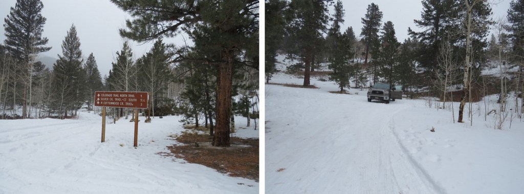
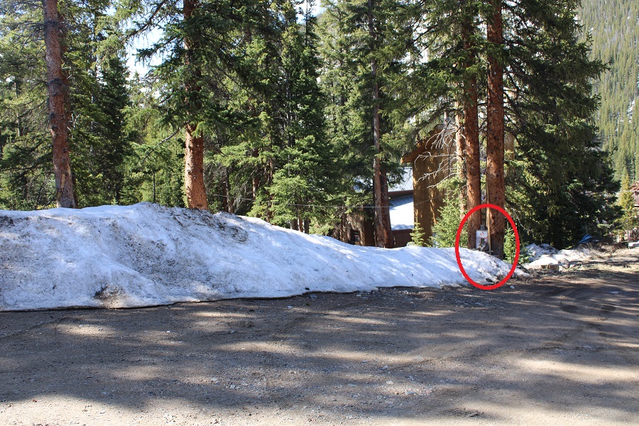
When driving through Montezuma, and turning down 3rd street, on your right you’ll see this area, that looks inviting to park.  DON’T PARK HERE!  It’s private property.  There are signs (covered in snow no doubt most of the time) asking you not to park in this area.  I’ve circled one in red.  Note, when you drive in, the sign is behind you, so it’s difficult to see. When I left the owner of the property was watching me from his window.  It’s probably a game to him.  So, don’t park here.

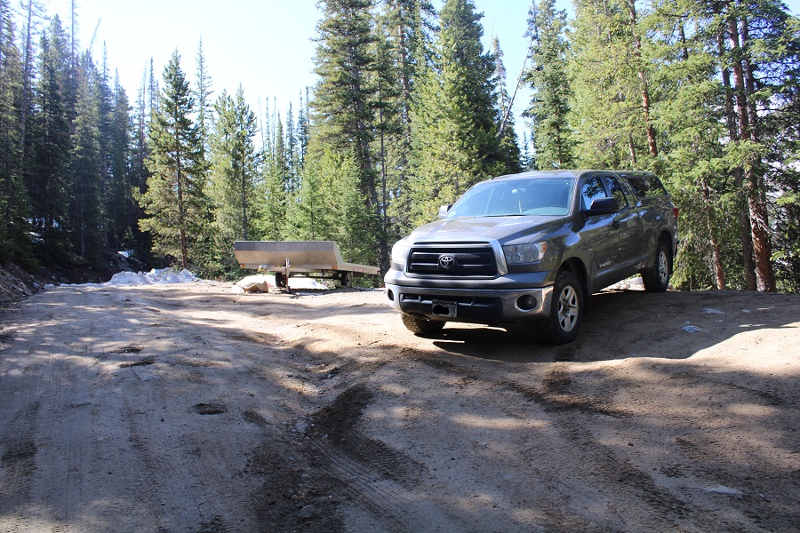
Instead, continue about 10 yards pasts this sign for 4WD road 264.  (Also note, the black and white sign says ‘highway legal’ vehicles only. 

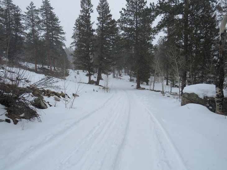
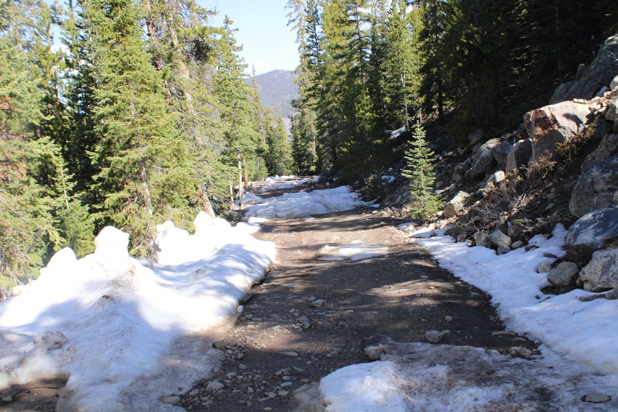
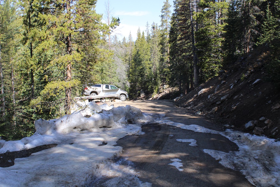
Here you will find a small pull-off area where you can park.  Only about 3-4 vehicles can park here if you all pull in nicely, so if you’re first, set the example.  This is Public Land.  From here on out, it goes back and forth between public and private land, and it can get confusing.  The road also narrows and there are a lot of downed trees in the area, so it’s not really worth it to try to drive further.  Especially in winter conditions (like today).

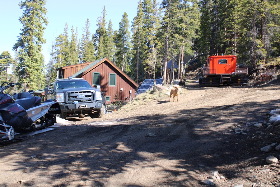
Just an FYI:  There’s a house/structure around 10,800’.  They plow the road themselves, but it’s still ‘iffy’ to drive to that point, and they currently have an unfriendly dog.  I wouldn’t drive past the staging area, even if you feel you can.

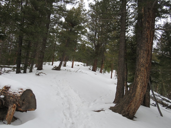
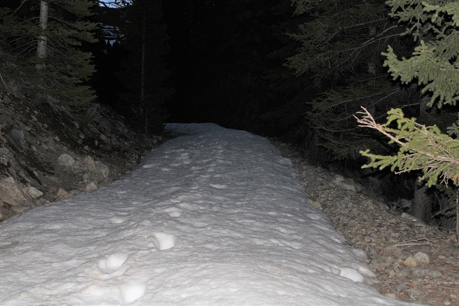
After some careful maneuvering (my 4WD is still out and there were some deep ruts) I backed into a spot, gathered my gear, and was on my way at 5am.  It was around 37 degrees outside, and the snow hadn’t consolidated overnight, so almost immediately I started post holing.

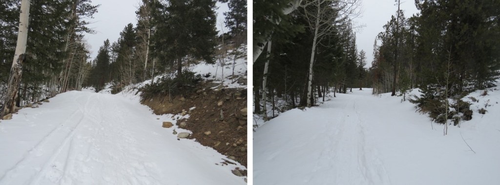
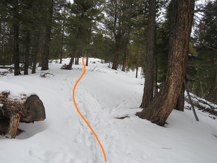
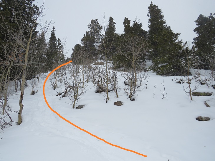
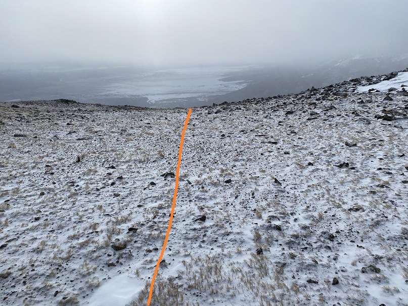
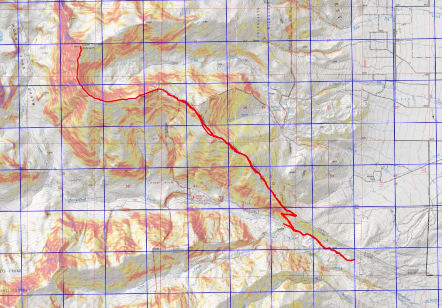
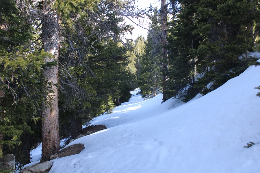
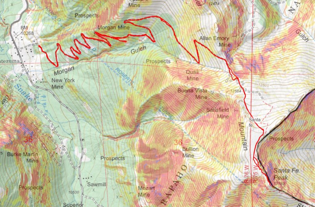
I’m stubborn, so it took me 1.5 miles to put on my snowshoes.  I should have put them on right away. I followed 4WD road 264 for 3.7 miles to the saddle of Morgan Peak and Santa Fe Peak

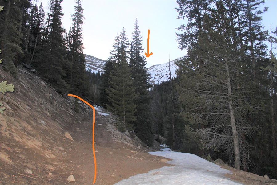
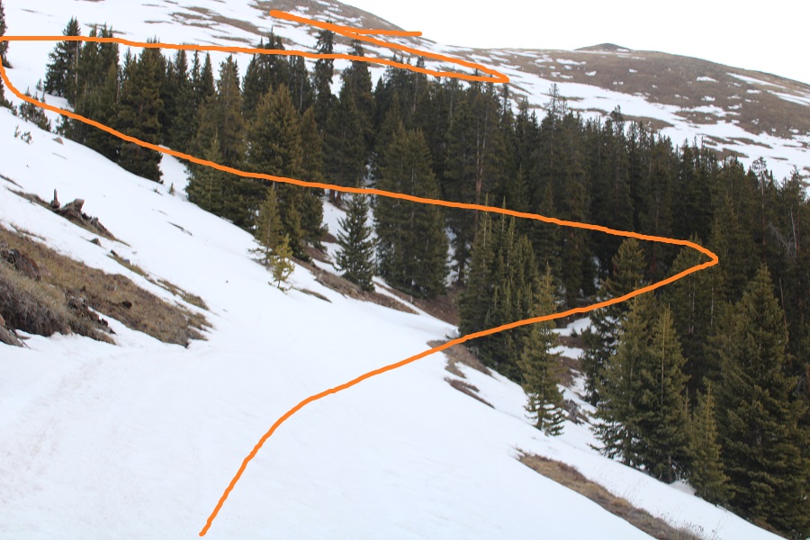
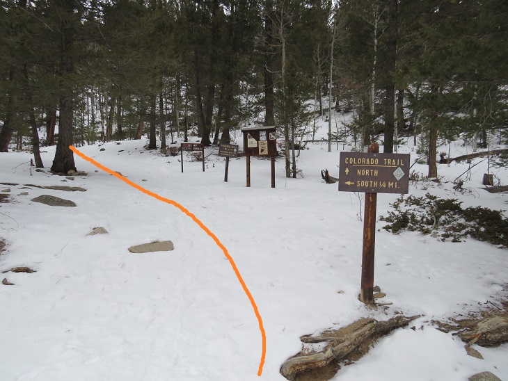
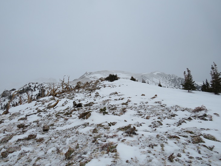
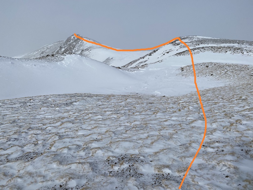
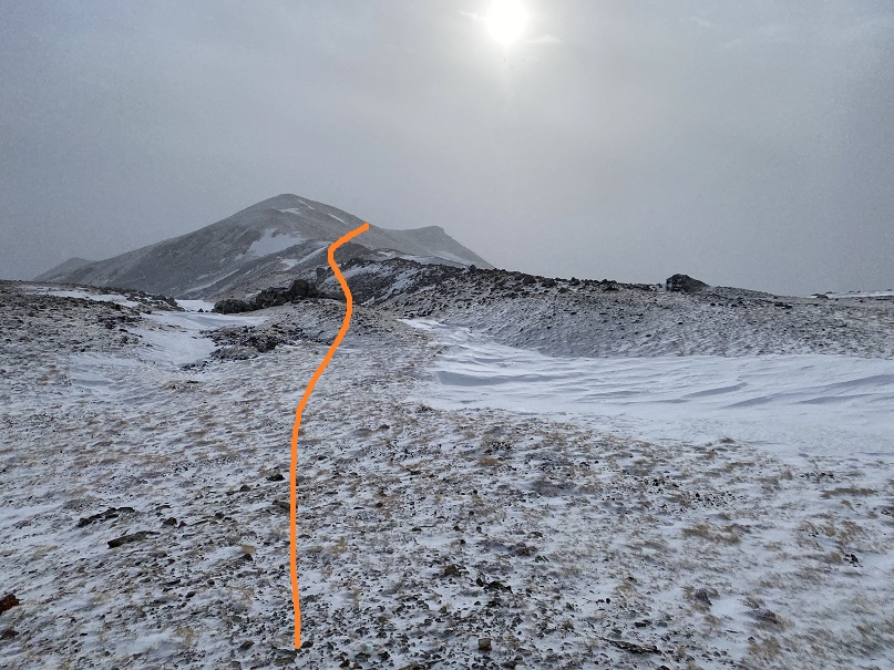
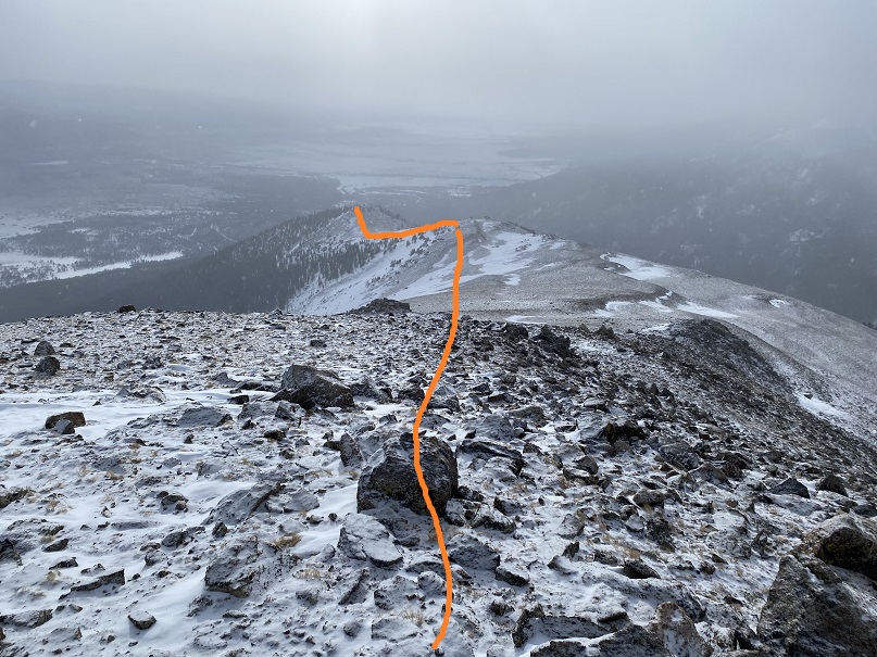
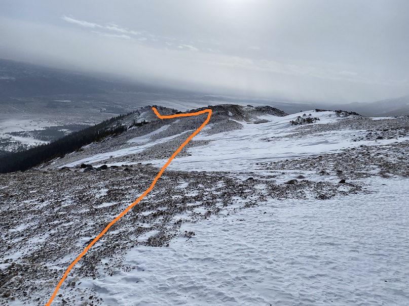
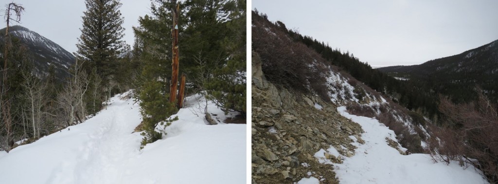
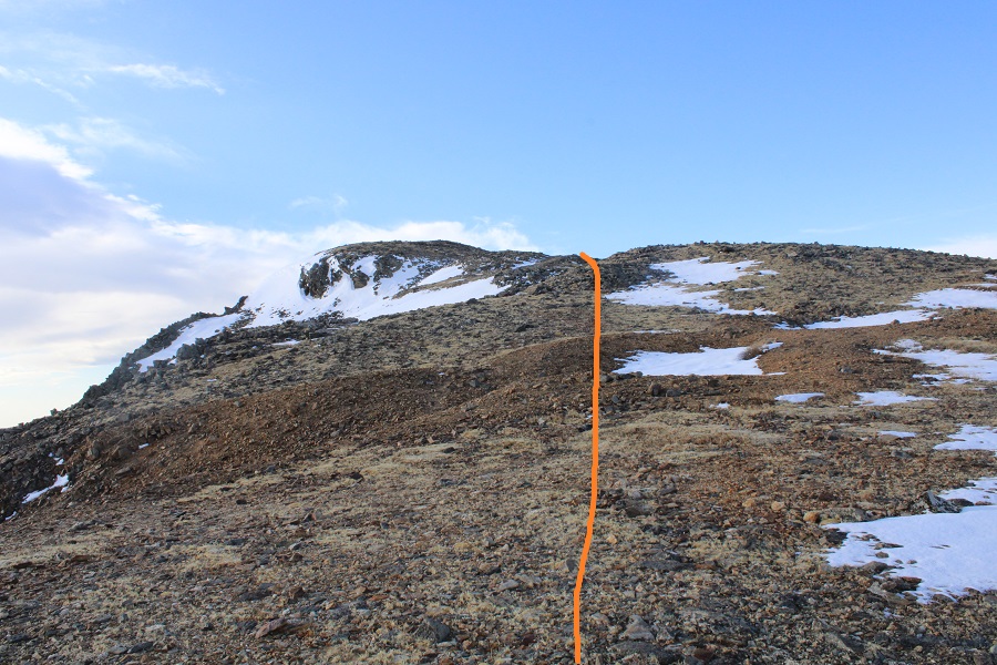
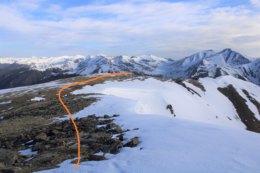
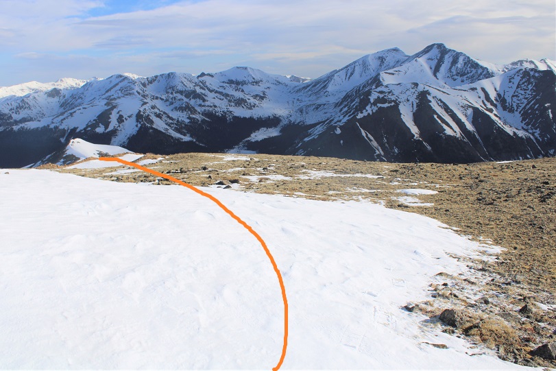
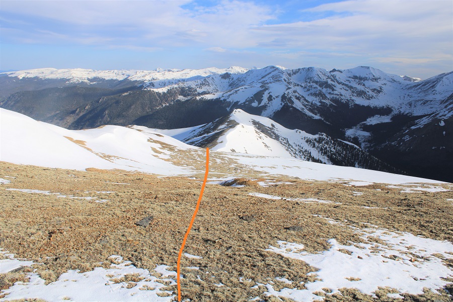
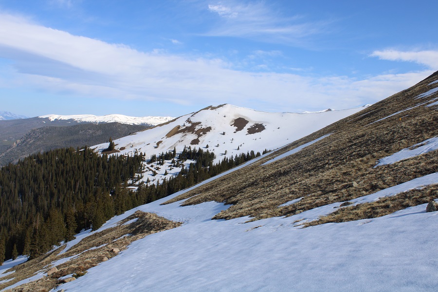
Once at the saddle there was still a road, but it was difficult to discern with the snow, so I just headed southeast to the ridge

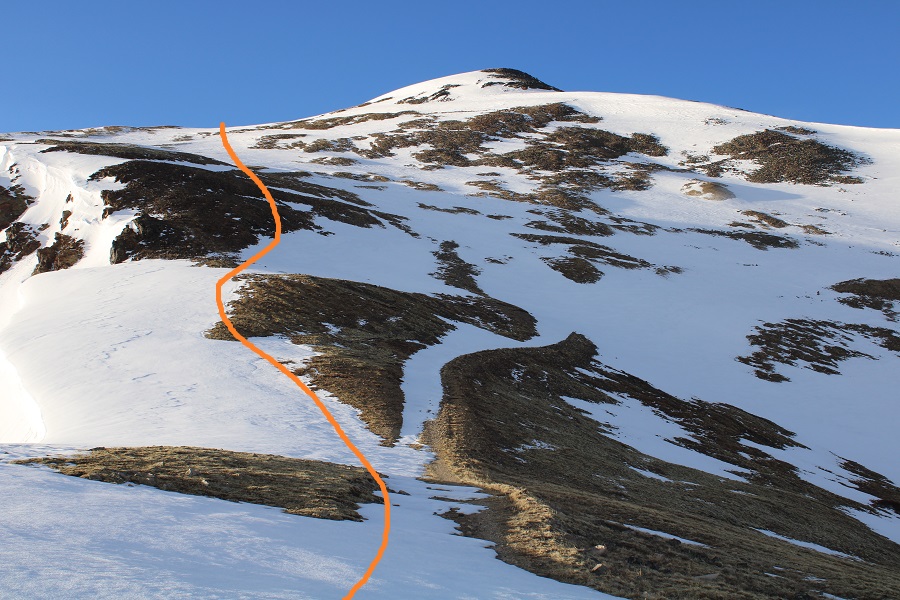
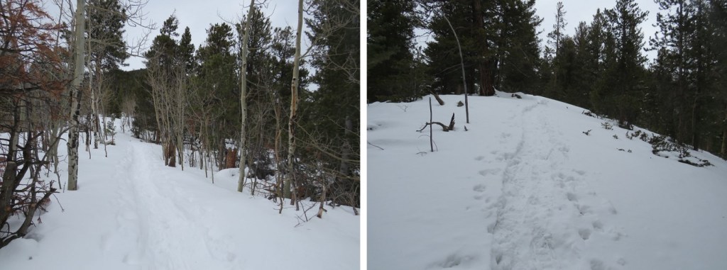
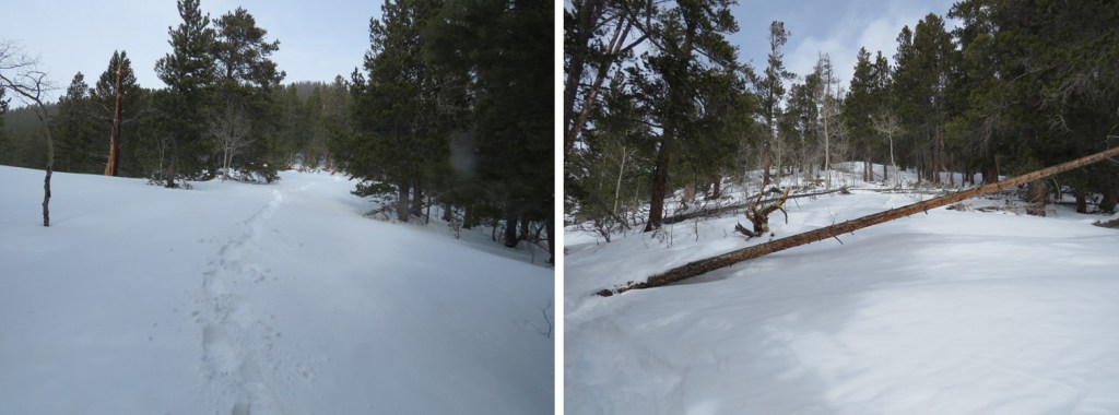
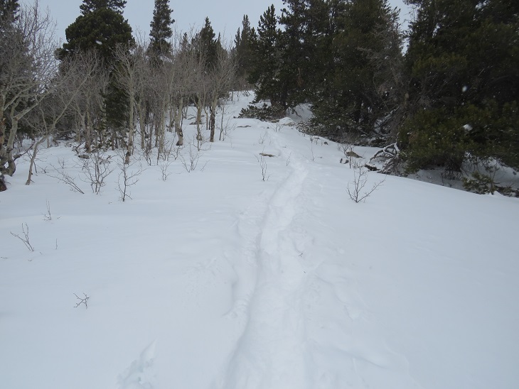
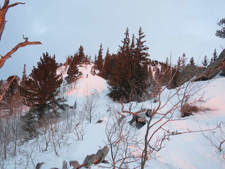
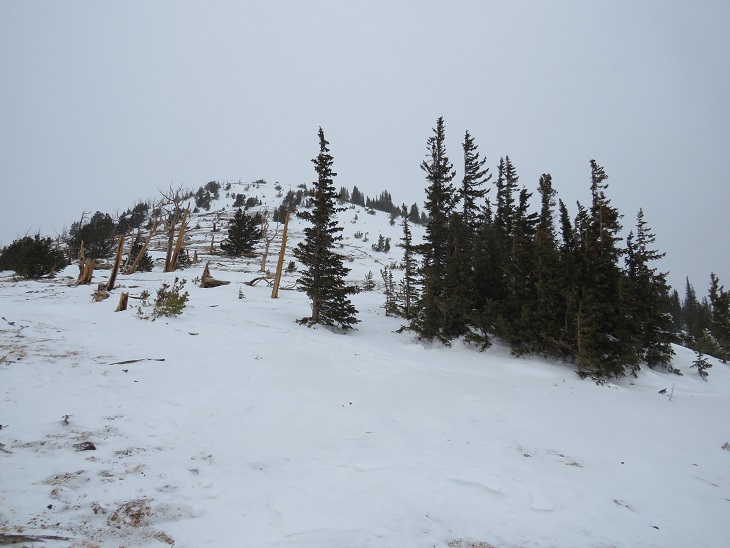
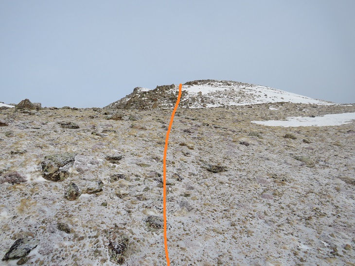
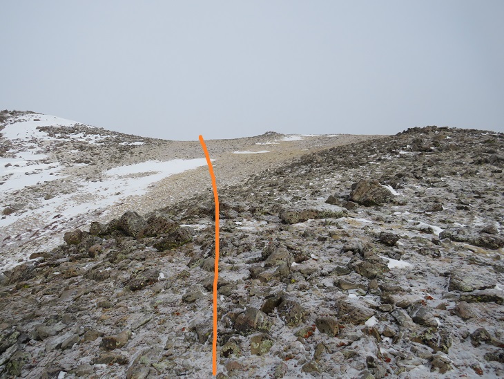
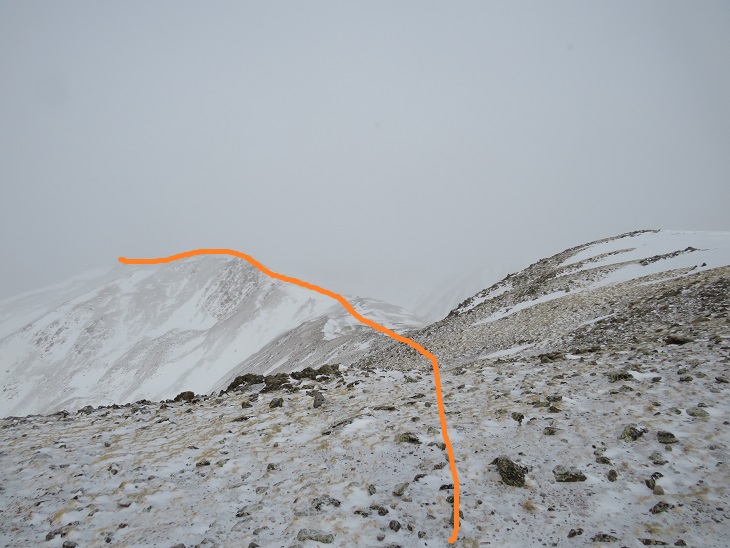
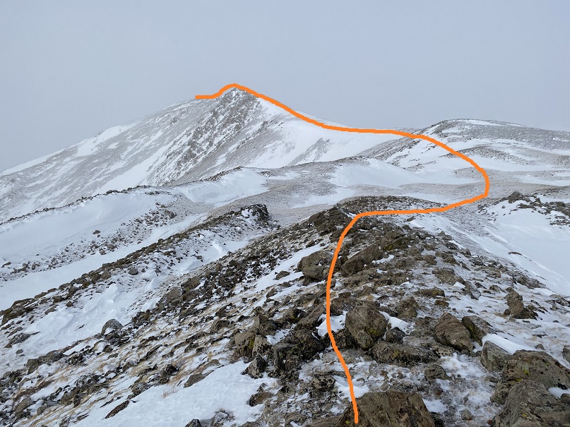
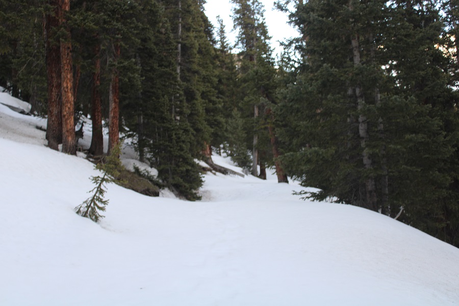
Here are some step by step pictures

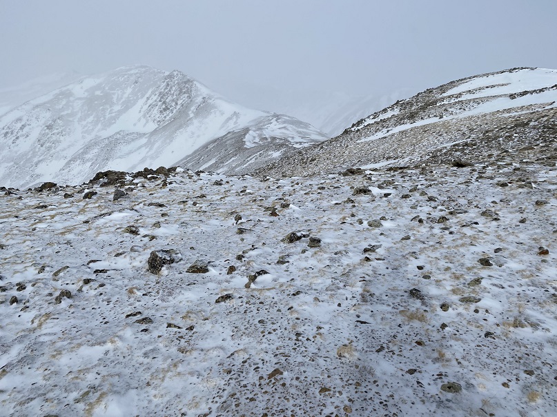
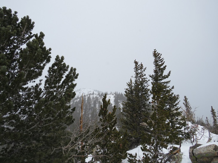
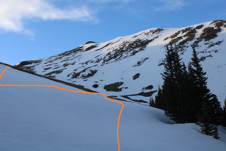
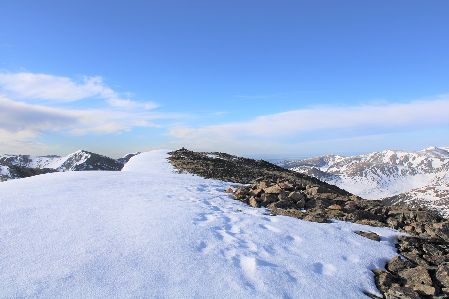
Once on the ridge I could see Santa Fe Peak.  I’d need to go right and follow the ridge southwest to reach the summit.  The wind picked up here, and all that postholing I did earlier came back to haunt me:  the snow I’d obtained in my socks from postholing had melted and now was freezing back into ice again:  my socks and toes as a direct result were now frozen. 

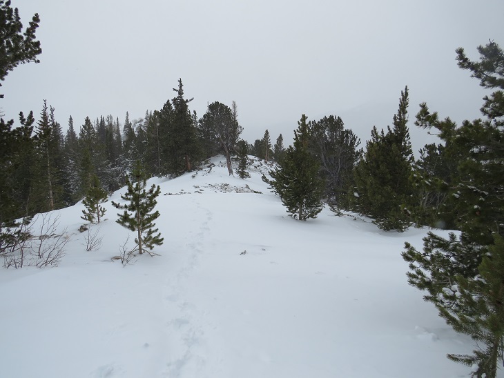
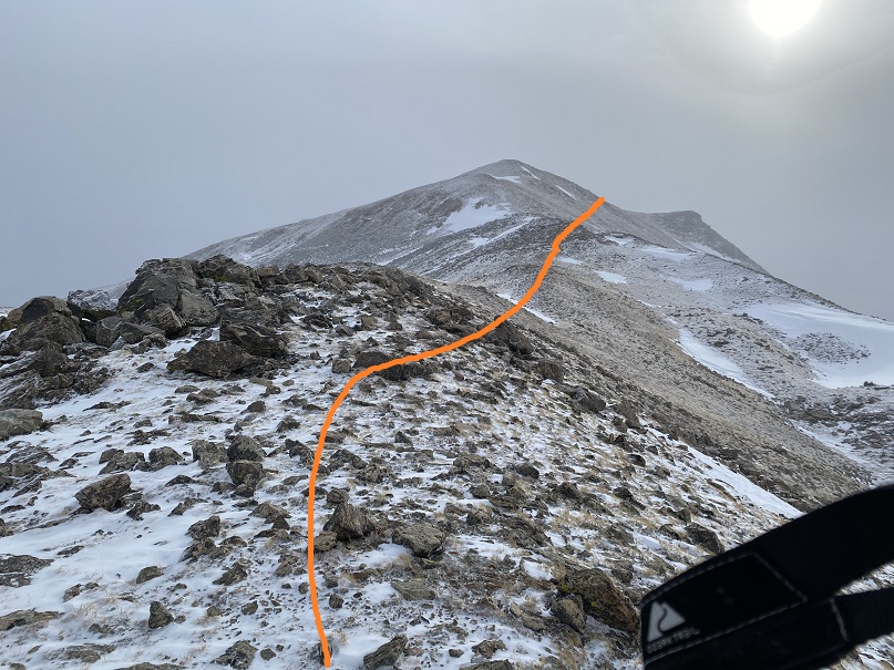
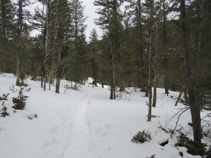
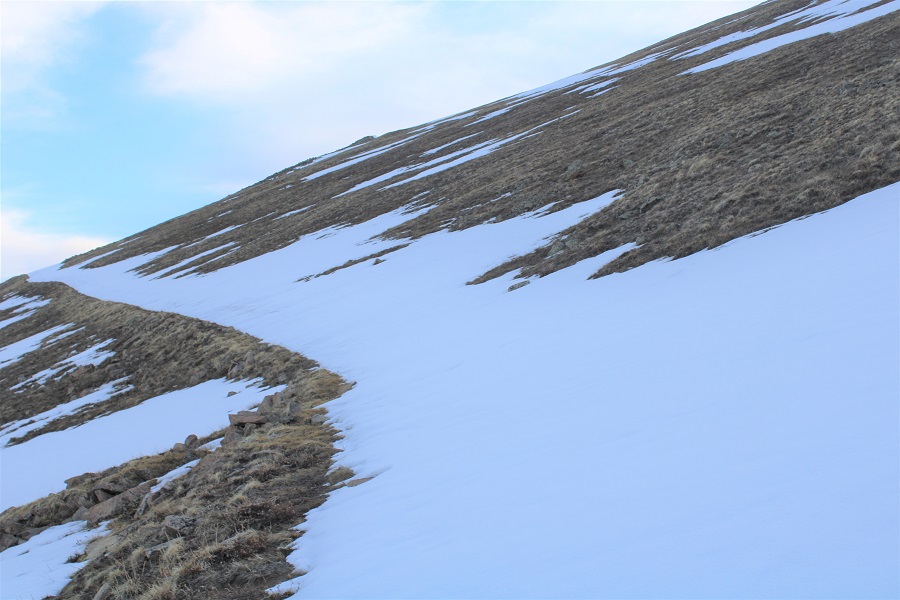
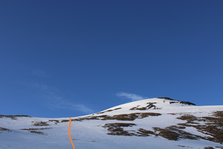
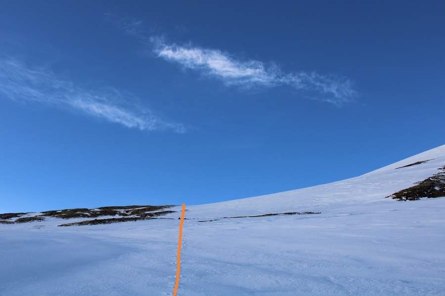
The ridge was easy to follow, and windblown.

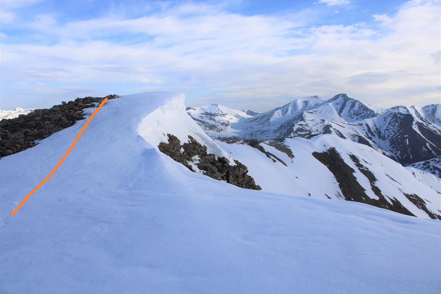
There was one cornice, but it was easily avoidable, and made for a kind of ‘false summit’ (pic on the way back). 

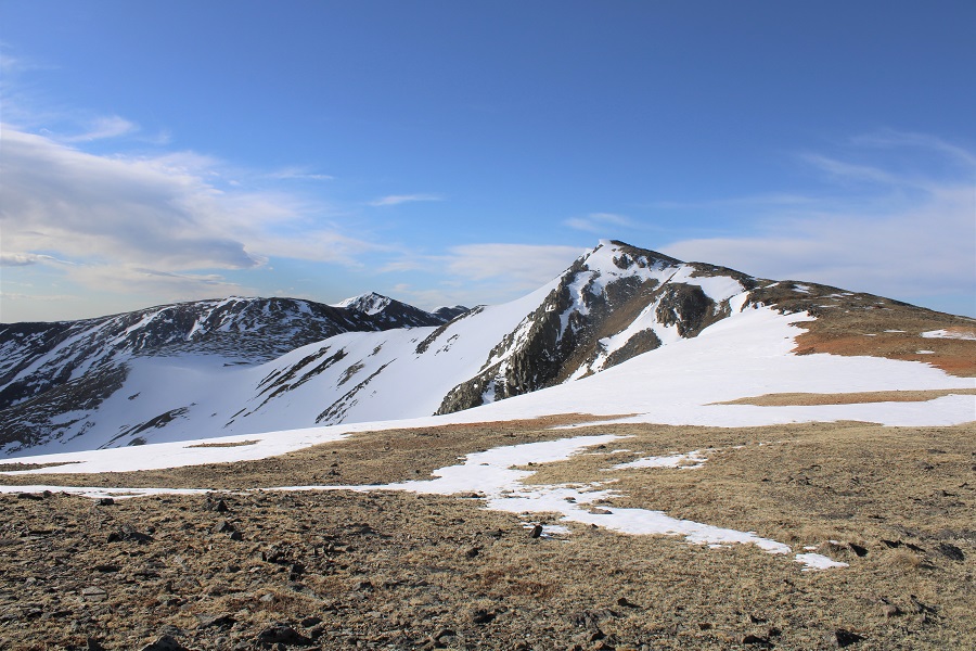
I summited Santa Fe Peak at 7:30am
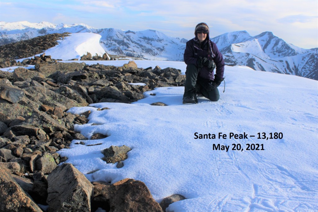
Santa Fe Peak:

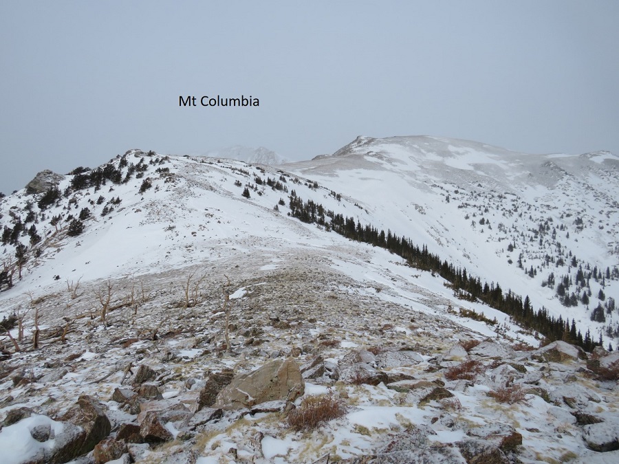
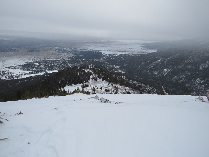
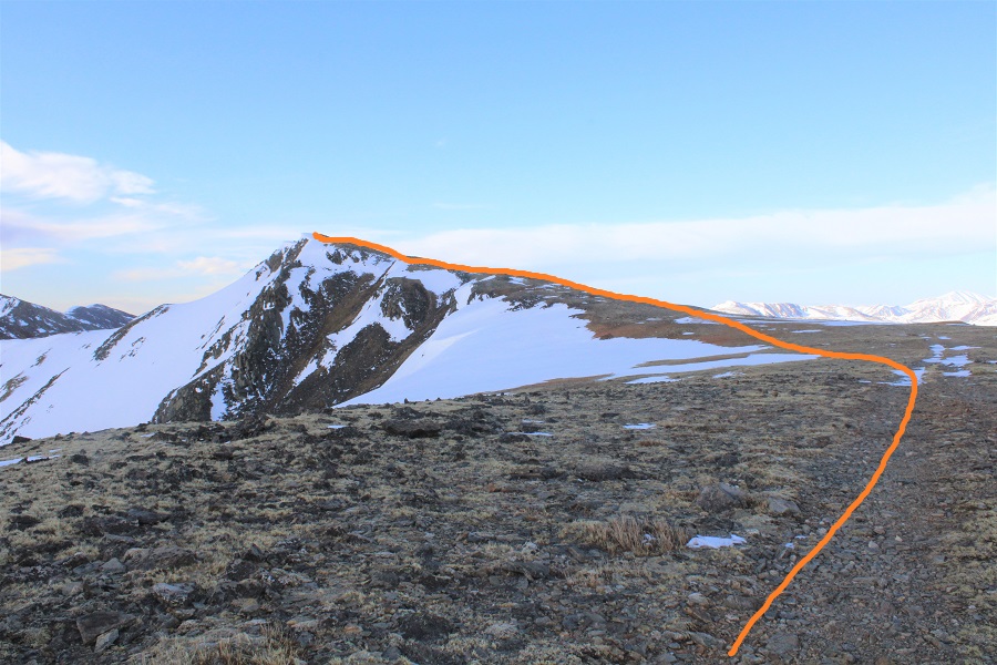
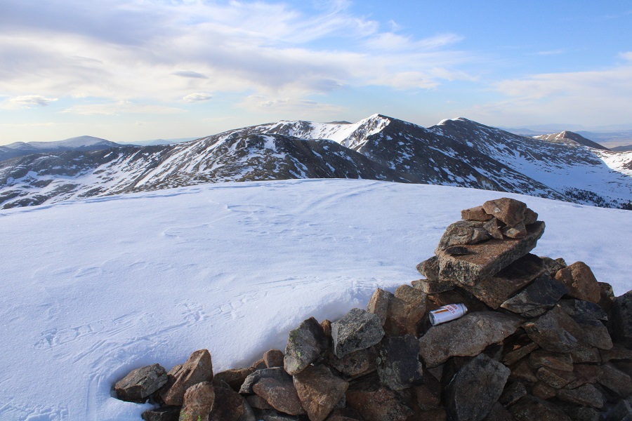
I didn’t see a summit register, so I left one.  Here’s a look back on the other 13ers in the area.  If it wasn’t so windy… if my socks and toes weren’t solid ice, and if I didn’t have to pick up my mom from the airport I’d be making this a loop, as the conditions looked perfect (sigh).

I turned and retraced my steps back over the cornice, along the ridge, to the saddle

It was interesting: I could see tire tracks, but due to downed trees on the road in, it’s probably been a while since vehicles have been up here

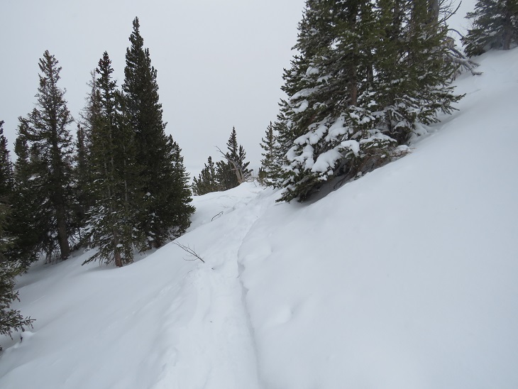
From the saddle I followed the 4WD road back to the trailhead, glad I’d decided to put my snowshoes on, as I came across my morning post-holing adventures

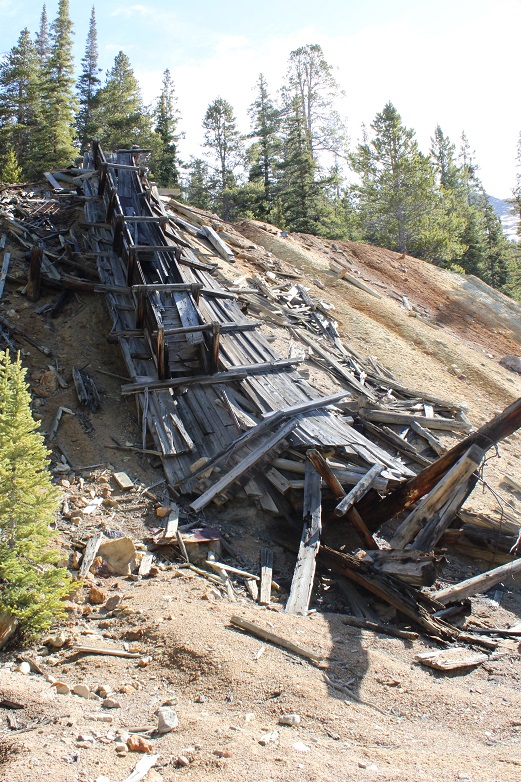
When I finally took the snowshoes off, I accidentally took a wrong turn, and ended up at the old Morgan Mine.  I took a quick picture and re-traced my steps (probably private property so I didn’t investigate further than a quick photo).

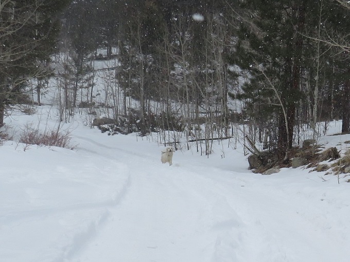
When I made it to a bend in the road around 10,800’ I could see the residence/office (etc.) and immediately a dog rushed out and started barking at me.  This is right where the Harold Roberts Tunnel is (short information on what that is and why it’s cool here).

I’d heard about this dog, and was a little bit apprehensive.  However, I held my trekking pole in my right hand, and my Ruger in my left hand inside my coat pocket.  I’d hate to actually hurt an animal, but if it attacked, I was ready.  Luckily, this dog was all bark and no bite:  It barked viciously, but never left his/her side of the road.  I kept walking like I was supposed to be there, and nothing came of the encounter. 

I continued following the road back to my truck.

I made it back to my truck at 9:30am, making this a 9.36 mile hike with 2894’ of elevation gain in 4.5 hours.

As I drove out, I stopped to get pictures of the trailhead, parking/no parking areas, etc.  for a trip report.  The owner of the house nearest the parking area stood in his window and watched me the entire time with a scowl on his face.   

Mt Columbia in Winter – 14,073

RT Length: 14.28 miles

Elevation Gain: 5498’

I’d already summited 3 peaks this week, but with my being so close to 100 14ers and winter weather moving in I really wanted to try to get in one more summit.  I did a lot of weather watching:  the storm kept changing areas, times, wind speeds, etc.  I finally settled on Mt Columbia because I haven’t done it yet in winter and someone said they’d trenched it earlier in the week (remember, my motto this year is not to let a trench go to waste).

I didn’t make it all the way to the Harvard Lakes Trailhead on the drive in. There was too much snow and I ended up backing my truck up for about half a mile to find a good parking space.  I parked here. There’s room for 2-3 vehicles if everyone parks nicely.

I gathered my gear and started hiking along the road. It’s about a mile from where I parked to the Harvard Lakes Trailhead along this road.  Alost as soon as I started hiking my flashlight stopped working, so I had to get out another.  When that one stopped working as well I walked for a bit in the dark, then sighed and got out my emergency charger/flashlight.  It was then I realized I’d missed the trailhead, so I had to backtrack a ways.  I was also very glad I’d decided to turn around/head back when I did on my drive in: the road isn’t driveable to the trailhead.

I made it to the proper trailhead, and followed the Colorado Trail as it switchbacked up the side of the mountain.

After hiking on the Colorado Trail for .8 miles I left the trail and followed the ridge.  Luckily, this part was (mostly) already trenched.

From here on out it was a ridge hike.  I followed the ridge to treeline (about 1.25 miles).  Some of the area below treeline was trenched, but there were many areas under several feet of snow.  I was stubborn and reused to put on snowshoes, postholing up to my waist several times. 

Also, it takes forever to get to treeline!

Finally, it became impossible to go any further without snowshoes, so I put them on, just before making it out of treeline. Here’s a good overall view of the route above treeline.  It’s important to note the true summit is still not visible (it’s behind that ridge, to the north).

Now this became a ridge hike, above treeline.  I could see the clouds moving in, and indeed, it was snowing off and on.  The wind was also picking up.  Taking off my snowshoes, I followed the ridge as it wound northeast.  First heading towards point 12042

Once there, I lost some elevation, and the ridge split.  I don’t think it matters which side of the ridge you take.  I went right, since there was less snow there. Here’s an overview of the route

My camera died here (due to the cold), so I started using my phone.  Here are some more close-up pictures

Around this point the wind became unbearable, and I could no longer take off my gloves to take pictures with my phone, so I don’t’ have any from this point on.  Also, as you can tell, the weather moved in and you wouldn’t have been able to tell much from the photos anyway. What you need to know about the rest of this hike is it’s further than it looks, it’s all class 2, the ridge goes on forever, and what you think is the summit… isn’t.  The summit is actually the northernmost point, not what looks like the summit from below (that’s PT 13544).  It’s a rocky summit, and I couldn’t find a summit marker (but I also didn’t look for one).

The wind didn’t let up, and I summited in whiteout conditions.  It seems the 50% chance of snow after 11am was happing at 9am.  I tagged the summit, turned around, and retraced my steps down that long ridge.  My fingers and toes were burning inside my socks and glvoes.  I had on ski goggles that kept fogging up, and I had to be careful of my footing since I couldn’t see much in front of me.  As I got further down the ridge the weather let up a bit, and I could see my way back (these pictures were actually taken from my way in).

I put my snowshoes back on and kept them on for the rest of the hike.  The snow started picking up again, especially as I made it back to treeline. 

I made it back to the Colorado Trail, and followed it back to the road

And now to follow the road back to my truck

Along the way I was passed by a cross country skier.  He seemed impressed I’d just hiked Mt Columbia, especially since it was now snowing quite a bit.  I’m not gonna lie, I was a little worried about my drive out.  I wished him well as I took off my snowshoes and kept trudging along the road. 

Just as I made it back to the trailhead I turned and saw a white dog running towards me, no owner in sight, clenching a deer leg in its mouth.

The skier said it was his dog, assembling a deer one piece at a time.  His wife soon followed after the dog, they packed up and were on their way. I made it back to my truck at 12pm, making this a 14.28 mile hike with 5498’ of elevation gain in 9 hours.

The snow was really falling, so I got out of there quickly. The roads weren’t as bad as I’d thought, and completely clear by the time I made it to town.

In the end, I was glad I’d hiked today, but will most likely do this one again to get better ridge pictures.  I should have picked a better weather day.

Mt Columbia Summit Sticker can be bought here