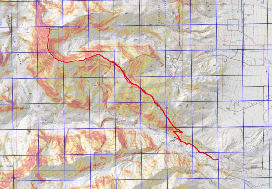
I’d already summited 3 peaks this week, but with my being so close to 100 14ers and winter weather moving in I really wanted to try to get in one more summit. I did a lot of weather watching: the storm kept changing areas, times, wind speeds, etc. I finally settled on Mt Columbia because I haven’t done it yet in winter and someone said they’d trenched it earlier in the week (remember, my motto this year is not to let a trench go to waste).
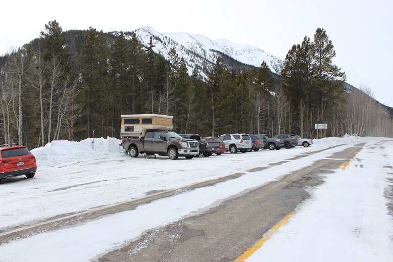
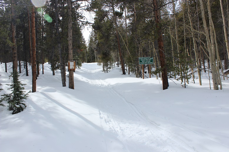
I didn’t make it all the way to the Harvard Lakes Trailhead on the drive in. There was too much snow and I ended up backing my truck up for about half a mile to find a good parking space. I parked here. There’s room for 2-3 vehicles if everyone parks nicely.
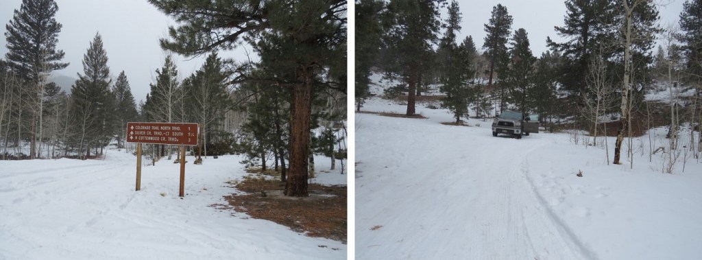
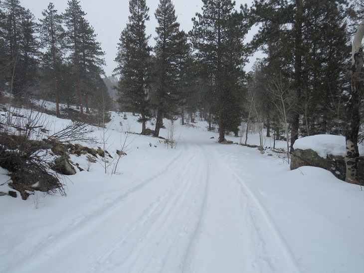
I gathered my gear and started hiking along the road. It’s about a mile from where I parked to the Harvard Lakes Trailhead along this road. Alost as soon as I started hiking my flashlight stopped working, so I had to get out another. When that one stopped working as well I walked for a bit in the dark, then sighed and got out my emergency charger/flashlight. It was then I realized I’d missed the trailhead, so I had to backtrack a ways. I was also very glad I’d decided to turn around/head back when I did on my drive in: the road isn’t driveable to the trailhead.
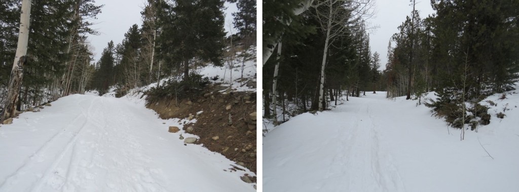
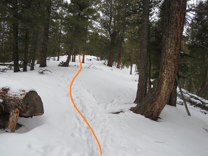
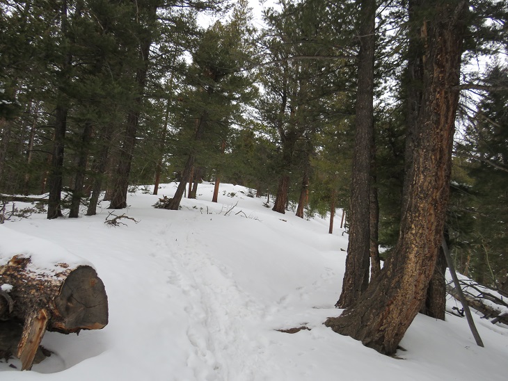
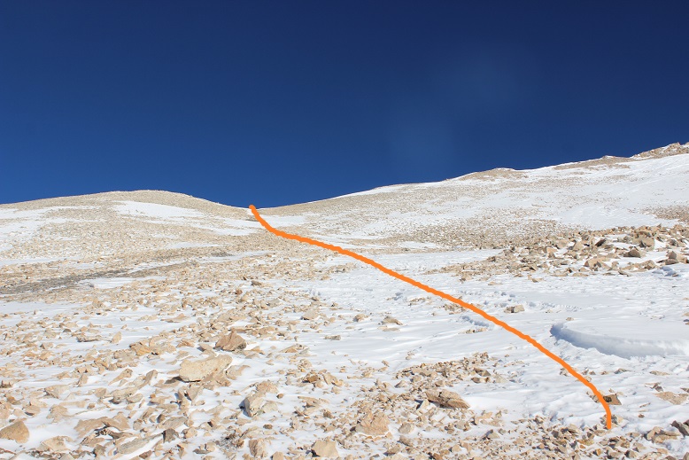
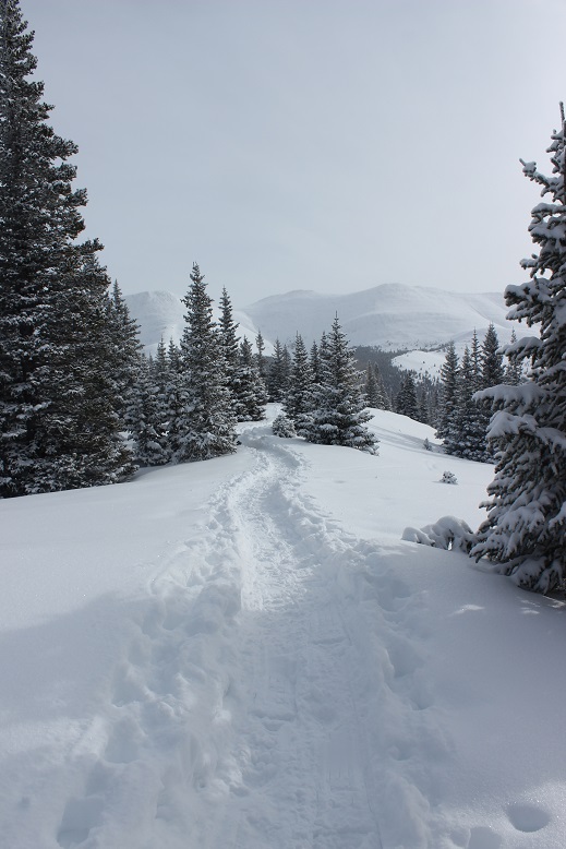
I made it to the proper trailhead, and followed the Colorado Trail as it switchbacked up the side of the mountain.
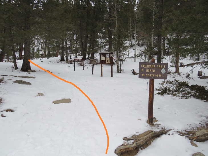
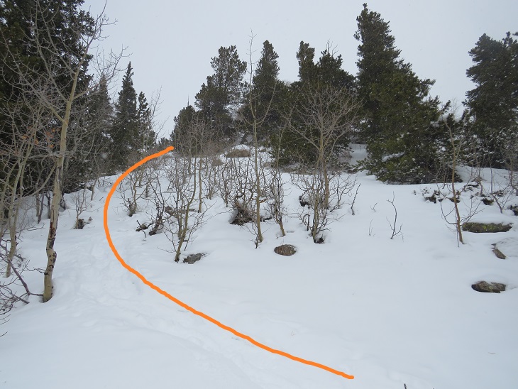
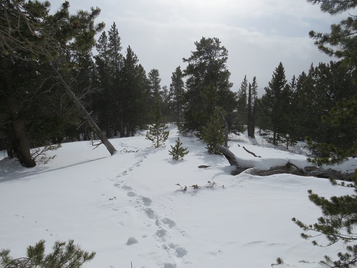
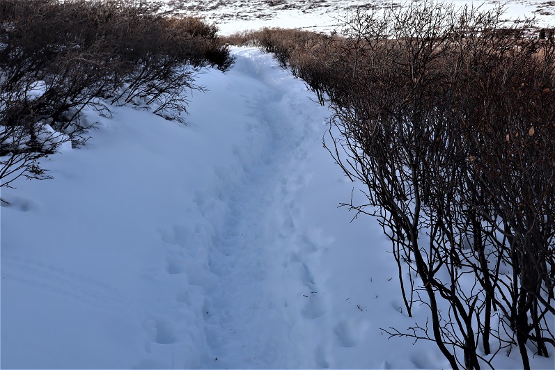
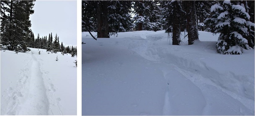
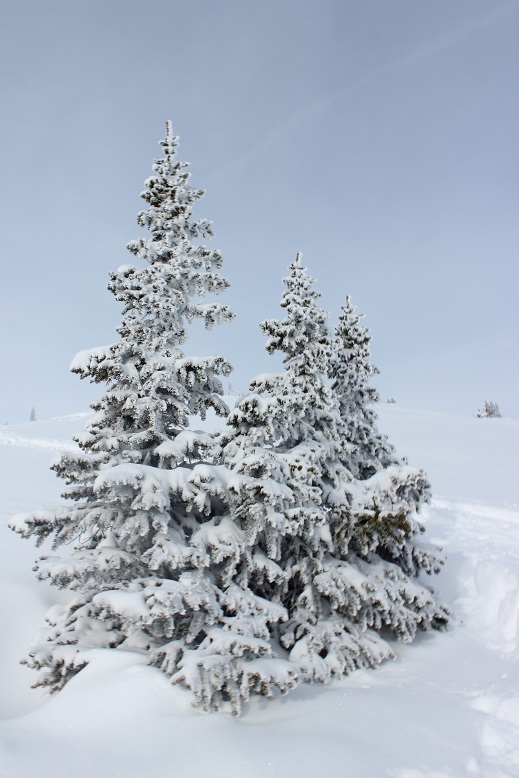
After hiking on the Colorado Trail for .8 miles I left the trail and followed the ridge. Luckily, this part was (mostly) already trenched.
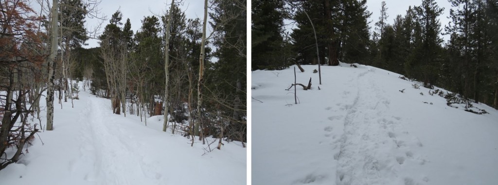
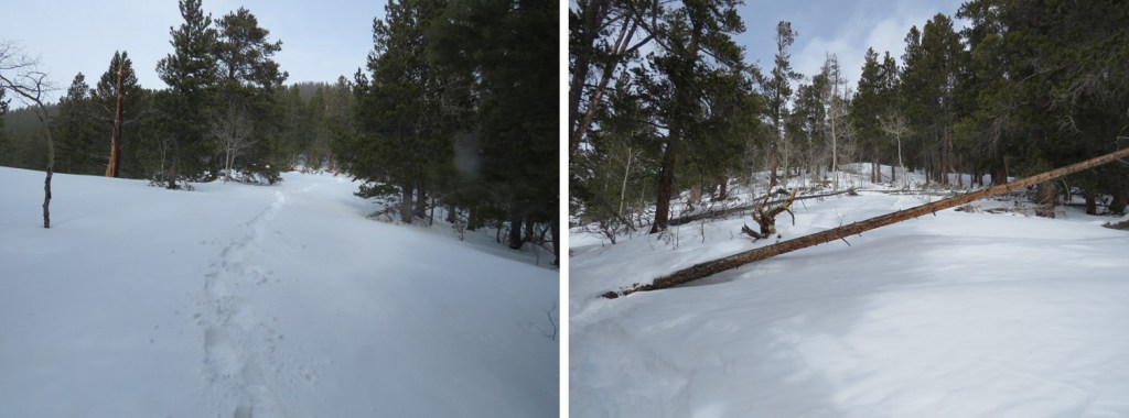
From here on out it was a ridge hike. I followed the ridge to treeline (about 1.25 miles). Some of the area below treeline was trenched, but there were many areas under several feet of snow. I was stubborn and reused to put on snowshoes, postholing up to my waist several times.
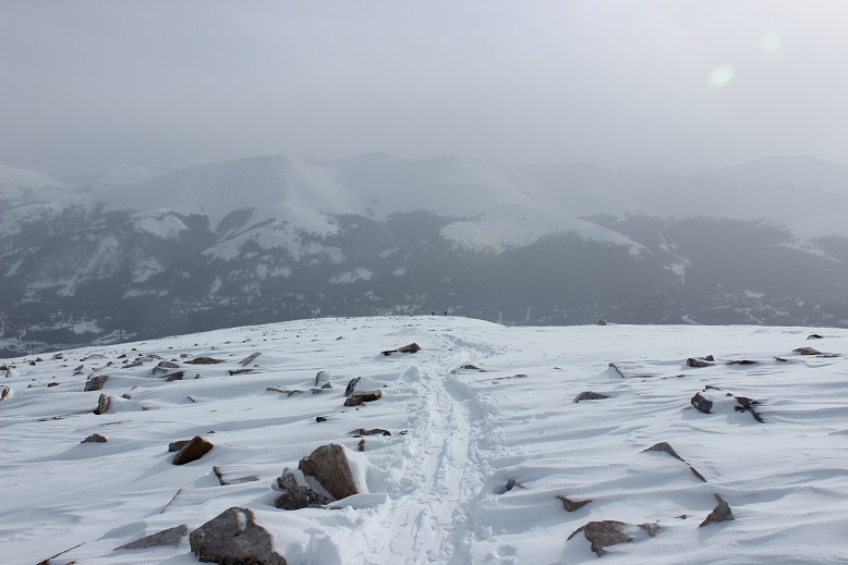
Also, it takes forever to get to treeline!
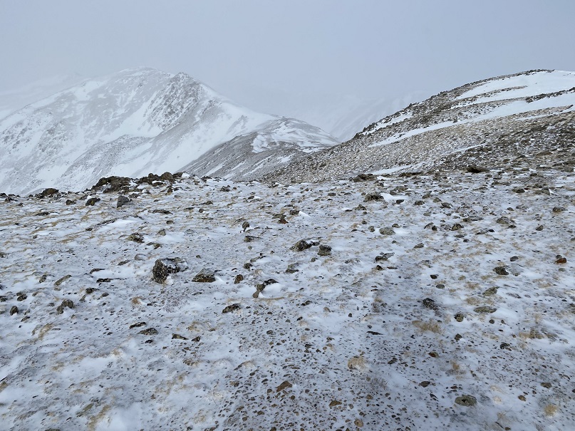
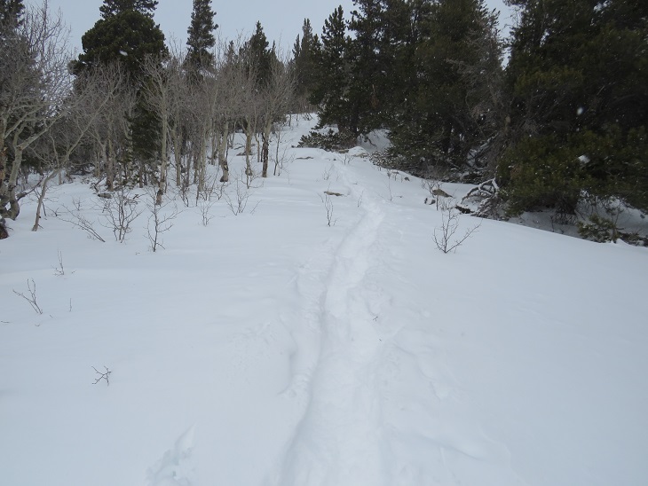
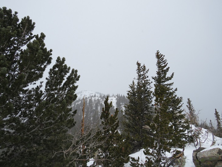
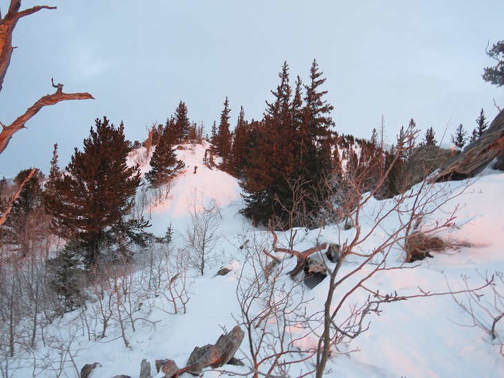
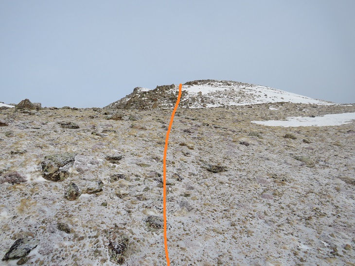
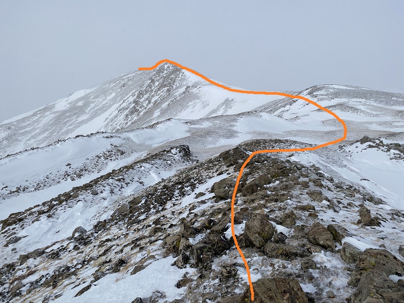
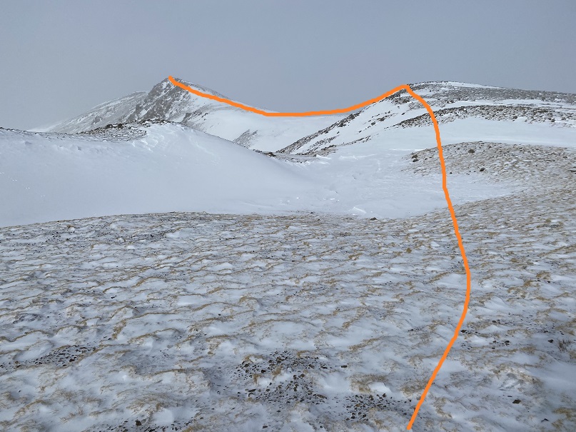
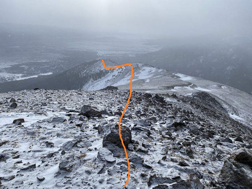
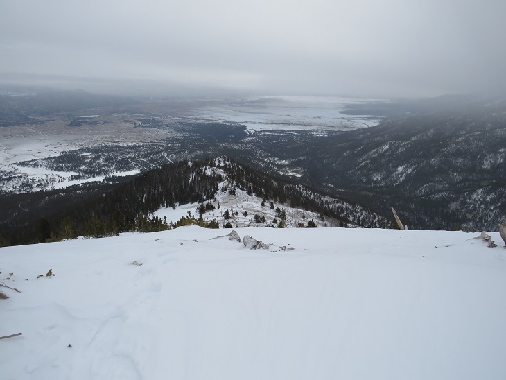
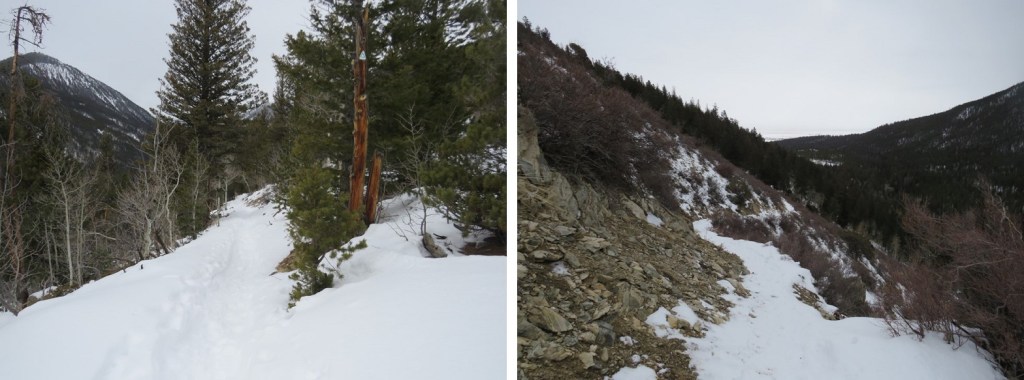
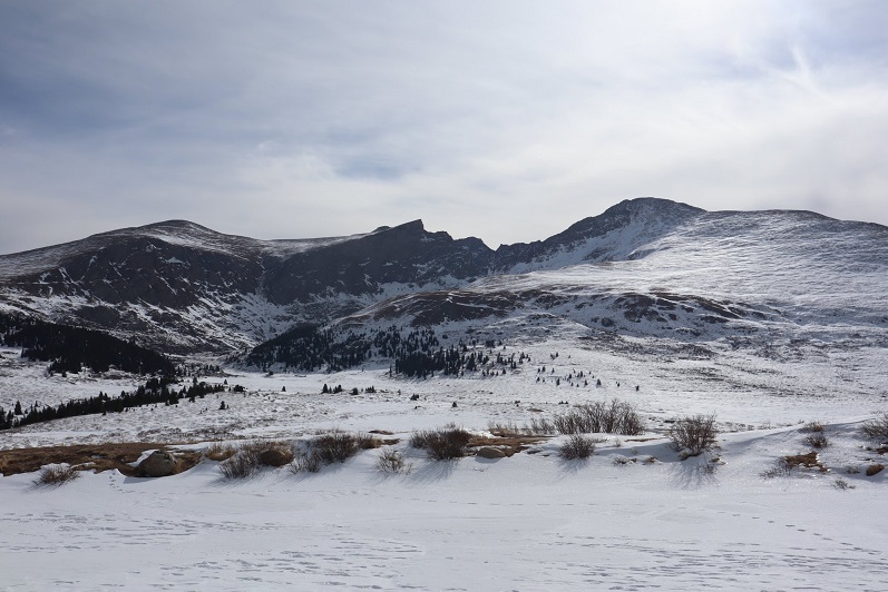
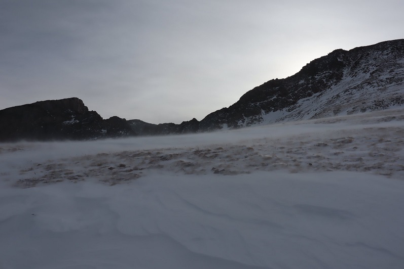
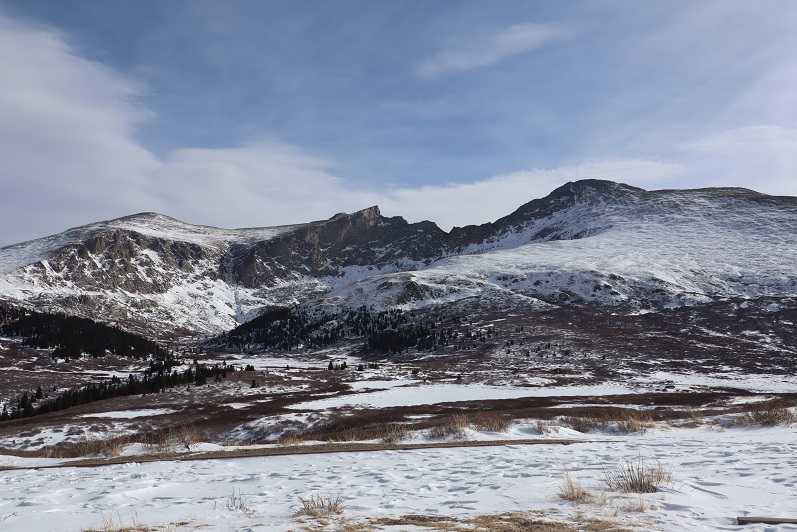
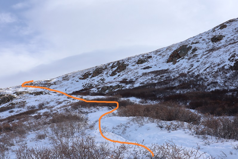
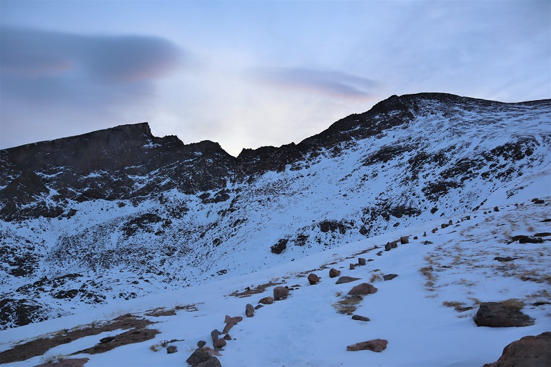
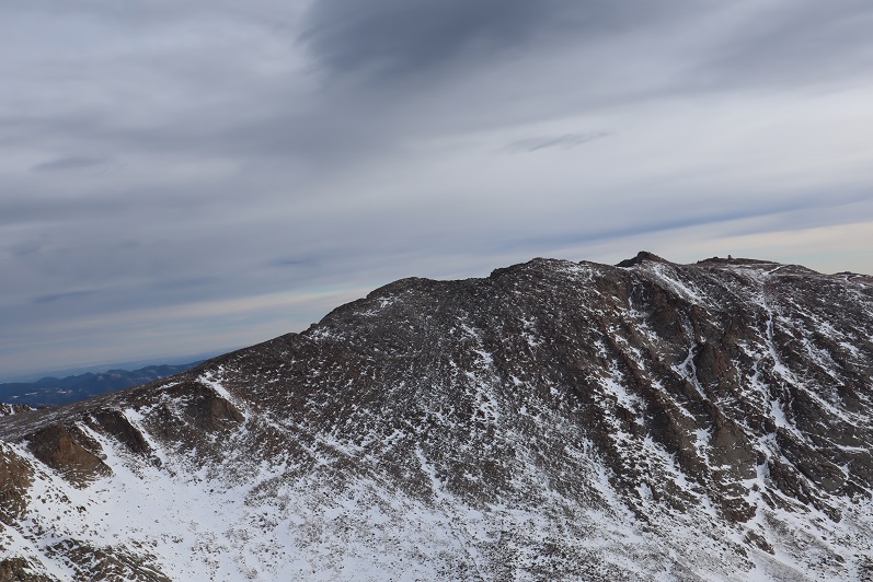
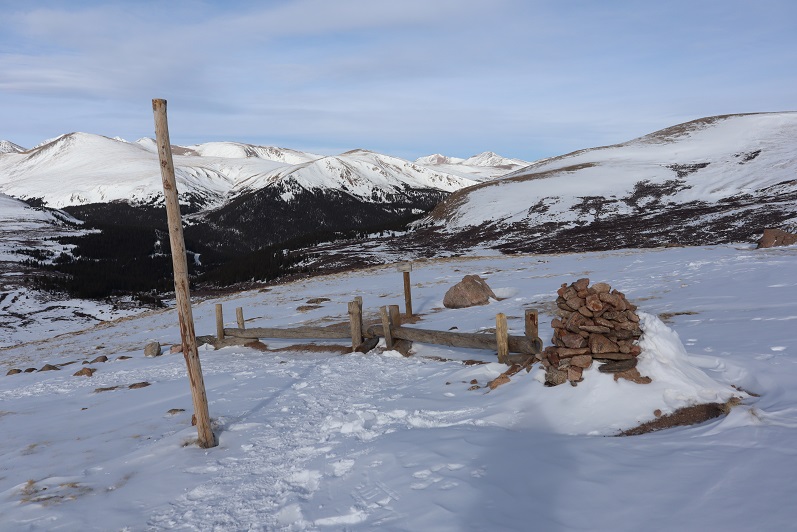
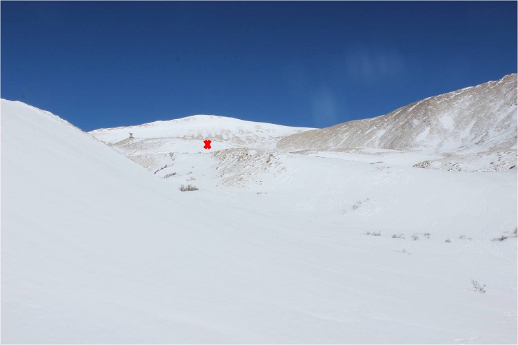
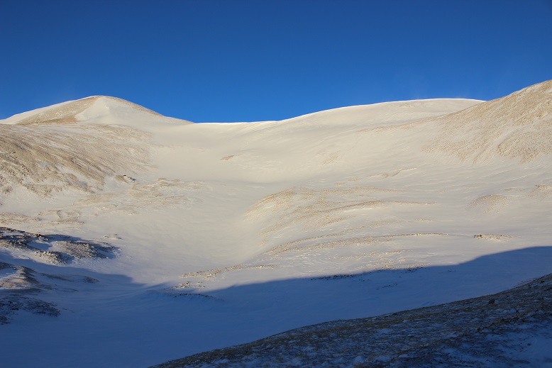
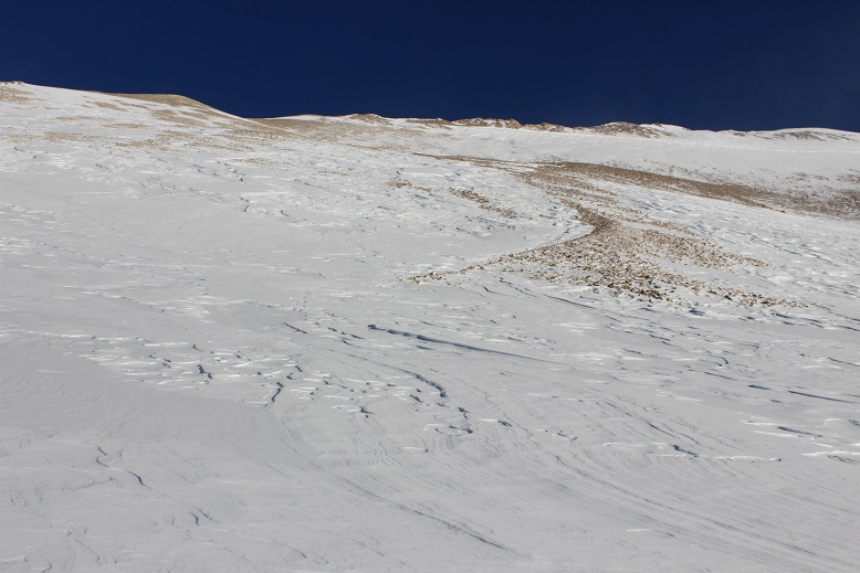
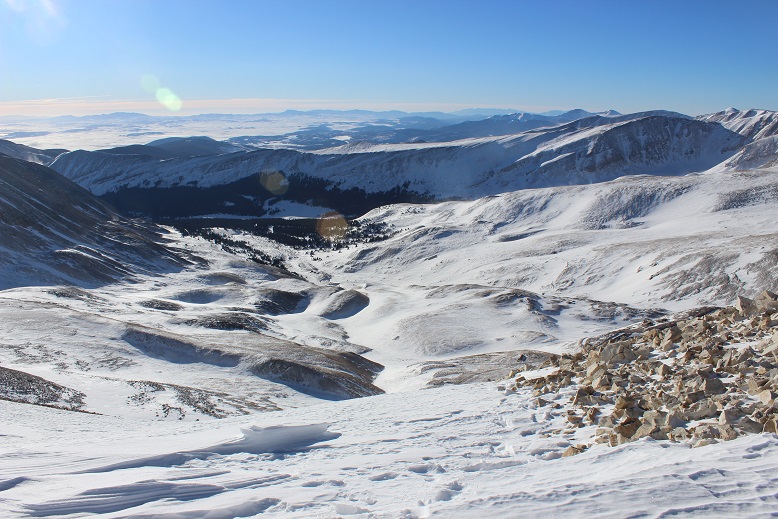
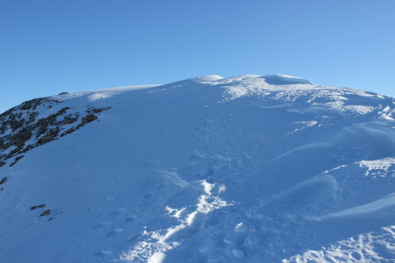
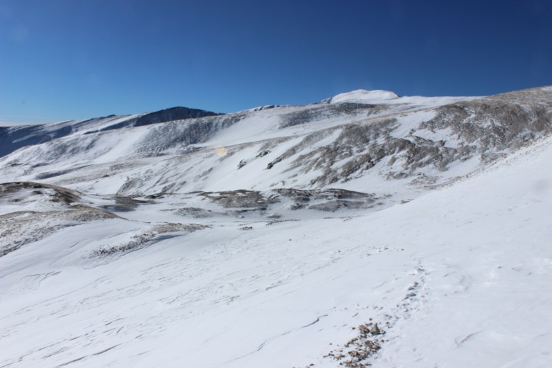
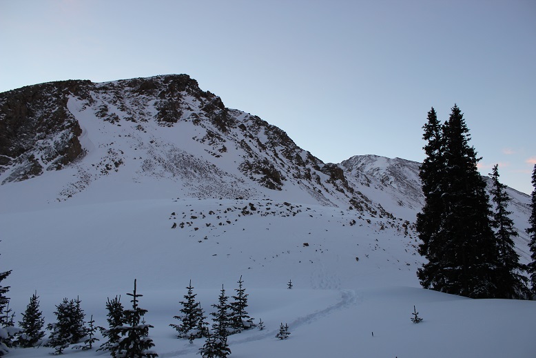
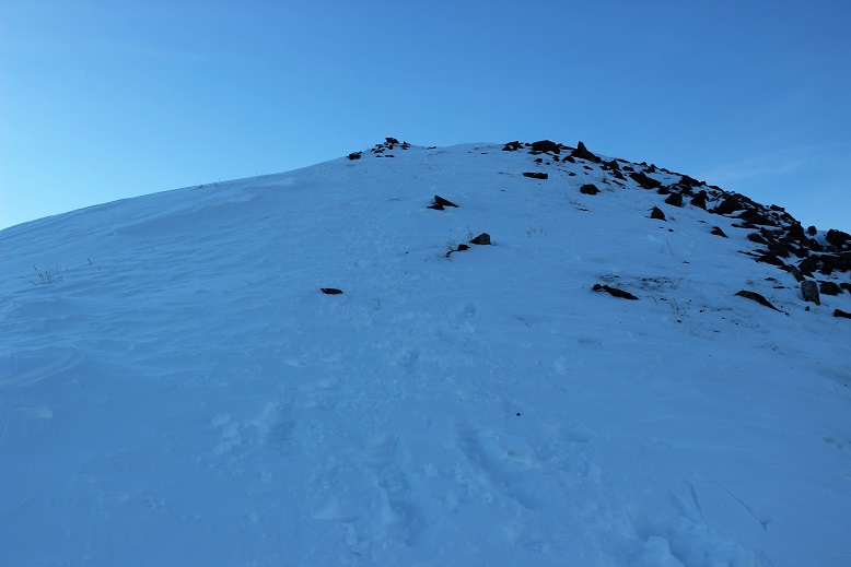
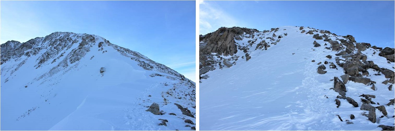
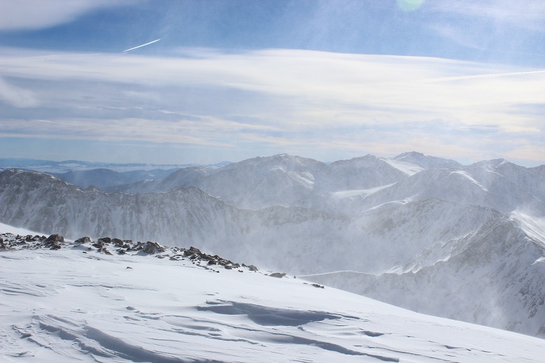
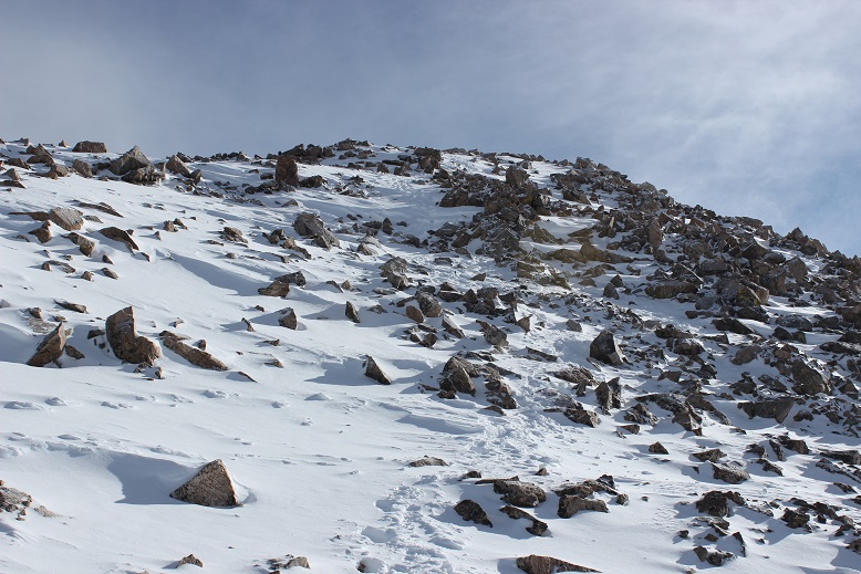
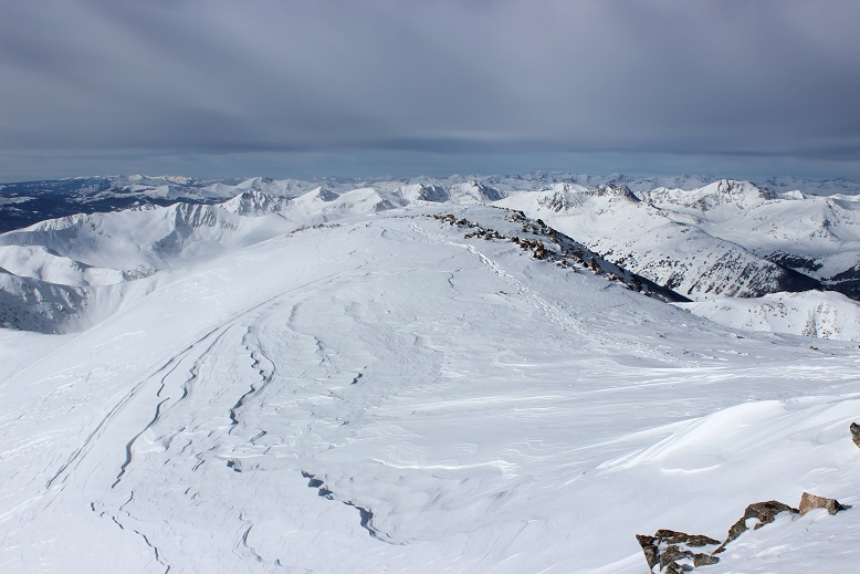
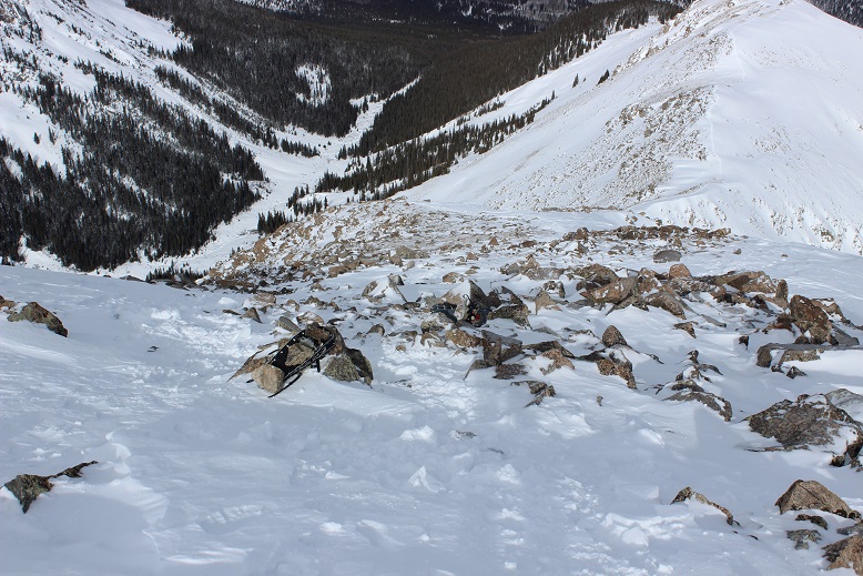
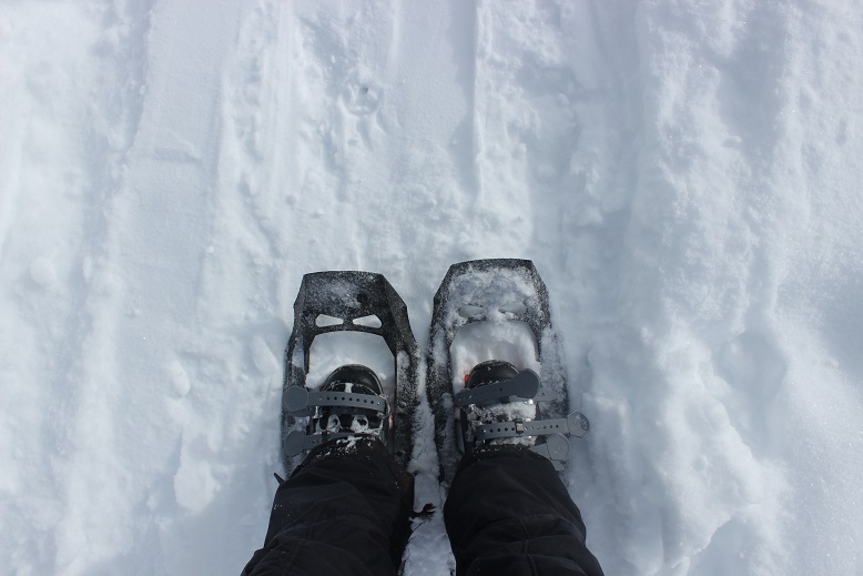
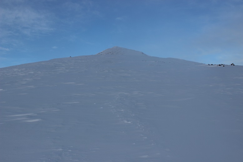
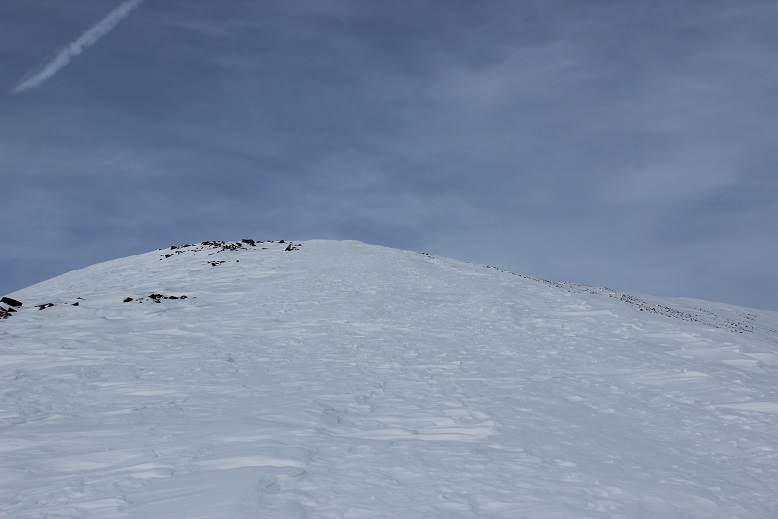
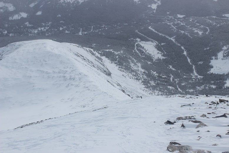
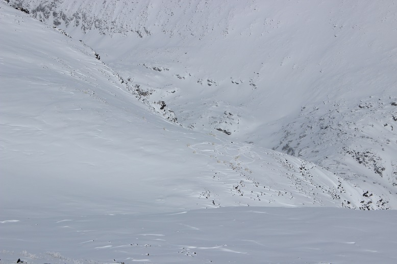
Finally, it became impossible to go any further without snowshoes, so I put them on, just before making it out of treeline. Here’s a good overall view of the route above treeline. It’s important to note the true summit is still not visible (it’s behind that ridge, to the north).
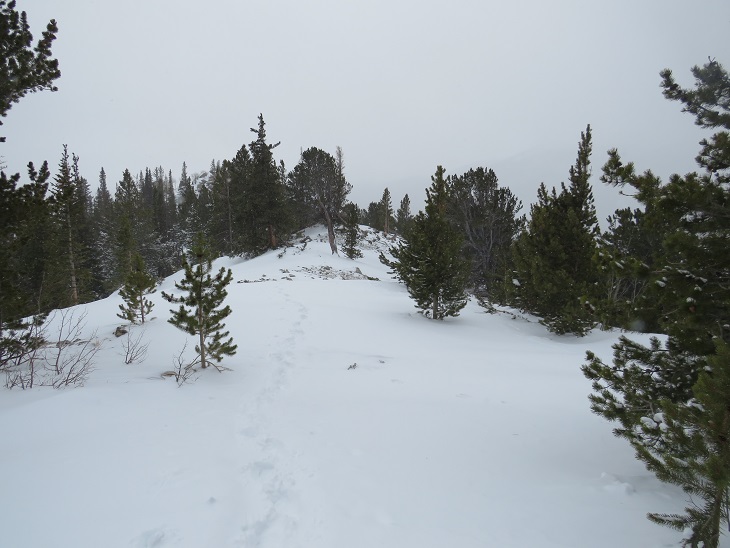
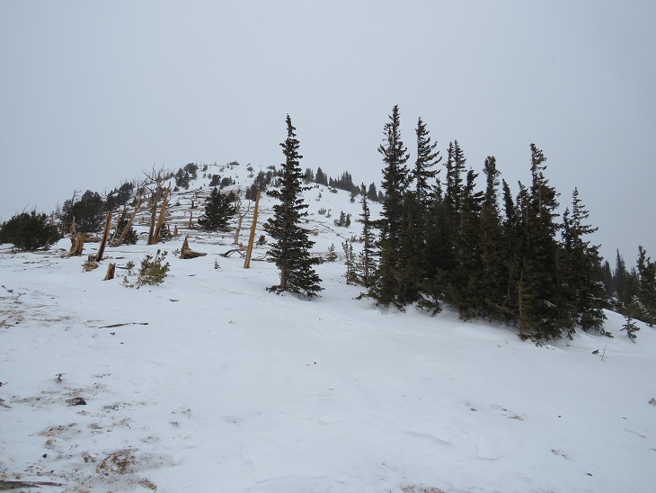
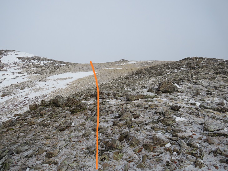
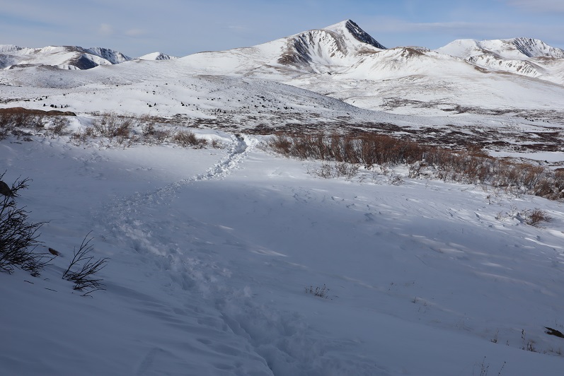
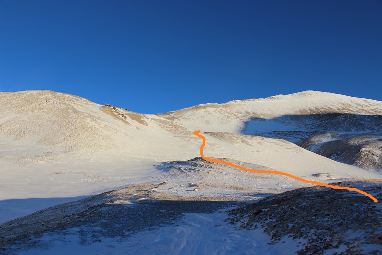
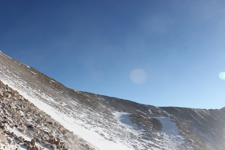
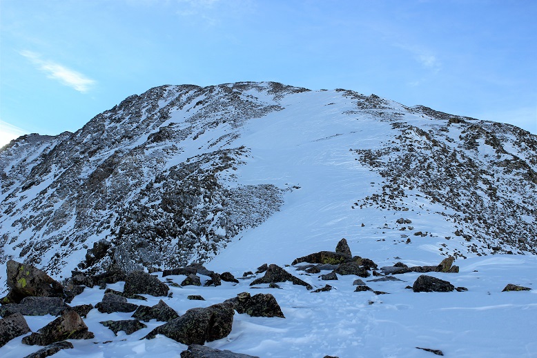
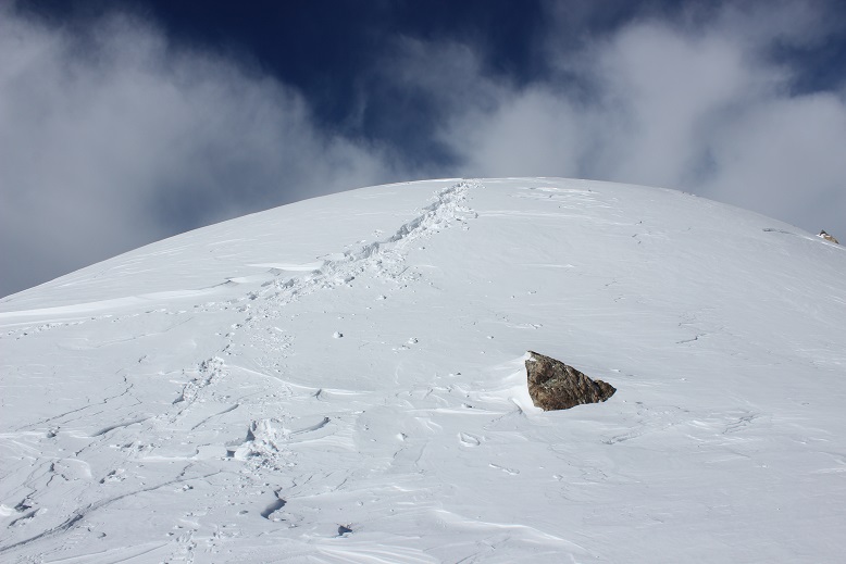
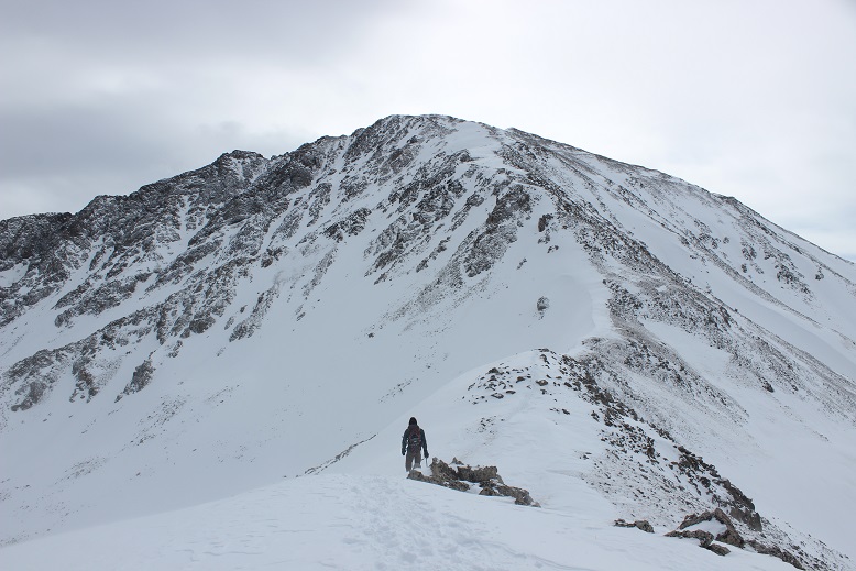
Now this became a ridge hike, above treeline. I could see the clouds moving in, and indeed, it was snowing off and on. The wind was also picking up. Taking off my snowshoes, I followed the ridge as it wound northeast. First heading towards point 12042
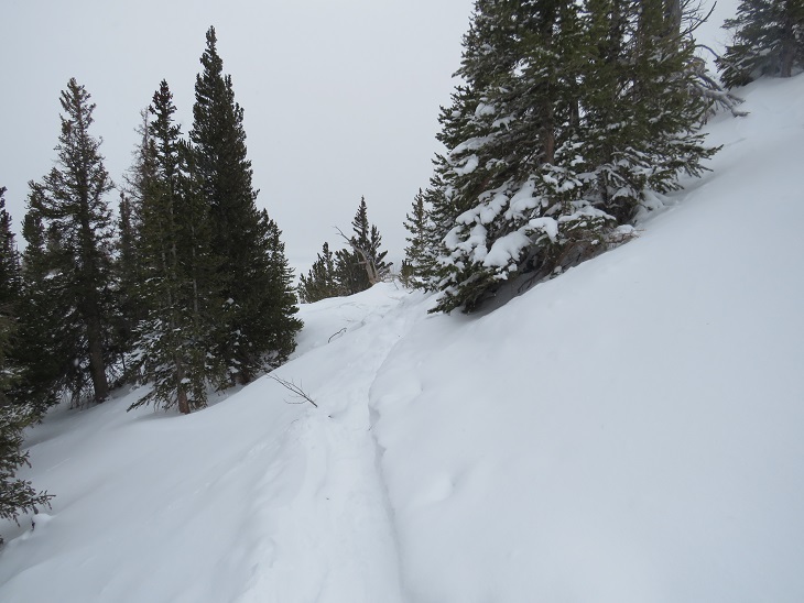
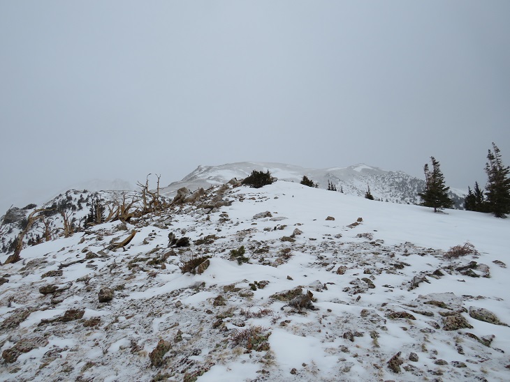
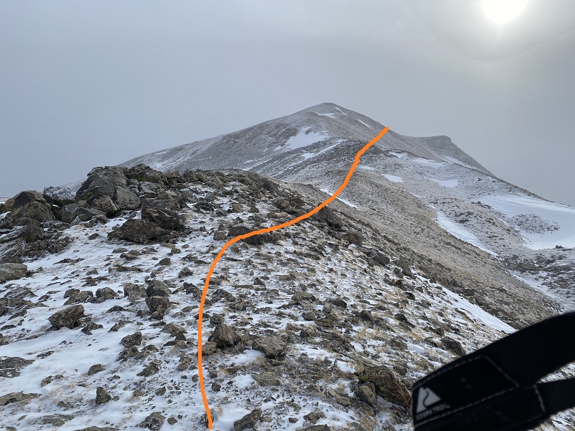
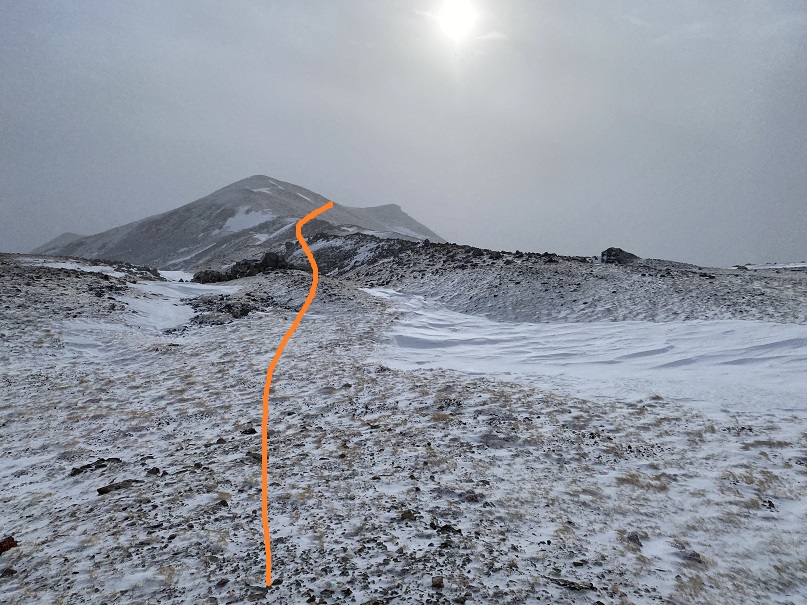
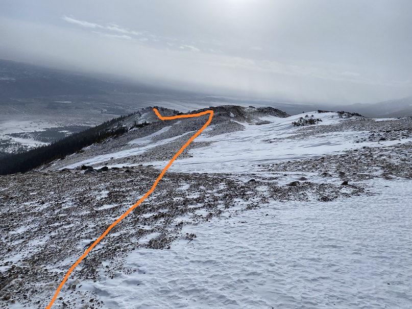
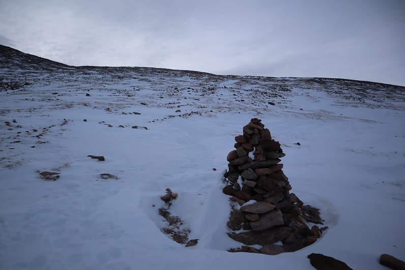
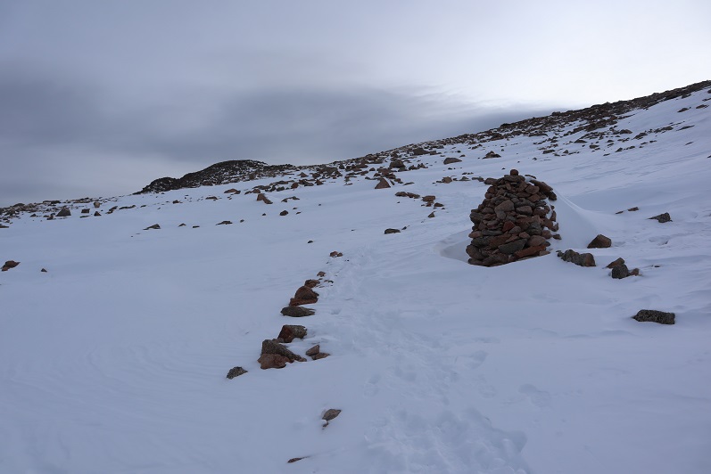
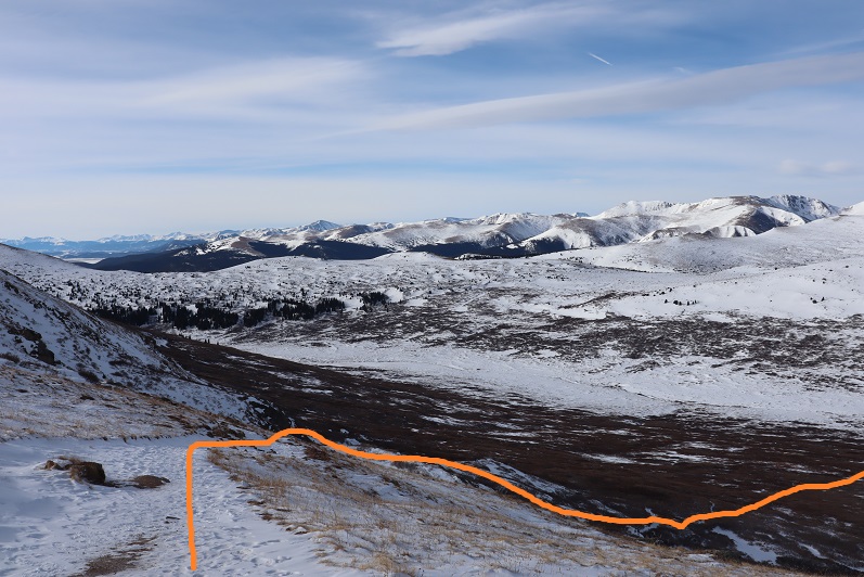
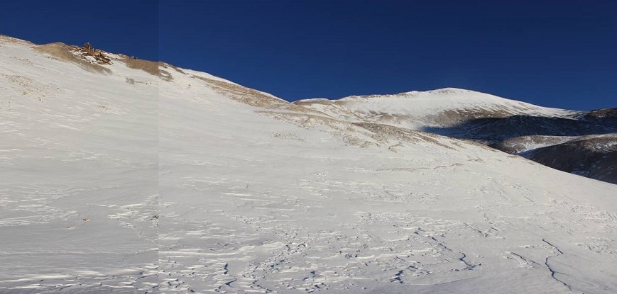
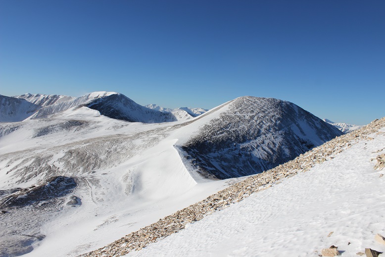
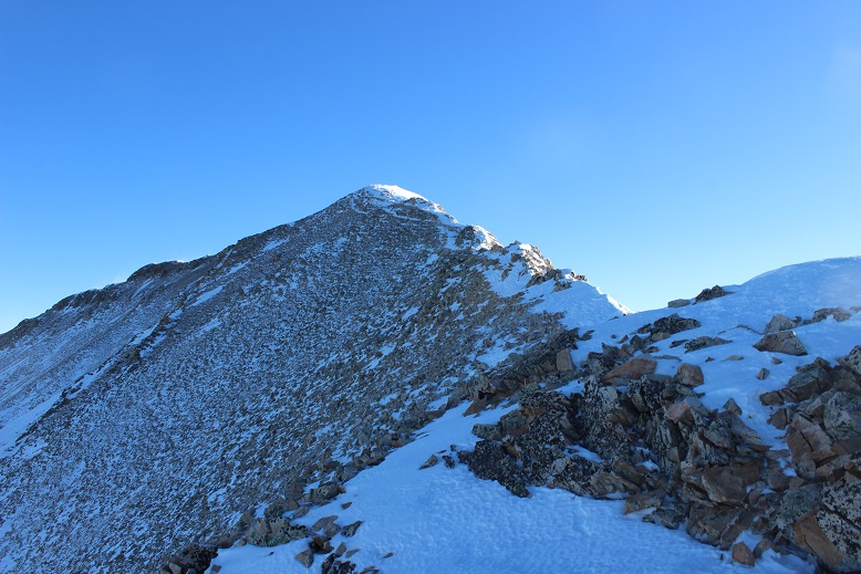
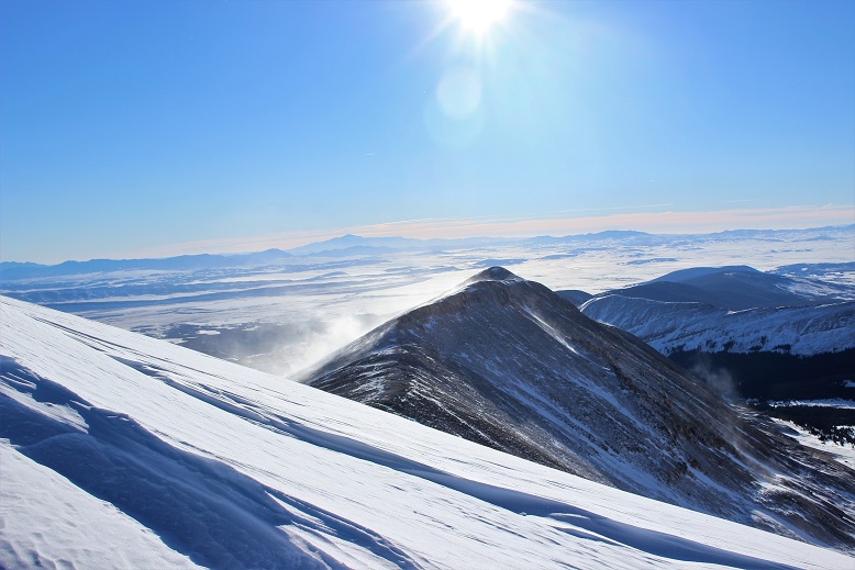
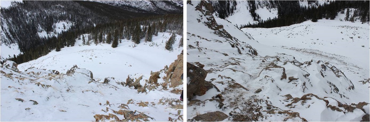
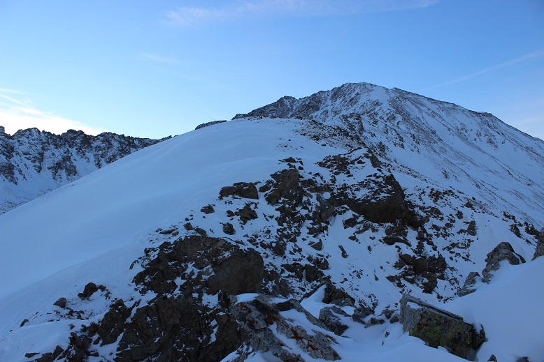
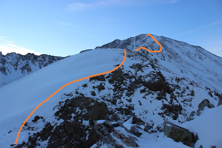
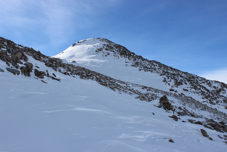
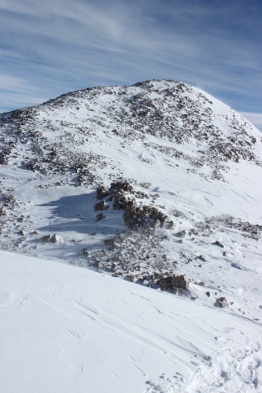
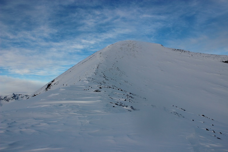
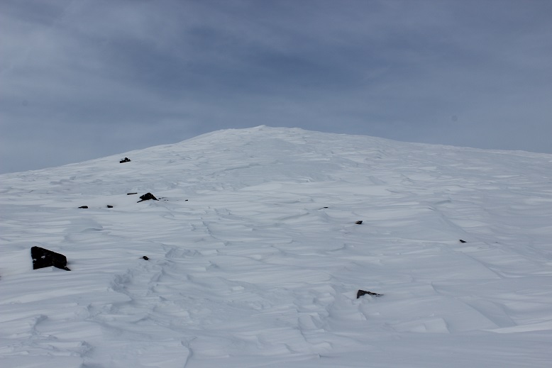
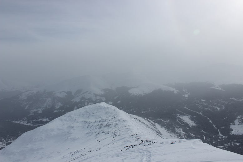
Once there, I lost some elevation, and the ridge split. I don’t think it matters which side of the ridge you take. I went right, since there was less snow there. Here’s an overview of the route
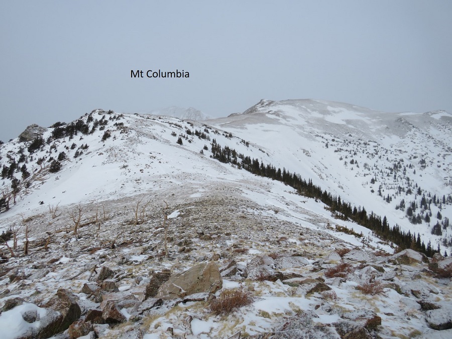
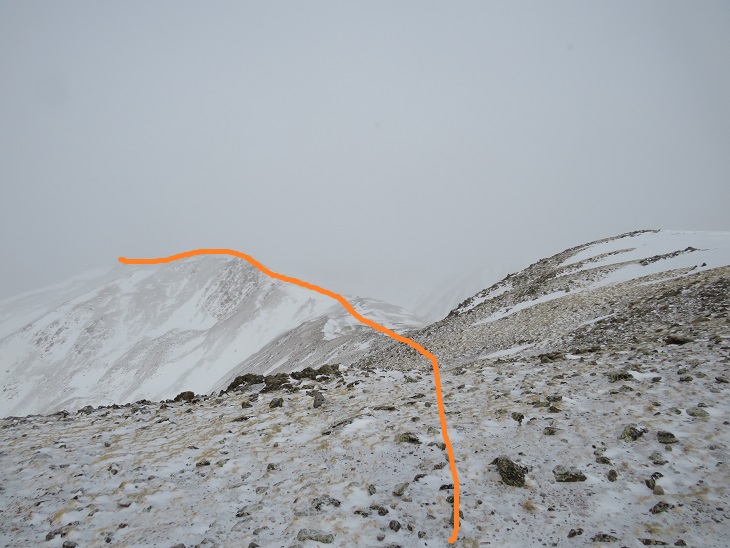
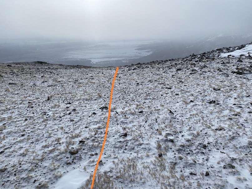
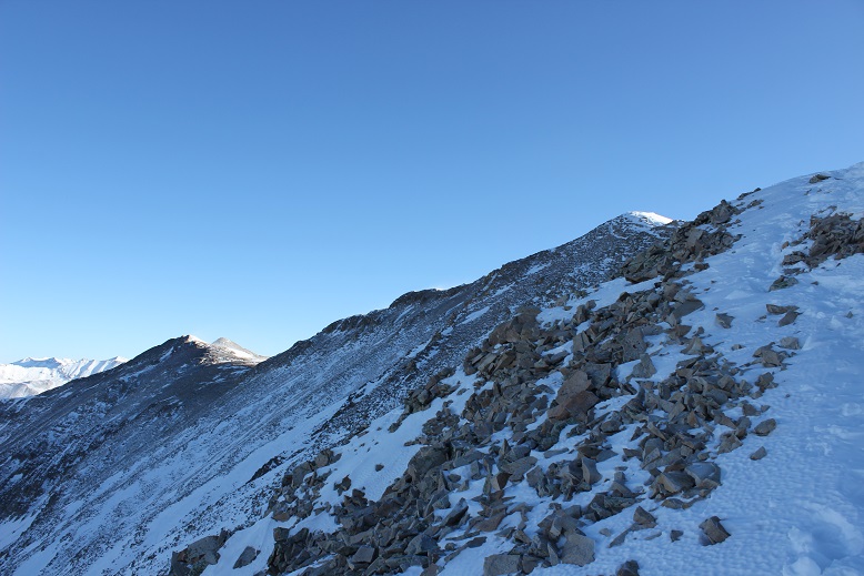
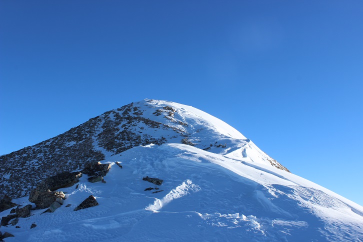
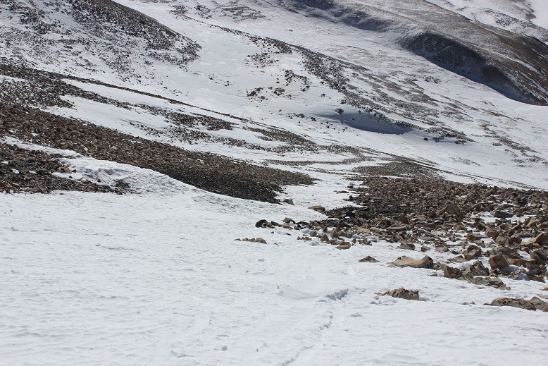
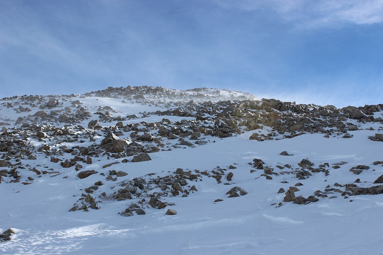
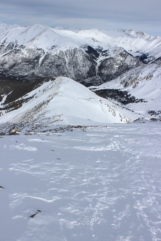
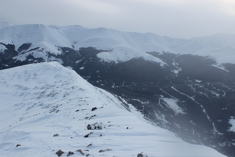
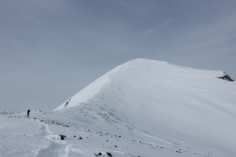
My camera died here (due to the cold), so I started using my phone. Here are some more close-up pictures
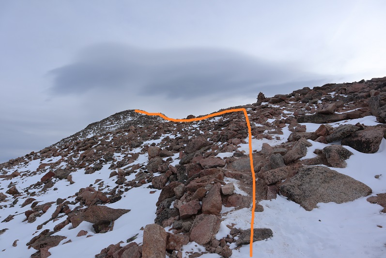
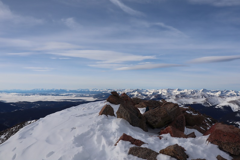
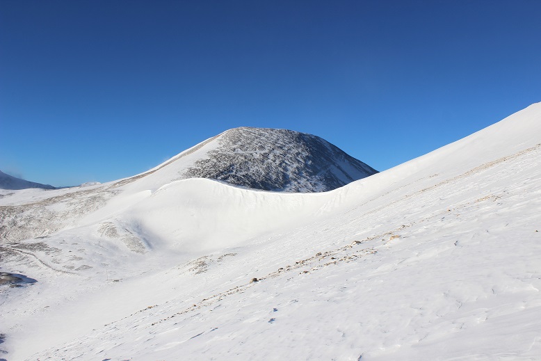
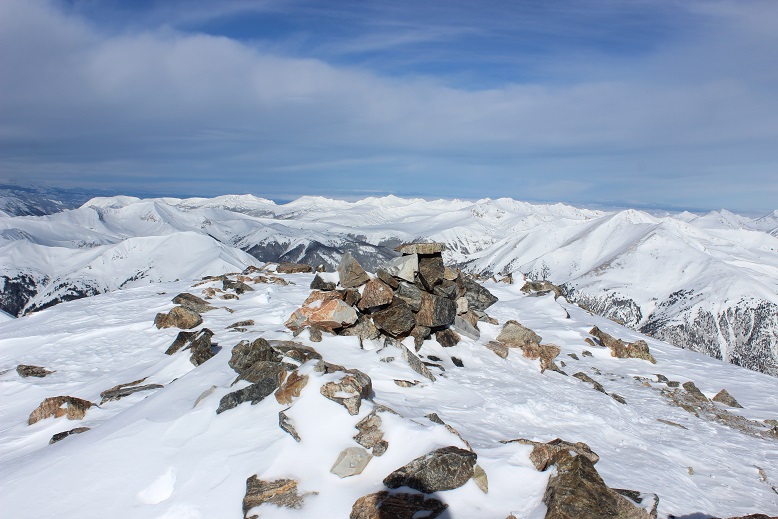
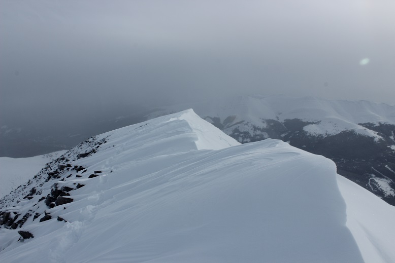
Around this point the wind became unbearable, and I could no longer take off my gloves to take pictures with my phone, so I don’t’ have any from this point on. Also, as you can tell, the weather moved in and you wouldn’t have been able to tell much from the photos anyway. What you need to know about the rest of this hike is it’s further than it looks, it’s all class 2, the ridge goes on forever, and what you think is the summit… isn’t. The summit is actually the northernmost point, not what looks like the summit from below (that’s PT 13544). It’s a rocky summit, and I couldn’t find a summit marker (but I also didn’t look for one).
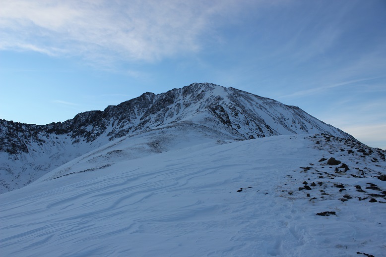
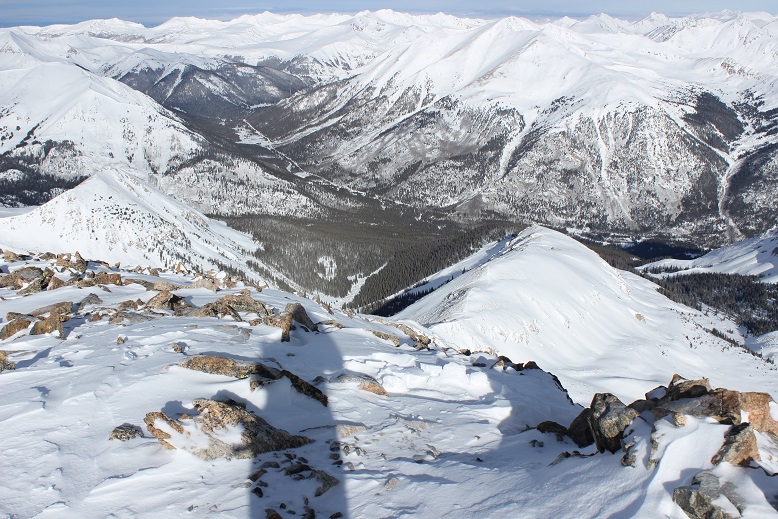
The wind didn’t let up, and I summited in whiteout conditions. It seems the 50% chance of snow after 11am was happing at 9am. I tagged the summit, turned around, and retraced my steps down that long ridge. My fingers and toes were burning inside my socks and glvoes. I had on ski goggles that kept fogging up, and I had to be careful of my footing since I couldn’t see much in front of me. As I got further down the ridge the weather let up a bit, and I could see my way back (these pictures were actually taken from my way in).
I put my snowshoes back on and kept them on for the rest of the hike. The snow started picking up again, especially as I made it back to treeline.
I made it back to the Colorado Trail, and followed it back to the road
And now to follow the road back to my truck
Along the way I was passed by a cross country skier. He seemed impressed I’d just hiked Mt Columbia, especially since it was now snowing quite a bit. I’m not gonna lie, I was a little worried about my drive out. I wished him well as I took off my snowshoes and kept trudging along the road.
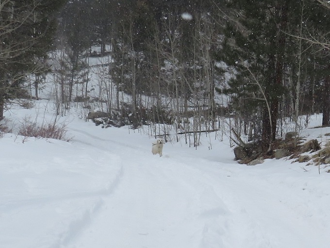
Just as I made it back to the trailhead I turned and saw a white dog running towards me, no owner in sight, clenching a deer leg in its mouth.
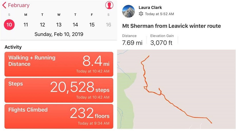
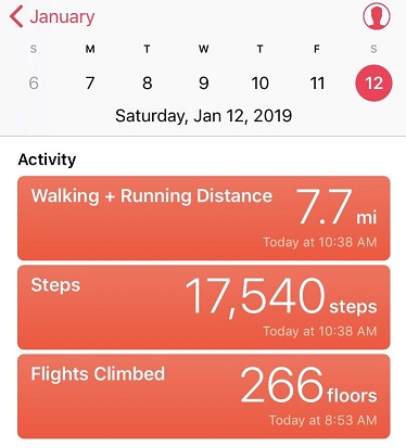
The skier said it was his dog, assembling a deer one piece at a time. His wife soon followed after the dog, they packed up and were on their way. I made it back to my truck at 12pm, making this a 14.28 mile hike with 5498’ of elevation gain in 9 hours.
The snow was really falling, so I got out of there quickly. The roads weren’t as bad as I’d thought, and completely clear by the time I made it to town.
In the end, I was glad I’d hiked today, but will most likely do this one again to get better ridge pictures. I should have picked a better weather day.
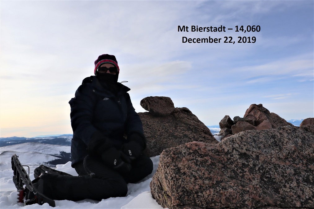
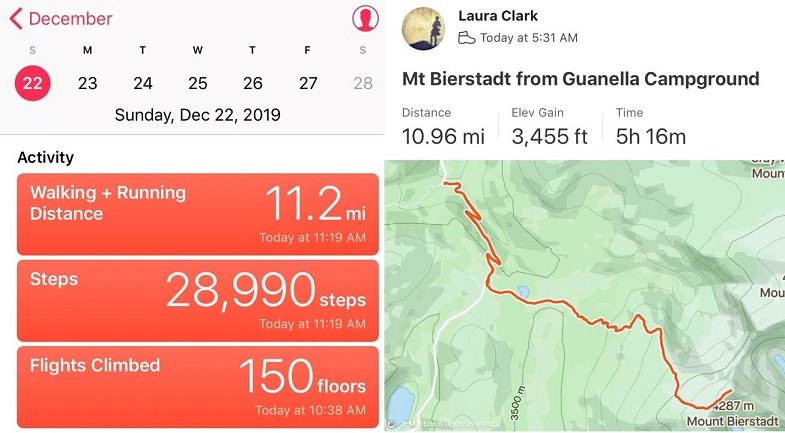
I’ve already summited Mt Bierstadt in winter, so I’ll just post a few highlights. It was cold and windy and beautiful and I was the only one on the mountain that day, practicing social distancing the best way I know how!
I’m working on snowflake 14ers. Well, kind of. I set a goal to summit 5 more 14ers this year in calendar winter and I’ve been sitting on 4 since March (I only counted DeCaLiBron as 1because… well, it seemed too easy a hike to count it as more than 1) and I really wanted to get in another 14er snowflake this year. I checked the weather and Bierstadt had the best forecast on the first full day of winter so it’s the one I went with. It ended up being a fantastic choice!
I arrived at the trailhead at 5am to two other vehicles in the lot. I’d actually expected more, considering this is Guanella Pass and it’s the first day of winter. I spent quite a bit of time in my truck getting ready and wasn’t on the trail until 5:30am. I’d decided to start out wearing my spikes and snowshoes, and while they weren’t 100% necessary, I wore them the entire day but could have summited without them. I was just too lazy to take them off. Ok, not lazy, but exposing my fingers to the cold is a no-no and unfortunately a must if I’m going to take the snowshoes off. Also, I’m working on a ‘no blue toes’ season and it helps the cause if I’m not postholing. I would have postholed without the snowshoes.
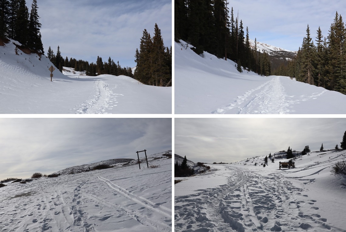
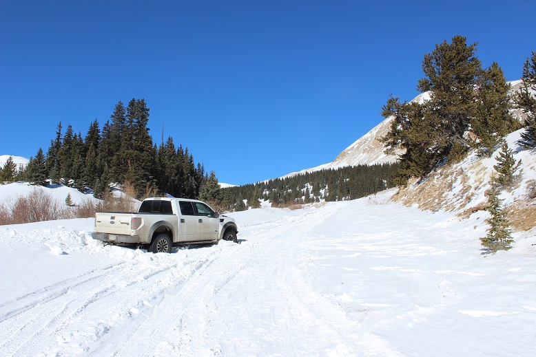
Here are some pictures of the hike along the road
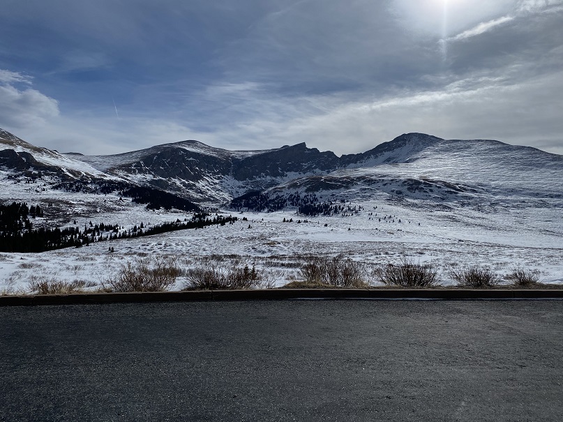
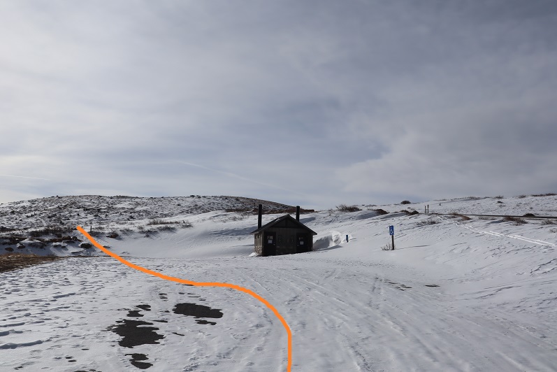
At the upper parking area the bathrooms were closed so I bypassed them and found the trail to the left
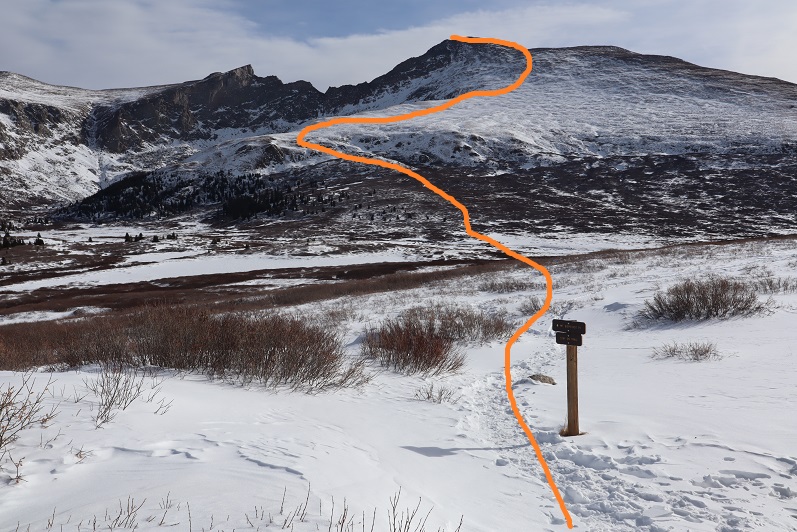
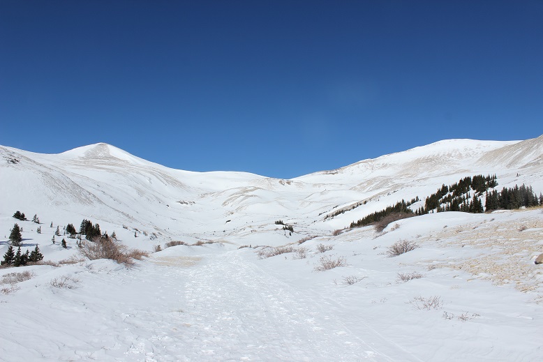
Here’s an overview of the route
The trail had a great trench and was easy to follow. There were tons of fresh signs indicating elk were in the area and using the same trails as the other hikers.
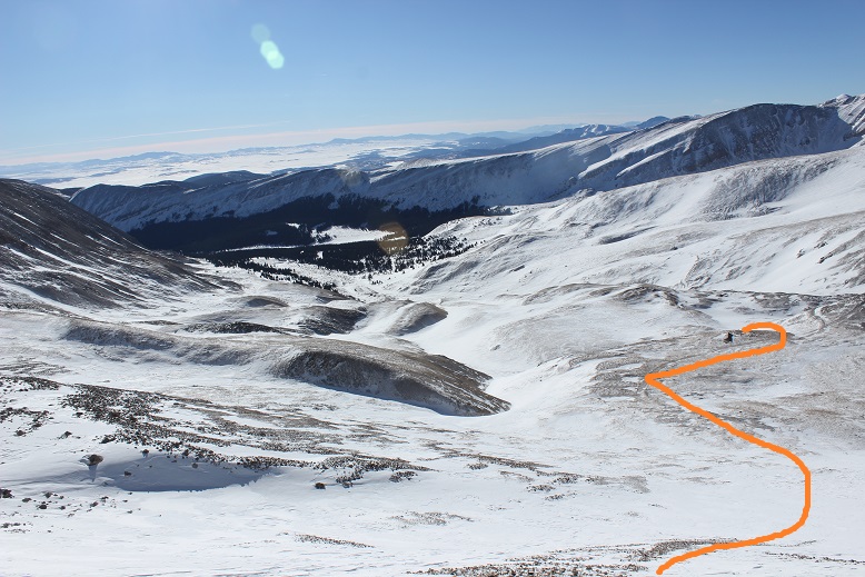
Here’s how to access the area above the willows
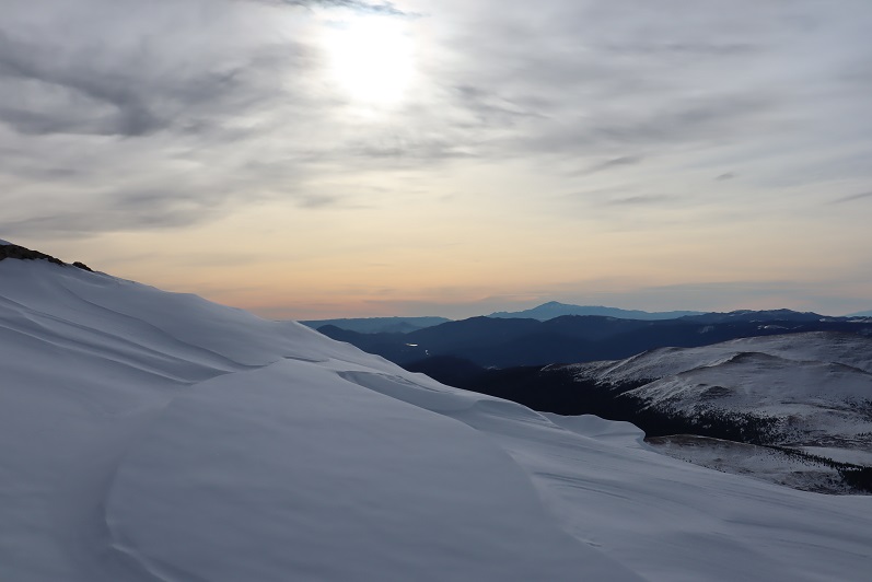
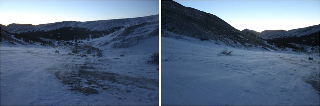
This is also when the sun began to rise. I turned back and my views were phenomenal!
There’s a lot you can say about Bierstadt. One of those things is it’s very well cairned/posted. The cairns are large and the posts even larger.
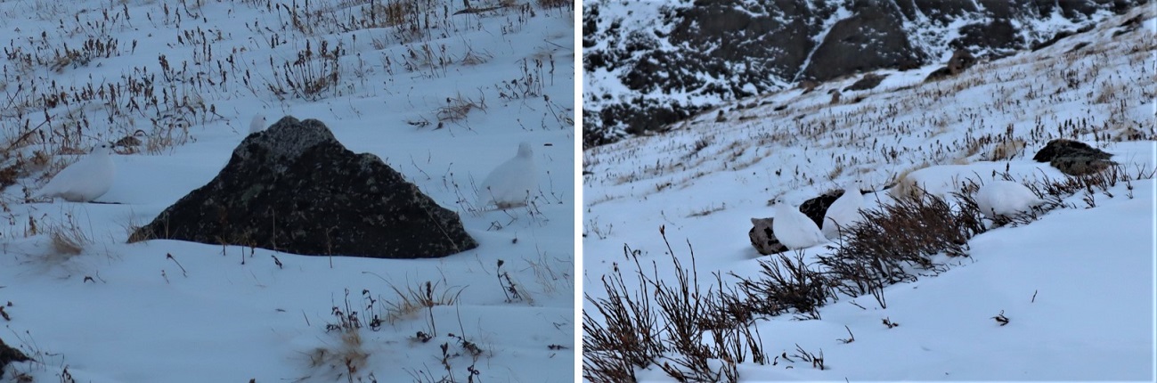
I just followed the snow covered trail and aimed for the next cairn/post. I came across a group of ptarmigans here. There had to be 7 or 8 of them altogether, and they blended in very well with the snow. I didn’t realize they stayed in groups of that size? I’ve only seen them singly or in pairs. It was neat to see so many at one time! One rogue ptarmigan ran ahead and about 10 yards away while the others huddled together. Also, what do you call a group of ptarmigans? A flock? A flight? A covey? (I think it’s a covey….)
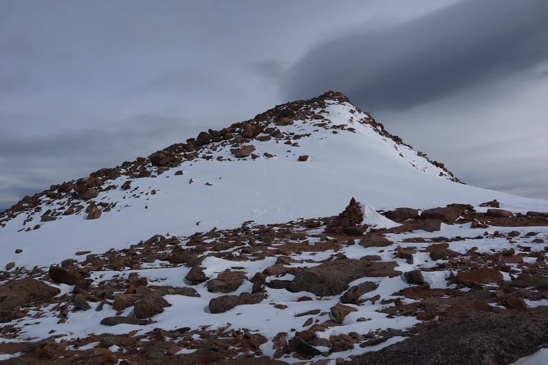
In any event, the route was easy to follow all the way to the upper ridge
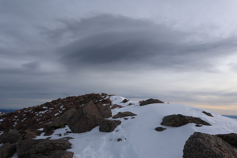
And to the summit
I summited at 8:40am. It was cold but not nearly as windy as forecasted. I was thrilled (but still didn’t take off my gloves)
Summit video:
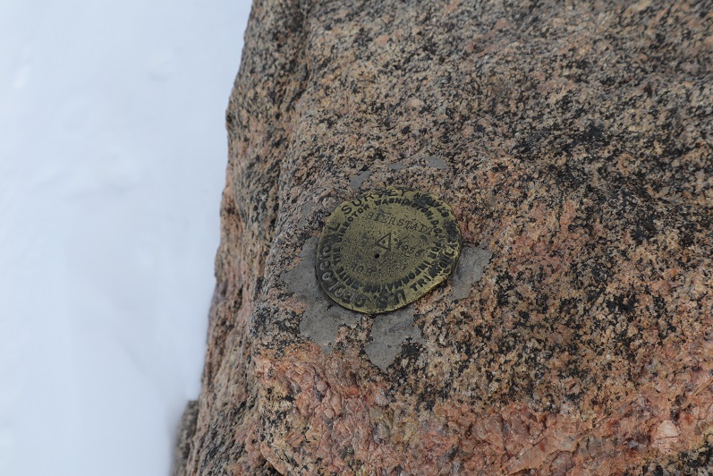
Woot! A summit marker!
Here’s looking over at Evans
Time to head back
Here’s the basic route down the face
And a cool alternative view of Pikes Peak
This is about the time I started seeing other people. Mt Bierstadt can see hundreds of people a day, but today I only saw 5: Woot for hiking in winter!!! Only one other person had snowshoes, which was understandable, as the route was really well packed down.
Views of the way back down…
With more of those awesome trenches
I made it back to the upper parking lot
And hiked the rest of the way down to the Guanella Campground parking area. There were many more vehicles there now than when I arrived. Also, they do a good job of plowing this area.
I made it back to my truck at 10:45am, making this an 11 mile hike with 3455’ of elevation gain in 5 hours 15 minutes.
Out of the 12 peaks on my short list to hike today Mt Sherman had the best weather, coming in at 12* with 15-20mph winds, and 30mph gusts. This was by far the best weather for wind gusts (most other peaks forecasted 50+mph winds) so it was a no brainer as to which peak to pick. Unfortunately (as you’ll read later) I made this decision at 9pm the night before and didn’t do much (ok, any) research on hiking Mt Sherman in winter because I’d seen some FB posts there was minimal avy danger that was easily avoidable and read the trailhead was clear. And hey, I’ve done this peak before and I knew what I was getting into. Right?
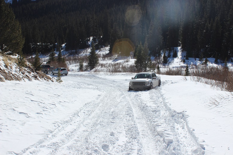
I was more nervous on the drive in to this trailhead than I’ve ever been. The last conditions report hinted it wouldn’t be difficult to make it to the Leavick site, and possibly further in a 4WD. However, about 4 miles before the Leavick site the normally 2WD road became a sketchy, drift and rut filled one way snow fest. This was a ‘both hands on the wheel’ kind of experience that required skill to stay in the lane and not drift into the deep snow on either side of the vehicle. I didn’t feel stellar about continuing on, but there was no place to turn around and in the dark I couldn’t see to back up so I just kept driving onward, bolstered by the fact others had obviously succeeded on this road yesterday.
I made it to the Leavick site at 5am in one piece (woohoo!) but there was no safe place to park my truck without it getting stuck in a snowbank. The wind had drifted snow all over the area, so I set about using my trucks tires as snowplows and drove it back and forth, up and down, flattening out an area big enough to park. This took a lot more time than anticipated as the snow was soft and kept sinking and squishing up on the sides as I drove over it. I had no idea how deep the snow actually was and the more I drove over it the more it pushed up the snow around it to make new walls. I got out my snow shovel and started scooping up some of the bigger areas of snow to make more room. Just as I was doing this another truck arrived and I let out a sigh of relief: The more vehicles to drive up the road and stomp down the snow the better! It looked like he was going to continue on, but then suddenly he backed up…. right into a drift. Ouch. I lent him my shovel and went back to work trying to make a suitable parking area. Once I felt I’d made enough room for my truck to safely park and about 2 others I went over to help the man with the stuck truck. We tried shoveling away all the snow, putting dirt and then rocks under the tires, and him gunning it while I pushed. No dice. That vehicle was stuck.
I was now an hour behind schedule and that truck wasn’t going anywhere. The man told me he had a few friends meeting him soon so I offered him the further use of my shovel and began my hike at 6am.
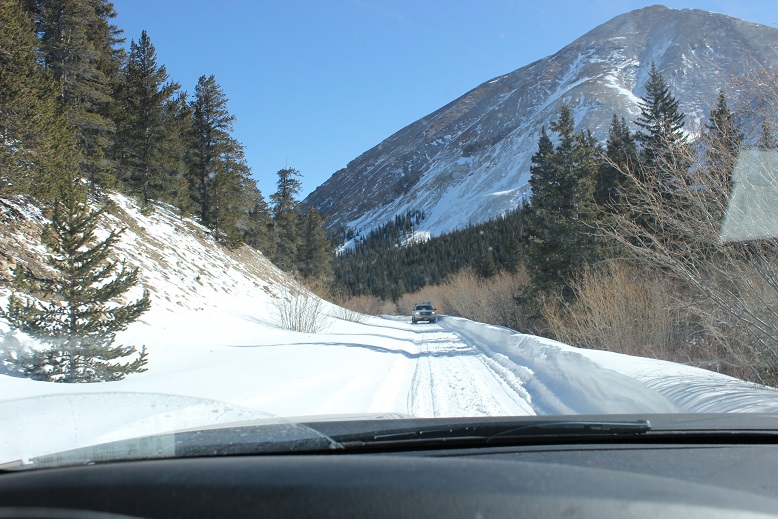
The Leavick area is 2.5 miles below the trailhead, but an easy hike on a 2WD dirt road (well, 2WD in the summertime). I put my snowshoes on in the truck and was grateful for them as I made my way up the road. It was windy but I’d anticipated the wind and was grateful for my balaclava, mittens, and hat.
At this point I started seeing footprints and even though I knew the road curved around to the left I decided to follow the footprints that led in the general direction of the basin, knowing they’d all connect when I made it further up. I made it to about here and stopped
The snow just didn’t feel right. I knew if I continued on I’d make it to the basin, but it felt like I was walking on a thin crust of ice with spongy layers below. It didn’t feel or sound right and the slope was getting steeper. I decided to just backtrack to the road. (Later I learned this was indeed the winter route, and others made it up said route that day, so I was most likely being over cautious, but no regrets).
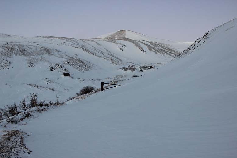
I made it back to the road fairly quickly. There was plenty of snow blocking the gate
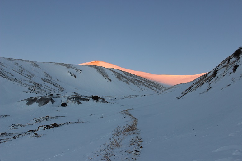
The sun started to rise just as I walked up to the Dauntless Mine area. I silently wished I’d started just a bit earlier so I could fully enjoy the alpenglow.
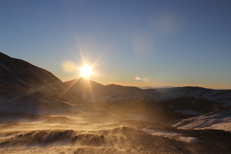
The wind was still present. Every once in a while a gust would hit me full force and I had to turn around and put my back to the wind, but this meant I was facing the sun
I was now in the basin. I looked at the summer route (or what I could see of it at the time) and got a little nervous: that was more snow than I’d anticipated and no ‘quick, easy way around’.
There are several routes (trails/roads?) around the hilltop mine. They were all covered in various degrees of snow, and some were too steep for my liking.
Here’s the route I took:
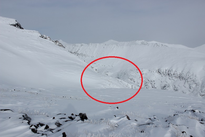
OK, so now I was in the basin and it was obvious the standard route was a no-go due to avy and cornice danger
I looked at the mountain and decided I had some options. I saw what looked like a viable path up the face and through a gully, and another that went off to the right, up a ramp, and then left to the summit. I knew from previous experience the ramp was a way down from White Ridge, and I was considering doing that peak as well today, so I decided to go up the gully (solid) and down the ramp (dotted).
By now the wind had died down and I was starting to get warm. This was fantastic! The gully had snow, but now very much. It was just enough to provide the necessary traction on the scree (which would have been nasty without the snow).
And boy was it steep!
From about halfway up I had a good view of my intended route down
The route kept getting steeper and steeper but I just kept to the areas where there was snow. Towards the end I got out my ice axe for support/stability.
I gained the ridge and looked back on what was the standard route. Yep, it had been an excellent choice to avoid the area altogether.
From the ridge I took a look back at the basin: yes, I could have just gone the way I’d started out, but I was where I wanted to be, so this was good too.
I turned north as the wind picked up a bit. Obviously others had been here recently. This didn’t look too bad
I gained one small ridge and saw what looked like more fun than I’d remembered last time I’d summited Sherman. Woot!
This was easy to cross, and as I was making my way I looked over to Gemini (another peak I was considering after Sherman)and debating if I should summit White Ridge or Gemini first?
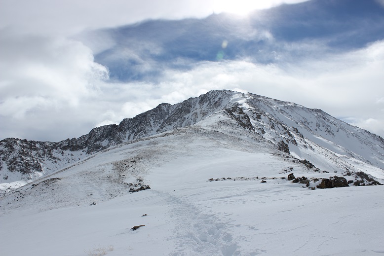
Sherman has a very long ridge to the actual summit. Here’s more proof
I stopped for a second and looked over at White Ridge. It looked like it was getting some wind!
I continued on to the summit, with the wind increasing as I went. As I stood on the summit I turned around to get out my camera and was immediately knocked over by a gust of wind. Wow! That hadn’t been expected! I got to my knees and stood up again. Wham! I was knocked down again. Ugh! So I got out my trekking pole and used it as leverage, struggling to stand and the wind continued full force. It wasn’t happening. The wind was too strong! Ok I thought, I’ll just wait this gust out. But it didn’t stop. It became a sustained wind that didn’t seem like it was giving up anytime soon. There was no way this was the forecasted 30mph gusts. I’m not sure the speed, but it had to be pretty significant if I couldn’t stand. There was no way I was going to attempt Gemini or White Ridge in these conditions. It looked like I was heading back the way I’d come.
I couldn’t stand so I got out my ice axe and crawled back towards the ridge. This was a good and bad idea: I was making progress towards the ridge, but holding the ice axe was brutal on my hand. Note to self: bring something to wrap around my ice axe to work as a barrier for warmth between my glove and the axe, as gloves (mittens) don’t cut it. I noticed I couldn’t feel my fingers. This happens to me a lot, but this was the worse it’s ever been, and I got scared. Really scared. I was breathing fast and my breath froze my balaclava stiff. This meant I was now having a hard time breathing in and out of it due to the barrier. Wind chill is no joke.
I had to get out of this, and fast. I kept crawling down the ridge, hoping the wind would let up. It didn’t. Me being me, all I could think about was not getting a picture on the summit. I told myself there was no way I’d have been able to because the wind would have blown my camera away, but I still wanted one. I made my way to a rocky area that provided some shelter from the wind and took a selfie (kind of). I wasn’t on the summit at this time, but I was close, and it was the best I was going to get.
The camera wouldn’t focus due to the wind, and I thought it weird there was so much blowing snow on White Ridge but none on Sherman. The wind was insane but it wasn’t blowing any snow. I actually would have preferred blowing snow in a way because then I could have seen the wind coming towards me and anticipated the blast.
I put my camera away and while the wind was still brutal I was able to stand up. My fingers were seriously bothering me. I’d been trying to pump them back and forth but I wasn’t sure if it was working because I couldn’t feel them, and there was no way I was taking off my glove to check them out. Just before making it to the end of the ridge my fingers started burning intensely, as if I were touching a hot stove and not pulling my fingers away from the heat. The pain was extreme but I was relieved because this meant the blood was starting to flow through them and it also told me I hadn’t done any permanent damage.
I trudged back to the gully and started my way back down, pulsing my fingers the entire way. The initial descent from the ridge through the gully is very steep. I faced the mountain and used my ice axe. About 50 feet from the ridge the wind finally stopped and never started again. By now the sun had warmed up the snow in the gully, making it not quite slushy but still slippery.
Once I’d made it back to the basin I headed towards the hilltop mine.
And then followed my snowshoe tracks back down the mountain
By now my hands were sweating in my gloves, but I still didn’t want to take them off: the tips of my fingers hurt in a way they never had before and I wanted to keep them covered for as long as possible. I kept pulsing them and thinking to myself: now I know where my limit is. I can do cold to a certain point, but I cannot do wind chill. When I got home I looked it up, and if it were 10* on the summit (the forecast high had been 12*), after 40mph the wind chill stays constant at -39* up to 60mph winds. I learned today that’s too much for my body. From now on I cannot go hiking above treeline if the winds are forecasted over 25mph. I just can’t, and I need to hold myself to that. Also, I’m pretty sure the forecast had been wrong in this case, and if I’m honest I kind of knew this going in since Sherman’s forecast was so much better than every other mountain in the area. It had been too good to be true, and if it seems too good to be, it probably is.
Back to the trip report. The Dauntless Mine takes on a whole new quality with snow
I followed the road back to my truck, meeting a few hikers along the way. At one point it looked like someone had tried to drive further up the road past Leavick and had second thoughts. Instead of turning around it looked like they’d backed up down the road.
As I was walking the 2WD road back I was so warm I took off my balaclava and gloves about half a mile from my truck. My hands were swollen and sweaty and red and sore, but no blisters! It was warm and there wasn’t any wind so I kept my gloves off to let my hands dry out. I made it back to my truck at 10:15am, making this an 8 mile hike in just over 4 hours.
When I made it back the white truck was still stuck and there was one other vehicle in the area.
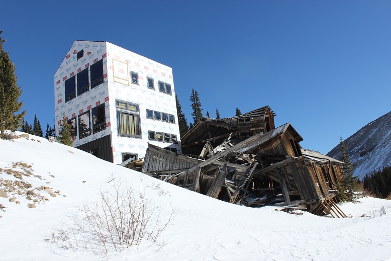
They’re still building a structure at the Leavick site. I’ve been told it’s a home but that sounds questionable to me. And creepy: the old structure creaks and groans with the wind continuously at night.
OK, let’s talk about the drive out. I wasn’t looking forward to driving those first 4 miles, but I was looking forward to them being over. After about a mile I came across a Jeep heading up the trail. Ugh! One of us was going to have to back up, but then the driver did something I hadn’t expected: He did what I’d done this morning to make a parking space, and drove up and down and up and down about a dozen times to make a spot for him to park and me to drive around. I slid around him with less than an inch to spare (and I mean this in more ways than one as despite being on my A-game I wasn’t 100% in control of the vehicle the whole time). I took a deep breath. That had been very, very close. I couldn’t believe I hadn’t hit him or gotten stuck on the side trying to pass, and I wasn’t entirely sure he could make it out of his ‘parking spot’.
Almost immediately after passing the Jeep I saw another vehicle coming towards me and thought “Oh no! Not again!” But this guy did something unexpected as well: He started backing up, quite efficiently, and didn’t stop for 2 miles! Even though I’d had the right of way he’d done the backing up. I was so grateful (and told him so when I was finally able to pass him). Once again, THANK YOU! You kept us both from potentially getting stuck. As a side note, whenever possible I used my truck to make the ruts in the road wider because it can do that kind of thing. Have I mentioned I love my truck?
Ok, let’s talk damage to my hands (and feet). I had indeed pushed them to their limit, but they aren’t permanently damaged. The tips of my fingers feel very raw, similar to how the little red sores you get on your feet feel after being in the pool for too long and rubbing your toes along the side. The tops are all red, and there are small blisters and lines under the tops of my fingernails (kind of like when you bend your nail backwards below the nail plate. Last night it felt like I had blisters all over the tips of my fingers (but no actual blisters present). My left pinky toe once again took the brunt of the hike: It’s swollen to twice its size, a fun purple/black color in the middle (not frostbite, but pretty bad chilblains, which are a consequence of Raynaud’s meeting cold) and very, very tender to the touch. I couldn’t get a shoe on today. Here’s a positive note: I teach wilderness first aid and we use aloe to treat frostnip (NOT frostbite). Since my chilblains have similar symptoms I put aloe on them, and it instantly felt the same relief as if I were cooling a sunburn. Woot! What’s even better is it’s not medicine so I can apply it as often as I’d like!
I have a goal of completing 5 winter 14ers this season, but that’s going to be more difficult to accomplish than it sounds. The weather hasn’t been cooperating on my hiking days, so I’ve been highpointing and sticking close to home the past couple of weeks (Manitou Incline over and over again & summiting the 9K mountains behind). I’ve only done one other winter 14er (Quandary) and my time is about to get seriously limited. This happened on Friday:
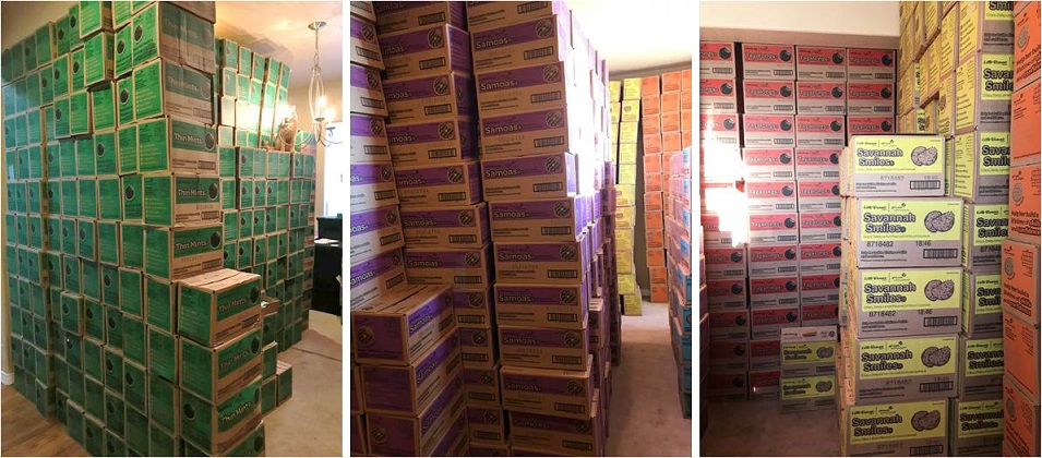
I volunteer as a cookie cupboard from mid-January through mid-March. This means Girl Scout Troop leaders come to my house to get cookies for their girls to sell. I have 2 semi trucks full of cookies delivered to my house twice a week, and those cookies are all gone by the next delivery date. (Think 20,000 cases of cookies, twice a week, in my living room, that have to be unloaded, sorted, and then loaded again when Troops come to pick them up). It’s intense, insane, and a full time job on top of my already full time job: I love it! Oh, and my house smells amazing right now! The only downside is it seriously limits the time I can allot to hiking. I had to give up my Friday hike for a delivery but the weather looked good for Sunday so I just switched days. I’m hoping to get in one more hike before sales start on February 3 (crossing my fingers).
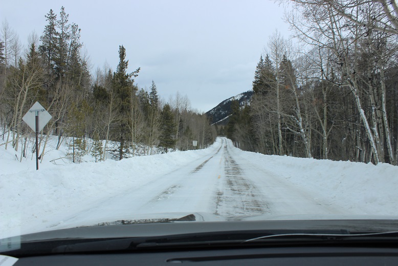
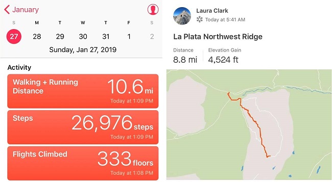
OK, back to business. I arrived at the trailhead at 5:30am, a little later than expected. The drive in on Colorado 82 was a bit icy but manageable with no one else on the road.
La Plata Trailhead was full when I arrived. I’m pretty sure I got the last spot. It looked like several groups had slept at the trailhead overnight and were just now getting ready to hike (brave, brave souls to sleep at a trailhead in this 10* weather).
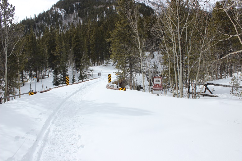
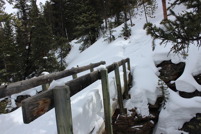
I was on the trail by 5:45am. The trail follows FSR 391 over a bridge and to the left. The bridge was covered in at least 2 feet of snow, making the railings irrelevant.
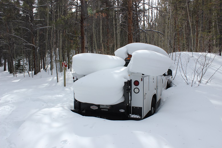
I passed an abandoned utility truck along the way and thought “that’s unfortunate”. I’m not sure if it was left here on purpose but it isn’t going anywhere anytime soon. I’m fairly certain several rodents and small animals have taken up residence under the vehicle.
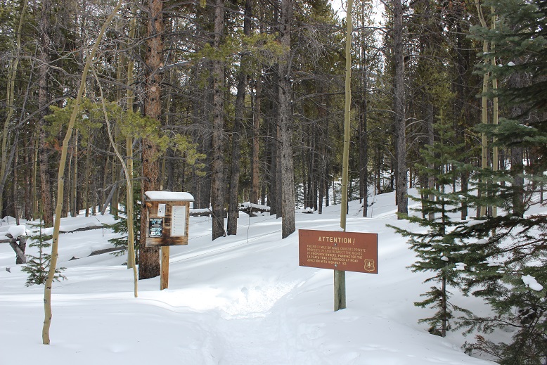
I continued on until I came to the trailhead on the left.
If you see these signs, you’ve gone too far
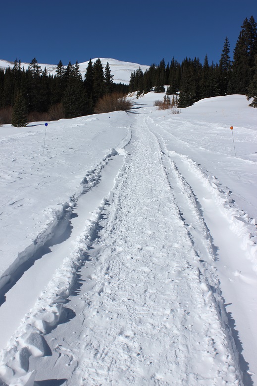
It was still dark, but knowing exactly where the trailhead was made finding it so much easier this time. The last time I took this route I’d missed the trailhead and ended up hiking at least a mile in the wrong direction. The trailhead was also easier to find now because of the fabulous trench already in place. This trench went from the parking lot just about to the summit, and made route-finding very, very easy.
I crossed another snow-filled bridge
And shortly thereafter a snow covered log bridge. I remember this was very difficult to find in the early summer when it was overgrown and filled with new leaves. No problem this time!
From here I never saw the log/stone steps as they were most likely covered in snow. I followed a trench that went straight up the ridge. About halfway up the slope I smelled smoke and got a bit nervous (forest fire?) until I ran into two hikers taking a smoke break (no comment). The sun started to rise just as I was exiting the trees, but I wasn’t yet high enough on the mountain to enjoy the alpenglow.
The trench up this part of the hillside was a bit sketchy at times because it was on a steep portion of the mountain, but it did lead me here
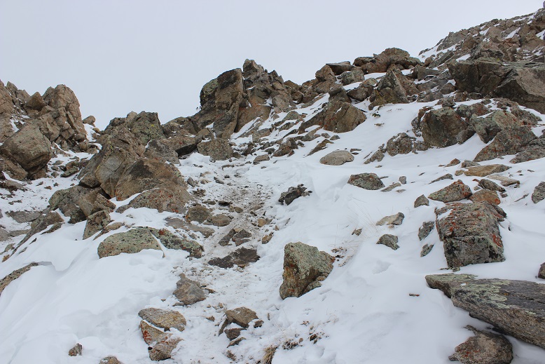
From here I had to gain the ridge. I hadn’t expected a gully? This wasn’t too terribly difficult, but it had been unanticipated. Here’s the route up
The gully was much steeper than these pictures make it look. Here there was no trench, but instead a mixture of scree, snow, and unstable rocks that didn’t provide much traction. Wearing my snowshoes helped.
Here’s a look back down from the top
And my view as the sun continued to rise
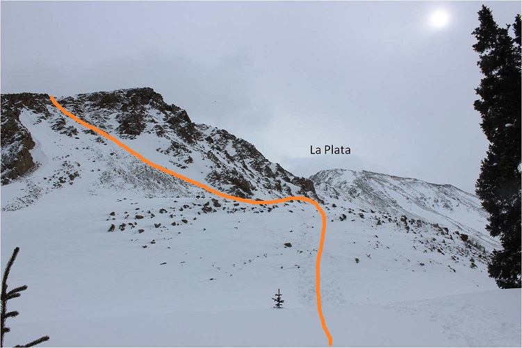
The sun never fully rose today, as it stayed behind La Plata and the ridge for hours after sunrise and then hid behind clouds. From the top of the gully the ridge was just beginning. Here’s the first obstacle
And from there the rest of the ridge
Here’s the route
This ridge is much longer than it looks, with a few ups and downs along the way. Besides the trench there wasn’t a visible trail, but luckily it is very straightforward and all you need to do is follow the top of the ridge.
I came upon some spots where my ice axe and the crampons on my snowshoes were helpful (side note, the straps my snowshoes are still a major pain).
At about this point the wind started picking up. I wasn’t physically tired but I was having trouble breathing. Because my balaclava was covering my mouth I wasn’t getting a full breath of air, making each breath only half as effective as it normally would have been.
I kept trudging on, knowing I wasn’t in a hurry today so I could take as much time as I wanted. When I reached this cairn I turned left and wondered if the hill to the right had any significance?
From this point the wind really kicked into high gear. I was having difficulty standing up at times but wasn’t worried about falling (there was no real danger of falling anywhere that would send me very far)
I headed up this small rocky stretch
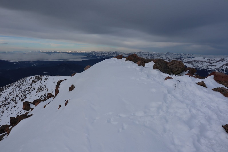
And came to a flat(ish) summit area
I’m not sure what time I summited because I’m doing this new winter hiking thing where I don’t take out my phone unless it’s an emergency, but it was most likely between 9-10am.
I’d thought about summiting East La Plata today but once I got a good view of the way there and considered the current wind conditions I thought twice about my intended second summit. It’ll have to wait for another time.
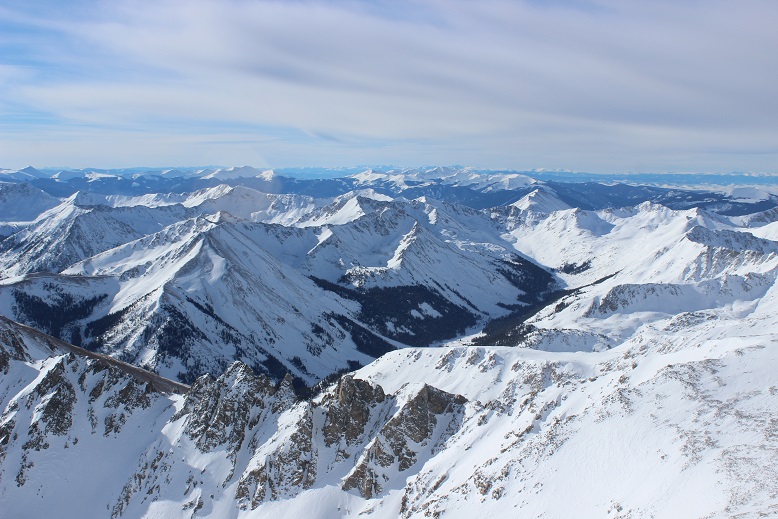
The views from the summit of La Plata were breathtaking
Because of the wind I didn’t stay too long at the summit. It also looked like snow was coming in: Not on La Plata, but the surrounding mountains. Here’s a view from the summit of the ridge
OK, time to head back
Just for fun I decided to climb the little hill before heading back down the ridge
Here’s a look at the summit of La Plata from that hill
Here’s a better look at the ridge and my way back
The sun never quite made it out all the way: it kept hiding behind thin clouds. It was about here I caught up with the two hikers (now a party of 4) I’d seen taking a break on my way up. They only had on microspikes but seemed to be doing just fine (my snowshoes were most likely overkill on the ridge). A little bit further down I saw where they’d stashed their snowshoes.
As I kept descending I started running into more hikers. I thought this was a cool pic of a young man starting his trek up to the summit
The rest of the way back was fairly straightforward. The ridge had a great trench by this point and I could tell where those who’d ditched their snowshoes or hadn’t worn them had post-holed up to their waist on several occasions. The short descent down the gully made me wish I’d brought a helmet, as now bowling ball sized rocks were set loose both above and below me as I made my way down. I breathed a sigh of relief when that was over and I followed the trench back to my truck.
Once I made it to treeline the sun stayed behind the clouds and I could tell it was snowing on nearby peaks. Despite the summit wind it had been a very nice and quiet hike. I didn’t see any animals or very many animal tracks in the snow. I made it back down to my truck at 1pm, making this a 9 mile hike in just over 7 hours. Oh, and total bonus for today: My hands didn’t freeze! They didn’t even get cold. In fact, they were sweating in my mittens when I made it back to my truck. Two of my toes were blue, but nevertheless I’m considering today a huge success in the ‘cold’ department!
2 winter 14ers down for the year, 3 to go!
Just because they’re fun… here’s my Relive (I thought it was interesting this says my elevation was at 14,338 when La Plata’s elevation is 14,336): https://www.relive.cc/view/2107811469
The weather just about everywhere in the state today was forecasted as miserable. Everywhere except for Quandary (even the 13ers and mountains adjacent to Quandary were forecasting snow). Quandary showed clear weather from 4am-2pm so I decided to make the best of the situation and work on my winter 14er goal for the year.
I slept an extra hour this morning. It’s been a long time since I’ve hiked in the daylight, and now that my youngest has her license and I don’t need to be home quite so early every time I hike. I had the ability and wanted to start out hiking today with light. The roads were terrible on my drive in for most of the way. The worst tended to be in the cities (looking at you Woodland Park) but surprisingly the back highways were mostly clear. In any event, due to ice on the roads I didn’t go above 30mph the entire way so I didn’t arrive until after 6:30am.
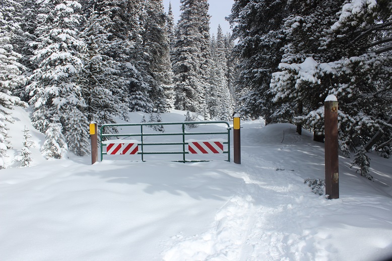
The upper trailhead was closed so I parked at the lower trailhead. This adds about 100 feet to the hike so it was no big deal.
I was surprised to find 3 other vehicles in the parking lot when I arrived. I reminded myself this was a popular 14er, even in winter time, and I’d gotten a late start.
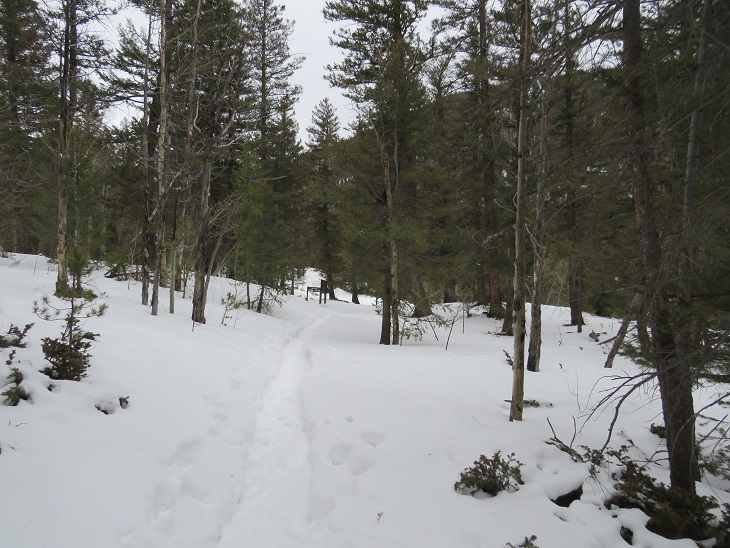
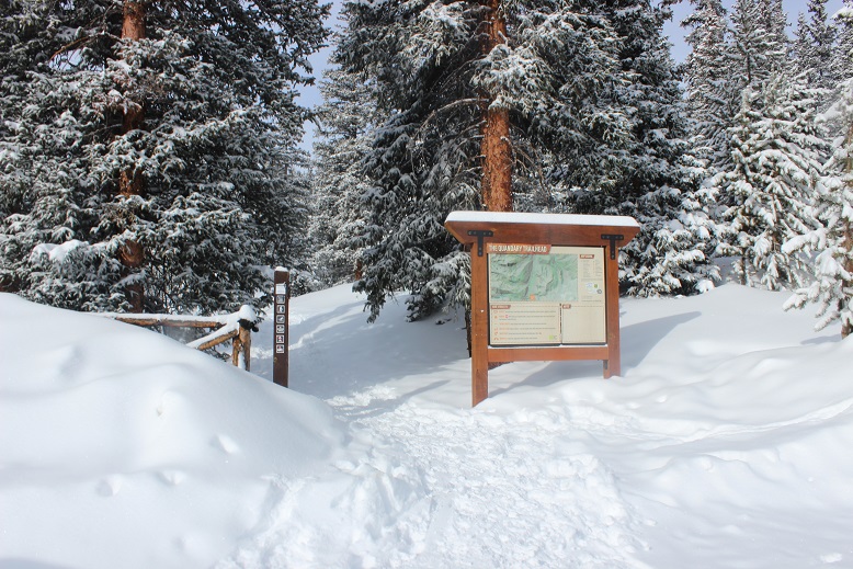
The path was easy to follow up the dirt road to the start of the trail. It was just beginning to get light out, so I didn’t need my flashlight (woohoo!).
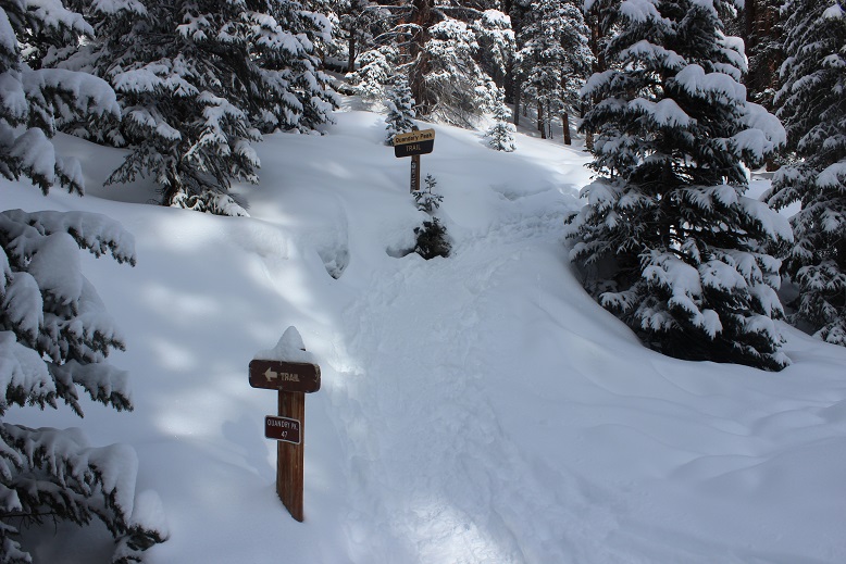
I’d read from a conditions report yesterday there was no trail, but quickly found the upside to others being here before me: They were trenching the trail! It feels like it’s been forever since I’ve had someone else trench a trail for me. In fact, it was only one other time and I can name the date: Evans, my 2nd 14er, June 2017, and it wasn’t the trail they trenched but the last bit to the summit.
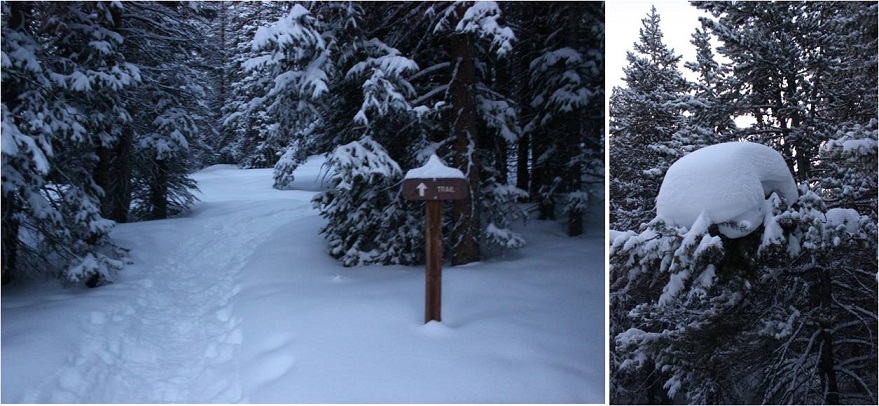
The trail today was quiet and peaceful and I enjoyed just walking through the snow.
Well, all except for my snowshoes. Today I’d decided to see if my microspikes had any effect on the bindings of my snowshoes, and apparently they didn’t: They come undone whether or not I’m wearing microspikes. Sigh. Oh well. It’s not too big of an inconvenience, but they should really replace these things with ratchet bindings so they don’t come undone. Or add another way to secure the straps.
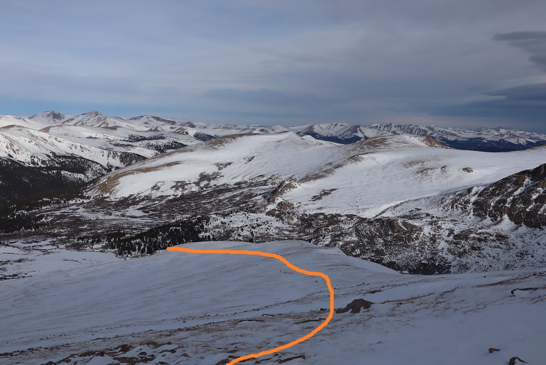
I was appreciative of the group before me, trenching lazy ‘S’ curves up the mountainside.
But just after I took this picture I caught up to the group and decided to take over trenching: They’d done such a good job and must have been tired. They deserved a break and I wanted the exercise. The difference between their trench and mine was theirs gradually gained the slope: I just trudged straight up the ridge.
I continued hiking until about 13,100’, crossed a flat ridge and saw the rest of the route before me
It was here with 1000’ left of elevation gain I decided to try out the heel lifts on my new snowshoes. I take back everything negative I’ve ever said about these snowshoes… well, everything except the need for ratchet bindings. Those heel lifts are amazing!!! Where have they been all my life? They made an insane difference, and I was flying up the mountain.
About halfway up I turned and looked around. I knew there were at least 5 people behind me, but they were nowhere in sight. They must still be below the ridge.
OK, this was all I had left. Time to book it to the summit
OK, maybe a little more
Wait, what?!?! What’s this? There was a large grouping of snow where the summit should have been. I was going to need to cross this in order to officially claim I’d summited. I took one step and sank up to my knees. Hmmm. This snow was not stable and I wasn’t sure what was beneath (I found out later it was just a flat summit and I most likely could have walked straight across). I decided to play it safe and stick to the right. It was slow going, slippery, and unstable. Here’s looking back from the true summit.
I set up my camera to take a photo and got one shot before my camera died (well, stopped working until it warmed up again). So here’s my one summit photo… Good thing this isn’t my first summit of Quandary.
It was snowing on all the mountains all around me, and while the snow was headed towards Quandary it didn’t look like it would make it here. It seemed like I’d chosen the correct peak to summit today! And: Quandary with no wind? That’s unheard of! I started my trek back down. I made it halfway down the ridge before seeing anyone else.
I’d wanted to hike Hoosier Ridge today, but the weather was forecasted as better on Quandary, and indeed the forecast had been correct as it was now snowing on Hoosier Ridge. I took a good look at it for tomorrow and marked in my mind the features I could see.
I stopped along the flat section to get a few pictures
And noticed some goats!
I was only able to see them due to the trails they were making in the snow, otherwise I’d never have known they were there.
OK, time to get serious about heading down. Check out that trench!
As I descended I kept seeing more and more people working their way up: snowshoers, skiers, and some hikers just wearing microspikes. I wasn’t sure there was enough snow to ski, but there sure were a lot of skiers out today. I don’t really understand 14er skiing. It’s not that I don’t like to ski, it just seems like a lot of work for a “you get one” kind of experience. Also, I don’t want to become addicted to another sport, especially something that involves snow, so I’ll leave the 14er skiing to others for now. There was plenty of skiable snow just at and below treeline, but it seemed these skiers intended on summiting as well. I saw at least two dozen people, if not more, and was glad I’d gotten an ‘early’ start. Boy was that trench looking good now!
I saw a group of three men on my way down working their way up. They’d found my bandana and the microspike I wasn’t aware I’d lost. Thanks guys!
I made it down at 10:30am, making this a 7 mile hike in 4 hours. The parking lot was packed.
This really is a straightforward hike: make it to treeline and follow the ridge. With clear skies (at least over Quandary) and no wind it was a perfect hike for today. I’d like to summit four 14ers during winter this year. 1 down, 3 to go!