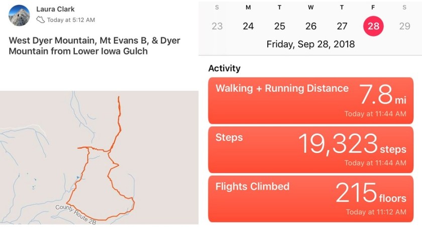
RT Length: 7.5 miles
Elevation Gain: 3350’
I woke up at 2am and made it to the Lower Iowa Gulch Trailhead at 5:15am, which was much earlier than I’d anticipated. The drive in is easy on a 2WD dirt road.
There is no official trailhead, so I parked near a tree, gathered my gear, and headed northwest through the base of the amphitheater towards the West Dyer/Dyer saddle.
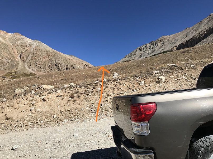
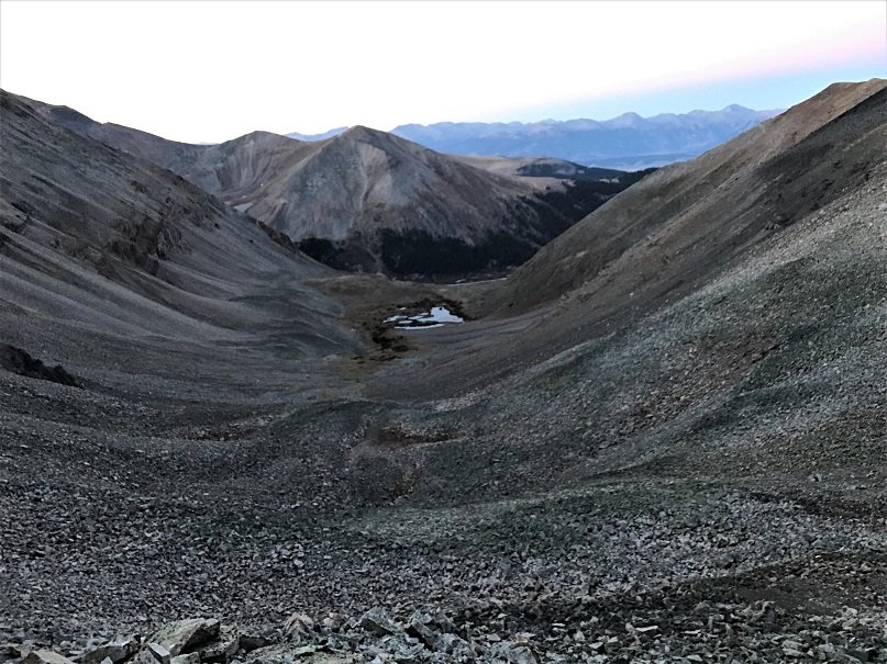
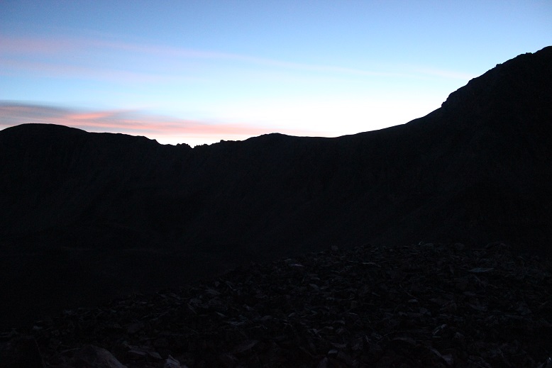
It was only 1.3 miles to the base of the West Dyer/Dyer saddle. There isn’t a trail, but the route is fairly obvious, even in the dark. Just keep heading for the saddle. Here’s a look back on the basin from the saddle
From the saddle I chose to summit West Dyer Mountain first, an unranked 13er. I chose my route to reflect my time constraints and sunrise/daylight limitations. For me it’s a delicate balance between hiking in the dark/daylight (pictures turn out better in the light) and being back at the TH by noon.
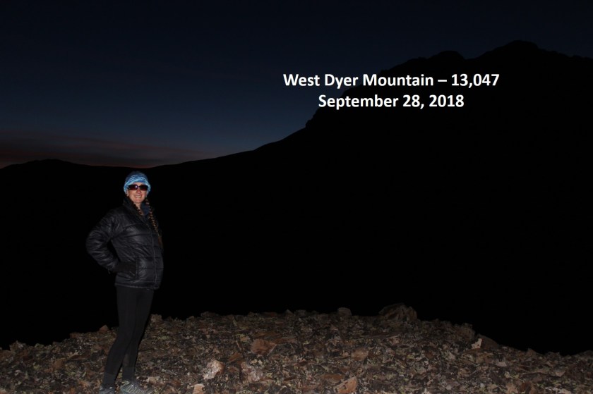
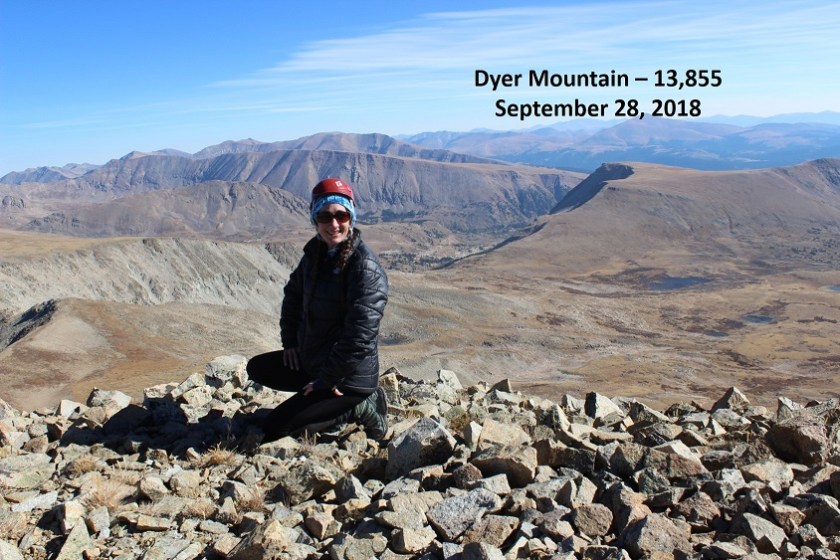
It takes so long for the sun to rise in the fall! I wanted to summit and get pictures, but I also needed to be back at my truck by noon so I could drive home in time to pick up my daughter from school and start our day. So while I was hiking slowly because I wanted to get pictures from the summit in the daylight, I also wanted to get in as much hiking as possible today. In any event, after the saddle I turned west and hiked .2 miles to the summit of West Dyer Mountain, slowly, willing the sun to rise. I summited at 6:20am, while it was still dark. I took some pictures of the summit and waited for the sun to rise. But it just wasn’t happening.

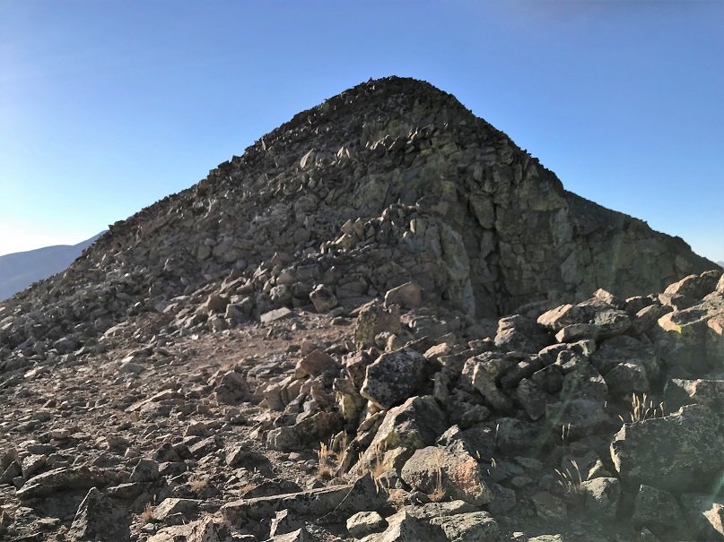
West Dyer:
So I turned back towards the West Dyer/Dyer saddle and put on my helmet.

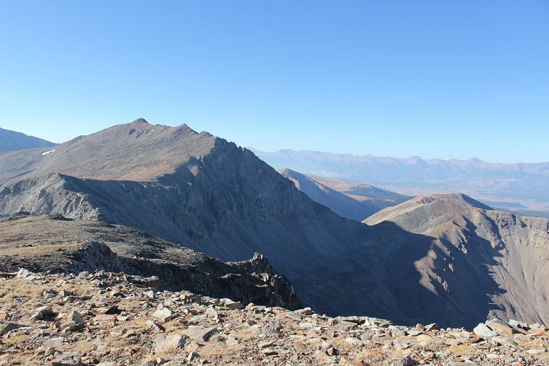
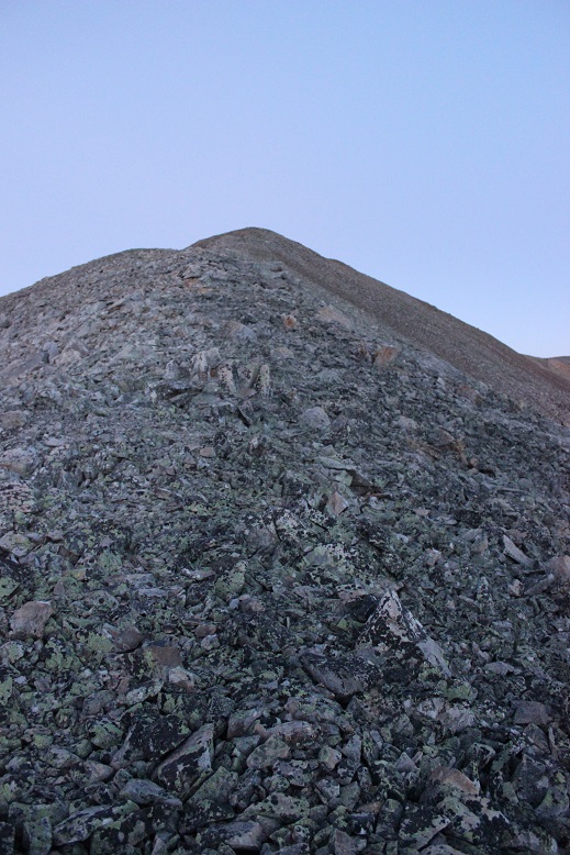
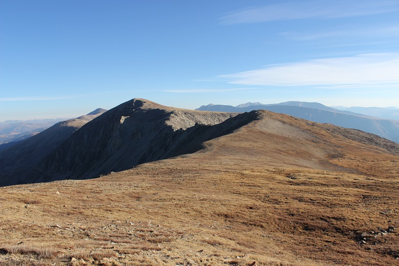
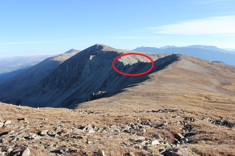
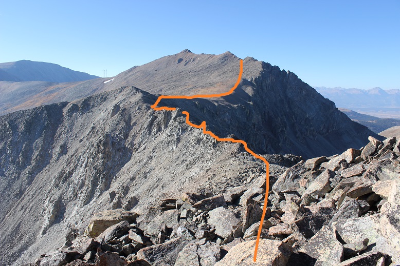
It was still dark and hard to make out the path I was supposed to take up Dyer’s West Ridge. I was hoping it would be more obvious as I got closer to the route. Here’s a look back on West Dyer from the saddle
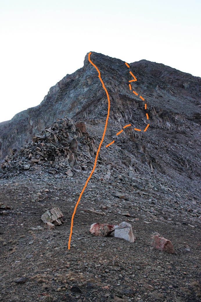
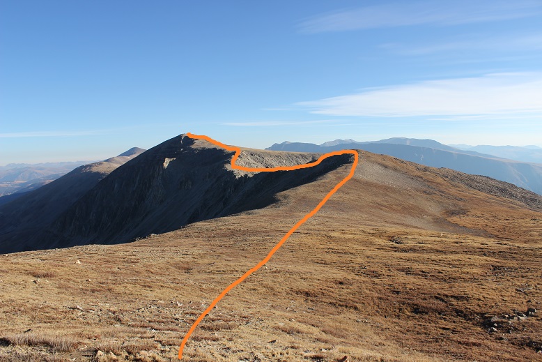
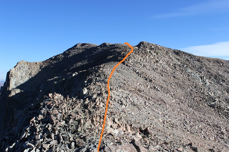
The route up Dyers West Ridge is a class 4 route. I knew I was supposed to look for the chimney to the right, climb it, and then stick to the right of the ridge to the summit. That didn’t happen. In the dark I never found the chimney, but I also didn’t look too hard. I was expecting a class 4 route, and I discovered if I stuck to the ridge, and once or twice went to the left when necessary (just a little to the left, not much) I was able to follow the ridge all the way to the false summit. Here’s the route I took (solid orange) and the suggested route (dotted line)
It was class 4 the entire way, but doable, spicy, and FUN!
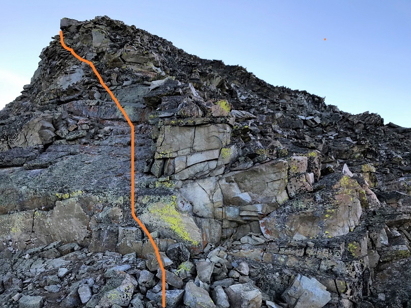

In fact, I kept expecting to cliff out somewhere, and to need to retrace my steps and head more to the right, but that never happened.
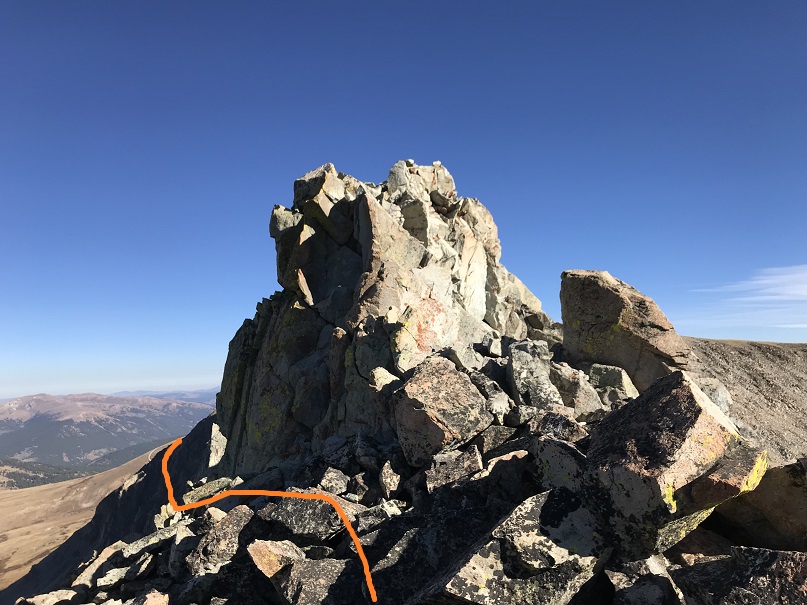
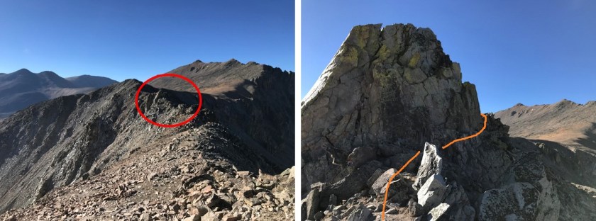
It was serious exposure and solid class 4 climbing for the entire ridge. I met up with the regular class 4 route here, just before the false summit. This area has much more exposure than it looks, and is both the most difficult climbing and also the end of the difficult climbing. This picture (below) doesn’t do the exposure justice: The dirt pyramid on the bottom is a 15 foot drop from where I was standing, and actually where two gullies meet, each dropping down on either side to an unclimbable area. I wish I had better pictures of the exposure, but honestly this was all class 4 and I needed my phone in my pocket and my hands gripping the rocks at all times.
After navigating this area (to the left) I was quickly deposited at a false summit, with a great view of Mount Evans B
And Dyer’s false summit
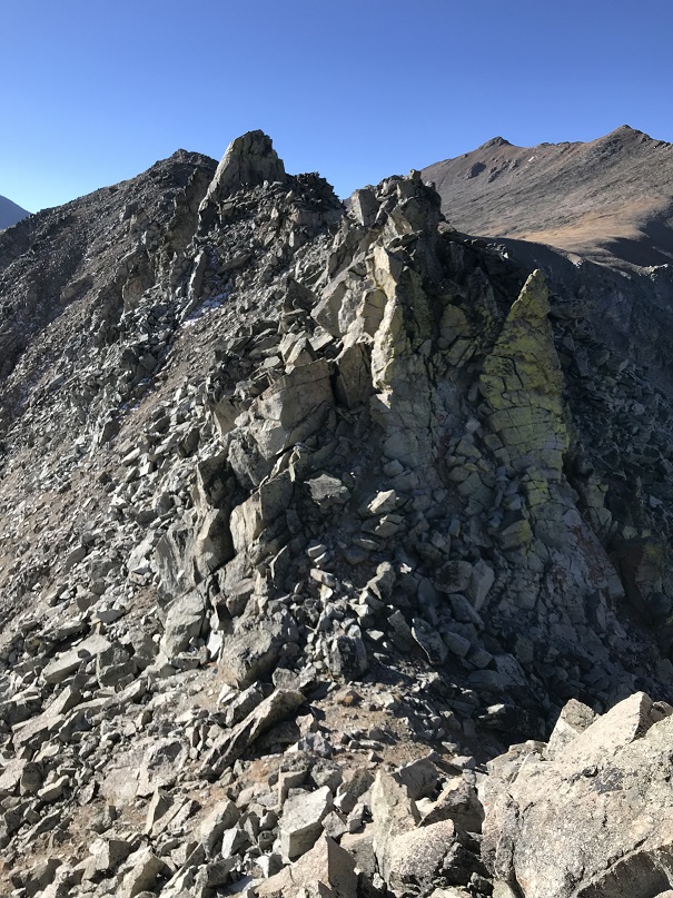
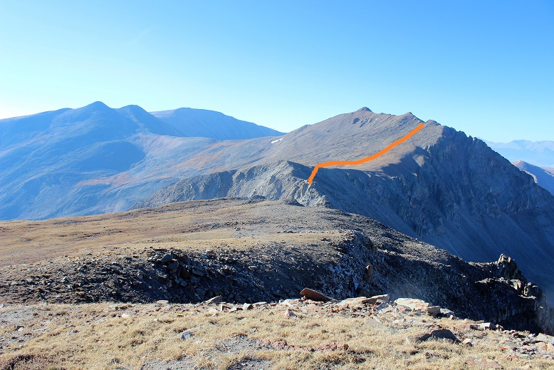
Dyer Mountain was the closer 13er, but I didn’t want to summit it twice today. I’d intended on making this hike a loop, and Mount Evans B was my next goal. Unfortunately, there isn’t much beta on the ridge between Mount Evans B and Dyer Mountain. From where I was it looked doable, and I know it’s been done in the past, so I kept on my helmet and headed towards the ridge.
Here’s the route I took
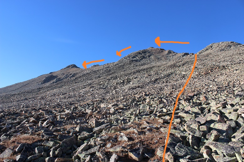
I followed the ridge crest most of the way, only once or twice navigating to the left or right around some large boulders. This is a class 3 move where I hugged the wall as I traversed a crack in the rock. (There’s another picture later in the report that shows the other side of this wall and my route)
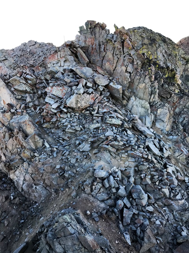
As you can imagine, climbing after point 13,383 is the crux of the route, but it stays at a class 3
After the most difficult climbing is over it’s a class 2 hike up the ledge
To a long grassy slope to the summit
I summited at 8:55am

VIDEO: Mount Evans B:
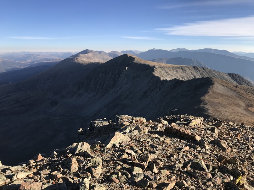
It was an absolutely beautiful day! Besides the wind it was perfect. Here’s a look back on the way I’d come, and the way I’d now need to retrace my steps to summit Dyer.


Here’s a look back on the Dyer/Mount Evans B Ridge
And the route I took
Here’s the class 3 part and the way I navigated around it
I decided not to re-summit point 13,383 but instead cut it to the right.
And headed up to the Dyer Mountain ridge and followed the ridge to the summit
As I ascended the ridge the rocks became loose and mixed with unstable gravel, but it was navigable.
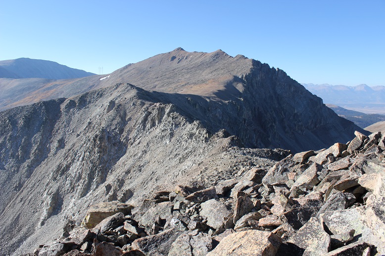
Here’s a look at Dyer Mountain from the ridge

I summited at 10am
Dyer Mountain:
My next goal was Gemini, and then a trek over to Mt Sherman, and finally make it a loop back down to Iowa Gulch.
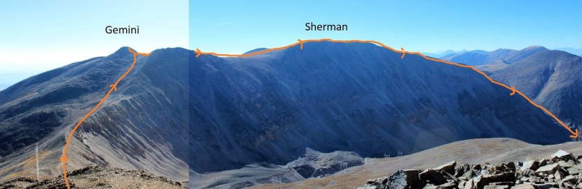
I made it about halfway down towards the Gemini/Dyer saddle, almost to the radio towers, when I pulled out my phone to take a picture and looked at the time. 10:10am! Whoops! I needed to turn back! Looking at my intended route there was no way I could hike the mile up to Gemini, .7 miles across to Sherman, and 2.5 miles back down to the trailhead before noon. Hmph! I was a bit mad at my circumstances, mainly because it was an absolutely beautiful day and I wasn’t even beginning to get tired. But I reminded myself in another few months my youngest would have her license and I’d rarely see her again (I know, it happened with my older two), so I’d better get a hustle on and enjoy the time I still have with her now. Besides, I’ve already summited Sherman, and combining it with Gemini would make for a good winter climb. I’d be back.
I was in a weird spot on the mountain when this realization occurred. I’m not entirely sure why, but instead of just heading towards the basin I cut across the mountain to the south, trying to link up with the south slope route off of Dyer Mountain. I hadn’t realized there wasn’t any established trail off the mountain, but did as soon as I linked back up with the route. Traversing back was time consuming through very large, loose rocks. Several microwave sized rocks slid below me, doing their best to take me with them.
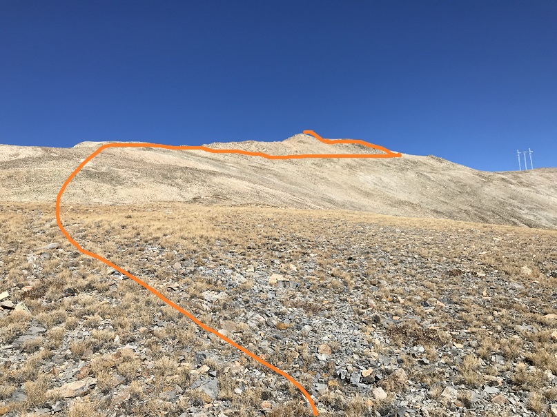
As soon as I reconnected with the correct ridge I just aimed towards the road in the basin and the towers. It’s important to link up with the road in the correct place because otherwise you’ll end up needing to cross a drainage area

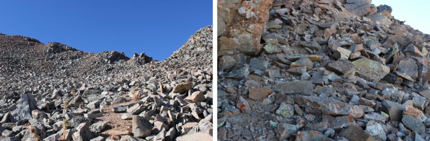
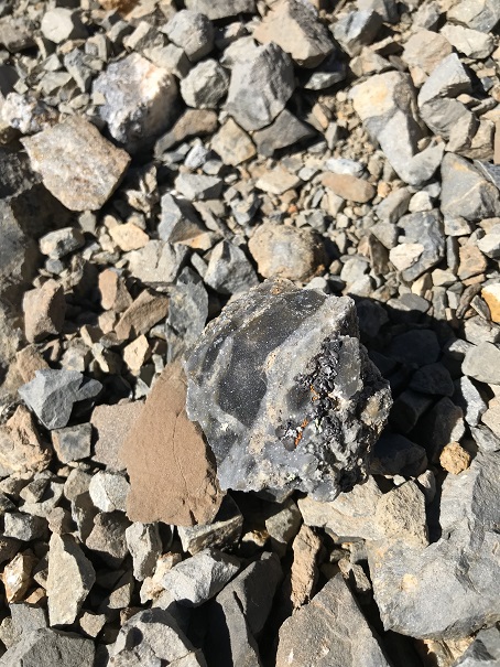
I saw some pretty amazing rocks on the way down
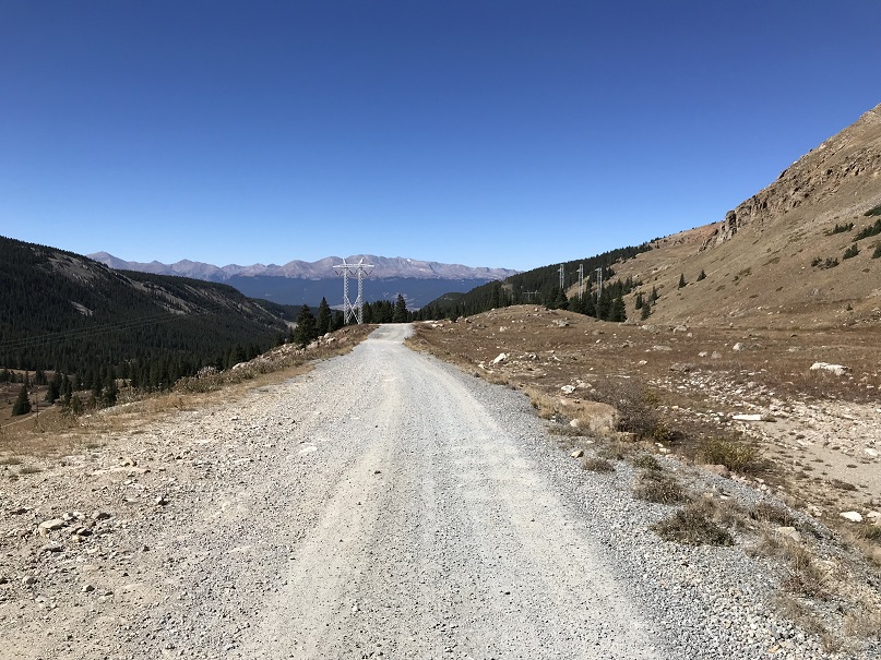
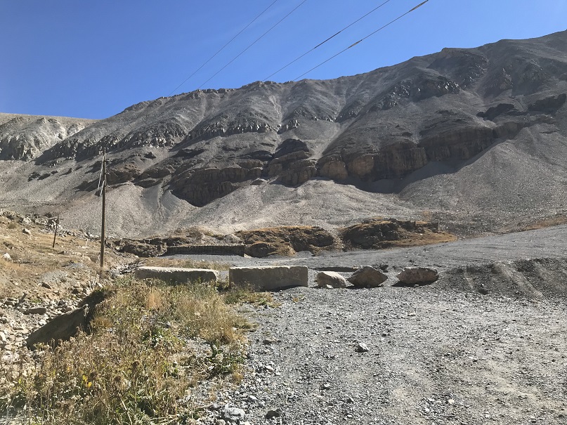
Once I met up with the road I followed it back to my truck. Here’s a look at the upper Iowa Gulch Trailhead
And where I parked my truck at the lower Iowa Gulch Trailhead
I made it back to my truck at 11:40am, making this a 7.5 mile hike/climb with 3350’ in elevation gain in 6.5 hours.
Relive it here: Dyer Mountain
I made it home in time to pick up my daughter from school, take her to ice skating lessons, make dinner, and then headed over watch one of my Girl Scouts cheer at her High School Homecoming Football game, making this a very long day, but totally worth it!
