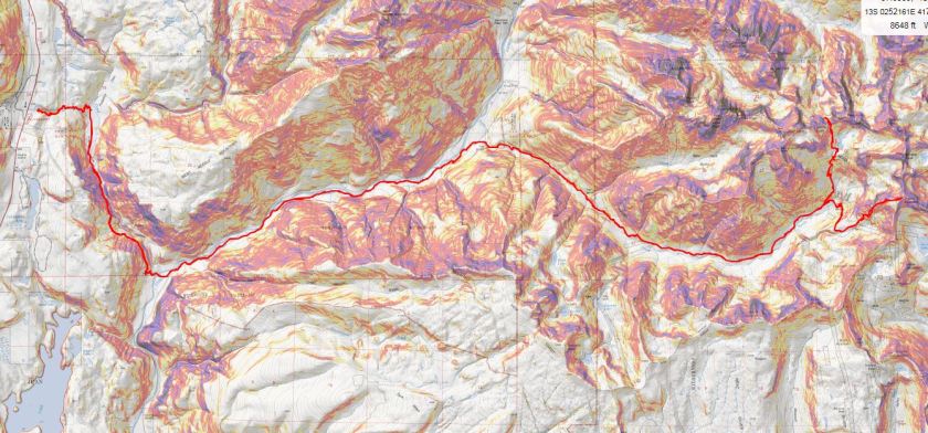
RT Length: 41.5 miles
Elevation Gain: 11,098’
I did a ton of research before setting out for this hike. It was my goal to link up the Chicago Basin with the Noname Creek Approach via Twin Thumbs Pass. All of my research said it was “doable”, but I hadn’t found a trip report indicating it had ever been done, so I went in kind of expecting to fail. I was trying to eliminate hiking into the Chicago Basin to summit Jupiter and then hiking back out and attempting Jagged Mountain via the Noname Creek Approach. If I could link up the hike via Twin Thumbs Pass I’d be saving about 20 miles and several thousand feet of elevation gain. And it almost worked…
Sleep is for armatures, so I left my house at 8pm after hosting a Girl Scout awards ceremony, arriving at the Purgatory Trailhead at 2:15am. I was on the trail by 2:30am. The first 10 steps hurt. A lot. My pack was wayyyyy too heavy. I’d gone through it multiple times eliminating what wasn’t absolutely necessary and it was still painfully heavy. I’m not sure how much it actually weighed (I was too scared to weigh it) but I’m guessing it was around 45-50lbs. That’s excessive, especially for someone who only weighs 105lbs. But I just couldn’t lose any more weight: I’d already thrown out unnecessary items like a camp stove (it was all peanut butter and beef jerky for me this weekend) a pillow (not needed), a change of clothes, bug repellant, etc. and had switched my “good” backpacking sleeping bag for a lighter weight one. What was weighing me down was all the gear: rope, harness, carabiners, webbing, etc. All that stuff was necessary if I wanted to attempt Jagged this weekend, which I did.

So those first 10 steps hurt and I should have known then to stop and reassess this adventure, but I told myself it would eventually get easier if I just kept moving so I just kept moving. Yep, I kept moving but it didn’t get easier. I gingerly hiked my way down the Purgatory trail towards Cascade Creek, losing elevation the entire way and thinking to myself “hiking down shouldn’t be this difficult”.
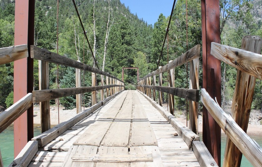
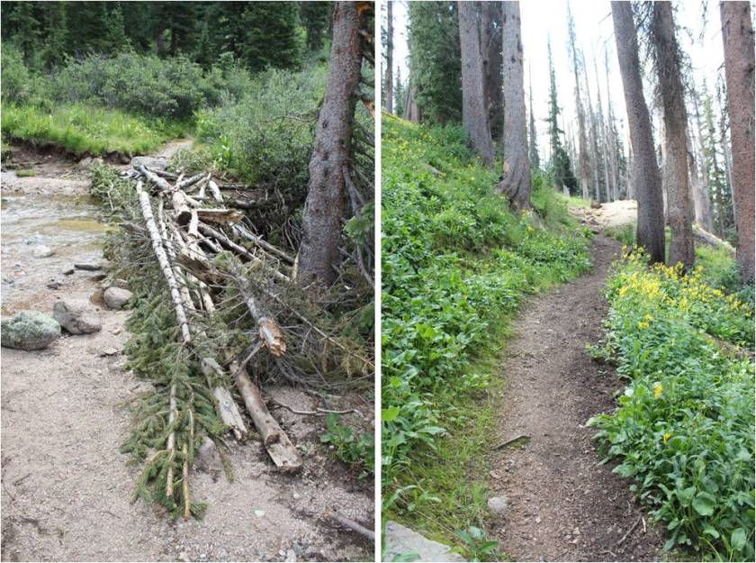
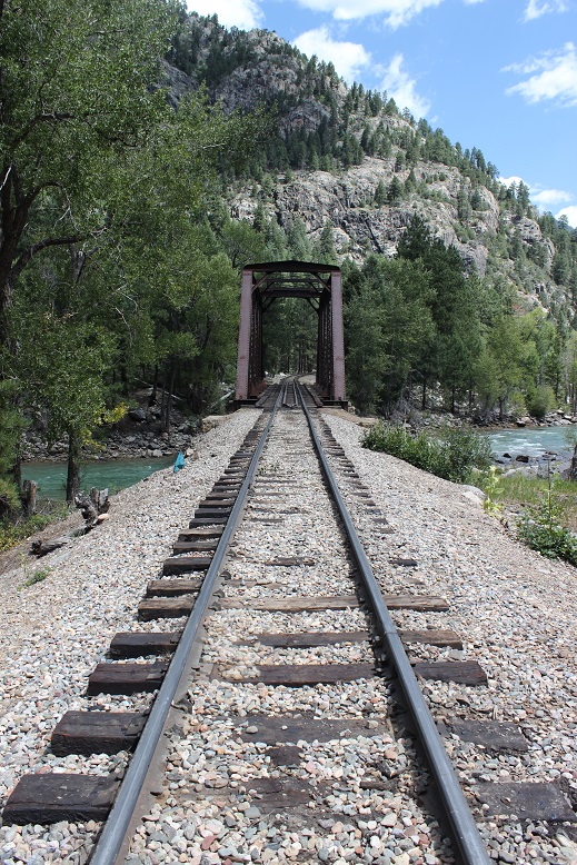
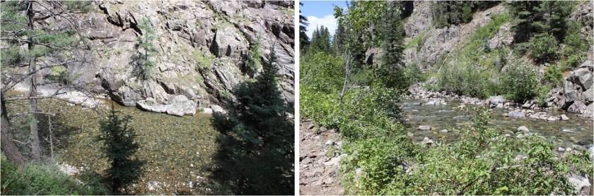
The trail follows Cascade Creek southeast towards the Animas River. There’s a bridge here to cross
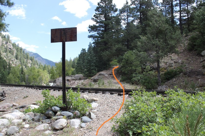
and a good trail to follow to the Railroad tracks. I crossed the tracks and continued on the Animas River Trail.
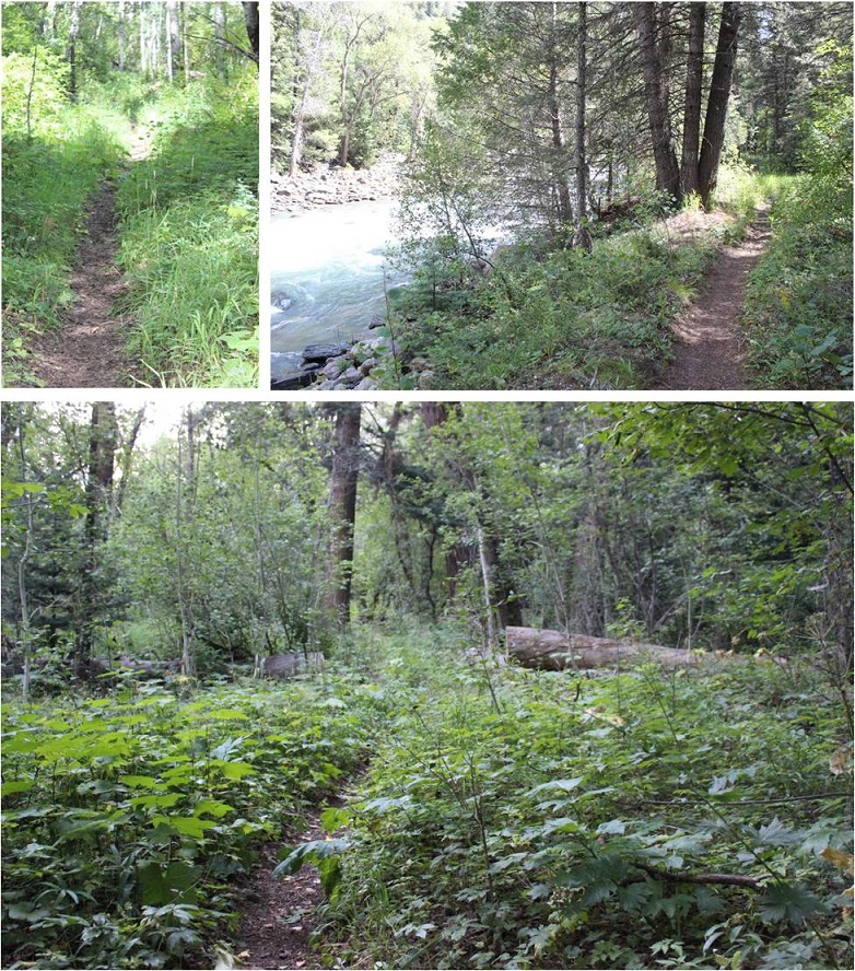
The trail is easy to follow, but was overgrown in areas. It follows the Animas River, which I could hear but not see in the dark.
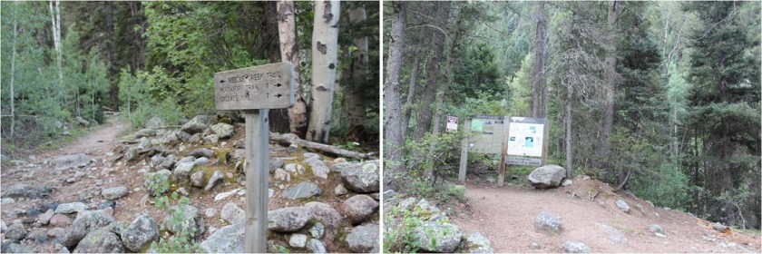
While the trail follows the river it still has numerous small ups and downs in elevation, which I thought were completely unnecessary: I’d rather stay at a steady elevation. The sun started to rise and I made it to the Needleton/Purgatory/Cascade Junction and followed the Needleton Creek Trail to Chicago Basin. Side note: It is not 7 miles to the Purgatory Trailhead. From this point my tracker says it’s 10 miles. A little ways up there’s a trail register and information area. I didn’t sign the trail register because I hadn’t intended on exiting this way.
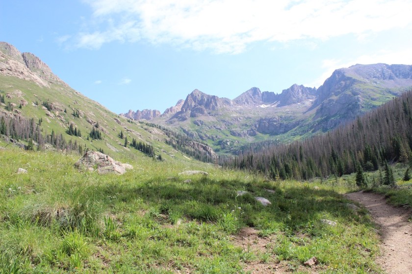
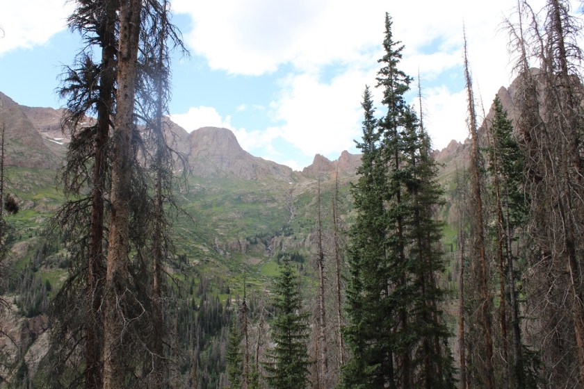
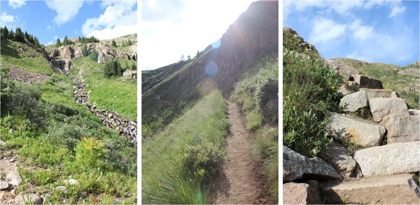
From this area it’s another 6 miles to the Chicago Basin. This part of the trail follows Needle Creek as it climbs towards the basin. I loved hearing the water rushing past and seeing the waterfalls along the way.

It seemed like it took forever to make it to the basin. I realized I was almost there when I saw the avalanche debris. There really wasn’t very much damage, and luckily there were already clearly established trails as a workaround.

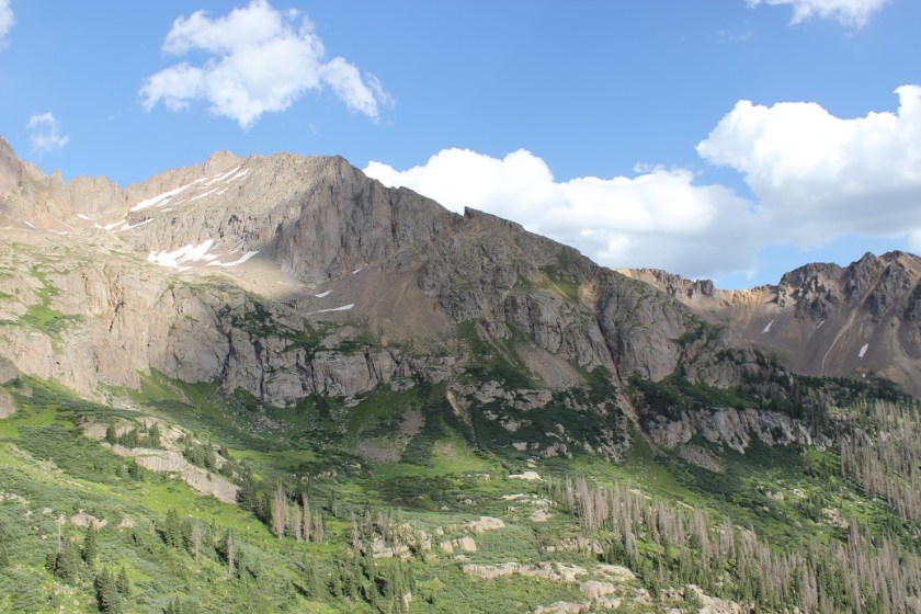
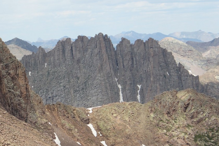
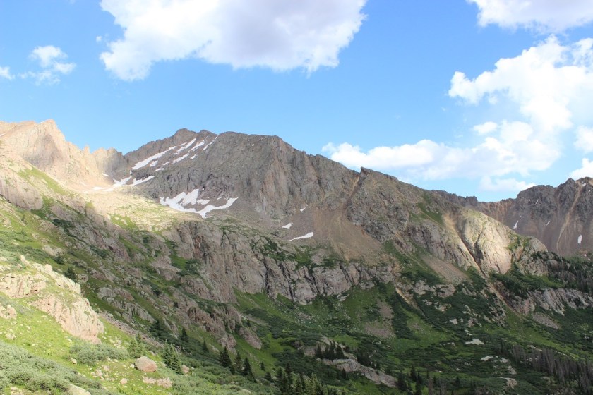
The hike into Chicago Basin is indeed beautiful!
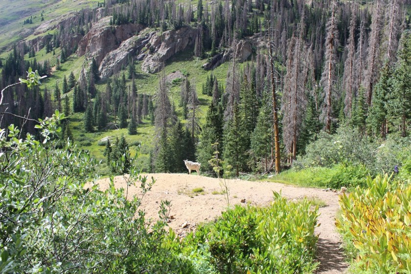
I didn’t see much evidence of mountain goats. I was here last year and they were everywhere. This year I saw a couple, but nowhere near as many as before.
Normally I like to do the hardest peak first, but today the easier peak was my first goal for several reasons: I wanted to get a look at the backside of Jagged to see how much snow there was on route and I wanted to see if there was still snow on Twin Thumbs Pass. I knew I didn’t need all my gear to summit Jupiter so I stashed my pack and just brought the essentials: water, my camera, and some snacks. Oh yeah, snacks. I should probably eat something? I had about 12 almonds and kept them down so I considered it a win.
If you go left at this junction it takes you up to Twin Lakes. If you continue straight it will take you on a well established path towards Jupiter.
The trail crosses Needle Creek and heads west up the hillside
About halfway up the hillside there’s an old mine. I’d already explored this mine the last time I was here so I didn’t feel the need to go inside, but I did see a pack outside, and called in to say hello to whoever was exploring.
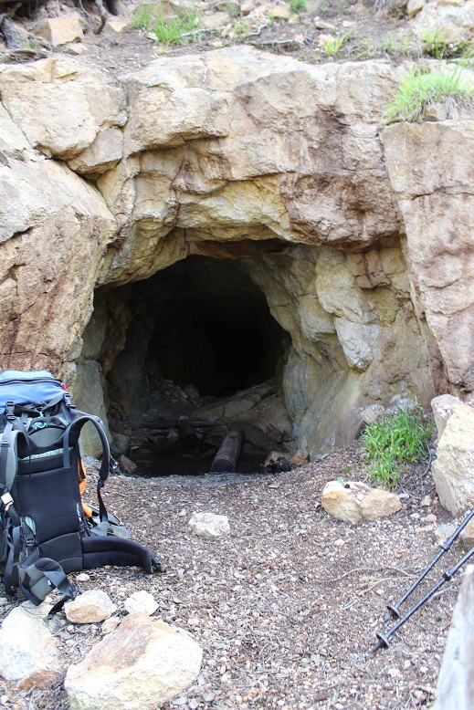
I met a man who was really excited about the mine. His hands were white from the walls, and it looked like he’d been having a time. We chatted for a bit: He’s already hiked the Colorado Trail and was now looking for a way back to Durango. He asked me if I knew if the trail “went” and since I’d already done a lot of research on the Johnson Creek/Vallecito trails when planning this trip I knew if he made it to the saddle he could take Columbine pass over. I envied this man his freedom to just explore and not worry about time and wished him luck. I wish I had more time to adventure!
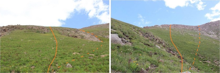
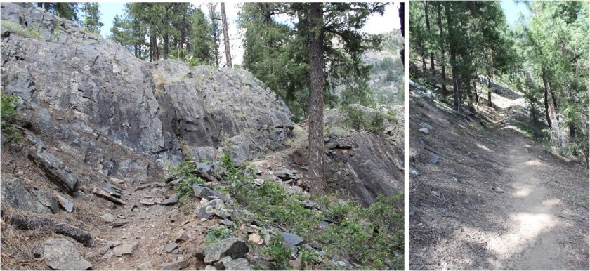
I continued on the trail to treeline, crossed a creek, and here the trail (mostly) stopped. I felt so much better hiking with just the essentials: I felt like I could skip up this mountain!
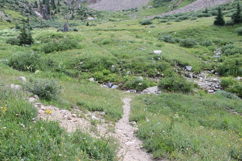
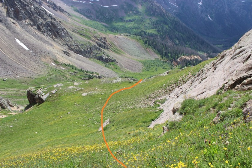
There were a few cairns and what looked like overgrown social trails but no established trail after the small creek crossing. Here’s the route I took up the side of Jupiter.
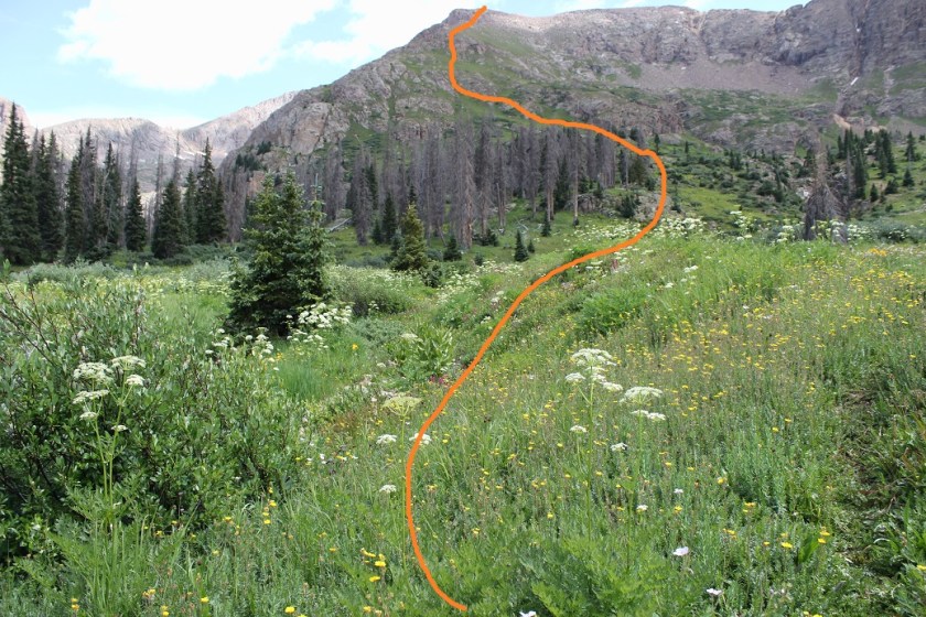
It’s much steeper than it looks, but the wildflowers made up for the difficulty.
About halfway up the hillside I started getting worried about the weather. There was a 30% chance of rain today between 2-4pm, and the clouds forming didn’t look good. Luckily the wind was blowing them away from me, but I kept an eye on them just in case. I really, really didn’t want to turn back at this point (but I would have if necessary). I kept looking for the man I’d met, watching for his ascent of Columbine pass, but I never saw him again (even from a distance).
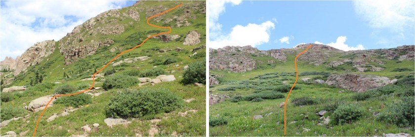
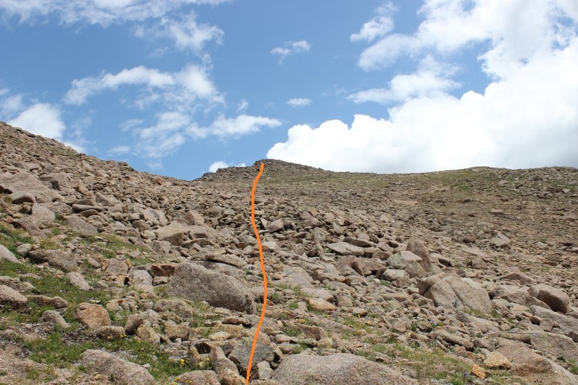
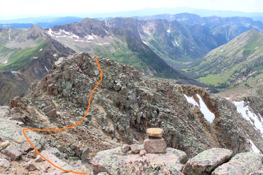
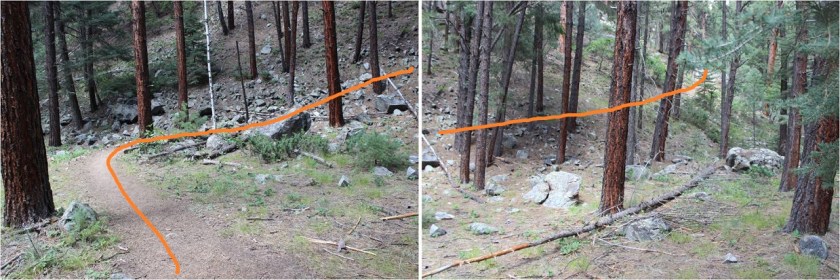
I continued on and came across cairns. There seemed to be several ways around this part. I took the solid line up, the dotted line back down.
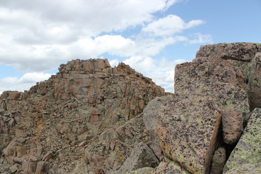
I continued up the side of the mountain, aiming for the cairn I could see at the top of that pile of rocks, sure that was the summit (spoiler alert: it wasn’t)
Imagine my surprise when I made it to the top of that pile of rocks, only to see… this
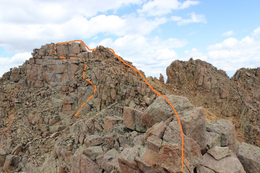
Wait? I thought this was a class 2 hike? That looked like class 3 scrambling to me. I was a little put off I’d left my helmet back with my gear in the basin and a little upset with discovering this had been a false summit, but decided to just go ahead and finish. I took the solid route up, the dotted line down. I felt the dotted line route was indeed class 2+, but the solid route was class 3. There were several ways to summit here, and so many cairns they lost their intended purpose.
I summited Jupiter Mountain at 2pm.

Summit Video:
I’d been hiking for almost 12 hours at this point, but without my full gear for the past 2 hours I was feeling pretty good. I decided to take a look around. Jagged from this side was mostly snow free!
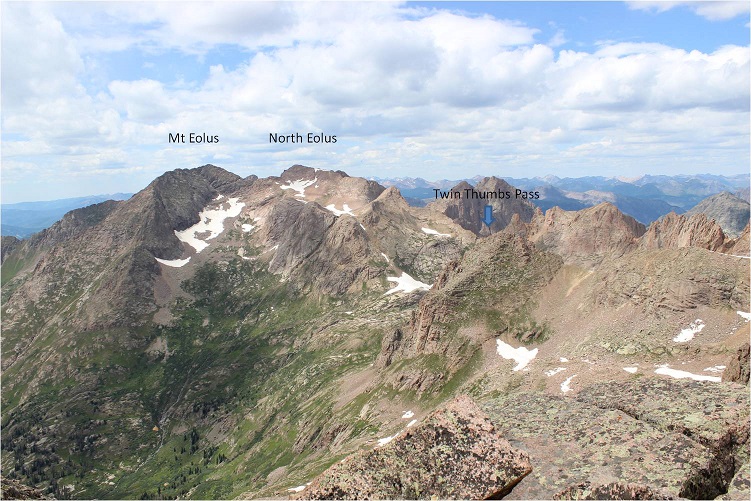
Twin Thumbs pass was obscured by Point 13,472, but it looked mostly clear of snow as well. This was all good news. Now I only had to worry about the north facing sides of the mountains (which hold snow longer).
Time to head back. Here’s the route I took off Jupiter (this also shows Columbine pass in the background)
And back down to treeline
Back at treeline I had a better view of Twin Thumbs pass. It appeared clear. Now it was time to retrieve my gear and head up to Twin Lakes.
I saw my first mountain goat of the day here
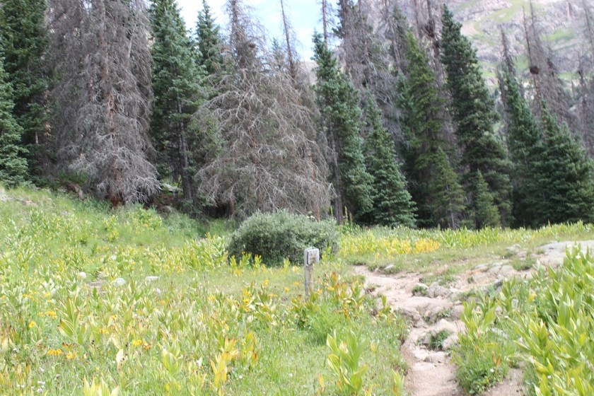
I re-crossed Needle Creek and stopped to filter some water. It was a warm day and I was forcing myself to drink. It was making me nauseous, but at least I wasn’t light headed. The cool water felt really good, and I started just drinking it from the filter to save time. After my water bladder was full I went to find my pack. Argh! I wasn’t able to find it! This was not good. I was sure I’d left it by the sign? After about 5 minutes of searching I realized there were two similar signs and I was at the wrong one. I made my way about 10 yards further and was relieved to find my pack where I’d left it, and as an added bonus, no goat/marmot damage to be seen. The downside? There were so many mosquitoes here! I’d wanted to rest for a bit, but the mosquitoes wouldn’t quit, so I decided to just get going.
My pack was on the ground so I sat down to put it on and groaned as I leaned to the side to stand up. That pack was heavy!!! Time to trudge up to Twin Lakes. Luckily this is a very well marked trail.
About halfway up I saw my second set of goats for the day. They were directly on the trail and looked me straight in the eye as I got close. I was wondering how we would pass each other politely when one of them just veered off the path a little to the left, went around me, and then hooked back up with the trail. They must be used to this…

From this angle Jupiter looks imposing
As I continued on I saw a sign that said “No camping beyond this point: Including Twin Lakes Basin”. Well shoot. There went my “Plan B” of sleeping at Twin Lakes if I couldn’t make it over the pass. Oh well, it looked like the path was clear, so it shouldn’t matter anyway.
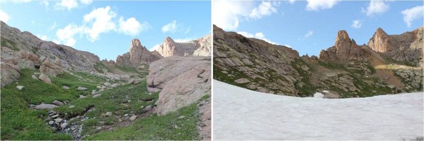
I made it to the Twin Lakes area and had a great view of my intended route. There looked to be a little snow, but nothing I couldn’t handle

Also, there’s hidden snow here, more than anticipated
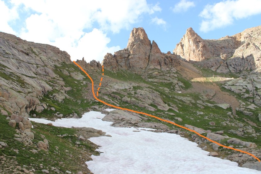
No worries though: I just put on my crampons, tested the snow for stability, and easily traversed over to the final gully before Twin Thumbs pass. I took the solid route up, and the dotted route down (the dotted route is the better route).
There were no cairns or paths or footprints here, or anything indicating anyone had used this route in the past. I was huffing and puffing by this point but really wanted to just get over the pass. When I made it to the top this is what I saw

Ok, this looks good! I could see where I wanted to be and the path I wanted to take to get there.

Right now I was pumped! I probably had 2 hours left of daylight and a clear visual of where I wanted to be. And it was all downhill. I began my descent through a class 4 chimney (not as easy as it sounds with a full pack on my back. Also, this move wouldn’t have been necessary had I taken the dotted line route.) I was immediately taken aback by how steep the scree here was.
It quickly became apparent the route up to Ruby Basin (should I need to use it) was much steeper than it looked on a topo map.
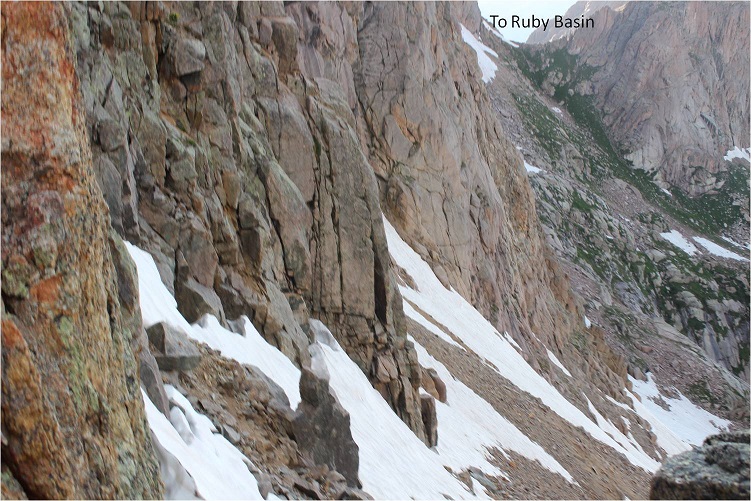
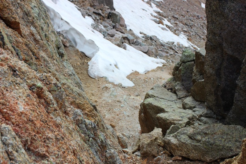
This is where my trouble began. I made it to the first patch of snow and thought it would be similar to the snow I’d encountered in the Twin Lakes area. I stepped on it and promptly sank up to my waist. My feet however were still dangling in the air beneath the snow. This was not good. It wasn’t lost on me I’d narrowly avoided breaking a leg. My large pack is what had caught me and kept me from sinking further. It took some time but I was able to get myself out of the hole I’d fallen into.
A bit shaky now I stood where I was and considered my options. I probed the snow a bit with my trekking pole and realized there was a layer of snow a couple of inches thick over the rocky ground. This layer broke easily (obviously) and I did not feel comfortable traversing on it, even with crampons. I looked for a clear line of scree/rocks to traverse to get me where I wanted to go and just couldn’t make out a snow free path.
I could continue to descend and look for a snow free path, but I gave finding one a low probability since the areas I couldn’t see were the steeper parts of the route. It looked like no matter what I was going to have to cross snow. The sun had already gone down behind the mountains and I figured I had about an hour of daylight left. There was nowhere to camp on this side of the mountain.

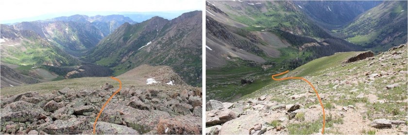
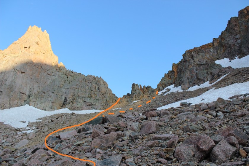
I had two options: either continue on and hope to find an area without snow I could cross or to turn around and head back. The choice was obvious. I wept a few silent tears, turned around, and started my ascent back up and over Twin Thumbs Pass: making it to Noname creek was optional, making it back to my truck was mandatory. Here’s the path I took back up to the pass. The dotted line is the path I took down. I’d recommend the solid line.
Ok, so I turned to head back to the pass but my shoes immediately slipped as if I were wearing ice skates. This wasn’t good. The scree here was terrible for an ascent. I hadn’t brought along my microspikes (to save weight) but I did have my crampons, so I took those out, strapped them on, and wouldn’t you know it? Better than microspikes! Sure, I was ruining the crampons, but at this point the benefits outweighed the risks.
I knew I was racing against the clock: the sun was rapidly setting and I needed all the daylight I could get. I found an unexpected boost of adrenaline and booked it up to the pass. I was shocked at how quickly I moved, and actually entertained the idea of hiking all the way back to Needleton tonight and attempting Jagged in the morning.
I made it up and over the pass and kept my crampons on until I made it past the snow near Twin Lakes. Here I stopped to take off my crampons and at this point the adrenaline stopped and exhaustion took over. I took off my crampons but was too tired to take off my pack and put them away so I carried them in my left hand. This worked well until it got too dark to see and I needed to carry a flashlight (I’m not a fan of headlamps).
I was stumbling in the dark. Stumbling because at this point I was exhausted and also because I’d completely ruined my hiking boots: they had holes in them the size of quarters and the tread was completely gone. That pass had been more brutal than I’d anticipated. Every few steps I’d slide due to lack of traction and catch myself. One time I didn’t catch myself quick enough and I landed on my shoulder in a bunch of willows. Ouch. That was it; I needed to stop and set up camp. Now. Gone were my fantasies of setting up camp at Needleton, or even in Chicago Basin for that matter.
But I’m a rule follower and I’d seen the sign. I wasn’t allowed to camp here, and I knew it. So I kept on. It seemed like I’d hiked for miles before I finally made it to the “no camping past here” sign, and when I did I dropped all my gear and haphazardly set up my tent directly in front of it. I did a terrible job: I couldn’t see in the dark and honestly I was too tired to care what I was doing. It took me twice as long as it should have to set up and I did so directly beside the trail. Dumb move, and I knew it, but I didn’t care. I needed to rest. Oh, and eat. So far all I’d had were a few almonds and I knew I needed more calories. I opened my bear sack and had tons of options: beef jerky, tuna, almonds, peanut butter. I chose dried mangoes. Not the most caloric but it was what my body was craving. I only wished I’d brought more.
I fell asleep around 10:30pm and woke up every half hour after midnight. You see, I was camped directly next to the trail, so every set of early morning hikers intent on Eolus, Windom, and Sunlight passed right by me. As they did so they all directed their flashlights at my tent. What they most likely didn’t realize is that when you shine a light on a tent it doesn’t allow you to see inside of it, but it does brightly illuminate the inside of the tent. So every 30 minutes or so it was like someone turned on a light inside my tent. My fault for so many reasons I know, but I was too tired to care. And cold. It had been a bad idea to swap my good sleeping bag for a lighter weight one.
In the middle of the night I could hear a goat beside my tent. It was occupying itself with the bandana I’d left outside. I could actually hear him a foot or so from my head, and mentally visualized him picking up the bandana with his teeth and swishing it from side to side.
I left my tent at daylight. My bandana was now separated from my trekking pole but lying inches from where I’d been in my tent. Apparently the goat didn’t want the souvenir. I wasn’t hungry but forced myself to eat a packet of tuna and quickly packed up my gear. Taking down the tent was the worst: my fingers were frozen stiff, despite it being about 40* the night before. My whole body ached from yesterday. I wasn’t sure I was going to be very efficient today, and laughed at myself for thinking last night I could even attempt Jagged today. I was honestly considering camping at Needleton and making the rest of the journey tomorrow.
It was Saturday morning but I didn’t pass many people as I exited the basin. I hurt all over, but especially my shoulders, and specifically my right shoulder. I was worried I’d broken my clavicle when I’d fallen into the willows yesterday. Every hundred feet or so I had to stop and lean over to take the weight off my shoulders for a bit. I tried re-adjusting my straps to distribute the weight more evenly but that wasn’t helping. When I made it to the bridge 2 miles from the Needleton junction I stopped and took off my pack. I realized one of the upper straps had come unbuttoned and fixed it. This seemed to help a bit, but I was still worried about my shoulder. It was red and sore and there was an unfortunate bump right on the collarbone. It wasn’t lost on me I’d carried most of this gear for nothing…

I’d rested for a bit and decided that was enough for today and was on my way. I met a trail runner who stopped to talk for a bit. “Isn’t Chicago Basin as close to heaven on Earth as you can get?” she asked. I agreed, but mentally thought Purgatory was a more apt name, and most likely why Chicago Basin felt like heaven. I really thought she was running to the junction and back but I never saw her again (and she should have caught back up with me if she were doing so).
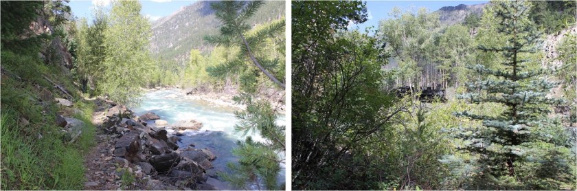
I was bummed. The weather was perfect, which meant I was wasting a perfect day not summiting something. And I hurt. I was sore and each step hurt more than the last. My shoes were trashed and I’d carried 30 extra pounds of unnecessary gear for dozens of miles and elevation gain for naught except conditioning. Suddenly Sherpas made sense. By the time I made it to the Animas River I was done feeling sorry for myself and instead decided to focus on the positive: I’d been here three times but never hiked the trial in the daylight. I was going to enjoy the view of the river and the shade and the occasional view of the train passing by
I was actually making good time and made it to the railroad crossing around lunchtime.
I’d made a deal with myself here I’d take off my pack for a long time (at least 15 minutes) and have lunch and soak my feet in the river. The mosquitoes had other plans however. Eventually I figured out they came in small swarms and if I killed all 12-15 of them I’d have a solid 2-3 minutes before the next swarm arrived. On the positive side the water was cool and it felt good to sit for a bit.
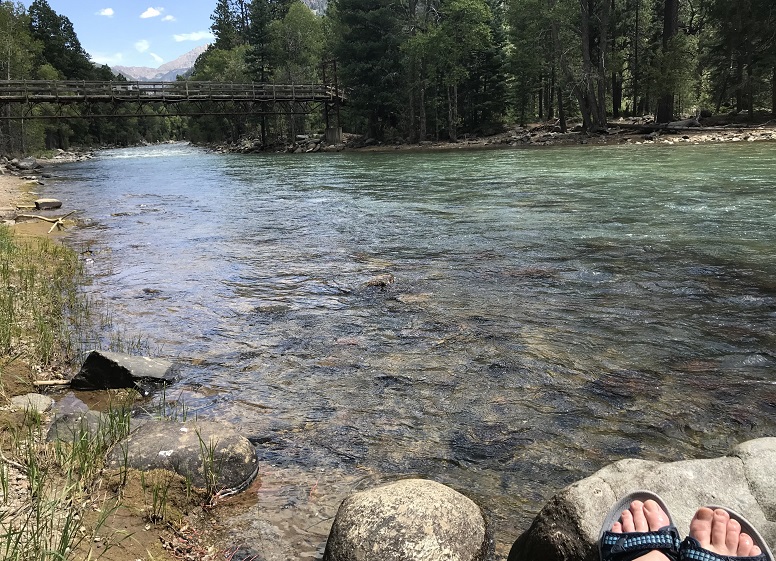
Animas River:
Lunch was a couple spoonfuls of peanut butter. I strapped on my gear and got ready for the hardest part of the hike: the last 4 miles and several thousand feet of elevation gain. I headed northwest and hugged the side of the mountain
I was pleasantly surprised to realize this trail is mostly in the shade. I was also surprised to realize just how closely this trail comes to Cascade Creek. Hiking this at night I’d always assumed the creek was down much further from the trail than it actually is.
So the shade was nice but the elevation gain was exhausting! I kept gaining and then losing elevation for what seemed like no purpose whatsoever. Why couldn’t the trail just gain steadily in elevation? It was disheartening to gain a couple hundred feet just to lose it again.
There were raspberries on this trail, and while I’m not fond of raspberries these were by far the best I’ve ever had. I couldn’t collect them fast enough (sorry woodland creatures that would have benefited from them, but they were delicious).
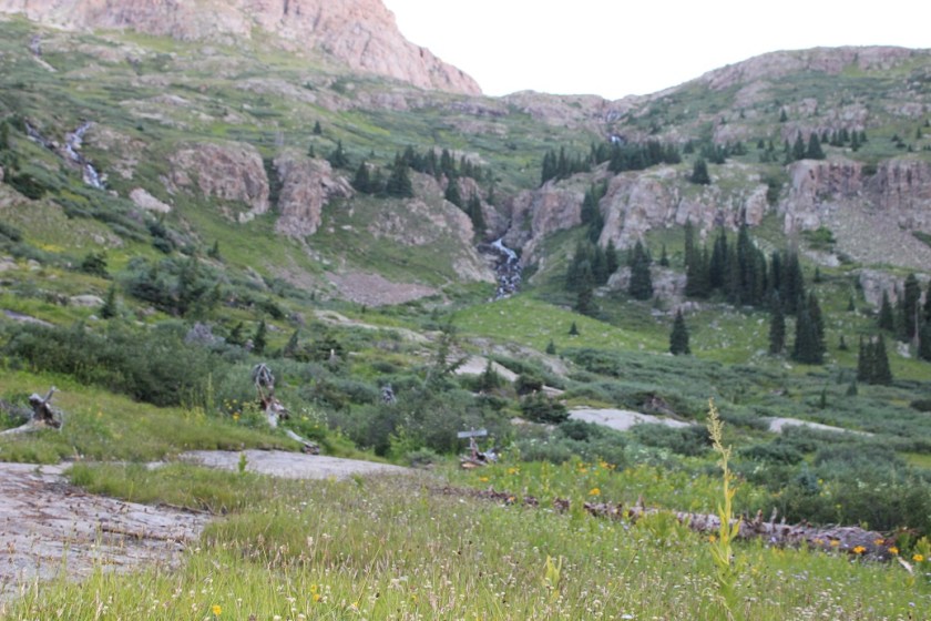
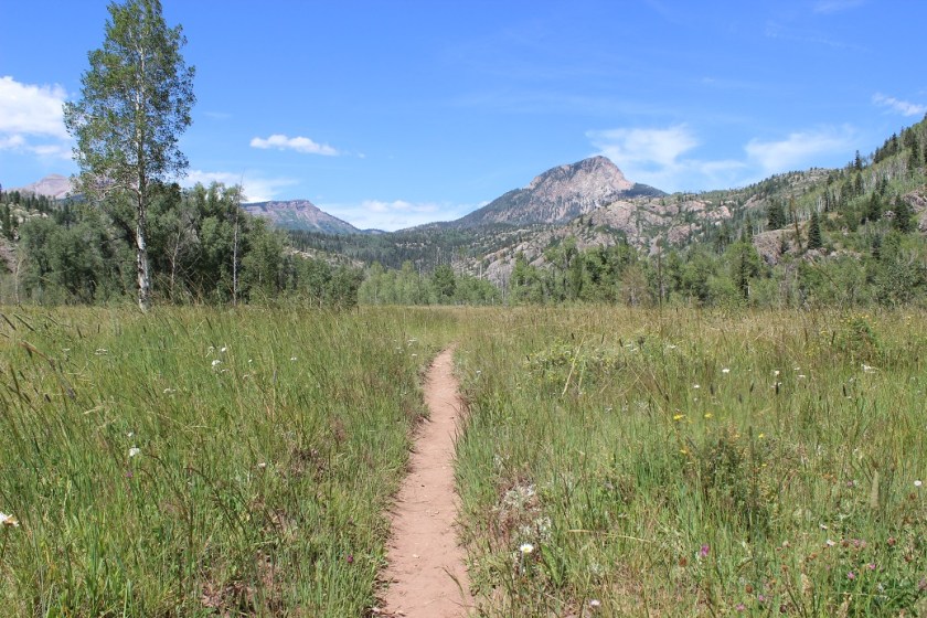
This meadow looks totally different in the daylight
The last quarter mile was the worst of the entire hike for several reasons: This part was a steep uphill climb, the sun came out again from behind the clouds, I was tired, my pack was heavy, and I ran out of water just as it began. This last quarter mile took me half an hour to complete (which is very, very slow for me).
Last time I was here I’d hiked Pigeon and Turret’s 39 miles in a day and I’d had hallucinations. This time I realized I’d gladly hallucinate again if it meant not being in this much physical pain from carrying such a heavy load. The only redeeming factor to the weight was I’d used every piece of equipment I’d brought (except the climbing gear, but that was necessary if I’d intended to climb). The physical pain was terrible, and I wondered to myself how long it would take me to forget the torture I’d put myself through over the past two days. Hopefully less than two weeks because I totally plan on doing this again. Soon.
I made it back to my truck at 2:30pm, making this a 41.5 mile hike with 11,098’ in elevation gain in 37 hours.

But my adventure wasn’t over yet. I limped back to my truck and set my pack on my tailgate. I unlocked my truck and downed an entire 2 quart bottle of cranberry juice in-between huge gulps of air. It was still early enough to make today productive, so I decided to drive to a Subway, get dinner, and then sit in my truck and figure out what to do next. A nap was definitely in the plan.
Did you know it’s difficult to find a place to sleep in your car in Durango? Seriously. Every parking lot I entered had “no camping” signs, and many even had “no sleeping in your car” signs. So I drove to a park on the edge of town, thinking this would be a good place to rest for a while. I got out my list of peaks I want to attempt in the next few months and did some calculations. None of them were close enough to drive to tonight to make them worth summiting tomorrow. Drat. It looked like tomorrow was shot as well. Which was probably for the best seeing as how I couldn’t move at the moment, but I was still disappointed.
It was too hot to sleep in my truck without the windows open and there were a surprising number of children screaming at the park as if being there itself were pure torture. I gave up on the nap and drove for a few hours until I found a National Forest Trailhead I could park at for the night, avoiding suicidal deer running across the road. This was a fabulous idea and I was able to sleep under the stars.
I woke up as the sun began to rise and drove the rest of the way home. I was itching all over, and when I looked in the mirror I noticed I had so many mosquito bites it looked like I had the chicken pox. Lovely. I randomly picked a CD out of the glove compartment and began singing 9-5 at the top of my lungs along with Dolly, my mood instantly improved. Until I stopped for gas. I slid out of the truck and my legs buckled underneath me. I quickly looked around to make sure no one had noticed me, and then pulled myself back up into my truck, laughing at myself for even thinking I could’ve hiked another peak today. My body needed a few days to rest, and I need to figure out a way to lighten my pack…
