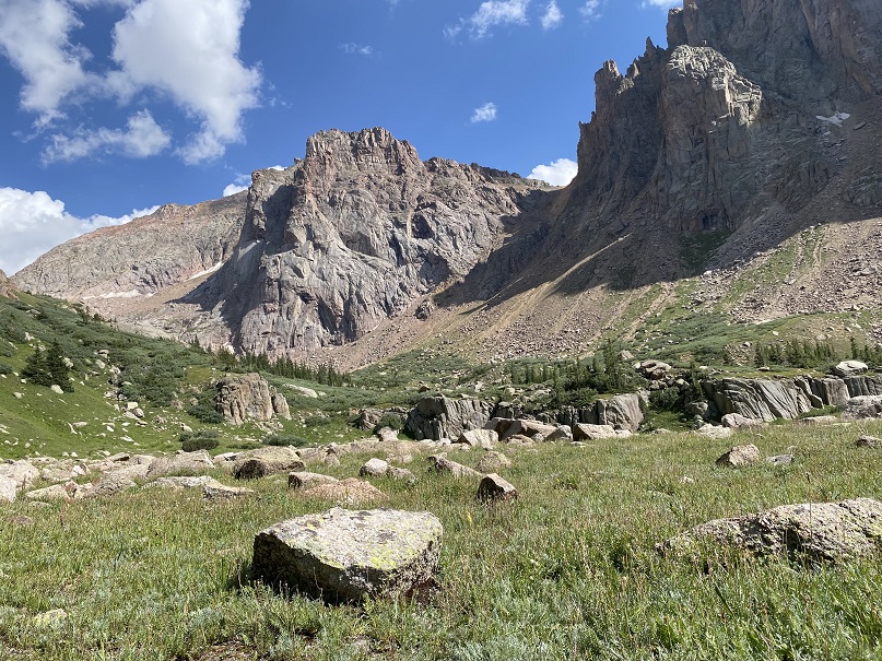
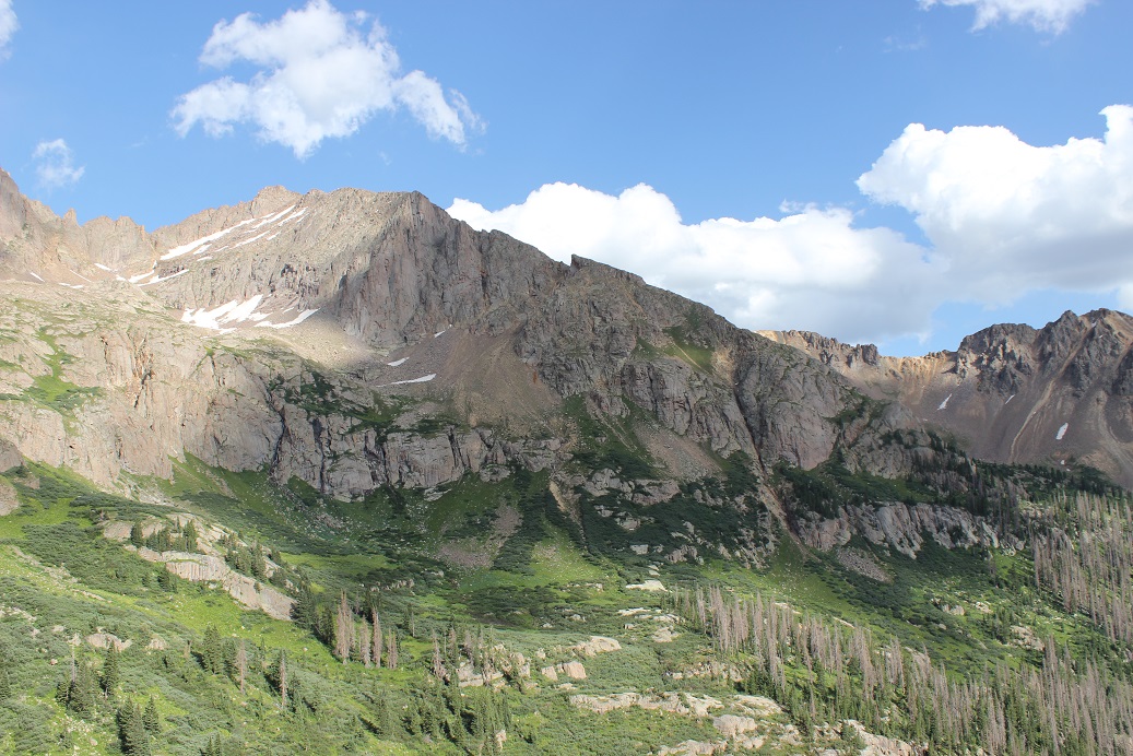
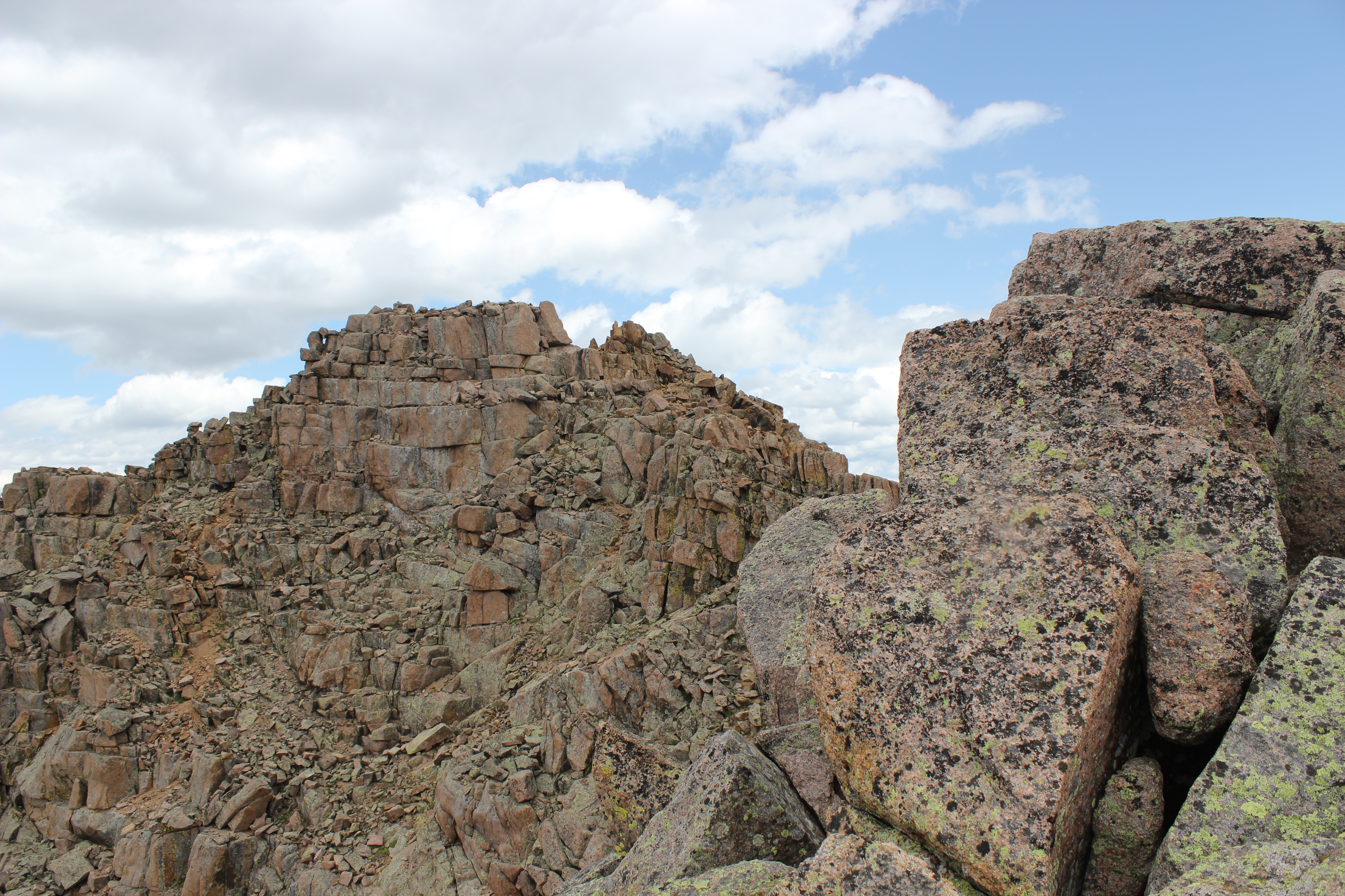
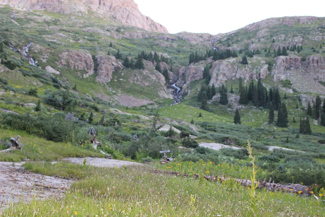
I’ve done this approach several times, but always in the dark. I decided to put together a detailed route description for those looking to head to Ruby Basin, or those interested in what it looks like hiking from Purgatory to the Chicago Basin cutoff. I feel this route has improved over the years, but unfortunately now has more downed trees blocking the trail, making route finding interesting at times.
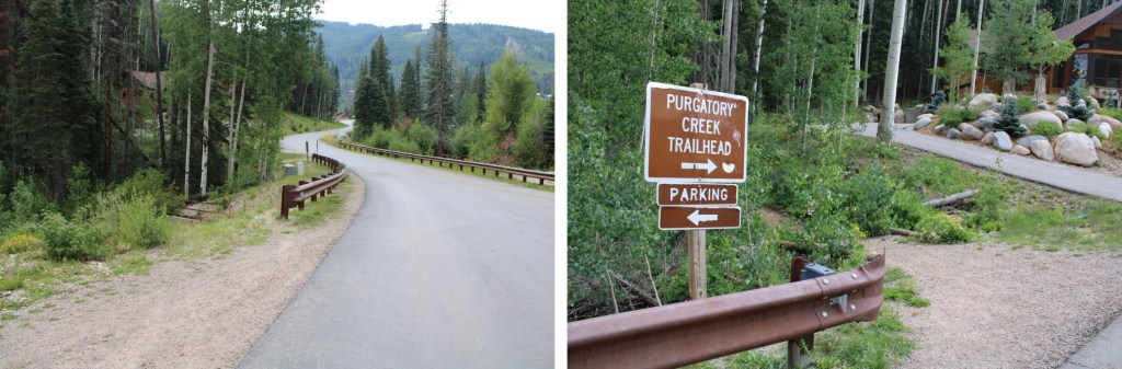
I arrived at 2pm on a Thursday afternoon and the parking area was full. They’re doing a lot of construction/new housing in the area, and there were a ton of visitors to the lake. I actually had to wait about 15 minutes for someone to leave before acquiring a spot. It might have been the time of day, but come prepared (I’ve never had trouble finding a spot before, but I usually arrive in the middle of the night).
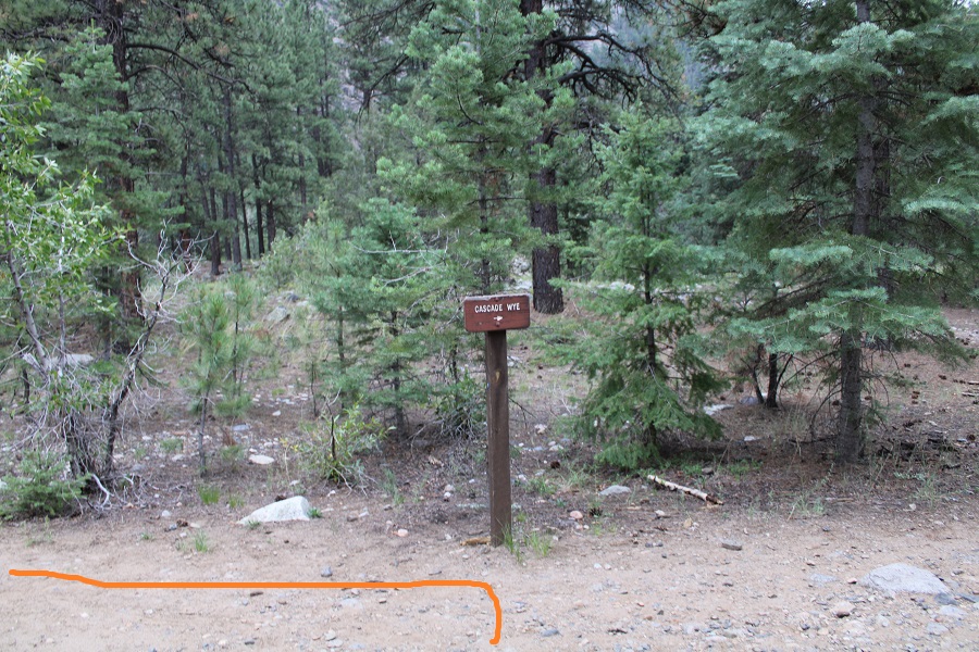
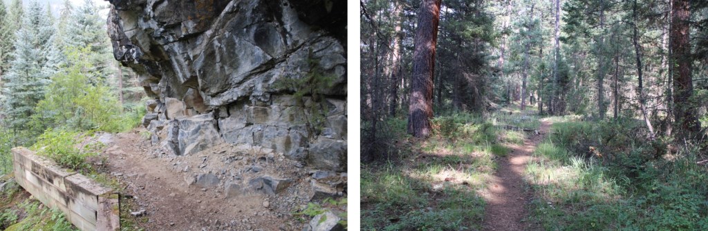
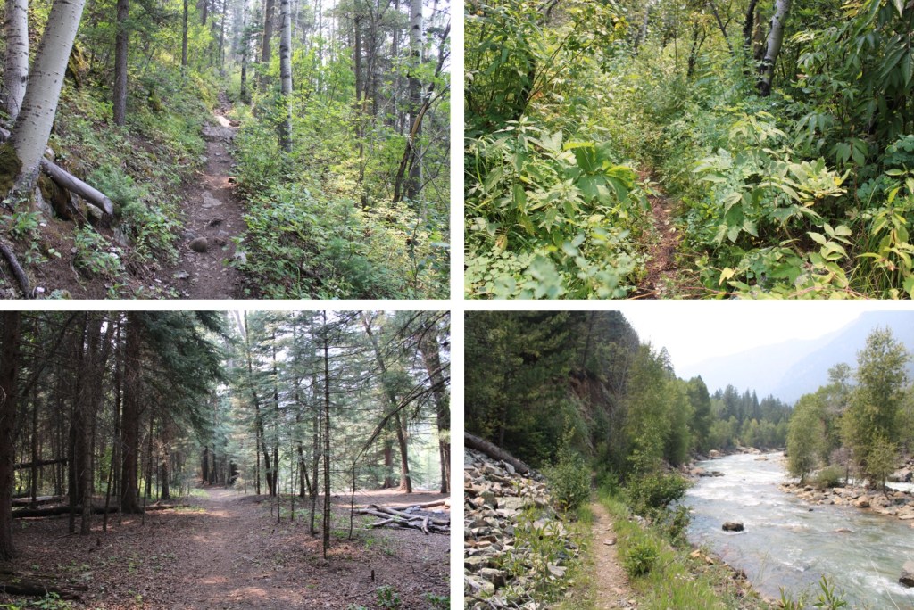
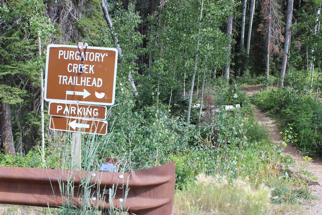
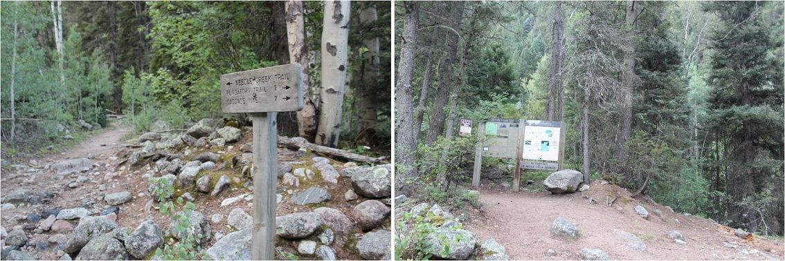
The trailhead is clearly marked, and starts at the west end of the parking area
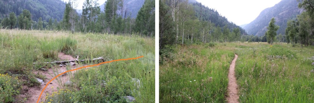
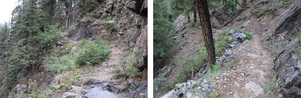
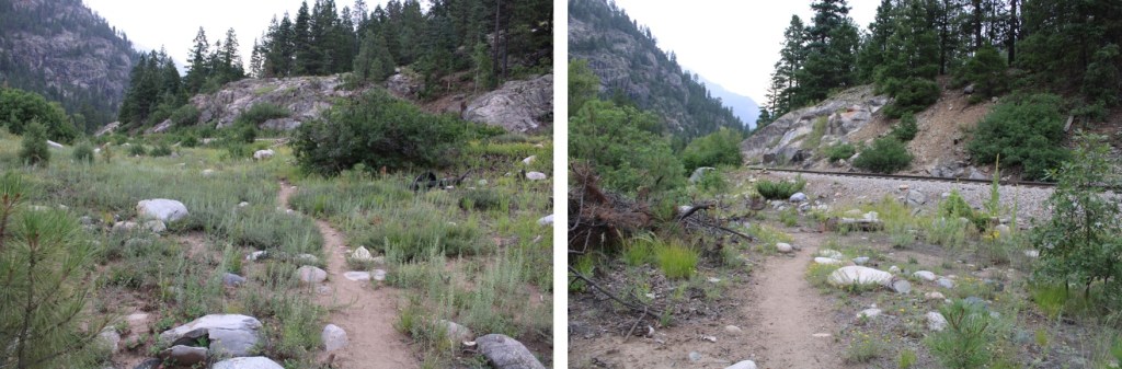
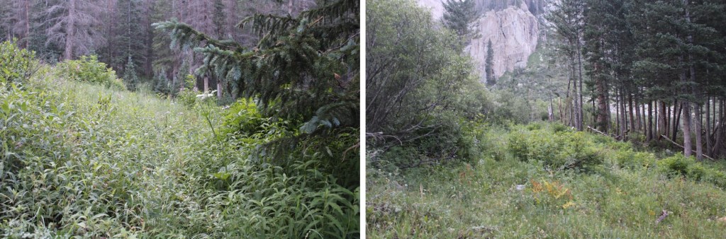
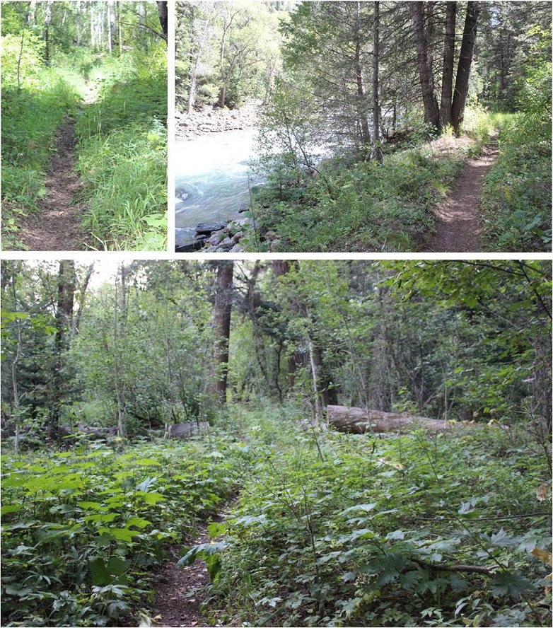
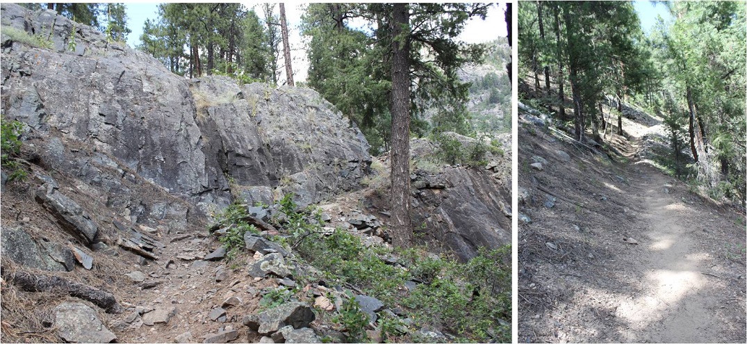
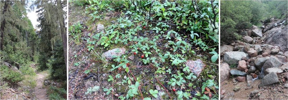
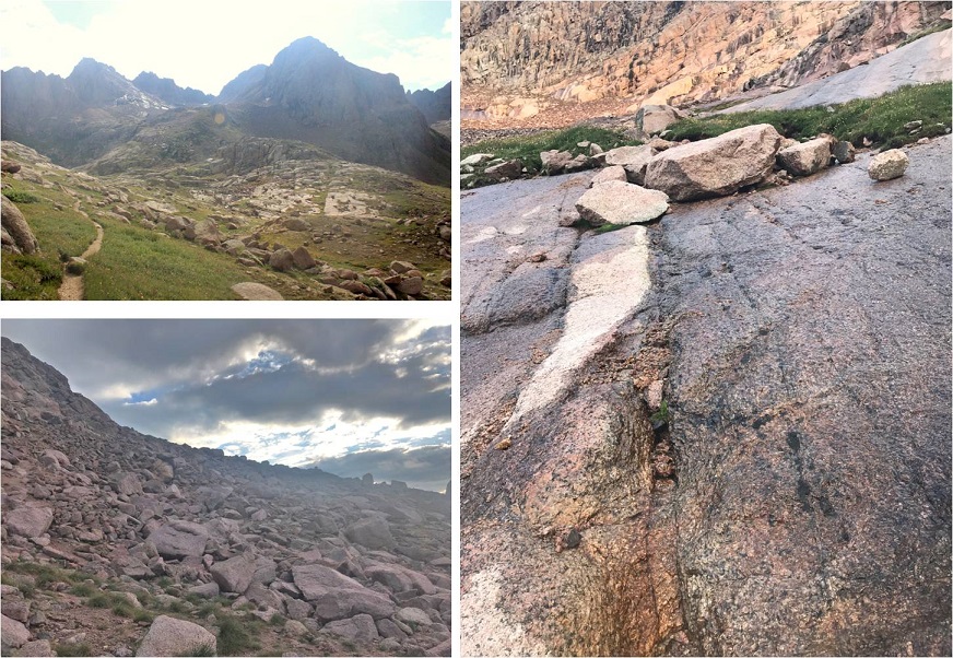
From here, the trail is class 1 as it heads east for 1.3 miles, and then turns right and follows Cascade Creek south to the Animas River. This part of the trail is nice on the way in, as you lose about 1200’ of elevation, but can be frustrating on the way out. I’d recommend hiking this part out in the cooler part of the day (or night). Here are some pictures of the trek down to Cascade Creek
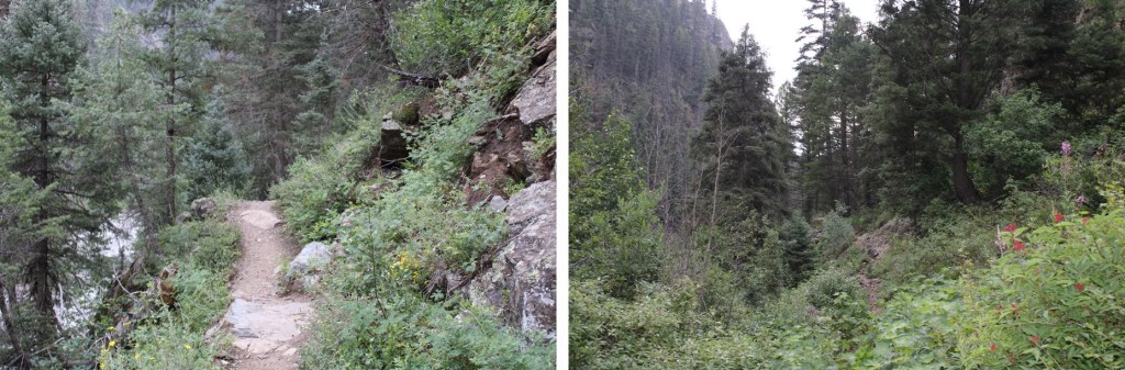
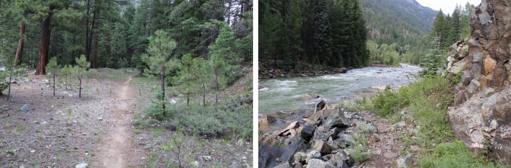
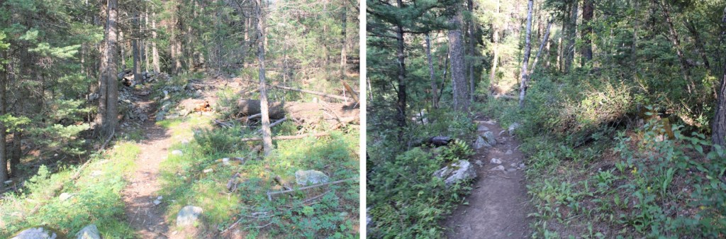
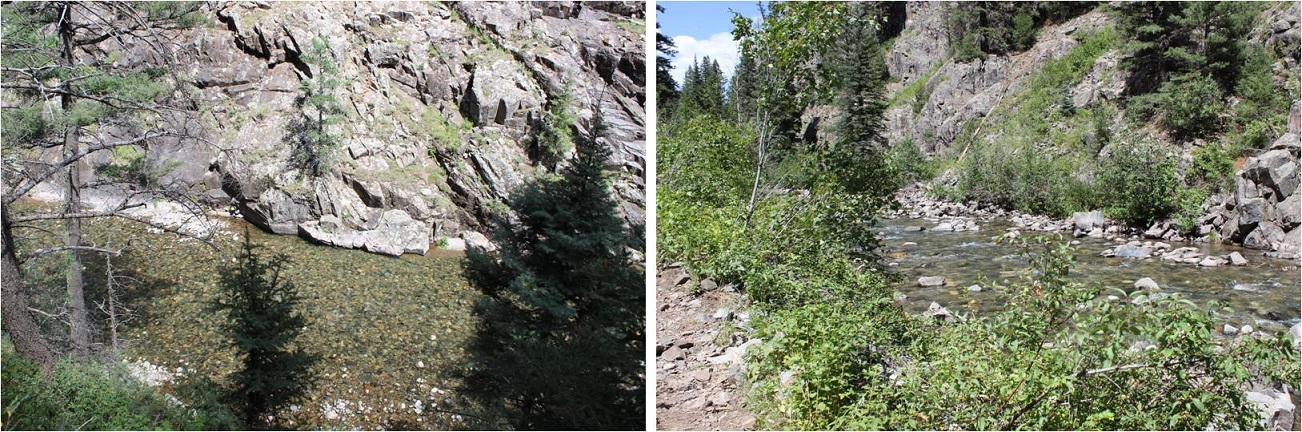
And from the creek to the Animas River. Here the trail will gain and lose elevation multiple times before descending to the river. In the late summer and early fall you’ll find wild blueberries, raspberries, strawberries, and lots of foliage here.
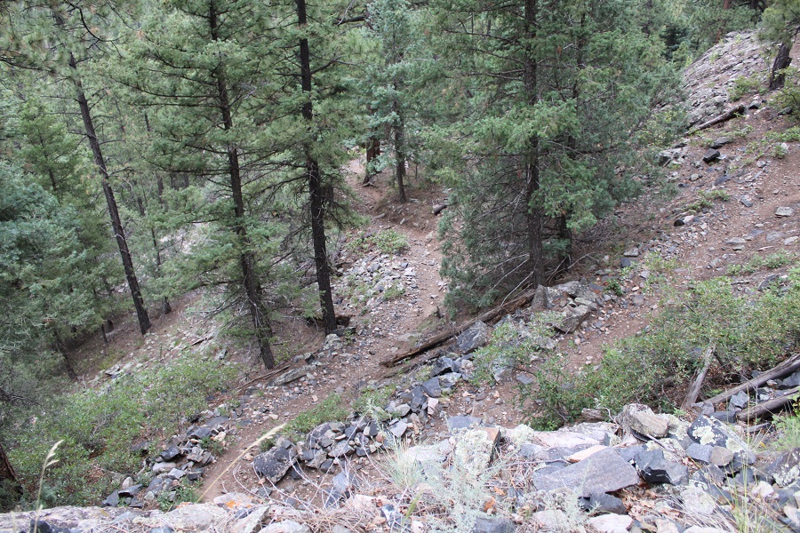
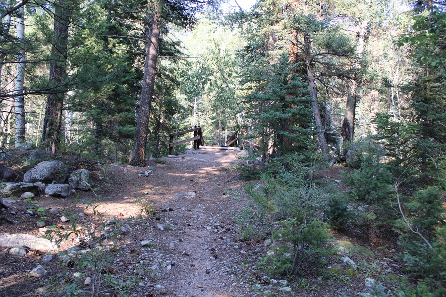
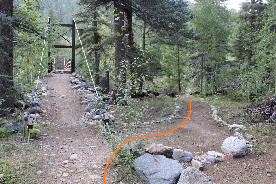
Just before getting to the Animas River the trail descends 400’ to a flat area
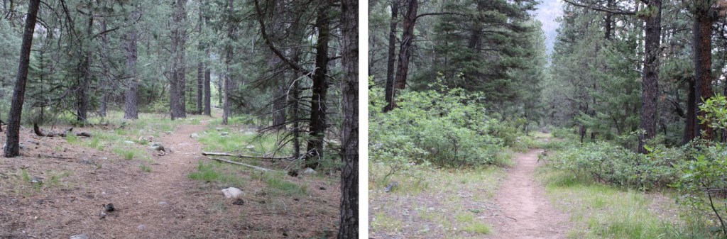
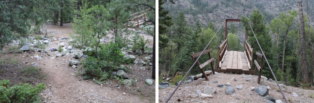
Here there are picnic tables and camping spots, and finding the exact trail can be confusing. If you get lost, just head west towards the river
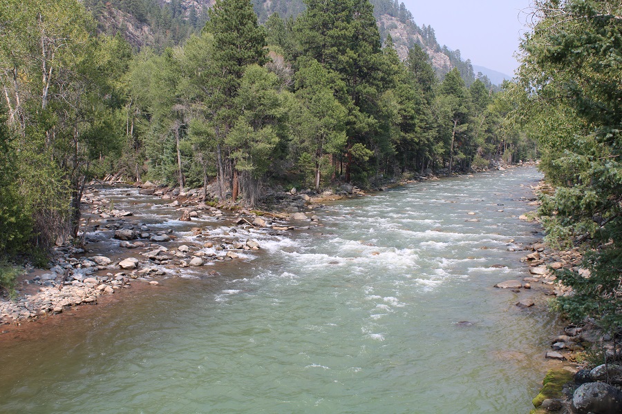
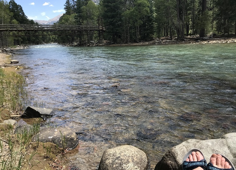
There is a very large and very obvious bridge to cross. This is also a good place to filter water (either on your way in or out). CalTopo told me I hiked 4.62 miles to this point.
As you’re crossing the bridge you can see where Cascade Creek and Animas River meet
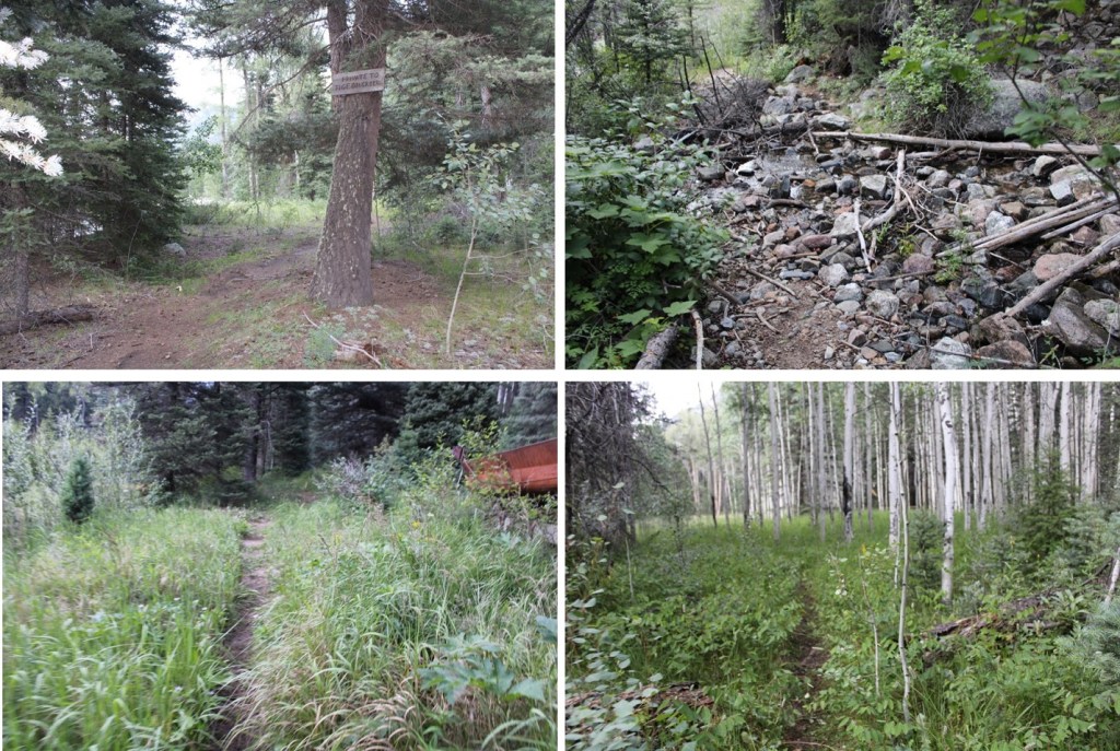
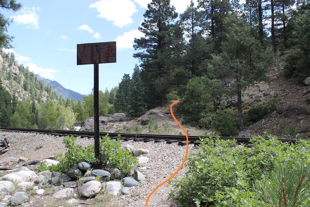
As soon as you cross the bridge, you’ll see this sign. Go LEFT here
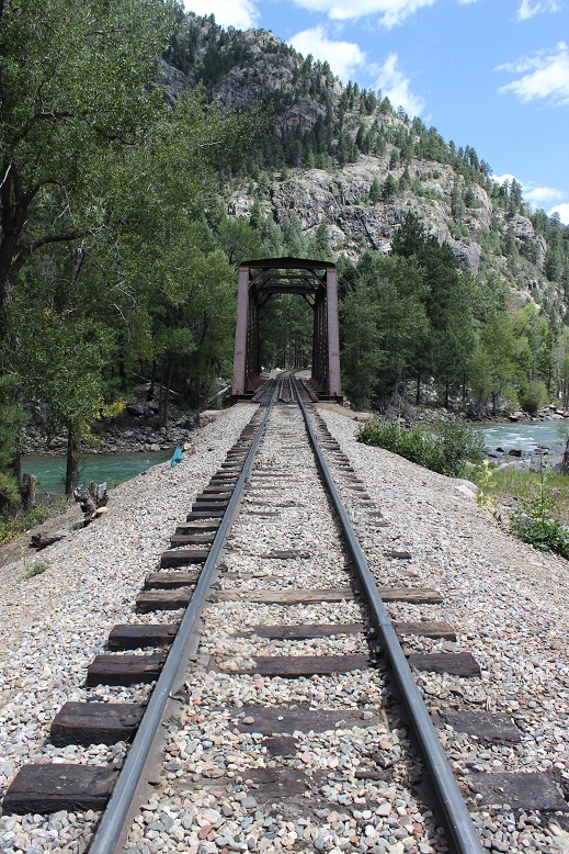
And follow the trail to the railroad tracks
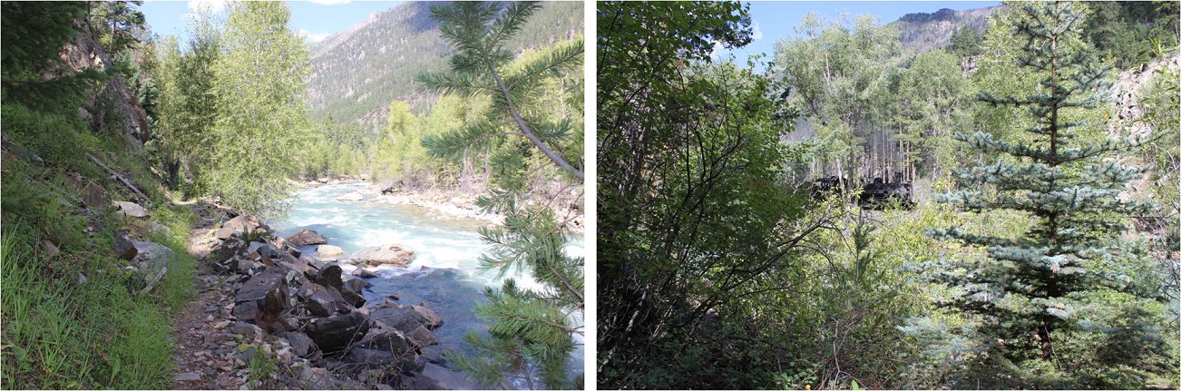
There will be an obvious place to cross the tracks. Funny story: when I was crossing the tracks this time and taking pictures the train blew its whistle from what felt like very close. I’m sure they do that to warn people to get away from the tracks at the crossing (I also heard it on my way back). If you hear the whistle, you have less than a minute to remove yourself from the tracks before the train arrives. Cross the tracks and continue on the class 1 trail as it hugs the Animas River and the Mountainside
From here the trail stays pretty level as it follows the Animas River. If it’s rained recently, you’ll want rain gear, as the foliage covers the trail in many areas and you’ll get very wet. There are many places to camp along this stretch.
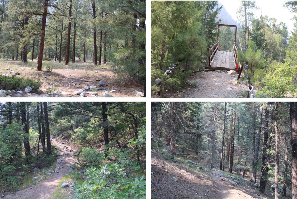
From the Animas River Crossing, it’s just under 6 miles to the cutoff for Chicago Basin (or 10.5 miles total from Purgatory). Here you’ll cross Needle Creek on another sturdy bridge. This is also another good place to filter water.
If you’re headed to Chicago Basin, there are obvious signs that will guide you there.
If you’re headed towards Needleton/Ruby Basin (etc.), continue following the trail north for another mile.
There’s new signage here. Please note, this is a public trail through private property. If you need to filter water, cross the bridge, filter, and then come back.
Here’s where the trail gets fun! Don’t cross the bridge. Instead, follow the trail to the right
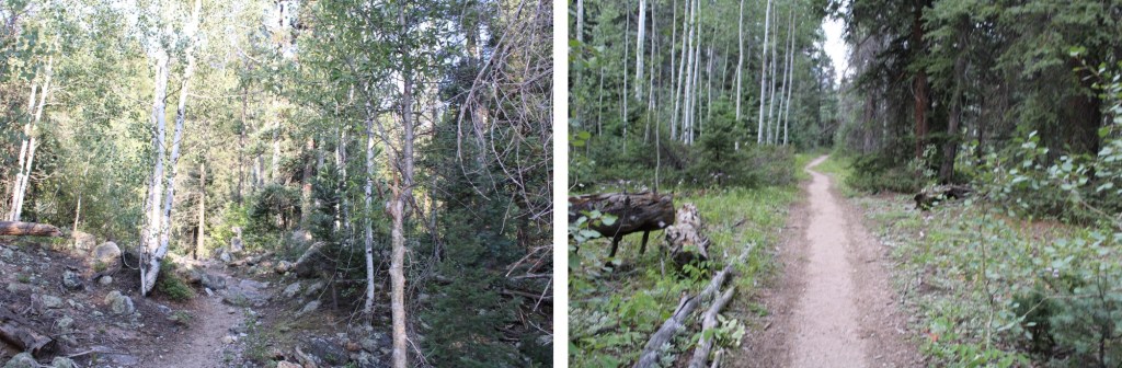
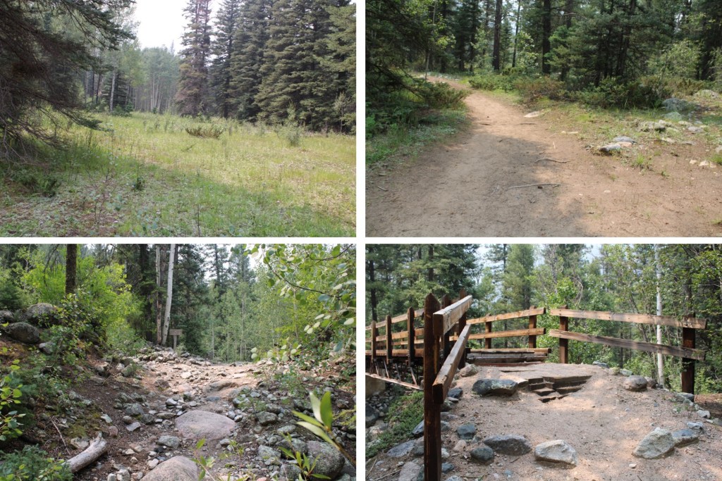
You’ll follow this trail for just under half a mile until you get to an Aspen Grove. This is a good place to spend the night before the elevation gain begins. You’ll have hiked a total of (almost) 12 miles to this point.
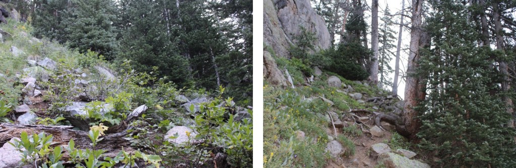
Here you’ll turn right, and follow an obvious trail up the hillside
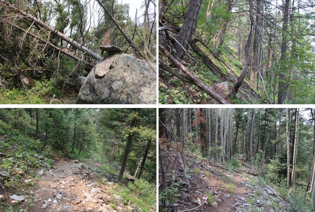
This is where the elevation gain starts and doesn’t quit.
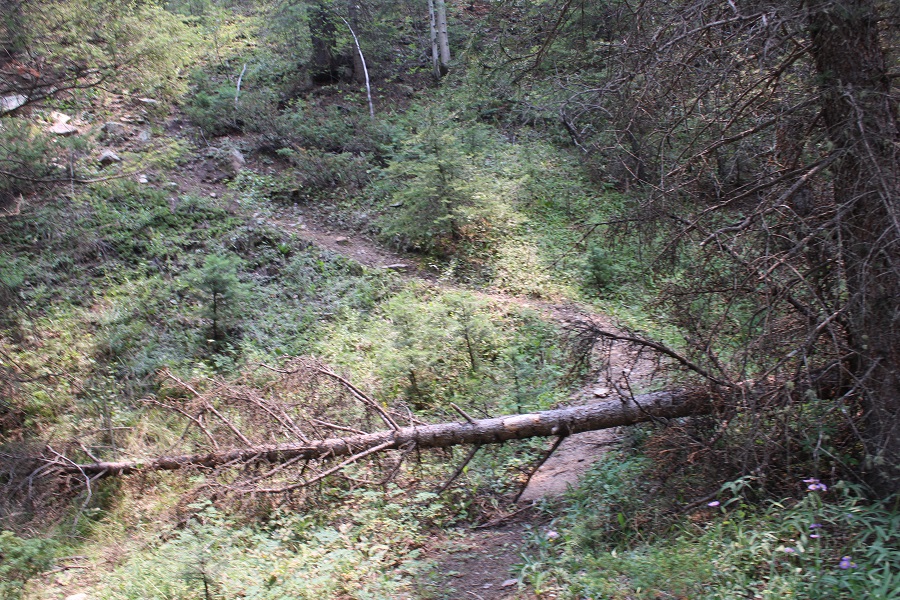
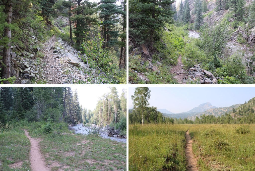
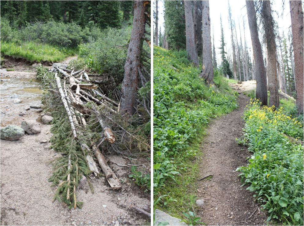
There are a lot of newly downed trees in this area, without an established workaround. Most of the trail is easy to follow, so if there’s a large downed tree in your path (and there will be), just try to be logical about where the trail should go, get around the tree, and you should be able to pick it back up again. This is tons of fun in the dark, and much easier when it’s daylight.
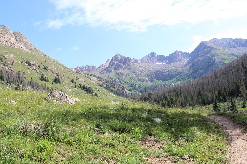
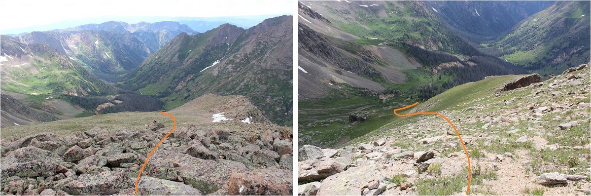
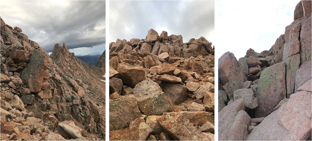
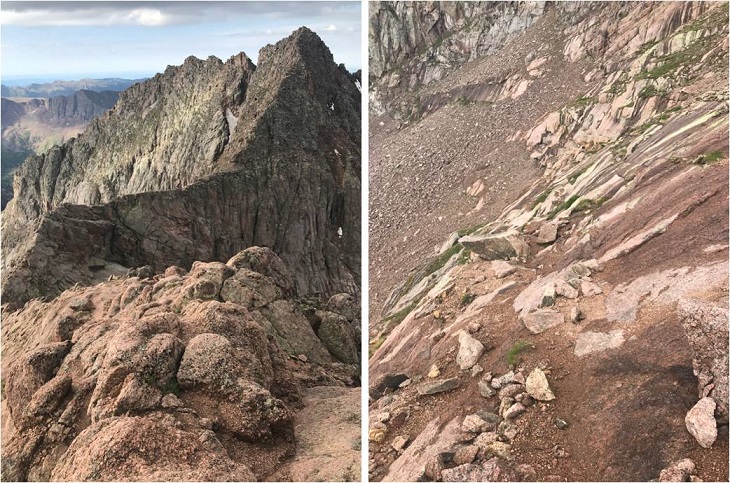
Another fun part: after gaining and gaining and gaining in elevation, at around 10,330’ you’ll LOSE about 200’ of elevation, quite quickly. Pictures looking down don’t do it justice, so here’s LOOKING BACK UP at the elevation you’ll lose
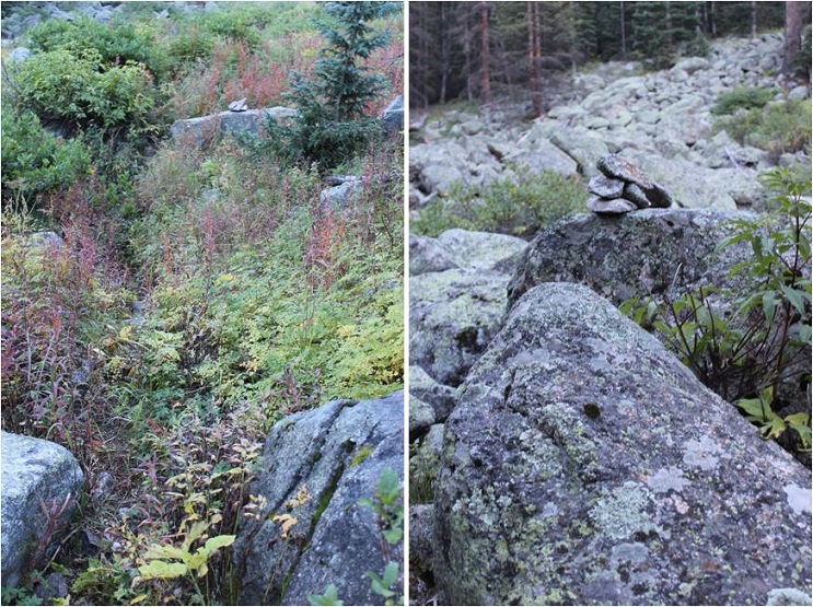
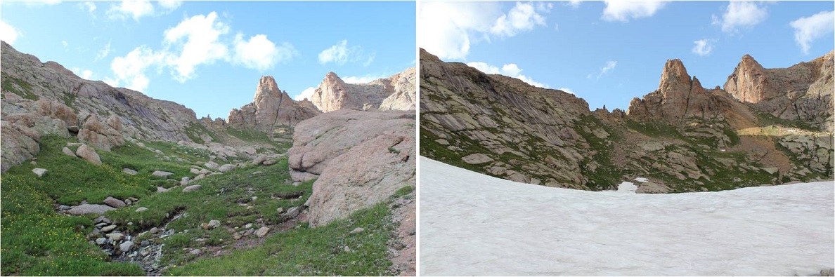
At this point the trail becomes a little more difficult to follow, but there is a trail and cairns. You’re hugging the mountain, following Ruby Creek east. Once again, this part of the trail is overgrown, so if it’s been raining, you’ll want to wear your rain gear to avoid getting soaked from the dew on the plants.
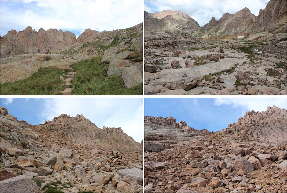
You’ll pass through a rocky area, with raspberry bushes and cairns to guide you
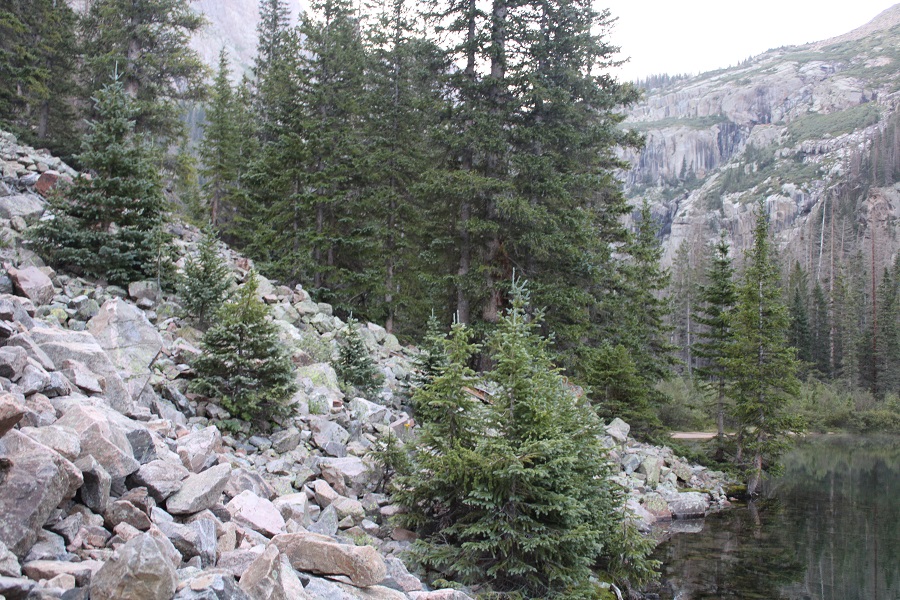
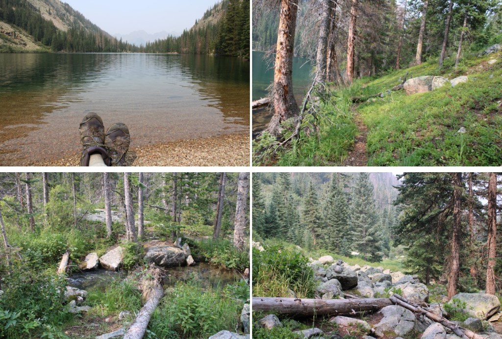
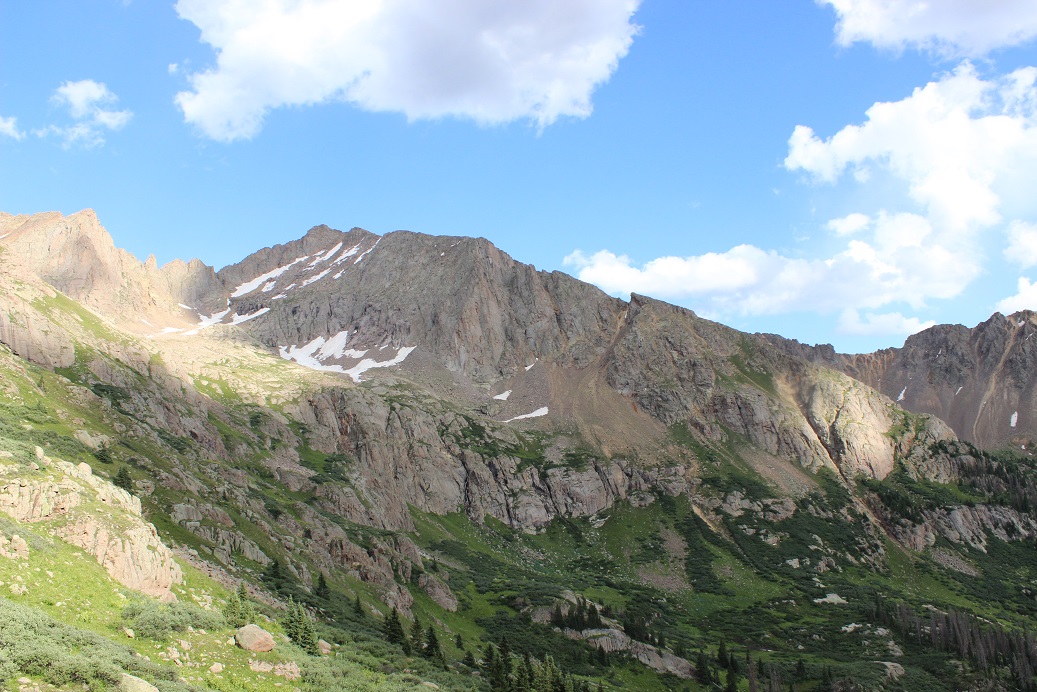
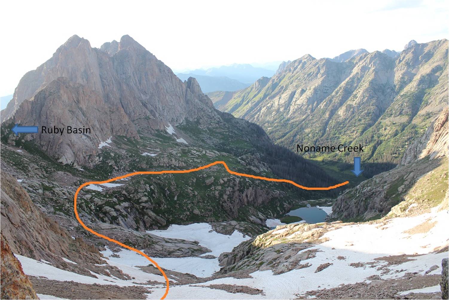
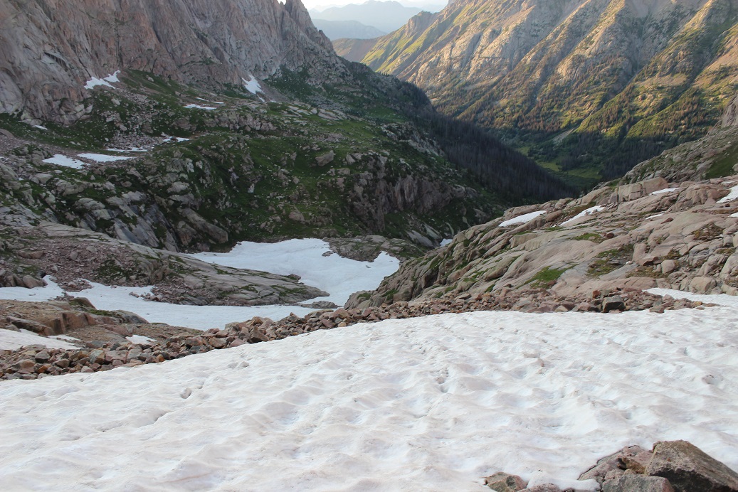
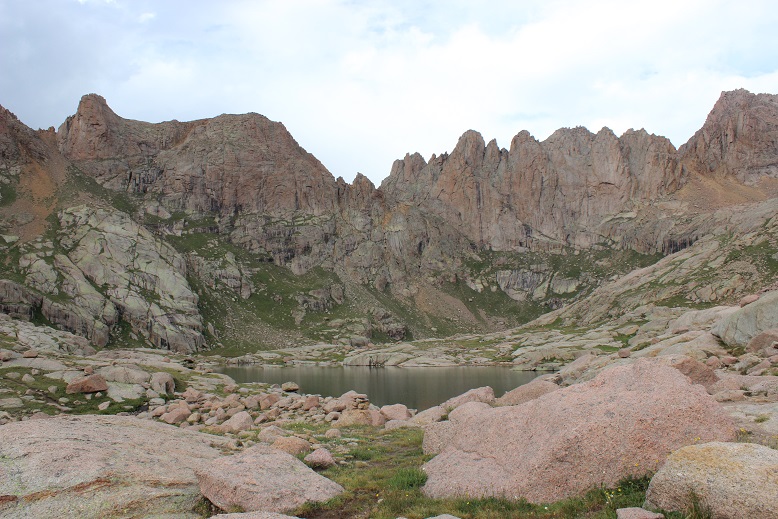
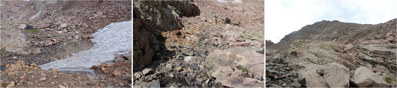
After hiking for 17 miles, and at 10800’ of elevation, you’ll arrive at Ruby Lake. Cross where the stream and lake meet, and skirt the north side of the creek.
There are also a few nice camping spots here, and the ability to filter water
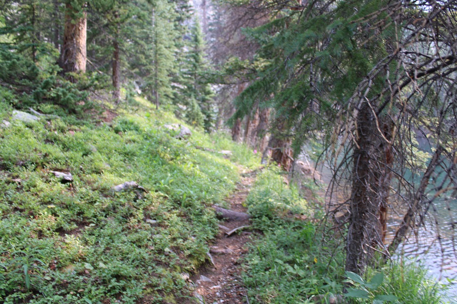
Be sure to stay close to the water’s edge here, as there’s a trail and it’s much nicer on your feet than rock hopping. There are cairns here as well.
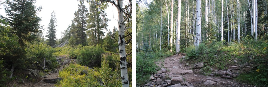
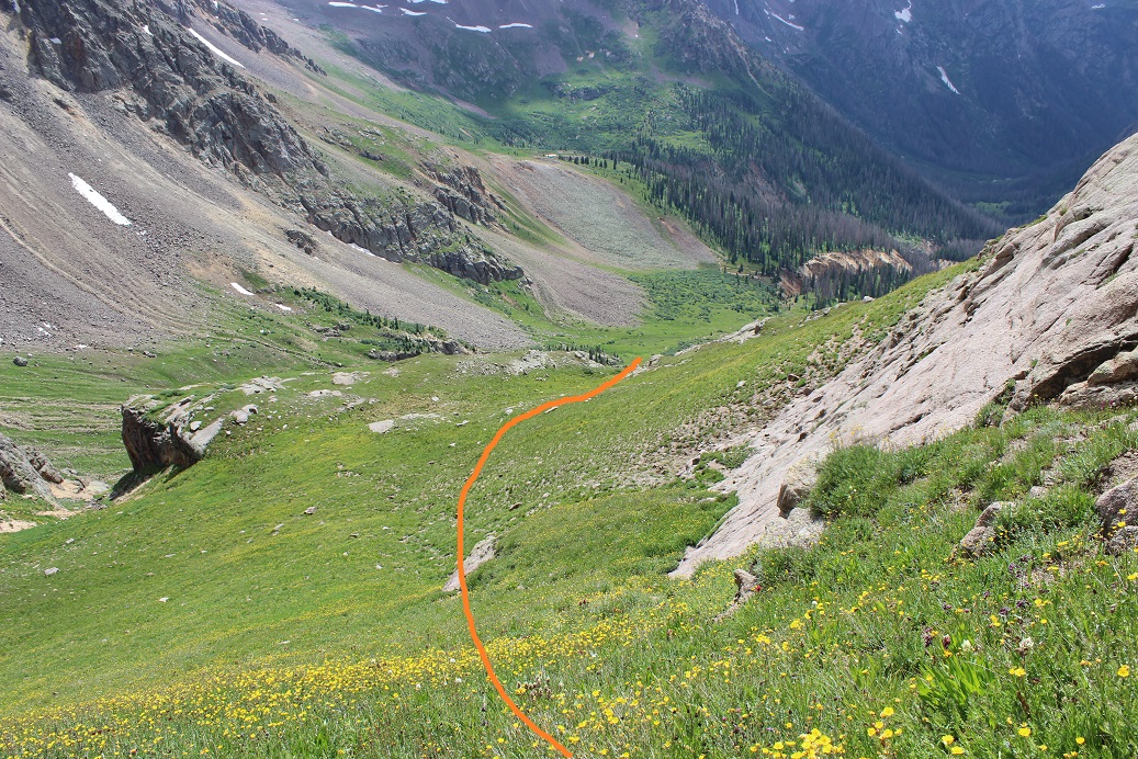
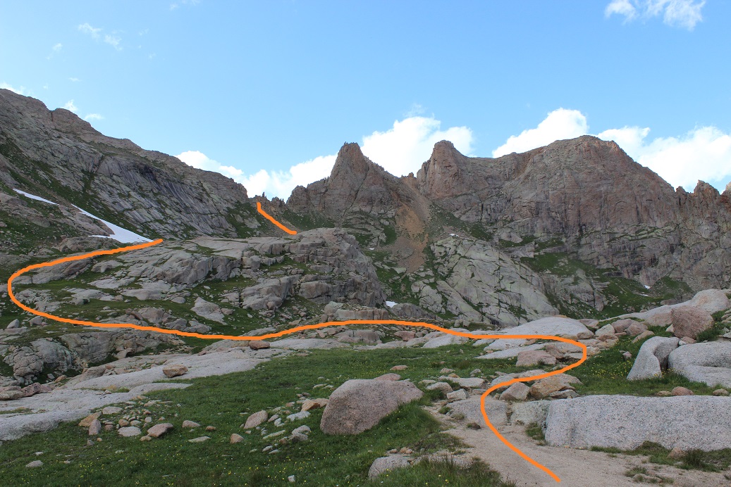
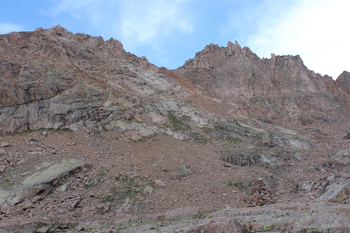
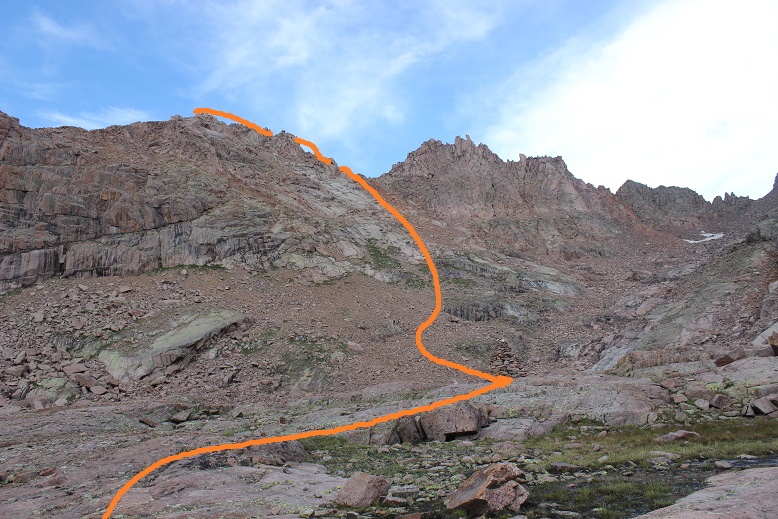
The goal now is to ascend into the upper basin. There is a trail here, but once again, a lot of downed trees and very overgrown with grass, flowers, etc. Keep heading east, staying below the rocks to your left.
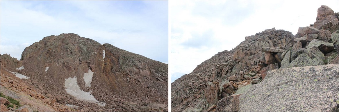
At about 10900’ the trail abruptly ascends into the upper basin by aiming north.
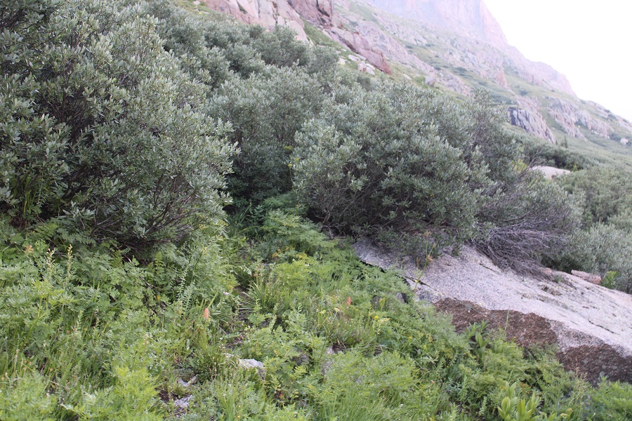
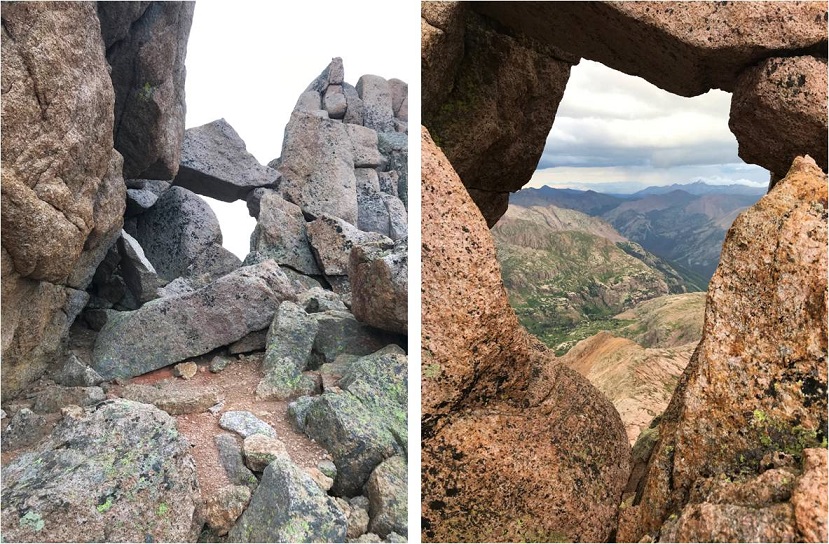
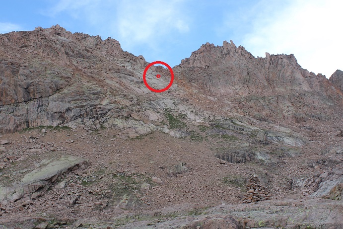
Where you’ll be greeted with: Willows! It is now your job to navigate through these willows to Ruby Basin. I promise you, there are trails here that ‘go’. They’re goat trails and anything above your waist will be gnarly, meaning you should plan on getting whacked in the face with willow branches, but trails are here. It’s important to find the entrance to the trail, and then go with your gut. Obvious cairns are circled in red. You’re aiming for the orange arrow:
Here’s what the entrance to the trail looks like
When you make it to that orange arrow, the rest of the trail into the basin will become obvious
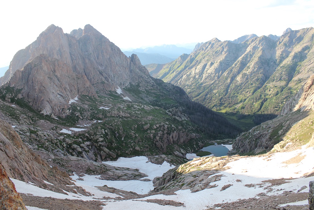
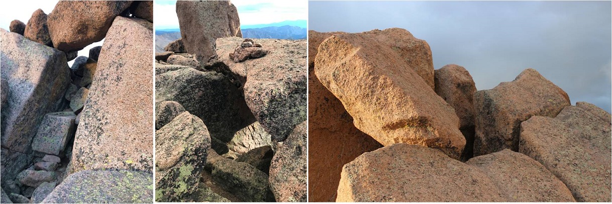
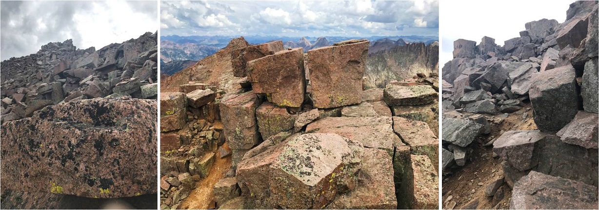
Pick your place to camp. There’s always plenty of water here flowing through the basin. The marmots will chew up anything not hung up, which is difficult in this treeless basin. I’ve seen Mountain Goats and Moose here a few times. This is a great starting place for several 13ers in the area. If you’d like my GPX file for the route send me an email wild.wanderer@aol.com
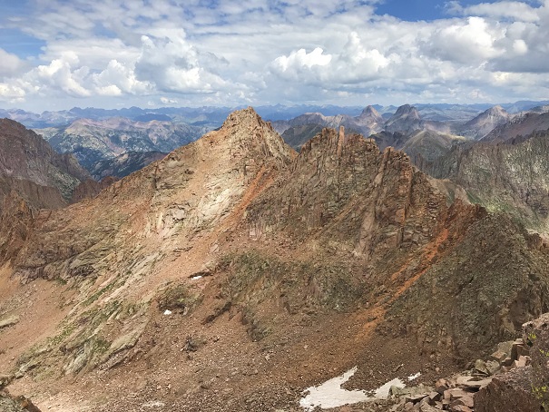
Here’s a view of the Ruby Basin from the east side of the basin, looking west at how you enter the basin.
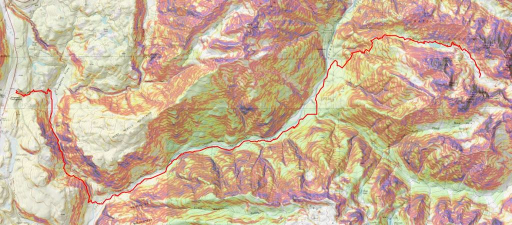
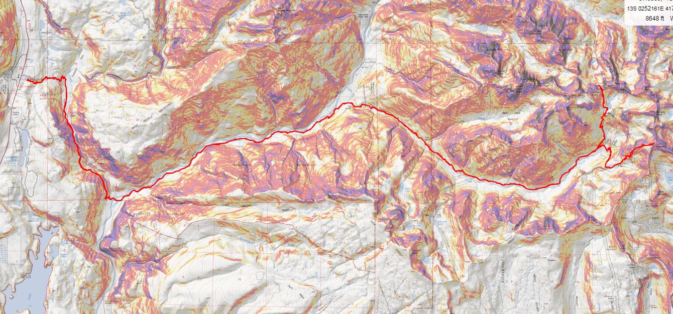
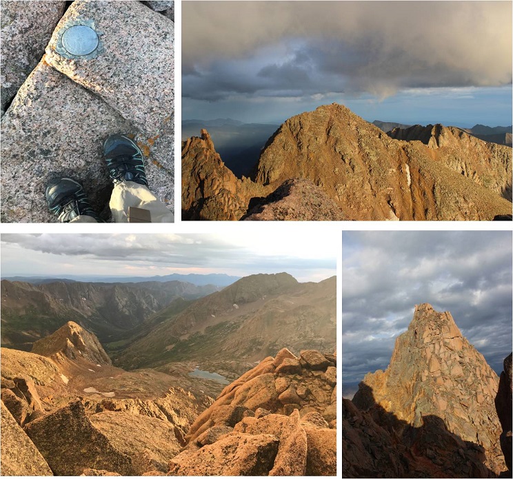
Here’s the topo route
And just for fun, a compilation of pictures of the route out.
I did a ton of research before setting out for this hike. It was my goal to link up the Chicago Basin with the Noname Creek Approach via Twin Thumbs Pass. All of my research said it was “doable”, but I hadn’t found a trip report indicating it had ever been done, so I went in kind of expecting to fail. I was trying to eliminate hiking into the Chicago Basin to summit Jupiter and then hiking back out and attempting Jagged Mountain via the Noname Creek Approach. If I could link up the hike via Twin Thumbs Pass I’d be saving about 20 miles and several thousand feet of elevation gain. And it almost worked…
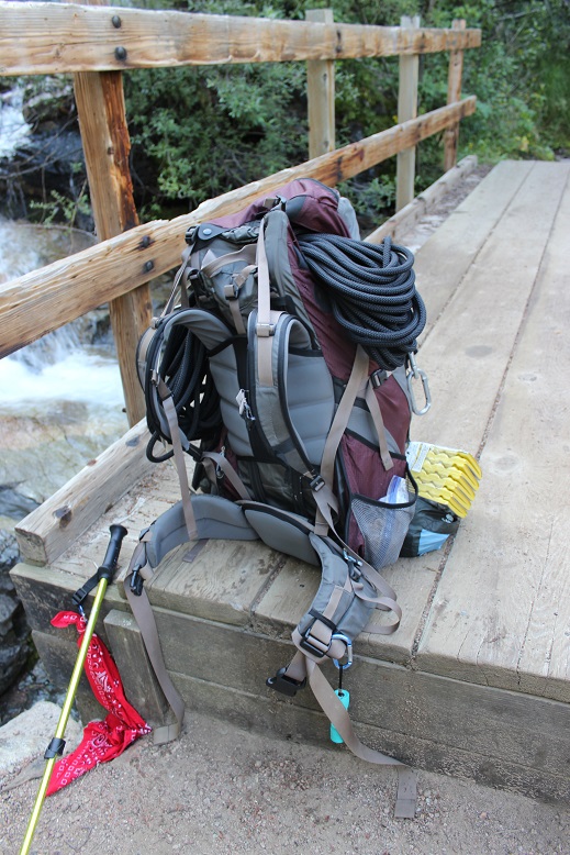
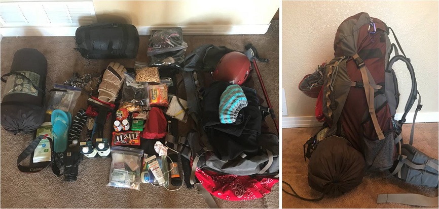
Sleep is for armatures, so I left my house at 8pm after hosting a Girl Scout awards ceremony, arriving at the Purgatory Trailhead at 2:15am. I was on the trail by 2:30am. The first 10 steps hurt. A lot. My pack was wayyyyy too heavy. I’d gone through it multiple times eliminating what wasn’t absolutely necessary and it was still painfully heavy. I’m not sure how much it actually weighed (I was too scared to weigh it) but I’m guessing it was around 45-50lbs. That’s excessive, especially for someone who only weighs 105lbs. But I just couldn’t lose any more weight: I’d already thrown out unnecessary items like a camp stove (it was all peanut butter and beef jerky for me this weekend) a pillow (not needed), a change of clothes, bug repellant, etc. and had switched my “good” backpacking sleeping bag for a lighter weight one. What was weighing me down was all the gear: rope, harness, carabiners, webbing, etc. All that stuff was necessary if I wanted to attempt Jagged this weekend, which I did.
So those first 10 steps hurt and I should have known then to stop and reassess this adventure, but I told myself it would eventually get easier if I just kept moving so I just kept moving. Yep, I kept moving but it didn’t get easier. I gingerly hiked my way down the Purgatory trail towards Cascade Creek, losing elevation the entire way and thinking to myself “hiking down shouldn’t be this difficult”.
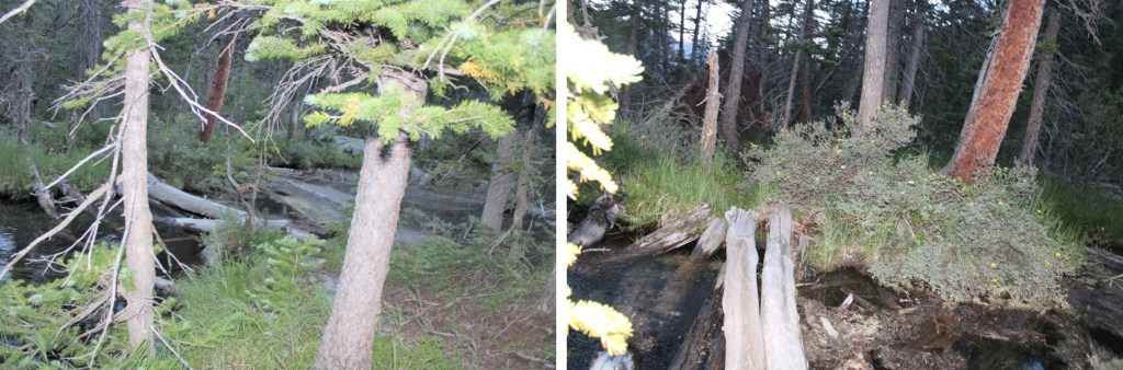
The trail follows Cascade Creek southeast towards the Animas River. There’s a bridge here to cross
and a good trail to follow to the Railroad tracks. I crossed the tracks and continued on the Animas River Trail.
The trail is easy to follow, but was overgrown in areas. It follows the Animas River, which I could hear but not see in the dark.
While the trail follows the river it still has numerous small ups and downs in elevation, which I thought were completely unnecessary: I’d rather stay at a steady elevation. The sun started to rise and I made it to the Needleton/Purgatory/Cascade Junction and followed the Needleton Creek Trail to Chicago Basin. Side note: It is not 7 miles to the Purgatory Trailhead. From this point my tracker says it’s 10 miles. A little ways up there’s a trail register and information area. I didn’t sign the trail register because I hadn’t intended on exiting this way.
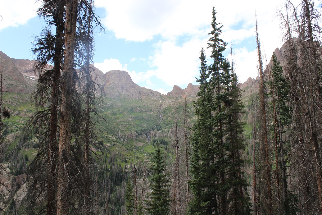
From this area it’s another 6 miles to the Chicago Basin. This part of the trail follows Needle Creek as it climbs towards the basin. I loved hearing the water rushing past and seeing the waterfalls along the way.
It seemed like it took forever to make it to the basin. I realized I was almost there when I saw the avalanche debris. There really wasn’t very much damage, and luckily there were already clearly established trails as a workaround.
The hike into Chicago Basin is indeed beautiful!
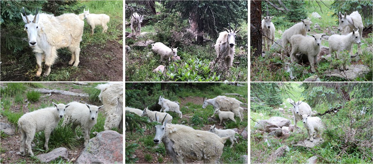
I didn’t see much evidence of mountain goats. I was here last year and they were everywhere. This year I saw a couple, but nowhere near as many as before.
Normally I like to do the hardest peak first, but today the easier peak was my first goal for several reasons: I wanted to get a look at the backside of Jagged to see how much snow there was on route and I wanted to see if there was still snow on Twin Thumbs Pass. I knew I didn’t need all my gear to summit Jupiter so I stashed my pack and just brought the essentials: water, my camera, and some snacks. Oh yeah, snacks. I should probably eat something? I had about 12 almonds and kept them down so I considered it a win.
If you go left at this junction it takes you up to Twin Lakes. If you continue straight it will take you on a well established path towards Jupiter.
The trail crosses Needle Creek and heads west up the hillside
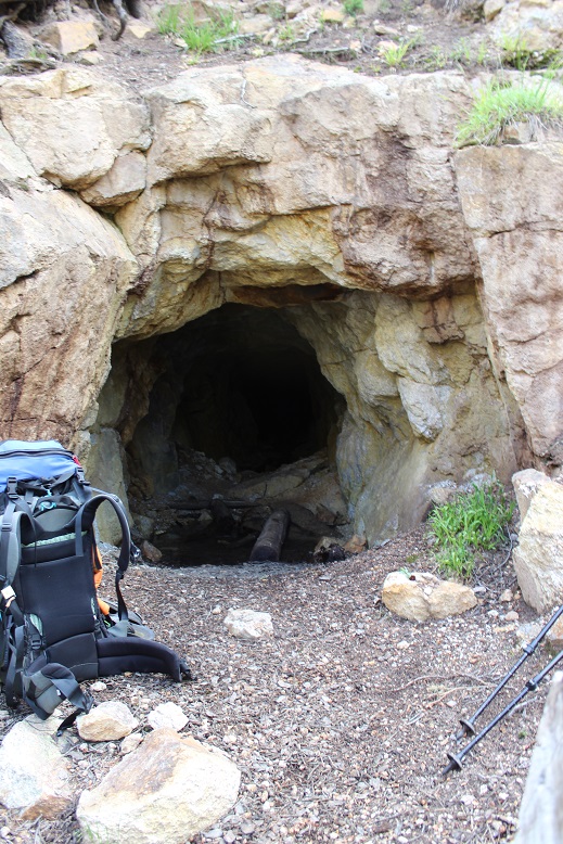
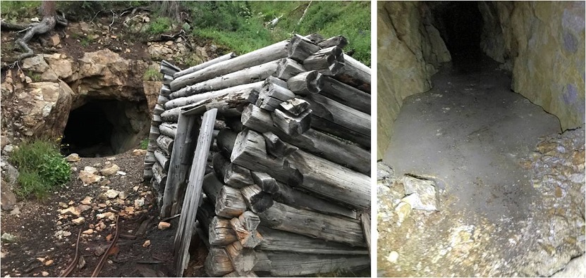
About halfway up the hillside there’s an old mine. I’d already explored this mine the last time I was here so I didn’t feel the need to go inside, but I did see a pack outside, and called in to say hello to whoever was exploring.
I met a man who was really excited about the mine. His hands were white from the walls, and it looked like he’d been having a time. We chatted for a bit: He’s already hiked the Colorado Trail and was now looking for a way back to Durango. He asked me if I knew if the trail “went” and since I’d already done a lot of research on the Johnson Creek/Vallecito trails when planning this trip I knew if he made it to the saddle he could take Columbine pass over. I envied this man his freedom to just explore and not worry about time and wished him luck. I wish I had more time to adventure!
I continued on the trail to treeline, crossed a creek, and here the trail (mostly) stopped. I felt so much better hiking with just the essentials: I felt like I could skip up this mountain!
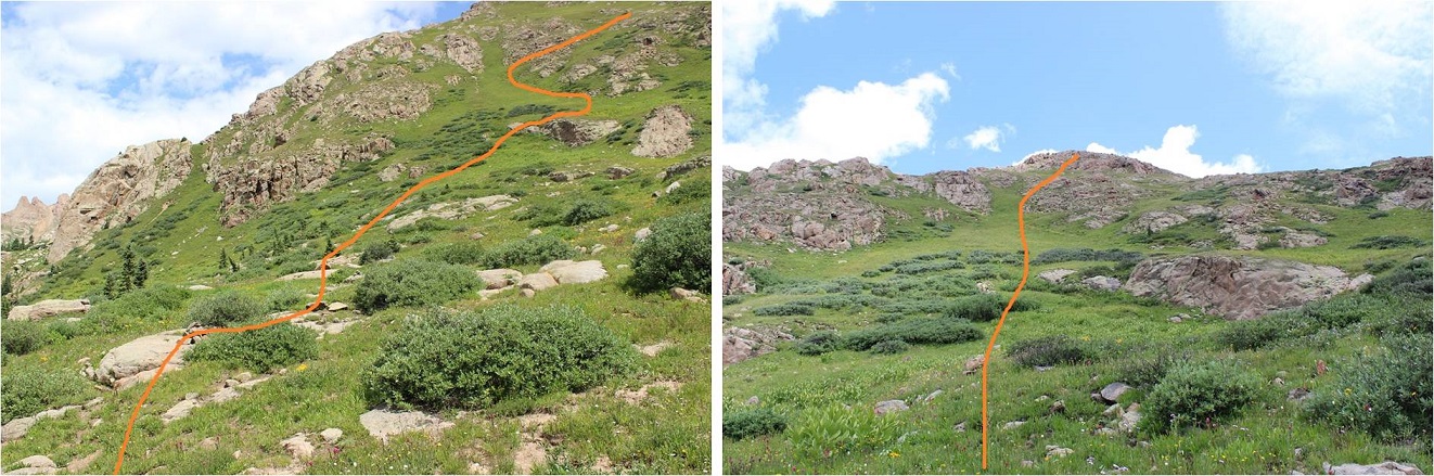
There were a few cairns and what looked like overgrown social trails but no established trail after the small creek crossing. Here’s the route I took up the side of Jupiter.
It’s much steeper than it looks, but the wildflowers made up for the difficulty.
About halfway up the hillside I started getting worried about the weather. There was a 30% chance of rain today between 2-4pm, and the clouds forming didn’t look good. Luckily the wind was blowing them away from me, but I kept an eye on them just in case. I really, really didn’t want to turn back at this point (but I would have if necessary). I kept looking for the man I’d met, watching for his ascent of Columbine pass, but I never saw him again (even from a distance).
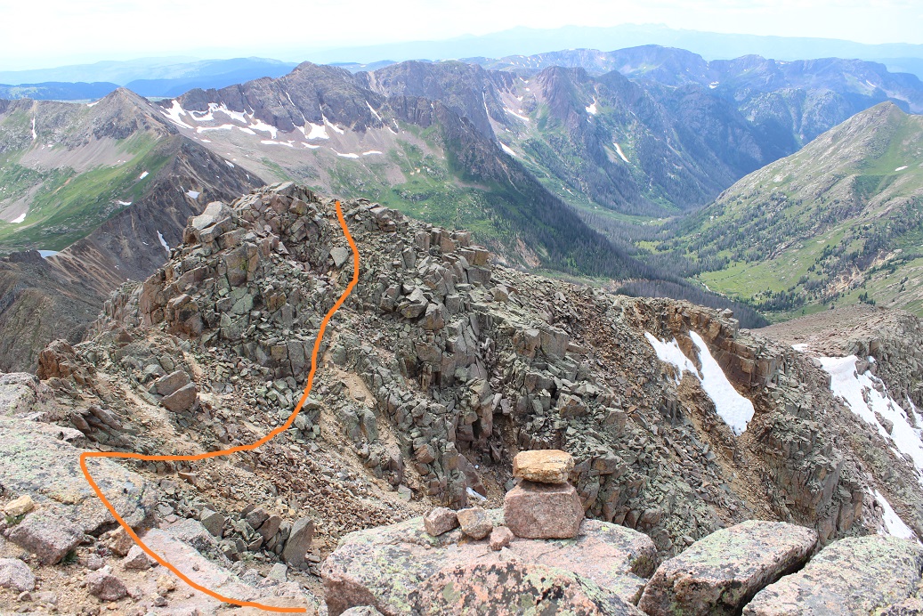
I continued on and came across cairns. There seemed to be several ways around this part. I took the solid line up, the dotted line back down.
I continued up the side of the mountain, aiming for the cairn I could see at the top of that pile of rocks, sure that was the summit (spoiler alert: it wasn’t)
Imagine my surprise when I made it to the top of that pile of rocks, only to see… this
Wait? I thought this was a class 2 hike? That looked like class 3 scrambling to me. I was a little put off I’d left my helmet back with my gear in the basin and a little upset with discovering this had been a false summit, but decided to just go ahead and finish. I took the solid route up, the dotted line down. I felt the dotted line route was indeed class 2+, but the solid route was class 3. There were several ways to summit here, and so many cairns they lost their intended purpose.
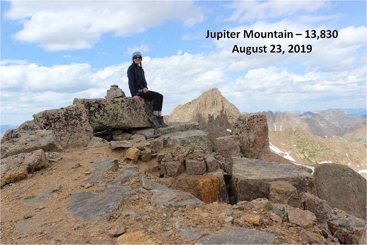
I summited Jupiter Mountain at 2pm.
Summit Video:
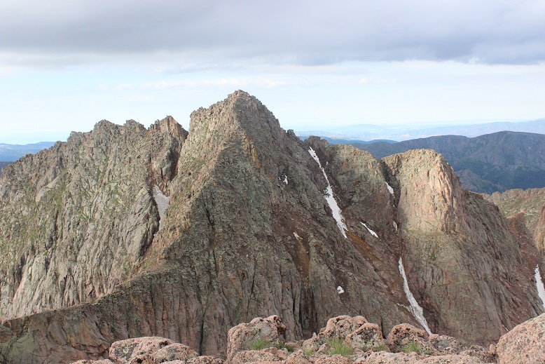
I’d been hiking for almost 12 hours at this point, but without my full gear for the past 2 hours I was feeling pretty good. I decided to take a look around. Jagged from this side was mostly snow free!
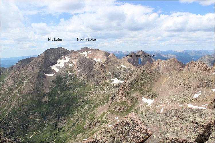
Twin Thumbs pass was obscured by Point 13,472, but it looked mostly clear of snow as well. This was all good news. Now I only had to worry about the north facing sides of the mountains (which hold snow longer).
Time to head back. Here’s the route I took off Jupiter (this also shows Columbine pass in the background)
And back down to treeline
Back at treeline I had a better view of Twin Thumbs pass. It appeared clear. Now it was time to retrieve my gear and head up to Twin Lakes.
I saw my first mountain goat of the day here
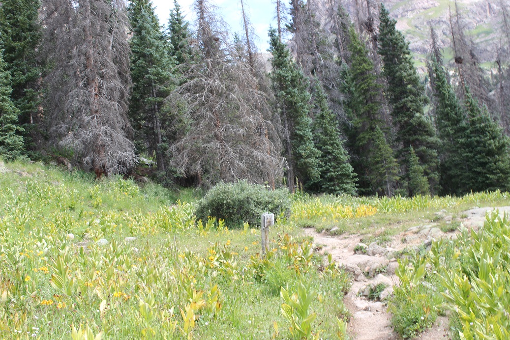
I re-crossed Needle Creek and stopped to filter some water. It was a warm day and I was forcing myself to drink. It was making me nauseous, but at least I wasn’t light headed. The cool water felt really good, and I started just drinking it from the filter to save time. After my water bladder was full I went to find my pack. Argh! I wasn’t able to find it! This was not good. I was sure I’d left it by the sign? After about 5 minutes of searching I realized there were two similar signs and I was at the wrong one. I made my way about 10 yards further and was relieved to find my pack where I’d left it, and as an added bonus, no goat/marmot damage to be seen. The downside? There were so many mosquitoes here! I’d wanted to rest for a bit, but the mosquitoes wouldn’t quit, so I decided to just get going.
My pack was on the ground so I sat down to put it on and groaned as I leaned to the side to stand up. That pack was heavy!!! Time to trudge up to Twin Lakes. Luckily this is a very well marked trail.
About halfway up I saw my second set of goats for the day. They were directly on the trail and looked me straight in the eye as I got close. I was wondering how we would pass each other politely when one of them just veered off the path a little to the left, went around me, and then hooked back up with the trail. They must be used to this…
From this angle Jupiter looks imposing
As I continued on I saw a sign that said “No camping beyond this point: Including Twin Lakes Basin”. Well shoot. There went my “Plan B” of sleeping at Twin Lakes if I couldn’t make it over the pass. Oh well, it looked like the path was clear, so it shouldn’t matter anyway.
I made it to the Twin Lakes area and had a great view of my intended route. There looked to be a little snow, but nothing I couldn’t handle
Also, there’s hidden snow here, more than anticipated
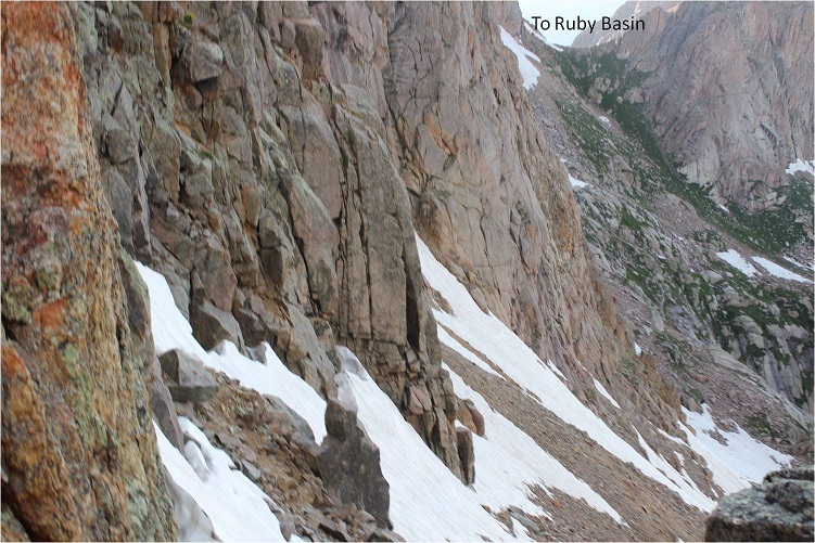
No worries though: I just put on my crampons, tested the snow for stability, and easily traversed over to the final gully before Twin Thumbs pass. I took the solid route up, and the dotted route down (the dotted route is the better route).
There were no cairns or paths or footprints here, or anything indicating anyone had used this route in the past. I was huffing and puffing by this point but really wanted to just get over the pass. When I made it to the top this is what I saw
Ok, this looks good! I could see where I wanted to be and the path I wanted to take to get there.
Right now I was pumped! I probably had 2 hours left of daylight and a clear visual of where I wanted to be. And it was all downhill. I began my descent through a class 4 chimney (not as easy as it sounds with a full pack on my back. Also, this move wouldn’t have been necessary had I taken the dotted line route.) I was immediately taken aback by how steep the scree here was.
It quickly became apparent the route up to Ruby Basin (should I need to use it) was much steeper than it looked on a topo map.
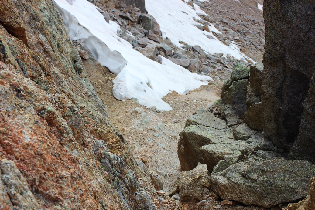
This is where my trouble began. I made it to the first patch of snow and thought it would be similar to the snow I’d encountered in the Twin Lakes area. I stepped on it and promptly sank up to my waist. My feet however were still dangling in the air beneath the snow. This was not good. It wasn’t lost on me I’d narrowly avoided breaking a leg. My large pack is what had caught me and kept me from sinking further. It took some time but I was able to get myself out of the hole I’d fallen into.
A bit shaky now I stood where I was and considered my options. I probed the snow a bit with my trekking pole and realized there was a layer of snow a couple of inches thick over the rocky ground. This layer broke easily (obviously) and I did not feel comfortable traversing on it, even with crampons. I looked for a clear line of scree/rocks to traverse to get me where I wanted to go and just couldn’t make out a snow free path.
I could continue to descend and look for a snow free path, but I gave finding one a low probability since the areas I couldn’t see were the steeper parts of the route. It looked like no matter what I was going to have to cross snow. The sun had already gone down behind the mountains and I figured I had about an hour of daylight left. There was nowhere to camp on this side of the mountain.
I had two options: either continue on and hope to find an area without snow I could cross or to turn around and head back. The choice was obvious. I wept a few silent tears, turned around, and started my ascent back up and over Twin Thumbs Pass: making it to Noname creek was optional, making it back to my truck was mandatory. Here’s the path I took back up to the pass. The dotted line is the path I took down. I’d recommend the solid line.
Ok, so I turned to head back to the pass but my shoes immediately slipped as if I were wearing ice skates. This wasn’t good. The scree here was terrible for an ascent. I hadn’t brought along my microspikes (to save weight) but I did have my crampons, so I took those out, strapped them on, and wouldn’t you know it? Better than microspikes! Sure, I was ruining the crampons, but at this point the benefits outweighed the risks.
I knew I was racing against the clock: the sun was rapidly setting and I needed all the daylight I could get. I found an unexpected boost of adrenaline and booked it up to the pass. I was shocked at how quickly I moved, and actually entertained the idea of hiking all the way back to Needleton tonight and attempting Jagged in the morning.
I made it up and over the pass and kept my crampons on until I made it past the snow near Twin Lakes. Here I stopped to take off my crampons and at this point the adrenaline stopped and exhaustion took over. I took off my crampons but was too tired to take off my pack and put them away so I carried them in my left hand. This worked well until it got too dark to see and I needed to carry a flashlight (I’m not a fan of headlamps).
I was stumbling in the dark. Stumbling because at this point I was exhausted and also because I’d completely ruined my hiking boots: they had holes in them the size of quarters and the tread was completely gone. That pass had been more brutal than I’d anticipated. Every few steps I’d slide due to lack of traction and catch myself. One time I didn’t catch myself quick enough and I landed on my shoulder in a bunch of willows. Ouch. That was it; I needed to stop and set up camp. Now. Gone were my fantasies of setting up camp at Needleton, or even in Chicago Basin for that matter.
But I’m a rule follower and I’d seen the sign. I wasn’t allowed to camp here, and I knew it. So I kept on. It seemed like I’d hiked for miles before I finally made it to the “no camping past here” sign, and when I did I dropped all my gear and haphazardly set up my tent directly in front of it. I did a terrible job: I couldn’t see in the dark and honestly I was too tired to care what I was doing. It took me twice as long as it should have to set up and I did so directly beside the trail. Dumb move, and I knew it, but I didn’t care. I needed to rest. Oh, and eat. So far all I’d had were a few almonds and I knew I needed more calories. I opened my bear sack and had tons of options: beef jerky, tuna, almonds, peanut butter. I chose dried mangoes. Not the most caloric but it was what my body was craving. I only wished I’d brought more.
I fell asleep around 10:30pm and woke up every half hour after midnight. You see, I was camped directly next to the trail, so every set of early morning hikers intent on Eolus, Windom, and Sunlight passed right by me. As they did so they all directed their flashlights at my tent. What they most likely didn’t realize is that when you shine a light on a tent it doesn’t allow you to see inside of it, but it does brightly illuminate the inside of the tent. So every 30 minutes or so it was like someone turned on a light inside my tent. My fault for so many reasons I know, but I was too tired to care. And cold. It had been a bad idea to swap my good sleeping bag for a lighter weight one.
In the middle of the night I could hear a goat beside my tent. It was occupying itself with the bandana I’d left outside. I could actually hear him a foot or so from my head, and mentally visualized him picking up the bandana with his teeth and swishing it from side to side.
I left my tent at daylight. My bandana was now separated from my trekking pole but lying inches from where I’d been in my tent. Apparently the goat didn’t want the souvenir. I wasn’t hungry but forced myself to eat a packet of tuna and quickly packed up my gear. Taking down the tent was the worst: my fingers were frozen stiff, despite it being about 40* the night before. My whole body ached from yesterday. I wasn’t sure I was going to be very efficient today, and laughed at myself for thinking last night I could even attempt Jagged today. I was honestly considering camping at Needleton and making the rest of the journey tomorrow.
It was Saturday morning but I didn’t pass many people as I exited the basin. I hurt all over, but especially my shoulders, and specifically my right shoulder. I was worried I’d broken my clavicle when I’d fallen into the willows yesterday. Every hundred feet or so I had to stop and lean over to take the weight off my shoulders for a bit. I tried re-adjusting my straps to distribute the weight more evenly but that wasn’t helping. When I made it to the bridge 2 miles from the Needleton junction I stopped and took off my pack. I realized one of the upper straps had come unbuttoned and fixed it. This seemed to help a bit, but I was still worried about my shoulder. It was red and sore and there was an unfortunate bump right on the collarbone. It wasn’t lost on me I’d carried most of this gear for nothing…
I’d rested for a bit and decided that was enough for today and was on my way. I met a trail runner who stopped to talk for a bit. “Isn’t Chicago Basin as close to heaven on Earth as you can get?” she asked. I agreed, but mentally thought Purgatory was a more apt name, and most likely why Chicago Basin felt like heaven. I really thought she was running to the junction and back but I never saw her again (and she should have caught back up with me if she were doing so).
I was bummed. The weather was perfect, which meant I was wasting a perfect day not summiting something. And I hurt. I was sore and each step hurt more than the last. My shoes were trashed and I’d carried 30 extra pounds of unnecessary gear for dozens of miles and elevation gain for naught except conditioning. Suddenly Sherpas made sense. By the time I made it to the Animas River I was done feeling sorry for myself and instead decided to focus on the positive: I’d been here three times but never hiked the trial in the daylight. I was going to enjoy the view of the river and the shade and the occasional view of the train passing by
I was actually making good time and made it to the railroad crossing around lunchtime.
I’d made a deal with myself here I’d take off my pack for a long time (at least 15 minutes) and have lunch and soak my feet in the river. The mosquitoes had other plans however. Eventually I figured out they came in small swarms and if I killed all 12-15 of them I’d have a solid 2-3 minutes before the next swarm arrived. On the positive side the water was cool and it felt good to sit for a bit.
Animas River:
Lunch was a couple spoonfuls of peanut butter. I strapped on my gear and got ready for the hardest part of the hike: the last 4 miles and several thousand feet of elevation gain. I headed northwest and hugged the side of the mountain
I was pleasantly surprised to realize this trail is mostly in the shade. I was also surprised to realize just how closely this trail comes to Cascade Creek. Hiking this at night I’d always assumed the creek was down much further from the trail than it actually is.
So the shade was nice but the elevation gain was exhausting! I kept gaining and then losing elevation for what seemed like no purpose whatsoever. Why couldn’t the trail just gain steadily in elevation? It was disheartening to gain a couple hundred feet just to lose it again.
There were raspberries on this trail, and while I’m not fond of raspberries these were by far the best I’ve ever had. I couldn’t collect them fast enough (sorry woodland creatures that would have benefited from them, but they were delicious).
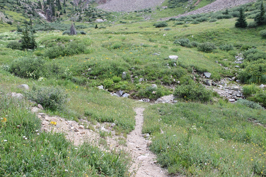
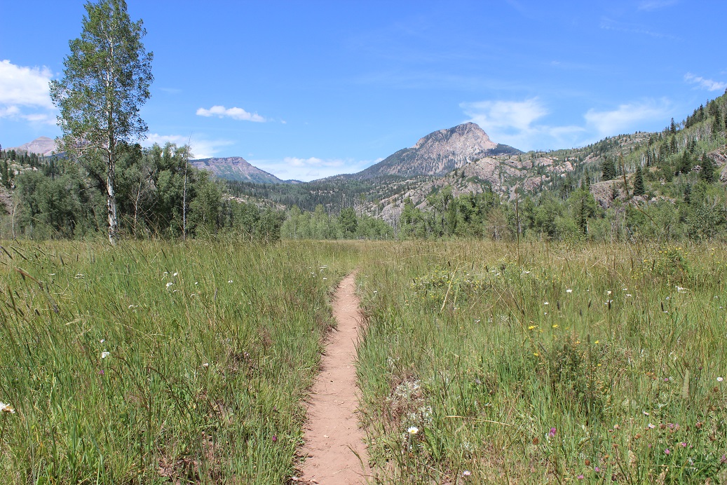
This meadow looks totally different in the daylight
The last quarter mile was the worst of the entire hike for several reasons: This part was a steep uphill climb, the sun came out again from behind the clouds, I was tired, my pack was heavy, and I ran out of water just as it began. This last quarter mile took me half an hour to complete (which is very, very slow for me).
Last time I was here I’d hiked Pigeon and Turret’s 39 miles in a day and I’d had hallucinations. This time I realized I’d gladly hallucinate again if it meant not being in this much physical pain from carrying such a heavy load. The only redeeming factor to the weight was I’d used every piece of equipment I’d brought (except the climbing gear, but that was necessary if I’d intended to climb). The physical pain was terrible, and I wondered to myself how long it would take me to forget the torture I’d put myself through over the past two days. Hopefully less than two weeks because I totally plan on doing this again. Soon.
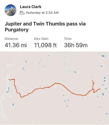
I made it back to my truck at 2:30pm, making this a 41.5 mile hike with 11,098’ in elevation gain in 37 hours.
But my adventure wasn’t over yet. I limped back to my truck and set my pack on my tailgate. I unlocked my truck and downed an entire 2 quart bottle of cranberry juice in-between huge gulps of air. It was still early enough to make today productive, so I decided to drive to a Subway, get dinner, and then sit in my truck and figure out what to do next. A nap was definitely in the plan.
Did you know it’s difficult to find a place to sleep in your car in Durango? Seriously. Every parking lot I entered had “no camping” signs, and many even had “no sleeping in your car” signs. So I drove to a park on the edge of town, thinking this would be a good place to rest for a while. I got out my list of peaks I want to attempt in the next few months and did some calculations. None of them were close enough to drive to tonight to make them worth summiting tomorrow. Drat. It looked like tomorrow was shot as well. Which was probably for the best seeing as how I couldn’t move at the moment, but I was still disappointed.
It was too hot to sleep in my truck without the windows open and there were a surprising number of children screaming at the park as if being there itself were pure torture. I gave up on the nap and drove for a few hours until I found a National Forest Trailhead I could park at for the night, avoiding suicidal deer running across the road. This was a fabulous idea and I was able to sleep under the stars.
I woke up as the sun began to rise and drove the rest of the way home. I was itching all over, and when I looked in the mirror I noticed I had so many mosquito bites it looked like I had the chicken pox. Lovely. I randomly picked a CD out of the glove compartment and began singing 9-5 at the top of my lungs along with Dolly, my mood instantly improved. Until I stopped for gas. I slid out of the truck and my legs buckled underneath me. I quickly looked around to make sure no one had noticed me, and then pulled myself back up into my truck, laughing at myself for even thinking I could’ve hiked another peak today. My body needed a few days to rest, and I need to figure out a way to lighten my pack…
I’ve been preparing for this weekend since February when the summer camp catalog came out. I knew I wanted to plan this trip for the days when my youngest daughter was at summer camp, so when she chose her camp I made my reservations with the Durango & Silverton Narrow Gauge Railroad for the days she’d be gone.
It didn’t matter what the weather was, that was the time I had available to go. My son was going on a solo road trip to Arizona (well, he brought the cat) and my oldest would be at Drums Along the Rockies, so I had 1 free weekend to backpack this summer.
Well, then the fires happened and not only did they shut down the railroad, they closed the entire San Juan National Forest. This was unfortunate for numerous reasons, and also because it looked like my trip wasn’t going to happen. Then they re-opened the forest (woot!) but not the railroad. This was getting frustrating! I kept calling the railroad station to see if they were going to be running the train, and every time I called I got a different answer.
So I made two plans: One for if the train was running, and another for if it was not. This was my one weekend to visit the Chicago Basin and attempt its 14ers this summer and I didn’t want to waste it. Going through Purgatory didn’t sound fun but if it was my only option I was prepared to hike into Chicago Basin that way. Normally I wouldn’t mind, but I had a strict time limit because I had to work Monday morning.
I checked and re-checked and checked the weather forecast again. It did not look promising. 70% chance of thunderstorms in the morning, afternoon, and evenings for the entire weekend. These conditions were less than ideal but at least I could prepare for them. I became a weather expert (it seems this isn’t monsoon season yet, but pre-monsoon season that mirrors the actual monsoon season… yeah, basically it’s going to rain buckets with lightning and thunder added in for fun, and it won’t be predictable).
I packed, unpacked, reduced, and packed again. I decided to cut weight by eliminating the need to cook my food (I make a mean beef jerky and dehydrate fruit to bring with me that doesn’t need to be cooked) and added warm layers. Extra socks, pullovers, hats, and gloves.
The day before my trip the train was scheduled to run again, but they weren’t giving out backcountry permits until late August. However, they would honor my tickets since I’d bought them so long ago. Woohoo! I was good to go!
Thursday afternoon I closely watched the weather out the windshield of my truck as I drove the 6.5 hours to Durango. If the weather tomorrow was like today I was golden: heavy cloud cover with no rain. Before checking into the motel I stopped by the train station to pick up my ticket. There was only one other backcountry permit in the queue besides mine, which told me not many of us would be packing in with the train.
Next I checked into the motel. I made small talk with the man at the front desk wearing the Zia Marching Festival shirt (my kids went two years ago for band so small talk was easy) and was assigned a room and a parking space. I stopped by Wendy’s for a quick dinner and brought it back to my room.
This was the smallest motel room I’ve ever stayed in, mainly because I’m a hotel snob. I travel a lot for work, and I need the hotel to have a gym so I can work out every morning. Most hotels with gyms are just… nicer in general. I didn’t think that was necessary for tonight’s stay, so I just chose the cheapest place I could find. I had an assigned parking space my truck didn’t fit into and a room just big enough to walk around the bed. I was a little concerned my truck would get broken into overnight. Well, all I really needed was a place to sleep, so this would do just fine. Check out the view from my room…
I poured myself a glass of wine and brought my backpack in from the truck. After dumping all the contents on the bed I went through my gear one last time. I’ve been backpacking many times, but tonight I seriously felt like Cheryl Strayed. I dipped a fry into my frosty and considered: I’d done a good job packing. There was nothing I thought I didn’t need and I had extra space in my pack. Everything was in a Ziplock bag and I had extra large trash bags if needed. I was good to go! But it felt weird only packing for myself. I haven’t been solo backpacking in a long time: I’m usually in charge of a group of scouts, so I have to over pack things like emergency supplies, food, etc. I could get used to this!
I took a last minute shower (I’d brought my Disney shampoo for good luck: if you’ve ever stayed at one of their resorts you know what I’m talking about), and charged my cell phone and camera. I made a list of goals for this weekend (stay warm/safe/make good choices, learn something, make the most of the time I had, hike at night if necessary, and if the weather’s bad sleep until it’s good). I did some texting and problem solving and answered some very important last minute emails that came in about a potential magazine interview on Monday and made it an early night so I could get started early in the morning.
I had a couple of people who had considered hiking in with me but had canceled due to weather. I was actually relieved they weren’t able to make it! I would have been a terrible hiking buddy in this weather because I’m too goal oriented and I don’t need much sleep. Hiking solo gave me time to hike as fast as I needed, set up camp (or not) and hike/eat/etc. whenever it worked for me. If someone else had been with me I’d have felt responsible for their comfort/ etc. and I’m pretty sure I’d have either made them mad or I wouldn’t have summited (making me mad).
The night had been sweltering. There was an air conditioner that I had to turn off because all it did was make noise. Well, you get what you pay for. I had to take another shower in the morning because it had been so hot overnight. I dressed for success in my new hiking pants that are supposed to repel insects and are two inches too short because I had to get them in the kids section. (Note to athletic/outdoor clothing manufacturers: not every “woman” is large. I’d like some hiking pants that fit a 5’4” 105lb woman please… I’ve been looking for years and resorting to wearing yoga pants under your size 2’s or shopping in the kids section isn’t working for me!)
I did one last sweep of texts and put my phone on airplane mode. The weekend had officially begun.
Check out at the motel wasn’t until 8am but I had a train to catch. The front doors were locked so I dropped off my room key in the slot and headed to the train station. It was a beautiful morning! And that sunrise! It almost physically hurt not to be hiking now when the weather was good.
I was the first one of the day in the parking lot at the train station. I parked in long term parking with 3 other vehicles from yesterday and mentally calculated how many people should be in the basin.
McDonalds was close so that was breakfast. I haven’t eaten this much fast food in quite a while. In fact, I don’t think I’ve been to a McDonald’s since I was in High School. Thoughts from the McDonald’s lobby: it smells like cigarette smoke in here, there are two types of people here: those in their pajamas and those in their motorcycle gear. The parking lot filled up fast.
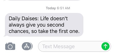
My Daily Daisy text pinged my phone and I took it as a good sign:
I went back to my truck to get my gear and walked to the train station.
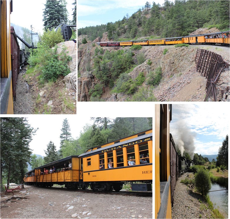
Of course I got there early, so I walked the platform and talked to the volunteers and employees. They were all thrilled to be working again, as they’d all been out of a job for the past 6 weeks. Some teared up as they talked answered questions.
With the help of brakeman Chris I loaded my gear into a boxcar with the two other backpackers and thought to myself how it was already hot outside and I stunk. Those two guys in the picture below on the right stayed behind and watched the wheels on the train to make sure there weren’t any sparks. Several employees shook hands with the engineer and told him to “stay safe out there”.
The train left right on schedule. There were homemade signs and posters all over the fences thanking firefighters and welcoming the train back. Several houses had “Welcome Back Train” signs, and tons of people stood by and cheered the train on as it left, or came out to see the train as it passed by their front yards. The citizens were visibly emotional to see the train in action again, wiping away tears sand clapping. You could tell the closure of the train had impacted the community greatly.
Check this guy out! We saw him every few miles or so, cheering us on. I’m not sure if he was an enthusiastic Durango citizen or paid to do so by the train station, but he would cheer us on, get in his vehicle and drive ahead of the train, change is outfit, and get out and cheer us on again. Everyone on the train loved him. We passed him at least 8 times.
I sat next to a brave mother and father of 6 well behaved boys under 10 years old. One of the train employees talked with me about stopping in Needleton and asked me if I knew how to jump off of a moving train. The boys eyes got wide when I said “Absolutely, I just tuck and roll, right?”
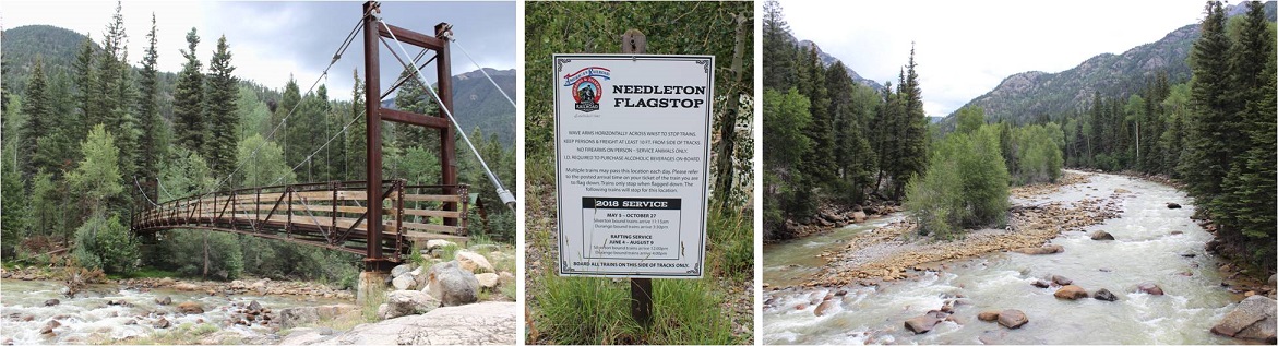
It was a long 2.5 hours to the Needleton stop. I passed the time by going over my trail notes again and again. I arrived at the Needleton flagstop at 11:40am.
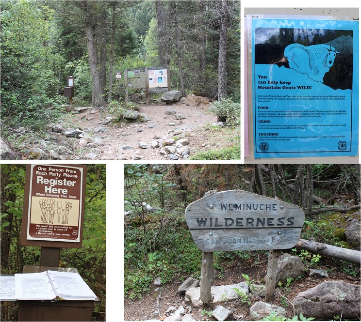
I waved goodbye to the train, said a quick greeting to the other two hikers, and started the 6 mile hike to the Chicago Basin. This hike has excellent signage. I signed in at the trail register at about .8 of a mile up the trail where it intersects with the Purgatory Trail.
I passed several groups of hikers hiking out as I was hiking up. They gave me some advice that ended up being very useful: Hang everything up when you leave with your bear bag. Leave nothing in your tent or on the ground. The goats and marmots will eat through your tent to get to your stuff. Also, don’t pee anywhere near your campsite: the goats like pee and will follow you to get it. I found this last part weird since usually urine (especially male urine) usually keeps predators away, but I guess goats aren’t predators and like the salt. In any event, their advice was correct.
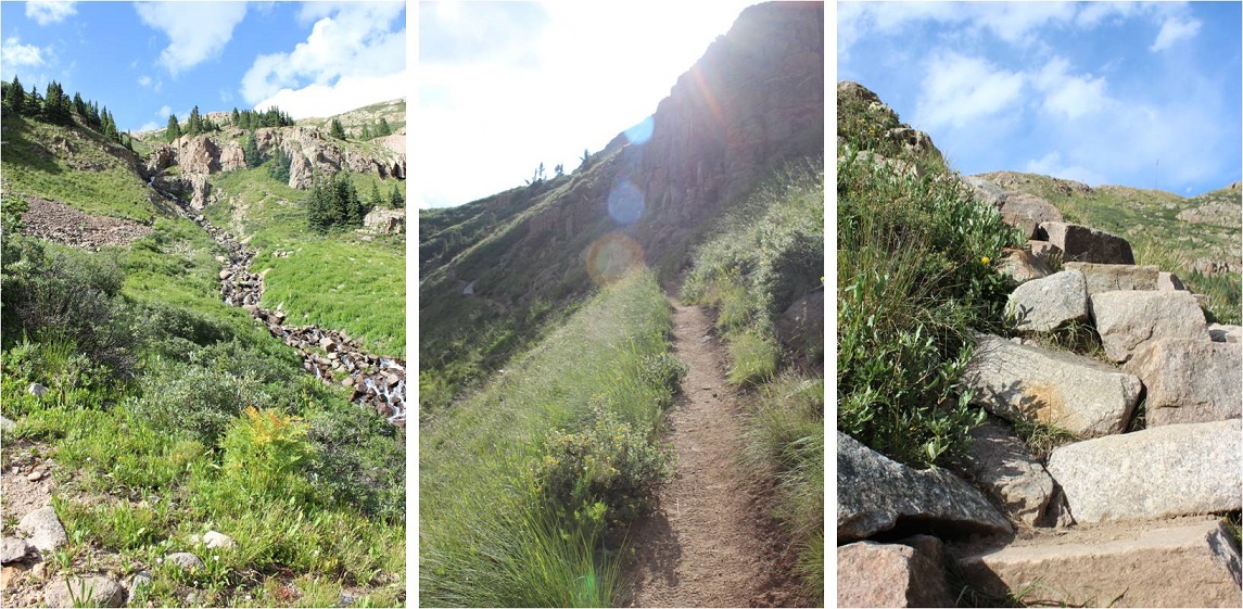
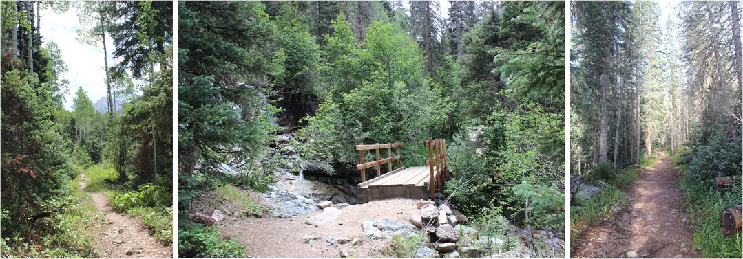
The trail was heavily shaded and followed a creek, but that didn’t stop it from being hot out! I don’t usually hike in the middle of the day: It’s tiring! Most of the hike in follows a creek. At the halfway point I crossed a bridge, knowing I had 3 miles left of the hike and seriously hoping it would rain soon.
There were tons of strawberries covering the ground, as well as downed trees. When I saw this small waterfall I stopped and dipped my head in the water (swallowing some in the process, so if I get Giardia I’ll know why). This cooled me off and felt amazing! I soaked my bandana and continued on. From here it was 1 mile left to the basin.
I arrived at 2:40am and was greeted by tons of bold and very adorable goats! Here’s proof:
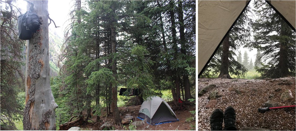
The goats were everywhere, and seemed to like my company. I carefully placed a beer in the creek to cool off, set up camp, hung my bear bag, re-hung my bear bag because the first place I hung it was covered in sap, and looked up at the weather. It didn’t look too promising, so I went back to the creek to retrieve my beer and went back to camp to eat something. I’d been saving the beer for tomorrow but I was really hot and needed to cool off. I sat down to eat and it immediately began to hail!
This lasted for about 45 minutes and cooled everything off in the basin. It was a good time for me to eat, rest, and get my bearings. There were a lot of people camping in the basin, many more than I’d anticipated considering they couldn’t take the train. They must have all hiked in from Purgatory. Oh, and the inside of my tent was getting wet. Lovely. It stopped raining at 5:15pm and just before it completely stopped I decided I wasn’t going to waste any time. I hung up everything I wasn’t taking with me, gathered my gear and headed towards the trail.
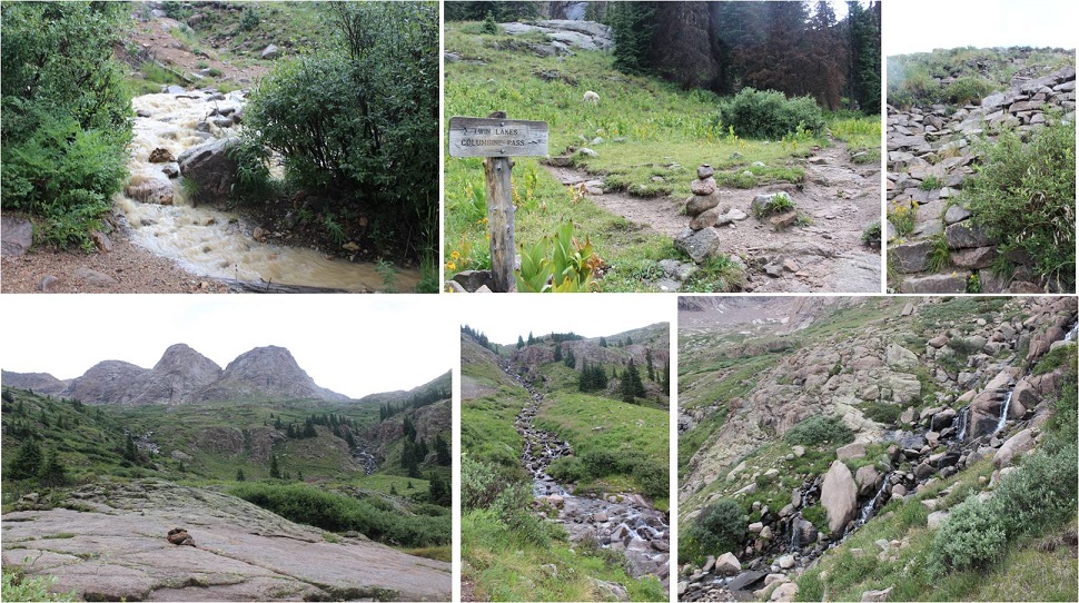
The Twin Lakes Trail gets you to the intersection for all 4 14ers, so I decided to hike up to Twin Lakes and make my decision then which 14er I’d attempt tonight once I got there. I passed several goats along the way.
Since it had just rained/hailed the creek crossings were high. I had to get creative to cross them. The trail came to a junction where I turned left and followed it up the hill, through some rocky areas and some well maintained stairs up a slope and through some waterfalls.
At the top of the slope was Twin Lakes. I could go either left towards Mt Eolus and North Eolus, or right towards Sunlight or Windom.
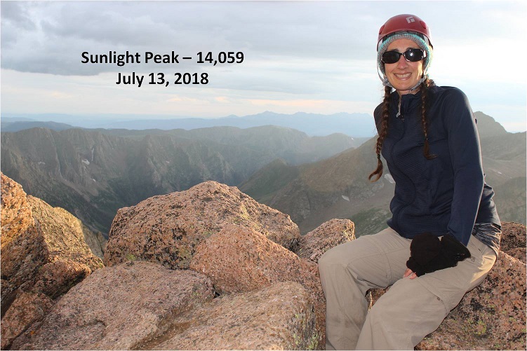
I’d been doing a lot of thinking on the trek up to Twin Lakes about which 14er I should attempt. I really wanted to get both Eolus and N Eolus done tonight, but as I was watching the weather it looked best near Sunlight Peak. It was a difficult choice, but I chose Sunlight, purely due to weather. I mean, doesn’t it look inviting?
Here’s the route I took:
As you can see, the route is very well cairned. I followed the 6 foot tall cairns toward the gully, and then up the gully to a notch. This gully was a good gully! It had some loose terrain, but was mostly made up of rocks about the size of a tire. I was keeping an eye on the weather, but as you can see, it looks great!
From here I followed the route left. This part was actually quite easy and didn’t require much route finding, just some scrambling over class 3 terrain.
Here’s a great view from a hole in the ridge. I decided not to take this route but to turn left and head to the final summit pitch.
From here there were a couple of class 3 moves, and then a class 4 move up and around to the summit. I made it to the summit and decided to drop my gear and climb the last bit to the “true summit”. It was a scramble on some grippy rock to the top of a few boulders placed a few feet apart in all the critical areas. That had been too easy!
I made it up to the top of the highest boulder and took a look around. Wow! I needed a picture of this! Drat! My camera was back down with my stuff. No worries, I’d just climb back down and get it. I slid feet first down the rock and jumped onto more solid ground. I got a few pictures of the summit marker and surrounding peaks
And took a summit selfie to prove I’d summited.
I took a quick video of the summit, and came to the realization a storm was approaching very quickly. I hadn’t been able to see it from the way I’d climbed in, but it was obvious now I needed to get back to treeline as soon as possible.
Please watch the video below with the sound on. Note it starts at 7:58pm, and then it jumps to 8:30pm.
In 10 minutes time I made it to the top of the gully and it started sprinkling. Wow, that was fast. No worries, I’d just put on my poncho and keep heading down. I made it about a quarter of the way down the gully when the sky broke loose: it started pounding rain, and then hail, and then the thunder and lightning started. There was nowhere to hide: No caves or rocks to hide in or under. I was completely exposed and I couldn’t hike up or down to find shelter, as there wasn’t any. I didn’t want to be a moving target so I found two large rock slabs that didn’t provide any shelter to back up and huddle against. I still had my helmet on, but water was cascading down the rocks straight onto my head, and I was being pelted from the front by the storm. The second half of this video takes place after the worst of the storm is over, but you can still get a sense for the atmosphere.
Just for reference, this is where I was during the storm.
I sat there for over an hour and a half, listening to the thunder crackle all around me and waiting for the lightning to stop. There was no lightning tingle or electric current in the air as I’ve heard from other people who’ve been caught out in storms. Luckily most of the lightning stayed in the clouds, but every so often I’d see a bolt strike Windom. I couldn’t get off that mountain fast enough, but I needed to be safe at the same time, so I waited it out. When I finally felt the lightning was far enough away I got out my flashlight and hiked back to the Chicago Basin soaking wet.
Well, as far as picking a peak to hike tonight I had picked the right one. Windom was a nightmare with all that lightning, and I realized the next day I wouldn’t have been able to summit the other two peaks: I’d have had to come back and hike at least one if not both of them again the next day.
I made it back to my campsite sometime before midnight, and the entire basin was already asleep (besides the goats I said hi to as I passed them on the trail). I was hungry, so I brought down my bear bag and rummaged around for something to eat. Peanut Butter sounded good, but where was my spoon? In the dark it was difficult to find anything, and I was trying to be respectful and quiet for the other campers. Well, I couldn’t find a spoon, but I did have some dehydrated bananas that I could use as a spoon. So there I squatted next to my bear bag, trying not to sit on the ground because it was wet, flashlight on the soil, with a tub of peanut butter in one hand, and the other scooping it out with a banana slice. When I was done I licked my fingers and put everything away.
Now to deal with my sleeping arrangements. I’d put my sleeping bag in the tree with my bear bag before leaving to keep it away from the critters, not anticipating the rain, and now I had a soaked sleeping bag (or so I thought). Luckily I’d brought two tarps. One I’d put under my tent earlier today when setting up, the other I got out now and as quietly as I could folded into a square and placed it inside my wet tent, forming a barrier between the wet floor and myself. I opened my sleeping bag and was delighted to find the fleece blanket I’d rolled around the sleeping bag had absorbed 95% of the rain water, and the sleeping bag itself was mainly dry. I hung the fleece outside and settled down for bed.
Saturday morning came early. After almost 4 hours of sleep I was up at 3:45am and out by 4:15, ready to tackle another peak. I re-hung all my gear by my bear bag and set out in the dark, hiking under the stars and some wispy clouds. The clouds didn’t look too threatening. Everything was still wet from the storm.
I followed the same route I had yesterday up to Twin Lakes. My legs were still sore and I was actually thirsty. I hiked slow and steady past Twin Lakes and towards Mt. Elous. Here the sun began to rise and I got a good look at the route before me.
I hiked towards the edge of a basin and then up a ramp and over some rock slabs
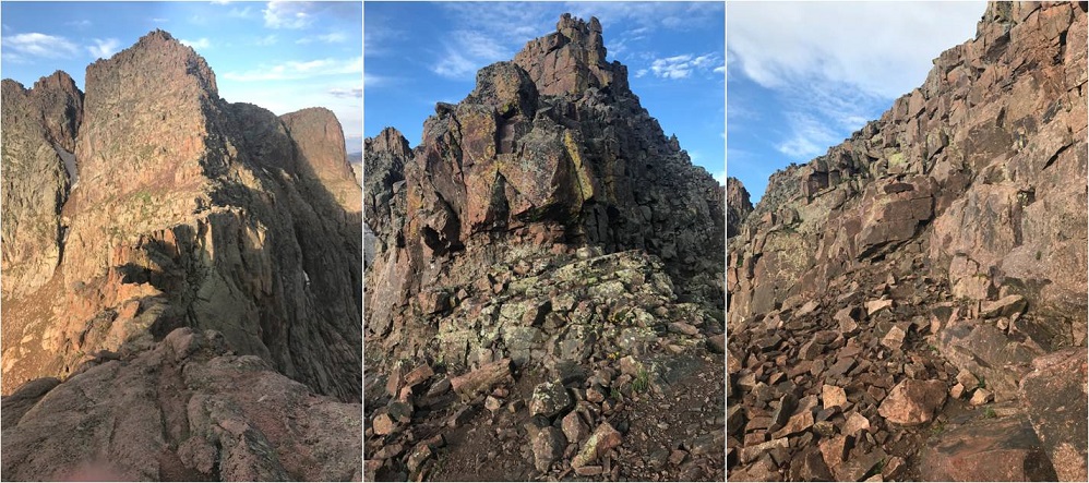
Here’s where the hiking got fun! It became a climb from here on out. I climbed up this optional (class 4?) wall to reach the saddle / ridge
And looked at the catwalk to my left. This was going to be fun!
There was a lot of exposure here but the route wasn’t too narrow. I followed the catwalk to the final pitch up the East Face, which required a lot of route finding and class 3 moves. Let’s just say aim up: There are tons of cairns and they all parallel each other, but the basic route goes up.
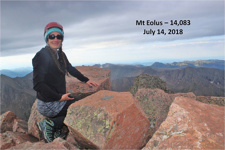
Woohoo! Summit Selfie
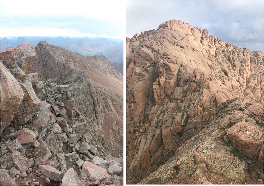
Now it was time to head back and tackle North Elous. Here’s a look back at the Catwalk and North Elous’ Ridge
The ridge was actually very easy to navigate. It had grippy rock and was a sticky but simple scramble towards the top. Once again, I was glad I’d chosen today to hike this instead of yesterday. Oh, and I was a bit sore so I was hiking slow.
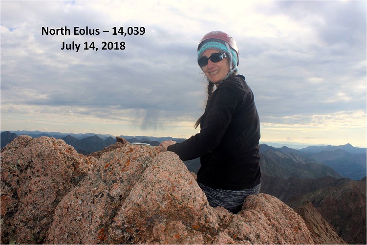
I took a quick summit selfie
And looked back at the way I’d come. Pretty cool! The catwalk looks like a beast, and so does the way back down.
Ok, 3 down, 1 to go. I was closely watching the weather today as I hiked back to Twin Lakes. I made it to the lakes at about 9am and was concerned with the amount of clouds I saw in the sky. I figured I had a 50/50 chance of needing to bail on Windom, but like I said before, I was sore and didn’t want to hike down to Chicago Basin just to hike back up to do Windom again later today: That elevation gain was brutal! I decided to try it, as I could always turn back if needed. I’d just take it slow and keep watching the weather.
At Twin Lakes I met Boy Scout Troop 393 from Phoenix, a fun group of guys to talk with. They were filtering water, and told me about the time a couple of years ago when they hiked Windom. A few of them were Eagle Scouts and Life Scouts.
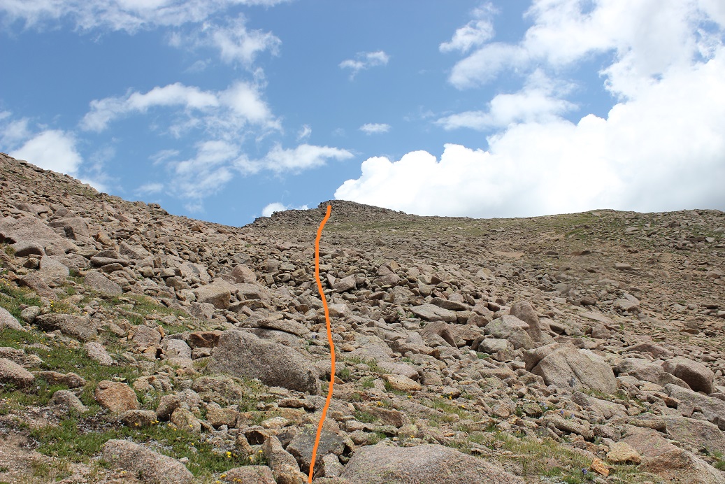
I continued on towards Windom. The trail follows much of the same route as Sunlight through the basin, but then angles right up a gully (there is a trail to the right near the ridge but it’s currently washed out).
There were several routes, but I took the gully up and aimed towards the ridge, to what I found was a false summit. Drat! I thought I was making great time and I’d been so excited I was going to climb this mountain before the weather set in, but when I hit the notch I realized I still had another 45 minutes or so to go. I steeled myself against the let down and kept climbing, more intent now than ever on finishing this trek.
The final push from the notch follows the left (not the right as the GPS told me to go) and contains some class 3 moves, even though it’s rated 2D. It was very well cairned, and quite a bit of fun!
It took me longer that I’d have liked to summit, but when I did I felt fabulous!
Check out that view of Sunlight!
OK, now it’s time to head back down. The weather was holding, but I didn’t want to cut it close. I turned around and the Boy Scouts called to me from the saddle. They wanted to know if they could summit before the rain hit. Now, that’s a difficult question to answer. I’m not sure how fast they hike, and sure, they could probably make it up, but they weren’t going to make it down before the rain hit. I told them as much and passed them on their way down. They’d already hiked this one a few years ago, so they knew the route. I wished them luck and continued on.
Just before making it to Twin Lakes I met up with the rest of their troop (not all were prepared enough to climb Windom today). We had a nice chat before I excused myself to head back down to camp. I practically skipped back down as the weather held. Sure, I hadn’t brushed my hair in 2 days, I was getting hungry and I was tired, but I’d just summited the 4 14ers I’d come to summit! This mission was a total success!
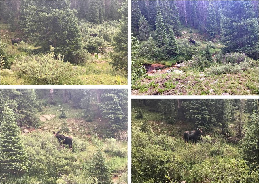
To top it all off, today I did everything right. All my clothes and sleeping bag were dry, as it hadn’t yet rained. I took a trip down to the stream to filter some water and stumbled upon two moose! A male and a female who didn’t much care I was there
I went back to my tent, ate about ¼ a package of Ramen and some dried fruit, and then cleaned myself up before the rain started. My feet were sore and I stunk, but I was happy as I sat all dry in my tent. I thought about tackling Jupiter tonight/tomorrow. Should I? I kept going back and forth with it in my mind. I took a quick 2 hour nap and was woken by my neighbors. Unfortunately they were boisterous and the man’s voice carried. It continued to rain so I decided against Jupiter for now. I lay down, and the next thing I knew I woke up at 1am, needing to use the bathroom. Well, that had been quite a nap! I guess I’d caught up from the night before. The only problem was it was too early to hike. I didn’t want to summit in the dark, so I decided to just lie in bed and wait an hour or two. The next thing I knew it was 5am, and now it was too late to summit and still make it back. Or was it?
I jumped out of bed, gathered some food, and went to look for the Jupiter trail. As I was hiking I really gave the outing some thought, and while I felt I could summit in time I was worried it would put me hiking back down to the train during the wet weather time of day, and I didn’t much want to do that. So I made a nice 3 mile loop out of the hike instead. I came across an abandoned mine I’d wanted to explore but the ice kept me from it
I stopped for a bit to filter some water, and then continued the trail as it followed a ridge. Here I meet a ton more goats all playing on the scree slope. Two baby goats looked like they were trying to push each other off. The rest just seemed to be rock climbing.
I leisurely walked back to camp, and when I arrived at 7am I was surprised to find the Basin was totally cleared out! Everyone had packed up and left. Wow! So I packed up my things, said goodbye to the goats, searched for and picked up pieces of trash, and left at 7:45am to head back down to the train.
I was in no rush today, which is not normal for me. I’m always in a hurry. I actually stopped, took breaks, and enjoyed the waterfalls and streams. It was so nice not to be in a hurry! I stopped to have a snack by a waterfall, and once I’d made it down to the Needleton/Purgatory Junction I took off my shoes and soaked my feet in the stream as I heard the 11:30am train go by. I washed my hands and re-did my hair. There were tons of flies here, and I tried not to take offense they seemed enamored with me.
I put my shoes back on, passed 4 hikers who’d been let off the train and watched the clouds roll in as I made it to the flagstop. Hey, guess what? I just realized I hadn’t seen a single mosquito this entire trip! I thought the Chicago Basin was notorious for mosquitoes? Hmmm… I must have been lucky!
I made it to the flagstop at 12:30pm, which meant I had 3 hours to wait for the train. That’s quite a bit of time to do nothing, but almost immediately it began to rain. I crossed the tracks and found an old shelter on the other side. It didn’t look too safe, but it did look like it would keep me dry. I’d just have to be careful not to sit down/step on any nails.
For the next 2 hours I watched the rain from inside the shelter. It looked much worse on the trail, and I congratulated myself for not going for Jupiter today: I’d have been stuck in that hailstorm hiking right now if I had.
At about 2:30 the rain stopped, so I went back out by the tracks. A little before 3pm the 2:30 train went by, and out of nowhere 3 high school aged boys ran across the bridge to wave at the train. It seems they’re staying at a cabin on the river (they’d come in by train this morning) and their only entertainment was waving at the train, so they were coming out every time one passed.
My train came closer to 4pm. The two other hikers who’d come in on the train with me were there to take the train back (they’d gotten caught in the hailstorm hiking back down). After getting a $5 beer I had some great conversations with the other people sitting next to me. I tried to relax before my 6 hour drive home, but everyone was chatty. I was ok with that. In fact, I was just fine. I’d accomplished what I’d come to accomplish, meaning I didn’t have to hike in through Purgatory next week to finish hiking the Chicago Basin 14ers. But… I’d still like to come back at a later date, maybe with others next time. I would also still like to come back and do Jupiter someday, but I’m thinking of making it a day hike from Purgatory…