13457 and Middle Mountain – 13,108

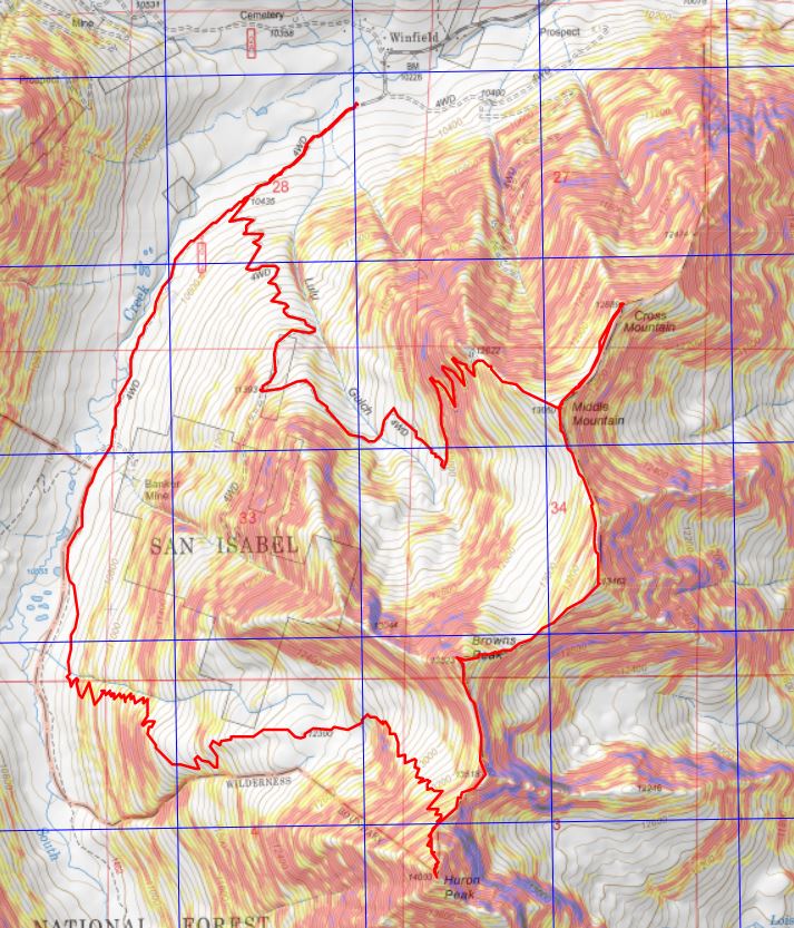
RT Length: 9.37 miles

Elevation Gain: 3246’

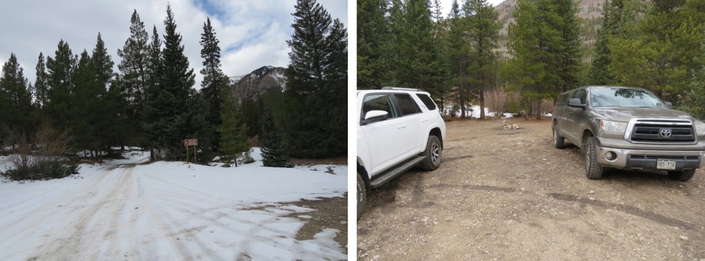
Trailhead: Just before South Fork Lake Creek, where 391 and Trail 1466 meet.

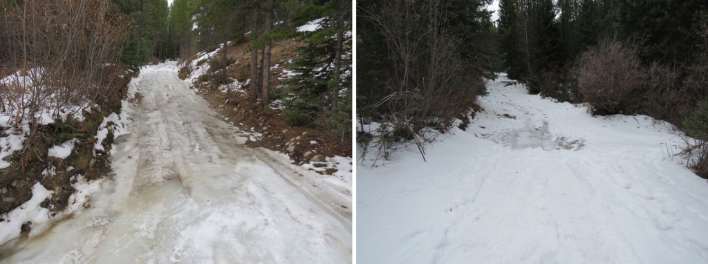
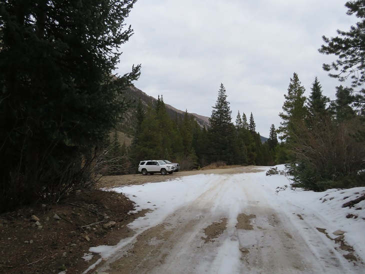
I drove in the night before, so I could start early the next morning.  The only problem?  I wasn’t able to drive all the way to the trailhead.  There was a small ice flow that still hadn’t melted, and it’s the middle of June!  It wasn’t very big, but so far no one has been able to cross it. 

It wasn’t a big deal, but I did have to back up for half a mile before I could find a place to turn around, which happened to be at a nice campsite at 11,000’, so I parked there for the night.

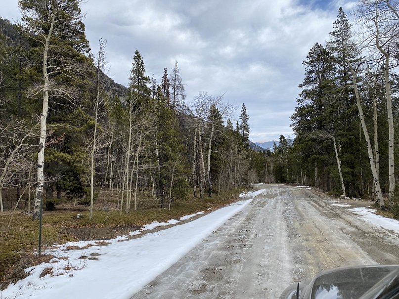
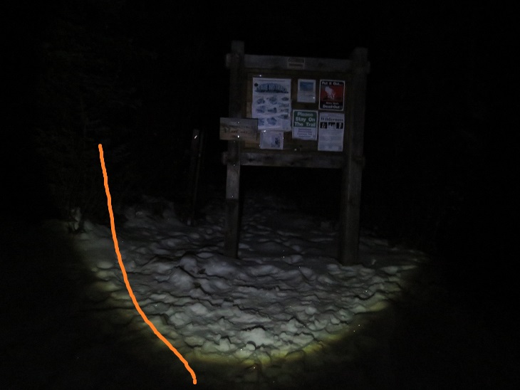
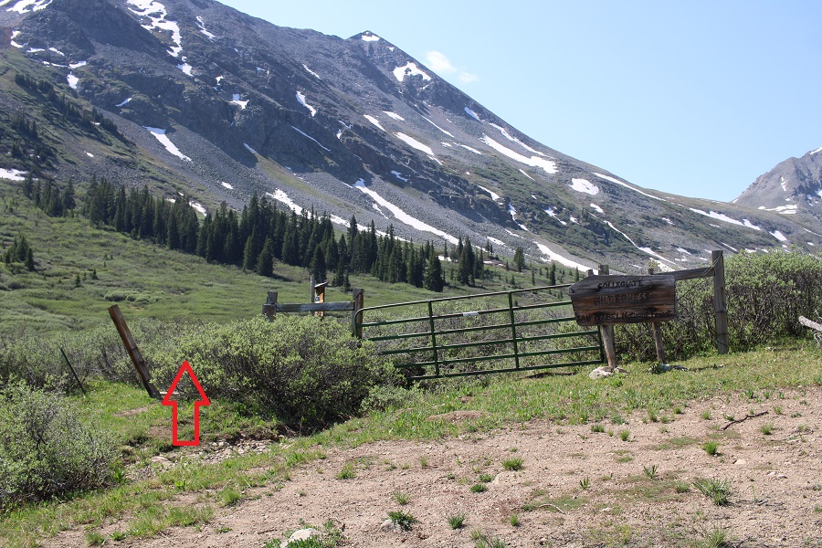
I woke up at 1am, 1:30am, and 2am to something moving around underneath my truck.  It sounded about the size of a squirrel, and made sleeping difficult, so eventually I got up and sat in the front seat of my truck, ate breakfast (vanilla Breakfast Essentials shaken with a sleeve of Folgers instant coffee crystals), and was on my way at 3:30am.   I could smell the Arizona and New Mexico fires as I hiked.  I followed ROAD 391 for .8 miles to the proper trailhead. 

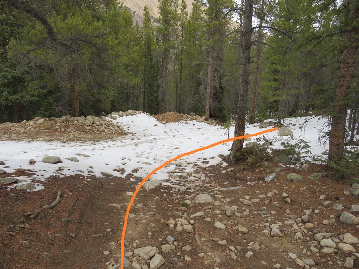
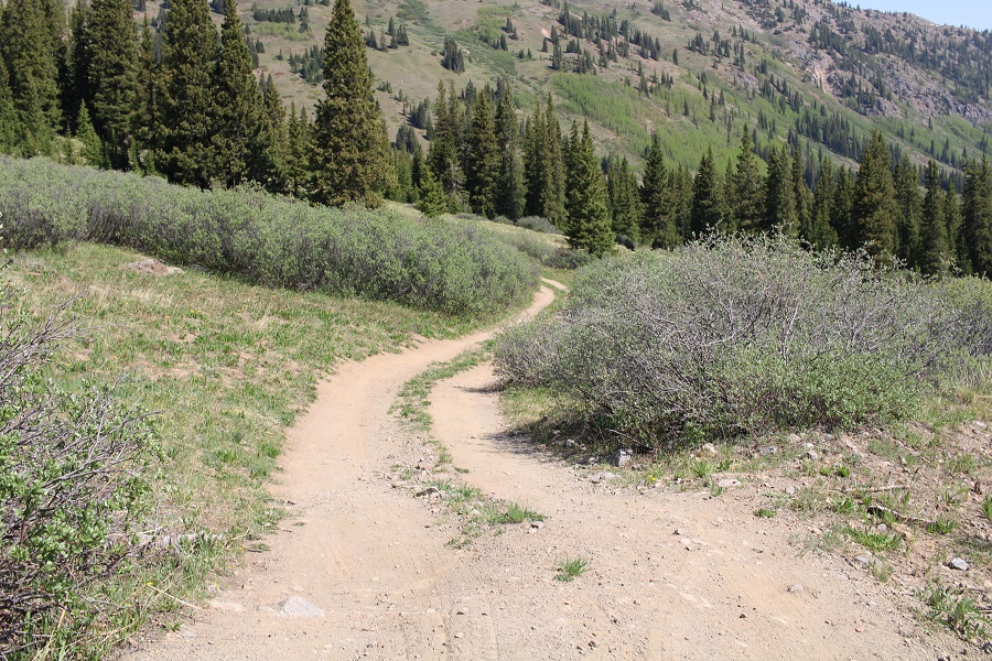
The entrance to the trail is to the left of the gate

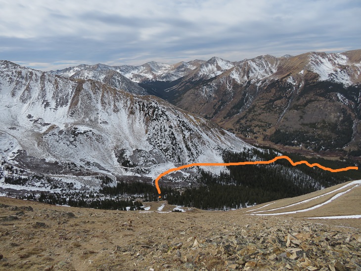
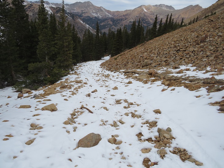
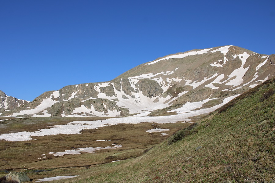
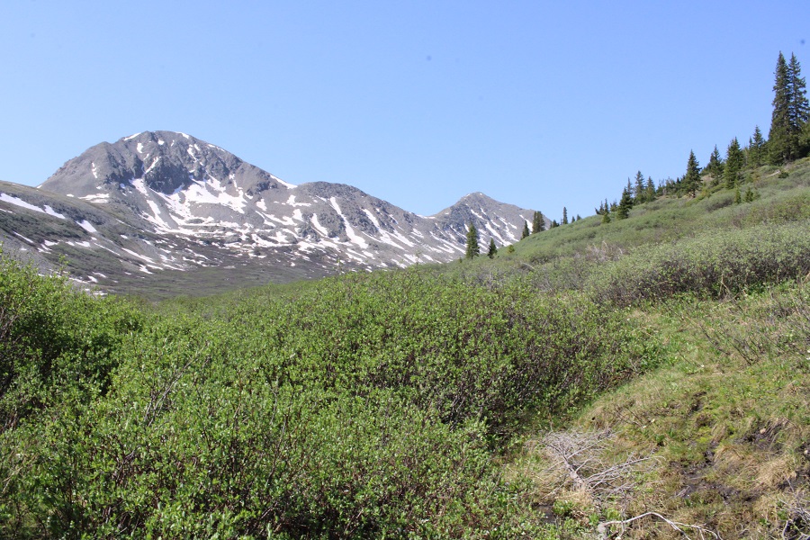
I followed the trail until it ended in the upper basin.  This is a class 1 trail, but it goes through willows and since it’s currently spring conditions, there was an excess of water running in the middle of the trail. With no way to avoid it, my feet became wet and muddy early on in the hike.

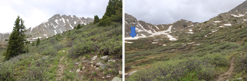
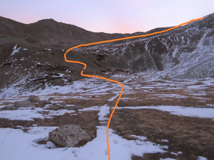
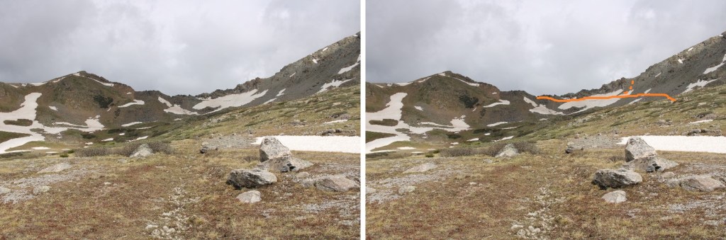
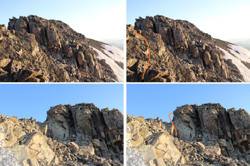
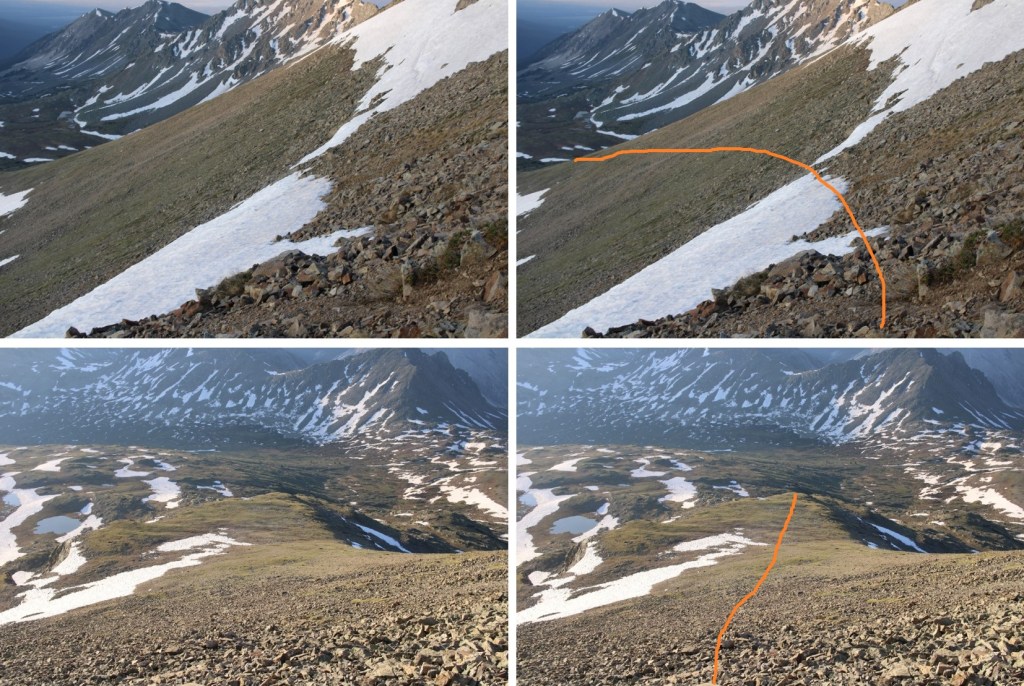
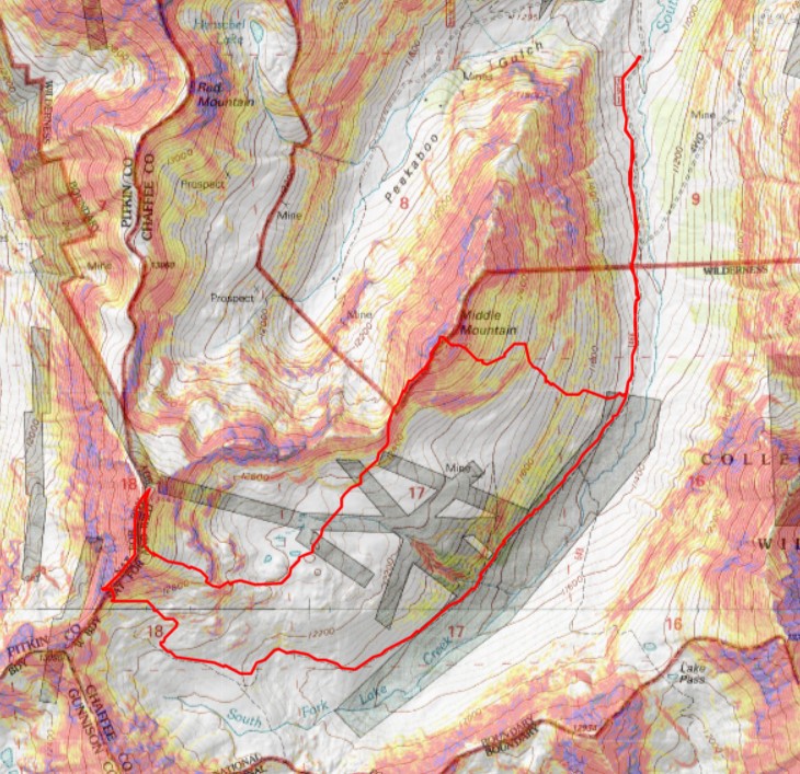
When I made it to the upper basin, my intent has been to take the trail to the saddle, and summit Prize Benchmark first.  The intended route is the solid route, the route I took is the dotted line.  Note:  the solid route wouldn’t work, because it was too chossy on the other side to utilize.

I put on my microspikes and started crossing the ice.  I got about halfway across and felt out of my comfort zone:  The ice was too slippery, and I didn’t have an ice axe.  Instead, I turned and headed northeast towards a different part of the saddle

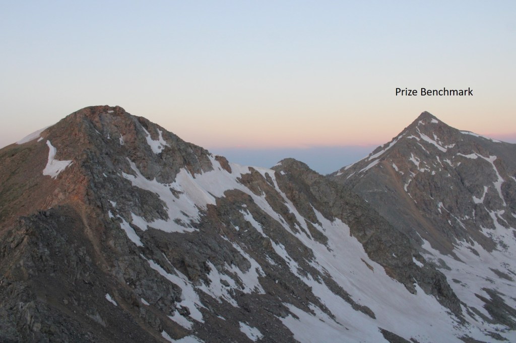
Now at the saddle, I turned and looked over at Prize Benchmark, but the route the rest of the way across the saddle looked sketchy.  It was loose, with spires and talus. 

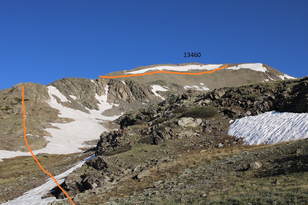
I got out my map, considered my options (did I want to backtrack?) and decided to change my plans for the weekend and head over towards PT 13460.  I headed east along the ridge.

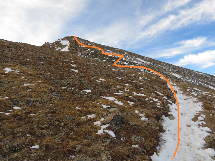
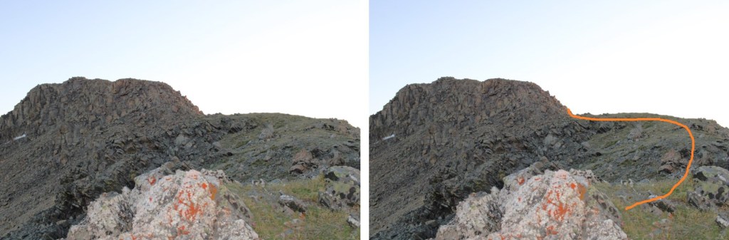
This was all easy class 3 or below, with a few scree gullies and rocks.  The route was obvious, but there were a few false summits

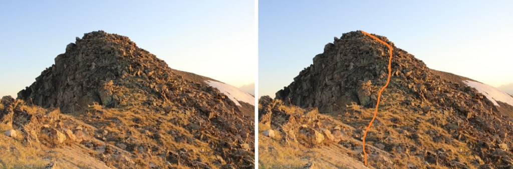
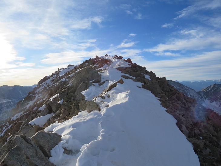
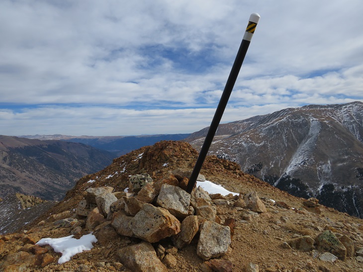
The summit was obvious, with a summit register clearly visible

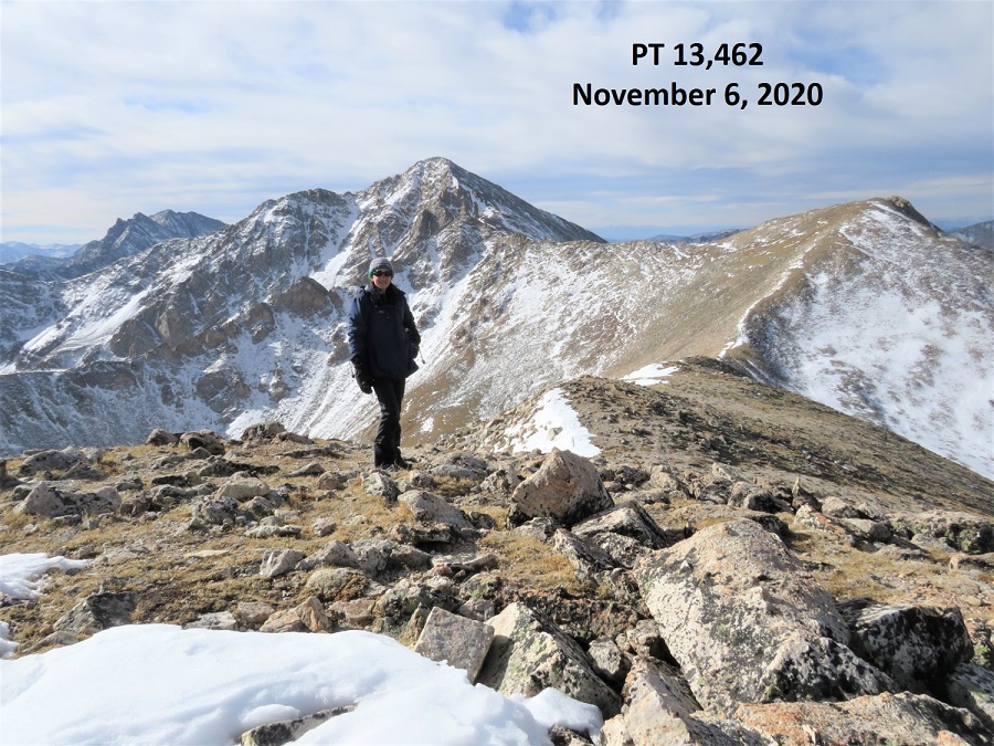
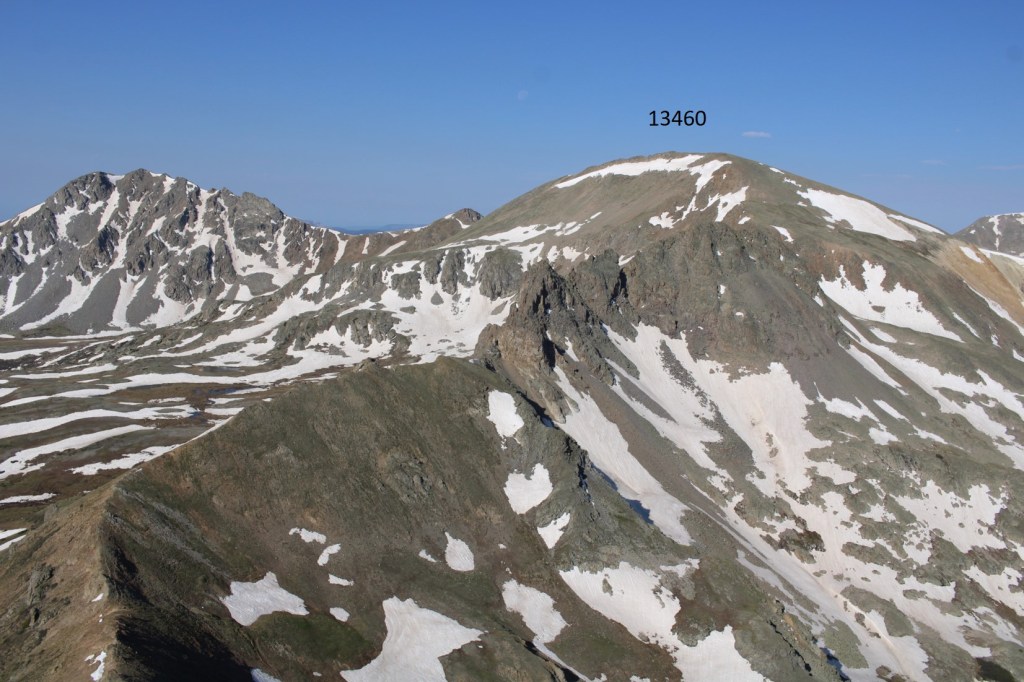
I summited PT 13460 at 6:10am
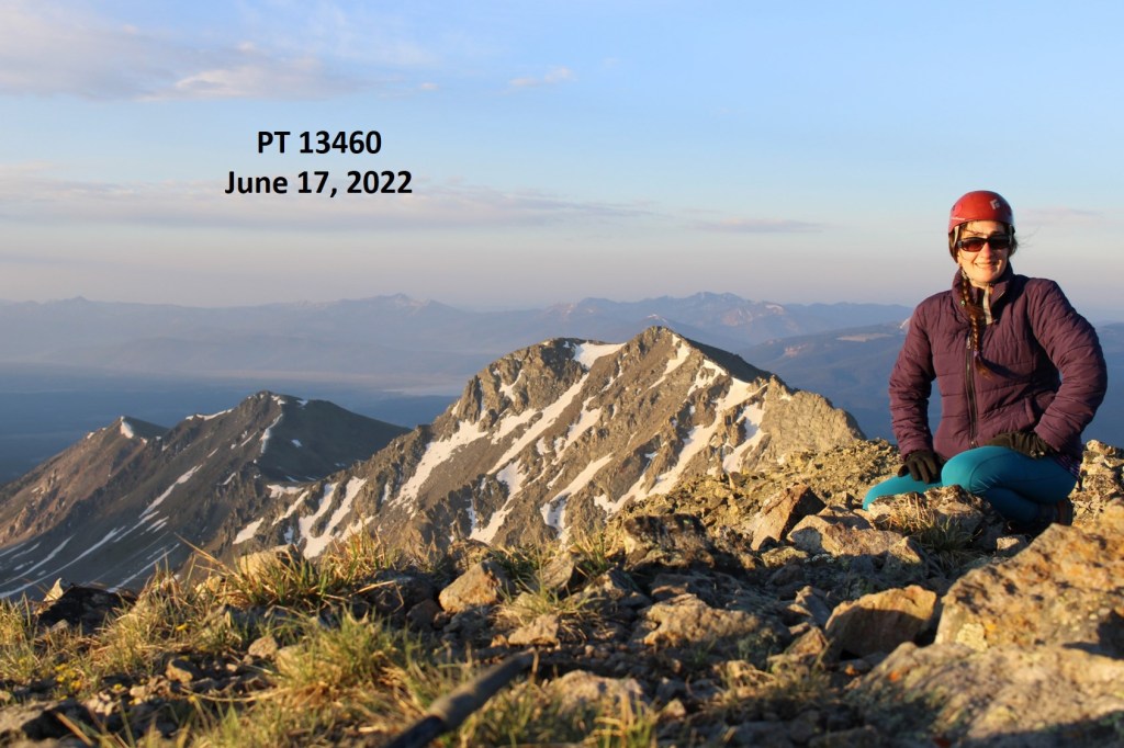
PT 13460:

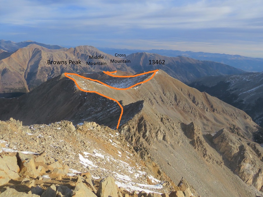
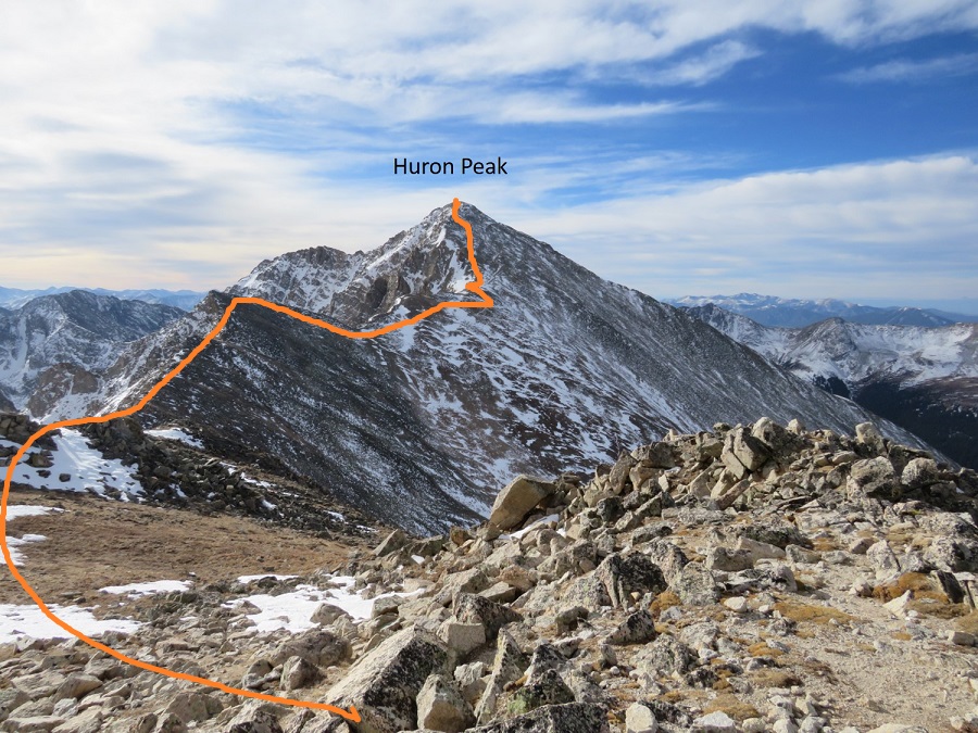
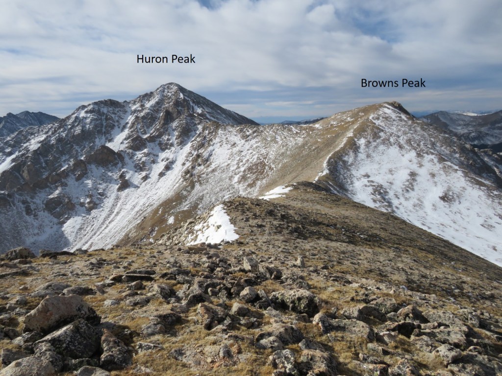
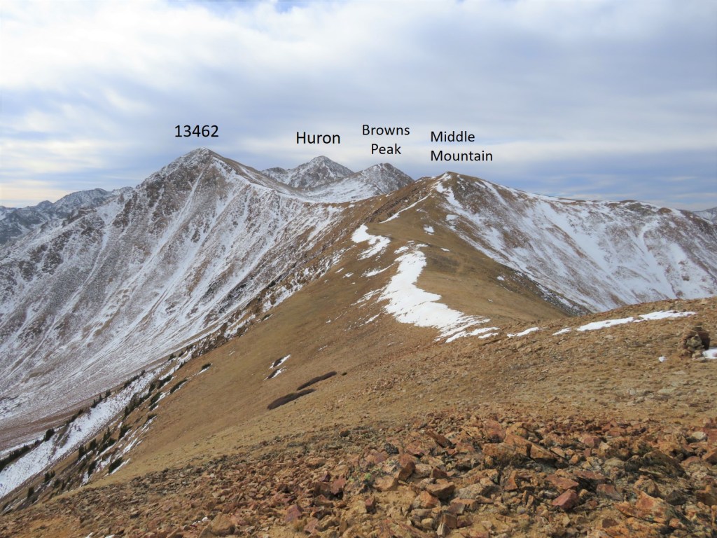
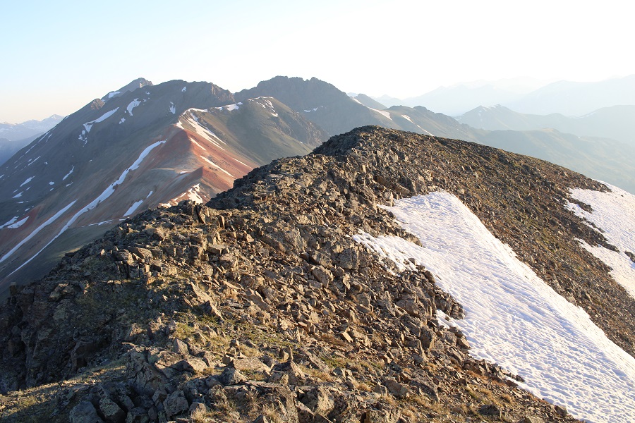
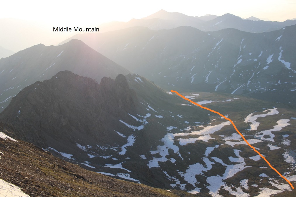
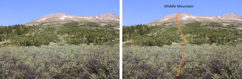
From the summit I could see my next intended summit, Middle Mountain, to the southeast.  Sorry for the bad picture… the smoke from the fires created a haze that was hard to photograph through.

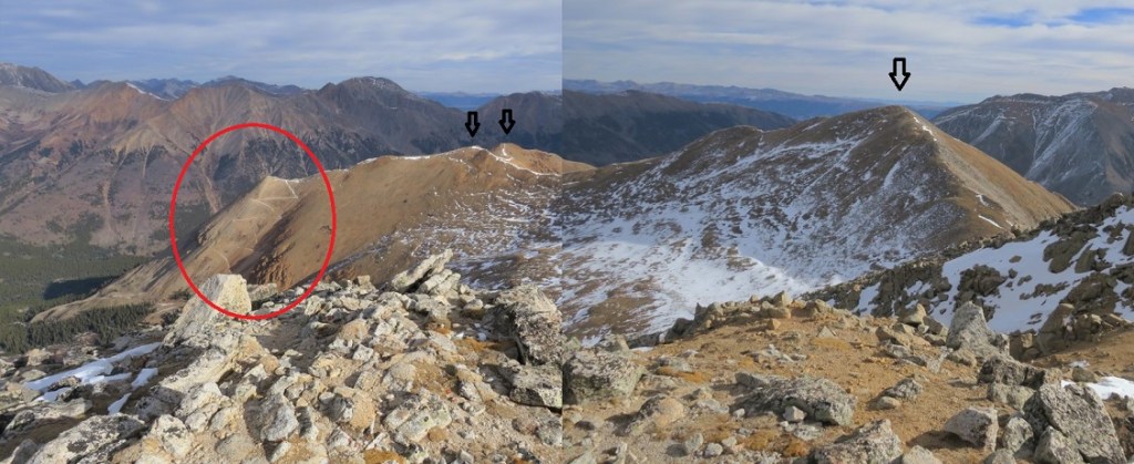
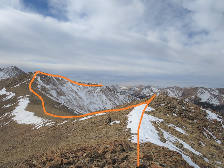
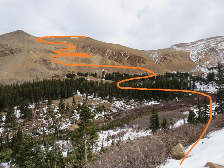
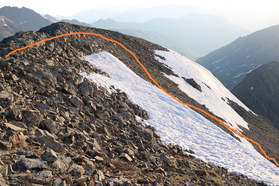
I didn’t have a good view on my way in of the snow conditions, so I walked southeast for a bit along the ridgeline to gauge the best descent route. 

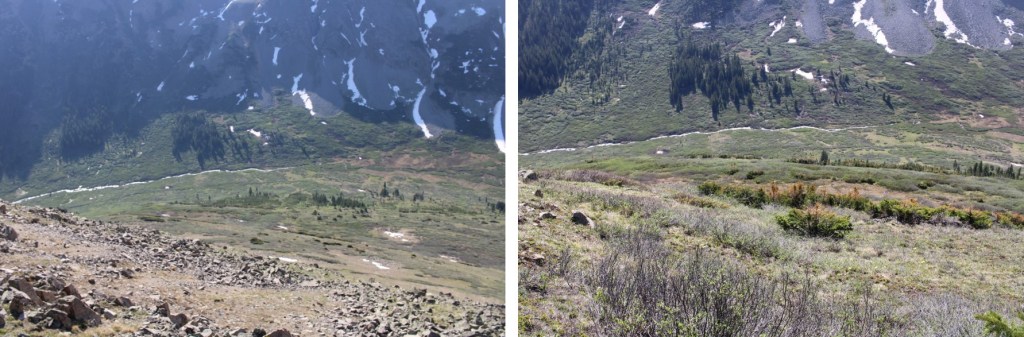
The conditions looked sketchy:  All I could see from above were drop offs and snow, so I got creative and headed down into the basin, avoiding cliffs and snow.  I found out I had cell service, and ssat for 30 minutes on the mountain, checking weather forecasts.  Here’s my route:

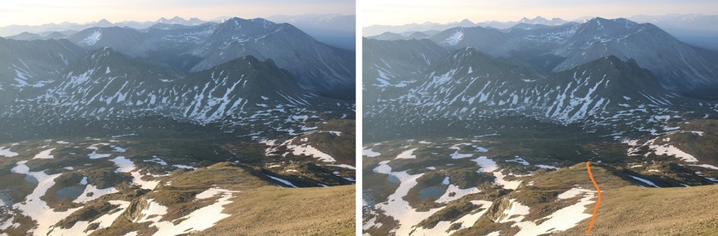
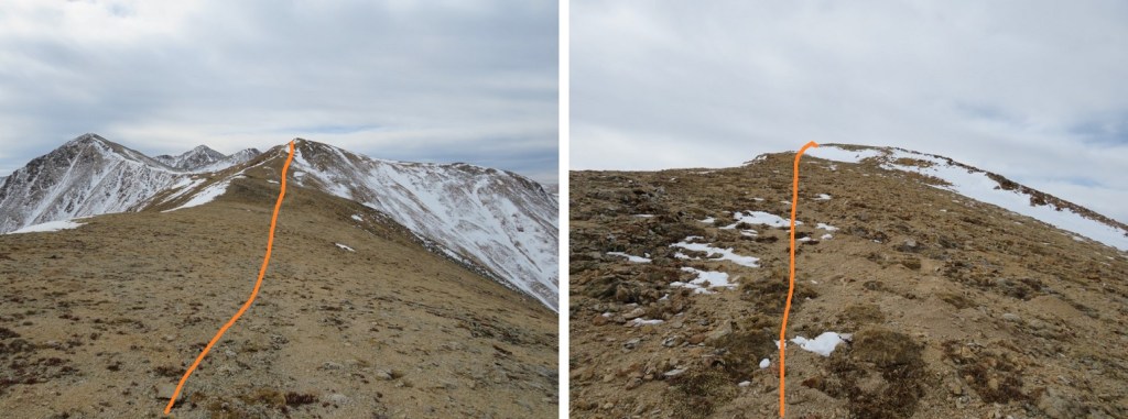
I came to some tundra gullies, and was able to navigate down them without a problem.

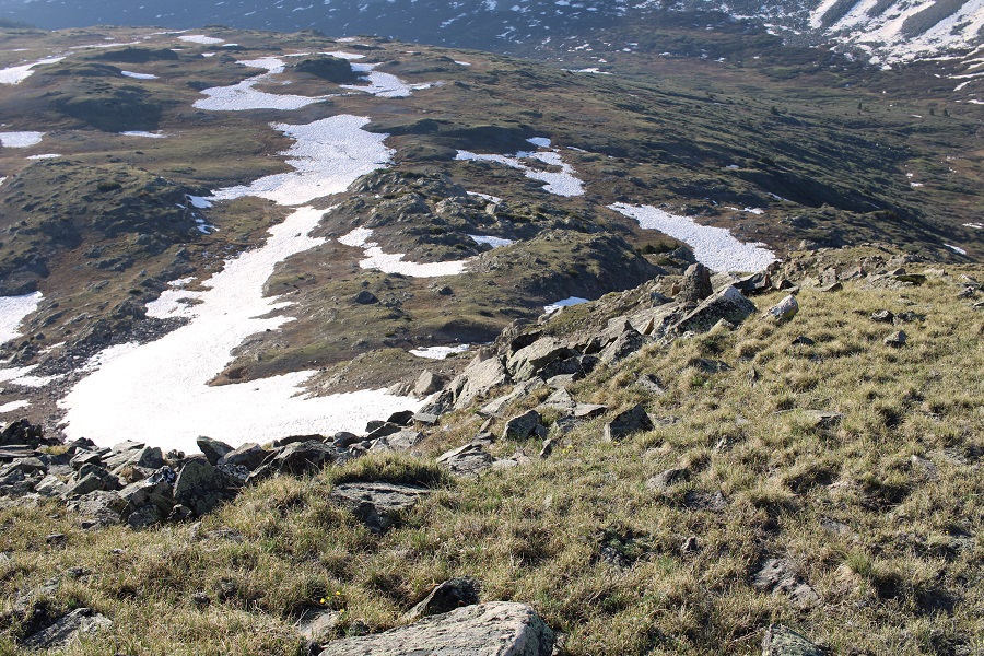
Here’s my route into the basin

And through the basin to Middle Mountain.  You can see the ridge to the left I was trying to avoid

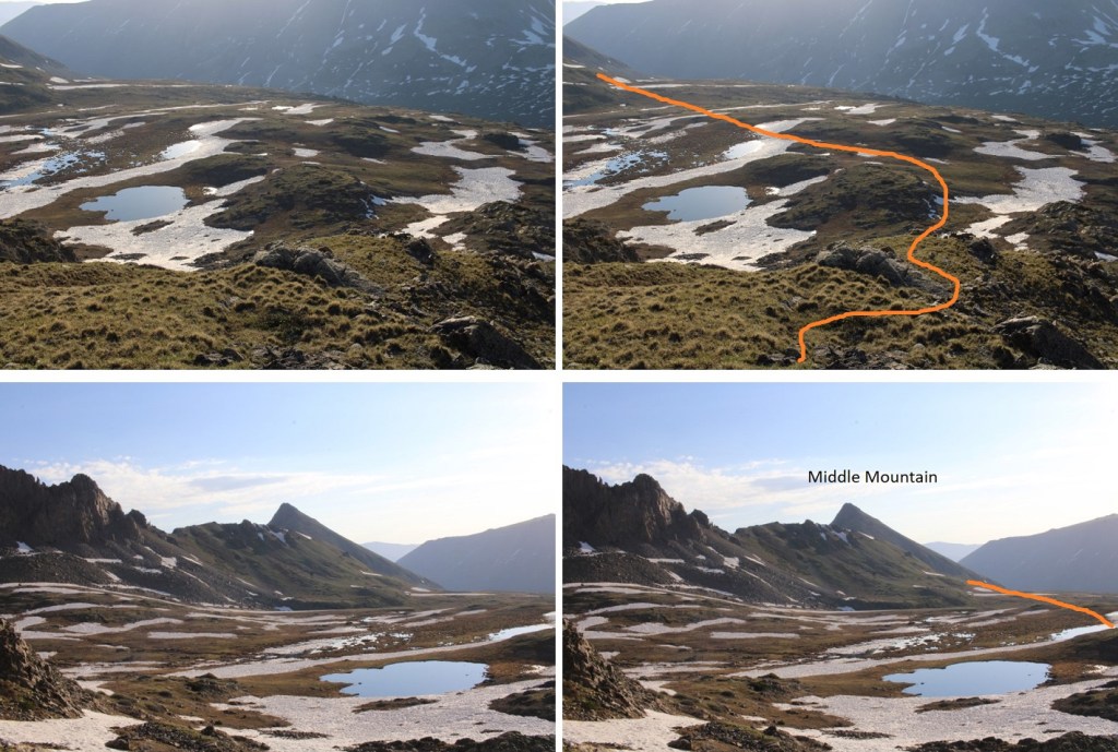
Here’s a look back on the route down into the basin

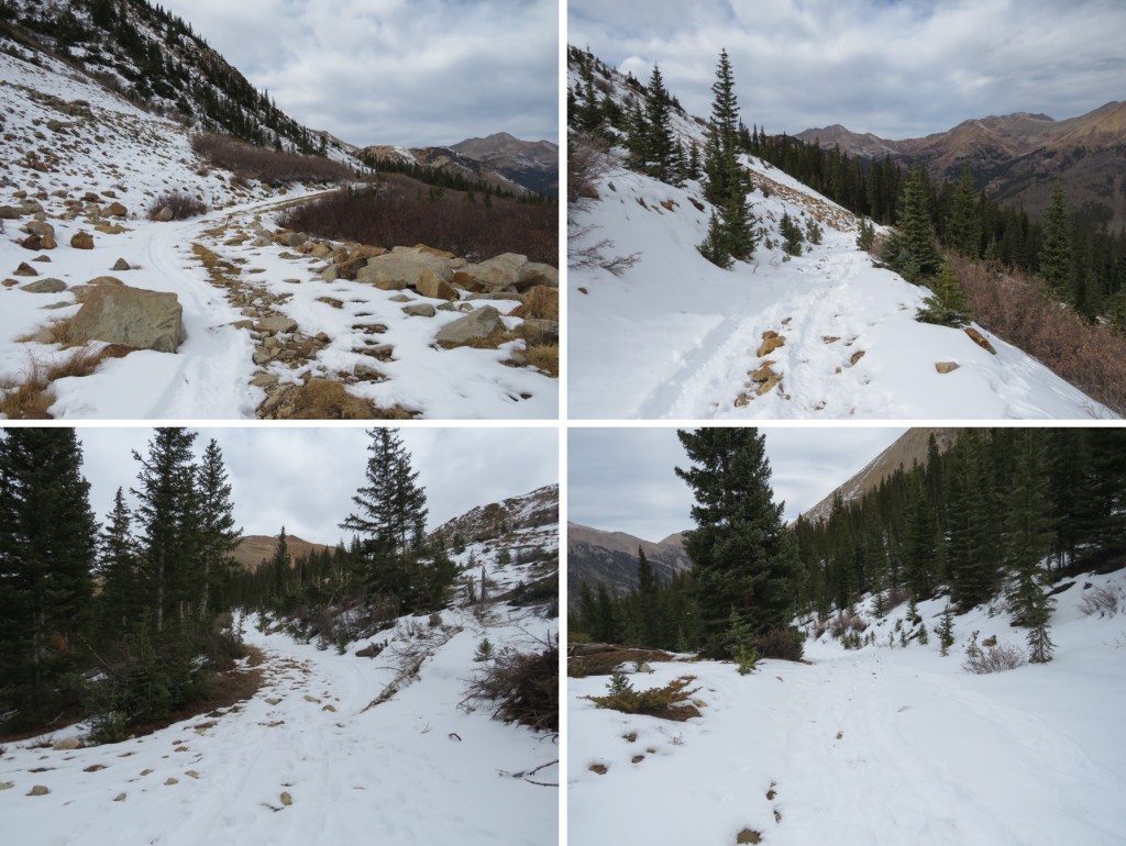
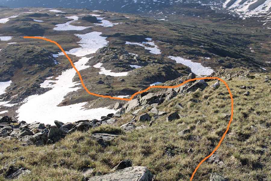
The upper basin was still melting out, and very… squishy. Once again, my socks and shoes got wet. I slogged my way southeast towards the saddle

Here are the last few bits before the saddle.  I was trying to avoid a large boulder and the willows

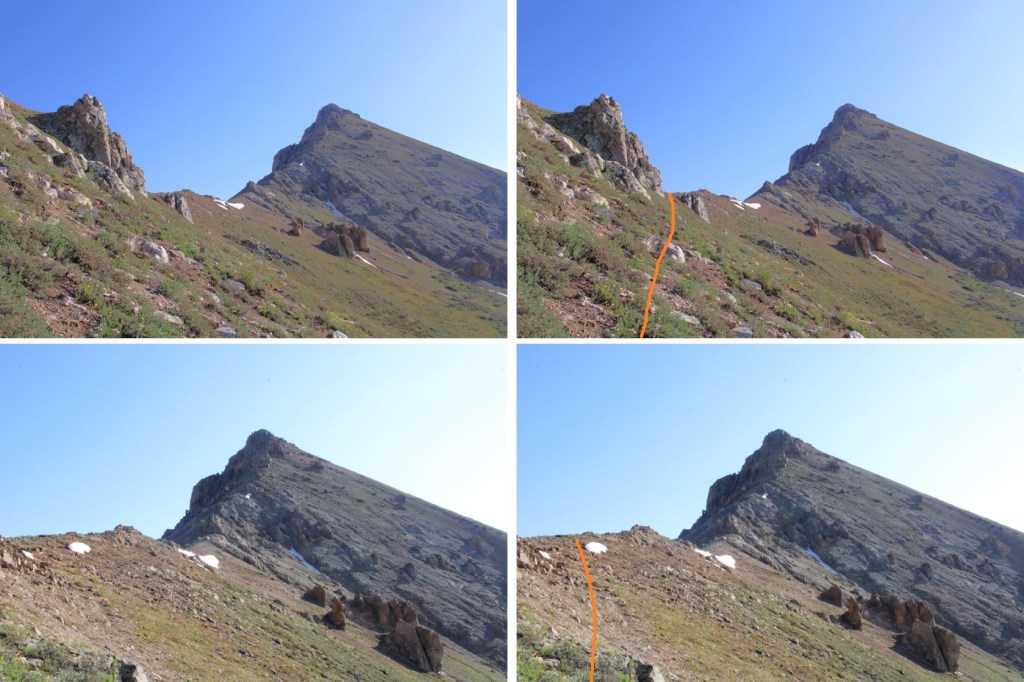
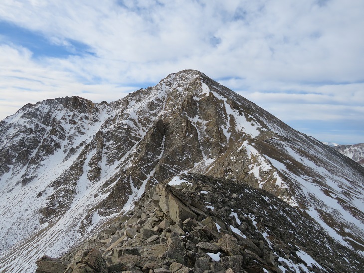
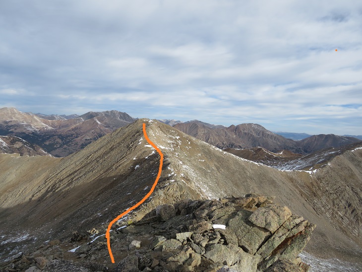
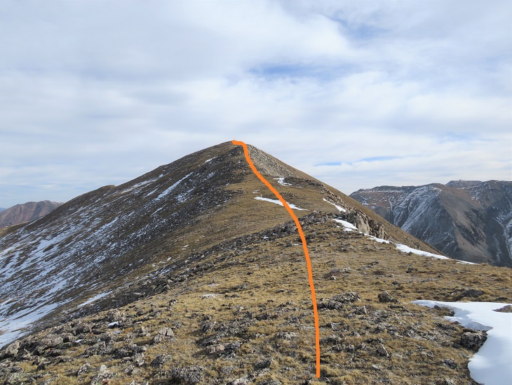
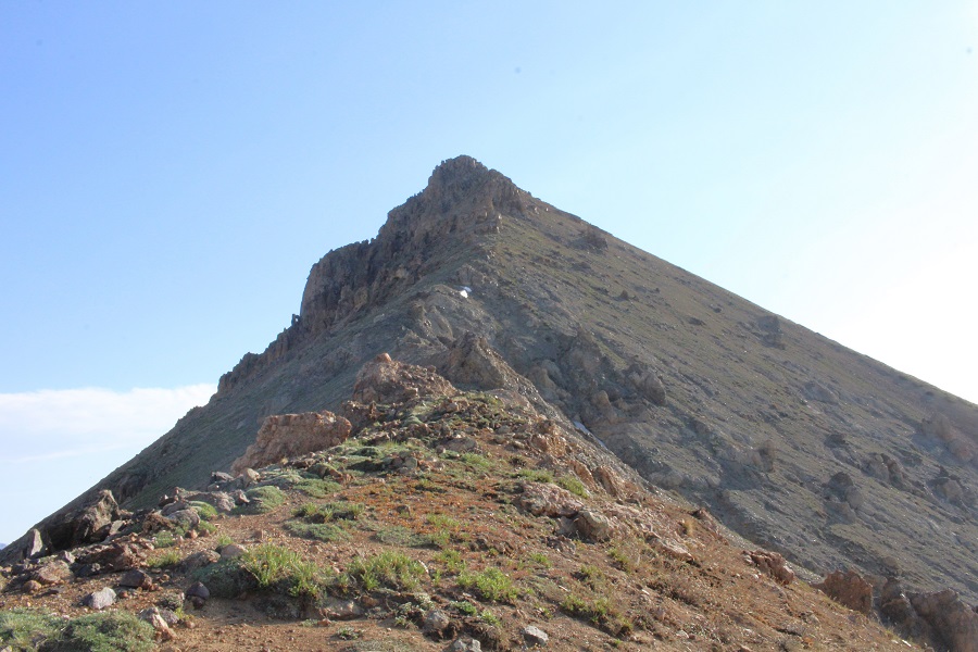
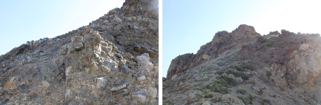
Middle Mountain was also easy class 3, with several false summits.
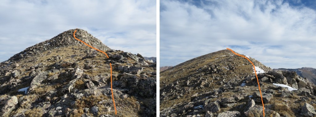
I went right here

Left here

And then right again

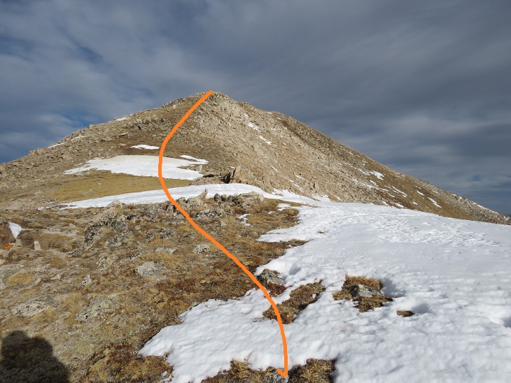
Now it was some easy scrambling over false summits to the true summit.  I always stayed right (south)

I summited Middle Mountain at 8:25am
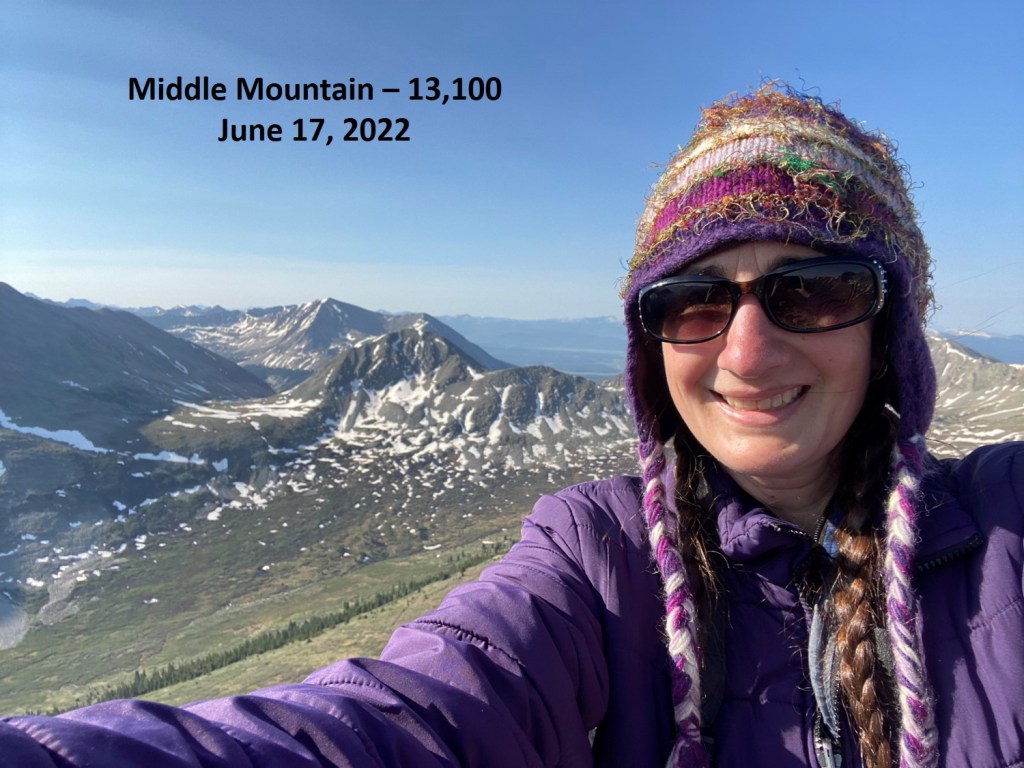
Middle Mountain:

Here’s looking back at 13460

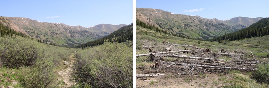
Now to head back to the trail.  This was easy, and choose your own adventure.  I just looked and headed south, doing my best to avoid the willows (etc.).

From the lower basin, here’s looking at the route I took down from Middle Mountain

Now back on the trail, I followed it back to my truck

I made it back to my truck at 10:15am, making this a 9.37 mile hike with 3246’ of elevation gain in 6 hours, 45 min.

On to the next trailhead!

Huron Peak – 14,003, Browns Peak – 13,523, PT 13462, Middle Mountain – 13,060, & Cross Mountain – 12,889

RT Length:  13.83 Miles

Elevation Gain:  4811’

There was a storm predicted for this weekend, so I set out to try to get this loop in before the snow hit.  I had no trouble driving the 2WD dirt road all the way to Winfield, even though it was icy in spots.  

Once I made it to the 4WD road it became icy.  I decided to park in the dispersed camping area and hike along the road.   There are several dispersed camping areas here, and plenty of parking.

I put on my microspikes at the truck and didn’t take them off the entire hike (although they were overkill for over half of the hike).  I started out following the 4WD road southwest.  It quickly became icy and I was glad for the spikes.  I could also hear owls on either side of the trail.  They were hooting, calling to each other back and forth.  We’ve recently had an owl take up residence in our backyard and the calls were similar, so I’m guessing they were great horned owls.  I also heard a chirping in-between calls.  I’m not sure what animal the chirping belonged to, but it happened every time an owl’s call ended, and before the next one began.  In any event, the sounds kept me occupied as I hiked in the dark.

I followed the 4WD road for 2 miles to the upper trailhead (Lake Ann).  Here the trail splits.  I took the well marked ‘Huron Trail’ that went left up the mountainside.

The Huron Trail is a well marked and easy to follow class 1 trail that takes you all the way to Huron Peak.  This is also a well documented trail, so I’ll just add a few photos.

Once at the saddle the trail became increasingly icy, and I was glad to be wearing my microspikes.  Also, one of them broke (I continued to wear it anyway.  The other one broke as well later on, but microspikes are easily fixable so I wasn’t too worried). 

I summited Huron Peak at 7:45am

Huron Peak:

From the summit I had a great view of all the other peaks I intended to hike on this loop.  Here’s the overall route, which consists of a nice ridge hike

I turned around and headed back to the Browns/Huron saddle, and then over to Browns Peak.  I summited the point here on my way over to Browns, but that’s unnecessary, as it’s not ranked and just adds elevation (the elevation part was why I summited the point)

I summited Browns Peak at 9:10am.  Browns Peak is unranked.

Browns Peak:

Here’s a look back on the route to Browns from Huron

From the summit of Browns I could see my next 3 summits, as well as the trail I intended to take back down

It was a simple ridge hike to the saddle and then back up to PT 13462

There was a small false summit before the actual summit

I summited PT 13462 at 9:40am

PT 13462: 

Here’s looking back at Huron Peak and Browns Peak

The hike over to Middle Mountain B was also a simple ridge hike.  Here’s the route

I summited Middle Mountain at 10:10am (also unranked)

Middle Mountain: 

Here’s looking back on the route so far

It was still early in the day so I decided to head over to Cross Mountain.  This is another unranked peak, but it’s named, so I didn’t want to leave it out on today’s hike.  It was a quick and easy hike northeast over to Cross Mountain.

I summited Cross Mountain at 10:35am

Cross Mountain:  

Here’s a look back at the other peaks I summited this morning

I was making this a loop, which meant I needed to re-summit Middle Mountain, turn right and head northwest down the ridge to the 4WD road.  Here’s an overview of the route

First, I made my way back to Middle Mountain

Once I’d re-summited Middle Mountain I turned right and headed northwest down the ridge, aiming for the 4WD road

Then I followed the road back to my truck.  Here’s an overview:

A word of caution here:  the 4WD road isn’t truly a road for most of the way up the side of this mountain.  It looks to be an old mining road that hasn’t been used in many years, and has experienced rockslides and avalanches, turning the road into more of a trail down the mountain and into the gulch.  In other words, if you have a 4WD vehicle, or even a motorcycle, don’t plan on driving it up this road.  Evidence:

Once down in Lulu Gulch the 4WD road picks up again, and is easy to follow. 

Here’s a look at the hike down from the ridge

The 4WD road was indeed easy to follow, but it seemed to go on and on.  And on.  And on.  I was very happy with my choice to summit Huron first today, as this was a very long slog back to the main 4WD road and I would have been terribly bored following this road as it switchbacked (needlessly?) down the mountainside.  It kept going, and going, and going.  I seriously wanted to just cut the switchbacks and make it a straight line (but didn’t)

I was thrilled when I reached the main road

Here’s looking back at the turnoff (this is what you see when hiking in, you can go straight to the Huron Trail or left to follow the mining road and summit Middle Mountain first)

I followed the icy 4WD road back to my truck, thankful for my microspikes

I made it back to my truck at 12:15pm, making this a 13.83 mile loop with 4811’ of elevation gain in 8 hours, 15 minutes.

The Huron Peak Summit Sticker can be bought here