Mt Elbert – 14,433 in winter

1

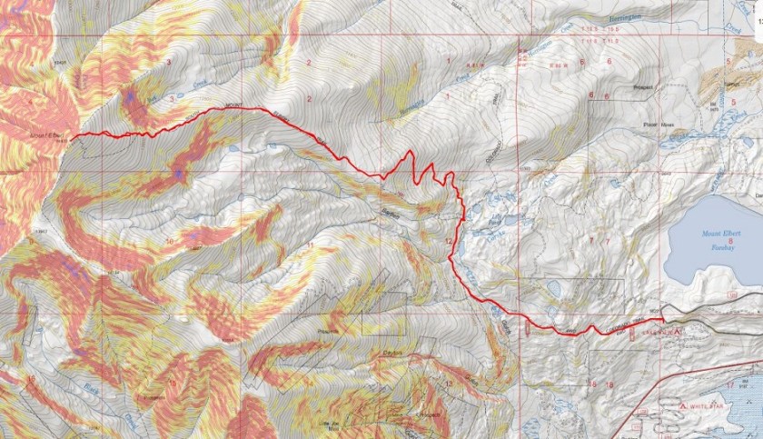
RT Length: 13.25 miles

Elevation Gain: 4934’

Partner: Steffen

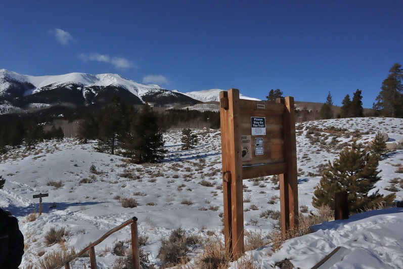
We pulled up to the South Mt Elbert trailhead at 5am and were ready to go soon after. There were about 5 vehicles already in the lot, and we were now worried we’d started too late and eager to get started

2

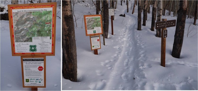
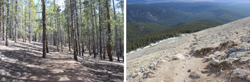
On our last (failed) attempt of Mt Elbert in winter we took the trail, but this time we hiked in microspikes along the 4WD road/Colorado Trail for 1.75 miles to the upper trailhead. I would recommend hiking the road instead of the trail.

3

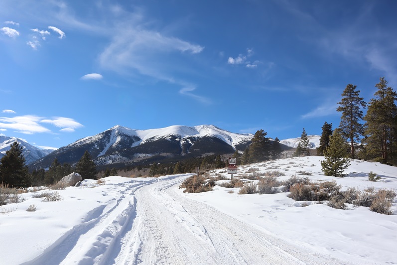
The road was passable for about a mile in 4WD vehicle, and then it became solely a hiking trail. I was glad I’d parked at the lower trailhead.

4

5

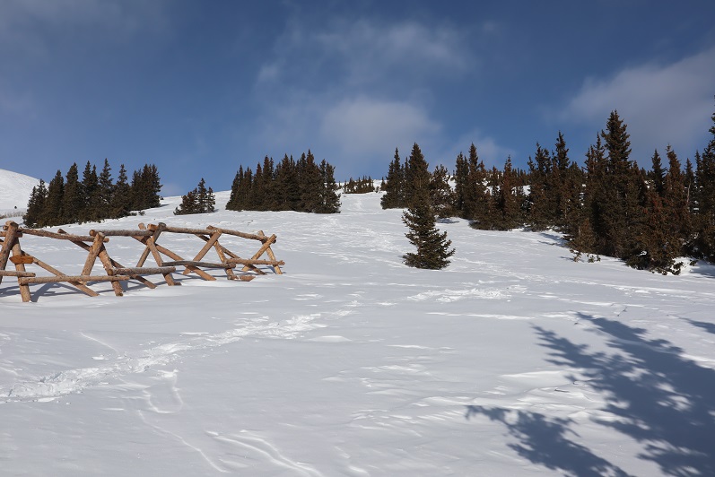
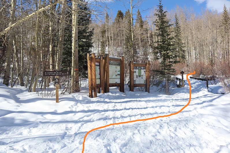
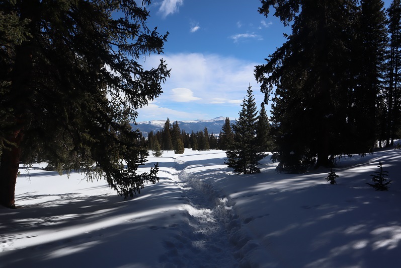
At the upper trailhead we turned right, crossed the bridge, and continued along the Colorado Trail for another quarter mile

6

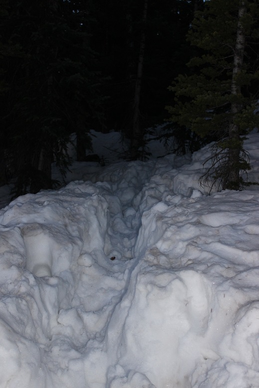
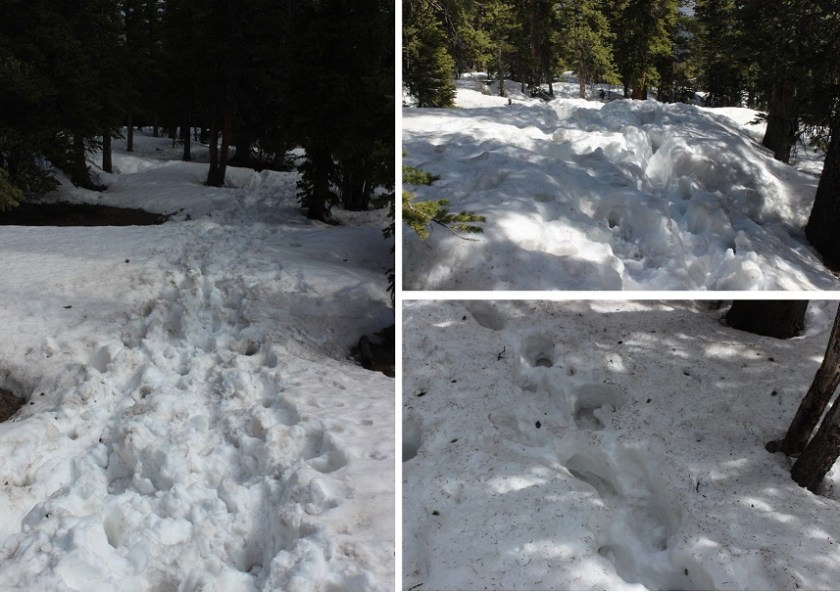
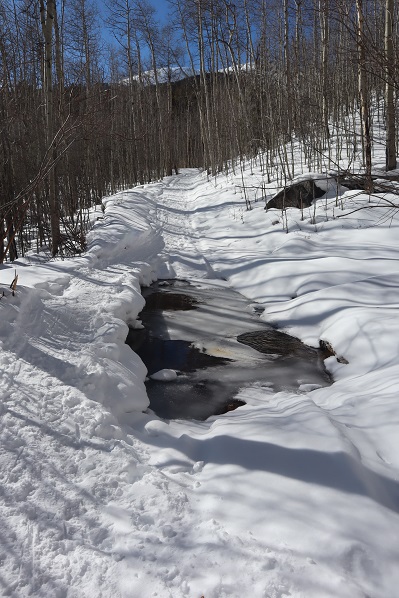
This trail is really well marked, and the trench was nice and solid

7

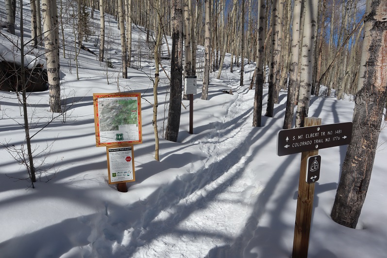
After a quarter mile we came to the Colorado Trail/South Mt Elbert Trail junction and continued on the South Mt Elbert Trail

8

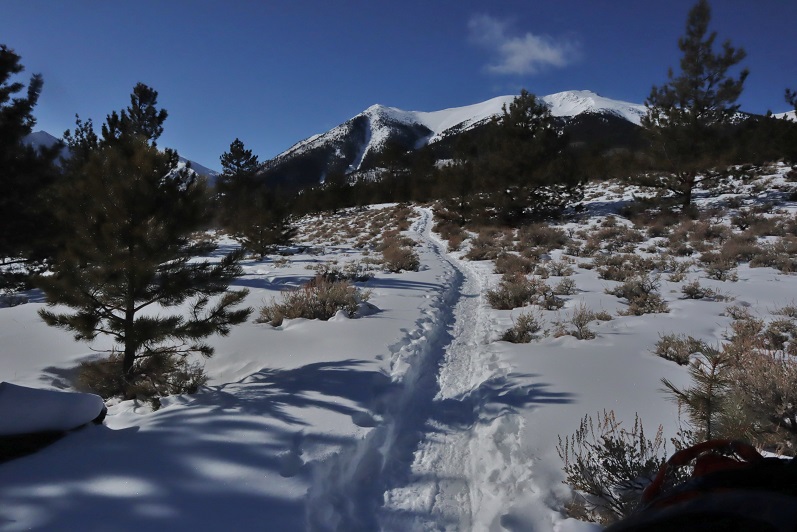
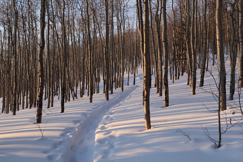
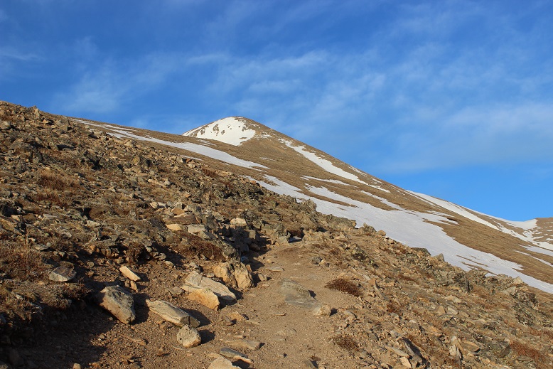
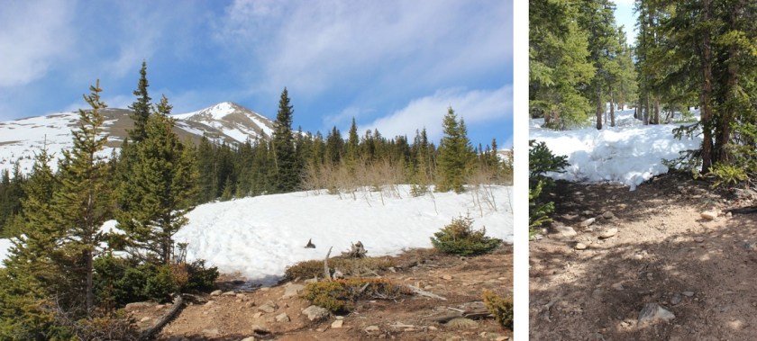
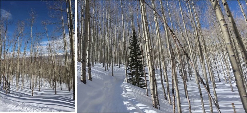
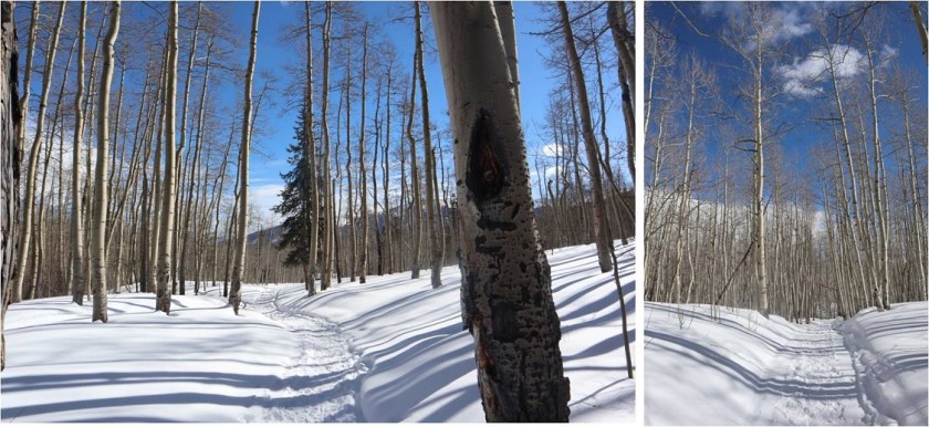
This well maintained trail took us to treeline

9

10

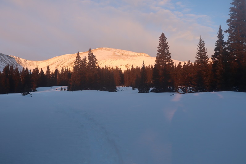
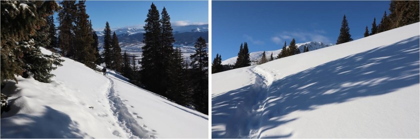
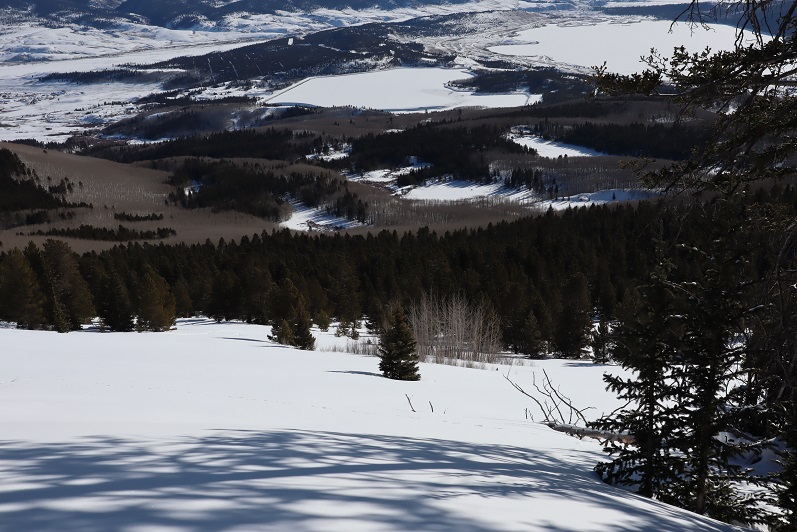
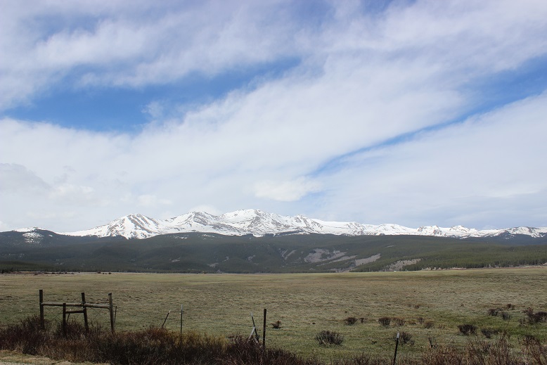
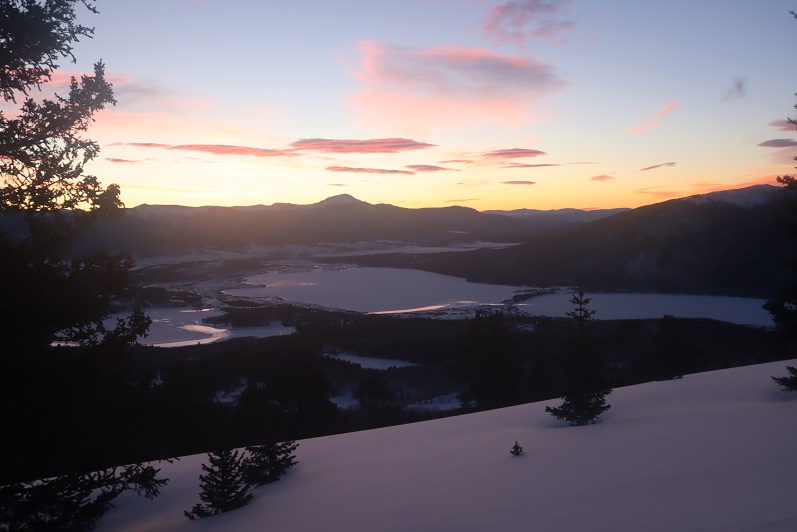
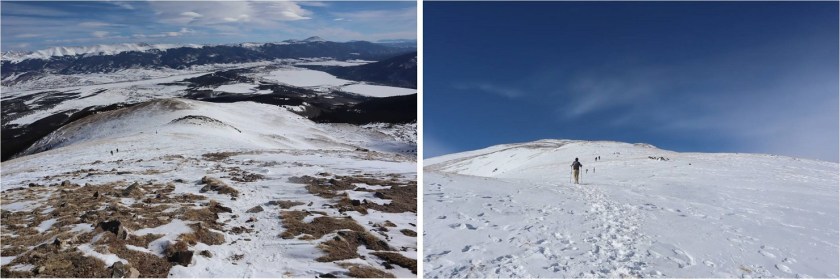
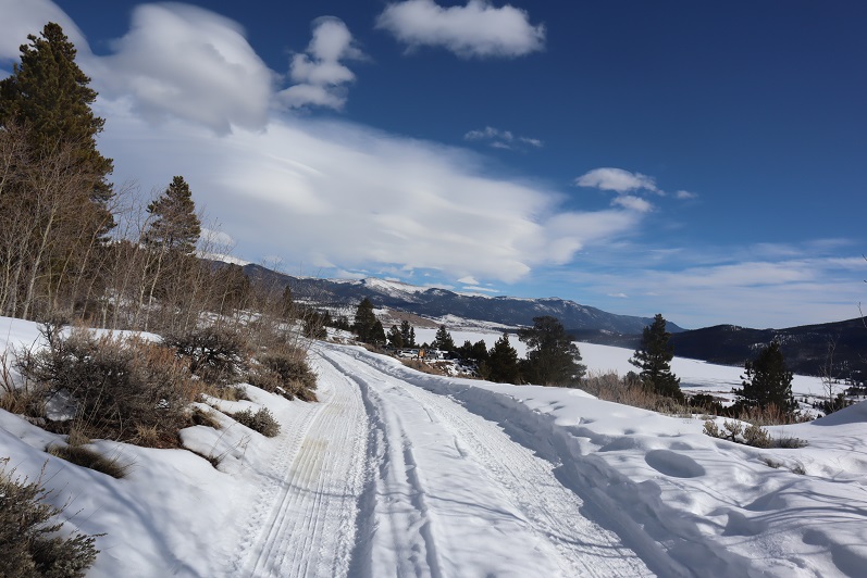
Here there was a lot more snow so we decided it was time to put on our snowshoes. The sun was also rising and we could put away the flashlight.  Here’s looking back at Mt Elbert Forebay and Twin lakes

11

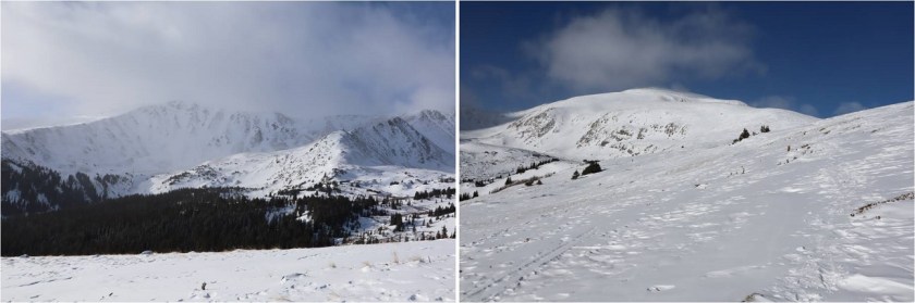
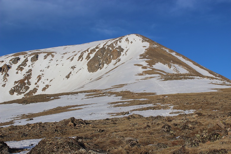
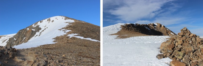
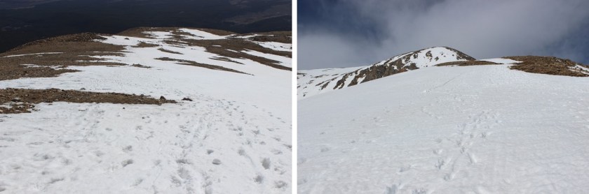
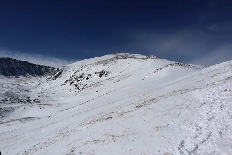
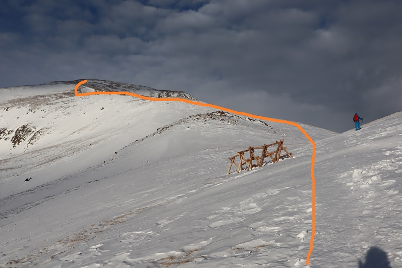
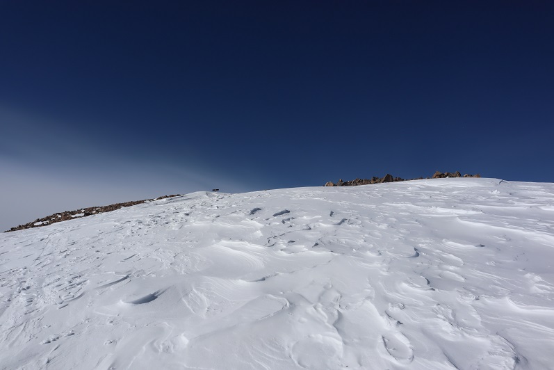
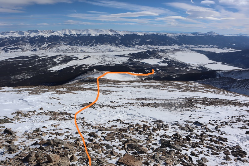
From treeline here’s the route up Mt Elbert.

12

Not long after making it to treeline we passed a hiker and wondered where everyone else was who’d been parked at the trailhead? There were at least 5 other vehicles there, and we only saw this one hiker along the ridge.  Seemed curious.

13

The wind picked up as we hiked up the ridge. The forecast said 15-20mph winds, but we felt they were much higher here

14

Snowshoes were useful until about halfway up the ridge, and then they weren’t really needed. I kept mine on because the wind had picked up and I didn’t want to take off my gloves to take off my snowshoes.  Steffen offered to help, but I was worried I’d need to put them back on again and honestly didn’t mind hiking wearing them, so I kept them on.

15

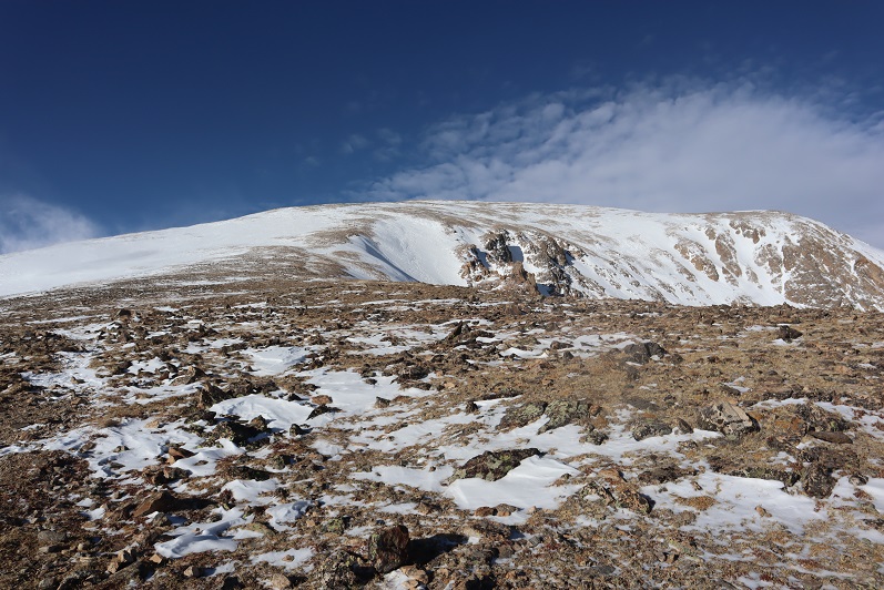
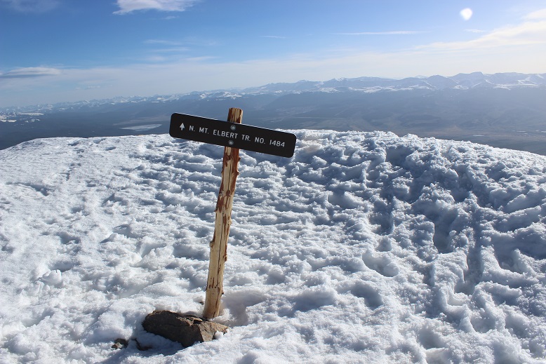
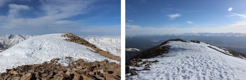
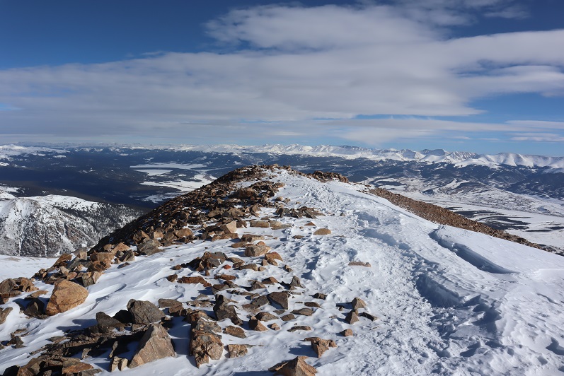
This was a simple ridge hike. I don’t do well with breaks (my feet lose function so I can’t stop) and since there weren’t any obstacles I hiked ahead of Steffen at a slow and steady pace while he took breaks as needed.  I kept looking behind me to make sure he was still on track.  I was excited to see the sign on top, indicating the summit was near.

16

At the saddle I decided to slow down and wait for Steffen so we could summit together. The only problem?  It was super windy.  So windy the wind kept knocking me down.  So I decided to crouch down behind this rock and take in the Massive view while I waited for Steffen to catch up. Luckily he wasn’t too far behind

17

18

When he made it to the small saddle we turned and headed towards the summit together

19

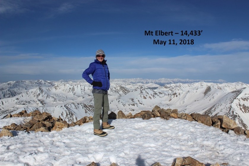
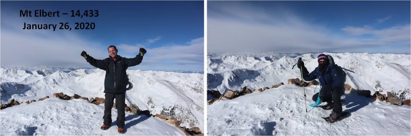
It was a blue skies kind of day, but extremely windy on top. I’m proud of Steffen:  this is his second 14er, and second in winter.   It was weird having someone else there to take my picture:  I had to crouch down because I kept getting blown over.

20

21

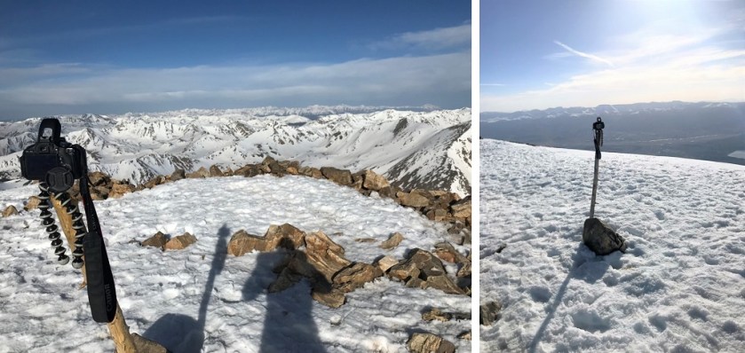
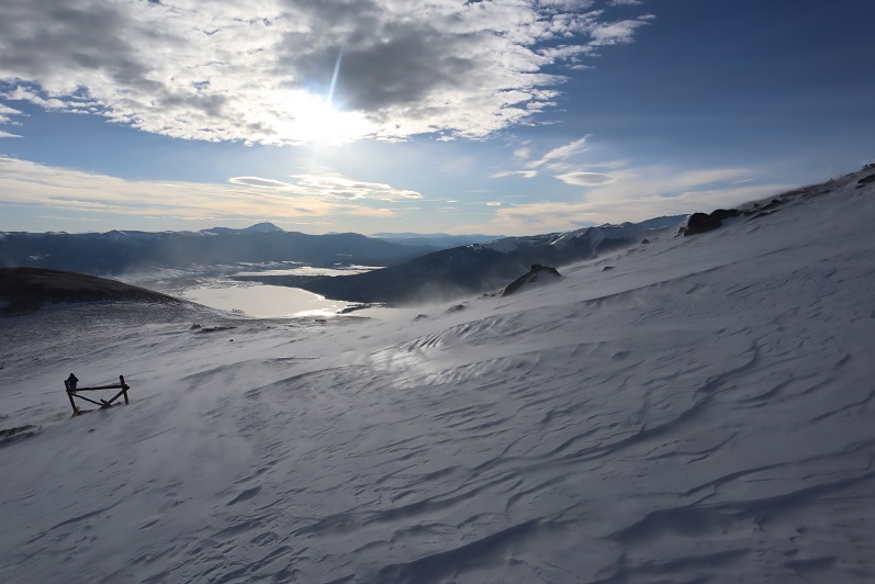
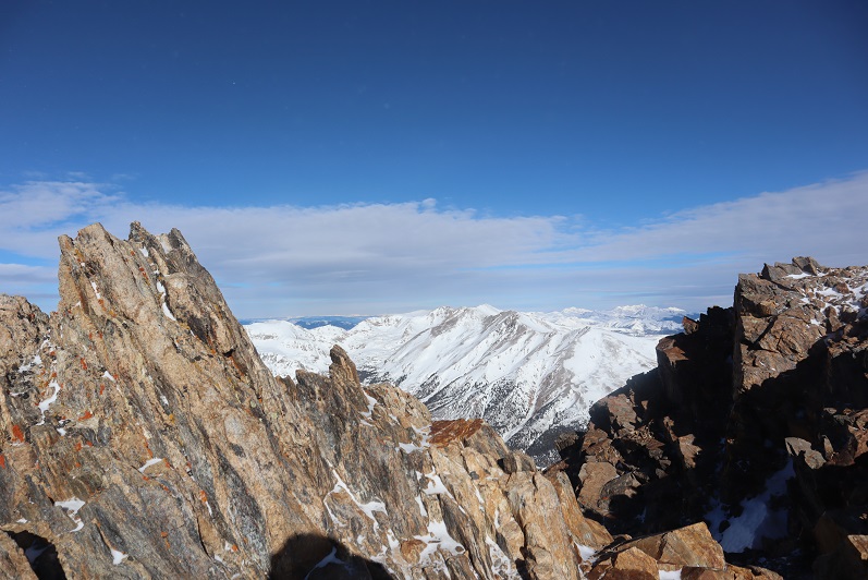
We didn’t stay long on the summit due to the wind. Steffen teaches skydiving, and was pretty sure the winds were closer to 50+mph than 20mph.  It was nice having someone else there to verify the wind speed and let me know I wasn’t crazy for thinking it was higher than forecasted.  The winds lessened as we hiked down the ridge.  Here’s the way we took back

22

23

24

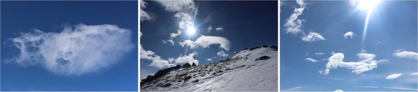
Along with the wind came some pretty cool clouds. I took off my snowshoes for most of the ridge descent.

25

About halfway down the ridge we began seeing other hikers. Tons of other hikers.  They were like ants, marching their way up the mountain, and must have been sleeping in their vehicles when we made it to the trailhead.

26

Once we made it back to the snow we both put our snowshoes back on: we were postholing and it soon became evident the return route would be miserable without them.  We were glad we’d started when we did:  in a couple of hours this would be posthole city.

27

28

29

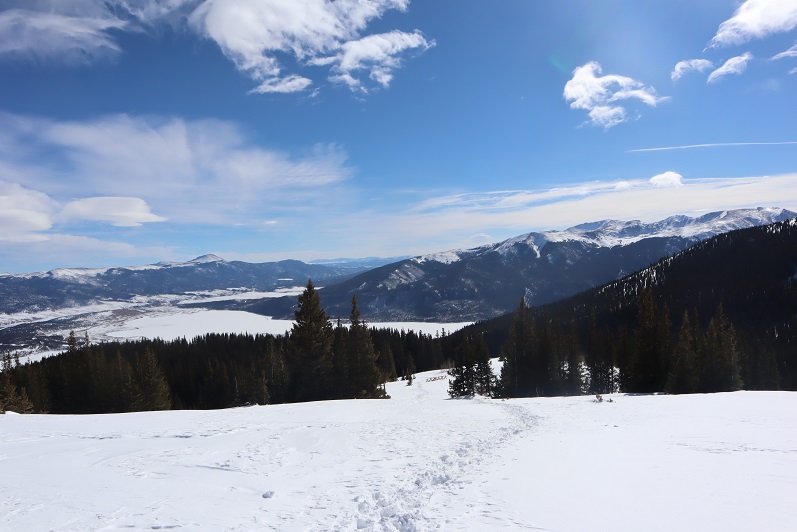
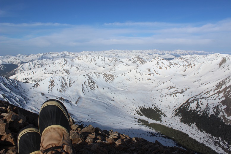
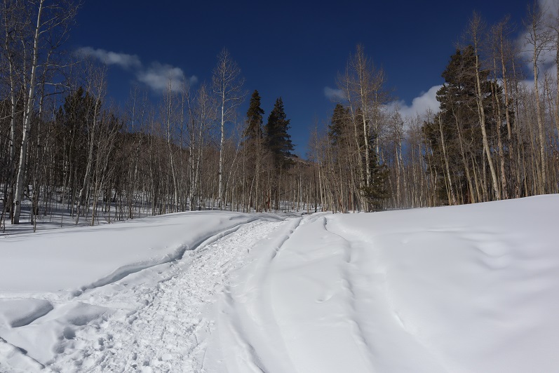
The route back was just as easy to follow as the route in, but with the added bonus of sunlight we had some pretty amazing views of the aspens

30

31

32

We made it back to the trailhead at 1:50pm, making this a 13.25 mile hike with 4934’ of elevation gain in 9 hours 40 minutes.

33

Mt Elbert (winter attempt)

1

RT Length: 10 miles

Elevation Gain: 2685’

Time: 7 hours

Partner: Steffen

Note:  Our successful winter summit can be found here.

This was an attempt of the East Ridge of Mt Elbert. We ended up turning back around 12,500’ and did not summit today.  We still had a great time though, with great views and fun animal prints to be found in the snow!

We arrived at the South Mt Elbert trailhead and were on the trail around 5:30am. There was one other vehicle in the lot from out of state.  From the booklets and maps in the front seat I figured they were highpointing.  We ever did see this person…

In the dark we were unable to see the 4WD road and took the trail instead to the 4WD parking area, adding on 2.4 (unnecessary) miles to this hike

2

3

Even though there had been recent snowfall the trail was well trenched and we didn’t need snowshoes for the first few miles. Ours were the first tracks on the trail, leading me to believe the other hiker(s) had taken the 4WD road up.  After about a mile of hiking we came across mountain lion prints!  They looked to be only a few hours old.  They were headed in the opposite direction and followed the trail for about 20 yards before disappearing.

4

I spent the next hour or so stopping frequently to scan the night for glowing eyes but didn’t see any. After about 3 miles we made it to the junction.  Here I decided to put on my snowshoes, and kind of wished I’d done so earlier.  The bridge had a couple feet of well packed snow to cross.

5

There were some interesting 14er signs and here’s where we caught up with the other hikers tracks.

6

The sun was beginning to rise and the forest suddenly became more beautiful. The aspen trees and snow made for a unique landscape

7

8

This hike was trenched and relatively straightforward but felt like it was taking forever to complete. We made numerous stops just to enjoy the view.  The trench continued up and over the mountainside, and here Steffen stopped to put on his snowshoes.  This made a ton of difference for him!

9

The tracks stopped at treeline but the route seemed obvious: just head to the ridge.

10

11

Now that we were above treeline we had a good view of the summit. Unfortunately, it looked windier than we’d anticipated.

12

The mountains all around us seemed to be making their own snow. We weren’t going at a very fast pace (lots of stopping) and Steffen had already taken a few pain killers.  We still were only about half way in both elevation and distance.  I didn’t think our chances of summiting today were very high so we decided to turn around here.  It was a shame because it seemed like such a nice day but on a positive note the fun stuff happened on the way back.

This slope would be perfect to ski/snowboard down!

13

When we made it back below treeline I saw prints that hadn’t been there before: it looked like a bird had caught breakfast while we’d been gone!

14

Steffen made another snow angel and debated doing this on every hike until the realization hit there wouldn’t be snow in the summer… Ha! The shadows from the trees made it difficult to get great pictures.

15

We had fun identifying animal tracks and I enjoyed the aspen trees again. I don’t think I’ve ever seen so many aspen with snow below treeline:  usually I see only pine trees so this was a fun treat!

16

17

We re-crossed the bridge

18

And headed back to the trailhead.

19

We came across the mountain lion tracks again and I got better pictures in the daylight. Just as we left the prints behind we came across a group of 5 snowshoers with their dogs.  The dogs were off leash and the owners seemed upset we were there.  Lucky for us we’d turned back when we did or the mountain lion tracks wouldn’t have been there upon our return.  We made it back to my truck and checked our stats.  I was surprised we hadn’t gained more elevation than we had.  This hike seemed to have taken all day and I was sure we’d gained close to 4000’.  Oh well:  This was a well trenched hike, so I’ll be back to complete it in winter (soon).

Mt Elbert – 14,433′

1

RT Length:  9.5 Miles

Elevation Gain:  4700’

I still have a handful of class 1 14ers I’ve ‘saved’to hike in May/early June, and after the past couple of 14ers I’ve experienced I figured it was time for a break.  Also, I had a board meeting to attend at 4pm today, so I needed something that wouldn’t take me all day to accomplish/leave me stranded on a mountain.

I woke up at 1am and made it to the trailhead around 4:30am.  There was only one other vehicle in the parking lot, and despite the signs stating “no overnight camping” it appeared someone was sleeping in their vehicle.  High-Five sir.

The road in was a 2WD dirt road.  This was the most ‘challenging’ part, so if your vehicle can make it past this obstacle, you’re good to go.

2

The parking lot is completely clear of snow and (today at least) mostly empty.

3 Parking Lot no overnight

I started at about 4:45am.  The snow cover started after the first junction (about a mile in) and was annoying but manageable without using traction.  OK, in reality, I’m just stubborn.  I should have put on my snowshoes, but I wanted to see how far I could make it without them.  The path was well defined in most areas, but in the dark and with the snow there were a few times I had to backtrack.  Nothing major though.

I was able to make it all the way to treeline without traction, although honestly snowshoes would have been helpful.  Don’t get me wrong, I HAD snowshoes, I just didn’t want to take the time to put them on because they “didn’t seem worth it”.  Every 100 feet or so I’d posthole up to my waist, which was always unexpected and a great workout, but very time consuming to extract myself.  You see, you can’t just get out of a posthole that deep like you get out of a pool by doing a push-up because your hands immediately sink in the snow (duh!).  I had to get creative.  Side note:  this would be a great idea for an exercise machine at the gym:  you’re walking and then all the sudden the machine holds you by your waist and won’t let you go until you figure your way out.  OK, probably not such a great idea.  But it was a good workout.  I digress…

Did I mention it was 5am?  (Yes, I looked at the weather, and it wasn’t supposed to get below freezing all night, but I could hope, right?).  And I should also mention it was obvious those hiking yesterday or earlier this week had it worse than I did.  Either that or they were really tall because their postholes went much deeper than mine.  This picture really doesn’t do them justice, but it’s all I have….

4

I made it to treeline just before sunrise and got my first view of Mt Elbert

5

I was excited with this view, because it meant I could most likely summit without traction (and I did).  As I started hiking above treeline the sun started to rise.  I love sunrises, and spent about 20 minutes just watching….

6

Above treeline the trail was pretty obvious

7

Well, at least for most of the way.  Once I got here I had the option of hiking on snow or trail.  I alternated between both.

My alarm rang. It was now 6:50 am and time for me to call my High Schooler to wake her up for school (I’m her 3rd alarm).  I was a little out of breath, but it looked like I was about half a mile from the summit, so I told her I was “almost there” and wished her well at school today.  I wasn’t.  In reality I was probably over a mile away from the true summit. But it looked so close!!!

The frustrating part were the false summits.  I made it around one turn, thinking I was close to the summit, but I actually had 2 more ‘summits’ and a few cairns to go….

10

I love signs.  Love, Love, Love them.  Here’s a great one…

11

You see, it told me which way to take to go when I was headed back down.  That’s not always an issue, but this peak has several routes, so knowing the correct one to take back down can save you a lot of time if you accidentally get so excited about your summit views you forget which route you took because you weren’t paying attention on your hike up.  It also indicated I was close to the summit.  Here’s the summit view

12

And picture proof I summited (8am)

13 Mt Elbert 14433

I’ve had a lot of people ask me how I get summit photos when I summit solo.  I usually get creative with my DSLR on automatic, my gorillapod and trekking pole, but today there was a post in the perfect spot, so I improvised…

14 how I take pictures

Did I mention the views were AMAZING?!?!?!?  I stopped for a minute just to enjoy (beef jerky was also involved).

15

It was COLD at the summit!  It was supposed to be 46 degrees today, and it might’ve been, but that 45+ mph wind was a killer! I couldn’t feel my fingers (OK, I actually kind of could, but it was more of a pain/throbbing/burning thing than an actual movement thing and I knew it wasn’t a positive thing…).  I took a selfie, checked in at Mt Elbert and wrote the obligatory “I’m the highest person in Colorado right now” post on facebook, and headed down so I could start thawing out my fingers.

The snow was definitely softer on the way down, but manageable without traction.

16

I made it back to treeline at 9am.  This is where the hike got fun.  I knew I was going to put on my snowshoes (I’d anticipated warmer temps + softer snow = put on those snowshoes), but they weren’t ALWAYS necessary, so I alternated for a bit between quickly trekking on lots of snow and slowly slogging through mud.

17 Start and Stop

I was now postholing with every step.  The good news?  Because of my snowshoes I was only postholing up to my knees, instead of up to my waist.  This was an improvement!  Once again, I could see others had it MUCH worse than me (or were VERY tall).

18 Postholing

This intense workout lasted for about half a mile, and then conditions alternated between snow on the trail (and pretty much only on the trail)

20 No Snow perfect

to no snow at all…

20 No Snow perfect

Did I mention I love signs?  This trail has great/amazing/wonderful/actually informative signs.  Check them out

21 signs

I made it back to my truck at 10:45am, making the 9.5 mile hike in about 6 hours, with generous time allotted for sunrises and summit exploring.

On the way out I couldn’t help but stare at Mt Massive…. Maybe next week?

22