Mt Belford in Winter – 14,197

RT Length: 11.15.miles

Elevation Gain: 4764’

Note, this is the third time I’ve hiked Mt Belford, so this time I’ll just be giving a quick overview with a few pictures and thoughts.  A full trip report can be found here for Mt Belford via Elkhead Pass, and here for Mt Belford and Mt Oxford in winter conditions.

Also note:  whining ahead. 

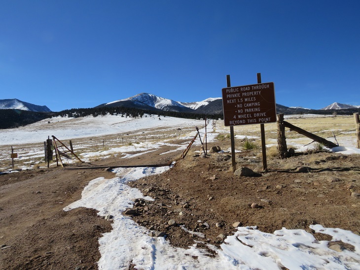
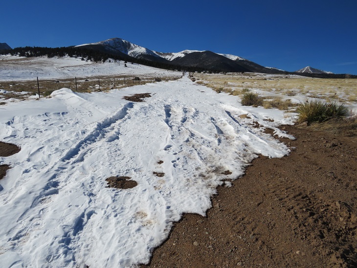
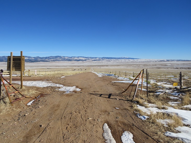
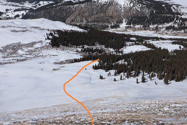
The last 3 miles to the Missouri Gulch trailhead were terrible!  So bad I asked SkydiverHiker to drive.  We were sliding in the ruts and eventually found a turnout about .7 miles from the trailhead and stopped there.  This ended up being a fabulous idea, since the trailhead was too covered in snow to park.  It looked like someone had tried and it took them quite a while to get out.  This is the road to where we parked (easy until the plowing stopped)

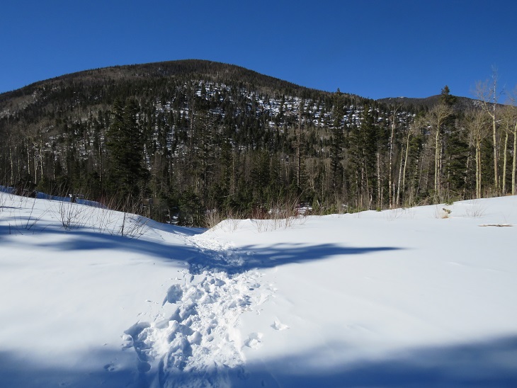
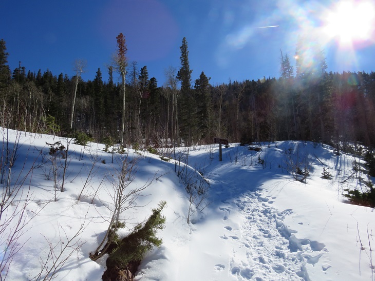
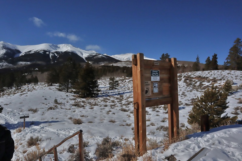
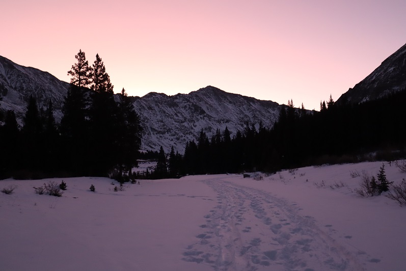
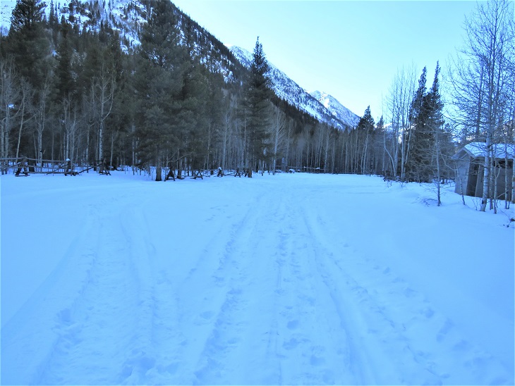
Parking further away changed our plans a little, as it added an hour onto our trip.  We decided we’d probably just hike Mt Belford today, and leave Oxford for another day.  We were on the trail at 5:15am.  Here’s a look at the Missouri Gulch Trailhead Parking area

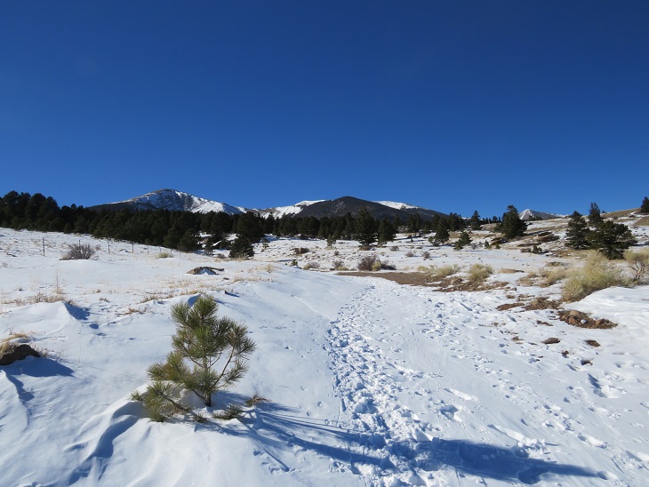
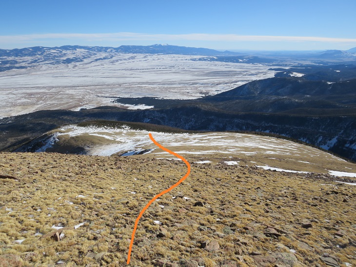
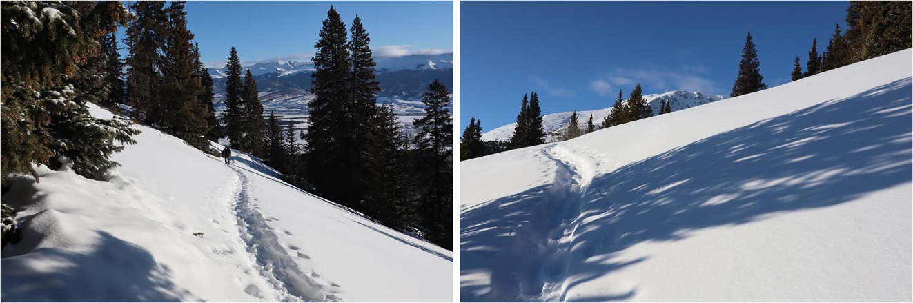
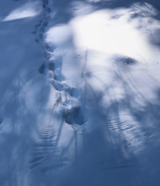
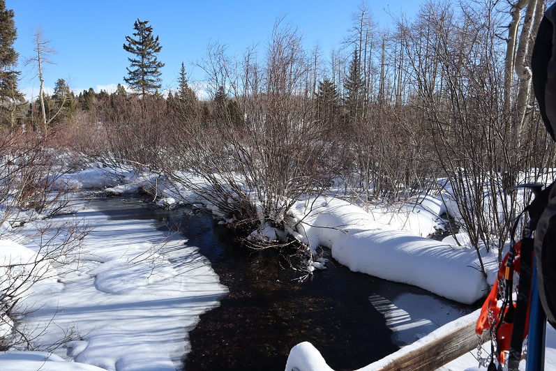
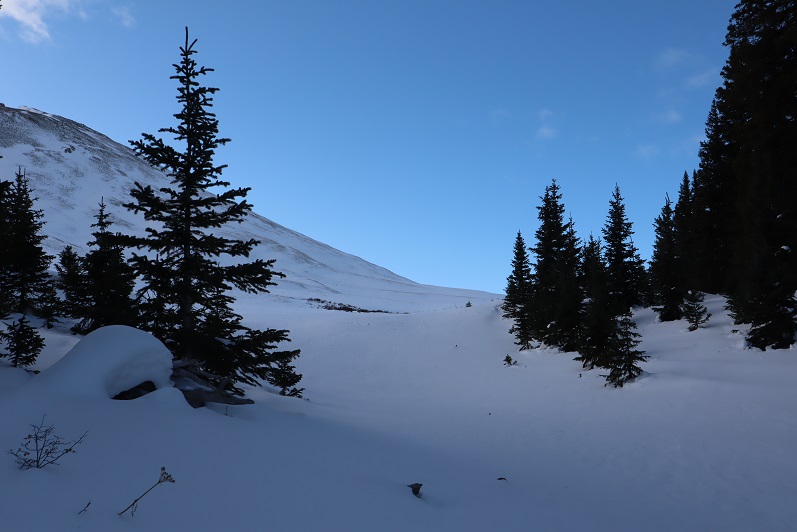
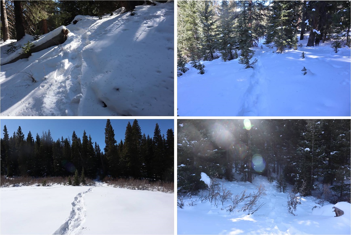
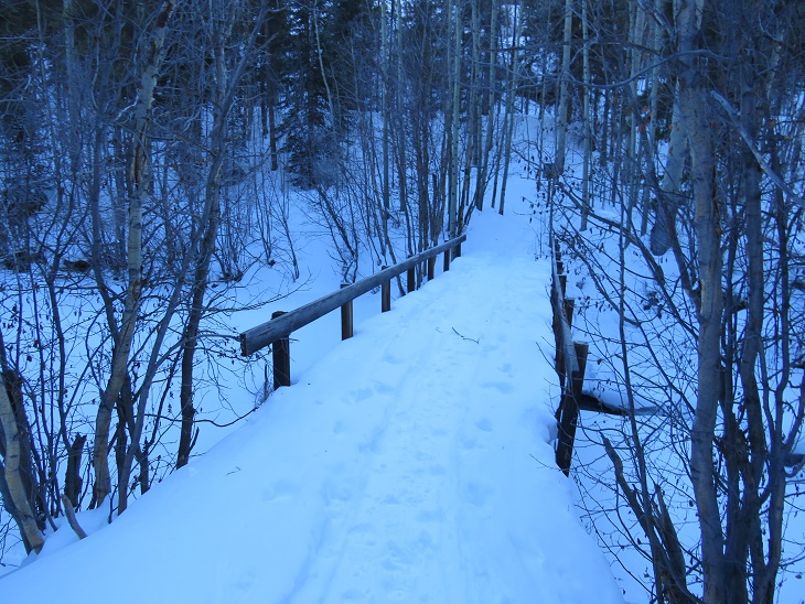
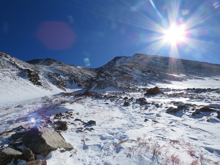
We crossed clear creek and started ascending the side of the mountain wearing microspikes.  We saw some elk tracks here, but luckily, no mountain lion tracks this time.

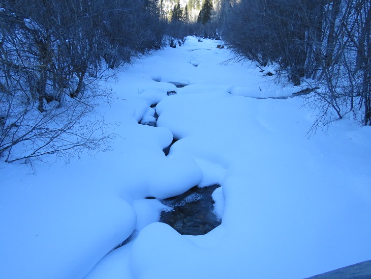
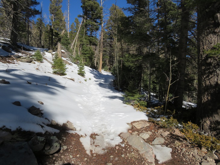
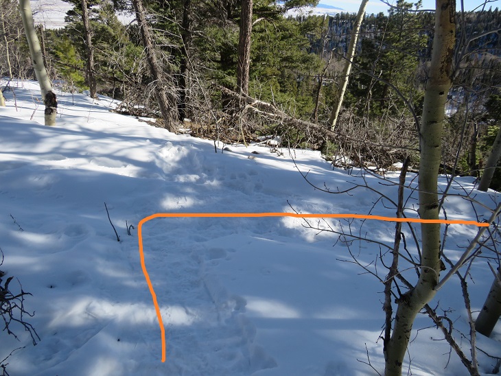
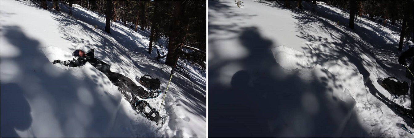
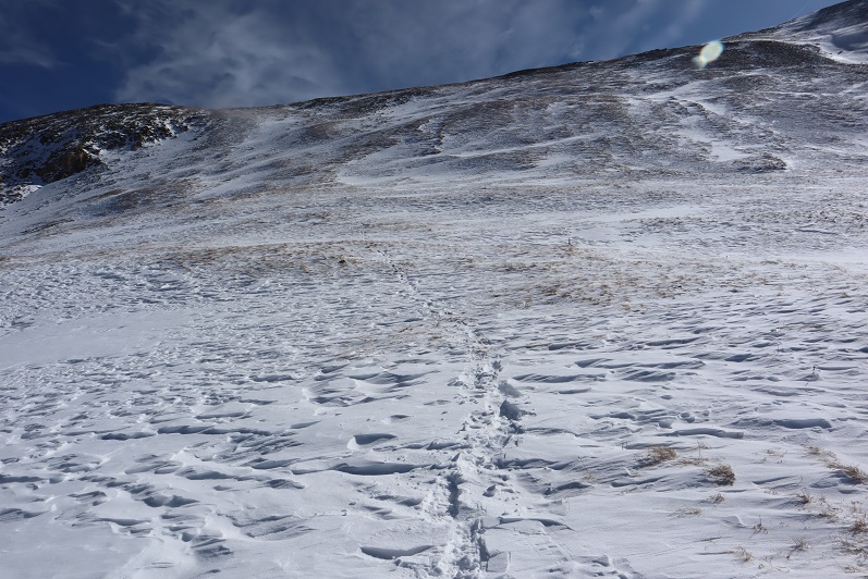
Once in the avalanche area the trench stopped.  We crossed the drainage on some sketchy, snow covered logs

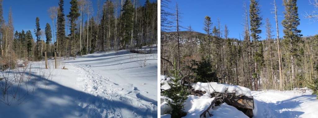
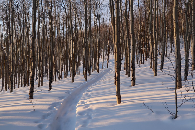
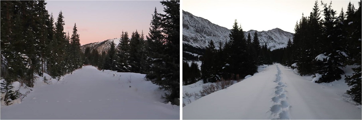
Then stopped for a bit to put on our snowshoes.  These pictures were taken later in the day on our way back down, so you can see the trench.  We put that trench in!  I’ve done this hike several times, so I knew to aim for the trees, heading south

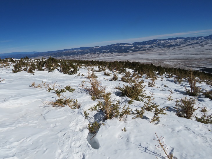
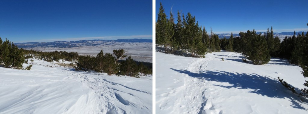
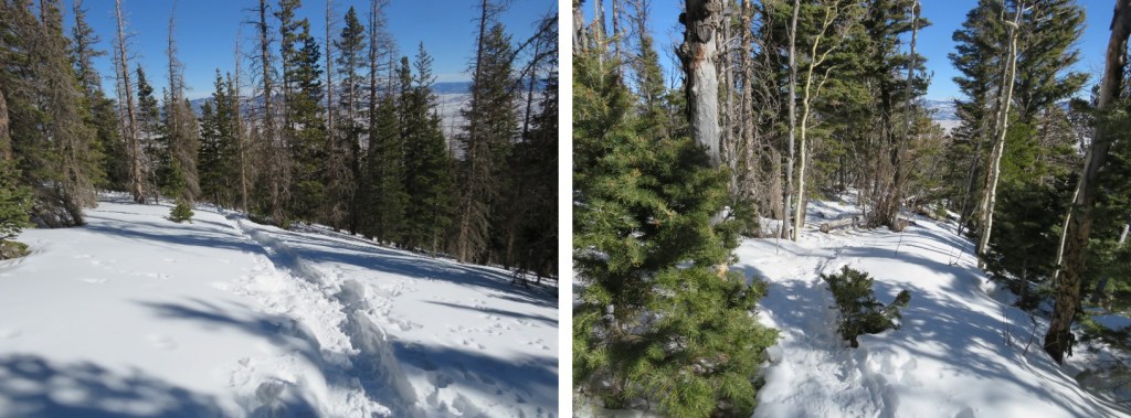
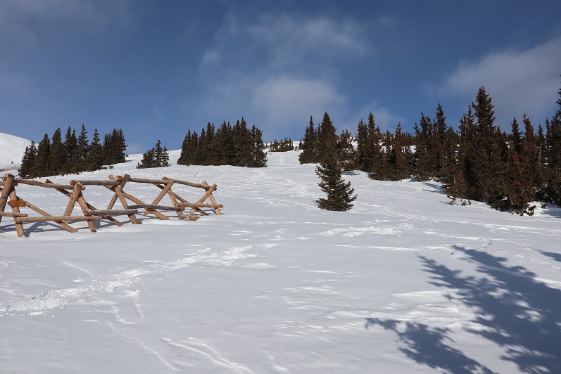
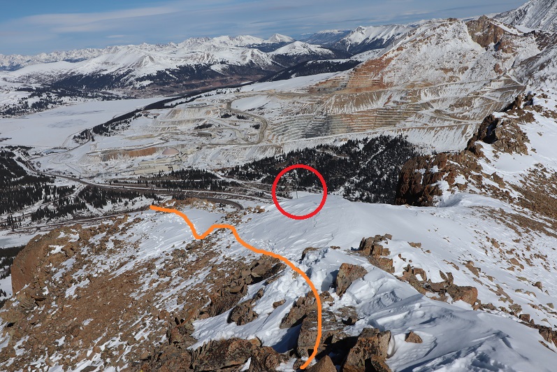
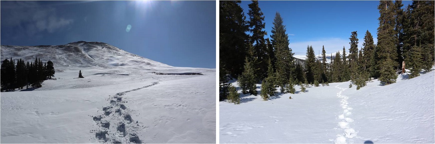
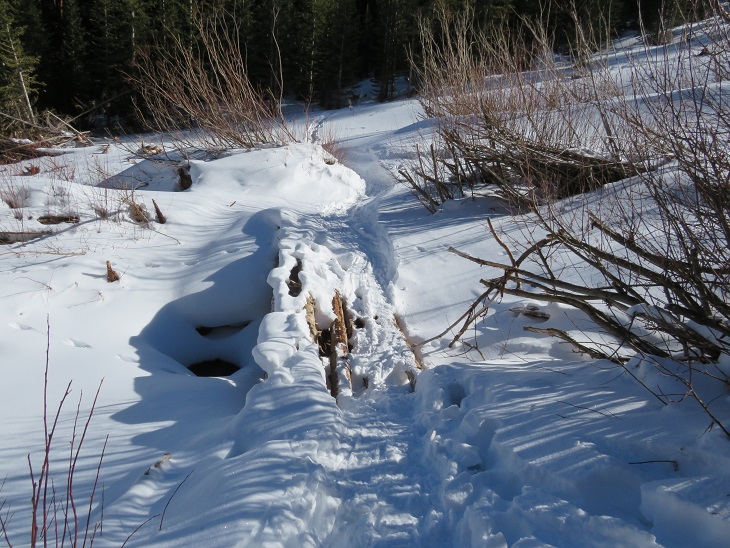
Once in the trees the trench picked up again until the cabin

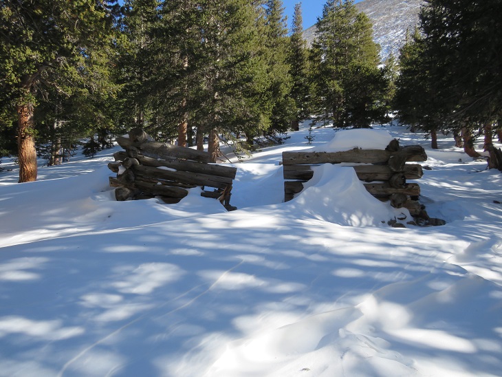
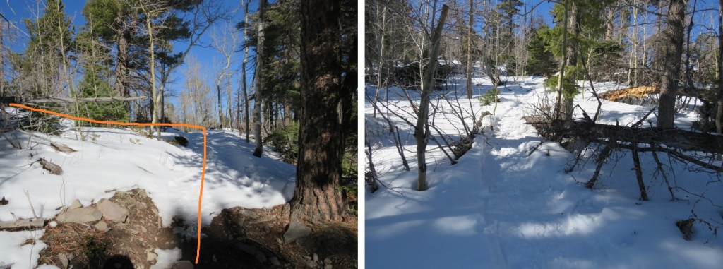
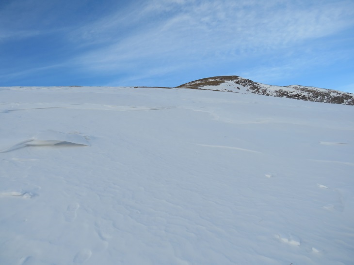
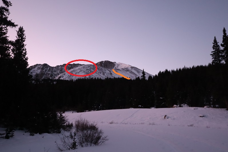
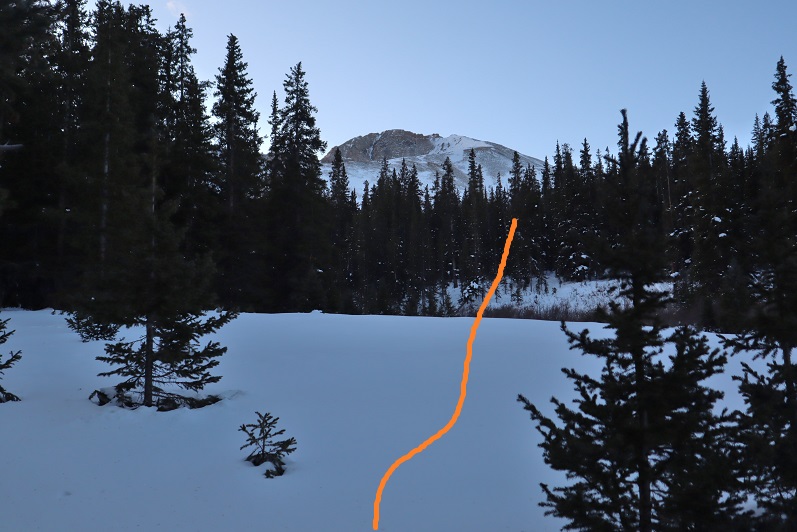
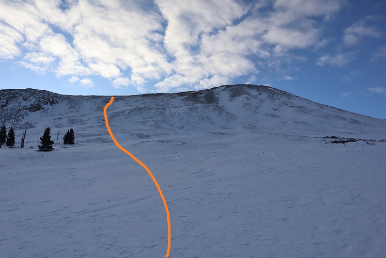
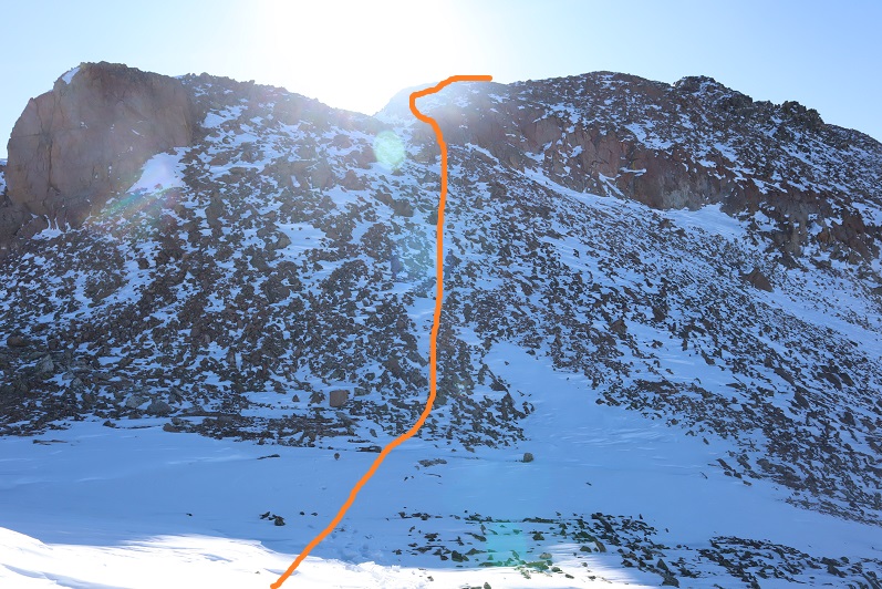
Once past the cabin the trench stopped again.  The wind in the gulch is fierce and I’m sure blows away trenches nightly that are made during the day.  No worries though, we just headed through the gulch (still wearing our snowshoes) towards Mt Belford’s Northwest Ridge

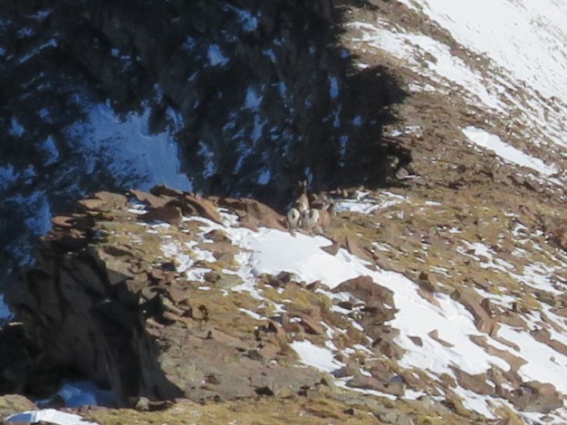
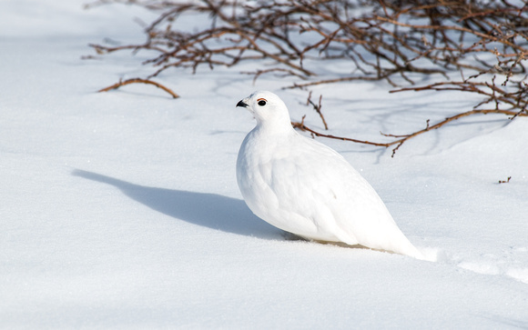
As we were trying (unsuccessfully) to avoid the willows, I heard ptarmigans chirping, but couldn’t see them. Then, all of the sudden, a ptarmigan busted out from under the snow and walked away.  It was here I learned ptarmigans huddle near the willows and stay in their air pockets when it snows to stay warm.  They can do this for days, as their food source is under the snow as well.  It was so cool to hear them calling to each other throughout the day!

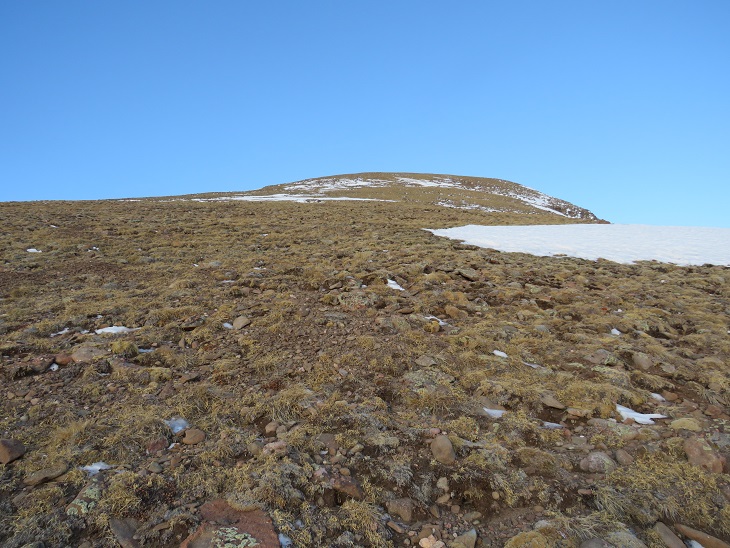
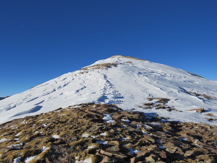
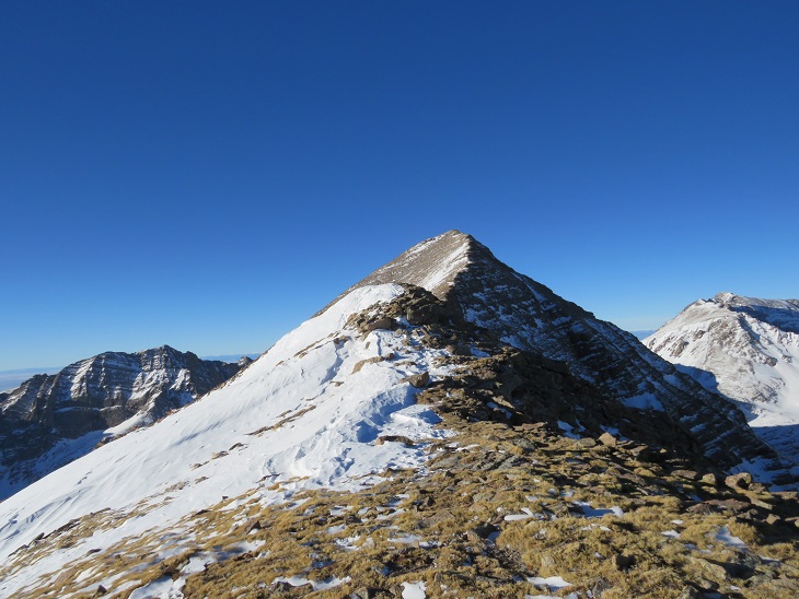
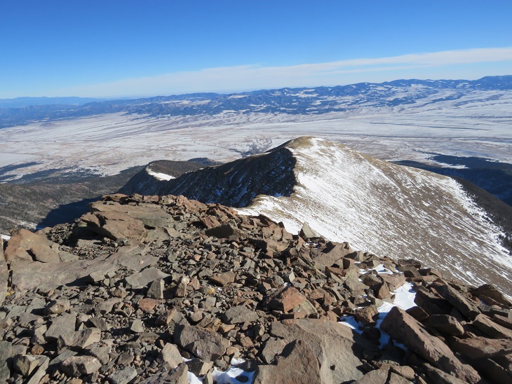
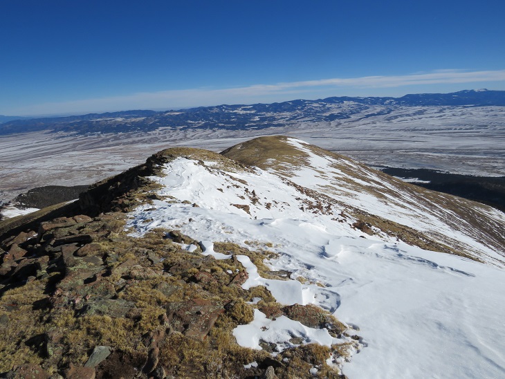
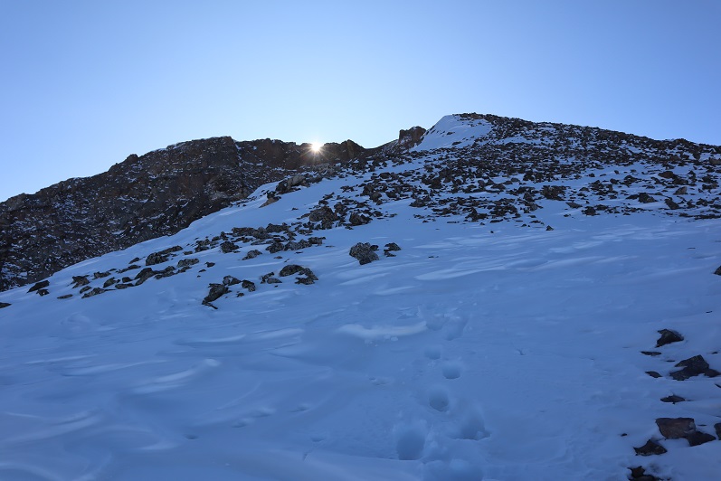
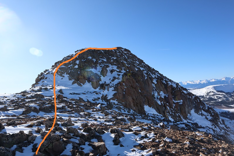
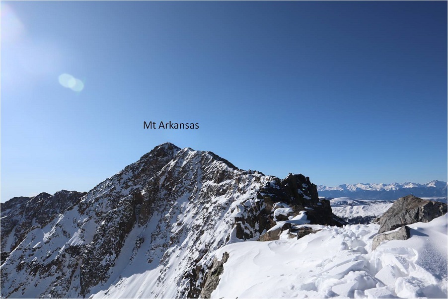
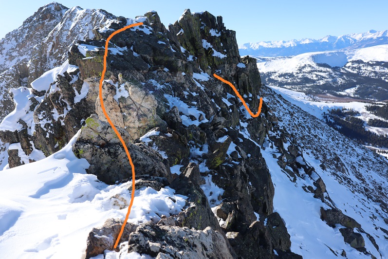
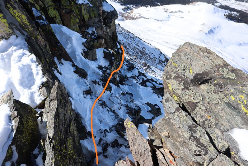
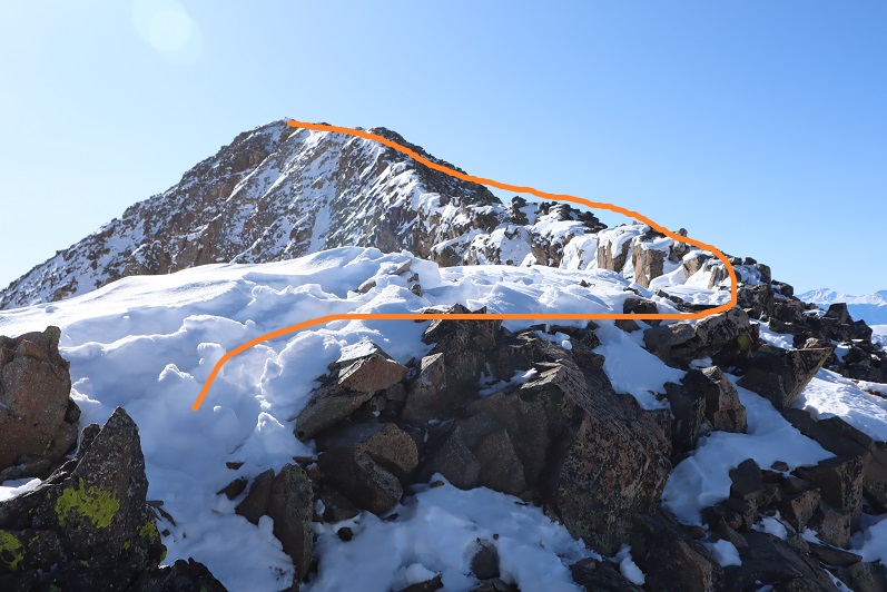
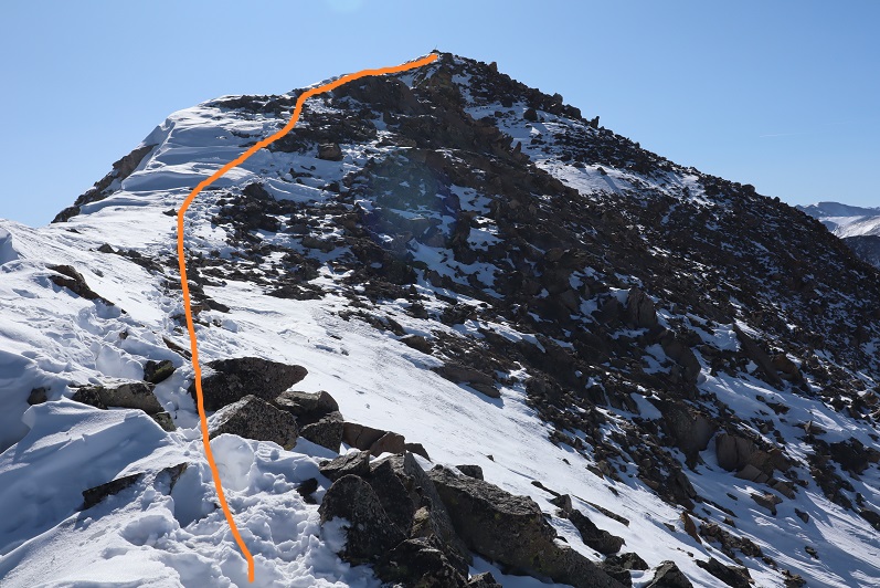
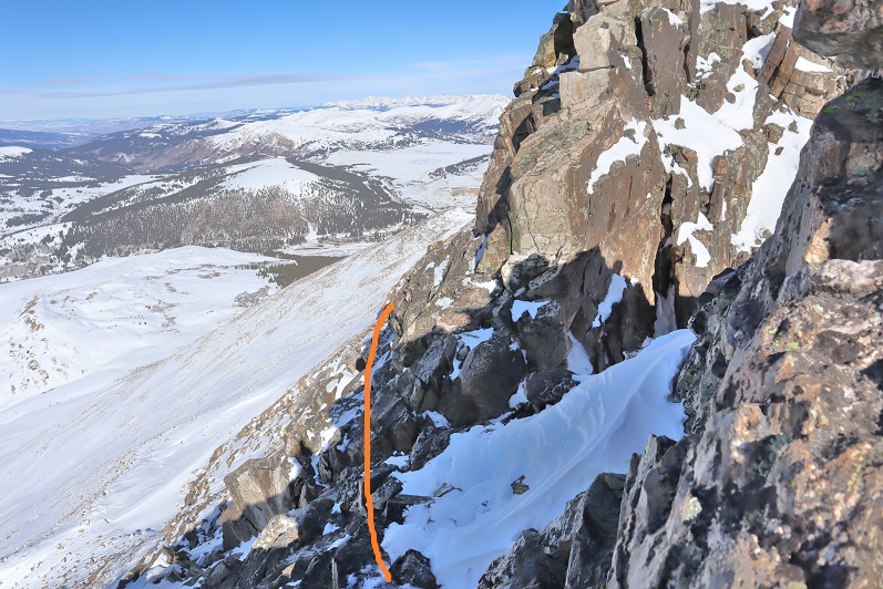
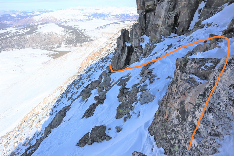
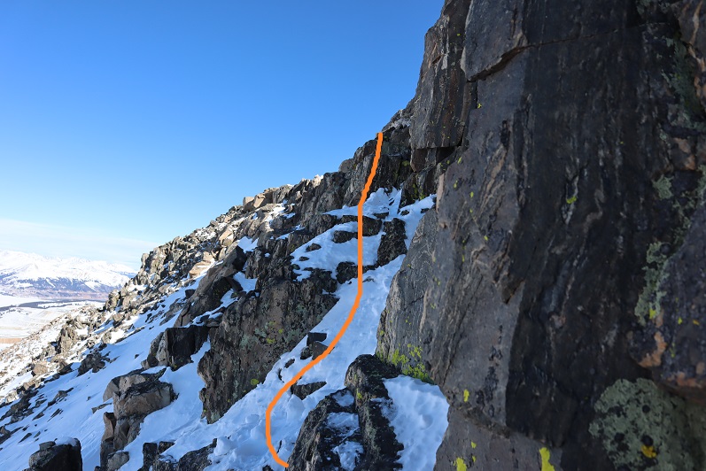
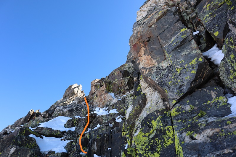
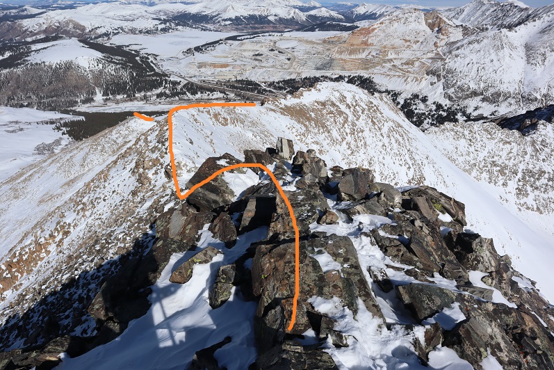
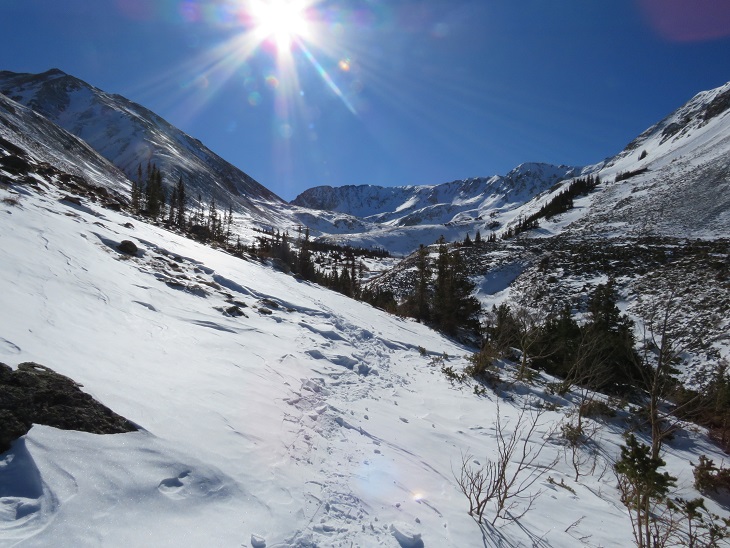
We continued through the basin, only taking our snowshoes off once we reached the ridge.  From here we followed the ridge to the summit.

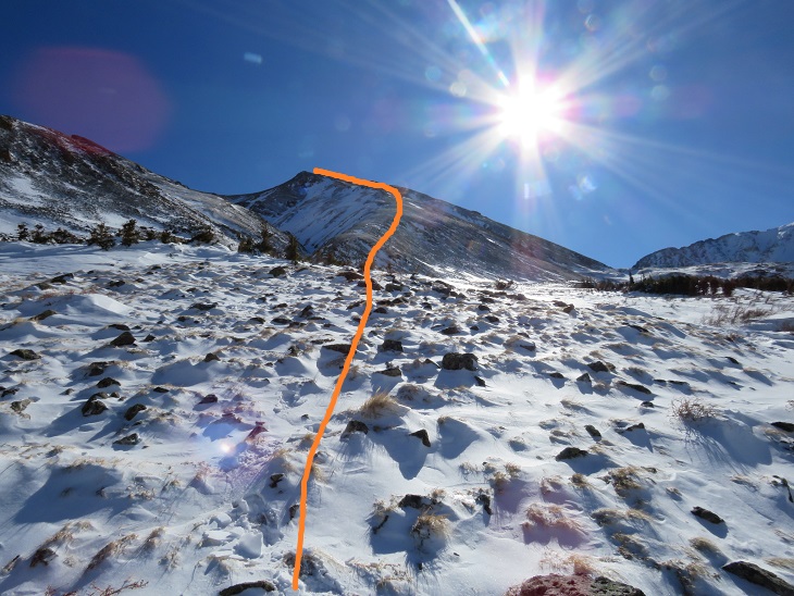
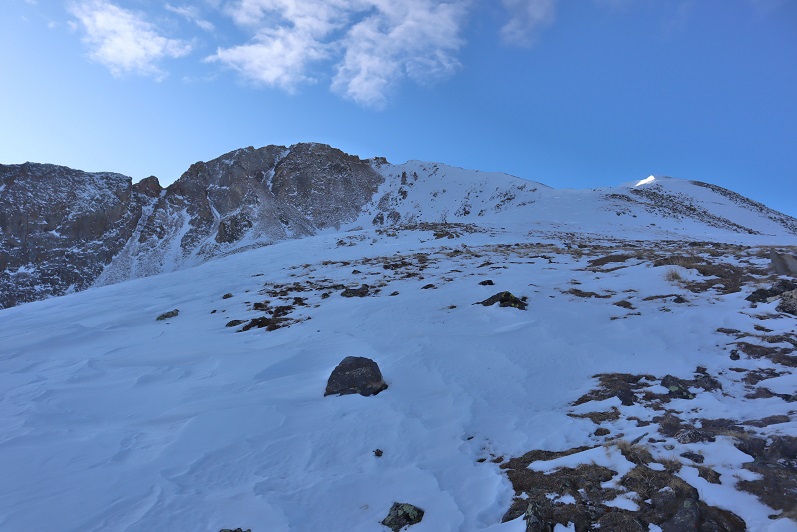
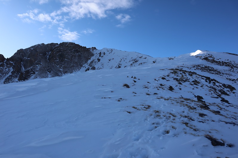
I’m making this sound MUCH easier than it was.  This is probably one of my most difficult winter summits to date.  With my Raynaud’s I need to keep moving to stay warm, and while SkydiverHiker was doing an excellent job keeping up, we still stopped more than my body would have liked.  In fact, about halfway up the ridge I was seriously thinking about turning back:  my fingers and toes were burning and the wind was more intense than predicted.  With windchill it was at least -20 degrees.  We discussed turning back, and decided to continue on (Skydiver Hiker needed a ‘win’ today, and I wouldn’t let him go on without me).  SkydiverHiker dropped his and we continued on up the ridge.  I continued with my pack because I had an ice axe and essential gear.  This continuing on included a lot of intense feelings and emotions, and there was some crying involved and also some nausea.  Have you ever hurt so much you felt nauseous?  Both SkydiverHiker and I felt that way today.  But at least the pain told me I hadn’t lost anything to frostbite.  While mountaineering is certainly physical, it’s emotional and a mind game you play with yourself as well.  I felt as if I were dying every step of the way, not because I was tired, but because I felt my fingers and toes were on fire.  I was dry sobbing at times.

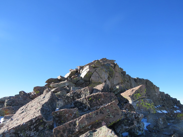
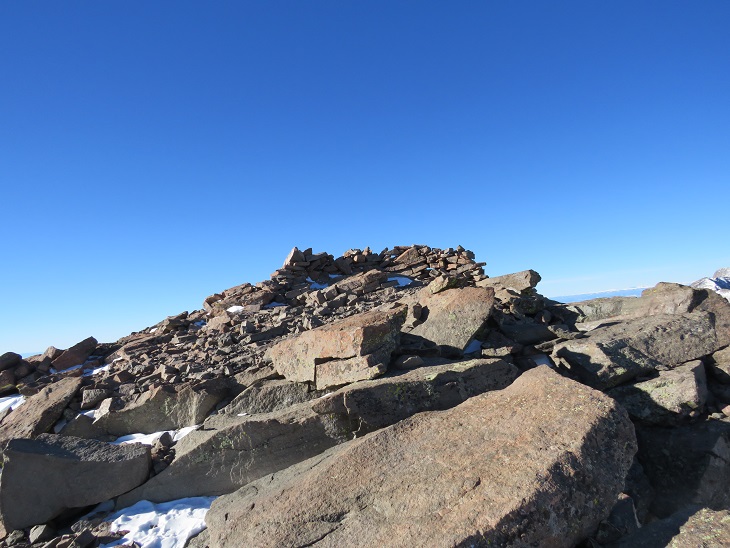
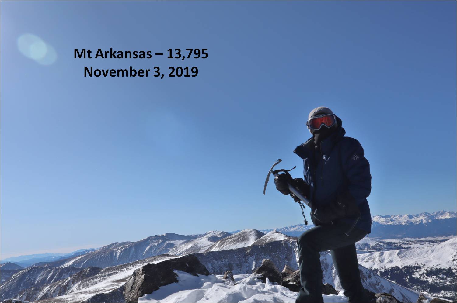
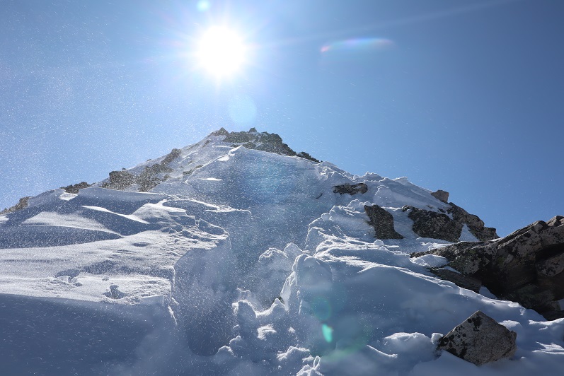
We trudged to the top, where my camera stopped working (I really need to find a better cold-weather camera) so the photos we have are SkydiverHikers from his phone.  About 20 yards from the summit SkydiverHiker laid down and didn’t want to get up.  I didn’t know this, but his back had been really, really hurting him.  This laying down right now was (of course) unacceptable, so I made him get up and lead the way to the summit.

We didn’t stay long, just long enough to get a photo of the summit marker, and then we were on our way back down.

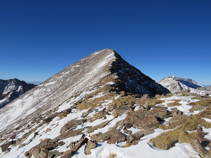
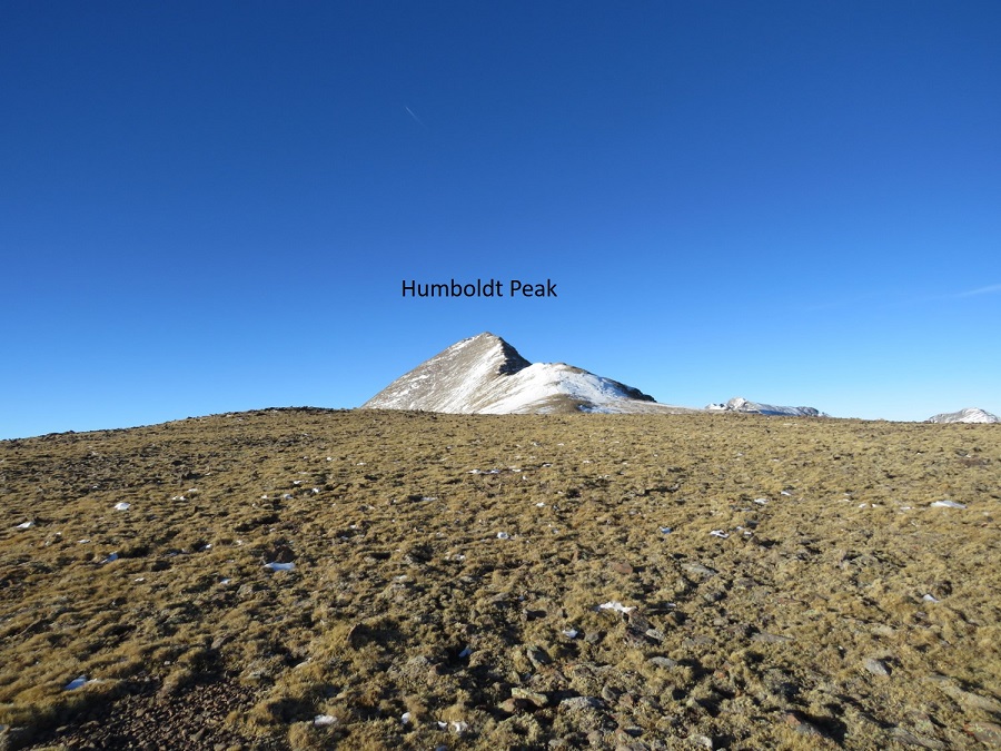
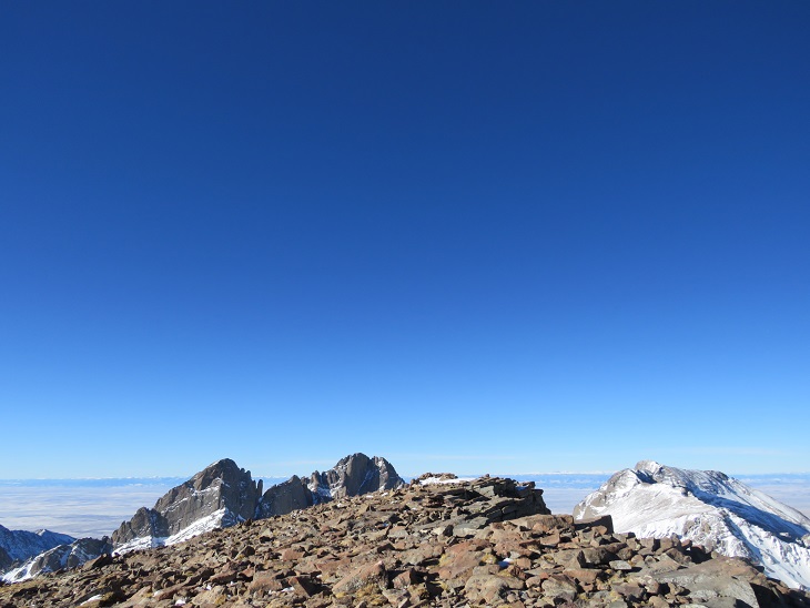
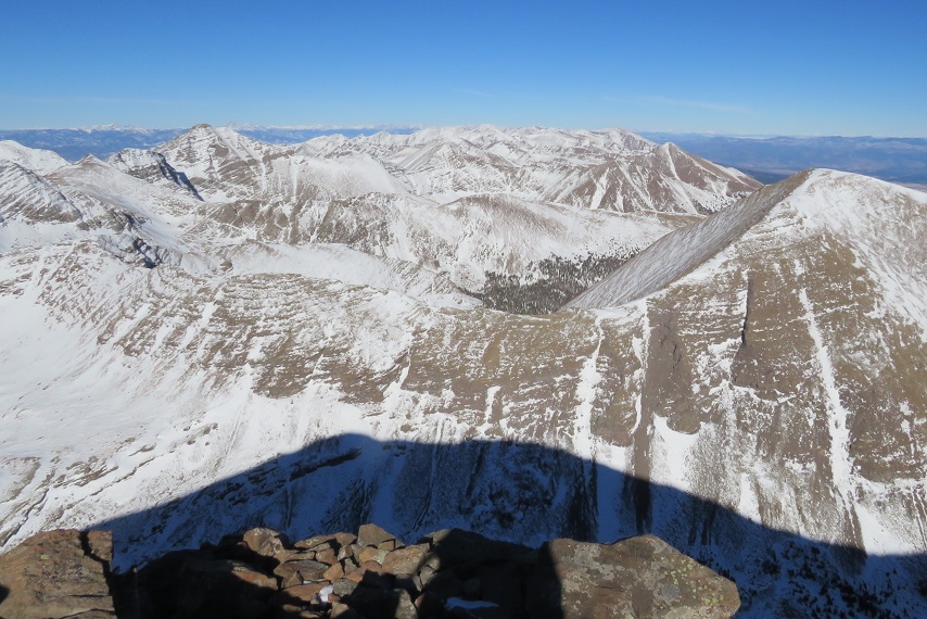
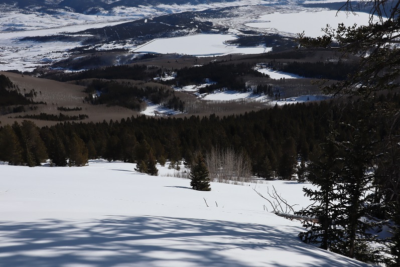
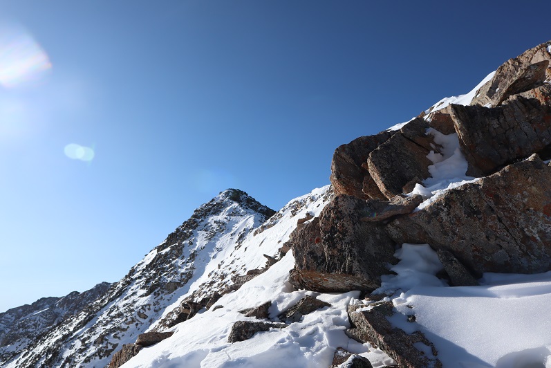
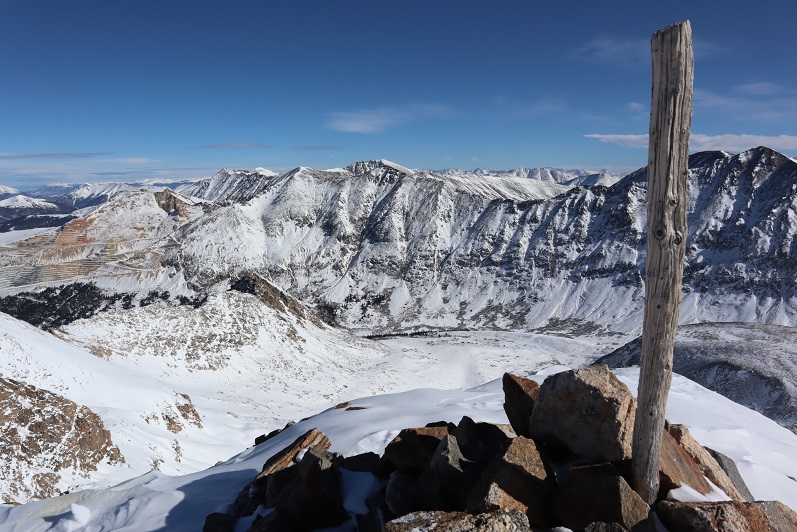
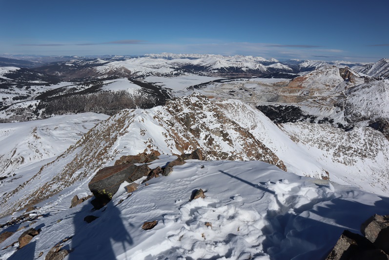
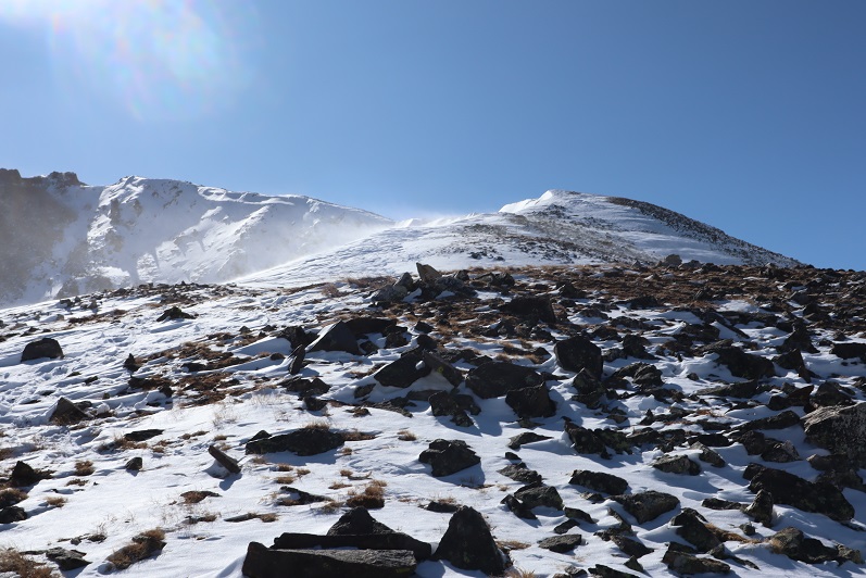
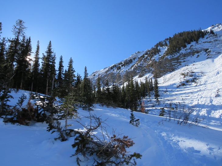
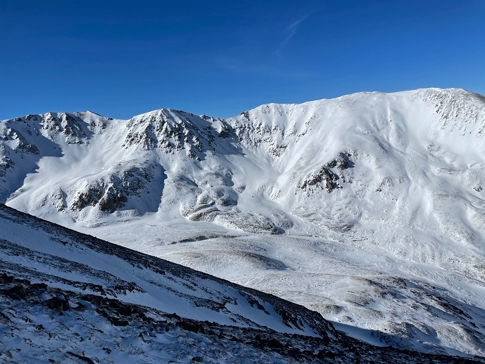
Let me pause here to show you the great views of Missouri Mountain

The screaming and crying continued until we made it to where we were hiking in sunlight, near the base of the ridge.  It’s amazing how the warmth of the sun made me feel better, even when it was still well below freezing. Once at the base of the ridge we donned our snowshoes once again and headed back out of the gulch, following our morning trail.  

As we warmed up our spirits lifted and we were once again thrilled to be out here hiking.  This is one of the most beautiful places in Colorado to hike, and we had it all to ourselves.  Well, it was us and the chirping ptarmigans.  We hiked back past the cabin and through the avalanche area, took off our snowshoes, and continued back to the trailhead in better spirits.  Yes, this is a mental game.   

We made it back to the truck at 1:15pm, making this an 11.15 mile hike with 4764’ of elevation gain in 8 hours.

Summit Sticker can be bought here

Humboldt Peak in Winter

RT Length:  14.02 miles

Elevation Gain: 5562’

This was my third time hiking Humboldt, but my first time in calendar winter.  The last time I was here there was a terrible wind that was causing the snow to become clouds, and I couldn’t see the summit when I arrived (or my own 2 feet). This time I was here for better pictures of the route, and to count it as an official snowflake.  I arrived at the South Colony Lakes lower trailhead and was the only one in the lot when I parked my truck.  I put on my gear, using only microspikes as my footwear, and was on the trail at 4:30am.  As usual in winter, the snow started just past the 2WD parking area.  I always find it amusing to see how far the tire tracks try to go up the road.  This time, they didn’t go far.

The snow on the road started right away, but there was a good trench. I followed the road for 2.3 miles to the junction with Rainbow Trail.  It was still dark out, and as I rounded the last corner of the trail where I could still ‘see’ the trailhead I noticed there was another car parked there.  It seems there would be hikers about a mile behind me today.  Also, my flashlight started flickering.  Time to change the batteries!

At Rainbow Trail the trench spiked, one side going towards Marble Mountain, the other towards Humboldt Peak’s East Ridge.  There weren’t any tracks headed further down the road to South Colony Lakes.  I turned right and followed Rainbow Trail for .5 miles. 

I quickly came to a bridge, then took the trail to the top of a slope

At the top of the slope I was thrilled to see there was a trench in place leading up the ridge.  Last time I did this hike I’d had to trench it myself, and it had taken quite a bit of work.  Today, I was going to poach someone else’s trench!  Woot!

And what a trench it was!  I followed it as it for 2 miles as it ascended the east side of the ridge, all the way to treeline.  Here’s an overview of the route up to Humboldt Peak

If you keep heading west and stick to the rib/ridge, it will take you to treeline.  I could hear the wind above the trees, and got a bit anxious for the above treeline part of the hike.

As I hit treeline the sun started to rise.   I took a few minutes to enjoy the view.  (side note: there were a lot of rabbit tracks here)

The trench ended near treeline.  I could see where it was supposed to go, so I kind of re-trenched it as best I could wearing just spikes.  

Here’s the general overview of my route up the ridge

The wind had been intense all morning, but once I was above treeline it became difficult at times to even stay upright.  So much for the forecased 11-17mph winds!  I’d started early to avoid the most intense winds that were supposed to start around 11am, but it seems they started a little early.  I had to hunker down at times and turn away from the wind, which turned the snowflakes into glass, and was side-stepping as I hiked just to stay in a straight line.  I tried to take pictures, but unfortunately, wind is invisible.  I kept my gloves on and was glad I’d put on my balaclava at the trailhead.  Here are some pictures of the ridge. 

Here I noticed some bighorn sheep in the distance.  They also noticed me and trotted off.

At the top of the ridge was another ridge, so this had been a false summit.  Here’s the actual summit of Humboldt Peak.  It’s a straightforward ridge hike to the summit, nothing above class 2.

Here are some pictures of the ridge.  There was some snow, but it was all firm enough not to need traction

On this part of the ridge the wind really picked up.  I had to hide behind rock structures to get out of the brunt of it, and the noise it made as it came up and over the rocks was creepy.  The balls of my feet were frozen at this point (due to Raynaud’s) and it felt like I was walking with large rocks in my shoes (I wasn’t, it was just the ball of my foot that had frozen).  Several times I hunkered down to maintain my balance, but it was still a straightforward ridge hike.

I knew I’d made it to the summit when I found the wind breaks.  I never saw a summit marker, but I don’t think there’s one here?

I’ve summited Humboldt Peak twice before, so I knew I was at the summit at the first wind break, but I walked further west for better pictures.

I summited Humboldt Peak at 9:45am

Humboldt Peak: 

The views of the Crestones/Sange de Cristo range were beautiful!

Time to head back down the ridge

The wind was still fierce, and I was worried I was getting a nasty windburn in all the areas my balaclava didn’t cover.  The wind speeds weren’t supposed to be this high, so I’d left my goggles at my truck.  Note to self:  next time, bring the goggles. On my way back down the ridge I saw the Bighorn Sheep again.  They quickly turned when they saw me and headed over the mountainside.  There was a big drop on the other side, and I was surprised I couldn’t see them again when I passed. 

This was a simple ridge stroll, or, it would have been, without the wind

Here’s looking at my route back down the ridge to treeline

Here I met some hikers heading up.  The wind had died down considerably by this point, so I figured they had the better weather of the day (I found out later it picked back up again, and they said their summit was just as windy as mine).  My feet started to de-thaw, and I had a minor Raynaud’s attack:  think insane pins and needles as the blood started flowing again.  It lasted about 30 minutes, and to combat it I just kept hiking.  On a positive note, I could feel my toes! Finding my tracks back to the trail was a bit of a challenge, but I came across them eventually.

Then I followed the trench back to Rainbow Trail.  I should have put on snowshoes here, as I postholed ever 30 feet or so, but I really didn’t want to stop.  I was just glad I’d started early enough in the day not to need snowshoes (spikes worked just fine).  Anyone heading back down later than me would need snowshoes. 

Once back at the trail I followed it a half mile to South Colony Lakes Road

Once on the road I hiked the 2.3 miles back to the trailhead, noticing a lot of dog tracks along the way. As I neared the trailhead I saw a couple walking with two beautiful dogs.  It seems they were out on a day hike, and I thought this was a great idea, as it was a beautiful day below treeline.

Here’s a look at the trailhead on my way back. Easily 2WD accessible.

I made it back to my truck at 1pm, making this a 14.02 mile hike with 5563’ of elevation gain in 8.5 hours. 

Unfortunately, when I made it back to my truck I could hear the conversation the couple with the dogs were having. The man kept cussing at his female companion, and the dogs, over simple things like an overturned water bowl.  To me there’s no need for vulgar words, and he was using multiple ones in each sentence he uttered.  I felt the urge to say something, but no one else in his party seemed to mind his behavior, so I kept it to myself.  I’m not sure why women allow themselves to be treated that way?

The Humboldt Peak Summit Sticker can be bought here

Mt Elbert (winter attempt)

1

RT Length: 10 miles

Elevation Gain: 2685’

Time: 7 hours

Partner: Steffen

Note:  Our successful winter summit can be found here.

This was an attempt of the East Ridge of Mt Elbert. We ended up turning back around 12,500’ and did not summit today.  We still had a great time though, with great views and fun animal prints to be found in the snow!

We arrived at the South Mt Elbert trailhead and were on the trail around 5:30am. There was one other vehicle in the lot from out of state.  From the booklets and maps in the front seat I figured they were highpointing.  We ever did see this person…

In the dark we were unable to see the 4WD road and took the trail instead to the 4WD parking area, adding on 2.4 (unnecessary) miles to this hike

2

3

Even though there had been recent snowfall the trail was well trenched and we didn’t need snowshoes for the first few miles. Ours were the first tracks on the trail, leading me to believe the other hiker(s) had taken the 4WD road up.  After about a mile of hiking we came across mountain lion prints!  They looked to be only a few hours old.  They were headed in the opposite direction and followed the trail for about 20 yards before disappearing.

4

I spent the next hour or so stopping frequently to scan the night for glowing eyes but didn’t see any. After about 3 miles we made it to the junction.  Here I decided to put on my snowshoes, and kind of wished I’d done so earlier.  The bridge had a couple feet of well packed snow to cross.

5

There were some interesting 14er signs and here’s where we caught up with the other hikers tracks.

6

The sun was beginning to rise and the forest suddenly became more beautiful. The aspen trees and snow made for a unique landscape

7

8

This hike was trenched and relatively straightforward but felt like it was taking forever to complete. We made numerous stops just to enjoy the view.  The trench continued up and over the mountainside, and here Steffen stopped to put on his snowshoes.  This made a ton of difference for him!

9

The tracks stopped at treeline but the route seemed obvious: just head to the ridge.

10

11

Now that we were above treeline we had a good view of the summit. Unfortunately, it looked windier than we’d anticipated.

12

The mountains all around us seemed to be making their own snow. We weren’t going at a very fast pace (lots of stopping) and Steffen had already taken a few pain killers.  We still were only about half way in both elevation and distance.  I didn’t think our chances of summiting today were very high so we decided to turn around here.  It was a shame because it seemed like such a nice day but on a positive note the fun stuff happened on the way back.

This slope would be perfect to ski/snowboard down!

13

When we made it back below treeline I saw prints that hadn’t been there before: it looked like a bird had caught breakfast while we’d been gone!

14

Steffen made another snow angel and debated doing this on every hike until the realization hit there wouldn’t be snow in the summer… Ha! The shadows from the trees made it difficult to get great pictures.

15

We had fun identifying animal tracks and I enjoyed the aspen trees again. I don’t think I’ve ever seen so many aspen with snow below treeline:  usually I see only pine trees so this was a fun treat!

16

17

We re-crossed the bridge

18

And headed back to the trailhead.

19

We came across the mountain lion tracks again and I got better pictures in the daylight. Just as we left the prints behind we came across a group of 5 snowshoers with their dogs.  The dogs were off leash and the owners seemed upset we were there.  Lucky for us we’d turned back when we did or the mountain lion tracks wouldn’t have been there upon our return.  We made it back to my truck and checked our stats.  I was surprised we hadn’t gained more elevation than we had.  This hike seemed to have taken all day and I was sure we’d gained close to 4000’.  Oh well:  This was a well trenched hike, so I’ll be back to complete it in winter (soon).

Mt Arkansas – 13,804

1

RT Length: 6 miles

Elevation Gain: 2759’

I got a late start on this one but I didn’t mind much. I made it to the Freemont Pass South trailhead just before 6am, surprised to see two other vehicles already parked there.  I’m not sure we made the best use of our parking spaces

2

When I looked up at the mountain I could see headlamps. Wow!  It’s not often I’m not the first person out.   That’s what happens when you sleep in.  They were taking a different route to the ridge than I planned on taking, and I wondered if they knew something I didn’t?  You can’t really see them, but they’re circled here.  The orange line is how I gained the ridge

3

I put on my microspikes under my snowshoes and headed out. As the sun started to rise I followed the road as it wound southwest, switchbacking a couple of times

4

There were plenty of tracks on the road until I came to a straightaway. All tracks went left (east) but my instructions said to go right, so I got to be the first one on the new snow!

5

After about a quarter mile I turned left and entered the trees

6

There was no trail here but I could see the mountain. I trenched my way south, sometimes coming across ski tracks or old game trails

7

8

Eventually I made it to treeline and had no difficulty figuring out the route before me. There were some large snow drifts towards the end of the basin I wanted to avoid so I decided to gain the ridge early.  The snow here was soft and sugary and I was once again glad I’d worn snowshoes.

9

Here’s the path I took up the ridge

10

It’s steeper than it looks. Once on top of the ridge I ran into the tracks of the hikers I’d seen that morning. None of the tracks headed back down so they must still be on the mountain. I turned southwest and started up the ridge

11

12

The snow here wasn’t consistent.  In some places there wasn’t any snow, and in others it was consolidated.  I saw just enough postholing tracks from the hikers above me to convince me to keep my snowshoes on.

13

I followed the ridge to a small saddle and ascended the hill.

14

I completely thought I was nearing the end of this climb and kept looking for the other hikers. They should have been way ahead of me.  Why hadn’t I seen them yet?  I kept feeling like I was getting closer and closer to the end, which meant they should have been on their way back by now.  At the top of that hill there was a pole. This pole is important, as it signifies the correct route to take back down.  It’s good to make a mental note of where this is. I went right here

15

This is where the fun began. Once again, I totally assumed this was the summit (it wasn’t). I went up and over

16

And saw this

17

No worries… that must be the summit (it wasn’t). It was an easy class 2 hike though, until I came to a short class 4 section here, which was interesting in snowshoes

18

At the top of the class 4 section my heart sank: I still had a long ways to the actual summit, and it looked like all class 3+ from here.  I couldn’t see the other hikers anywhere and I was getting seriously worried because all tracks still pointed up.

19

I looked for the class 2 section as an alternate, but there was so much snow it wasn’t a viable option. If I was going to continue I was going to have to climb class 3 in the snow.  That wasn’t going to be possible with my snowshoes on.  I seriously considered turning back.  This would be an easy hike with no snow, one I could do quickly next summer.   I debated my chances of success in the current conditions.

I decided since it was a nice day I’d take it one step at a time and turn back if necessary.   The snowshoes weren’t necessary so I sat down to take them off and stash them while I summited.  Just as I was kicking them off (I didn’t want to take my gloves off so there was a bit of a struggle)  I saw the group of hikers coming towards me.  No, they hadn’t been slow, it had just been a much longer ridge than I’d anticipated and they’d been behind rocks when I’d made it within final view of the actual summit.  I waited for them to pass me.  I had a hard time making conversation (my mouth was frozen and it was difficult to make words) but we had a quick chat.  They said the headwall on the way they’d come up hadn’t been fun.  I wished them luck and we were on our separate ways.  I was so glad I’d decided to put on my spikes under my snowshoes!  It was worth it not to need to take off my gloves.  The wind wasn’t too terrible, but I’d need all the feeling in my fingers I could get for some class 3 scrambling.

This last route on the ridge mainly sticks to the ridge, but it does dip down a few times to the right. Here’s the route I took

20

21

22

It looked like the group ahead of me had gone a little higher in places than I did but I felt their route looked class 4 and felt more comfortable staying a bit lower. I was never more than 30 or so feet below the ridge and most of the time I was right on top.  The last push to the summit was on class 2 rocks

23

24

There was a big cairn indicating the summit. I was thrilled I’d decided not to turn back!  That had been easier than I’d anticipated.

25

Here’s my summit photo

26

It is much harder to work a camera with large gloves on than you’d think. If you have a few minutes to spare you can watch one of my attempts (I couldn’t figure out why it wasn’t working.  Turns out it was on video mode).  This sort of stuff happens frequently and wastes time on the summit.  I tend to give up quickly and go with the first shot I take, especially when it’s cold and time has more meaning.

Summit Post

27

Here’s a look back down the ridge

28

The trail down the ridge was pretty similar to the way up. Here’s a look at the tricky sections

29

30

31

32

Remember how I said that pole was important? Here’s why:  You don’t follow this ridge all the way down.  You’ll eventually turn left and follow a different ridge

33

The wind was starting to pick up, and some of the trenches forming were body-sized because of the sugary snow

34

The pole is circled here in red. Follow the ridge to the left, don’t go straight or it will take you to point 12923.

35

From here I followed the ridge to just before the headwall

36

Looking back things started to get windy

37

I turned left and headed down the side of the mountain. Down was much easier than up.

38

Here’s my exit route back into the trees

39

My tracks were mostly gone in a lot of the basin but I could see where they picked up near treeline

40

Once at treeline I just followed my tracks back to my truck, doing my best to form a nice trench

41

I made it back to my truck at 12:30pm, making this a 6 mile hike with 2759’ of elevation gain in 6 and a half hours. The hike had felt longer distance wise than it was, and I it felt shorter time wise.  I guess I kind of went into a zone when crossing the ridge and lost track of time.

42

43