North Cheyenne Canyon

Today was disappointing on so many levels, but wonderful
because I was able to spend some time outside!

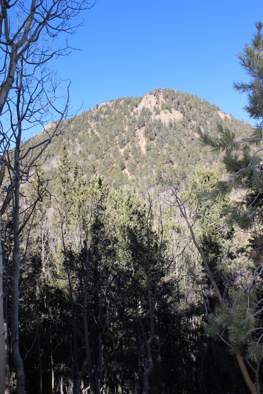
I’d wanted to hike a 13er today (the weather was absolutely
perfect!)  but due to my truck issues I’m
stuck with a 2WD rental car that wouldn’t make it to the trailhead.  So I decided to take another hike in North Cheyenne
Canyon.  

I woke up at 5am and because it was still too early (cold)
to head out I ran for an hour on the treadmill, took a shower, and did 30
minutes of yoga.  

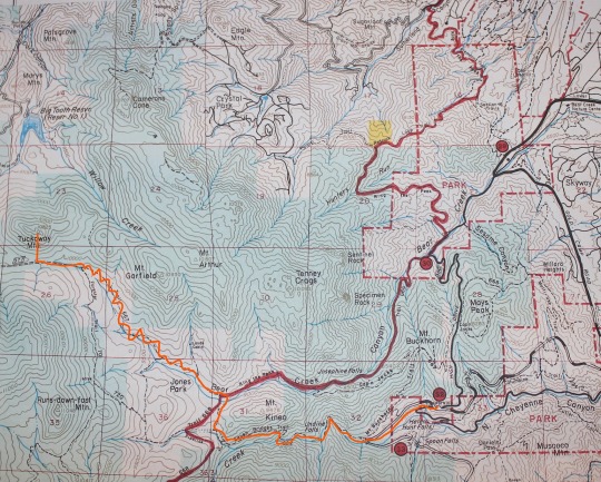
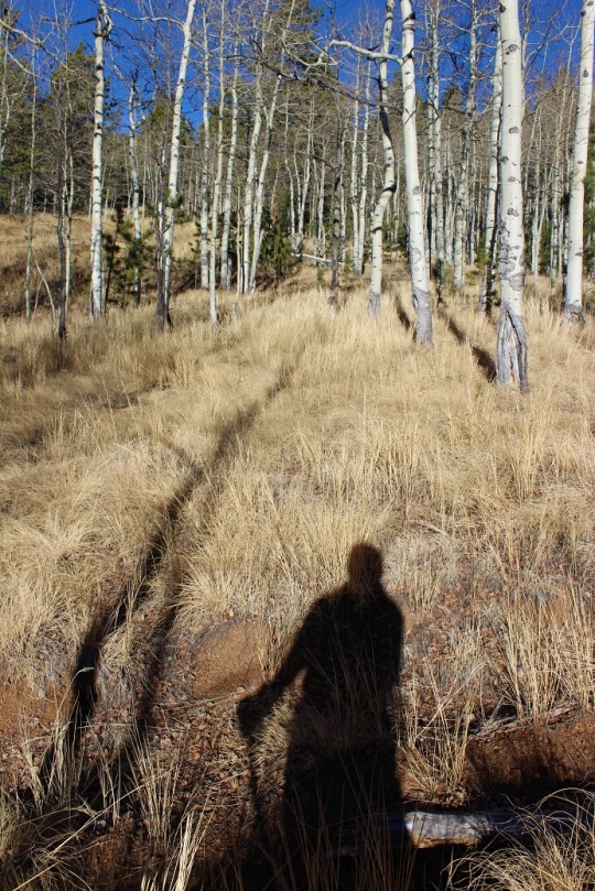
I made it to the trailhead at 8am and started on the 7
bridges trail.  I was aiming at hiking
Runs-Down-Fast mountain, which is on my Atlas but not in my GPS or on any trial
map I’ve seen.  

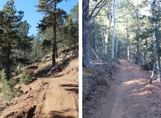
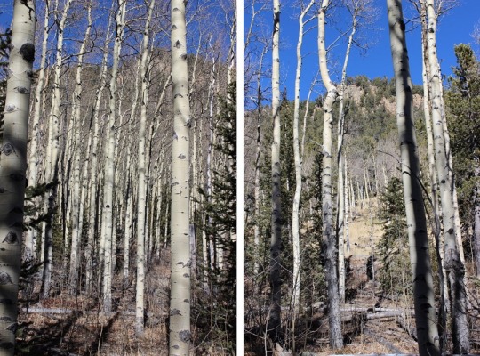
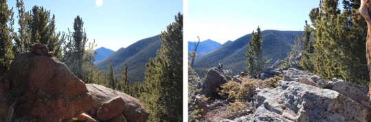
North Cheyenne Canyon has a lot of amazing, well kept
trails.  They’ve been doing a lot of work
in the area maintaining their trails, which is great, but in the process they’re
destroying established trails and making new ones, and sometimes changing
existing trails and moving them to other routes.  In other words, none of the maps sync.  It’s been very frustrating hiking in the area
lately!  They have posted signs with
terrible maps that make no sense and are difficult to read.  Not all of the trails have trail signs on
them, and some of the names are wrong.
It makes for quite an adventure!
Even with a topo map nothing makes sense (because the trails have
moved).  

The 7 Bridges Trail is still the same.  Today it was all iced over!

I took 622A to 668 and was looking for the turn off to 622
to bring me west towards the mountain.  I
hiked and hiked and hiked, and crossed this area that took a lot of
concentration (I couldn’t tell how tough the ice was or how far the creek
went).  

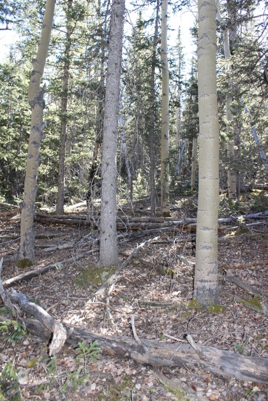
Most of the trail was free of snow at this point

Then I followed the pipeline trail.  I tried to find some history on the pipeline
and failed.  Basically, it looks old and
it obviously hasn’t been functional for quite a while.  

I rounded a corner and saw where the 622 A intersects with
the Pipeline Trail, but there was no route at all hiking west.  So I continued to follow the trail for
another half a mile before pulling out my topo and realizing I was way too far
south.  So I backtracked to the cutoff,
and nope, still no trail west.  I kept
going for another quarter mile and realized my mistake:  Just at the creek crossing I was paying so
much attention to was a snowed over trail.

It was unmarked but looked like the trail I was looking for
(it matched on the topo).  The only
problem was it was obviously a trail they didn’t want me to follow.  It looked like crews had purposely destroyed
it, making it difficult to follow.  

I followed it anyway and ended up at intersecting the 667
trail. Ugh!  I knew I was too far north
at this point, so I headed back, figuring I’d missed the 720 at some
point.  I never found it.  Instead I took a route that brought me nowhere.  I could tell I was supposed to head west, but
it just didn’t look possible.  I bushwhacked
for a bit, heading in the direction of Runs-down-fast Mountain, and eventually
came to some orange marking tape.  

Woohoo!  I figured
this would get me to the 720 or the Forester Trail, so I followed it for about
half a mile.  Nope, it brought me to this
big hole in the ground.  Ugh!  

However, at this point I heard some motorcyclists and
watched them speed past me about 50 feet up the hill.   I headed up to the trail (once again hoping I’d
hit the 720 or Forester) but nope:  I was
back at the 667!  

Now I was extremely frustrated.  I knew where I wanted to go, but apparently
when I’d backtracked the second time I didn’t backtrack far enough. I knew where I was and what I’d done wrong, but at this point I had two options:  Backtrack again and try it a third time, or
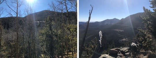
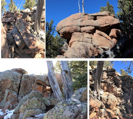
head back down the trial and make it a look by taking Cap’n Jacks Trail over to
Mt Buckhorn and follow High Drive back down.

I decided I wanted to get back home to my kids, so I took
the loop.  Here’s the entire route I took
today:

It was frustrating not summiting anything (especially when I
had 3 ‘easy’ summits I wanted to hit today), and basically hiking in circles,
but I did take a few trails I haven’t taken before, and I was able to problem
solve and route find.  I also mapped out
in my head where several trails intersect so next time I’ll be more prepared.  

I’m not done searching to summit Runs-down-fast, but I think
I’m going to start at a different trailhead next time, at least until North Cheyenne
Canyon gets their act together and publishes some accurate maps available
online (I mean this with the utmost respect).

Mays Peak – 8,283 and Mt. Buckhorn 8,360

I was looking for a quick hike today because I wanted to be
home by 11am to spend time with my oldest daughter who’s 19 and I feel like I never
see anymore because we have conflicting schedules.  Fridays are my hiking days, but they are also
the only time I have free to see my daughter before she goes to work in the
afternoon.  She sleeps in really, really
late, so I just got up early and headed to the trail, intending to be back by
noon to wake her up for some mother/daughter time.  

I’ve been spending a lot of time in the North Cheyenne
Canyon area recently.  I hear they’ll
close the road in for winter at some point, so I’ve just been going to the same
trailhead and hiking different peaks.  This
is a pretty popular area, with trails to many different areas, so getting there
early is essential.  There’s nothing
really special about Mays Peak or Mt Buckhorn.
They aren’t particularly tall peaks, and they aren’t difficult to find
(they don’t have established trails but they’re both pretty close to the
trail).  However they’re on the map and
they’re labeled, so I figured I’d add them to my list of points to see.  

I parked at the trailhead at Gold Camp Road and High Drive,
and was on the trail at 8:10am.  Here’s
the route I took:

I hiked north on High Drive to just after this sign:

I was at a junction (left is Buckhorn, right is Mays).  

I turned right and took this trail east and then curved
north around the mountain.  For some
reason it looked like they didn’t want me to take this trail, but it was the
way I’d wanted to go, so I did.

The trail looked established, but it’s not on their trail
maps.

After rounding the mountain and turning north I decided to try
to find my own way up Mays Peak.  I know
there’s a trail, but I wanted to practice my route finding, so I turned west and
this is what I saw.

I continued west and continued up the hillside.  The only difficult part was avoiding those
darn banana yuccas:  they’re prickly!

I made it to the ‘summit’ and took a few pictures of the
view (to the north I could see the Waldo Canyon Burn Scar)

And one of me to prove I’d summited.

Then I was on my way back down to the junction.  I took 667 south and around the mountain and
then up the hill.

Once the trail started heading north there was a junction that
was difficult to see and unmarked.  You
could go north or west.  Mt Buckhorn is
north, so stay straight.  

Mt Buckhorn is kind of difficult to find, but just keep
heading north and eventually you’ll get there.
First you pass this rock formation

Then you pass a large firepit.

Next you’ll go through a few more
rocks            

And another very large crater size fire pit

You’ll know you’re at the summit because you’ll come to a
very large area of boulders that defy explanation of how they got there.  These things are HUGE!  The actual summit is on top of this rather
large boulder, that requires ropes to climb.
I’d heard this so I’d come prepared with my helmet.  However, there was absolutely NO WAY of
climbing this rock without ropes.  Trust
me, I spent a good 15 minutes walking all around this thing looking for a
viable route.  This rock is much larger
than it looks (you can camp underneath it).

So I put my helmet away and headed back down.  I couldn’t believe what wonderful weather we
had today!  Here it is, December 1st,
and I’m wearing yoga clothes out on the trail!
It was 65 degrees today in the mountains, with no wind.  

There are many trails in this area, so I had options on my
way back down.  I decided to take the 667
to the 776, mainly because I wanted to see where it went.  

I’d already taken the 667 for quite a ways and knew that
took me to the Kineo cutoff.  The 776
took me down to the area just before the 7 bridges trail.  I could exit just below the North Cheyenne Creek
or just after the 1st bridge, where it turns into 622 (7 bridges
trail).  

I exited here and took Gold Camp road back to my truck, making
it there at 10:30am.  The hike was quite
pleasant, and although short (5 miles or so?
Maybe a little more…) I didn’t see many people and I was out hiking in
the sunshine.  I was so happy I’d gotten
outside today!  

Tuckaway Mountain – 10,825′

image

RT Length:  12+ miles

Elevation Gain: 3400’

Notes:  Bring your
sense of adventure and a helmet!

This hike was really pretty awesome!  Each time I go out looking for a bit more of
a challenge, and today I found it!
Tuckaway Mountain is listed in the Pikes Peak Atlas, but there is no established
(or even mildly established) trail to the summit.  The hike is long, the summit a class 3 scramble
(at least).  It really is Tucked Away, and takes a long trail through North Cheyenne Canyon to reach.

I started this hike at 7:45am at the 7 Bridges Trail parking
lot.  Around the 2nd bridge I
saw a decorated Christmas Tree that wasn’t there two days ago when I hiked this
part of the trail to summit Mt Garfield and Mt Arthur. The tree immediately
brought a smile to my face, and then my next thought was “I hope whoever put
this here takes it down as well”  LNT and
all.

image

I followed the 7 Bridges Trail to the junction and turned left
onto 667.  I stayed on this trail until
it ran into trail 377.  This seemed to
take a really long time, probably because of all the switchbacks!  My map didn’t mention those, so I put them in
where they’re missing.  They go on
forever!

image

This trail is newly renovated, and seems to cater to
motorcyclists/mountain bikers.  I didn’t
see one hiker on this trail all day, but saw 1 group of motorcyclists and 2
groups of bicyclists.  They all seemed
surprised to see me.

image

The wind started picking up around 9500’ and I was glad I’d
chosen to stay below treeline today.  Looking
at the topo map I thought once I was close to Tuckaway Mountain the hike would
be easy, but I was wrong.  First off, the
mountain was extremely difficult to see, even though it’s late in the
fall.  Secondly, it was covered in
rocks!  

image

Once I made it to the area directly in front of the mountain
I turned right/north.  This is what I
saw:

image

I decided my best course of action was to really study the mountain,
pick my route, and head up.  The entire base
was covered in Aspens, making it difficult to tell where I was going. I didn’t
want to get stuck at a rock outcropping.

image

I chose to summit to the east to avoid the large
outcroppings, but in reality, you can’t avoid them all.  There is no established trail to the top of
Tuckaway Mountain:  no trail, no cairns,
nothing.  I did some major scrambling,
involving all hands and feet at once, as well as some intuition and luck!  The rocks weren’t stable, and even the big
ones rolled when I touched them.  Where
there weren’t rocks there was scree, and very slippery terrain.  

image

Since I was basically bushwhacking and I couldn’t see the summit
through the trees, I kept stopping every 20 feet or so to look back behind
me.  I kept this sandy area in my sights
for my return trip back down.

image

I summited at 10:45am, to a bunch of rocks!  The summit was rather long and irregularly
shaped, full of trees, and lots of rocks to scramble on.

image
image

I took a bunch of photos from all around the mountain, just because
I could, and to show where it’s located in relation to the other peaks in the
area.

image

Next came the fun part:
heading back down.  The trek up
was challenging, and so was the trek back down.
I had to be careful with my footing.
I spent a lot of time lowering my center of gravity and getting stuck
with needles and thorns.  My gloves were ripped
in places and covered in yellow Aspen dust by the end.  Just an FYI:
pine needles are slippery… avoid patches of pine needles.  By the time I’d made it down I was COVERED in
dirt.  I really looked like I’d worked
for that summit!

I made it back down to the Aspen grove and was able to find
trail 377 to lead me back.  The trek back
seemed a lot longer than the trek in (which seemed long to begin with… I’m thinking
it may be more than 12 miles total now that all the switchbacks are there…).  It was mostly downhill, but those switchbacks
went on forever!  When I made it to the 7
falls area it was PACKED with people!  I
was surprised to see so many families lining the trails.  And I mean families!  Most groups had over 10 people, over half of
them under 10 years old, most younger than that.  It was great to see so many young families
out enjoying the trails, but it was frustrating trying to pass the large groups
who were (understandably) going slow.  Gold
Camp Road was full of strollers.  The
parking lot that had 6 cars in it when I arrived was overflowing with at least
100 cars:  people were parking down at
Helen Hunt falls and walking up!  I was
really glad I’d gotten an early start on such a popular hiking day.  

image

I made it back down to the trailhead at 2pm, making this 12+mile hike with 2400′ elevation gain in 6 hours, 20 min (with a lot of summit time!)