I’m writing up this accident report to analyze what went wrong and what steps I need to take in the future to make sure it doesn’t happen again.
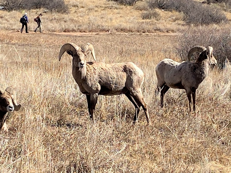
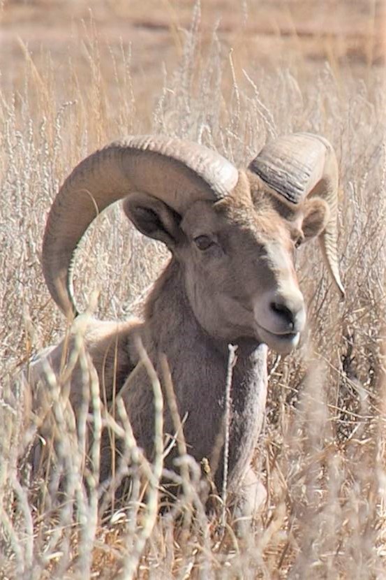
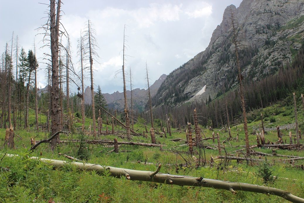
The day before Eric asked me if I’d like to go climbing so he could get some adveture photos. The weather was great, so of course I said yes. I got to the parking area about 10 minutes early so I could put on my gear, but those plans changed when I saw the bighorn sheep. They were quite sociable today, sitting/standing/grazing just off the trail. I quickly called Eric and told him to meet me at the sheep.
I noticed while the Bighorn Sheep were fine with humans, they tensed every time someone walked by with a dog. There were park rangers there to make sure no one got too close. I think it’s funny how when you’re at Waterton Canyon or Garden of the Gods the sheep will stand 10 feet away from you as if you aren’t even there, but if you see one while on a mountaintop they bound away as soon as they see you.
We didn’t stay long because we had some climbing to do. We went back to our cars (we’d unknowingly parked right next to each other) and got out our gear. Eric told me all I needed was a harness and my rope. I asked him if my 60-meter rope was enough? Oh, more than enough he assured me.
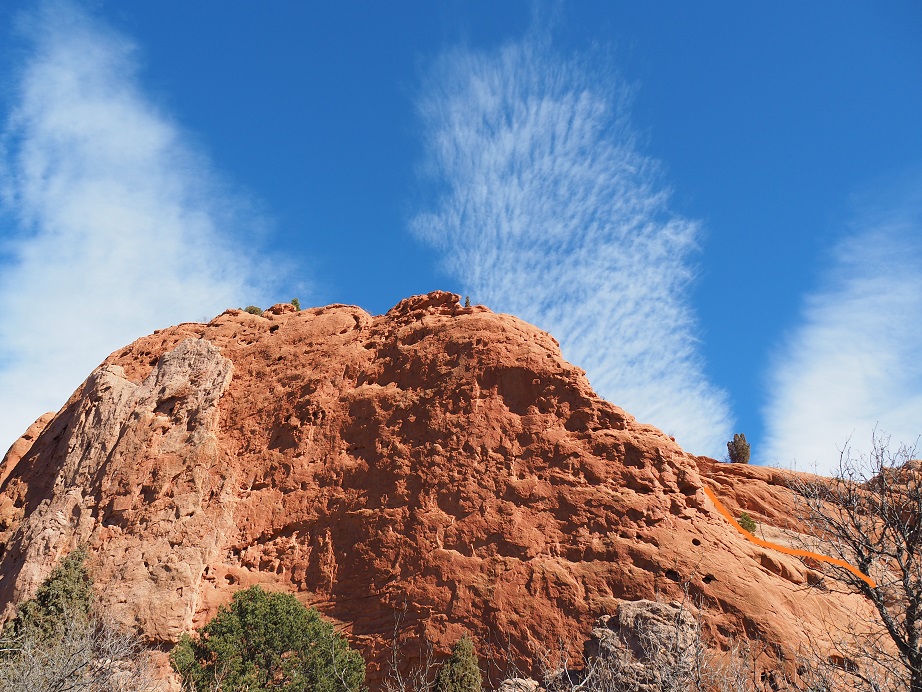
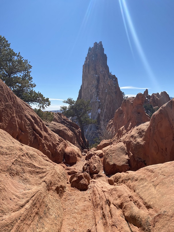
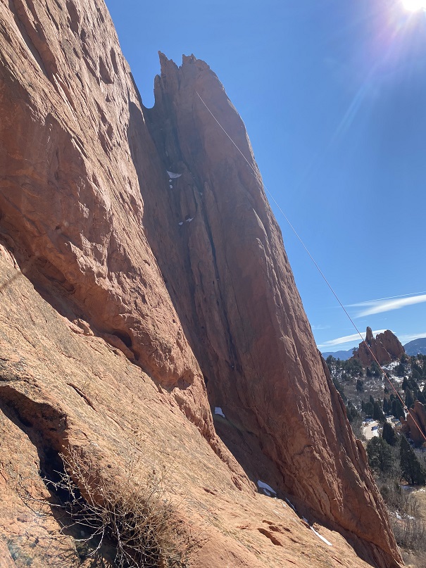
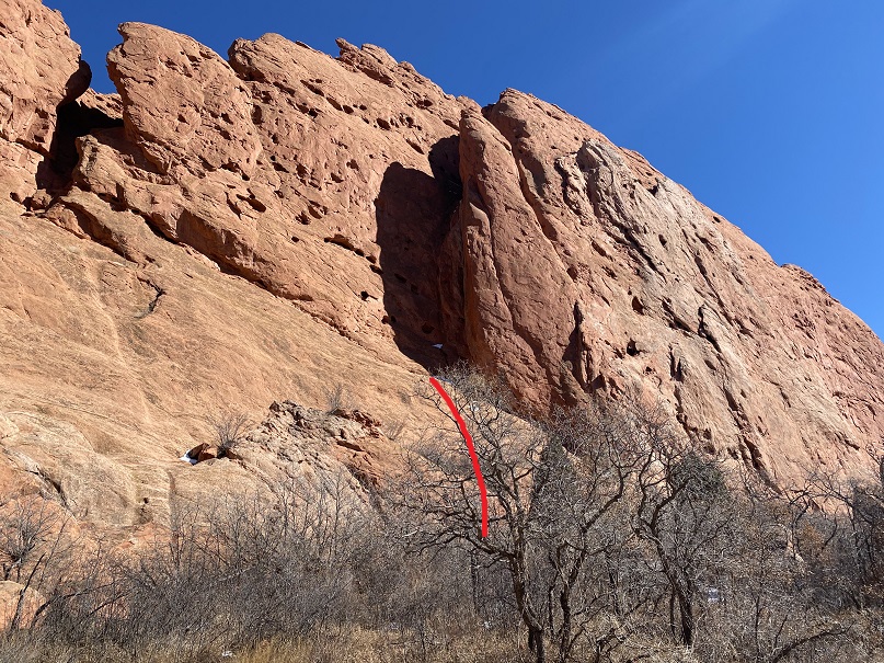
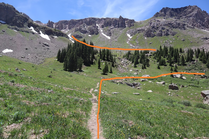
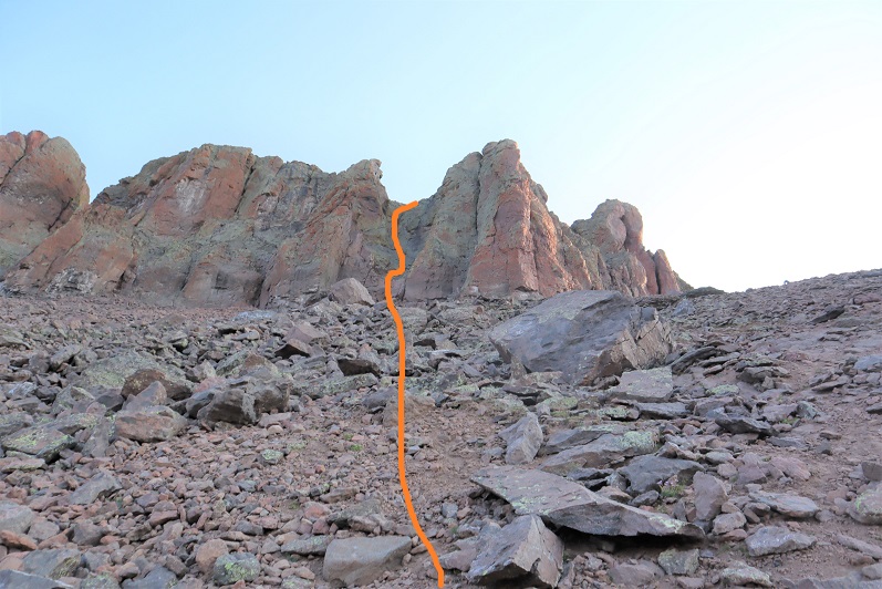
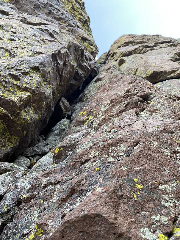
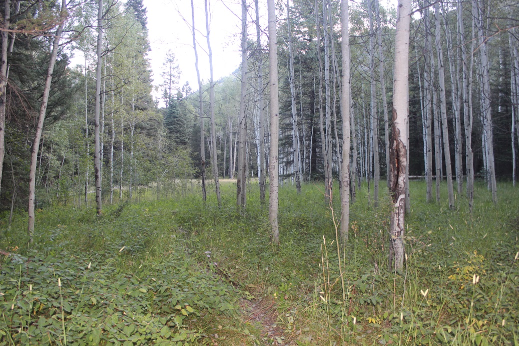
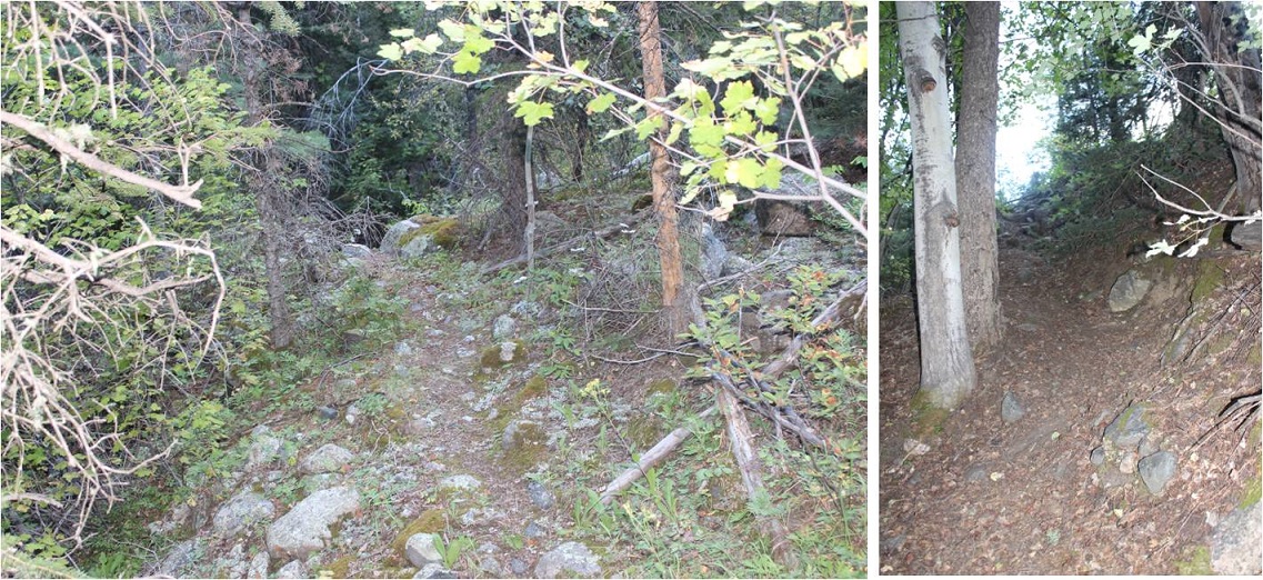
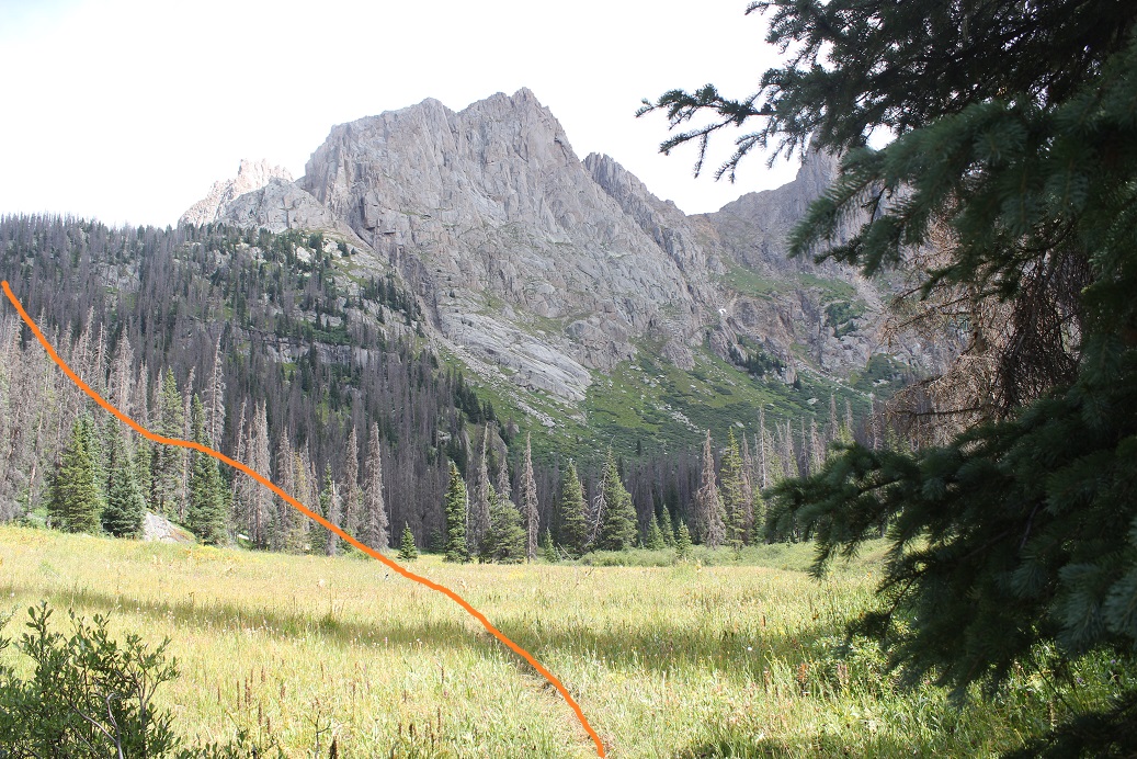
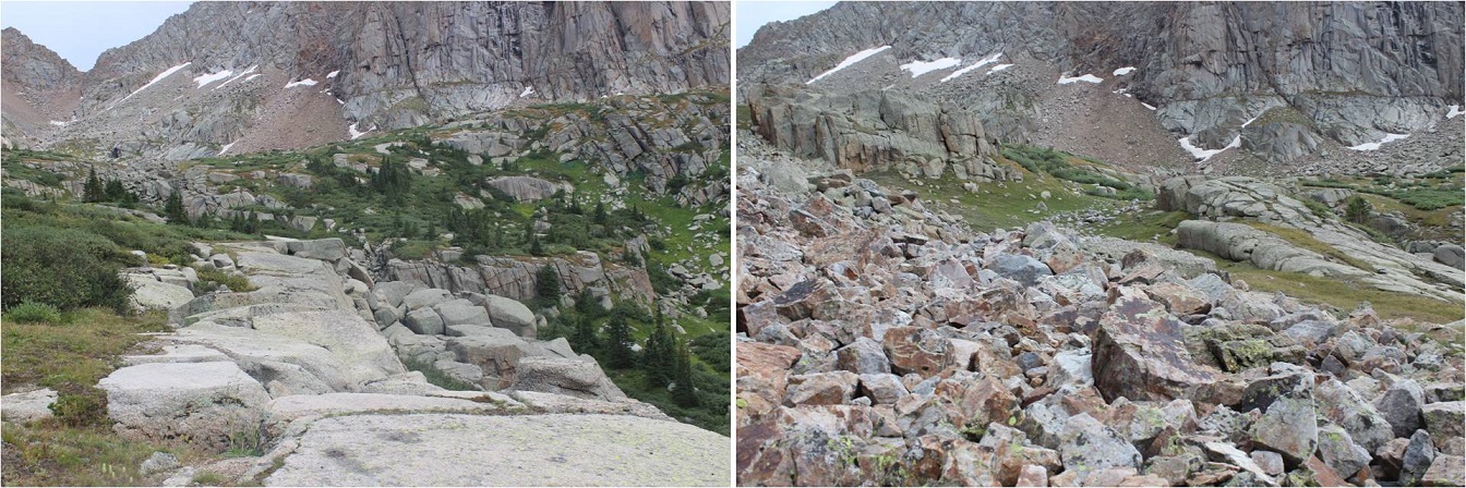
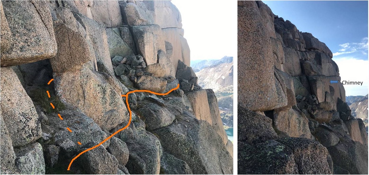
Together we walked through the pathways towards West Point Crack. Here’s the entrance
OLYMPUS DIGITAL CAMERA
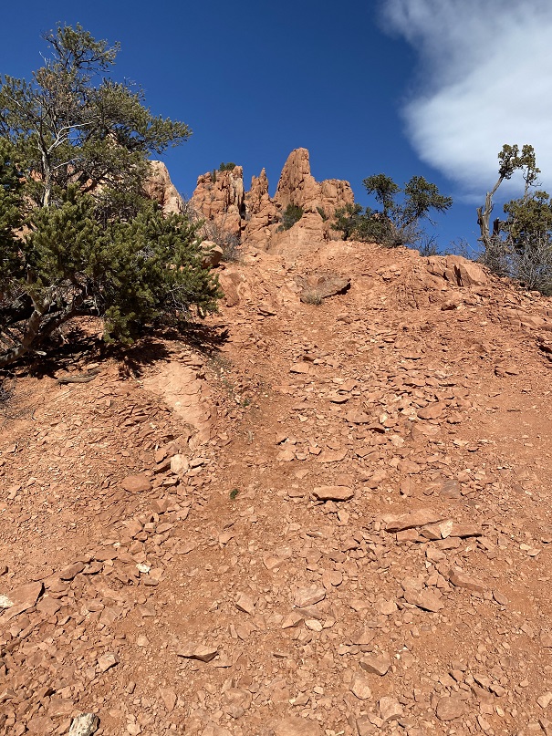
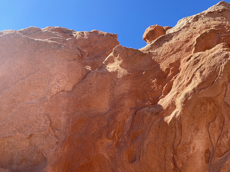
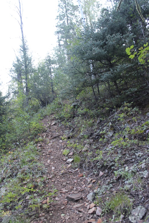
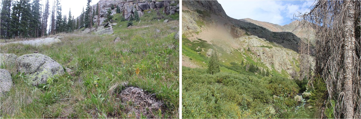
On the south side there’s a gully to climb up
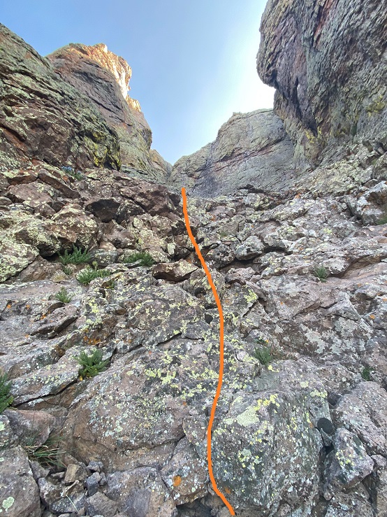
Here’s looking back from the top of the gully
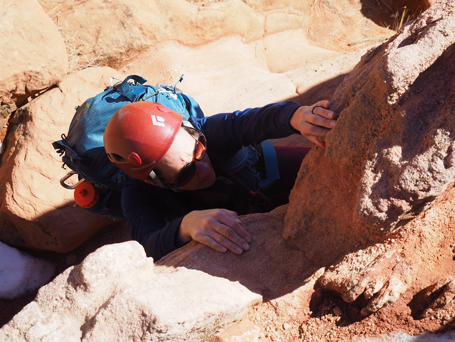
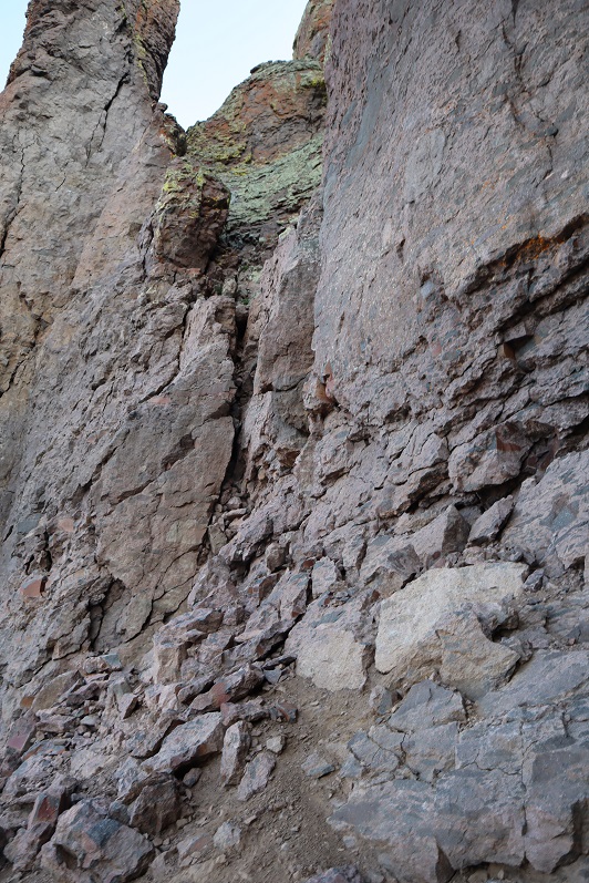
At the top of the gully is a class 4 climb of about 8 feet
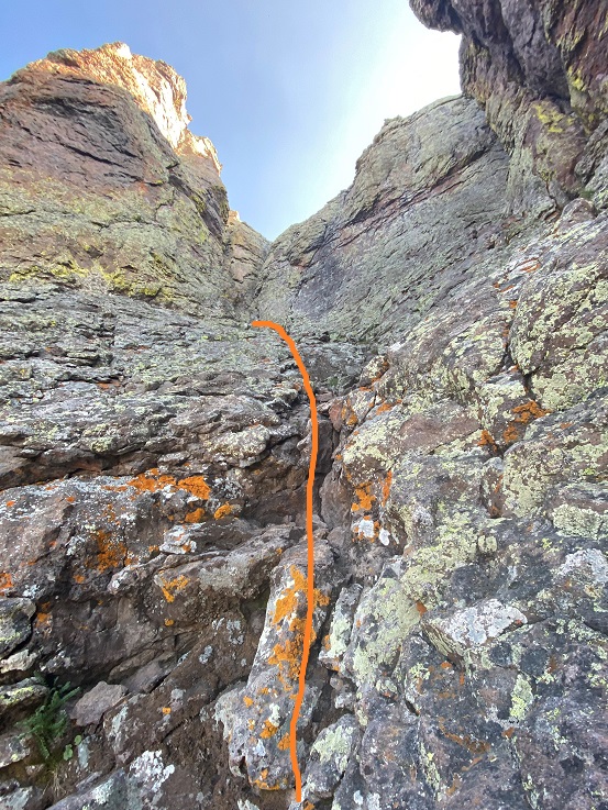
Eric went up first and took a picture of me upclimbing
OLYMPUS DIGITAL CAMERA
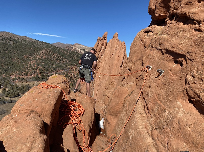
From here we staged our gear. There were two bolts in the wall we were going to use to do the first rappel. Eric told me we’d rap onto a rock, then again to the bottom. He wanted to counterbalance each others weight and have each of us go down on one side of the rope. I’d never done this before, but he assured me it was quick and easy and we were only rappelling about 10 feet or so onto a ledge the size of a kitchen table (it ended up being more like 20 feet). From there we’d clip in, retrieve the ropes, and rappel the rest of the way down.
Here’s Eric setting up the gear
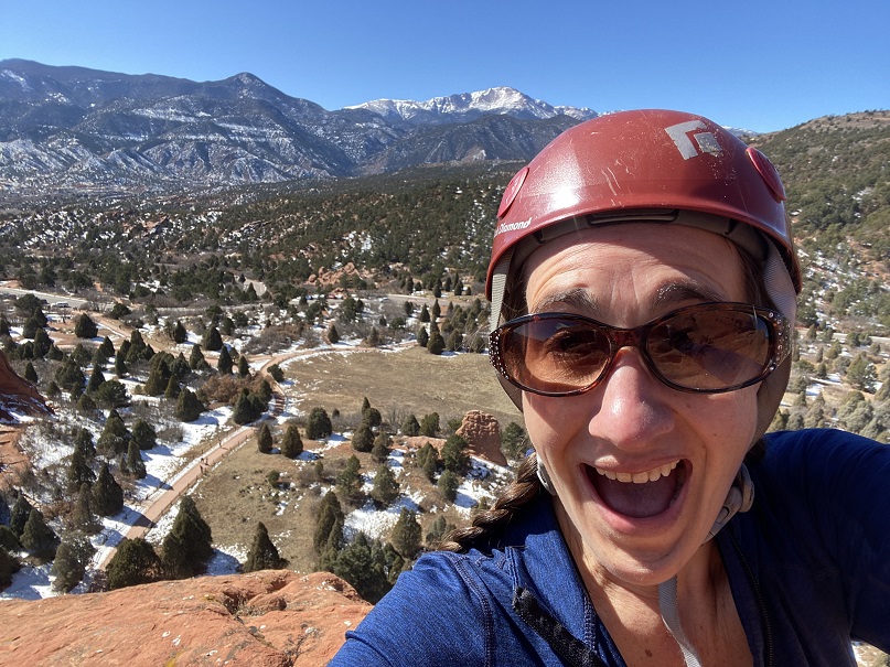
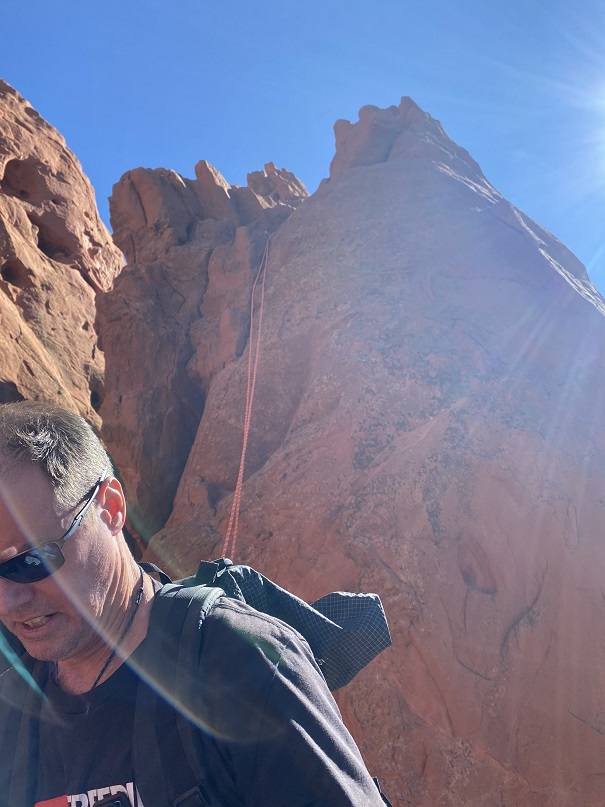
It was a beautiful day, so I took a selfie
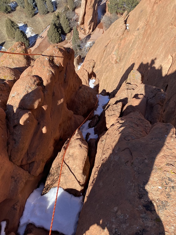
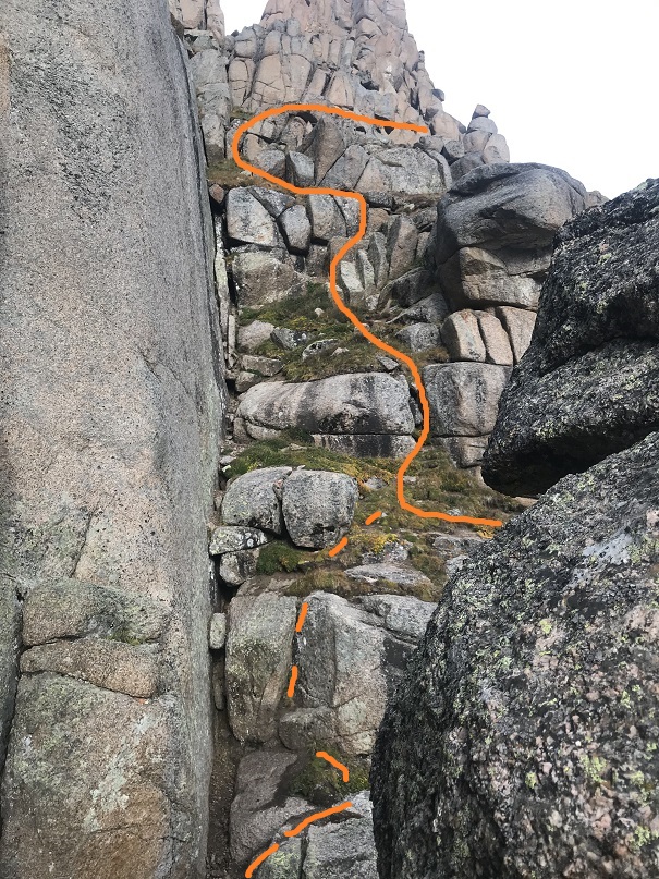
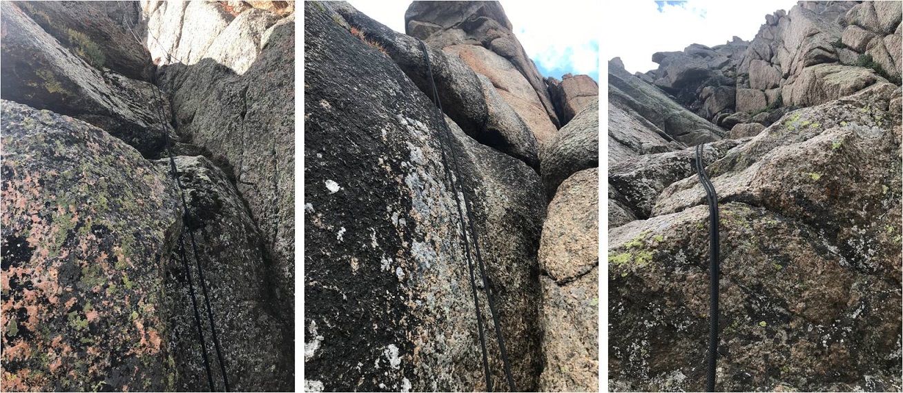
I went over first and Eric stayed at the top (even though we were going to go together?). We rapped off the back side so our ropes wouldn’t get stuck. Here’s looking down
All was going well, until I realized there was a gap in between the rock I was rappelling off and the one I was supposed to land on (which was really more of a spire). Also, the wind picked up and started swinging me around. I ended up rapping further into the gap than I’d intended and more to the west, and since I was only on one side of rope I couldn’t tie off to climb back up. I needed my breaking hand to make sure I didn’t fall, yet I needed two hands to climb.
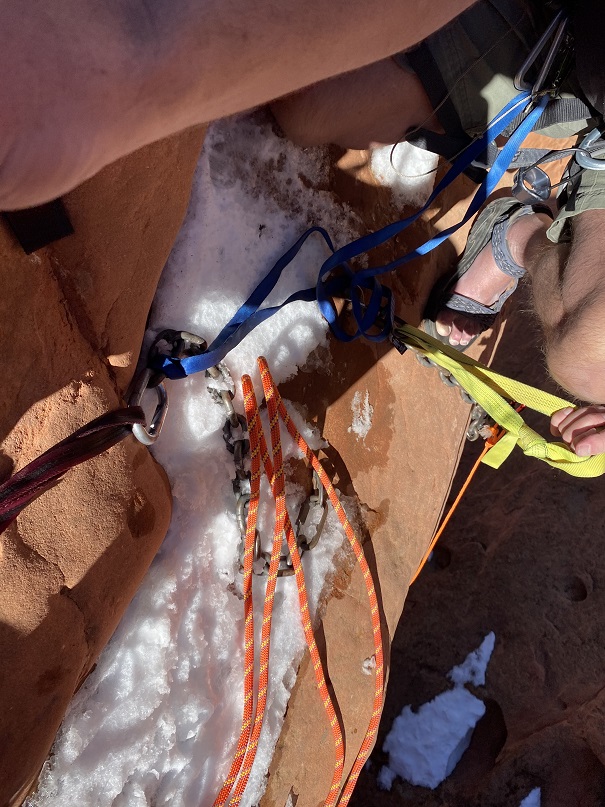
At this point I knew I had to manage my adrenaline, because if I didn’t I was going to fall and die, and I wasn’t going to allow that to be an option: The rope didn’t go all the way to the ground. It took me a solid 5 minutes (which felt like an hour), but I was able to get a slight grip on the rock (with my street shoes: my climbing shoes I’d been assured hadn’t been necessary were in my pack on my back). I managed to turn myself around and upclimb about 6 feet to the top of the rock and clip myself in. This rock was the size of a small dining room table. I’m guessing 4 feet across. There was snow where I needed to clip in.
I clipped in and calmed my nerves as Eric rapped down, easily pushing himself off the rock and landing on the spire. I was a little jealous: He had the advantage of height and he knew the route. Eric didn’t overshoot the ledge.
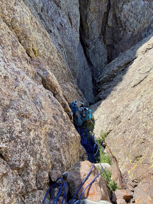
Here I am sitting on the ledge; in front of me, past the rope, is where I’d originally rapped too far and had to upclimb.
Here’s looking up from the ledge
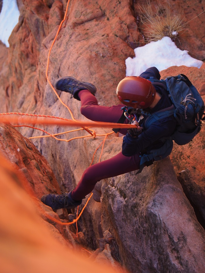
Eric was practicing ghost anchors, and using paracord to retrieve the rope. This ended up getting messy, and I wouldn’t recommend this technique. We retrieved the rope and set it again, to rap off the back side of the rock again. Eric threw the ropes, and they looked a bit jumbled. He asked me to untie them when I got down to them and throw them down again. I couldn’t see around the spire below, so I asked if he was sure the rope was long enough? (not like there was much we could do about it now) and he assured me they were. I tied knots in the ends. Eric looked at me like I was crazy.
Once again, I went first, but this time with both strands of rope. I immediately felt safer. Eric got some pictures of me on my way down. Unfortunately, his go-pro stopped working (which was kind of the reason we were doing this in the first place) so we don’t have a lot of pictures.
OLYMPUS DIGITAL CAMERA
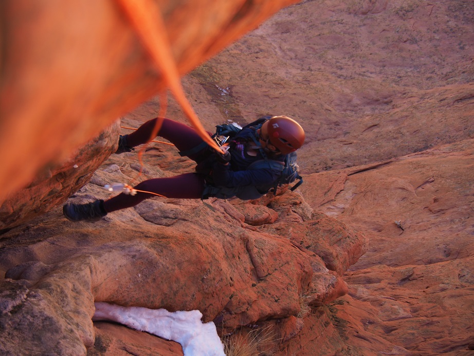
As I went down, I noticed the ropes were tangled more than I’d anticipated. I came to a place I could sit and untangle the ropes. I didn’t need to re-throw them, as their weight drew them downward.
OLYMPUS DIGITAL CAMERA
I continued my decent. That paracord was kind of a nuisance, but at least the ropes were straight
OLYMPUS DIGITAL CAMERA
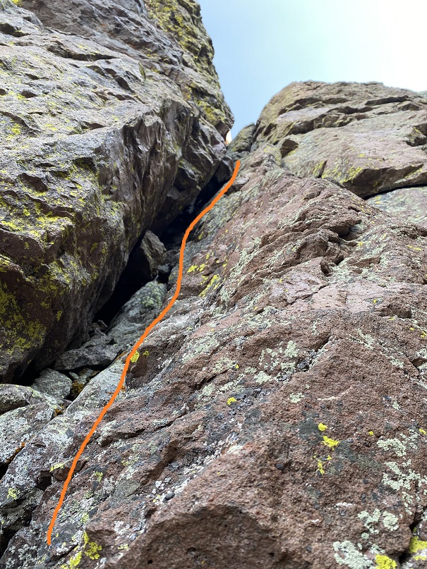
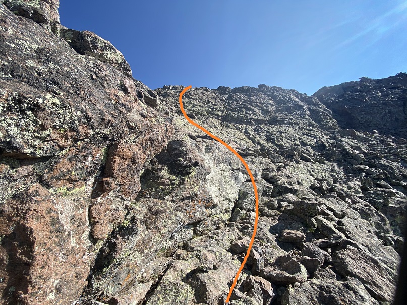
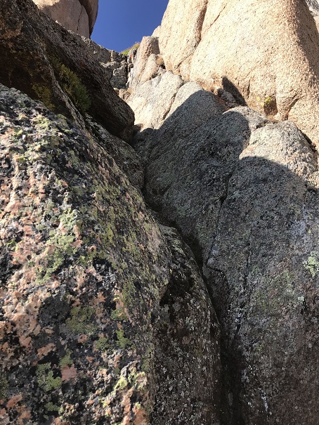
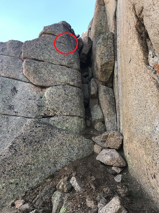
As I rounded the spire I now had a good look at the rest of the route, and to my shock, the roped did not go!!! I wanted to scream! I did notice however, that they landed just even with a very thin ledge (we’re talking maybe 6 inches wide). I was so glad I’d tied knots in the end of the rope!!! I rapped down as far as the ropes would allow, then unclipped and hugged the wall. There wasn’t room for both Eric and I on this ledge, or to be attached to the rope at the same time. I looked around and noticed a goat trail to the left that went up; That route looked a bit sketchy, but safer than where I was. I told Eric I was going to climb to the ledge while he rapped down, then we’d re-secure the ropes for a third time behind the rock I was aiming for and rap down a final time to the bottom. The circle is where the ropes ended, and the line is where I climbed for safety
Here’s looking back from my perch. I felt safe with this plan, because we’d rapped in this area before (after upclimbing to this spot).
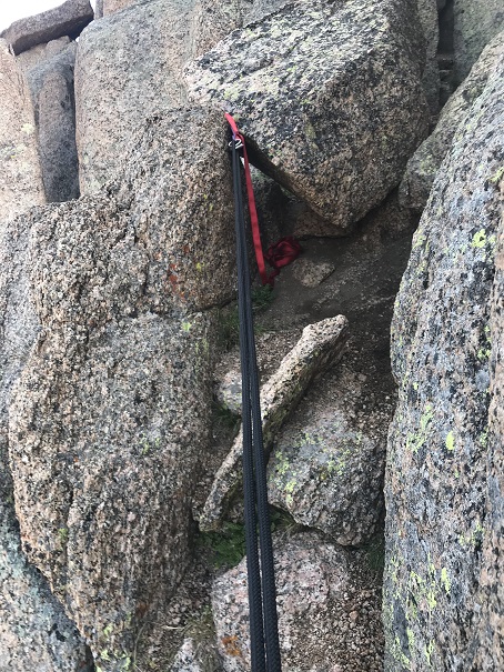
Eric made his way down, and started to bring down the rope, but it got caught on something. He spent some time going back and forth on the ledge, trying to dislodge the rope.
It wasn’t working. The rope was stuck, but one side of the rope went all the way to the ground, so we decided to brainstorm.
In the end we decided to have me rap down first, with Eric belaying me from above on the one piece of rope we had. Then I’d fireman belay him down. We had about 25 feet or so below us to get to the ground. Afterwards we’d go back to the car, get another rope, and retrieve the one that was stuck. Eric wrapped the stuck rope around his waist and shoulder for good measure, and after saying “You’re sure you’ve got me?” and Eric replying “Yes” I went over backwards.
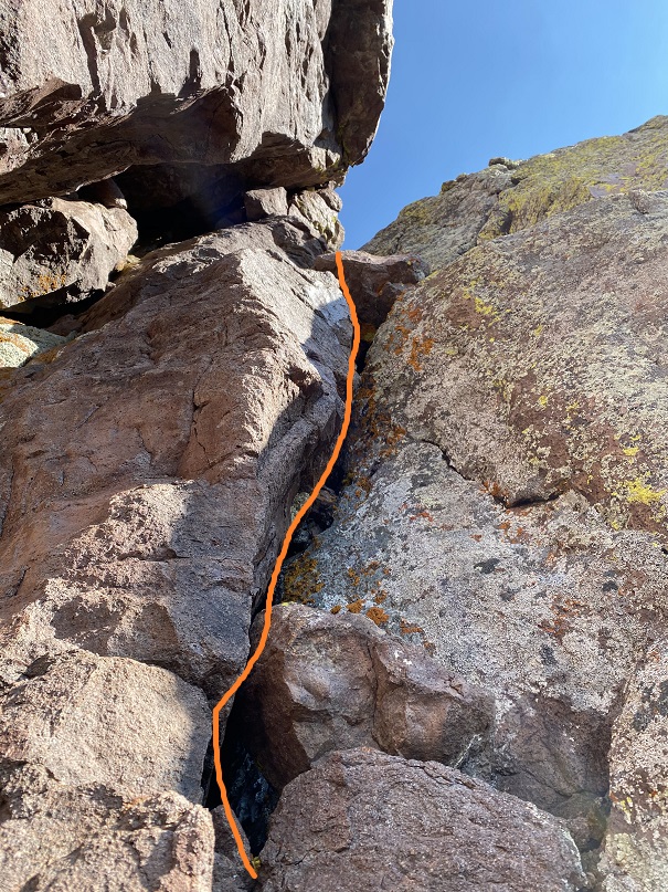
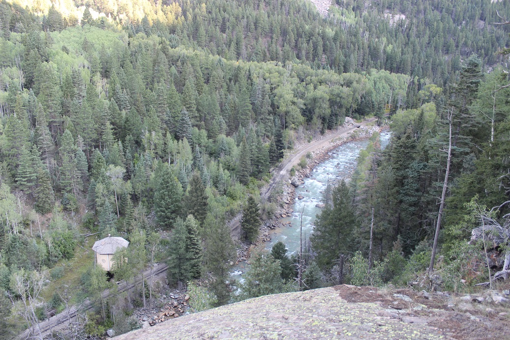
Almost immediately we started tumbling. As soon as I said “I thought you said you had me?!?!?” I noticed he was falling too. We fell together, tumbling and sliding the 25 feet to the ground. Here’s a picture of the line we fell
It all happened very quickly, and as soon as we stopped we both got up and did a head to toe check. Nothing broken, but a lot of scrapes and what were going to be bruises. I looked around, hopeful someone had seen our fall and tell us what had happened, but none of the dozens of park visitors so much as looked our way.
We both thanked God it hadn’t been worse, then talked about what had happened: the rope that Eric couldn’t get unstuck by himself had dislodged under our combined weight.
I’m writing this to process what happened, and to try to prevent it from happening again. Here are some of the things I did wrong:
I didn’t ask enough questions, instead relying on Eric’s experience. I should have asked for more clarification on what we were doing before we started. Had I done so, I would have seen the spire from below I’d be rapping onto, and noted the gap. I most likely would have worn my climbing shoes (they were in my pack, after all).
I wouldn’t have rapped on both sides of the rope for the first rappel. I still have no idea when he wanted each of us on different sides of the rope, since we never rapped together.
I should have put on my climbing shoes from the beginning, but definitely after the first rappel.
I also would have brought two 60-meter ropes and tied them together, instead of relying on one rope and rapping several times. Two ropes tied together would have made it from the top to the bottom, and we only would have needed to rappel once. We had the ropes in the car, but I had only asked if one rope was enough, not if two would have been better (you need to be specific with Eric: I didn’t realize we were rapping 3 times until we were done with the second).
When the rope had gotten stuck, I should have tried to dislodge it. Instead, I never touched the rope and relied on Eric telling me it was stuck. Maybe I could have found a different angle?
I should have insisted the ropes been thrown again, instead of untangling them myself. If I had been solo, I’d have thrown them as many times as it took to get a straight line. Also, the paracord thing stunk. It just made things tangle. Seems too risky to me.
Instead of rappelling down the last time with Eric standing I should have had him sit to belay me, or I should have put on my climbing shoes and downclimbed carefully (although, to be fair, I thought the rope was the safer option because I believed it to be stuck).
I’m sure I’ll be adding to this list.
In the end, I figure I’m better solo because I do my research and go over safety over and over again. When I go with someone, I rely too much on them being the expert, forgetting not everyone is as detail oriented as I am.
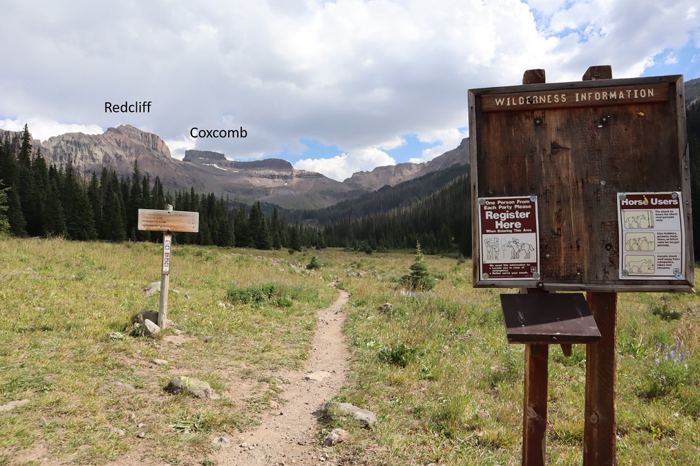
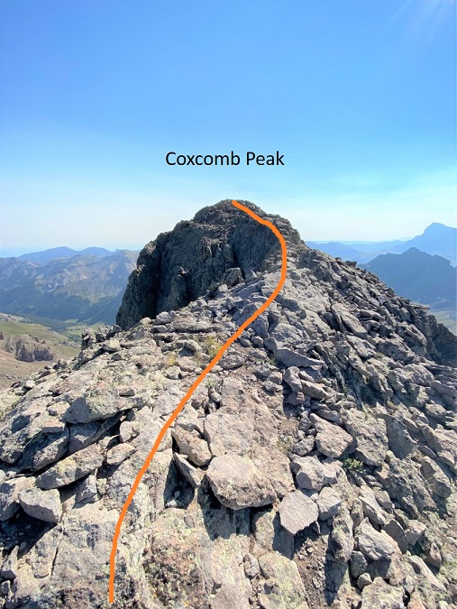
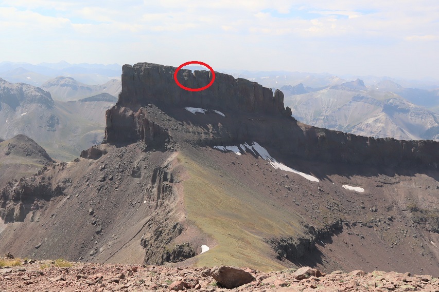
I’ve been up in my head about this peak since my failed attempt last month. Last time I’d turned around because I wasn’t 100% sure I was in the right area and I was afraid of cliffing out. All of the information I had on Coxcomb was conflicting (some called areas class 3 and others class 5, etc.) and none of the pictures I had from others lined up with what I was seeing. After going back home and researching more I realized I had been in the correct area, and now I was ready to try again.
I drove to the Wetterhorn Trailhead and was surprised to see no one else parked in the lot. The last time I was here there were several other vehicles. I got out, walked around, and signed the trail register so I wouldn’t need to in the morning. It was cloudy and windy but on the plus side there were no mosquitoes.
I tried to pump myself up for the hike tomorrow, but was still having trouble mentally. I told myself to just enjoy the hike and focus on learning something, even if I didn’t summit (again). I got out the book I’m (still) reading: Death in Yosemite, and noted I was still on the ‘death while climbing’ chapter. It may sound macabre, but reading about how other, more experienced climbers have died while climbing puts climbing into perspective for me: gravity never sleeps, and I can never be too careful (which is another reason why I turned around last time). I like to review potential mistakes so I don’t make them.
A group of three (shirtless) guys in their early 20s walked by, carrying gear and pads. I stopped them to see where they were headed and they told me they were just out bouldering. Hmmmm… I didn’t think the area was good for bouldering, but I wished them luck.
I made sure to get to bed early, and wouldn’t you know it, I heard a mouse moving around under/inside my truck as I was trying to sleep. I guess those mothballs don’t work. Also, I believe it was the same mouse as last week: it’s most likely been living in my truck, building a nest, etc. I was going to need to get some traps asap.
I woke up and was on the trail at 4:30am, taking the same route as last time. There’s an obvious trailhead with a register.
I followed the class 1 trail for 3.4 miles up to the top of the pass, and then lost 450’ of elevation as I descended into the basin.
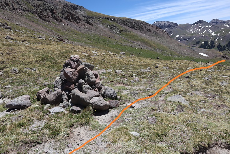
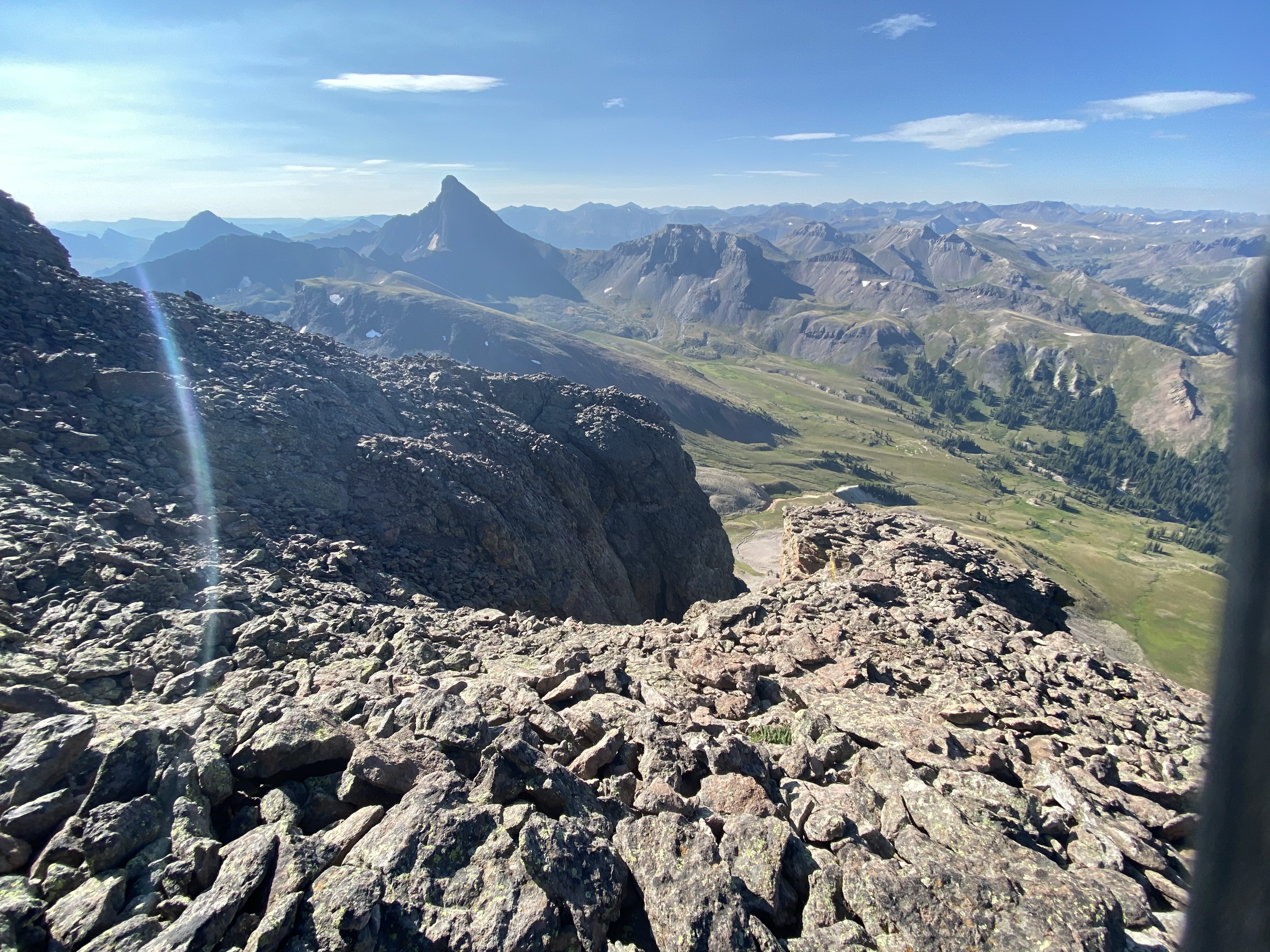
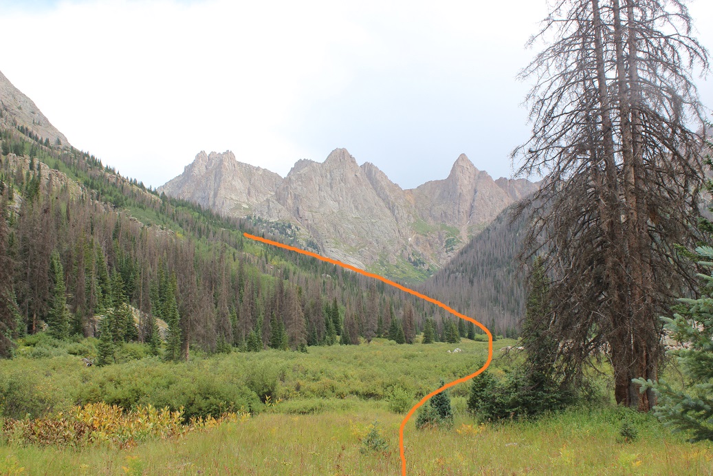
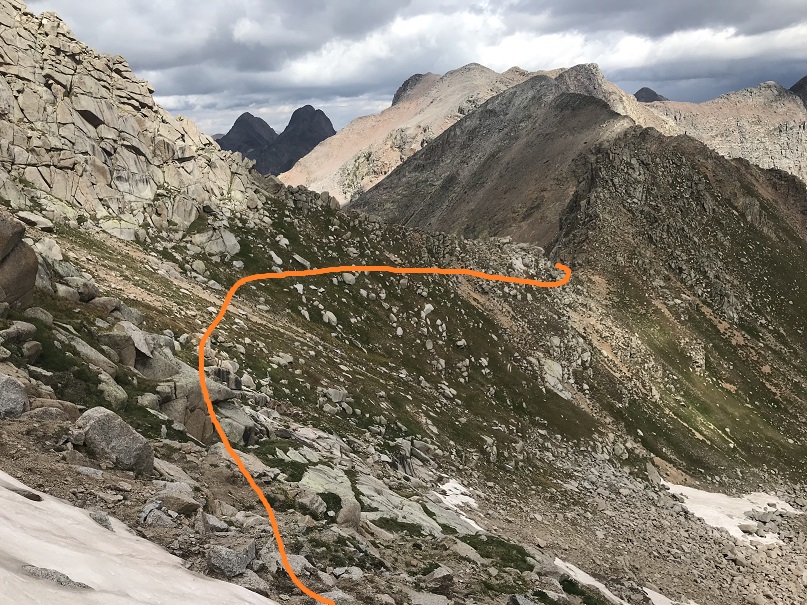
I’ve heard of others who’ve stayed high here instead of going into the basin, and from my perspective, the rubble and talus and scree aren’t worth it: I’m ok losing a little elevation, and I’m actually convinced it saves time. Once in the basin I left the trail, crossed the basin and followed the ridge up to the base of Coxcomb
There was a little bit of scrambling to get to the base
Here’s an overall view of the route up
Once there I was happy to see the rocks I’d placed in the chimney were still where I’d put them. I sat down, put on my helmet, and mentally prepared myself to begin. Here’s the first chimney
I made my way over to the chimney and tried to climb up. No dice. I love to boulder, but I haven’t been since COVID started due to the gym being closed and now requiring masks (say what you will, but I cannot work out with a mask on. I respect the rules however, and thus choose not to go). All this to say I’m a little rusty when it comes to my bouldering skills.
Ok, so if I couldn’t just climb up I’d do what I did last time: I took off my pack, attached a rope to the pack and my harness, and tried climbing up without a pack. The rock was cold and my fingers were stiff and I tried and tried but was unable to climb up the chimney. What was wrong? I’d been able to do it last time! Ugh. That was when I realized last time I’d worn climbing shoes. I guess they did make a difference. Oh well, I was just going to need to get creative. I tried once again, this time angling myself sideways, putting my thigh into a crack, shimmying around, and pressing into the side of the rock with my inner thigh and hoisting myself up. This took me halfway up the chimney. From there I was able to hoist myself up and use my arms to do the rest. I made it to the top of the chimney, hauled up my gear, and prepared for the second part for the climb. The red circle is where I ‘sat’
The next section was easy class 3. I re-coiled my rope, put on my pack, and made my way to the base of the next chimney
This is where I’d gotten stuck last time. This time however, I was sure I was in the correct spot. I initially tried to climb this with my pack on, realized that wasn’t going to happen (the pack was too heavy and put me off balance) and decided to try climbing this chimney without my pack. The red circle is where I took off my pack.
Here’s what the climb looks like from there. Knowing I wouldn’t be able to climb this with my gear, but also knowing I needed my gear to descend I decided to once again tie the rope to my harness and loop it around my pack. I was very careful to make sure my rope didn’t get tangled, and I had an exit strategy in case the whole ‘rope around the pack thing’ didn’t work in this area. I wouldn’t recommend this tactic unless you put a lot of thought and planning into its execution, as so many things can go wrong in this scenario. Here’s a look at the beginning of the route
I made it halfway up and stopped.
At the halfway point I hauled up my gear to where I was positioned. I figured this would lessen the chances of my pack getting stuck when I hauled it all the way up, and also gave me a chance to test whether or not hauling the pack would work in an area where I still felt I could downclimb safely. This tactic proved successful, so I continued on.
From the halfway point, here’s looking up at the rest of the route
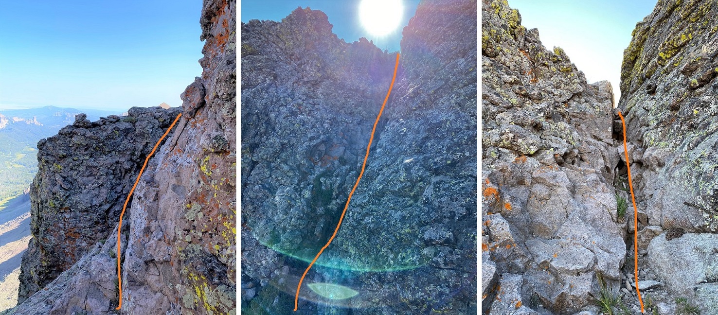
This is a class 5.2 chimney that requires some stemming/fun/creative moves to ascend. At one point I even used a crack climbing technique to get a good hold with my arm vertically and hoist myself up. This is the point I wasn’t able to make it past last time, but after talking with others who’d successfully climbed this area I felt confident I’d be able to as well. There are some sketchy moves, but plenty of opportunities for stemming/hand holds to make the ascent doable. I was terrified but just told myself not to look down, to focus ahead, and soon enough I’d made it out of the chimney. Here’s the route I took
Once at the top of the chimney I turned and hauled up my gear, feeling pretty pleased with myself for making it this far. I recoiled my rope and put it in my pack.
I’ve heard it’s class 3 after this point to exit the chimney, but it felt class 2 to me
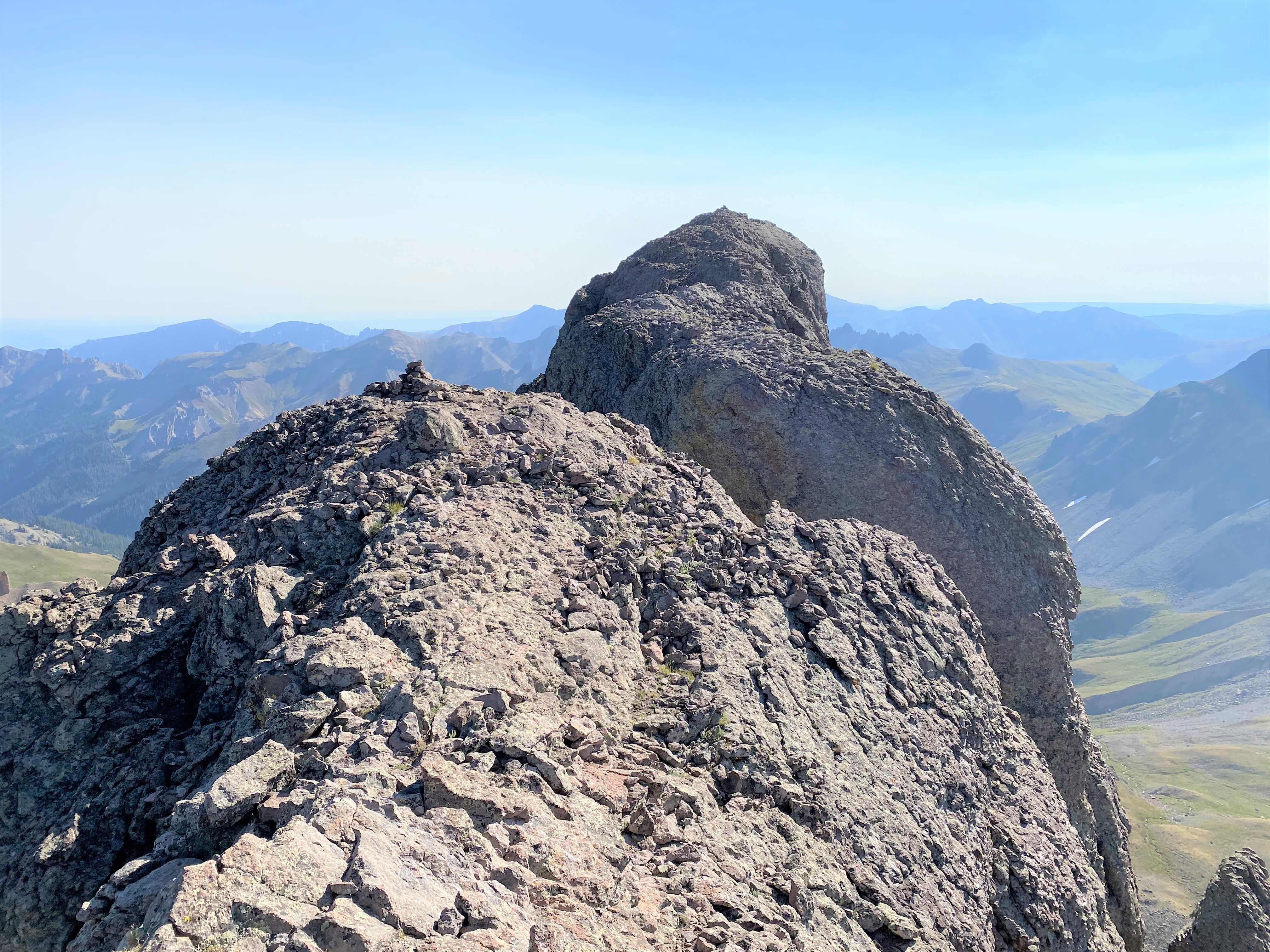
Last time I’d been worried I was in the wrong gully. Since I hike solo I’m extra careful, and probably turn back more often than I should when uncomfortable. One of the reasons I’d turned back here last time was I was worried if I ascended the wrong gully I’d be cliffed out. It turns out that wouldn’t have been the case, so if you’re worried about cliffing out in this area don’t be: all chimneys exit in the same area, and it’s solid. Here’s looking back
And forward towards the summit of Coxcomb
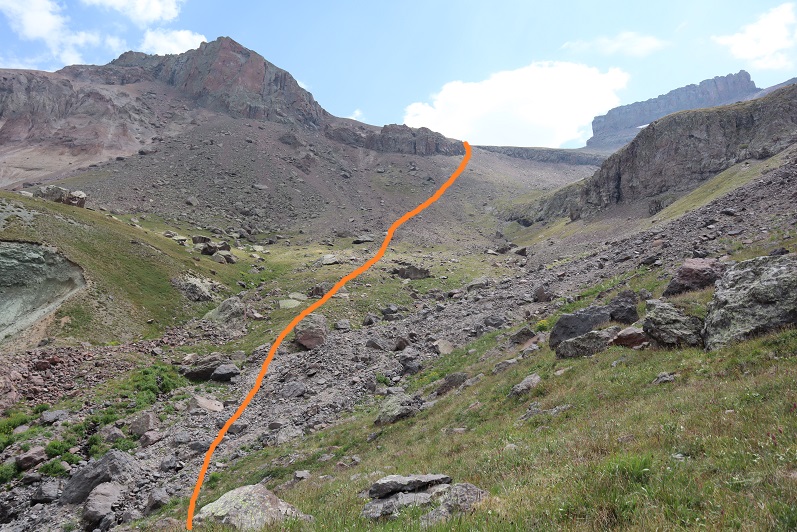
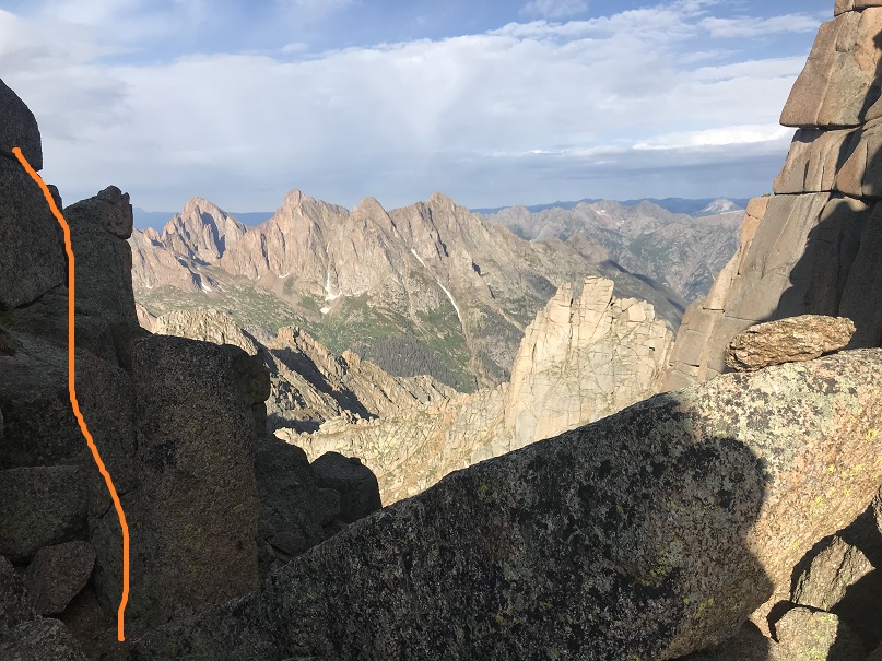
There was still one more obstacle before reaching the summit: a 25 foot notch I’d need to rappel before upclimbing to the summit.
I got out my rope, attached it to my gear and the anchor (which looked solid so I didn’t replace the webbing) and rappelled down into the notch. This is committing because it’s class 5.6 to climb back up. I’m not a climber, and I knew I wouldn’t be able to upclimb this section on my own: forward was the only way from here on out. This last bit included rappelling down, then climbing out of the notch
Here’s a look back up at this section from inside the notch
I once again retrieved and recoiled my rope, and got ready for the final pitch to the summit. I went north, following the cairns, and climbed up an easy chimney
From there it was an easy walk to the summit
I summited Coxcomb Peak at 9:30am. There was a summit register in a powerade bottle that should probably be replaced. I didn’t open it, but it looked like the papers were smushed in there.
Coxcomb:
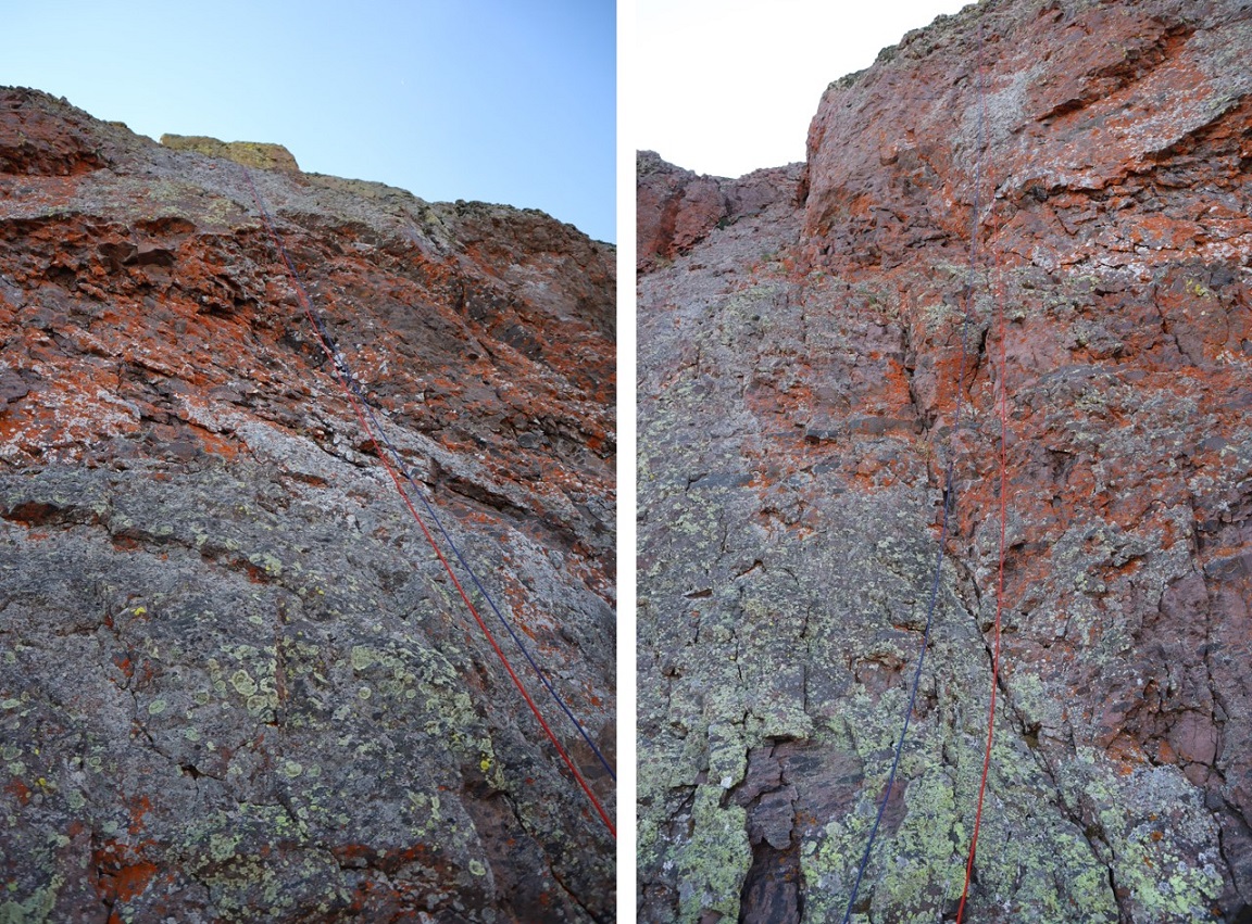
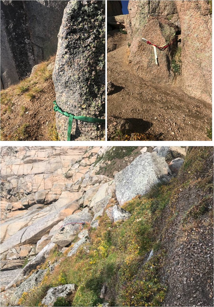
I was thrilled I’d made it this far, but I still had the 170’ rappel to accomplish. I went to work, looking for the webbing and anchor set up. It was easy to find and still looked good, so I decided to use what was already there.
I tied my two ropes together with a double fisherman’s knot and threw my ropes. It was quite windy, and the wind was coming at me, so it took a couple of tries to make sure the ropes made it all the way to the ground. This was quite frustrating, but worth the extra effort to make sure it was done correctly. Next, I tested the rope, watched my knot to make sure it was secure, unclipped my safety, and started the rappel. Everything went smoothly. I even noticed 2 more anchors set up below where I’d rappelled, so if you brought just one rope it would have been enough (the webbing looked old though, and should probably be replaced).
My feet touched the ground and I gave out a “Woot!” I was so excited! I’d done it!!! I’d solo’d Coxcomb Peak, a peak I wasn’t sure I’d ever be able to climb, let alone solo. I gave myself a minute to let it sink in, and then went about retrieving my ropes.
I had two ropes, one purple, one orange. I always pull the darker one. I pulled the purple one and was thrilled when it moved. I pulled it about 10 feet when it stopped. Hmmm. Ok, maybe it got stuck? So I pulled the orange rope back a few feet, and then tried the purple one again. Once again, it got stuck. I whipped the ropes and they moved as far as I could see, so one of the ropes must have been stuck up at the very top. I spent the next hour doing everything I could think of to retrieve those ropes, to no avail. In the end I made the very difficult decision to leave them there. I did put a note in the trail register on the way down and I posted to some climbing social media sites about their whereabouts, so at this point I’m fairly confident they’ve been retrieved. It hurt to leave them there, not only because of LNT, but also because this is the first time I’ve used them (besides the initial breaking in).
Here’s the rappel
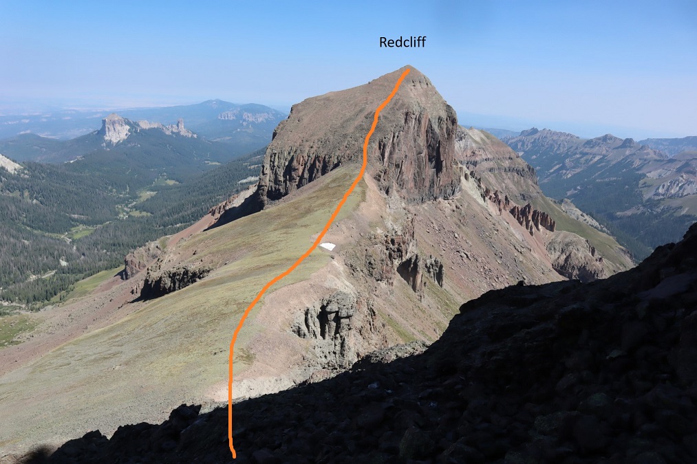
I sighed heavily and turned to hike up Redcliff.
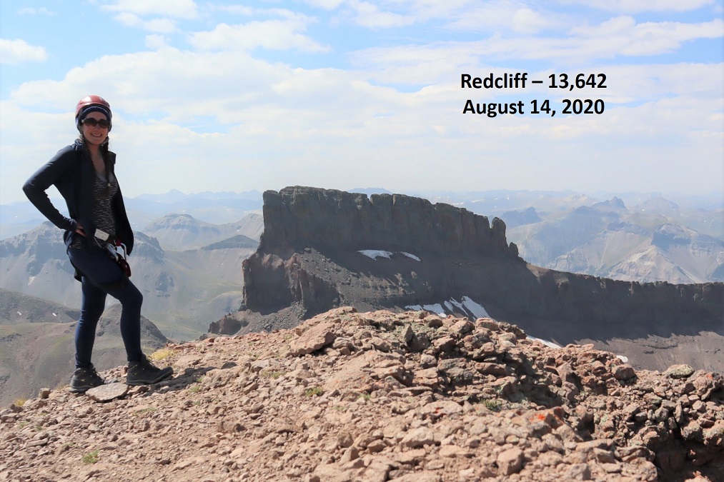
This was a very short, simple, and straightforward climb. I summited Redcliff at 11:15am
Redcliff:
Here’s looking back at Coxcomb. I’ve circled the notch that needs to be rappelled down and then climbed back up
I turned and headed back to the Coxcomb/Redcliff saddle, and then descended west into the basin
There wasn’t a well stablished trail here, but the route was easy enough to figure out. I just aimed for the visible class 1 trail below I’d taken on my way in this morning
Here’s looking back at the route from the saddle to the trail
And a look at the hike out
I made it back to the now full trailhead and my truck at 1:10pm, making this a 13.24 mile hike with 4654’ of elevation gain in 8 hours, 40 minutes.
I was thrilled with today’s success, and even though I’d lost two new climbing ropes I drove to the next trailhead on a bit of a high.
50 meter rope was perfect (but tie the ends, because it was close)
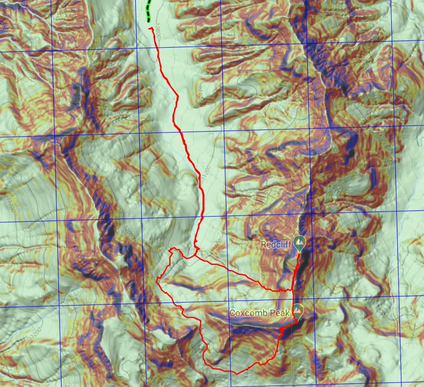
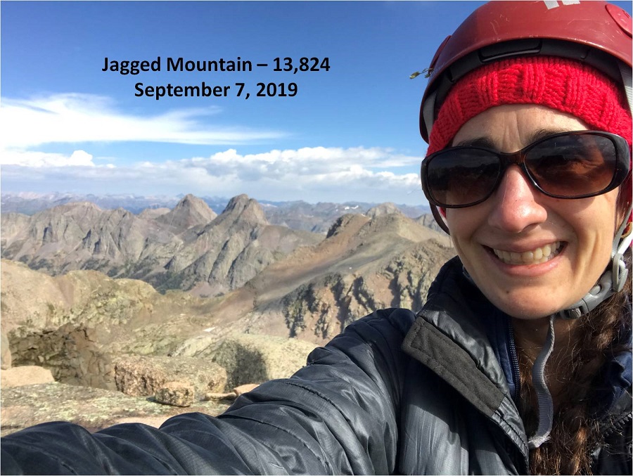
I knew the risks going in: The weather didn’t look all that great and my first day in would be from no sleep from the night before, but I’m used to these circumstances and decided to go ahead and attempt Jagged Mountain this weekend.
If I were to do this climb again and I had the time availability I’d stretch it into 4-5 days. Unfortunately, with my work/volunteer/mom schedule I knew I’d never get that much time off in a row, so my plan was to hike up to the base of Jagged Pass the first day, either summit Jagged that night or the next morning, hike back down to the Animas River the next day and camp somewhere between the cutoff to Noname and the base of the Purgatory Trail, and hike out the third day, with the understanding I could change plans as I went (one of the benefits of solo hiking).
I’d spent quite a bit of time going through my gear to make it lighter, and I think I shaved off about 10lbs, making my pack a much more manageable 35lbs (including rope, harness, webbing, etc.)
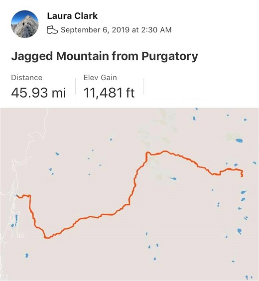
I drove the 6.5 hours to the Purgatory Trailhead and was on the trail by 2:30am. This is the third time I’ve hiked in from Purgatory, and the third time doing so in the dark. I decided to get some stats from Strava this time.
First Trail Bridge @ 4.3 miles, 2 hours of hiking.
Second Trail Bridge (cutoff to Chicago Basin) @ 9.9 miles, 4 hours 30 min of hiking
Needleton Bridge @ 10.8 miles, 4 hours 50 min of hiking
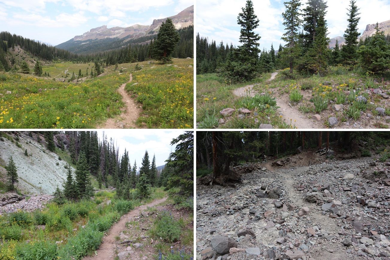
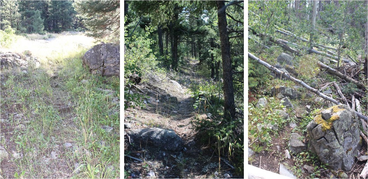
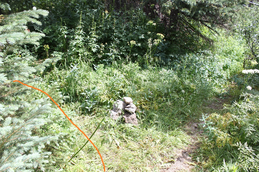
The Needleton Bridge area has some private property surrounding it, and several social trails to cabins. This is the correct trail to bring you towards Pigeon Creek and Noname Creek. It starts just to the right of the Needleton Bridge.
The path here is easy to follow and brings you to the “campers meadow” / Aspen Grove at the turnoff for the Pigeon Creek approach to Ruby Basin
From here the path was much better than I’d anticipated. There were cairns and a semi-worn footpath to mark the way north through the forest, paralleling the Animas River
Then, for no reason whatsoever (except of course the river below) comes Water Tank Hill. It’s worse than it sounds: 200’ straight up the side of the mountain (and then back down to the river afterwards).
When I got to the top of Water Tank Hill I noticed the water tank was actually on the other side of the River. I decided this would be a great place to take a rest. As I sat down I noticed a Black Bear racing over the tracks and through the yellowish/green grass in the middle right of this photo. I was reaching for my camera when I saw her cub bounding after her. I wasn’t fast enough to get a picture, but thought to myself: Cool! About 10 years ago I’d taken the trail from Durango to Silverton and asked one of the workers how often they saw bears, and he said in the 25 years he’s worked there he’s only seen one. I felt pretty special to get to see this pair this morning. I also asked myself what they were running from?
I sat here for a bit and had breakfast (I decided to force myself to eat this time). Beef Jerky and Almonds for breakfast isn’t all that bad. After a short rest I put back on my gear and headed down Water Tank Hill, which was just as bad as the way up
Back at river-level the trail was once again straightforward. I thought to myself how this trail was much easier than the Pigeon Creek trail (but to be fair I’d done that one twice in the dark both ways, and I was doing this one in the daylight).
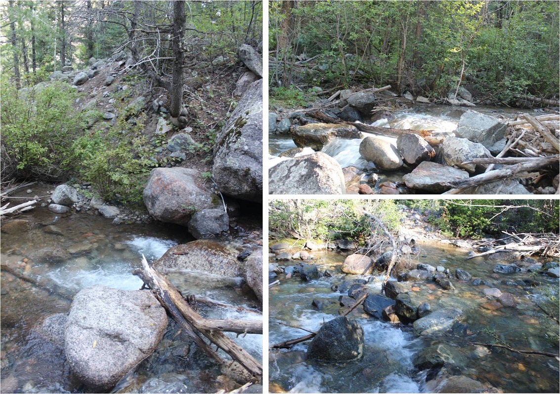
I crossed several creeks
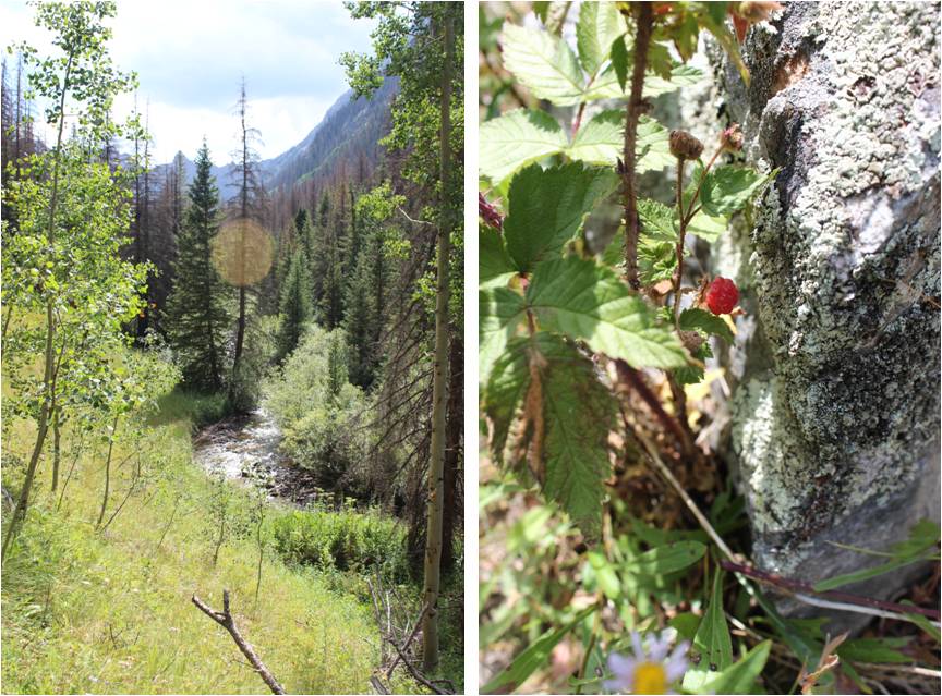
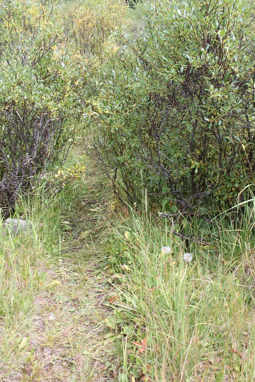
And turned right (east) and followed the Noname Creek trail. Once again, the trail was easy to follow (but obviously not maintained)
It follows the Noname Creek. I found a patch of raspberries growing as the crow flies from the raspberry patch on the trail to Ruby Creek, as well as thimbleberries (which always seem to grow alongside raspberries)
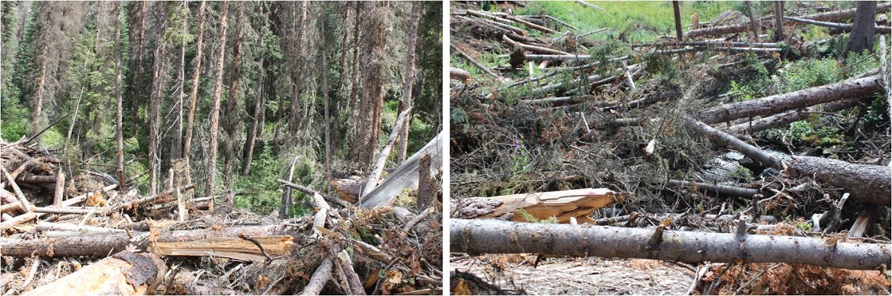
The difficulty came when I reached the first avalanche area (I think there are 3 in total, but two of them kind of run together). I’d heard to avoid most of the debris to cross the creek, and so I did so. This ended up being a terrible idea (maybe I crossed at the wrong section?). There were trees piled on top of trees that reached heights well over my head. This made crossing the river a bit dangerous, as the trees weren’t stable and there were huge gaps. Hundreds of trees criss-crossed the creek.
Eventually I had to cross the creek again and there was still avalanche debris to contend with
The above picture is deceptive, as there are still large areas of trees piled on top of each other to cross and no clear path to take. The trees are tumbled together and rotting. I had to secure each step carefully, even if it looked like the log was solid (some would roll). Crossing this area took a long time, and is not something I’d recommend doing in the dark. As I came out of the 2nd avalanche area I realized what I should have done was stick more to the left (north) and I told myself I’d do that on the way back. I was so excited when I reached a trail again!
About half a mile after I found the trail again I hiked a bit up a hill and found myself at the Jagged Cabin, which was more run down than I’d anticipated. I made it here after 18.2 miles in 10 hours, 42 min. I’m sure the avalanche area slowed me down…
I took off my pack and rested for a bit, going over the next part of the route.
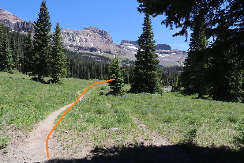
I put back on my pack and headed east through willows and more forest and more uphill. I went left at this junction and came across another small avalanche area that was annoying but not difficult.
I entered another clearing and went left again, up the hill to the basin below Jagged Pass
Here route finding was a bit of a challenge because there were so many trails, but as long as I stayed on a trail and kept the stream to the right of me I was headed in the correct direction
It started raining halfway up this hill, and this is where my troubles began. I’d totally expected it to rain (each day called for rain between 12-5pm). I just hadn’t anticipated how drenched I’d get from just a little rain. You see, I was hiking through overgrown grass and willows
The rain collected on the plants and soaked my pants as I walked through them. I think it’s worth noting everything I was wearing was “waterproof”, including my socks, pants, and jacket(s). Within 15 minutes I was soaking wet. No worries though, because I had a change of clothes in my pack and I could dry off once I reached my campsite. Here’s the rest of the route to the small lake I camped at. There was no trail here and the route I took included some boulder hopping
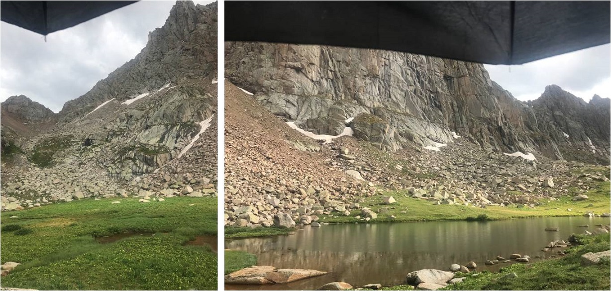
I made it to my campsite at a pond just below Jagged pass (12,210’) after 21.1 miles and 13 hours 30 minutes of hiking. Note, this is NOT the unnamed lake at 12,522’
Jagged Campsite:
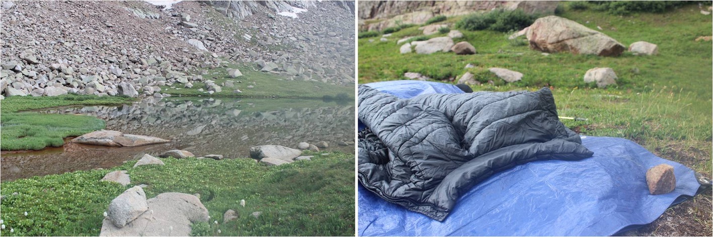
It was about 4:30 in the afternoon. I set up camp quickly, thankful the forecast only called for rain until 5pm. Camp was just a tarp, bivy, and sleeping bag, so setting up didn’t take long. I changed my clothes, laid out my wet pants and socks to dry, ate dinner (more jerky and nuts) and filtered some water. There were flies and mosquitoes, but the flies seemed particularly interested in me. I’d been sweating all day and they were intrigued.
As I was filtering I found an umbrella that had seen better days. I wondered how it got here? In any event, it soon became “useful” (not really) as it started raining again. I quickly packed up the clothes I’d set out to dry and sat under the mangled umbrella, watching the rain.
The rain didn’t look like it was going to stop anytime soon, so around 5pm I decided to take a nap. I woke up around 7pm to a fantastic view of my campsite in the evening glow.
I was also a little bummed: Had I just missed my opportunity to summit Jagged by taking a nap? There wasn’t a cloud in the sky, so the rain couldn’t have lasted too long. Oh well, it had been a long day, so I decided to go back to sleep to prep for tomorrow.
It rained most of the night. On the positive side, I was nice and warm and dry inside my bivy and sleeping bag. I woke up several times: a few because it got stuffy and I couldn’t breathe (but due to the mosquitoes I’d wanted to keep my set up as air tight as possible). Another time it was to rain, and once to a very loud grinding noise coming from below me. It sounded like a rabbit slowly biting through a carrot, and a little like a hand saw slowly cutting through wood. I heard this a few times and figured out it was most likely a marmot burrowing below me, extending its tunnels (or something).
At 5am I woke up to clear skies and sat in my bivy for a full half hour just gazing at the stars. I could make out dozens of constellations, a few satellites, and at least 4 meteors flying through the sky. I was pleasantly surprised at the lack of clouds.
Curiously, I thought I saw a flash light up the mountains. The first time I saw it I thought my eyes were playing tricks on me. The second I looked around for lightening (sure that was what it had been). No clouds, so it couldn’t have been lightening. The third time I saw it I thought maybe it was someone hiking in the dark and their flashlight was causing it? That didn’t make much sense, and I couldn’t see anyone with a flashlight below, so I ruled that out as well.
I didn’t want to move, not only due to the amazing nighttime view but also because it was a bit chilly; but I needed to get a move on.
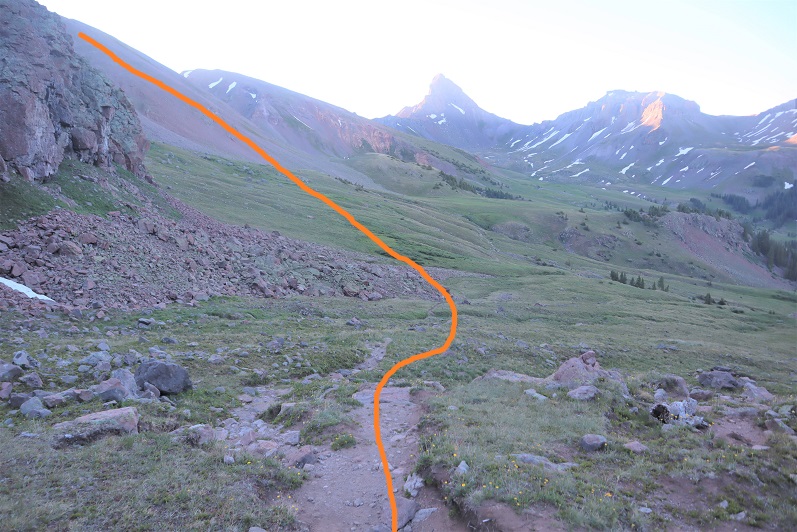
I left all my nonessential gear under my tarp, put on my helmet, and even though it was dark I headed in my intended direction. There was a grassy slope to the left (north) of me I took to a rocky area and up and over the pass
I made it about 5 minutes before I had to stop because I couldn’t see anything and it was getting dangerous traversing over the wet, rocky area. I sat in one spot for about 20 minutes, allowing the sun to rise before continuing on. As I sat there I could see what I hadn’t been able to from below: a storm to the west. It had been lightning I’d seen, but luckily the storm seemed to be petering out.
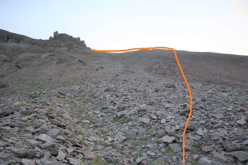
This gully was full of rocks and nasty scree that took careful foot placement but was straightforward
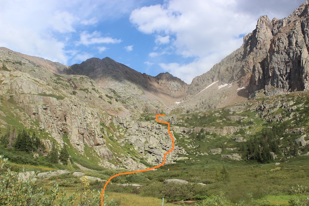
At the top of the gully I turned right (south) and got my first good look at Jagged Mountain
I spent some time planning my route. Here’s the route I took, staying below the areas of snow and just to the right of the gully.
This area is steeper than it looks
Here’s the path to the first crux, just to the right of the gully
I turned to look back on the way I’d come and noticed that storm that looked like it was going away wasn’t. In fact, it was coming right at me! Ugh! It was only around 7am and it wasn’t supposed to rain until noon but yet here was obvious rain headed my way. I was glad I wasn’t in the Vestal Basin right now.
The rain started falling and I got out my poncho, put my back to a rock, and sheltered in place for half an hour, waiting for the rain and graupel to stop. While I sat there I did a lot of thinking. I knew due to this rain the rocks would be wet, so I’d have to be very careful. Also, I needed to set a turn back time, which I set for 12pm. In my mind I was thinking this rain could be a good thing: It wasn’t supposed to rain until noon and it was raining now: maybe this would be it for today? (insert God laughing here).
Once the rain stopped I set to work at the first crux. You’re supposed to go over these grassy slopes, but I wasn’t able to get over the first bit. I wished I’d brought my rock climbing shoes!!! I tried and tried and tried but I just wasn’t tall enough to get myself up and over the first rock: I had no traction with my feet and nothing to hold onto with my hands. There had to be another way?
I went to the right and found another area that looked “easier”. I attempted to gain the slope this way but wasn’t able to pull myself up here either. Ugh! So I went back and tried the slopes again, but it just wasn’t working. I went back to the second area, took off my pack, and was easily able to climb up. This was no good though because I needed my rope to rappel. So I attached a small rope to my pack and tried to haul it up after me: the rope broke. Face palm.
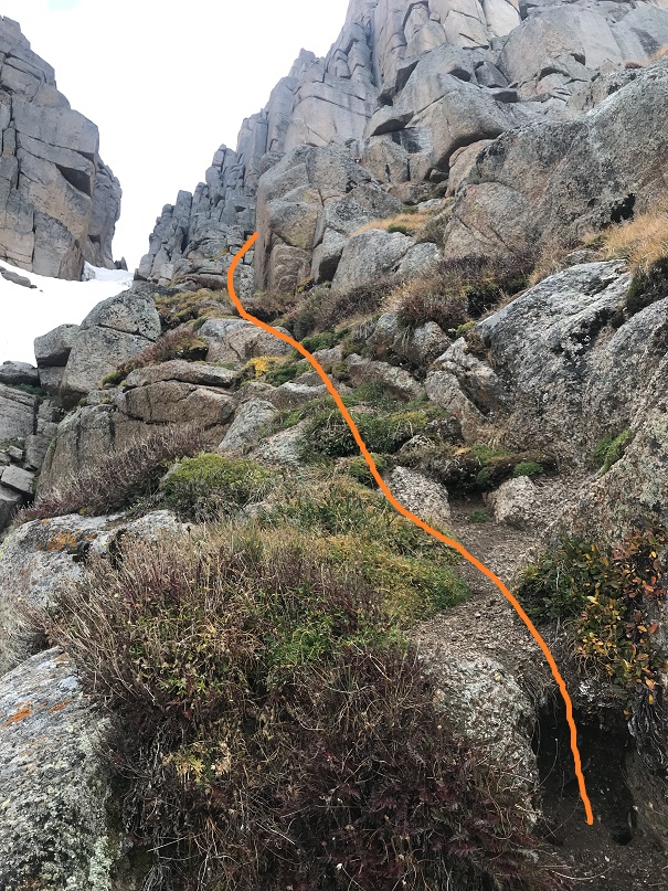
Ok, next idea: I rummaged around in my pack for my knife but was unable to find it? My idea had been to use it kind of like an ice pick for leverage on the grassy slope (since there were no rocks/etc. to grab onto). I was upset I couldn’t find my knife, but I did find my microspikes and decided to put them on. These gave me the traction I needed to pull myself up and onto the slope from below. I then made my way around and finished the first crux. (The dotted line is how I think you’re supposed to get over this area, but I wasn’t tall enough to make it happen).
The climbing became steep. I’m assuming this is the second crux
There weren’t cairns here but I knew I was on the right track because I kept seeing anchors set up. I inspected each one on my way up and they all looked good enough to use on my way down.
I made it to the notch, got my first good view of the sky and turned left. It looked like the weather was going to hold out for me today after all!
Here’s that airy traverse. There’s a lot of exposure here but luckily for me the rocks were dry and it was a short section. I took the solid line, but if I hadn’t been wearing my backpack I could have fit through the hole where the dotted line is (behind the rock is a tight fit with a pack).
I was feeling pretty good about myself at this point as I rounded the corner and saw the chimney. It used to be a class 3 chimney but there had been a rockfall and the top two rocks in the chimney were “new”. I’d heard they weren’t that difficult.
So I decided to just go for it. Indeed, the first part of the chimney was easy. Easy until I came to the place just below those new top two rocks. They were positioned in such a way they were overhanging the rocks below. I tried and tried and tried but I wasn’t able to get around the rocks, so I retreated to the bottom of the chimney and studied the route again.
It looked like the way to get over this area was to balance on the ledge to the left and haul myself over. So I tried again, but that crack was smaller than a pencil and there was no way I was going to be able to balance on it without rock climbing shoes. Drat!
I was getting seriously frustrated and tried several more times from numerous different angles and was unsuccessful. What was really demoralizing was I was so close to the summit! I went back down the chimney (again), took off my pack, and studied the rocks. There had to be a way up and over this area, and I had to bring my rope with me (there was no way I was soloing down the chimney without a rope). I told myself I was going to keep trying over and over again until my turnaround time at noon. I was kicking myself for the second time today for not bringing along my climbing shoes, but I wasn’t ready to give up yet.
I just needed a little bit of leverage. That’s when I got an idea! I put on my climbing harness, attached my rope to the belay device (because I’d need the rope on the way down but couldn’t carry it up in my hands). I took some webbing and carabineers with me and left everything else (including my camera) at the base of the chimney.
I climbed back up the chimney again and this time when I made it to the rocks at the top I turned around and faced away from the chimney. What I did next I’m sure isn’t kosher, so I’m not going to describe it in detail (but if you’re interested I’ll tell you at a 14er HH). It involved a lot of upper body strength, some webbing, and a move I learned in elementary school when I’d play on the bars at recess. My feet made it up and over the right side of the chimney first and I hauled the rest of my body over, thrilled I’d figured this problem out!!! Here’s the route I took and a look back down from the top of the chimney
There was an anchor set up about 10 feet from the top of the chimney that looked sketchy. I was glad I’d brought my webbing and rope up with me and decided to secure it now before summiting, lifting and pulling the rope hand over hand until I had it all above the chimney. I didn’t need a lot of webbing but I’d been unable to find my knife, so if you get up there and wonder why someone left all that webbing I can assure you it wasn’t on purpose: I just didn’t have anything to cut it with (I did have more webbing in my pack however, so this wasn’t all of it).
I summited Jagged Mountain at 10am
Jagged Summit:
Here are some summit views and a pretty robust anchor set up if you want to rappel the 165 feet down instead of heading back the way you came (that’s a lot of rope!)
Jagged Mountain was by far the most challenging summit I’ve ever attempted. I was very proud of myself for not giving up, even when I seriously wanted to. Now I just had to get back down to my campsite safely. I turned to exit the way I’d come and rappelled back down the chimney, retrieved and recoiled my rope and put back on my gear.
Here’s looking at the traverse back to the notch
I used every anchor station on the way back down, collecting and recoiling my rope after each descent (that’s exhausting!)
I brought a 50 meter rope with me and it was exactly the right length. I rappelled 4 times (including the chimney) and on the last rappel to right above the snow my rope just touched the ground (a great reason to tie a knot in the ends of your rope!).
I was coiling my rope here when I saw the flight for life helicopter heading towards the Animas River. I said a silent prayer for those involved (stay safe adventuring out there friends!), put on my microspikes and headed back to the pass, keeping an eye on the weather.
At the pass I took a selfie just because I could and because, hey, it’s Jagged
Here’s the route to my campsite (note I camped below the unnamed lake: I didn’t see a reason to hike all the way up there?) and the path out through the basin.
I made it back to my campsite around 12:45pm, making this about 6 hours campsite to summit to campsite: that’s a long time for 2 miles round trip! (I blame it on the rain…)
It had been my intention to hike back to my camping area, eat lunch, gather my gear, filter some water, and head back. Mother Nature had other plans. As soon as I made it to my camping area it started to rain, so I turned myself into a tarp burrito and rested for about an hour. When it became apparent the rain wasn’t letting up anytime soon I had some choices to make. I didn’t have any dry clothes but the ones I was wearing because I’d been unable to dry my wet clothes from yesterday. I could:
Stay where I was and wait out the rain and hike back the entire route tomorrow. By doing this I’d be chancing the snow forecasted for tonight and the conditions would be similar to today since the sun wouldn’t have been out to dry the rain
Hike back now in the rain and stop somewhere along the way to camp in wet clothes
Hike all the way to Purgatory in wet clothes (approximately 20 miles)
I knew I’d gotten more sleep last night than I usually get in 2 nights time so I was well rested. I also knew if I tried to sleep in wet clothes I would just shiver all night (and sleeping naked wouldn’t have been any good since I’d need to put on wet clothes in the morning and hike out anyway, so I might as well just hike out now). I have a lot of energy and need to exhaust myself to go to sleep: staying put didn’t mean rest.
Curiously, the umbrella that had been there yesterday was now gone. I’m assuming a marmot took it?
I decided to hike out, so I packed up my gear (found my knife in my sleeping bag: It must’ve fallen out of my pocket last night) and in the beginning tried to use my tarp to shield me from the rain (in case you’re wondering, it didn’t work). I was soaking wet in the first 5 minutes. Everything, including my waterproof pants, socks, jacket, and shoes were sopping wet. I could actually see the water oozing out of the top of my shoes and when I put my arms down I saw water dripping out of my sleeves.
It rained. And rained. And rained. After about 2 hours I screamed (to no one in particular) ‘”STOP RAINING!” It didn’t work and it didn’t really matter: the ground and trees and bushes were going to be wet for days (the forecast called for more rain/snow).
My main concern was getting past the avalanche area while it was still daylight. I stayed north this time and went over some boulders, avoiding trees where I could, which ended up being the better idea. There was still no trail to follow, but I was able to pick up faint game trails at times through the 3-4 foot brush. The difficulty of the avalanche area was compounded by the rain and slick conditions. I was slipping and sliding over tall-grass camouflaged wet rocks and trees; the only consolation being I was doing it now instead of tomorrow (in worse conditions).
In case I didn’t describe it properly last time, the avalanche area is full of enormous trees and branches piled on top of each other in various states of decomposition and some areas are like trap doors: they looked olid but you could fall right through them. My shins and thighs and forearms are covered in bruises. My hiking pants are completely torn up and I’m in the market for a new pair. I kept falling and about halfway through my phone stopped working (I’m guessing because it was waterlogged). I didn’t dare get out my DSLR in these conditions so I mentally resigned myself to losing pictures/my track, which stunk because I really wanted them from this climb!
Thankfully I made it out of the avalanche area and back on the Noname Trail in the daylight, and from there booked it down to the Animas River. I wanted to get as much of this hike done in daylight as possible so I wasn’t taking breaks. I was taking “bend over to get the weight off my shoulders and pump my thighs up and down” breaks though, usually for 5 seconds worth of ujjayi breath before continuing on.
As I hiked I looked for fresh animal racks in the mud and unfortunately didn’t see any. There were brief periods where the rain stopped, but I’d only get about halfway dry out before it started raining again. I didn’t bother being careful crossing the creeks: my feet were already soaked, so a little creek water wouldn’t hurt any.
I made it to about a mile before Water Tank Hill when a man surprised me. He was dressed head to toe in rain camo. “Oh, I didn’t see you” I announced (well, duh) and we talked for a bit. He looked like a hunter but I noticed he had a tripod in his pack and guessed he was a photographer. He had an accent that suggested Eastern Europe. He was soaking wet as well and had no idea how he was going to get dry tonight. When I told him I was hiking back to Purgatory he first said “wow, that’s a long way!” and then asked me if I’d come this way on my way in. We had a laugh over 200 feet of “why am I doing this?” (Water Tank Hill) and then I was on my way.
I made it up Water Tank Hill and decided to take a short break. It was 8pm. I played with my phone again and was finally able to get it to turn off and reboot. Once it was done I was able to open my phone again: yes!!! I hadn’t lost my data and it looked like my tracker was still going. I was still soaking wet and my feet felt like I was hiking in water shoes, but this, this was a major win!
From here it didn’t take long to make it back to Needleton, where I breathed a huge sigh of relief, knowing I still had 11 miles to go but they would all be on a well established trail with no route finding. I just needed to keep going, slow and steady.
I’ve hiked the Animas River Trail several times, and it’s getting easier to know where I am and how much further I have to go, even in the dark. For the first time I didn’t see any campers (most likely due to the weather forecast). I stopped for another break at the base of the Purgatory Trail. Despite not having time to filter water I still had plenty so I didn’t filter any now. I had some peanut butter and was on my way again to hike the last 4.3 miles up to the trailhead.
I’ve done this last part three times: once in the daylight and twice now in the dark. Let me tell you, hiking up Purgatory in the dark is the way to go! The daylight sun in demoralizing. Sure, tonight I was soaked due to the rain, but I wasn’t gulping down water every few seconds to stay hydrated. Also, the first couple of times I hiked this trail I got frustrated due to all the ups and downs in elevation. It’s no fun to gain elevation just to lose it again. So I changed my mindset this time: I was going to have to do the last mile directly up from the river anyway: I might as well enjoy the downhill times while I could.
I made it back to my truck around 1:45am, making this a 46 mile hike with 11,481’ in elevation gain in 47 hours. I took off all my gear, cleaned myself up, and decided to take a nap before heading home. I tried for 30 minutes to fall asleep, couldn’t, and got up and just drove home (too much sleep yesterday?)
There had been a 30-70% chance of rain today from 12-5pm, but it had rained at 7am, 12-5pm, 7pm, 8-10pm, and as I turned my truck on to leave it started pouring again…
I have mixed feelings about this river. I’ve been rafting here at least a dozen times, but that one time in 2009 still haunts me. I’d been invited out on the water today (with the added bonus of some potential rock climbing) and was determined not to think about what happened in that icy river 10 years ago. Instead I was going to focus on today’s experience.
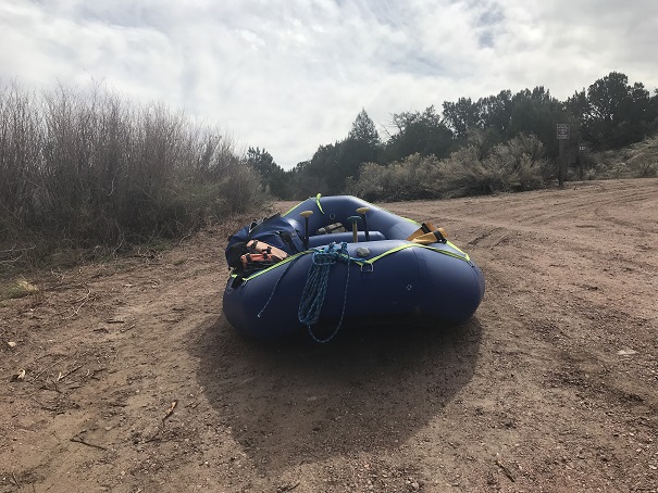
I didn’t even realize you could go rafting in Colorado in April, but apparently it’s a thing! Because we were rafting we took 2 separate vehicles and met at a gas station on the way. A local 4H club was having a bake sale, and I couldn’t resist (no, I didn’t but cookies, but left a donation). 4H and FFA bring back so many awesome memories I couldn’t not donate, even just a little bit. Oh, and they were totally taking over that gas station. There were probably 15 students there with their parents. They made an impact, and the belt buckles and handmade signs were a nice touch.
In any event, we parked my truck at the end of our intended route and drove together to the launch area. I breathed a sigh of relief when I realized we were nowhere the crash site (it was miles upstream). OK, I could completely relax now. Even though I try not to, on past trips I’ve been glued to the water to see if I can find where we landed. Funny thing, my success rate in actually finding the spot is about 50/50.
First things first: setting up the raft. To be honest I didn’t do much work, but it seemed straightforward. There’s tons of gear you need (or hope you don’t need) for a day on the water. After setting up I stayed by the raft and just relaxed and did yoga for a bit while he parked his car in a lot a few minutes away.
To my surprise it was a beautiful day; A bit chilly when the wind blew, but with the PFD on it wasn’t too bad. My feet were cold, but that was to be expected. I was only splashed by the water a few times, and tried to make it fun. Today’s trip down the river was more serene than any other trip I’ve taken, most likely because I’m usually in charge of 25 excited girls and the river’s flowing faster. It was nice just floating on the river, my friend doing most of the work (which I felt guilty about). On the downside the water could be loud at times and I had a hard time hearing and missed a few strokes (whoops). There were dozens of geese and lots of small birds on the water’s edge. One of my favorite parts about being in nature is seeing wildlife.
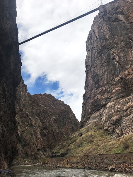
After a few hours of rafting we stopped directly underneath the Royal Gorge. I’ve never actually been to the Royal Gorge (something that needs to be rectified soon).
Our intention was to get some photos of me climbing. My main intention was to learn. I want to solo a few Centennials this summer that include rock climbing, and while I’ve climbed for years in a gym and many times with groups, I’ve never been solo, or even in charge of setting up my own equipment. That means I have no true idea what I’m doing, and that needs to change.
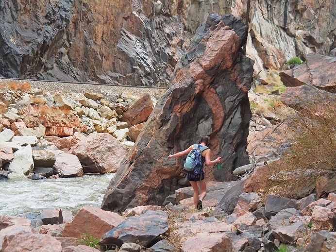
I found a friendly rock to hide behind and changed into my climbing gear (this was tricky; as we were directly under the viewing platform of the Royal Gorge, and I’m sure there were tourists with binoculars up there).
I was given a quick briefing about how to secure ropes that astonished me in its reliance on trusting the strength of rocks I’ve been taught not to trust, and then started climbing. I’ve never been climbing without shoes before, and it was trickier than I’d imagined. I’ve also never self belayed, and I was clumsy to say the least. The rope kept getting longer than I wanted it to, but I wasn’t sure how to quickly shorten it.
Climbing up was pretty easy. The only difficult part was stopping for pictures. I like to keep moving, and I wasn’t too steady staying in one place. I felt nervous and unsecure, and my harness was definitely too tight.
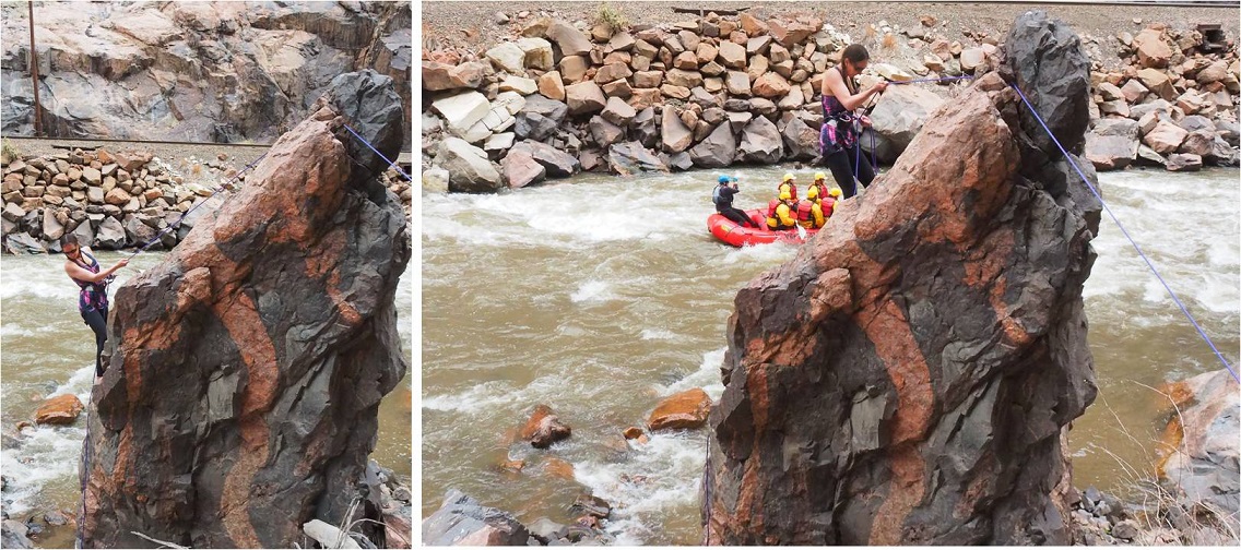
OK, after climbing up it was time to maneuver around the rock so I could rappel down. I like bouldering, and this was exactly what this was (except for the rope and harness continually getting in the way).
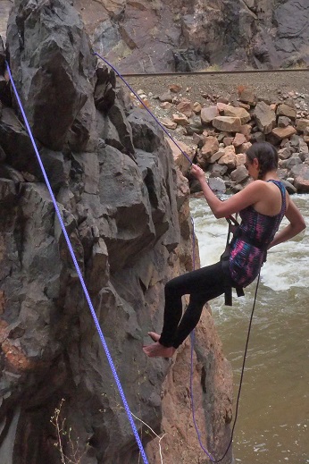
I started rappelling and then stopped in place for a picture.
All was going well, or at least I thought it was, as staying in one place was working. But as soon as I tried to rappel just a little bit something went wrong: I started sliding and couldn’t stop myself. Believe me, I tried, and I have the rope burns on my fingers to prove it. Luckily I was able to slow myself down so I didn’t hit the ground too hard, but I was immediately consumed by tons of negative and unproductive emotions.
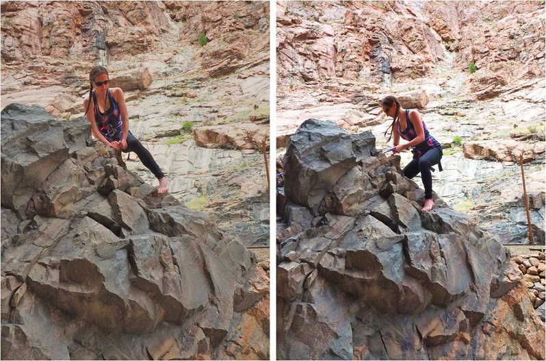
I was embarrassed I’d slipped, I wasn’t quite sure how it’d happened, and yes, I was in a little bit of shock from the whole experience. Now I felt very silly for not bringing my helmet (I’d left it in the car… on purpose). I don’t fail well, but need to get over that if I want to accomplish my goals. I still don’t quite know what I’m doing when it comes to solo climbing, and this incident proved that. I’m going to need more practice before tackling this myself. I wanted to get up and try again, but was advised otherwise. So I walked down to the river to cool my burnt fingers in the water.
We did have time to hang from some rocks though….
Note to self: Now that cookie season is over I need to work on toning my arms.
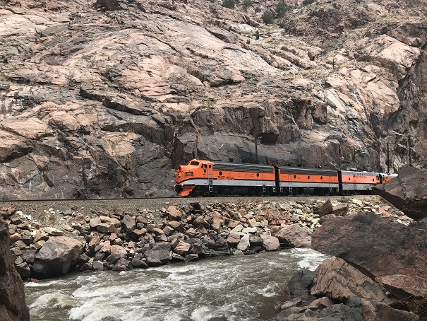
Oh, and it was fun to see the Royal Gorge train go by. Everyone waves at you and you’re kind of supposed to wave back…
We gathered up our gear and rafted back down to my truck. I was amused to learn we just tied up the raft and left it on the water while we drove to get the other vehicle. This seemed pretty trusting to me, but I guess the rafting community’s pretty honest? Deflating the raft and putting it away proved similar to taking down a tent. A heavy, canvas tent made out of rubber. It was much later than I’d realized (wow! Was it really already 4:30pm?) and I’d promised the girls I’d be home by 6, so I drove a bit faster than I should have home.
OK, so lessons learned today:
You can raft the river in April
It wasn’t as cold as I’d expected on the river in April
A canyon is wider than a gorge (duh…lol!)
I’m better at taking photos than being a subject (this needs work!)
If your guide knows what they’re doing you can avoid getting wet (but it’s probably more fun to tackle the rapids instead of glide through them. Still, I appreciated staying mostly dry)
I need to do some research and practice on how to set up webbing safely (I’ve tried this before and came up empty, so I’m going to have to search again)
I need to buy webbing (maybe on my trip to get a new backpack?) and figure out exactly how much I need
Self belayed rappelling is not my strong suit. I need to practice, preferably in a place where a fall won’t be too tragic.
I may need a thicker and longer rope (mine will hold me, but it’s slippery… maybe gloves?)
I need to develop more patience with myself
I need to fail faster and not beat myself up so much when I do
While I feel like I got the perfect amount of sun, sunscreen is my friend and I can’t forget that