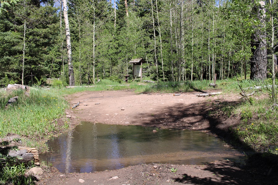
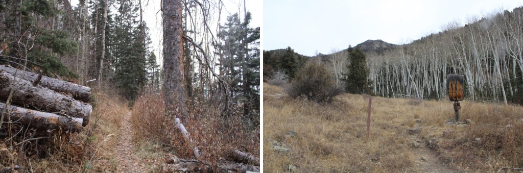
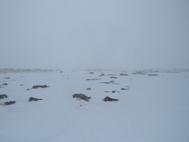
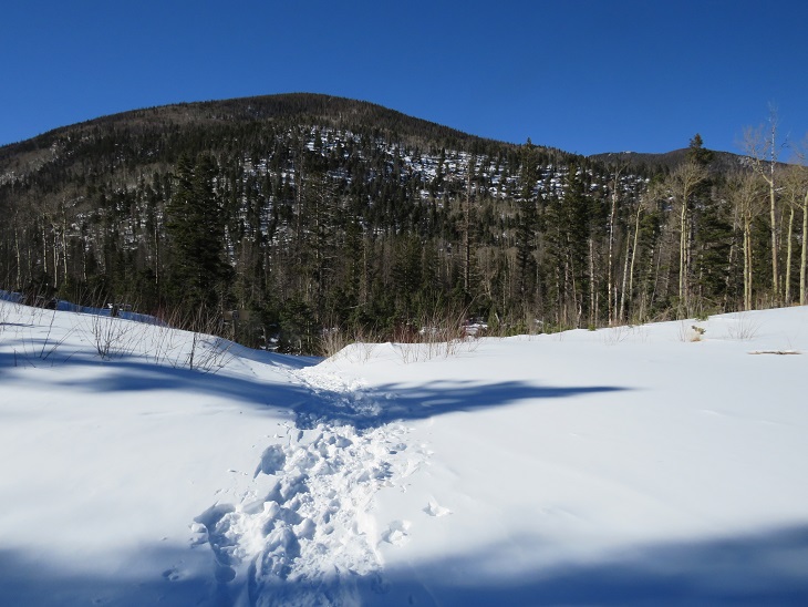
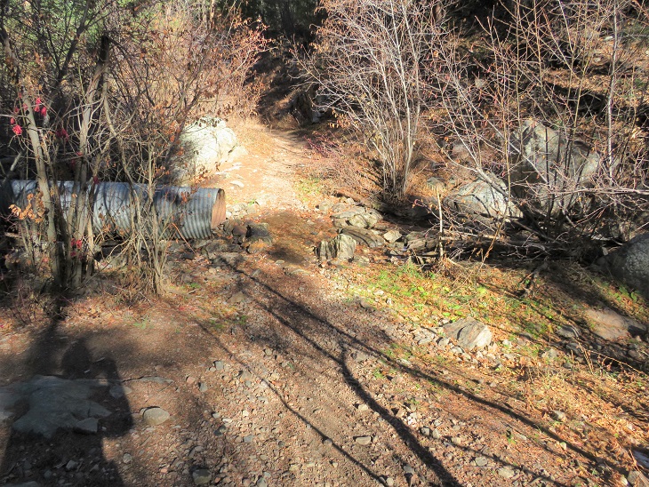
I started from the Cottonwood Creek Trailhead at 4:30am. This trailhead tends to fill up in the summer, but on this fall day my truck was the only one there.
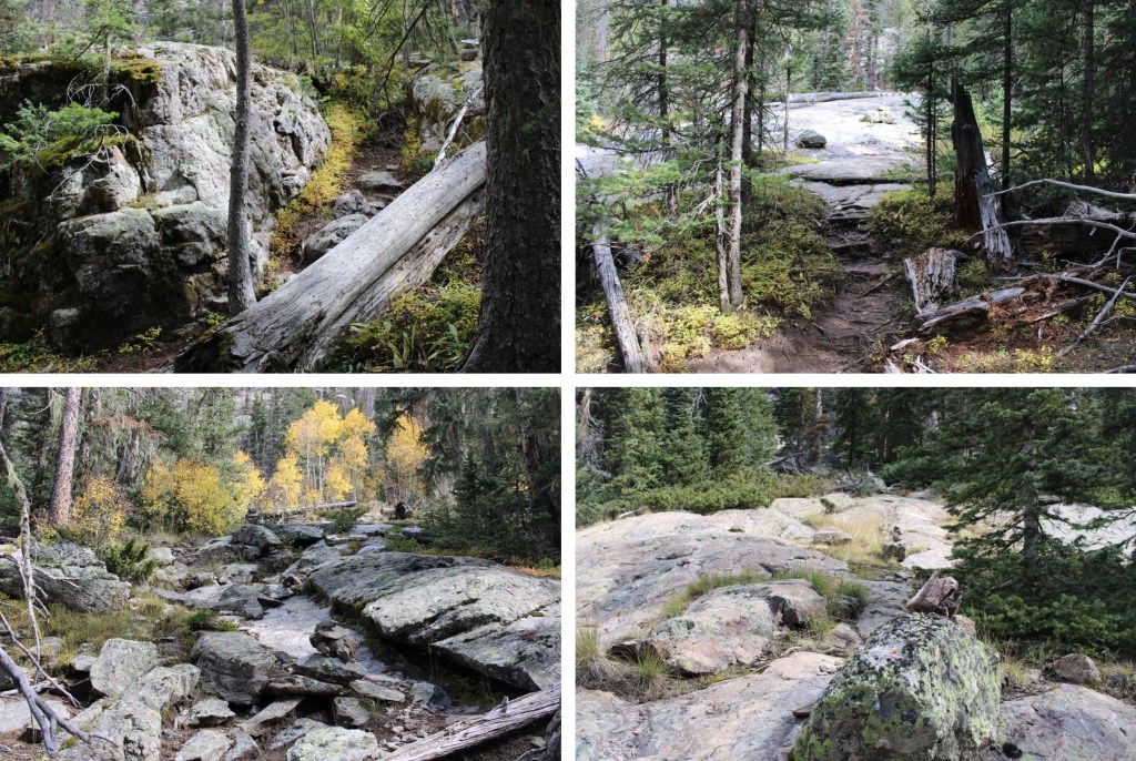
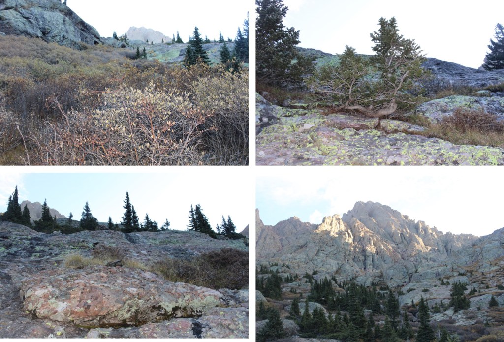
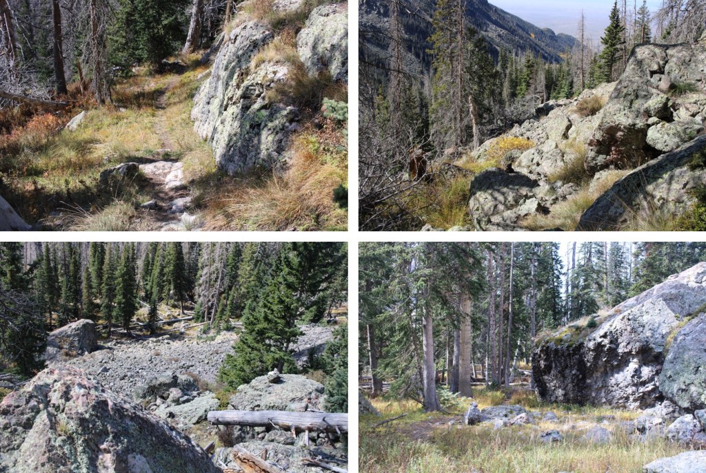
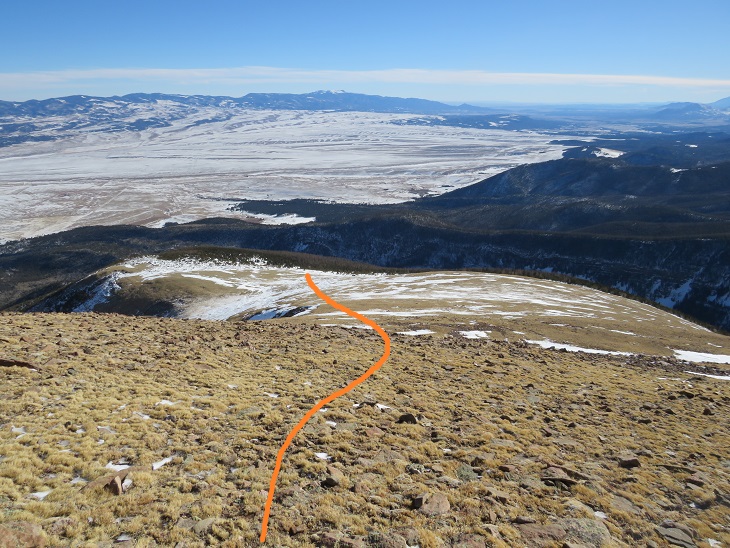
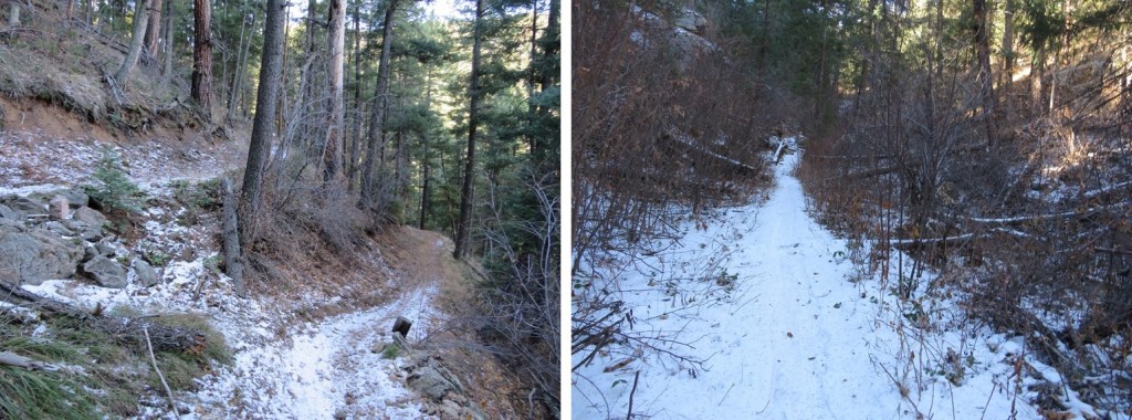
I started out following the class 1 trail east
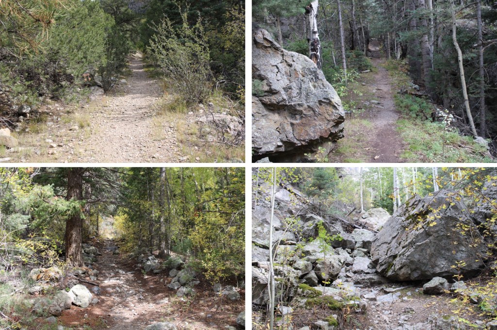
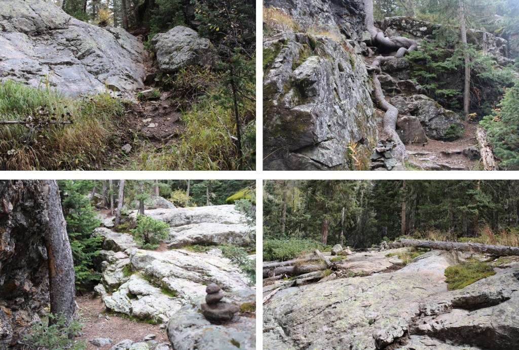
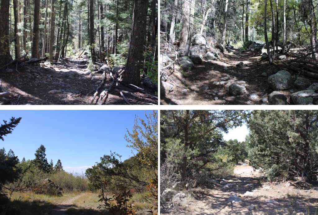
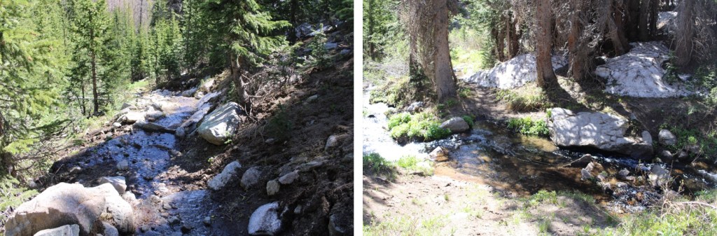
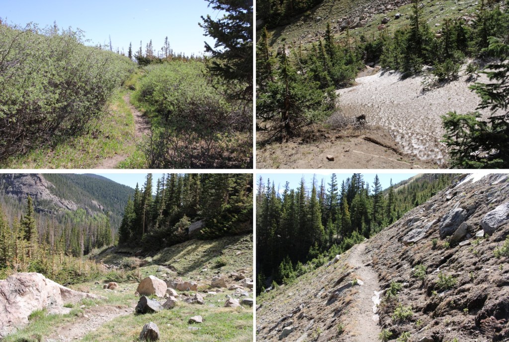
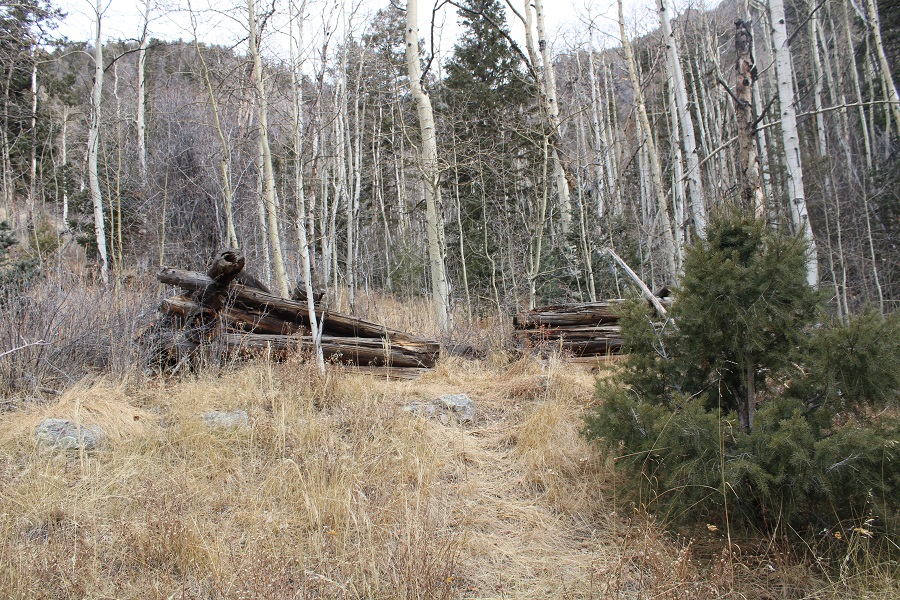
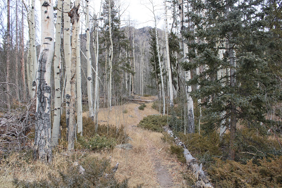
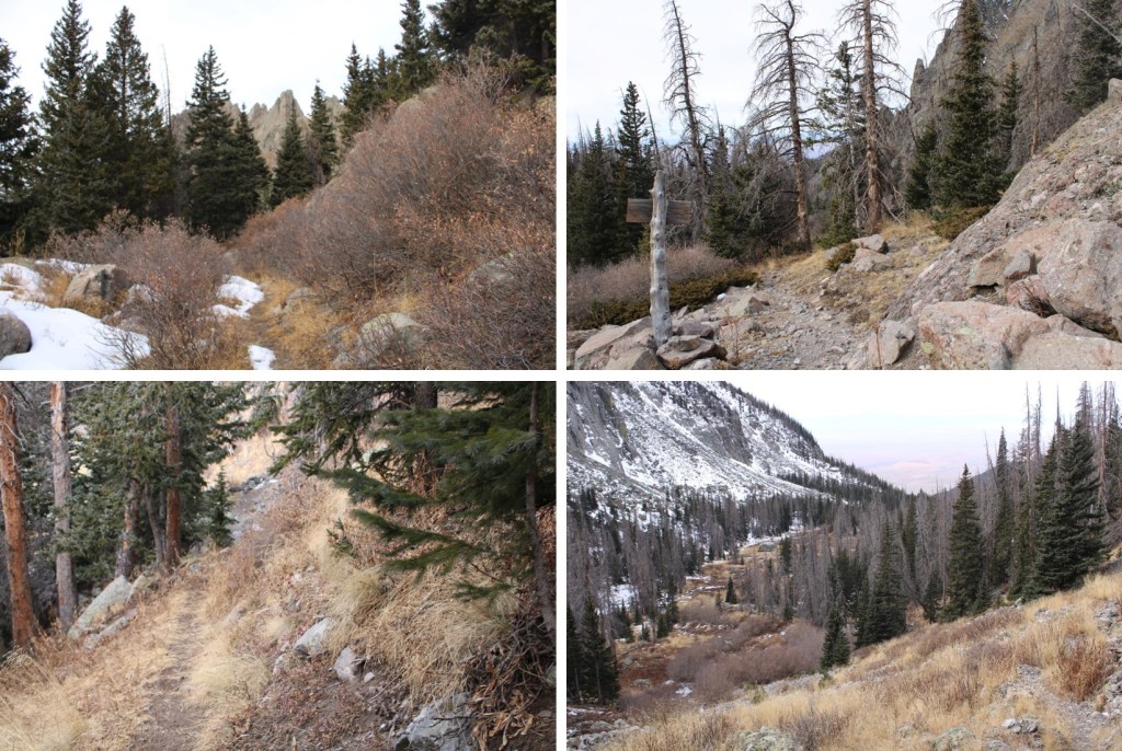
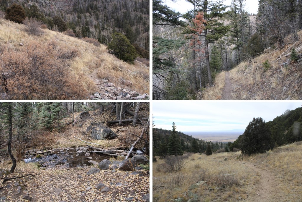
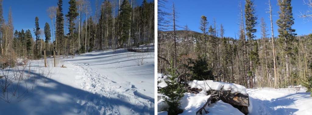
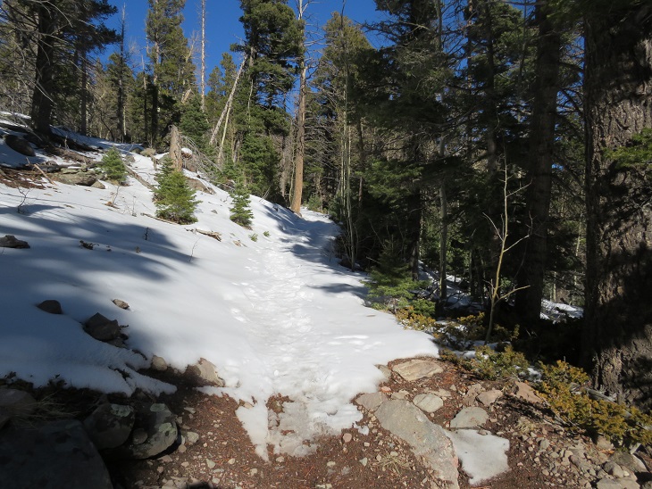
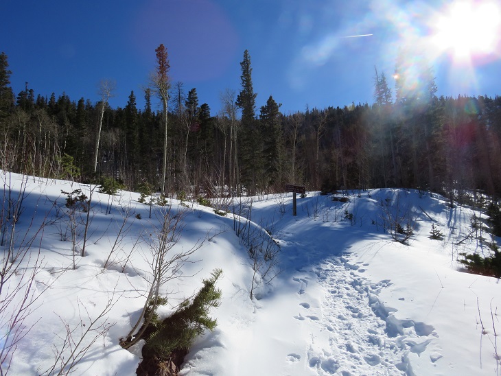
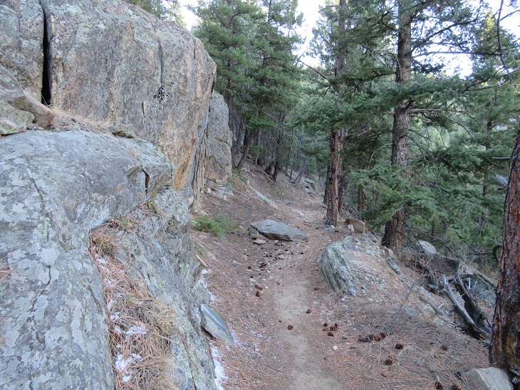
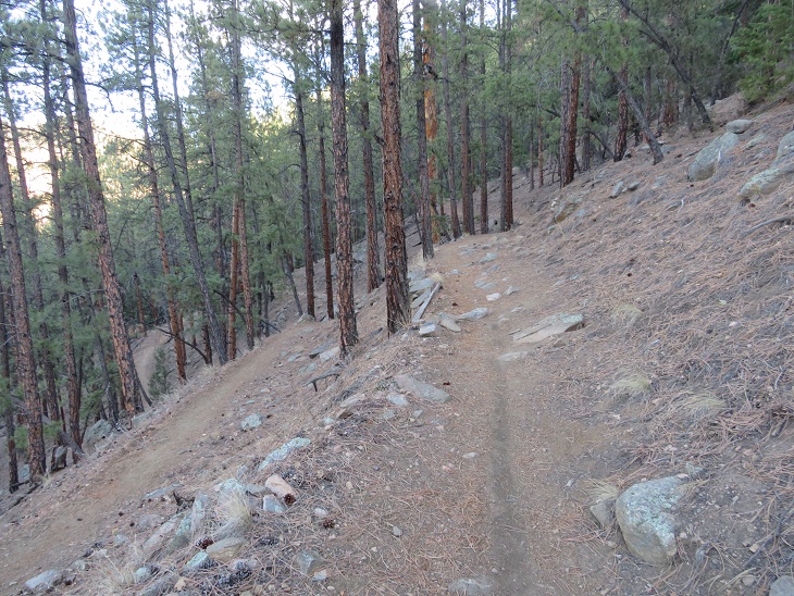
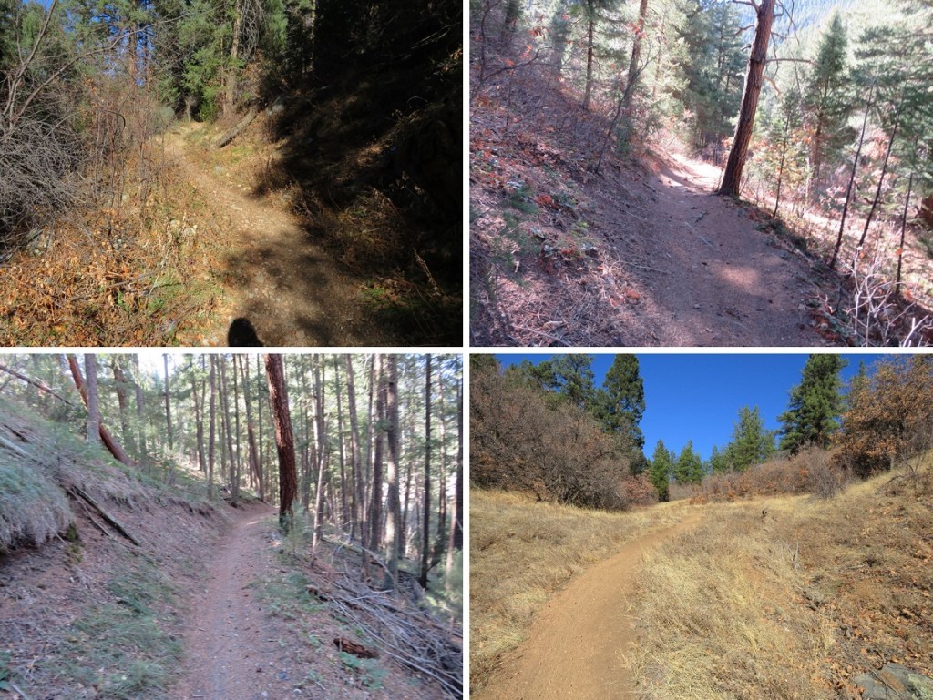
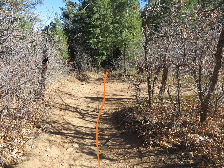
The trail is easy to follow for the first 4 miles
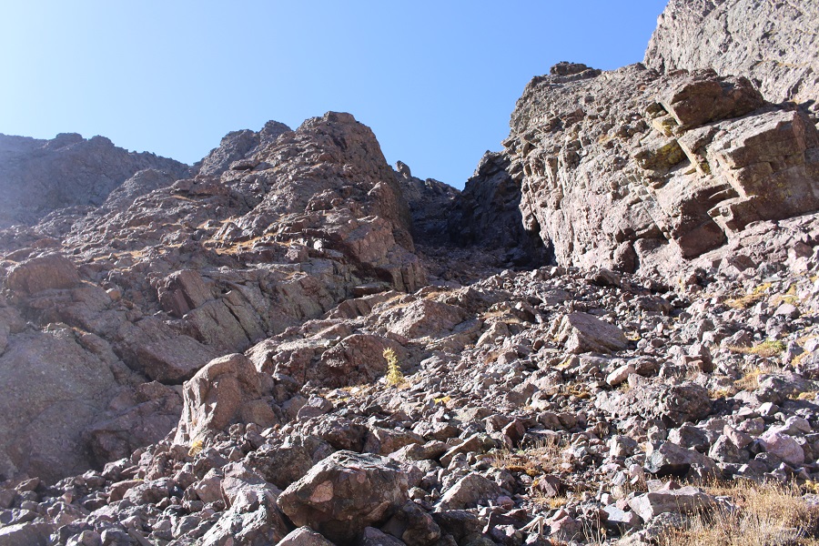
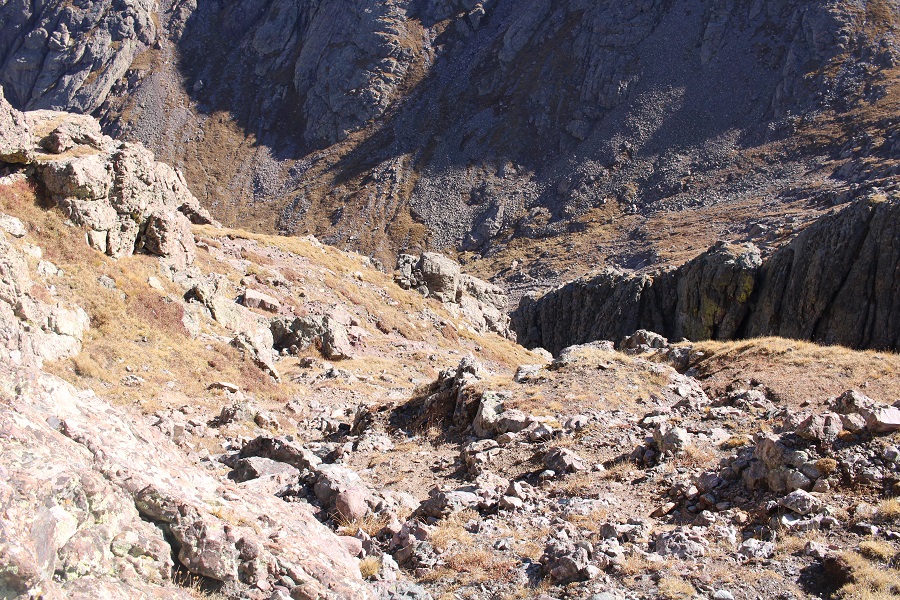
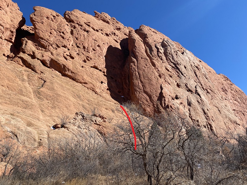
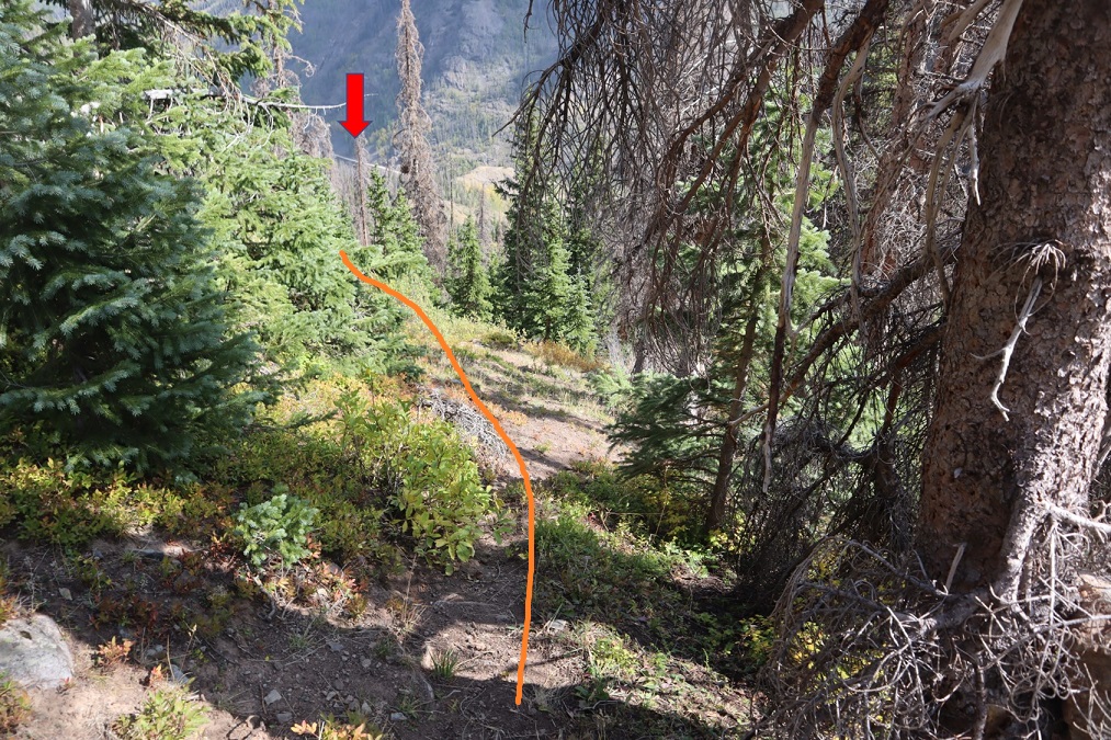
Then I came to what looked like a wall of rock. This wall goes for about three quarters of a mile, and should not be attempted in wet conditions. There are plenty of cairns here to mark the way. If you don’t see a cairn, you’re off route. You head straight up.
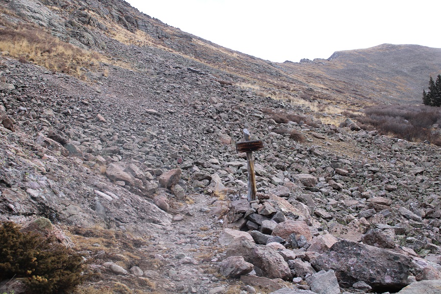
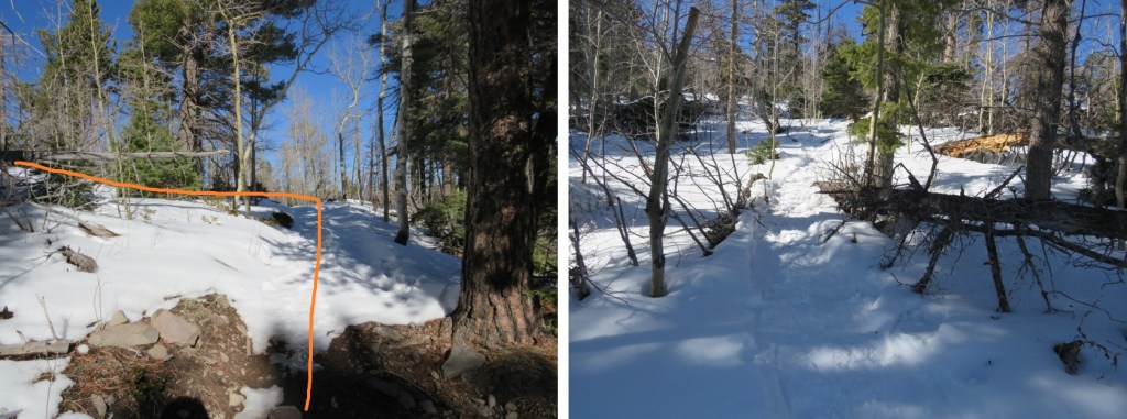
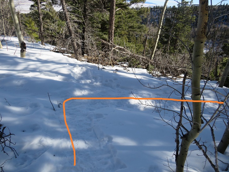
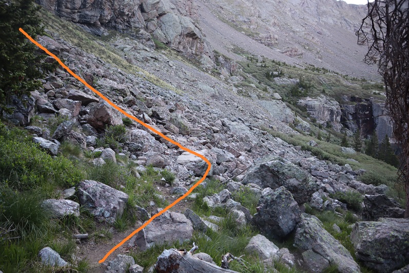
After 4.6 miles I came to a junction between Trail 743 and Trail 861. It’s not obvious, and there are no signs, so you need to be looking for it. I was at 11255’. One trail goes left, the other right, and crosses the creek. Don’t go right, go left and continue following the trail.
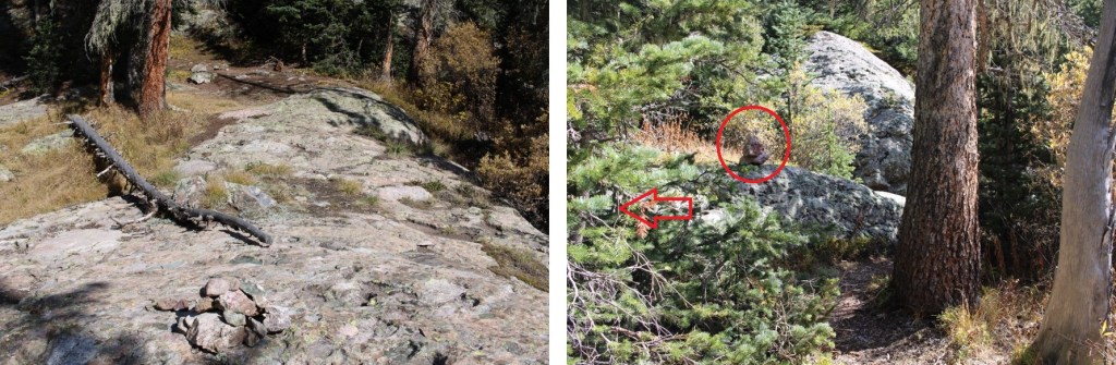
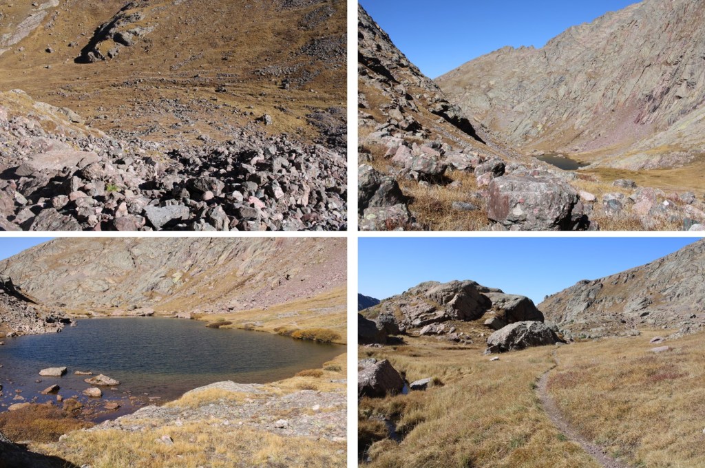
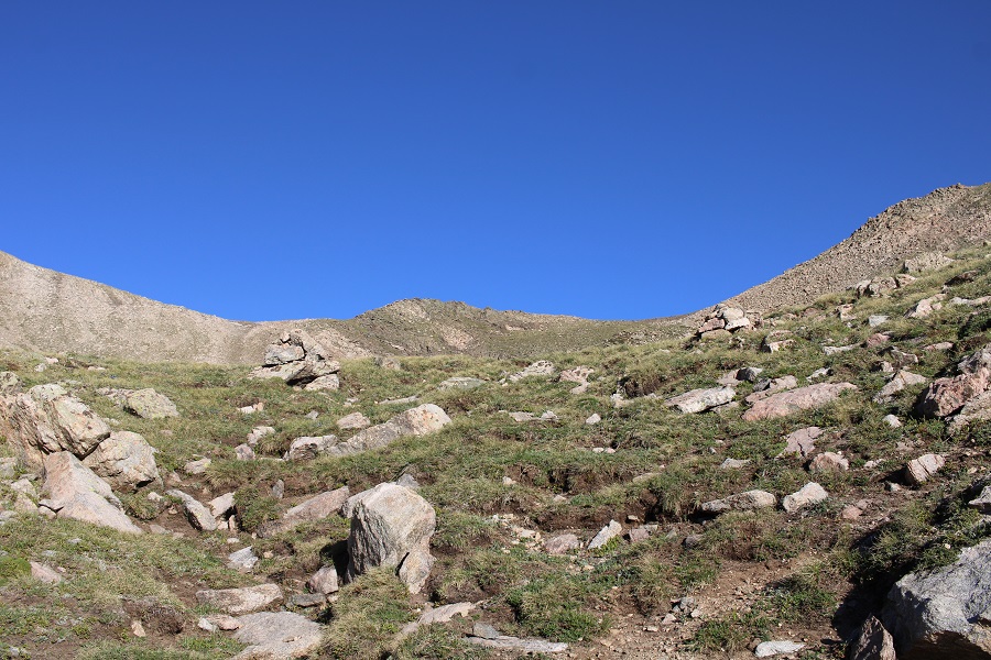
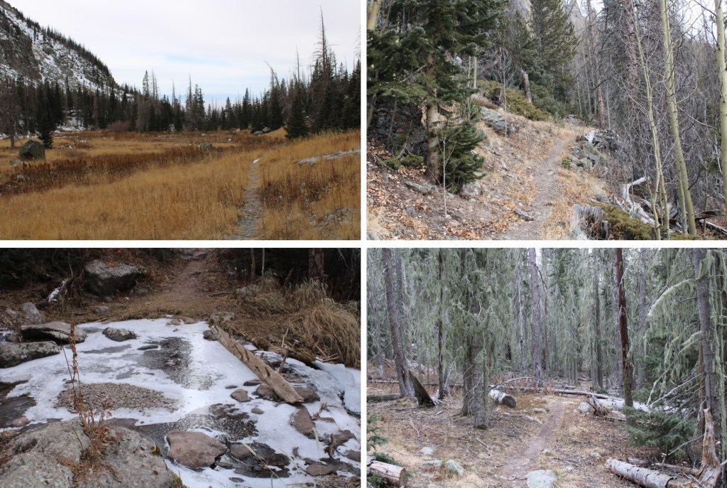
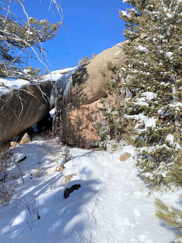
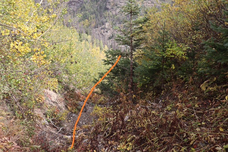
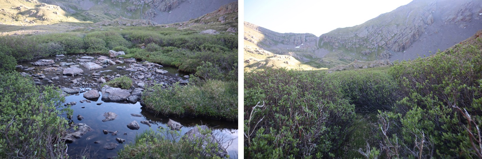
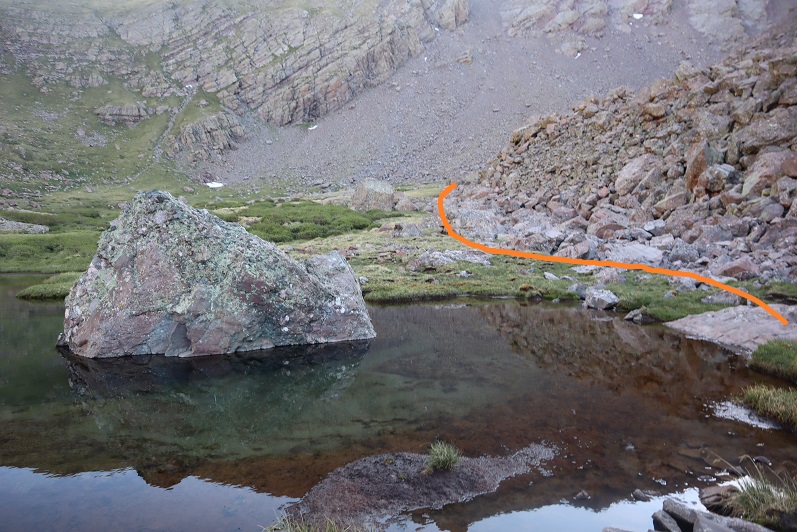
This trail led me to a camping area, with a boulder the size of a house. The goal is to make it to the upper basin. There are trails that go on each side of the boulder that will get you there. There are a lot of cairns in this area.
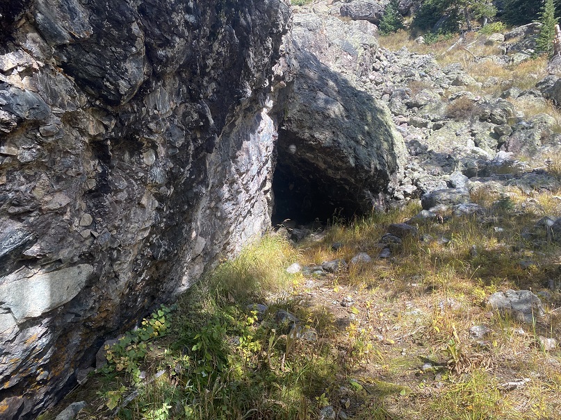
If you take the trail to the right, there’s a pretty cool cave to check out, but be careful: there was a rather large hornets nest at the entrance this time.
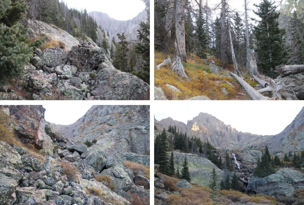
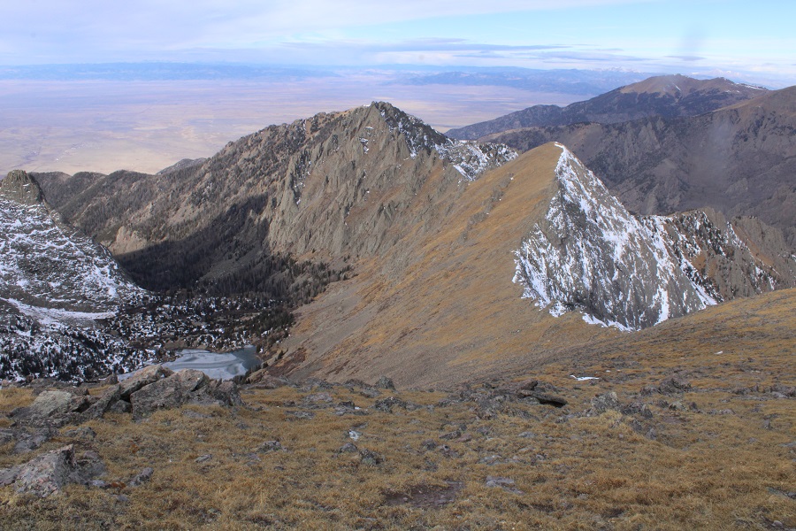
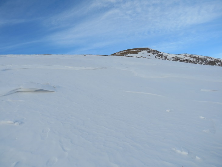
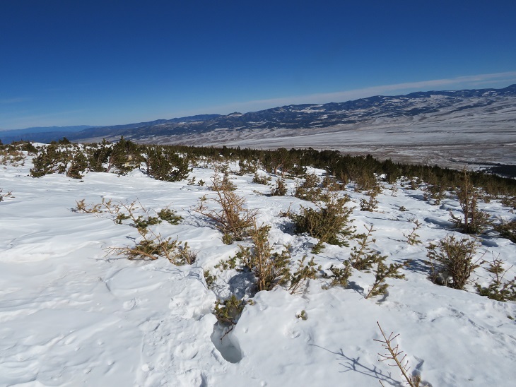
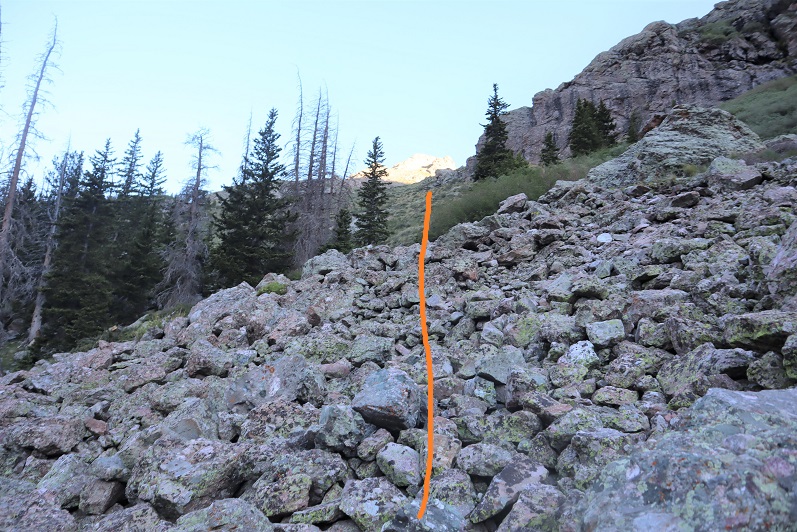
I followed the cairns northeast, through rock fields and willows.
There were a few class 3 moves to do to make it to the upper basin, but plenty of cairns to guide the way
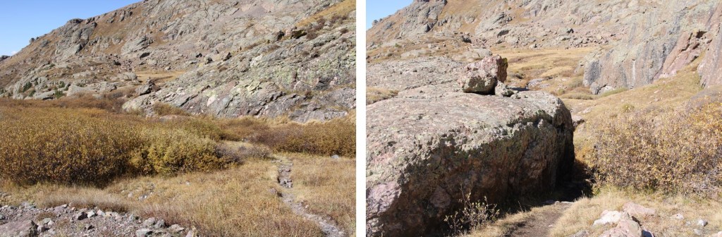
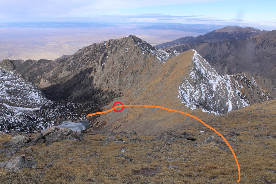
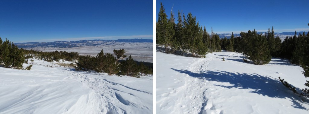
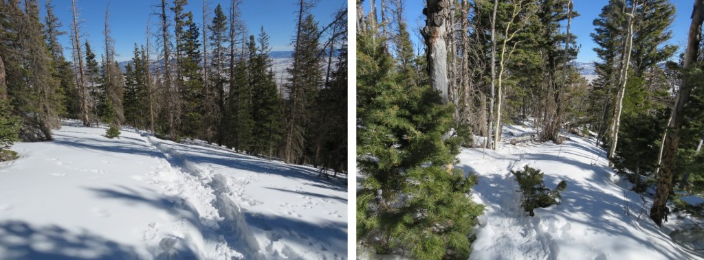
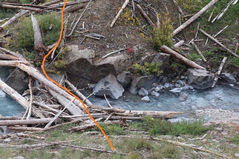
I went behind this rock, and caught up with the trail to Cottonwood Lake, now heading east.
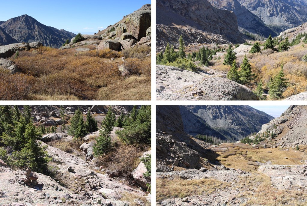
I followed the trail until I was at 12430’, and then turned right, starting up tundra
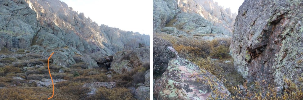
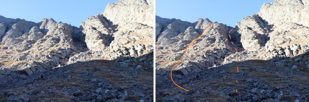
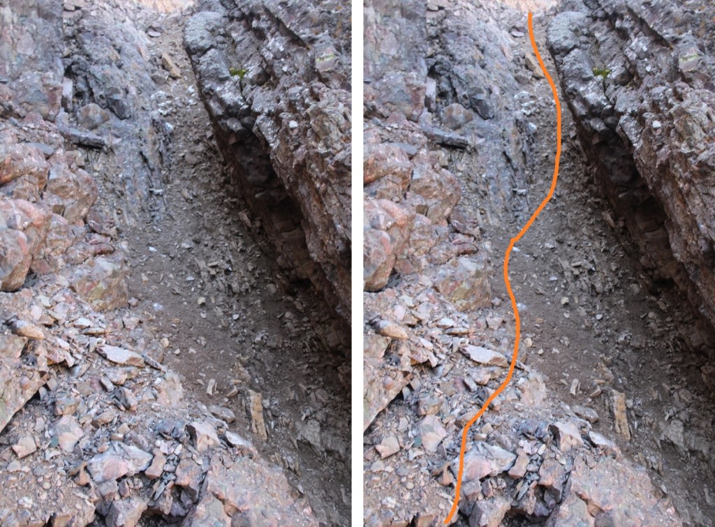
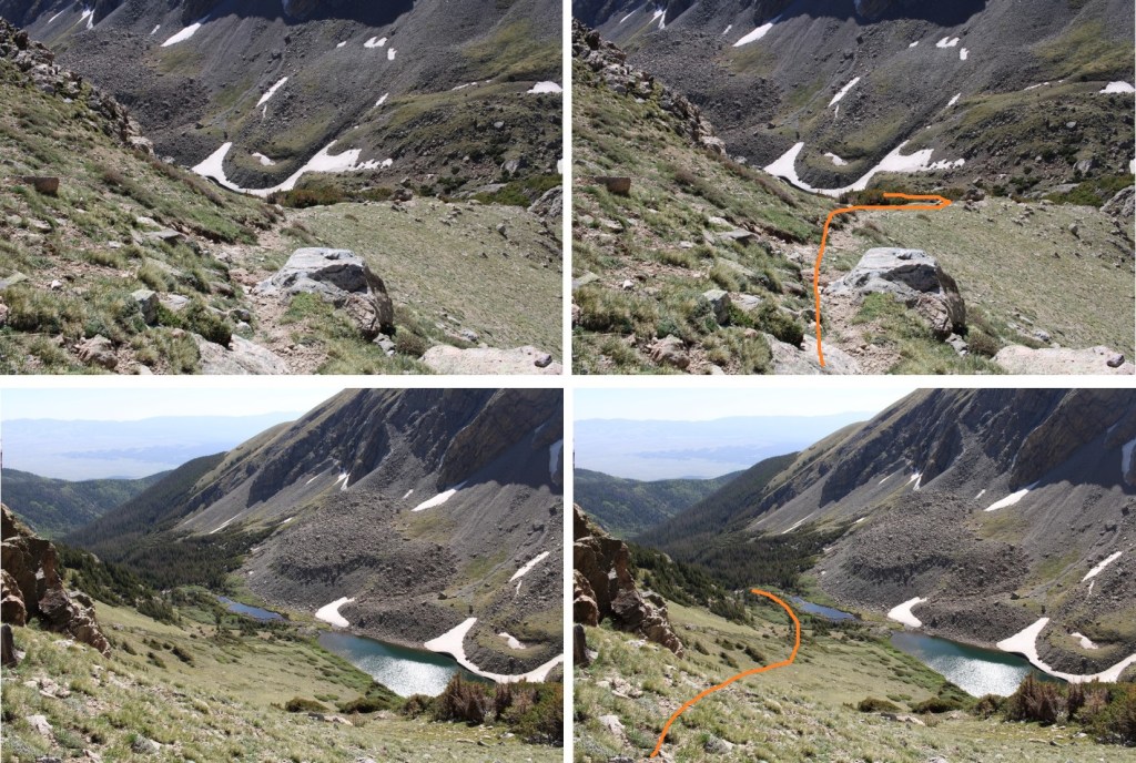
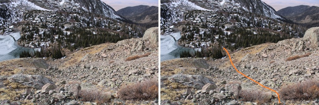
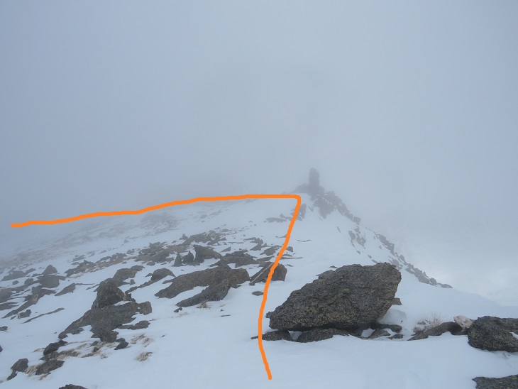
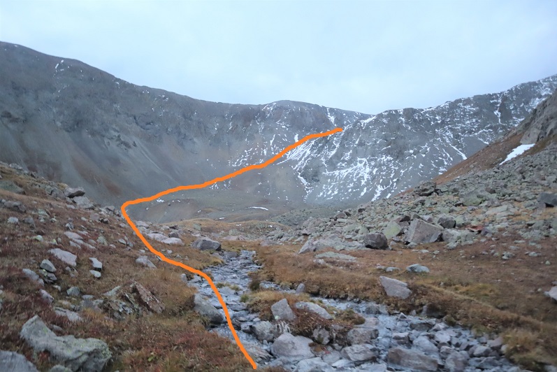
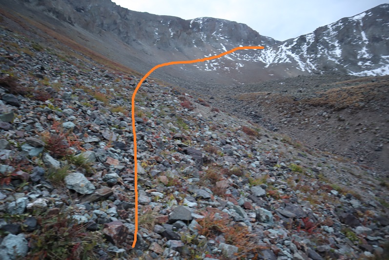
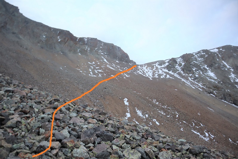
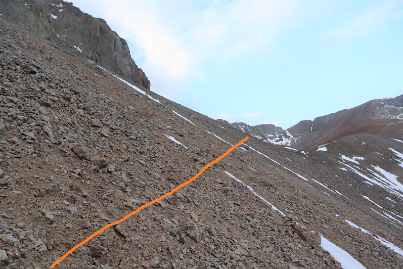
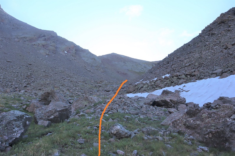
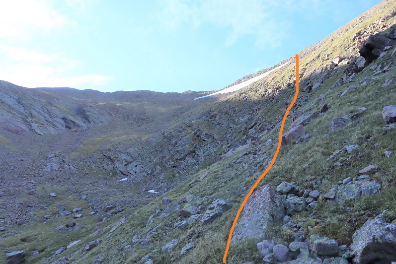
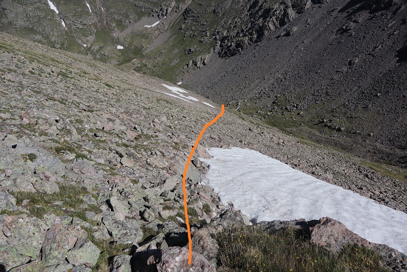
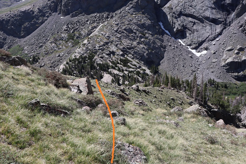
My advice to you is to go straight up the gully, as it stays at class 2+. I however, did not do this. I went up the right side. This goes at class 4, and was unnecessary. In addition, it included a drop of about 40 feet on class 4 terrain. I’ll show pictures of the route I took, but I really recommend taking the easier gully.
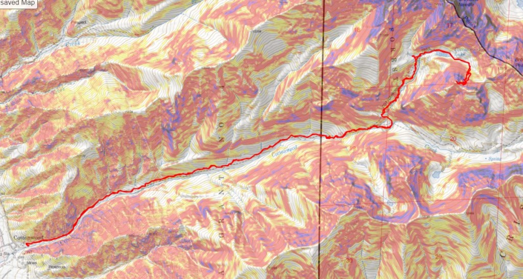
My route: Solid line up, dotted line down
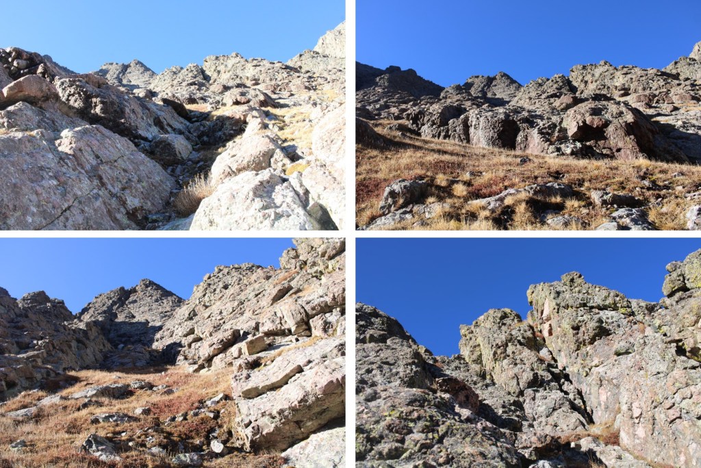
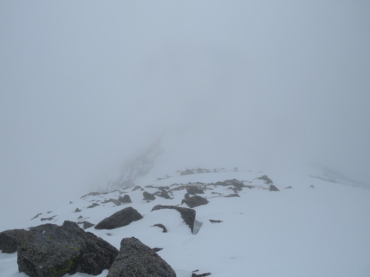
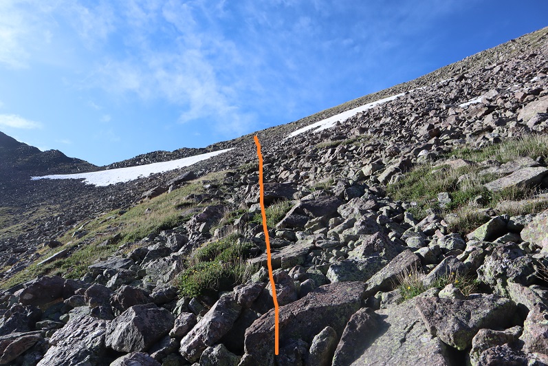
Here are some pictures of the route I took up. Once again, I do not recommend this
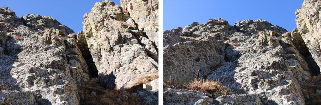
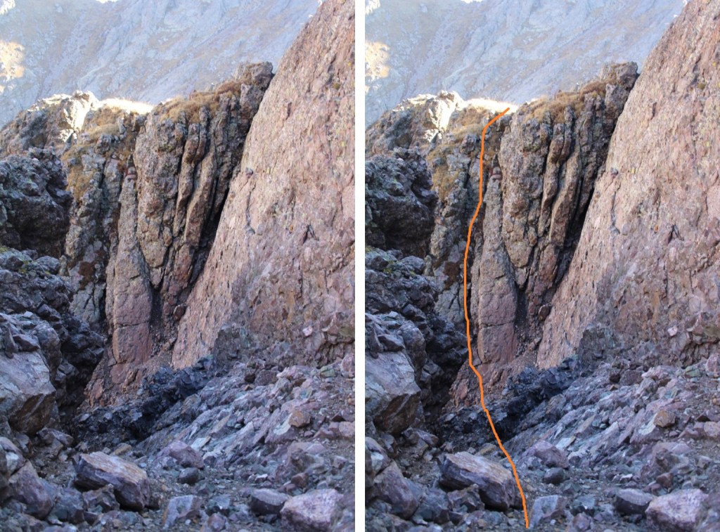
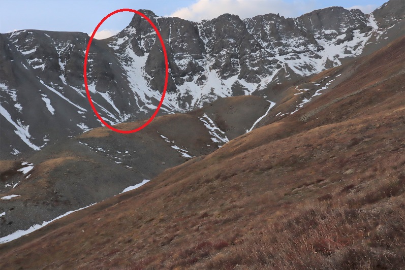
I don’t recommend this route, because this is where it led me: That arrow points to a 40-foot class 4 chimney I’d have to descend.
I seriously considered turning back at this point, and trying again with the gully. After some careful consideration, I realized I could navigate the current terrain. I gingerly climbed down 40 feet, then up another 40 feet
Here’s looking back at that chimney, and the route I took both down and then back up. Both sides were steep, and I was glad to be wearing my microspikes.
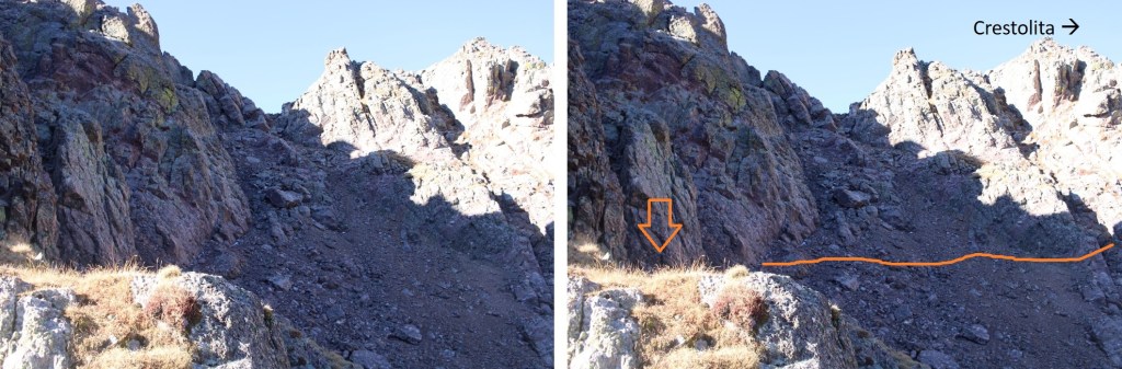
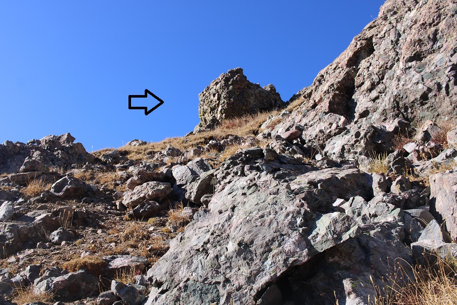
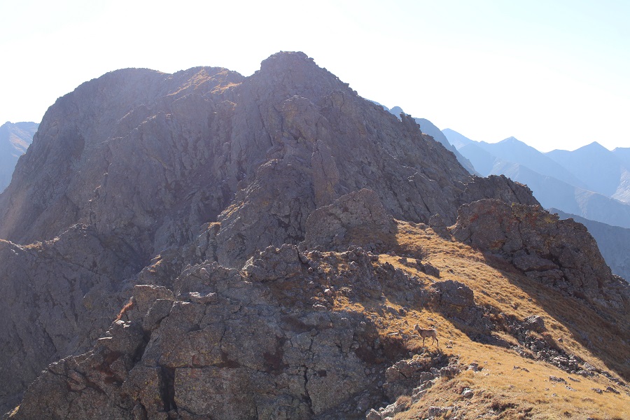
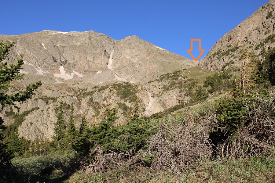
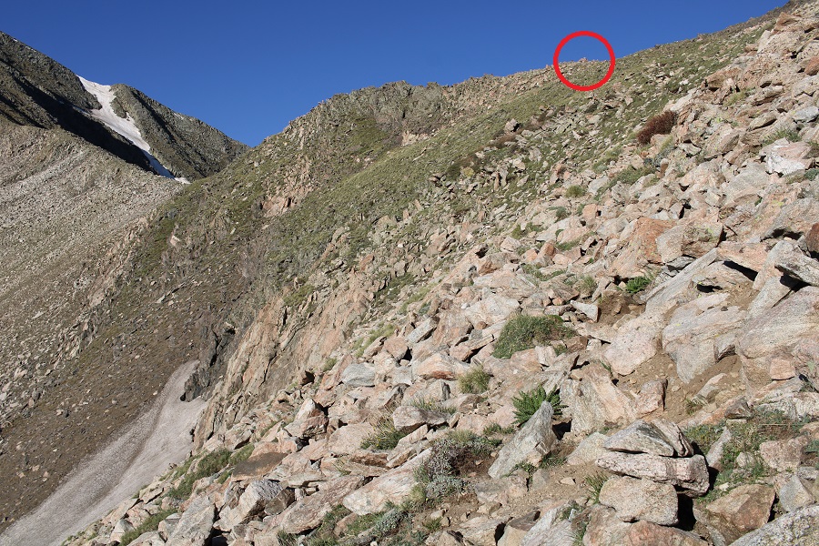
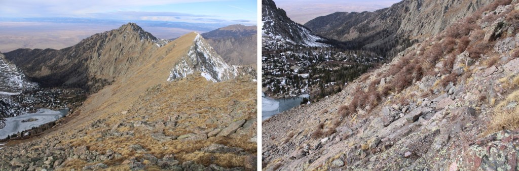
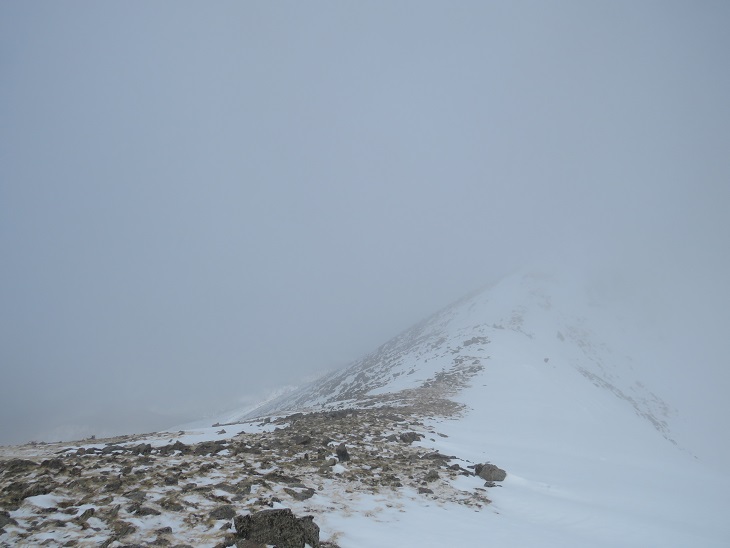
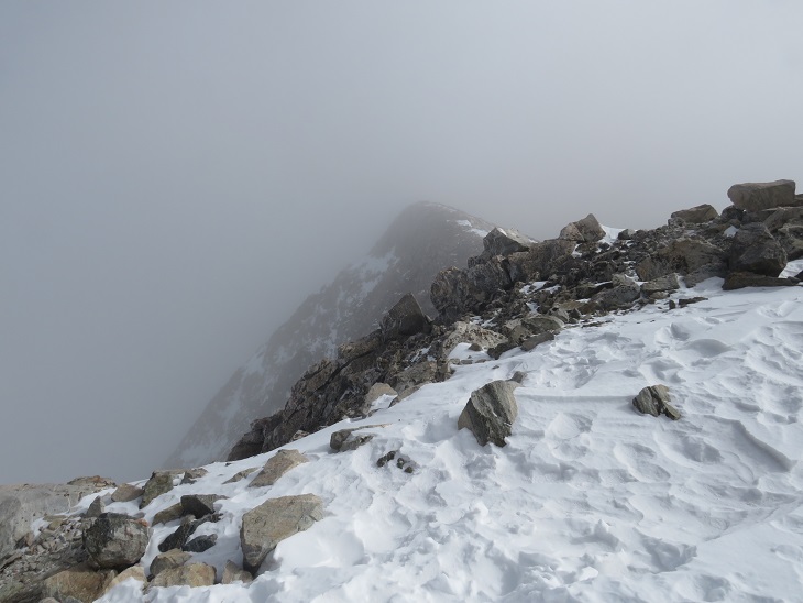
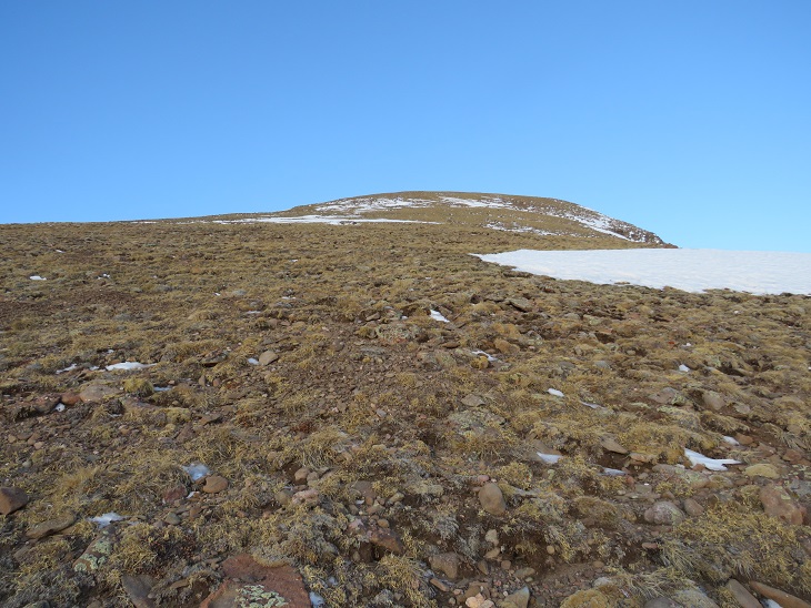
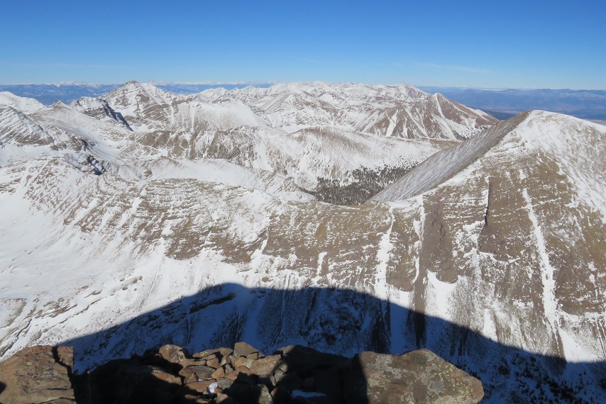
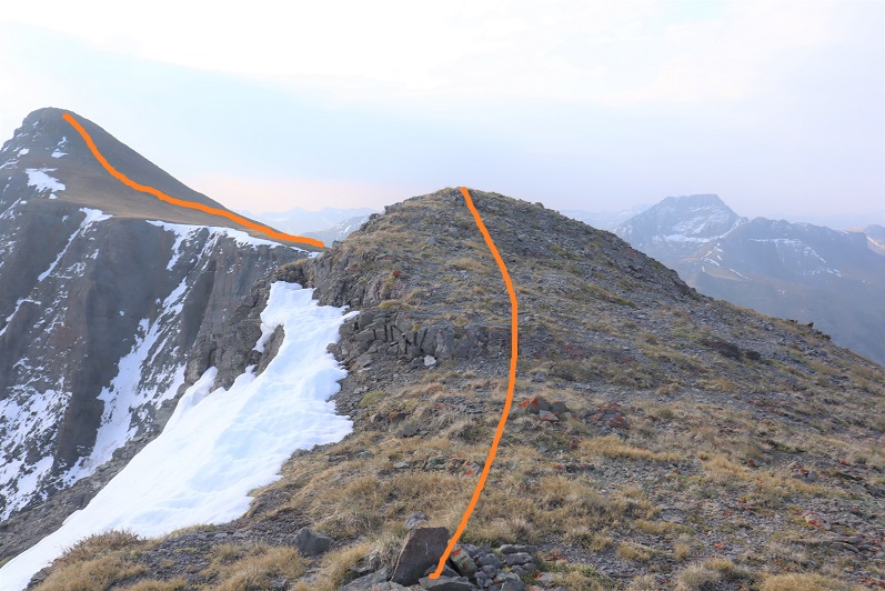
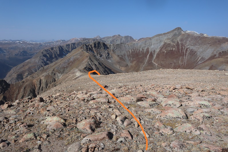
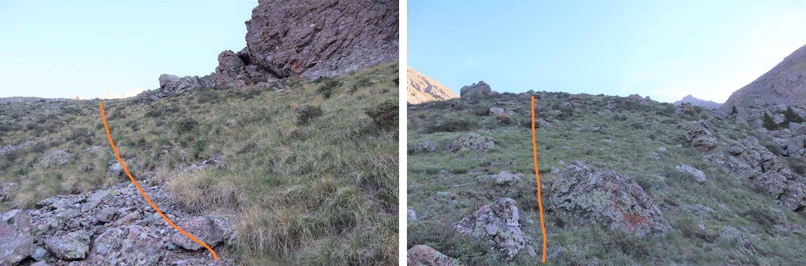
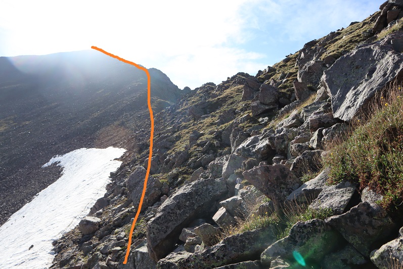
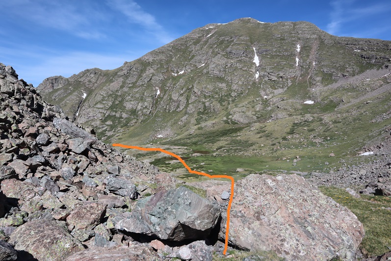
From here, I could now see the route to Crestolita to my right
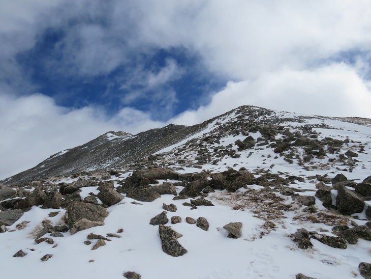
This took some navigating, but the terrain remained at 2+, with some added exposure. First, I headed to the saddle
At the top of the saddle I turned right
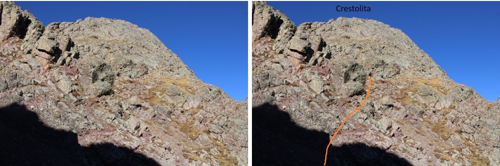
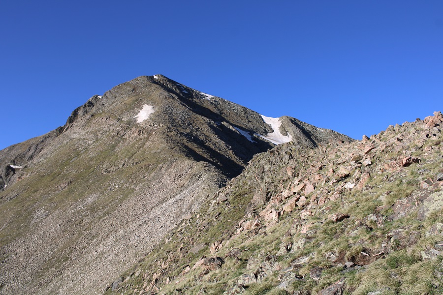
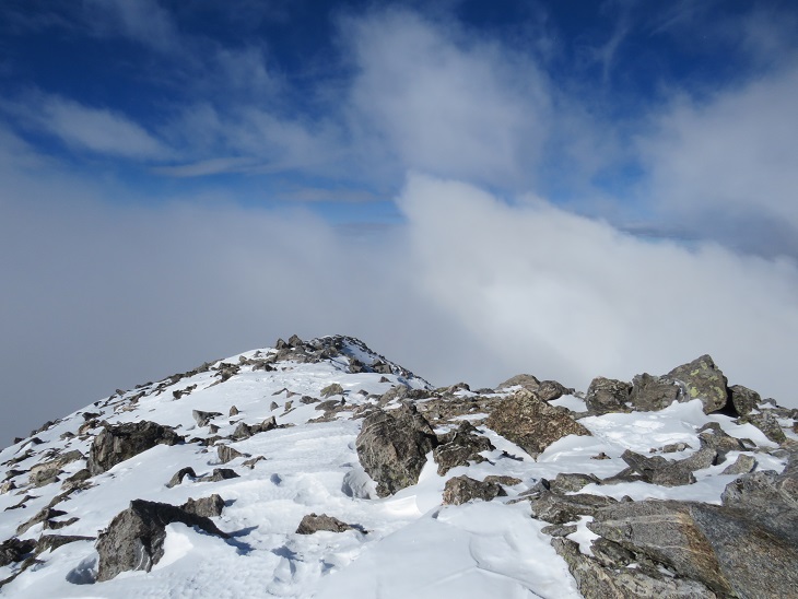
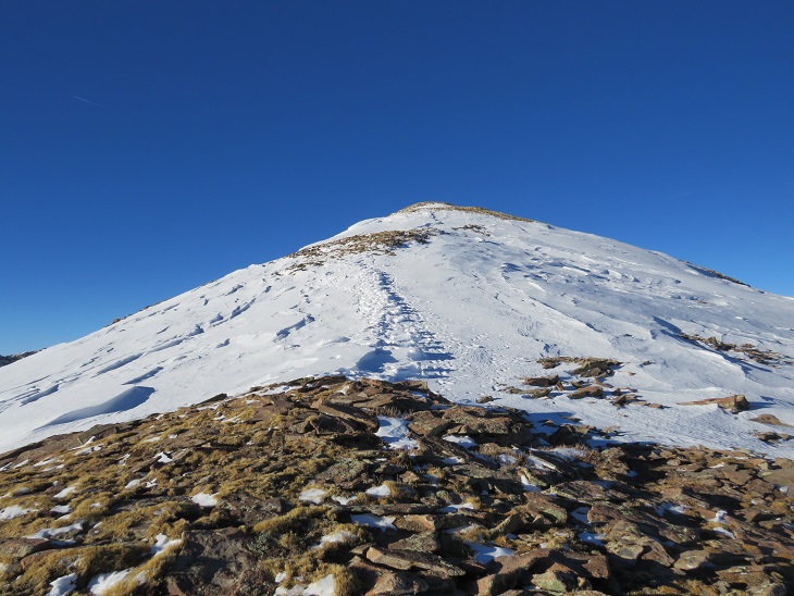
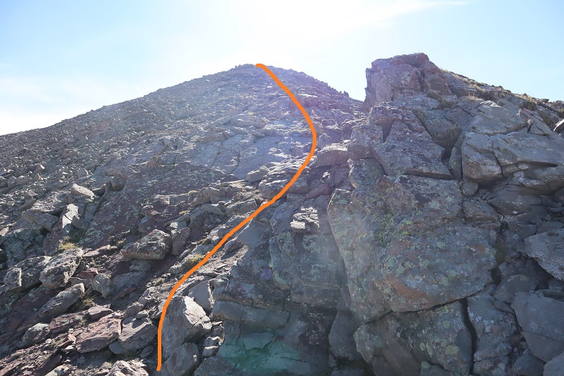
Then it was a fun scramble to the summit of Crestolita
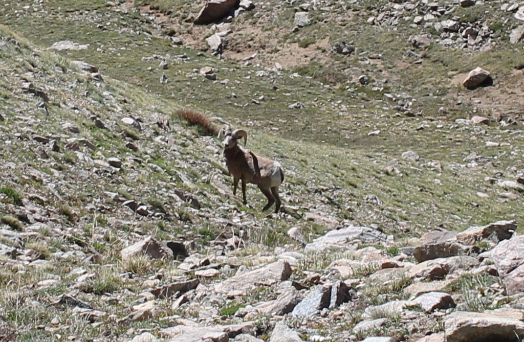
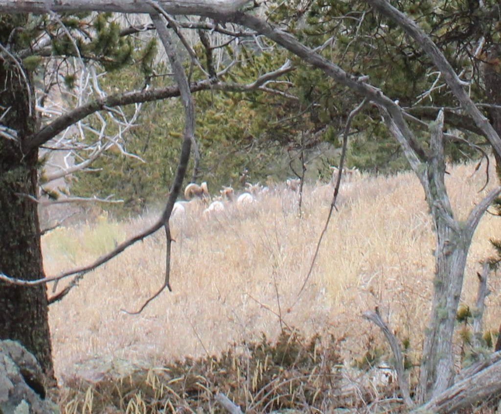
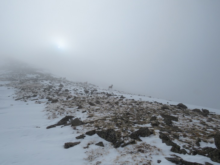
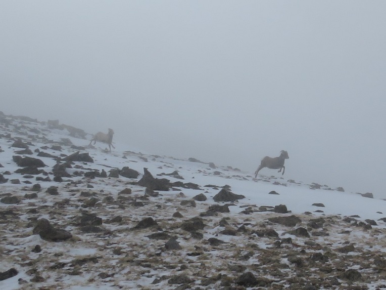
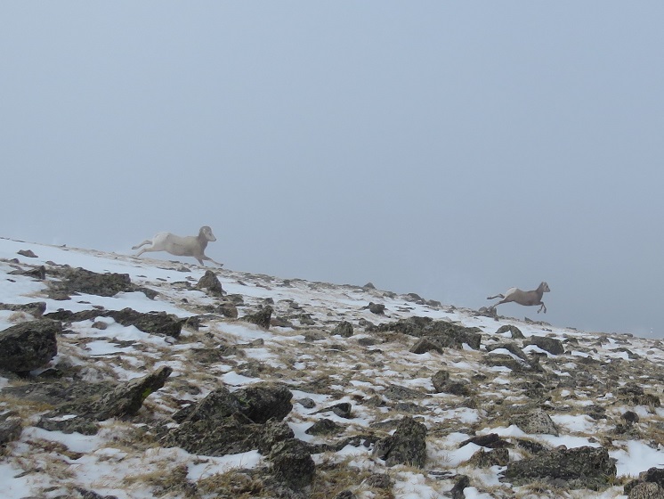
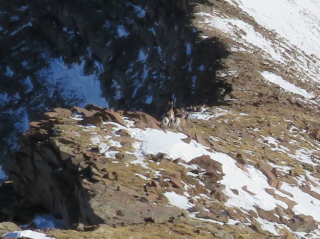
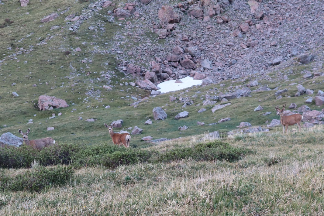
I turned back and saw a bighorn sheep watching me. She watched me for so long I eventually left her there and kept going.
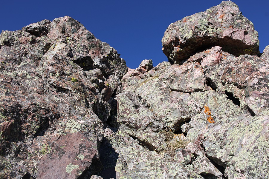
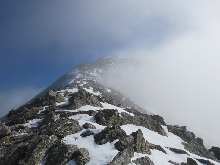
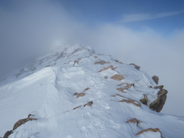
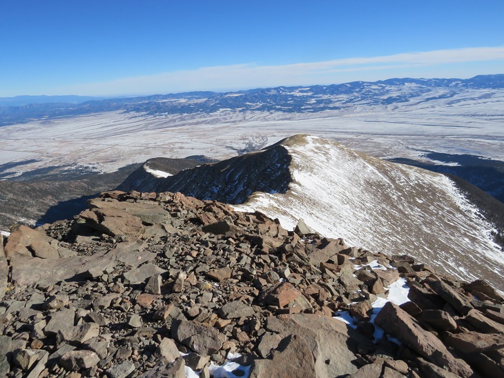
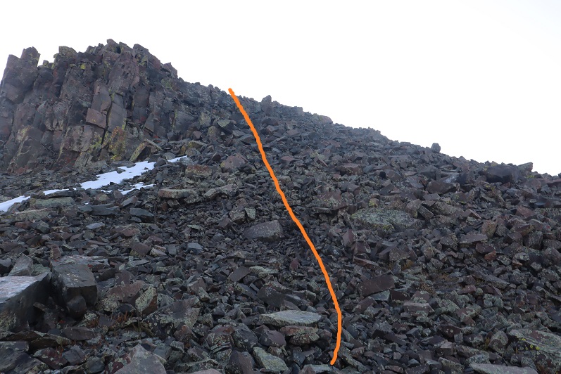
Here’s the last bit before the summit
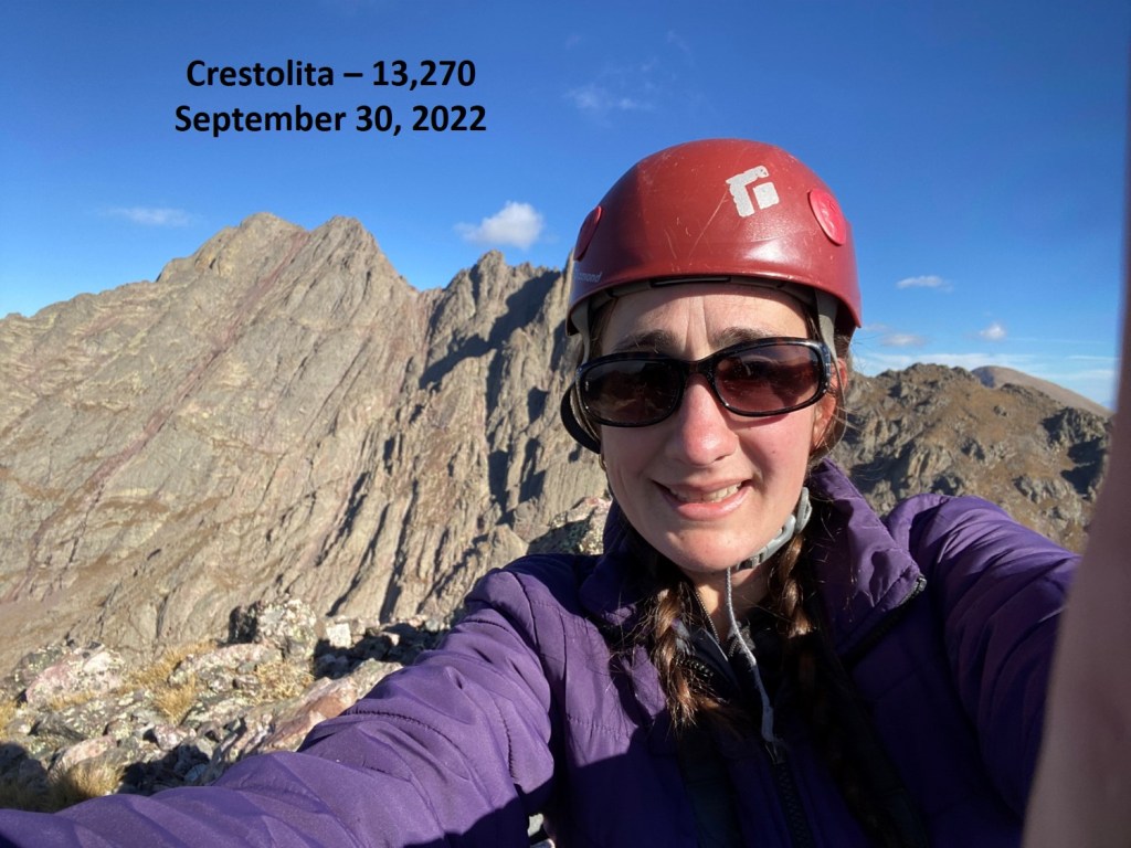
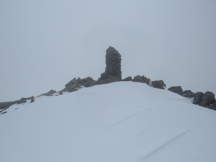
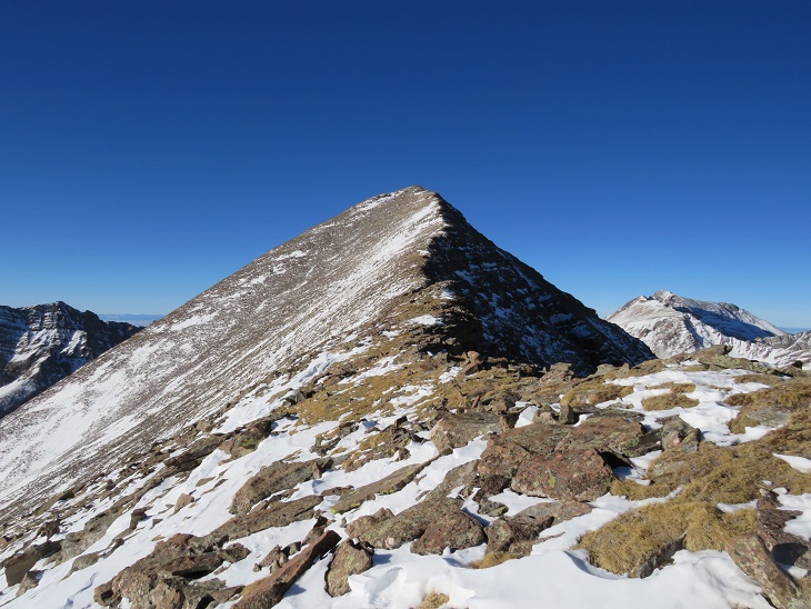
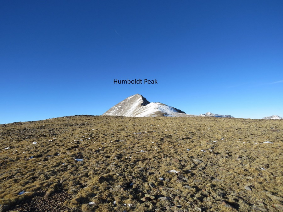
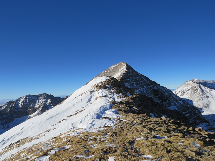
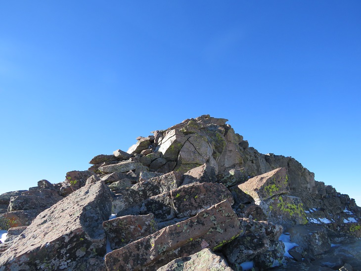
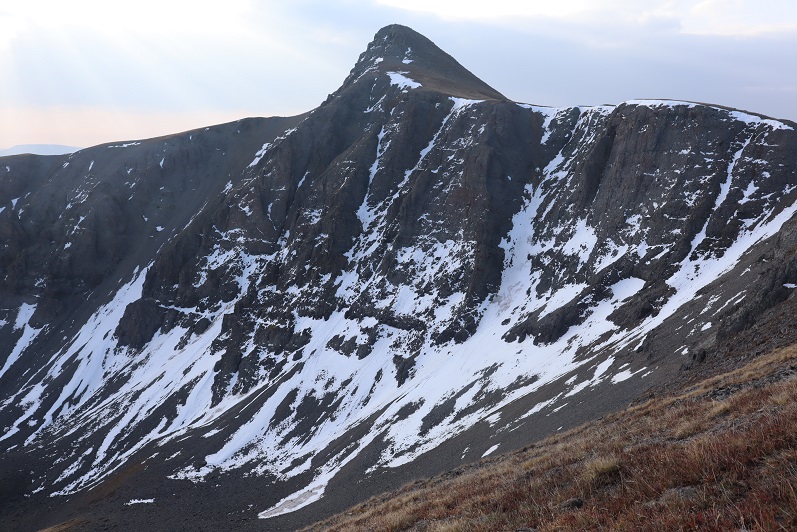
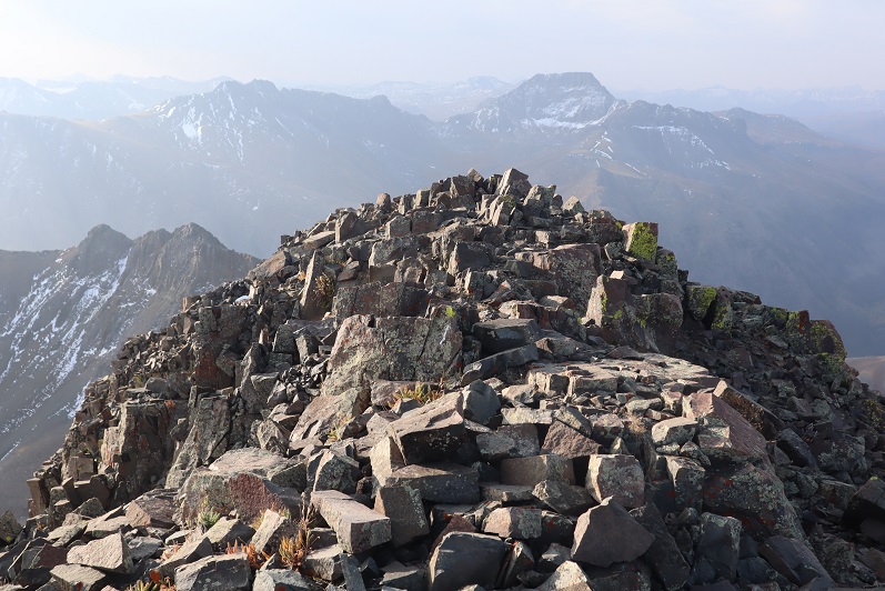
I summited Crestolita at 9:25am
Crestolita:
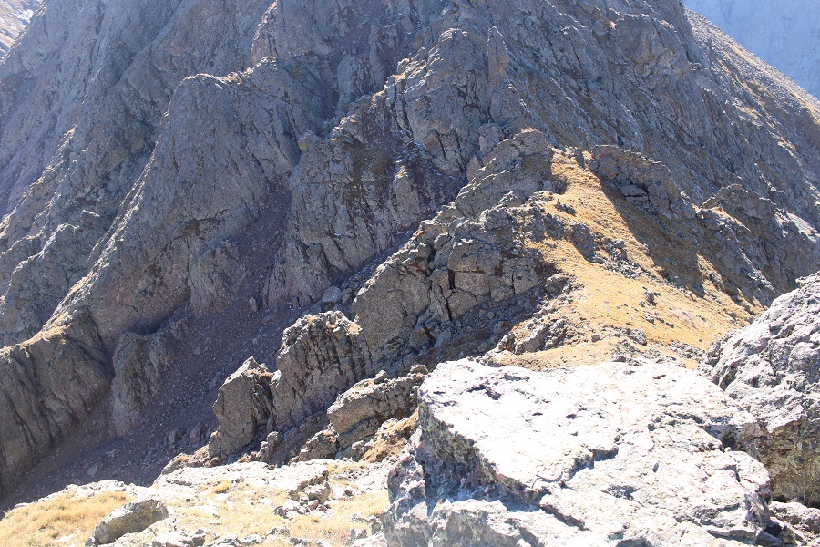
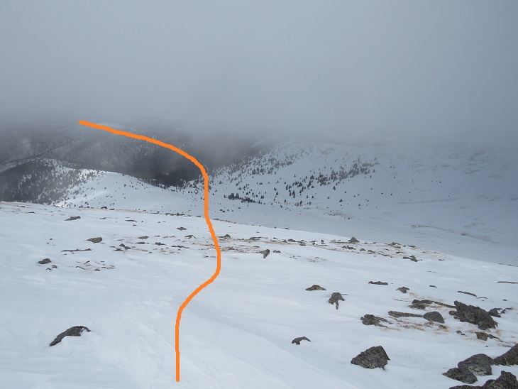
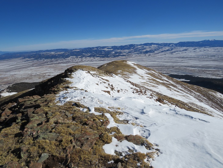
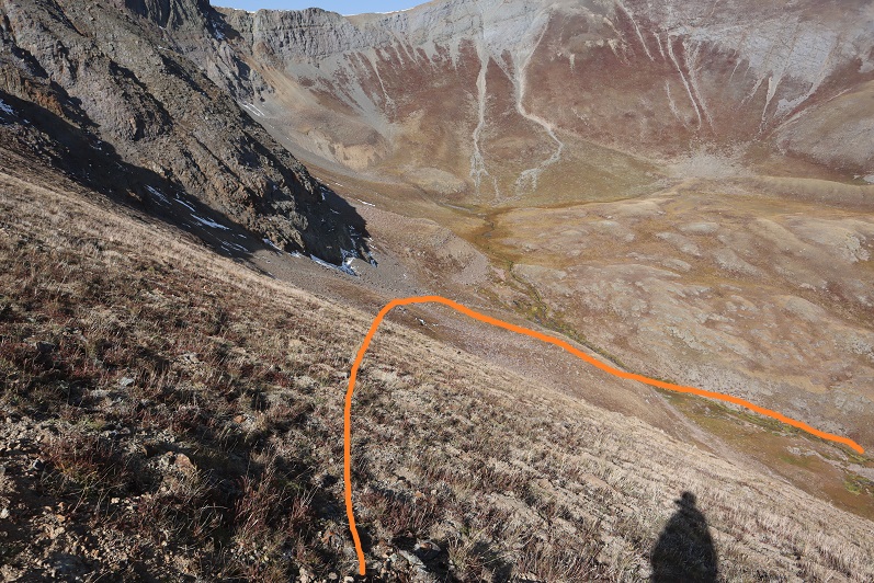
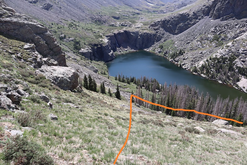
I took the gully down. There were several options to make this happen. When I had options, I went right, and wasn’t disappointed. Here are some pictures of the way I took down.
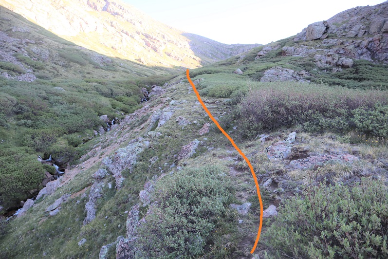
First, I made my way back to the saddle
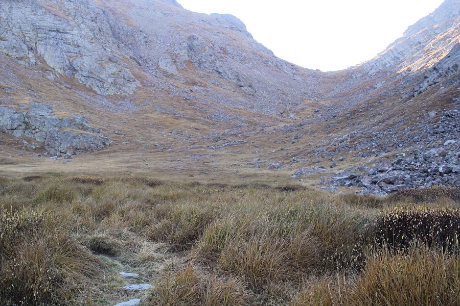
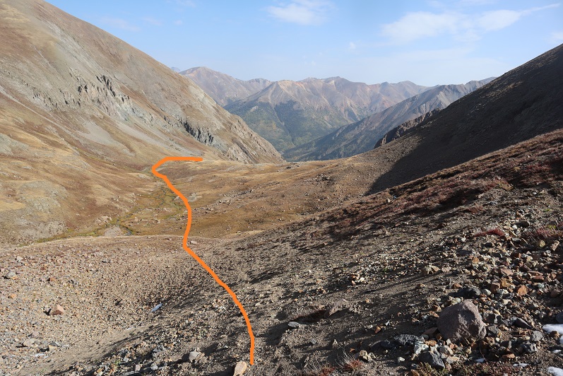
Then turned left, and followed the tundra until it turned into scree
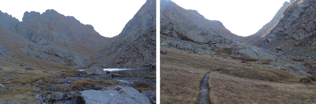
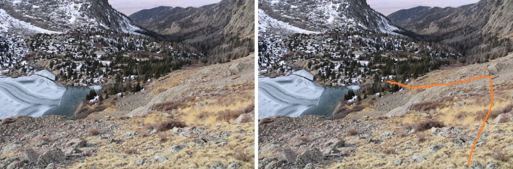
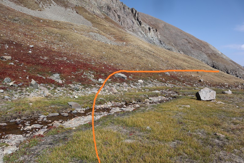
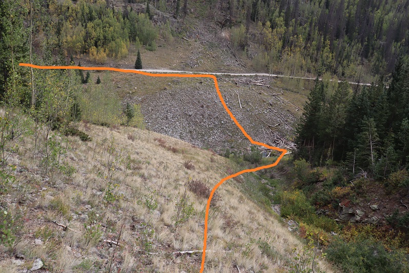
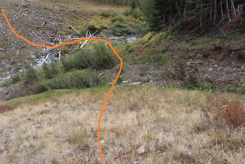
At the base of the gully, I picked up the trail again and took it towards Cottonwood Lake
I once again rounded the large boulder, then followed the cairns back to the trail
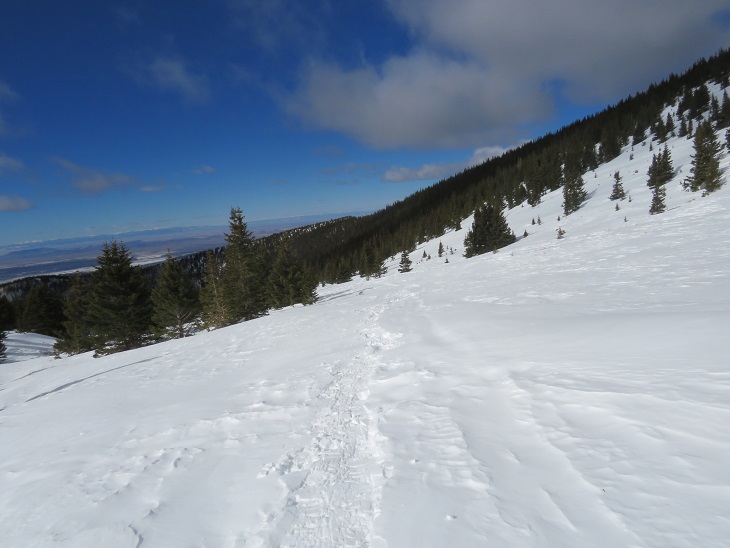
Back at the 861/743 ‘junction’, I followed the trail back down the granite slabs, and through several transition zones back to the trailhead.
I made it back to the trailhead at 1:30pm, making this a 14.33 mile hike with 4842’ of elevation gain in 8 hours.
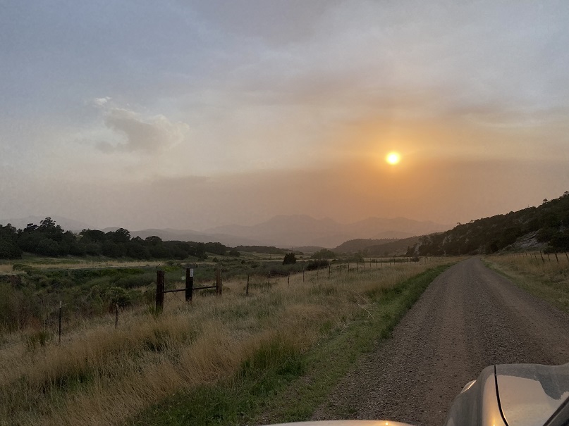
I drove in the night before to heavy clouds of smoke from the Arizona and New Mexico fires, but the weatherman predicted a cold front would push the smoke away by the next morning.
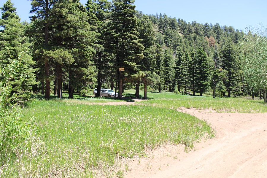
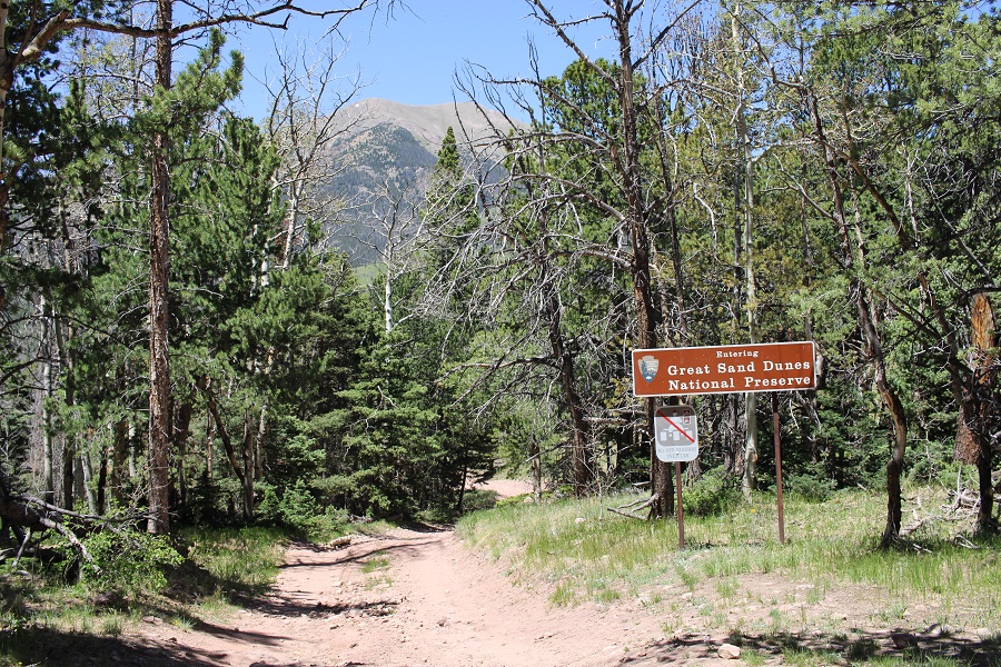
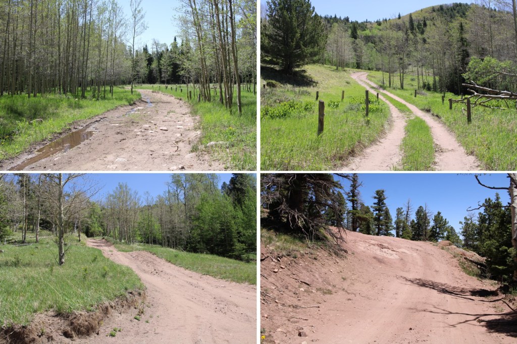
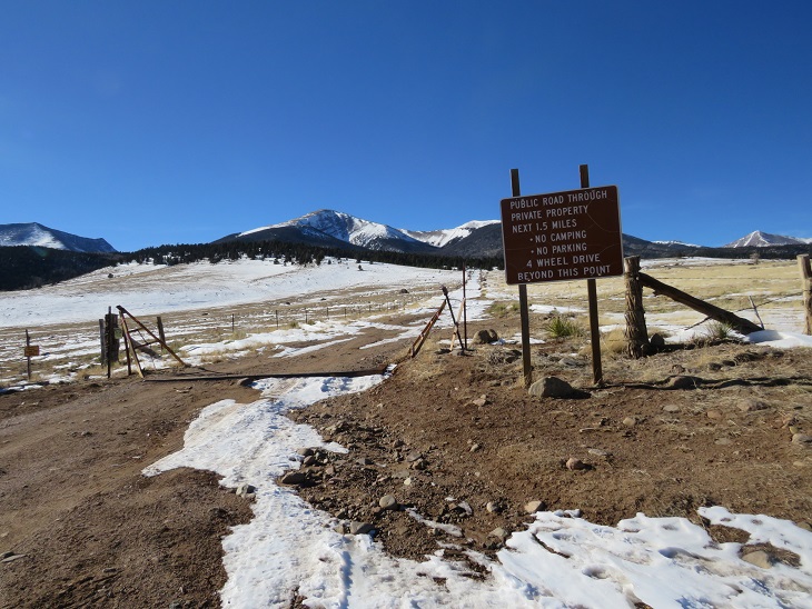
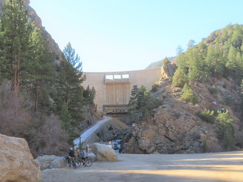
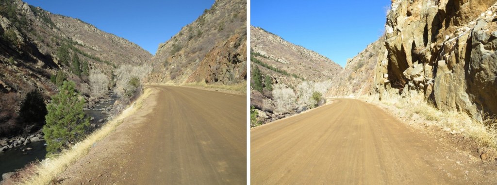
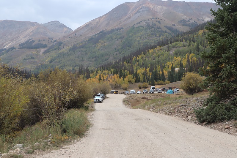
The drive in was on an easy 4WD dirt road, and probably doable in a 2WD vehicle to where I parked in the camping area before the pass.
There were private ranches on either side of the road, with bison and what looked like hunting property. There were tons of signs telling you the property was private, with information on how to report poachers. I knew Medano Pass was closed from the Sand Dunes side, but was surprised to find it was closed from the HWY 69 side as well. I parked in the camping area at 9200’, just over 2 miles from the pass. Mine was the only vehicle there, which made sense because the pass was closed. Also, it was a Monday. And extremely windy. There was quite a bit of glass on the ground from past campers who’d broken bottles and left them.
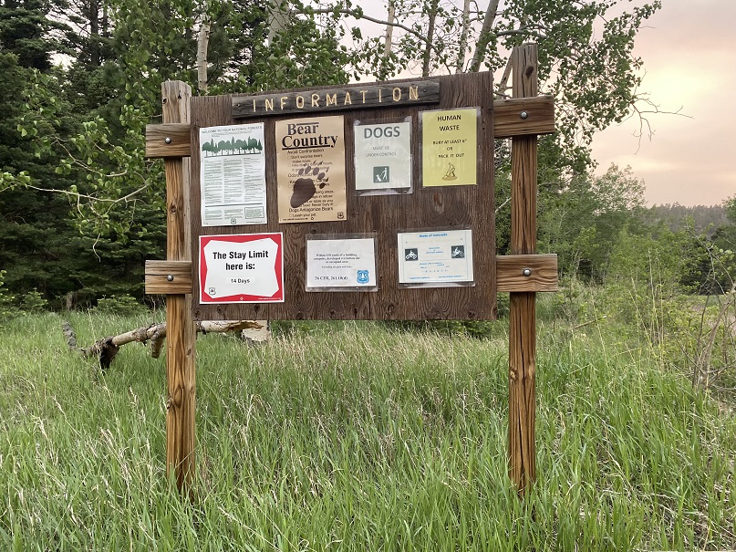
There were signs indicating bear activity in the area, which I confirmed the next morning. If you camp here, please secure your smellables/food/etc.
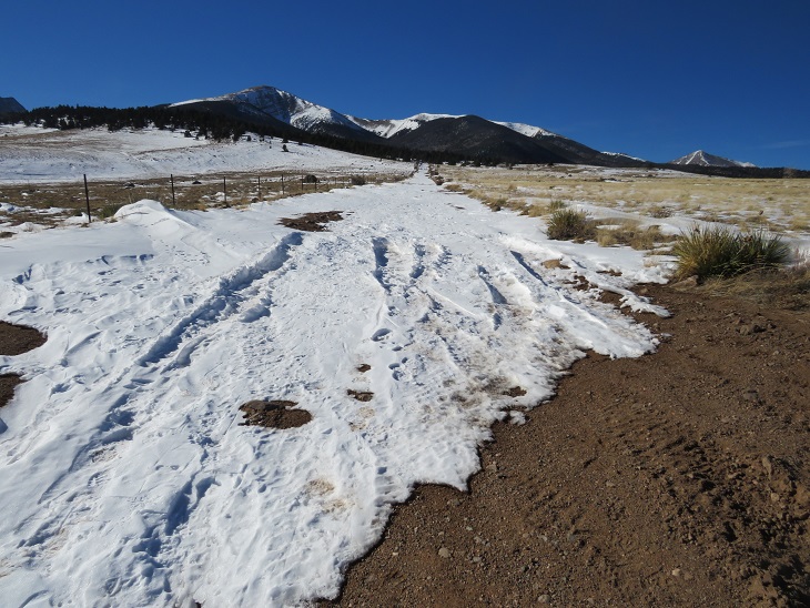
I made it to my campsite late (but it was worth it because my youngest daughter, who’s in college, called to chat with me a bit on my way in, and I had to stop where I had cell reception), so I made it an early night for what would be an early morning. I was up and on the trail at 3:30am.
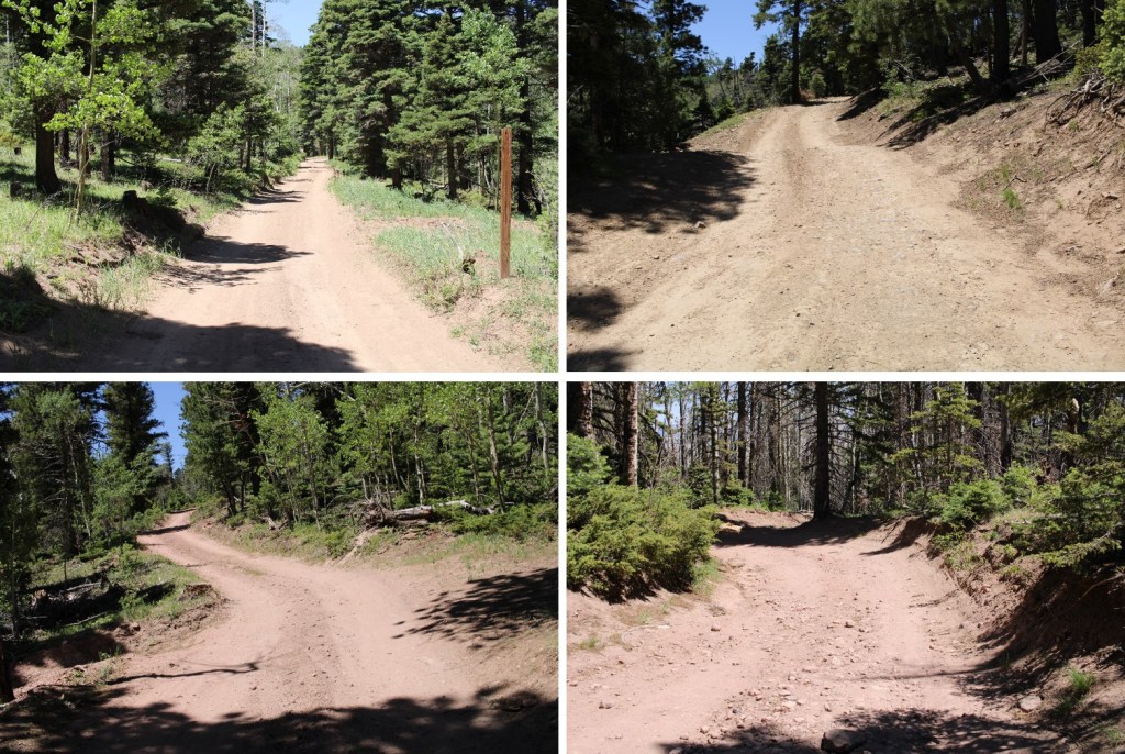
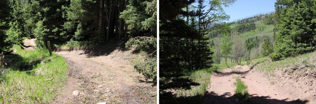
I started by following 559 west to Medano Pass. There were a few campsites along this road, but very few turnaround points. This is now a 4WD road.
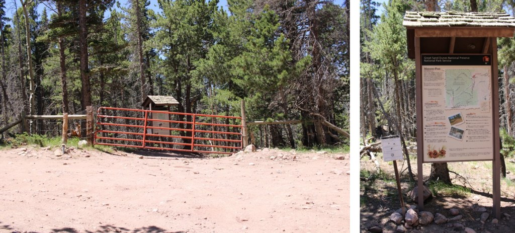
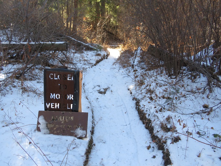
Once at Medano Pass I found the gate closed to vehicles. I hopped over the gate, and continued towards the Medano Lakes Trailhead.
Along the way there was a sign warning of bear activity
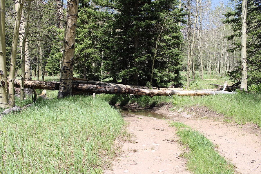
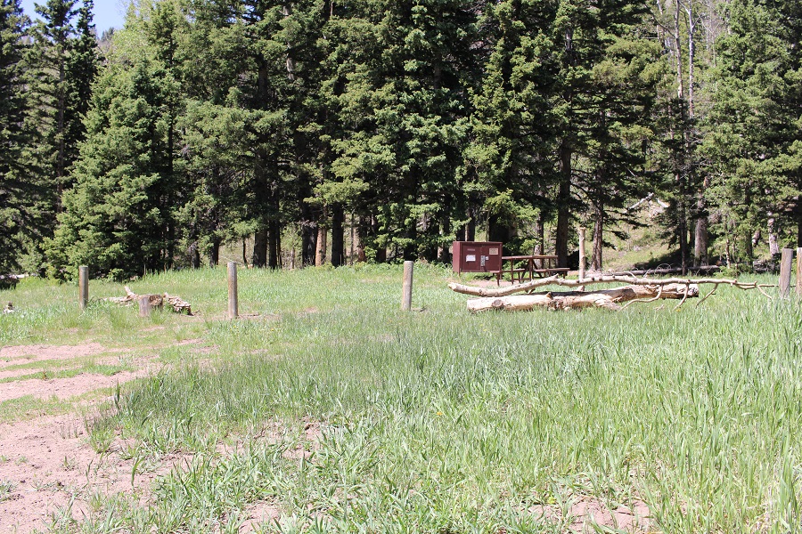
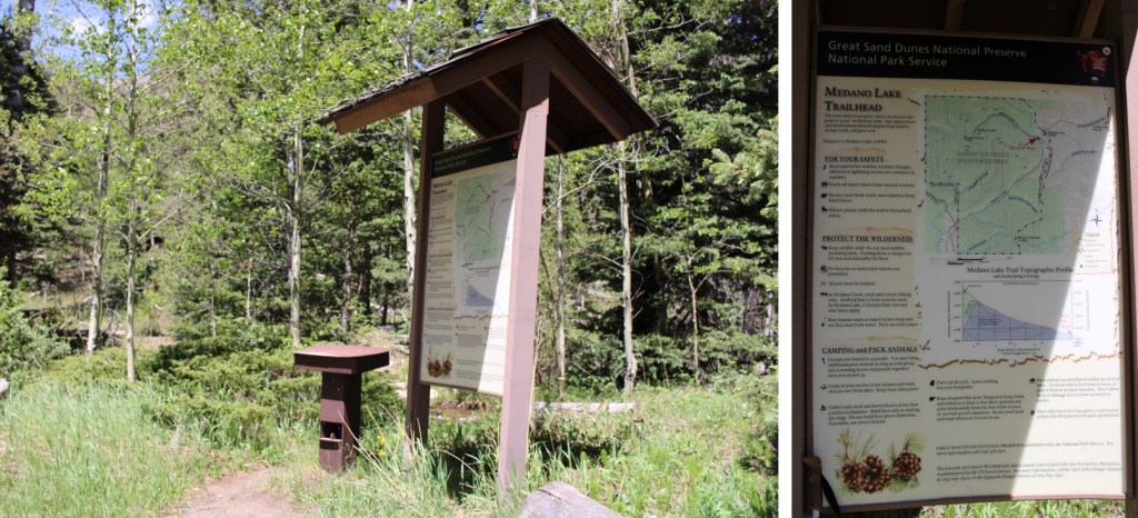
After hiking for 2.9 miles, I made it to the Medano Lakes Trailhead. Note if you’re driving, there are still several downed trees on the road, so you won’t be able to make it all the way to the trailhead. There are several campsites along the way with bear boxes.
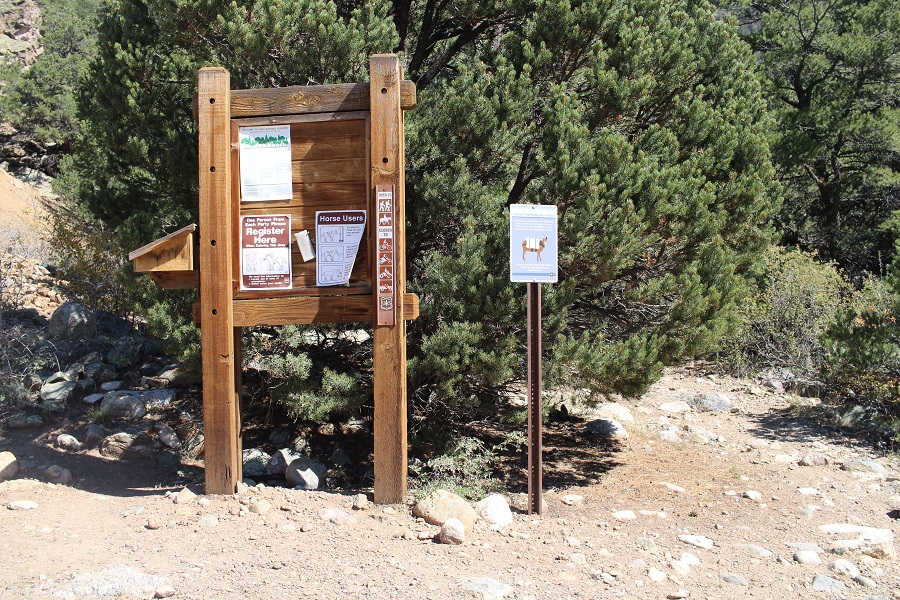
I signed the trail register and was on my way
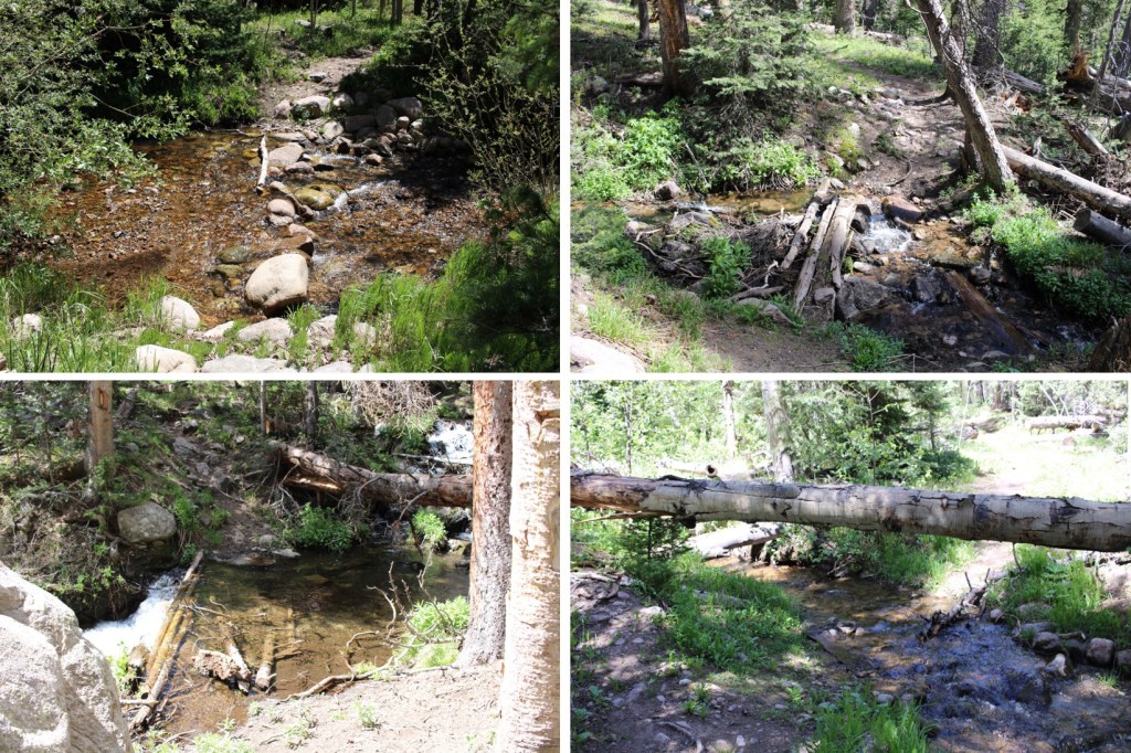
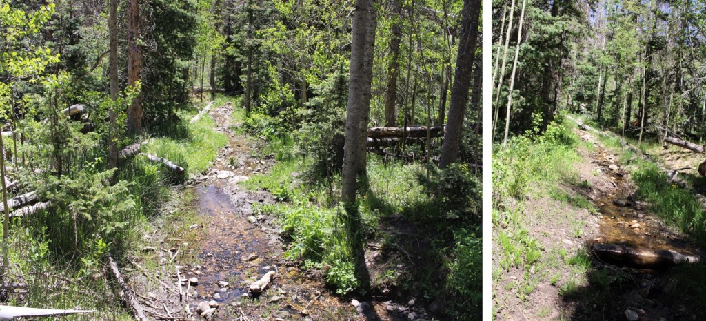
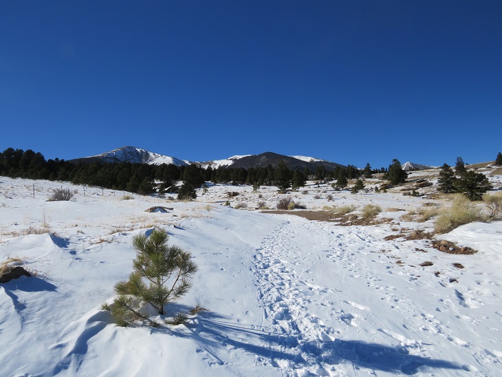
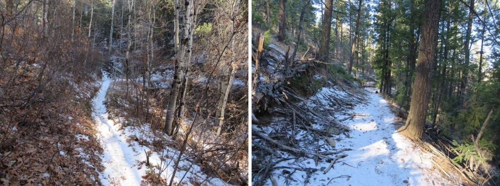
A couple of things to note: This is a class 1 trail, and mine were the first footprints in the mud/snow. There was a lot of evidence of bear activity, I crossed numerous streams (easily, no need for creek crossing shoes) and there was a lot of downfall. I mean, an excessive amount. Several times I was walking UNDER avalanche debris. These were also spring conditions, so a lot of times, the trail was under water/snow.
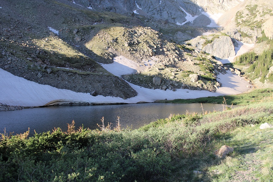
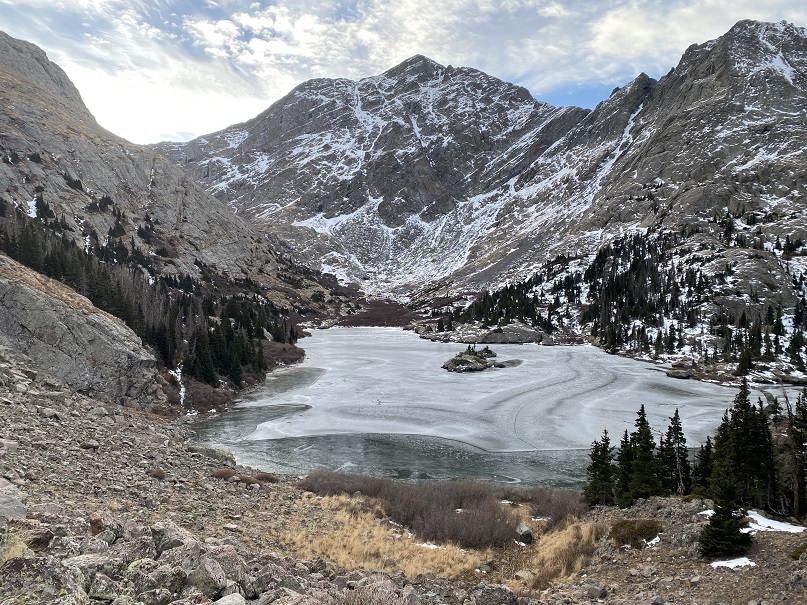
After hiking for 6.75 miles, I made it to treeline, the upper basin, and Medano Lakes
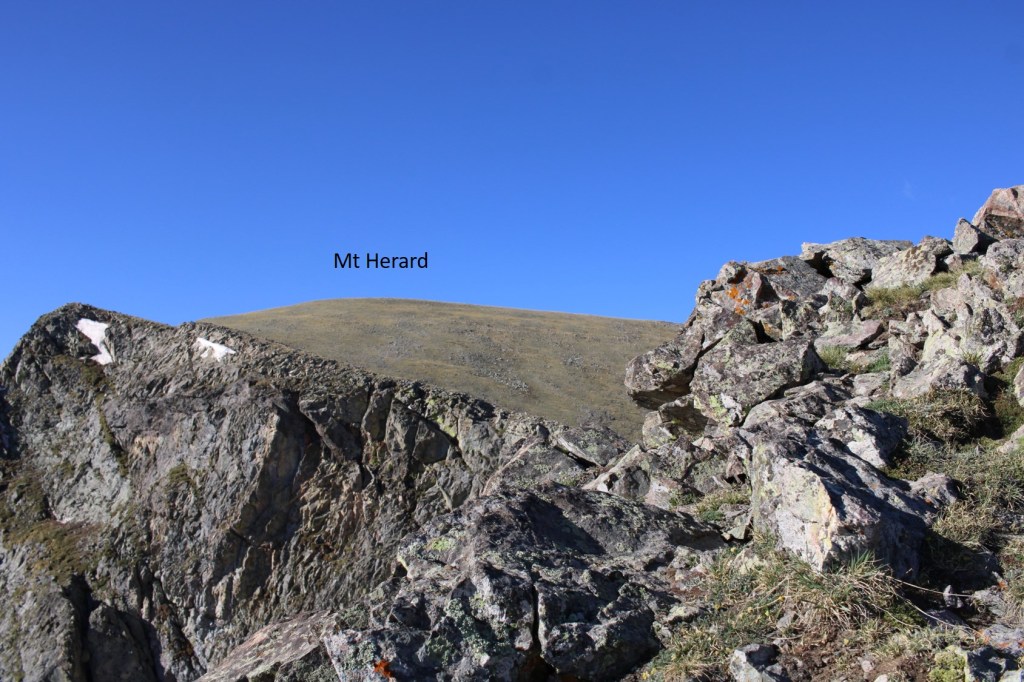
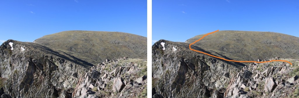
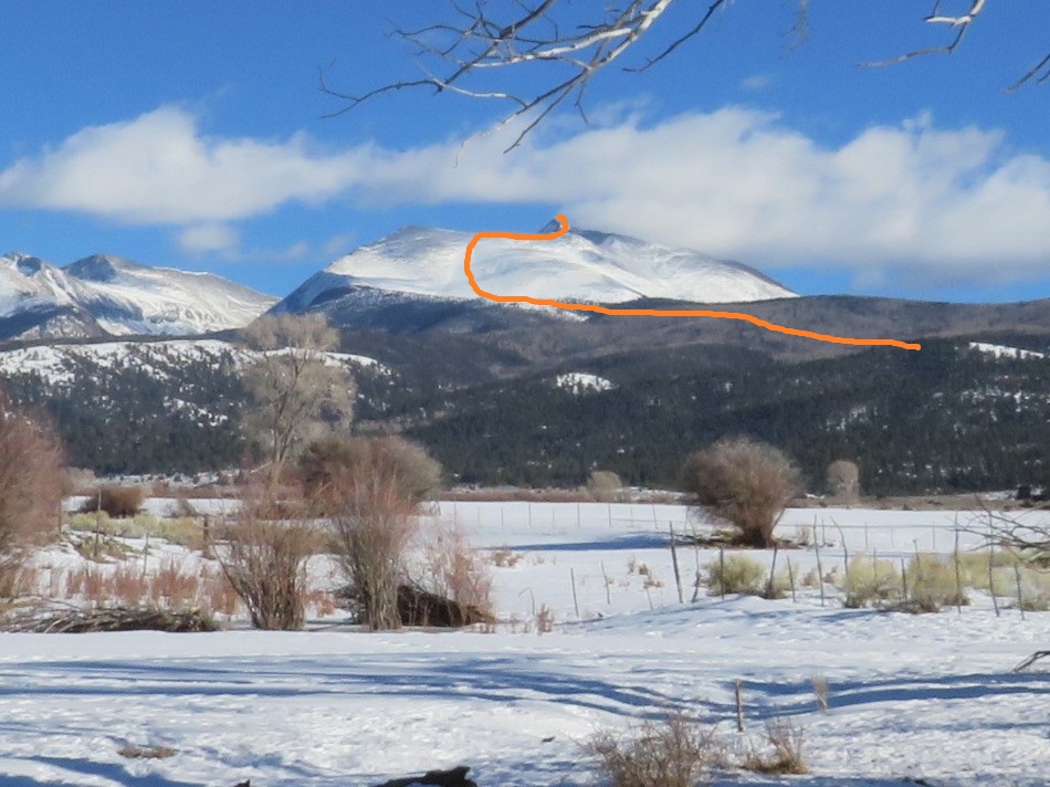
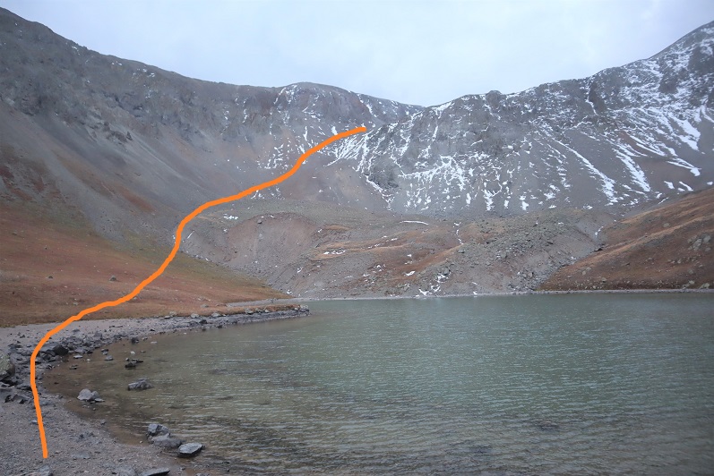
At 11540’, I left the trail and followed a faintly cairned route to the saddle of Herard and Medino. This is where I was aiming
There’s a faint trail that’ll get you to the upper basin
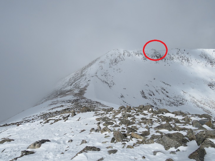
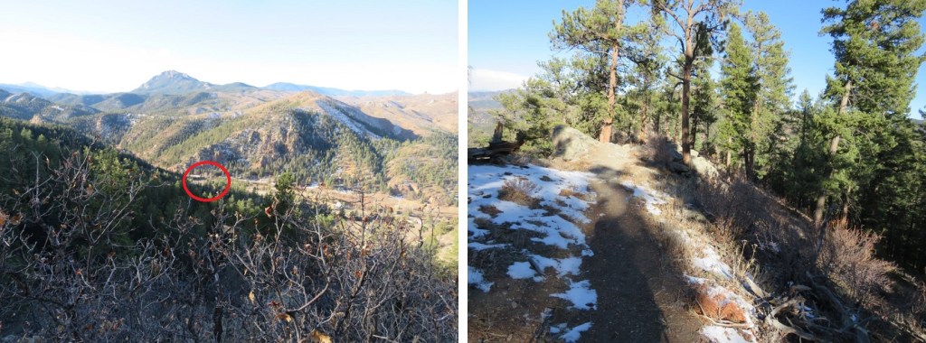
Just before the upper basin there are two cairns you’ll pass through. Take note of them for the route down
Now in the upper basin, the trail is gone for a bit, but there are cairns that will lead you to the saddle, and even a trail. This is the easiest way to make it to the saddle
The cairn you’re aiming for is circled in red
I decided to do Herard first, so after making it to the saddle, I followed the ridge south. There was a false summit, but this (and in fact the entire hike) was all class 2.
Here are some pictures of the terrain
And the false summit.
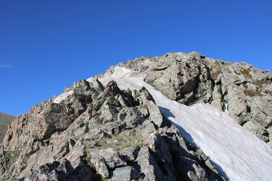
There was a bit of snow to navigate (nothing too serious) and then I followed the tundra (and a faint trail) to the summit.
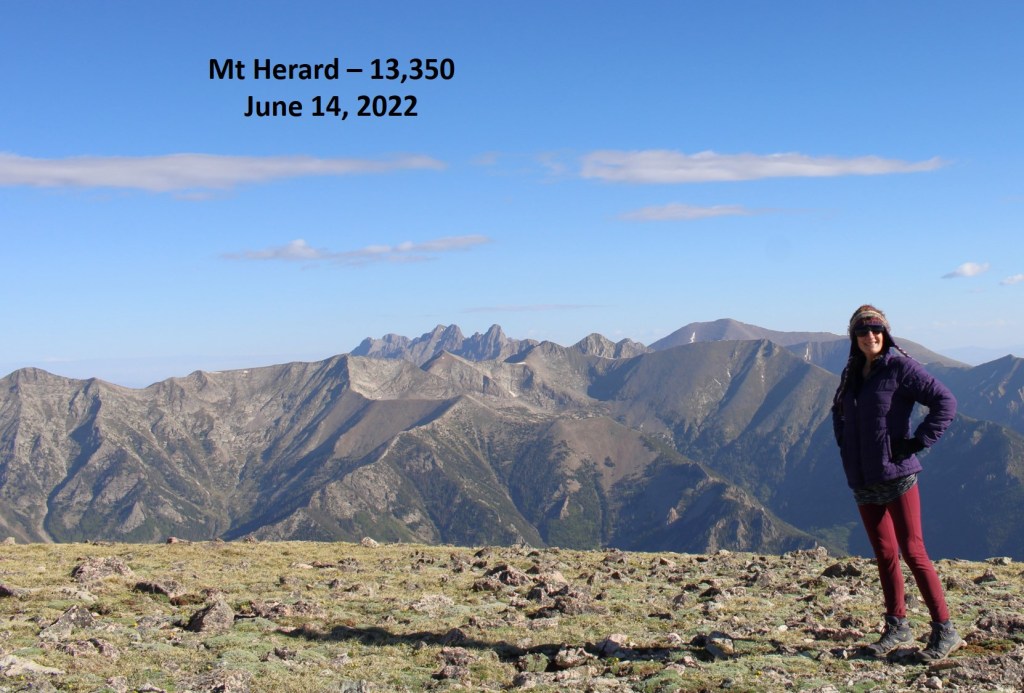
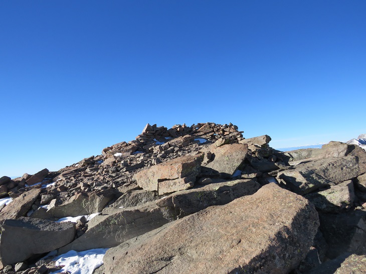
The summit was flat. I summited Mt Herard at 8am
Mt Herard:
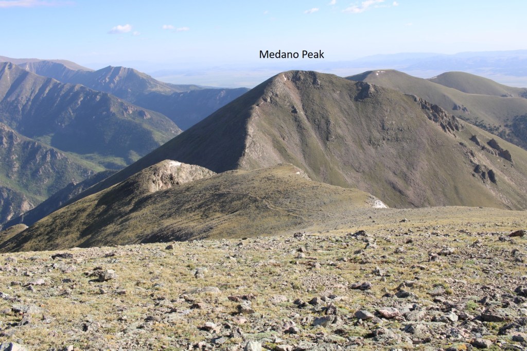
I turned and headed back to the saddle. My next objective was Medano Peak
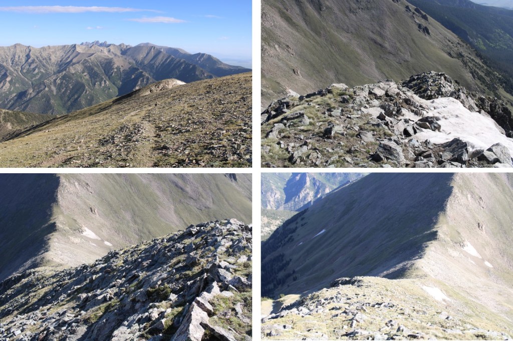
This was also a class 2 ridge walk. Here are some step by step pictures
Also, you might be able to see them in this picture… I came across 5 elk, who weren’t too concerned I was there, until I started hiking up from the saddle. At this point, they headed higher up, towards 13,000’. I was curious, until I noticed they were gathering their 5 babies, who were hidden amongst the rocks. They couldn’t have been more than a month old. Then the mothers trotted them off along the ridge.
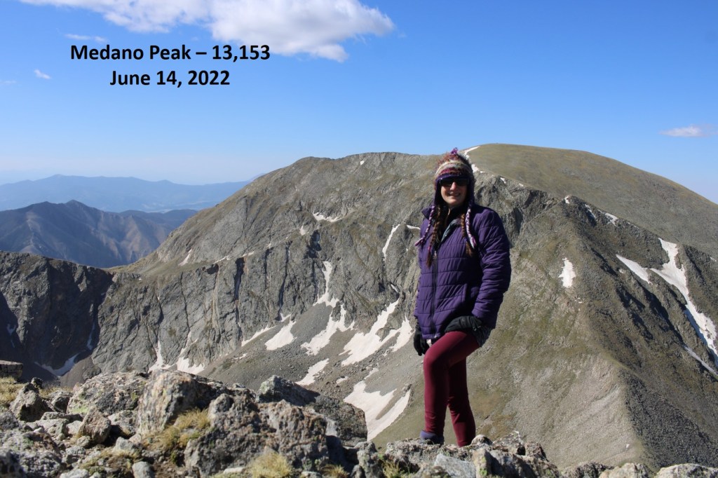
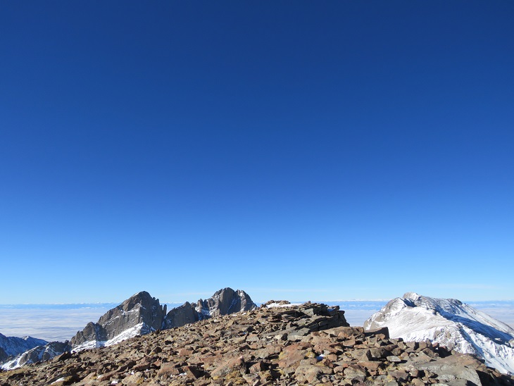
I summited Medano Peak at 9:05am
Medano Peak:
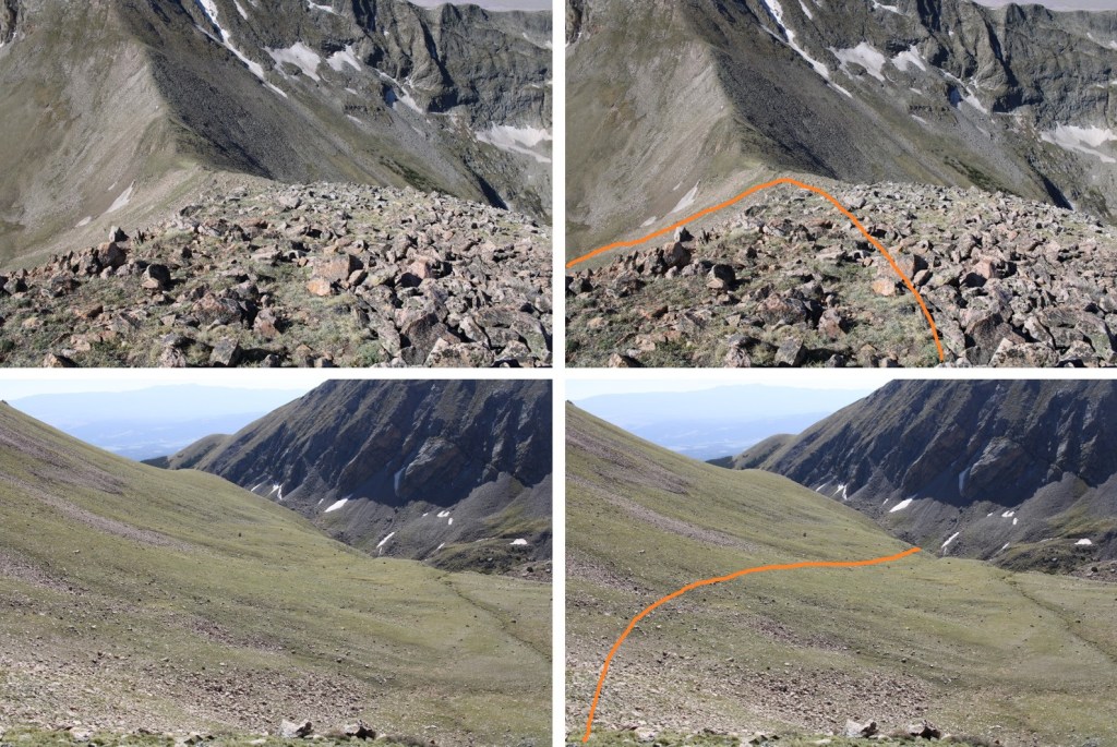
Here’s a look at Mt Herard from Medano
I retraced my steps back down to the saddle, and into the lower basin and Medano lakes
It was a super windy day (predicted winds of 45mph). As I was hiking I was able to notice a bighorn sheep ram below me. Since it was so windy, he didn’t notice me until I was right up on him.
Bighorn:
He trotted away as well, and I hooked up with the Medano Lakes trail, which took me back to the trailhead
And then I followed road 559 back to my truck
I made it back to my truck at 12:30pm, making this a 17.43 mile hike with 5584’ of elevation gain in 9 hours.
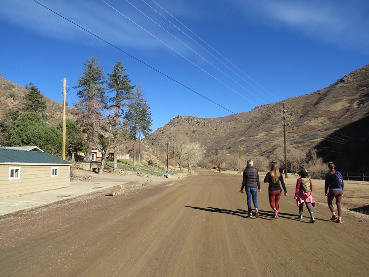
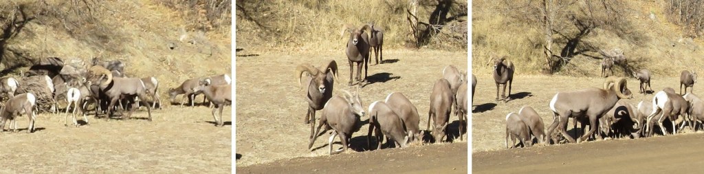
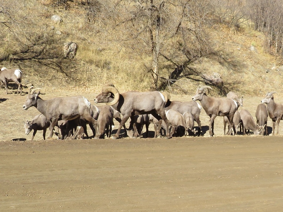
I just love the local herd of bighorn sheep in this area! I’ve seen them a few times, usually up at Willow Lake. It’s neat watching the babies get bigger. They greeted me this time on my way to the Willow Lake trailhead.
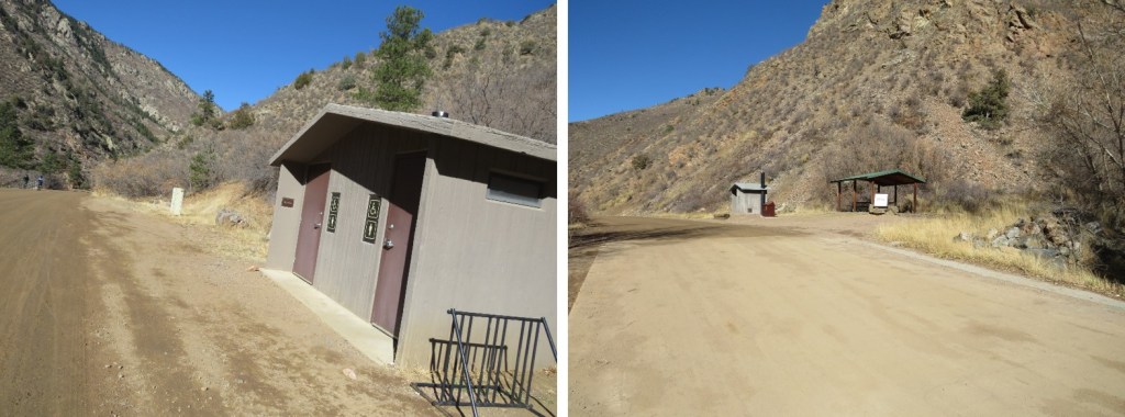
The trailhead was deserted for a Friday afternoon. I sat back, ate some peanut butter off a spoon, sipped some whiskey, and jotted down notes from the day. The bathrooms were still open, clean, and stocked.
Before making it an early night I pre-signed the trail register, red a bit, and headed to bed. I’m so darn comfortable sleeping in the bed of my truck, it’s difficult to get up and out in the morning. Oh, and I ‘installed’ new lights, if anyone’s interested:
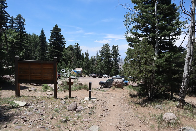
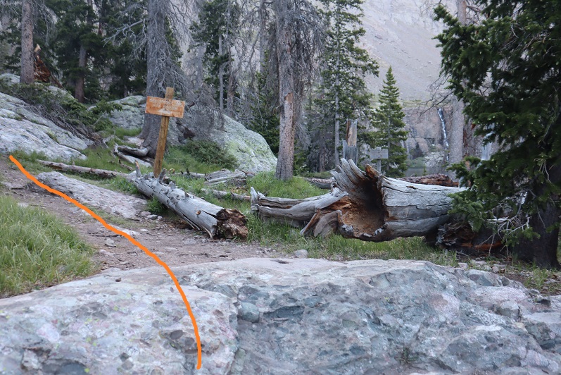
The South Crestone trail starts from the same area as the Willow Lake trail.
The trails quickly diverge, and I followed the South Crestone trail, heading northeast.
The South Crestone trail (860) is a class 1 trail that will lead you all the way to South Crestone Lake, without any junctions.
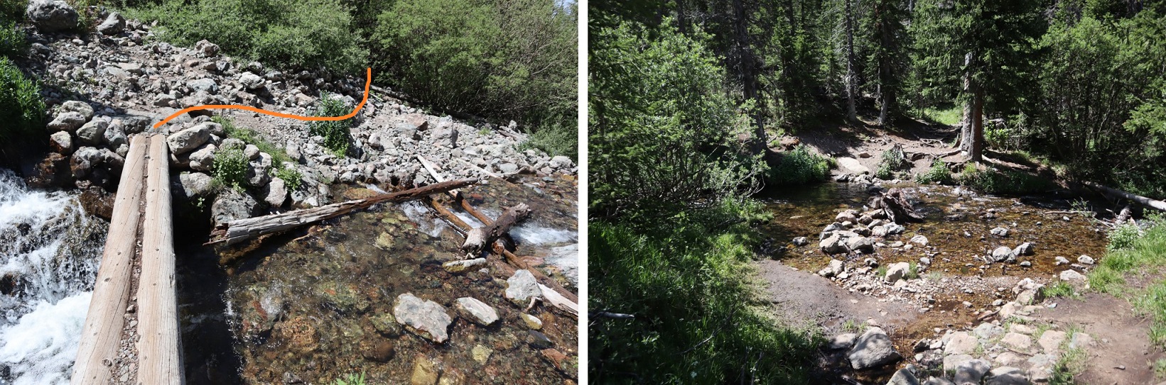
After hiking for 1.6 miles I passed an old log cabin, and started switchbacking up the hillside.
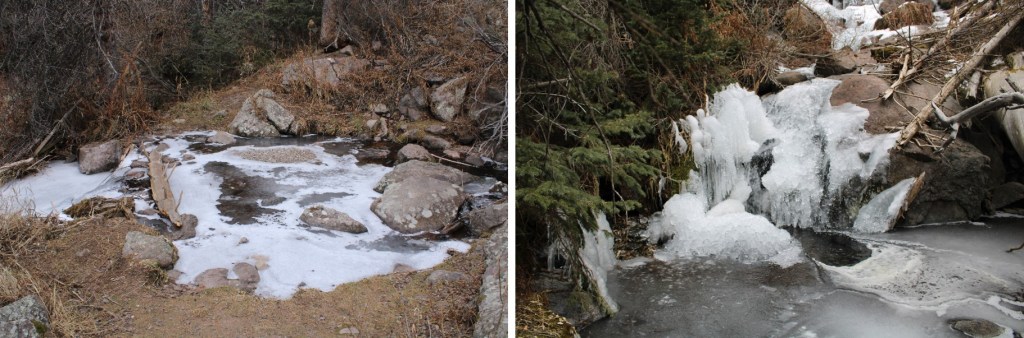
At the top of the swithcbacks the waterfalls started. They were located alongside the trail, but didn’t impede the actual trail. Since it was cold this morning, the ice never got a chance to melt (these pictures were taken on my return).
I came to a meadow, and then switchbacked up to the lake
I always know I’m close to the lake when I see the “no camping or livestock within 300 feet of lake” sign.
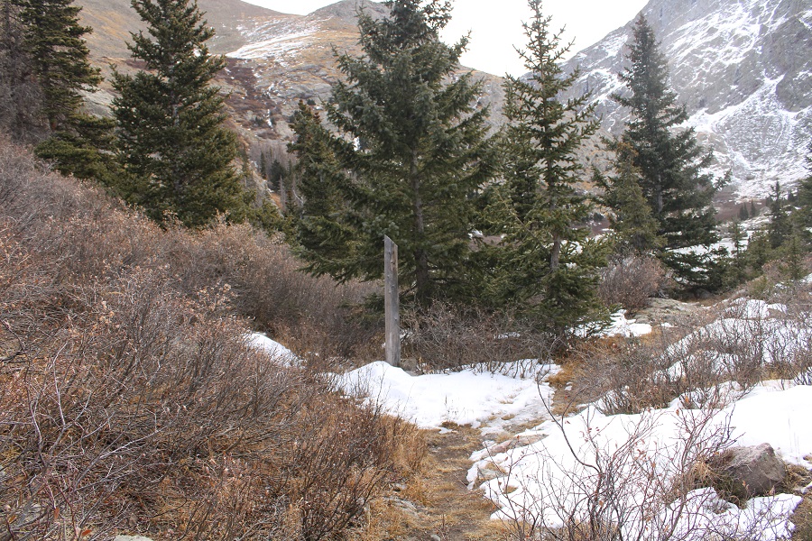
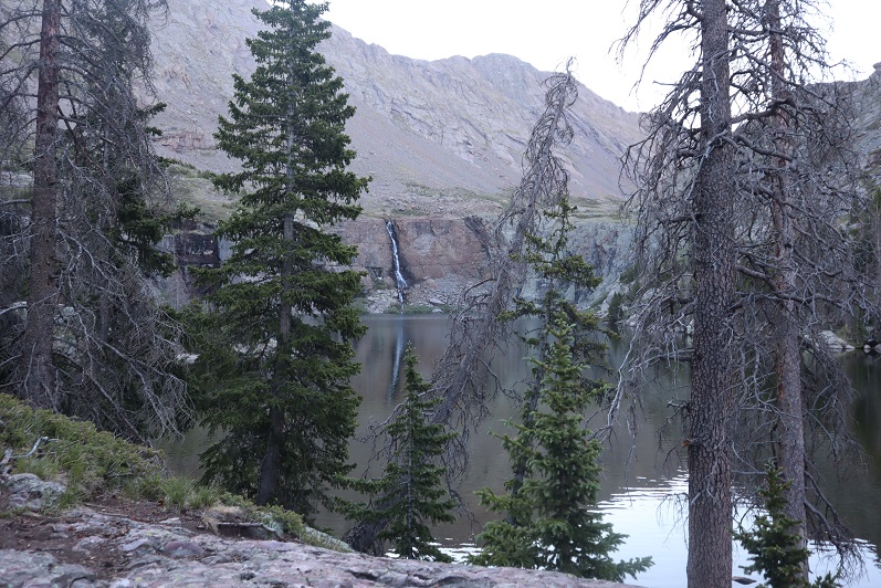
After hiking for just over 5 miles, I made it to South Crestone Lake
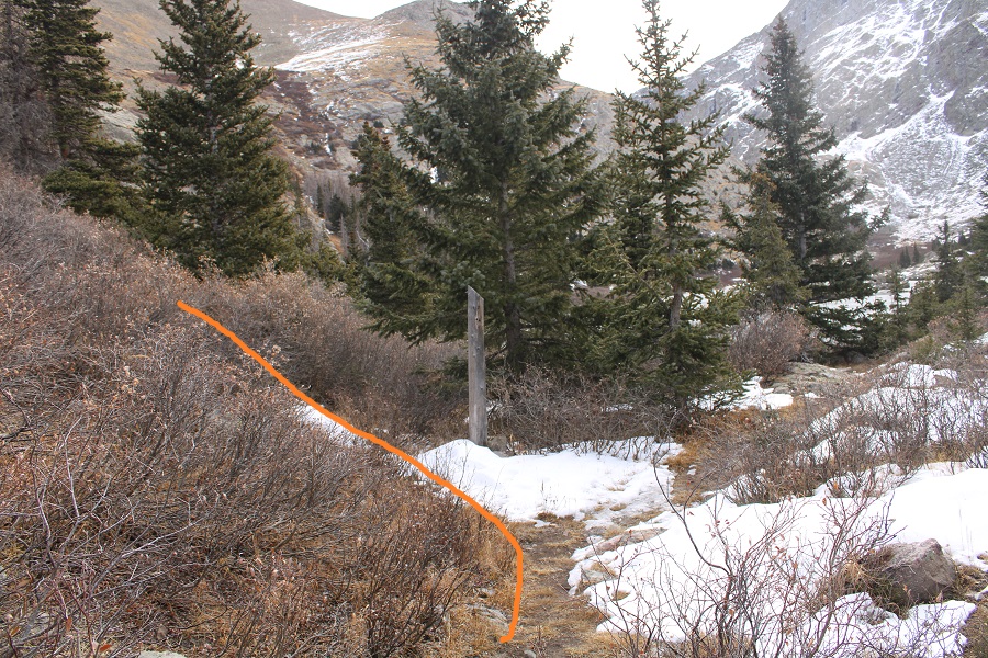
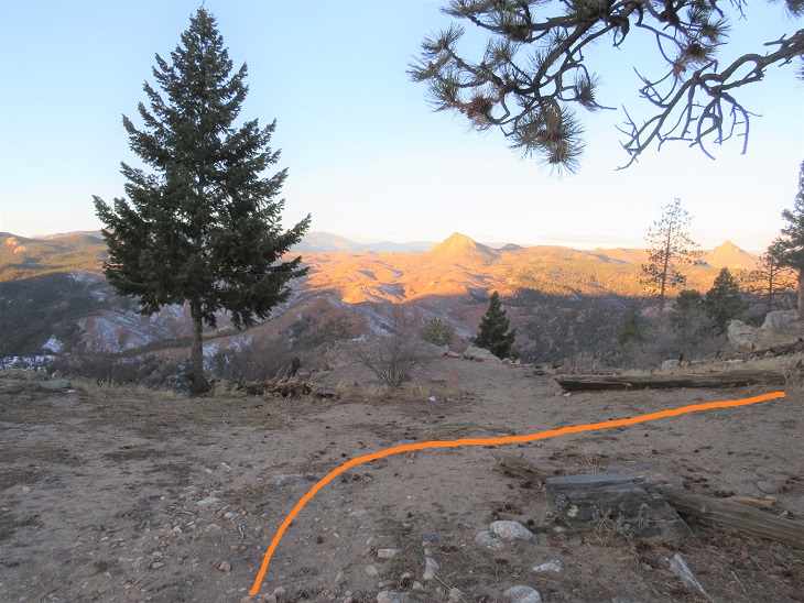
I’d gone too far, but on purpose: I’d wanted to see the lake. About 5 yards before the lake, there’s a post near the trail. I’m sure it was informational at some point, but now it’s just a post (and difficult to miss).
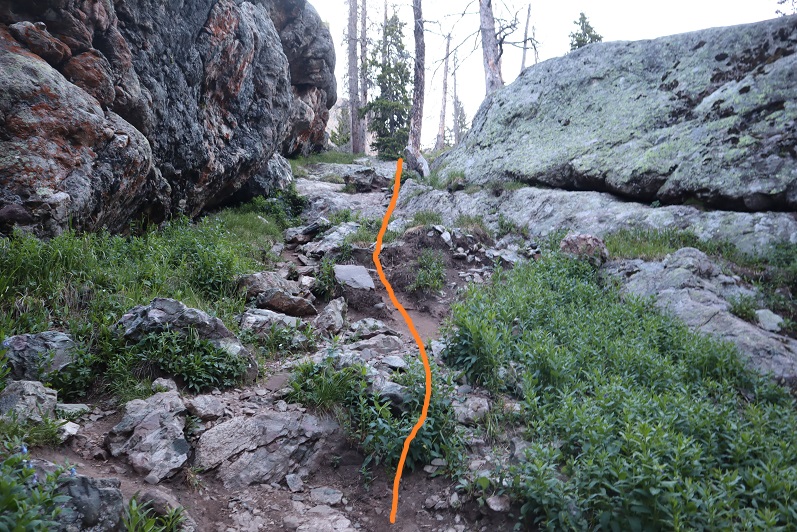
At this post I turned left, leaving the trail. From here on out, it was a class 2 hike.
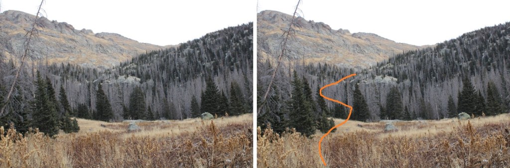
As soon as you leave the trees, you have a great visual of the rest of the hike
Here’s the route I took to the summit of PT 13153
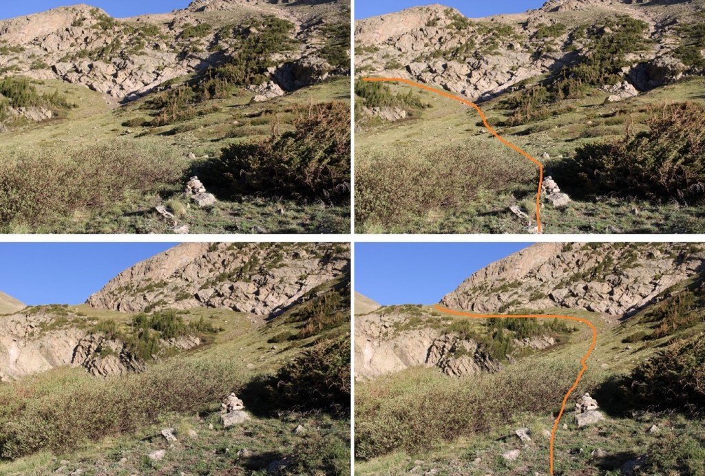
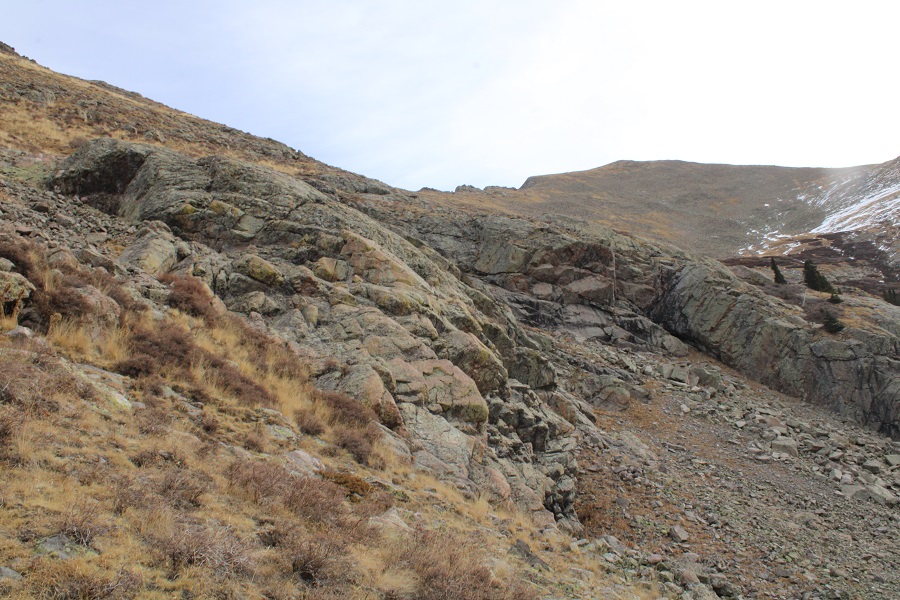
First, I ascended this rocky/willowy/tundra filled gully. Note the rock circled, as it will be your visual cue when you exit.
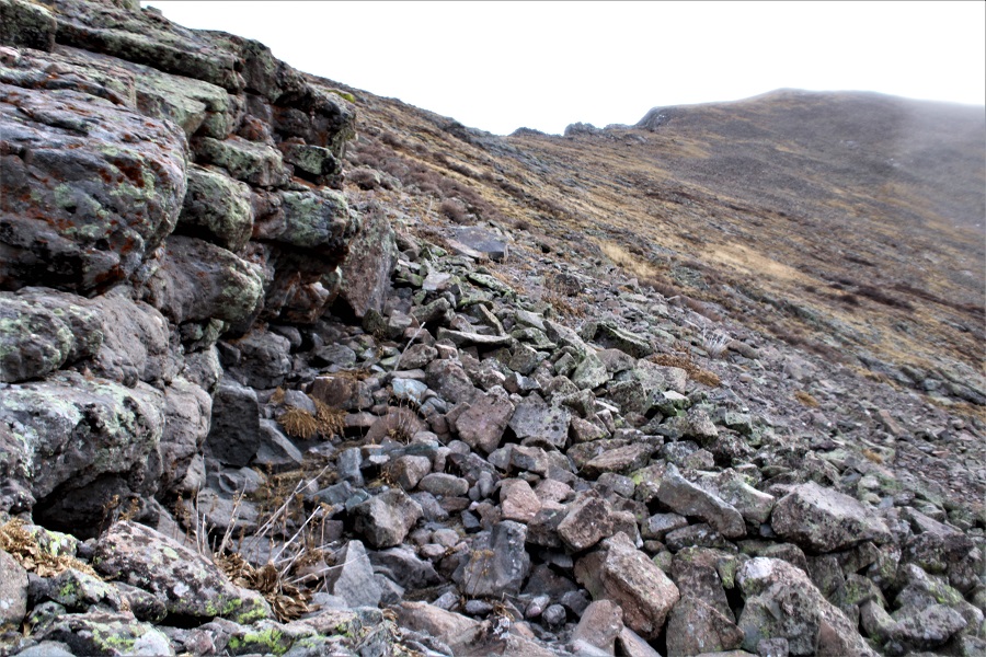
At the top of the gully, I stayed on the tundra, avoiding the rock outcroppings both above and below. But was unable to avoid the willows. I just aimed diagonally for the first pile of rocks on the ridge I could see. There’s no reason to try to ascend directly to the ridge; just keep aiming northeast.
Staying on the tundra will help to avoid rock-hopping
Once on the ridge, it was a simple hike to the summit
I summited PT 13153 at 8:45am. It was cold.
PT 13153:
There were some great views of the Crestones
There was a summit register, but it was too cold for me to attempt to open it. Have I mentioned it was cold and windy? I wanted to get down off the ridge asap.
Here’s an overview of the route back to the lake. Remember, just aim for that big rock that signals your decent down the gully
Here are some pictures of the way back to that large rock
Once at the large rock, I descended back down to the lake
This brought me to the class 1, South Crestone Trail, which I followed back to the trailhead
I was really surprised at all the witch’s hair I saw on the trees. It’s completely taken over in some parts. In the dark I’d thought the green were pine needles: Not so.
As I rounded the corner, just before descending down the switchbacks to the cabin, a herd of bighorn sheep darted across my path, kicking up dust and thundering down the hillside. They were too quick for a good picture, but I was 100% sure it was the same herd I’d seen yesterday, and last time I was at Willow Lake (we’ve bonded). I’ll add this to my growing list of wildlife ‘butt’ shots.
Here are some more pictures of the trail back to the trailhead
I made it back to my truck at 11:30am, making this a 12.1 mile hike with 4530’ of elevation gain in 6 hours, 30 minutes.
Today had been much easier than anticipated. I was done earlier than expected, which was great! Now to head home; my daughter comes back from college for Thanksgiving break tonight, and I want to have her favorite dinner ready for her when she arrives!
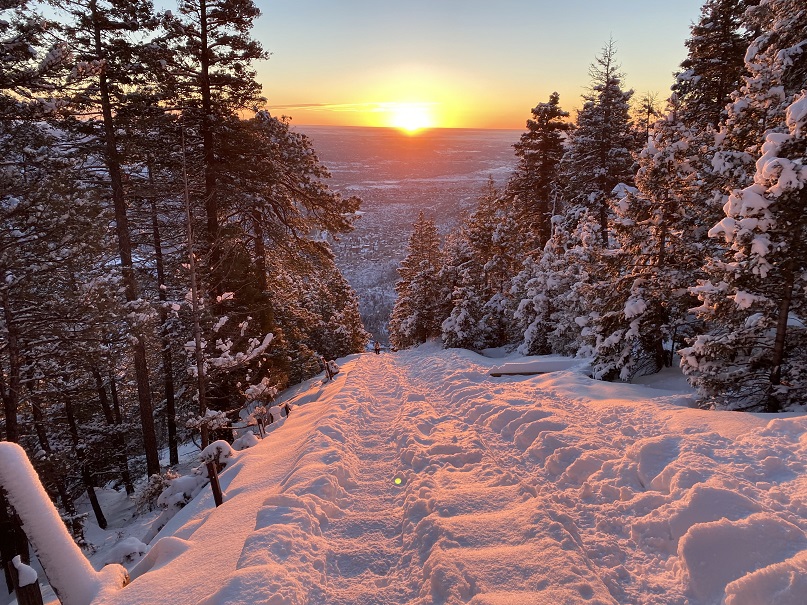
I was still sore from the fall a few days ago, but needed to get out, so I made a reservation to hike the Manitou Springs Incline first thing in the morning. I’ve done this route several times, so I’m just going to show you how beautiful it was that day.
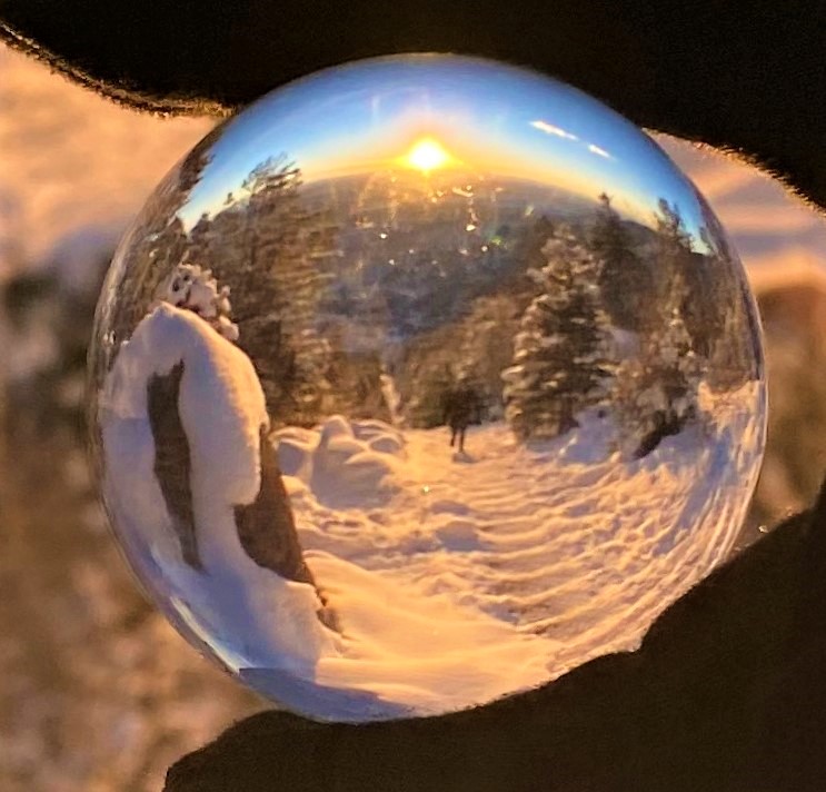
At the top I got some lensball photos of the incline and hikers. There seemed to be a lot of regulars here today.
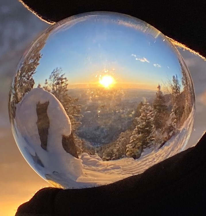
Then I continued on to Rocky Mountain. I broke trail here, and got another lensball photo of Pikes Peak from the summit
I once again broke trail to Mt Manitou, and then took the Barr Trail down. It was icy everywhere!
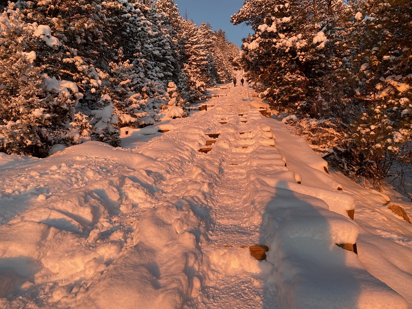
Here’s a look at the Incline from later in the day
I’m writing up this accident report to analyze what went wrong and what steps I need to take in the future to make sure it doesn’t happen again.
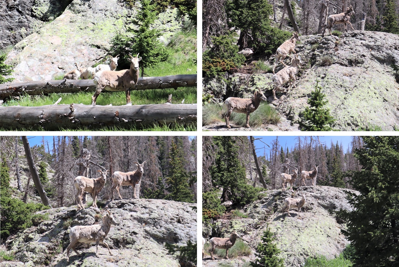
The day before Eric asked me if I’d like to go climbing so he could get some adveture photos. The weather was great, so of course I said yes. I got to the parking area about 10 minutes early so I could put on my gear, but those plans changed when I saw the bighorn sheep. They were quite sociable today, sitting/standing/grazing just off the trail. I quickly called Eric and told him to meet me at the sheep.
I noticed while the Bighorn Sheep were fine with humans, they tensed every time someone walked by with a dog. There were park rangers there to make sure no one got too close. I think it’s funny how when you’re at Waterton Canyon or Garden of the Gods the sheep will stand 10 feet away from you as if you aren’t even there, but if you see one while on a mountaintop they bound away as soon as they see you.
We didn’t stay long because we had some climbing to do. We went back to our cars (we’d unknowingly parked right next to each other) and got out our gear. Eric told me all I needed was a harness and my rope. I asked him if my 60-meter rope was enough? Oh, more than enough he assured me.
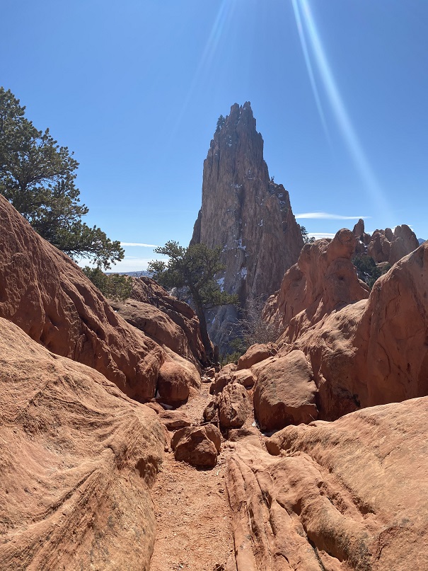
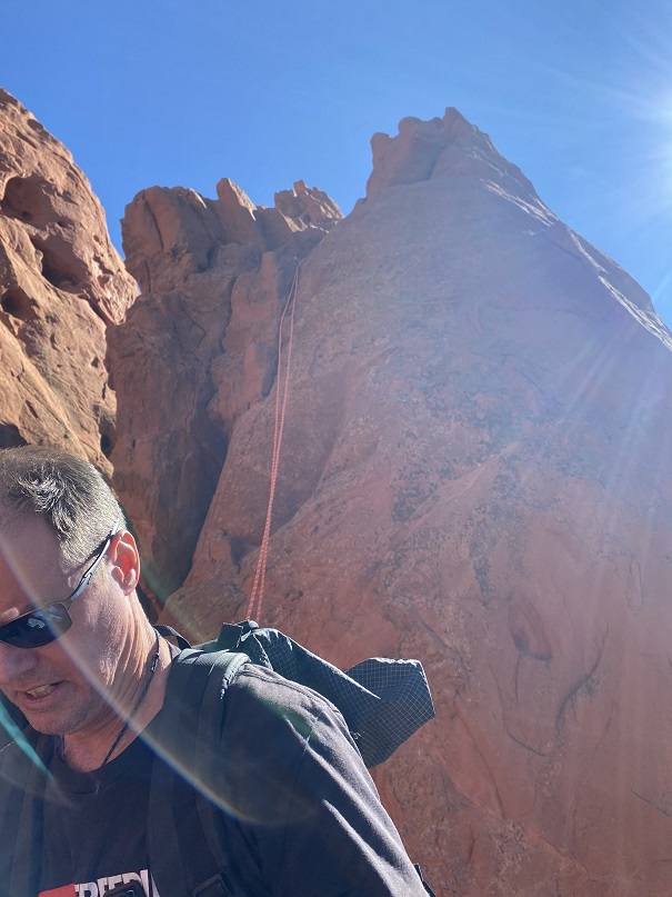
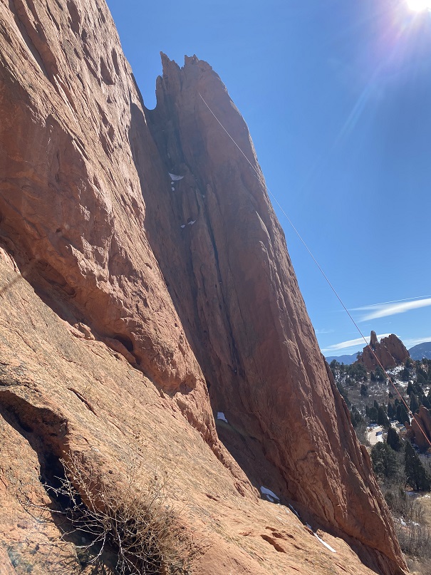
Together we walked through the pathways towards West Point Crack. Here’s the entrance
OLYMPUS DIGITAL CAMERA
On the south side there’s a gully to climb up
Here’s looking back from the top of the gully
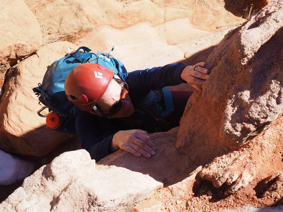
At the top of the gully is a class 4 climb of about 8 feet
Eric went up first and took a picture of me upclimbing
OLYMPUS DIGITAL CAMERA
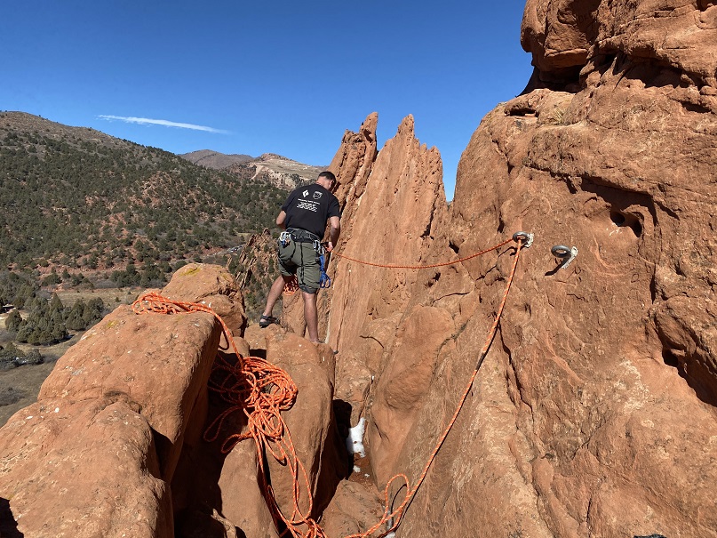
From here we staged our gear. There were two bolts in the wall we were going to use to do the first rappel. Eric told me we’d rap onto a rock, then again to the bottom. He wanted to counterbalance each others weight and have each of us go down on one side of the rope. I’d never done this before, but he assured me it was quick and easy and we were only rappelling about 10 feet or so onto a ledge the size of a kitchen table (it ended up being more like 20 feet). From there we’d clip in, retrieve the ropes, and rappel the rest of the way down.
Here’s Eric setting up the gear
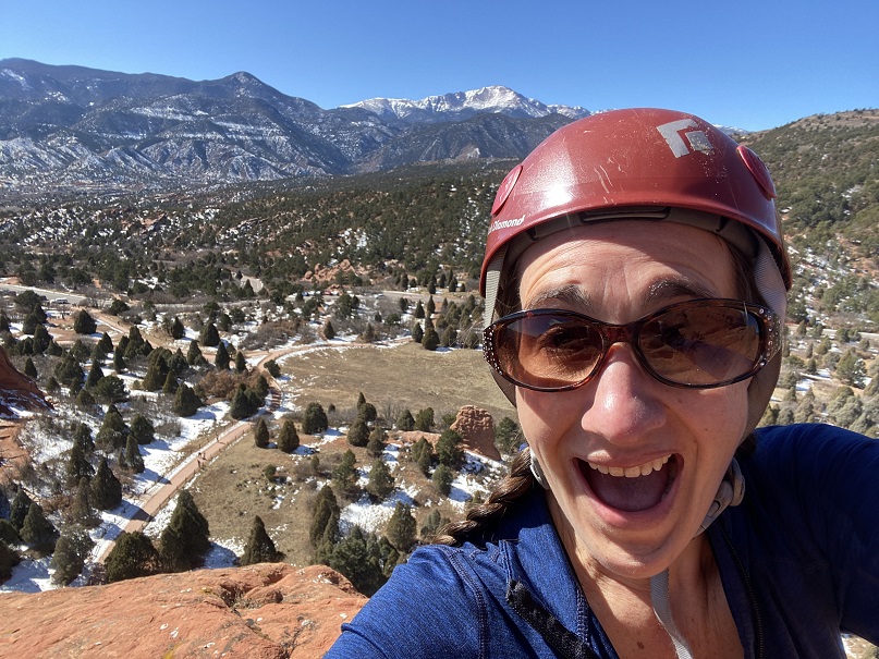
It was a beautiful day, so I took a selfie
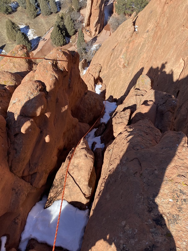
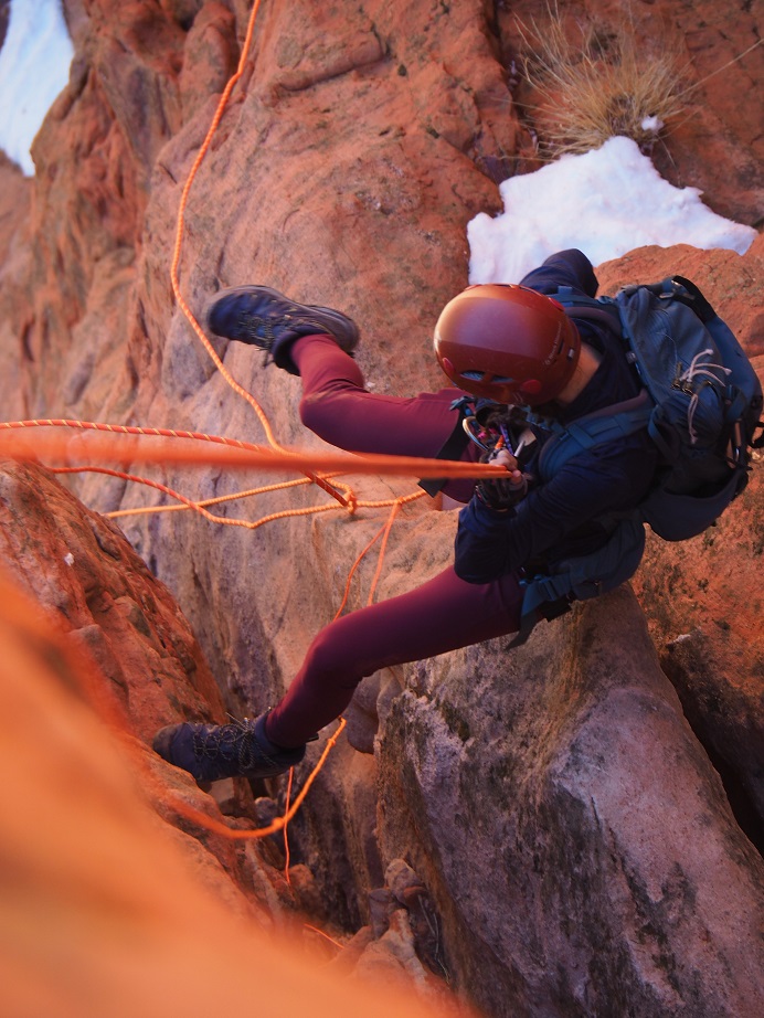
I went over first and Eric stayed at the top (even though we were going to go together?). We rapped off the back side so our ropes wouldn’t get stuck. Here’s looking down
All was going well, until I realized there was a gap in between the rock I was rappelling off and the one I was supposed to land on (which was really more of a spire). Also, the wind picked up and started swinging me around. I ended up rapping further into the gap than I’d intended and more to the west, and since I was only on one side of rope I couldn’t tie off to climb back up. I needed my breaking hand to make sure I didn’t fall, yet I needed two hands to climb.
At this point I knew I had to manage my adrenaline, because if I didn’t I was going to fall and die, and I wasn’t going to allow that to be an option: The rope didn’t go all the way to the ground. It took me a solid 5 minutes (which felt like an hour), but I was able to get a slight grip on the rock (with my street shoes: my climbing shoes I’d been assured hadn’t been necessary were in my pack on my back). I managed to turn myself around and upclimb about 6 feet to the top of the rock and clip myself in. This rock was the size of a small dining room table. I’m guessing 4 feet across. There was snow where I needed to clip in.
I clipped in and calmed my nerves as Eric rapped down, easily pushing himself off the rock and landing on the spire. I was a little jealous: He had the advantage of height and he knew the route. Eric didn’t overshoot the ledge.
Here I am sitting on the ledge; in front of me, past the rope, is where I’d originally rapped too far and had to upclimb.
Here’s looking up from the ledge
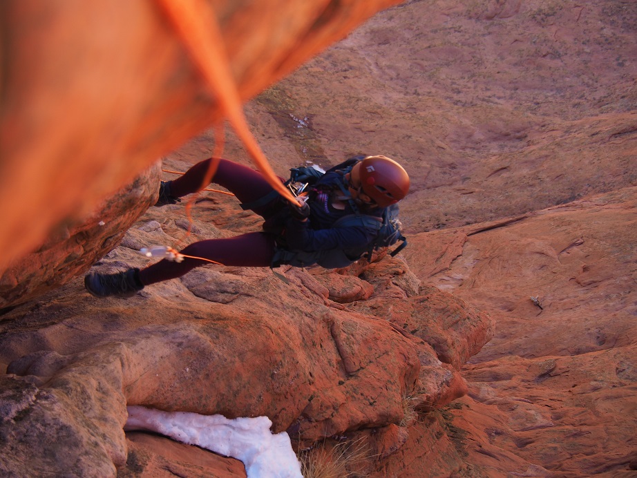
Eric was practicing ghost anchors, and using paracord to retrieve the rope. This ended up getting messy, and I wouldn’t recommend this technique. We retrieved the rope and set it again, to rap off the back side of the rock again. Eric threw the ropes, and they looked a bit jumbled. He asked me to untie them when I got down to them and throw them down again. I couldn’t see around the spire below, so I asked if he was sure the rope was long enough? (not like there was much we could do about it now) and he assured me they were. I tied knots in the ends. Eric looked at me like I was crazy.
Once again, I went first, but this time with both strands of rope. I immediately felt safer. Eric got some pictures of me on my way down. Unfortunately, his go-pro stopped working (which was kind of the reason we were doing this in the first place) so we don’t have a lot of pictures.
OLYMPUS DIGITAL CAMERA
As I went down, I noticed the ropes were tangled more than I’d anticipated. I came to a place I could sit and untangle the ropes. I didn’t need to re-throw them, as their weight drew them downward.
OLYMPUS DIGITAL CAMERA
I continued my decent. That paracord was kind of a nuisance, but at least the ropes were straight
OLYMPUS DIGITAL CAMERA
As I rounded the spire I now had a good look at the rest of the route, and to my shock, the roped did not go!!! I wanted to scream! I did notice however, that they landed just even with a very thin ledge (we’re talking maybe 6 inches wide). I was so glad I’d tied knots in the end of the rope!!! I rapped down as far as the ropes would allow, then unclipped and hugged the wall. There wasn’t room for both Eric and I on this ledge, or to be attached to the rope at the same time. I looked around and noticed a goat trail to the left that went up; That route looked a bit sketchy, but safer than where I was. I told Eric I was going to climb to the ledge while he rapped down, then we’d re-secure the ropes for a third time behind the rock I was aiming for and rap down a final time to the bottom. The circle is where the ropes ended, and the line is where I climbed for safety
Here’s looking back from my perch. I felt safe with this plan, because we’d rapped in this area before (after upclimbing to this spot).
Eric made his way down, and started to bring down the rope, but it got caught on something. He spent some time going back and forth on the ledge, trying to dislodge the rope.
It wasn’t working. The rope was stuck, but one side of the rope went all the way to the ground, so we decided to brainstorm.
In the end we decided to have me rap down first, with Eric belaying me from above on the one piece of rope we had. Then I’d fireman belay him down. We had about 25 feet or so below us to get to the ground. Afterwards we’d go back to the car, get another rope, and retrieve the one that was stuck. Eric wrapped the stuck rope around his waist and shoulder for good measure, and after saying “You’re sure you’ve got me?” and Eric replying “Yes” I went over backwards.
Almost immediately we started tumbling. As soon as I said “I thought you said you had me?!?!?” I noticed he was falling too. We fell together, tumbling and sliding the 25 feet to the ground. Here’s a picture of the line we fell
It all happened very quickly, and as soon as we stopped we both got up and did a head to toe check. Nothing broken, but a lot of scrapes and what were going to be bruises. I looked around, hopeful someone had seen our fall and tell us what had happened, but none of the dozens of park visitors so much as looked our way.
We both thanked God it hadn’t been worse, then talked about what had happened: the rope that Eric couldn’t get unstuck by himself had dislodged under our combined weight.
I’m writing this to process what happened, and to try to prevent it from happening again. Here are some of the things I did wrong:
I didn’t ask enough questions, instead relying on Eric’s experience. I should have asked for more clarification on what we were doing before we started. Had I done so, I would have seen the spire from below I’d be rapping onto, and noted the gap. I most likely would have worn my climbing shoes (they were in my pack, after all).
I wouldn’t have rapped on both sides of the rope for the first rappel. I still have no idea when he wanted each of us on different sides of the rope, since we never rapped together.
I should have put on my climbing shoes from the beginning, but definitely after the first rappel.
I also would have brought two 60-meter ropes and tied them together, instead of relying on one rope and rapping several times. Two ropes tied together would have made it from the top to the bottom, and we only would have needed to rappel once. We had the ropes in the car, but I had only asked if one rope was enough, not if two would have been better (you need to be specific with Eric: I didn’t realize we were rapping 3 times until we were done with the second).
When the rope had gotten stuck, I should have tried to dislodge it. Instead, I never touched the rope and relied on Eric telling me it was stuck. Maybe I could have found a different angle?
I should have insisted the ropes been thrown again, instead of untangling them myself. If I had been solo, I’d have thrown them as many times as it took to get a straight line. Also, the paracord thing stunk. It just made things tangle. Seems too risky to me.
Instead of rappelling down the last time with Eric standing I should have had him sit to belay me, or I should have put on my climbing shoes and downclimbed carefully (although, to be fair, I thought the rope was the safer option because I believed it to be stuck).
I’m sure I’ll be adding to this list.
In the end, I figure I’m better solo because I do my research and go over safety over and over again. When I go with someone, I rely too much on them being the expert, forgetting not everyone is as detail oriented as I am.
When someone asks you to climb Culebra Peak with them in winter, you say yes! I really needed to get out hiking with friends, and when Bill asked me to hike Mt Princeton with him, of course I said yes! But then, plans changed and he decided to hike Culebra instead. The weather didn’t look too bad (only 20% chance of snow), so when he asked if I wanted to go along I said yes: I mean, securing reservations is difficult in winter as you need a group, and he was putting together a group.
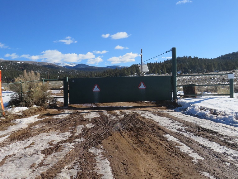
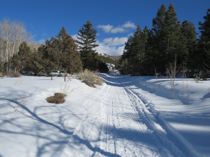
In any event, I made it to the trailhead an hour early. They open the gates at 6, and close them at 6:15am, and I didn’t want to miss that window. Everyone else got there early as well. There were 5 of us hiking today (3 girls, 2 guys), and 4 vehicles: 3 4Runners, and my Tundra. Toyotas seem to be popular among self-professed mountaineers.
Here’s a picture of the gate:
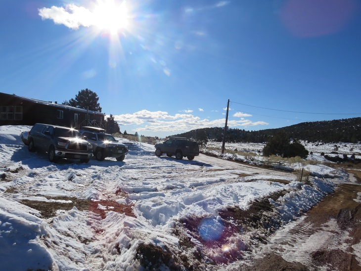
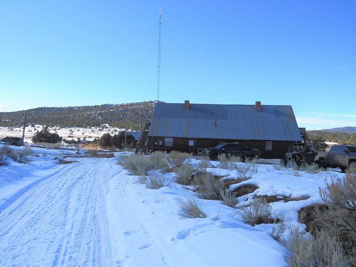
Promptly at 6am the gates opened, we were checked in, and we drove to the Ranch office. There was space for about 5 vehicles to park. We all got out of our vehicles, were given instructions on how to let ourselves out of the gate, and shown where the trail started. I was glad we all had 4WD vehicles, because while the dirt road in was clear of ice, the parking area wasn’t plowed.
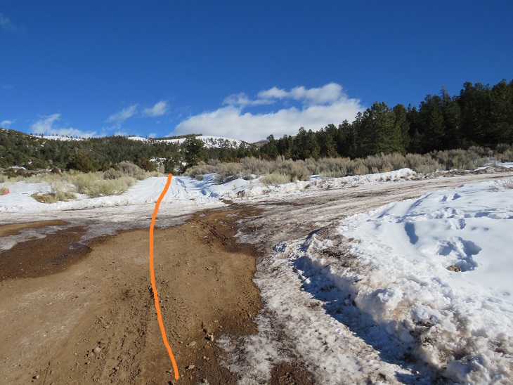
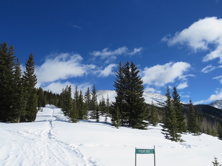
We gathered our gear and were off around 6:15am. The trail starts to the east of the parking area. In fact, most of this hike heads east.
Here’s an overview of the entire hike, from the road in
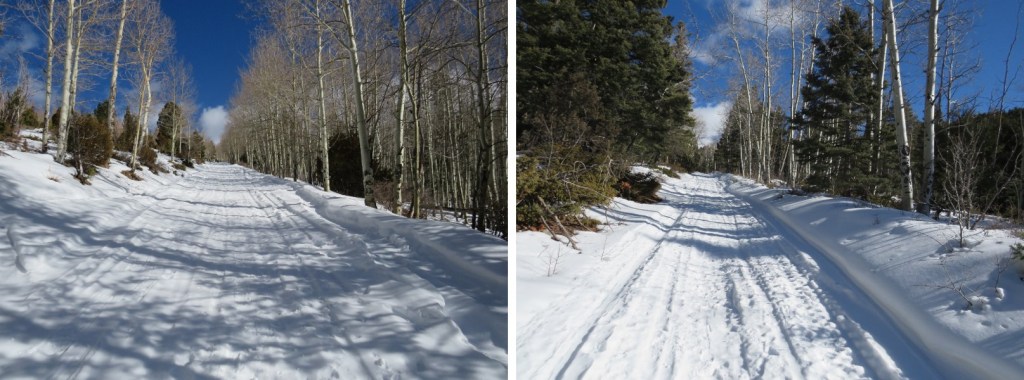
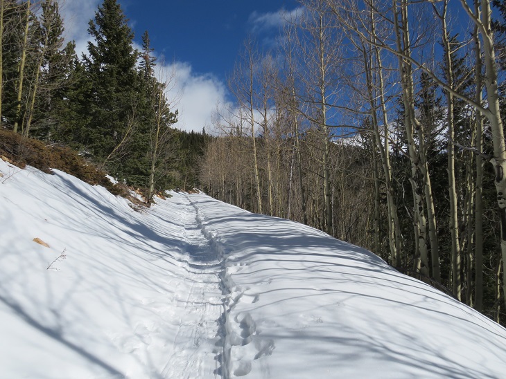
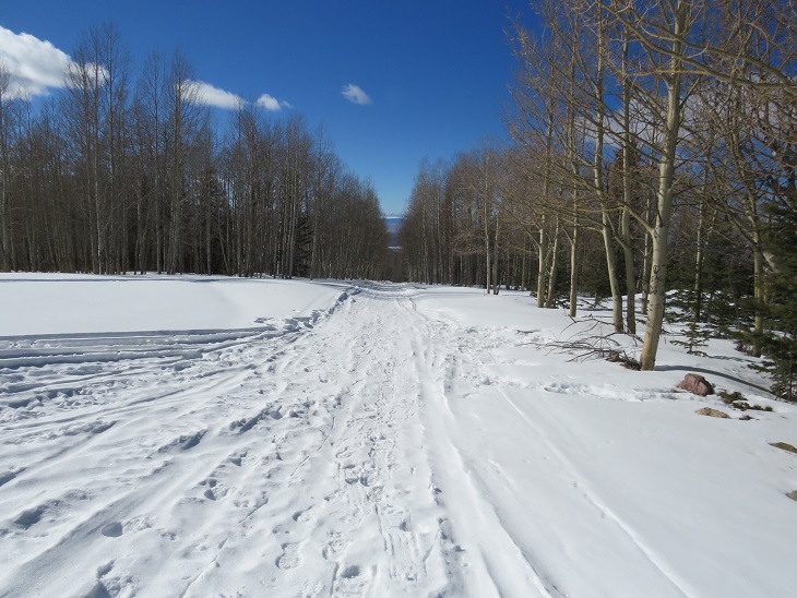
We followed the 4WD jeep road for 5 miles, gaining 2600’ of elevation. What was nice was they’d groomed the road until 4 way with snowmobiles, and after that there was a solid trench to treeline.
This part of the hike was very pleasant, as I talked with the guys (the girls weren’t as fast as we were at this point). We had a great pace, and I learned about other hikes they’d done and some of their goals. At one point I gave everyone a sticker, which got rave reviews. They understood the color schemes and even gave me ideas for other stickers in the future. I asked them to let me know how they hold up.
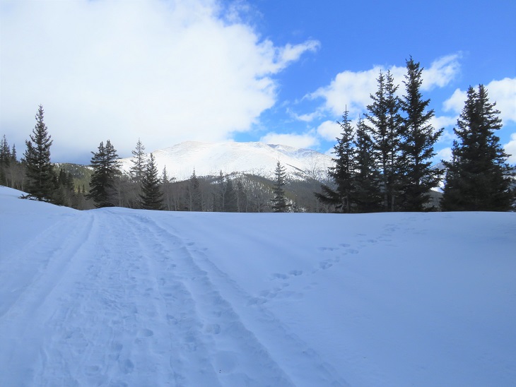
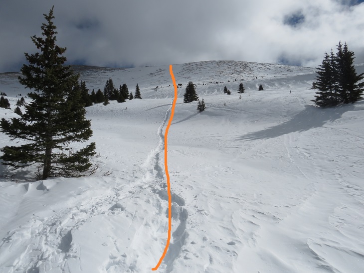
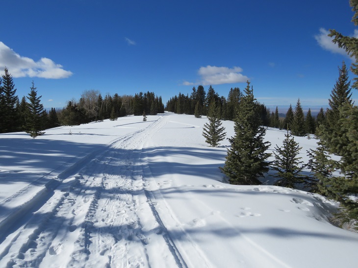
Once at treeline we were a group again. We donned our snowshoes and headed southeast up the side of the mountain. We had to trench here, but a lot of the area had solid snow. Here’s the path we took to the ridge
Once on the ridge everyone else took off their snowshoes, but I decided to keep mine on (mainly because I knew I wouldn’t be able to get them on again once I took them off). The weather started coming in, and it looked like that 20% chance of snow was going to materialize.
I was on my own from this point on, or, at least I thought I was, as I could no longer see anyone else and I was now in the lead. I made it to the ridge, as evidenced by this large cairn.
At the cairn I turned right and followed the ridge until it ended, which felt like forever! It’s a totally different hike when you have no visibility. But there was a bonus to the lack of visibility: it took a while for the bighorn sheep to notice me. When they did, they were off, running down the mountainside
I continued to follow the ridge as it lost some elevation (a hundred feet or so) and then started climbing again.
There were several small ‘false summits’ on this hike, but they were probably mostly due to the lack of visibility.
As I neared the summit I looked back and noticed three of the other hikers closely behind me. They’d taken off their snowshoes back on the ridge, and my snowshoes were slowing me down. Let me tell you, snowshoes on rock is not a good combination. We all ended up summiting around the same time, and took a group selfie. I couldn’t help but be jealous of everyone else: They didn’t need balaclavas and they were all taking off their gloves. I on the other hand, was trying to keep from crying because my fingers were hurting so bad. Also: we were all wearing the same gear/gloves so I blame my Raynaud’s (funny how mountaineers tend to find out what works and everyone uses the same stuff).
It was here I learned we’d lost one of our members on the ridge (he turned back early), and that everyone else was heading towards Red Mountain. I wished them good luck, as I’ve already summited Red Mountain and wanted to get down to where the sun was shining. We all had a group hug/high-five session, I turned and headed back the way I’d come, with little bits of sunlight peeking through the clouds when the wind made an opening.
Here’s that dip I was talking about earlier. The cairn is circled in red
Once at the cairn I turned left and headed back down the ridge, which was tons of fun with little visibility!
I was glad when I made it down to around 12K and was now below the clouds. Here’s a view of the hike out
This was great because I could just follow our tracks back. Once below the clouds the weather was actually quite nice. I could see Little Bear, Blanca, and Lindsey on the hike out. Also, the hike out seemed to take forever! It was only 5 miles, but it kept going, and going, and going. Wow! Had I really hiked in all this way this morning?
I made it back to the Ranch Office, signed out, and drove to the gate. It was super muddy at the gate, and since I now have a topper on my truck, I couldn’t just toss my gear in the back. Oh well! I put my boots on top of my snowshoes and was on my way.
I made it back to my truck at 2pm, making this a 14.87 mile hike with 5337’ of elevation gain in under 8 hours.
The Culebra Peak summit sticker can be bought here
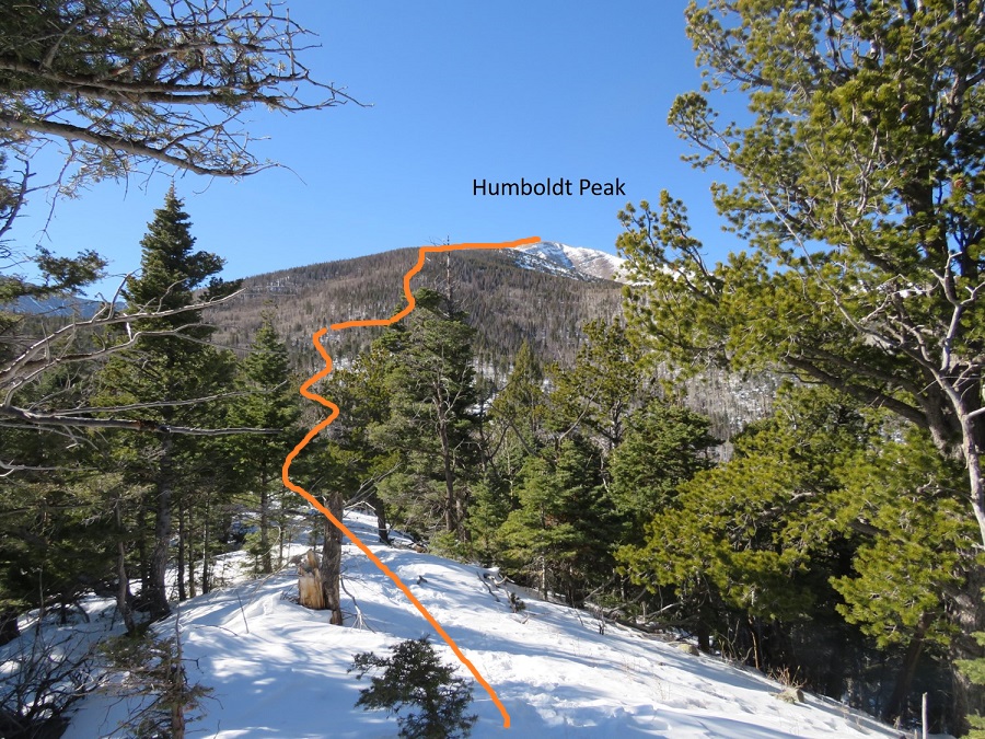
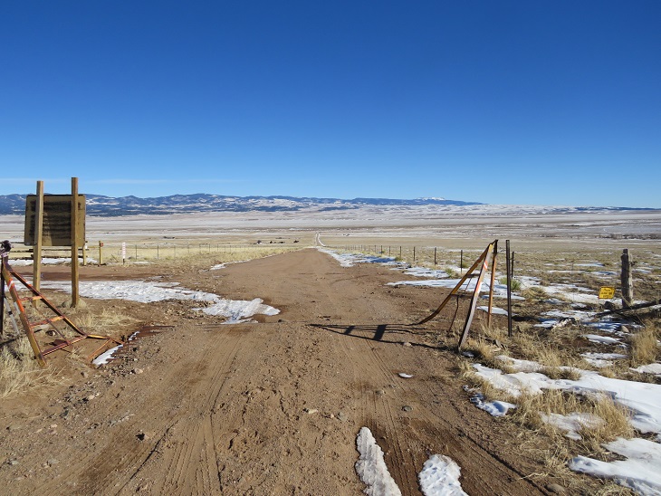
This was my third time hiking Humboldt, but my first time in calendar winter. The last time I was here there was a terrible wind that was causing the snow to become clouds, and I couldn’t see the summit when I arrived (or my own 2 feet). This time I was here for better pictures of the route, and to count it as an official snowflake. I arrived at the South Colony Lakes lower trailhead and was the only one in the lot when I parked my truck. I put on my gear, using only microspikes as my footwear, and was on the trail at 4:30am. As usual in winter, the snow started just past the 2WD parking area. I always find it amusing to see how far the tire tracks try to go up the road. This time, they didn’t go far.
The snow on the road started right away, but there was a good trench. I followed the road for 2.3 miles to the junction with Rainbow Trail. It was still dark out, and as I rounded the last corner of the trail where I could still ‘see’ the trailhead I noticed there was another car parked there. It seems there would be hikers about a mile behind me today. Also, my flashlight started flickering. Time to change the batteries!
At Rainbow Trail the trench spiked, one side going towards Marble Mountain, the other towards Humboldt Peak’s East Ridge. There weren’t any tracks headed further down the road to South Colony Lakes. I turned right and followed Rainbow Trail for .5 miles.
I quickly came to a bridge, then took the trail to the top of a slope
At the top of the slope I was thrilled to see there was a trench in place leading up the ridge. Last time I did this hike I’d had to trench it myself, and it had taken quite a bit of work. Today, I was going to poach someone else’s trench! Woot!
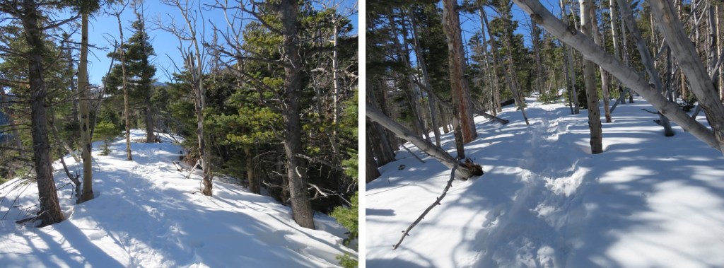
And what a trench it was! I followed it as it for 2 miles as it ascended the east side of the ridge, all the way to treeline. Here’s an overview of the route up to Humboldt Peak
If you keep heading west and stick to the rib/ridge, it will take you to treeline. I could hear the wind above the trees, and got a bit anxious for the above treeline part of the hike.
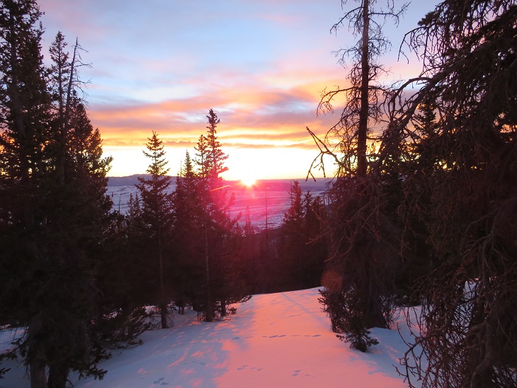
As I hit treeline the sun started to rise. I took a few minutes to enjoy the view. (side note: there were a lot of rabbit tracks here)
The trench ended near treeline. I could see where it was supposed to go, so I kind of re-trenched it as best I could wearing just spikes.
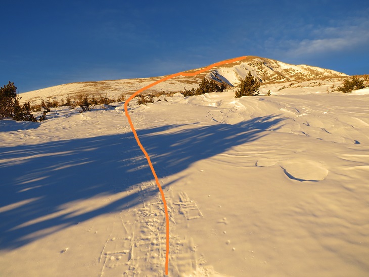
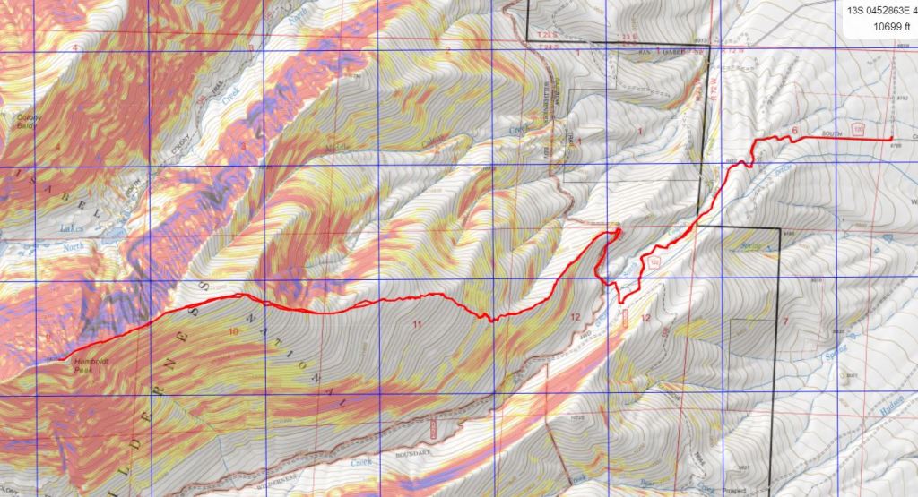
Here’s the general overview of my route up the ridge
The wind had been intense all morning, but once I was above treeline it became difficult at times to even stay upright. So much for the forecased 11-17mph winds! I’d started early to avoid the most intense winds that were supposed to start around 11am, but it seems they started a little early. I had to hunker down at times and turn away from the wind, which turned the snowflakes into glass, and was side-stepping as I hiked just to stay in a straight line. I tried to take pictures, but unfortunately, wind is invisible. I kept my gloves on and was glad I’d put on my balaclava at the trailhead. Here are some pictures of the ridge.
Here I noticed some bighorn sheep in the distance. They also noticed me and trotted off.
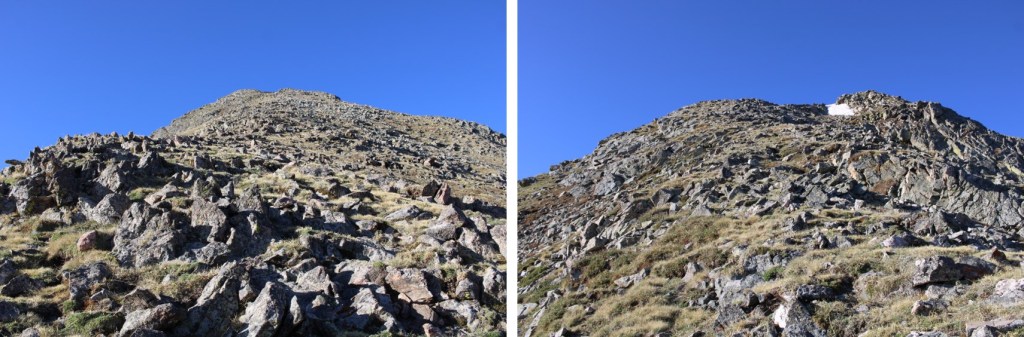
At the top of the ridge was another ridge, so this had been a false summit. Here’s the actual summit of Humboldt Peak. It’s a straightforward ridge hike to the summit, nothing above class 2.
Here are some pictures of the ridge. There was some snow, but it was all firm enough not to need traction
On this part of the ridge the wind really picked up. I had to hide behind rock structures to get out of the brunt of it, and the noise it made as it came up and over the rocks was creepy. The balls of my feet were frozen at this point (due to Raynaud’s) and it felt like I was walking with large rocks in my shoes (I wasn’t, it was just the ball of my foot that had frozen). Several times I hunkered down to maintain my balance, but it was still a straightforward ridge hike.
I knew I’d made it to the summit when I found the wind breaks. I never saw a summit marker, but I don’t think there’s one here?
I’ve summited Humboldt Peak twice before, so I knew I was at the summit at the first wind break, but I walked further west for better pictures.
I summited Humboldt Peak at 9:45am
Humboldt Peak:
The views of the Crestones/Sange de Cristo range were beautiful!
Time to head back down the ridge
The wind was still fierce, and I was worried I was getting a nasty windburn in all the areas my balaclava didn’t cover. The wind speeds weren’t supposed to be this high, so I’d left my goggles at my truck. Note to self: next time, bring the goggles. On my way back down the ridge I saw the Bighorn Sheep again. They quickly turned when they saw me and headed over the mountainside. There was a big drop on the other side, and I was surprised I couldn’t see them again when I passed.
This was a simple ridge stroll, or, it would have been, without the wind
Here’s looking at my route back down the ridge to treeline
Here I met some hikers heading up. The wind had died down considerably by this point, so I figured they had the better weather of the day (I found out later it picked back up again, and they said their summit was just as windy as mine). My feet started to de-thaw, and I had a minor Raynaud’s attack: think insane pins and needles as the blood started flowing again. It lasted about 30 minutes, and to combat it I just kept hiking. On a positive note, I could feel my toes! Finding my tracks back to the trail was a bit of a challenge, but I came across them eventually.
Then I followed the trench back to Rainbow Trail. I should have put on snowshoes here, as I postholed ever 30 feet or so, but I really didn’t want to stop. I was just glad I’d started early enough in the day not to need snowshoes (spikes worked just fine). Anyone heading back down later than me would need snowshoes.
Once back at the trail I followed it a half mile to South Colony Lakes Road
Once on the road I hiked the 2.3 miles back to the trailhead, noticing a lot of dog tracks along the way. As I neared the trailhead I saw a couple walking with two beautiful dogs. It seems they were out on a day hike, and I thought this was a great idea, as it was a beautiful day below treeline.
Here’s a look at the trailhead on my way back. Easily 2WD accessible.
I made it back to my truck at 1pm, making this a 14.02 mile hike with 5563’ of elevation gain in 8.5 hours.
Unfortunately, when I made it back to my truck I could hear the conversation the couple with the dogs were having. The man kept cussing at his female companion, and the dogs, over simple things like an overturned water bowl. To me there’s no need for vulgar words, and he was using multiple ones in each sentence he uttered. I felt the urge to say something, but no one else in his party seemed to mind his behavior, so I kept it to myself. I’m not sure why women allow themselves to be treated that way?
The Humboldt Peak Summit Sticker can be bought here
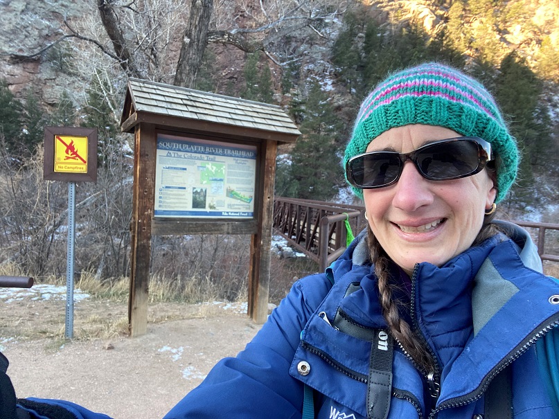
Waterton Canyon -> South Platte River -> Waterton Canyon
November 15, 2020
RT Length: 34.18 miles
Elevation Gain: 4308’
High Point: 7517’ Low Point: 5522’
Time: 11 hours, 20 minutes
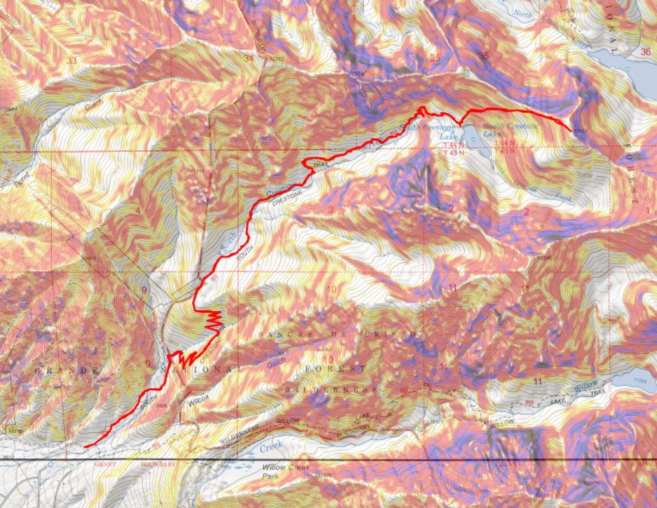
The Colorado Trail has been calling my name for some time now, so I put it on my list of goals for 2020. When I put down a goal in writing, there’s a 99% chance I’ll hit it. I try to make my goals a bit of a stretch, varying, but still doable, which keeps things fun. This was my last goal to achieve this year, and I honestly didn’t think I was going to make this one. But, a very windy forecast across the state above treeline gave me the opportunity to hike segment 1 of the Colorado Trail (or is it “The Colorado Trail”? Since I’m from California, not putting “the” in front of a trail, road, highway, etc. feels weird, but this is most likely also technically wrong. Please indulge me).
I know I’ll never get enough time off to hike the trail as a thru hike, so I’m going to need to segment hike when possible. The cool thing about this is if I park at a trailhead, hike the segment, and then hike back, I’ll essentially be hiking both SOBO and NOBO. Pretty cool! (Does that mean I get to say I’ve hiked it twice?) At this point I’m thinking I’ll still start out SOBO and try to do the segments in order.
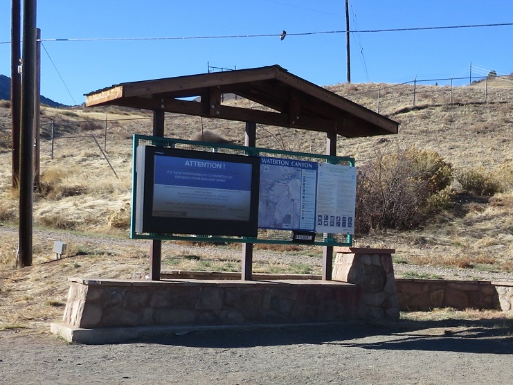
I arrived at the Waterton Canyon trailhead to find the lot empty. This wasn’t strange, as it was 2am, but it did tell me I wasn’t likely to see anyone as I was hiking this morning. The trailhead is positioned close to many large cities, and I was a bit worried my truck would be broken into, since it was the only vehicle in a lot that doesn’t get much ‘midnight traffic’ My only solace: I have a topper and a potential thief wouldn’t know if I was sleeping inside (or not) or if I was armed or not (I always am). It was much colder than I’d anticipated: 18 degrees at the trailhead instead of the forecasted 35 degrees. I knew it was supposed to get up to 60 degrees today, so I forwent the ski pants and instead put on my heavy-duty winter gloves. I said a prayer to the wind gods, asking them to play nice.
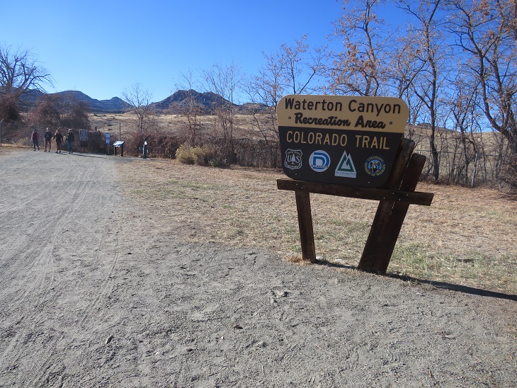
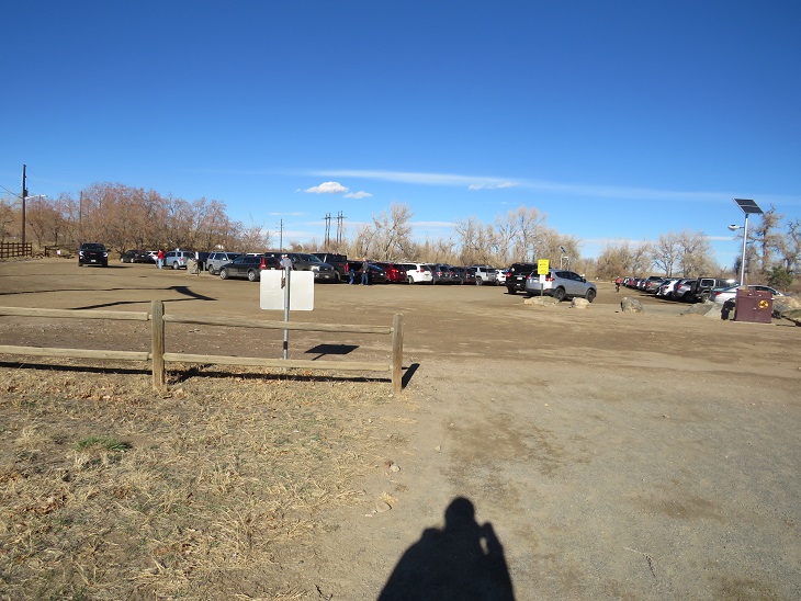
I was on the trail at 2:21am. Because it was still dark, most of the pictures I’ll be posting from the hike in were actually taken later in the day, on my hike out. Here’s a look at the parking lot. It was big enough to hold about 100 vehicles, and was past capacity when I got back.
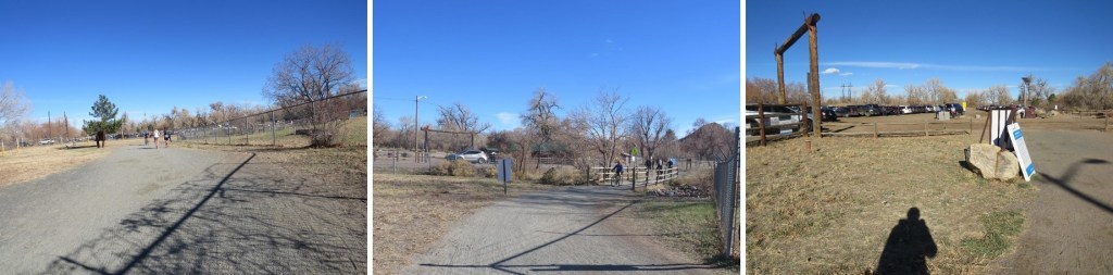
The trail starts at the west end of the parking area. I had to first cross the street. This was easy at this time in the morning, but the button I pushed that enacted the flashing lights on my return to stop traffic were uber useful.
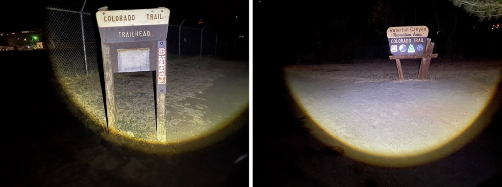
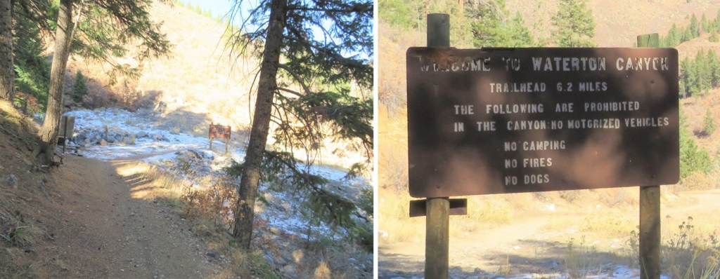
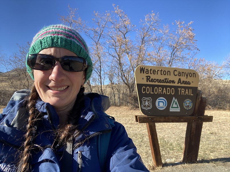
I saw signs indicating I was at the right place!
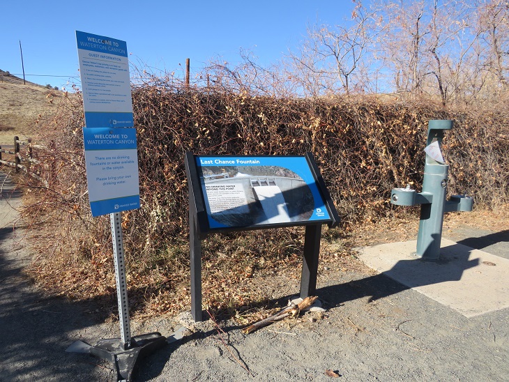
There was a ‘last chance water station’ that was unfortunately closed (most likely due to COVID). Side note: I didn’t drink a single sip of water on this entire hike, yet I brought along a full water bottle and filtration system. If you’re doing this as a day hike and are an experienced hiker, extra water isn’t a necessity. However: know yourself and your water intake. And prepare adequately. There is obviously water along the first 6 miles of this hike, and also at the end, so filtration is possible, and easily accessible.
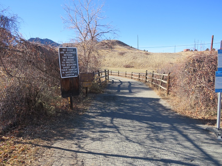
From the beginning there were signs indicating dogs weren’t allowed due to the Bighorn Sheep. I hoped this meant I’d been seeing some wildlife today. I also believe this is the only 6 mile segment of the trail dogs aren’t allowed, so if you want to bring along your canine, it might be prudent to start at the South Platte River Trailhead with your pup (well, start at the Waterton Canyon trailhead ad have a good friend bring you your pup the next day, because if you have a canine companion it’d be worth it).
I passed some bathrooms (vault toilets) and smore signage. I just continued following the road west. It was dark out, but at times I could actually smell the bighorn sheep. I knew they frequented this area, and at this point they must have been close. It’s funny how your sense of smell can guide you at times. Side note: in the 6 miles to the Stronia Dam there are 3 bathroom stops. I felt this was quite excessive until I hiked back and saw hundreds of other hikers along the trail.
The road here is wide and there isn’t much elevation gain for the first 6 miles. There are mile markers every half mile or so, which are helpful. Interestingly, the mile markers switch sides of the road halfway through, so in the dark I ended up missing a couple, only to find I’d hiked further than I’d thought. In the daylight this made sense, as they followed the contour of the mountains. On the positive side, the miles were just flying by! This was good, because it was quite cold and I was willing the sun to rise. My fingers were frozen and I kept pumping them back in forth inside my gloves. Also, seriously, my fingers were frozen. I actually gave the thought to going back, but the knowledge it was supposed to be a warm day kept me continuing on.
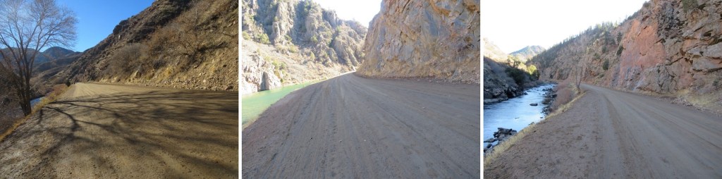
The road follows the South Platte River, with several bathrooms along the way (no less than 3)
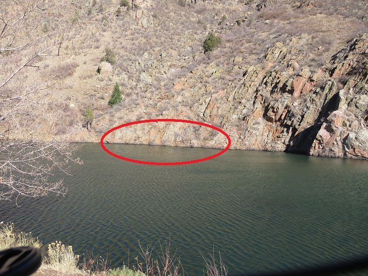
After hiking for 6 miles I came to the last bathroom area, and, in the dark, saw lights illuminating the Stronia Springs Dam on the right (there will be a better picture of this dam later)
I continued following the road for another half mile or so as the road began to narrow.
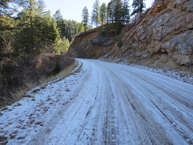
It was a bit icy out, even on the way back, but nothing that required spikes or even more than common sense to navigate.
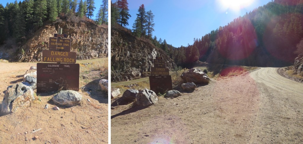
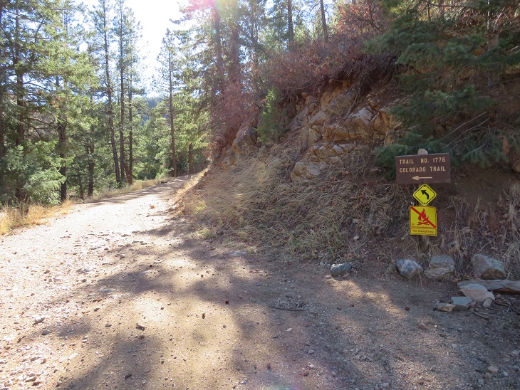
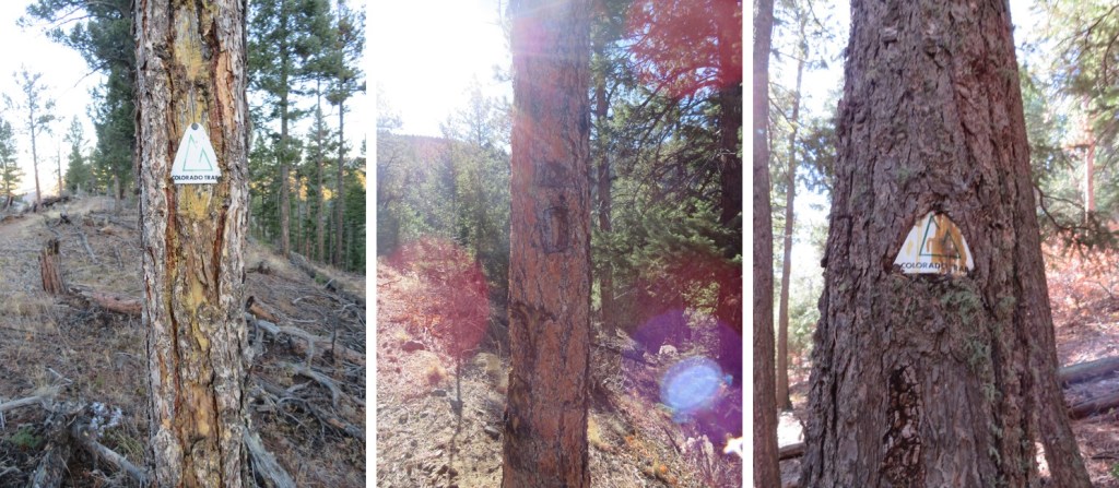
The trail is very well marked and easy to follow. I thought it was cool Colorado Trail is Trail 1776.
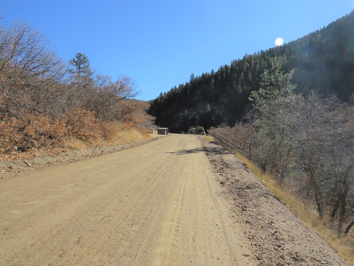
After hiking for 6.7 miles on a flat road, the real trail began. And so did the wind. I don’t want to make a big deal of this, mostly because the wind across the state this weekend was intense, but the wind didn’t stop for this entire hike. It was insistent, but always above treeline, which made it manageable. Yes, it had been a good idea to take this hike, as anything above treeline would have been intolerable. I’ll stop mentioning the incessant wind here.
I was surprised it was still dark outside. It had been my goal to get to this point before daylight, but daylight was still a long ways off. Woot! I didn’t check my phone to see the time (too cold for that) but the sky wasn’t even beginning to lighten. This was good news. Since I usually do intense elevation hikes I had no idea how long this hike would take me, but it seemed I was making better time than I’d anticipated.
From this point it was 10 miles to South Platte River Trailhead. The trail continues gaining elevation for 1.2 miles, switchbacking south, gaining about 725’ of elevation.
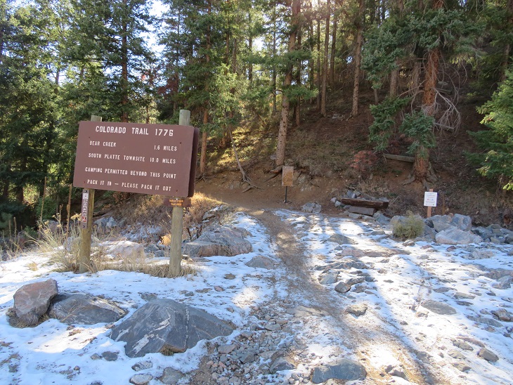
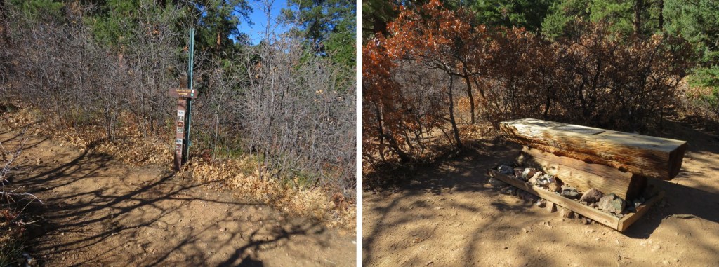
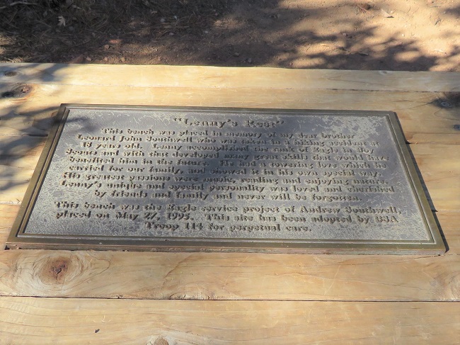
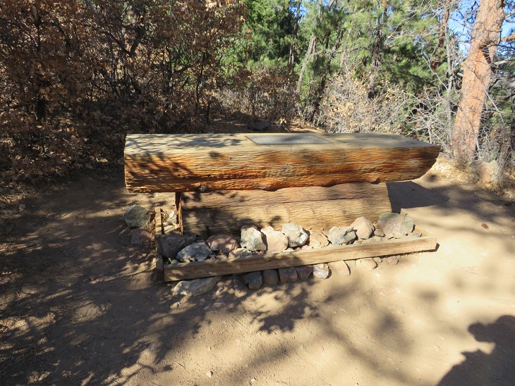
At the end of the 1.2 miles is a sign indicating the Colorado Trail, and a bench entitled ‘Lenny’s Rest’.
You should take time to read the plaque while there. My son is an Eagle Scout, and I’m an avid hiker, so I took time to appreciate this monument. I’m not providing a clear indication of the wording because I believe it’s best experienced in person. Rest here.
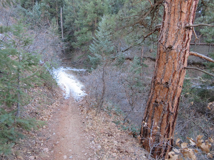
From Lenny’s Rest I was disappointed to find the trail started losing elevation. I lost a total of 350’ as I hiked down. Maybe I should have done more research? The hike started in chaparral and ended in pine. This seemed something of a paradox, but also fitting to the area. There are pinon pines, junipers, scrub oak, and ponderosa pines in this area.
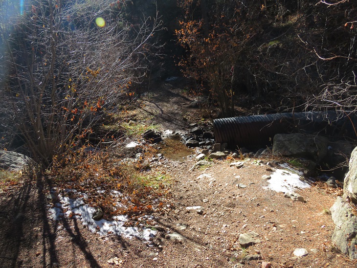
You’ll know when you’re at the lowest part when you cross this drain. Maps show this point as crossing Bear Creek. This was more of a jump across a drainage than a creek, but it was late in the year so water was low.
Then, it was all uphill for the next 4.2 miles, as I gained 1332’, switchbacking again. There are a lot of switchbacks on this segment. Switchbacks are a blessing and a curse, depending on where you are in your hike. If I’ to do this entire hike in segments, they will most likely be a curse, as I’d prefer elevation gain, but if I were a thru hiker, I’d appreciate the ease in elevation.
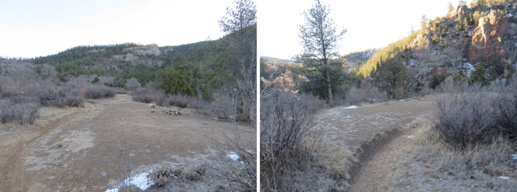
Some of the signage needs work. I’m not sure what the wooden plaque says?
There are a lot of good campsites in this area. I’m guessing that’s because it’s a nice ‘last night’ for Colorado Trail thru hikers before finishing up the next day (that, and camping isn’t allowed along the road). If this is the end of your NOBO journey, this is a great last place to camp. Also, high-five and congratulations!
The highpoint of this hike came below treeline, where these metal signs are present. From here, it was (mostly) all downhill.
The sun hadn’t yet risen, and I was getting excited about my time, mentally calculating how much longer I had to reach the South Platte River Trailhead and the distance to my halfway point for today. As I hiked, I contemplated the different trail signs, which ranged from actual signs (wooden or metal) to the Colorado Trail Marker and blazes on the trees, both etched and painted. It seemed a shame the trees had been blazed, but this also makes sense, as the paint eventually goes away and people steal the markers (or the trees eat them).
Sometimes the markers are placed over the blazes. There were quite a few markers (it’s difficult to get lost on this trail). I spent a lot of time contemplating most of this. Also, if you’re hiking the Colorado trail and want a marker as a memento, you can buy one here for $5 and not have to carry it with you, and you don’t need to feel the need to take one from the trail (don’t take one from the trail. Don’t).
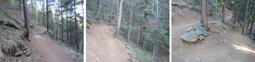
The trail continued to wind around the mountain
There was a considerable number of downed trees in this area, and also tree cutting boundary signs. (Another side note: a forest fire has decimated the corresponding segment, most likely spreading quickly due to dead/downed trees. This area needs to be cleared, or is most likely next to go up in flames).
I hiked around a spot that looked like it’d be a fun rappel point (for new learners)
And kept hiking, losing elevation as I went
In total, I’d lose 1375’ before making it to South Platte River trailhead. There was a small plateau with a great view of the South Platte River trailhead. I hit this point at sunrise, with the sun was rising behind me.
From here I swtichbacked what seemed like another 50 or so times before making it to the bottom. The good news: the sun was starting to rise and I had a great visual of the trail.
I made it to my half-way point, South Platte River Trailhead, at 8am. There were some other vehicles in the lot, with hikers putting on gear, getting ready for their morning hike. I was quick, took a few pictures to prove I’d made it, turned around and headed back. It had taken me 5 hours, 40 minutes to make it the 16.7 miles. I considered this a good time.
There is a vault toilet at this trailhead. It was now 8am and I’d hiked 16.91 miles so far this morning (in about 5.5 hours.
To head back, I just retraced my steps. However, now it was daylight, so I’d be able to get some appropriate pictures. Starting from South Platte River Trailhead, heading NOBO: The trail starts at the east end of the parking area
There are several great camping spots along the trail, just a few dozen yards from the parking area. I’m sure these are for CT hikers on their first (or last) nights. Lots of room here for a dozen or so campers that play nice.
This was a very easy to follow trail that switchbacked northeast along the mountainside, first through chaparral, and then pine trees. There are lots of areas with chaparral, pinons, and pines along this trail.
Here’s another look at the quick plateau
And more hiking through pine trees. I promised I wouldn’t say anything more about the wind, so I won’t.
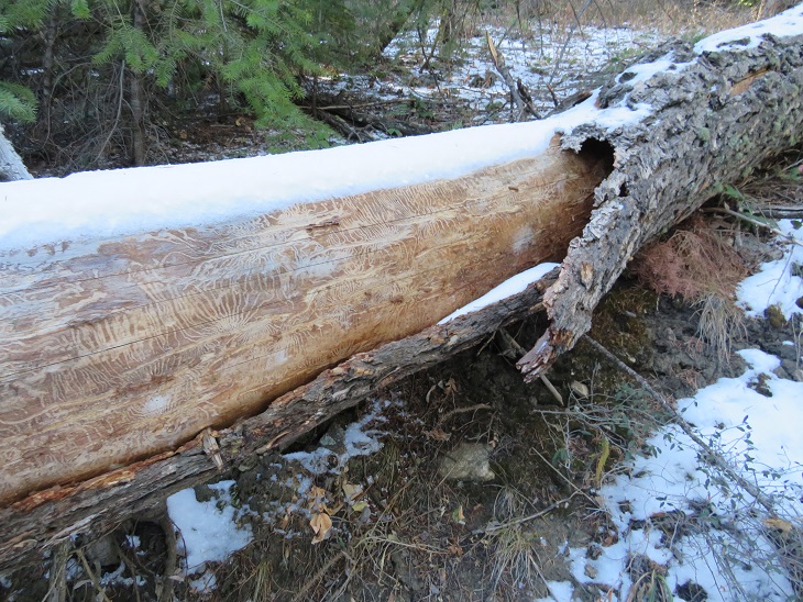
Here’s a cool log I hopped over on the trail. I’m a fan of the markings the beetles make, if not a fan of the beetles themselves.
And now I was back up at the highpoint/ridge
From here I’d lose 1319’ of elevation as I wound my way back down the mountain
There are several good camping spots directly off the trail, just before the low point and after (if you’d want to camp closer, rather than later in your end hike).
When you see this metal drain you’re at a low point. I believe this is Bear Creek.
From here I gained the last 350’ of this hike in elevation as I hiked back up to Lenny’s Rest
Another camping option, although this one is kind of steep to get to.
I made it to Lenny’s rest, and stayed straight to stay on the Colorado Trail (going right brings you to Roxborough Park
From here I switchbacked and switchbacked and switchbacked back down to the road.
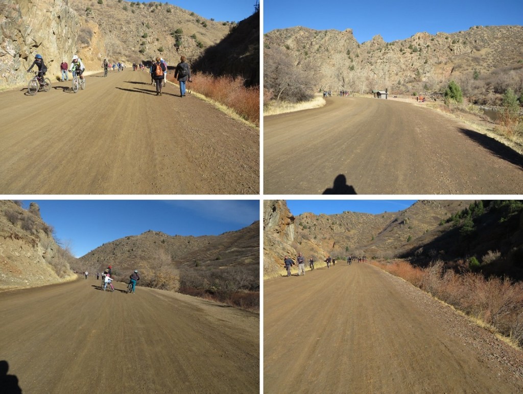
This is also where I encountered my first ‘people’ of the day. These people were riding bikes. I’ve encountered a lot of bike riders in my hiking experience, and I’d like to note everyone I encountered today was cordial. In Colorado Springs I’ve found the bikers had attitudes, but not here. I did my best to give them passing room on the trail, and they verbalized thank you’s. However, I was still frustrated. Over and over and over and over again I passed bikers headed towards me. Because I was hiking I gave them room and stepped aside. Again, and again. And again, and again. And again, and again. There were so may bikers I lost over an hour of hiking time giving them room. This was the right thing to do, but very, very frustrating. This is November, how many bikers could there be? (side note: dozens, if not hundreds). The trail eventually led to the road that navigates through Waterton Canyon
I was quite excited to see during the day what I’d missed hiking in at night. The first thing I noticed was a sign stating “This part of the Colorado Trail is maintained by the Colorado Mountain Bikers Association”. Well, that explained a lot. I just needed to prepare myself for bikers that wouldn’t end. The road led me past a maintenance yard and a ‘private residence’, which I believe belongs to a permanent/stationed worker here.
I quickly came to the Strontia Springs Dam, and got the feeling I’d be seeing a lot more people today than I’d imagined. And a lot more bikers. Sigh. Well, at least this was happening at the beginning of my journey. Also, I don’t dislike bikers, sharing trails is great, but I think we can all agree separate bike-motorcycle/ hiking trails is the optimal solution.
Most of the hike out was uneventful. I hiked for 6.2 miles along a well-maintained dirt road, doing my best to stay out of the way of the hundreds of bike riders along the way. Yes, hundreds. It was insane. There were bathrooms and picnic areas every 2 miles or so.
This road follows the South Platte River, which, according to the dozen or so fishermen I saw along the trail, is a good place to fish. Unfortunately, it must be too late in the year, as I didn’t see a single of these dozens of fishermen with a caught fish.
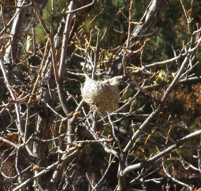
I saw birds nests in the trees
And wood ducks (the kind with red heads) floating in the river
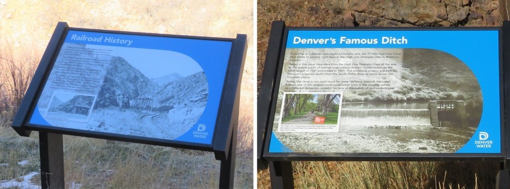
There were several interpretive signs along the trail as well
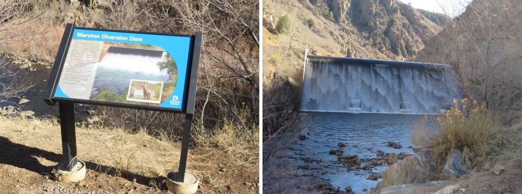
I passed the Marston Diversion Dam. At night, this was hard, yet amazing to see. Here it is in daylight.
And some more buildings/houses. It looks like they store snow equipment here
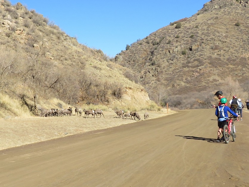
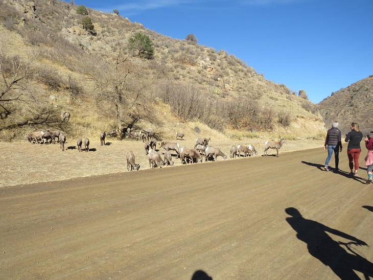
This is where it got really interesting: I could see people gathered along the side of the road ahead of me, and to the left of the road there was a large herd of bighorn sheep.
That’s when I heard it: the thundering of hooves quickly approaching from behind me. I turned and saw a rather large ram chasing an ewe down the mountainside at breakneck speed. They made it to the herd and everything settled down.
Well, kind of. It seems this is mating season, at least for the males. The rams kept chasing the females, sniffing their backsides and sticking out their tongues, testing if they were ready to mate. The females were having none of it, and kept darting away. You could see the power these animals have: lots of muscles and agility.
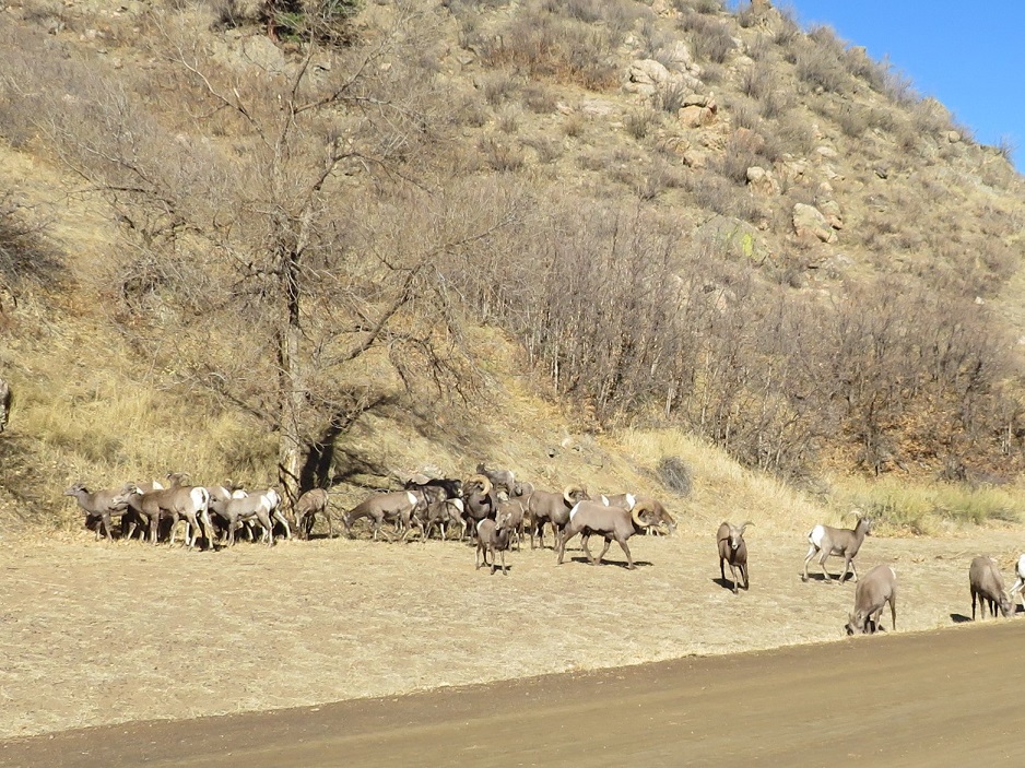
Bighorn Sheep – Waterton Canyon
Head Butt:
I was surprised at how close the people were to all this madness. There are signs posted asking you to stay a minimum of 25 feet away from the Bighorn Sheep, but it seems many people either hadn’t read the signs or forgot this. The sheep were all riled up (due to mating) and unpredictable.
I passed so many people on the way out. Hundreds of hikers, bikers, walkers, runners, and lots and lots of children on the trails. OMG, this was an insane entry point: One I’d love to do again, but never with this may people. INSANE.
Here are some pictures of the end of the trail
And a picture to prove I made it back
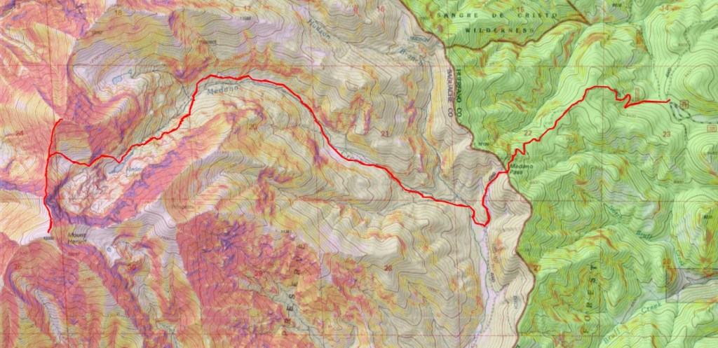
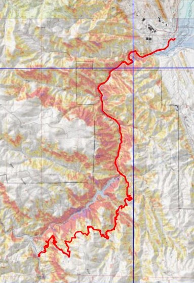
I made it back to my truck at 1:45pm, making this a 34.18 mile hike with 4308’ in elevation gain in 11 hours, 20 minutes. Added bonus: My truck was as I’d left it. I’d been a little bit worried, because about 5 miles in I realized I’d forgotten to lock the topper. Whoops! I was lucky this time. Here’s a topo of the route. (Side note: feel free to contact me if you’d like a copy of the GPX file for this route).
The most difficult part of this hike ended up being the drive out. It took no less than 15 minutes for me to leave the parking lot, due to the number of people using the crosswalk and drivers coming each way. A nice person finally realized my predicament and waved me on, even though they had the right of way.
When I got home I took out my journal to write notes, but decided I’d rather start a specific journal, just for the Colorado Trail. I have some stocked up, for just this reason. Emily drew the Colorado Trail logo on the front, and I started jotting down notes. I’m kind of liking this journal…
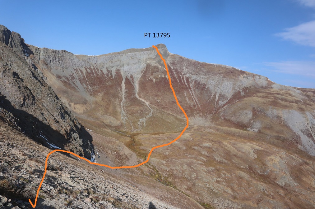
To finish off my birthday weekend I wanted to hike two more 13ers, which would bring my total to 200 unique Colorado 13er summits. I chose these peaks because we’ve recently had our first snow and I’ve attempted this peak before and turned back due to snow/conditions. If I wanted to get PT 13795 in this year I was going to have to do it soon.
I drove down to the Grizzly Gulch/Silver Creek Trailhead and didn’t make it there until after dark. The parking lot was packed, there were several tents set up, and tons of campers enjoying campfires. In short, it was loud and everyone seemed to be enjoying themselves. I parked, fired up my jetboil and made my birthday dinner of cup noodles and mashed potatoes. As I ate dinner, I made some notes from the days climb, then got ready for bed. There are clean bathrooms at this trailhead (no toilet paper though). As I came back from the bathroom I ran into a rather large deer licking my truck. I tried to shoo it away but she wouldn’t budge, so I carefully made my way into the back of my truck while she continued licking my bumper. On a positive note, by 9pm the entire trailhead was silent and everyone had gone to bed, so I had no problem falling asleep.
I awoke to 32 degree weather and a layer of frost on top of my sleeping bag. Looks like I’m going to have to start winterizing my topper. Since it was cold I put on my puffy as well as my windbreaker, knit hat and gloves, and was on the trail at 5:15am.
I started out by heading west, following the same trail as Handies Peak. If you’re reading this I’m going to assume at this point you’ve summited Handies Peak and I won’t go into detail about the initial approach. If you’d like to see the approach I’ve written it up from my failed attempt of PT 13795 last year.
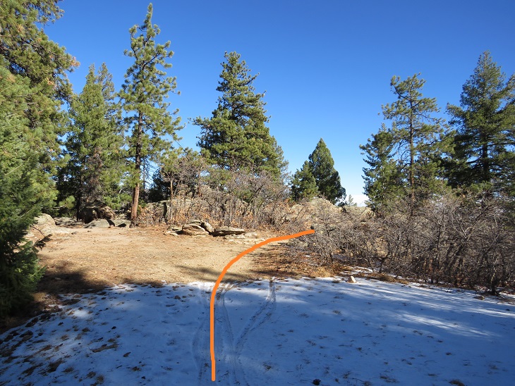
I followed the Grizzly Gulch trail through the woods and past treeline. After hiking for 2.5 miles I turned left and headed southeast towards an upper basin. There was a faint trail here
Once in the upper basin I came to a lake. There were two tents set up, so I tried to be quiet as I passed. I skirted the lake to the left and headed towards the gully that would bring me into another basin.
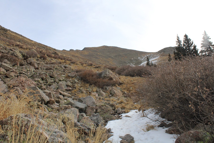
Ascending the gully beyond the lake was class 2+. The scree here was awful: I’d take one step forward and slide backwards. I actually used my ice axe and trekking pole here for stability, glad the sand was wet from the recent snow. There was no trail, so I just aimed southeast and tried to avoid the snow (it was bulletproof by the way).
Once in the upper basin I had a few options. I’ve read trip reports where hikers have used the gully to the left, but I’m not a fan of gullies. In fact, I consider ‘gully’ to be a 4 letter word. I took a look at the gully and said “nope”. Instead I took the ridge to the right. This was an easy hike on tundra, and should be the standard route.
Here’s a look at that gully I didn’t want to ascend
Just before gaining the ridge the tundra gave way to rock
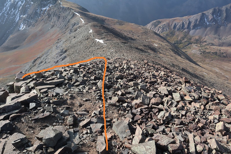
At the top I turned left and headed southeast for an easy tundra stroll towards PT 13795
The last push to the summit was rocky, but stayed class 2
The summit was rocky as well
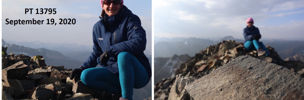
I summited PT 13795 at 8:20am. I only took 2 photos, and when I got home they were both terrible (oh well).
PT 13795:
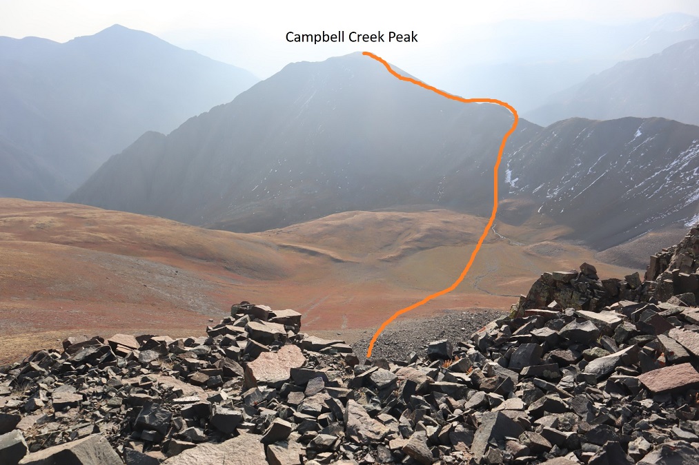
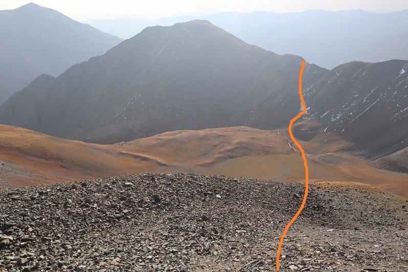
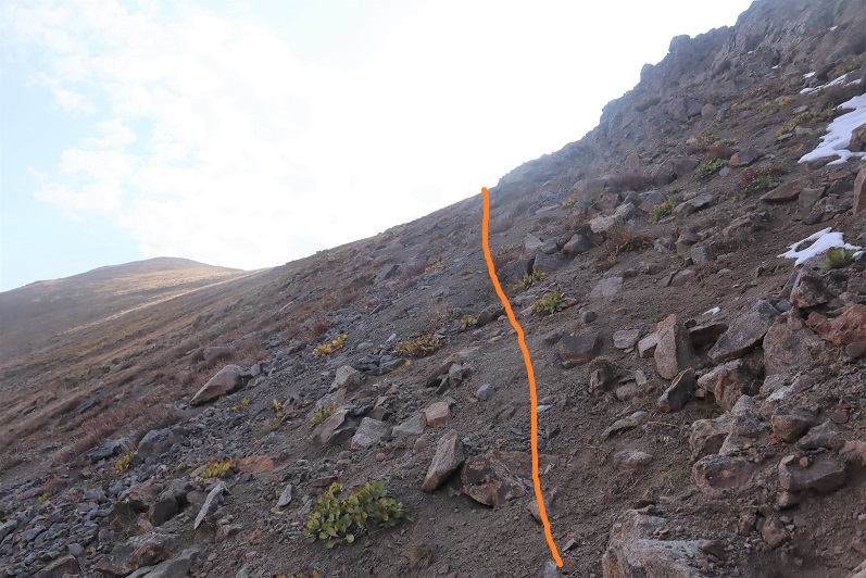
It was really hazy due to the fires, so I had a hard time getting a clear view of Campbell Creek Peak. I’d heard the ridge between PT 13795 and Campbell Creek Peak didn’t ‘go’ so I was going to need to drop down into the basin and ascend another gully. That gully didn’t look too bad. Here’s the overall route I took
First heading south to avoid the class 3-4 section directly below the peak, and then east towards the basin
I just aimed for the stream, and then stayed to the left of the rock to gain the ridge
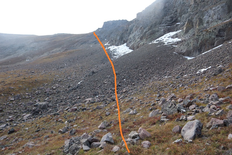
Here’s a look back at the route I took down from PT 13795 (it’s not as steep as it looks, but I was glad I’d hiked down this and not up)
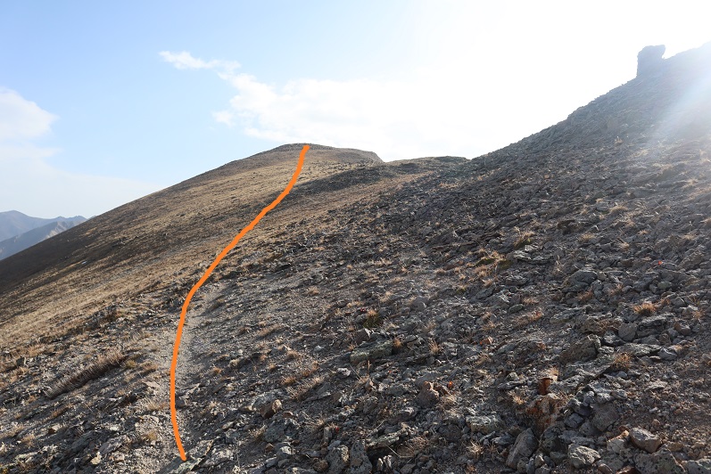
I followed the ridge northeast to the summit of Campbell Creek Peak
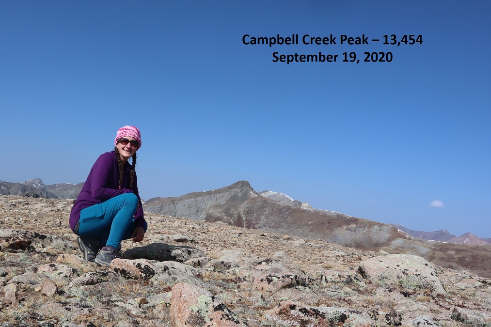
I summited Campbell Creek Peak at 9:45am
Campbell Creek Peak:
After summiting I turned around and headed back down the ridge and into the basin.
Once in the basin I turned right and followed Campbell Creek north. I crossed the creek towards the end of the basin and picked up a faint game trail
It was here I saw a herd of Bighorn Sheep. They also saw me and quickly bounded away.
The game trail I was on kept disappearing and reappearing, so I decided to just follow the creek out of the basin
This led me to a large patch of willows. I followed game trails northeast through the willows, around the side of the mountain
From here on out there was a lot of bushwhacking and route finding involved. Luckily, I could see CR 30 in the distance, so I just kept traversing the side of the mountain, heading northeast and aiming for the road, slapping willows, bushes, and branches out of my way as I went.
Eventually I came to a gully and followed it own to the Gunnison River, crossed the river on avalanche debris, and followed the road a mile back to the trailhead.
Here’s a look back at the gully I came down
I made it back to my truck at 12:30pm, making this a 11.29 mile hike with 4559’ of elevation gain in 7 hours 15 minutes.
Oh, and I didn’t get a picture of the deer licking my truck, but there were obvious signs it had when I got back and saw it in the daylight.
Campbell Creek Peak was my 200th unique 13er. Not a bad way to end a birthday weekend!
I chose this peak for today because it was the closest one on my list of unfinished bicentennials to Cielo Vista Ranch, where I’d just spent the morning hiking. I drove to the Willow Creek Trailhead and backed into the only available parking space. Vehicles were parked and double parked in each space, as well as several hundred feet down the road on the drive in. This is a popular trailhead and it was a Saturday afternoon.
It was raining a bit as I got out and looked around. There is an open and stocked bathroom here, and lots of signage.
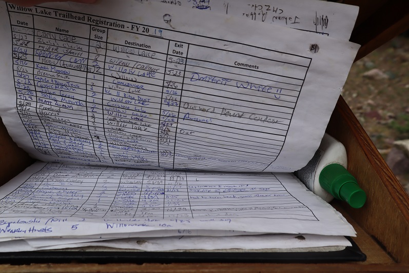
I opened the trail register container and was disappointed to find another full register. Every page was so full people were just writing in the margins of past pages. This one is from 2019. There were probably 7 pages total, which could probably get filled up here in a week. How are these useful when they aren’t kept up to date? Signing these seems useless.
I went back to my truck and got my stuff ready for the hike tomorrow. I didn’t have a flashlight so I decided to use my phone’s flashlight app. That meant conserving battery, so I put it in airplane mode. Then I people watched. There was a man hiking with a small dog in a basket, a group of about 20 high school aged backpackers returning from what looked like their first outdoor experience, and two men hiking in to Willow Lake to summit Challenger and Kit Carson tomorrow. I spent a good 30 minutes watching a man trying to turn his pulled trailer around in the parking lot. He must’ve been looking for a dispersed camping spot and wasn’t able to find one before the trailhead. Turning his rig around in the parking lot of the Willow Lake trailhead was his only option, and it took dozens of attempts. His rig was loud and he set off several car alarms in the process. It was all quite entertaining.
When the mosquitoes came out I decided to call it a night and went to bed early. I woke up at 2:30am, decided I was way too comfortable, and went back to sleep. The only bad thing about having a bed in the back of my truck is I don’t seem to want to get up in the mornings. I was on the trail by 4am.
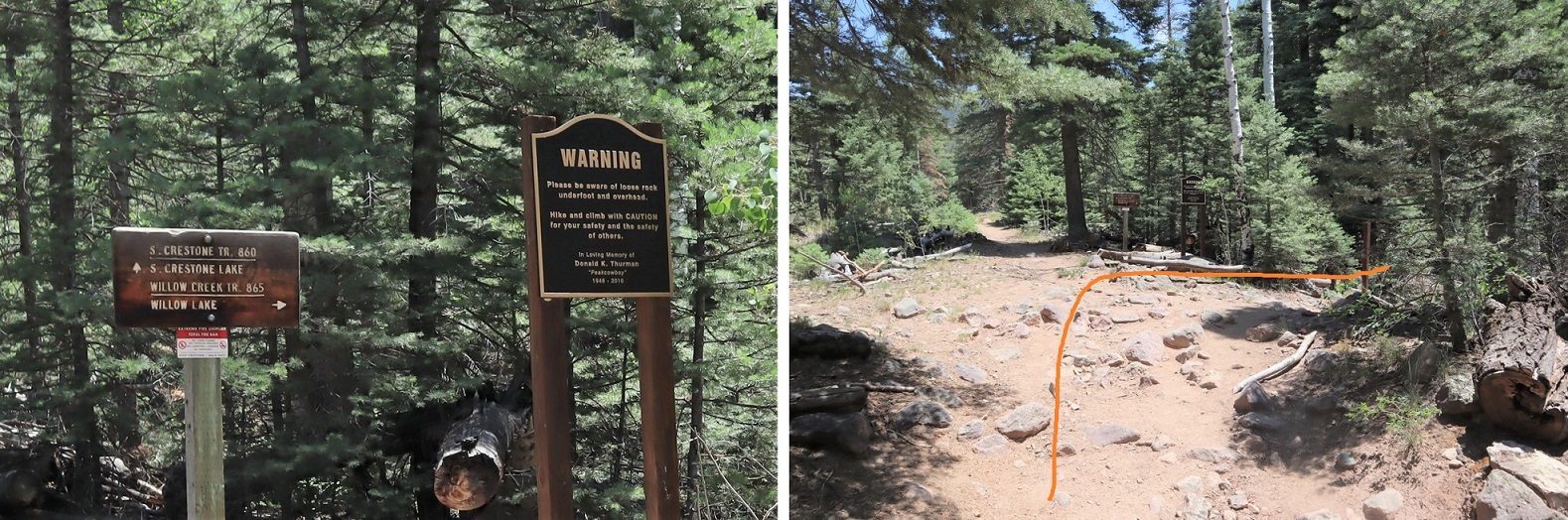
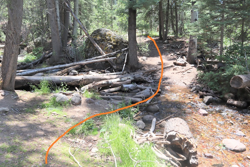
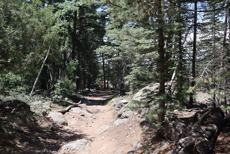
The trail starts at the east end of the parking lot and almost immediately comes to a junction. I turned right here, crossed a creek, and continued on a sandy trail.
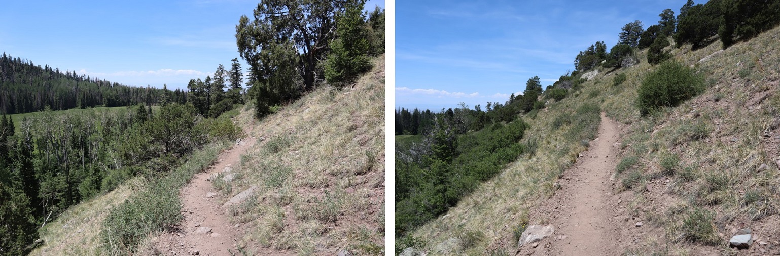
During the first mile of this hike, as I was hiking in the dark, I kept hearing chirping. It sounded like one of those bird boxes that’s put in the middle of nowhere to monitor birds and chirps every few seconds was out there somewhere, and broken. It wasn’t chirping on my way back, so it either ran out of battery or was an actual bird going crazy at 4am. The Willow Creek Trail is a class 1 trail that switchbacks all the way up to Willow Lake. Here’s an overview
And some pictures of the trail
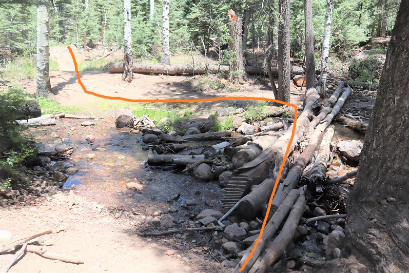
There are a couple of streams to cross, each with bridges/rocks
Before making it to the lake there’s a camping area. Someone has set up communal bear bag hanging areas, which I think was a brilliant idea. What’s even better is people actually seem to be using them. I saw two such areas, but there may be more.
After the camping area it’s a short distance to Willow Lake. I went up this rocky area
And was greeted by this sign and the lake. I turned left at the sign
I made it to Willow Lake after 5 miles of hiking
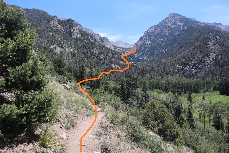
I continued following the trail until just before the boulder field. At this point I left the trail, turned left and continued north/north west up the hillside
There is no trail, but the route is easy to follow, as after I gained this small ridge I kept the creek to my left and willows to my right and continued north up to the basin.
It’s important to try to stay as much in the center here as possible, as to the right there are willows and shallow ponds to contend with. (I made this mistake on my way in, but was able to avoid it on my way out. I scared several deer out from willows in the process.). At the end of the basin you turn right and head east
This area was a bit mushy, so I went to the right around this rock/water to avoid getting wet, and then entered another basin
There were a lot of friendly deer here who didn’t seem to mind my hiking past them. I gave them room, but they let me get within 20 feet of them with no problem.
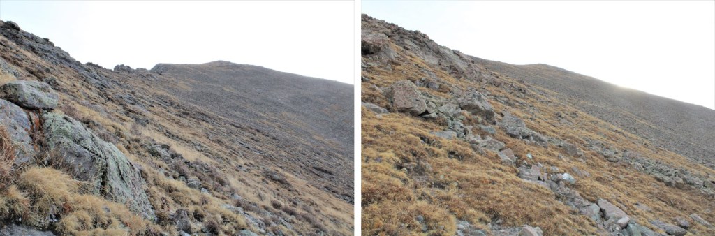
I headed east into the second basin, which was full of large rocks
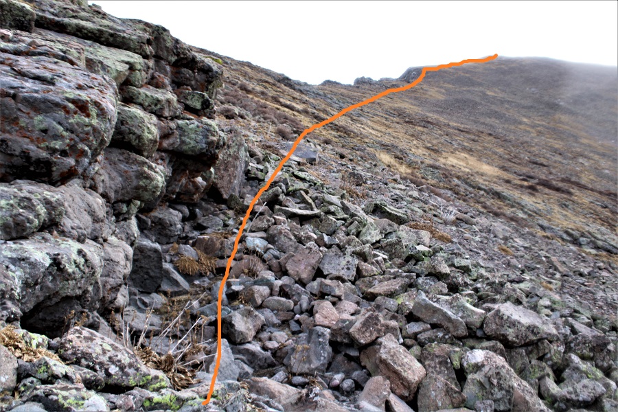
There are a lot of ways to summit this point. I decided to gain the ridge and follow it to the summit of PT 13580
Once on the ridge it was an easy hike to the summit. The only problem was the sun was rising directly in front of me as I was hiking and I couldn’t see anything due to the glare. These pictures are from the way back down. While hiking up this ridge I heard someone from over on the Kit Carson/Challenger side yell “rock!” every couple of minutes. It’s amazing how sound carries out here.
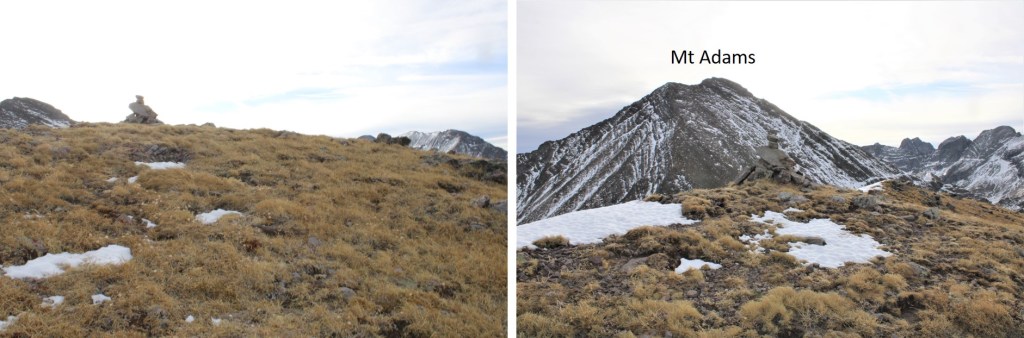
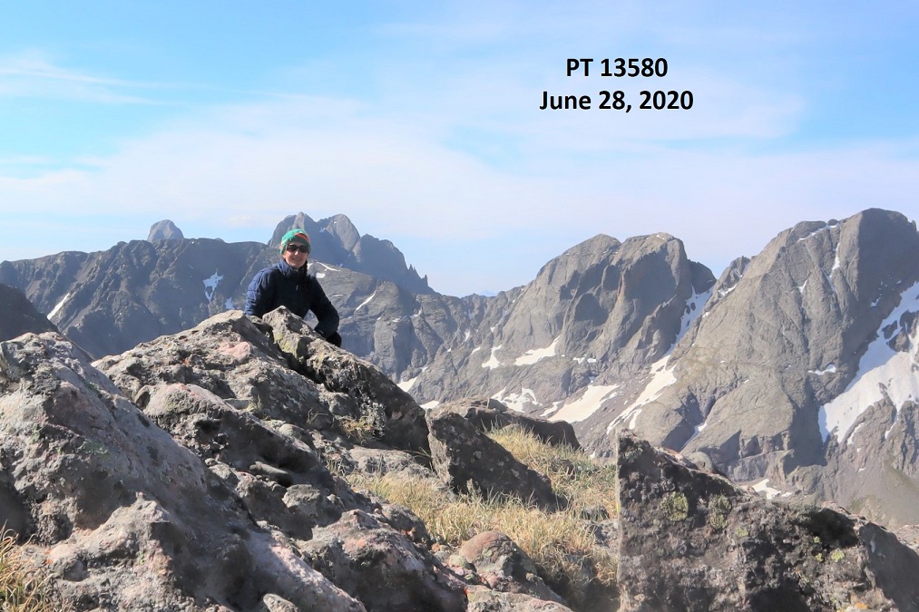
I summited PT 13580 at 8:45am, after 6.8 miles of hiking
13580:
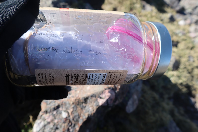
There was a summit cairn at the top, as well as a summit register. I didn’t open it, but I could read through the glass it was recently placed there (6/20/2020?)
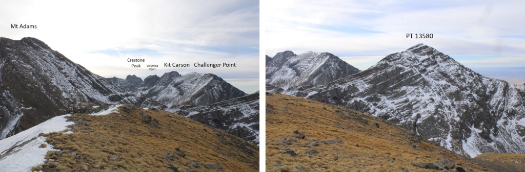
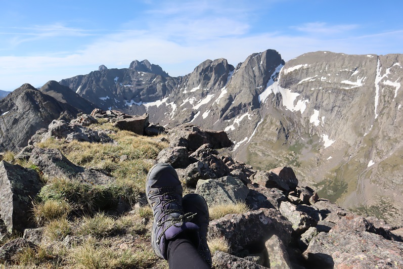
It was a beautiful day and I stayed for a long time on the summit, enjoying the views
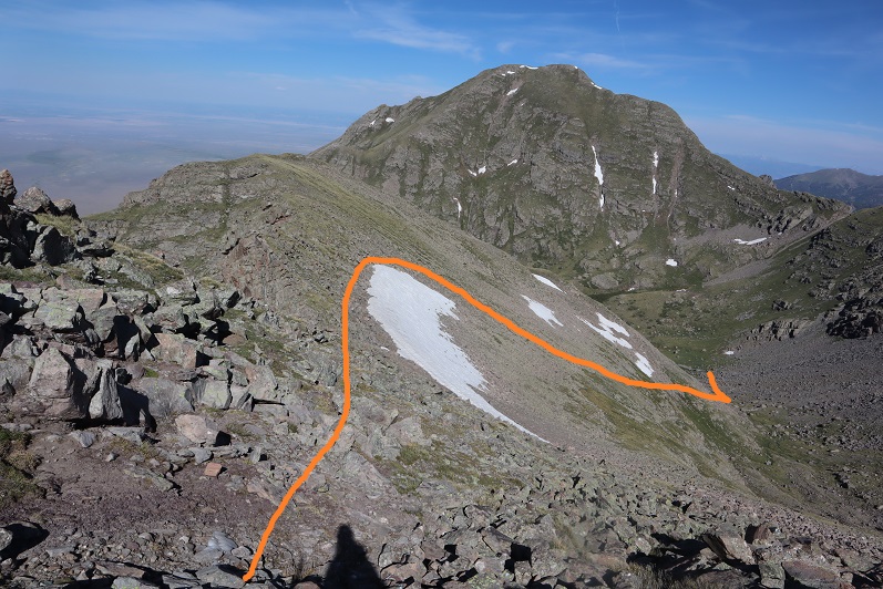
When it was time to go I retraced my steps back down the ridge into the basin. Here’s an overview, with Willow Lake to the south
And step by step…
Staying higher and dryer this time in the lower basin
It was easier this time to avoid both the willows and the creek
Once Willow Lake was in view it was easy to make my way back down to the trail
There are some beautiful waterfalls here
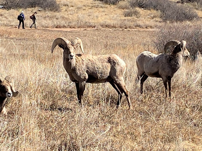
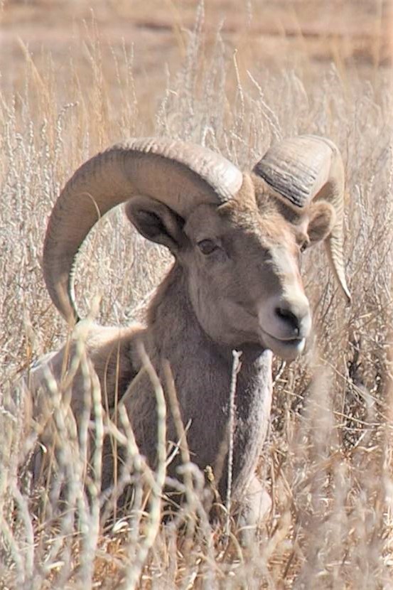
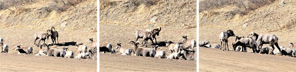
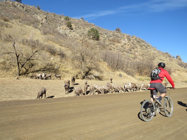
I made it to the camping area and was startled to see bighorn sheep just off the trail. The camping area was full of tents but the hikers were all out hiking. It seems while everyone is out hiking for the day the sheep came to play. They posed for me while I took a few pictures. Yes, they were a little unkempt, but friendly enough.
Here are some shots of the class 1 trail back down to the trailhead
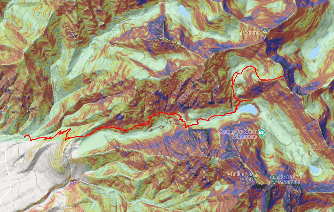
I made it back to my truck at 12:30pm, making this a 13.38 mile hike with 4934’ of elevation gain in 8.5 hours. Here’s a topo map of my route. Oh, and just for reference, using my iPhone’s flashlight took up 66% of it’s battery in 2 hours (while on airplane mode).
I drove back home, cleaned up, and noticed I was full of mosquito bites. Curiously, they were only on the left side of my body.