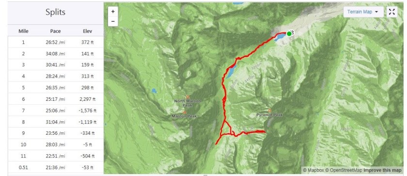
RT Length: 11.5 miles
Elevation Gain: 4697’
I did a ton of research on this one, as I didn’t want to have to attempt it twice. I’d been watching the weather for the past few weeks for this peak, and now that the road was open into Maroon Bells I figured this would be my best chance of making this peak a snow climb this year. The night before the attempt I was re-reading previous conditions reports and someone mentioned they’d have liked to have had 2 ice picks for this peak. This seemed curious to me, but if someone’s going to give honest advice I was going to take it. The only problem: It was 6pm and I didn’t have a second ice axe. I gave it some thought, and a wild idea came into my head: I wonder if I could use a hammer? Probably not the best idea, but maybe just bring it along just in case? I went to the garage to find a hammer and found a very cheap adze hoe I’d bought at the dollar store last year. It had three prongs, was very lightweight, and I thought this looked even better than a hammer! I had no intention of relying on this as my only source of stability (I brought along my ice axe) but I thought I’d have it “just in case”. I got out some paracord and made a quick leash for it and attached a carabineer to it and put it in my pack, never intending to actually use it.
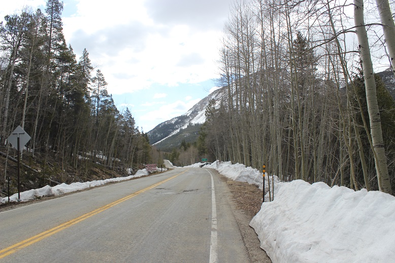
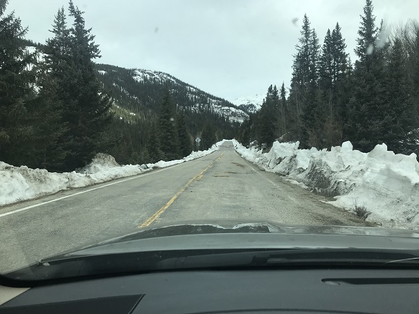
When I made it to the trailhead there were two other vehicles in the lot. I got my gear together and as I was ready to go I noticed a young man getting his gear ready, so I went over to talk with him to see which peak he was climbing. He was a bit surly (which I attributed to it being 2:30am) and he told me he and his friends were going to snowboard down Pyramid. I wished them luck, put on my helmet (so I wouldn’t forget to later) and was on my way.
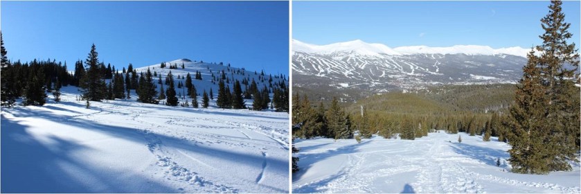
I was surprised to find they’ve recently roped off Maroon Lake (on my way out I saw dozens of people step over the rope for pictures, so unless they have personnel there monitoring visitors I don’t think the ropes are going to make much of a difference).
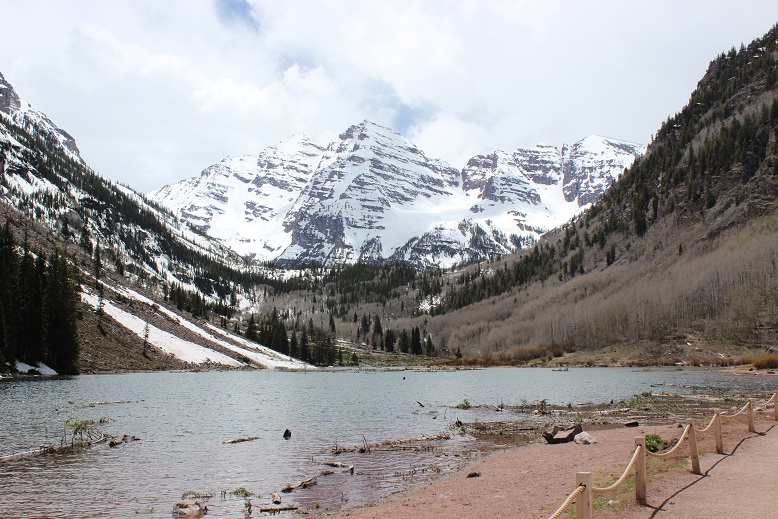
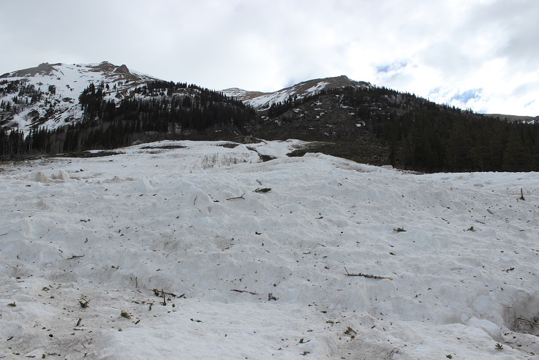
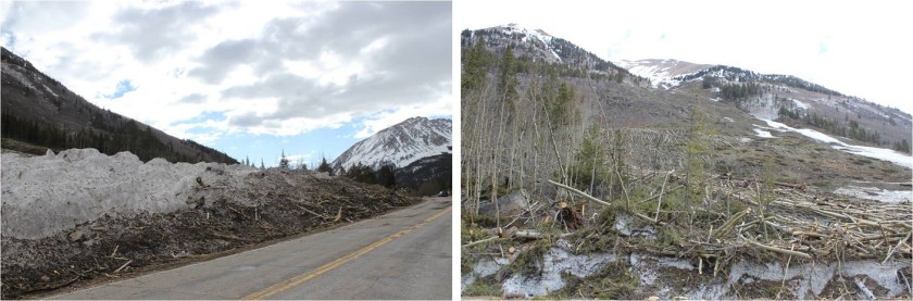
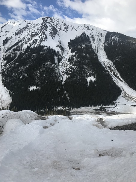
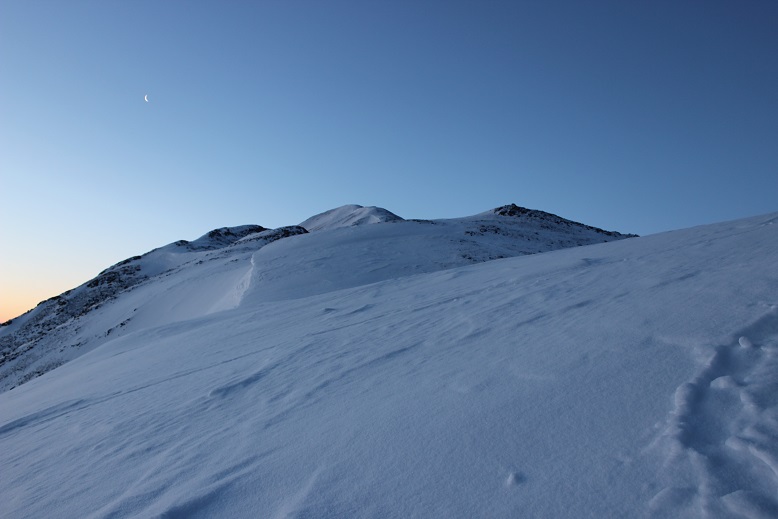
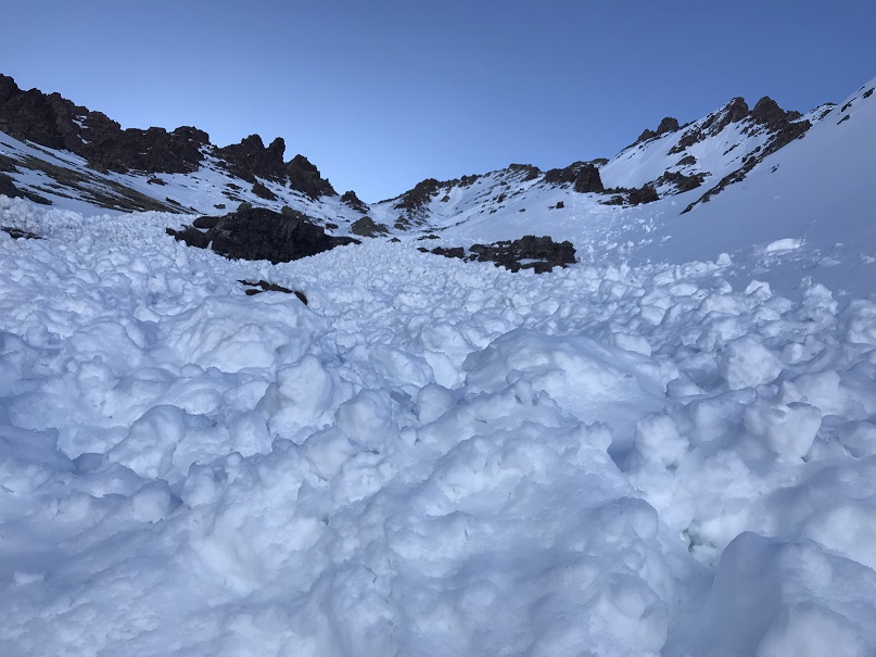
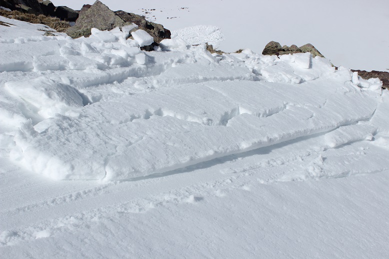
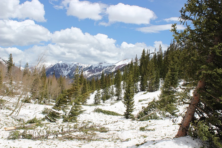
The trail was dry until I hit 9950’, about half a mile before Crater Lake. Luckily the snow was firm so I didn’t need to put on my snowshoes. Crater Lake was covered in recent avalanche debris, but even in the dark it was easy to navigate through.

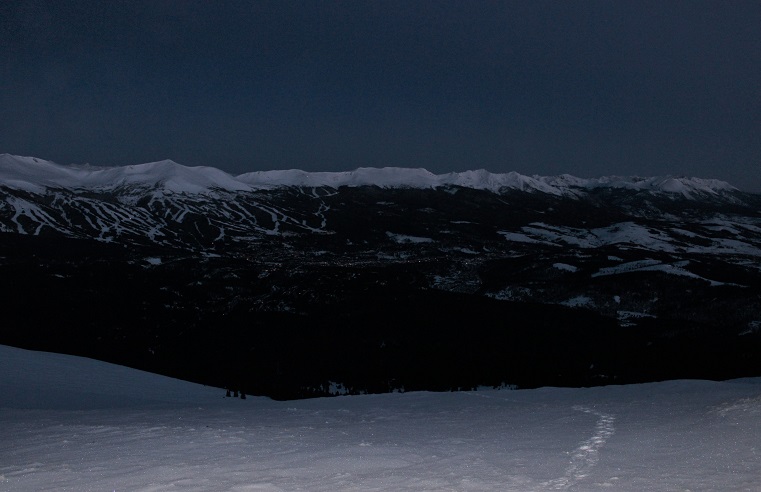
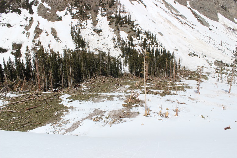
After Crater Lake the trail pretty much stopped: it didn’t look like anyone had been out hiking past Crater Lake yet this season. There was a thick layer of snow and what seemed like avalanches everywhere the trail was supposed to be, so I just worked my way through the willows and followed Maroon Creek as best I could. I postholed a bit in the camping area, but otherwise the snow was firm. It was about here I turned around and saw someone’s headlamp in the dark. It looked like someone as hiking North Maroon Peak this morning, and making good time. Cool!
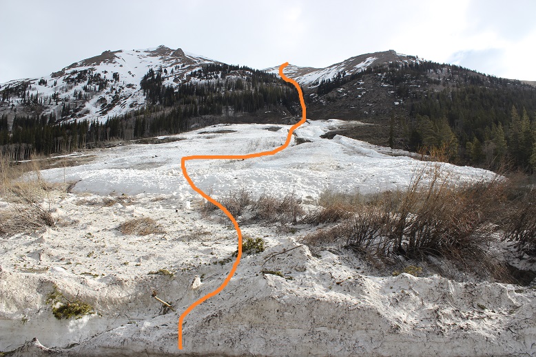
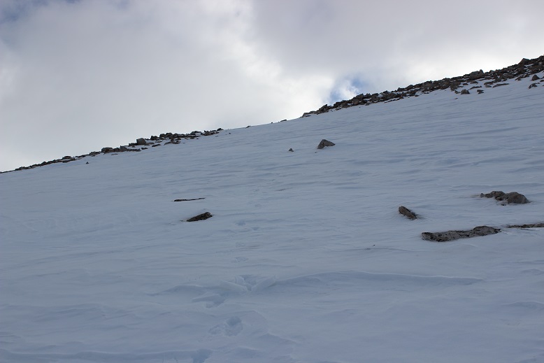
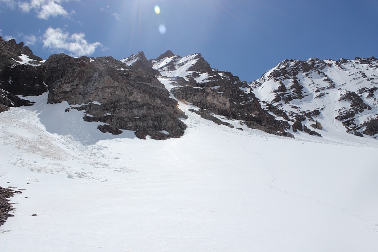
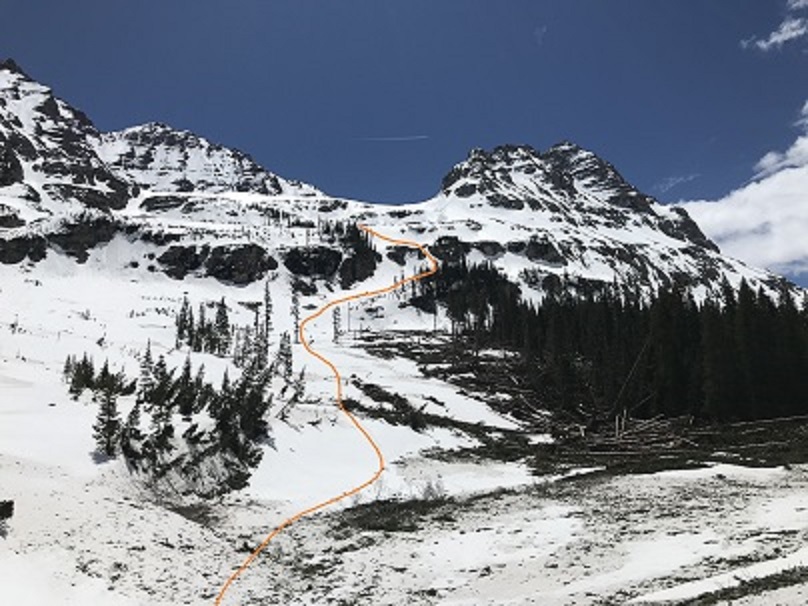
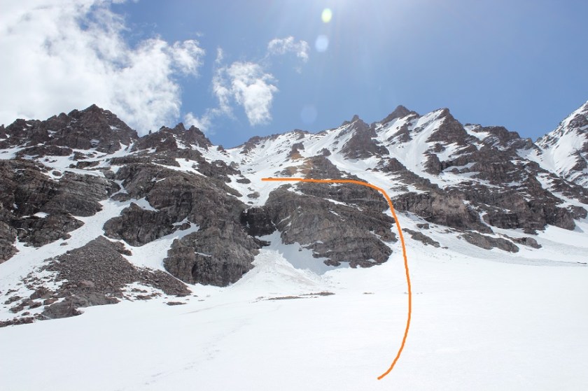
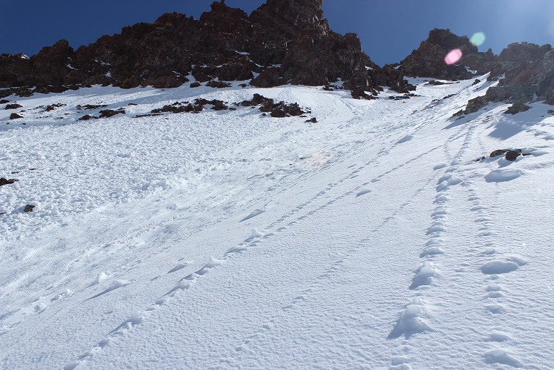
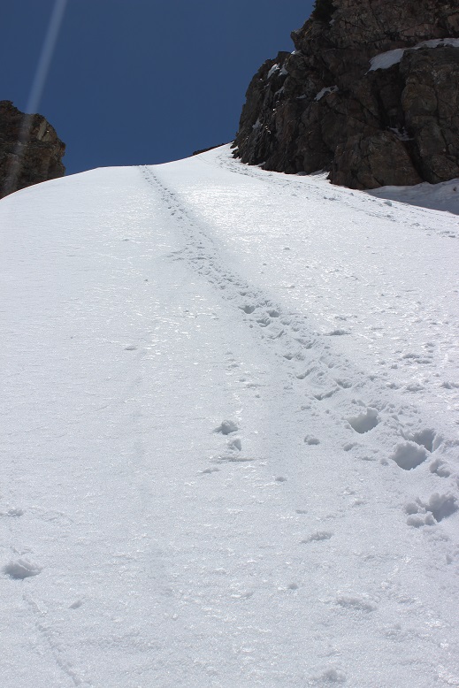
I never saw the creek crossing as it was covered in snow, and in the dark I accidentally went too far and had to backtrack. When I made it back to the correct spot to ascend the first access gully I noticed an avalanche had occurred here as well. The good news is it makes it easier to see your entire route. Here’s the route I took up the first access gully.
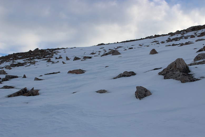
This was much steeper than it looked. At the base I put on my crampons and looked for a good route. Boy, was that steep! The snow was consolidated enough to need crampons, but the slope angle was so steep I couldn’t just walk up it either: I needed to kick in steps. I decided to take out that adze I’d brought with me and try it out. Kicking in steps was difficult because the snow was so hard. I’d kick about 15 times for each step.
However, the adze was amazing! In fact, I liked it better than my ice pick. It wasn’t practical for self arresting, but those 3 prongs were great for traction! I had the adze in my left hand, and once in the snow it felt more secure than my right hand did holding my ice axe. Wow!
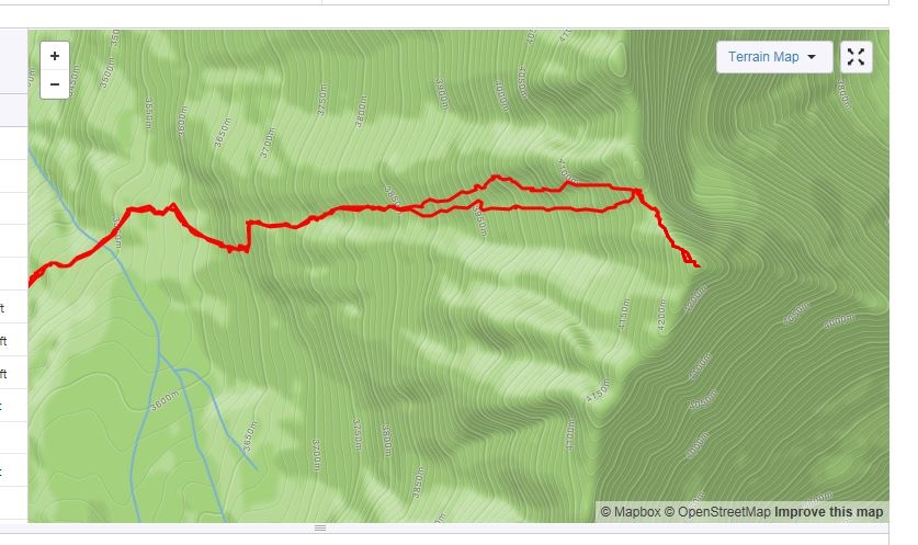
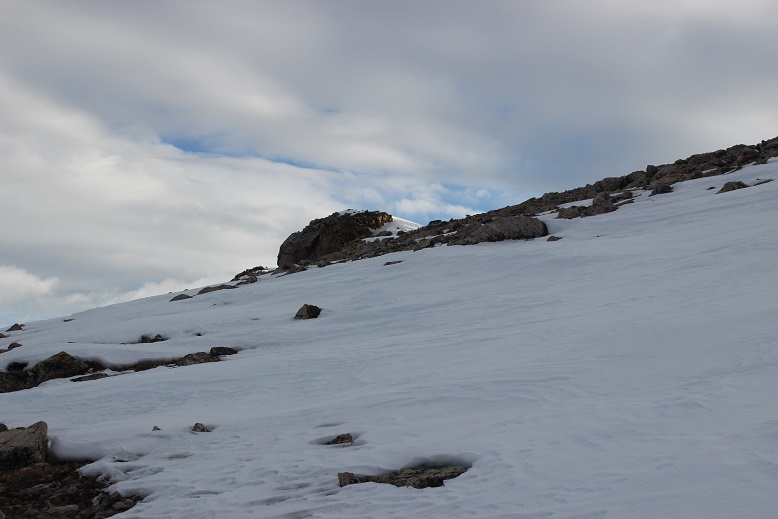
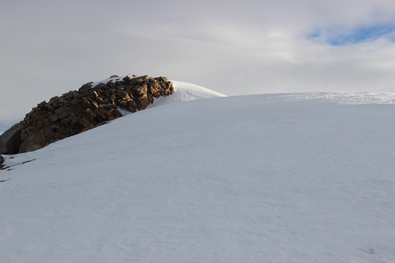
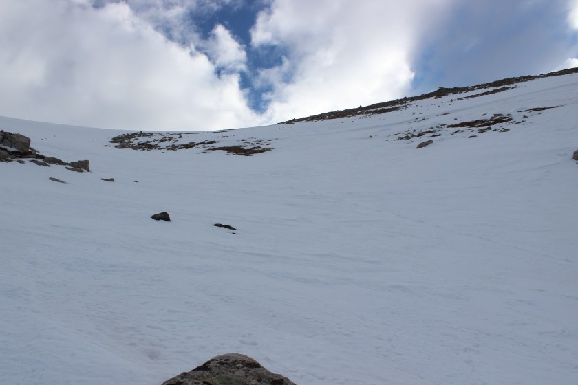
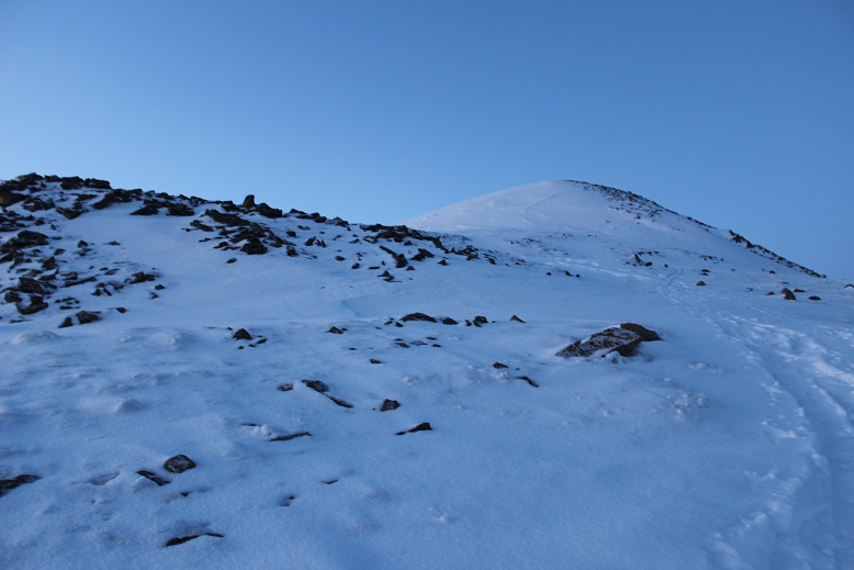
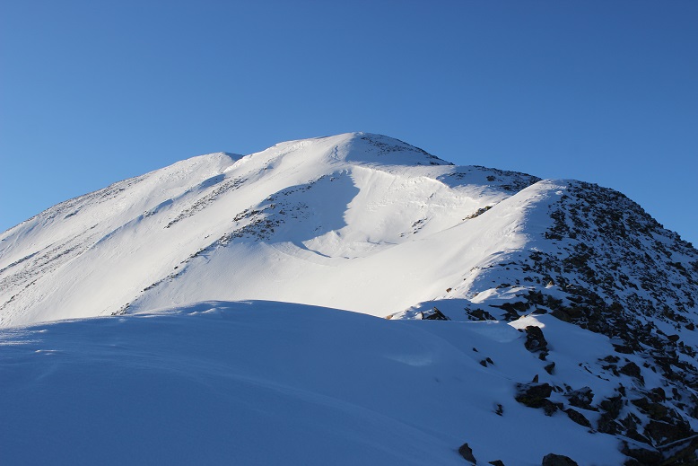
It’s really important to pick your line from the base of the mountain because once you’re climbing the terrain is very steep and it’s hard to tell where the actual summit is. This is the route I took.

From the top of the first access gully I needed to ascend a band of cliffs. This is the route I chose to take
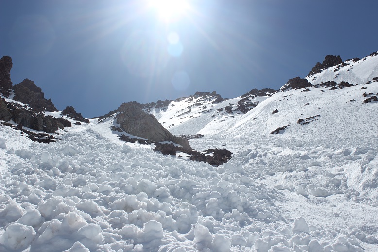
After the cliff bands there’s over 1500’ of gully to climb. This sounds straightforward enough, but the route was really, really steep. Added to that there were unavoidable frozen roller balls and avy debris littering the whole route.
It wasn’t lost on me I was climbing up a slide area, but the entire mountain was a slide area. The debris on the mountain was actually helpful while upclimbing because it gave my feet stability (most of the time, when it wasn’t sliding out from underneath me). I knew I was climbing on a ticking time bomb: as soon as the sun warmed up the mountainside all this debris would become slush and slide (hopefully after I’d made it down). I tried to decide if it was safer to hike down the slide areas or on the firm snow on steeper terrain that looked like it was about to slide. I wasn’t sure?
Progress was very slow going. If I were to lose my balance and fall self arrest would be difficult at this angle, and I was going to slide a long, long way if that happened. So I couldn’t fall. I made sure each step was secure, having at least 3 points of contact at all times. This entire stretch required kicking in steps, often times on terrain that fought against me. Did I mention the adze? It was amazing!!! I didn’t care how silly I looked, I was so glad I’d chosen to bring it along.
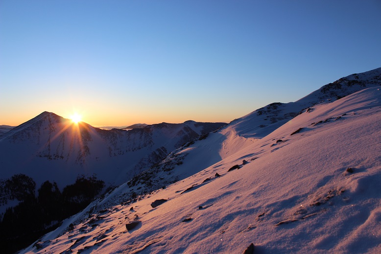
I was in a race against the sun, and kept reevaluating my current situation. The snow was firm and I was making good (if slow) progress, but I told myself to stay out of harm’s way I needed to make it to the top of the gully before the sun crested the saddle. If the sun made it before me, I was going to have to turn back for safety reasons.
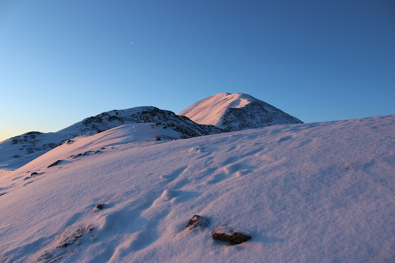
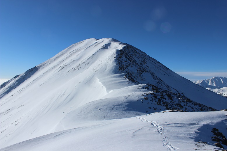
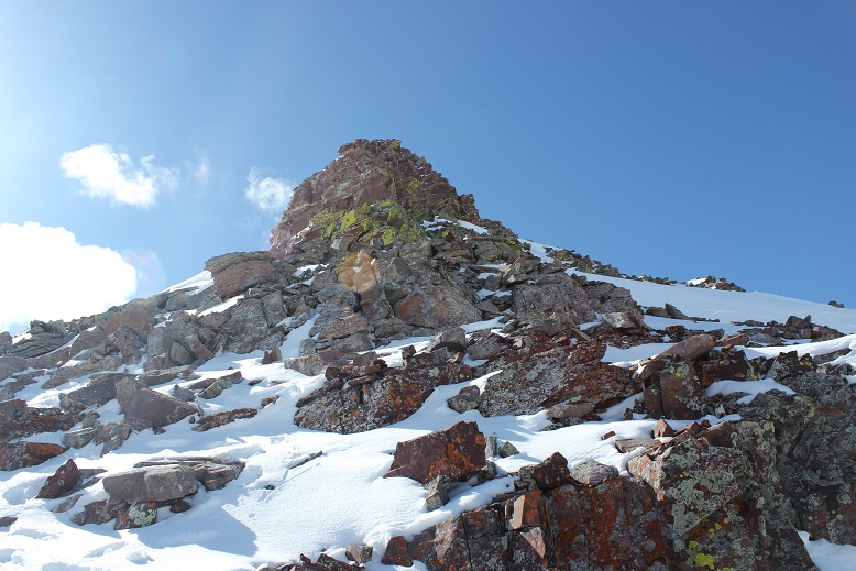
Most of the trip reports I’d read said to take the right gully, but that wasn’t an option for me as the safer terrain today was to the left. I topped out of the gully at a small saddle between Point 13,820 and Thunder Pyramid. Here I stopped to catch my breath. I’d done it! I’d beaten the sun! Woot! It was now a quick 300’ or so climb to the summit. But was that really the summit? I took out my phone and pulled up Peakbagger. Yep, that was it: I needed to go right. I put my phone away, took off my crampons for the climb, crossed the saddle and sank up to my arms in soft snow.
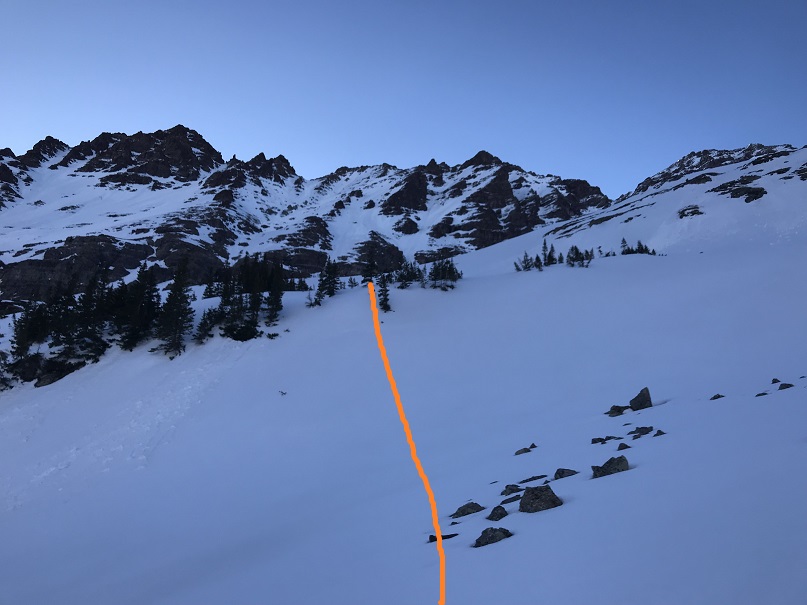
Drat! I seriously had to hurry! The sun was going to warm up the mountainside fast. Here’s the rest of the route
Whoops, my camera was still covered in snow from that unexpected dip. Here’s a better picture of the route I took
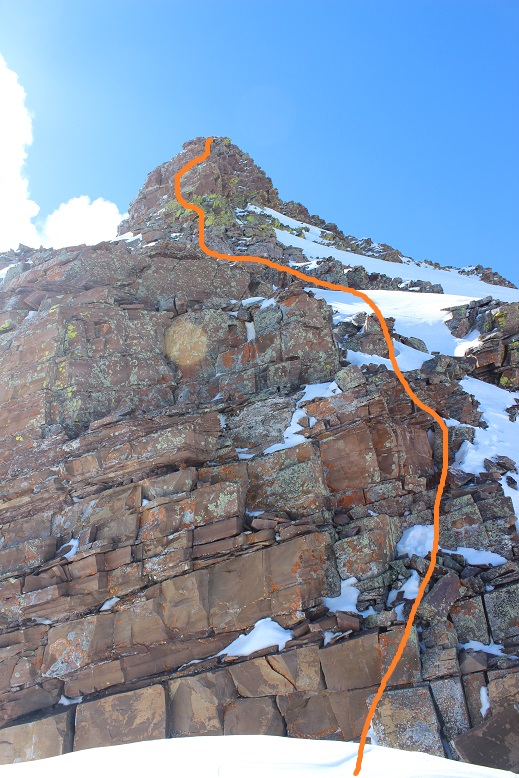
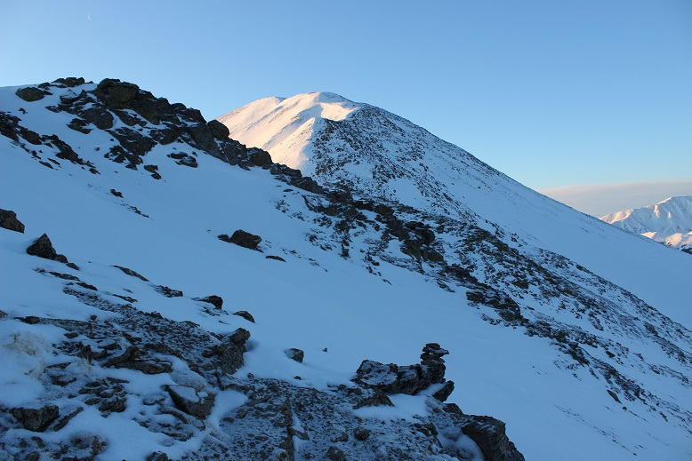
It looks steeper than it is. I’ve heard this is class 4-5, but I was able to keep it at class 3-4.
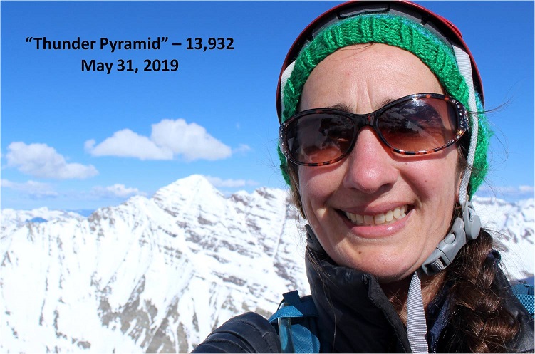
I made it to the top, took a quick selfie (my gorillapod is still broken: another’s on its way so hopefully this DSLR-selfie thing can stop soon)
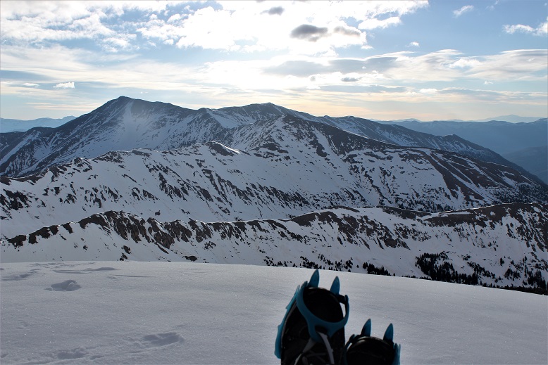
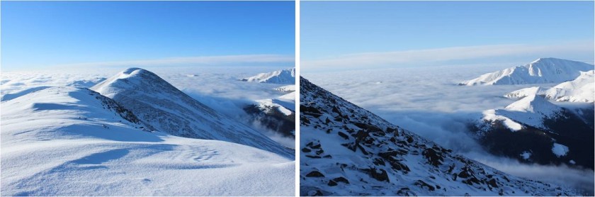
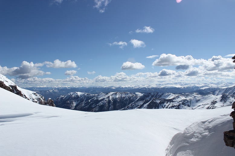
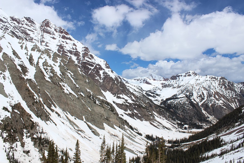
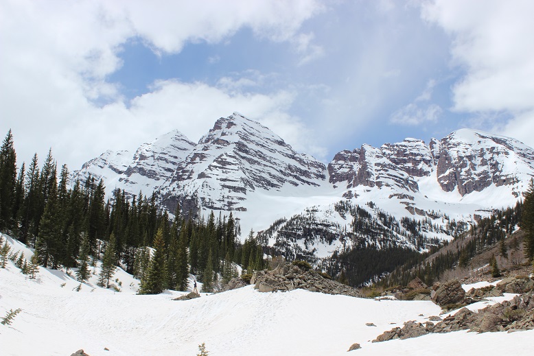
And booked it back to the saddle. Pyramid is looking wonderful this morning
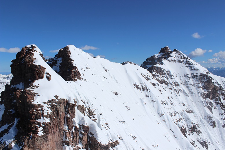
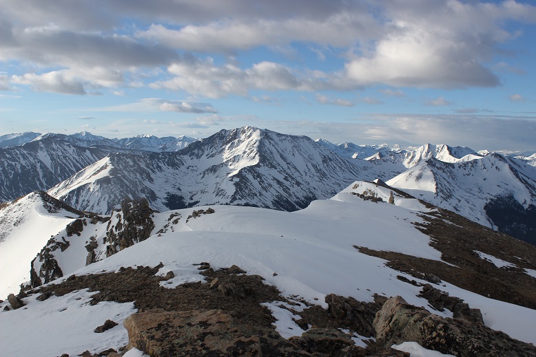
As are the bells
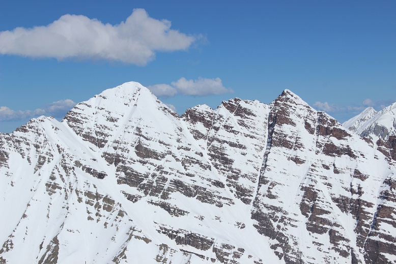
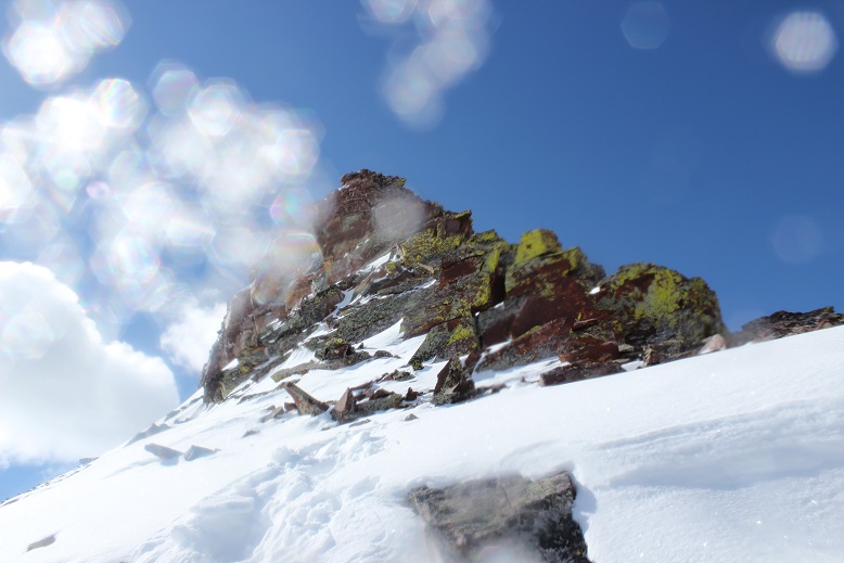
The sun was heating things up fast but Thunder Pyramid was still (mostly) in shadows

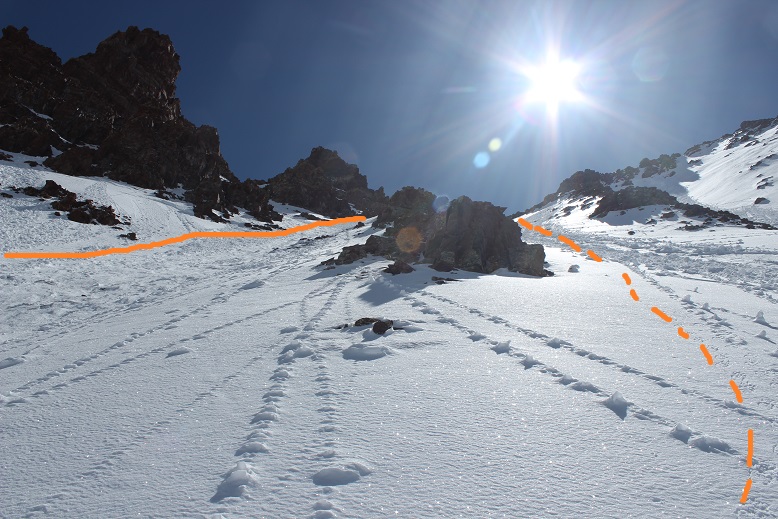
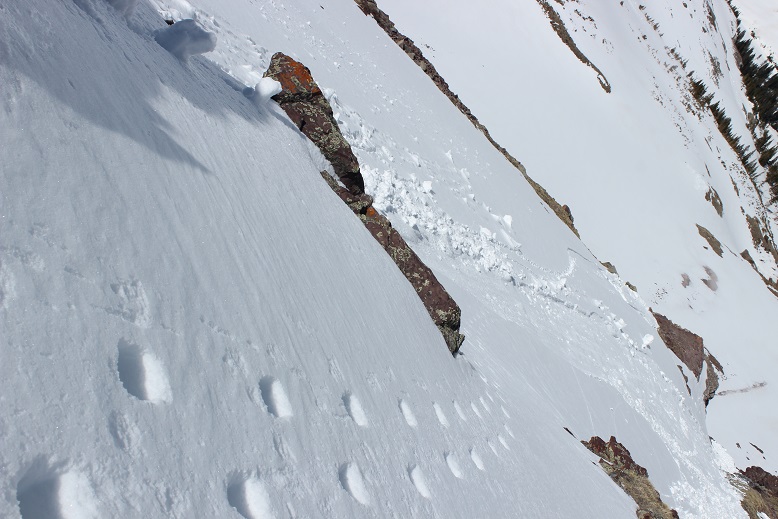
I put my crampons back on, grabbed my ‘tools’, and began descending. I descended a little more to the right than I’d summited, with the intention of climbing the smooth snow instead of the avy debris (which I was worried would fall). Solid line is how I summited, dotted line is how I descended. Neither was better than the other.
I had to turn and face the mountain the entire way down, and wouldn’t you know it? Slick as snot. This side was no better, and probably worse.
If anything, there seemed to be more avy debris here, none of it stable.

I tried to avoid the areas that had recently slid because they were very, very slick. I was also happy to see some of my kicked in steps on the way back down!
Evidence of wet slab avalanche
Downclimbing was just as hard as climbing up, with the added anxiety of making it down (safely) before things started to slide. I made it to the top of the cliff bands and was finally able to turn around and walk down

The snow was seriously starting to soften up fast. I kept increasing my speed until I made it to the cairn at the top of the first access gully. Here was where I could finally breathe a sigh of relief: I was out of the danger zone! I figured it was time for some self care: I reapplied sunscreen (knowing on my way down I’d already done some damage), took off my gloves (it was warm here!), exchanged my crampons for snowshoes, and looked back at the route I’d taken down the cliffs.

I also took a picture of my ‘tools’. I was so thankful for the conditions report that suggested I bring 2 ice axes! The adze wasn’t an ice axe but it had proven extremely useful. I was glad to have had it with me.

Just as I took this picture I heard a loud pop and then a crash that sounded like thunder. It startled me at first, until I realized one of the waterfalls had warmed up and dropped a bunch of ice down its chute. Then I heard it again, and again, and again. The entire basin had warmed up at the same time and was filled with icefall. I’d made it down in perfect time! Woot! I sat there and waited for the crashes to stop, just enjoying the experience while I was there.
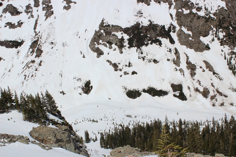
But I wasn’t out of the woods yet. I’d thought I could descend via the avalanche area and skip going back down that steep access gully, but when I made it to the avalanche area it cliffed out
Ugh! I had to backtrack up to the cairn and get out my tools one more time. The snow was very soft at this point, and I should have just glissaded down the access gully, but I didn’t want to take off my snowshoes (etc) so I turned and faced the cliff and descended in rapidly softening snow.
After heading down I turned right (instead of left, the way I’d initially made my way in the dark) and was able to safely descend via the avalanche area. This will probably be the new route
Here’s looking back on the route

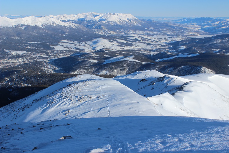
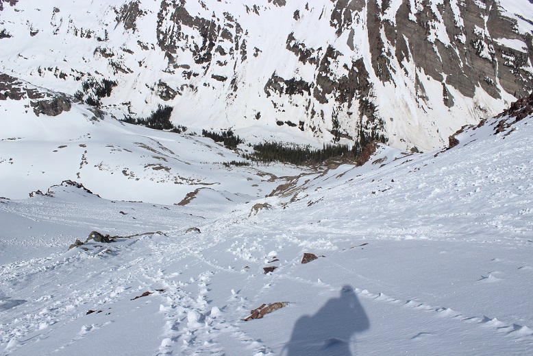
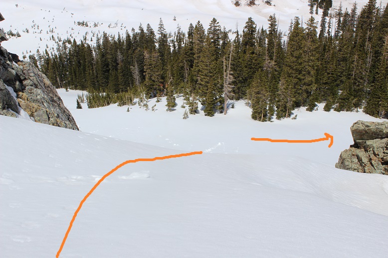
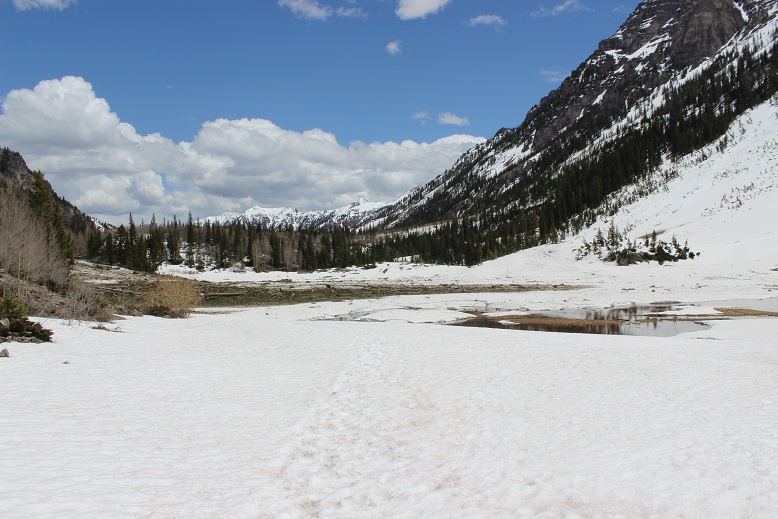
And now to head back down the basin to Maroon Lake.
The willows were much easier to navigate in the daylight, but unfortunately I was postholing in the snow. There was avy debris hugging the base of the mountains, so I tried to stick to the creek as much as possible.

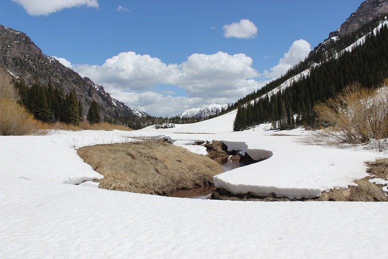
Maroon Creek is beginning to thaw
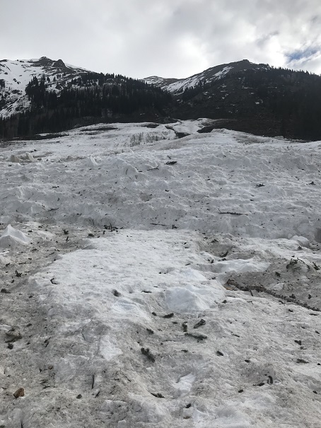
And the avalanche area covering Crater Lake didn’t look so intimidating in the daylight
Oh, and you haven’t experienced spring snowshoeing in Colorado until you’ve snowshoed over avy debris. There’s no other experience like getting a pine branch stuck in your snowshoe. And don’t bother removing it: another one will take its place with your next step.
It was really nice to hear all the birds chirping on my way out. After Crater Lake the crowds picked up and so did the slush. I was very thankful to have my snowshoes. Every tourist I passed commented on how ‘smart’ I’d been to bring them. Ha!
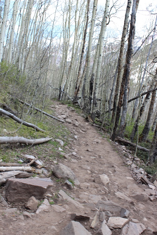
The last part of the trail was over a path with just enough rocks to slow you down, but at least it was snow free.
I started at 2:30am and made it back down at 1:30pm, making this an 11.5 mile hike/climb in 11 hours.

Disclaimer: I’m NOT advocating the use of garden tools in place of proper mountaineering equipment. There are tons of reasons why this was a bad idea, but in the end it worked out well. The next day I went to REI to buy a second tool. I asked an employee for help, and she couldn’t recommend anything to me at the moment (apparently ice climbing gear isn’t in season in June). The only thing she could recommend was a second ice axe, exactly like the one I currently have (which I thought was overkill, too much weight, etc.). So I’m currently in the market for an ice pick for my left hand and keeping the adze in my pack until that happens. Hopefully sooner rather than later.
Track: