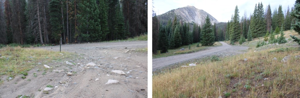
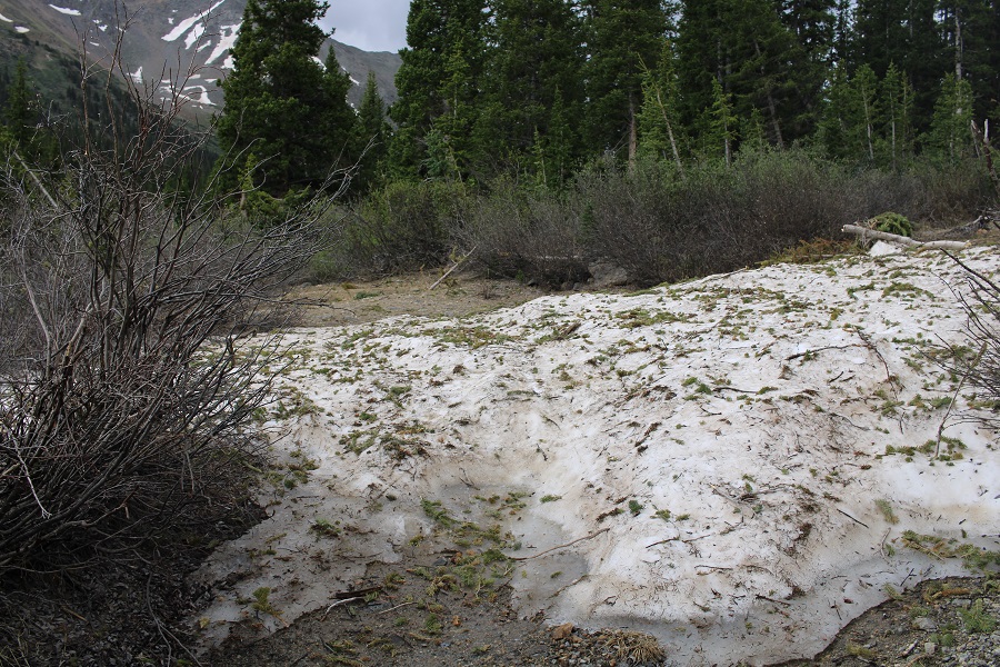
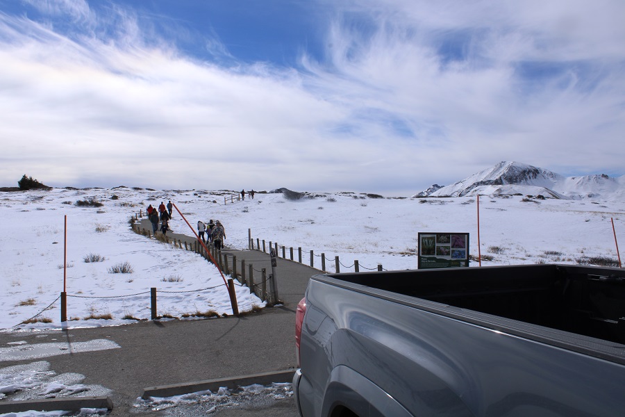
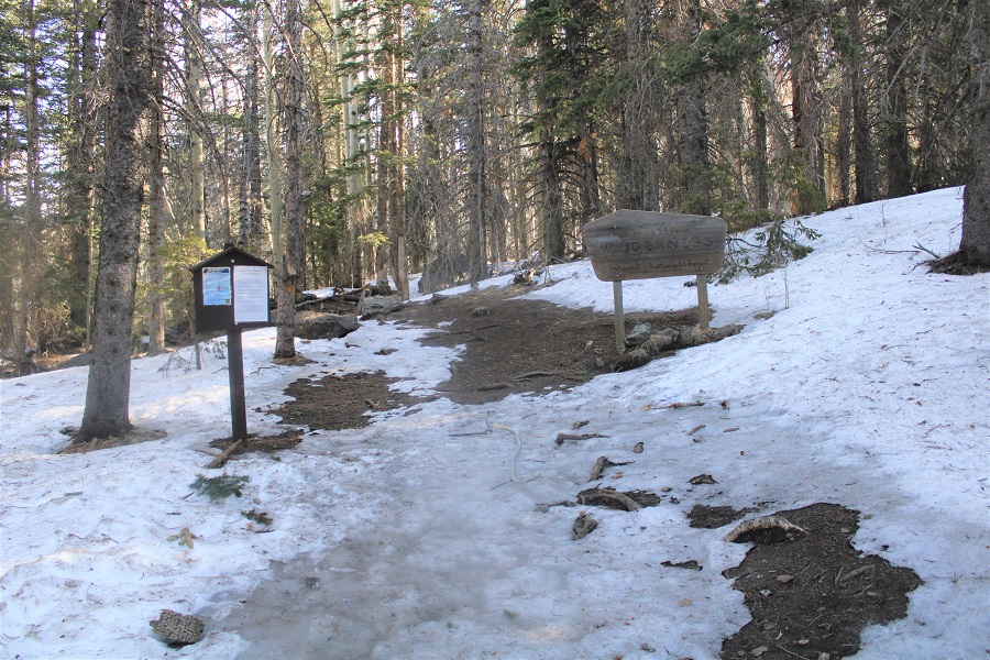
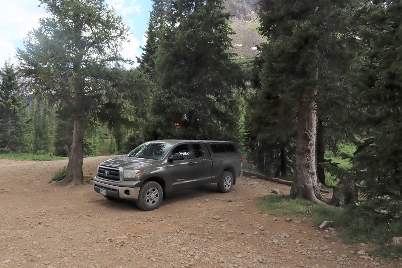
I’d parked about 6 miles past Cottonwood Lake, at the junction of 344/349. There are a few dispersed campsites in the area, and a few further up as well. I was up and on the trail at 4:45am, hoping this would be a quick hike because I had other things to do this afternoon.
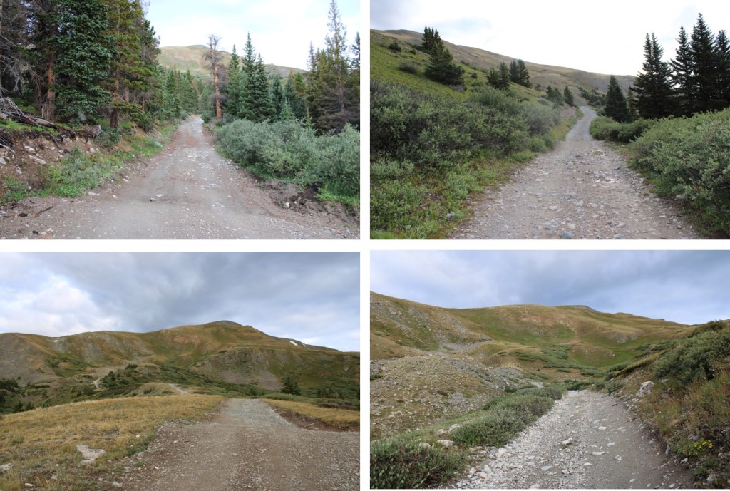
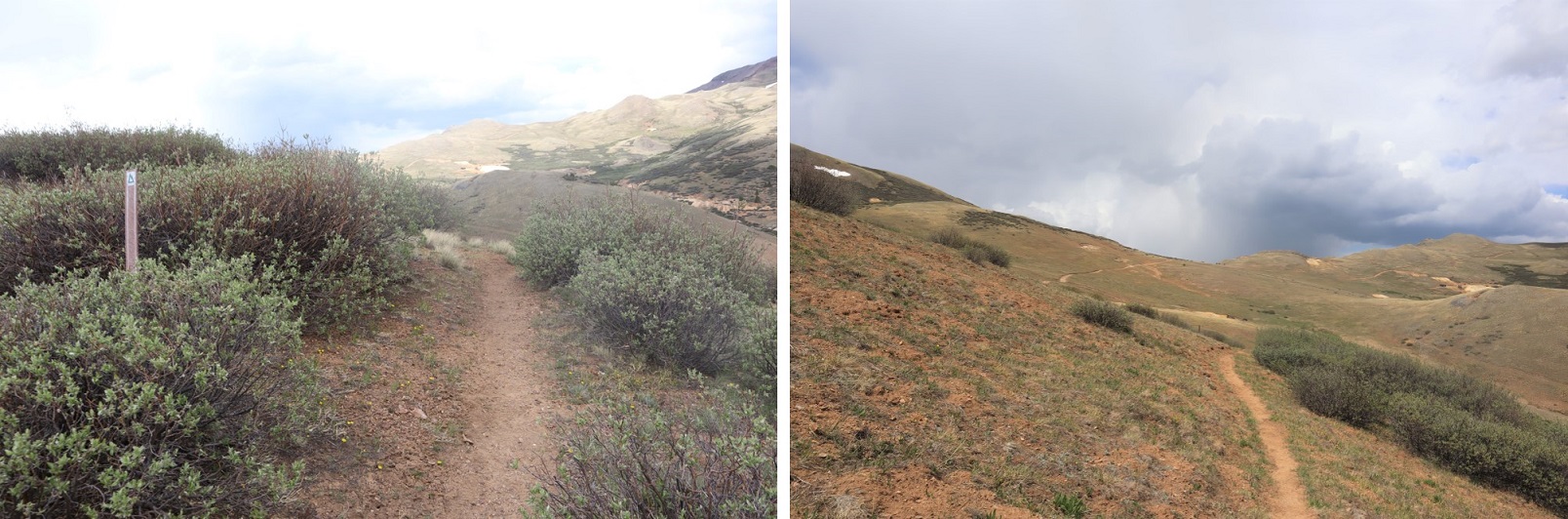
The trail starts by following 4WD road 349. It’s a narrow 4WD road, but if your vehicle made it this far, it can make it all the way to the top of the road
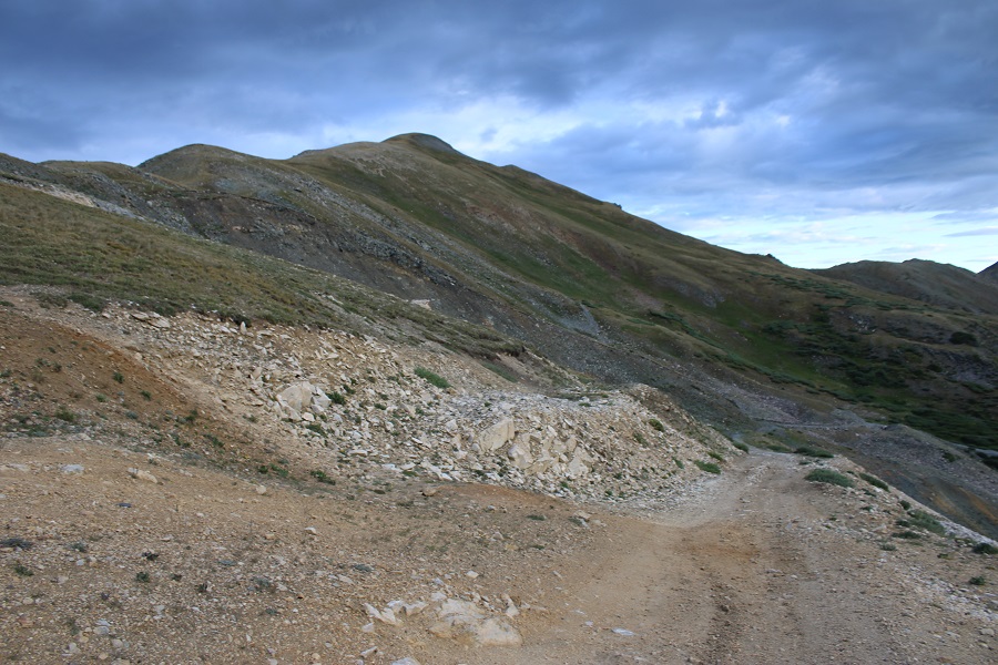
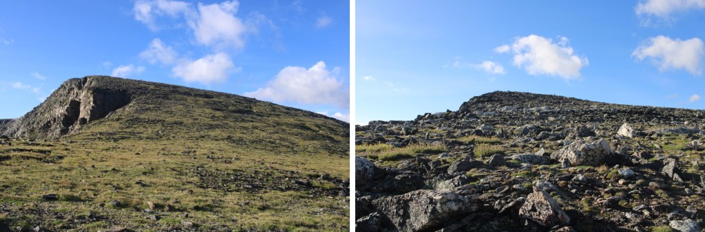
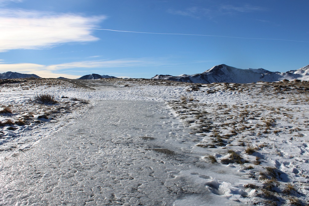
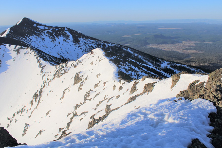
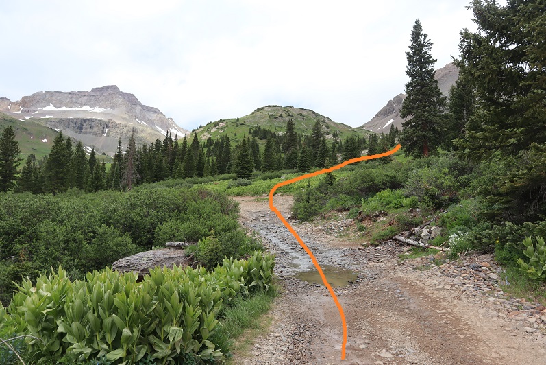
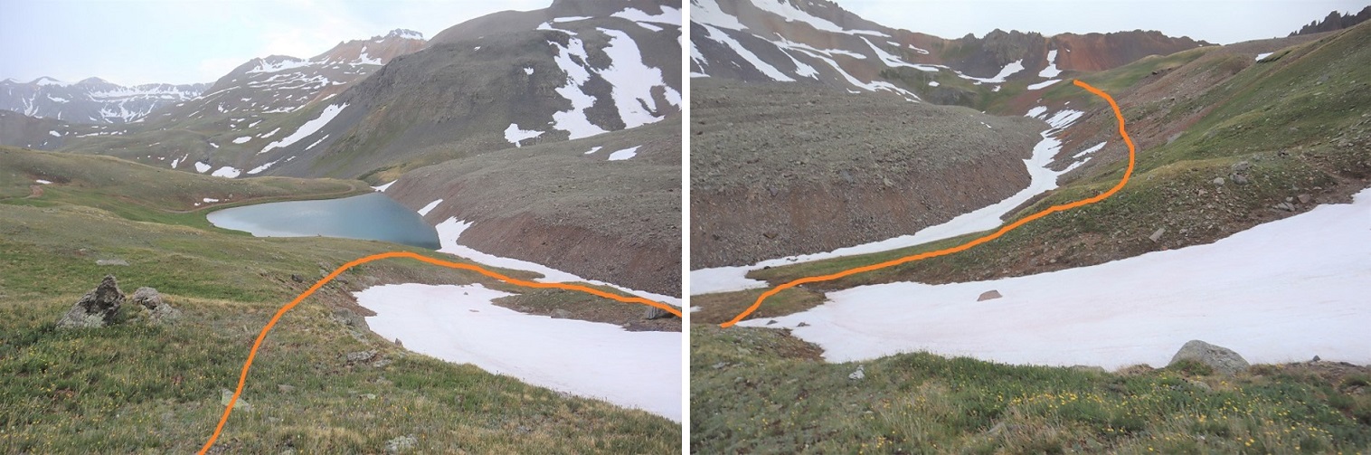
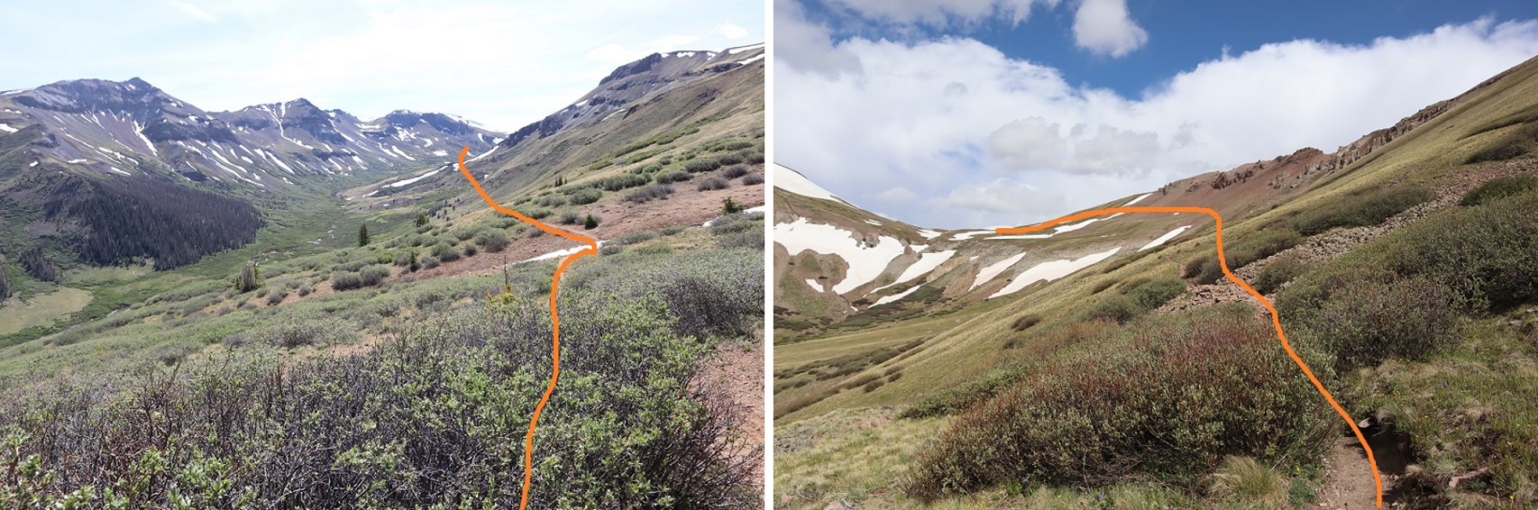
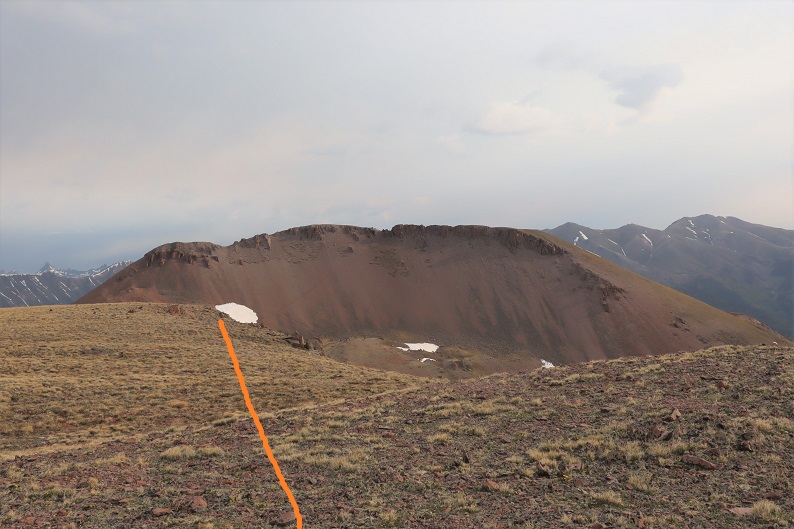
I followed the road for 2.3 miles, up to about 12,330’.
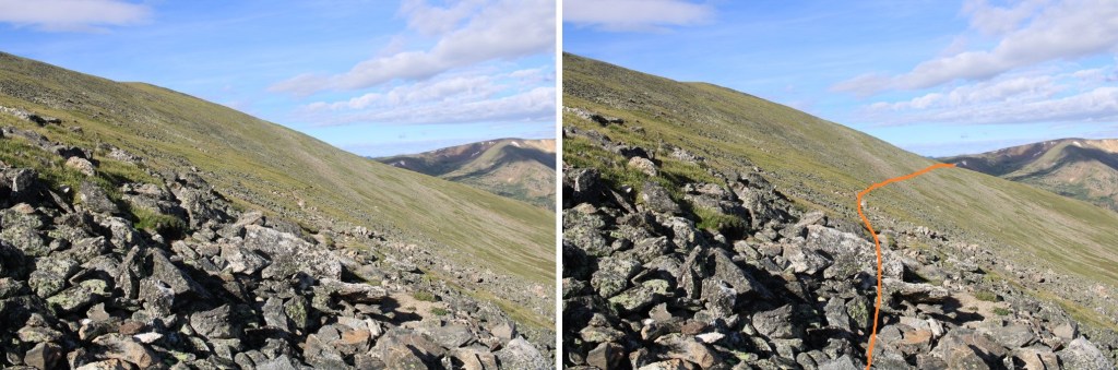
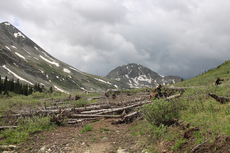
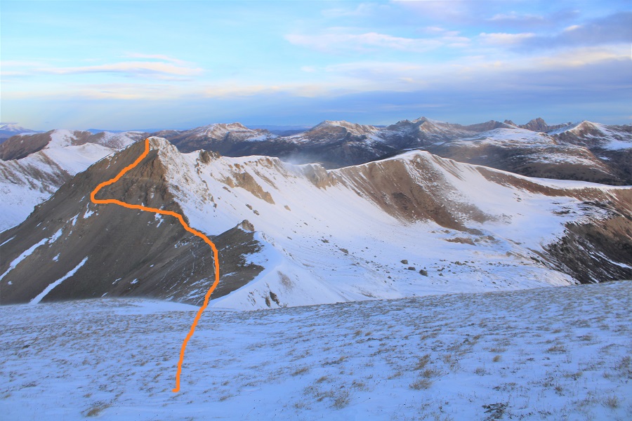
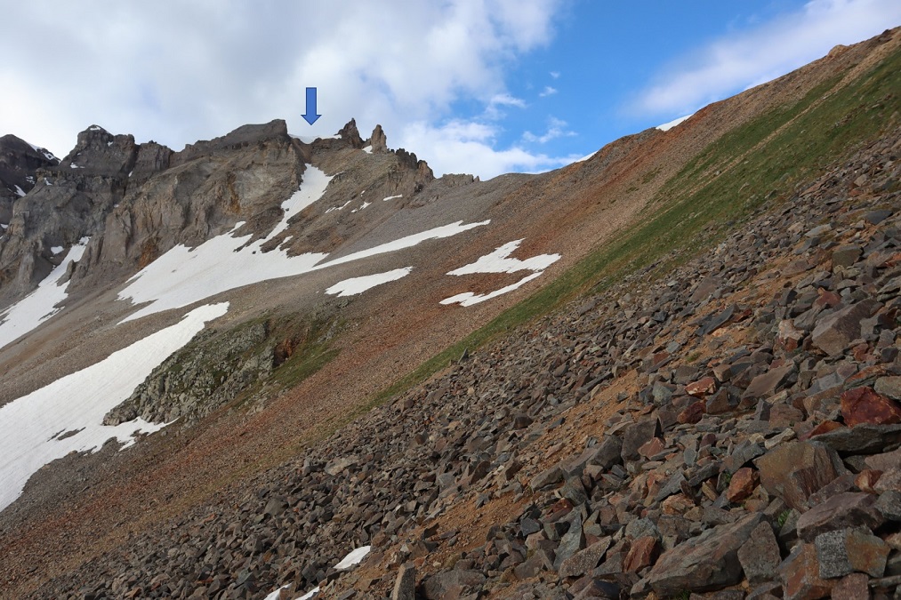
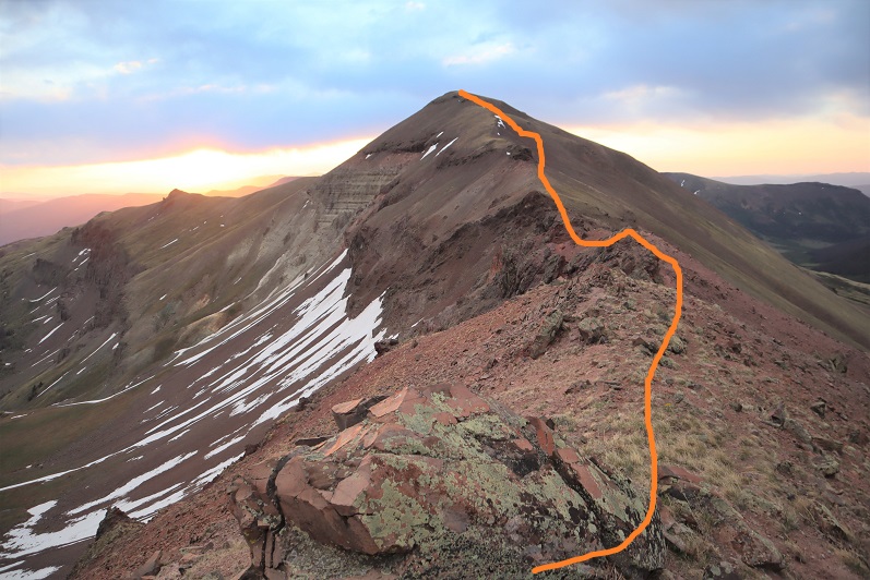
I didn’t know it at the time, as it was still dark, but I could have taken the road all the way up to the ridge, and then taken the ridge to the summit, which would have been easier. I’ll have pictures of that route on the way back down. Here’s where the road goes to:
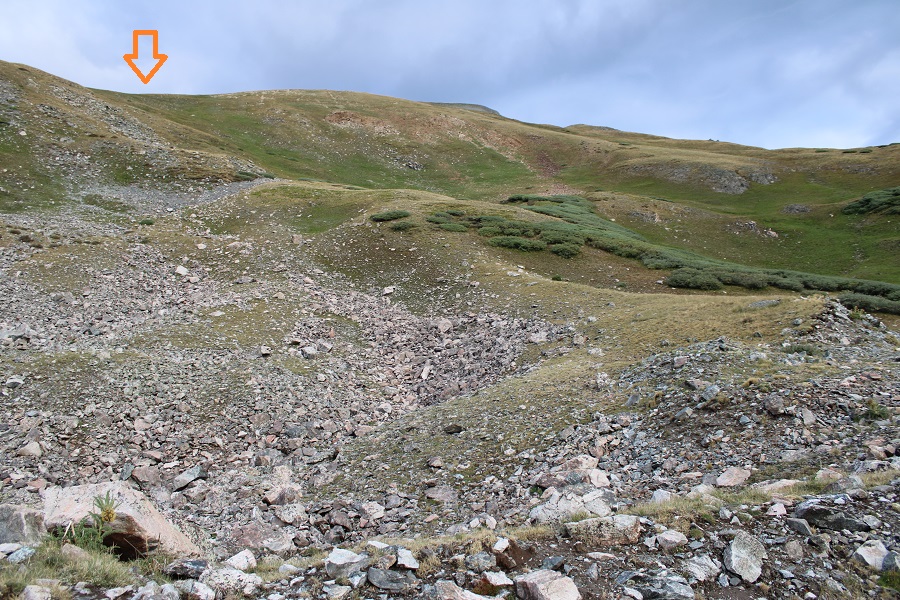
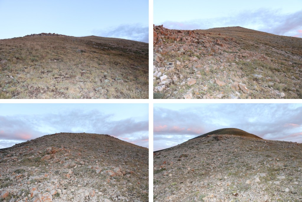
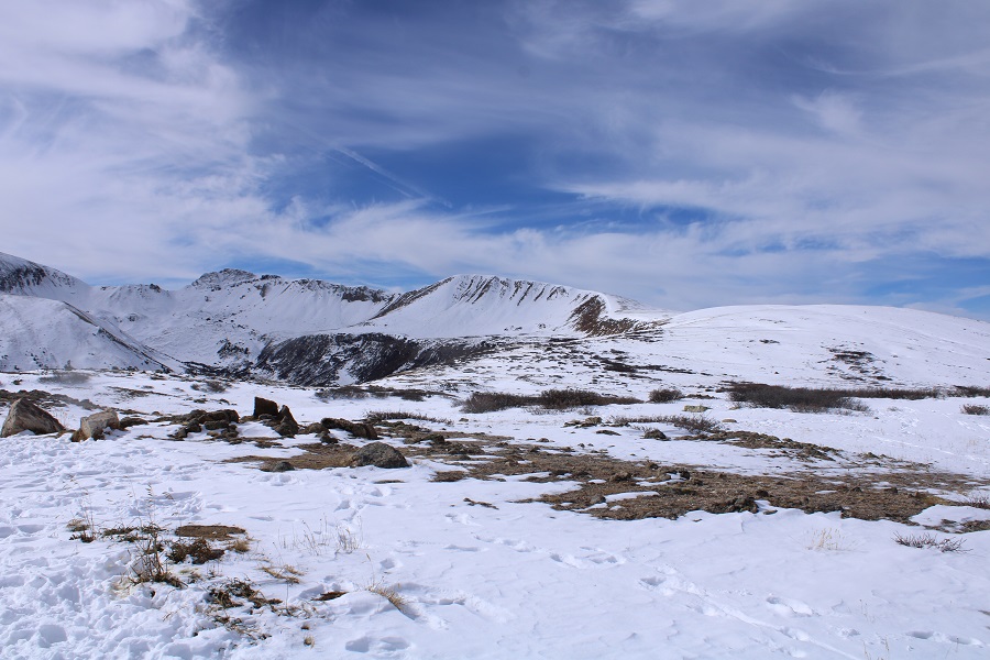
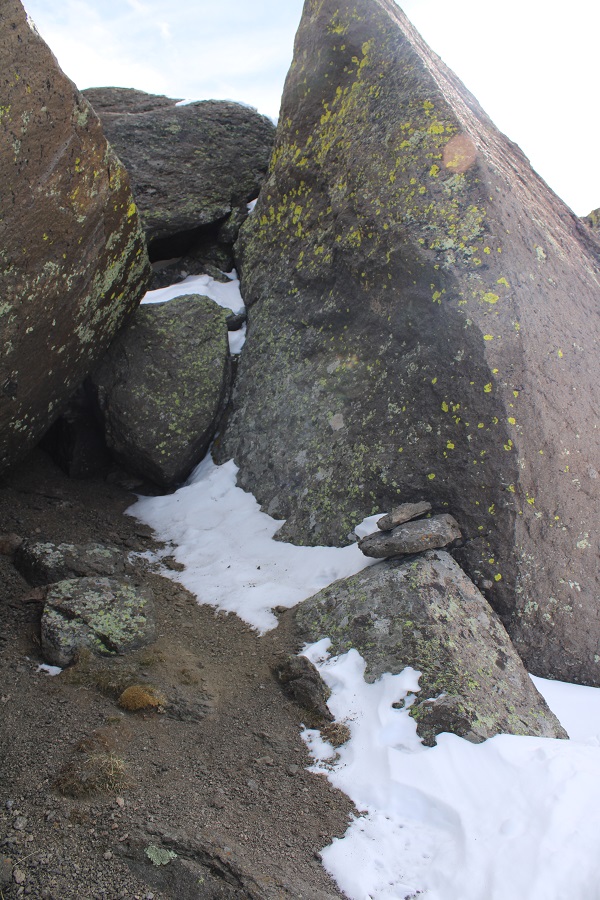
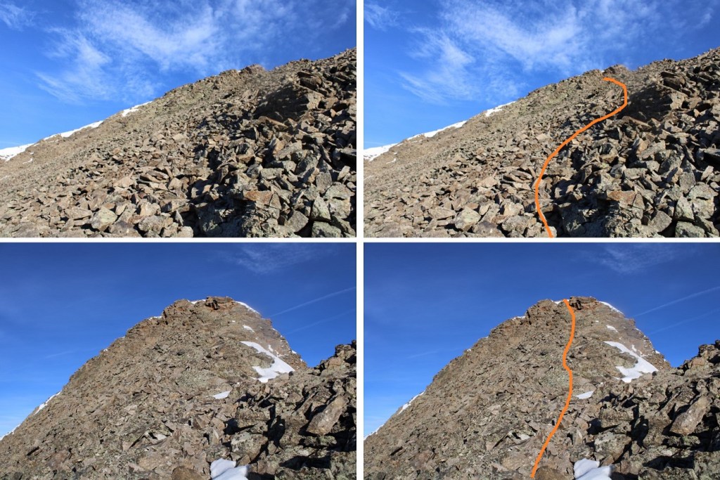
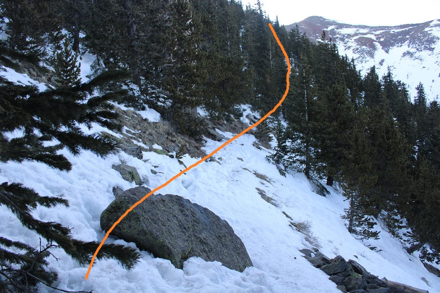
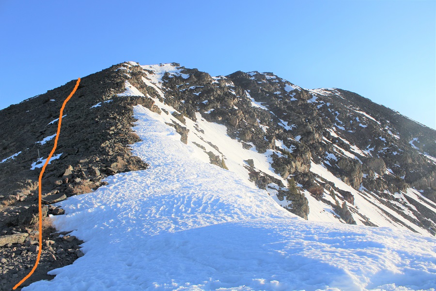
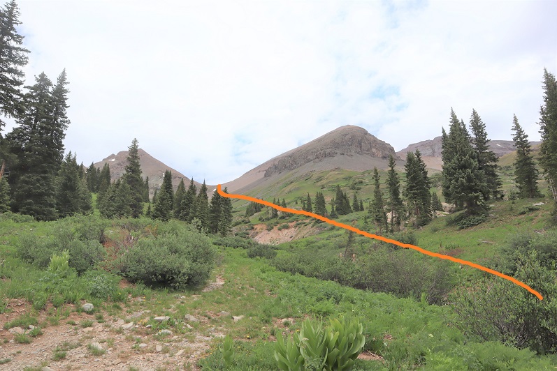
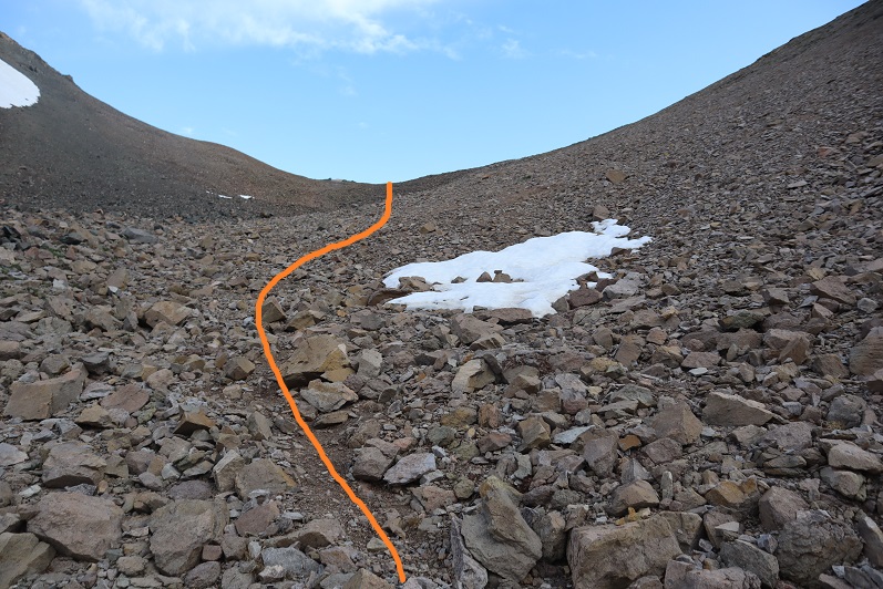
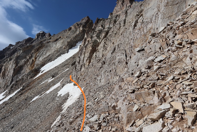
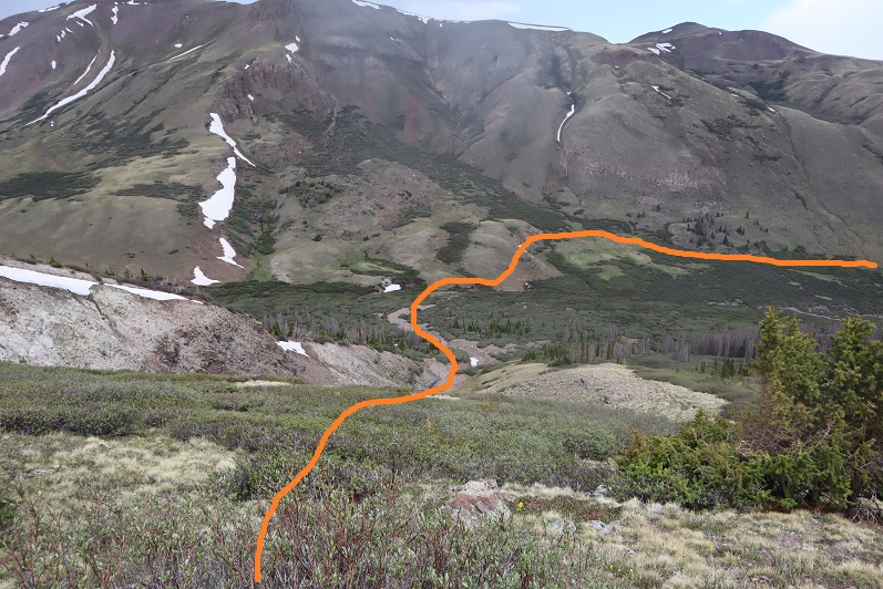
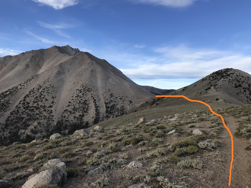
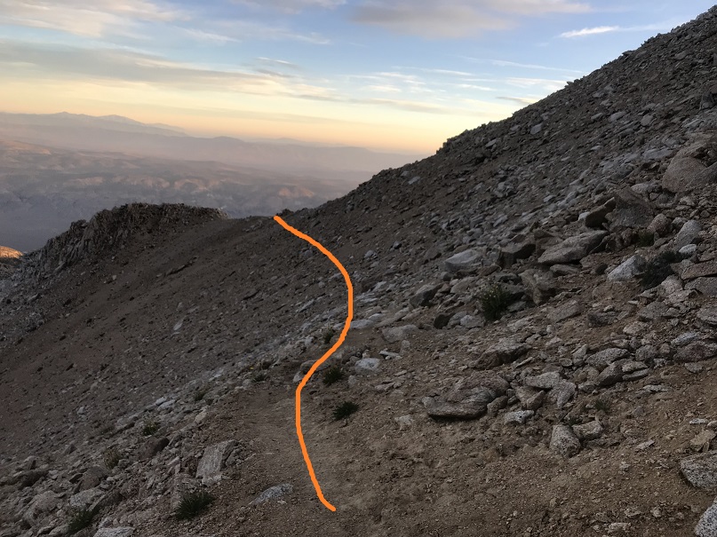
Anyway, I didn’t take the road up, instead, I decided to gain the ridge here
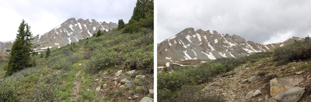
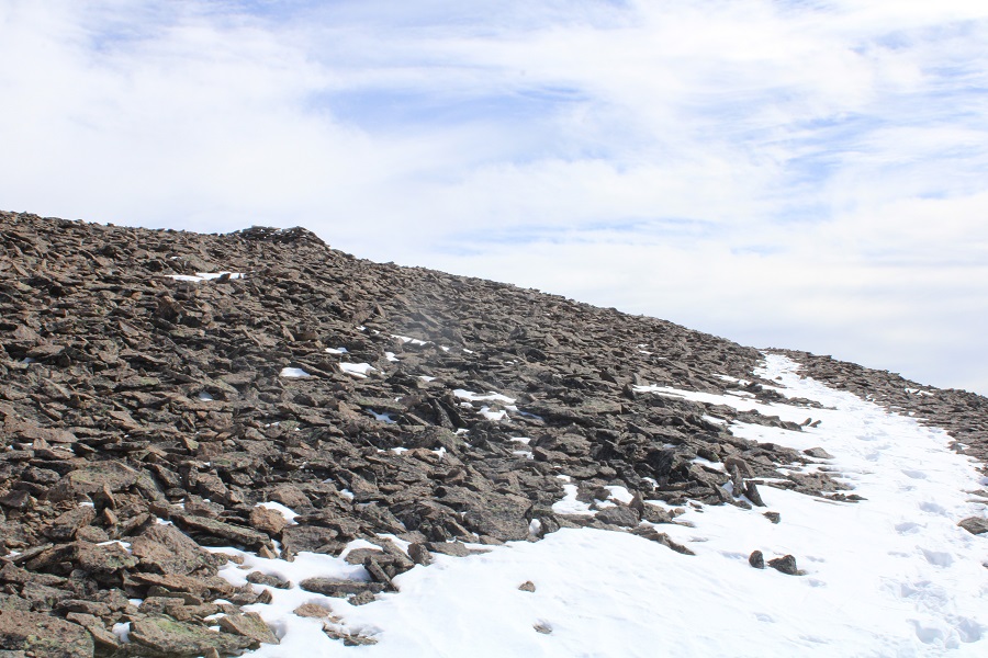
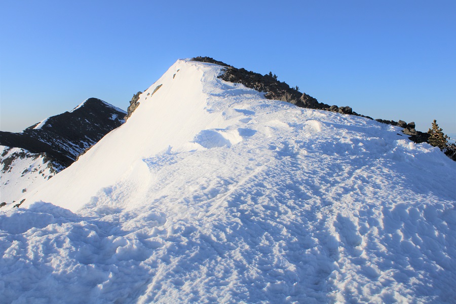
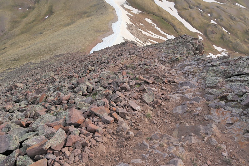
This route was very straightforward
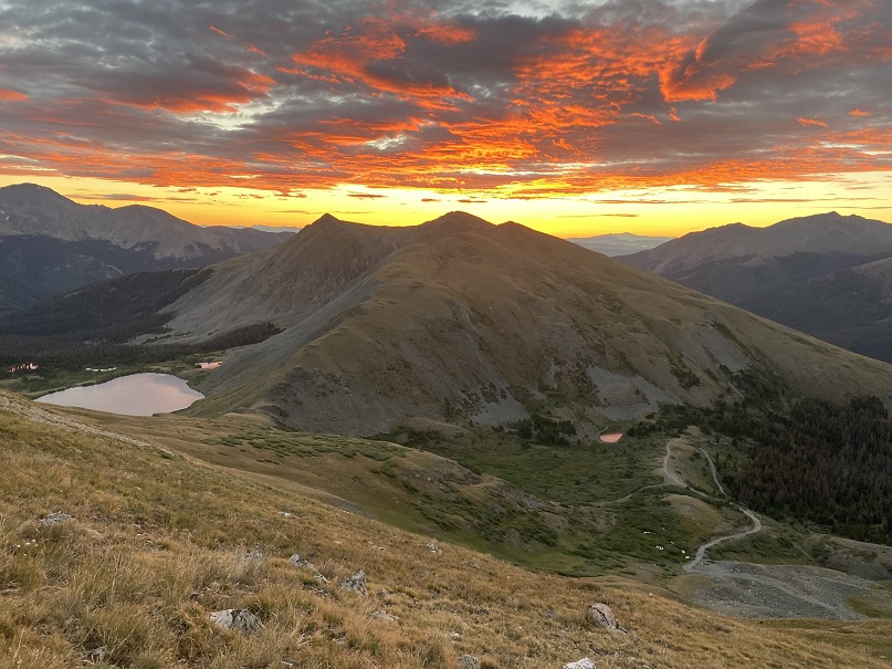
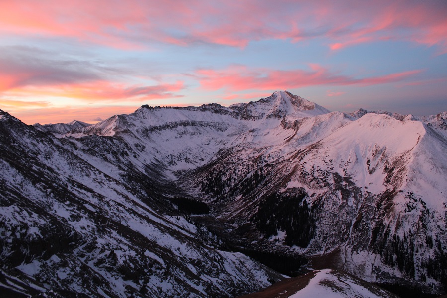
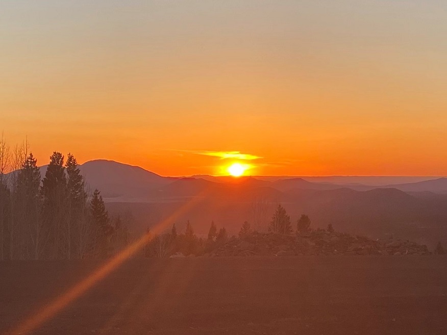
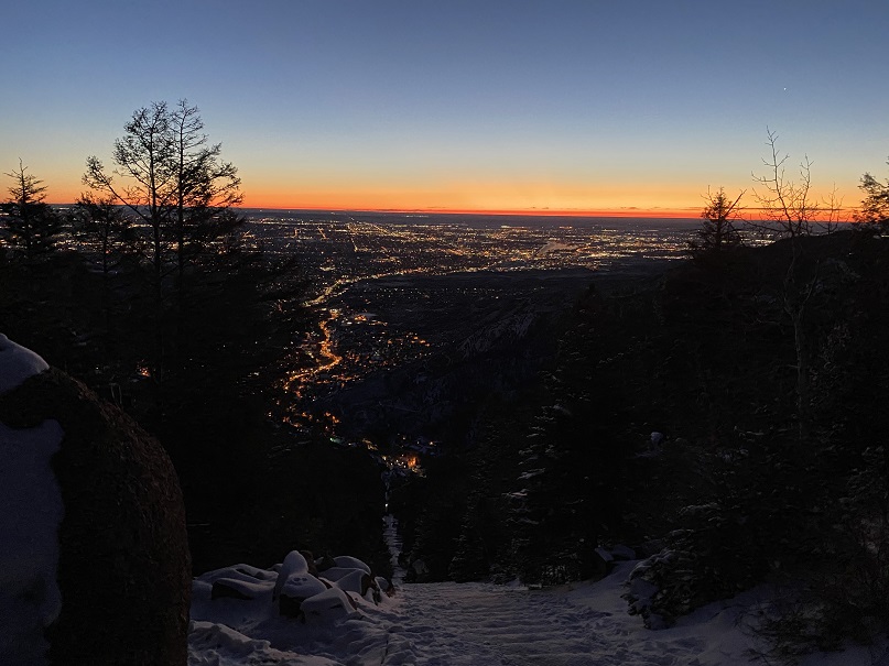
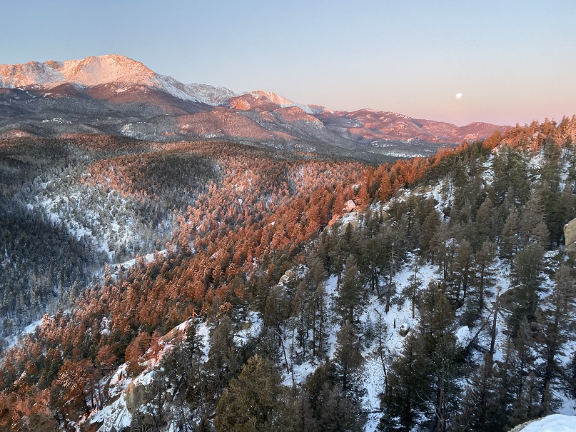
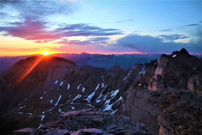
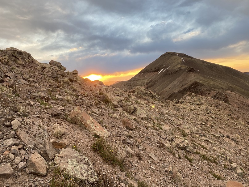
I also got to see a beautiful sunrise
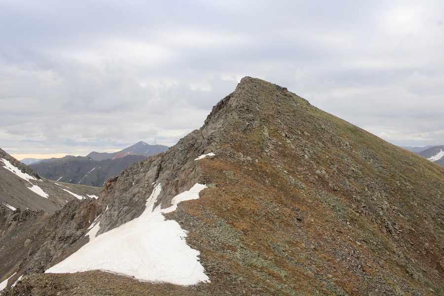
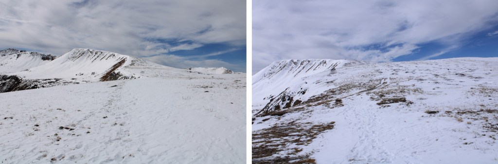
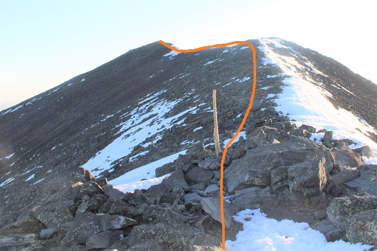
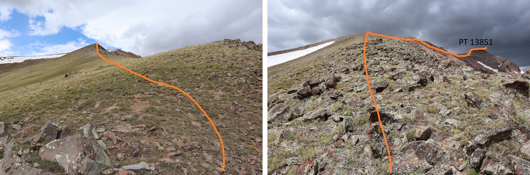
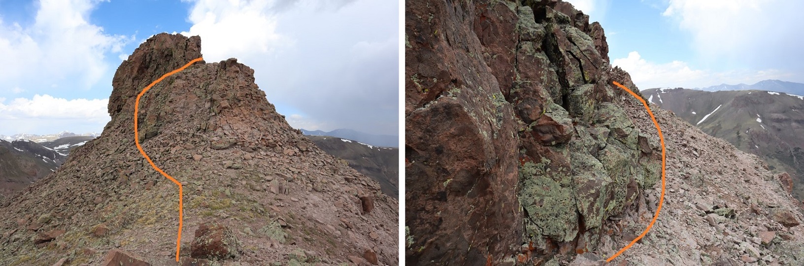
From the I turned right and followed the ridge northeast. From the ridge it was a short .25 mile hike to the summit.
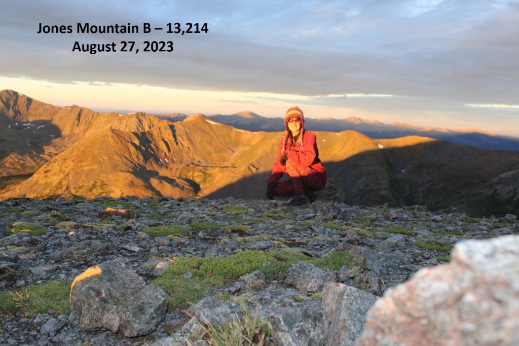
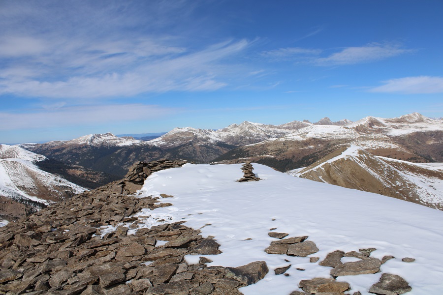
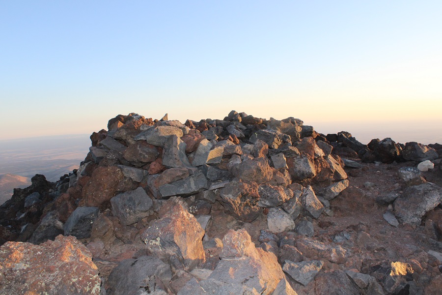
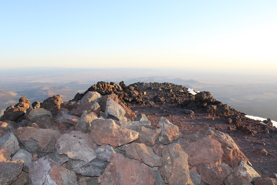
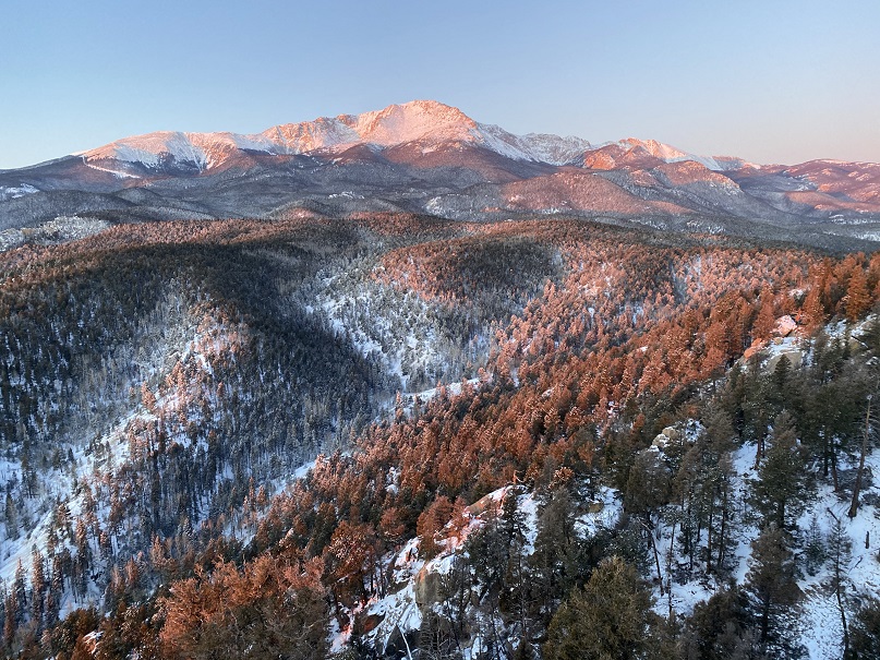
I summited Jones Mountain B at 6:30am
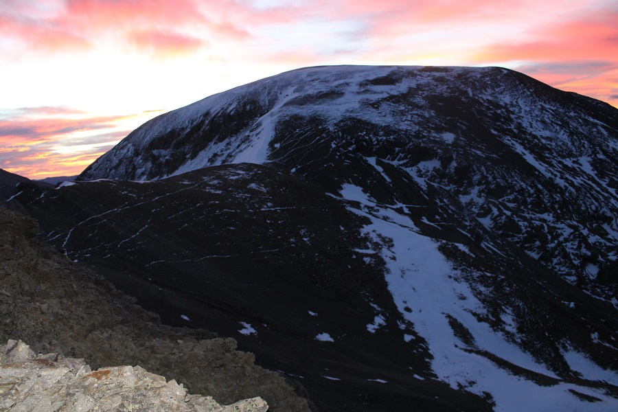
Jones Mountain B:
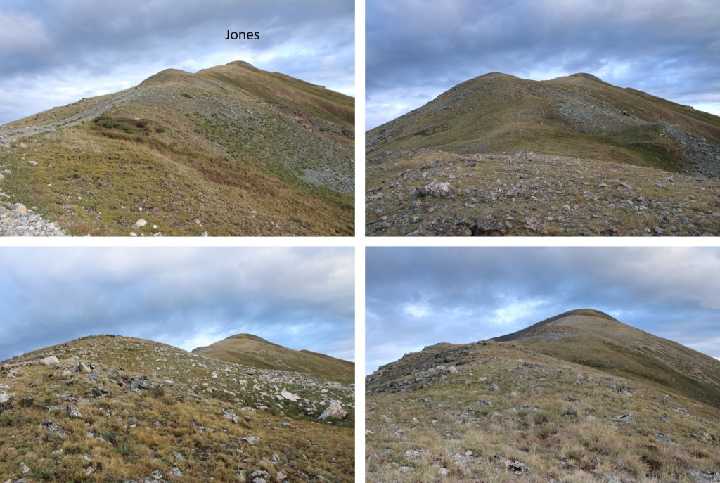
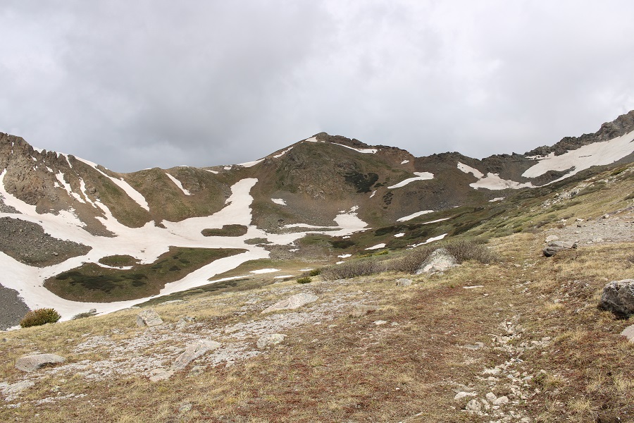
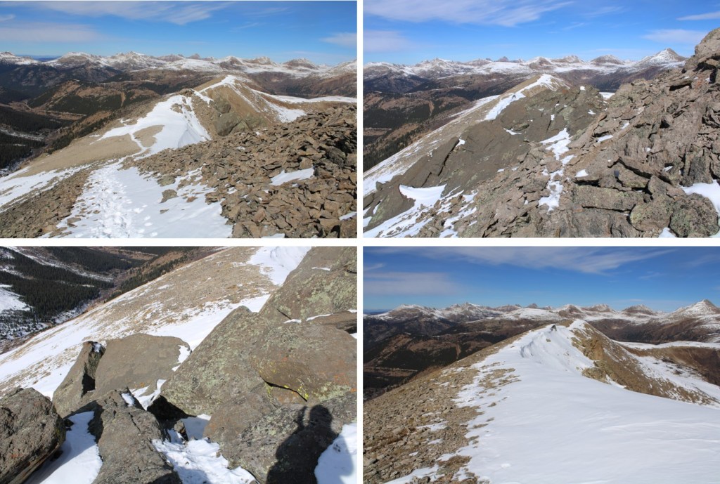
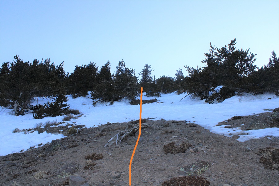
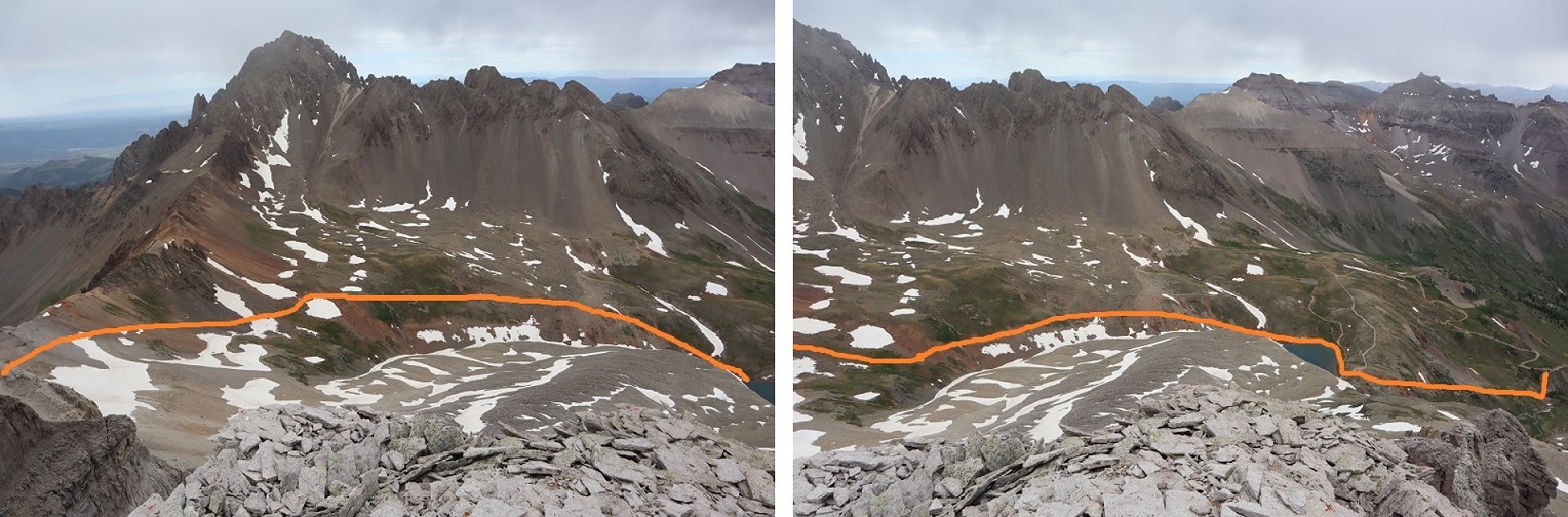
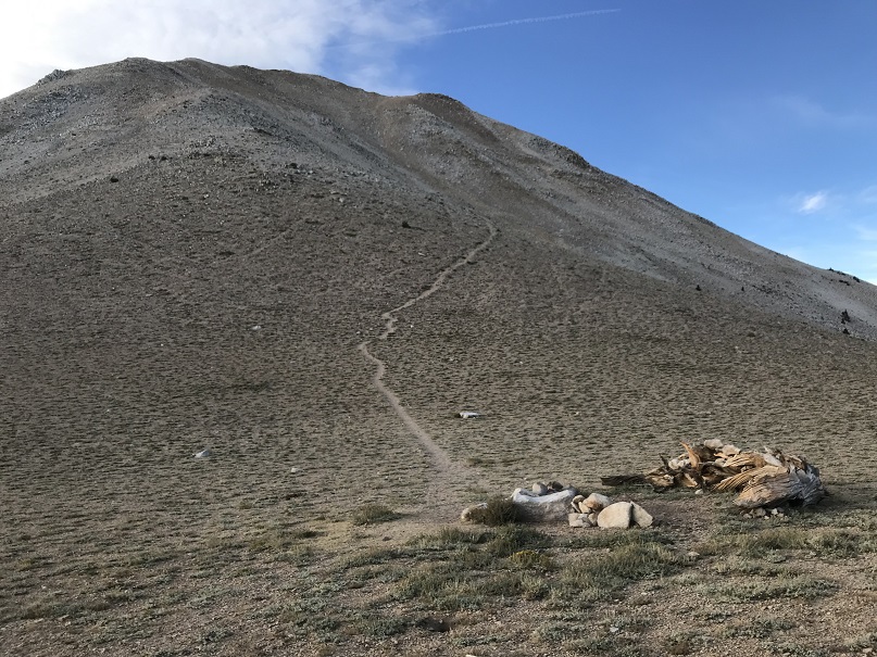
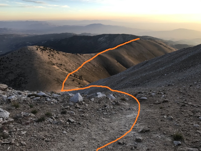
It was rather cold and windy on the summit, making it feel like fall. I turned around and, in the daylight, noticed the road I’d hiked in on went all the way to the ridge, so I followed the ridge southeast back to the road.
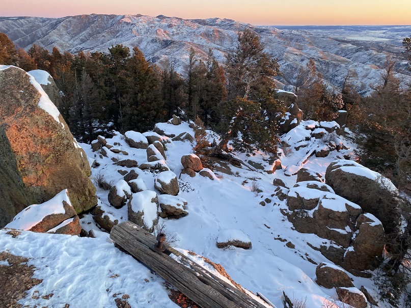
Some ptarmigans overlooking Ptarmigan Lake
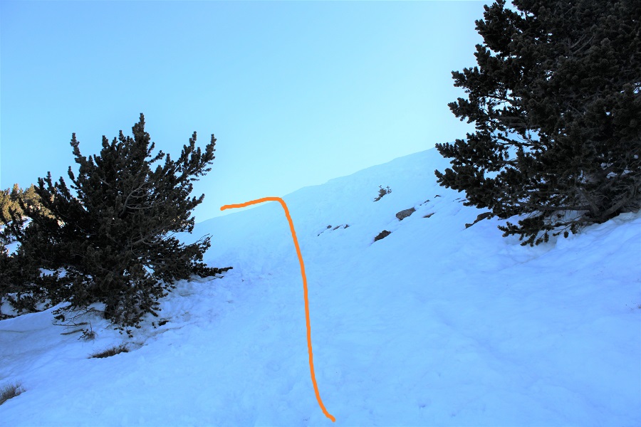
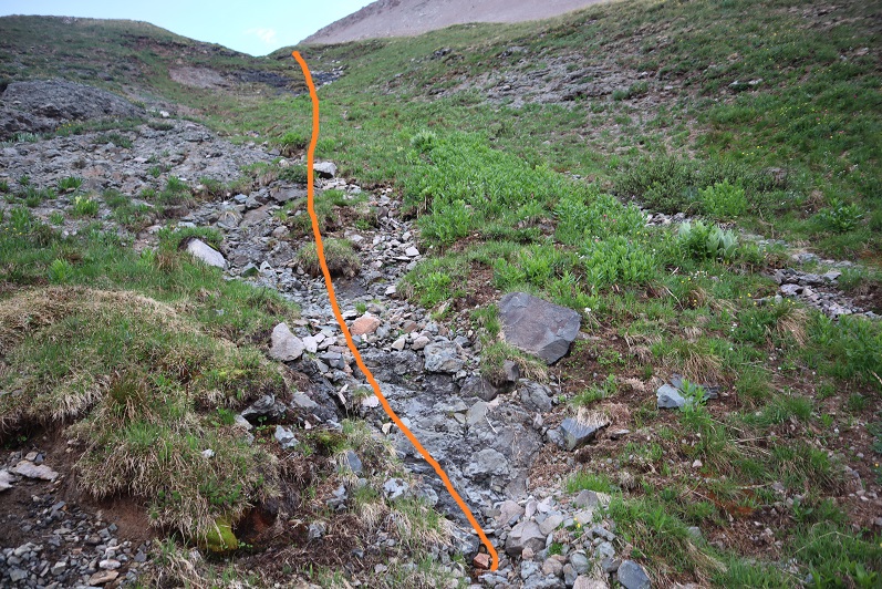
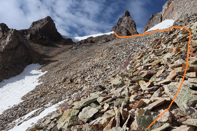
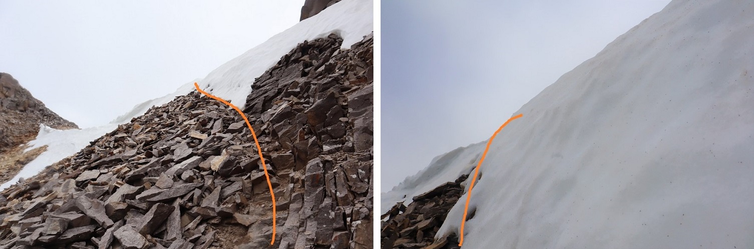
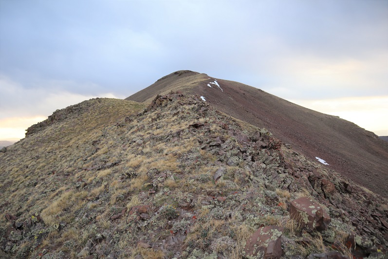
Here’s the route up the ridge from where the ridge meets the road
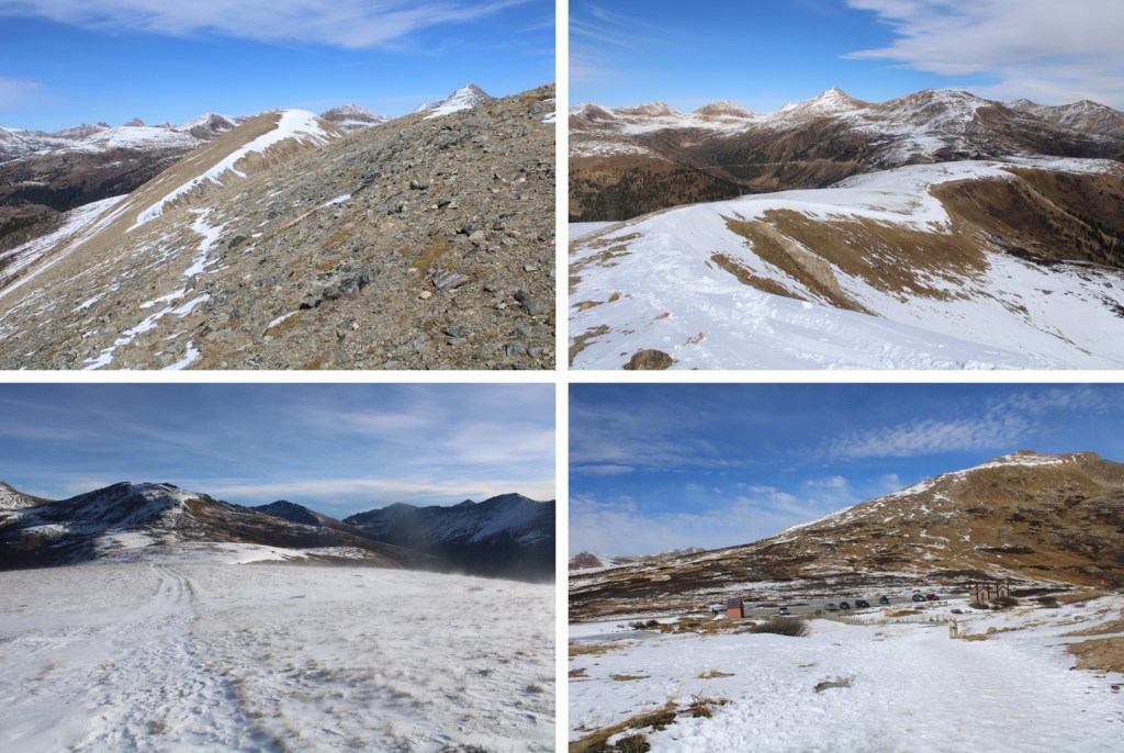
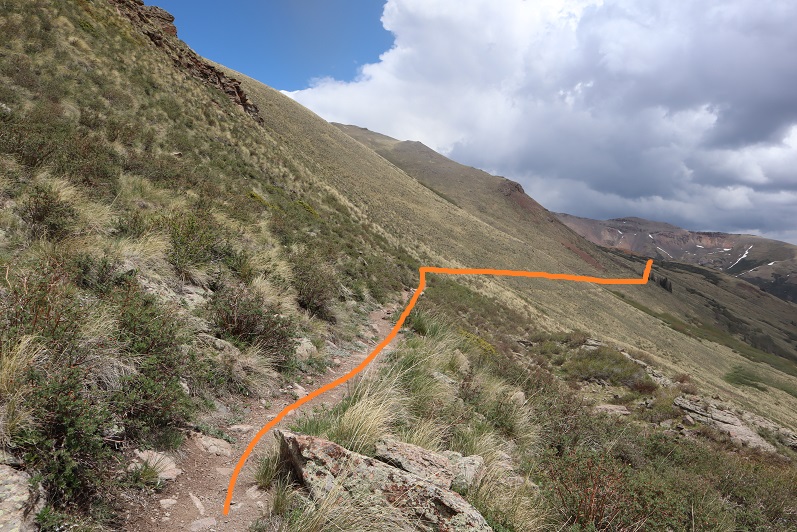
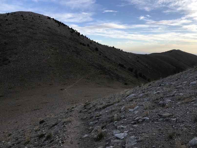
Back on road 349, I followed it all the way back down to road 344
I made it back to my truck at 7:45am, making this a 6.04 mile hike with 2361’ of elevation gain in 3 hours.
Now it’s time to head back home to harvest a couple hundred apples from the tree in my backyard before the thunderstorms hit for the day.
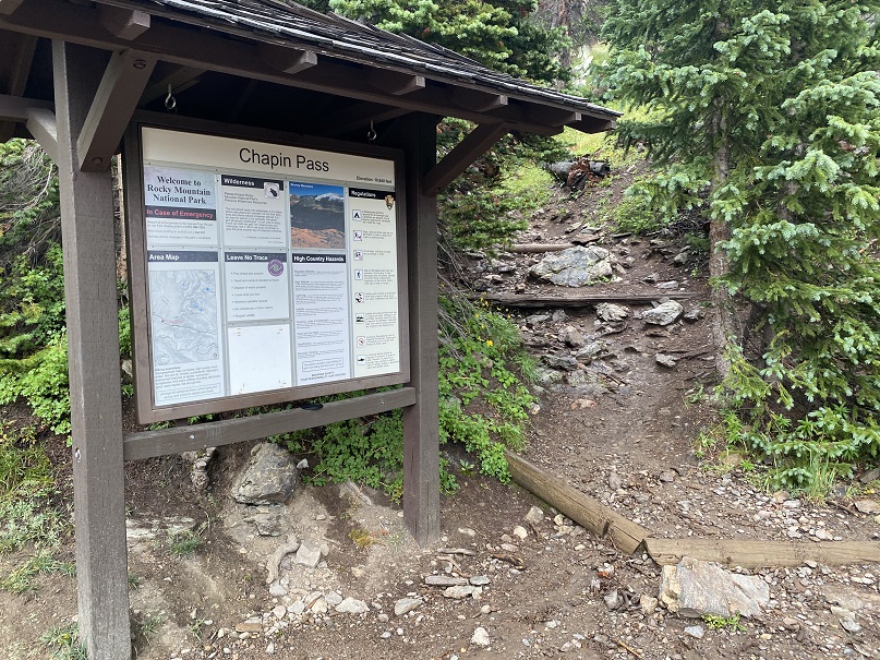
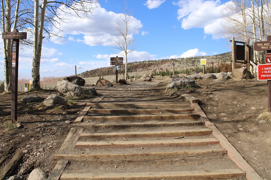
I parked my truck at the Chapin Pass trailhead and was on the trail at 4am.
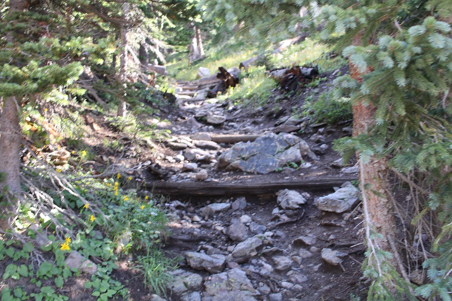
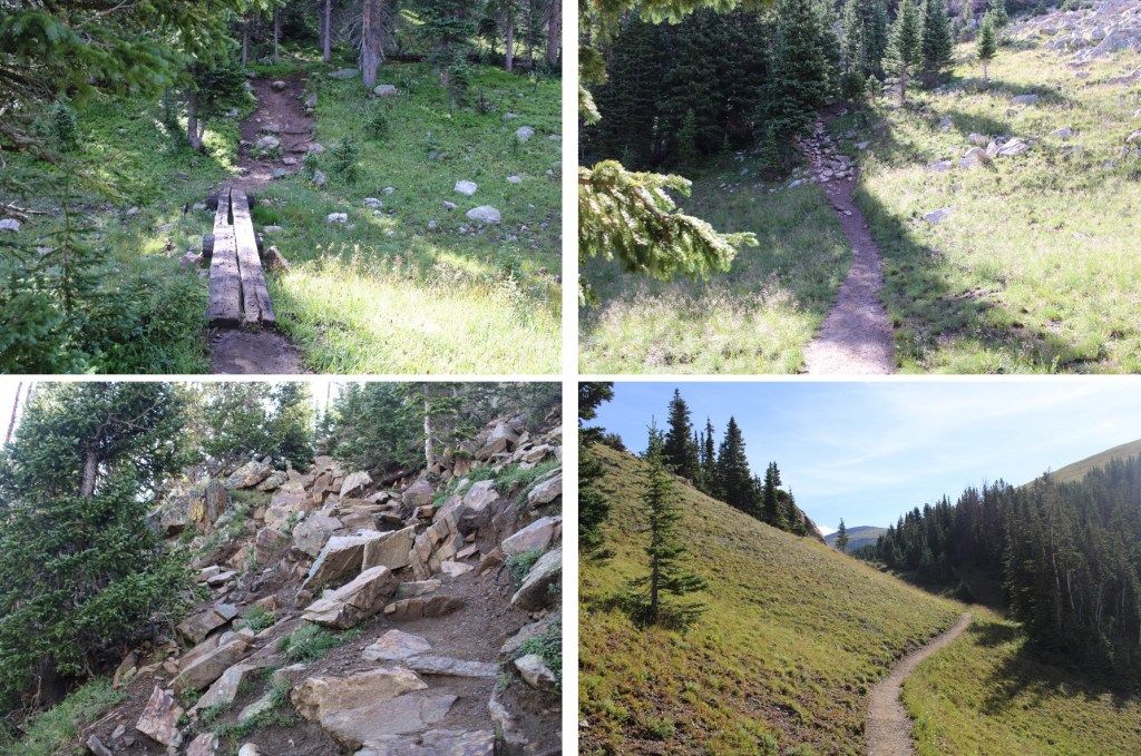
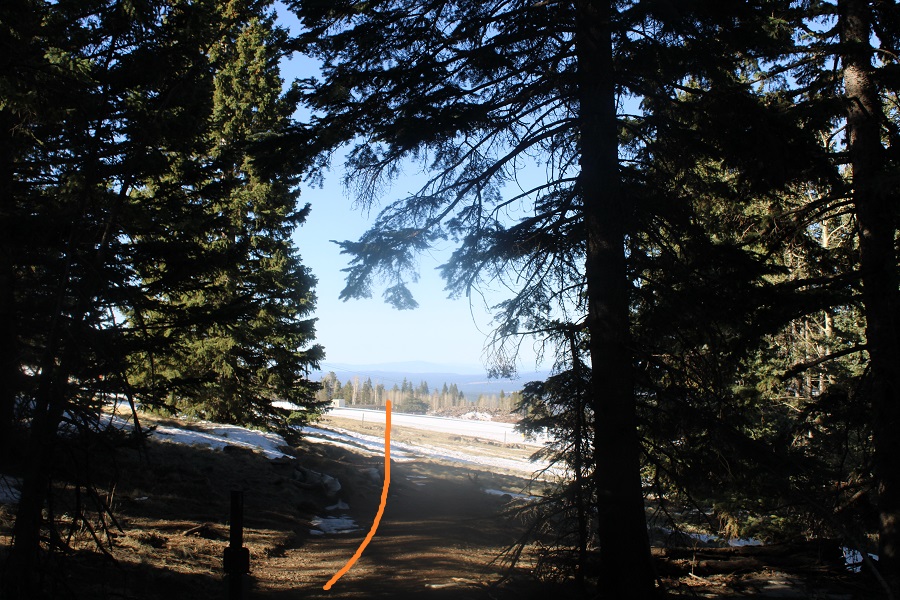
The trail starts out heading directly up to the pass.
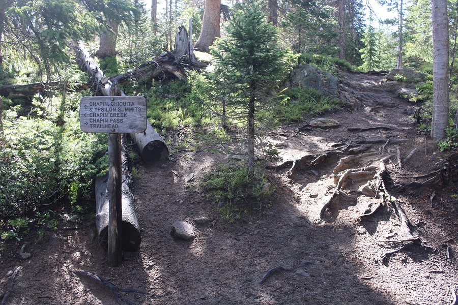
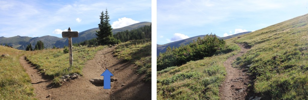
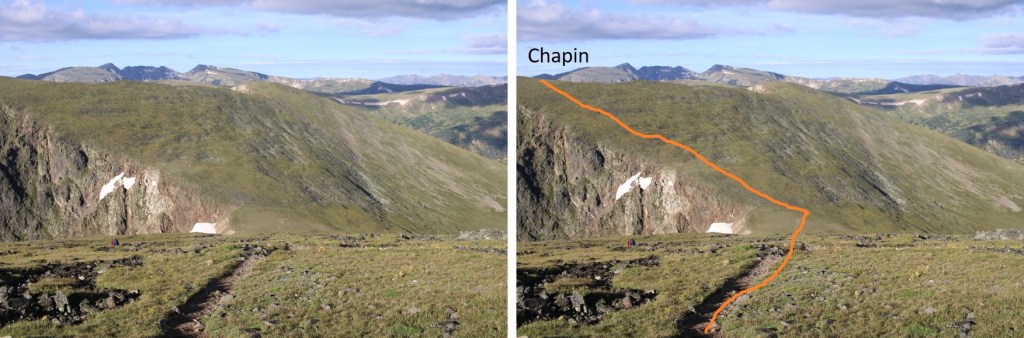
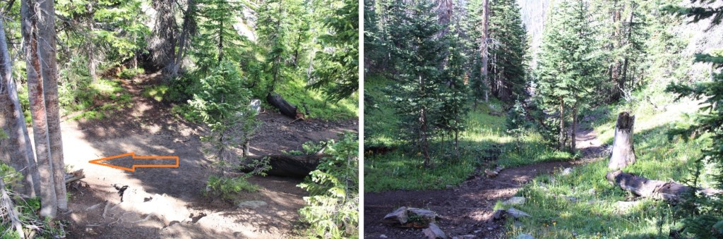
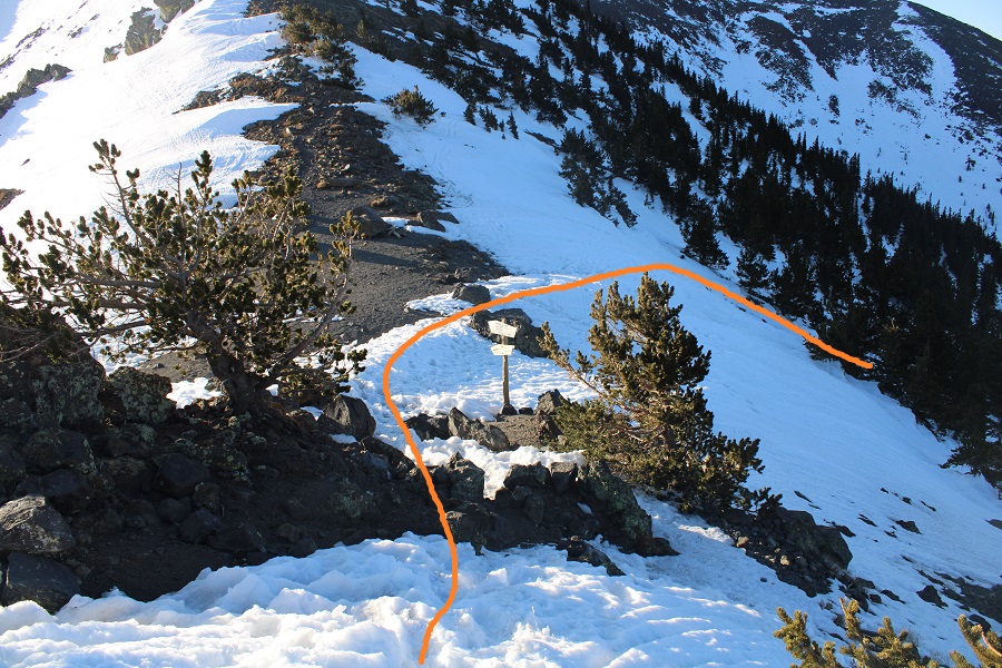
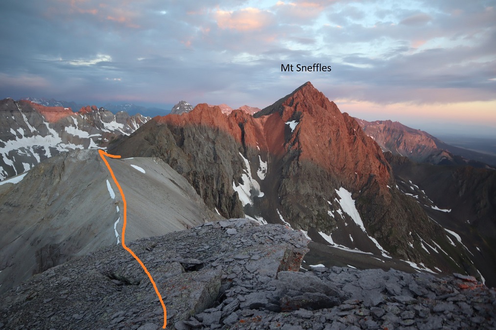
After hiking for .25 miles I came to an obvious junction and turned right, heading towards Chapin, Chiquita, and Ypsilon summits
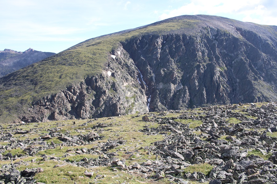
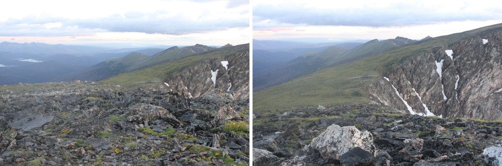
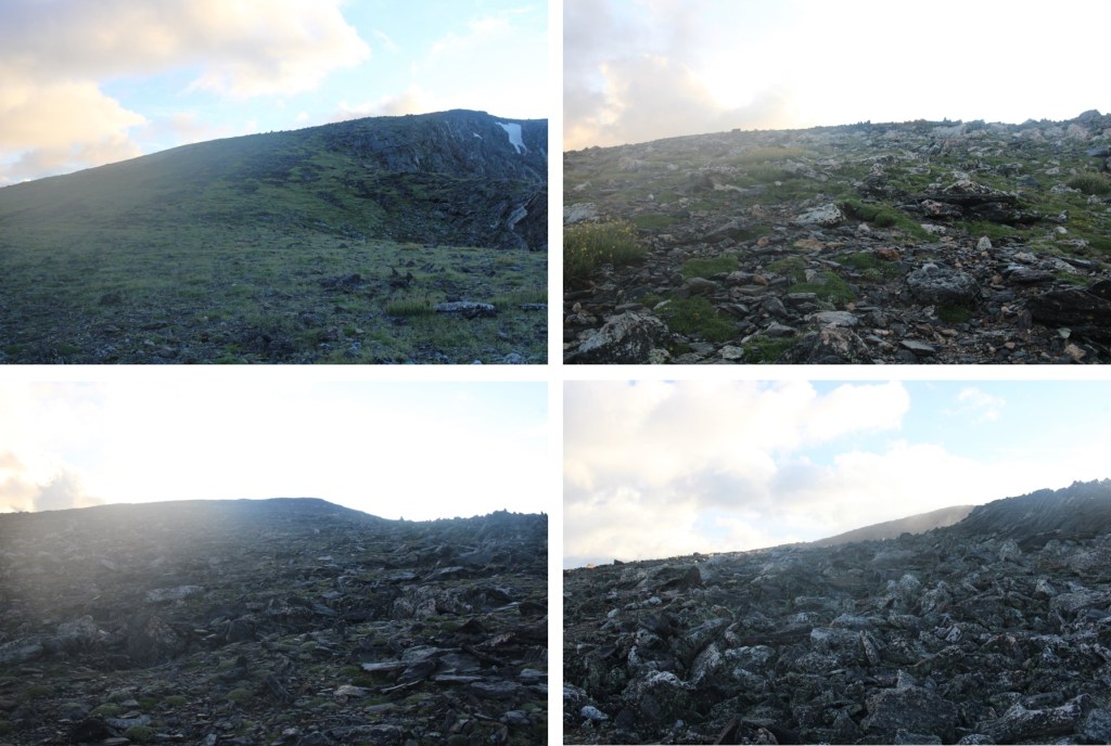
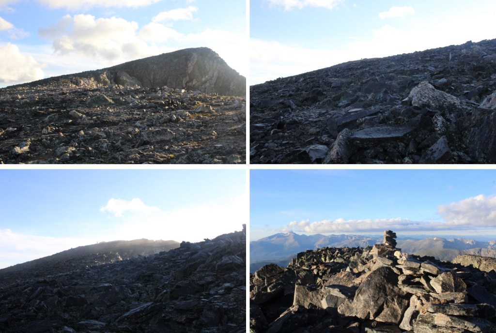
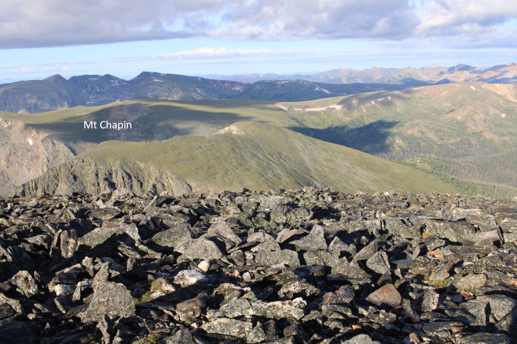
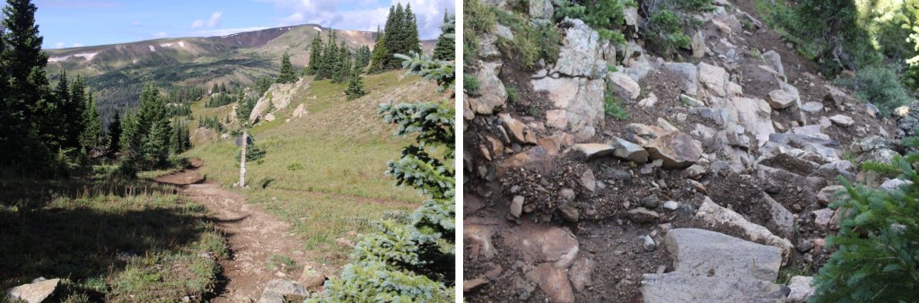
The trail was very easy to follow. I followed it east and rounded the north side of Mt Chapin (saving it for later).
The trail changed from Class 1 to Class 2 as I made my way up to the top of Chiquita, heading northeast.
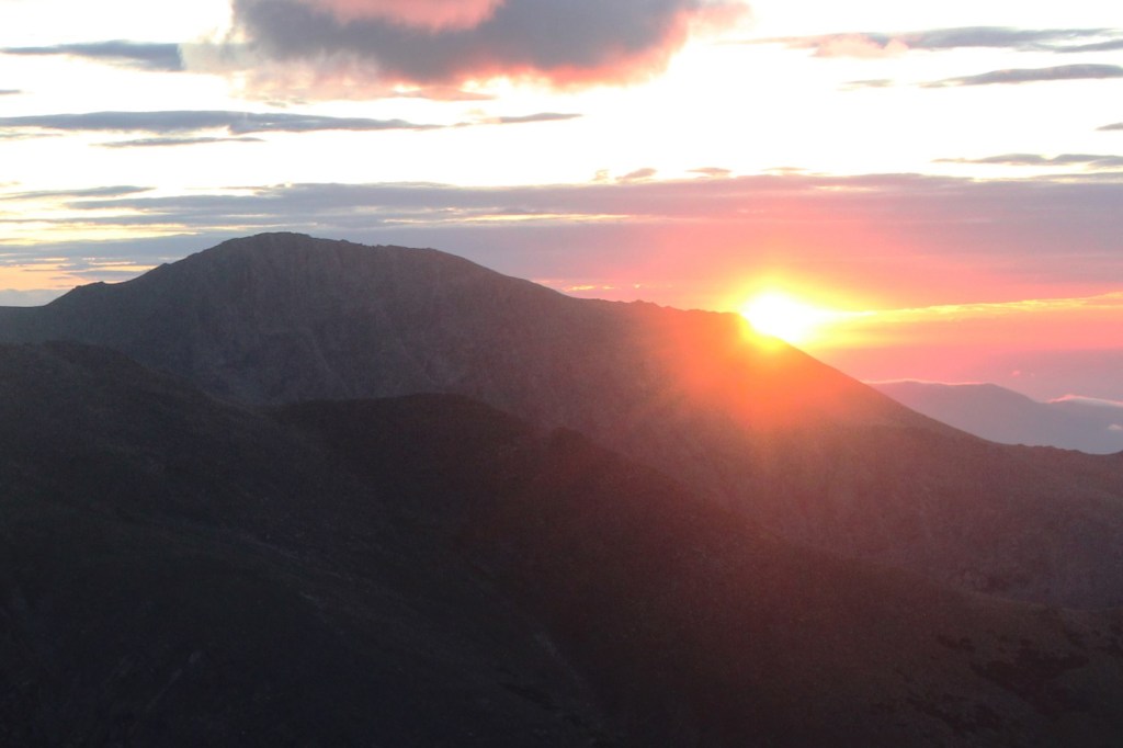
I made it to the summit just as the sun was starting to rise
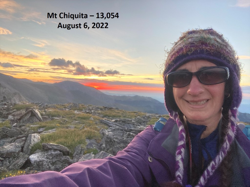
I summited Mt Chiquita at 6am
Mt Chiquita:
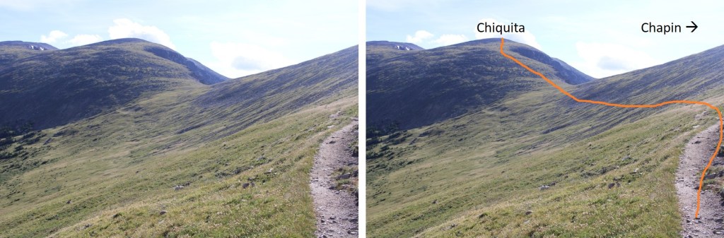
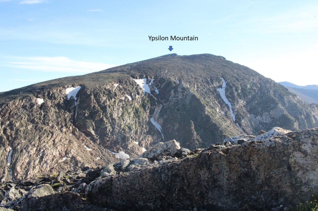
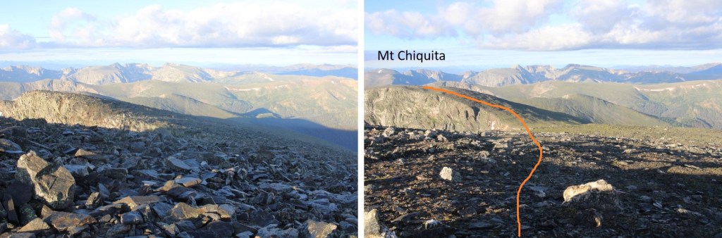
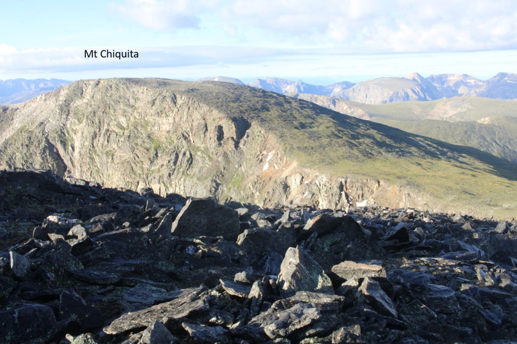
From the summit of Mt Chiquita I could see the summit of Ypsilon Mountain to the north.
It was an easy ridge walk to get there, with a small false summit along the way. I just followed the ridge down 270’, and then up 722’ to the summit of Ypsilon.
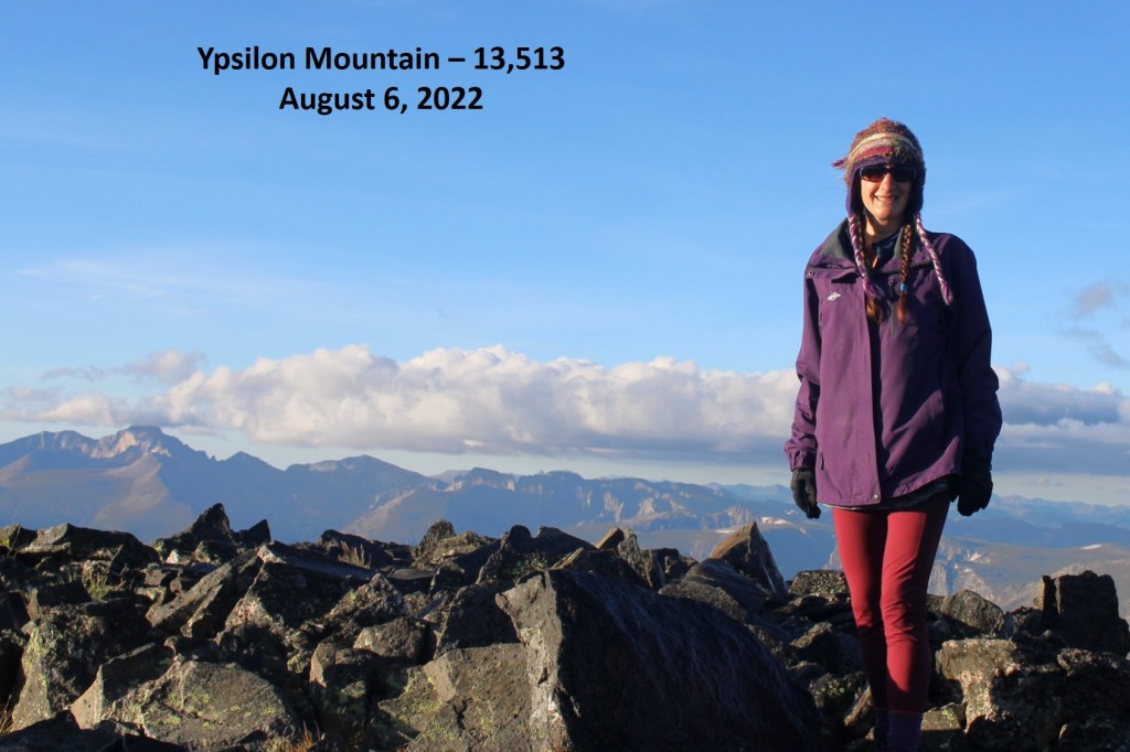
I summited Ypsilon Mountain at 7am
Mt Ypsilon:
This was going to be an out and back for me, so I retraced my steps back to Chiquita, losing 722’ of elevation, and then gaining 270’
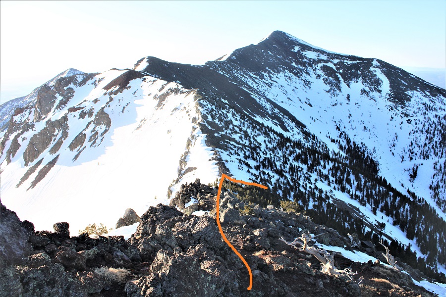
Back at the summit of Mt Chiquita I continued following the ridge southwest, back to the trail. There is a trail to the summit of Mt Chapin from there.
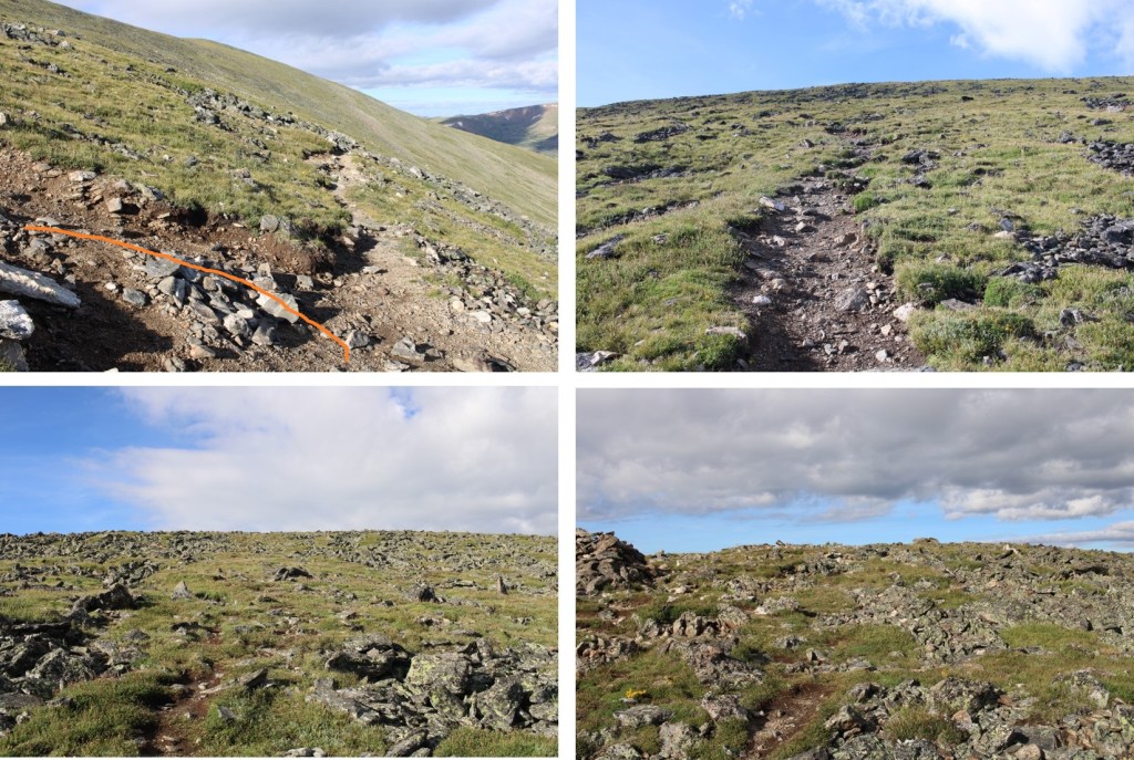
Here are some close up pictures of the class 1 trail
I summited Mt Chapin at 8:30am
Mt Chapin:
I turned and retraced my seps back to the trail below
Once back at the junction with the main trail, I turned left and followed it west to Chapin Pass
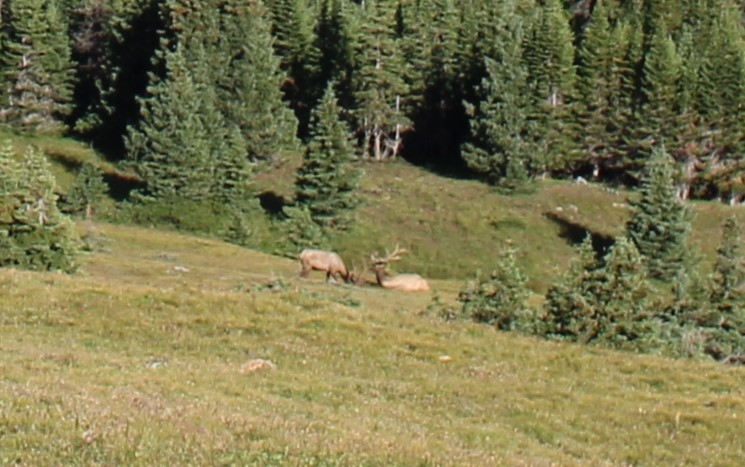
I even saw a few bull elk lounging along the way
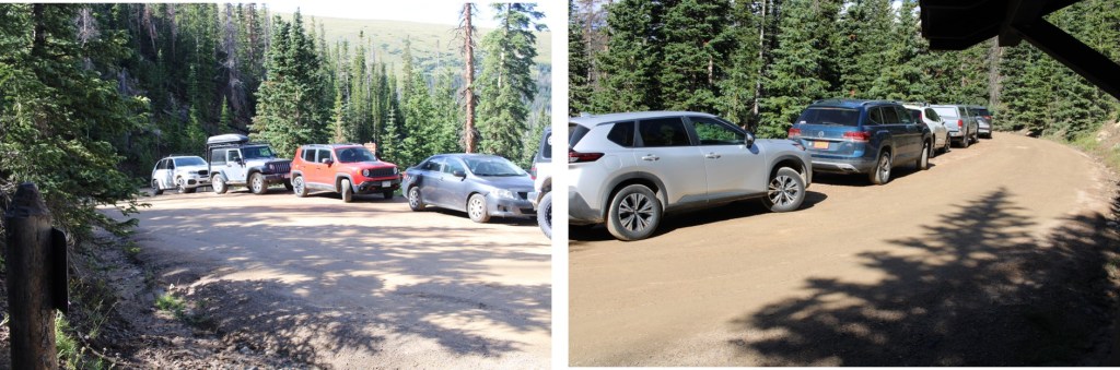
Back at Chapin Pass, I turned left, and followed it back to the parking area, which was now overflowing with dozens more vehicles than could fit in the area. If you want to do this hike, get there early.
I made it back to my truck at 9:15am, making this a 10.2 mile hike with 3555’ of elevation gain in 5 hours, 15 minutes.
Trailhead: Just before South Fork Lake Creek, where 391 and Trail 1466 meet.
I drove in the night before, so I could start early the next morning. The only problem? I wasn’t able to drive all the way to the trailhead. There was a small ice flow that still hadn’t melted, and it’s the middle of June! It wasn’t very big, but so far no one has been able to cross it.
It wasn’t a big deal, but I did have to back up for half a mile before I could find a place to turn around, which happened to be at a nice campsite at 11,000’, so I parked there
I was up and on the trail at 3:30am, hoping to avoid some of the cold, wet, rainy weather that was supposed to arrive today. No such luck: It was raining when I left my truck, so I put on rain pants and a waterproof jacket and started following the road south.
After hiking for .8 miles I made it to the trailhead. Just before reaching the trailhead the road was covered in old avalanche debris.
The trail starts to the left of the gate
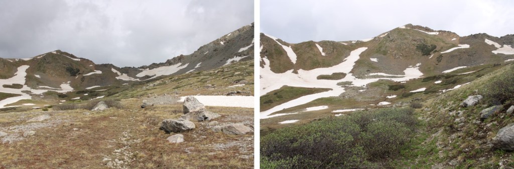
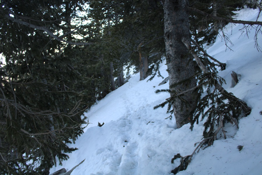
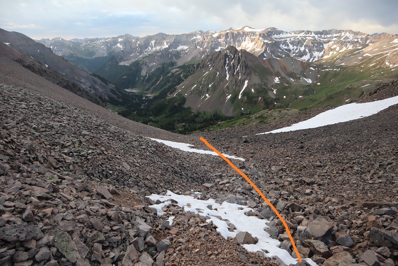
As I mentioned earlier, it was raining. I followed a very wet, willow-filled trail all the way into the upper basin. This trail is class 1, but a bit overgrown since it’s early in the hiking season. It was also teeming with water, and bear tracks (although I did not see any bear scat).
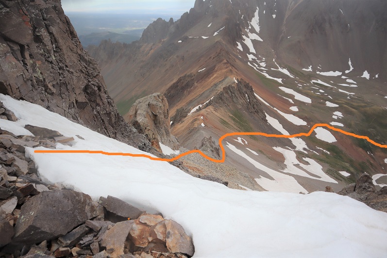
When I made it to the upper basin, I knew I wanted to gain the ridge. I also knew, from yesterday’s experience, that I wanted to gain it from the left, and not the right.
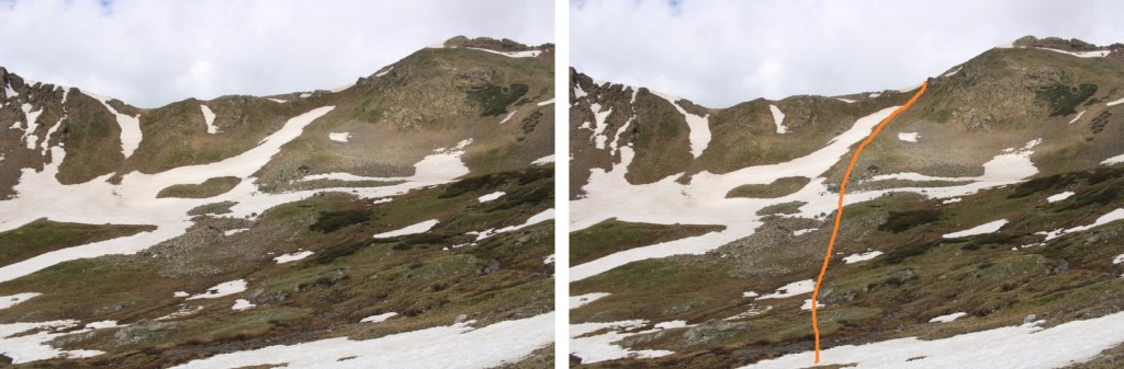
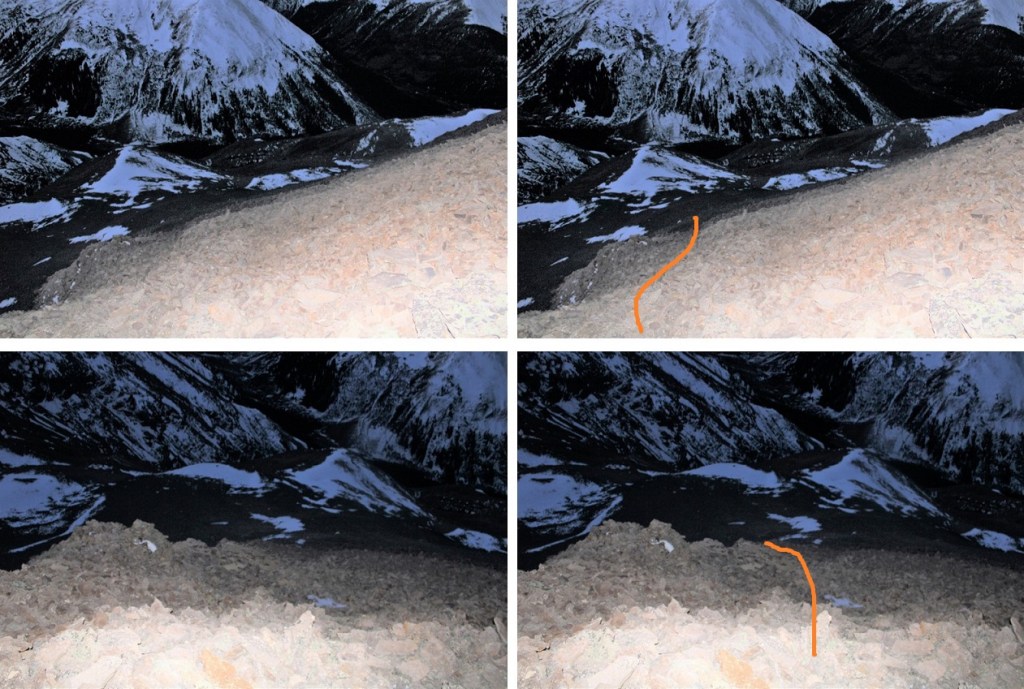
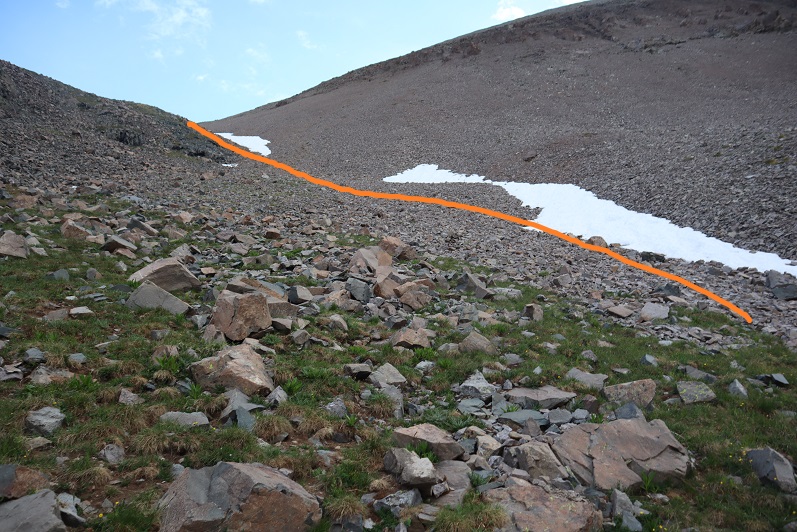
Note: There is a game trail here that goes to the ridge, but most of it was covered in snow. I was only able to see it in bits and pieces on my way up and down. This is the route I took to the saddle
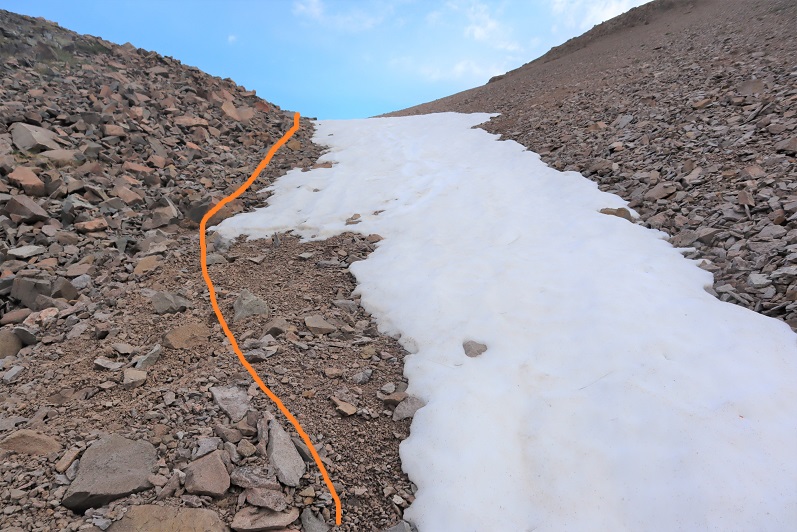
The basin was mush. Not only was it raining, it was warm enough for the snow to thaw, so I was walking on 6 inches of water most of the time. Here’s my route to the ridge
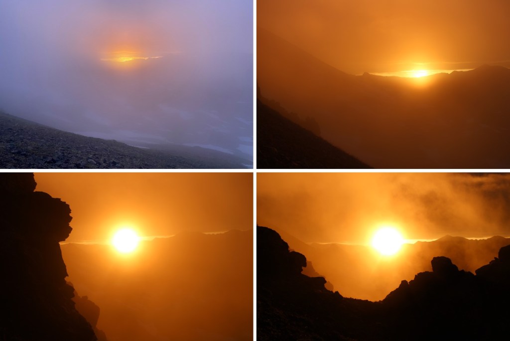
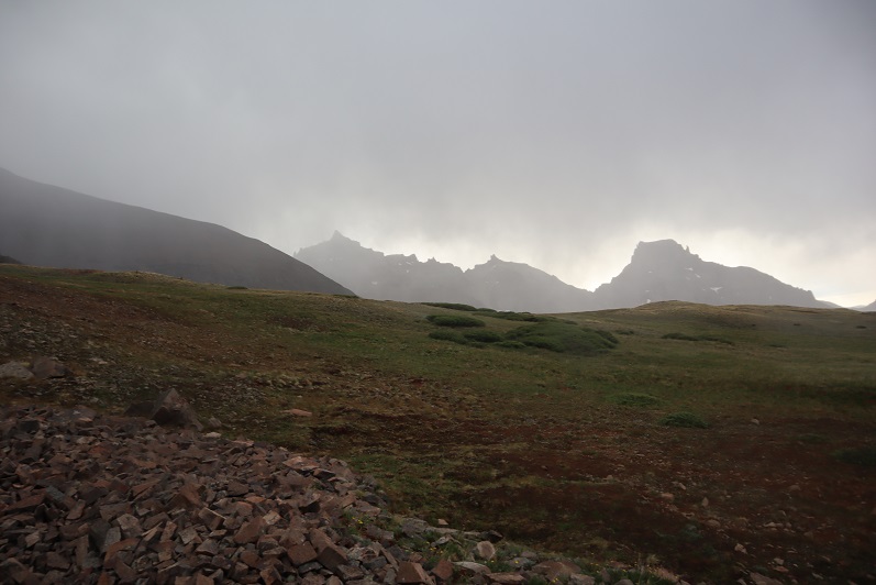
As I was gaining the ridge, the sun was rising. It was a beautiful, misty morning
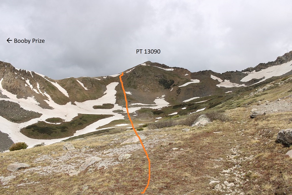
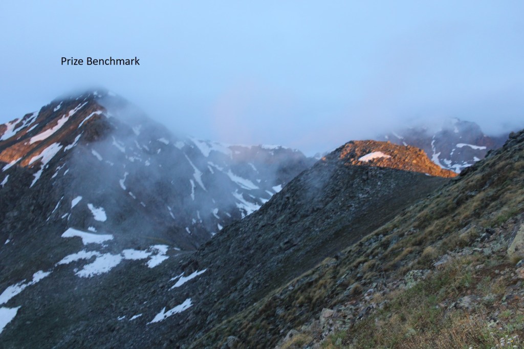
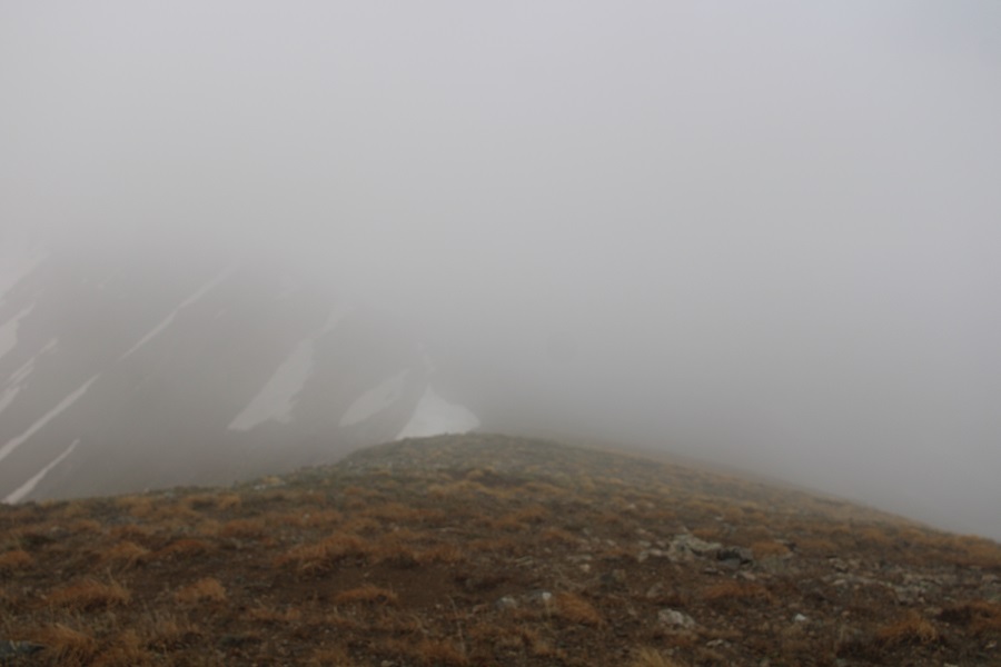
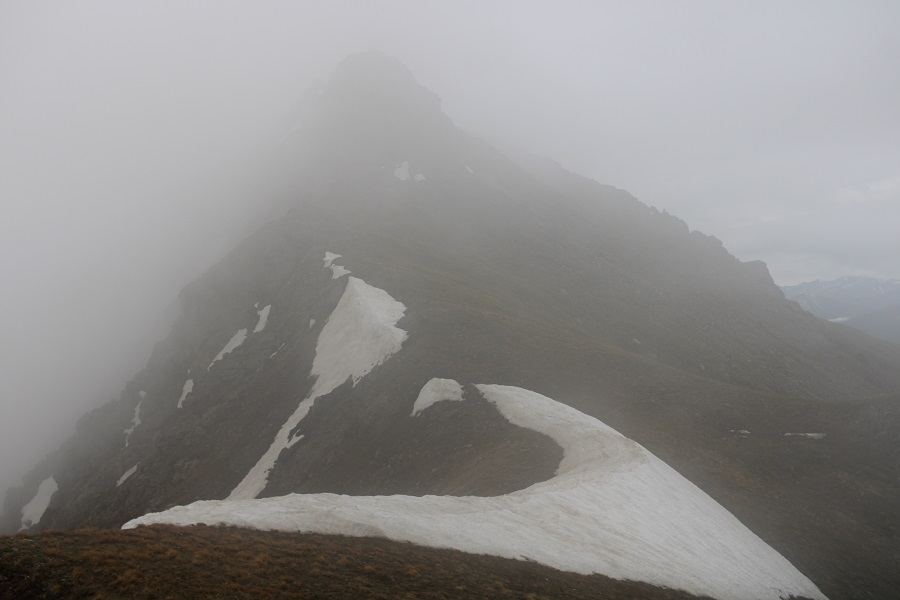
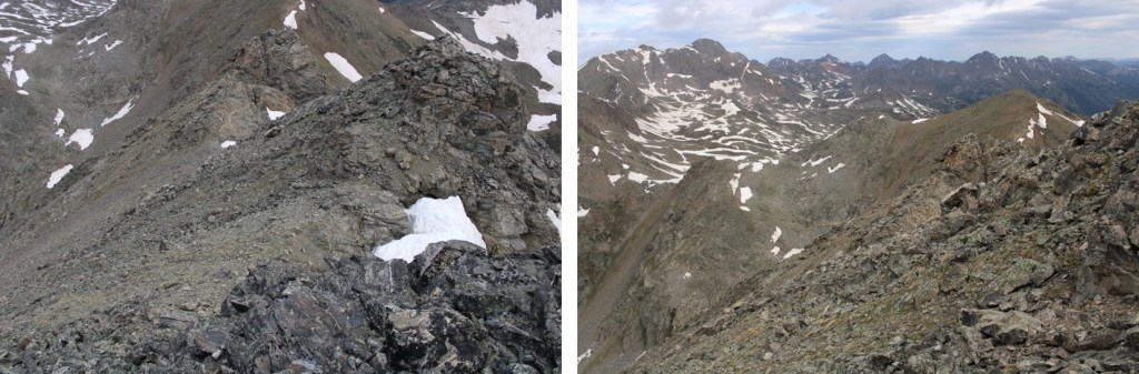
I gained the ridge, and headed over to Prize Benchmark, my first intended peak of the day. As you can see, conditions weren’t ideal:
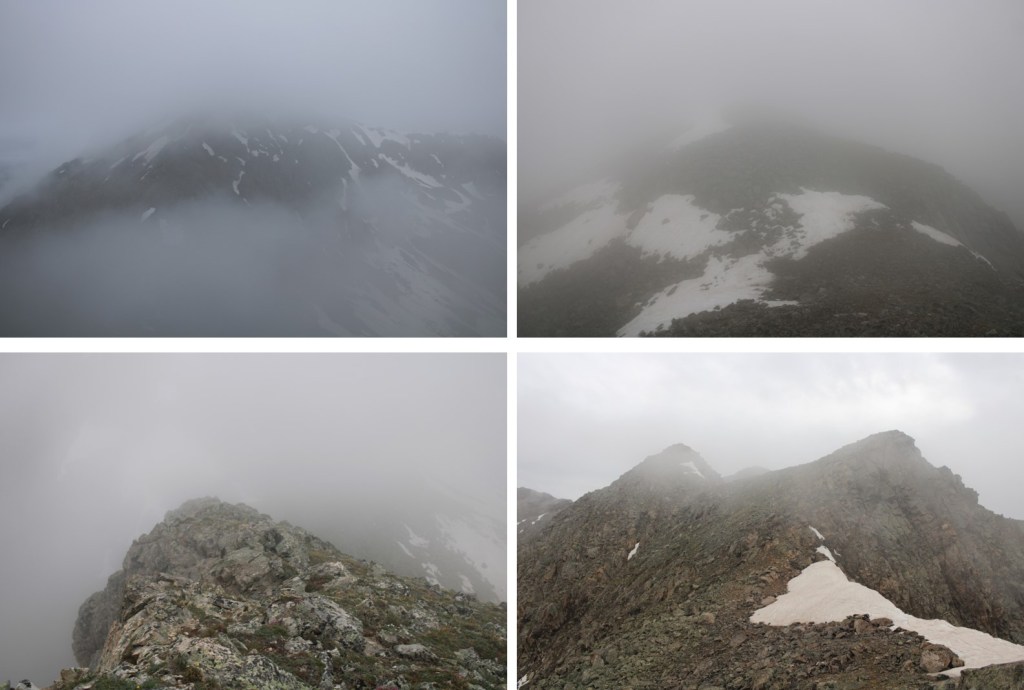
In fact, that was one of my better photos of the day. The clouds kept coming in and out, obscuring my route.
Eventually, I was in class 4-5 territory, and decided to call it and come back another day when I could see what I was doing. I knew I was headed in the right direction, but the terrain didn’t feel safe. I wanted to take the gully, and it was still full of unstable ice.
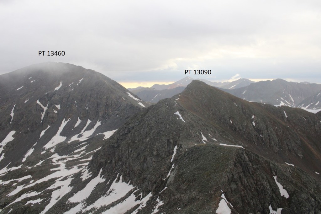
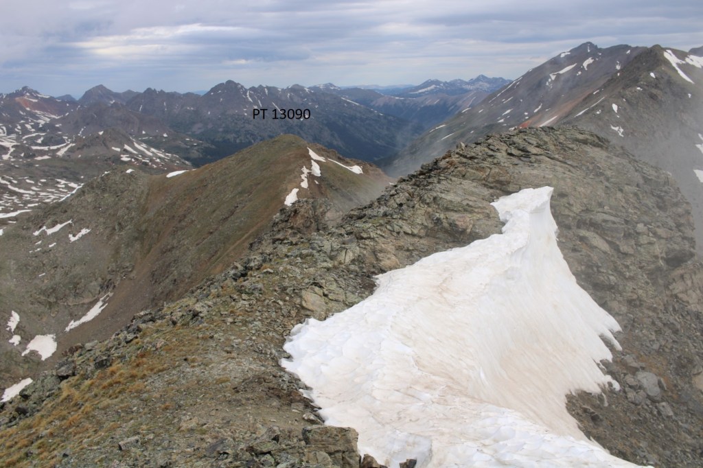
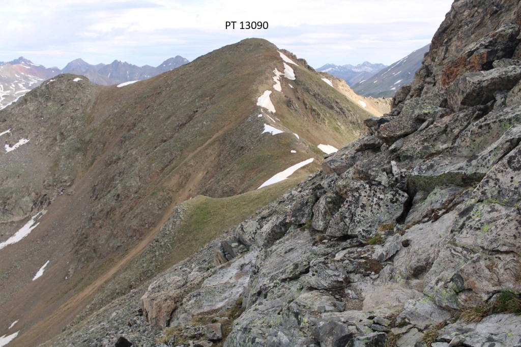
I downclimbed, and headed back to PT 13090. Even though it’s not ranked, I summited it, just because I was there
This was an easy ‘summit’
PT 13090:
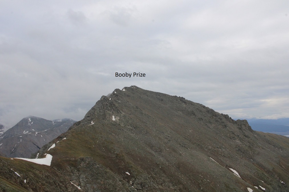
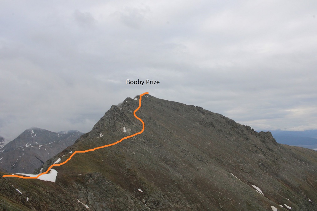
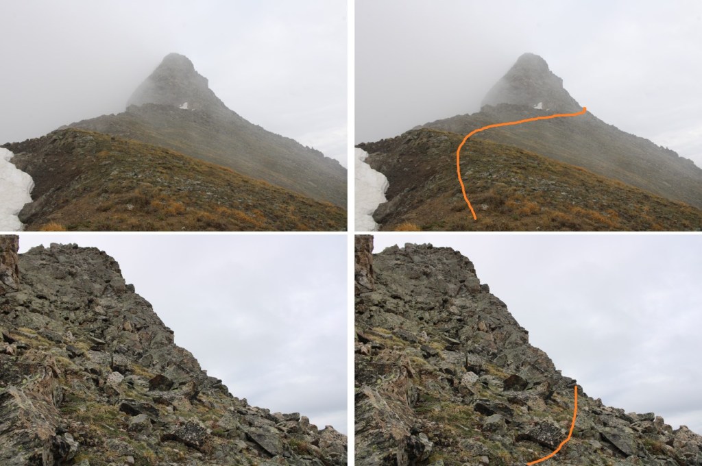
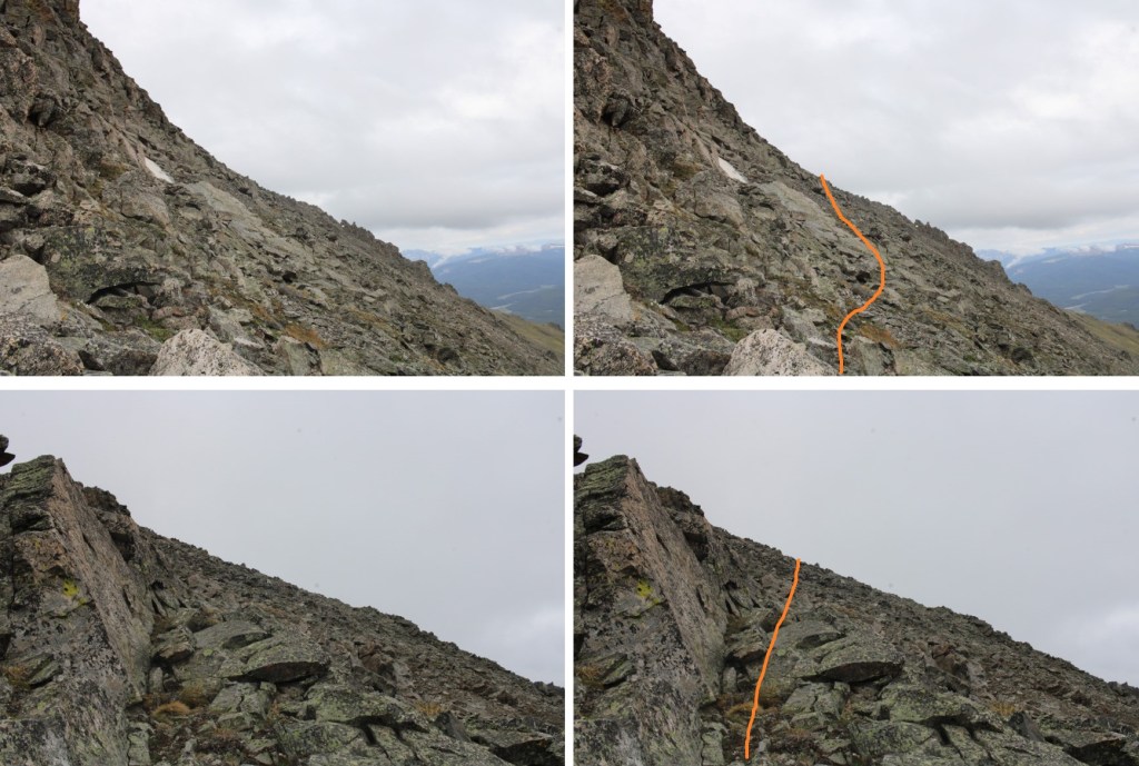
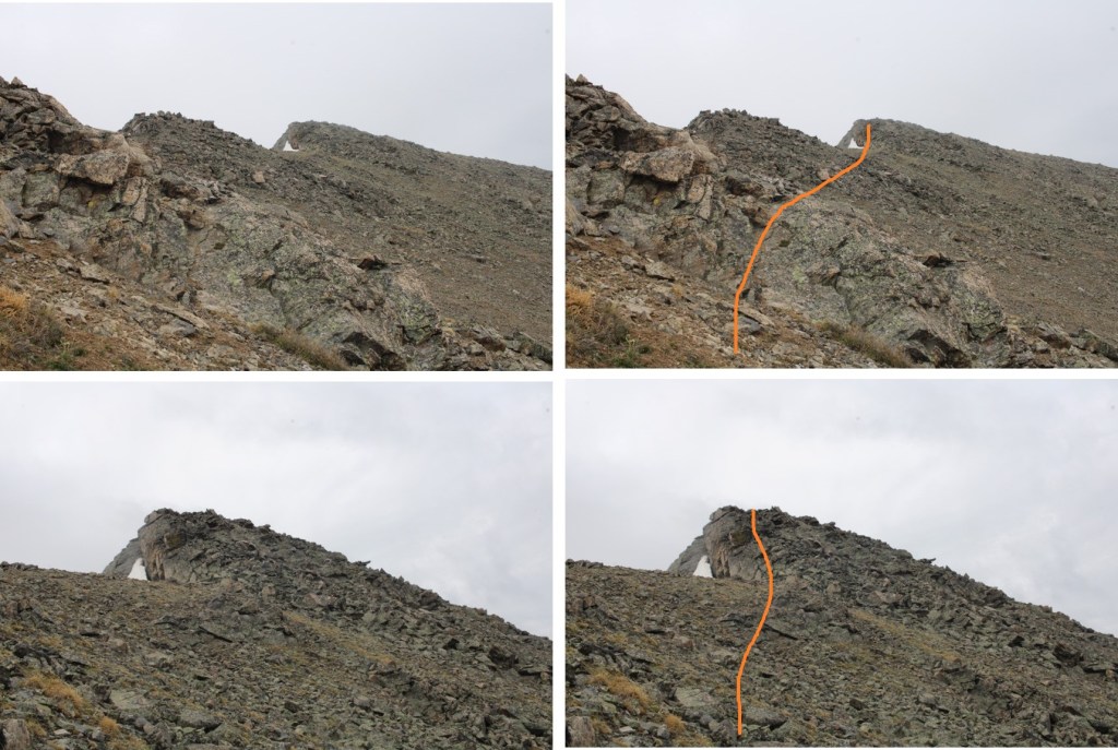
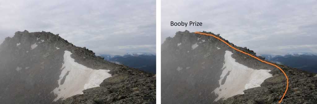
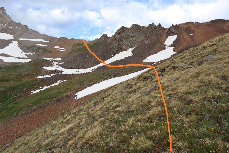
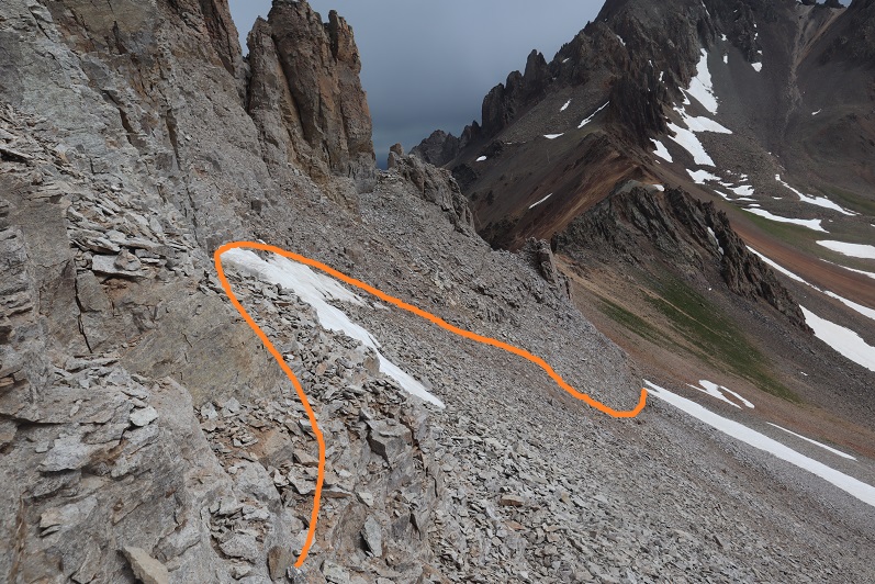
I turned right, and headed southeast towards Booby Prize
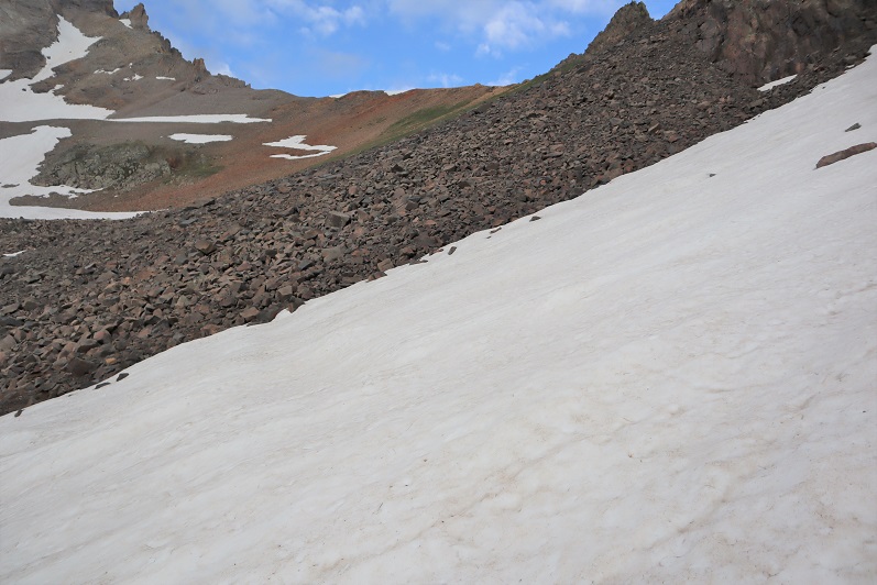
Here’s the overall route I took, avoiding the rock slabs and snow. This was all class 2, with some loose scree/rocks to navigate
The clouds picked up again, obscuring my view, but luckily, this was all class 2
Here are some step by step pictures
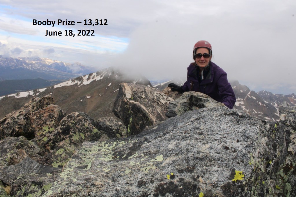
I summited Booby Prize at 8:10am
Booby Prize:
Nasty weather was predicted for the day, so I decided to re-trace my steps and head back to the PT 13090/Booby Prize saddle
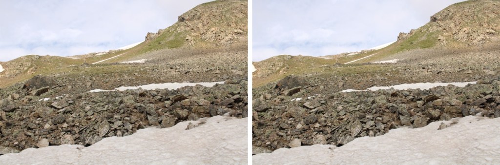
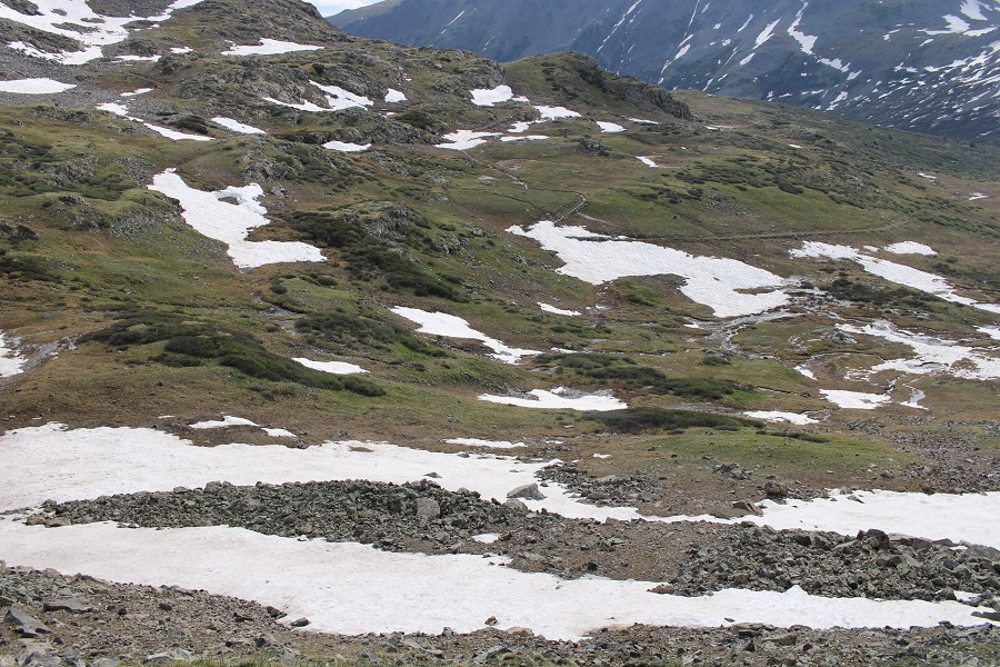
Back on the saddle, I could see the game trail that led down, but it also went right through a large patch of ice, so I went a little further up the saddle to find a snow-free route.
Here’s my route back to the trail
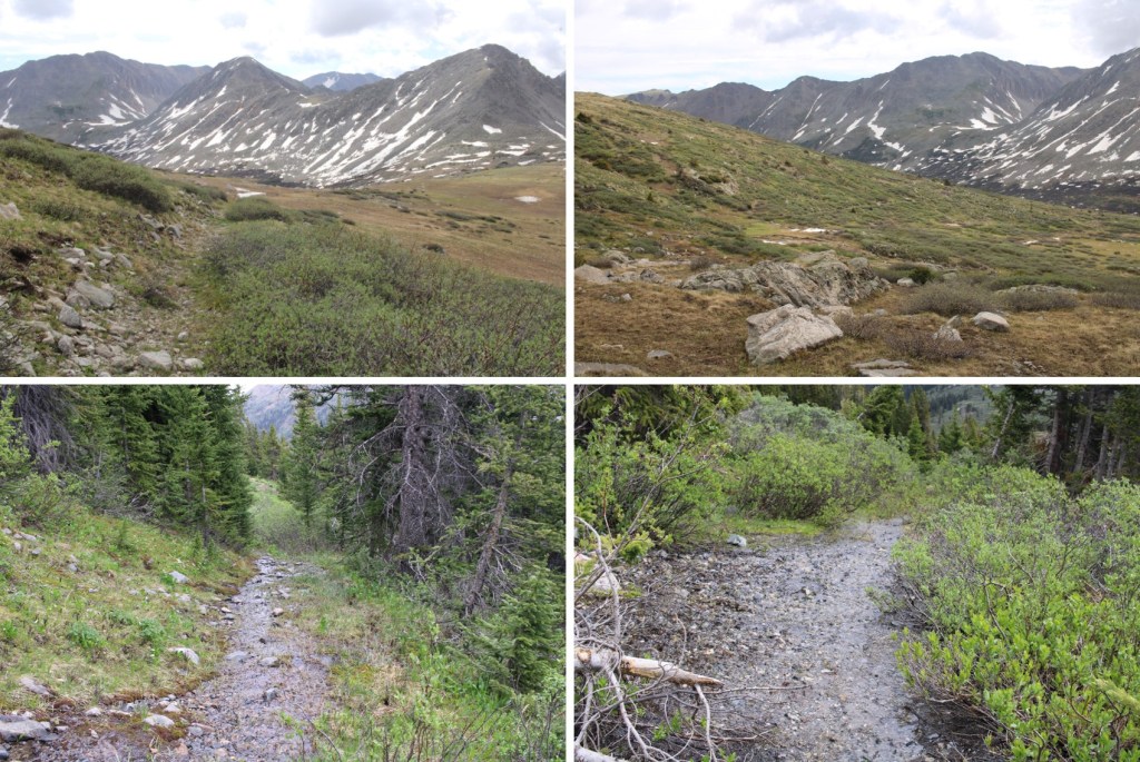
The route down was obvious
And the trail was easy to follow, if wet, back to my truck
I made it back to my truck at 10:30am, making this a 11.08 mile hike with 3174’ of elevation gain in 7 hours.
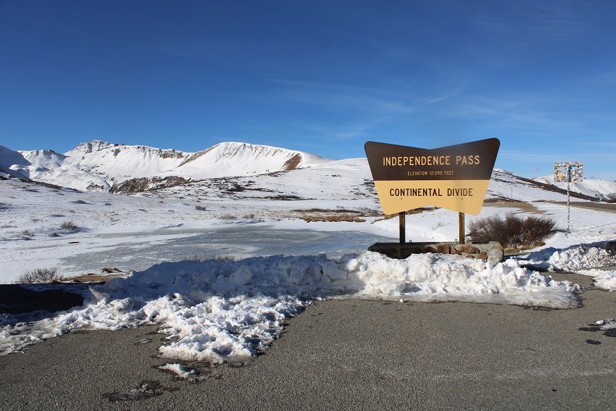
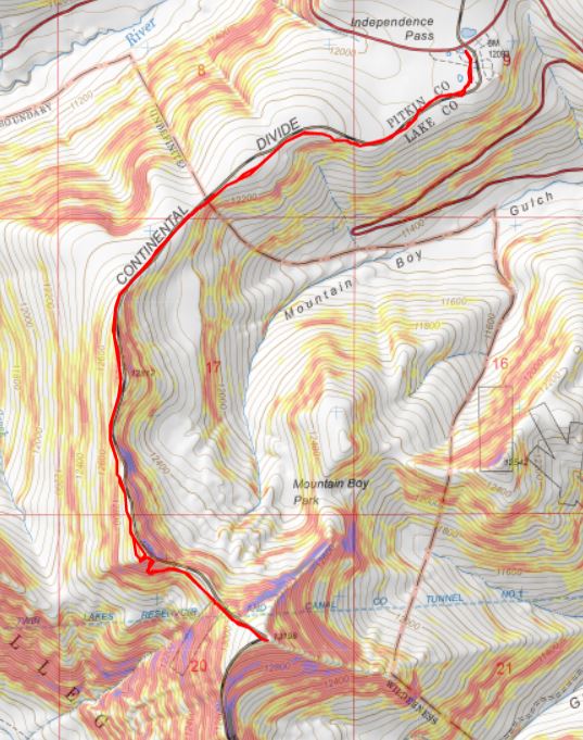
I wanted to get in one last peak before Interdependence Pass closes for the year. I was supposed to hike this peak o Tuesday, but weather was coming in, so I changed my plans and hiked it Monday morning instead.
I made it to Independence Pass and was on the trail by 5:30am. Side note: I was here October 25th, and the bathrooms were closed for the winter.
Obviously, mine was the only vehicle in the parking lot that early in the morning. The trail is obvious, and starts by heading south on a paved trail.
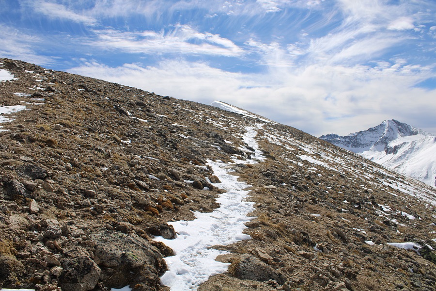
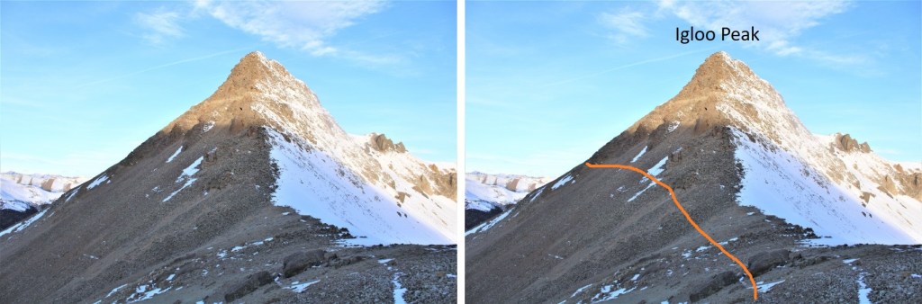
I’ve never been in this area in summer conditions, so I’m not really sure when the trail becomes a trail and no longer paved, but I know I was off pavement pretty quickly, heading west. This morning, before making it to Igloo Peak, snowshoes were needed some of the time, overkill most of the time.
Here’s an overall view of the route to the ridge
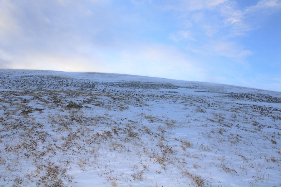
I headed towards the ridge, following an obvious route, which I am sure is class 1 in the summer.
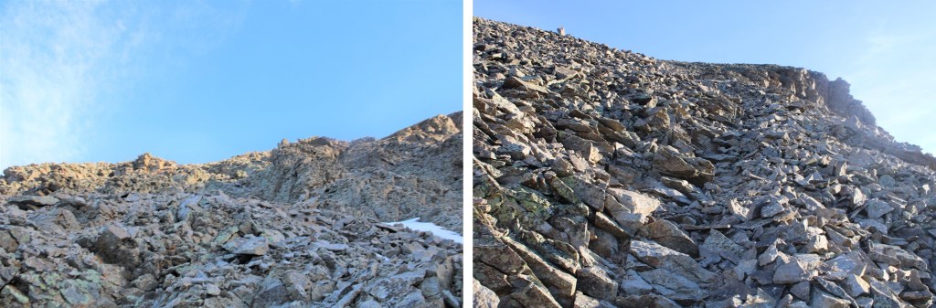
As you can see from the pictures… obvious route. If it’s not obvious when you’re here, follow the contour of the ridge. It’s all tundra.
The route becomes briefly class 2 here
This is very easy to navigate
And then it’s back on a class 1 trail again
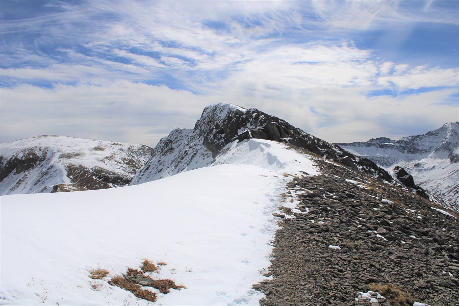
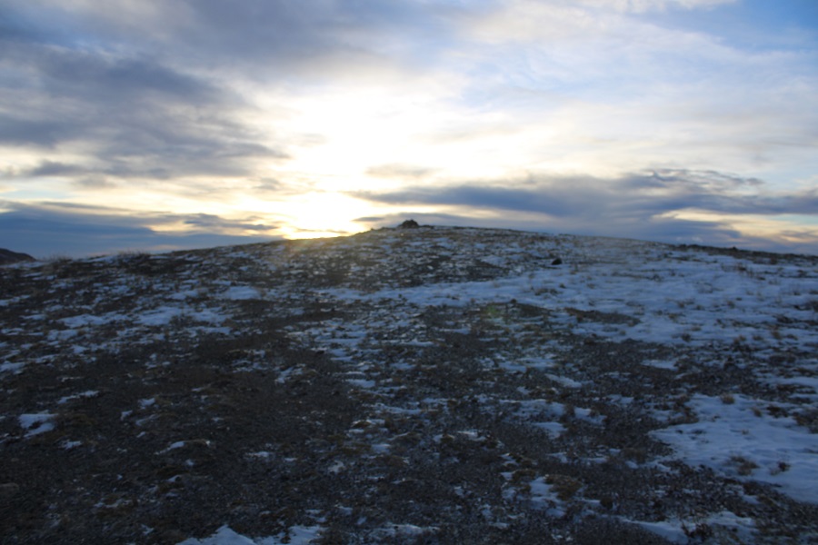
If you stay on the trail, the summit will be obvious
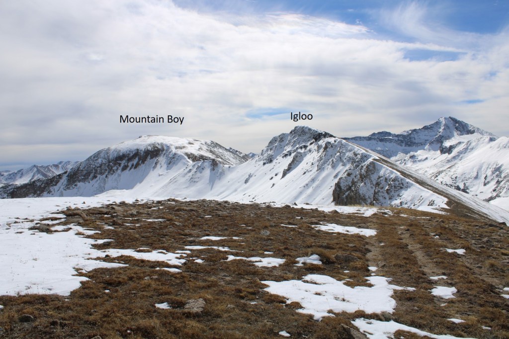
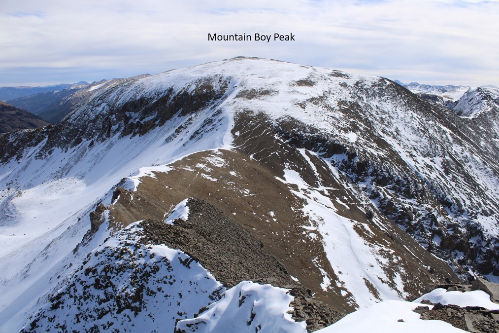
Here’s Mountain Boy from Igloo
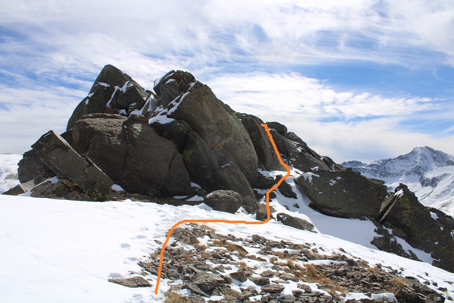
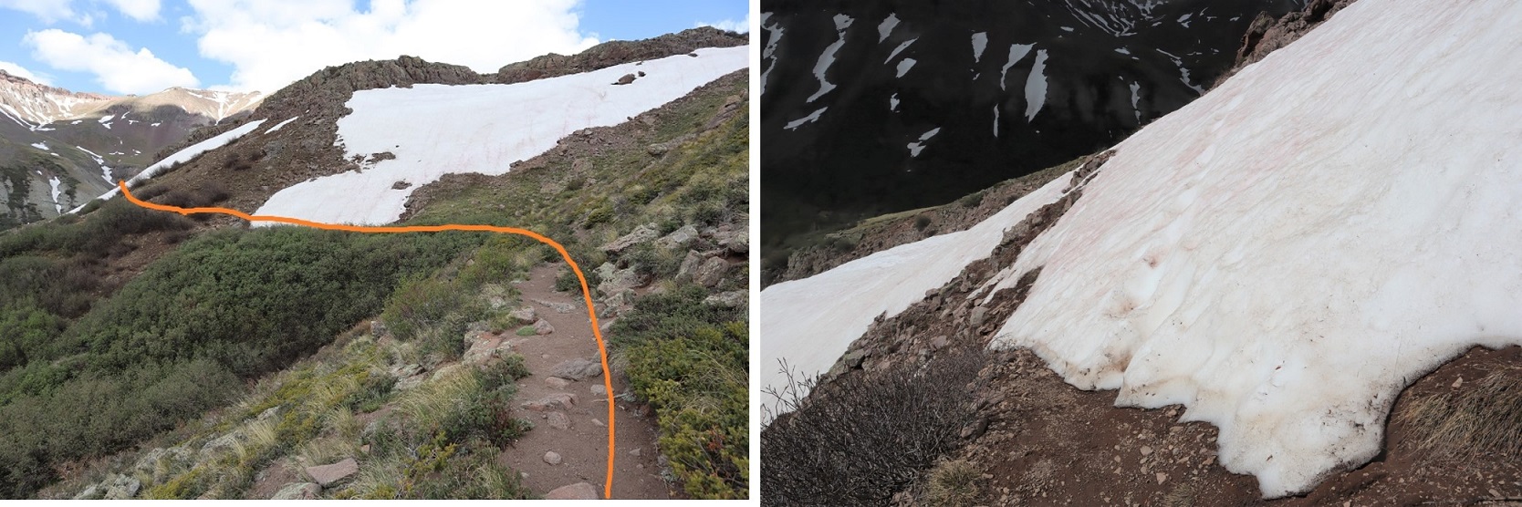
From the summit of Igloo Peak, the trail towards Mountain Boy immediately gets fun. It’s class 2 from here on out, with one brief class 3 move (or two… it’s a chimney). Now is a good time to put on your microspikes. I continued southeast, heading down this briefly class 3 chimney
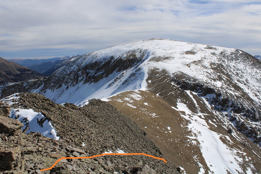
The rock will be loose until you make it to the saddle.
In order to get to the saddle, I headed straight south, down these scree/loose-rock filled gullies
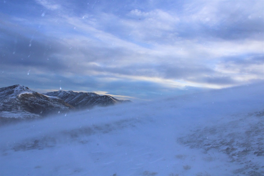
The sun was just starting to rise at this point. Alpine sunrises are the best!
Since the sun was still rising, my view wasn’t that great. Here’s what I saw as I was descending, following the contour of the drainages. This is choose your own adventure, but it’ll be obvious when the drainages end. Don’t descend too early.
It’ll also be obvious when it’s time to head towards the saddle. There seem to be several social/game trails here. I chose to stay high, about level with the saddle, and didn’t regret it.
Once at the saddle, there were still a ton of social/game trails. I chose the one closest to the ridge. From the saddle, it was an easy hike to the summit of Mountain Boy Peak on scree/tundra
Easy, except for today’s wind!!! It was relentless, and difficult to catch I pictures/on video at its worst. This doesn’t begin to describe the gusts
Wind on Mountain Boy:
The summit is obvious, marked by a cairn
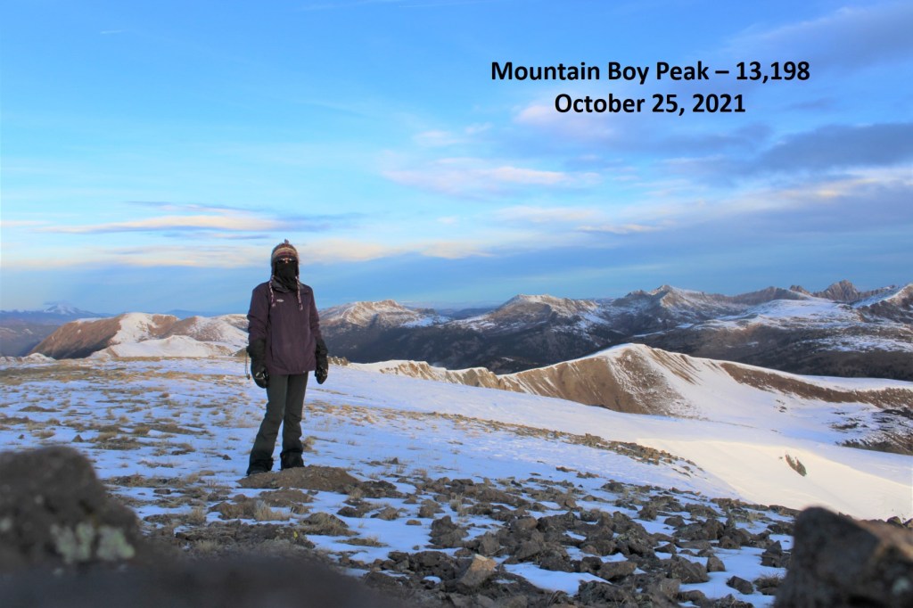
I summited Mountain Boy Peak at 7:45am.
Mountain Boy Peak:
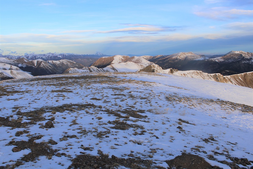
The views of Grizzly Peak were stunning!
I turned and retraced my steps back to the Mountain Boy/Igloo saddle
Here’s the route I took back to Igloo, which is the same route I took down. Microspikes are helpful here, as it’s kitty litter in some areas.
Here are some close-up pictures of the route back up to Igloo
And back up those scree/rock gullies
And up that quick chimney to the peak
I re-summited Igloo Peak at 8:25am
Igloo Peak:
The trek was easy back to the trailhead in the daylight
I made it back to my truck at 9:15am, making this a 6.78 mile hike with 2151’ in elevation gain in 3 hours, 45 minutes
Side note: I didn’t have my microspikes. Well, I did, but they fell out of my pack when I took off my snowshoes, and I didn’t realize this until they were needed. So, when I went to find my microspikes, just before the kitty litter area on the south side of Igloo Peak, they weren’t in my pack. But I really could have used them! Especially on the snowy ascent/decent of Mountain Boy Peak. The kitty litter areas were so much more difficult than they needed to be without spikes as well. I cursed myself the entire time, thinking I’d lost them for good and vowing to buy new ones on my way home as soon as I got cell service. The reason my track shows movement near Igloo Peak is because, on my way back I realized when I must have lost them and went looking for them. I found my microspikes, along with a whiskey flask I hadn’t realized I’d lost, just before the summit of Igloo Peak. From now on, they’re going INSIDE my pack, not in the cup holder of my backpack (I know, I know, not the best decision).
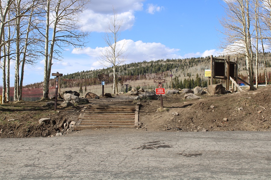
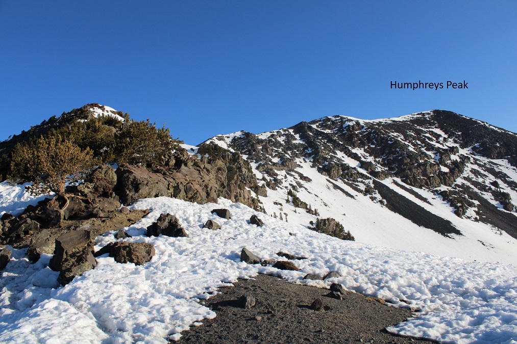
Last week I saw a post indicating someone had successfully summited Humphreys Peak from the summer trailhead, so I decided to give it a go. (Humphreys Peak Trailhead / Kachina Peaks Trailhead / Snow Bowl)
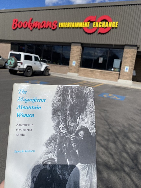
I woke up at 2am, worked out for an hour on the treadmill, and then drove to Arizona, stopping along the way for a few work calls. I’m not a big fan of the New Mexico city of Gallup: Nothing good has ever happened to me there. This time, as I was getting gas, a man was sitting in front of the gas station entrance cleaning a knife with a blade at least 8 inches long, swinging it around every few minutes like he was practicing martial arts moves. Also, all of the bathrooms in the gas stations and fast food establishments in NM and AZ are closed due to covid. So was the bathroom at the Bookman’s I stopped at in Flagstaff. I had a voucher for Bookman’s I’d received in 2016, and since I was in the area I decided to use it. I got this very appropriate book
Then I drove to the Snow Bowl, where the trailhead is for Humphrey’s Peak. There were a lot of skiers driving down the mountain, but I was the only one going up. On the drive in I saw a sign that said “Skiing Open 10am-4pm, TH-SU”.
I made it to the parking area and found a place to park. This is the trailhead
I walked around the trailhead, and noticed the beginning part of the trail goes right under a ski lift. I also saw this sign:
Ugh. That was unexpected. I’d driven all the way from Colorado only to be thwarted by a technicality. As I was standing there, I noticed two female hikers walking towards me, directly from the ski area where it said pedestrians weren’t allowed. They told me they hadn’t had any issues (indeed, at least 5 more hikers came down after them, and all said the same thing). I decided to hike the following morning, early, and try to make it down before the 10am skiing session began. Side note: these women were badass, and had a great list of mountaineering accomplishments. We talked for a bit, and I gave them some fireside stickers.
I sat in the back of my truck and started making dinner. A young man pulled up with a similar set-up and got out to enjoy the sunset. He spent his time sitting in a chair enjoying a beer, alternating drinking with doing push-ups. I went over and talked with him for a bit, and we ended up doing a few whiskey shots together (both of us had various bottles in our rigs). He was a nice young man (reminded me of my son) and this was his third time this week at the trailhead. He hoped to summit the next day as well. After the sunset I wished him good luck and told him I’d see him tomorrow on the trail (either up or down).
My view tonight
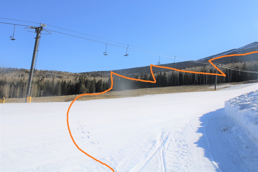
I went to bed and had a peaceful night’s sleep, waking up to my alarm at 2:45am, I was on the trail at 3am. Interestingly enough, as I was leaving a vehicle pulled up: it looked like there was another hiker hiking with me this morning. We ended up leap-frogging each other on the trail. The trail starts at the north end of the parking area and heads northeast, across the slop and into the trees, before zig-zagging up the west slope.
Plot twist: When I started out at the trailhead it was dark, all except for a really big light, accompanied by a loud buzzing sound. Turns out they groom the trails at 3am, and there was a snow groomer working this morning. Drat! I decided to turn off my flashlight and wait until the groomer had passed me, then darted across the field to the safety of the trail in the trees, where I turned my flashlight back on. I’m sure this would have been comical to watch.
There was another trailhead once I entered the trees. Note: I wore microspikes for the entire hike, and didn’t need snowshoes. If hiking later in the day, they would have been necessary.
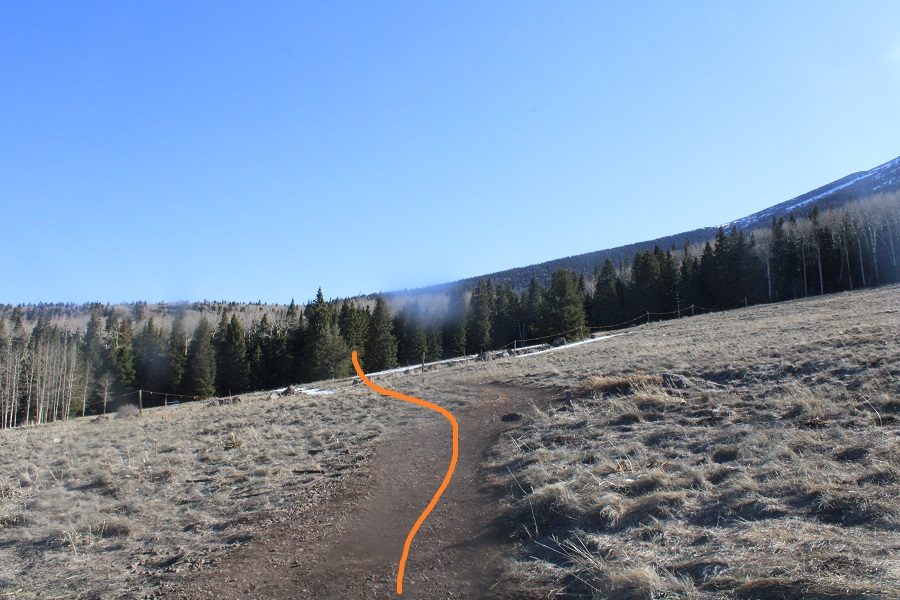
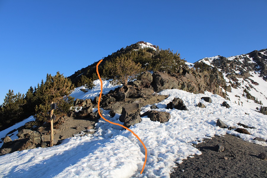
Once in the trees there was a lot of snow, so I had a hard time following the trail. There were several downed trees covering the trail, and a lot of social trails. If you’re doing this peak in summer it will be a straightforward, class 1 trail. If you’re doing it with snow on the ground expect some route-finding. I switchbacked northeast to the saddle. The saddle you’re aiming for is the one that’s directly east of you from the parking area (it’s a clear, skiable path).
As I neared treeline the snow declined and there was no longer a trail. I kept heading northeast to the saddle
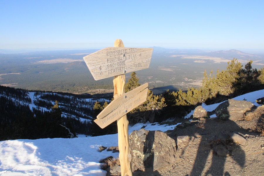
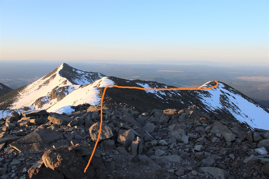
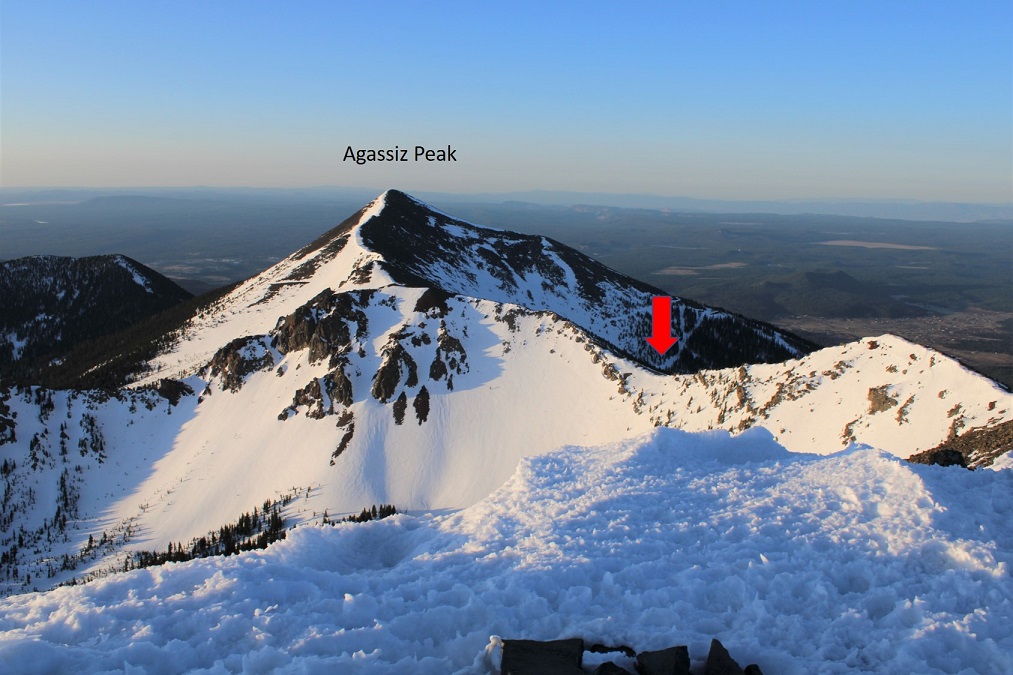
Once at the saddle I turned left, and followed the ridge north. (Going right will take you to Agassiz Peak) There’s a faint trail here that picks up as you go along, as well as wooden posts to guide the way. Stay to the left while on the ridge.
There’s also a trail sign here, indicating the way
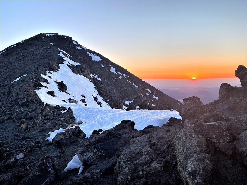
I followed the ridge north/northeast as the sun began to rise
The girl I’d been leapfrogging with took a different route up (there were several snowshoe tracks to follow), and when we hit the ridge she got out a sleeping bag and decided to watch the sunrise. She never did go to the summit, and was gone when I made my way back down.
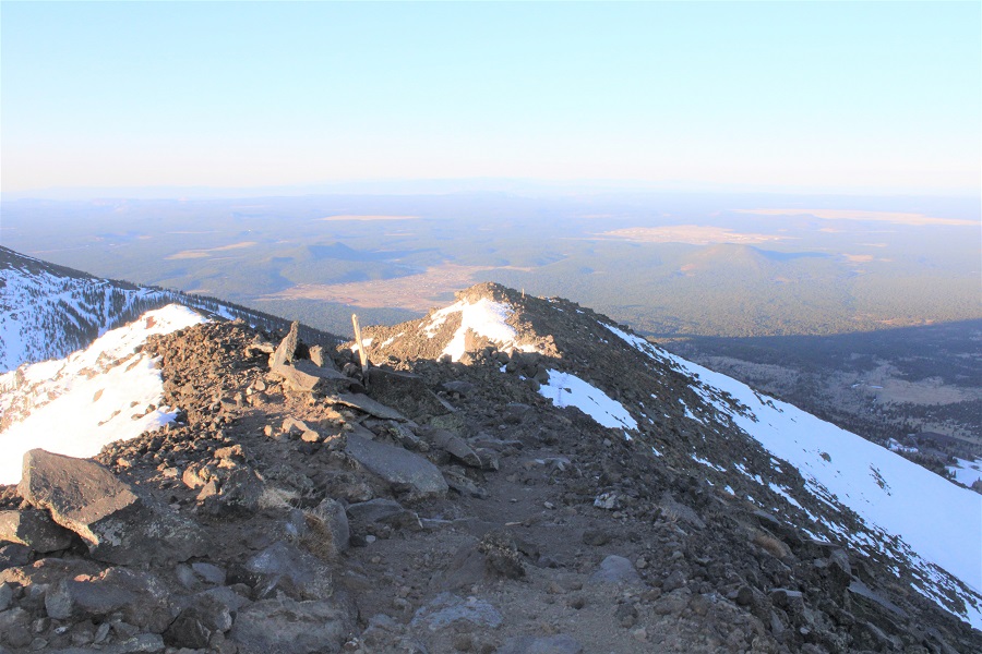
I continued on, following the ridge
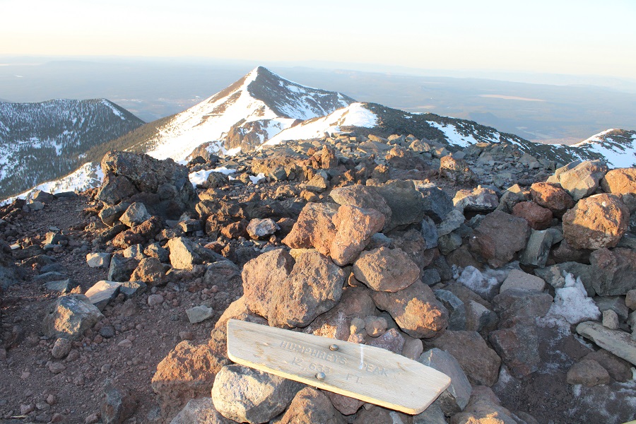
I made it to the summit at 6:20am. There were a lot of windbreaks at the summit
I found a buried summit register, left it there, and took a picture with the broken summit sign
Humphrey’s Peak:
It was cold and windy, so I decided to head back. Here are a few photos of the route down. I (mostly) re-traced my steps.
Here’s the saddle I was aiming for
And the ridge to get there
Once at the saddle I did my best to follow my tracks back down
Taken from the saddle, the parking area is circled. Here you can see it’s a straight shot west from the saddle, but that area was all skiable and off limits, so I did my best to switchback down the mountainside, following the summer trail.
I lost the trail several times, but was able to follow snowshoe tracks down. If you’re blazing your own trail, you can stay in the trees and parallel the ski area by heading west, which will lead you to the parking area.
Here’s the exit route back to the parking area
I was still really early, and there wasn’t anyone on the slopes. I was making tracks on the newly groomed snow however.
I made it back to a still empty parking lot at 9:00am, making this a 10.55 mile hike with 3649’ of elevation gain in 6 hours. I never did see that man I met in the parking lot last night. I can only think he had more whiskey than he could handle and had a hangover. That’s what he gets for drinking with a pro.
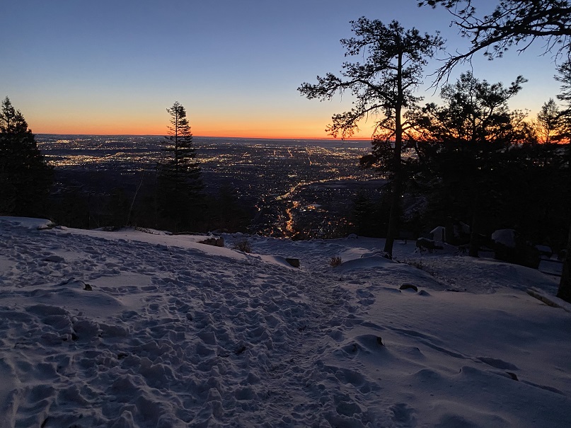
I’ve done this hike several times, so today I’m just going to post some pictures. I started at 6am, and while the sun hadn’t yet risen the moon was full and bright. The moon was so full I didn’t need to use a flashlight as I hiked up the steps. I was able to make it to the top f the incline in 36 minutes, 19 seconds. That’s my second fastest time, and I’m proud to say I did it with full gear, snowshoes and all attached to my pack.
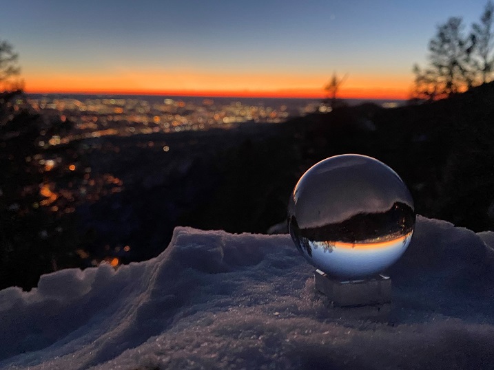
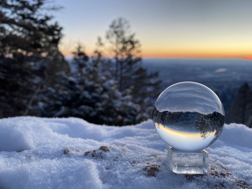
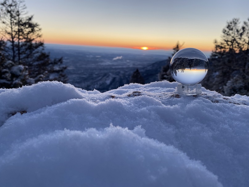
I tried out my photography sphere again, but it was really, really cold (12 degrees when I made it back to my truck) so I couldn’t position the camera right. I’ll keep practicing!
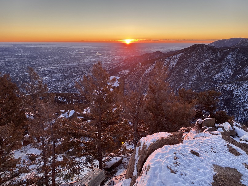
When I got to the top I wasn’t tired yet, so I decided to continue on to Rocky Mountain. The last bit is class 3, especially with snow.
There I made it just in time for the sunrise. And I got some pictures of Pikes Peak with the moon.
I got to hike down heading directly into the sun, which felt good on my face
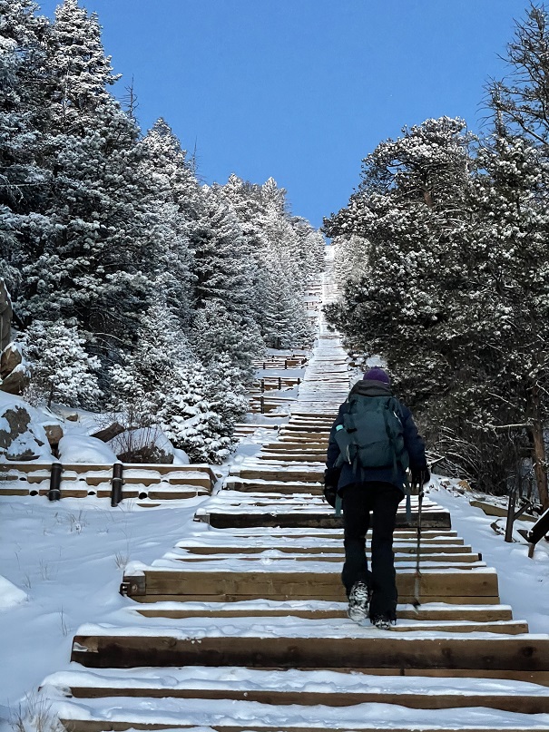
I haven’t been to the Manitou Springs Incline since they’ve implemented the reservation system, but since there was high avalanche danger all across the state, I figured today was a good day to go. The reservations were free, and easy to obtain. There are 25 slots open every half hour for reservation, and I secured the last two. However, when we arrived we only passed/say about 8 other people all day, and no one was enforcing the permit system. Maybe they took a snow day?
We paid to park while it was still dark and headed up the trail. It was 12 degrees outside, and SkyDiverHiker had on his new gloves. We weren’t sure if we were going to hike the incline once or twice today, so we decided to take it slow. We also wanted to see the sunrise, and we knew at our normal speed we’d get there half an hour before it happened, so if we went a little slower we’d stay warm longer. Check out our view of Manitou Springs
We kept the pace slow and steady. About halfway up SkyDiverHiker’s calves started cramping up, so we decided to make this a one and done day.
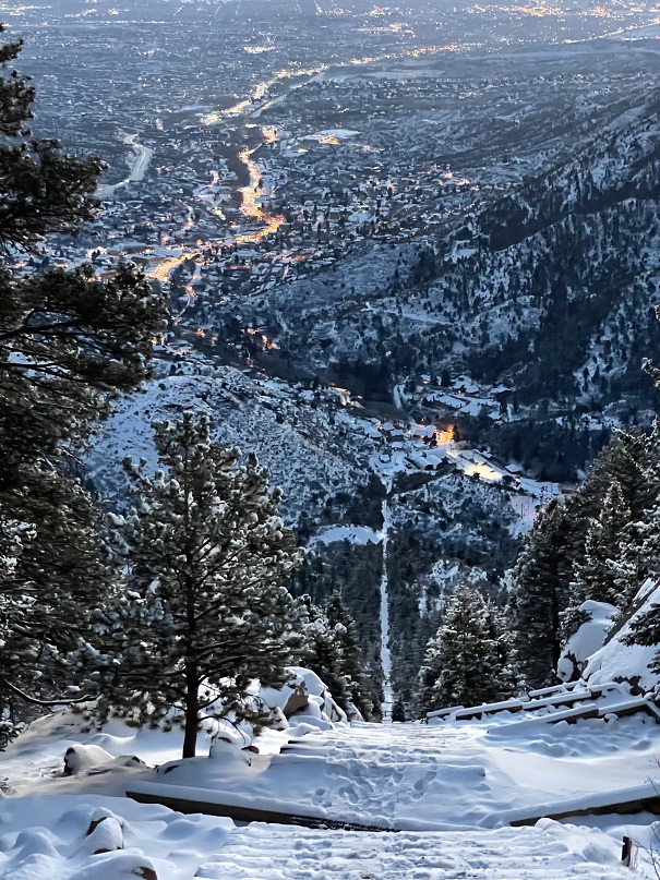
It took us about 40 minutes to reach the top, so we had a bit of waiting to do.
We took a selfie at the top: notice how cold it is? My hair is frozen!
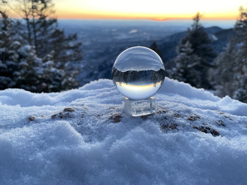
While we waited I got out my new photography sphere. I took a bunch of photos, trying to figure out how it worked. Unfortunately, it was still really cold outside, and my phone froze. The stylus didn’t work and my fingers were numb, so I didn’t get as many pictures as I’d of liked. I need some more practice.
It seemed to take forever for the sun to rise!
Jill and her husband met us at the top, and she took a few sphere photos too. Then we were off, back down the trail
Halfway down we had someone ask us if we’d seen a dog. No, we hadn’t, but a few minutes later a medium sized black mutt raced past us. We ended seeing the dog again and were able to coax it to us. We retraced our steps back up the trail to the owners, who were grateful, but I had to ask them if they had a leash? They looked confused, said “Oh yeah”, and got it out and put it on the dog. When we got back to the truck it was still 12 degrees outside! Brrrr!
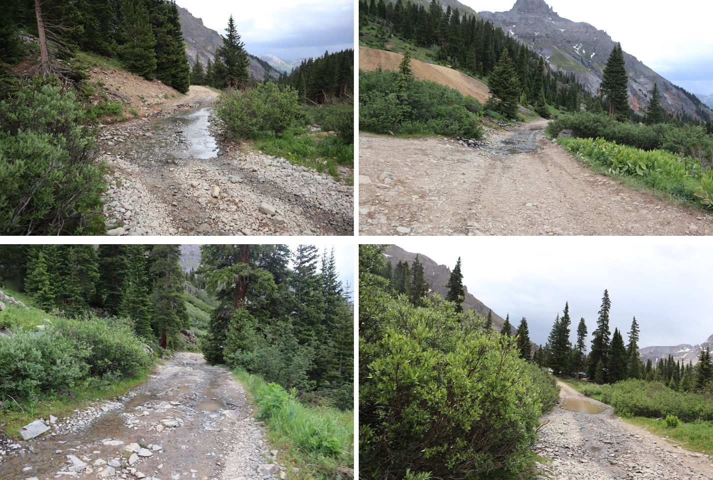
I’m kind of liking this ‘work from home’ thing that’s been going on for the past few months. Today I had a zoom meeting I attended at a Starbucks and then I was off to the Yankee Boy Basin (which I considered an appropriate place to spend the 4th of July weekend). The road to Yankee Boy Basin is easier than I remember. It’s only 4WD for the last mile or so. There’s a little bit of exposure but the road is plenty wide enough to pretend it’s not there.
I arrived at the trailhead and backed into a spot near the bathrooms (P.S. bring your own TP).
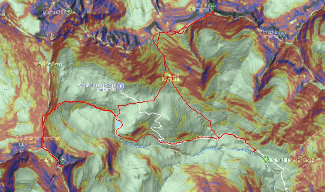
I got out and took a look around at the route I intended to take while it was still daylight. I was pretty sure I wanted to hit Cirque Mountain first, and then cross over to Gilpin Peak. Everything is different in the dark and a good visual in the daylight is helpful.
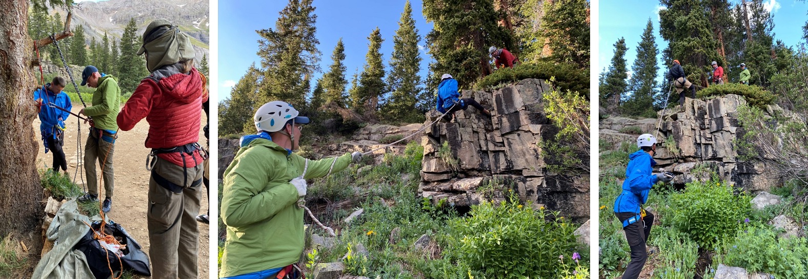
While I was looking around I heard a couple talking about Mt Sneffles. I went over to ask if they’d seen any snow on Cirque Mountain/Gilpin Peak while hiking. They were staying the night at the trailhead too, climbing Teakettle in the morning. We struck up a conversation and ended up exchanging beers and candy and 14er stories and caps full of whiskey. About an hour later two more of their friends showed up and we huddled around my truck as it rained a bit. When the rain stopped, they went over their gear and practiced some rappelling. They allowed me to tag along. I ended up calling it a night really early (I get up at 3am to work and get tired early in the evening). I’m sure I forgot to say it, so I’ll say it now: It was really nice getting to meet you all! Also, I will never be able to hear the word ‘traverse’ again and not say it twice @climbingcue, @dwoodward13, @hikesingeologictime, & @tallgrass!
I woke up at 3:30am, hit snooze once because I was really warm in the bed of my truck. I was ready to go a little before 4am. Tallgrass came to say goodbye and good luck. I was still groggy (I don’t wake up until about an hour into a hike). Thanks for the beer Tallgrass! I started by following the 4WD road northwest.
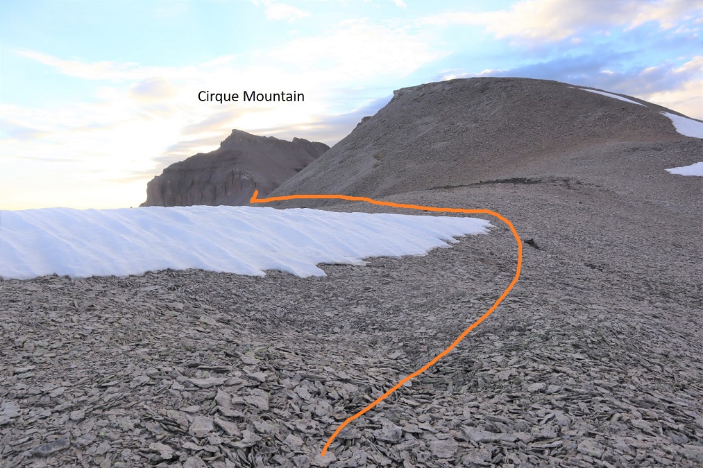
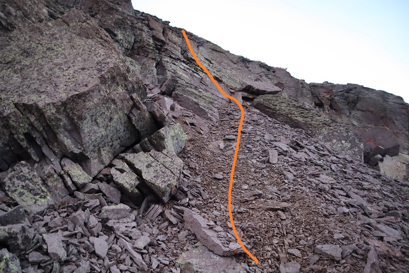
After hiking for almost half a mile I turned right and followed the small ridge up to the saddle of Kismet and Cirque.
The trail eventually narrowed and I went up a low flowing waterfall type gully
And then followed the scree filled gully to the saddle. All snow was avoidable.
At the saddle I turned right (east) and followed the ridge. Note, the point on the right isn’t a ranked peak. It’s easily bypassed by a trail to the left. I climbed it on my way back just to get in some added elevation and for the views.
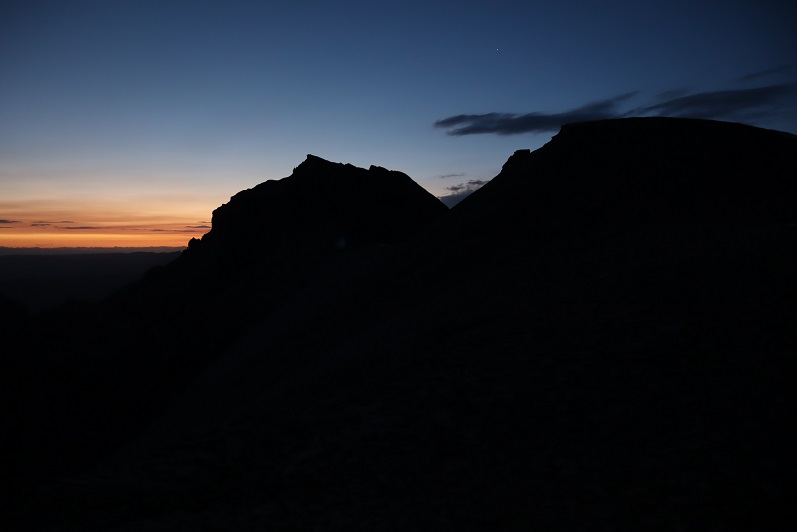
I picked up my pace here because it looked like I could make it to the summit for the sunrise. Wow, that part of the hike hadn’t taken as long as I’d anticipated.
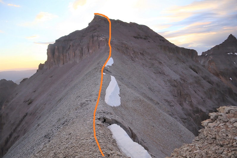
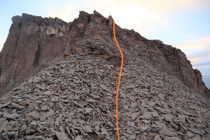
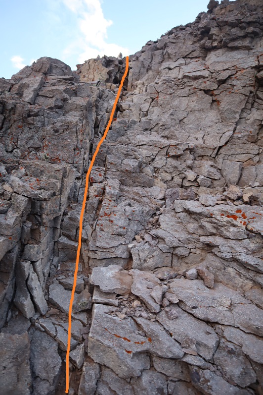
There was some choss and a chimney to climb. I put on my helmet and worked my way up.
There was some route finding for the last little bit as well as some easy scrambling
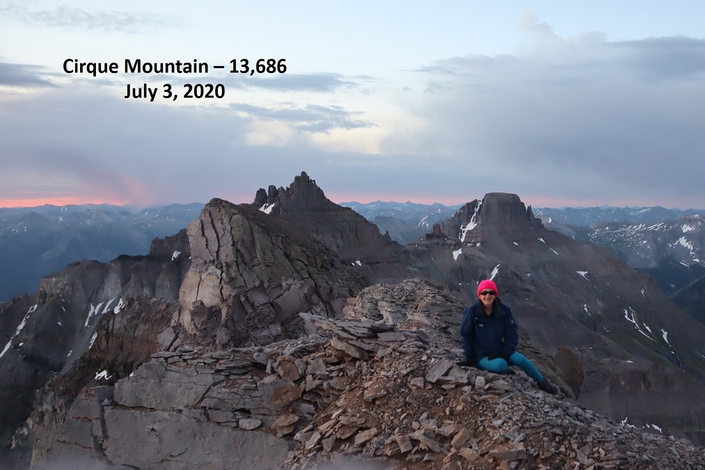
I summited Cirque Mountain at 5:45am
Cirque Mountain:
I made it a few minutes before sunrise and decided to stay to enjoy the show. It didn’t disappoint.
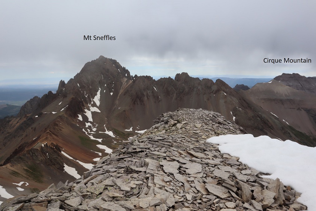
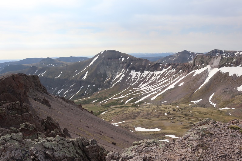
I also had some great views of Teakettle and Potosi to the southeast
I headed back the way I’d come, and decided to summit the small point and then head back down the gully
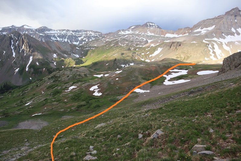
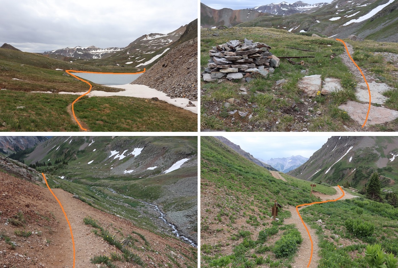
I didn’t go all the way down the gully. Instead when I hit tundra I turned right and headed west until I reached a small pond.
At the pond I hooked up with the Wrights Lake Spur trail and followed it until the first switchback.
Right about now it started to rain. I looked back on Teakettle and thought about my new friends hiking up there. I hoped they were staying dry.
The trail was an easy to follow, class 1 trail. At the first switchback I left the trail to continue heading west towards the saddle. There was a little bit of snow to contend with here so I put on my microspikes and walked across.
At this point I could see there was a gully I’d have to ascend that was still holding a little bit of snow at the top
Once on the saddle I followed it south. On the ascent I made the wrong choice and tried to ascend directly up the gully. This got me onto very loose, chossy terrain and took me longer than necessary to figure out. The rocks were the size of toasters and none of them were stable. Large sections would move below me at a time, taking me with them. On my way down I found a better route, so I’ll describe that route here.
From the ridge, dip down to the left to go around this first obstacle
Next, hug the area where the snow meets the rock. I’m pretty sure there’s an actual trail here under the snow
From here I’d wanted to ascend directly up the gully. DON’T DO THAT. Instead, try to make it as close to the ridge as you can
At the small saddle there was snow to contend with (a lot more snow than the pictures suggest). Glad to have brought my ice axe and crampons (something I do on every hike I don’t have beta on) and got to work kicking in steps and climbing over the snow. There was probably 30 feet worth of work to do over the snow at its narrowest point.
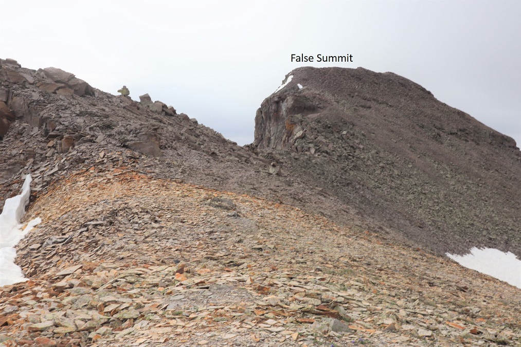
At the saddle I sat down to take off my crampons. From here it was a short trek to the summit, after first going over a false summit. This was all class 2, but I kept my helmet on.
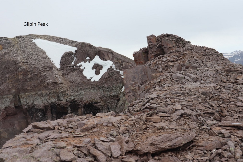
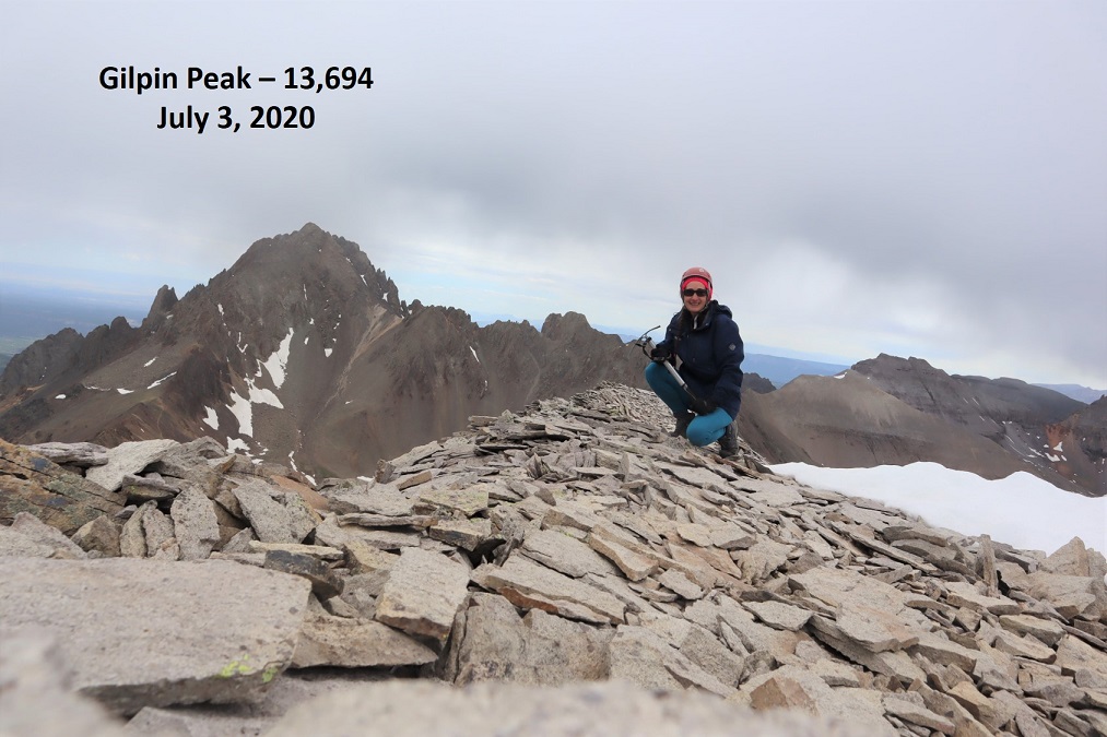
I made it to the summit of Gilpin Peak at 9:30am. It was lightly snowing.
Gilpin Peak:
Here’s a look at the route I took out the basin from the summit
I turned and headed back over the false summit and headed back to the saddle
Because I’d already kicked in steps I made the decision to put on microspikes instead of crampons to go down the snow. This was a bad idea, but I didn’t realize it until I was already too committed. I made it down the snow safely, but I was shaking as I did so: crampons provide much more stability than microspikes (duh) and I wasn’t very stable on the downclimb. I relied a lot on my ice axe.
Here’s looking at the ridge back down
I re-crossed the snow below, this time without traction: I boot-slid my way across much of the snow.
I made it back to the trail and there was a family standing there, waiting for me. There was a mom and dad and grandparents with 6 kids who all had to be under 10 years old. They’d been watching my descent, and the father asked if I would show the kids my gear (crampons, helmet, ice axe). The kids were fascinated with the equipment, and proudly told me they were hiking to the lakes. I wished them luck and was on my way.
After making it to the pond I followed the class 1 trail above Sneffles Creek until I made it to a road, and followed the road back down to my truck.
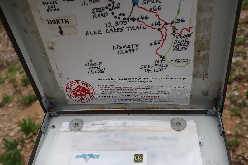
Just before making it to the road I passed what I thought was a trail register. I opened it and found one of the most confusing maps ever! Not only did it not correspond with the visual direction of the peaks, north was at the bottom. This map is going to get a lot of people lost.
I passed a jeep that had gotten stuck. Everyone pitched in to get her un-stuck.
It was easy to follow the 4WD road back to where I’d parked my truck
I made it back to my truck at 11:15am, making this an 11.1 mile hike with 4382’ of elevation gain in 6 hours, 15 minutes.
I still had plenty of time left in the day, so I decided to drive to the next trailhead and attempt another mountain.
I drove up to Carson Pass the night before and slept in my truck. For details on the drive in, please see this post: Carson Pass.
That night was a rough night, not only because my mind wouldn’t turn off, but because the winds were constant and curiously loud. I woke up before my alarm and decided to sit in the cab of my truck with the heat on to warm up a bit before starting out. I turned the ignition, heard a “thunk” and noticed my ABS and traction control lights were on. Oh, and my 4WD light was blinking. That seemed strange, and a little troublesome. I tried turning the truck off and on again and taking it in/out of 4WD but I couldn’t get it to engage. I didn’t like this turn of events but figured I might just need to get the truck moving to get it to work. Hopefully it was just an actuator problem. I was on the trail at 4am.
The forecast called for rain today, which most likely would transfer to snow at this altitude. I usually like to do the longer hike first, but today I was afraid I’d get caught too far when weather hit and since these entire hikes are above treeline that just didn’t sound safe. I grabbed my helmet and figured I’d play it by ear.
From my parking spot I traveled south for half a mile along trail 821 before turning right onto the Continental Divide Trail/The Colorado Trail/Trail 831. I didn’t know it at the time, but just past this junction there is actually a parking area, so if you wanted to cut off a mile from this hike (and extra elevation gain) you could just park there.
I followed the class 1 Trail 813 as it lost a total of 400’ as it wound down the canyon, and then gained almost 1000’ to the top of the pass.
There was one small section of snow to cross, but luckily for me the elk had already done a great job blazing the trail.
I saw quite a few elk this weekend. They are definitely all over this basin. The first ones I encountered at about 5:30am. Of course they trotted away from me, but I was able to get a photo of one up on the ridge (I’d be on that ridge in about half an hour)
Up towards the top of the pass the trail got a little wet, but it was still easy to follow.
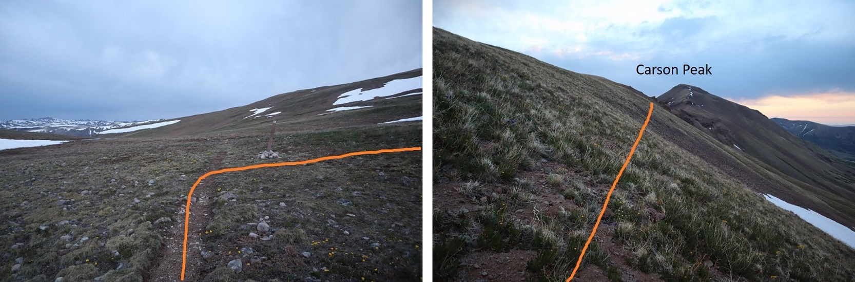
From the top of the pass I left the trail, turned right and headed northeast to the ridge.
I aimed for the saddle and got a great view of the sunrise.
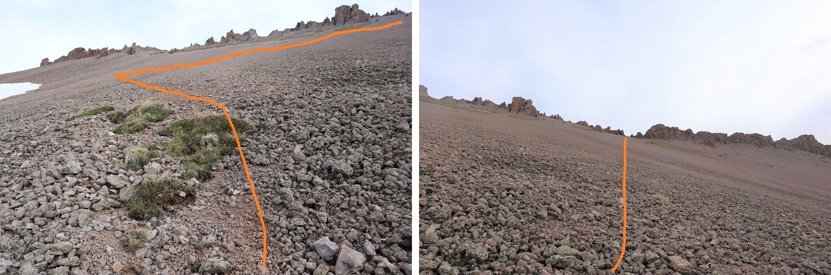
From here it was a class 2 ridge hike. I stayed on the ridge when possible, and when not I dipped to the right. Here’s the route I took:
In the beginning there were some steep sections to navigate. Nothing too difficult, but it’s all choss and there’s some decent exposure, so choose your footing carefully. This area was about a foot and a half wide in places.
This section is easier than it looks: Just dip down to the right
From there it’s an easy walk up tundra to the summit
I summited at 6:40am
Carson Peak:
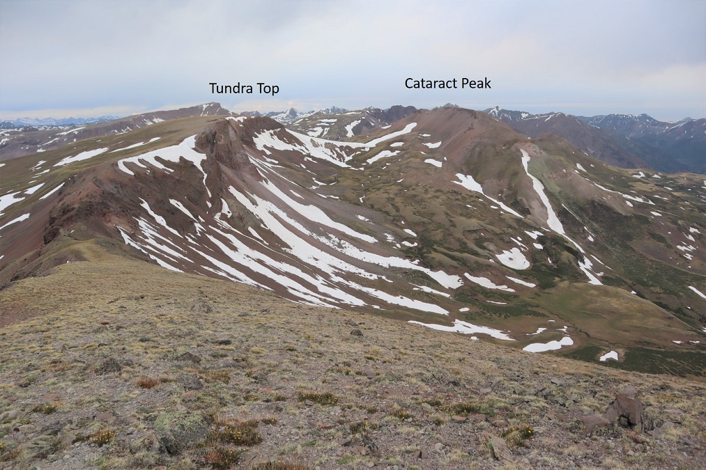
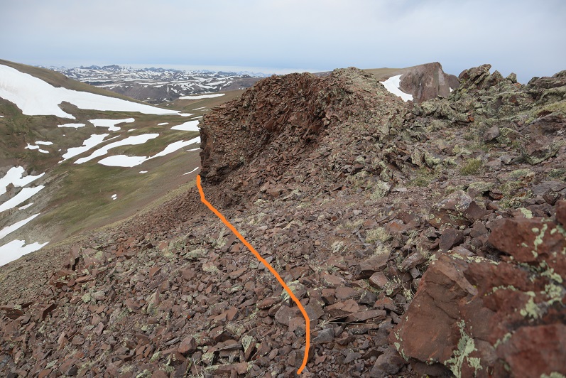
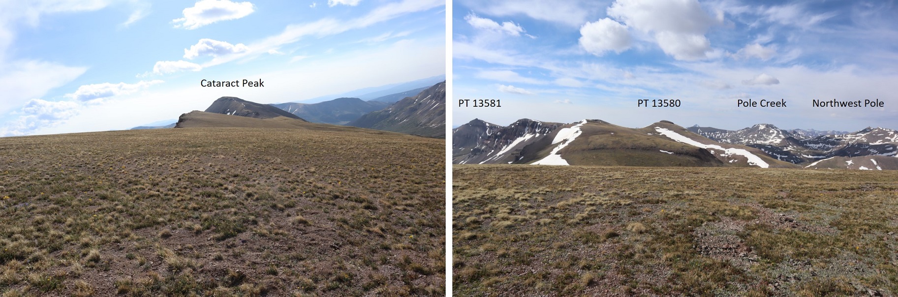
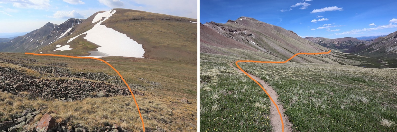
I turned around and headed back over the ridge. From here I had a good view of my next 2 objectives: Tundra Top and Cataract Peak
The route looks a little different on the way back.
Go straight over this part. Once again, there is some exposure here, along with loose rocks. Be sure of your footing.
And straight up this. Once again: loose, but straight up is the way to go
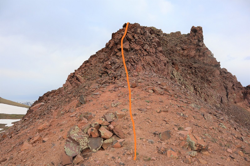
Once the ridge section is done it’s an easy walk up tundra
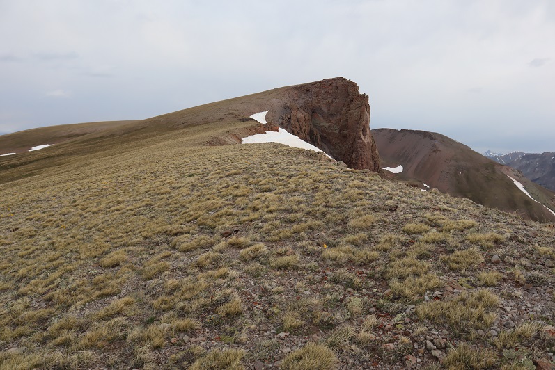
The only problem? I’m not sure exactly where the summit is to Tundra Top. It looks like it’s at the jagged point you can see from Carson Peak, and indeed that feels like the summit and also has a large cairn, but when I used my altimeter I measured the middle of the flat, open space further to the west as being 30 feet higher. Also, there are cairns all over the summit, as well as at the high point after the ridge. So I basically walked all over the mountain (between summiting the first time and when I came back over from Cataract) and I’m considering it a summit.
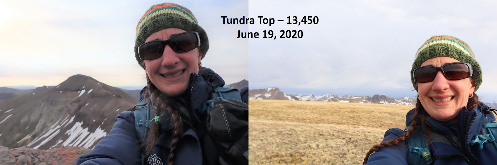
In any event, here’s a couple of summit photos from somewhere on the top of Tundra Top, and a video (not sure if the video is from the actual summit though)
Tundra Top:
I turned north and headed over towards Cataract Peak
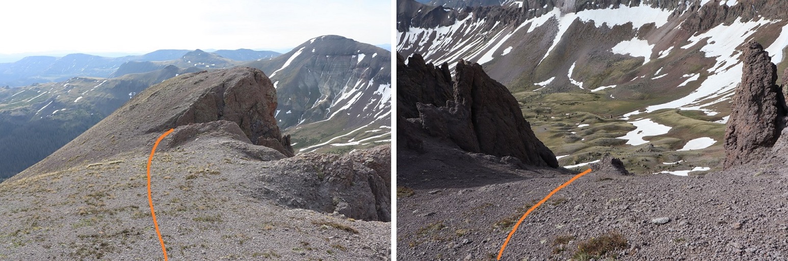
The hike down started with unstable rocks and then switched to scree. This was class 2, and I’m pretty sure I was using game trails, making my way towards the saddle.
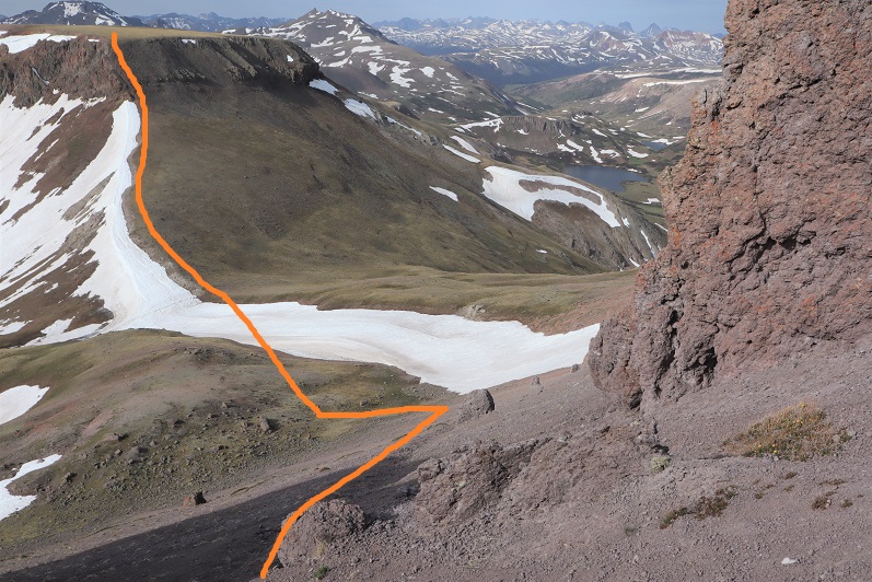
There are two ways to summit Cataract Peak: you can go to the left (west), gain the ridge, and then summit, or go straight up the south face. Not knowing ridge conditions, I decided to go straight up the south face, even though that meant crossing some snow. (After summiting Cataract I realized the ridge is easy class 2 and a viable option).
After crossing the snow I made my way up the mountainside on loose scree, which was steep at times. I followed an obvious game trail with one switchback.
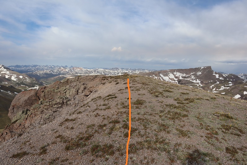
At the top of the ridge I turned left, went around this boulder, and hiked the short distance to the summit (which had a cairn)
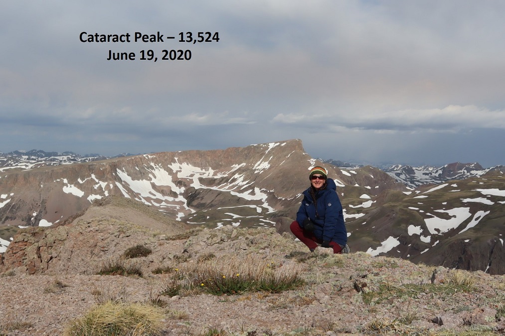
I summited Cataract Peak at 8:25am
Cataract Peak:
I re-traced my steps back to Tundra Top
Encountering an elk on the ice flow before the easy hike up to Tundra Top
From Tundra Top you could see a bunch of the peaks I was hiking this weekend. I spent a lot of time here, checking out the weather and looking at routes for tomorrow to see if they were clear or not. Unfortunately, these peaks require a lot of ups and downs through basins, and while I could see ridges were clear, I had no idea what the basins looked like.
I headed back to the pass, picked up the trail, and headed back down into the basin.
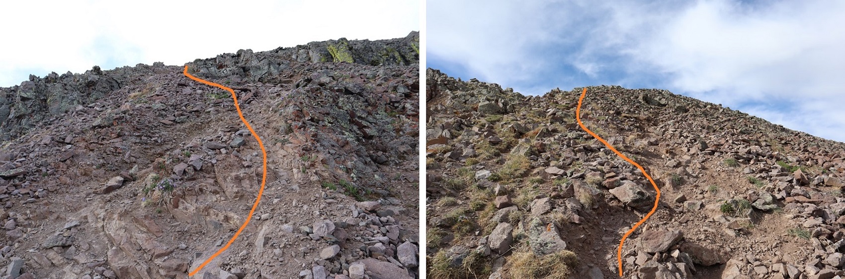
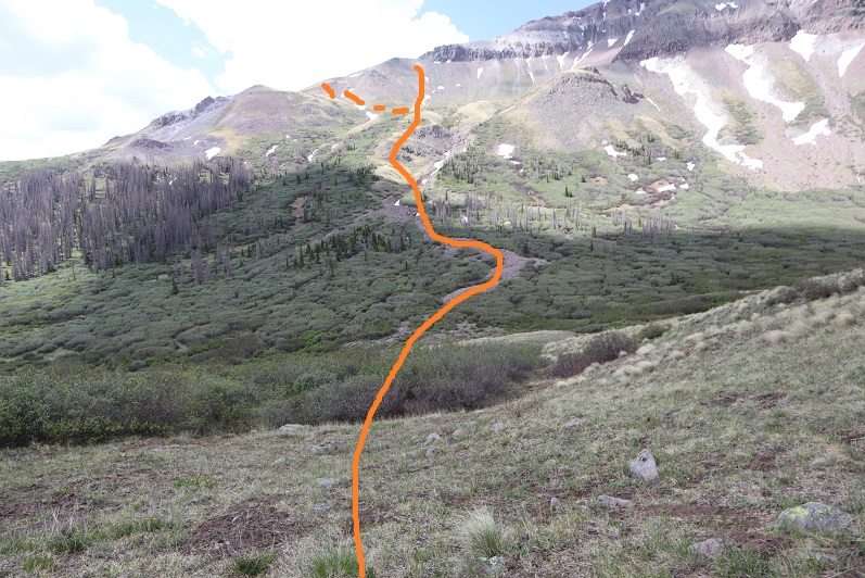
When I got to the lowest point in the basin I decided to attempt PT 13581 today as well. The weather looked like it would hold, and I was so close (and not yet tired) that I figured I should at least give it a try. I eyeballed this one, looking for the best route up. I decided to leave the trail, cross Lost Trail Creek, and follow the drainage until I hit the tundra that paralleled willows. Then I would stay on the tundra, using the willows as guidance before taking a gully up. To gain the ridge I took the solid line up, the dotted line down.
This proved to be a fabulous plan. The only downside was the gully: it had recently melted out and was still soft. I almost lost a hiking boot in the mud, and it was very steep. It almost felt like it should have been a winter route with snow, an ice axe and crampons.
Here it is in a little more detail:
At the top of the ridge I turned right and followed the ridge to the summit block
I was keeping a close eye on the weather. The clouds were building, and fast. Luckily, they looked like snow clouds and not thunderclouds. I had a feeling that 40% chance of rain was going to happen.
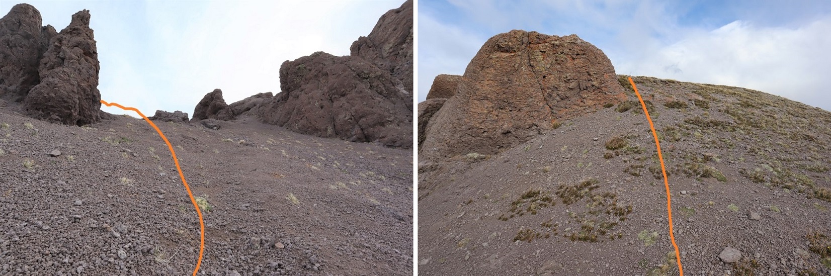
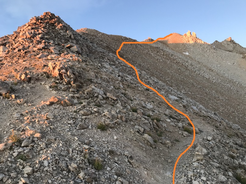
When I made it to the summit block I was surprised to find it wasn’t a class 2 hike as my (quick) research had told me. Nope, this was definitely class 3. I was glad I’d brought my helmet. I strapped it on and left my pack and trekking pole and headed in to figure out how to summit. This is the route I took: I circled around to the left, found a bunch of easy class 3 access gullies, took one up, followed the ridge around to another access gully and climbed to the top. There was exposure in the second gully.
I summited at 12pm
PT 13581:
The weather was turning so I quickly retraced my steps back down the gullies to my gear, then followed the ridge
On the way out I took the second gully down, which wasn’t as steep, and then followed the same path I’d used as on my way in back to the trail.
The wind picked up as I hit the gully and it started snowing. Not big fluffy flakes, but more like slush being carried by the wind that splattered when it hit me. I put on better gloves and kept hiking.
The hike out was uneventful, as it was on a well maintained class 1 trail. The extra 600’ of elevation gain on the way out was kind of a bummer, so I just took it slow. The trail actually inclines gradually, so it wasn’t too bad.
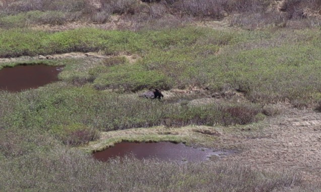
Oh, and I saw a moose in the basin, so that was kind of cool. It was a little far to get a good picture of, but it’s a male.
I made it back to my truck at 2pm, making this a 15.41 mile hike with 5543’ of elevation gain in 10 hours.
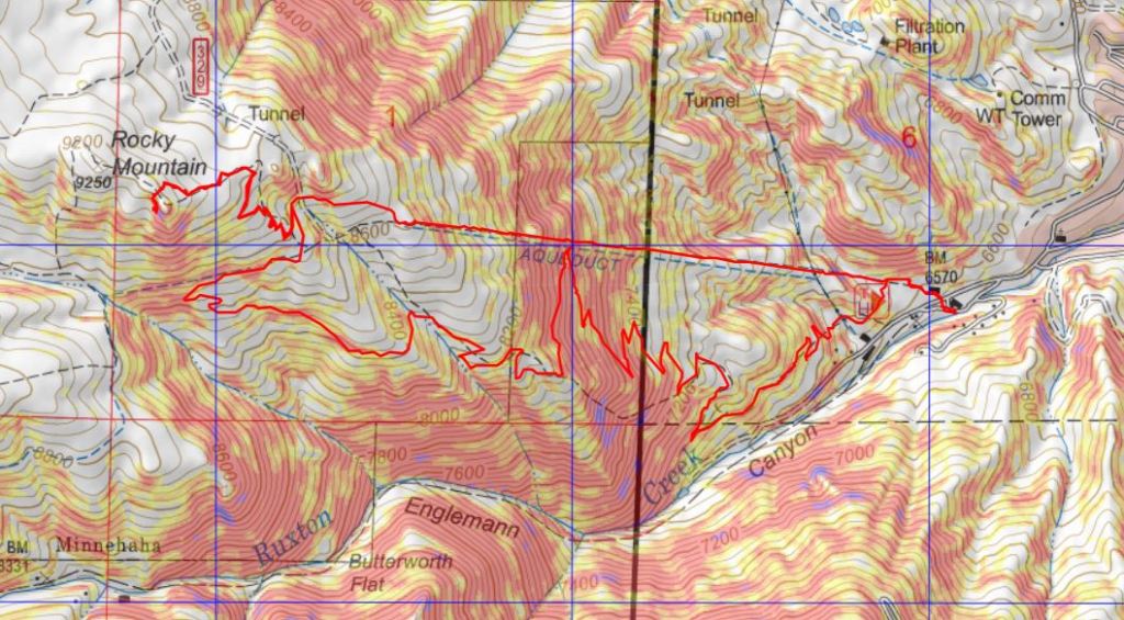
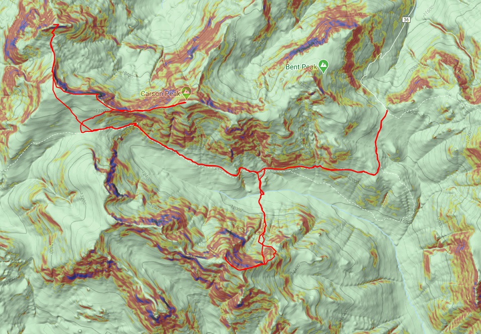
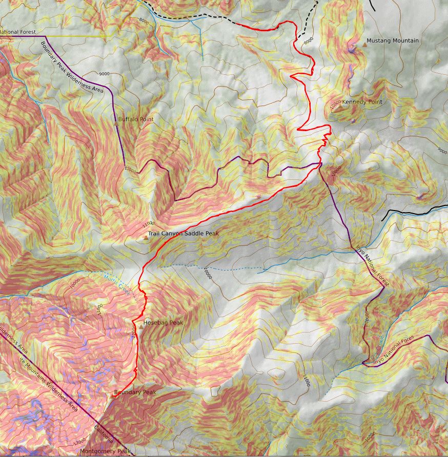
Here’s a topo map of my route:
It was still early so I decided to clean up, get something to eat, and try to start my computer. It lit up but quickly turned off. Maybe it will dry out overnight and work tomorrow? OK, with my computer out I decided to do some reading. My favorite book for a long time has been “Death in the Grand Canyon”, so I picked up it’s sequel, “Death in Yosemite” and have been reading it the past few weeks. Lovely how the book reiterates, several times, how it’s important to always make good choices, retrace your steps before committing when you’re unsure if you can continue, and not to go solo. Also, don’t be a male between 20-30 years of age. I like to remind myself of these things often and use these stories to try to learn from others’ mistakes.
Idea: Devotionals for hikers (not necessarily religious) that are quick, a page or two, and detail real accidents and how they occurred. Then discussion questions to see what steps could have been employed to prevent the accident. In other words, more books like “Death in the Grand Canyon”, just in a different format.
From inside my truck I watched the marmots and pikas and chipmunks go about their business. They couldn’t see me in the topper, and it was fun to watch them skitter around. One marmot chirped incessantly for over an hour, and I as I sat there my thoughts drifted to how everyone should get to experience climbing in the mountains at least once in their life.
After reading I got out my topo map and looked at routes for the next day, prepped my gear, and got to bed early. I wanted to get a lot of rest before an early start tomorrow, and I was still a little worried about my 4WD and computer problems…
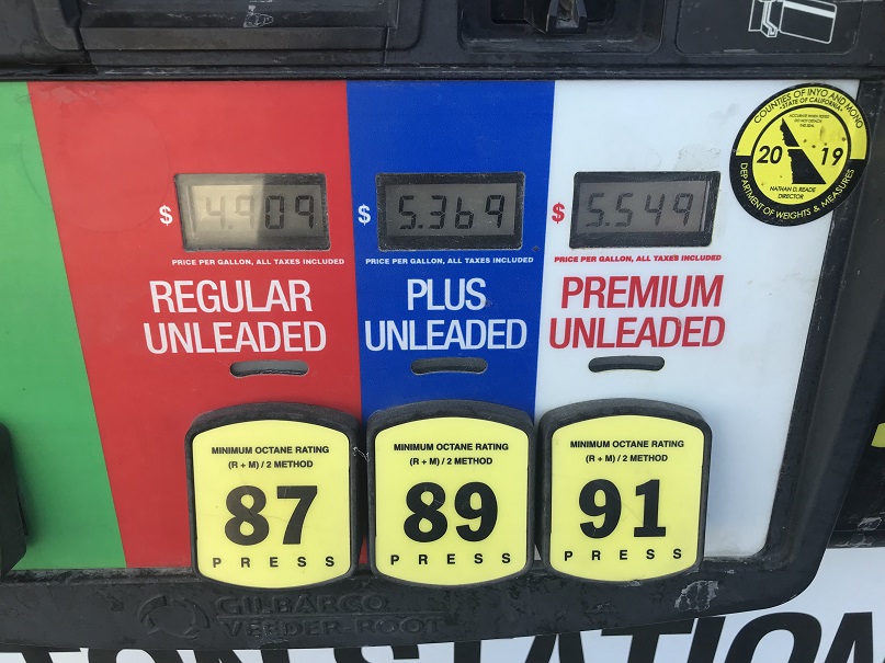
After hiking Mt Whitney I drove my rental vehicle to a Subway, got lunch/dinner, and paid too much for gas
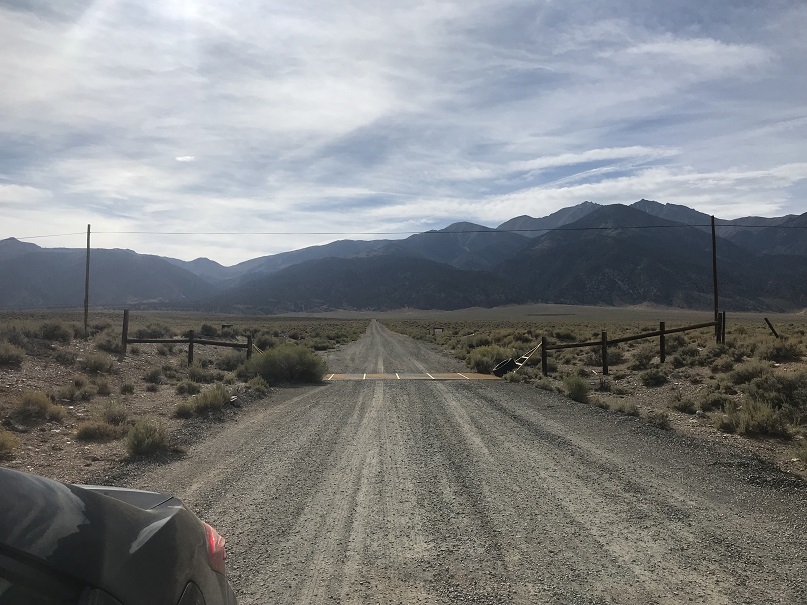
My goal was to drive as close to the Boundary Peak trailhead as I could get in the Toyota Corolla I’d rented. I’d heard a lot of different things about the drivability of this road and since I didn’t have a 4WD or even a vehicle with much clearance (5.2 inches) I was a little worried. About 30 miles from the turnoff my cell phone lost service, and I knew I’d be on my own if I got a flat tire or damaged the vehicle on the 4WD road.
I was pleasantly surprised when I turned off US 6 and this is what I saw
I knew the Queen Canyon Trailhead was about 6 miles from here, and it looked like I’d be taking a well maintained 2WD dirt road for at least the first few miles. The first two miles were flat and relatively easy, and with each passing mile I became more confident and a little more excited to be getting closer to the trailhead.
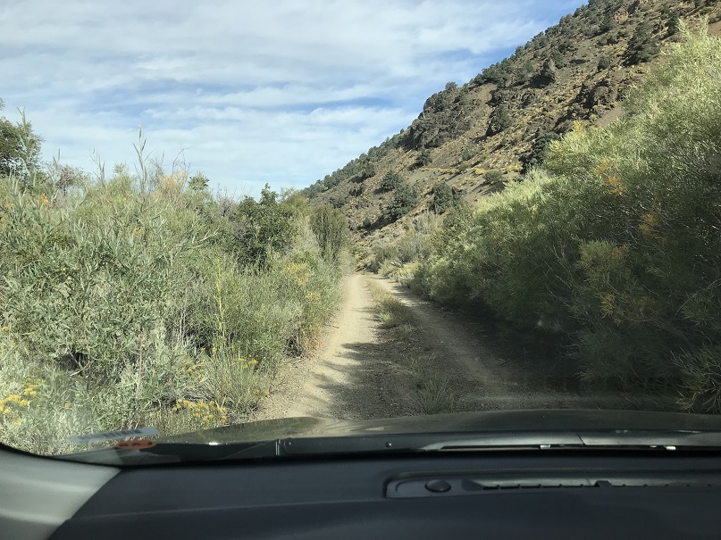
Around the 3rd mile the road became one lane and entered the canyon. I was a little skeptical about the road because I couldn’t see what was ahead of me, but I figured if I couldn’t turn around at least I’d be able to back up. Here the willows brushed both sides of the vehicle as I drove past, and the grass growing from the middle of the road made whooshing noises as it hit the underside of the vehicle.
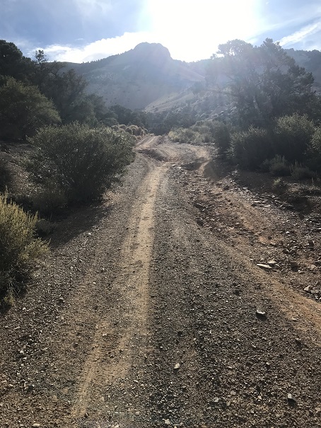
I was beginning to think I’d be able to drive all the way to the trailhead when around mile 4 I came to a roadblock: the road had washed out a little bit and with the low clearance vehicle it became too difficult to navigate. I got out of the car and walked up and looked for a fancy way around that wouldn’t require bottoming out and was unsuccessful. I was a little bummed because this section was so short and the road looked clear if I could just make it past this section about 10 yards long, but I didn’t want to get stuck and I seriously didn’t want to get stuck with paying for damages to the rental vehicle.
So I made a 10 point turn and looked for a spot to park. I was able to find a small pullout (thankfully the vehicle was small) but unfortunately it wasn’t in the shade (there wasn’t any).
I relaxed, ate my sandwich, and pulled out my altimeter: I’d parked at 8220’. I did the math and figured this would add a little over 2000’ to my hike tomorrow and 2 miles each way. I liked those numbers, but they meant I’d only be hiking Boundary Peak and not adding on Montgomery Peak (because I had a plane to catch). I really wanted to get some sleep, but it was 4pm in Nevada in September and 95* outside. I tried to lie down in the back of the Corolla in my sleeping bag but it was just too hot to sleep. Rolling down the windows just invited the flies in, so I tossed and turned for quite a bit. The last thing I remember before drifting off to sleep was seeing a red Jeep race down from the road above and pass by my vehicle. It was the only other car I saw the entire time I was there.
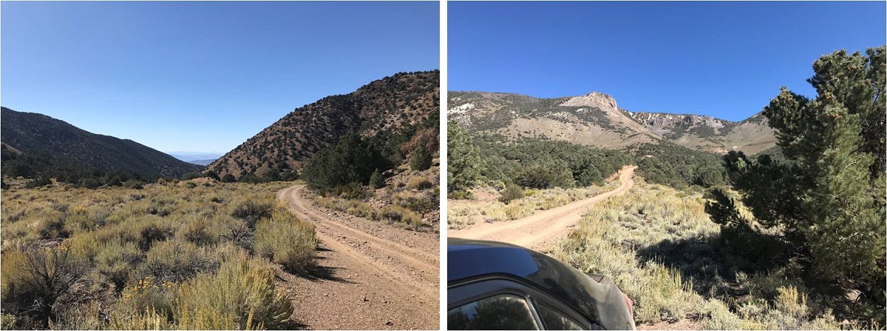
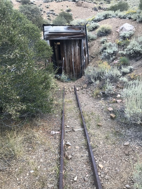
I woke up at 1:30am and was on the trail before 2am. I started up the 1N146 road, forgot to turn on my tracker, stopped, turned it on, and was on my way. The road was very easy to follow to the trailhead; just stay on it and don’t take any turns. In the dark I passed a mine (I noticed on the way back there was a light on inside and wondered at why I hadn’t seen it on my way in).
This mine is at 9010’ and provides a great place to camp before the road becomes 4WD
After the mine there’s still a mile left to go, and the road indeed becomes 4WD, although you could probably do it in a high-clearance vehicle that isn’t 4WD as well. The Corolla never would have made it.
You can see how easy it is to follow the road to the trailhead
As I was walking along the road something bobbled past me and flew like an awkward cross between a bat and a bird. It landed in the grass in the middle of the road, so as I approached it I aimed my flashlight at it to get a closer look. It looked up at me with a round face and large, yellow eyes. It was a fledgling burrowing owl. “Oh! You’re a baby!” I said to the owl. It hopped twice, jumped about 6 feet in the air, and once again awkwardly and silently glided into the brush on the other side of the road. That had been a fun encounter!
The trail starts at the right (south side) of the saddle around 10,000’.
As I made it here I thought to myself “I should have brought my bivy with me”. It doesn’t weigh that much and it would have been a great idea to have hiked up here last night, slept, and started the trail from here. Oh well, next time I’ll add it to my pack on trips like this because it only weighs 1 pound.
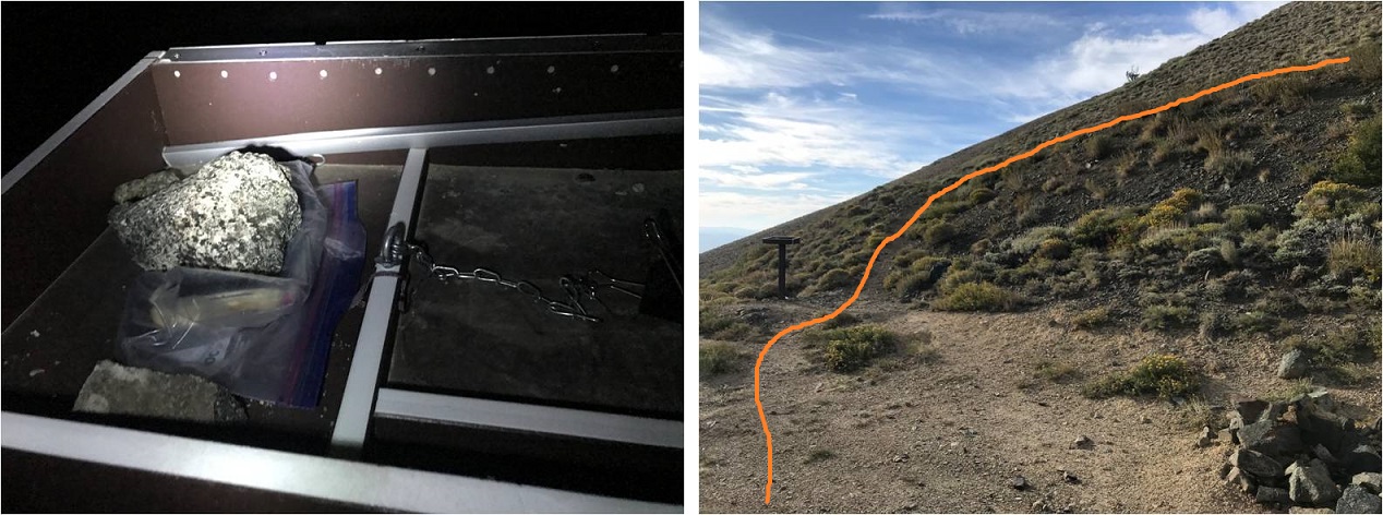
I followed the trail a short distance to a trail register that was lacking a lid, arriving at 3:55am. I signed the register, replaced it in the ziplock bag and was off.
The trail begins with about 1000’ of elevation gain as it heads south and switchbacks easily up the hillside
From the top of the hillside it’s a little disappointing as you then spend the next mile and a half losing 300’ in elevation, aiming for the saddle between Trail Canyon Saddle Peak and Boundary Peak.
Here I started seeing horse manure, and quite a bit of it. Initially I thought how crazy someone must be to take a horse up at this elevation, but then I noticed there was a lot of it off trail as well and figured there must be wild horses in the area.
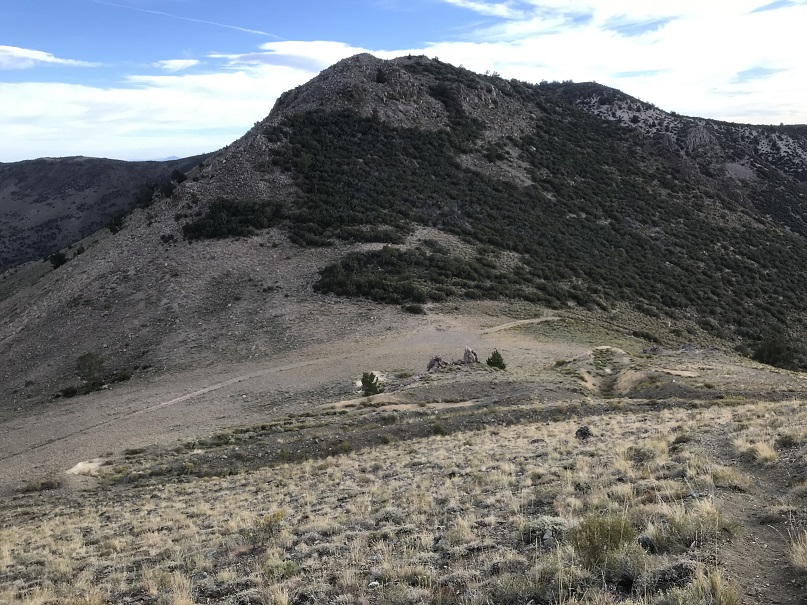
Once at the saddle there’s a cool wind shelter made out of bristlecone pine and rocks and an obvious trail that goes up the mountain.
This is the path the trail takes. It’s obvious in the daylight, but in the dark there were a lot of social trails and I kept getting off trail, yet stayed pretty much on course
Oh, and the top of this hill is NOT Boundary Peak.
Around this time is when my tooth started hurting again. I took some ibuprofen and thought to myself “well, isn’t this fun?”
Once you reach the top this is the path before you
The trail splits a lot in places, but basically follows the ridge to Boundary Peak. It doesn’t matter which path you follow, they all stay at class 2 or below. This is the path I took
The last little bit to the summit has larger rocks but still stays at class 2
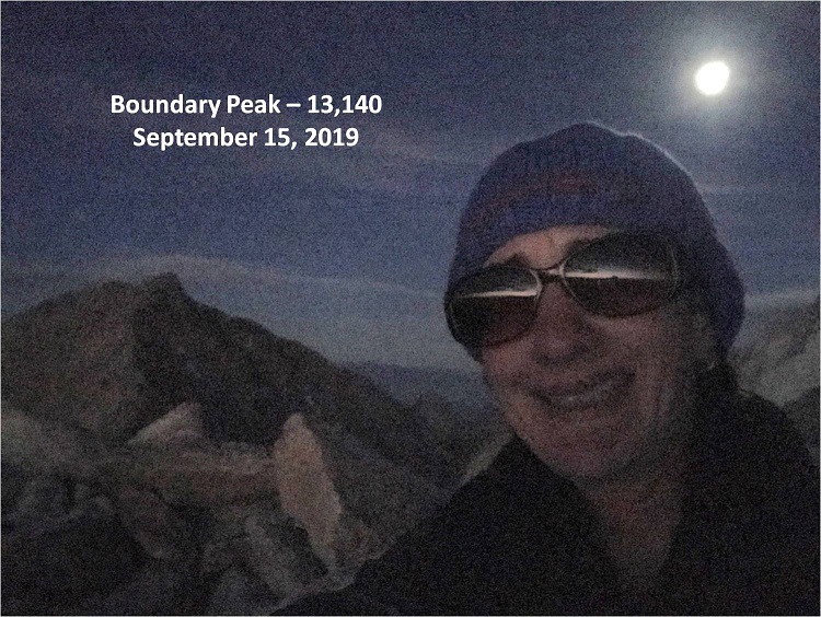
I summited at 6:45am, and the sun still hadn’t risen. My glasses are on to hide the crows feet…
Boundary Peak Summit:
It was very cold at the summit, and since I still didn’t have my new camera I had to keep taking off my gloves to get pictures on my iPhone: my hands were freezing! I took a few pictures and (again) actually signed the summit register. I figured I should eat something so I got out some dried mangoes, took one bite and felt the most intense dental pain I’ve ever felt in my life! Oh no! This was NOT good! Tears came to my eyes and I decided right then and there I was going to see a dentist as soon as I got home.
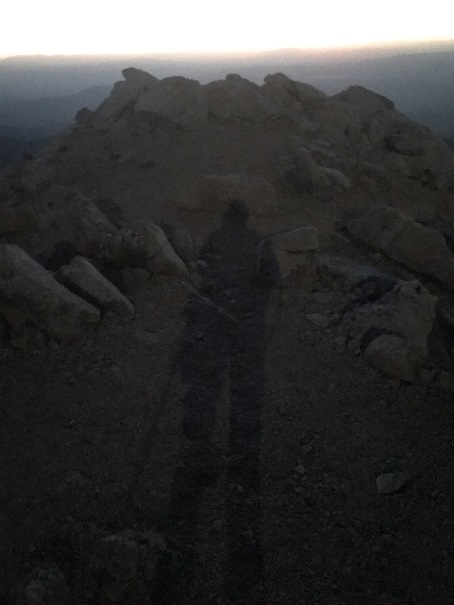
I sat here for a minute and contemplated watching the sunrise, but it was just too cold (and I figured I’d have a great view of it as I hiked back down). The moon was full and extremely bright, so I got a shadowselfie in the moon-glow
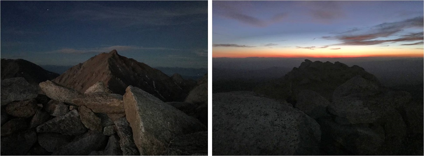
I also took some pictures of Montgomery Peak and the summit I was currently on (I lightened them up a bit so you can see detail)
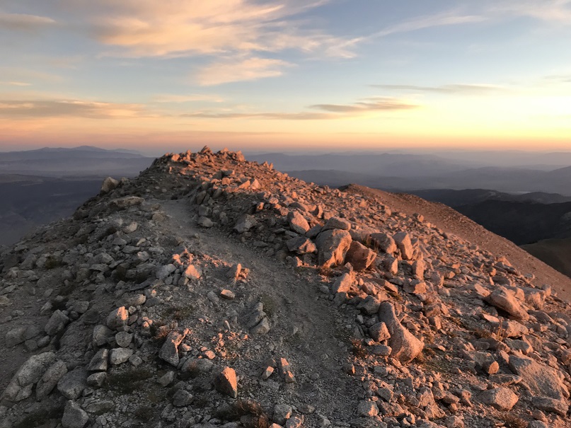
I headed back down, and within about 10 minutes there was enough light to see the path ahead of me. It was so nice to be able to see an actual trail instead of guess where it was in the dark!
I sneezed and my teeth bumped together in the process. The pain was so intense I stood there for 3 full minutes waiting for it to subside. The sun finally rose at 7:35am (which I thought was late, but maybe that’s normal for Nevada?)
I followed the trail back down the same way I came up
Back down to the saddle and then up to regain those 300’ I’d lost
Regaining the elevation actually wasn’t that bad, but I was also lucky the sun had gone behind the clouds and it wasn’t that warm out. It felt like I was hiking in the shade, and at this point my dental pain was more of an annoying dull ache and I was beginning to think the pain was directly related to elevation.
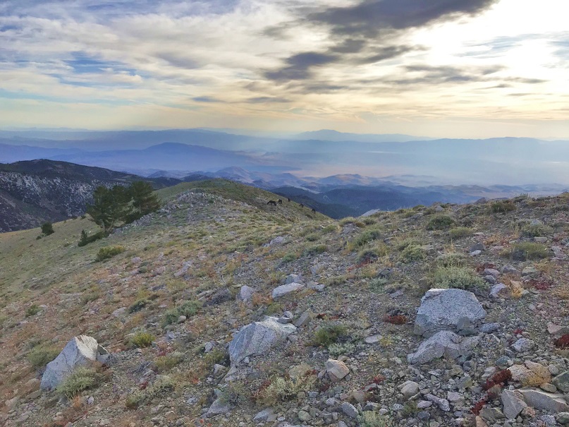
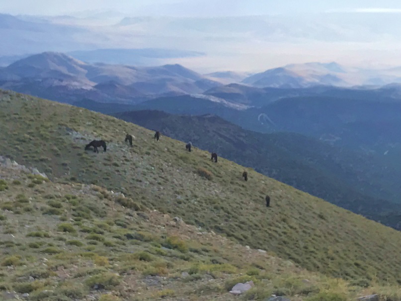
I came across a few deer near the trail, and as I rounded the last bit of hillside I saw a small herd of horses, grazing in a semi-circle on the hill.
Boundary Peak Horses:
I made noise but they didn’t really seem to care I was there. Once again I wished I had my good camera with me and not just my cell phone: these could have been awesome pictures!
From here it was all downhill back to the trailhead
I signed out of the register and headed back down the road to my vehicle.
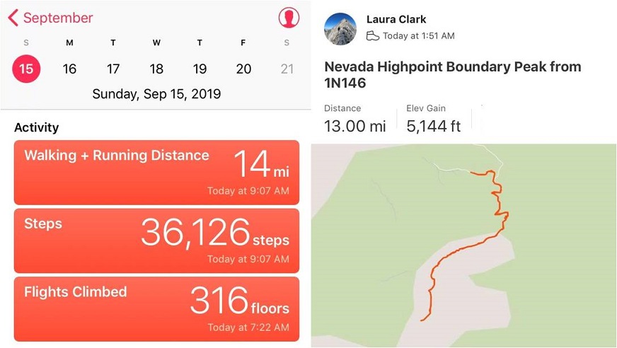
I made it back to the car at 9am, making this a 13 mile hike with 5144’ in elevation gain in 7 hours 15 minutes.
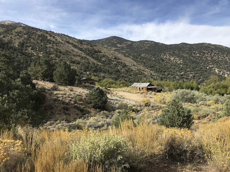
Once back at the car I cleaned up and got ready to head out, saying a silent prayer I didn’t do any permanent damage to the vehicle in the next 4 miles. I knew I’d be ok as long as I just drove slow, and since I hadn’t seen any vehicles since that Jeep last night I wasn’t too worried about the need to pass another car in the tight spots. In the daylight I saw an abandoned house
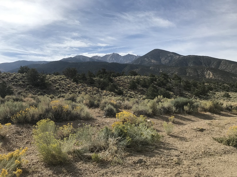
And a really neat view of Boundary Peak
I made it back to US 6 without incident, but the vehicle was quite dirty and had pinstripes from the willows. It was a 5 hour drive from here back to Las Vegas. I spent it with the radio turned up to avoid the constant “not in your lane beeping”. Once in Vegas I looked for a car wash to try and buff out he streaks. It was surprisingly difficult to find one that was open and operating (I found a bunch of closed or non operational car washes however).
After driving around for half an hour I was finally able to find a car wash, paid the $7 and was extremely happy with how everything turned out: no scratches left on the rental car! Woot! Now it was off to return the car (I didn’t have any issues) and to get to the airport early, hopefully to change my flight to an earlier one so I could hike again tomorrow.
My flight didn’t leave until 9pm and I was at the airport by 3pm. I went to the desk to try and get an earlier flight but even on standby they wanted more than double what I’d paid for both tickets combined to take an earlier flight home. I was not ok with this, so I decided to take a shower and eat instead (yes, the Las Vegas airport has showers, if you know where to look).
I spent the next few hours relaxing before my flight home, listening to others talk about what they’d done during their Bachelor/Bachelorette parties that weekend. I was a little upset I’d get back to late to hike the next day, but all in all considered my birthday weekend a win!