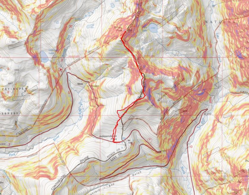
RT Length: 5.39 Miles
Elevation Gain: 2443’
After summiting Sayres Benchmark I noticed the day was still nice and I had plenty of time to spare so I drove to Independence Pass to try my hand at Twining Peak. I’ve already been here once this year after another hike, but the conditions weren’t… favorable. Lots of wet marshy mush to get through to the good stuff, and I don’t like hiking with soggy socks.
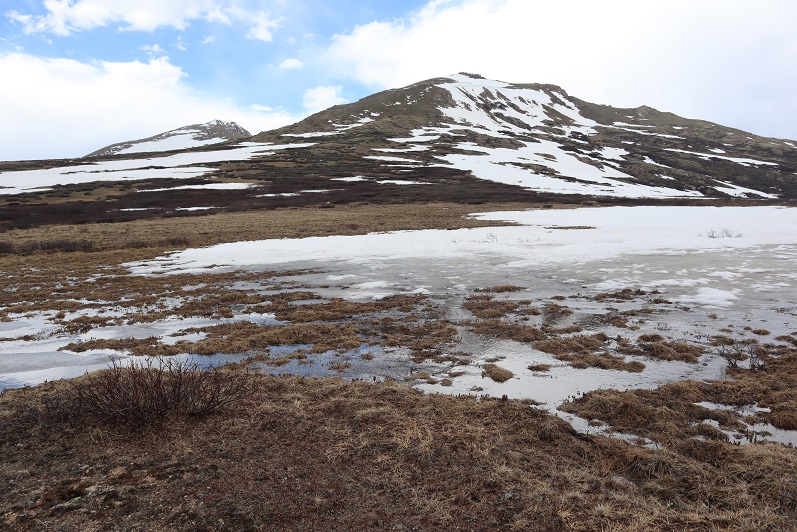
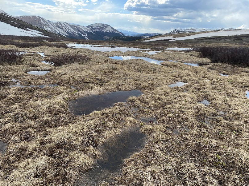
When I got to the Independence Pass parking area I backed in my truck and took a look around. Yep, it was still marshy.
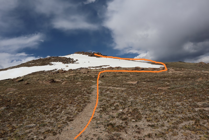
The weather looked good, and I could see a clear line to the ridge. I decided to gather all my gear (crampons, ice axe, snowshoes, new socks, etc.) and hit the trail. I walked west along HWY 82 until I reached this sign, which happened to be where the snow ended. From here I turned right (north) and headed for the ridge.

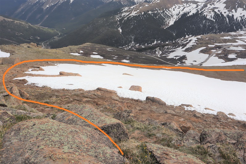
Yes, this was still marshy, but I could avoid the snow and getting my feet wet with careful navigation. I aimed for the ridge, intending to see what the basin looked like before determining if I would summit first via the 13500/Twining saddle or go over 13500 instead.
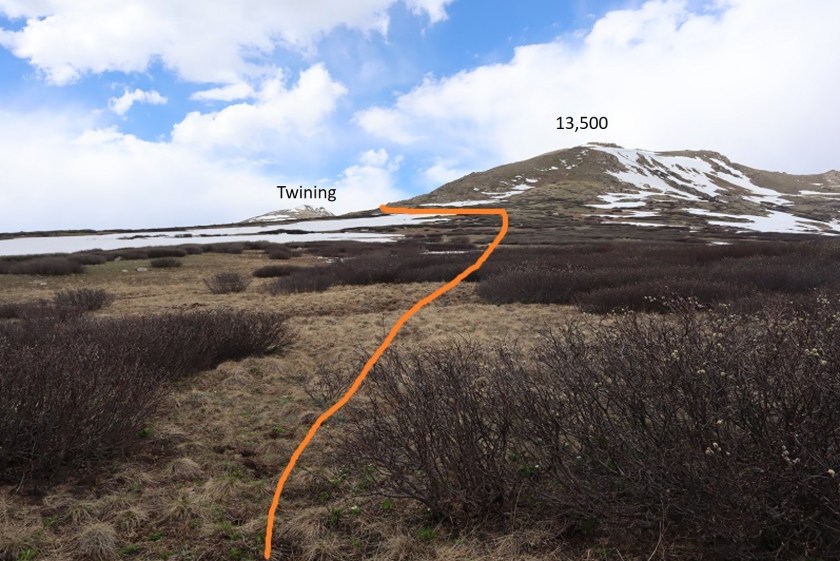
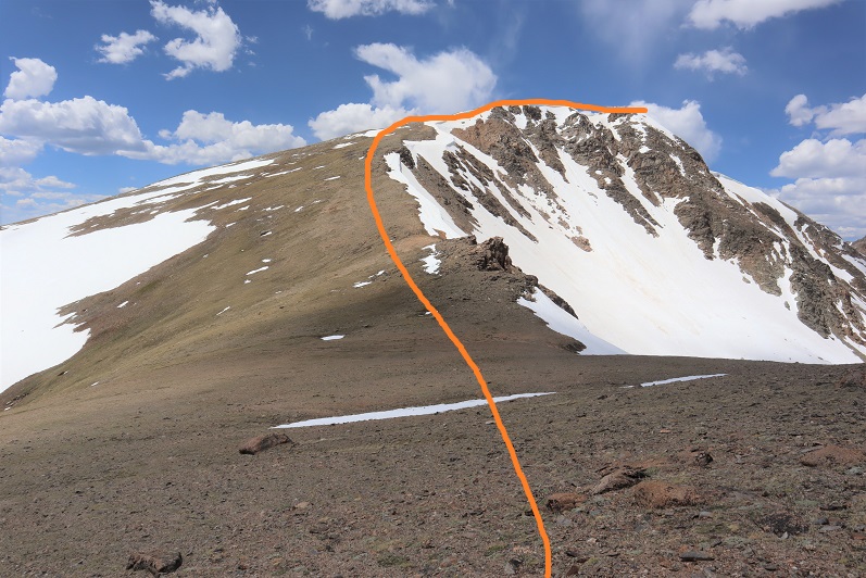
When I made it to the ridge I looked over at Twining Peak. If it were earlier in the day I would have crossed the basin and gained the saddle first (as outlined below).
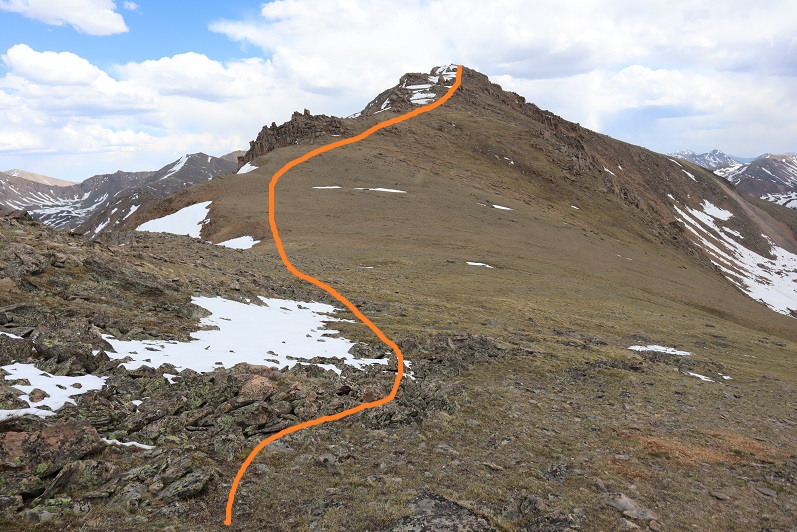
However, it was now almost 2pm and I knew that snow was soft. Yes, I had snowshoes, but no, I didn’t want to posthole with them through the basin. So instead I turned right (northeast) and followed the ridge to 13,500. This was all class 2


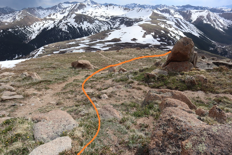
There seemed to be a bit of a trail in areas that went straight up through the snow. I didn’t want to do that so when I encountered snow I just went around it. This is an easy ridge to follow.

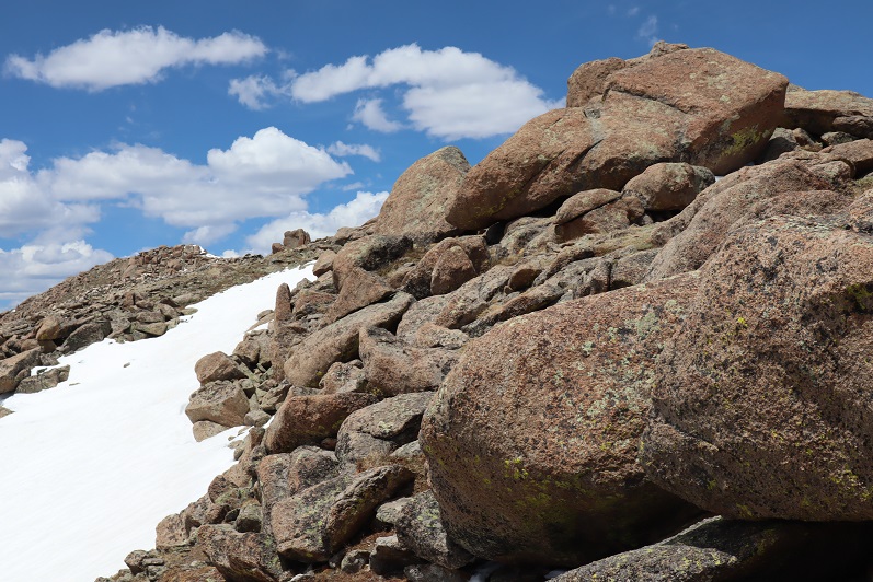
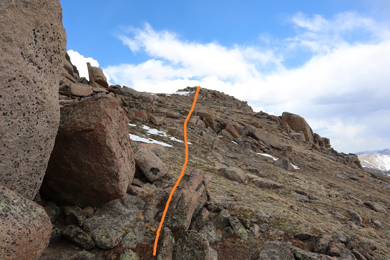
There was a little bit of rock hopping, all class 2, and easy fun. The boulders are big and pretty stable. Just hug the ridge to the left and don’t try to go straight over the ridge and you’ll be fine.
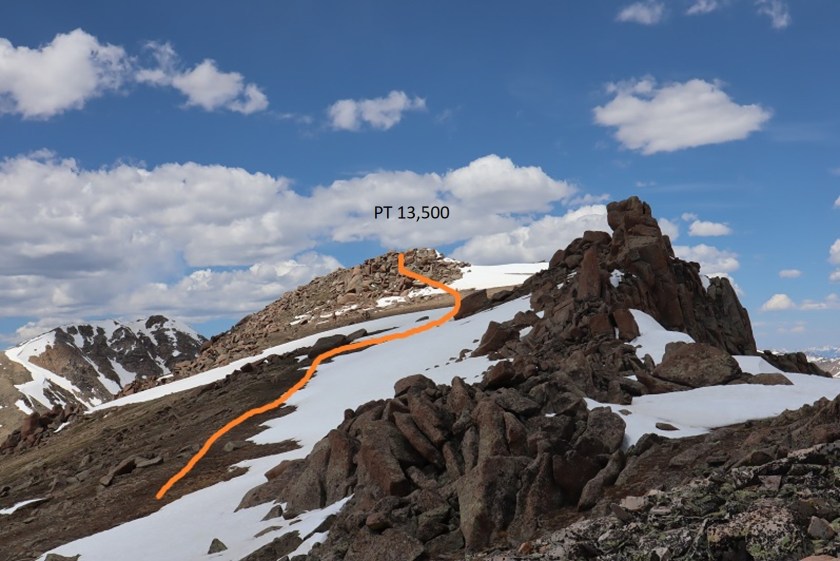
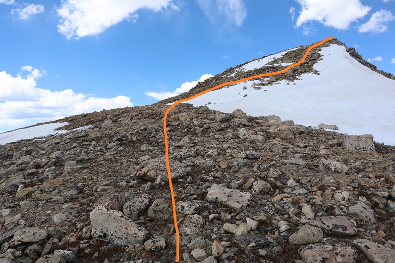
Here’s the last bit to the summit

I summited at 2:15pm

Pt 13,500:
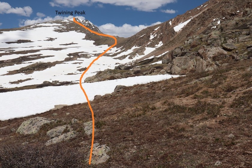
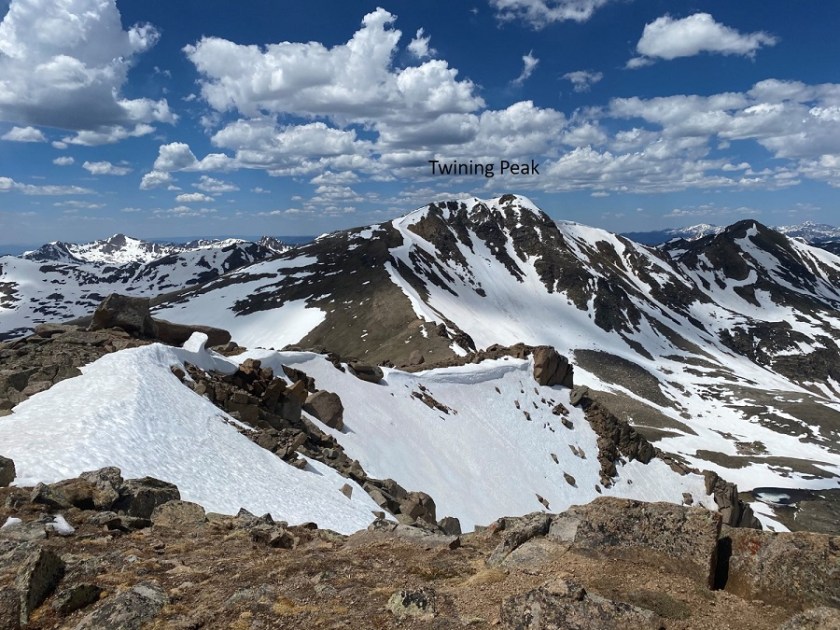
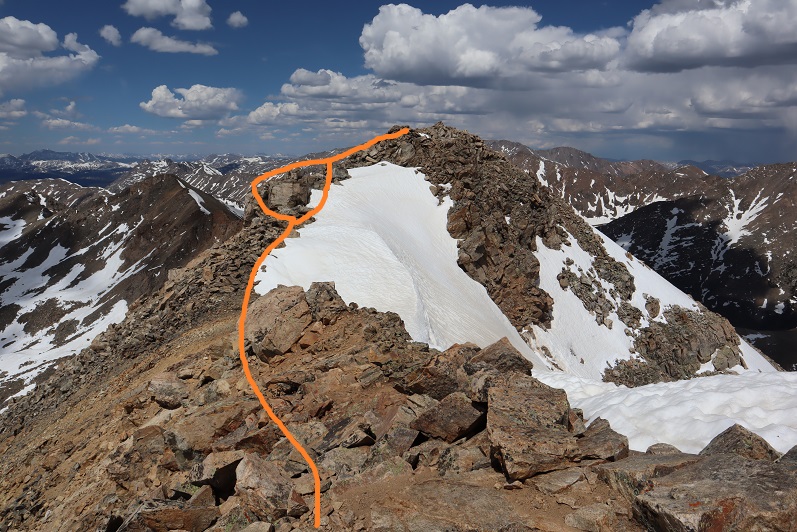
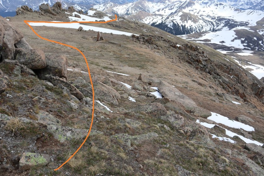
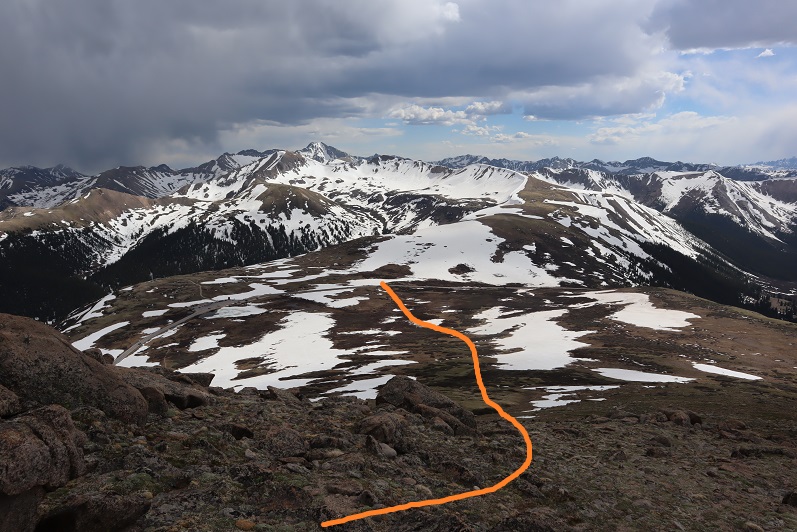
There wasn’t a summit register. Turning northwest I could see my path to Twining Peak
This was an easy ridge walk, with a little easy rock hopping and the snow was totally avoidable

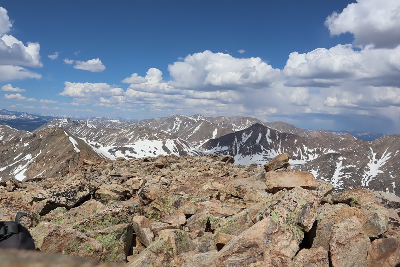
The tundra changed to rocky terrain
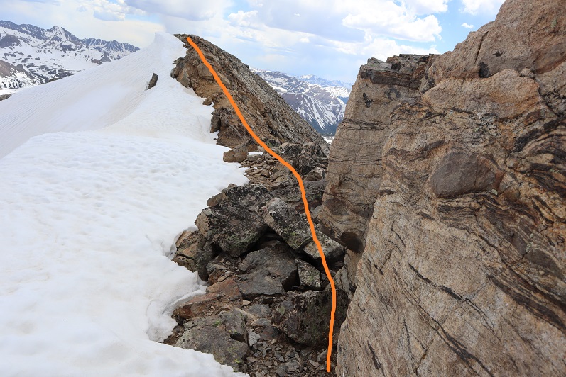
There was some snow on the last section. I decided to drop to the left and find a gully to summit, but I wouldn’t recommend that route: the gully was loose and on my way back I found out the snow was actually solid near this boulder, so I should have just summited by walking across it.
Summit of Twining Peak
I summited Twining Peak at 3pm
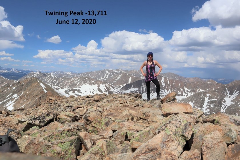
Twining Peak:
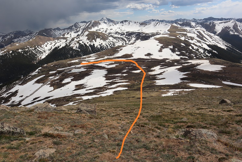
The weather was starting to turn; I could see rain showers all around so I didn’t stay long on the peak. I put on my jacket and headed back down, this time going over the snow and large boulder I’d gone around on my way up.
And back down the ridge, sticking to the right to avoid the snow
I re-summited PT 13,500 as it was lightly snowing. There was a young man at the summit who was super excited: this was his first 13er! He’s never gotten this far before on this peak, and he was excited. He wanted to know what all the peaks were that we could see, and I obliged him for a bit. Also introduced him to 14ers.com because he’s interested in tackling more 13ers and 14ers (please be nice).
I headed back down the ridge
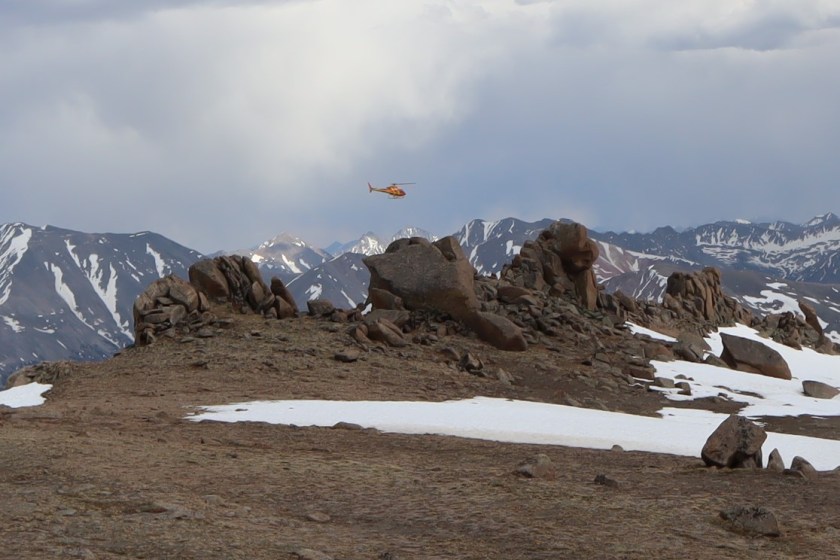
Unfortunately, at about this time I saw a flight for life helicopter whiz by. Never a good sign. Later, as I was driving back down HWY 82 I saw a police officer and a tow truck driver putting a motorcycle on the back of the tow truck, lots of lights flashing, no other vehicle/animals involved. Ouch. I sincerely hope everyone is ok. Also, the accident happened in a straight area of the HWY, so I don’t think HWY curves were involved. In any event, please adventure carefully!
I took a slightly different path on my way down than I did on my way up, as I could see a clearer path that avoided marsh/snow

I eventually came upon a trail, but it led to snow/marsh, so I avoided it and went back down the ridge
The nice thing about this hike is you can see your vehicle for most of it, and at a minimum HWY 82, so it’s difficult to get lost. I just aimed for the road, avoiding the snow/mush
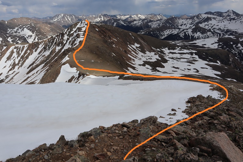
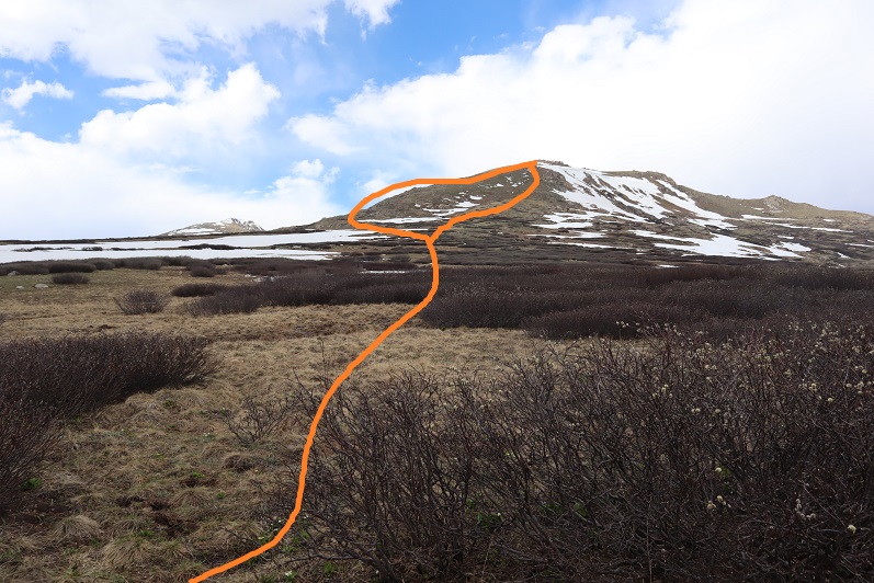
Here’s an overview of my hike up to the ridge and back down more to the center (after realizing the basin wasn’t something I wanted to experience today)
I made it back to my truck at 5:45pm, making this a 5.39 mile hike with 2443’ of elevation gain in 3.5 hours. Please don’t judge the time: I’d already hiked 12.5 miles and 4652’ of elevation this day and I was a bit tired; this hike can most likely be done faster.
Here’s a topo map of my route
OK, on to the next trailhead!
