Today I hiked Mt. Shavano and Tabeguache Peak,
otherwise known as Shav and Tab to most because no one know how to pronounce
Tabeguache (TAB-uh-wash). Up until late last night I wasn’t sure which
peak(s) I was going to hike today. I’d
planned on three possible hikes for today before I left for Europe, and it
would just depend on the weather when I got back. I really wanted to hike Redcloud, Sunshine,
and Handies because I had 2 days in a row available and I’m 75% sure it would
require an overnight, but when I looked at the weather for the area it showed
thunderstorms all day for the next two days.
Drat.
So I looked up the two
other hikes I had ready, Shav and Tab, and Grays and Torreys. They both had similar weather (rain and
thunderstorms at either 10am or 11am both days), so I decided to make a
spreadsheet. In the end I went with Shav
and Tab because it’s further away (by half an hour), a longer hike (10.5 miles),
and had more elevation gain (5400+ feet). I figured if it was going to rain in
the afternoon both days at both places I’d get the harder one over first when
the rain was scheduled for an hour later and have more time to deal with
weather if it became an issue on the shorter hike.
For this one I was up
at 2am and on the road by 2:30am. I had to do a little work (like, for my job)
before leaving so it took longer than anticipated. I was able to find the trailhead without too
much difficulty and began at 5:30am, at the last-minute stuffing a winter coat
in my backpack just in case. It adds about 3lbs to my pack (which honestly only
has water, some snacks and first aid supplies), but I’ve never regretted having
it on a hike.
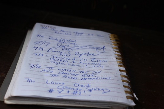
I hiked for a bit and
found the register. I signed the date,
my name, Colorado Springs, and continued on.
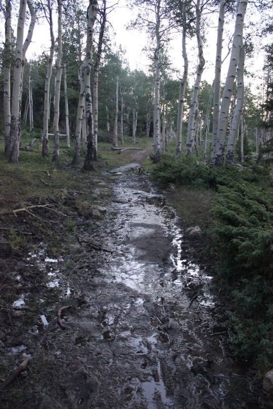
The sun was just
beginning to light up the sky, waking up the crows, flies, and cows. I heard them all for the first two miles or
so as I walked through a muddy trail.
Then the red glow of
the sunrise. I always LOVE this time of
the morning on a hike. It only lasts
about 5 minutes, but everything is bathed in a reddish orange glow. It’s beautiful.
The sunrise woke up a
woodpecker (I’ll upload the video on Wednesday, sorry!)
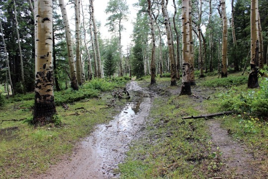
I walked over several
small streams those first few miles, then didn’t see any water for the rest of
the hike.

Early on in the hike I
passed a group of three male hikers. They
were glad to let me pass, as they couldn’t keep up. They were taking their time and didn’t know
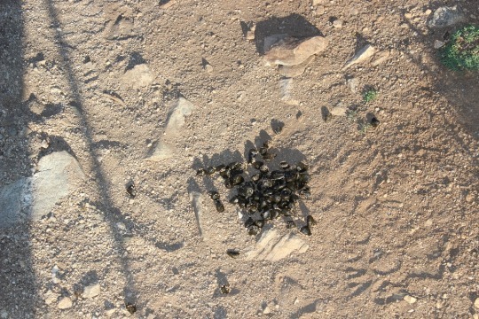
if they were going to summit both peaks today or not. Around mile 2 I started seeing scat. Lots of it and it looked fresh. Then out of the corner of my right eye I saw
something move quickly and bound up the hill.
I only say the legs, but I’m thinking it was either a deer or a bighorn
sheep. I’m thinking sheep because of the
scat. It even smelled like they were in the
area.
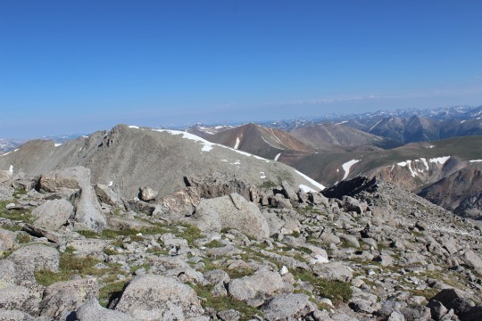
I rounded a corner and saw the Angel of Shavano, or
where she should be. I’ve known of Mt.
Shavano for years, ever since we’ve started skiing at Monarch. She’s the famous symbol of the area. The Twisted Cork (where we like to go out to
eat when we ski) owns the Mt Shavano winery and the Angel of Shavano is on all
their bottles. It’s a pattern in the
mountain when there’s snow that looks like an angel. Kind of like a Native American Angel (hard to
describe, but that’s what she looks like).
The middle of this picture is where she’d be… only half of her is still
here due to snow melt.
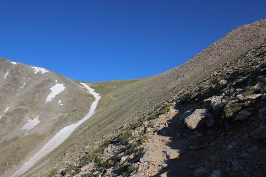
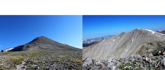
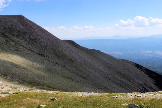
This hike goes up, up, up, up, with just about no
leveling out. I made it to the top of
the saddle, looked right, and could see Mt. Shavano, but I didn’t know it was
Mt. Shavano at the time. To be honest most
hikers, no matter how much research they do, aren’t sure which one is the
actual peak until they’re hiking it.
Most hikers today thought it was a peak to the left. Nope, this is it. As you can see, I cross the saddle, then make
my left before swinging over to the right to cross between the two humps, and
then around again to the left to summit.

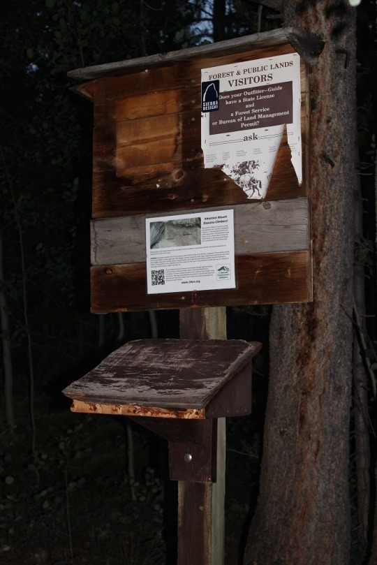
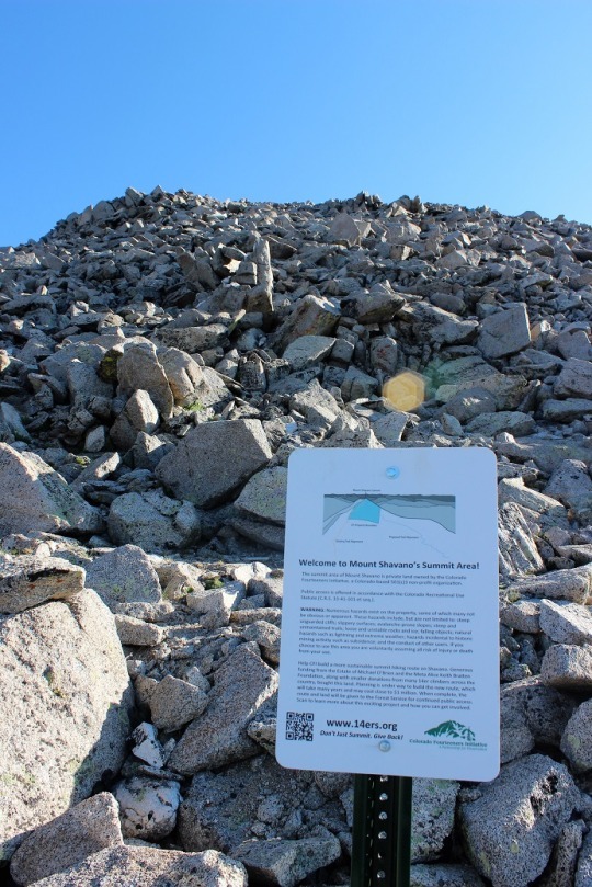
I came across this sign about half way up that
mountain.
There was no clear trail, but a bunch of little trails
to try and follow. Probably because this
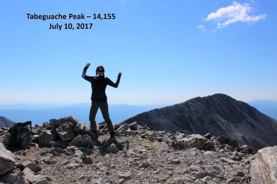
is a popular snow route and it’s sometimes easier to just make it up as you go. In any event, I summited, and was super
proud! Oh, and it wasn’t windy and I
didn’t need my extra jacket! Bonus
points for this peak!

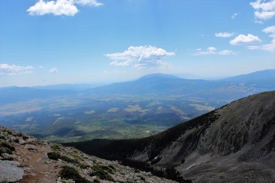
Now to find Tabeguache. I got out my map and figured out which peak
it was, and my stomach dropped. I was going
to have to cross this ridge (there was no trail, I just had to cross it).
Here’s a better picture. I had to cross the ridge to the bottom right,
then go down and left towards a saddle, and follow the snow line to the left to
the peak. I took a deep breath and was
on: I’ve got this!
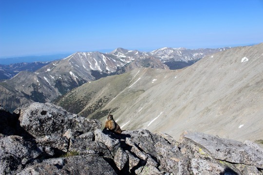
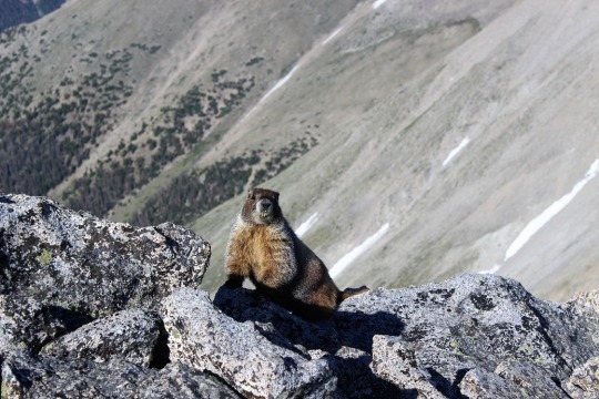
I met a rather photogenic marmot just as I started
descending Mt Shavano towards the ridge.
As I was hiking I was continually disturbed there was
no actual trail to follow. My mind got
to wandering and I got to thinking about how dangerous it was not to have a
trail to follow. I knew this was senseless
because of the activity I was partaking in, but I felt it anyway. For some reason, I felt entitled to a
trail. Well, there wasn’t one, so I
aimed towards where I needed to go and just worked my way towards it.
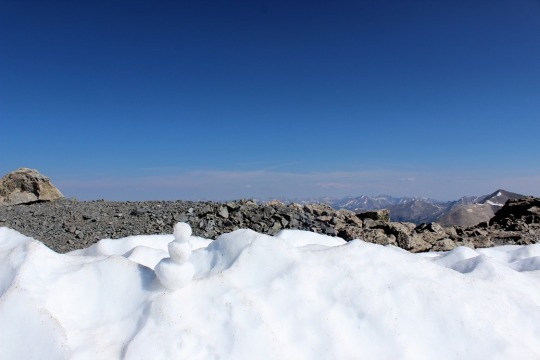
As I was crossing the last patch of snow I spied a snowman. So cute!
There was one other hiker ahead of me (I’d noticed him off in the distance
as I summited Shavano), and I’d seen him stop here, but I thought he was just
resting. This was much better!
There was just a little more ways to go. I skirted the snow to the left

And all the sudden, I was there! I’d summited!
I was super proud of myself for this one! I’d hiked for over a mile down one mountain
and up another, over piles and piles of rocks, without a trail, and still
managed to get where I needed to go. It
was now 9:30am and there was one tiny cloud in the sky.
I turned around and saw what I’d hiked thru without a
trail (that’s Mt. Shavano as seen from Tabeguache). I’d hiked just over 5 miles
in 4 hours. That’s a very, very slow
hiking time for me, but I had hiked over 5400 feet in elevation, so hiking 1100
feet in elevation an hour isn’t so bad, right?

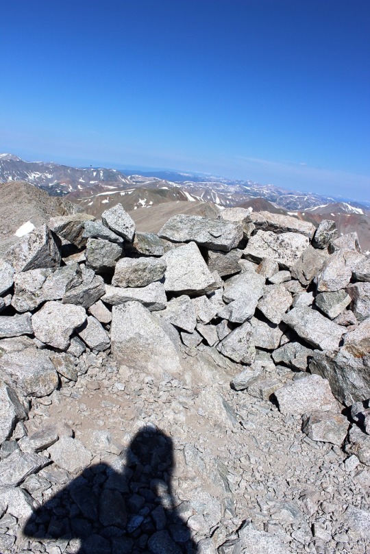
I took a summit-shadow-selfie and was back on my way. I don’t like to spend too much time at the
summit.
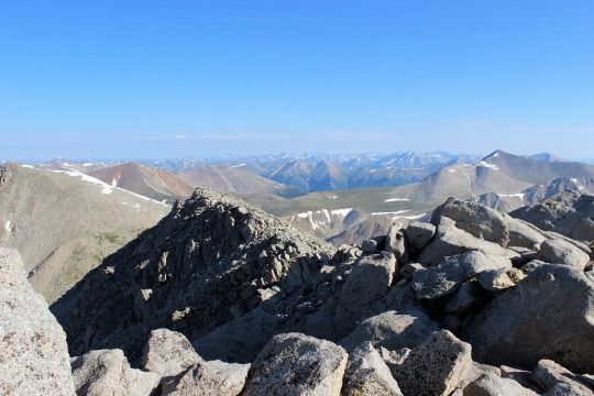
At the saddle I had a great view of Mt. Antero. I’ll probably do that one soon…

This hike is an out and back hike. So I hiked up Mt.
Shavano, then to Tabeguache, then down Tabeguache, back up Mt. Shavano, and
down Mt. Shavano to the trailhead.
Basically I summit Mt. Shavano twice, which seems awfully unfair since
it only counts as two summits.
As I was hiking back up Mt. Shavano I got to thinking
about what I’d just accomplished. Sometimes
there isn’t a trail, and that’s ok.
Maybe you need to make your own trail.
Set a goal, keep your eye on that goal, head in that direction and keep
putting one foot in front of the other. Eventually you’ll make it. It may not be how everyone else made it, but
you can make it just the same. There’s a
moral in there somewhere…
I summited Mt. Shavano a second time and saw the group
of three hikers I’d seen earlier. They
were impressed I’d already hiked out to Tabeguache and back. I was about 2 hours ahead of them hiking
time. We discussed whether or not they
could make it to Tabeguache. They weren’t
planning on hiking it because they didn’t have a ‘summit sign’. I thought this was a lame excuse, but did comment
on the clouds building quickly. When I’d
looked at the weather last night it had said thunderstorms were highly likely
after 11am, and it was now 10:15am. While
it had been clear at 9:30am clouds were quickly forming. I wished them luck and told them to watch the
weather.
Unfortunately, people just don’t realize how quickly
weather moves in on a 14er. The weather
can turn in 15 minutes and put you in a dangerous position. I saw about 15 hikers as I was making my way
down to the ridge. For some reason, I
feel a personal responsibility when I’m hiking to everyone else hiking the same
trail, since I’m usually the one with the most experience. I talk to them all,
ask how they’re doing, if they’ve ever done a 14er before (or this one), where
they’re headed, etc. It takes time out
of my hike but I feel responsible to advise in some way because I have more
experience.
I told each and every hiker on my way down to watch
the weather. I got a lot of responses,
none of which sounded concerned. Most
said things like “it’s not forming too fast” or “it doesn’t look that bad” or “we
aren’t supposed to get rain today, are we?”.
But I had more information than them.
I knew it was supposed to thunderstorm today. I advised them to watch the weather and if
they couldn’t hike it in an hour to turn back.
None of them did, and I also knew none of them could make it the rest of
the way in an hour. Hmmmm.
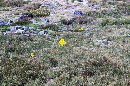
I crossed the saddle and came upon an alpine
meadow. I love how these flowers seem to
be saying “hi”.
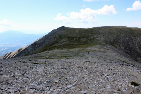
Then I turned and saw the trail back. Ugh!
This wasn’t going to be fun. The
entire trail was up, up, up (much more than is visible in this photo). While it was challenging to hike up it was
extremely difficult to hike down. I
couldn’t hike fast. There were just too
many rocks in the way and it wasn’t safe to hike down any faster than I’d hiked
up. Oh, and notice the shadow in the
picture? Clouds are beginning to
seriously form above me. I needed to
make it to the treeline as fast as possible.
At least the view was great!
So, I hiked and hiked and hiked and hiked down, down,
down. It was slow going and I really had
to pee, but, you know, I’m above treeline so that’s not really a good
idea. Just as a side note, NEVER pee
directly on a trail. Besides the obvious
‘ew’ factor and LNT and all that, no matter how sure you are you’re alone, you’re
not. Someone WILL come into view as soon
as you drop your pants. This is a fact.
Anyway… about a
mile after I made it past treeline I started feeling drops of rain. Small, icy, cold drops of rain. They started out slow, and then I heard
thunder and it started pouring. Within
30 seconds there was thunder and lightning everywhere and it started to
hail. I quickly pulled out my winter
jacket (Woot! See? I’m always glad to have it) and put my camera
into my backpack to keep from getting wet (so no pictures, sorry). At one point, it was hailing so hard I wasn’t
sure if I was still on the right trail, but I was below treeline and I needed
to keep getting lower, so I continued.
The entire time I kept thinking about everyone behind
me on the trail who hadn’t turned around when I’d warned them of weather. I was absolutely positive they were ALL still
above treeline at this point, right in the middle of that thunder and lightning
and hail. I sent encouraging vibes their
way and continued onward.
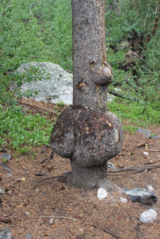
Eventually the rain stopped and all that was left was
water slowly dripping down from the trees.
I was roasting in my coat (but dry!) and started looking for a time to
take it off. I came upon this tree,
figured it was something I needed a picture of, stopped and made the switch
(and took the picture).
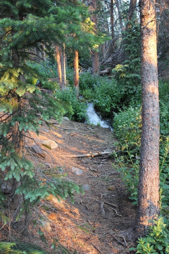
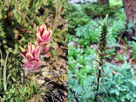
I saw several pretty flowers on the trials today. Here are just a couple…
The last 2 miles seemed to take forever. I mean, forever. And they kind of did. It took me 4 hours to summit and 3.5 hours to
make my way back to the trailhead when I would have expected it to take about 2
hours to get back down. I found the
register, added #8 and #9 to my name (it seemed bad luck to do so before
actually summiting them) and sloshed my way back to my truck.
I got a lot of good thinking done on the mountain
today. Oh, and I’ve now decided to write
a book.
Woodpecker:
Views from the top:
