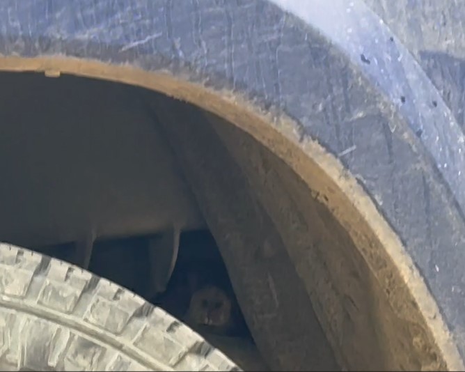
It all started at 2am that morning. I got out of the back of my truck to get ready to hike, and shined my flashlight all around. This is something I do if it’s dark out, because you never know what’s lurking at 12,000’. I’ve been startled by deer, racoons, and even a mountain lion before. I flashed the light under my truck, and saw a porcupine, pine marten, and marmot underneath.
It was like something out of a Disney movie, or the beginning of a really bad joke: “So, a porcupine, a pine marten, and a marmot were sitting under a truck…”
Great, this spelled trouble, and I knew what was going to happen. Usually, I hear them rustling around under my truck, but for some reason, I hadn’t this time. I shooed them away, got in my truck, and turned it on.
All the lights were flashing.
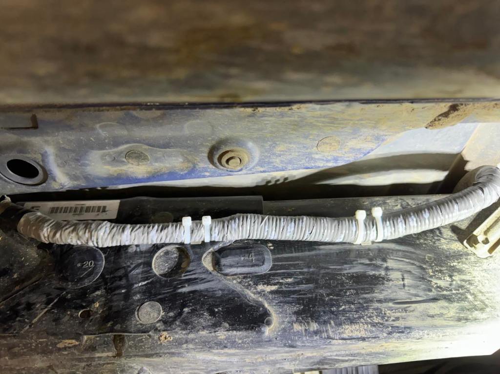
I knew what had happened: one or all of those varmints had chewed through the wires underneath my truck. Well, I was 15 miles off a 4WD dirt road, and if my 4WD wasn’t working, 2am was the best time to drive down this road, as I shouldn’t encounter any other vehicles.
I resigned my hiking plans for the day, and drove to the nearest dealership that could fix my truck. Durango was 4 hours away, and I made it there just as they were opening. I told them what had happened, they took a look under the hood and under the vehicle, and said “soonest we can fix it is 3 weeks. Maybe 4.”
I was shocked: I’d never had a dealership not be able to get me in that day, but they were adamant. I knew what needed to be done, as this has happened before. The wires needed to be spliced and put back together, then bound with rat tape. My bad for not doing the rat tape thing already, but I’ve done it on so many of my vehicles I’d honestly forgotten I hadn’t done it on this truck.
They also told me not to drive my truck, as it wasn’t safe. Great. So, I was stuck here for 4 weeks? I don’t think so.
I called around to every shop within a 5 hour drive, and they all told me the same thing: 3-4 weeks until they could fix my truck. Since this has happened to me before, I already knew what was going on, and wasn’t too worried. Yes, the lights were annoying, but my truck still worked. I just needed to drive carefully and not try to break too fast.
I decided to head instead to a 2WD trailhead for the weekend, seeing as how I was already in Durango and it was a 7 hour drive home (where I was sure my local dealership would do whatever it took to get me in that day: Putting over 50K miles on my truck a year means I’m one of their most valuable customers). Adding 45 minutes on to my drive wasn’t going to change much.
I drove to the next trailhead, a little upset my hiking day was shot. As I was sitting in the front seat of my truck, researching routes, I heard a scratching coming from inside my truck. Well, not inside exactly, but underneath… and inside.
Then I heard the noise again. Something was scratching the walls. It sounded bigger than a mouse or rat, and a bit frantic. I went outside to see what was going on, and the noises stopped. It was starting to rain, but I decided to sit there and wait to see what was going on.
Then the noises began again
I saw a Forest Service truck drive by. I flagged him down, and asked him if he knew any tricks for getting a marmot out from underneath your vehicle. I could tell by the look he gave me he didn’t believe me. He sat there for 5 minutes and whatever it was inside was silent. He smiled at me, said to give it time, and drove away.
As soon as he drove away, the noises started again.
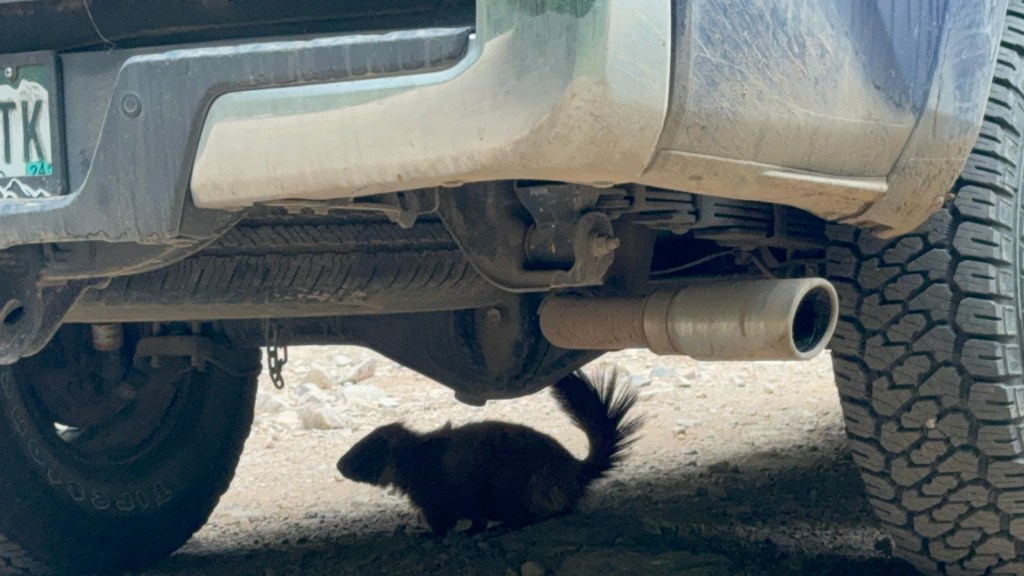
Something was obviously stuck and trying to get out, so I tried to pull back the flaps and bang on the tires. The animal went silent again, but it was watching me from just above my back tire. I saw a nose peeking out, staring at me, and it kind of looked like a porcupine. It would have made sense, since I’d seen a porcupine under my truck that morning as well.
Well, if it was a porcupine, I wasn’t going to put my hands anywhere near that wheel well. Eventually, it started trying other options. I saw it near my spare tire, and figured it was only a matter of time before it found it’s way out.
Well, eventually it did. And when it did, it just sat under my truck, confused. It obviously had no idea where it was, and was taking time to think.
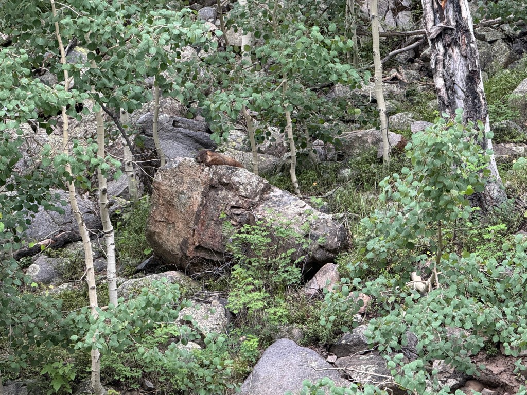
It took a little too much time, and when it looked like it was going to climb back inside my truck I shooed him away. He ran off into the trees, and I went back to doing what I was doing. Then I noticed him, sitting and staring at my truck. I went over to him and he didn’t seem scared, he just stared back at me.
Then he started walking towards my truck again, and I got worried he’d try to slip back in later in the night, so I drove down the road for about a mile, giving him space from my vehicle, which he seemed to desperately desire.
15 minutes later, I looked in my side mirror, and that little bugger was running up the road towards my truck! It was as if he thought my truck was a portal and he’d escaped the wrong side. Maybe if he went back in and out another way, it would take him back to the original trailhead. I kind of laughed to myself, realizing he’d been inside my truck at the repair shop and hadn’t been noticed. I drove another 5 miles away, he didn’t follow, and my truck was safe for the rest of the weekend.
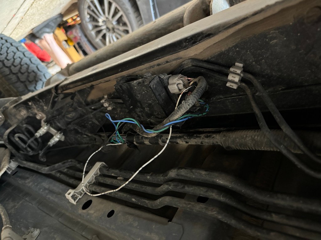
Here is a picture of the damage
And what it looks like now that it’s fixed. Rodent Tape is manufactured by Honda, and costs about $60 a roll. Much better than a $4400 fix later.
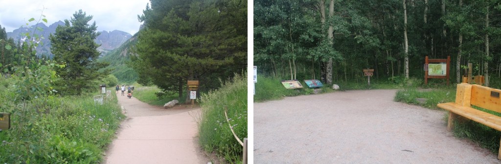
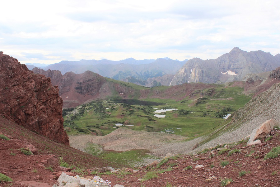
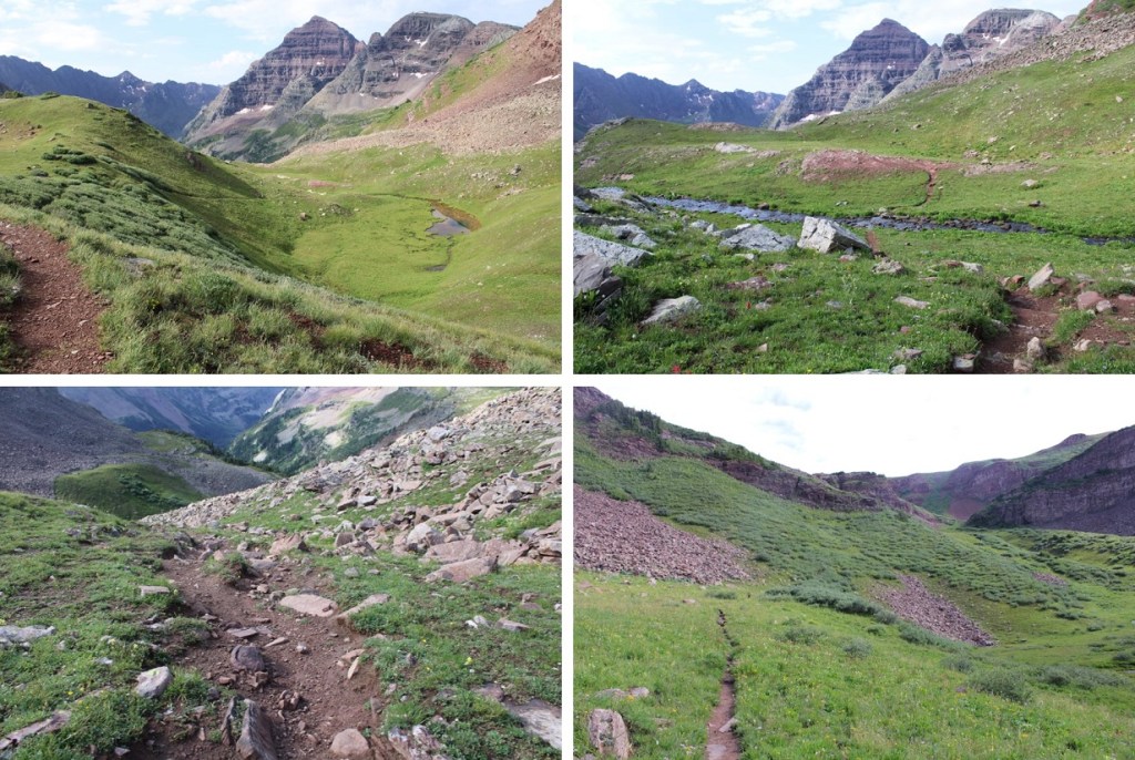
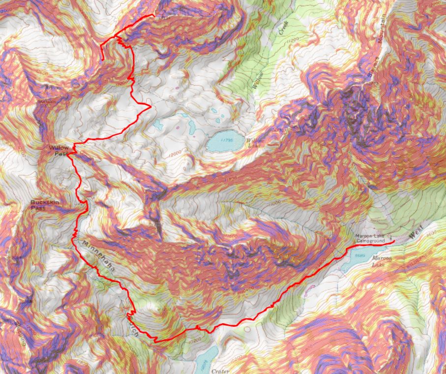
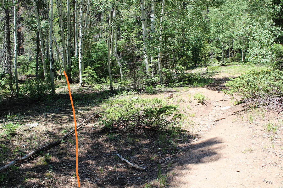
I decided to hike these peaks from the Maroon Bells area because I had a pass and was already there. I knew today was going to be a straightforward but long day, and it was supposed to storm in the morning, so I was up extra early and on the trail at 2am. I started at the Maroon Lake trailhead, and passed a few deer grazing in the dark. I skirted Maroon Lake to the right, and continued on the trail towards Crater Lake.
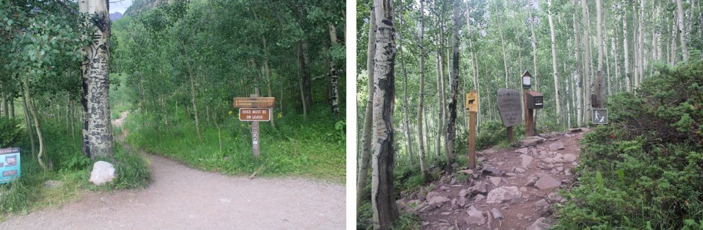
At the first junction I continued straight, and followed Maroon Snowmass Trail 1975 up into Minnehaha Gulch.
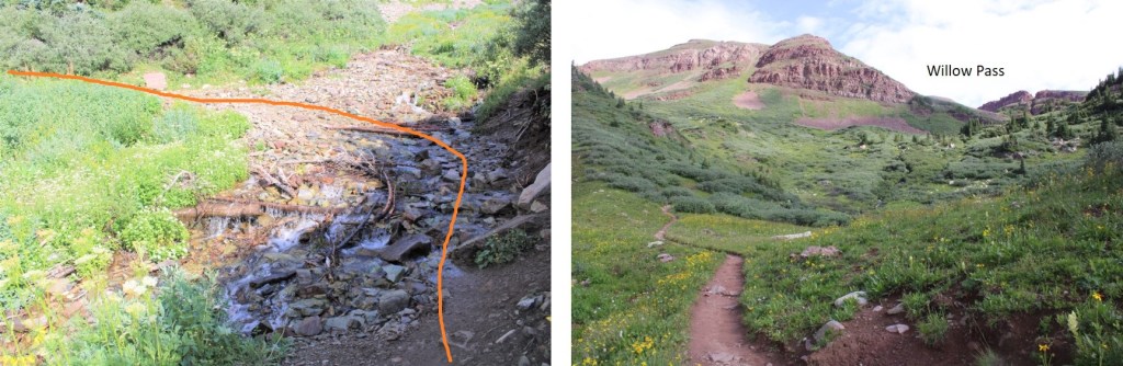
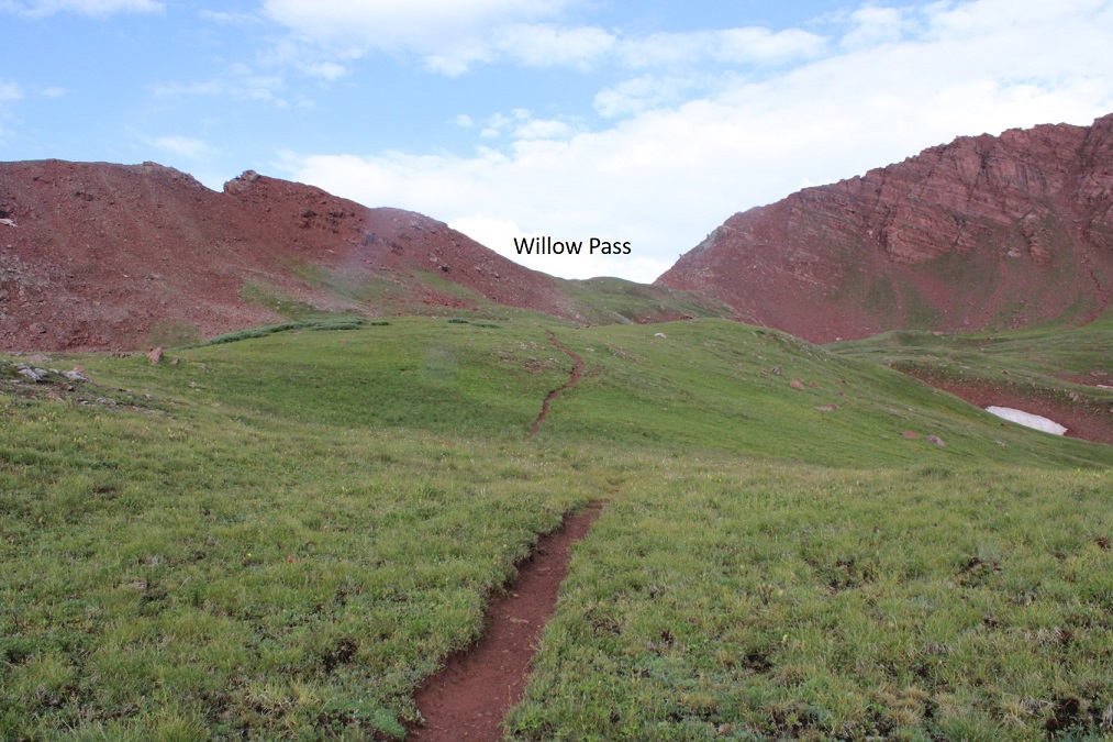
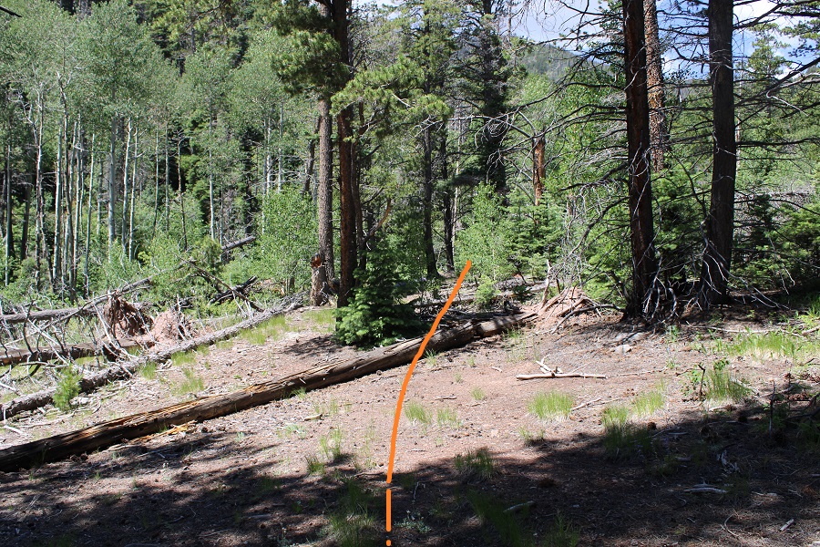
I continued on this trail all the way to Willow Pass.
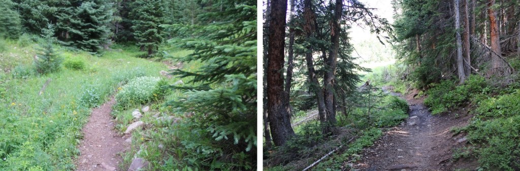
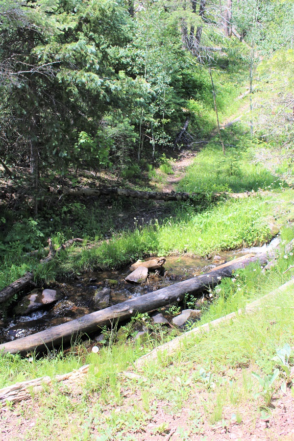
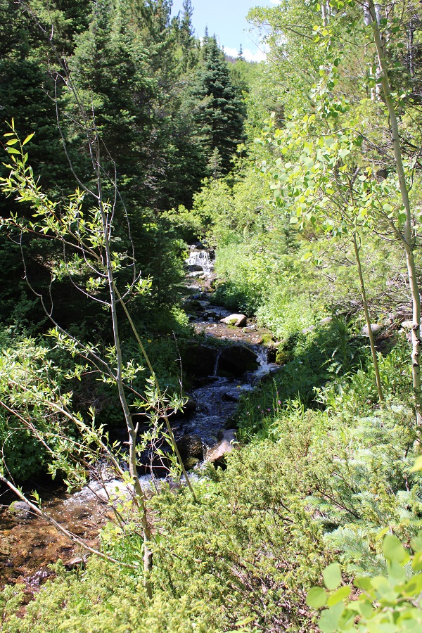
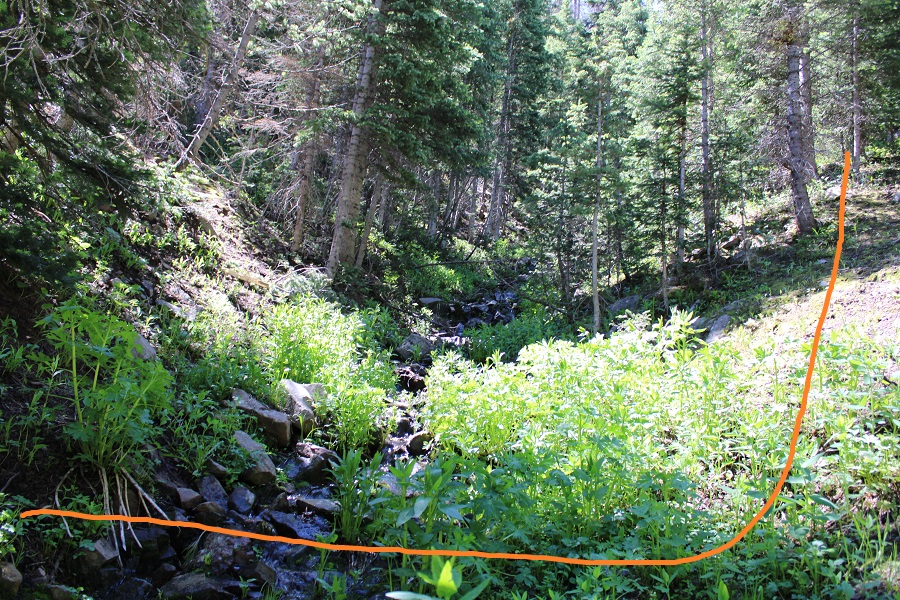
This is a class 1 trail that crosses a creek, then heads north through the basin.
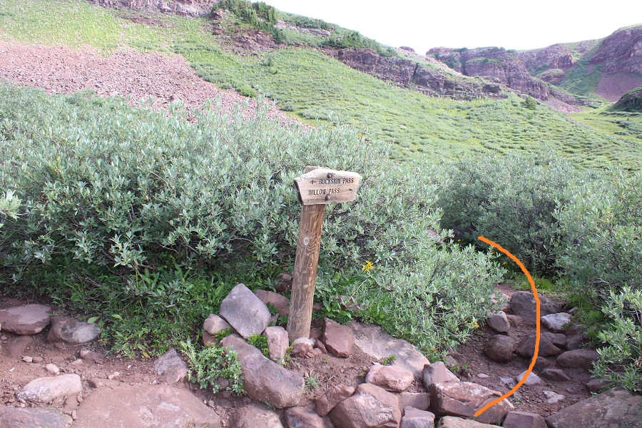
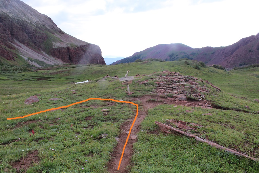
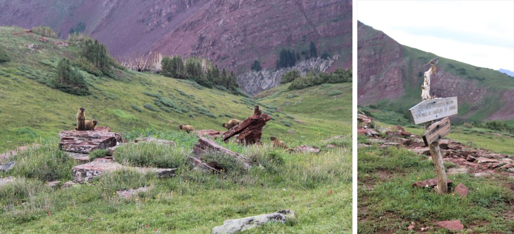
Stay right at this sign
And follow the trail to Willow Pass.
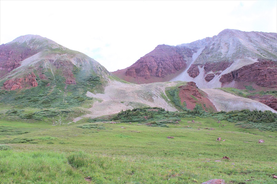
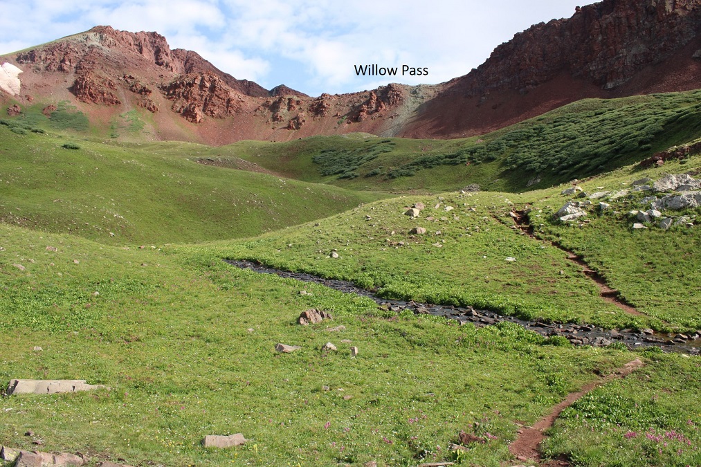
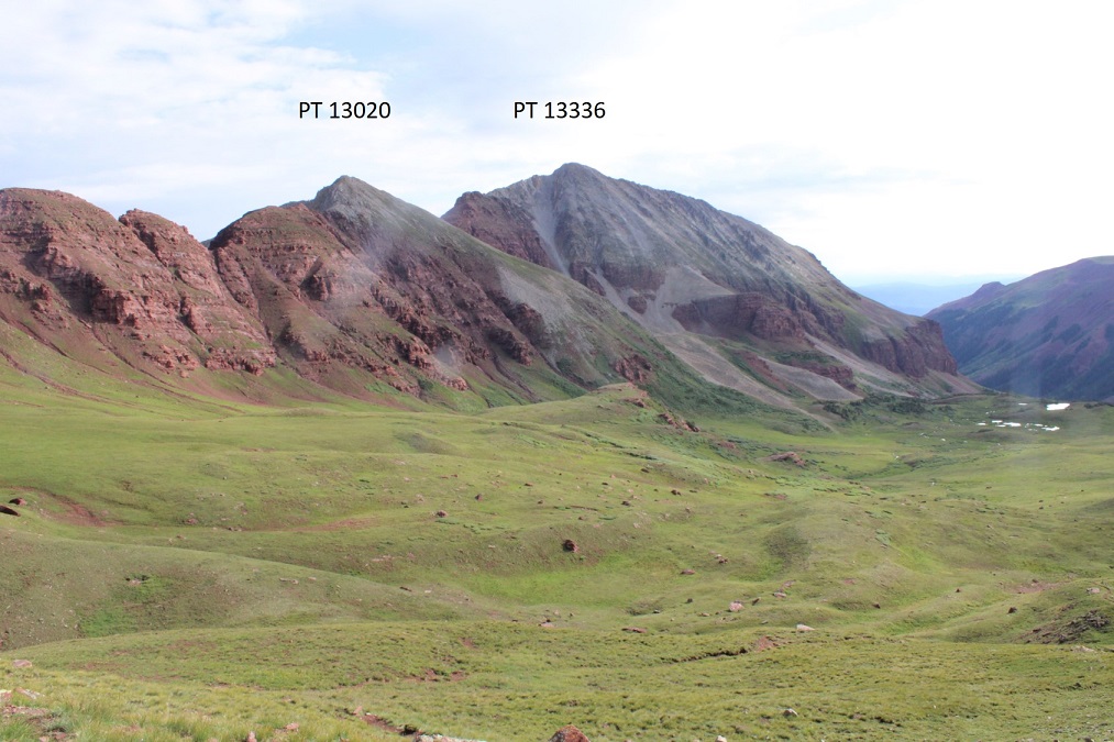
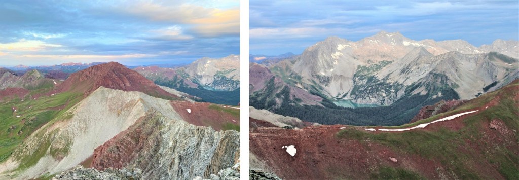
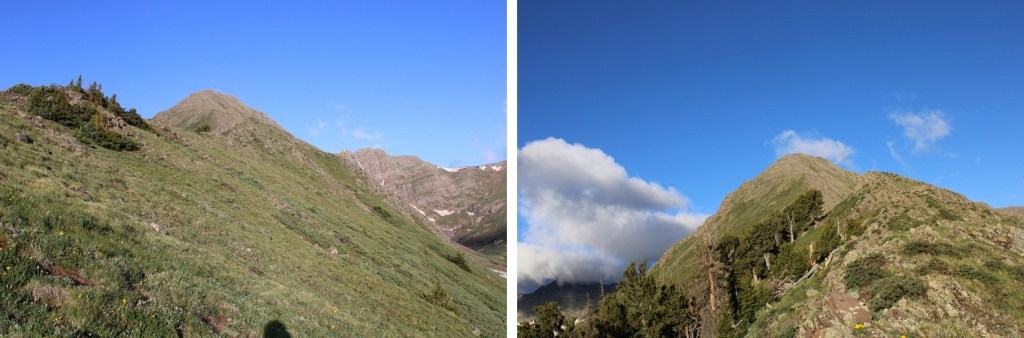
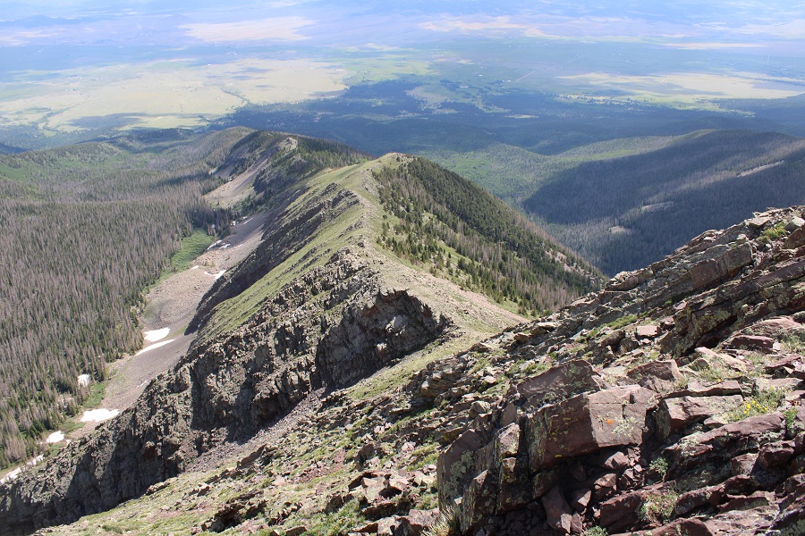
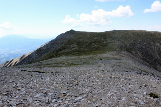
CalTopo tells me I hiked 5 miles from the parking area to Willow Pass. From Willow Pass you can see today’s peaks
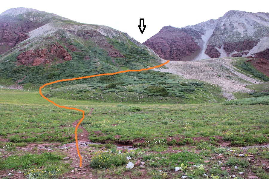
From Willow Pass I descended 560’ into the basin
I came to the Junction for East Snowmass Trail/Willow Lake, and turned left, following the East Snowmass Trail.
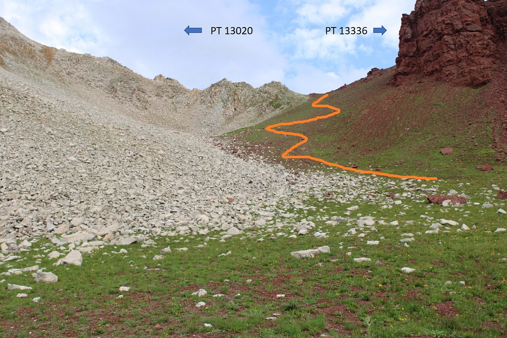
I was now following the trail towards the saddle of PT 13336 and PT 13020
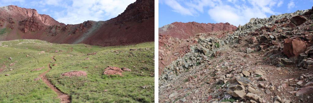
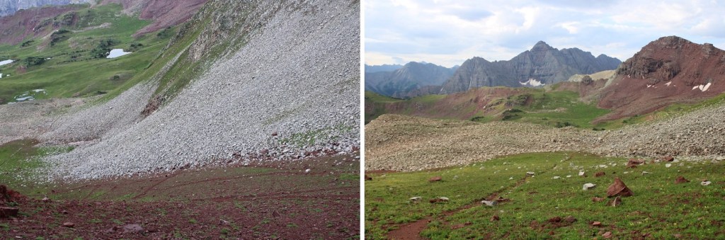
The upper basin was really neat, as I could see two different types of rocks, one coming from each mountain. The color contrast was interesting. The trail was still class 1 to the saddle, staying on the tundra/red dirt.
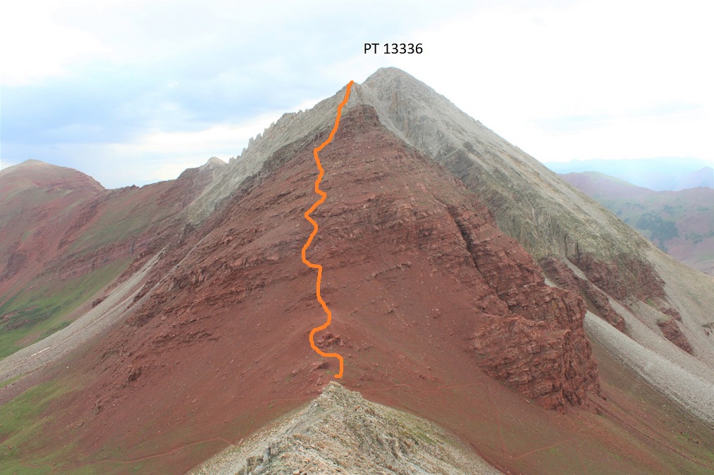
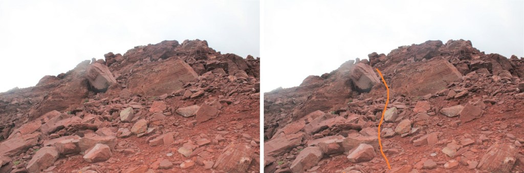
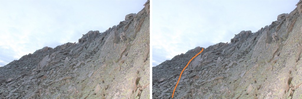
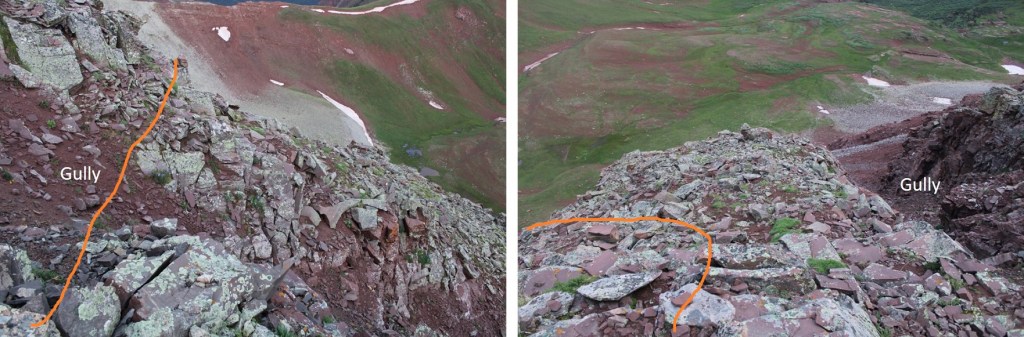
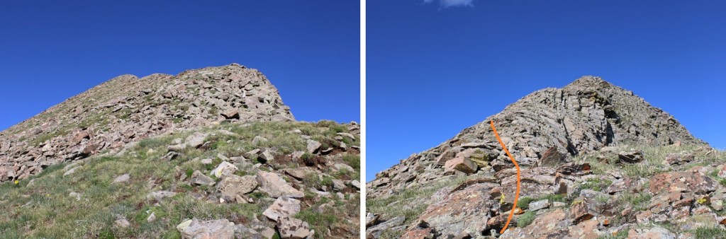
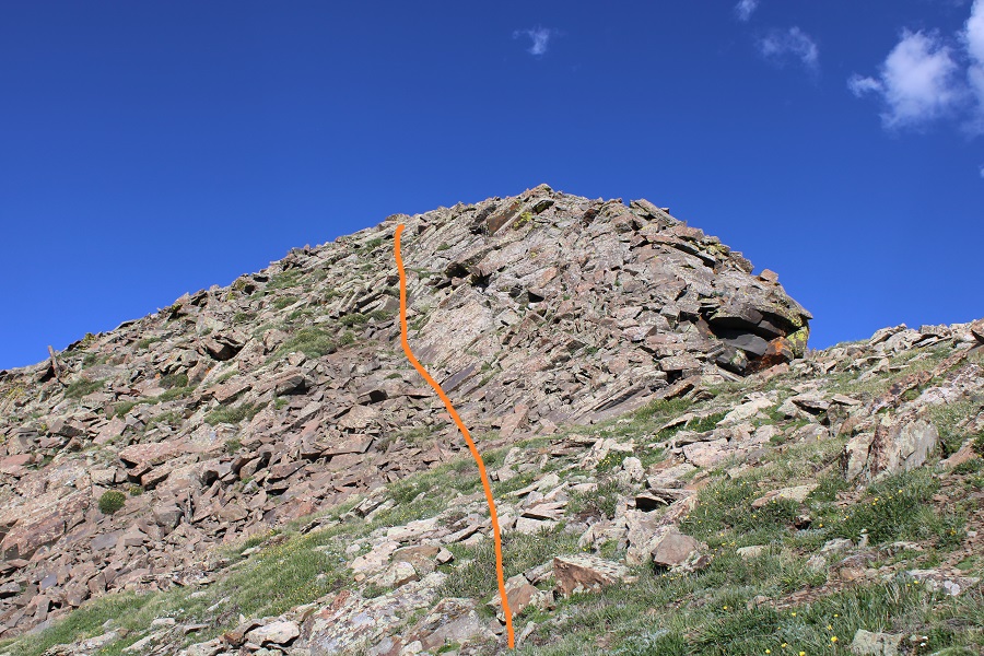
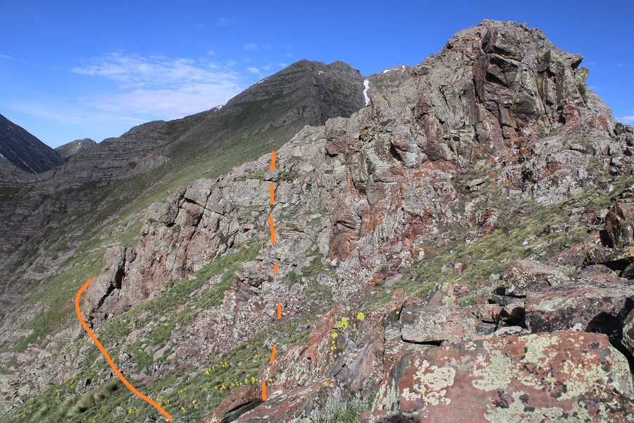
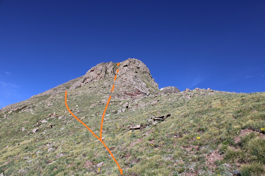
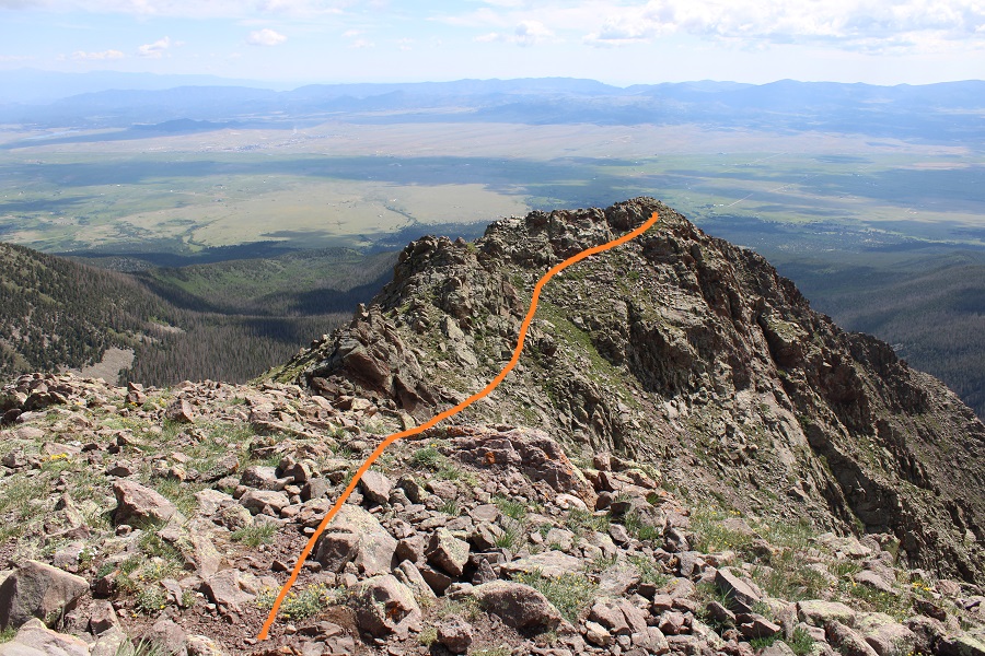
Once at the saddle it’s a good idea to put your helmet on. I decided to tackle PT 13336 first. This is class 3, and takes place on loose rock. You may want to put on your microspikes for added traction. The red dirt was mushy because it had recently rained, but it was still loose. Here’s the route I took, as seen from higher up on PT 13020 later in the morning:
And here are some step by step pictures of the route:
Easily walk around the first two obstacles to keep this part class 2
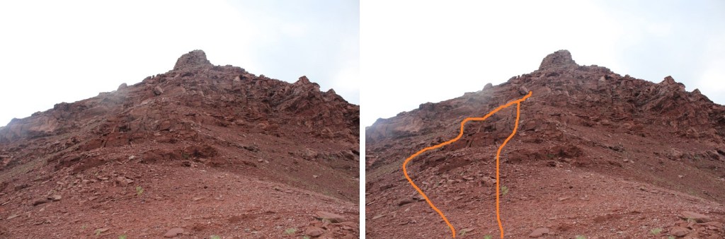
Next, you can either skirt the next obstacle to the left to keep this class 2, or go straight up and over if you like class 3
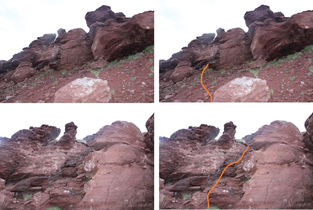
Now, keeping the ridge in front of you, the route becomes class 3. Head between these two boulders and ease a little left
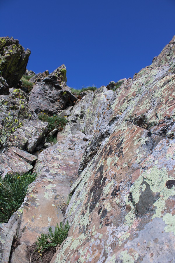
Look for a break in the rock formation and scramble up
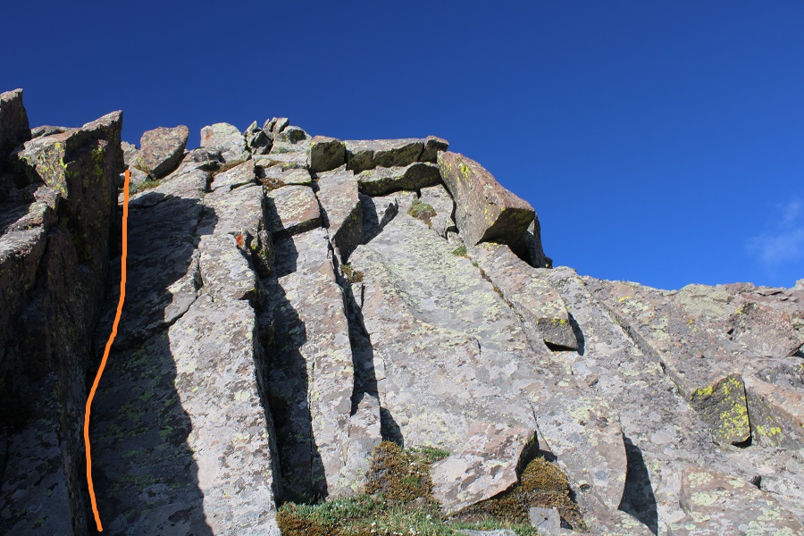
You can now clearly see the ridge. Keep the ridge to your right, and skirt the north side of the ridge. There is no need to go up and over the ridge at this point.
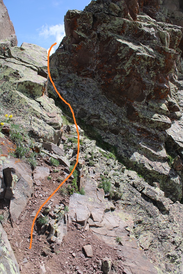
The rock here is loose, and only gets looser. Follow the loose rock up a sort of side gully.
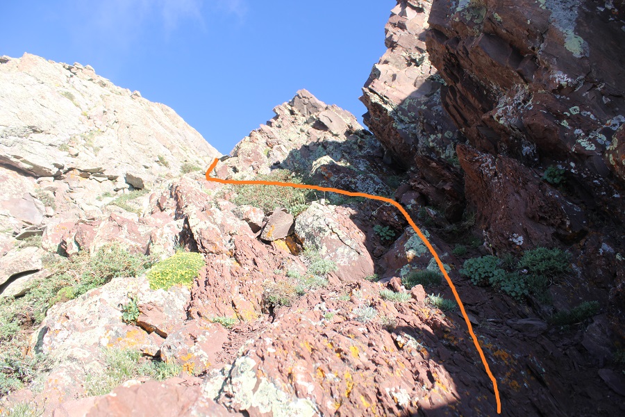
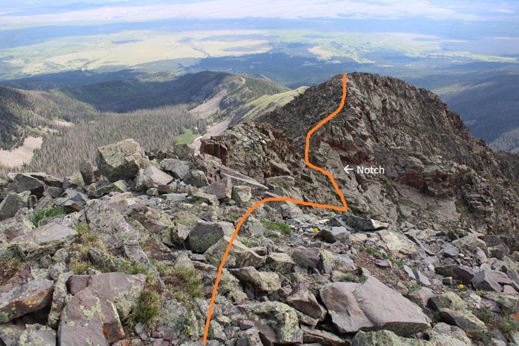
At the top of this rubble the rock changes. It’s no longer the loose Maroon rock: it now becomes the loose Snowmass rock. This rock is very slippery when wet, and even when not, so take care. These rocks are not stable. Just assume they all move. Cross this gully high. There is still no need to gain the ridge, you can stay just a bit below
I have a feeling the terrain here shifts often, so pick your way carefully. I traversed the ledge by staying about 50 feet below the ridge, and then gaining the ridge through a gully
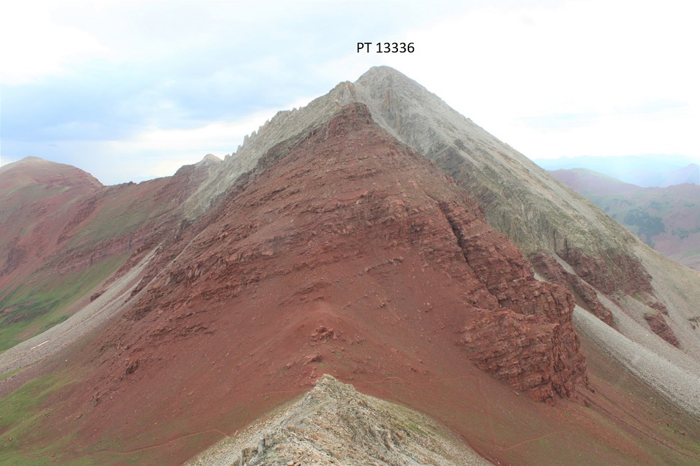
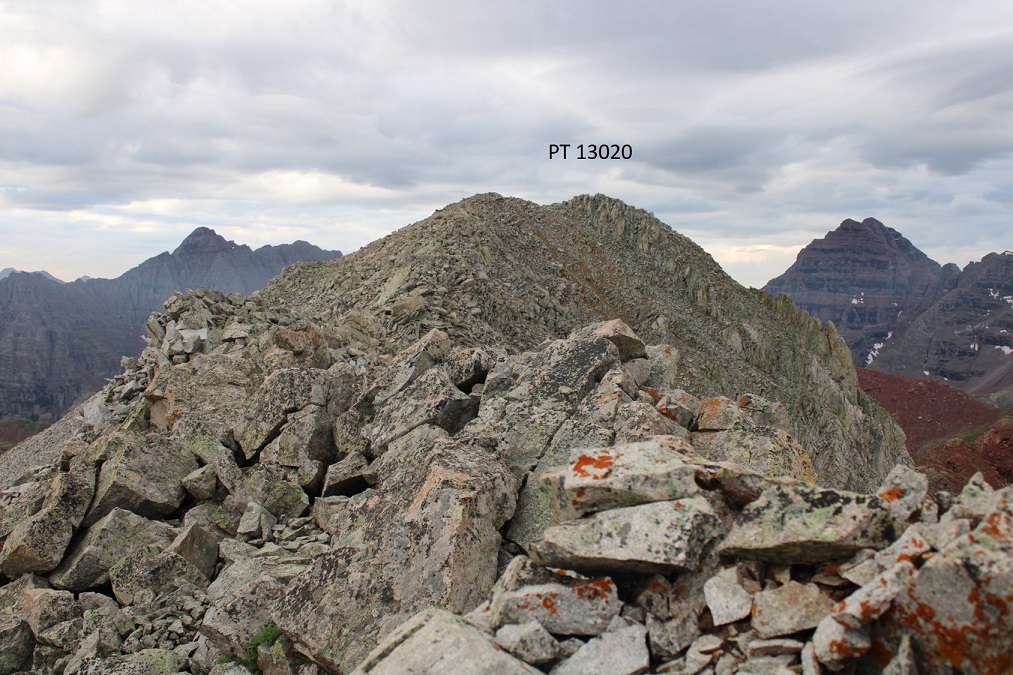
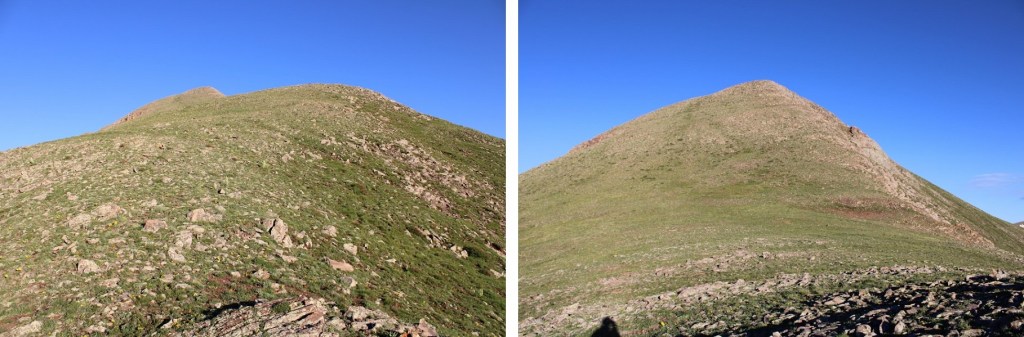
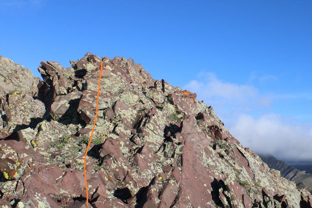
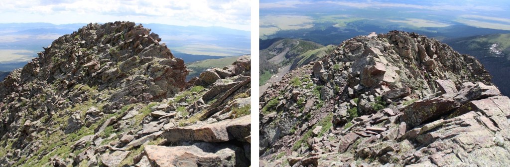
At the top of the ridge you can see the true summit of PT 13336. The terrain stays just as loose as before.
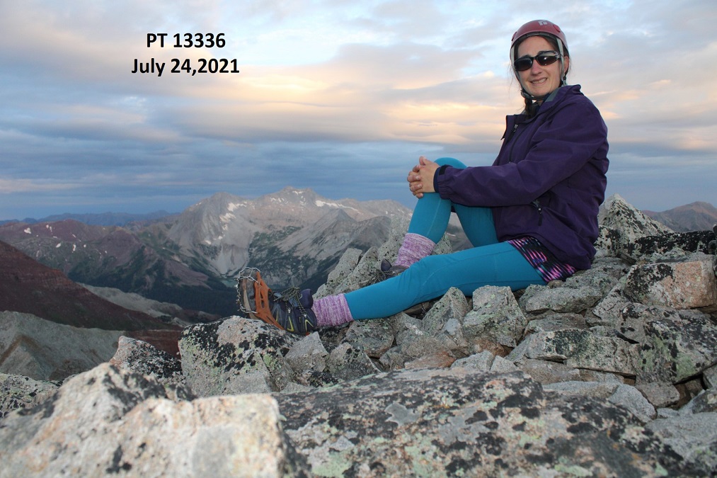
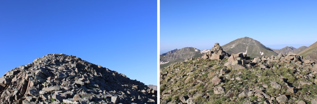
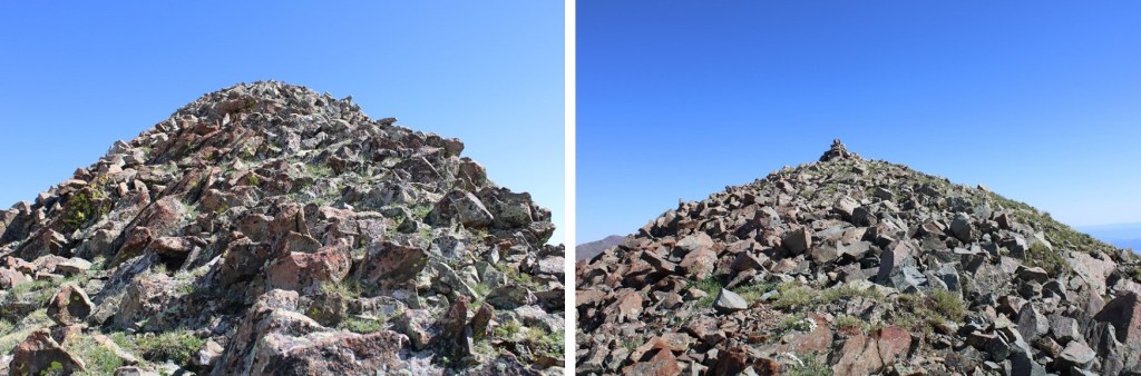
I summited PT 13336 at 6:10am
PT 13336:
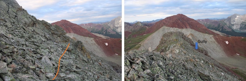
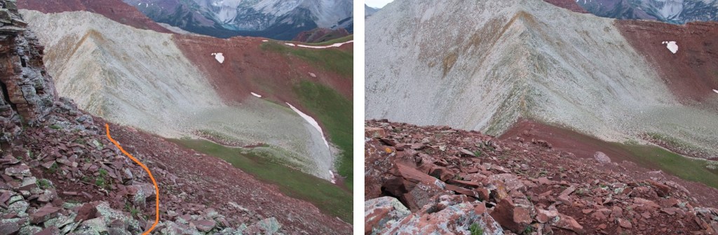
Here are some pictures of the way back to the saddle
Across the gully
And down the maroon scree
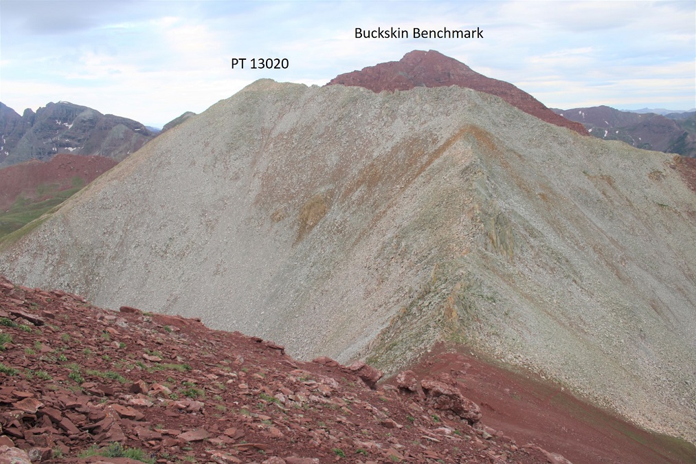
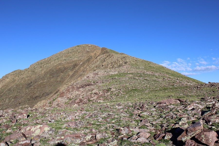
From here you can see the summit of PT 13020 and Buckskin Benchmark
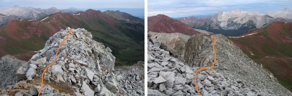
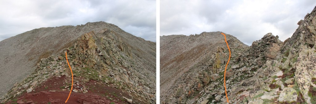
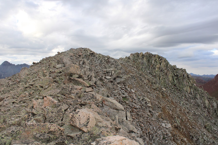
It was a simple ridge hike, with just a few fun moves to the summit of PT 13020. Here’s the overall route
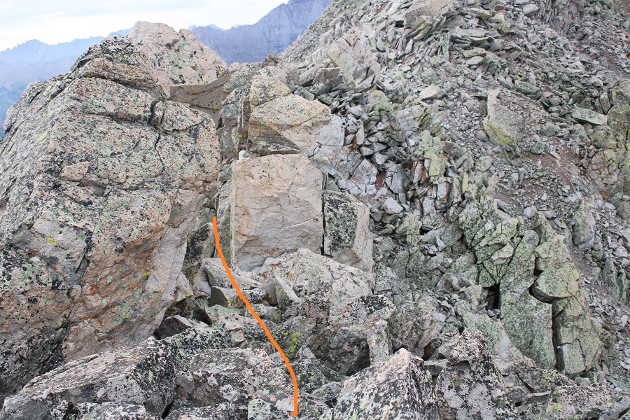
And some step by step pictures. To gain the upper ridge, I skirted the rock formations to the left, but still stayed as close to the ridge as possible.
Once on the upper ridge I followed it to the summit of PT 13020, only dipping down to the left once through a gap in the rocks to keep this class 2
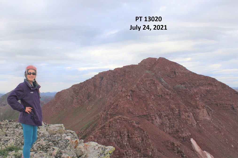
I summited PT 13020 at 7:20am.
PT 13020:
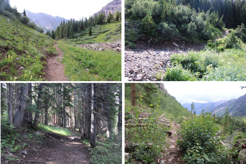
It was starting to rain, so I headed back down the ridge to the saddle.
Once at the saddle, I followed the class 1 trail back to Willow Pass
There was a large family of marmots at the Willow Lake/East Snowmass/Willow Pass Junction. As I approached, several jumped underneath the grass, not wanting to be photographed. I turned and headed southwest towards Willow Pass
And from Willow Pass I followed the trail back to the Maroon Lake Trailhead
I made it back to the trailhead at 10:45am, making this a 16.3 mile hike with 5815’ of elevation gain in 9 hours, 45 minutes
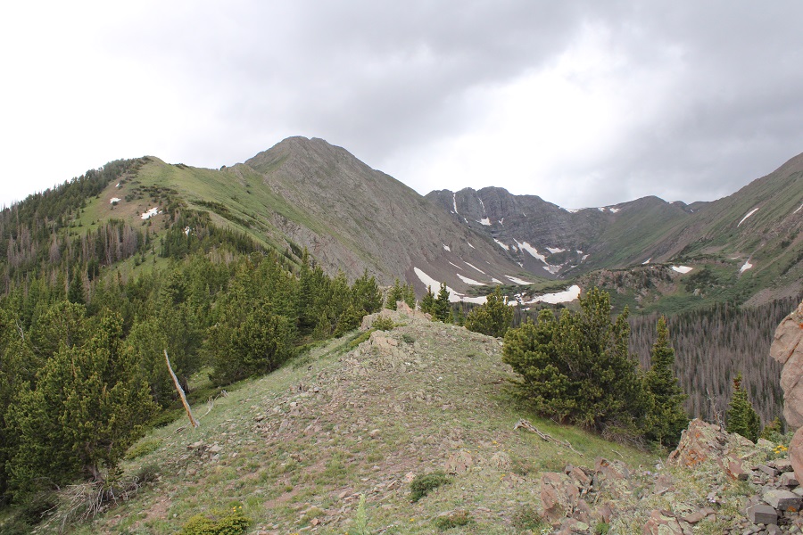
And, just because I have room for one more picture, can we all take a minute to appreciate jut how beautiful this area is?
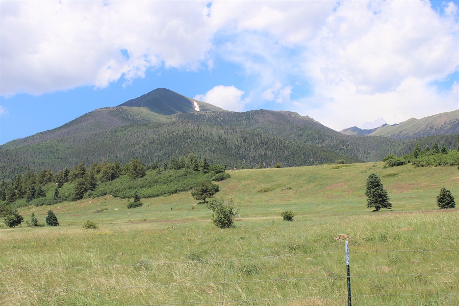
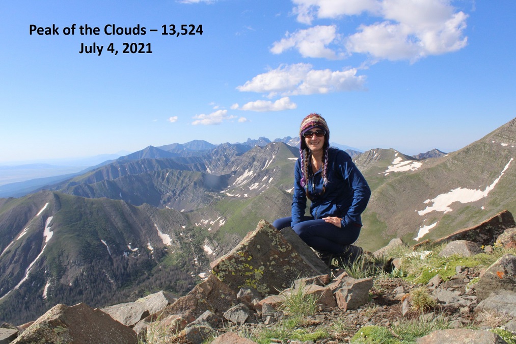
This was my 4th attempt at Peak of the Clouds. Not because it’s a difficult peak, but because every time I was in the area I was thwarted by the elements; snow conditions, or a fast-moving storm coming in. Today had a great weather forecast, so I figured today was my day.
Unlike my previous stays at the Gibson Creek trailhead, this time it was packed. Probably because it was a Saturday over 4th of July weekend. There were RVs set up everywhere, and every parking space in the lot was taken. Knowing I was going to spend the night in my truck I just waited for someone to leave and then backed into their spot.
I was sitting at the trailhead, just appreciating the sounds of the birds chirping and insects humming, and then the sun comes out and lights up each individual blade of grass and all I can think is how lucky I am this is my life. It was a perfect night, and the last one I’d be spending in this particular vehicle, as my new truck was waiting for me at the lot and I was picking it up Monday. I wanted to enjoy tonight.
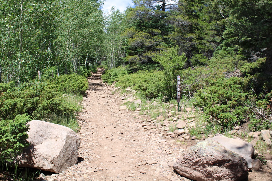
I’d been gone for a few days, and I also wanted to get back home to see my kids, so I made it an early morning. I was on the trail at 3:45am. The trail starts at the north end of the parking area, and follows trail 1456 west.
The trail starts out nicely defined. Stay straight at the Rainbow Trail Crossing. This sign has been broken for years. I wonder if they’ll ever replace/fix it?
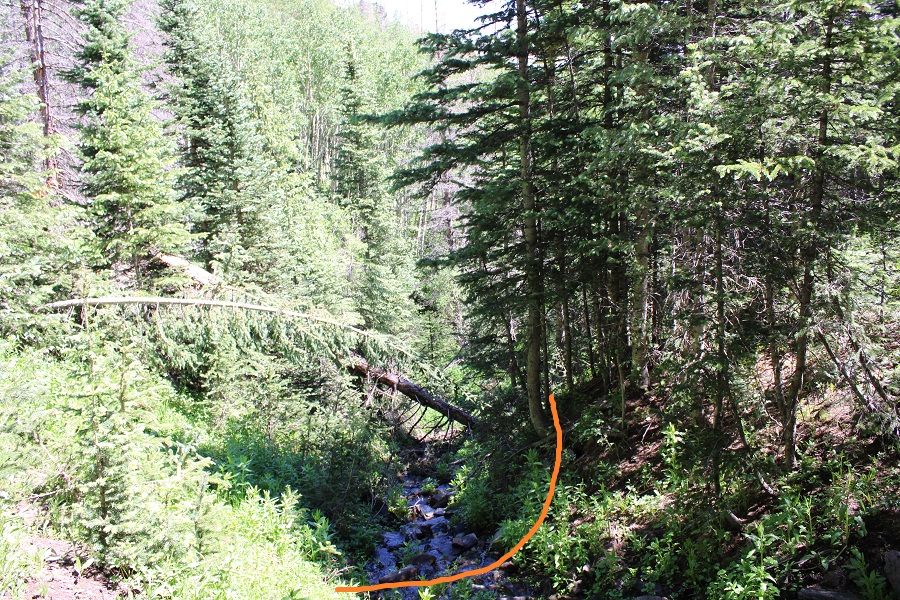
Here’s where it gets tricky. After hiking for .4 miles, and at 9400’, leave the trail and cross Gibson Creek. It looks like there used to be a good trail here at one time, but it’s no longer well defined. In fact, someone placed a tree trunk over the way you’re supposed to go.
After crossing Gibson Creek, the trail picks up again.
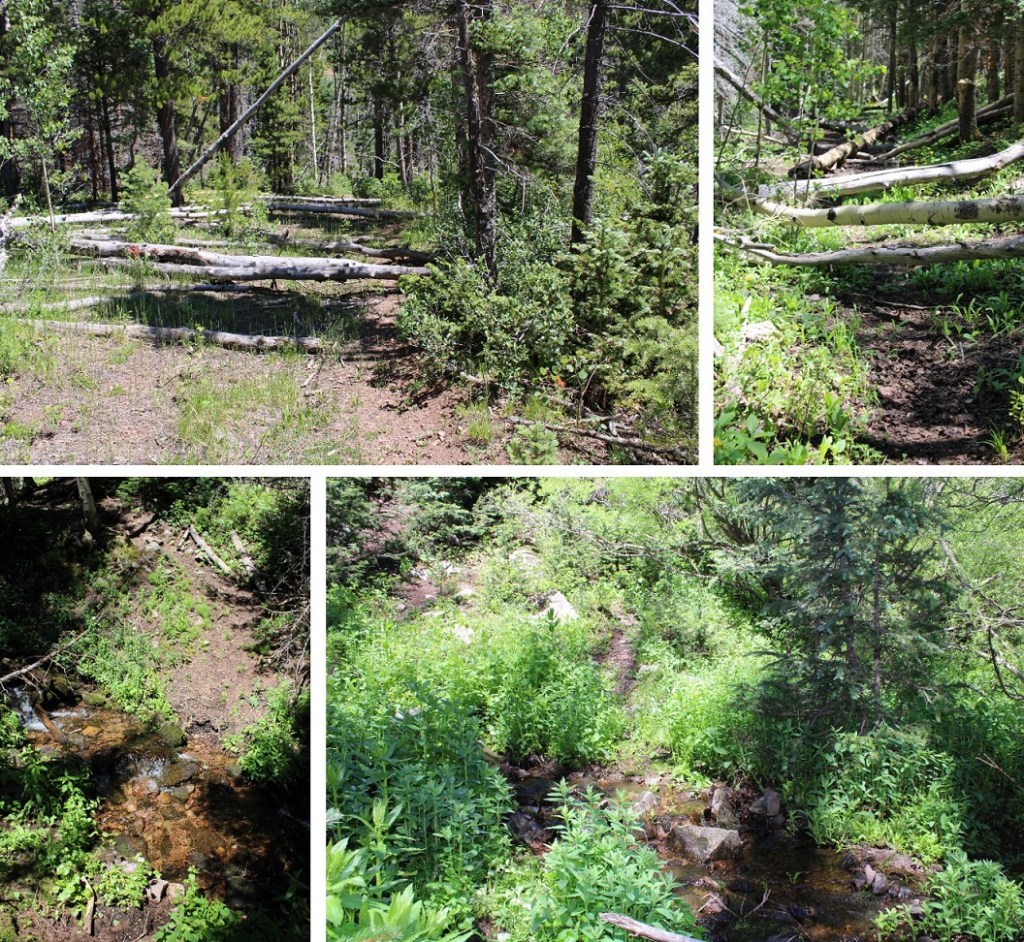
The trail goes through various conditions, from being well-defined, to being covered with downed trees, to barely being a trail at all. It also crosses Gibson Creek several times.
The main thing is to just keep following Gibson Creek west/southwest
I followed the trail for about 2 miles, to when the trail abruptly ended where a tree had fallen over the trail. Here I crossed the creek one last time, and bushwhacked southwest, up the mountain. It’s important to note here something the topo map doesn’t show: Apparently, somewhere Gibson Creek was to my right, but a much larger creek was to my left (this creek is not shown on the topo map, and could just be an error in CalTopo, as the creek was always to the south of me, but on the map it’s shown as being north). Gibson Creek pretty much fizzled out here, so keep the creek you can see to your left as you ascend the hillside.
This is a steep hillside with some bushwhacking involved. It seemed to go on forever. I took a different way down than I did up, and I’d recommend taking the way I went up, directly aiming southwest towards the ridge, as it avoids the large section of willows to the northwest.
I made it to the ridge as the sun was coming up
Once on the ridge, it’s a straightforward, class 2 ridge hike to the summit.
Here are some step-by-step pictures of the ridge
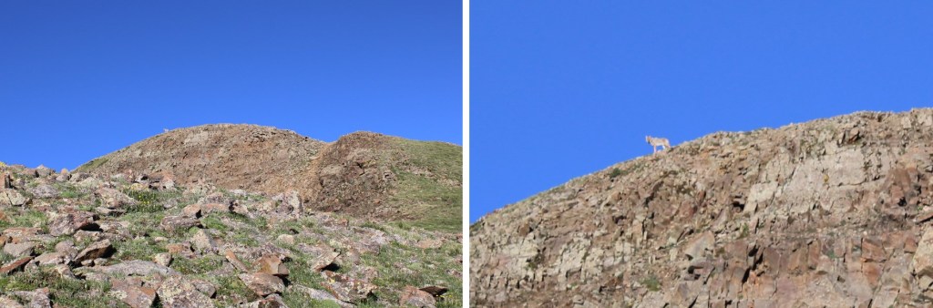
As I was nearing the summit, I looked towards the summit and thought I saw a bighorn sheep. When I looked again I realized it was a coyote: the biggest coyote I’ve ever seen! He was chillin’ on the summit.
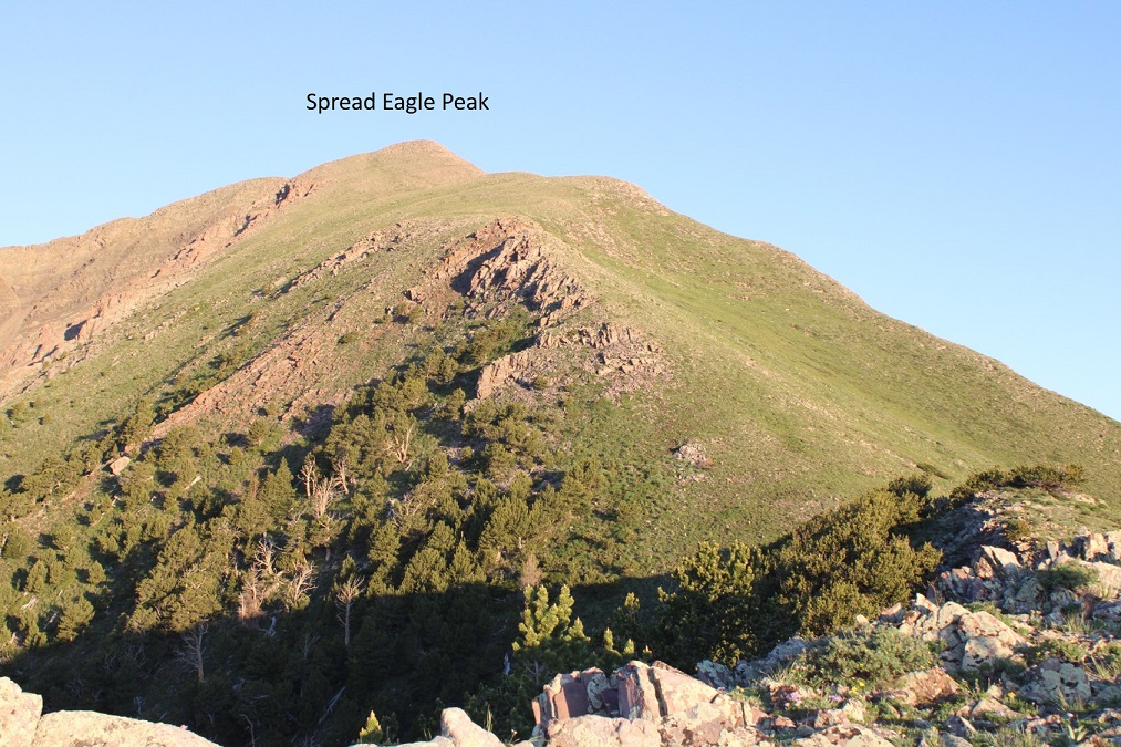
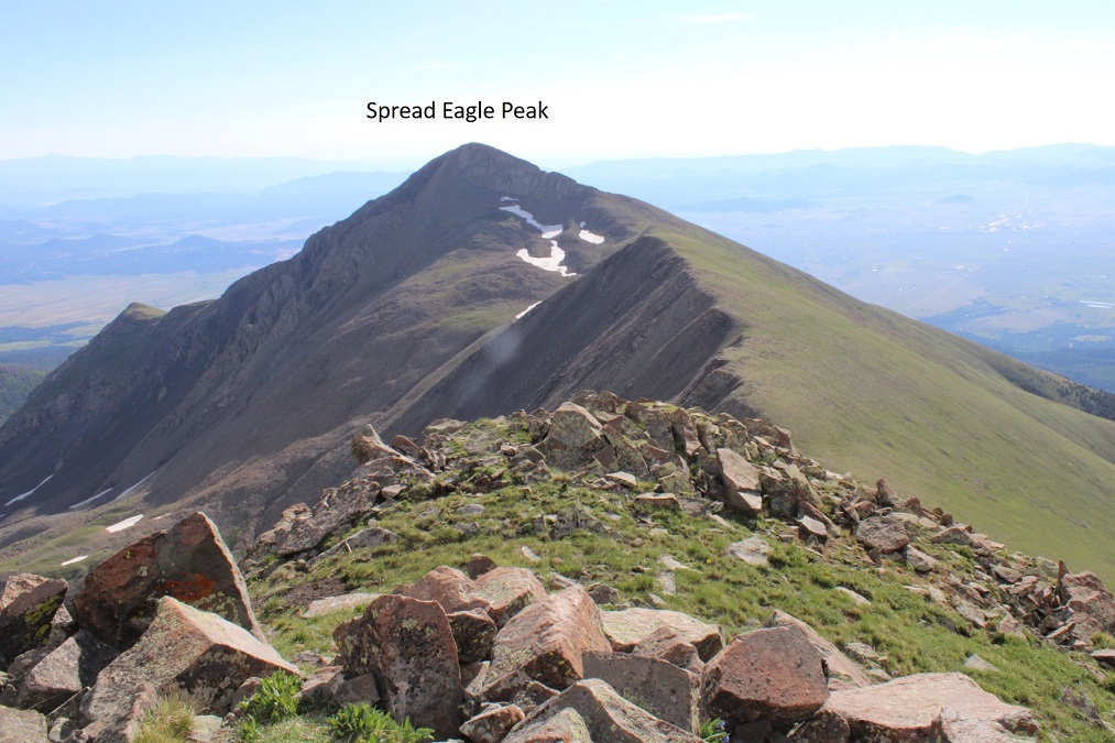
I summited Spread Eagle Peak at 7:15am. The coyote was nowhere to be seen.
Spread Eagle Peak:
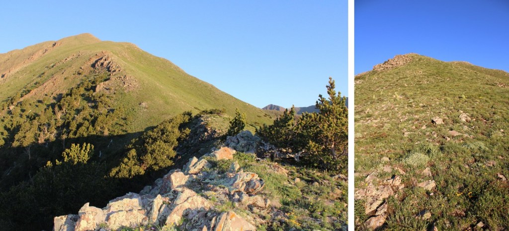
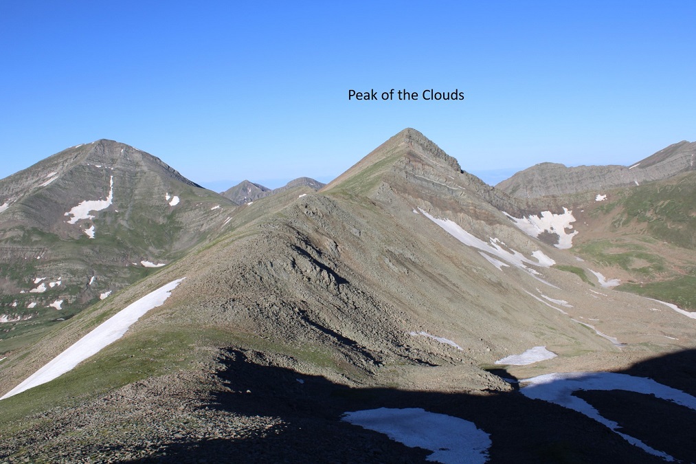
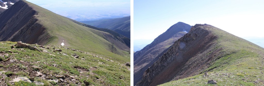
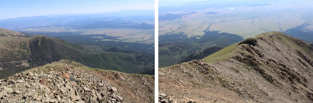
It was an absolutely beautiful day! I headed south, down the ridge to the Spread Eagle/Peak of the Clouds saddle.
This was a straightforward trek, with just one short class 3 move. I stayed right and downclimbed this section.
Then followed the ridge to the saddle
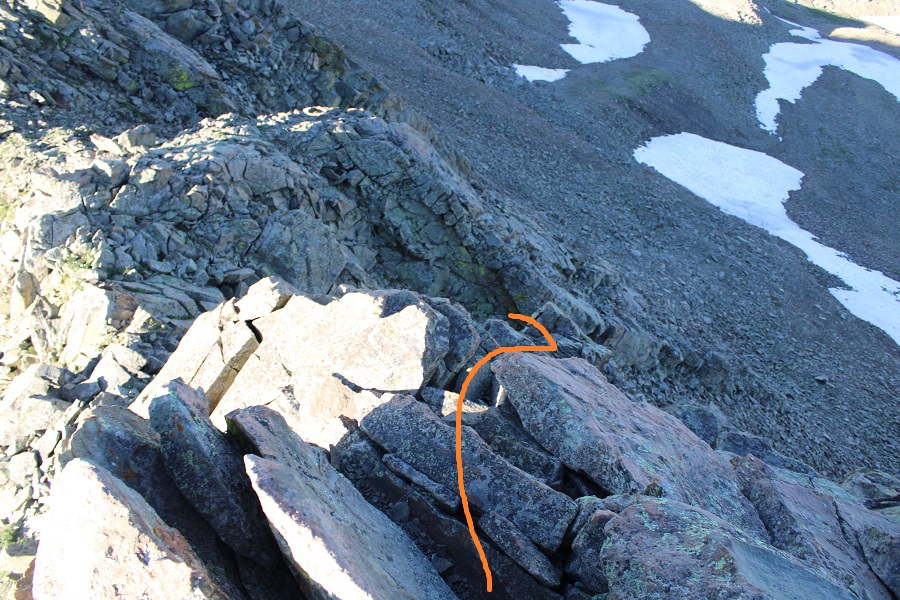
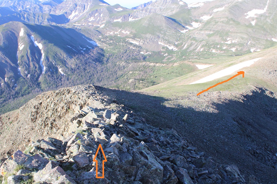
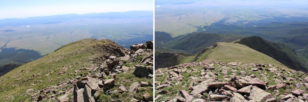
It was a simple, class 2 ridge hike to the summit of Peak of the Clouds
Here are some step-by-step pictures
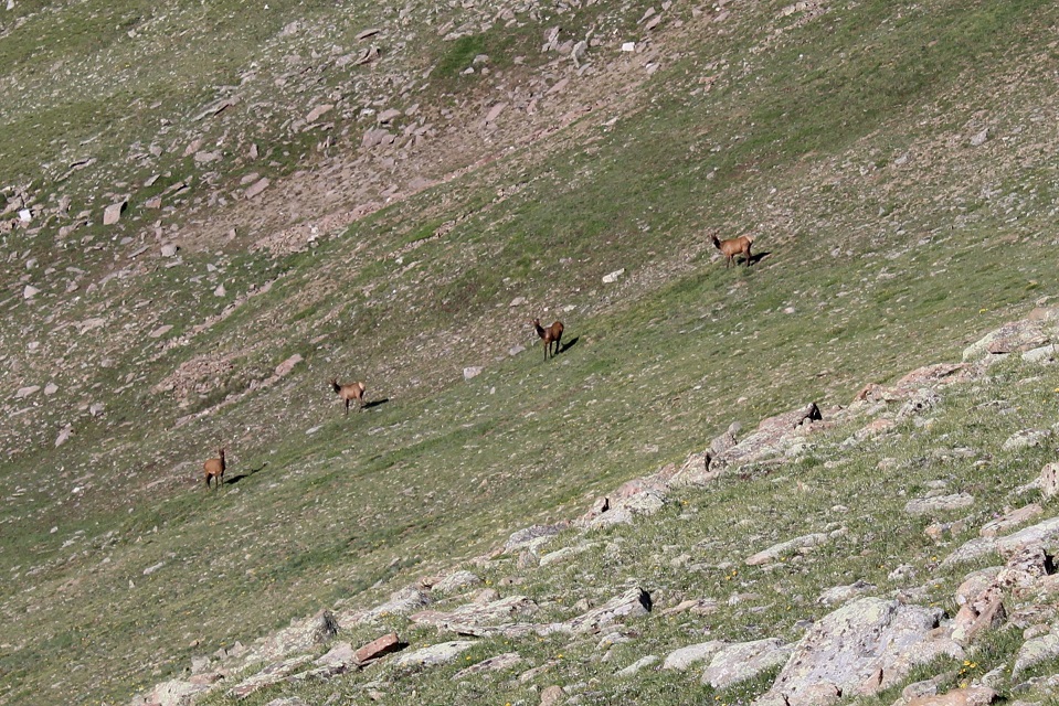
Here I saw some elk (they didn’t stay long)
Looking up at the ridge to Peak of the Clouds
As I was hiking up, a marmot rushed down past me. I wonder where he was going?
The last part of the ridge was rocky. I stayed to the left.
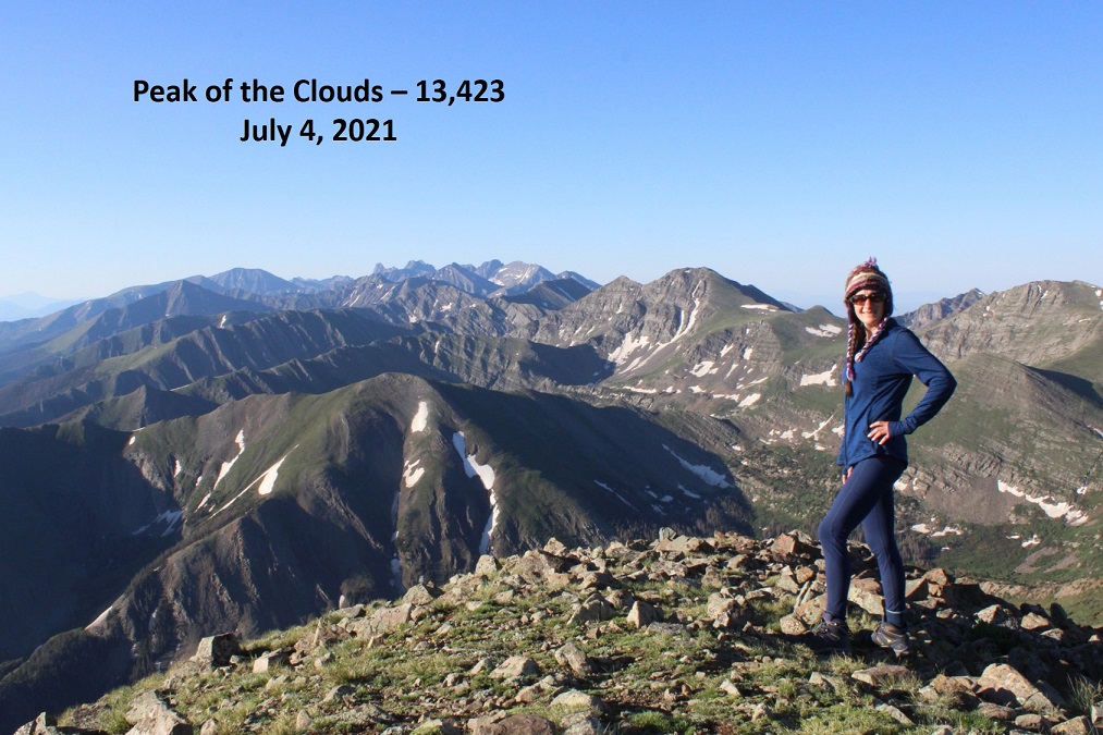
I summited Peak of the Cloud at 8:20am
Peak of the Clouds:
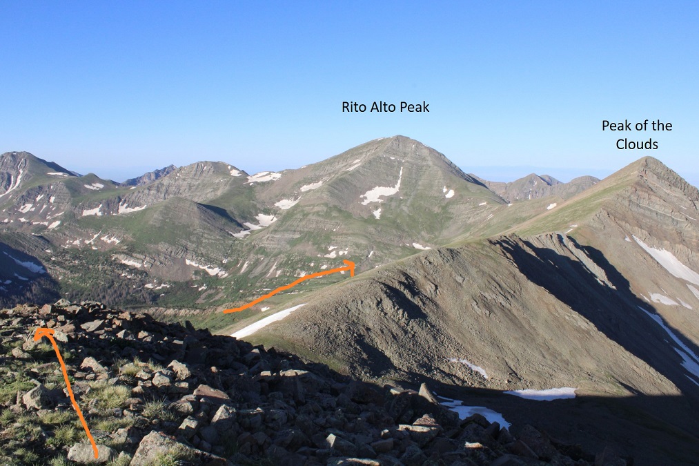
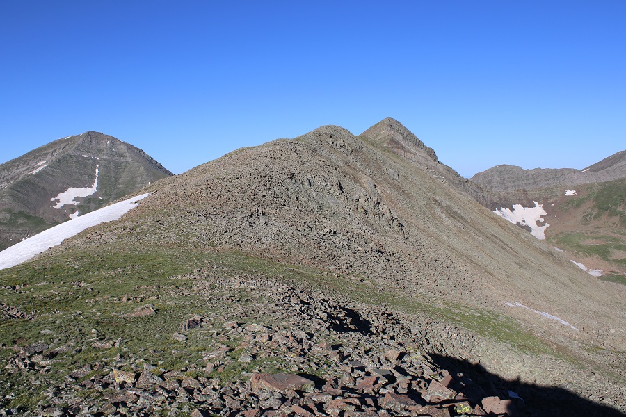
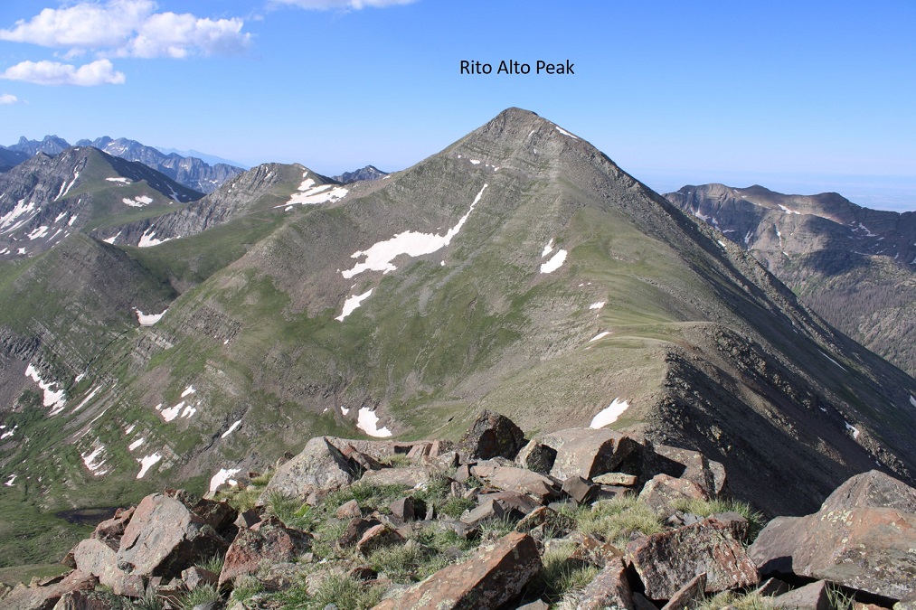
Here’s a look at the ridge to Rito Alto Peak (in case anyone is looking to do that one as well)
I sat for a minute and enjoyed my time on the summit. It was a beautiful 4th of July in the Sangres!
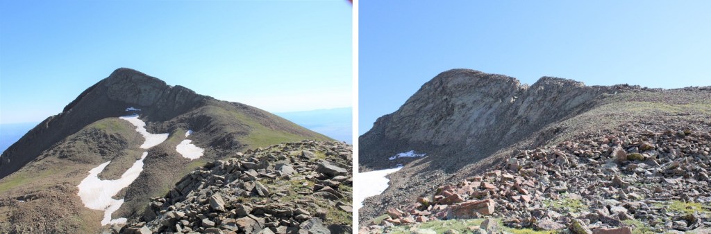
I was making this an out and back trip today, so I turned and looked back at Spread Eagle Peak
Here are some step-by-step pictures back to the saddle
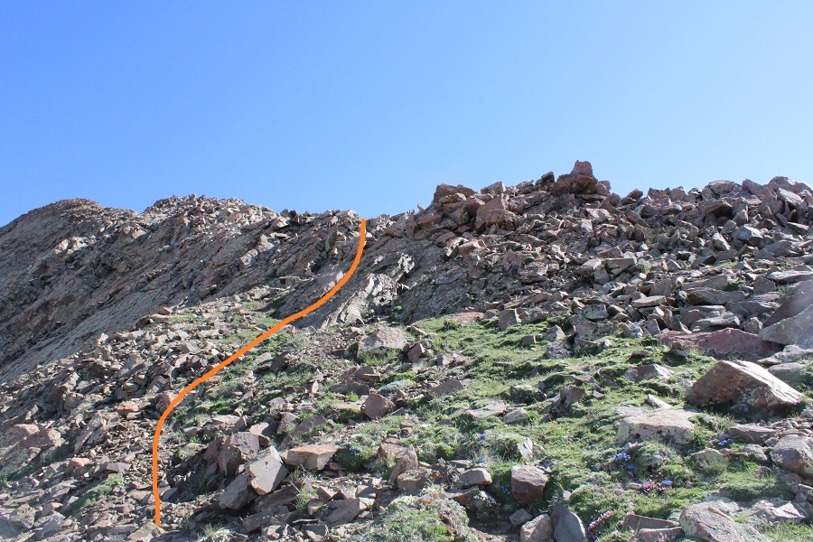
This is how I accessed the ridge
And then followed the ridge north
The short class 3 section was easier to upclimb than downclimb.
Then it was an easy ridge hike to the summit
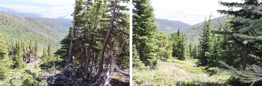
I turned and headed east down the ridge, back to treeline. I saw elk here as well.
Once near treeline I headed back toward Gibson Creek, but as I said before, I encountered a lot of willows and it was slow going. I’d recommend following the ridge as it slopes up a bit and becomes treed, and then heading northeast.
Yes, there’s bushwhacking and route finding involved.
I made it back to the creek, and followed the trail back as it curved northeast towards the trailhead
I crossed Gibson Creek one last time, and was back on the well-marked trail.
I made it back to my truck at 11:45am, making this an 11.05 mile hike with 5461’ of elevation gain in 8 hours. Now, time to drive home, wake up my daughters, and grill some steak!
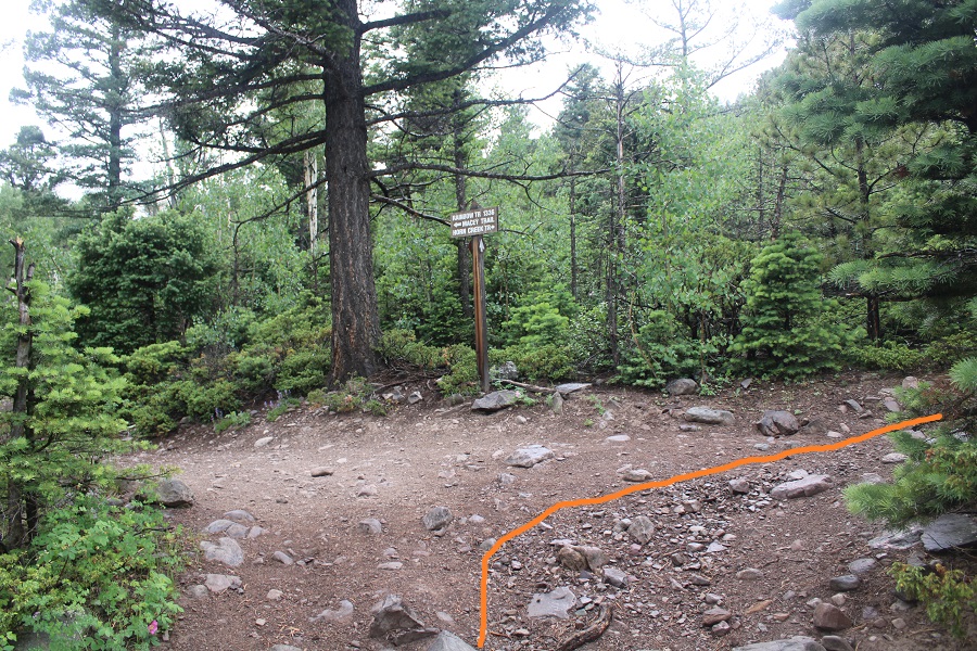
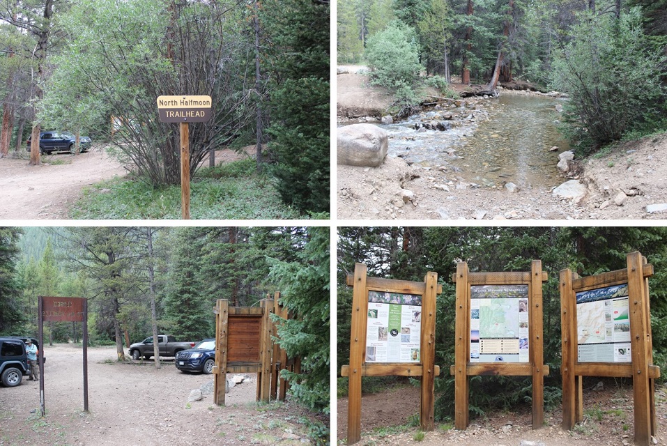
I parked at the Horn Creek Trailhead, the only vehicle in the lot. I’m always surprised at how few people take advantage of the free dispersed camping sites we have in Colorado, especially ones like this with a bathroom. Eager to summit and get back to treeline before the incoming storm, I gathered my gear and was on the trail at 4:30am. The trail starts by following the Rainbow Trail southwest for just over half a mile
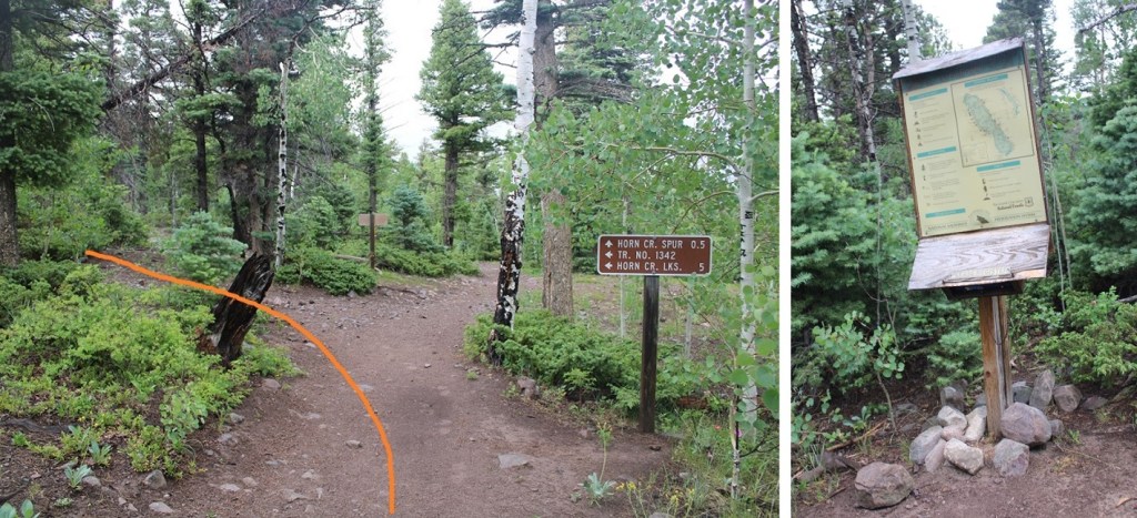
Then I turned right onto Horn Creek Trail
I followed Horn Creek Trail for a short distance, about a tenth of a mile, before turning left at the junction towards Horn Creek Lakes. Here there’s a register, that looks to be kept up.
I stayed on this trail for half a mile, before leaving the trail at 9590’ and heading north and then west up the ridge. There is no trail here. I left a small cairn to indicate where I left the trail, but I don’t expect it to be there long, as it was small.
Route finding here can be a bit tricky, but the goal is to gain the ridge. I did this by heading west, through the pine and aspen trees. Every once in a while, I’d come across a game trail. They all fizzled out however. This area is easy to navigate, as there aren’t too many downed trees. I was able to avoid most of them.
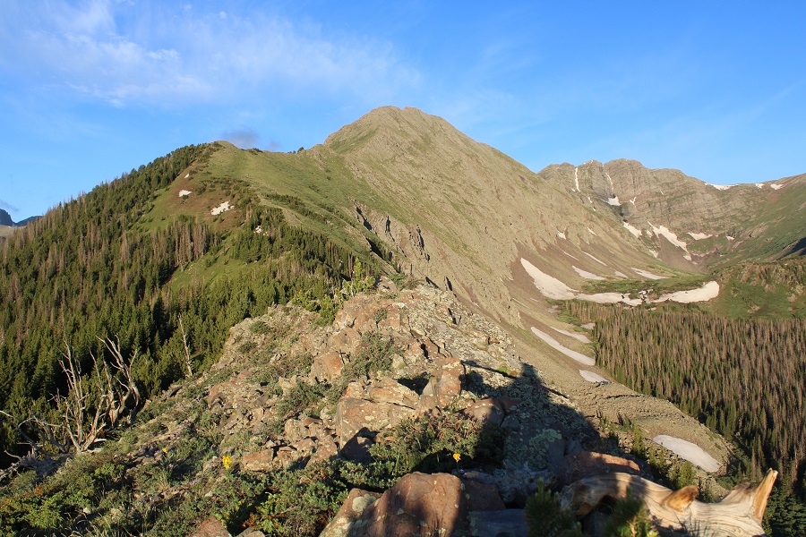
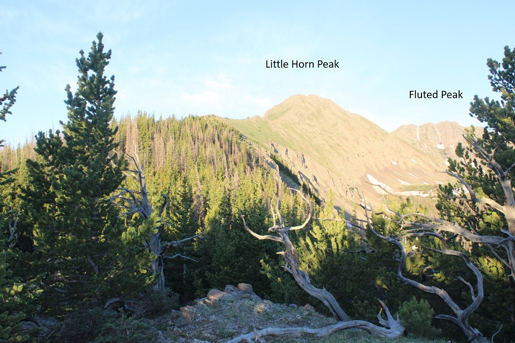
Once I was on the ridge, I followed it southwest to treeline. This is a long ridge, and it seemed to take forever to make it to treeline. Here’s my first glimpse of Little Horn Peak
Like I said, this is a long ridge
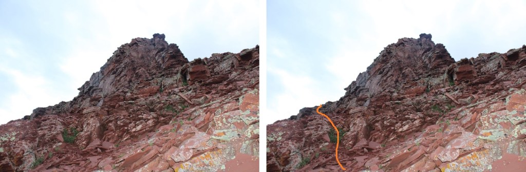
The class 3 fun starts at the top of the ridge, which is a false summit. From here you can see Little Horn Peak’s true summit
My trekking pole isn’t collapsible, so I left it at the start of the class 3 section, put on my helmet, and started heading straight over the ridge. The class 3 section is consistent for another half mile to the summit.
Start out by going straight over the ridge. There is some exposure here.
Then you’ll dip down to the right. Look for a notch, go through it, and now you’re on the left side of the ridge.
Go up the gully and cross back over to the right side of the ridge
There’s a section of rock to upclimb. This was difficult class 3 / easy class 4 (and much more difficult and committing on the way back down later in the day).
From the top of this section I could see the summit. I stayed on the left side of the ridge from this point on, staying on class 2 terrain.
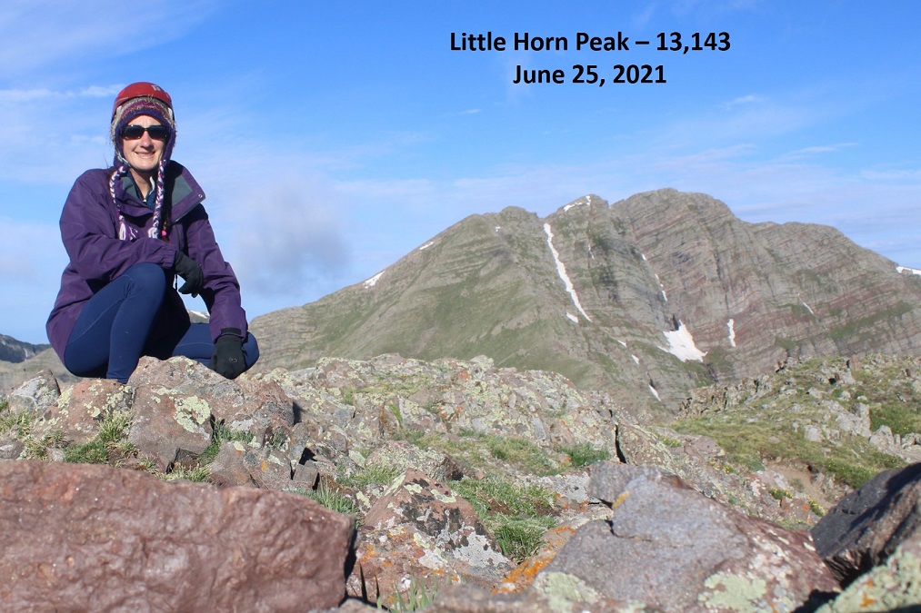
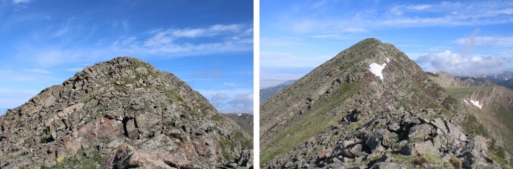
I summited Little Horn Peak at 7:45am
Little Horn Peak:
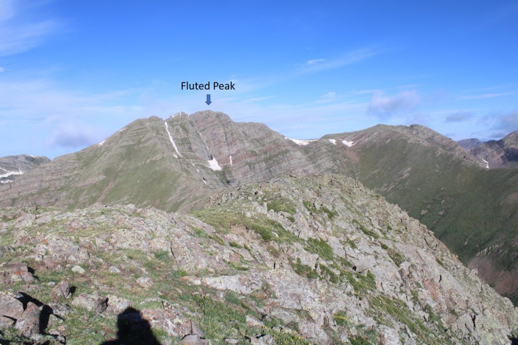
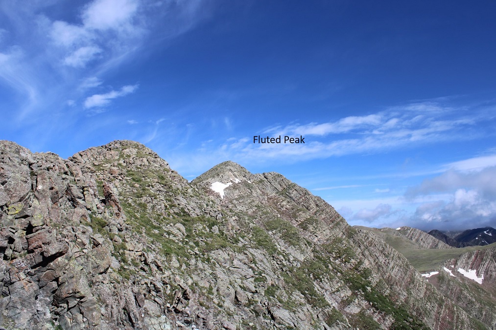
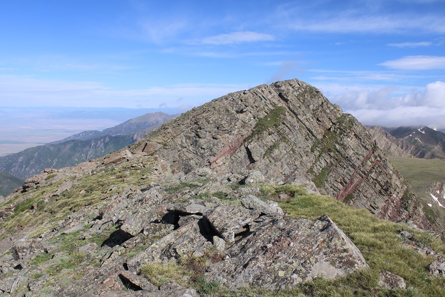
That was it for the class 3 section of the hike. The ridge over to Fluted Peak is class 2 (with the option to go up a class 3 chimney, but it’s avoidable). Here’s Fluted Peak to the west.
This was a simple ridge hike to the saddle. You can’t see them very well in this photo, but there was a mama bighorn sheep with her baby walking up the ridge. The baby couldn’t have been more than a month old.
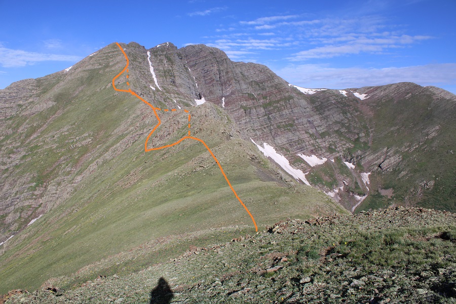
From the saddle, here’s how you keep this a class 2 hike (dotted lines show the class 3 route)
Here’s the first obstacle (class 2 solid, class 3 dotted):
And the second (class 2 solid, class 3 chimney dotted):
Here’s that chimney up close
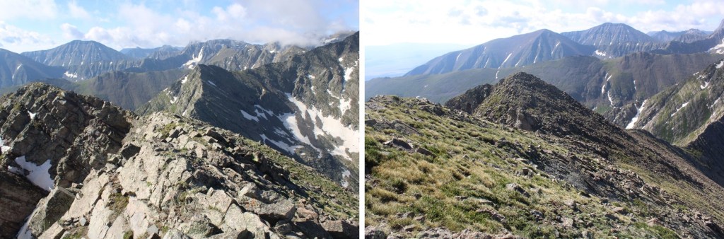
After the chimney, it’s straightforward class 2 to the top of the ridge to the first false summit.
Fluted Peak is actually here
There are two quick false summits to go up and over
And then the final summit
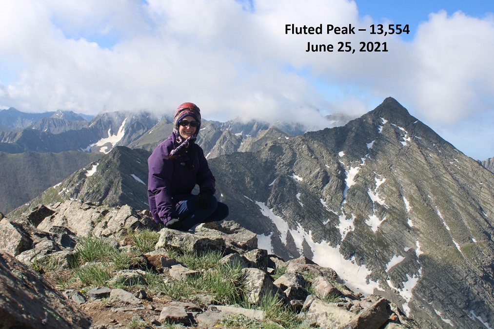
I summited Fluted Peak at 9am
Fluted Peak:
The clouds were coming in fast, so I decided to re-trace my steps and head back to Little Horn Peak (I’ve already summited Horn Peak, so there was no need to make this a loop today). I headed back to the ridge
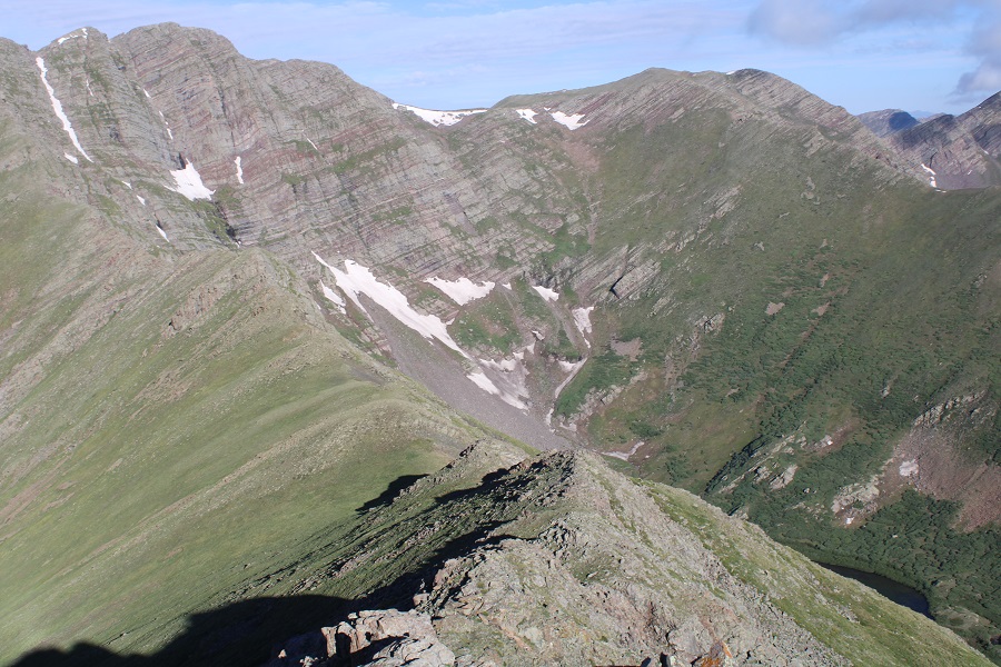
Here’s a picture of Little Horn Peak from the Fluted Peak Ridge
It all stayed class 2 until I made it to the summit of Little Horn Peak
From there It was class 3 again until I made it to the ridge.
Here’s a closer look at that notch
And the last bit of scrambling to the ridge
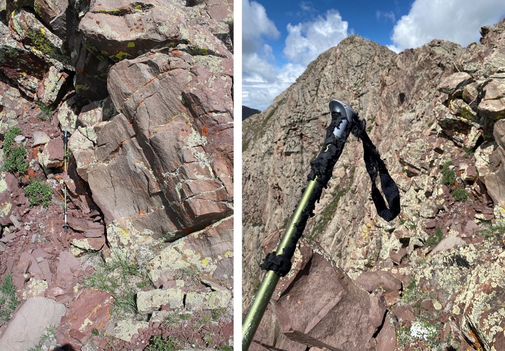
I made it to the ridge and looked around for my trekking pole. It wasn’t where I’d left it. Instead, it was about 15 feet away, at the entrance to a marmot burrow. I picked it up and found some marmot had turned it into a snack. Just adding more photographic evidence to prove the case “Marmots can’t be trusted with trekking poles”.
I sighed, took off my helmet, and headed back down the ridge (yes, I brought the trekking pole down).
Once back at treeline I turned back for a last view as it started raining.
The rain quickly turned to hail and I had to put my camera away. Here are some pictures of below treeline, in-between bouts of rain/hail. I just kept descending northeast, and when the ridge ended I continued east towards Horn Creek Trail. Once again, I’d pick up game trails and then lose them. A little advice: you should be able to hear Horn Creek flowing below you to your right if you’re going in the correct direction.
Back on the trail I followed it to the trailhead.
I made it back to the trailhead at 1pm, making this a 12.35 mile hike with 5504’ of elevation gain in 8.5 hours. That had been a fun day of scrambling!
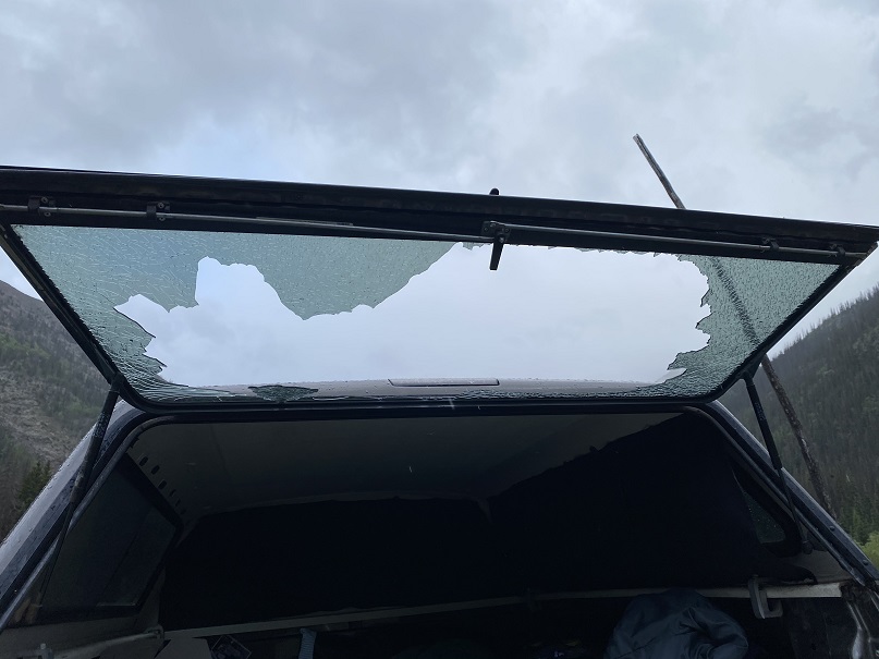
I dried off and headed to the next trailhead. When I got there it was still raining, so I decided to make dinner inside the topper of my truck. I finished, cleaned up, and was sitting down to write notes in my journal when I heard a loud “BANG!”
I looked up, and the back window to my topper crumpled and broke into thousands of pieces. I honestly thought I’d been shot at, and turned around but didn’t see a bullet hole anywhere. Next, I gingerly opened the window, crawled out of the truck and took a look around: no one in sight (but it was still raining).
I assessed the damage, and realized I needed to take care of this asap, so I put on gloves and cleaned up all the broken glass I could, still getting some small slivers of glass embedded in my fingers. Next, I drove to where I could get cell reception, and found the nearest place that would be open the next day to fix the broken glass was 5 minutes from my home, and 6 hours from where I was right now. I sighed: It looked like I had a long night ahead of me.
It turned out the auto glass store couldn’t help me, and told me to go to where I’d originally bought the topper. They couldn’t help me for another 4-6 weeks (and $600), but referred me to another glass shop that didn’t open until Monday. So, a quick trip to Walmart to pick up some duct tape and a tarp and I was able to create a makeshift door that does nothing to keep animals/intruders out, but has done a decent job keeping out the rain. I’m still not sure why the window broke: I was told sometimes there’s just a flaw in the glass. That sounds bogus, but I’m getting a new one soon anyway, and I’ve learned not to get windows in my next topper (I don’t use them anyway). I’m actually more upset I lost out on two days of hiking.
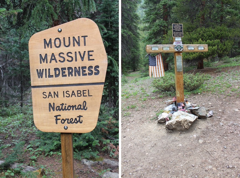
Fridays are my hiking days, and today’s Friday. However, it’s also the day I pick my daughter up at camp (at 2pm), which seriously cuts into my hiking time. I’m totally ok with this however, because I planned ahead. I saved Mt Massive for today because it’s a peak I knew I could summit quickly and head back down to pick up my daughter.
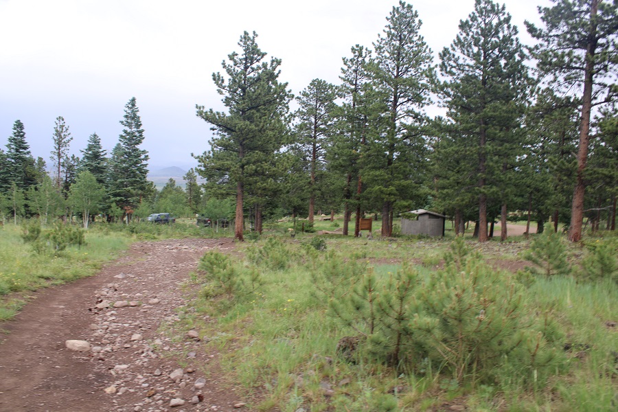
So I left the house at 11:30pm and drove to the North Halfmoon Creek Trailhead. Just when I was almost there I saw a huge campsite with about 20 RVs set up. They had a pallet bonfire going, and I thought to myself how I used to do that kind of stuff at 2:30am when I was younger. It wasn’t until I reached the trailhead I remembered I’m pretty sure there’s a fire ban here and they shouldn’t have been burning like that. The road in was rough 2WD most of the way, and the last bit 4WD. Here’s the worst of it.
I arrived at 3am to just one other car in the lot. It’s a small lot, but there’s a larger one adjacent to it that probably holds 15 more vehicles.
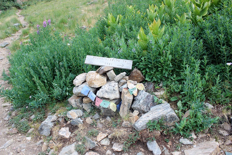
I’m a sucker for signs. This trailhead had tons! It also had a memorial to a helicopter crash that occurred on Mt Massive and those who died. There were quite a few liquor bottles surrounding the memorial, as well as cigarette lighters, coins, and shot glasses.
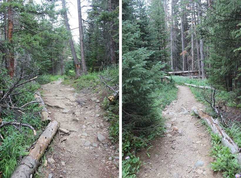
Wow! After last weekend’s Chicago Basin trip, my backpack felt light! This was great! I was practically running up the trail. I hiked almost the entire trail in the dark, so here are some pictures from the way back. The trail started out through the forest. I was surprised at how much I could smell smoke from the surrounding fires. I’ve been hiking a bunch of 14ers the past few months, and this was the strongest smell of smoke I’d encountered yet.
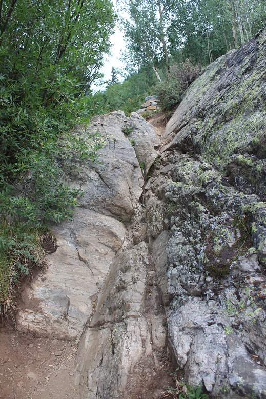
There’s a wall you need to climb towards the beginning of the trail that requires you use your hands to balance yourself. This is much easier than it looks, and if you can do this, you can absolutely hike the rest of the trail. This hike is considered a class 2, but I think it’s only because of this one move. IMO, if Pikes Peak is a class 1 this should be as well. This trail is well maintained all the way to the summit. I came across this move in the dark and was sure I wasn’t supposed to go this way, but yes, this is the correct way to go, up the rock.
The trail passes through a meadow
Turn right at this junction
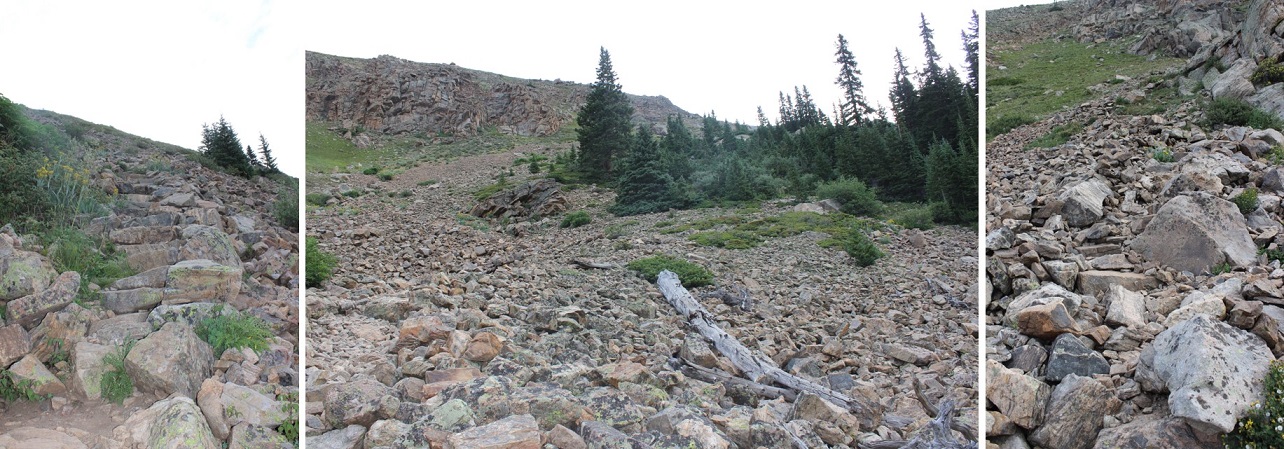
And then start climbing up some well made talus-stairs (thank you CFI!)
Your goal is to climb up this
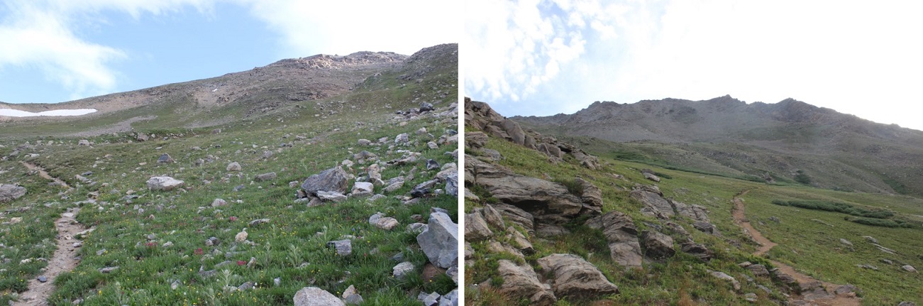
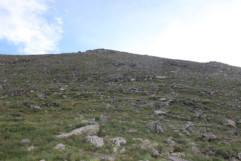
It was a nice, steady climb on a well maintained trail with a lot of switchbacks. I never needed to stop to catch my breath or take a break. At the top of this hill you reach a rocky ridge and a couple of false summits. This is where the trek gets fun! There isn’t really any route finding or climbing to be done, but the stairs/steps up make for a nice change of pace.
This is the worst of the “climbing”, and you can skirt around it to the right and avoid it altogether on a trail.
Here’s a look back at the ridge
There are several false summits, but here’s the true summit. You know the true summit is coming up when you see the wind shelter: the true summit will be the highest point north of the wind shelter (about 15 yards away).
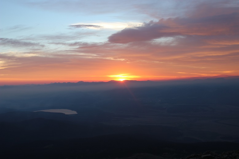
I summited at 5:30am, just in time to watch the sunrise!
Summit Selfie
I’d summited in plenty of time and intended to use my extra time to head over to Massive Green and then to North Massive and maybe some of the other sub-summits of Massive. The route goes through a rocky area, but doesn’t get much lower than 13,900’. Here’s the route:
It wasn’t that cold, and the temperature on the summit was supposed to be 40-60* with 5-10mph winds. This sounded perfect for today! I decided to go light with layers and just bring my moisture wicking zip-up and a hat. This had worked perfectly so far. I got excited when the sun rose because that meant the temperature could only get warmer from here, right? Well, it didn’t . The sun stayed behind the haze and never warmed up the air, and as soon as I summited the wind began picking up and it started getting cold. This is something really hard to explain unless you’ve got it, but let me just say Raynaud’s stinks. With each step I took the temperature seemed to drop as I headed toward North Massive. It wasn’t so much the temperature, but the wind. It was icy and probably hovering at a steady 25mph, which isn’t that bad, but I wasn’t prepared for this. I didn’t have the proper jacket and my gloves weren’t winter gloves. I have Raynaud’s, so it’s important I prevent getting cold because once I do I cannot warm up (it’s a circulation thing). I’m sure most people would have been ok, but as I reached Massive Green I had lost feeling in my fingers. I pulled off one glove and my fingers were white down to the second knuckle. Great. I’d hoped the wind would die down, but it didn’t look like it was going to happen, so I made the executive decision to turn back and head towards Massive before losing my fingers to frostbite. It hurt to turn back. I was seriously mad at myself! I wasn’t tired at all, and I wasn’t even that cold, yet my fingers were in the early stages of frostbite (it happens much faster for people with Raynaud’s) so I had to go back. I couldn’t move them and the only way to get blood back into them to start circulation again was to go where the wind wasn’t. I didn’t regain feeling until just before treeline. Lesson learned: pack extra jacket/gloves no matter what.
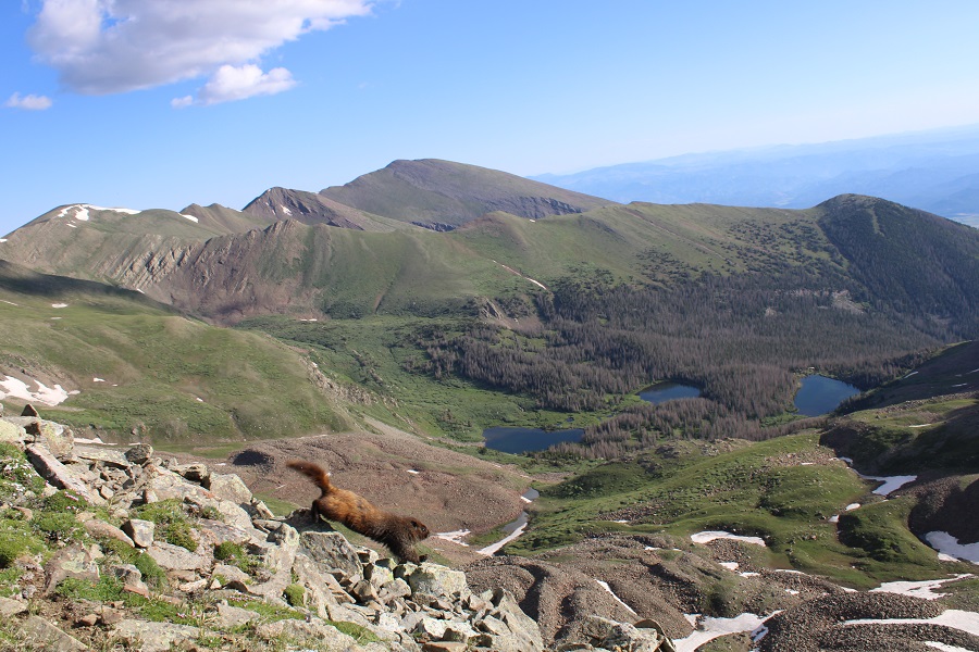
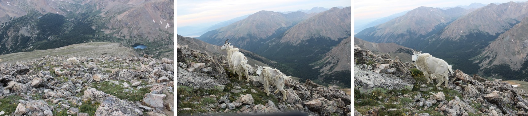
I re-summited Massive and headed down the ridge, this time seeing two goats on my way. I love seeing Mountain Goats!
About halfway down the slope I saw something I’ve never seen before: a white marmot! Well, it was more of a very light tan color, but still pretty cool. I didn’t know marmots came in this color? I saw a bunch of brown marmots as well.
Across the trail from me there was evidence of avalanche
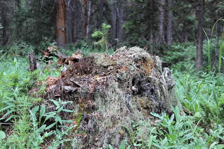
Back into the forest I came across more proof nature is amazing
I made it back to my truck at 8:30am, making this an 11.5 mile hike completed in just over 5 hours. That gave me plenty of time to drive to Woodland Park, set up my computer at a local Starbucks to write my trip report, and pick up my daughter at 2pm. I’d definitely do this one again, not only to get in those other sub summits but because it was a nice and peaceful way to spend the morning. It didn’t really feel like a 14er. I could just hike and think and not think too much about the hike…
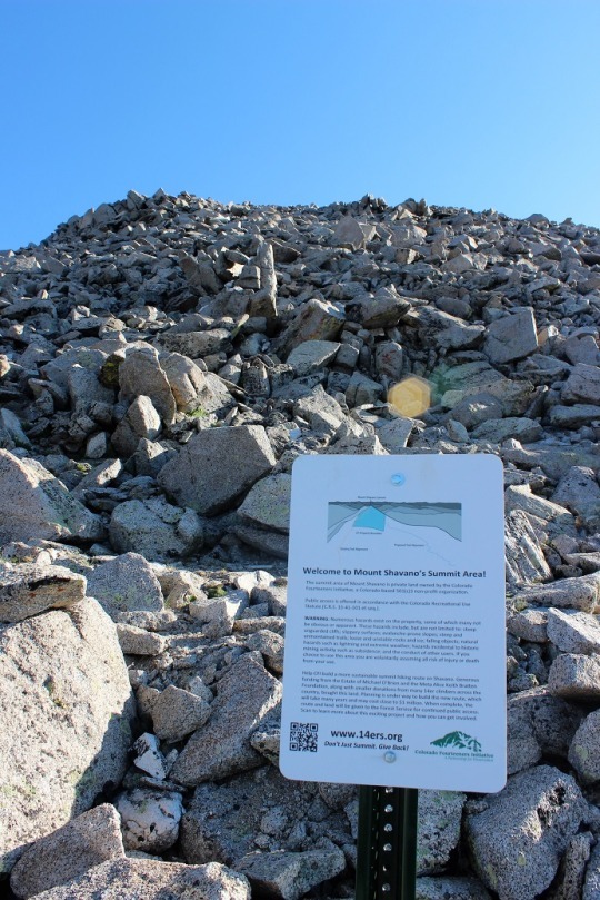
Today I hiked Mt. Shavano and Tabeguache Peak,
otherwise known as Shav and Tab to most because no one know how to pronounce
Tabeguache (TAB-uh-wash). Up until late last night I wasn’t sure which
peak(s) I was going to hike today. I’d
planned on three possible hikes for today before I left for Europe, and it
would just depend on the weather when I got back. I really wanted to hike Redcloud, Sunshine,
and Handies because I had 2 days in a row available and I’m 75% sure it would
require an overnight, but when I looked at the weather for the area it showed
thunderstorms all day for the next two days.
Drat.
So I looked up the two
other hikes I had ready, Shav and Tab, and Grays and Torreys. They both had similar weather (rain and
thunderstorms at either 10am or 11am both days), so I decided to make a
spreadsheet. In the end I went with Shav
and Tab because it’s further away (by half an hour), a longer hike (10.5 miles),
and had more elevation gain (5400+ feet). I figured if it was going to rain in
the afternoon both days at both places I’d get the harder one over first when
the rain was scheduled for an hour later and have more time to deal with
weather if it became an issue on the shorter hike.
For this one I was up
at 2am and on the road by 2:30am. I had to do a little work (like, for my job)
before leaving so it took longer than anticipated. I was able to find the trailhead without too
much difficulty and began at 5:30am, at the last-minute stuffing a winter coat
in my backpack just in case. It adds about 3lbs to my pack (which honestly only
has water, some snacks and first aid supplies), but I’ve never regretted having
it on a hike.
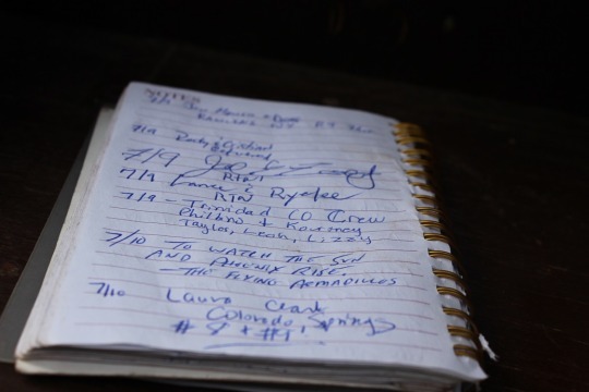
I hiked for a bit and
found the register. I signed the date,
my name, Colorado Springs, and continued on.
The sun was just
beginning to light up the sky, waking up the crows, flies, and cows. I heard them all for the first two miles or
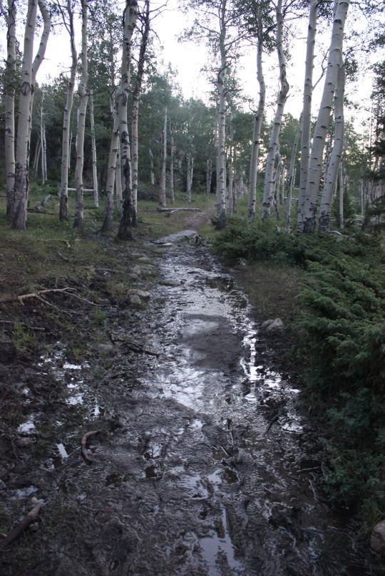
so as I walked through a muddy trail.
Then the red glow of
the sunrise. I always LOVE this time of
the morning on a hike. It only lasts
about 5 minutes, but everything is bathed in a reddish orange glow. It’s beautiful.
The sunrise woke up a
woodpecker (I’ll upload the video on Wednesday, sorry!)
I walked over several
small streams those first few miles, then didn’t see any water for the rest of
the hike.
Early on in the hike I
passed a group of three male hikers. They
were glad to let me pass, as they couldn’t keep up. They were taking their time and didn’t know
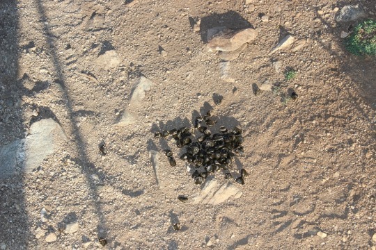
if they were going to summit both peaks today or not. Around mile 2 I started seeing scat. Lots of it and it looked fresh. Then out of the corner of my right eye I saw
something move quickly and bound up the hill.
I only say the legs, but I’m thinking it was either a deer or a bighorn
sheep. I’m thinking sheep because of the
scat. It even smelled like they were in the
area.
I rounded a corner and saw the Angel of Shavano, or
where she should be. I’ve known of Mt.
Shavano for years, ever since we’ve started skiing at Monarch. She’s the famous symbol of the area. The Twisted Cork (where we like to go out to
eat when we ski) owns the Mt Shavano winery and the Angel of Shavano is on all
their bottles. It’s a pattern in the
mountain when there’s snow that looks like an angel. Kind of like a Native American Angel (hard to
describe, but that’s what she looks like).
The middle of this picture is where she’d be… only half of her is still
here due to snow melt.
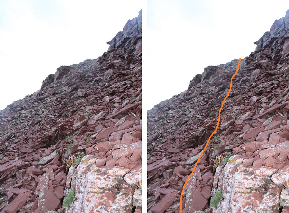
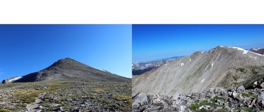
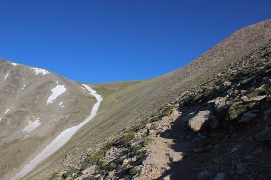
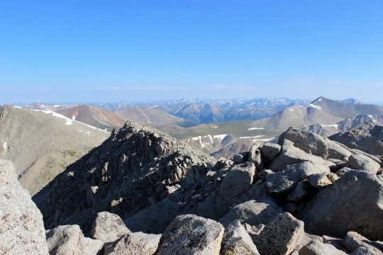
This hike goes up, up, up, up, with just about no
leveling out. I made it to the top of
the saddle, looked right, and could see Mt. Shavano, but I didn’t know it was
Mt. Shavano at the time. To be honest most
hikers, no matter how much research they do, aren’t sure which one is the
actual peak until they’re hiking it.
Most hikers today thought it was a peak to the left. Nope, this is it. As you can see, I cross the saddle, then make
my left before swinging over to the right to cross between the two humps, and
then around again to the left to summit.
I came across this sign about half way up that
mountain.
There was no clear trail, but a bunch of little trails
to try and follow. Probably because this
is a popular snow route and it’s sometimes easier to just make it up as you go. In any event, I summited, and was super
proud! Oh, and it wasn’t windy and I
didn’t need my extra jacket! Bonus
points for this peak!
Now to find Tabeguache. I got out my map and figured out which peak
it was, and my stomach dropped. I was going
to have to cross this ridge (there was no trail, I just had to cross it).
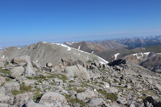
Here’s a better picture. I had to cross the ridge to the bottom right,
then go down and left towards a saddle, and follow the snow line to the left to
the peak. I took a deep breath and was
on: I’ve got this!
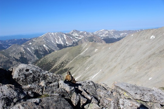
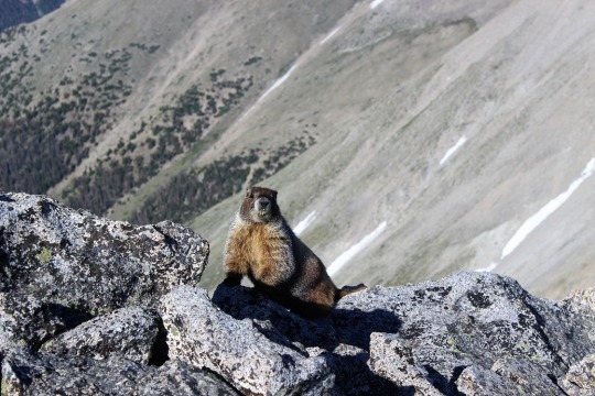
I met a rather photogenic marmot just as I started
descending Mt Shavano towards the ridge.
As I was hiking I was continually disturbed there was
no actual trail to follow. My mind got
to wandering and I got to thinking about how dangerous it was not to have a
trail to follow. I knew this was senseless
because of the activity I was partaking in, but I felt it anyway. For some reason, I felt entitled to a
trail. Well, there wasn’t one, so I
aimed towards where I needed to go and just worked my way towards it.
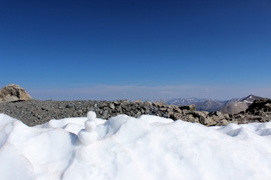
As I was crossing the last patch of snow I spied a snowman. So cute!
There was one other hiker ahead of me (I’d noticed him off in the distance
as I summited Shavano), and I’d seen him stop here, but I thought he was just
resting. This was much better!
There was just a little more ways to go. I skirted the snow to the left
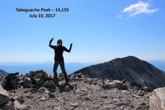
And all the sudden, I was there! I’d summited!
I was super proud of myself for this one! I’d hiked for over a mile down one mountain
and up another, over piles and piles of rocks, without a trail, and still
managed to get where I needed to go. It
was now 9:30am and there was one tiny cloud in the sky.
I turned around and saw what I’d hiked thru without a
trail (that’s Mt. Shavano as seen from Tabeguache). I’d hiked just over 5 miles
in 4 hours. That’s a very, very slow
hiking time for me, but I had hiked over 5400 feet in elevation, so hiking 1100
feet in elevation an hour isn’t so bad, right?
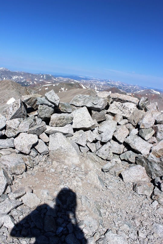
I took a summit-shadow-selfie and was back on my way. I don’t like to spend too much time at the
summit.
At the saddle I had a great view of Mt. Antero. I’ll probably do that one soon…
This hike is an out and back hike. So I hiked up Mt.
Shavano, then to Tabeguache, then down Tabeguache, back up Mt. Shavano, and
down Mt. Shavano to the trailhead.
Basically I summit Mt. Shavano twice, which seems awfully unfair since
it only counts as two summits.
As I was hiking back up Mt. Shavano I got to thinking
about what I’d just accomplished. Sometimes
there isn’t a trail, and that’s ok.
Maybe you need to make your own trail.
Set a goal, keep your eye on that goal, head in that direction and keep
putting one foot in front of the other. Eventually you’ll make it. It may not be how everyone else made it, but
you can make it just the same. There’s a
moral in there somewhere…
I summited Mt. Shavano a second time and saw the group
of three hikers I’d seen earlier. They
were impressed I’d already hiked out to Tabeguache and back. I was about 2 hours ahead of them hiking
time. We discussed whether or not they
could make it to Tabeguache. They weren’t
planning on hiking it because they didn’t have a ‘summit sign’. I thought this was a lame excuse, but did comment
on the clouds building quickly. When I’d
looked at the weather last night it had said thunderstorms were highly likely
after 11am, and it was now 10:15am. While
it had been clear at 9:30am clouds were quickly forming. I wished them luck and told them to watch the
weather.
Unfortunately, people just don’t realize how quickly
weather moves in on a 14er. The weather
can turn in 15 minutes and put you in a dangerous position. I saw about 15 hikers as I was making my way
down to the ridge. For some reason, I
feel a personal responsibility when I’m hiking to everyone else hiking the same
trail, since I’m usually the one with the most experience. I talk to them all,
ask how they’re doing, if they’ve ever done a 14er before (or this one), where
they’re headed, etc. It takes time out
of my hike but I feel responsible to advise in some way because I have more
experience.
I told each and every hiker on my way down to watch
the weather. I got a lot of responses,
none of which sounded concerned. Most
said things like “it’s not forming too fast” or “it doesn’t look that bad” or “we
aren’t supposed to get rain today, are we?”.
But I had more information than them.
I knew it was supposed to thunderstorm today. I advised them to watch the weather and if
they couldn’t hike it in an hour to turn back.
None of them did, and I also knew none of them could make it the rest of
the way in an hour. Hmmmm.
I crossed the saddle and came upon an alpine
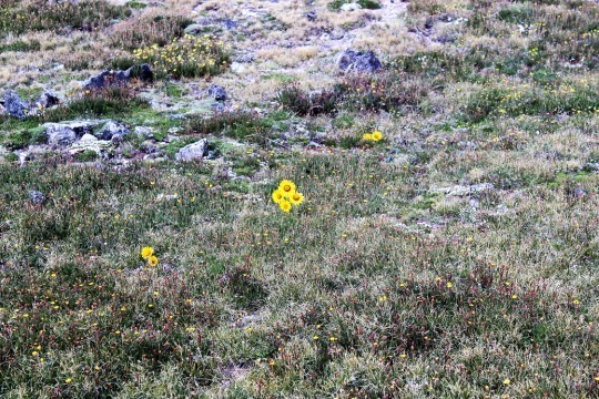
meadow. I love how these flowers seem to
be saying “hi”.
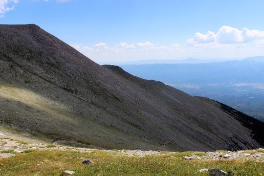
Then I turned and saw the trail back. Ugh!
This wasn’t going to be fun. The
entire trail was up, up, up (much more than is visible in this photo). While it was challenging to hike up it was
extremely difficult to hike down. I
couldn’t hike fast. There were just too
many rocks in the way and it wasn’t safe to hike down any faster than I’d hiked
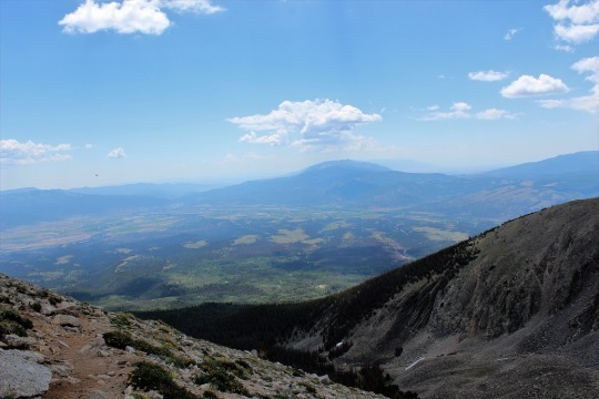
up. Oh, and notice the shadow in the
picture? Clouds are beginning to
seriously form above me. I needed to
make it to the treeline as fast as possible.
At least the view was great!
So, I hiked and hiked and hiked and hiked down, down,
down. It was slow going and I really had
to pee, but, you know, I’m above treeline so that’s not really a good
idea. Just as a side note, NEVER pee
directly on a trail. Besides the obvious
‘ew’ factor and LNT and all that, no matter how sure you are you’re alone, you’re
not. Someone WILL come into view as soon
as you drop your pants. This is a fact.
Anyway… about a
mile after I made it past treeline I started feeling drops of rain. Small, icy, cold drops of rain. They started out slow, and then I heard
thunder and it started pouring. Within
30 seconds there was thunder and lightning everywhere and it started to
hail. I quickly pulled out my winter
jacket (Woot! See? I’m always glad to have it) and put my camera
into my backpack to keep from getting wet (so no pictures, sorry). At one point, it was hailing so hard I wasn’t
sure if I was still on the right trail, but I was below treeline and I needed
to keep getting lower, so I continued.
The entire time I kept thinking about everyone behind
me on the trail who hadn’t turned around when I’d warned them of weather. I was absolutely positive they were ALL still
above treeline at this point, right in the middle of that thunder and lightning
and hail. I sent encouraging vibes their
way and continued onward.
Eventually the rain stopped and all that was left was
water slowly dripping down from the trees.
I was roasting in my coat (but dry!) and started looking for a time to
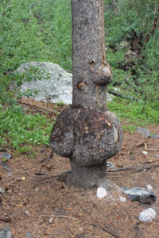
take it off. I came upon this tree,
figured it was something I needed a picture of, stopped and made the switch
(and took the picture).
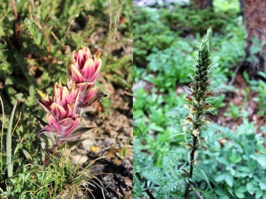
I saw several pretty flowers on the trials today. Here are just a couple…
The last 2 miles seemed to take forever. I mean, forever. And they kind of did. It took me 4 hours to summit and 3.5 hours to
make my way back to the trailhead when I would have expected it to take about 2
hours to get back down. I found the
register, added #8 and #9 to my name (it seemed bad luck to do so before
actually summiting them) and sloshed my way back to my truck.
I got a lot of good thinking done on the mountain
today. Oh, and I’ve now decided to write
a book.