
While there are a few twists and turns through the back
roads of Chipita Park to get there, this hike has a very obvious trailhead but
very little parking. I had to drive a
quarter mile down the road to find a driveway to turn around at so I could park
my truck alongside the dirt road.


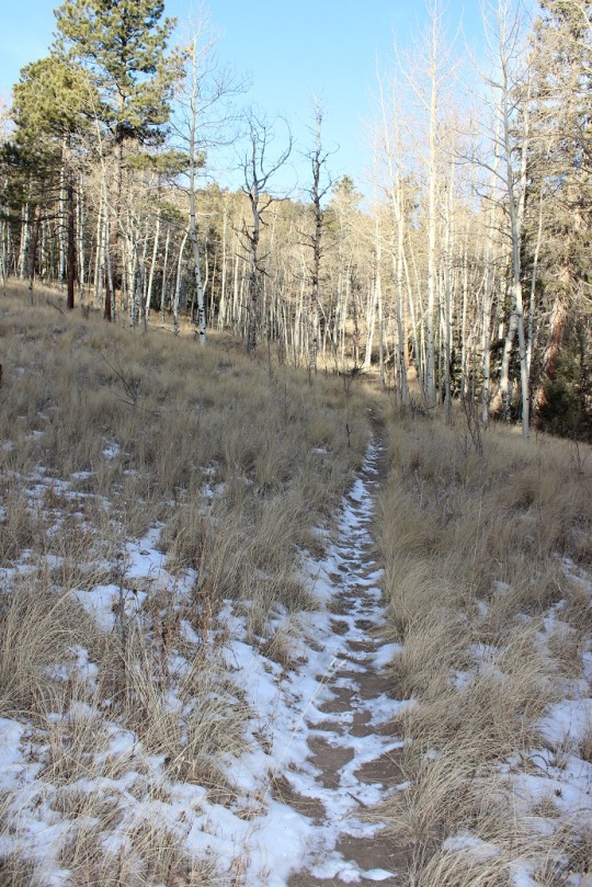
The first 1.3 miles of the trail begins with some steady
elevation gain and a lot of switchbacks.


I noticed as I was hiking there had been a lot of tree clearing/cutting/trimming
lately. I saw dozens, if not a hundred
of these piles lining the trial.

Once you arrive at the top of the switchbacks you come to a
nice meadow and a trail junction. Stay
right at the junction. I state this
because many people have told me they mistakenly went left, which takes you on
a long loop to nowhere. (OK, it goes somewhere,
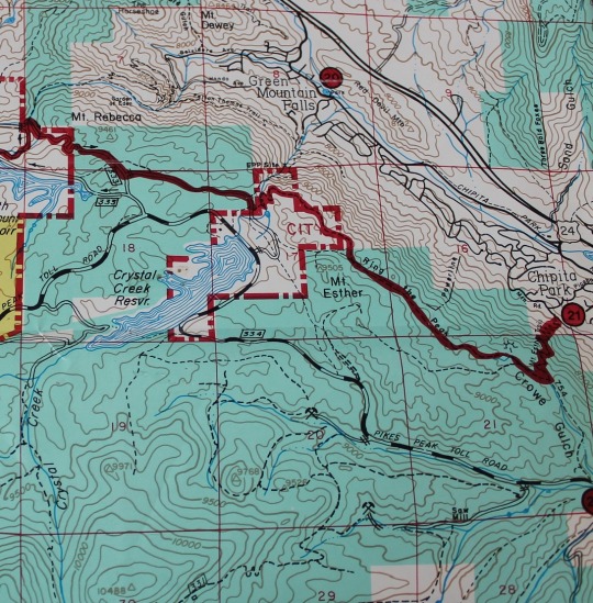
but not directly: you’ll need a topo map
as there are several possible trails you can take, leading in many different
directions: just go right).

After crossing the meadow and a very small trickle of a
stream you enter an aspen grove
and then start following a forest road. While I was hiking here I heard the loud
rustle of feathers ahead of me, looked up, and saw 2 ptarmigans jump/glide from
the forest floor to the top of a pine tree.
I was able to get a picture (and video) of them, but didn’t want to
disturb them so I didn’t stay long/didn’t get great photos.

The forest road starts to follow power lines from this point
on.

This forest road will take you all the way to the Crystal
Creek Reservoir, but what fun is that? I
looked at my topo map, and figured the power lines were a straight shot to
where I wanted to go, while the road twisted and turned but eventually ended up
in the same place. It’s part of the Ring
the Peak trail system, which they made wide enough here to accommodate 4
wheelers. I’d rather hike. So I turned left and followed the faint trail
under the power lines (hey, there was little chance I could get lost this way,
right?)

Once I reached a saddle I could see the Crystal Creek
Reservoir, so I knew Mt. Esther must be to my left.

Quite a bit of tree maintenance had been done here as
well.

My directions told me to look for a cairn indicating a faint
trail, but there was no cairn, and no trail.
So I turned south and just headed towards the summit. This is what it looked like:

I headed south and up the mountain for about a third of a
mile before reaching a boulder filled summit with great views of the reservoir!

I had fun bouldering a bit (and jumping from rock to rock where
feasible). I took a few summit selfies
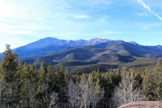
to prove I’d made it, one with a view of Pikes Peak and another of the Crystal
Reservoir (which I’ve taken a paddle boat out in with the kids! Fun!)


Pikes Peak looked beautiful today, as it does just about
every day
This was a fun, quick hike (7 miles in 3 hours including
stops to watch the Ptarmigan and boulder for a bit). I’ve heard it described as ‘difficult’, but I
think that’s exaggerating a bit. Yes,
the initial mile of switchbacks probably would turn many away, as well as the route-finding
at the end if you intend to summit Mt. Esther, but the hike itself is quite
pleasant and easy to follow!
7 miles
1500’ Elevation gain
I followed the red Ring the Peak route, and then kind of made my own trail. This topo shows where the trail should be. I followed this, even though there was no actual trail off the Ring the Peak trail.
Summit View (It was WINDY)
Ptarmigan
