Wheeler Mountain – 13,698

1

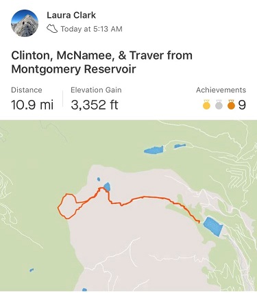
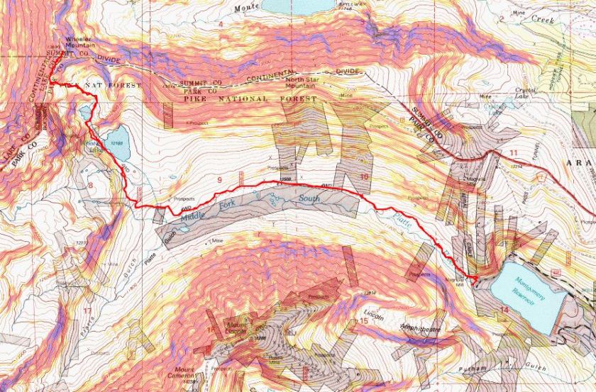
RT Length: 9.5 miles

Elevation Gain: 2810’

My alarm clock rang and I hit snooze. Today’s worry:  starting too early.  I wanted to be home from the hike around 1pm because that’s when my daughter would be home, but I didn’t feel the need to start too early when this was a short hike with minimal elevation gain.  I didn’t think it would take me more than 5 hours.

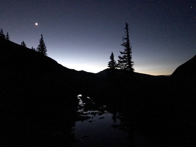
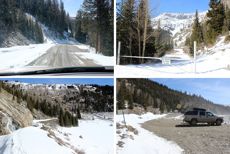
After trying to fall back to sleep for 20 minutes I gave up and drove to the Montgomery Reservoir trailhead, arriving at 4am and taking my time getting ready. It was much colder than I’d anticipated and I put on my winter gloves from the beginning.  The drive in was uneventful and I was the only one in the parking area when I arrived.

2

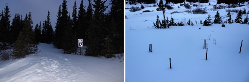
I was on the trail at 4:30am. It starts at the east end of the parking area (you pass it when you drive in).

3

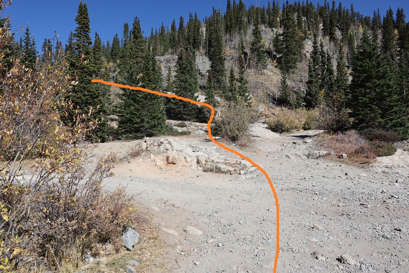
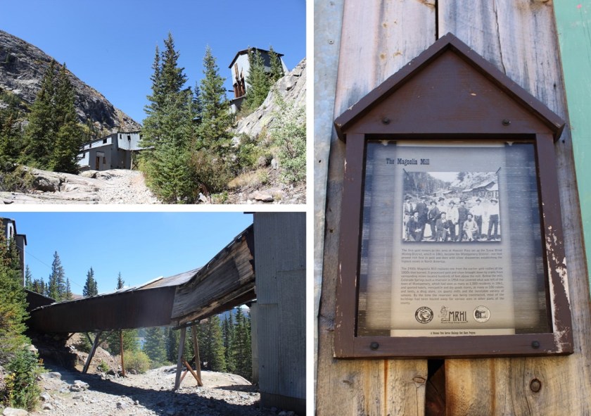
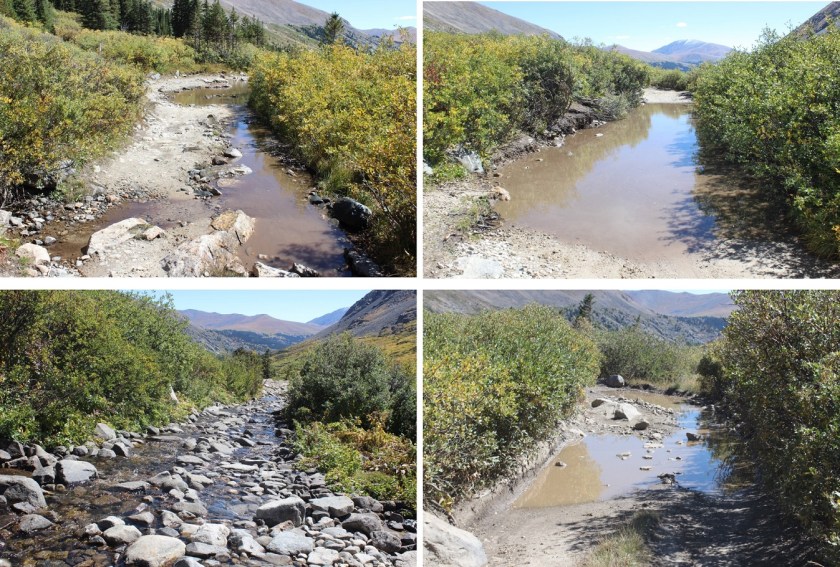
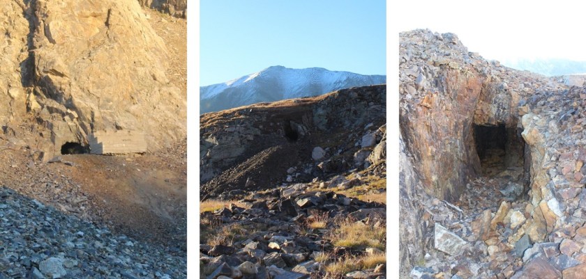
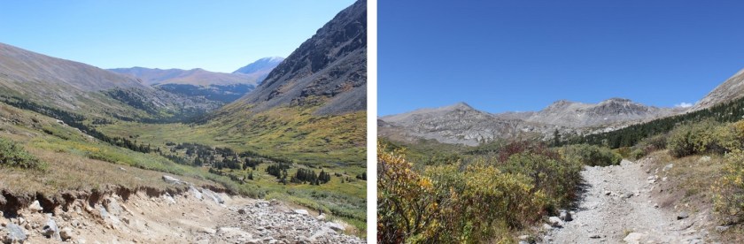
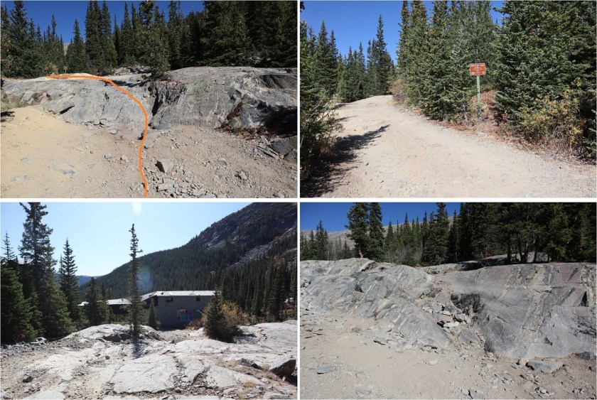
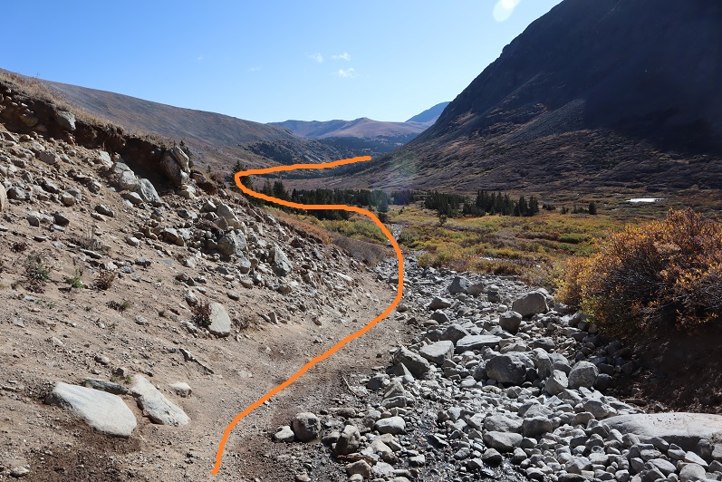
The trail passes the Magnolia Mine and follows an extreme 4WD road for 3.3 miles to Wheeler Lake. If your vehicle can make it to the top of Lake Como you have a chance in being able to navigate this road, but you should probably just hike the 3 miles.  This is my third time on this trail, and I can tell you it’s much easier to follow without snow.

4

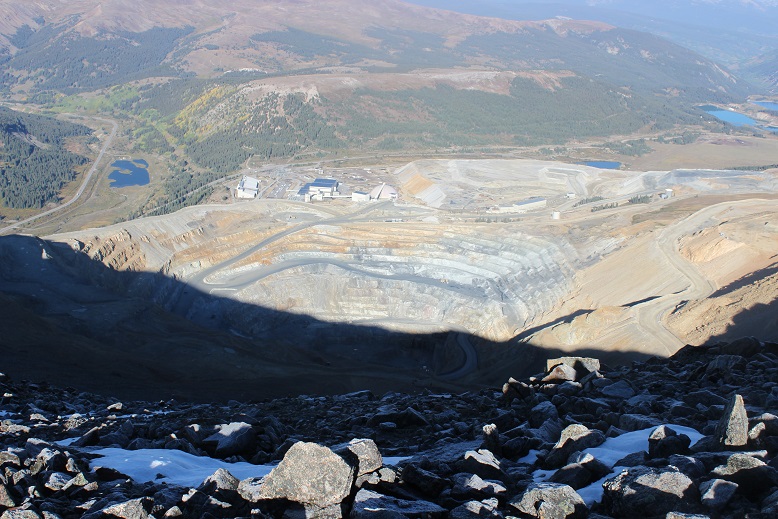
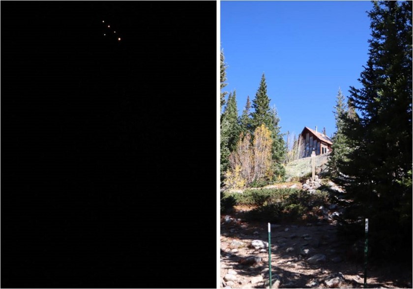
In the dark I saw a bunch of flickering lights and wondered what they were? They looked like gas-powered lights, fire and all, and I figured they were probably from a mine.  In the daylight on my way out I realized they belong to a house/structure on private property.

5

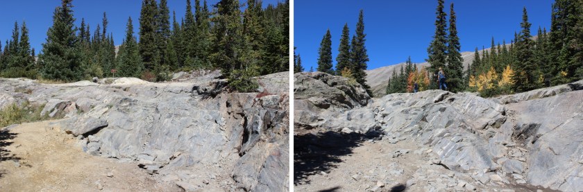
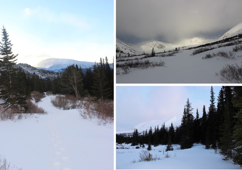
There are some flat areas and very bumpy parts to this road, making a quick pace nearly impossible.

6

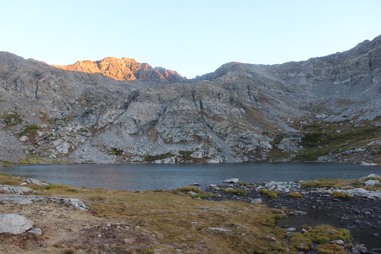
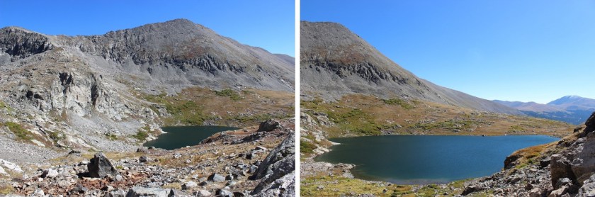
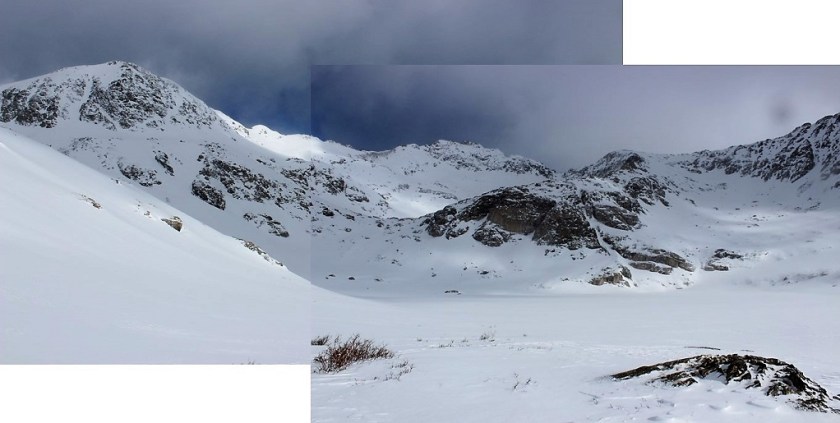
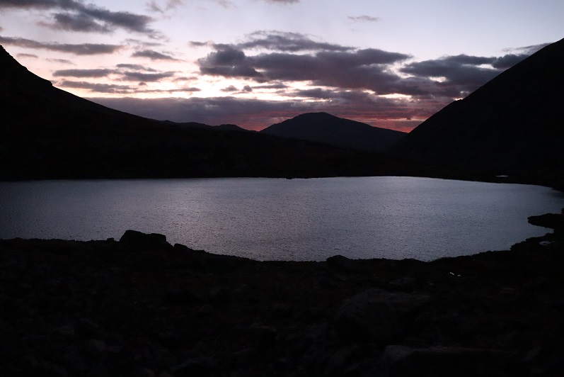
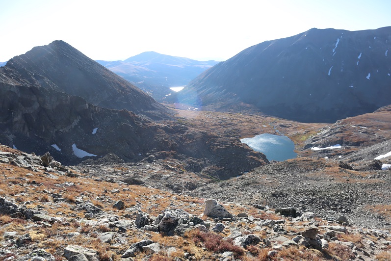
It was windy and cold and I wasn’t ‘feeling it’ today so I trudged along, hiking slower than usual. Windy is normal here (it’s a basin after all) but the cold along with the wind made this easy part of the hike more challenging.  After hiking for 3.3 miles and an hour and 45 minutes I made it to the lake, just as the sun was beginning to rise.  I still needed my flashlight but aimed it away from the lake, as there appeared to be campers there.  I could see a tent and heavy-duty 4WD vehicle parked beside the lake.

7

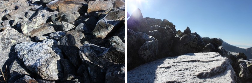
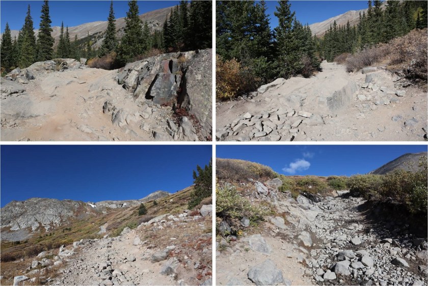
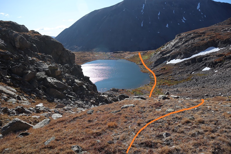
There’s a trail along the left side of the lake that’s used for both the Clinton-McNamee-Traver hike and Wheeler Mountain, so it’s easy to follow. The only downside?  It was iced over and slick. In fact, any part of the road/trail thus far that had held water had been iced over.

8

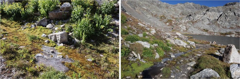
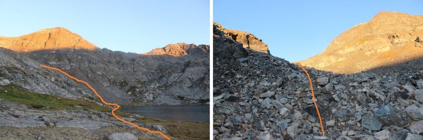
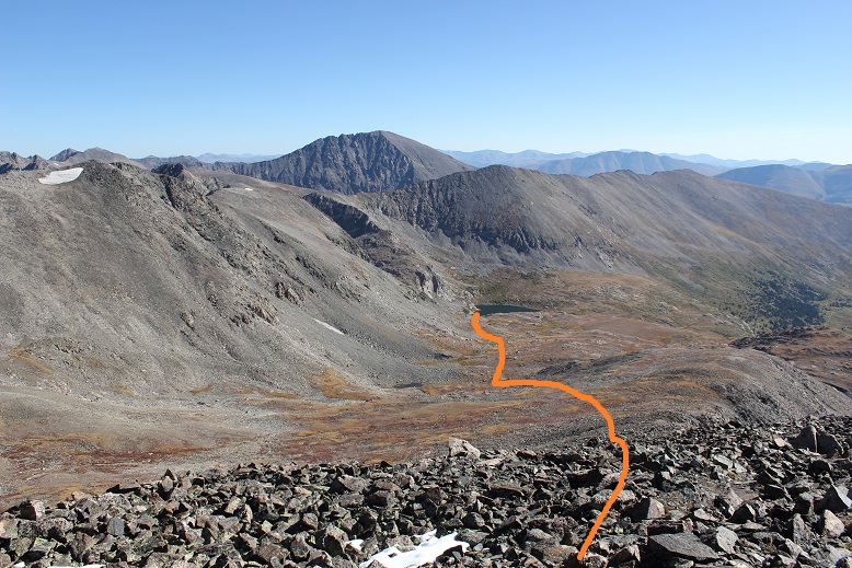
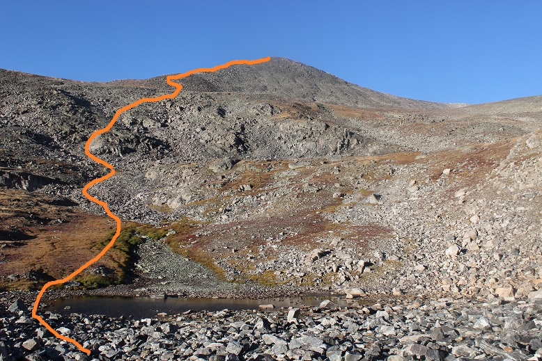
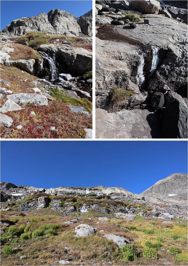
The trail up past Wheeler Lake towards Wheeler Mountain is less traveled and more difficult to find. Here’s the path I took, staying to the left of the waterfall.  It passed around the outskirts of the willows.

9

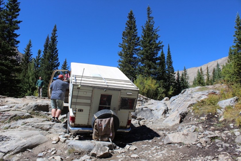
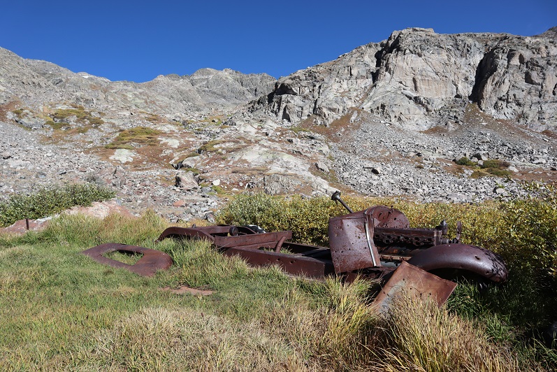
I passed someone’s getaway vehicle along the way

1

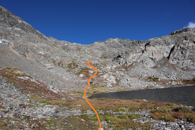
At the top of this gully there’s another small lake. This time I skirted the lake to the right, following well placed cairns.  Oh, and the wind stopped!  This was fantastic!  I was finally starting to warm up a bit.

11

12

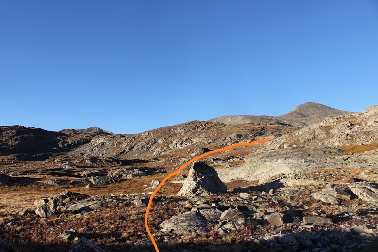
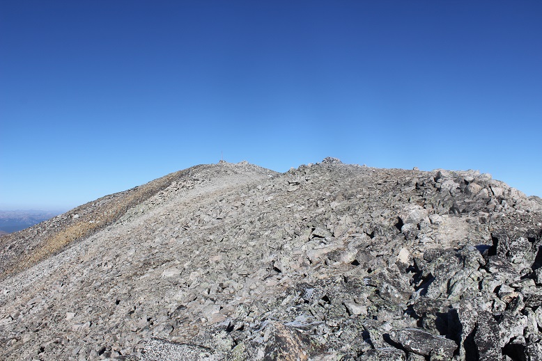
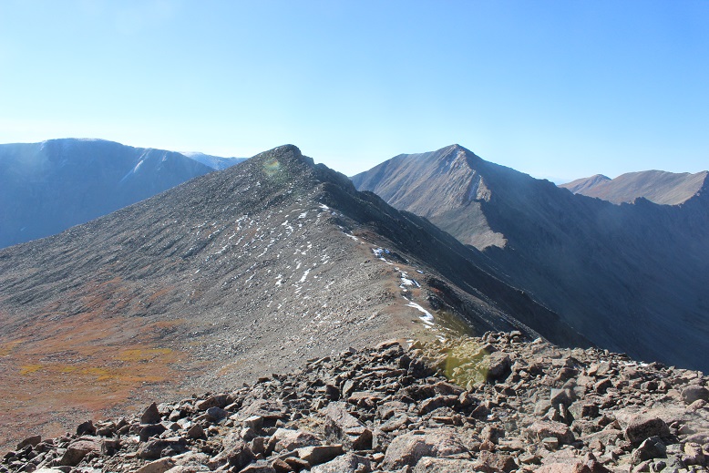
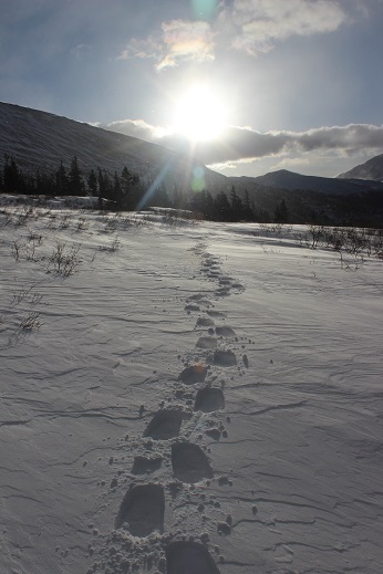
Once above the second lake the trail is faint but the cairns are helpful. The trail turns and heads northwest.  The goal here is to gain the saddle.

13

14

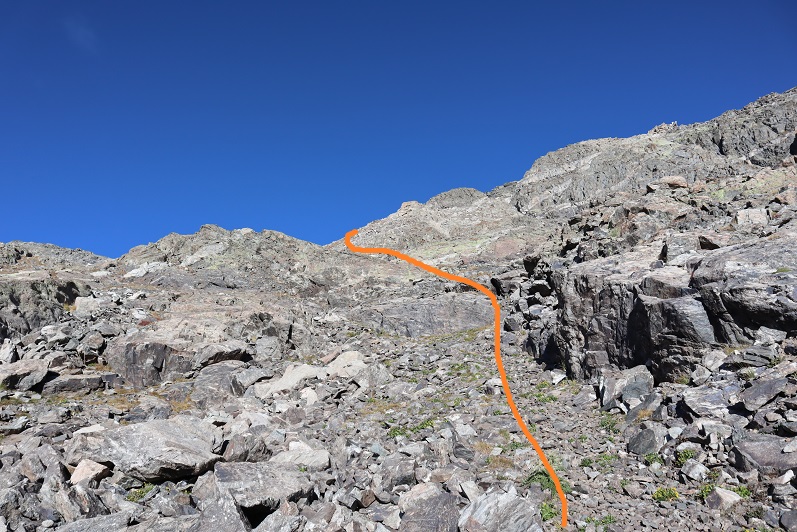
I felt there were just the right amount of cairns here to keep me headed in the right direction, but basically I was just aiming towards the saddle. During the last bit the trail goes left and then angles back right over a grassy area

15

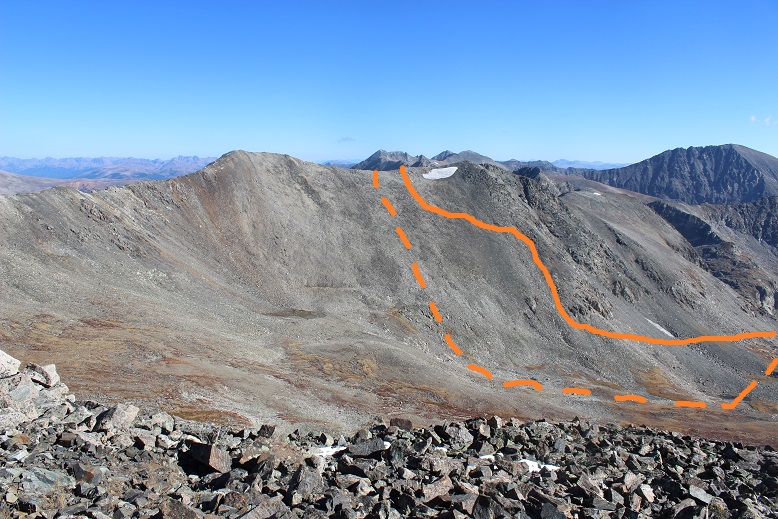
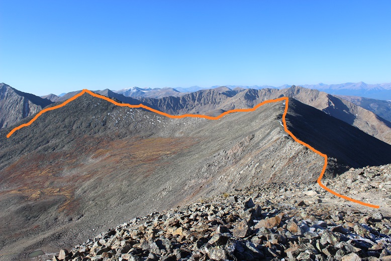
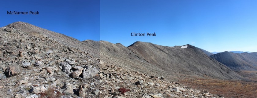
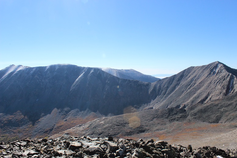
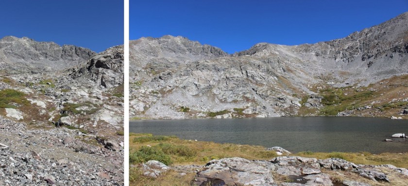
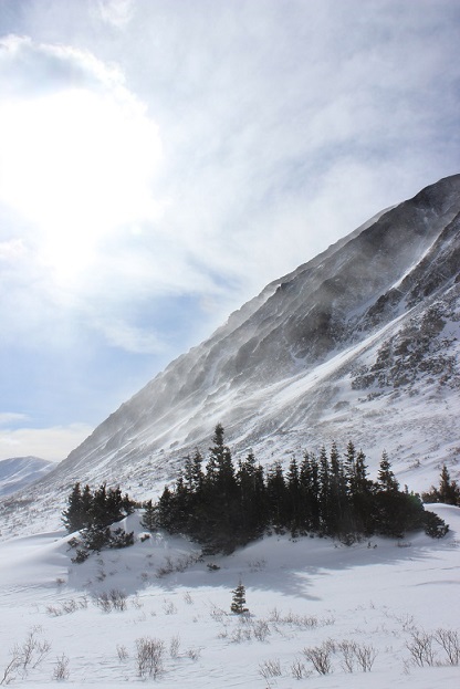
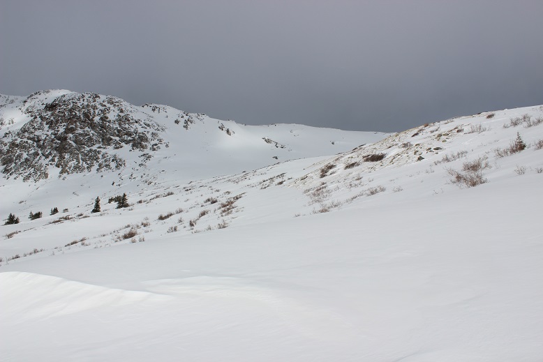
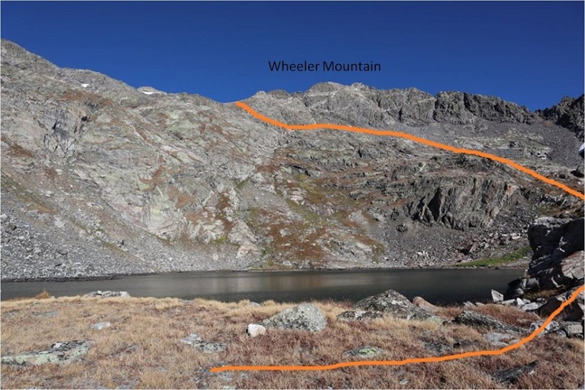
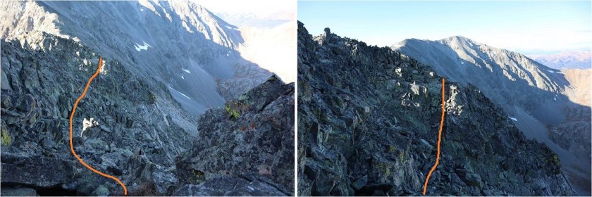
Once I gained the saddle the wind picked up intensely. It wouldn’t have been so bad if it had been a normal wind, but this wind was a steady 40mph and icy.  It was like an arctic blast was blowing directly against me as I hiked.  I turned right at the saddle and headed northeast.  Instead of going up and over the ridge (which doesn’t look possible) I skirted it to the left, following the cairns.

16

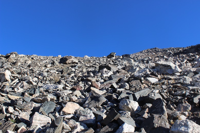
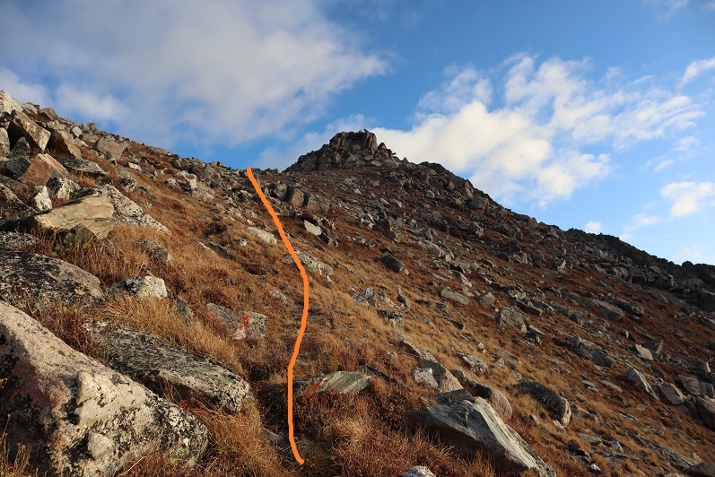
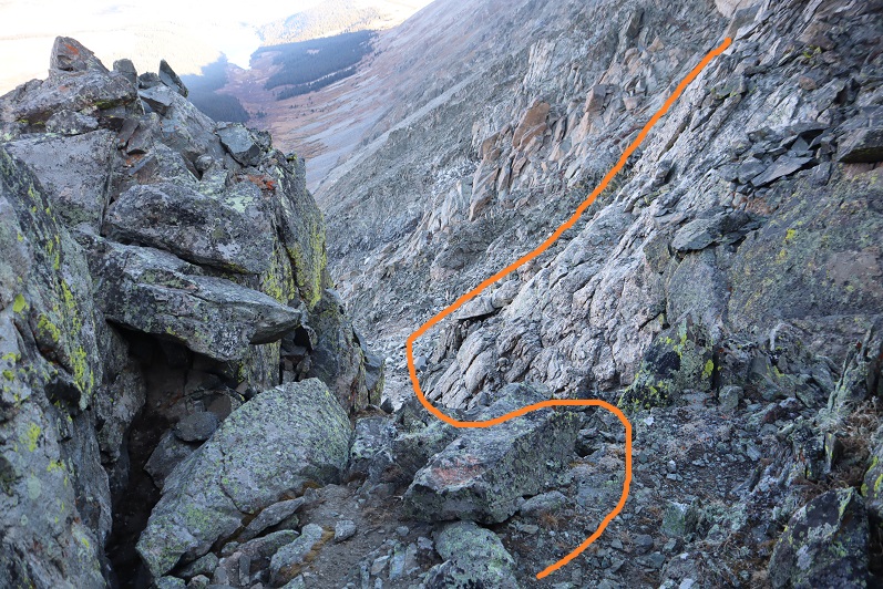
There aren’t very many cairns here, but they are all placed in helpful areas. If you can’t see a cairn, you’re off trail.  This is not something I’d want to attempt in the snow.  I skirted several gullies

17

18

19

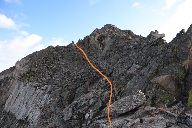
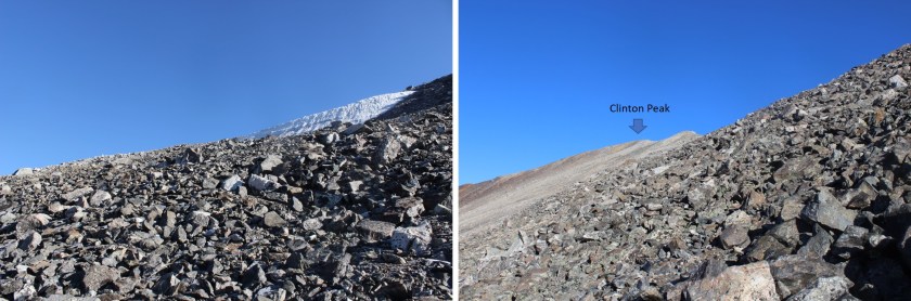
I found myself at the top of a particularly sketchy gully where it looked like I was going to have to lose some elevation and I didn’t think I was headed the right way. Also, I couldn’t see any more cairns.  The wind picked up dramatically and I seriously considered turning back.  My fingers were frozen and finding the “Y” in the ridge that indicated the summit was taking a lot longer than I thought it should.  I looked all around but wasn’t sure where to go?  I started jumping up and down to get warm, and that’s when I saw it:  a cairn just over the next rib.  Woot!  I just hadn’t been tall enough to see it.  So yes, I went down this gully, and then back up and around, aiming for the cairn

20

21

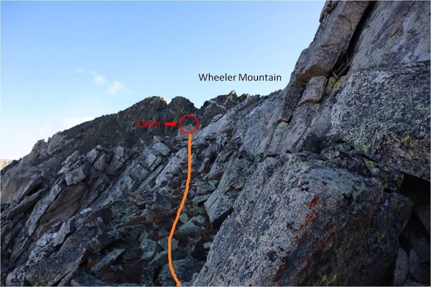
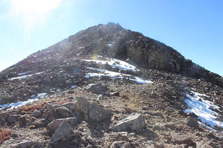
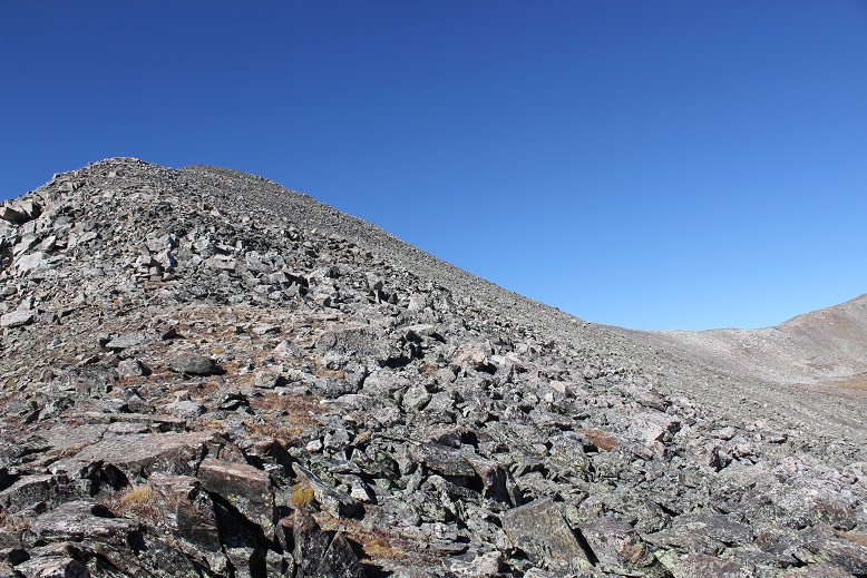
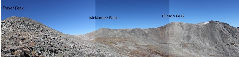
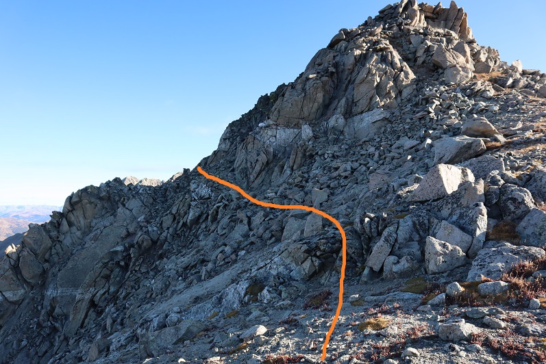
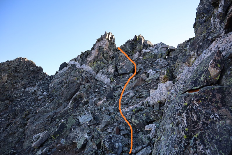
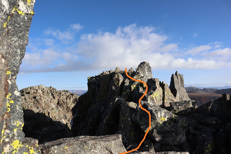
I was so glad I hadn’t decided to give up! The summit was in sight, and there were enough cairns leading the way so I didn’t need to do too much route finding.  Here’s the way I took to the summit

22

There was a rock gully to climb

23

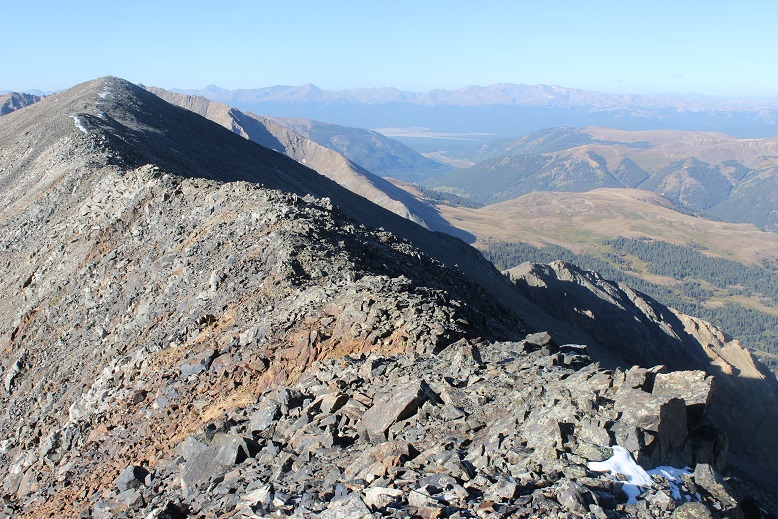
And then I turned left (north) and did some fun rock climbing the last way to the summit. Well, it would have been fun if I hadn’t been frozen and if the wind would have stopped.  This part was exposed and I stayed low on the rocks to avoid the gusts of wind, worried they’d knock me off balance and I’d fall over the edge.

24

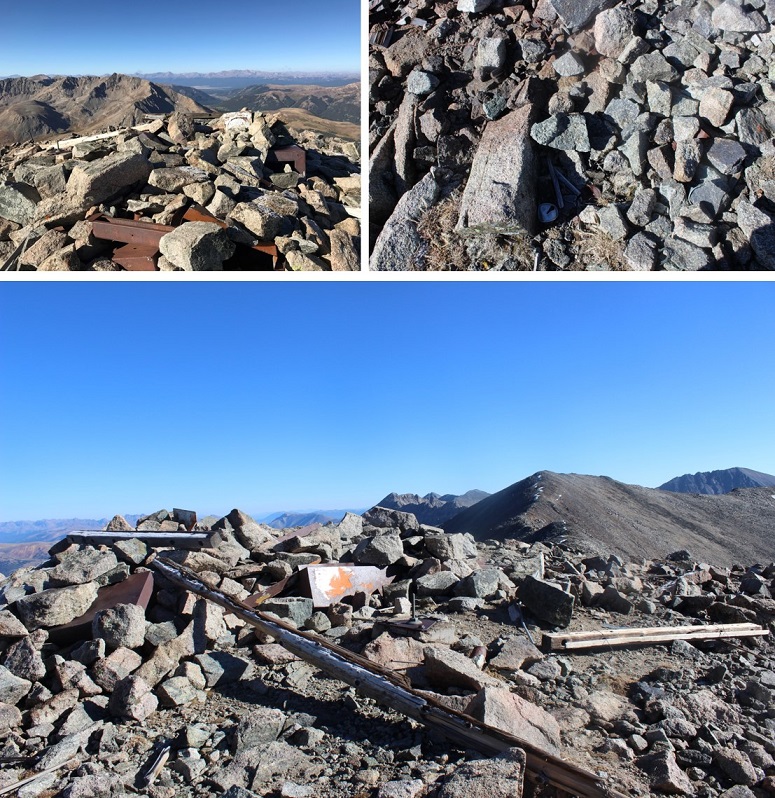
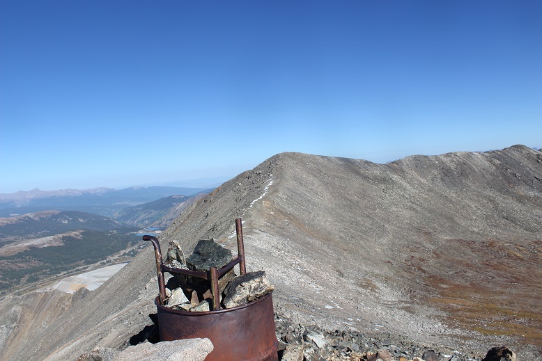
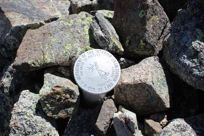
I finally knew I was on the summit when I found the summit register (which I never sign, but it’s nice to know they’re there)

25

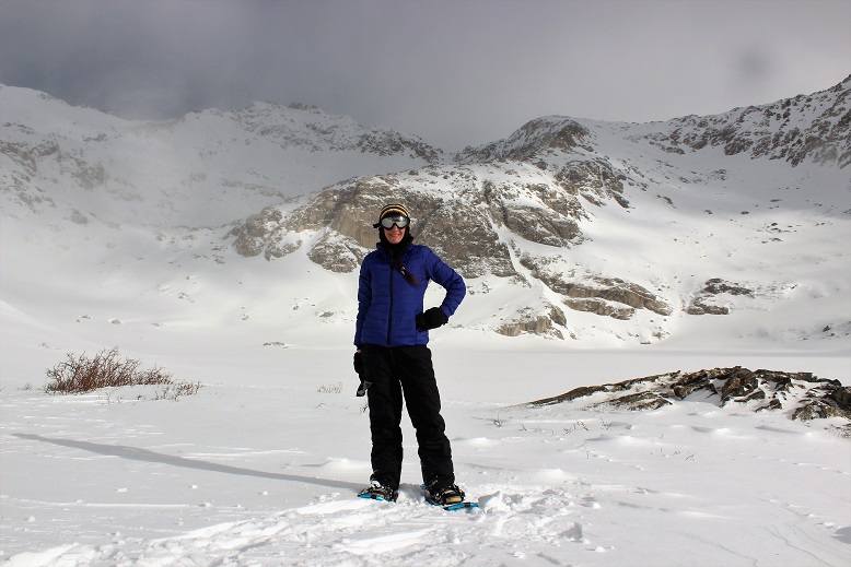
It was far too cold for me to take off my gloves to set my camera up to take a good photo, and there honestly wasn’t much room to set it up, so I just took a selfie. I have no idea what time it was (I couldn’t pull out my cell phone to check) and sorry, but no video either (I take those on my cell phone as well).

26

I didn’t stay on the summit any longer than it took to take a few pictures. I returned the way I came

27

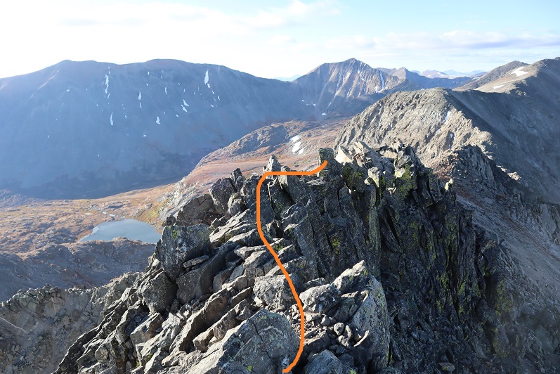
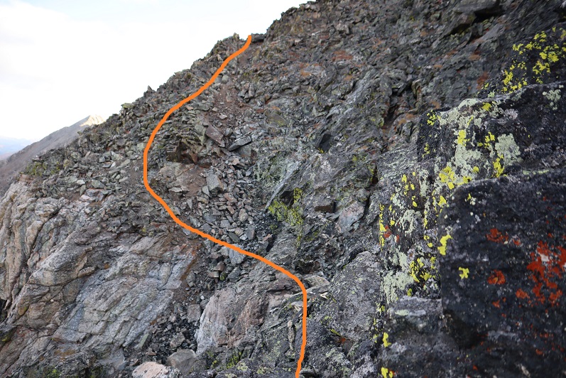
Back down the rocky gully, aiming for the cairn

28

29

Heading back was much quicker because I was sure of the correct way and had no problem locating cairns. I was in a hurry to thaw out.

30

Once back at the saddle I located the cairn that told me where to descend, and turned and headed back down to the lake(s)

31

32

33

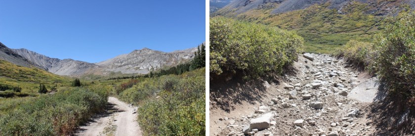
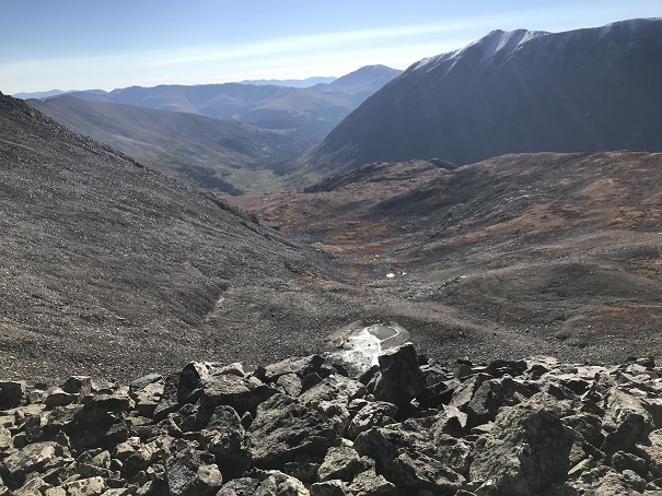
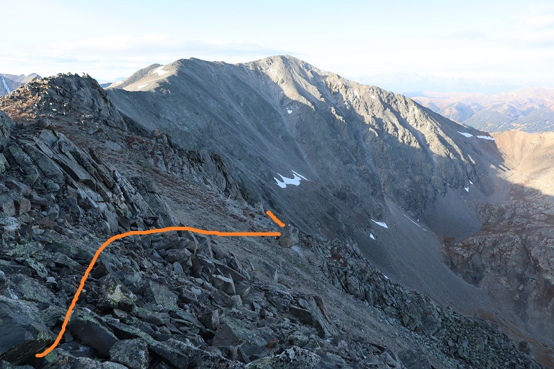
And back down to the 4WD road

34

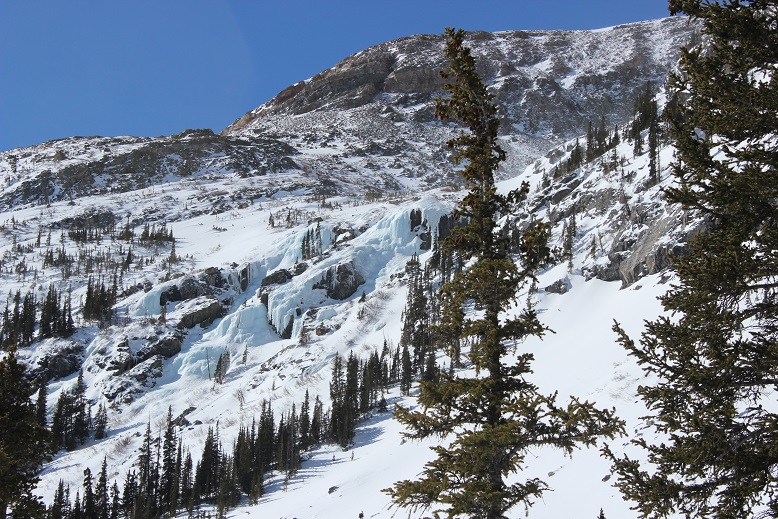
In the daylight I could see all the waterfalls were a bit icy. I completely understood:  It was cold, even without the wind (which hadn’t yet let up).

35

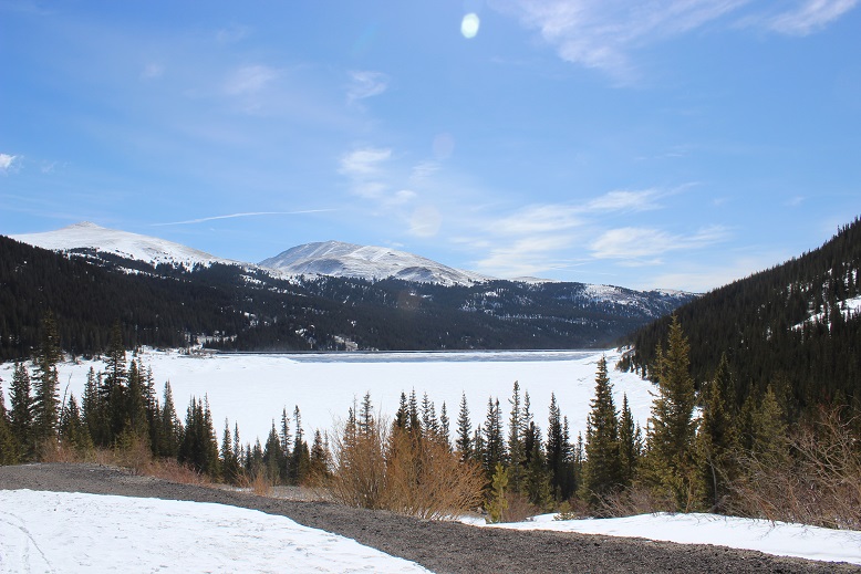
The campers I’d seen at the lake in the morning were gone, and their vehicle had crushed all the ice along the road as it drove out. I saw several modified vehicles on my way back:  probably 10 or more, all part of a caravan. I was hoping to see wildlife, but with all the vehicles I realized that wasn’t likely.  I didn’t see any hikers the entire day.  Here’s looking at the way back to the reservoir.

36

The wind never let up but it did get a bit warmer as the sun rose. I never took off my gloves.  It looks like it’s time to bring out my heavy-duty winter gear!  I started this hike at 4:30am and made it back to my truck at 11am, making this a 9.5 mile hike with 2810’ of elevation gain in 6.5 hours.

37

38

I was a little bummed it had taken me so long because the elevation gain was minimal, but I knew it was due to the cold and that bit of route finding on the ridge.  This peak all in all was much easier than I’d thought it would be, yet took me a bit longer than I’d thought to complete.  Despite the wind and cold, today was a fantastic day!

Clinton Peak 13,866 – McNamee Peak 13784 – Traver Peak 13,856

1

RT Length: 10.9 miles

Elevation Gain: 3352’

I didn’t want to get up when my alarm went off at 2am.  I really didn’t.  I rarely ever want to get up when my alarm rings, but today I was extra tired.  I really wanted that extra sleep.  I reminded myself while it’s typically difficult waking up early for a hike, I always thank myself for it later.  So I dawdled and took extra time getting ready, trying to wake myself up.  It was supposed to snow last night and there was as 40% chance of snow today, so I dressed in triple layers of pants and double jackets (necessary for me, not for most people).  I also had 3 different pairs of gloves.

I drove to the trailhead and actually stopped at a gas station for 20 minutes to sleep for a bit before continuing on:  I was more tired than I thought!  I felt great after that quick cat nap though.

I finally made it to the trailhead at 5am and was ready to go by 5:15am.  Already I could tell this was going to be a much different adventure than when I was here last March and the area was covered in feet of snow (https://wildwandererlmc.wordpress.com/2018/03/31/wheeler-lake-12168/).  I’d had to turn back at the lake on that trip, but I’d learned a lot!  Today the gate was open all the way to the mill, and there wasn’t any snow to be seen anywhere (in the dark that is).  The road in is a 2WD dirt road all the way to the mill

2

There’s plenty of parking all along the way.  I chose to park by the mill (the ‘lot’ there holds about 7 vehicles).

3

Here are some pictures of the Magnolia Mill, which I swear is going to collapse any minute…

4

Don’t go past the mill unless you have a heavily modified 4×4 vehicle.  You will get stuck.  Here are some pictures of the 4×4 road in

5

And one of a truck getting stuck on my way out

6

You can follow the 4×4 road all the way to Wheeler Lake:  it’s about 3 miles.  Wow!  Was this a different experience than the snow-covered road I’d encountered back in March!  Back then I wasn’t even aware there was a road… I kept looking for trails.  It was obvious from my hike today I’d been way off route earlier this year.  Way off.  And the road had to be under a good 5 feet of snow at the time because these willows which were taller than me now were only about 6 inches high last time I was here.  I’d gone in circles in the blowing snow trying to route find my way to the lake (and back).  Today was a breeze!

I kept thinking to myself: those rocks are going to be a bugger to hike over on the way back down (they were).

7

What a difference the season makes!  One bad part about no snow?  The road was pretty much a river most of the way.   Most of the areas of road covered in water had side trails going through the willows so you didn’t need to walk directly through the mud puddles, which I’m sure added to my route confusion in the snow as well.

8

Oh, but it was still early morning and I was hiking through all of this at night…

9

It’s about a 3 mile hike from the Mill to Wheeler Lake.  I made it to the lake just as the sun began to rise (and thought back on how difficult this trudge had been in snowshoes:  there were actual spots that had had exposure with all the snow and I’d been fearful I’d slip and slide down the mountain.  Not so today.)

10

This is where the route ends and the creativity begins.  Hike around the lake to the left about ¾ of the way around.  You’ll notice an unmarked path left and up a drainage.  (There’s no trail, make your own)

11

I turned back to watch the sunrise and take a Colorado Flag picture of the lake…

12

There are a lot of mines in the area.  I counted at least 6

13

When you get to the top of the drainage you’ll find yourself in a small basin.

14

I tried to stay higher up to the right, and this ended up being a mistake:  Stick to the middle, go up the area with small ponds and waterfalls, and head west.

15

I was trying not to lose my elevation gain, but all I ended up doing was complicating things with lots of rocks, slowing me down.

16

So my route had steeper elevation, lots of loose rocks and scree, and was thus very slow going.  I rounded the corner and kept heading northwest.  Finally I was able to see the summit!  If you’re hiking this too you can breathe a sigh of relief now:  the worst of the hike is over (yes, even if you’re doing all 3 summits)

17

As I rounded the slope the rocks became slippery:  everything in the shadows (west) had a thin layer of frost covering it (slippery!)

18

I gained the ridge and followed it to the summit of Clinton Peak.

19

I turned back and looked at the way I’d come:  that had been a steep climb!

20

From Traver Peak, here’s a view of the route I took (solid line) versus the one I should have taken (dotted line)

21My Route versus actual route

I summited at 8:30am.  Here’s proof I summited

22 Clinton Peak 13857

VIDEO:

There were a lot of active mines in the area west of the peak and below as well

23

The rest of the route before me was very straightforward.  It was class 2 ‘climbing’, following the ridge.

24

There were a few large rocks to contend with, but nothing class 3, and all avoidable if you went down the ridge a bit (go left (east) to avoid frost).

25

There were also small bits of snow, but nothing that got in the way or wasn’t easily avoidable

26

I couldn’t help but think as I reached the saddle of Clinton/McNamee how much easier this hike would have been to just continue straight all the way through the basin up to this saddle.  It would have added maybe a mile to the hike (maybe) but also made the elevation gain so much simpler to deal with!  I’m sure it would have cut my time down at least an hour.

27

The path to McNamee was about half a mile and easy to follow.  I summited at 9am

VIDEO

There was a lot of mining trash on this summit!

28

Here’s the rest of the route to Traver Peak

29

Here’s a picture from the McNamee/Traver saddle looking back on the route so far

30

Summiting Traver was just a little more difficult than McNamee, but as long as I stuck to the ridge I was just fine (class 2).  There were a couple of places I intentionally made it a class 3 climb, but they were completely unnecessary.

31

There was also a metal trash can full of rocks on the ridge?

32

I summited at 9:30am

VIDEO

There had been a light dusting on DeCaLiBron the night before

33

Ok, now it was time to head down.  I turned east and looked at my route before me.  All I had to do was follow the ridge down and head for Wheeler Lake.  It was quite simple really

34

About ¼ of the way down the ridge I found this survey marker

35

And halfway down the ridge I saw a large cairn.  Or at least that’s what I thought it was until I saw the stone with writing and a date.  I couldn’t make out the writing, but the year is clearly 1881.  When I got home I looked it up online, and couldn’t find any information about a possible grave/death/etc.  It looks like a cairn grave to me (think Oatman family?).  Thoughts?

36

The ridge was easy to follow with medium sized, mostly stable rocks.  I couldn’t help but think how much easier it would have been to have done this hike in reverse, instead coming up the east ridge of Traver and down Clinton.  My advice to anyone doing this hike:  HIKE IT IN REVERSE.  Or go up the McNamee/Clinton saddle, over to Clinton, and then back to McNamee and Traver.  That trek up Clinton’s south slope is a bugger! And from what I experienced on the easy way down Traver, totally avoidable and unnecessary.

37

In any event, the cairn is clearly visible from a ways away.  It’s a good marker to look for (especially if you’re hiking this in reverse).  When I made it to the cairn I headed down the basin, over large rocks and some grassy areas.  Before the bottom of the basin I was greeted with some large boulders.  I didn’t have to climb down them… but I did.

38

Here’s the route I took.  I obviously could have avoided the boulders by sticking to the north.  (Note, this is NOT Wheeler Lake, but a small pond in the middle basin).

39

All morning and afternoon the weather had been perfect!  The skies were clear and I’d way overdressed (no worries, this is better than the alternative).  The basin was beautiful, and I got to thinking:  Life for me has been extremely difficult in the past and I’ve been through some dreadful things no one should ever have to go through, but today, life is good.  I mean really, really good!  I’m the happiest I’ve been in years, my kids are all amazing and doing amazing things with their lives, I get to hike every Friday, I paid off my truck this month (woohoo!  This means I’m debt free!), and I’ve now completed 28 13ers (think I can hit 30 by my birthday on the 18th?).  I was in a great mood, and so glad I decided to go hiking today! (See?  I told myself so!)

Here’s where the hike became beautiful.  As I was exiting the basin and aiming towards Wheeler Lake I was able to notice all the fall colors.  Here’s a look at the North side of Lincoln (14er)

40

And a look back down on Wheeler Lake

41

I passed by the waterfall and skirted the lake

42

Here is where I met back up with the road again.  The 3 miles out would have been easier and much faster without all those rocks in the road, but at least route finding was easy!

43

I made it back to my truck around 12:15pm, making this a 10.9 mile hike with 3300’ in elevation gain in 7 hours with lots of summit time.

44

The fall colors are starting to change early this year.  The drive through Alma was unexpectedly beautiful!

45

Here’s another look at the peaks

46

Oh, and I’m still working on the GPX thing.  Here’s the link to STRAVA: https://www.strava.com/activities/1825871164

Wheeler Lake – 12,168

1

I got my new ice axe in the mail yesterday, but unfortunately I didn’t get my crampons, so I was at a loss as to where to hike today.  I spent a LOT of time researching potential hikes, and maddingly there just weren’t many posted trip reports, so any hike would be a gamble.  I decided to just pick a hike I knew would have a little snow and go for it.  I wanted to summit something, but didn’t necessarily have to.  I also wanted to practice self arrest with my new ice axe.

The trailhead (Montgomery Reservoir) looked easily accessible, and there were 3 potential 13er summits, so I chose to try Clinton Peak.

It was cold this morning!  The road in was an easy 2WD dirt road, closed at the 4WD trailhead.

2 Trailhead

As soon as I started hiking it became apparent I’d need snowshoes.  I didn’t take them off until I made it back to my truck.  I was also glad I had my GPS because there was a lot of snow and the beginning of the trail was at the beginning of 2 other trails as well.  I’m pretty sure I’d have chosen the wrong one.  The correct trail goes past the old mill…

3 Mill

This mill was non operational and looked like a small gust of wind would take it down any minute.  There were beams missing, nails exposed, and supports splitting in half.  There was a sign telling people to “Enjoy but not Destroy” their Colorado history.  I thought it was lacking more safety notices.  I high tailed it out of there before the mill collapsed on me.

As soon as I passed the mill the trail was lost.  Kind of. You see, this is what it looked like:

4

The snow was so deep you couldn’t see the trail!  This trail was supposed to be really easy:  just follow the 4WD trail for 3 miles to the lake, but the snow was so thick it obscured the road and everything else.  There was no road!  That meant a lot of GPS’n and Guessin’

5 Trail

This part of the hike was an exercise in patience.  What I thought couldn’t possibly be the road actually was, and what I thought was obviously the road wasn’t.  I kept looking at my GPS and altering course.  That took up a lot of time and a lot of battery. And I was post-holing pretty deep.  Here’s a picture of a typical part of the trail. Yes, I was supposed to hike over that snow berm and around it to the right.

6

Luckily I’ve found it’s usually difficult to get lost in a basin, and this basin was no different.

7 Down the Basin

Unfortunately, basins are formed by wind, and this basin gave me an in depth tutorial of how that happens.  Luckily the wind wasn’t too intense (20mph).  It was cold however, and the weather on top of the peaks looked nasty (so much for no snow predicted today!)  At this point I realized a summit wouldn’t be likely.

This hike was long.  And windy.  I was breaking trail and confused as to where the trail was most of the time, but learning a lot in the process.  I loved looking back at where I’d been (most prints were quickly filled up with blowing snow).  Also, I need a solar powered cell phone charger battery pack thingy.

8 IMG_8855

Of course once the sun came up I took a snow shadow selfie because I could

9

After trudging along for about 2.5 miles I went back through some trees (off course, but not by much, and honestly, my route was better anyway) and then came to the hill below the lake.  This looked like it should have had an established trail, but once again the snow covered it, so I just hiked the lane of snow parallel until I reached the top.  Have I mentioned I love snowshoes?

10

This was a long trudge!  Snowshoeing actually takes a lot more energy out of you than hiking does (especially when post holing in wind).  I’d expected to see Wheeler Lake when I finally made it to the top, but it was covered in snow and ice.

11

This drastically changed my plans.  I was supposed to skirt the lake and find a trail to the left, but that obviously wasn’t possible in these conditions.  I didn’t know where the lake was, how deep it was, how thick the ice was, etc.  and I couldn’t see any trails on the other side.

This was supposed to be an easy 13er… one I should be able to just walk up, but with the snow obscuring everything it changed the difficulty.  I briefly considered going for it and just hiking over the lake, but just as quickly dismissed the idea as being idiotic.  I didn’t have enough conditions information and I wasn’t sure about the snow I’d encounter on the other side.  I’m sure others would have done it, but I’m just not ready to take those kinds of chances.

So I took a lake photo to prove I’d made it this far and was off

12

The hike back down was a bit disappointing and took forever!  Disappointing because I didn’t summit anything today.  I made a lot of snowshoeing progress, and learned how to carry my ice axe comfortably, but I wasn’t challenged at all. (besides route finding).  I wasn’t even tired!  Turning back was absolutely the right decision, but it made today’s hike too easy (no intense elevation gain).

And that trip back!  Those 3 miles kept going and going and going!  I was able to (mostly) follow my tracks back, and the trail was much easier to figure out hiking towards the sun (the shadows helped me see where the road was). I corrected my path several times from the way in (just to make a more accurate trench, assuming my tracks stayed).

I was hot because of the mileage, but also because it got warm. I mean really arm.  My balaclava and goggles and jacket and snow clothes all became too much, but I didn’t want to stop to take them off, so I kept trudging on in the heat.  (OK, so I really just didn’t want to put on sunscreen… It wouldn’t have mattered if I’d just made it back to the truck already!!!)

The weather cleared up from the cold and windy morning, and I was able to get a few pictures of the mining equipment

13

the ice flows on the hillsides

14

and the reservoir I’d passed in the dark on the way in

15

I hopped back in my truck, found out my son needed a new car battery (long story) and headed home to assist.  I only stopped briefly at the 9/24 junction when I saw a herd of bison.  I actually turned around because I didn’t want to miss the shot…  Colorado is amazing!!!

16 Bison

All in all, a great (if a little disappointing) day.  It’s always a bummer when you have to turn back, but I don’t do it often and only when I feel it’s absolutely necessary.  Hey, any day above treeline is a great day!

… I’ll be heading back to hike this route again.  Without snow.