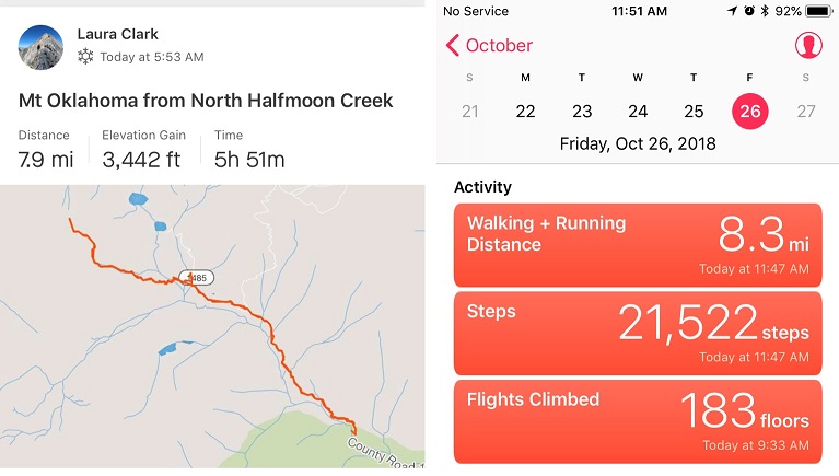
RT Length: 8 miles
Elevation Gain: 3450’
I made several spreadsheets this week outlining possible hikes, and finally settled on Mt Oklahoma. Imagine my surprise when I checked the weather forecast one more time at 2am and it switched from 15mph winds to 45mph winds! I considered changing my peak at the last minute, and then looked at the direction of the wind. I should be ok….
Speaking of OK, when I was about 8 or 9 years old I understood the joke for the first time that “Oklahoma is OK”. I thought this was hilarious, even though my friends didn’t ‘get it’. I told it over and over again and got blank stares. Maybe I just wasn’t telling it right? But I digress…
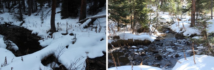
I arrived at the trailhead around 5:30am, surprised the 4WD road was clear of snow all the way to the upper trailhead, despite snow in the forecast for last night. Conditions of the road in are the same as the last time I was here (https://wildwandererlmc.wordpress.com/2018/07/20/55-mt-massive-14421/).
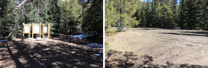
There were no other vehicles in the parking lot. I gathered my gear (whoops! I forgot my goggles, oh well, my sunglasses would have to do) and started just before 6am. I followed the Mt Massive/Halfmoon Lakes trail to the trail junction in the dark, but by the light of the full moon. The trail had pockets of snow, but no traction was needed.

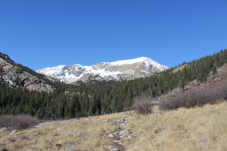
The moon gave off enough light so I didn’t need my flashlight, but not enough light to get a good picture of the mountains in all their snow capped glory. They were beautiful, and I stopped several times to try and photograph them (none of which turned out). I was wasting serious time trying to get a picture I’d never be able to capture, so I put my camera(s) away and kept going.

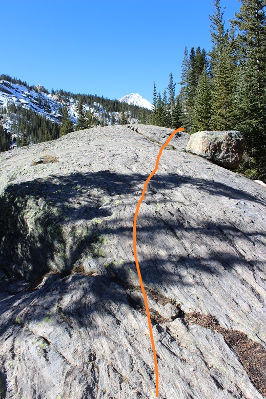
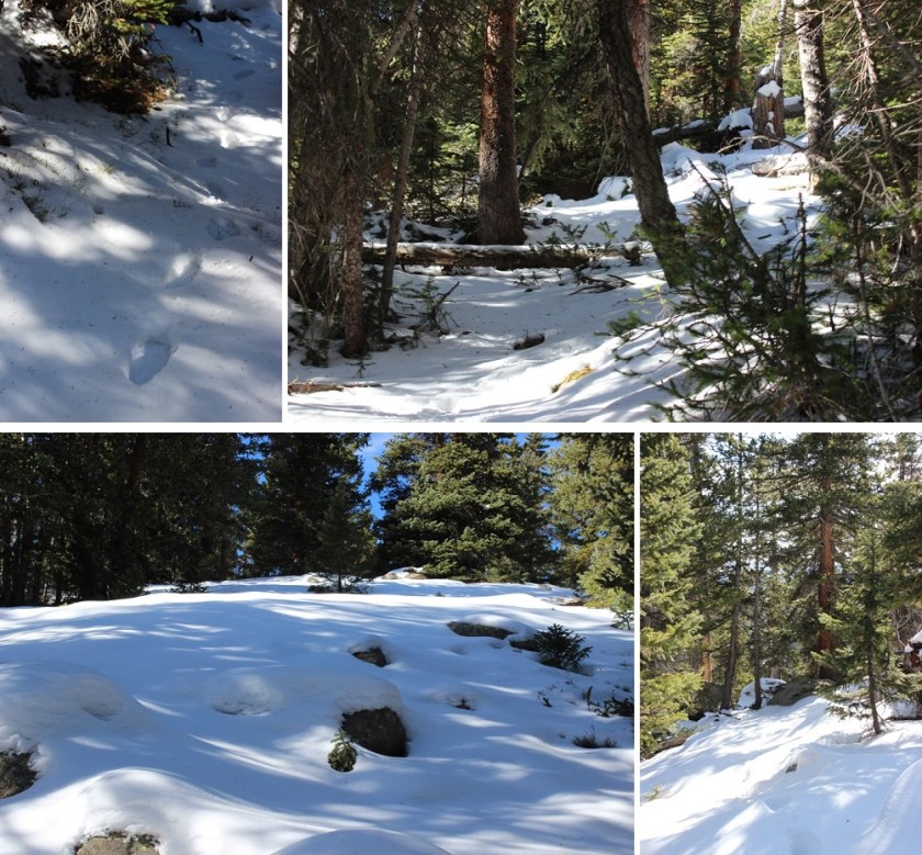
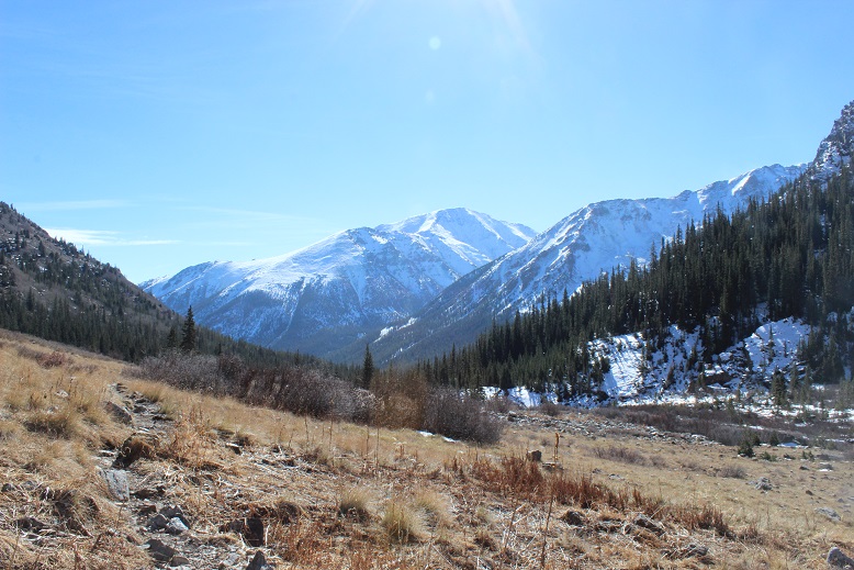
From the trail junction I continued west, back into the trees
And up and over a very large rock (I’m guessing 50-70 feet long?)
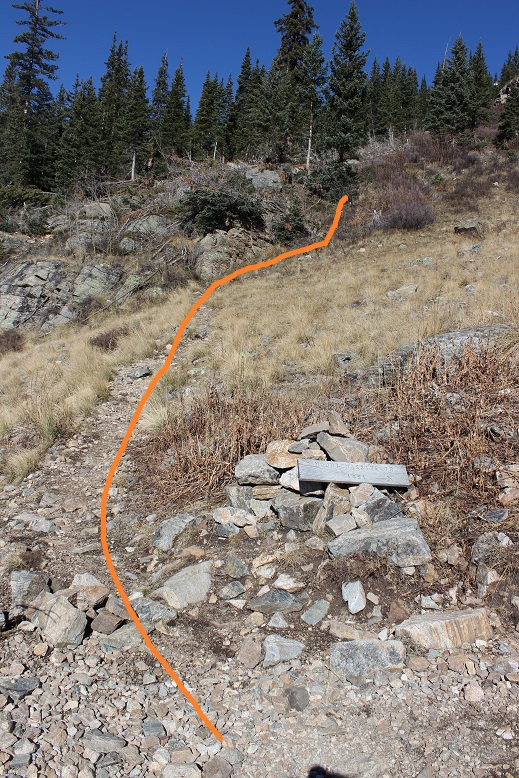
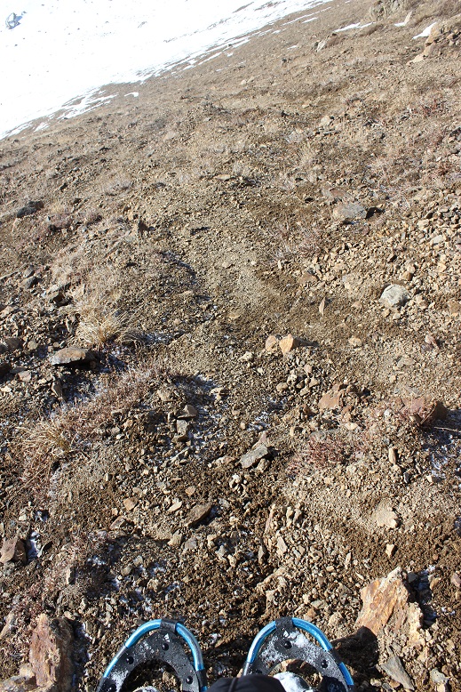
I kept thinking to myself how I wished the elevation gain would start soon. I was over 2 miles into a 4 mile summit, and still no real elevation gain. Those last few miles were going to be a killer! From here I left the North Halfmoon Lakes trail and the route-finding began. The trail was surprisingly free of snow until I passed the second creek crossing.
From here snowshoes would have been helpful, but I didn’t put them on. Route finding through the trees was interesting. At points I could tell there was a trail, or a heavily used path out there somewhere, but most of the time everything was covered under lots of snow.
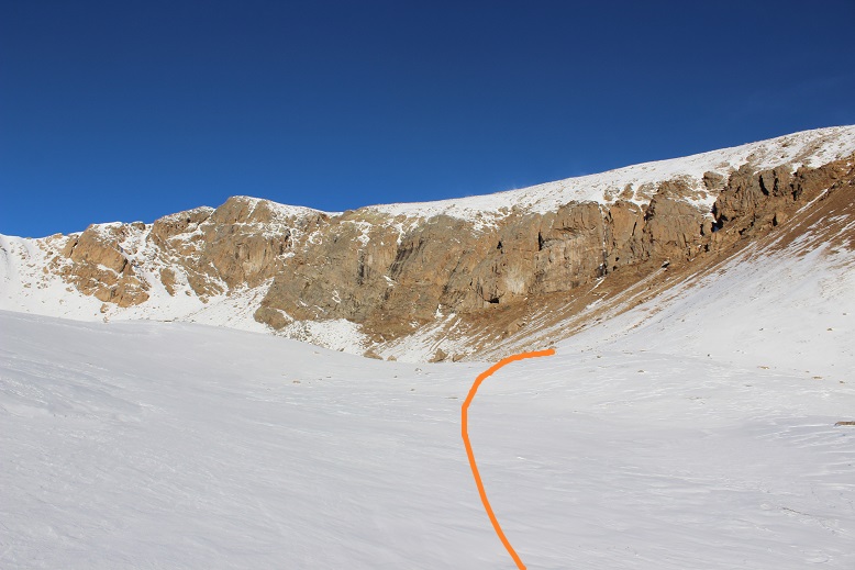
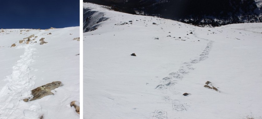
I had to backtrack once, but was able to find my way to the ridge and after exiting treeline I found a few cairns (not enough to rely on… maybe 5 total in the next 2 miles). At the ridge I continued left
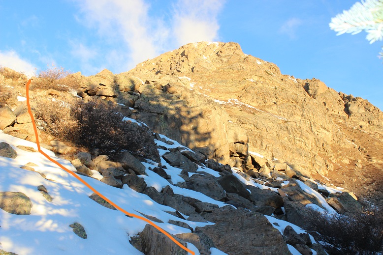
Over this hill and up the drainage
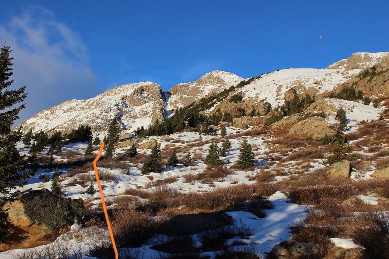
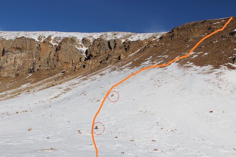
And up some more drainage. This is where I put on my snowshoes. The snow is deceptively deep in some areas here (it is a drainage after all) and bare in other places. The snowshoes were worth it for the times I sank to my waist.

At the top of this drainage was a small basin
I found 2 cairns here, indicating the way I should take up the slope.
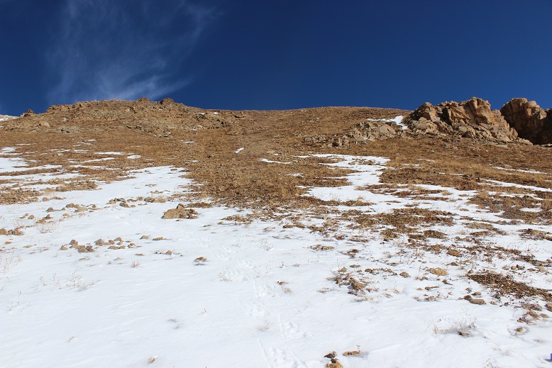
This is where the hike became challenging. That slope is much steeper than it looks, and just when you reach the top, there’s another slope just as long to navigate. I kept on my snowshoes until the snow stopped, and then put them in my pack and hiked up to the ridge. Hiking was much easier with the snowshoes! I’ll take snow over scree any day.
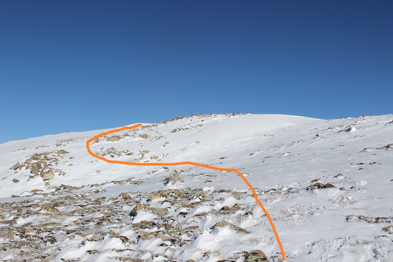
When I reached the ridge I was surprised to see more snow. A lot of it! But it didn’t look that deep, so I put on my microspikes and started forward.

That lasted about 30 feet. There was no way this was going to work. I needed snowshoes. And goggles (that wind!). I stopped to put them on, realized I’d left my goggles in my truck (drat!) and looked at the task before me. I had less than an hour to make it to the top before my turn around time. My legs were burning, and it was slow going, but I knew I could do this. I trudged on. There isn’t an exact route to the top, just keep aiming for the highest point. I chose to go left instead of straight because the snow looked deeper and less stable directly in front of me.
Once again, it’s steeper than it looks and I had to stop every 50 feet or so just to catch my breath. My ice axe proved useful several times. The wind was picking up and I was getting cold. Those 2 miles without elevation gain were catching up on me!
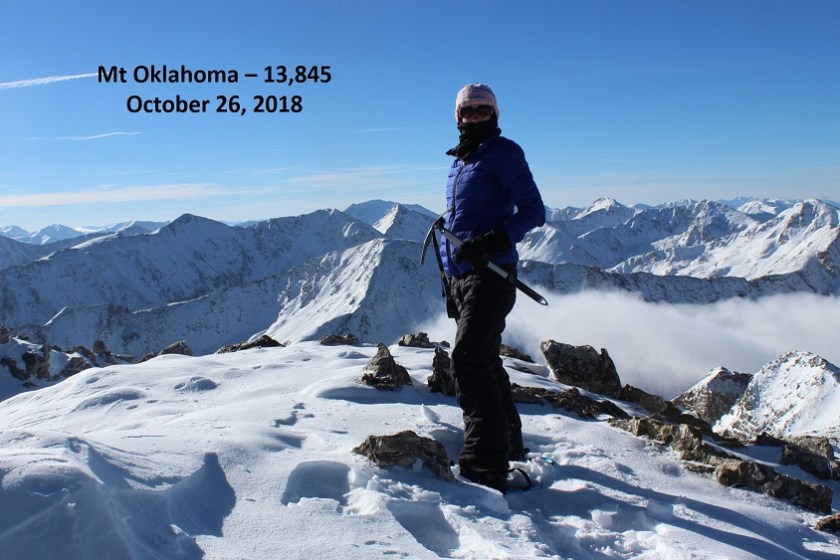
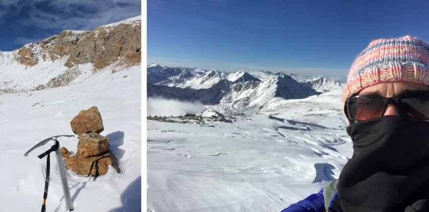
I summited at 9:25am (my turnaround time was 9:30am)
VIDEO:
The summit is mostly flat, with a small cropping of rocks near the Mt Massive side.

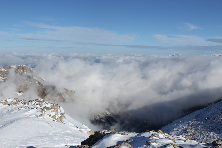
Here’s a view to the south

This is the way I came up

I turned and looked to the left of Massive, and there was the weather I’d been worried about. 45mph winds turning fresh snow into ice clouds, headed towards me. It was time to book it off this summit before those clouds reached me.
But first, a shadow selfie

I backtracked the way I’d hiked in, following my tracks

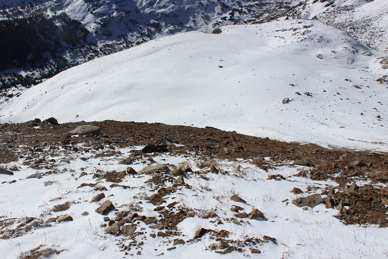
The snow was soft, perfect for skiing. I didn’t have any skis, but I had fun gliding in strides in my snowshoes. I quickly made it back to the scree slope where the snow ended for about 200’ and the scree reigned.
I decided against taking off my snowshoes for this part. Snowshoes actually provide the same stability on scree as they do on snow. Plus I was too lazy to take them off just to put them back on again. (If your snowshoes are aluminum don’t try this. Also, get new snowshoes).
I made it down into the basin and stopped for a bit to reapply sunscreen and take off my gloves (I had on multiple pairs). This was also the last time I saw my hat. Since I had on a balaclava too I didn’t notice when it went missing. I’m not sure if I lost it here or in the trees, but if you find it please bring it down and donate it to a worthy organization (I knit about 300 a year and give them to low income elementary schools and teen homeless shelters in Colorado). This was the only time I wore it, and after washing it I’d planned on adding it to the donation pile.
I continued following my tracks back down to treeline and back to the North Halfmoon Lakes trail. After the second stream crossing the snow virtually stopped, and when I hit the junction it was gone all except for when I was in the trees
I made it back to my truck at 11:50am, 10 minutes before my 12pm target time, making this an 8 mile hike/climb/snowshoe adventure in about 6 hours.
I didn’t see a single person the entire day, which I consider a win! There was a Tacoma in the parking lot when I left, and I did see at least 2 if not 4 sets of tracks on the trail going up to Mt Massive as I was heading down.
Here’s my relive video:
https://www.relive.cc/view/1928750207
Note to self: it’s time to keep goggles in gear bag.

Oklahoma is OK.for more reasons than one.They have the “Rodeo Hall of Fame”. I am still at sea when I look at your activity chart and the ground you cover in the deep snows and high winds and in such a short time. I’m sorry you lost your hand knitted hat that you kindfully give to those who you have a heartfelt desire to please. You produced a very nice shadowed selfie that has a distinctive aura with the rock formation right next to you. Thank you “Lady Laura”,Mountain Hiker and Surviolist.You go beyond that title and more.
LikeLike