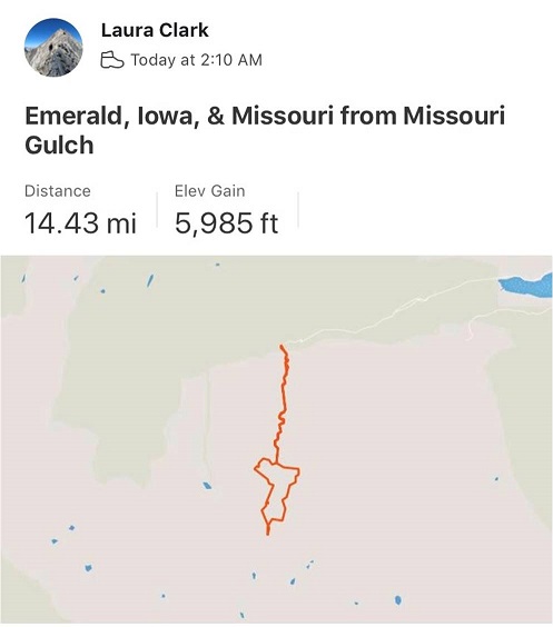
RT Length: 14.5 miles
Elevation Gain: 5985’
No, I didn’t drive straight to the Missouri Gulch trailhead. It took me forever to drive home going 50mph on the I70. I made it home at 7am and limped out of the truck. My feet seemed to hurt more now than they did last night. They’d dried out, but were now red and raw. I decided to take a few hours ‘off’ to let my feet rest. After cleaning up and pampering my feet I took a 5 hour nap. When I woke up my feet had dried out and I was able to get a better look. No blisters. That was a relief. They were still red and swollen though, meaning I’d had a Raynaud’s attack yesterday. It all made sense, and was most likely caused by the 20 minutes I spent trying to dig out my water shoes from the cold creek combined with a long, physical day.
Driving home had been the right thing to do. By the middle of the day my feet were still sore but I found I could walk on them. Kind of… you see, it hurt terribly to begin walking, but after the 10th step or so the pain went away. So I figured I just had to start hiking and not stop and I’d be fine.
At 9pm I made the decision to drive to the trailhead, try to nap for an hour, and attempt another hike. It was either that or stay home and do the treadmill thing in the morning, which did not sound appealing with sore feet.
Everything went well. I made it to the trailhead and slept for an hour before my alarm went off at 2am. There were tons of vehicles at the trailhead. As I was putting on my hiking boots a couple drove up in a Subaru. We were hitting the trail at the same time, so when I got out of my truck I waved and said hi to them. No response. Hmmmm… ok. Maybe they hadn’t seen me (or that the lights on in my truck)? I turned on my flashlight, walked over to the trailhead and once again said “hi guys!” I was hoping to just chat and see where they were going before setting off. When I see others at trailheads I like to connect in case something happens (to either of us). Once again, they didn’t respond (but their dog looked back at me). Maybe the creek was making too much noise for them to hear me? Ok, well, I don’t like to be rude but I’d tried to be nice. Maybe I’d see them on the way down. I didn’t say anything as I quickly scooted past them and headed down to the stream, crossed the bridge, and headed up the trail.

Yes, my feet hurt, but I had a plan: don’t stop. Also, take ibuprofen every 4 hours. The first few steps were painful, but after that as long as I kept moving the pain went away. This was my second attempt of Emerald/Iowa, and my 4th time hiking via the Missouri Gulch trailhead. Call me crazy, but those switchbacks are getting easier. Also, the baby grave doesn’t bother me so much anymore.

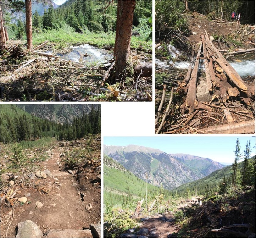
The avalanche area has been nicely cleared, and now there’s a log bridge over the creek and a nicely manicured trail through the avy debris.
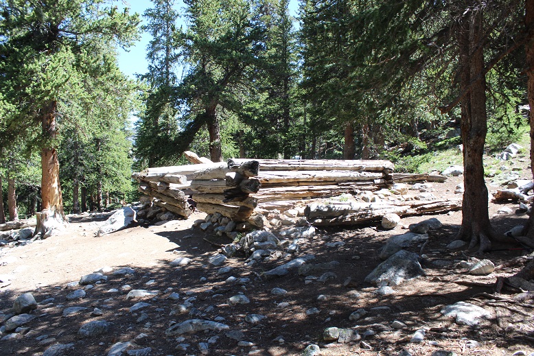
I made it to the cabin in exactly 1 hour and thought that was pretty good time, considering.
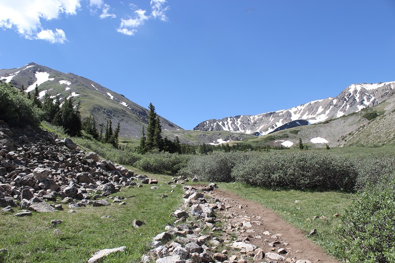
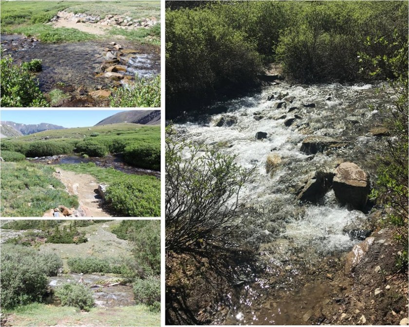
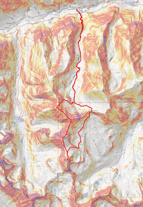
I entered Missouri Gulch and had no problems following the well established trail. The willows seem so much bigger without all the snow.
I turned right at the junction for Elkhead Pass/Belford and followed the trail towards Elkhead Pass.

There were several stream crossings to navigate here. These were not fun in the dark, but in the daylight didn’t pose much of a problem. Oh, and there aren’t any ‘easier’ ways to cross: just cross them right where they intersect with the trail.
I felt like I was making pretty good time. It’s amazing how much easier the gulch is to navigate without snow. I made it to the Elkhead Pass/Missouri Mountain junction
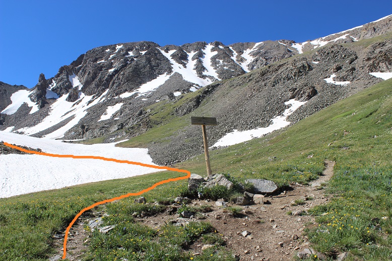
This is where I got a little worried: this is the first hike all year I haven’t brought along my snowshoes, and the area before Elkhead Pass looked to be full of snow. Luckily there actually wasn’t that much and what snow there was was solid in the morning so I didn’t need traction (I had spikes and crampons in my bag, but didn’t need them).

It was still dark as I navigated my way through the snow and sometimes trail up to Elkhead Pass. Here’s a look at the route from later in the day coming down from Missouri. The snow was easily navigable, but seems like much more when you’re down there hiking through it.
I found myself at the top of Elkhead Pass at 5:15am. It had taken me 3 hours to get here (4.1 miles and 3580 in elevation gain). Remembering how icy conditions had forced me to turn around here last time I was a bit worried to see snow at the top of the pass, but as I got closer I noticed there wasn’t as much snow as I’d initially thought. (Sorry for the poor quality of the next few photos: I took them in the dark and had to lighten them up so show details)

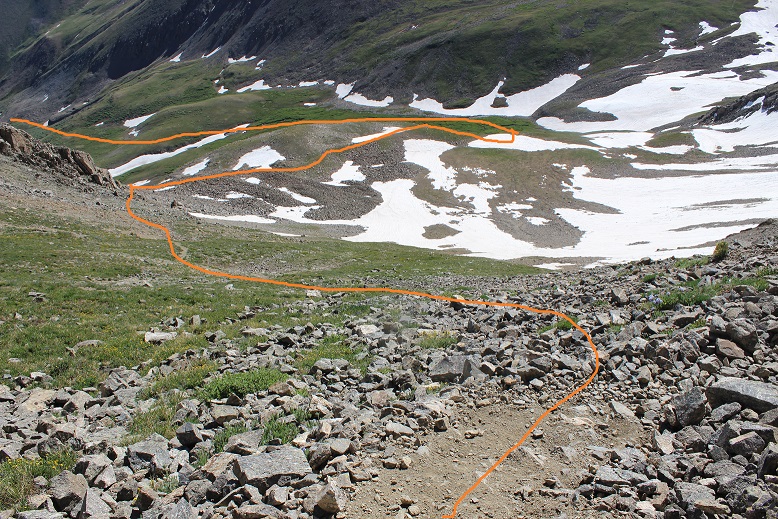
I descended Elkhead Pass, but not all the way to the bottom of Missouri Basin (Yes, Missouri Basin, not Missouri Gulch. We need to get more creative with these names people!). I found a cliff band below Missouri and followed that towards the little lakes, as I didn’t want to lose more elevation than necessary. Here’s the path I took hugging Missouri
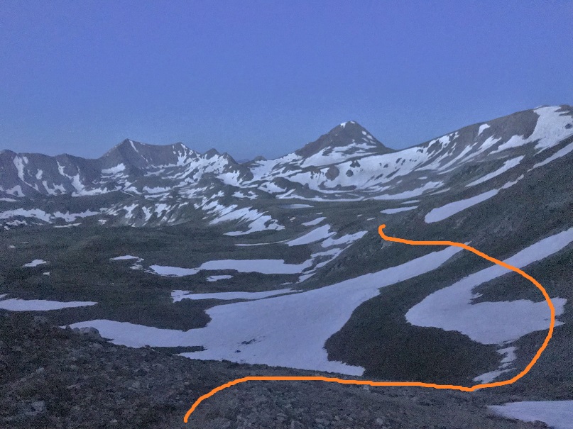
At the cliff band I descended the least amount possible, heading towards the lakes

Here’s looking back at Elkhead Pass and the way down (don’t drop lower than necessary: there’s a trail that takes you all the way to the bottom; avoid that).

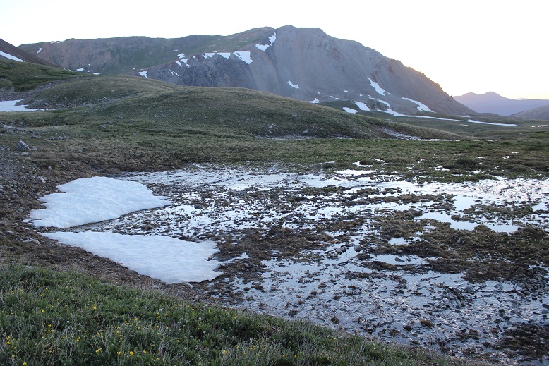
The area between Missouri and Emerald was mucky
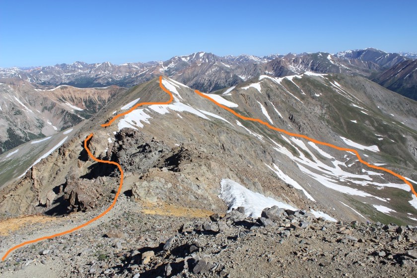
There are several ways to gain Emerald’s ridge. There was snow surrounding the access area to the south, so I went a little further north and took this path, avoiding the lakes and snow as much as possible.
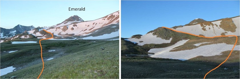
Here’s a look back at the route and Elkhead Pass

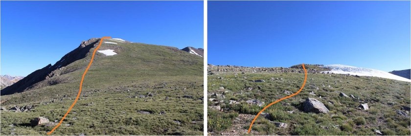
Once I gained the ridge I turned right (west) and followed a faint trail up the ridge. (Note: the standard route up is the dotted line. I did not take this route because I wanted to avoid kicking in steps in the snow: I wasn’t sure my feet would appreciate that today)
Instead I skirted the mountain to the northwest to the saddle between Emerald and Iowa and summited via Emerald’s north slopes
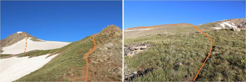
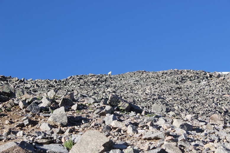
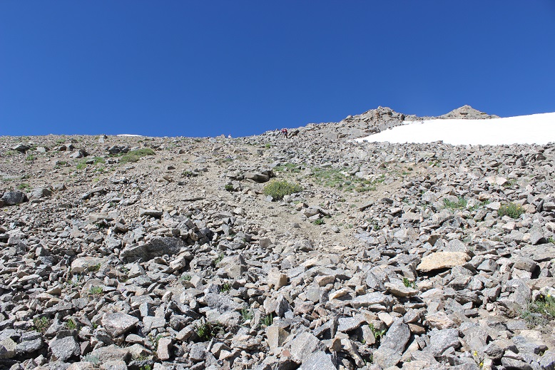
The last 500 feet or so to the summit were filled with scree/talus and tons of goat/social trails. Just aim for the ridge

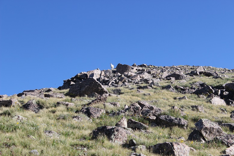
I had a goat watch me the entire way, then disappear when I reached the ridge
From the ridge I turned right (west) and walked my way to the summit

I summited Emerald Peak at 7:20am
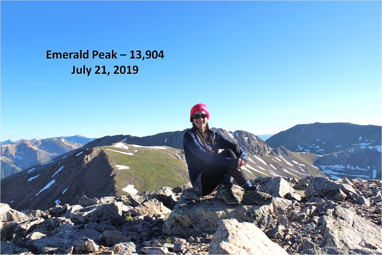
Emerald:
Despite the threat of forecasted afternoon storms this morning was beautiful! I looked over to Iowa and back at the route I’d taken thus far. An idea came to me: it looked like similar elevation gain/loss going over Missouri as it did going back over Elkhead pass. I might as well tag Missouri again. I decided to wait and see if the weather held out before making a final decision, but it seemed a draw either way. Oh, and my feet were holding up, so that’s a plus.
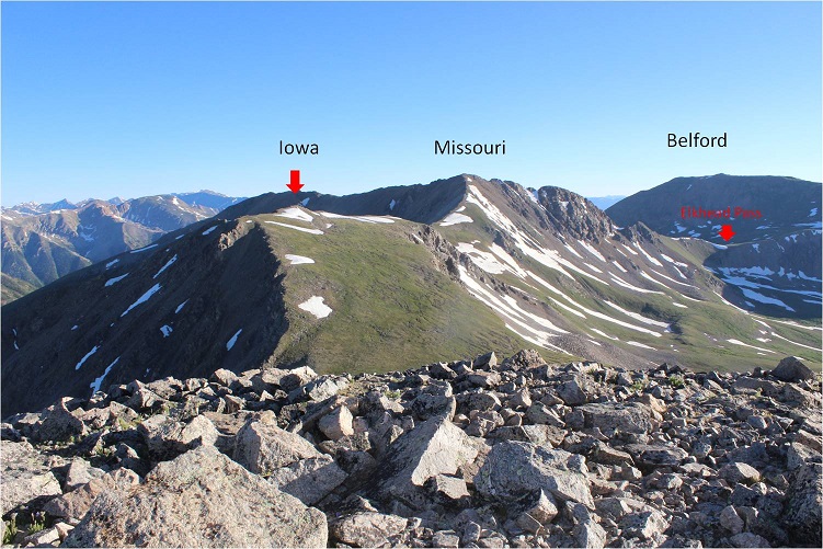
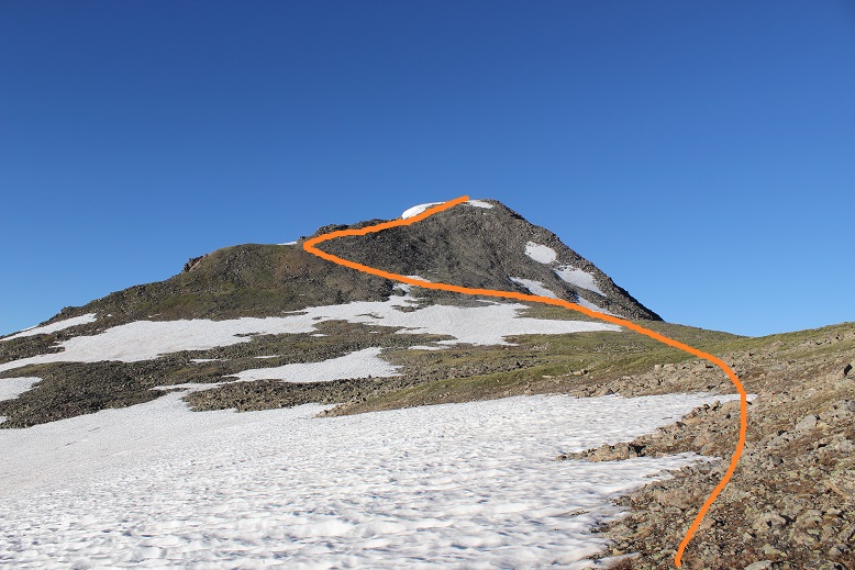
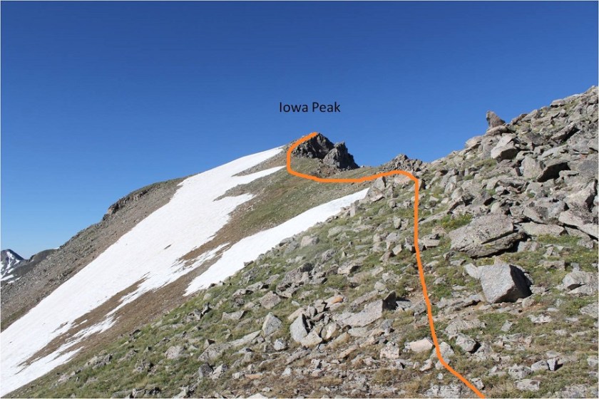
The route to Iowa and Missouri was obvious. I headed down Emerald’s north slopes and towards the Emerald/Iowa saddle and up to the summit of Iowa
The hike up to Iowa’s summit was easier than expected; I just stayed to the left of the snow on the ridge. Once again, a goat watched my ascent.
I summited Iowa Peak (an unranked 13er) at 8:10am. You can see Emerald Peak in the background of this picture
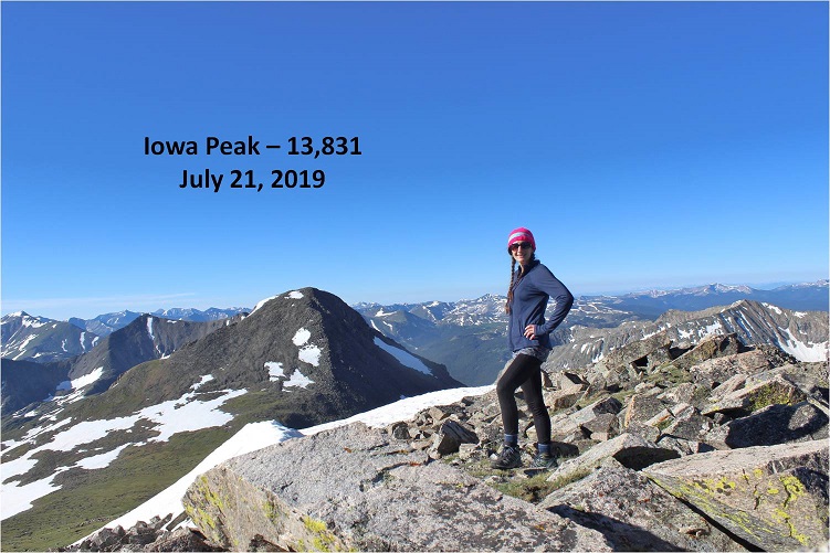
Iowa:
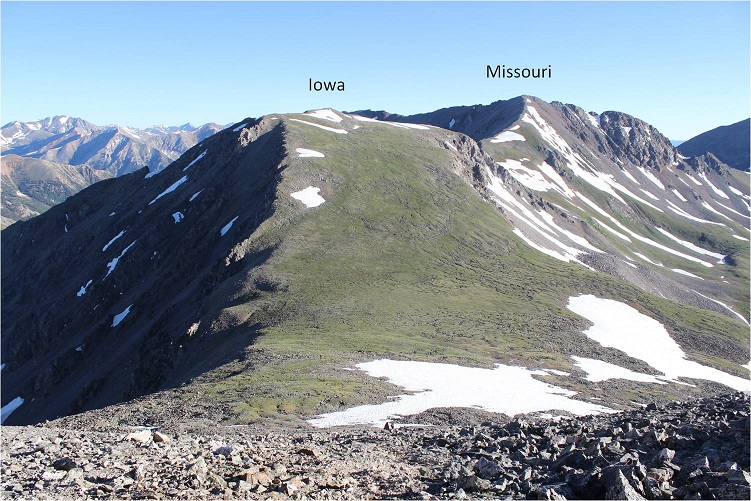
The decision had been made: on to Missouri! Initially I tried to descend Iowa too far to the right (east) and had to turn back due to snow I didn’t particularly want to cross. To avoid all snow it was easier just to follow Iowa’s ridge to the Iowa/Missouri saddle.

Looking back at Iowa from the Iowa/Missouri Saddle
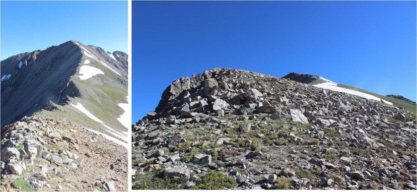
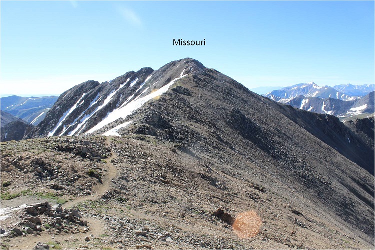
The ridge up to Missouri was much, much easier than anticipated. I don’t know if it was the ibuprofen I took on Iowa or just conditioning, but I felt the ridge from Iowa to Missouri wasn’t very challenging at all. In fact, when I made it to the top I’d assumed I was only halfway up, and actually asked the 10 other people I saw as I was approaching “Is this seriously the summit!?!?” (Note to self: not a good question to ask a group exhausted hikers when you aren’t even winded. Tone it down a bit.).
I reached Missouri at 9am and asked one of the other hikers to take my photo because I thought it would look silly setting up my gorillapod.
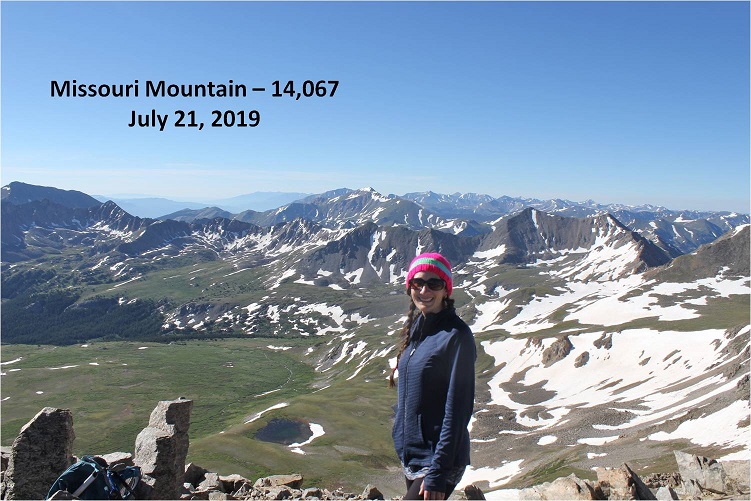
Missouri:
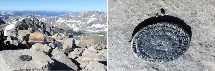
Missouri had been an added and unexpected bonus peak today, and it has a summit marker!
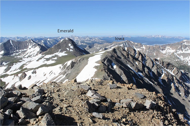
Here’s a look back on Emerald and Iowa
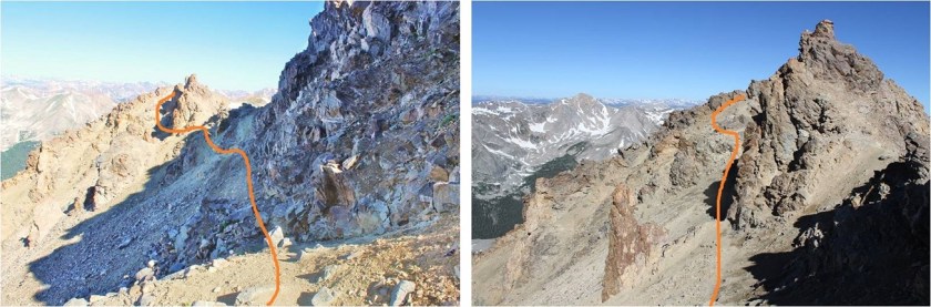
Knowing I couldn’t let my feet stop moving for long I thanked the photographer for taking my picture and headed back down via Missouri’s northwest ridge. There’s a great trail the entire way from the summit back to the Missouri Gulch Trailhead. Here’s the route of the ridge
The crux area was much easier to navigate than I remember it being when I hiked Missouri last time. This time I could even hold onto the rock face for added stability if needed
Is this rabbit named?

Here’s a look back at the ridge
Exiting the ridge is marked by a cairn (and today a tiny bit of snow). After rounding the corner get ready to do some scree surfing. (Note: if you’re not a fan of scree (who is?), microspikes help provide traction. Seriously, try them on scree, it’ll change your life).
Looking back up at the scree slope to gain the ridge
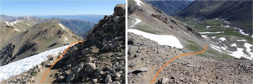
There were some slight snow fields to cross, but nothing that required traction

From here there’s an obvious trail back down to the gulch.

I met tons of people hiking on the way down from Missouri. It was the perfect day for a 14er, there are 3 in the area, and everyone was out. I made it back to my truck at 11:45am, making this a 14.5 mile hike with 5985’ in elevation gain in 9.5 hours.
My feet did not look pretty when I was done but I was very pleased with today’s hike. I didn’t feel tired, even at the end. My feet successfully made it the entire way without complaining (too much). I think the ups and downs in elevation gain on the ridges gave me little breaks that made all the difference. I’m sure you could do this hike in reverse and feel the same way. I never saw the couple I’d seen at the trailhead in the morning, but I’m hoping they stayed safe and had a fabulous hike as well!

After seeing the photos of Your precious feet that carry You over so many summits,it is enlightening to see You overcoming the pain and agarivation of raynaud’s which sometimes hinders You,but never destroys Your willfully strong heart in overcoming adversities. Please never apologize for photos that You may think aren’t satisfactory.I feel blest just to be able to view them as presented by Your hands that are often so cold to even hold the camera at the elevations You reach at great efforts to Your physical well being.I find it pleasurable to see your smiling face as I’m sure others do.I am awed at the pics of Your hiked route as well as the routes marked in dotted lines to show alternate trails.I truly do not know how You accomplish these feats all by Yourself.You have strength and determination that I just can’t understand.I gaze upon all these photos with the written words and am still beside myself in understanding the things that You do.You are the most Amazing Fantastic Young Girl Scout Leader, Wild Wanderer,Mountaineer,Survivalist Instructor @Miss Laura @ Lady Laura and the many other titles that have slipped my mind,but only because You go beyond just being a title.You are who You were meant to be as sung by Miss Susan Boyle.When I hear that song,it is so You.Thank You Lady Laura.
LikeLike