RT Length – 14.5 miles
Elevation Gain – 5304’
It’s officially High School Football season which means late Thursday/Friday night games. Luckily for me my daughter performs at half time and can drive herself home so I was able to get in 2 hours of sleep before waking up at midnight to drive to the trailhead.
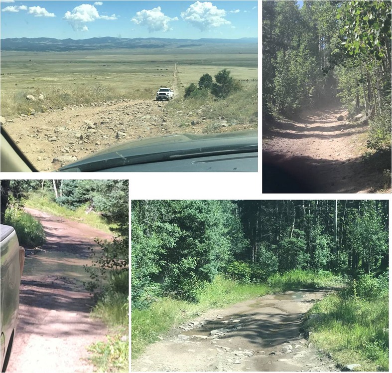
And what a drive it was! This is my 6th or 7th time at the South Colony Lakes Trailhead, and the last 3 miles were the worst I’ve ever seen them. The drainpipe was actually one of the easier parts. Because of the rough road I drove a little slower than I normally would and wasn’t on the trail until 2:30am. (Sorry, these pictures are of the easier areas, as I needed both hands on the wheel to navigate the tougher ones).
One side of the parking lot was completely full: I was the first to park on the opposite side.

I followed the South Colony Lakes trail, which starts at the west end of the parking area
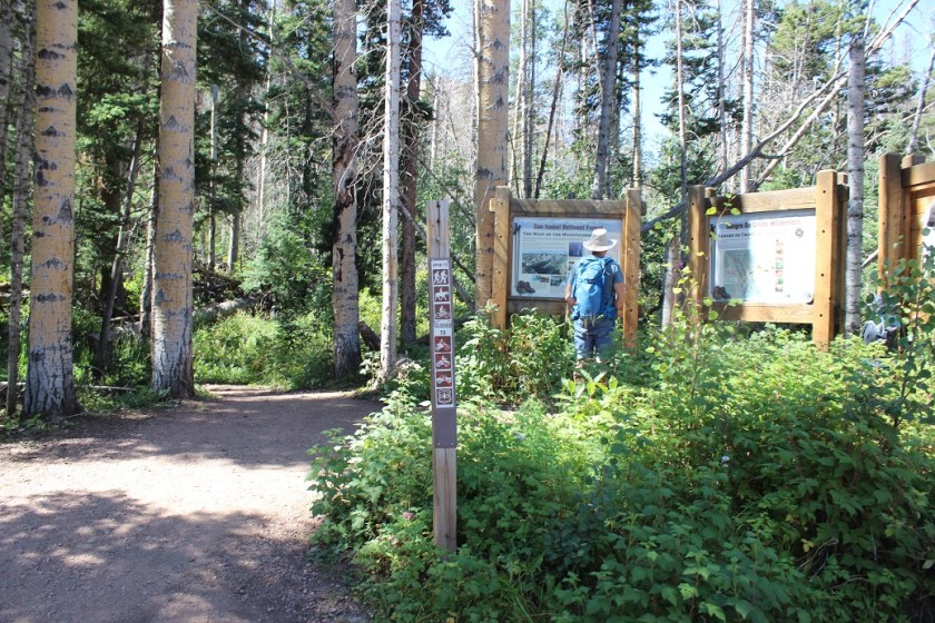
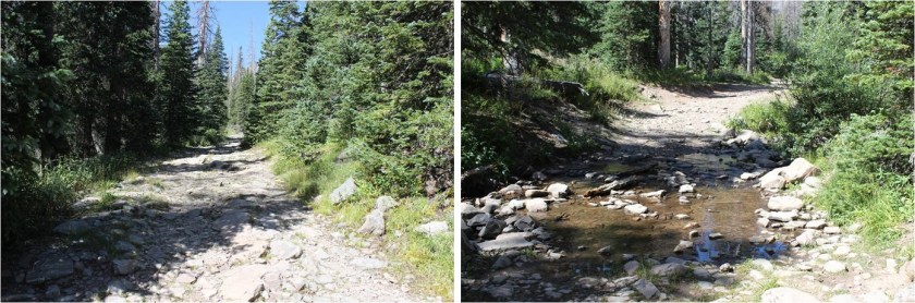
There’s a register to sign and then immediately I crossed a bridge and headed left (west) along an old 4WD road that’s no longer maintained.
There were a few mud puddles here and some running water, but nothing that actually got my boots wet.
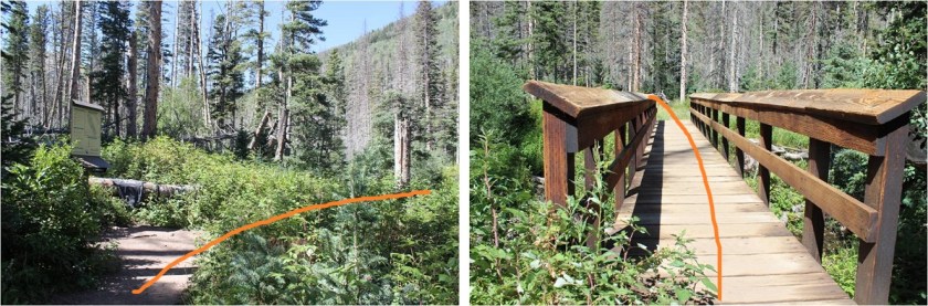
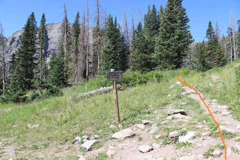
After hiking for 2.6 miles I came to this junction and went right to follow the Humboldt Peak / South Colony Trail.
Here the road ends and it actually becomes a trail, crossing a few minor bridges and a small boulder area
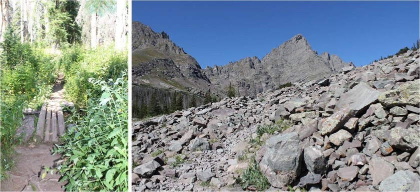
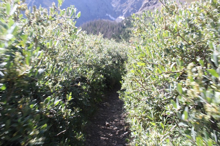
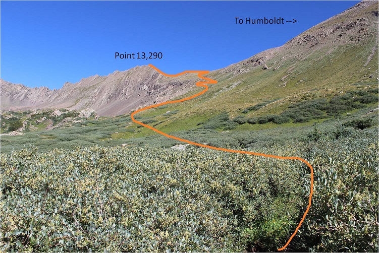
before entering the South Colony Lakes Basin. Here the willows were overgrown and made the trail ‘fun’ to follow at night (spiderwebs).
In the daylight it’s easy to see where you’re headed: Follow the well defined Humboldt Trail to the saddle of PT 13,290 and Humboldt
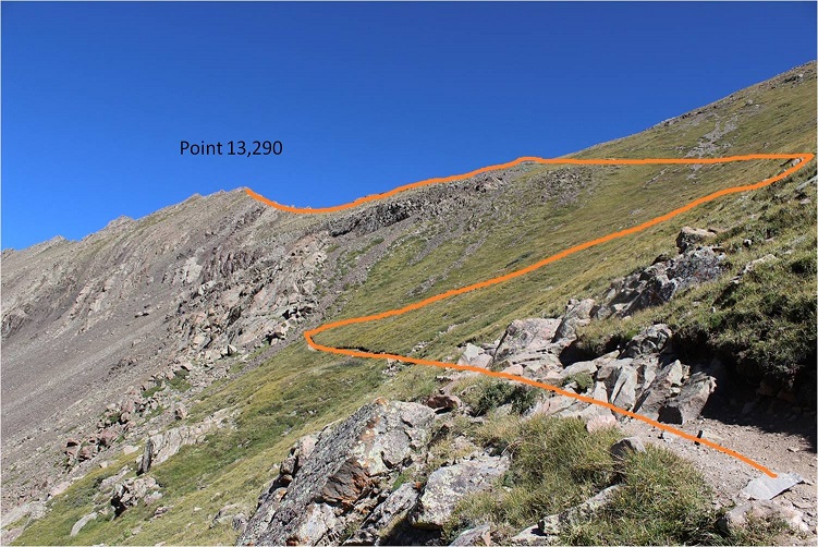
Making it to the saddle was straightforward, but here the trail ended. I turned west (left)and continued on towards point 13,290
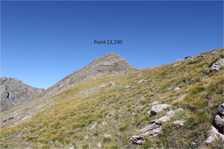
I followed the ridge to the top of the point
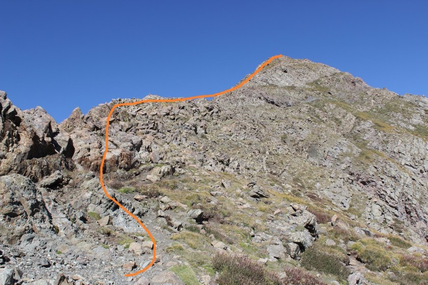
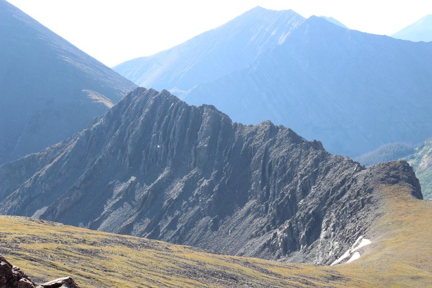
From here you can see the rest of the route up to “Obstruction Peak”, but I couldn’t because it was still dark
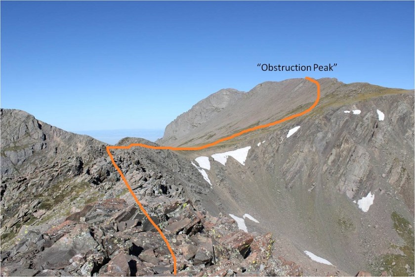
This ridge is NOT fun to cross in the dark. I wasn’t able to see much of what was ahead of me, which made route finding tricky. I also couldn’t tell how much exposure there was, which was positive at times. I mentally wished for my helmet and just stuck to the ridge, doing my best to anticipate the proper route and backtracking and trying again when necessary. On my way back I could clearly see a class 2+ path, but in the dark it was slow going.
Here’s the ridge

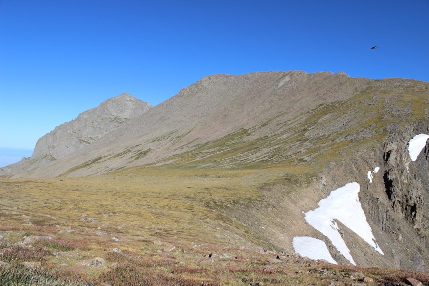
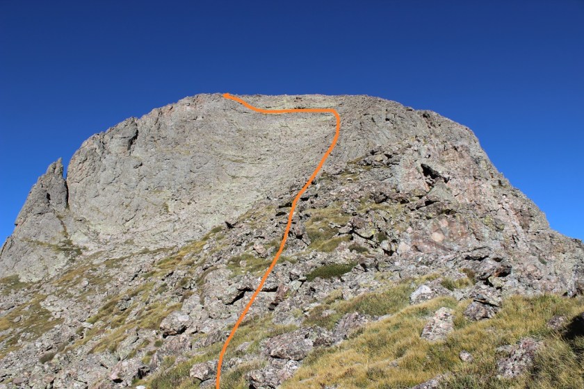
After crossing the ridge I crossed a relatively flat area known as “Bears Playground” and headed northwest up towards “Obstruction Peak” first over tundra and then rocky areas

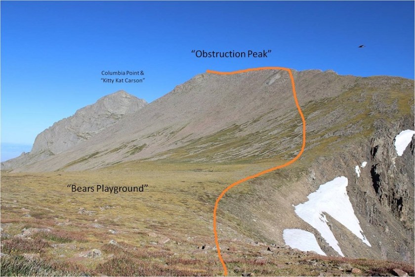
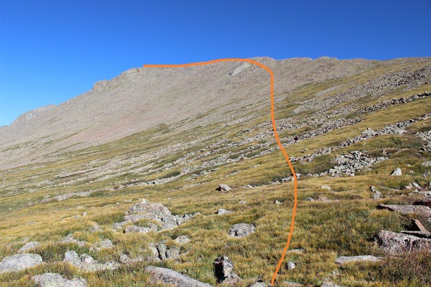
It was actually difficult to tell exactly where the summit of “Obstruction Peak” was so I decided to make it to the ridge early and just walk across the entire ridge. I’m pretty sure the true summit is at the most westerly point.
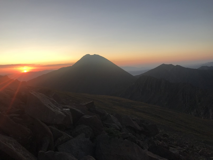
I summited at 6:45am

“Obstruction Peak”:
As I turned and looked east I could see the sunrise
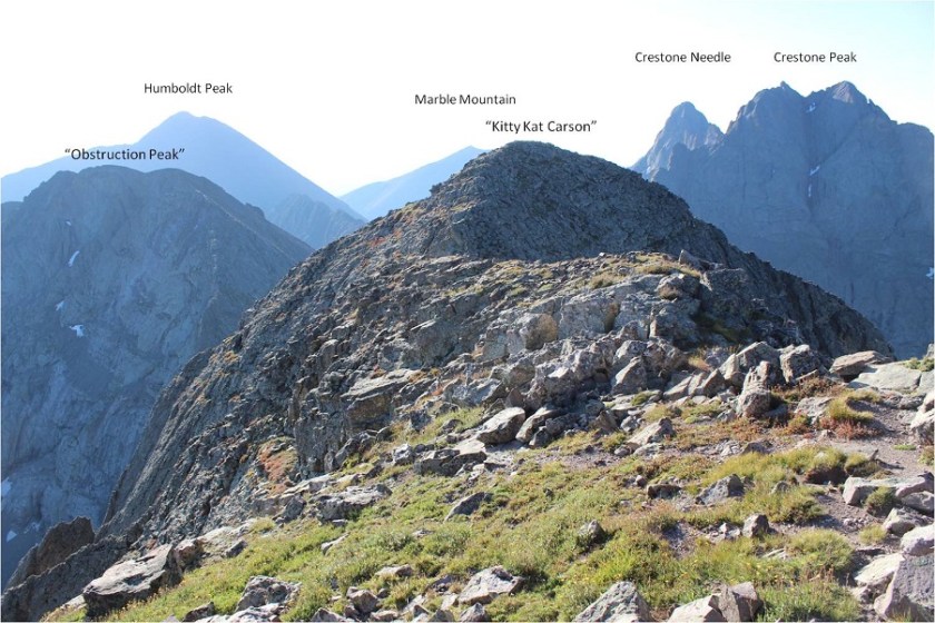
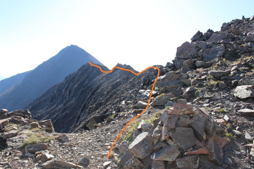
From the summit of “Obstruction Peak” the path to “Kitty Kat Carson” and “Colombia Point” was clear

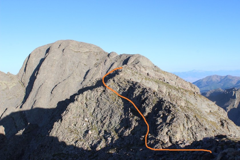
I hiked down “Obstruction Peak” towards “Kitty Kat Carson”. The ridge down was rocky but stable
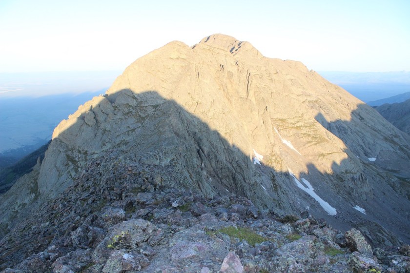
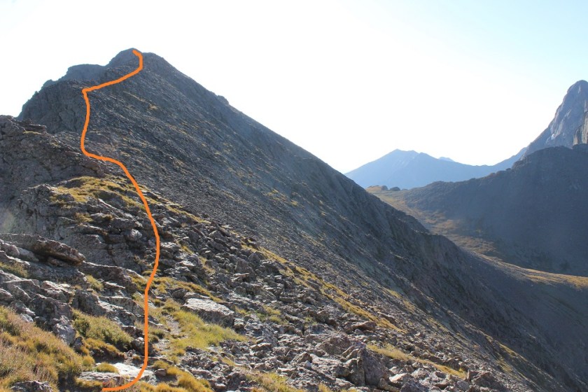
Once at the saddle “Kitty Kat Carson” looked imposing, but wasn’t too much of a challenge. There were a lot of cairns here, especially towards the top, which made them useless. I stayed to the right for most of the ridge, and then headed left to summit
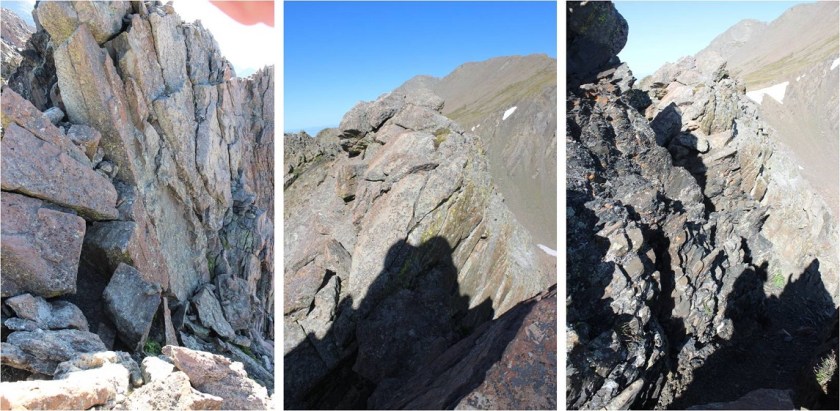
The terrain here was classic Crestone: lots of steep, grippy rock

I summited “Kitty Kat Carson” at 7:28am

“Kitty Kat Carson”:
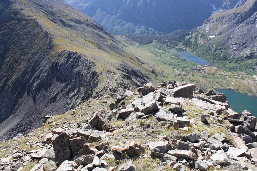
It took me less than 10 minutes to traverse from “Kitty Kat Carson” over to Columbia Point, losing about 50’ in elevation and then regaining it back. This was all class 2+ climbing
I summited Columbia Point at 7:39am
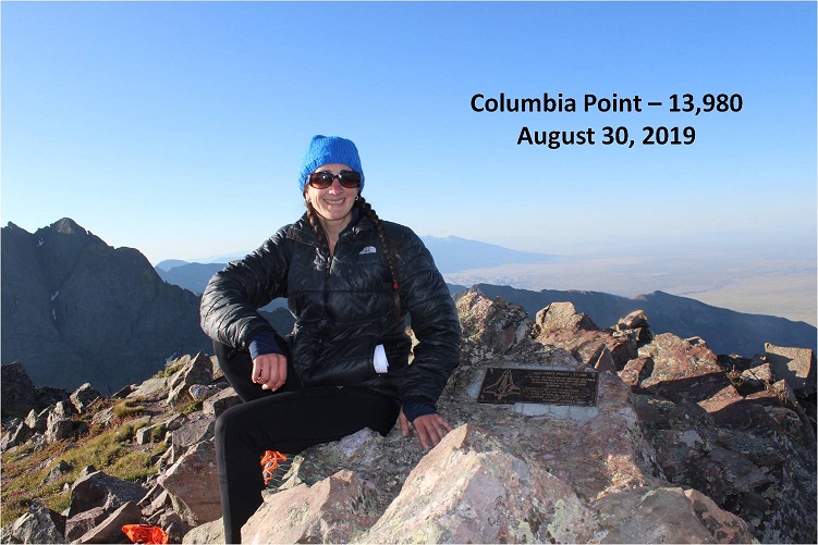
Columbia Point:
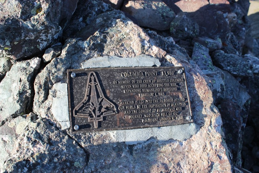
There’s a plaque at the summit commemorating the crew of the shuttle Columbia
Here’s looking back on “Kitty Kat Carson”
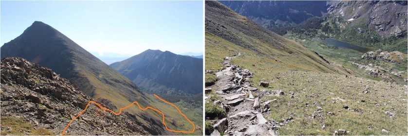
Time to head back. Here’s the route towards “Kitty Kat Carson”

And down the saddle and back up to “Obstruction Peak”

Once at “Obstruction Peak” I made my way back down Bears Playground and over to the ridge. That had been quite a time in the dark!
I was so glad to be able to see the route in the daylight. I didn’t need to stick to the ridge the entire time, and mainly stuck to the left/north when I wasn’t on top of the ridge. I found this was a rather quick traverse when I could see what was in front of me.

What took longer than I’d remembered was the hike down from Point 13290 and back to the Humboldt Saddle
Here’s the route to the South Colony Lakes area
The hike back was rather uneventful. I saw over a dozen hikers and was reminded how popular the 14er trails are. I stopped and talked to several people intent on Humboldt, and even saw a few friends intent on some of the other 14ers. I was in a rush though: I had to be home by 2pm to take my daughter camping, which meant I had to make it back to the trailhead no later than 11:35am. It was a beautiful day and I wasn’t carrying a full pack so I was able to hike pretty quickly. I made it to the bridge crossing and saw some raspberries.
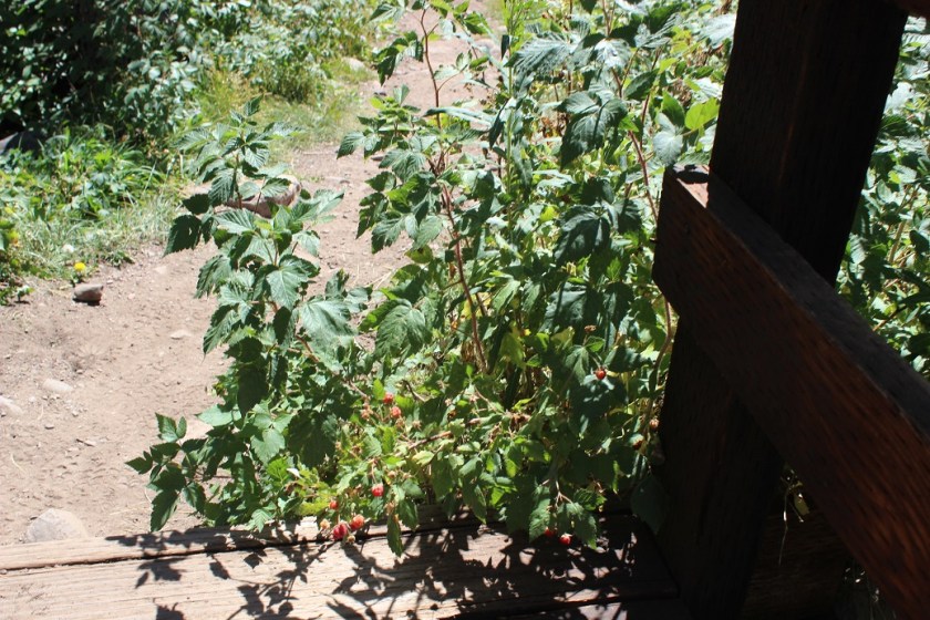
I decided to try one: it was sour, and unfortunately not as good as the ones from Purgatory, so I only ate one and left the rest for woodland creatures to enjoy. I made it back to the trailhead at 11:30am, making this a 14.5 mile hike with 5304’ in elevation gain in just under 9 hours. The best part (besides making it home at 1:58pm)? No mosquitoes!!!


