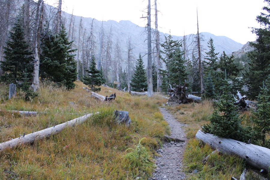
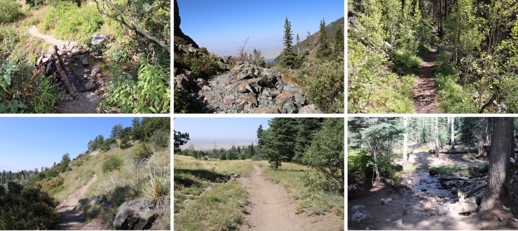
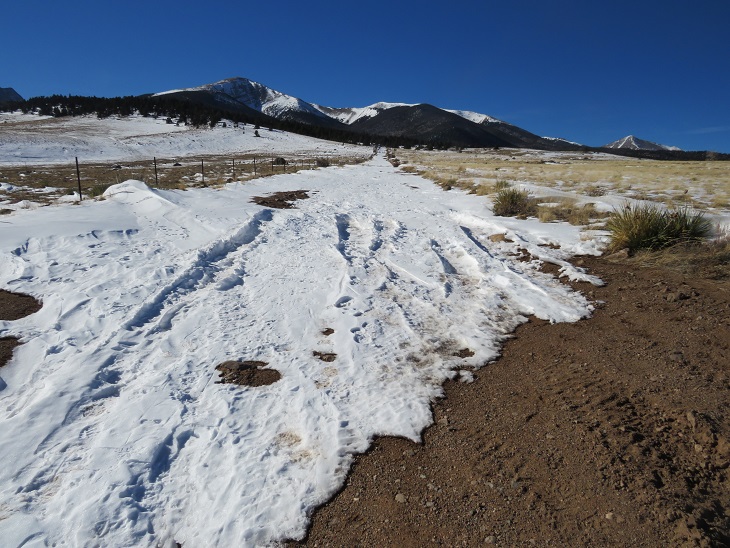
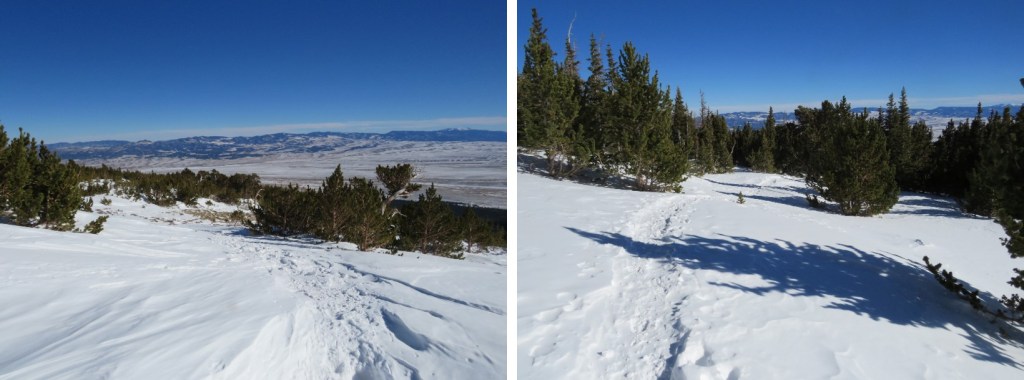
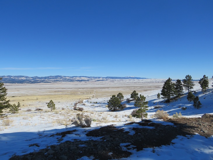
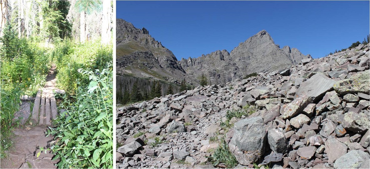
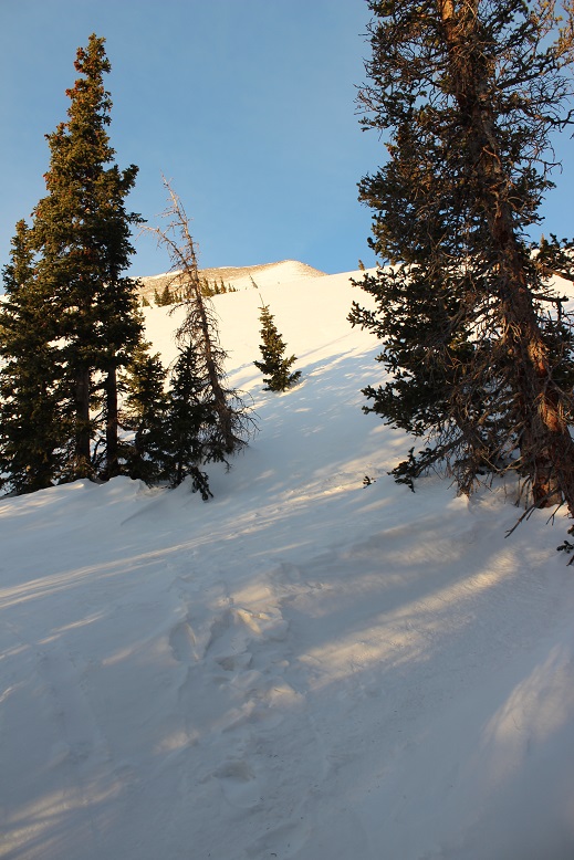
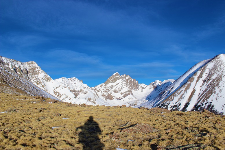
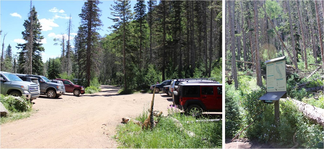
I’ve taken the Willow Lake trail several times, and I’m guessing if you’re doing this peak you have too, so I’m going to start this report from the camping area just before Willow Lake. If you’d like detailed instructions on the approach, click here
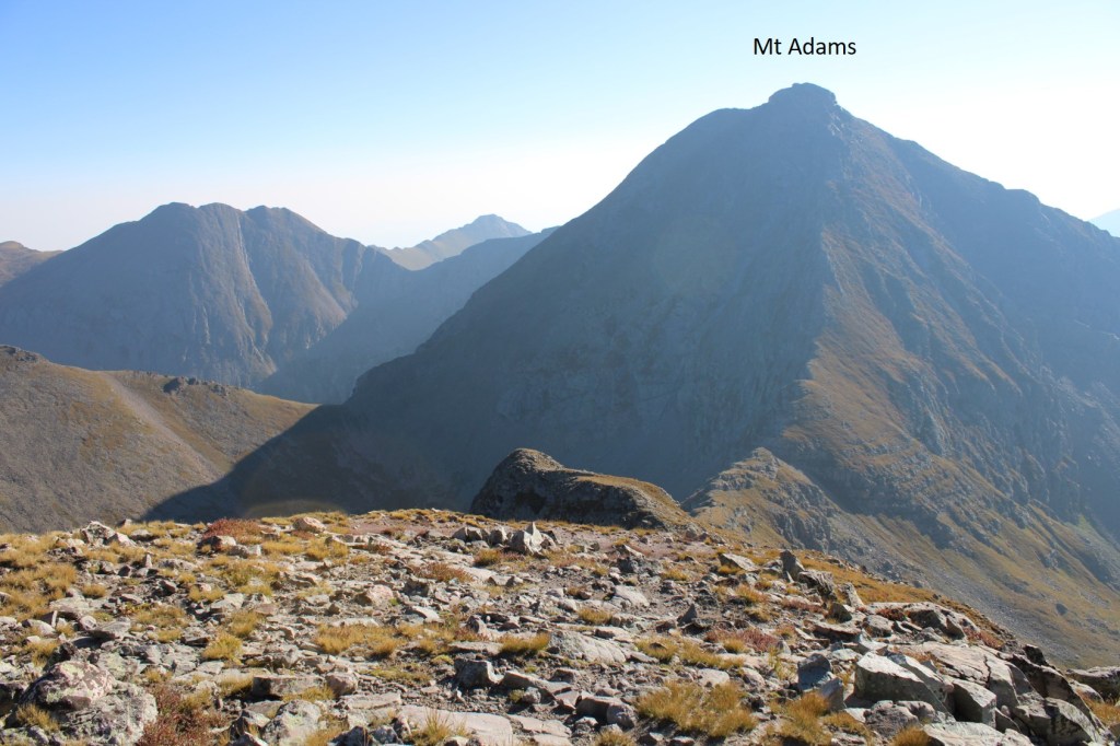
I would also like to recommend pairing this up with other peaks in the area: PT 13153, Mt Adams, PT 13580, etc. This felt like a really easy day.
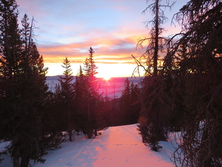
I was on the trail at 4:30am, surprised at how easy the approach was this time. I attribute it to taking the week off from hiking to visit my son in Alaska, and in doing so, consuming about 10 times more calories than I normally would, thus giving me an excess of energy.
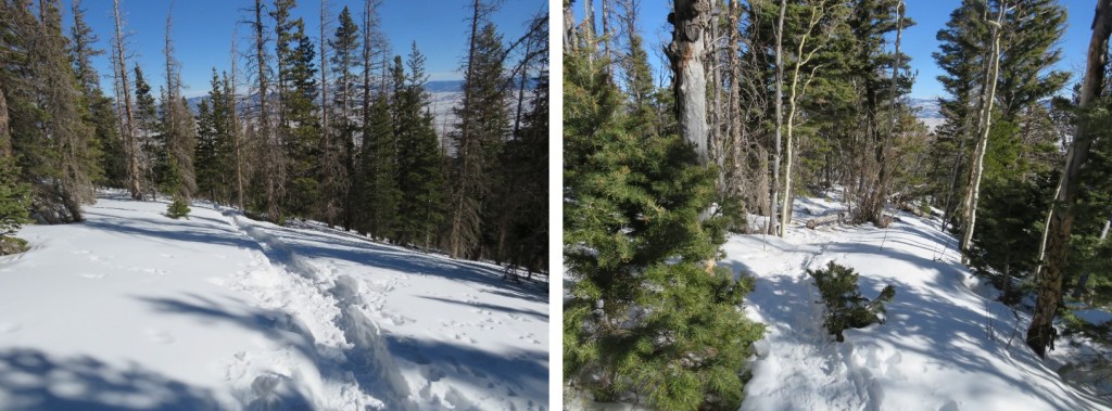
There are several spots to camp just before making it to Willow Lake, including one very large area at 11500’. There are still plenty of areas to hang bear bags already set up (for public use). I continued to hike west. My tracker told me I’d hiked 5.3 miles to this point.
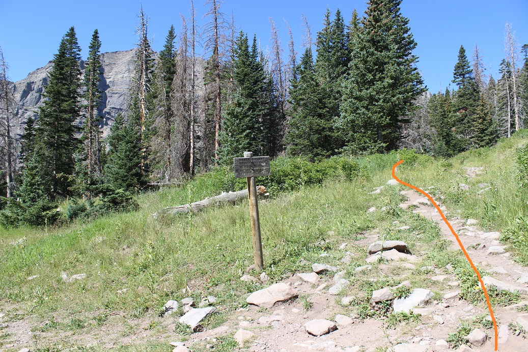
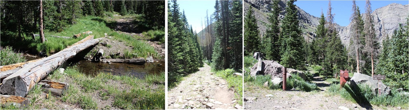
I followed the sign left that took me on the trail for Challenger/Kit Carson
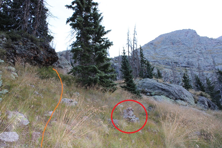
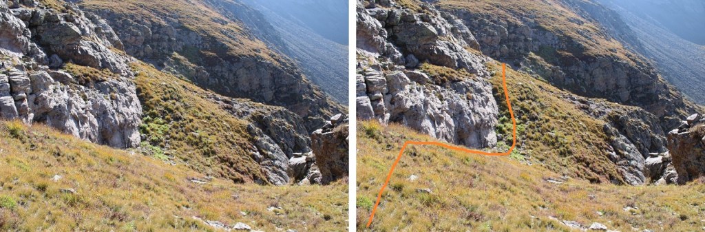
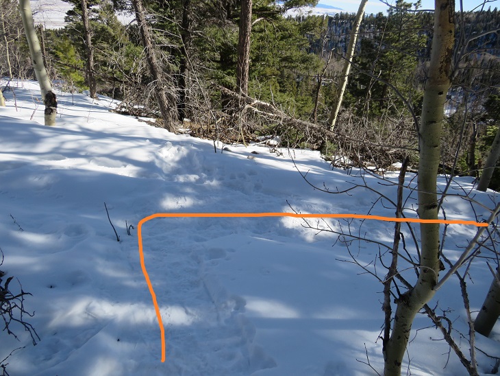
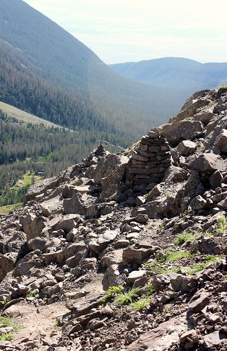
About 10 yards after this sign I left the trail and headed north up the hillside. There are cairns here, but they may be difficult to see in the tall grass.
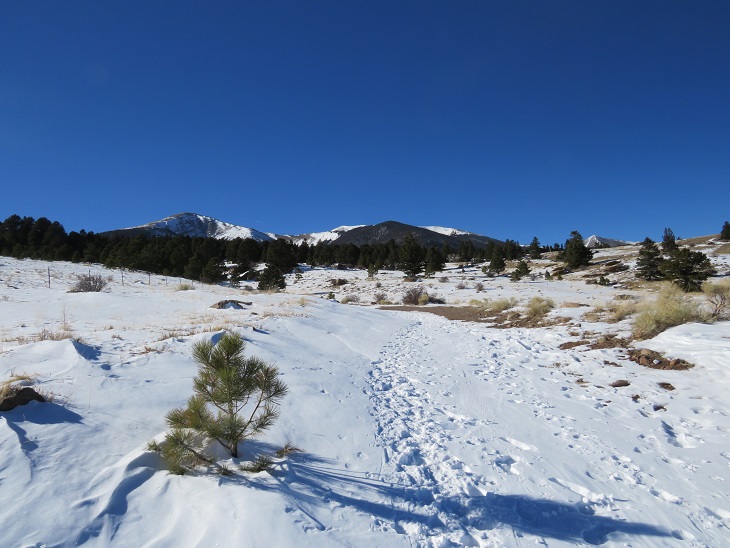
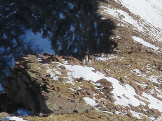
There are game trails here. I saw tons of deer and bighorn sheep the last time I was here, and this time I saw a few deer. Find a game trail and follow it north, keeping the creek to your left and rock outcropping to your right.
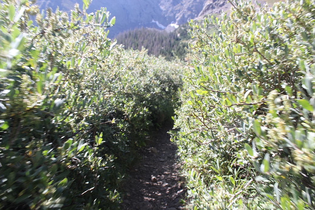
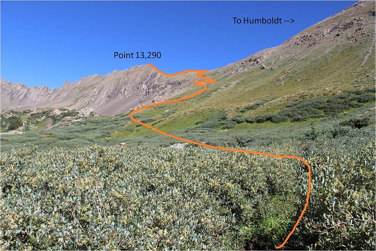
At the top of this hill there are cairns indicating you should go right, but if you do so, you’ll be going through a lot of willows. Instead, parallel the creek, staying to the right of the creek, and you can follow a game trail to the end of the basin, staying out of the willows, or at least keeping them to the easy ones that just reach your knees. Just keep heading north.
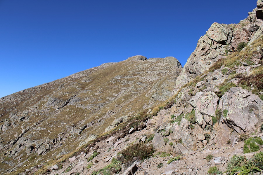
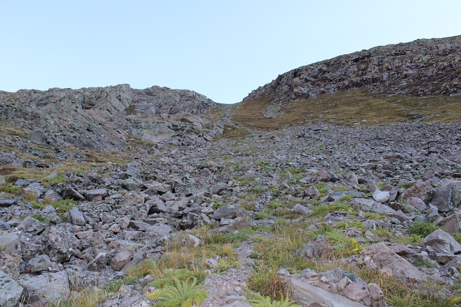
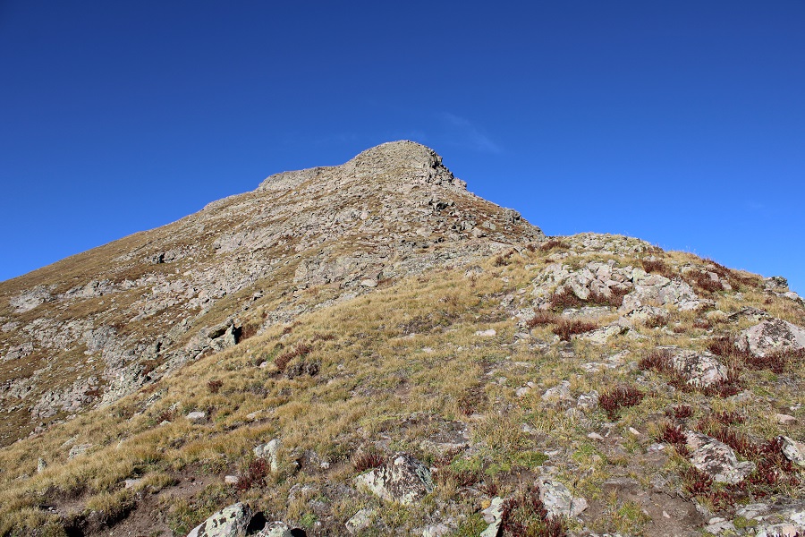
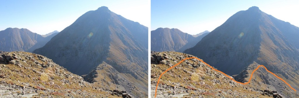
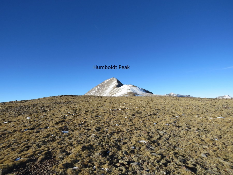
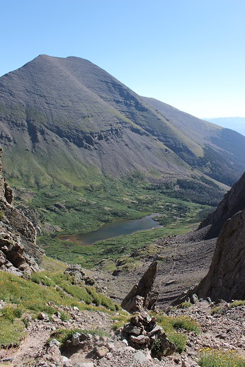
You’re aiming for this gully
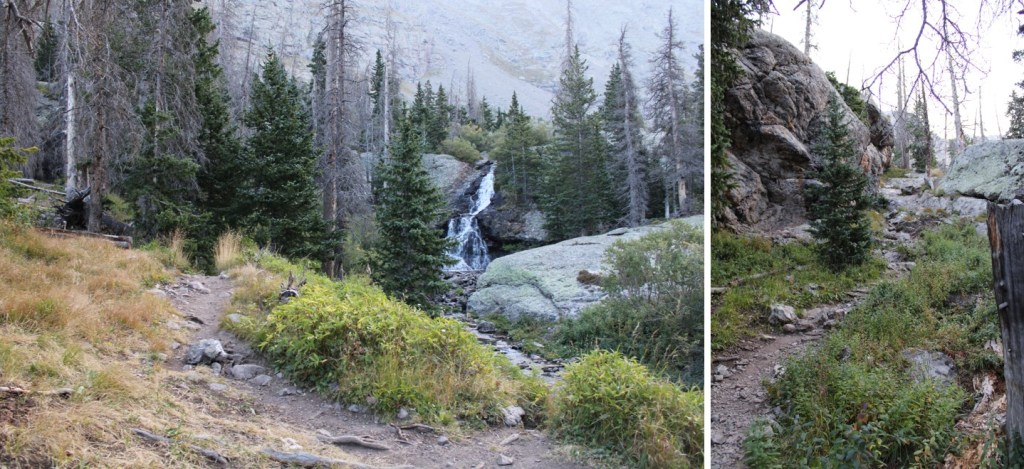
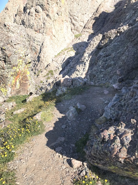
Here are some step-by-step photos (just keep heading north, this is class 2 terrain on tundra). First, stay to the right of the creek, and to the left of the willows
Then, continue north towards the gully. I was easily able to cross a creek and avoid the willows. I kept to the left of the willows and right of the creek the entire time.
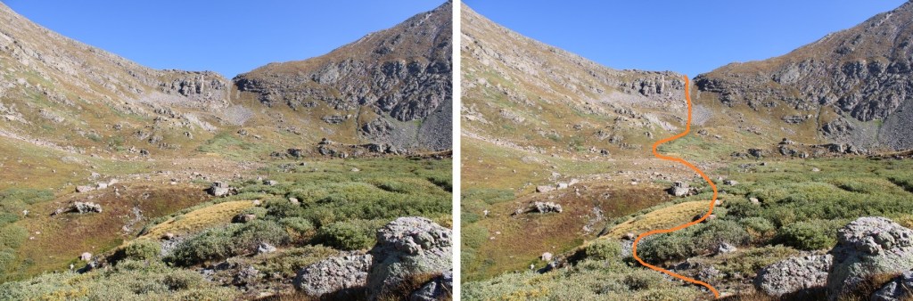
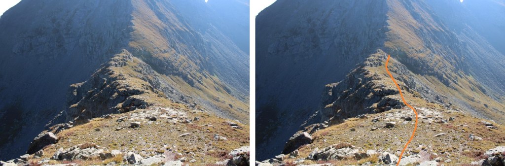
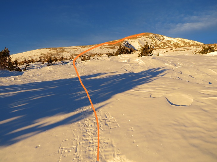
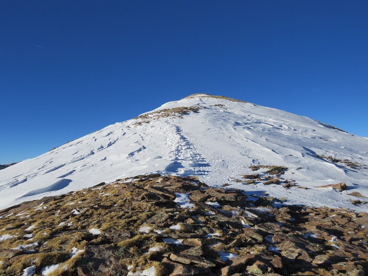
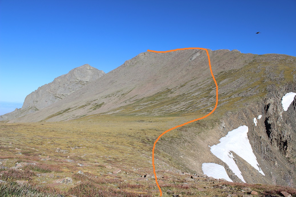
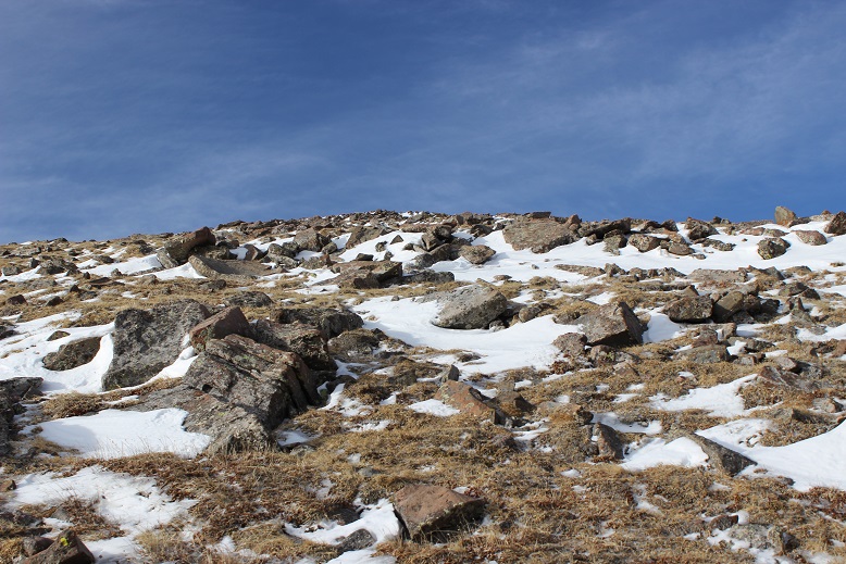
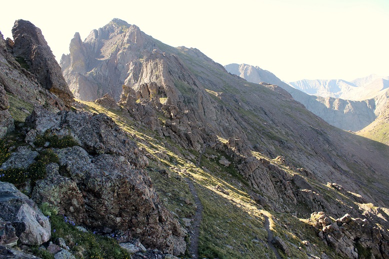
Next, I ascended the gully. This was easy as far as gullies are concerned. I was able to stay mostly on grassy areas. Note, you do NOT need to ascend all the way to the top of the gully. About 15 feet before topping out, take the grassy ramp to the left, staying below the rock outcropping of the ridge.
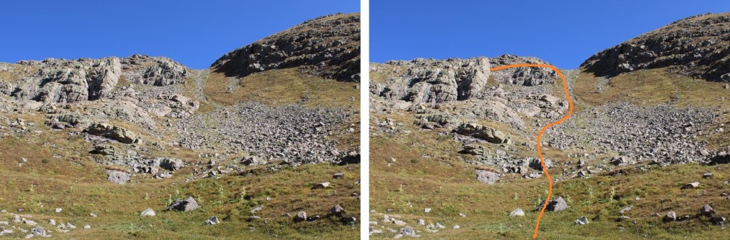
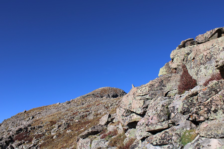
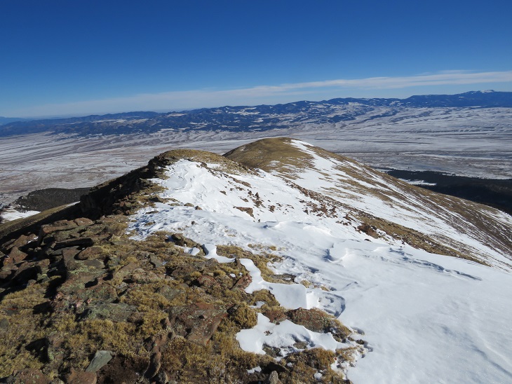
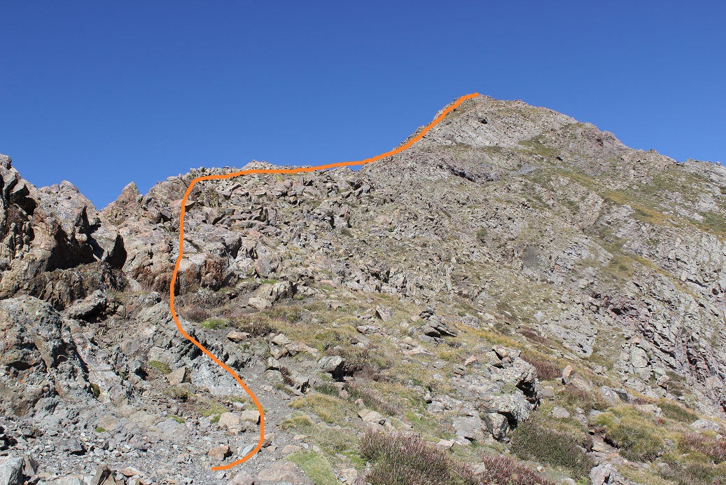
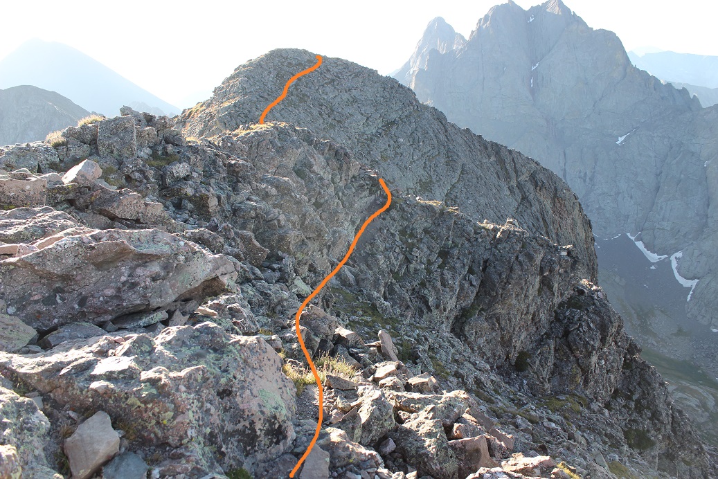
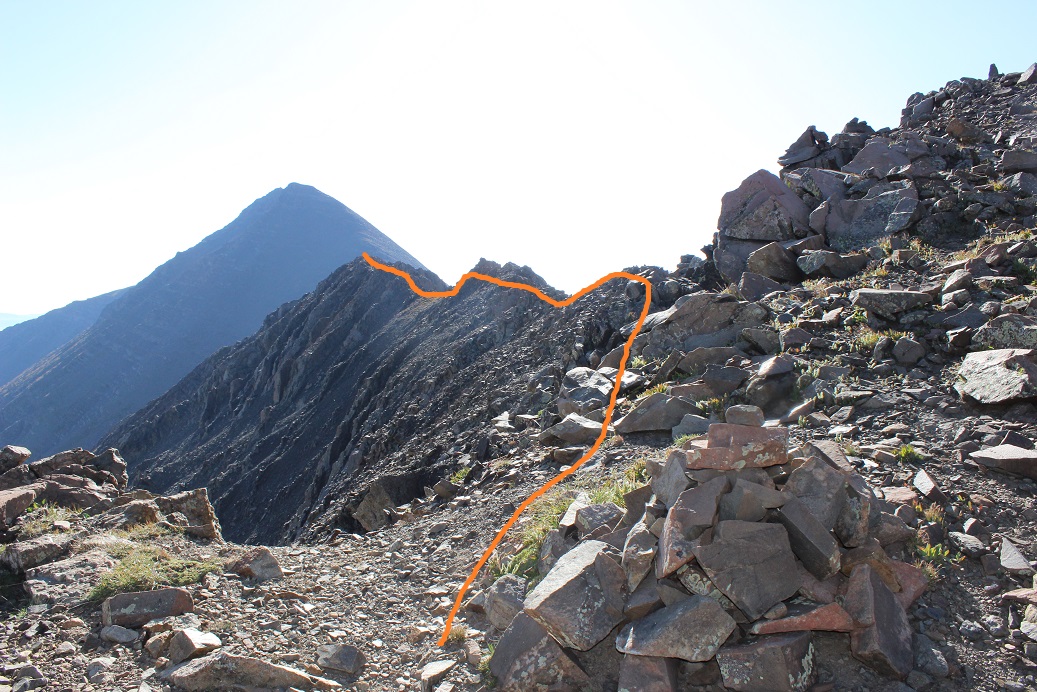
This grassy area is easy to follow. I just stuck below the rock. Here’s an overview of the route to the summit.
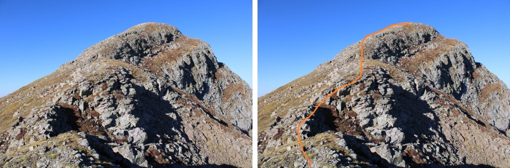
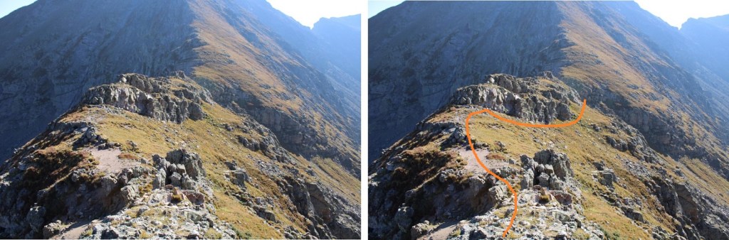
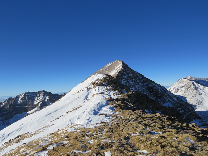
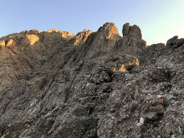
And step by step, first, following the ridge west
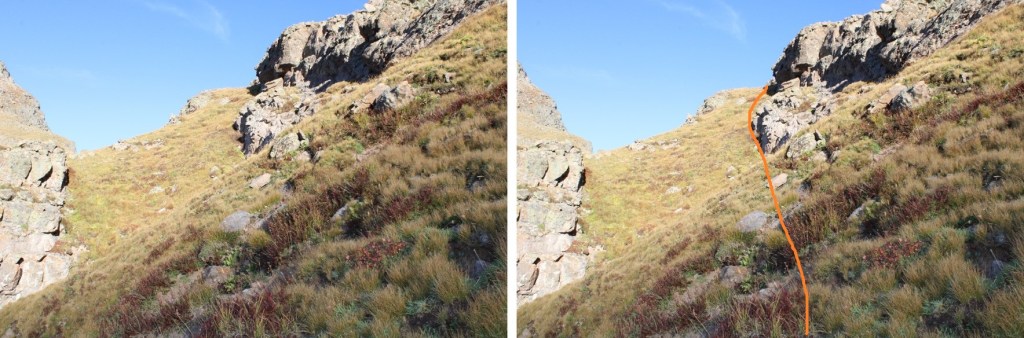
After the rocky ledge, I stayed on the ridge all the way to the summit. Once again, all class 2, and you can stick to the ridge.
Yes, this stays at class 2 (it looks harder than it is)
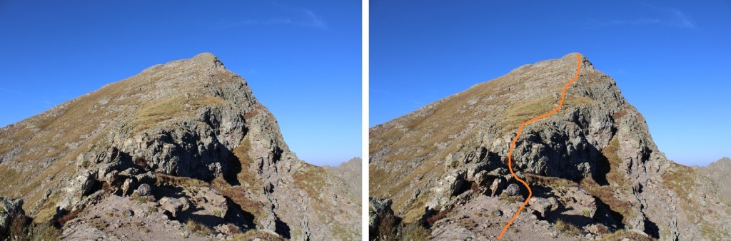
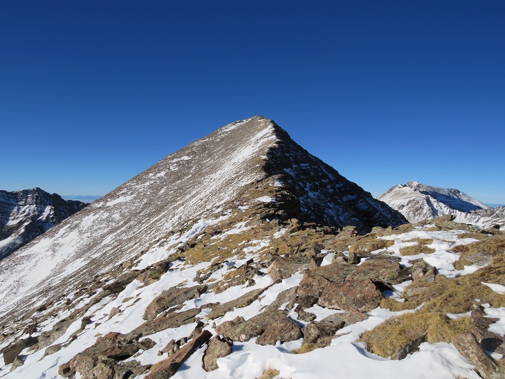
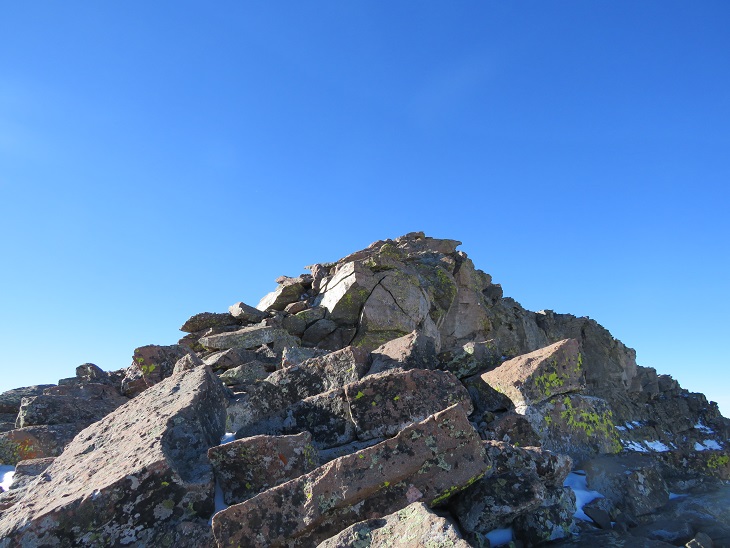
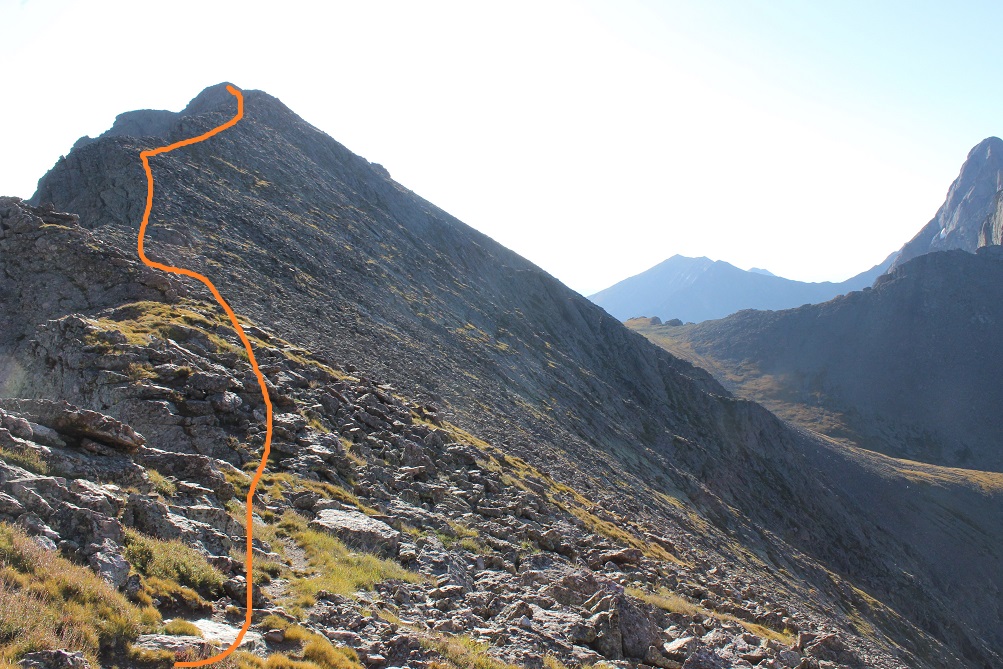
There’s a small false summit, and then it’s an easy trek to the peak
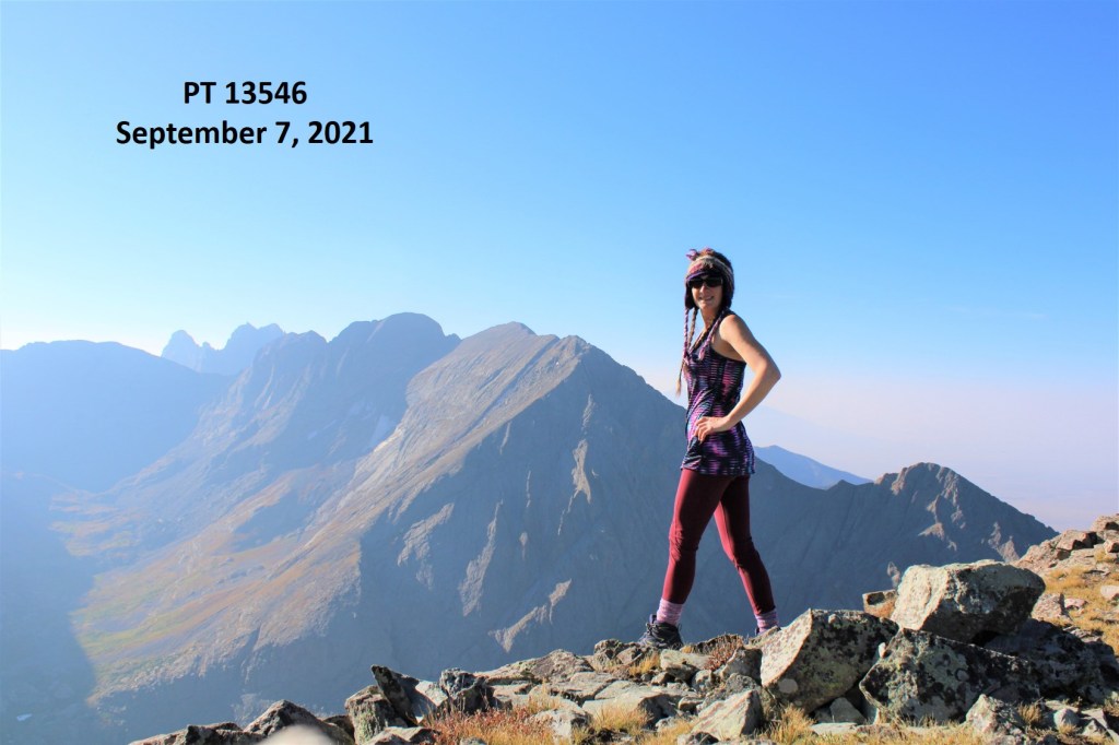
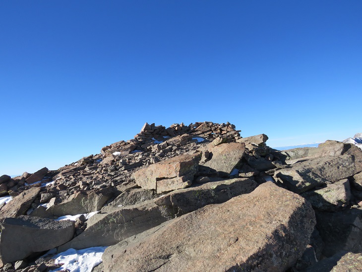
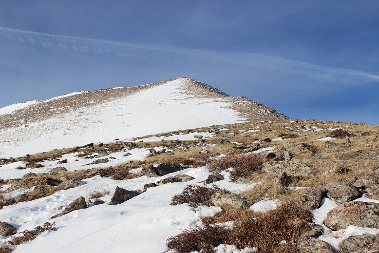
I summited PT 13546 at 8:30am
PT 13546:
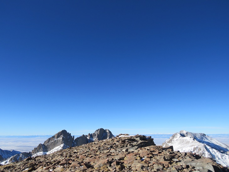
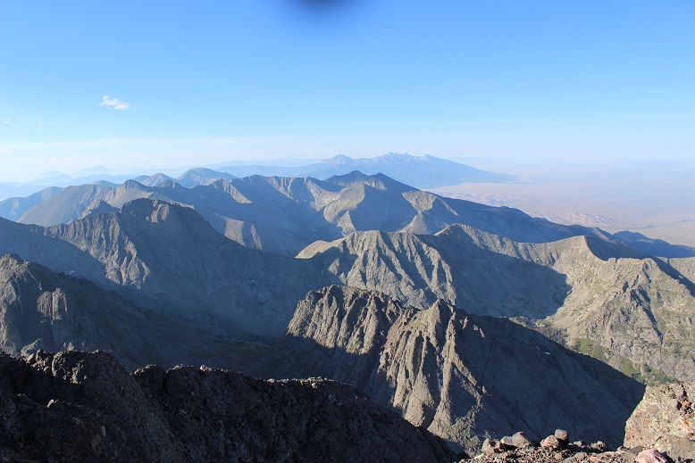
It was a hazy day. There was a summit register, but it was one of those pipe ones, so the paper inside was wet. It was also completely full of signatures, so I left the paper in the tube and added another one. There was a nice view of the Crestones; I just wish it was a little less hazy today.
I turned and headed back the way I came in, aiming for the Adams/13546 saddle. If you look closely, you can see a route to Mt Adams. I still had to get to work today, so I didn’t have time for Mt Adams (or PT 13153). Both look straightforward though from the saddle.
Here’s how I exited the ridge
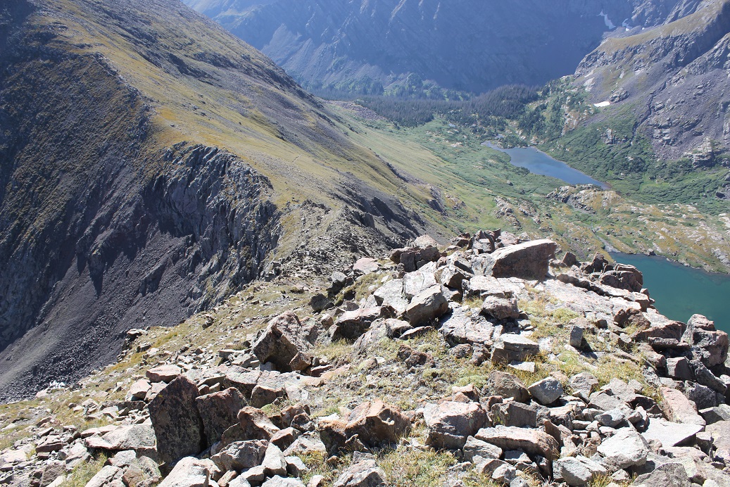
Once back on the saddle, I headed south out of the basin
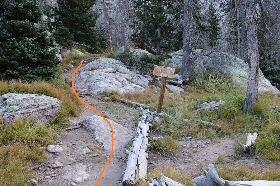
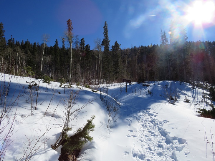
At the south end of the basin, I turned and followed the grassy ridge down (make sure you’re on the grass, not in the trees: there will be game trails here)
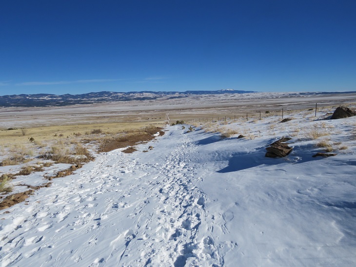
From the grassy area, the trail is easily visible. I made it to the trail, and followed it west, back to the trailhead.
I made it back to my truck at 11:30am, making this a 14.15 mile hike with 5337’ of elevation gain in 7 hours. While it was hazy today, it felt like a perfect day to be out!
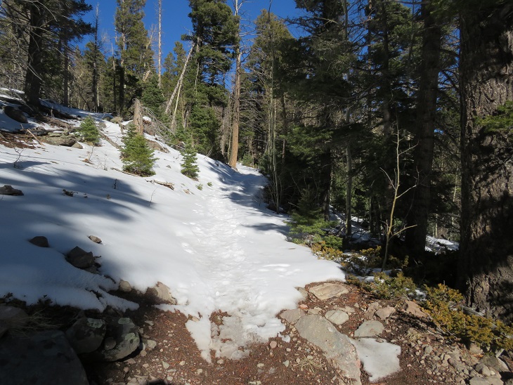
This was my third time hiking Humboldt, but my first time in calendar winter. The last time I was here there was a terrible wind that was causing the snow to become clouds, and I couldn’t see the summit when I arrived (or my own 2 feet). This time I was here for better pictures of the route, and to count it as an official snowflake. I arrived at the South Colony Lakes lower trailhead and was the only one in the lot when I parked my truck. I put on my gear, using only microspikes as my footwear, and was on the trail at 4:30am. As usual in winter, the snow started just past the 2WD parking area. I always find it amusing to see how far the tire tracks try to go up the road. This time, they didn’t go far.
The snow on the road started right away, but there was a good trench. I followed the road for 2.3 miles to the junction with Rainbow Trail. It was still dark out, and as I rounded the last corner of the trail where I could still ‘see’ the trailhead I noticed there was another car parked there. It seems there would be hikers about a mile behind me today. Also, my flashlight started flickering. Time to change the batteries!
At Rainbow Trail the trench spiked, one side going towards Marble Mountain, the other towards Humboldt Peak’s East Ridge. There weren’t any tracks headed further down the road to South Colony Lakes. I turned right and followed Rainbow Trail for .5 miles.
I quickly came to a bridge, then took the trail to the top of a slope
At the top of the slope I was thrilled to see there was a trench in place leading up the ridge. Last time I did this hike I’d had to trench it myself, and it had taken quite a bit of work. Today, I was going to poach someone else’s trench! Woot!
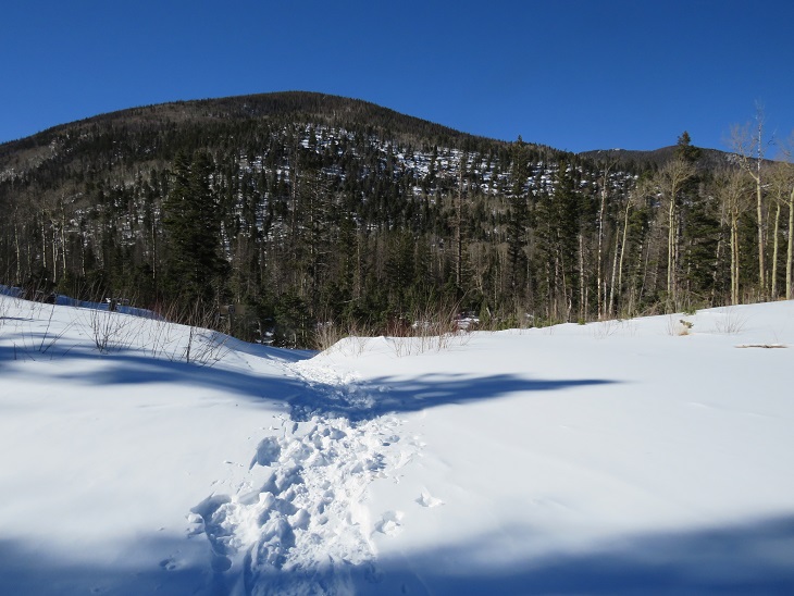
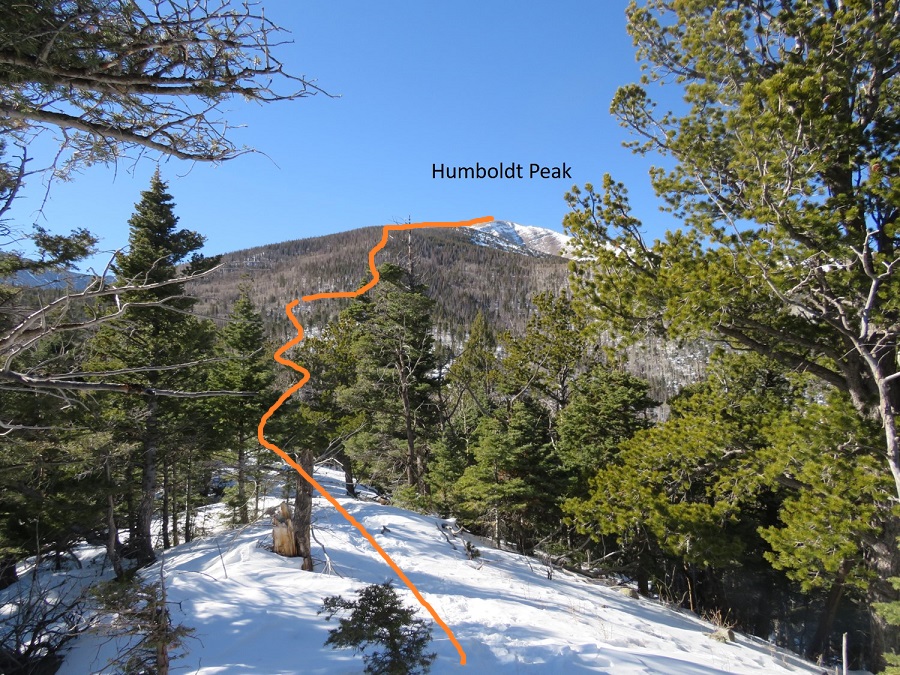
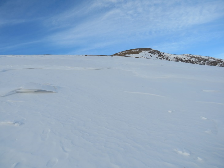
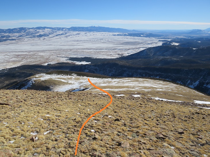
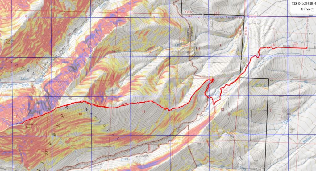
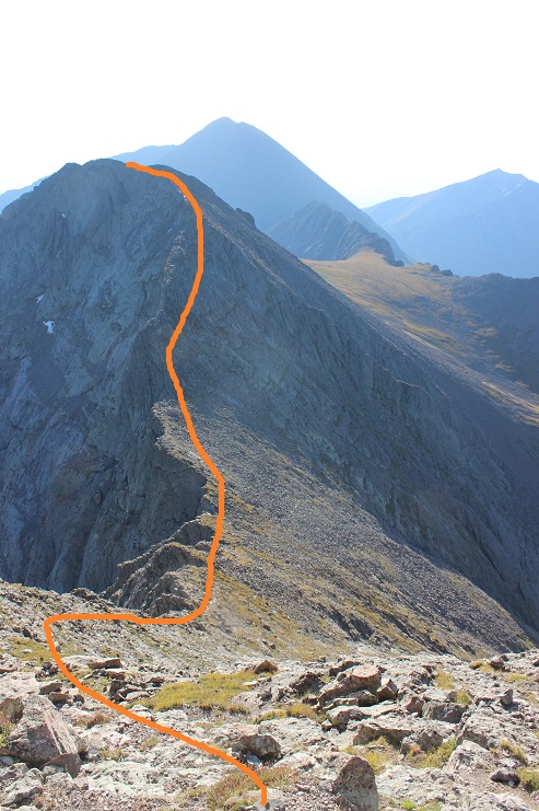
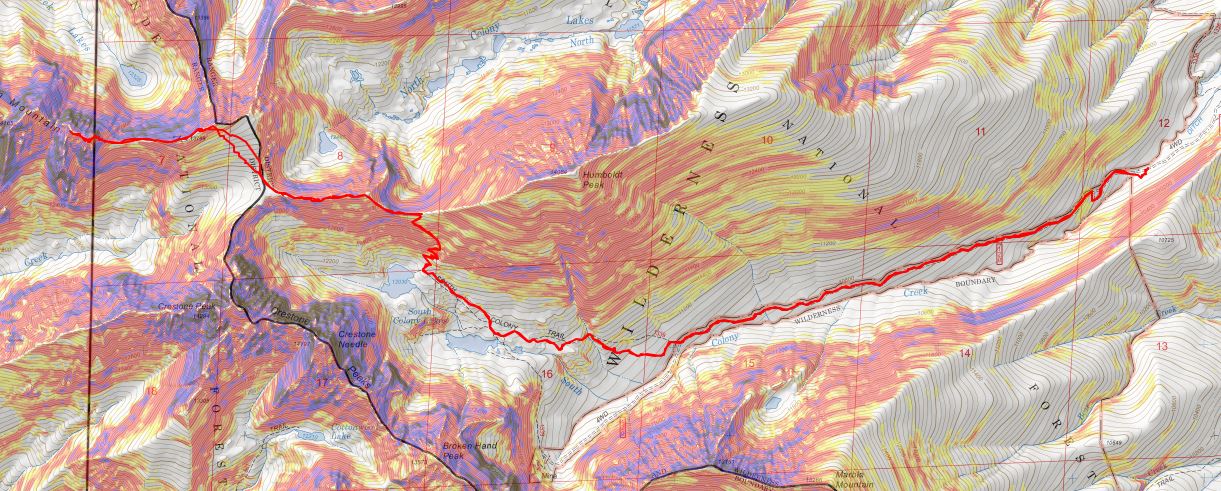
And what a trench it was! I followed it as it for 2 miles as it ascended the east side of the ridge, all the way to treeline. Here’s an overview of the route up to Humboldt Peak
If you keep heading west and stick to the rib/ridge, it will take you to treeline. I could hear the wind above the trees, and got a bit anxious for the above treeline part of the hike.
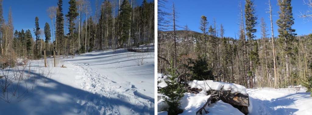
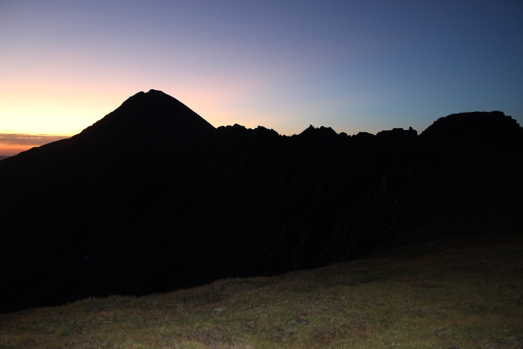
As I hit treeline the sun started to rise. I took a few minutes to enjoy the view. (side note: there were a lot of rabbit tracks here)
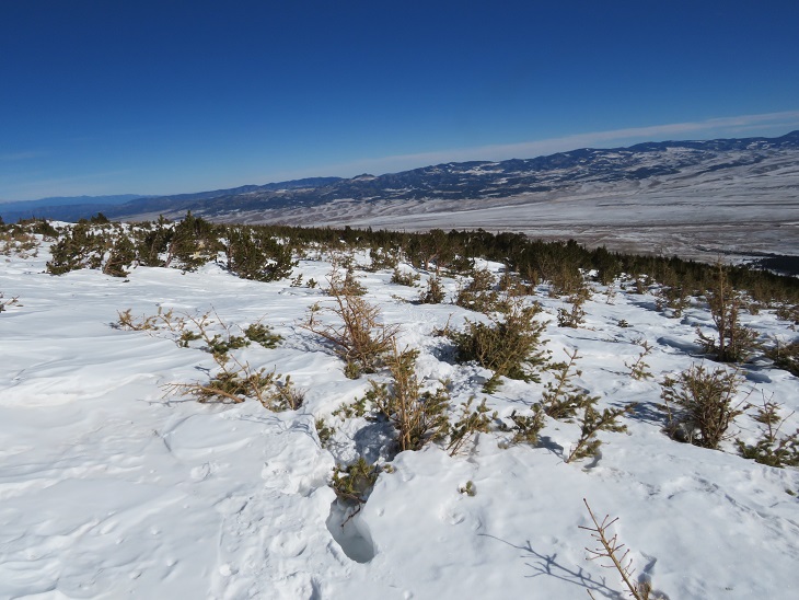
The trench ended near treeline. I could see where it was supposed to go, so I kind of re-trenched it as best I could wearing just spikes.
Here’s the general overview of my route up the ridge
The wind had been intense all morning, but once I was above treeline it became difficult at times to even stay upright. So much for the forecased 11-17mph winds! I’d started early to avoid the most intense winds that were supposed to start around 11am, but it seems they started a little early. I had to hunker down at times and turn away from the wind, which turned the snowflakes into glass, and was side-stepping as I hiked just to stay in a straight line. I tried to take pictures, but unfortunately, wind is invisible. I kept my gloves on and was glad I’d put on my balaclava at the trailhead. Here are some pictures of the ridge.
Here I noticed some bighorn sheep in the distance. They also noticed me and trotted off.
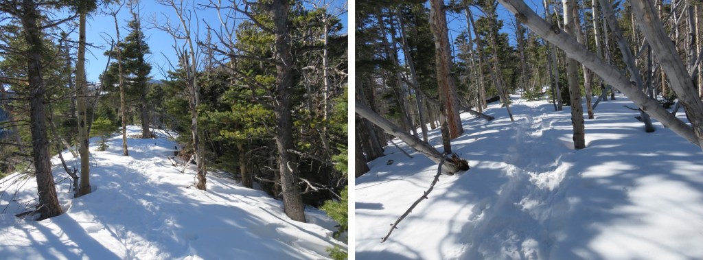
At the top of the ridge was another ridge, so this had been a false summit. Here’s the actual summit of Humboldt Peak. It’s a straightforward ridge hike to the summit, nothing above class 2.
Here are some pictures of the ridge. There was some snow, but it was all firm enough not to need traction
On this part of the ridge the wind really picked up. I had to hide behind rock structures to get out of the brunt of it, and the noise it made as it came up and over the rocks was creepy. The balls of my feet were frozen at this point (due to Raynaud’s) and it felt like I was walking with large rocks in my shoes (I wasn’t, it was just the ball of my foot that had frozen). Several times I hunkered down to maintain my balance, but it was still a straightforward ridge hike.
I knew I’d made it to the summit when I found the wind breaks. I never saw a summit marker, but I don’t think there’s one here?
I’ve summited Humboldt Peak twice before, so I knew I was at the summit at the first wind break, but I walked further west for better pictures.
I summited Humboldt Peak at 9:45am
Humboldt Peak:
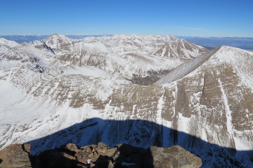
The views of the Crestones/Sange de Cristo range were beautiful!
Time to head back down the ridge
The wind was still fierce, and I was worried I was getting a nasty windburn in all the areas my balaclava didn’t cover. The wind speeds weren’t supposed to be this high, so I’d left my goggles at my truck. Note to self: next time, bring the goggles. On my way back down the ridge I saw the Bighorn Sheep again. They quickly turned when they saw me and headed over the mountainside. There was a big drop on the other side, and I was surprised I couldn’t see them again when I passed.
This was a simple ridge stroll, or, it would have been, without the wind
Here’s looking at my route back down the ridge to treeline
Here I met some hikers heading up. The wind had died down considerably by this point, so I figured they had the better weather of the day (I found out later it picked back up again, and they said their summit was just as windy as mine). My feet started to de-thaw, and I had a minor Raynaud’s attack: think insane pins and needles as the blood started flowing again. It lasted about 30 minutes, and to combat it I just kept hiking. On a positive note, I could feel my toes! Finding my tracks back to the trail was a bit of a challenge, but I came across them eventually.
Then I followed the trench back to Rainbow Trail. I should have put on snowshoes here, as I postholed ever 30 feet or so, but I really didn’t want to stop. I was just glad I’d started early enough in the day not to need snowshoes (spikes worked just fine). Anyone heading back down later than me would need snowshoes.
Once back at the trail I followed it a half mile to South Colony Lakes Road
Once on the road I hiked the 2.3 miles back to the trailhead, noticing a lot of dog tracks along the way. As I neared the trailhead I saw a couple walking with two beautiful dogs. It seems they were out on a day hike, and I thought this was a great idea, as it was a beautiful day below treeline.
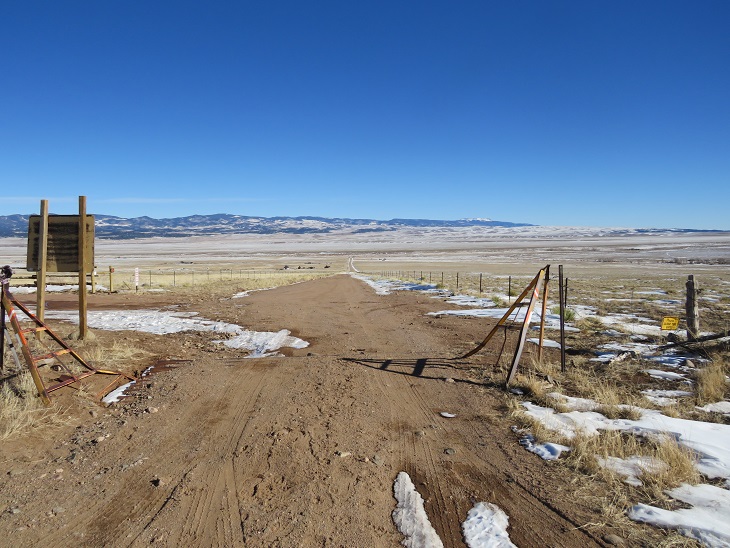
Here’s a look at the trailhead on my way back. Easily 2WD accessible.
I made it back to my truck at 1pm, making this a 14.02 mile hike with 5563’ of elevation gain in 8.5 hours.
Unfortunately, when I made it back to my truck I could hear the conversation the couple with the dogs were having. The man kept cussing at his female companion, and the dogs, over simple things like an overturned water bowl. To me there’s no need for vulgar words, and he was using multiple ones in each sentence he uttered. I felt the urge to say something, but no one else in his party seemed to mind his behavior, so I kept it to myself. I’m not sure why women allow themselves to be treated that way?
The Humboldt Peak Summit Sticker can be bought here
It’s officially High School Football season which means late Thursday/Friday night games. Luckily for me my daughter performs at half time and can drive herself home so I was able to get in 2 hours of sleep before waking up at midnight to drive to the trailhead.
And what a drive it was! This is my 6th or 7th time at the South Colony Lakes Trailhead, and the last 3 miles were the worst I’ve ever seen them. The drainpipe was actually one of the easier parts. Because of the rough road I drove a little slower than I normally would and wasn’t on the trail until 2:30am. (Sorry, these pictures are of the easier areas, as I needed both hands on the wheel to navigate the tougher ones).
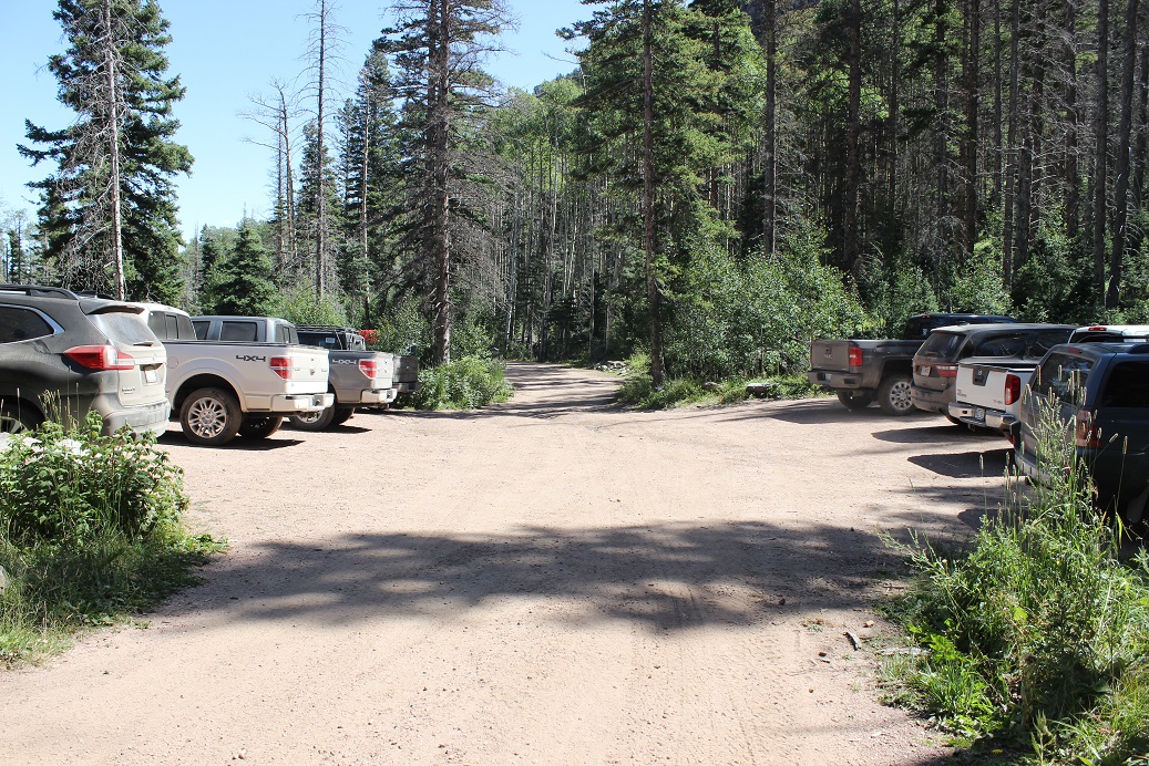
One side of the parking lot was completely full: I was the first to park on the opposite side.
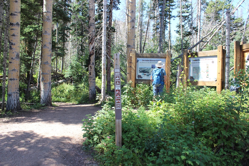
I followed the South Colony Lakes trail, which starts at the west end of the parking area
There’s a register to sign and then immediately I crossed a bridge and headed left (west) along an old 4WD road that’s no longer maintained.
There were a few mud puddles here and some running water, but nothing that actually got my boots wet.
After hiking for 2.6 miles I came to this junction and went right to follow the Humboldt Peak / South Colony Trail.
Here the road ends and it actually becomes a trail, crossing a few minor bridges and a small boulder area
before entering the South Colony Lakes Basin. Here the willows were overgrown and made the trail ‘fun’ to follow at night (spiderwebs).
In the daylight it’s easy to see where you’re headed: Follow the well defined Humboldt Trail to the saddle of PT 13,290 and Humboldt
Making it to the saddle was straightforward, but here the trail ended. I turned west (left)and continued on towards point 13,290
I followed the ridge to the top of the point
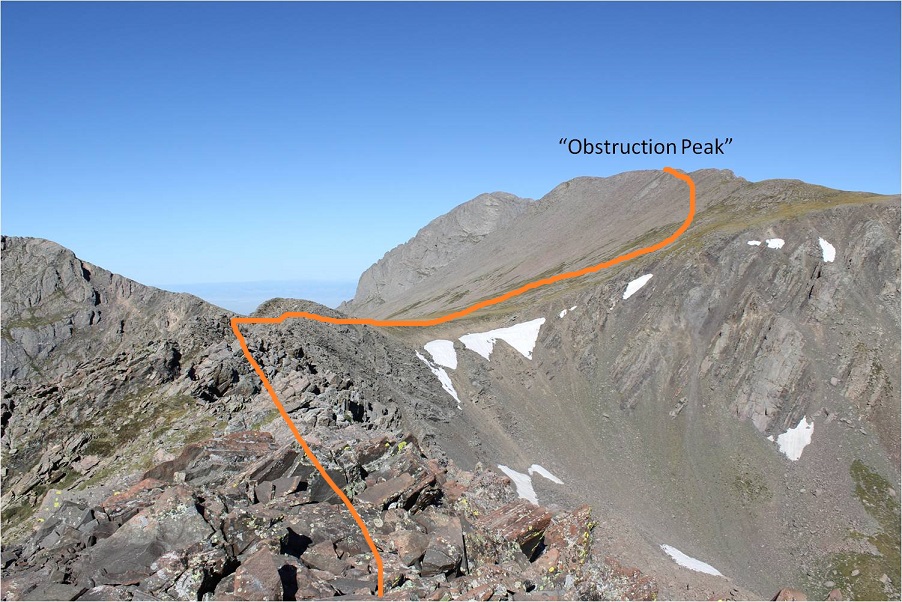
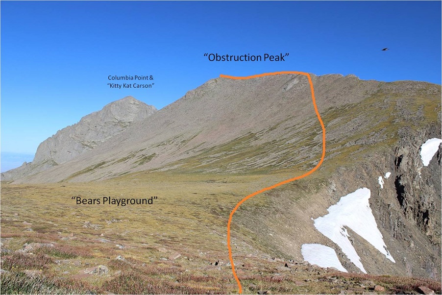
From here you can see the rest of the route up to “Obstruction Peak”, but I couldn’t because it was still dark
This ridge is NOT fun to cross in the dark. I wasn’t able to see much of what was ahead of me, which made route finding tricky. I also couldn’t tell how much exposure there was, which was positive at times. I mentally wished for my helmet and just stuck to the ridge, doing my best to anticipate the proper route and backtracking and trying again when necessary. On my way back I could clearly see a class 2+ path, but in the dark it was slow going.
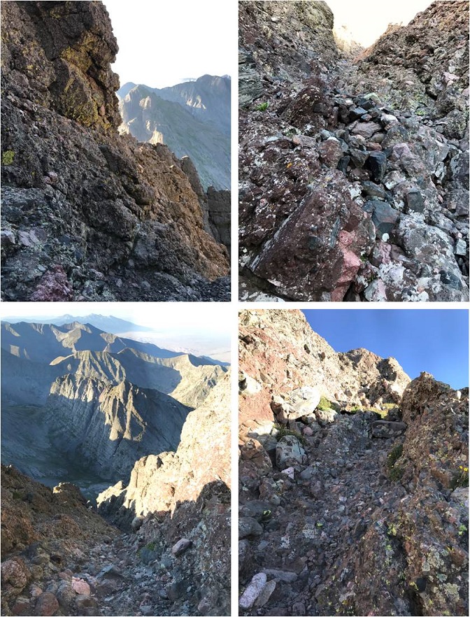
Here’s the ridge
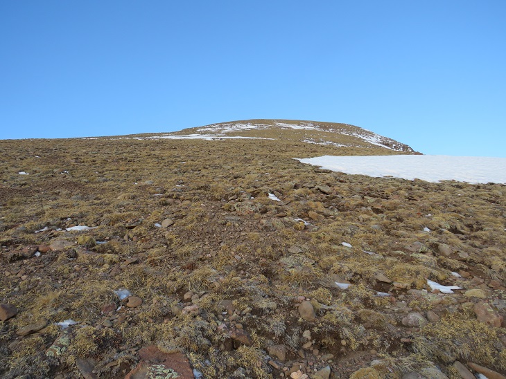
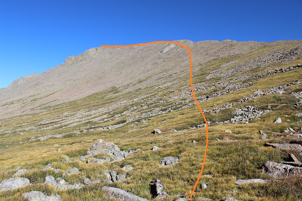
After crossing the ridge I crossed a relatively flat area known as “Bears Playground” and headed northwest up towards “Obstruction Peak” first over tundra and then rocky areas
It was actually difficult to tell exactly where the summit of “Obstruction Peak” was so I decided to make it to the ridge early and just walk across the entire ridge. I’m pretty sure the true summit is at the most westerly point.
I summited at 6:45am
“Obstruction Peak”:
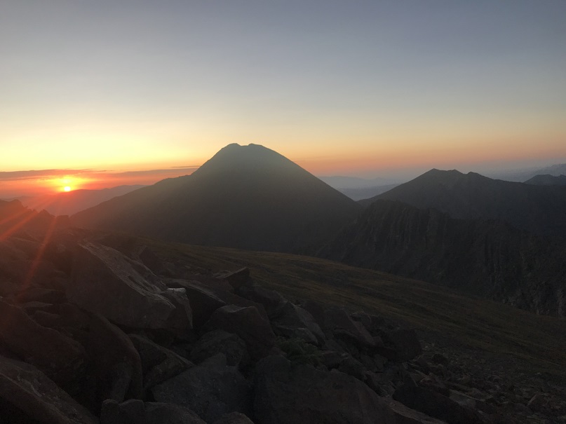
As I turned and looked east I could see the sunrise
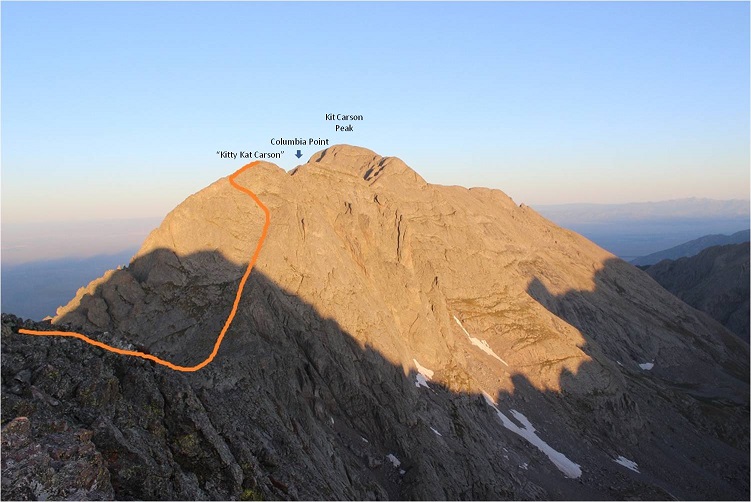
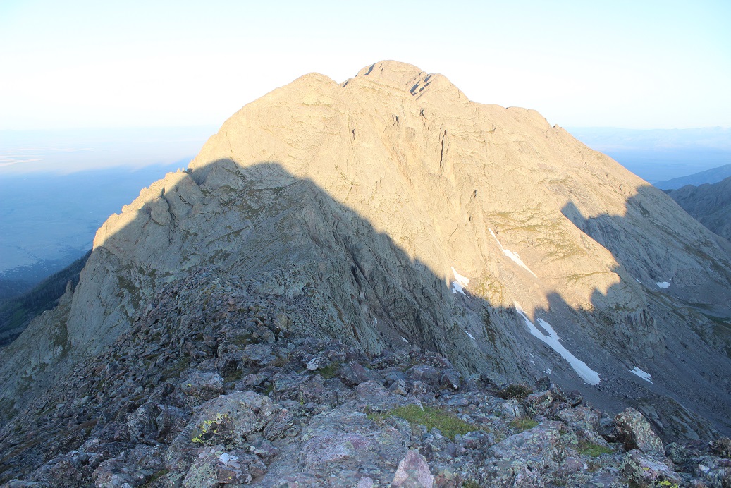
From the summit of “Obstruction Peak” the path to “Kitty Kat Carson” and “Colombia Point” was clear
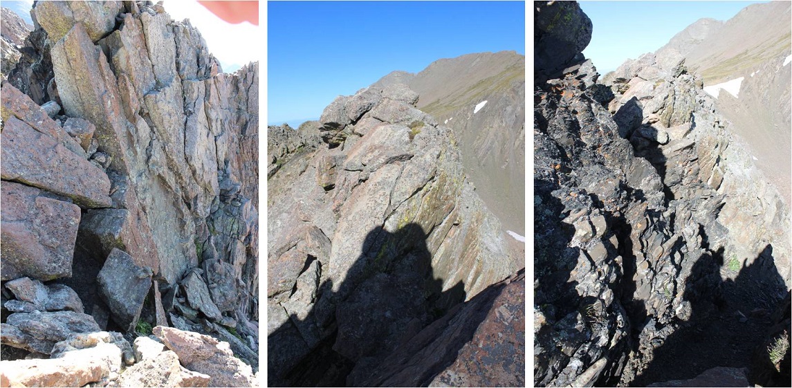
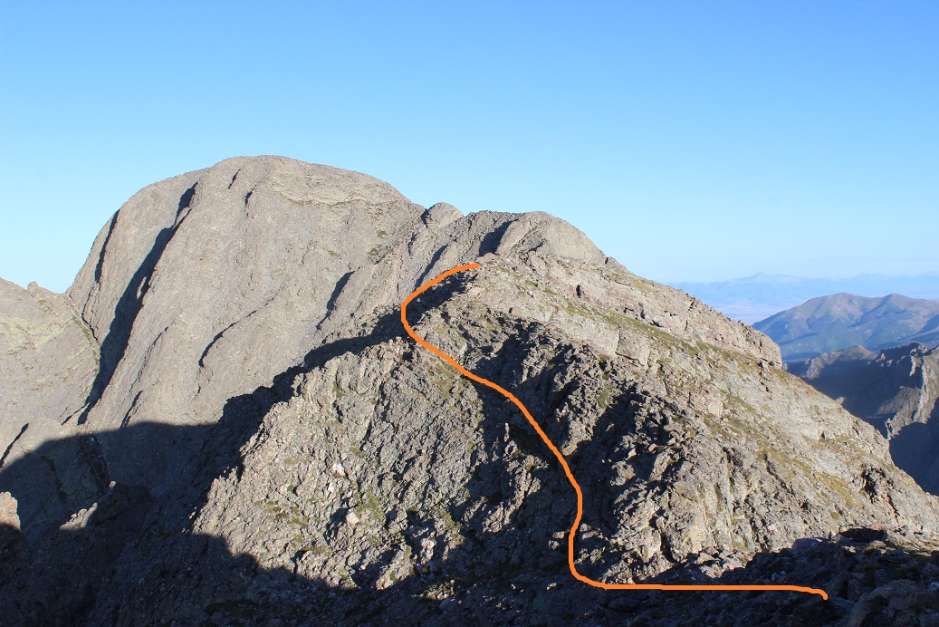
I hiked down “Obstruction Peak” towards “Kitty Kat Carson”. The ridge down was rocky but stable
Once at the saddle “Kitty Kat Carson” looked imposing, but wasn’t too much of a challenge. There were a lot of cairns here, especially towards the top, which made them useless. I stayed to the right for most of the ridge, and then headed left to summit
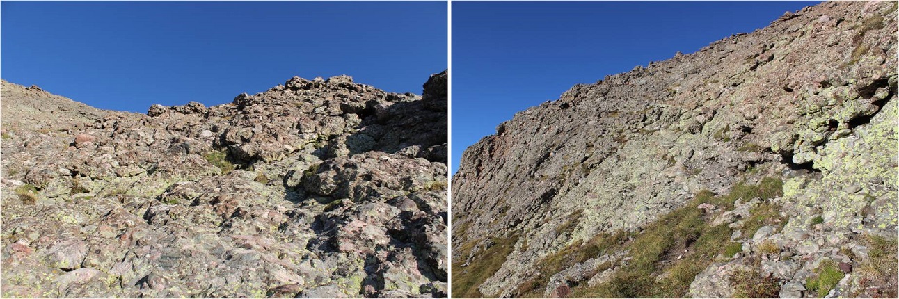
The terrain here was classic Crestone: lots of steep, grippy rock
I summited “Kitty Kat Carson” at 7:28am
“Kitty Kat Carson”:
It took me less than 10 minutes to traverse from “Kitty Kat Carson” over to Columbia Point, losing about 50’ in elevation and then regaining it back. This was all class 2+ climbing
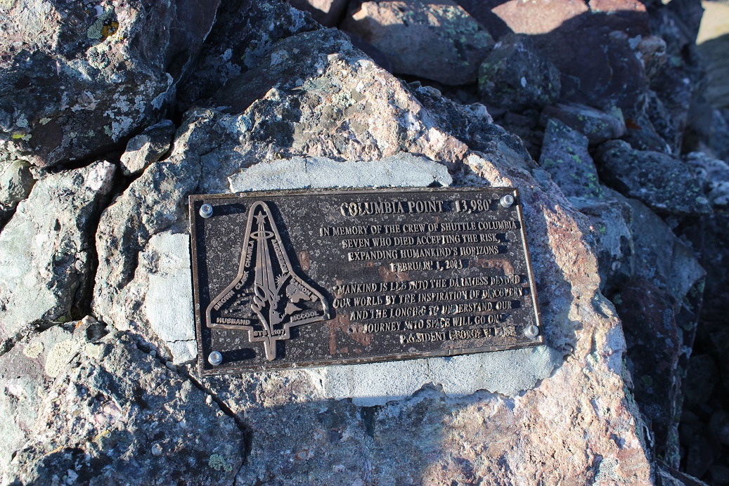
I summited Columbia Point at 7:39am
Columbia Point:
There’s a plaque at the summit commemorating the crew of the shuttle Columbia
Here’s looking back on “Kitty Kat Carson”
Time to head back. Here’s the route towards “Kitty Kat Carson”
And down the saddle and back up to “Obstruction Peak”
Once at “Obstruction Peak” I made my way back down Bears Playground and over to the ridge. That had been quite a time in the dark!
I was so glad to be able to see the route in the daylight. I didn’t need to stick to the ridge the entire time, and mainly stuck to the left/north when I wasn’t on top of the ridge. I found this was a rather quick traverse when I could see what was in front of me.
What took longer than I’d remembered was the hike down from Point 13290 and back to the Humboldt Saddle
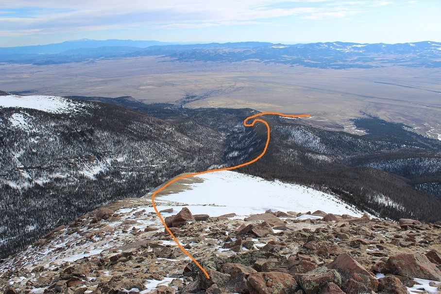
Here’s the route to the South Colony Lakes area
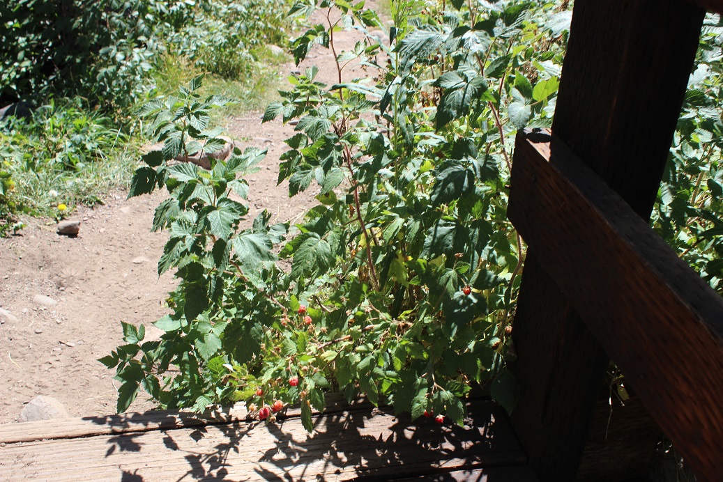
The hike back was rather uneventful. I saw over a dozen hikers and was reminded how popular the 14er trails are. I stopped and talked to several people intent on Humboldt, and even saw a few friends intent on some of the other 14ers. I was in a rush though: I had to be home by 2pm to take my daughter camping, which meant I had to make it back to the trailhead no later than 11:35am. It was a beautiful day and I wasn’t carrying a full pack so I was able to hike pretty quickly. I made it to the bridge crossing and saw some raspberries.
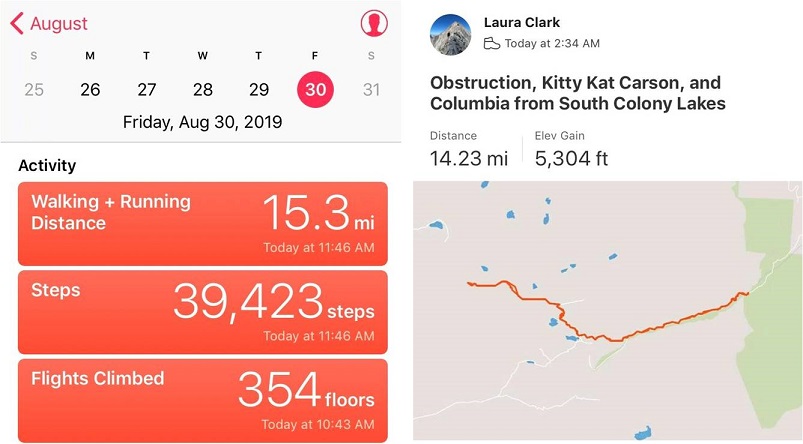
I decided to try one: it was sour, and unfortunately not as good as the ones from Purgatory, so I only ate one and left the rest for woodland creatures to enjoy. I made it back to the trailhead at 11:30am, making this a 14.5 mile hike with 5304’ in elevation gain in just under 9 hours. The best part (besides making it home at 1:58pm)? No mosquitoes!!!
I’d attempted this peak a few weeks ago but had to turn back due to high winds above treeline. Today I was ready to try again, armed with a beautiful weather forecast and a full night’s sleep.
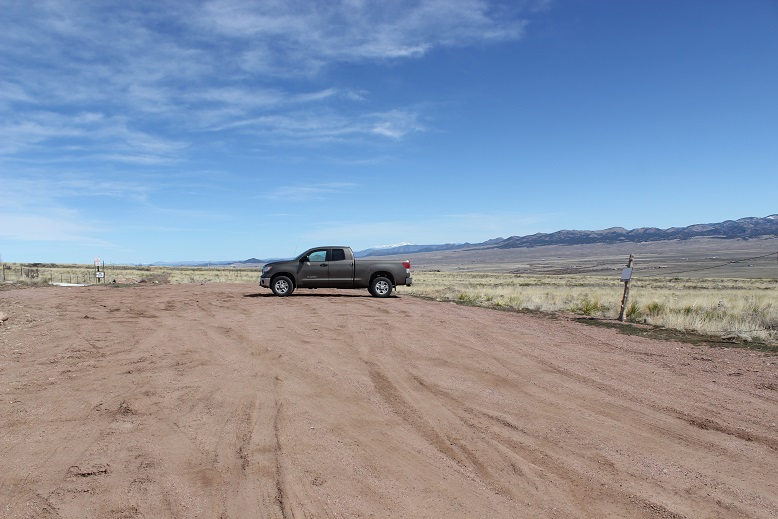
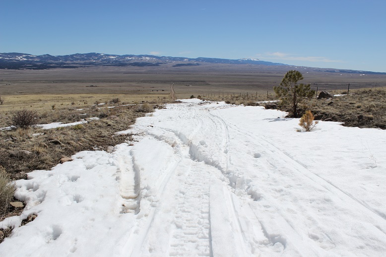
Since I’d been here 2 weeks ago and knew it had snowed here quite a big since then I didn’t even attempt to drive to the upper South Colony Lakes trailhead. I made it to the South Colony Lakes lower 2WD trailhead at 4am to one other vehicle in the lot. It looked as if someone was sleeping in their truck. I got together my gear and was on the trail around 4:15am. After hiking about 100 yards I came upon snow on the 4WD road and was glad I’d parked in the lower lot.
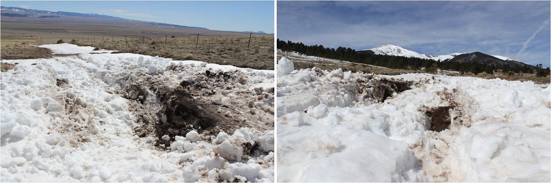
Unfortunately, it looked like someone had attempted to drive up the road in the past few days. When the road got too much snow on it they drove off the dirt road, kept driving parallel to the road, and then when they felt there was less snow went back to the main road.
This tears up everything people! Don’t do this! It also looks like they learned their lesson because they got stuck in a snow drift. I’m guessing there’s about 4 feet of snow here. Not only did they get stuck, they tore up the road trying to get out, which will make it more difficult for drivers to make it to the upper trailhead once conditions actually improve.
The road in was well packed in areas, soft in others, and covered in 2-6 feet of snow. It was still dark so I kept looking over my shoulder to see if anyone drove in behind me or was hiking with a flashlight but didn’t see anyone. I put on my snowshoes at the Rainbow Trail Trailhead.
This trailhead is still inaccessible by vehicle and covered in snow.
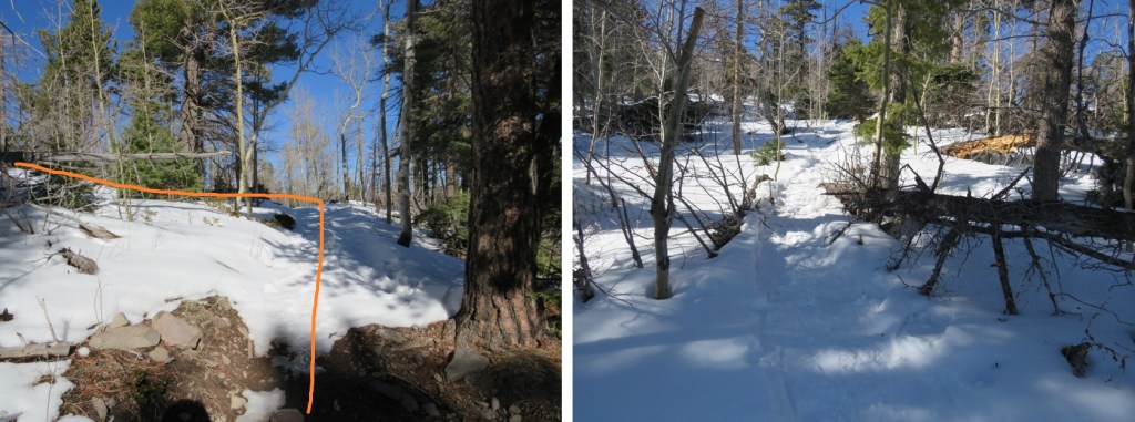
I had a map with me, but since I’d just done most of this hike 2 weeks ago I never took it out of my pack. From the Rainbow Trail I turned left (northeast) and followed the slope up to the ridgecrest. Here the tracks I’d put in earlier were still in place, and it looked like a few others had been here since then, so there was a faint trail to follow
At the top of the slope I immediately turned right and followed the ridge. The ridge looks mostly flat, but does gain in elevation, all except for one area where it dips down a couple hundred feet and then inclines again.
This was supposed to be a 7-10 mile hike, with about 3500’ in elevation gain, but for some reason it felt like a lot more than that. It seemed I was below treeline for much, much longer than I should have been, yet I knew I was still on track because as the sun rose I could see Humboldt peeking at me through the trees to my right.
Finally (and I mean finally) I crested a vertical slope
And made it to treeline.
Here the snow was hard packed and I was glad I had snowshoes (crampons would have been necessary otherwise). I traded my trekking pole for my ice axe and started up the hill.
The wind picked up, and remained a steady 15mph until I made it back below treeline. In this area it was impossible to avoid the snow
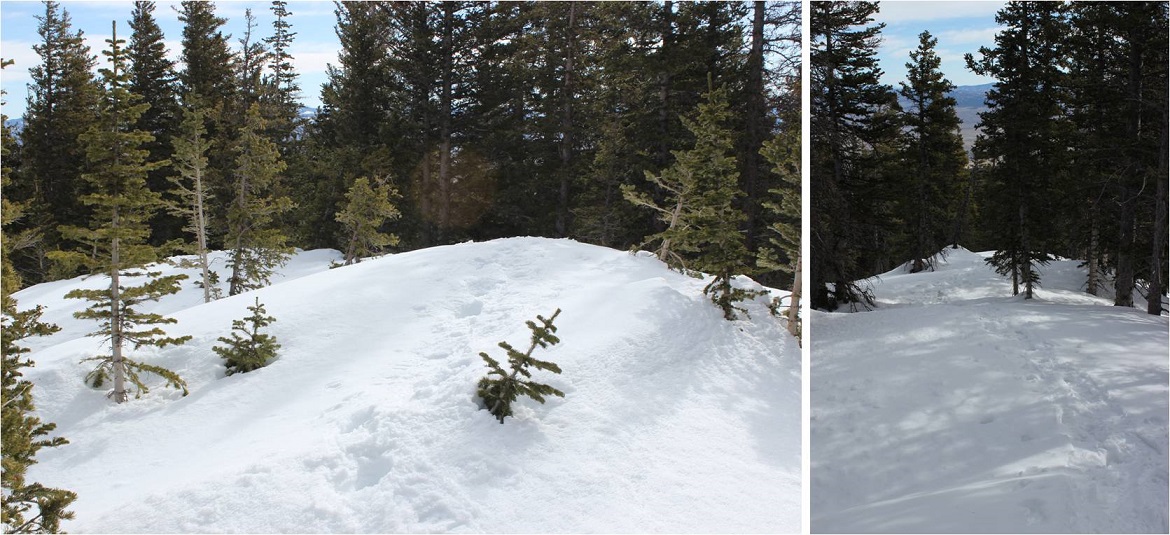
But as soon as I was up over this hill I had the option to stick to the snow or hike on tundra instead. I was tired of the snowshoes, so I took them off and kept to the right, following the ridge.
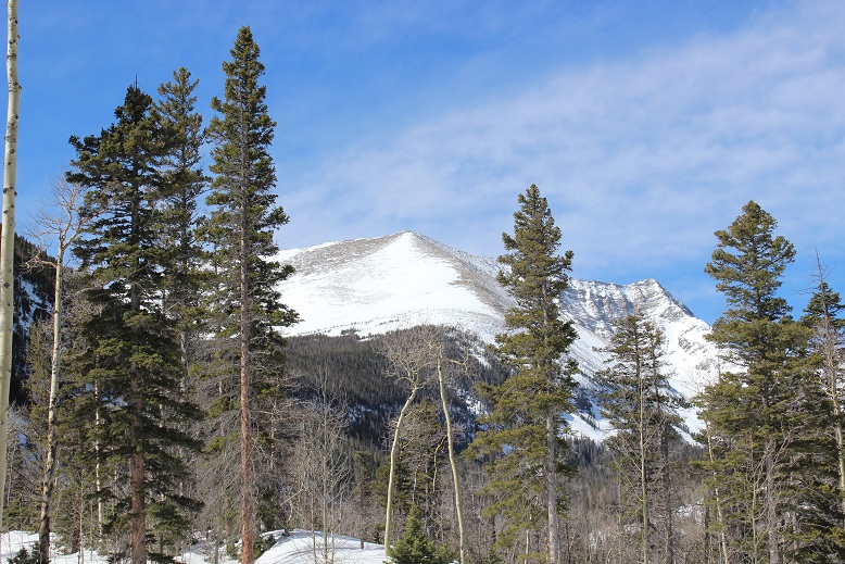
The view of the Crestones and Humboldt was beautiful!
The rest of the route was pretty straightforward, but I was curiously more tired than I should have been for just 3500’ in elevation gain. I was seriously worried I was losing my touch, or that I was getting out of shape? As I neared the summit the terrain became more rocky and steep. I found myself zig-zagging my way up, doing my best to avoid the random snow patch that had me post holing up to my thighs
I summited to some amazing views of Humboldt, the Crestones, and a bunch of 13ers!
Here’s my summit photo
It was a beautiful day, but that wind made it cold and my fingers were starting to burn so I turned around and headed back down the slope. Here’s a look at the way I came
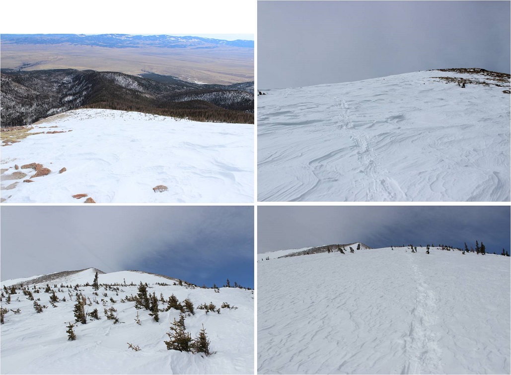
Here’s what it looks like just above treeline. Snowshoes were helpful (and here I put them back on). I appreciated the full coverage of snow
The ridge back once again seemed to take longer than necessary. It felt like I was in the trees forever! I was still glad I had my snowshoes
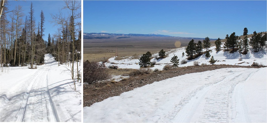
The wind stopped below treeline and the temperature increased dramatically. I took off my hat and gloves and noticed my hands had some minor damage, but nothing that wouldn’t heal in a few days. I saw a couple of early season mosquitoes on the ridge, which were easily distinguishable against the white backdrop of snow. I made it back to the Rainbow Trail and followed it to the Lower South Colony Lakes trail, noticing the temperatures had warmed up the snow quite a bit and once again praising my snowshoes: The road was becoming a slushy mess.
I fully expected to see people hiking up the trail or skinning, or something, but I never did. I didn’t see another person the entire day, and as I rounded the corner and could see the parking lot it became apparent why: my truck was the only vehicle in the lot! I’d had the entire mountain to myself today!
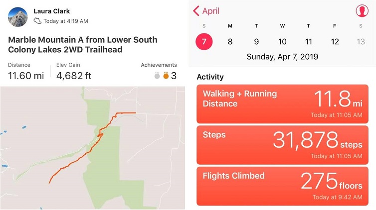
It had been a beautiful day to hike: Little wind, warm temperatures, and solitude. When I checked my tracker it said I’d gone 11.6 miles and gained 4682’ in elevation in 6.5 hours. No wonder I’d felt out of shape! I’d expected a 7-10 mile, 3500’ elevation hike. As I’d been hiking I’d begun to doubt my physical fitness, but these new numbers seemed much more accurate.
Here’s my Relive (which I like this time because it portrays the snow above treeline)
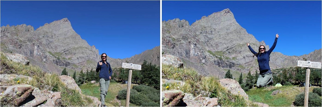
The decision to hike Crestone Needle today didn’t come until late yesterday. I’d had this day on the calendar for this particular hike for over a month, but the fires in the area had me hesitant. I did a lot of online research and was 80% sure the road to the trailhead I needed to take was open. That was a chance I was willing to take. What I wasn’t thrilled with was the possibility of inhaling smoke for the entire hike. The weather looked good, and in the end I chose to take the hike because it’s my last 14er I need to complete the Crestones and I was afraid if I waited too long the fire would expand and I’d miss my opportunity to hike.
I woke up at 12:15am and drove to the trailhead. All roads were open from Colorado Springs South, but there were more deer on the roads than I’ve ever seen. I’m assuming they were displaced because of the fires. Most deer I see when driving at night are female, but these were mainly male deer in the velvet. I was just glad I was the only one on the road so I could drive cautiously and stop when needed.
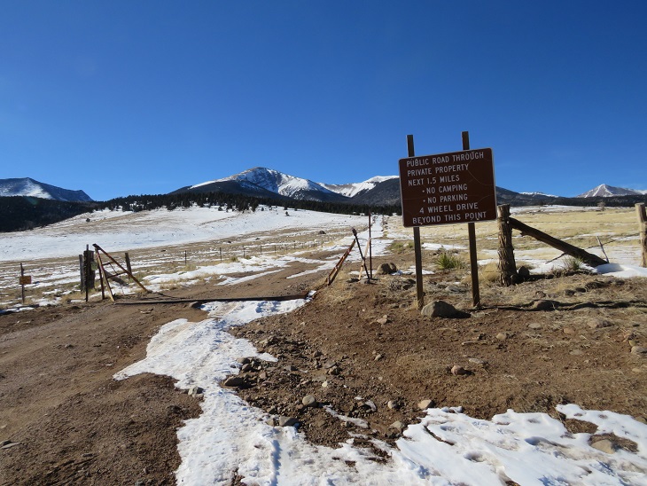
I turned South on Colorado 69 and saw a flashing sign indicating the highway was closed ahead and only open to residents. I crossed my fingers and drove on. I was able to make it to the turnoff (Colfax) before the road closed. The drive in past the 2WD trailhead was worse than I remember it being back in April (but not worse than last year at this time). The drainpipe was a bit steep.
When I arrived at the trailhead at 3am the parking lot was almost full, which I’d expected even though it was a Wednesday morning. After all, it was the 4th of July! There was a lot of activity in the parking lot as people were getting ready for their respective hikes. I hate leapfrogging people, so to get a head start I jumped out of my truck and hit the trail, grabbing a bagel to eat on the way. There was no smell of fire in the air and I hadn’t been able to see flames the entire drive.
At 3:15am I signed the trail register and was on my way. BTW, the trail log book is in serious need of repair/updating. The pages are mostly loose, and there’s no clear order to signing it. I found a blank page and signed in, but if there was an emergency (say, a fire) and they needed to know who was hiking in the area it would take them a very long time to figure it out.
This is my third time this year hiking in through the South Colony Lakes trailhead. I have to say, it’s much easier and faster without snow to navigate through! It’s amazing how easy the trail was to follow without snow, and how difficult it is to navigate when snow is present. The hike in didn’t take me long at all. I was way ahead of schedule. Last time I was here the creek was frozen over and there was snow up to the footbridge. Today there was no snow to be seen.
I made it to the South Colony Lakes and saw many tents lit up as people were preparing for their hikes today. It looked like there were dozens of people camping by the lake. I made it up Broken Hand Pass around 5:30am and looked behind me at the trail of lights from hikers taking the pass as well.
The only other time I’ve hiked Broken Hand Pass it was filled with snow and there was no clear path to follow, so I crossed the slope wearing snowshoes. Today the path was clearly visible, yet harder to hike without traction. I kind of missed the snow here! As I looked around me at the slope I realized back in April I must have been hiking on over 10 feet of snow! What a difference the snow made!
The trail up and through Broken Hand Pass is very well cairned. I now know why those cairns are so big! They looked small (or were non-existent) under the snow.
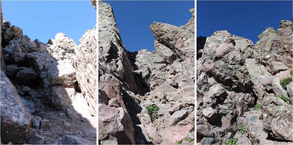
Last time I did this hike I forgot to put on my helmet until it was too late and I was in a position where it was too dangerous for me to take my helmet out of my pack to put it on, so this time I put it on before it was needed. Here are the first class 3 moves up the pass.
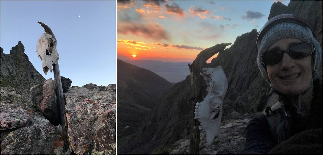
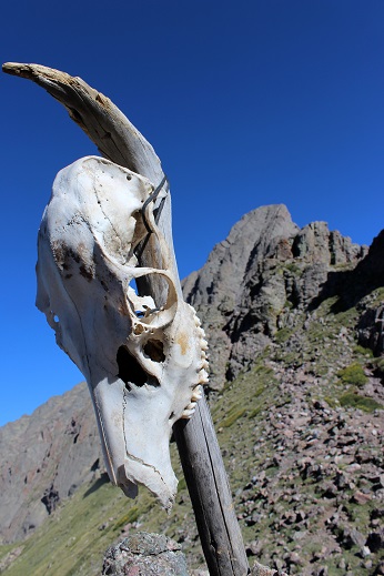
I made it to the saddle just as the sun was coming up, and when I looked over to my left I saw a skull that wasn’t there last time, placed on a large stick. Of course I went over to investigate. As the sun rose I made friends with Skully and got a few selfies with my new pal. He seemed to be keeping sentinel over the area.
I was way ahead of schedule at this point, but decided to keep hiking so I wouldn’t get cold. I followed the ridge and went to the heavily traveled trail to the right, and realized it cliffed out, so I turned left and encountered more class 3 moves.
The trail was well marked, although sometimes it split into two parallel trails. They both followed the South side of the mountain and ended in the same place. Here’s a look back at the trails and Broken Hand pass.
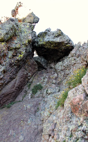
After hiking the slope the trail abruptly stops. I knew this was going to happen, but was surprised at how abruptly it did just… stop. I mean, it just ended at a rock.
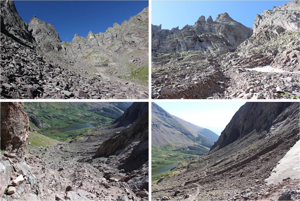
I looked up and down and then got out my directions. I needed to hike down about 75 feet, then over to the east gully. Here’s a picture of the route before me.
This is where the fun began! Climbing the gullies is a lot of fun! There was exposure, sure, but plenty of hand and foot holds available. I once again praised myself for joining a rock climbing gym and going weekly. This was child’s play! While this class 3 scrambling should have been challenging, for me it was really just fun.
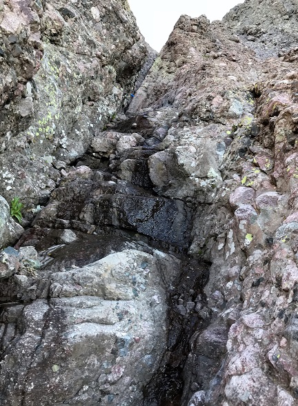
The route wasn’t heavily cairned, but there were enough cairns in just the right areas so you knew you were on the right path (which I prefer to multiple cairned paths). For me the crux of the climb came at the dihedral, where you switch from the east to the west gully. The dihedral was obvious to find but difficult to cross. It’s much larger in width and depth than this picture suggests, and my task was to climb on top of it, locate a cairn, and cross the rib. There was a trickle of water running down its base, just enough to make climbing up slippery with wet soles.
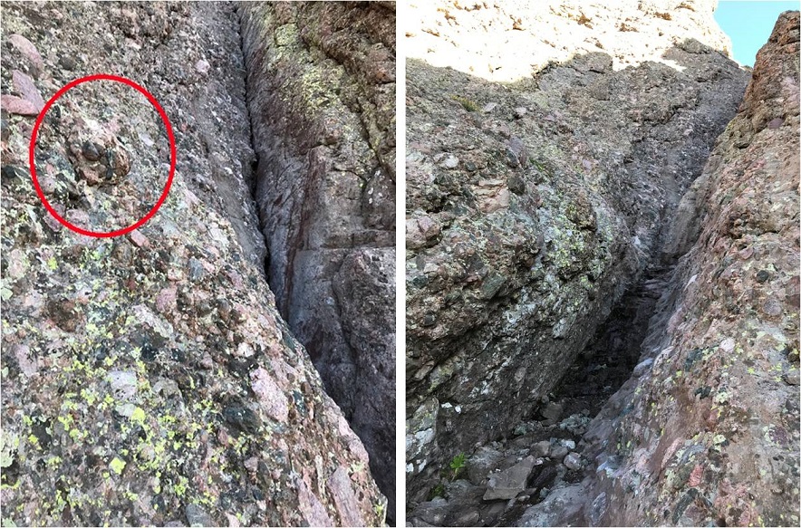
I’m not a large lady, and while I’m pretty flexible, here my 5’4” height was a hindrance and flexibility wasn’t much help. There were hand and foot holds all over this mountain, except in the dihedral. The rock here was smooth and there weren’t many places to grip. The width was just far enough apart where I couldn’t stretch across (although I’m assuming it wouldn’t be much difficulty for someone over 5’10” to navigate). So I was stuck: I couldn’t climb up the dihedral to cross over, and I couldn’t climb across the gap either. I searched and located the cairn on the rib above me and to the left. I knew that’s where I needed to be, but getting there seemed impossible! (The cairn is in the red circle)
I took a deep breath. This had to be traversable. There had to be a way across, I just wasn’t seeing it yet. I went back to where the dihedral was narrowest and tried again. There were a few stretch moves, but I was able to successfully climb up the wall and back over to the left where the cairn was located. Woot! I’d made it!!!
This is where the real climbing began! I climbed up the ridge and aimed for a notch. Here’s a picture from my way back down when I passed three male climbers heading up (who’d had trouble with the dihedral too, so it wasn’t just me!).
The exposure here was real! One of the other hikers told me this part almost made him lose his breakfast. Personally, I loved it! Yes, the exposure was extreme, but there wasn’t much danger from loose rock and there were plenty of hand and foot holds, so as long as you didn’t slip and fall you were fine.
I couldn’t help but thinking how awful this route would be with snow, and once again praised myself for not trying this peak after completing Crestone Peak last April and the waterfalls that were present then. It wouldn’t have ended well.
There were several large gullies to climb, all with the same secure rock and lots of holds.
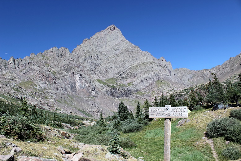
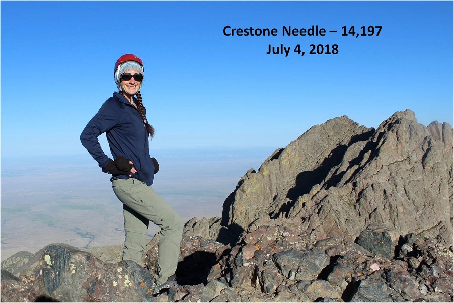
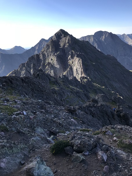
At 7:20am I summited! I had a great view of Crestone Peak
As you’ll notice from the video, there isn’t evidence of a fire anywhere
For the first time while hiking a 14er I was able to see the Sand Dunes in the distance
I took a summit selfie to prove I’d summited
And while it was still early I headed back down because I was only half way through with this hike. It was too early to celebrate yet.
Remember all those steep gullies I’d climbed up? Well, now it was time to climb back down them. They were pretty steep, so I turned and faced the wall and began climbing down, once again grateful for all the holds.
Thankfully the dihedral was much easier to navigate heading down than up. I just pressed my stomach on the wall and slid off and down into the open space below, using friction for balance, knowing I didn’t have far to fall if I did.
I have to pause for a second here to talk about down climbing. I may not know a lot about rock climbing, but I do know I have better balance when I’m facing the wall on the way down. I passed a hiker who was heading down these gullies feet first. He was continually off balance and honestly scaring me.
So I engaged him in conversation: “Have you tried turning and facing the wall when you down climb? You’ll thank yourself for it!”
I got no response, so I figured he must not have heard me. We parted but caught up to each other once again in another gully, where he was once again tip toeing down and sliding feet first.
I tried again: “Do you rock climb?”
Hiker: “No”
Me: “Oh, well if you turn and face the wall you’ll find your center of gravity isn’t off and the gully will be easier to navigate”
Once again, no response and he continued doing what he was doing. All I could think was “He’s going to fall and I’m the only one anywhere near him. He’s going to slip and tumble headfirst down one of these gullies and I’m going to have to rescue him because I’m the only other person out here”. I’d already warned him twice and he hadn’t listened. I decided to just sit and take a break for a while and let him get far enough ahead of me where we wouldn’t pass each other again. This way I wouldn’t have to watch him scare me half to death. I’d just keep an ear out for him falling. (Luckily he never did)
I made it back to Broken Hand Pass at 8:40am. The sun still hadn’t made it over the ridge
I waved to Skully and got a picture of him with the Crestone Needle in the background
Ahead of me were Humboldt and Broken Hand Pass. I was completely ready for the class 3 moves back down and got to it.
About 1/3 of the way down I heard a very loud and deep chirp, looked up, and saw a rather large marmot ahead of me skid to a stop on top of a pile of rocks. The rocks then went tumbling down the pass, making quite a racket and causing a rockslide. Wow! That marmot was a jerk! He’d just put about 4 people in danger of getting brained by rocks the size of my fist. I called down to the hikers below me, made sure they were ok, and blamed it (rightly so) on the marmot. See people? Wear your helmet, even if you’re the only person on that mountain!
I passed quite a few hikers on the way out. South Colony Lakes is a trailhead for multiple 14ers, as well as a great place to backpack and fish. Most people I passed who’d been there for a few days had no idea there was a fire or that the roads were closed.
As I hiked the last few miles out I marveled at what an awesome day it was. The weather was gorgeous, the wildflowers were just starting to bloom, the trail was in full summer conditions, and I’d made a quick and successful summit of what’s considered the 6th most difficult 14er in Colorado. So why wasn’t I jump up and down happy? Well, I kind of was. I took a few celebratory photos once I was back near the lakes.
But I wasn’t euphoric as I had been for many other hikes. No fist-bump, high five kind of feeling. This hike had been too easy. Don’t get me wrong, it’s not an easy hike, but it wasn’t as difficult as I’d anticipated and been looking forward to. Yes, there was exposure. Yes, there was climbing involved. Yes, it was a long hike with elevation gain, but it wasn’t as technical as I’d anticipated and everything I did was well within my abilities. There wasn’t even any snow to navigate!!! I wasn’t tired at all and even considered hiking up Humboldt to make the day a little more aggressive. Maybe I wasn’t tired because I wasn’t carrying all the stuff I’ve needed lately (crampons, ice axe, snowshoes, extra jacket, etc)?
I know the conditions were awful when I hiked Crestone Peak last April, but that seemed much more difficult than today’s climb of the Crestone Needle, and this was supposed to be harder. I didn’t feel challenged. Hmmmm… So I came to the conclusion these hikes are indeed tough, I’m just advancing in my skills. What scares me is I enjoy a challenge. I enjoy being tested and learning new skills. That’s something I’ll seriously need to spend some time considering.
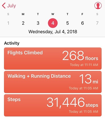
I made it back to my truck at 11am, making this a 13 mile hike/climb in 8 hours. This also means I was home by 1:30pm, in plenty of time to wake up my kids (yes, they’re teenagers, with nothing scheduled for today they were still sleeping when I got home) and grill some steaks for the 4th of July!