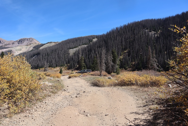
I drove in from Kite Lake after hiking some 13ers in the area. It took me about 2 hours to drive to Silverton, 40 minutes to drive to Purgatory, and another hour and a half to drive to the end of Forest Service Road 579. This is an easy 4WD road, but there are few spots to turn around. I was getting seriously worried about my trip out tomorrow until I (finally) made it to the end of the road. The road abruptly ends at a campsite, which was good news to me, as that meant there should be fewer chances to pass other drivers on the way out because the road doesn’t really ‘go’ anywhere. Mine was the only vehicle at the trailhead.
It was 10:30pm when I made it to the campsite, and I should have been exhausted after hiking/driving all day without sleep the night before, but I wasn’t. I was cold however. I turned on my heater and jotted down some notes in my journal while sipping on some whiskey. I played a few games on my phone and looked over my topo map for the next day. I hadn’t found a lot of good information on this peak, so I’d planned a route myself and I was trying to memorize it so I wouldn’t need to break out my map too often tomorrow. As I sat there, I was reminded of something someone had said to me a few days before: “Don’t you ever relax?” Yes, yes I do. This was relaxing.
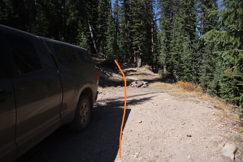
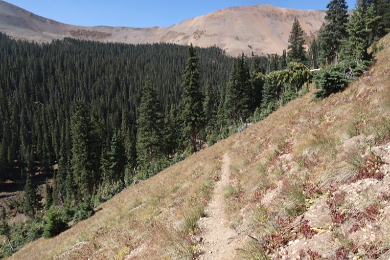
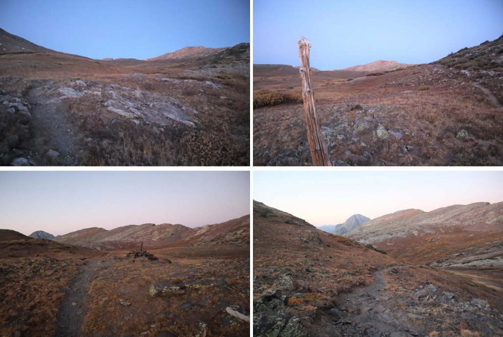
My heater was starting to make my sleeping area too warm so I shut it off and decided it was a good time to go to bed. I woke up and was on the trail at 6:30am. The trail begins just behind the campsite
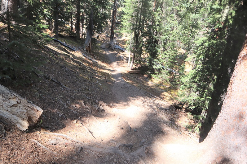
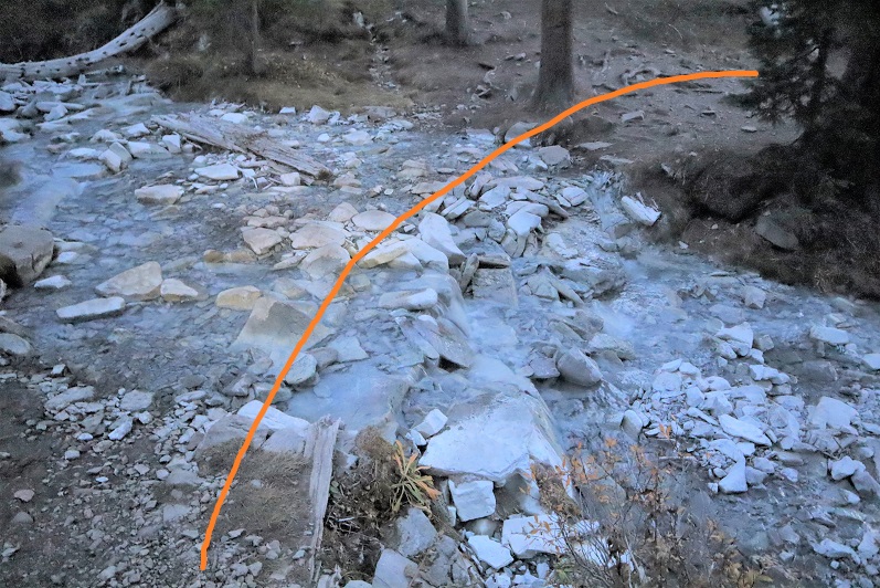
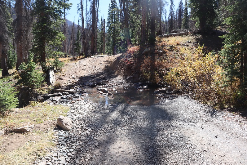
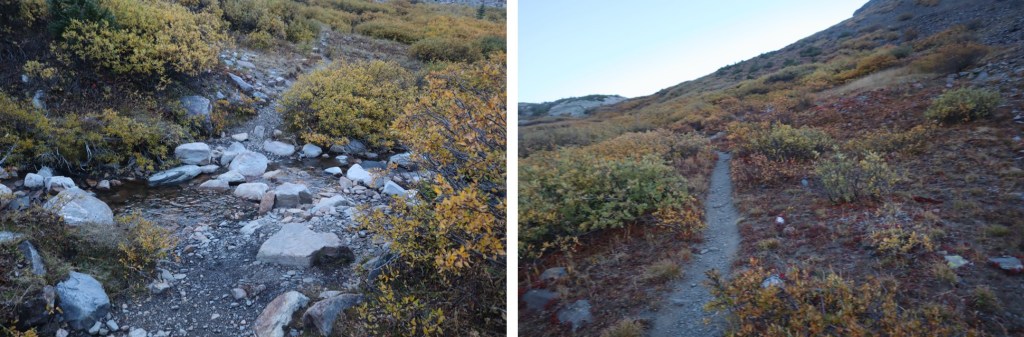
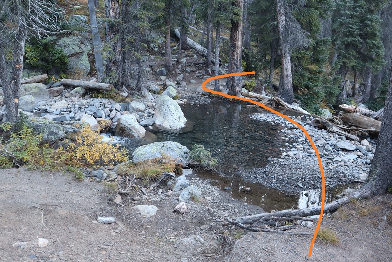
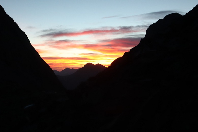
I could smell the fires and hooped the views would be better today than yesterday. Immediately I noticed flashlights shining in the distance. No way?!? I hadn’t seen another vehicle on my way in, and I was very far from any other trailhead. That’s when I remembered I was hiking on the Colorado Trail and this must be a good area to camp for the night. I followed the trail northeast as it descended down to a creek, crossed the creek, and headed east, still following the trail
I stopped here because something was rubbing against my ankle. I’ve never had to put on a band-aid while hiking before, but I thought I’d better now because my ankle would be rubbed raw if I didn’t. Yep, I still need new hiking boots.
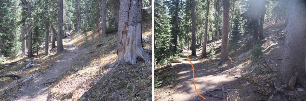
I put together a topo map for this route, and in doing so later found there were trails on the route that weren’t listed on the map. The trail I found went lower than I wanted to go, so I didn’t take it initially, but ended up being brought back to it several times, so I’m going to give you beta on the way you should take, not the way I took (which was loopy).
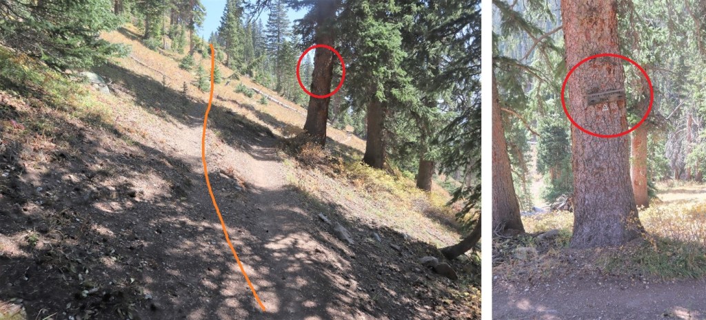
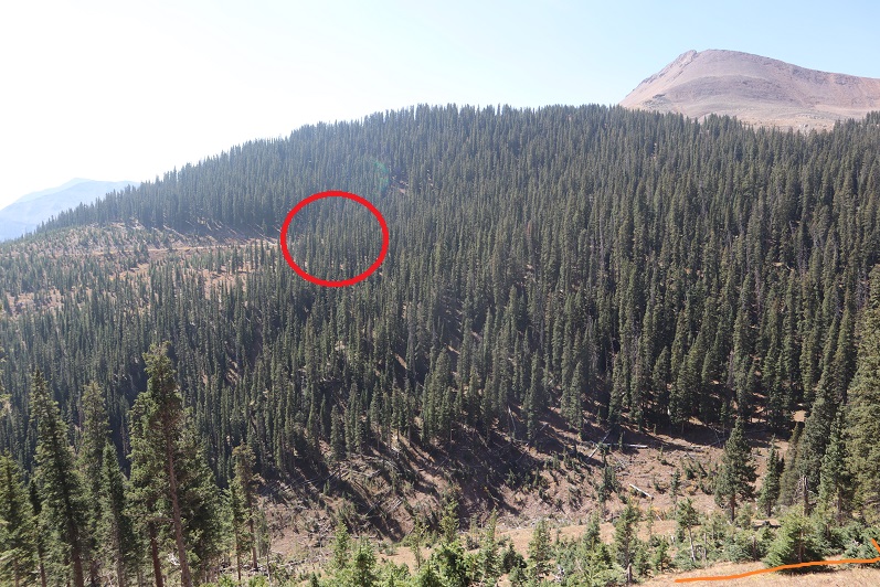
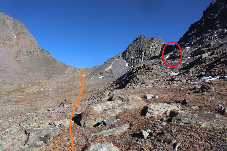
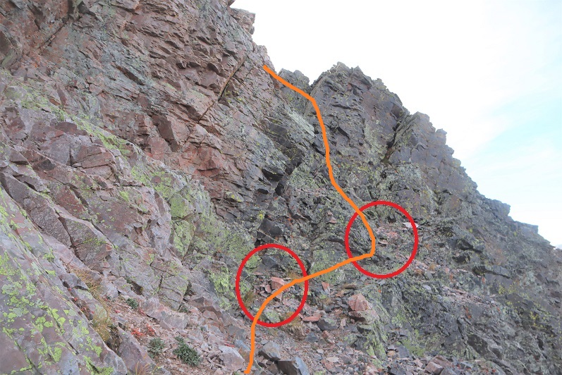
After crossing the stream, head east for .35 miles. Here there will be a faint junction, and if you look carefully, a sign to your right that says “Rico-Silverton Trail” (circled in red). Take the upper trail here and follow it until you pass an obvious pond (about 1.2 miles).
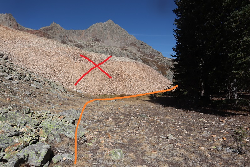
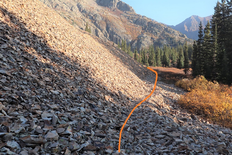
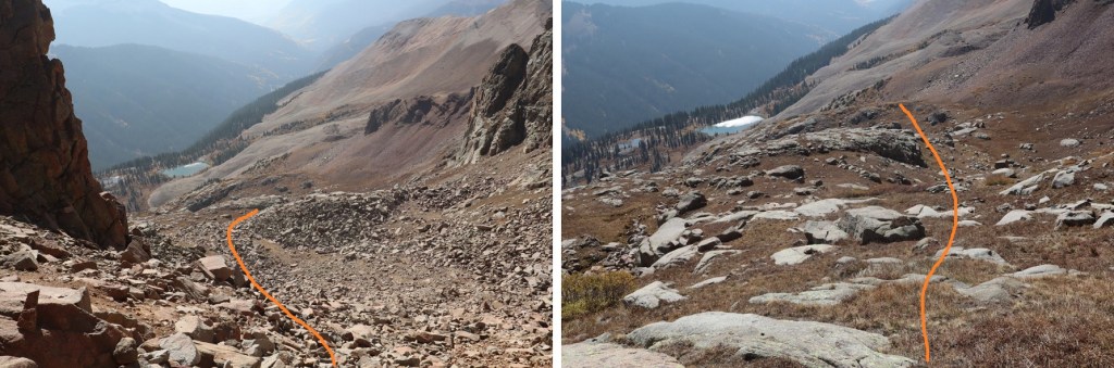
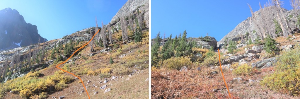
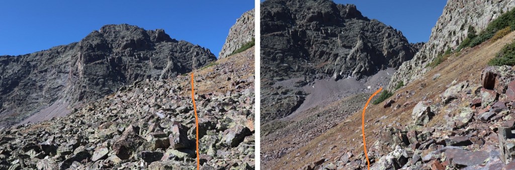
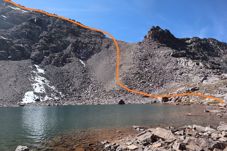
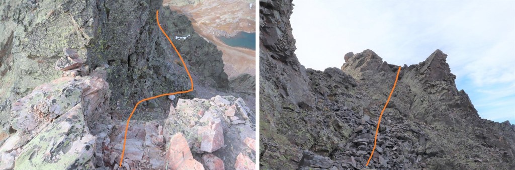
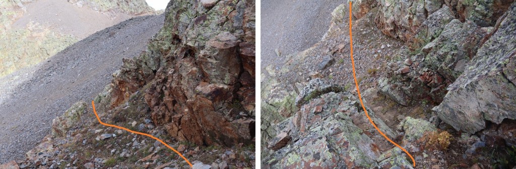
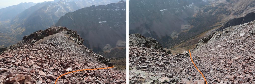
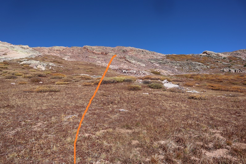
When you get here, there will be 2 trails. Do not ascend the scree! Instead, skirt the scree to your right
And continue following the trail as it skirts the lake to the left
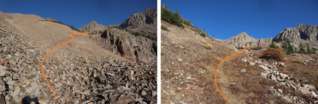
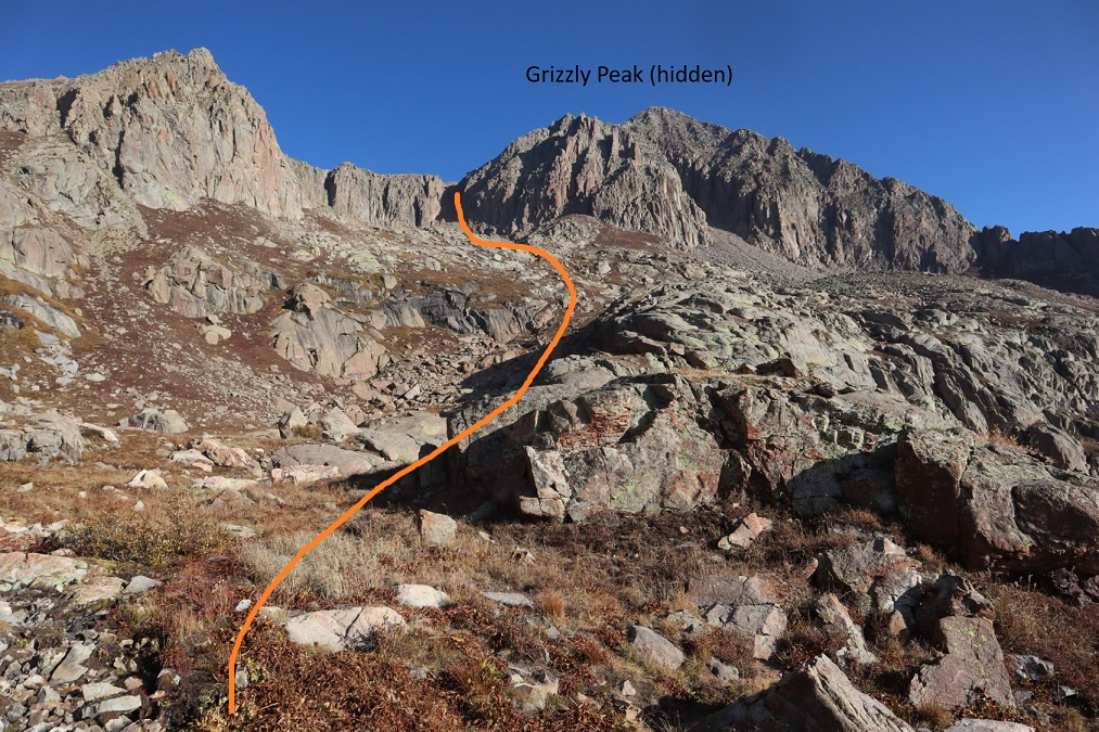
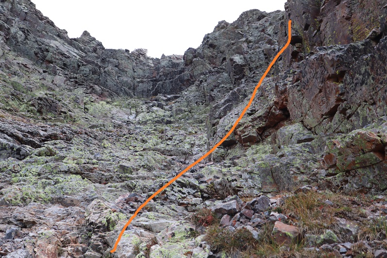
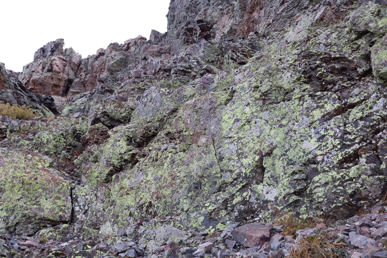
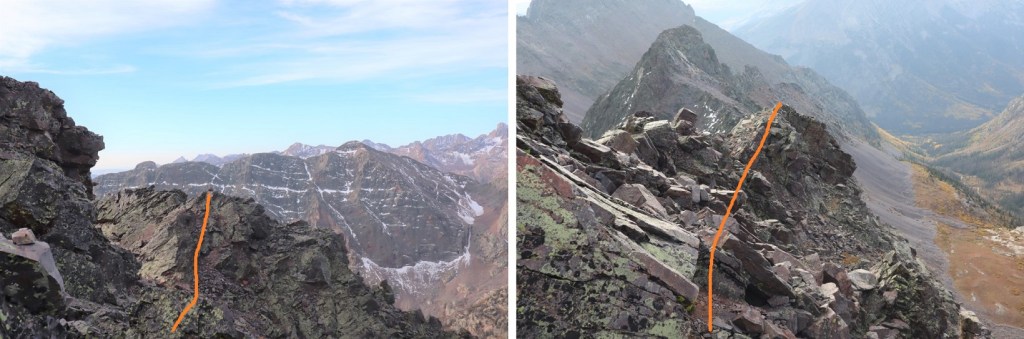
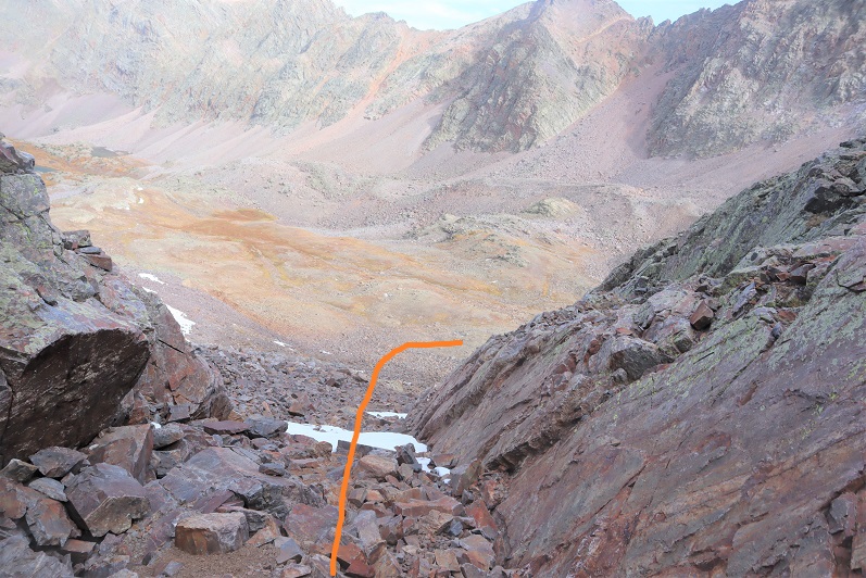
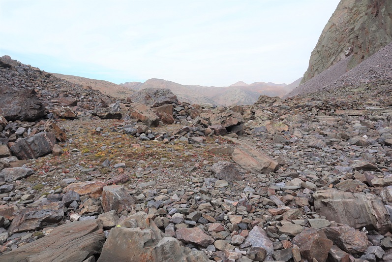
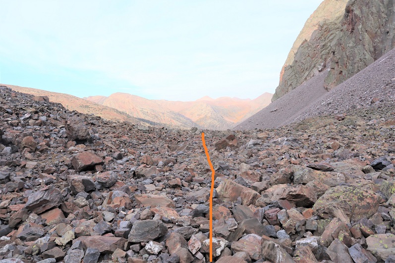
Just after the lake the trail will curve to the left. Follow the trail northeast up the basin
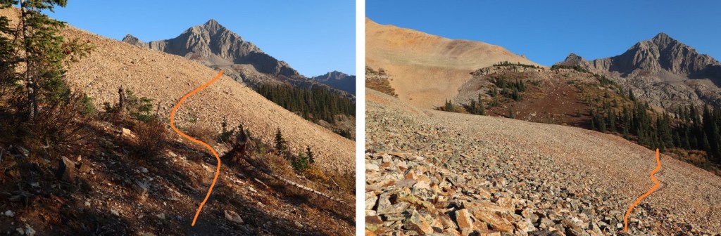
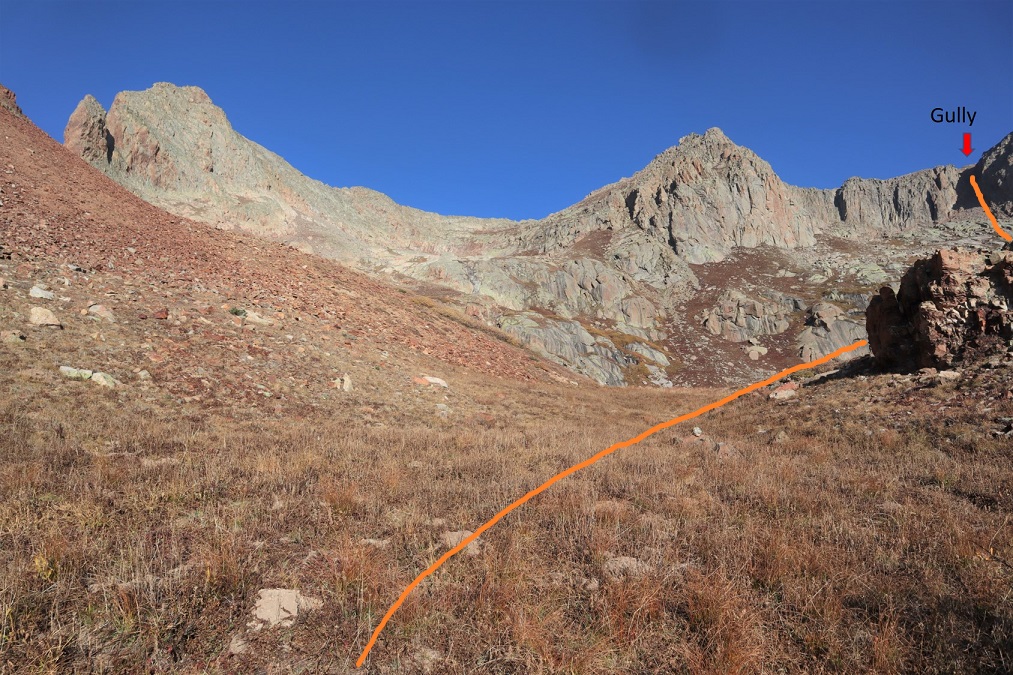
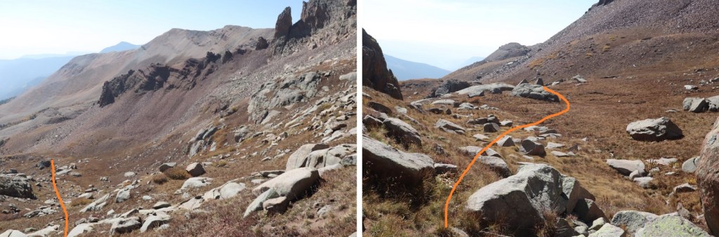
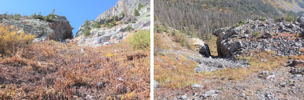
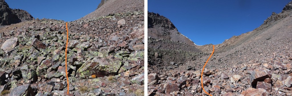
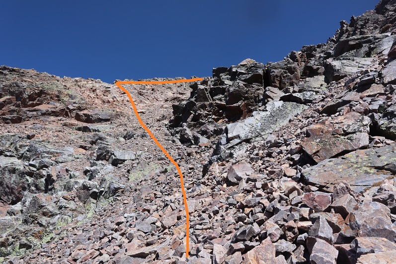
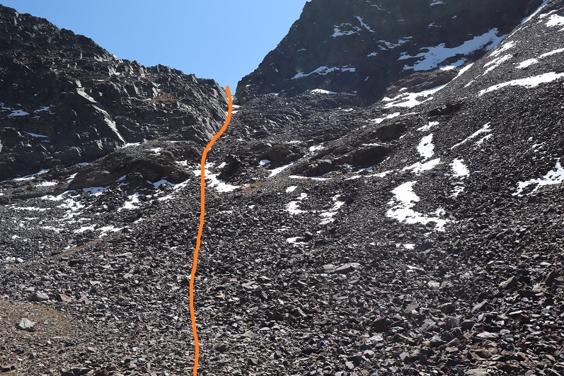
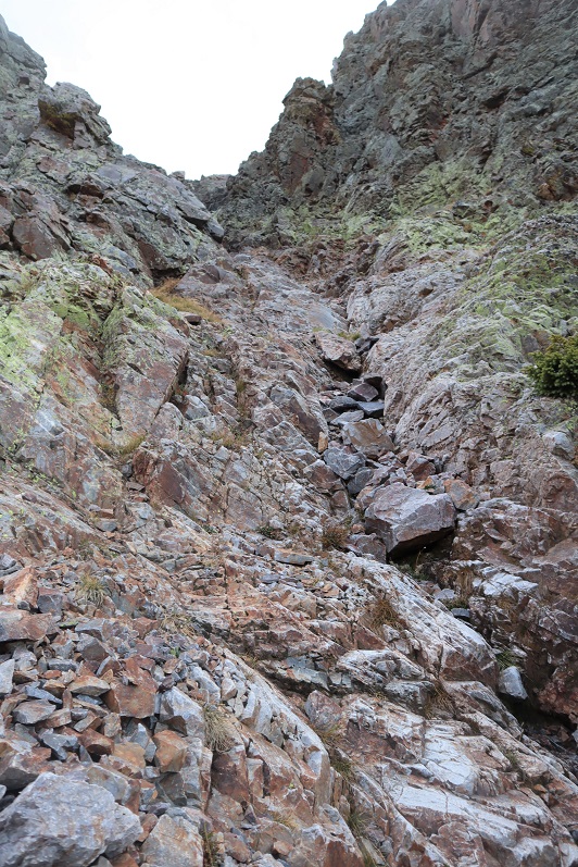
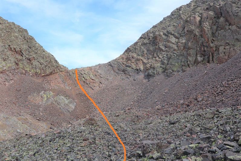
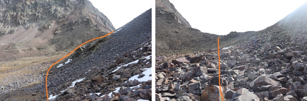
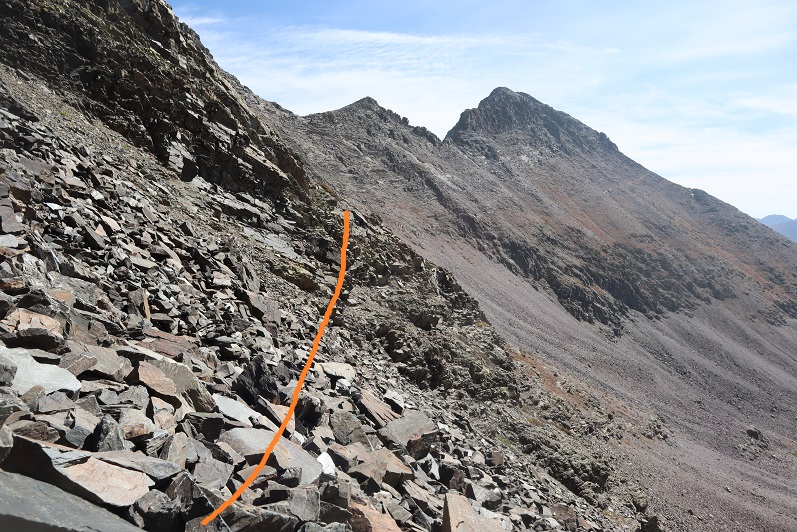
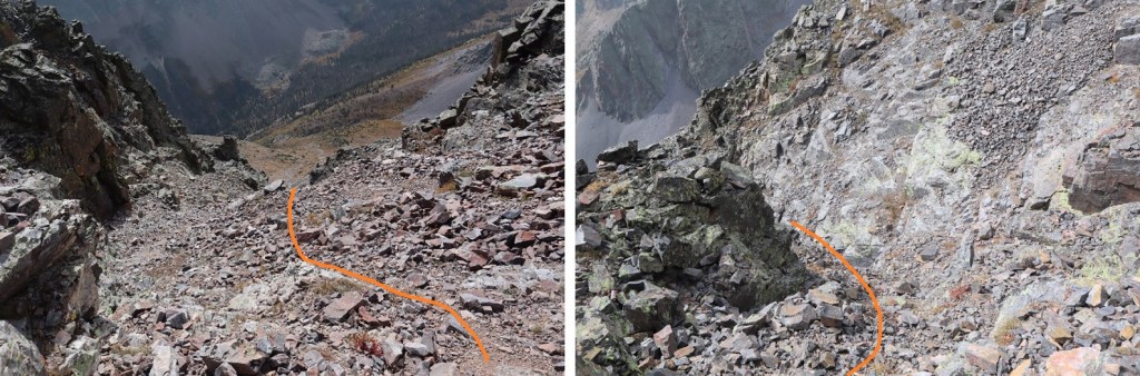
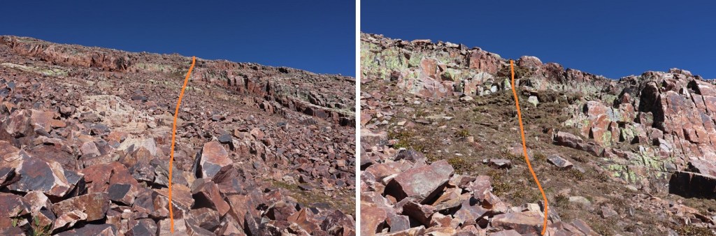
This is where the trail stopped. I wanted to ascend via the upper gully, so I followed the basin as it curved right and then left. Here’s a visual
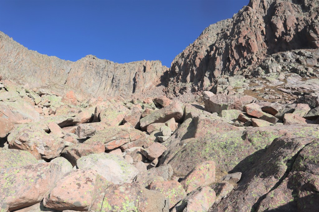
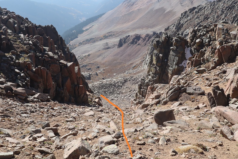
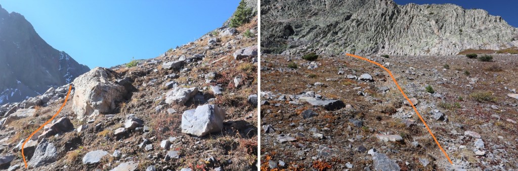
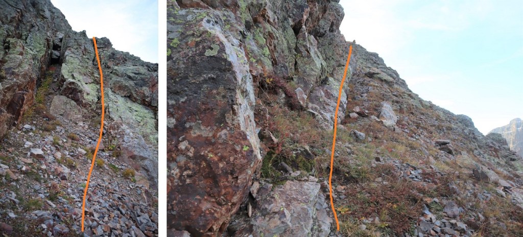
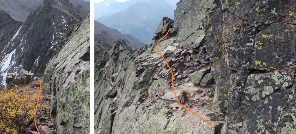
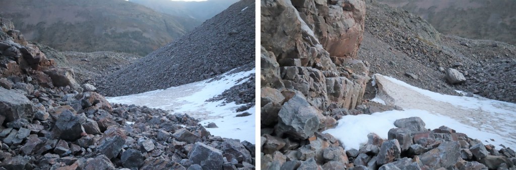
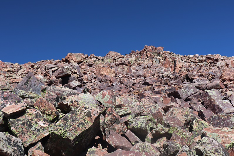
Some boulder hopping brought me to the base of the gully
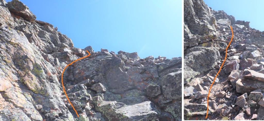
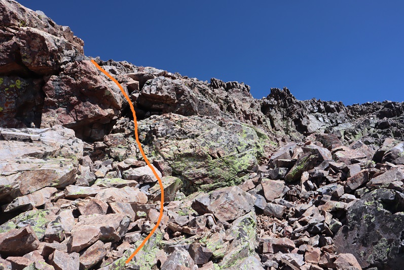
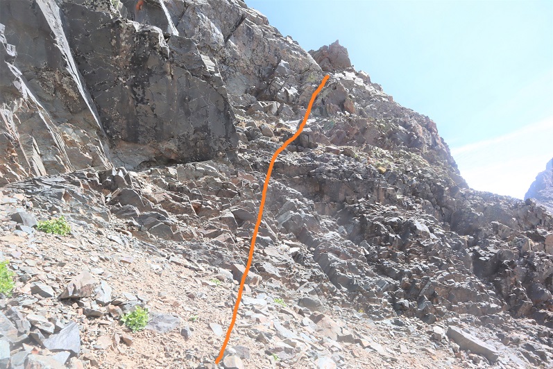
I stuck to the right to ascend the gully on rocks, and descended more to the left on the scree
As far as gullies go, this one wasn’t too bad.
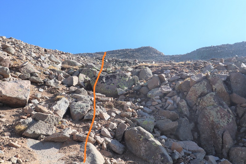
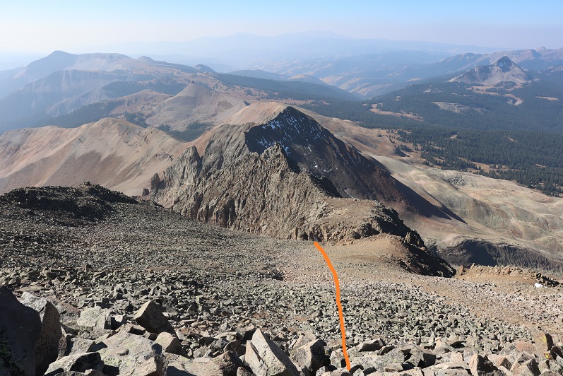
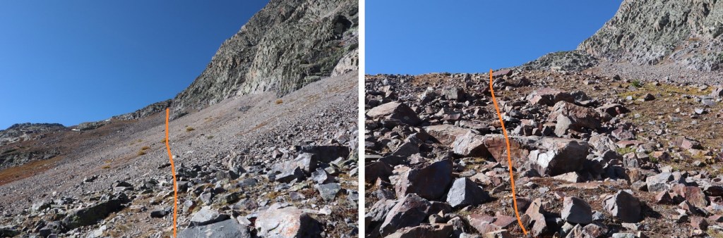
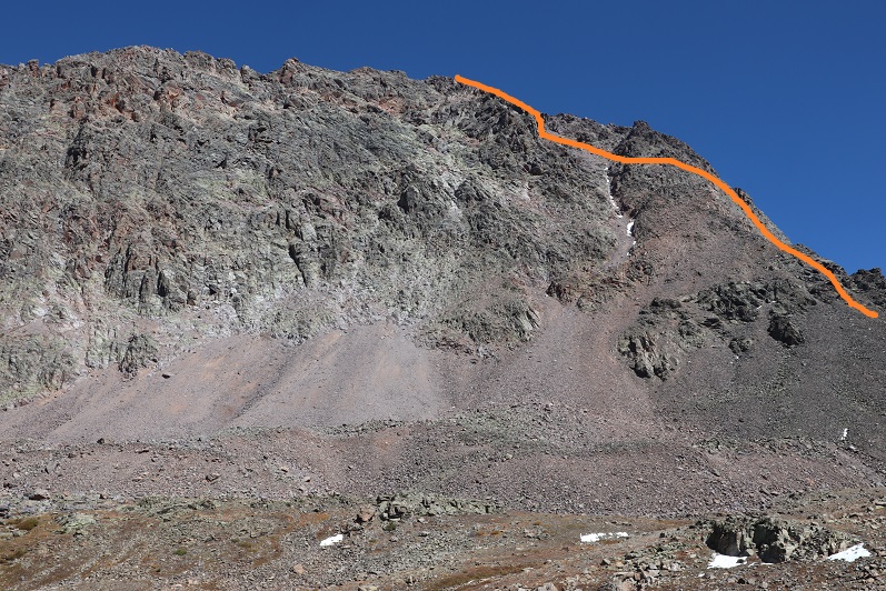
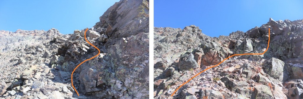
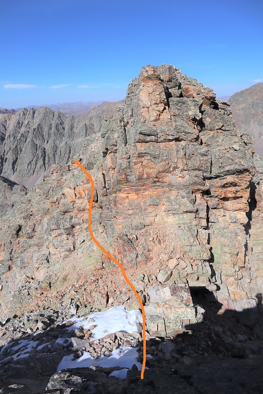
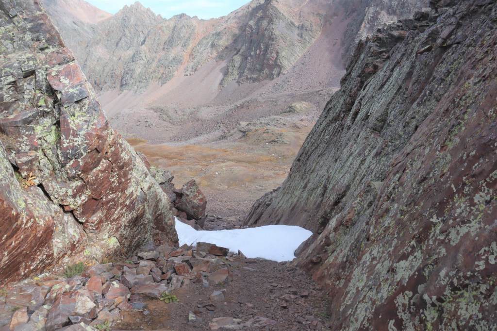
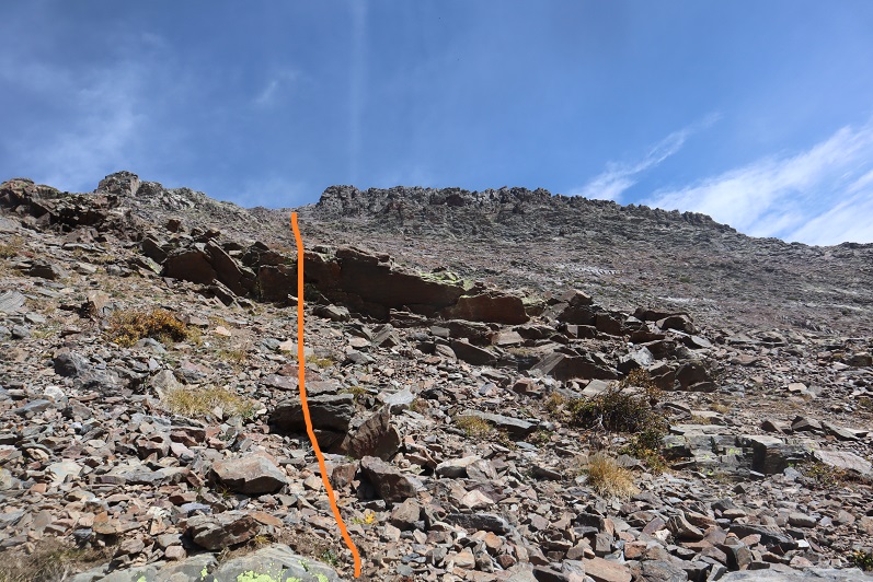
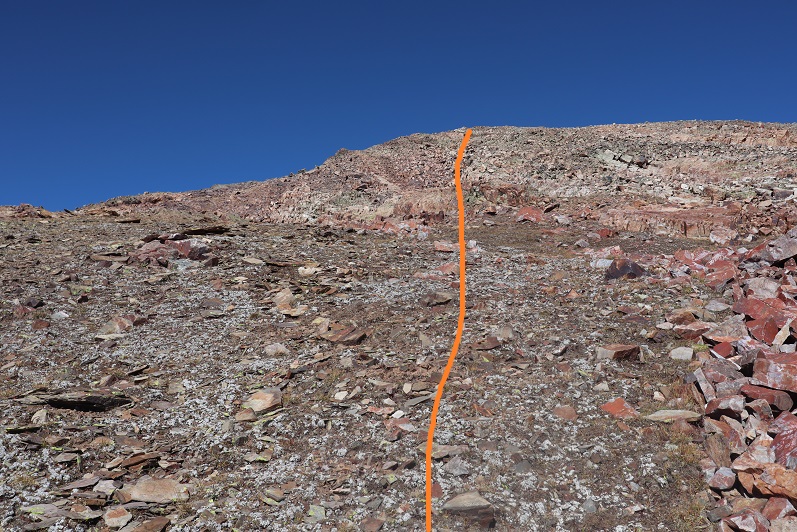
At the top of the gully I continued north
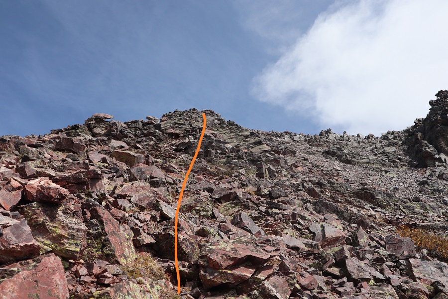
I came to an abrupt drop-off, turned right, and followed the ridge a short distance to the summit
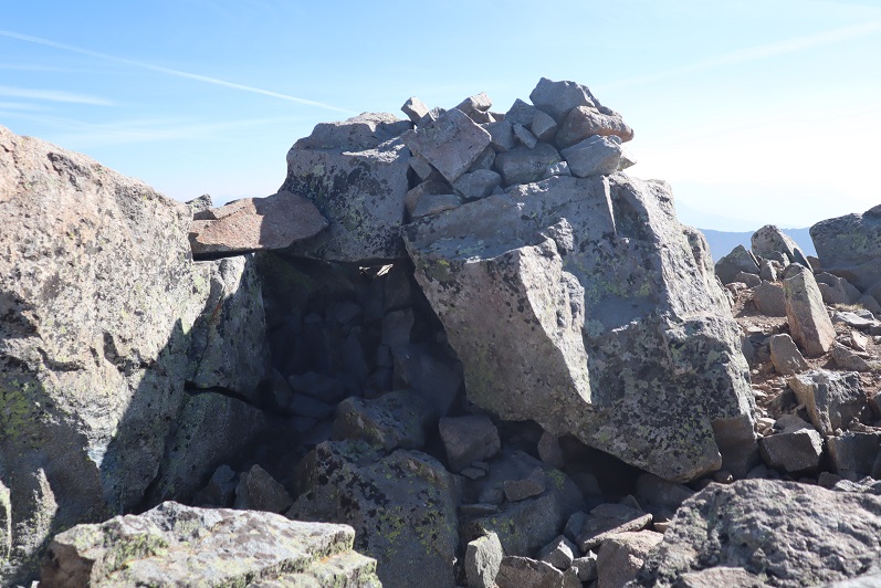
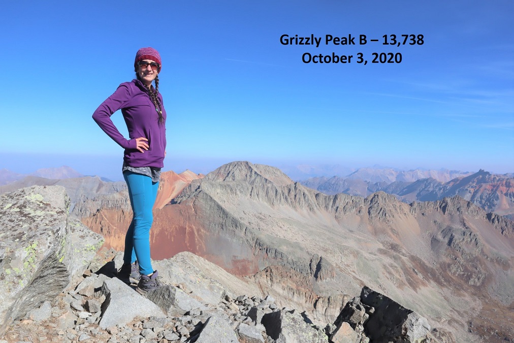
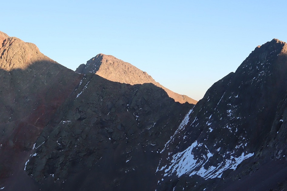
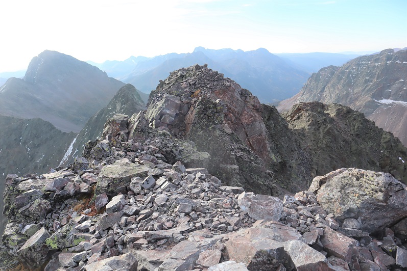
I summited Grizzly Peak at 10:10am
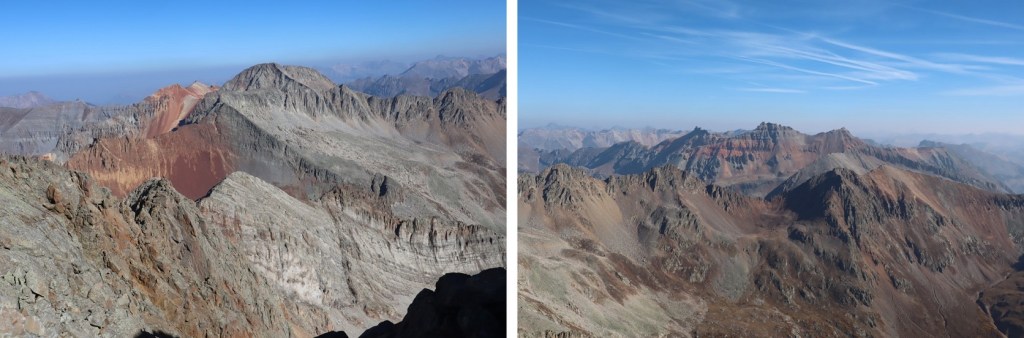
Grizzly Peak:
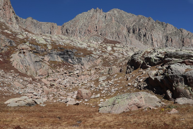
The views were amazing! Much better than my views the day before that were shrouded by haze from the fires
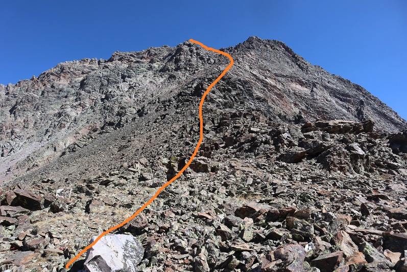
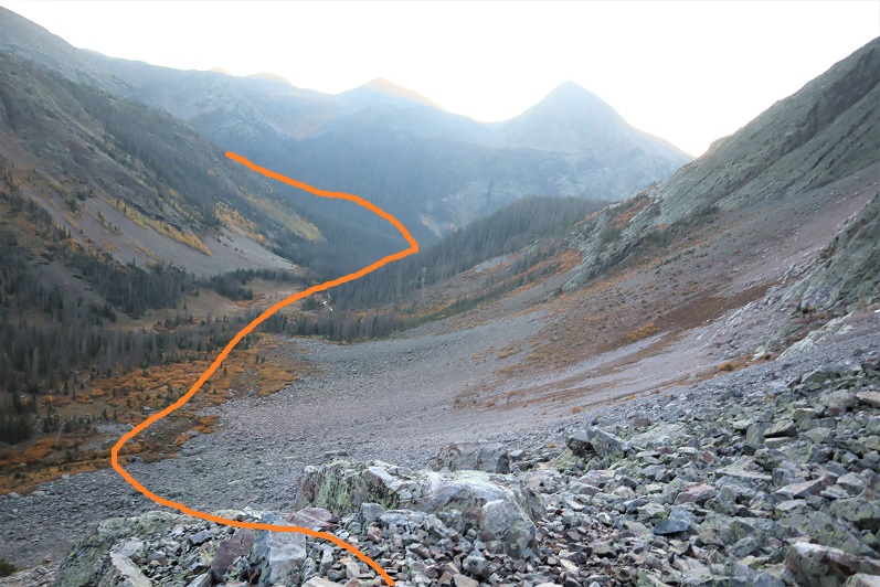
I headed back down the way I summited
Descended the gully
Back down the basin
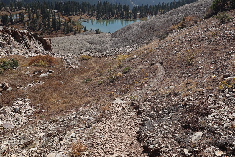
And picked up the trail
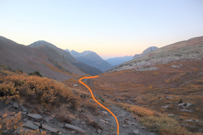
My way back to the trailhead was so much easier than the way in, as I just followed this (unnamed, unlisted) trail back to the Colorado Trail/Rico-Silverton Trail.
Just before descending back to the Colorado Trail I could see where I’d parked my truck
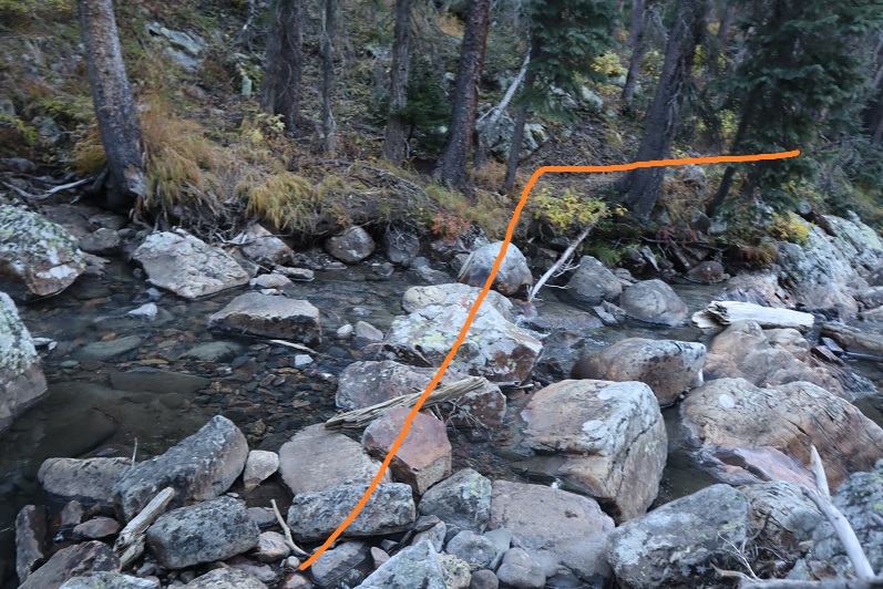
I rounded the mountain and started my descent to the creek
Hooked back up with the Colorado Trail
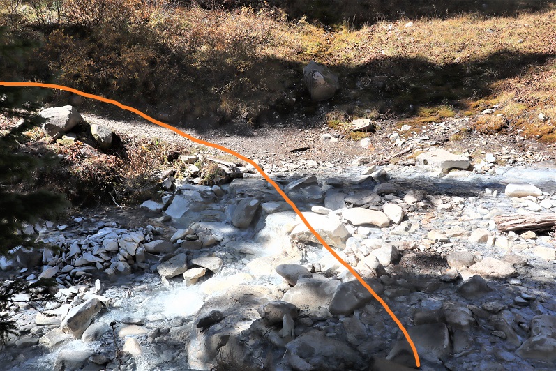
Crossed the creek
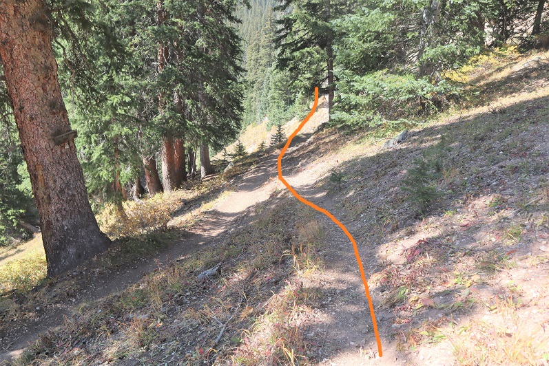
And gained some elevation as I headed back to my truck, staying left to head to the campsite when the Colorado Trail went right
And within a dozen yards or so was back at my truck. There was one other truck parked in the area (a Tacoma).
I made it back to my truck at 12:45pm, making this a 9.96 mile hike with 3543’ of elevation gain in just over 6 hours.
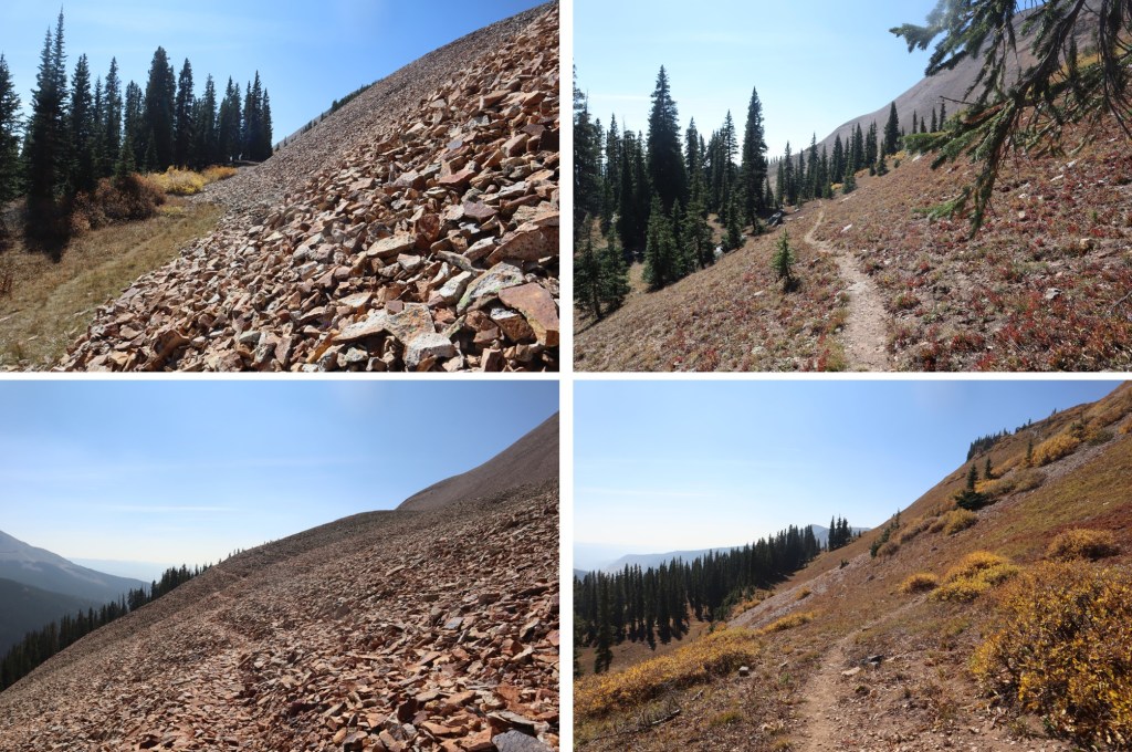
Even though it was a Saturday afternoon I didn’t pass another vehicle on the way down to the 2WD road, which was good because there were long stretches with no turnarounds/passing points. The leaves were beautiful! (I took this picture near the bottom once the road evened out).
Also, this is the last 4WD trailhead I need to use to get to any of the bicentennials I still need to summit! Woot! Just 10 left to go, and they’re all accessed via 2WD roads. Now about that skid plate…
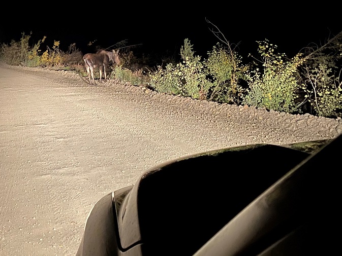
I’ve put off these peaks because I was a bit anxious about the drive in from Silverton, but the weather was perfect and they’re on my list, so off I went. After a Girl Scout meeting where we sewed masks (I have a girl working on her Gold Award who did an awesome job leading the meeting), I drove 8 hours to the Hunchback Pass trailhead. Along the way I saw a moose. And let me tell you, this is why they don’t call it “moose in the headlights”: they really don’t care. I sat there for a bit watching her, and then just drove by. She munched on willows as I passed.
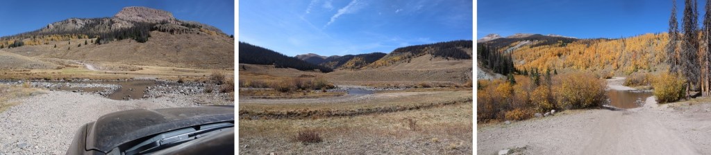
The drive in on the dirt road was underwhelming. I have no idea what I’d been worried about? It took me an hour and a half, and was actually quite pleasant. These pictures are from the way out, but it was just as easy to drive both ways. I never had difficulty passing others, and 4WD was only needed once or twice. This is actually one of the better 4WD roads I’ve done this year, and if weather permits, I’ll be back again next week. Here are some pictures from the drive in
And the Rio Grande river crossings (easy in late September)
I found a place to park much sooner than I needed to. I’m not sure why I stopped here except it was dark and I was tired and it was a good spot, but I could have continued driving another mile to the trailhead and been fine. I parked, slept for half an hour (I’d been up for 24+ hours, and needed the rest) and was on my way at 5:30am.
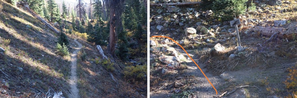
Since I’d parked along the road I followed the 4WD road for 1.3 miles before turning left onto Trail 813. There was room for 2 vehicles to park at the trailhead. There’s a trail register here, but nothing official.
I followed the class 1 trail as it curved up and over and then down hunchback pass. As I was hiking the sun rose, and I got a good look at Hunchback Mountain. I didn’t have a topo for it, but it looked doable. I’d file that one away and maybe attempt it on the way out.
From the top of Hunchback Pass I hiked for 3.4 miles and lost almost 2000’ of elevation as I followed the class 1 trail down the mountain, crossing small creeks and navigating through willows.
Stay straight at this sign/junction
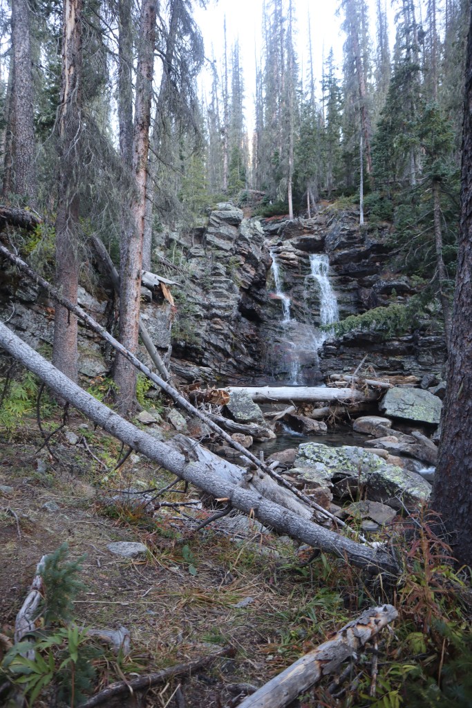
I missed the initial turnoff and had to do some route finding (because there is no official turnoff). However, after hiking for 3.4 miles there are some logs on the right side of the trail, split in half, and a waterfall. There are waterfalls all along this trail, so don’t just look for a waterfall, but look for the split logs. Leave the trail here and head west.
From here you’ll quickly come to an easy creek to cross and a waterfall. This is Nebo Creek. You can camp here, and it’s worth spending a little time enjoying the area.
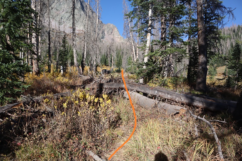
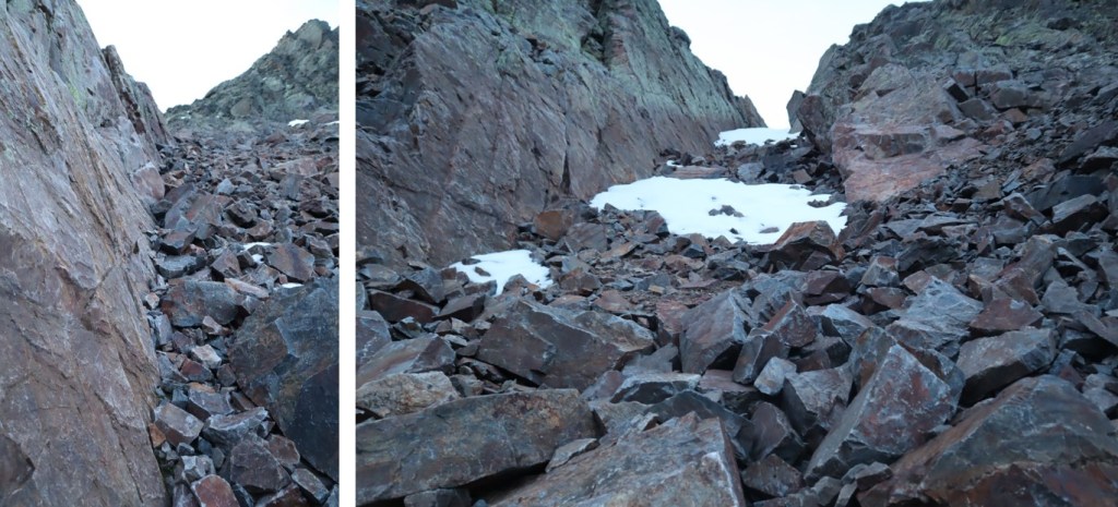
There is no clear trail here, but there is a bit of a game trail. Several in fact. They all go to the same place, so follow stormy creek by heading west, stay north of the creek for better terrain. Here are some pictures.
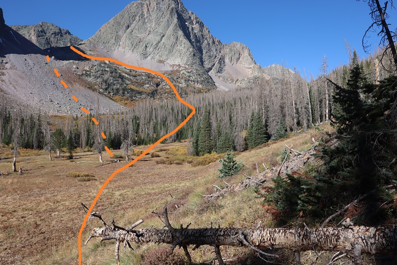
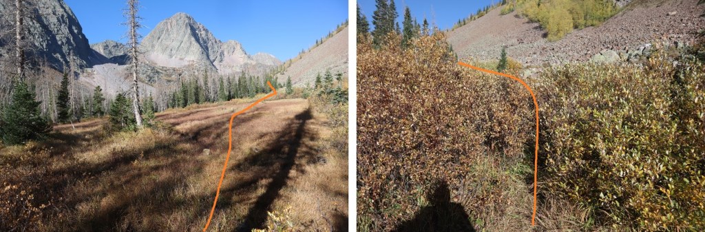
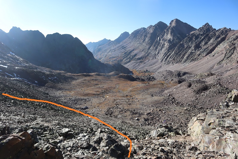
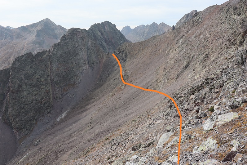
I headed west for just under 2 miles. I believe the standard way to enter the basin as it leads to Lake Silex is to use the obvious scree/rock filled gully (dotted line). I didn’t do this, and I’m glad I didn’t (I did take it down and was disappointed, as it seemed more trouble than the way I took up). Instead, I went further west, found a different, smaller gully by the rock/grass/willow filled slopes, and ascended that way. Here’s an overview
And step by step
I was able to follow game trails the entire way, and even saw some cairns in areas. At 11500’ I turned left and headed south, then southwest up the side of the mountain, aiming for this narrow gully.
Here’s looking up into the gully, and back down from the top. The rocks here were solid and it was an easy climb
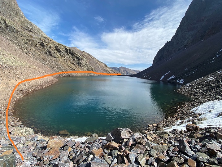
From the top of the gully I still had a ways to go. I headed south, and then west, curving high along the side of the mountain. I wasn’t headed to Lake Silex today, but instead to the pass, so staying high was helpful.
After rounding Lake Silex I headed up the rocky gully to the pass at 12800’
It took me 10 miles to make it to the pass. I took off my gear and took a break. I ate a packet of tuna (I’d forgotten to eat breakfast) and decided to leave my large pack here and just take some water and a first aid kit in my small pack for the rest of the day. Before I left, I filled my water filter up with snow and laid it out in the sun, hoping it would melt so I could filter it later.
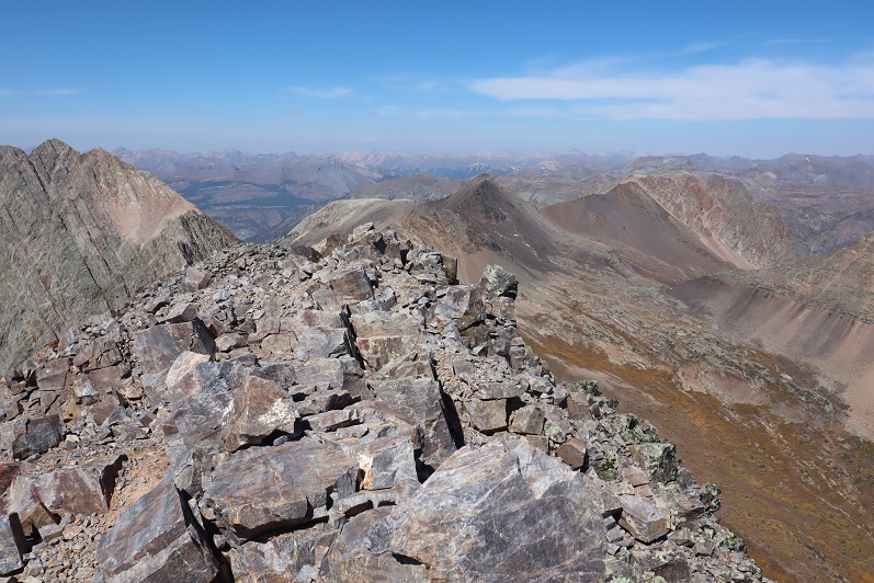
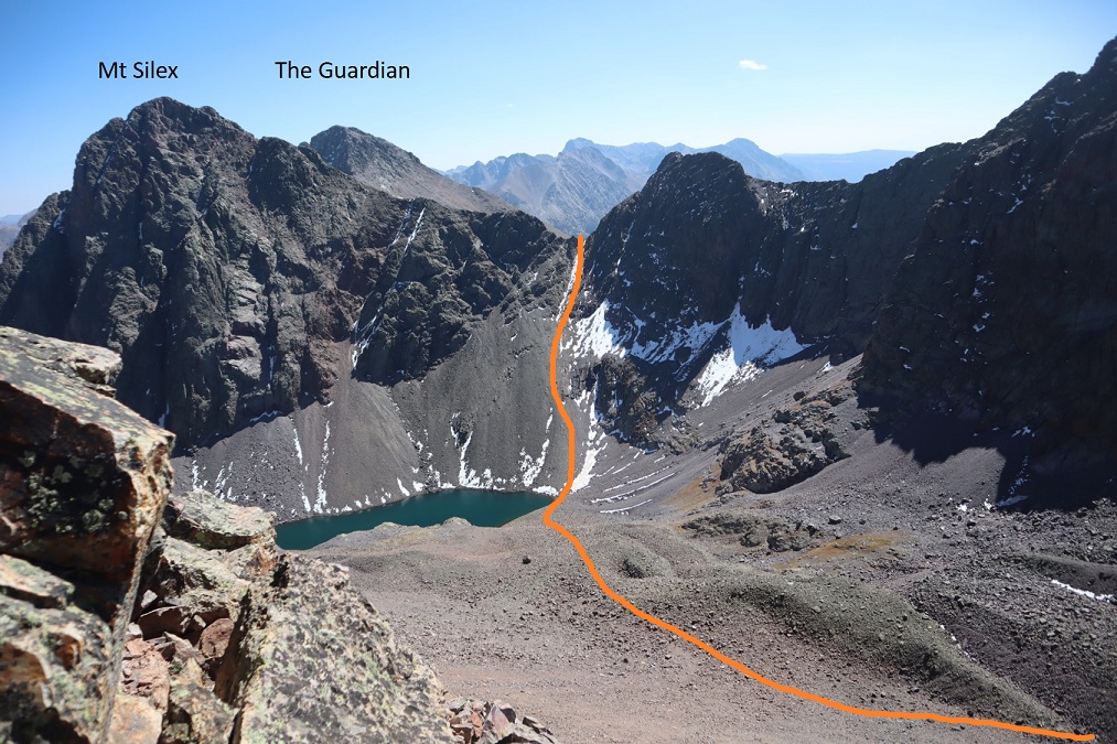
First up: Storm King Peak. Here’s a view of the overall route from further down the pass below later in the day.
And a view from the pass
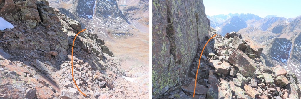
I did some scrambling, following the ridge north east. There really is no established route here, just pick your line. It shouldn’t be harder than class 3
At 13430’ there’ll be a small dip, and an obvious place to cross the gully
After crossing the gully, I headed north along the ridge. The peak is just to the left
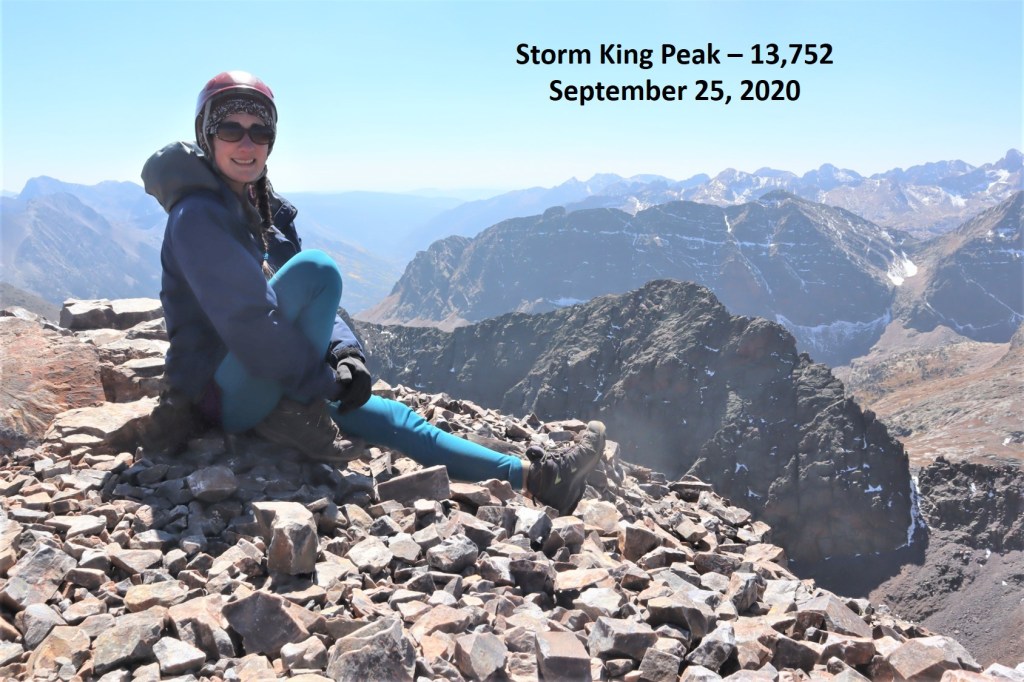
I summited Storm King Peak at 12:25am
Storm King Peak:
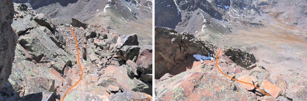
Here’s the route back down to the pass
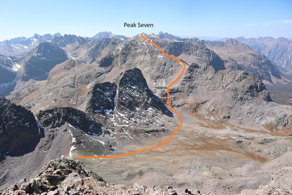
From the pass my next objective was Peak Seven. I headed west, losing about 300’ as I descended into the basin, and then headed back up towards Peak Seven. Here’s an overall look at the route
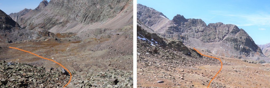
This was pretty straightforward. Here are some step by step photos. First, I entered the basin and then rounded the side of Peak 8
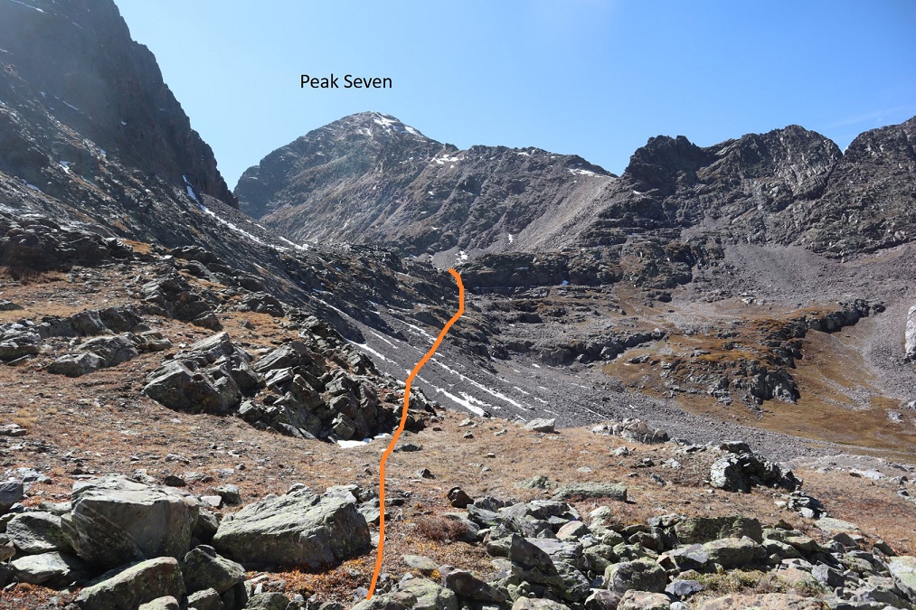
There were a few game trails here. I stuck high, and then aimed for a gully that would bring me to the pond underneath Peak Seven
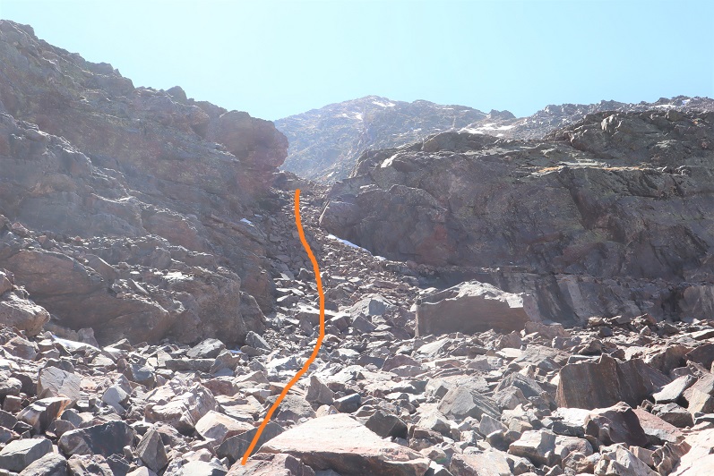
From the pond I turned right and headed west up the gully
Once I’d gained the ridge I headed south. There was some scrambling here, and due to the fact there was snow on the normal route I had to get a bit creative. Instead of going up the face I stuck to the left and avoided the snow, and had some fun class 3/exposed scrambling instead. Here’s the basic route
There was a nice, airy game trail that led me to some rock slabs, which I used to ascend
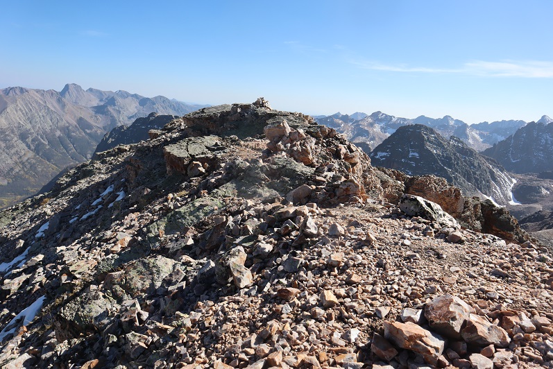
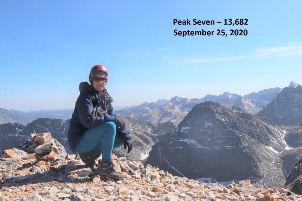
I summited Peak Seven at 3:10pm
Peak Seven:
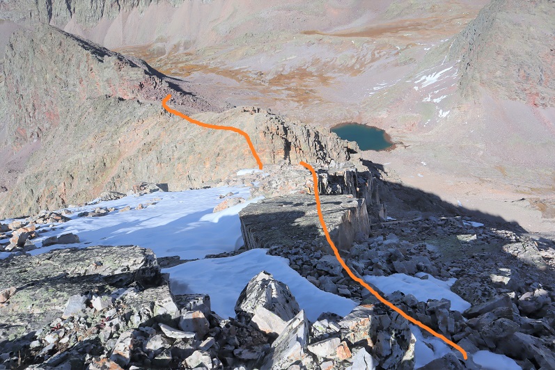
Heading down Peak Seven was just as fun as heading up. Here’s the way back to the saddle
From the saddle I hiked back down to the lake, and made my way over to the south side of Peak 8, intent on attempting Peak 9 today as well.
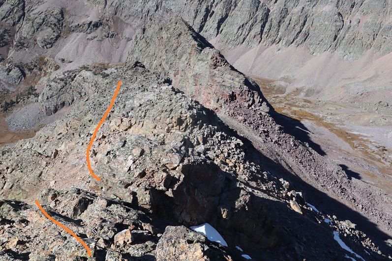
However, as I rounded the corner to Peak 8 I noticed the sun was already starting to set behind Peak Seven. It’s fall, and the days are short. Looking at the hike ahead, I knew I wouldn’t be back to my gear before dark. I have Raynaud’s, and I need to be bundled up and in bed as the sun goes down. I sighed and retraced my steps back to where I’d left my gear at the pass. Once I got there, I’d do some thinking. Here’s the route from the top of the gully of Peak Seven back to the pass.
As I made my way back to the pass I noticed a gully in between Peak Eight and Peak Nine. It looked like it went.
I filed that away and kept hiking to my gear
As I hiked, I strategized. I could hike back down to the lake to set up camp, but right now I was really upset about not getting in Peak Nine today as well. The approach was a lot for one peak, and I really didn’t want to drive/hike in all this way in the future just for Peak Nine at a future date. Maybe I could get it tomorrow morning? I got out my topo map and the route I’d passed on my way to/from Peak Seven indeed looked like it went, but I was a little worried about the snow. Luckily, I’d packed spikes. I decided to sleep on the pass tonight (at 12,830’) and attempt Peak Nine first thing tomorrow.
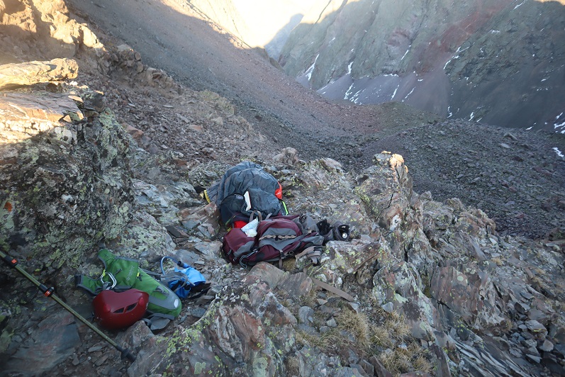
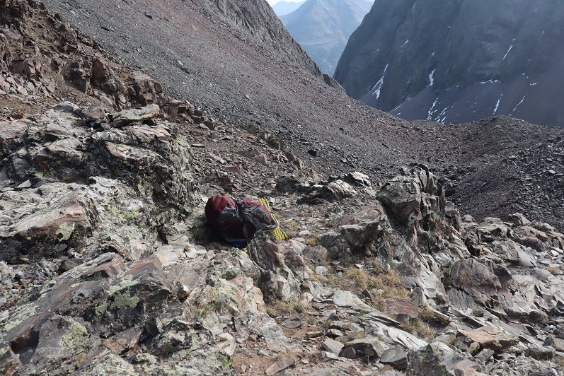
I made it back to the pass and looked for a place to spend the night. I didn’t have many options, and all of them were rocky. And windy. Time to set up camp. Check out my bivy for the night. Side note: it’s hard to dry out your feet when it’s windy and cold. I ended up putting dry socks on and wearing my sandals.
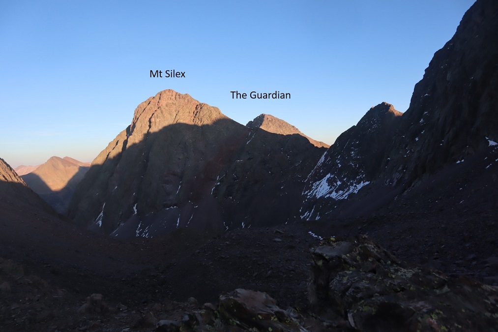
As the sun started to set I filtered some water (glad I’d thought to melt snow now that I wasn’t camping at the lake), jotted down some notes, and had dinner (a handful of peanuts and 4 or 5 slices of dried mangoes: eating while hiking makes me nauseous, so I probably only get in 500 calories in an entire backpacking weekend). Oh, and a couple shots of whiskey. That adds calories. I set up all my gear so in the morning all I’d need to do was put away my sleeping bag and bivy (important when you have no function of your fingers, which I won’t in the morning cold), watched the sun set, and poured over topo maps for two other of tomorrow’s peaks: Mt Silex and The Guardian
Anyone else think it looks like The Guardian is wearing a mask?
I set my alarm, bundled myself up in all my clothes, gloves, hat, etc. and went to bed. It was a windy night but my bivy did its job. I woke up at 5:30am and it was still pitch-black outside. I watched a few shooting stars and re-set my alarm, knowing getting outside of my bivy with this wind/cold would be a bad idea. By 6:30am it was just starting to get light. I enjoyed the sunrise tucked inside my layers, and then as quickly as possible put away my bivy and sleeping bag and bundled my gear together. I was going to attempt Peak Nine with just my daypack today as well (which I’d pre-packed last night), so I left my large pack on the pass and started out.
Day 2: Peak Nine, Mt Silex, The Guardian
I started off the same way I’d headed towards Peak Seven yesterday, heading down the pass, but when I saw the access gully for Peak Nine I turned left (south) and up
I’d been a bit worried about the snow, but it wasn’t a nuisance. Most of the gully was dry. I didn’t need to put on traction to kick in steps in the snow, and it didn’t cause me to slip. There was only about 20 feet or so to deal with.
I was excited when I made it to the top of the gully to find I was in the perfect spot to continue the hike. I stayed high and aimed for the ridge. Note: Here it became very windy. The wind didn’t stop all day.
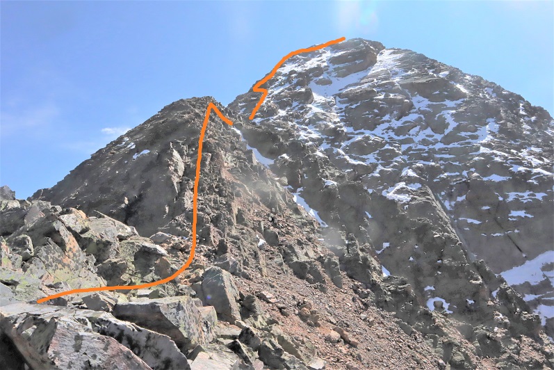
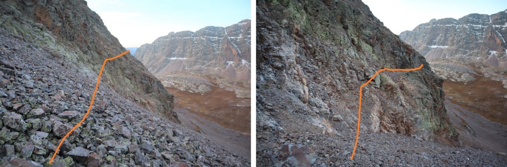
At the end of the ridge an obvious cairn trail picks up.
It will lead you up a class 3-4 chimney and then around the mountainside.
You have the option of taking the gully or the ridge. I took the gully up, the ridge down. The gully takes some route finding and I found it to be class 4. The ridge is easily and highly cairned. Here’s the entrance to the gully. I don’t think there’s a way to cliff out, but there are tons of options to ascend. Just keep heading northeast
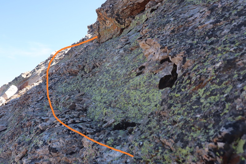
Here are some photos from inside the gully
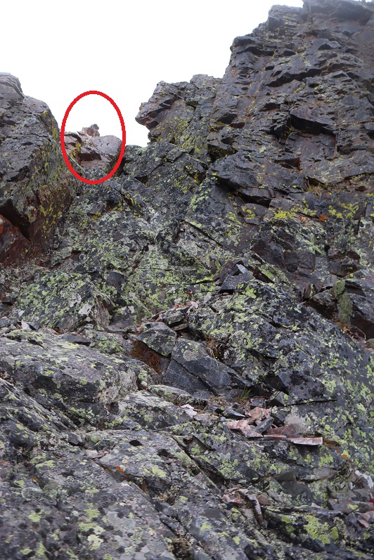
If you keep heading northeast you’ll hit a wall. There will be cairns in the northeast corner of the top of the gully that lead you both to the exit route back down the ridge, and to the summit.
These cairns will take you to the ridge, which if you follow northwest will take you to the summit
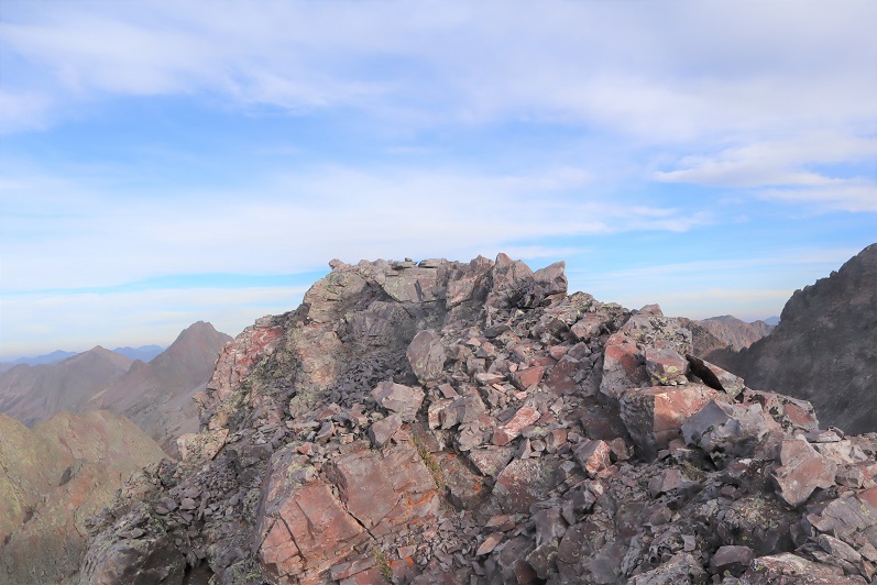
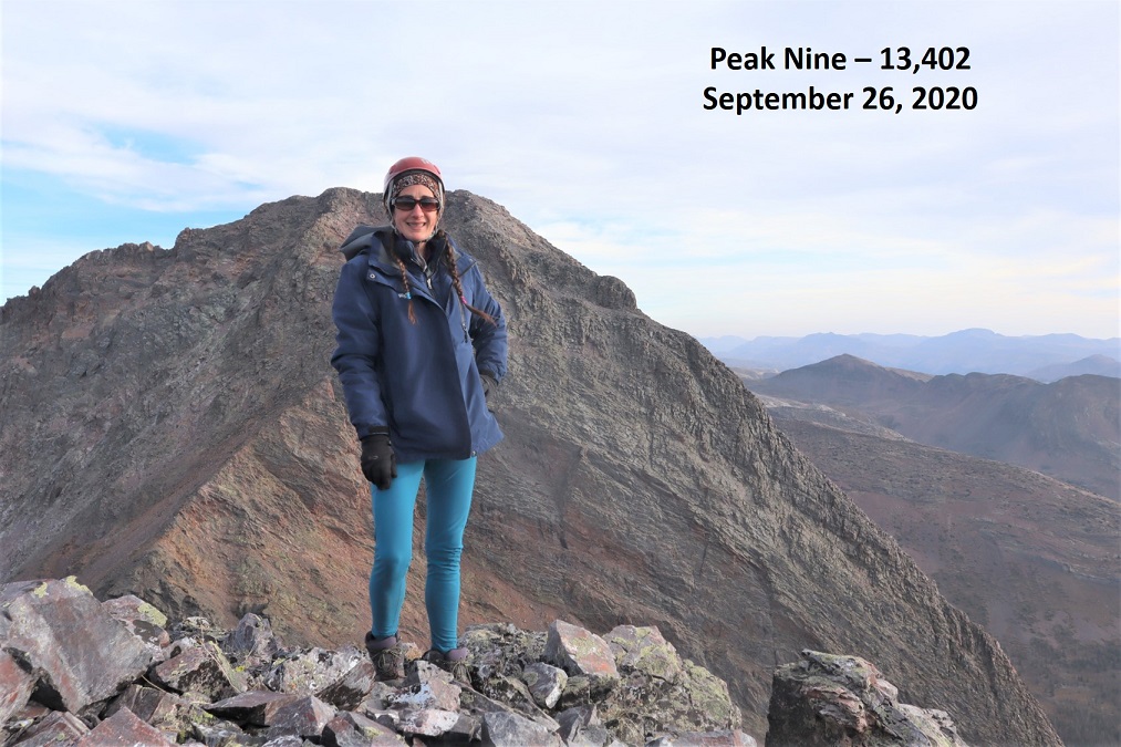
I summited Peak 9 at 8:25am
Peak Nine:
Here’s looking down the gully from the summit. Here you can see you can pick your route but need to head to the northeast corner to gain the ridge
I’m not gonna lie, I didn’t want to head back down the gully. I’d known there was a ridge route when I’d ascended, which kept me going up, but the class 4 moves were bordering on class 5, and I felt safer taking the ridge down. Here are some pictures of the very well cairned route down the ridge. I followed the ridge southeast the way I’d come, dipped down a bit, then found the cairns that led me back up to the ridge
I then followed the ridge
Dipping down to the left once, then staying to the right for the rest of the ridge
The ridge led me to a short gully. I took it southwest
And this brought me back to the trail I’d hiked in on.
I followed it back to the chimney, climbed down
And aimed for the gully I’d hiked in through
I used my kicked in steps from this morning to descend, then made my way back to the pass and my gear.
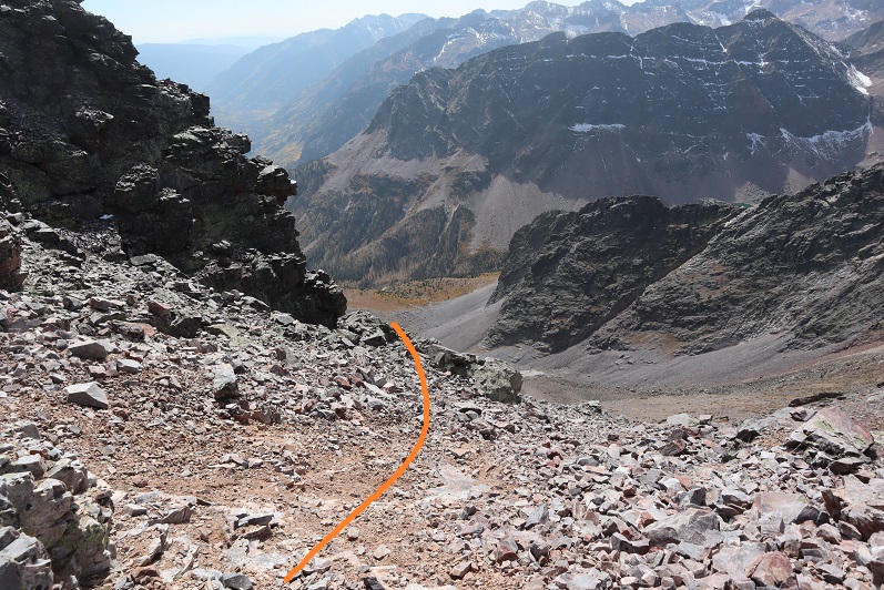
I sat at the pass and had a packet of tuna and looked at the time. It was still early, so I figured I had plenty of time to hike Mt Silex and The Guardian today as well. I gathered my large pack and set off for Lake Silex below. I was a bit worried about the access gully (circled in red). The snow looked to be covering the entire last part of the route, and I wasn’t sure I’d be able to get up the gully.
I dropped my large pack at the lake. It was now 11am, so the sun wouldn’t be my friend as I ascended the gully: it would be shining in my eyes the entire time. Here’s an overview of the route I took from the pass, down to the lake, and up the gully
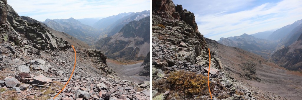
When I got to the gully the snow wasn’t as bad as it had looked from down below. I was able to avoid most of it by sticking to the left
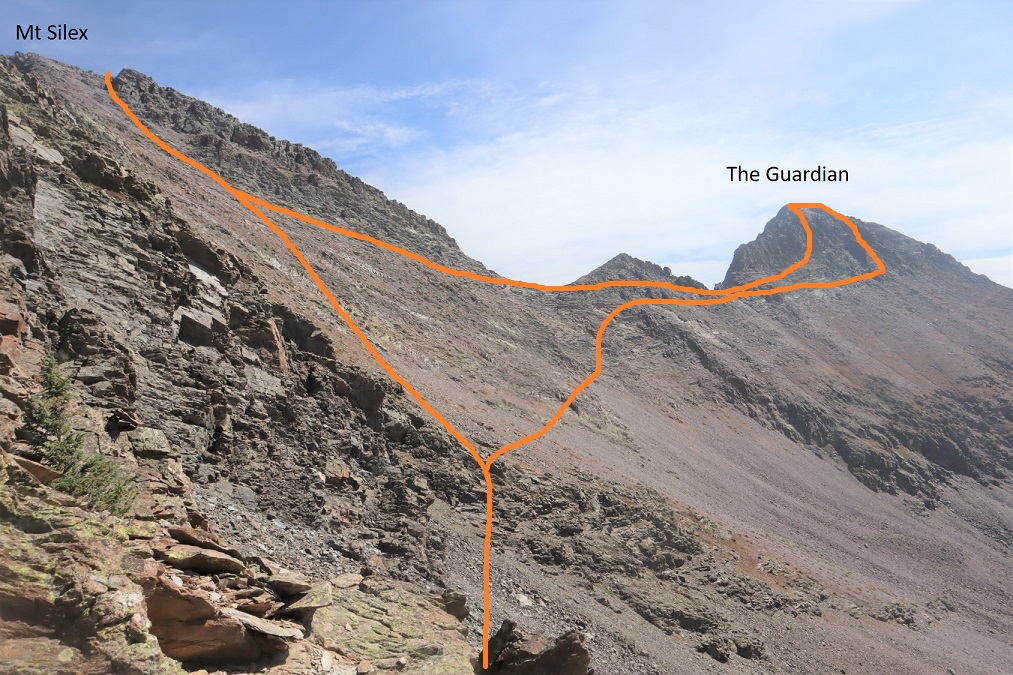
Here’s an overview of the route I took to summit both Mt Silex and The Guardian and back from the top of the gully
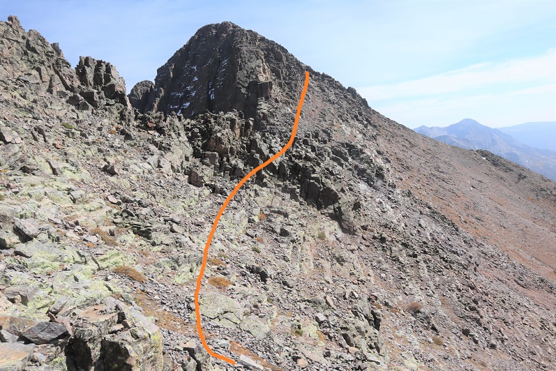
I started out kind of low, but my advice is to gain the ridge as soon as you can and follow it to the summit. I took more of the gully route, which made things more difficult than they needed to be. Here’s my route
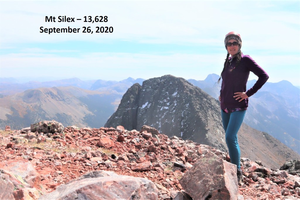
I summited Mt Silex at 12:55pm
Mt Silex:
Here’s a look back down the ridge I’d just hiked up
Now to head over to The Guardian. I went back down the gully, and hugged the side of the mountain
Then I stayed high and worked my way southeast
Here’s step by step.
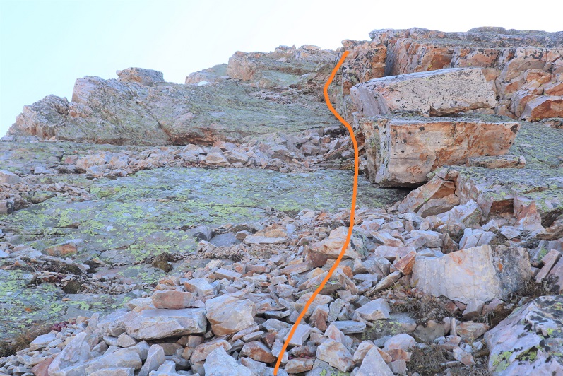
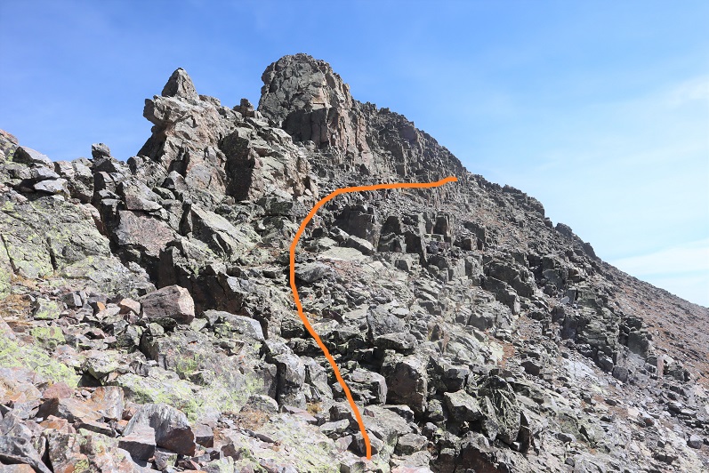
At around 13400’ I came to a gully, turned and headed northeast to the summit. The climbing here was class 4, and seemed to get sketchier as I went.
At the top of the gully was a well-cairned summit ridge
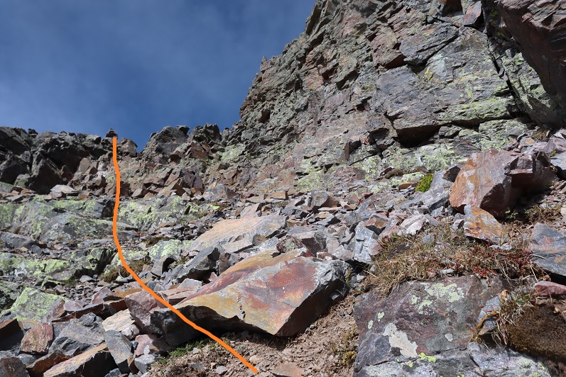
Here’s a look back down the gully
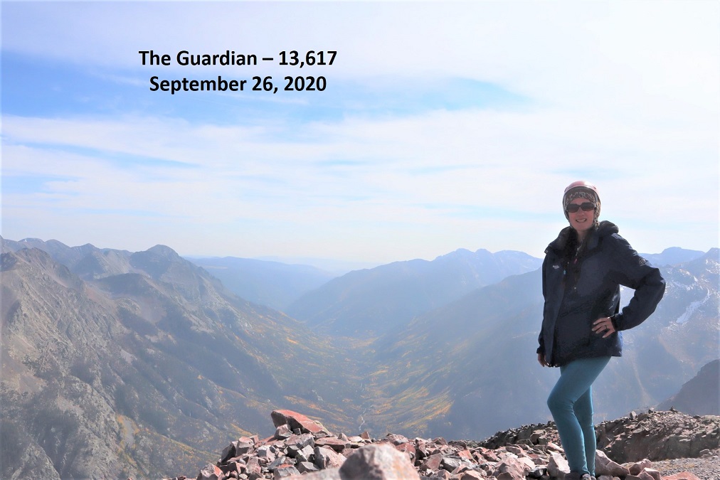
I summited The Guardian at 2:55pm. The views were a bit hazy due to the smoke from the fires
The Guardian:
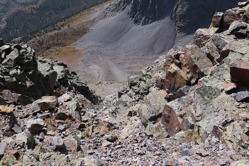
As I’d summited, I noticed an easier gully I could have accessed to summit if I’d hiked just a little further southeast. I decided to take that gully down. It’s scree filled and I scree surfed down. This is class 2.
At the bottom of the gully I turned right
I had a great view of my route back to the gully that leads back to Lake Silex. It’s important to stay high here, as it does cliff out a little below. Here’s my route
Here’s a look back at the route down from The Guardian, staying high to avoid the cliff bands
Back at the top of the gully here’s looking at my route back to Lake Silex. I hiked down to the lake, gathered my gear, and went around the north side of the lake, looking for a spot to spend the night.
At the northeast side of the lake I found a set of 3 windbreaks and picked the most well-constructed one to spend the night.
I set up my gear inside a windbreak built in-between two large boulders. It was well made, but the wind was so intense the barrier wasn’t doing much to keep out the wind.
I filtered some water from the lake, ate dinner (my last packet of tuna, a handful of peanuts, and a few shots of whiskey) and made it an early night.
The wind howled all night long. It was intense, but my bivy once again did its job.
Day 3: Descent, Hunchback Mountain, Hunchback Pass
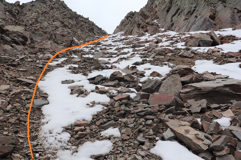
I woke up the next morning, gathered my gear, and was off at 7am. I followed the gully northeast towards Stormy Gulch.
There was still some snow left in this gully from last winter.
I made my way down the scree and back Stormy Gulch
I much preferred the way I hiked in rather than this scree hike out. Here’s looking back on the scree slope
I picked back up the faint trail and followed it east
The waterfall seemed a good place to stop for a bit. I sat on a log and relaxed for a few minutes before the long hike back up to Hunchback Pass. Once again, this would be a great camping spot.
I crossed Nebo Creek and quickly found the trail.
I followed the trail north past treeline, keeping a steady pace as I still had one more peak to climb and didn’t want to get too tired too quickly. I filtered water one last time and took frequent breaks just because I could.
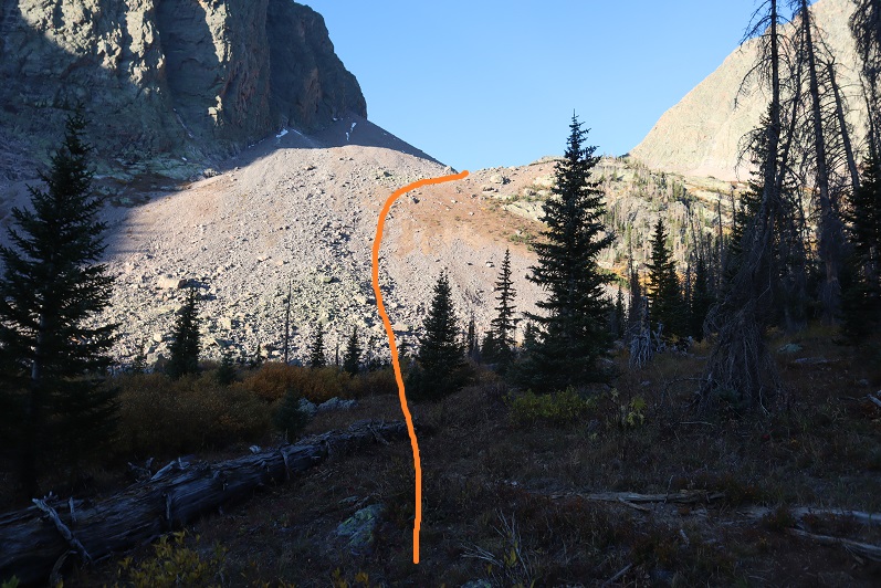
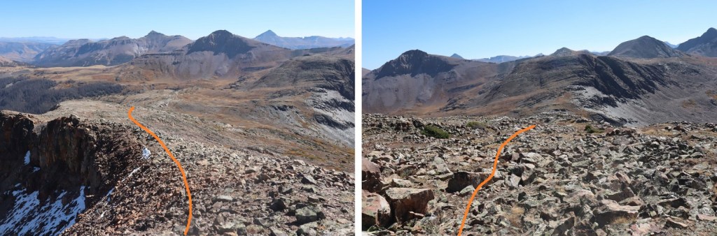
Once above treeline I had a great view of Hunchback Mountain. Here’s the overall route I took to the summit
And step by step, all class 2. Sometime during this part of the hike I lost one of my gloves. It was really windy, and I suspect it was blown out of my pocket. Time for a new pair of gloves. I left the trail and aimed for a small grassy area near a band of rocks
After the grassy area the terrain became rocky. I aimed northwest (note, this is a false summit)
Here’s a view of the summit of Hunchback Mountain
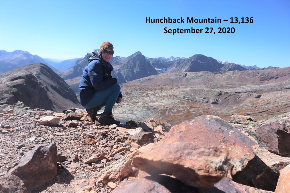
I summited Hunchback Mountain at 11:15am
Hunchback Mountain:
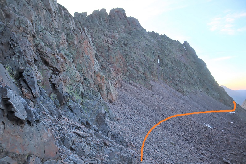
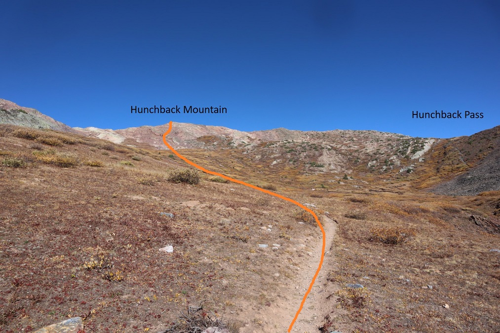
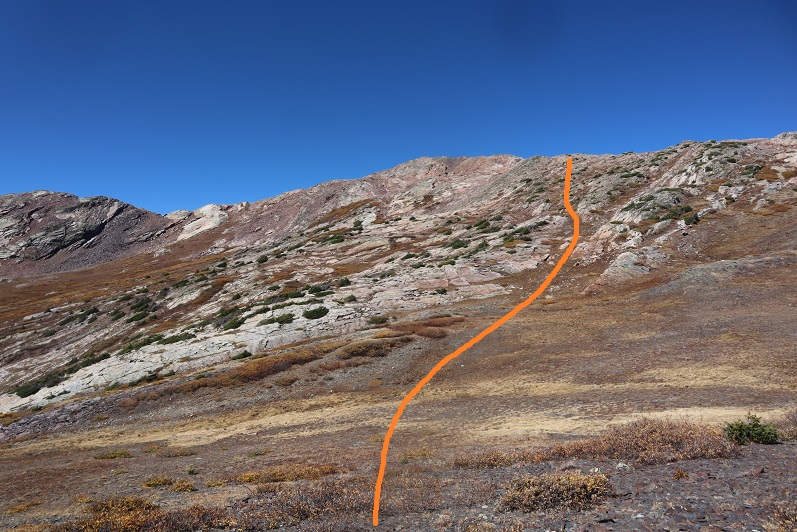
I spent some time on the summit, getting a good look at some 13ers I wanted to attempt next weekend if the weather held out. I figured out which route I wanted to take next week, and then it was time to head towards Hunchback Pass. I just followed the ridge east until I reached a tundra/willow filled gully, then followed the gully back to the trail.
Here’s looking back on my descent
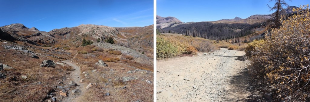
Back on the trail it was an easy hike back down to my truck
I made it back to my truck at 1pm. This was a 3 day hike, with 39.49 miles and 11981’ of elevation gain according to CalTopo, 28.9 miles and 19042’ of elevation gain according to Strava. I’m not sure why the big gap in elevation gain/mileage, but to remain consistent I always use CalTopo data.