Peak A – 13,952

1

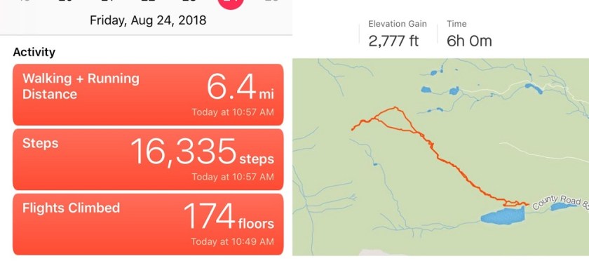
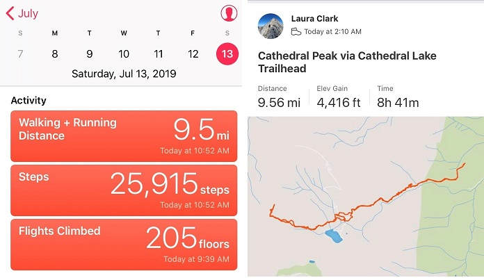
RT Length:  9.5 miles

Elevation Gain: 4416

This was my second attempt to summit Cathedral Peak this year.  The first time was back in April when I had to turn around due to avy debris I was unable to navigate in the dark.  I’d read a recent conditions report stating there was now a path around the avy debris and decided to attempt Cathedral Peak on my next free day.

My sleeping schedule is currently all messed up.  I’d woken up at 2pm, took my daughter to the art museum, and then left my house at 9:30pm to make it to the trailhead by 2am.  I wanted to get an early start on this one because of the potential thunderstorms later in the day, but mostly because I was worried the snow in the couloir would soften up early in the sunlight.

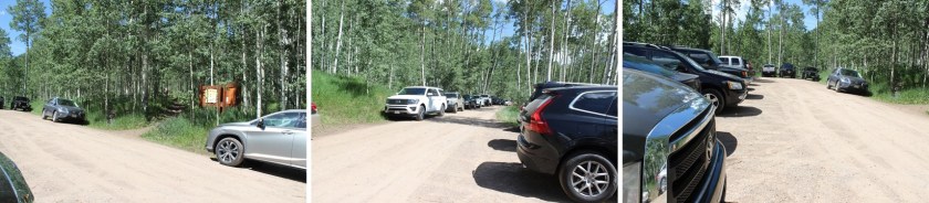
The trailhead had room for plenty of vehicles.  When I arrived, there were 4 or 5 cars in the lot, but when I left there were dozens, all lined up on the side of the road.  Also, apologies to the man I woke up who was trying to sleep in his vehicle:  apparently my trucks headlights were too bright.  I was on the trail at 2:10am.

2

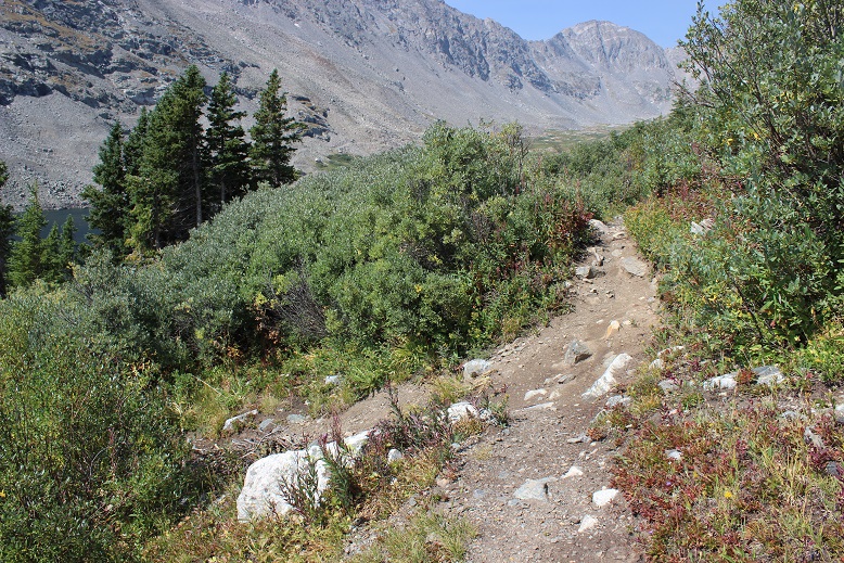
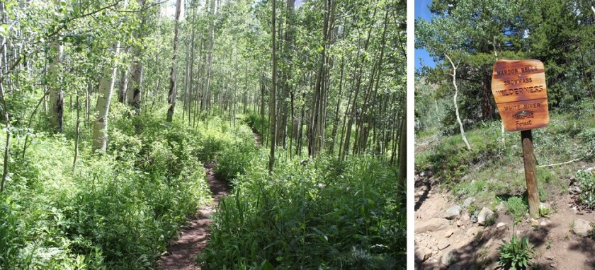
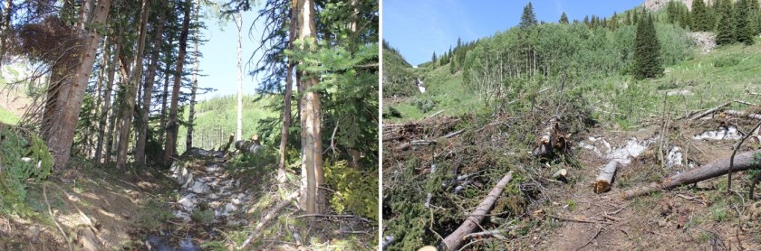
The trail starts off meandering through an aspen grove.  Last time I was here this had been covered in 3-4 feet of snow and I’d missed the sign…

3

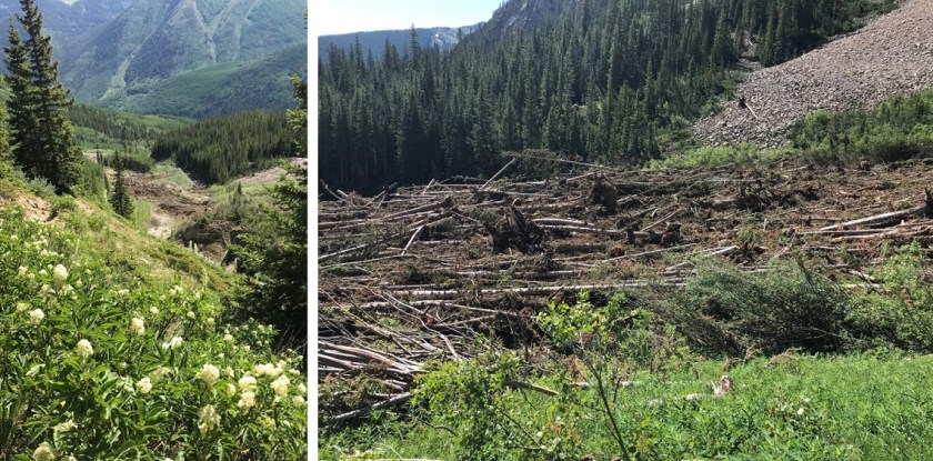
I made it to the avy debris area after about a mile and a half of hiking.  When I was here last I couldn’t see the top of the downed trees; they were supported by a huge layer of ice that was at least twice as tall as I am.  Today the area was much more manageable to navigate.

4

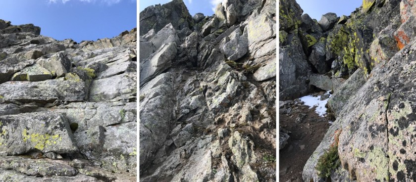
Next I followed the side of the mountain up some switchbacks on an obvious trail.  Side note:  Beargrass (the tall plant with lots of tiny white flowers) looks scary in the dark; kind of like children waiting for you silently in the night.  I like to keep my flashlight directly in front of me to keep myself from freaking out.

5

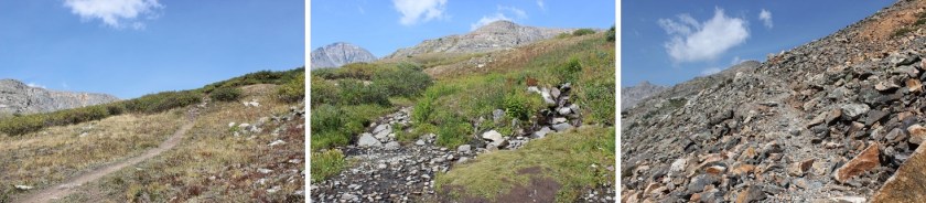
Once again, the trail is easy to follow.  Here’s a look back at the trail

6

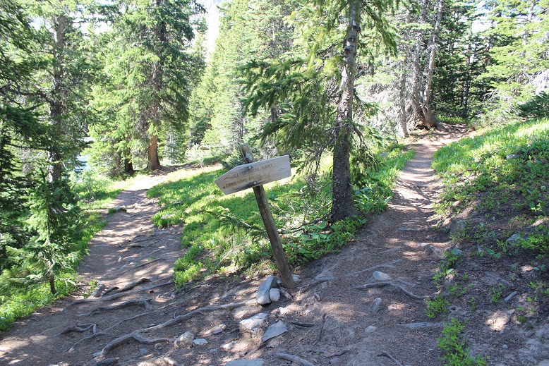
I stayed left at this junction on the way in (but on the way out ended up coming back down the Electric Pass trail and rejoining the trail here)

7

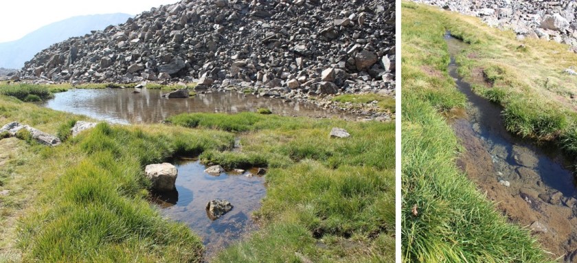
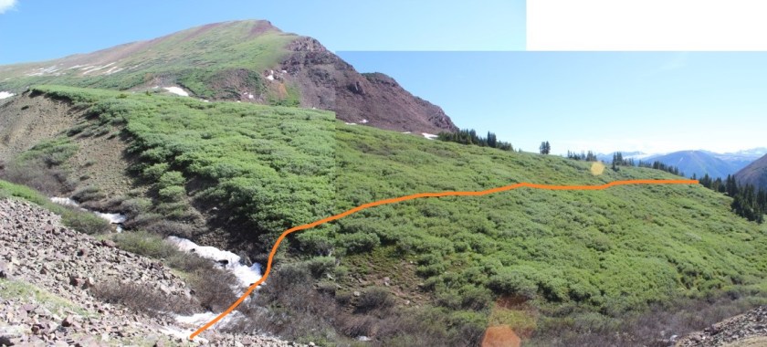
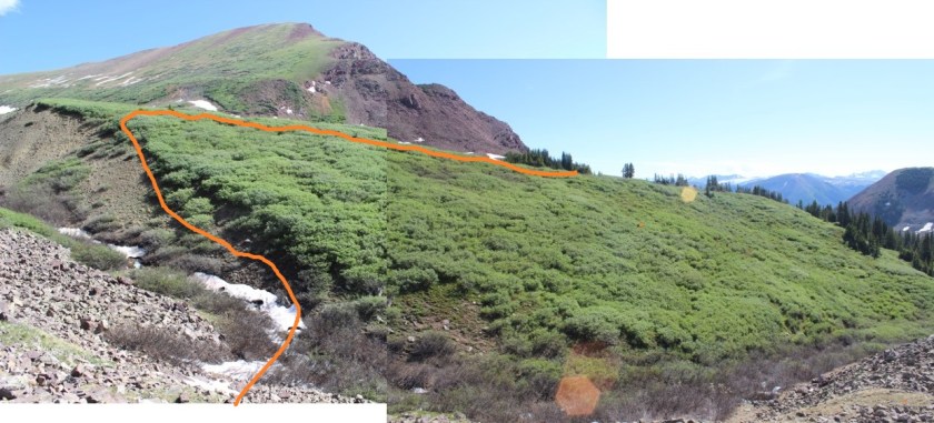
The most difficult route finding occurred here, before the lake.  I knew I could pass the lake on either side but due to a creek crossing I didn’t want to take I navigated to the north.  I was told there was a miners trail here, but was unable to locate it in the dark.  I lost half an hour going up and down the trail, looking for the offshoot and was unsuccessful (although I did find a lot of trails that went in other directions).  Finally, I decided to just head northwest through the willows.  This sounds easy enough, but the willows here were several feet taller than I am.  I just turned my trekking pole parallel to the ground and held it out in front of me while I bushwhacked across them.  I only got hit in the face a few times (and had a swollen upper lip the rest of the day to prove it).  The good news is I made it across, and the willows were no worse for the wear.  On my way back I could see the miners trail in the daylight (more on this later).  Here’s the route I took through the willows and across the creek (which was small enough I could jump across here without getting my boots wet).

8

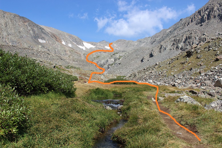
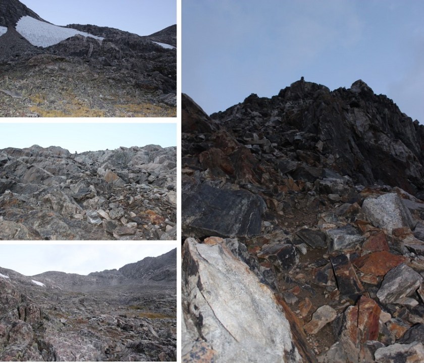
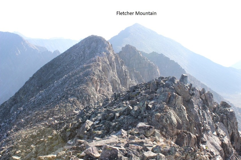
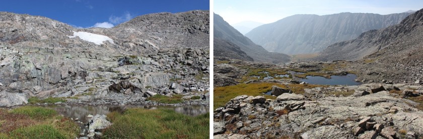
Next I rounded Cathedral’s east ridge and found a well cairned trail that led me into the basin

9

This trail brought me above Cathedral Lake

10

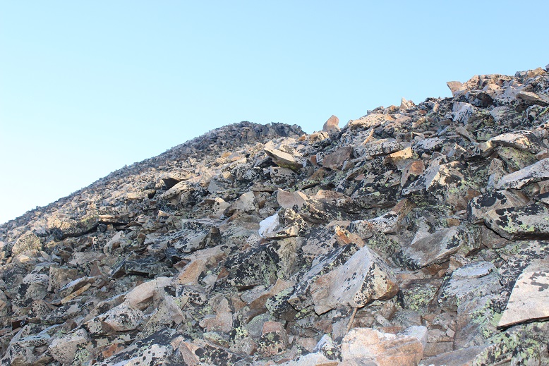
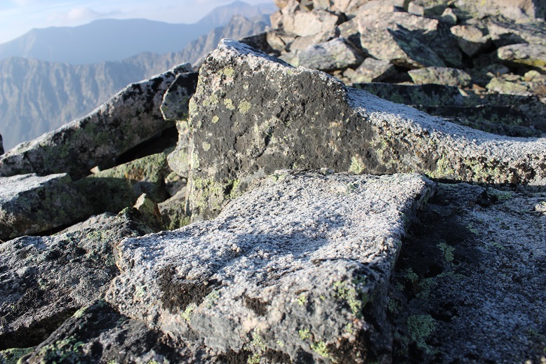
This route was well cairned, and the talus was terrible.  I got to be the first to experience the spider webs this morning.  Tons of fun in the dark!  Second only to phantom children.

11

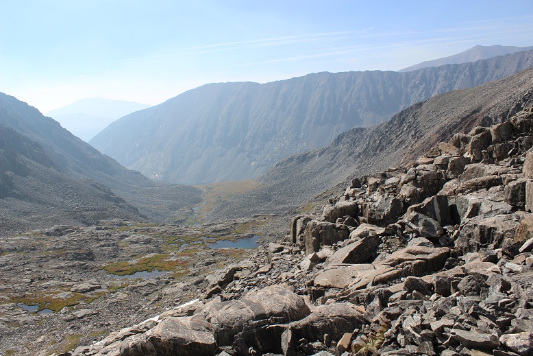
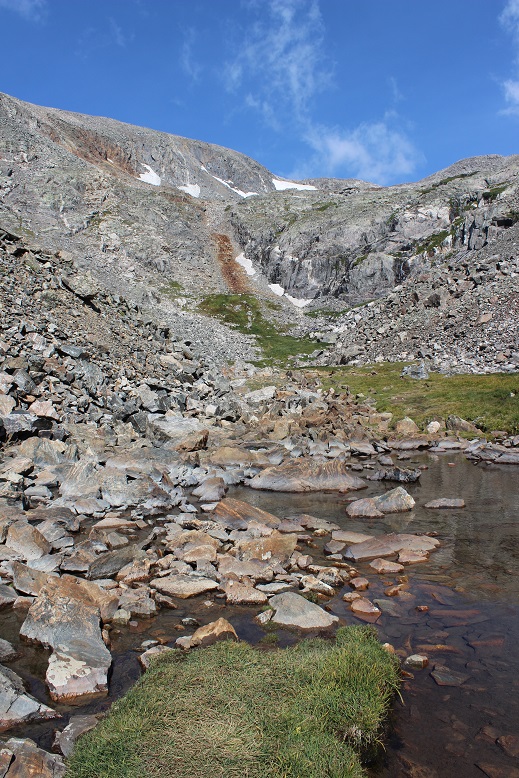
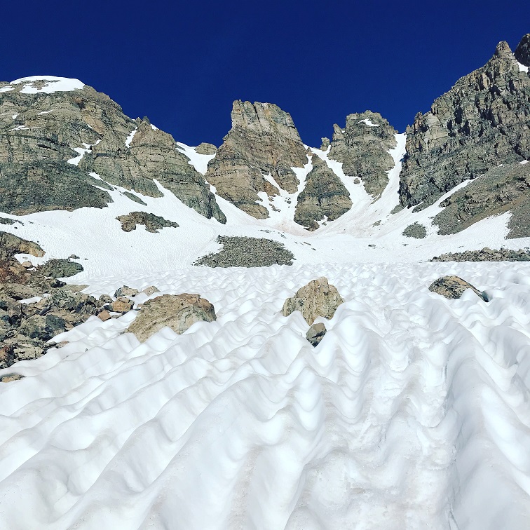
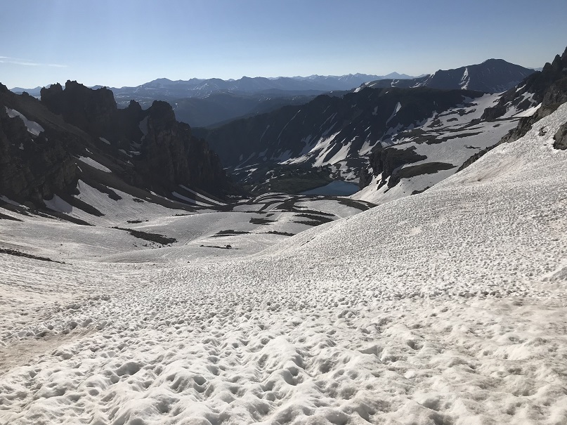
Once in the basin you can see the route up the access gully.  Today the basin was half filled with snow and I couldn’t help but think how much easier it would have been to traverse if it had all just been snow.

12

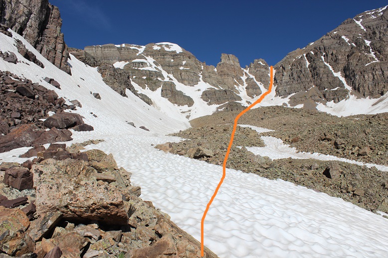
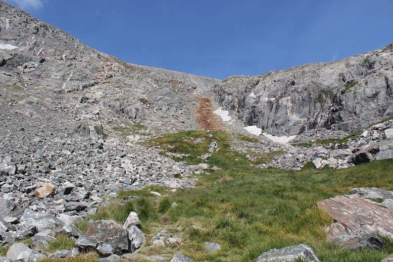
In the morning I didn’t need snowshoes.   I made it to the base of the access gully at 5:25am and put on my crampons and helmet and got out my ice axe and garden tool (that tool’s really coming in helpful, but I may just break down and buy another full ice axe).  This is steeper than it looks, but luckily it ‘went’ all the way to the ridge

13

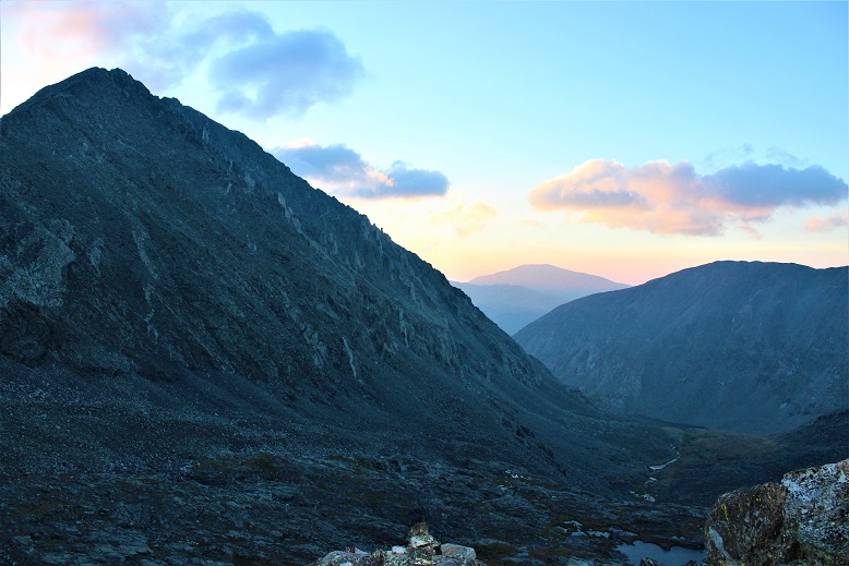
Here’s looking back at the basin

14

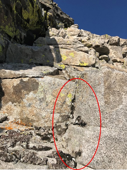
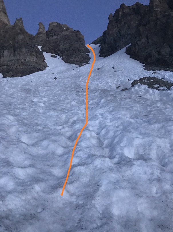
The snow was still really firm and I was unable to kick in steps but I was able to ascend with crampons and ice axe.  I was glad to have both my ice axe and (garden) tool.  I was about 30 feet from the top when I decided it was better to be on the left side of the gully rather than the right and started traversing sideways.  About 4 steps in my crampon hit the ice sideways and my boot slipped out of the bindings.  This was the worse possible place for this to happen:  I was balanced on the side of the wall of ice, with one foot in front of the other (I wasn’t able to kick in steps here, and was balancing on a very small mound of frozen snow with my right toe pointed at my left heel, sideways).  I needed to have an ice pick in the wall for balance or I was going to slide all the way down the gully.  My pulse rate quickened as I realized the severity of the situation.  Luckily I had two tools. I carefully balanced on the working crampon and tried to knock the other back into place with my ice axe.  No dice, my crampon wasn’t going back over my toe by sheer force (as well it shouldn’t;  I’d fastened it pretty tightly initially, and had no idea how it had been knocked loose from my boot).  That meant I was going to have to untie the crampon and re-tie it with one hand while holding onto the ice with the other:  Without losing my balance and sliding down a few hundred feet of ice.  It took me a solid 10 minutes to gingerly untie and re-tie the crampon, but I was able to do so from where I was perched.  I mentally praised my daily yoga routine for developing my balancing skills.  Here’s where my crampon was knocked sideways

15

Ok, crampon back on I carefully hustled my way to the top of the gully, topping out at 6:09am, a little shaky as I looked back down.

16

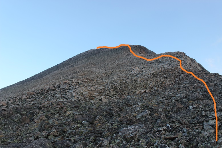
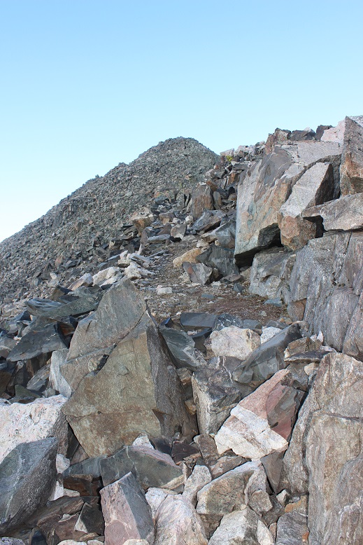
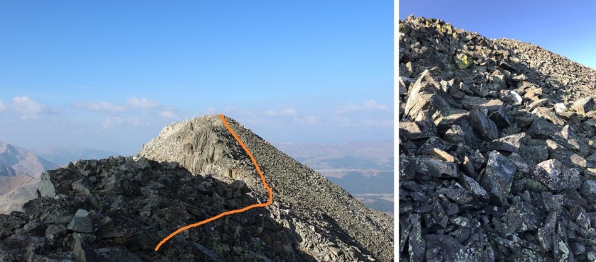
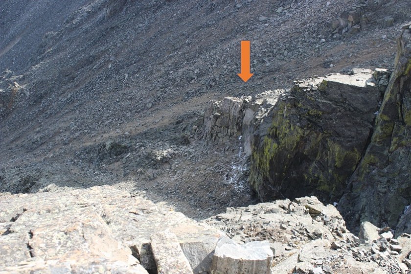
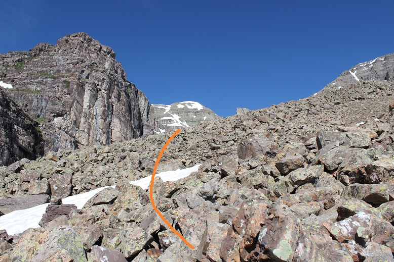
From the top of the gully I turned right and noticed the rest of the route was snow free.  Woot!  I took off my crampons and put them in my pack.  Time for some scrambling!  On the way up I took a class 3-4 route up and over the ridge (solid line) on the way down I found the cairns and took the class 2+ route along the side of the towers (dotted line).

17

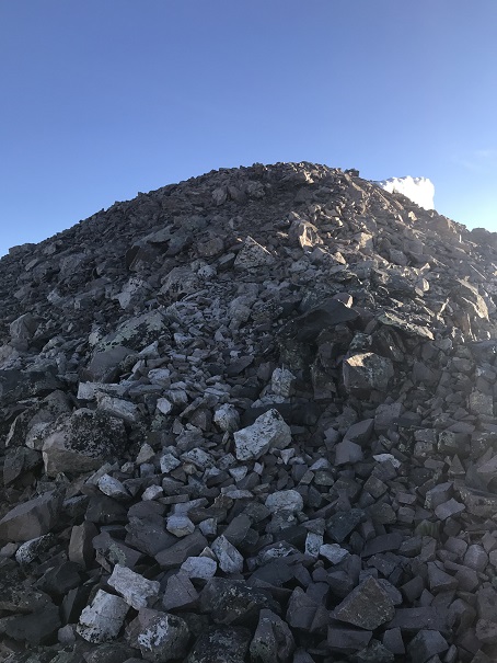
The last bit to the summit was easy

18

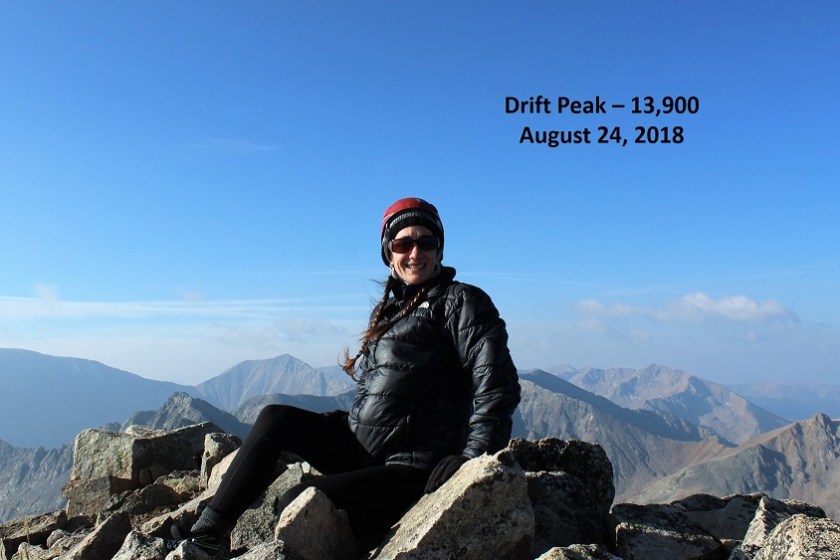
I summited at 6:40am (it took me half an hour from the top of the gully to summit).

19

Summit Video

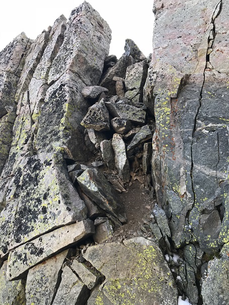
Check it out!  A summit marker!

20

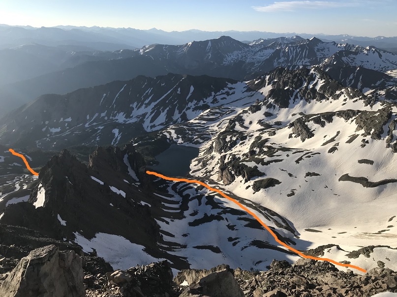
Here’s a look back at the basin and my route up to the gully

21

Time to head back down.  I made it back to the top of the gully and met 3 other climbers.  We chatted for a bit.  They said they’d kicked in steps on the way up to make their descent easier.  It was 7:20am as I headed back down the gully. On my way up I’d forgotten to put on my gloves (it wasn’t cold) and my knuckles were a bit tore up, but that’s the best way to learn a lesson.  Also, I wasn’t sure I’d have been able to untie and then re-tie my crampon with gloves on.  At any rate, I was putting gloves on for my descent.

22

I turned, faced the gully, and began my descent.  It was only just after 7am, but there was a huge difference from when I was climbing at 6am.  The snow was quickly softening up.  I was careful to either avoid the kicked in steps, or if I had to use them to make sure I only made them better, but the softening snow wasn’t making things easy.  Sticking to the climbers left of the gully seemed the best way to go.  About ¾ of the way down the snow was slush and I really just wanted to glissade the rest of the way (but didn’t because I was worried I’d mess up what was left of the kicked in steps).

Here’s the route once again

23

I actually took more time than necessary heading back down, and as soon as I could I switched out my crampons for snowshoes to exit the basin.

24

I met a man starting his climb up the gully and was worried for two reasons:  #1, the three people I’d met at the top of the gully hadn’t yet began their descent, and #2, it was rather late in the day for someone to start their climb (the snow at this point was rubbish).  I figured the trio up top must have decided to picnic at the summit and asked the current climber to look out for them.  It was now 8:25am, and I knew I wouldn’t want to begin my descent at this time.  I figured I’d timed it pretty well starting at 2am: it would have been perfect if I hadn’t spent half an hour lost in the willows.

Speaking of willows, I made my way back to the small creek crossing and in the light of day was able to locate the miners trail.  I crossed the creek and headed up the slope, aiming at a small pine tree.  From here I was able to follow a faint trail, which eventually led me to the Electric Pass Peak trail, which I took back to the junction with the Cathedral Lake trail.

25

On my way out I couldn’t help but think how dreadful this climb would have been with snow all the way up to the lake!  I have no idea how I found my way so far the first time.  Here’s a look at some of the avalanche debris

26

I made it back to my truck at 10:55am, making this a 9.5 mile hike with 4416’ in elevation gain in 8.5 hours.  The hike felt longer than it was, most likely because much of the trek out was done in direct sunlight on the way out (no trees for shade).

27

Second Attempt for the Win!


Fletcher Mountain  – 13,943 & Drift Peak 13,915

1

RT Length

Elevation Gain: 2777’

I was a bit worried about today’s hike.  After hiking Stewart Peak with frozen feet last Tuesday I found this rock in my right hiking boot.

2

I’m not sure how long during the hike it had been there, but it had apparently rested under the ball of my right toe for quite some time.  I know this because for the past 2-3 days I’ve had a hard time walking without pain.  My foot wasn’t red or swollen, but I couldn’t walk on it normally, and it hurt to massage it.  I researched my symptoms, and Google told me I did something to the joint.  Ironically the way to treat it was to either exercise it, rest it, or take Ibuprofen.  I don’t rest and I don’t take medication if I can avoid it, so I decided to get some exercise (but not too much).

So for today I picked a moderate class 3 hike that was supposed to be about 6 miles in length with around 3000’ of elevation gain in a heavily trafficked area so if something went wrong I’d have a better chance of finding help.

I woke up at 2am (woohoo!  It’s like I slept in!) and made it to the trailhead at 5am.  There was one other car in the parking lot but as I was getting ready someone pulled up and asked me if we were at the Quandary Trailhead.  Technically we were, but it’s the trailhead for the more dangerous West Ridge route, and I figured by looking at them they were looking for the East Ridge Route, so I gave them directions back to the lower trailhead.  For so many reasons sorry not sorry if I’d been wrong.

Here’s a view of the 2WD dirt road in and the parking area

3

It was dark when I started out.  I crossed my fingers and started my new tracker, walked to the right to the hill where the gate and dam meet and noticed this sign:

4

There’s a trail here that follows the lake.  I took it for longer than I should’ve and quickly noticed my mistake:  I was too far south.  In the dark where I was supposed to turn didn’t look safe so I’d continued along the lake looking for another trail that headed up.  Luckily there were several social trails that headed north towards the correct trail.  I found one that was most likely more difficult than the first and was soon back on route.  Here’s where you’re supposed to turn right and climb the hill.

5

Here’s where I joined the trail

6

The trail up through the basin is easy to follow (even in the dark).  The trail gained elevation very gradually and my right foot throbbed with every step.

7

Here’s the route I took through the basin and up over to 12,500’

8

Once the trail ends it’s heavily cairned and easy to follow, even in the dark.  I wasn’t able to see the red gully, but it was still the obvious trail to follow.  As I gained in elevation and the route became steeper my foot curiously stopped hurting.

9 0

After the red gully there were large boulders and rocks to hike around, with lots of carins to help out with route finding.

10

When I reached the top of the basin I turned around.  Quandary’s west ridge looked amazing in the morning light!

11

Ahead of me I could see Fletcher Mountain

12

There was no trail, but the route to the summit was obvious.  Here’s the route I took

13

You want to stick to the left of the ridge because there are steep drop offs to the right.  The rocks aren’t stable but they won’t fall on you either, they’ll just roll.  About half way up it started getting tricky: I was curiously slipping with every step!  That wasn’t right?  I have great shoes that usually grip everything.  It seemed there was a thin layer of ice on the rocks I couldn’t see but which made hiking without slipping nearly impossible.  Yes, I resorted to a kind of forward crawl where I had at least 3 points of contact the entire time.  I probably looked silly with my butt in the air but I wasn’t slipping and falling. And there wasn’t anyone around to see…

14

I made it to the summit at 7am and had a great view of Quandary (it looked cold up there!).  The wind was intense and made it much colder than it should have been.  Here’s my summit photo

15 Fletcher Mountain 13951

And video:

The cloud above Quandary worried me, but the wind was blowing east and I was headed west so I decided to just keep an eye on the weather.  Otherwise it was a perfect morning!

I looked to the southeast at my next goal

16

The hike down Fletcher towards the saddle was just as awkward as the hike up (I kind of spider crawled due to the ice) but by the time I’d made it to the saddle the ice was pretty much gone.  Here’s the view of Drift (left) and Fletcher (right) from the saddle

17

This is a great place to put your helmet on (and keep it on until you make it back here).  The beginning part of the ridge for Drift wasn’t too difficult.  I just gained the ridge and followed it

18

From the picture below you want to stop following the ridge and turn right (north) to bypass the crux of the route (if you continue on the ridge you’ll encounter steep drop-offs and need to turn around)

19

You’re looking for and aiming towards a large round bolt in the route.  It’s about 5 inches in diameter, and visible from a good ways away if you know where to look.  I’ve circled the bolt in the pictures below

20

When you make your way to the bolt you’ll see by facing north how to drop into the gully.

21

This is kind of a chimney, and gets you ready for the more serious climbing ahead

22

Oh, did I mention the rocks were now icy again?  Here’s a better view of the ice

23

From here I had to re-gain the ridge.  I crossed the gully, located the lighter gray colored rocks, and headed up.

24

There are several routes to regain the ridge but if you stay on the lighter gray rock you should be fine.  Did I mention this was steep?  Seriously steep and slippery (due to the ice) and definitely Class 3+.  Several times I thought how helpful a rope wouldn’t been…

25

But once I gained the ridge all I had to worry about was ice and wind as I crossed the easy path to the summit. The rocks weren’t stable but they weren’t a problem to navigate.  Just be careful for rolled ankles.

26

Well, easy if the wind wasn’t blustering at 40mph and there wasn’t a thin layer of ice on the rocks.  I was very cold and honestly crab-walked over the slippery rocks to the summit, afraid with the wind and ice I’d slip and fall.  But I made it!  I summited at 8:15am.  I couldn’t smile because my lips were frozen… I tried though.

27 Drift Peak 13900

Video:

Here’s a look back at the ridge

28

I was cold and my fingers were starting to freeze so I didn’t stay on the summit long. I knew I’d need some dexterity in my fingers to make it back down the light gray rocks.  I followed the easy ridge back and braced myself to downclimb back into the gully.  The first few sections were fun and I was easily able to navigate the large boulders.  Until I reached this point

29

This is where I fell.  Well, I didn’t actually fall, more like slid for about 4 feet (scarier when it’s actually happening than it sounds reading about it).  You see, everything was once again covered in a thin layer of ice, and there were no foot/hand holds available.  None.  I know, I was looking.  I was in a spot that (due to the ice) offered very little in the way of help for the situation I was in.  There were a few patches of moss that I tried to use, but naturally they weren’t stable and quickly crumbled out from under my shoes.  And that ice didn’t help at all!  I knew I was going to slip and slide eventually, so I tried to minimize the acceleration as much as possible before and as it happened by hugging the rocks and leaning forward.  When I slid I was able to stop myself on a ledge about 3 inches wide and 6 inches long, stabilize myself, take a deep breath, and continue downclimbing.  I’d bruised my right shin (just a little scrape with minor bleeding) and I had a hole in my pants at my shin, but I was proud of myself for not turning this into a worse situation.  Here’s the section where I slid.  From top of the circle to the bottom is about 10 feet.

30

I couldn’t go to the left or right because it was actually steeper in those sections and led to larger drop-offs.  This looked less steep when I was first climbing down, and the moss and lichen looked to be on larger/actual holds, or I wouldn’t have attempted it.  In hindsight, before I was downclimbing this area I should have retraced my steps to where I climbed up (as I knew there were adequate hand and footholds in that area).

Once I was on more stable ground I took a look around:  I needed to find that chimney to head back.  Here you can see it from across the gully

31

I headed towards the chimney, climbed it, turned right and headed back to the ridge, knowing the worst was behind me.  I made it back to the saddle and saw no reason to re-summit Fletcher, so I turned right and headed down the middle of the basin towards Quandary.

32

Once again, no trail, just rocks.  Luckily, while the rocks weren’t stable they also weren’t icy.  I felt humbled by the enormity of the rock field and my small place in it.

VIDEO:

As I descended into the basin the beauty caused me to pause.  This is truly a gorgeous area!  I’ll be coming back to attempt Quandary’s West Route someday.

33

I followed the cairns down and around the several small ponds I’d missed in the dark.

34

I stayed here much longer than I should have, but it was worth it for the views!  The red gully was clearly visible in the daylight

35

And those ponds and streams are much deeper than they look.  For such narrow streams at a high elevation I was surprised they were 4-5 feet deep.

36

Exiting the basin was an easy walk.  At this point I noticed my foot didn’t hurt anymore.  I guess exercise was the answer!  I passed an old mine

37

Turned the corner to take one last picture of the basin (I may frame this)

38

and:  Goats!  I love running into goats on the trail!  This herd had several kids.  All adorable

39

Video:

I made it back to my truck at 11am, making this a 6.4 mile hike/climb in 6 hours. Oh, and my tracker had worked!  It said I’d climbed 2777’ in elevation, which I thought was pretty close to the 2800’ I’d been expecting.   Now I just need to figure out how to save and transfer the GPX file to my computer. I was not happy with my time, but considering I’d crawled for a good portion of it due to ice I wasn’t too upset either.  And I’d stayed safe. And I’d seen goats!

40

Here’s my route on a topo map