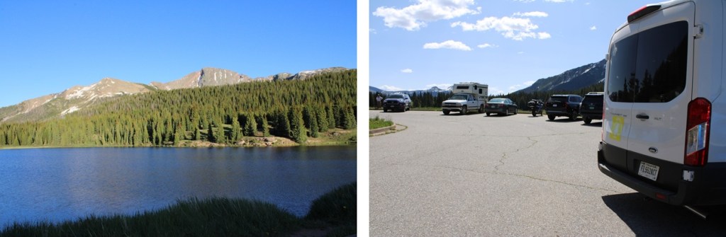
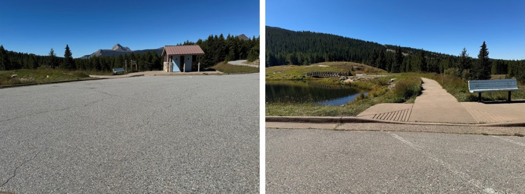
I once again started from the Andrews Lake Trailhead. When the bathrooms are clean this is a really nice trailhead, up close and personal with Andrews Lake. It’s also quite popular in summer, so get there early (yes, they have plenty of parking and an overflow lot, but it gets busy).
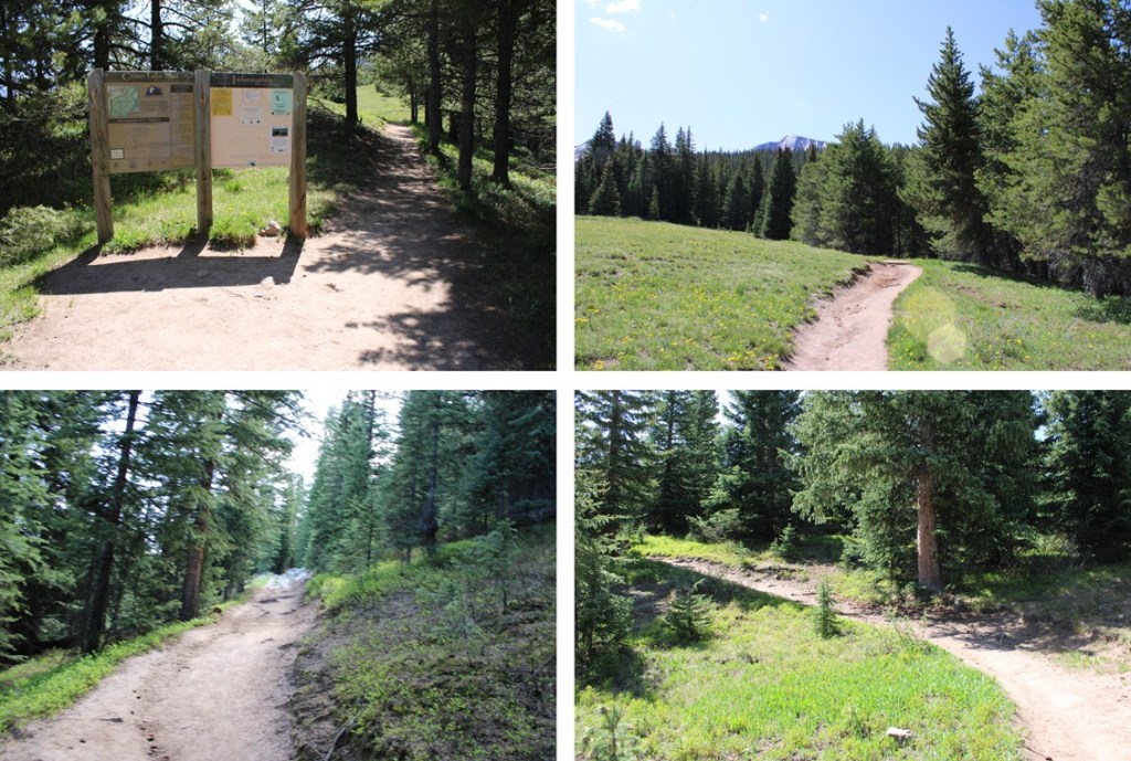
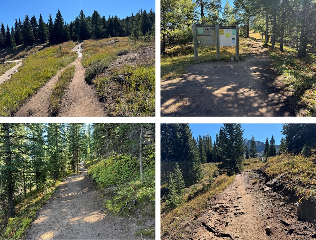
The trail starts by skirting the lake from the parking area and then ascends about 1.2 miles to a junction.
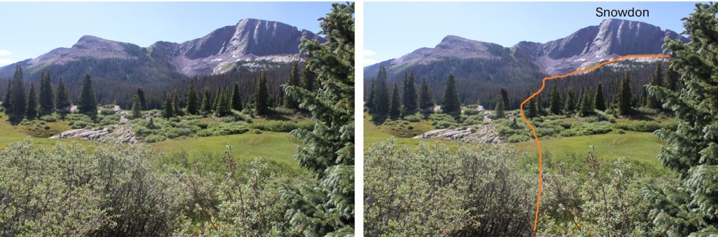
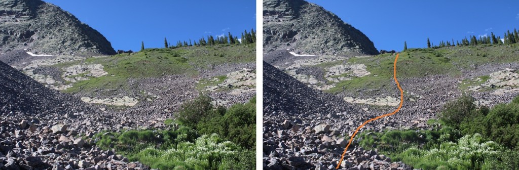
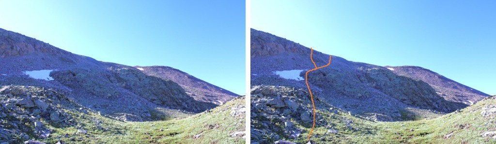
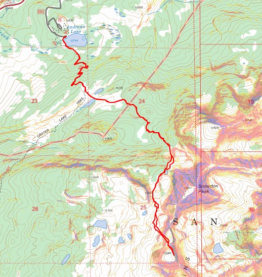
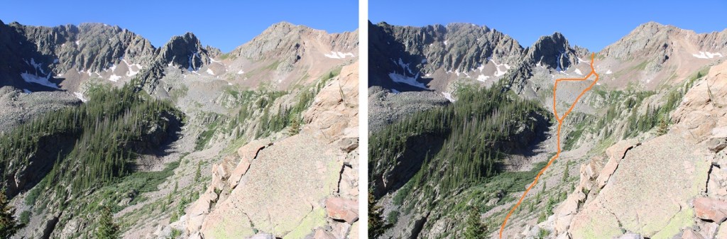
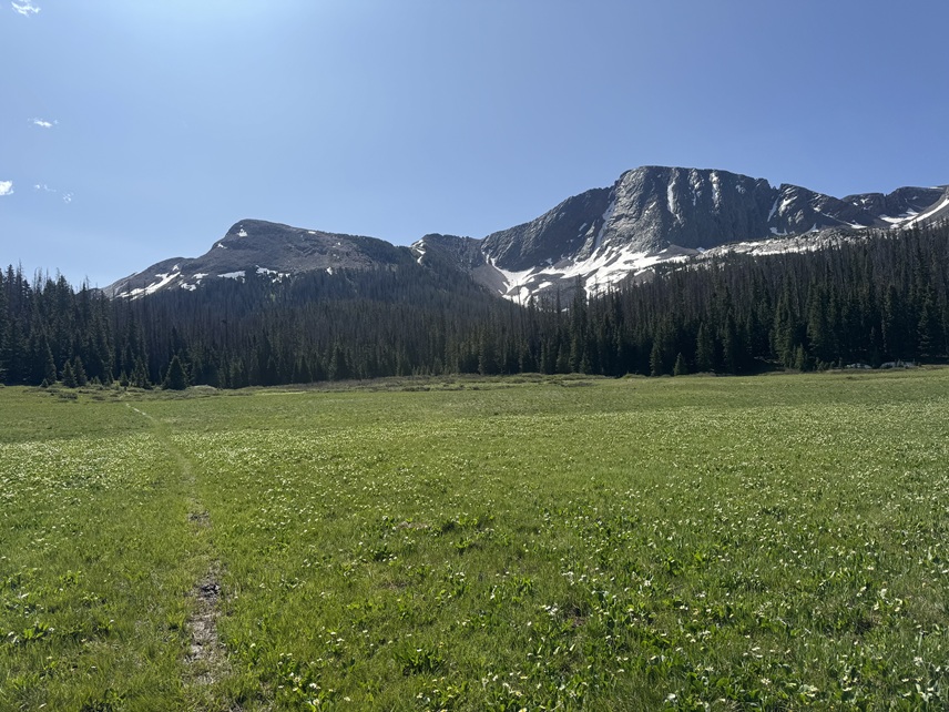
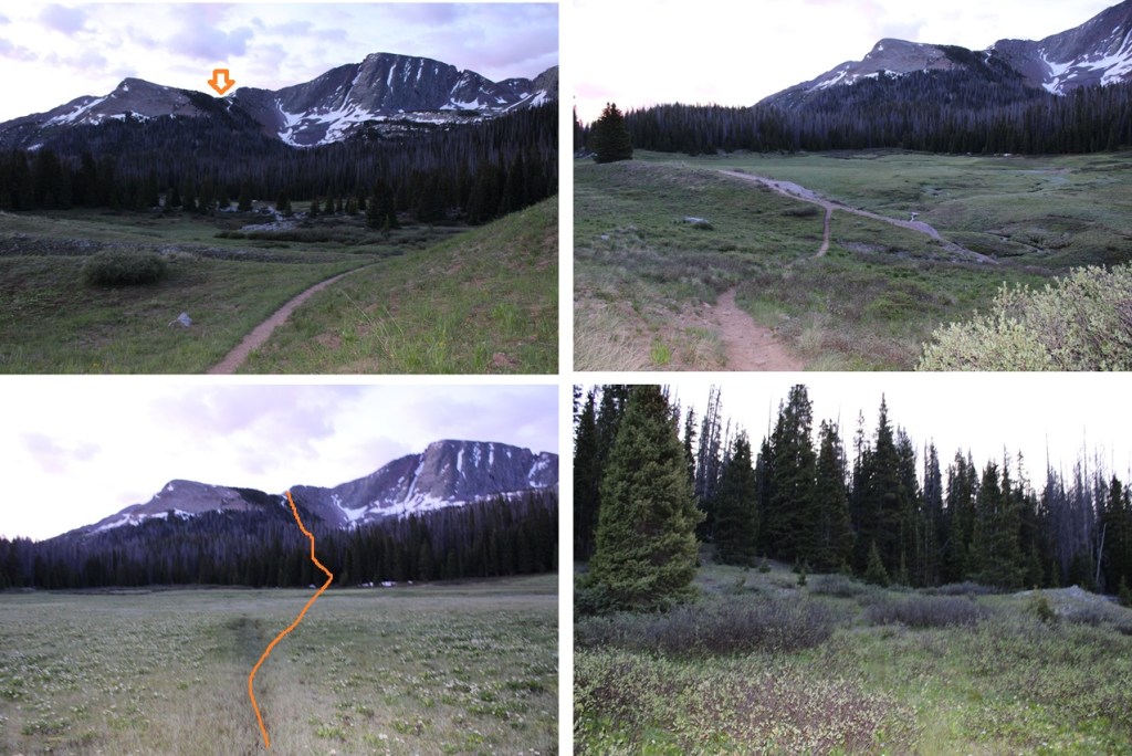
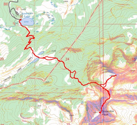
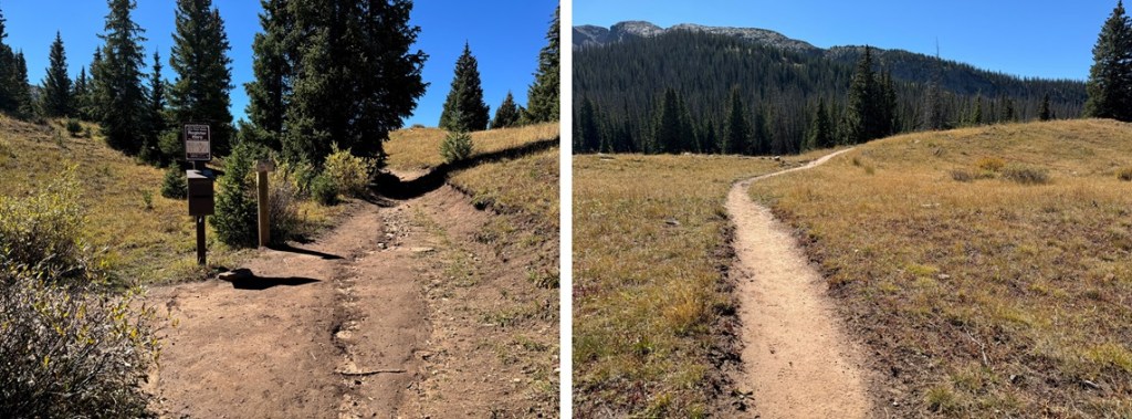
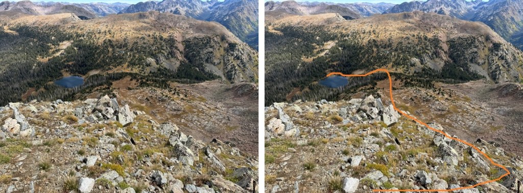
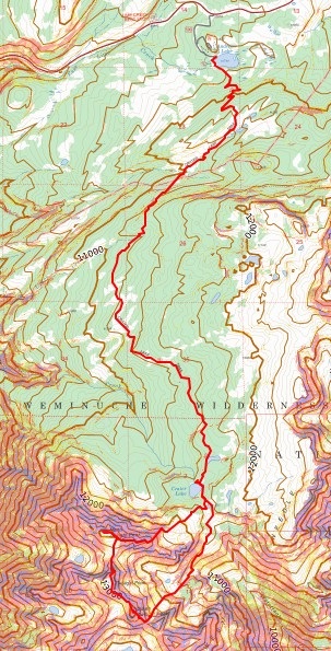
At the trail junction I went left and followed the trail through a meadow and towards the basin below Snowdon Peak. If you’ve done the West Buttress of Snowdon, it’s much of the same route. Here’s the basic overall route to the upper basin:
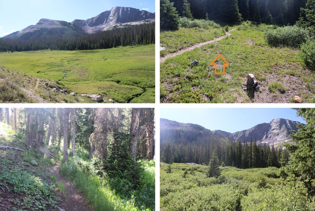
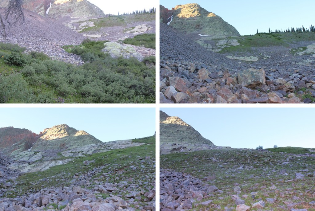
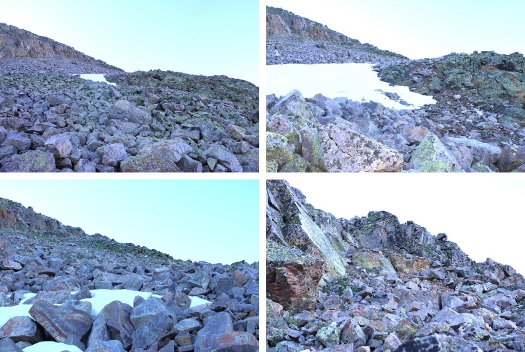
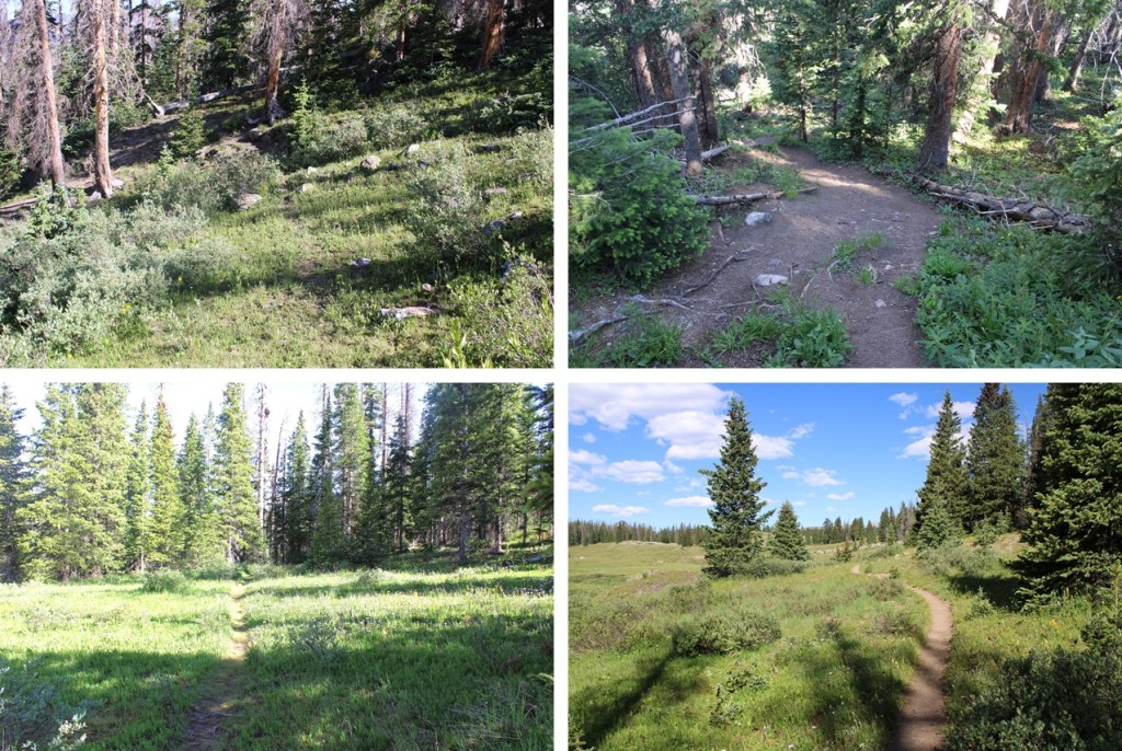
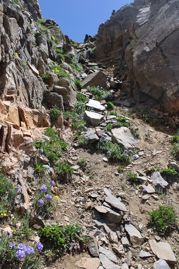
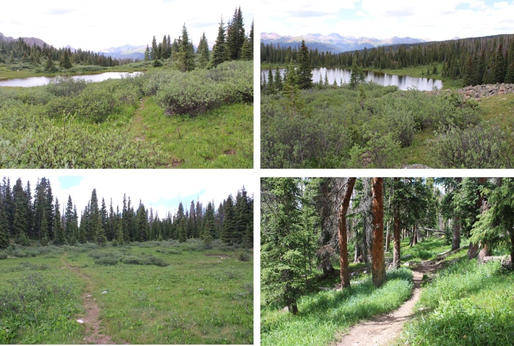
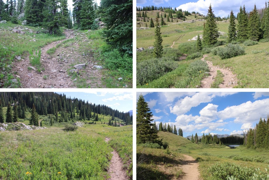
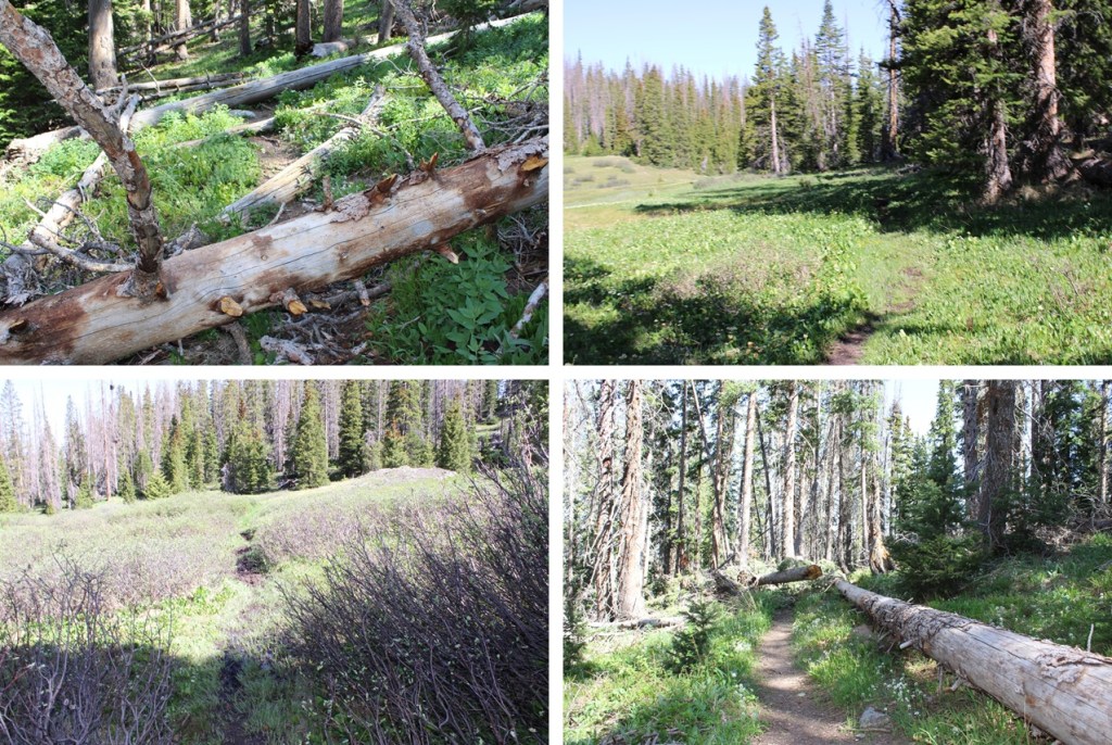
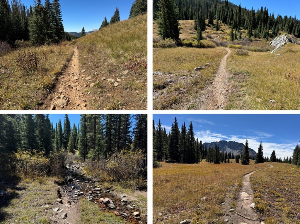
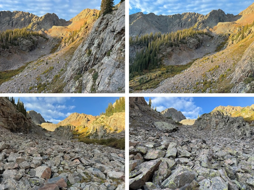
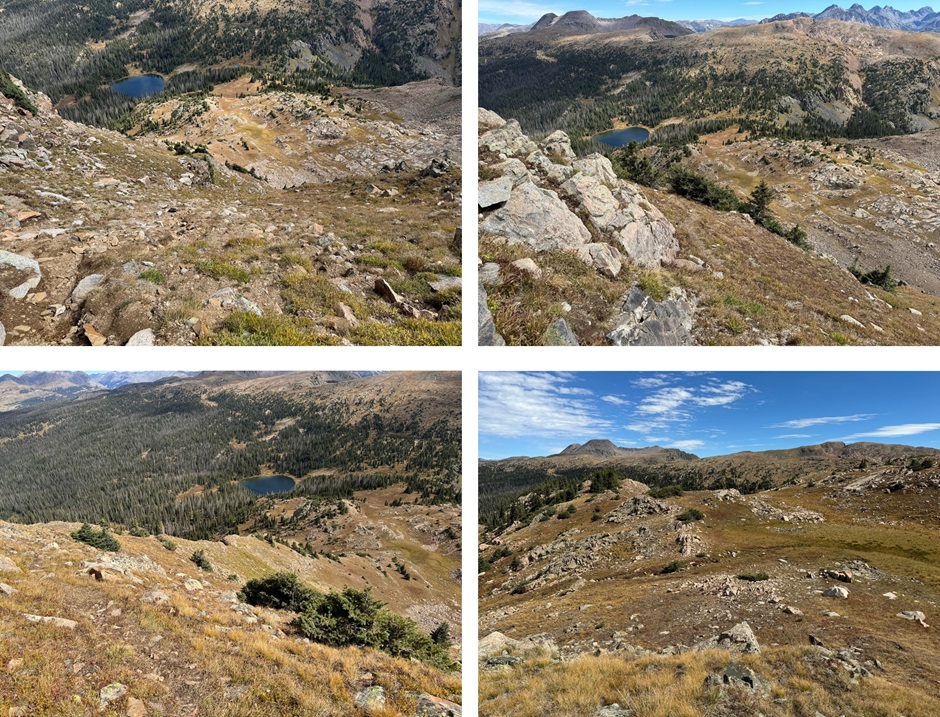
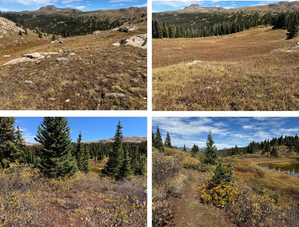
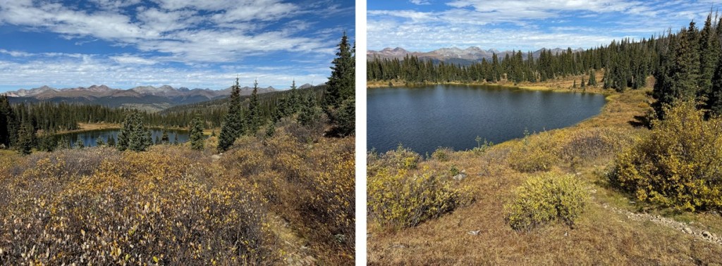
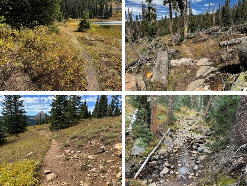
And some pictures of the way to the lower basin. I was lucky enough to see a herd of elk this morning.
At the base of the basin it’s time to leave the trail. I’d hiked about 2.7 miles to this point. Here I left the trail and headed southwest into the upper basin.
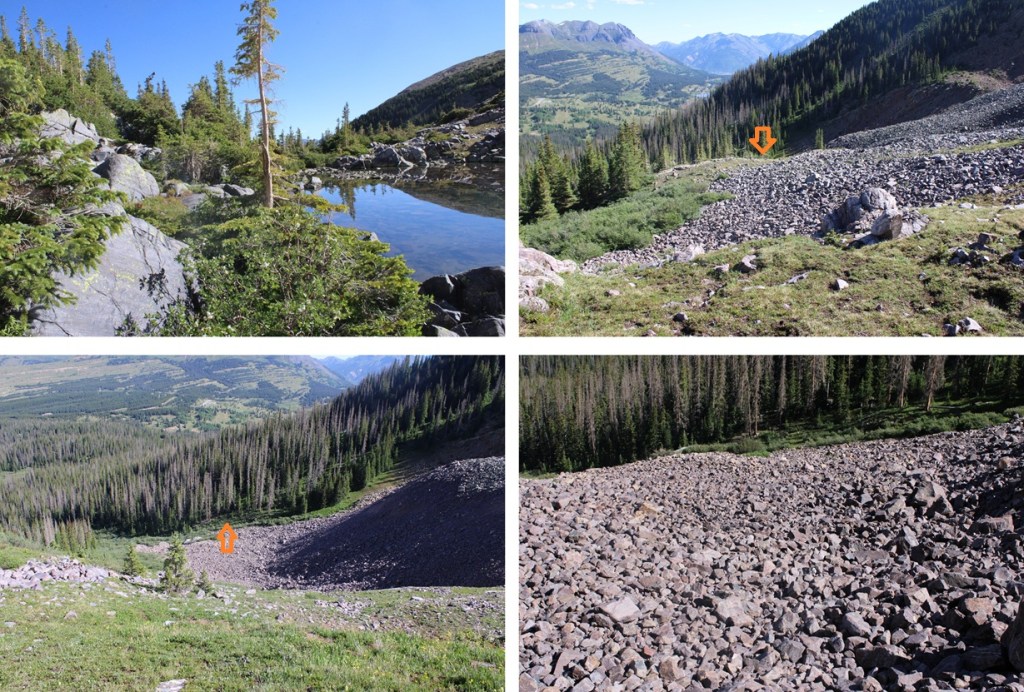
Heading southwest in the upper basin I came to a small pond and skirted it on a game trail to the west.
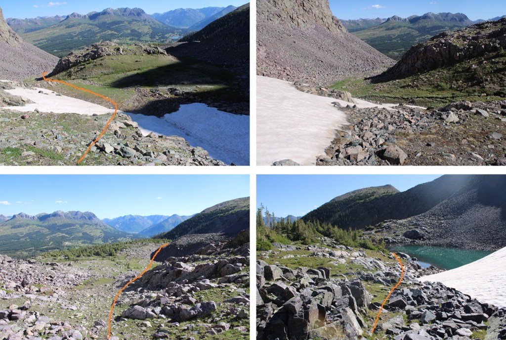
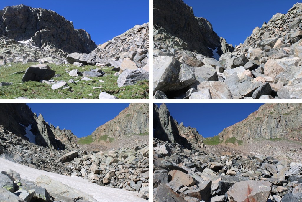
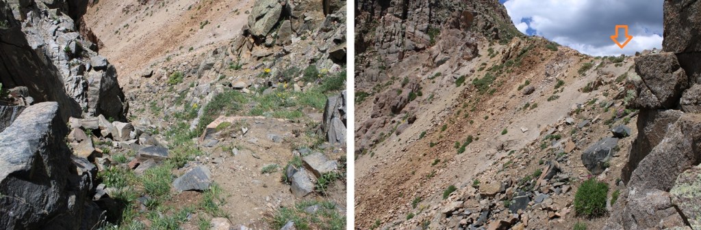
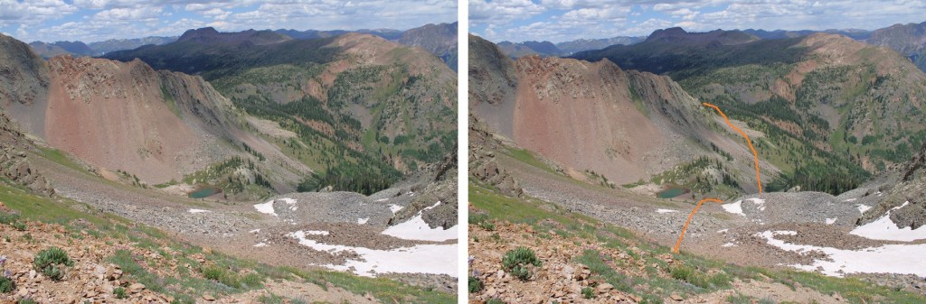
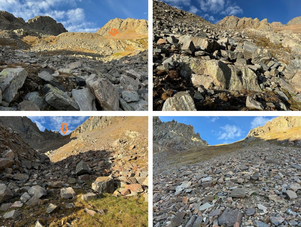
After skirting the pond, I came to a bit of a ravine. I followed it south. The route is a bit obvious, and the terrain is easy to navigate. You can’t really get lost if you keep heading south. Access to N2 will eventually be on your left.
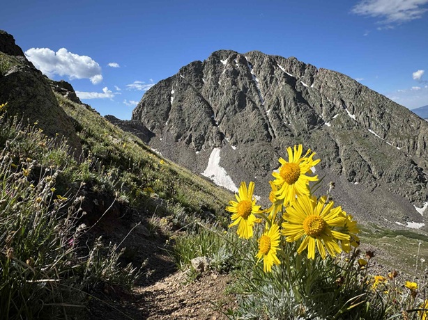
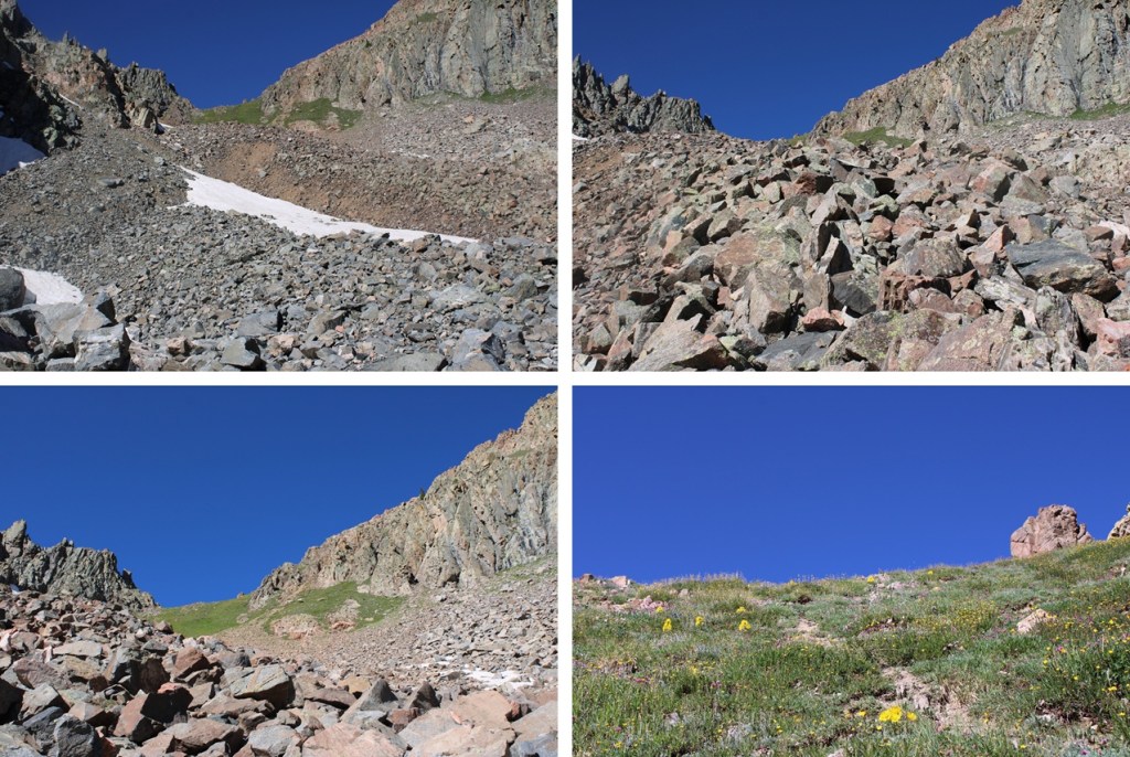
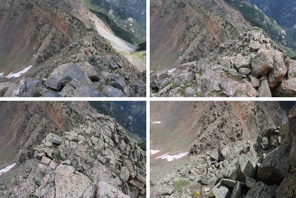
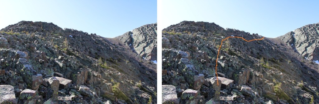
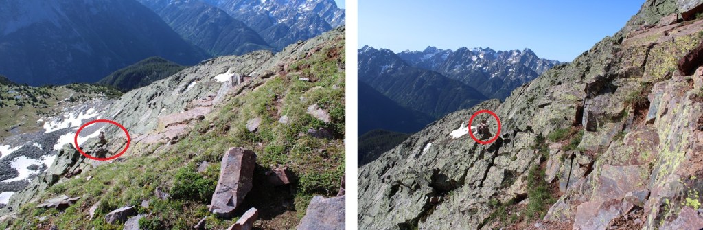
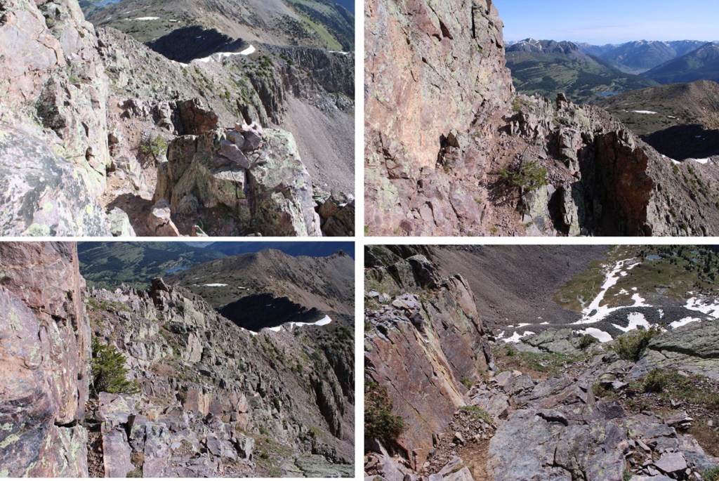
When I made it to 12355’ I started heading over towards the ridge. This is class 2 to the ridge and choose your own adventure. I was trying to avoid the rock outcropping. Most of the route is full of loose rock and boulders. I ascended the left route, descended the right route, and both were loose and a bit miserable, but the left route was a little more stable. Here’s the overall route:
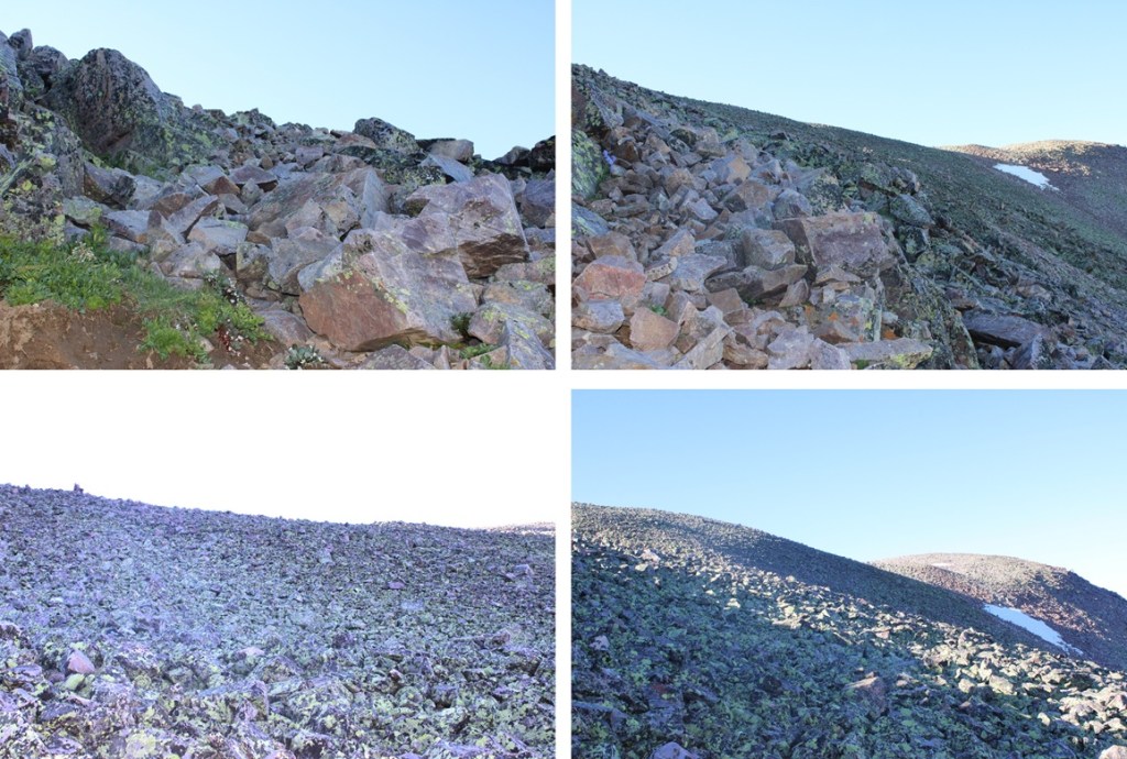
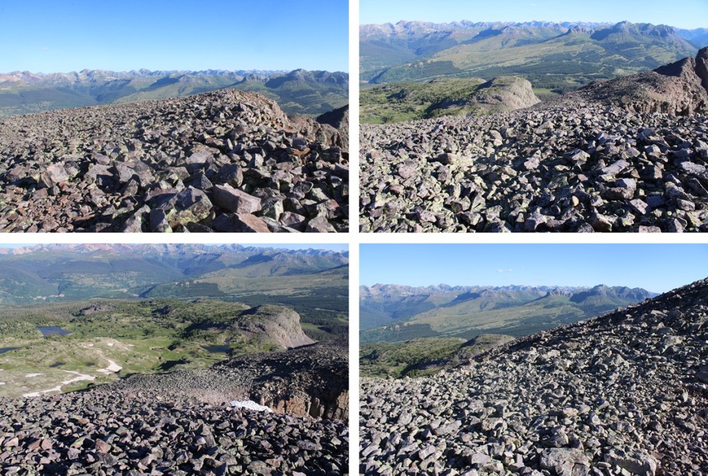
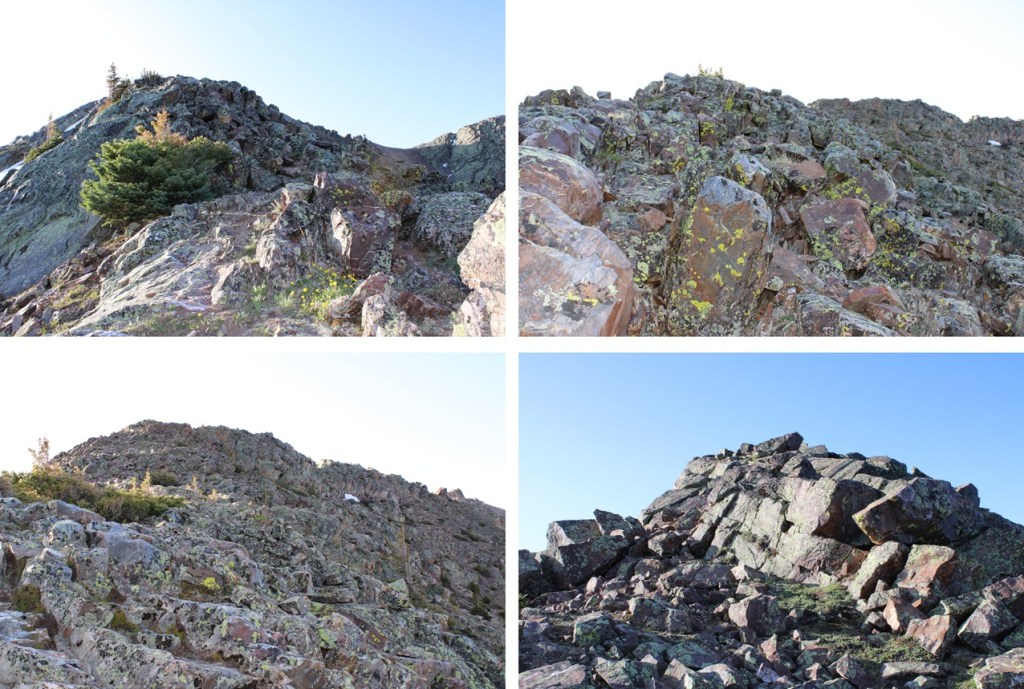
And some pictures of my way to the ridge
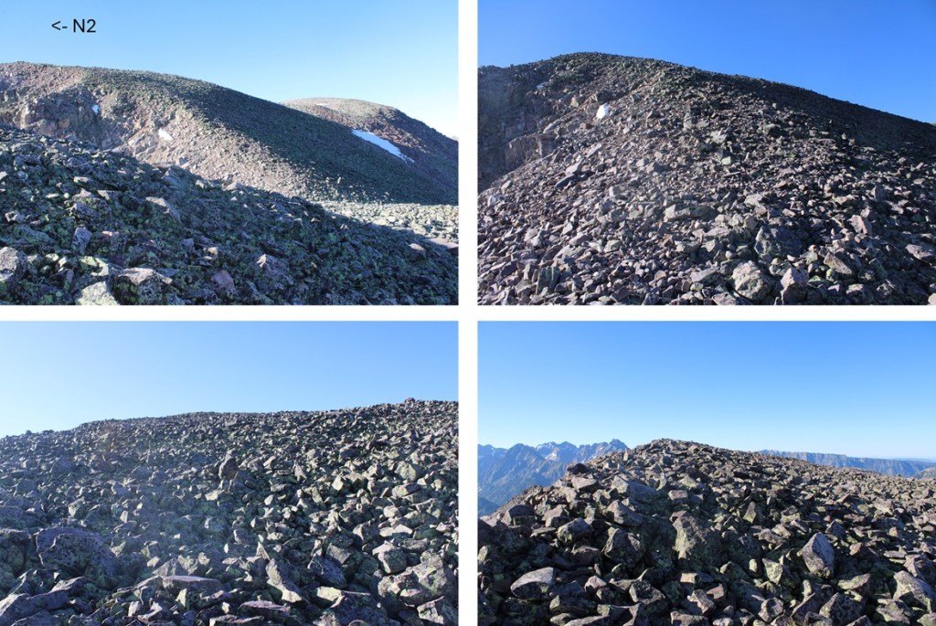
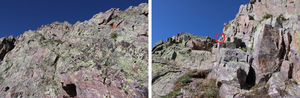
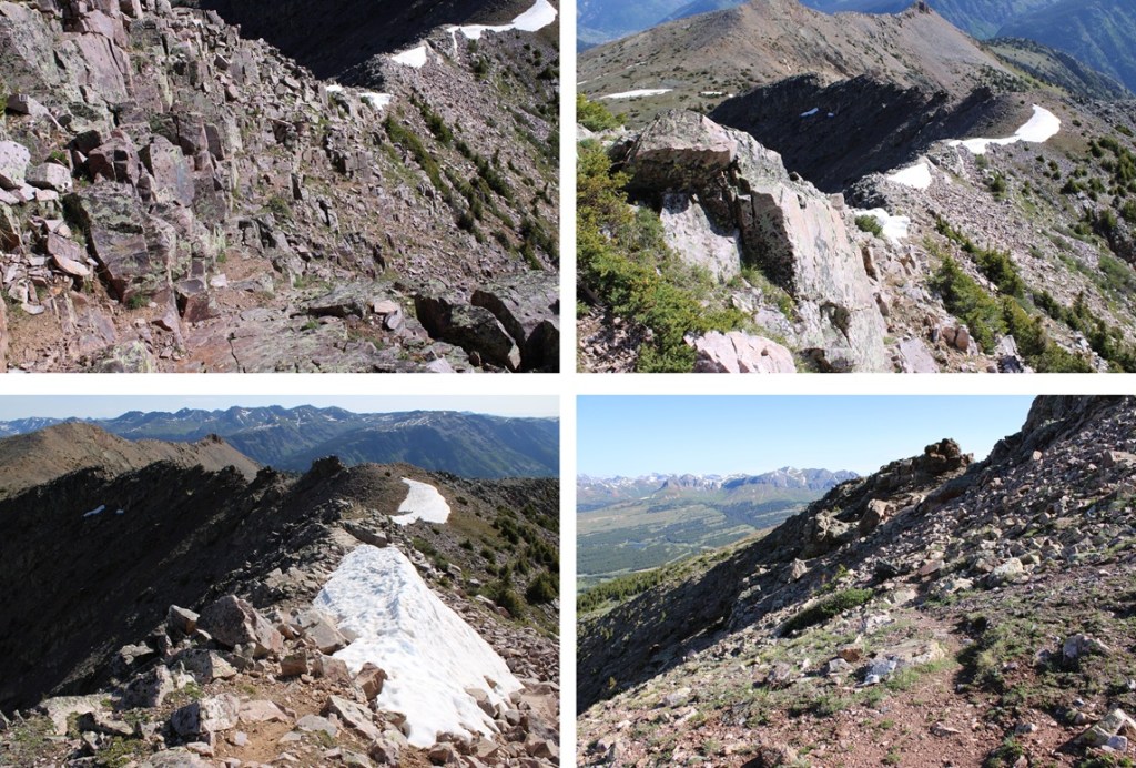
Once on the ridge I followed it southeast to the summit. Once again, very rocky, but all class 2.
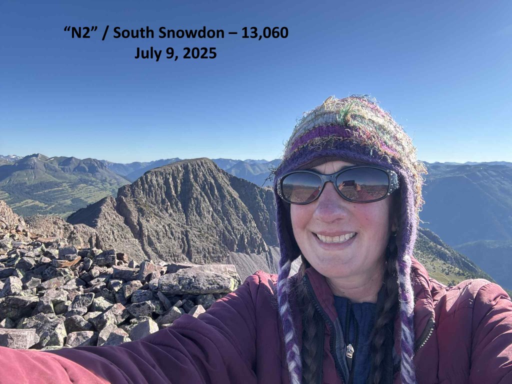
I summited N2 at 8am
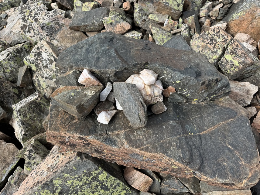
N2:
This was my only peak for today, so I turned around and headed back the way same way I’d summited. I headed northwest down the ridge
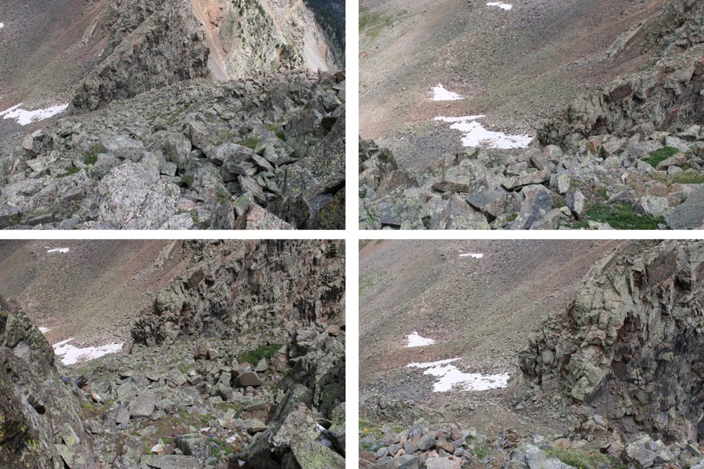
Then back down into the upper basin on a slightly different route. Lots of loose rocks here.
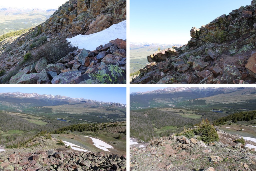
Once I was done with the rocks I turned right and followed the upper basin north, staying on the grassy areas.
I came to the small pond and skirted it to the left, and then headed down into the lower basin and back to the trail
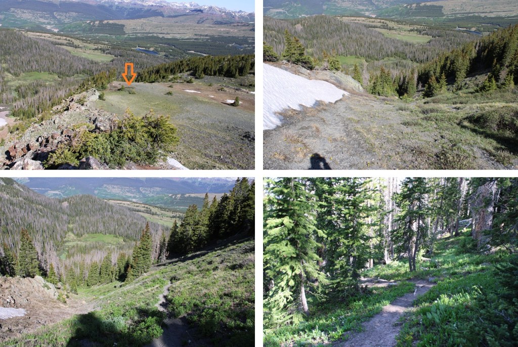
Then it was a quick 2.7 miles back to the Andrews Lake Trailhead
I made it back to the trailhead at 10:15am, making this an 8.15 mile hike with 2416’ of elevation gain in 4 hours, 45 minutes.
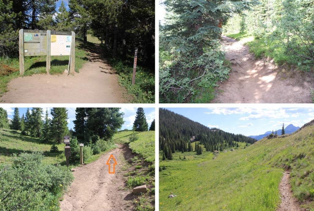
I started from the Andrews Lake trailhead at 6am. On a positive note, the bathrooms were clean this time! No toilet paper, but the seats were clean (always bring your own TP). The trail starts by skirting the south side of the lake.
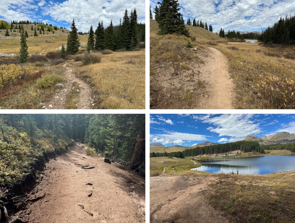
I then took Trail 623/Crater Lake Trail all the way to Crater Lake. This is an easy, class 1 trail that is easy to follow with no major junctions. I hiked the 5.5 miles to Crater Lake on this trail.
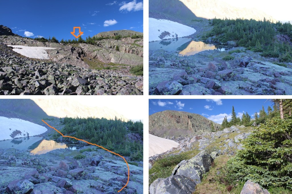
Once at Crater Lake there’s a side trail that goes off to the left. This trail stops at 11750’ at a small pond. I took the trail to the pond.
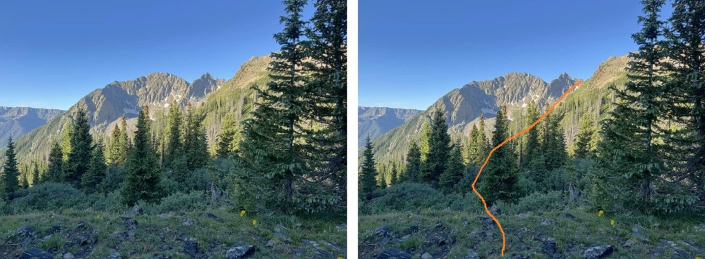
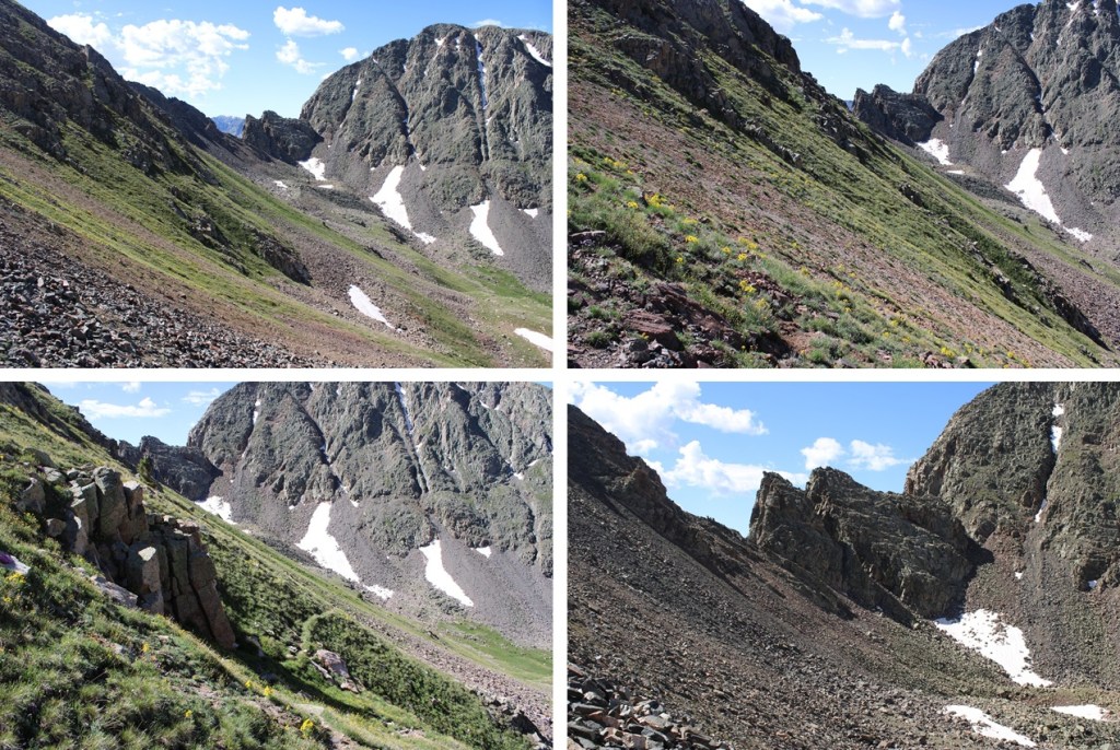
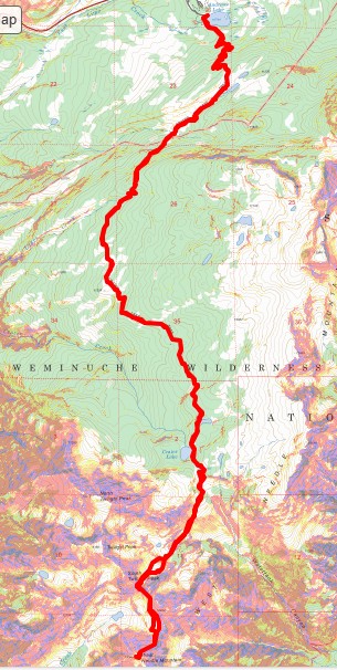
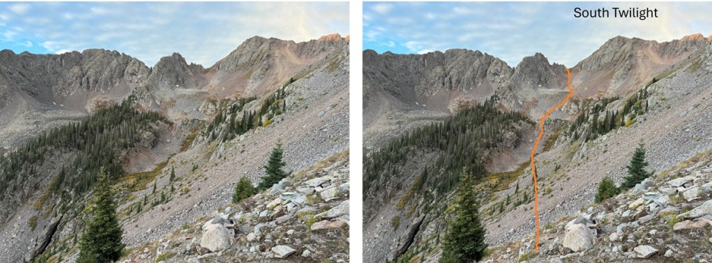
The trail stops at 11750’ and now it’s time to bushwhack. I lost 400’ of elevation as I headed southwest towards a gully I couldn’t yet see. Here’s an overview of where I was headed.
Aiming southwest I skirted the hillside until I came to the end of the trees.
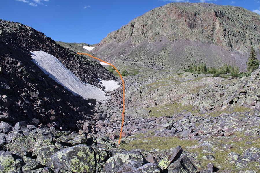
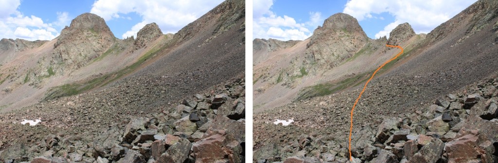
I now had a clear view of my path to the saddle between South Twilight Peak and PT 12932. I kept descending towards the creekbed and then ascended up 1260’ towards the saddle.
The route was obvious but not marked. I went to the left on the way up, to the right on the way down, and both were similar. The left side had larger boulders and the right side had more tundra, but both were essentially snow free and clear.
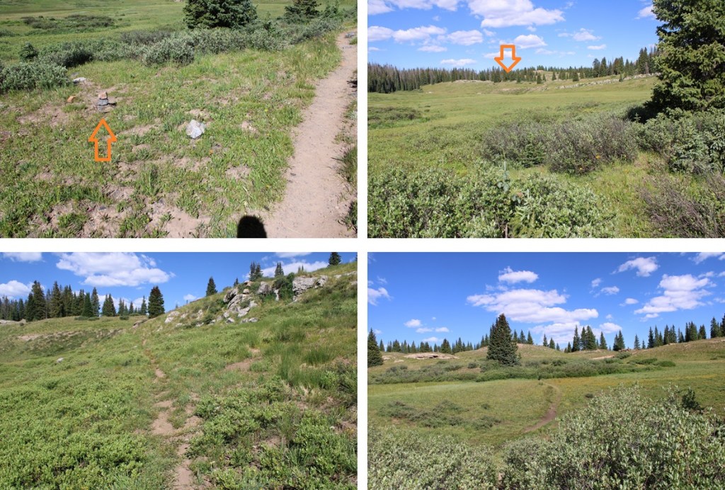
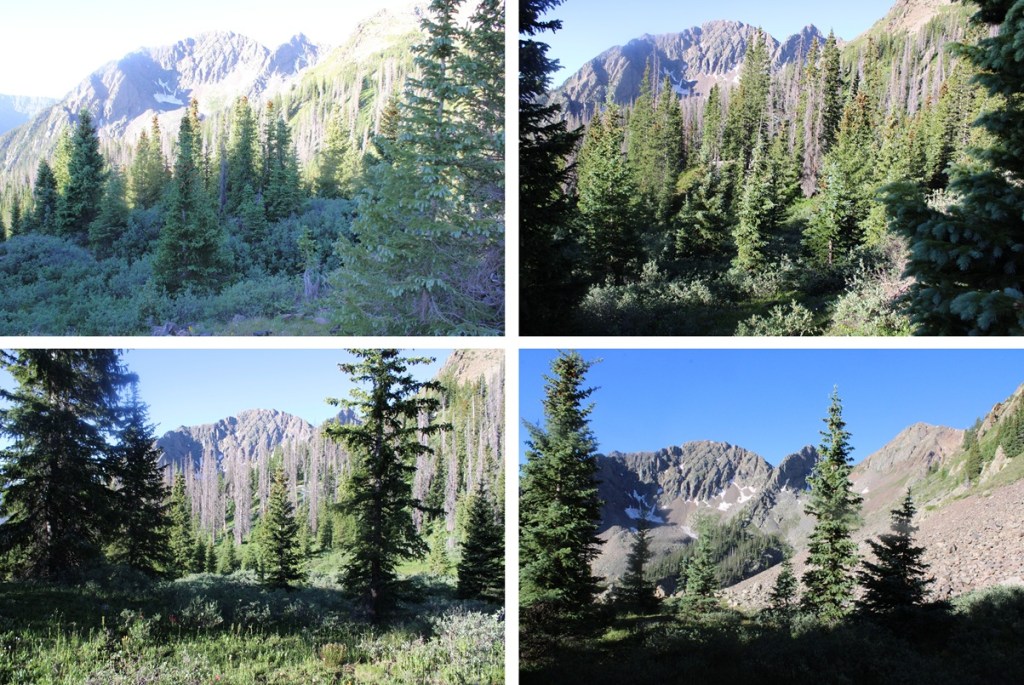
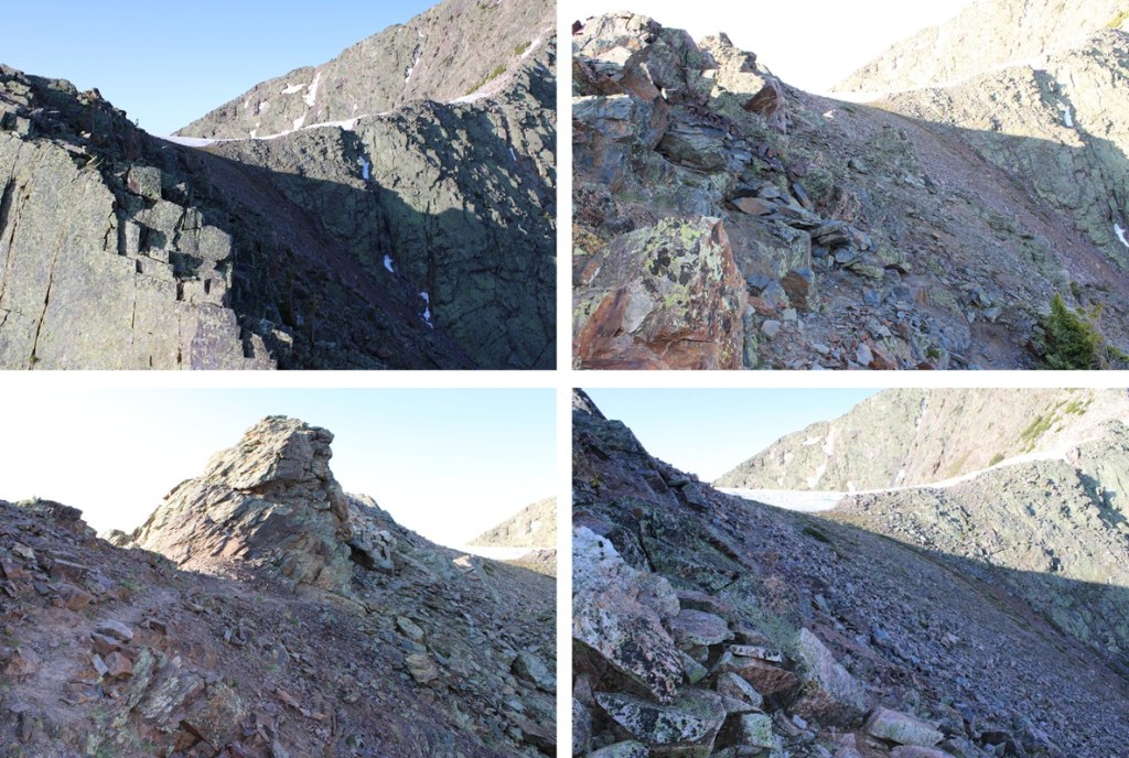
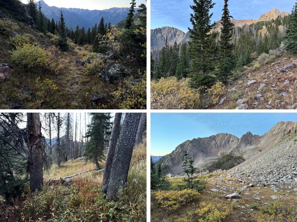
Here are some pictures of the route to the saddle
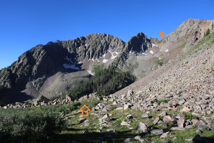
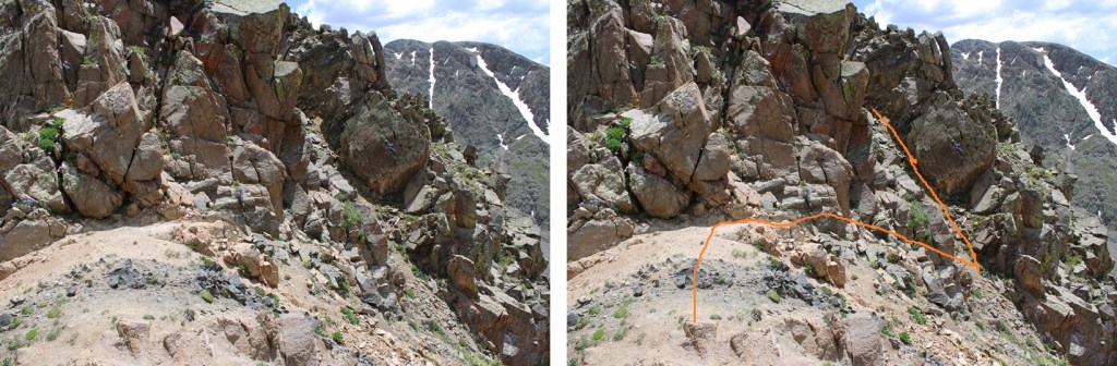
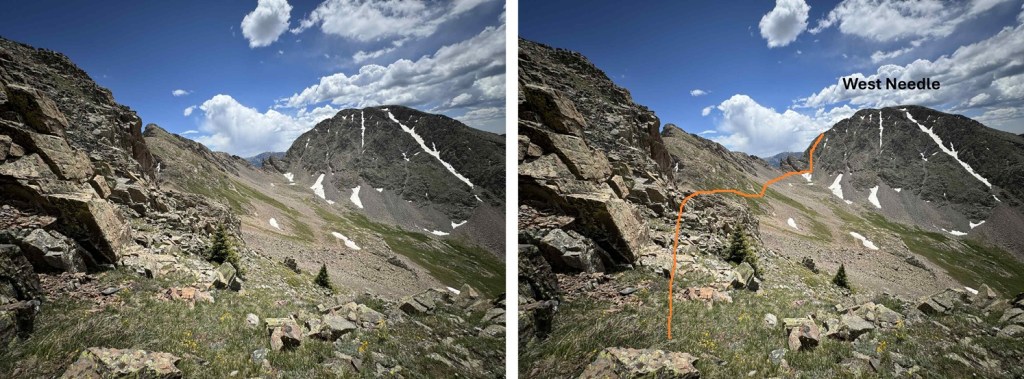
Now at the saddle I had to descend a bit to traverse towards West Needle Mountain. I descended about 25 feet to the south and found an access gully on the left that would get me around the rock outcroppings.
I ascended the class 2 gully
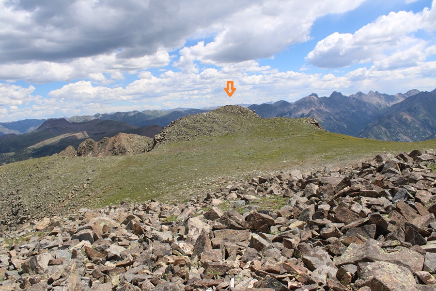
From the top of the gully I could see my intended route for West Needle Mountain. I would initially stay high, just under the rock outcroppings, then pick up a game trail for a while and follow it towards the base of the ridge in the distance, aiming towards just below the two large outcroppings and up a gully.
Here are some pictures of the route to the base of the gully I used.
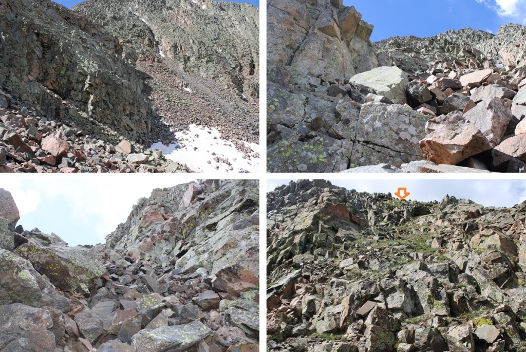
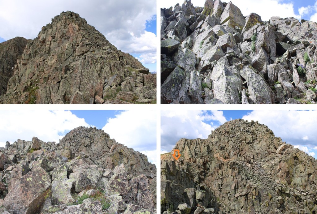
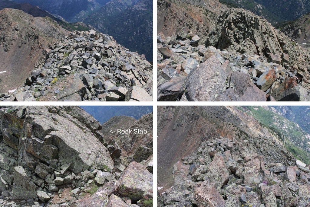
From here it’s a great time to look at the route before you. This is choose your own adventure, and there seem to be a lot of different possibilities for gaining the ridge. All class 3. This is the route I chose, first going up the loose and rocky gully then straight up the class 3 face.
Once on the ridge it was still choose your own adventure. I stuck mainly to the ridge itself in class 3 terrain. There was one ‘sketchy’ move where I had to slide down a 10-15 foot boulder/rock slab and shimmy down. It wasn’t difficult, but there was exposure. The entire ridge for me was ‘figure it out as you go’. I just kept following it up, never cliffed out, and kept heading southwest.
Of course there was a false summit, but luckily the terrain got easier from there.
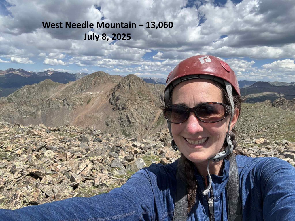
I summited West Needle Mountain at 11:40am
West Needle Mountain:
This was an out and back hike for me, so I turned around and headed towards the false summit
Then back down the ridge. Downclimbing seemed much easier than upclimbing on this route. The route was easier to ‘find’ on the way down.
And then back towards the gully. It’s easy to know when to start the descent towards the gully as the terrain gets noticeably easier and you have a line of sight as to where you need to descend.
From the base of the gully this is my route back up to the saddle. I’d be ascending about 250’ to get there.
Then it was back down the gully and up towards the saddle
From the saddle I could see my route back towards Crater Lake. I’d descend back down 1260’, then up 400’.
First to head back down the drainage
Then to head back up towards the pond at 11750’. To help me navigate I first aimed for this large boulder in the distance, then headed north through the trees.
Once at the pond at 11750’ I found the Crater Lake Trail and took it the 5.5 miles back to Andrews Lake.
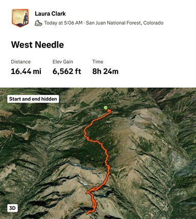
I made it back to my truck at 5:30pm, making this a 19.1 mile hike with 4853’ of elevation gain in 11 hours, 30 minutes. At least according to CalTopo. Strava gave me different numbers.
Yep, it’s been a while. Those of you who follow me on my socials know what I’ve been up to, and I’ve been busy! I’m really excited to have a few months off to tackle more peaks (kind of… I still need to travel for work most of August. WHY is that my busiest climbing month, and my busiest work month???). Most of the 13ers I have left still need to ‘melt out’ before I can climb them, but when I heard Snowdon was all clear I drove down to Andrews Lake and had to see for myself.
Andrews Lake has plenty of parking, and even an overflow lot. However, that didn’t stop it from being full when I arrived. Also, the bathrooms were dirty (and bring your own toilet paper). Last time I was here the bathrooms didn’t lock. I was pleased to see they had been fixed.
I started from Andrews Lake at 5:30am, skirting the east side of the lake to the trail.
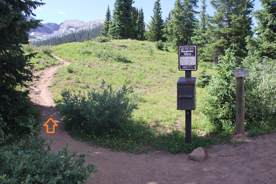
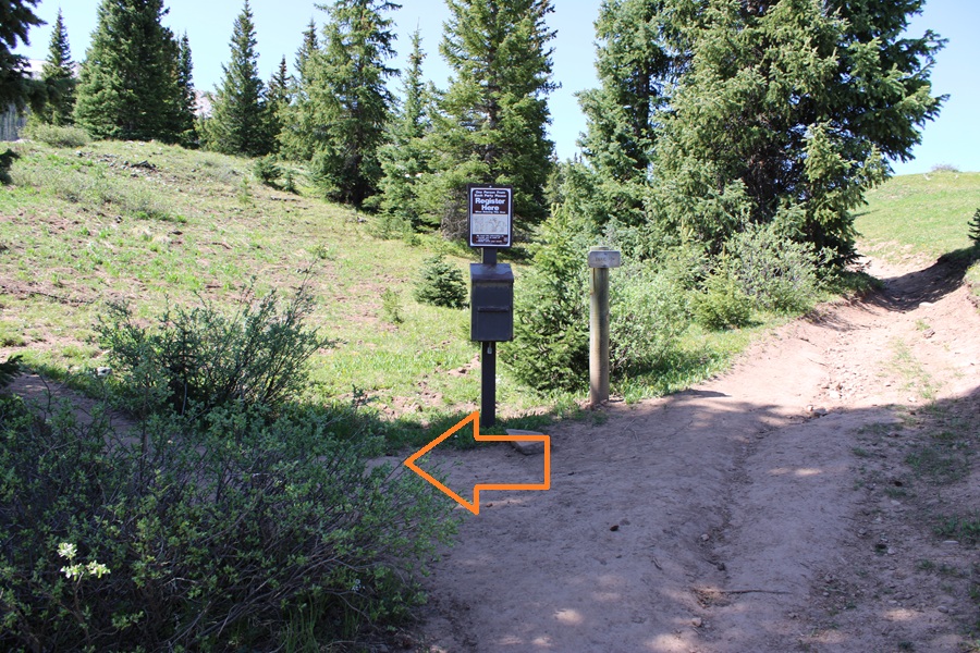
I followed this class 1 trail for about 1.3 miles to a junction with a trail register.
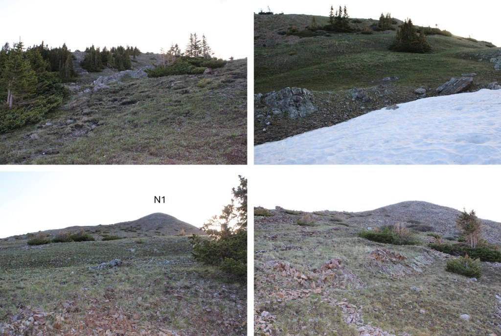
At the junction/trail register I turned left and followed an unnamed trail east/southeast.
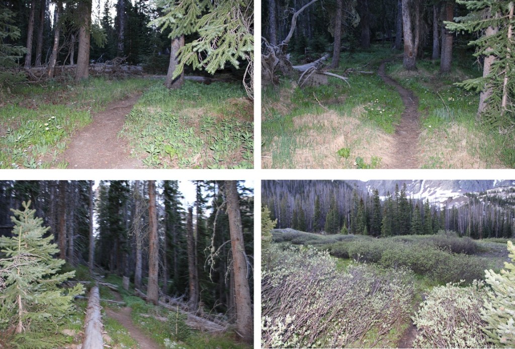
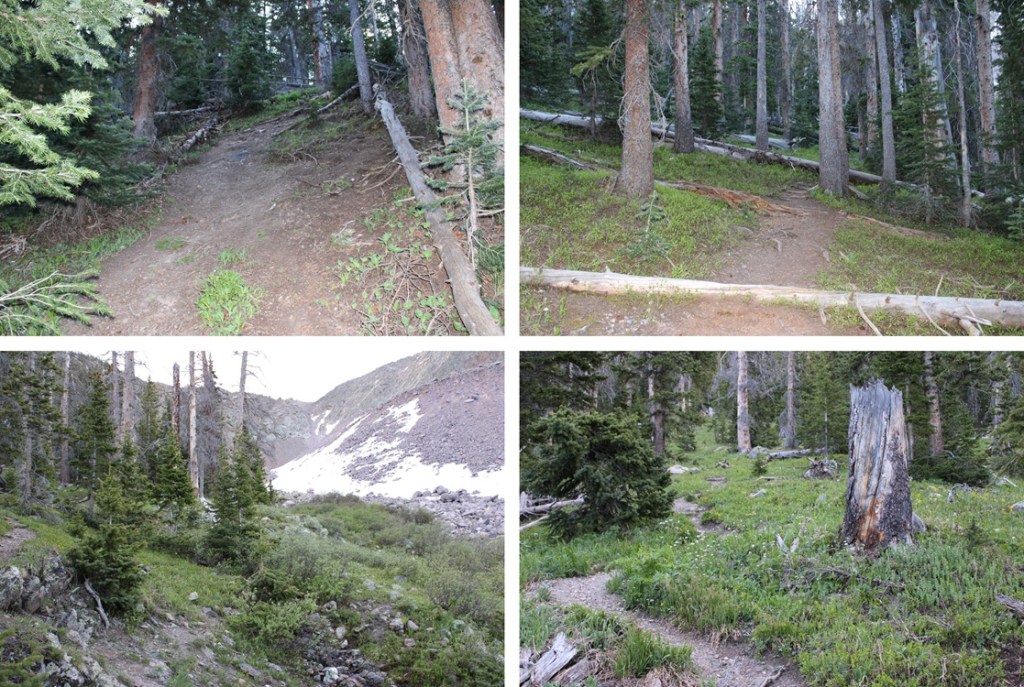
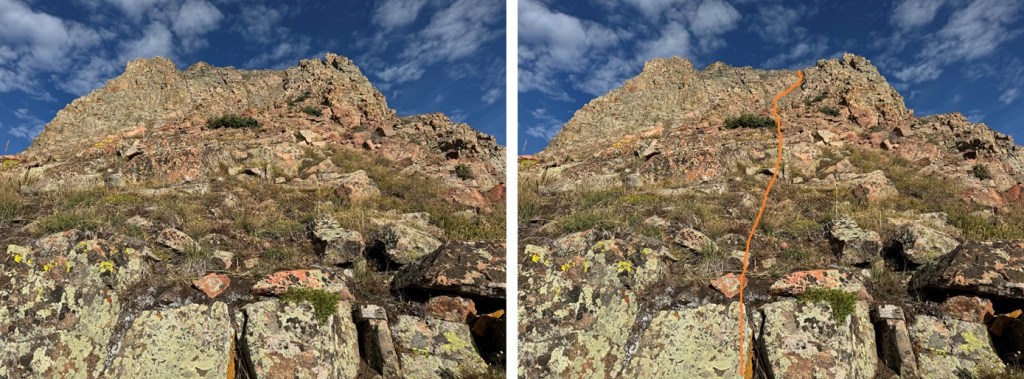
This trail was well defined in the beginning, but in the marshy areas became non-existent and I had to route find a bit. There were areas with willows, marshes, and trees. There were a few downed trees along the trail, but nothing too difficult to cross. I was headed towards this gully (there’s a good trail at the base).
For reference, these are N1 and Snowdon
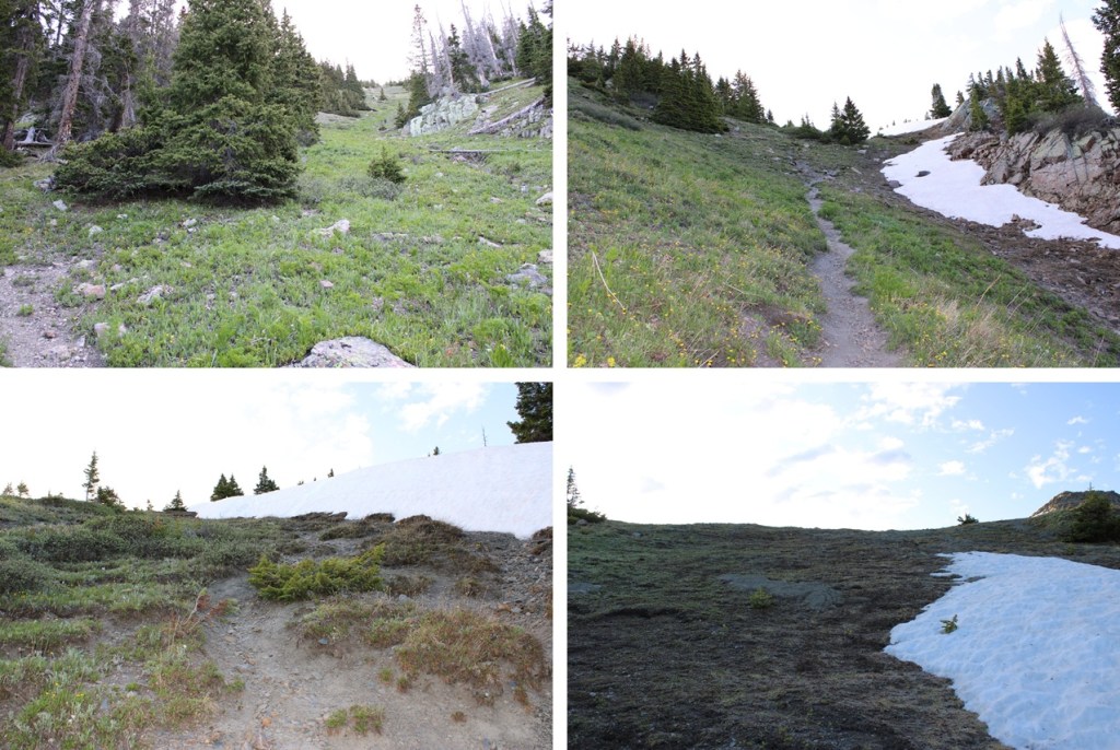
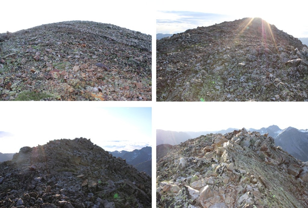
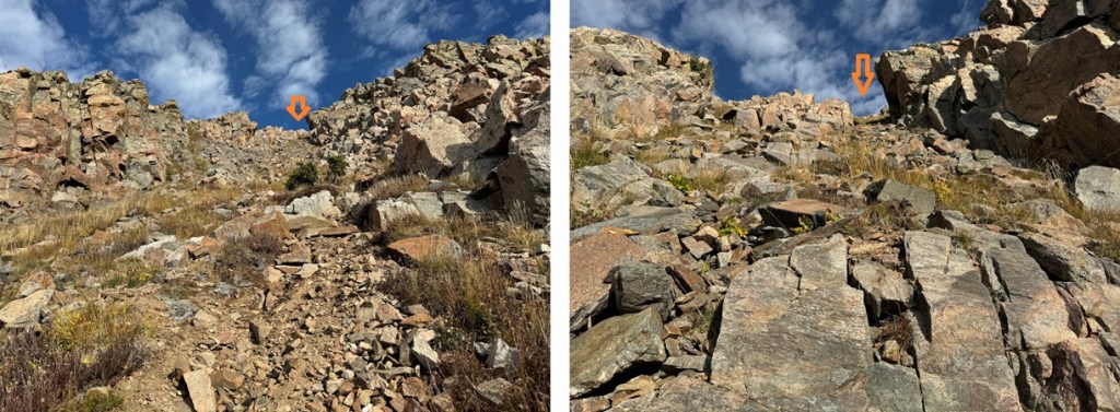
I followed the gully up a class 1, steep trail for 550’ in elevation.
At the top of the gully the trail ended. I went left and headed northeast towards the summit of N1. This was all class 2 and the route was obvious. It felt “too easy”, almost like it shouldn’t have been ranked.
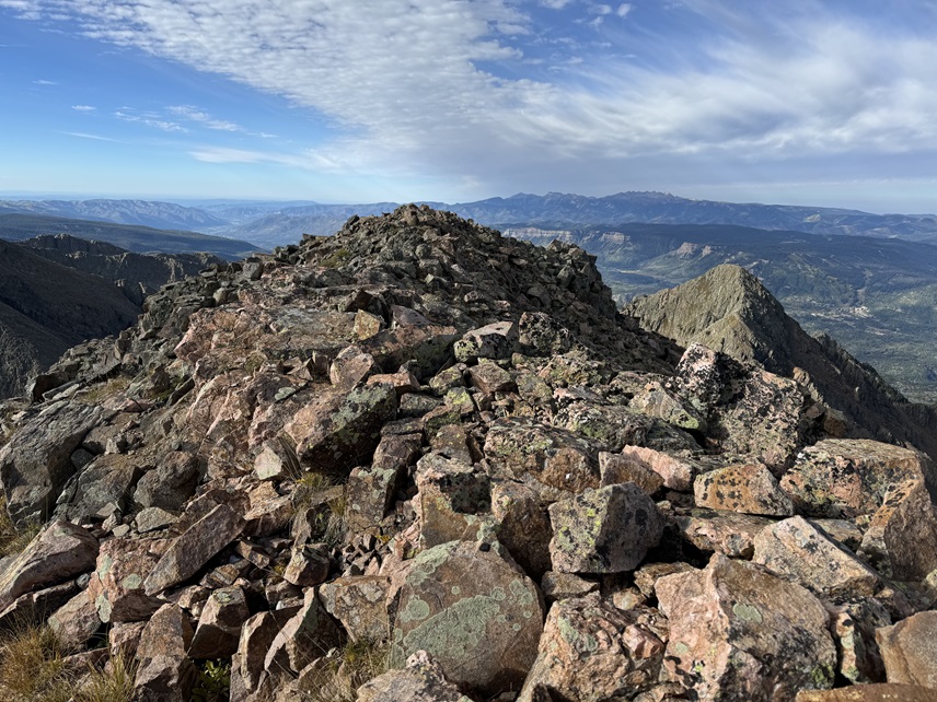
I summited ‘N1’ at 7am
N1:
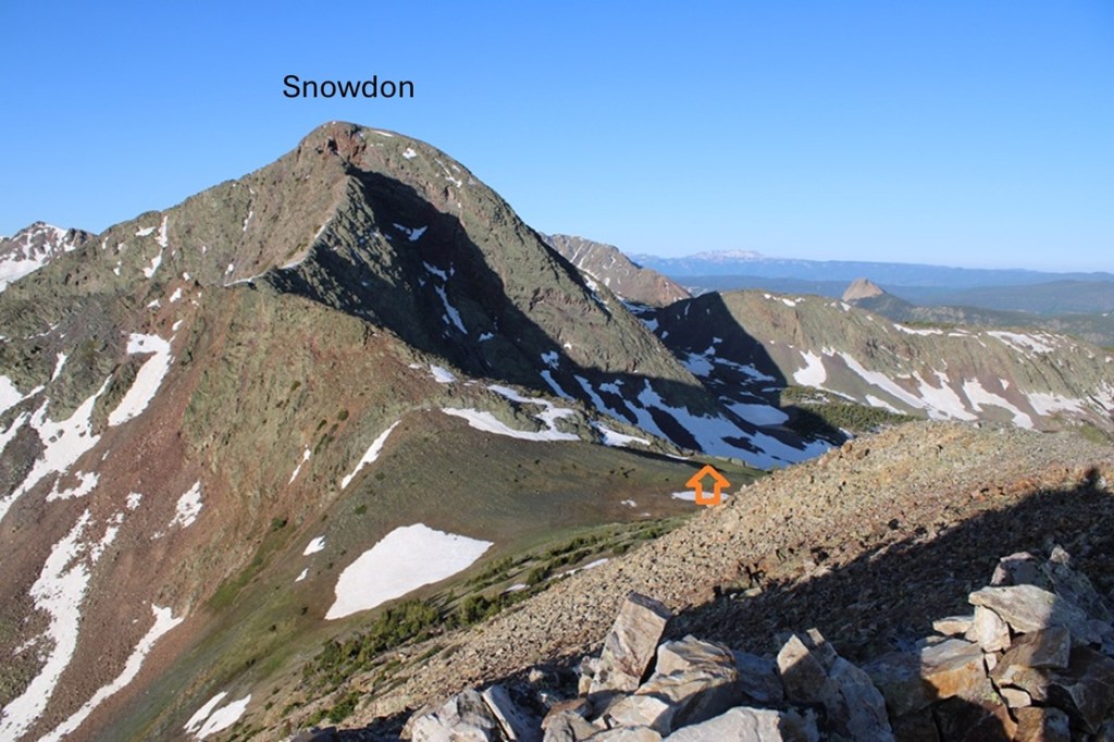
Now for Snowdon Peak. I turned and headed southwest back to the Snowdon/N1 saddle, to the right of the ridge.
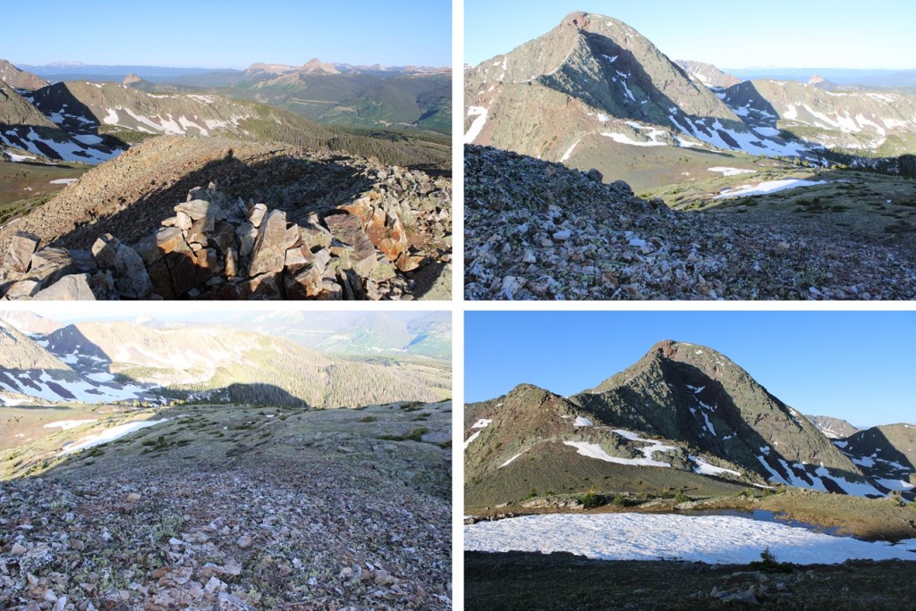
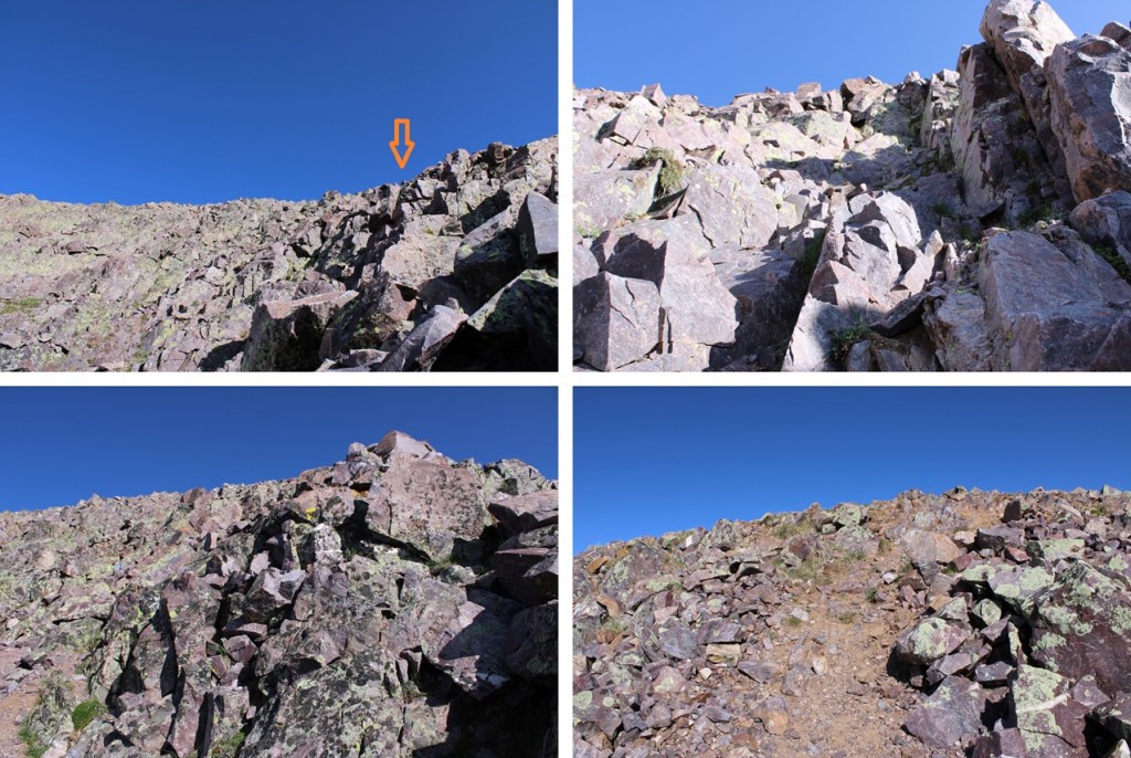
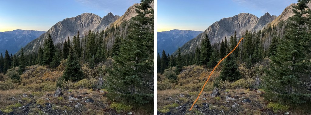
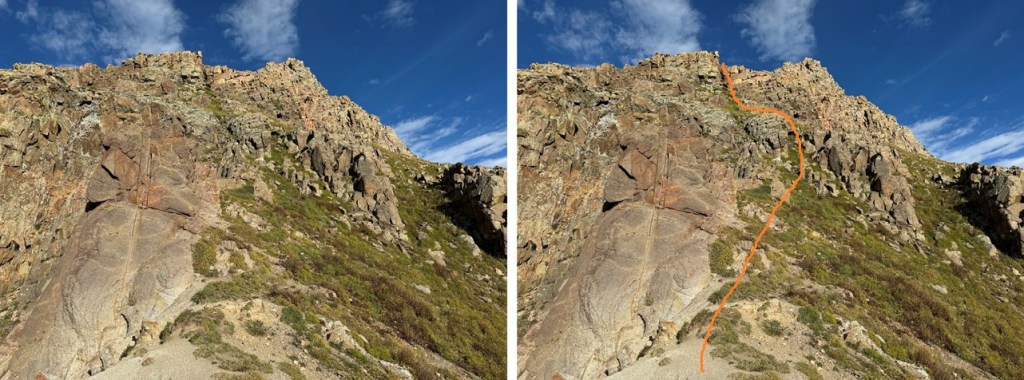
Now to head up the ridge. There are several ways to do this. On my ascent I stuck to the ridge proper, which went at class 3. On the way back down I found a faint trail that kept this area at class 2 after climbing about halfway up the ridge. Here’s a picture of that trail:
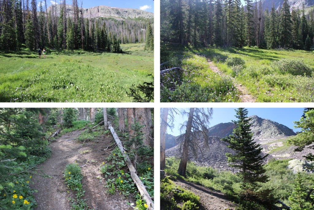
And some pictures of the ridge. I was able to take the ridge proper to the next saddle until I came across the game trail, which was much easier.
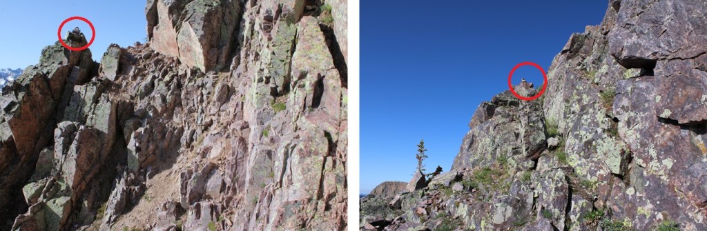
If you don’t already have your helmet on now is the time to do so. There are several routes up this ridge. I took the ridge proper at class 3 all the way to 12900’ before dipping down and south, then traversing around the east side of the mountain to get to the summit (lots of cairns to help once I dipped down). However, you don’t need to take the ridge proper to this point. If you stay to the left of the ridge there are game trails that keep you about 50 feet below the ridge on class 2 terrain most of the way. Here are the routes:
Here are some pictures of the ridge route I took to 12,900’
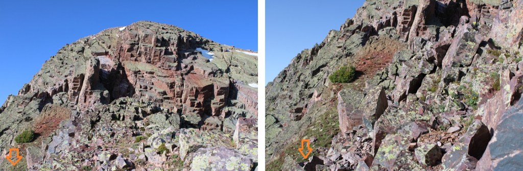
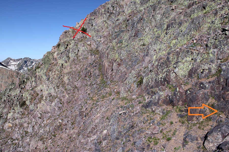
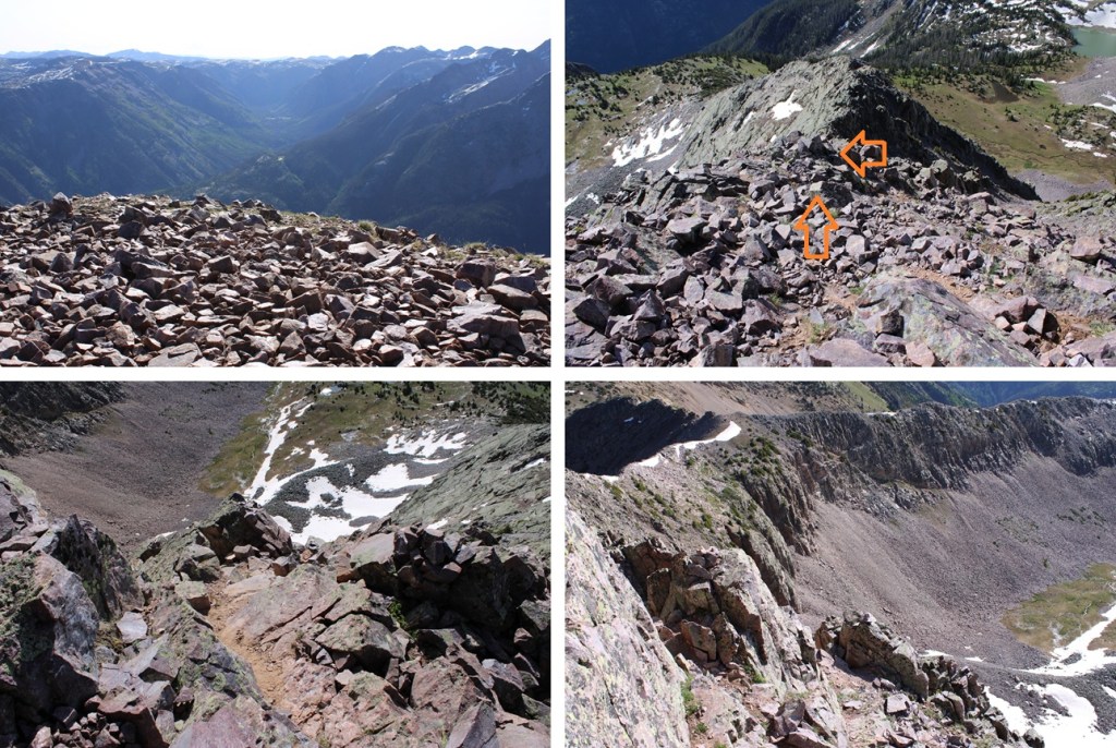
On the ridge at 12,900’ I hit a snag, and realized I needed to drop down where I saw this gully. Directly below it I saw a cairn and headed that way. Here’s a visual of where you should go when you hit this area. Head down, not up, and continue around the left side.
From here on out there are cairns to the summit. If you don’t see a cairn, you’re off route. I kept heading left, and every time I wanted to ascend it seemed like I had to descend as well, but there were always cairns to help lead the way. This is class 3.
When I got to 13,010’ I saw this in front of me, and a cairn in the distance. Don’t head for that cairn. This is where you just scramble to the top from where you are.
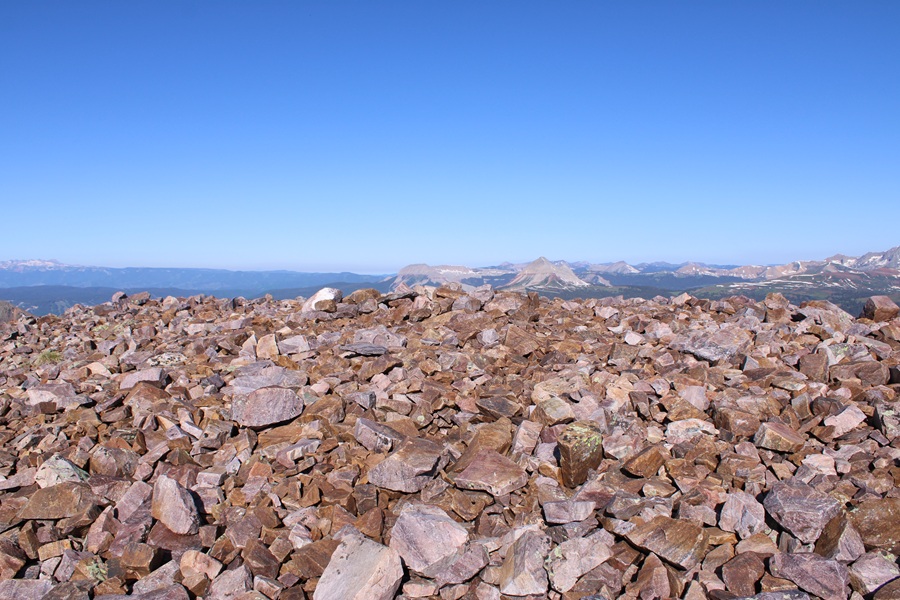
It’s a short scramble, and soon I was on the relatively flat summit
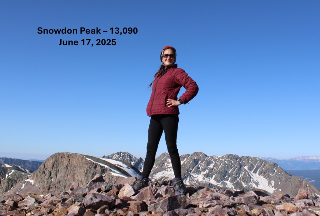
I summited Snowdon Peak at 8:20am
Snowdon Peak:
Now to head back down. I took the same route back to the ridge following the cairns as I descended.
And now to follow the ridge back to the saddle. Here’s a visual of the route I took:
I found my access gully and headed back down to the trail.
I then followed the trail back through the marshes and trees towards Andrews Lake.
Once back on the Crater Lake Trail I followed it back to Andrews Lake.
I made it back to Andrews Lake at 10:30am, making this an 8.42 mile hike with 2747’ of elevation gain.
And for those of you wondering, my past few months consisted of: Getting married, buying property, Mexico, Cookie Cupboard for 2 months (I love Girl Scouts!!!), Florida, Washington DC, my son visiting from South Korea, 2 of my kids graduating College in different states during the same week (one of them Valedictorian!), Georgia for a week, South America for a month, building a ranch from the ground up (empty land, but after a few months of hard work I now have a well, a vineyard, an orchard and the animals have corrals). Raising yaks and alpacas (all the females are pregnant), a nasty tick bite that left me out of the sun for a month but gave me time to do a a couple of dozen podcasts, teaching Wilderness First Responder courses and several outdoor survival skill classes to multiple groups. Oh, and last week we got a puppy, so it’s been a little busy around here!
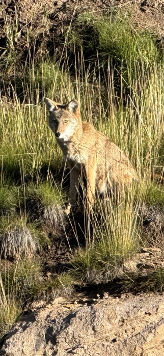
I arrived at the Andrews Lake trailhead and noticed a rather robust coyote sitting along the shoreline, just staring. He wasn’t bothering anyone, so I let him be.
About 20 minutes later, I heard a woman screaming from not too far away. The coyote was attacking her Golden Retriever (which was luckily leashed). I ran over there with my trekking pole to help her out. The coyote had been stalking them for a bit and wanted the dog as food. After scaring the coyote away, we chatted for a while, and she told me this wasn’t the first time her and her dog had been stalked by a coyote. I was surprised the coyote would be so bold as to go after such a big dog. We quickly became friends, exchanged contact information, and we were both on our way.
I started my hike at the Andrews Lake Trailhead, which is at the west end of the lake. The trailhead has vault toilets (but women be mindful: the door lock moves left and right but doesn’t actually lock). There are about 15 parking spaces here, with an overflow lot on the way in to accommodate more vehicles.
My goal for day 1 was to make it to Crater Lake, since I had a late start, not starting until about noon. I followed the class 1 trail as it skirted the lake, then switchbacked up to some ponds at 11200’
I then continued following the trail as it wound south to crater lake, rolling up and down in elevation as it went. Pictures of this trail are difficult to give reference points to, as most of it was below treeline and the views were always the same. However, there are no junctions or side trails, so just stay on the main trail and it will take you to Crater Lake. There are several small creek crossings that are easily manageable, and the trails were a bit muddy.
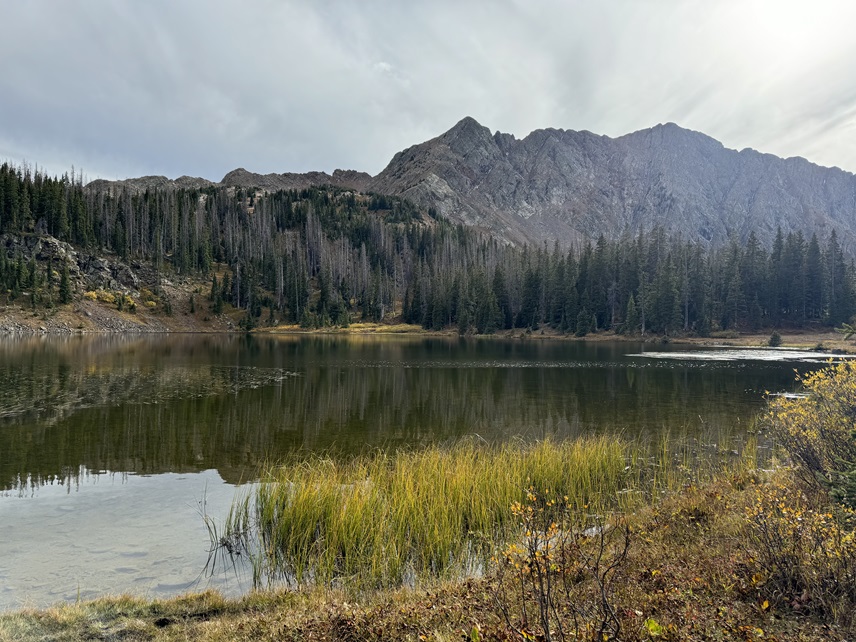
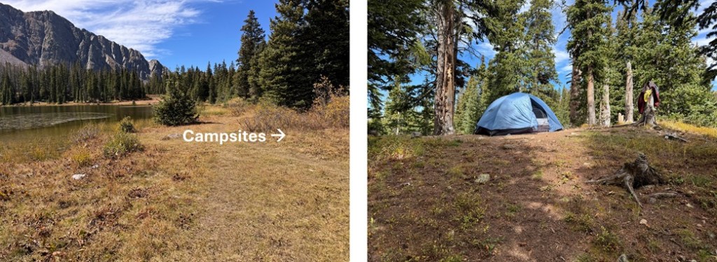
It was 5.5 miles and 1530’ of elevation gain from Andrews Lake to Crater Lake. It took me 2.5 hours to get there with a full pack. There are some good campsites up the slope in the trees to the north of the lake (your right when you arrive). I set up my tent and made it an early night.
The next morning I was up and on the trail at 7am. To the left (east) of the lake there’s a trail that will take you through the willows and up to another small pond.
I skirted the small pond on a trail to the left
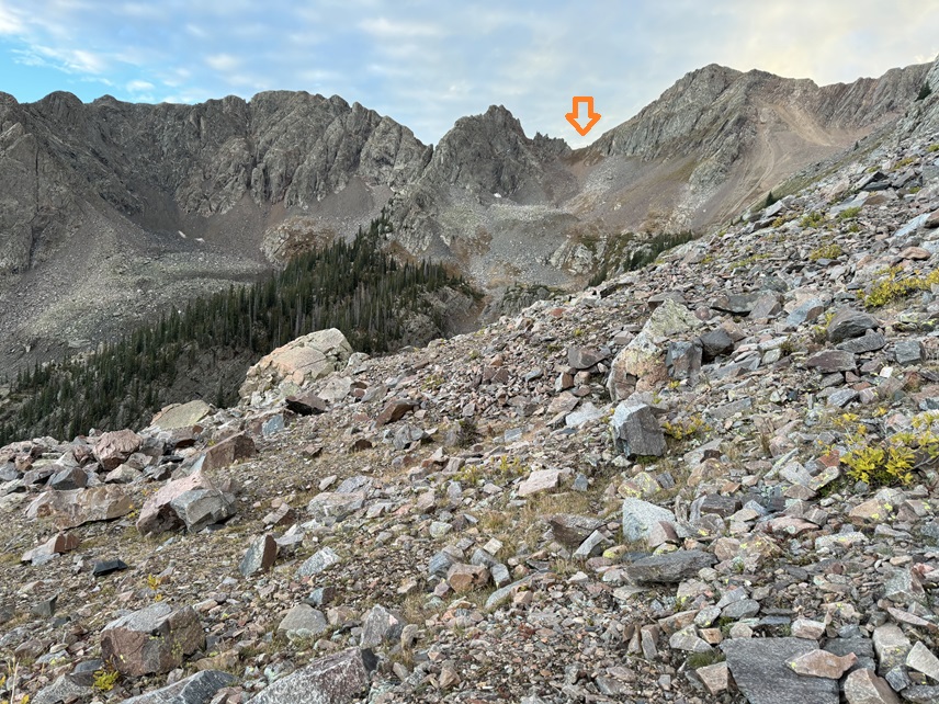
And then the trail ended, but I could see my route to the southwest. Here is where I was aiming:
To do this, I went down a grassy gully, then headed southwest, losing about 400’ of elevation total as I rounded the mountain, avoiding the rocky gully below.
I made it through the trees, and the terrain became rocky. I was headed towards a saddle to the left of South Twilight Peak.
This is choose your own adventure. I chose to stay low, heading for the small stream below, then ascend by following the tundra, going to the right of the rock pile (it’s obvious as you get higher), and up the tundra slope.
Here are some pictures of my way to the saddle:
Once on the saddle I turned right, and scrambled northwest to the summit of South Twilight Peak. This was mostly class 2. I just looked for grassy gullies and ascended them, heading northwest, until I came to the top, then walked the short distance southwest to the summit.
I summited unranked South Twilight Peak at 9:10am
South Twilight Peak:
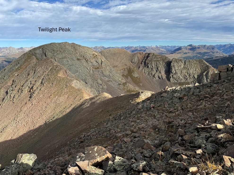
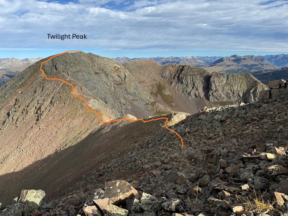
From South Twilight Peak, Twilight Peak was to the northwest.
It was a class 2 tundra/rock walk to get there that only took me 20 minutes. This is the route I took, sticking mostly to the ridge.
There was a bit of a false summit. The summit is to the north.
I summited Twilight Peak at 9:30am. Sorry, no summit video: I thought I took one, but when I uploaded it, it was only 1 second long, so it wasn’t very helpful.
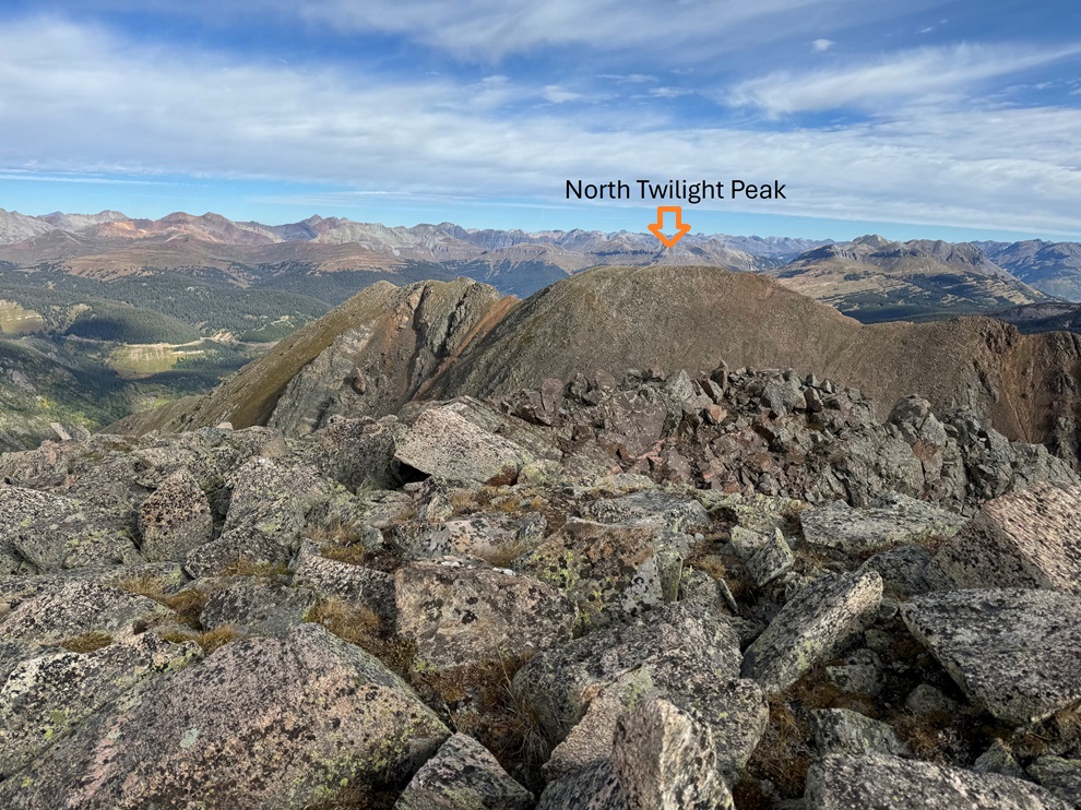
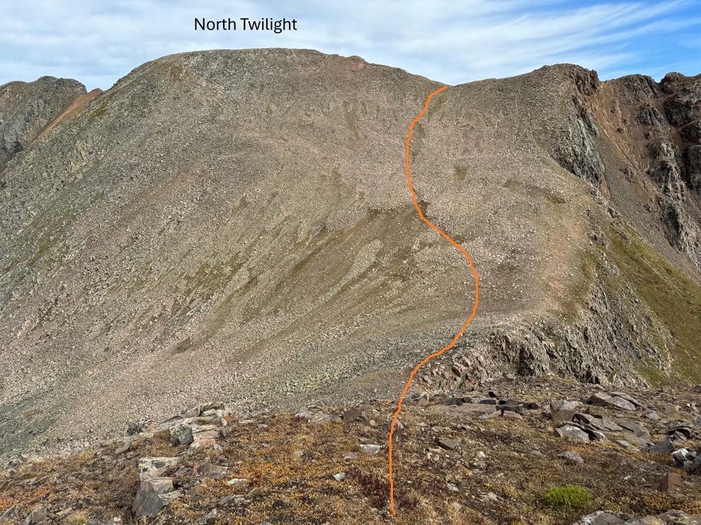
From the summit of Twilight Peak, I could see North Twilight Peak to the North.
To get there, I continued following the ridge north.
It was all class 2 until I got here.
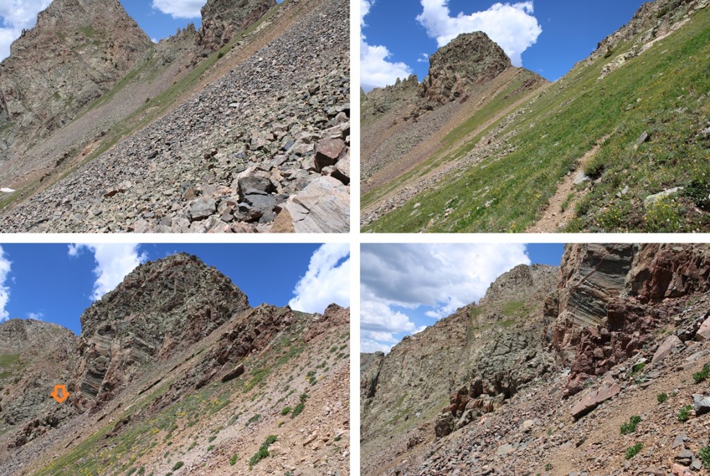
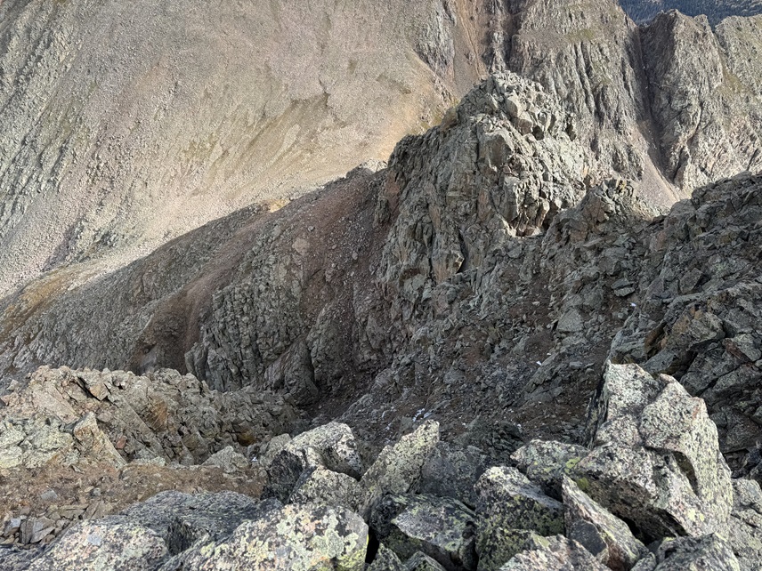
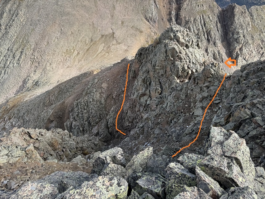
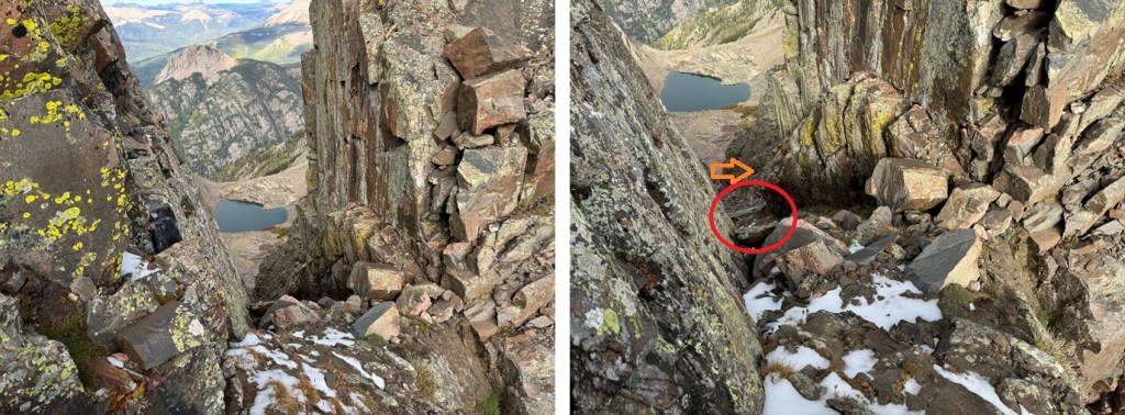
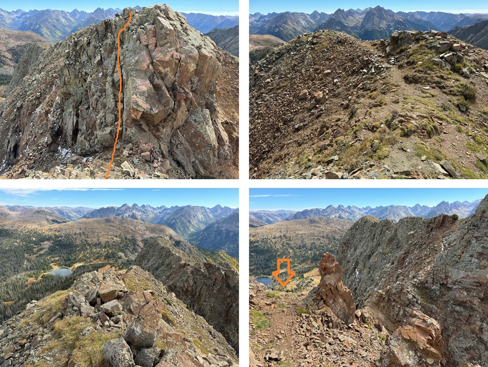
This is where the route finding and class 3 fun began. If you haven’t already put on your helmet, now is a good time to do so. I could tell there were a lot of ways to navigate this ridge successfully, but many would end in getting cliffed out. I chose to go right. Here’s an overall view of my route out of this fun. There’s a hidden gully I took to get back to the ridge.
This is class 3, and pretty steep, but if you choose your line carefully and drop down just to the right of the gully, the gully is easy to access.
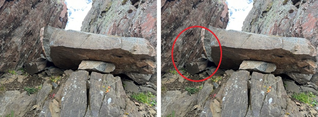
I passed through the gully, which was a bit sketchy. These photos don’t do the terrain justice, but the graupel here had turned to ice, and there’s a bit of a waterflow on the rocks, which had also turned to ice. I put on my microspikes (they’re ALWAYS in my bag), and carefully navigated through the notch and down the gully, being deliberate so as not to slip on the ice. There’s exposure here, so falling would be detrimental. At the bottom of the gully was a large boulder. This can easily be climbed up from the other direction, but heading down the gully I found a very small hole to the right I was able to crawl through (I’m glad I’m small!). You can also climb over it to the left, but I didn’t like the conditions (ice) on that side. The boulder is circled.
Here’s looking back up at the boulder at the base of the gully. I crawled through the hole to the left (circled).
Once passing around the boulder, I immediately turned right and re-gained the ridge.
The rest of the route to North Twilight was class 2. I descended to the saddle, then re-ascended to the ridge on a small patch of tundra. The slope angle was low, so it was an easy trek.
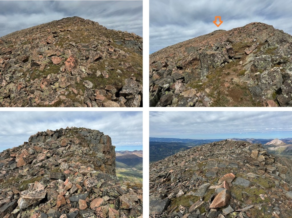
Once on the ridge, I turned left and headed west for the summit.
The only problem? The summit ridge is rocky but flat, so it’s difficult to tell exactly where the summit is. I walked the length of the summit, but I’m pretty sure the actual summit is in the middle (not the far west end as indicated on a map). There aren’t any cairns, but there is a circle of rocks on the middle of the ridge placed on top of another rock that look ‘intentionally’ placed.
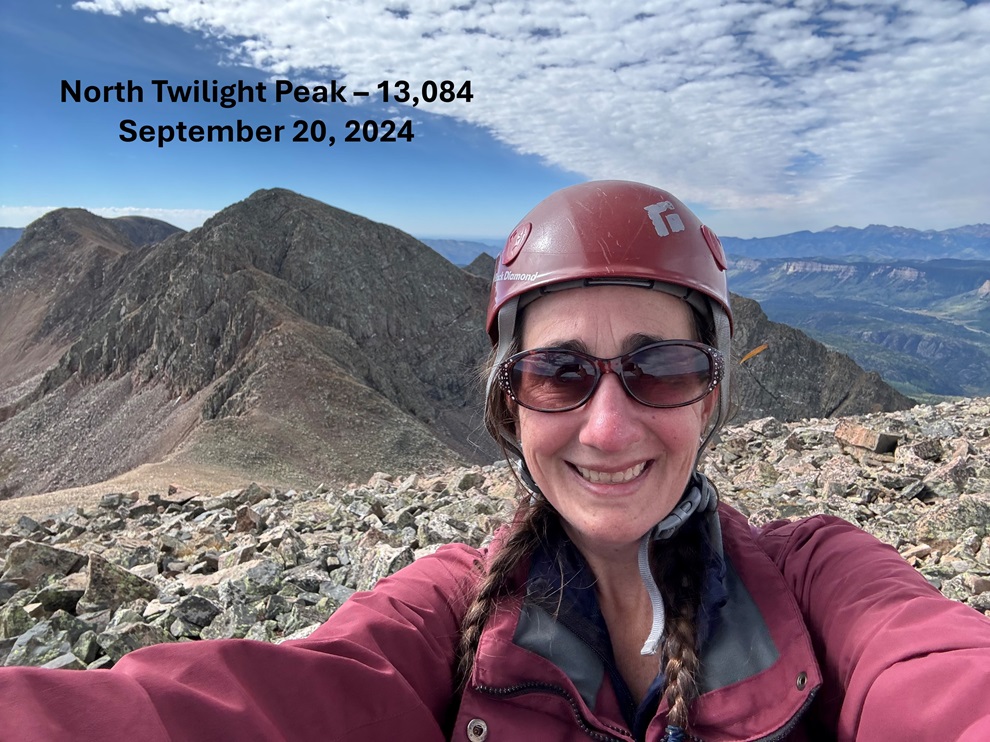
I summited North Twilight Peak at 10:40am
North Twilight Peak:
Now to head back to Crater Lake. I did this by turning around and following the ridge east. While there are some ups and downs on this ridge, there are game trails that can help keep this a class 2 trek with one or two easy class 3 sections (I’ve labeled the route below). Here are some pictures of the ridge.
I could now see Crater Lake in the distance. Here I found a game trail that would lead me most of the way there. I descended on the tundra, heading northeast, towards the small pond I’d seen early that morning. There I picked up the trail that headed west back to Crater Lake. Here’s the overall view of the route:
And some pictures. First, I found the tundra to the right of me, and descended on the game trail that wound its way back to the ridge.
This trail ended in a meadow, so I headed northeast through the trees towards the small pond.
Once at the pond, I followed the trail back to Crater Lake.
I made it back to Crater Lake at 11:20am. Once back at Crater Lake I checked the weather (I had cell service for almost this entire hike). Forecasts for the next day were all over the board (calling from anywhere from half an inch to a foot of snow, starting anywhere from 7am to noon), so I decided to pack it out and come back another day for the other peak I had in the area. I packed up my tent and followed Crater Lake trail back to Andrews Lake.
I made it back to Andrews Lake at 2:45pm, making today’s hike 11.61 miles with 3034’ of elevation gain, and the total hike 17.11 miles with 4573’ of elevation gain.