White Dome – 13,627, Peak One – 13,599, Peak Three – 13,478, Peak Two – 13,475

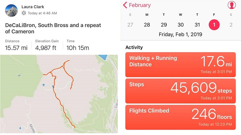
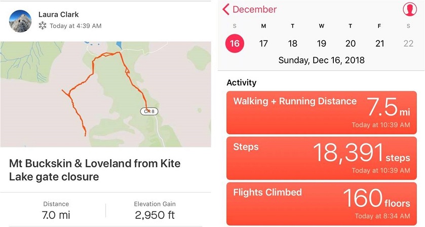
RT Length: 15.03 Miles

Elevation Gain: 6051’

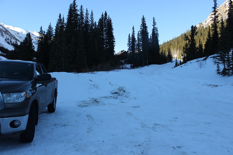
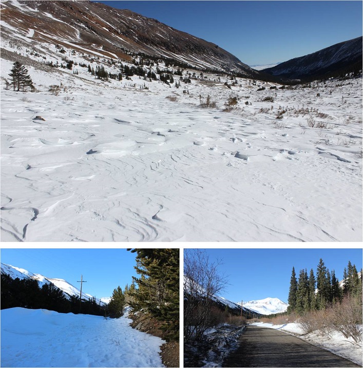
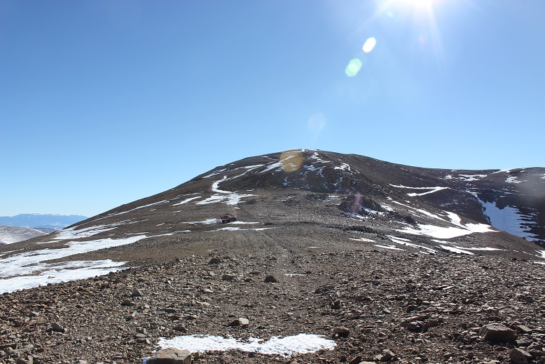
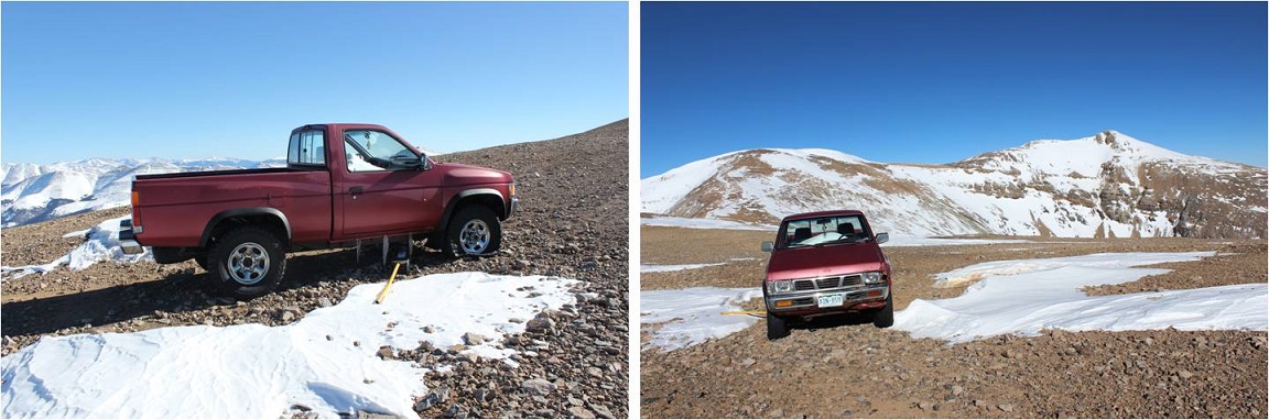
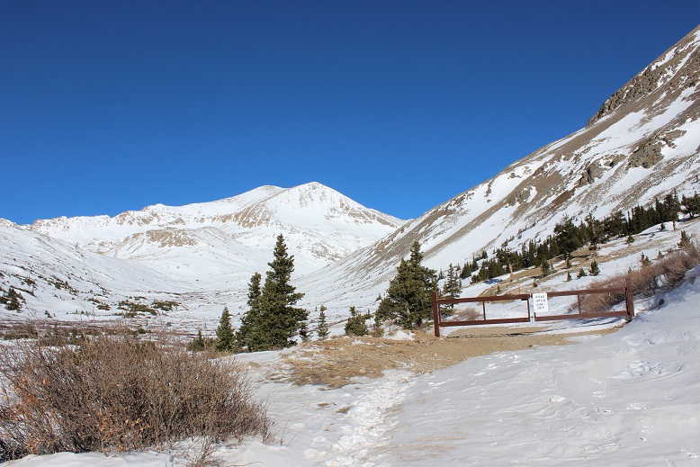
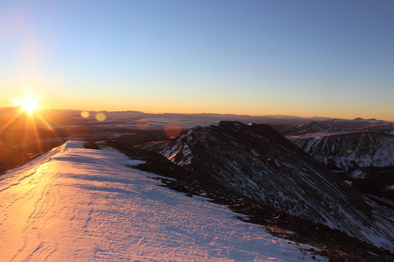
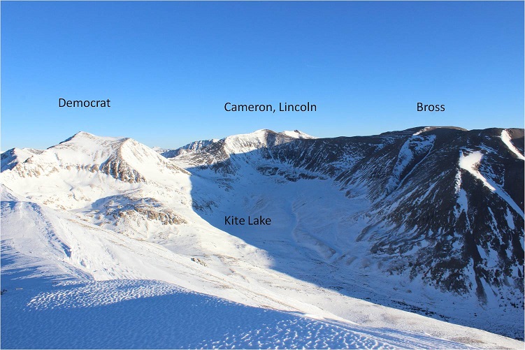
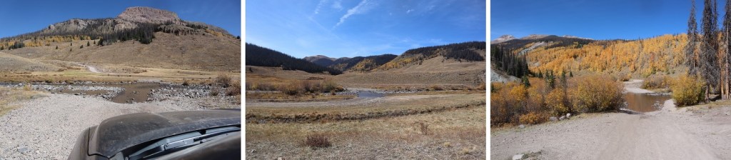
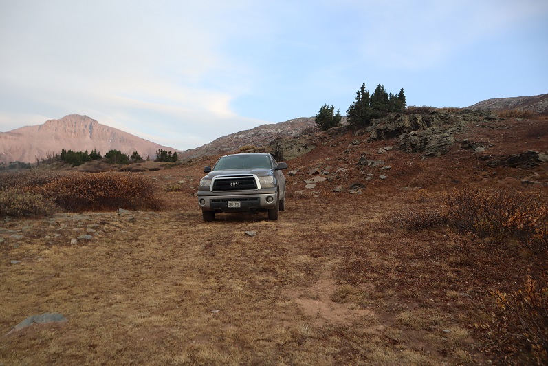
I was in this same area last week, and got a good view of the route I wanted to take to summit these peaks.  This weekend the haze from the fires obscured a lot of the photos, but I think I can still get the general description across.  I once again drove from Silverton to Beartown, but I decide to drive a little further up the road this time towards Kite Lake.  That wasn’t the best idea (the road gets worse as you drive towards Kite Lake) but my truck still made it.  She wasn’t thrilled with me, and I’ll be replacing her skid plate this week, but she made it. I drove in and out in the dark, so here are some pictures from last week’s drive.

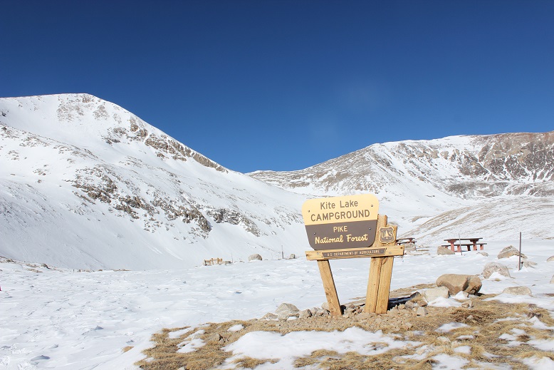
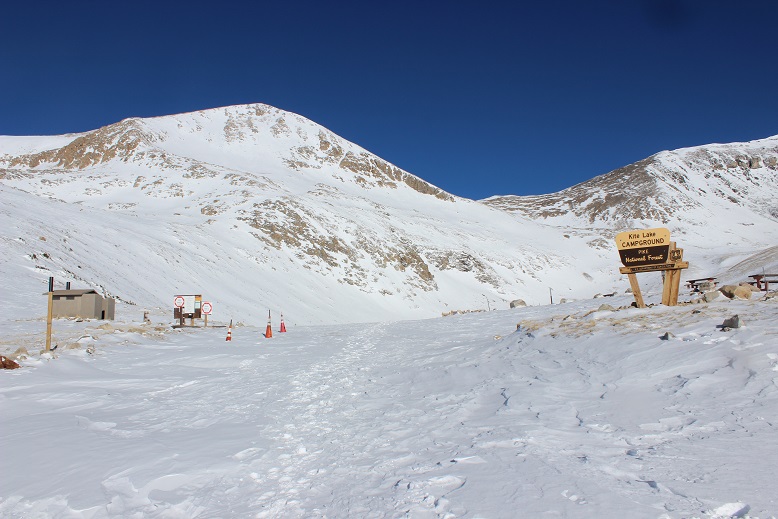
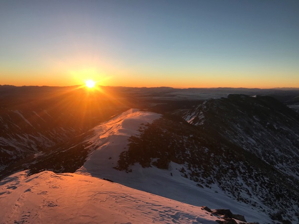
I parked yards before the lake and was on the trail at first light: 6:30am

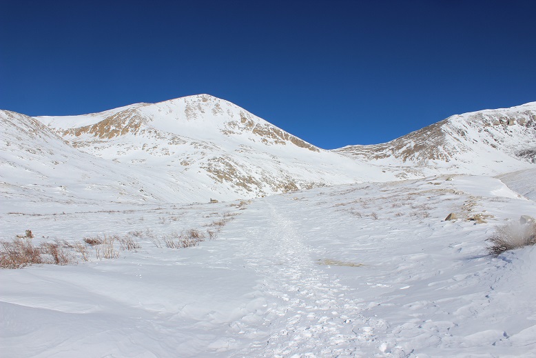
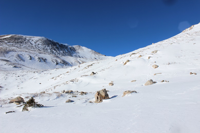
I realized on my way down I could have taken the trail to El Dorado Lake to gain the ridge, but that’s not what I did on my way in.  You should though.  Instead, before Kite Lake I headed south, and then southwest and followed the drainage below Hunchback Mountain to the ridge.

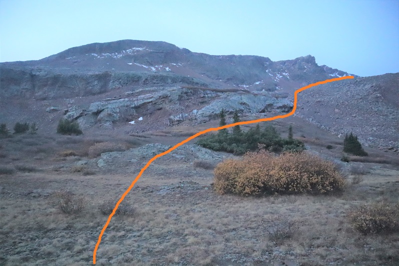
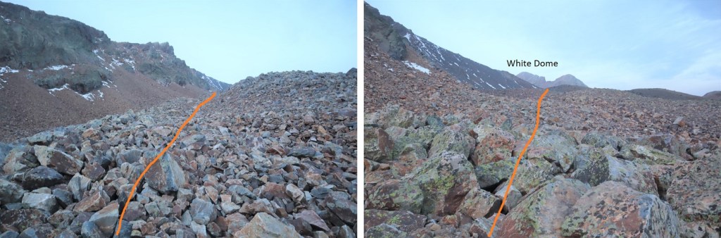
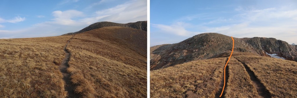
Once on the ridge I came across a trail, and followed it northeast

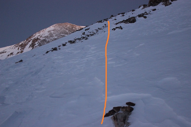
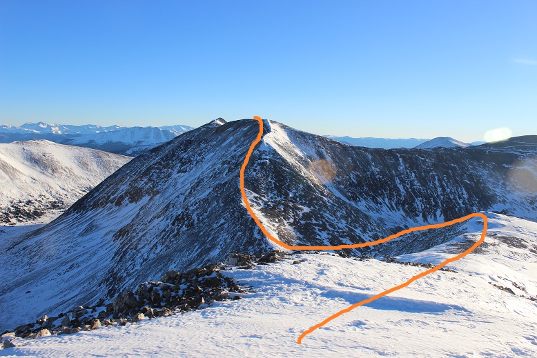
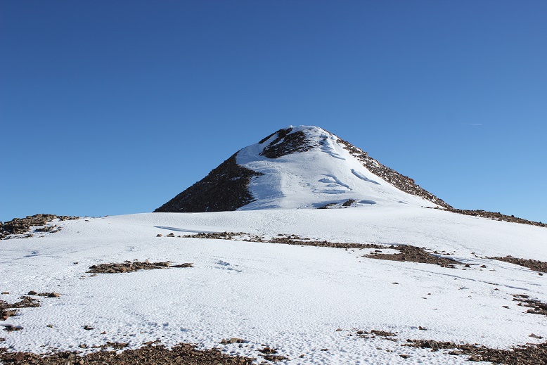
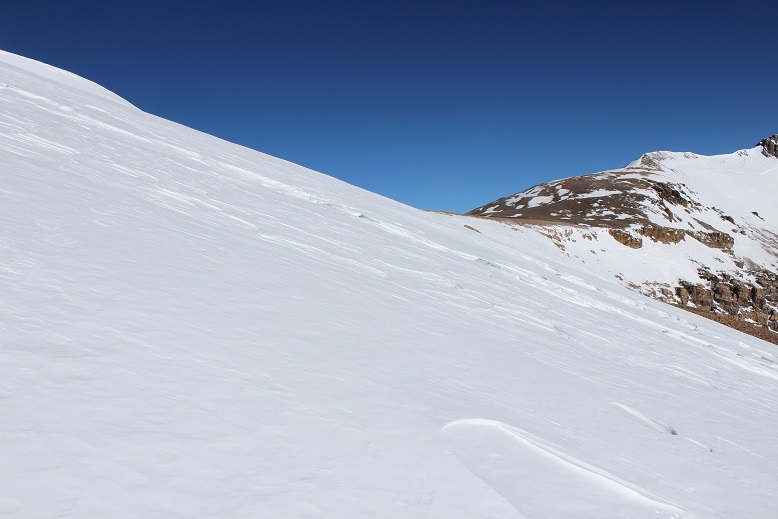
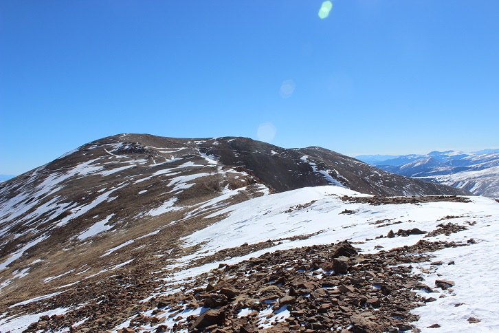
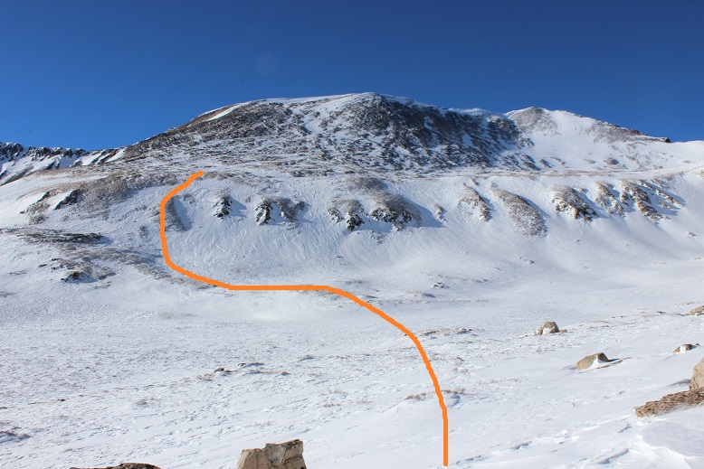
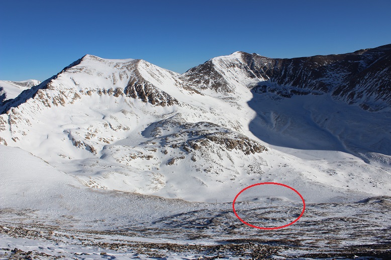
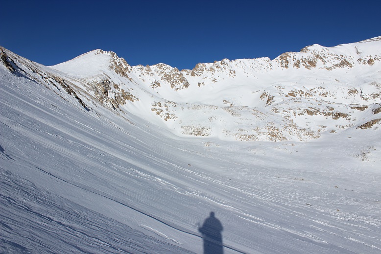
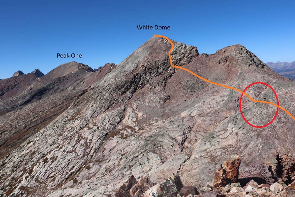
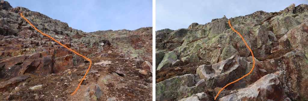
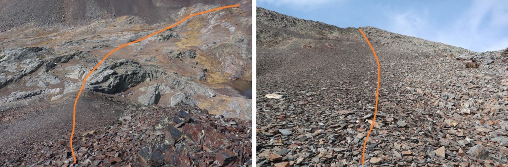
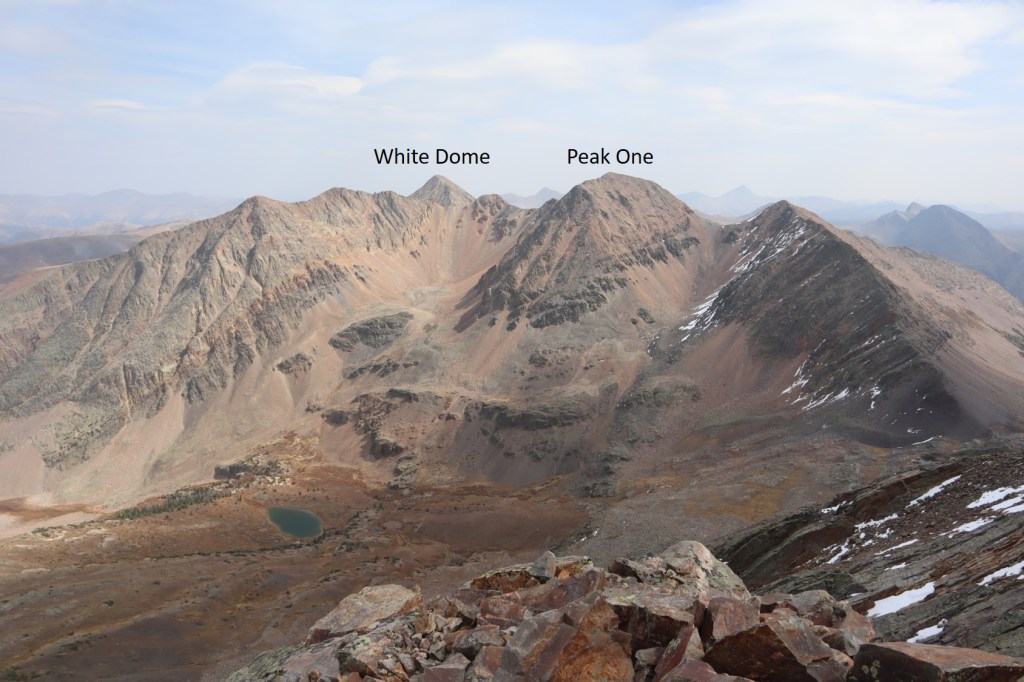
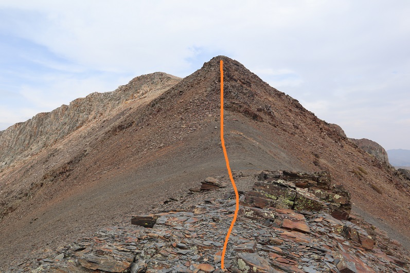
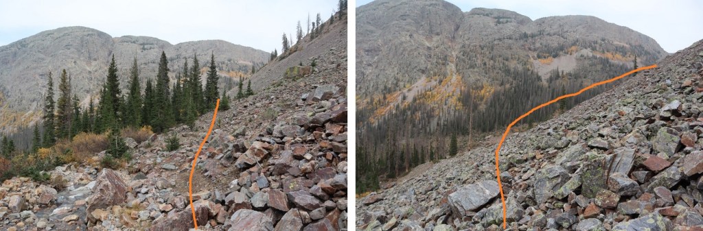
This would bring me to a rocky rib.  Here’s an overview of the route up to White Dome, with the rib circled in red (it’s deeper than it looks).  The rib drops down about 25 feet, crosses a ravine, and then gains 30 feet.  This is class 3, closely bordering on class 4, and the only time I wore my helmet the entire hike. 

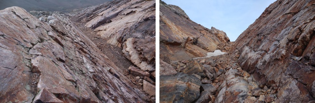
Here’s looking down and up the ravine

And how I crossed

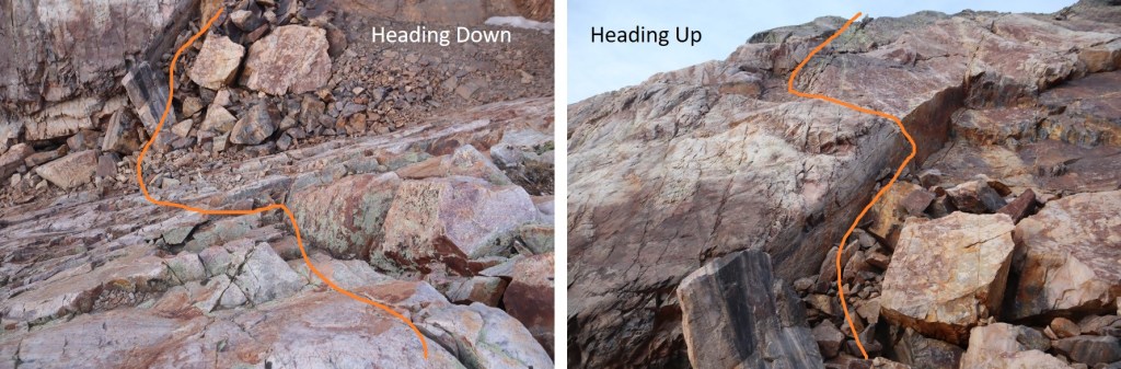
Here’s looking back on how I climbed into the ravine.  This is pretty much vertical, straight down.

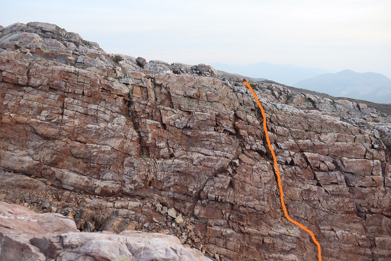
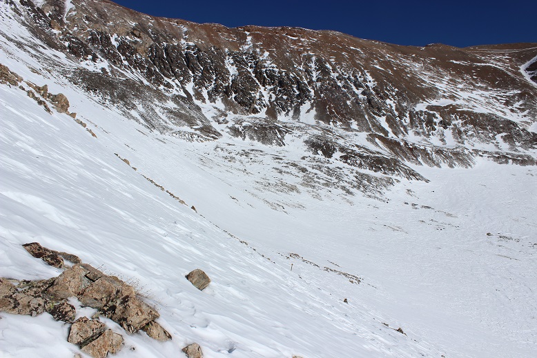
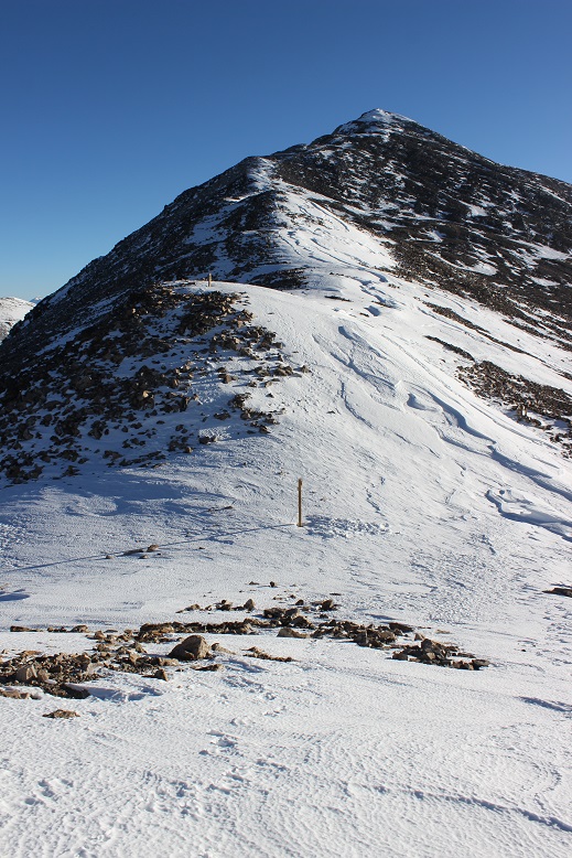
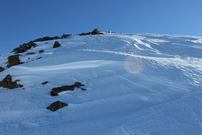
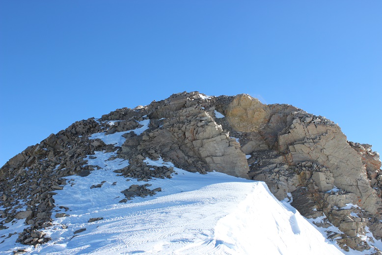
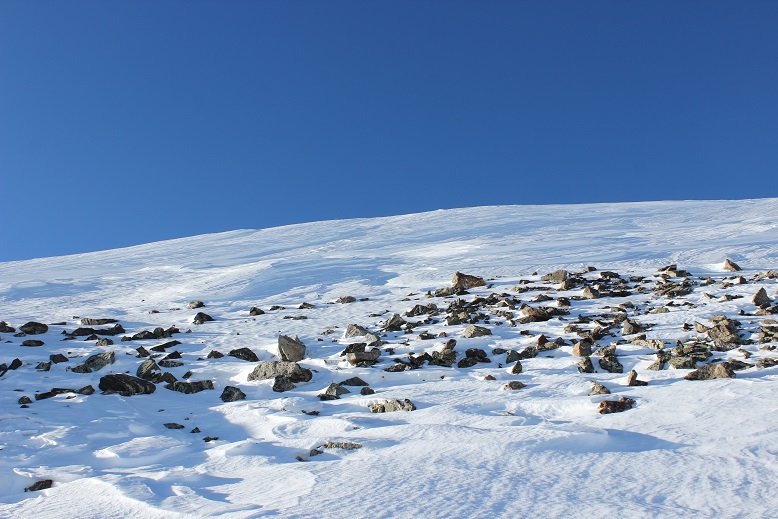
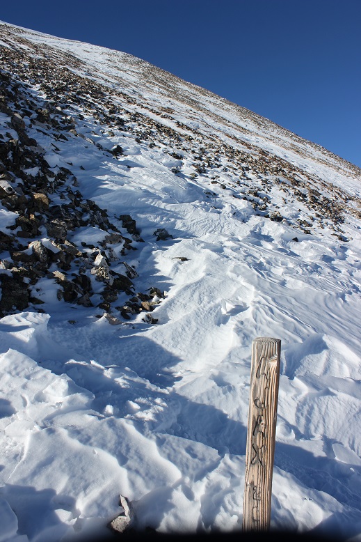
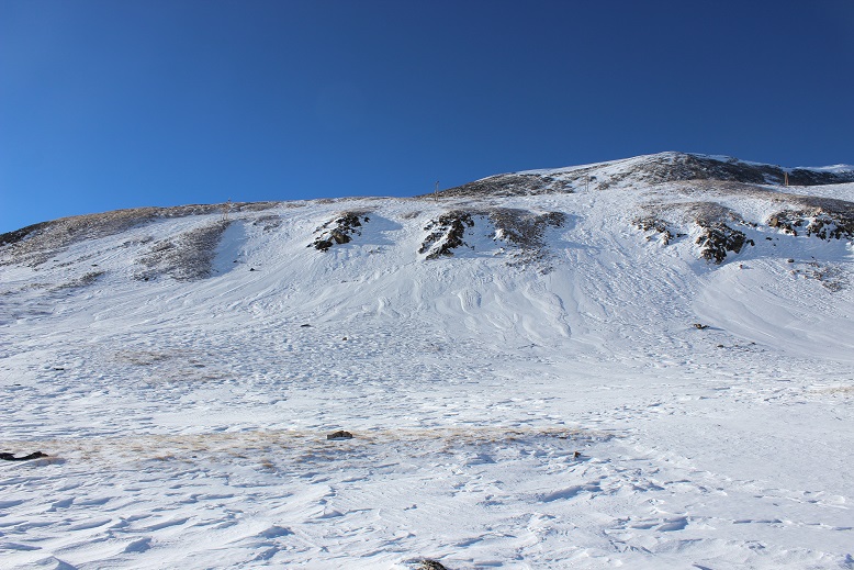
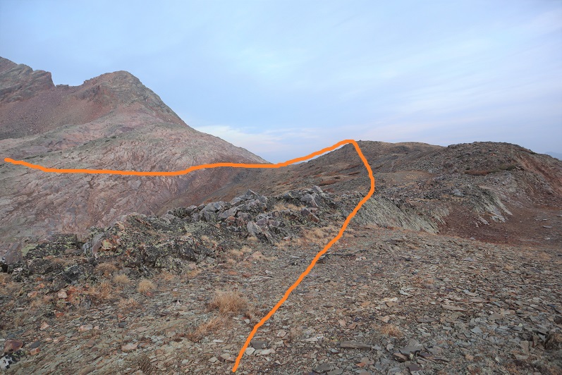
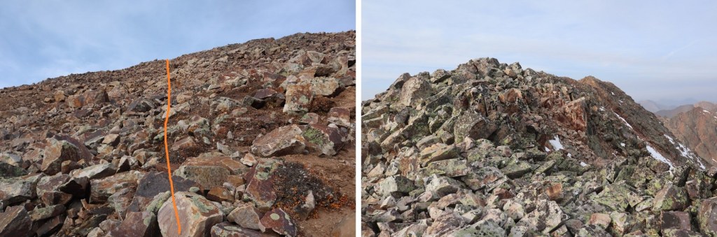
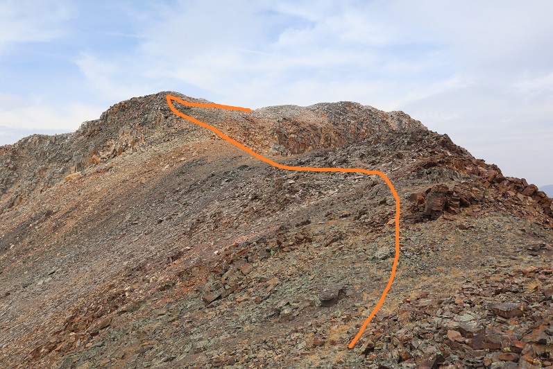
Once out of the ravine I continued southwest across some talus, aiming for another rock band.  This was easy to climb up, and there was a cairn at the top, indicating the route to take.  This is all class 2/easy class 3.  Here are some photos:

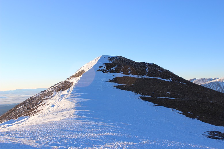
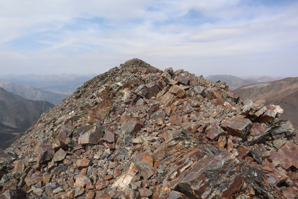
Once I gained the ridge it was an easy hike west to the summit

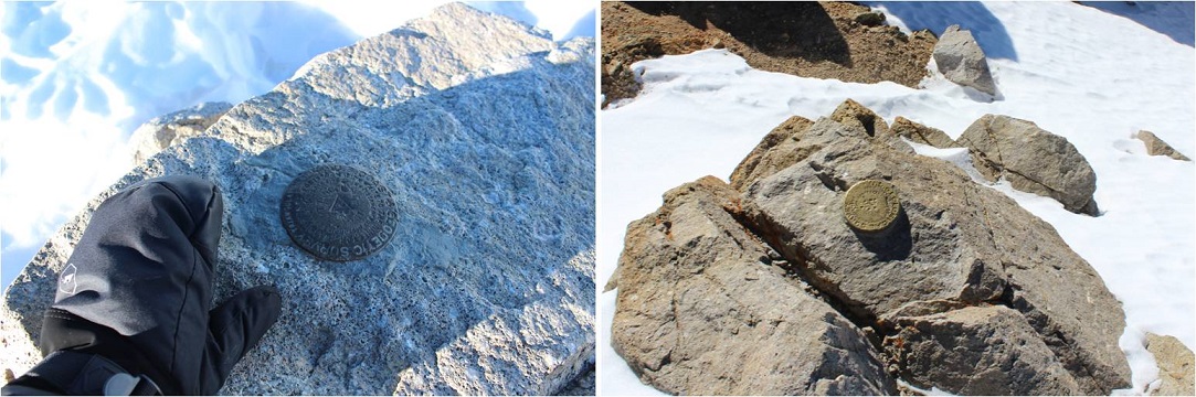
I summited White Dome at 8:45am.
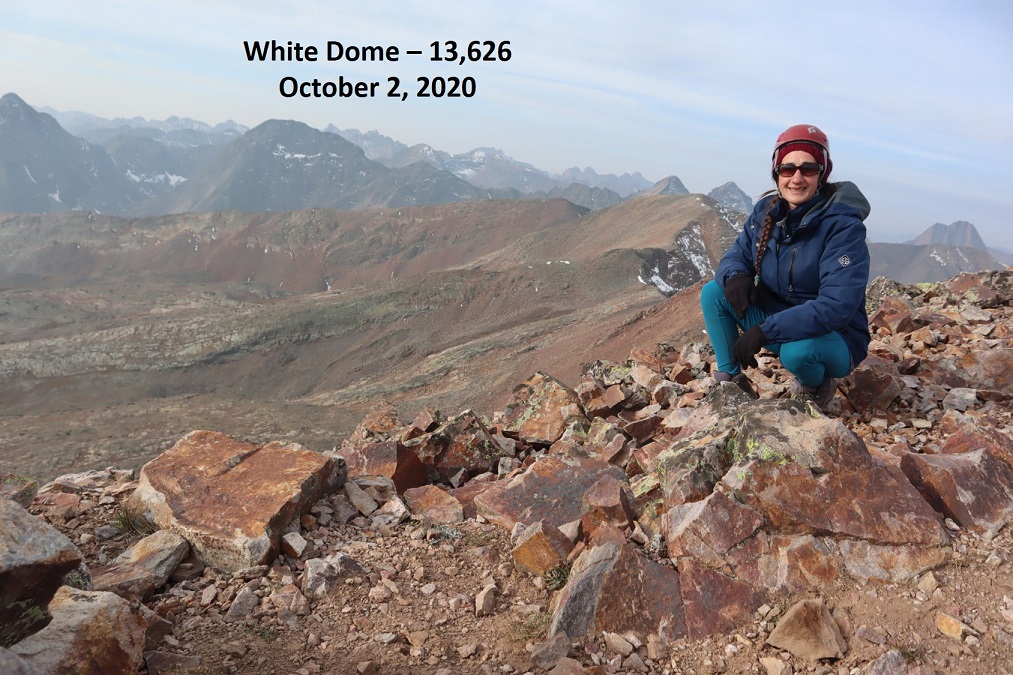
White Dome: 

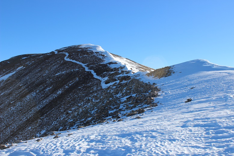
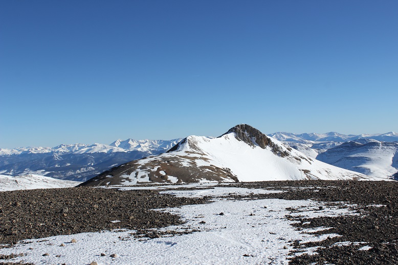
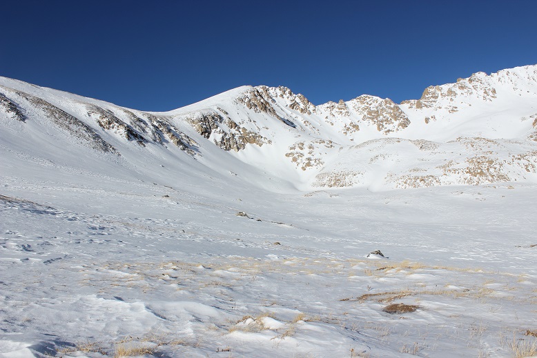
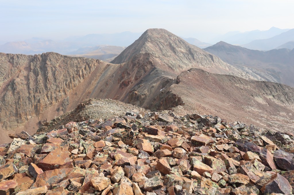
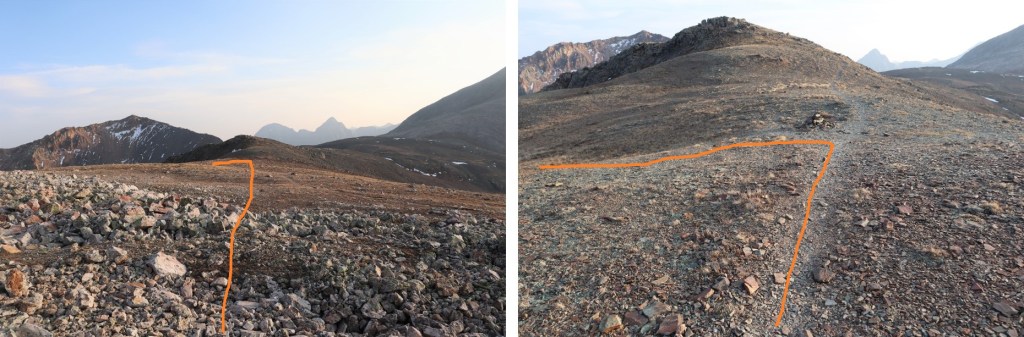
Next up was Peak One.  Here’s an overall view of the route

This was a ridge hike, with no large obstacles to summiting.  I dipped down once or twice to the right when needed, but this is all class 2

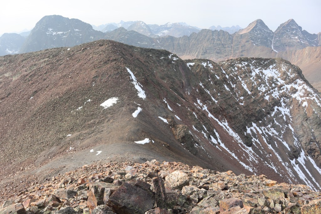
Here’s looking back at White Dome

I summited Peak One at 10am.
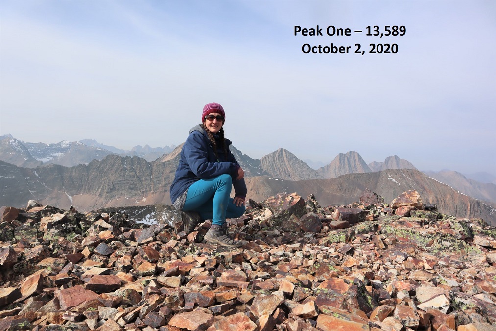
Peak One:

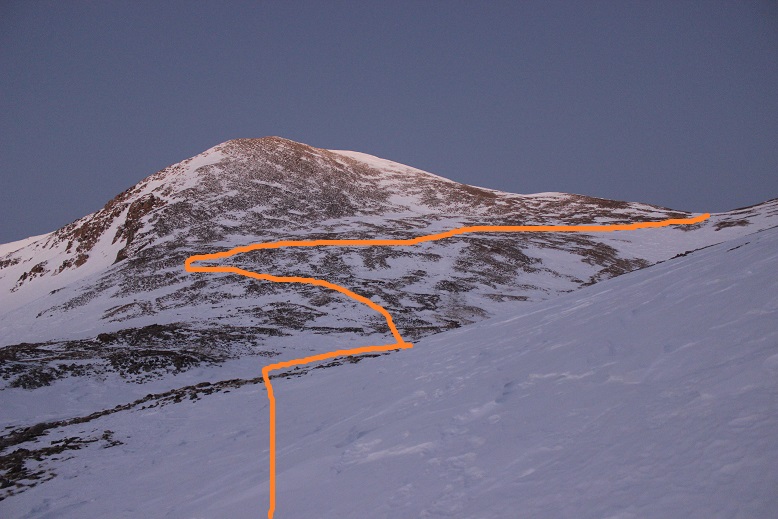
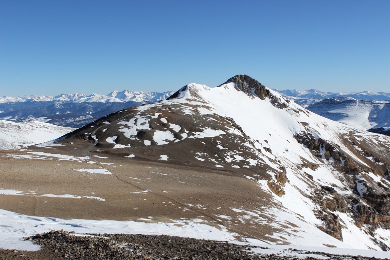
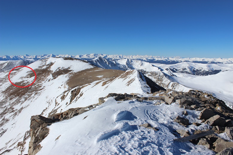
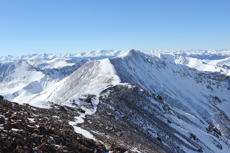
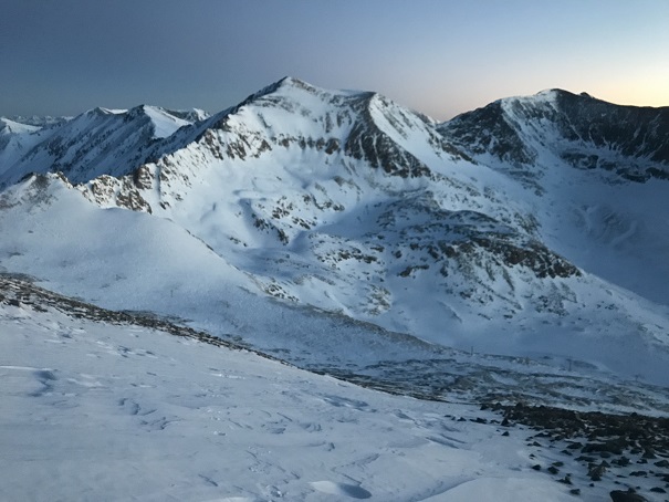
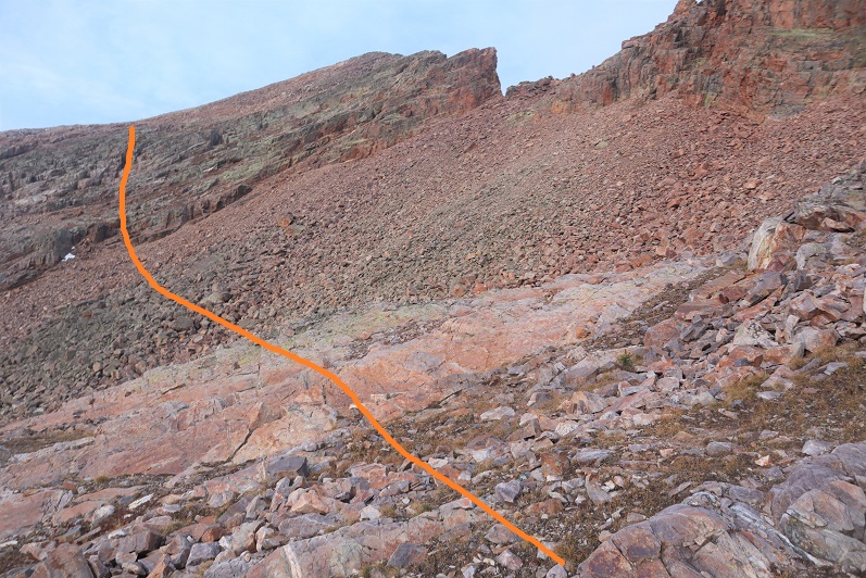
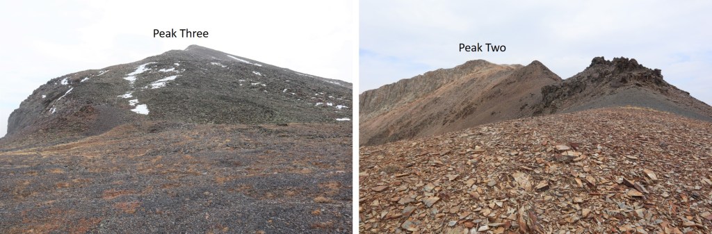
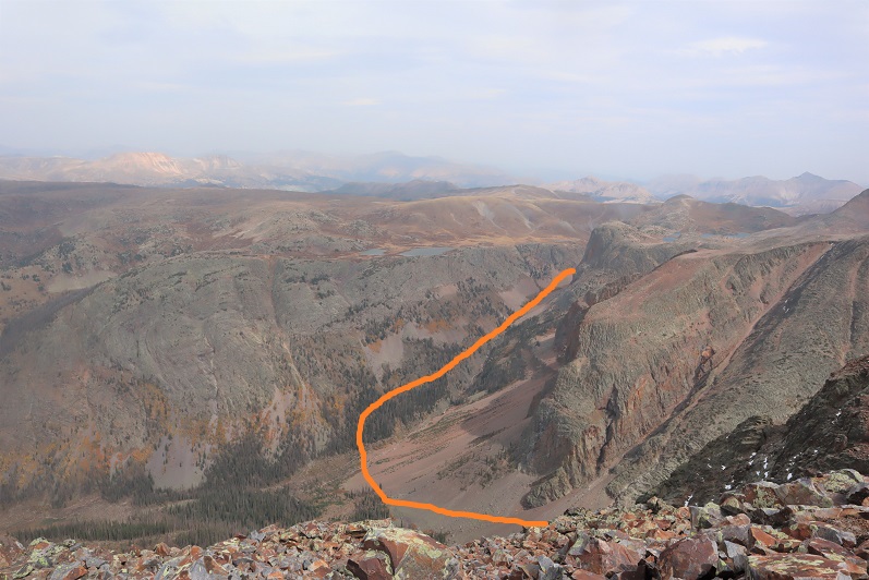
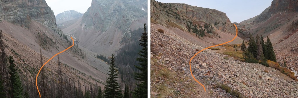
Now I had a decision to make.  I could either turn back and head for my truck now, or make this a loop.  I looked at my stats.  I’d only gone 3 miles.  Nope, not enough mileage/elevation/work to justify the drive in.  I was going to make this a loop and summit Peak 3 and Peak 2 today as well.  It would significantly raise my elevation gain (mostly on the way out) but it would mean I would need to make that 1.5-2 hour drive on a dirt road from Silverton one less time.    Here’s looking at Peak Three and Peak Two from Peak One, with my overall route there and down into the basin that would lead me out

I started by heading south and following the ridge down, losing over 900’ of elevation.  This ridge was class 2, with nothing too tricky.  I could mainly stick to the ridge, but it would be obvious if I needed to dip right or left.

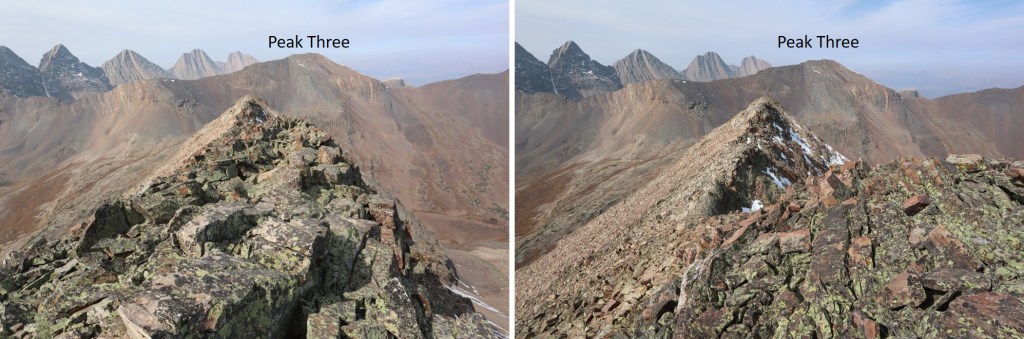
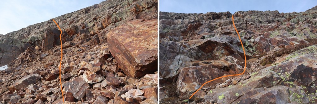
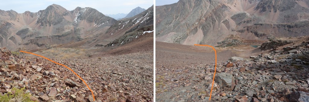
Here’s my overall route from the ridge over to Peak Three

And a look back at Peak One

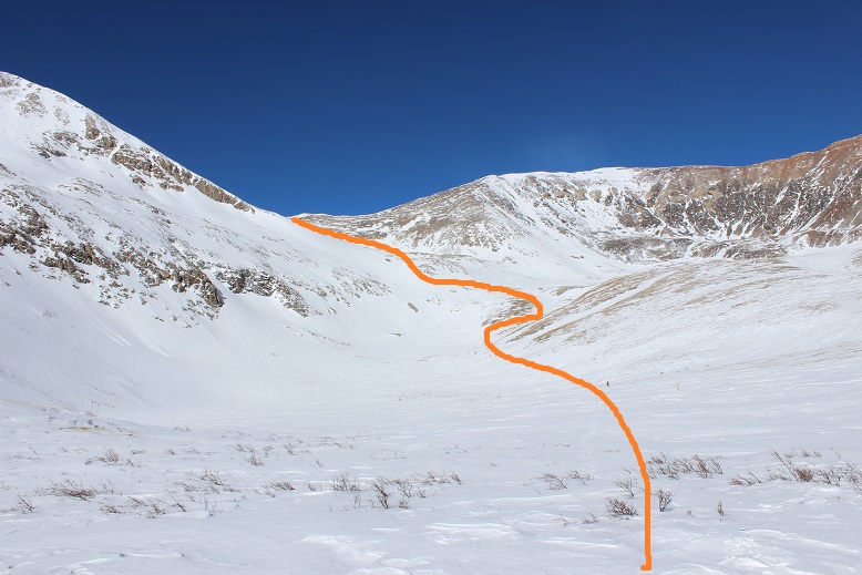
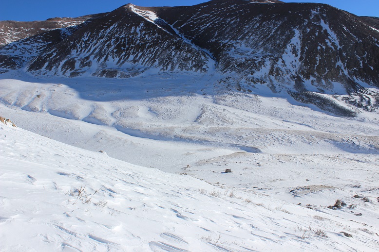
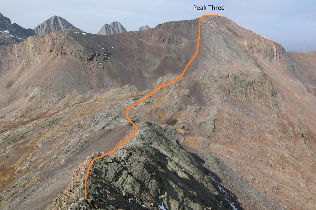
And some step by step photos of my way to Peak Three.  After losing approximately 900’ I regained another 800’ to the summit, first by taking a rock rib towards the upper basin, and then ascending using the scree filled gully.  The scree here wasn’t too bad. 

At the top of the gully it was a quick hike to the summit

I summited Peak Three at 12:30pm.  I had a hard time getting my camera to cooperate, so we get a unique summit photo this time
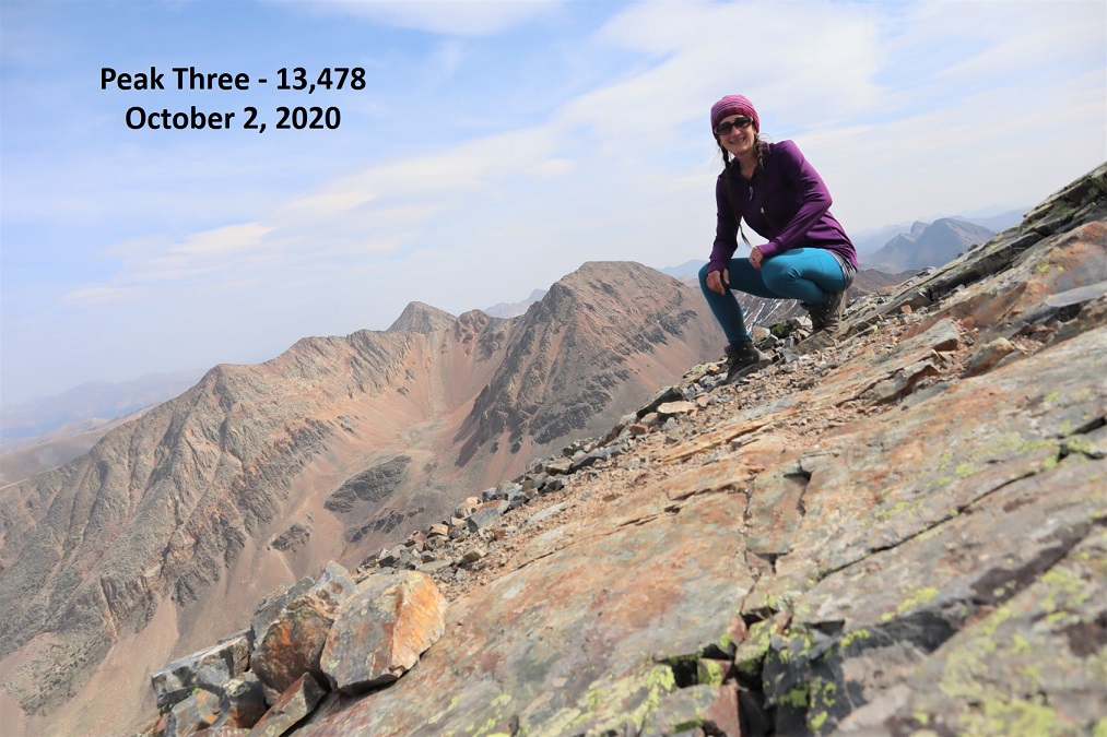
Peak Three:

There were some pretty awesome views of the Trinities, and Wham Ridge looked dry (I didn’t get a clear picture of Vestal Peak however, sorry!)

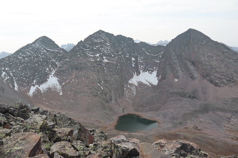
And here’s looking back at White Dome and Peak One

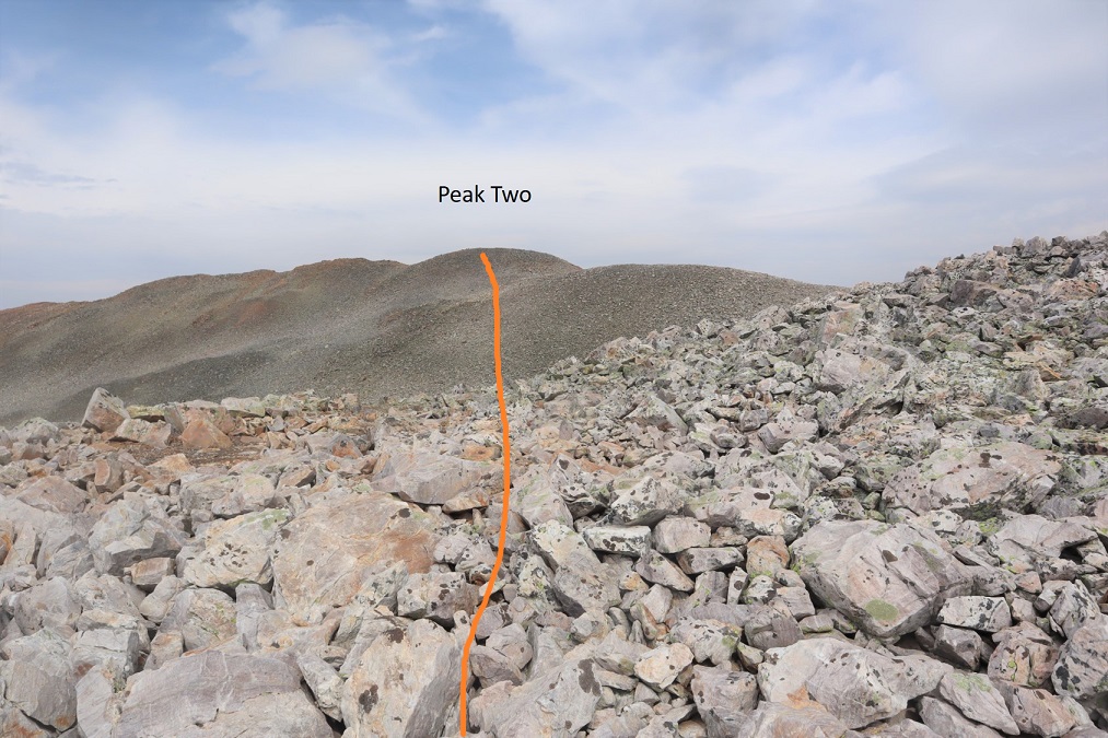
Now on to Peak Two.  Here’s the overall route

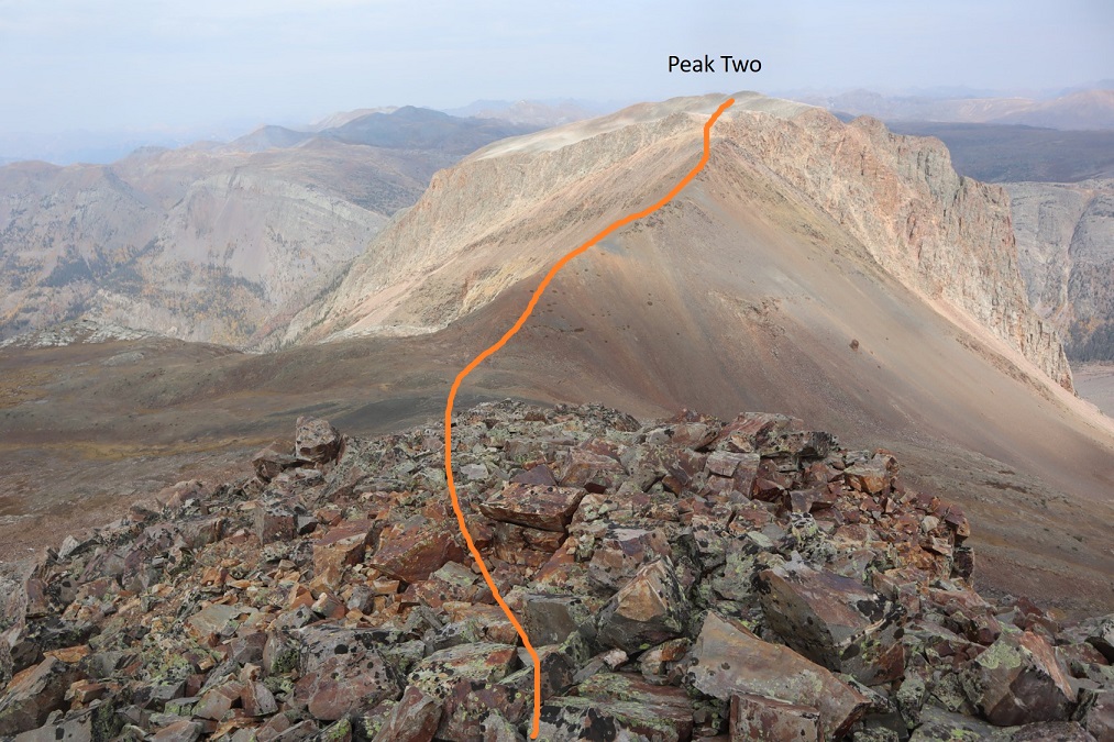
This is an easy ridge hike.  I started out heading north and just followed the ridge.  Here are some highlights.  From the saddle, looking back up at Peak Three and Peak Two

There’s actually a trail here that skirts the ridge to the left

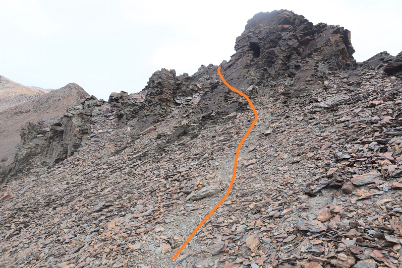
Then it’s straight up this point to a false summit

And a quick dip and rocky trek to the summit

I summited Peak Two at 1:50pm.  Something was wrong with my camera.  I couldn’t set up the timer for a photo, so I just took a selfie, which ended up being unfocused.  I also couldn’t use any of the buttons, the visual playback didn’t work, and I wasn’t entirely sure the camera was taking a photo (even though I heard a click).  Oh well, I guess it’s time for a new camera.  I’ve never liked this one anyway….
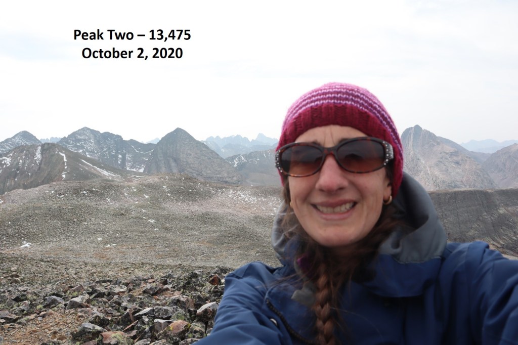
Peak Two:

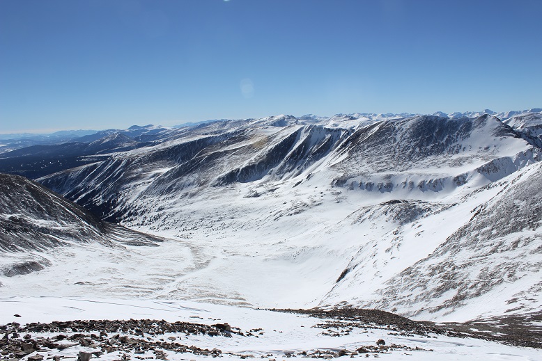
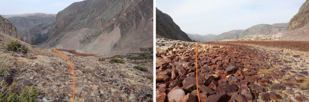
I looked to the northeast, and could see my intended exit route.  I planned to hike back down to the basin and catch up with the Colorado Trail.

That first required me to head back the way I’d come to the Peak Two/Peak Three saddle

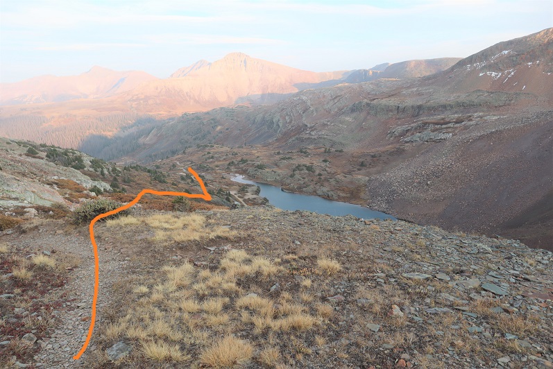
At the saddle I turned left and headed east and then north out of the basin

As you’re exiting, you’ll want to stay left to avoid a smooth rock waterfall

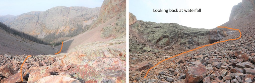
After the waterfall, aim for the trees, pass them to the right, and you’ll be able to see where the Colorado Trail picks up below

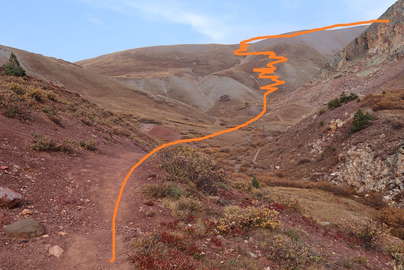
This is where I slipped on a rock the size of a microwave that decided to roll as I was using it for balance.  I didn’t hurt myself, but I did bang up my camera, and when I went to take another picture all the buttons were functioning again (which was nice, but I’m still investing in another camera).  Also, I need new shoes with better traction (this has nothing to do with the rock rolling, I just need new hiking boots).  After this I followed the Colorado Trail east for 3.5 miles, gaining about 2100’ of elevation on a class 1 trail

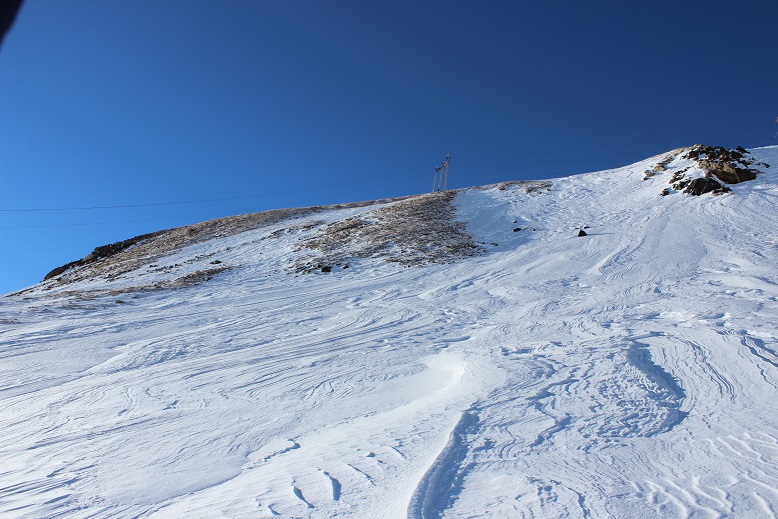
The last bit was especially fun, as it involved dozens of switchbacks (sarcasm)

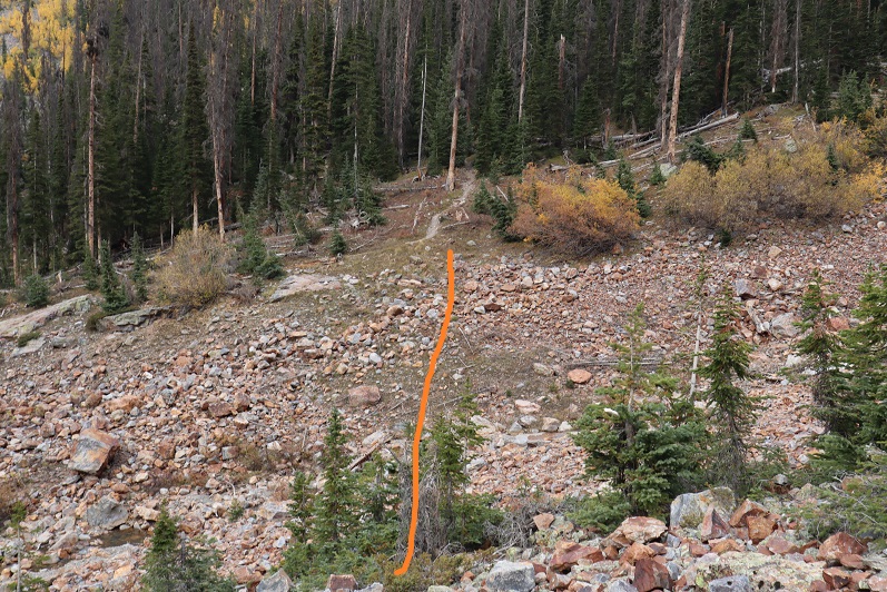
At the top of the hill I turned right and followed the trail south until I hooked up with the El Dorado Lake Trail, and took that east to Kite Lake and my truck

I made it back to my truck at 1:50pm, making this a 15.03 mile hike with 6051’ of elevation gain in just under 12 hours. 

On to the next trailhead! 

Democrat – 14,148, Cameron – 14,238, Lincoln – 14,286, Bross – 14,172, South Bross – 14,020

1

RT Length: 16 miles

Elevation Gain: 4987’

OK, I know this looks like an excuse to say I’ve hit my goal of summiting 5 winter 14ers for the year by just doing them all at once, but I’m only counting this as 1 winter 14er hike (putting me at 3 for this season… 2 more to go!).

Luckily the Kite Lake Trailhead is only 2 hours from my house so I made it there by 4:30am. Well, almost there. From turning west on Buckskin I was able to drive 2.5 miles on a bare dirt road and got my hopes up I’d be able to drive to the winter closure. No such luck. Almost immediately at 2.5 miles I ran into snow and stopped. Quite suddenly in fact.

2

It looked like someone had attempted to drive further and decided to back up, so I parked my truck and took a look. I was fairly certain I’d be able to drive my truck through what I could immediately see, but I wasn’t sure I’d be able to drive back out after the sun warmed up the snow later in the day. I decided to play it safe and stay parked near the Paris Mill site. This ended up being a fantastic idea.

I put on my snowshoes and other gear and was on the trail by 4:45am. The dirt road in ranged from bare dirt to covered in 3-4 feet of snow. Yes, tt had been a good idea to park where I had. The jury was still out on whether or not wearing my snowshoes had been a good idea (necessary in some places, and not in a lot). I could tell no one had been on this particular trail for a few days (probably since the weekend).

3

The first mile and a half to the gate went by quickly

4

It was still dark, and here the wind picked up. It felt like I was in a wind tunnel, and the drifts on the road got deeper. I wasn’t able to see the road most of the way but I knew where Kite Lake was so I just headed in that general direction. It was still dark when I made it to Kite Lake.

5

From here there was no visible trail: everything was covered in snow and the wind had swept any trace of tracks away long ago. I stayed to the right and came upon a sign. Woot! Last time I was here it was summer, but I remembered there were signs indicating where the trail was. I snowshoed over to the sign hoping to see it read “trail”. Nope, it just said “no camping”. Well, at least this meant I was on some sort of trail and not on the lake. I pointed my flashlight in the general direction I was supposed to go and saw another sign. Maybe this one would say ‘trail’? Nope, ‘no camping’ again. Then I saw another sign (this one ended up saying ‘trail’).   You can probably guess what I did from here: I just went from sign to sign until I was out of the basin (by the collapsed mine). Unfortunately most of the signs I encountered said ‘Trail Closed for Restoration’, but this was encouraging because I knew I was going in the correct general direction (and I wasn’t worried I was damaging the trail because I was on top of several feet of snow). Some of the time the signs actually said ‘trail’. Here’s the route I took:

6

Remember however, it was still dark, so here’s what I was looking at as I was hiking

7

I made it past the mine and the route started getting very steep. Yes, snowshoes had been a good idea. I got really excited when I ran across a cairn (I haven’t seen one of those in ages!)

8

Here’s looking back at the slope from my way down later in the day

9

Now all I had to do was hike up the slope to the Democrat/Cameron Saddle

10

Luckily from here most of the mountain was windblown. I only ran into one or two tricky spots covered in snow. Here’s the view from above the saddle looking left at the hike up Mt Democrat. I just stuck to the ridge.

11

Yes, there’s a false summit on this one. Here’s the last bit of the trek to the summit

12

13

There was more snow than anticipated on this summit

14

Here’s my summit photo

15 Democrat

I turned and looked back at the ridge and the route up Cameron

16

Here’s the route I took

17

From the saddle it looks steeper. The actual trail goes left and right, but I was able to just stay on the ridge (and snow)

18

19

For the final push to the summit you can clearly see the trail to the left outlined in snow.

20

When I gained this ridge it was like I was transported to the moon: The snow was gone and there were small rocks everywhere

21

I took a quick summit photo

22 Cameron

And looked over towards Lincoln

23

I was debating taking off my snowshoes for the rest of the hike. It looked like everything on this side of the mountain was pretty much windswept, so I took them off, walked about 20 yards, and looked down to this:

24

I should have kept the snowshoes on just for this last little bit, but I found a way around the stuff causing me to posthole. The path up Lincoln is obvious. About halfway up to the summit I ended up putting on my snowshoes again because the snow was deeper than it looked from Cameron.

25

This one had a bit of a false summit as well

26

Summiting Lincoln was much easier than I remembered it from last time: Maybe it was the snow? Or maybe it was because the wind this time was nonexistent. In any event, I summited

27 Lincoln

There were two summit markers on this peak

28

So far my day had been pretty easy. I looked across at the route past Cameron and over to Bross, debating if I needed my snowshoes or not. There was only one area that gave me pause

29

I made it to the Lincoln/Cameron saddle, rook off my snowshoes, and hiked south. When I got to the slab of snow I put on my snowshoes and carefully began crossing the snow. This is much steeper than it looks, but with crampons on my snowshoes I felt secure

30

31

Here’s a look at the rest of the route up Bross

32

I didn’t think I’d be needing my snowshoes anymore so I took them off once again. I’m not a fan of taking them off and putting them back on again, but I’m even less of a fan of holding them (they’re too big to fit into my pack, and don’t fit nicely on the sides either). Also, it felt really warm. I’m not sure if it actually was warm outside or if it was due to the lack of wind, but I was actually starting to sweat. My hands were almost too warm in my gloves. I could get used to this!

It was a very quiet day. I hadn’t seen anyone else and the wind was silent, so imagine my surprise when I rounded the corner and saw this

33

Hm. Someone else must be up here today. I wonder why I hadn’t heard them drive up? No matter, now I as on the lookout for people. Until I got closer and realized the vehicle had been abandoned. It looked like someone had tried to fix a flat and gave up.

34

What was even more curious was they left the windows open and keys in the ignition.

35

I’m not sure how long the truck has been here, but with the roads the way they are it isn’t going anywhere anytime soon.

I turned around to look at the way I’d come and decided I didn’t want to traverse that snow slab later in the day: on my way back I was just going to trudge straight up the hill to the summit of Cameron.

36

Since this is a mining area there are multiple roads to the summit of Bross. I just kept aiming towards the top and followed one after the other.

37

This felt like an easy summit

38

Here’s a look back at the route from the summit of Bross

39

The summit of Bross was very similar to the summit of Cameron: barren except for rocks. It was also very large and flat

40

The last time I’d taken this hike I hadn’t known there was a “South Bross” and today I intended to make my way over there. There isn’t much of a trail, but the route’s obvious

41

I was losing elevation, and it wasn’t lost on me I’d need to regain about 150 feet in elevation on my way back (just for Bross, with more for Cameron) but the short .6 of a mile trek was worth it.

42 South Bross

Here’s a look back on the entire route

43

I turned around and headed back to Bross. From the summit of Bross I pondered my options. I still wasn’t sure if I wanted to make this a loop and head down the west side of Bross or re-summit Cameron and head back the way I’d come. The only reason hiking down Bross sounded like an ok choice was because it was shorter. However, I’ve experienced that screet before and it wasn’t something I ever wanted to experience again, either hiking up or down. Cameron had its drawbacks too: it meant an extra 300 feet of elevation gain in a short distance, and it added a couple of miles onto the trip. However, it also meant I’d get photos of the way I’d come. That was it, I was re-summiting Cameron, and not by way of the Cameron-Lincoln saddle. I was just hiking straight up the slope.

44

Yes, there was some snow, and it was steep, but very navigable

45

Here’s a look back at Bross and South Bross

46

Once I made it to the summit of Cameron (again) I had a great view of Democrat

47

Here’s a look at the route back. You can see Kite Lake is completely covered in ice and snow. Once again, the sections of snow below the Democrat/Cameron saddle were steep.

48

Here’s the route from Kite Lake

49

The 3 miles back to my truck from Kite Lake took a while, but I wasn’t bothered: I had all the time I needed today, and it was such a lovely day I didn’t mind the hike. Another plus was the lack of people. It was obvious I’d been the only one on this trail today. In the light of the afternoon sun I was once again glad I’d decided not to drive my truck any further on this road: it would have gotten stuck. In fact, just as I could see my parked truck I heard a noise and saw a truck smaller than mine come plowing down the road. I tried to wave my arms at them to indicate they shouldn’t drive further but it was no use. They continued on and got stuck.

50

They weren’t too happy about the situation either, and rudely refused my help when offered as if it were my fault they’d gotten stuck. I made it back to my truck at about 3 pm, making this a 16 mile hike in just over 10 hours.

51

Just for fun, here’s my Relive of the hike: https://www.relive.cc/view/2117888145

Mt Buckskin 13,871 & Loveland Mountain 13,692

1

RT Length: 7 miles

Elevation Gain: 2950’

I thought I was done with summits for 2018. I’ll be gone next week on a road trip visiting my family in Mississippi for Christmas, and along the way picking up my son from his base in Texas to join us (I’m so glad he got leave for the holidays before transferring to Alaska!!!).  I’d just been hiking yesterday, but today I noticed the weather for tomorrow was perfect for hiking as well.  I did some mental calculations, and then had this conversation with my youngest (a sophomore in High School).

Me: What are your plans for tomorrow?

Her: I was planning on sleeping in and then studying for finals. And I’d like to get in some rink time if possible.

Me: Do you want any help studying?  I did graduate with my undergrad 2nd in my class.  And I have an MBA.  I’m pretty good at the whole ‘studying’ thing.

Her (with a terrified look on her face): No mom.  Just… no.  I get straight A’s and have my academic letter to prove it.  I’ve got this.

Me: I was thinking of hiking tomorrow, but I’d also like to spend time with you.  What do you think?

Her: You should go hiking.  That way I can sleep and study.  I’ll probably still be sleeping when you get back anyway.

Me: How much studying do you need to do?  Is studying more important than sleeping?

Her: Mom, I’m a teenager.  Teenagers gotta sleep.  At this point I need more sleep than study time.

Me: OK, but that still leaves rink time.  How about we go to the rink tonight from 7-9pm, tomorrow I’ll hike, you’ll sleep, I’ll wake you up to study, and we’ll have dinner together.

Emily: Deal.

Woot! It looked like I was going to get one more hike in this year after all!  The weather looked great, and my schedule for the morning was cleared.  Because of rink time I didn’t make it to bed until 10pm, which meant I only got 4 hours of sleep, but that seems to be the norm for me these days.  I’ve discovered the hike is always worth the lack of sleep.

Once again, I woke up at 2am and drove to the trailhead. I encountered a herd of about 40 elk at the same place I had on Friday, and this time I was prepared when I saw them in the center of the road.   I slowed down and waited for them to budge, but they didn’t seem concerned with doing so.  They were quite happy to stand in the middle of the road and just watch me wait.  It seemed I was in more of a hurry than they were.   Luckily there were no other vehicles on this road.  After two minutes I did something I knew would make them move:  I took out my camera.  Sure enough, before I got the chance to take picture they’d scattered to the sides of the road.  I was on my way!

I haven’t been to the Kite Lake Trailhead for what seemed like ages. The last time I was here was back in June of 2017.  The 2WD dirt road was icy but clear and plowed up to the gate closure, about a mile from Kite Lake.

2

3

This was also a pleasant surprise: I’d expected to park about 3 miles from the trailhead, and here I was, just 1 mile away.  This day just kept getting better and better!

There was room for about 5 cars at the gate, if everyone cooperated and parked nicely.

4

I was the first vehicle there, so I tried to pull up and leave as much room as possible for others. Also, about 40 feet before the gate the road isn’t plowed, and a few vehicles tried to drive past a snow drift and obviously had to turn back.  My advice:  Don’t even attempt to drive past where it’s plowed.  Your vehicle might make it, but there’s no parking in front of the gate so you’ll need to turn around and park lower anyway.

I gathered my gear and began hiking towards Kite Lake at 4:45am. Just after the gate I had to stop and put on my snowshoes.  I left them on for the entire hike.

The hike up to Kite Lake was simple: I just followed the road.

5

The sky was clear with no moon, and when I looked up I often saw leftover shooting stars from Friday’s Geminid Meteor Shower. The only downside was the wind!  Wow!  It sure wasn’t the forecasted 8mph, and it wasn’t letting up.  It was like I was walking headfirst into a wind tunnel:  the wind was funneling down the mountains and straight towards me as I trudged towards the lake.  I remembered last time I was here the wind was intense as well, and hoped it died down at some point.

OK, I made it to Kite Lake.

6

My directions said to look for the trail to Lake Emma, which was supposed to be highly visible behind the bathrooms to the left. Hmmm.  No trail was visible, just a lot of snow.

7

I hiked around for a bit, looking for an obvious trail sign, tracks, path indentations in the snow, etc, and when I didn’t find any I just headed southeast.

Before long I was in a basin, and thankfully here the wind stopped. Even though it was dark I could tell I was in a basin because the ground was relatively flat, and there were outlines of the mountains surrounding me.  I’d been told there were willows here, but they must have been buried under all the snow.

I crossed the basin to the south, squinting in the dark, trying to see Mt Buckskin before me. From the basin I’d wanted to get a good look at Mt Buckskin so I could pick a safe line to climb, but in the dark all I could see was there were a lot of snow covered slopes surrounding me.  I couldn’t be sure in the dark how stable/deep/etc. those snow covered slopes were.  In fact, I couldn’t see much but lots of white surrounding a few areas of black shapes.  I was pretty sure the dark areas were cliffs, and not climbable.  Imagine seeing this (which is actually more than I was actually able to see at the time), and trying to decide which path was safest to take.

8

I kept slowing my pace, hoping the sun would rise and I’d be able to see what I was up against conditions wise. Why wasn’t it getting light out?  This would be a whole lot easier if it were light out.

After checking my watch and realizing it wouldn’t be light out for quite some time I decided to aim left, where it looked like there was tundra near the snow. I looked at my topo map and it seemed to have the least drastic slope angle.  I figured if I stuck to that path I’d have firm ground to hike up if the snow wasn’t stable.  This ended up being an excellent idea.  The terrain was quite steep but not as steep as in other areas, and no cliffs.  Here’s the route I took.  In the daylight I realized I’d made the correct choice.

9

About halfway up the hill I could see power lines in front of me, and decided this would be an excellent point of reference. I aimed for the power line with 3 poles (and discovered later all the others only had 2).

10

This was a very steep section. Here’s the look back down (from later in the day)

11

When I made it to the power line I set my next goal of making it to the top of the summit ridge. While the sun hadn’t risen yet, the sky was beginning to get light and I could see better than when I was down in the basin.

12

Here the snow was firm and I wanted to keep my snowshoes on so I looked for a continuous line of snow to the ridge. Here’s the path I took

13

Once again, pictures don’t do the steepness here justice.

14

The snow at this point was consolidated and I was glad my snowshoes had crampons: microspikes wouldn’t have been sufficient.  I was also glad I had my ice axe.

15

After what seemed like forever I gained the ridge just as the sky began to turn pink.

16

I stopped for a minute to admire the view, and then realized if I hurried I’d be able to make it to the summit to watch the sunrise. I quickly sauntered in my snowshoes the last hundred yards or so towards the summit.

17

I summited at 7am

18 Mt Buckskin 13965

Mt Buckskin:

And yes, I was able to watch the sunrise (it rose directly from behind Pikes Peak, which was cool but not something I was able to capture with my camera)

19

I also wanted to summit Loveland Mountain today, so I turned and walked back the way I’d come. The trail over to Loveland Mountain looked very straightforward.  I could see the path outlined in snow

20

I made my way to the Buckskin/Loveland saddle, careful not to trip in my snowshoes.

21

From here there was a rocky section to navigate

22

And then I had the choice to summit via the trail to the right or the hard packed snow to the left.

23

I had on my snowshoes, so I decided to take the snow route, which has more snow than it looks like from a distance

24

I gained Loveland’s ridge and walked to the cairn on the relatively flat summit

25

I summited Loveland Mountain at 7:50am

26 Loveland Mountain 13692

Loveland Mountain:

Now that the sun had fully risen it was time to apply my sunscreen. This has been problematic in the past because a tube of sunscreen freezes in the winter above treeline. Using an aerosol spray isn’t practical for obvious reasons (wind) and the sunscreen that comes in a deodorant-like stick doesn’t apply evenly.  Yesterday I’d visited my new esthetician and we’d had the usual sunscreen talk.  I’d told her I usually just keep my face completely covered when above treeline, since I’m unable to apply sunscreen when it freezes.  She told me about something she’d recently heard of, and I decided to give it a try.  I went to the dollar store and bought a compact, took out the powder, cleaned the compact out, and filled it with my favorite sunscreen.  Then I placed a new compact sponge over it (30 for $1 at the dollar store as well) and let the sponge absorb the sunscreen.

27

I had the compact in my pocket as I was hiking this morning (inside of a plastic ziplock as well) and now was the time to take it out and see if the sponge had kept the sunscreen from freezing. I sat on the summit cairn, took out the sunscreen filled compact and applied the sunscreen to my face using just the sponge.  I was amazed at how well this worked!  The sunscreen hadn’t frozen!  Using the sponge it was easy to apply the sunscreen to my face, and my fingers didn’t get cold because they weren’t in direct contact with the sunscreen.  I hadn’t expected this to work so well.  This is life changing.  I took a picture to prove to her I’d tried out her idea.

28

OK, that had been fun, but now it was time to head back down. Here’s a look at the ridge back to Mt Buckskin

29

Yes, I had to regain some elevation, but at this point I was feeling great so it was no big deal.  When I reached the top of the Mt Buckskin ridge I noticed a few cool looking cornices forming (these were small, only a few feet wide)

30

Here’s a look at the view from the Mt Buckskin Ridge

31

On my way back down I once again aimed for the power lines, which were much easier to see in the light of day.

32

33

Here’s looking back up the slope to Buckskin

34

From the power lines I headed back into the basin.

35

And from the basin a look back up at the route I’d taken

36

Wow, what a basin! In the light of day I could full appreciate how vast it was.  I stopped to take some pictures and admire the view

37

38

I realized I’d made the right choice in choosing the line I had to ascend Buckskin’s slope, and now aimed for Kite Lake

39

40

Once at Kite Lake, and while hiking the road back to the gate, I got a really good view of Mt Buckskin and the path I’d taken to the top. I had the realization this hike would have been much more straightforward in the dark if I’d just followed the power lines up the ridge.

41

The power lines start on the road and lead up the mountain, avoiding the basin altogether. I’m not sure if they cross private land (etc.) but this seems a much easier option that would have made the hike quicker as well.

42

In any event, the weather had been perfect today once the wind had stopped. Not a cloud in the sky, and as I was walking from Kite Lake back to my truck it got really warm out and I was able to take off my hat and balaclava.

43

I made it back to my truck at 10:30am, making this a 7 mile hike with 2950’ in elevation gain in 5 hours, 45 minutes. This gave me plenty of time to drive home, get the truck washed and gassed up for the road trip, and to wake my still sleeping daughter up to start studying.  All in all, an absolutely perfect day!

44

And just because it’s fun, here’s my Relive video: https://www.relive.cc/view/2020503730

45