Hike/walk/run/treadmill elevation gain of 1 million feet
Summit a combined total of 10 winter 13/14ers
Finish the Bicentennials
Summit 3 new state highpoints outside of Colorado
Summit 3 new El Paso County Highpoints
Hike another section of the Colorado Trail
Keep my average above 10+ miles and 4000’+ of elevation gain per hike
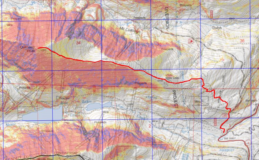
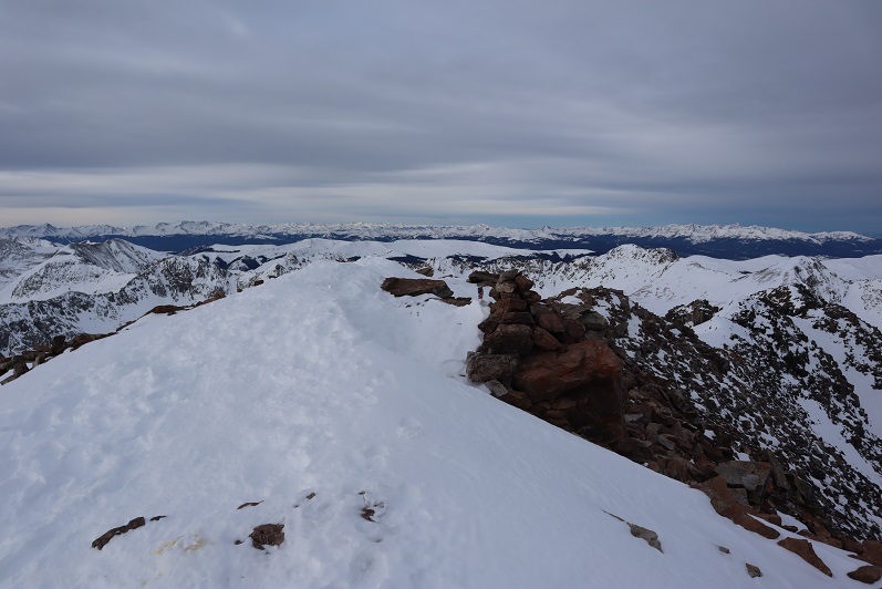
Quandary Peak – 14,265
RT Length: 7.22 miles
Elevation Gain: 3444’
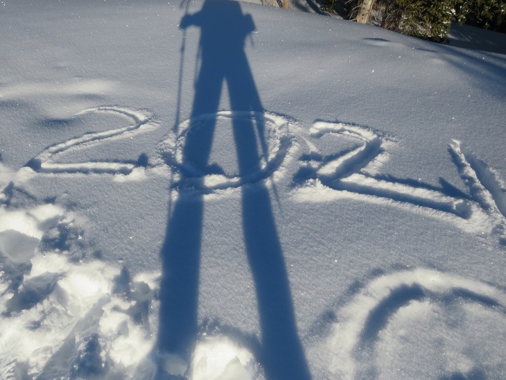
Just to get 2021 off to a good start, I set my alarm for early and made a reservation to hike the Manitou Springs Incline on New Years Day. Unfortunately, my alarm didn’t go off and I ended up missing my start time. I was super bummed, but I didn’t let it get me down: I still had enough time to get a hike in. I figured I’d just do Quandary Peak instead. This is the 4th time I’ve hiked Quandary, and I’ve written several trip reports on the peak, so I’ll just post some pictures with highlights:
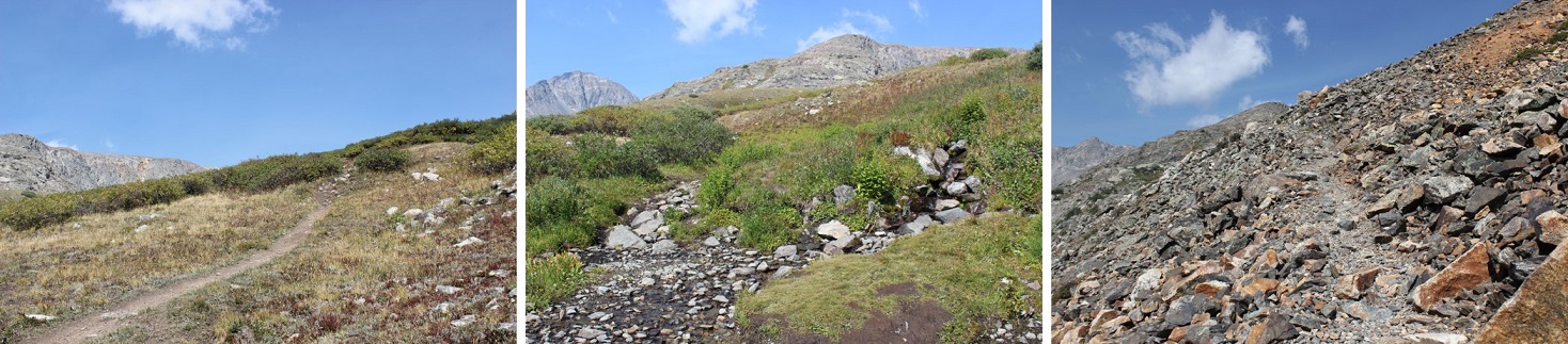
The road and trail was well packed down
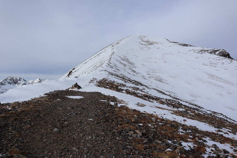
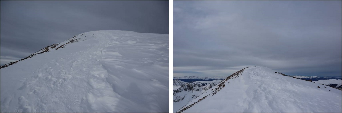
This time I decided not to stop at all, and guess what? I had my fastest summit of Quandary Peak! There were tons of dogs on the trail today, and I even saw a group of skiers with guides. Here’s the summit
It was very, very cold today. It didn’t get above 18 degrees (that’s what the temperature was when I got back to my truck). There was a slight layer of frost on everything
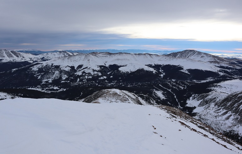
Looking west
Heading back down I came across some BASE jumpers who were intending to jump from the summit. I didn’t think it was windy enough today. In fact, it was a perfect, bluebird day to go hiking!
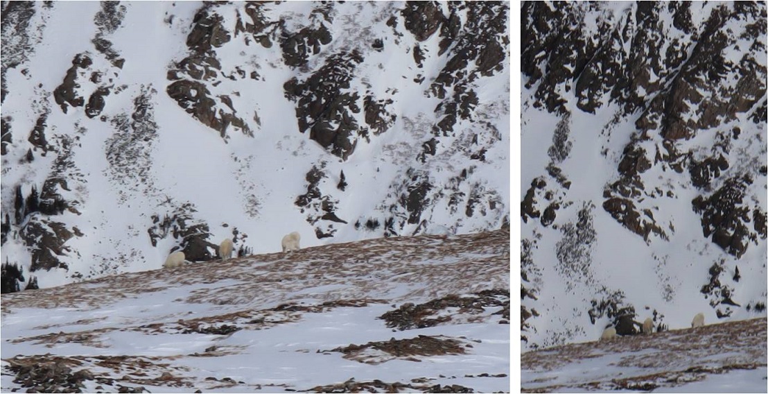
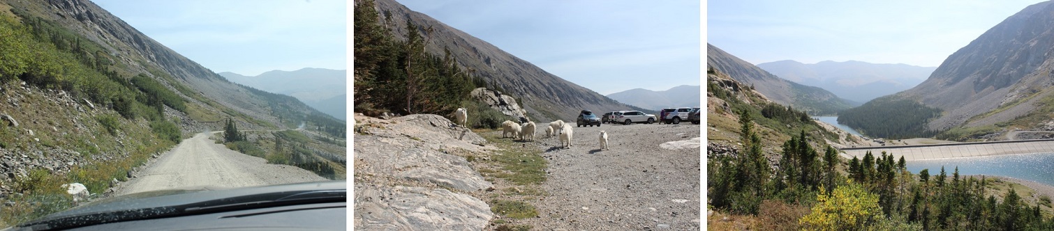
I saw Mountain Goats on the way down, but they were kind of far away
Here’s a topo map of the route. I made it back to my truck at 11:45am, making this a 4 hour hike: 7.22 miles with 3444’ of elevation gain
The Quandary Peak Summit Sticker can be found here
This is the third time I’ve summited Quandary, and the second in winter, so I won’t give a full report. A full winter report can be found here.
Here are a few highlights from the day:
RT Length: 7 miles
Elevation Gain: 3435’
Time: 5 hours
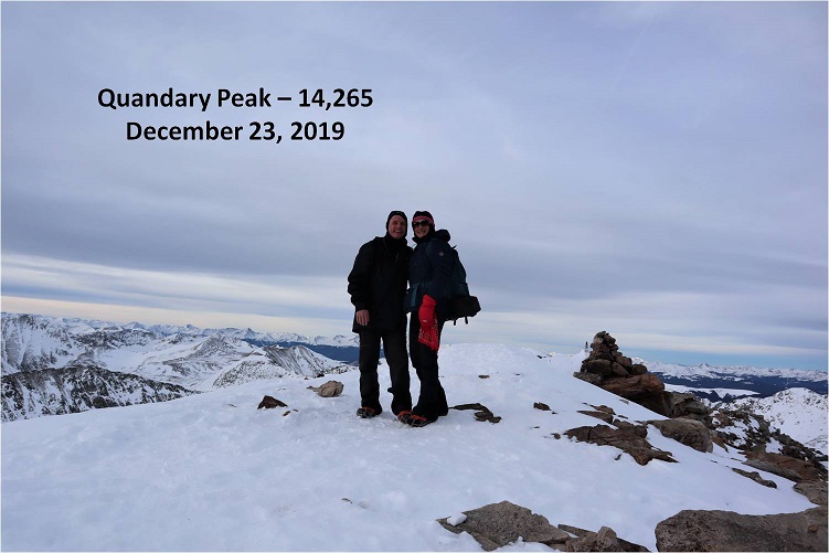
Partner: Steffen
We arrived at the trailhead at 5am to a few other vehicles in the lot. This is pretty normal for Quandary Peak. One of the vehicles had their dome light on, with no one in the car. We tried to open the door to turn off the light but it was locked. Hopefully their vehicle would start when they got back.
We carried our snowshoes the entire way but didn’t need them. Microspikes were very, very helpful. The trail was well packed down from the trailhead all the way to treeline, but sugary and deep off trail.
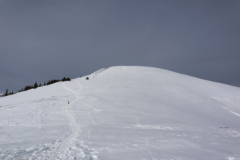
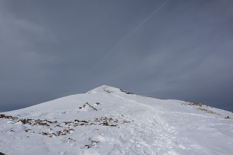
We hiked at a steady pace, taking breaks as needed. This was Steffen’s first 14er (and a winter one at that!) so I didn’t want to push him too far. He did great! Here’s the path to the summit from treeline
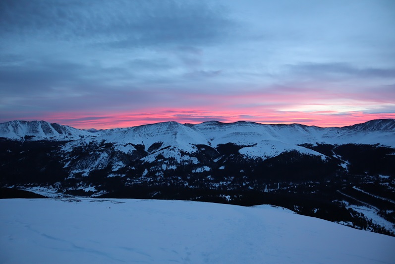
Right about now the sun was beginning to rise. It stayed behind the clouds for most of the day but made for a nice sunrise photo
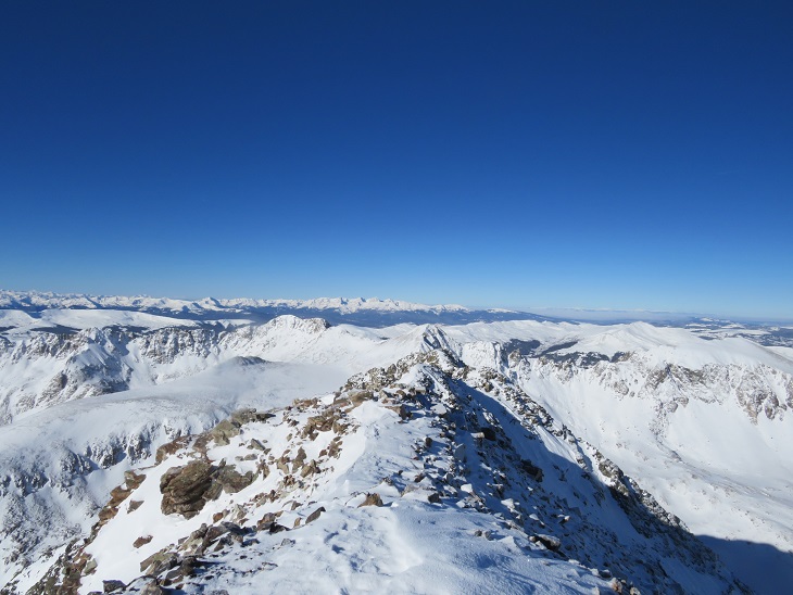
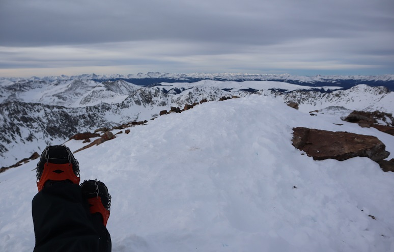
This is a simple ridge to summit hike. I was surprised at how little wind we encountered today!
Here’s the final push to the summit. This is where we came across the owner of the vehicle who’d left their lights on. He was a bit sheepish when he realized what he’d done, and picked up his pace on the way down. We offered to jump his vehicle when we made it down if it wouldn’t start for him. I started picking up the pace a bit here as well, hopping as I went and hiking backwards to make talking easier and to keep me going when things slowed down.
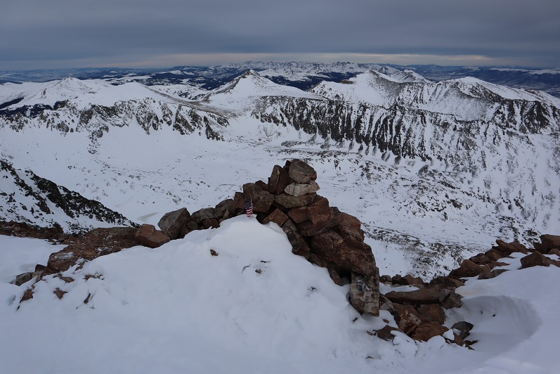
Summit Views: I love the little American Flag at the top (and wonder how it stayed with all that wind?)
Summit Photo:
Time to head back down the ridge
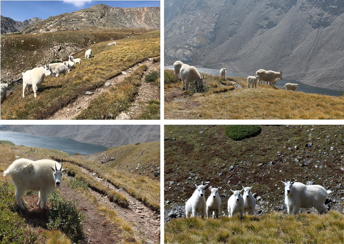
We saw mountain goats on our way down, but had a hard time getting a good photo. Mountain goats are frequently seen here. In fact, I’ve seen them every time I’ve hiked this peak.
We had a good view in the daylight of the recent avalanche area. The slope is only 31 degrees for a very short while, yet it slid yesterday. Luckily it wasn’t near the trail, but skiers/snowboarders would want to be careful not to ski this area during high avy days
The snow off the trail was really soft so Steffen decided to make a snow angel.
We made it back down to the trailhead and the guy who’d left his lights on was no longer there, so I guess his battery worked. All in all a great day above treeline! Congratulations Steffen on your first 14er!
The Quandary Peak Summit Sticker can be found here
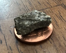
I was a bit worried about today’s hike. After hiking Stewart Peak with frozen feet last Tuesday I found this rock in my right hiking boot.
I’m not sure how long during the hike it had been there, but it had apparently rested under the ball of my right toe for quite some time. I know this because for the past 2-3 days I’ve had a hard time walking without pain. My foot wasn’t red or swollen, but I couldn’t walk on it normally, and it hurt to massage it. I researched my symptoms, and Google told me I did something to the joint. Ironically the way to treat it was to either exercise it, rest it, or take Ibuprofen. I don’t rest and I don’t take medication if I can avoid it, so I decided to get some exercise (but not too much).
So for today I picked a moderate class 3 hike that was supposed to be about 6 miles in length with around 3000’ of elevation gain in a heavily trafficked area so if something went wrong I’d have a better chance of finding help.
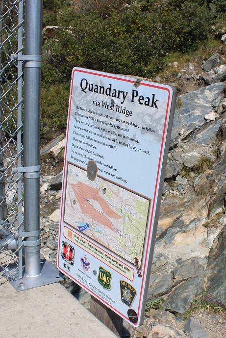
I woke up at 2am (woohoo! It’s like I slept in!) and made it to the trailhead at 5am. There was one other car in the parking lot but as I was getting ready someone pulled up and asked me if we were at the Quandary Trailhead. Technically we were, but it’s the trailhead for the more dangerous West Ridge route, and I figured by looking at them they were looking for the East Ridge Route, so I gave them directions back to the lower trailhead. For so many reasons sorry not sorry if I’d been wrong.
Here’s a view of the 2WD dirt road in and the parking area
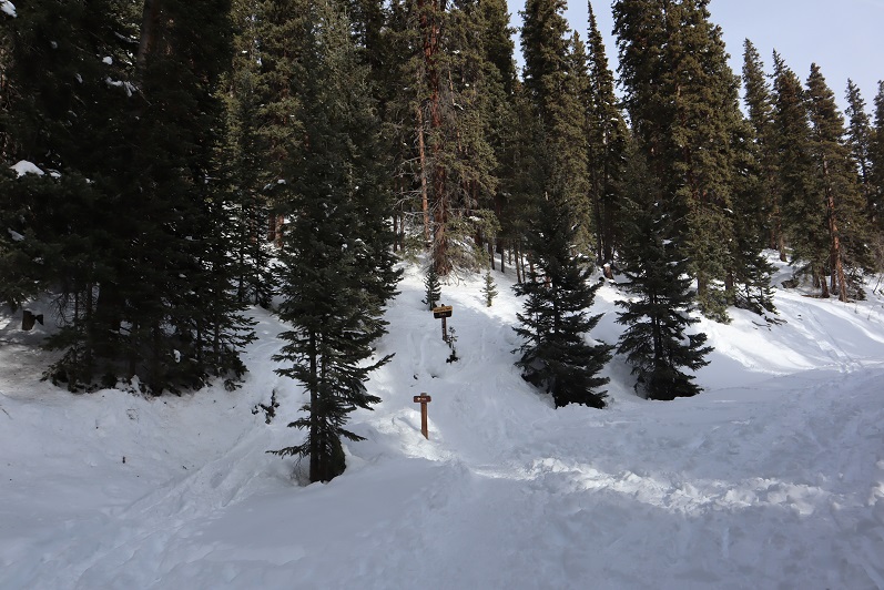
It was dark when I started out. I crossed my fingers and started my new tracker, walked to the right to the hill where the gate and dam meet and noticed this sign:
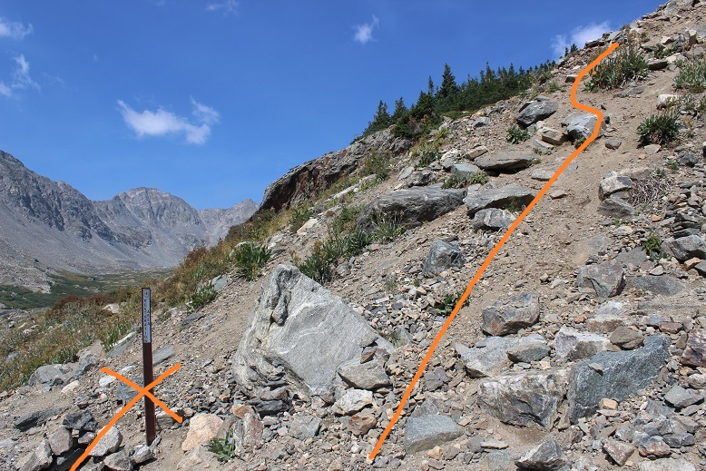
There’s a trail here that follows the lake. I took it for longer than I should’ve and quickly noticed my mistake: I was too far south. In the dark where I was supposed to turn didn’t look safe so I’d continued along the lake looking for another trail that headed up. Luckily there were several social trails that headed north towards the correct trail. I found one that was most likely more difficult than the first and was soon back on route. Here’s where you’re supposed to turn right and climb the hill.
Here’s where I joined the trail
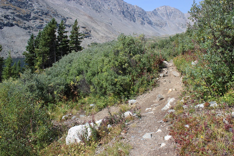
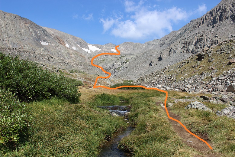
The trail up through the basin is easy to follow (even in the dark). The trail gained elevation very gradually and my right foot throbbed with every step.
Here’s the route I took through the basin and up over to 12,500’
Once the trail ends it’s heavily cairned and easy to follow, even in the dark. I wasn’t able to see the red gully, but it was still the obvious trail to follow. As I gained in elevation and the route became steeper my foot curiously stopped hurting.
After the red gully there were large boulders and rocks to hike around, with lots of carins to help out with route finding.
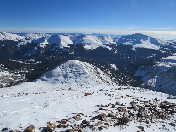
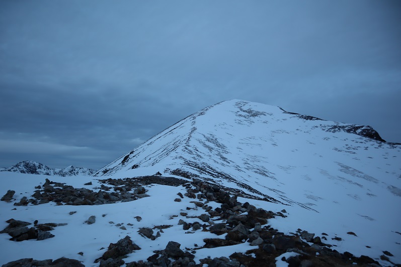
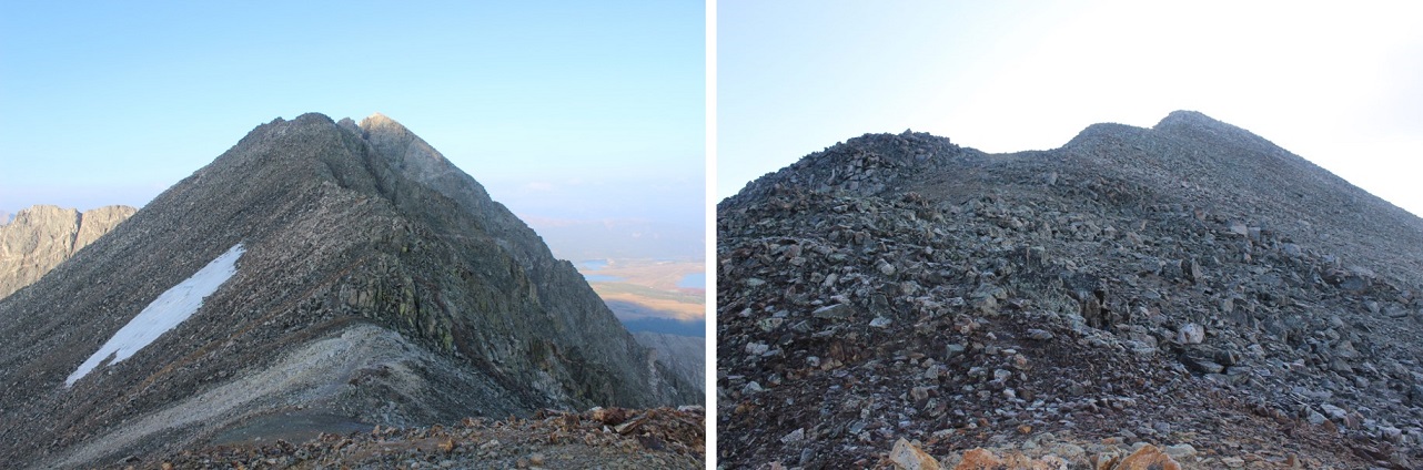
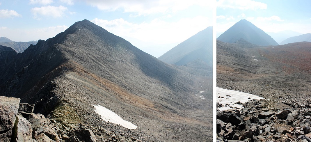
When I reached the top of the basin I turned around. Quandary’s west ridge looked amazing in the morning light!
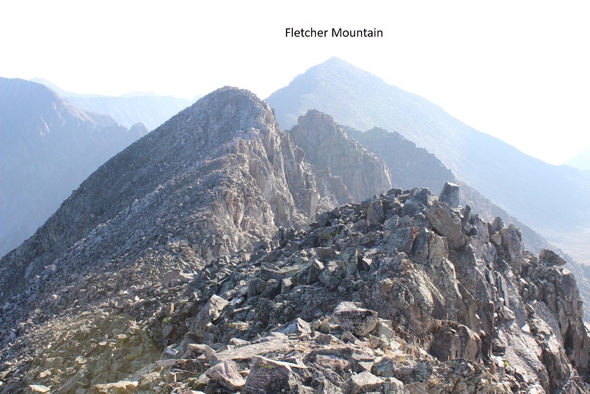
Ahead of me I could see Fletcher Mountain
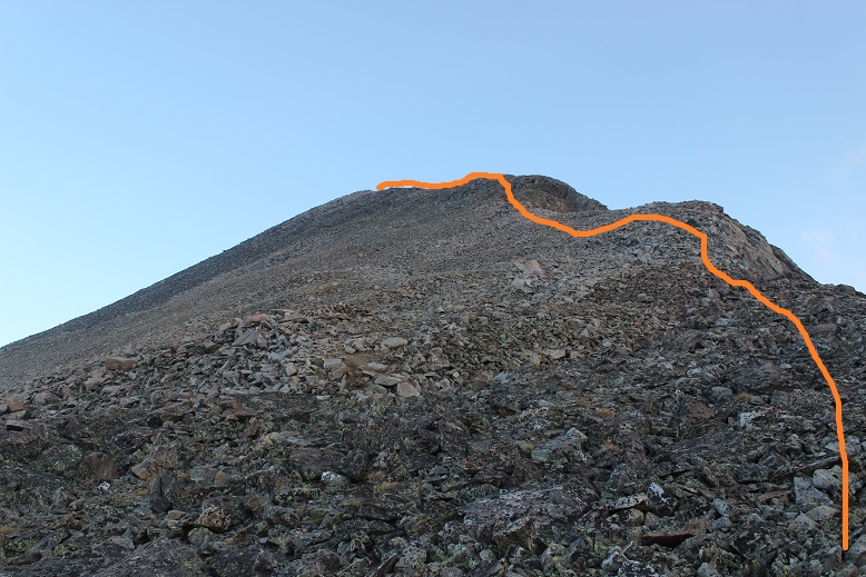
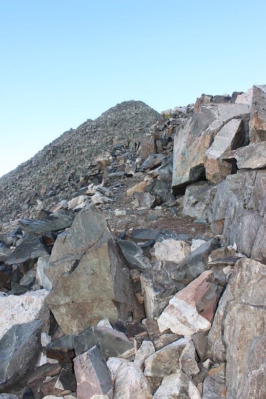
There was no trail, but the route to the summit was obvious. Here’s the route I took
You want to stick to the left of the ridge because there are steep drop offs to the right. The rocks aren’t stable but they won’t fall on you either, they’ll just roll. About half way up it started getting tricky: I was curiously slipping with every step! That wasn’t right? I have great shoes that usually grip everything. It seemed there was a thin layer of ice on the rocks I couldn’t see but which made hiking without slipping nearly impossible. Yes, I resorted to a kind of forward crawl where I had at least 3 points of contact the entire time. I probably looked silly with my butt in the air but I wasn’t slipping and falling. And there wasn’t anyone around to see…
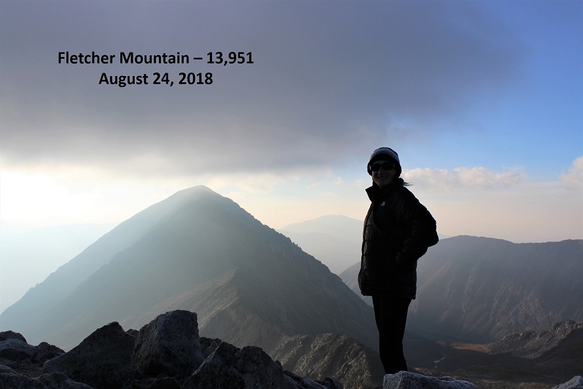
I made it to the summit at 7am and had a great view of Quandary (it looked cold up there!). The wind was intense and made it much colder than it should have been. Here’s my summit photo
And video:
The cloud above Quandary worried me, but the wind was blowing east and I was headed west so I decided to just keep an eye on the weather. Otherwise it was a perfect morning!
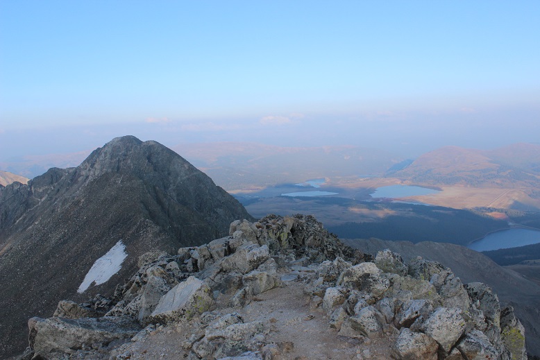
I looked to the southeast at my next goal
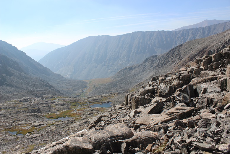
The hike down Fletcher towards the saddle was just as awkward as the hike up (I kind of spider crawled due to the ice) but by the time I’d made it to the saddle the ice was pretty much gone. Here’s the view of Drift (left) and Fletcher (right) from the saddle
This is a great place to put your helmet on (and keep it on until you make it back here). The beginning part of the ridge for Drift wasn’t too difficult. I just gained the ridge and followed it
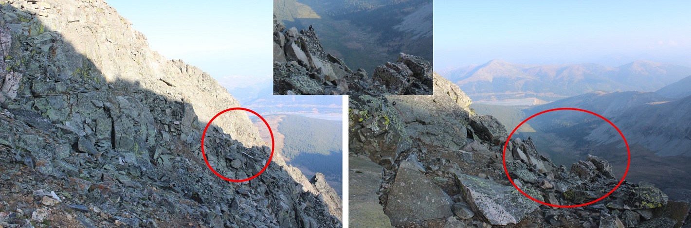
From the picture below you want to stop following the ridge and turn right (north) to bypass the crux of the route (if you continue on the ridge you’ll encounter steep drop-offs and need to turn around)
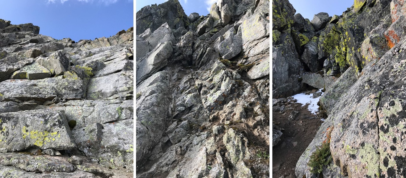
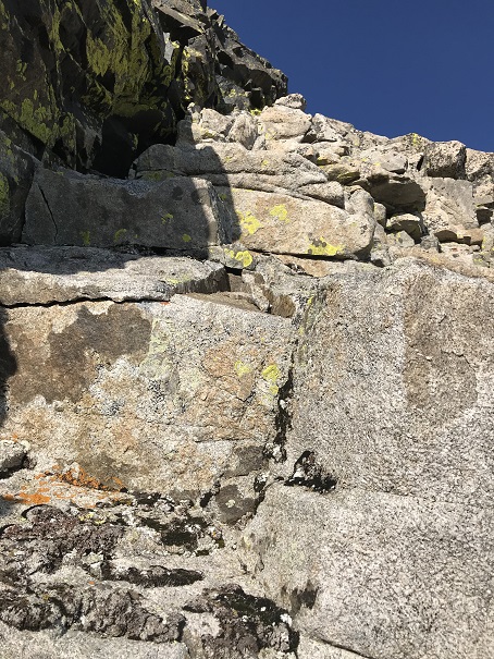
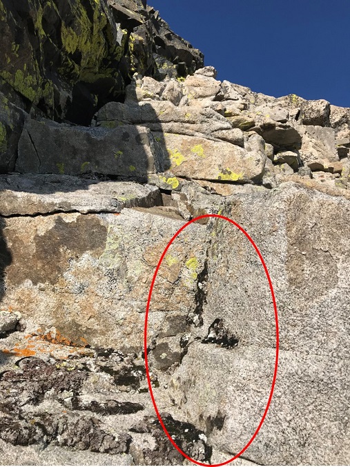
You’re looking for and aiming towards a large round bolt in the route. It’s about 5 inches in diameter, and visible from a good ways away if you know where to look. I’ve circled the bolt in the pictures below
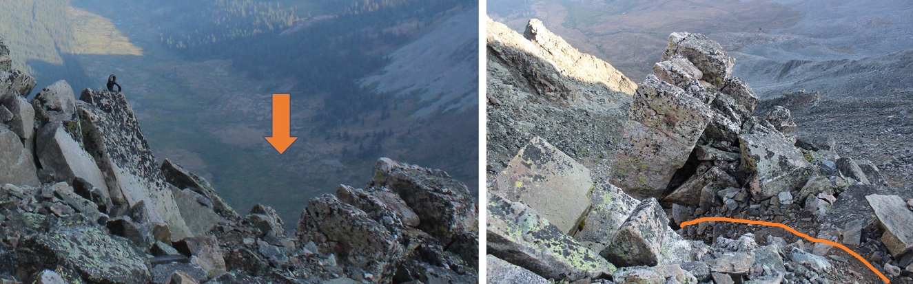
When you make your way to the bolt you’ll see by facing north how to drop into the gully.
This is kind of a chimney, and gets you ready for the more serious climbing ahead
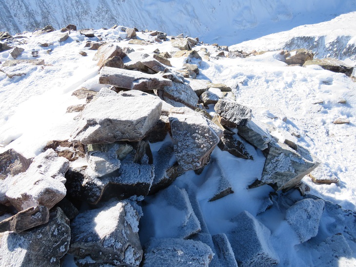
Oh, did I mention the rocks were now icy again? Here’s a better view of the ice
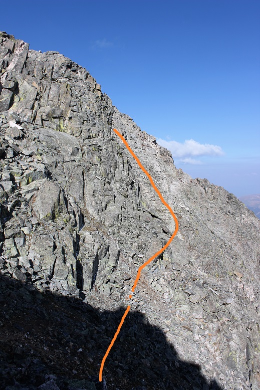
From here I had to re-gain the ridge. I crossed the gully, located the lighter gray colored rocks, and headed up.
There are several routes to regain the ridge but if you stay on the lighter gray rock you should be fine. Did I mention this was steep? Seriously steep and slippery (due to the ice) and definitely Class 3+. Several times I thought how helpful a rope wouldn’t been…
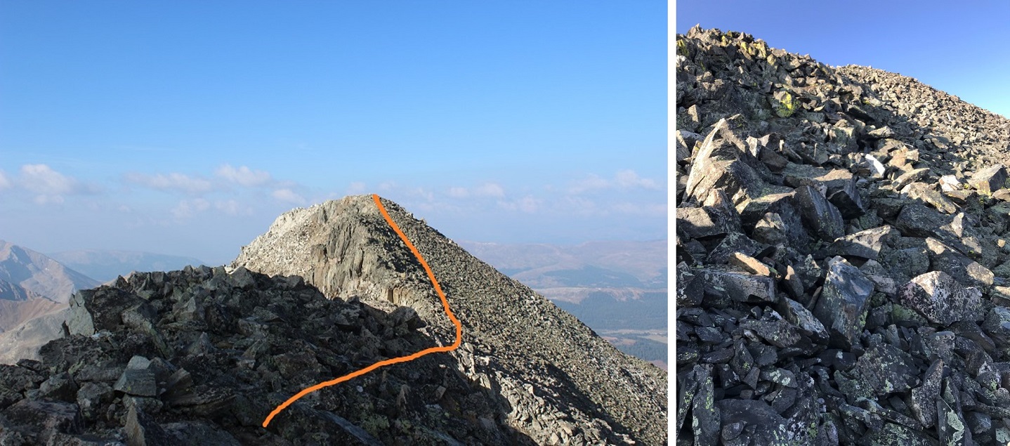
But once I gained the ridge all I had to worry about was ice and wind as I crossed the easy path to the summit. The rocks weren’t stable but they weren’t a problem to navigate. Just be careful for rolled ankles.
Well, easy if the wind wasn’t blustering at 40mph and there wasn’t a thin layer of ice on the rocks. I was very cold and honestly crab-walked over the slippery rocks to the summit, afraid with the wind and ice I’d slip and fall. But I made it! I summited at 8:15am. I couldn’t smile because my lips were frozen… I tried though.
Video:
Here’s a look back at the ridge
I was cold and my fingers were starting to freeze so I didn’t stay on the summit long. I knew I’d need some dexterity in my fingers to make it back down the light gray rocks. I followed the easy ridge back and braced myself to downclimb back into the gully. The first few sections were fun and I was easily able to navigate the large boulders. Until I reached this point
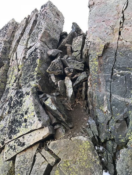
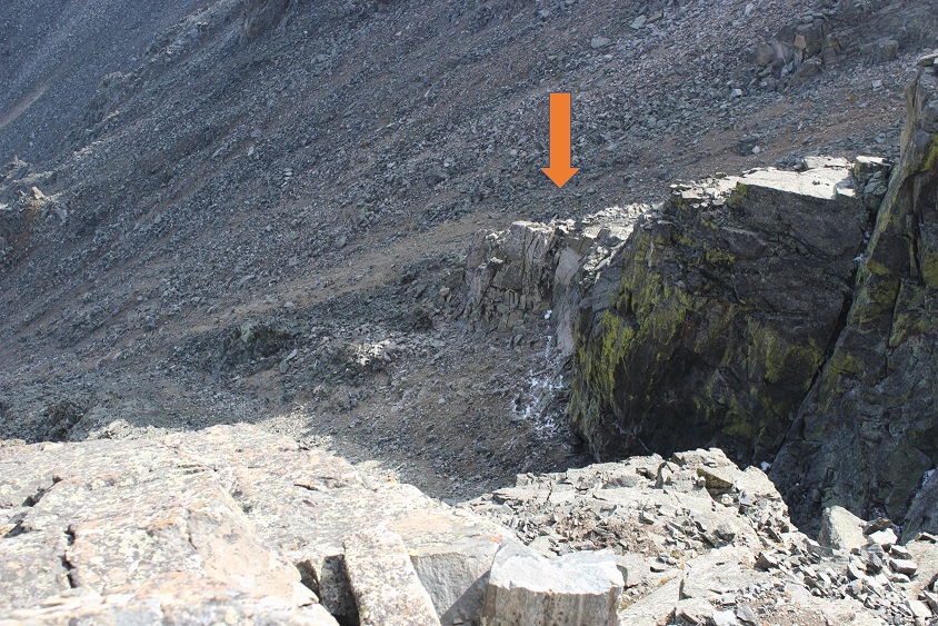
This is where I fell. Well, I didn’t actually fall, more like slid for about 4 feet (scarier when it’s actually happening than it sounds reading about it). You see, everything was once again covered in a thin layer of ice, and there were no foot/hand holds available. None. I know, I was looking. I was in a spot that (due to the ice) offered very little in the way of help for the situation I was in. There were a few patches of moss that I tried to use, but naturally they weren’t stable and quickly crumbled out from under my shoes. And that ice didn’t help at all! I knew I was going to slip and slide eventually, so I tried to minimize the acceleration as much as possible before and as it happened by hugging the rocks and leaning forward. When I slid I was able to stop myself on a ledge about 3 inches wide and 6 inches long, stabilize myself, take a deep breath, and continue downclimbing. I’d bruised my right shin (just a little scrape with minor bleeding) and I had a hole in my pants at my shin, but I was proud of myself for not turning this into a worse situation. Here’s the section where I slid. From top of the circle to the bottom is about 10 feet.
I couldn’t go to the left or right because it was actually steeper in those sections and led to larger drop-offs. This looked less steep when I was first climbing down, and the moss and lichen looked to be on larger/actual holds, or I wouldn’t have attempted it. In hindsight, before I was downclimbing this area I should have retraced my steps to where I climbed up (as I knew there were adequate hand and footholds in that area).
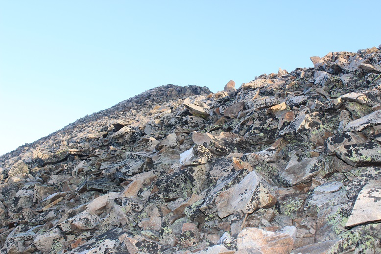
Once I was on more stable ground I took a look around: I needed to find that chimney to head back. Here you can see it from across the gully
I headed towards the chimney, climbed it, turned right and headed back to the ridge, knowing the worst was behind me. I made it back to the saddle and saw no reason to re-summit Fletcher, so I turned right and headed down the middle of the basin towards Quandary.
Once again, no trail, just rocks. Luckily, while the rocks weren’t stable they also weren’t icy. I felt humbled by the enormity of the rock field and my small place in it.
VIDEO:
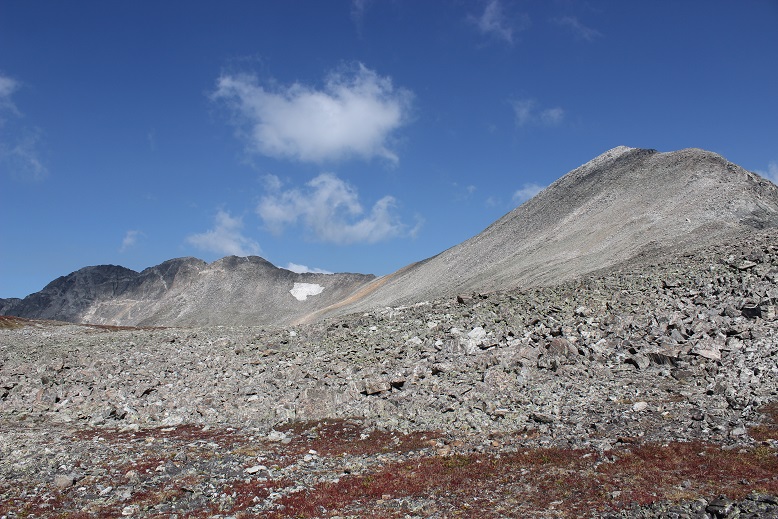
As I descended into the basin the beauty caused me to pause. This is truly a gorgeous area! I’ll be coming back to attempt Quandary’s West Route someday.
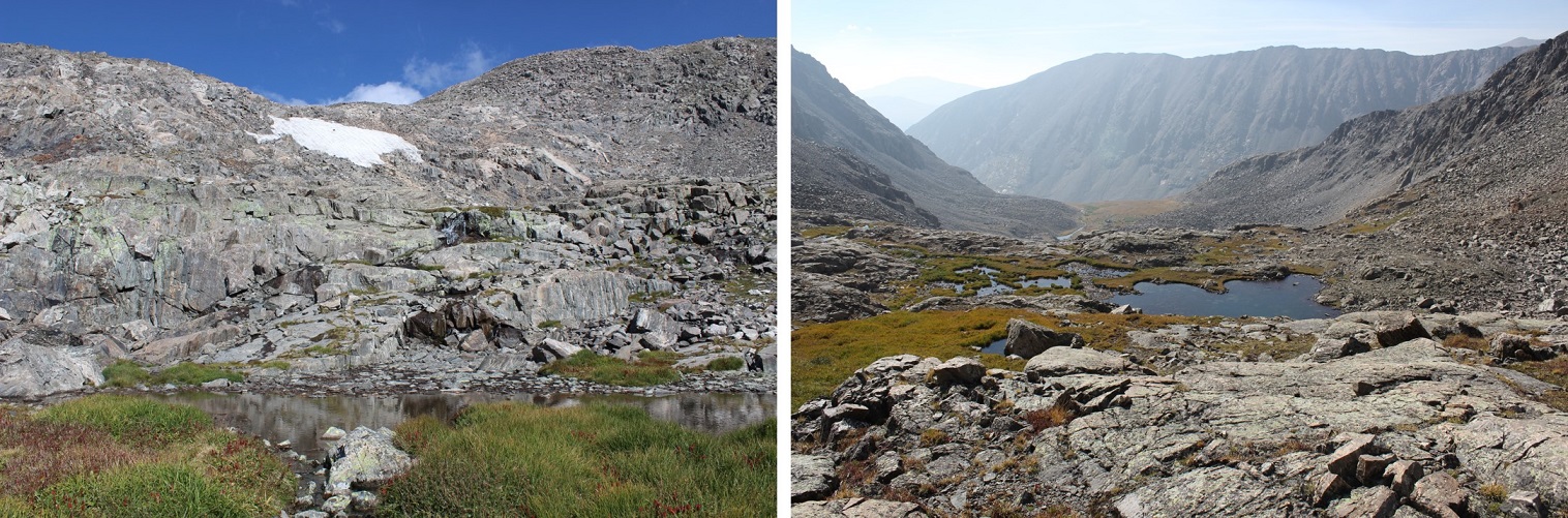
I followed the cairns down and around the several small ponds I’d missed in the dark.
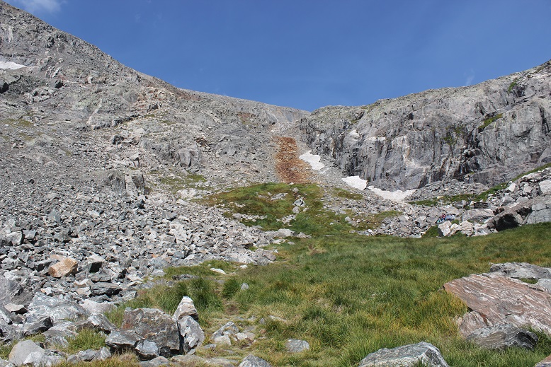
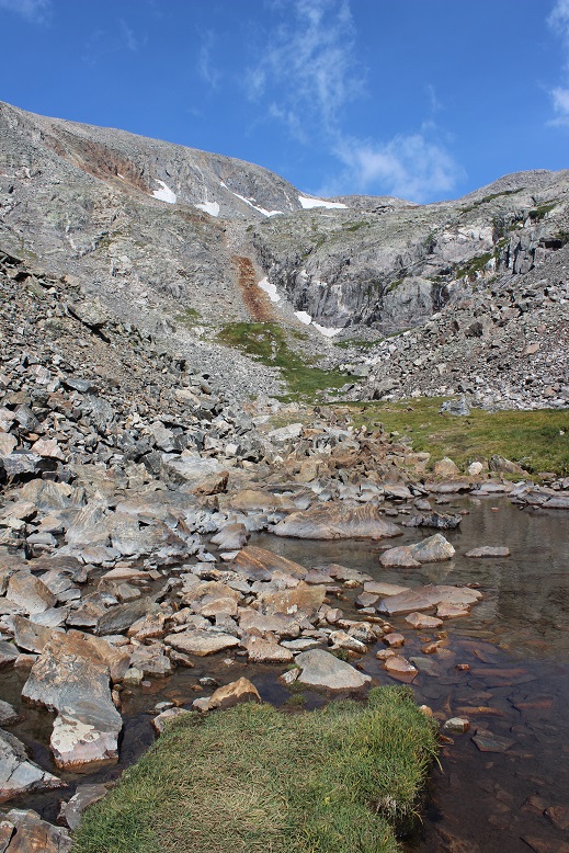
I stayed here much longer than I should have, but it was worth it for the views! The red gully was clearly visible in the daylight
And those ponds and streams are much deeper than they look. For such narrow streams at a high elevation I was surprised they were 4-5 feet deep.
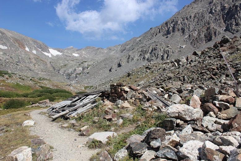
Exiting the basin was an easy walk. At this point I noticed my foot didn’t hurt anymore. I guess exercise was the answer! I passed an old mine
Turned the corner to take one last picture of the basin (I may frame this)
and: Goats! I love running into goats on the trail! This herd had several kids. All adorable
Video:
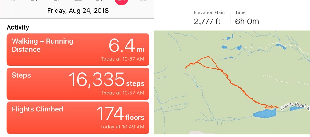
I made it back to my truck at 11am, making this a 6.4 mile hike/climb in 6 hours. Oh, and my tracker had worked! It said I’d climbed 2777’ in elevation, which I thought was pretty close to the 2800’ I’d been expecting. Now I just need to figure out how to save and transfer the GPX file to my computer. I was not happy with my time, but considering I’d crawled for a good portion of it due to ice I wasn’t too upset either. And I’d stayed safe. And I’d seen goats!