13223 and 13144

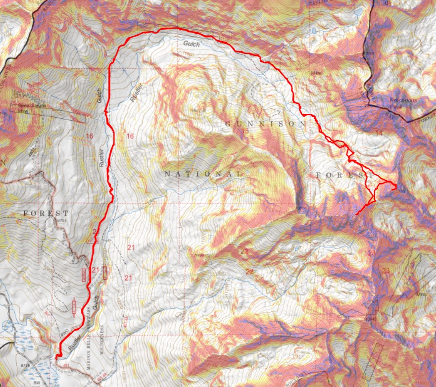
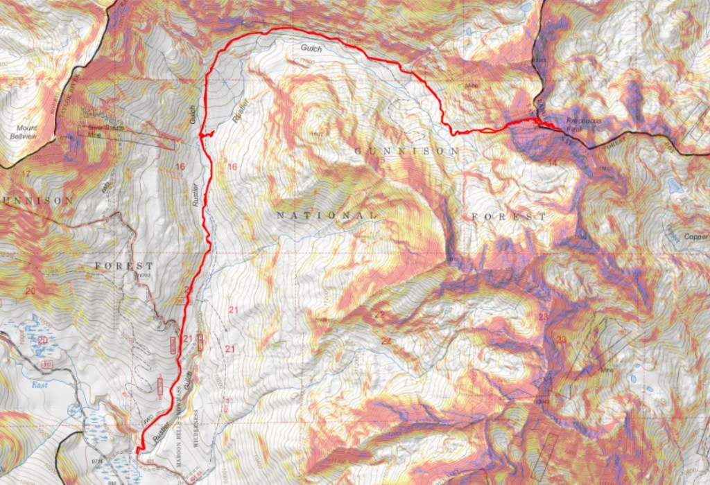
RT Length: 11.58 miles

Elevation Gain: 4141’

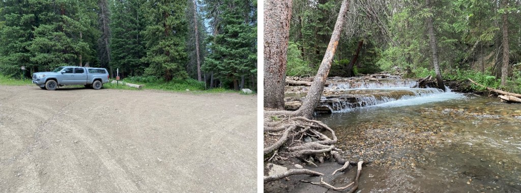
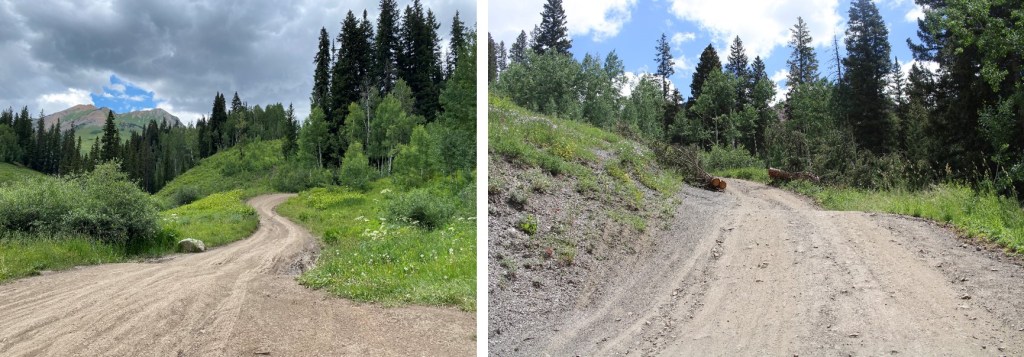
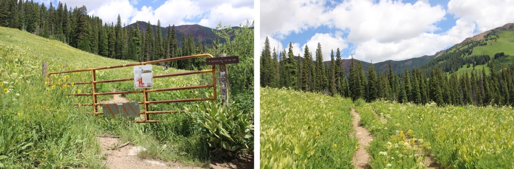
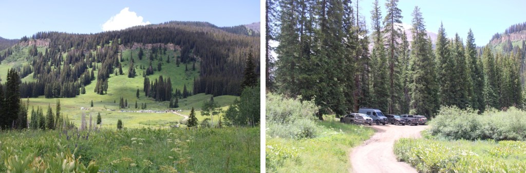
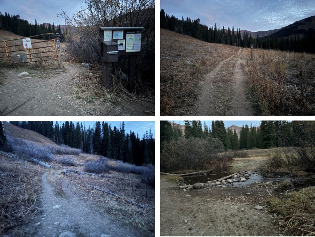
I started this hike at 6:45am from just below Rustler Gulch Trailhead.  Rustler Gulch Trailhead is located off a 4WD road, and while there is a trailhead, there’s really only enough room for one or two small vehicles to park there.  I tried parking my truck near the gate, and it stuck out halfway into the narrow road, so I backtracked and parked a bit earlier along the road. 

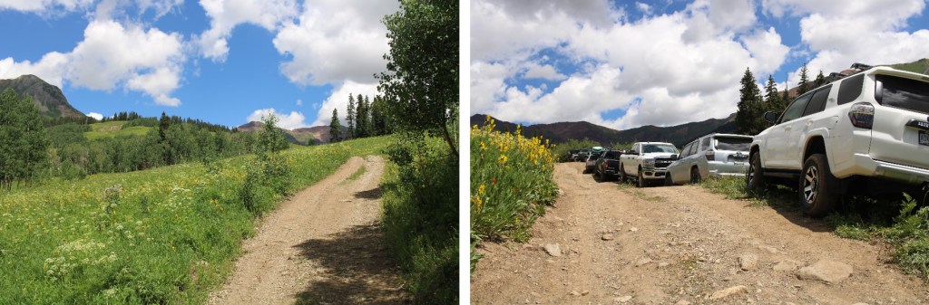
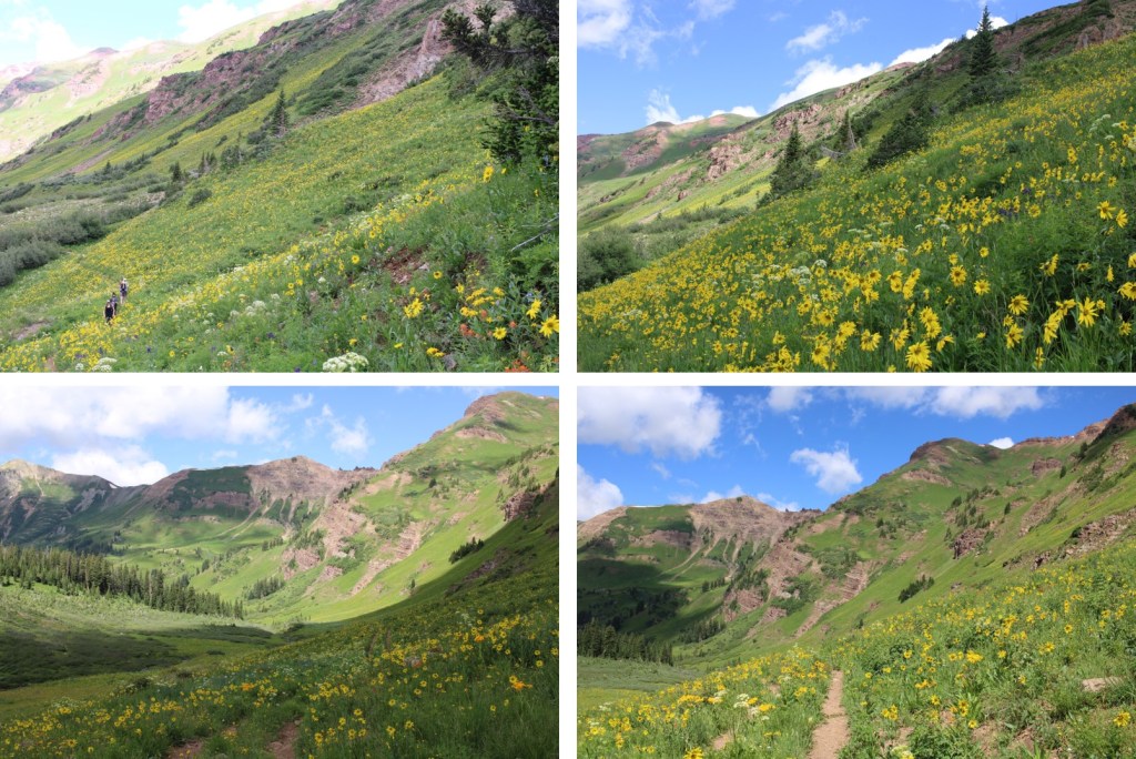
I’ve been to this area in the summer, and while the wildflowers are beautiful, I knew I wanted to do this hike in the fall.  In the summer the entire road to the trailhead is packed with vehicles, there are biting black flies, and I’d be hiking with 2000 other hikers.  Not to mention the flowers: they’re beautiful, but I’d need to navigate my way through them (and the bees) to reach the ridge, which I didn’t want to do. 

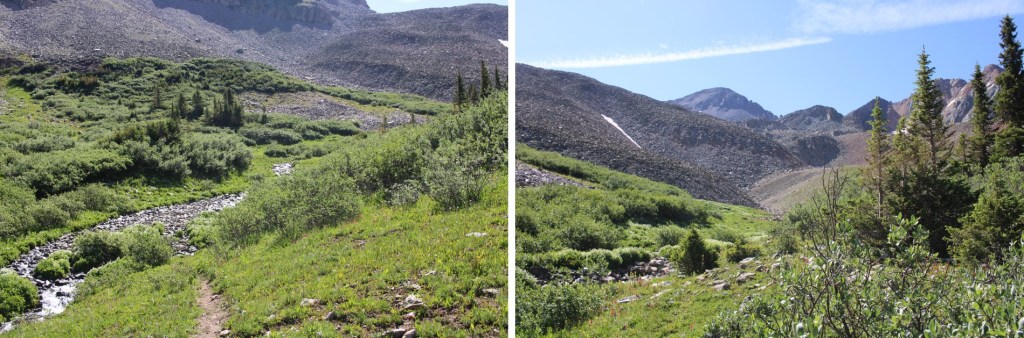
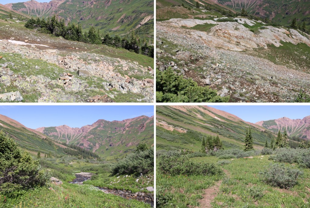
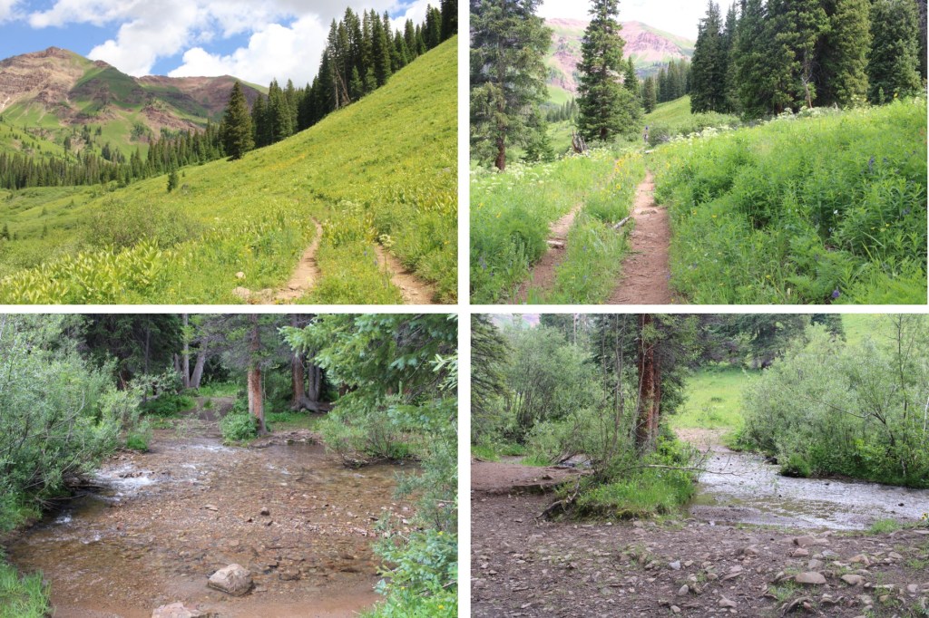
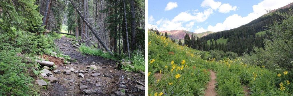
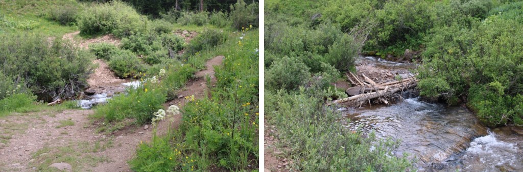
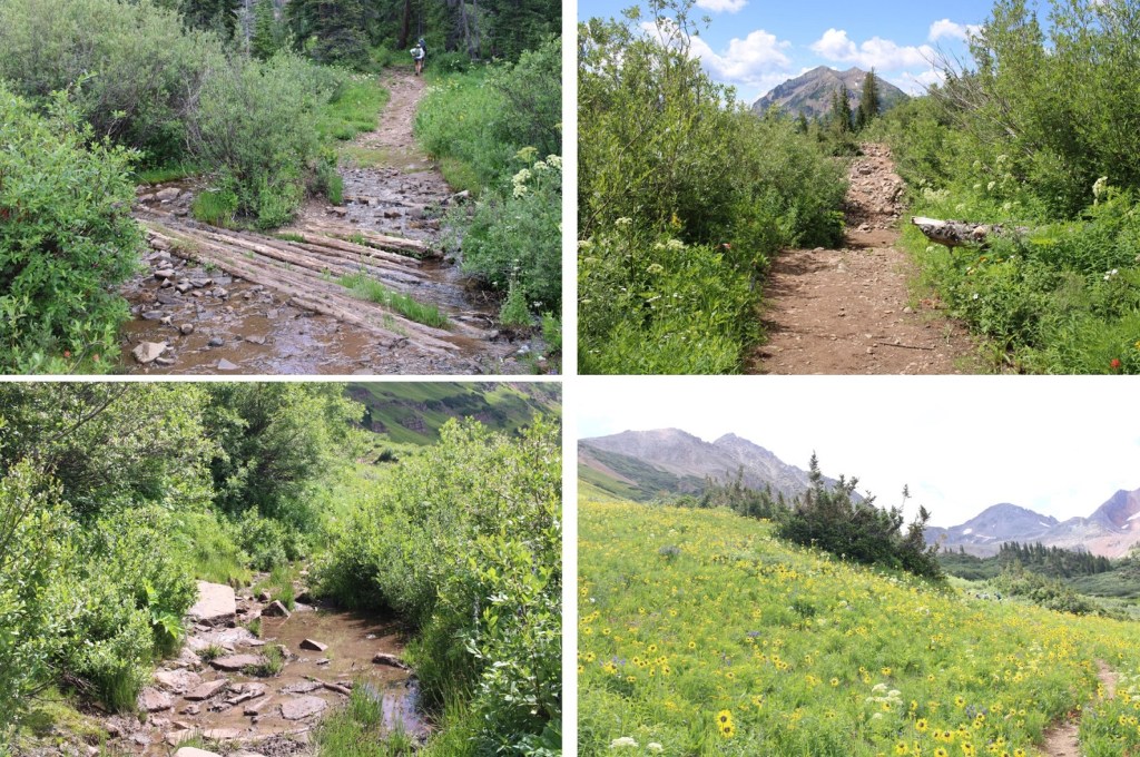
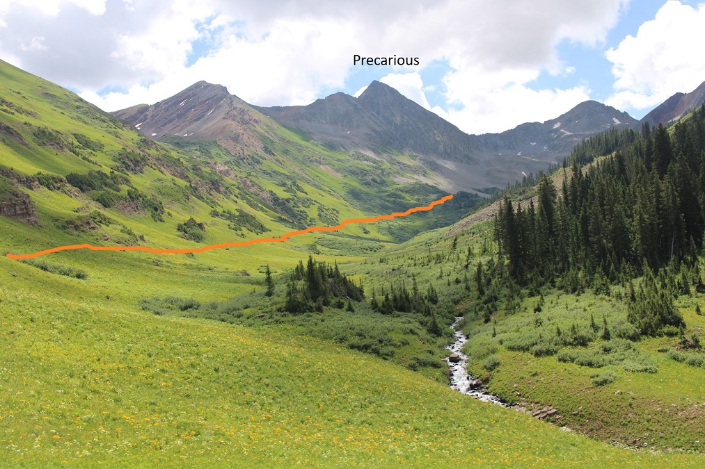
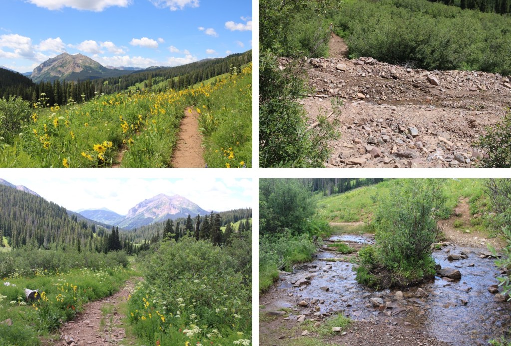
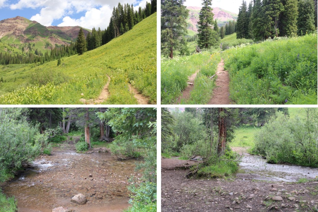
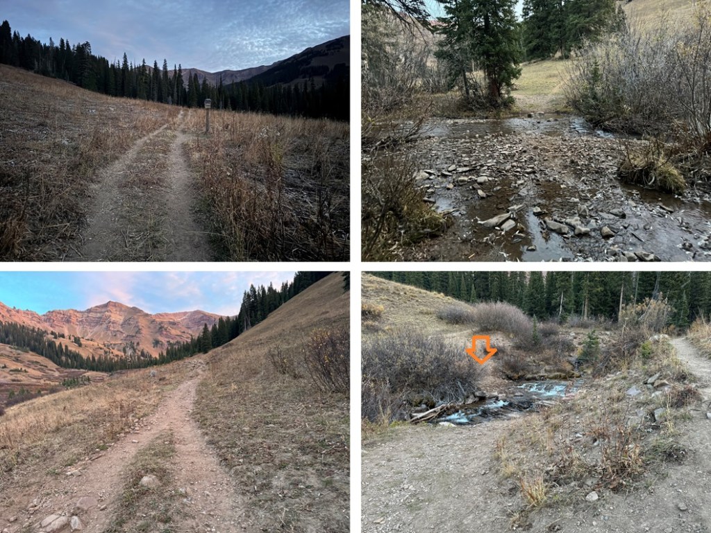
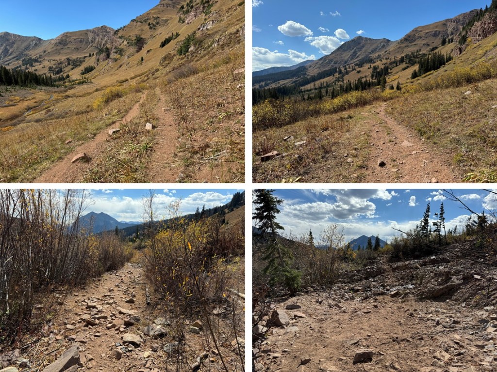
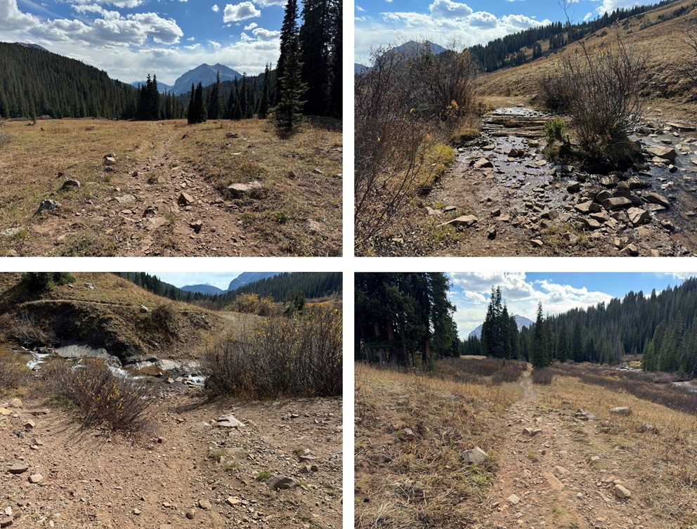
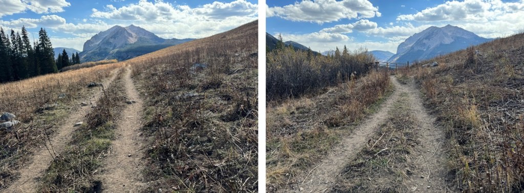
I walked a little bit up the road, and then hiked the Rustler Gulch trail for 3 miles.  This trail is easy to follow, starting out in the trees before crossing several streams and entering the gulch.

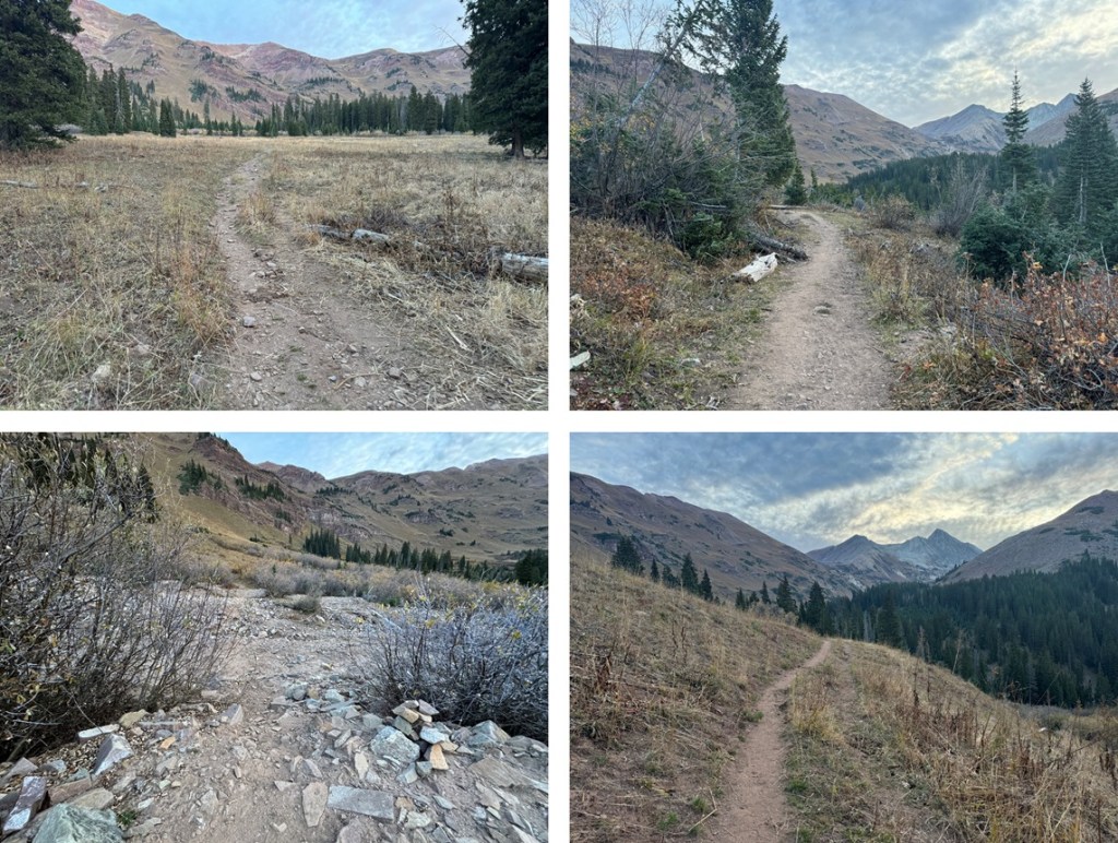
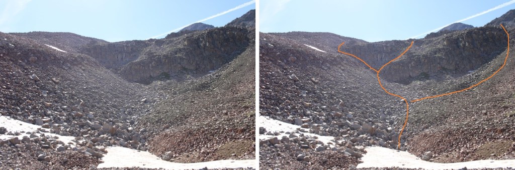
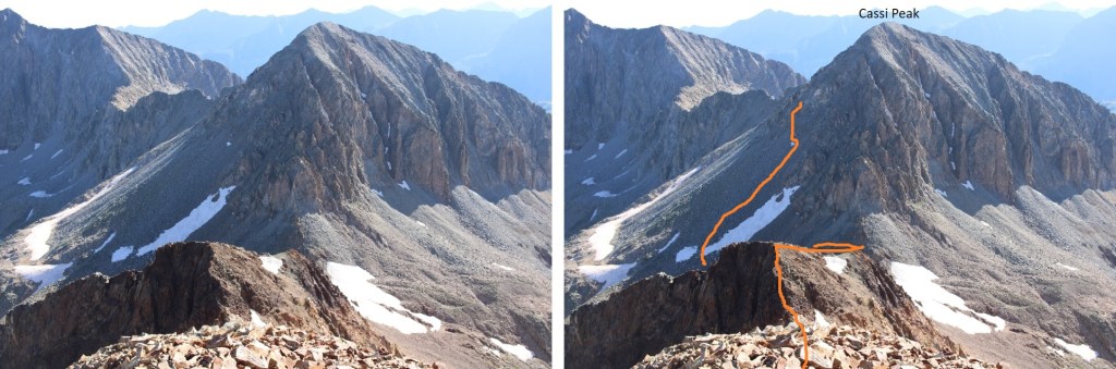
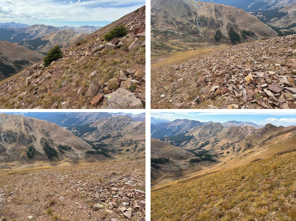
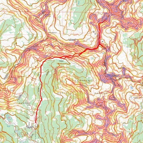
After hiking for about 3 miles, I could see the route I wanted to take to gain the ridge. 

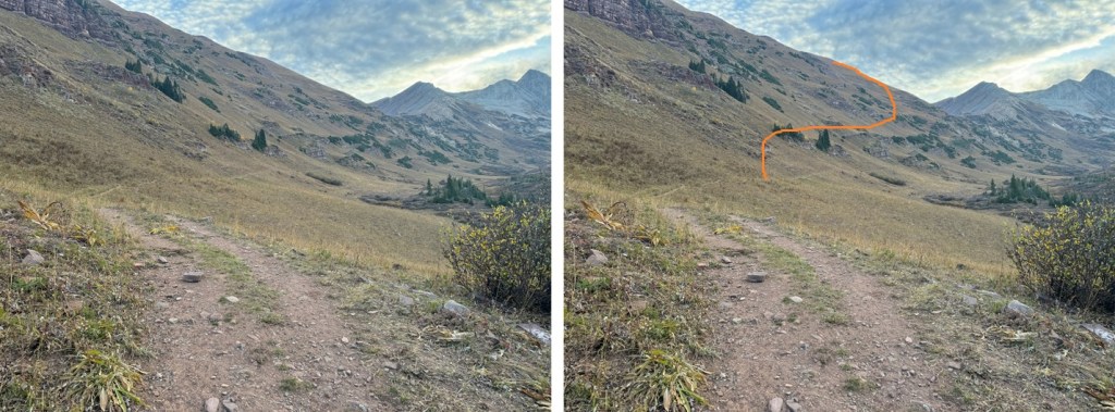
This was fairly easy to do.  I left the trail, and started heading northeast up the tundra slope, avoiding the rock outcroppings and willows along the way.

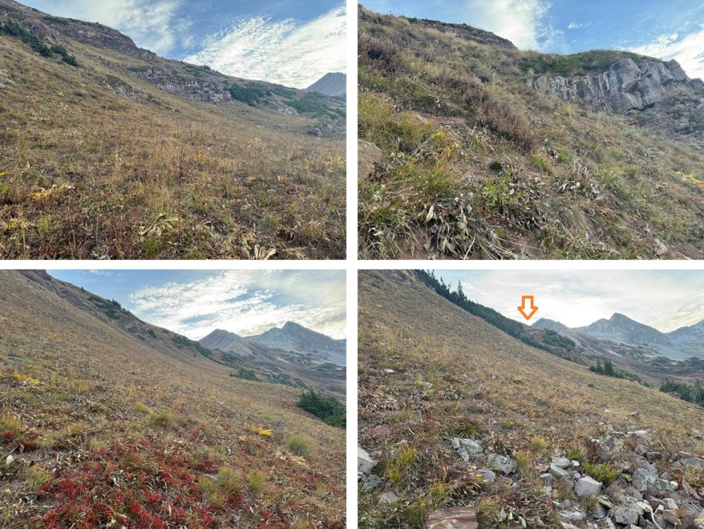
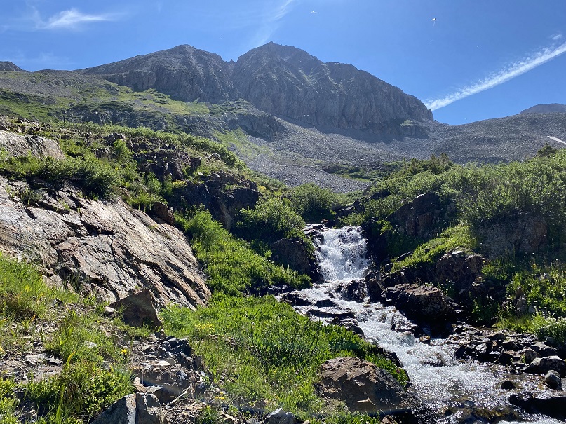
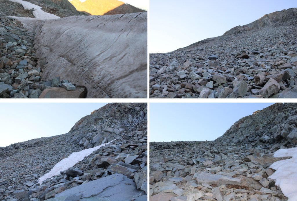
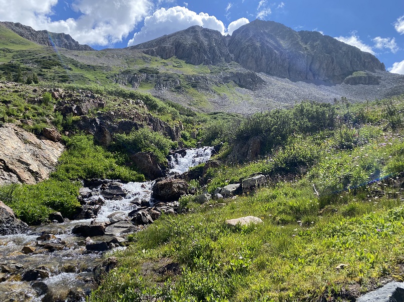
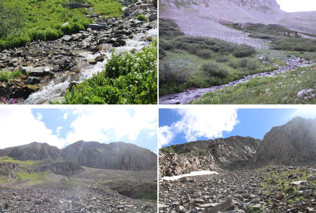
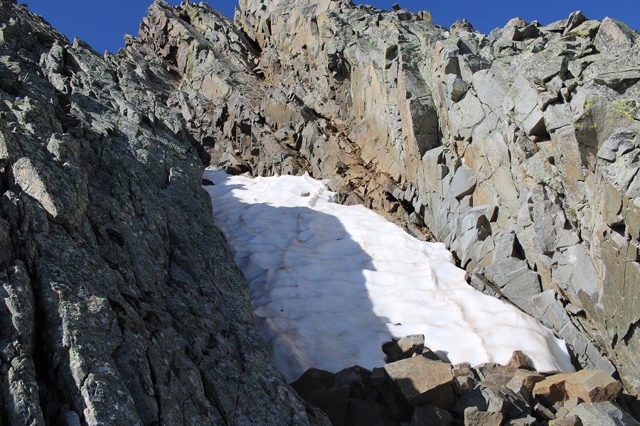
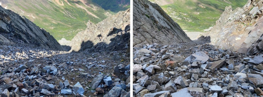
As I continued northeast, aiming for the ridge, the terrain got steeper and it changed from tundra to talus. 

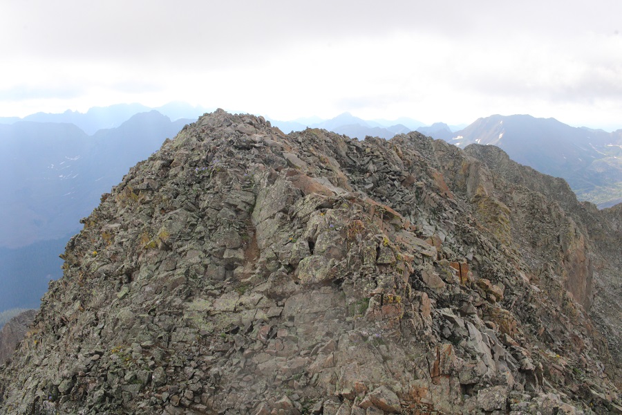
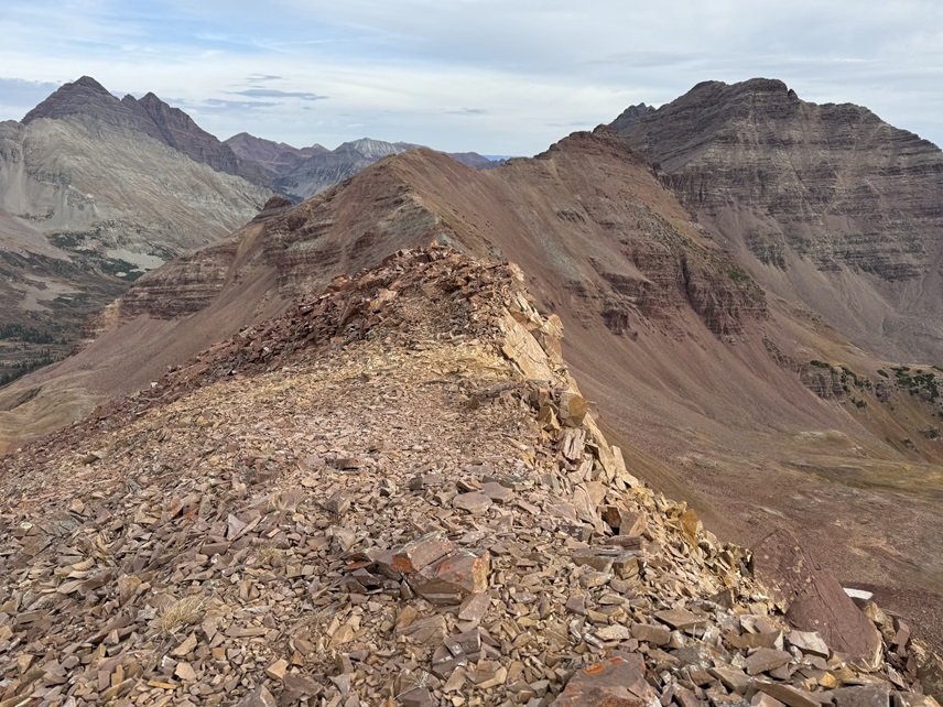
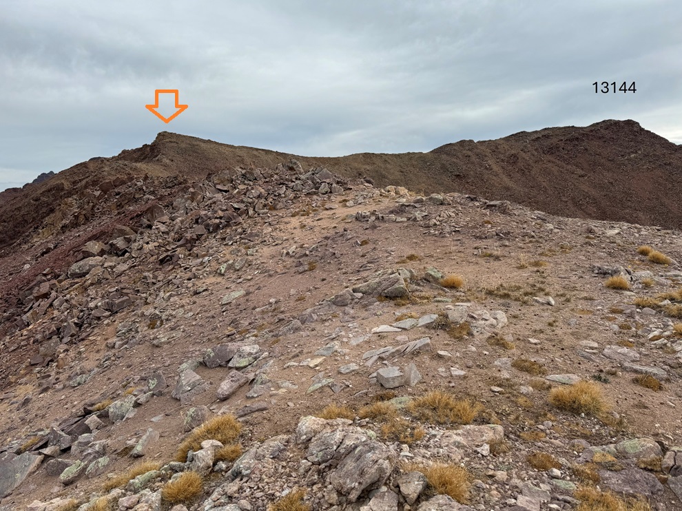
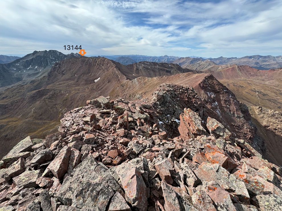
Once on top of the ridge I turned right and followed it east.  I could see 13144 in the distance.

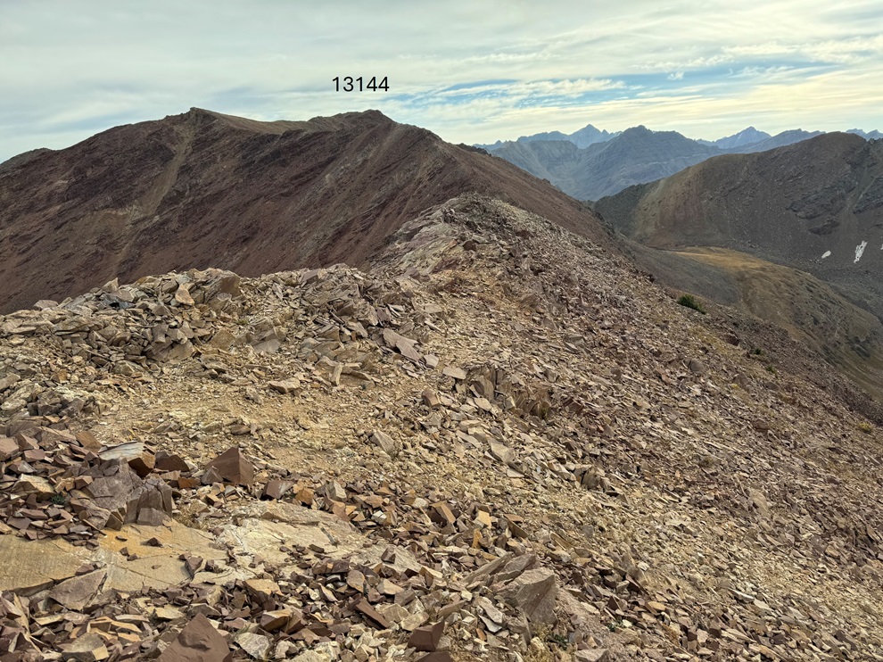
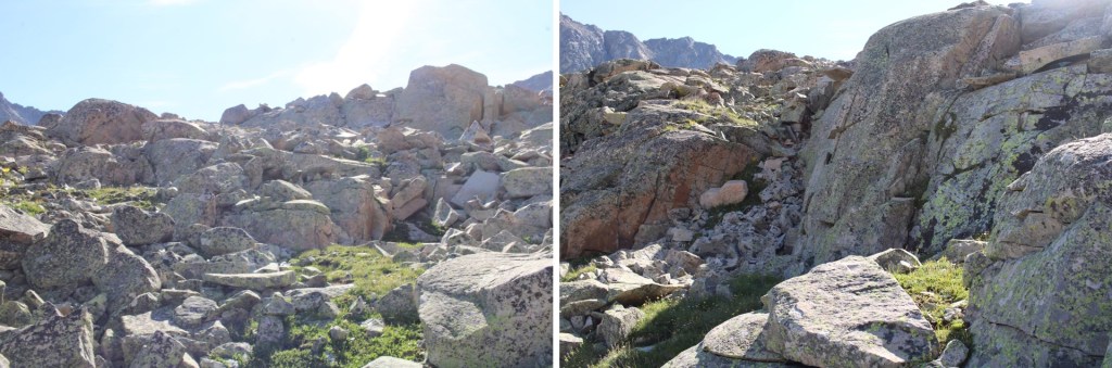
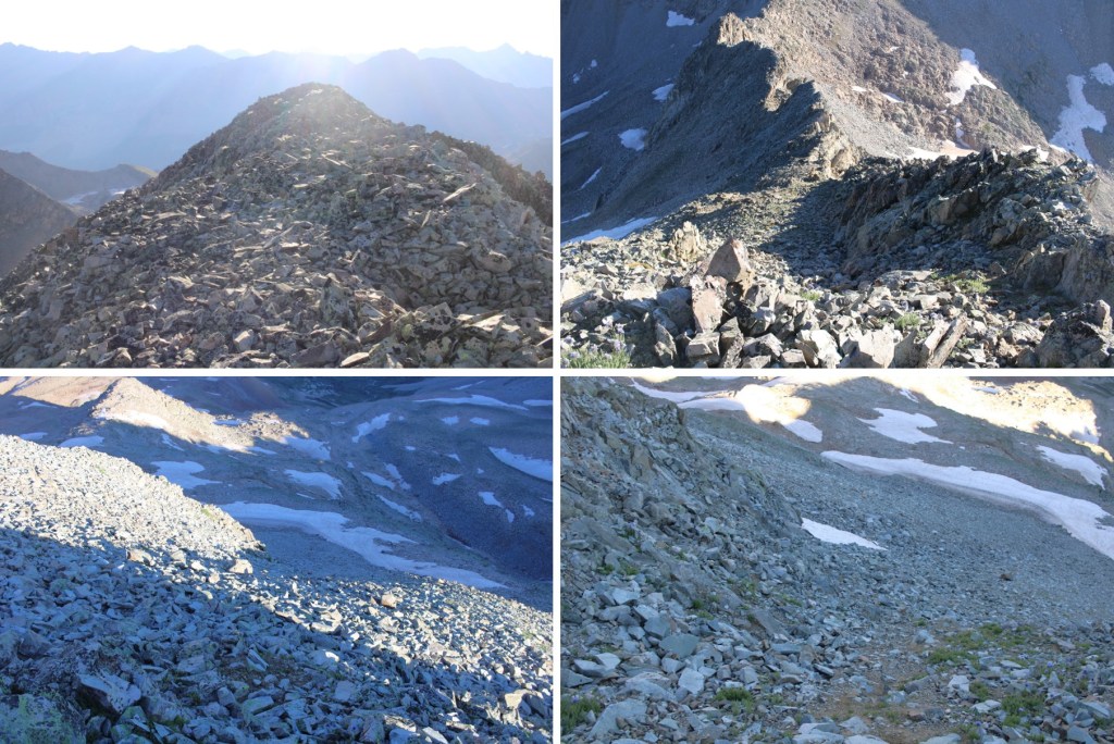
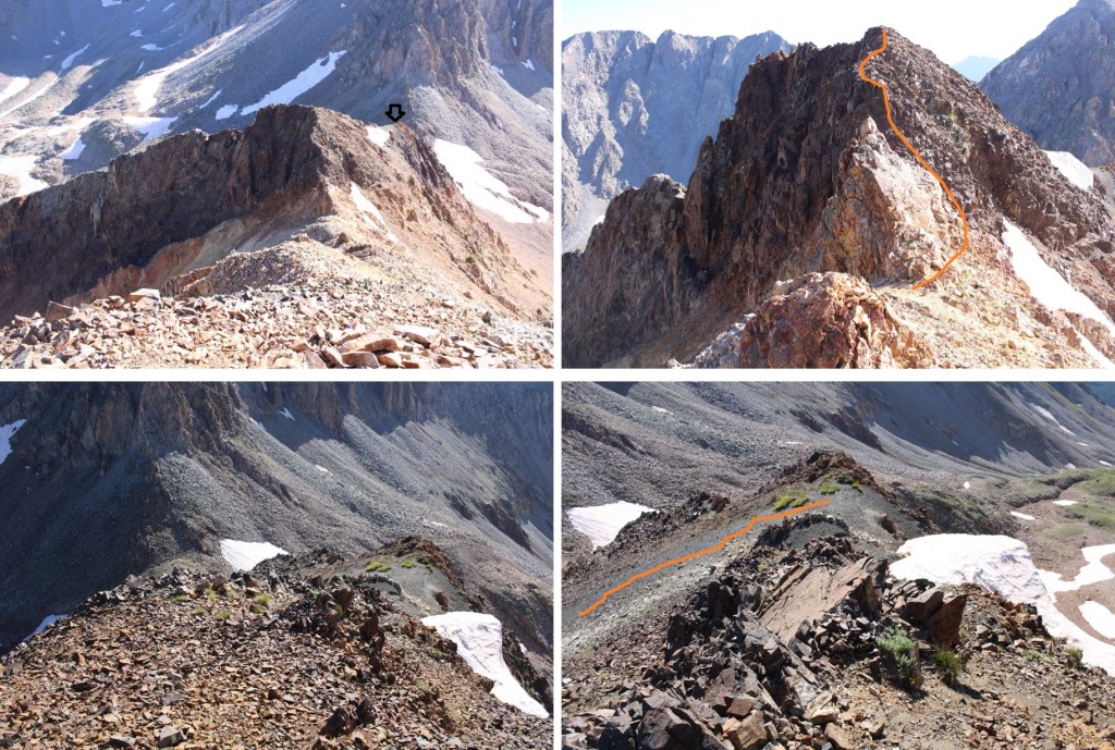
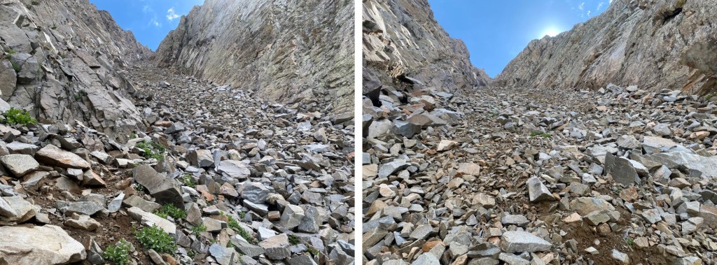
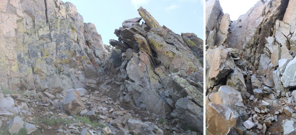
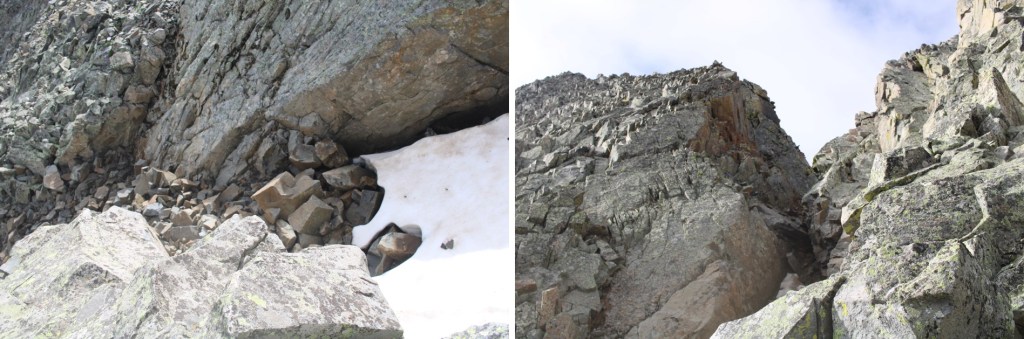
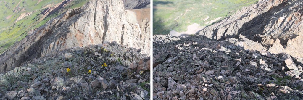
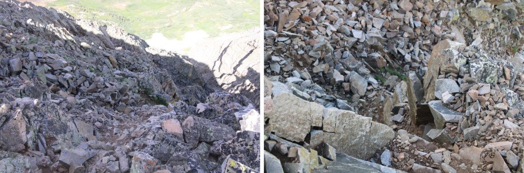
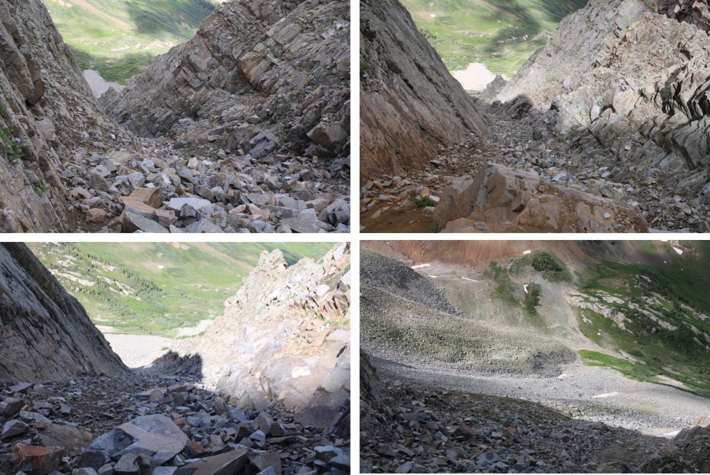
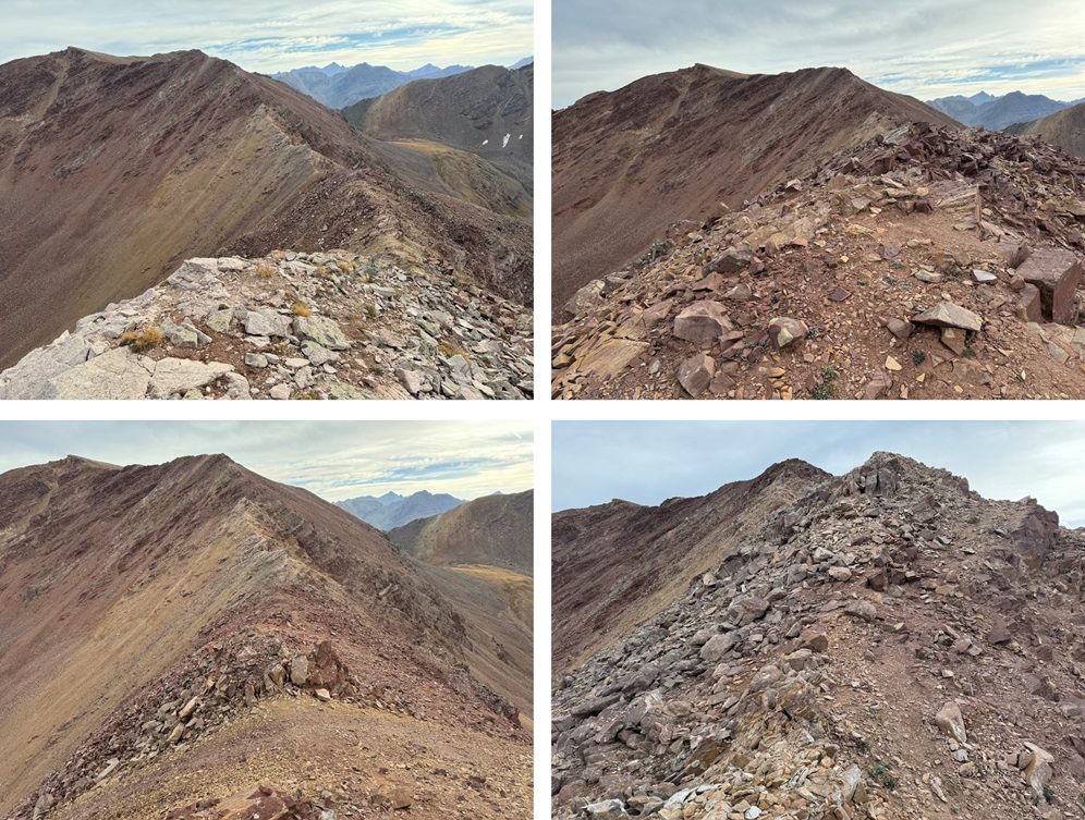
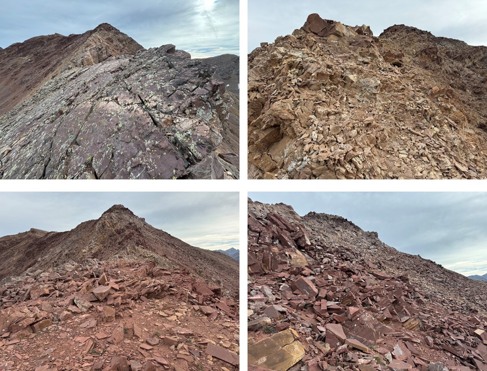
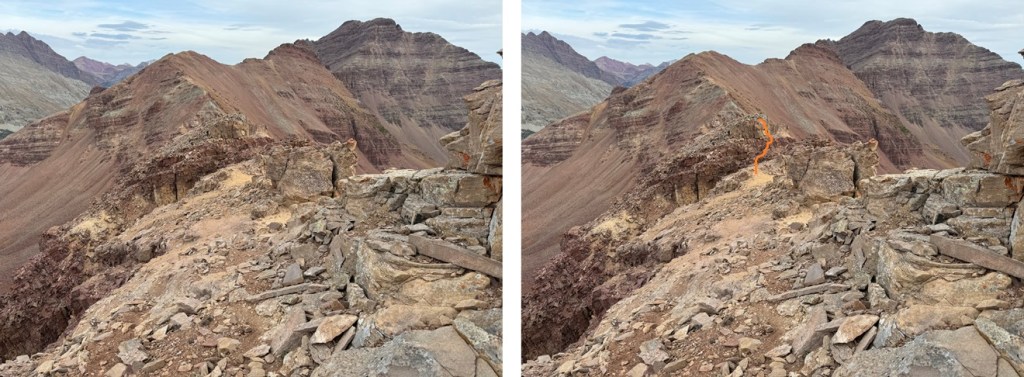
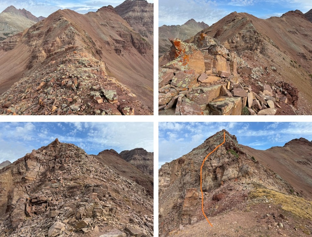
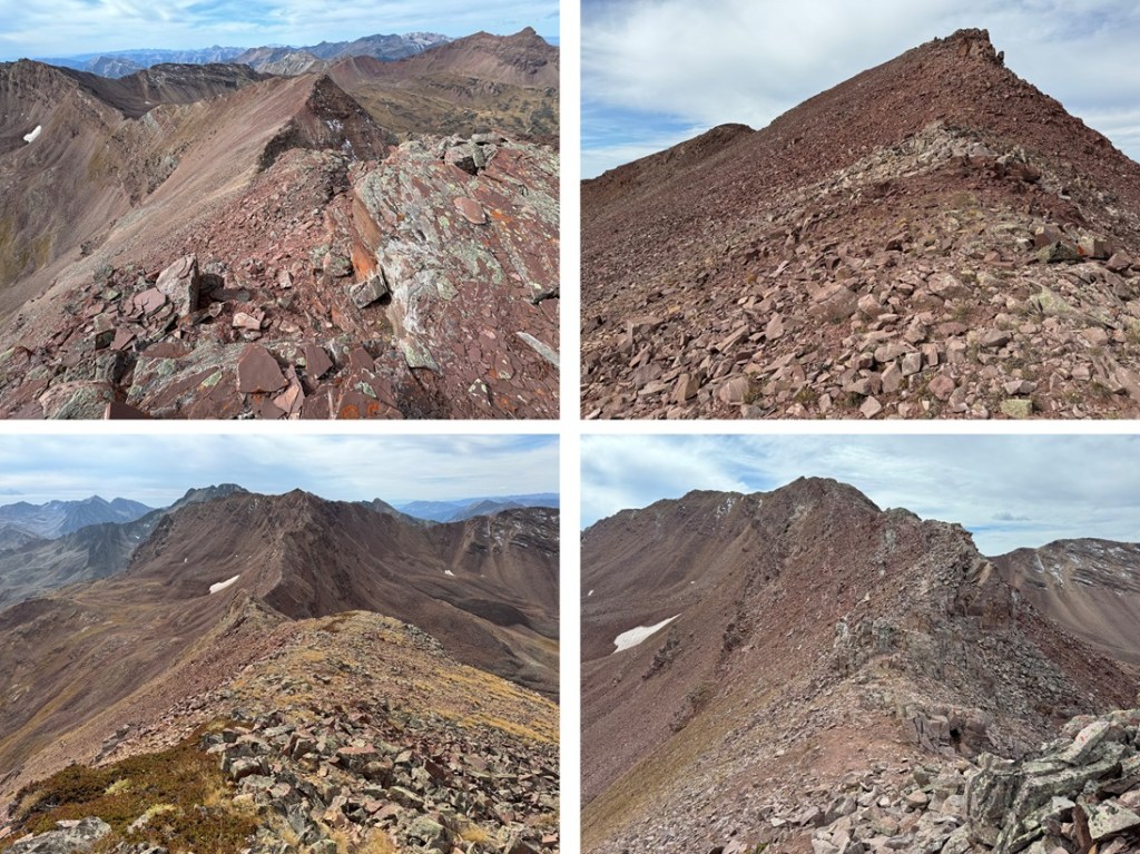
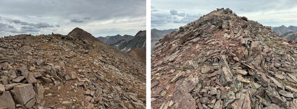
There are a lot of ups and downs along the ridges in this hike, gaining and losing and gaining elevation.  This part of the ridge is class 2.  If you find yourself in class 3 territory, you’re making it too difficult.  Look for game trails to the right to avoid any potential class 3.  Here are some pictures of this part of the ridge.

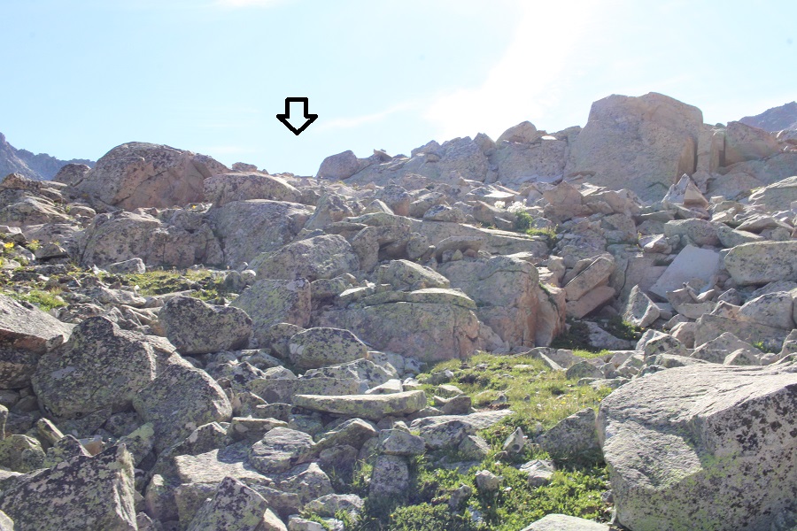
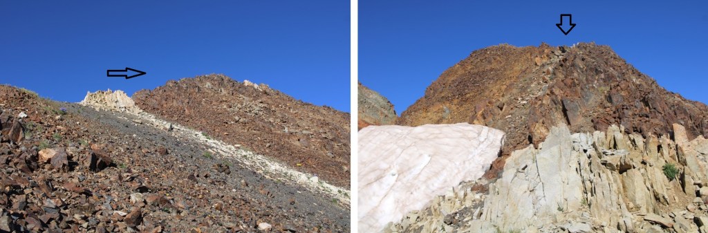
From about halfway along the ridge I could clearly see 13144, but I wasn’t headed there first.  Instead, I was headed here:

I continued following the ridge (now heading northeast) to that point, still in class 2 territory.

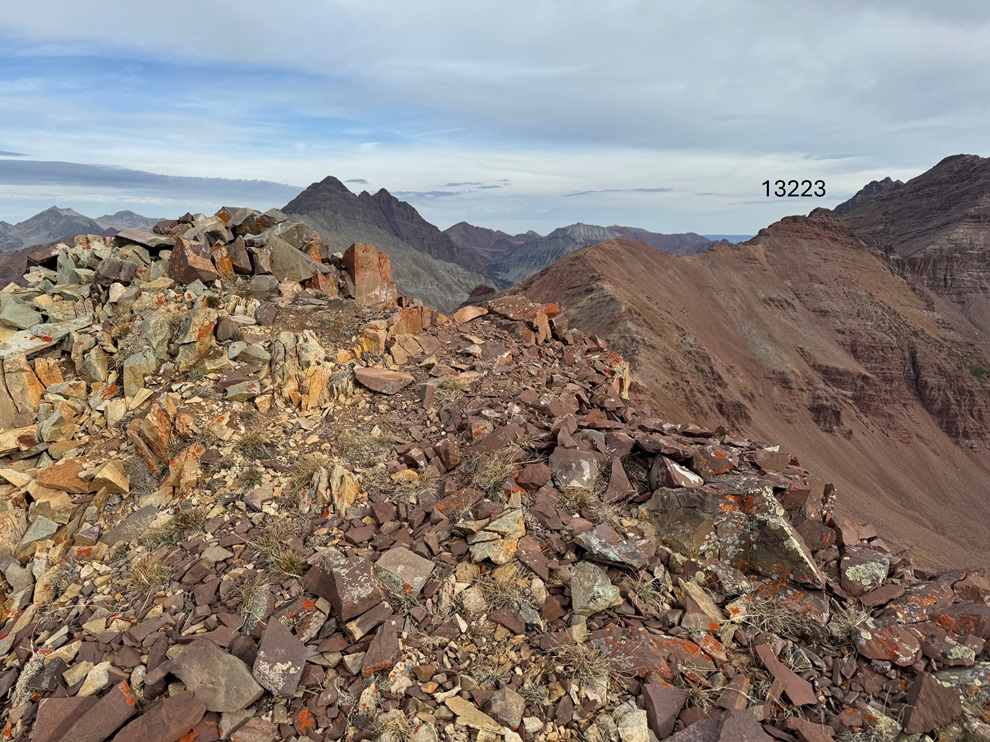
I could now see 13223 to the north/northeast.

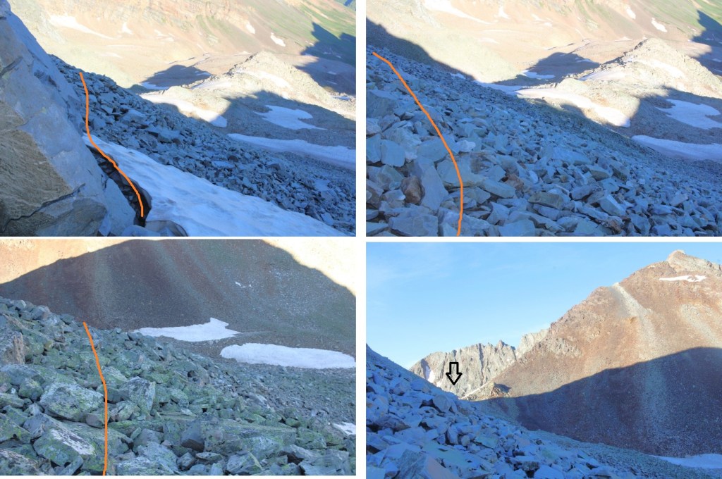
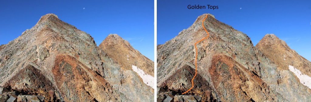
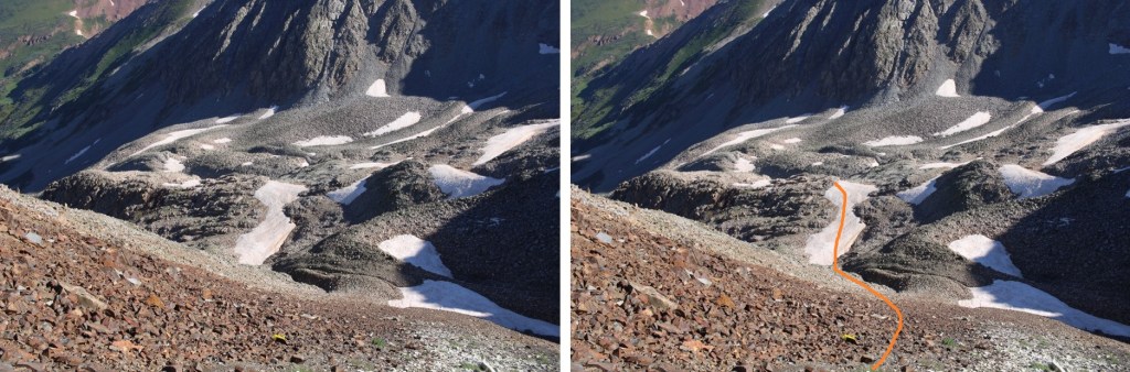
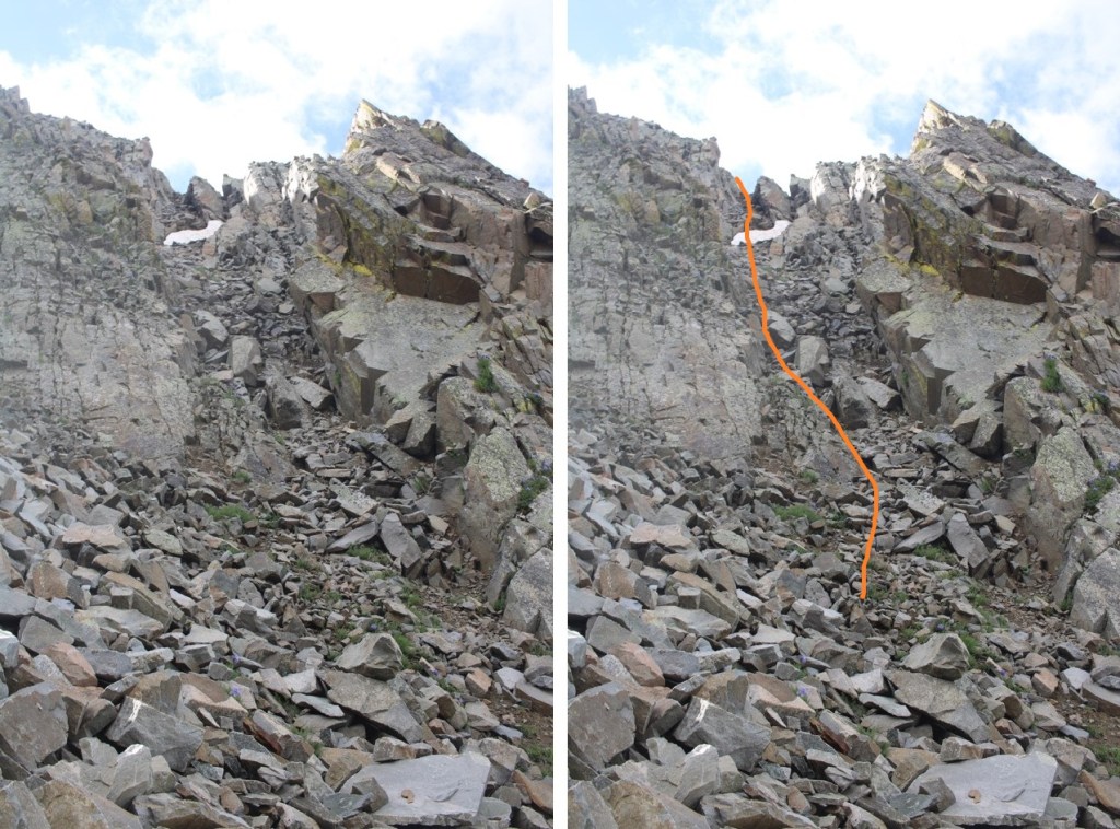
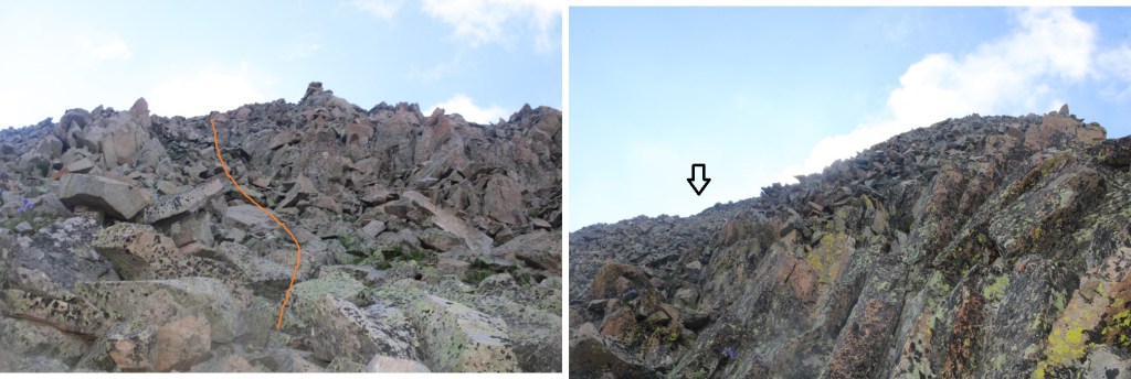
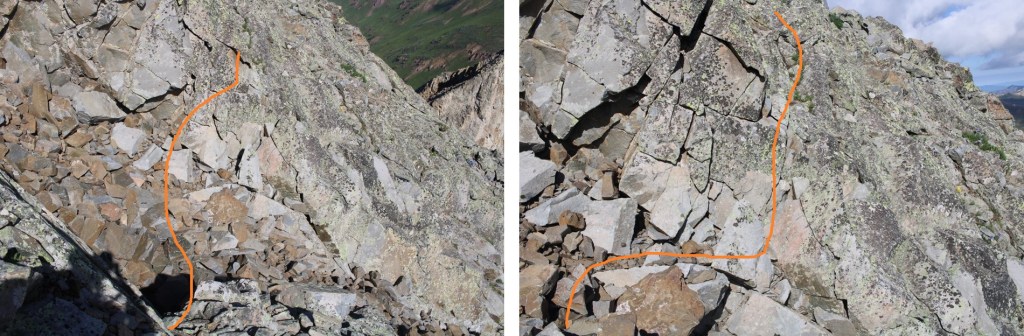
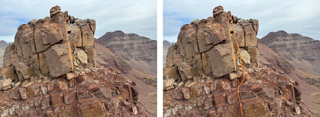
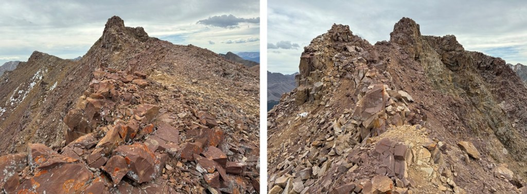
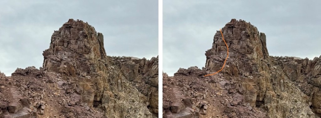
From this point, the most difficult part of the ridge is class 3.  It’s mainly class 2, with a couple of class 3 climbs thrown in, especially at the beginning of the ridge and the final climb to the summit. This part of the ridge starts out with an airy class 3 move.  I went to the right on a narrow shelf of rocks.  Now is also probably a good time to point out the rock here, like the rest of the Maroon Bells area, is unstable and chossy.  Most rocks will move, so be sure of your holds before continuing.

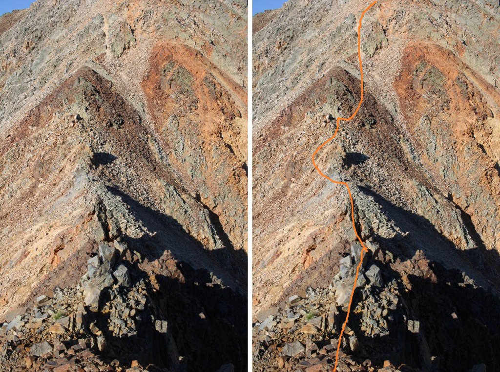
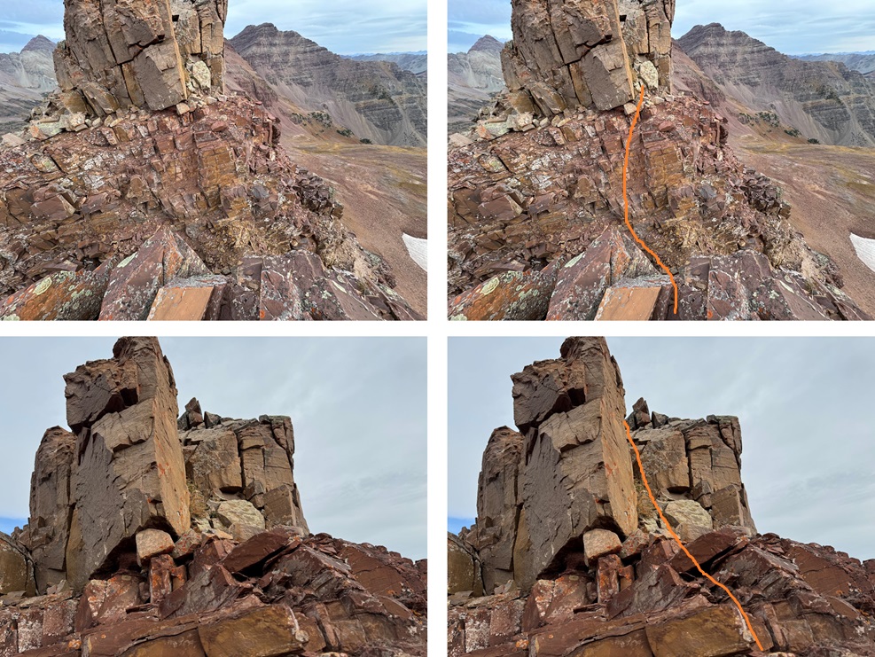
After the initial airy class 3 around the rock outcropping I was back into class 2 territory for a while

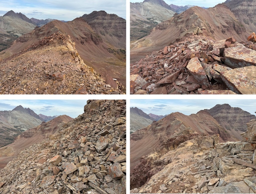
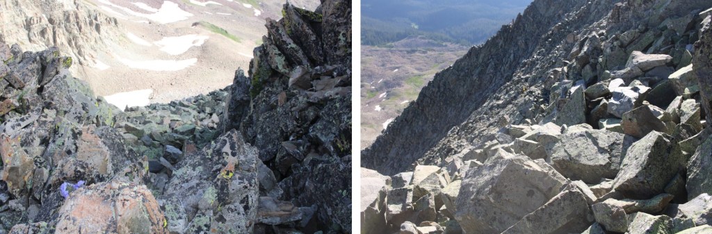
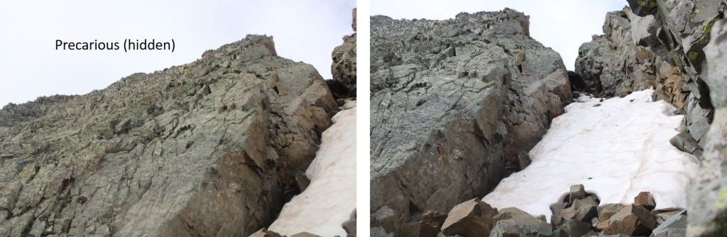
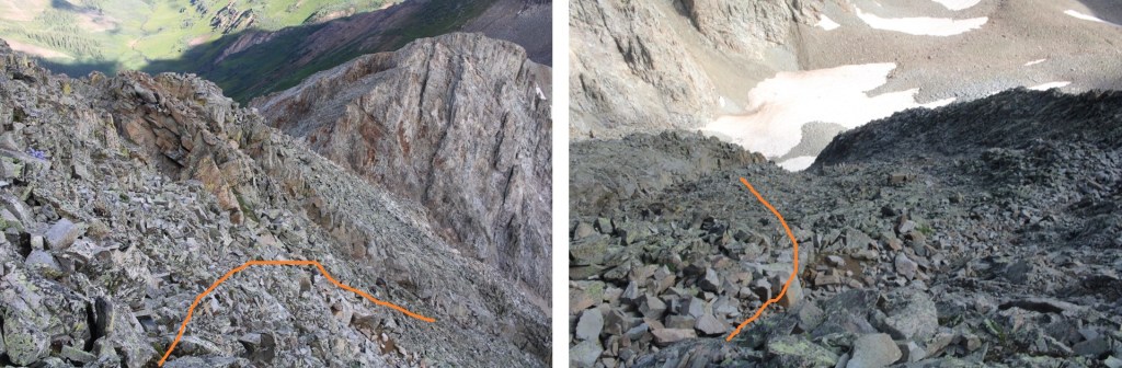
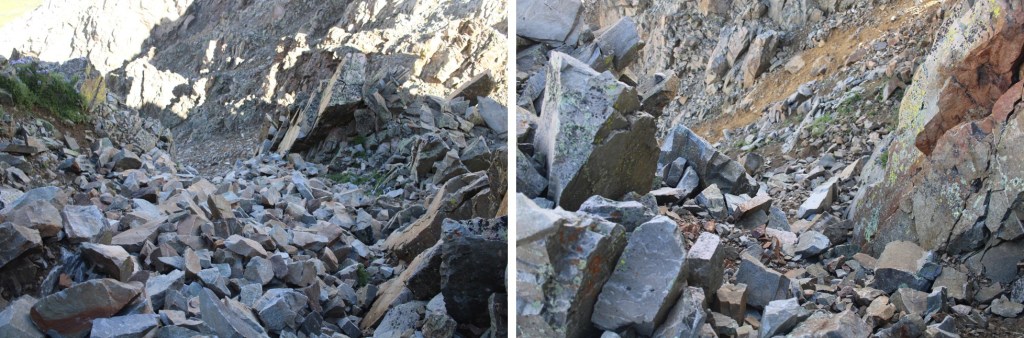
Until I came here.  I came to a point in the ridge that was narrow and had gullies on each side.  While these gullies looked like they went at difficult class 2, they had kitty-litter scree on top of hard sand, steep drop offs, and a lot of exposure.  The best (safest) way to traverse this is to downclimb to the narrow point at the top of both gullies, then climb straight up the rock.  This was the crux of the climb, and had exposure, but it was no more than class 3 (and much easier to downclimb). There are plenty of holds to use, just make sure they’re stable before committing. This is much easier to do than pictures make it look, and indeed, than it looked at the time. 

From here, the rest of the ridge is class 2/difficult class 2.  If it looks more difficult than class 2, look for a game trail to the left or the right of the ridge.

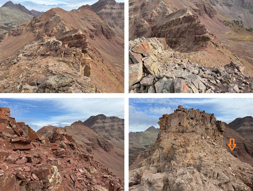
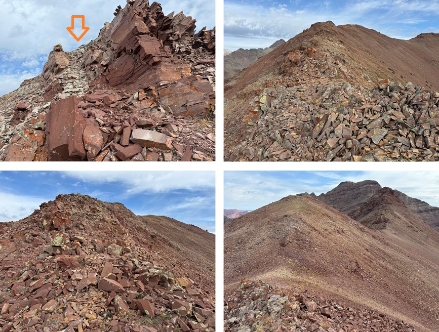
There’s a bump in the ridge, which I went over on my way to Belleview

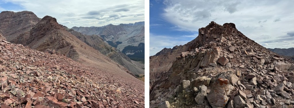
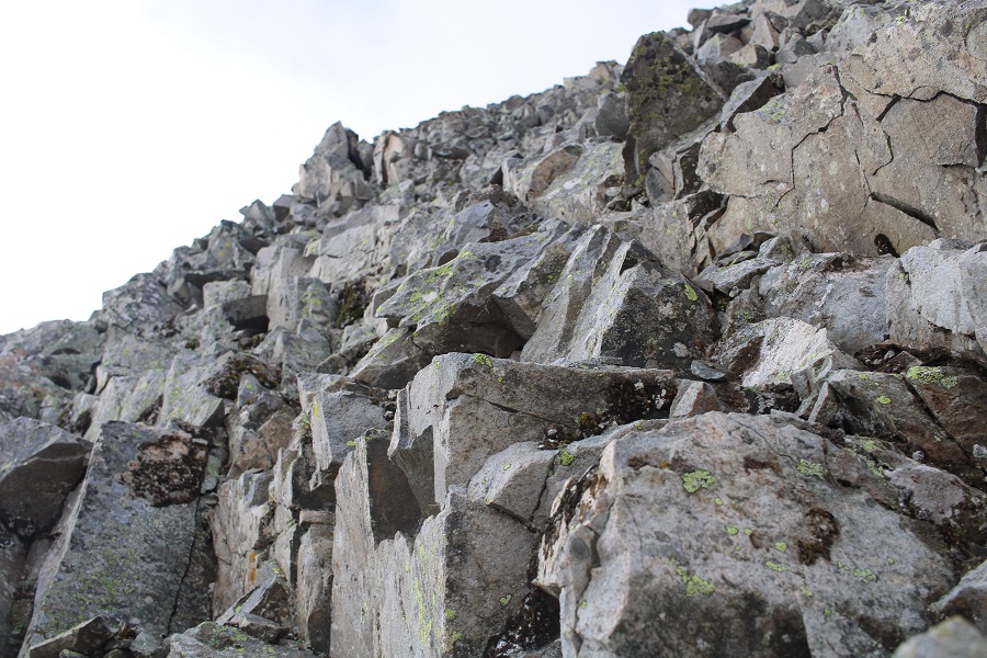
The last bit to the summit starts out as class 2, then becomes class 3.  I aimed for the depression in the rocks.  This area is filled with broken pieces of rock, but there are sections of scree.  Aim for the sections of scree as you ascend.  Getting over this piece brought me to the final push to the summit. 

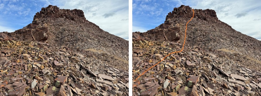
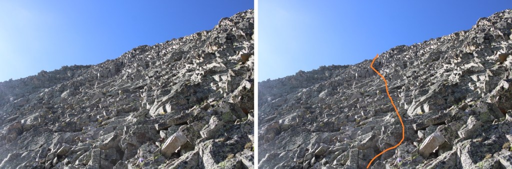
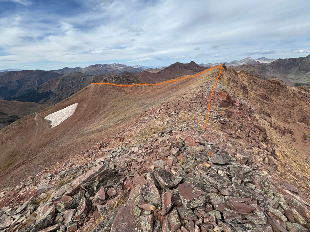
Now I could see the final push to the summit. This is class 3, and loose, but easy climbing.  This is the overall route I took:

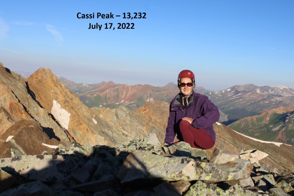
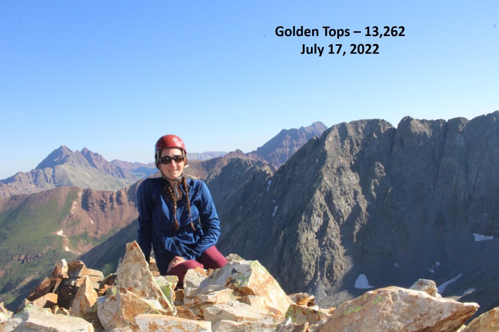
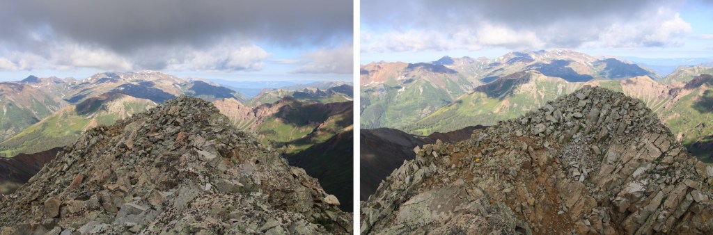
I summited 13223 at 11am
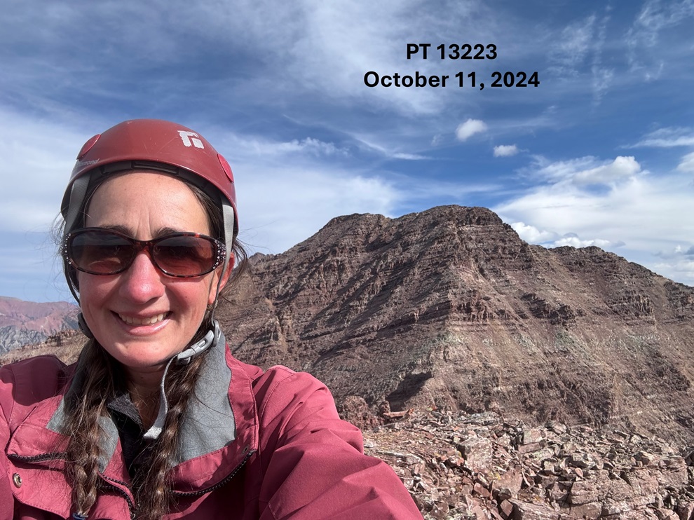
13223:

Now to head back towards PT 13144. 

I descended back to the ridge, and followed it the way I hiked in.

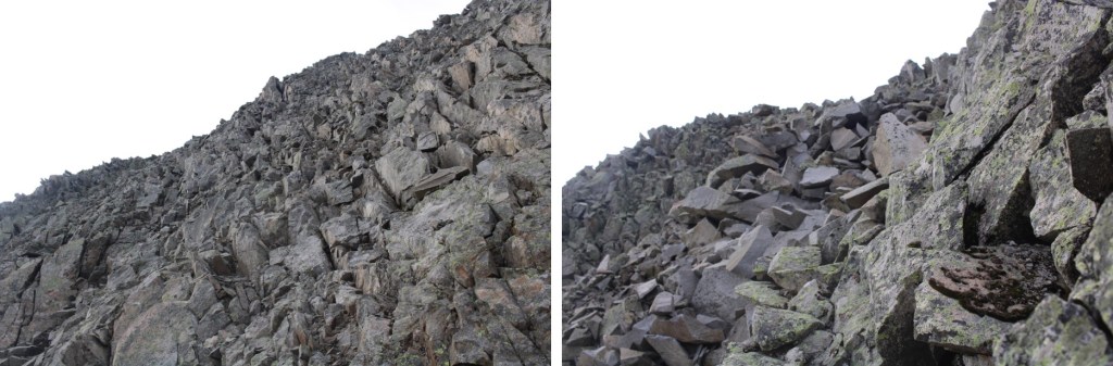
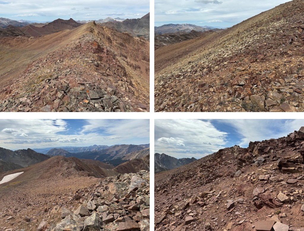
For brevity, and because I’m assuming you already hiked the ridge on the way in, I’m just going to show a few pictures of the ridge back towards 13144

And the final exit off the ridge

From here, it was a quick class 2 hike southeast to the summit of 13144

I summited 13144 at 12:15pm

13144:

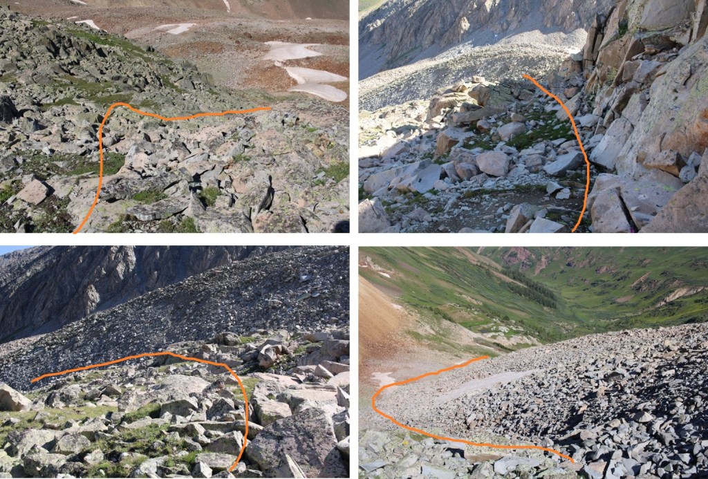
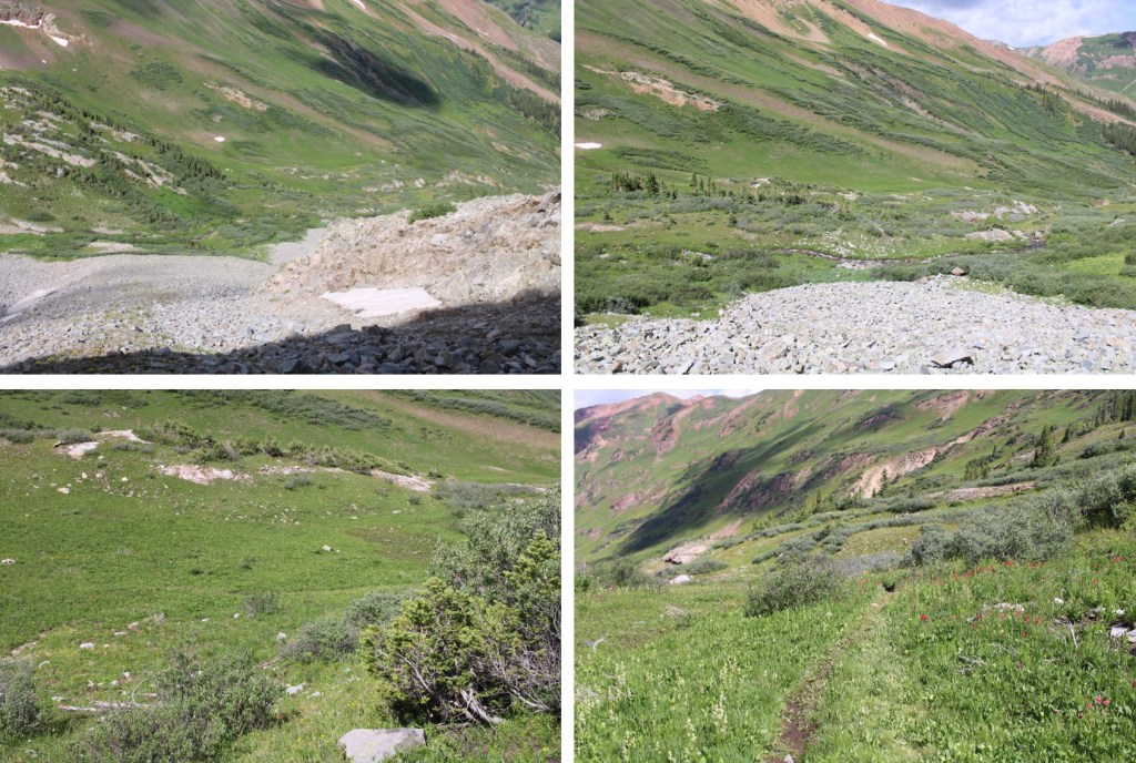
I descended much the same way I ascended initially to the ridge.   I headed northwest along the ridge, and then followed the ridge southwest, back towards Rustler Gulch.

Instead of ascending to the high point on the ridge, this time I descended just below the talus and scree, heading southwest on the grassy slope towards the trail below.

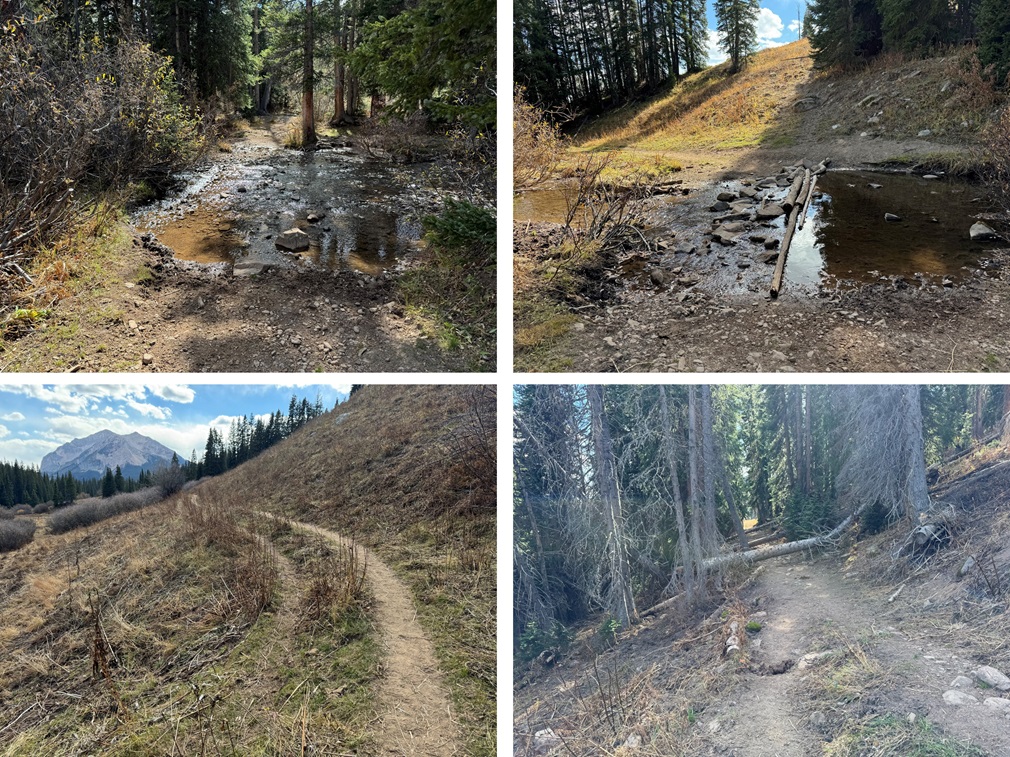
Back on the trail, I followed it west and then south through Rustler Gulch, back to the trailhead. 

I made it back to my truck at 2:45pm, making this an 11.58 mile hike with 4141’ of elevation gain in 8 hours.

On to the next trailhead!

Cassi Peak – 13,380 and Golden Tops – 13,262

RT Length: 14.51 Miles

Elevation Gain:  4021’

Yes, I’m recycling the approach pictures/description because all the info’s the same.  The Rustler Gulch Trailhead was full.  I tried to drive up the road several times, but kept getting greeted by vehicles coming down.  The drivers didn’t understand up had the right of way, and all of them seemed to be in vehicles too big for them to maneuver.  After backing up over half a mile for the third time, I decided to just park below.  I’d find out the next day it’s peak wildflower season in Rustler Gulch, and the tourists were flooding in to see them. Parking down below added about 2 miles to my trip and 500’ of elevation gain, which was negligible. Bonus:  There was a creek behind me to enjoy as well.

I was on the 4WD road that led to the trailhead at 2:30 am.

I followed it 1 mile to the actual trailhead, which was overflowing in the afternoon

I passed around the gate, and followed Rustler Gulch trail #599 north into the gulch.

There were several stream crossings to cross, all of which had rocks or logs so my feet didn’t get wet.

When I got to this creek crossing, I went right, and found a footbridge

I continued following the trail, and crossing creeks, through the gulch on a well-marked trail

Here’s my route into the upper basin.  This is all done on a class 1 trail

Here are some more pictures

After hiking for 5.3 miles, I crossed a creek, and continued following the trail.  The trail became faint, but if I looked closely, I could follow it all the way to the rocky basin

I needed to get to the upper basin. There are several ways to do this.  I took the gully to the left, but you could also go right.

Here are pictures of my way up the gully

You have several options

Once in the upper basin, I navigated the rock outcroppings to the right/southeast.  Here’s my route

Now to get up these rocks.  This was an easy scramble, and choose your own adventure. 

I now had a clear picture of Cassi Peak.  This is the route I took to get to the top of the last set of rocks

Now to get up to the ridge.  This is the route I took, all class 2.  The rocks were mostly stable, but the gully was steep.  I had to cross a solid streak of snow several feet deep at the beginning, and was glad I’d brought microspikes

Here are some pictures of the route up the gully

Once up the gully, I aimed for the ridge, which was much more solid

Once on the ridge, I followed it south, then west to the summit

I summited Cassi Peak at 7am

Cassi Peak:

From the summit I could see Golden Tops to the southwest.

To get there, I re-traced my steps back down the ridge and through the gully

This time, when I made it to the gully, I stayed high.  I actually crossed above the snow, and gasped as two boulders larger than microwaves cleaved off the rocks.  Be careful in this area near the rock walls.  I stayed high, as I was aiming for the Cassi/Golden Tops saddle

I climbed up some scree to the saddle

Then turned right, and followed the ridge.  This was class 2, with some easy class 3 scrambling thrown in.  The route will be obvious:  just follow the scree rubble west

From the top of the first point I could see Golden Tops to the southwest.  This is my route

And some step-by-step pictures. This is where the climb becomes class 3, heading down this small saddle.  This is how I navigated the class 3 section, by going straight up and over the first obstacle, which is like a mini knife edge, then around the second to the left.

The rest of the route followed the ridge to the summit

I summited Golden Tops at 8:30am

Golden Tops:

Looking back, here’s my route from Cassi Peak

Now to head back to the Cassi/Golden Tops saddle

Just before making it to the saddle I turned left, and scree-surfed north, back to the rocky ledges I’d ascended that morning

And now to exit the upper basin and head into the gulch

Here I picked up the faint trail that brought me back to the waterfall and the mining area

There were so many people, and so many wildflowers!  I can see now why this trail was so popular.

Rustler Gulch Wildflowers:

Here are a few pictures of the way back to the trailhead

And from the trailhead to my parking spot

Here you can see even more of the overflow/2WD parking below

I made it back to my truck at 11:30am, making this a 14.51 mile hike with 4021’ of elevation gain in 9 hours.

On to the next trailhead!

Precarious Peak – 13,380

RT Length: 13.79 miles

Elevation Gain: 3714’

The Rustler Gulch Trailhead was full.  I tried to drive up the road several times, but kept getting greeted by vehicles coming down.  The drivers didn’t understand up had the right of way, and all of them seemed to be in vehicles too big for them to maneuver.  After backing up over half a mile for the third time, I decided to just park below.  I’d find out the next day it’s peak wildflower season in Rustler Gulch, and the tourists were flooding in to see them. Parking down below added about 2 miles to my trip and 500’ of elevation gain, which was negligible. Bonus:  There was a creek behind me to enjoy as well.

I was on the 4WD road that led to the trailhead at 3:30 am.

I followed it a mile to the actual trailhead, which was overflowing in the afternoon

I passed around the gate, and followed Rustler Gulch trail #599 north into the gulch.

There were several stream crossings to cross, all of which had rocks or logs so my feet didn’t get wet.

When I got to this creek crossing, I went right, and found a footbridge

I continued following the trail, and crossing creeks, through the gulch on a well-marked trail

Here’s my route into the upper basin.  This is all done on a class 1 trail

Here are some more pictures

After hiking for 5.3 miles, I crossed a creek, and left the trail.  I could see my route before me to Precarious’ access gully.

This is the route I took

And some step-by-step pictures to get there

At the base of the gully I put on my microspikes and started climbing.  This is choose your own adventure of 850’ of elevation gain.  This felt class 2+.  I’ve definitely been in worse gullies, but still be sure of every step.  I didn’t have any rocks fall down the gully, but I did make a few slide a few feet. It had rained the night before, so the scree was mushy and easy to grip.

There are two ways to top out of the gully.  I took the first one up, the last one down.  If I were to do this again, I’d take the one closest to the top up and down, as it felt more secure.  Here’s the one I took up, which still had snow in mid-July:

And the one I took down (snow free)

They both led to the same place:  Class 3 scrambling. 

I aimed south, towards what looked like the ridge, but went too far up, where the route cliffed out.  Instead, head east.  At around 13190 there’s a path to go around the mountain. I had to descend about 50’

When I got there this is what I saw:  A snow filled gully!!!  I was so upset, thinking my climb was over…

Until I realized I just needed to cross the gully, and then head towards the summit on the other side (all class 3 scrambling). 

I crossed the gully just at the base of the snow

And then scrambled to the top

To find I wasn’t yet at the top…  This was all class 3 scrambling as well

I summited Precarious Peak at 8:30am

Precarious Peak: (Yes, I called it the wrong name.  I knew it was wrong at the time, but didn’t care to take the video again)

There were two summit registers, and when I went to open them I found out why:  The older one was sealed shut.

I backtracked the way I’d summited back to the snow filled gully

Crossed the gully

And made my way back to the ridge

Then back down to the gully that would take me to the access gully

OK, time to put back on my microspikes to descend the 850’ that is the access gully

I stopped on my way down to get a video

Precarious Gully:

Then continued to its base

At the base of the access gully I took off my microspikes, and then headed for the obvious trail below.

I crossed the creek, and spent some time looking at some old mining equipment.

Then I followed the trail back down the gulch

There were so many people, and so many wildflowers!  I can see now why this trail was so popular.

Here are a few pictures of the way back to the trailhead

And from the trailhead to my parking spot

Here you can see even more of the overflow/2WD parking below

I made it back to my truck at noon, making this a 13.79 mile hike with 3714’ of elevation gain in 8.5 hours.

On to the next trailhead!