
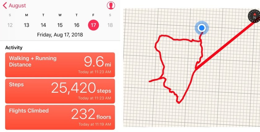
RT Length: 9.6 miles
Elevation Gain: 4000’
The weather changed my plans at the last minute, so the hike I’d intended to take in the Sawatch range didn’t happen today. I’m on a time crunch when it comes to my Friday hikes for the next few weeks, so I needed a hike I could complete and still be home in the early afternoon. After a quick weather search, California Peak looked promising. Plus, it has a bunch of other 13ers close to it so I could make the hike longer if I wanted… I just needed to back to my truck before noon.
I made it to the trailhead at 4am without passing a single vehicle on the 69. Oh, and that forest road 580 in seems to take forever!!! I’m always surprised this is labeled as a rough 2WD road. There are several spots I’d love to have 4WD well before the 2WD parking lot (which you aren’t allowed to park at BTW). This is my third time on this road, and the third time with lots of mud puddles…
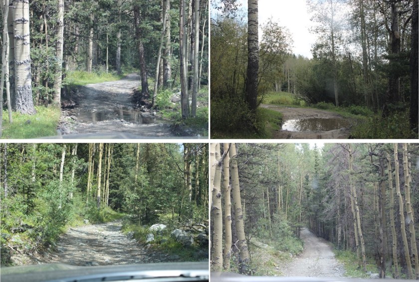
4WD Road:
I mean, you could probably do it in a 2WD if you have high clearance and you’re a great driver, but why chance it? And that last hill before the 2WD parking lot? 4WD is totally necessary! Most people want to park in the avalanche area, but these signs tell you it’s not advised:
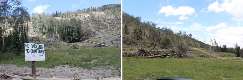
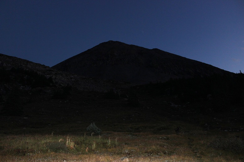
The 4WD parking lot has enough room for about 10 vehicles. There were 2 others there when I arrived (and 3 when I left). I got out my gear and turned on my new tracking app. I’m not a fan of GPX routes, but think it’d be careless not to have one in case it’s needed. There isn’t a GPX file for the trail I wanted to take, so I decided to try and make one. I’ve never done that kind of thing before, but I figured maybe I could make one and help someone out since a lot of this hike is off trail. I started the track, signed the trail register, and was on the trail at 4:15am.

The trail was wet. The sky was clear and I could see the stars, but it had obviously rained (hard) during the night. The trail was pretty much a small river, and all the grass and plants lining the trail were wet, making my pants wet when I brushed them as I walked by (I should have worn my hiking pants instead of my yoga pants). I accidentally stepped in the water a few times and was glad I had my waterproof Salomon’s on (so only my socks got wet above my shoes, but my feet remained dry).
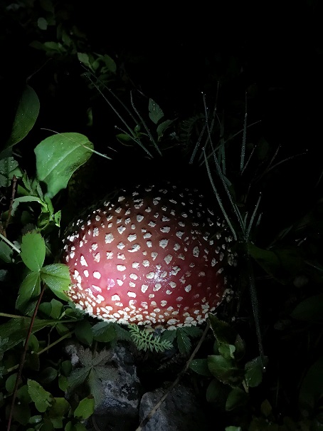
Even though it was a clear night water was raining from the sky too: as I passed trees startled birds flew out of the trees, causing water droplets to rain down on me from above. Since the ground was wet I looked for animal tracks and didn’t see any, so I didn’t expect to see any large wildlife before sunrise. I did hear a rather large animal dash through the creek to the left of me, but it was obviously running away from me. I’m guessing it was a deer. I did see a cool mushroom on the side of the trail too
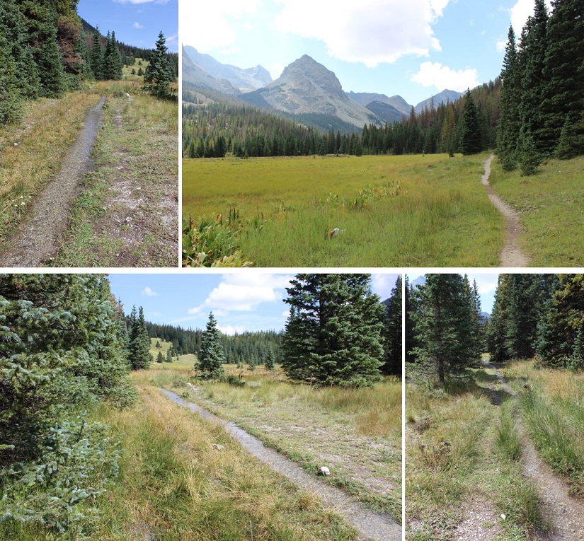
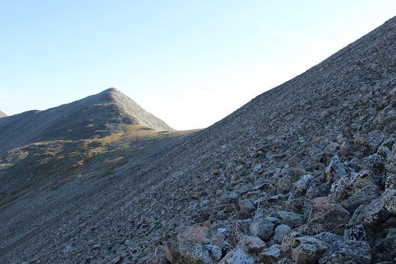
I missed the first junction that’s supposed to be a mile in, letting me know to turn right, but I’ve missed it every time I’ve taken this trail, so either the signs missing or I take the wrong path, which is a possibility. The trail follows the Huerfano creek but since it overflows onto trails there are several side trails. This is also a heavily used snow shoeing area, so there are tons of paths in and out of the trees. The good news is I saw the second sign and turned right, heading up the hill towards Lily Lake. I was hiking a bit too fast (I wanted to be at the lake around sunrise so I could see the lake) so I slowed down a bit. Just before the lake there was a small waterfall
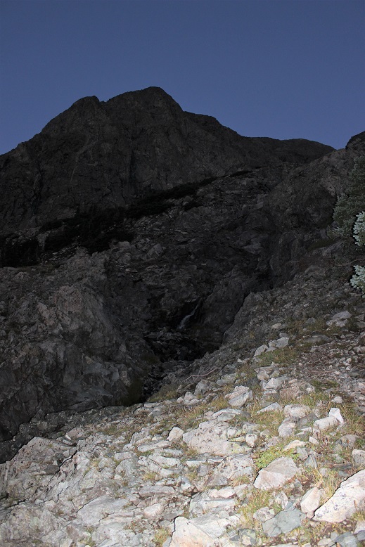
I passed it to the right, and headed up a hill
And came to Lily Lake
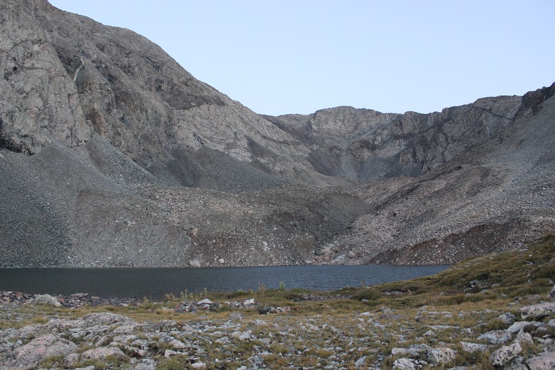
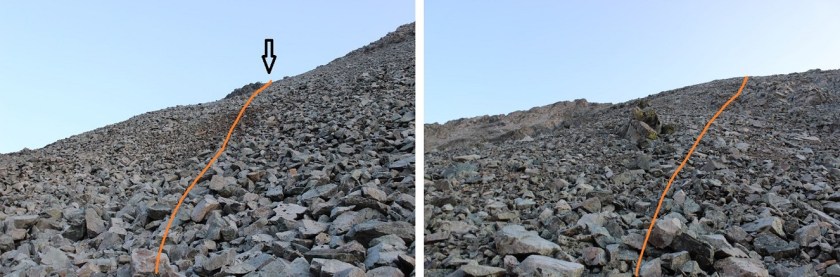
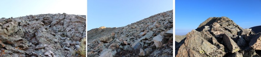
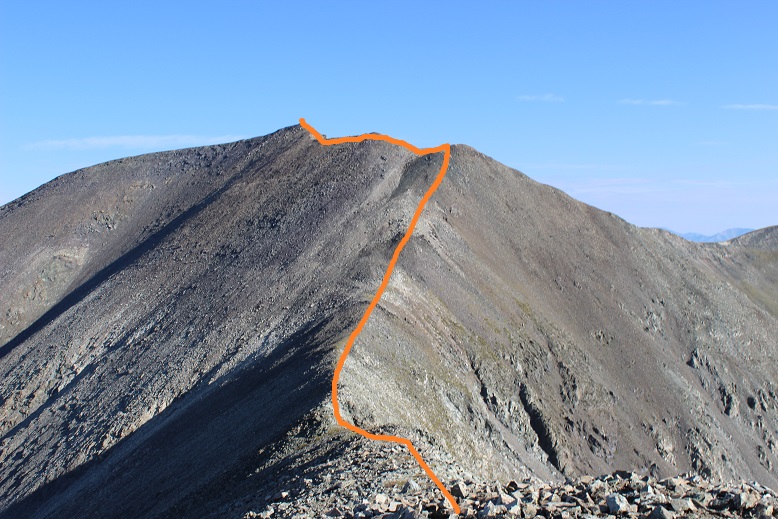
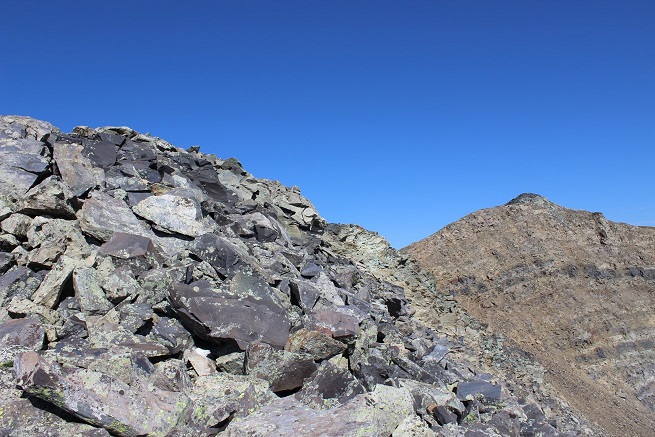
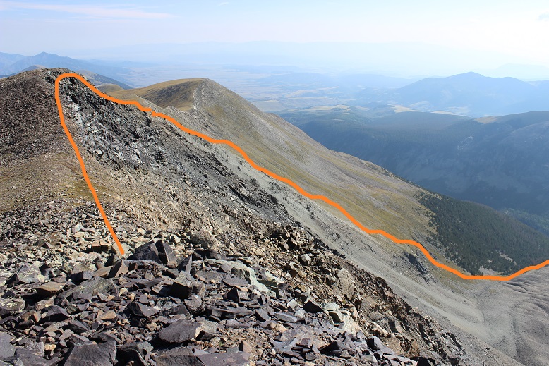
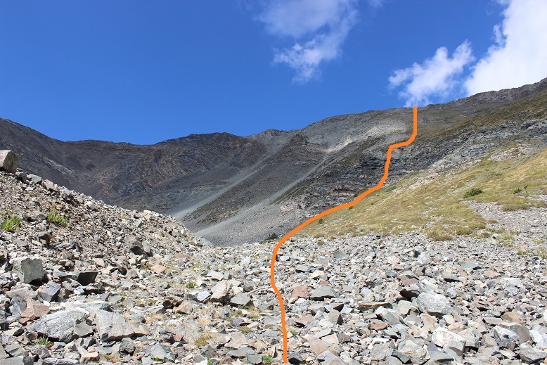
The wind immediately picked up and the temperature dropped. This is also where the trail ended. I’d read this was the “crux” of the route, and I’d agree. There is no path through the amphitheater. The goal is to avoid the loose rock and navigate your way up the mountainside to the right. The trouble is none of the rock is stable. It’s all terribly loose and when one rock falls it creates a rockslide. Think avalanche with rocks. This is rated as a class 2, but I found myself wishing for my helmet. I’d consider it absolutely necessary if I was hiking with someone else. Also, don’t follow anyone else’s GPX route up this mountain. The rocks slide and change quickly, so a route that’s safe today might not be tomorrow (and most likely won’t be next year). You need to use your best judgement and pick your own line. It’s steeper than it looks. Here’s the route I took:

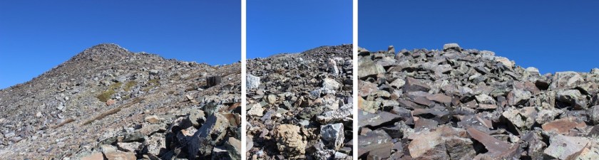
I aimed for the large, stable rock, and once I made it there, passed it to the right, where I was met with larger (unstable) rocks.
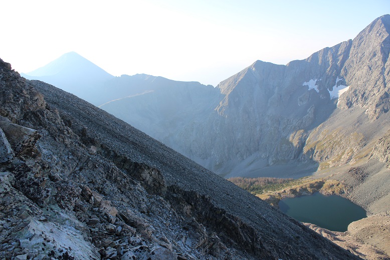
I turned around and could see evidence it had snowed a bit last night as well as rained
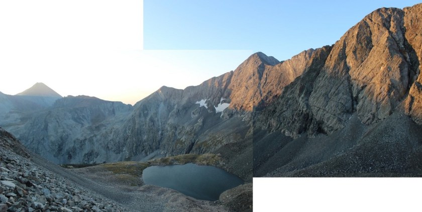
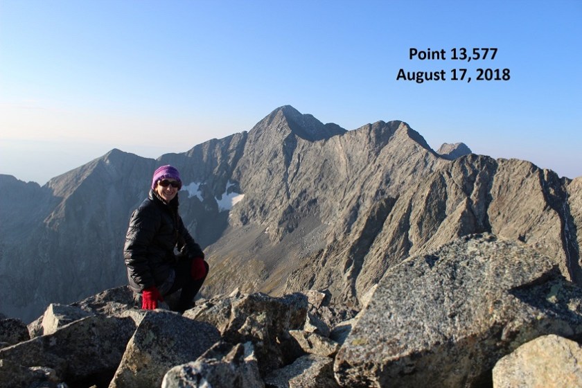
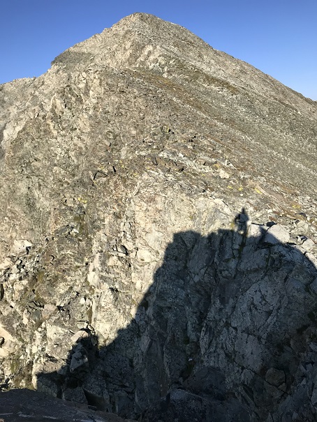
From here I gained the ridge and followed it left to the summit of Unnamed Point 13,577, arriving at 7am.
I turned around to look at the way I’d come up: steep and full of loose rocks.
Point 13,577 is a ranked 13er. Here’s my summit selfie to prove I summited:
And a video:
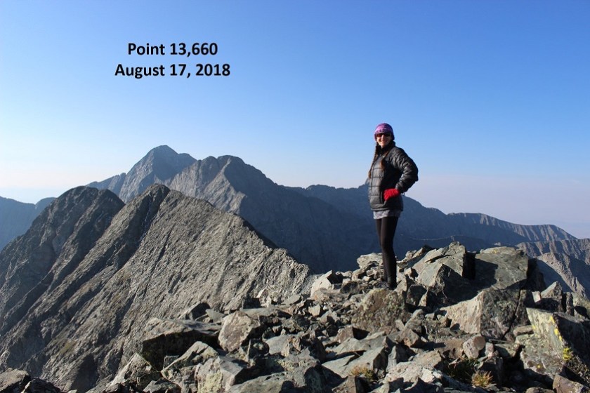
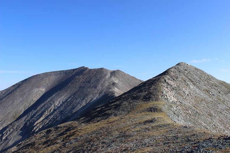
I turned and looked west at Unnamed Point 13,660. This is a bicentennial, and I’d promised myself if I had time I’d do my best to summit this peak as well since I couldn’t find another route for this one (hey, I was here, I might as well make the most of it, right?)

I mentally calculated my time (I was right on time… that crux had taken a lot longer that=n I’d anticipated) and decided to go for it. If it took me too long I could always come back for California Peak another day, satisfied I’d completed 2 ranked 13ers today.
And so I headed towards the ridge. It was a fairly simple hike until I reached the saddle. From here it got a little more sketchy, but nothing over a difficult class 2. Once again I wished I’d brought my helmet. The rock wasn’t sticky at all. In fact, my (really good) hiking boots were slipping and couldn’t gain traction. There were also a few steep spots and areas of exposure. I was able to navigate the entire way by sticking to the ridge, but if necessary stick to the right.

OK, this was actually a lot of fun! The past couple of 13ers I’ve done have been pretty easy, with no real route finding or scrambling involved. This ridge included plenty of careful scrambling.
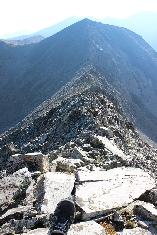
I made it to the summit at 7:50am and turned back to look at the route and Lily Lake (not sure what the other lake is named, or if Lily Lake is just missing some of its water).

Here’s a summit selfie as proof I summited
And a video:
The last hundred yards or so of that had been worth it and so much fun!!!
From Unnamed Point 13,660 I could clearly see the route I’d taken and the route I had left. Due to time I didn’t feel it was necessary to re-summit Point 13,577 so I skirted it to the left and aimed for the saddle between it and Point 13,420.
Once again, there is no trail for this hike, so I had to carefully navigate my way across the rocks.
From this saddle it was a quick hike to the top of Unnamed (and unranked) Point 13,420.
I summited at 8:40am to some of the best views I’ve had the pleasure of having all to myself! I could see small lakes in every direction, Huerfano Peak, Mt Lindsey, Blanca, and Ellingwood. Wow!
Video :
Here’s a look back at the route I took from PT 13,550

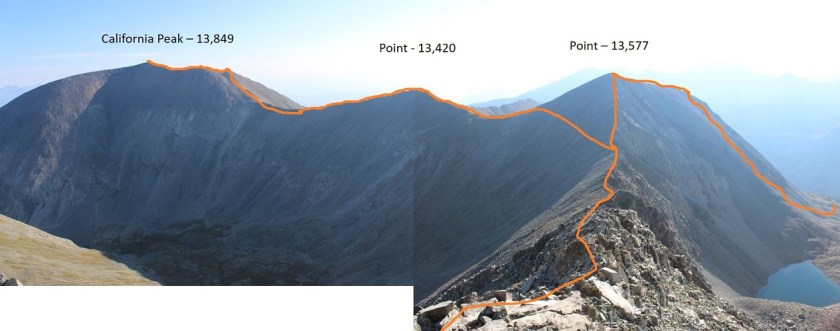
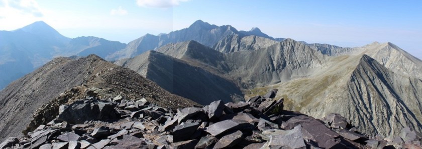
OK, time to head up California. This ridge was easy to follow, with no obstacles to face and stickier rock than Point 13,660. Here’s the route I took:
The rock was much larger and more stable than before
There was a false summit, but it wasn’t anything too difficult. Here you can see California Peak (to the right) from the false summit
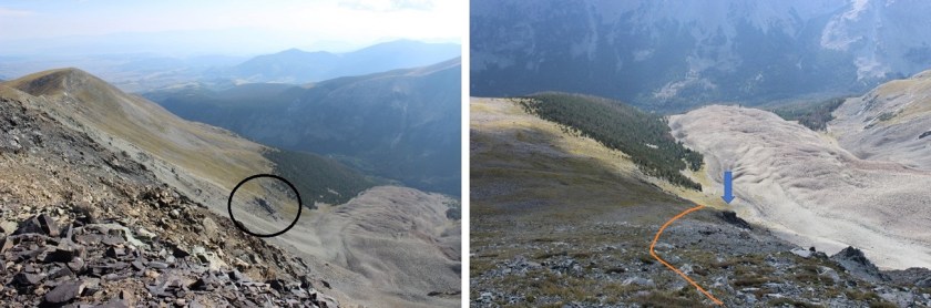
The false summit is also a great place to stop and visualize your path down from California Peak if you are choosing to do the loop (which I highly recommend… that rock up to PT 13,577 is dangerous enough heading up, down it would be treacherous). I’ll discuss this more later, but either take a picture here or get a good look so you know how you’ll approach your descent. You want to aim for where the trees and drainage meet.

The summit of California Peak was curiously flatter than I’d anticipated

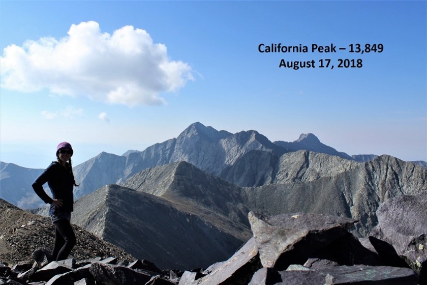
I summited at 9:15am to more awesome and amazing views!!!
Video:
Check out that ridgeline!
OK, your goal is to hike north up and around the horseshoe shape, locate a cairn, and head down (right/east) into the basin. Look for a cairn. You don’t want to descend too soon because it will be full of dangerous rocks.
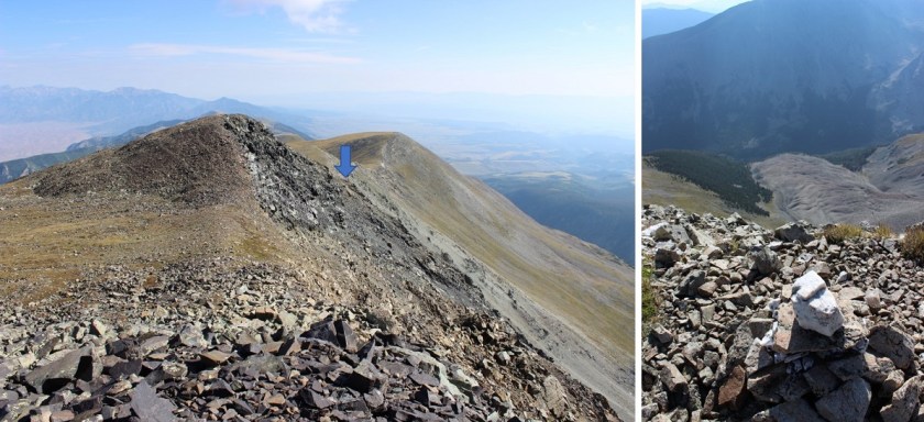
Standing behind the cairn looking down into the basin you can see where you want to aim: Just where the trees and rocks come together. From there you follow the drainage until you make it to Huerfano creek (and the obvious trail) Here’s a view from the false summit of the path you want to take.
From the top (where the cairn is) your best bet is to descend and angle a bit left to avoid the loose rocks and scree you’ll immediately encounter. Try to stay on the grassy area, but aim for the left of this bump:
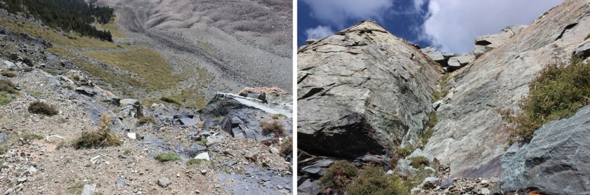
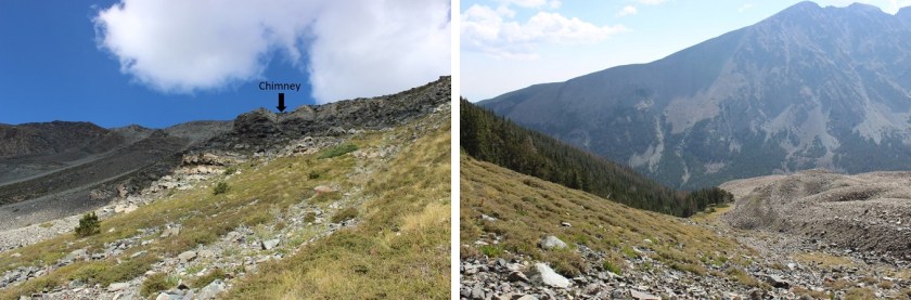
Once you make it to the bump you have several options ranging from class 2-4 to navigate your way down to the drainage. Just stay left and head down. I chose to climb down the wide chimney, but you have other (class 2) options as well.
Here’s a picture looking back at the terrain and what still lies ahead of you
In case you’re absolutely crazy and want to do this hike in reverse, here’s how I came down the mountain. Note: if you want to do this in reverse stay to the right (where there’s grass) and avoid the loose rock sections to the left.
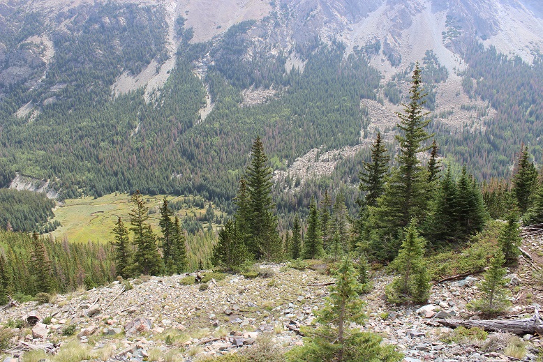
This is where the route gets tricky because you’re going to enter the treeline and terrain filled with rocks, slippery wet grass/plants, creeks, and pine needles (deceptively slippery as well). I followed the drainage

Until I came to this
Once again, your goal is to head towards the creek. I did so and quickly the terrain looked like this:

This was actually much more difficult to navigate and took much, much longer than I’d anticipated, but as long as I kept heading east down towards the bottom of the basin I knew I was on the right track. There were dozens of game trails heading every which way, and a few snow shoe trails as well. It wasn’t lost on me if I were to get hurt in this area it would be extremely difficult for anyone to know where I was or to be able to find me (even though I’d let people know I was doing the loop). The area was thick with trees and bushes, most of which got caught in my hair. When I finally made it back and found the trail I did a fist bump! That was awesome, and the most difficult route finding (in the daylight) I’ve done to date. Yes, it was technically easy, but I was super proud of myself!
When I made it to the trail (which was still filled with water BTW) I turned left (north) and headed back towards the trailhead.
I made it to my truck at 11:15am, 45 minutes earlier than needed to remain on schedule to drive back home and pick up my daughter from school. That made this a 9.6 mile hike/climb in 7 hours. I quickly got out my phone and checked my route. Now, this is the very first time I’ve ever tried to track my route, but I’m pretty sure I didn’t teleport 30 miles away for a few minutes and come back right where I’d been on the trail. Hmmmm. Either something was wrong with the app or I needed more practice with this (probably both). Oh well, that’s what I get for using a free app. So no GPX file this time, but maybe in the future?
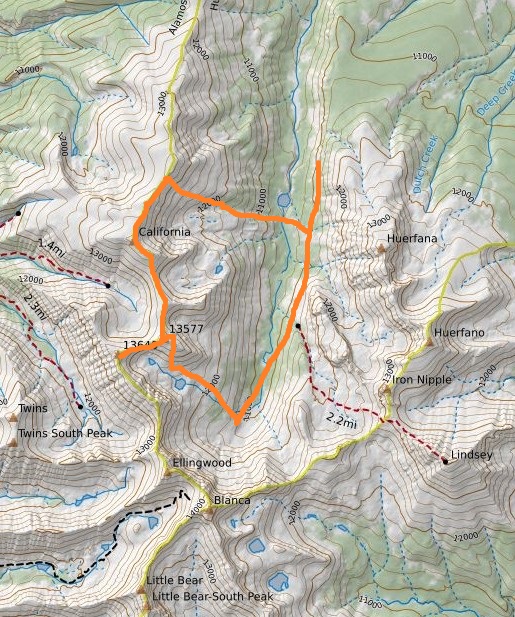
In any event, here’s the route I took on a topo map
This was a fantastic trip! Once again I didn’t see anyone else all day, the views and weather were amazing, and I was able to practice my route finding in an area I was familiar with and didn’t think I could get lost. I loved being able to tag a bunch of 13ers and I felt I learned a lot today. 13ers are amazing!

Every once in a while and not often enough,You congratulate yourself in making wise decisions in the routes you select to summit safely and without injury to yourself or those in your path.I believe you should love yourself for just getting in your Tundra and driving to the location you have set for your hike. You have a good sense for timing ,as you always seem to return to your vehicle in time to return to family matters. Thank you Wild Wanderer for the enjoyment you provide for all interested through pics and writings. This is one of the few times you haven’t met up with wild of some kind or another.
LikeLike
It just crossed my mind that your son was scheduled for basic training from one of your earlier writings. Hope all is well with him as he faces new challenges daily.I’m sure he has the same fortitude and stamina as his Mother has.
LikeLike