
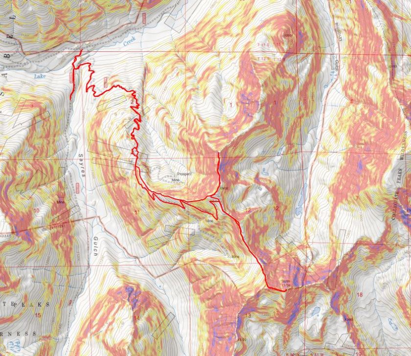
RT Length: 12.61 Miles
Elevation Gain: 4652’
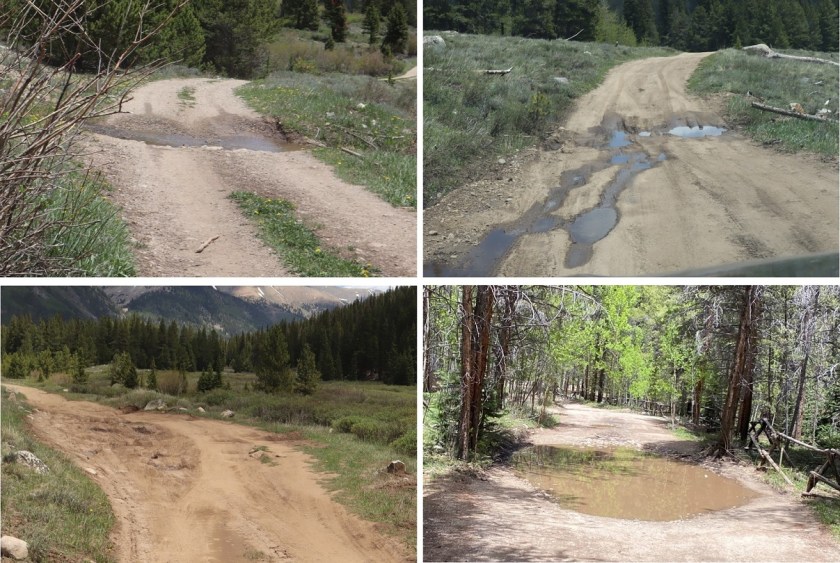
I drove to the La Plata Gulch Traihead and then took 391 for a little over 2.5 miles to a junction with 382, 391, and 392, where I parked my truck. This is an easy 4WD road in, with a few water holes to navigate.
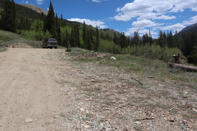
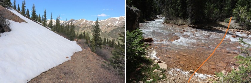
I parked at what looked to be an avalanche runout area.
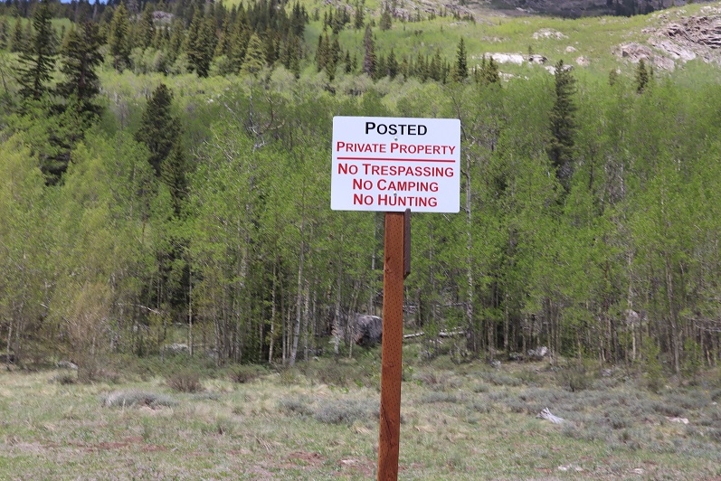
Initially I’d intended to make this a loop and incorporate Unnamed 13,300F and PT 12,601, but the area that I’d exit the hike as a loop with had a lot of “no trespassing” signs, so I decided early on just to make this a 2 peak hike.
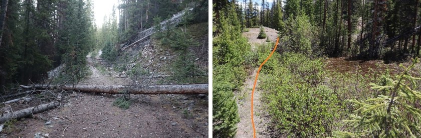
At 5am I gathered my gear and headed southwest, following 392, passing some dispersed campsites and wiki-ups.
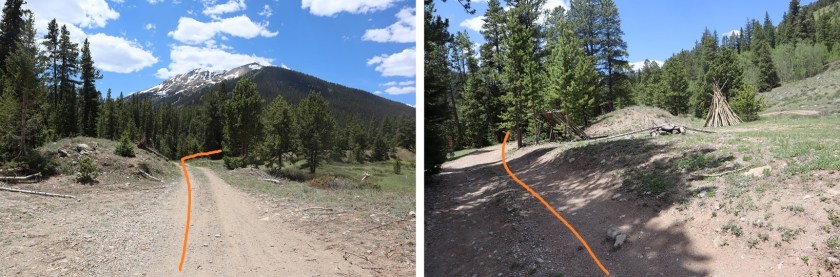
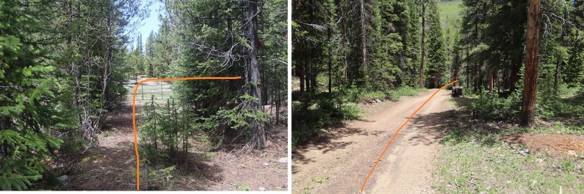
I crossed a bridge and turned right, following 392. There are more dispersed campsites here. The dispersed campsites make it a little difficult to follow/see the road.

In the dark I ended up going too far south on 382, missing the obvious 392 sign, and the not so obvious road. Turn left at this sign, even though there’s no road.

And pass through a gate, now following the 392 4WD road.

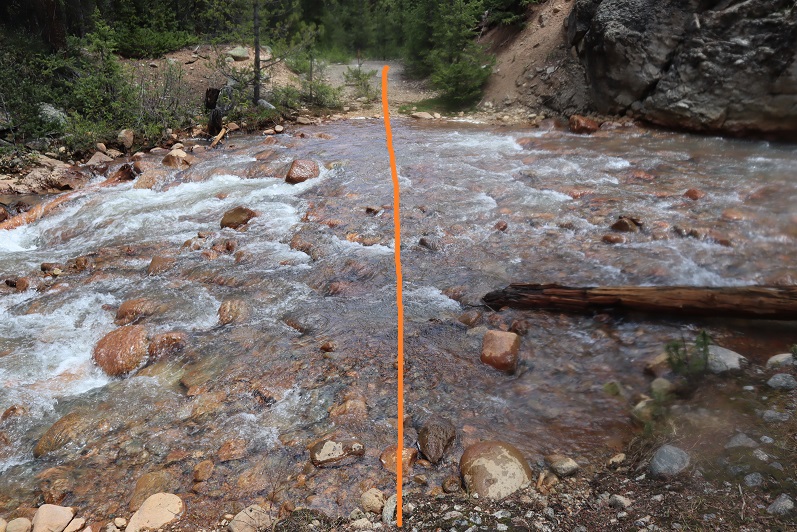
Almost immediately I came to a creek crossing that required me to take off my shoes and get out my sandals. The creek was cold (especially at 5am) but the water only went up to my knees in the deepest of places.
Shoes back on, I followed the 4WD road. “4WD Road” is a bit of a misnomer. This was probably a road decades ago, but it has gone into disrepair and hasn’t been used for quite a while. It’s easy to follow, but overgrown in many areas with willows, aspens, and even 10+ foot pine trees.
At 11,950’ I came to a small cabin with a great view.
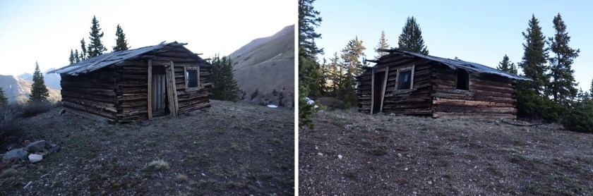
I peered inside: someone had left a peanut bottle full of trail mix (peanuts and M&M’s?) on a shelf. It was dark and cold inside and I’ve seen horror movies so I didn’t take the bait. I turned around and considered my options. Here the road still had some snow/ice covering it, but early in the morning I could walk across it when necessary without traction. On the way back I was able to see dry spots to navigate down and avoided the snow.
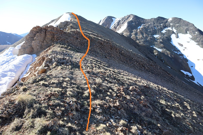
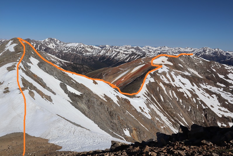
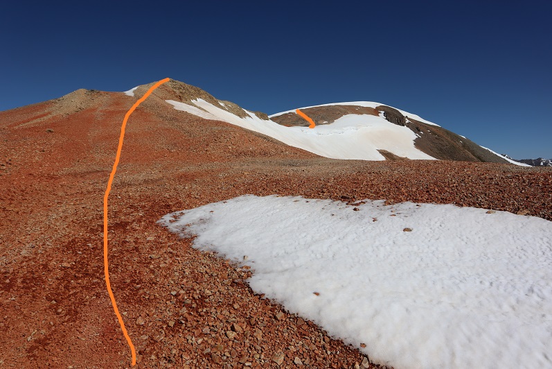
My options were to either take the road or follow the ridge. I decided to take the road up and follow the ridge back down. I wasn’t disappointed. I also placed a cairn here to show where you leave the trail to follow the ridge (even though it should be obvious).

The road really didn’t have much snow on it after I passed this point and was quite easy to follow all the way to the saddle. Several times I intersected with the ridge route as I followed the road.
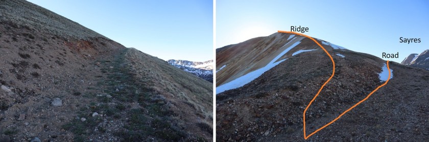
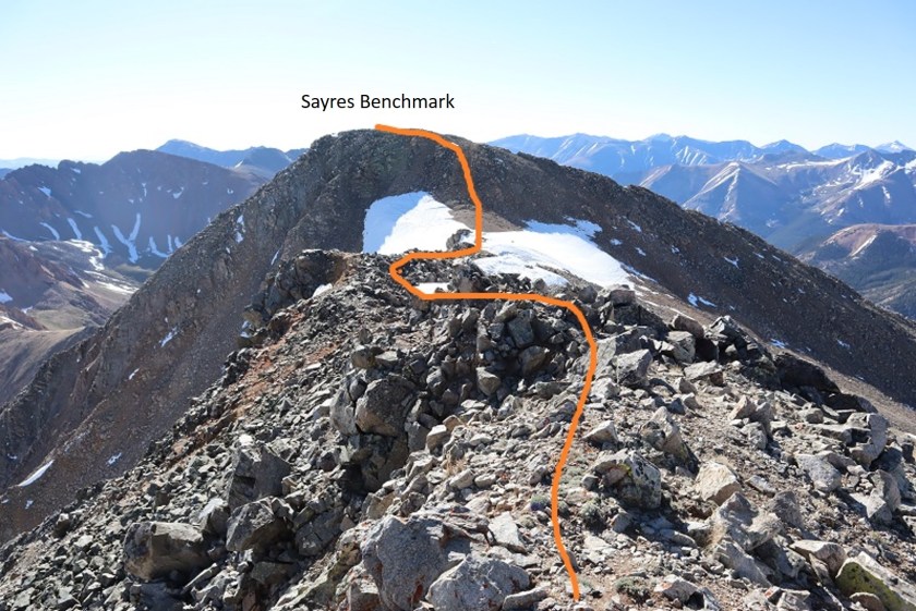
From the ridge you can see the road, and the path you take to get to Sayres Benchmark

I was really glad I decided to take the road up. Not because it was easier than the ridge, but because it was here I saw some elk. My favorite were the calves, suckling breakfast until they noticed me and their mamas decided it was time for them to leave.
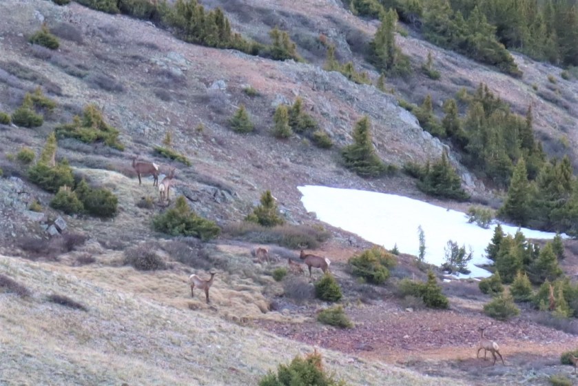
Elk:
Following the road to 13275 feel of elevation I then turned right (south) and followed the ridge, losing 300 or so feet of elevation as I made my way to the saddle. I decided to just follow the ridge, even though it meant going up and down in elevation a few times. (This is all class 2)
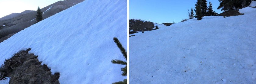
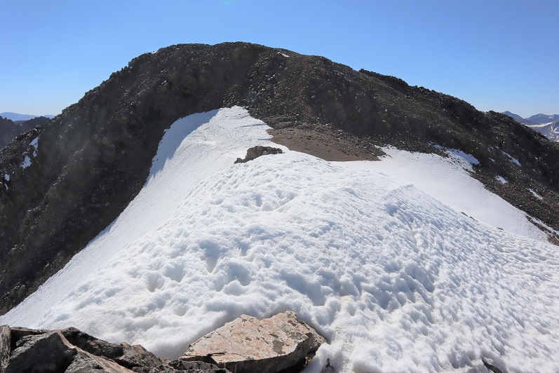
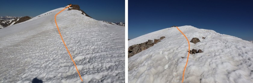
There was still some snow on the ridge. I made the 50/50 decision to stick to the right of the ridge and wasn’t disappointed, as later I could see the ridge to the left was impassable due to snow.
I stuck to the right of the snow
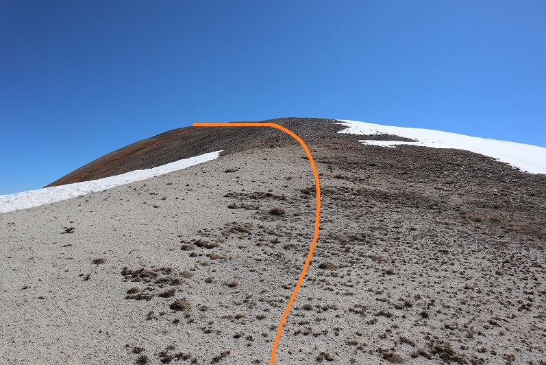
Towards the top the tundra gave way to rocks
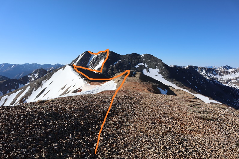
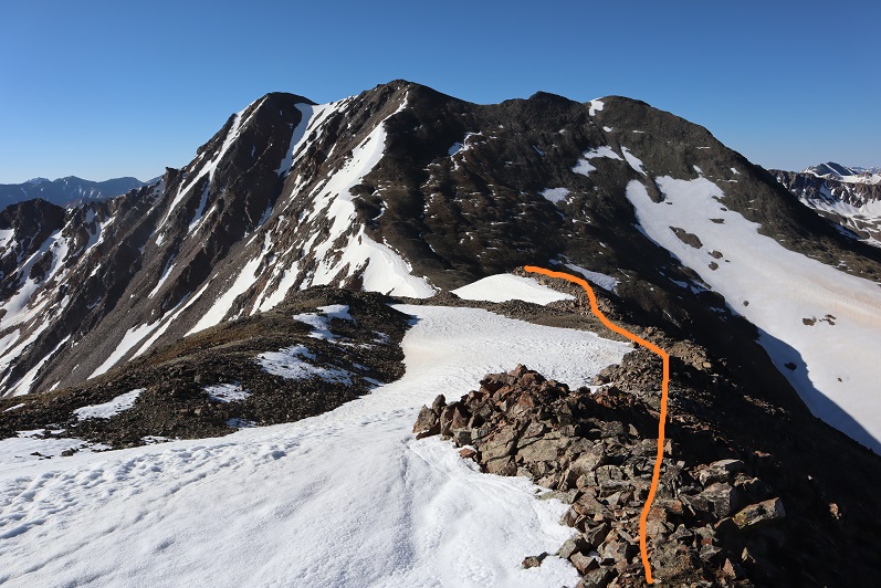
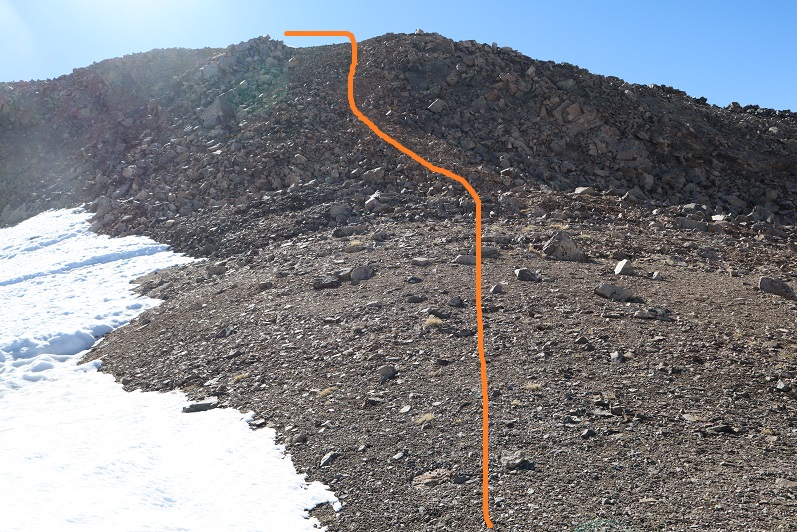
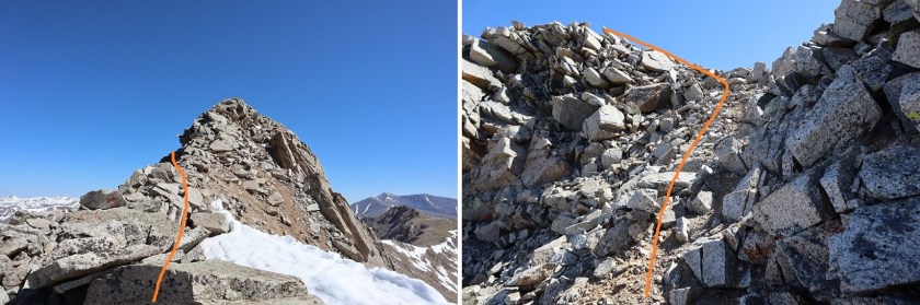
The top of this is unfortunately not the summit of Sayres Benchmark, even if it looks like it is from far away. Nope, when you get to the top of the ridge turn left (northeast) and hike to another small saddle and then up to the summit of Sayres.
There was more snow here than I would have liked, but it was firm this early in the morning. I decided against putting on spikes or crampons and just hiked across.
After this small saddle I picked one of the many dirt filled gullies and climbed to the top
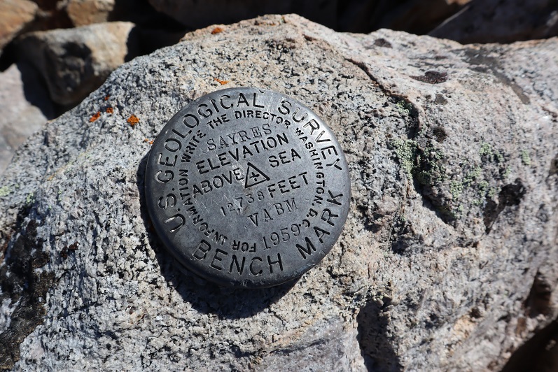
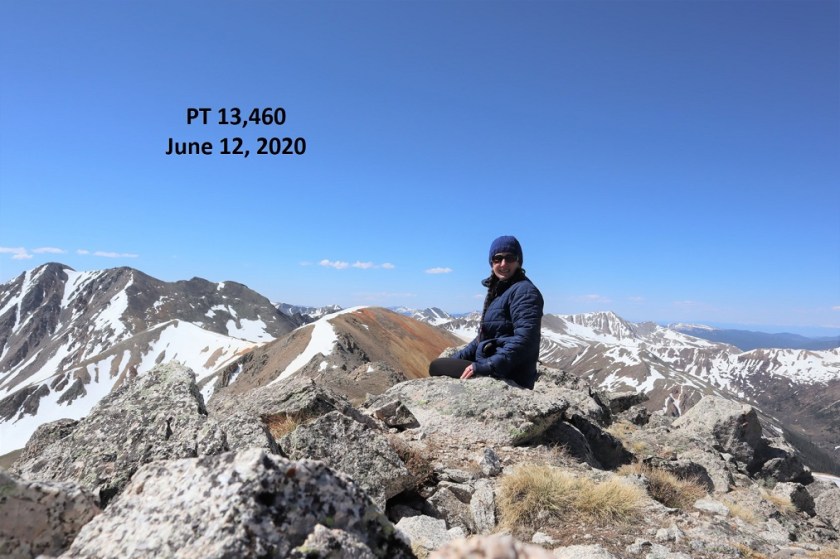
I summited at 8:40am.

Summit of Sayres:
There was a benchmark that I’m pretty sure is off by 1000’ or so…
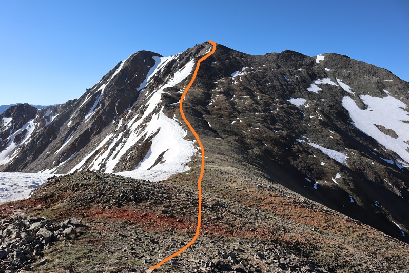
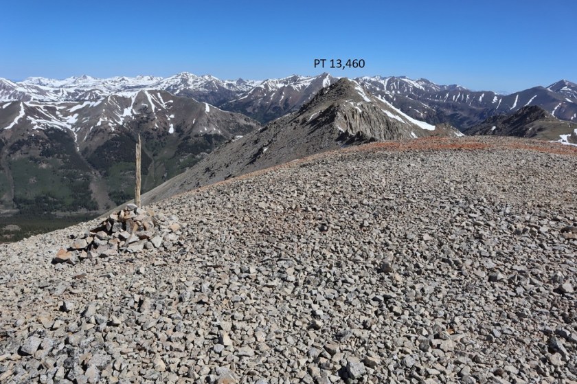
There was a summit register, but as always, I didn’t open it. Time to head back the way I came. I turned back and headed towards the small saddle, retracing my steps. Here’s an overview of the route to PT 13460
I was glad the snow was still firm enough not to need traction. Today there was minimal exposure as well.

Here’s an overview of the route back to PT 13,430 (not considered ranked or unranked)
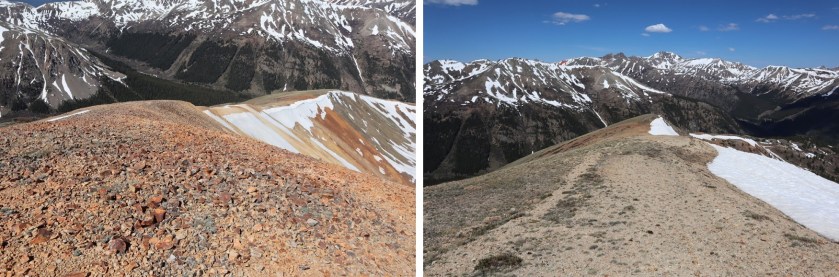
Notice the snow? It’s good here to stick to the left (west side)

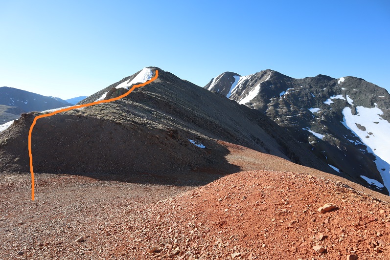
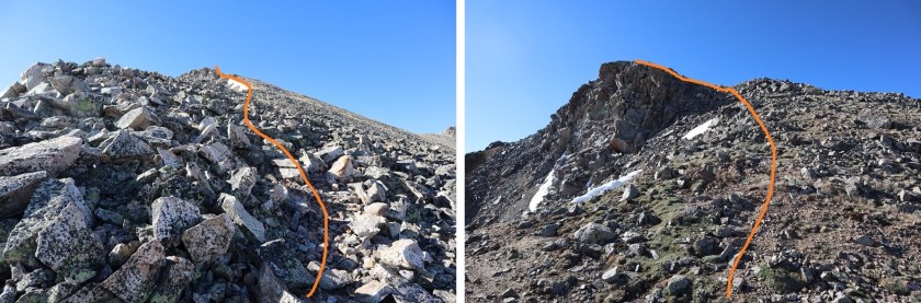
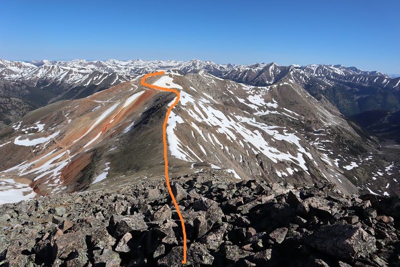
Here’s a visual of the route to the top of PT 13,430
I took the road to the ridge, turned right (northeast) and once I was on the ridge the ground turned sandy for a bit, but mostly it was crushed rock.
Here’s a view of PT 13,460 from PT 13,430
Here’s the route I took to get to PT 13,430. I tried to stick to the ridge, but when that wasn’t possible I dipped to the left. This is all class 2, maybe easy 2D (if that can be a thing?)

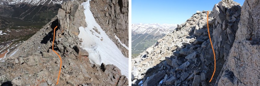
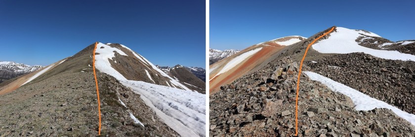
Here you dip down to the left and climb back up through a short gully
The final trek to 13,460

I summited PT 13,460 at 10:20am. There was as a summit register here.
Summit of 13,460:
Here’s looking back at today’s peaks

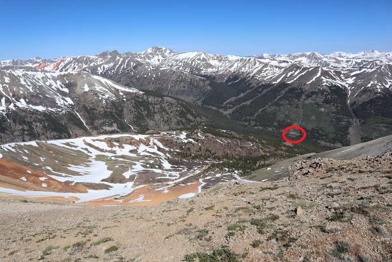
I made my way back to PT 13,430, retracing my steps. Here’s an overview of the route back down from the ridge before PT 13,460. You can clearly see the road at the end of the ridge. I circled where my truck is parked.
The ridge started out as rubble and turned to tundra before making it back to the road
Here’s looking back at the ridge. While hiking the ridge I ran into another hiker! I hadn’t expected to see anyone at all today, and as we passed I was thrilled to see she was another female solo hiker. It’s nice to see other women out rocking the mountains. We talked for a bit. I was probably a bit clipped because I had other plans for today and wanted to keep moving, but she did too so after chatting about the weekend weather around the state and other peaks for this weekend we were both on our way.

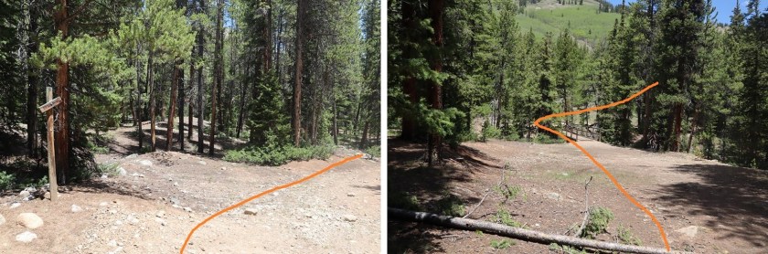
I followed the road back to the creek crossing, through the gate, turned right, and followed the trail back to my truck. I kept my sandals on after the creek crossing, since it was such a short distance and I’d be changing back into them when I was done anyway.
I made it back to my truck at 12:30pm, making this a 12.61 mile hike with 4652’ of elevation gain in 7.5 hours.
Since it was still early, the weather seemed to be holding up, and I wasn’t yet exhausted I decided to drive over to Independence Pass and see if I could hit a few more ranked 13ers today. As I drove out all of those empty dispersed camping spots were full.

I am so amazed at how versatile you have made Yourself through self willed determination.I marvel at how brave You are as I look at the topographical map and the photos You provide for Your viewers such as I.Please never stop providing Your self photos as they are also so very important to Your soloing and History of Lady Laura (Wild Wanderer).I can’t help but marvel at Your every footstep,whether wet or dry and always concerned about Your hands and feet as they are succestable to temperatures that interfere with Your many successes. Thank you for pics of the Bench Marks,they look like they were just planted. There is no one like You Laura Clark.
Thank You for sharing Your struggles.
LikeLike
Wow that was strange. I just wrote an very long comment but after I clicked submit my comment didn’t appear. Grrrr… well I’m not writing all that over again. Regardless, just wanted to say superb blog!
LikeLike