Ellingwood Ridge – 13,222

Rt Length: 9.9 miles

Elevation Gain: 3622’

I’d been crying all day, so when I made it to the trailhead I was quite the mess.  My eyes were swollen, my nose was red, and I was tired.  My 23-year-old daughter coaches color guard, and last week, one of her team members was murdered.  I’m not going to go into the details of what happened (news article here), but my daughter wanted to be at the viewing and also at the funeral to support her students.  I wanted to be there to support my daughter.  She was determined to make sure she talked with each and every one of her students individually, which meant we were there a long time.  I watched high-schooler after high-schooler break down in front of the (open) casket, crying, some uncontrollably.  There was a slide show of the best moments of her 17 years scrolling, with several pictures including my daughter.  When all of the guard members were there, they held hands and stood in a semi-circle around the casket, grieving together.  This was one of the hardest things I’ve had to witness in my life, and I was just on the sidelines.  I was mad, angry, hurt, confused, and so many other emotions I can’t put into words, for everyone involved.  I cried excessively during the entire funeral, my arm around my daughters’ shoulder, trying to comfort her as well.  I dropped my daughter off at the airport (she’d been in Georgia for the summer, and flew back for the funeral), and drove to the trailhead.   I needed a hike, as I had a lot to process. 

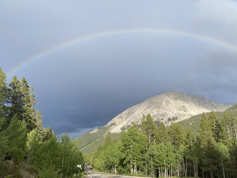
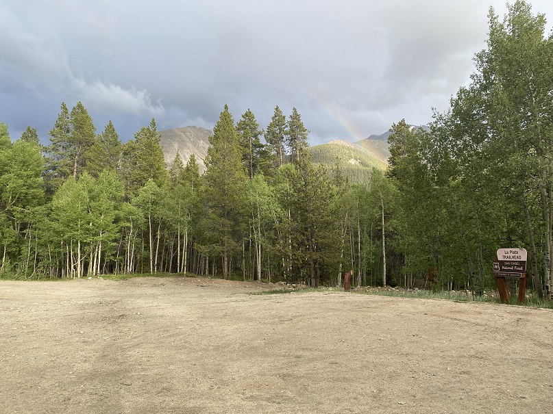
When I got to the La Plata Gulch Trailhead it was raining, but after a few minutes a rainbow came out.  I needed that rainbow.  I also needed sleep.

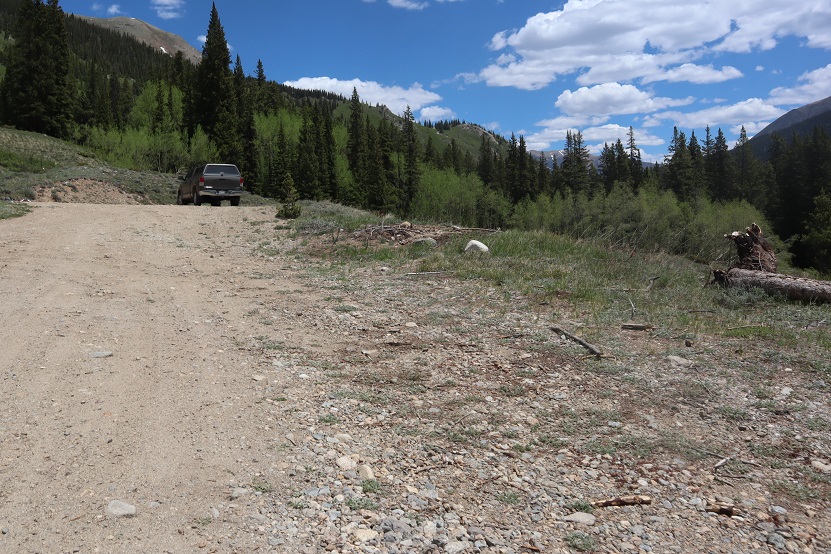
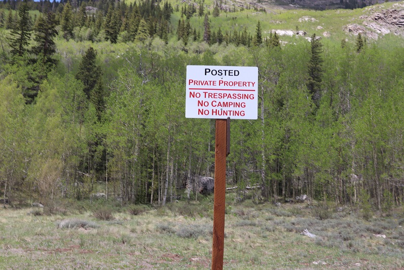
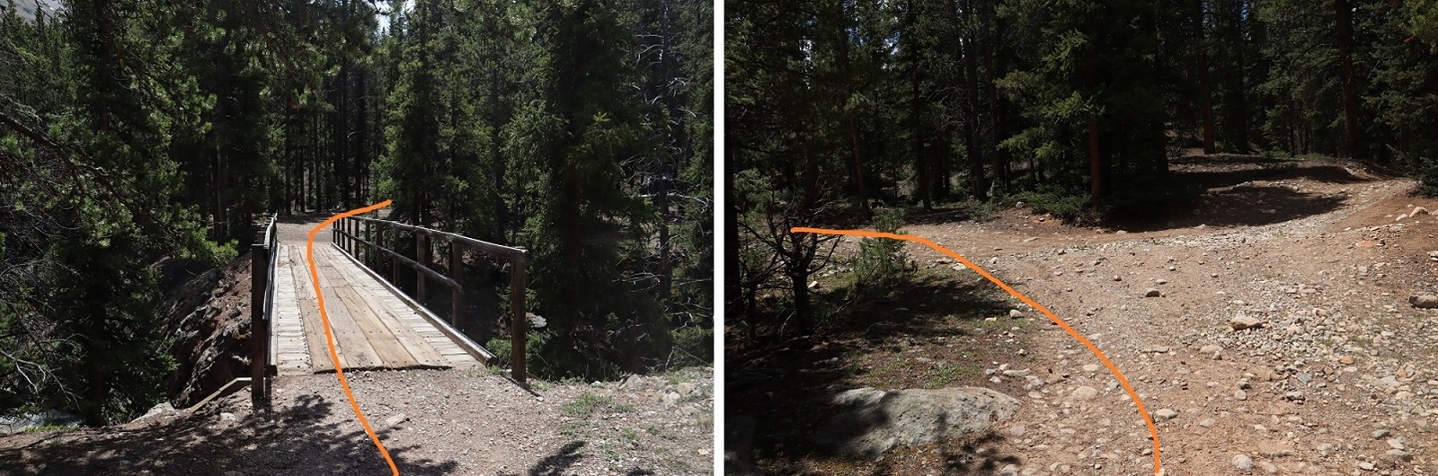
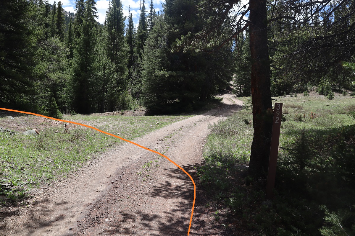
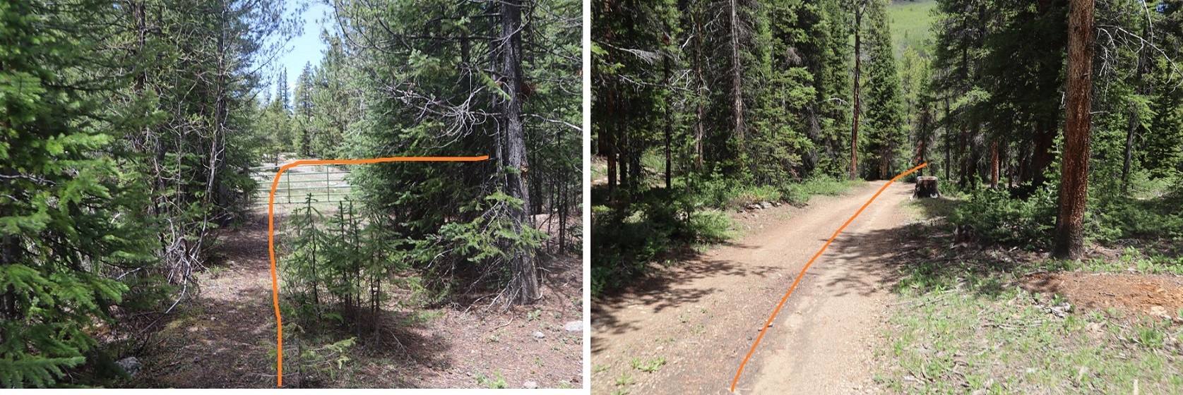
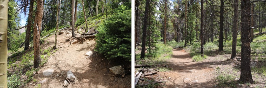
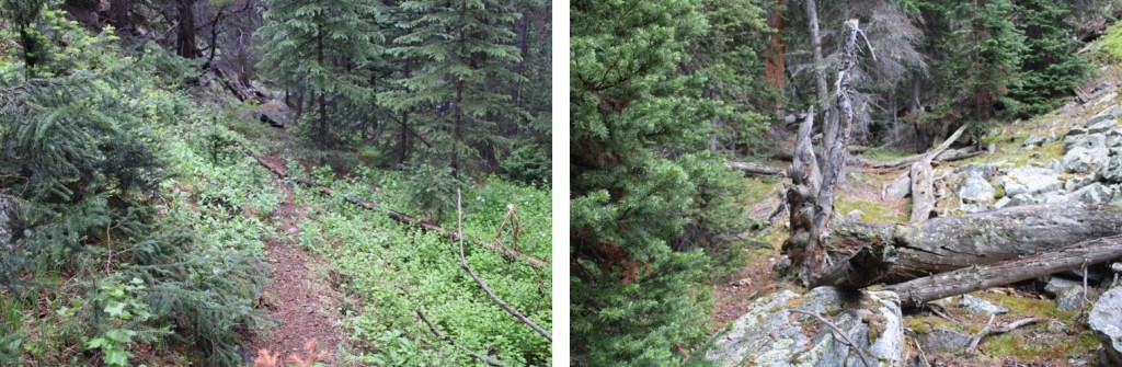
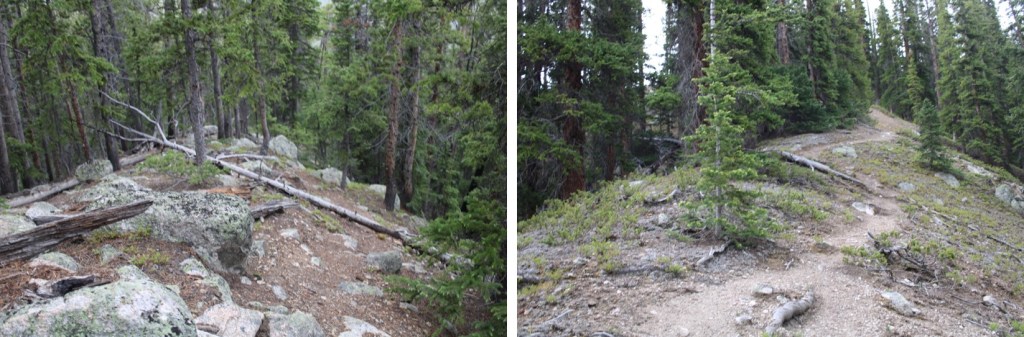
I went to bed early, and was on the trail at 4:30am.  The trail begins by following the La Plata Gulch Trail

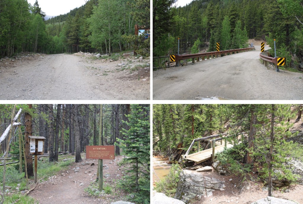
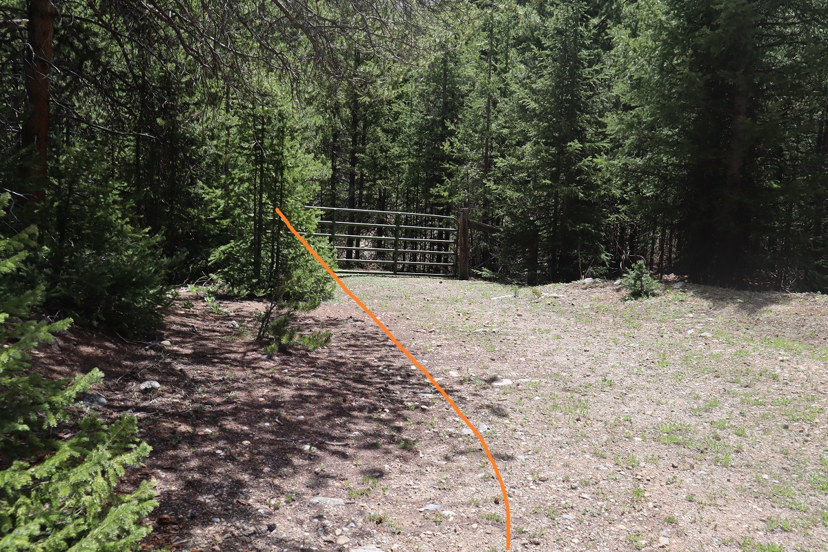
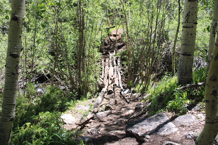
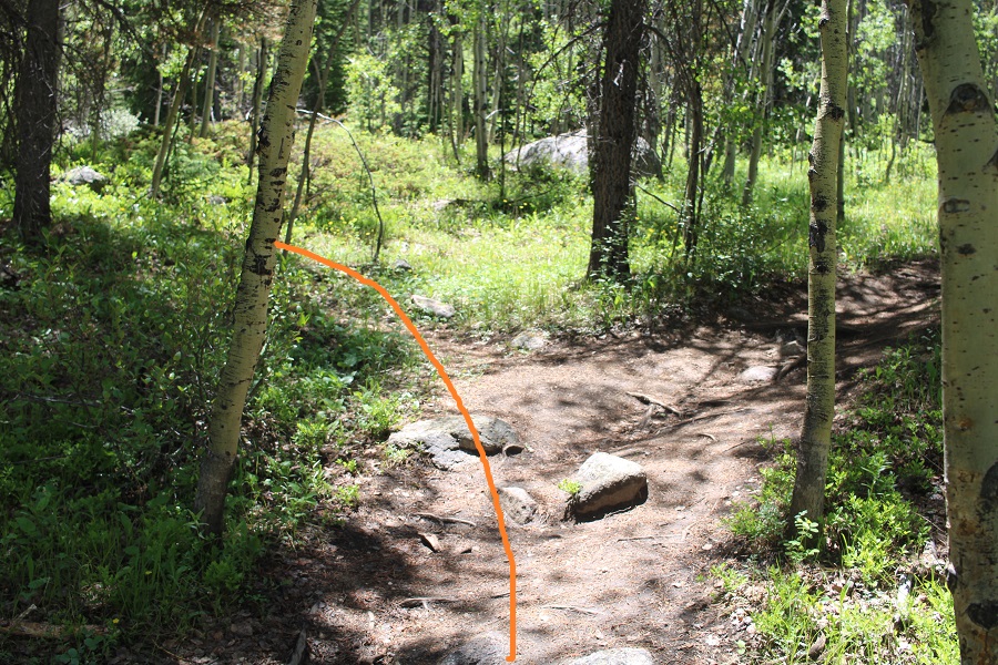
After following the trail for 1.3 miles, and after the second bridge crossing, there was a faint trail I took to the left

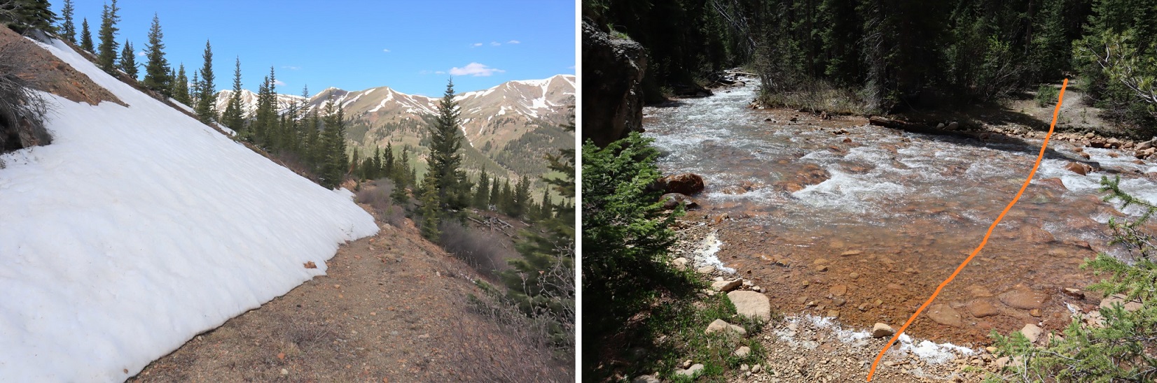
I followed this faint trail until I came to a third creek

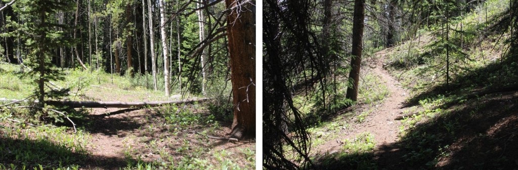
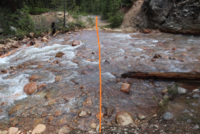
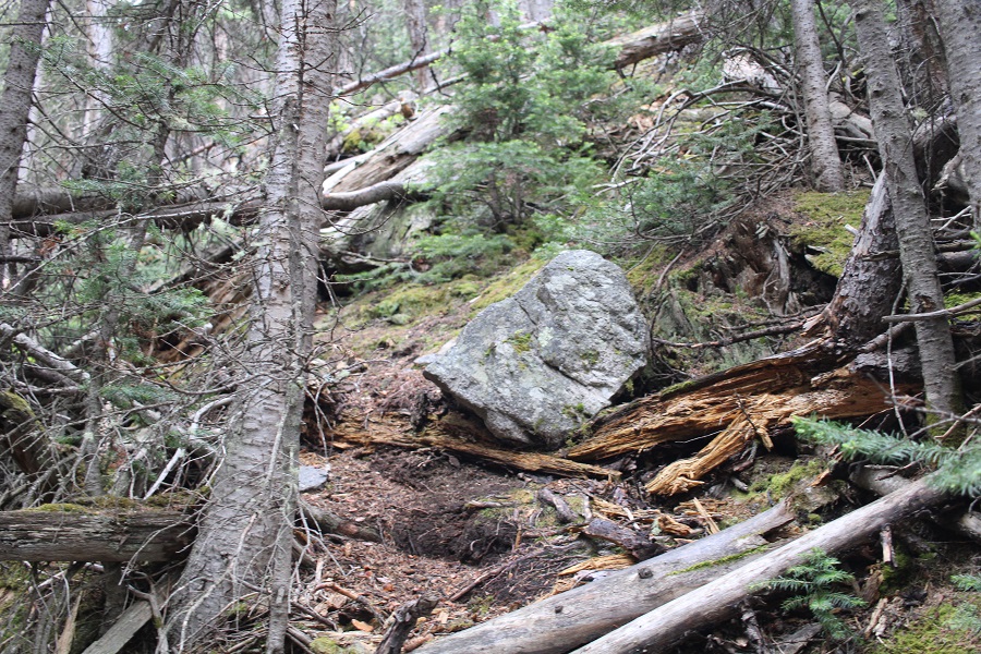
At the creek the trail stopped, so I turned right and followed the creek.  It’s important not to cross the creek too soon! 

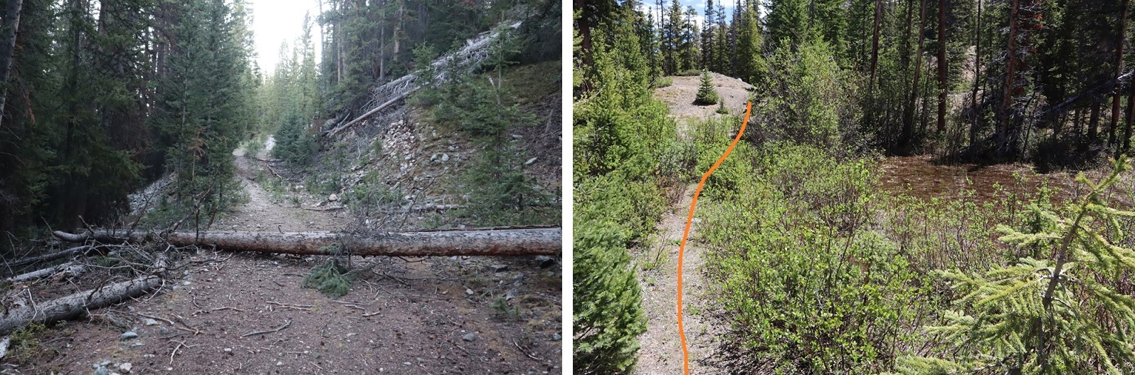
The creek had a lot of deadfall, but there is a faint trail that can be navigated.  I followed it until just after I saw this large rock formation on the left, at about 10630’.

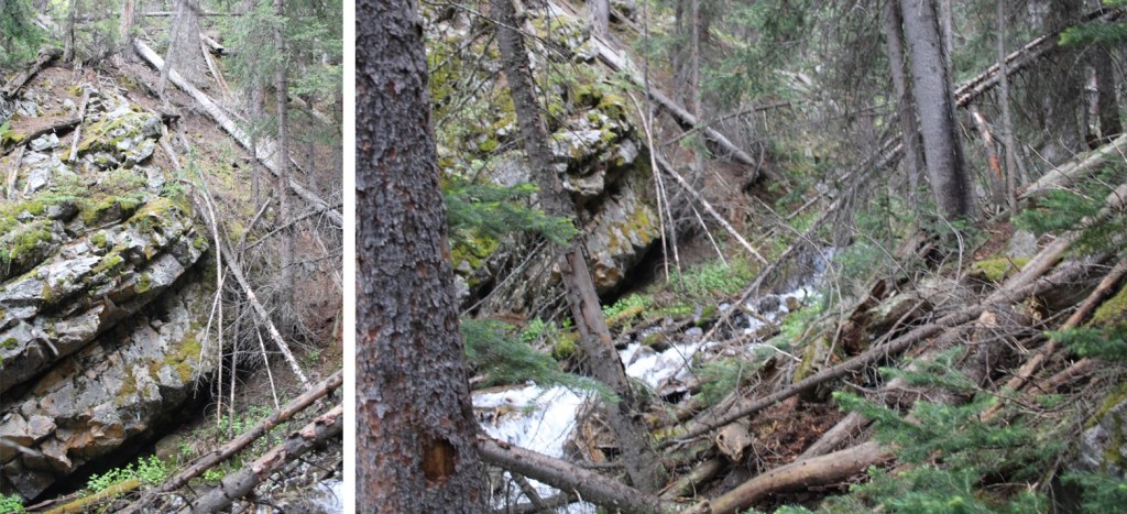
AFTER this rock formation I crossed the creek, and made my way to a small ridge

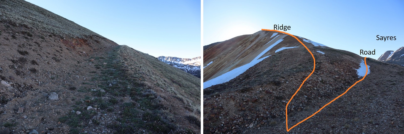
I followed this ridge to treeline

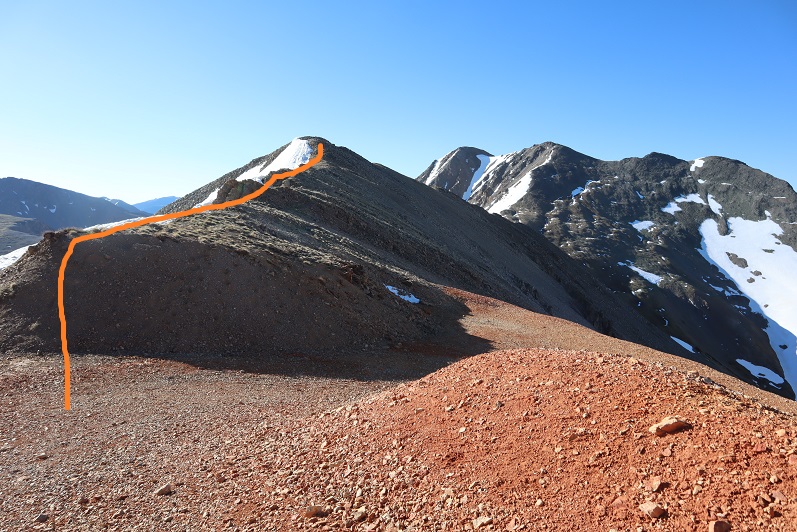
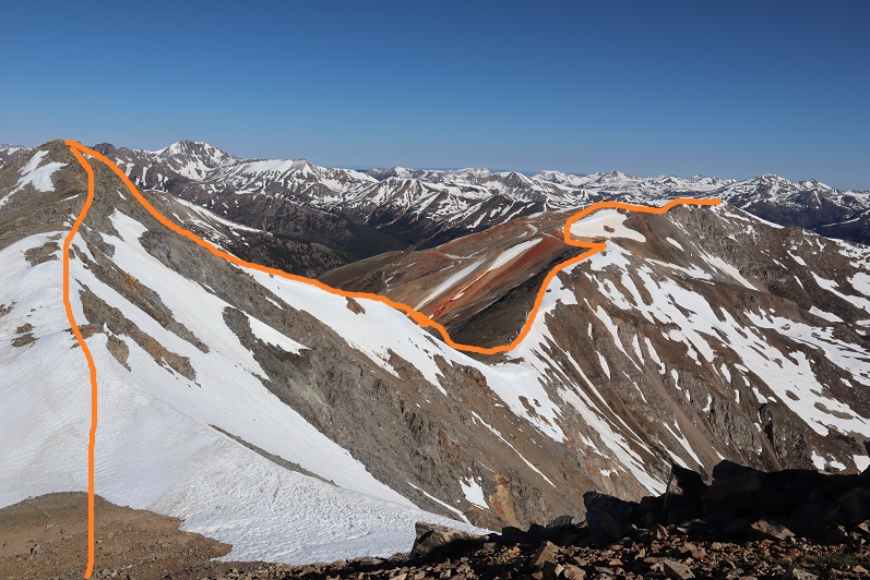
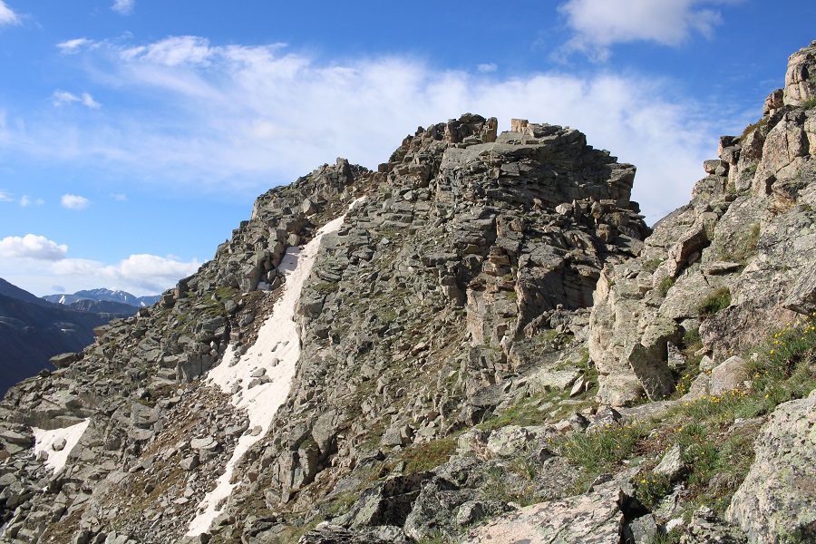
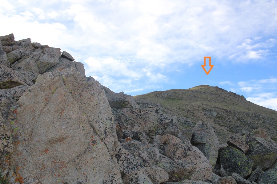
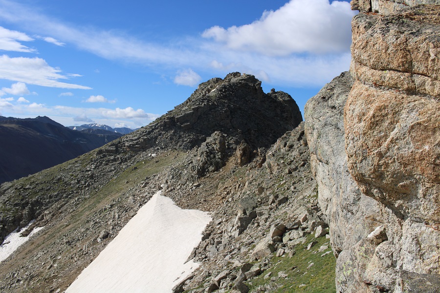
At treeline, to my left I could see my route to gain the ridge. 

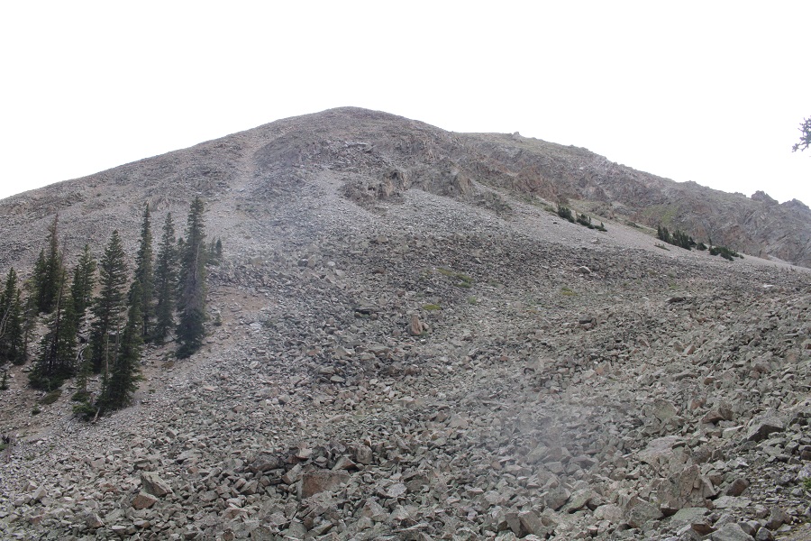
This is the route I took… up an obvious gully.

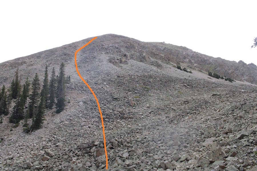
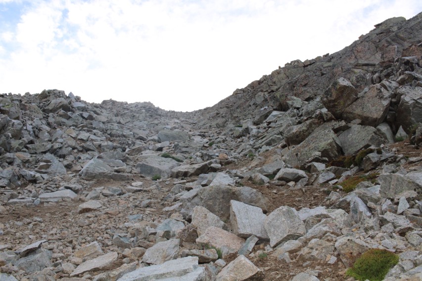
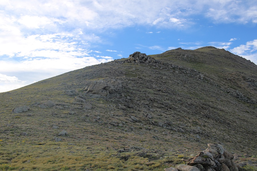
I started out rock-hopping on unstable rocks, which gave way to a scree and raspberry bush filled gully, which gave way to tundra.

I followed the tundra southwest

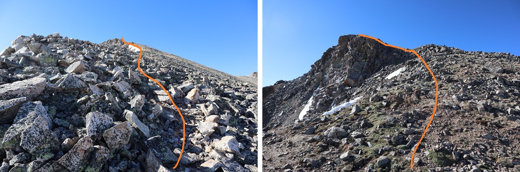
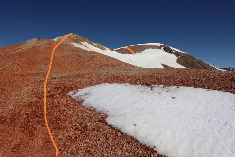
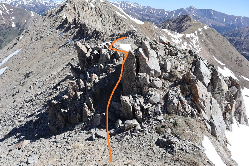
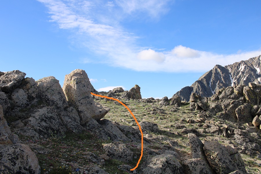
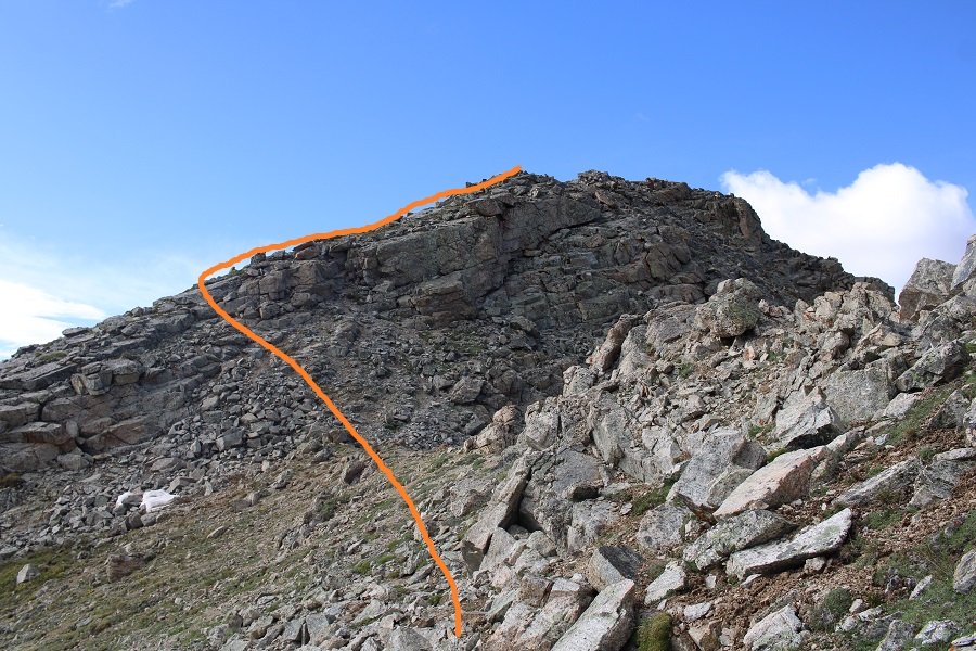
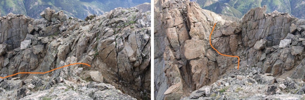
This is where the hike gets interesting.  I’ll show you the route I took that worked (I tried a couple of different things that didn’t, so I have a messy GPX file).  First, I put on my helmet for some rock hopping

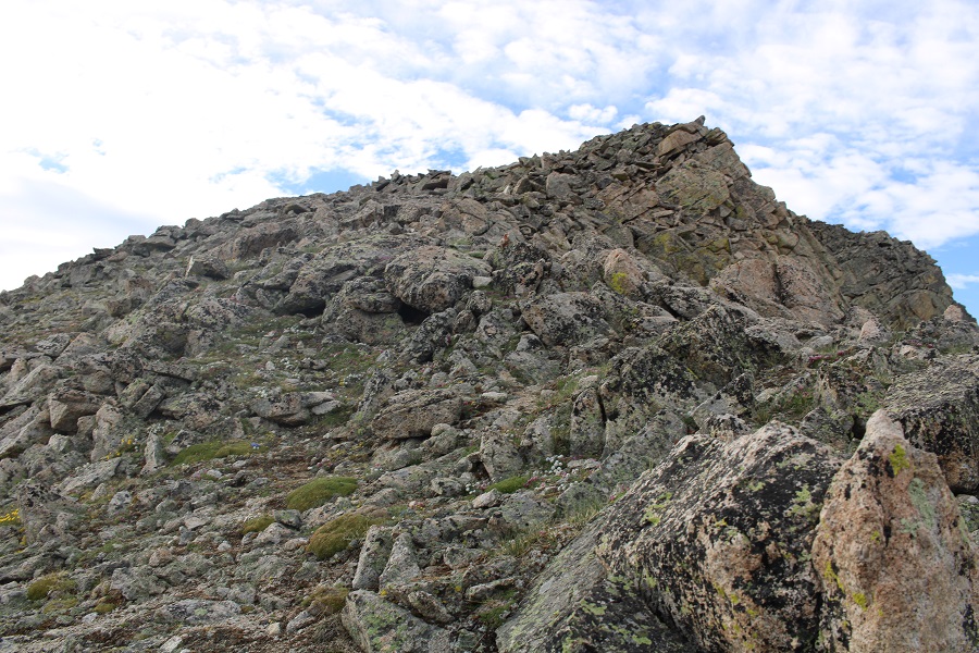
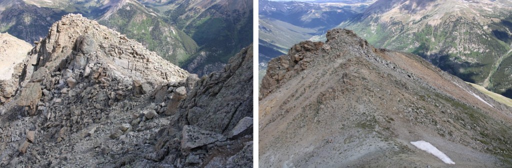
Then, I went straight up the face of this

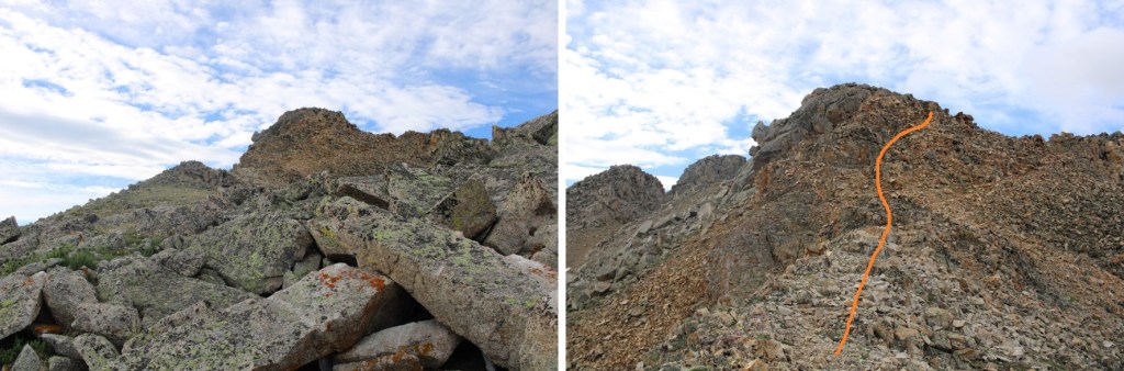
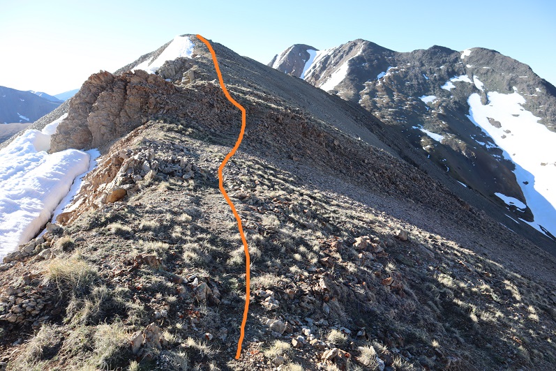
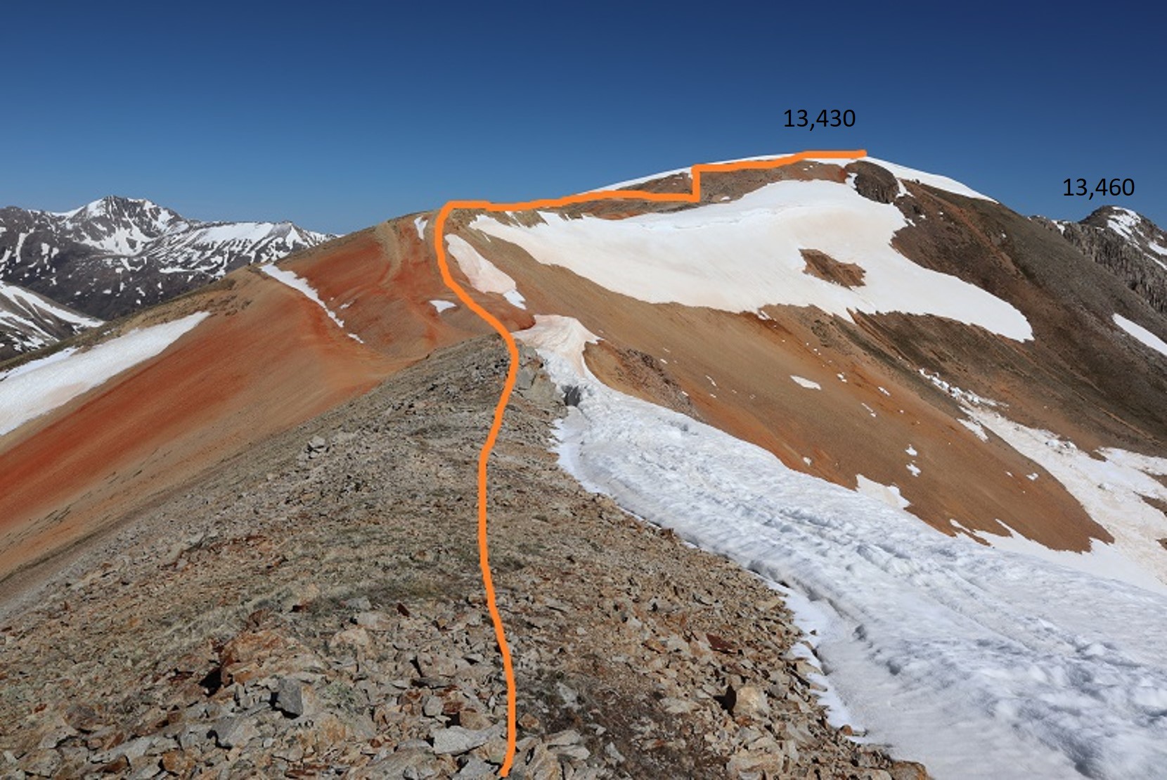
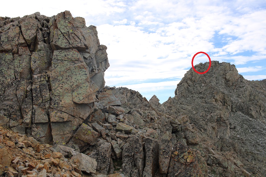
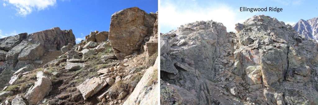
And then class 3’d this ridge to the right.  Notice the cairn in the red circle?  I erroneously assumed this was the summit of Ellingwood Point, but it isn’t.  In any event, DO NOT aim for that cairn.

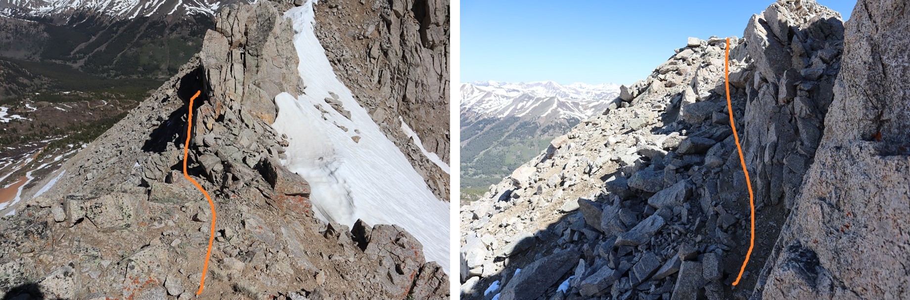
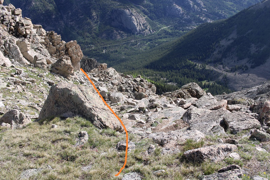
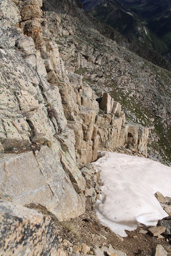
Instead, you’ll encounter some class 3-4 scrambling as you go under the ridge, losing about 50 feet of elevation. 

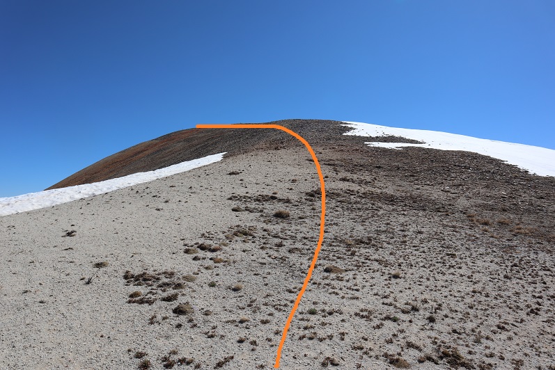
I descended down what I felt was a class 4 chimney, before turning left and finding a somewhat grassy ramp that turned to rocks and took me back to the ridge

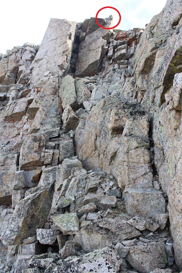
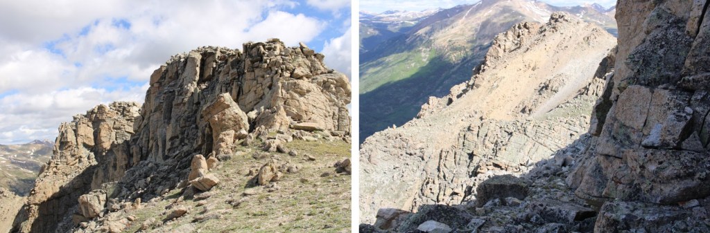
Just before reaching the ridge, I saw another cairn, and what I thought would be the summit of Ellingwood Ride.  This is also not the accepted summit.  DO NOT follow this cairn. 

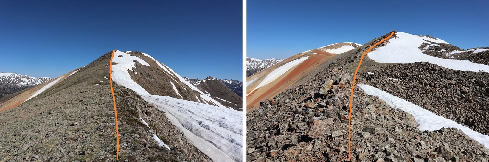
However, when I made it to this point I could clearly see it was about level with the OTHER point I wasn’t supposed to summit (here’s looking back)

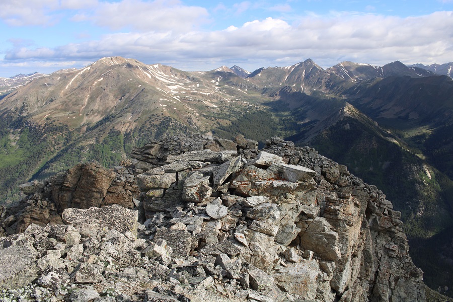
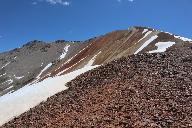
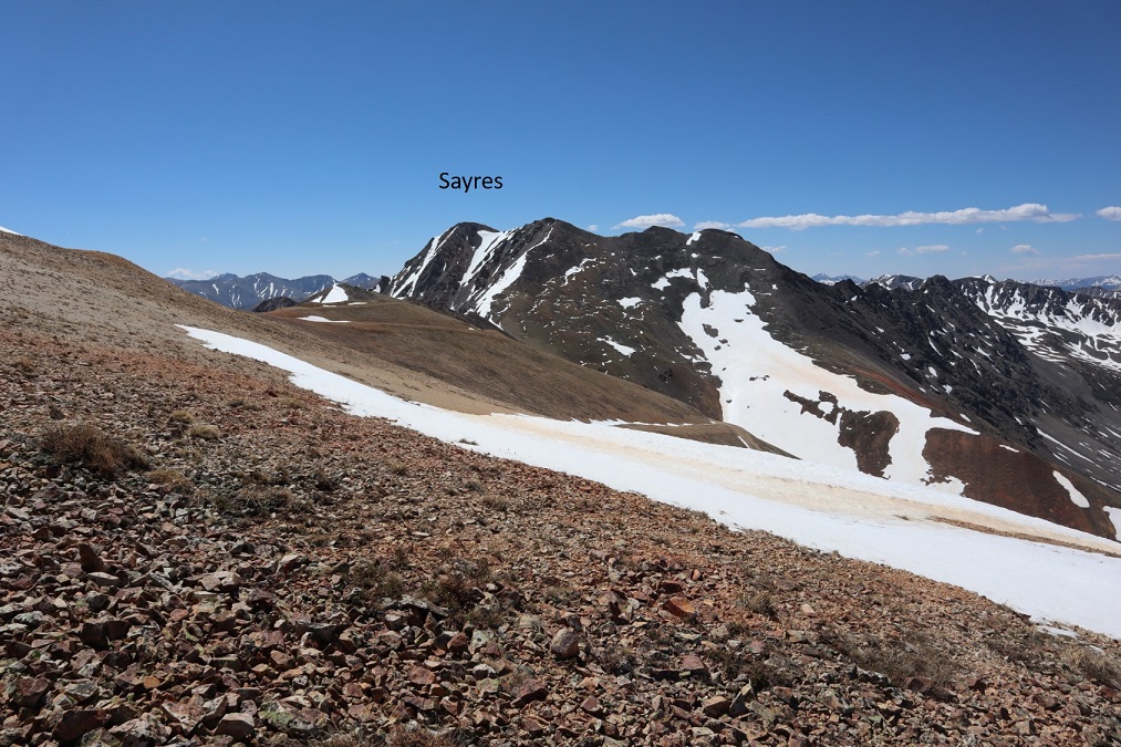
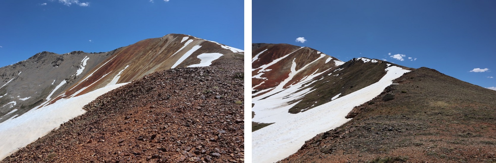
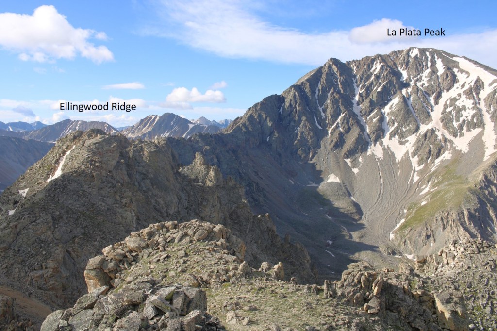
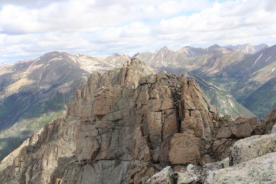
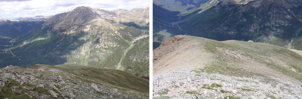
When I turned and looked south, I could see the true summit of Ellingwood Point.

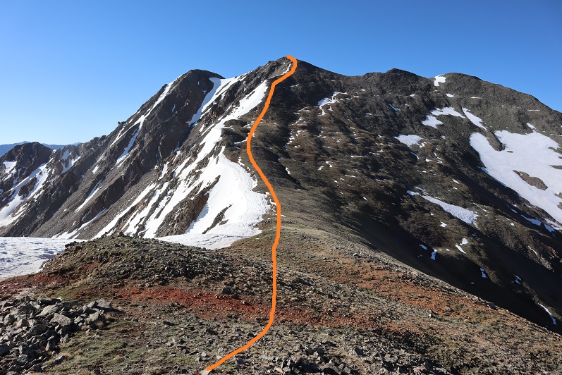
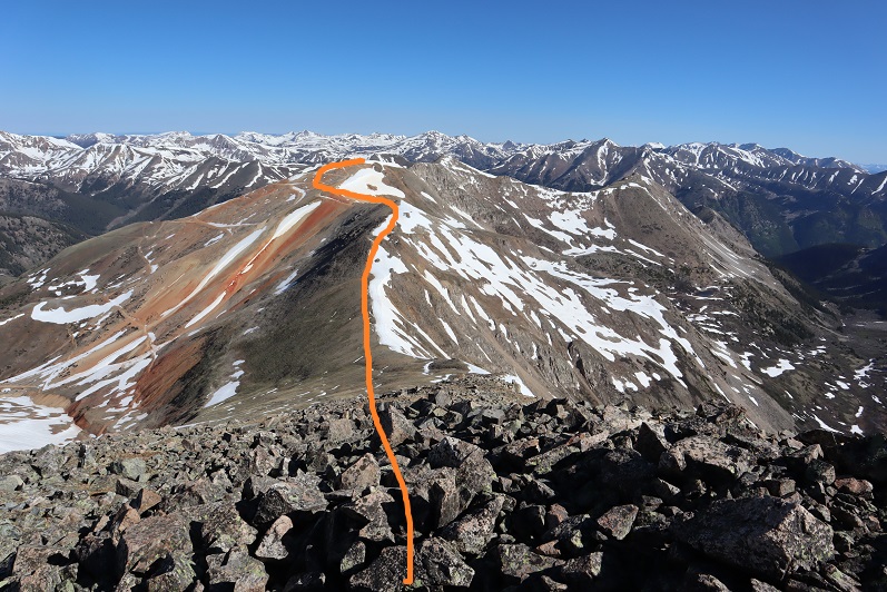
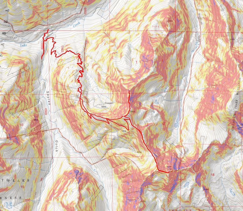
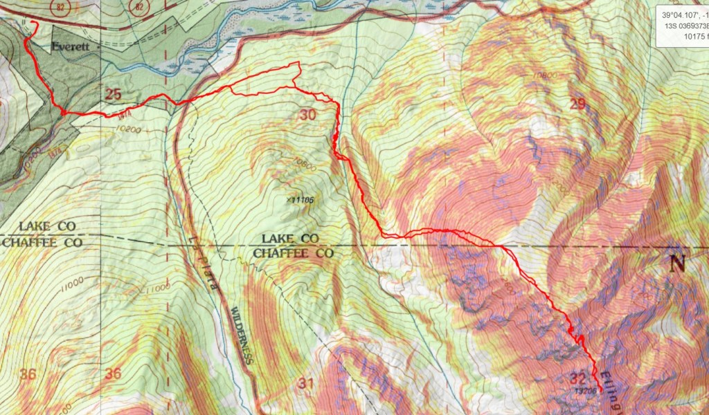
The route wasn’t straightforward.  I made my way down, and over to the ridge.  I then lost 115’ of elevation as I made my way towards Ellingwood Point.  Here’s my overall route

Here are some step-by-step pictures

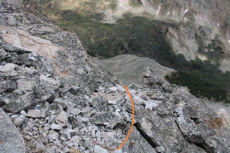
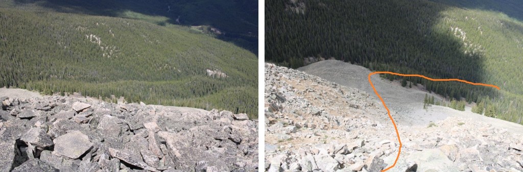
Make sure you choose the correct gully to descend!  It’s not the first gully you encounter, but the second that ‘goes’

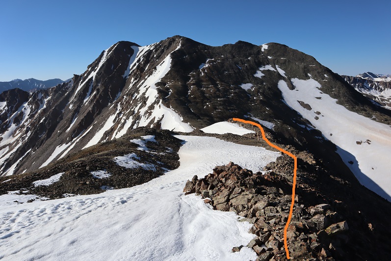
Then I turned right and made my way towards the saddle, staying above the snow

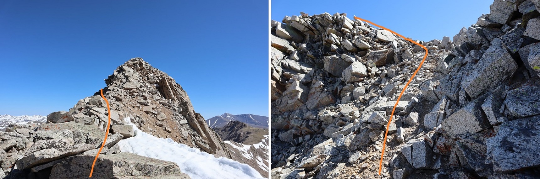
At the saddle it was choose your own adventure up

I think the traditional route is to take the gully up, but it was covered in snow, so I made my way on the rocks until it was safe to use the gully, quite near the top.  This is the route I took

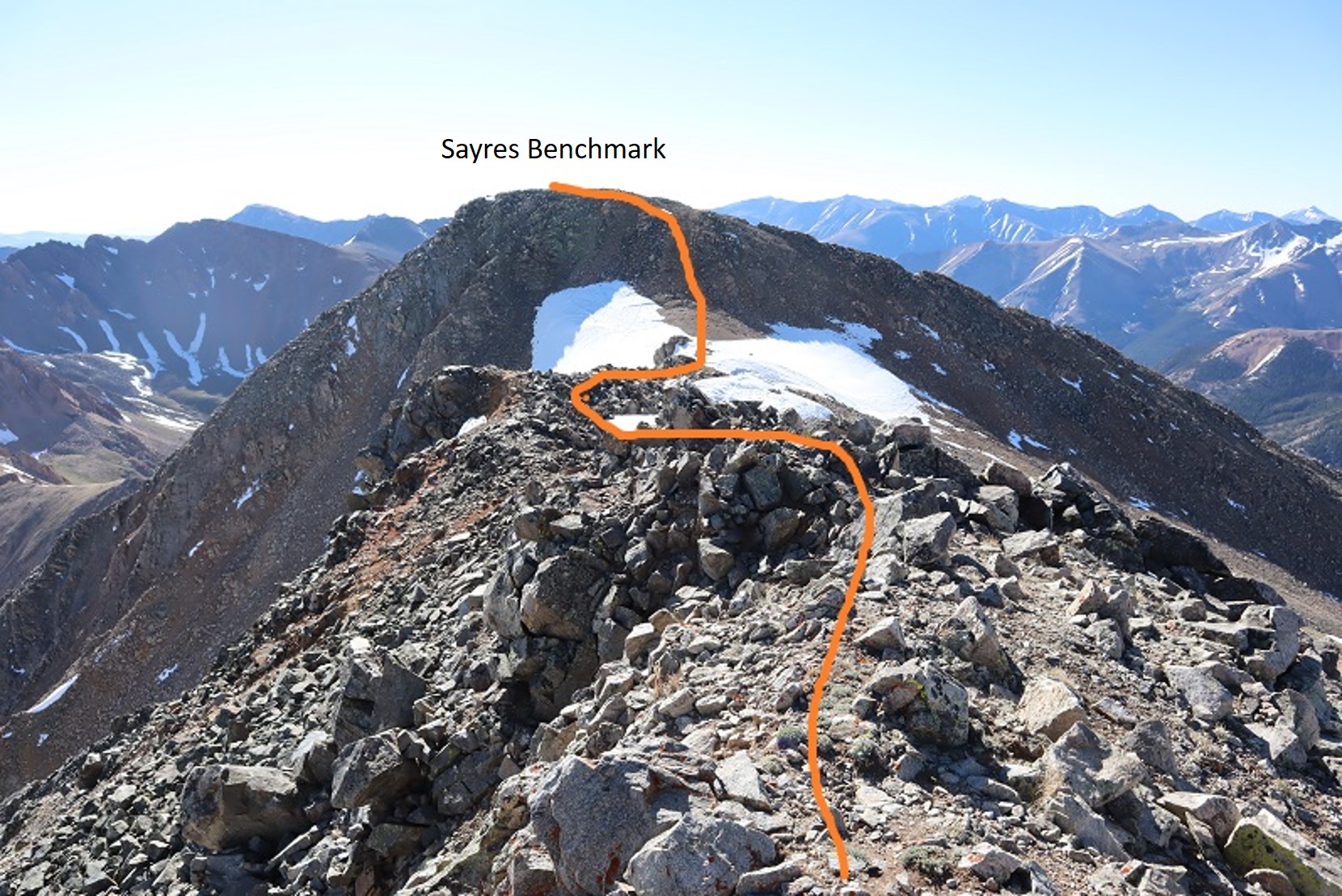
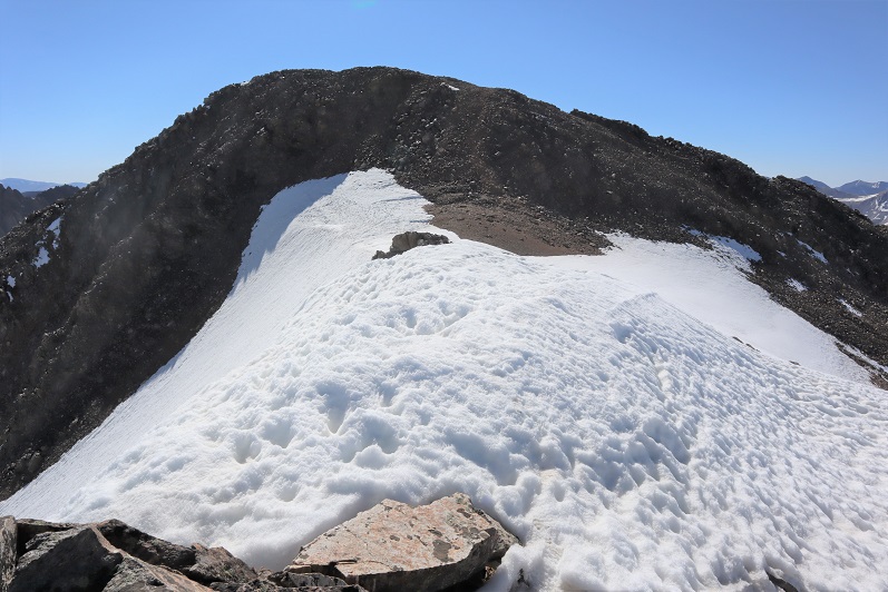
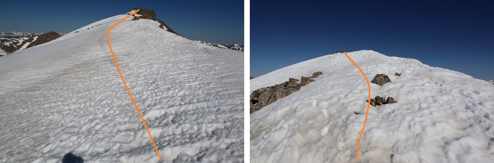
I did encounter a little bit of snow towards the top, but I was able to navigate around it.  Once at the top of the gully, I descended some class 3 terrain, and re-ascended another short gully

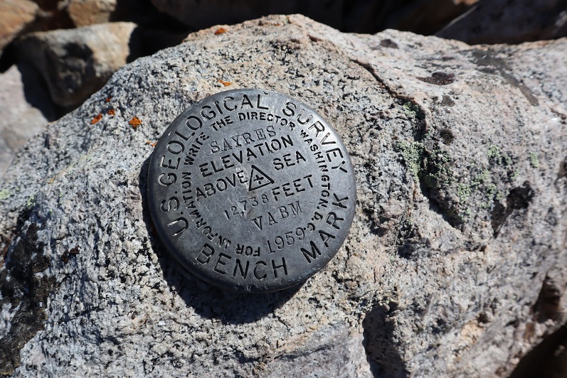
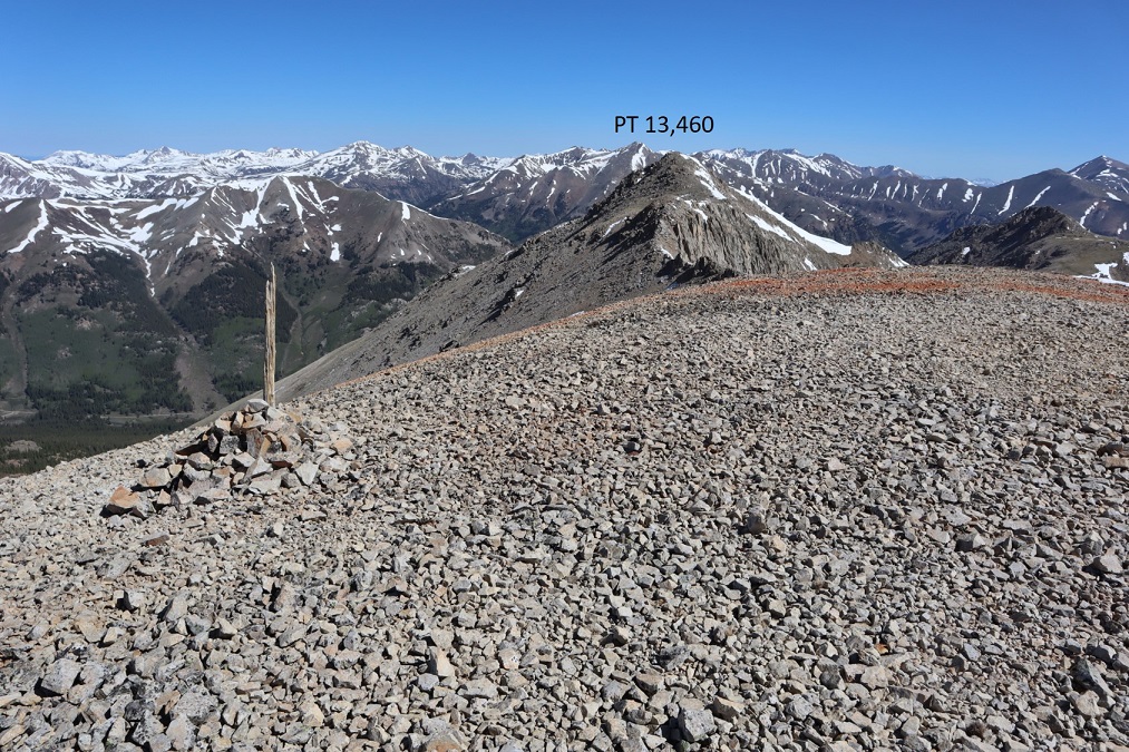
There was a small cairn there, letting me know I was at the summit

I summited Ellingwood Ridge at 9am

Ellingwood Ridge:

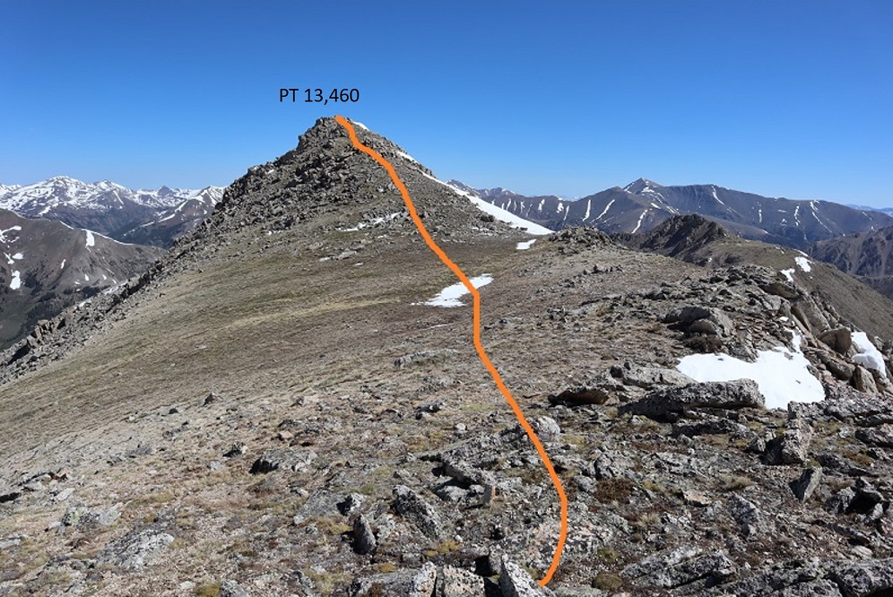
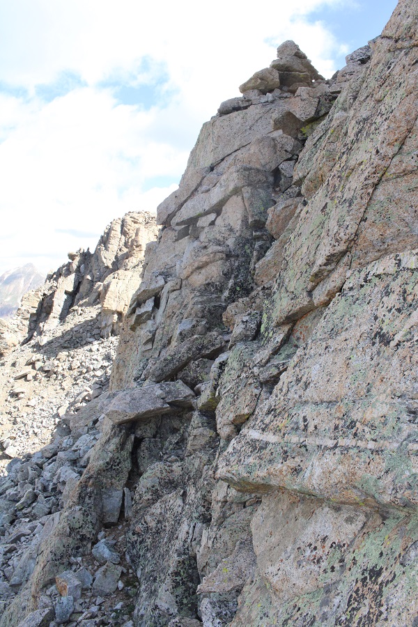
Here’s looking north at the route I took in.  As you can see, it’s difficult to tell where the ‘true’ summit is.

I was making this an out and back, mainly because there was a storm headed my way, so I turned and retraced my steps.  Here are some visuals of the harder areas to ‘figure out’

Looking down the gully, I stuck to the wall and did just fine

Then I made my way back down the ridge, keeping to the right, and heading back up that second gully, which is more obvious going this way, as it’s the only one that ‘goes’

At the top of the gully I once again lost elevation and navigated the west side of the mountain

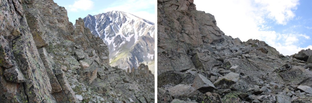
Here’s looking up at that class 4 gully

And the ridge back to the tundra

The tundra to the rocky gully

And the gully to the ridge

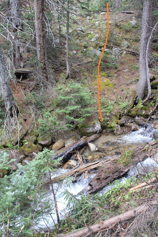
As soon as I hit the ridge it started raining.  I followed the ridge to the stream crossing, then followed the stream back to the trail

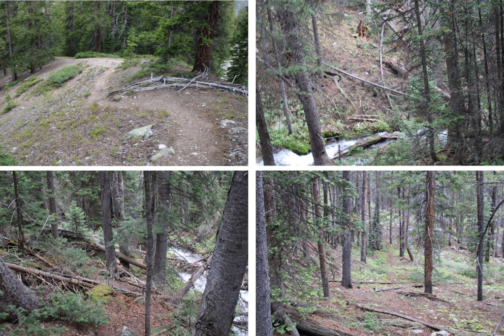
Once on the trail, it was easy to follow it back to the trailhead

I made it back to my truck at 12:30pm, making this a 9.9 mile hike with 3622’ of elevation gain in 8 hours.

While I unpacked quite a bit emotionally, I didn’t come up with any answers on the hike, except that it’s important to listen when people tell us something is wrong, and to love each other, as you never know what the other person is going through.  I can’t combat the evil in this world, but I can appreciate and acknowledge, and even contribute to the good.  I raised a daughter who chose to go out of her way to be there for her students, when it would have been easy to say something like “I’m all the way in Georgia”, “I don’t do well with death”, “I can’t afford the trip” or “I don’t do well with funerals” and not show up.  She showed up and she supported her students as they grieved, and even shared some of her favorite memories of Riley with her parents.  That’s something to be proud of. 

On to the next trailhead!

Sayres Benchmark – 13,746 & PT 13,440

1

RT Length: 12.61 Miles

Elevation Gain: 4652’


I drove to the La Plata Gulch Traihead and then took 391 for a little over 2.5 miles to a junction with 382, 391, and 392, where I parked my truck. This is an easy 4WD road in, with a few water holes to navigate.

2

I parked at what looked to be an avalanche runout area.

3

Initially I’d intended to make this a loop and incorporate Unnamed 13,300F and PT 12,601, but the area that I’d exit the hike as a loop with had a lot of “no trespassing” signs, so I decided early on just to make this a 2 peak hike.

4

At 5am I gathered my gear and headed southwest, following 392, passing some dispersed campsites and wiki-ups.

5

I crossed a bridge and turned right, following 392. There are more dispersed campsites here. The dispersed campsites make it a little difficult to follow/see the road.

6

In the dark I ended up going too far south on 382, missing the obvious 392 sign, and the not so obvious road. Turn left at this sign, even though there’s no road.

7

And pass through a gate, now following the 392 4WD road.

8

Almost immediately I came to a creek crossing that required me to take off my shoes and get out my sandals. The creek was cold (especially at 5am) but the water only went up to my knees in the deepest of places.

9

Shoes back on, I followed the 4WD road. “4WD Road” is a bit of a misnomer. This was probably a road decades ago, but it has gone into disrepair and hasn’t been used for quite a while. It’s easy to follow, but overgrown in many areas with willows, aspens, and even 10+ foot pine trees.

10

At 11,950’ I came to a small cabin with a great view.

11

I peered inside: someone had left a peanut bottle full of trail mix (peanuts and M&M’s?) on a shelf. It was dark and cold inside and I’ve seen horror movies so I didn’t take the bait. I turned around and considered my options. Here the road still had some snow/ice covering it, but early in the morning I could walk across it when necessary without traction. On the way back I was able to see dry spots to navigate down and avoided the snow.

12

My options were to either take the road or follow the ridge. I decided to take the road up and follow the ridge back down. I wasn’t disappointed. I also placed a cairn here to show where you leave the trail to follow the ridge (even though it should be obvious).

13

The road really didn’t have much snow on it after I passed this point and was quite easy to follow all the way to the saddle. Several times I intersected with the ridge route as I followed the road.

14

From the ridge you can see the road, and the path you take to get to Sayres Benchmark

15

I was really glad I decided to take the road up. Not because it was easier than the ridge, but because it was here I saw some elk. My favorite were the calves, suckling breakfast until they noticed me and their mamas decided it was time for them to leave.

16

Elk:

Following the road to 13275 feel of elevation I then turned right (south) and followed the ridge, losing 300 or so feet of elevation as I made my way to the saddle. I decided to just follow the ridge, even though it meant going up and down in elevation a few times. (This is all class 2)

17

18

19

There was still some snow on the ridge. I made the 50/50 decision to stick to the right of the ridge and wasn’t disappointed, as later I could see the ridge to the left was impassable due to snow.

20

I stuck to the right of the snow

21

Towards the top the tundra gave way to rocks

22

The top of this is unfortunately not the summit of Sayres Benchmark, even if it looks like it is from far away. Nope, when you get to the top of the ridge turn left (northeast) and hike to another small saddle and then up to the summit of Sayres.

23

There was more snow here than I would have liked, but it was firm this early in the morning. I decided against putting on spikes or crampons and just hiked across.

24

After this small saddle I picked one of the many dirt filled gullies and climbed to the top

25

I summited at 8:40am.

26

Summit of Sayres:

There was a benchmark that I’m pretty sure is off by 1000’ or so…

27

There was a summit register, but as always, I didn’t open it. Time to head back the way I came. I turned back and headed towards the small saddle, retracing my steps. Here’s an overview of the route to PT 13460

28

I was glad the snow was still firm enough not to need traction. Today there was minimal exposure as well.

29

30

Here’s an overview of the route back to PT 13,430 (not considered ranked or unranked)

31

Notice the snow? It’s good here to stick to the left (west side)

32

33

Here’s a visual of the route to the top of PT 13,430

35

I took the road to the ridge, turned right (northeast) and once I was on the ridge the ground turned sandy for a bit, but mostly it was crushed rock.

36

Here’s a view of PT 13,460 from PT 13,430

37

Here’s the route I took to get to PT 13,430. I tried to stick to the ridge, but when that wasn’t possible I dipped to the left. This is all class 2, maybe easy 2D (if that can be a thing?)

38

39

Here you dip down to the left and climb back up through a short gully

40

The final trek to 13,460

41

I summited PT 13,460 at 10:20am. There was as a summit register here.

42

Summit of 13,460:

Here’s looking back at today’s peaks

43

I made my way back to PT 13,430, retracing my steps. Here’s an overview of the route back down from the ridge before PT 13,460. You can clearly see the road at the end of the ridge. I circled where my truck is parked.

44

The ridge started out as rubble and turned to tundra before making it back to the road

45

Here’s looking back at the ridge. While hiking the ridge I ran into another hiker! I hadn’t expected to see anyone at all today, and as we passed I was thrilled to see she was another female solo hiker. It’s nice to see other women out rocking the mountains. We talked for a bit. I was probably a bit clipped because I had other plans for today and wanted to keep moving, but she did too so after chatting about the weekend weather around the state and other peaks for this weekend we were both on our way.

46

I followed the road back to the creek crossing, through the gate, turned right, and followed the trail back to my truck. I kept my sandals on after the creek crossing, since it was such a short distance and I’d be changing back into them when I was done anyway.

47

48

49

I made it back to my truck at 12:30pm, making this a 12.61 mile hike with 4652’ of elevation gain in 7.5 hours.

50

Since it was still early, the weather seemed to be holding up, and I wasn’t yet exhausted I decided to drive over to Independence Pass and see if I could hit a few more ranked 13ers today. As I drove out all of those empty dispersed camping spots were full.