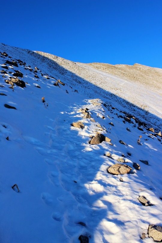
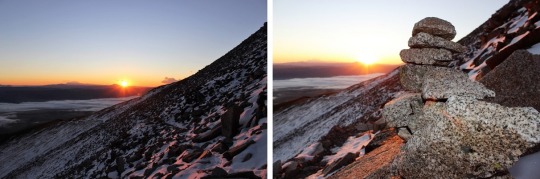
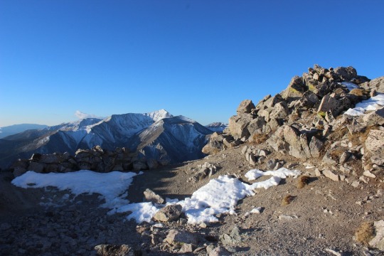
I earned this last week while climbing Wetterhorn: My elbow caught on a rock when my trekking pole accidentally collapsed.
Funny thing, my knees felt way worse when I fell on Princeton a few weeks ago. In fact, they are still a little sore, but they never bruised? However, when I hurt my elbow it stung, but was nowhere near as painful as hurting my knees. Yet this bruised. Oh well. Time to look for a quality trekking pole that doesn’t collapse unless I tell it to…
The weather today for just about every 14er in Colorado was
the same: Windy. I’m not a fan of wind gusts of 45+ mph (which
usually end up being around 85mph up on the peaks if we’re honest) but they’re
manageable if it’s a warm day. I ruled
out any peak with snow on it because wind and snow don’t mix (as I learned last
week). That left me with Wetterhorn Peak
for today’s 14er. I checked the weather: 20% chance of snow and 100% chance of 25mph+
winds with gusts of 43mph. Hmmmm. That didn’t sound too promising. Not bad, but not great. I knew there wasn’t any snow on Wetterhorn,
so that was a plus. I was just worried
it would get snow during the night/day and ruin the trip. I didn’t want to drive 6 hours out there to
turn around.
I was musing all this to my kids when my youngest said “Mom,
you should just go. You’ll never really
know the weather or if you can make it or not unless you try.” She’s a smart 14 year old. (She must have an
amazing mom…). I told her she was right,
and set my alarm for midnight. Besides,
this would be my 33rd 14er and my 3rd class 3. Lots of 3’s mean it’s meant to be, right?
The trailhead is easy to find/follow. From this sign it’s really a 4WD road.
I know others have posted it’s manageable in a 2WD, and I’m
sure it is for those amazing 2WD gods out there, but if you value your 2WD
vehicle, do NOT take it on this road. However,
if you’re looking for a reason to get a new vehicle, by all means proceed. Here are a few pics:
I made it to the trailhead at 5:30am and was on the trail by
5:45 (I drive fast). There were 2 other
vehicles in the lot (I parked lower down).
There’s probably room for 15 vehicles total at the upper trailhead,
including parking about 10 yards below the lot.
Here’s what the trailhead looks like in the daytime. The trail starts to the left of the trail
signs.
Note: Most of these
pictures were taken on the way down because my fingers were too frozen to take
pictures on the way up.
The beginning of the hike was pretty uneventful. (Another Note: The summit ledger is full and the pen
provided doesn’t have any ink left. Maybe
a hiker could bring new supplies with them?) It was just me hiking in the
dark. The trail was wide, clear of snow,
with just a few muddy spots in areas. It
was about 37 degrees, and there wasn’t any wind. Yet.
As soon as I hit treeline the wind began to blow, but it
wasn’t too powerful and it wasn’t cold outside, so it was bearable. As the sun began to rise I noticed what
looked suspiciously like snow clouds on the mountains next to where I was
hiking. Luckily the wind was blowing
them away from me. It seemed like the
sun took an awful long time to rise this morning. I passed a boulder field that was easy to
navigate but didn’t have any cairns?
This could be a problem in the winter.
The entire trail was very well maintained, all the way to
the ridge
I looked for the turnoff to Matterhorn Peak but never saw
it? I did see this sign, which, despite
it’s name, does not go to Matterhorn Peak.
I could see a few hikers in front of me by their
flashlights. They seemed far away, but I
quickly caught up with them. They looked
really cold in their hoodies. I was cold
in my snow clothes.
At this time the sun began to rise and the temperature began
to drop as I hit the ridge and the wind picked up. I still think Colorado Flag sunrises are
cool!
At the top of the ridge I could see most of the route
left. This scree hill was insanely
slippery! I could tell a lot of people
had chosen to just walk on the tundra. I
put on my microspikes and braved the scree.
At the top of the scree hill I could see the path to the
summit (or part of it).
It included a LOT of scrambling over a lot of rock walls/large
gullies/insanely tall boulders. These
pictures just do not do them justice!
This part should have been fun for me (I love scrambling)
but the weather made it really difficult to find my way. The wind was cold and intense. I had to find a cave to shelter in to get out
my map, and taking my gloves off made my fingers freeze instantly. I’d look at my map, put it away, put on my
gloves, head out to hike, and the terrain kept changing on me. I even brought up the pictures on my
phone. Nothing up close looked like the
pictures I had? Well, every once in a
while they did, but not on a consistent basis.
I gave up and just followed the cairns.
Luckily there were a lot of them.
Did I mention the boulders were COLD? My hands were frozen! And it was pretty windy, so I didn’t want to
rest too long to appreciate the view. I
just wanted to summit, and was thrilled when I did!
I could see Matterhorn Peak and Uncompaghre Peak in the
distance.
I took a selfie to prove I’d summited
And a quick 360 degree video
And headed back down.
I needed to get warm again.
Soon. I was seriously worried
about two fingers on my left hand at this point that were solid and starting to
burn. I kept trying to flex them to keep
the blood pumping but they wouldn’t move.
(No, not frostbite, I have Raynaud’s, so I’m overly susceptible to cold
temperatures).
Climbing down is different than climbing up, as your center
of gravity is off and you can see more of the exposure so it’s more mental. I took my time, even though my fingers were
frozen. I didn’t want to slip.
Just as I was finishing the climbing part of this hike I ran
into the three hikers again, getting ready to cross over the first obstacle.
OK, time to book it back down in elevation to warm up these
fingers! Luckily the sun was coming out
and the clouds all seemed to gravitate towards other peaks. It was still windy
though. As I hiked back down I
contemplated Wetterhorn. She was beautiful!
Summiting had been really anti-climactic and I was trying to
figure out why? I should have LOVED that
climb! It must have been the
cold/wind. I mentally tried to decide if
I was even up for hiking Matterhorn Peak today?
I went back and forth in my mind a few times, and told myself the
decision hinged on actually finding the trailhead and my fingers defrosting. Oh, and warmer weather and less wind wouldn’t
hurt…
As I descended into the basin and passed through the boulder
field there was a brief period where all wind stopped. The silence was deafening. I didn’t hear a bird, marmot, pika, airplane,
wind, etc. Nothing. I grew up in Southern California, and
directly before and after earthquakes everything becomes still (for different
reasons). That’s what this felt
like: The still before the chaos. I hoped that wasn’t foreshadowing for the
hike ahead.
I kept debating the whole Matterhorn Peak thing. My fingers had finally defrosted, the wind
had died down a bit (but don’t let those photos fool you: the wind was intense!) and I didn’t really
want to drive all the way back here to hike Matterhorn at a different time. But I was tired, and I still wasn’t sure
where that trailhead was? As I was
hiking I had a thought: Could it be
here? At the Ridgestock Driveway and
Wetterhorn Peak junction?
That wasn’t in any of my notes, and didn’t really make sense
(shouldn’t it be at the Matterhorn trail junction where it wasn’t?). But in the daylight it looked right. I got out my altimeter. Ugh! I
was at 12,500’. If I was going to do
this hike I was going to have to gain another 2000’ in elevation, after already
doing 3300’ this morning. I was
tired. Did I REALLY want to do
this? I heard my daughter’s voice in my
head again: “Mom, you should just go.
You’ll never really know if you can make it or not unless you try.”
Before making the decision to hike Matterhorn Peak I decided
to see if this was actually the correct junction to take. Then if it was I could either continue
hiking, or know for next time when I’d most likely be hiking in the dark. I started up this hill. It really did seem to go on a lot longer than
it looked like it should, and more than once I thought about stopping this
nonsense and heading back down the trail.
But I’m stubborn, so I continued on.
At the top of the hill the trail kind of split in two. Left is the correct way to go
This is what I saw:
I was intrigued. What
I saw before me truly looked like fun.
Sure, I was tired, but this looked like FUN! There was no trail, I’d get to make a trail
for the first time, and this looked totally doable! I just needed to cross the stream and head
up! I was in a basin, so it would be
difficult to get lost.
I was in. Since there
was no established trail I designed a plan:
I’d leave the trail, cross that little creek and hike straight up the
mountain (no sissy switchbacks for me, I wanted that elevation gain). I looked at the entire mountain and visually
picked cues (rocks) to aim towards. Here’s
the route I took:
Before heading out I turned around to get a good visual of
where I’d started from so I could return to the same spot. I snapped a picture with my camera just in
case I forgot, and was off!
I told myself no looking back/down. The elevation gain was indeed intense because
I just went straight up, but I kept making small goals and taking breaks when I
met them. I took a lot more breaks than
I normally do. As I got further up the
mountain I could see the rocky ridge above me, and made out two figures in the
center that looked to me like rabbits (think Easter Bunny Chocolate
Candy). They were right in the middle of
the ridge, so that’s where I aimed.
As I got closer they looked more and more like rabbits.
I reached the rabbits and gave them my trekking pole for
safe keeping. I trudged on. I could see the summit in front of me.
There was no clear path to the top, but I could clearly see
the peak and several routes I could take to summit. There was a lot of easy scrambling (compared
to Wetterhorn this was a piece of cake!) and a very small summit. So small I couldn’t get a summit selfie. I straddled the summit and just sat there,
thinking about what I’d just done. I’d
rocked that climb! And check out my
view!
I was surrounded by Uncompaghre, Wetterhorn, and the entire
mountain range. I was in the middle of
it all, sitting on a peak, completely enjoying the experience. I the sun and a huge smile on my face. This was awesome! This is why I’d come to hike today! And guess what? For the 15 minutes I was on Matterhorn Peak
the wind completely stopped. I was warm,
could take off my gloves, and took a few pictures.
I was happy. I was
thrilled. I felt accomplished and my
self esteem soared. I love solo
hiking!!! I spent about 15 minutes on
the summit, which is unheard of from me.
I usually summit, take pictures, and head back down to a lower elevation
to warm up. However, it was now time to
head back. I still had a 6 hour drive
home ahead of me. I revisited the
rabbits, thanked them for watching my pole, looked for my point of reference
and headed back down the mountain.
I kept looking for and finding my past reference points and
headed towards where I’d initially gone off the trail. I must have done a really good job, because
about three quarters of the way back I started walking over the tracks I’d
initially made! How crazy is that? All those years of practicing orienteering
paid off!
I made it back across the creek, found the trail, and headed
back down the mountain. I was in a much better mood than when I’d started
today! I was so glad I’d decided to come
hiking. Matterhorn Peak is my new favorite
13er!
I had to be at work by noon today and I didn’t really feel
like getting up at 2am this morning, so I chose a quick, easy, and close
hike. Also it’s a Thursday and there’s
snow on the peaks, so I was hoping to avoid hiking traffic.
I got up at 3:30am and made it to the Quandry Trailhead at
6am. There were noticeably more vehicles
on the road this morning than when I usually drive to 14ers. Must have been because I wasn’t leaving quite
as early.
The road to the trailhead is a short 2WD dirt road. I can’t imagine it ever gives people
problems. There are two parking lots, a
lower one (with 2 clean porta potties) that can hold about 50 cars, and an
upper one that can hold 5-6.
I started at 6:15am. This
is obviously a great snowshoeing trail, as it’s wide and has a lot of wooden
trail signs pointing the way. I was able to see them, even in the dark.
The trail meandered through a forest and when I came to
treeline the snow began on the trail and sun began to rise. I absolutely LOVE sunrises from 14ers, so I
stopped to take a few pictures.
At this point I was at 12,800’ and microspikes were
needed. Well, not needed necessarily, as
technically you could just follow the ridge to the left and not need them, but
what’s the fun in that? I put on my
microspikes and climbed straight up that ridge, looking for cairns. This one was obvious, but after this I didn’t
see any more.
Funny thing, that ridge didn’t seem to end! As soon as I’d reach the top of one, I’d see
another. And they were all covered in
snow. Luckily the snow was packed
tightly, but it felt like I was hiking on my tip-toes.
I kept climbing and climbing and climbing, and eventually I just
had one more ridge to go
It felt like it had taken FOREVER to climb that entire
ridge, but I summited at 8am. The summit
was flat but looked a bit rocky under all that snow.
I took a look around.
The views were amazing! The
entire high country is blanketed in snow!
I took a picture to prove I’d summited
And turned around.
Now I got to hike back down that ridge!
Hiking down is usually more difficult for me than hiking up because I
train running uphill (so my muscles are used to it) and my center of gravity is
off when hiking down hill. Also, my
knees are at about 95% right now after those falls two weeks ago. I only notice it when I either touch my knees
where they were injured or go down stairs/climb down mountainsides. Not to mention by now the sun had come up and
the snow was now more icy/slippery.
That ridge seemed to go on forever on the way down as well! It was indeed quite slippery, and I was happy
to practice maintaining my balance on the ice/snow. I appreciated when I sank into the snow about
2-3 inches, as it gave me traction. I
never post-holed, but it was obvious others had and would later in the
day.
Here’s a happy story:
I rounded a corner, and saw a Mountain Goat!
I’ve hiked 14ers dozens of times and this is the first time
I’ve ever seen a mountain goat while hiking!
I know they’re popular on a lot of the trails, but I never seem to see
them on those trails. Anyway, I named
him Billy and he seemed to like me.
In fact, Billy followed me for about a quarter mile of the
trail!
He was a slow hiker however, and soon I had to say
goodbye.
This part of the trail gave me the views I’d missed hiking
in the morning: views of a few 13ers:
Wheeler Mountain, Drift Peak, and Fletcher Mountain.
All in all, this was a pretty easy hike. I made it back to the trailhead at 9:55am,
which meant I’d hiked about 7 miles with 3500’ in gain elevation in less than 3.5
hours, and that included time to take a lot of sunrise/goat pictures, and to
hike alongside a mountain goat for quite a while.
I’ll probably be back to do this one with more winter
conditions (and friends) later this season!
I need an excuse to try out my new snoeshoes…
Oh, and I made it to work at 11:58am. I hadn’t made it home to take a shower first,
but that’s ok because I was the only one there and just needed to be there for
a WebEx call. I put on a new shirt, did
my hair, and was good to go!
I was featured in “Out There Colorado” today. They contacted me because they were looking for women who are active in the outdoors in Colorado. I’m not sure why they chose this particular picture, but I was honored to be featured!
This week has been challenging 14er wise. I’m working from home all week, so basically
I could’ve hiked any day I wished. I’d
planned on hiking Monday, but we had a big storm roll in and blanket all of
Colorado with snow. That meant I couldn’t
hike Tuesday either. I made an awesome
choice and hiked Uncompaghre Wednesday.
I was quite pleased with myself, and wanted a similar success today. Most of the peaks I still have left to hike
were too snow covered to hike this week, so I went online last night and tried
once again to get information on the Crestones.
The webcams made it look like they were pretty devoid of snow, but I
wanted to make sure before heading out there.
The forecast said it would be clear, with temperatures in the 50s with
25mph winds. The winds were higher than
I’d have liked, but in the past the wind speeds have been overrated, so I didn’t
pay much attention to them.
I checked my schedule for today and cleared it a bit (my son
would pick up my daughter from school) and tried to get to be early. That didn’t work, but I did manage to get in
3 hours of sleep before waking up at 1am to head to the trail.
This is where my bad luck began. I’d copied and pasted the GPS coordinates
into my phone, and when they pulled up they looked like what I’d printed out
from my research: same mileage, cities,
highways, etc. So I just followed the
directions on my phone and arrived at what I’d thought was the trailhead. It was kind of weird I’d gone through a
residential area, but it was on an unpaved road and we were backing up to the
forest, so I figured this was the trailhead.
But when I started on the “trail” (no sign, which is a pet peeve of
mine) I realized I was at a water treatment plant? I pulled out my GPS and I was right where I
was supposed to be, but when I zoomed in I realized I was about 15 yards off
from the exact trailhead, and since I was in the middle of nowhere it would
take me 20 miles to go around on the roads and park in the proper spot. I
briefly considered just hiking towards the trailhead but thought better of it
and drove around. The lady who’s house I’d
parked in front of would appreciate I’d moved my truck from her front lawn.
This meant I’d arrived at the trailhead 30 minutes later
than my intended time. I was already
cutting it close (I know, I know, it’s a bad idea to put time limits on hikes,
but I’m a single mom and have a lot of other responsibilities too: If I’m going
to hike I have to accept these time restrictions, summit or no). 30 minutes can equal 2 miles if I book
it. I seriously hoped I didn’t just
endanger my ability to summit because of this stupid mistake.
The drive in was 2WD all the way.
And there was ample parking at the trailhead
Woohoo! A trail
sign! I LOVE these things! This meant I was on the right trail.
I grabbed my stuff and was off at 5:30am. Right away I had difficulty. The trail obviously went to the right, but
there were several social trails.
And it was dark. GPS
is great, but it’s off a few feet in every direction, and I couldn’t really
tell which way to go. There was a stream
to the right, and I figured that was where I was supposed to go, but there didn’t
seem to be a way to cross it?
In the dark (even with a great flashlight) I couldn’t see
across the stream, and it didn’t look like the trees made a bridge across. I spent another 5 minutes looking at my GPS
and going in circles before taking the plunge and just walking across the
stream, not knowing how deep it was. My
feet and legs were wet because the water was about a foot and a half deep, but
there was an obvious trail when I made it to the other side.
Woot! I was on my
way! The first 4.5 miles was
switchbacks. Lots and lots of
switchbacks. I didn’t mind much, because
I was working out the elevation gain in my head and this was an easy way to get
in those 4.75 miles to Willow Lake.
I crossed several smaller streams in the dark and saw
numerous waterfalls. I’d be getting
pictures of them later! (here they are)
Side note: water at
this altitude/temperature means ice. If
it looks wet, assume it’s slippery and unstable. I know this from experience.
Especially on those log “bridges”.
The last quarter mile before the lake was where the trail
got rough. Well, not rough, but
messy. Lots of ice and snow and mud on
the trail. Yuck!
The view was great though!
The only downside from this route was I wouldn’t be seeing a sunrise (it
was on the other side of the mountain). It
looked like I’d picked a great peak to climb today. There was minimal snow when compared with
other 14ers and no clouds!
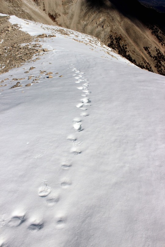
Just before reaching the lake I was watching my feet as I
was hiking (ice, remember?) and I saw what looked like toes in the mud. I briefly thought it was a print from someone
wearing those shoes with the individual toes, but quickly realized it was a
(small) bear print! Woot! Awesome!
That meant there was a bear in the area!
It looked bigger than a cub print, but not big enough to be a full grown
bear, and the prints were heading away from me (back where I’d came from) so we’d
missed each other. Oh well, maybe I’d
see it on the way down?
I pressed onward, over what looked like it was a waterfall
at various points during the winter
And arrived at the lake!
It was now 7:40am. I’d
hiked 4.75 miles in 2 hours 20 minutes. Uphill.
Immediately the weather
changed. The wind picked up
dramatically, and there was no sun? The
temperature dropped as I looked for the correct trail. I knew it went left behind the waterfall on
the other side of the lake.
My GPS told me to go one way, but that way was now “closed
for restoration” so I did my best to look for the proper trail. No dice.
I ended up kind of bushwhacking my way through some willows (there had
been a trail there previously that was not too overgrown) and up some rocks to
where I saw a sign indicating the trail.
I checked my GPS: success!
I kept trudging, admiring the view
As soon as I made my way over the waterfall area I got a good
look at the Crestones: This view offered
a stark contrast to their backsides! I
was amazed at how much snow there was here in the middle compared to the east! No worries though, snow was easy enough to
navigate.
I crossed a few very slippery half-frozen streams and made
it to a large basin.
The wind was howling at this point. I looked up at the intended route and sighed
inwardly: a gully. A BIG gully.
I hate gullies! The first part
didn’t look too bad though, and it looked like the sun was coming out?
Nope, it went right back behind the only cloud in the
sky: the one very similar to the one I’d
encountered on Blanca Peak last month. UGH! The weather was supposed to be sunny, clear,
warm, and windy? When will I learn 14ers
create their own weather? It WAS sunny,
clear, warm, and windy everywhere except in the basin I was in.
Here is was cloudy, cold, and very, very windy. I rounded some large boulders and looked at
the hike in front of me. Lots of snow
covered the trail, with no footprints. I
was probably the first to take this route since before Monday’s storm. No worries though, I liked hiking in the
snow. I put on my microspikes and headed
in.
I made my way to the gully.
It’s actually much bigger than this picture indicates. I looked at my watch. I had exactly 2 hours to summit both
peaks. In normal conditions, even with a
little snow, this was doable. Today
however was another story. I decided to
start climbing and see how far I could make it, then adjust my goals.
The gully sucked.
There wasn’t enough snow to make it easy to climb, but there was a lot
of ice. And wind. Lots and lots of wind. Bitter, cold, snow-filled wind. I picked a ledge and followed it, which was
much easier than hiking up the scree/snow.
I gained the first ridge and looked at the rest of the route. It went to the right of the gully. Right where the wind was swirling snow into
the air.
The weather kept getting worse.
The wind picked up and knocked me into the side of the
mountain, hard. It pressed and held me
there as ice crystals swirled up and around me and gave me an unwanted
dermabrasion on the only exposed surface of my body: my face.
I stood back up and got my bearings, but another gust of wind did the
same thing all over again. This was not
going well. I got out my map, and looked
at the ‘easy’ ridge I’d get to summit after making it up the side of the
gully. Ugh! It was covered in snow! (and most likely ice) And that wind! Down here it had to be at least 65+MPH. Up there?
Probably worse. I did some mental
calculations, and figured it wasn’t safe for me to try to cross that snow/ice
covered ridge in this wind. It was
knocking me around like a doll down here: I didn’t stand a chance on the exposed
ridge. Maybe I could wait the weather
out and see if the sun re-emerged and the wind died down? It was early yet, but how long would that
take? Even now I wasn’t sure I’d be able
to summit one, let alone both of the peaks I’d wanted before I had to turn back
around to make it home on time, help from the sun or not. How far could I make it if the sun was
out? Was it worth the wait?
Take a look at this video.
See where that snow is circling to the right of the snow filled gully? That’s the route I needed to take, and then
across the ridge to the left.
Then I really got to thinking. If I wasn’t going to summit today, what was I
doing mentally calculating how much further I could go? Here I was, cold, on top of a gully, halfway
up the side of a huge mountain, trying to gauge how much farther up I could
safely climb, when I had no intention anymore of summiting. The wind was knocking me around, the ice was
terrible, and my fingers were numb. The
climb up the gully had been difficult and slow, and I knew from experience the
hike down would be worse (center of gravity problems mixed with ice means slow
going and causes slips and falls). And
here I was, mentally calculating how much further I could go before I absolutely
must turn back because of TIME. To make
it to a class I was teaching on outdoor survival skills. Wouldn’t it be ironic if the reason I didn’t
make it to the meeting was because I needed to be rescued?
Good point. I turned
around and headed back. Summiting was optional, but making it down was
mandatory. The gully down was indeed
worse than the way up, and took me twice as long. By the time I’d made it to the bottom my
fingers were turning white and I couldn’t feel them anymore (they kept gripping
snow for traction, and I don’t do well in the cold). The look back was beautiful though!
I re-crossed over the waterfall and looked at Willow Lake
from above
I probably should have noted the ice hanging from the
waterfalls earlier. It was cold here,
and had been for a few days.
There were tons of waterfalls on the way down, and lots of
mud/ice to trudge through. No sign of
that bear though.
Oh, but the birds were ‘singing’
What really hurt was turning back and looking on the mountain I hadn’t climbed. It looked warm and inviting on this side, yet I knew once I rounded the back it was a bitterly cold snow-globe of ice, wind, and snow. What’s worse is turning back today meant I might not get to hike another 14er this year: I don’t have many more available days so this might be it. I took a good look at all the mountain ranges on my way in. They’re socked with snow, and all are getting wind this weekend. Snow I can handle, but this kind of wind? Not fun.
It ended up being an 11 mile hike, I’m not sure about the elevation gain, but 3500’+
I’ve hiked 43 14ers and this is the first time I’ve had to turn back due to weather. And what’s worse, it was due to the wind and ice, not snow, rain, lightning, etc. Oh well, the mountain will still be there next year. I’ll try again!
·The trail was pretty much free from snow, even after Monday’s storm. Microspikes were not needed.
· This would be a great first class 2 hike: it’s easy to follow, relatively short, and not too taxing
· If you’re looking to spend the night on a 14er summit, this would be a good choice
Uncompaghre, or “Uncle Padre” as it’s affectionately referred to, wasn’t supposed to be my hike today. We had a storm come in on Monday, blanketing the entire state with snow. So I’d gone on the Colorado Webcams page to see what the conditions looked like in different areas of the state.
I was specifically looking at peaks in the Crestone area, and the webcam made it look like there was surprisingly little snow. I was thrilled! That is, until night fell and I looked at the web cam again, and it still showed daylight. It was then I went on the forum and someone said there was a lot of snow on the Crestones, and I concluded the webcam must have been broken. It was showing the correct time/date, but the image was obviously wrong. UGH!
No worries though, I had about 5 different 14ers I was interested in, so I just went down my list. I wasn’t 100% sure the conditions weren’t great at the Crestones (I asked for clarification from the poster and never got any), but the webcams for Lake City looked promising. I gave it some thought and did a pro-con list. The Crestones were closer, the hike was longer, and I’d get 2 14ers in tomorrow, but I didn’t know for certain the conditions. Uncompaghre was a lot further (6 hours), the hike was shorter, and I’d only get in one peak (I really wanted to hike it with Wetterhorn). But my knees still weren’t 100% from my falls last week (I’d say 80% on one knee, 85% on the other) so a shorter hike was probably a good idea. Also, Uncompaghre is affectionately referred to as “Uncle Padre”, and it’s my Uncle’s birthday today, who pretty much was like a father to me growing up, so I saw it a sign of good luck and just went for it. Uncompaghre it was!
I woke up at midnight and made it to the trailhead at 6am (remember, I don’t sleep well at trailheads, so it’s just easier for me to drive and hike). There’s an obvious sign telling you where the trailhead is. If you don’t have 4WD, park here.
The drive up is definitely 4WD. My directions indicated I’d cross 2 streams, but I crossed 3, and was delighted to do so! My whole face lit up when I saw the first one: I love it when I get to drive my Tundra through streams!
The only downside to this road is it’s pretty narrow, and a bit bumpy in places. There were 3 turns that were tight for my Tundra, and I had to back up and reposition my truck to make the turns happen.
There was also a lot of ice on the trail (which I’m assuming is gone now). In fact, there was a lot of snow on the entire drive up, starting at about 8000’. This seriously worried me for the hike ahead! I had microspikes and snowshoes, but would rather not carry them if not needed.
The trailhead had parking for about 10 vehicles and was pretty open.
The weather forecast for the area today was a low of 22 and a high of 44, but as I drove I saw the temperature drop to 19 degrees, and stay there. Lovely. There was a half moon, and I could see there wasn’t enough snow on the mountains for snowshoes (woot!), but I brought along my microspikes anyway. I bundled up and began my hike at 6:15am. There were two Park Service trucks at the trailhead, but I never saw people on the trail. The trucks were still there when I left.
The beginning of the trail had a bit of ice in the creek areas
I hiked through a basin, and about a mile in there was a little bit of snow on the trail, but it was easily avoidable, and this was seriously the most snow I saw on the entire hike.
As I came to the trail junction for Matterhorn Creek and Uncompaghre Peak the sun and the temperature began to rise. This is why I’d woken up at midnight! The sunrise was amazing!
I turned around to take a look at Uncompaghre. Wow.
The entire trail was well maintained and very easy to follow. It was almost too easy, it didn’t seem as if I were hiking a 14er.
The Alpine glow this morning was fabulous against the blue sky! I hiked up some switchbacks to Uncompaghre’s south ridge.
This ridge gave me amazing views! I had fun taking pictures
At the top of the ridge I turned left and went behind the mountain
I followed the trail and looked for this rock tower.
You can either go to the left of it or the right of it. I chose the right
The hike up until this point was very much a class 1 hike. However, at this point there’s about 30 vertical feet of hand and feet climbing. Woot! My favorite! I took a picture and put away my camera. Here’s why this is considered a class 2:
This is what it looked like from the top
The rest of the hike was pretty straightforward. I just followed a trail to the summit.
The summit was a wide, flat, barren summit. If you were looking for a 14er to camp out on for the night, this would be it (if you don’t mind wind). I summited at 8am.
I turned to look around, and all around me there was snow! I’d picked the only peak in the area without snow! Amazing!
I took a summit photo to prove I’d summited
And as I looked over the edge, I saw there was snow on the north face of the mountain. What a drop!
I didn’t spend long on the summit, but turned around and started back down. As I was descending the class 2 part of this hike I stopped to take in the view.
I thought to myself how this was the perfect hike for today! I didn’t get in Wetterhorn, but there are several 13ers in the area I can partner with Wetterhorn and take my time on instead of rushing to get them all in. I was glad I’d chosen to hike Uncompaghre solo for today.
I didn’t see anyone else on the hike until I was just about to exit the basin. It was a couple hiking together. I didn’t see anyone else the entire day, and luckily didn’t pass anyone on the drive down.
I made it back to the trailhead at 9:55am, so I hiked 7.5 miles in less than 4 hours, with 3000’ feet of elevation gain.
·
Snow starts at 12000’ and keeps going from
there. Bring microspikes. Snowshoes weren’t needed.
·
I can see tons of potential avalanche danger on
this hike with more snow.
·
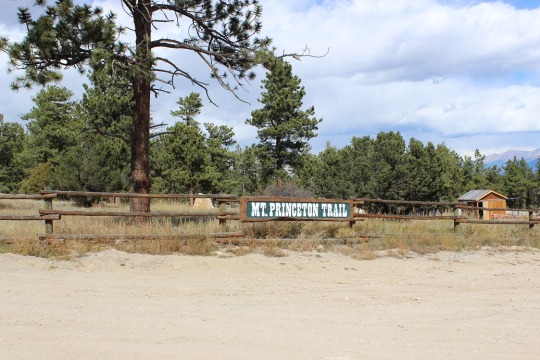
The lower Mt Princeton Road Trailhead is
actually pretty nice.
·
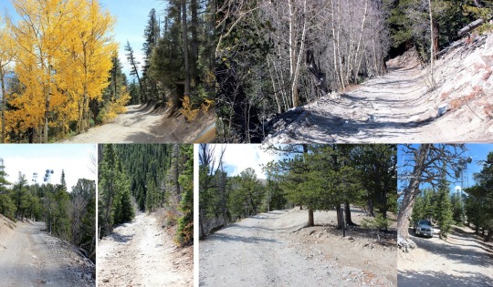
The road from here to the radio towers wasn’t as
bad as I’d been led to believe. It was definitely
4WD, but it wasn’t that difficult. The
only down side was it was narrow, so if you came across another vehicle it
would take a bit of maneuvering to get around each other. I have a Tundra, so this was an issue for
me. Two Jeeps wouldn’t have an
issue. Side note: the trail was dry when I took it. If it was wet or had snow or ice it would
probably be much more technical to navigate.
I could see several dry gullies I’m assuming flow over the road when it
rains/snow melts.
·
There are spots to park your vehicle at the
radio towers, but they aren’t obvious, and they’re tight. I had ‘fun’ turning around my truck when I
discovered the road was one way in and out.
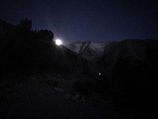
I began at 6am. For
anyone wanting to know what it looks like hiking in the dark, here you go:
This was my first view of Mt Princeton
The trail after the towers begins on road 322A. It can be difficult to find the towers in the
dark, but if you’ve driven 3 miles since the lower trailhead and come upon a
sharp curve, you’ve missed the towers.
It was pretty cool to look back on Buena Vista and see it
covered in fog and haze
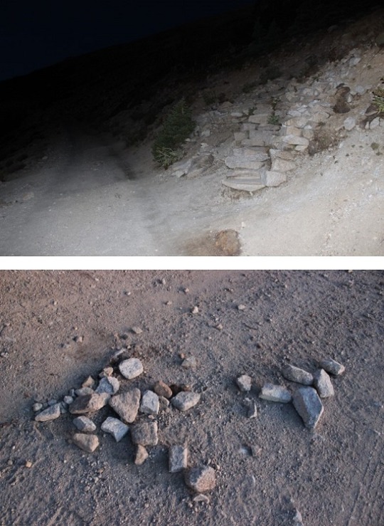
The first couple of miles follow the 4WD road up 322A. Then the real trail starts up to the right of
the hillside. There’s no sign, except
this wonderful, um, arrow of rocks? pointing the way.
As soon as you get up this small hill you get a great view
of Mt. Princeton.
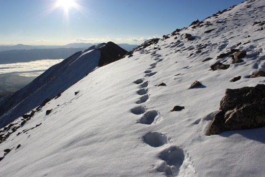
From here snow at minimum lined the trail for the rest of
the hike, and at most completely covered it.
I put on my microspikes and continued on.
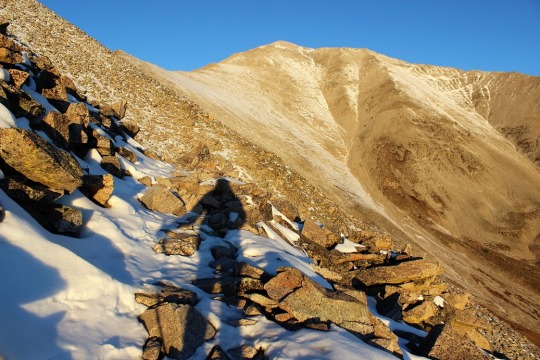
Shadowselfie, because I do that type of thing
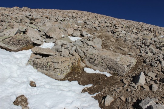
At this point I was thinking it was probably a good thing I
had snow on the trail, since I was probably walking over a lot of scree. I prefer snow to scree any day.
Oh, and when I turned back around I saw the SUNRISE! Colorado 14er sunrises are AMAZING!!
When I got to the top of the ridge I noticed a wind wall in
front of me and a mountain to my left. I
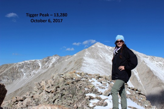
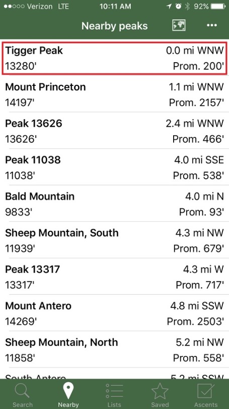
got out my Peakbagger app, and discovered it was Tigger Peak (13,280). It was only .3 miles away, so I made note of
the location to hike on the way back.
I turned right and got a good look at the rest of the hike
up Mt. Princeton. From here it’s .7miles
to the top. There was a pretty good
trail for most of the way, but when it was covered in snow I just followed the
ridge to the right.
Some places had a lot of snow and I did a bit of post holing
Others were bare
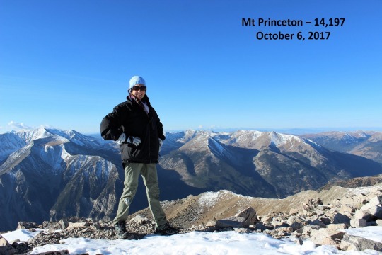
I summited to an absolutely beautiful view! Here’s photo proof I summited:
The weather reports said 40 degrees with 25-30 MPH winds and
45MPH gusts, so I dressed warmly (multiple layers, hats, scarves, etc.) Either I did an excellent job over dressing,
or it wasn’t that cold out. I barely had
any wind for the entire hike, except on the exposed ridges.
At this point I turned to head back down Mt Princeton’s
ridge. Take a look at Tigger Peak!
It took a lot longer to hike down than I remembered hiking
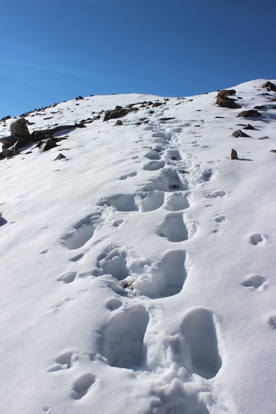
up, but I had to be very careful of foot placement. Despite microspikes it was still slippery. I ended up tripping once and hitting my left
knee pretty hard. I felt silly and
continued on.
The trail to Tigger Peak had a ridge and what I considered a
false summit. And due to the recent
snow, no trail. Well, I’m assuming it’s
due to the recent snow. It might not
have a trail at all anyway? In any
event, there wasn’t a visible trial, so I got to make my own! I considered this a very awesome opportunity,
and I was careful to make sure my steps were secure.
On the ridge between the two small what I considered summits
of Tigger Peak it happened:
I was on a part of the route with exposed rock (no
snow). I lifted my right foot to take a
step, and abruptly pirouetted and started falling towards the rocks. You see, when I’d tripped earlier apparently
I’d tripped on broken microspikes: One
of the hooks holding them together had come loose, and now, when I’d lifted my
foot, the hook on my left microspike attached to my right microspike, and I
fell down like that giant in Jack and the Beanstock with the tied
shoelaces. It all happened in slow
motion. In fact, I had time to curse
twice. (Side note, I don’t actually
cuss, so I said “Gosh Darn It! Flibbity-gibbit” (seriously)).
I’m not going to lie, it hurt. But I didn’t sit there. As soon as my knee hit the rock and I could, I
untangled myself, got up, and started hiking.
I could tell nothing was broken, but it stung badly. The best way to fix this (I know from
experience) is to walk/hike it off. So I
kept going, looking down at my knee every few seconds, expecting to see
blood. Luckily that never happened.
I’m proud to say I continued on up and over the second ridge
and summited my first 13er! (yes, I know it isn’t “official”)
This is the first time I’ve forged a trail on snow, and I
was pretty proud of myself! Oh, but I
had to prove I was in the right spot, so I took a picture of my Peakbagger app
indicating I was on the peak
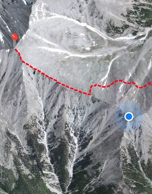
And a picture of my GPS, showing where I was
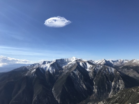
And as I looked across the mountain range, I snapped a
picture of this cloud that looks like a pufferfish? Yoda? Floating
majestically over Mt Antero.
Then I headed back.
It was cool following my tracks!
So now I had a serious dilemma: My microspikes were broken. I’d slipped and fallen hard twice, but I knew
the hike would be much worse without them.
This is what I still had to hike (well, about 3 times this, as the trail
looped all the way around the mountain, remember those earlier snow pictures?):
So I made the decision to hike with the broken microspikes,
but to be very, very careful (slow). I
kept my feet wide apart from each other:
I waddled, felt like a pregnant woman, and my pace was slow, but I didn’t
slip again! I was excited to make it
back to 12000’ where the snow stopped and I could take off my microspikes. This was also where I met my first hiker of
the day: A newby without spikes but with
a good and realistic attitude (he was prepared to turn back but wanted to see
how far he could go). I also met a group
of 5 or 6 friends hiking with a dog: ON
A LEASH! Major points to these
people. They were friendly too!
I made it back to my truck at 11:30pm, which wasn’t a great
time for a 7.5 mile hike, but I’ll allow it because I was hiking on extended
fields of snow for the first time, I forged my own trail and I was being extra
careful on the way down. Here’s a
picture of the towers
I was invited by Anne on
this hike, and was thrilled with the invite!
I’d initially wanted to hike a 14er today, but the rough weather all
week meant lots of snow everywhere over 14000 feet in Colorado, so this was the
perfect opportunity to get out and hike on a day a 14er wasn’t the best
option.
Once again, I wasn’t
sure if I’d be able to go on this hike until the day before. I felt really bad about my lack of commitment
early on, but I’d hate to RSVP and then later retract it. When I realized I’d actually be able to go I
was stoked! We started out with about 6
or 7 people invited, but there ended up being 3 of us hiking in the end.
I was worried about the
weather. Really worried actually. It had snowed in the region all week. All current weather reports indicated snow
was inevitable, along with cold temperatures and wind. However, the cold weather wasn’t supposed to
set in until the afternoon.
I mentally didn’t want
to hike in the cold, but I also really wanted to make a few hiking friends, and
saw this as the perfect opportunity. I
decided to bundle up and take the plunge.
We met at 3:30am at the
Woodmen Park n Ride. I drove. Actually, I insisted I drive. I really like to drive, and this way if I
ended up bailing due to weather I’d be able to sit in my truck and not feel bad
about using up gas for heat. I was
wearing 4 layers of clothing, but was worried because I didn’t bring a
scarf.
It only took us about 2
hours to get there. I was surprised the
drive went by so fast, even after stopping half way for coffee. We didn’t see any wildlife on the road, besides
the tail end of a fox.
The hike to Sky Pond
begins from Glacier Gorge Trailhead in RMNP.
The parking lot was almost full when we arrived at 6am. Even though this was a National Park, there
was no way to pay at the entrance gate?
Usually there are self pay envelopes you leave when you arrive
before/after hours, but we weren’t able to find any, despite searching. Oh well, we’d pay on the way out.
We began the trail at
6:15am. It was 45 degrees outside with a strong wind (25mph?). I was glad it was beginning to get light
outside because I didn’t have a map. In
fact, I hadn’t done any research on this trail, which is absolutely nothing
like me. Usually I’m uber prepared. The only research I’d done was on the weather. Luckily Anne knew where we were going and had
a map. Both David and I let her
lead. It was a good thing too: there were several trails that intersected at
various points with our trail. It was
easy to go the wrong way if you didn’t pay attention to the signs.
At this point the sun
was beginning to rise and we started seeing a bit of Alpine Glow.
At just under a mile we
passed Alberta Falls, one of the more popular hiking destinations in Rocky
Mountain National Park. This scenic 30-foot waterfall thunders down a small
gorge on Glacier Creek, and is named after Alberta Sprague, the wife of Abner
Sprague, one of the original settlers in the Estes Park area. It was very difficult to take pictures of the
falls, so we didn’t. The next section of trail, between Alberta Falls and Mills
Junction, was rehabilitated by the National Park Service and the Rocky Mountain
Conservancy. The entire trail to this point was easy to hike,
and very well maintained.
This hike was full of
beautiful, small lakes. The first lake
we encountered was Loch Vale, better known as The Loch. It was very cold and
very windy at this lake. This beautiful
subalpine lake is situated at 10,190 feet.
We reached the base of Timberline
Falls, high above the trail. From this vantage point the trail begins to climb
a series of rock steps. In other words, you climb the waterfall. It was still very cold and there was a lot of
ice on the trail, so this is where we stopped to put on our microspikes.
From here the trail
continues up a chute to the right of the falls. This is a fairly challenging
scramble that climbs roughly 100 feet, and requires hand holds and the use of
all four limbs while ascending. The first 30 feet or so are the most difficult,
but beyond that it’s a relatively easy scramble. Just to complicate things a
little more, portions of the climb has water flowing down the route (the
waterfall). It’s nothing exceedingly dangerous, but we did have to take our
time and be extremely cautious. This is the point where many people turn around
on the hike.
At the top of the climb
we reached the Lake of Glass, an incredibly beautiful alpine lake with
outstanding views of The Sharkstooth, Taylor Peak and Powell Peak. This lake is
also sometimes referred to as Glass Lake. And it was WINDY! I was almost blown over a couple of times,
but once we started walking it wasn’t so bad.
From here the trail
becomes fairly rocky and rugged as it travels along the west side of the lake.
We finally reached Sky
Pond, which sits at an elevation of 10,900 feet. The views here are simply
spectacular. The alpine lake fills a cirque basin, and is surrounded on three
sides by sheer cliff walls.
Off to the right are the
granite spires of The Sharkstooth. Against the backdrop of a cobalt blue sky,
the scene makes for an extremely dramatic view.
The mountain directly
across the lake is 13,153-foot Taylor Peak, and towards the south is
13,208-foot Powell Peak. I’ll come back
for those two someday.
Even though this hike didn’t include a summit, we’d
had a great hike. But when we saw the
large formations staring at us from across the pond we knew we wanted
more. So we made our own path across the
pond and towards the large formations.
We looked up at the gulley, decided it was doable, and started to
climb.
It was a bit challenging due to the ice and snow, but
we made it to the top! I loved how
everyone just went for it, knowing we’d all be able to make it (or just willing
to turn back if it seemed too difficult… we had to at least try!).
The views from here were amazing as well!
The best part?
This is when the sun came out! I
was pretty much freezing at this point due to the wind, but the sun was
absolutely amazing!!!
We met a couple of hikers here who had the same idea
we did, but went a slightly different route.
Our route ended up being easier, so they followed us on the way back
down. They were fun to chat with, and
seemed like a couple of fun guys! They
even took Anne’s camera for a couple of selfies!
As we hiked back we looked back on the trail we’d
hiked to get there.
On the way up we hadn’t seen many people, but on the
way down we encountered a steady stream of hikers. This became a bit dangerous on Timberline
Falls, but we were thrilled most of the ice from the morning had dissipated and
it was now just wet in most areas and icy in just a few.
We gave the other climbers some pointers and headed
on. It was really nice to be with other
competent hikers who were sure of themselves while hiking.
We made it back to the Loch and met a couple that took
a fun picture of David, Anne, and I
The colors on the trees had already started to fade,
but there was a little left to enjoy.
When we made it back to the trailhead we looked at the
map of our hike. We’d visited a bunch of
lakes!
We all seemed to get along pretty well, talking and
hiking at about the same pace. After the
hike we all decided to head down to Estes Park for a beer. It was about 2pm, and there was quite a bit
of traffic. We learned we were in the
middle of an Elk Festival, and the town was overflowing with tourists. Funny thing, we didn’t see any elk, but many
people had that morning (we did see them lounging in the RMNP Elk Viewing area
however).
We stopped at Rock Cut Brewing Company for some
excellent beer and some fried food out of a food truck that was pretty tasty
(fries, burgers, cauliflower covered in parmesan garlic and tater tots). There were lots of wasps, and some pretty
good conversations with a bunch of people we met who were staying at the
Stanley Hotel. They’d been friends for decades
and were vacationing together for fun.
The drive home took twice as long as the drive there
due to traffic. There were several
accidents and even a death investigation on the I25, so we didn’t get back
until after 6pm. It was totally worth it
though! I’m pretty sure I made some new
hiking friends, and I had a great time!
Roundtrip Length was about 10 miles, with elevation gain
of about 2000 feet.
Side note: "National
Public Lands Day is being celebrated this Saturday, Sept. 30, across the US
which means you can get in free to all national parks across the country for
FREE. And yes, that includes Colorado’s four national parks as well.“
– we were lucky to get a parking space at all!
I had someone ask me the other day who I was hiking
for. The question caught me off guard,
but I guess you can’t set a goal like hiking all 58 of Colorado’s 14ers and
aggressively tackling that goal without people thinking you’re doing it for a
cause.For those of you who don’t know
me, this type of behavior is typical “Laura” behavior.If I’m going to do something, I’m going to
give it 100%.Intense is a word often
used to describe me.Also, if I’m not
going to give it 100% I usually don’t do it at all.
No one’s noticed this yet, but I wear a different School in the
Woods hat on each hike. Usually it’s the last one I knitted, but sometimes it’s just one I like.I also like the fact I’m summiting these
peaks alone, and not many women hike/climb alone.I see a lot of men solo, but I’ve yet to see
a woman.Why can’t women be mountaineers
too?
Why do I like hiking alone?
It gives me time to think. I love to think and process information, and
when I go by myself I don’t need to fill the silence with talk.
I can set the pace. I can hike as fast or as slow as I’d like. This is important because I’m usually on a
schedule to get back home by a certain time to be with/pick up my kids. I have a time table that doesn’t give a lot of
room for error. I rarely hike slowly, but
I’d feel bad for my partner if I was slowing them down. I’m always hiking at a brisk pace that’s
usually difficult for others to keep up with.
I get frustrated hiking slower than necessary. Yes, hiking is competitive for me. If you’re ahead of me or behind me, we’re
racing. (No, I don’t allow this to let
me make reckless decisions when hiking, I know when to alter my pace for safety
reasons).
I’m not a fan of taking breaks while hiking,
even for drinking water or getting a snack.
I continue hiking as I’m taking off my jacket or getting out my gloves. I’ve yet to meet anyone who doesn’t need a
break while on a hike. This is
especially important for me towards the summit, where it’s often cold. I have Raynaud’s, and if I stop/hike slowly
in the cold my body shuts down and I cannot move. Frostbite comes easy to me even in warm
weather (if there’s wind). I need to
keep moving if I want to summit. This
also means I can’t spend a lot of time on the summit enjoying the view (because
I’m susceptible to frost bite I get off the summit asap, especially if it’s
cold).
There are several peaks I’ve climbed I’m certain
I wouldn’t have been able to summit if I’d had a partner, because they would
have insisted we’d turn back. I have a
higher risk acceptance rate than most because I have a lot of experience. No, this doesn’t mean I’m reckless, but I
feel prepared to continue on a hike many people wouldn’t.
I’m more likely to see wild animals (because it’s
quieter). Yes, this is one of the
highlights of hiking for me. I get upset
when I see someone with bear bells, because it means I won’t get to see any
wildlife either.
I usually don’t know which peak I’m going to
climb, or if I’m hiking at all, until the night before. This can be difficult for others to work with,
and I’d feel bad being the one to constantly change plans. It also means I’d need to communicate with
the other person about details, which isn’t something I particularly like to do
(the communication part: details I’m great at).
This all probably makes me sound like an awful person, but
in reality, I’m just an introvert that likes to hike solo because it’s
intrinsically motivating. I understand a
hiking partner would need to put up with me as well (and I admit I can be
difficult).I don’t actually mind hiking
with other people, but we’d need to be a good fit in areas of personality,
endurance, etc.I’ve yet to find someone
who is.I need to find someone with more
experience to climb with next summer. There are several peaks I want to tackle that are difficult class 3’s
and class 4’s where it just makes sense safety wise to climb with a
partner.I need to step outside of my
comfort zone, which may be more difficult for me than tackling those class 4’s
alone.
Back to the purpose of
this post:If people ask me who I’m
hiking for I’d like to say SitW or Girl Scouts, but in reality the reason is
more selfish:I’m hiking for me.
Hiking so many peaks in so little time is probably the most
selfish thing I’ve ever done. I’ve
always loved to hike and mountains/backpacking/camping/etc. in general, but after becoming a mom at 17 my whole
world as I knew it changed.For the past
20 years I’ve been focused on being the best mom I can be, always putting my
kids and their activities first.But now
that two of my kids are driving/working, and all are in either High School or College,
I’m noticing they have more of a social life than I do.Whenever I want to do something with them
they’re busy.
I’m not mad or upset about this. It’s wonderful my kids have
jobs, interests, and friends. I want to
encourage them to go to work and school and spend time with their peers.But I’m finding myself with the ability to go
hiking because they’re busy and I’m not. Note:I ONLY go hiking when my
kids are busy, sleeping, or in school.I’ve
never hiked when I’ve had an opportunity to spend time with them one on
one.This is important to me, and often
why I plan hikes last minute.
So, what are my goals when it comes to summiting Colorado’s
14ers? They’ve evolved over the past
couple of months.Initially I’d wanted
to hike them all by 2023:the 100th
anniversary of the first successful summit of them all.But as I got to hiking this year I started
completing them faster than anticipated. My goal for this year was to climb 11, but I’ve already made it to
29.I realize the climbs get more
difficult, and I’ve done most of the “easy” ones this year, but I won’t be able
to realistically hike another 29 next year. They just take too much commitment, and I know I’ll fail at a few
summits the first time or two, so I’ll need to attempt them multiple times.
Realistically, my goals are to complete all 58 by the time I
turn 40 (in 2020). That gives me exactly
3 more years to successfully summit 29 more peaks.
Another question I get often: Why are you hiking them all so fast?What are you going to do when you hike them
all and have none left?
This question is obviously asked by someone who doesn’t know
me very well. I have a lot of life
goals, and this is only one of them.Off
the top of my head some of the others I want to tackle are:Rim to Rim Grand Canyon, 14ers in
California/Washington, Galapagos, Andes, Kilimanjaro, Mt Fuji, Mona Loa, Great
White Shark Diving, the PCT and the Appalachian Trail. I also want to go back to school to get my
Doctorate, I want to write a book, and don’t forget, there are over 637 13ers
in Colorado, and many, many more amazing hikes to tackle!