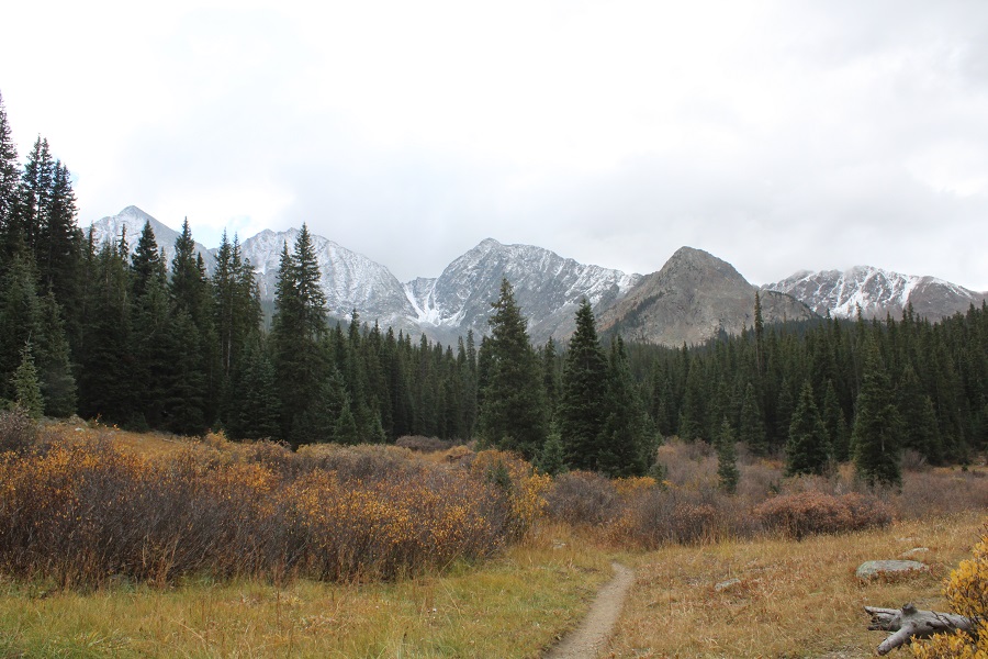
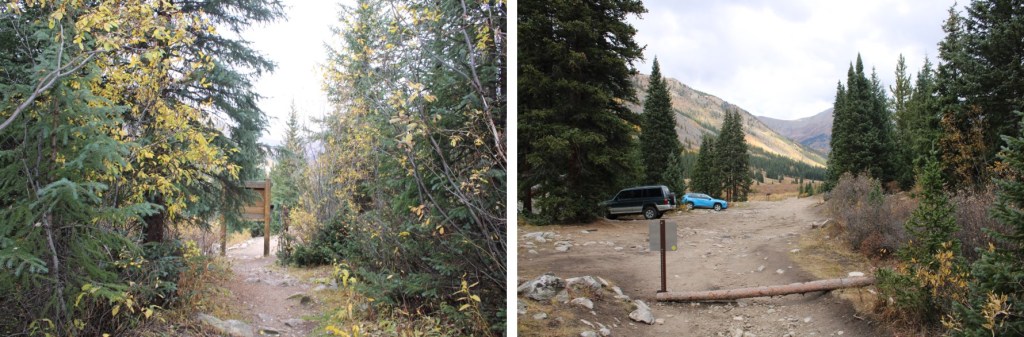
I was the only one at the Lake Ann/Huron Peak trailhead at 5pm on a Friday, and I was thrilled! The 4WD road to the upper trailhead was a little rougher than I remembered it, but the drive had been worth it to be the only one there. I jotted down some notes from the days hike, sipped some whiskey, and looked at notes for tomorrow. It was still light out when I curled up in the back seat of my Tacoma and drifted off to sleep to the sound of pounding rain: that meant fresh snow on the peak tomorrow!
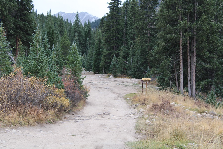
I woke up and things seemed dry outside, which was odd for the amount of rain I’d heard last night. I put on my winter gear anyway and was on the trail at 5:30am. The trail starts at the south end of the parking area, and continues heading south, towards Lake Ann. Be sure to take the Lake Ann trail, NOT the Huron Peak Trail
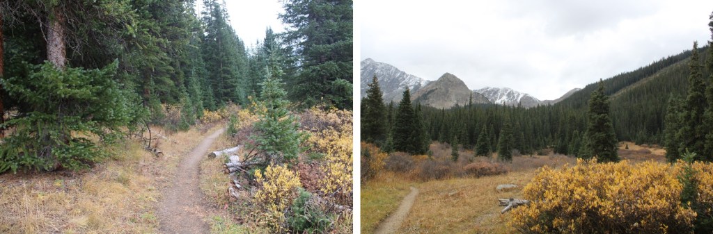
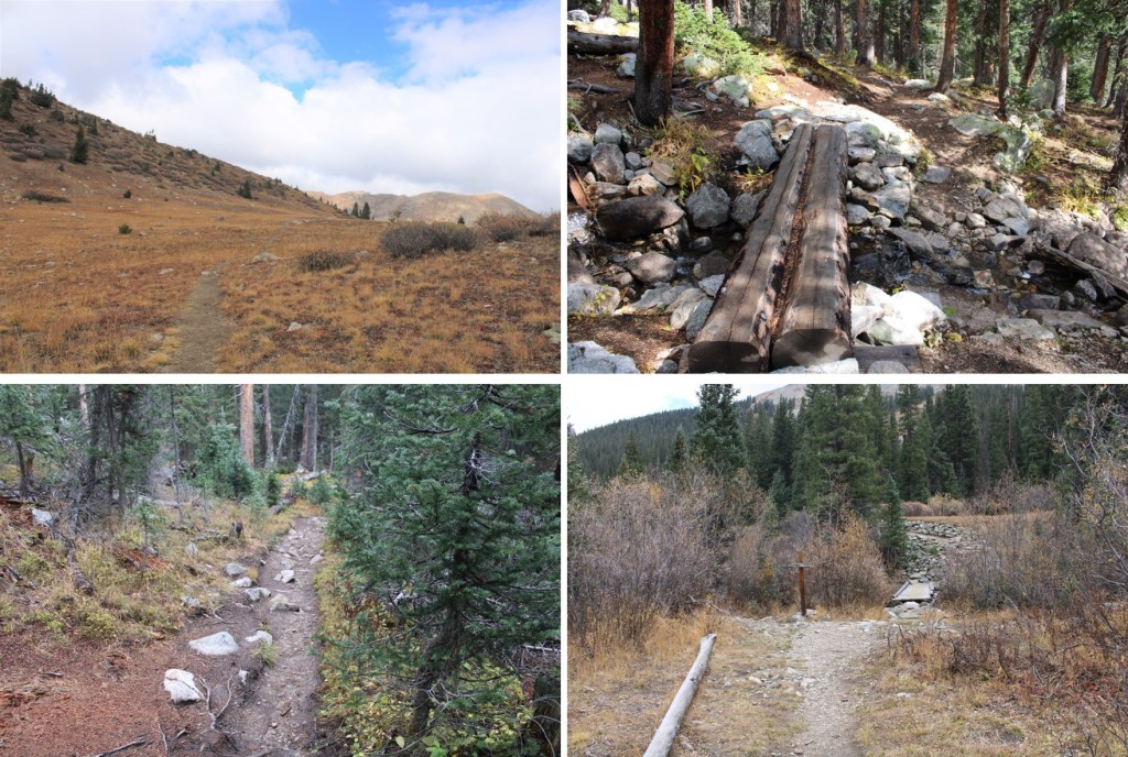
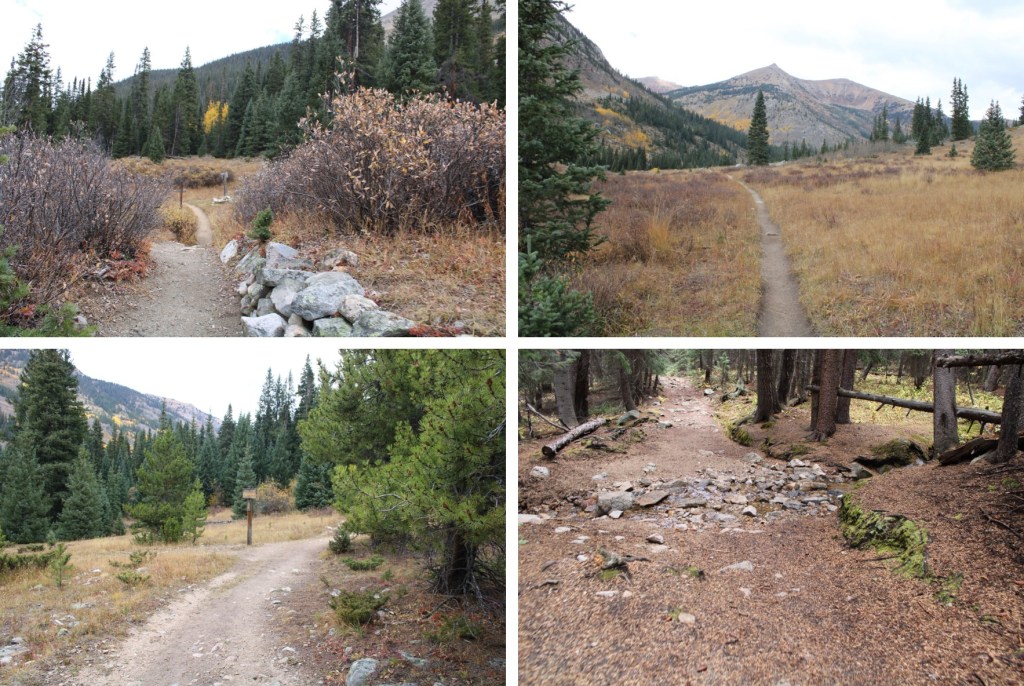
I hiked 4 miles south along a class 1 trail to Lake Ann
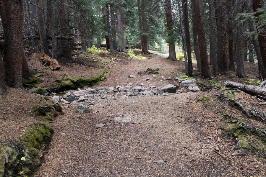
Stay left at this crossing
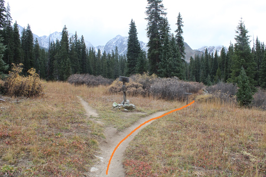
At the second crossing I went right
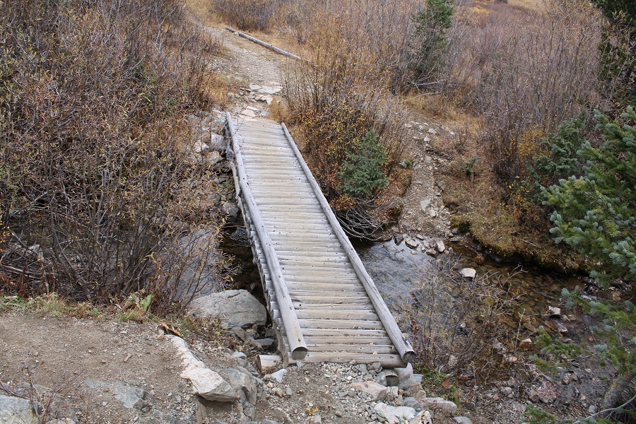
And crossed a creek on a ‘pretty-solid’ bridge
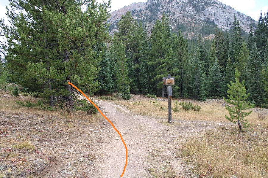
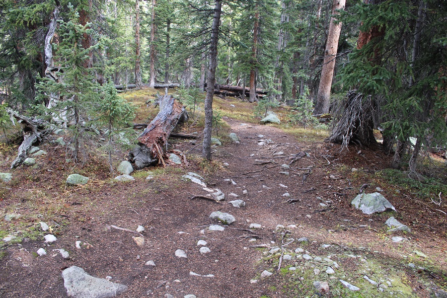
Finally, I started gaining elevation as I made my way towards Lake Ann
Just after making it to treeline, go left at this junction.
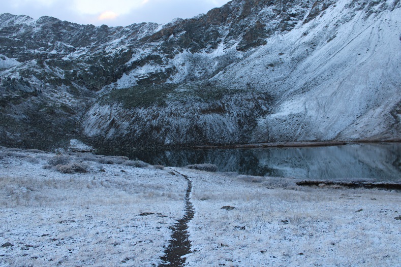
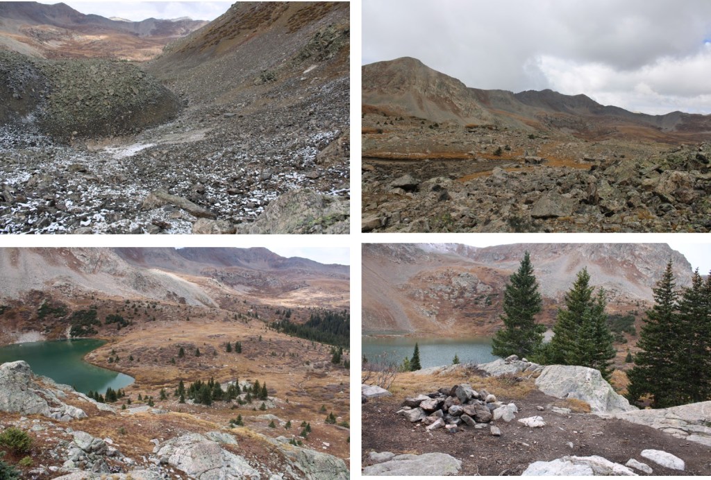
And you’ll arrive at Lake Ann
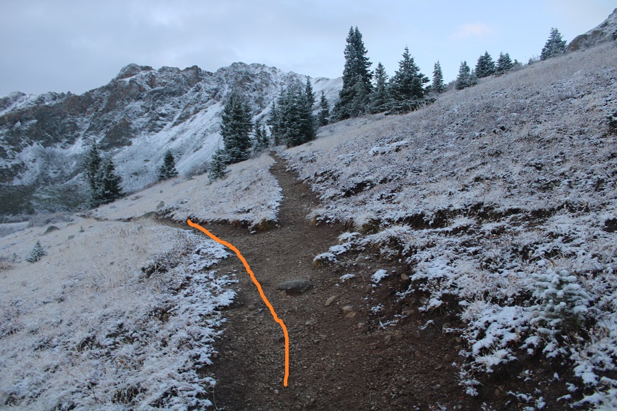
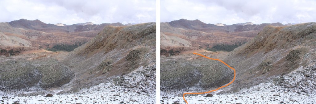
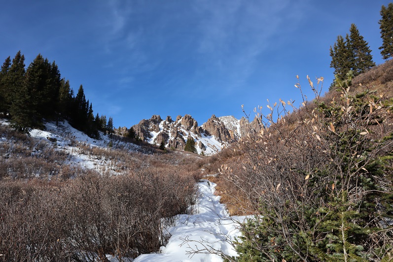
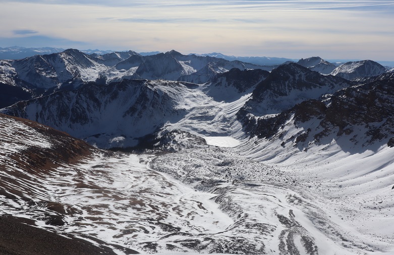
The goal is to skirt the north side of the lake, and enter the upper basin
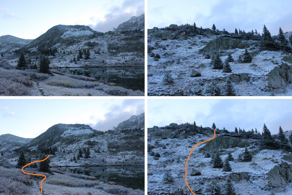
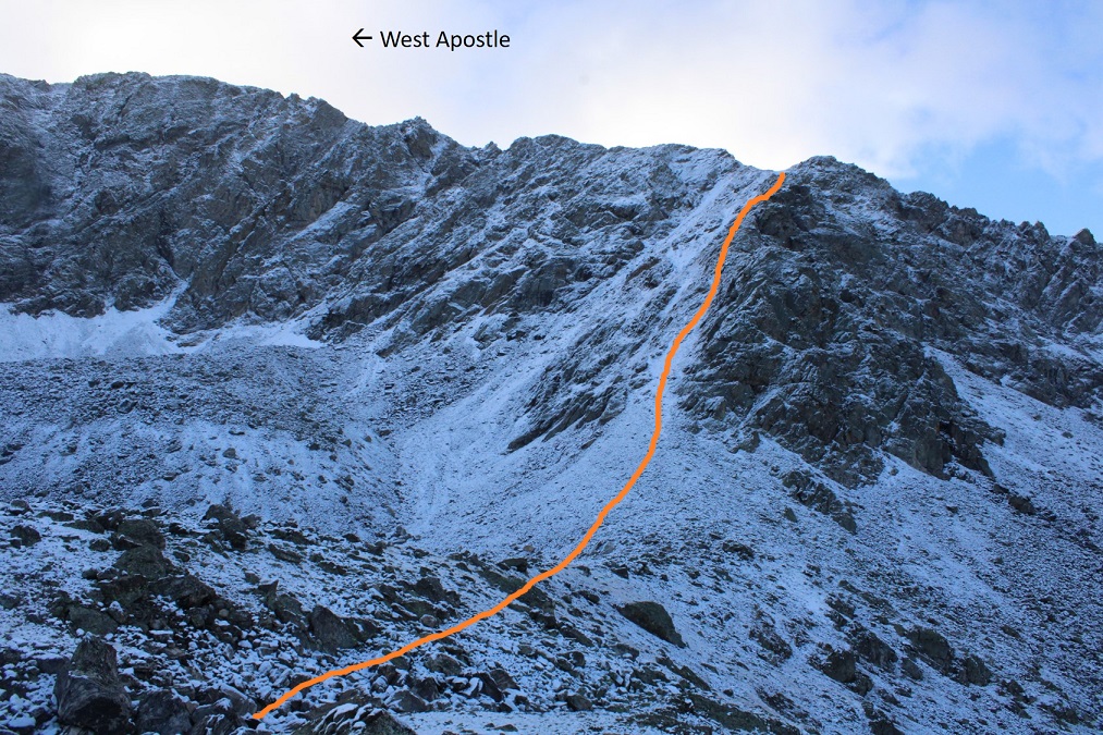
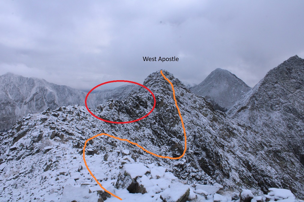
Here’s an overview of the route
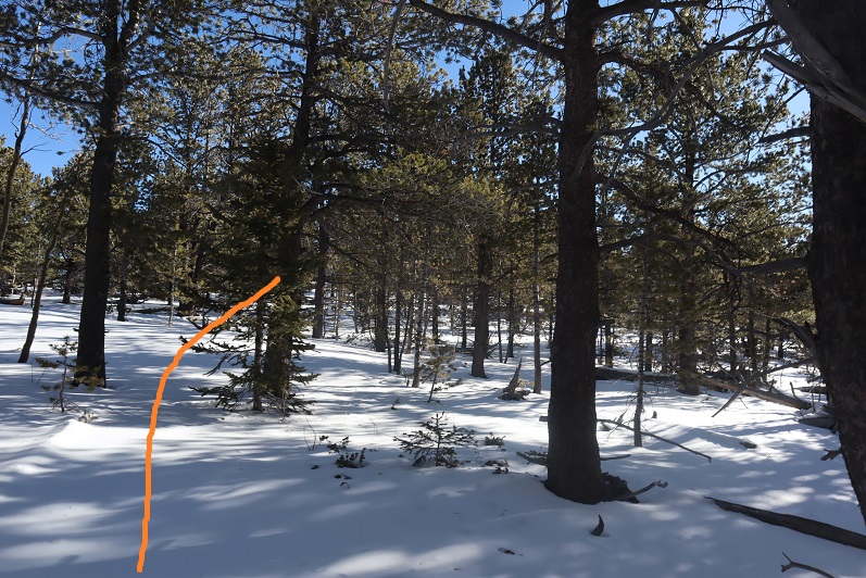
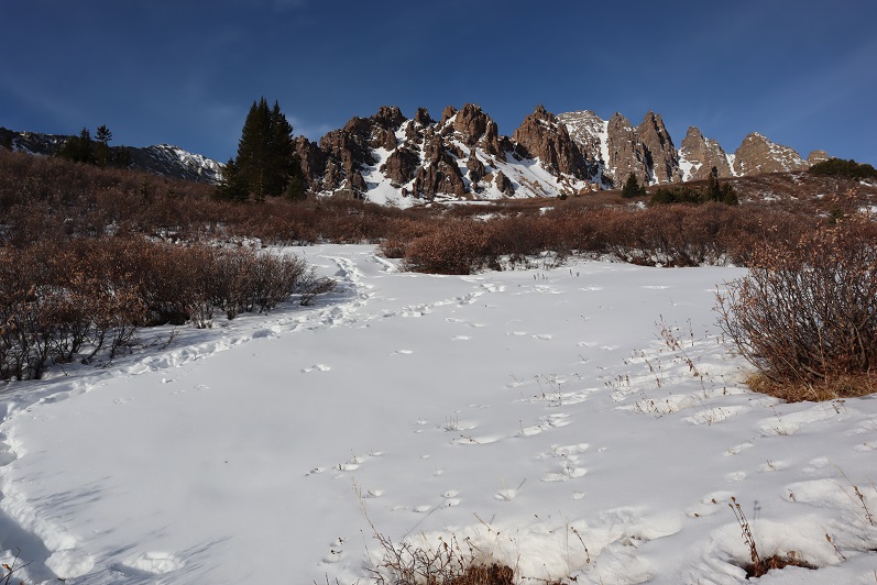
And some step-by-step pictures into the upper basin
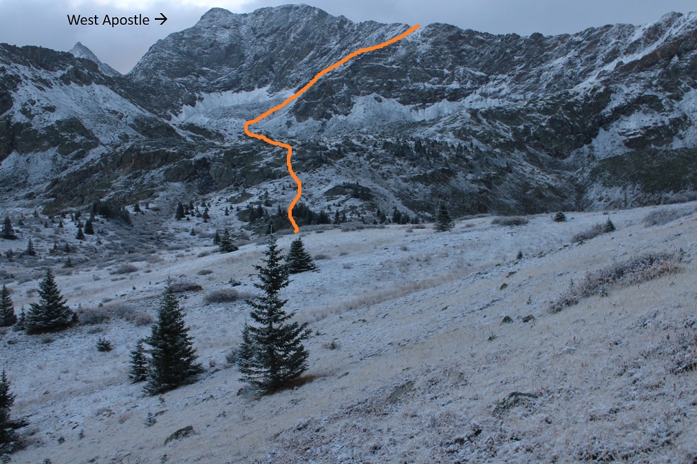
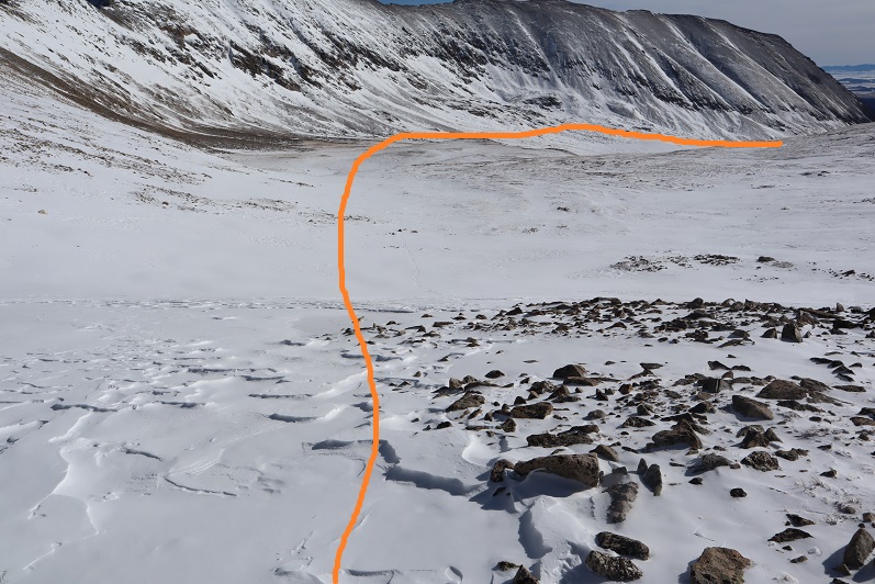
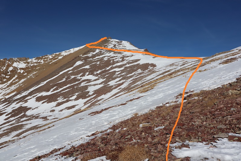
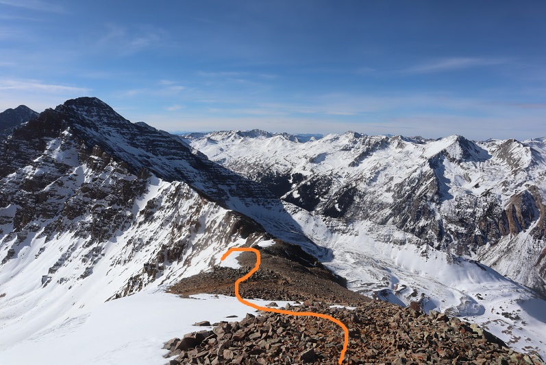
Once in the upper basin I aimed to ascend the amphitheater. This can be done multiple ways. I decided to stay left on the way up (solid line), and follow (very faint) game trails, and I went right on the way down (dotted line). The orange arrow is where you’ll eventually be aiming.
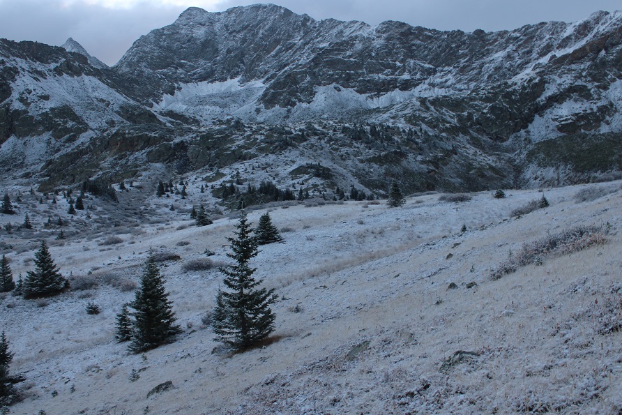
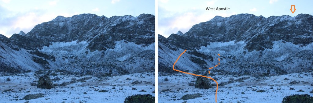
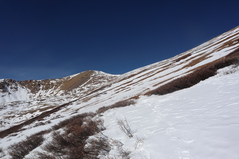
Here’s another picture of the amphitheater
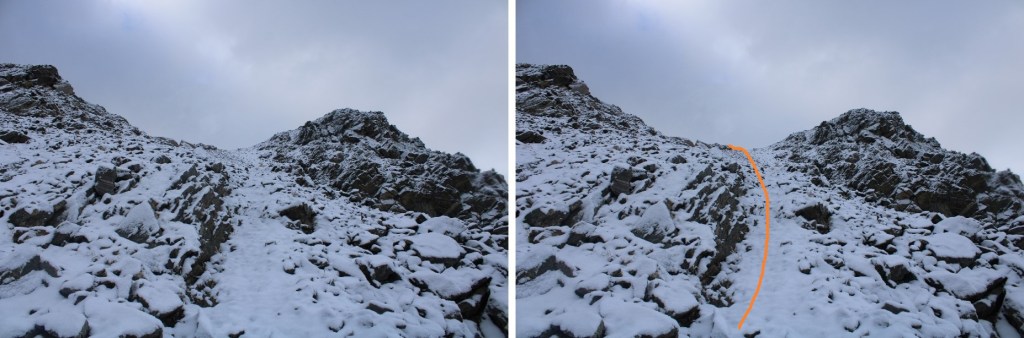
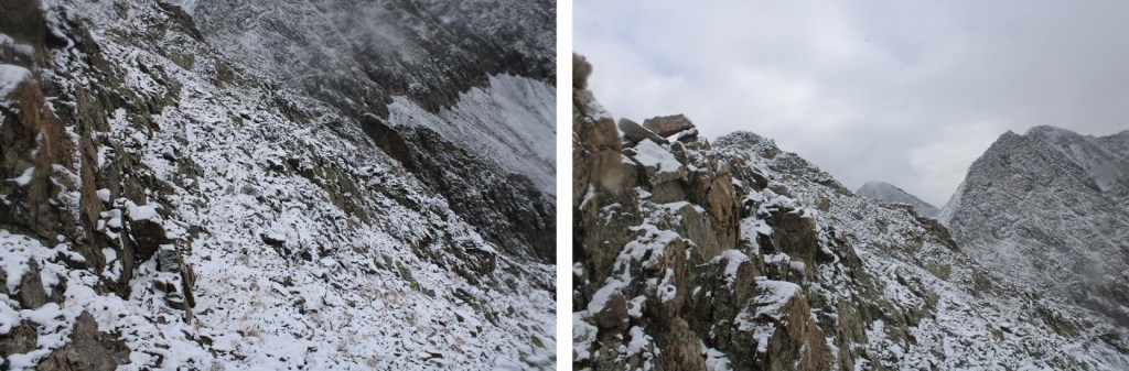
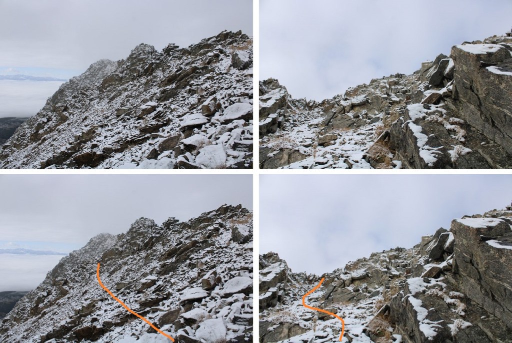
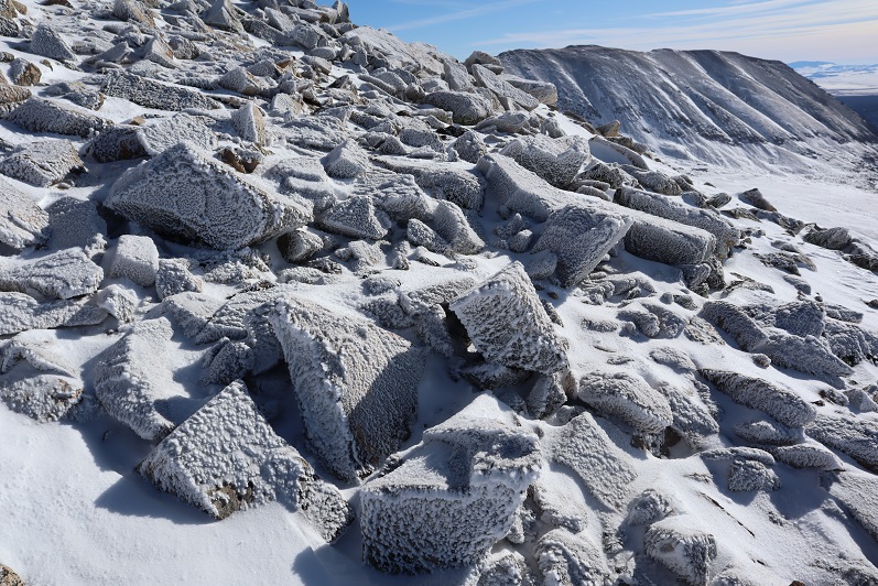
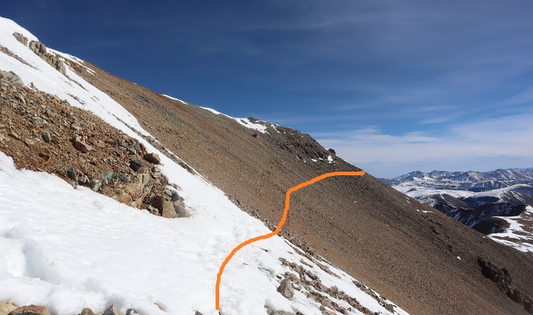
Once at the top of the amphitheater I was in another basin. I turned right, and followed the ridge. I’m sure the best way to ascend this gully is straight up the gully, but today there was unconsolidated snow blocking that route. Even with microspikes I wasn’t able to get traction the gully direct, so I took the rocks to the right.
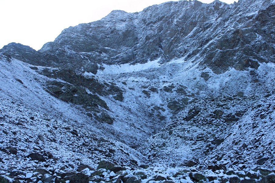
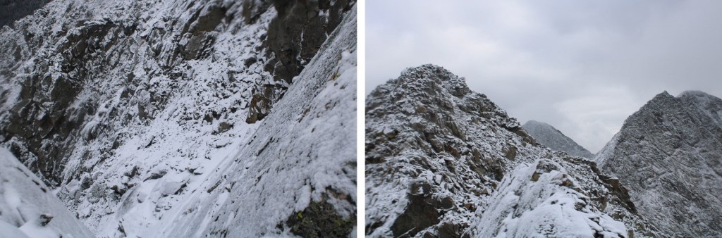
Here are some closer pictures of the gully
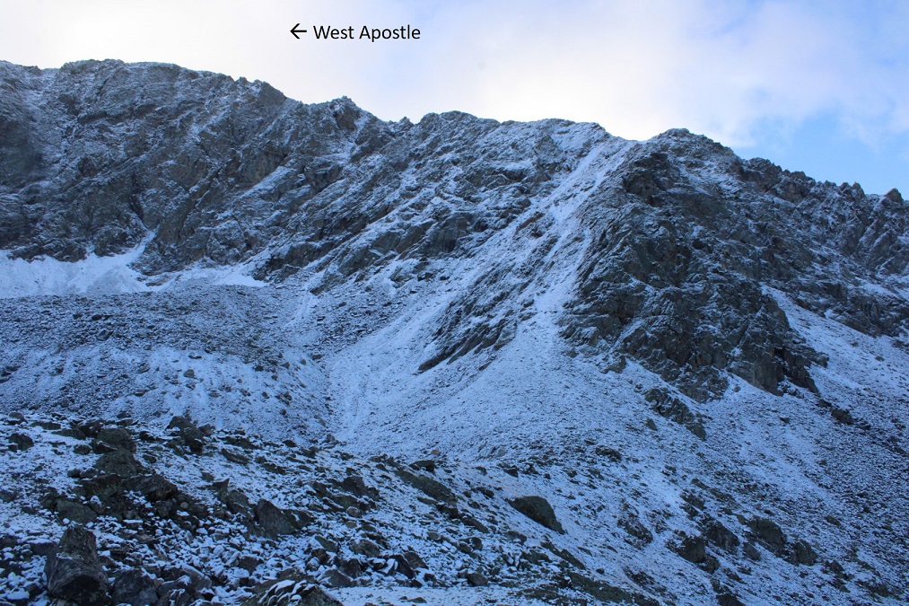
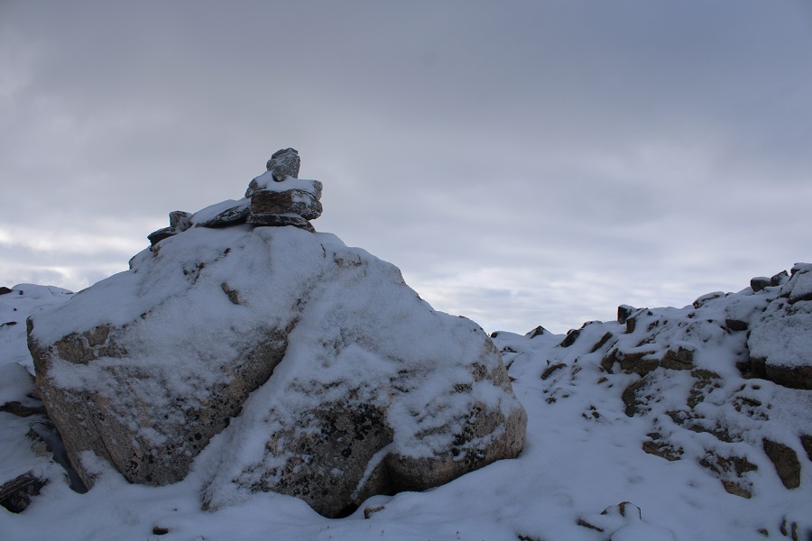
At the top of the gully I went left
Which brought me to the ridge (and a cairn!)
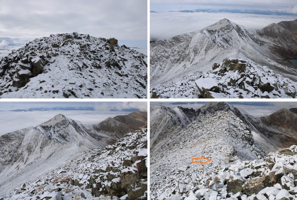
I turned left and followed the ridge northeast. This is a class 2 ridge, which I was able to stay on the top of the ridge to hike most of the way.
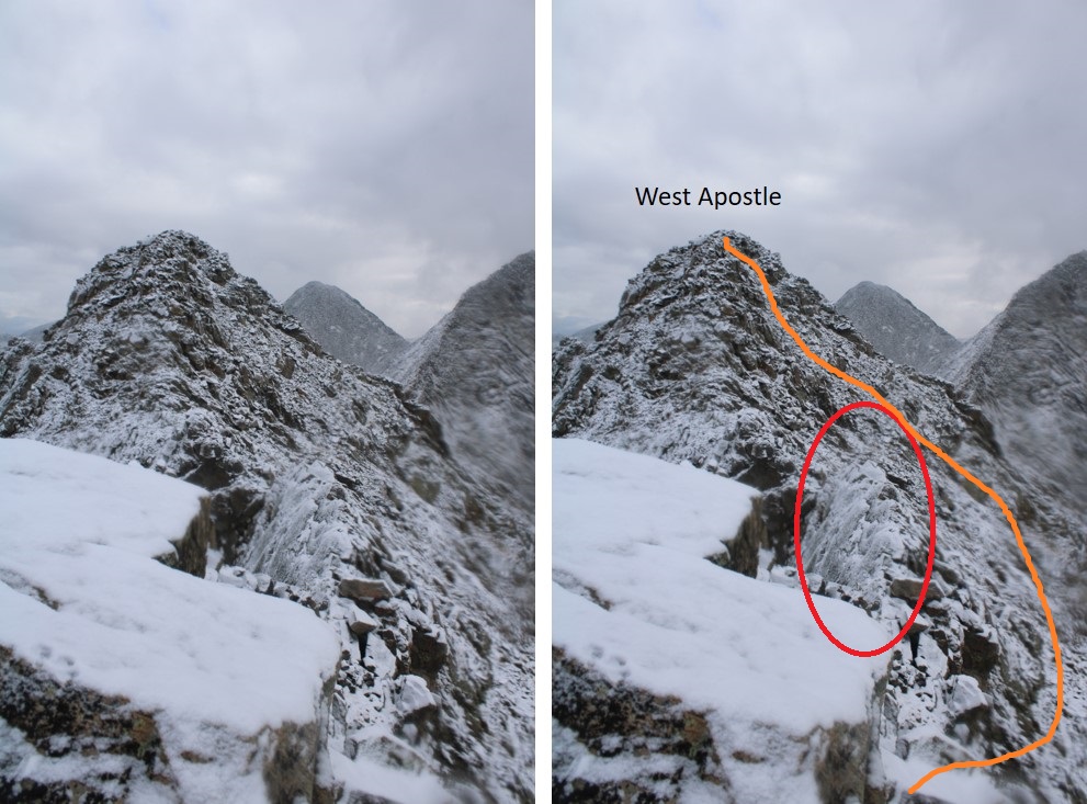
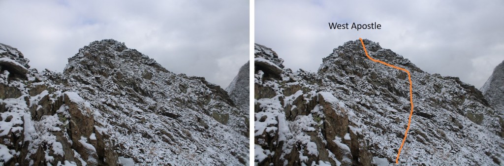
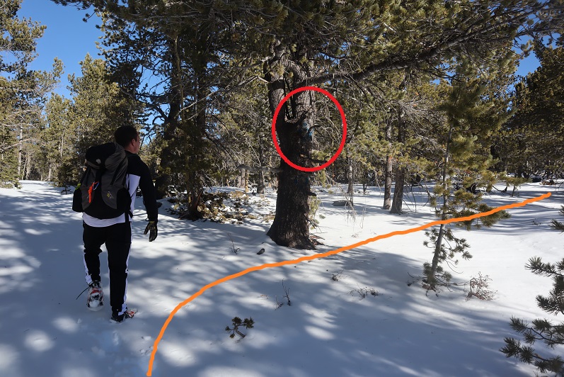
Here it gets a little dicey. If there hadn’t been snow, I would have taken the ridge all the way to the summit. However, with the snow and ice today things were slippery, and the exposure was real (to the left). I decided to dip down to avoid some of the worst of the exposure. I did this a little later than I should have, as it as getting spicy already. The area with exposure is circled in red. This is how I summited West Apostle
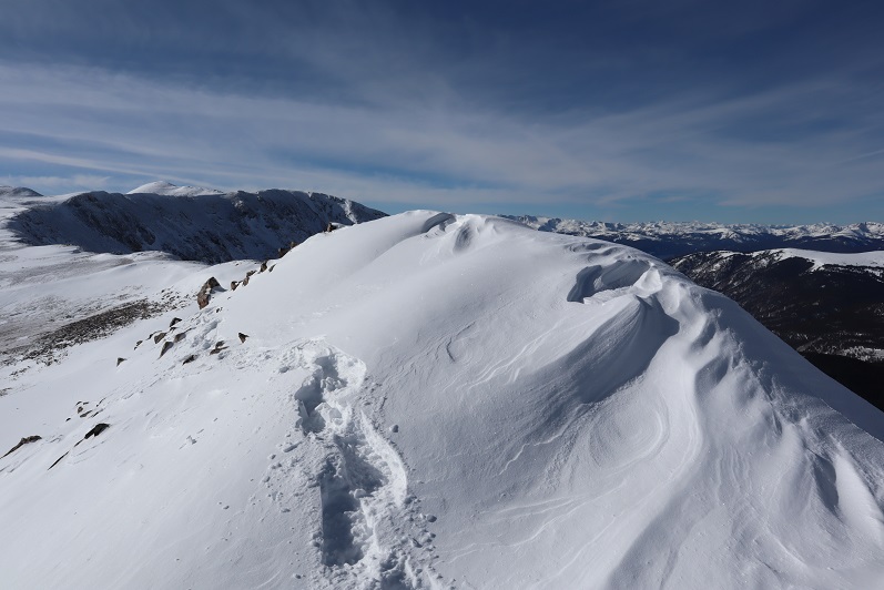
Here’s a picture of the ridge
And this is the exposure I was avoiding
So, I dipped down to the right and kept it class 2
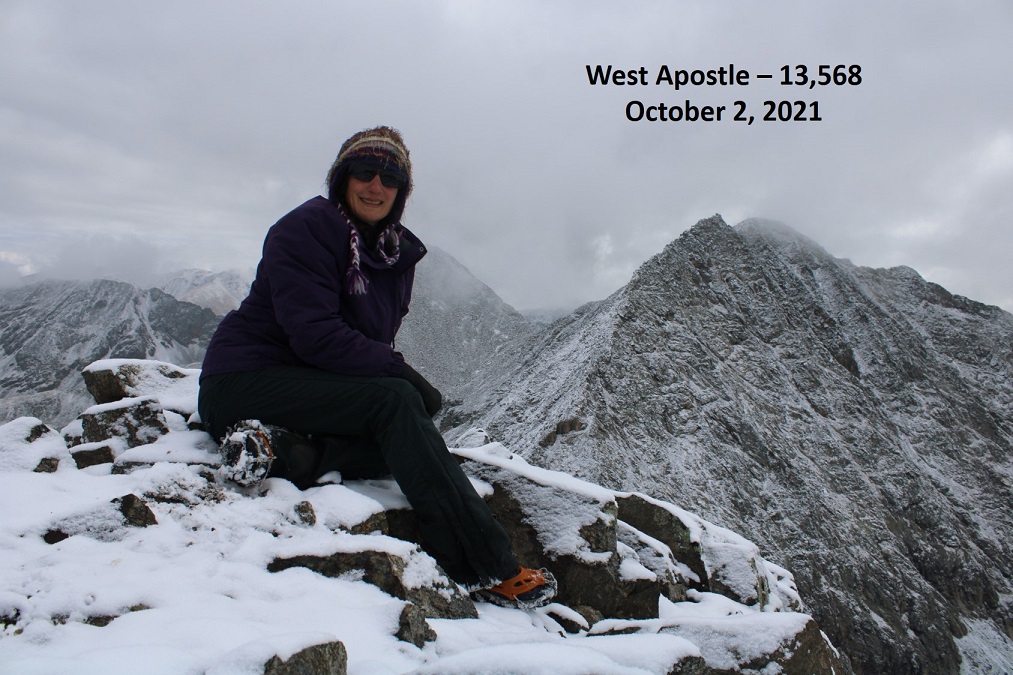
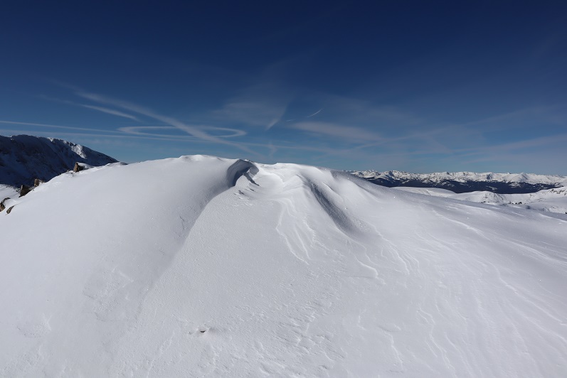
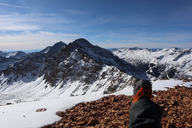
I summited West Apostle at 9:30am
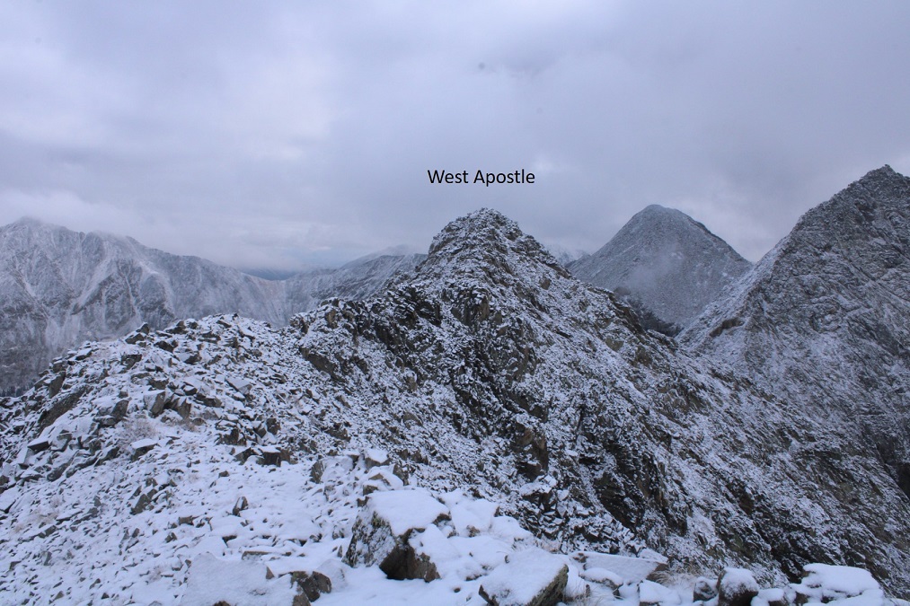
West Apostle:
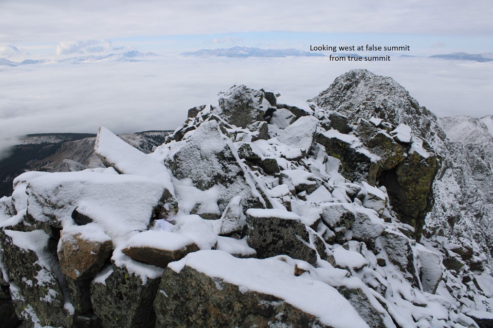
There was a summit register, but it was a pipe one missing its lid, so I replaced it with a jar. Here’s looking back at the false summit
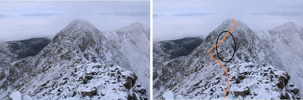
I headed back the same way I summited, heading west, avoiding the area with exposure
Here’s what that looks like after dipping down
Back on the ridge, I followed it to the saddle.
The cairn was helpful in finding the correct exit from the ridge in all this snow.
I made my way back down towards the gully, staying as much to the west as possible, avoiding the gully direct and sticking to the rocky area.
I then re-entered the basin, and headed west towards Lake Ann
Back at Lake Ann, it was easy to pick up the class 1 trail and follow it back to the trailhead.
I made it back to my truck at 12:30pm, making this a 12.04 mile hike with 3575’ of elevation gain in 7 hours.
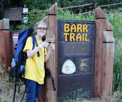
Steffen was interested in visiting Barr Camp, it felt like it’d been forever since I’d been, I hadn’t been aware of and the weather was perfect, so today seemed like a great day to hike the Barr Trail.
I wasn’t able to find a lot of information on this peak, but looking at the Pikes Peak Atlas it seemed to be just behind Barr Camp. I figured we’d figure it out.
We arrived at the Barr Trail parking lot around 5:30am and were surprised the parking situation has (again) changed. As of today it’s $10 to park in the upper lot. Last time I was here it was $40, but it’s been $5, $10, and $20 in the past. The parking app is gone, and the fee machine is back. This is all good news.
We gathered our gear and were ready to go at 5:45am. The guy who parked next to us unfortunately left the dome light on in his truck, but fortunately (maybe?) he also left his truck unlocked so we were able to shut it off for him. He was planning on summiting Pikes Peak and most likely had a 12 hour day; we didn’t want him to come back to a dead battery. Also, he was getting a late start if he truly intended to summit today. We ended up passing him within 20 minutes and let him know about the situation.
I’m not going to spend a lot of time describing the trail to Barr Camp because it’s an easy class 1 hike the entire way. There are very accurate mile markers every half mile, great signage, and as long as you stay on the trail it’s difficult to get lost, even in winter. As we ascended the first 3 miles we had great views behind us of the city lights. Too bad it’s difficult to get pictures at night.
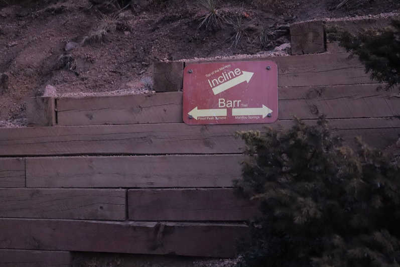
We passed the cutoff for the incline as the sun started to rise
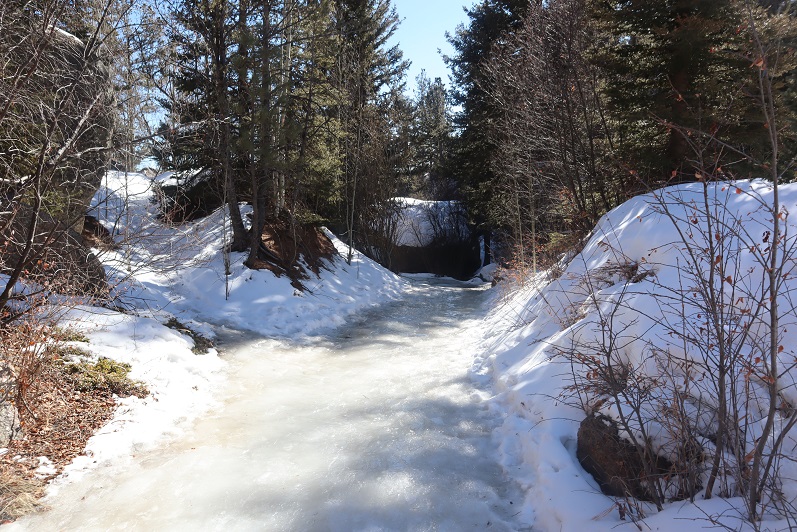
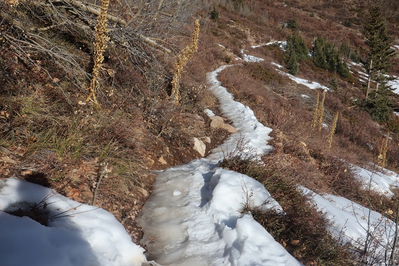
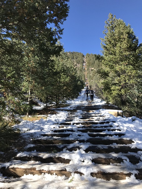
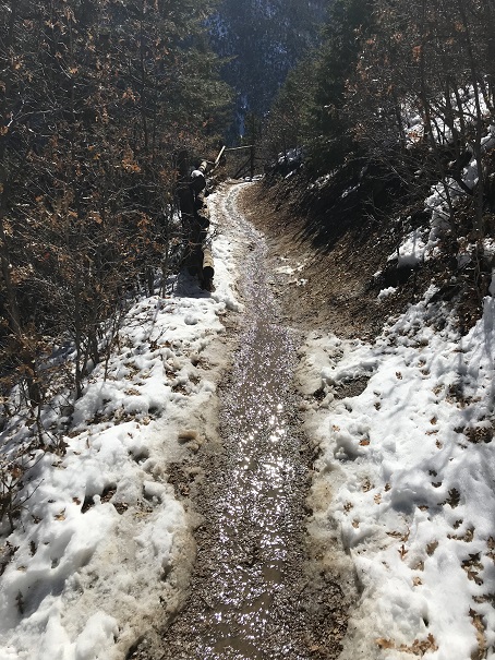
And as soon as we crossed the creek (which is usually dry in summer) the trail conditions changed.
They went from a bit of ice every once in a while to a frozen river of water that would be perfect for ice skating
This lasted until just after the junction with the experimental forest (turn left/southwest here)
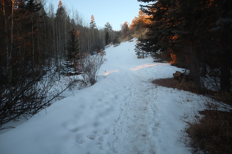
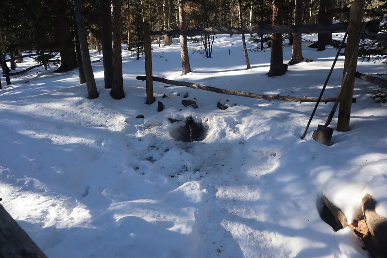
This is where the trenched snow started, and also where I scattered wildflower seeds two years ago in memory of my Granny (yes, the seeds were local to the area)
If it were summer you could walk three people wide without tripping on each other along this trail, but today we walked single file.
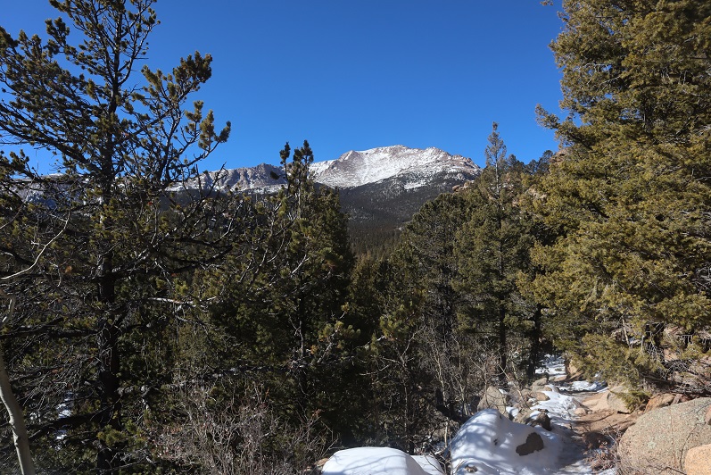
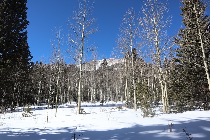
Around mile 4 we heard a noise and looked up, confused to see a rather young looking squirrel jumping around in the trees. Shouldn’t he be hibernating? The views of Pikes Peak were (as always) amazing today
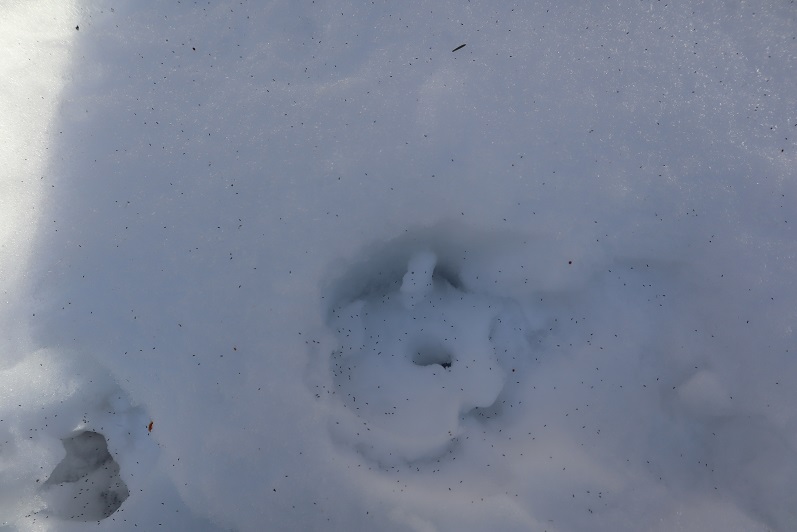
I stopped for a second because I saw something curious on the ground: it looked like some sort of pollen (which made no sense: it’s February) but upon closer inspection discovered they were little bugs on top of the snow! I could see them jumping and wondered how in the world they got there?
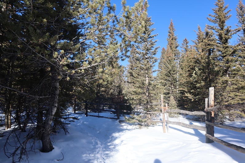
We made it to the aspen grove just before Barr Camp and I took a picture: I have a picture of this grove in every season except winter, and was excited to add this one to my collection.
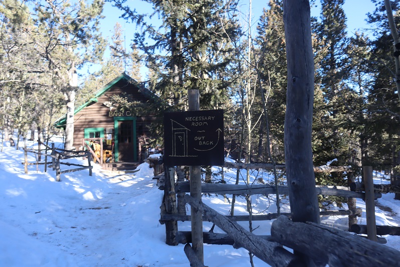
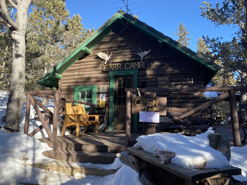
From the aspen grove it’s a quick jaunt to Barr Camp
We decided to use the restrooms there and then went inside to inquire about PT 10245’
The caretaker didn’t know what PT 10245’ was, but when we looked at the Pikes Peak Atlas he said they called it “AdAmAn Peak”. (Note, this ended up being a different peak altogether). In the summer there’s a nice trail that will get you within a few dozen yards of the peak, but since it was winter the trail was covered in snow. He said to go up, then down, then up again, and then back down, heading northwest. Then there would be quartz rocks on the ground in an arrow showing us where to go (but those would be covered in snow as well). We couldn’t miss it.
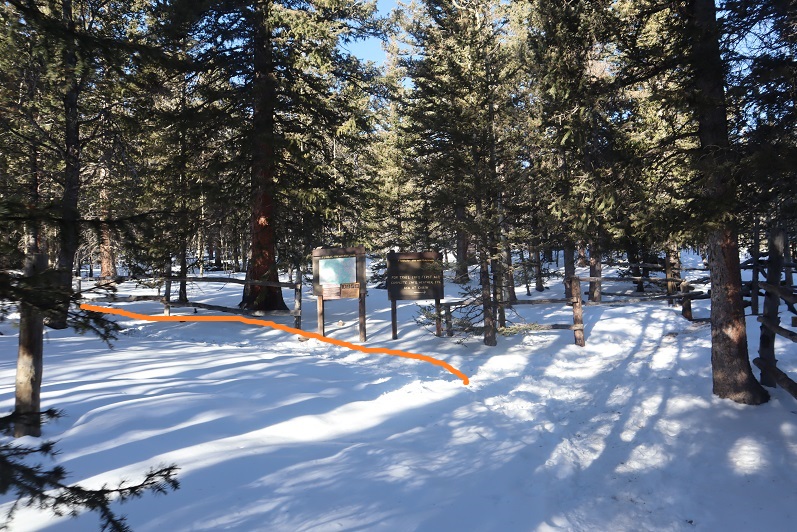
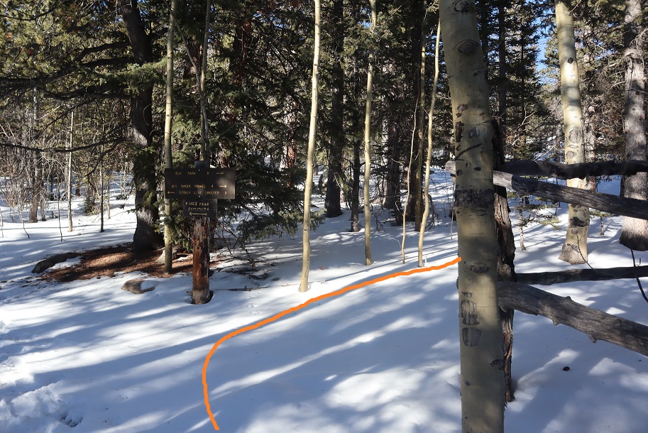
Um, ok. Good thing we’re good with a map and compass! We exited the lodge, put on our microspikes, and were on our way. We took the Barr Trail again a little bit southwest (just to the end of the fence) and turned right (north) towards Elk Park on trail 652.
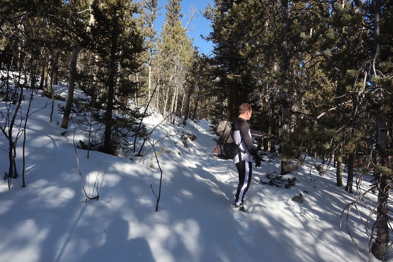
The caretaker had been correct: the trail was covered in snow, but some of the time we could make out where the trail was. We hadn’t brought our snowshoes, so we were having a time getting snow in our shoes (and pants, etc.). Next time remind me to bring gaiters.
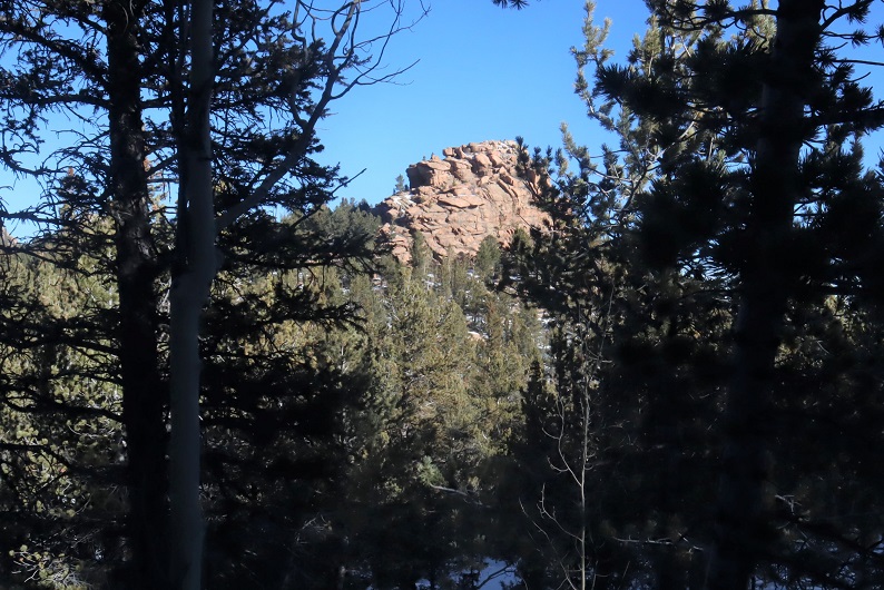
We hiked on this trail for almost exactly half a mile, and we did indeed have a great view of the summit from the trail. I started to worry we wouldn’t be able to summit today: I hadn’t brought any rope and that summit looked like it needed rope!
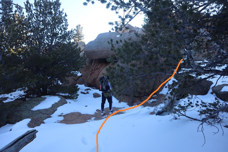
The trick to this summit is to summit from the west. After half a mile we came to a small saddle and decided to turn right and head for the summit (this is how the caretaker should have described the route to us: follow the trail until you come to the saddle, turn right, and then scramble to the summit). Coincidentally, there were blue dots spray painted on the trees here, a good indication that’s where you should turn
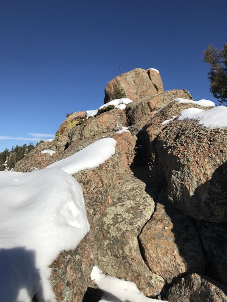
There was no visible trail here, so we just aimed for the summit block (east)
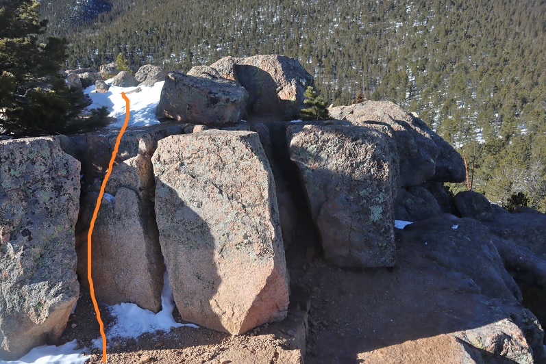
Here’s how we summited:
It was a class 3 scramble and tons of fun! My advice is to initially go left up the rocks, but you summit more near the middle of the rocks. The summit was flatter and larger than I’d anticipated
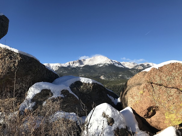
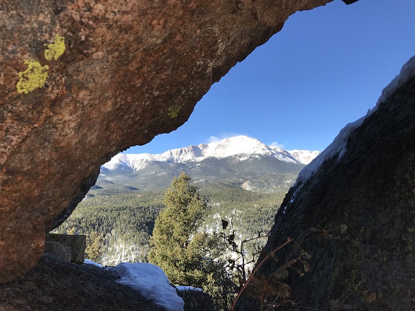
There were some great views!
I’ve never seen Pikes Peak from this angle before…
There wasn’t a summit register (we looked longer than we should for one)
Time to head down. It’s not as scary as it looks…
We followed our tracks back to Barr Camp, and noticed our tracks were filled with thousands of those little bugs already! Yuck! I went home and researched them and apparently they live under the snow until it’s a nice day out, and then they hang out on top of the snow. They were very, very small. So small I’m thinking we were probably breathing them in and not noticing it. Yes, those little black dots are the bugs.
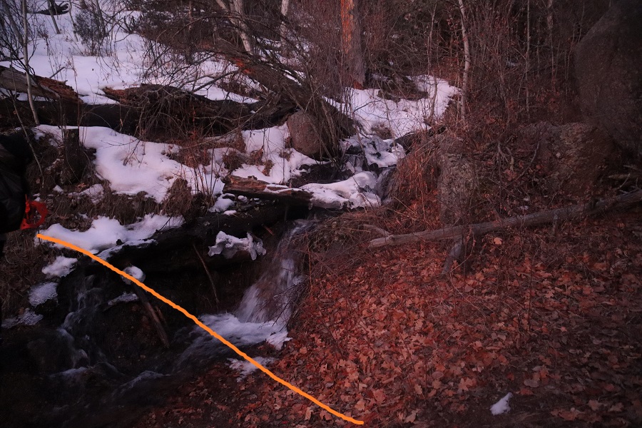
We made it back to Barr Camp and decided to buy a protein bar and leave a donation (hey, we used their bathrooms). I noticed the stream where I usually filter water was just a trickle
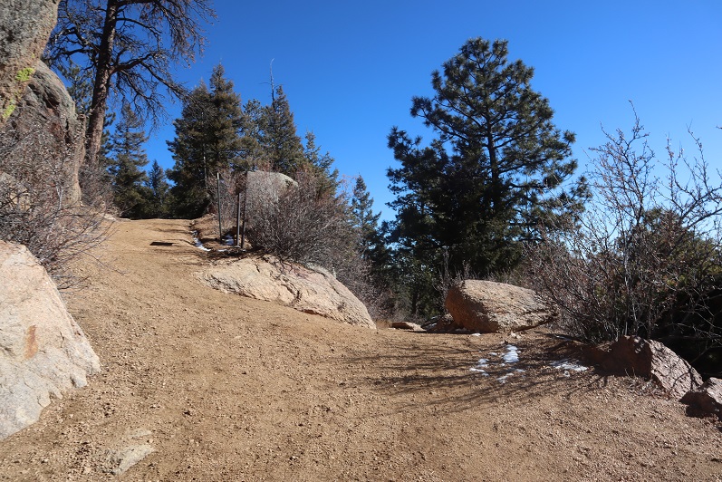
The hike back down was uneventful except for the flight for life helicopter we saw making a beeline for Pikes Peak (it never landed). Actually, the hike was beautiful! I’ve hiked this trail dozens of times and I never get tired of it! We kept our microspikes on the entire way, even though they weren’t necessary most of the time. The trail cleared and opened up around the incline junction
We made it back to my truck a little before 12:45pm, making this a 15 mile hike with 4027’ of elevation gain in 7 hours.
This was a really nice trail with decent elevation gain you don’t notice much because it’s so gradual.
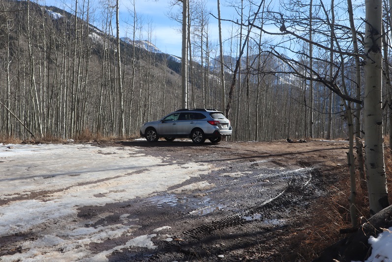
My flight actually made it in on time and I drove from DIA to the Mosquito Creek trailhead starting at around 11pm. I70 was closed for rock mitigation so I used 285 instead (and passed fire trucks rescuing drivers from vehicles that had slid off the road). I was a bit worried about the conditions of the roads since it’d snowed yesterday, but I had no trouble making it to Alma. From there the 2WD dirt road was icy but drivable.
I saw signs indicating Mosquito Pass was open, but I was headed to the Mosquito Creek Trailhead. I turned off the 2WD road onto the 4WD road and drove up about 20 yards before deciding to turn my truck back around and just park at the junction. I didn’t feel comfortable driving my truck through the snow on the road, and I knew it would most likely just get worse as the day warmed up. So I parked my truck and since it was only 1:30am I decided to try and get some rest before starting the hike.
I set up my sleeping bag(s) in the cab, ate a few pieces of turkey jerky I’d made with Thanksgiving leftovers from last week, downed a few shots of whiskey and I went to sleep. My alarm was set for 5:30am, and although it was 12 degrees outside and the wind was howling I was warm inside my sleeping bag inside the cab of my truck. When the alarm rang at 5:30am and it hadn’t even begun to turn light and that wind sounded less than fun I made the decision to re-set my alarm for 6am and got in another half hour of sleep before starting the trail at 6:15am.
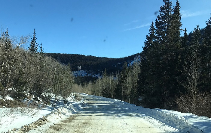
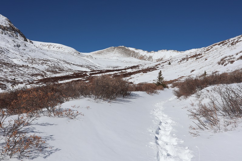
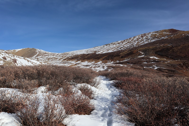
I was immediately glad I’d decided to park where I had. Just following the road the conditions ranged from bare dirt to 6 inches of ice to 4 feet of snow. There were quite a few drifts covering the road I wouldn’t have felt comfortable driving my truck through. There was a constant wind coming through the lower basin, changing the drifts as it went.
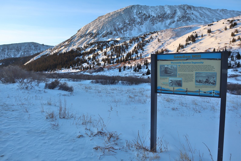
I wore my microspikes from the time I left my truck until I made it back, but didn’t need snowshoes until I reached the London Mill.
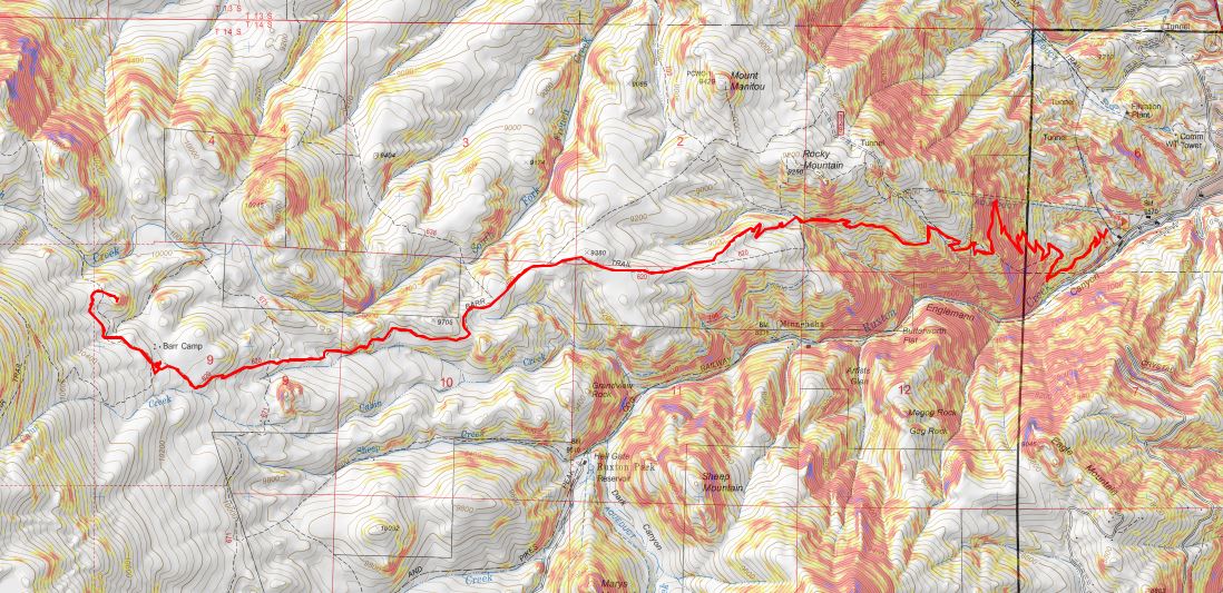
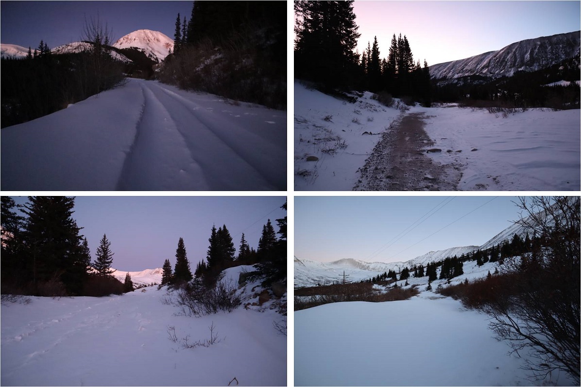
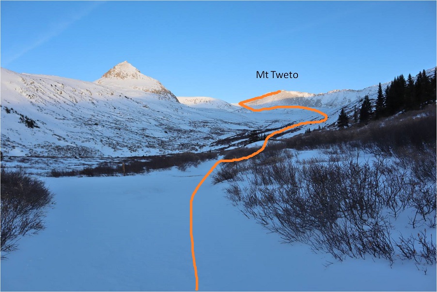
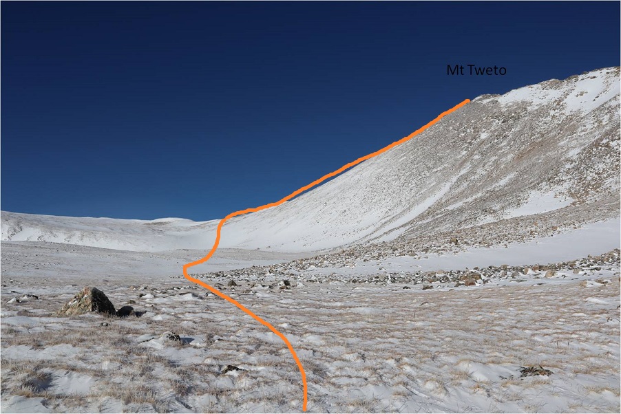
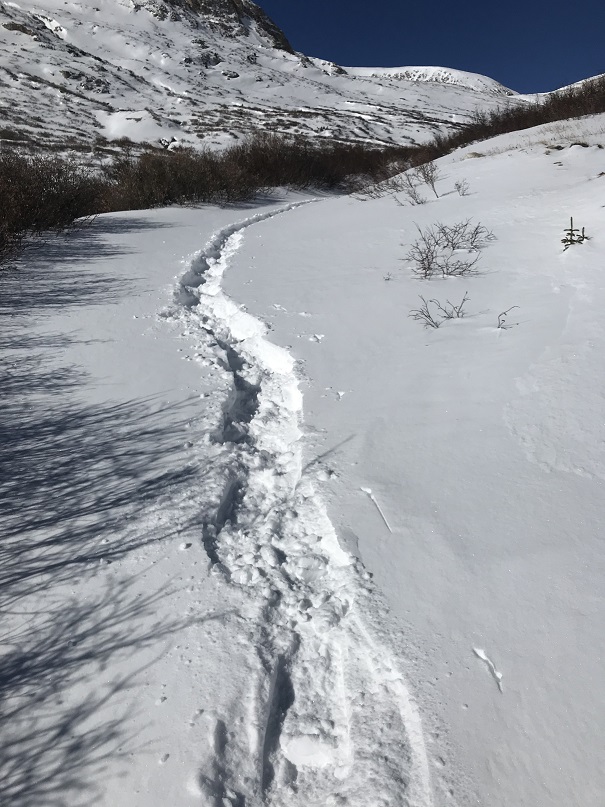
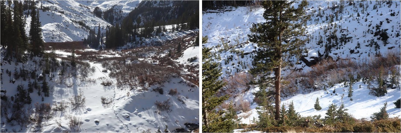
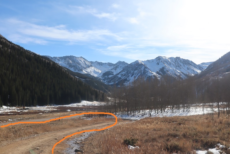
After the London Mill the snow picked up on the 4WD road and I was postholing up to my knees, even with my snowshoes on. It was slow going and very tiring. Here’s a look at the rest of the route
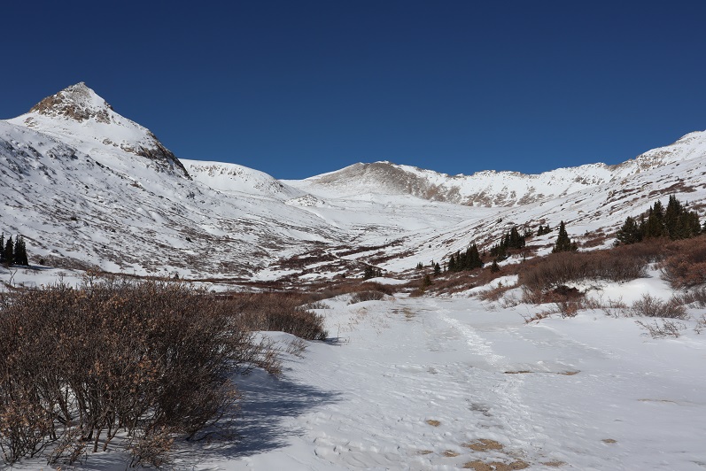
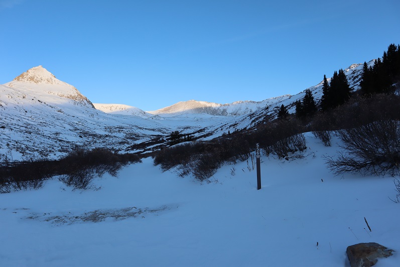
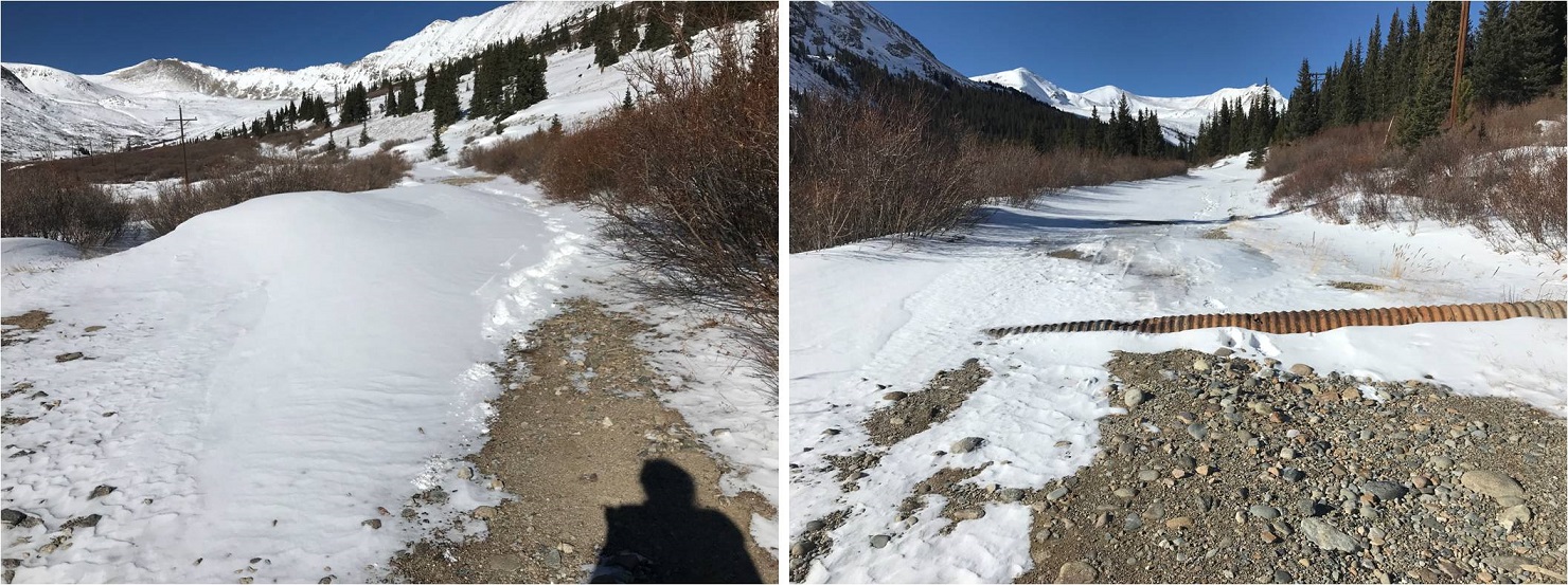
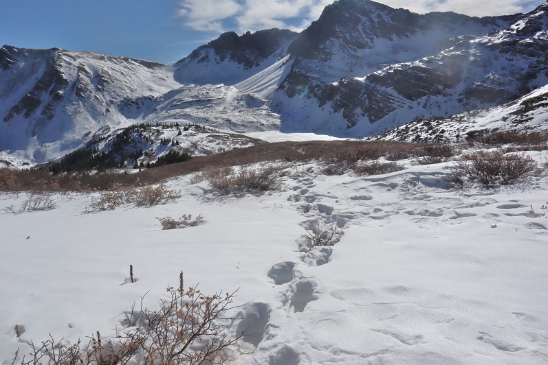
I followed road 656 into the upper basin.
There wasn’t a ton of snow, but there was enough to completely cover the road in areas.
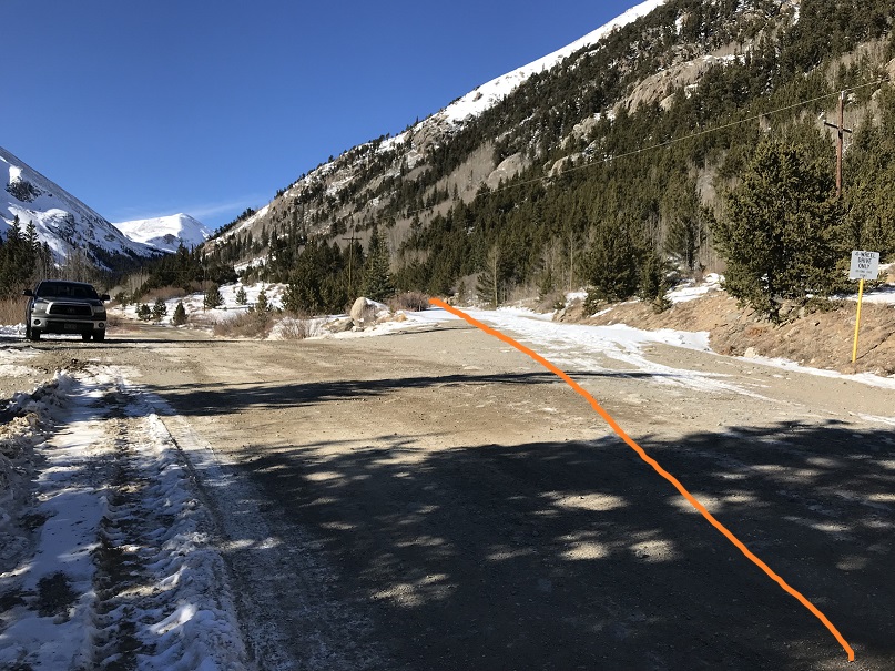
Once I was in the upper basin the wind stopped but the snow levels were still uneven. I made my way towards the aerial cable. I could see what was left of it littering the mountain even from hundreds of yards away. Here the road stopped.
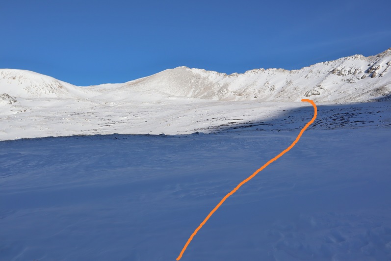
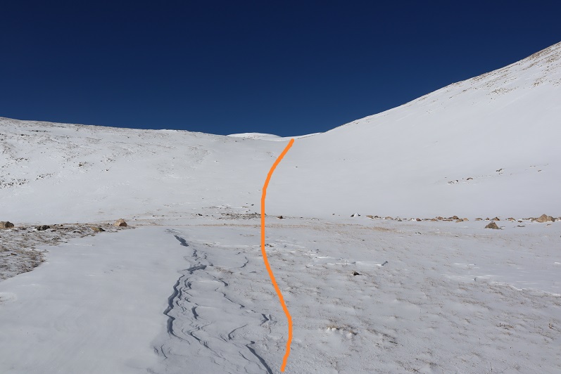
I turned left and headed west
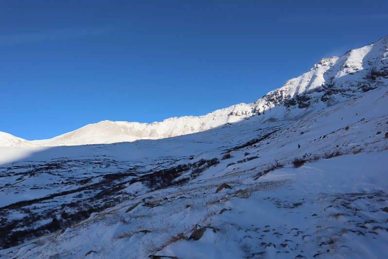
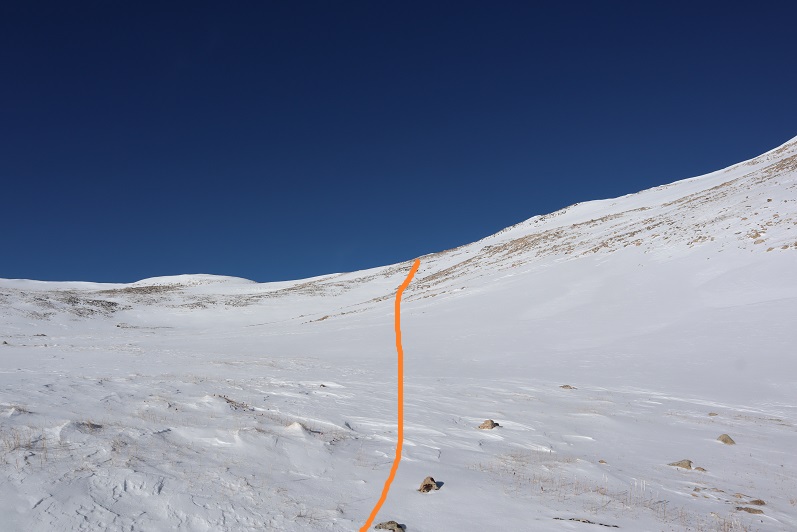
My goal was to gain the ridge. It was a straightforward snowshoe with no large rocks/obstacles to overcome.
It’s steeper than it looks, but I didn’t need to put the risers up on my snowshoes.
Once on the ridge the wind picked up again, but it wasn’t giving me a headache like I’d had on Mt Flora.
Side note: for those of you who remember the curious headache/nausea that caused me to turn back after summiting Mt Flora instead of hiking the ridge, I found out what happened (and no, it hadn’t been the wind). Before hiking Flora I’d woken up in the middle of the night and needed a quick drink, so I went to the fridge and half dazed with my eyes squinted closed to block out the fridge light found some iced tea in the back and chugged it straight from the container. It had tasted awful, but I hadn’t thought much of it. I travel to China for work and bring home loose leaf tea, which my kids love to make. Sometimes it has a curious taste/texture. The next day I’d had a terrible headache accompanied with nausea while hiking above treeline and attributed it to the constant wind. Well, a few days later I was cleaning out my fridge and when I found the tea in the back of the fridge I noticed what I’d thought had been leaves had actually been mold: Big clumps of mold floating in the tea and covering the sides of the container. Thinking of how I’d swallowed a good cup or more of that stuff made me nauseous all over again, and I felt lucky a headache was all that had happened. The container was beyond cleaning so I threw it away. Needless to say, I will be looking much closer at my late night drinks in the future.
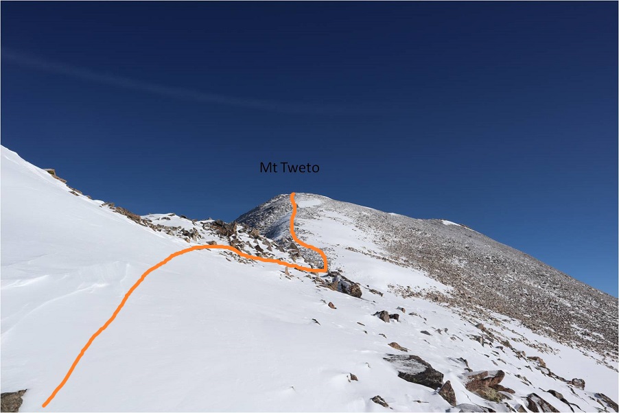
I followed the ridge north. There were a few cornices forming on the ridge making snowshoes helpful and just enough rocks to slow me down.
Towards the top the wind really picked up and you could actually see the cold. I kept on my snowshoes even though they were overkill. I just didn’t want to take them off to put them on again in the cold and wind.
As I got closer to the top I noticed a plaque to the left of the summit and went to get a closer view
The actual summit was just to the right (east) of the plaque
I summited at 10:20am
Summit Video:
I hadn’t seen my daughter all week because I’d been in Florida for work, so I decided to just head back the way I’d come instead of heading over to hike Treasurevault, Mosquito, etc. It was my goal to be back home when she got home from school, so I turned around and headed back down the ridge
I followed my tracks back down the ridge
Back through the basin and to the 4WD road.
Most of my tracks were gone in the upper basin, but once I made it back to the road they were easy to follow. I did my best to make a trench, but it could use a few more people on the route.
I was once again glad I’d decided not to drive the road up.
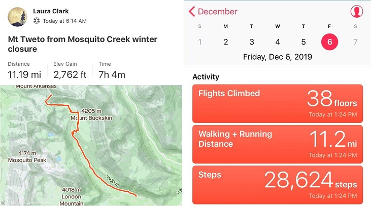
I started this hike at 6:15am and finished at 1:15pm, making this an 11.2 mile hike with 2762’ of elevation gain in 7 hours. I didn’t see another person hiking all day.
I made it home in just enough time to take a shower before my daughter came home from school. She was a little sheepish when she walked in; the kitchen was a mess with dishes in the sink and on the counter and opened packages and mail all over the place. She’d thought she had another few hours to clean up before I arrived. I was just happy to see her. We chatted and cleaned up the kitchen together before making dinner and heading to the ice rink.
My flight got in late. I’d been in California all week at a tech conference and decided to leave Thursday evening to allow me to hike on Friday morning. This seemed like a great idea but the flight was delayed and I didn’t end up making it to Denver until 1:30am. I jumped in my truck and drove to the Cathedral Lake trailhead, a little upset I was behind schedule but not too worried since it was supposed to be a nice day and I wasn’t on any time schedule.
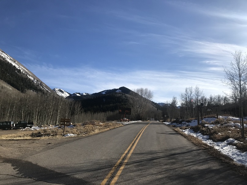
I’d heard they were closing the road to Maroon Bells today and figured since they were in the same area they’d be closing the road to the Cathedral Lake trailhead soon as well. When I got to Ashcroft I saw the gate was still open but there was a blinking sign indicating the road was going to close on November 15 (today). I was excited it was still open until I noticed it said they were closing it at 7am. Drat! I’d arrived before the gate closure but only by about an hour and a half. Oh well, this only added 3 miles total to my hike. Also, props to them for putting up signs warning of the upcoming closure.
I parked my truck in the parking lot at Ashcroft, gathered my gear, and was on the trail at 5:45am.
I followed the road for a mile and then turned right (west) onto a dirt road.
Here the road became icy. I followed it for another three quarters of a mile to the trailhead
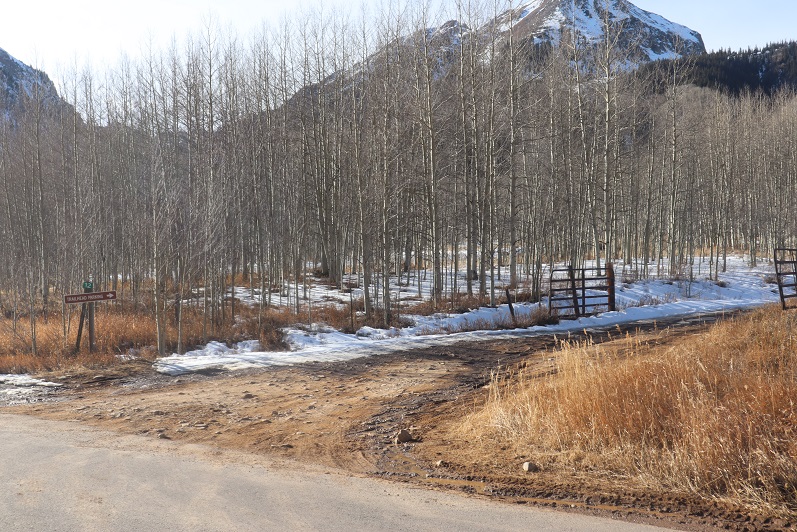
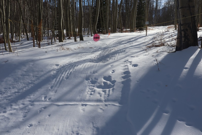
I saw several ropes put across roads that weren’t open, which I thought was a great idea! I was here last May when there were several feet of snow on the ground and following the correct road had been a challenge when everything was white. These ropes would have come in handy back then
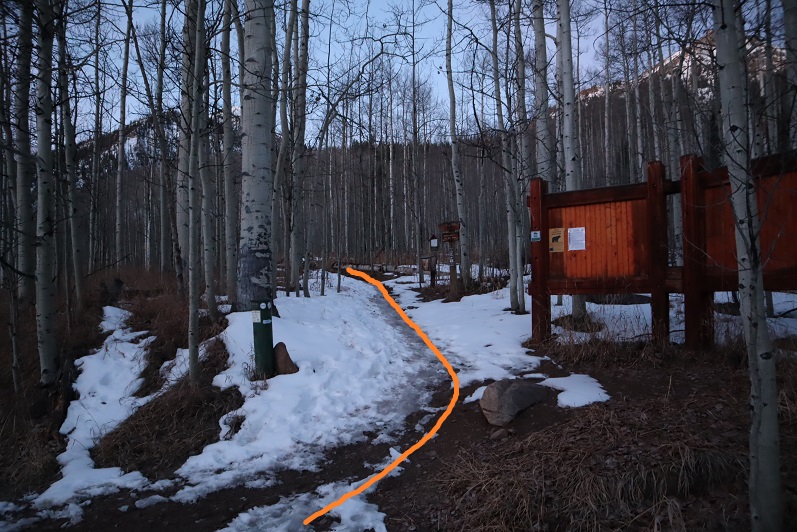
The dirt road led me to the Cathedral Lake trailhead.
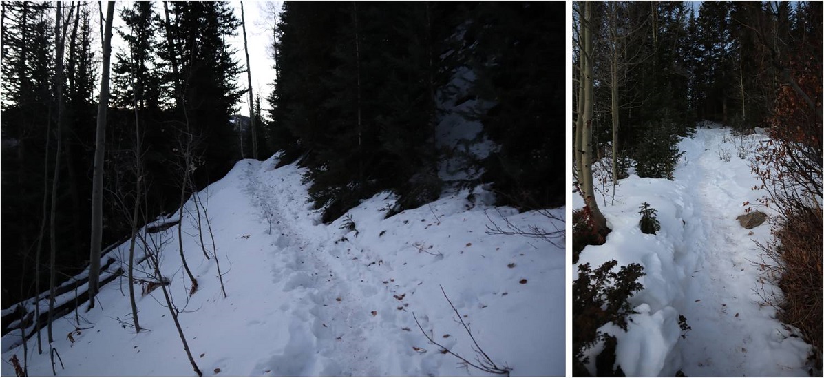
The trail up to the lake is a well defined, class 1 trail. The trail had seen snow recently but was well packed down. In the morning I didn’t need microspikes, but they were very helpful in the afternoon.
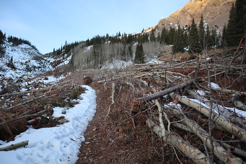
The avalanche area has been well cleared
Just after ascending this hill (after about 4 miles from the start of the trail) the trail splits in two, one going to Cathedral Lake, the other to Electric Pass.
I went right towards Electric Pass
Here the snow picked up quite a bit and the trail became less traveled.
Most of the snow seemed to be directly on the trail. Unfortunately, it looked like one other person had been here since the snow fell and apparently they hadn’t brought snowshoes because they’d postholed with every step. It made my trek that much more difficult.
The trail led me to a basin and from here snow obscured the rest of the route, making this a class 2 hike. Also, here the tracks stopped. It seemed the previous hiker had given up their hike at the basin (probably because they lacked snowshoes). With no visible trail I’d originally planned to hike to the end of the basin and gain the ridge, but as I was aiming for the ridge I came across the trail again and decided to follow it instead. Here’s the route I took
Some parts of the trail were completely dry
But most of the trail was obscured by snow. I’d lose it and then find it again. I decided this was a good time to put on my microspikes.
I just kept aiming for the saddle
Once there I saw a cairn and followed the ridge west
Instead of following the ridge to the summit I followed the trail, which went around to the left
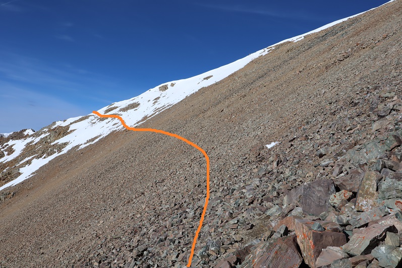
After rounding the corner (still on the trail) I could see the route to Electric Pass
This area was full of loose talus. It looked like some people had attempted to summit this way in the past (there were cairns pointing upwards) but this seemed foolishly difficult and unnecessary.
The last bit was steep and the snow here was soft. I carefully made solid tracks in the snow.
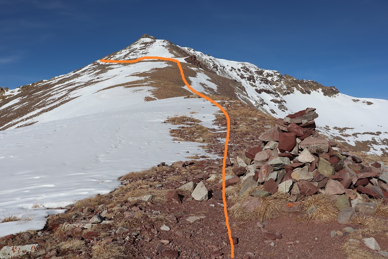
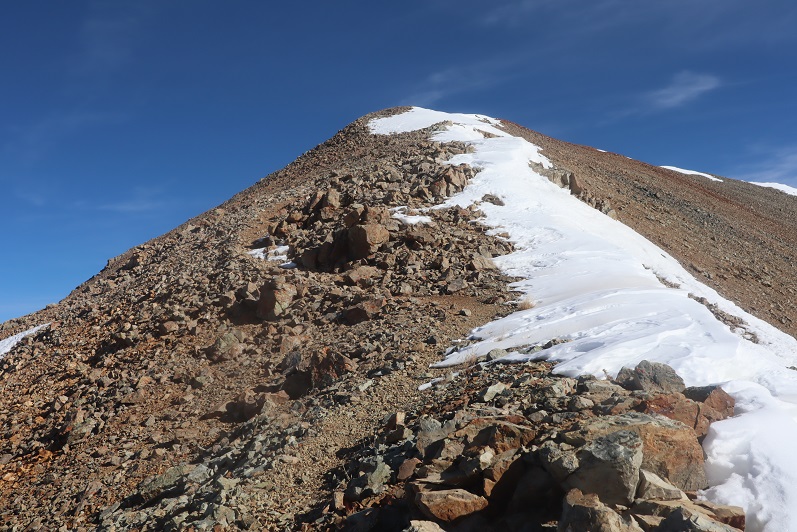
There was a cornice to navigate before gaining the ridge. Once on the ridge I turned right (northeast) and followed the trail to the summit
The summit had a lot of red rocks and a large cairn
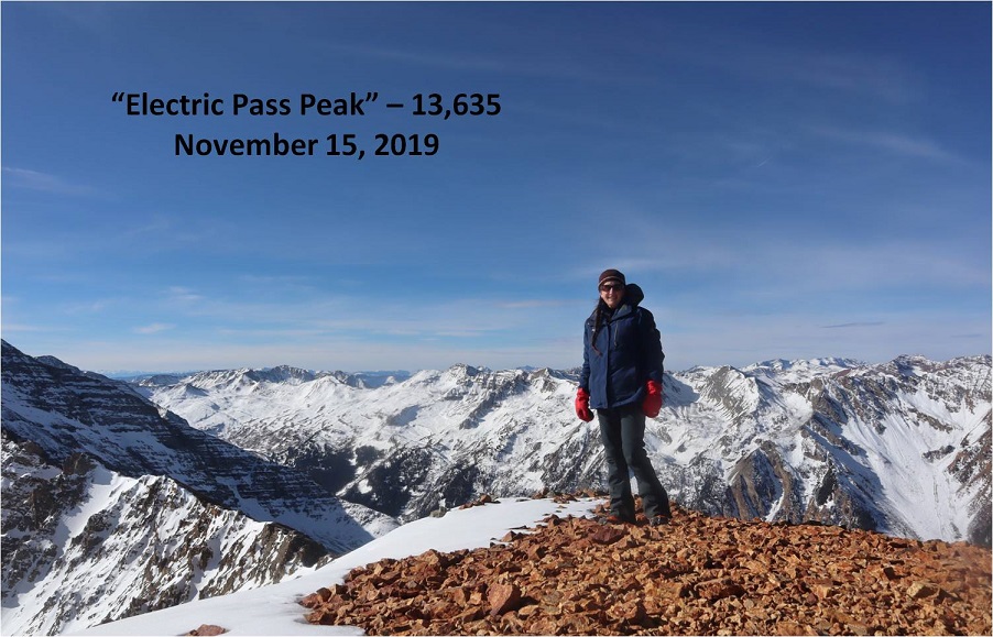
I summited “Electric Pass Peak” at 10:15am
“Electric Pass Peak”
The views were absolutely amazing!
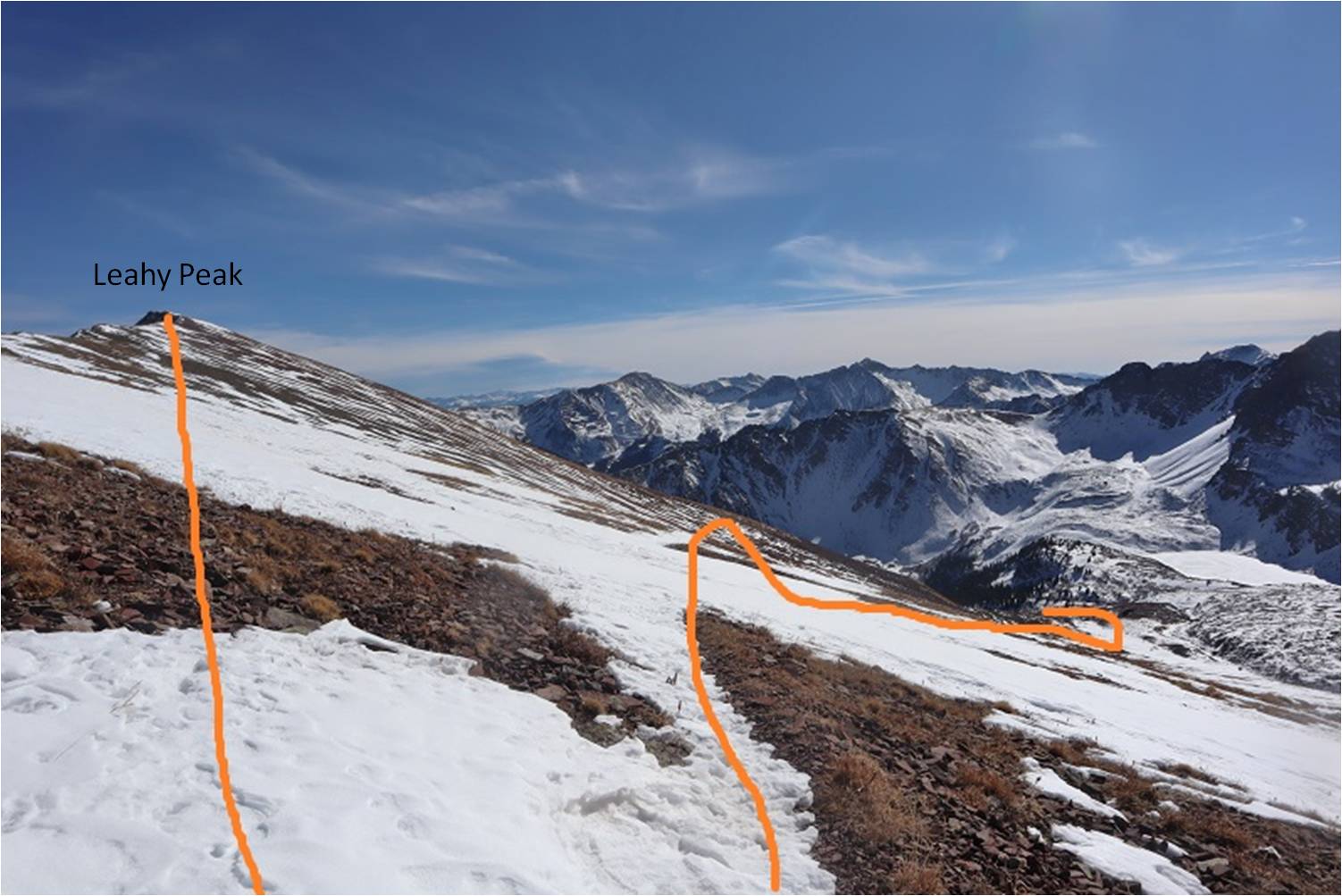
From here I had a good view of the route to Leahy Peak
I turned and went back the same way I’d summited
It hadn’t been very long since I was there, but the section of snow just under the ridge had now become slick. This was the crux of the route for the day, going back over the cornice and snow that took me back to the talus
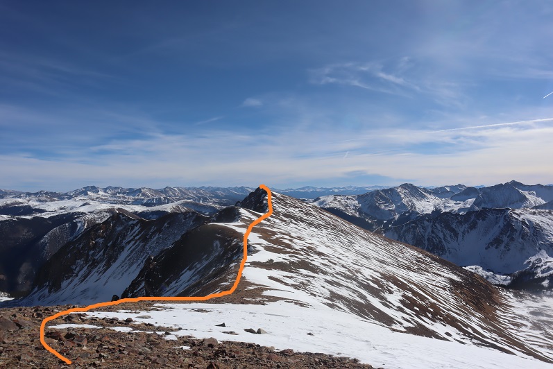
Here’s the route I took from “Electric Pass Peak” to Leahy, doing my best to stick to the ridge and avoid the snow
Side note: look at the difference in snow levels on opposite sides of the mountain!
Here’s the last bit up to Leahy Peak. This really was an easy ridge walk, and if you’re even considering summiting Leahy I’d recommend doing so.
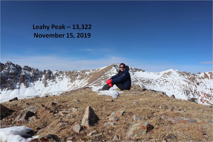
I summited Leahy Peak at 11:15am
Leahy Peak
Time to head back. I followed the ridge back as best I could until I came across the trail again
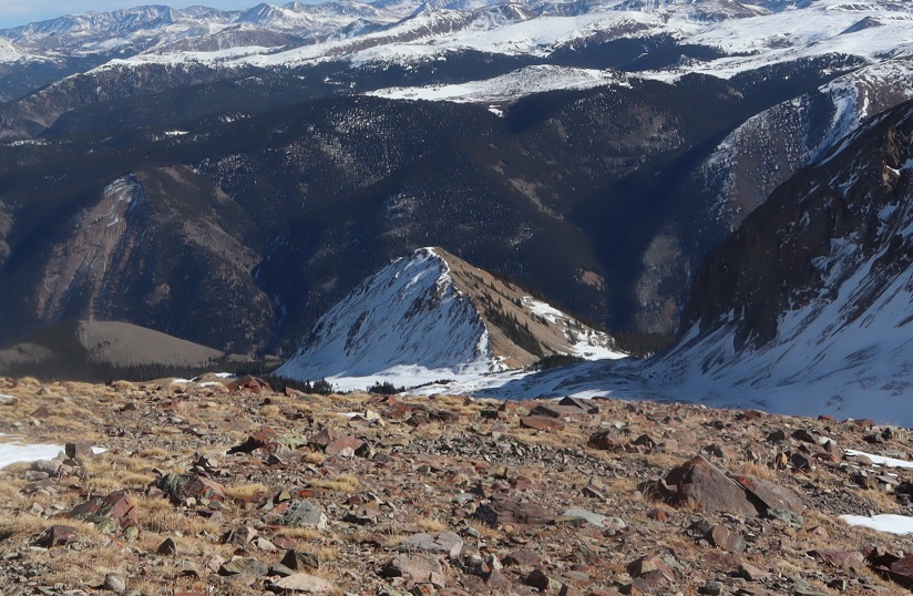
Here’s my route from Leahy Peak back down to the basin
On my way back I put on my snowshoes and tried to stomp down the postholes along the trail
It was really neat seeing all the animal tracks on the way down that hadn’t been there on my way up
I was almost back at the trailhead when I came across three hikers. They were surprised to see me because they hadn’t seen any other vehicles at the trailhead. They also didn’t have proper gear to be out hiking, especially on all this ice. They seemed upset with me when they saw I was wearing microspikes because they hadn’t brought any.
I was surprised they’d parked at the trailhead.
Me: “Weren’t they supposed to close the gate this morning?”
Them: “Yes, they did. We just used our 4WD vehicle to drive around it”
I didn’t agree with their tactics and gave them a blank look as I let my eyes go wide. Don’t be like them.
I made it back to the trailhead and indeed they’d parked their car in the lot, going around the closed gate to get there.
I followed the dirt road back to the paved road
And followed the paved road back to Ashcroft (and the closed gate)
I made it back to Ashcroft at 2:15pm, making this a 14 mile hike with 4406’ of elevation gain in 8 hours, 30 minutes
I was a bit tired, seeing as how I hadn’t slept in 2 days, but considered today’s outing a win!
The weather forecast for this weekend was terrible. So terrible in fact they cancelled the 14er Winter Welcomer (where they teach newbies how to hike in winter-like conditions). I watched the weather very closely and narrowed the best weather down to the Sawatch range, right along the 82. Unfortunately, they usually close the 82 the first week of November, and today’s the 2nd. Oh, and the weather forecast wasn’t that great, it was just better than anywhere else in the state (40% chance of snow, 15-29*, winds 20-45mph… yes, that was the BEST forecast).
I’m still learning about alpine hiking in late fall/winter (considered early winter season conditions), so I made a promise to myself until I learn more about correlating forecasts to actual conditions to drive out to the trailheads and not make a decision on whether or not I’d hike until I was actually there. So this morning I drove past Buena Vista and a sign indicating the 82/Independence Pass was open. Woohoo! Now my only worry was they’d close it while I was parked at a trailhead and I wouldn’t be able to drive out (do they have plans for that?).
Well, that was my only worry, until I started driving on the 82. Almost immediately it was sketchy. It wasn’t snowing, but snow was blowing all over the roads. I could tell no one had been on the road in quite some time (an hour or more?). No one was passing me coming the other way, and I had to drive much slower than normal to avoid ice. I made it to the trailhead, but when I arrived it was whiteout conditions, and actually snowing at that time. The forecast indicated the snow would stop but the winds would pick up. I knew it wasn’t safe to hike in the dark in these conditions (and most likely not in the light of day either). I couldn’t wait for the sun to rise because I wouldn’t have enough time to complete the hike. Drat. I was going to have to turn around. This stunk, but I knew it was the right decision. Those winds were insane, and the snow was just going to keep blowing as long as the wind did. If these were the conditions below treeline it would be a miserable hike, even more so above treeline, and I most likely wouldn’t summit.
When you show up to the 13er trailhead with the best weather forecast in the state and life gives you whiteout conditions but you NEED TO HIKE you change tactics.
On the drive home I frantically thought of which local mountains (below treeline) I’d yet to summit. I had none in mind… In fact, I haven’t even started planning my local winter summits because I figured if I never planned them I’d never have to use them. Ouch, that was coming back to haunt me now. I didn’t have any of my local maps with me, or any routes planned (I did have 8 different 13er routes though, but the weather wasn’t going to let any of them happen today). I guess I’d just hike the Incline a few times so at least I’d still get in some elevation gain. That’s when it hit me: Mt Manitou! I’d heard that was a nice alternative to the incline that no one used. I googled it. No luck. I couldn’t find a route, but I could find one for Rocky Mountain (a 9K summit directly behind the Incline). I was going to go for it.
I made it to the Manitou Incline Trailhead and began at 8am (after taking off my snow clothes: it wouldn’t get that cold below 10K today).
The Incline was much icier than I’d anticipated.
I had my microspikes, but didn’t put them on. Most experienced incliners had theirs on. As usual with the incline, I kept a steady pace but didn’t stop. It took me 41 minutes 39 seconds to make it to the top, after taking time to help someone with their yack tracks and careful foot placement due to ice.
I was overdressed in my knit hat and snow jacket, but the top of the incline wasn’t my intended destination. I took a few pictures and continued uphill, past the old foundations.
There’s actually a 4WD road here.
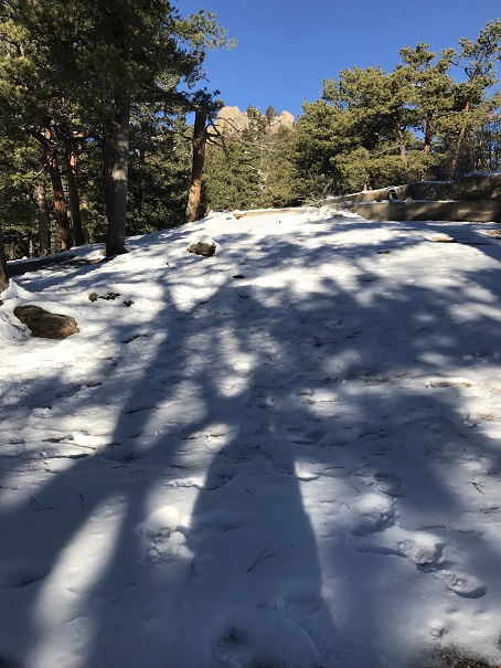
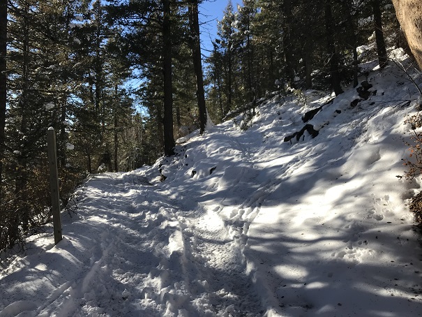
I took it for 1.5 miles and then left the road on a trail that heads towards the summit. The cutoff is at this post.
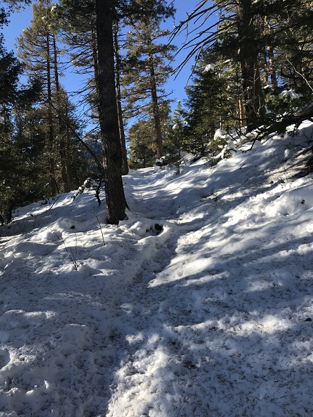
The trail was covered in snow, and I backtracked a few times due to game trails (and fresh prints from said game) but was always able to find my way back to the actual trail.
The snow was about 6” deep. Luckily I had on winter boots that went to my shins. These had looked ridiculous on the incline, but were coming in handy now.
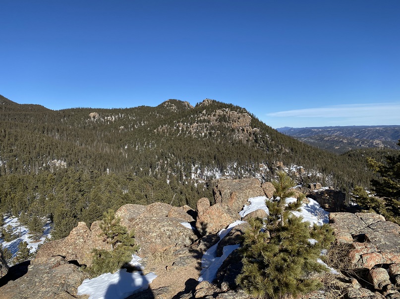
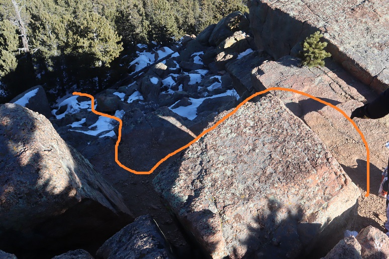
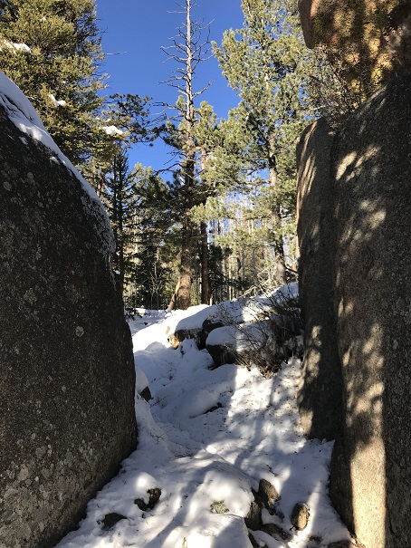
I turned right at an area with some large boulders (after initially heading straight/north, which I soon figured wasn’t a trail that led to the summit)
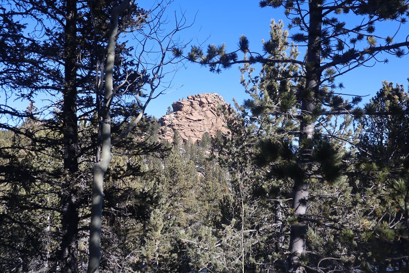
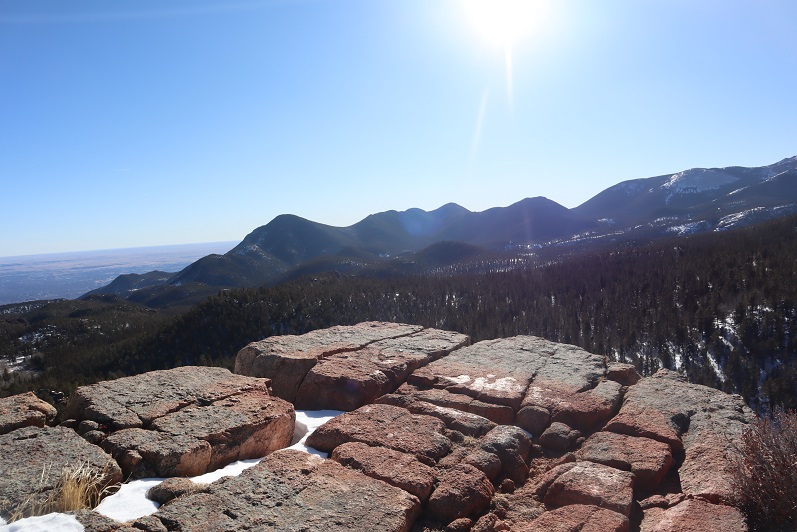
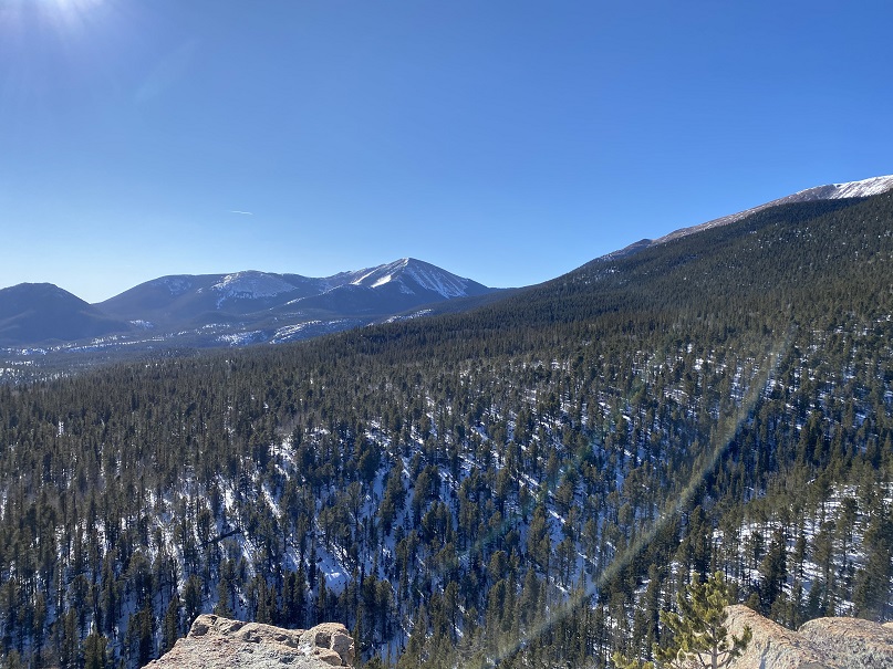
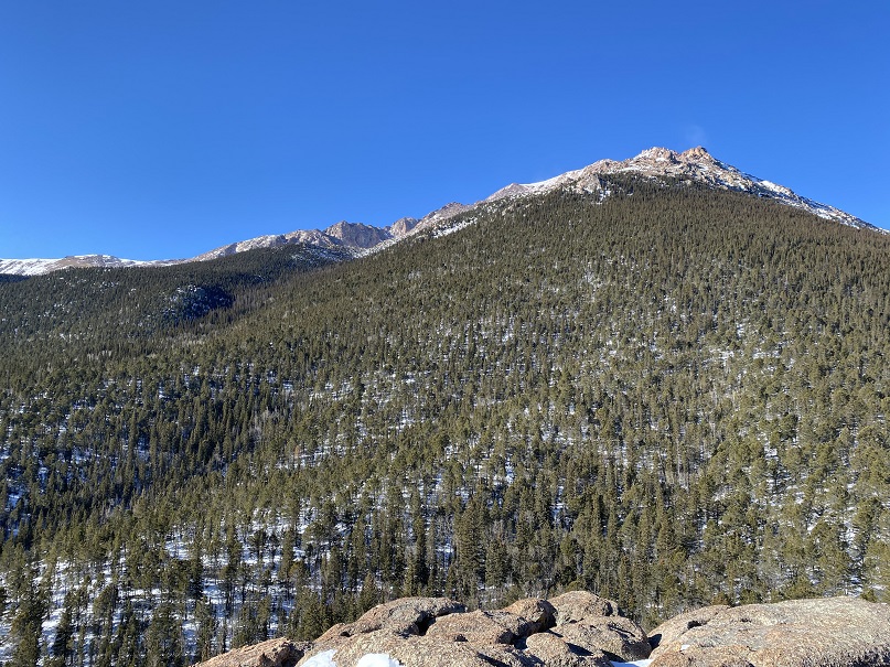
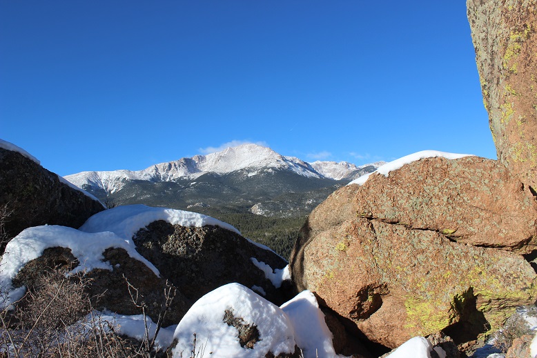
I rounded several corners and finally came to the summit block of Rocky Mountain. This is what I saw.
What?!?!? This didn’t look too difficult, but I didn’t bring my helmet, as I didn’t think I’d need to do any rock climbing. It was also icy due to snow and, well, ice. Before climbing I decided to walk further around the side to see if there was another route up, and sure enough, there was.
It was an easy climb to the summit, which still had remnants of some sort of past structure.
I summited at 9:15am
VIDEO:
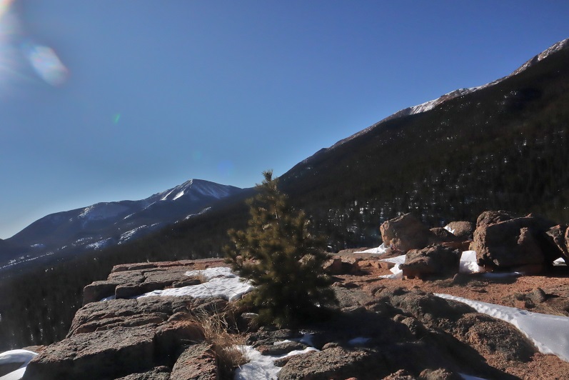
It was WINDY! Seriously windy! And COLD!!! And I wasn’t even above treeline! It was a good call to alter my hiking plans for today and to overdress for the Incline. After retrieving a glove that had been caught in the wind and flown about 10 yards away I hiked back to below the summit block and got a few pictures of Pikes Peak.
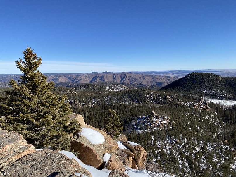
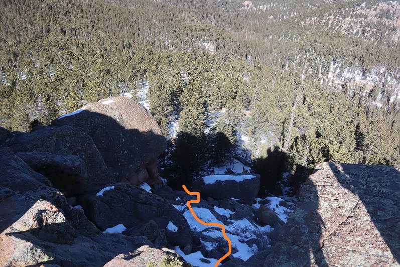
And then I was on my way down. I just followed my tracks. When I got to the boulder area I decided to actually take that trail I’d seen earlier, but I wasn’t entirely sure it was a trail. I stopped for a bit, turned on my data, and tried to see if there was a trail to Mt Manitou from here? No luck. The trail I was on went north (and lower in elevation). I could see Mt Manitou,
and debated just hiking the half mile over there, but the snow was getting deeper and I didn’t have snow pants/snow shoes and the snow I’d been trekking in was turning to water on my clothes. This wouldn’t end well with the wind, so I backtracked and found the Barr trail. Here’s a view of Cameron Cone
taking it back down to the base of the Incline. The Barr trail was much icier than I’d anticipated. Spikes would have been helpful (but I was too stubborn to put them on and instead put up with the occasional sliding: Thank you Yoga for the balance).
I made it back to where I’d started, but I wasn’t tired yet!!! It was exactly 11am, so I decided to hike the Incline again. The second go up the incline was more difficult than the first because there were a lot more people, it was warmer out (I still had on my winter coat and hat) and I was tired. This time it took me 49 minutes to summit. That’s the longest it’s ever taken me, and I was quite tired when I reached the top.
I immediately headed back down the trail, which was muddy now since most of the snow/ice had melted.
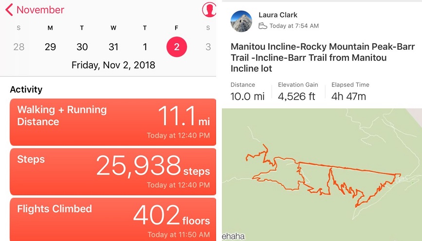
I made it to my truck at 12:40pm. I checked Strava, and this was a 10 mile hike with 4500’ in elevation gain, completed in under 5 hours. I felt great!
This week has been challenging 14er wise. I’m working from home all week, so basically
I could’ve hiked any day I wished. I’d
planned on hiking Monday, but we had a big storm roll in and blanket all of
Colorado with snow. That meant I couldn’t
hike Tuesday either. I made an awesome
choice and hiked Uncompaghre Wednesday.
I was quite pleased with myself, and wanted a similar success today. Most of the peaks I still have left to hike
were too snow covered to hike this week, so I went online last night and tried
once again to get information on the Crestones.
The webcams made it look like they were pretty devoid of snow, but I
wanted to make sure before heading out there.
The forecast said it would be clear, with temperatures in the 50s with
25mph winds. The winds were higher than
I’d have liked, but in the past the wind speeds have been overrated, so I didn’t
pay much attention to them.
I checked my schedule for today and cleared it a bit (my son
would pick up my daughter from school) and tried to get to be early. That didn’t work, but I did manage to get in
3 hours of sleep before waking up at 1am to head to the trail.
This is where my bad luck began. I’d copied and pasted the GPS coordinates
into my phone, and when they pulled up they looked like what I’d printed out
from my research: same mileage, cities,
highways, etc. So I just followed the
directions on my phone and arrived at what I’d thought was the trailhead. It was kind of weird I’d gone through a
residential area, but it was on an unpaved road and we were backing up to the
forest, so I figured this was the trailhead.
But when I started on the “trail” (no sign, which is a pet peeve of
mine) I realized I was at a water treatment plant? I pulled out my GPS and I was right where I
was supposed to be, but when I zoomed in I realized I was about 15 yards off
from the exact trailhead, and since I was in the middle of nowhere it would
take me 20 miles to go around on the roads and park in the proper spot. I
briefly considered just hiking towards the trailhead but thought better of it
and drove around. The lady who’s house I’d
parked in front of would appreciate I’d moved my truck from her front lawn.
This meant I’d arrived at the trailhead 30 minutes later
than my intended time. I was already
cutting it close (I know, I know, it’s a bad idea to put time limits on hikes,
but I’m a single mom and have a lot of other responsibilities too: If I’m going
to hike I have to accept these time restrictions, summit or no). 30 minutes can equal 2 miles if I book
it. I seriously hoped I didn’t just
endanger my ability to summit because of this stupid mistake.
The drive in was 2WD all the way.
And there was ample parking at the trailhead
Woohoo! A trail
sign! I LOVE these things! This meant I was on the right trail.
I grabbed my stuff and was off at 5:30am. Right away I had difficulty. The trail obviously went to the right, but
there were several social trails.
And it was dark. GPS
is great, but it’s off a few feet in every direction, and I couldn’t really
tell which way to go. There was a stream
to the right, and I figured that was where I was supposed to go, but there didn’t
seem to be a way to cross it?
In the dark (even with a great flashlight) I couldn’t see
across the stream, and it didn’t look like the trees made a bridge across. I spent another 5 minutes looking at my GPS
and going in circles before taking the plunge and just walking across the
stream, not knowing how deep it was. My
feet and legs were wet because the water was about a foot and a half deep, but
there was an obvious trail when I made it to the other side.
Woot! I was on my
way! The first 4.5 miles was
switchbacks. Lots and lots of
switchbacks. I didn’t mind much, because
I was working out the elevation gain in my head and this was an easy way to get
in those 4.75 miles to Willow Lake.
I crossed several smaller streams in the dark and saw
numerous waterfalls. I’d be getting
pictures of them later! (here they are)
Side note: water at
this altitude/temperature means ice. If
it looks wet, assume it’s slippery and unstable. I know this from experience.
Especially on those log “bridges”.
The last quarter mile before the lake was where the trail
got rough. Well, not rough, but
messy. Lots of ice and snow and mud on
the trail. Yuck!
The view was great though!
The only downside from this route was I wouldn’t be seeing a sunrise (it
was on the other side of the mountain). It
looked like I’d picked a great peak to climb today. There was minimal snow when compared with
other 14ers and no clouds!
Just before reaching the lake I was watching my feet as I
was hiking (ice, remember?) and I saw what looked like toes in the mud. I briefly thought it was a print from someone
wearing those shoes with the individual toes, but quickly realized it was a
(small) bear print! Woot! Awesome!
That meant there was a bear in the area!
It looked bigger than a cub print, but not big enough to be a full grown
bear, and the prints were heading away from me (back where I’d came from) so we’d
missed each other. Oh well, maybe I’d
see it on the way down?
I pressed onward, over what looked like it was a waterfall
at various points during the winter
And arrived at the lake!
It was now 7:40am. I’d
hiked 4.75 miles in 2 hours 20 minutes. Uphill.
Immediately the weather
changed. The wind picked up
dramatically, and there was no sun? The
temperature dropped as I looked for the correct trail. I knew it went left behind the waterfall on
the other side of the lake.
My GPS told me to go one way, but that way was now “closed
for restoration” so I did my best to look for the proper trail. No dice.
I ended up kind of bushwhacking my way through some willows (there had
been a trail there previously that was not too overgrown) and up some rocks to
where I saw a sign indicating the trail.
I checked my GPS: success!
I kept trudging, admiring the view
As soon as I made my way over the waterfall area I got a good
look at the Crestones: This view offered
a stark contrast to their backsides! I
was amazed at how much snow there was here in the middle compared to the east! No worries though, snow was easy enough to
navigate.
I crossed a few very slippery half-frozen streams and made
it to a large basin.
The wind was howling at this point. I looked up at the intended route and sighed
inwardly: a gully. A BIG gully.
I hate gullies! The first part
didn’t look too bad though, and it looked like the sun was coming out?
Nope, it went right back behind the only cloud in the
sky: the one very similar to the one I’d
encountered on Blanca Peak last month. UGH! The weather was supposed to be sunny, clear,
warm, and windy? When will I learn 14ers
create their own weather? It WAS sunny,
clear, warm, and windy everywhere except in the basin I was in.
Here is was cloudy, cold, and very, very windy. I rounded some large boulders and looked at
the hike in front of me. Lots of snow
covered the trail, with no footprints. I
was probably the first to take this route since before Monday’s storm. No worries though, I liked hiking in the
snow. I put on my microspikes and headed
in.
I made my way to the gully.
It’s actually much bigger than this picture indicates. I looked at my watch. I had exactly 2 hours to summit both
peaks. In normal conditions, even with a
little snow, this was doable. Today
however was another story. I decided to
start climbing and see how far I could make it, then adjust my goals.
The gully sucked.
There wasn’t enough snow to make it easy to climb, but there was a lot
of ice. And wind. Lots and lots of wind. Bitter, cold, snow-filled wind. I picked a ledge and followed it, which was
much easier than hiking up the scree/snow.
I gained the first ridge and looked at the rest of the route. It went to the right of the gully. Right where the wind was swirling snow into
the air.
The weather kept getting worse.
The wind picked up and knocked me into the side of the
mountain, hard. It pressed and held me
there as ice crystals swirled up and around me and gave me an unwanted
dermabrasion on the only exposed surface of my body: my face.
I stood back up and got my bearings, but another gust of wind did the
same thing all over again. This was not
going well. I got out my map, and looked
at the ‘easy’ ridge I’d get to summit after making it up the side of the
gully. Ugh! It was covered in snow! (and most likely ice) And that wind! Down here it had to be at least 65+MPH. Up there?
Probably worse. I did some mental
calculations, and figured it wasn’t safe for me to try to cross that snow/ice
covered ridge in this wind. It was
knocking me around like a doll down here: I didn’t stand a chance on the exposed
ridge. Maybe I could wait the weather
out and see if the sun re-emerged and the wind died down? It was early yet, but how long would that
take? Even now I wasn’t sure I’d be able
to summit one, let alone both of the peaks I’d wanted before I had to turn back
around to make it home on time, help from the sun or not. How far could I make it if the sun was
out? Was it worth the wait?
Take a look at this video.
See where that snow is circling to the right of the snow filled gully? That’s the route I needed to take, and then
across the ridge to the left.
Then I really got to thinking. If I wasn’t going to summit today, what was I
doing mentally calculating how much further I could go? Here I was, cold, on top of a gully, halfway
up the side of a huge mountain, trying to gauge how much farther up I could
safely climb, when I had no intention anymore of summiting. The wind was knocking me around, the ice was
terrible, and my fingers were numb. The
climb up the gully had been difficult and slow, and I knew from experience the
hike down would be worse (center of gravity problems mixed with ice means slow
going and causes slips and falls). And
here I was, mentally calculating how much further I could go before I absolutely
must turn back because of TIME. To make
it to a class I was teaching on outdoor survival skills. Wouldn’t it be ironic if the reason I didn’t
make it to the meeting was because I needed to be rescued?
Good point. I turned
around and headed back. Summiting was optional, but making it down was
mandatory. The gully down was indeed
worse than the way up, and took me twice as long. By the time I’d made it to the bottom my
fingers were turning white and I couldn’t feel them anymore (they kept gripping
snow for traction, and I don’t do well in the cold). The look back was beautiful though!
I re-crossed over the waterfall and looked at Willow Lake
from above
I probably should have noted the ice hanging from the
waterfalls earlier. It was cold here,
and had been for a few days.
There were tons of waterfalls on the way down, and lots of
mud/ice to trudge through. No sign of
that bear though.
Oh, but the birds were ‘singing’
What really hurt was turning back and looking on the mountain I hadn’t climbed. It looked warm and inviting on this side, yet I knew once I rounded the back it was a bitterly cold snow-globe of ice, wind, and snow. What’s worse is turning back today meant I might not get to hike another 14er this year: I don’t have many more available days so this might be it. I took a good look at all the mountain ranges on my way in. They’re socked with snow, and all are getting wind this weekend. Snow I can handle, but this kind of wind? Not fun.
It ended up being an 11 mile hike, I’m not sure about the elevation gain, but 3500’+
I’ve hiked 43 14ers and this is the first time I’ve had to turn back due to weather. And what’s worse, it was due to the wind and ice, not snow, rain, lightning, etc. Oh well, the mountain will still be there next year. I’ll try again!
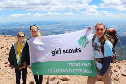
Pikes Peak is an INTENSE hike, made even more so by backpacking. We are all tired and extremely sore, but proud of our accomplishment!
I grow as a person every time we Girl Scouts get together!
Thank you Girl Scout Troop 931 for teaching me about teamwork, patience, FUN, goals, perseverance, and awesomeness!!! Oh, and for those interested, YES they did help rescue someone on this trip too: a hiker with a broken ankle about a quarter mile from the summit. Troop 931 ROCKS!!!
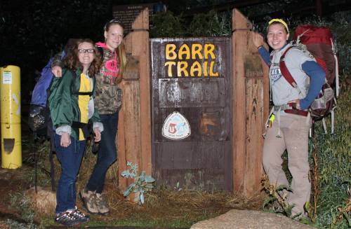
This wasn’t our first rodeo (we did the same hike last summer and saved some hikers. You can read that story here: http://lauramclark.tumblr.com/post/95826650834/girl-scout-troop-931-backpacking-pikes-peak-and ) so we started before the sunrise to get an early start on the hike. The weather changes frequently on the mountain, and we knew it would start out cold, get really hot, then back to cold again as we made it past the tree line. Here are the girls, all ready to go in their “warm” clothes. We just layer for hikes like these. Also notice how happy and fresh they look.
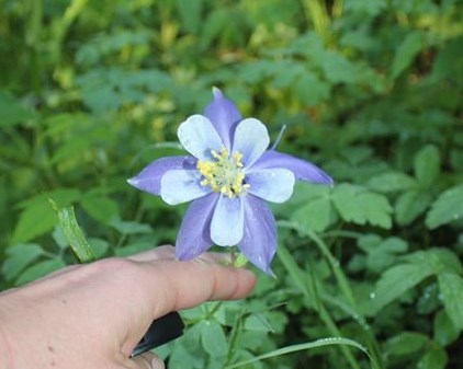
Along the way we saw different flowers than last time (since we were hiking two months earlier in the season). I love seeing columbines growing in nature!
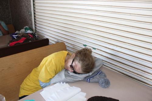
This is a really tough hike. About 6 miles in there’s a place called Barr Camp where a lot of hikers stay the night. Our overnight spot was still another 3 miles up the trail. Here’s Kayla passed out as we took a lunch break. Poor girl! This was a much harder hike than she’d anticipated. She was doing great though!
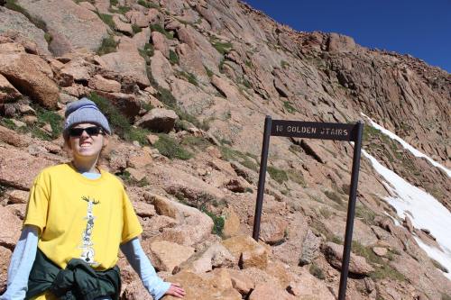
Notice this sign posted as you leave Barr Camp. Unfortunately, too many hikers either don’t see this sign, or don’t take it seriously.
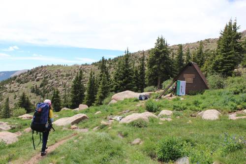
About half a mile past Barr Camp we split into two teams. Jordan, Ruth Ann, and Tristina were hiking fast, so they went on up ahead and were to meet Kayla and I at the “A-frame”. Kayla was exhausted by this point, but kept on going. We all knew it would be easier if we separated, and we wanted to make sure we had a spot to sleep tonight since it’s first come (so getting there first was our best option).
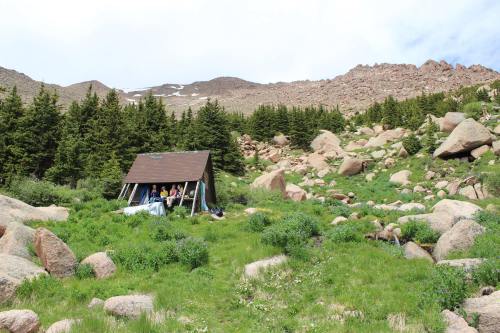
Kayla and I made it to the A-Frame about 2 hours after the other girls. They had already set up camp and rested by the time we got there.
Kayla immediately unpacked her sleeping bag, and fell asleep.
The other girls had already rested, so by this point they were ready to talk. I walked around the campsite to get some pictures.
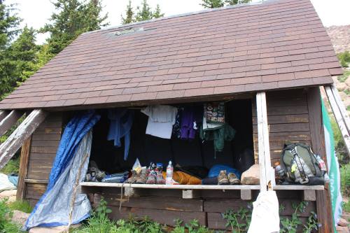
The A-Frame isn’t very big, and we didn’t want to put our things on the ground because there were a lot of critters around, so we weren’t as “tidy” as we could have been.
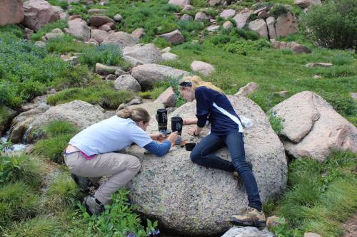
Jordan and Tristina got to work sanitizing water and making dinner. The site has a running creek year long, so this time we decided not to hike with as much water (conserving weight), and we planned to filter water at the top. The girls boiled the water, then placed the container of water in the stream to cool down before drinking it. I just have to say, as I was talking this picture I kept thinking to myself what awesome ladies these girls are! They were totally able to do everything themselves on this trip, and they did so without complaining. They have skills and they were having fun!
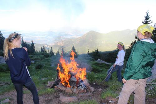
I mentioned earlier we weren’t very tidy in the A-Frame. However, we are Girl Scouts, so we do leave places cleaner than we find them. We brought trash bags to haul trash down the mountain (yes, even stuff that wasn’t ours), but we realized there was so much trash we couldn’t bring it all down. This was odd/not cool because we’d camped in the same spot less than a year before and totally cleared it of all trash. We decided to make the best of the situation and just burned as much as possible. Since there isn’t any wood to burn at the site (you have to haul it up from down the mountain) this had the added benefit of keeping us warm.
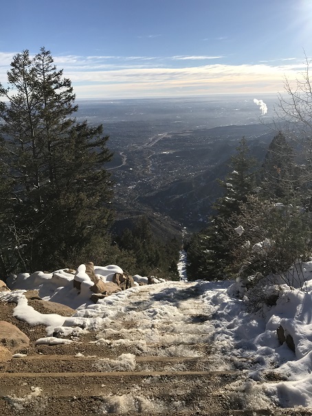
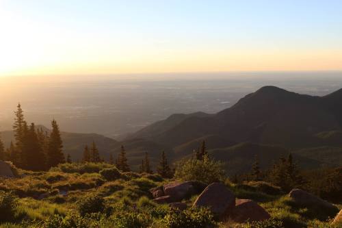
Have I mentioned the view at night from tree line is absolutely amazing! If winter didn’t exist on the peak I could live there. Enough said.
The sunrise is equally beautiful. We set our alarm just so we could watch the morning glow.
After a breakfast of Mountain House eggs and bacon (gross by the way, we’re never doing that again), we were off to climb the peak!
About half a mile in we decided we’d split up again. Kayla was having a lot of difficulty with this hike, and we were at the part where you have to keep going or you’ll never get started again. This is a very mental hike, and you have to know how to psych yourself up to continue.
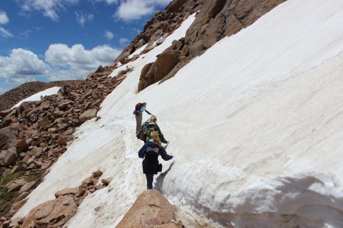
Even though it’s July there is still a lot of snow on the peak. These drifts are much larger in person than they look from Colorado Springs. They are about the size of a football field, and they are very slippery! We saw many people fall because they were over confident. Kayla fell on each one (there were 7 or 8), hard, but she kept going!
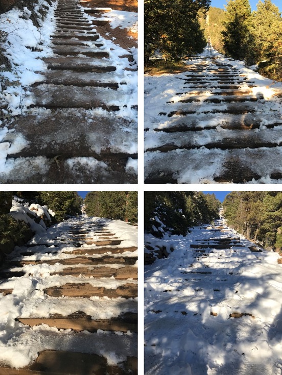
The 16 Golden Stairs are anything but. This is the hardest part of the hike, and it took us about 1.5 hours to do (even though it’s only about ¼ of a mile). We kept stopping every 2 or 3 feet because Kayla really didn’t want to continue. However, I wasn’t going to let her give up. She told me at the beginning of this hike she was doing it for her dad (who passed away the week before), and I wanted to help her reach her goal.
There were a lot of tears and frustrated words said (never towards another person), but Kayla kept going.
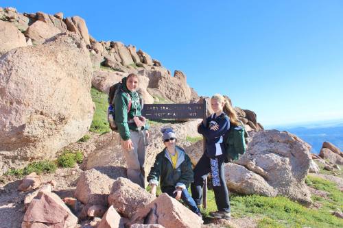
I’m very, very, very proud to say she made it!!! Many (ok, most) grown men cannot complete this hike. It was hard, it hurt, and she was tired, but she kept putting one foot in front of the other and made it to the top.
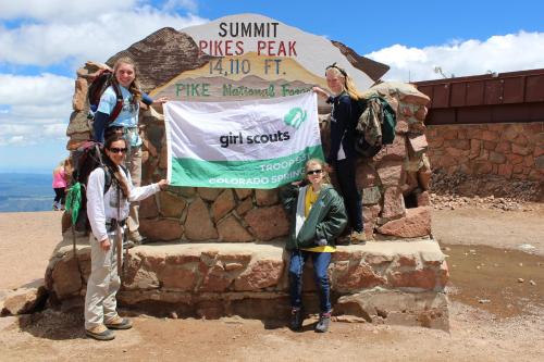
She was exhausted when we got there (we both were). As soon as she crossed the cog tracks she stopped, raised her hands, looked up, and started talking to her dad in heaven. I couldn’t help it, I started to cry.
All of the work to get to the top was totally worth it! When she was done she turned to me, gave me a big hug, and said “Thank you Ms. Laura for helping me get to the top. I’m sorry I yelled at you!”. I cried some more.
Then we walked the 20 or so feet to the Summit House and Kayla fell asleep for the next 45 minutes.
We met the other girls there, got some donuts, drinks, and fudge, and told about our separate climbs.
Jordan, Ruth Ann, and Tristina told me they had helped rescue a man who had broken his ankle about a quarter mile from the top. He wasn’t a hiker, so he wasn’t prepared. He had driven to the peak and was hiking down to take selfies when he tripped (yes, he had a selfie stick).
They tried to give him an ice pack, but it exploded so they did the next best thing: They used their ace bandage to wrap his ankle, then got a ziplock bag and filled it with ice.
Then the girls helped him up and he hopped on one foot (his good one) to the top with one of his arms around each of the girls shoulders. He thanked them profusely when they arrived, and promised to get in touch when he made it home.
I woke Kayla up after 45 minutes because her body needed a rest: You burn just as many calories sitting at 14,000+ feet as you do running at sea level, so she needed to move down the mountain so her body could rest properly. We also needed to finish our hike: it was only half over!
As Alison Levine says: “Getting to the top is optional. Getting down is mandatory”.
We posed for a few pictures (we were too tired when we got there at first to take any), and were on our way down.
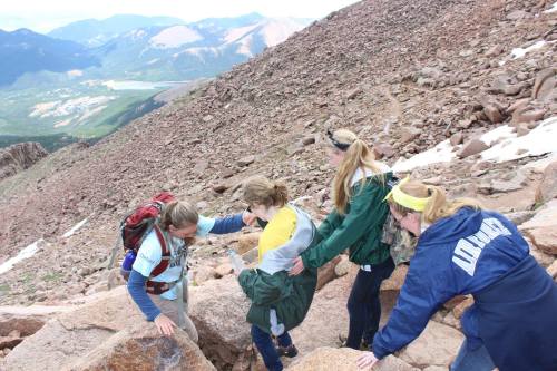
This is where the real teamwork began. Kayla was very tired from this hike. We all were. I run 5-10 miles a day, Jordan is captain of the Ice Hockey team, Tristina runs cross country, and Ruth Ann runs as well, so we were more conditioned for this hike (don’t get me wrong, we were still aching).
Kayla however wasn’t conditioned, and was exhausted. She wanted to stop and rest every 15 feet or so, and that just wasn’t possible if we wanted to make it down the mountain.
So the girls helped to keep her motivated. They held her hand as she navigated tough rocky areas and the slippery slopes of snow. They let her hold onto their backpacks for support, and held her hand to help keep up her momentum.
They also kept praising her progress and success!
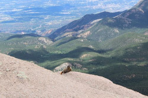
When we got just about to the tree line we started seeing marmots. 3 or 4 were chirping to each other, and some stayed still long enough for us to get pictures!
I love this one: you can see the Garden of the Gods below!
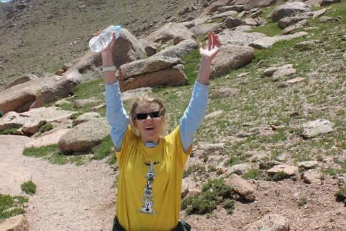
At tree line Kayla remembered we forgot to take a picture of her celebrating at the peak, so we took one now:
She did it! Great job Kayla! She looks filthy but proud of her accomplishments! She probably lost 5-10 pounds as well from the beginning (did I mention this is an intense 26+ mile hike? We did a mountain marathon in less than 36 hours)