The hardest part about this hike, besides the last mile of course, was getting there. Let me tell you, they’re not playing around when they state 4WD only. It was insane! I saw several people with flat tires on the road. And be sure, if you plan to take this hike, that you do NOT google map it. The 4WD road they put you on is even more intense. Everyone in my vehicle was a bit scared we weren’t going to make it (I’m proud of my Tundra!). Use 120 road instead!
This is a 16.6 mile trail with 5,394 feet in elevation gain (don’t believe the .com’s statement of 11 miles…. it’s a lot more. Be prepared.
We got all our gear ready before going to bed the night before, and got up at 2:30am to make it to the trailhead by sunrise (5:30am). After the eventful 4WD trip to the trailhead we signed the register, crossed a bridge, and were on our way.
The first 2.5 miles went straight up an old service road. It was covered in waterfalls, water, and flowers. Beautiful! If a little slippery. Make sure you have waterproof hiking boots. It was here I stopped to take off my jacket, and ended up accidentally leaving my sunglasses (to be picked up at the end of the hike).
After 2.5 miles we came to a sign indicating the trail split. Crestone Peak and Needle went left, Humboldt right. We went right and continued up the trail.
Right at about this area the trail was littered with fallen trees. They were pretty easy to go over (or under). Then there was a boulder field and we were dropped into the Colony Lakes Area.
Shadow Selfie…
The views were nothing short of amazing. We hiked in absolute awe.
Much of the trail was covered with snow. This only got us into trouble twice. Once before Colony Lakes and once about ½ a mile from the summit.
While there wasn’t a lot of snow on the trail, where there wasn’t snow there was water.
After passing the lakes the trail turned steeply to the right. and you could see Humboldt Peak.
It was very well maintained for much of this trek. Lots of work has been put into this part of the trail! It is pretty steep, however.
The ‘trouble’ started when we reached the saddle. While there wasn’t much snow, it was over the trail and made it impossible to find (on the way up, we found it just fine on the way down). Here’s a tip: Stay to the right! It really looks like the trail goes to the left, but don’t take it. We did (and so did 3 groups before us) and it made the hike much harder. We were bouldering where we shouldn’t have been. Stay right.
At this point the girls were getting really tired, but this is where I need to speed up to keep my blood moving. I went ahead about 10 yards and stopped to wait for them. They decided to take a 20 minute break (I wasn’t aware of this). I was frantic wondering what happened to them, went back, found them, and continued on. It got really cold at this point. I’d been standing still for 20 minutes in the cold. This marmot cheered me up though. He was licking the rock.
The wind picked up and it couldn’t have been more than 20 degrees. My fingers started turning white and I was having a hard time bouldering (we were obviously in the wrong place). So I looked around, got my bearings, and led the girls over the ridge, found the trail, and we made it!
There was a small shelter made out of stones, really just there to block the wind so you could rest for a minute or two before heading down (it didn’t block much wind).
Here’s a 360 degree view from the summit
We didn’t spend much time on the summit, mainly because it was cold. We quickly found the correct trail down, conveniently marked with multiple large cairns which would have been easy to see if we’d have stayed right instead of going left. ‘
The trail was just as steep heading down as it was heading up, and the views were just as magnificent. We stopped at the lakes for lunch, then continued the rest of the way.
The trip back down seemed to go on forever, probably because the trip was 5 miles longer than the beta had suggested. Especially those last 2.5 miles! It was hot, we were tired, and my eyes hurt (no sunglasses, remember?). We followed the stream, cooled off a bit from time to time, and eventually found my sunglasses. They were just where I’d left them, and had spent their time enjoying the waterfall while we’d been hiking.
I chose this hike specifically because it’s supposed to be easy. It’s only a 3.5 mile hike with 1,475 feet of elevation gain in 1.75 miles. The route looked pretty standard and easy to follow. It’s a popular hike because it’s so close to Denver and visible to its residents. I chose it for this week because ALL the 14ers still have snow on them. I figured if I was going to hike a 14er this week I might as well chose Mt. Evans as I was going alone and the trail is difficult to get lost hiking. Indeed, there is a road that goes to the summit, making it the highest paved road in North America, and the entire trail is above treeline.
I’d be able to see this road for my entire hike. In addition, it was an easy hike that included snow, so it would give me some realistic practice, and make the hike more challenging. Oh, and since there WAS snow on the trail it was a sure indication it wouldn’t be swarmed with hikers. I’m not a fan of hiking with a lot of people.
I woke up at 2:30am and started some coffee. As a side note, I’m never hungry this early in the morning. I didn’t eat anything until I got back to my truck, and didn’t drink anything either besides that first cup of coffee (I did have a full camelback, I just don’t get thirsty hiking). I was out the door by 3 and at the trailhead by 5 after stopping for gas. I drove the entire way in the dark and actually kept to the speed limit because I wasn’t in much of a hurry. There was a full moon to follow the entire way. I figured if I was going to get up early and miss the gym for an ‘easy’ hike I’d at least enjoy myself. The road to the summit just officially opened this week due to snow, so it was also my first real chance to get the hike in. I stopped on Mt Evans road several times for pictures.
There was a small convenience center at the Summit Lake trailhead, as well as a way to pay to park during non-operating hours. It was $15 per car to stop on the side of the road or park anytime between 8am-5pm. I did some mental calculations as I put on several layers of gloves and clothes (snow/cold in general is dangerous for me because I have Raynauds, so I have to over prepare) and figured with just a 4 mile hike I’d be back well before 8am, so I didn’t pay the fee and hit the trail at 5:20am.
My directions said to follow the paved road for 0.6miles and look for the unmarked trailhead to the right. I kept looking to the right for the trailhead, but couldn’t resist also looking left at the sunrise.
After walking well over the 0.6mi looking for the trialhead I doubled back. I realized the trailhead was probably covered in snow, and maybe I’d see it coming from a different angle. I didn’t. Just for future reference, I did find the trail on the way back down. It’s between these two poles and yes, it’s covered in quite a bit of snow.
While I couldn’t find the trail to begin I could look over the piles of snow and see the visible steps from previous hikers further up the mountain. I figured I’d come this far and wasn’t going to lose the opportunity to hike due to a technicality. So I aimed toward those steps and did my best not to disturb the alpine tundra: I walked on the snow or boulders to avoid destroying tundra, which, due to the short growing seasons at 14,000 feet takes hundreds of years to grow. Stay on the trails people!
Luckily, most of the way up was covered in snow so this wasn’t much of an issue. While I was the first one to hike this morning, several other hikers must have hiked yesterday or earlier this week as there were postholes already made in the snow. Since it was early in the morning still they were frozen and there was little chance I’d posthole myself. I put my feet in their tracks and climbed the snow stairs.
I found a friend! The pikas here were actually a bit more sociable than on Pikes Peak. While I couldn’t get close to them, they didn’t run away if I took their picture.
This hike was indeed all uphill. It felt like I was climbing stairs (which I kind of was, stepping into other hikers tracks). About ¼ of a mile below the summit the snow dissipated, I found the trail and started maneuvering around and over rocks of all sizes.
Don’t be fooled by the above picture. This is actually a false summit. And it was really, really windy here! I’m not a big girl, and I was wearing a winter jacket that turned me into a kite. Several times the wind blew me into the mountain and I had to wait for it to stop before I could stand back up. The hike wasn’t too demanding (besides the trudging up stairs part) but I was at over 14,000 feet, and it was difficult to breathe. I had to stop to breathe (not necessarily because I was tired).
Once I reached the top of the false summit I was greeted by a parking lot, an abandoned summit house, and some educational signs about the area.
This was only a false summit however, and I still had a little ways to go. This is the actual summit. There’s a man standing on it taking pictures. He drove up today to get some pictures as it was the first day the road was really open (no one had advertised it’s opened until last night).
This trail was also covered in snow, so I just headed straight up towards the top. And when I got there, what an amazing view!
It was also really, really, really windy. So windy you can’t hear my narration of Mt. Evans in this video, but you can enjoy the view.
I found the summit marker!
I tried to take pictures, but the wind just wasn’t having it. I’d spent some quality time this week making a summit sign out of a Girl Scout Cookie box. I was really proud of it! It had the name, elevation, date, and #2 on it. It was the perfect size, lightweight, and fit into my pack. As soon as I took it out of my pack the wind blew it away. I was holding onto it and it was blown out of my hands. Ugh! So now I was a litterer and I didn’t have that sign. Oh well. I set up my camera to automatic and did my best. I’d just fill in the important info later with a picture editor.
The wind wasn’t happy (it kept blowing both my hair and the camera over) so I had to get creative. I got an ‘ok’ shot, but to keep the camera out of the wind I had to angle it weird, so I didn’t get a good view.
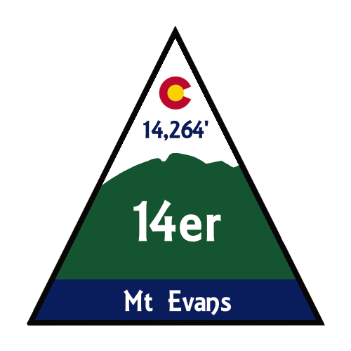
I was getting frustrated. I’d hiked all this way and wanted a good picture for my 14er Challenge Poster. This was the problem with hiking alone So I tied my hair back, balanced the camera on my water backpack, and set the timer. This one turned out ok. I added the important info to it since my sign had blown away.
It was now time to trek back down. I’d probably spent 30 minutes on the summit, which is an awful long time (but I really wanted a good picture!). The way down was more challenging than the way up because the snow was starting to melt and the footholds were now slippery. I had to lower my center of gravity to avoid falling and sliding. This was not snow to glissade on.
I did posthole a few times, but it wasn’t too bad.
I even found a snow spider friend! But not the mountain goats this hike is famous for. Oh well, maybe another time.
I was able to find the trail better on the way down and stuck to it as much as possible. When I made it back to the road (without seeing anyone on the entire trail, woot!) I stopped to put the snow into perspective.
Wow! That was a lot of snow! I took a selfie because I was really proud I’d made it without falling and sliding down and hurting myself. The wind had been torture on my hair: That had been in a bun when I’d left the summit, but I couldn’t re-do it because of my gloves… and the wind.
And here’s a shot that shows you how deep the snow was
After I made it back to the road I did see one other hiker. He was hiking the road to the summit, and also backpacking in general. The views from the road were beautiful!
I was back at my truck at 7:40am, changed out of a few layers of clothes, and headed to the gym to get in a few more miles (and a shower).
So I made it back down, and had even remembered to collect a ‘summit rock’ from the summit. This picture is of Mt. Evans, but not the route I took (I took a route to the back left of this picture)
If I had to compare this hike to anything, I’d say it was like hiking the last 2 miles of Pikes Peak, without the switchbacks and without being exhausted from already hiking another 11 miles to get there. It looked similar and the terrain was similar as well (but more slippery due to small rocks). #2 is bagged! Time to plan #3!
Look what came in the mail! I’m really excited about this book. After seeing Jordan’s version I decided to get one of my own. It includes detailed information about all routes, including trailheads and multiple summits in a day.
I quickly went through it and marked all the routes I plan to hike this summer on top, then on the bottom I marked all the backpacking trips to get the ones either farther away or with excessive mileage, and on the right side I marked the rest of the 14ers.
My intention is to take the sticky note off once I’ve completed the 14er so I know which ones I still need to plan. Time to get reading!
Eagles Peak is a trail accessed through the Air Force Academy. It’s a 3.6 mile up and back trial that has an elevation gain of 2100 feet in 1.3 miles. As I was driving in I got to take a detour through the USAFA housing development (they’re working on the roads) and I saw a turkey this time in the same place I saw one last time. He gobbled at me as I took this picture.
The trail begins at the visitors center. I parked my truck in the lot, crossed the street, and followed the service road past some power lines to the trailhead. I want to note the beginning of the service road stated “authorized vehicles only” and when I got to the trailhead there were two unauthorized vehicles parked. Well, I’m assuming the Accord and Subaru weren’t authorized. Oh well, I got an extra half mile out of my hike and they didn’t, and it let me know there were at least 2 other groups of hikers on the trial. I passed them both coming down as I was going up relatively early in the trial. One was a man in his 50s, the other looked like a cadet with her two dogs.
Here’s a picture of the trail. It looks deceptively short and easy, but look at that elevation gain!
Oh, and the trail also looks easy to follow in this map. What it doesn’t show is how it follows a waterfall for most of the way, so when you’re looking at the trail thinking “There’s NO WAY the trial goes up that waterfall, it must follow this worn path to the left”, you’d be wrong. I was. Right where the ‘17’ is on this trial I ended up hiking up that ridge, only to notice my mistake once I got to the top and it was a dead end at a rock face. I had to retrace my steps and hike up the waterfall I didn’t think was a trail…
This hike is a steady uphill/up rock climb all the way to the top, except for a small meadow just before the final climb.
And what a climb it is! Like most trails in the area, it’s not well marked and hard to follow, but at least someone spray painted these blue dots that indicate what general direction you should follow.
As always, the view from the to was amazing! I love looking west towards Pikes Peak.
I was actually able to find the summit marker this time, which is an anomaly. Most summits don’t have them in the area at this elevation.
The hike back down was uneventful, if a bit slippery. Granite is really slippery when wet (remember the waterfall) and also when it’s crumbled up into pebbles. It is trickier hiking down in many areas than hiking up because it’s easier to slip and fall. Gravity isn’t on your side.
In any event, I made it down safely, hopped into my truck, and floored it to work, as I had several texts asking me for help (my team is in Brussels this week and I’ve been working odd hours while they’re overseas).
This was a challenging hike, but I made this hike a lot more
difficult than it needed to be, but not really on purpose. You see, I’d originally planned to hike
Eagles Peak this morning, but after talking with a friend at the gym decided to
try Blodgett Peak instead. I’m trying to
do as many USAFA hikes as possible before Thomas graduates, leaves ROTC, and I
no longer get a base pass. My friend has
hiked the ‘normal’ route and said it had only taken him about an hour. I’d already calculated this route for later
this week, so I just quickly changed my plans.
I was interested in this hike because while studying the
Pikes Peak Atlas I noticed there was a walking trail through the USAFA to the
peak, and because there was supposed to be wreckage from a WWII plane on the
trail. The aircraft was a C-49J
twin-engine transport, en route from Pueblo to Denver on 23rd Feb. 1943 in
overcast weather. It crashed at 1205 MT, instantly killing the pilot and
crewmen.
This trail isn’t a popular one. In fact, it isn’t even listed as a trail on
the USAFA map (but the peak is)
However, my Pikes Peak Atlas shows there’s a walking trail
to the wreckage site.
So as soon as I was done with my 10 miles at the gym I
hopped in my truck and set out to find the trailhead. There wasn’t any parking there (no room) and
I didn’t want to just park on the side of a USAFA road and leave my truck so I
did my best to fit where I could at the bottom of the dirt road hill and
crossed my fingers I was hidden enough not to get towed. It was a trailhead after all (if not a
popular one).
The trail is labeled as ‘713’, and very well marked so it’s
easy to follow. First you cross a gate
And then you come to a creek crossing. I startled a few ducks upon my arrival.
While you aren’t supposed to cross when water is present I
was able to find a few boards placed just for this purpose.
The beginning of the hike was gradual and went through a
grassy meadow. I could pick out Blodgett
Peak and indeed the crash site from the beginning of the trail. But I wondered
how many people would even notice if they didn’t know what to look for?
I passed a scary/lonely looking Tesla Plant (owned by CS
Utilities) and continued the trail behind building. Here the trial was very well marked and
followed a paved road for about 1/8 of a mile.
I’m pretty good at following topo maps, so I was sure I’d be
able to navigate this trail easily. So
far everything was working just as planned.
While the trail was well marked with ‘713’ signs before the
Tesla Plant. Once I passed the Tesla Plant
the land stopped being owned by the USAFA and began being US forest service
land. This is also where the great signage
stopped. I wouldn’t see one more sign indicating which trail/road I was on for
the rest of the hike, and this was a serious safety hazard.
I was about halfway into the hike, just expecting to make it
to a forest service road when the trail stopped abruptly. I was confused and looked around for a bit to
try and find the trail. I went back and
forth, and realized there had been a rock slide, and the trail had been taken
out. No big deal, except I wasn’t
exactly sure how much of the trial had been taken out, since I couldn’t see a
corresponding trial anywhere ahead.
I’d been following the service road for a little bit of
time, and I knew I was supposed to be on it eventually, so I made my way down
the 75 feet or so on the slope towards the road (it was going to be ‘fun’
getting back up).
OK, so I was ON the service road, but I wasn’t sure where I
was on it. I looked back to my map and
decided to hike east to the end to see if I could find a trail. I followed it to the end and I couldn’t. So I hiked back west, pretty sure in my assumption
I’d eventually see either the walking trail to the left of the original 713
trail intersecting with the trail I was on.
Either way I’d eventually know where I was.
Except that didn’t happen.
I hiked and hiked and hiked, and eventually came to the
Northfield Storage Tank, which wasn’t on either of my maps. I was fairly sure I was on the right road,
but there were no signs indicating which road I was on or where I was on that
road. I looked at my map several times, but it just wasn’t there anywhere on
the trail.
I thought about spending some time admiring the storage
area, but wanted to get on with my hike, so I continued.
The road alternated between a gravel trail and being
seriously poorly paved. I wondered how
vehicles made it on this path: It’s one
direction was up, and I continued to climb.
I never did see where the trail intersected the road, or a path to the
left that would take me up Blodgett Peak.
Eventually I realized just by looking around I was way too far east, but
I knew I’d been diligent about looking for the correct trail. I was sure I hadn’t missed it. So I decided to just ‘give up’ looking for
the USAFA trail to Blodgett Peak and just try again some other time from the
way I was supposed to use.
However, never one to give up a good chance to get some
exercise, I continued the path for about 2 miles, then hiked back down the way
I’d came. This was quite a workout for
my calves! It was a beautiful day and I’d enjoyed the
hike even though I hadn’t found what I was looking for. It was getting hot, so I decided to take a
walk around the storage tank just to get some shade for a bit before heading
back.
That’s when I saw it.
A cairn. “Oh! Are you serious?” I
said to myself.
Yep, serious. This
was obviously the trail I’d been looking for.
I was a bit upset none of this was listed on my detailed
map, but decided at this point is wasn’t very important. I did some mental calculations. I’d been hiking for 2.5 hours (probably 5-6
miles or so, as it was directly uphill) and I’d already done 10 miles that
morning at the gym before hitting the trail.
I hadn’t had any breakfast (or coffee).
I had plenty of water, but only a package of fruit snacks and a ‘fun
size’ Twix in my pack (besides my survival stuff, of course). By looking at my map I had another mile or
two to the summit, and it was ALL UPHILL.
But this was what I’d hiked for, so I decided to go for it
and reserved the right to turn back at any time if I felt the need.
The hike was indeed straight up, and besides the rock arrow
I’d seen at the beginning of the trail, there was no trail to follow. Or, if there was, this is what the trail
looked like (yes, I was supposed to proceed, where this usually means ‘wrong
way’).
This was probably why it wasn’t on the USAFA map. You really had to know where you were
going. I kept my eyes on the peak and
just headed towards it. You can see a lot of visible damage from the Waldo
Canyon Fire in these pictures.
I was so excited when I came upon the plane wreck! Not because of the wreck itself (which was
tragic), but because it meant I was exactly where I needed to be on the
trail. There was no trail down to the
wreckage, so I hiked down about 25 feet from the top to get there.
Nothing about the site looked stable (once again, probably
why it wasn’t listed on the USAFA map) so I didn’t stay long. The plane was in at least 4 large pieces. Due to the drastic angle of the slope I
couldn’t get any good pictures.
There was a sign of dedication and an American Flag.
I didn’t know if I should be smiling or not, but here’s a
selfie anyway for proof of life.
I didn’t stay long at the crash site (it didn’t feel
safe). I continued onward and saw a lot
of strawberry and raspberry plants.
Those raspberry stems were a bugger!
They kept breaking off and getting into my shoes. I’d have to stop to get the stickers
out. Hmph!
About halfway up this ridge I began to see Pikes Peak over
the burn scar and got really excited for the summit.
The last ¼ of a mile or so was exhausting. I’m not sure if it was because I’d just
driven in from a lower elevation in New Mexico last night, because I hadn’t hit
the gym for 3 days prior and just climbed thousands of stair cases instead (my
calves were screaming at this point), because there was no trail and I had to
climb over boulders, or because I was hungry, but it was very difficult. I
considered it good training for future 14er hikes.
It was tough but I made it!
I sat on a rock, enjoyed my fun sized Twix (which seriously helped btw)
and looked around. Check out some summit
photos!
OK, you may think the hard part was over, but it was really
just beginning. If I thought no trail
and climbing up was difficult, imagine climbing down without a trail, on
terrain it was difficult to find my footing climbing up. I was sliding down scree and small chunks of
gravel the entire time. At one point I
slipped a bit and broke the lens of my camera (no worries though, it was just
the lens cover, and it’s why I have one and plenty of extras back at home).
Just after taking the above picture I stopped to look around
and freaked out. While I was extremely careful
while scrambling back down the rocks at the top of the peak to watch where I
was going and to make sure I was heading towards the right ridge, as I looked
around now I began to second guess myself. There were now several ridges, none of which
looked familiar, but of course I was heading down and not up. I took a minute to really study where I was
and concluded I needed to head further west.
This ended up being a great idea.
I was beyond ecstatic to see this burnt tree with two pine cones
together, as I remembered it from the hike up.
Then I saw this ladybug and a few butterflies and all was
well.
I’d thought I’d paid quite a bit of attention while hiking,
but this proved you really need to top every few minutes or so and just look
around. It helps for the way back
down. Also, the wind rushing through the
trees sounds remarkably like a loud stream/waterfall, and when you know there’s
water below you it can be deceiving. I
had to make sure I was on the correct path a few times, but in the end I made
it out (with a few minor scratches… I had to get by a few difficult trees).
I made it back to the storage tank safely and was pleased
with my success. Not only had I made it
to see the plane wreckage, I’d successfully summited difficult rocky terrain and
made it back down a difficult ‘trail’ using only my intuition and a poorly
defined topo map. This was progress!
Just before the meadow I saw a bunch of exposed wires
jutting out of the hillside. Hmmm.
I saw a few more wildflowers on the hike down, made it to my
truck (woohoo! Still there!), and looked at the time. It was almost 12:30pm! My 2 hour hike had
turned into a 5 hour hike, and I didn’t mind in the least. Now to head home and enjoy some lunch!
Distance:2.2 miles (out and back), Elevation Gain 898
feet
Mount Herman Trail is a 2.2 mile
moderately trafficked out and back trail located near Monument, Colorado that is
rated as moderate. It’s pretty much on my way to work so I decided to get in a
quick hike before my team landed from North Carolina and came in this
morning.
I didn’t have a map of the area (ok,
I did, but I didn’t look at it) just directions written on paper.I’d take the actual map out at a last
resort.The directions got me to where I
needed to go:Exit 161 head west, make a
left on Mitchell and a right on Mt Herman Rd. That was all pretty simple, but it didn’t tell me how far to drive on Mt
Herman road.I didn’t know exactly where
the trailhead was (in front of back of the ridge?) There were several places
that could have been the trailhead, but the actual one ended up being about 3.5
miles up a dirt road.The only
indication I was in the right place was this sign indicating it was trial
#716.
This was the only sign I’d see all
morning, except for this one telling directly behind it indicating “no shooting”.
Here’s a picture of the “parking lot”
at the base of the trail.Mine was the
only vehicle there (woot!I shouldn’t
run into anyone!)
My directions said after about a
half mile of hiking I’d reach a meadow, and to turn abruptly right to head up
the trail.Well, after a while it became
apparent I wasn’t on the correct trail. The trial I was on was following a small stream, and wasn’t gaining in
elevation.That couldn’t be right with
the numbers I’d seen (almost 900 feet in a mile means a lot of uphill climbing)
so I turned back.Check out what the
author considered a “meadow”.
To me this isn’t a meadow, but a
campsite/fire pit.In no way would I
call this a meadow, and in fact it was only about 1/8 of a mile from the
trailhead, not the half mile that was indicated, and the turnoff was BEFORE
this meadow, not after it (there was another trail after that led nowhere, as
many do in this area).Who writes these
instructions anyway?In any event, I
found the correct trail (I assumed, as it abruptly climbed uphill) and hiked
on.Here I am taking a picture of where
the turn is while standing on the correct trail.
The trail indeed went straight up
the rest of the way.I was surprised to
see bike tire tracks, as it was a very difficult trail upwards.At several points on the trail there was no
trail, just about 50 feet of rocks in either direction, so I had to guess which
way to go.Luckily it was kind of like a
ski run in that I knew I just had to keep going up and eventually I’d find a
trail again to follow.The bad part
about this is trail maintenance.There
is no easy trail to follow so everyone makes their own trail, stamping down small
plants (etc) as they hike.That gives
way to erosion and is dangerous.
I was pretty proud of myself for
making it to the summit, as there were several times I questioned if I was even
on a trail.I took a few pictures…
And then turned around and gasped.What a BEAUTIFUL view of Pikes Peak!Pictures just don’t do it justice!I was in awe. This was by far the best view I’ve ever had of the peak from any hike I’ve
taken thus far.
I wanted to stay there forever, but
I did need to make it into work this morning, so I took a selfie
And a summit shadow selfie and made
my way back down.
This time I took a different trail
(indeed, it would have been almost impossible to take the same one as there
wasn’t a clear path) and saw two small cairns I hadn’t seen on the way up.They were a nice gesture but didn’t indicate
much.I’m not sure they were indeed very
helpful either since they were at the very top of the trail.
Just as I reached the campsite/fire
pit from earlier I met up with 4 hikers who all looked like they were in high
school (maybe they’d just graduated?).Two
girls and two guys.I asked them if they
were going to the summit to watch the flyover, and apparently that hadn’t occurred
to them.It would be a wonderful
idea:They’d have the best seat in the
house!I’d have stayed if it weren’t for
the whole work thing.They had taken the
hike before though, so I wished them well and headed back to the truck.
I liked the challenge of this
hike.While it’s no fun not to know
where the trail is, I never felt as if I was actually lost.I was actually pretty proud of myself for
finding my way when I had no idea which mountain I was actually on (I knew
where Mt Herman was, but didn’t know which mountain it actually was, as it’s on
a ridge).
Check out the reflection of Pikes Peak in my camera lens…
To be honest, none of these summits is really a big
deal. I mean, I live at about 7000 feet
(traveled down in elevation to get to this trailhead) but I’m sure they sound pretty neat to my out
of Colorado friends. So why am I posting
the elevations? Basically I’ve done this
because it’s noted on the map and I just want to keep good records. I’m not trying to impress anyone. Although Mt Muscoco was a pretty good
training hike. It started to kick my
butt by the end…
Once again this morning, after hitting the gym I drove down
to Cheyenne Park. I made it to the trailhead at 7:20am and took a quick picture
of the trail. This hike didn’t look all that difficult,
but most people I know who hike and live in Colorado Springs have done Mt
Cutler several times. It’s kind of a “thing”. However, no one I’ve talked to has ever done
Mt Muscoco.
There was one other car in the parking lot, an old Subaru
hatchback. Cool. The vehicle told me it was probably someone
who liked to hike and probably wanted to be left alone. I can work with that.
This entire hike is uphill.
Mt Cutler has an elevation gain of 415 feet in a mile, which wasn’t much
of a challenge. After turning the first
ridge I heard a waterfall. I assumed it
was Helen Hunt Falls, which is a bit further up the same road I’d drove in on. But as I looked closer I noticed it was much
bigger and had different structures at its base. I
quickly realized it was Seven Falls, not Helen Hunt Falls. So cool!
I was getting a free look at the falls!
Around the next bend I saw the Will Rogers Shrine of the Sun
above the Cheyenne Mountain Zoo. Here is
where the path got tricky. The trail
branched off into several smaller trails, but they all seemed to head in the
same direction. I noticed this problem
on my hike yesterday too, and can only figure it’s due to people hiking in the
winter snow and kind of making their own trail. This happened several other times today, but luckily all trails ended up catching up with the original trail.
Mt Cutler wasn’t very impressive. It only took me about 15 minutes to hike
there, so I decided to take a quick hike to the Mt Cutler Overlook. That ended up being totally worth it! The views from here were 360 degrees of all the
Pikes Peak Region.
I spent quite a bit of time just enjoying the view. As I was getting ready to leave I heard the
chimes from the Will Rogers Shrine. So
cool and unexpected!
Now it was time to tackle Mt Muscoco. I actually went down quite a bit in elevation
as I was hiking to the turnoff, so I took my traditional “hiker selfie” that really only works with morning light.
The rest
of the hike was uphill, and while it wasn’t as steep as the incline, I’d
compare it to the first 2 miles of the Barr Trail. It also had some pretty cool stairs, but they
were all paced at about 1 and a half steps, making them useless (so it looks
like everyone just hiked on the trail beside them).
Here’s a picture of the summit.
The last ¼ mile was just like a 14er: Really close but a bugger to get there! This part of the hike was indeed a bit
challenging, but mainly because it just went straight up. It was at this point I saw three girls in
their 20s hiking above me. I quickly
passed them, and learned they were the owners of the Subaru below. This part of the hike had a bunch of trail
markers, which were needed and appreciated.
The view from Mt Muscoco was the best one of the day
(probably because it was highest in elevation).
As I stood there I saw airplanes flying into the Air Force Academy for
the graduation. Two days in a row! Awesome!
The trail didn’t end at the summit, but kept going for about
another third of a mile. I hiked it to
the end, turned around, and hiked back down.
Down was a bit challenging as it had been steep hiking up. It was definitely not a running trail.
About halfway down I met a man who’d just returned from
Poland (he was stationed at Ft Carson).
He was having a difficult time adjusting to the altitude but preparing
for Pikes Peak. I wished him luck and
told him to pace himself. He looked like
he’d already been sitting there for a while…
We had a late frost, so most of the trees and bushes had
dead new growth on them, but some were just beginning to emerge.
I also saw a few asters along the trail.
All in all, it was a really nice hike, and a little
challenging. In fact, the sign at the
trailhead says “advanced” for the Mt Muscoco trail, which I’d agree with. I was back to my car by 9am after hiking
about 4 miles in just over an hour and a half, elevation gain (estimated because it was multiple trails up and down) was just over 1300 feet .
Oh, and I saw a couple on the trail who looked like they
hated each other, hiking about 20 feet apart.
I see this a lot on trails and it makes me wonder why they hike together
if they don’t like each other? Either
that or the difficulty of the trail does funny things to our facial features as
we hike…
Please don’t mind the hot mess that is my hair in these photos: I came straight from my shower at the gym and forgot my hairbrush on the hike.
I’ve been trying to do this hike for a while now, but the
directions I’ve been finding on the web have been wrong (imagine that). The two sites with directions state the
trailhead is 3.9 miles from the initial checkpoint. So I’ve done that several times, even driing
as much as a mile in either direction, and I’ve been unsuccessful in finding
the trailhead. But after purchasing the
Pikes Peak Atlas earlier this week, and talking with a friend at the Humane Society
who’s done the hike, today I was able to successfully find the trailhead!
OK, so it’s not 3.9 miles from the checkpoint as indicated,
but more like 5.5. In any event, if you
take the USAFA southgate entrance and make a left on Stadium drive, the turnoff
will be before the next checkpoint. In
fact, it will be about 20 feet before the next checkpoint, on your left. Follow the dirt road and the trailhead will
be clearly marked. My advice is to
bring with you a sturdy hiking pole, water, waterproof hiking boots, and a
sense of adventure.
I saw some wild turkeys on the drive up…
To be honest, there isn’t much information about this hike
online, so I’ll detail it here. Please note these are “early season” conditions, and it had snowed/rained for the past 3 or 4 days, so I’m sure the water levels were higher than normal.
Yes, the trailhead is clearly marked, in multiple
areas.
It’s hard to get lost for the
first half mile or so, but after that it’s anyone’s game. I saw
two other vehicles in the parking lot when I got there, so I surmised I’d end
up meeting two different hiking parties. I also forgot my map in the car. Well, I didn’t really forget it, as I remembered when I was about 10 yards from my truck, but I didn’t feel like going back to get it. In any event, I’d taken a picture of the trail at the trailhead. How difficult could this be?
I saw several scruffy looking rabbits along the trail.
The trail goes straight up for about 90% of the hike.
Here’s the indication you’ve left the USAFA
And as soon as you get to the top of this hill there’s a
great view, and this is where you’re leaving the easily marked area of the trail.
Check out this really cool water collection pool in the side
of the mountain! I’m sure it’s a
waterfall of it’s own earlier in the season.
The first ¾ of the hike is up through a lot of loose
granite, over creeks and yes, up waterfalls.
The trail actually goes up the waterfall. For anyone who’s ever climbed up granite, you
know it’s very slippery when wet. This
was indeed the case here.
The trail is difficult to find in places, but I reasoned
since I was hiking towards a reservoir, as long as I followed the water I’d
eventually find it, right? That ended up
being a good assumption. Also a friend
of mine told me she’d recently done this hike and kept thinking it couldn’t be
right to keep crossing the waterfalls, but that was indeed how it was done
(Thanks Paige for the advice!). I was
lucky it was still early in the season and the leaves hadn’t emerged yet. Otherwise it would have been really difficult
to see through the brush to find the eventual trail.
The trail went back and forth over a steady stream of
water. I was really glad I’d brought my
waterproof hiking shoes, and wondered how I was going to hike down these slopes
(up wasn’t easy, but I had footholds).
Where there were crossings over the stream they weren’t very
elaborate: Just a couple of
strategically placed logs. This is where
a hiking pole comes in handy!
Check out these baby aspens!
I love the intense green color of the trunks.
Most of the trail us rocky granite. You can tell it’s covered in snow during the
wintertime, and I’m assuming well traveled.
Because of this there are multiple trails to the same destination, all
paralleling each other. All are
difficult.
As soon as I made it to the top of the waterfalls it was as
if I was in a different world! The
temperature dropped 20 degrees and there was snow everywhere. Water was dripping like rain from the trees
as the snow melted in the morning sun. This is where I saw my first group of
hikers. They looked like cadets, and there
were 5 of them, so I figured they could indeed have been the owners of both
vehicles, but at least one.
And there were tons of animal tracks…
After about ¼ of a mile hiking through the cold I came upon
a clearing that still had snow, but it was much warmer and quickly melting.
The reservoir was beautiful!
As I approached I saw a fisherman, and surmised he was the owner of the
second vehicle. We exchanged greetings
and I snapped a few pictures.
I could hear the sounds of gunfire (expected on base) and
the drumming of woodpeckers. I saw
several fish jumping in the reservoir. I
didn’t stay long as I actually had quite a bit of work to do today. And I was getting cold. My Raynauds was really kicking in (and
unexpectedly). My finders were red and
beginning to turn white. I knew I needed
to get to a lower elevation to arm up.
The way back down was indeed more challenging than up, as I
was hiking down slippery slopes with little footing. When hiking up it’s much easier to find a
place to put your foot, but when going back down everything just slips.
And much of the trail was covered with small creeks of
water.
Just as I made it to my truck I heard a very loud rumbling
and saw the Thunderbirds soar by! So
cool! This was totally unexpected and
awesome, so instead of taking the second hike I’d planned for today I stood
there at the trailhead for half an hour just watching them practice.
I had a very unique view of their flight, as
everyone else in the Springs was watching them looking west, and because of the
hike I’d just completed I was watching from the east. I love living in Colorado
Springs!
One of my favorite parts about this experience was seeing the cadets watch the flyover from on top of the buildings.
At the last Happy Hour I’d vowed to make sure I wore hiking
clothes at the next one.Well, I just
didn’t feel like changing into hiking clothes just to go out.But I’d promised myself…So I asked the girls if I looked ok in my
jeans, work blouse, and heels.Yes, I
did, but they reminded me I was supposed to wear hiking clothes.We went back and forth on this a few times
(Emily:“Mom, you actually look good in
hiking clothes, you should wear them”) and in the end I just wore what I’d been
wearing all day.I was short on time and
wanted to get going.
I’d never been to the Cogstone Brewing Company before, but
my directions placed it right near the old Girl Scout Shop (kind of by Tees n
Time).I got there just a little after
6:30pm and backed into a space up front. I loved how the parking here was so much better than at the last HH!
As I walked up the front steps I met Scott again, who I will
forever remember as the “Cisco Guy”. There were a bunch of people already there, standing in the back corner
with their beer.
I went to get a beer of
my own at the counter, which wasn’t really set up for ordering that way.I got a red, and it came out to $5.41, which
I thought was a really odd number.How
are you supposed to tip on that?Then I
remembered this wasn’t a bar, it was a brewery, and they did things a bit
differently.Still though, shouldn’t it
have been wither $4 or $5 so a $1 tip would have been appropriate?Are you even supposed to tip at
breweries?I did, but now I’m wondering…
I digress.
When I got back to the 14er table they announced it was “Geek
Night” at the brewery, so it was going to be busy. It was basically a bunch of people who like
beer and geek trivia who meet every Wednesday at this particular brewery.
We made the decision to just go outside onto
the patio.
Just as a side note, Nate Pittman brought his dogs.Adorable!Oh, and these photos aren’t mine.I stole them from Stephanie’s post on the 14er page.I don’t feel comfortable yet taking photos at this event, but that will soon change.
It was cold, so someone tried to turn on the heater but
couldn’t get it working.I stood there
with Scott and Bill Anderson, who has the same tattoo I want to get on his arm
(hmmm) and works in the summer repairing trails above treeline on 14ers.He’s from Minnesota, has no kids but does
have a wife and dog.We discussed a way
to get to the Barr Trail through Green Mountain Falls, and then they brought
out the Pikes Peak Atlas.Which I need
BTW.Like, yesterday. It is a very detailed topo map of the Pikes
Peak region, including Mueller State Park. Most of the information it has isn’t available online (Stanley Canyon
still eludes me due to online directions). I was fascinated and we spent about 15 minutes pouring over it.
See? This is why I go
to these events. Apparently everyone
knew about this map and I didn’t. I don’t
know what I don’t know.
The conversation kept turning to Pikes Peak. I’m not sure why, but it did last time
too. Maybe because it’s the only peak I
have reference to. That needs to
change.
It was so cool listening to everyone else’s
conversations.At my table three people
were discussing their upcoming trip to Little Bear.They’d all climbed it before, but wanted to
try a different route.They were going back
and forth on dates, equipment, timing, weather, etc.I asked if it was ok if I just listened in as
they talked and they agreed.I couldn’t
help but be fascinated by their conversation. They were having the same discussions I have internally with myself
before going on a hike.I try to
describe this decision making to other people, but they just don’t “get it”.However, these were my people.We spoke the same language.Now I just need to find a way to get invited
to go along with them.
I went back inside to get a second beer (and had the same
tipping problem).
When I came back outside there were a few new people
there.One woman was from Southern
California, so we discussed some of the peaks there.I feel like I spend a lot of my time at these
events trying to prove myself.She’d done
Cactus to Clouds, but for some reason was sure it brought her to the top of Mt.
San Gorgonio.I assured her it was Mt. San
Jacinto (with views of San Gorgonio) and agreed it was a very challenging
hike.I hope to see her again because we
seem to have similar hiking abilities. She offered to share her pizza, multiple times, but even though I was
hungry I didn’t feel comfortable saying yes.
I overheard Yin Ling mention she was doing Rim to Rim next
week and tried to talk to her about it, but she was deep in Little Bear
preparations.When I was finally able to
snag her for details I didn’t get much: she was just a tagalong on the trip and hadn’t actually planned
anything.She didn’t realize the details
of the hike were so difficult to plan.How
can I be a tagalong?
Oh, and I shouldn’t have worried about what I wore.Sue Kim was there and she looked nice, so I
didn’t feel overdressed.
It felt like I left early but it was actually late when I
got home.I’d spent 3.5 hours there and
it had only felt like one.There is so
much I don’t know.So much to
learn.But what I really need to do is
just get out there so I can contribute to conversations and get some
experience.I’d love to be invited along
on some climbs, but I don’t think that’ll happen until I gain more
experience.I don’t feel like I made
much progress in the “hiking partner” department.I need to work on that.I also need to spend some quality time on
the14er site, getting to know how it’s used.
I’m not one to miss an opportunity to go hiking, so when
Thomas’ Boy Scout Troop decided to meet for a hike instead of a meeting I tagged
along.I brought Emily with me (against
her will) because she’d had a tough day at school and I wanted to spend some
time with her.That ended up being a
great decision!
Troop 2 is boy led, which means its chaotic most of the
time.The boys don’t fully understand
they’re supposed to lead, so there’s a lot of standing around waiting for stuff
to happen until someone “takes charge” and things get going.This is usually Thomas.It became apparent right away these boys
weren’t going to hike or do much of anything at a quick pace, so before they began
I took a group picture of the boys and then set off with Emily to hike by
ourselves.
Usually when we go to Red Rock Open Space we hike from the
lower lot down up for the first quarter mile or so, then down through the quarry,
but because of where we were parked to meet up with the Troop we decided to do
our normal hike backwards.This meant a
lot more uphill hiking, but since it’s a relatively easy hike anyway it didn’t
make much of a difference.The weather
was perfect (around 75 degrees) and we got to watch the sunset. The cool part
was we made it to the pond earlier in the hike than we would have if we’d hiked
our normal route.
There were a few
Canadian Geese with goslings swimming in the pond.Adorable!
I’m not a big fan of taking selfies, so I’m not really good
at taking them. Emily doesn’t take many selfies, but she’s better at it than I
am, so she taught me as we were hiking. We had quite the conversation about how I don’t like taking selfies
because they make me look old…
Emily’s a pretty quick hiker so we were able to keep up a
moderately fast pace.We had a great
conversation about her school life, friends, sports, ways to reduce anxiety, and
her Gold Award project.She’s excited to
get started on her project, which means she needs to compose a quick email to
the organization she wants to work with. I was surprised at how enthusiastic she is about the whole thing: she
wanted to start the email tonight.
About ¾ of the way through our hike we started paralleling
the Boy Scout Troop.They were on a
different trail, so I took some pictures.
We ended up finishing at the same time as the boys, but we hiked an
extra 2 miles.It had been a good decision
to split up.Not only did I have a great
conversation with Emily, but I hadn’t been frustrated by hiking slow.
Check out the Indian Paintbrush I saw towards the end of the
hike


 So I tied my hair back, balanced the camera on my water backpack, and set the timer. This one turned out ok. I added the important info to it since my sign had blown away.