Humboldt Peak – 14,064
9 miles RT (East Ridge)
5000’ Elevation Gain
I’ve been itching to do a 14er, but my schedule and the weather hasn’t been cooperating. My hiking days are typically Friday, and for some reason the weather in the high country’s great all week, but when Friday rolls around the temperatures drop, the winds picks up, and it starts to snow.
The weather didn’t look too great today, but I’d been following the weather surrounding Humboldt all week. Humboldt is the only 14er (out of 35) I haven’t hiked solo, and to make this whole thing official I figured I’d try it from the winter (East Ridge) route since I took the West Ridge last time. The weather wasn’t great, but I had noticed in the past few days the predicted snow levels had gone down consistently (from 4-7 inches to 2-6 and finally down to 1-3) so that was a plus. Unfortunately the wind levels were picking up (those rose to 55mph). The temperatures hovered around the low 30s, which was great except that meant post-holing.
I didn’t need to summit today. I’ve already summited this peak, so I figured I’d go into this as a learning experience. Kind of a way to test my skills and see how far I could go without needing to commit to summiting. I don’t have a ton of winter 14er experience and I wanted to see what a hike would be like in these conditions. I could always turn back when I felt I’d had enough or if I didn’t feel safe.
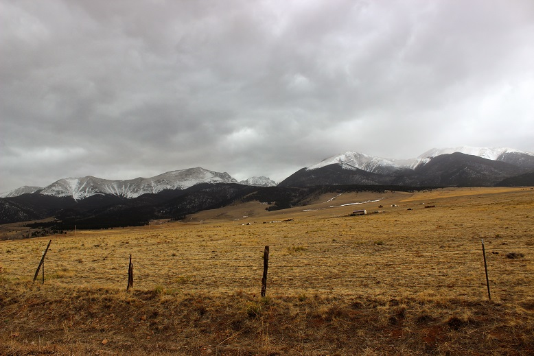
First of all, that drive to the trailhead: Insane! I have a Tundra, and that thing can handle a lot. I’ve done the South Colony Lakes 4WD trail in early June, and it was nothing compared to this! I put my truck in 4WD and tackled it head on. I wouldn’t recommend it an any time of year if you don’t have a high clearance 4WD, but particularly not now when the trail was covered in ice and mud and slush, and in the dark it was difficult to tell which was which. I’m pretty confident driving off road, but I’ve never done the whole off-roading in this much ice/mud/slush before, so I didn’t want to push it too far. I probably drove further than I should have, and parked about ¼ of a mile before the Rainbow Trail Trailhead. There were no tire marks after this point (note: I took most of these pictures on the way back because it was snowing too hard or too dark to take pictures in the morning).
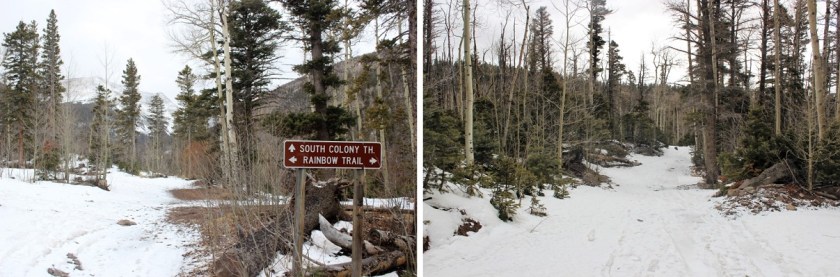
I started at 6:45am. The trail at this point was pretty dry. I crossed South Colony Creek and turned right.

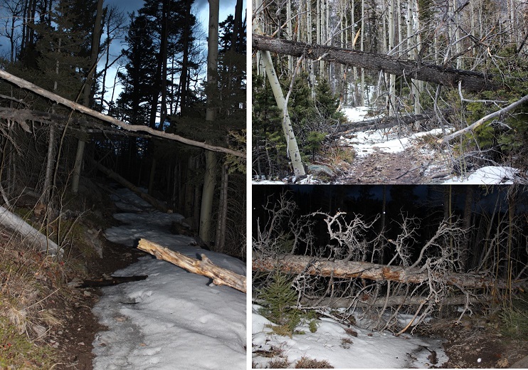
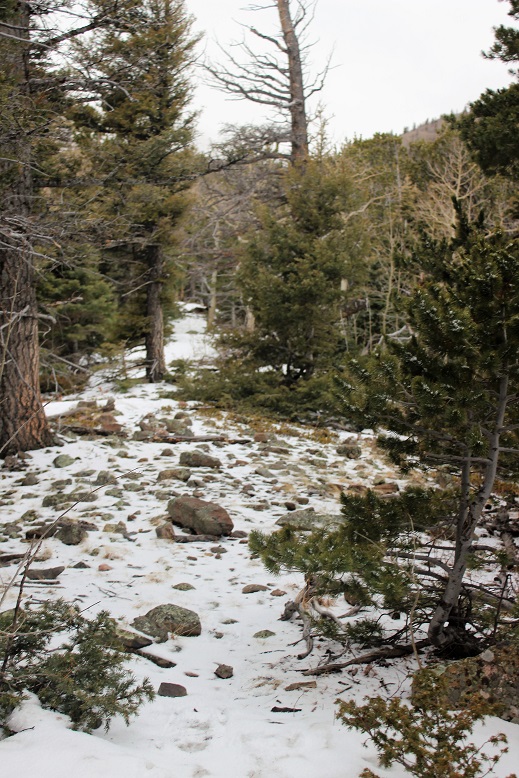
There were tons of downed trees on this trail!
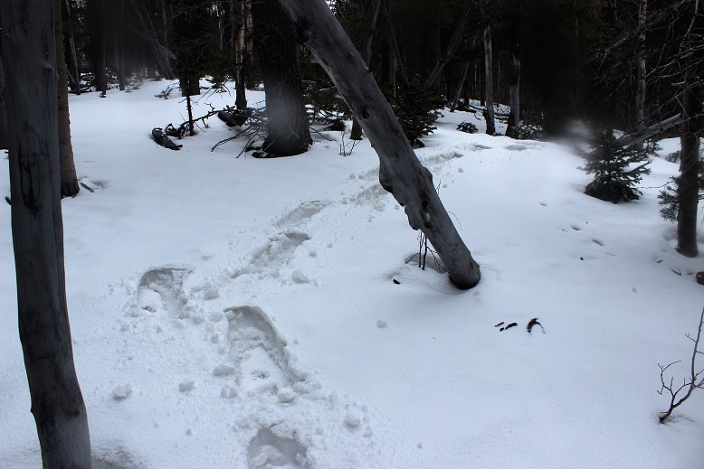
After hiking about a quarter mile I saw a cairn to the left. It’s small, and you really have to be looking for it. With more snow it’s most likely covered.
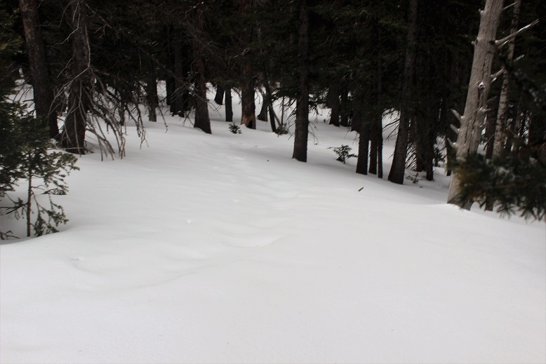
This was my indication to start hiking northwest through the trees. This is what that looked like.

Obviously I wasn’t hiking this trail in “winter enough” like conditions. I hiked up towards the ridge, and then followed the ridge southwest.
I was fighting putting on my snowshoes, but I was postholing. Each step put my boot at least a foot under the snow, and finally I said enough is enough! I’d paid for those snowshoes and hiked them in this far, I might as well put them on! So I did. Woot! This was great! I was still postholing, but only about 6 inches or so instead of a foot or more.

The snow on the ground got thicker and so did the snow falling. I made sure to step extra hard into the snow so it’d be easy to find my tracks on the way back down. I wasn’t necessarily breaking trail, but there wasn’t a clear trail to follow either. The last tracks were old and most of them had been covered by snow or melted. The snow was falling as predicted, but it wasn’t intense. It was actually kind of nice because it wasn’t freezing out. The snow cooled my face.
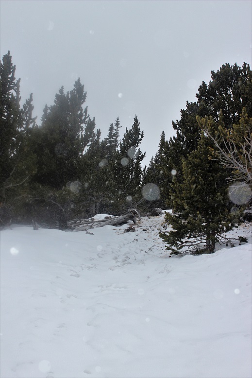
As I hit about 11,500’ the wind started picking up. I headed west until I made it to treeline. At this point the snow had been thick, but abruptly stopped here, so I took off those snowshoes and put on my balaclava and goggles.
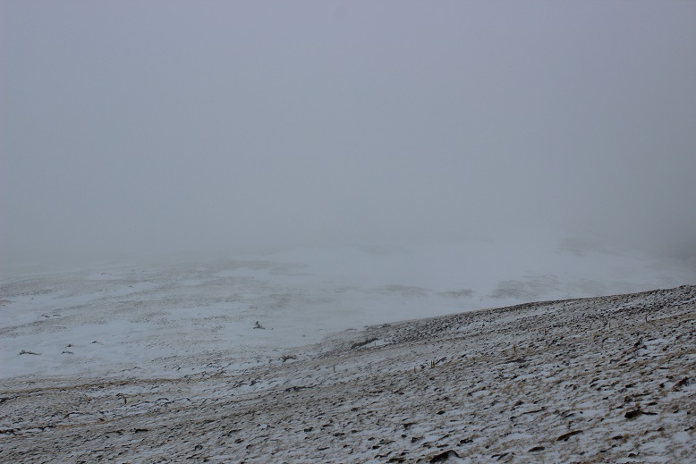
From treeline there was no direct route to the top: you’re supposed to make your own trail. My directions said from here the rest of the route would be visible: Just look for the peak and head towards it. Um… not possible. This was my view:
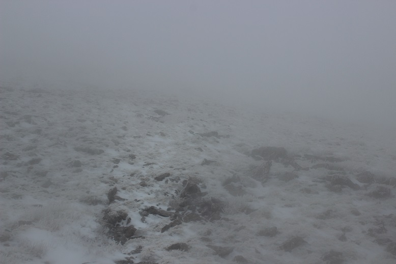
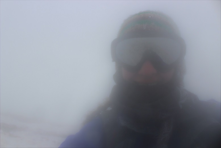
The wind was really insane here and there was no visibility. Wind was blowing at a constant 35-40mph with many wind gusts (I’m guessing 55mph+, as predicted). I could feel the wind gusts approaching. After the second one knocked me down I decided to anticipate them and lie flat whenever I felt one approaching.
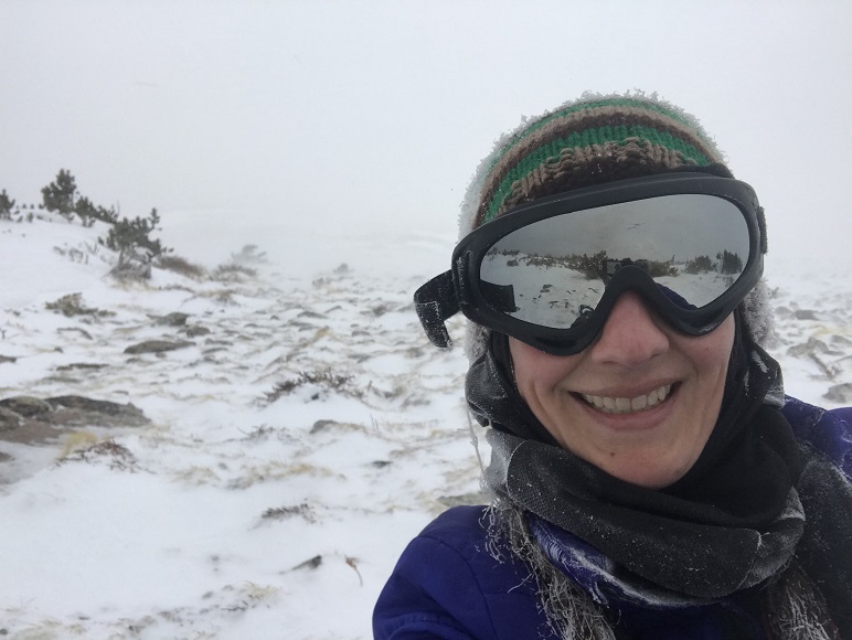
The only good part about those wind gusts was it cleared the visibility to about 50 feet in front of me for 2 or 3 seconds after it passed, so I’d hunker down, and then look up towards where I wanted to hike to see what was ahead of me. I never was able to see the top of any mountain. I took this selfie because I noticed everything about me was frozen and I thought that was pretty cool because I wasn’t that cold!
I couldn’t see where I was supposed to go, or even more than about 10 feet in front of me, so at this point I had a choice to make. Turn around and head back, wait out the weather (it was supposed to clear around noon and it was about 9:30am) or pull out my map and compass and practice those orienteering skills I teach to others for situations like this. You can guess which one I chose. (Note: I should have turned back).
I headed northwest up the ridge, being careful not to get too close to the edge of the ridge and trying to stay away from large areas of snow (I used those as landmarks). I kept trudging on, following the ridge. I’m 95% sure I made it to the summit, because when I pulled out my phone and looked at the GPX file it said I was there. You’d never guess though by the picture…
I went to get some pictures with my cell phone, and before I could do so noticed I was at 41% battery. Time to head down. Wait, 37%… 35%… 31%… all lost within about 10 seconds. Argh! No!!! This was insane! I turned off my phone and booked it down that ridge! I have a lot of great survival skills, but knowing my phone was going this fast made me start to worry. It’s like a safety blanket I didn’t want to lose. Yes, I know, I know, (I know!!!) but when it hits you as reality in these types of conditions your priorities change: you really do want that phone to work! (I’d left my portable charger in the truck because this was only a 9 mile hike: never again!).
That ridge lasted forever. Did I really hike all this way up? It felt like it would never end, and without visually being able to see how much route I had left I kept checking my compass to make sure I was headed in the right direction and my altimeter to see how much further I should have to go.
I made it back down to where I’d exited treeline and looked for the snowshoe tracks I’d so carefully made. They weren’t there. Drat. The wind had completely filled in those 6 inch post-holes with fresh snow! This is what I saw…
I quickly put on my snowshoes and started jogging as fast as I could carefully jog down. I wanted to get off that mountain. At this point the visibility was great… there just weren’t any tracks to follow. I headed towards the ridge, and when I made it I breathed a sigh of relief! Now all I had to do was follow the ridge until it ended and head southeast.
At this point my anxiety dropped because I could see where I was and I knew where I was headed. But I was also exhausted! I was wearing winter hiking boots, trudging through the snow in snowshoes that were postholing, and that wind took a lot out of me. I haven’t been this tired at the end of a hike in a very long time. And it wasn’t even that long of a hike! I’d guess it was less than 9 miles total, but in those conditions, it was insane!
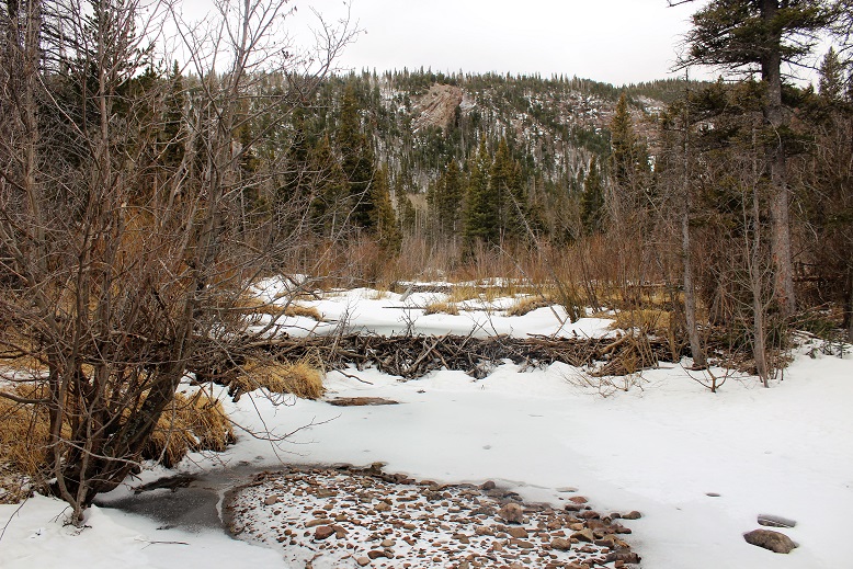
I noticed a small dam at the bridge…
I learned so much from todays hike. I really tested my abilities, and I’m proud I was able to use the skills I have to stay safe in a not so safe situation. Also, I don’t think I’ll be purposely doing that again. Anyway, I’m back at it!
Oh, and the weather cleared up as I headed back down.


