13403, Cleveland Peak – 13,414, 13384, & Dead Man Peak – 13,050

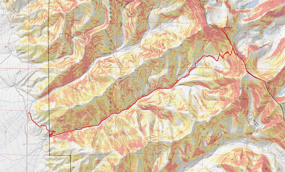
RT Length:  23.05 miles (CalTopo), 17 miles (Strava)

Elevation Gain:  7080’ (CalTopo), 9474’ (Strava)

I parked at the Music Pass trailhead the night before, the only other vehicle in the lot until a 4Runner pulled up. 

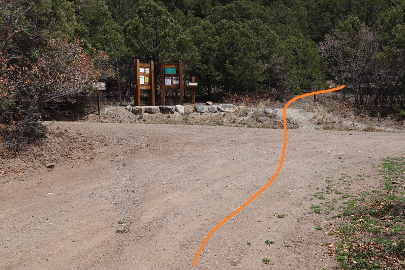
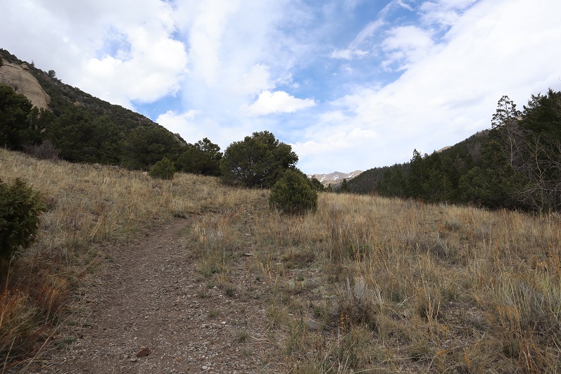
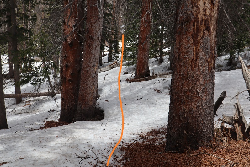
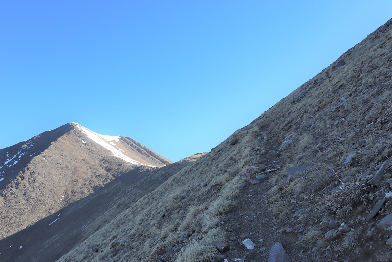
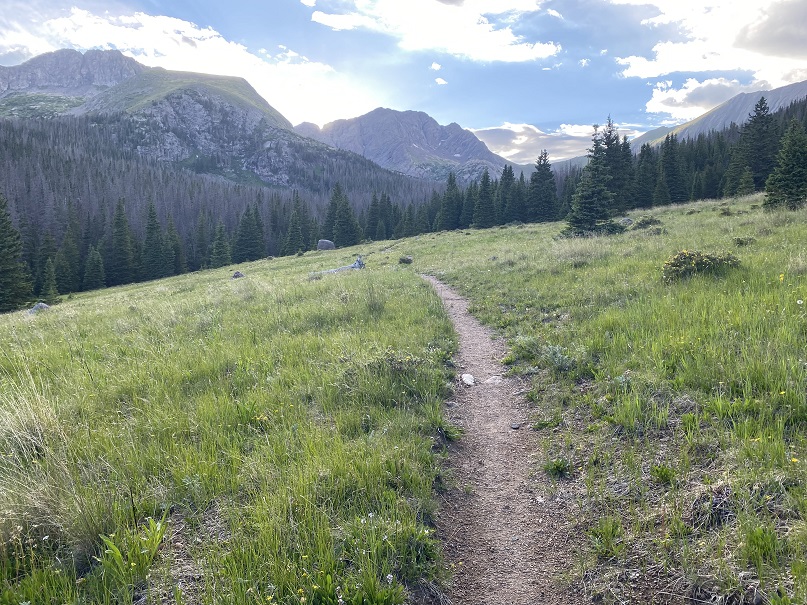
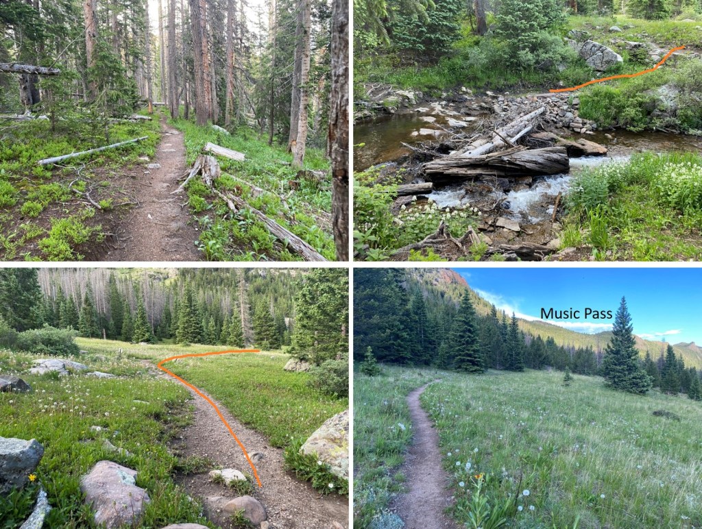
I made it an early night, and was on the trail at 4am, heading west towards Music Pass.

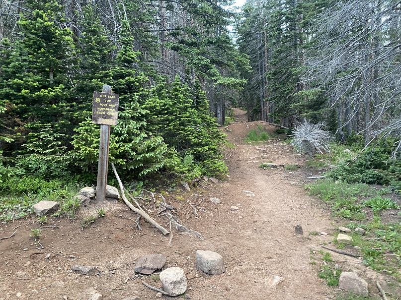
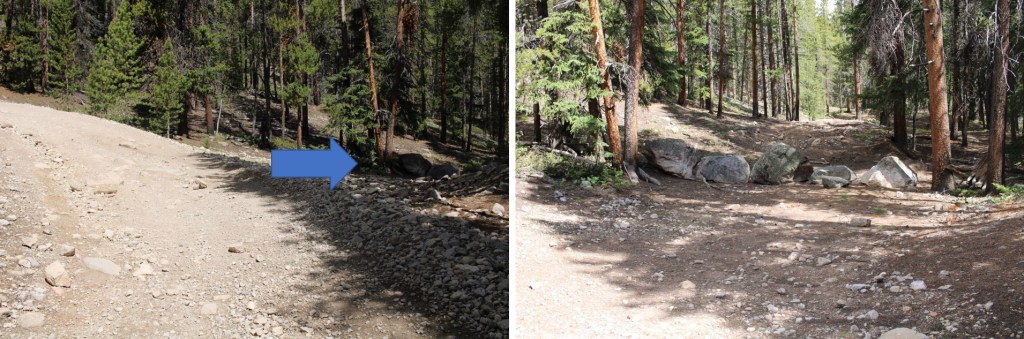
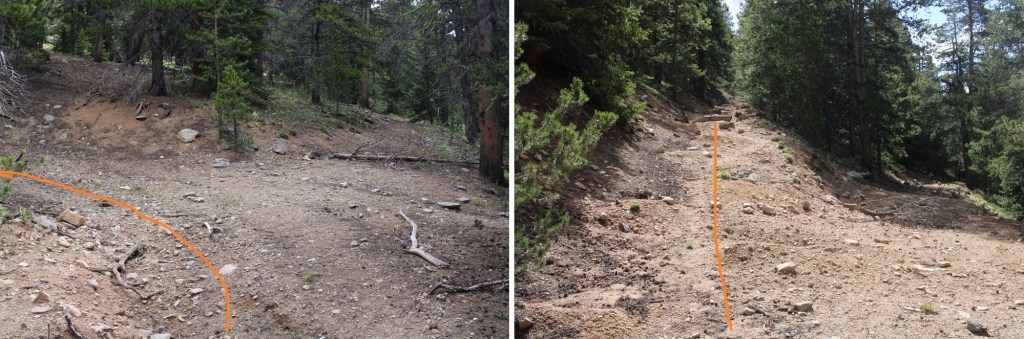
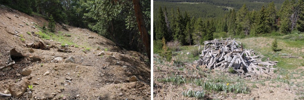
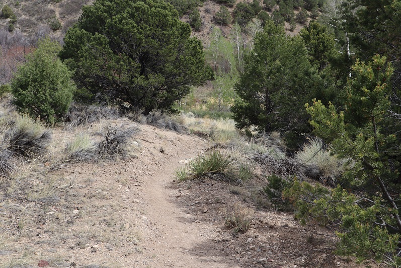
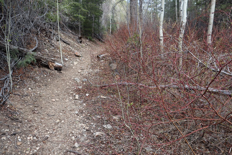
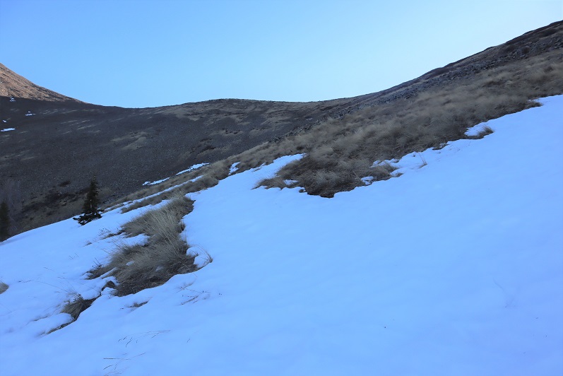
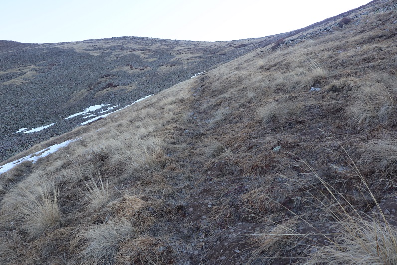
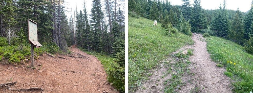
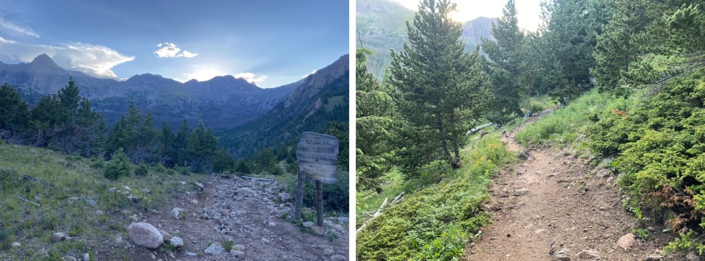
I passed a trail register, which was full of moths and only one piece of paper.  I didn’t bother signing it.  The trail is class 1 and easy to follow

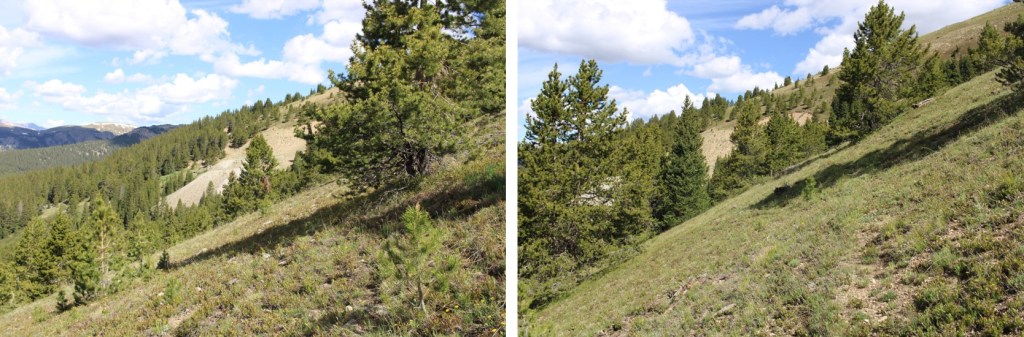
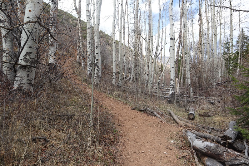
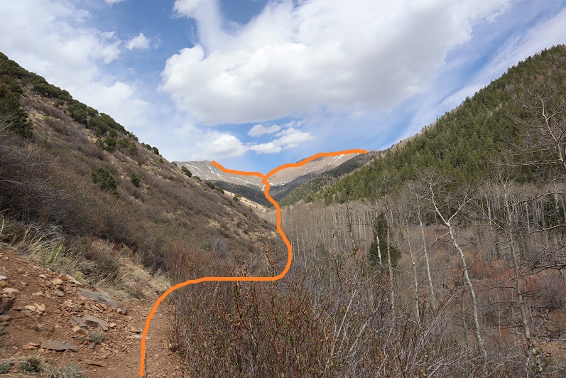
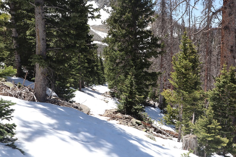
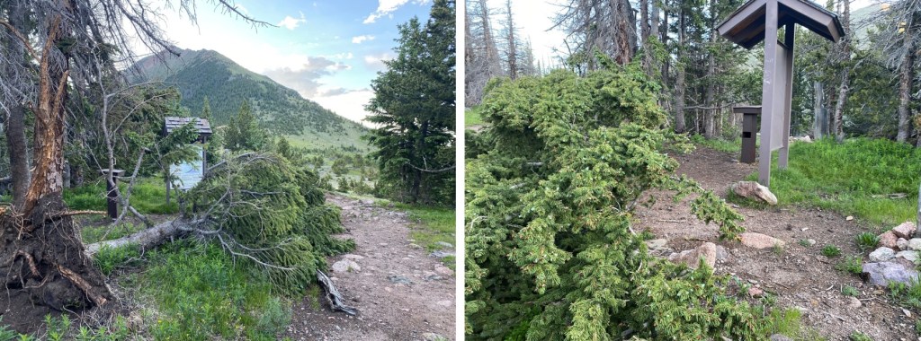
A tree has recently fallen near the signs at the top of Music Pass.  I continued on the trail and lost 450’ as I descended to Sand Creek below.

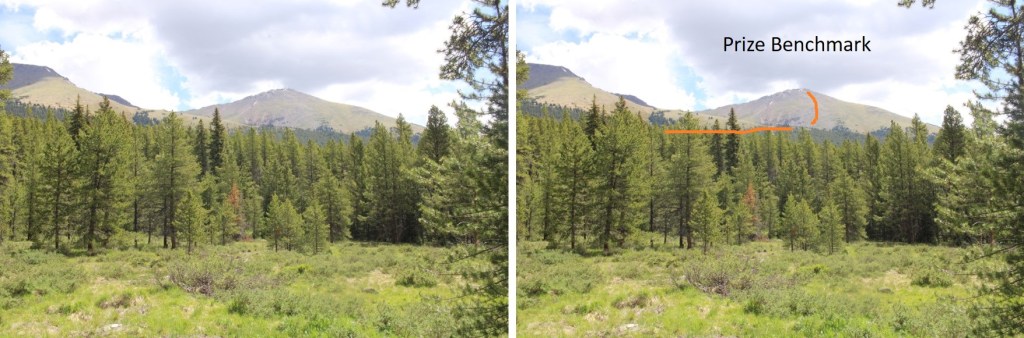
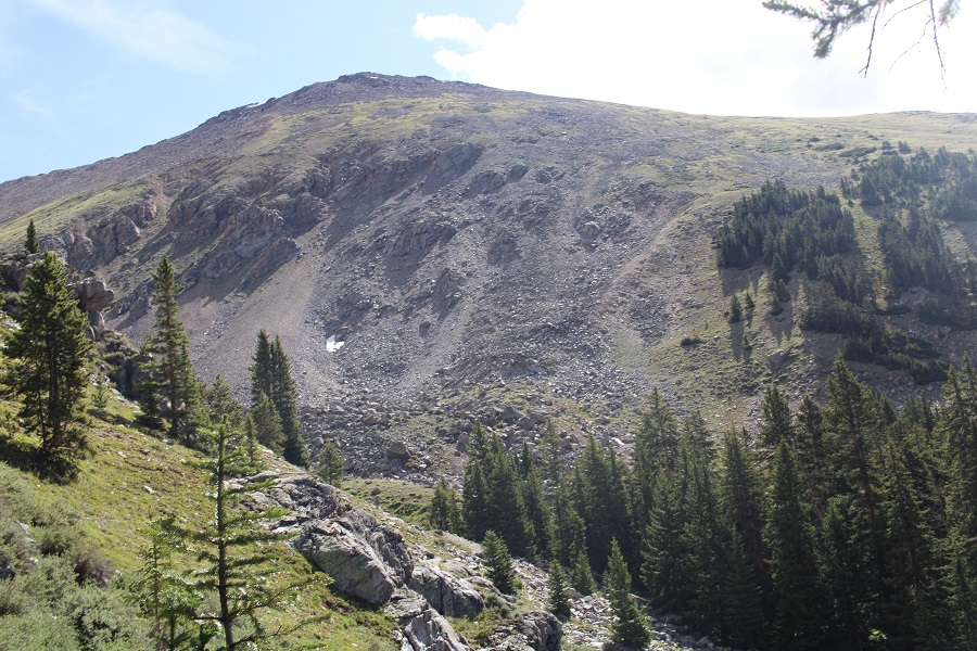
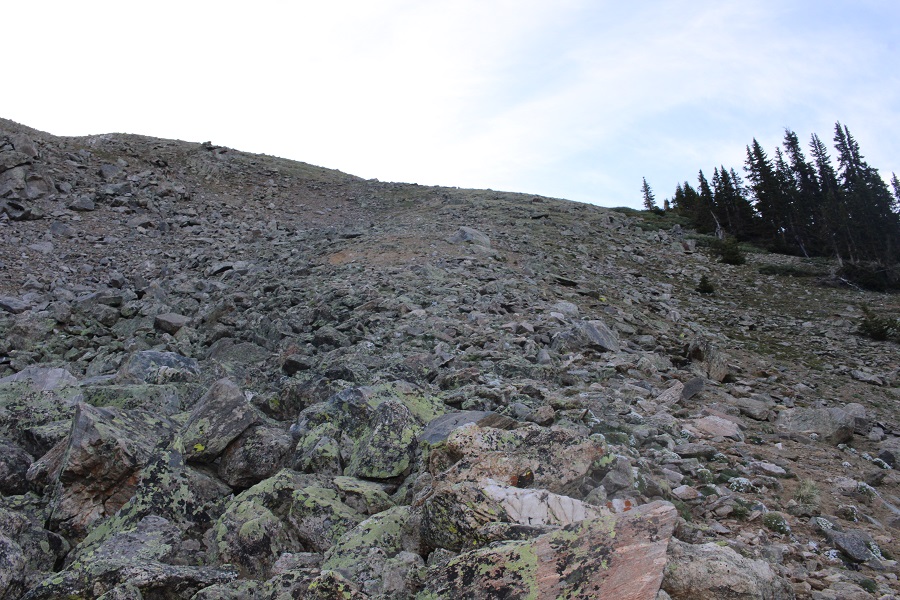
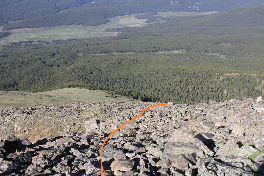
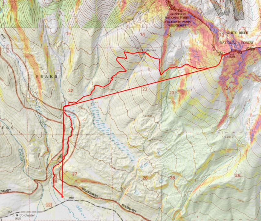
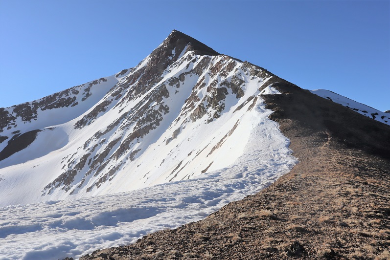
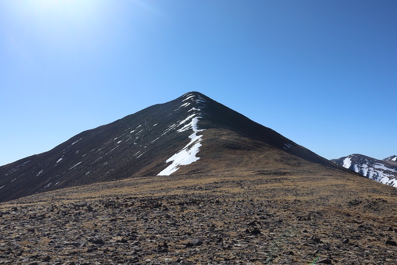
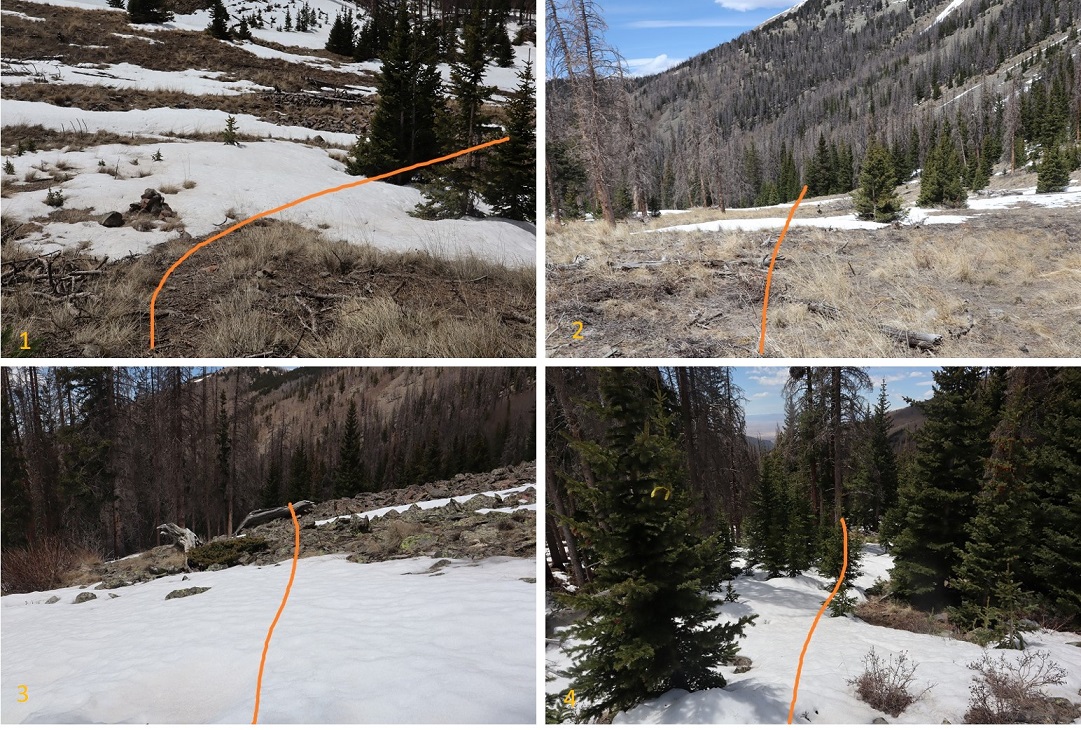
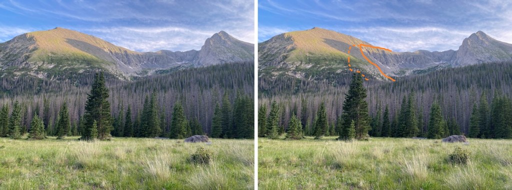
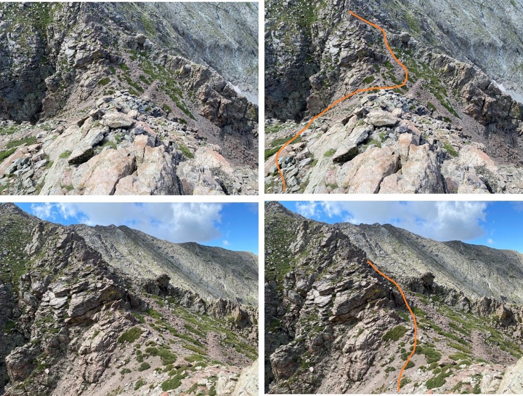
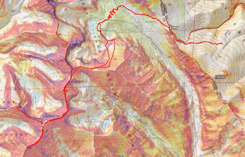
Now is a good time to get a look at how you’re going to ascend the ridge from Sand Creek Lake.  Getting up the ridge is not easy.  I would not recommend the route I took up (dotted line).  The easier route is up a gully.  Also note the cliffs you’ll want to avoid.  It’s important to make it to at least 13000’ before traversing to the ridge, as there are cliffs and chutes you’re trying to avoid. This is the overall route I took

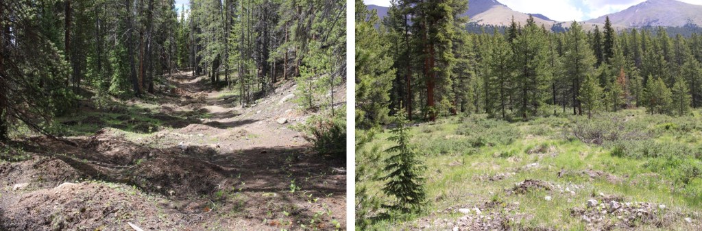
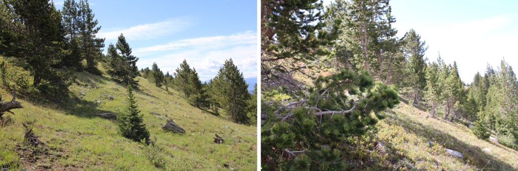
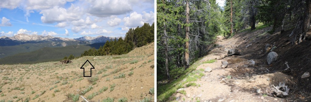
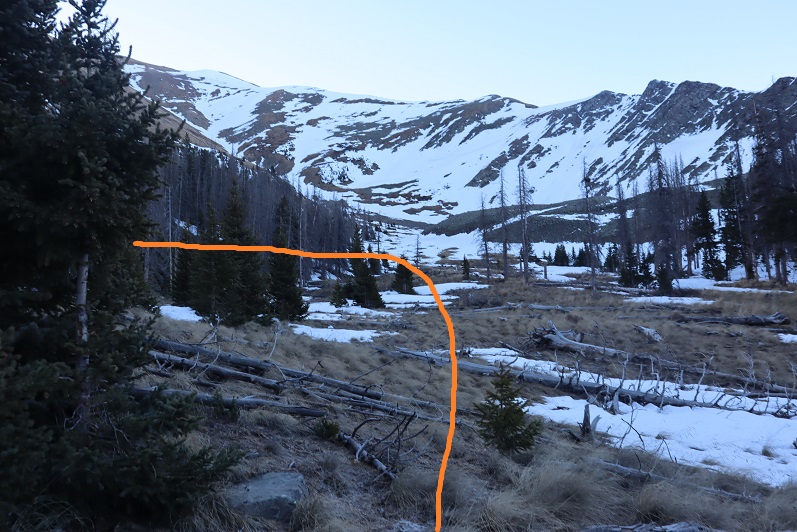
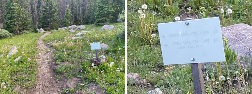
After 3.3 miles I took the second junction and turned left.

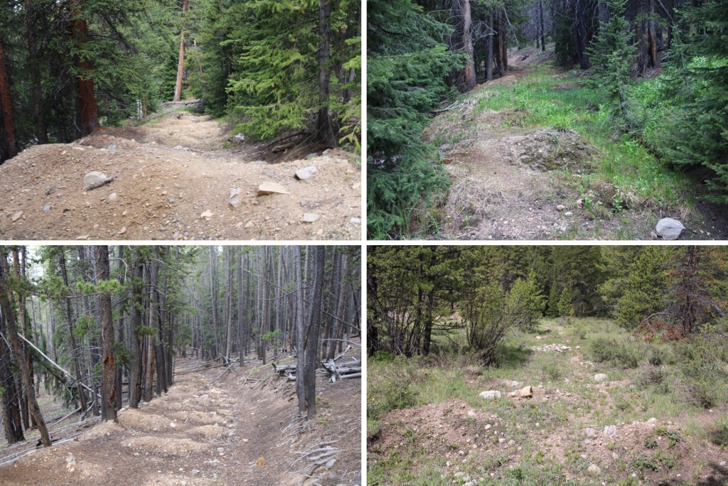
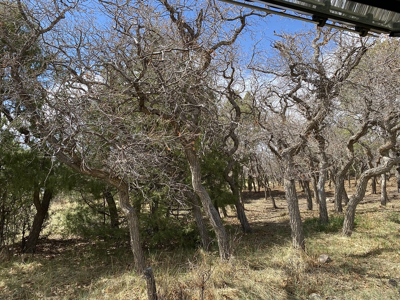
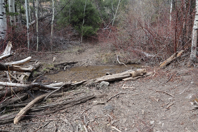
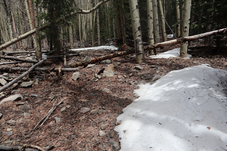
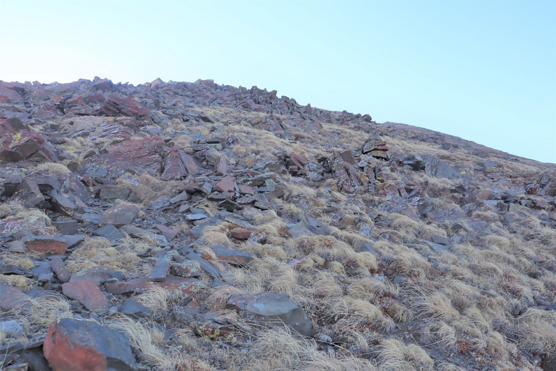
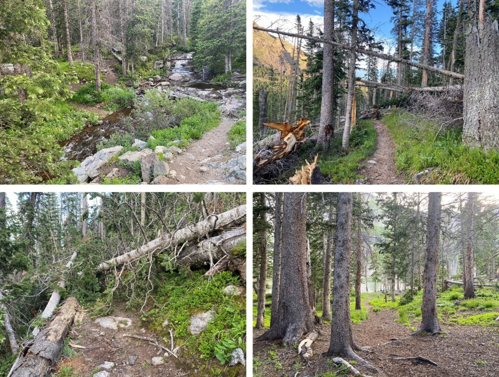
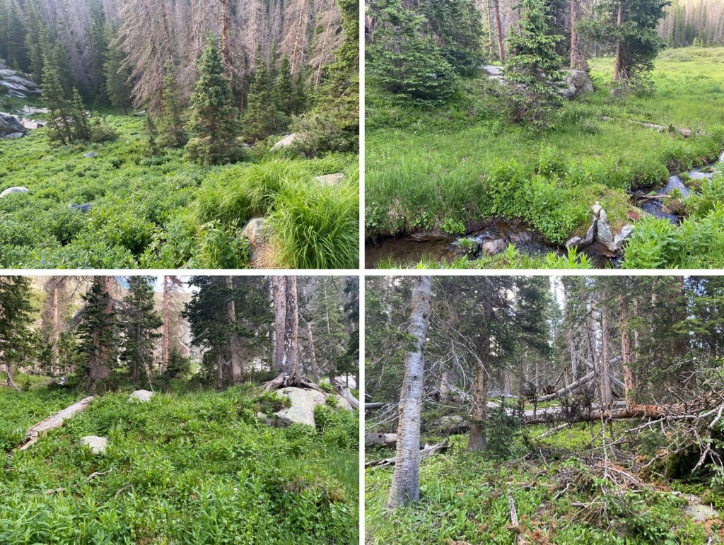
I crossed Sand Creek and made my way to Sand Creek Lake on the class 1 trail.  There was a lot of deadfall in this area

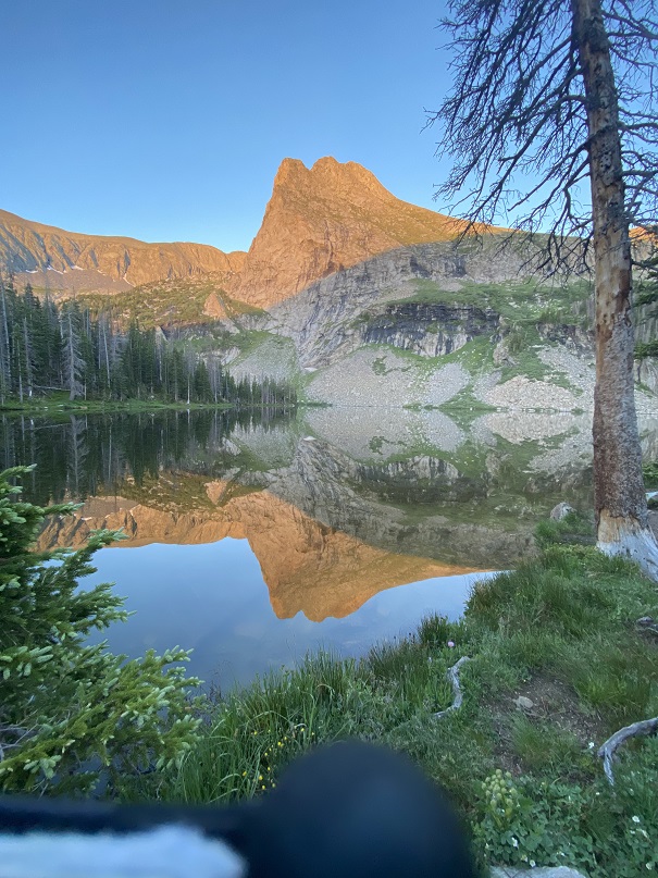
I made it to the lake as the sun was rising.

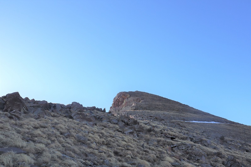
At the lake the trail ended.  I knew I needed to ascend the ridge, so I headed south, which required some bushwhacking.

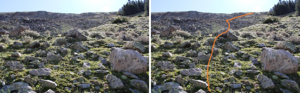
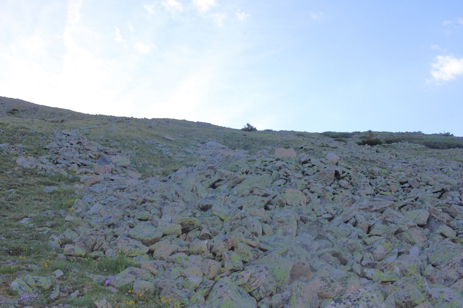
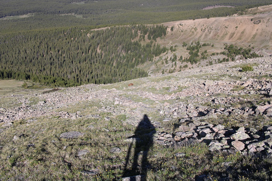
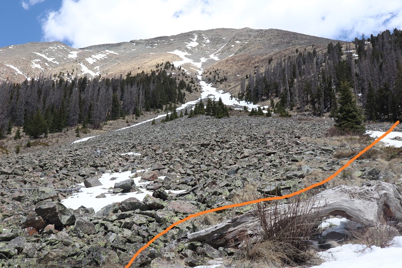
From here I’m going to show you how I descended, as it was much safer than the way I ascended.  At around 11,400’ there’s a gully.  It’s obvious, and the only one.  Follow and ascend the gully southwest and then south.

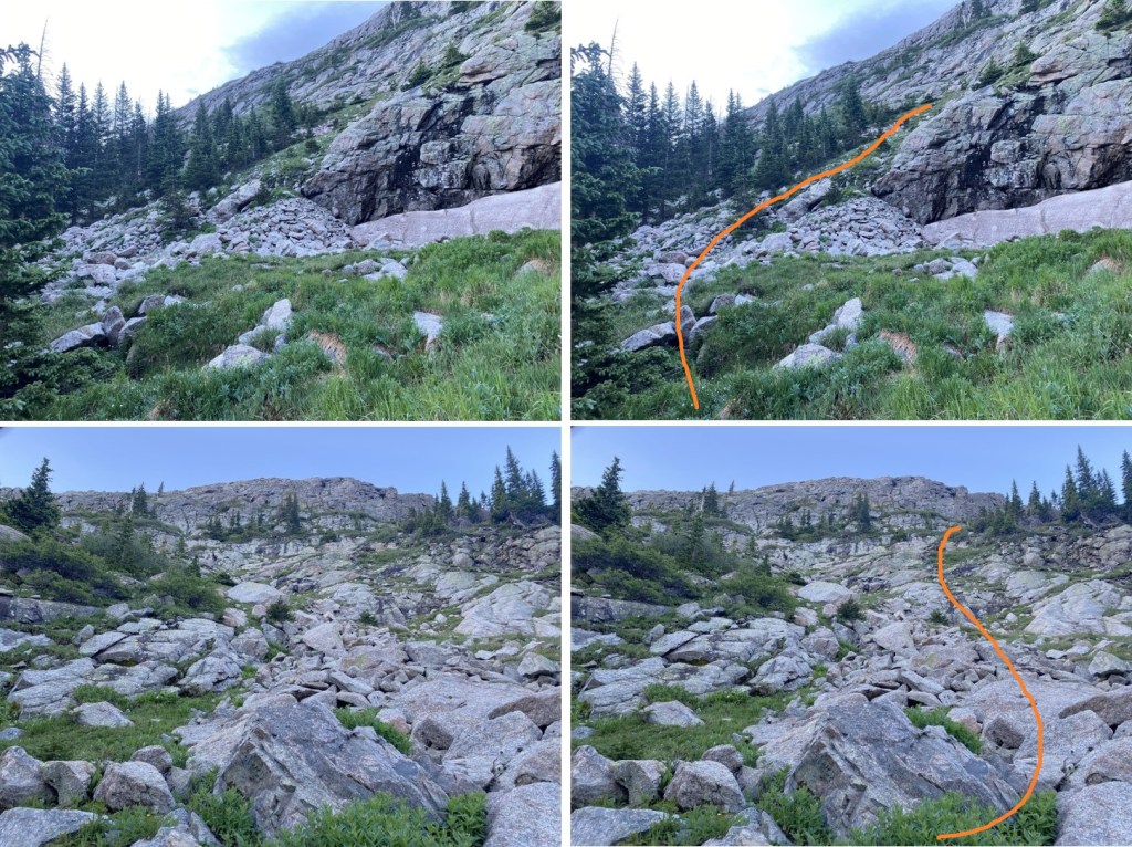
This is where you ascend the gully. This can be done mostly on grassy ledges. 

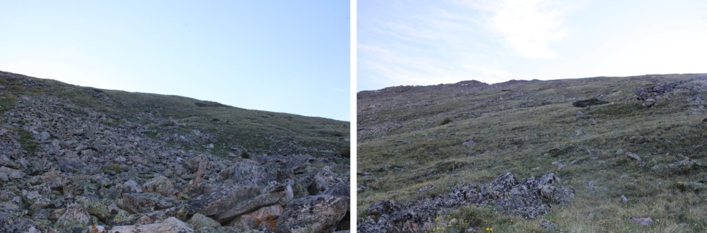
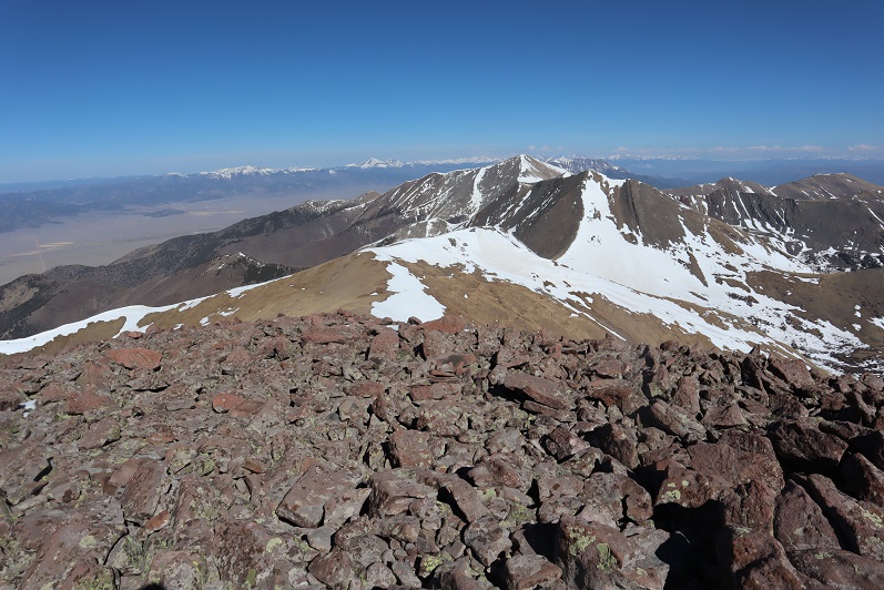
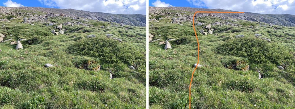
Once up the gully, it’s time to make it to the ridge.  You don’t need to go all the way to the top, instead, ascend to about 13000’, then traverse over to the ridge at its lowest point. It’s important to make it to at least 13000’ before heading west to the ridge, to avoid the drop offs and smooth gullies. The terrain here is full of loose rocks.  Every one rolls, so be prepared to wear your helmet and take your time.

It was at 13000’ I unexpectedly awoke a bobcat.  He was not happy with me, but allowed me to take his picture before bounding off.
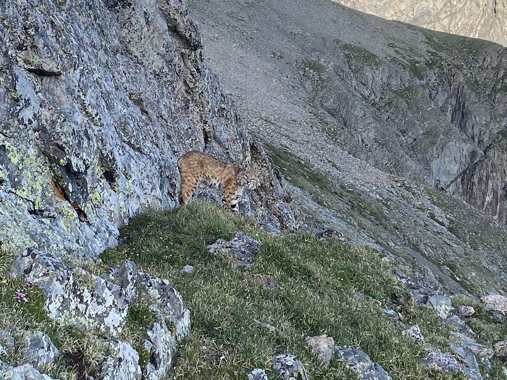
Bobcat:

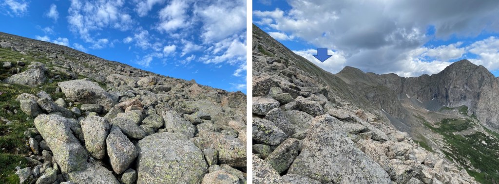
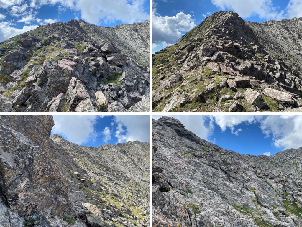
I continued heading west, across some tundra and rock filled gullies, towards the ridge.

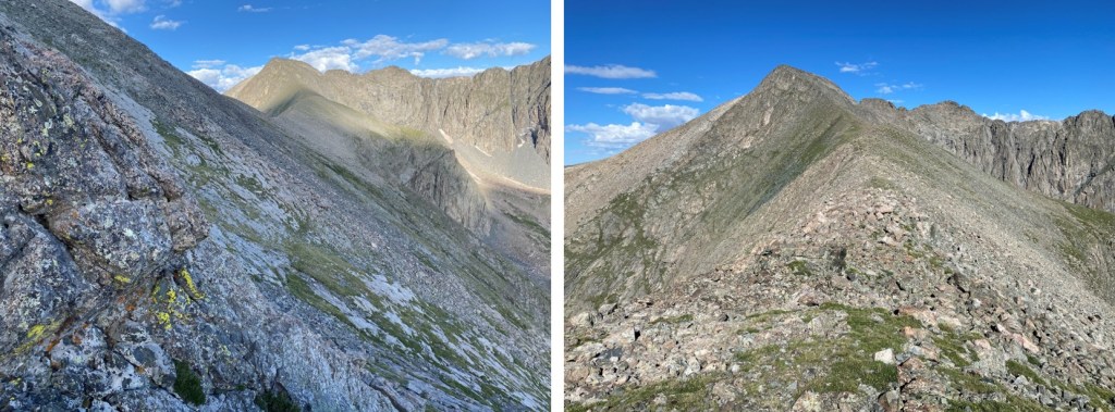
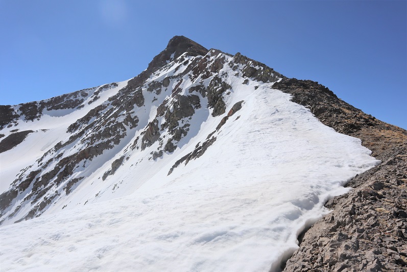
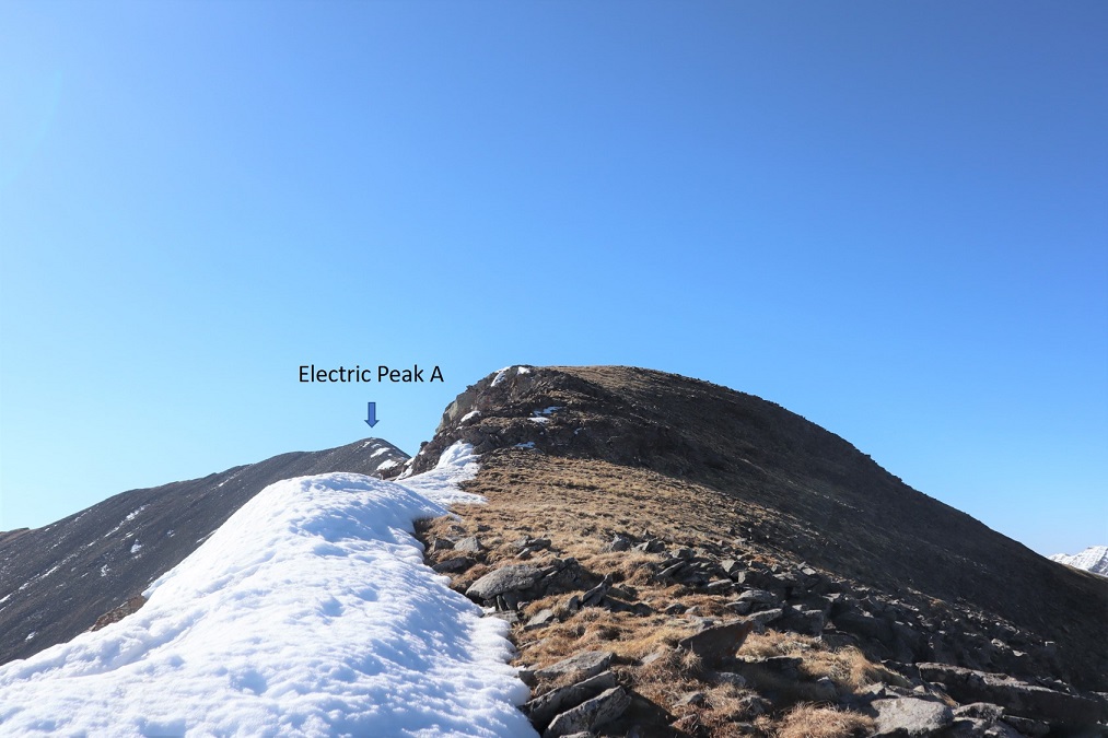
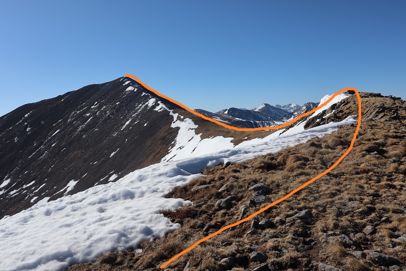
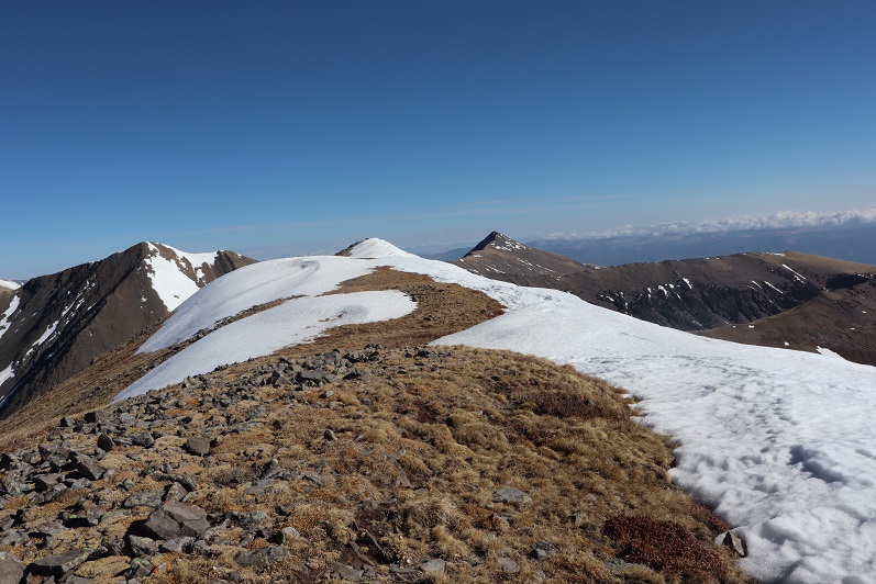
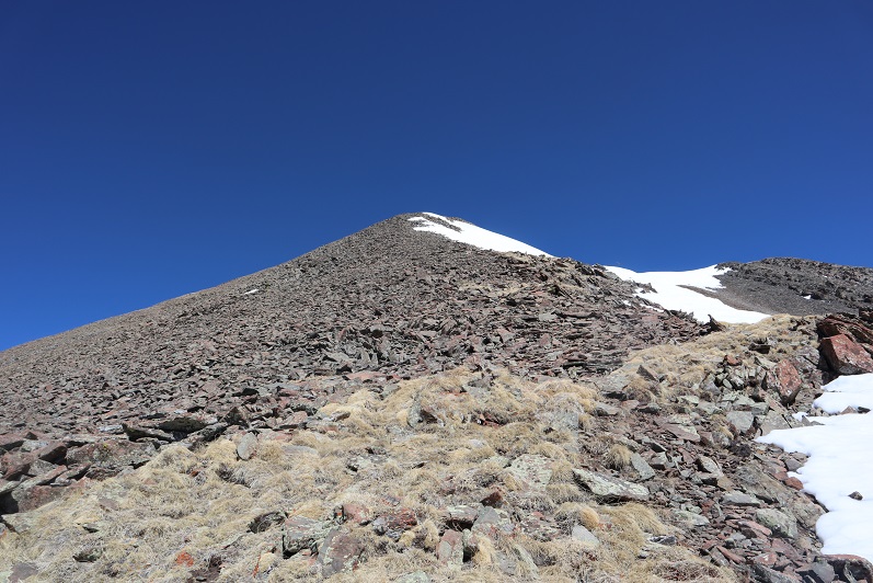
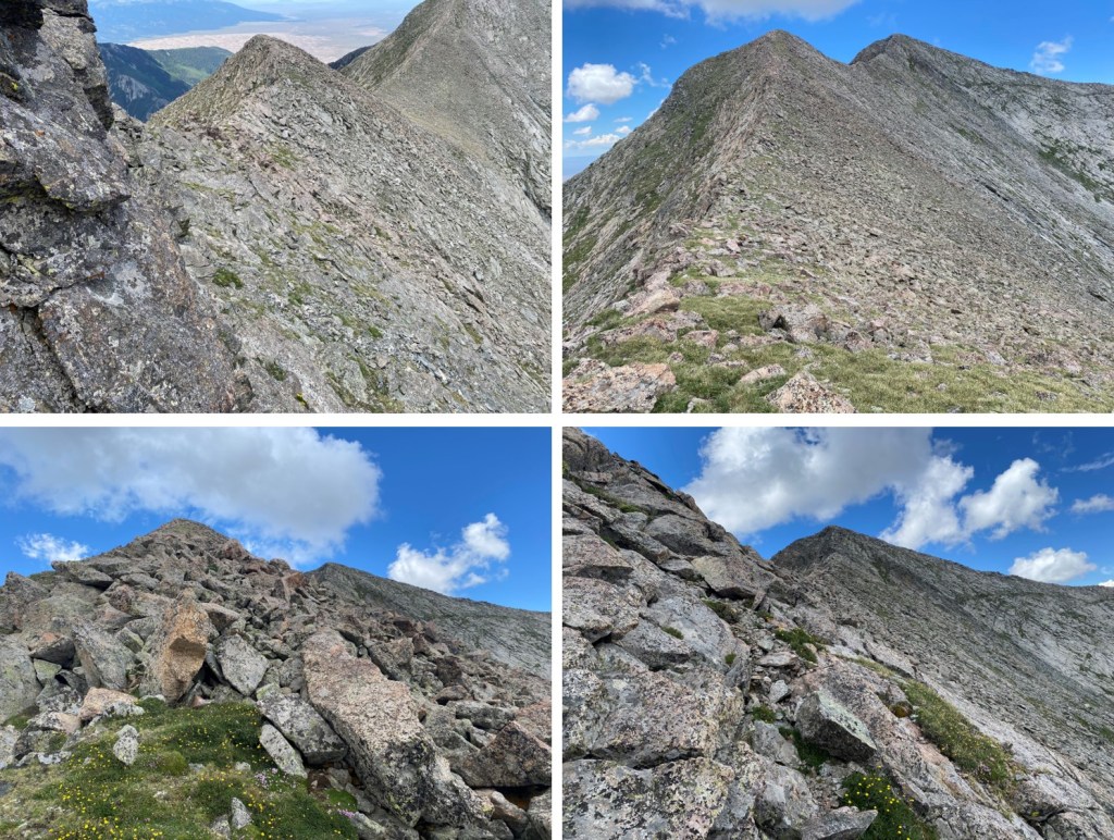
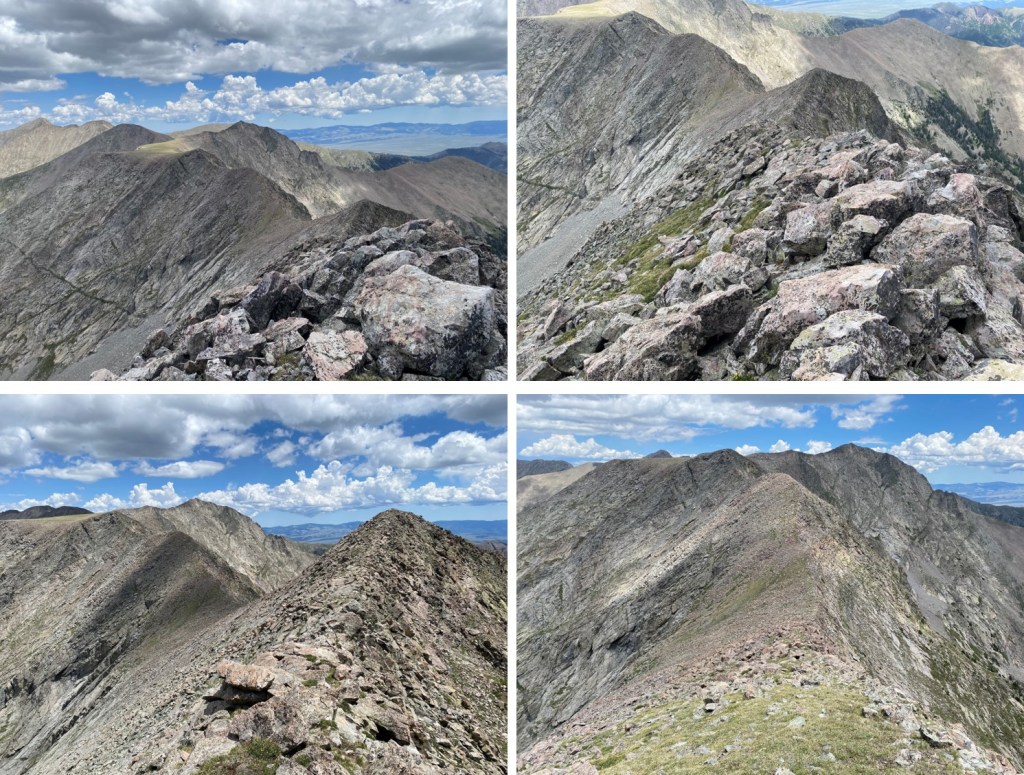
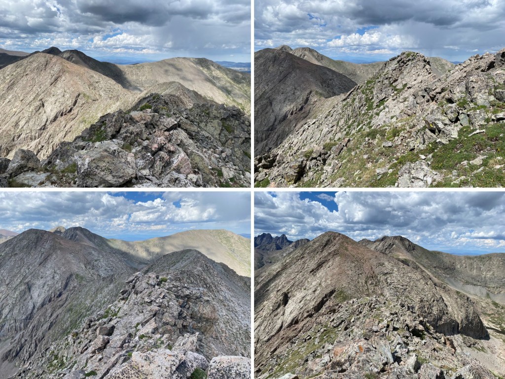
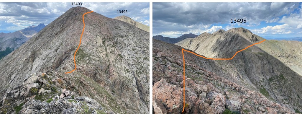
Once on the ridge, I followed it straight up to PT 13495.  However, this is an unranked point, so there is no need to go there.  Instead, you can skirt this summit and instead head over to PT 13403 (also unranked).  If you decided to go up and over PT 13495, it’s all class 2, both up and down.

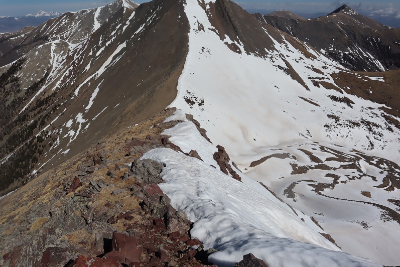
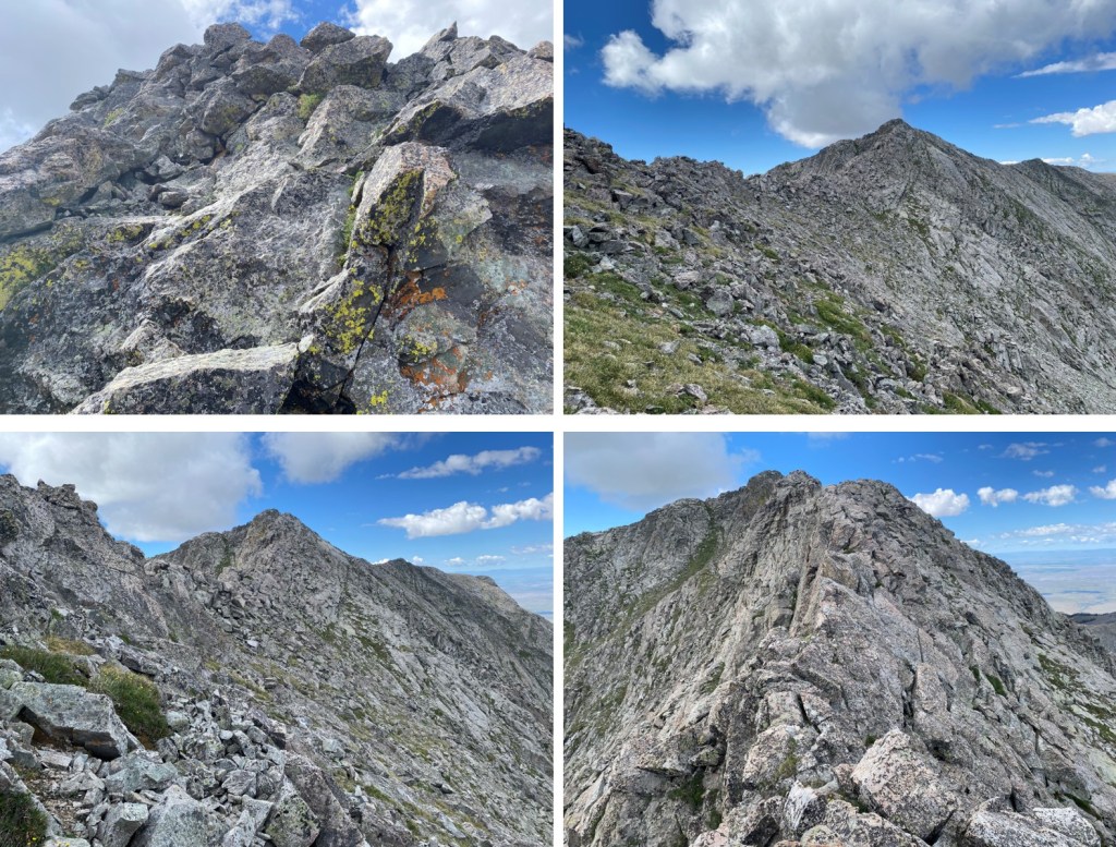
From the summit of PT 13495, this was my route up 13403.  The ridge looked like it went at class 3, but I decided to keep it class 2 and ascend the face

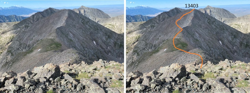
And some closer pictures

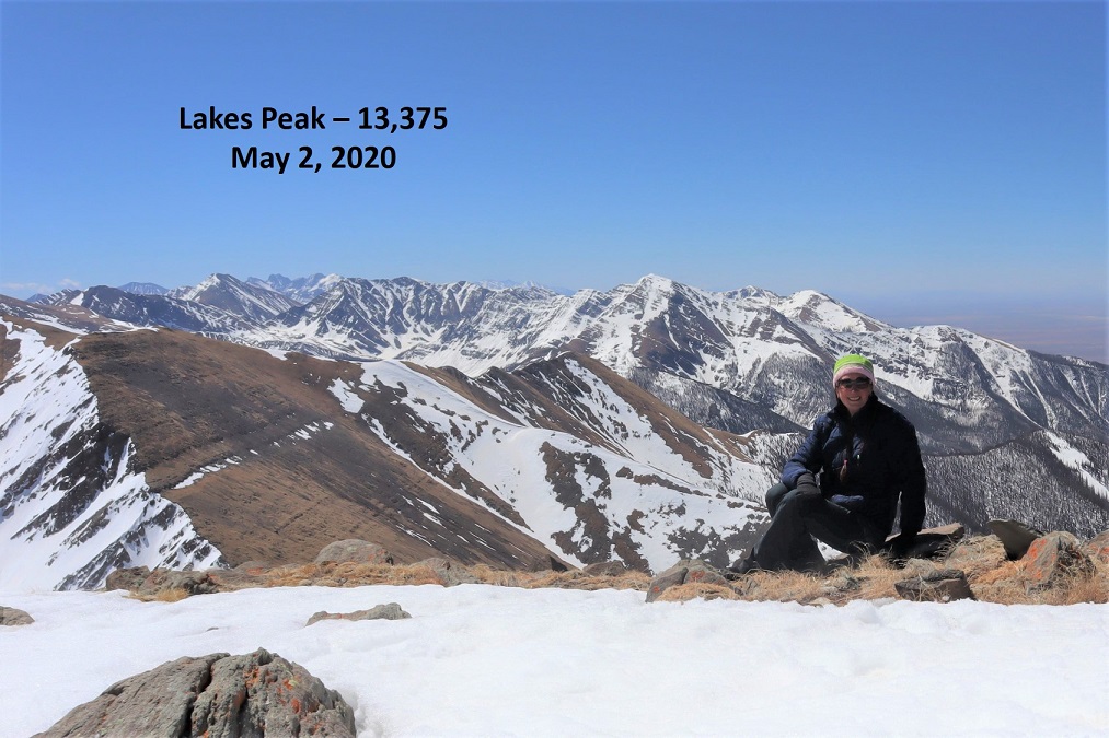
I summited PT 13403 at 10am

PT 13403:

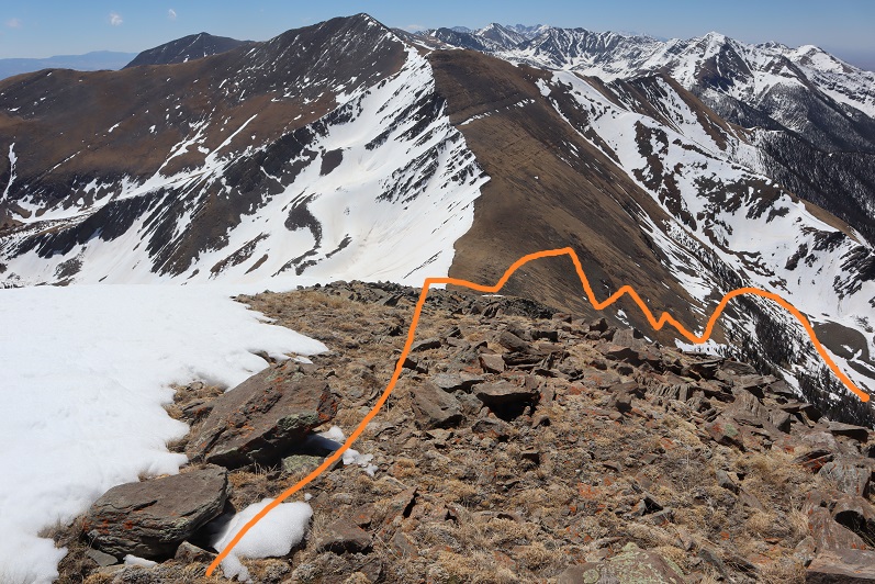
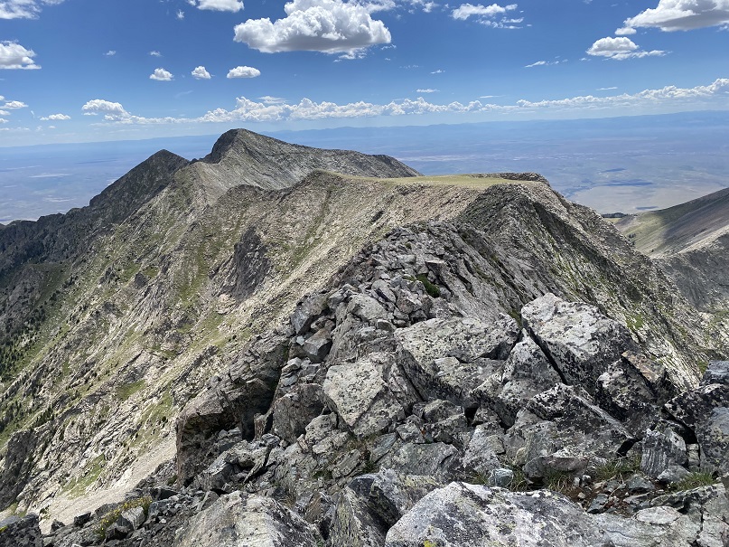
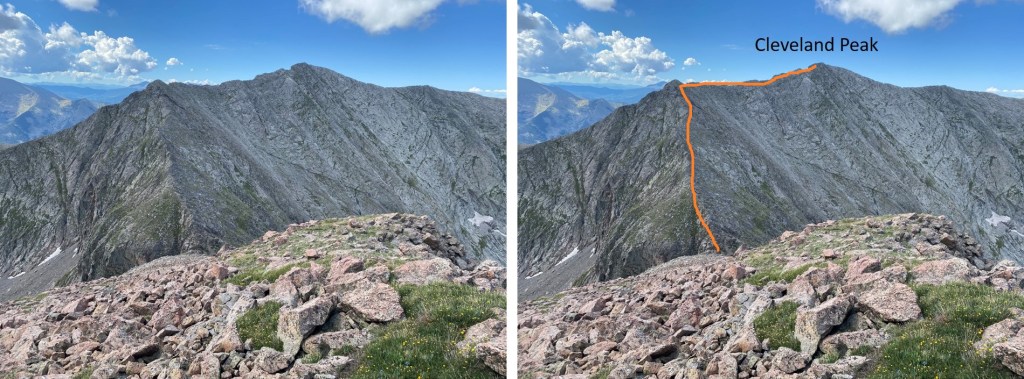
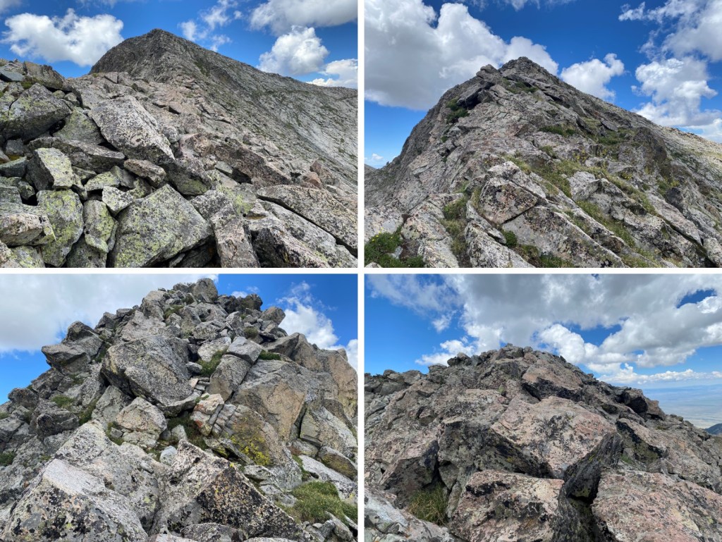
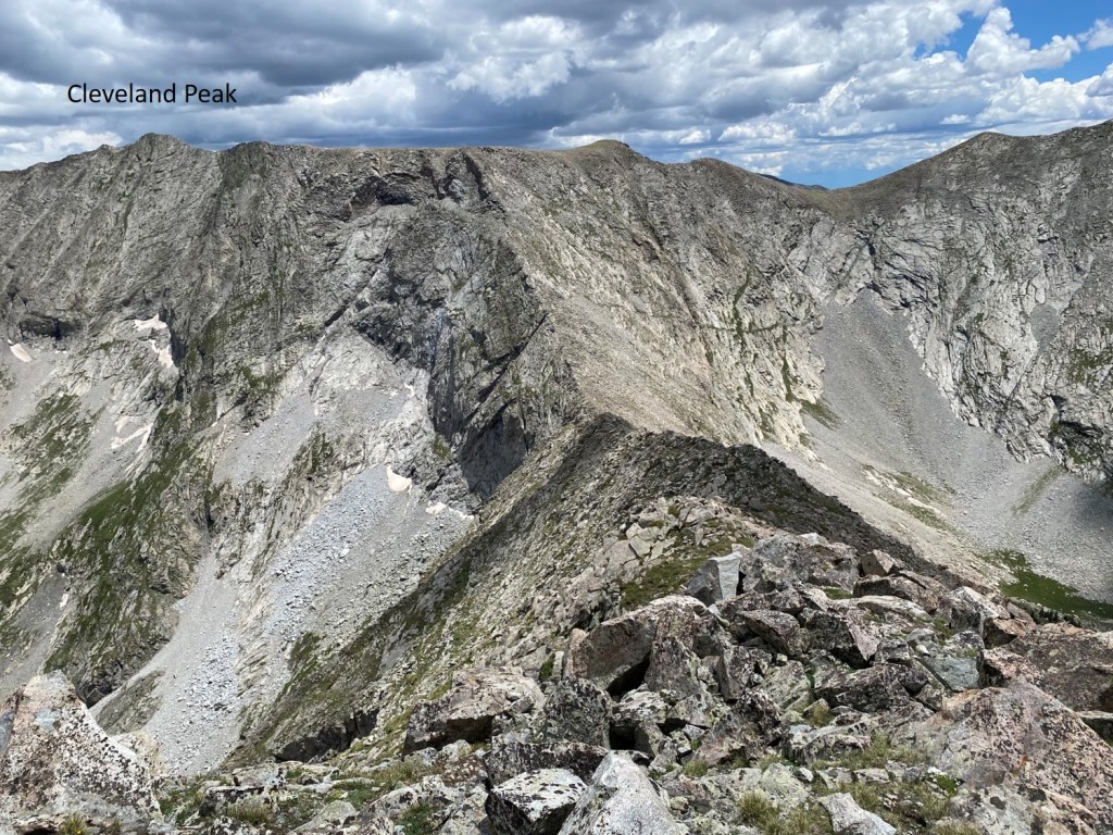
My next objective was to follow the ridge south towards Cleveland Peak.  Here’s my overall route up (going down I stuck to the ridge, which was class 3 with maybe a few class 4 moves)

I made it down to the saddle, and crossed over on some scree. 

From there I tried to stick to the ridge, but every so often I had to drop to the right.  This is choose your own adventure.  The ridge goes at continuous class 3, easy class 4, and was the most difficult climbing of the day. 

I summited Cleveland Peak at 11am
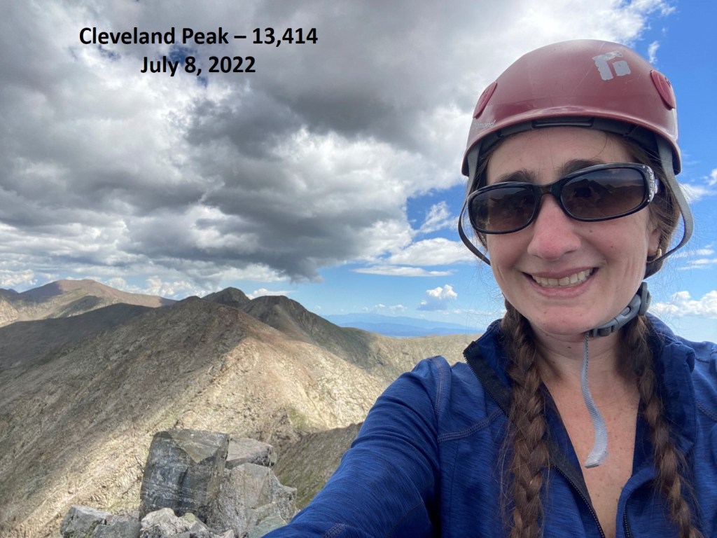
Cleveland Peak:

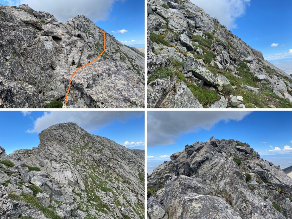
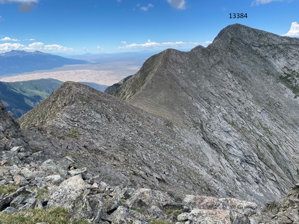
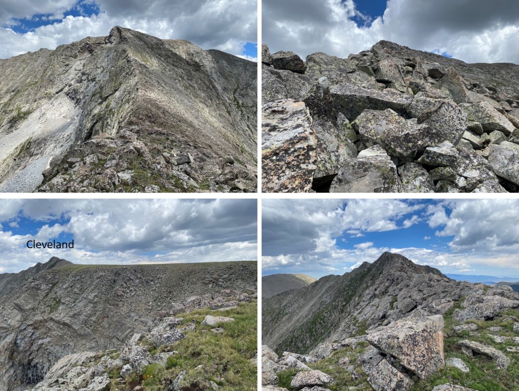
My next goal was PT 13384, to the southwest.  There was a little more class 3 ridge work, and then I crossed a plateau and made it to the Cleveland/13384 saddle

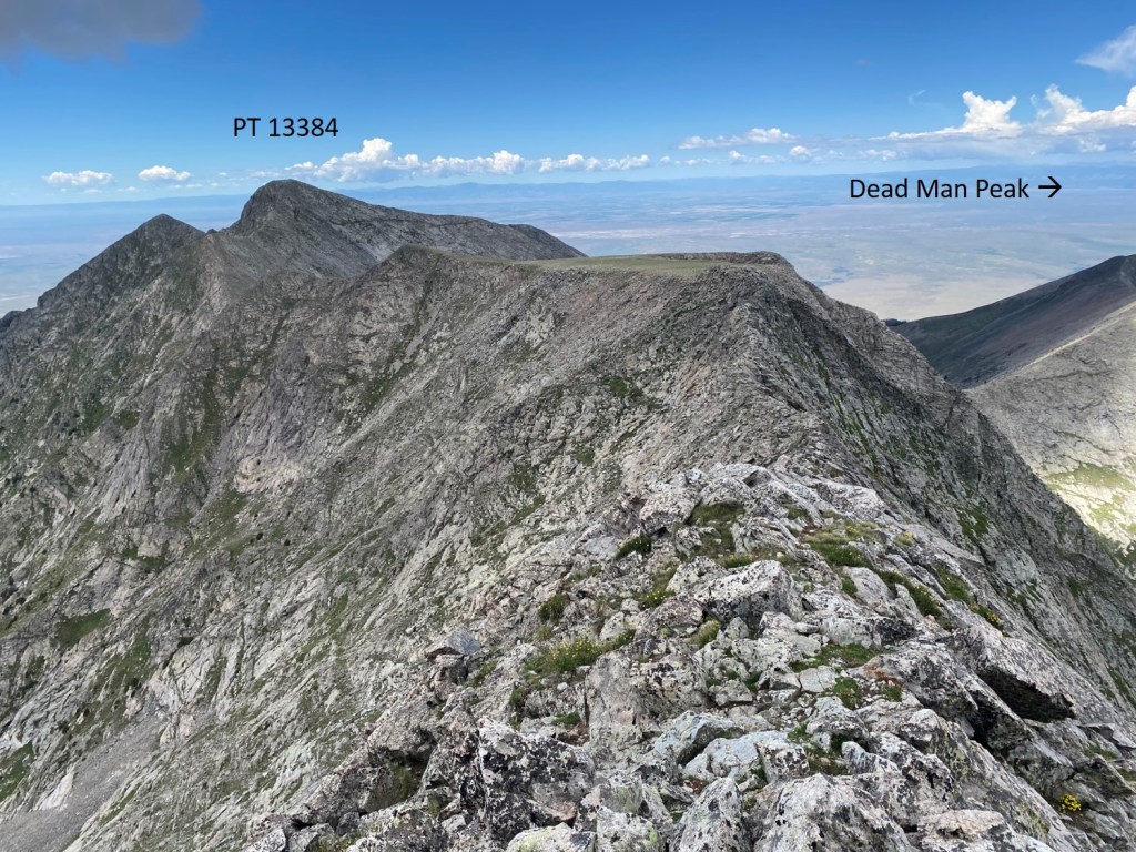
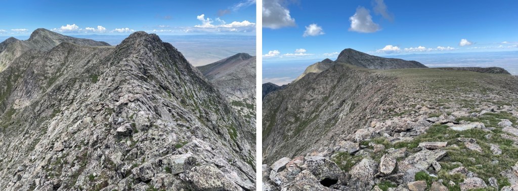
Once there, I followed the ridge to the summit.  The ridge goes at class 3

Here are some closer pictures of the ridge

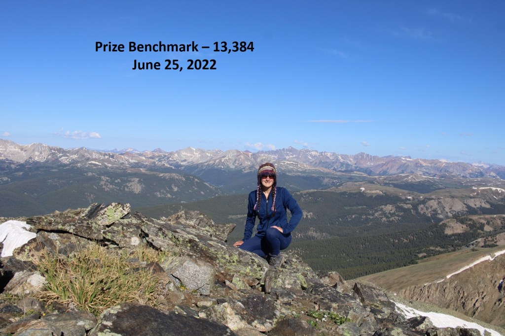
I summited PT 13384 at 12:10pm
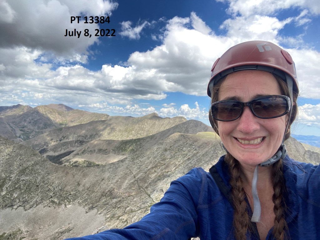
PT 13384:

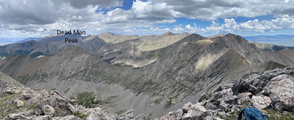
Dead Man Peak was to the north.  To get there, I would have to make my way back to the Cleveland/13384 saddle, re-ascend to the plateau, then head northwest over to Dead Man Peak

I made my way back to the Cleveland/13384 saddle

Re-ascended up to the plateau

Then descended 550’ and re-gained 400’ to the summit of Dead Man Peak.  This could all be kept at an easy class 3 by sticking to the ridge

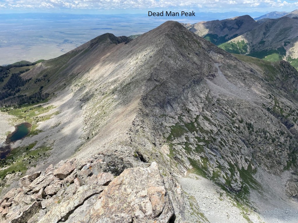
The summit is circled in red, to the northwest

I summited Dead Man Peak at 1:45pm

Dead Man Peak:

To get back to Cleveland Peak, I had to go back down to the saddle, and re-gain 770’ of elevation

After re-summiting Cleveland, I had the most difficult part of the downclimbing to do to get back to the 13403/Cleveland saddle.   

I was able to stick directly to the ridge.

I did not summit PTs 13403 or 13495 this time, but skirted them to the right

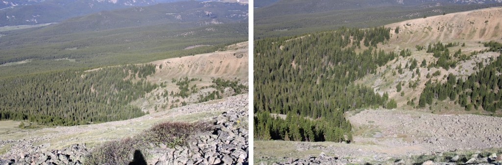
Once I could see Lower Sand Creek Lake, I stayed high on the ridge to pass all the cliffs, then descended straight towards the gully below.

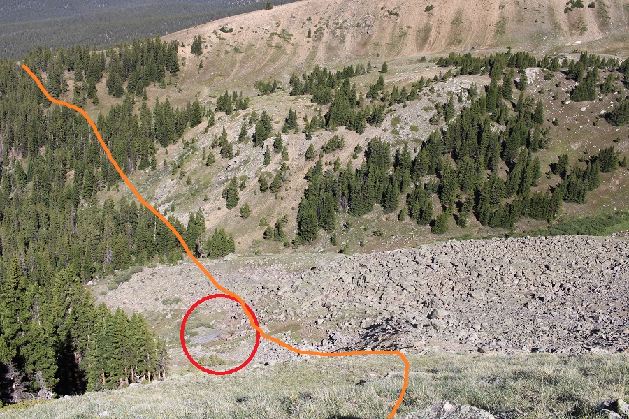
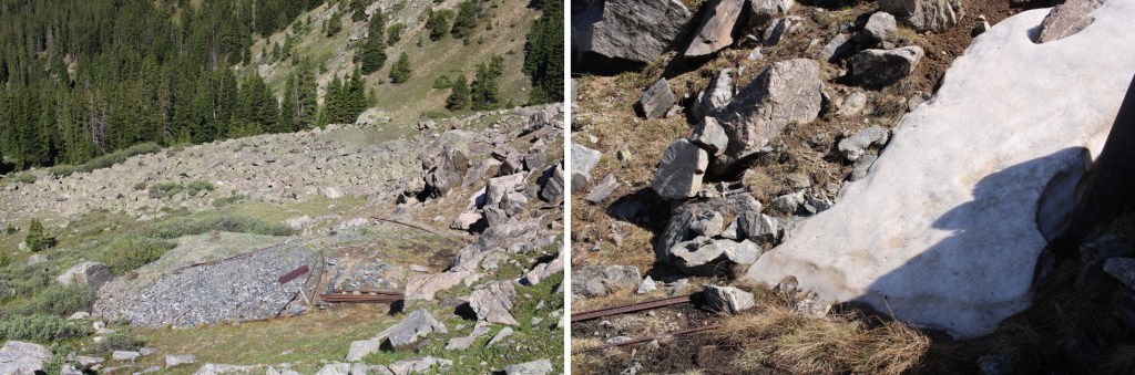
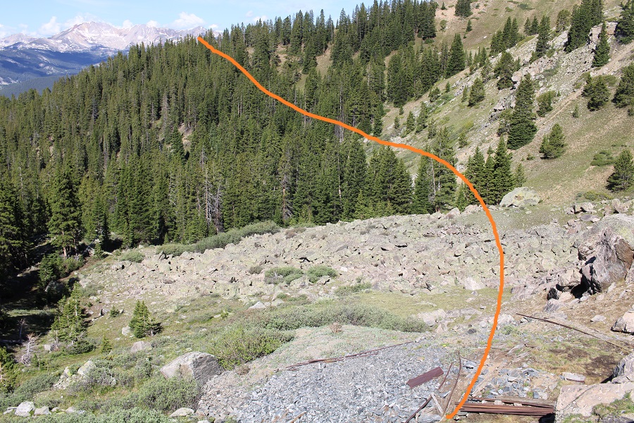
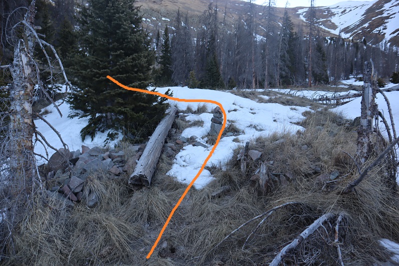
I bushwhacked it to northwest to Lower Sand Creek Lake, then found the trail and took it back to Music Pass

Then followed it back to the trailhead

On big days, I tend to get wildly different numbers from CalTopo and Strava.  CalTopo says I did 23.05 miles with 7080’ of elevation gain, and Strava says I did 17 miles with 9474’ of elevation gain.  In any event, the hike/climb took me 16 hours, 15 minutes to complete.   

On to the next trailhead!

Prize Benchmark – 13,384

RT Length: 10.4 miles

Elevation Gain: 3996’

There is a ton of camping at the Tellurium Trailhead, so that’s where I spent the night. 

I was parked next to a small stream, and had the entire area to myself. Not bad for a Friday and Saturday.

I was up and on the trail at 4:30am, following the 4WD dirt road 584 north for just under 1.5 miles.  There were a lot of dispersed camping sites along the road.  I was glad I’d parked where I did and hiked in.

After hiking for just under 1.5 miles I came to an old dirt road that has been blocked off.  It was on the right, and wouldn’t have been obvious in the dark.  There is no parking there.

This was a road someone had tried to make unusable.  It made hiking interesting, as I could not hike in a straight line.  The road was obvious and easy to follow however.  

When you come to the meadow, if it’s light out, get a good look at Prize Benchmark. This is the route you’re going to want to take.  Notice there’s a ridge?  You’re going to want to parallel that ridge, then dip into a basin before ascending Prize.  This will make more sense later.

There were two creek crossings I did not need to take off my shoes to cross

There were a few side roads that went to old houses and mining operations.  Every time I had an option to turn I kept left (twice).  I followed this road all the way to the Enterprise Mine.  There’s not a lot left…

Here’s where I messed up. I went over the ridge.  Don’t do that.  Instead, try to stay parallel with the ridge, as you’ll want to cross it at a low point because you’ll be descending into a basin.  There is no trail here, but don’t try to ascend the ridge, stay at about 11800’.

When you can see east, it’s time to descend into the basin.  There are a few game trails here. Yes, you’ll be headed back into the trees.

I just kept heading east.

I could see a grassy band I wanted to take to the ridge, and thought the easiest way to get there was over a pile of rocks.  It wasn’t.  The rocks weren’t stable, and more than once I seriously considered heading back.  This is the way I’d recommend ascending

Here are some pictures of the way up the ramp.  I stayed to the left of the trees.

Then I followed the tundra east to the ridge

As I was heading east, and the sun was trying to rise, I notices a small herd of elk to my right.  They were sharing the tundra, and after a while the mamas woke their babies and trotted off. 

I continued hiking east.

As I was trudging up the tundra, I heard what sounded like a bark.  At first I thought it was a coyote, but they don’t bark.  Then I thought maybe a dog, but it was unlikely there was a dog all the way out where I was.  I heard a single bark every two minutes or so.  One time, when I turned around, I saw an elk, and realized the ‘bark’ belonged to her

Elk barking:

I figured she’d gotten separated from her herd, and was calling them. On I trudged.  I reached the ridge, and turned left.

This was all class 2. I navigated the rocks to the left

And then could clearly see the summit

I summited Prize Benchmark at 8:15am.  I could still hear that elk barking, but watched as it went in the direction of the herd.

Prize Benchmark:

I turned and re-traced my steps, thinking to myself how much easier this route had been rather than doing this from the other side with Booby and 13460.  I aimed for the tundra below.

This time I stayed to the right of the trees, aiming for the grassy rib and gully below

As I was hiking down, I saw something that didn’t fit with the terrain.  It was small and brown, and even from a distance, I thought it was an elk calf. IF was curled up, and I was worried it was dead, but seriously hoped it was a misplaced piece of wood.

As I got closer, it was obvious this was an elk calf, and I was sure the elk I’d heard earlier was looking for her baby. 

Then, suddenly, the calf popped up and stood on all fours, looking at me straight in the face.  I was relieved it was alright, then went into mom mode:  I chastised the baby, saying “Your mom’s looking for you! I know you heard her, because I heard her for over half an hour. Go back to your mama!” I pointed to where the mom had gone off to, and the calf ran in that direction. 

Now to continue on back to the basin

Here’s the route I took out of the basin.  While taking this route, I saw something I hadn’t on my way in:  remnants of a mine (circled in red).  I was going to explore when I made it down there.

There wasn’t much to see.  It looked as if the opening was entirely covered by snow… or a large boulder had been placed to cover the entrance.

I took a few pictures and continued on.  Now to regain the ridge. 

Once on the ridge I stayed level at 11800’ and aimed for the Enterprise Mine, which I could clearly see while on the ridge

Once at the mine I followed the destroyed road back to 584

I then followed 584 back to my truck

When I got there, I stopped my tracker, only to find it had gone all wonky, right at about the time I’d seen the calf, so my mileage was taken from my iPhone (which is usually pretty close to my tracker) and the elevation gain from CalTopo.  I made it back to my truck at 11am, making this a 10.4 mile hike with 3996’ of elevation gain in 6.5 hours.

On to the next trailhead!

Electric Peak A – 13,618 and Lakes Peak – 13,384

1

RT Length: 19 miles

Elevation Gain: 6661’

I feel like I was just here. Well, actually, last week I climbed Cottonwood Peak which is 2 miles away, so it stands to reason.

2

I got a picture of the shoes on the drive in this time… easy 2WD dirt road to the trailhead.

3

This time I got to spend the night. I arrived at the trailhead early (around 2pm) after my failed attempt at 13,636.

4

I was excited to discover I had cell service, and the first thing I did was order a new water bottle (I’d lost mine on my last hike). So, what to do with all this extra time? I really wanted to sleep, but I just…. Couldn’t. It was too hot outside. I know, right? Too hot, in the first week of May? But there you have it, I was roasting in the back of my truck, so I kept the windows open. The view was great. I’d parked near a copse of scrub oak.

5

I decided to write down some trip notes from the day and text a few people (since I had service). There was a nice breeze outside. I heard a loud buzzing noise, and had a hummingbird fly into my truck and back out again. So cool! Someone drove in with a rather large horse trailer and I thought I may have neighbors for the night, but they lived adjacent to the trailhead and just drove through.

Oh, I should eat.   But I wasn’t hungry. I forced myself to eat some tuna and a handful of pistachios. And I had 3 shots of whiskey. There, that should make me tired. But nope, I still couldn’t fall asleep.

So I set up everything for tomorrow and walked around a bit. When I got back to my truck a car was parked in front of mine, and I saw an older woman walking around. I said hi, and that I hadn’t heard her drive up. But that wasn’t her car. She lived across the street and was just checking the trail register. A man had signed it, saying he was headed towards Major Creek and should be back by 5. Well, now I wouldn’t be able to sleep until after 5. He didn’t show up by 5:30, and I decided to was exhausted by that time, so I fell asleep.

I only woke up once during the night, around 10:30pm, to barking. The barking didn’t stop all night, and I assumed it belonged to the lady I’d seen earlier in the day (ok, her dog). My alarm went off and I snoozed it for an hour (the dog was still barking), but eventually I left my warm bed and got ready for the day. I was on the trail by 3am, armed with 2 16oz bottles of water. The dog was still barking.

To expedite things I’d signed the trail register the night before, so today I was able to start hiking right away. The trail starts to the right (southeast) and hugs the mountainside.

6

7

Then the trail switchbacks down to Major Creek.

8

I must admit, this caught me off guard. Not the part about crossing Major Creek, but the part about losing 300’ of elevation to do so. In fact, I got out my map and compass several times to check that I was going the correct way. Unfortunately my compass wasn’t working correctly. It must have been the location, because I could clearly see the town lights to my right yet my compass was telling me I was headed in the wrong direction. In any event, yes, the trail does switchback all the way to Major Creek, and then quickly crosses it twice. I was easily able to rock hop across without getting wet.

9

10

The trail winded through brush and chaparral

11

12

Before entering Aspen groves

13

Here’s a look at the route

14

After a mile of hiking I could no longer hear the dog barking, and I started seeing discarded deer legs on the trail (and hanging in the trees) from hunters last fall. I even saw a dead mouse in the middle of the trail. Oh, how I was regretting binge watching Stranger Things last month! After hiking about 3 miles I heard a loud “Woof!”. I stood still for 3 seconds, trying to figure out if I’d really heard what I’d heard when I heard two more quick barks: “Woof! Woof!”. I thought to myself “What wild animal barks? Coyotes yip and howl and so do wolves”. I concluded it must have been a dog (a large dog) and continued hiking. Weird since I was the only one for miles…

There was one annoying aspect to this hike (besides all the horse poop): So far I wasn’t gaining any elevation. I’d lost 300’ going down to Major Creek, and from then on I kept hiking up and down small hills. I’d think I was gaining in elevation only to lose it again and head back down to the creek.

At 4.8 miles (10100’) I came across measurable snow on the trail, and at 5 miles I crossed a small creek and came to a camp.

15

It was obviously a horse camp and I figured the guy who lived adjacent to the trailhead spent a lot of time here (in the summer).

16

The trail had been nice up until this point. A few downed aspens here and there, but nothing major. However, it was obvious not many people used the trail after the camp area.

17

I just kept heading northeast, and every now and again I’d find the trail. And then the snow began. Around 10,900’ snowshoes became mandatory.

18

At 11,000’ I turned right (east) and rounded a boulder field. I put some surveyors tape on a tree so I could remember where I exited. I only barely skirted the boulder field, and then continued southeast through some trees and into a meadow.

19

20

21

There was a lot of evidence of elk and moose in the meadow. I think they may bed down here at certain times of the year. At the end of the meadow there were cairns and I turned left (northeast) and followed a much better trail up the mountainside.

22

At times this trail was covered in several feet of snow, and at times it was bare, but it was always easy to follow. Postholing wasn’t fun, so I put on my snowshoes for a bit, and kept them on until the snow subsided.

23

24

25

Making it to the saddle was easy

26

From here I chose to do Electric Peak first, mainly because it was the taller of the two ranked peaks, and a little longer of a hike. I turned right (southeast) at the saddle, and followed the saddle towards the peak. This is much easier than it looks.

27

28

However, this is not the peak

29

As with Cottonwood Peak just a few miles away, Electric Peak A has a hidden summit

30

Luckily it was an easy ridge walk, first starting out with tundra, and then moving to larger rocks (all pretty stable)

31

32

33

I summited at 9:15am

34

Electric Peak A

There was a summit register. I don’t normally sign these things, but since it was apparent I was the first person to summit since October of last year and it was warm enough for me to take off my gloves, I signed it.

35

And turned to head back. I was a little worried about where the true summit to Lakes Peak was, considering all the false summits in this area. Originally I’d thought it was the peak to the left of the saddle, but now I was worried it was the peak behind that peak. I decided to get out my altimeter when I made it to the top of the false summit and do the math. Here’s a look at the ridge back

36

37

When I made it to just above the saddle I was very pleased to find out the peak before me was indeed Lakes Peak. I headed down to the saddle, and then up the ridge, being careful to stay just to the left of the snow

38

There was still a lot of snow in the basin to the east, but not much to the west. While hiking down I saw a boulder the size of a microwave break off and roll down the hillside, coming to rest in the basin. It was neat to see the trail it left behind.

39

The trek up Lakes Peak was full of very loose rock. I felt that at any minute I was going to cause a rockslide, so I placed my footing accordingly. By this time I was quite tired, so it was slow going.

40

I summited Lakes Peak at 11:10am

41

Lakes Peak:

There was a summit register here too, but I couldn’t open it so I didn’t sign it. Also, the clouds were moving in quickly and I wanted to get below treeline. I turned to head back down the ridge

42

When I got to the saddle I stopped to fill one of my water bottles with snow. It was a hot day and I wanted to be prepared in case I needed more water: It was still 7 miles back.

43

From the saddle, here’s the route back (after you make it to the basin)

44

The snow at treeline to about 11,000’ was awful: Mushy stuff that I sank in with every step (with snowshoes on) for about 2 miles.

45

I made it back to the basin, found the cairn, and headed back over the boulder field, found the yellow surveyors tape I’d left, and headed southwest back down to Major Creek

46

No, it was not a fun trail to follow, even in the daylight

47

I passed the horse camp, and an old abandoned cabin at 9780’

48

The entire way back there were hundreds (thousands?) of dead trees littering the sides of the trail. It looked like an avalanche had come through, or the trees had all been killed off and the wind had blown them over. Speaking of wind! It didn’t stop! It kept getting stronger and stronger, and I feared one of the dead trees would fall over on me as I was hiking. I heard lots of creaking and swaying.

49

I’d been worried about the last 300’ of elevation gain climb from Major Creek up to the trailhead, but it ended up being easier than I’d thought, mostly because of the great cloud cover and wind cooling things off. I just took it slow and kept putting one foot in front of the other. The cactus blossoms were nice.

I made it back to the trailhead at 3:45pm, making this a 19 mile hike with 6661’ of elevation gain in 12 hours, 45 minutes.

50

OK, I’ll do my whining here: I bought a new pair of winter climbing boots last week and wore them for the first time yesterday. I didn’t think much of it, and my feet did well. Today however, not so much: my feet did fine on the way up, but on the way back I was limping. The new boots were just too tight around my shins and when I took off my shoes at my truck noticed large bruises (3 inches in diameter) and blisters on my ankles both inside and outside. I really, really like these shoes, as they kept my feet warm, but I’m worried they’re going to take a lot of breaking in. Tonight I’m going to put them by the fire and hit them with a hammer for a while, trying to loosen them up, after soaking my feet in a salt bath.