West Apostle – 13,597

RT Length: 12.04 miles 

Elevation Gain:  3575’

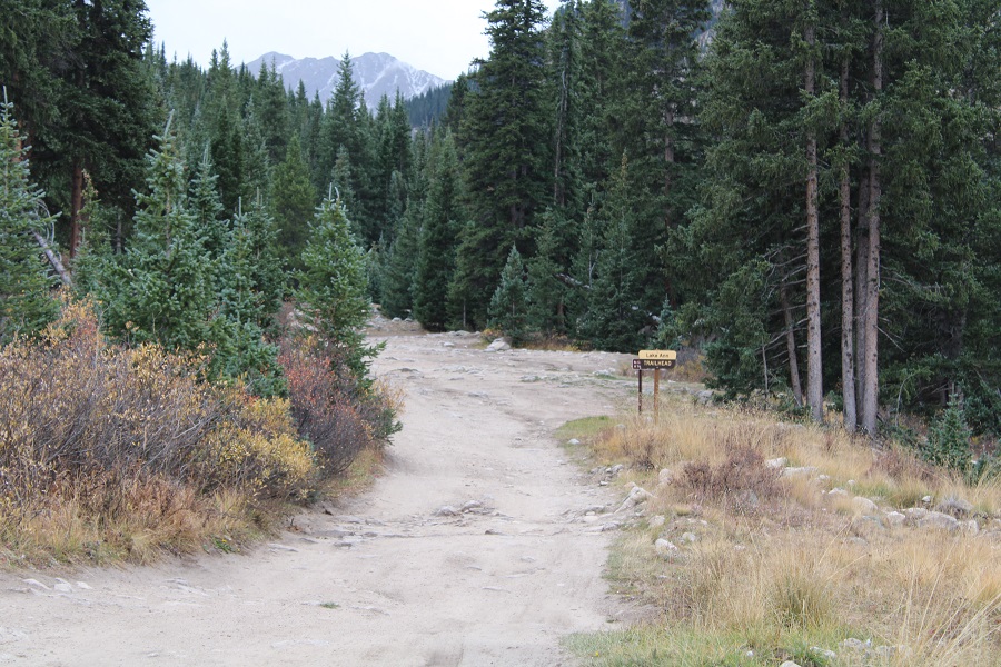
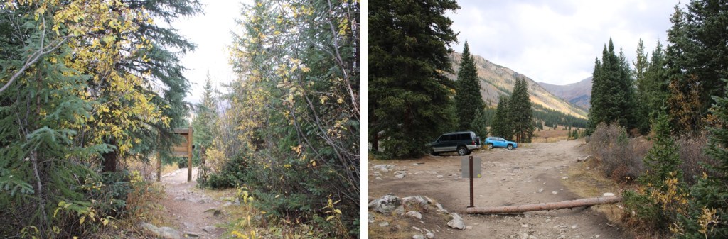
I was the only one at the Lake Ann/Huron Peak trailhead at 5pm on a Friday, and I was thrilled!  The 4WD road to the upper trailhead was a little rougher than I remembered it, but the drive had been worth it to be the only one there. I jotted down some notes from the days hike, sipped some whiskey, and looked at notes for tomorrow. It was still light out when I curled up in the back seat of my Tacoma and drifted off to sleep to the sound of pounding rain:  that meant fresh snow on the peak tomorrow!

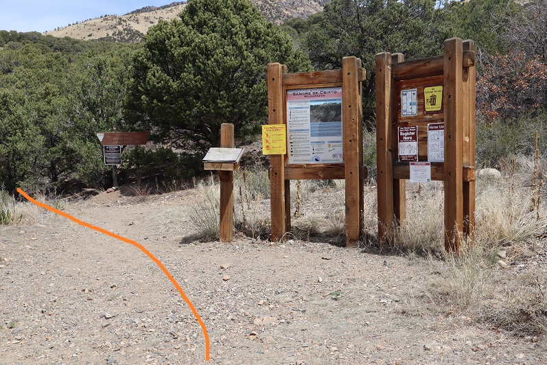
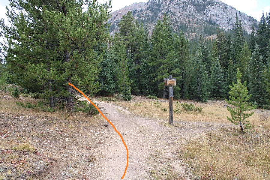
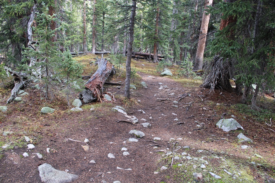
I woke up and things seemed dry outside, which was odd for the amount of rain I’d heard last night.  I put on my winter gear anyway and was on the trail at 5:30am. The trail starts at the south end of the parking area, and continues heading south, towards Lake Ann.  Be sure to take the Lake Ann trail, NOT the Huron Peak Trail

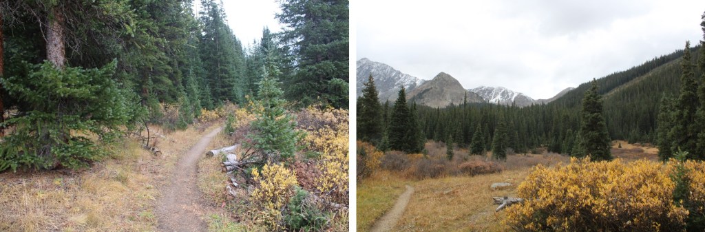
I hiked 4 miles south along a class 1 trail to Lake Ann

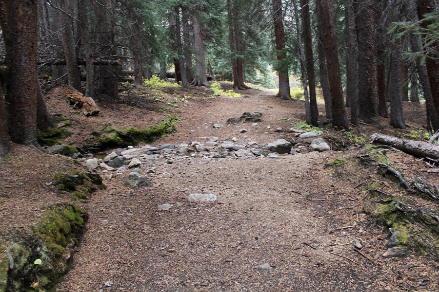
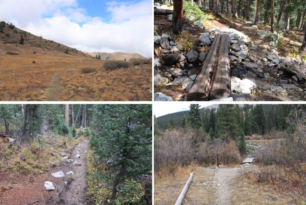
Stay left at this crossing

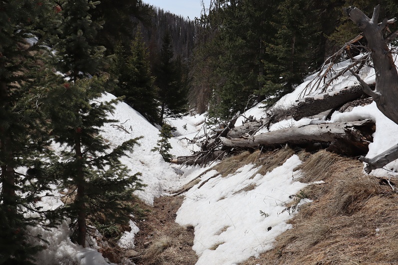
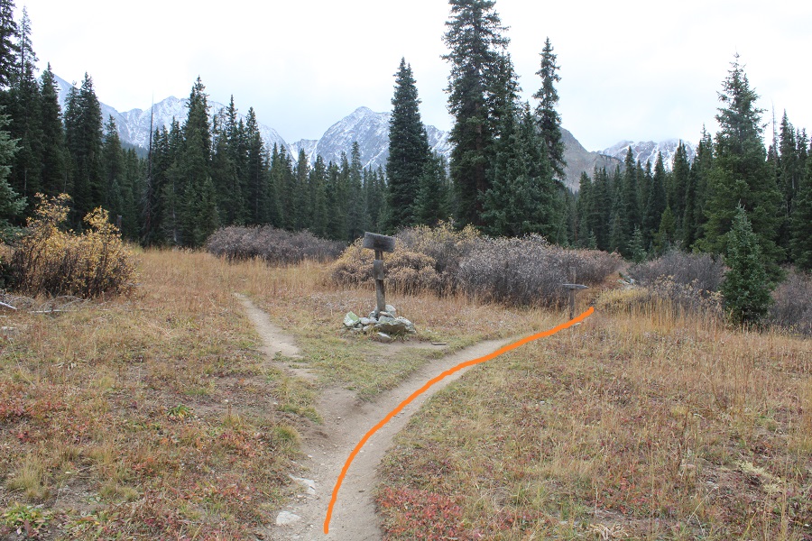
At the second crossing I went right

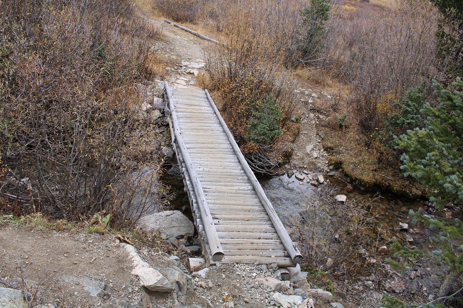
And crossed a creek on a ‘pretty-solid’ bridge

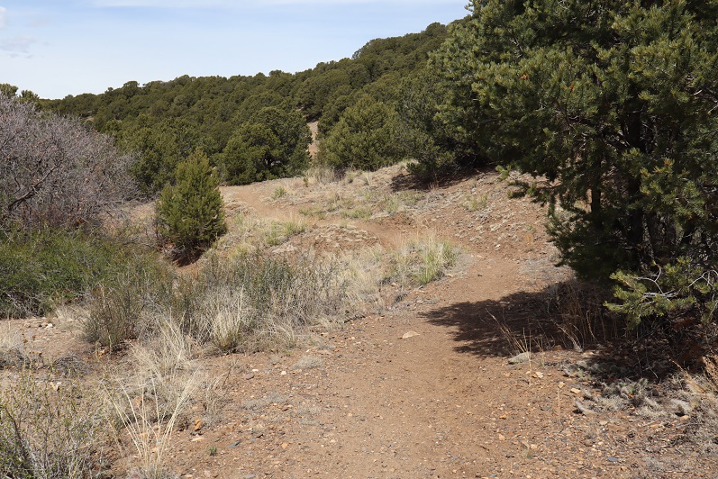
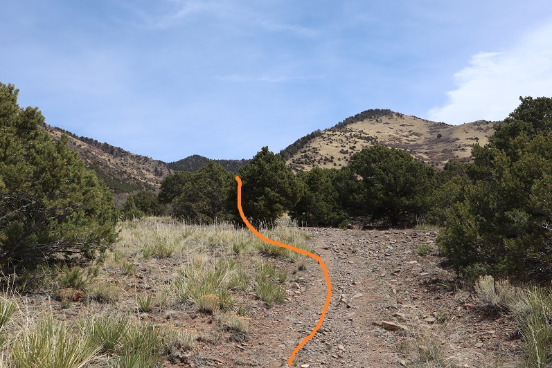
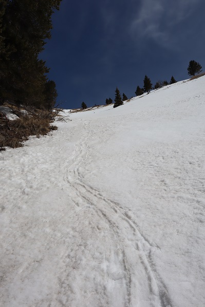
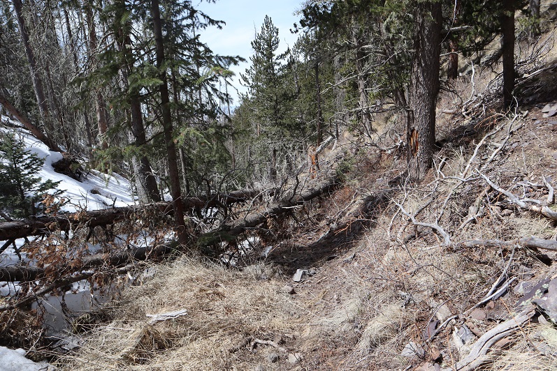
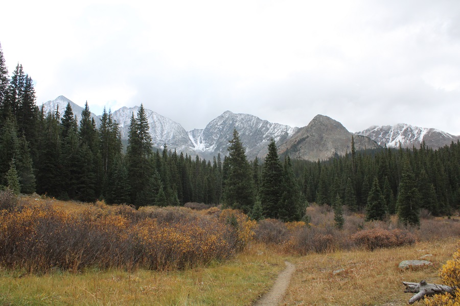
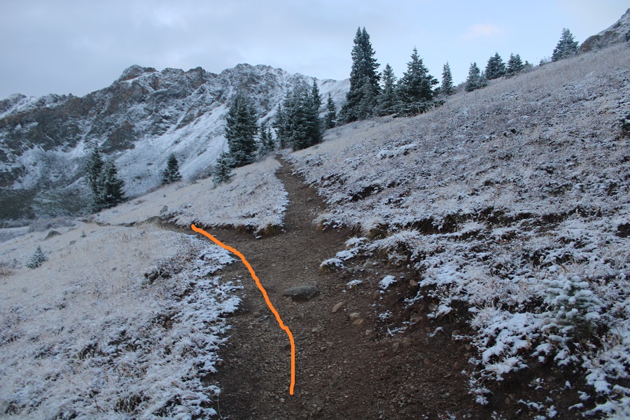
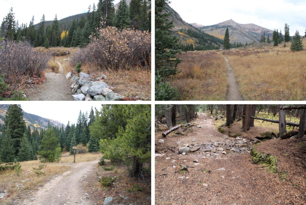
Finally, I started gaining elevation as I made my way towards Lake Ann

Just after making it to treeline, go left at this junction.

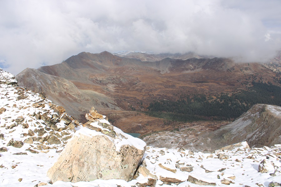
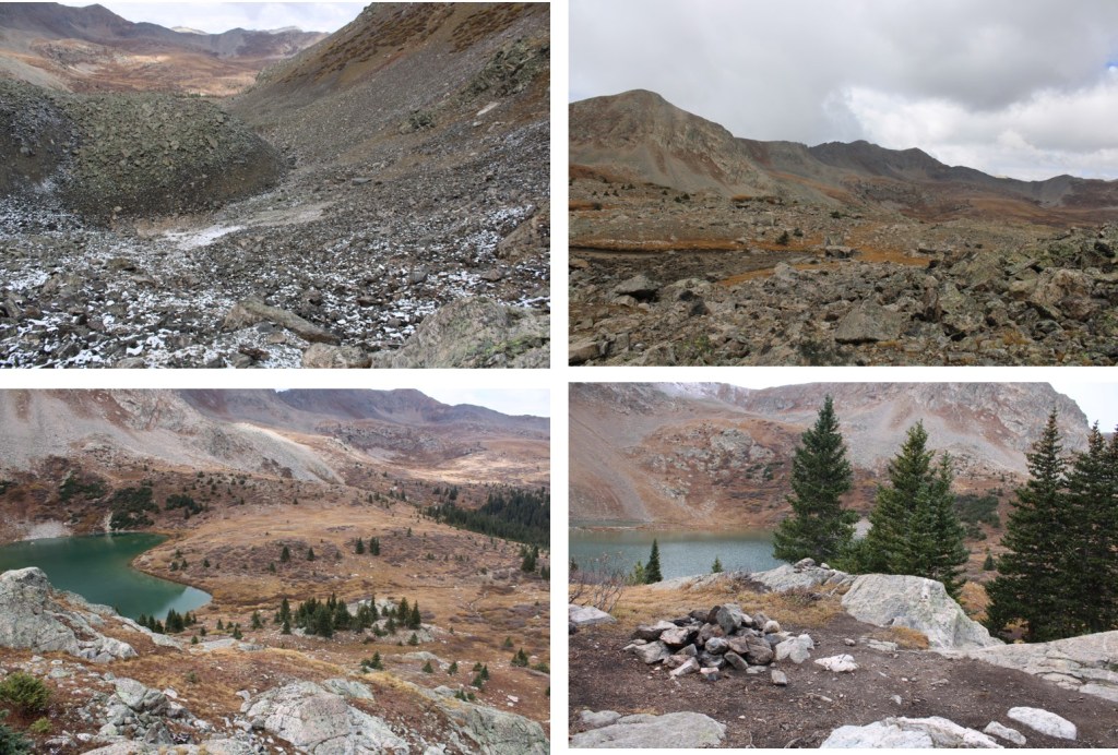
And you’ll arrive at Lake Ann

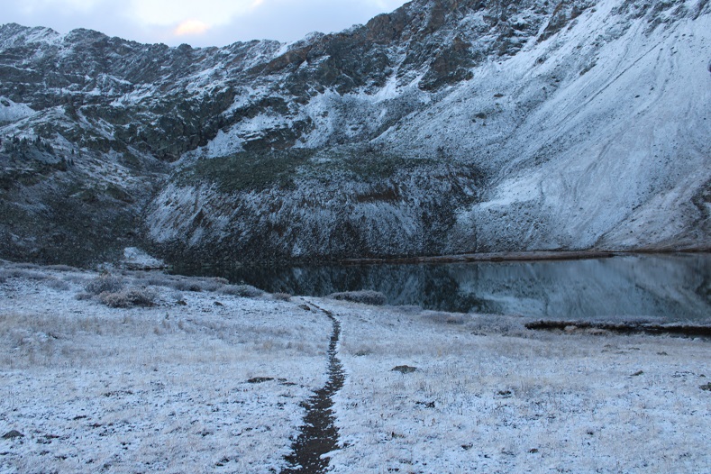
The goal is to skirt the north side of the lake, and enter the upper basin

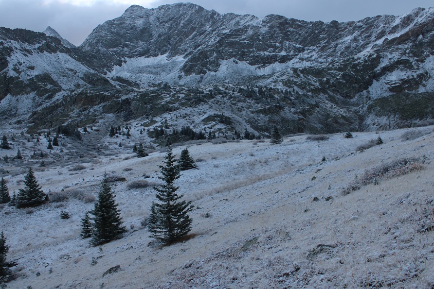
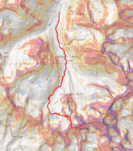
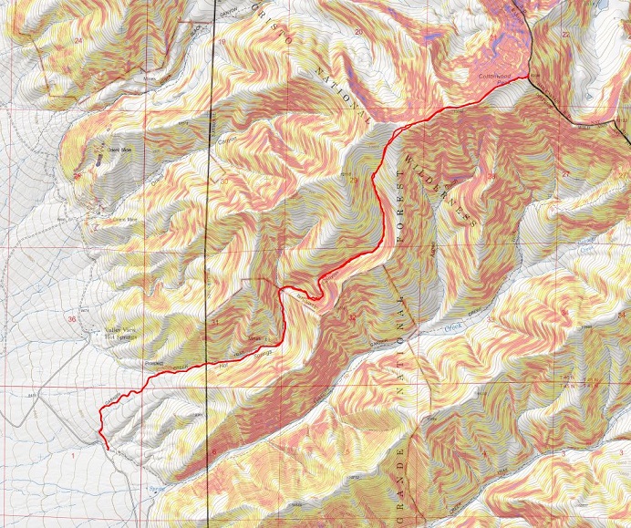
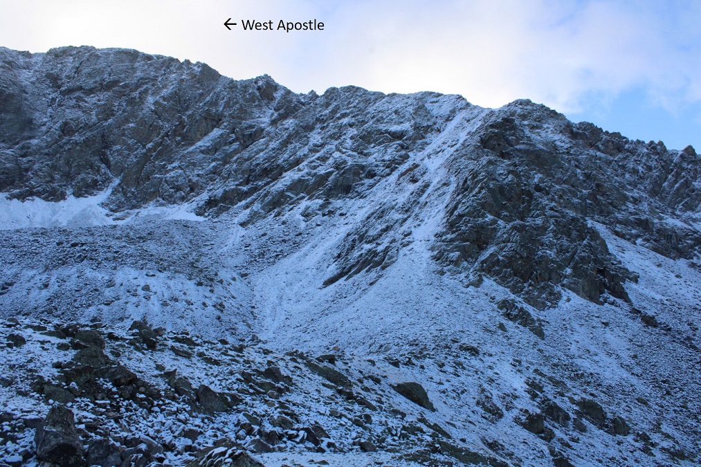
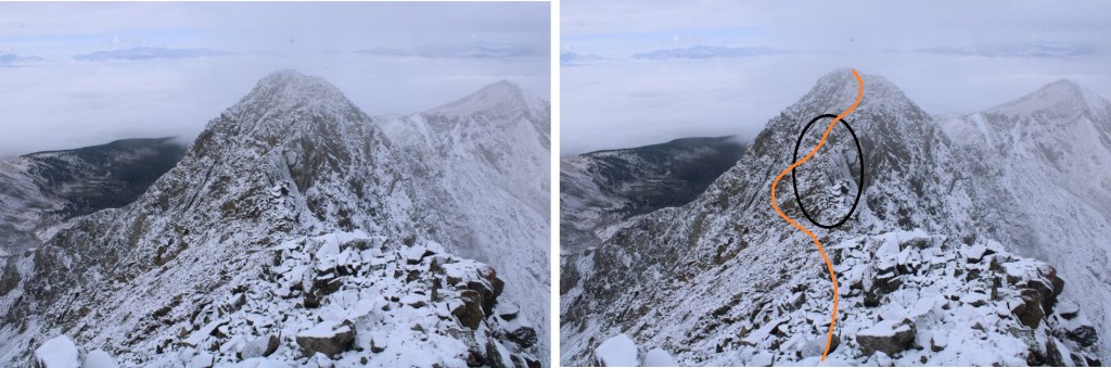
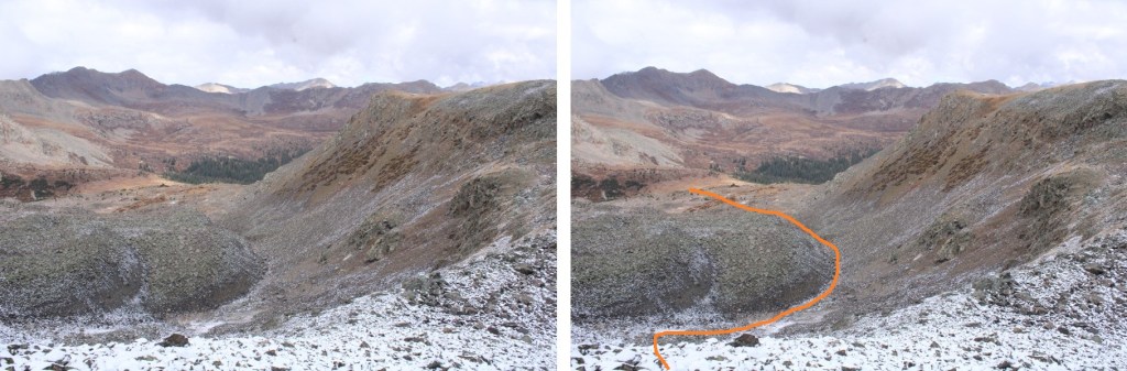
Here’s an overview of the route

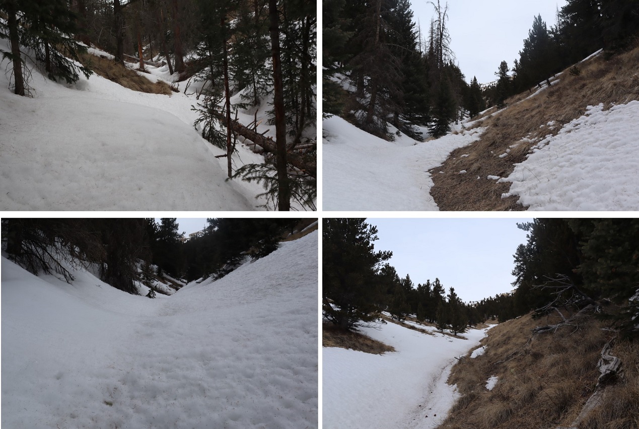
And some step-by-step pictures into the upper basin

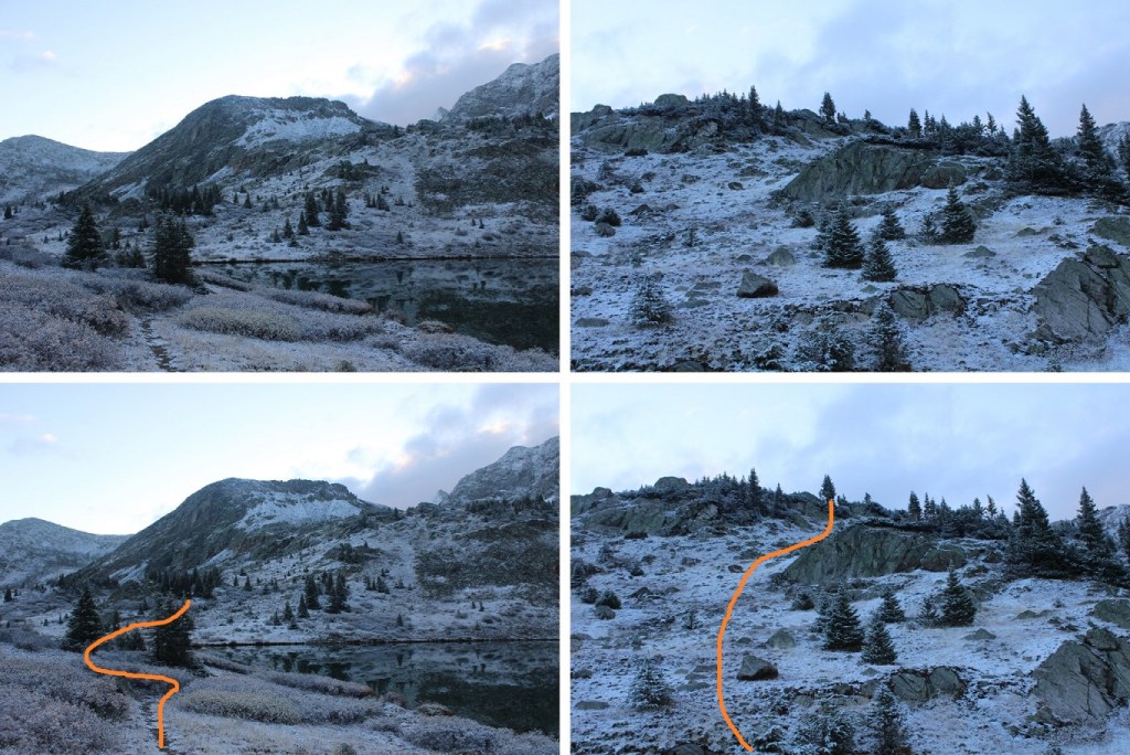
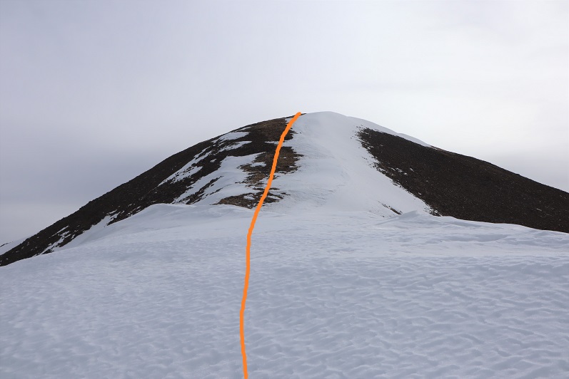
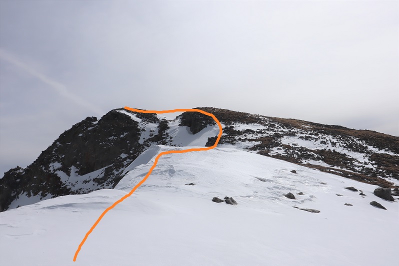
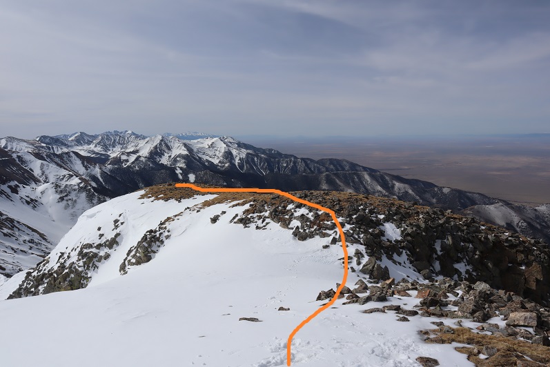
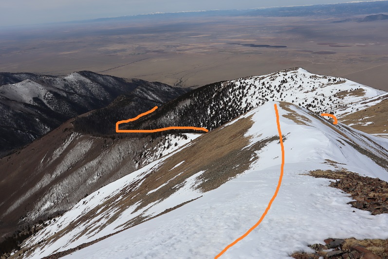
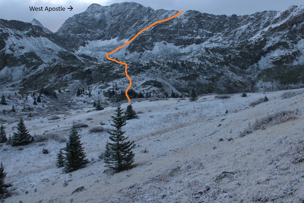
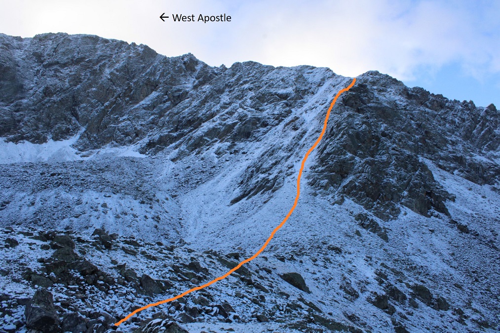
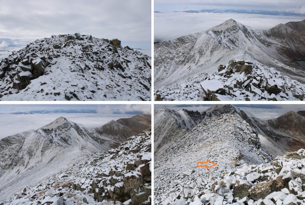
Once in the upper basin I aimed to ascend the amphitheater.  This can be done multiple ways. I decided to stay left on the way up (solid line), and follow (very faint) game trails, and I went right on the way down (dotted line).  The orange arrow is where you’ll eventually be aiming.

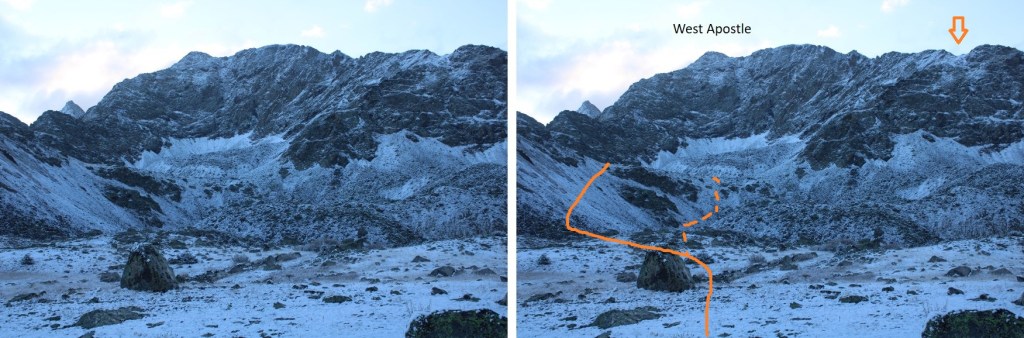
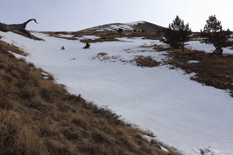
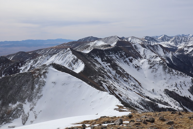
Here’s another picture of the amphitheater

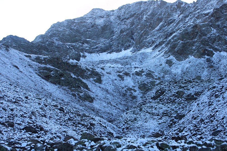
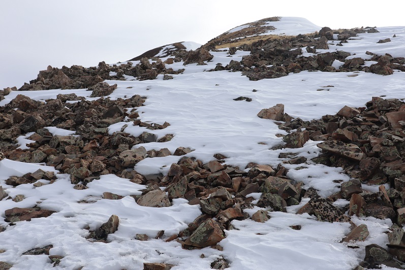
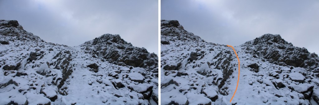
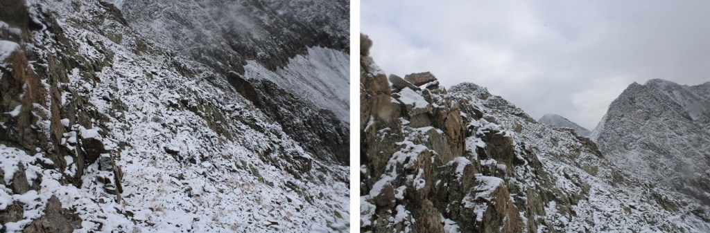
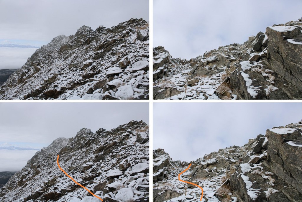
Once at the top of the amphitheater I was in another basin.  I turned right, and followed the ridge.  I’m sure the best way to ascend this gully is straight up the gully, but today there was unconsolidated snow blocking that route.  Even with microspikes I wasn’t able to get traction the gully direct, so I took the rocks to the right. 

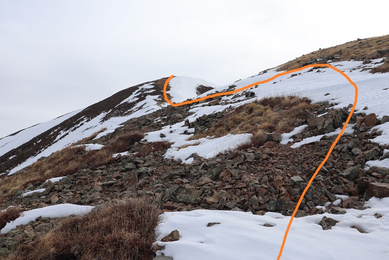
Here are some closer pictures of the gully

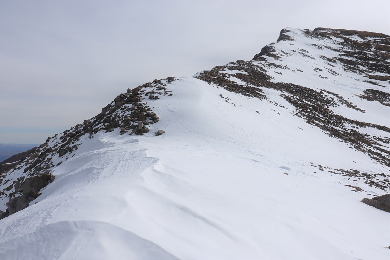
At the top of the gully I went left

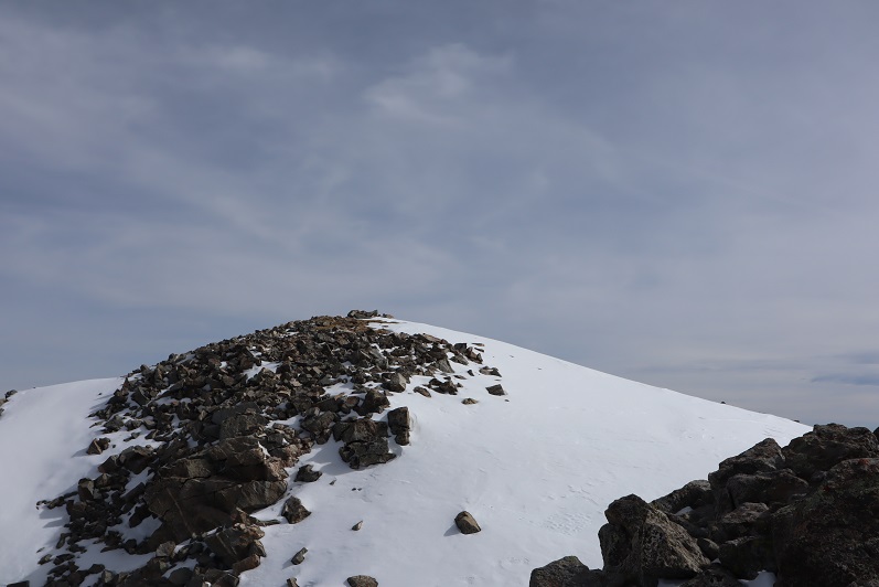
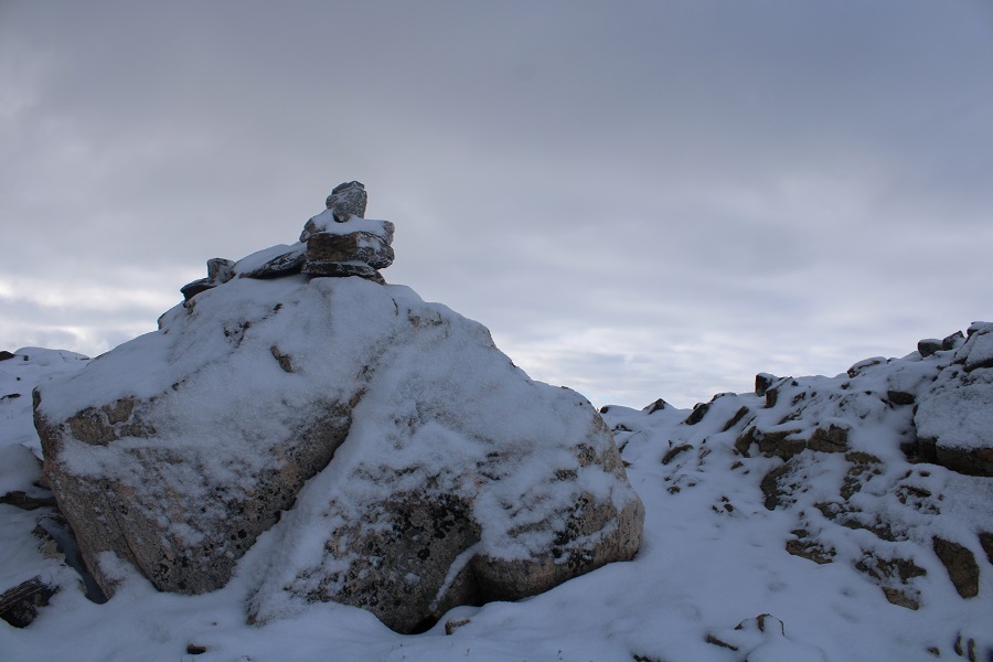
Which brought me to the ridge (and a cairn!)

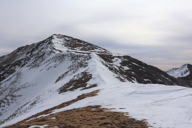
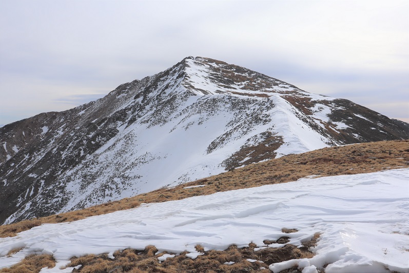
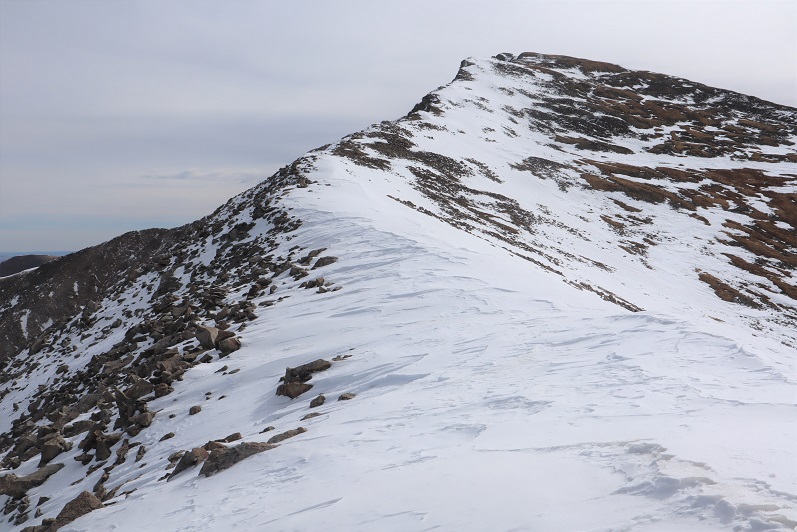
I turned left and followed the ridge northeast.  This is a class 2 ridge, which I was able to stay on the top of the ridge to hike most of the way.

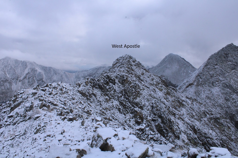
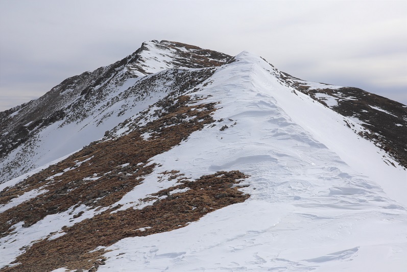
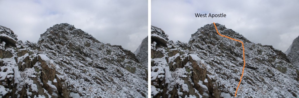
Here it gets a little dicey.  If there hadn’t been snow, I would have taken the ridge all the way to the summit.  However, with the snow and ice today things were slippery, and the exposure was real (to the left).  I decided to dip down to avoid some of the worst of the exposure.  I did this a little later than I should have, as it as getting spicy already.   The area with exposure is circled in red.  This is how I summited West Apostle

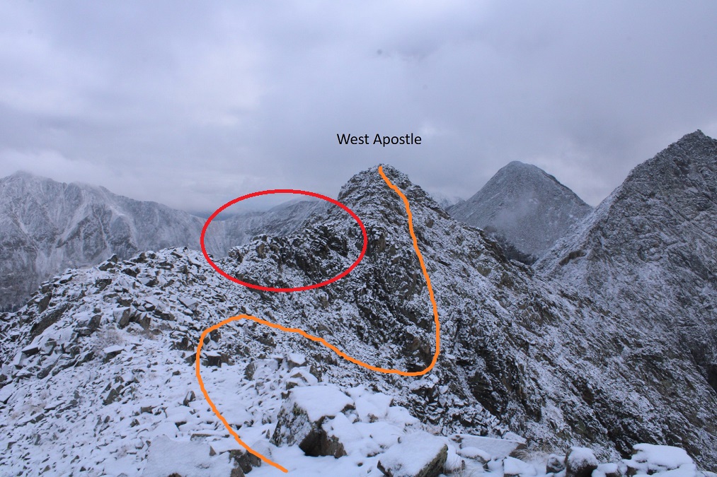
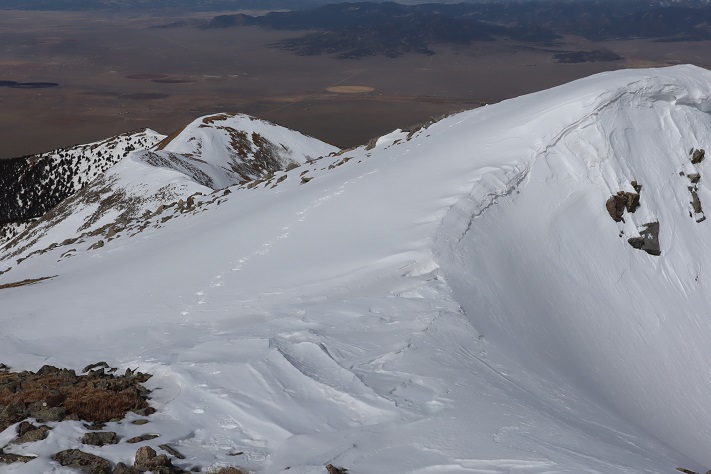
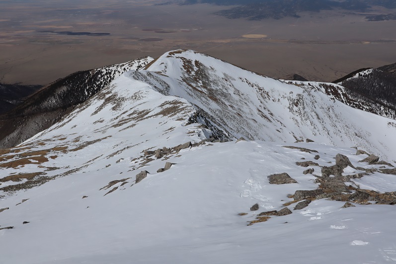
Here’s a picture of the ridge

And this is the exposure I was avoiding

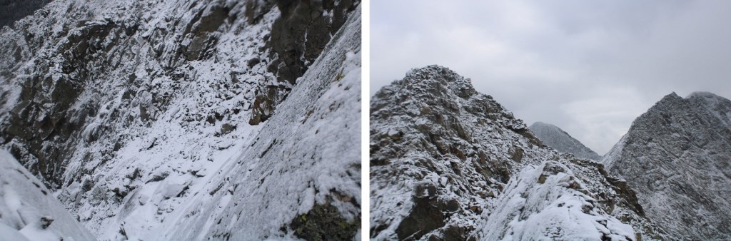
So, I dipped down to the right and kept it class 2

I summited West Apostle at 9:30am
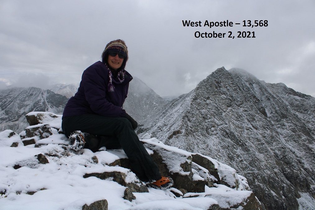
West Apostle: 

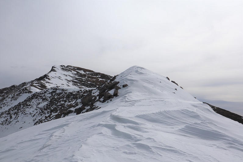
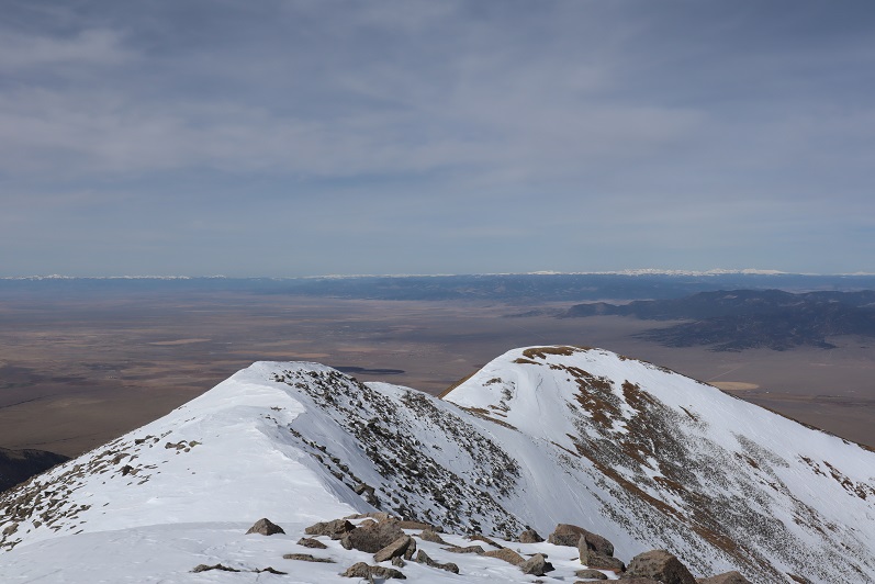
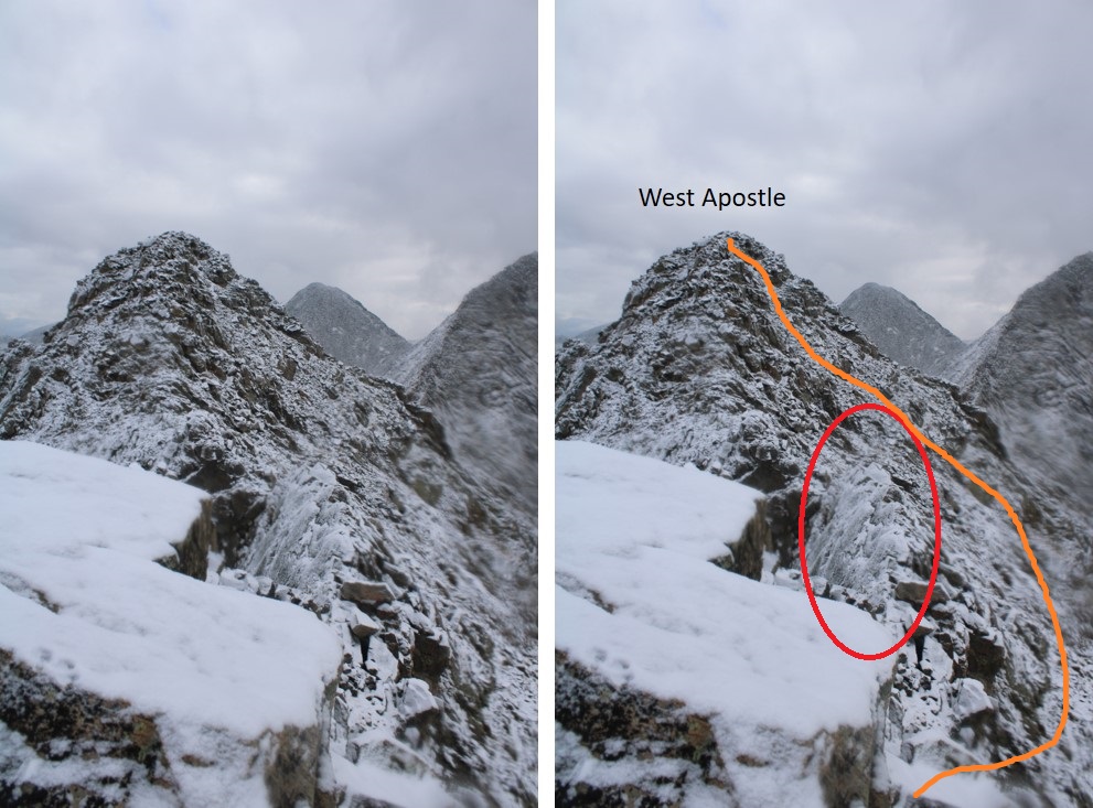
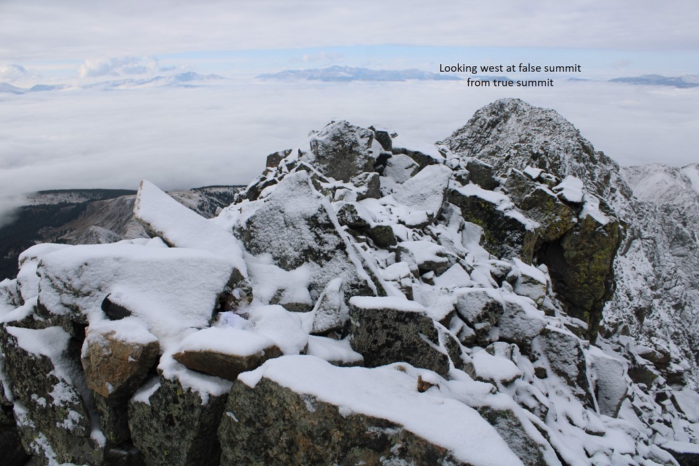
There was a summit register, but it was a pipe one missing its lid, so I replaced it with a jar. Here’s looking back at the false summit

I headed back the same way I summited, heading west, avoiding the area with exposure

Here’s what that looks like after dipping down

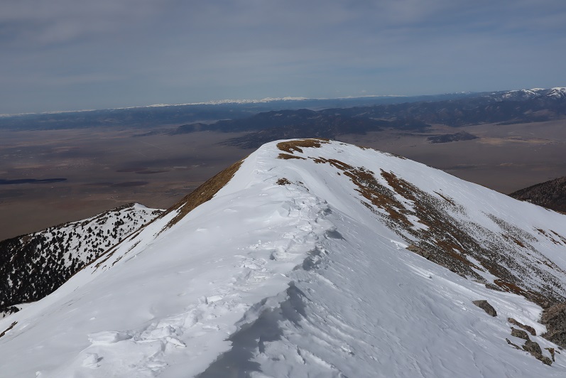
Back on the ridge, I followed it to the saddle.

The cairn was helpful in finding the correct exit from the ridge in all this snow.

I made my way back down towards the gully, staying as much to the west as possible, avoiding the gully direct and sticking to the rocky area.

I then re-entered the basin, and headed west towards Lake Ann

Back at Lake Ann, it was easy to pick up the class 1 trail and follow it back to the trailhead.

I made it back to my truck at 12:30pm, making this a 12.04 mile hike with 3575’ of elevation gain in 7 hours.

Cottonwood Peak A – 13,597

1

RT Length: 11.5 miles
Elevation Gain: 5110’

I got a bit of a later start on this one that I’d intended, as when my alarm went off at 12:30am I hit snooze and slept another hour or so (I’d already summited 7 peaks in the past 2 days and was a little tired). I made it to the Hot Springs Trailhead after first being led by GPS to the Hot Springs (which the sign indicated clothing optional: it was also closed due to Covid-19 fears).

The drive to the trailhead is easy 2WD on a dirt road.

2

There was 1 other vehicle parked there when I got there, which I thought was odd. It was a newer VW and didn’t look like it had been there overnight. I tried to be quiet in case someone was sleeping in their car but thought to myself “Great! Someone else is trenching the trail for me!”

The trail is a loop, and I was surprised to find out it was actually an established trail. The morning was getting better and better!

3

Just as an FYI, you cannot see the peak from the parking lot, but it was dark so that didn’t matter anyway. I signed the trail register (which was difficult due to the cold temperatures and ballpoint pen available). I wanted to summit Cottonwood Peak first, so I took the trail clockwise, starting to the left

4

The trail starts off wandering through chaparral

5

Here the trail was clearly marked and easy to follow.

6

I rustled a sleeping ptarmigan as the trail switched to scrub oak

7

Once I entered the aspens the trail started to deteriorate. What I’d been pleased to discover was a good trail became a trail in much need of maintenance. I was navigating over fallen trees for the rest of the hike, and it became increasingly obvious no one had used this trail since the Fall and no one would be trenching for me today.

8

Around 2.4 miles there was a great spot for a campsite (10130’)

9

What I found disturbing were the number of dead animals I encountered on this hike. There were deer remains everywhere (I’m pretty sure it was more than one deer, spread out over a few miles) and a lot of bird feathers. It let me know there was a predator in the area, I just wasn’t sure which kind?

10

I encountered the first real snow after about 2.6 miles. It was still early in the morning so I didn’t need traction, but I did posthole from time to time. Here the trail was difficult to see, as it was both covered in fallen trees/branches and snow.

11

Here things got interesting: I came across bear tracks! They looked like they were from the day before, and since there was only one set of prints I knew it wasn’t a mama, and that it was just passing through. I followed prints along the trail for about a mile

12

Since the trail was difficult to follow and the snow was getting softer I found myself straddling the ravine and following the small stream around the mountain

13

It became increasingly apparent I was the only one to use this trail in a long time. I circled around to a gully, which would have been challenging if there’d been more snow. Instead it was a steady climb up, and when I had the option, I took the gully to the right, also easy to navigate

14

15

The second gully ended near treeline, and I became excited as I thought I could see the peak.

16

Of course in my mind I knew I was too close to treeline for that to be the peak, but surely it had to be just behind it? As I continued on I saw another peak behind the first one and figured that was the summit

17

Up, up, and up I continued, doing my best to avoid the snowy areas.

18

19

20

Imagine my surprise (and dismay) when I finally reached the top of the second peak and noticed I wasn’t anywhere near the summit: it was still quite far away

21

Not only was I still a good distance from the summit, but I would need my ice axe and snowshoes. Luckily, I had both. I sighed, broke down, and put them on. There was no way I was turning back now. The weather was great (the best day I’ve had all year) and while I’d already done 30 miles this weekend with 15K of elevation gain and was physically exhausted, I wasn’t quitting this close to the summit. I left my trekking pole here and continued on, ice axe in hand. The only way across the ridge was to walk directly on top of the cornices. Luckily the snow here seemed firm

22

23

24

25

The last bit to the summit was easier than expected

26

27

I summited at 9:30am

28
Summit Views:

There was even a summit tag on top

29

This hike is traditionally done as a loop along with Unnamed 13123B, so I went over to get a good look at the route

30

Hmmmm…. The route didn’t look that difficult. Actually, the ridge looked better than the one I’d just traversed, but it was a really nice day and the snow was warming up fast. I knew I could summit 13123, but I was unsure of the snow conditions on the route back below treeline if I were to make this a loop. I didn’t want to re-summit Cottonwood because a) I’d already done 5000+ feet of elevation today and b) the snow was getting softer by the minute on this side as well.

31

In the end I decided to go with the safer route and descend the way I’d summited, figuring that while the conditions wouldn’t be ideal, at least I knew what to expect.
I turned and headed back the way I’d come, first over a pretty cool cornice

32

And then back down the ridge

33

34

My favorite part was toe-heeling it across the cornices

35

Here’s the route back

36

37

I decided to keep my snowshoes on, and this time stuck to the areas with snow.

38

The snow was a terrible mush and I was glad I’d decided to return the way I knew, even if it meant postholing and navigating felled trees

39

I kept my snowshoes on for longer than needed, but they came in helpful when I hit the boggy areas where there was no discernable trail but a lot of willows/snow/downed trees

40

They were cumbersome in areas such as this:

41

On the way back I scared the same ptarmigan as this morning and saw a cactus in bloom

42

I made it back to my truck at 12:30pm, making this an 11.5 mile hike with 5110’ of elevation gain in 7 hours, 15 minutes. The VW was gone.

43

44
I was really happy with my decision not to make this a loop today, and look forward to trying the trail counter-clockwise next time, when there’s less snow…