North Apostle 13,869 & Ice Mountain 13,960


1

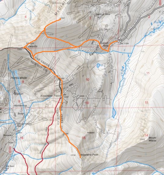
RT Length: 10.5 miles

Elevation Gain: 4000’

I seriously debated on whether or not this hike would even be possible today: I had to be home no later than 2pm because that’s when Troop 2393 was meeting at my house for the Reach for the Peak survival competition.  They train all year for this, and as their coach I didn’t want to disappoint them by making them late to the event.  I did the math and figured if I started hiking at 1am I’d make it back just in time.  It meant hiking and route finding for a long time in the dark, but I felt this was within my abilities.

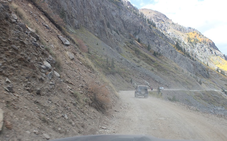
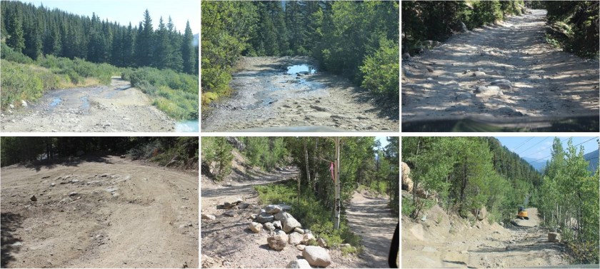
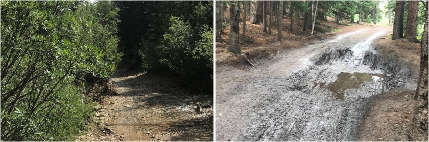
I left my house at 10:00pm and drove to the trailhead. It took longer than anticipated on the 4WD part of the 390.2B dirt road due to running water (not a big deal) and mud puddles (looked bigger in the dark).

2

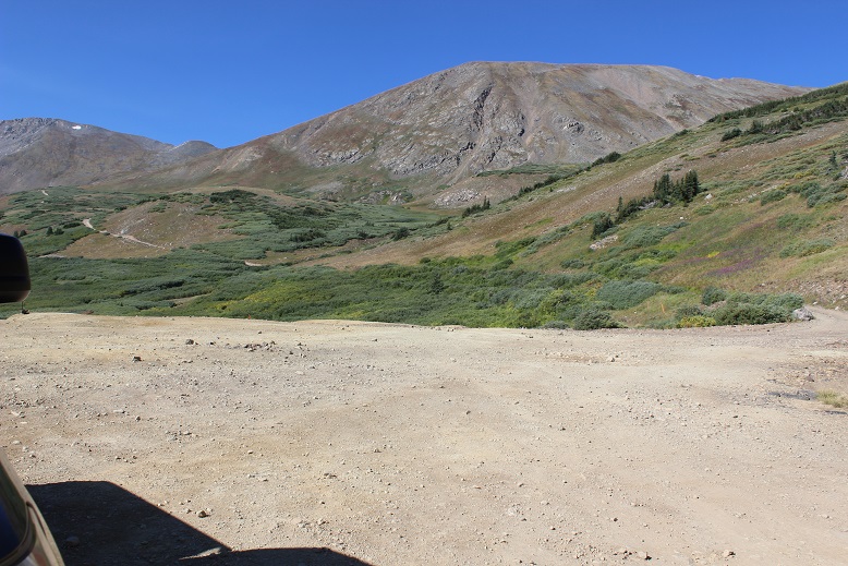
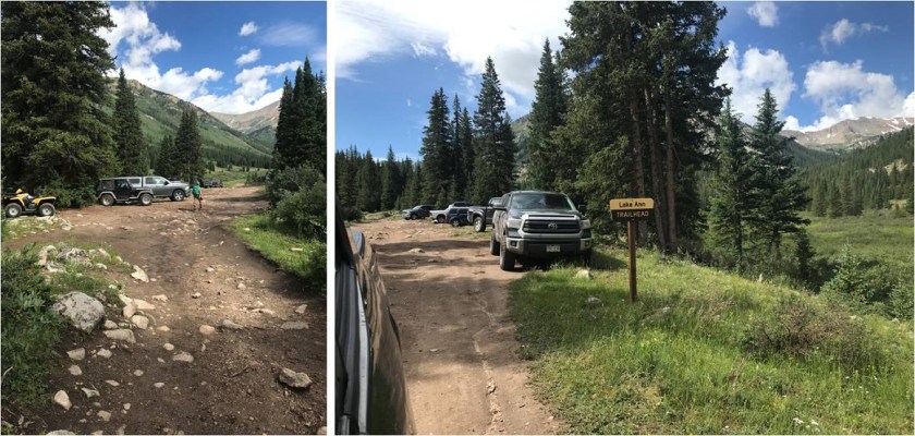
Parking was at the Lake Ann / Clear Creek / Huron / South Winfield 4WD trailhead. I didn’t make it to the trailhead until 1:15am, but I was on the trail by 1:30am.  I set my alarm for 7am as a turnaround time.  There’s plenty of parking at this trailhead.

3

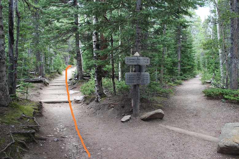
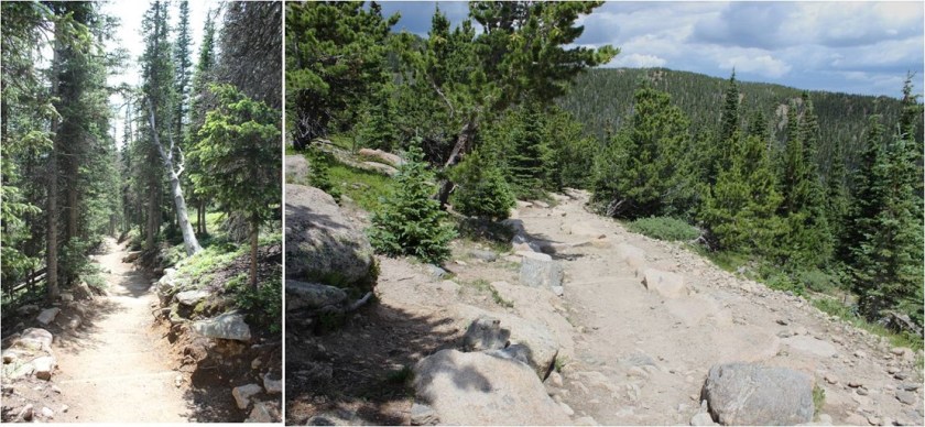
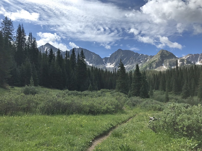
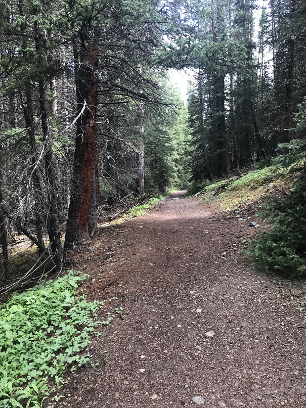
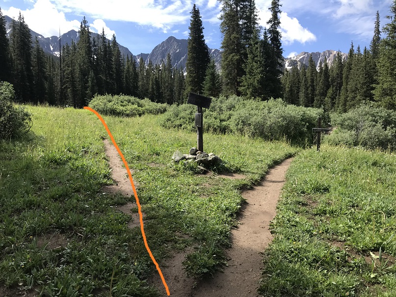
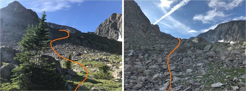
The trail begins at the south end of the parking area, and follows the Lake Ann Trail

4

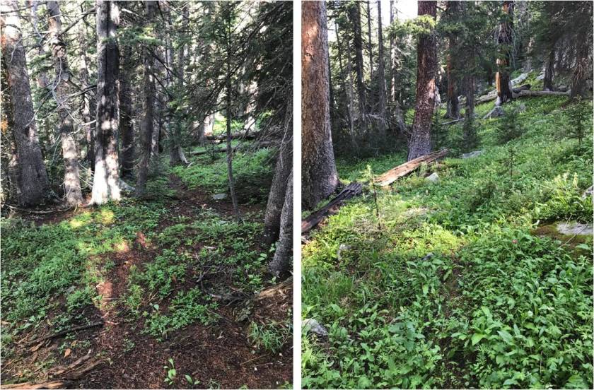
The beginning part of this trail is easy to follow on a wide path

5

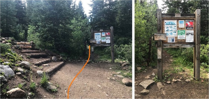
At this junction stay left

6

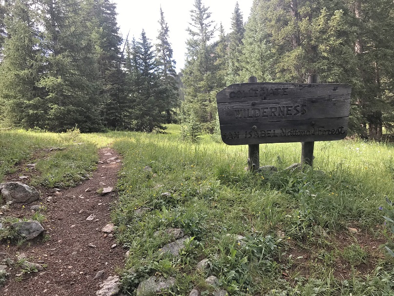
And enter the Collegiate Peaks Boundary at about .6 mi

7

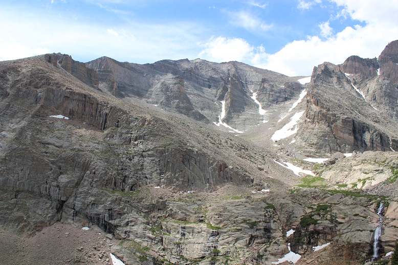
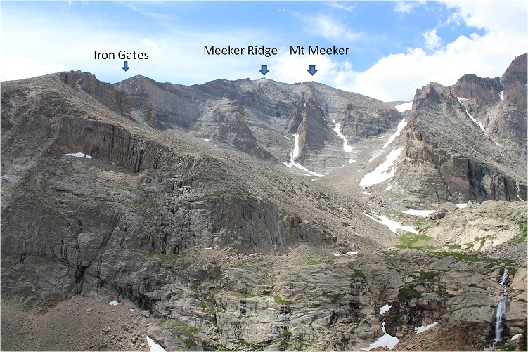
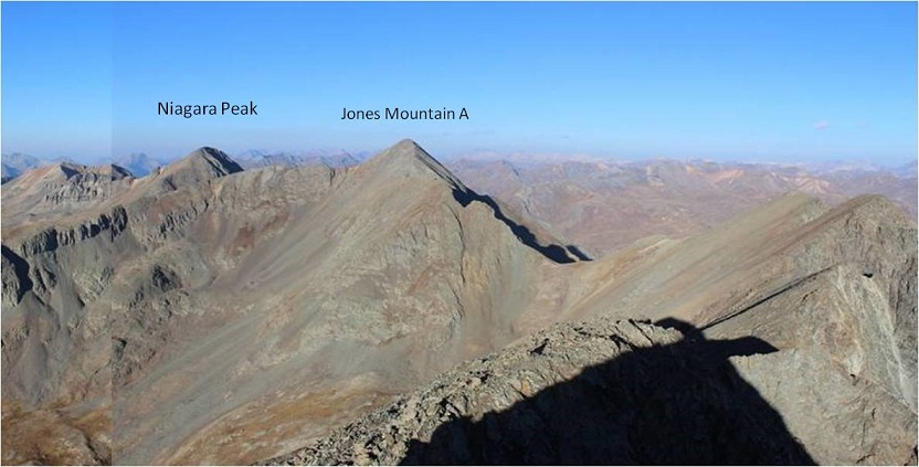
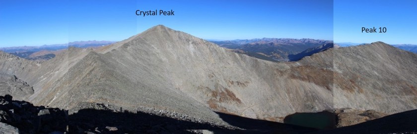
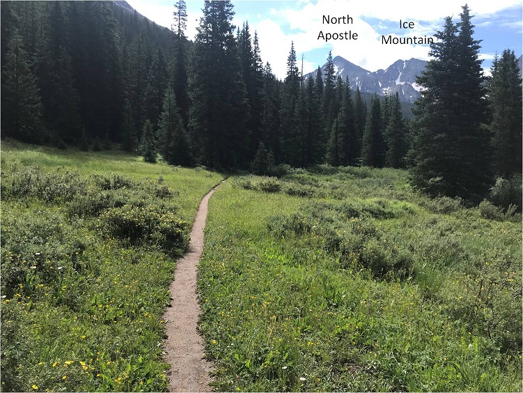
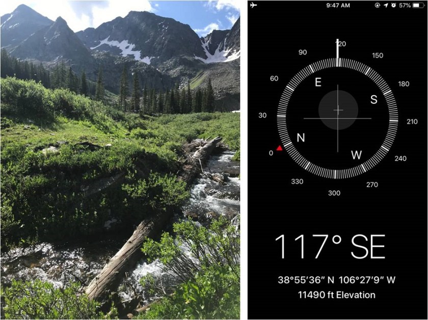
If it had been daylight I would have been able to see North Apostle and Ice Mountain here

8

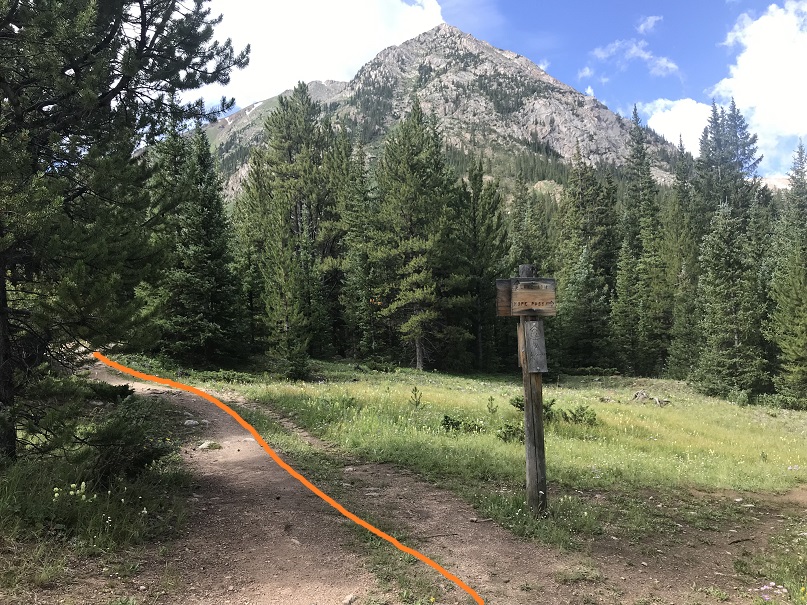
At 1.2 miles there’s another junction. Stay left here

9

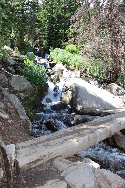
I quickly arrived at the next (unmarked) junction and turned right, crossing a creek in the dark on a solid log bridge.

10

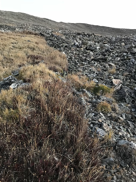
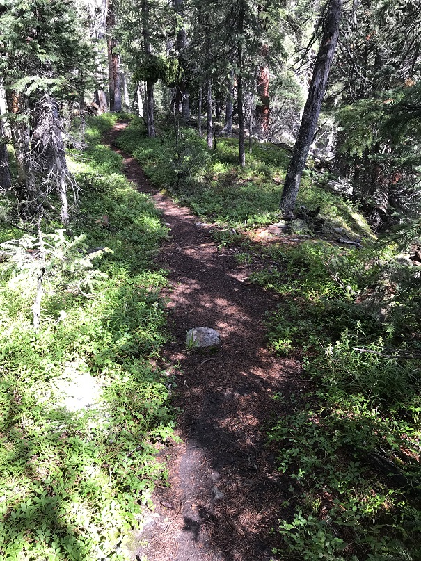
The trail was still easy to follow through the trees. I’d heard there was an avalanche area somewhere, but never saw it in the dark

11

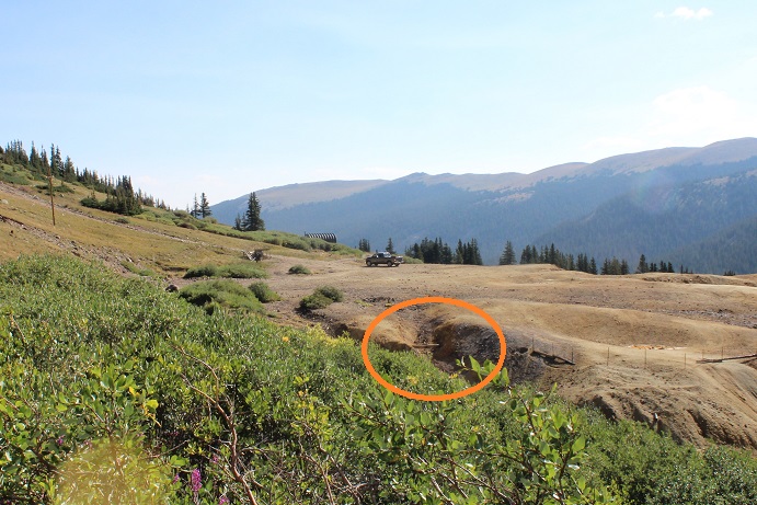
The real route finding began when the trail ended at the creek

12

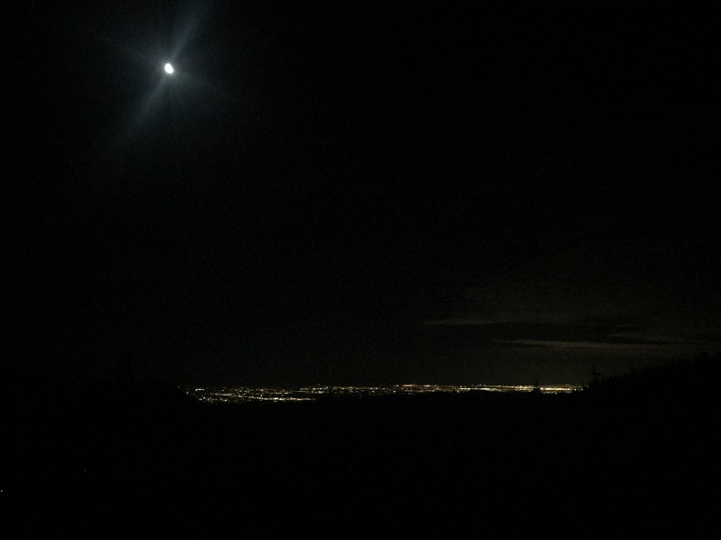
I spent about 15 minutes walking up and down the banks of the creek in the dark trying to find a way to cross, but was unable to find a log bridge (etc.). It looked like a bunch of logs and small trees had been used as a makeshift bridge recently, but it had washed out.  I found a few trees, tried to make a quick bridge and realized I was just wasting time, so I took off my shoes and crossed the creek.  There wasn’t a moon, but the stars tonight were amazing!

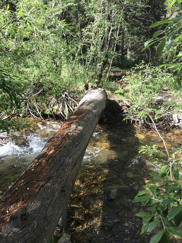
On my way back in the daylight I was able to find an actual crossing that didn’t require getting my feet wet. If you continue along the banks of the creek after the trail ends for about 200 feet you’ll find a large tree that creates a crossing.  There’s some walking through the willows to find the crossing.  Here’s where I found it:

13

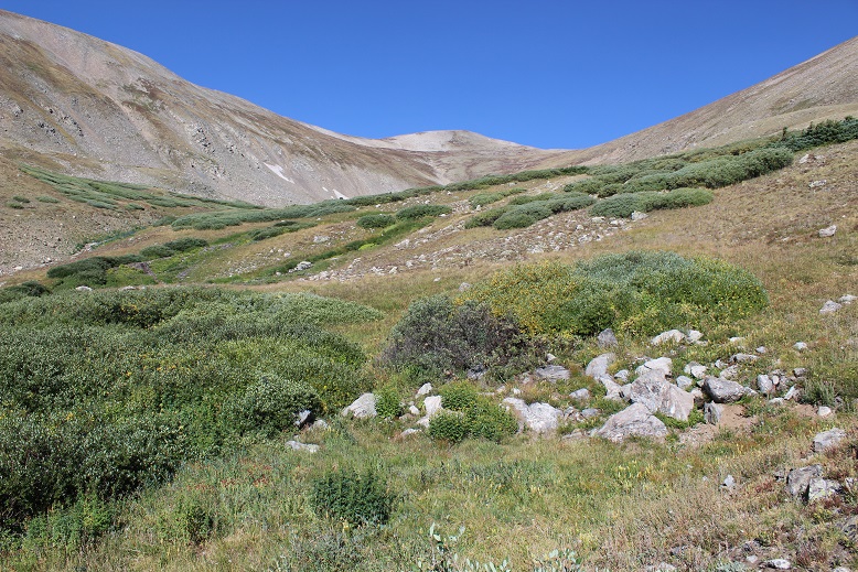
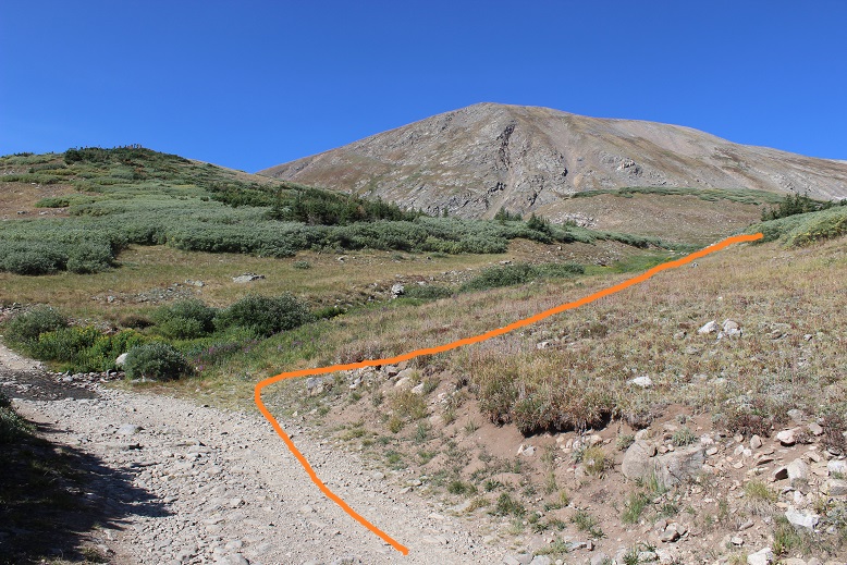
After crossing the creek I sat down to put on my shoes and then continued southeast up and around to the basin. There was no trail here, so I just had to skirt the mountainside and head up.  Also, I saw a flash of light and then it started to rain.  Violently.  There had only been a 20% chance of rain before noon today, and here it was at 3:30 in the morning pouring rain.  I put on my helmet and sheltered in place until the lightening stopped.  I was surprised the sky had been full of stars one minute, cloudy and stormy the next.

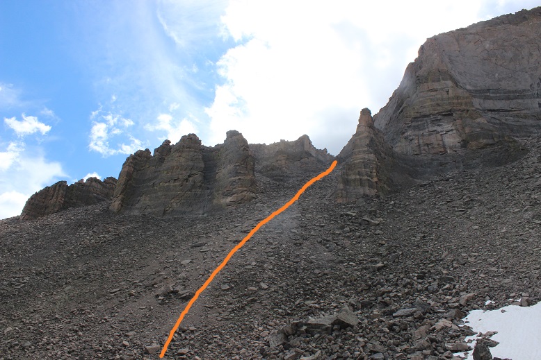
The rain stopped as quickly as it had started, but now everything was slippery and wet. This part of the hike required about a half mile of bushwhacking through the trees to make it to a waterfall area.  There were several game and social trails, but none of them were continuous or led up to the waterfall area.  I just kept hugging the mountainside, trekking southeast.

14

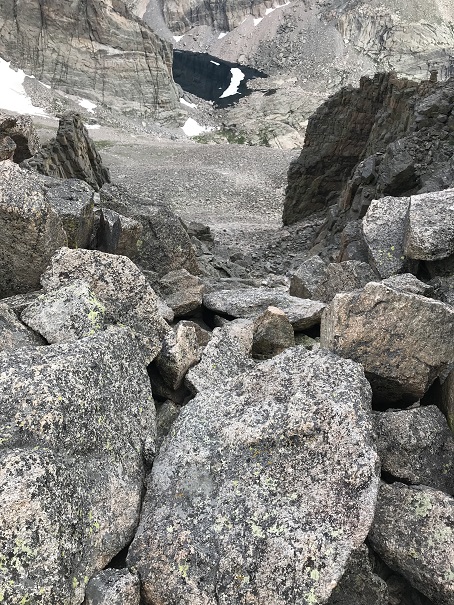
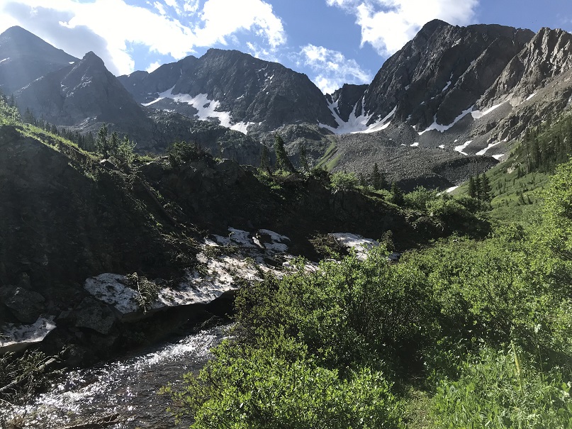
I made it out of the trees to a rocky waterfall area (that was more of a slope than a fall) and rock-hopped up

15

16

At the top of the waterfall area there are a bunch of willows and another stream to cross. The stream isn’t very wide, but it’s fast flowing and covered by willows.  By getting creative and using the willows I was able to find a crossing area here

17

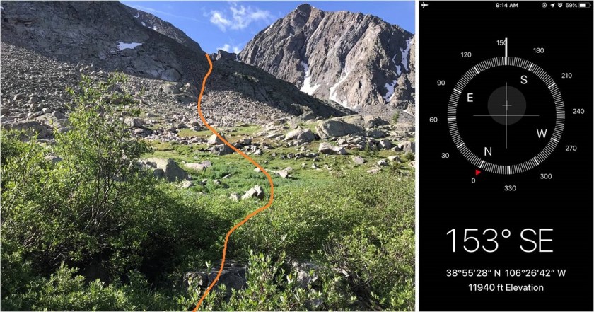
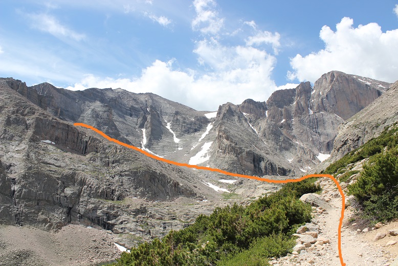
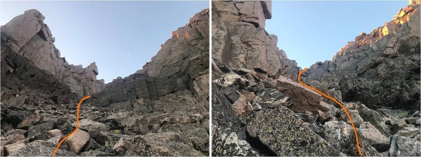
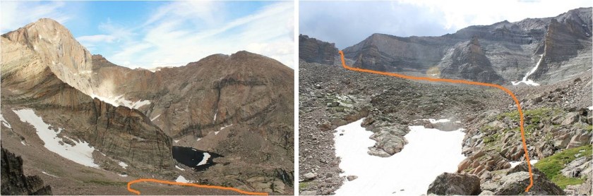
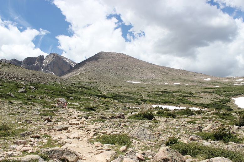
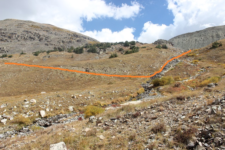
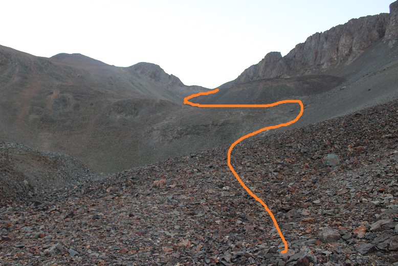
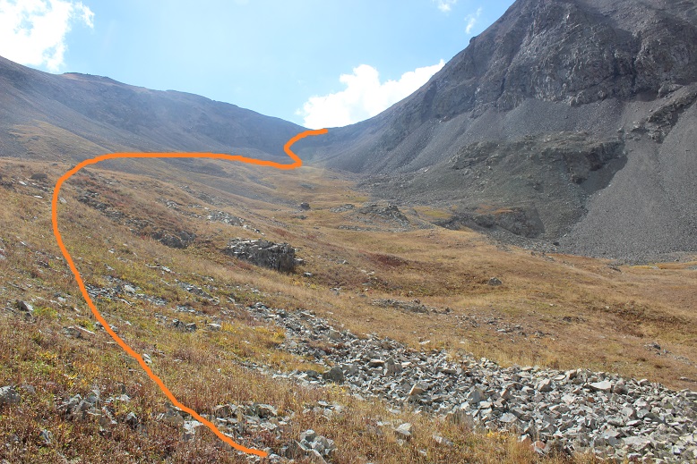
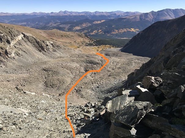
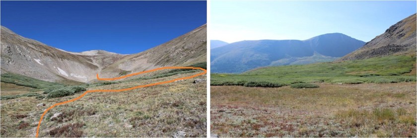
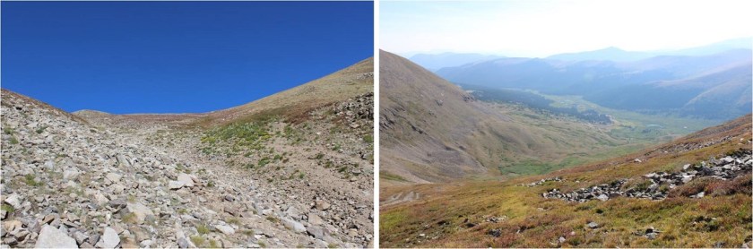
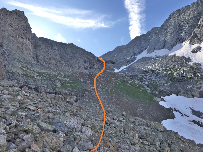
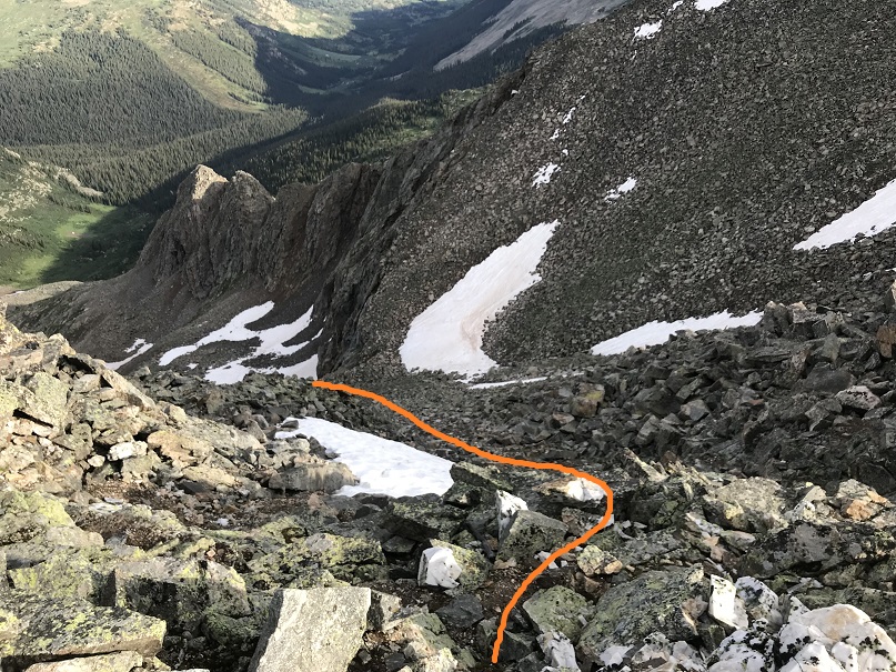
Once I crossed the creek I continued southeast into the basin. The only thing that made this difficult was route finding in the dark.  I wasn’t able to see the outlines of the mountains, or anything much that was further than 20 feet ahead of me.  I could hear rocks falling in the basin, and was glad I had already put on my helmet. I found a few cairns which were helpful to let me know I was on the right track.  In the light of day I figured out this area is very well cairned, but in the dark I only saw about 1 out of every 5.

18

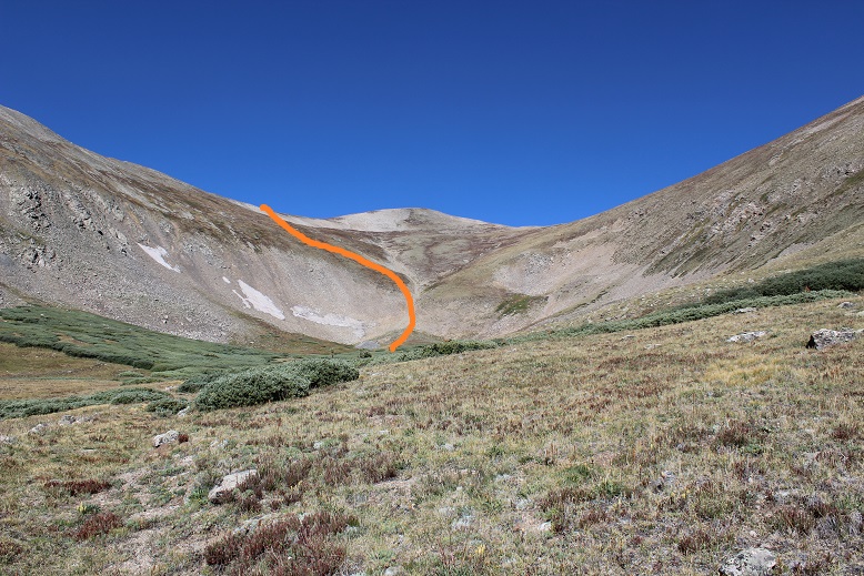
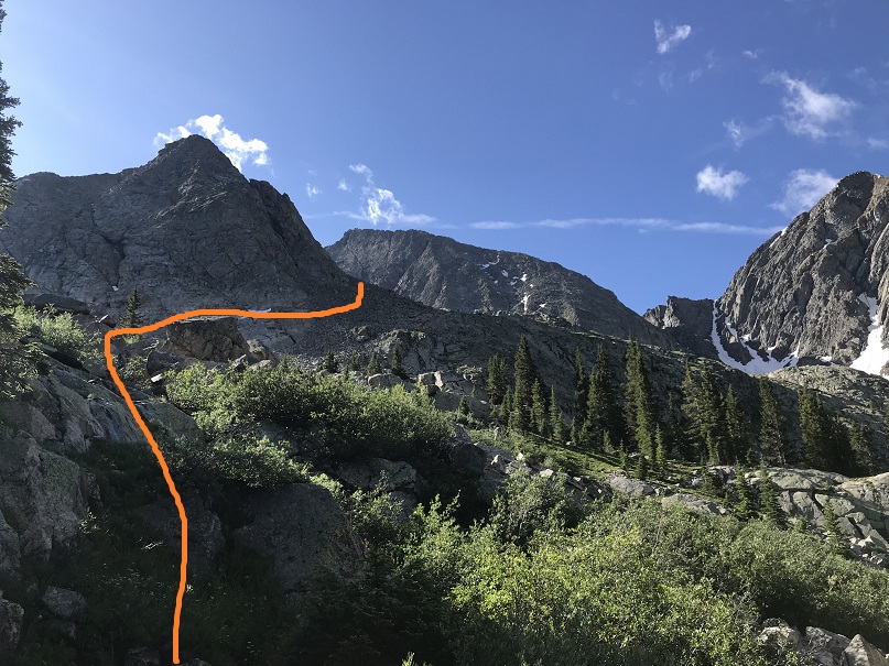
Here’s the route through the basin. I was doing this in the dark, so I just hugged the climbers left side of the basin (southeast)

19

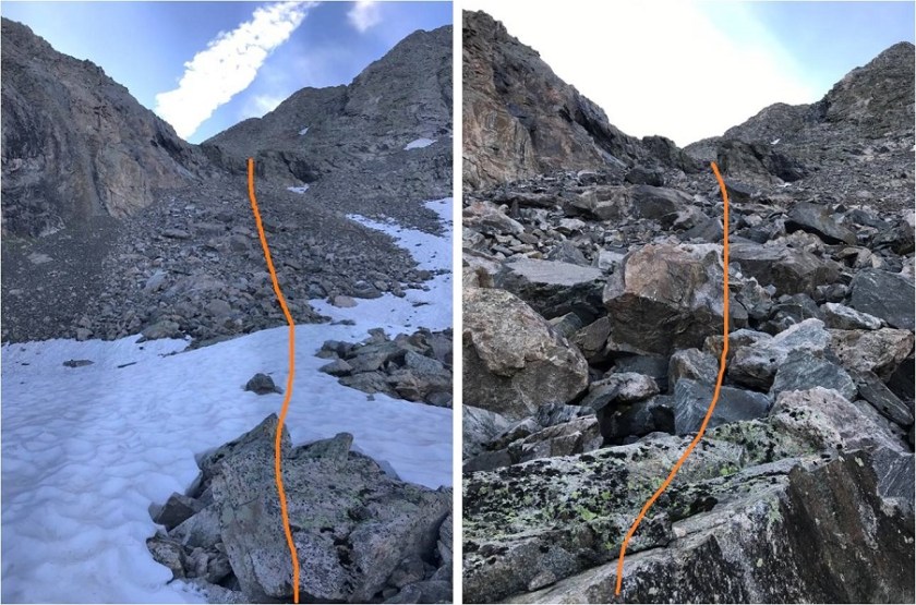
I rock hopped on solid rocks and then came to a scree section. This scree section actually wasn’t that bad because of the earlier rain:  scree provides great traction when wet.  The wet rocks were another story:  they were slippery and required patience.

20

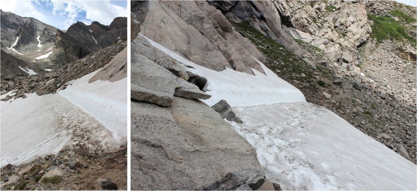
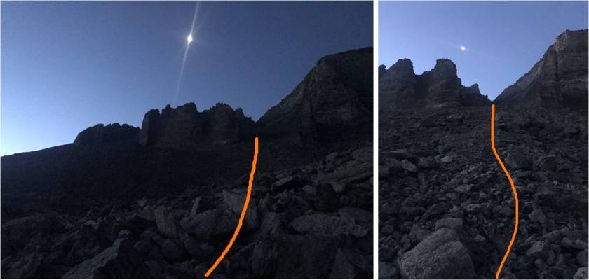
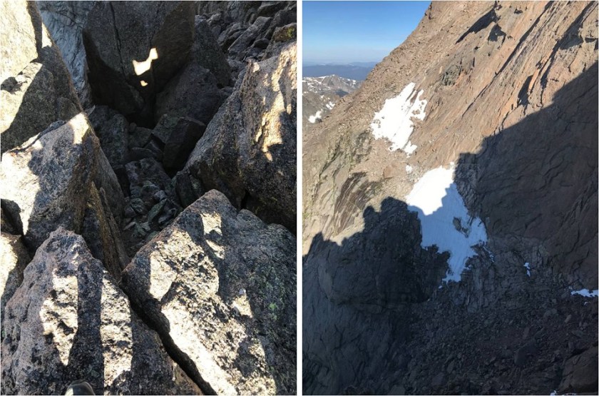
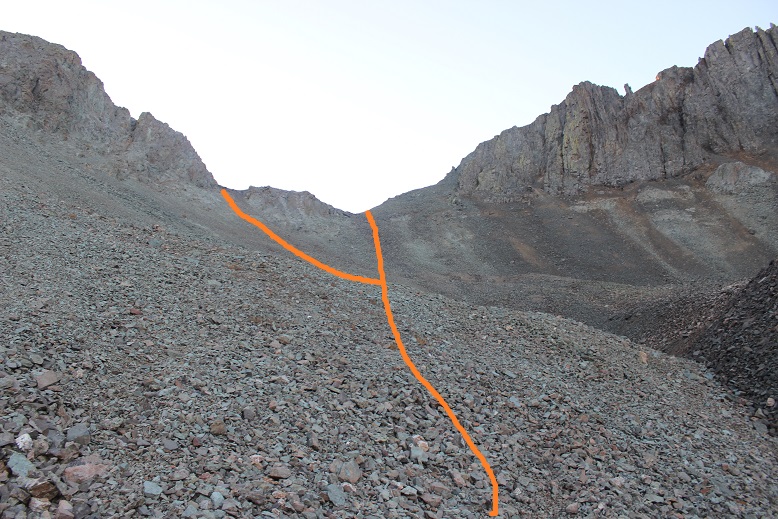
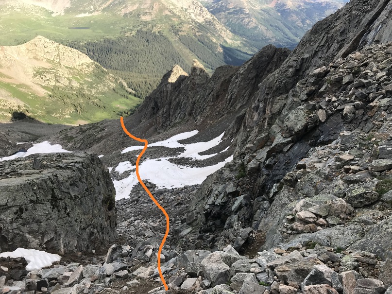
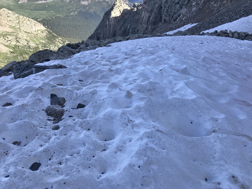
I encountered two small patches of snow. I had crampons and microspikes, but after testing the snow didn’t feel they were necessary and just walked across them.  I didn’t realize it in the dark, but I was aiming towards a rock ‘gate’.  Also, I could hear running water to my left.

21

Once through the gate I turned left (east)

22

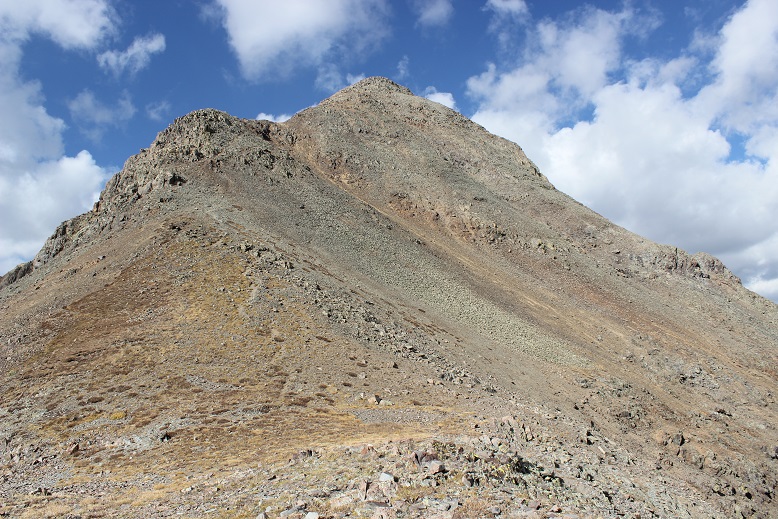
And gained the saddle between North Apostle and Ice Mountain

23

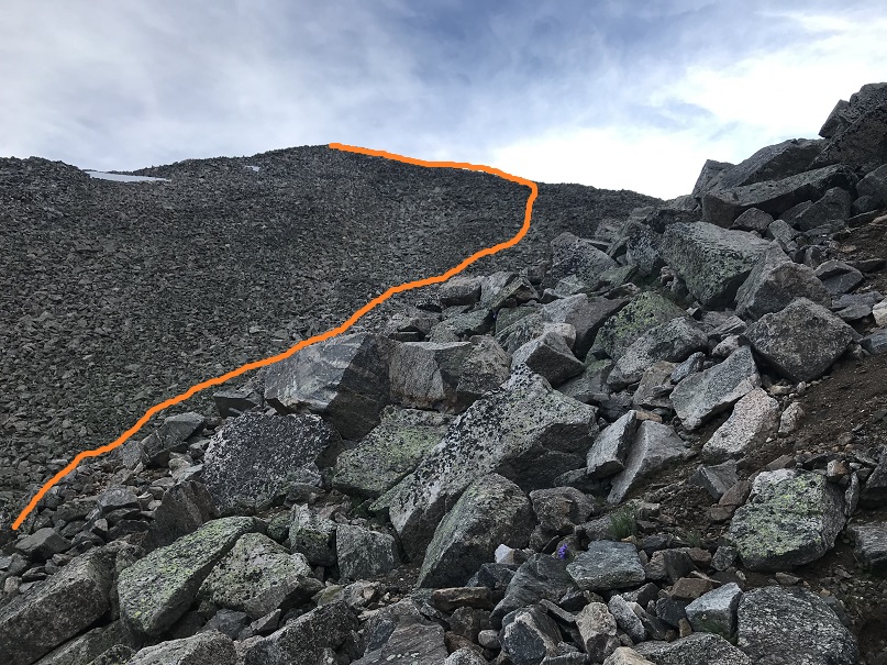
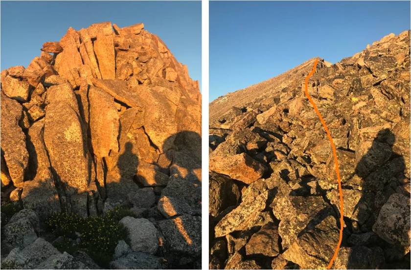
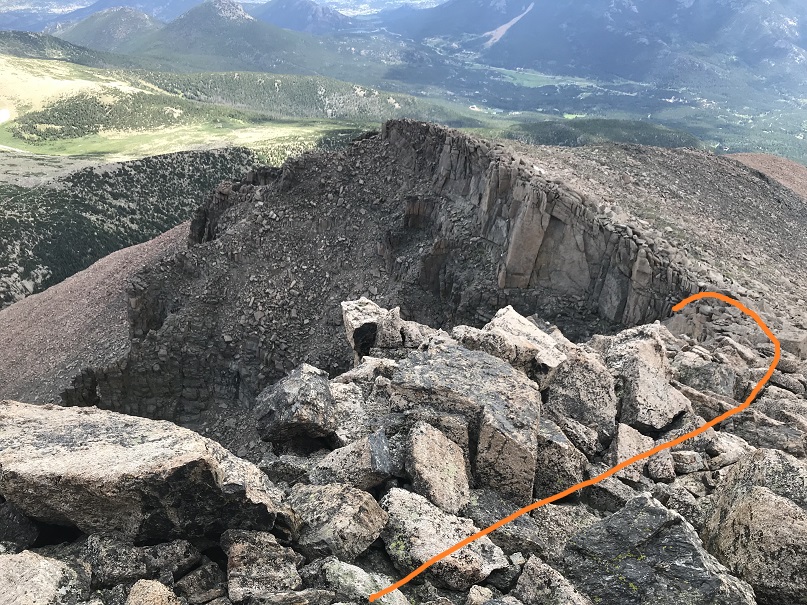
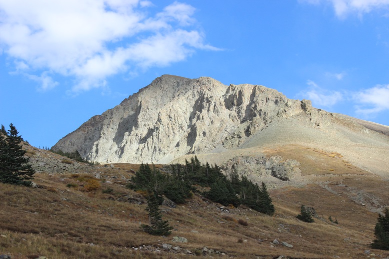
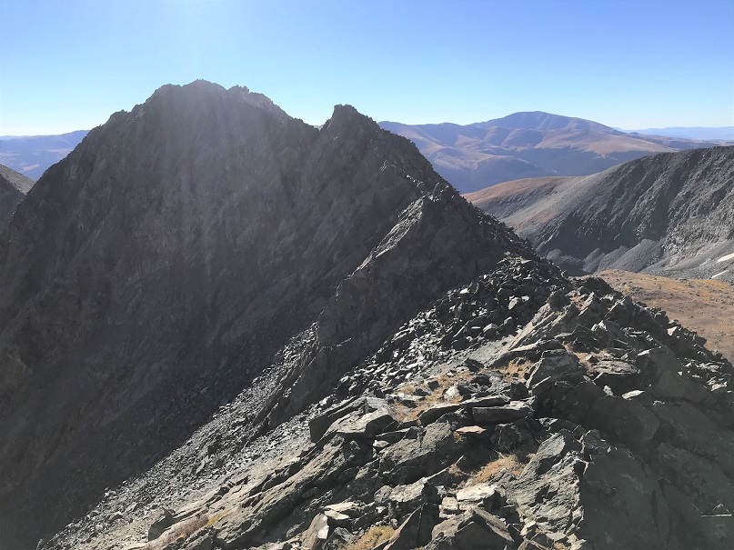
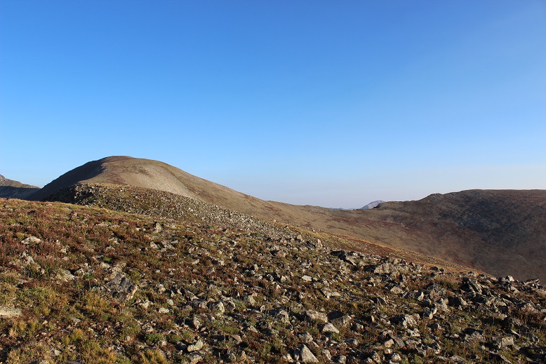
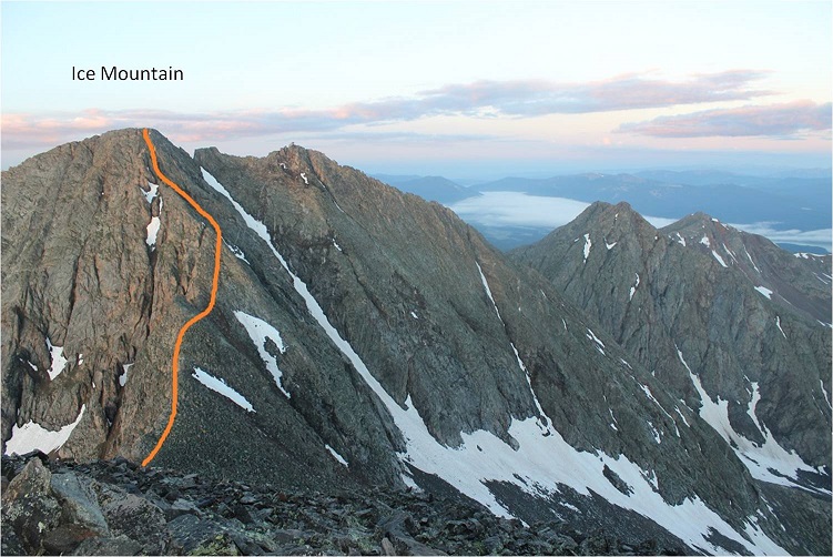
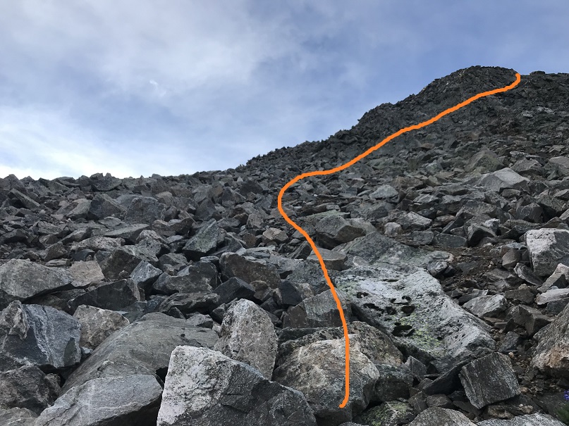
Once at the saddle I could summit either Ice Mountain or North Apostle, but chose North Apostle so I’d have a good view of Ice Mountain (class 3) on a class 2 route. Here’s the final push to North Apostle

24

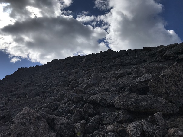
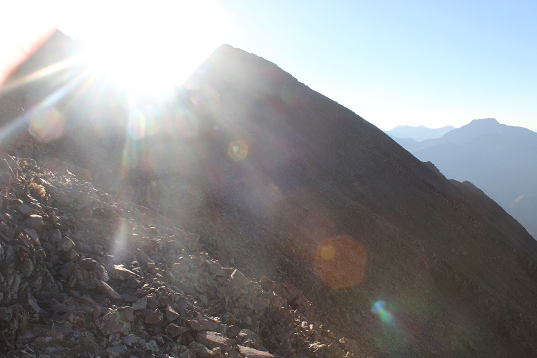
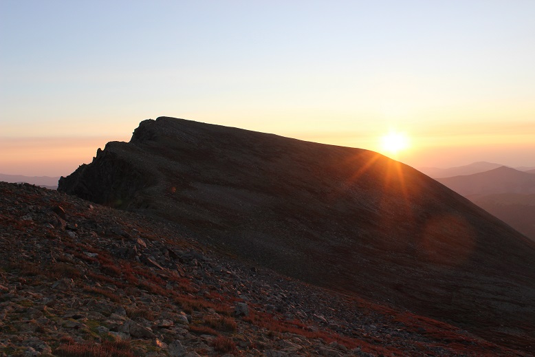
This as an easy class 2 route that took me less than 15 minutes to complete from the saddle. The sun was beginning to rise

25

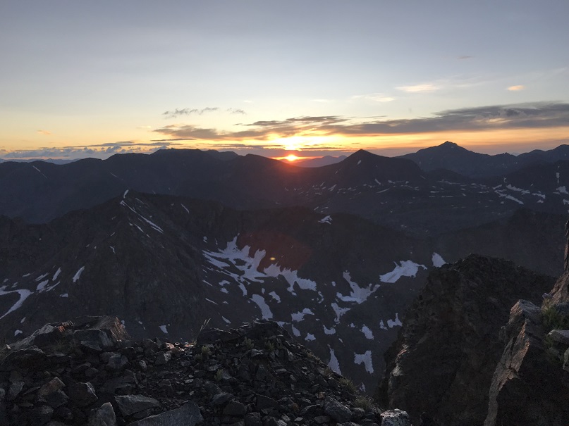
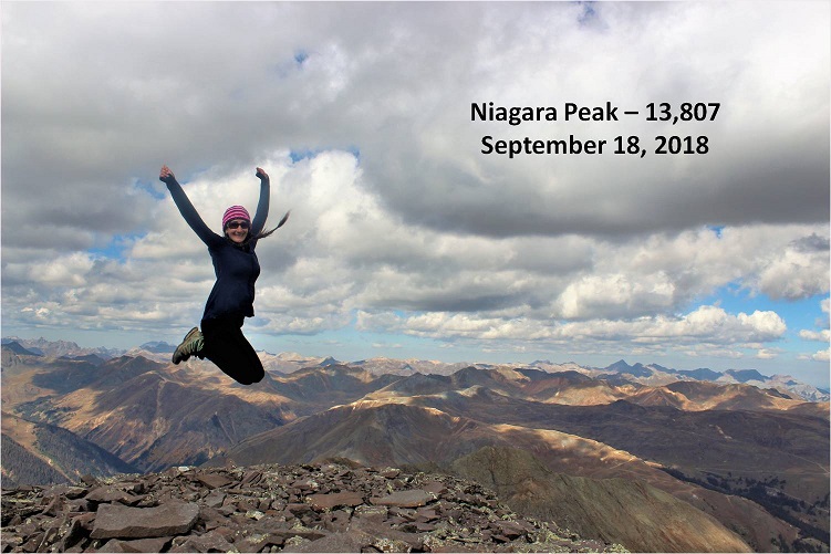
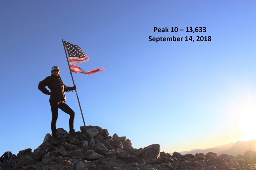
I summited at 6:15am
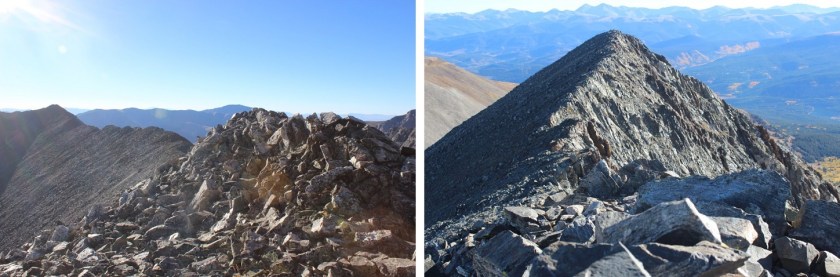
26

North Apostle

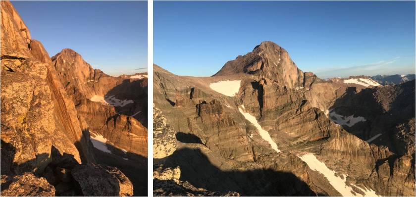
I turned and looked at the class 3 route up Ice Mountain. I knew I was a little pressed for time:  my turnaround time was 7am, and it was already 6:15am.  I didn’t stay long on North Apostle and worked my way carefully back towards the saddle, being careful not to slip on the wet rocks.

27

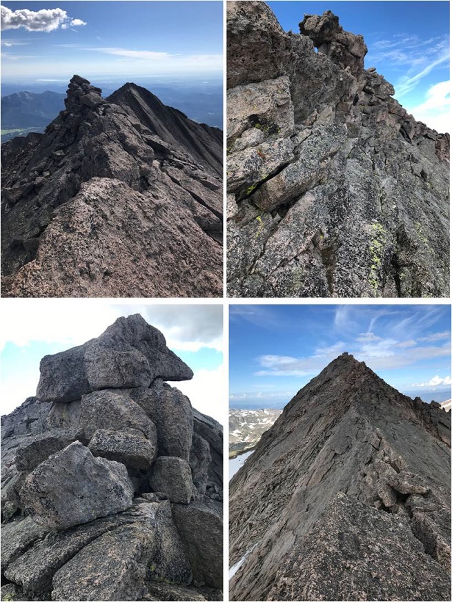
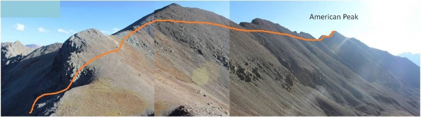
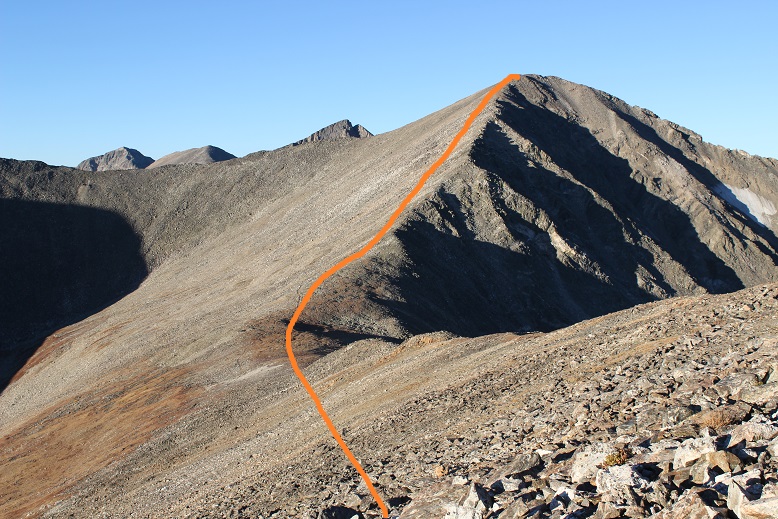
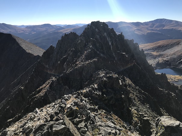
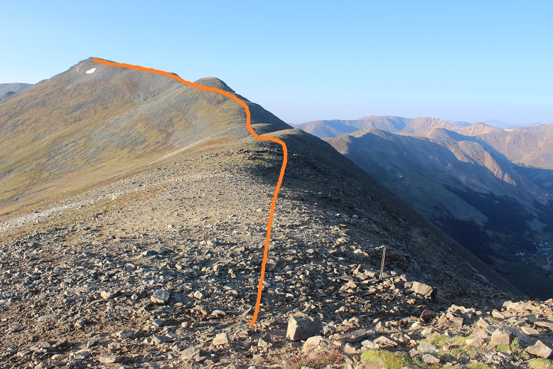
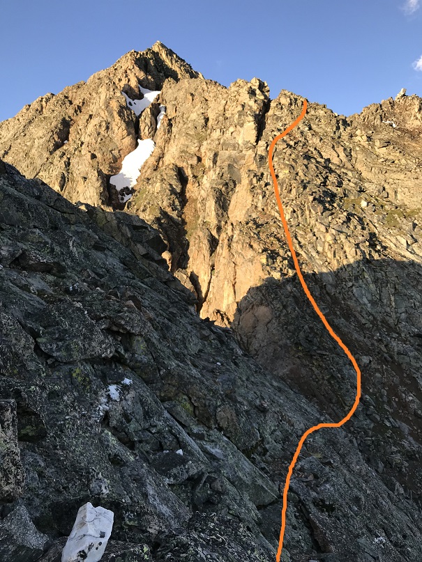
From the North Apostle/Ice Mountain Saddle the first obstacle was this section of climbing. I stuck to the ridge and didn’t find it difficult

28

I rounded the ridge and dipped down just a bit to a notch, crossed the notch, and headed up the solid and cairned route up the ridge. My alarm went off.  Drat.  It was 7am, and I was so close to the summit!  I went back and forth in my head a few seconds, realized I’d started later than I’d planned, so surely I wasn’t at my halfway point yet?  I could squeeze in another 20 minutes and still be fine, right?  My math here was iffy, but I figured I was less than 15 minutes from the summit:  I’d find a way to make up the time.  Surely route finding would be much easier in the daylight?  That would help… right?

29

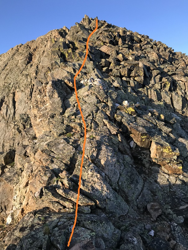
Here are some closer pictures

30

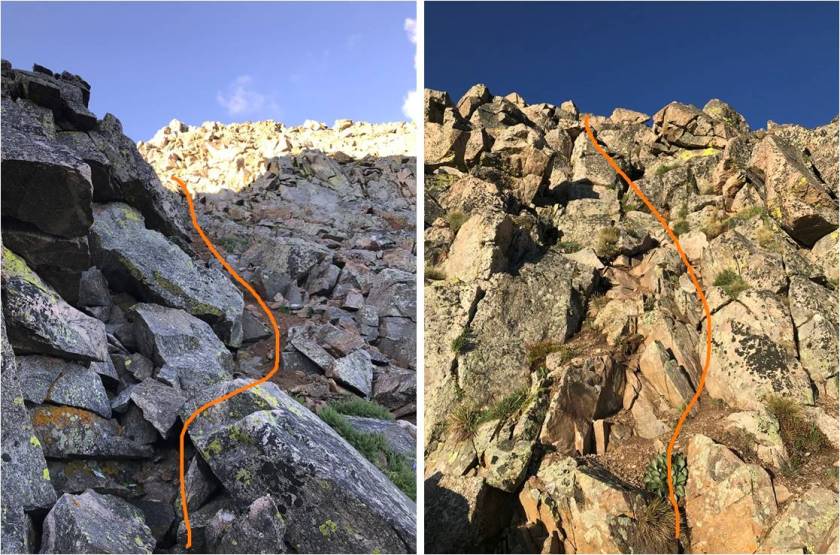
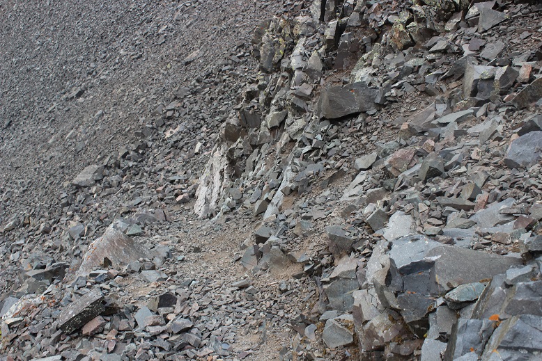
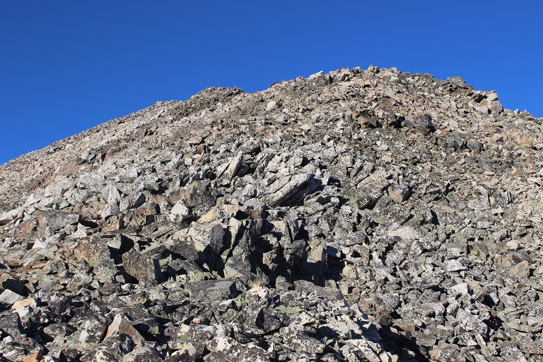
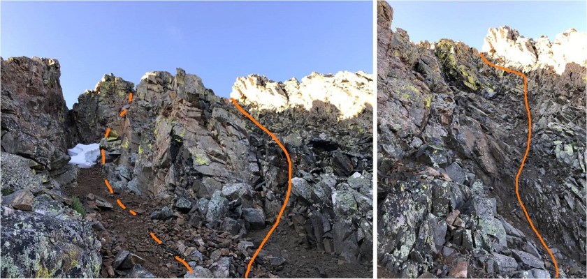
I came to a gully and took the solid route up and the dotted line down. The solid route felt sketchy to me (which is why I took the other way down). I don’t think either was better than the other.

31

I summited at 7:10am.
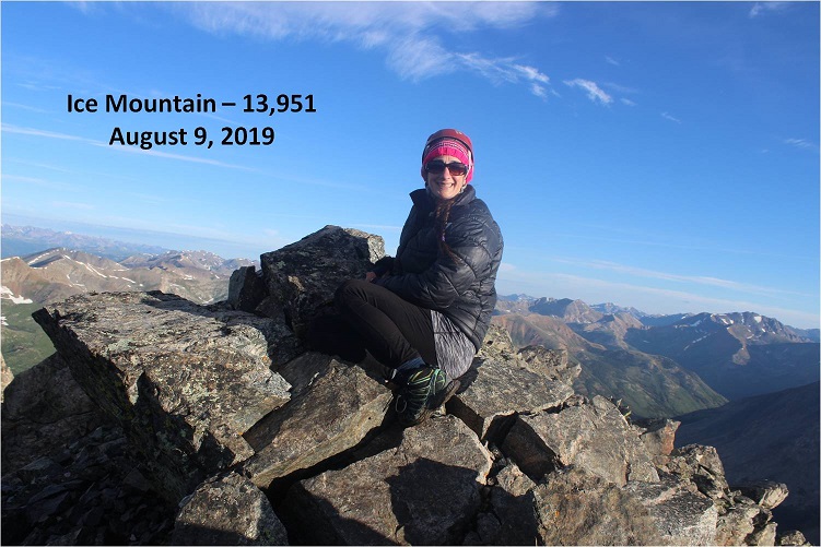
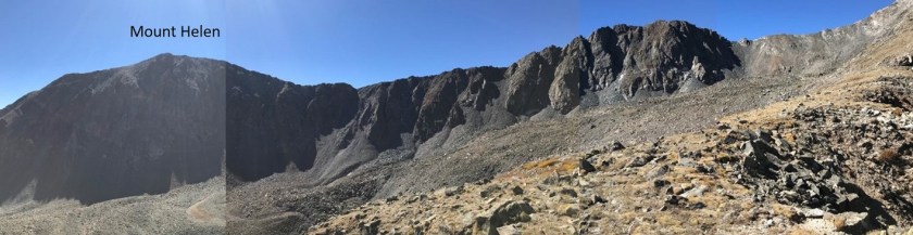
32

Ice Mountain

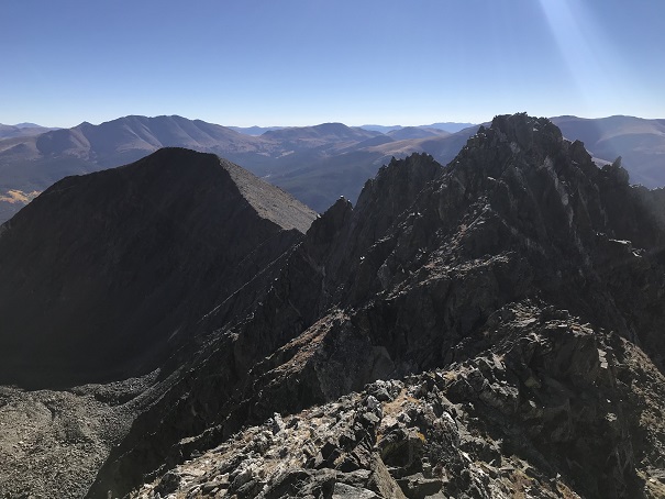
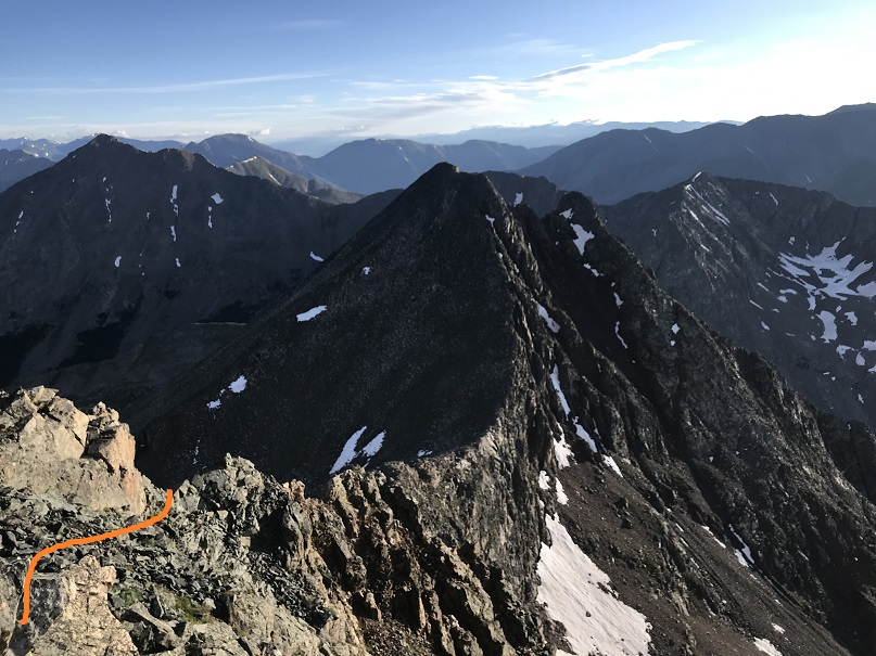
Here’s a look back on the route up to North Apostle

33

Ok, had no time to waste so I didn’t stay long at the summit. I decided to head down a slightly different way than I’d headed up.

34

35

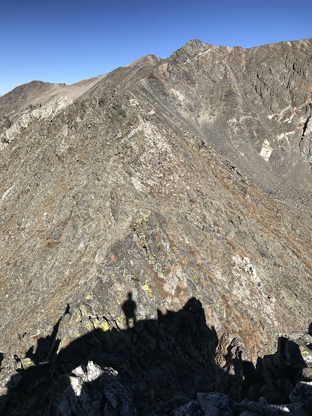
Before making it to the saddle I found it easier to just begin descending a gully towards the gates I hadn’t seen in the dark

36

Here’s looking up at the way I came down from Ice Mountain

37

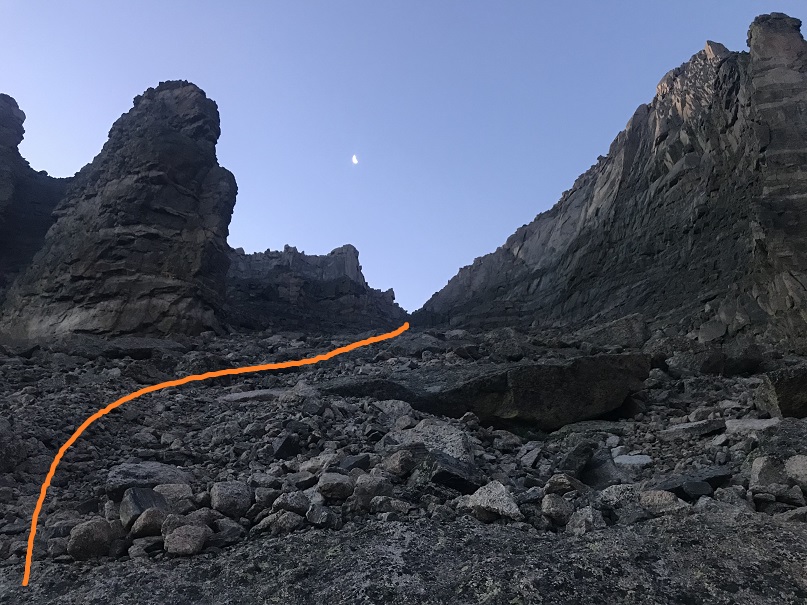
Ok, time to go through the gate and head back down the basin. This was so much easier in the daylight!  I was definitely going to be able to make it back to my truck by 11am.

38

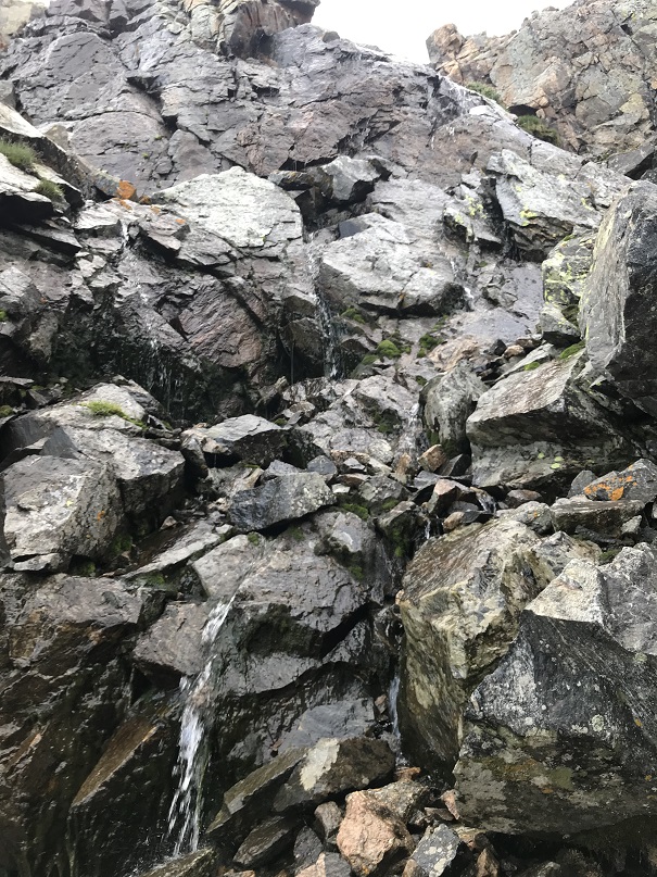
The running water I’d heard earlier was a trickle of a waterfall down the side of the mountain that was flowing beneath the rocks I was hopping.

39

I made it to the first patch of snow and misjudged its texture, thinking it would be similar to how it was when I crossed 2 hours ago: solid but soft enough to provide traction.  I stepped on the snow and immediately slipped, flailing my arms and flying backwards, landing on my tailbone.  That wasn’t snow but ice, and it was solid.  It felt like I’d landed my tailbone on a rock.  OUCH!  I knew as soon as I hit this was not good.  I jumped up, glad to find nothing was broken and I could stand, and did what I always do in this kind of a situation:  I kept moving.  The first fifty yards or so were painful, but then just became uncomfortable and it only hurt when I upclimbed.  Eventually it stopped hurting altogether and just became a nuisance.  I could tell it was going to bruise and it would be sore for a few weeks, but immediately walking it out seems to be the best policy for me.

40

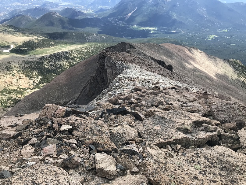
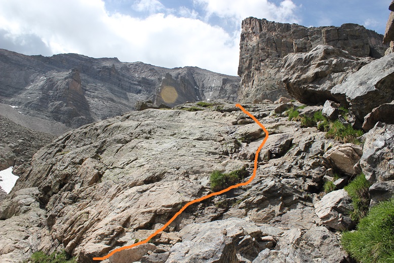
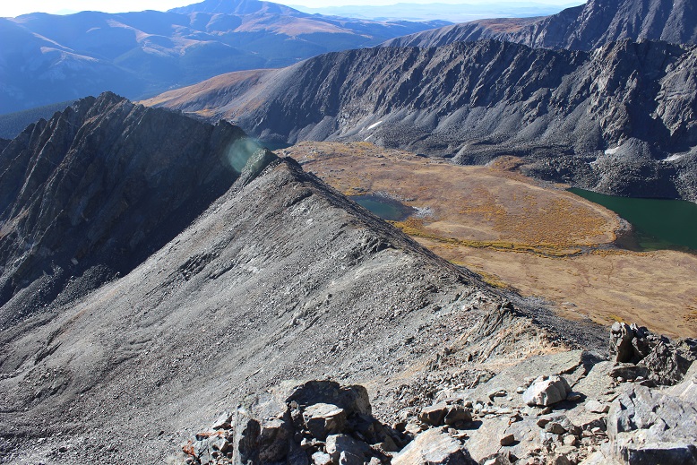
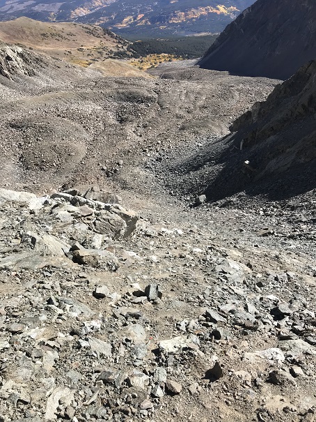
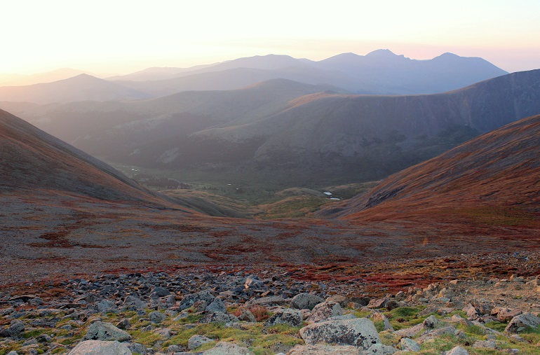
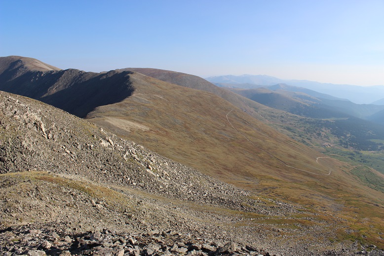
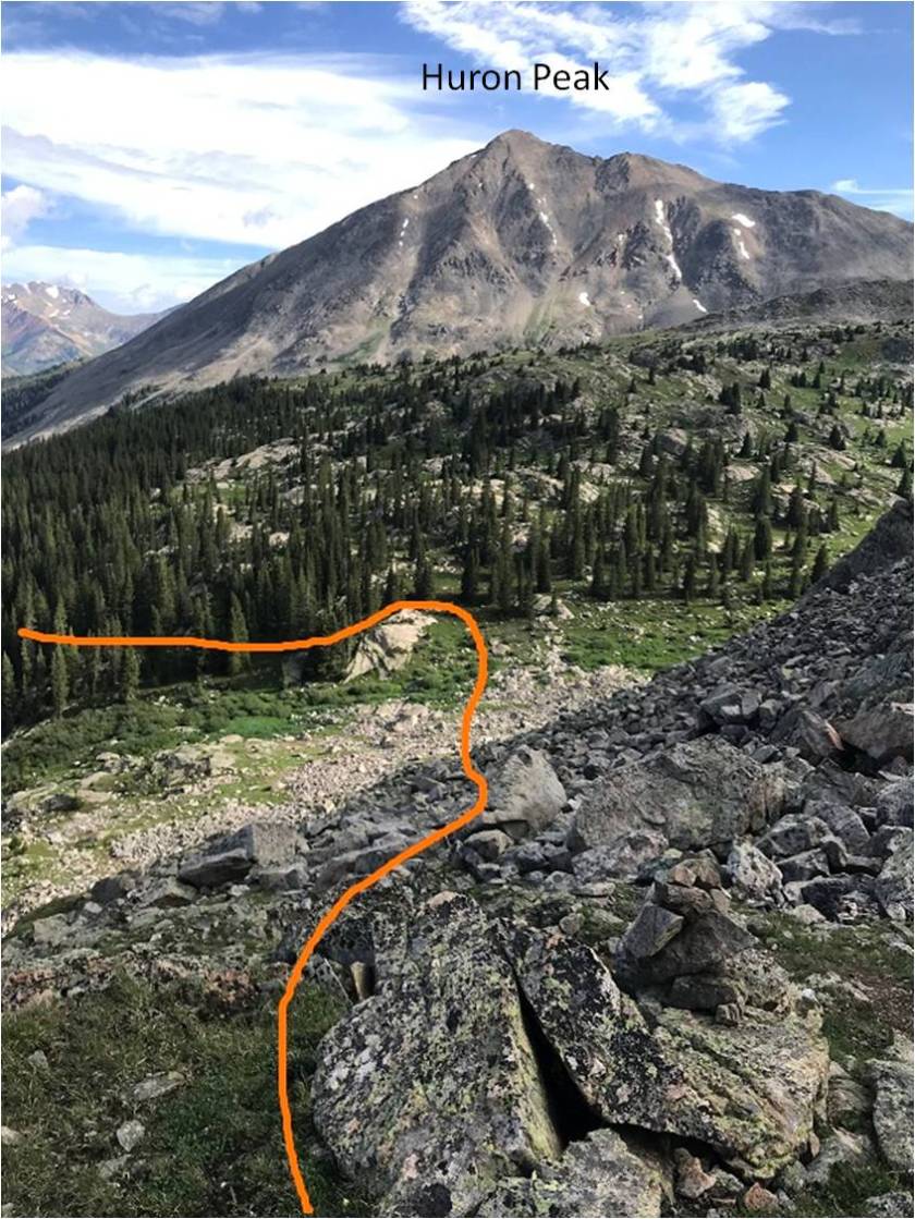
All those cairns! I was so glad to see them all in the daylight!  I rounded the end of the basin and had a great view of 14er Huron Peak as well as the rest of the route to the trail.

41

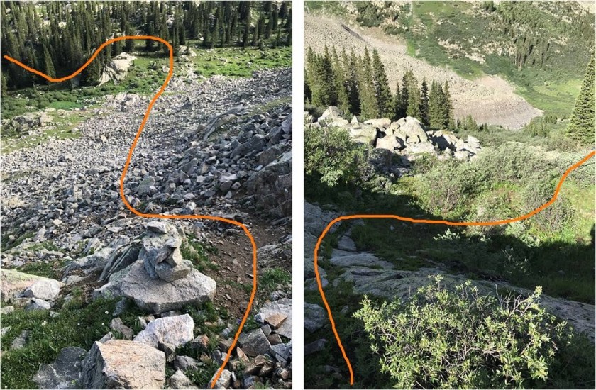
Route finding was much easier in the daylight on my way back down, but still an exercise in bushwhacking and following my compass. At least now I had visuals to help

42

43

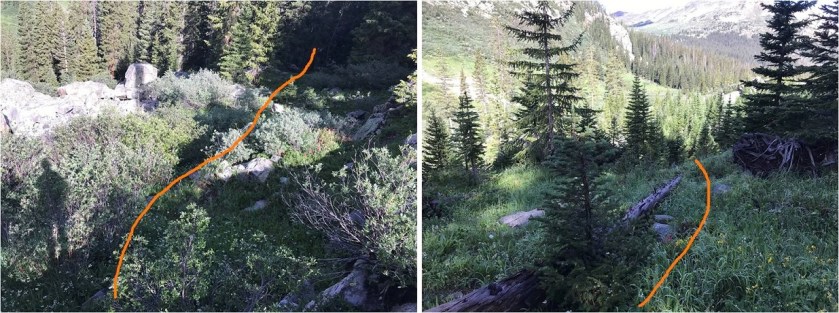
The only problem with walking through all the grass and shrubs were they were still wet from the rain, and even though I have waterproof boots they were soaked through at this point. I was debating if it was even worth it to take off my boots for the creek crossing (decided in the end it was because stream water dries with a terrible stench) when I saw a felled tree crossing the creek.  I crossed the creek on this tree and then walked through the willows a bit by the bank of the creek to eventually link back up with the trail.  The rest of the hike out was uneventful and absolutely beautiful.  I was able to enjoy the blue skies and greenery without the nuisance of mosquitoes.  I saw a pair of hikers about 2 miles from the trailhead, but that was it for people for the whole day.

It had been my goal to make it back to my truck by 11am, and I was able to make it down by 10:40am, keeping me right on track to be home by 2pm so I could take a shower and pack before the girls all arrived. (For those wondering, they won the Eagle Award).

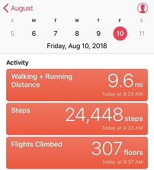
I made it back to my truck at 10:40am and went to stop my tracker, only to find it had stopped on its own 3.7 miles into the hike. I’m not sure why it stopped (maybe the rain?), but I don’t have a track for this climb, so I’m going by my iPhone app when I say it was about 10.5 miles and using the 4000’ in elevation gain as an approximate from topo maps and guide books.  This hike took me just over 9 hours to complete.

44

Mt Meeker 13,916, Meeker Ridge (UR) 13,861, & Southeast Longs (UR) 14,060

1

RT Length: 13.5 miles

Elevation Gain: 5764’

There are so many routes up Mt Meeker, and some have pretty cool names: Flying Dutchman, Dream Weaver, Dragon’s Tail, etc.  I chose the Iron Gates route because for some reason it sounded cool to climb through The Iron Gates.  I was also told this route had the best views of Longs Peak (I wasn’t disappointed).  Plus… the knife edge between Meeker Ridge and Mt Meeker sounded like fun, and I wanted to find out what a “flying buttress” was.

I was surprised with how many vehicles were in the Longs Peak Trailhead parking area when I arrived. It’s a large lot, and was at least halfway full.  Several hikers were readying their gear.  Last time I was here was the Friday before a Labor Day weekend, and I hadn’t seen very many people at all.  I saw dozens of hikers on the trail this morning.

I arrived at the parking lot at 2:30am and was on the trail by 2:40am. I chose to take the Chasm Meadows Approach from Longs Peak Trailhead.  The trail starts to the left of the Rangers Station.

2

I could see headlamps shining brightly ahead of me, and passed four groups of hikers before making it to the first junction about ½ a mile from the trailhead. Stay left here

3

The trail is definitely class 1 all the way to Chasm Lake. I saw multiple groups ahead of me, all intent on Longs Peak.  They had very bright headlamps.  Very bright.  In fact, at times they were almost blinding, especially as I got closer to a group of hikers and they’d turn around to look at me.  I realized this morning just how dim my flashlight actually is (but I like it that way:  sometimes a bright flashlight gives too much information).

4

Around treeline I could see the full moon with city lights in the background.

5

After making it to treeline there’s still 1.7 miles left to Chasm Lake. Stay left here as well.

6

About a mile before reaching chasm lake there’s a trail junction where you can stop for a bit to use the privy and let your horses rest.

7

Having to do neither I continued on towards chasm lake, a little disappointed to lose a couple hundred feet in elevation in the process.

8

Here there were a couple of small snow areas to cross that were quite slippery in the morning, but easy to navigate in the afternoon.

9

Just before Chasm Lake the trail ended. I made it to this area while it was still dark and it looked like there was a lot more snow than there actually was.  The dotted line is the route I took up the gully, the solid one is the route I took on my way back down. This ended up being a good approach, as the solid way down went through a waterfall that would have been messy in the dark.

10

My goal was to make it to the Iron Gates. In the dark I couldn’t see much and while I knew I was headed in the correct direction I didn’t have a visual yet of the Iron Gates.

11

The terrain at the base of the Iron Gates was very loose scree, mixed with small rocks. As I climbed higher the ground became loose talus that became more stable until it eventually turned into solid rocks.  I headed straight through to the back of the Iron Gates

12

13

Here the sun began to rise and I was able to see why this route is said to have great views of Longs Peak

14

At the end of the Iron Gates there’s some class 3 scrambling to gain the ridge

15

There’s a cairn at the top I made a mental note of to help me find the entrance on the way back down

16

Here’s a look back down the Iron Gates at Chasm Lake

17

At the top of the Iron Gates I turned right (south) and climbed the northeast ridge to Meeker Ridge (the unranked peak, not the ridge itself)

18

Yes, there were some pretty awesome views of Longs Peak

19

I made it to Meeker Ridge at 6:45am. I got a quick selfie and video at this unranked 13er

20

Meeker Ridge:

Up until this point the hike had been easy, but now it was about to get a little spicy. It was time to traverse the short ridge between Meeker Ridge and Mt Meeker.  This ridge has a ‘mini-knife edge’ similar to the one on Capitol Peak.  I was able to stick to the ridge for this short traverse, dropping down to the right only once when absolutely necessary. This is a solid class 3 ridge with exposure.

21

Here’s a tip for the knife-edge part: It’s very similar to the one on Capitol Peak, and would make for a great practice run if you’re hesitant to try Capitol but feel solid with class 3 climbing. While on Meeker’s knife edge you can cross and use your right foot for balance by placing it on the rock beneath the ledge.  This rock is underneath the knife ledge and difficult to see, but a few inches wide, solid, and you can use it for extra balance if needed. The rock here felt more solid than on Capitol.

Here’s looking back at Meeker Ridge

22

And some of the climbing/exposure on route

23

I made it to the summit of Mt Meeker at 7:15am, or what I thought was the summit of Mt Meeker. At the top of the traverse there were two points about 40 feet apart that both looked like the true summit.  I sat on top of the first point, but the second point looked higher.  So I went over and climbed to the top of the second point, but from there the first point looked higher.  So I decided to take a video from the middle of both points and pictures from both.

24

Mt Meeker:

It was still early in the morning and the weather was holding out nicely. I decided to descend Mt Meeker and cross the Loft towards Longs Peak.  Longs Peak wasn’t my goal, as I’ve already summited Longs, but I wanted to get a look at the Notch route up Longs and summit Southeast Longs (an unranked 14er sub summit).  Southeast Longs is where the orange line ends.

25

To get there I descended 450’ to the loft, and then gained 600’ to the top of Southeast Longs.

26

The rocks here were solid and much larger than they looked from Mt Meeker. There were a bunch of social trails here so I just took the path of least resistance to the top.

27

I made it there at 8:25am. You can see Longs Peak Summit in the background

28

Curious as to what the Notch and path to Longs Peak looked like from here I descended to the cairn that indicated the entrance to the Notch and looked over. It looked like a class 3 scramble that would lose a couple hundred feet in elevation, and then re-gain it on the other side, connecting with the traditional Longs Peak Route just before the final pitch.

29

I briefly thought about attempting Longs Peak as well, but did some mental calculations and figured it would get me back around 3-3:30pm, and I really wanted to be back around 1:30pm, so I decided to save Longs Peak round 2 for another day. Also, there were a ton of people queued for the final push on Longs (I could see/hear them) and a lot of people on the summit as well.  I’m not a fan of crowds, especially on peaks.  In any event, I still had some more climbing to do myself, as I needed to re-ascend Mt Meeker to head back.  I did not want to make this a loop.

30

The clouds were starting to build as I gained Meeker’s ridge

31

While they looked ominous at first (especially for being so early in the day) nothing came of them. The clouds did hide the sun for most of my return back to the trailhead and I did get a few drops of rain here and there, but I was never worried about thunderstorms.

Time for knife-edge part 2. I felt much more confident the second time around, and the traverse went much faster.  I was well aware of the group of 15 or so people on top of Longs Peak watching me make the traverse.  I could hear them talking to each other as I climbed up boulders and balanced on the ridge.

32

Just as I made it back to Meeker Ridge I met a young man beginning his attempt of the traverse. He’d had a long day, starting from Sandbeach Lake.  I wished him luck and was on my way back down the Northeast Ridge towards the Iron Gates

33

34

As Chasm Lake came into view I could hear loud shouts that sounded like a large group was down there having fun. A group was paddleboarding. It seemed like a lot of work to me to get multiple paddleboards up to Chasm Lake, but hey, they must really be into the sport. I wondered to myself if it was legal to paddleboard there?  I descended into the Iron Gates and had no problem on the larger rocks/talus.  However, descending the scree was a bit of a small nightmare.  I was so glad when I made it to the bottom of the Iron Gates and turned around to see them in the daylight

35

36

I followed the gully more to the west this time and descended via a wide waterfall area with small rivers of water flowing throughout

37

38

This brought me to the base of Chasm Lake, where I picked up the trail back to Chasm Meadows. This is also where I met up with a group of 12 or so campers from a nearby camp.  I could tell immediately they weren’t Girl Scouts because there was only 1 adult with them, the girls were all wearing shorts and did not look like they’d been “roughing it”.  I asked them where they were from and wished them well as I hiked out.

39

A few minutes later as I reached the Jims Grove area I could hear the girls behind me, their counselor yelling at them every 10 seconds or so to “hurry up” even though they were setting a fast pace. Long story short, she pushed them too hard and one of the girls clipped and fell. She’s alright and just scraped her knee, but I hope the counselor learned her lesson and slowed down a bit.

40

It was great seeing the waterfall crossing areas on my way down in the daylight.

41

I made it back to my truck at 1:15pm, making this a 13.5 hour hike with 5764’ in elevation gain in 10 hours 30 minutes

42

43

Today’s hike was absolutely beautiful! I can’t wait to head back here to tackle a few more 13ers…

American Peak – 13,814, Jones Mountain – 13,867, Niagara Peak – 13,816′

(part 2 of 2)

6

Part 2 of 2

RT Length: 7.3 miles

Elevation Gain: 3800’

My drive to the trailhead took me through Silverton. I’d heard the fall colors weren’t supposed to peak here for another 2 weeks, but right now it looks beautiful.

2

I had conflicting directions on how to get to the Burns-Gulch trailhead, so I brought both with me. From Silverton I took County Road 2 past Eureka on a 2WD dirt road, and ate the dust from off road vehicles driving ahead of me the entire way.  For a Monday afternoon it sure was crowded: Leaf peeping season is definitely in full swing!

3

I made it to the base of the trailhead on the Animas River and my directions ended but I knew this wasn’t where the 4WD trail began. So I pulled up a GPX file of the route to see where I needed to be:  about 2 miles up a narrow shelf road.

4

The road was much narrower and steeper than it looks and filled with bowling ball sized rocks. I took it slow:  this road was more difficult than I’d anticipated (but nothing my truck couldn’t handle). I just hoped no one would drive towards me from the top:  There was no way I could turn this truck around on such a narrow road, and passing another vehicle wouldn’t be easy.

There was a campsite at the 4WD trailhead at 11,720’ and no other vehicle in sight. Sweet!  It looked like I was going to have the site all to myself for the night.

I got to work making dinner: Mountain House Beef Stroganoff.  When it was ready I poured myself a glass of wine in the measuring cup I brought for making dinner, sat back, and enjoyed the view.

52

Life is good! Sitting in the bed of my truck looking at the mountains was so relaxing.  As I was sitting there I heard a creek to my right and got up to investigate.  This was wonderful!  It was about 10 yards from where I’d parked my truck.  I enthusiastically washed my hands in the running water. They were gross from today’s adventure and it felt good to have clean hands and fingernails again.  I got up to turn around and head back when my left sandal broke.  I mean really broke, like duct tape can’t fix it broke.  Drat!  I was going to have to tiptoe the 10 yards back to my truck without wearing shoes.  The first step I took landed my left foot on a thistle.  Wonderful.  I made it back to my truck,  poured myself another glass of wine and spent the next half hour picking splinters out of my foot (mostly on the heel and arch).  I looked around at the mountains: Life was still good!

6

I got out my maps and route info for the next day and tried to identify the peaks around me and the best route to take (I had several options). I studied my chosen route until I felt it was time to get some sleep: it was starting to get cold.

I decided to sleep in the cab of my truck because I fit perfectly across the back seat and because I could. Two shots of whiskey later I was ready to go to sleep.  I laid my head on my pillow and a fly landed on my arm.  I thought about how much fun having a fly buzzing around me while I was trying to sleep would be and debated whether or not to open the door to let it out.  In the end I decided I’d rather not let all the warm air out in doing so, so I made a deal with the fly:  “Fred “(I named him Fred)”If you promise not to buzz around me all night I promise not to kill you right now”.  Fred flew away to relax on my steering wheel and I fell asleep thinking this wasn’t a bad way to spend my last day of being 37.

I woke up at 11:11pm. This isn’t unusual, as I normally only get 4-6 hours of sleep a night.  Obviously my body was ready to get up and start my day.  I however was not.  I took 3mg of melatonin, washed it down with another shot of whiskey, and spent 5 minutes star gazing before falling back to sleep.

My alarm woke me up at 5am. Why, oh why, oh why did I choose to sleep at a trailhead on my birthday?  I hate sleeping at trailheads!  I’m always cold and have a hard time getting going and all I really want to do is stay in my nice warm sleeping bag where it’s nice and warm.  Sleeping.

Why hadn’t I done the sensible thing and reserved a hotel in Ouray?

Ugh. I could smell myself.  Or was that my socks and shoes on the floor recovering from yesterday?  Both. Definitely both.  Well, the day wasn’t getting any younger.  I needed to be off, so I slowly started through my morning machinations, taking much longer to get ready than it would have taken me at home.  My coffee was cold.  My hands were cold.  It took me almost an hour but by 6am I was finally ready to go.

I decided to start by hiking to the Jones-American saddle, which I discovered isn’t a very popular route (most people start with the Jones/American saddle). The trail starts at the campsite and heads directly north up a hill, then east.  (Sorry, no pictures:  I did this in the dark and planned to get pictures on the way back, but there was an adventure that happened….)

I followed the road to a drainage and just headed up what was trying desperately and failing to be a waterfall.

7

From here I followed the drainage up a basin and to the right. Just continue sticking towards the bottom of the drainage and heading right.

8

I passed a very small pond (it’s been a dry year)

9

and navigated up the rest of the basin. There’s no established trail or cairns.  This looks like a great route to ski in the winter.  This is the route I took to the saddle

10

The base of the saddle is where I ran into trouble. I knew I had to gain the saddle, but neither of the options I saw looked better than the other.

11

I could have gone either left or right. I chose left.  I chose wrong.  As I got closer and closer to the saddle the ground became less and less stable and the path to the right looked more and more appealing and less steep.  The ground wasn’t like loose scree, but more like compact sand my shoes couldn’t grip.  It was slippery and I was dangerously close to sliding all the way back down the slope.  At this time I realized this must be a snow route:  perfect for skiing down or snowshoeing up.

I decided to aim for the rock wall area to the left, as it looked like it had more stable dirt around it. It didn’t. In fact, it was just as loose and slippery as the rest of the scree.  I made it to the rocks and my first thought was “Why don’t I have my helmet?  I need a helmet for this!!!” I had a helmet, it was just back at the trailhead in my truck because this was supposed to be a class 2 hike.  The rock I’d wanted to climb was more of a rock wall than a rock couch.  I’m talking straight up with hand and foot holds that crumble out from under you when you grab them.  But it felt safer than the dirt/scree area.  I was shaking, but I made it.  I wouldn’t recommend it to anyone, and I’m glad I did this route first instead of last (I’d of had to re-summit Jones again because there was no way I was going down that unless I was on skis).

Here’s a look at the route I took to the top of the saddle. I know it doesn’t look like it but this was the safest option since I hadn’t taken the route to the right.

12

OK, now that I’d gained the saddle I looked at my route to American Peak.

13

Oh yeah… it looked like I’d be hiking into the sun again today. I put on my sunglasses and had at it.  Here’s a clearer picture of the route from later in the day. Why does the peak I’m climbing always have to be the LAST peak on the ridge?

14

Most of this hike across the ridge was easy. It was a well traveled path with even a few cairns in places.  It became difficult at the base of the last bump before the summit.  For about 200 feet the rock became extremely loose and there was evidence of rockslides everywhere.  It was difficult to find good footing, and once again I longed for my helmet.  I’d read this was the easier ridge of the three I’d do today, but I disagree:  this West Ridge to American Peak was the most difficult ridge I did today, but only the last part of the ridge.  Here’s the final pitch to the summit

15

I summited at 8am

16 American Peak 13806

American Peak:

Here’s a look back on my route, and my next peak:  Jones Mountain A.

17

I reversed my steps (the ridge was easier on the way back down) and made my way to the Jones/American saddle. I turned and faced the ridge.  Here’s the route I took:

18

Believe it or not the initial climb up the ridge was more stable than the ridge on American Peak, it had some steps but still had scree.

19

About halfway up the terrain changed and I walked a class 2 ridge to the summit of Jones Mountain A

20

I summited at 9:15am

21 Jones Mountain A 13860

Jones Mountain A:

Here’s a look back at American Peak and what I consider the crux of that route

22

Now it was time to focus on Niagara Peak. The trail from here to the peak is well established.  I just followed the trail down Jones Mountain A and up the ridge of Niagara Peak.

23

And a look back at Jones from the saddle

24

On my way down from Jones I saw a man hiking with his two dogs. I was surprised to see him, as I hadn’t expected to see anyone out here today. He was nicely and appropriately dressed for hiking with both a GPS and Walkie Talkie on either strap of his backpack.  His dogs were leashed, well groomed and very well behaved.  We stopped and discussed the Niagara/Jones saddle and descent, to which he didn’t think his dogs could make the loop.  He would most likely head back the way he came.  We parted ways, him to continue up Jones, and me towards Niagara Peak.  He was the only hiker I saw all day.

Just after passing the hiker I was surrounded by a flock of birds. They kept following and avoiding me on the trail.  I considered it good luck and figured there were 38 of them…

Birds:

I made it to the saddle of Jones/Niagara and looked at the ridge. There is a path but this is another class 2 ridge that has some steep sections and lots of scree.  If I haven’t already mentioned it, microspikes would be helpful on this route, even without snow.

25

Here’s a picture looking back on the ridge

26

I summited Niagara Peak at 10am. Oh, and guess what?  Niagara was my 38th 13er!  I summited my 38th 13er on my 38th birthday!  Very cool! BTW, 38 feels great!

27 Niagara Peak 13807

Niagara Peak:

What a beautiful day! I’d considered hitting unranked 13ers Crown Mountain and North Crown Mountain, but I wanted to make it back to celebrate my birthday with my kids (and my son’s birthday: he’s headed for Basic training on Monday and he’ll turn 18 during boot camp, so I’d like to celebrate early).  If I left now I could be home by 6pm, just as the kids were making it home as well.

So I turned and headed back to the Jones/Niagara saddle. This trail was much easier to navigate than the route I’d taken up.  This route had a trail for 90% of the way, and where there wasn’t a trail you could see where it connected further down.

28

This is the route I took down. It hugged the right (east) ridge.  This path took me back to my truck and the 4WD road that was obvious from the Jones/Niagara saddle.

29

30

Here’s a copy of my GPS tracks. The red circle is where I parked my truck overnight and began/ended my hike.  The tracks are a little off: I forgot to hit stop on my tracker because of the adventure below… but it might help others who want to know how to get to the upper trailhead

31

As I was descending back to the Burns Upper 4WD trailhead where I’d parked my truck I noticed the man I’d seen earlier and his dogs walking around, looking at my truck. Hmmmm…. That was odd, but maybe they were just taking a break and checking out my truck.  It is an awesome truck.  I kept an eye on them as I kept hiking.  Within half an hour I was back at my truck, and the man and his dogs were still there.  He asked me a bit sheepishly if he and his dogs could hitch a ride down to the lower trailhead:  his dogs were tired and their feet were sore.

Of course they could ride down with me!

He was happy and let me know he’d hiked up with his wife but she’d turned back much earlier in the hike and he’d continued on with the dogs. She was waiting for them at the lower trailhead by the river crossing.

Immediately my estimation of him as a person grew: I love it when a man who’s married lets me know early on in conversation he has a wife.  It sets the tone in a positive way, and I respect a man who wants other women to know he’s married.

I cleaned up my truck (it had stuff from the past few days strewn all over since I’d also used it as a tent) and apologized for the smell (both from my dirty clothes and, well, me). He was happy to have a ride down and put the dogs in the back of the truck.  They indeed looked tired.

I navigated the 4WD road as slowly as I could, cognizant of the fact I had two dogs in the back. I usually take these roads at a quick speed, but right now I was gingerly maneuvering around the rocks and unfortunately not avoiding them all.  We hit a few big bumps, and my passenger kept looking back to make sure the dogs were ok.

The 2 miles took us about 20 minutes, and we talked about our jobs, my kids (I can talk about them all day), vehicles, and his life as a Doctor and his wife being a Veterinarian. They were staying in Ouray for vacation and are 14er/13er/hiking enthusiasts.

He also mentioned this was the first time his dogs had ever been in the back of a truck. I tried to take it a little slower, knowing the road was rough.  About halfway down the road we ran into a Jeep heading up.  It took some careful maneuvering, but we were able to pass each other on the narrow road.  I was pretty proud of my driving skills, and thankful the other driver was willing to work together so we could both pass each other.

When we made it back to the bottom of the road I decided to navigate around the river instead of driving across it because of the dogs in the back. We pulled up next to his vehicle, where his wife was waiting. I jumped out of the truck, opened the tailgate, and… no dogs!  What?  Where were they?!?!?

When I announced the dogs weren’t there the woman had a shocked look on her face, and I felt as shocked as she looked. After some quick discussion we came to the conclusion the last time we’d seen the dogs in the back of the truck was around the time we’d passed the Jeep (that was the last time we’d checked).  Well, there was no way we were going to have two lost pups on my watch.  I knew their car couldn’t make it up the road, and I was determined to find those dogs (once they were in my truck I felt responsible for them), so I offered to drive the couple back up the road to look.

I drove very quickly this time, driving across the river and up the side of the mountain at a swift speed, concerned time was against us. Also, without the dogs in the back I didn’t have to be gentle.  It wasn’t lost on me how I’d thought this road was difficult the first time I’d driven it, but now I wasn’t quite so worried about the road:  I was worried about finding those dogs.

One of the dogs was white and it’s currently fall so I figured it would be easy to spot in all the brown grass.

We ended up finding them about halfway up the road, just before where we’d passed the Jeep. They were sitting side by side in the shade under a tree, panting with happy smiles on their faces.  Luckily the hike had exhausted them and they hadn’t felt like running.  They were also well trained dogs.

This time we put the dogs in the cab of the truck for the ride down. I was able to make a 9 point turn on the shelf road and headed back down to the lower trailhead.  It was a good ending to the hike.

I was in a bit of a hurry now to get home. As soon as I hit cell service my cell phone blew up with tons of messages and important things I needed to address.  I had the whole 7 hour drive home to think about everything and make phone calls.  As I exited Silverton Fred landed on my hand and then quickly flew away.  Wow, he’d stuck with me that entire time!

After making it back home at 7pm and taking a quick shower I decided to take the kids out for Ice Cream to celebrate our birthdays. Emily jumped into the front passenger seat of the truck and closed the door behind her.  Two seconds later I heard her hit the window with the bottom of the measuring up I’d used last night for my wine.  Emily looked at me and said:  “There was a fly on the window, but he’s dead now”.

Peak 10 – 13,633, Crystal Peak A – 13,860, Father Dyer Peak – 13,615

1

RT Length: 7.1 miles

Elevation Gain: 2532’

I didn’t make it to the trailhead until almost 6am.  This was due to my pressing snooze while my coffee brewed and thinking it would only take me 2.5 hours to get there instead of 3.  Oh, and GoogleMaps gets you to Crystal Trailhead in Breckenridge, but not the one I was looking for.  Luckily it was only a 15 minute fix (and the directions were eerily similar to the real ones, just 2 miles south on the 9 instead of 2 miles on South 9…).  If you’re coming from Colorado Springs like me and taking the 24 to the 9, the trailhead is BEFORE you get to Breckenridge (but after the Quandary TH).  If you get to Breckenridge you’ve gone too far.

In any event, the road to the lower (Spruce Creek) trailhead is a 2WD dirt road that’s easy to navigate.  As soon as you pass the gate and head towards Lower Crystal Lake things get 4WD fast.  The road narrows and is scattered with rocks about the size of bowling balls, with a few microwaves thrown in.  Most are sharp.   It was worse driving up than driving down, and as long as you’re the only vehicle on the 2+ mile road and you have high clearance it’s no big deal.  There aren’t many passing areas though, so if you do need to pass someone it’s a long backwards navigation to a pull off site.  Luckily, I didn’t see anyone on the drive up or down (or anyone hiking on the trails for that matter).

2

My truck handled everything just fine, except for the narrow area through the willows:  they scratched the sides of my truck (nothing a good wash won’t fix, but it hurts to hear it just the same).

VIDEO:

I was on the trail by 6am, but immediately knew something wasn’t right.  I got out my map and realized while being at the upper trailhead sounded like a good idea, it actually wasn’t because the trail was a loop that started and ended at the LOWER trailhead.  Whoops!  At least I could do the hike backwards and start from where I was (Lower Crystal Lake, doing the hike in reverse, with Crystal Peak A first, then Father Dyer, and then Mount Helen).

But this meant I’d need to alter my decent route as well.  It was dark so I couldn’t see if the terrain below Mount Helen cliffed out or not, so I wasn’t sure if I’d be able to alter my route at all.  I got out another map (I had 4) and noticed I could backtrack if needed and take the basin between Father Dyer Peak and Mount Helen if I ran short on time (I was on a strict schedule again today:  I had to be back at my truck by noon so I could pick my daughter up from school at 3).  But I really wanted a visual, so I hiked a bit slowly and allowed the sun to rise.

I’d parked at the shambles of an old cabin near Lower Crystal Lake and hiked northwest on an established trail up the mountainside.

3 Picture1

4

The sun began to rise and I got a better view of what I’d wanted to be my exit route off Mount Helen… nope, that wasn’t happening:  I’d be cliffed out if I tried to make a beeline off the mountain for my truck, and hiking all the way back to the Spruce Creek Trailhead would add too much time.  OK, plan B:  I was going to have to backtrack after summiting Mount Helen.  No worries though, because it all looked doable in the time I had.

46

But then I looked up and noticed an American Flag on the peak above me.  Oh yeah!  Peak 10 (a Bicentennial).  I was going to try for it if I had enough time after summiting the other 3 peaks, but since I was here now and so close (.3 miles, according to Peakbagger) I didn’t want to miss the opportunity.  So I changed direction and headed north toward the summit of Peak 10.  There was no path, and the terrain was rocky but easy to navigate.

6

I made it to the summit at 7am

7 Peak 10 13633

VIDEO:

That had been too easy!  I turned east and identified the reason I’d planned my hike today:  Crystal Peak A (a Centennial).

8

No way.  It had to be harder than this?  I got out my map again.  Yep, that was it.  All I had to do was follow the class 2 ridge down to the saddle and up to the summit.

9

There was a small false summit, but this peak was also easily navigable, and at times there was a faint trail to follow.  Just stick to the ridge and you’ll be fine.

10

The rocks were beautiful, and a pika posed for me…

11

I summited at 7:50am.

12 Crystal Peak A 13852

VIDEO:

I hadn’t even been hiking 2 hours yet and I’d already summited two ranked 13ers.  Pretty cool!  BUT… a little voice in the back of my mind reminded me the hardest part was yet to come:  The traverse between Mount Helen and Father Dyer Peak was supposed to be very time consuming, so I’d better get a move on.  I turned and looked southeast for Father Dyer Mountain.  You can’t see the route to Mount Helen from here.

13

And looked back on the route I’d taken so far (note this is UPPER Crystal Lake in this picture, Lower Crystal Lake, where I parked, isn’t visible).  Also note, there are lakes all over the place in this area!  Ever ridge leads to multiple lakes, so make sure you know where you are and which lakes you’re aiming for/avoiding.  I counted about 15…

14

The ridge to Father Dyer is a difficult class 2.  I put on my helmet and had at it.

15

Once again, just stick to the ridge and you’ll be fine.  There were a few parts where it helped to go a little left (north) but I mainly stuck to the ridge.  I summited at 8:30am

16 Father Dyer Peak 13615

VIDEO:

There’s a plaque on the summit commemorating the Methodist Church and Father Dyer

17

I was feeling pretty good about myself at this point.  My turnaround time was 10am.  I had an hour and a half to do the traverse.  I turned and looked at the route before me and my jaw dropped:

18

The beginning part of the ridge looked easy, and it was, but soon I encountered more difficult class 3 terrain.  It’s been over a month since I’ve done anything class 3 or above, and I was in heaven!!!

19

The only downside?  It was slow going.  And yes, stick to the ridge (even when it doesn’t seem right)

20

21

I made it past the highest of the spires, started down again and ran into the gully I need to descend to hit the saddle for Mount Helen. I looked at my watch:  it was 9:40am, and my turnaround time was 10am.  I looked at what was left of the route before me:

22

There was no way I was going to make it to the summit of Mount Helen in 20 minutes.  Could I summit successfully?  Yes.  In 20 minutes?  Nope.  Ugh!!!  I had a decision to make:  continue on until my alarm rings or turn back now.  I was at a point where I needed to descend a gully about 200 feet and then continue on up the ridge to Mount Helen, and I knew I could descend the gully no problem, but making up the time on the way out wouldn’t work because I’d parked at the 4WD TH and couldn’t do the loop to exit (I also didn’t have the time to hike down to the 2WD and back up the to the 4WD TH).  It seems the added time it took me to summit Peak 10 meant no Mount Helen for me today.

The bad news: I had to turn back and descend the saddle between Father Dyer and Mount Helen.  The good news:  I got to do the traverse twice, once each way!  Woot!  This was great!  I haven’t done any climbing in a while, and now I had a full day of it, complete with exposure and route finding and, well, good times!  I started back towards the saddle

23

I’d already mapped in my mind the route I’d wanted to take back if I had to descend this way.  There are a lot of areas on Mount Helen that cliff out, but if I descended here (near the saddle) I’d be able to descend into the basin and hike out towards Lower Crystal Lake (keeping to the left/north).

24

This is the route I took

25

Please note, this route is very steep, full of scree, slippery, and demands a helmet and more time than you think it will.  It wasn’t fun, but it was productive

26

Here’s the route I took down from the ridge

27

Once I was in the basin I rock-hopped northwest.  Here’s what it looked like looking back

28

The only problem?  I was kind of cliffed out. Kind of, but not really.

29

It took some careful maneuvering down goat trails (NEVER say to yourself: if a goat can do it I can too!) but I eventually made it back down to my truck.  Here’s my route:

30

I made it back at 11:20am, meaning I’d done my mental calculations correctly (turn back time of 20 minutes, etc.)

I was a bit disappointed I wasn’t able to summit Mount Helen, but as I was hiking down the basin towards my truck I thought about how I gained an extra ranked peak today (Peak 10) and how Mount Helen would be a great winter climb (accessible in winter and a great training hike for snowshoes/crampons?).  So I considered it a win.  Also, I was able to make it home to pick up my daughter from school on time, which is what really counts!

Here’s my route:

30

My tracking

32

And my tracks on a topo map

33


34


35

Centennial #58 Mt Edwards – 13,860, Mt McClellan – 13,594 & Argentine Peak 13,743

1

RT Length: 9.6 miles

Elevation Gain: 3313’

This is another busy weekend where I needed to be home by noon, so I was up at 1am and made it to the trailhead at 4:30am. I didn’t do much research on the trailhead in, and was surprised to find it was a little more 4WD than I’d anticipated.  I’d forgotten about the mug of coffee I had in my cup holder, and after the first few yards of driving on Leavenworth Creek Road what was left in my coffee cup was all over the front seat of my truck.  The road had a few 3 point turns and several small streams and large puddles to cross.  High clearance and 4WD are a must.

2 Road In

Here’s a video for those interested:

There weren’t any signs anywhere on this trail (except the continental divide one at the end), not even at the trailhead. No one else was at the trailhead when I arrived and I wondered if I was in the right spot?  I parked my truck and got out my flashlight to try and find where the trail actually began.  I had my GPS, so I tried to use it to find the start of the trail.  I was aware of the general direction I needed to follow.

3

I made several failed attempts down paths that looked correct but weren’t. They all led me down animal trails that ended in creeks and willows.  See this path here with the tree across it, which usually indicates it’s a closed trail?  Well, that’s exactly what it was: closed and not the trail I was looking for.  However, in the dark I couldn’t find a solid trail, so I took it, walked in circles trying to find a path, and ended up back at my truck.

4

After quite a bit of frustration I realized there was actually a road I was supposed to follow. I felt dumb for missing it, but in the dark I’d had no idea it was there.  So you don’t miss it and spend 20 minutes trying to find the correct start to this trail, here’s what you need to look for:

5

Ok, now I was on the correct trail and it was almost 5am. After walking for about 1/10th of a mile I came to a small stream.  Here I left the road and turned right.

6

From this point on there was no solid trail. In the daylight you just head towards the mountain and try to find a path clear, but in the dark I struggled to find a path clear of willows.  It seemed every time I tried to head towards the mountain I got stuck in willows with no trail.  They were taller than I was and when I tried to see over them with my flashlight they seemed to never end.  I had to keep going right, away from the mountain, but eventually I was able to curve back around to the left (and center of the basin).  My advice if you’re hiking this in the dark:  Stay to the right of the creek, and follow the line of willows to the right until they allow you to go left.  Here’s what it looks like in the daylight (second picture is looking back down the basin)

7

After skirting the willows you’ll find segments of a very, very old 4WD trail. Woohoo!  The only problem with this trail is it has willows too:  right in the middle of the path.  This was confusing and frustrating at night as well, but no problem in the light of day.  Just keep aiming towards the west and middle of the basin and you’ll be fine.

8

At the end of the basin your goal is to hike up towards the saddle of Mt Edwards and Mt McClellan. There is no established route to do this, but I’m assuming most people head straight up the gully.  I started to, but I wanted to summit Mt McClellan first, and when I looked to the right I could tell the terrain had no trail either but was easily hiked.  So I aimed up and right instead of towards the saddle.

9

When I reached the first bump in the ridge I turned right again and followed the ridge to the summit. I summited at 6am.  The summit was very long and had great views of Grays and Torreys.

10

11

I took a summit photo to prove I’d summited (McClellan is an unranked 13er)

12 UR Mt McClellan 13587

And a video as I was hiking to the top:

I looked over to Grays and Torreys and saw a trail of headlights coming up the road, as well as a steady stream of people already on the trail. I was so glad I was on a 13er with no crowds!  I hadn’t seen anyone all morning.

13

I turned and faced Mt Edwards. That was my next target.

14

I followed the ridgeline back to the saddle, noting the drop off to the right

15

From the saddle I turned back towards McClellan to watch the sunrise

16

And then took a picture looking down the basin I’d just come up

17

From the summit of Mt McClellan to the summit of Mt Edwards took me half an hour to hike. I made it to the top of Mt Edwards at 6:30am

18 58 Mt Edwards 13850

VIDEO:

The reason I’d summited Mt McClellan first and then headed over to Mt Edwards (which is the reverse way most people summit the two together) was because if I had enough time I’d wanted to summit a nearby bicentennial (Argentine Peak) as well. Since it was only 6:30am I had plenty of time to head over to Argentine before trekking back down to my truck:  Argentine was about a mile and a half away.

I turned and headed southeast down the ridge. The ridge follows the Continental Divide, has a faint trail at times, and a cairn every hundred yards or so.  It’s an easy ridge to follow.

19

I saw a few skittish mountain goats. They ran down the slope when I was about 20 yards away from them.

20

About halfway to Argentine Peak I came to a saddle that was crossed by Argentine Pass (a 4WD road). From here I continued to follow the ridge.  On the way up I decided to skip summiting point 13,449 because it didn’t seem necessary (but I climbed up and over it on the way back)

21

When I made it just below Point 13,449 I aimed for where the rocks end and skirted the mountain to the left.

22

I also took a shadow selfie because I do that kind of thing

23

The trail became a bit rocky going around the point, but it never exceeded class 2. The final trek to the summit was an easy hike up a steady slope.

24

It was still cold, and there was a bit of frost on the ground

25

I summited at 7:45am

26 104 Argentine Peak 13587

VIDEO:

There was a continental divide sign on the summit

27 Continental Divide

At this point I was in a hurry to get back to my truck by 9am to make it home by noon, so I turned and looked back at the route. I could hike back to the saddle and take Argentine Pass back down to my truck.  That would be the quicker route, but that would also mean I wouldn’t get pictures of the trail I’d taken in.   If I hiked fast I could most likely make it the 4 miles back in just over an hour.  It only had about 400’ of elevation gain.  I decided to go for it.  Instead of aiming for the pass I followed the ridge back to Mt Edwards.

28

When I got to just before the final pitch for Mt Edwards I turned east and started down the slope.  Here’s a picture of where I started back down to the basin (you’re looking at the Mt Edwards/Mt McClellan saddle).  Check out the scree heart on Mt Edwards…

29

From here there was about 200’ of scree to get through before it turned to grass.

30

31

I stuck to the slope and aimed toward the gully in the middle of the mountains.

32

Here’s the route I took down

33

In the light of day the route back to my truck was clearly visible around the willows. I was even able to see faint trails and aim for them.

I made it back to my truck at 9am, making this a 9.6 mile hike in just over 4 hours with 3 new 13er summits and 3313’ in elevation gain. There still weren’t any other vehicles in the parking area.

34

Here’s the route I took.

35

The best part? I didn’t see another person all day until I was driving back down the Leavenworth Creek Road.  At that point I passed 1 person in a truck and 3 Forest Service jeeps, all heading up the road.  We had to get creative to pass each other, but everyone was nice and we worked together to do so.