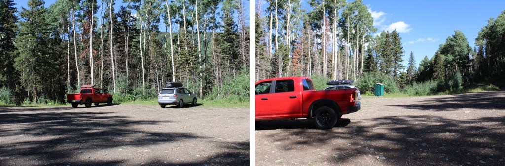
I started this hike at 5am from the Rock of Ages Trailhead. The trailhead has a porta-potty, and room for a couple dozen vehicles, but the road in is at minimum high clearance (with a creek crossing).
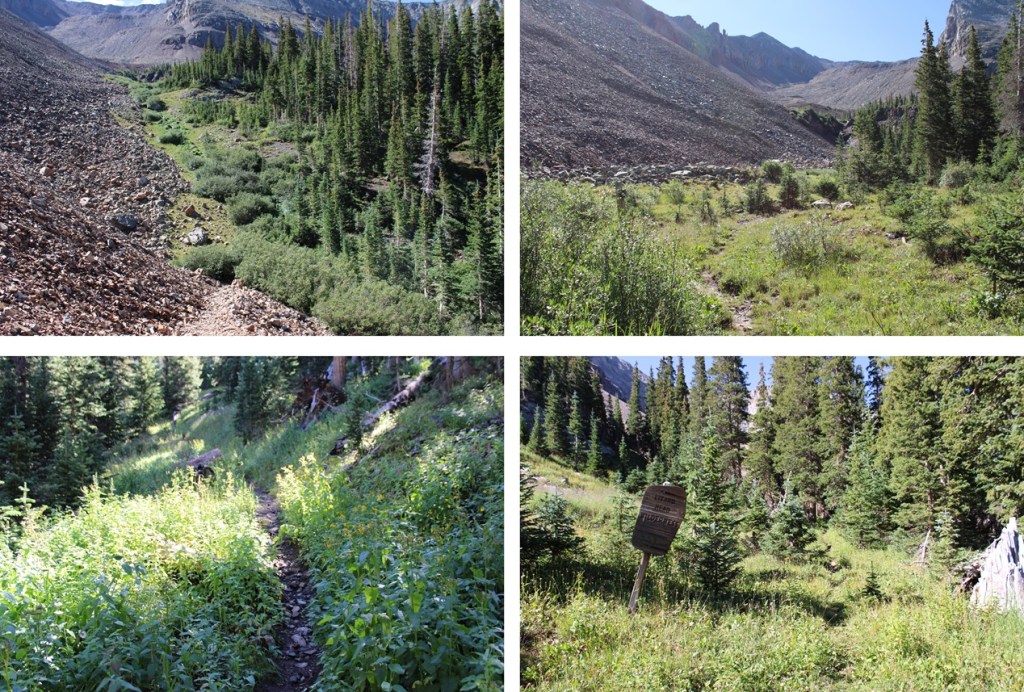
The trailhead starts at the south end of the parking area. I took the trail to the left, the Rock of Ages Trail, at the junction immediately following the entrance to the trailhead.
I followed the Rock of Ages trail for 1.5 miles
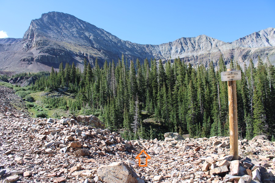
After following the Rock of Ages trail for 1.5 miles, I came to a junction, and started following the Elk Creek Trail east.
Here is where the trail got interesting. I kept gaining, then losing elevation, then gaining it back again. I knew this would be frustrating on the way out (it was). I continued following the class 1 trail
I then came to another junction, but the sign was broken. I followed the trail to the left.
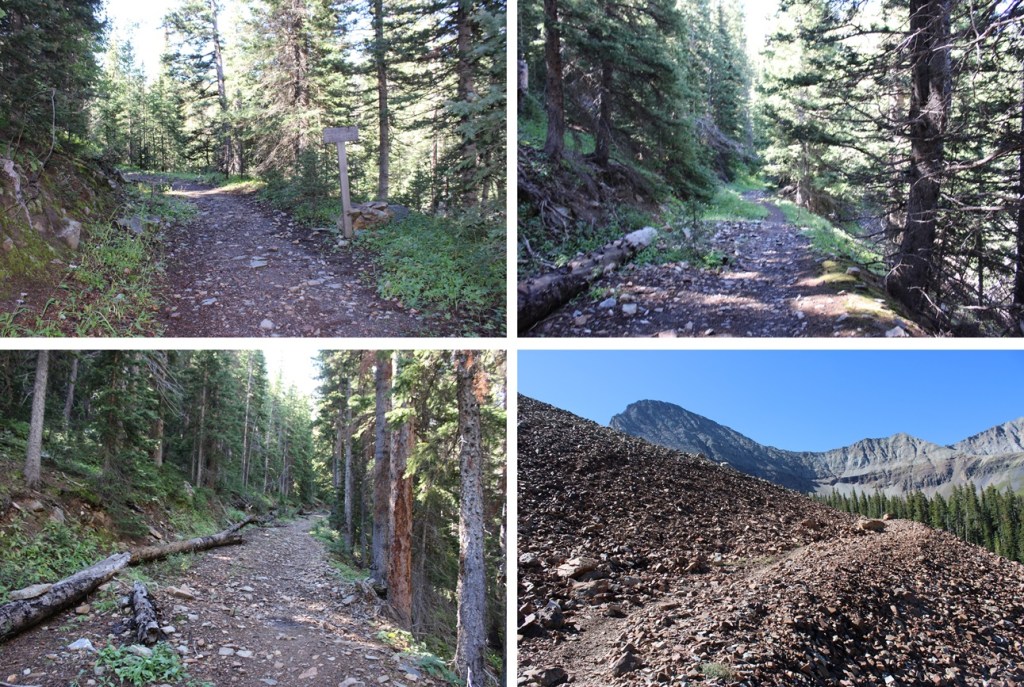
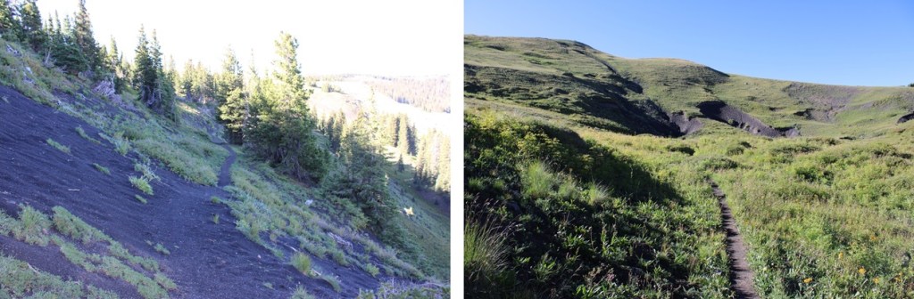
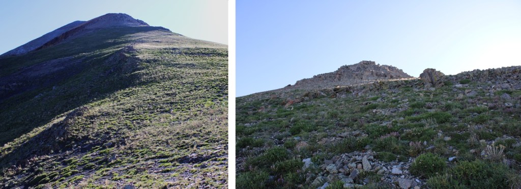
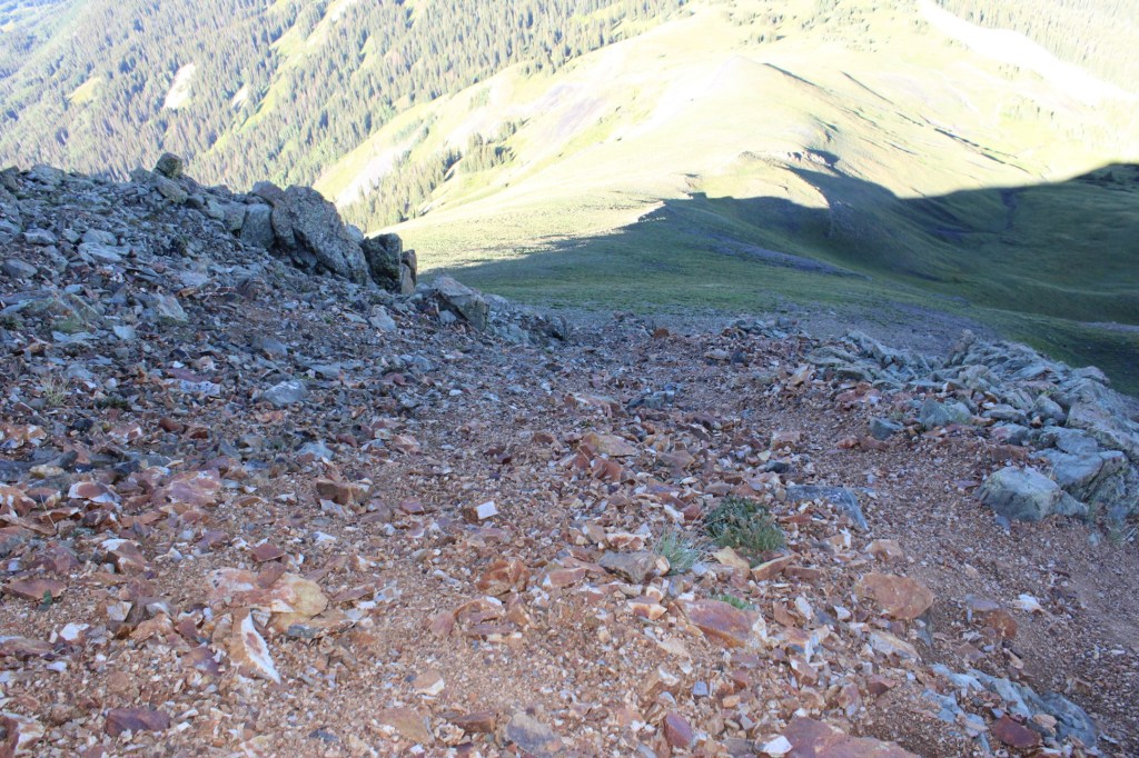
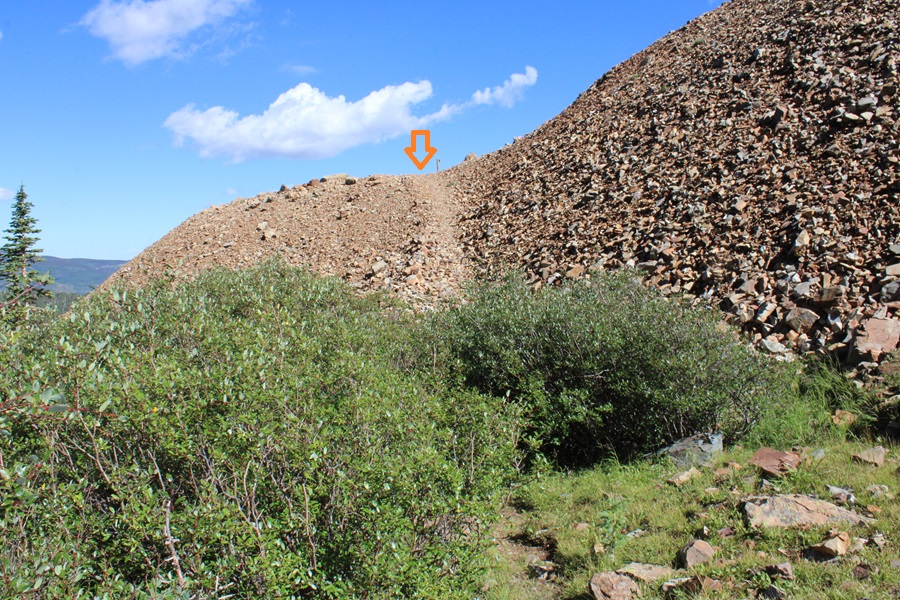
I followed these class 1, well defined trails for 4.3 miles, until I came to the base of a gully running down from Boskoff Peak
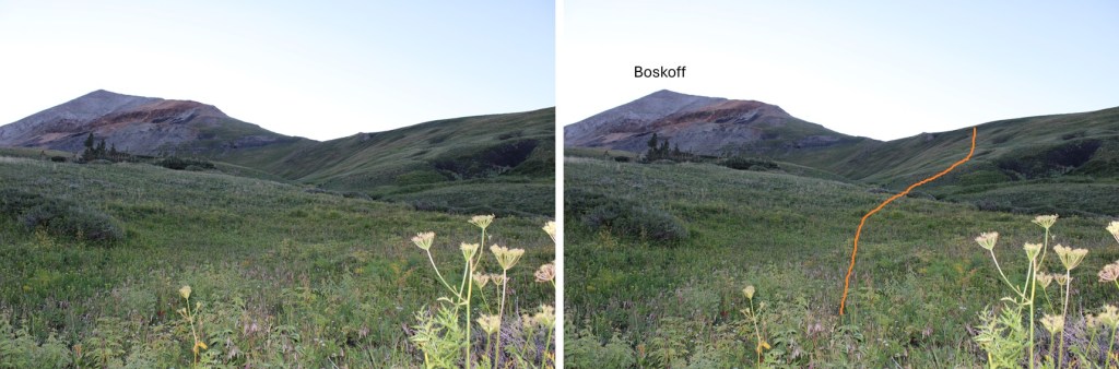
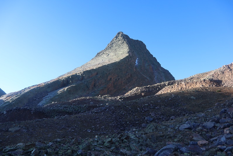
Here I could clearly see Boskoff, and it’s ridge in front of me. I left the trail, and headed southeast up the tundra slope towards the ridge.
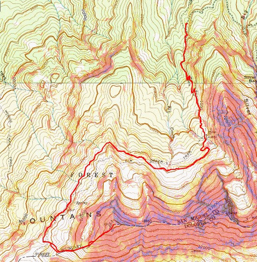
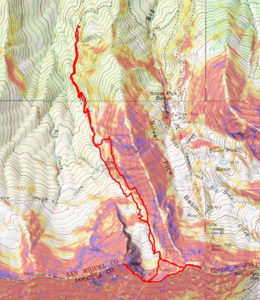
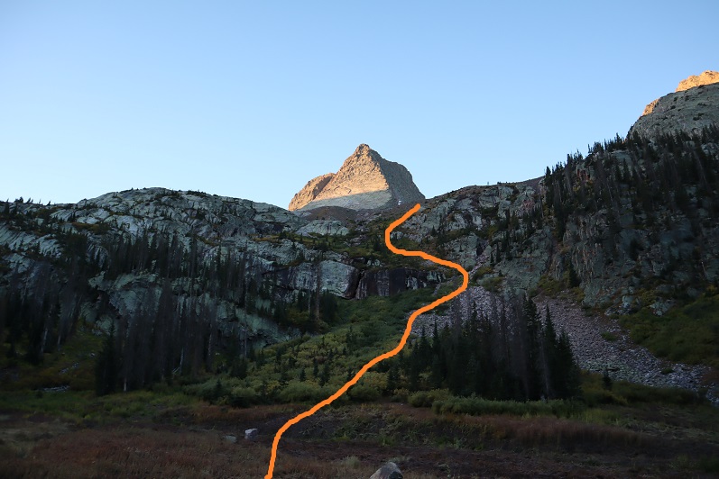
Once on the ridge, I turned left, and followed the tundra northeast. I pretty much stuck to the ridge to summit. Here’s the overall route:
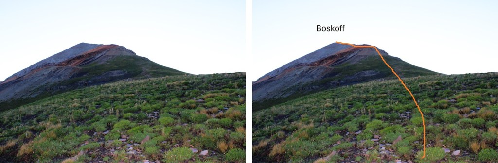
I followed the ridge until the tundra ended.
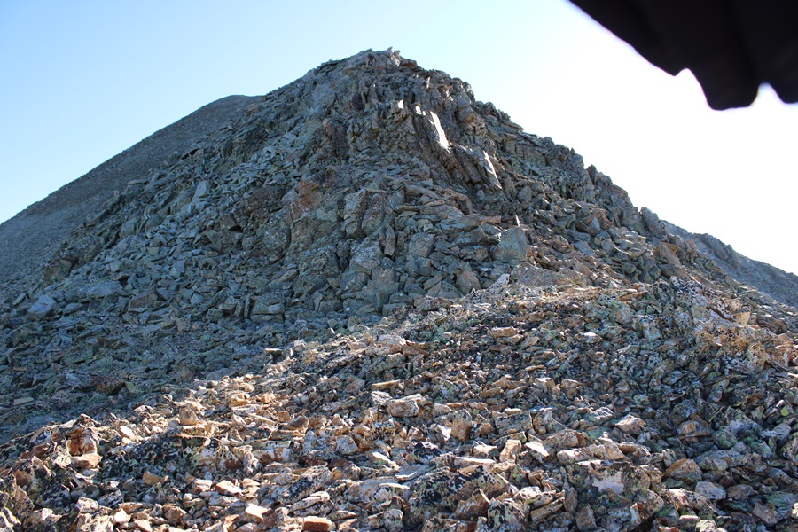
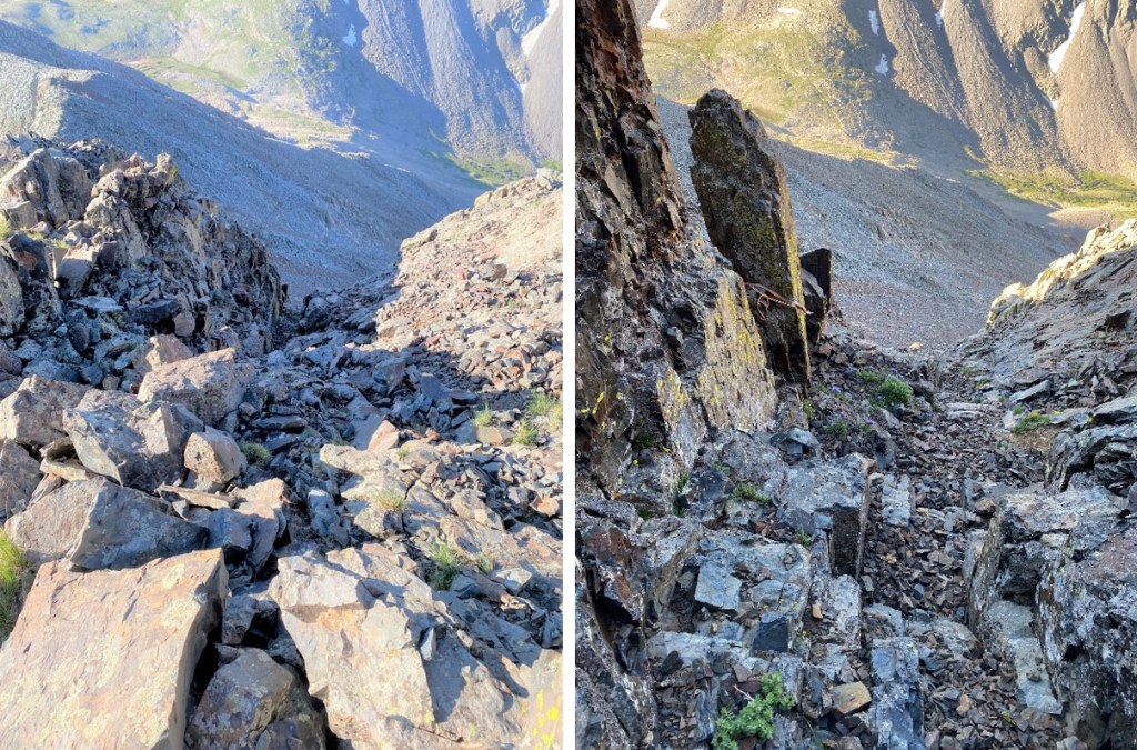
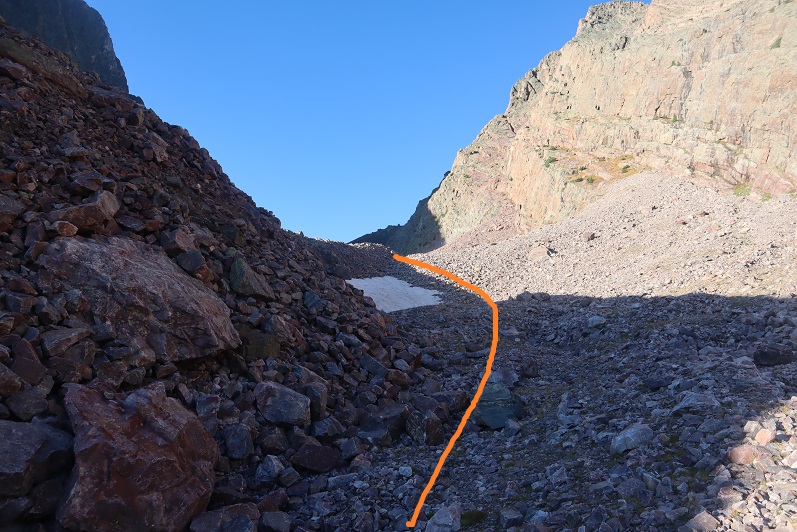
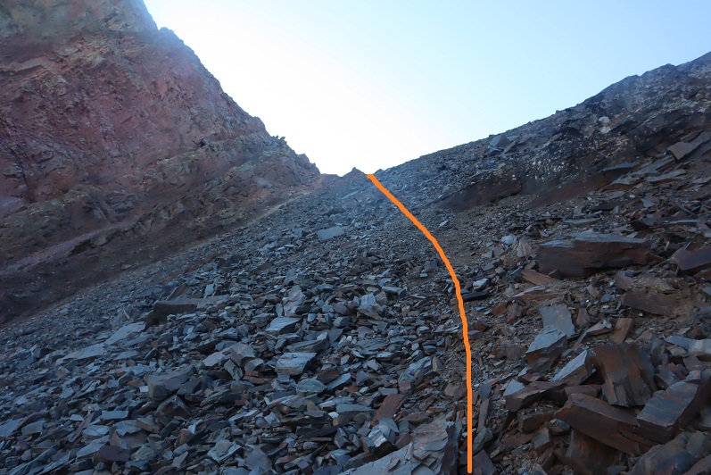
The tundra ended at the base of a rock formation and several gullies. I took the right gully up, the left one down. Both were class 2. The right gully was more stable, but the left gully made for some fun scree-surfing on the way down.
Here are some pictures of the right gully
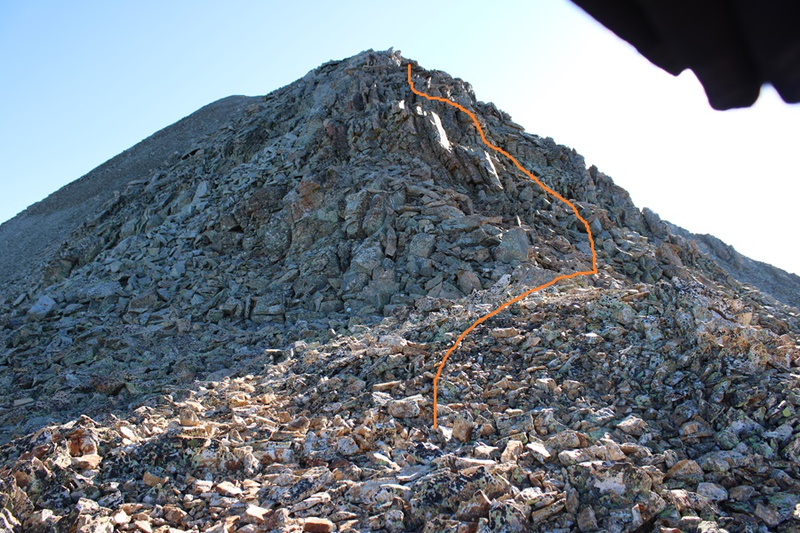
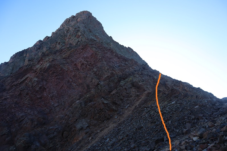
Both gullies end at the same place. From here, there’s a well defined game trail on the talus leading northeast along the ridge. I followed the talus trail until it ended at another pile of rocks.
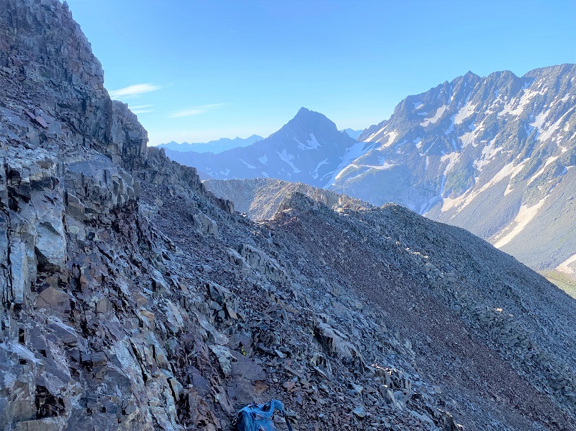
I went a little to the right, hopping over loose talus doing a couple of easy class 3 moves, then aimed for the ridge.
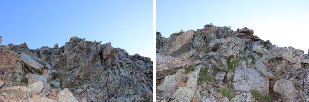
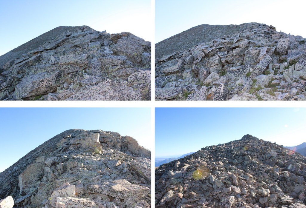
The rest of the hike is class 2, all the way to the summit. Just be careful, the boulders and talus here are loose. I wouldn’t want to do this ridge if the rocks were wet, as I relied a lot on the traction of my shoes to keep balance. I followed the ridge to the summit.
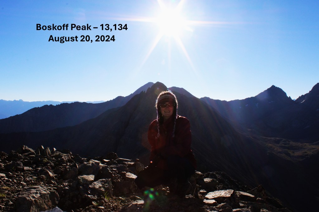
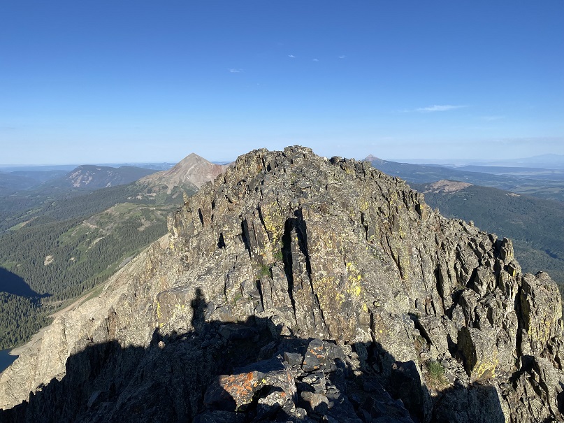
I summited Boskoff Peak at 7:50am
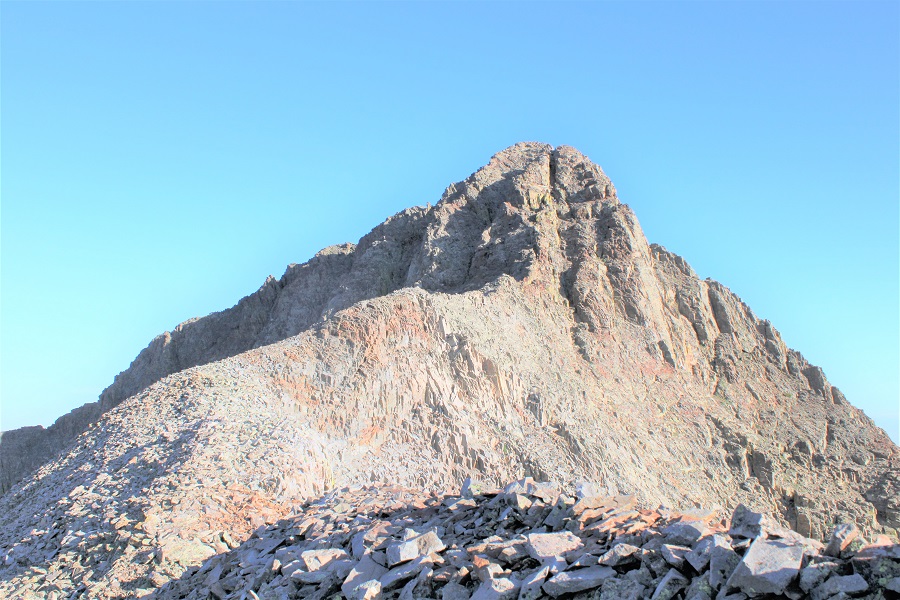
Boskoff Peak:
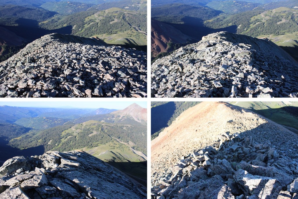
Now to head back. This was an out and back hike for me, so I turned and headed southwest down the rocky ridge
Then back down to the talus
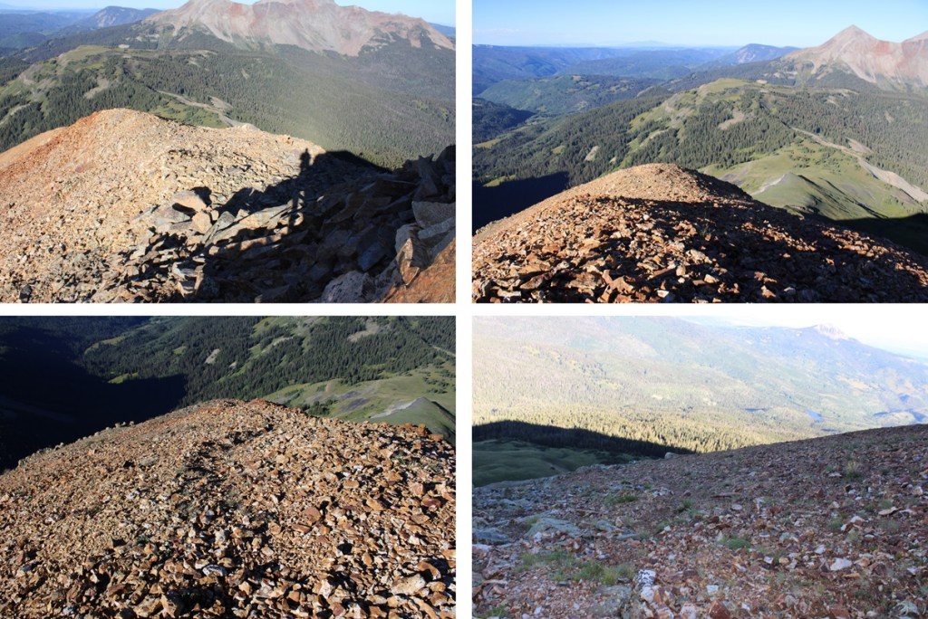
And back on the talus to the gully. This time I took the gully to my right down, scree surfing to the tundra.
Back on the tundra, this is the route I took back to the trail below.
When I made it back to the trail, I turned right, and followed Elk Creek Trail back to Rock of Ages Trail
I then went left, and followed the Rock of Ages trail north back to the trailhead
I made it back to the trailhead at 10:45am, making this a 10.63 mile hike with 3398’ of elevation gain in 5 hours, 45 minutes.
I’d already been away from home a few days before this trip, so I stopped at Ouray Hot Springs to get in a quick workout and a shower (they only charge $4 for a shower, which might be nice if you’re hiking around Ouray and want to freshen up every few days). The only downside? The parking was terrible, even on a weekday in the morning.
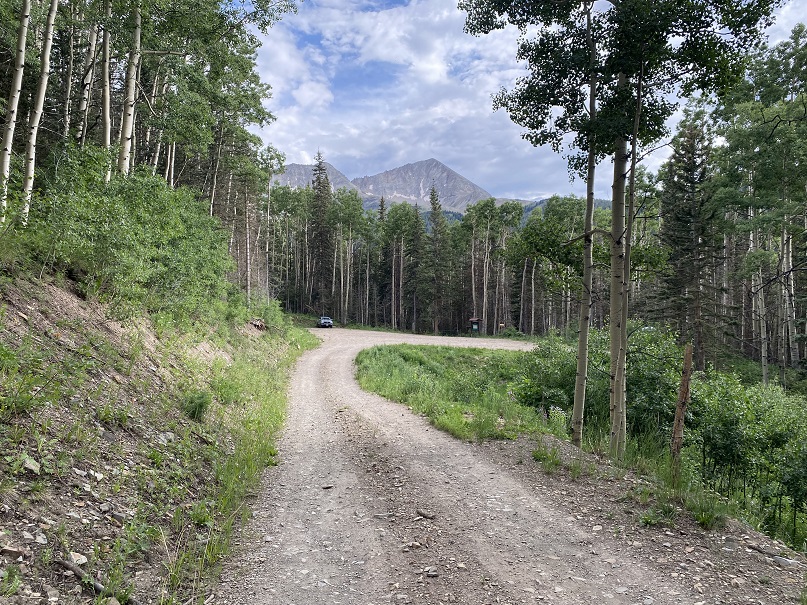
After cleaning up I drove to the Rock of Ages Trailhead. The drive in was a bit bumpier than I remembered, but also fun, because I was seeing what Miles (my new Tacoma) can do. He handled the stream crossing and ruts in the 4WD road without needing to be put into 4WD.
I made it to the trailhead and was the only one in the lot (another good thing about arriving on a Thursday).
I walked around for a bit, and immediately realized the mosquitoes were going to be a problem. I’ve ordered a topper for Miles, but it’ll take up to 3 months to get here, so until then I’m sleeping in the back seat of the cab (It’s a tight fit but luckily I’m small). I made the decision to get to bed as soon as possible. I ended up waking up several times during the night because I was so warm, but at least waking up ended one of my nightmares: a dream about sharks in a swimming pool swallowing children whole.
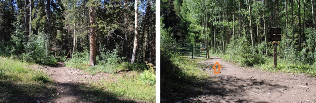
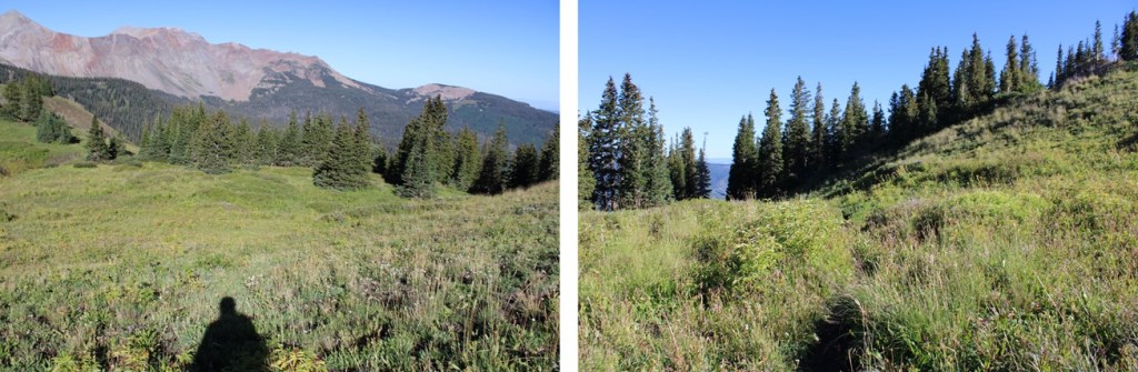
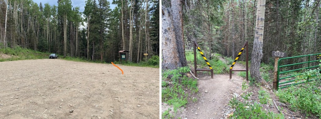
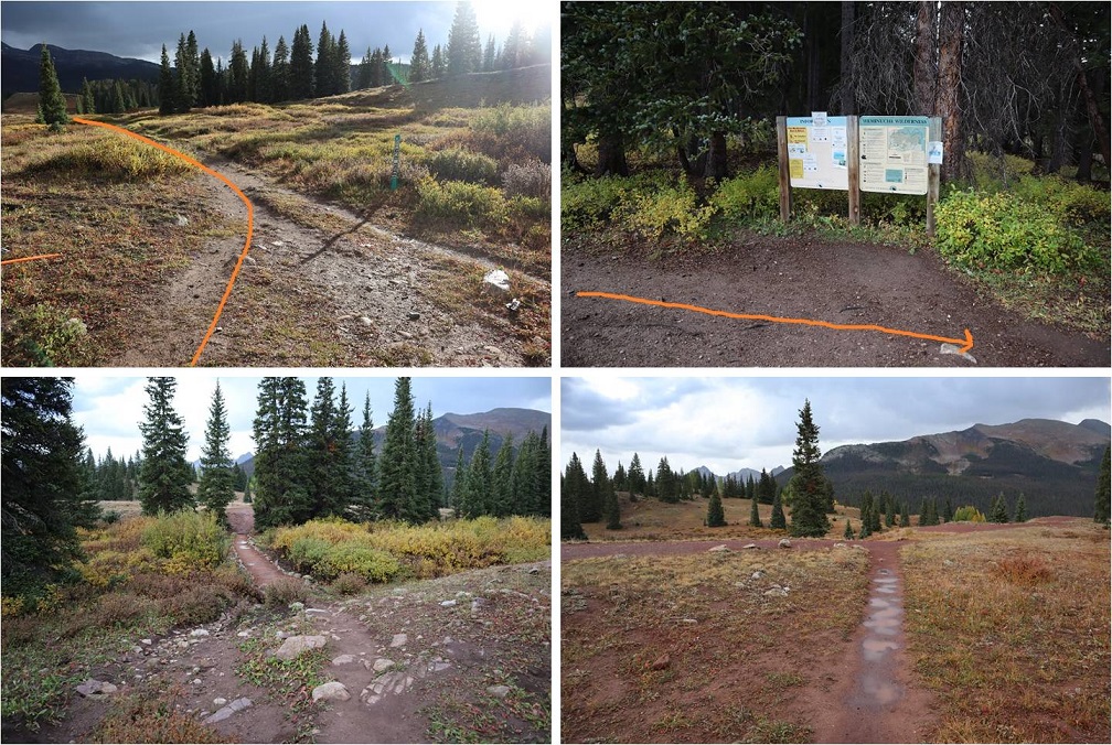
Ok. So, I woke up and was on the trail at 4:15am. The route starts at the south end of the parking area, and follows a well-defined trail south.
I quickly came to a gate, and walked around it.
Next, I saw this sign to my right, and continued on the trail
I followed the trail to treeline.
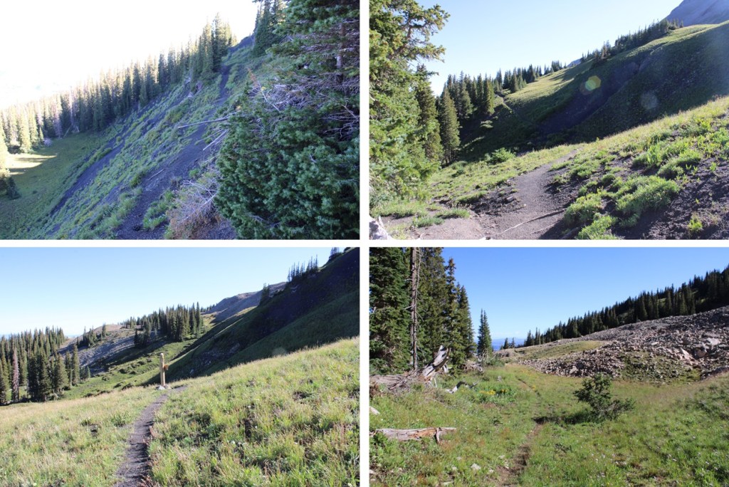
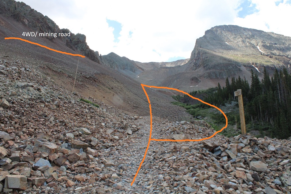
Shortly after making it to treeline I came to the Elk Creek Trail junction. From here there are several options, but your main goal is to make it into the basin. You can follow Elk Creek Trail and lose some elevation, then follow a faint road into the basin. Or, you could continue along the Rock of Ages trail and eventually hook up with the 4WD road that enters the basin from above (a bit chossy, but I chose to take it on the way out). On my way in it was dark, I couldn’t see any of these ‘routes’, and I chose to just head straight into the basin.
If you take the mining road, here’s what the entrance looks like from the Rock of Ages trail. It’s about half a mile past the Elk Creek Trail junction, on your right.
If you take the upper road, this is what the junction from the trail to the road looks like
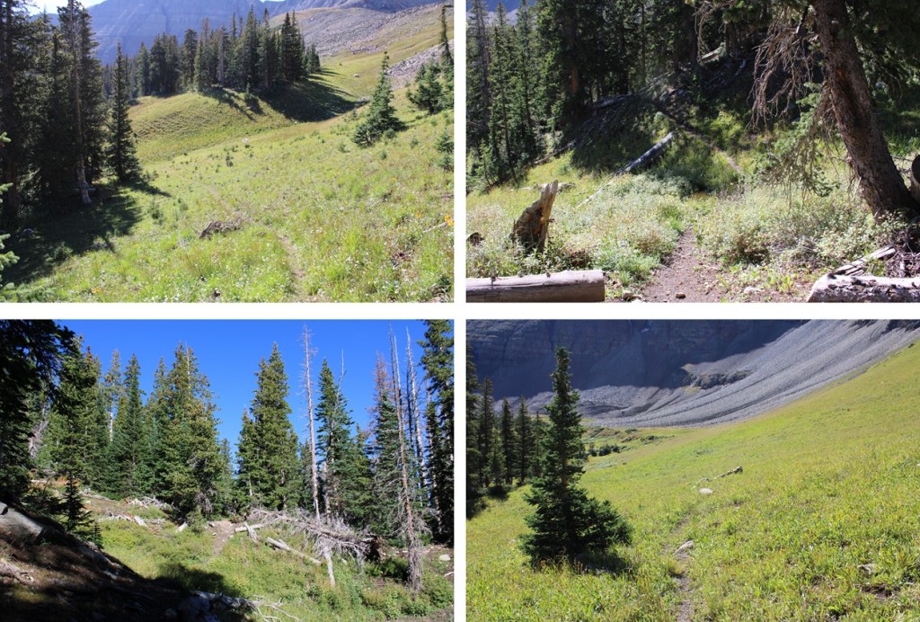
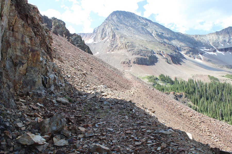
In any event, I made my way into the basin. Here are the routes. To the left you can see the mining road, and to the right you can see the abandoned dirt road. They both lead to the same place. (On my way in I didn’t see either of these roads and just headed south through the basin).
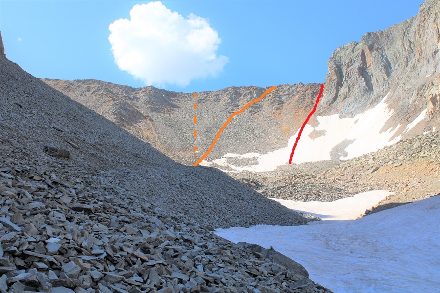
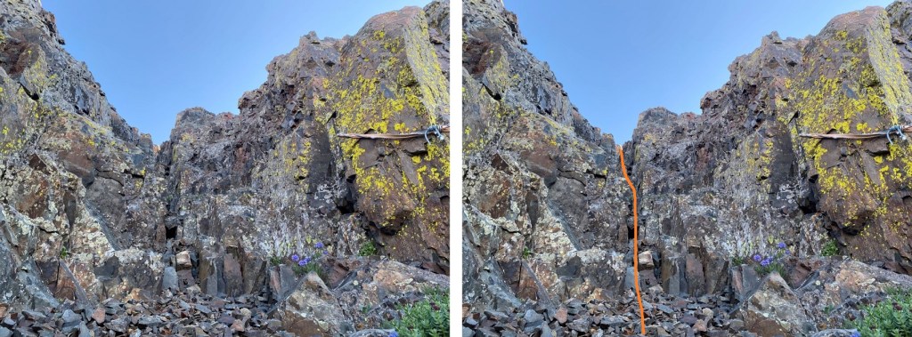
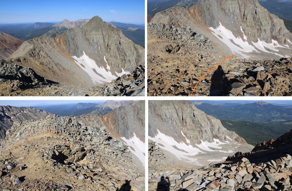
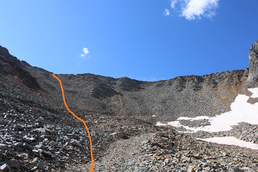
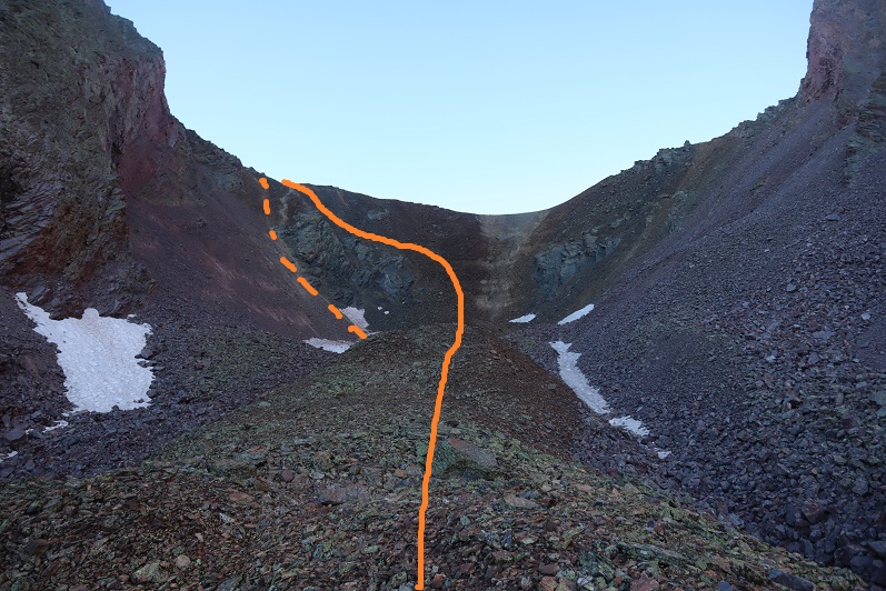
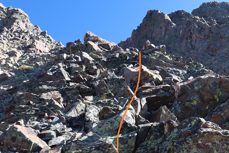
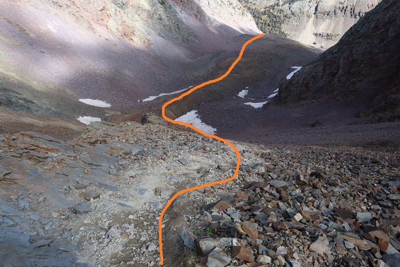
Once in the upper basin you want to gain the ridge. This sounds easier than it turned out to be. It’s “choose your own adventure”, and on the way up I chose wrong. I ended up getting into some class 4 scrambling, which was unnecessary. It’s my advice to do PT 13540 first, and gain the ridge to the left (southeast). However, all areas here ‘go’, if you’re willing to do some scrambling. When I made it to the ridge I found thick wire cording going where the red line is (I’m guessing that could be used as leverage if needed: it wasn’t moving anywhere). I ascended via the orange line. The dotted orange line is probably a better route. The best route is my descent route (pictured later).
I’ll spare you the scree-y and large-loose-rocky gully details of ascending the ridge. Once on the ridge I turned right and followed the ridge southwest towards Fowler. The ridge was all class 2
If you haven’t already, now is a good time to put on your helmet. Here’s a picture of that cable I was telling you about. It goes up and over both sides of the saddle.
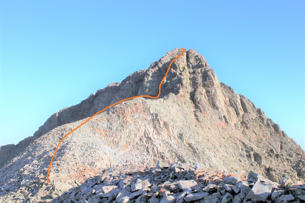
Here’s an overall view of the rest of the route to summit Fowler.
And step by step: It started out chossy as I ascended the ridge
I made my way to the gully to the left/middle. This area had more solid rock, but it was littered with scree/rubble. At the base of the gully I took off my pack and decided to go up with just my cell phone (and a summit register in my pocket, just in case).
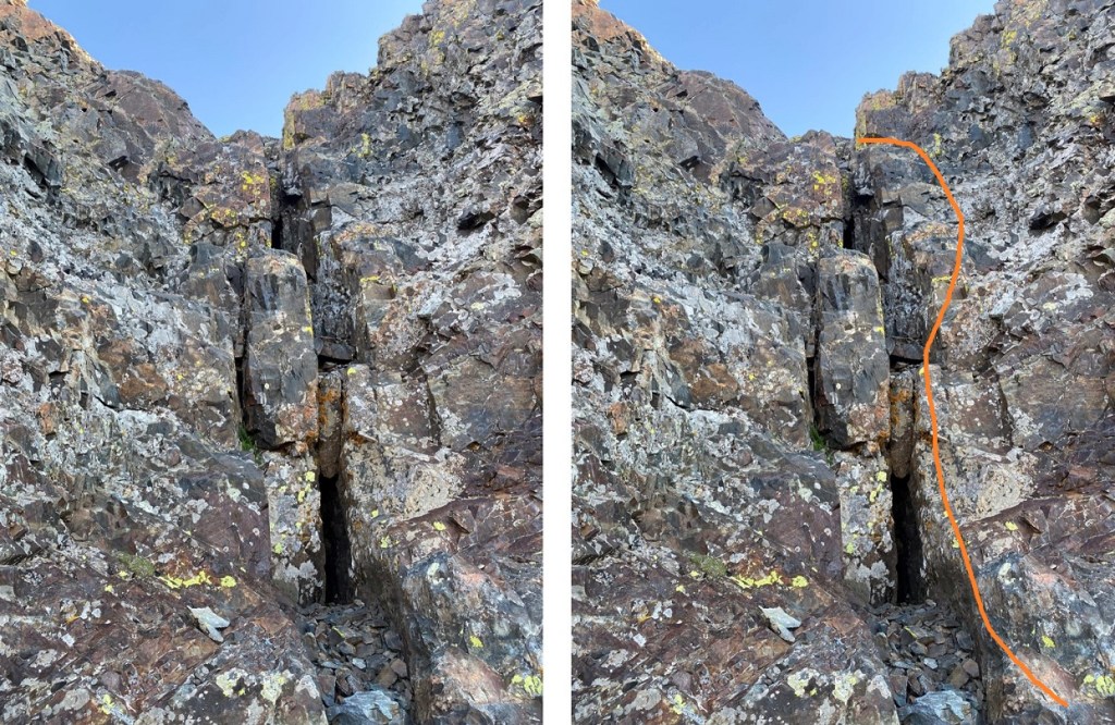
This is the class 4 part of the climb, and lasted for about 120 feet of vertical gain. I started by going straight up the gully. Here’s my route:
Step 1: ascend the chimney. I went to the right of the chimney, and found adequate hand/foot holds.
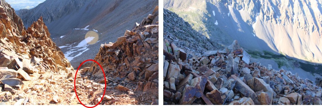
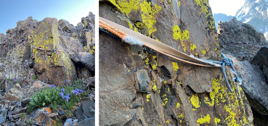
Step 2: Once above the chimney I stayed to the center of the gully. This is also where I saw an anchor set up (circled in red).
If you decide to rappel here, bring a new anchor, as this one looks like it’s been here for a while, and what’s been added to it doesn’t look recent either.
Step 3: From the anchor I continued straight up the gully (still class 4)
Step 4: Here’s a view of the last bit of the gully, before topping out. This felt class 3
At the top of the gully I turned left and headed towards the summit. It was a bit of a false summit, but all class 2/easy 3
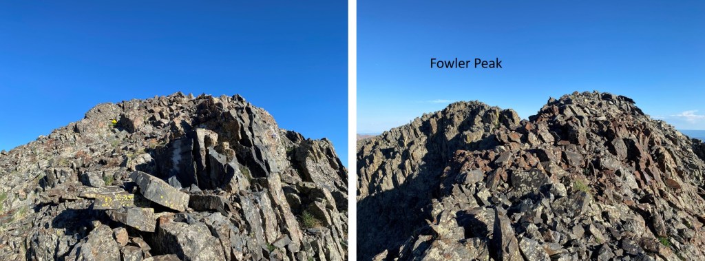
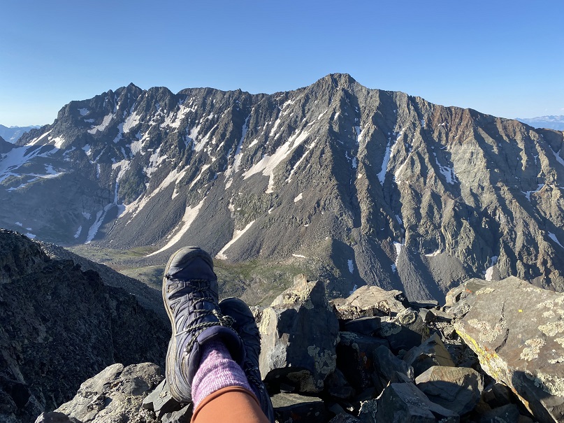
I summited Fowler Peak at 7:45am
Fowler Peak:
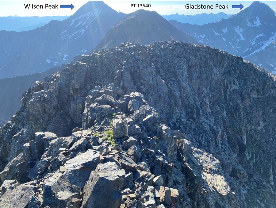
I sat and enjoyed my views of the Wilson/El Diente Traverse for a few minutes before heading back.
There was a summit register, but it was one of those tube ones. It hadn’t been closed properly and all the papers inside were wet, so I left it and also added a new register with dry paper to write on. And a new pencil. Here are some pictures of the trek back to the saddle
Back down the gully
To my stashed gear and back to the ridge.
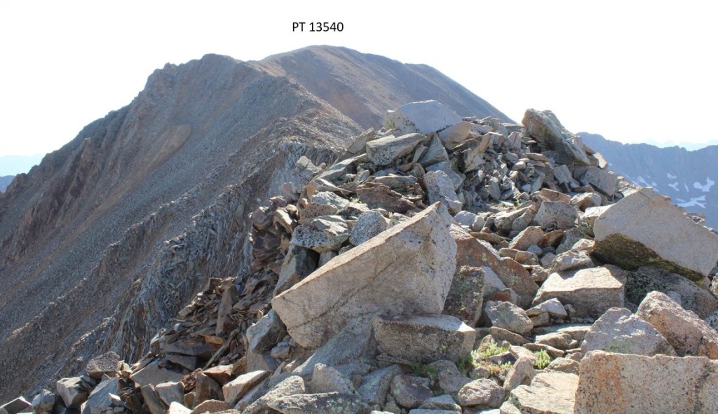
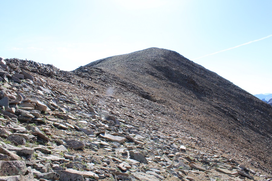
I followed the ridge over to PT 13540. This was a simple ridge hike, if a bit loose. Lots of rocks here. I stuck mostly to the ridge the entire time, only dipping to the right a few times when necessary.
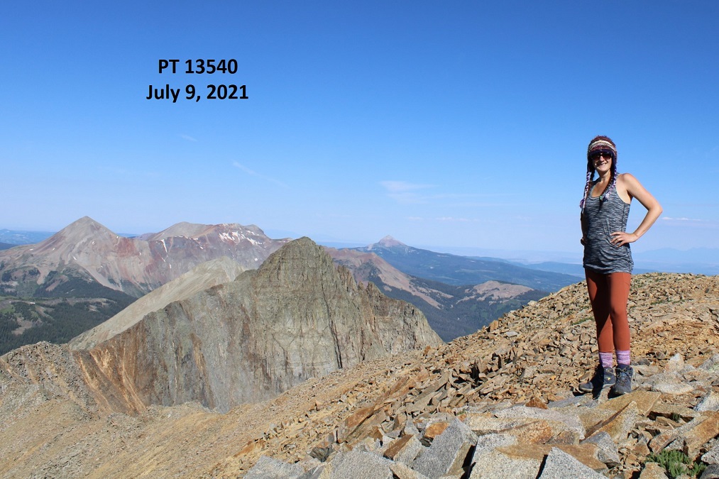
I summited PT 13540 at 9am
PT 13540:
I worked my way back towards the Fowler/PT 13540 saddle
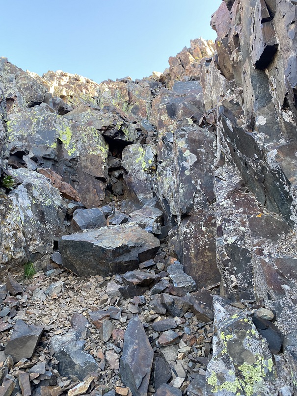
Once at the saddle there was what looked to be a boarded-up mine. In fact, it looked like everything here had been blown up at some point, except this area, which was strategically filled with large rocks (but may have been blown up too). I passed it and headed northeast back to the old mining road
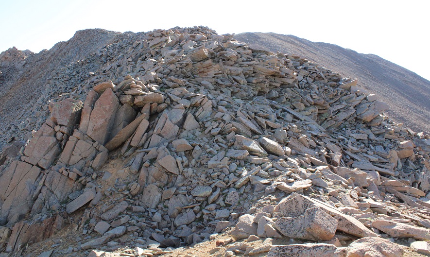
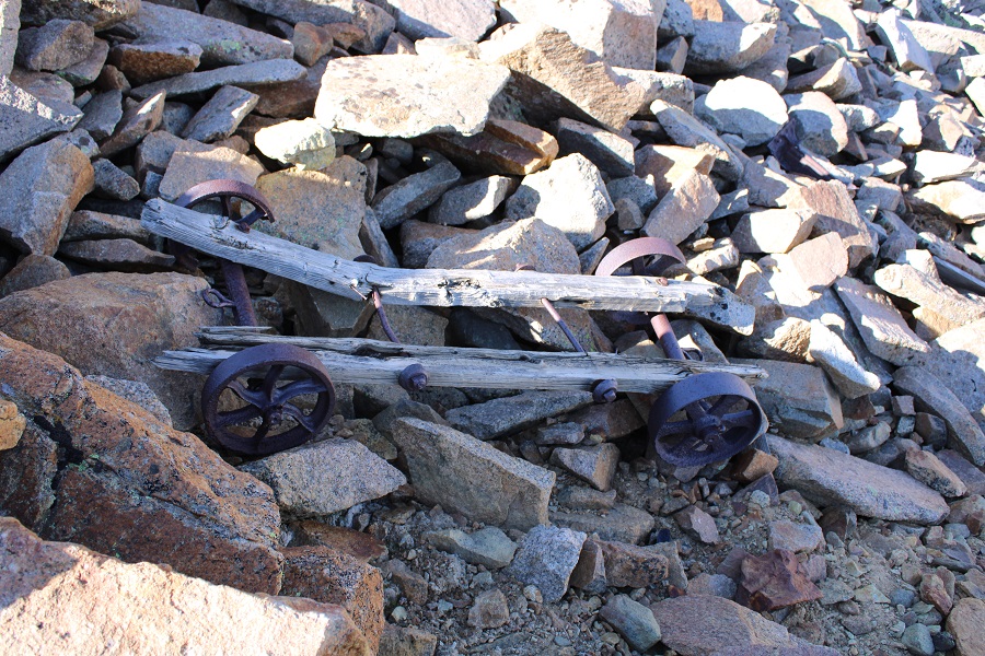
This area was steep, and I did some scree surfing, but it was much easier to navigate when compared to the route I took to ascend the ridge. I saw tons of mining trash here: lots of old cans and pieces of mining equipment, most of which were in small pieces, all made out of cast iron. This was the most intact item I came across
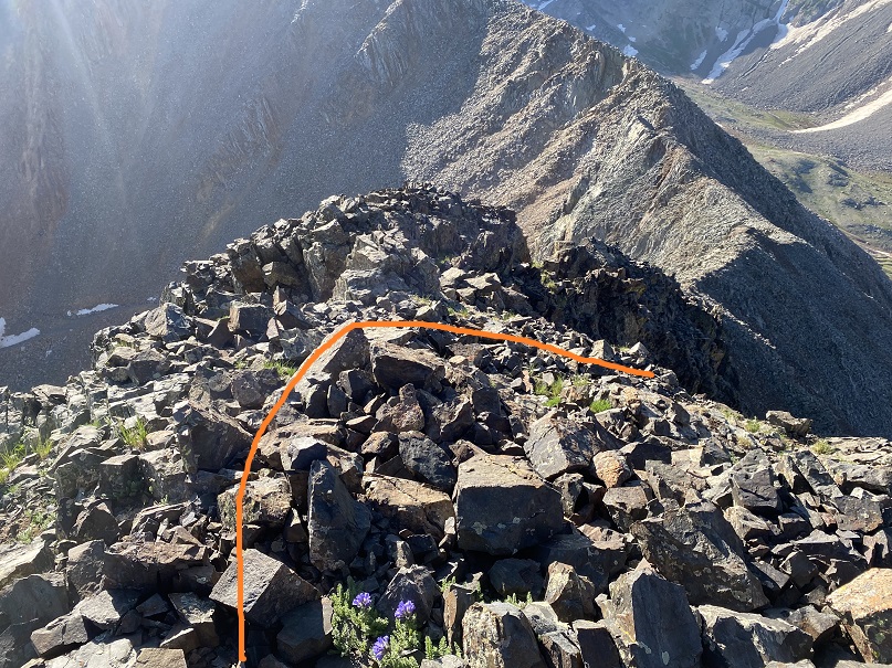
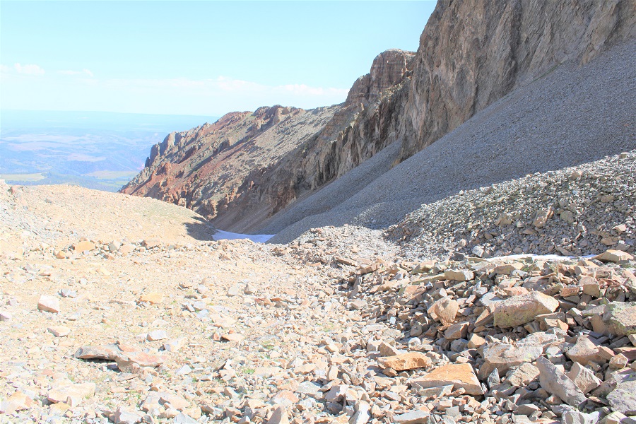
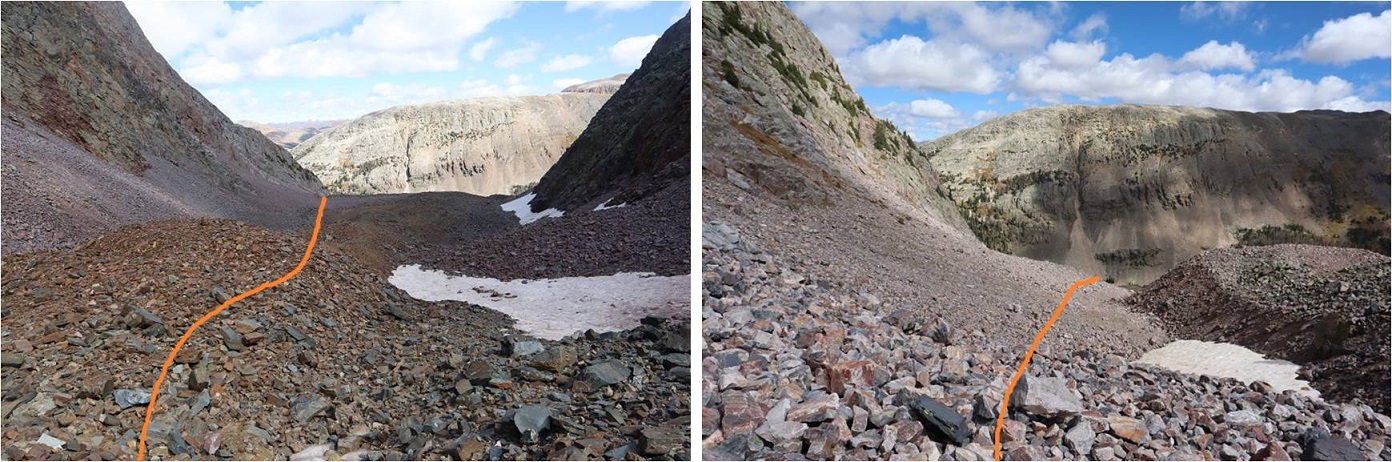
Here’s the route I took down from the ridge (I’d recommend ascending this way as well)
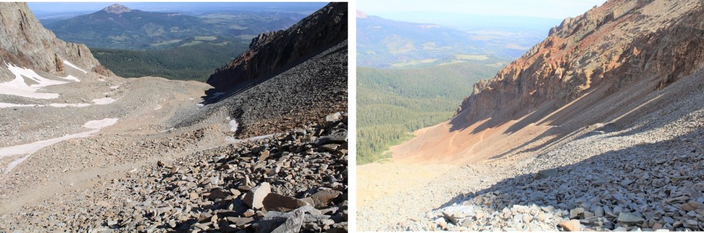
Once back on the road you once again have options to exit the basin. You can stay high, to the right/east, and follow the old mining road, or you can stay low and left/west, and follow an old dirt road.
Here’s a better look at both roads. Both take you out of the basin, and back to Elk Creek Trail / Rock of Ages trail (If you take the mining road all the way to the Rock of Ages trail, turn left and follow it to the Elk Creek Trail junction, and then continue following the Rock of Ages trail).
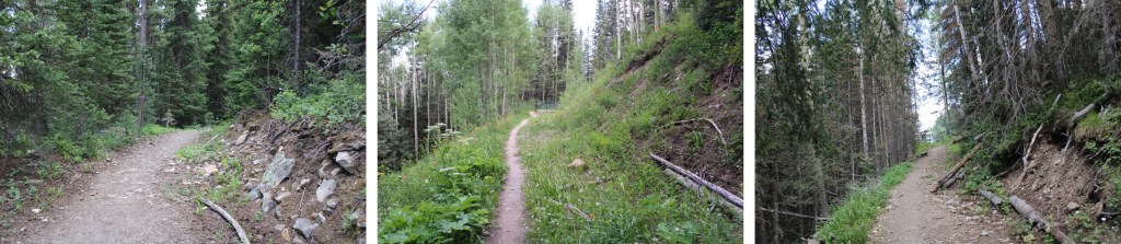
Once back on the trail I followed it through the trees northwest, back to the trailhead.
I made it back to my truck at 11:15am, making this a 10.53 mile hike with 3985’ of elevation gain in 7 hours.
It was still early, and quite warm, and the mosquitoes hadn’t magically disappeared overnight. I had a friend meeting me here at 6pm to hike Wilson Peak tomorrow, so I’d planned on staying at the trailhead until he got there, then heading to bed. I’d brought a lot of things to do, but they all required sitting down, and once I did that the mosquitoes swarmed me. It was like one would find me and sing its song to its friends and there’d be dozens to shoo away.
If I was outside I needed to have a jacket on, but it was hot! I tried sitting in my truck with the air conditioning on, but that wasn’t going to work for 7 hours straight. It was kind of funny watching the mosquitoes (and flies!!!) swarm my truck: they seemed to know I was in there with the air conditioning on.
So, I entertained myself for the next 7 hours by reading. I got out my current book (On the Road by Jack Kerouac) and read while steadily walking around the trailhead in circles. Continuously moving seemed to keep the mosquitoes at bay. Luckily, the trailhead has a large parking area and I was the only one there. Every few hours I’d take a break in my truck, and then get out and read again. I would have started a campfire to shoo the bugs away, but they’re currently banned. I can’t wait to get the topper on my truck! It would have solved the mosquito/heat problem.
After a full week of work in Tennessee where I gorged myself on comfort food (fried chicken, fried oysters, collard greens, cornbread, etc.) and went highpointing in Mississippi because I could, my flight got in at 1:30pm and I drove from Denver to Molas Pass and slept for about 3 hours in my truck before waking up at 1:30am and hitting the trail. There was one other truck in the large parking area when I arrived.
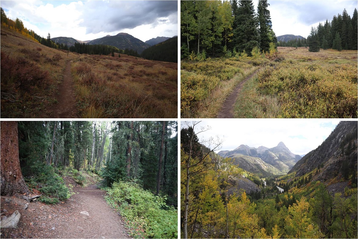
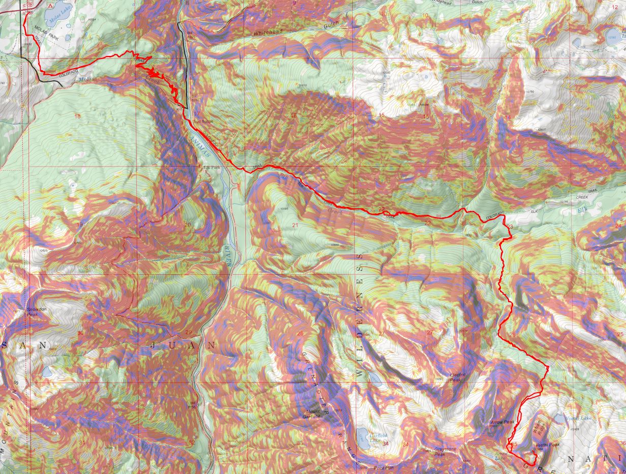
I checked the weather reports and anticipated rain/snow/wind for today so I put on my snow pants and went light on gear. Initially I’d planned on camping in the Vestal Basin and hiking Arrow and the Trinities as well, but with snow in the forecast I decided to make this a one summit/day trip. The trail started at the south end of the parking lot. It was really easy to follow and had plenty of signs
For about a mile the trail stayed pretty much level, and then it descended 1500+ feet down to the Animas River
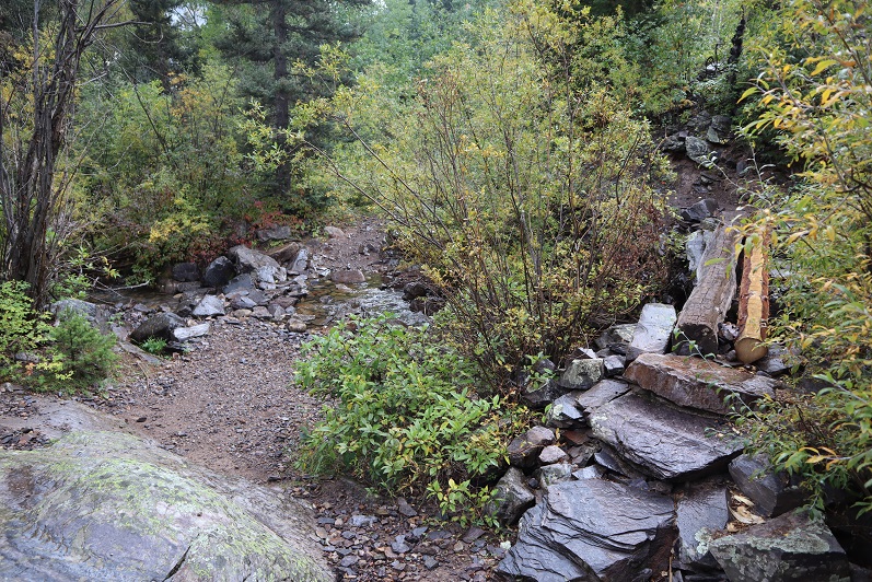
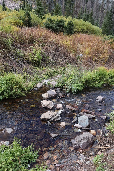
At 3.8 miles I crossed a small creek
And heard a rustling in the bushes. I knew there was an animal about 6 feet off the trail, and it felt larger than a coyote but smaller than a bear. I tapped my trekking pole loudly against a rock a few times to flush it out/scare it away. Usually when I do this the animal quickly runs in the opposite direction, but this time it started advancing towards me in the dark. Thinking this was not a good sign I braced myself as the animal came closer to me, moving through the tall brush. Was it a rabid raccoon? A baby bear? (I swung my head from side to side: Oh no! Where’s mama???) and then suddenly it was on the trail in front of me and I realized it was a rather large beaver.
This beaver wanted nothing to do with me, it was just aiming for the trail as an escape route, and kind of looked like a land manatee (BTW, I just finished reading the book “On Trails” by Robert Moore and the experience of hiking has broadened for me and I was immediately reminded of why animals are attracted to trails. It’s a good book with no direct conclusion but connects many aspects of hiking: you should check it out).
Seeing the beaver was cool: it was much larger than I thought they’d be. The downside? I had the “Beaver Song” in my head for the next 2 hours. Not as much fun as it sounds…
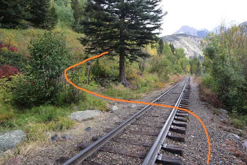
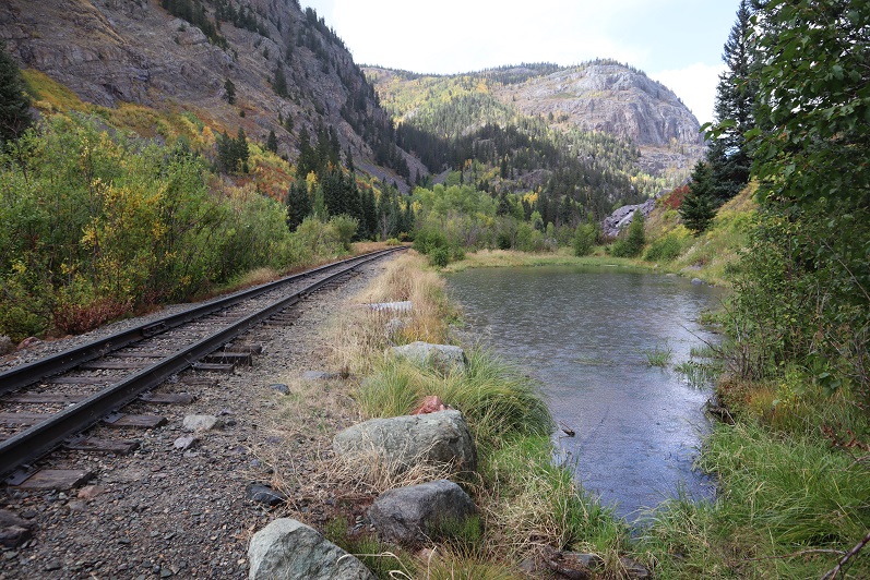
At 3.9 miles I crossed the bridge that goes over the Animas River
Turned right (southeast) and followed the train tracks for about a dozen yards, crossed the tracks, and followed the trail up the mountainside.
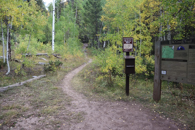
At 4.7 miles I came across the trail register and signed it in the dark.
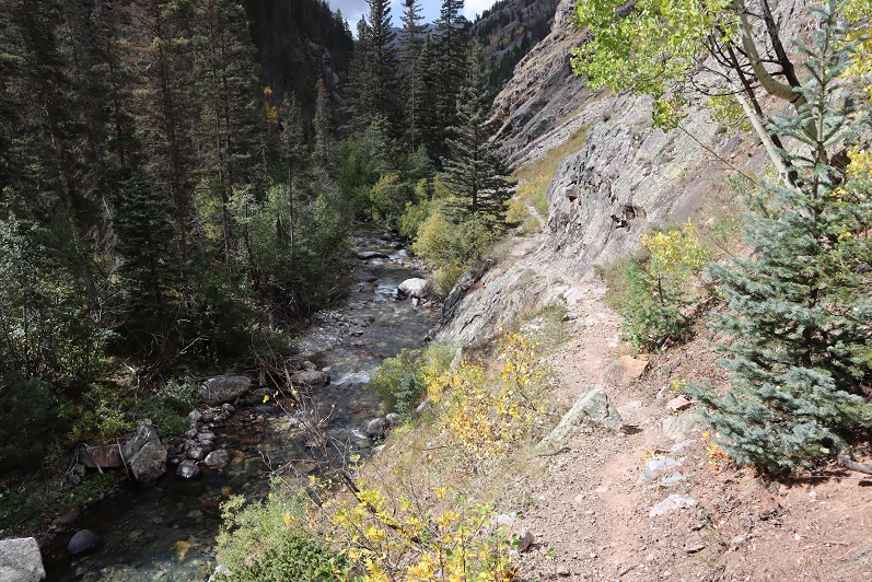
The trail parallels Elk Creek
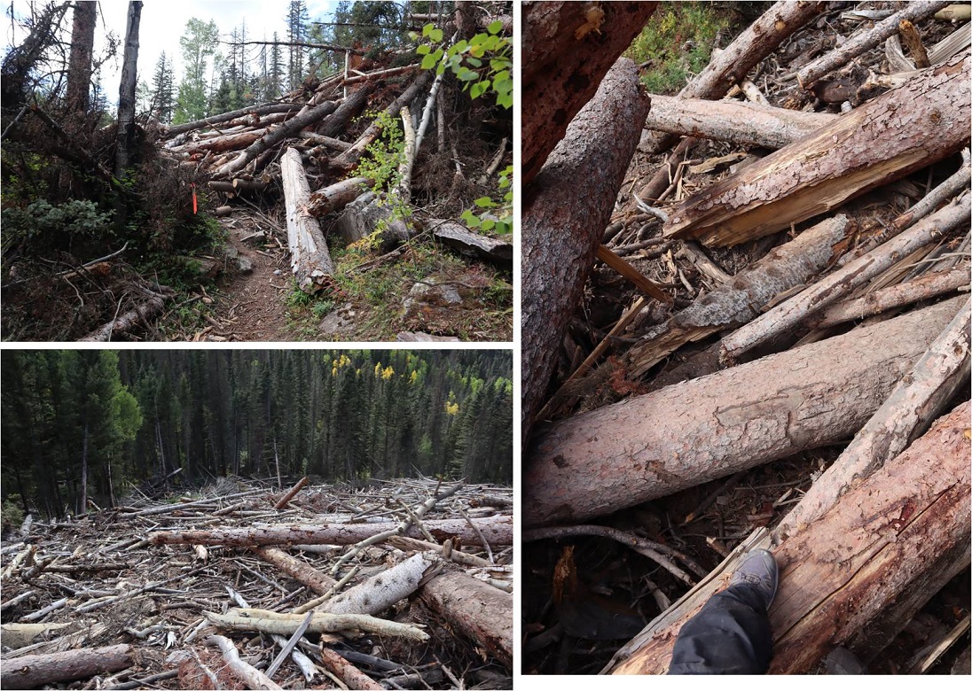
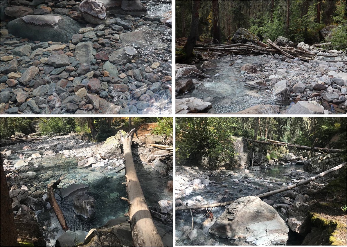
At 6.1 miles I came across the first area of avy debris. I’m guessing there were 3-4 slides all in close proximity that kind of ran together. I’d heard there’d been avalanches here and to just follow the marked tape through them, but was surprised at how dense and large the debris was. I was able to follow the marking tape easily through the first area but got lost in the second and ended up climbing a little higher than necessary.
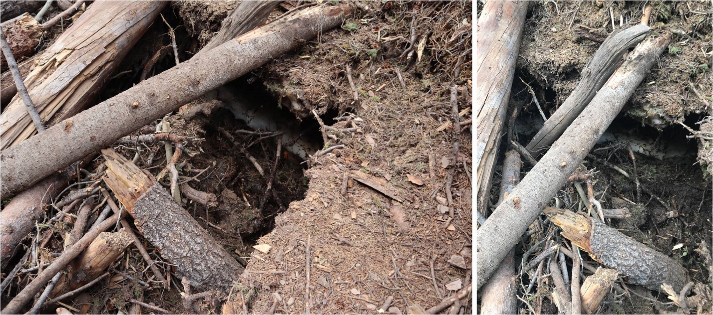
In the daylight I had no issues getting across the debris, but noticed there’s still ice and snow under the logs that’s melting and forming caverns, so be careful where you step! There were flies circling the debris.
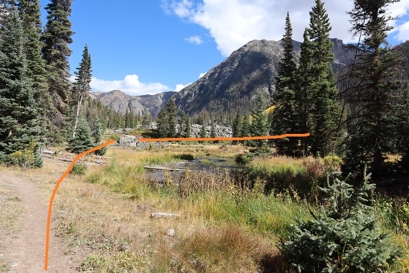
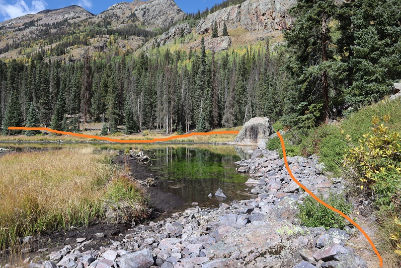
After the avy area I came across some beaver ponds and turned right (south). The best place to do this was just after the large boulder: the trail parallels a pond at this point
There was a good camping spot after the beaver ponds. Side note: anyone else’s carabineers hanging off your pack double as bear bells?
Mile 7 was the mile of creek crossings. What I couldn’t tell in the dark was this was some extremely clear water (it was refreshing on the way back to dip my bandana in it and cool off). All of the creek crossings were easy and had several options (rocks and fallen trees abound)
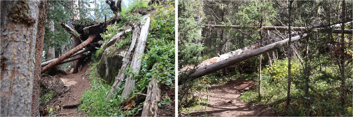
The trail continued to climb up the mountainside. There were frequently fallen trees on the trail (not from avalanches) but they were all passable and for once I celebrated in being short because I could pass under them easily.
This part of the hike was really cool because I started hearing elk bugling. I tried to get some of it on video but it’s hard to hear (turn your volume to the max). The bugling lasted for over an hour and came from all directions.
Elk Bugling:
The trail was well defined all the way to the basin. I reached the basin at 9.1 miles, just as the sun was coming up. There was a light dusting of snow on the Trinities.
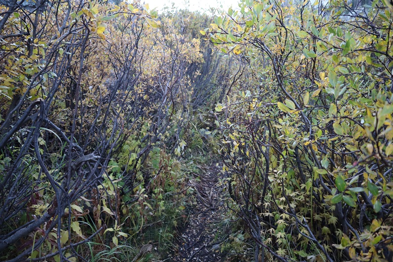
I followed the trail through the willows and lost one of my gloves. No worries though, because of my Raynaud’s I always bring at least 2 pairs (I had 3 today).
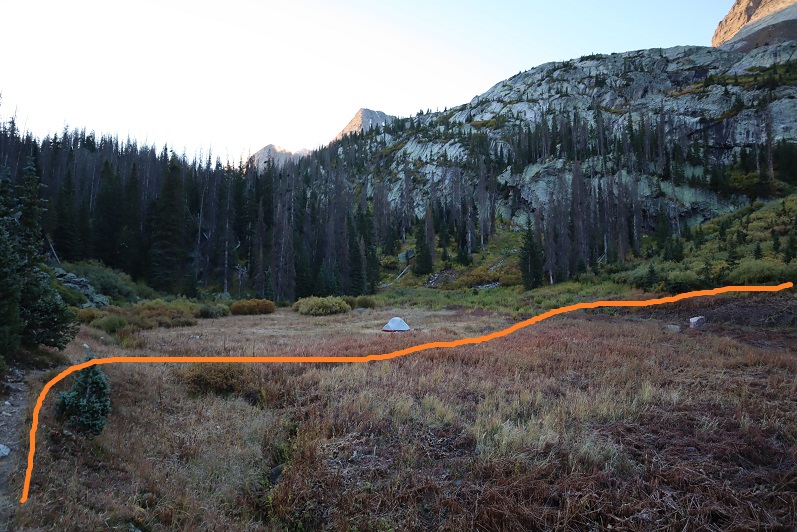
There’s an obvious campsite in the basin. I turned right (southwest) at the campsite at 9.8 miles- 11,380’, careful not to make too much noise because the campers were obviously still sleeping.
The trail crosses another small creek
And then climbs up the hill to another (rocky) basin/amphitheater
This is where the trail ends. I made my way over the talus, hiking closer to Arrow than Vestal
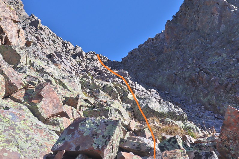
The goal is to gain the saddle at the top of the gully. This was harder than it sounds because that scree/talus is terrible. I was glad I’d worn my helmet. I strapped on my microspikes and took the solid line up, dotted line down. I’d do it the same way if I did it again.
Once on the saddle I headed southeast around the backside of Vestal
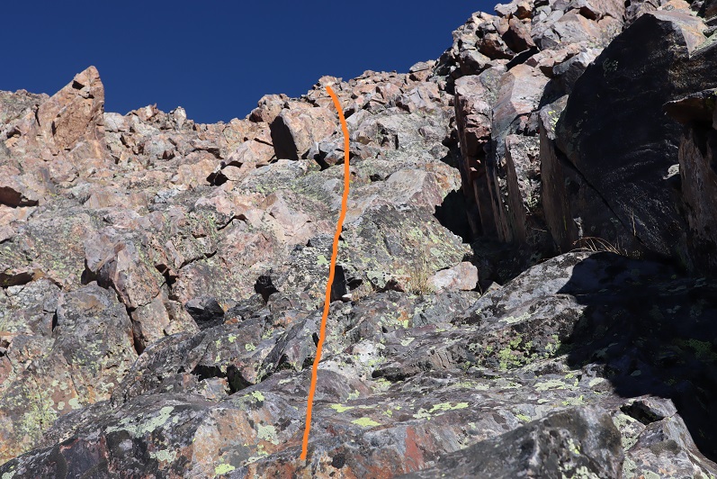
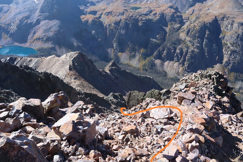
This eventually led me to an area of the mountain separated by a gully. Here I turned left (north) and climbed what I’d consider class 3 terrain towards the summit, careful not to go into the gully, aiming for where the gully originates.
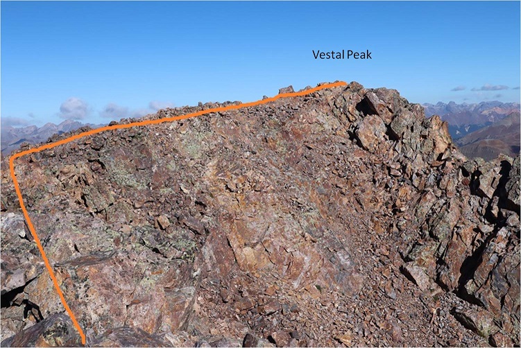
At the top there’s a false summit, but the true summit isn’t far off
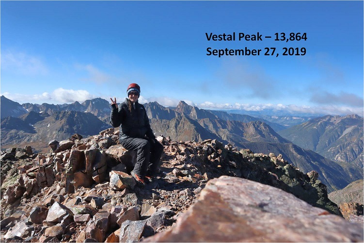
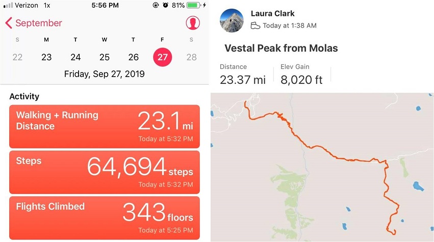
I summited Vestal Peak, my 100th Centennial, at 10am, after 8.5 hours and 11.4 miles of hiking.
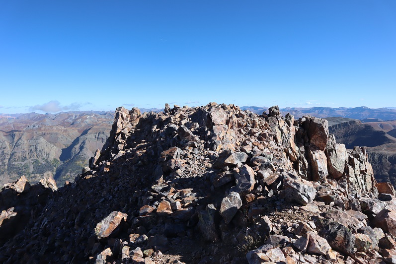
Vestal Summit:
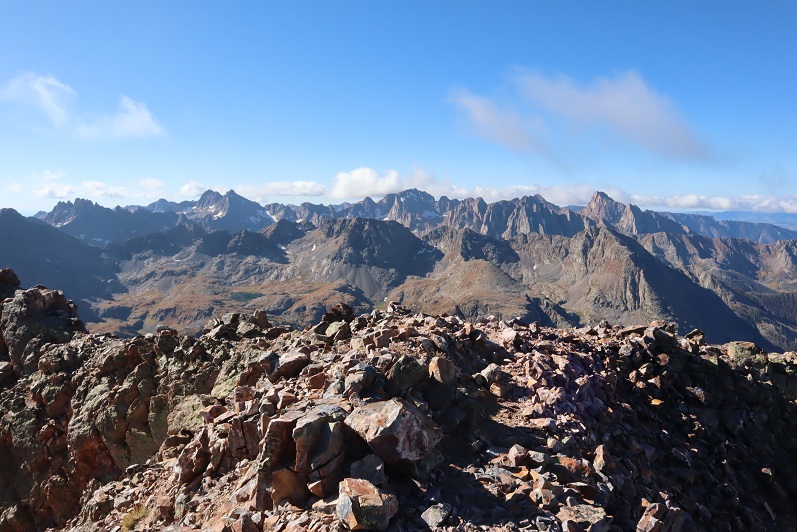
Despite the forecasted winds and cold temperatures and rain/snow it was a perfect day! I spent over half an hour on the summit, something I’ve rarely done, and took pictures of the Grenadier range and the beauty of the San Juans
Knowing the weather was nice now but it was supposed to turn I decided it was time to head back.
Here’s the path I took back down into the talus basin
It wasn’t pretty. In fact, I did something to a ligament in my ankle and it became very sore on the way down (still hurts, but it’s just bruised)
I decided to keep my microspikes on until I made it back down to the camping area. As I approached the area above the campsite I could hear someone shouting excitedly about nothing in particular and it looked like there were two people just finishing tearing down their tent. I figured it was a parent and child out camping and slowed down a bit to give them time to head out before me.
At the camping area I sat down for a bit, enjoyed lunch (peanut butter and pretzels) and took off my microspikes.
Here’s a look heading out of the basin
I found my lost glove (woot!) and caught up to the couple within about a mile of hiking. They were two girls in their early 20s who were out backpacking together. They seemed like they were having a terrific time (or high on something: I don’t judge) and were wonderfully boisterous. One of their boyfriends had dropped them off at one trailhead and was picking them up tonight at another one so they could make it a longer trip. We chatted for a bit and then I was on my way. The best part about the conversation? No one mentioned we were women out here alone.
The hike out was beautiful in the daylight. I made it back to the beaver pond area (I suspect the beavers moved to down by the Animas river because there’s no current sign they’re here anymore).
The avalanche area was much easier navigated in the daylight. I followed the Elk Creek Trail back to the Animas River
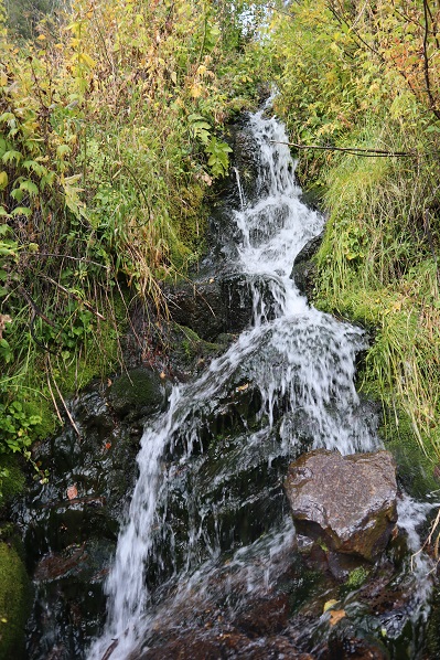
There were a few waterfalls along the way
I made it back to the trail register and even though it was sunny it started raining. For the rest of the hike it rained and didn’t stop. I was glad I’d worn waterproof clothing, even if it hadn’t been needed for much of the day. The rain was nice in the beginning but eventually the thunder started and I got a bit antsy. It was a beautiful hike out though, and much better than the trail back to the Purgatory trailhead (I’d take Molas over Purgatory any day).
The downside to the rain was the mud. It got really bad about half a mile before the trailhead and mud was starting to stick in layers to my boots. The last mile felt like it took forever to finish, but that was most likely because by this time I was quite tired. I’d made a good decision to make this a day trip: as I turned and looked back at the Vestal Basin I could see it was covered in dark clouds full of rain/snow/graupel/etc.
I made it back to my truck at 5:30pm, making this a 23.5 mile hike with 8020’ of elevation gain in 16 hours.
I changed in my truck into new hiking clothes and took a quick wet-wipe bath. I re-braided my hair, ate a packet of tuna and drove to the next trailhead. It rained the entire 5 hour drive there.