Cottonwood Peak A – 13,597

1

RT Length: 11.5 miles
Elevation Gain: 5110’

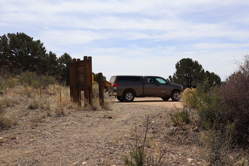
I got a bit of a later start on this one that I’d intended, as when my alarm went off at 12:30am I hit snooze and slept another hour or so (I’d already summited 7 peaks in the past 2 days and was a little tired). I made it to the Hot Springs Trailhead after first being led by GPS to the Hot Springs (which the sign indicated clothing optional: it was also closed due to Covid-19 fears).

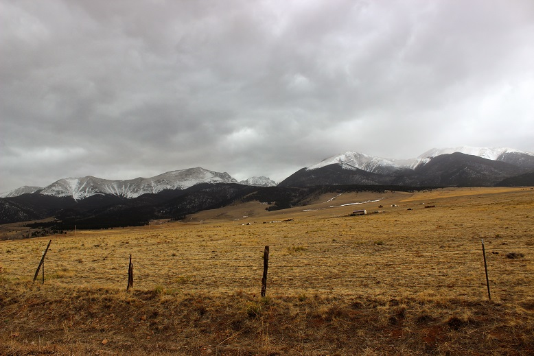
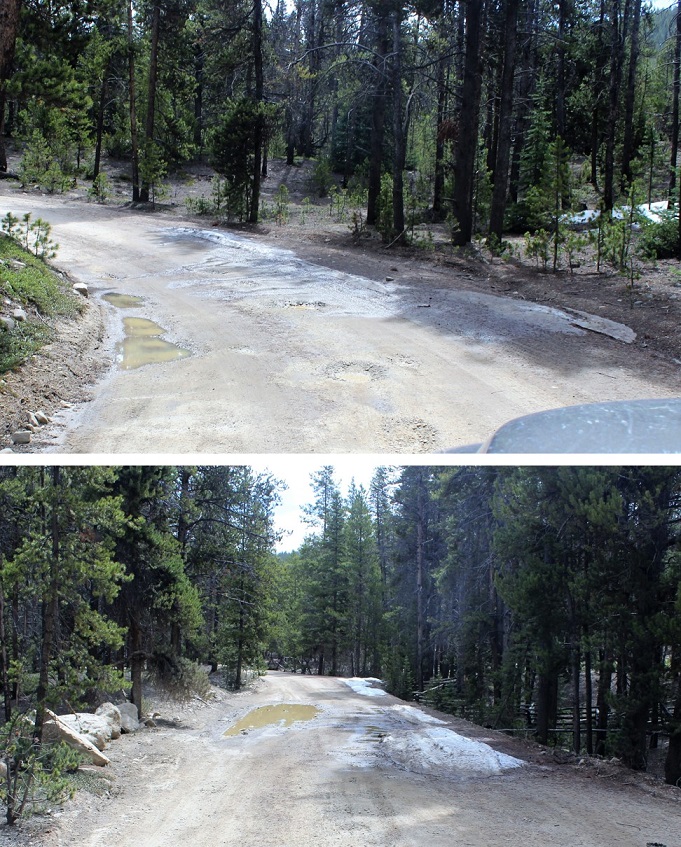
The drive to the trailhead is easy 2WD on a dirt road.

2

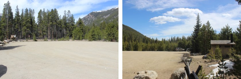
There was 1 other vehicle parked there when I got there, which I thought was odd. It was a newer VW and didn’t look like it had been there overnight. I tried to be quiet in case someone was sleeping in their car but thought to myself “Great! Someone else is trenching the trail for me!”

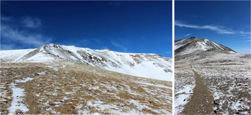
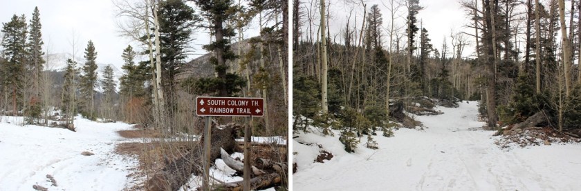
The trail is a loop, and I was surprised to find out it was actually an established trail. The morning was getting better and better!

3

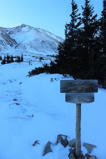
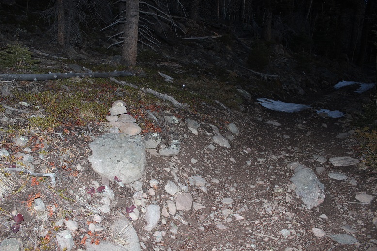
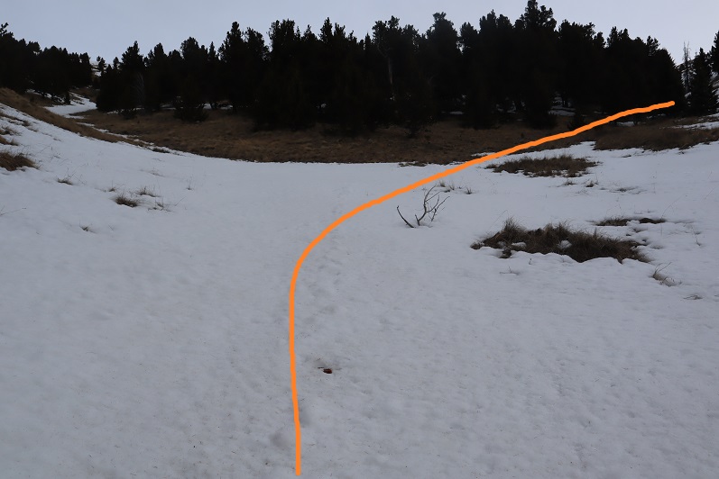
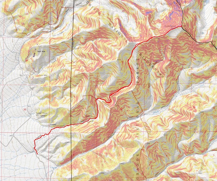
Just as an FYI, you cannot see the peak from the parking lot, but it was dark so that didn’t matter anyway. I signed the trail register (which was difficult due to the cold temperatures and ballpoint pen available). I wanted to summit Cottonwood Peak first, so I took the trail clockwise, starting to the left

4

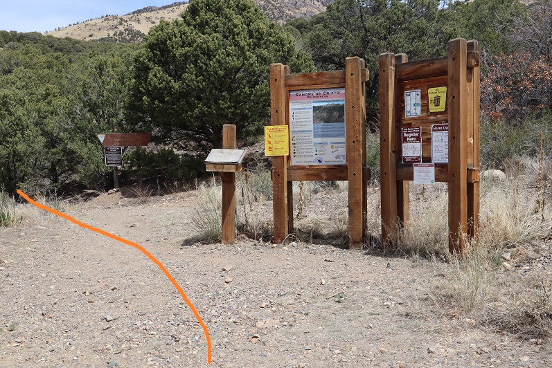
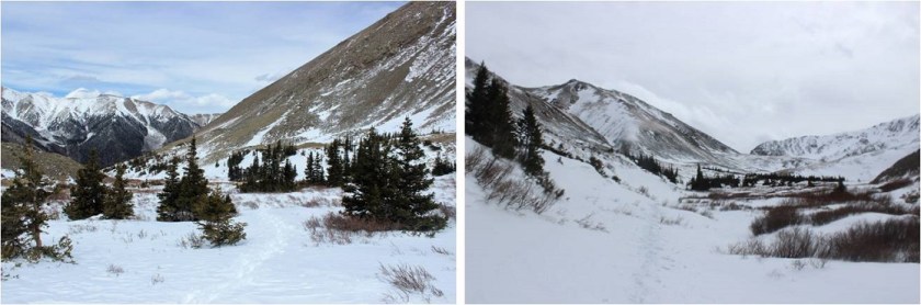
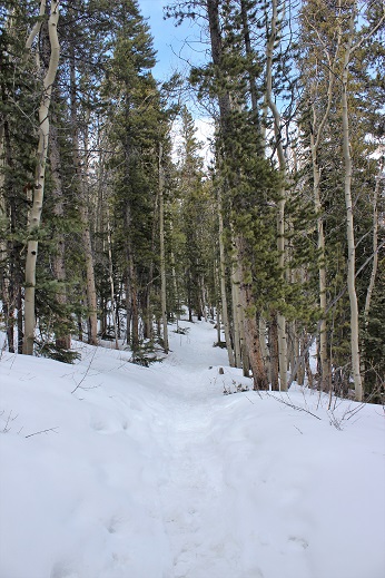
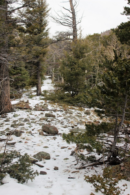
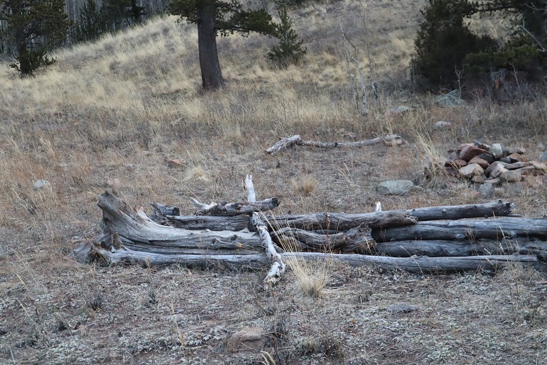
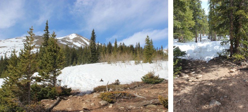
The trail starts off wandering through chaparral

5

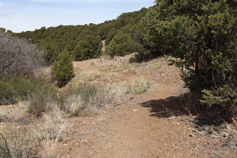
Here the trail was clearly marked and easy to follow.

6

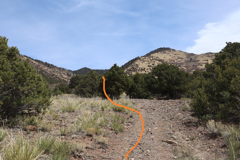
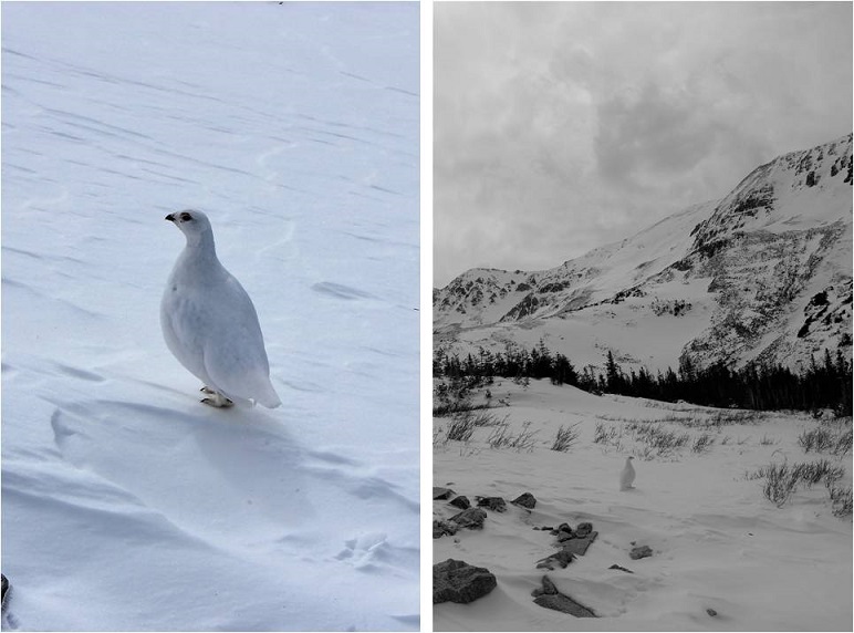
I rustled a sleeping ptarmigan as the trail switched to scrub oak

7

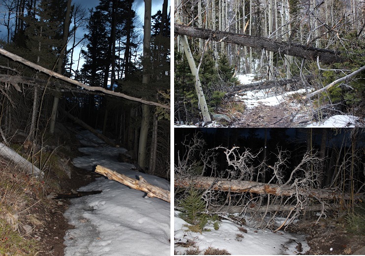
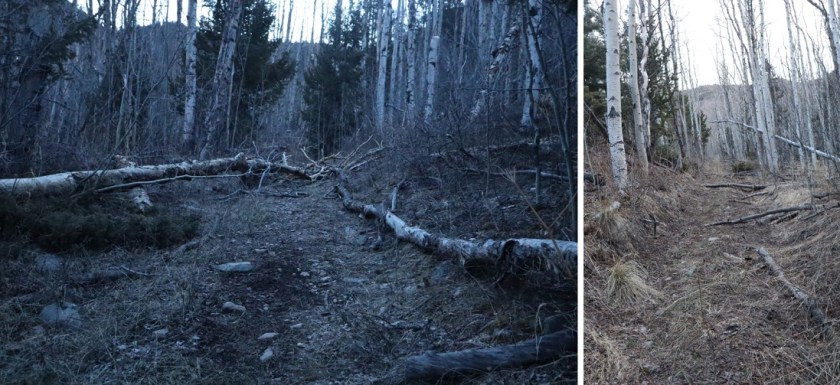
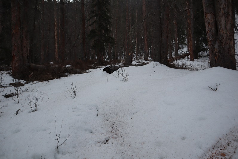
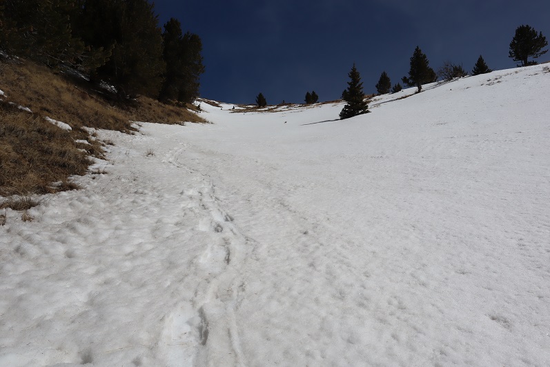
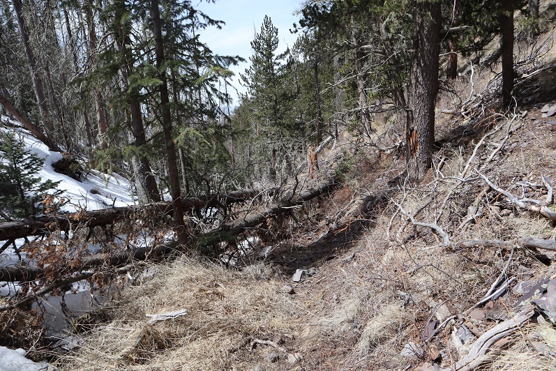
Once I entered the aspens the trail started to deteriorate. What I’d been pleased to discover was a good trail became a trail in much need of maintenance. I was navigating over fallen trees for the rest of the hike, and it became increasingly obvious no one had used this trail since the Fall and no one would be trenching for me today.

8

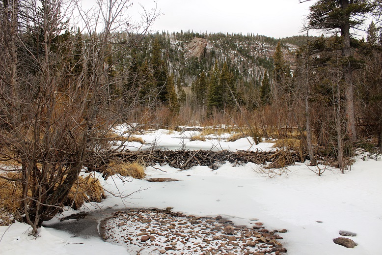
Around 2.4 miles there was a great spot for a campsite (10130’)

9

What I found disturbing were the number of dead animals I encountered on this hike. There were deer remains everywhere (I’m pretty sure it was more than one deer, spread out over a few miles) and a lot of bird feathers. It let me know there was a predator in the area, I just wasn’t sure which kind?

10

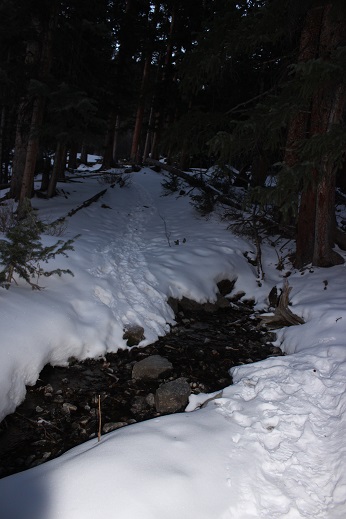
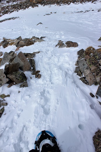
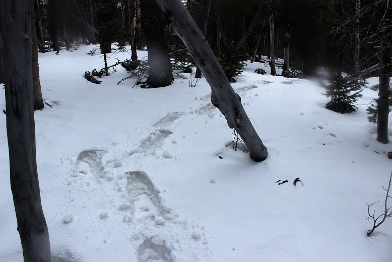
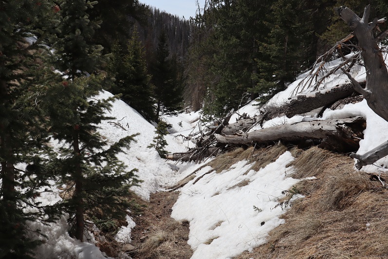
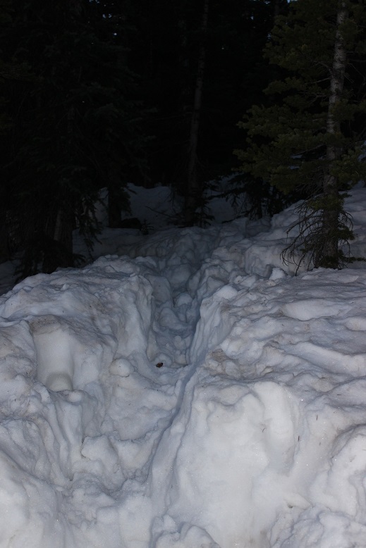
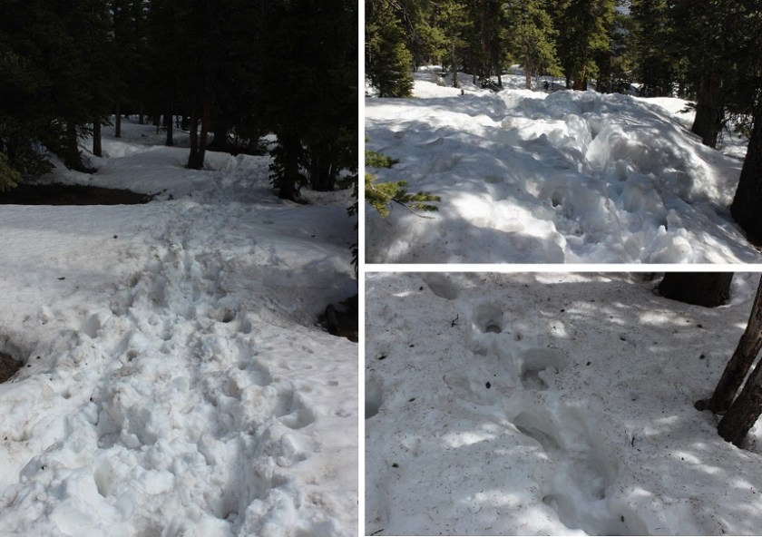
I encountered the first real snow after about 2.6 miles. It was still early in the morning so I didn’t need traction, but I did posthole from time to time. Here the trail was difficult to see, as it was both covered in fallen trees/branches and snow.

11

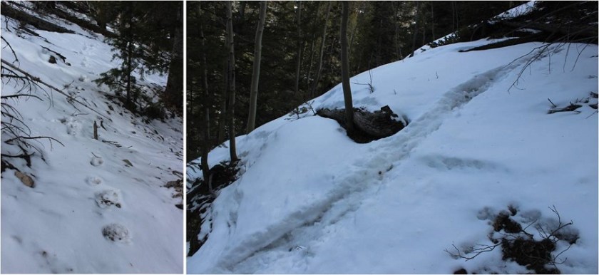
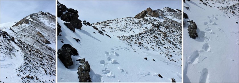
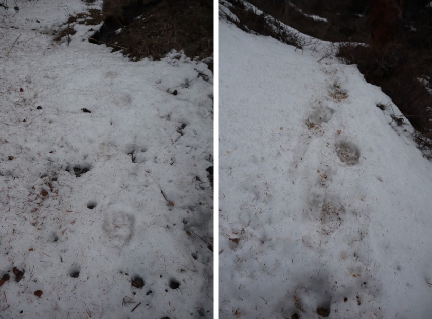
Here things got interesting: I came across bear tracks! They looked like they were from the day before, and since there was only one set of prints I knew it wasn’t a mama, and that it was just passing through. I followed prints along the trail for about a mile

12

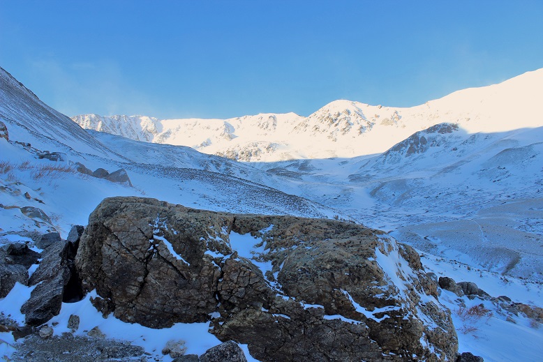
Since the trail was difficult to follow and the snow was getting softer I found myself straddling the ravine and following the small stream around the mountain

13

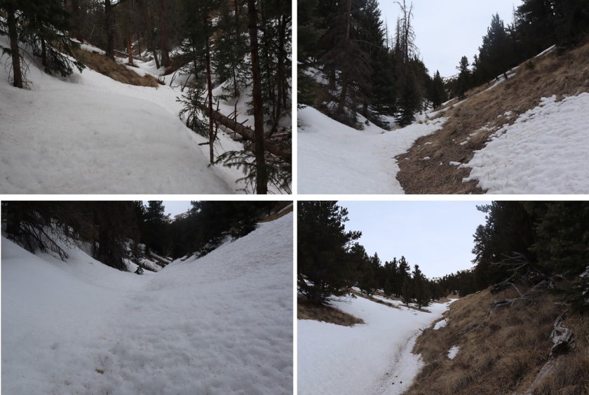
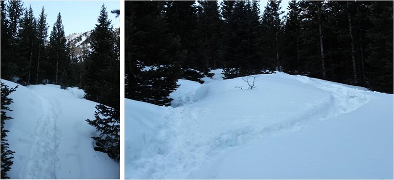
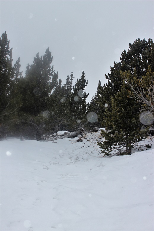
It became increasingly apparent I was the only one to use this trail in a long time. I circled around to a gully, which would have been challenging if there’d been more snow. Instead it was a steady climb up, and when I had the option, I took the gully to the right, also easy to navigate

14

15

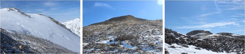
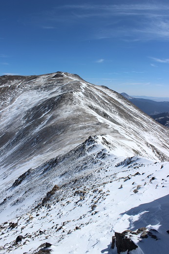
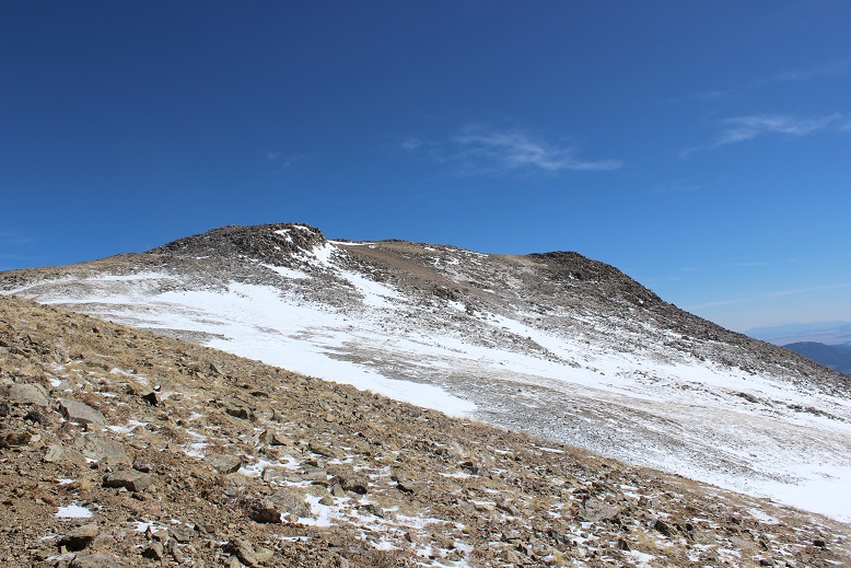
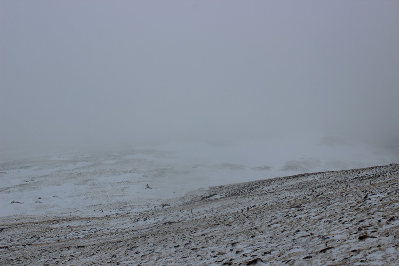
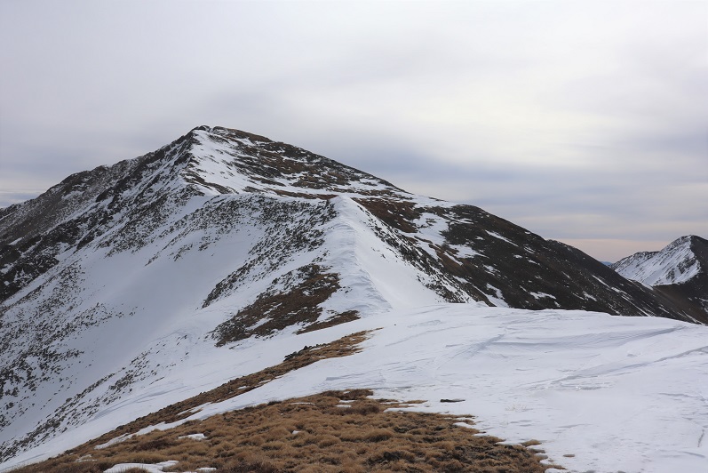
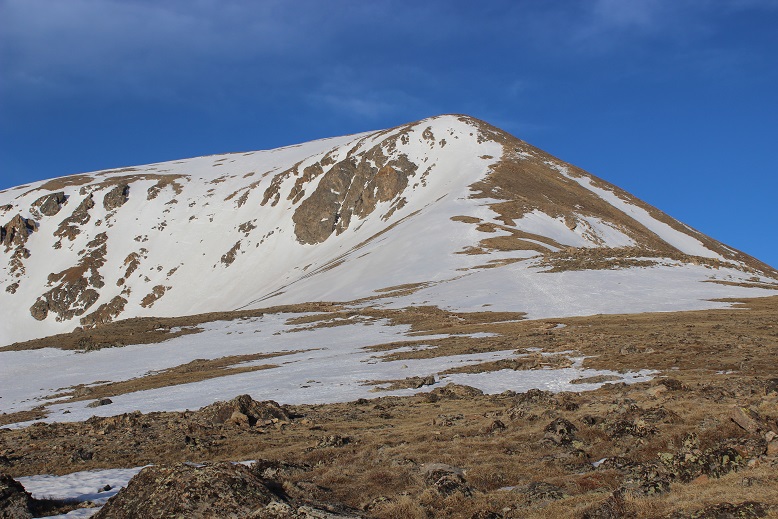
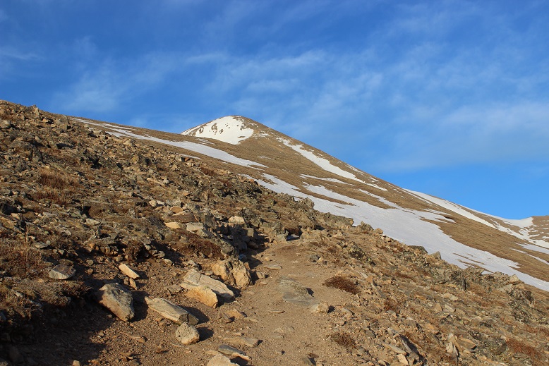
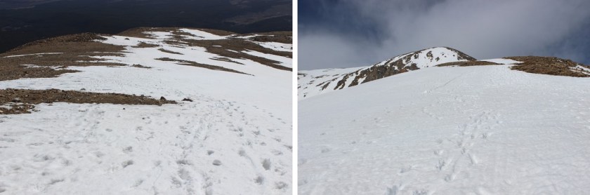
The second gully ended near treeline, and I became excited as I thought I could see the peak.

16

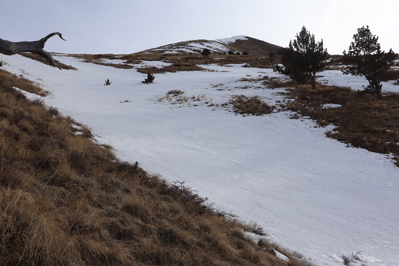
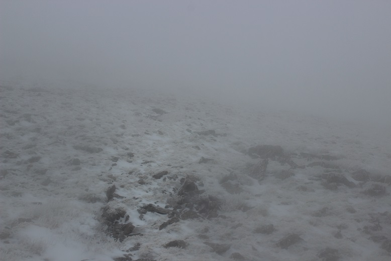
Of course in my mind I knew I was too close to treeline for that to be the peak, but surely it had to be just behind it? As I continued on I saw another peak behind the first one and figured that was the summit

17

Up, up, and up I continued, doing my best to avoid the snowy areas.

18

19

20

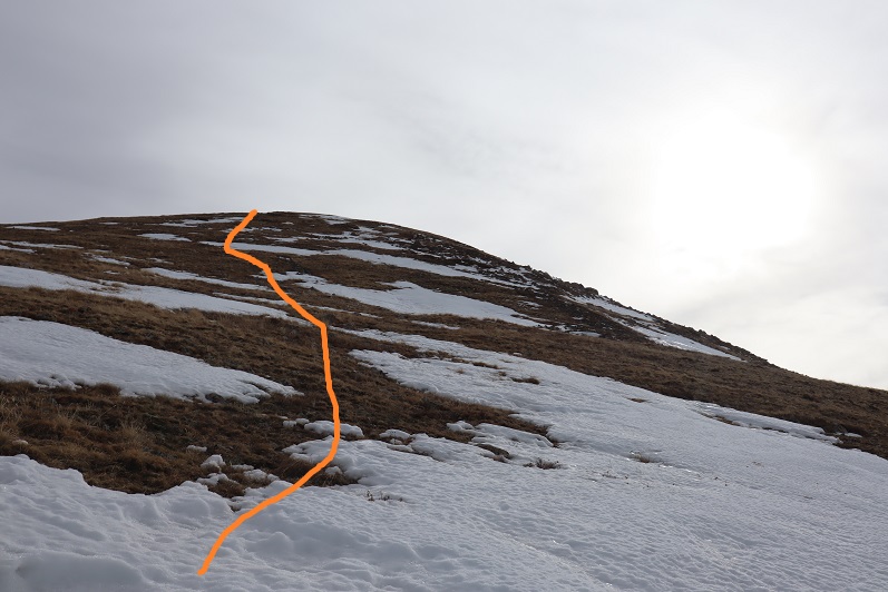
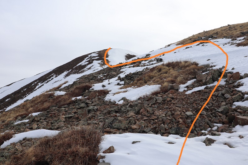
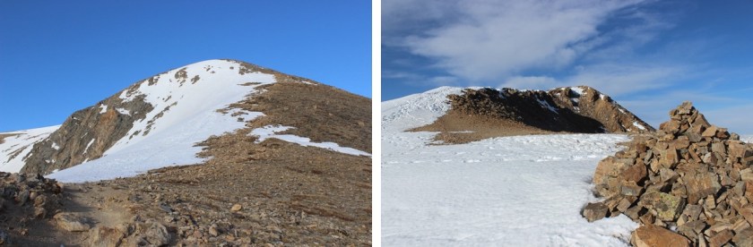
Imagine my surprise (and dismay) when I finally reached the top of the second peak and noticed I wasn’t anywhere near the summit: it was still quite far away

21

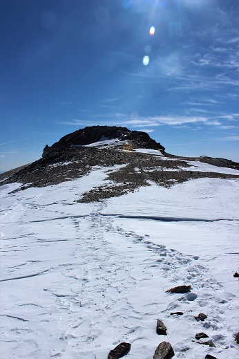
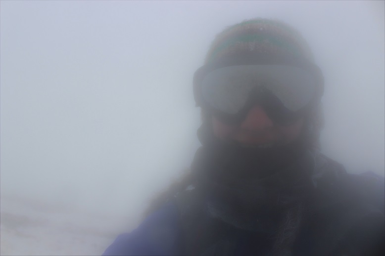
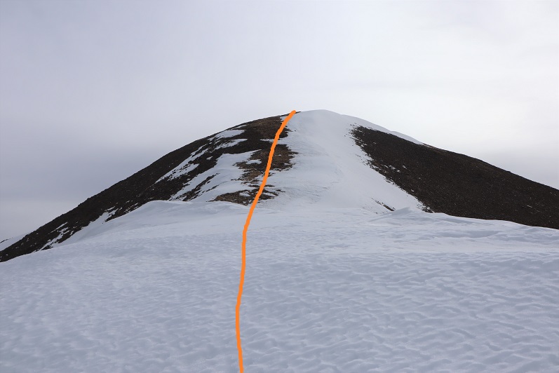
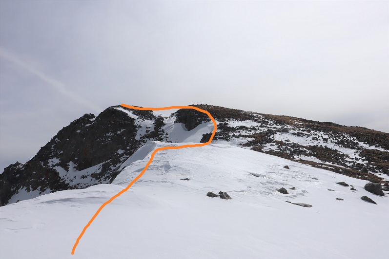
Not only was I still a good distance from the summit, but I would need my ice axe and snowshoes. Luckily, I had both. I sighed, broke down, and put them on. There was no way I was turning back now. The weather was great (the best day I’ve had all year) and while I’d already done 30 miles this weekend with 15K of elevation gain and was physically exhausted, I wasn’t quitting this close to the summit. I left my trekking pole here and continued on, ice axe in hand. The only way across the ridge was to walk directly on top of the cornices. Luckily the snow here seemed firm

22

23

24

25

The last bit to the summit was easier than expected

26

27

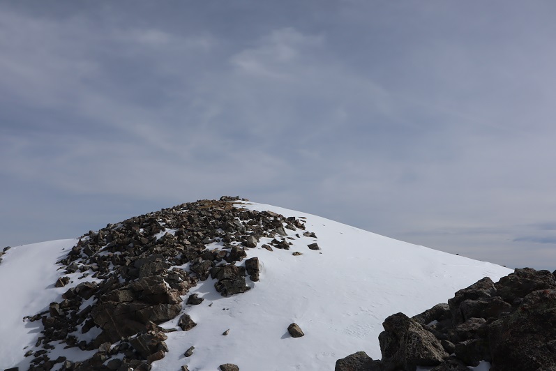
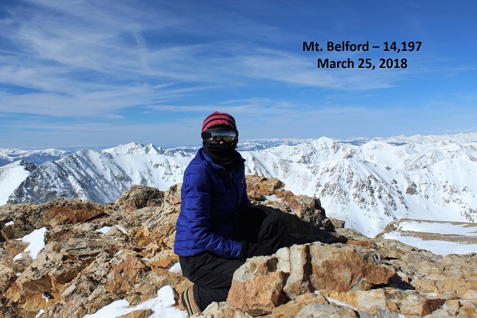
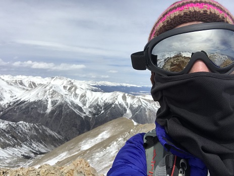
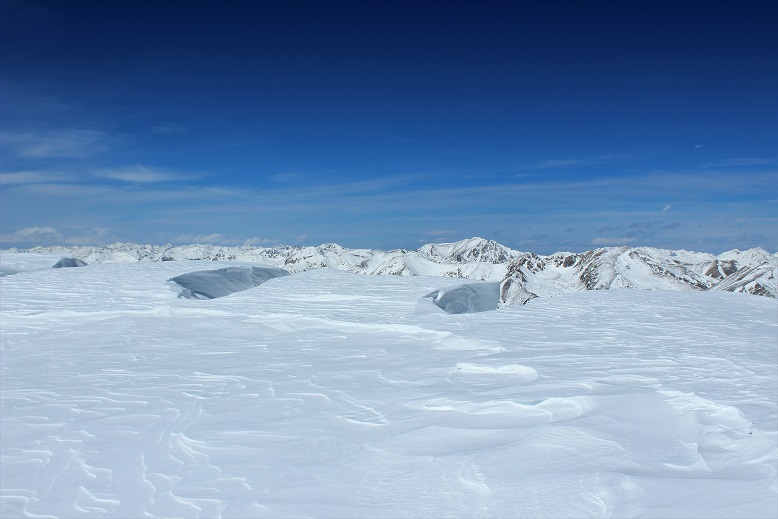
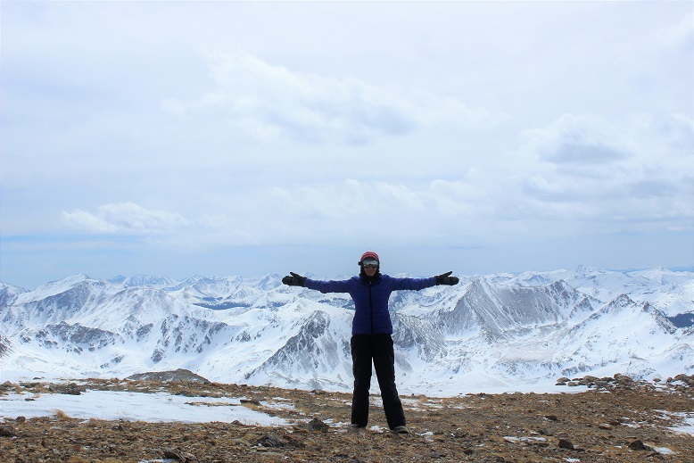
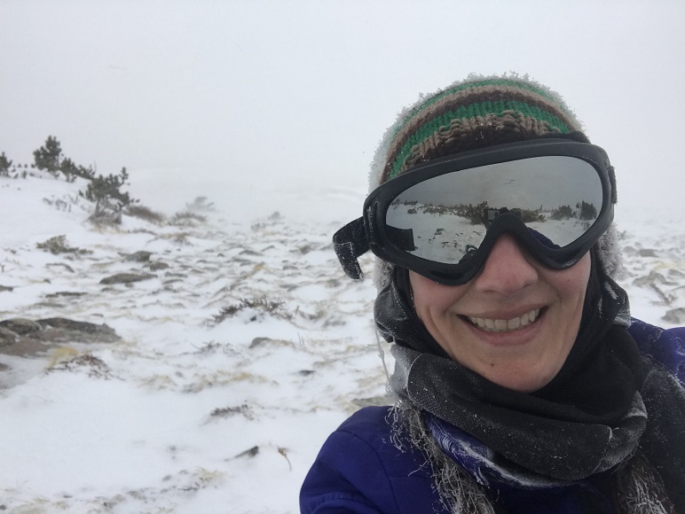
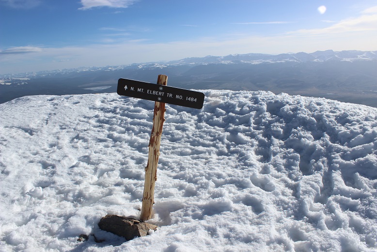
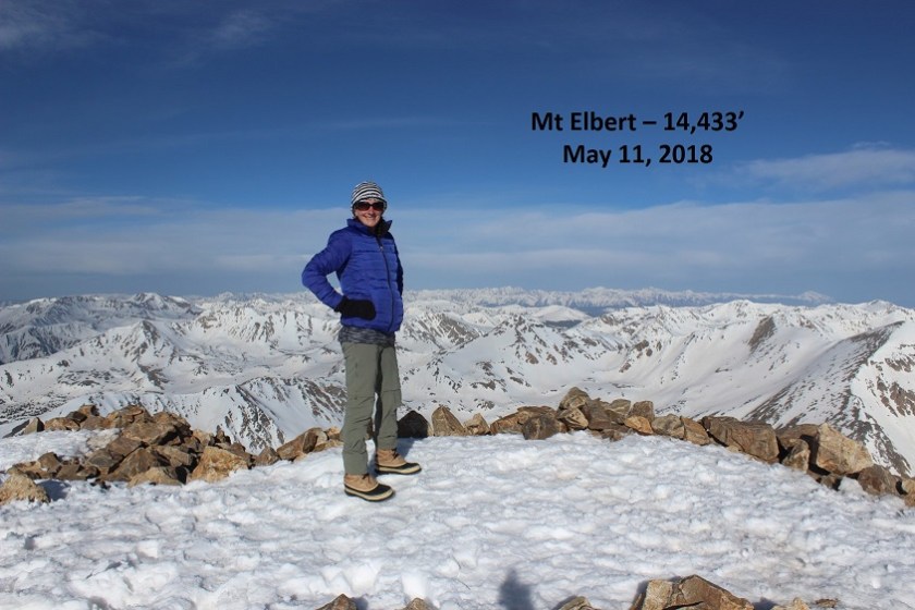
I summited at 9:30am
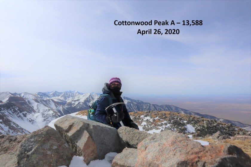
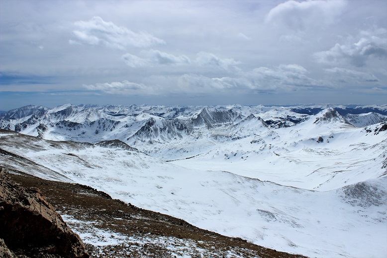
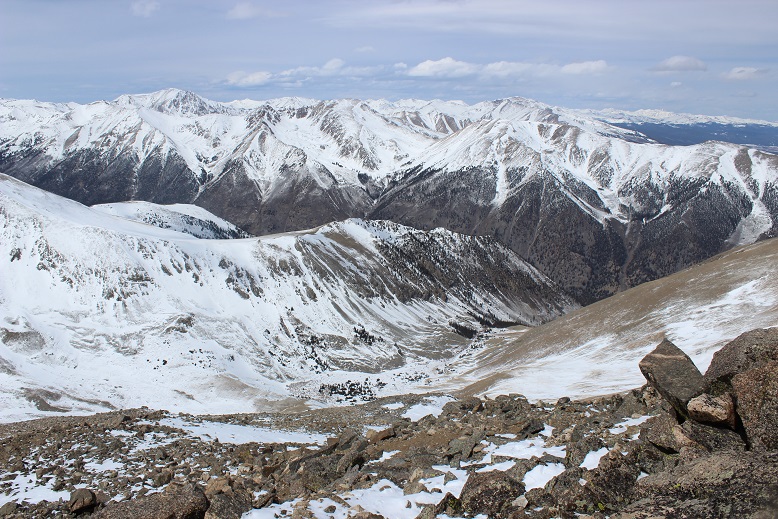
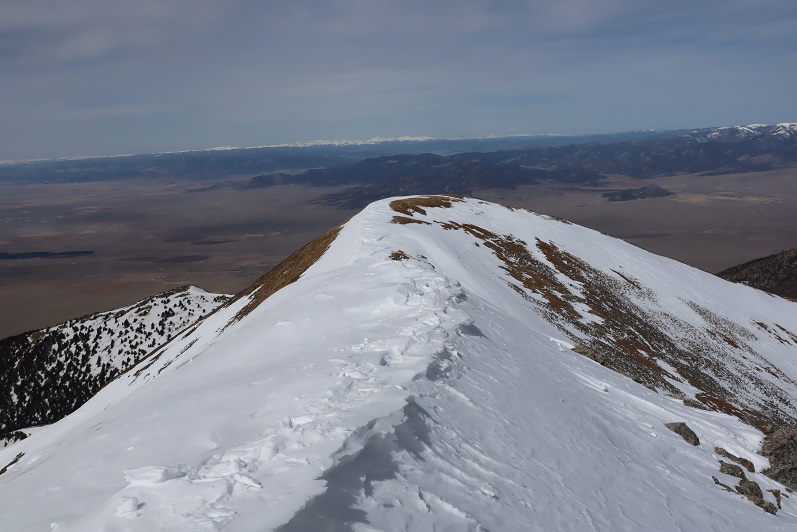
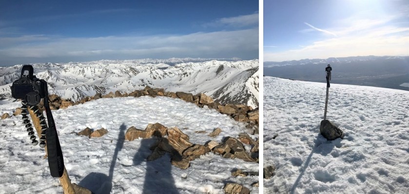
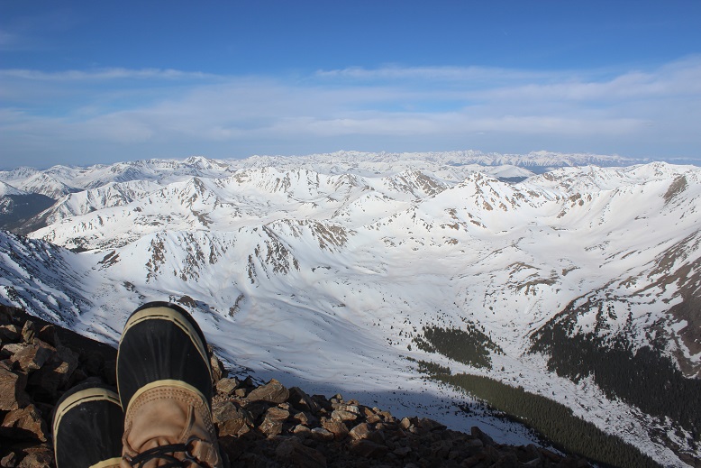
28
Summit Views:

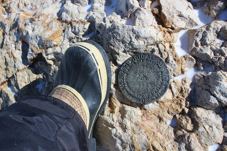
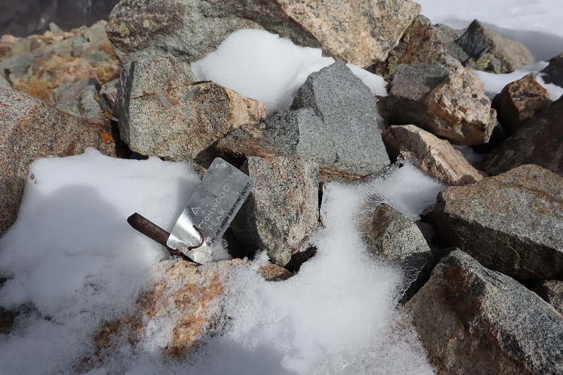
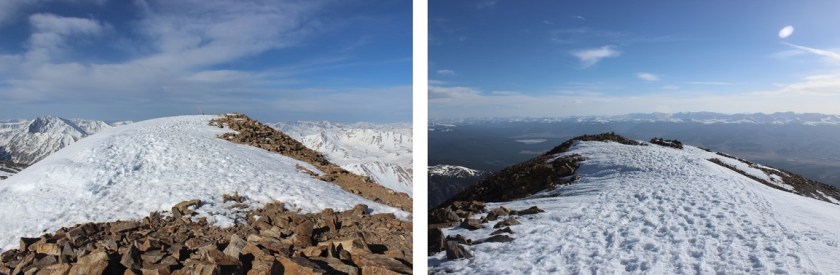
There was even a summit tag on top

29

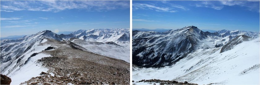
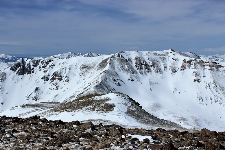
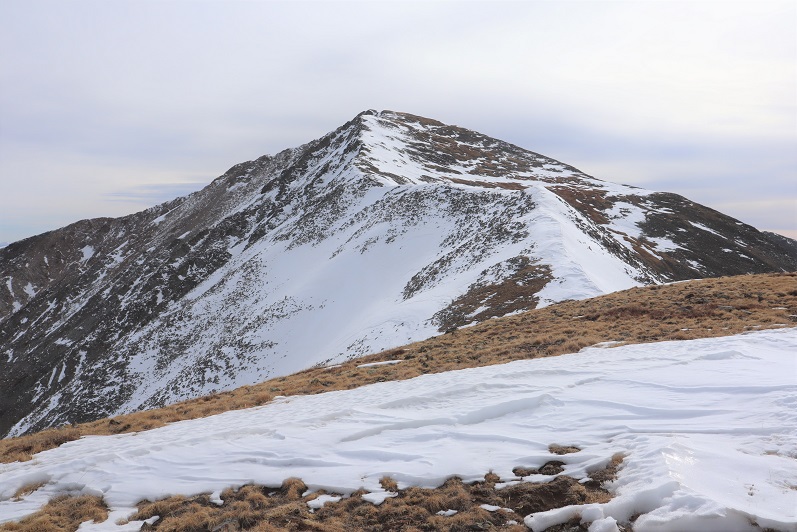
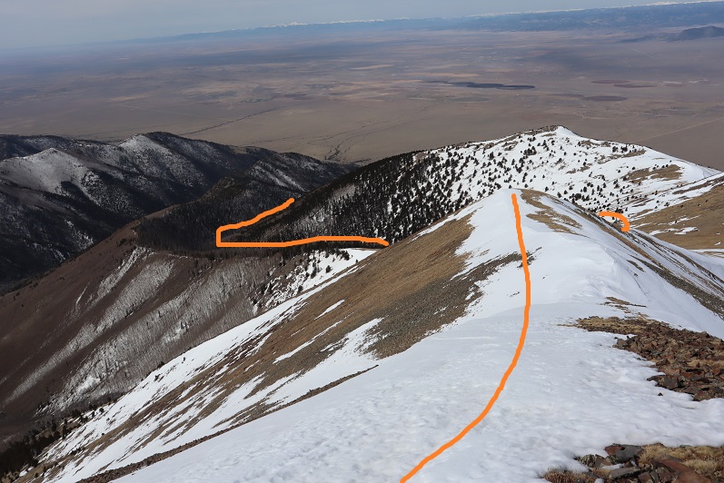
This hike is traditionally done as a loop along with Unnamed 13123B, so I went over to get a good look at the route

30

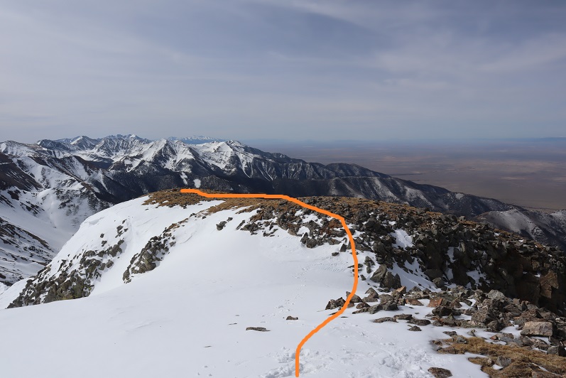
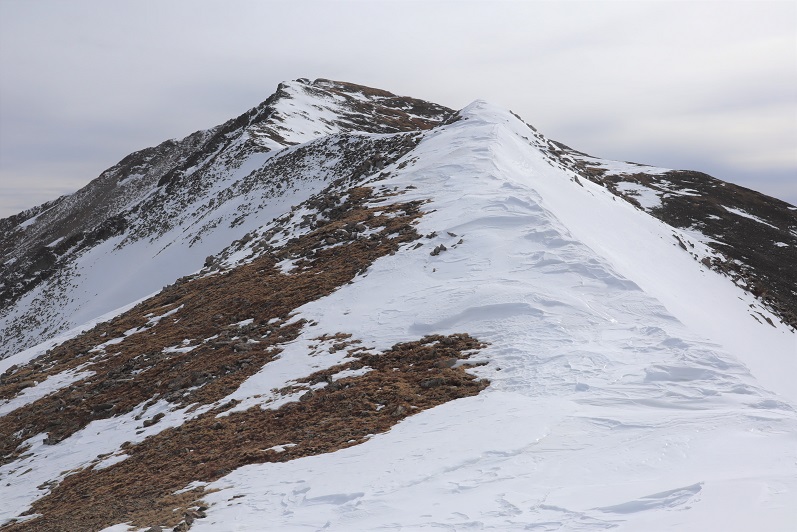
Hmmmm…. The route didn’t look that difficult. Actually, the ridge looked better than the one I’d just traversed, but it was a really nice day and the snow was warming up fast. I knew I could summit 13123, but I was unsure of the snow conditions on the route back below treeline if I were to make this a loop. I didn’t want to re-summit Cottonwood because a) I’d already done 5000+ feet of elevation today and b) the snow was getting softer by the minute on this side as well.

31

In the end I decided to go with the safer route and descend the way I’d summited, figuring that while the conditions wouldn’t be ideal, at least I knew what to expect.
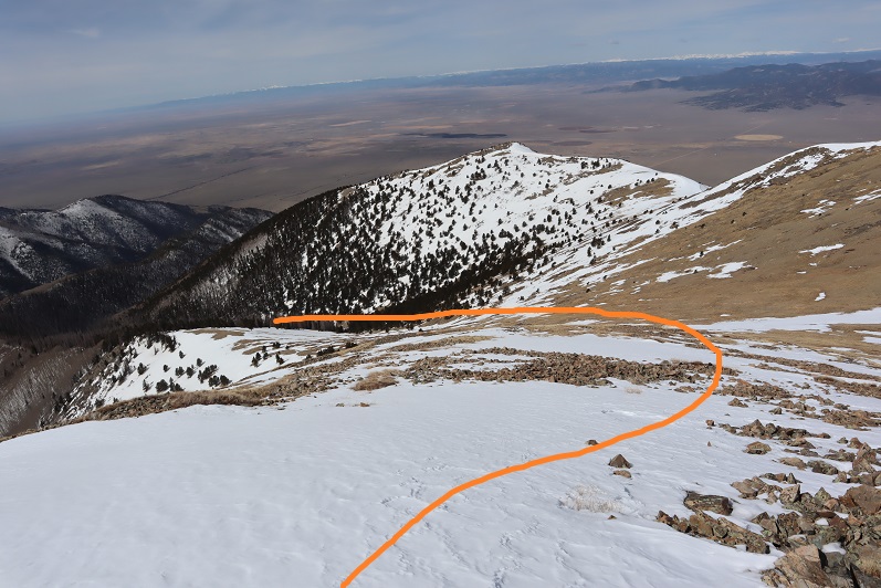
I turned and headed back the way I’d come, first over a pretty cool cornice

32

And then back down the ridge

33

34

My favorite part was toe-heeling it across the cornices

35

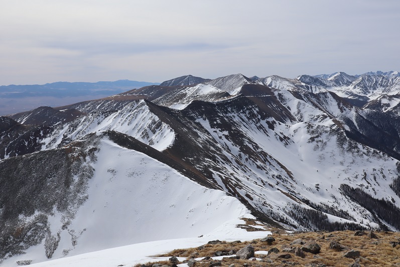
Here’s the route back

36

37

I decided to keep my snowshoes on, and this time stuck to the areas with snow.

38

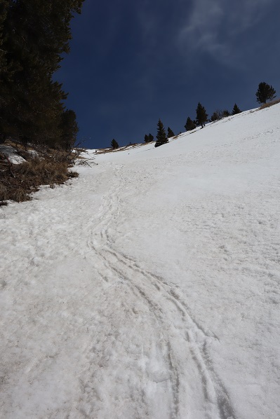
The snow was a terrible mush and I was glad I’d decided to return the way I knew, even if it meant postholing and navigating felled trees

39

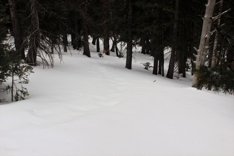
I kept my snowshoes on for longer than needed, but they came in helpful when I hit the boggy areas where there was no discernable trail but a lot of willows/snow/downed trees

40

They were cumbersome in areas such as this:

41

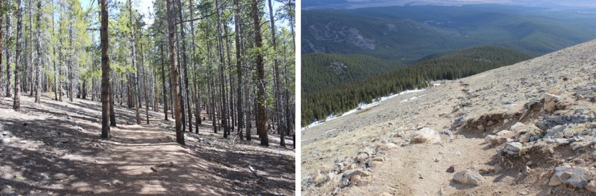
On the way back I scared the same ptarmigan as this morning and saw a cactus in bloom

42

I made it back to my truck at 12:30pm, making this an 11.5 mile hike with 5110’ of elevation gain in 7 hours, 15 minutes. The VW was gone.

43

44
I was really happy with my decision not to make this a loop today, and look forward to trying the trail counter-clockwise next time, when there’s less snow…

Mt Elbert – 14,433′

1

RT Length:  9.5 Miles

Elevation Gain:  4700’

I still have a handful of class 1 14ers I’ve ‘saved’to hike in May/early June, and after the past couple of 14ers I’ve experienced I figured it was time for a break.  Also, I had a board meeting to attend at 4pm today, so I needed something that wouldn’t take me all day to accomplish/leave me stranded on a mountain.

I woke up at 1am and made it to the trailhead around 4:30am.  There was only one other vehicle in the parking lot, and despite the signs stating “no overnight camping” it appeared someone was sleeping in their vehicle.  High-Five sir.

The road in was a 2WD dirt road.  This was the most ‘challenging’ part, so if your vehicle can make it past this obstacle, you’re good to go.

2

The parking lot is completely clear of snow and (today at least) mostly empty.

3 Parking Lot no overnight

I started at about 4:45am.  The snow cover started after the first junction (about a mile in) and was annoying but manageable without using traction.  OK, in reality, I’m just stubborn.  I should have put on my snowshoes, but I wanted to see how far I could make it without them.  The path was well defined in most areas, but in the dark and with the snow there were a few times I had to backtrack.  Nothing major though.

I was able to make it all the way to treeline without traction, although honestly snowshoes would have been helpful.  Don’t get me wrong, I HAD snowshoes, I just didn’t want to take the time to put them on because they “didn’t seem worth it”.  Every 100 feet or so I’d posthole up to my waist, which was always unexpected and a great workout, but very time consuming to extract myself.  You see, you can’t just get out of a posthole that deep like you get out of a pool by doing a push-up because your hands immediately sink in the snow (duh!).  I had to get creative.  Side note:  this would be a great idea for an exercise machine at the gym:  you’re walking and then all the sudden the machine holds you by your waist and won’t let you go until you figure your way out.  OK, probably not such a great idea.  But it was a good workout.  I digress…

Did I mention it was 5am?  (Yes, I looked at the weather, and it wasn’t supposed to get below freezing all night, but I could hope, right?).  And I should also mention it was obvious those hiking yesterday or earlier this week had it worse than I did.  Either that or they were really tall because their postholes went much deeper than mine.  This picture really doesn’t do them justice, but it’s all I have….

4

I made it to treeline just before sunrise and got my first view of Mt Elbert

5

I was excited with this view, because it meant I could most likely summit without traction (and I did).  As I started hiking above treeline the sun started to rise.  I love sunrises, and spent about 20 minutes just watching….

6

Above treeline the trail was pretty obvious

7

Well, at least for most of the way.  Once I got here I had the option of hiking on snow or trail.  I alternated between both.

My alarm rang. It was now 6:50 am and time for me to call my High Schooler to wake her up for school (I’m her 3rd alarm).  I was a little out of breath, but it looked like I was about half a mile from the summit, so I told her I was “almost there” and wished her well at school today.  I wasn’t.  In reality I was probably over a mile away from the true summit. But it looked so close!!!

The frustrating part were the false summits.  I made it around one turn, thinking I was close to the summit, but I actually had 2 more ‘summits’ and a few cairns to go….

10

I love signs.  Love, Love, Love them.  Here’s a great one…

11

You see, it told me which way to take to go when I was headed back down.  That’s not always an issue, but this peak has several routes, so knowing the correct one to take back down can save you a lot of time if you accidentally get so excited about your summit views you forget which route you took because you weren’t paying attention on your hike up.  It also indicated I was close to the summit.  Here’s the summit view

12

And picture proof I summited (8am)

13 Mt Elbert 14433

I’ve had a lot of people ask me how I get summit photos when I summit solo.  I usually get creative with my DSLR on automatic, my gorillapod and trekking pole, but today there was a post in the perfect spot, so I improvised…

14 how I take pictures

Did I mention the views were AMAZING?!?!?!?  I stopped for a minute just to enjoy (beef jerky was also involved).

15

It was COLD at the summit!  It was supposed to be 46 degrees today, and it might’ve been, but that 45+ mph wind was a killer! I couldn’t feel my fingers (OK, I actually kind of could, but it was more of a pain/throbbing/burning thing than an actual movement thing and I knew it wasn’t a positive thing…).  I took a selfie, checked in at Mt Elbert and wrote the obligatory “I’m the highest person in Colorado right now” post on facebook, and headed down so I could start thawing out my fingers.

The snow was definitely softer on the way down, but manageable without traction.

16

I made it back to treeline at 9am.  This is where the hike got fun.  I knew I was going to put on my snowshoes (I’d anticipated warmer temps + softer snow = put on those snowshoes), but they weren’t ALWAYS necessary, so I alternated for a bit between quickly trekking on lots of snow and slowly slogging through mud.

17 Start and Stop

I was now postholing with every step.  The good news?  Because of my snowshoes I was only postholing up to my knees, instead of up to my waist.  This was an improvement!  Once again, I could see others had it MUCH worse than me (or were VERY tall).

18 Postholing

This intense workout lasted for about half a mile, and then conditions alternated between snow on the trail (and pretty much only on the trail)

20 No Snow perfect

to no snow at all…

20 No Snow perfect

Did I mention I love signs?  This trail has great/amazing/wonderful/actually informative signs.  Check them out

21 signs

I made it back to my truck at 10:45am, making the 9.5 mile hike in about 6 hours, with generous time allotted for sunrises and summit exploring.

On the way out I couldn’t help but stare at Mt Massive…. Maybe next week?

22

Mt Belford – 14,197, Mt Oxford 14,153

1RT Length: 11 miles

Elevation Gain: 5967’

I’ve been saving this hike as a practice hike for winter conditions, since the route is relatively straightforward and it has a 2WD trailhead. Unfortunately I don’t have much time in the winter to actually hike, so it had to wait until early spring.

I woke up at 3am and drove to the Missouri Gulch trailhead. There were a few easily manageable mud puddles to avoid, but nothing anyone would get stuck driving through.  I made it much faster than I thought, as I was honestly waiting for daylight for this hike.  After seeing a herd of elk on 390 I made it to the trailhead at 5:45am.  There was one other vehicle in the parking lot, and it looked like it hadn’t been there long (no frost on the windows, etc).  This would make my family happy, knowing there was someone else out on the trail today.  They hate that I hike alone.

I usually love hiking well before sunrise, but today for several reasons I decided to sit in my truck for a bit and wait:

  • I’m not a fan of hiking by graves in the dark. Does anyone else think it’s weird the baby’s grave is so far away from all the others? I mean, it’s across the street and up the hill and everything…
  • I really didn’t want to play ‘leapfrog’ with whoever was already hiking on the trail. I figured I’d give them some time to get far enough ahead of me so we wouldn’t need to pass each other/hike together the whole time.
  • I’ve heard reports there’s a mountain lion that frequents the area, and I’d rather not run into one in the dark. (side note: I’m not afraid of mountain lions, in fact I’d love to see one while hiking, I’d just rather it be in the daylight)
  • But seriously, that baby grave in the dark freaks me out.

I debated for a while which hiking boots to wear (my regular ones or my winter ones) and whether or not to bring my snowshoes. There wasn’t a recent conditions report in the past week or so, and the last one said none were needed.  I left the snowshoes in the truck and headed out at 6:15am in my snow boots and winter gear.  It was still dark.

I made it about .25 of a mile when something told me to turn around and go back and get those snowshoes. It’s tough to head back after you’ve already started, but the feeling was strong and I thought how mad I’d be at myself if I made it up the trail 3 or 4 miles and needed to turn back because I didn’t have the proper gear.  So I hiked back to my truck, pulled them out, and was on my way again.

The trail was covered in slush that quickly turned to packed snow. As I looked on the ground I could see clearly defined mountain lion tracks (noted by size and lack of claw marks) on the trail.  Cool!  I also saw trails made in the snow that were obviously from a large animal (the mountain lion?) that detached from the main trail and went off into the hillside.  The tracks were going the opposite direction, but that didn’t stop me from looking all over for signs of animal life/more tracks.  After about 1.5 miles in the tracks disappeared.

2

20 minutes into my hike I passed the couple belonging to the truck. They didn’t look like they had snowshoes and I felt a bit foolish for carrying mine.  The trail was pretty hard packed here, and snowshoes didn’t seem necessary.  I briefly asked them if they’d seen the animal tracks, they had, and I was on my way.  I never saw them again.

I crossed a small stream and decided the snow was thick enough to put on those snowshoes I’d been carrying.

3

The snow got thicker, but luckily others had been here in the past few days because there was a pretty good trench all the way to the cabin.

4 AM Trenches

I made it to the cabin much faster than I’d anticipated. I took this trail on my way to Missouri Mountain last summer, and from what I’d remembered it had been a long slog full of switchbacks. But for some reason today it didn’t seem to take me much time at all.  The cabin was surrounded in snow.

5

From here on out snowshoes were mandatory. There was no trail from the cabin through the willows/gulch area, so I had to make my own trail.  Luckily I kind of knew how the trail went, since I’d hiked this area before.  It was really cool to be breaking my own trail, and doing so successfully!  This was the first real time I’ve broken trail: I hiked Humboldt Friday and broke a little bit of trail, but mostly followed others’ tracks.  In fact, this was only the second time I’ve ever been snowshoeing, and I kind of liked it!  It was so cool to be 5 or more feet above the trail in the snow, traversing over willows instead of around them.   There was no way I could have done this a year ago, and I was proud of my route finding.

When I turned around I saw the alpine glow of the sunrise

6

I stayed by the creek and headed towards the Elkhead Pass/Belford Summit Junction.

7

The sun was really starting to come up, and the view of Missouri Mountain was fantastic!

8

This is where the wind really started to pick up. It was relentless for the rest of the day, hovering around 35mph.  It looked like all that snow in the gulch was directly blown down from the mountains.

9

I looked at the route before me up Belford, and as I was ascending thought not for the first time how grateful I was to have gone back for those snowshoes.

10 Belford AM

The hike up Belford took forever. It just kept going and going and going up, up, and up.  And that wind!  Without the sunlight that wind was chilling.  I just kept moving, pretending it was the Manitou Incline, and trudged up that mountain wearing those snowshoes, breaking trail.

11

There were several false summits to Belford, which were a bit annoying but anticipated.

12 False Summits

Finally (and I mean finally, as I was exhausted) the real summit of Mt Belford came into view and I thought to myself: 4500’ in snowshoes for 4 miles was exhausting!

13

I was frozen, but set up my gorillapod and camera and took a summit photo.

14 Belford

15

and just because it was there (they usually aren’t) a photo of the summit marker

16

I took a look around. The view was magnificent!!!

17

I didn’t take out my instructions/map, but remembered the route to Mt. Oxford would be clearly visible from this location. It was just 1.5 miles away. I followed the clearly defined path with my eyes and my jaw dropped.

18

No way! There was no way I was doing that today in these conditions!  That’s when I took a closer look, realized I was looking at Mt. Harvard (which I’ve already hiked), breathed a sigh of relief and looked east.  There I saw the second summit I was after today:  Mt. Oxford.

19

It looked doable in today’s conditions. That is until I made it to the ridge.  The ridge down from Belford to Oxford was covered in snow.  There weren’t any tracks to follow (either no one had taken this trail in the past few days or that relentless wind had covered the tracks with snow).  As with any hiking/climbing challenge, I don’t make a decision to hike/climb until I’m right up next to the obstacle.  I often find it’s easier than it looks when you’re up close.  I decided to just take this ridge one obstacle at a time, and if I felt uncomfortable gave myself permission to turn back.  This was supposed to be an easy winter 14er, so I should be able to do this, even in these conditions.

I looked for the areas with the least exposure and least snow, and began my descent. It was really cool making tracks!  I carefully made each foothold by drawing a line with my trekking pole and stamping it down with my boot, making sure I had a firm stance before traversing.

20 Making Tracks

It was more than I’d anticipated running into today, but nothing I couldn’t handle. Microspikes/snowshoes weren’t needed.

I made it down to the saddle and looked back up at Belford, and then up at Oxford. Wow.

21 Back at Bel up at Ox

The saddle was dry and came with absolutely amazing views! I stowed my snowshoes and was off.

22 Saddle Views

To the north there was a small cornice that provided interesting views as well.

23

I looked ahead of me at the route up Oxford. Piece of cake.  And it was.

24

The summit was actually closer than I’d anticipated (the first outcropping, not the second). I took a summit photo.

25 Oxford

And another one of the summit marker (because it had one too!)

26

I turned around to see what I’d accomplished thus far today. What a view of Belford!

27

I started back, ready to tackle that ridge again head on, and this time uphill. I gathered my snowshoes and kept an eye on the weather, since it was supposed to snow after 3pm (it was currently around noon).  While all morning it had been windy and clear the clouds were now starting to form.  I hiked back up the ridge using the footsteps I’d made on my way down.  It took a while but I was successful!

At the summit of Belford the second time I stopped for a bit to really take in and enjoy the view. Since now the hardest part of the hike was behind me, I felt I could afford to rest for a bit.  I sat down at the summit marker and took a deep breath.

After a grueling and extremely windy 6000 feet in elevation gain in 6 miles (in snowshoes) I sat at the summit of Mt Belford, my 3rd 14er Peak today (out and back, so 2nd time here today). Suddenly the wind stopped and all was still. This is what I saw.

28 IMG_5026

Immediately tears came to my eyes. It was like God knew I was the only person in the world with this view and he wanted to show off just for me. I was absolutely mesmerized by the intense beauty before me. It’s the closest thing to a religious experience I’ve ever had.  All the hard work of the day and the frozen extremities that came with it was worth it!  I sat there for 5 minutes before he picked up the wind again and reminded me to get my butt off that mountain: a storms coming in.

29

Of course I took another photo, trying and failing to capture the beauty around me.

30

I walked over the summit and took a look at the rest of the route down to the gulch. It looked like the sun had melted some of that earlier snow.

31

I was making good time, so I decided to have a little fun and use my remoteness from any other human being to practice some winter skills without embarrassment. Much of the earlier snow was gone, so I was able to safely practice glissading and running down the snow without worrying about sliding too far or out of control.  I did this for most of the hike back down, laughing as I went.

32

Back down at the gulch, this was my view back down towards the cabin and back up at the route I’d come. As you can see, clouds were just beginning to form for that storm anticipated for tonight.

33 Missouri Gulch Front and Back

I put my snowshoes back on, crossed a frozen river of ice, and waiting for me on the other side was a ptarmigan. I knew he was a male because he had a red stripe over his eye.  He just stood there, looking at me, and then slowly turned towards Missouri Mountain and looked over his shoulder, as if he was beckoning me to follow.

34 Ptarmigan

I took several pictures, thanked him for being so cooperative, and followed my snowshoe tracks back through the gulch and down the mountain. It looked like several people had actually hiked up to the gulch today, as around the cabin there were several new ski and snowshoe marks, but no people to be seen.  The trench was also a bit more compact than it had been earlier.

35

The hike back down seemed longer than the hike up, and I kept my snowshoes on for most of it. Somewhere along the way I lost my beanie which was unfortunate (I’ll make another one).  As I was nearing the end of my route I kept looking for signs of a mountain lion (nope) or any other form of wildlife (again, nope).  As I approached the area with the grave in the daylight I realized I was ‘told’ to get those snowshoes exactly as I passed the grave… Hmmm.

I crossed clear creek and my days hike was over.

36 Clear Creek

On my drive home I thought about the details of today’s hike, and how this is something I wouldn’t have been able to accomplish a year ago. I was glad I’d saved these ‘easy’ 14ers for winter-like conditions, as it allowed me to apply the knowledge I’ve learned thus far (snowshoeing, traversing ridges covered in snow), while giving me time to practice more intense skills in a safe environment (glissading, self arrest, running down a snow field).

Here are some summit videos. The views were amazing!

Video of Mt. Oxford –

Mt Humboldt – 14,064′ – Second Summit

1-17

Humboldt Peak – 14,064

9 miles RT (East Ridge)

5000’ Elevation Gain

I’ve been itching to do a 14er, but my schedule and the weather hasn’t been cooperating. My hiking days are typically Friday, and for some reason the weather in the high country’s great all week, but when Friday rolls around the temperatures drop, the winds picks up, and it starts to snow.

The weather didn’t look too great today, but I’d been following the weather surrounding Humboldt all week.  Humboldt is the only 14er (out of 35) I haven’t hiked solo, and to make this whole thing official I figured I’d try it from the winter (East Ridge) route since I took the West Ridge last time. The weather wasn’t great, but I had noticed in the past few days the predicted snow levels had gone down consistently (from 4-7 inches to 2-6 and finally down to 1-3) so that was a plus.  Unfortunately the wind levels were picking up (those rose to 55mph).  The temperatures hovered around the low 30s, which was great except that meant post-holing.

I didn’t need to summit today.  I’ve already summited this peak, so I figured I’d go into this as a learning experience.  Kind of a way to test my skills and see how far I could go without needing to commit to summiting.  I don’t have a ton of winter 14er experience and I wanted to see what a hike would be like in these conditions.  I could always turn back when I felt I’d had enough or if I didn’t feel safe.

First of all, that drive to the trailhead:  Insane!  I have a Tundra, and that thing can handle a lot.  I’ve done the South Colony Lakes 4WD trail in early June, and it was nothing compared to this!  I put my truck in 4WD and tackled it head on.  I wouldn’t recommend it an any time of year if you don’t have a high clearance 4WD, but particularly not now when the trail was covered in ice and mud and slush, and in the dark it was difficult to tell which was which.  I’m pretty confident driving off road, but I’ve never done the whole off-roading in this much  ice/mud/slush before, so I didn’t want to push it too far.  I probably drove further than I should have, and parked about ¼ of a mile before the Rainbow Trail Trailhead.  There were no tire marks after this point (note: I took most of these pictures on the way back because it was snowing too hard or too dark to take pictures in the morning).

2

I started at 6:45am.  The trail at this point was pretty dry.  I crossed South Colony Creek and turned right.

3

There were tons of downed trees on this trail!

4 Downed Trees

After hiking about a quarter mile I saw a cairn to the left.  It’s small, and you really have to be looking for it.  With more snow it’s most likely covered.

5 IMG_8600

This was my indication to start hiking northwest through the trees.  This is what that looked like.

6 IMG_8601

Obviously I wasn’t hiking this trail in “winter enough” like conditions.  I hiked up towards the ridge, and then followed the ridge southwest.

I was fighting putting on my snowshoes, but I was postholing.  Each step put my boot at least a foot under the snow, and finally I said enough is enough!  I’d paid for those snowshoes and hiked them in this far, I might as well put them on!  So I did.  Woot!  This was great!  I was still postholing, but only about 6 inches or so instead of a foot or more.

7

The snow on the ground got thicker and so did the snow falling.  I made sure to step extra hard into the snow so it’d be easy to find my tracks on the way back down.  I wasn’t necessarily breaking trail, but there wasn’t a clear trail to follow either.  The last tracks were old and most of them had been covered by snow or melted.  The snow was falling as predicted, but it wasn’t intense.  It was actually kind of nice because it wasn’t freezing out.  The snow cooled my face.

8

As I hit about 11,500’ the wind started picking up.  I headed west until I made it to treeline.  At this point the snow had been thick, but abruptly stopped here, so I took off those snowshoes and put on my balaclava and goggles.

9

From treeline there was no direct route to the top: you’re supposed to make your own trail.  My directions said from here the rest of the route would be visible:  Just look for the peak and head towards it.  Um… not possible.  This was my view:

10

The wind was really insane here and there was no visibility.  Wind was blowing at a constant 35-40mph with many wind gusts (I’m guessing 55mph+, as predicted).  I could feel the wind gusts approaching.  After the second one knocked me down I decided to anticipate them and lie flat whenever I felt one approaching.

The only good part about those wind gusts was it cleared the visibility to about 50 feet in front of me for 2 or 3 seconds after it passed, so I’d hunker down, and then look up towards where I wanted to hike to see what was ahead of me.  I never was able to see the top of any mountain.  I took this selfie because I noticed everything about me was frozen and I thought that was pretty cool because I wasn’t that cold!

11

I couldn’t see where I was supposed to go, or even more than about 10 feet in front of me, so at this point I had a choice to make.  Turn around and head back, wait out the weather (it was supposed to clear around noon and it was about 9:30am) or pull out my map and compass and practice those orienteering skills I teach to others for situations like this. You can guess which one I chose.  (Note:  I should have turned back).

I headed northwest up the ridge, being careful not to get too close to the edge of the ridge and trying to stay away from large areas of snow (I used those as landmarks).  I kept trudging on, following the ridge.  I’m 95% sure I made it to the summit, because when I pulled out my phone and looked at the GPX file it said I was there.  You’d never guess though by the picture…

12

I went to get some pictures with my cell phone, and before I could do so noticed I was at 41% battery.  Time to head down.  Wait, 37%… 35%… 31%… all lost within about 10 seconds.  Argh!  No!!!  This was insane!  I turned off my phone and booked it down that ridge!  I have a lot of great survival skills, but knowing my phone was going this fast made me start to worry.  It’s like a safety blanket I didn’t want to lose. Yes, I know, I know, (I know!!!) but when it hits you as reality in these types of conditions your priorities change:  you really do want that phone to work!  (I’d left my portable charger in the truck because this was only a 9 mile hike:  never again!).

That ridge lasted forever.  Did I really hike all this way up?  It felt like it would never end, and without visually being able to see how much route I had left I kept checking my compass to make sure I was headed in the right direction and my altimeter to see how much further I should have to go.

13

I made it back down to where I’d exited treeline and looked for the snowshoe tracks I’d so carefully made.  They weren’t there.  Drat.  The wind had completely filled in those 6 inch post-holes with fresh snow! This is what I saw…

14

I quickly put on my snowshoes and started jogging as fast as I could carefully jog down.  I wanted to get off that mountain.  At this point the visibility was great… there just weren’t any tracks to follow.  I headed towards the ridge, and when I made it I breathed a sigh of relief!  Now all I had to do was follow the ridge until it ended and head southeast.

15

At this point my anxiety dropped because I could see where I was and I knew where I was headed.  But I was also exhausted!  I was wearing winter hiking boots, trudging through the snow in snowshoes that were postholing, and that wind took a lot out of me.  I haven’t been this tired at the end of a hike in a very long time.  And it wasn’t even that long of a hike!  I’d guess it was less than 9 miles total, but in those conditions, it was insane!

I noticed a small dam at the bridge…

16

I learned so much from todays hike. I really tested my abilities, and I’m proud I was able to use the skills I have to stay safe in a not so safe situation.  Also, I don’t think I’ll be purposely doing that again.  Anyway, I’m back at it!

Oh, and the weather cleared up as I headed back down.

1-17