Chipeta Mountain South – 12,850 and Chipeta Mountain – 13,472

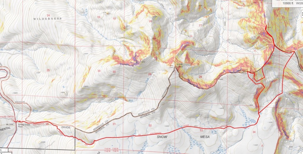
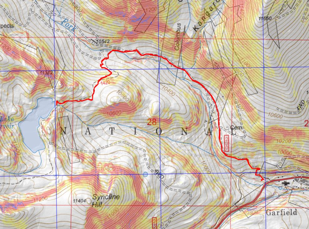
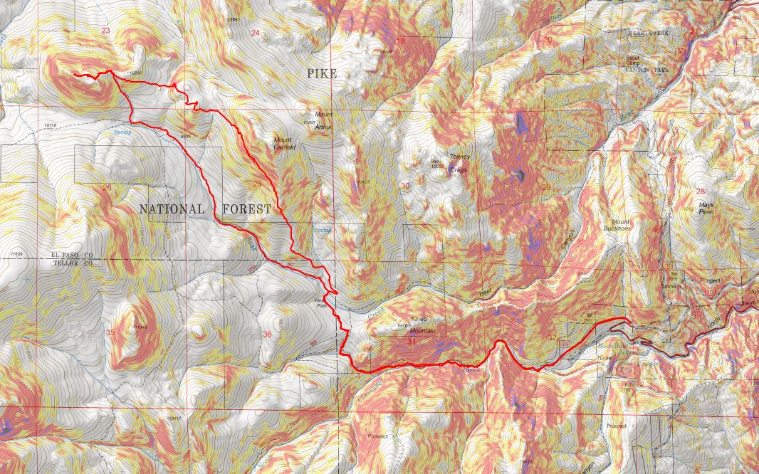
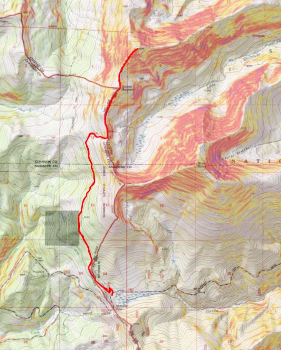
RT Length:  10.58 miles

Elevation Gain:  3281’

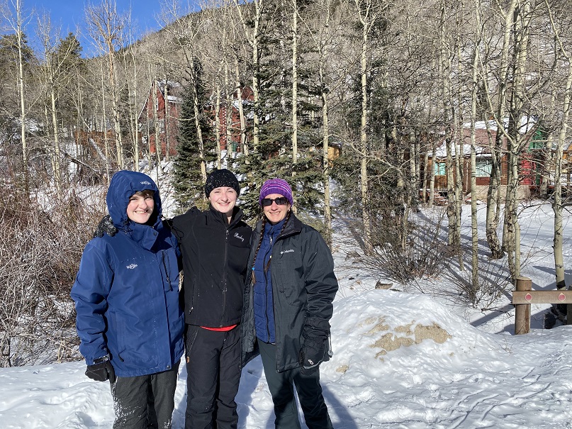
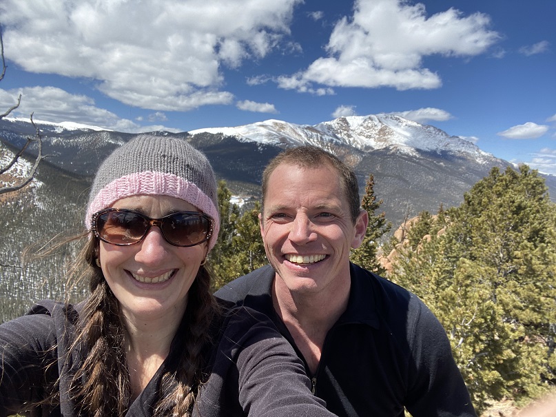
This was my third attempt at Chipeta Mountain this year.  The first time I drove out the road was open but impassible due to snow.  The second time the road was clear, but the gate was closed.  I saw several videos/pictures of people on the pass this year, but later found out they were part of a mining operation and the only ones allowed to access the road.  The road formally opened on May 28.  Today was May 29.  It had already been a long morning:  I’d woken up at the Gibson Creek trailhead, intent on hiking a few 13ers in the area (also not my first attempt these peaks this year), but after about 1000’ of elevation and deteriorating snow conditions I decided to make today a ‘me day’.  I hiked back to my truck, chugged a beer, and came up with a new plan:  I was going to drive to Marshall Pass, see if it was open, spend a day relaxing, and then tackle Chipeta Mountain tomorrow. 

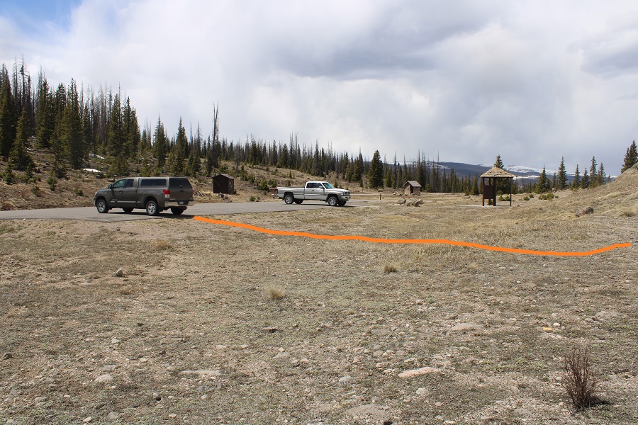
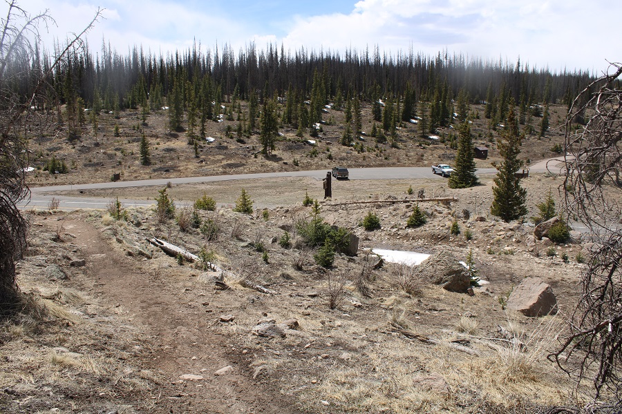
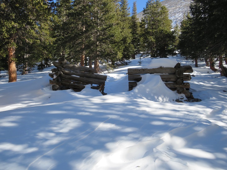
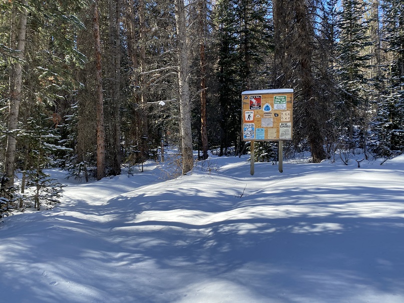
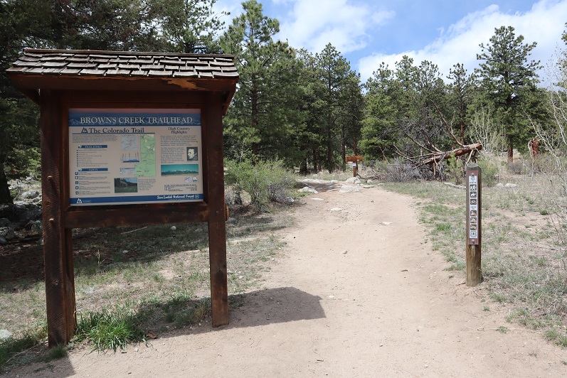
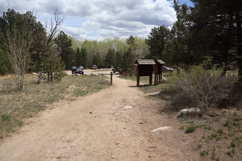
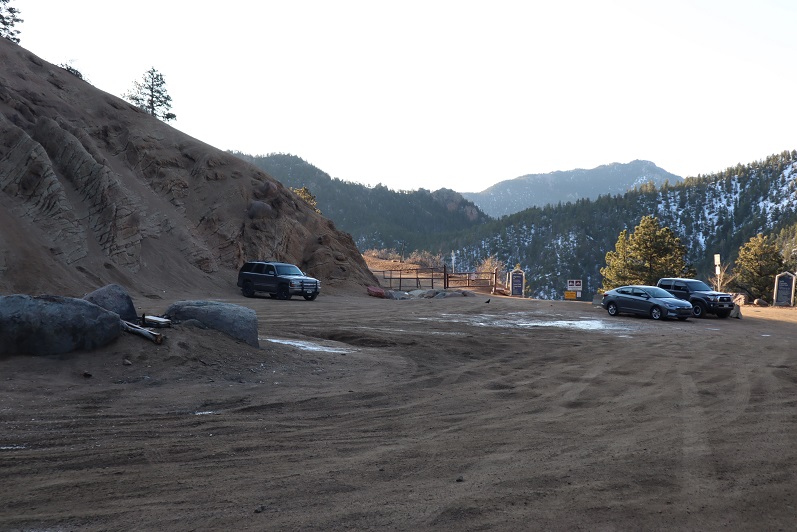
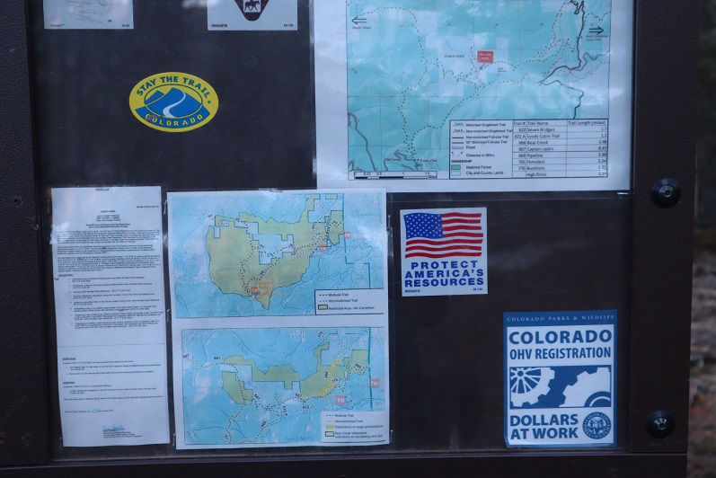
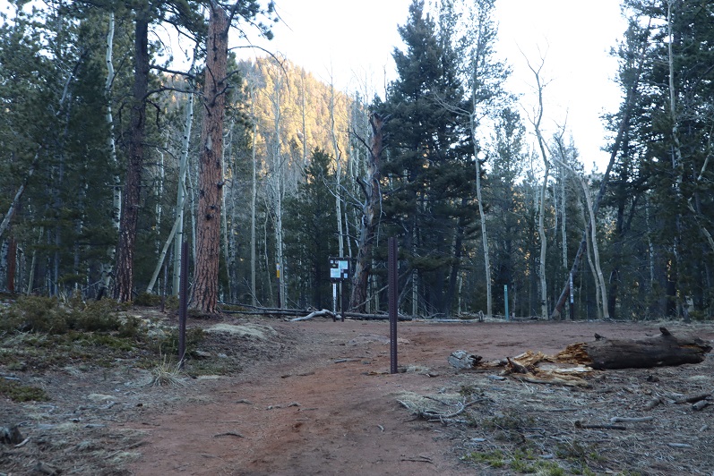
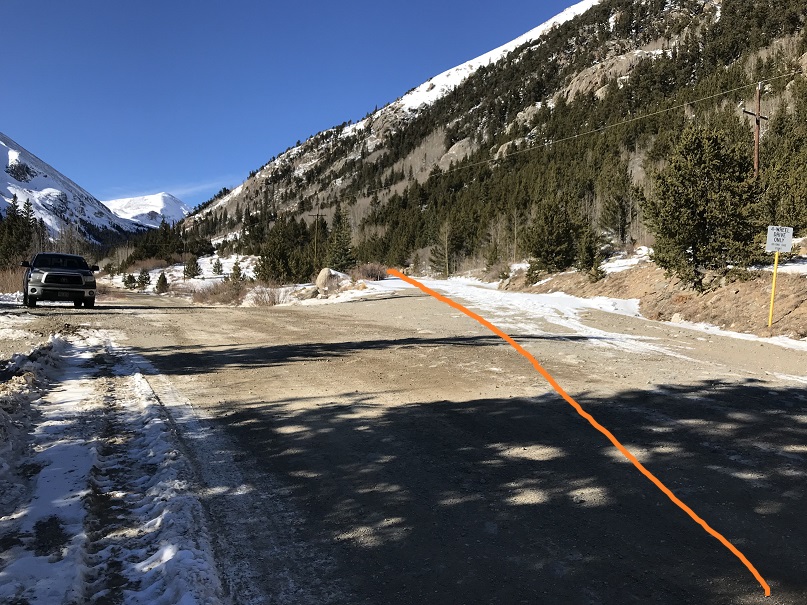
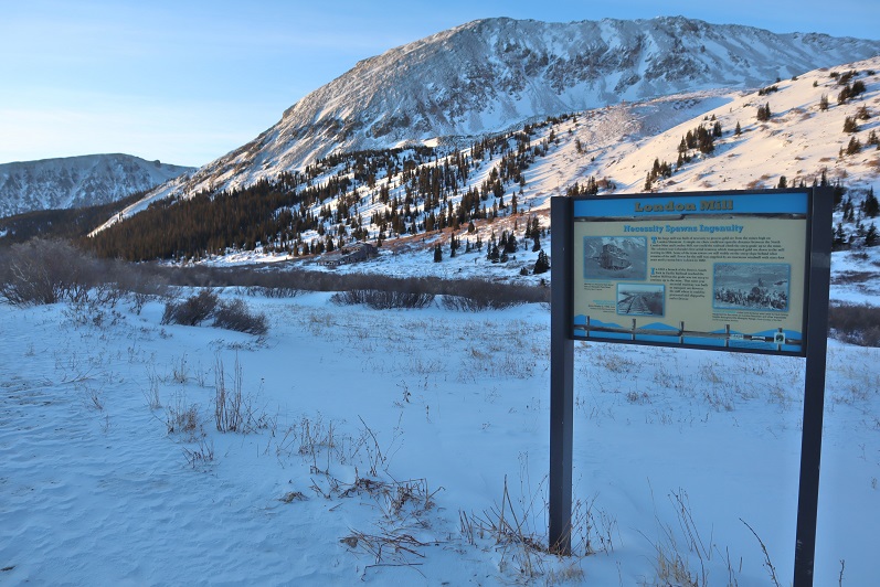
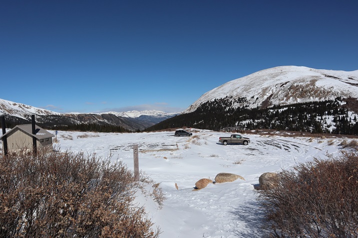
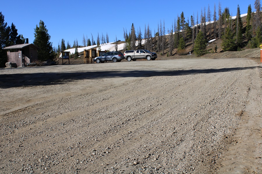
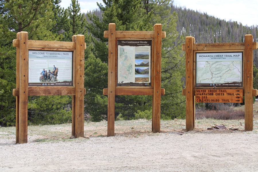
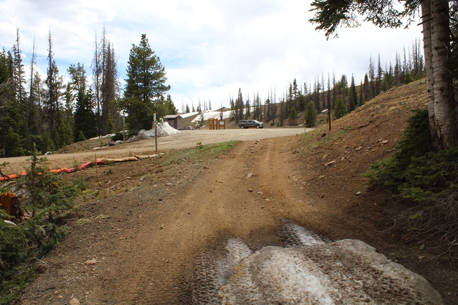
Marshall Pass was open and snow/mud free to the pass.  I was surprised at how few people were dispersed camping this Memorial Day weekend.  I parked near the bathrooms and information signs.

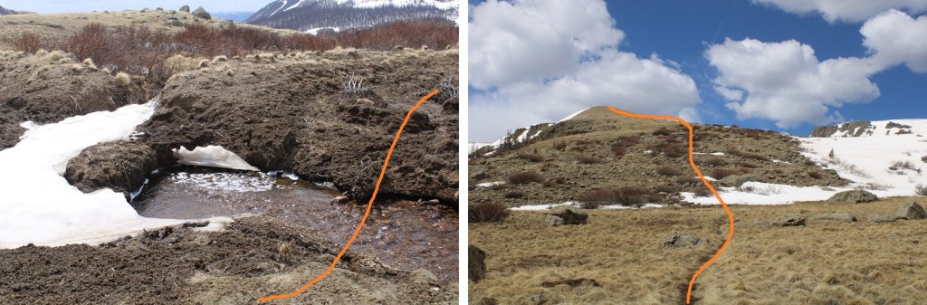
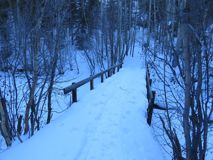
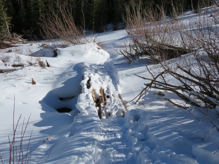
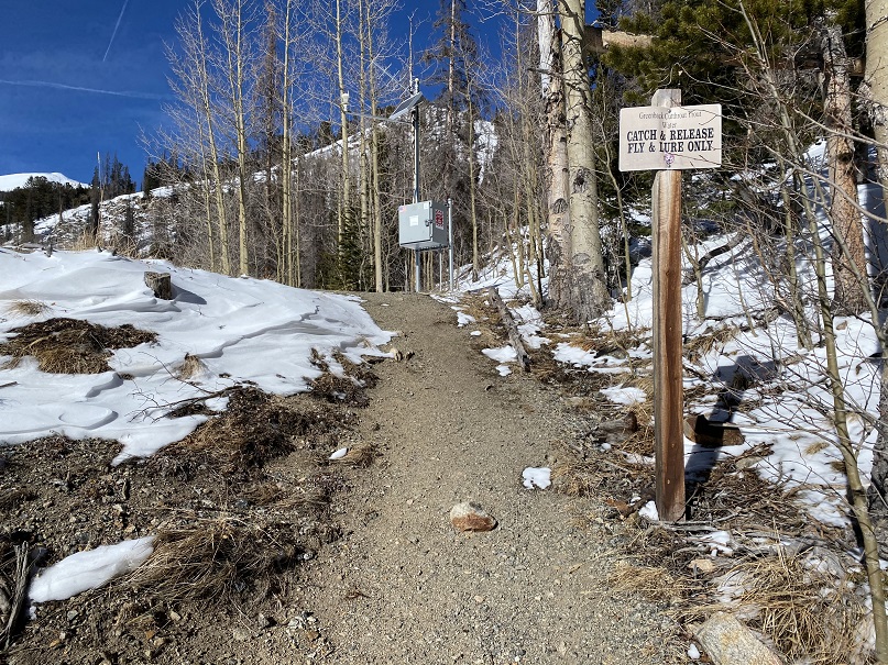
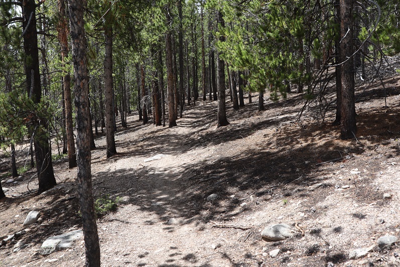
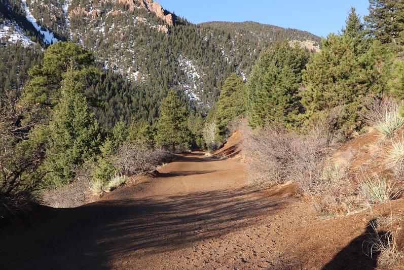
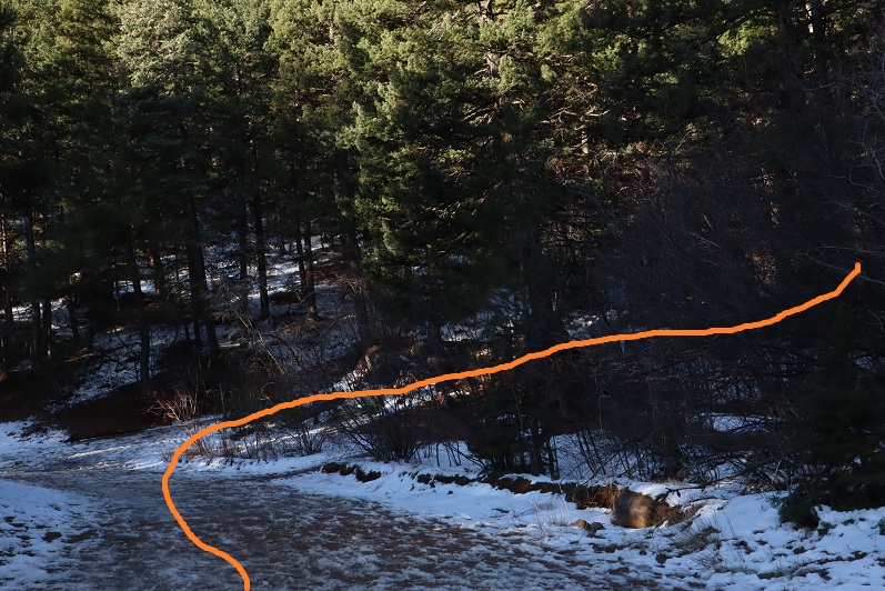
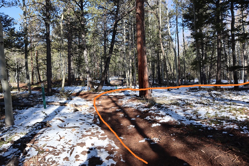
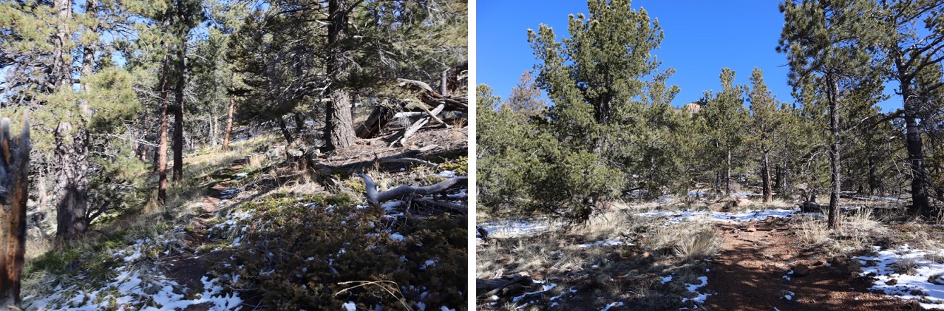
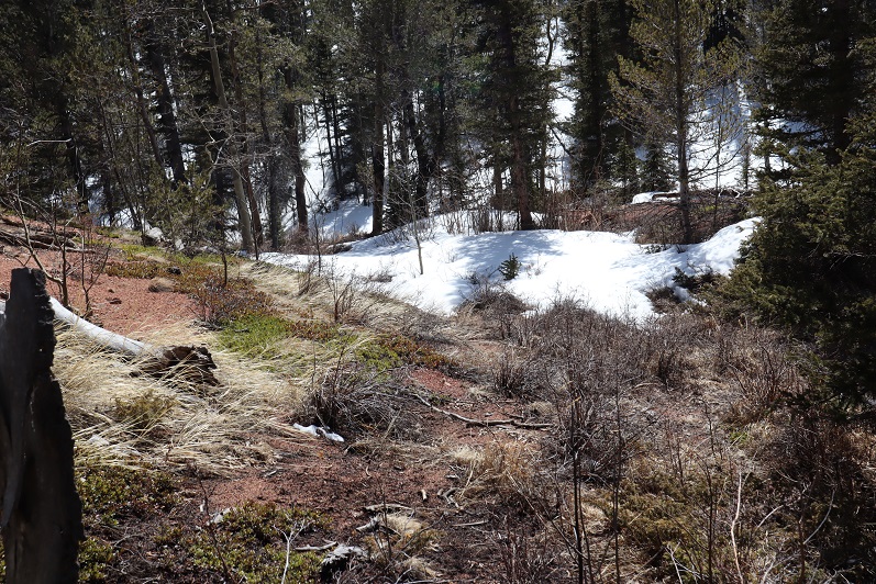
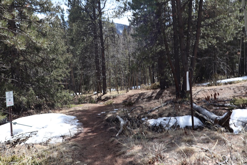
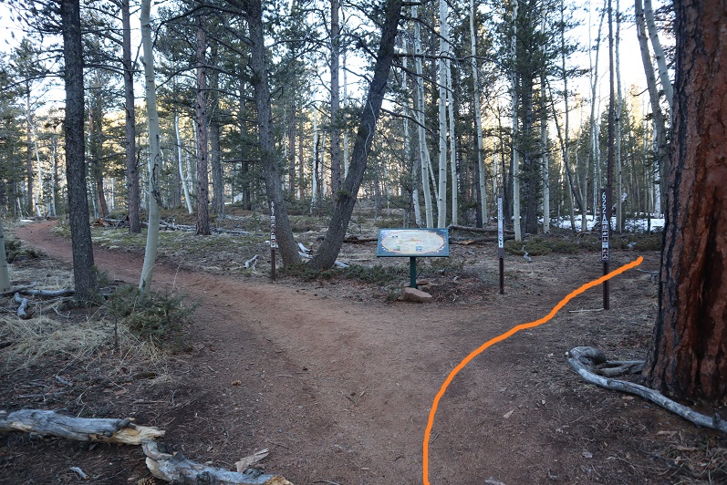
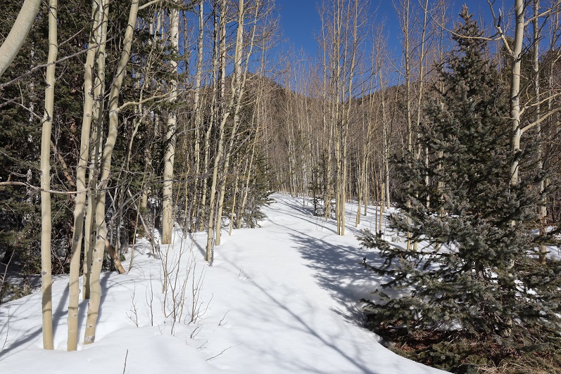
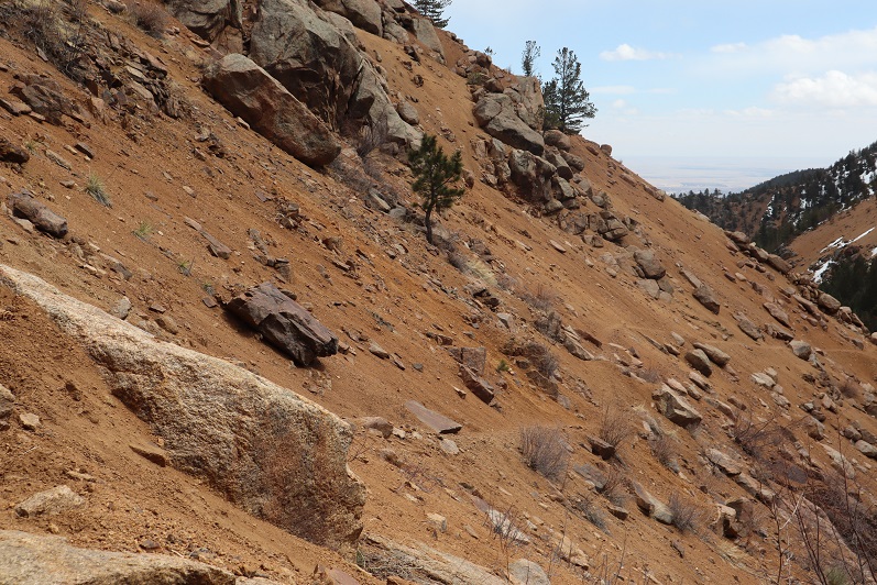
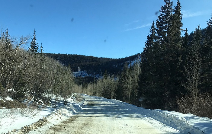
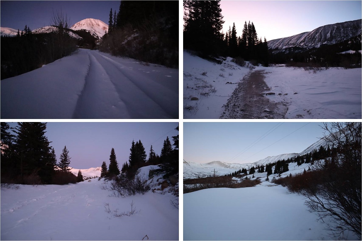
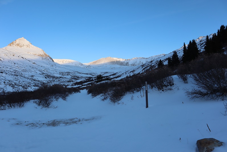
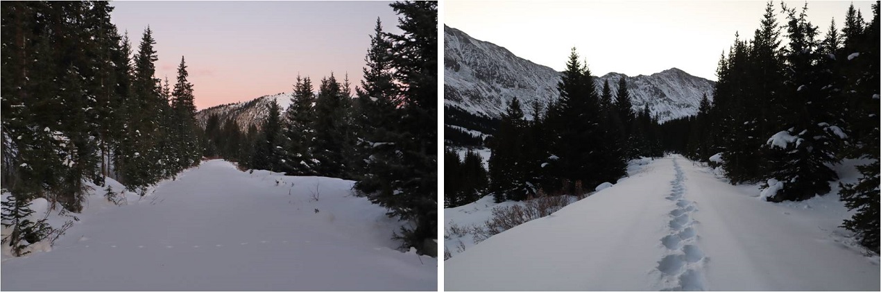
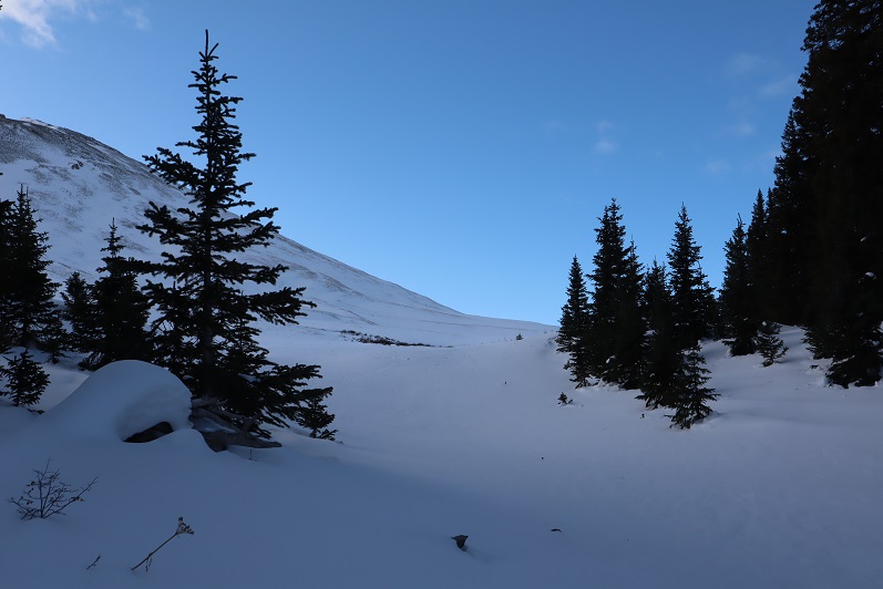
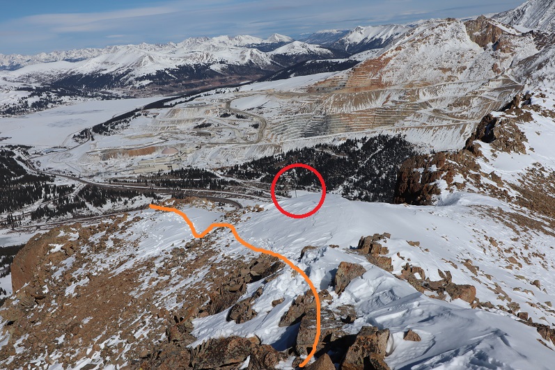
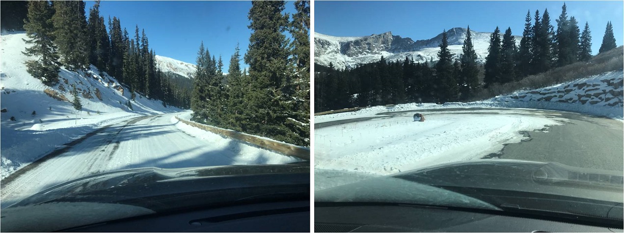
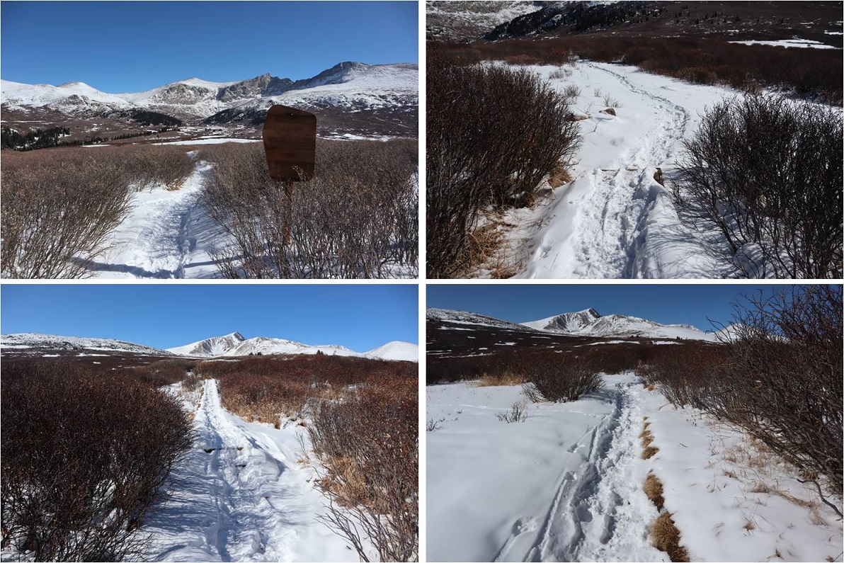
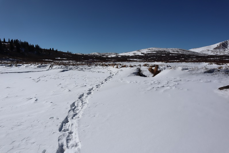
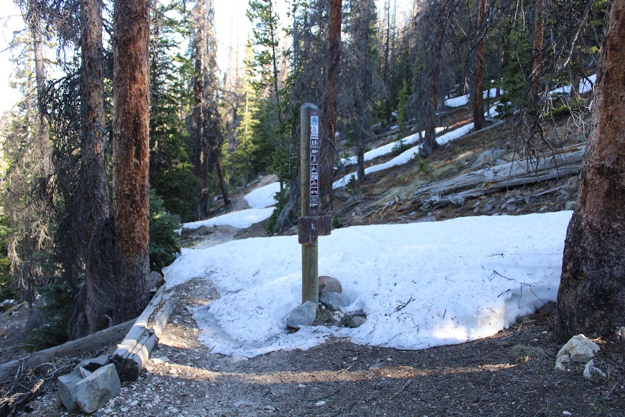
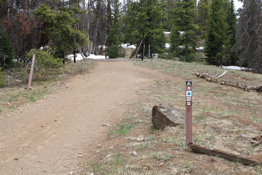
I checked the weather, and it wasn’t supposed to rain until 5pm tonight.  I did the math, figured I had plenty of time to get in a hike before weather set in, gathered my gear, and was on my way.  I was on the trail at 8am.  The usual trail from the trailhead has a sign saying it’s no longer in use, so I took the very short bypass and started along the road instead.  This is road 243G, located at the north end of the parking area.  If was a bit muddy to begin with.

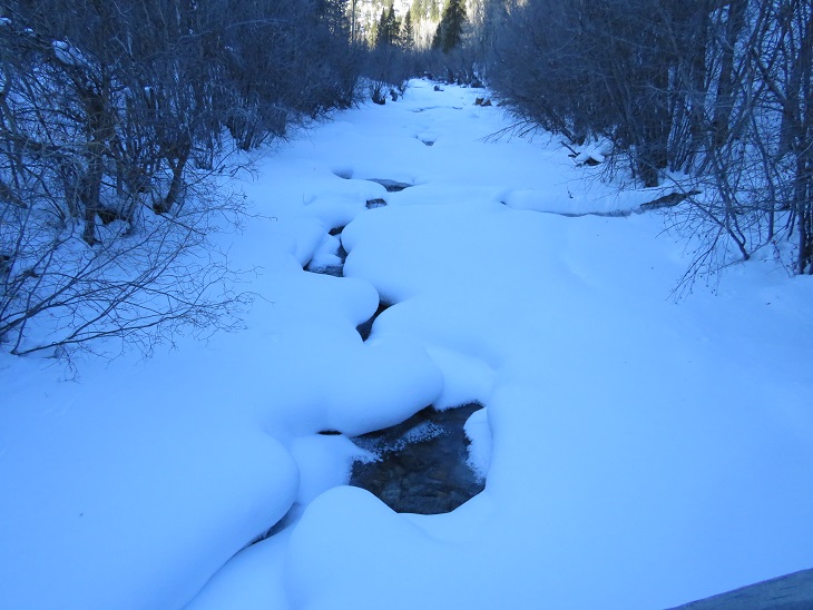
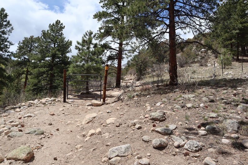
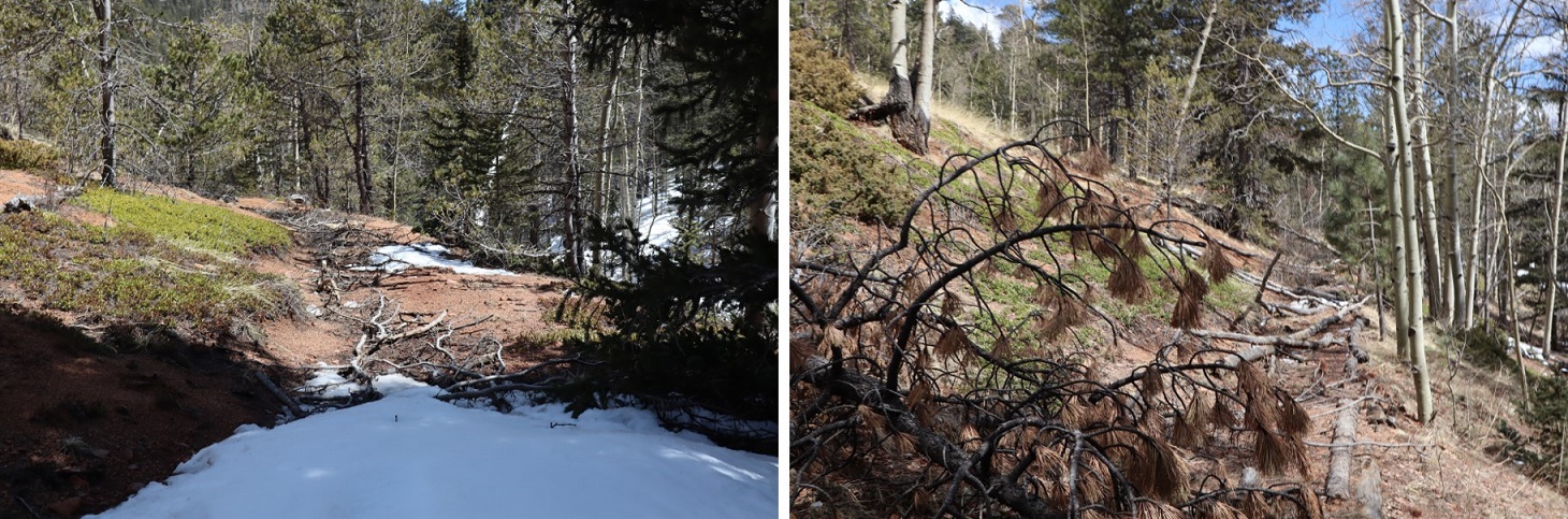
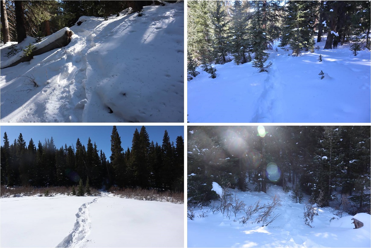
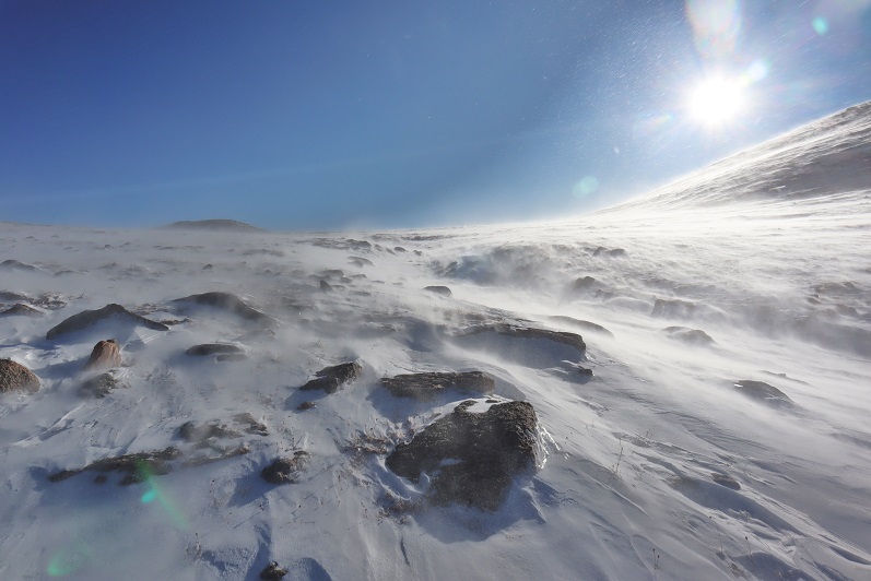
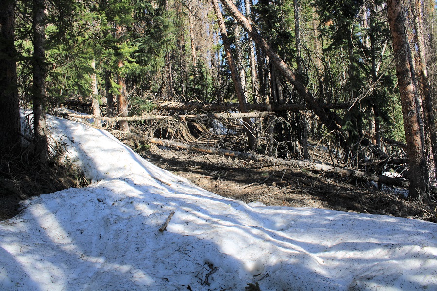
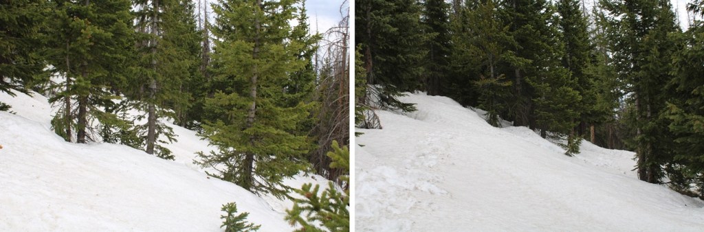
It was obvious from the start motorized vehicles hadn’t been on the trail yet this year, as there were numerous downed trees at the beginning (not much after a mile in, however).

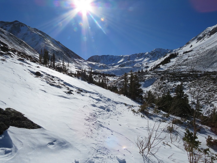
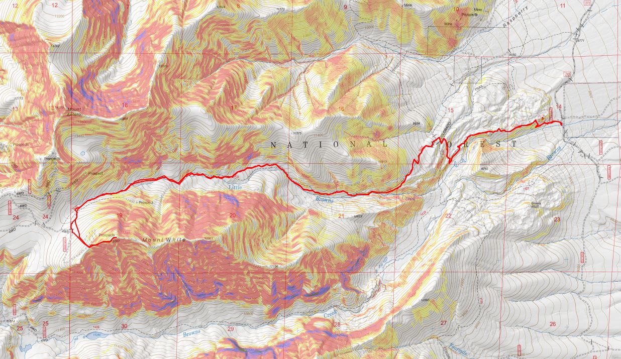
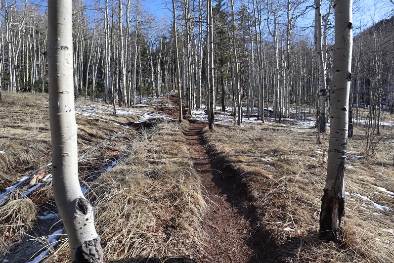
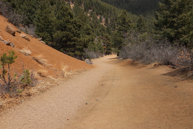
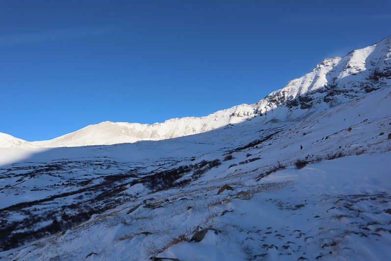
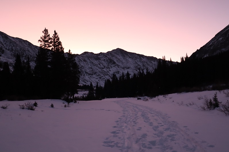
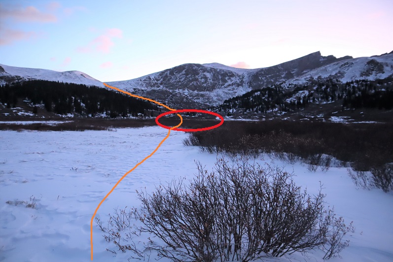
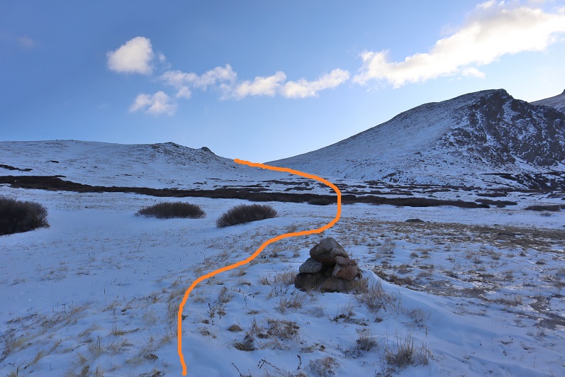
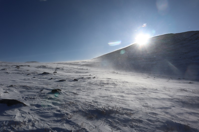
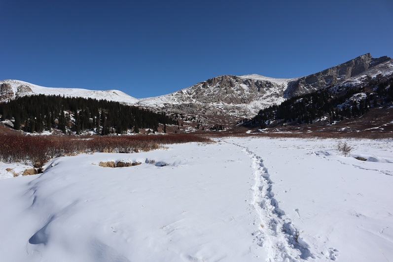
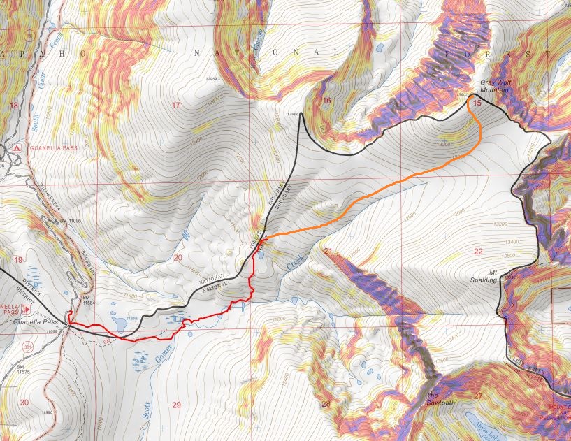
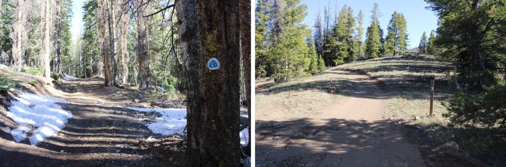
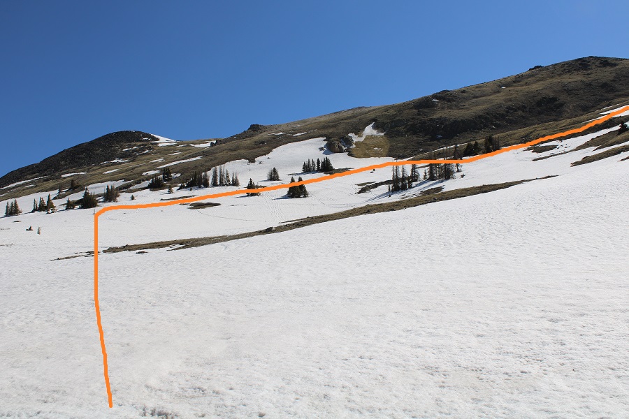
I was following the Continental Divide and Colorado Trails north, along the west side of the mountains. 

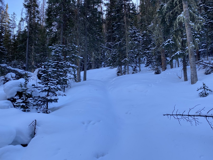
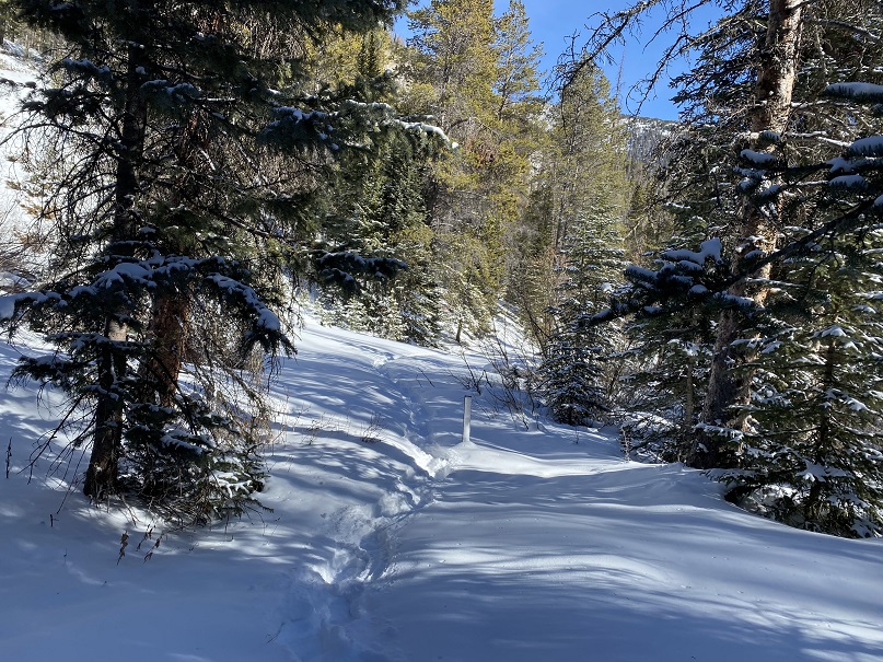
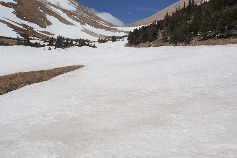
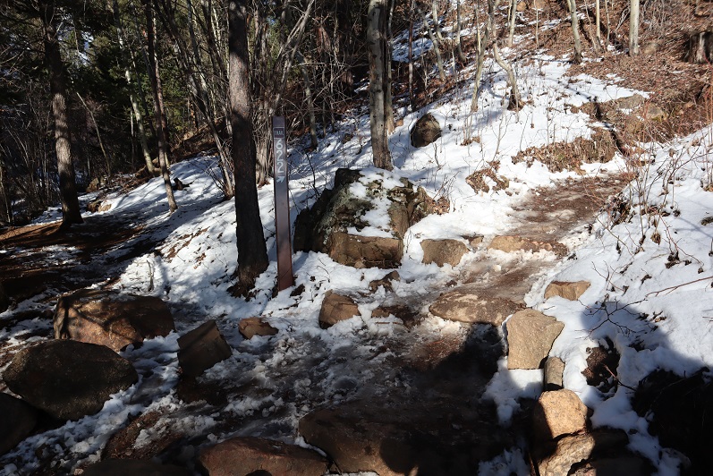
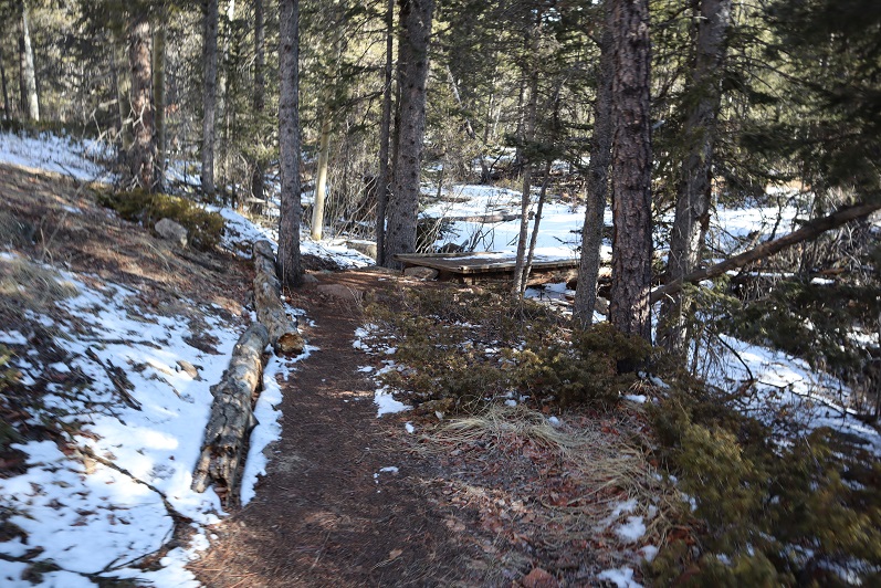
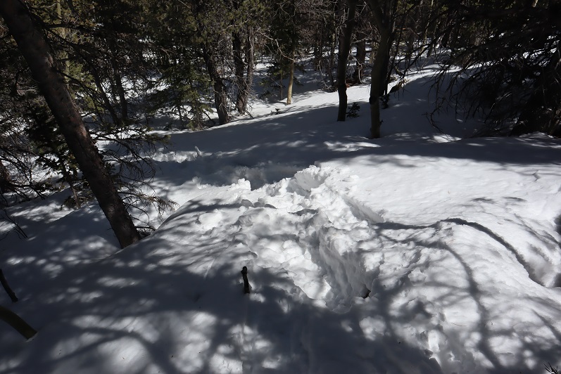
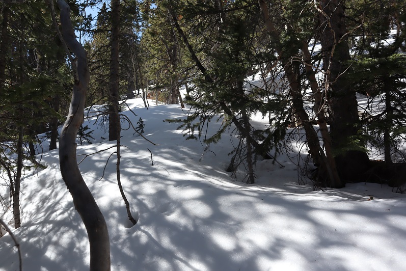
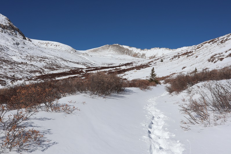
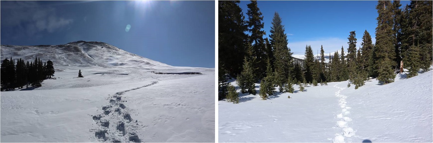
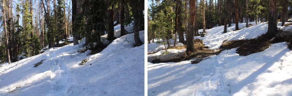
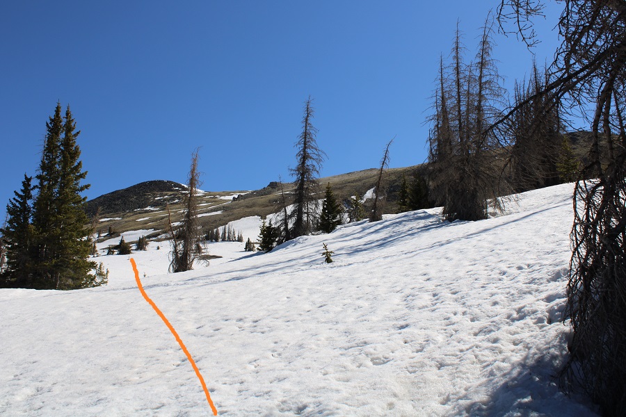
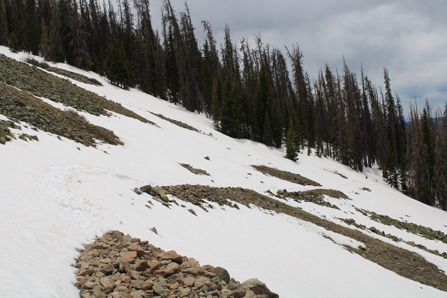
After hiking for 1.7 miles snow started covering the trail.  Luckily, this snow wasn’t quite mashed potato snow, and I could get by hiking over it with just microspikes (on the way in),

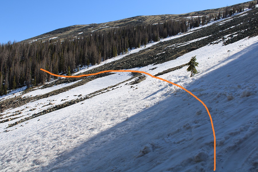
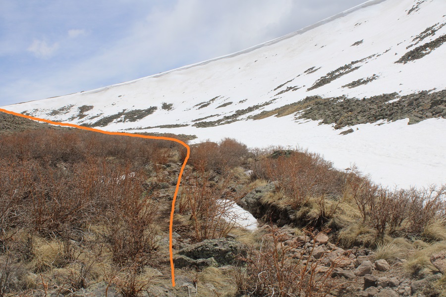
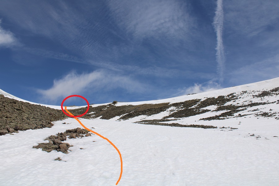
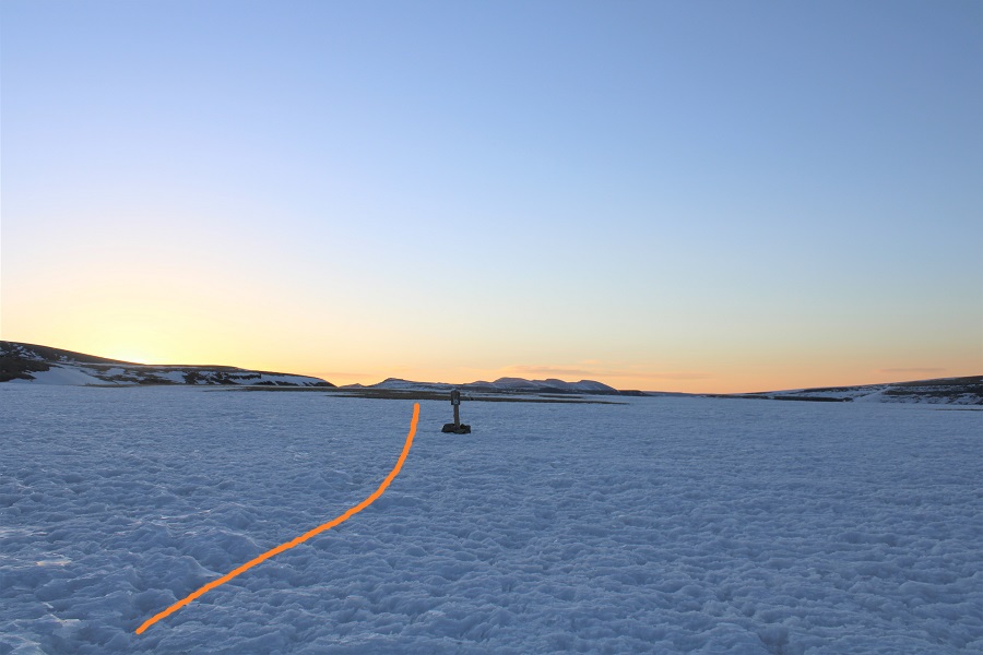
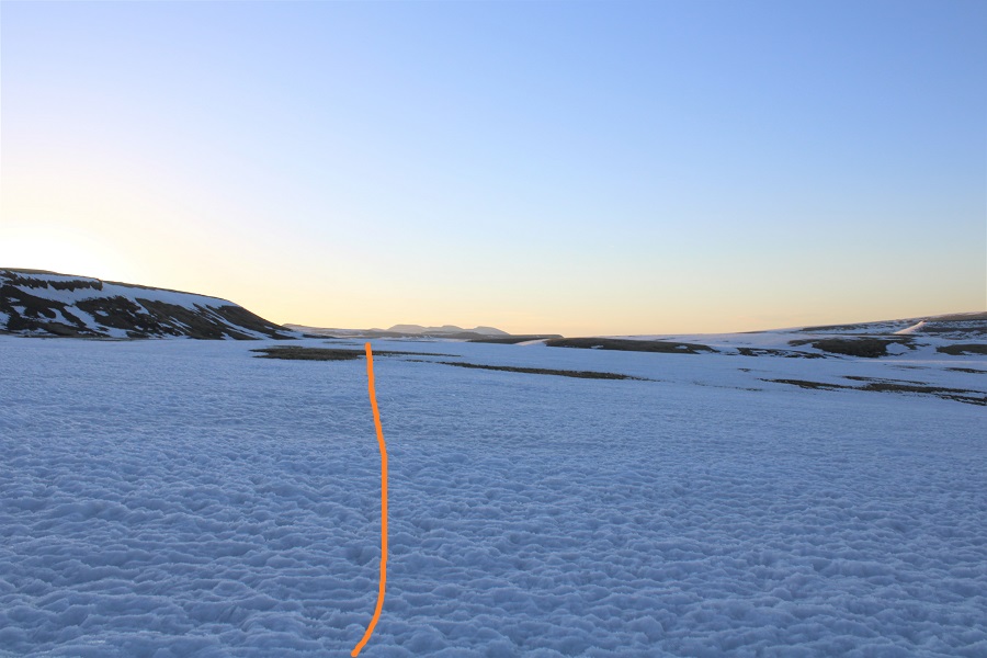
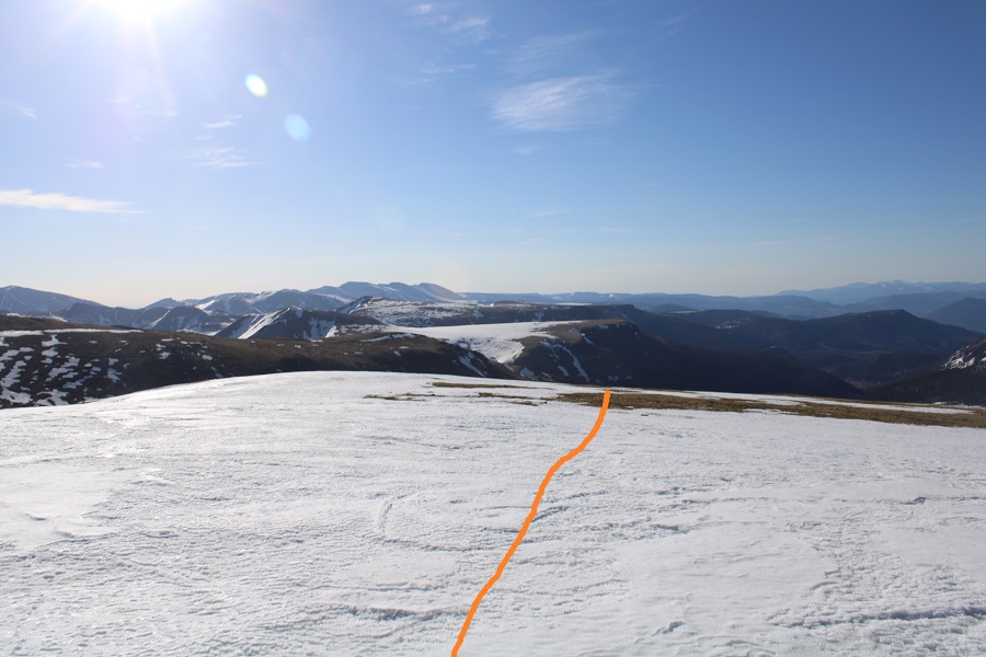
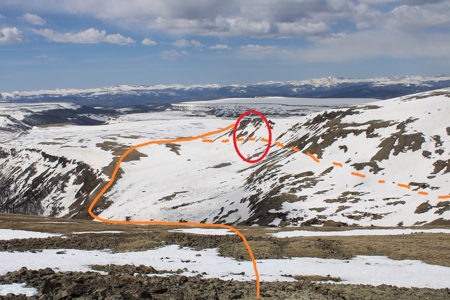
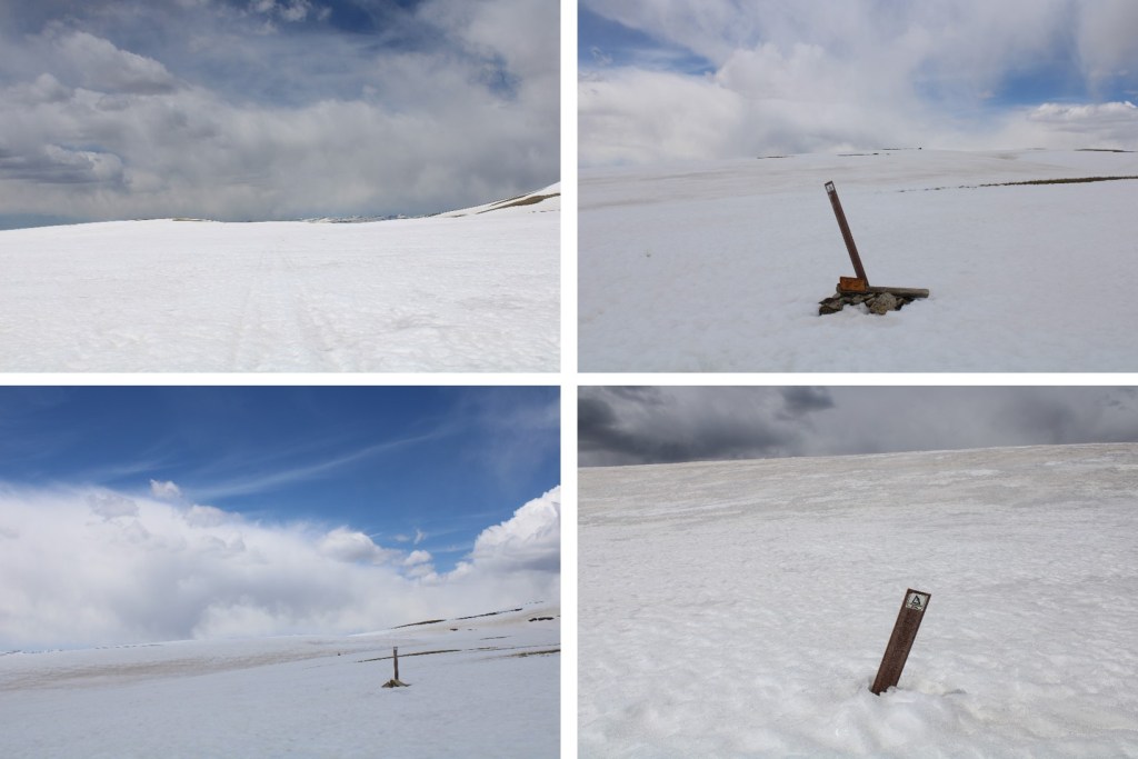
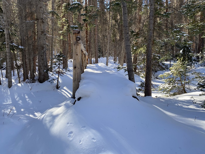
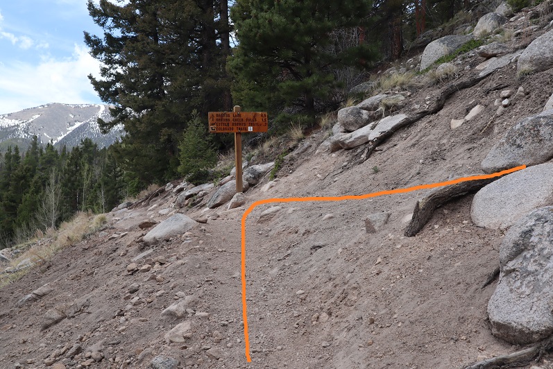
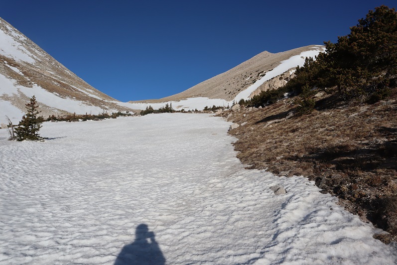
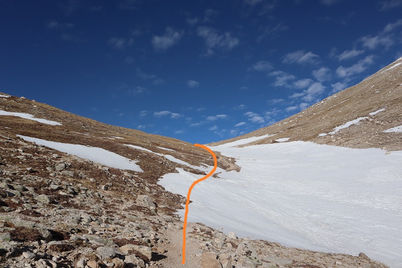
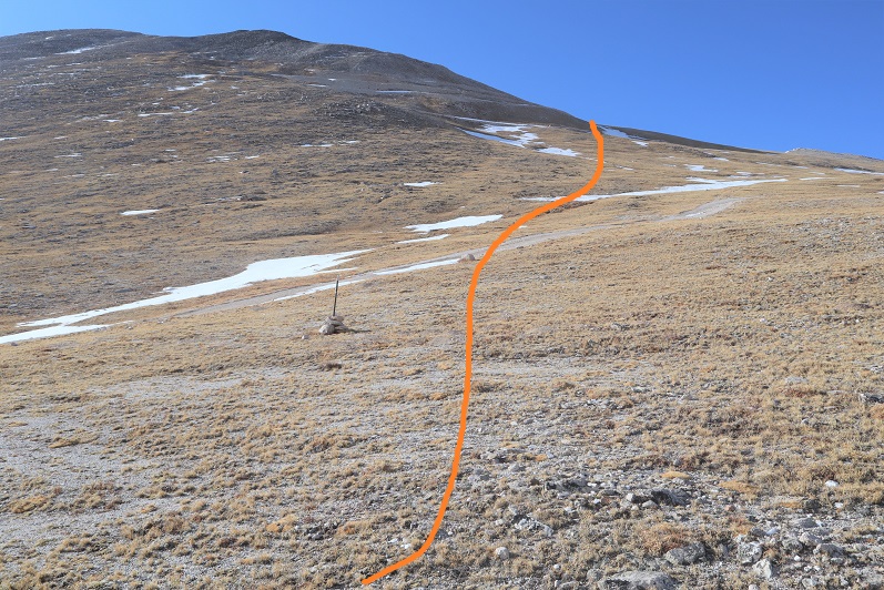
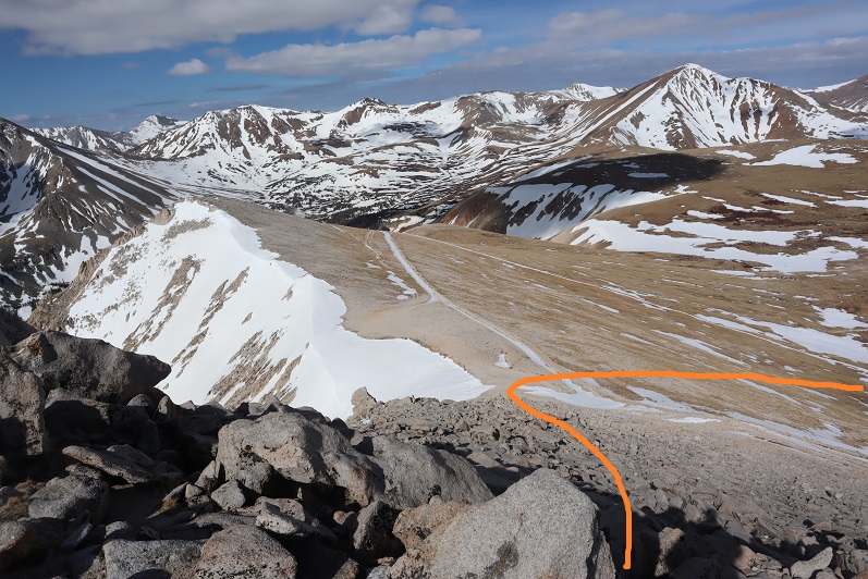
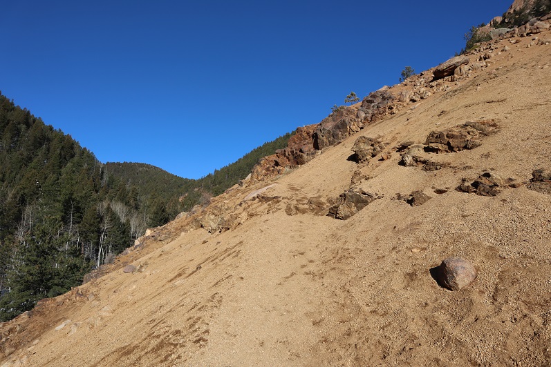
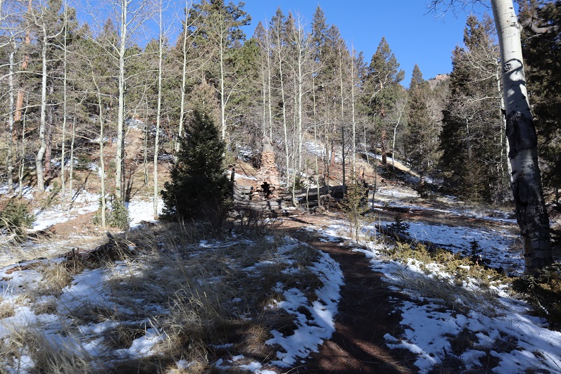
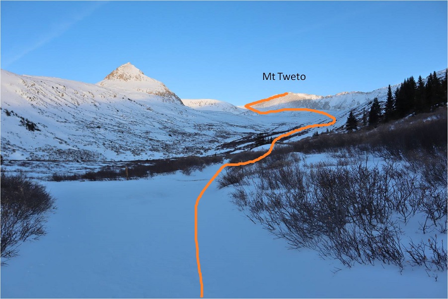
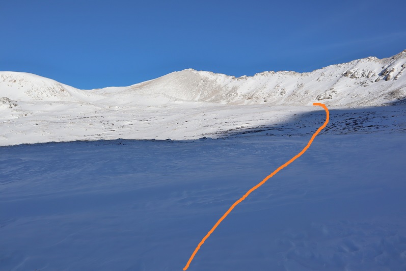
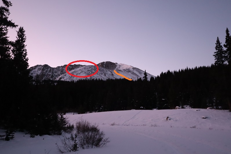
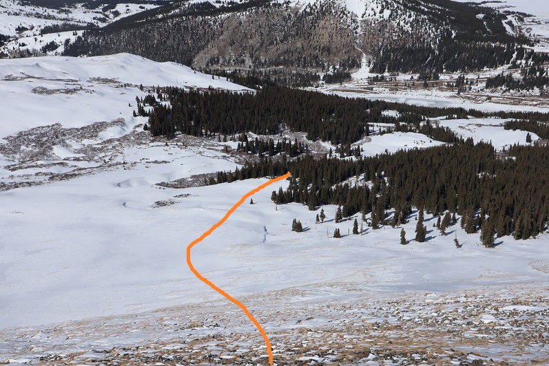
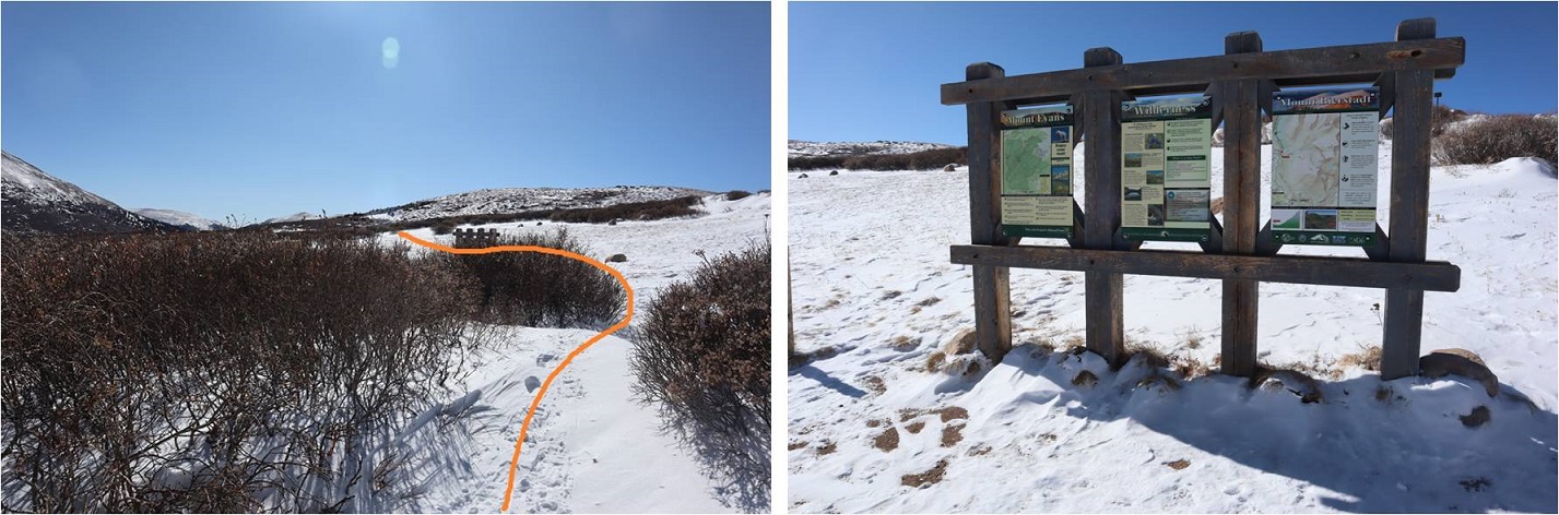
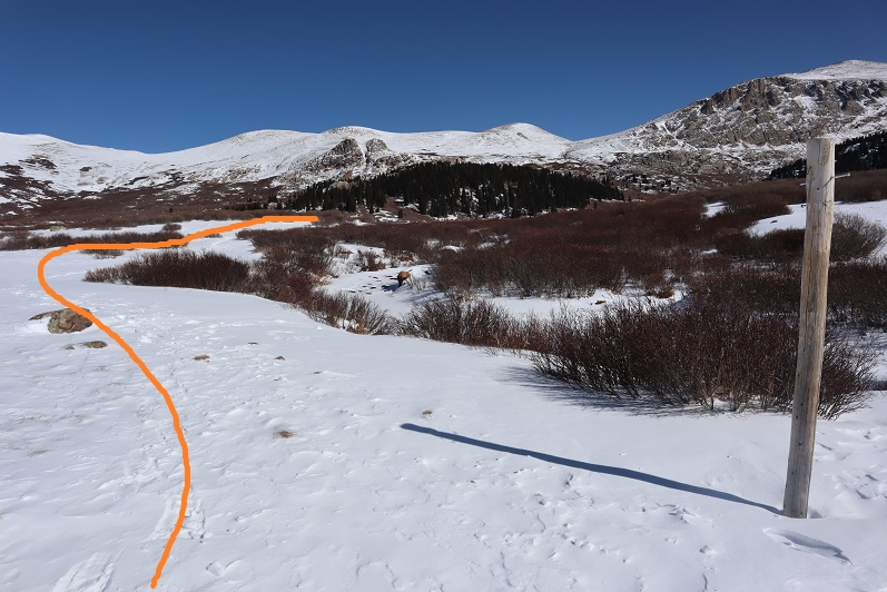
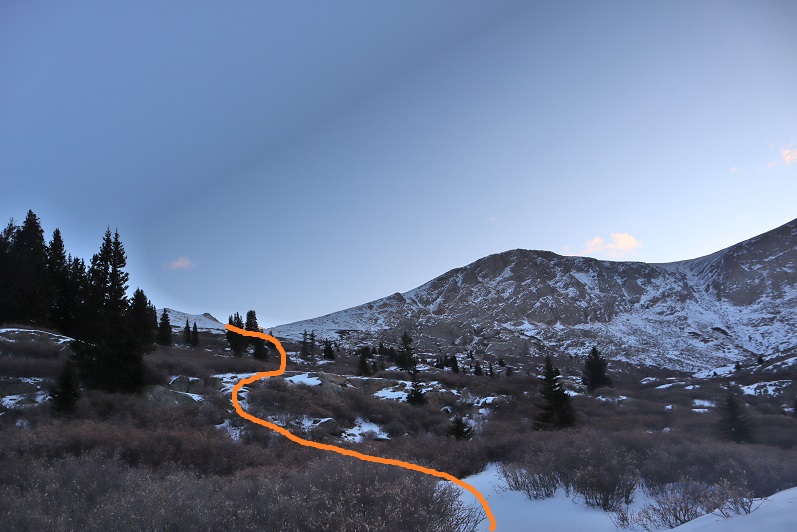
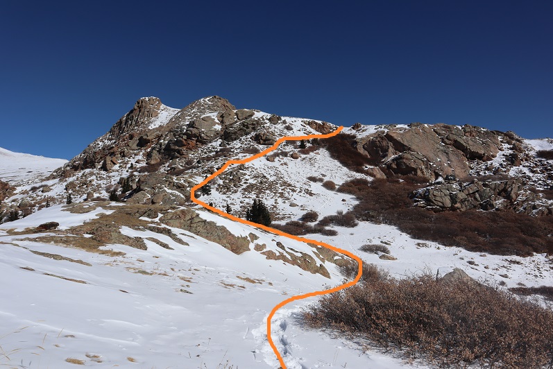
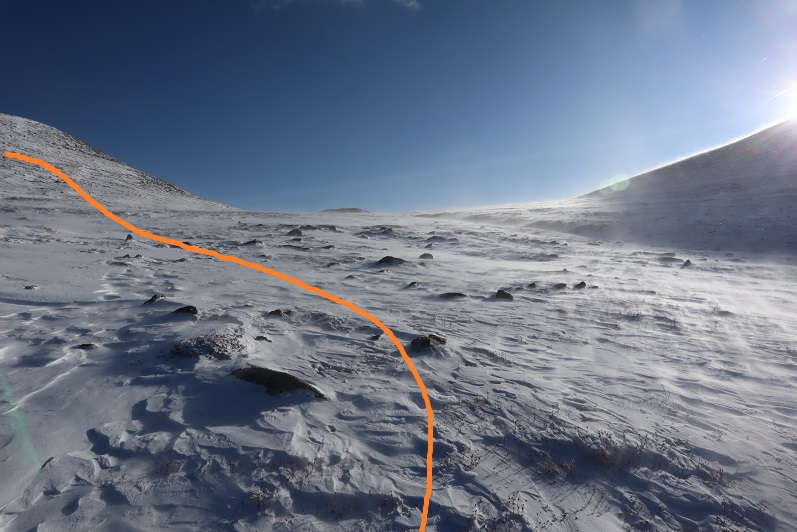
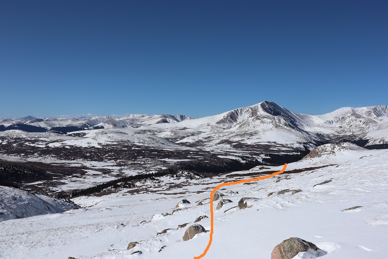
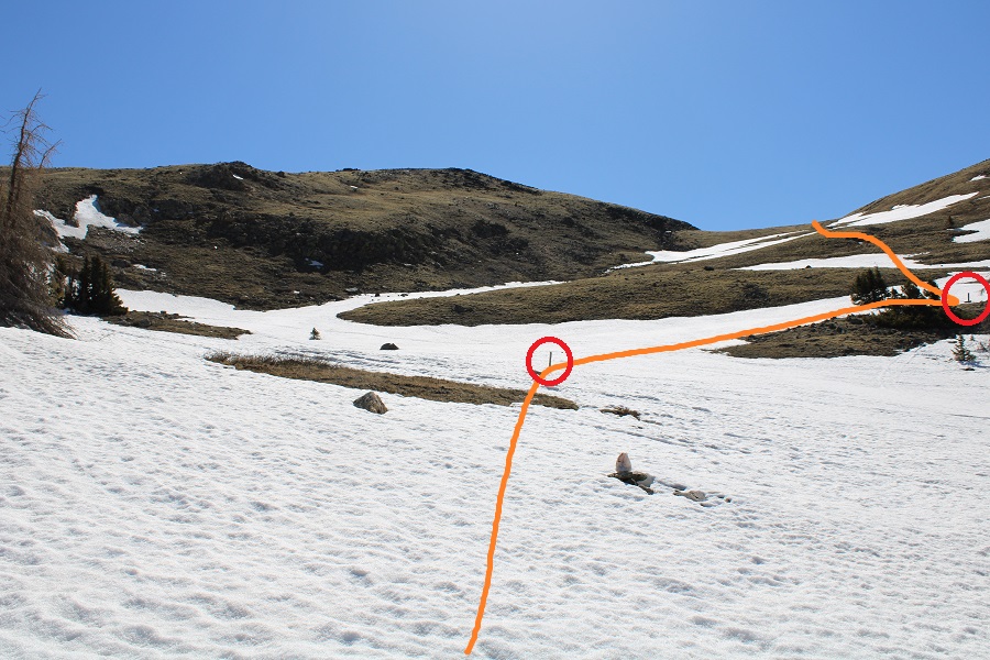
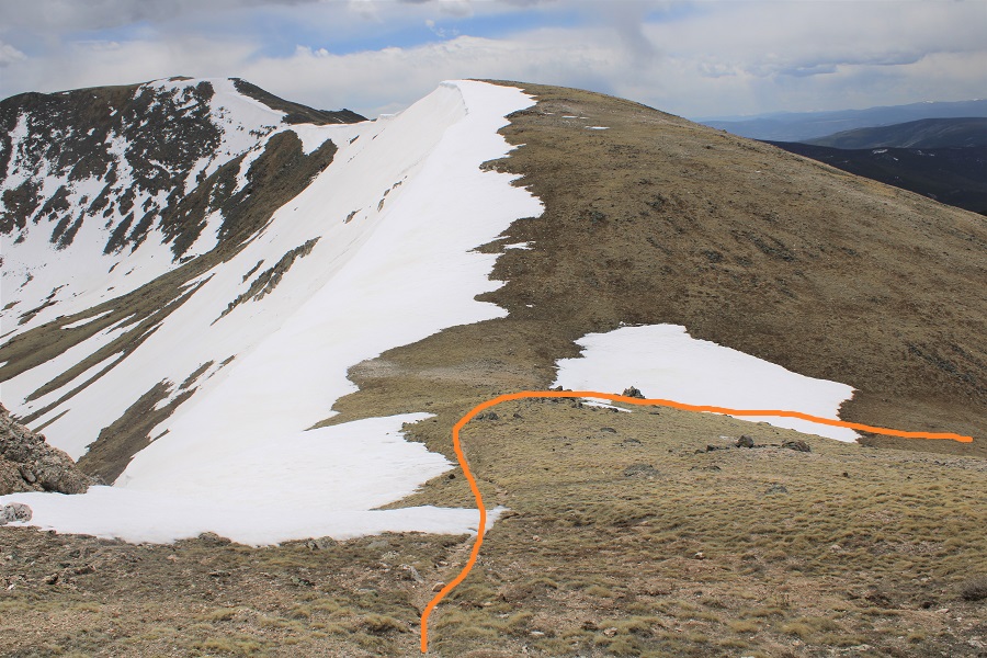
After hiking for a total of just over 3 miles I turned right and headed east up the slope.  A map will tell you this is trail 484.1, but since it was covered in snow I headed east,  and once I saw them, I followed the posts to the saddle.

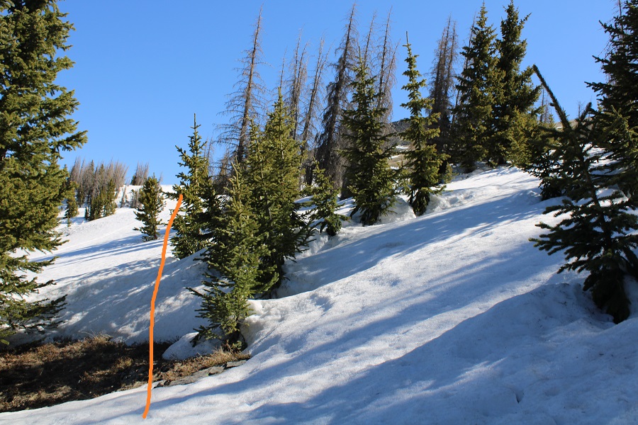
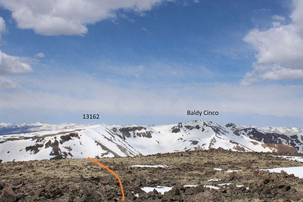
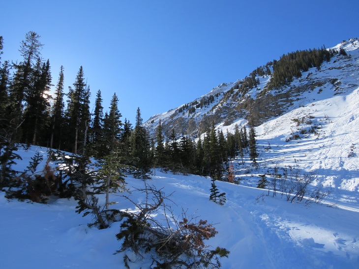
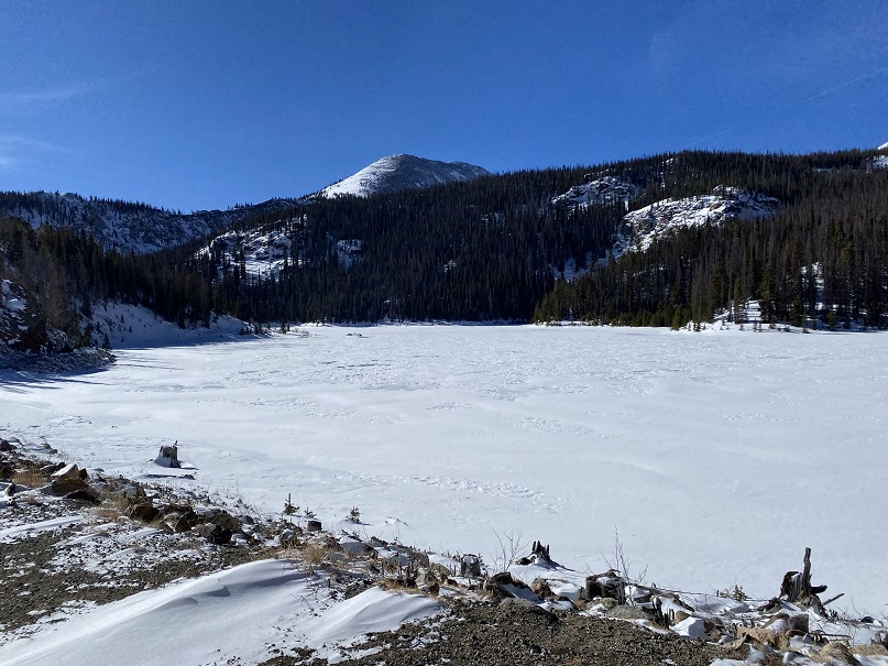
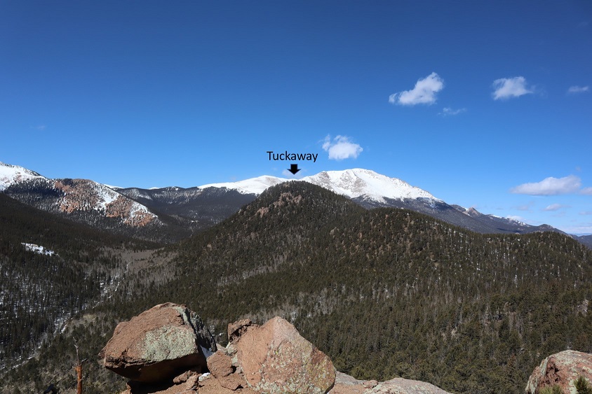
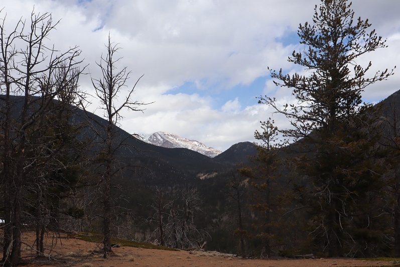
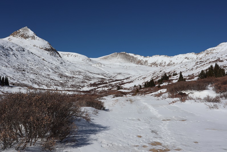
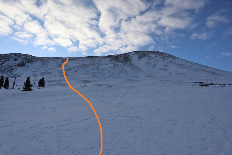
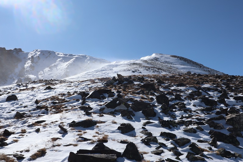
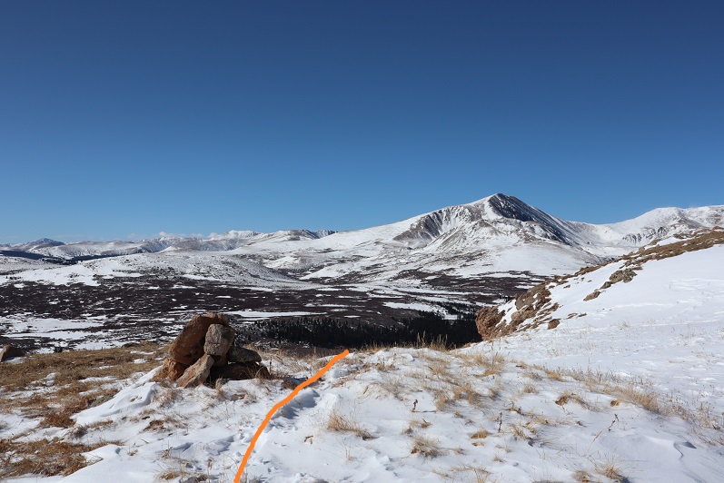
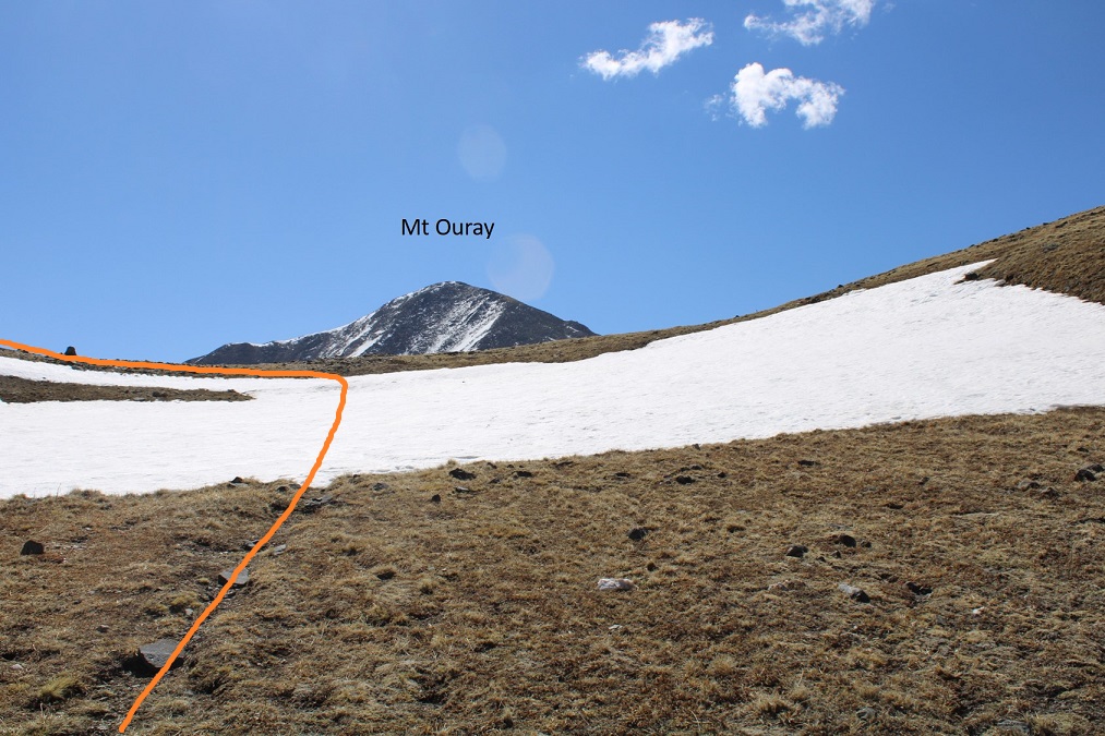
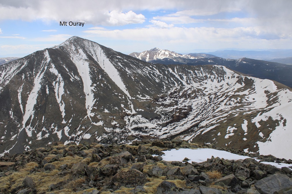
Once at the saddle I had a great view of Mt Ouray.  I turned left and headed north along the ridge.

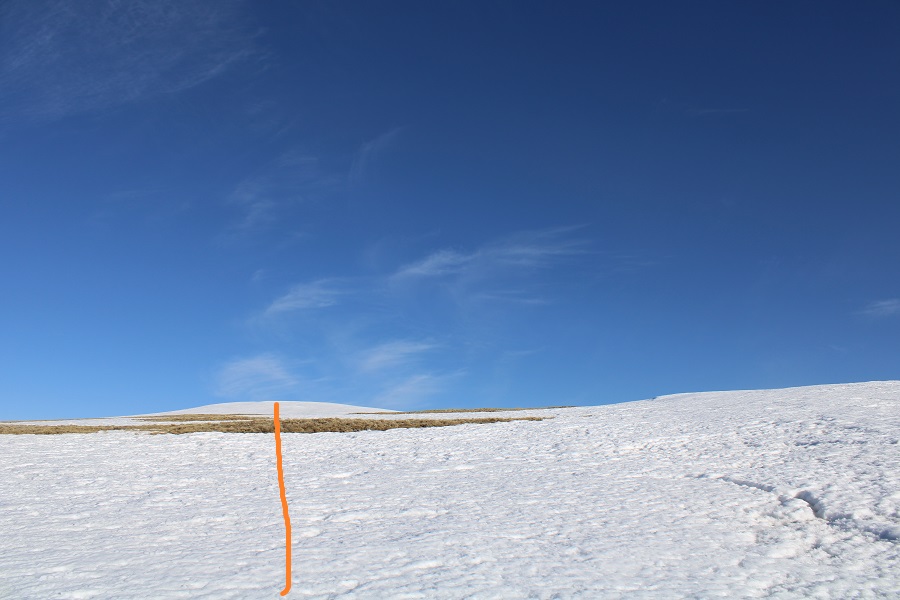
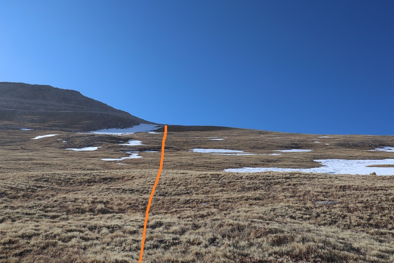
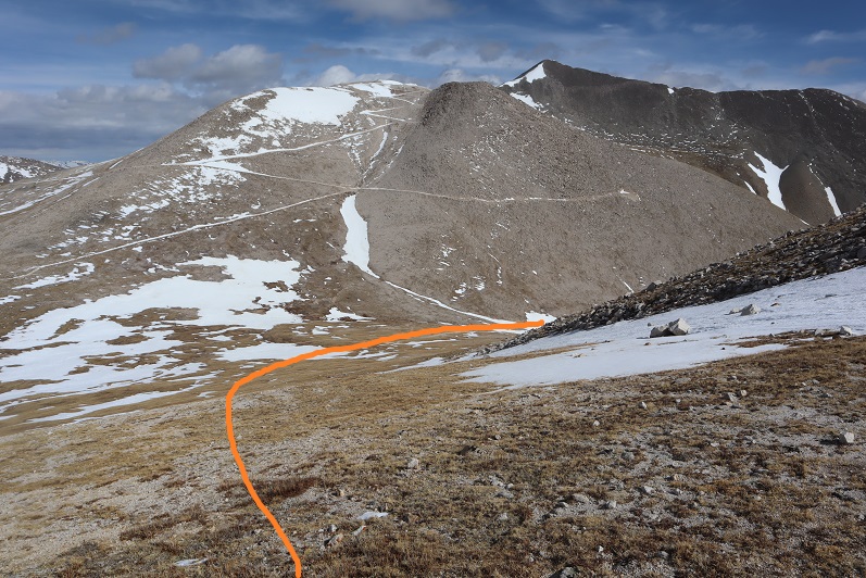
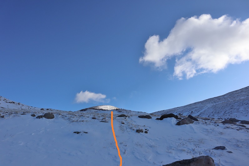
Here an obvious trail picked up (the trail only lasted to the top of this hill).

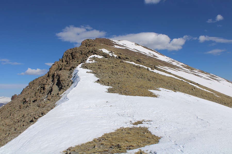
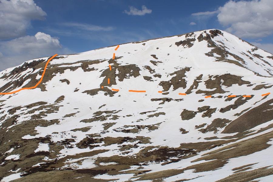
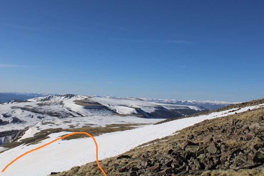
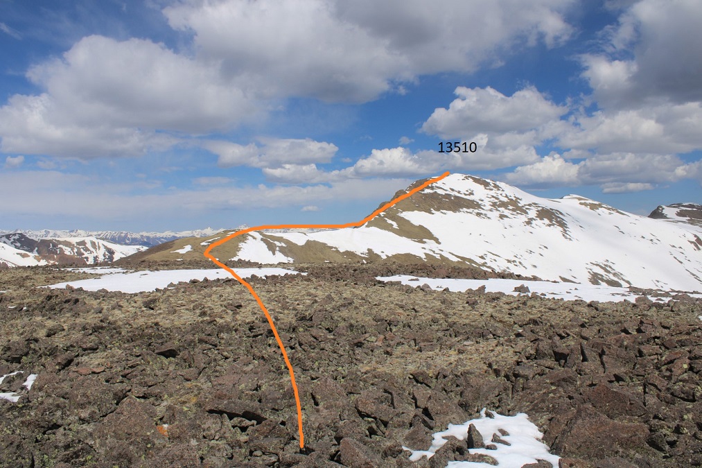
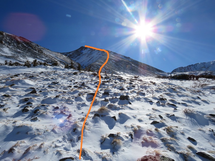
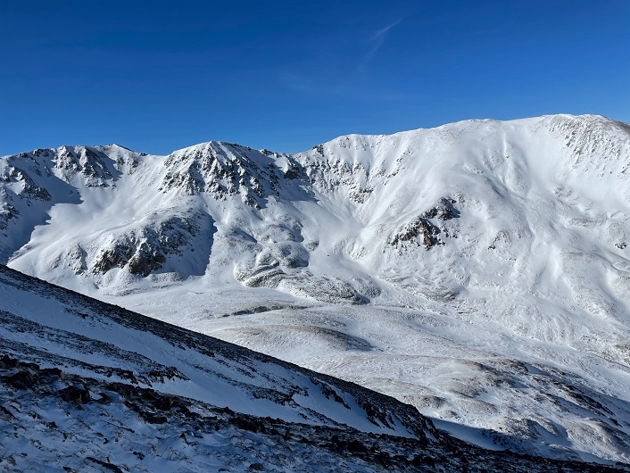
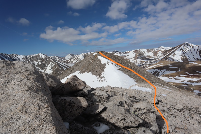
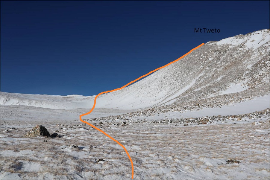
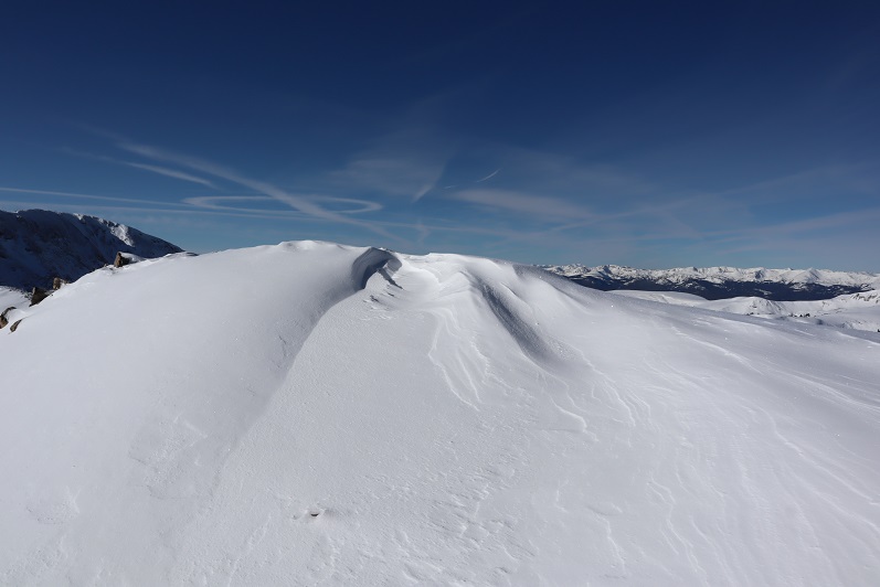
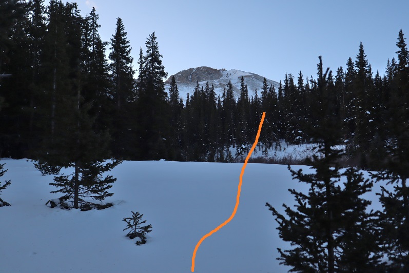
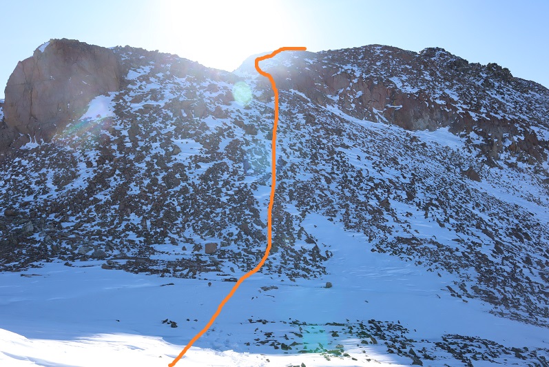
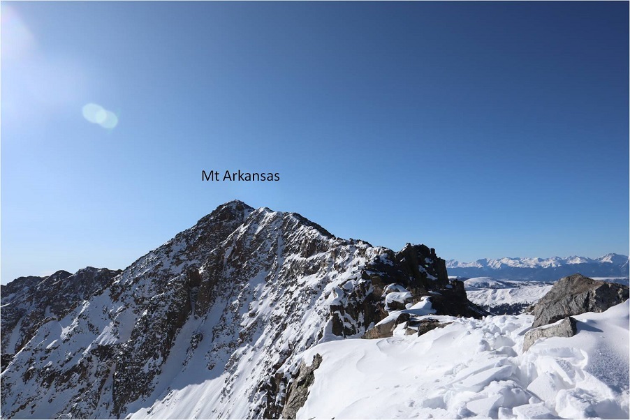
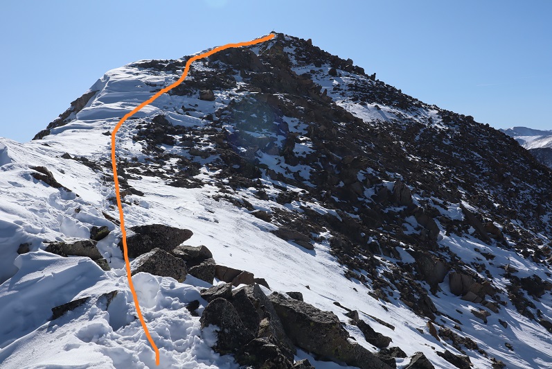
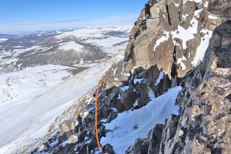
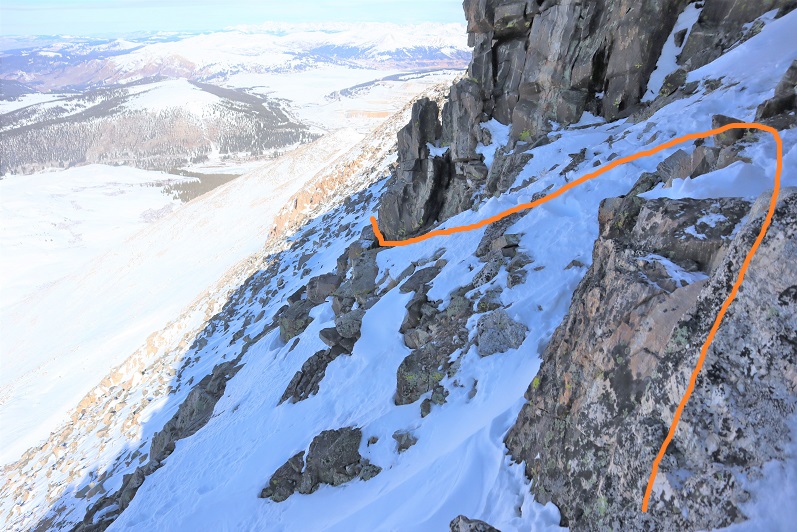
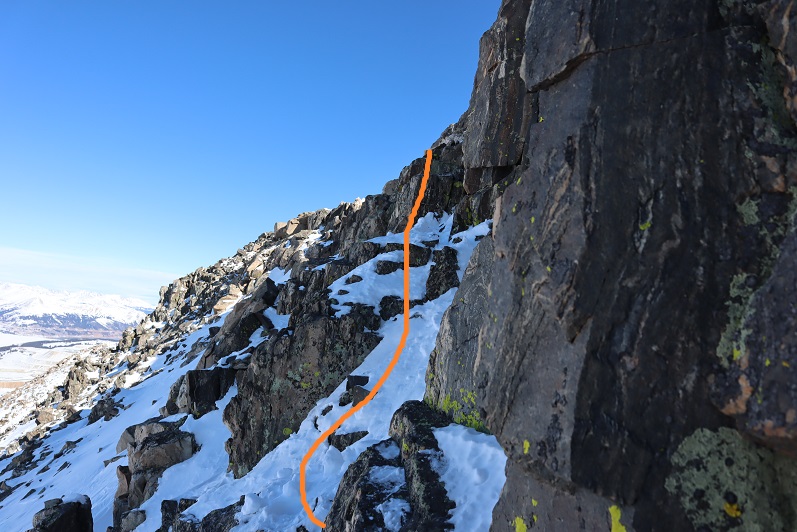
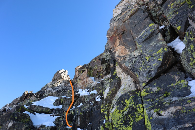
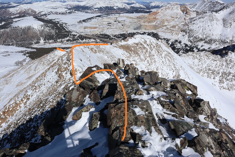
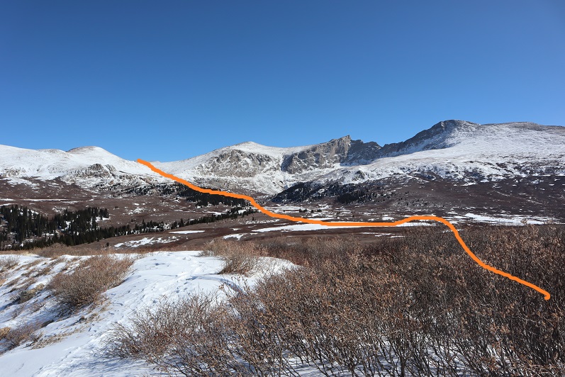
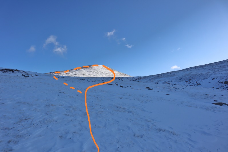
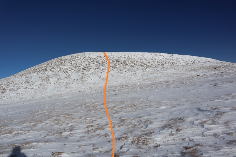
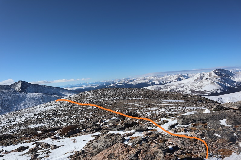
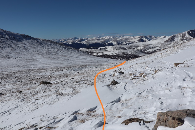
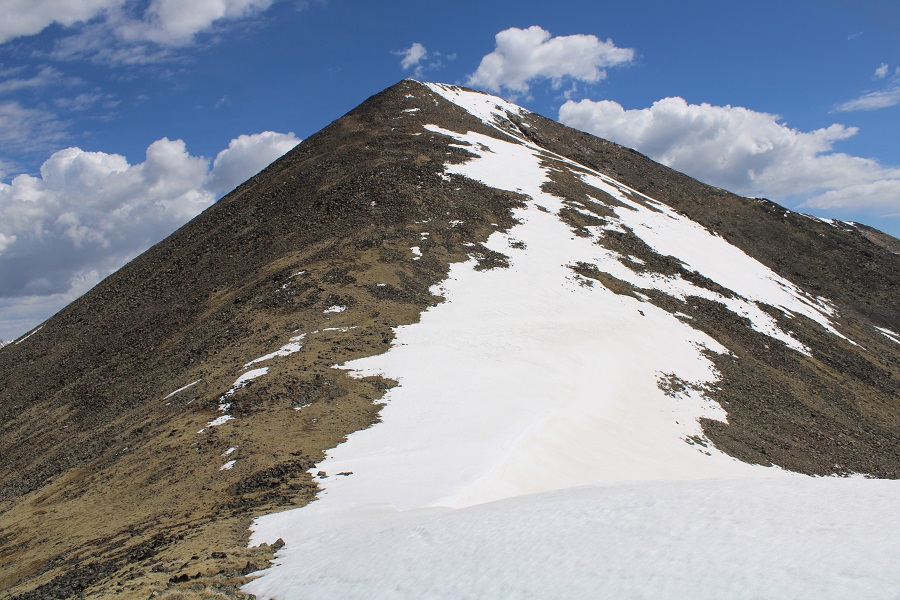
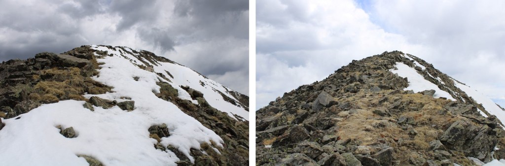
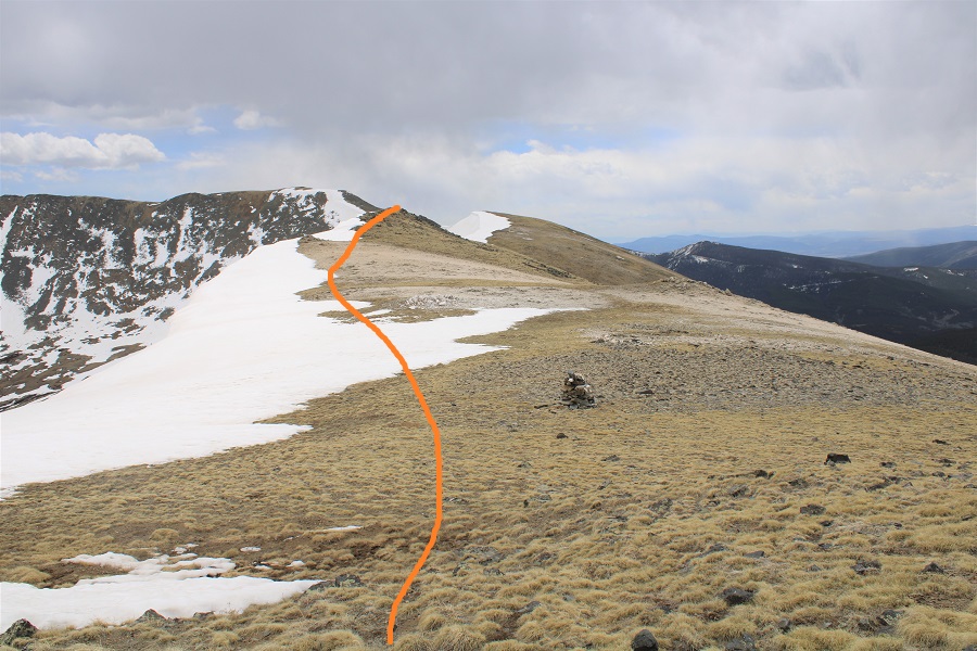
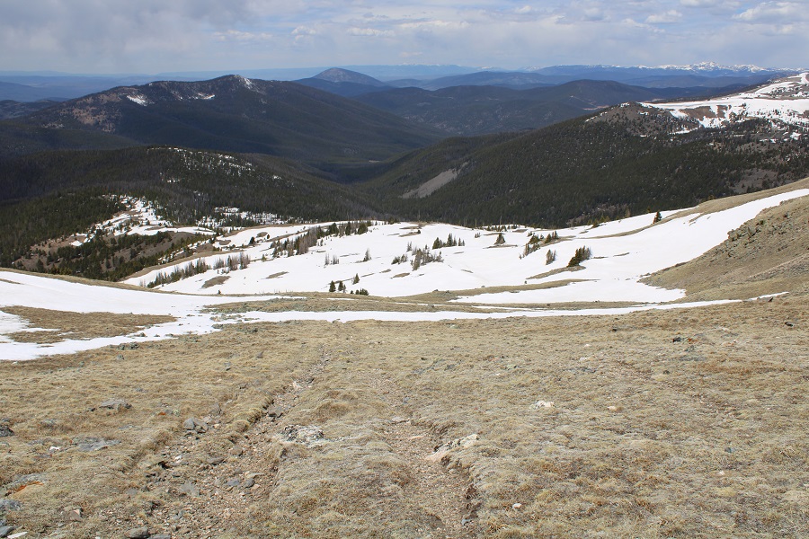
From here you can see the rest of the hike:  it’s a straightforward ridge hike that starts out with tundra, and ends with a lot of loose rocks the size of tires.  Note:  The drop from South Chipeta Mountain to Chipeta Mountain is more drastic than this image would indicate.

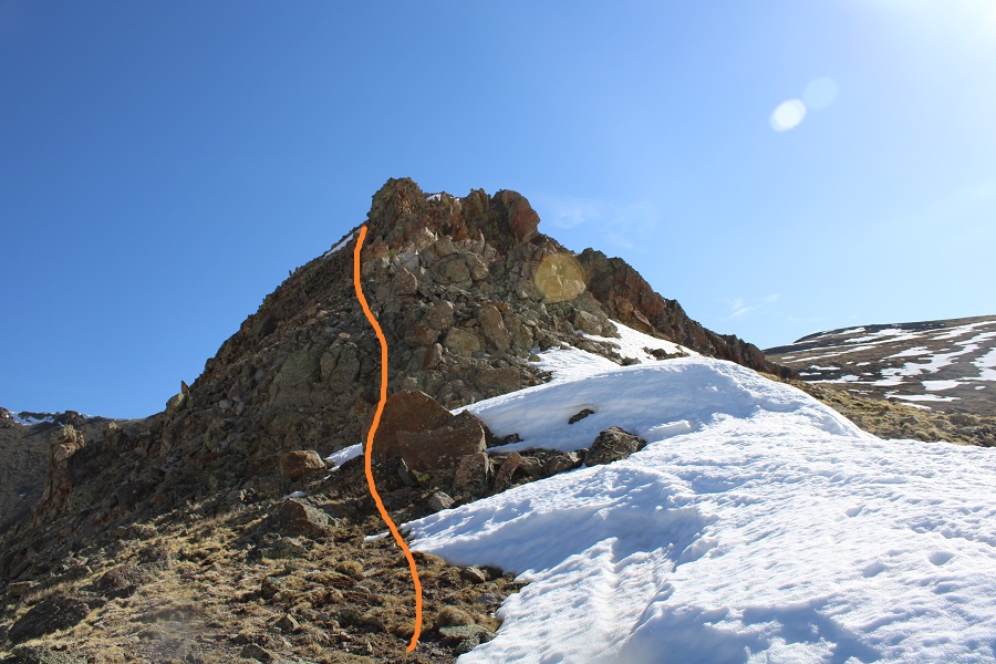
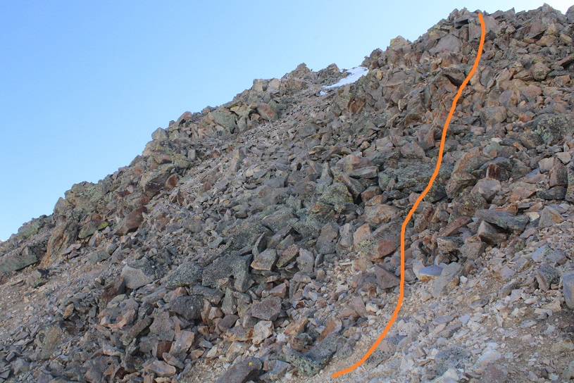
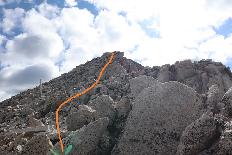
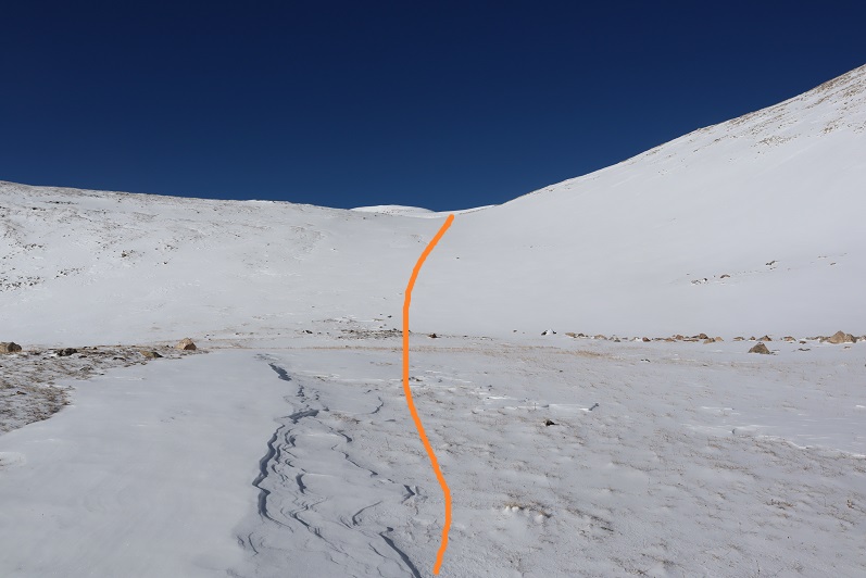
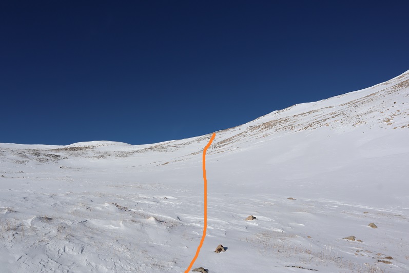
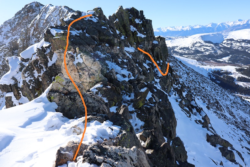
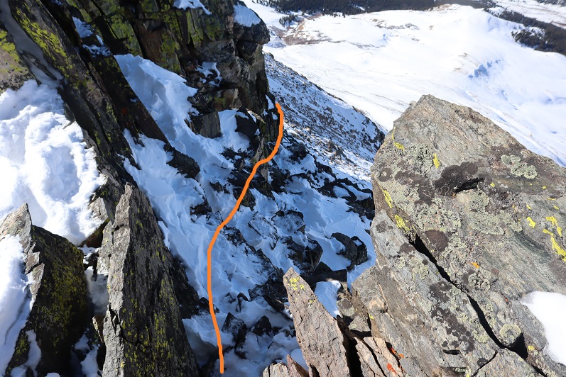
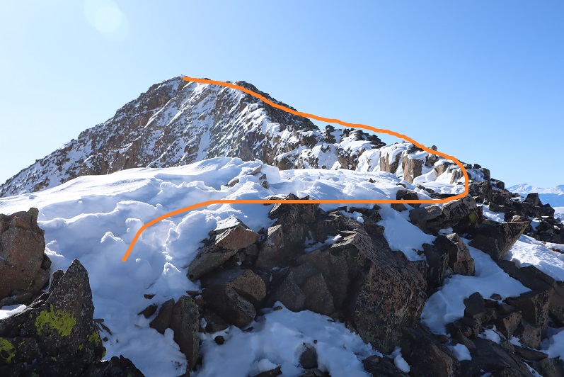
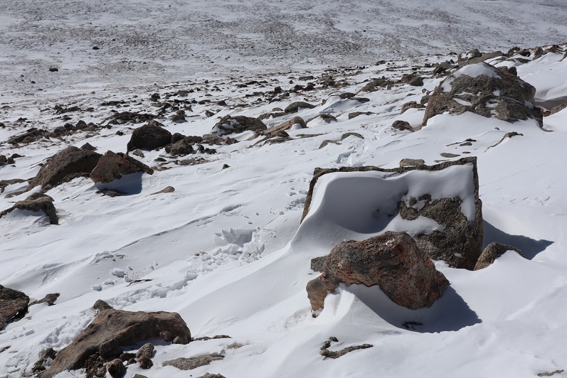
Here are some step by step pictures of the ridge.

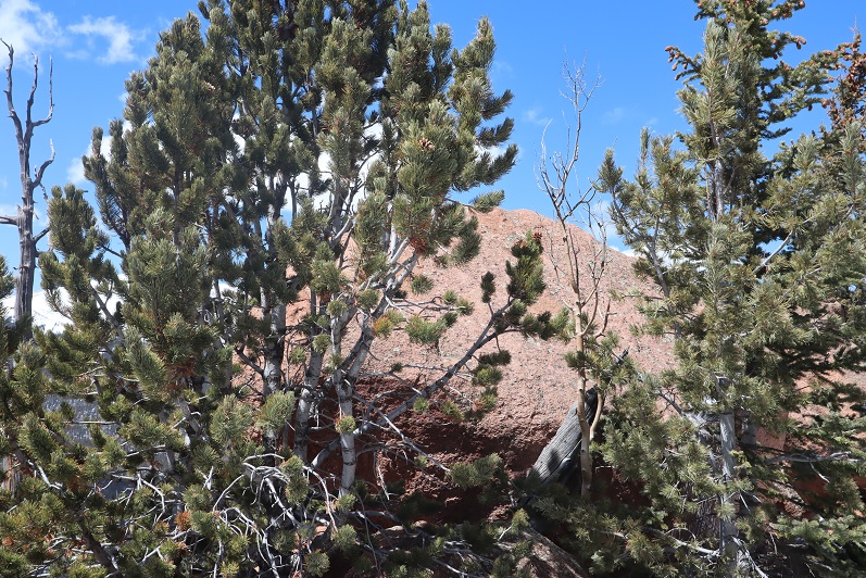
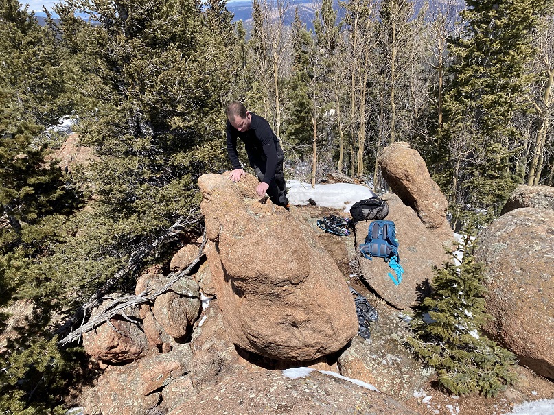
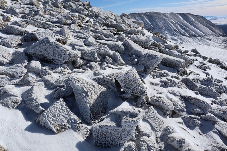
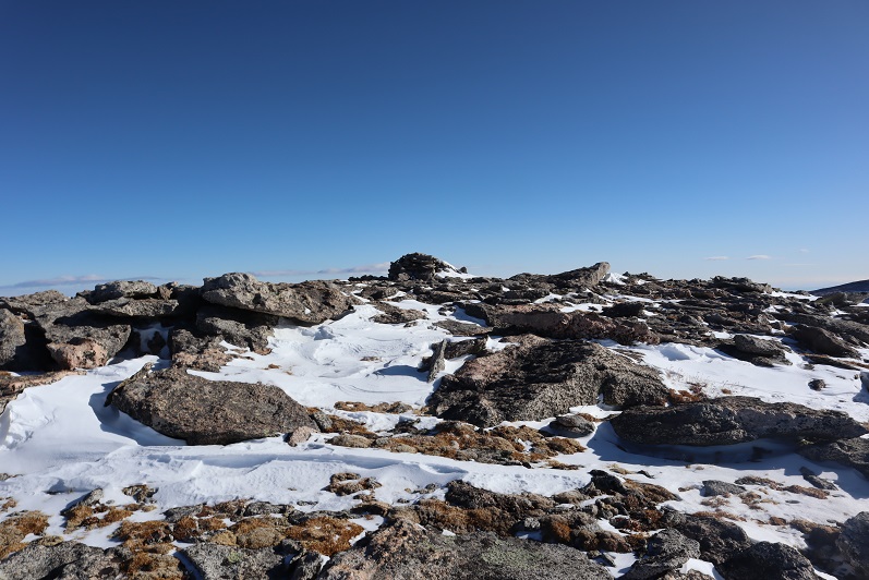
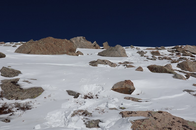
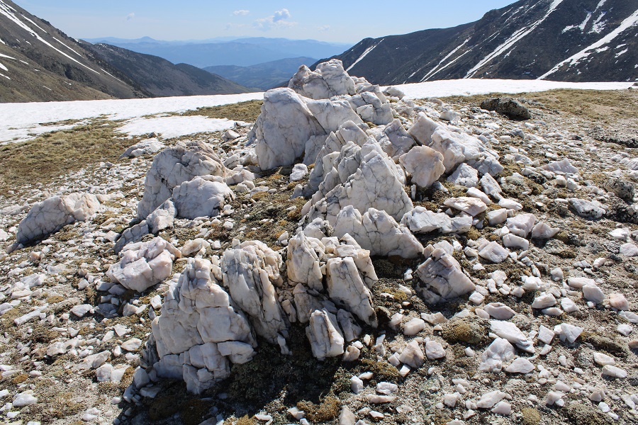
There’s a cool Quartz formation, with a lot of interesting rocks lying around

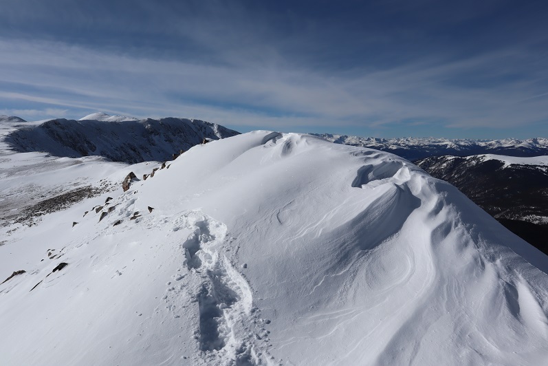
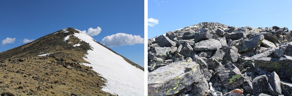
Then it’s on to South Chipeta Mountain

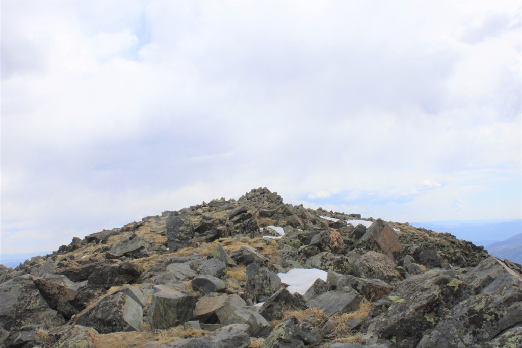
It’s rockier than it looks towards the top

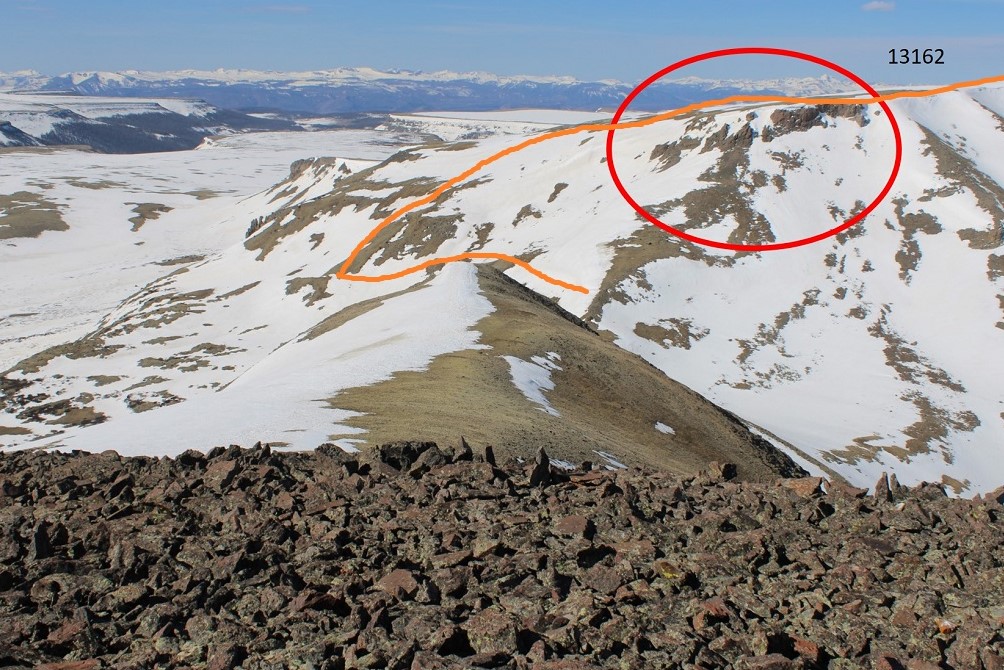
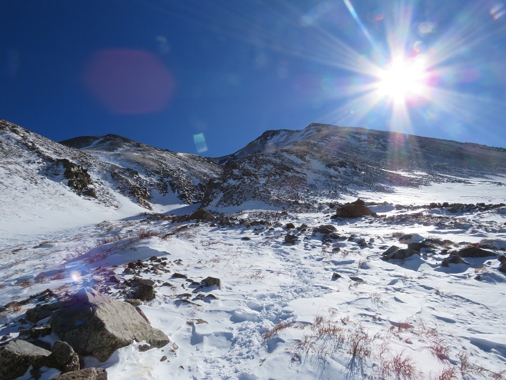
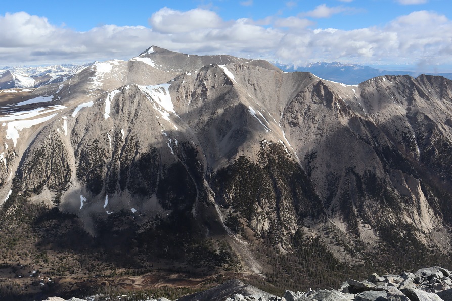
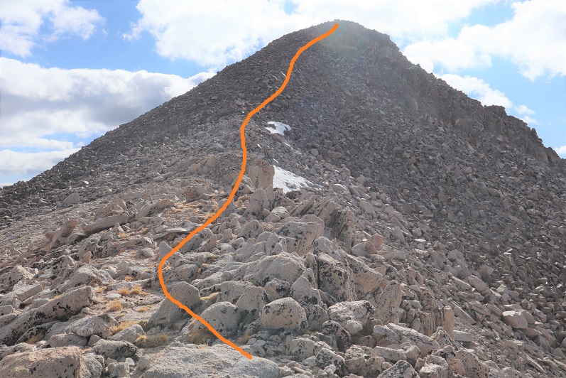
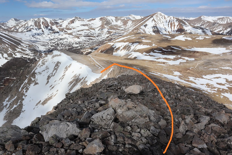
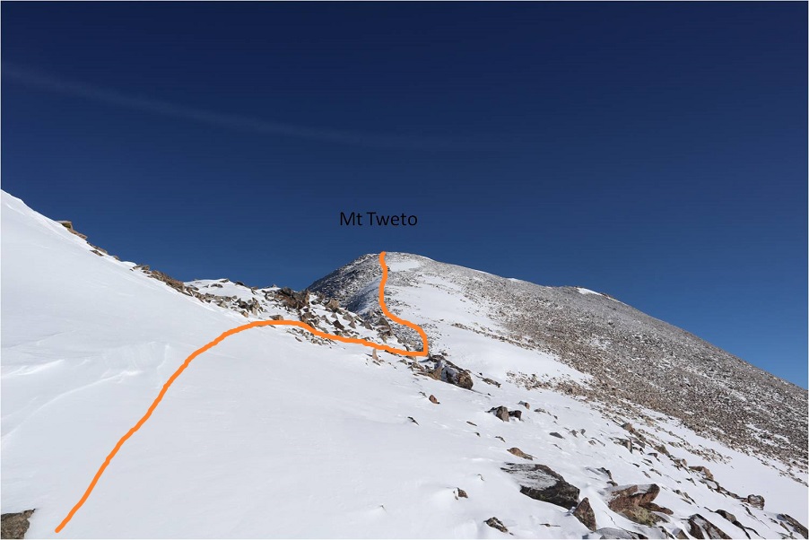
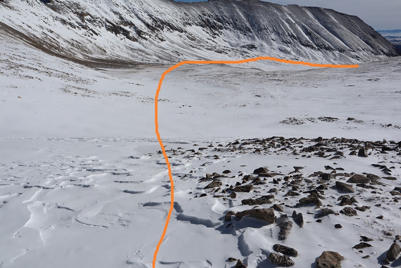
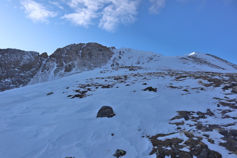
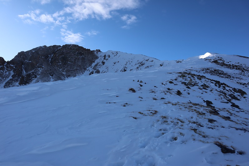
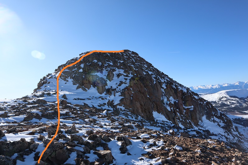
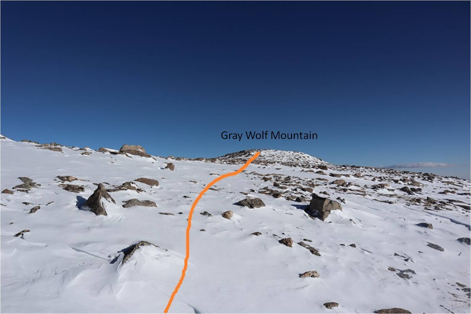
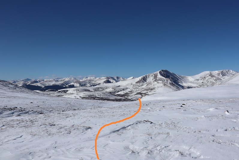
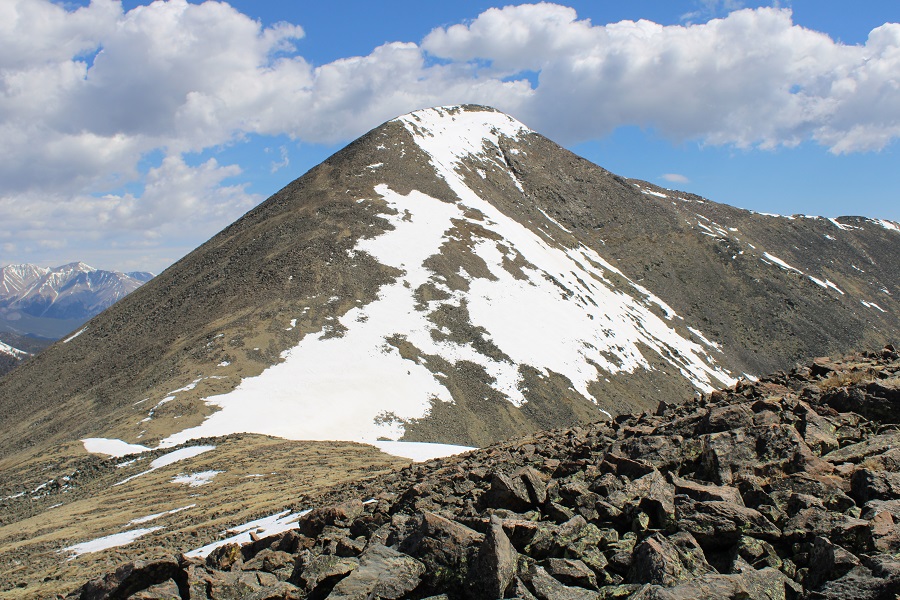
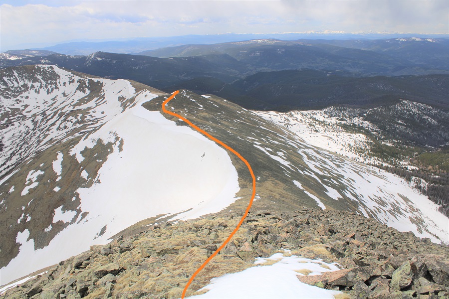
From the top of South Chipeta Mountain (12850) you can clearly see the route to Chipeta Mountain (13472).  From South Chipeta you will lose 200’ of elevation, and then gain 825’ of elevation to the summit of Chipeta Mountain. 

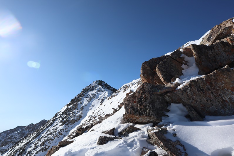
This is also a simple ridge hike, but it takes time and careful foot placement because the rocks aren’t stable and tend to roll.  Nothing above class 2 however.

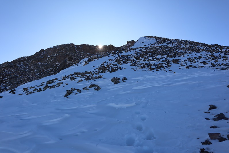
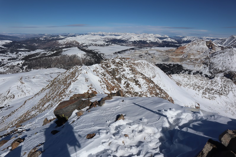
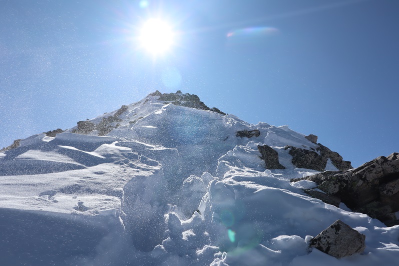
Weather unexpectedly started coming in early as I neared the summit of Chipeta

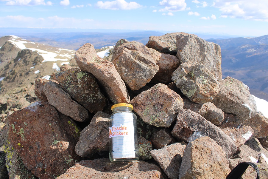
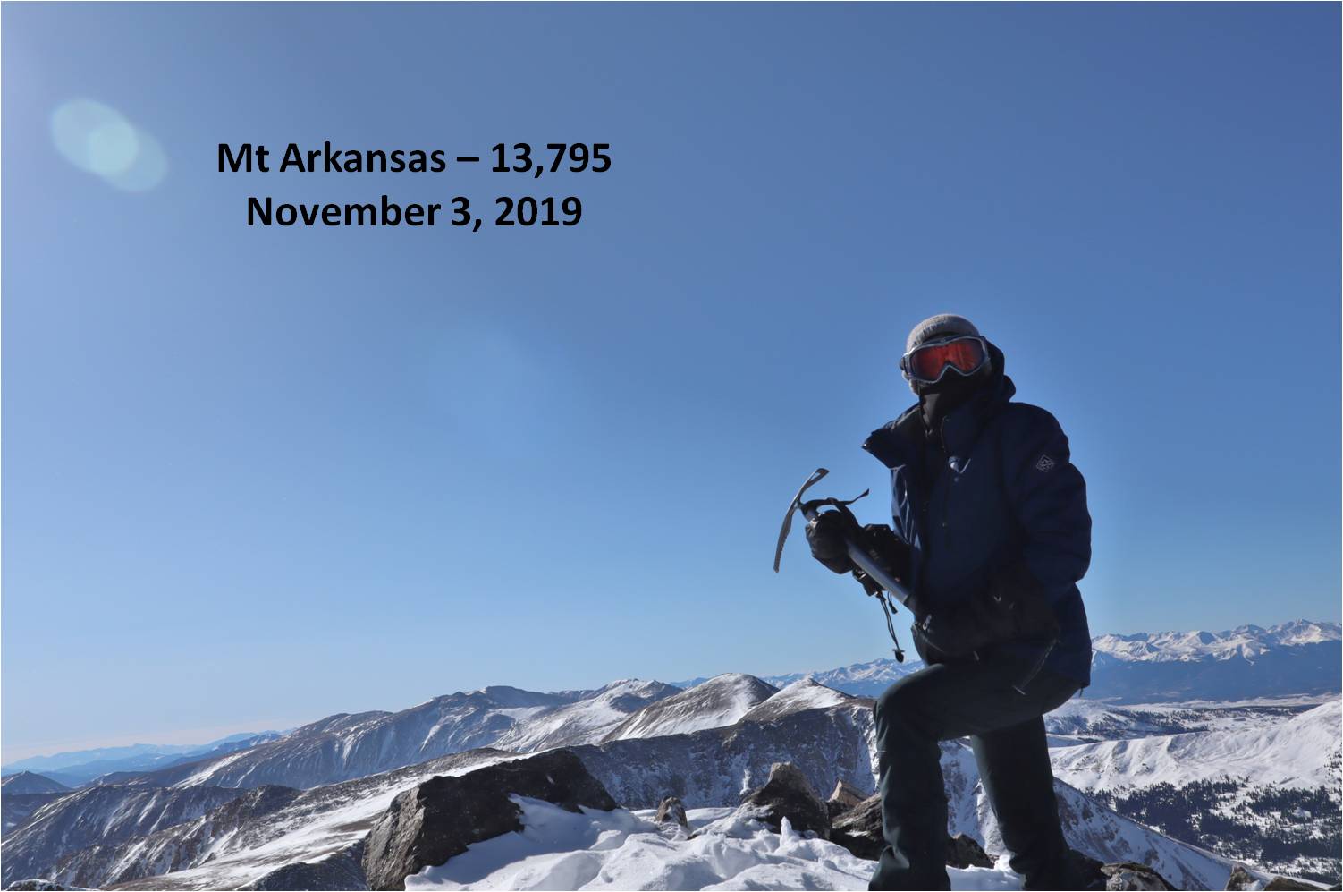
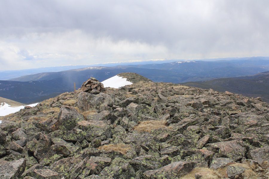
I summited Chipeta Mountain at 11:15am, after just over 3 hours of hiking
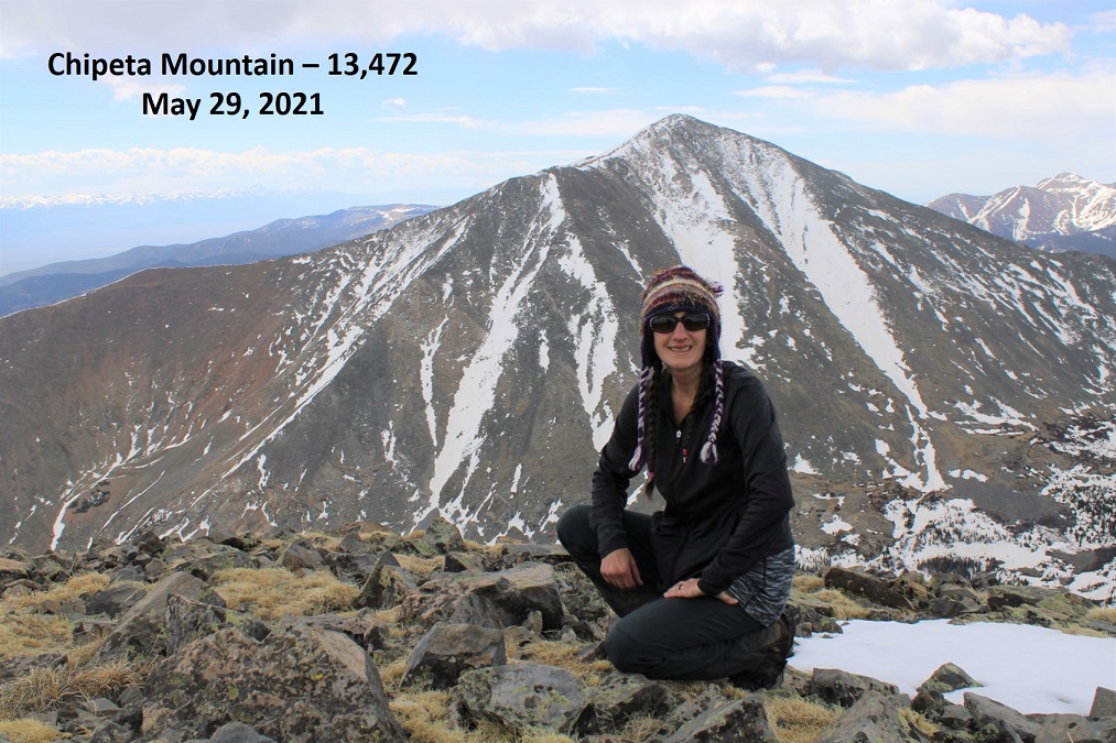
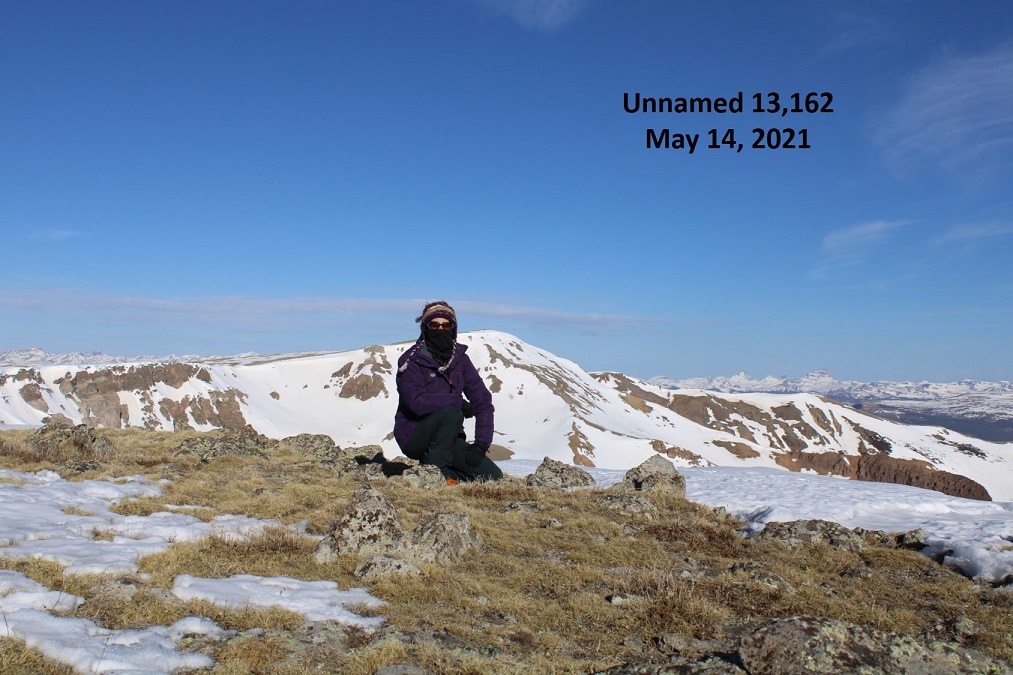
Chipeta Mountain: 

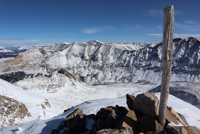
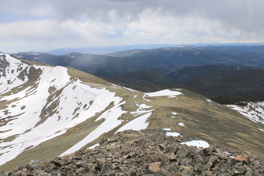
Here’s the view of Mt Ouray from the summit of Chipeta

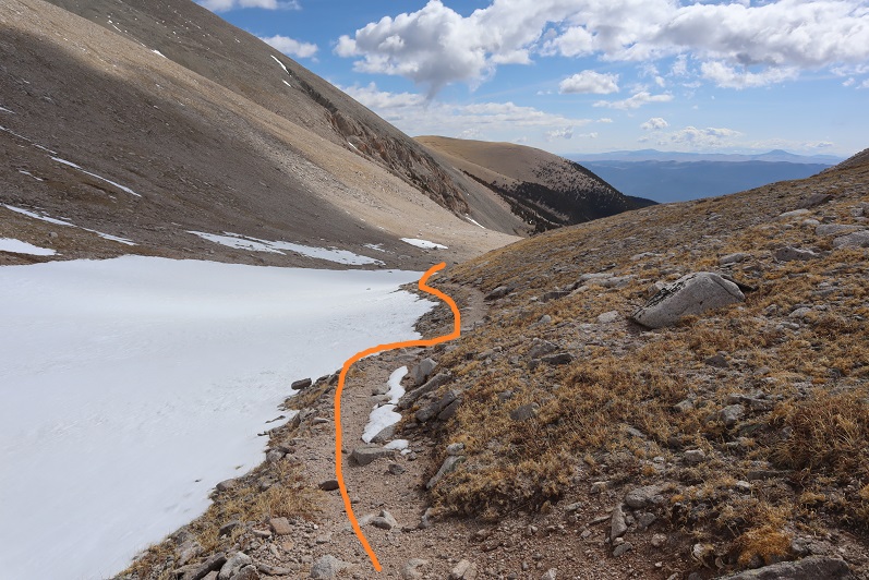
I didn’t like the look of the clouds, and there was virga in the direction I was headed, so I didn’t stay on the summit long.  I retraced my steps back over South Chipeta Mountain to the saddle.

At the saddle I turned right and headed back down to the Continental Divide / Colorado Trail

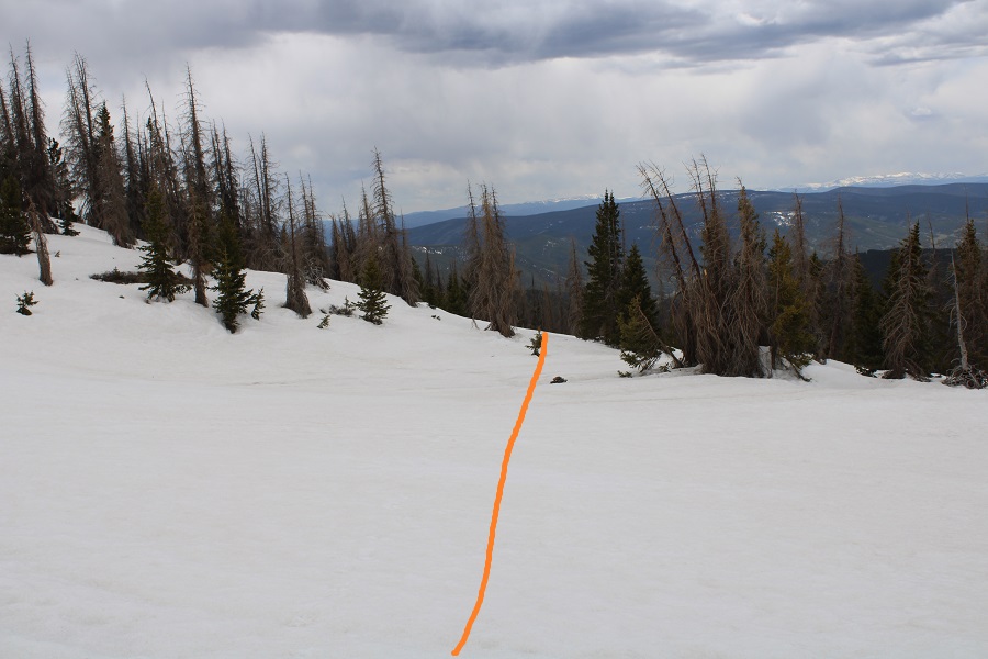
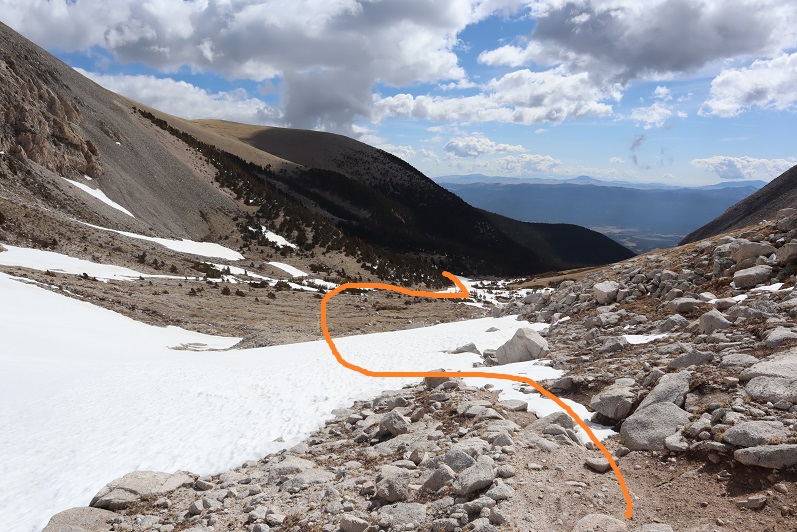
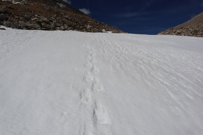
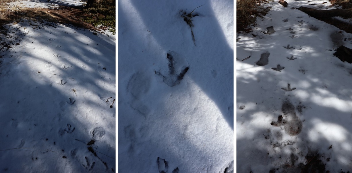
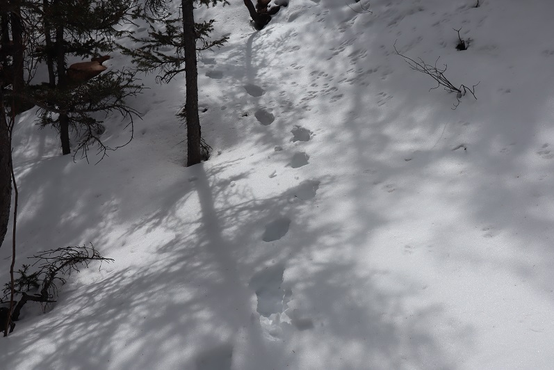
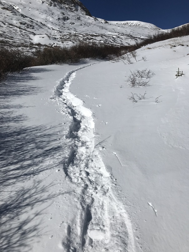
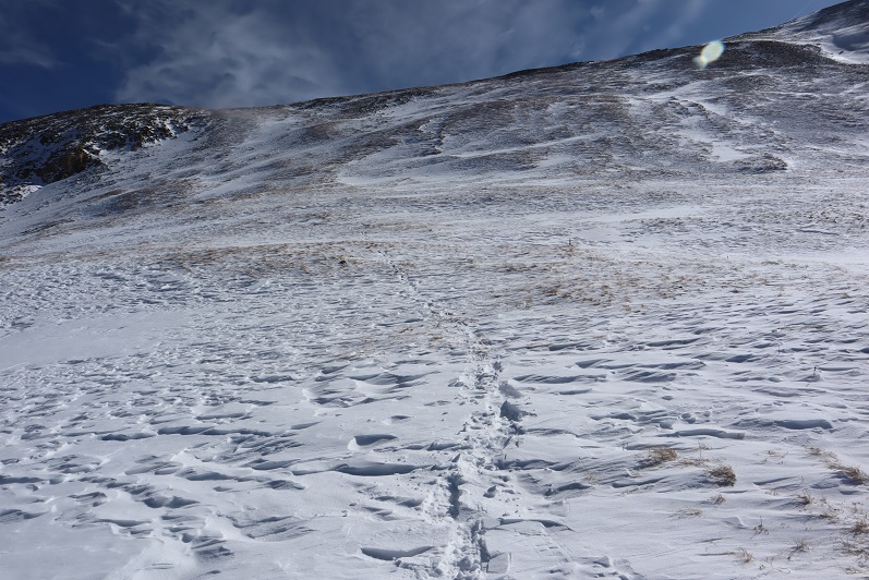
At this point I needed snowshoes.  Strapped them on and followed my tracks from this morning south

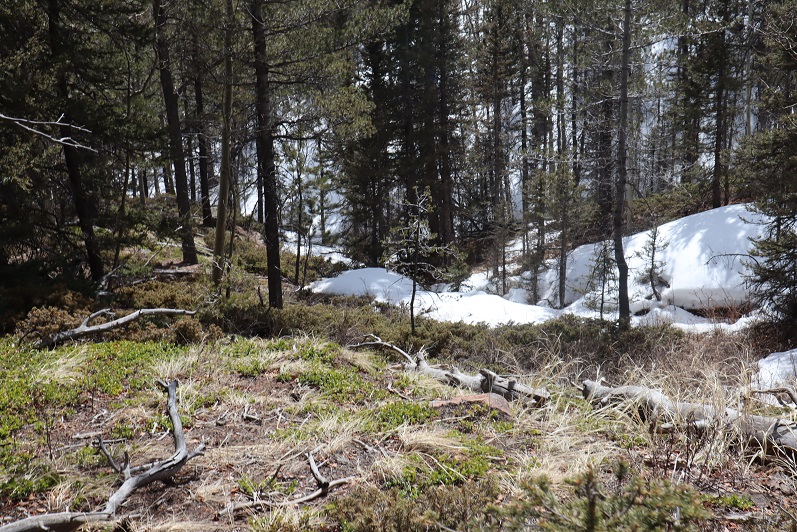
I made it back to the trailhead at 2pm, making this a 10.58 mile hike with 3281’ of elevation gain in 6 hours.

I was still intent on taking a ‘me day’, so I decided to sleep in my vehicle here overnight.  Around 5pm a couple drove in, saying they were planning on backpacking part of the CDT/Colorado Trail.  The had along their dog, and a ferret on a leash (the woman had a ferret fanny pack as well, for when needed).  I asked them if they had snowshoes?  The woman slapped the man across the chest and said “See? I told you so!”  They didn’t have snowshoes but headed out anyway. When I woke up at 5am their vehicle was gone, so I’m guessing they didn’t end up staying the night, which was a good idea, considering there was a storm coming in.  I’m not sure what a wet ferret smells like, but it’s probably not ideal.

Unnamed 13,162 – Unnamed 13, 510

RT Length:  17 miles

Elevation Gain: 4750’

On my way to the Spring Creek Pass Trailhead I was the only one driving on the road.  Probably because it was 1am.  I did have to slow down for a moose who wanted to jaunt back and forth across the center line, and a herd of elk I surprised as I drove by (they’d been lying down by the side of the road).  I made it to the trailhead before 1:30am and decided to get some sleep before starting out.  My truck was the only vehicle in the lot.  I love my heater.

I was on the trail at 4:30am.  There are several ways to get to the snow mesa.  Last time I was here I took the snowmobile route

This time I decided to take the Colorado Trail/Continental Divide Trail/813 trail.  This is the one I’d recommend without snow on the trail.  If there’s a groomed snowmobile track, take that instead. The trailhead is directly across from where I parked my truck.

From the trailhead it’s a nice uphill hike for about 2 miles to the mesa, heading east and southeast.  Here’s an overview of where you’re headed

And what the trail looks like

You’ll know you’re getting close to the mesa when you parallel a gully to your right.

Be careful here in winter conditions:  the cornices fall.  Luckily for me, today there was a lot less snow than last year.  I didn’t need traction to ascend into the mesa.  From below, you can see a Colorado Trail marker.  Aim for the marker.  This is also where my flashlight ran out of batteries.  I was glad it was starting to get light out.

Once on the mesa I followed the Colorado Trail / Continental Divide Trail markers for 3.3 miles.  These markers are great most of the time. In the summer the trail is well defined and not needed.  When I was here last they were covered in snow and useless.  Today they were nice benchmarks, keeping me on track since there were no tracks.  In the morning, the snow was firm (not so by noon).  The trail initially  looks flat, but you’re really losing and gaining elevation all the time.  This was especially frustrating on the way back.

After a total of 5.1 miles since the trailhead I came upon a junction and continued heading north on 813.  Note:  The trail looked doable when I started.   If doing this in winter conditions, I’d recommend taking the lower route (the one I took back, via 787). However, I wanted to stay high to avoid losing and re-gaining elevation, and I had all the necessary gear (snowshoes, crampons, ice axe, etc.) so I decided to go for it.  Also, from the junction vantage point, all looked good. Here’s the route I took

Unbeknownst to me, there was a slide area directly on the trail.  This area is prone to cornice falls/slides.  I felt comfortable crossing the area so early in the morning, but wouldn’t advise taking this route later in the day.  I knew immediately I wanted to take a different route back.

Here’s a look back on the slide area

After the slide area there was another solid area of snow.  I decided to descend a bit to make this more manageable.  I brought out my ice axe and traction here.

I was still ‘following’ the trail (under snow), and as soon as I started heading north it was time to head up the east side of PT 13162.  Here’s what that looks like (as seen later in the day from point 13020).  Solid line is path up, dotted line is the route I took down and across to the 13162/13510 saddle.  I was just doing my best to avoid the snow.

When not covered in snow this area is covered in tundra.  It’s steep, but an easy ascent.

I just kept heading west, until I was at the ‘ridge’, where I started heading northwest to the summit


I summited Unnamed 13162 at 7:45am

Summit of 13162: 

From here I could see the summit of 13,510 to the northeast.  It looks like it should be a simple ridge hike to get there, but unfortunately, there’s a steep section in the way, so I re-traced my steps back to scenic trail 813.

There was one section I was worried about after the 13162/13510 saddle.  I was hoping I could just go straight over the area, and not around. (Note, when I first wrote this report, I thought what I labeled below was PT 13020, but it’s actually further east… in the same general direction, but it’s actually the small peak just above the saddle in this picture).

Ok, back to trail 813 and to the saddle of 13162/13510

Here’s the rest of the route to 13510

I made it to the saddle and the rocky area looked climbable.  It didn’t get any harder than difficult class 2.  The gullies in this area were either snow free, or the snow was avoidable. I stuck to the ridge, dipping to the left (west) when necessary.

The rock here was loose, but once again, difficult class 2

I gained the ridge and looked back at 13162.  I’ve circled the area I was trying to avoid on my way down, and detailed my route down.

The rest of the route to 13510 was an easy ridge hike.  The snow was either consolidated or avoidable.

I summited PT 13510 at 9:40am

Summit of 13510: 

Interestingly, there had been a summit register on 13162, but there wasn’t one on 13510, so I left one.  There were also a lot of crow droppings.  I even saw a few flying around.

From the summit of 13510 I had a clear view of PT 13020 (unranked).  I decided to go for it before heading back down.  Here’s the route

Here’s looking back on the route I took from 13510

Time to head back.  I didn’t want to take the way I’d hiked in back out because of deteriorating snow conditions and possible slide activity. Instead, I hiked directly down into the basin, heading southwest.  Here’s a view of the route I took down from 13020, as seen from my way to 13162.  I just did my best to avoid the areas of snow when possible (and the willows at the bottom).

From the summit of 13020, here’s the route back to Trail 787

Here I’ve outlined the route I took in (dotted line) and the route I took out (solid line).  Trail 787 was dry on the ridge/elevation gain back to the snow mesa.  I could see it from the summit, and aimed there, doing my best to avoid snow on the way down. I’ve circled the small slide area.

The snow wasn’t totally avoidable however, and I did posthole through the section of willows.  From down in the basin, here’s a look back at my route down.

I hopped a small creek, then took trail 787 southwest to the snow mesa and the Colorado/Continental Divide/813 trail.

Here’s another look at the slide area.  It’s small, but the trail goes right through it.  Also note the cornices above.

Once on the mesa I followed the trail posts across the snow. The snow had softened up considerably, so I had to put on my snowshoes.  Even with them I was postholing up to my knees.  It was a very long 3.3 miles back.

Here’s a look at the decent route off the snow mesa.

And the trail back to the trailhead.  At this point the snow was mostly avoidable, so I took off my snowshoes.

I made it back to the trailhead at 2pm, making this a 17 mile hike with 4750’ of elevation gain in 9.5 hours

When I got back to my truck I was a little disappointed, as Strava hadn’t engaged.  Luckily, most of this route was done on established trails, so it was easy to hand draw this topo route (just note it is hand drawn, and I don’t have a GPX file to share for this one).

On to the next trailhead!

Mt Belford in Winter – 14,197

RT Length: 11.15.miles

Elevation Gain: 4764’

Note, this is the third time I’ve hiked Mt Belford, so this time I’ll just be giving a quick overview with a few pictures and thoughts.  A full trip report can be found here for Mt Belford via Elkhead Pass, and here for Mt Belford and Mt Oxford in winter conditions.

Also note:  whining ahead. 

The last 3 miles to the Missouri Gulch trailhead were terrible!  So bad I asked SkydiverHiker to drive.  We were sliding in the ruts and eventually found a turnout about .7 miles from the trailhead and stopped there.  This ended up being a fabulous idea, since the trailhead was too covered in snow to park.  It looked like someone had tried and it took them quite a while to get out.  This is the road to where we parked (easy until the plowing stopped)

Parking further away changed our plans a little, as it added an hour onto our trip.  We decided we’d probably just hike Mt Belford today, and leave Oxford for another day.  We were on the trail at 5:15am.  Here’s a look at the Missouri Gulch Trailhead Parking area

We crossed clear creek and started ascending the side of the mountain wearing microspikes.  We saw some elk tracks here, but luckily, no mountain lion tracks this time.

Once in the avalanche area the trench stopped.  We crossed the drainage on some sketchy, snow covered logs

Then stopped for a bit to put on our snowshoes.  These pictures were taken later in the day on our way back down, so you can see the trench.  We put that trench in!  I’ve done this hike several times, so I knew to aim for the trees, heading south

Once in the trees the trench picked up again until the cabin

Once past the cabin the trench stopped again.  The wind in the gulch is fierce and I’m sure blows away trenches nightly that are made during the day.  No worries though, we just headed through the gulch (still wearing our snowshoes) towards Mt Belford’s Northwest Ridge

As we were trying (unsuccessfully) to avoid the willows, I heard ptarmigans chirping, but couldn’t see them. Then, all of the sudden, a ptarmigan busted out from under the snow and walked away.  It was here I learned ptarmigans huddle near the willows and stay in their air pockets when it snows to stay warm.  They can do this for days, as their food source is under the snow as well.  It was so cool to hear them calling to each other throughout the day!

We continued through the basin, only taking our snowshoes off once we reached the ridge.  From here we followed the ridge to the summit.

I’m making this sound MUCH easier than it was.  This is probably one of my most difficult winter summits to date.  With my Raynaud’s I need to keep moving to stay warm, and while SkydiverHiker was doing an excellent job keeping up, we still stopped more than my body would have liked.  In fact, about halfway up the ridge I was seriously thinking about turning back:  my fingers and toes were burning and the wind was more intense than predicted.  With windchill it was at least -20 degrees.  We discussed turning back, and decided to continue on (Skydiver Hiker needed a ‘win’ today, and I wouldn’t let him go on without me).  SkydiverHiker dropped his and we continued on up the ridge.  I continued with my pack because I had an ice axe and essential gear.  This continuing on included a lot of intense feelings and emotions, and there was some crying involved and also some nausea.  Have you ever hurt so much you felt nauseous?  Both SkydiverHiker and I felt that way today.  But at least the pain told me I hadn’t lost anything to frostbite.  While mountaineering is certainly physical, it’s emotional and a mind game you play with yourself as well.  I felt as if I were dying every step of the way, not because I was tired, but because I felt my fingers and toes were on fire.  I was dry sobbing at times.

We trudged to the top, where my camera stopped working (I really need to find a better cold-weather camera) so the photos we have are SkydiverHikers from his phone.  About 20 yards from the summit SkydiverHiker laid down and didn’t want to get up.  I didn’t know this, but his back had been really, really hurting him.  This laying down right now was (of course) unacceptable, so I made him get up and lead the way to the summit.

We didn’t stay long, just long enough to get a photo of the summit marker, and then we were on our way back down.

Let me pause here to show you the great views of Missouri Mountain

The screaming and crying continued until we made it to where we were hiking in sunlight, near the base of the ridge.  It’s amazing how the warmth of the sun made me feel better, even when it was still well below freezing. Once at the base of the ridge we donned our snowshoes once again and headed back out of the gulch, following our morning trail.  

As we warmed up our spirits lifted and we were once again thrilled to be out here hiking.  This is one of the most beautiful places in Colorado to hike, and we had it all to ourselves.  Well, it was us and the chirping ptarmigans.  We hiked back past the cabin and through the avalanche area, took off our snowshoes, and continued back to the trailhead in better spirits.  Yes, this is a mental game.   

We made it back to the truck at 1:15pm, making this an 11.15 mile hike with 4764’ of elevation gain in 8 hours.

Summit Sticker can be bought here

Boss Lake

RT Length: 4.64 miles

Elevation Gain: 1260’

This year we rented a cabin up near Salida for a few days before Christmas.  There wasn’t ny internet/cell service, so we spend time cooking, baking, watching movies, and putting together a puzzle. 

We were supposed to leave early Christmas morning, so we pretended Christmas Eve was Christmas day.  After opening presents we went sledding on a nearby hill, which was actually a street.  It didn’t matter though:  the girls had fun!

We were done sledding around 10am and the girls wanted a nap, so I decided to go hiking.  It was too late to climb a peak, so I decided to hike to Boss Lake instead, a lake at the base of two prominent 13ers in the area. 

I’ve hiked past the Boss Lake Trailhead a couple of times, and was told the lake was only about .3 miles from the trailhead.  Spoiler alert:  It’s actually closer to a mile.  On my way up 4WD road 230 I saw some skiers heading down. They told me they’d just come from the hut.  I didn’t know there was a hut in the area?  Next time I’m going to have to try and find it. 

The trail was nicely packed down along the road, but as soon as I came to the trailhead that ended and it was time to put on my snowshoes. It was 1.5 miles from the parking area to the trailhead (Boss Lake Trail 1420).  I trenched all the way to the lake in snow at least 2 feet deep.

It was nice to be on another section of the Colorado Trail.  It seems there’s also a new hostel in the area that caters to thru-hikers

I crossed the bridge and trenched a mile to the lake, where the snow suddenly stopped

I was hoping to find a nice, frozen lake, but instead I found a large pond covered in snow.  There was a cool building next to the lake.  It was locked.

I took a selfie to prove I was there and headed back

The trek out was easier than the trek in, as I just followed my trench

I met some nice people along the way, who were snowshoeing for the first time with their Sheba.  They were thankful for the trench, and I told them to try hiking for a bit off trench, just to get a real feel for snowshoes. 

I made it back to my truck and felt the day had been too easy, but at least I’d burned some calories, and this was vacation after all. 

Mount White – 13,657

1

RT Length: 14.25 miles

Elevation Gain: 4945’

I arrived at Browns Creek Trailhead to one other vehicle in the lot. It didn’t look like they were sleeping in their car so I assumed they were either already on the trail or camping in the basin overnight. I didn’t pass anyone all day, so they must have been in Browns Creek (I was taking the Little Browns Creek approach). The road to Browns Creek Trailhead is an easy 2WD dirt road.

2

The trailhead had plenty of parking and restrooms (which are currently closed due to Covid-19: they had signs asking us to “recreate responsibly”). The trail starts at the north end of the parking lot, and follows trail 1429 west

3

4

I walked along the trail and quickly encountered a gate (not locked)

5

6

After hiking for 1.5 miles along a well maintained trail I came to a junction and turned right (north) and followed the Colorado Trial for a bit (not long) before continuing on trail 1430. There are well placed and visible signs at each junction.

7

For the first 5.25 miles of this hike it was an easy, class 1 trail that was both horse and bicycle friendly (I saw evidence of both)

8

9

10

The sun seemed to rise earlier than normal, and I was able to easily see where I was going. After 5.25 miles however, snow began to cover the trail at around 11,490’. This was punchy snow, and I couldn’t have crossed the area without snowshoes.

11

I strapped my snowshoes on and followed the ravine west.

12

13

There was one spot that was a little steep, but nothing I needed an ice axe for

14

It was clear there was a trail under the snow, as at times it would rise above the snow before sinking back down. Luckily it was still early and the snow was firm enough to navigate with snowshoes. I would not have been able to traverse this area without them, especially on the way back.

15

At 6.4 miles (12,670’) I left the trail to follow a 4WD road. I was supposed to take the road to the ridge, but what little snow there was here only seemed to be on the road itself, so instead I just hiked straight to the ridge

16

17

Once at the ridge I turned left (east) and hiked the third of a mile to the summit on rocky terrain. The was class 2.

18

19

There was a false summit (but it wasn’t too far from the actual summit)

20

21

I summited at 8:40am, after 4.5 hours of hiking and 7.2 miles

22

Mt White Summit:

It was quite windy but I still spent a few minutes getting a good look at the conditions of the local mountains: I intended to summit Unnamed 13,712 tomorrow and wanted to get a good look at the route. To be honest, I wasn’t exactly sure how I was going to summit, so I took a bunch of photos to study later tonight along with a topo map. Check out some of the surrounding peaks:

23

24

Time to head back down the ridge

25

26

27

I made a new friend

28

And turned right (north) and headed down into the basin

29

It was still morning, yet when I hit the area with snow it was already very soft. I put my snowshoes back on and headed directly down the snow, back to the trail. I was very happy to have lugged my snowshoes all this way: they weren’t always needed, but it would have been a miserable trek without them, if not impossible.

30

31

32

33

35

36

After taking off my snowshoes I followed the class 1 trail back to the trailhead. Little Browns Creek was dry the entire way.

37

38

39

It looked like this area had seen a fire in the past few years, but the trail was clear of debris

40

I made it back to the trailhead at 12:30pm, making this a 14.25 mile hike with 4945’ of elevation gain in 8 hours, 30 minutes.

41

Here’s a topo map of my route:

42

It was my intention to stay here tonight so I cleaned up, made dinner, took off my shoes, and enjoyed eating by the creek with my feet in the water.  Well, I didn’t much enjoy the food (I have to force myself to eat after a hike) but it didn’t taste bad. It took me about 45 minutes to finish my spaghetti, but I’m proud to say I ate it all.

43

I did a physical check: I’d returned the boots I’d previously bought and wore my old boots today instead. They were full of holes but at least they didn’t rub my ankles raw (my ankles were still red and raw from last week, but nothing my old shoes and some rather large band aids couldn’t fix. Also, I’m in the market for good winter hiking boots). I had cell service, so I text my kids to see how their day was (my youngest rocked her online APUSH exam and was now headed to work), answered a few emails and checked the weather for tomorrow.

I was surprised at how many people were at the trailhead now. The parking lot was completely full. Everyone seemed to have kids or a dog. The creek was a great distraction for both.

After dinner I sat in the back of my truck with a glass of whiskey and my topo map, trying to figure out how I was going to summit PT 13,712 tomorrow. It might have been the alcohol talking, but I couldn’t help but think of how much I loved my new truck set-up! I had another hummingbird fly into the back: that’s twice in as many days camping out and I think it’s because they think my hanging lights are flowers. I was just glad the buzzing noise wasn’t a giant bumblebee. The mosquitoes started coming out around 3pm so I shut my tailgate.

It became cloudy and started to rain. I looked at the time: 4:30pm. I decided to read for a bit, and then get to bed early. I needed to be up around 1:30am to hike past the snow before it got too soft. I prepped my coffee for the morning so all I had to do was turn on the stove, set out my clothes for tomorrow, and closed and locked all my doors/windows. It was still warm and very light outside but I knew it would get rather cold tonight. I was pleased my blackout curtains did their job and despite the early hour I was able to fall fast asleep.

Tuckaway Mountain – 10,820

1
RT Length: 12.5 miles
Elevation Gain: 4220’
Partner: Steffen

Third time’s a charm! For so many reasons…

I’ve attempted this peak on 2 other occasions. One time a few years ago I thought I’d summited (more on that later) and last week I turned around due to deteriorating snow conditions. Today I’m glad to say I had a successful summit!

I drove to Steffen’s house at 4:30am and we made it to the North Cheyenne Mountain gate by 5am, but unfortunately, the gate was locked. I guess it didn’t open until 6am? Oh well, we had a plan B, so we drive down Old Stage road for about 45 minutes, intent on Frosty’s Park and hiking Mt Rosa or Almaghre (or both). About 5 minutes from making it to the trailhead Steffen realized he’d forgotten his hiking boots. Drat! We would have to drive back and get them. As I said, third times a charm, and we arrived at the (now open) North Cheyenne Canyon Trailhead at 7am and were on the trail by 7:20am. It was already light out and I had serious doubts we’d summit today due to warm snow, but at least we’d get in a good hike.

2
We wore our microspikes the entire way, even though they weren’t always needed. I’ve done this hike several times, so I won’t go into a detailed description of the route to Loud’s Cabin, but you can find it here

I basically took the 7 Bridges Trail (622) to 677 to 622A to Loud’s Cabin. Here are the pictures:

3

4

5

6

7

8

9

10

11

12

13

Along the way we saw some curious tracks in the snow. They were about 5-6 inches long and distanced about a foot to a foot and a half apart. It took us a while to figure out they were turkey tracks. It would have been much cooler had they been emu or velociraptor tracks or something, as they seemed too big to be turkey tracks…

14

Once at Loud’s Cabin things once again got tricky. I’d made a GPX file from CalTopo with the way we were supposed to go, but the trails were no longer there. We decided to ascend the hill above the cabin and head west. It became apparent almost immediately we were on the wrong ‘trail’ but we were on a trail and headed in the right direction and felt committed… until it ended.

15

I noticed a few cairns so we followed them for a bit until they ended as well. I’m guessing the cairns were indicating an alternate route up Mt Garfield.

16

We weren’t interested in hiking Mt Garfield today, so we left the cairns and aimed northwest along the side of the mountain, making our own trail as we went. This included some fun scrambling over rocks and fallen logs. Be careful: those rocks and logs move!

17

Also, here we saw the first near tracks of the season! I’m thinking mama and cub

18

We had great views of Tuckaway when the trees cleared (which wasn’t that often). The frustrating part? We didn’t seem to be getting any closer. In fact, it felt like the mountain was always in the same place (well, it was, but we weren’t making much progress).

19

This was our view of Tuckaway most of the time

20

Finally we made it to the top of a rock formation at about 10,400’

21

Here’s the view looking back at the way we’d circled Mt Garfield

22

And a look at the route before us towards Tuckaway

23

There were tons of ways we could have traversed over to Tuckaway, and we actually went back and forth while we were hiking as to the best way: there’s snow you cannot see in a lot of areas that would make certain routes lousy. We’d initially wanted to just hike across the ridge, but instead this is the path we took:

24

I got a picture because the view was great

25

And we were off, deciding to initially descend this spot to the north (where we came across a mine not listed on the map), and then head west down some snow covered boulders. The scree here was really soft and felt a bit like quicksand.

26

27

There are no great pictures here, as we were just in the trees headed towards the saddle just before Tuckaway. When we reached the saddle it was time to don our snowshoes. We trenched a trail from the saddle to the west and came across my tracks from last week.

28

My tracks eventually ended and we had a time sinking up to our waist in the soft snow, but we were stubborn and took turns trenching: we could see the blue skies above indicating a ridge and were determined to summit today

29
We made it to the ridge and to our immediate left was a cairn. This is where I’d stopped a few years ago, thinking this must be the summit (cairns like this usually indicate a summit).

30
It certainly looked/felt like the summit, and indeed, from here you cannot see a higher spot. However, I’d had someone (not so nicely) comment on my blog that I hadn’t reached the true summit; that it was in fact further to the west. So today I was here (again) to see if he was right. We decided to follow the ridge west, through several feet of snow (I love snowshoes!!!) gaining and losing elevation as we went.

31

After about 2/10ths of a mile we came to a point I wasn’t convinced was higher than where we’d been before but was definitely the spot I’d seen in other one person’s picture as the summit. There was no summit register here either and no cairn indicating a summit.

32

We decided to climb the rock, which took careful footing and a leap of faith. Here’s Steffen heading back

Here is my summit photo

33

And some of the amazing views from on top of the rock

34

We took a summit selfie

35

And I got another shot of the way back down

36

Side note: As I said earlier, I wasn’t convinced this point was any higher than the point we were at before, so once I got home I put the route up on CalTopo. It showed the second point was indeed 3 feet higher than the first, but I hadn’t climbed to the top of the first rock like I had the second. In other words, I think both places are of similar height, and in fact, while the rock was difficult to climb I’d say the route I took the first time was more challenging than the one I took today. In any event, either way, we summited because we made it to both points. I think either point should count on its own.
We decided to descend the way I’d trekked last week, and followed our snow tracks to the saddle

37

38

39

And back down the gully to the trail I took last time.

40
What’s frustrating here is the trail that’s on ALL the maps, GPX files, etc. is a trail the forest service doesn’t want you to take. They’ve made it extremely difficult to follow because they don’t want people hiking there. They’ve essentially tried to close this trial.

41

I totally get this, but the problem is they haven’t established new trails/produced proper GPX files, etc. of new routes. This is the best they give, which is a poor excuse for a map and doesn’t include topographic features or mountain names. It’s like they want you to get lost

42

I’ve been in this area several times and their new trails are terrible and are meant for dirt bikes, not hikers. It’s really frustrating: I’d set out today to follow proper (new) trails and provide a GPX file for others interested but was unable to do so due to lack of information. In my topo picture at the end it shows I followed the trail on my return, but that’s the one they’ve blocked off, so it isn’t actually a trail. IT was however, my safest option.
We encountered a lot of snow on the trail on the way back, and instead of complaining about how we kept on postholing we decided to make it fun. Here’s Steffen trying to get across the snow without sinking by running fast (spoiler alert: that doesn’t work)

43

44

We made it back to just below Loud’s Cabin, linked back up with Trail 667, and followed it back to the parking lot

45

46

47

48

We were surprised to find when we made it back to the lot that it was overflowing with cars!

49

What was disturbing was about a third of these vehicles were from out of state. We’re supposed to be staying home and hiking only in our respective county, and I’m doing my best to abide by those rules (before they get worse). It was extremely frustrating to see so many out of state cars, and they just kept going and going and going: the lot was overflowing and cars were parked along the side of the road for miles as we exited. There were more cars here than I’ve ever seen in the summer. It must be Spring Break in other states and they’ve decided to still take their vacations.
We made it back to the truck at 3:30pm, making this a 12.5 mile hike with 4220’ of elevation gain in about 8 hours. It was a perfect day to go hiking!!! I’m so glad we got out and got some fresh air!

50

Tuckaway Attempt and Mt Kineo

1

Note, my successful climb of Tuckaway can be found here.

This whole Coronavirus thing is crazy, and it’s driving me crazy. Half the states are closed to outdoor recreation, with the other half open. Our county is open for hikers (with restrictions to social distance), others in the state are closed (and there seems to be no consistency) so I chose to social distance close to home today, getting in 14 miles and 4300’ of elevation gain on a trail that hasn’t been used much, if at all this winter. I didn’t pass a single person all day.
My intent was to hike Tuckaway Mountain. It’s located off North Cheyenne Canyon well off the beaten path but at a popular trailhead. I arrived at the trailhead at 6am, the first vehicle in the lot. Right behind me was a car full of runners: they parked and immediately started running down the trail. I envied them their lack of gear.
I’ve explained this hike several times so I’ll just paraphrase: I took the Seven Falls Trail (622) to the junction with 677 and then 622A to Loud’s Cabin. This part of the trail was snow free but I wore microspikes because there was ice in areas.

2

3

4

5

6
Once at Loud’s Cabin the trail ended, but it wasn’t supposed to. I ended up backtracking a bit and finally finding a trail! The only problem? They obviously didn’t want anyone using this trail.

7
Hmmmm. In the past few years they’ve done a lot of re-routing trails here. This must be one of the ones they closed off. I knew which direction I was supposed to go, so I decided to leave the old trail and bushwhack my way towards another trail I was sure would be ahead of me.

After crossing a stream

8
I just aimed west, keeping the snow filled gully to my left.

9
I hiked like this for about 2 miles, until guess what? I found a trail! It was obvious this trail hasn’t been used all winter.

10
I followed it north and held out as long as I could before putting snowshoes on

11

12
Just as soon as I put on the snowshoes, the snow stopped. I found myself at another gully, and this time followed it up to the saddle. This part reminded me a lot of Mt Garfield, and there wasn’t a trail.

13
Once at the small saddle I turned left (west) and once again donned my snowshoes.

14
After about 200 feet of snowshoeing I could tell I was very close to the summit, but unfortunately the snow became impassable in snowshoes (I could have done it in skis). Every step I took I sank up to my waist. The snow was just too sugary and warm for snowshoes to be effective. Maybe if I’d started earlier in the day the snow would have been more firm?

15
I turned around a couple hundred feet from the summit. This was my second attempt of this peak (I thought I’d summited the first time but was told the summit was actually 50 feet more to the north, so I wanted to go back and see for myself/hit the true summit). I wasn’t that upset about turning back because I was really proud of all the route finding I’d done. Also, I have a friend who wants to hike this mountain with me, so I knew I’d be back no matter what. Now I just have more accurate route information.
From here I could see my path back down the canyon. Yep, I now know these hills like the back of my hand. Who needs a map?

16
I made my way back down the gully to the trail, and followed my footsteps back

17
To where I’d written I the snow where I’d bushwhacked in from so I knew how to get back

18
Back down the mountain I went, keeping the snow to my right this time

19
I was thrilled when I made it back to Loud’s Cabin. This had been a great day! This is also where I got the idea to summit Mt Kineo, just to say I’d summited something today. I’ve summited Mt Kineo several times, and it isn’t a difficult summit. I didn’t need a map or directions to get there. I hiked back to the 677/622 Junction and left the trail to hike up the Kineo mountainside

20
At the false summit I had a pretty good view of Tuckaway Mountain (the mountain I’d attempted that morning). It didn’t look snow-filled, even though it had been.

21
There was actually more of a trail this time up the mountain than I’ve ever seen. The first time I hiked here there was no trail, but now it’s a clear path.

22
The views from Kineo don’t disappoint!

23

24
The hike back was uneventful. It was weird not seeing anyone on this part of the trail: the last 1.5 miles is usually teeming with people

25

26

27
I made it back to my truck and the lot was about halfway full. I was glad people were getting out and enjoying the sunshine while they can. The cool thing about our trails being open is they self-regulate. There are only so many parking spaces at the trailheads so only so many people can be allowed in.
Here’s a copy of my track

28

Mt Tweto – 13,672

1

RT Length: 11.2 miles

Elevation Gain: 2762’

My flight actually made it in on time and I drove from DIA to the Mosquito Creek trailhead starting at around 11pm. I70 was closed for rock mitigation so I used 285 instead (and passed fire trucks rescuing drivers from vehicles that had slid off the road).  I was a bit worried about the conditions of the roads since it’d snowed yesterday, but I had no trouble making it to Alma.  From there the 2WD dirt road was icy but drivable.

2

I saw signs indicating Mosquito Pass was open, but I was headed to the Mosquito Creek Trailhead. I turned off the 2WD road onto the 4WD road and drove up about 20 yards before deciding to turn my truck back around and just park at the junction.  I didn’t feel comfortable driving my truck through the snow on the road, and I knew it would most likely just get worse as the day warmed up.  So I parked my truck and since it was only 1:30am I decided to try and get some rest before starting the hike.

3

I set up my sleeping bag(s) in the cab, ate a few pieces of turkey jerky I’d made with Thanksgiving leftovers from last week, downed a few shots of whiskey and I went to sleep. My alarm was set for 5:30am, and although it was 12 degrees outside and the wind was howling I was warm inside my sleeping bag inside the cab of my truck. When the alarm rang at 5:30am and it hadn’t even begun to turn light and that wind sounded less than fun I made the decision to re-set my alarm for 6am and got in another half hour of sleep before starting the trail at 6:15am.

I was immediately glad I’d decided to park where I had. Just following the road the conditions ranged from bare dirt to 6 inches of ice to 4 feet of snow.  There were quite a few drifts covering the road I wouldn’t have felt comfortable driving my truck through.   There was a constant wind coming through the lower basin, changing the drifts as it went.

4

I wore my microspikes from the time I left my truck until I made it back, but didn’t need snowshoes until I reached the London Mill.

5

After the London Mill the snow picked up on the 4WD road and I was postholing up to my knees, even with my snowshoes on. It was slow going and very tiring.  Here’s a look at the rest of the route

6

I followed road 656 into the upper basin.

7

There wasn’t a ton of snow, but there was enough to completely cover the road in areas.

8

Once I was in the upper basin the wind stopped but the snow levels were still uneven. I made my way towards the aerial cable.  I could see what was left of it littering the mountain even from hundreds of yards away.  Here the road stopped.

9

I turned left and headed west

10

My goal was to gain the ridge. It was a straightforward snowshoe with no large rocks/obstacles to overcome.

11

It’s steeper than it looks, but I didn’t need to put the risers up on my snowshoes.

12

13

Once on the ridge the wind picked up again, but it wasn’t giving me a headache like I’d had on Mt Flora.

Side note: for those of you who remember the curious headache/nausea that caused me to turn back after summiting Mt Flora instead of hiking the ridge, I found out what happened (and no, it hadn’t been the wind).  Before hiking Flora I’d woken up in the middle of the night and needed a quick drink, so I went to the fridge and half dazed with my eyes squinted closed to block out the fridge light found some iced tea in the back and chugged it straight from the container.  It had tasted awful, but I hadn’t thought much of it.  I travel to China for work and bring home loose leaf tea, which my kids love to make.  Sometimes it has a curious taste/texture.  The next day I’d had a terrible headache accompanied with nausea while hiking above treeline and attributed it to the constant wind.  Well, a few days later I was cleaning out my fridge and when I found the tea in the back of the fridge I noticed what I’d thought had been leaves had actually been mold: Big clumps of mold floating in the tea and covering the sides of the container.  Thinking of how I’d swallowed a good cup or more of that stuff made me nauseous all over again, and I felt lucky a headache was all that had happened.  The container was beyond cleaning so I threw it away.  Needless to say, I will be looking much closer at my late night drinks in the future. 

I followed the ridge north. There were a few cornices forming on the ridge making snowshoes helpful and just enough rocks to slow me down.

14

15

16

Towards the top the wind really picked up and you could actually see the cold. I kept on my snowshoes even though they were overkill.  I just didn’t want to take them off to put them on again in the cold and wind.

17

As I got closer to the top I noticed a plaque to the left of the summit and went to get a closer view

18

The actual summit was just to the right (east) of the plaque

19

I summited at 10:20am

20

Summit Video:

I hadn’t seen my daughter all week because I’d been in Florida for work, so I decided to just head back the way I’d come instead of heading over to hike Treasurevault, Mosquito, etc. It was my goal to be back home when she got home from school, so I turned around and headed back down the ridge

21

I followed my tracks back down the ridge

22

Back through the basin and to the 4WD road.

23

24

Most of my tracks were gone in the upper basin, but once I made it back to the road they were easy to follow. I did my best to make a trench, but it could use a few more people on the route.

25

26

I was once again glad I’d decided not to drive the road up.

27

I started this hike at 6:15am and finished at 1:15pm, making this an 11.2 mile hike with 2762’ of elevation gain in 7 hours. I didn’t see another person hiking all day.

28

29

I made it home in just enough time to take a shower before my daughter came home from school. She was a little sheepish when she walked in; the kitchen was a mess with dishes in the sink and on the counter and opened packages and mail all over the place.  She’d thought she had another few hours to clean up before I arrived.  I was just happy to see her.  We chatted and cleaned up the kitchen together before making dinner and heading to the ice rink.

Mt Arkansas – 13,804

1

RT Length: 6 miles

Elevation Gain: 2759’

I got a late start on this one but I didn’t mind much. I made it to the Freemont Pass South trailhead just before 6am, surprised to see two other vehicles already parked there.  I’m not sure we made the best use of our parking spaces

2

When I looked up at the mountain I could see headlamps. Wow!  It’s not often I’m not the first person out.   That’s what happens when you sleep in.  They were taking a different route to the ridge than I planned on taking, and I wondered if they knew something I didn’t?  You can’t really see them, but they’re circled here.  The orange line is how I gained the ridge

3

I put on my microspikes under my snowshoes and headed out. As the sun started to rise I followed the road as it wound southwest, switchbacking a couple of times

4

There were plenty of tracks on the road until I came to a straightaway. All tracks went left (east) but my instructions said to go right, so I got to be the first one on the new snow!

5

After about a quarter mile I turned left and entered the trees

6

There was no trail here but I could see the mountain. I trenched my way south, sometimes coming across ski tracks or old game trails

7

8

Eventually I made it to treeline and had no difficulty figuring out the route before me. There were some large snow drifts towards the end of the basin I wanted to avoid so I decided to gain the ridge early.  The snow here was soft and sugary and I was once again glad I’d worn snowshoes.

9

Here’s the path I took up the ridge

10

It’s steeper than it looks. Once on top of the ridge I ran into the tracks of the hikers I’d seen that morning. None of the tracks headed back down so they must still be on the mountain. I turned southwest and started up the ridge

11

12

The snow here wasn’t consistent.  In some places there wasn’t any snow, and in others it was consolidated.  I saw just enough postholing tracks from the hikers above me to convince me to keep my snowshoes on.

13

I followed the ridge to a small saddle and ascended the hill.

14

I completely thought I was nearing the end of this climb and kept looking for the other hikers. They should have been way ahead of me.  Why hadn’t I seen them yet?  I kept feeling like I was getting closer and closer to the end, which meant they should have been on their way back by now.  At the top of that hill there was a pole. This pole is important, as it signifies the correct route to take back down.  It’s good to make a mental note of where this is. I went right here

15

This is where the fun began. Once again, I totally assumed this was the summit (it wasn’t). I went up and over

16

And saw this

17

No worries… that must be the summit (it wasn’t). It was an easy class 2 hike though, until I came to a short class 4 section here, which was interesting in snowshoes

18

At the top of the class 4 section my heart sank: I still had a long ways to the actual summit, and it looked like all class 3+ from here.  I couldn’t see the other hikers anywhere and I was getting seriously worried because all tracks still pointed up.

19

I looked for the class 2 section as an alternate, but there was so much snow it wasn’t a viable option. If I was going to continue I was going to have to climb class 3 in the snow.  That wasn’t going to be possible with my snowshoes on.  I seriously considered turning back.  This would be an easy hike with no snow, one I could do quickly next summer.   I debated my chances of success in the current conditions.

I decided since it was a nice day I’d take it one step at a time and turn back if necessary.   The snowshoes weren’t necessary so I sat down to take them off and stash them while I summited.  Just as I was kicking them off (I didn’t want to take my gloves off so there was a bit of a struggle)  I saw the group of hikers coming towards me.  No, they hadn’t been slow, it had just been a much longer ridge than I’d anticipated and they’d been behind rocks when I’d made it within final view of the actual summit.  I waited for them to pass me.  I had a hard time making conversation (my mouth was frozen and it was difficult to make words) but we had a quick chat.  They said the headwall on the way they’d come up hadn’t been fun.  I wished them luck and we were on our separate ways.  I was so glad I’d decided to put on my spikes under my snowshoes!  It was worth it not to need to take off my gloves.  The wind wasn’t too terrible, but I’d need all the feeling in my fingers I could get for some class 3 scrambling.

This last route on the ridge mainly sticks to the ridge, but it does dip down a few times to the right. Here’s the route I took

20

21

22

It looked like the group ahead of me had gone a little higher in places than I did but I felt their route looked class 4 and felt more comfortable staying a bit lower. I was never more than 30 or so feet below the ridge and most of the time I was right on top.  The last push to the summit was on class 2 rocks

23

24

There was a big cairn indicating the summit. I was thrilled I’d decided not to turn back!  That had been easier than I’d anticipated.

25

Here’s my summit photo

26

It is much harder to work a camera with large gloves on than you’d think. If you have a few minutes to spare you can watch one of my attempts (I couldn’t figure out why it wasn’t working.  Turns out it was on video mode).  This sort of stuff happens frequently and wastes time on the summit.  I tend to give up quickly and go with the first shot I take, especially when it’s cold and time has more meaning.

Summit Post

27

Here’s a look back down the ridge

28

The trail down the ridge was pretty similar to the way up. Here’s a look at the tricky sections

29

30

31

32

Remember how I said that pole was important? Here’s why:  You don’t follow this ridge all the way down.  You’ll eventually turn left and follow a different ridge

33

The wind was starting to pick up, and some of the trenches forming were body-sized because of the sugary snow

34

The pole is circled here in red. Follow the ridge to the left, don’t go straight or it will take you to point 12923.

35

From here I followed the ridge to just before the headwall

36

Looking back things started to get windy

37

I turned left and headed down the side of the mountain. Down was much easier than up.

38

Here’s my exit route back into the trees

39

My tracks were mostly gone in a lot of the basin but I could see where they picked up near treeline

40

Once at treeline I just followed my tracks back to my truck, doing my best to form a nice trench

41

I made it back to my truck at 12:30pm, making this a 6 mile hike with 2759’ of elevation gain in 6 and a half hours. The hike had felt longer distance wise than it was, and I it felt shorter time wise.  I guess I kind of went into a zone when crossing the ridge and lost track of time.

42

43

Gray Wolf Mountain – 13,604

1

RT Length: 9.5 miles

Elevation Gain: 2300’

Surprised they hadn’t yet closed Guanella Pass for the season, and with the only above treeline forecast for peaks I want to climb that didn’t have forecasted “blowing snow and blustery winds” I decided to try to get in this bicentennial before they closed the road. The drive up was icy so I took it slow, arriving at the Guanella Pass trailhead at 6am.

2

3

It was windy and cold and windy. Did I mention it was windy?  I got ready in my truck, put on my snowshoes, and sat in the front seat, willing the wind to stop blowing my truck back and forth.  It didn’t, so I decided as soon as it was light enough where I didn’t need a flashlight I’d be on my way.  Today’s hike was short and I wasn’t too worried about time.

I started from the south end of the parking lot at 6:40am

4

Here’s an overview of my route

5

I followed the well trenched Bierstadt trail through the willows until I came to post #11

6

The wind stopped as soon as I descended into the basin, which was a welcome surprise. At post #11the trail continued to Bierstadt, but ended for me.  I turned left and angled northeast through the basin, doing my best to avoid the willows and creeks.

7

Avoiding the willows wasn’t too difficult, but avoiding the small tributaries and creeks was a challenge.   It seemed as if there were offshoots of water everywhere.  They were covered in a thin layer of ice and several inches of snow.  Since they hadn’t yet frozen over completely they were a hazard.  It would look as if I was walking along a section of grass, and then I’d hear cracking and gurgling beneath me.  I had to take care not to plunge step into a small creek but wasn’t too worried as they weren’t very deep.  As I made it to the middle of the basin I noticed a herd of elk moving ahead of me.  They’d obviously seen me first and were doing their best to put some distance between us.  Luckily for me I noticed they were traveling in the same direction I wanted to go, so I decided to just follow their tracks.

8

Following the elk had its advantages: they’re heavier than I am and I can see where they posthole and whether or not they break through ice.  I didn’t take the conventional way up this slope, but I felt more secure in my footing following animal tracks.

I followed game trails through the willows and trees

9

to a small plateau. Still following the elk tracks I gained the side of the mountain

10

And found a cairn! Woot!  It seems I was on the right track.  The elk had gone left and I wanted to go straight so I stopped following their prints and headed east through the willows and then followed the drainage up the basin, keeping the drainage to my right.

11

The beginning this part of the hike wasn’t too bad. I just kept following the drainage towards Gray Wolf Mountain

12

Just as I made it to the base of the peak the wind started picking up intensely. I made the decision not to ascend Gray Wolf Mountain via the ridge because I was worried the winds would be too much for me (dotted line).  Instead I followed the basin until I felt I was parallel with the summit and gained the ridge that way, thus being able to make it to the top without the intense wind (solid line)

13

Winds were forecasted at 20-25mph, but they far exceeded those numbers. The winds never slowed down and they never stopped.  It’s difficult to get a picture of wind…

14

15

Eventually I hit an ice patch and decided it was time to start climbing Gray Wolf Mountain

16

I turned left (north) and ascended the ridge

17

18

The higher I climbed the lower the wind speeds became. The snow here was either hard packed or soft and unconsolidated, making route finding challenging.  I had to go slower than I would have liked to avoid twisting an ankle in the snow hollows between larger rocks.

19

The further up the mountain I went the more snow I encountered

20

Until I made it to the ridge and saw it was mostly windblown. Here’s the path to the summit

21

And looking back, you can see a better view of the dropoff between Gray Wolf Mountain and Mt Spalding and the wind that went with it

22

As I got closer and closer to the summit of Gray Wolf Mountain the winds increased again. I had to keep my head down and body angled forward to avoid getting blown over

23

When I made it to the summit I took off my backpack to set it down and it was blown by the wind, tumbling 10 feet away from me. I hobbled back and forth in my snowshoes to retrieve it before it was blown off the mountain altogether.  Wow, those were some strong winds!  I set up my camera between two rocks on the summit cairn to get a picture of myself on the summit.  I got one before the camera was blown over.  This is me stoically struggling against the wind to remain upright in the wind. Also, I’m cold.

24

I didn’t even bother looking to see if the picture was good: The wind wasn’t stopping and I had to get out of there.  These were sustained winds that I’m guessing exceeded 60mph.  I bent down to retrieve my backpack to put it on.  I was able to get one arm through one of the straps, but tried over and over again unsuccessfully to get the other arm through.  The wind kept blowing the pack away.  Frustrated, I half laughed/screamed “STOP!!!!”  to the wind.  It didn’t listen and it wasn’t going to listen so I had to get creative.  I propped my backpack up against the cairn, turned around, sat down and put the pack on.  At this point the wind was blowing me against the cairn and I couldn’t stand up from a sitting position.  I rolled onto my side and used my trekking pole to hoist myself up.  I made the decision right there not to attempt Mt Spalding today:  If the wind was this bad at 13,600’ I could just imagine what it was like at 13,800’.

I trudged against the wind back the way I’d come

25

When I made it back to the ridge the wind lessened as I descended out of its path. I followed my tracks back to the plateau

26

27

28

Here you can see how each step varied: sometimes the snow was firm, and other times I’d sink

29

30

I followed the drainage back down, keeping the drainage to my left. The wind was again strong here, but nothing like it had been on the summit

31

I aimed for this bump in the ridge

32

33

Found the cairn

34

And headed back down the hillside and into the basin. Here you can see my tracks, along with a bunch of elk prints

35

The wind hadn’t been present here, so I was easily able to follow my tracks back to the trail

36

37

38

I only ran into an issue once, when an area I’d crossed earlier had warmed up and I stepped through the ice. I’d known water was here and traversed the area slowly.  In my snowshoes my foot didn’t even get wet, but this picture shows a break in the ice

39

I love following animal tracks!

40

There were tons of moose tracks near the boardwalks in the willows that hadn’t been there when I’d hiked in, but I didn’t see any moose. There was one other vehicle in the parking lot when I left.  I didn’t see anyone else all day so I’m assuming they hiked Bierstadt.

I made it back to my truck at noon, making this a 9.5 mile hike with 2300’ of elevation gain in 5 hours, 20 minutes. When I went to stop my tracker it had shut off about an hour or so into the hike (I’m assuming due to cold) so for mileage I’m going by my iPhone’s tally and for elevation gain I’m just using topo estimates.  Red is what Strava recorded, orange is the rest of my route, hand drawn. If there hadn’t been any wind this would have been a really easy day.  I was kind of bummed I hadn’t had been able to try Mt Spalding, but there are numerous ways I can hit it next time.

41

42

Also, apparently my balaclava hadn’t been entirely covering my face. It had frozen in the wind and I’d thought everything was covered but when I looked in the mirror I had a dime sized sunburn on the tip of my nose.  Very cute.