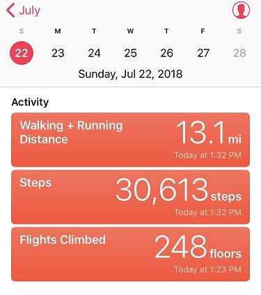
RT Length: 13.1 miles via Rock of Ages Trailhead
Elevation Gain: 5100’+
The weather looked better in the San Juan’s than the Elk’s, so I decided to go for Wilson Peak this time. I left my house at 8:30pm and made it to the trailhead at 3am.
The best part about the drive? Listening to 105.7 ‘The Range’ on the radio after I pass Gunnison. I’ve always been an old soul, but in a previous life (High School) I used to love ‘old’ country music (Lorrie Morgan, Reba, Charlie Daniels, Patsy Cline, George Jones, George Strait, Garth Brooks, Travis Tritt, Pam Tillis, etc.). I’d go dancing every week at our local country bar (another story for another day: How a 14 year old gets into a bar…), and this radio station plays all the classics from the 1950s up through the 1980s. The same ones I grew up dancing to, and thankfully without many commercials. I like a lot of different types of music, but this was a relaxing way to fill a few hours driving. Yes, singing was involved.
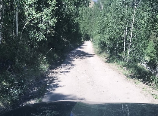
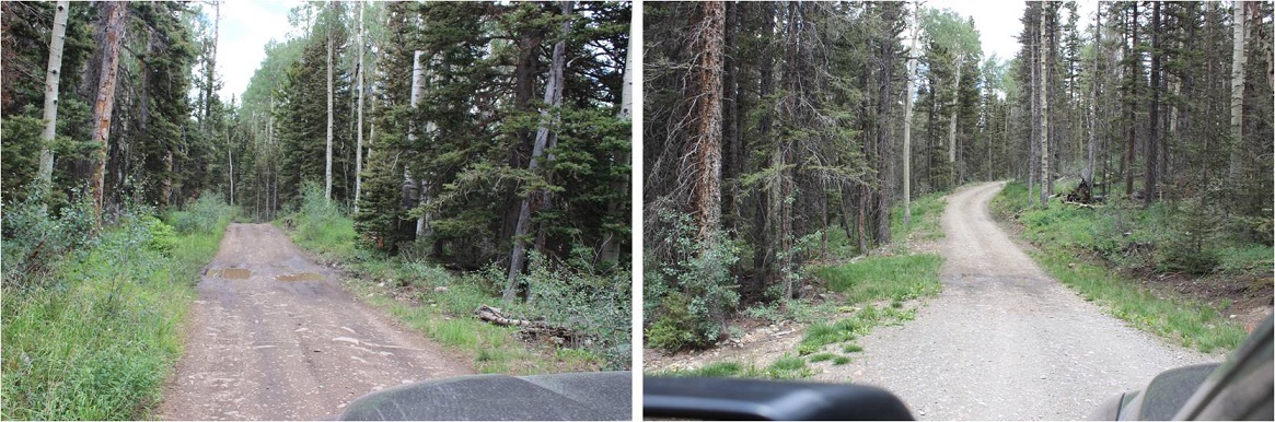
The 8 miles on the dirt road to the Rock of Ages trailhead took me at least half an hour to navigate. It wasn’t a particularly rough drive, just slow going with a lot of little mud puddles.
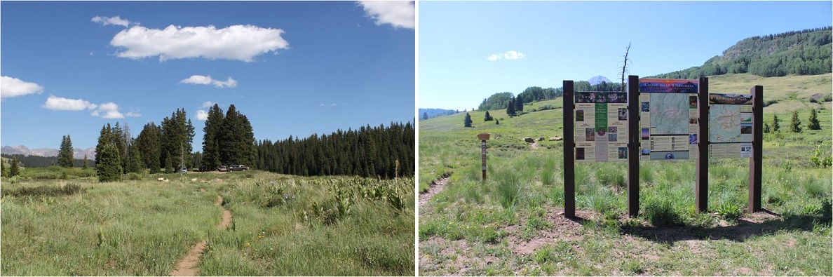
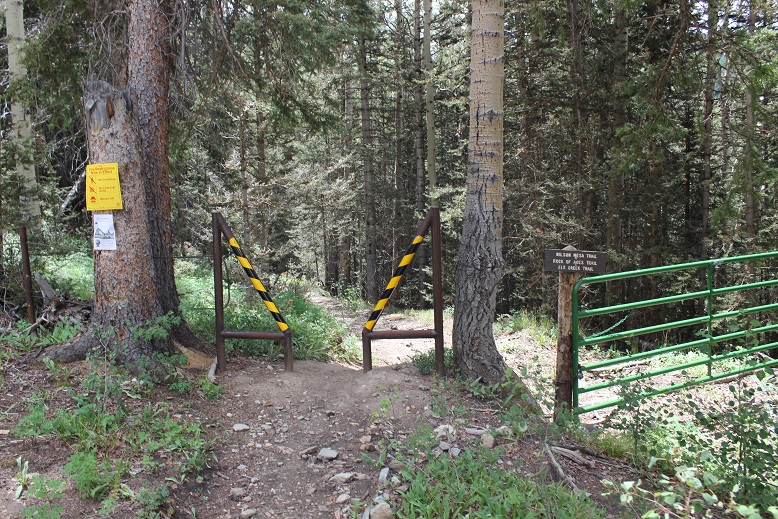
The trailhead had plenty of parking space, two porta potties, and only one other vehicle in the lot when I arrived. There was a sign that said “Head in Parking” and since it didn’t also say “only” I backed my truck into a space. I’m a Girl Scout and I was a park ranger for a while, which means I never head into a parking space. Ever. It’s just not efficient in an emergency. If there’s an emergency I want to be able to get out of there as fast as possible, so I always either back in or pull through when I park my truck. No exceptions. It’s been drilled into me…
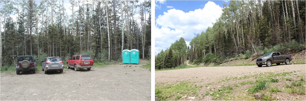
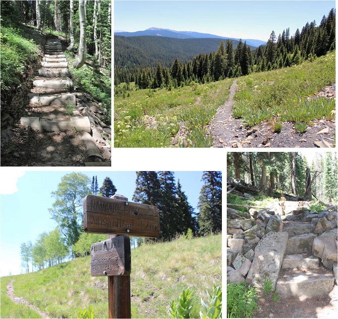
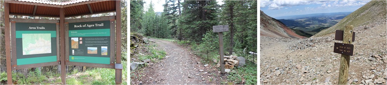
The trail starts here (note, no trail register)
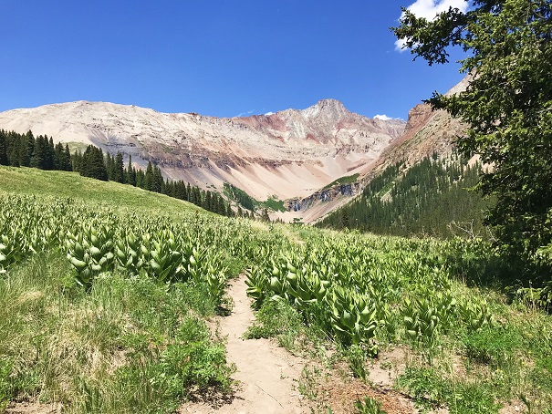
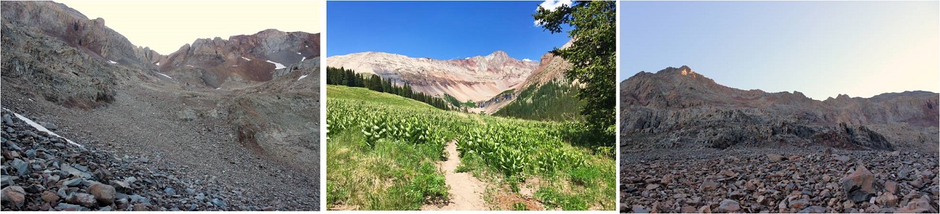
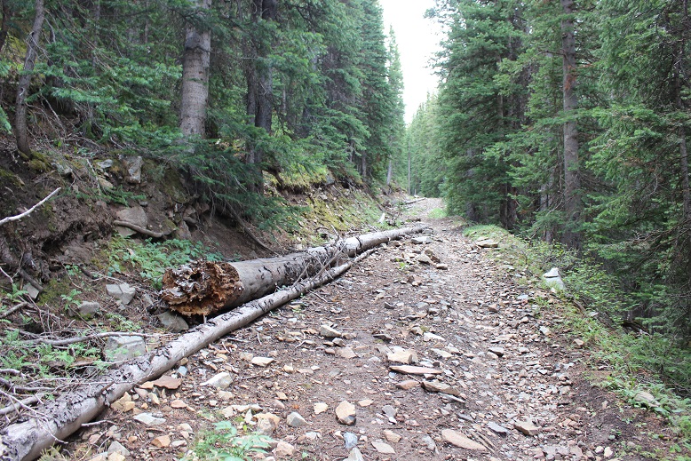
I was on the trail at 3:15am. The moon had already set, so I had a great view of the stars as I started my hike through the trees. The ground was very wet, most likely from all the rain the San Juan’s have been having this week. This was great because it allowed me to look for recent human and animal tracks. I didn’t see any animal tracks (just a few from horses) so I didn’t anticipate seeing any wildlife on this hike. (I didn’t).
And this trail had great signs! All the way to the basin I knew I was on the Rock of Ages trail (that’s where the signs stopped).
Between the two basins (Elk and Silver Pick) you go up a hill, and then actually lose a couple hundred feet in elevation. I remember thinking as I was hiking in how this wasn’t going to be fun hiking out (it wasn’t).

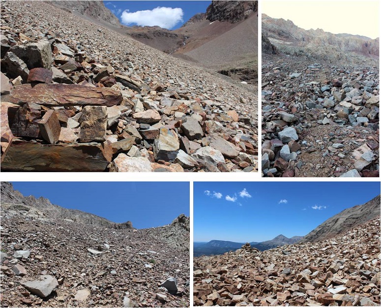
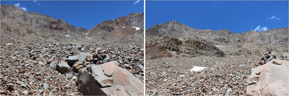
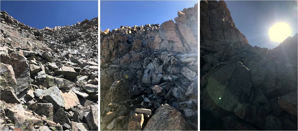
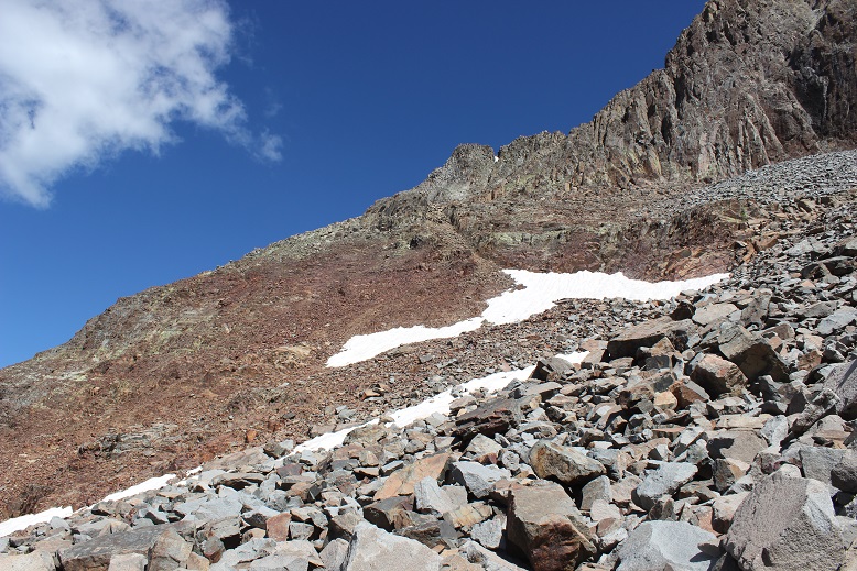
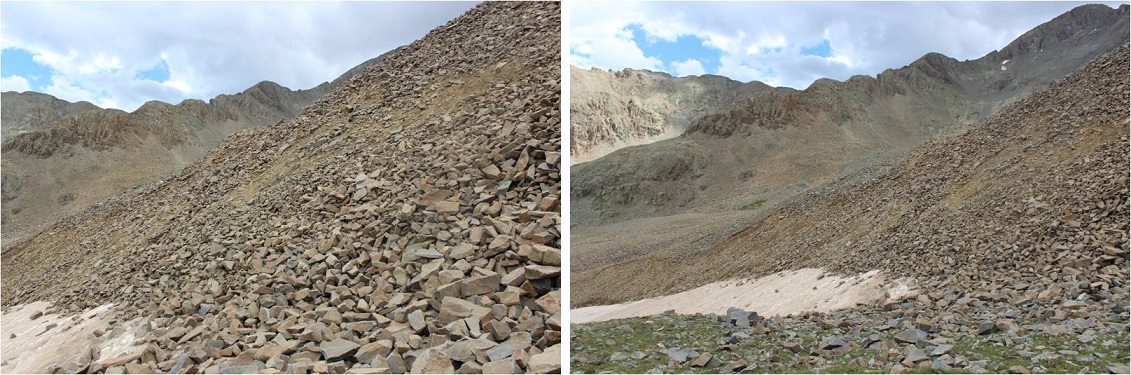
The only thing wrong with this trail? It was made up of lots and lots of talus. The entire basin and in fact 90% of the route was made up of talus. I’m not a fan of talus in general, mainly because I don’t pick up my feet enough when I walk. Even though I’m light I’ve always walked heavy. I could never sneak up on someone, and I recall “Laura, stop stomping like an elephant” being a common phrase in our house, even though I wasn’t actually trying to be obnoxious. Since I walk fast lots of talus for me = lots of tripping. I had to consciously think about each step I took to keep myself from tripping on the talus. This was more of an issue on the way out. It’s also more difficult to follow a talus trail in the dark. During the day route finding is a non-issue, but in the dark everything looks the same (sadly, no CFI stairs here).
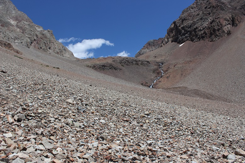
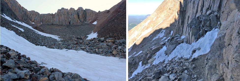
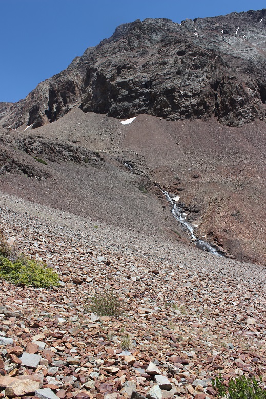
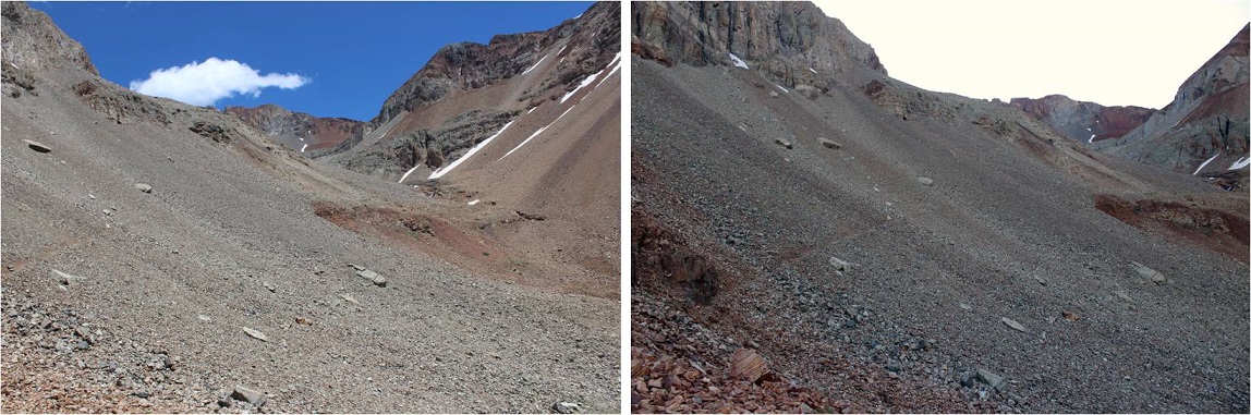
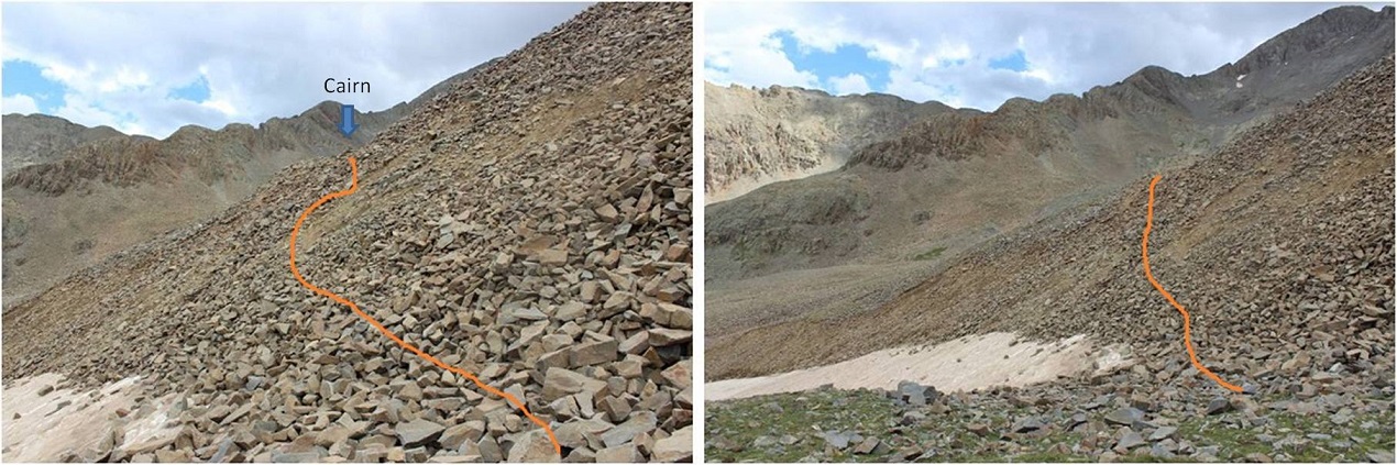
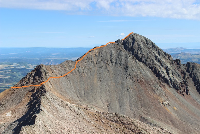
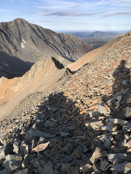
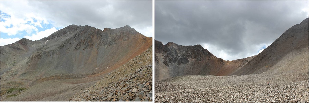
Here’s where talus at night became an issue. I’d been following the service road when it suddenly ended and cairns began. I’m a big fan of cairns, but these seemed to go in a circle, not leading anywhere. Also, the trail ended. I got out my topo map, and knew I was supposed to head straight over the hill into the upper basin, but when I started up the hill the rock was dangerously loose so I backtracked. I hiked up and down the hillside, looking for an alternate route, but there didn’t seem to be one. There was a snow bank without footprints, so I knew that wasn’t the correct way, and I kept coming back to the cairns. My flashlight wasn’t much help, as everything looked the same in the shadows. I honestly tried to find the route for at least 20 minutes, and finally decided to just go for it and trudged up the hillside, navigating carefully through the loose rock. This ended up being the right thing to do, as a cairn invisible in the dark from below awaited me at the top. Here’s what the route looked like
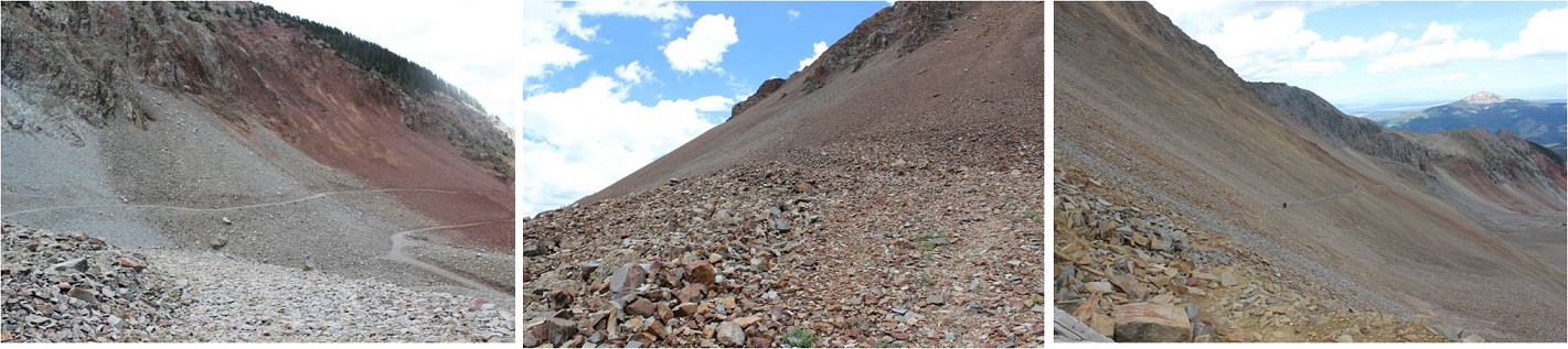
In the light of day the route was obvious (see below), but in the dark I wasn’t able to decipher between the trail and talus. There had been a rockslide of sorts over the direct trail, so there wasn’t a solid trail to follow. Here’s the route you’re supposed to take:
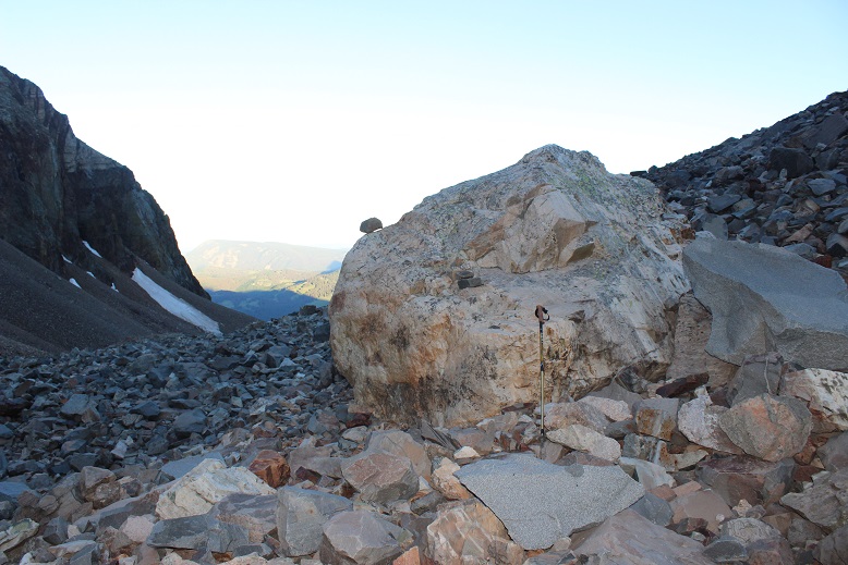
I hiked up and around the rest of the basin towards the Rock of Ages Saddle and noticed I was sweating a lot more than normal. My entire lower back was wet, which was weird? I felt around my backpack and noticed it was drenched. My water bladder was leaking. Well, this wasn’t ideal. I fixed my water bladder with a piece of duct tape and made a mental note to get another one before my next hike. Considering I’ve had it since 2003 it’s probably about time for a new one. The only downside? If the wind picked up I’d have to cancel my hike. Right now there was no wind, but that could change once I made it to the saddle. If it did, my Raynaud’s might start up and I’d get cold have to turn back. Hopefully that wouldn’t happen. The good news? I had on black yoga pants so while it felt like I’d wet my britches if I came across other hikers no one would actually be able to see that my pants were wet in all the wrong places: Let’s focus on the positive here!
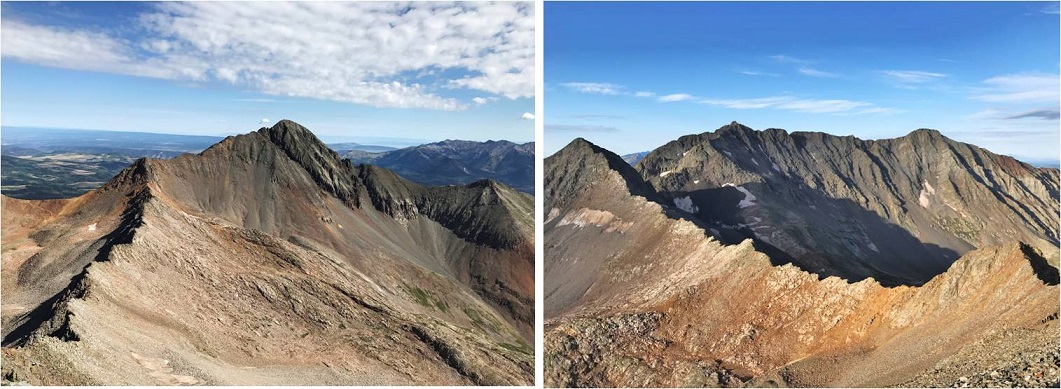
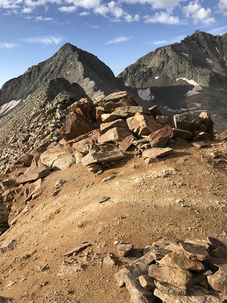
Woot! I made it to the saddle, and no wind! The sun was just beginning to rise and I had a great view of the north sides of Mt Wilson and El Diente Peaks.

Here’s what the saddle looks like.
I stashed my trekking pole, turned left, and hiked toward the Wilson Peak / Gladstone Peak saddle.
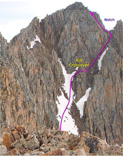
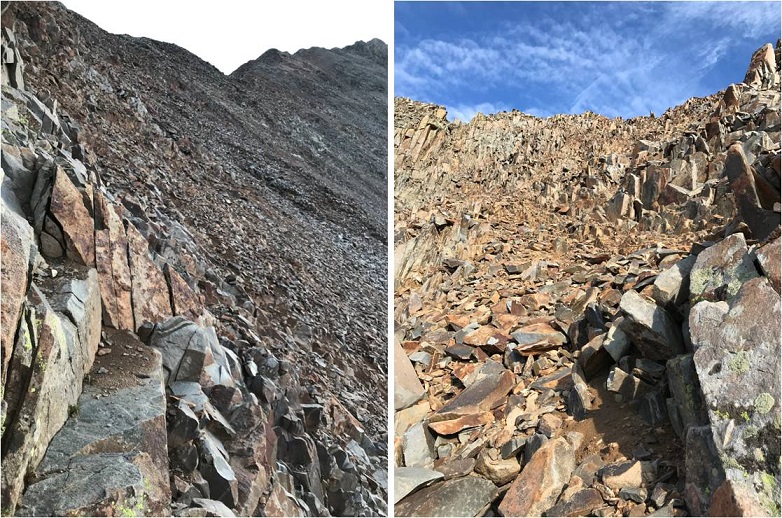
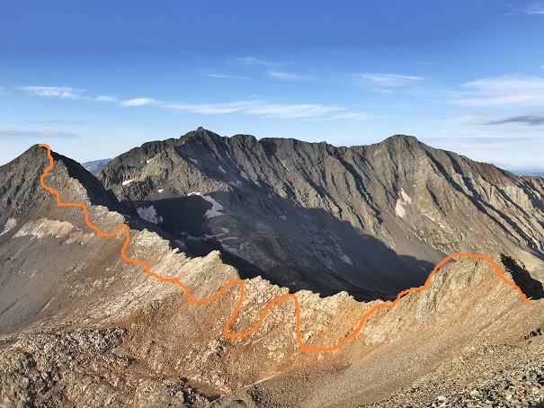
From the saddle I put on my helmet, turned left again, and started my trek to the summit. I ended up hiking too high on the initial ridge and had to back-track because I got into an area I couldn’t traverse. Here’s the route you should take: Aim for the dip in the ridge, and then follow the ridge towards the summit.
Here’s another view… aim for the small saddle in the ridge. You don’t want to climb too high or you run into lots of choss, i.e. very, very loose talus that isn’t easy/possible to traverse.
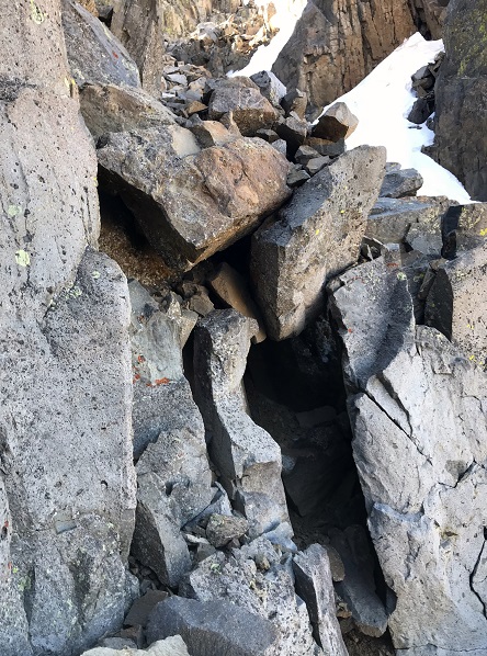
Wilson Peak has a false summit. The cool part about this is it’s where the climbing fun begins. You get to climb up a wall, descend, and then climb up again to the true summit.
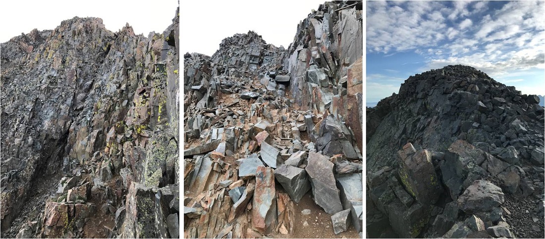
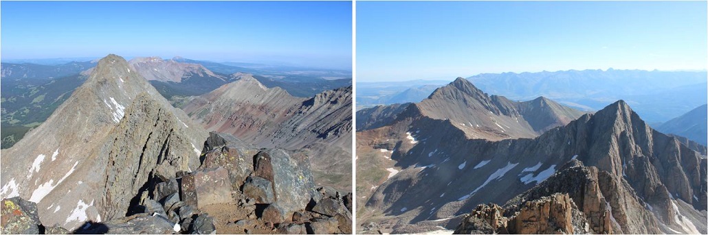
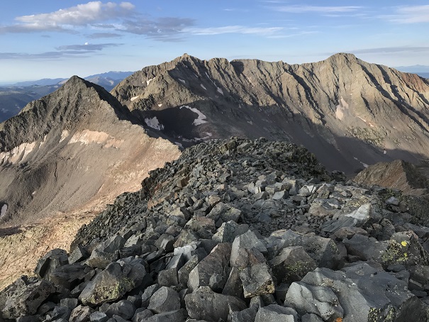
It was 7am. From the summit I could see Gladstone Peak, Mt. Wilson, and El Diente Peak
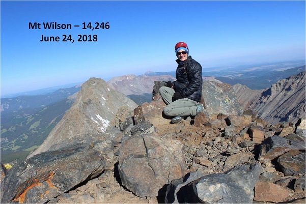
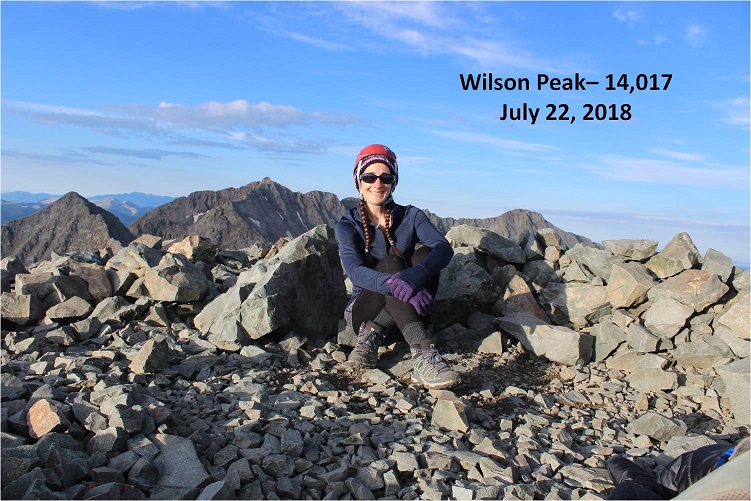
I took a summit selfie to prove I’d summited
And started on my way back down. The trail was much easier to follow now that I knew what to look for.
I made it back to the area I’d climbed too high at and had to backtrack, but this time at the correct elevation. I heard climbers above me and called to them, letting them know they were too high as I’d been. I placed a cairn where I was so they could see where they needed to be and wished them luck.
I made it back to the Gladstone/Wilson saddle. It was almost 8am, and the skies were pretty clear. It’s a centennial, and I was here, and the weather was nice, so I decided to attempt Gladstone Peak. I took off my (now dry) backpack to get out the directions I’d made up. Drat! Apparently I’d accidentally printed two sets of directions for Wilson Peak and none for Gladstone. Hmmmm. No worries, I had my GPS. I pulled up the route and drat again! When I pulled it up it kept me in the basin for the entire hike (and I knew that wasn’t right). I looked at the mountain before me and considered.

I’d put the directions together, so I tried to recall what they’d said. I remembered this was a class 4 hike, I was supposed to stay mainly on the ridge, only dropping down once to class 3 terrain to avoid a more difficult section, if the rocks are too loose you’re off trail, and if I had to go off the ridge to go left.
Well, I was here, so I decided to attempt Gladstone. I followed the saddle to the beginning of the ridge and did my best to stay on the ridge. I’m sad to say I failed almost immediately. There were no cairns. I quickly became a wuss and didn’t think I could stay on the ridge, so I dipped down and when I felt safe again climbed back up to the ridge. That meant I was going up and down loose gullies to avoid exposure. This happened over and over and over again. I knew I was off route and making this harder than necessary, but I kept looking for easier terrain (and not finding it). This was actually the more dangerous option.
The rock was all unstable, loose and shifting as I tried to step on it. I had to be careful with each step I took. I was frustrated but slowly making progress. When I got past point 13,341 I heard someone shout enthusiastically from the summit. Apparently someone else was on this mountain! He seemed pretty excited with himself. I watched him descend and aimed for where he was on the mountain. At one point a rock about the size of a microwave I was going to stand on let loose and cracked and tumbled down into the gully below me, producing a lot of noise and that fire and brimstone smell that comes from such an event. I took a deep breath and continued on.
When the climber was about 50 feet above me I called out to him. I wanted his advice on the trail back since the trail I took in hadn’t been all that pleasant. I called three or four times before I realized he had ear buds in. Why anyone would willingly take away one of their senses on a class 4 hike is beyond me, but I did applaud him wearing ear buds instead of blasting his music. Oh well, I was close, I could make it the rest of the way on my own and re-assess the route from the summit. I don’t think he ever knew I was there. Here’s the final push to the summit.

This is the path I followed (kind of… I probably went up to the ridge and down a gully a few more times). Please, please, please don’t do what I did. I realize this is a total mess.
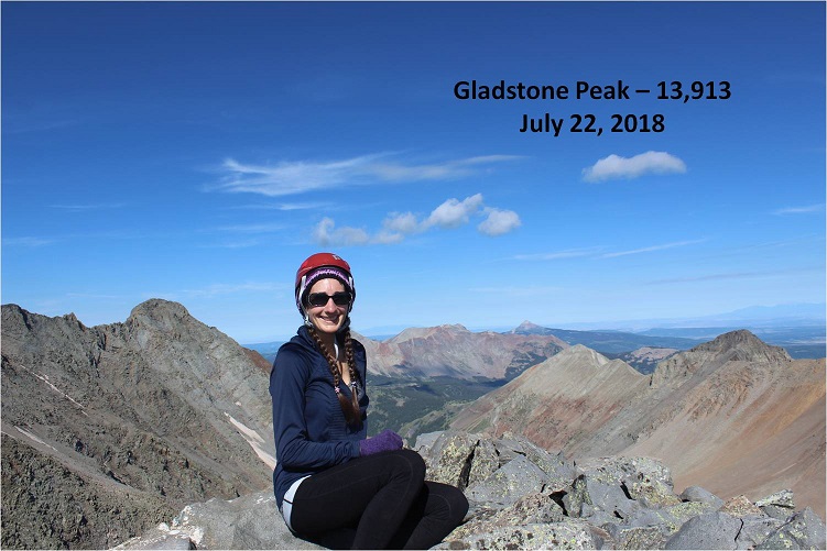
But I did it! I summited at 9:30am and knew why ear bud guy was so excited: That was one tough climb! Here’s my summit selfie
From the summit I could see the ear bud guy had trekking poles (WHY on a class 4 route?!?!?) and was following the ridge. After point 13,341 he disappeared and I never saw him again. Nothing nefarious, I was just focused on the weather/views and wasn’t able to locate him again when I looked towards the ridge.
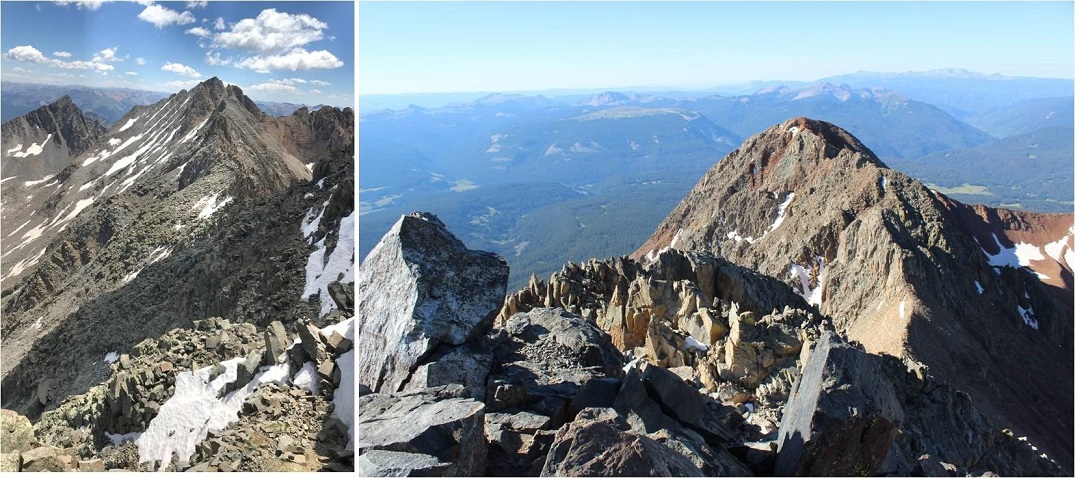
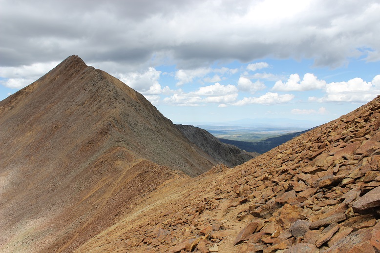
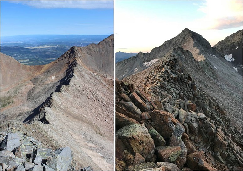
Here’s the view from Gladstone Peak, looking at Wilson Peak
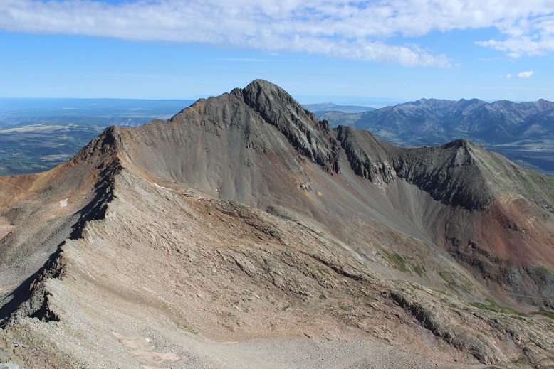
Wow! What a mountain! OK, now it was time to head back down. I made the decision to do my best this time to follow the ridge, no excuses. I’ve done class 4 before, I know I can do this. And so I started down, doing my best to follow the ridge. Here’s what the beginning looked like
I began scrambling. Luckily the rock, although unstable, was sticky on the ridge. There was a lot of exposure but as long as I focused on the task at hand it didn’t bother me. The weather however did. The clouds were moving in fast, and this was slow going. I religiously stuck to the ridge, and you know what? It was doable! Scary as hell, but doable. I could do this! I was climbing up 30 foot rock faces, balancing on ledges, stuffing my hands into cracks and balancing my feet on thin lines that shouldn’t have been possible, but I was successful with every step. I just kept thinking to myself “If I can do this in the gym I can do it here”. Check out the view from the base of Gladstone looking at what I’d just accomplished, and what I had left
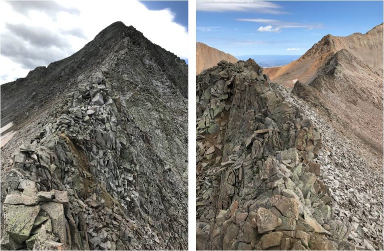
Here my confidence soared. I started picking up speed, still careful to make sure my placements were stable before using them. I was making great time and I was actually having quite a bit of fun with each new obstacle. I’d look at something, think “no way” and then go for it. Here’s the route I took back… I just followed the ridge.
I made it to the Gladstone/Wilson saddle and did a happy dance. Woot! I’d done it! Class 4 all the way baby! Let me tell you, Gladstone Peak gives Capitol a run for its money.
I learned a lot about myself on that ridge about what I can do. It’s ok to be scared because that’s your body’s natural response to a dangerous situation: Do it anyway.
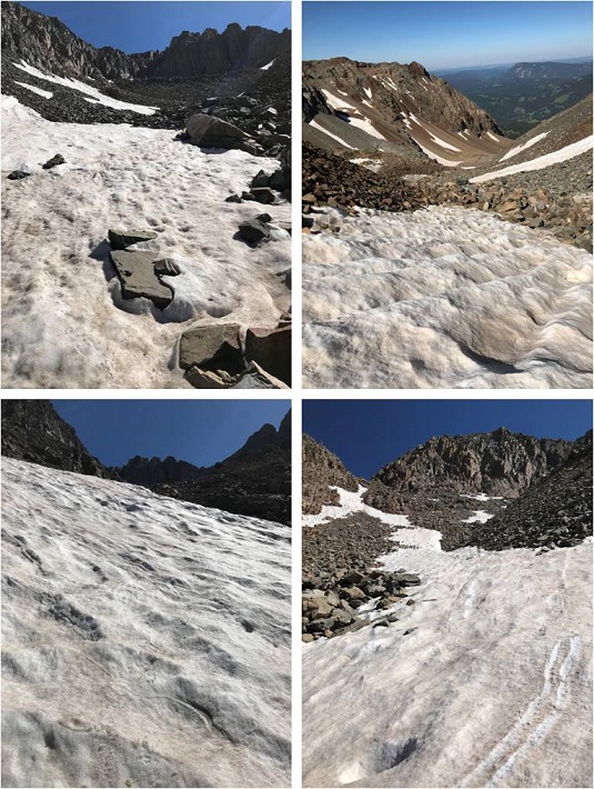
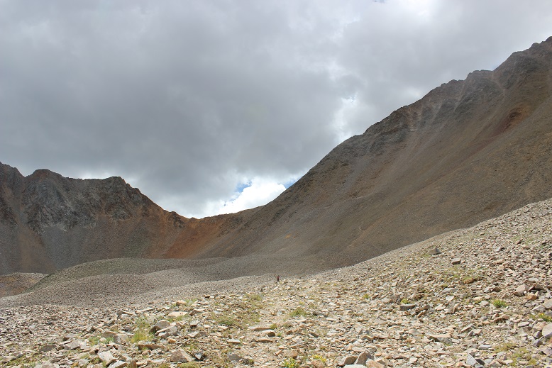
The clouds were rolling in as I made it back to the basin. The basin was busy, filled with hikers coming in from multiple trails. I felt a few sprinkles, but nothing seemed too ominous or threatening. It was weird hiking through the basin in the daylight where I could clearly see the trail.
I could also see a bunch of abandoned mines I hadn’t known were there in the dark
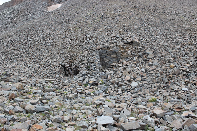
And remember the 20+ minutes of route finding I had to do? That was a cinch in the daylight! The hillside is right next to the old rock house and yes, those cairns do lead to nowhere but in a circle.

I made it back to my truck at 1:15pm, making this 13 mile double summit hike/climb in 10 hours. Not bad considering I lost quite a bit of time to route finding both on the trail and on the ridge.
I decided to let my truck play in the mud puddles on the dirt road back to the highway, getting her dirty in the process. No worries though, because it rained the entire way home, so in the end I came home with a clean truck.
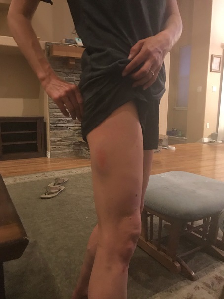
I didn’t make it home until 8:30pm, making this a 24 hour trip door to door. I immediately took a shower, and was confused at how many large bruises I had I didn’t remember earning, mostly on my shins, thighs and forearms. I guess the ridge bites back!
Oh, and push-ups were a killer this morning! I must have really used my arms yesterday…