Gudy Peak – 13572

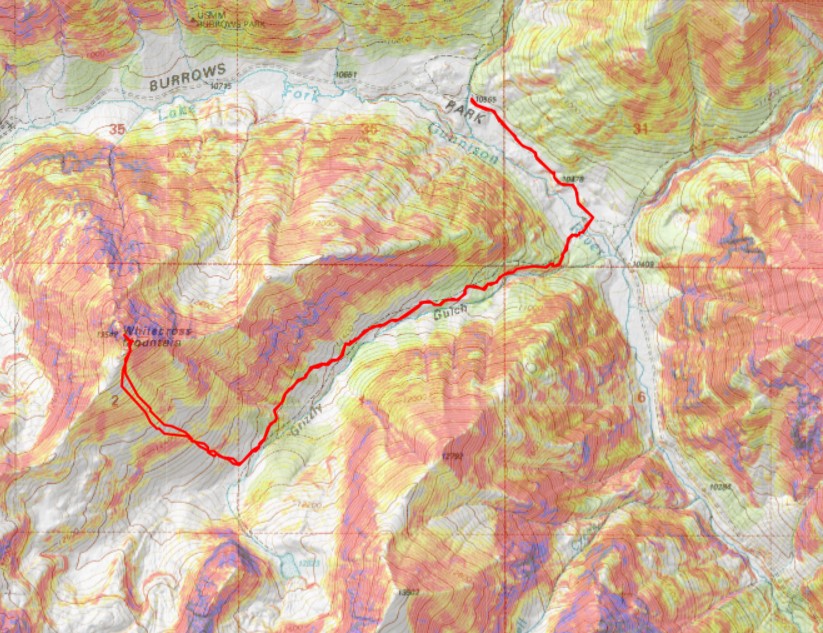
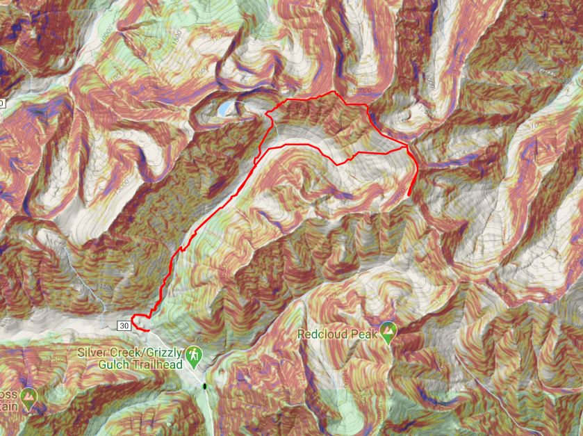
RT Length: 10.27 miles

Elevation Gain: 3191′

This was my third attempt at Gudy Peak.  The other two attempts were thwarted from various approaches due to either snow or ice.  With another storm rolling in this weekend, I realized this would be my last opportunity this year to summit this peak, so I was going for it. 

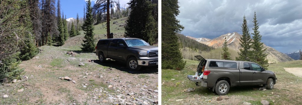
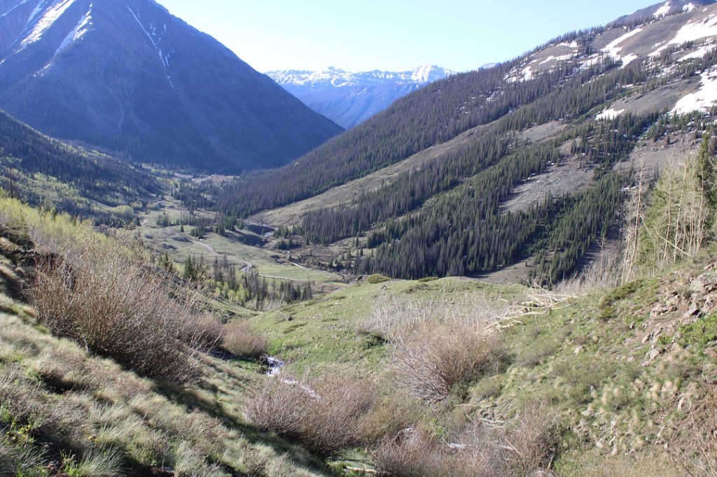
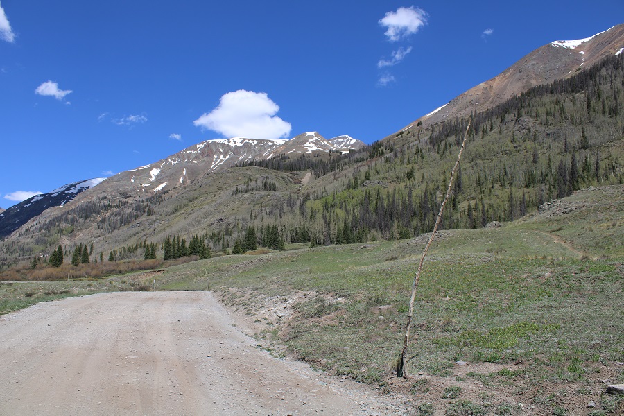
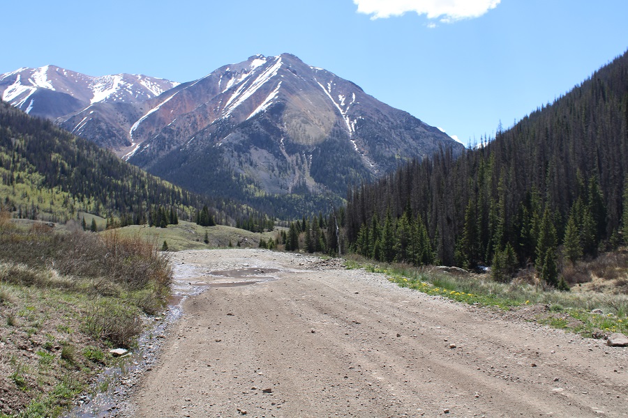
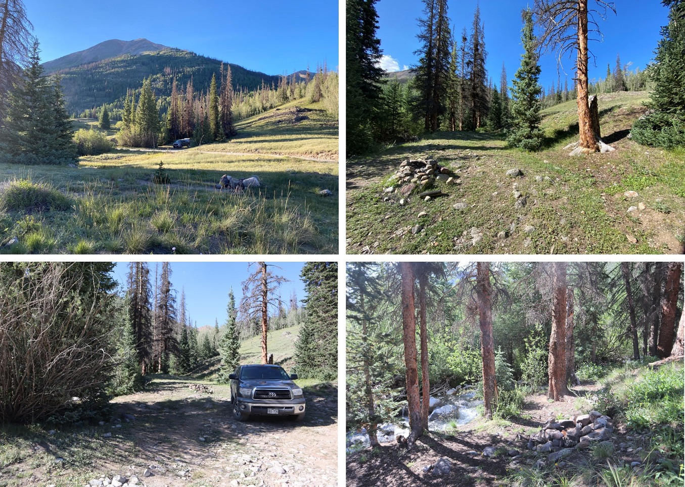
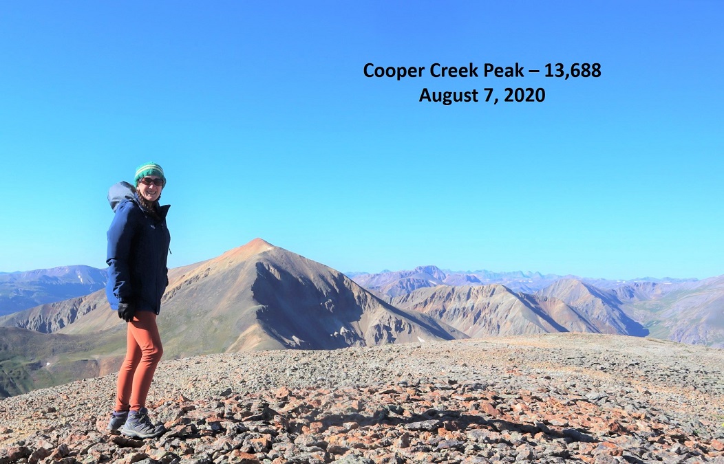
I camped the night before at one of my favorite dispersed campsites, near Cooper Creek.

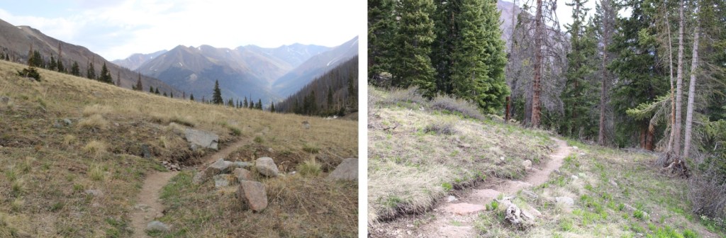
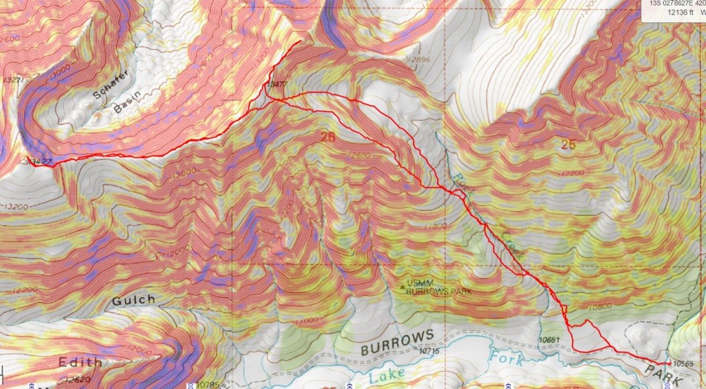
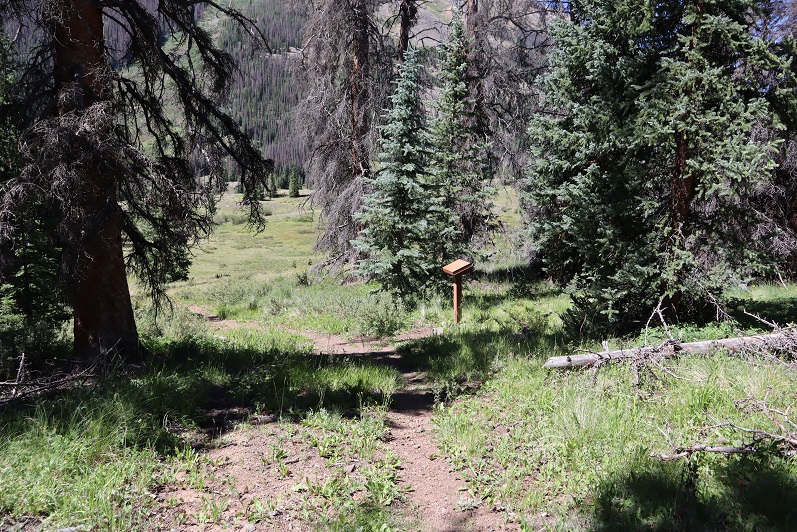
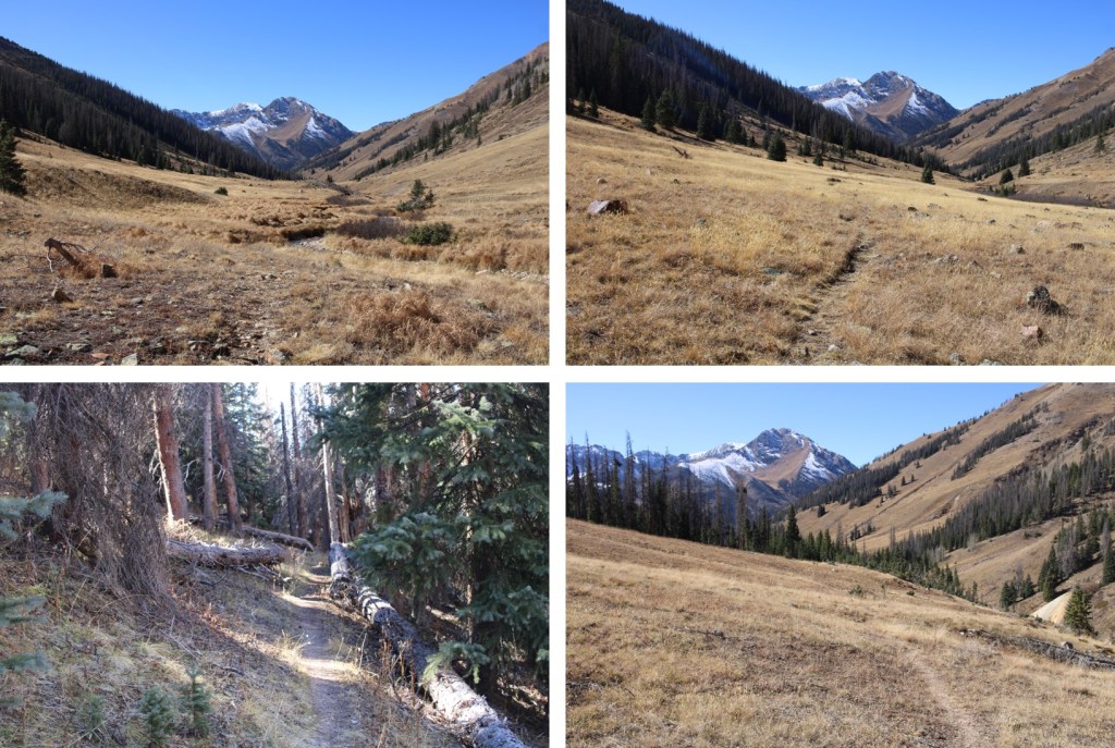
                                                                                                                                                                       When I woke up the next morning there was a layer of frost on the inside of my topper.  It was going to be a cold morning.  I sat in the cab of my truck to warm up and get ready, and was on the trail at 7am.  I started out heading northwest on the 4WD road, and then turned right onto Cooper Creek Trail

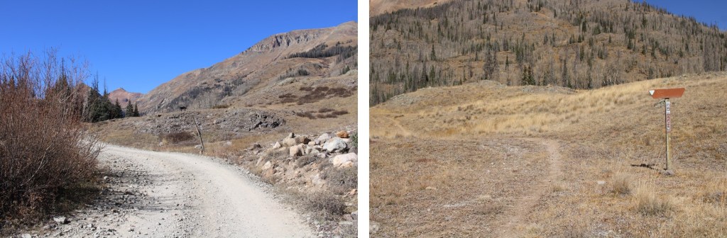
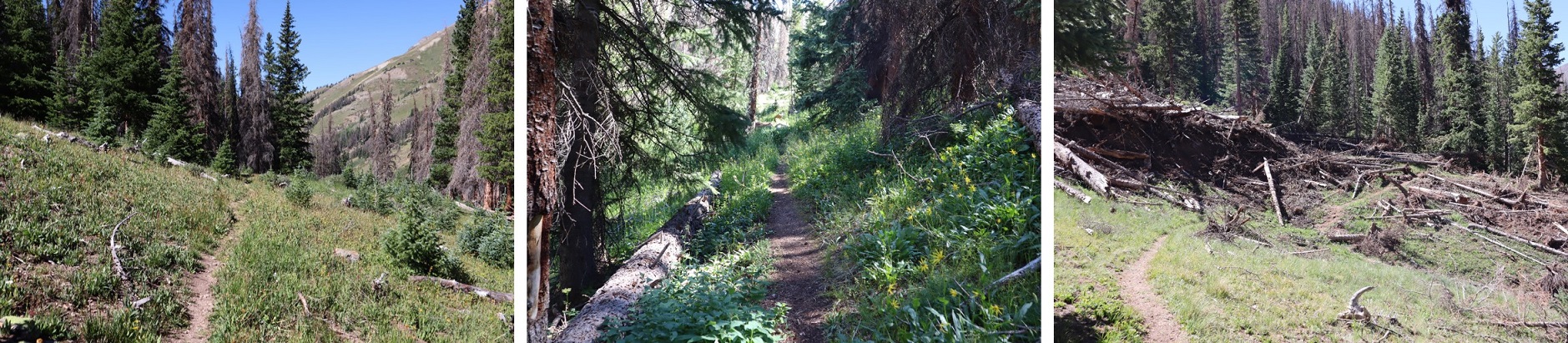
This trail is class 1, and pretty well maintained for the first two miles or so, when it fizzles out into more of a game trail. 

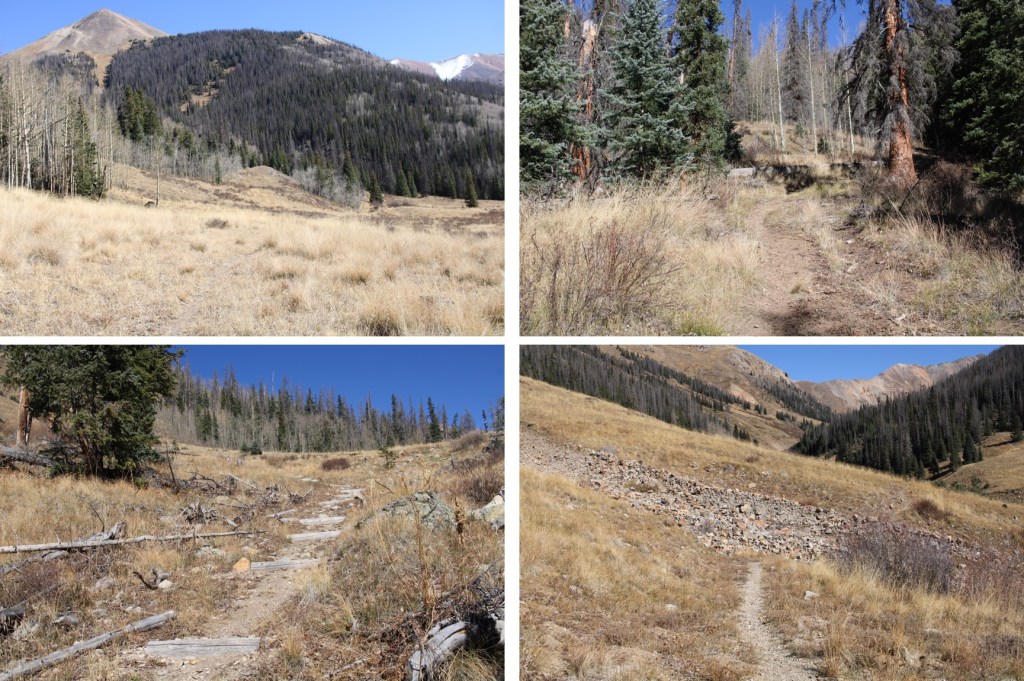
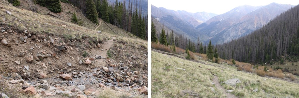
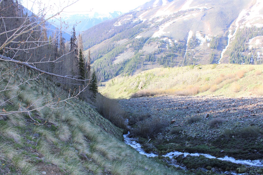
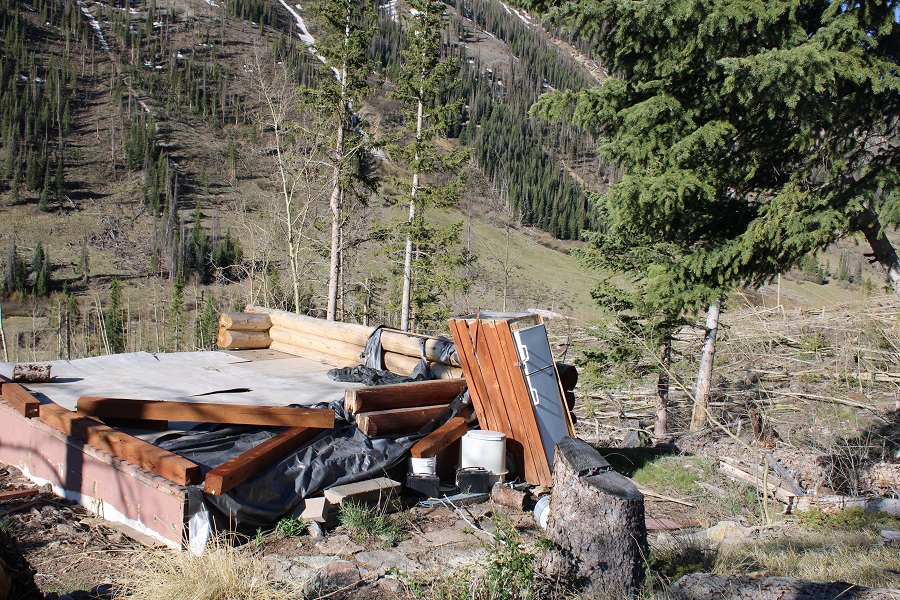
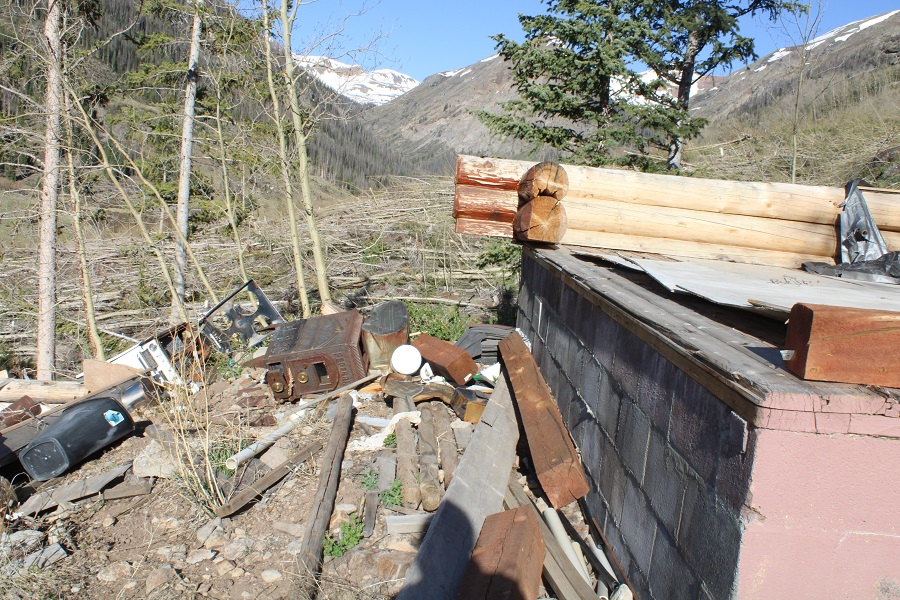
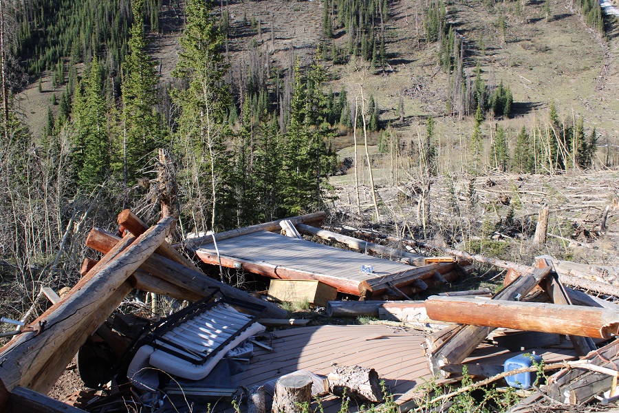
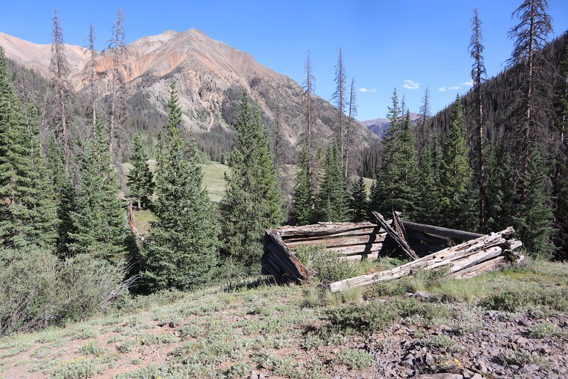
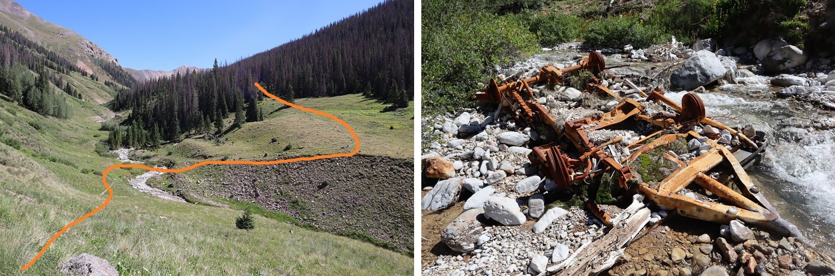
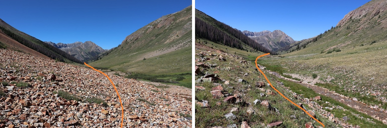
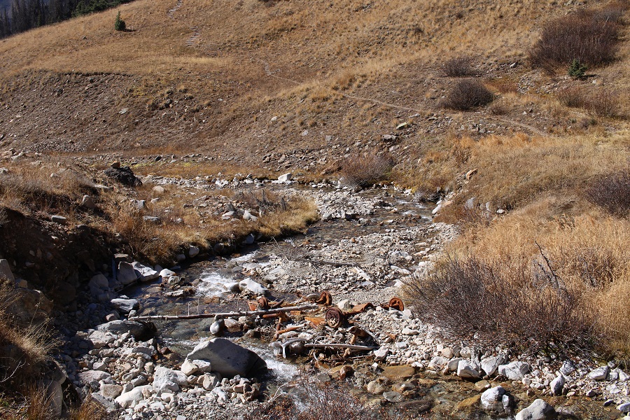
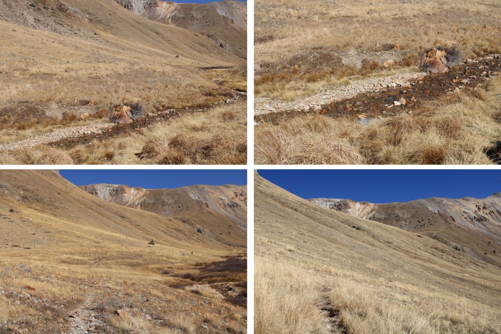
After hiking for about 1.5 miles the trail lost elevation and crossed Cooper Creek, then picked up again on the other side.  There is what I’d originally thought was a vehicle at the creek crossing, but upon closer inspection, realized it was an old mining cart or trailer tipped over.

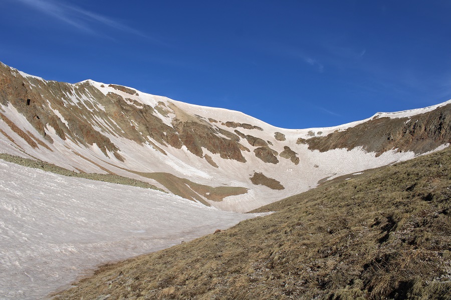
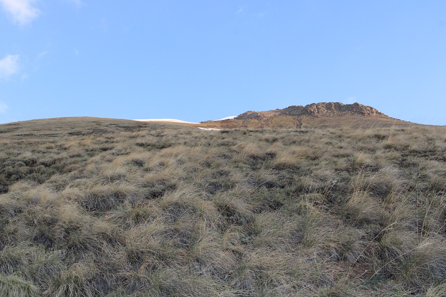
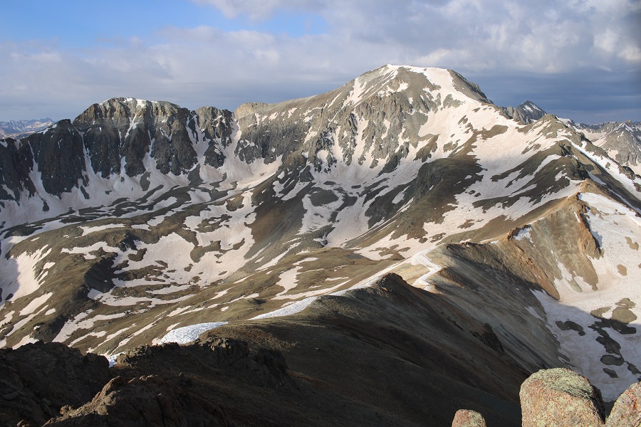
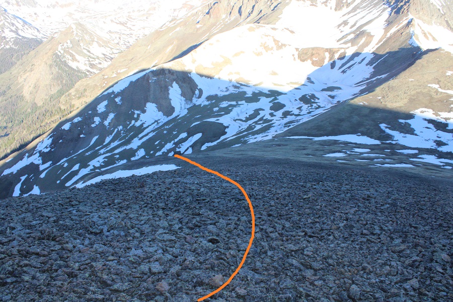
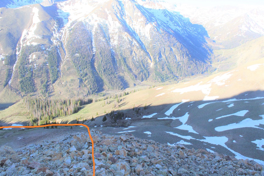
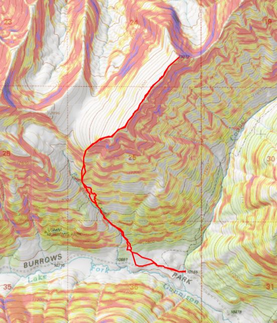
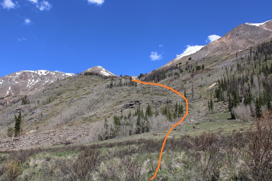
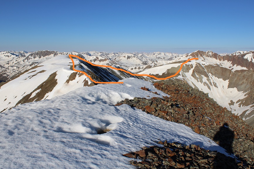
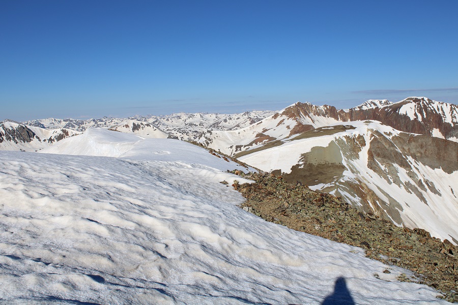
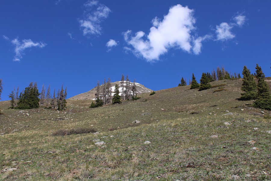
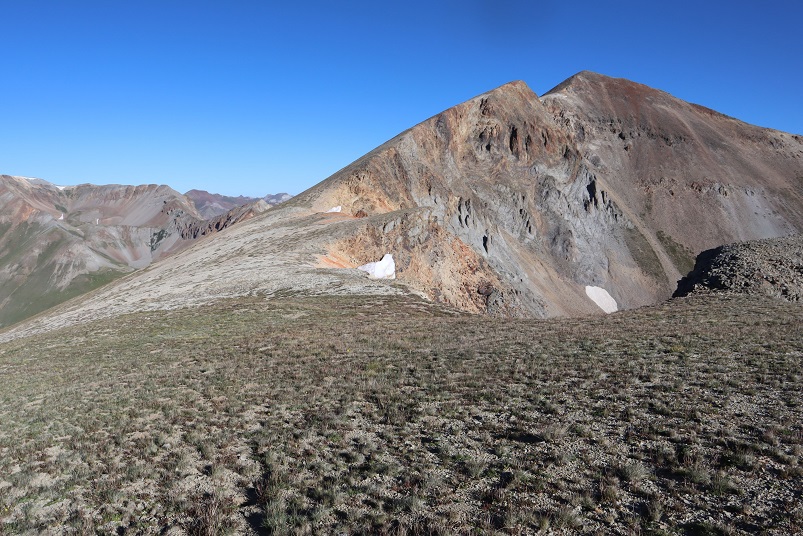
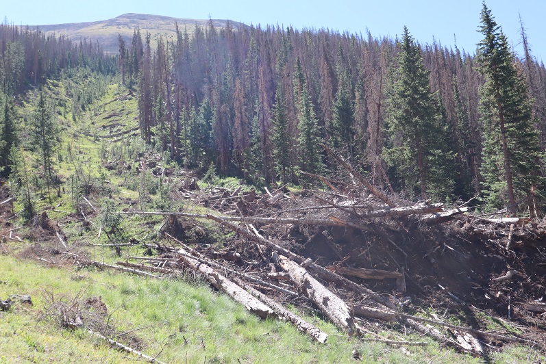
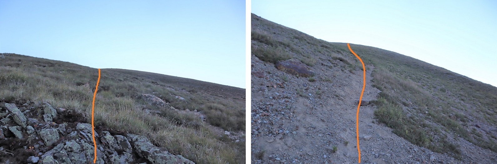
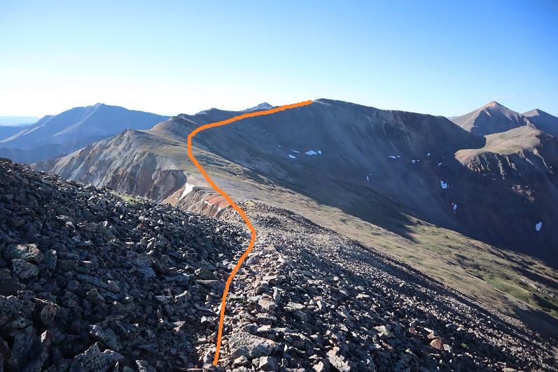
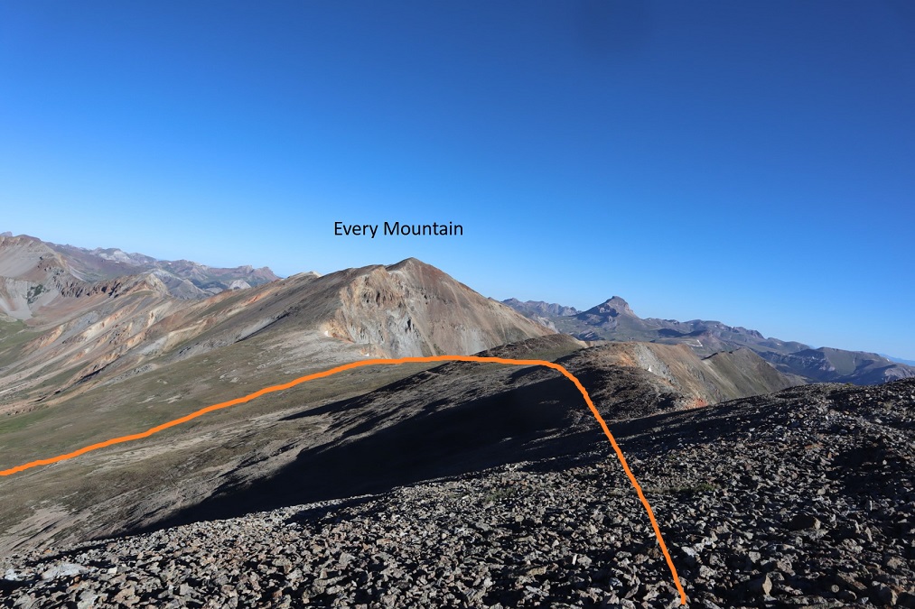
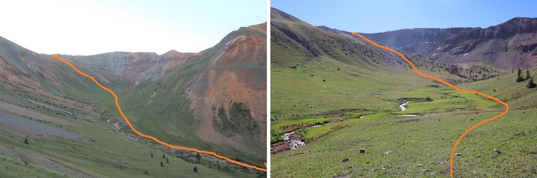
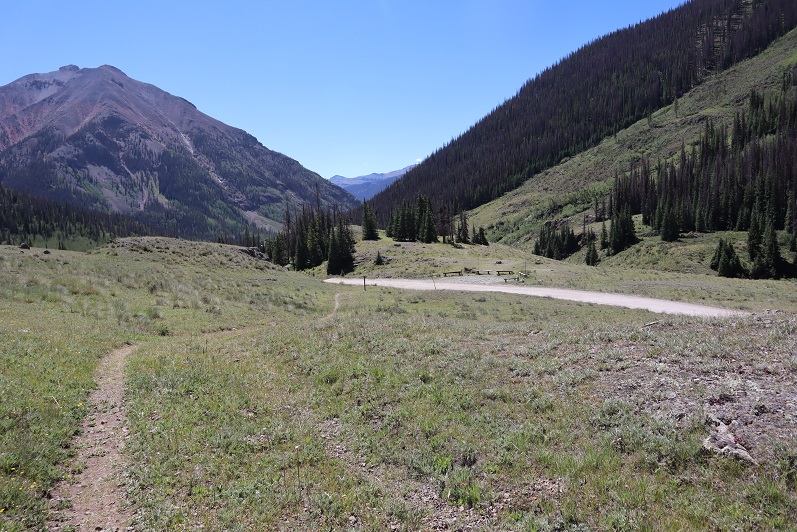
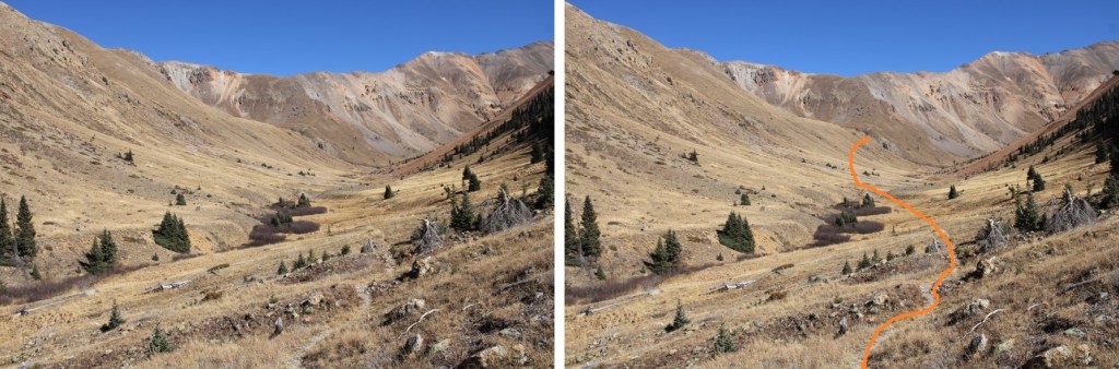
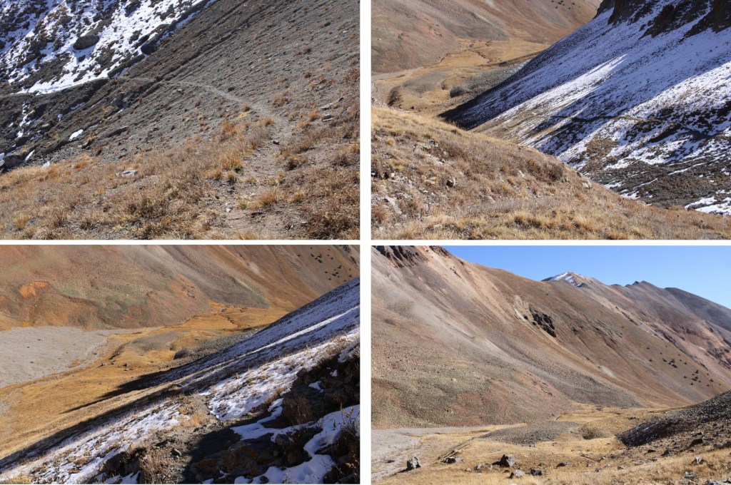
I followed the trail northeast through the basin

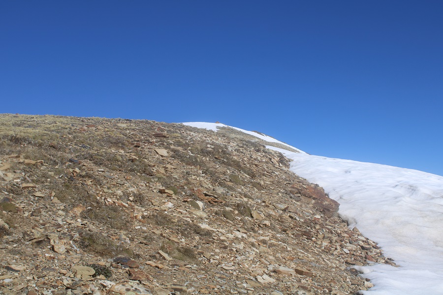
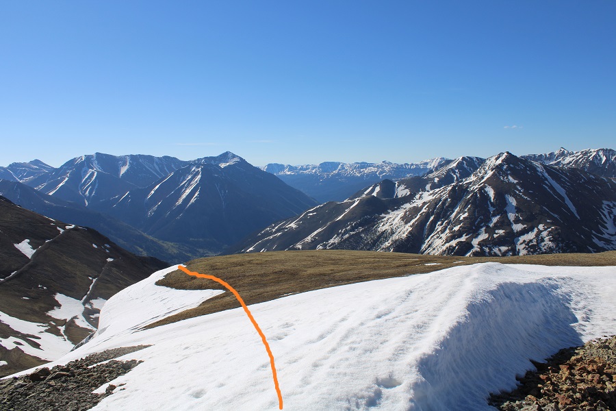
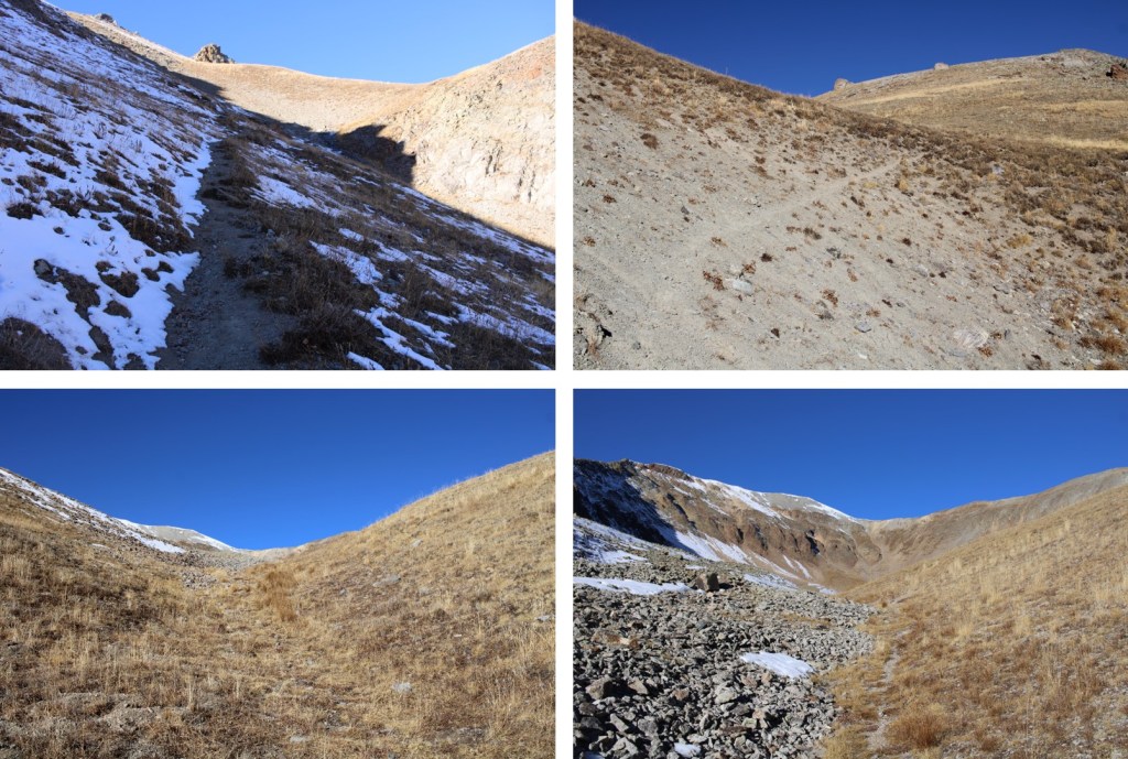
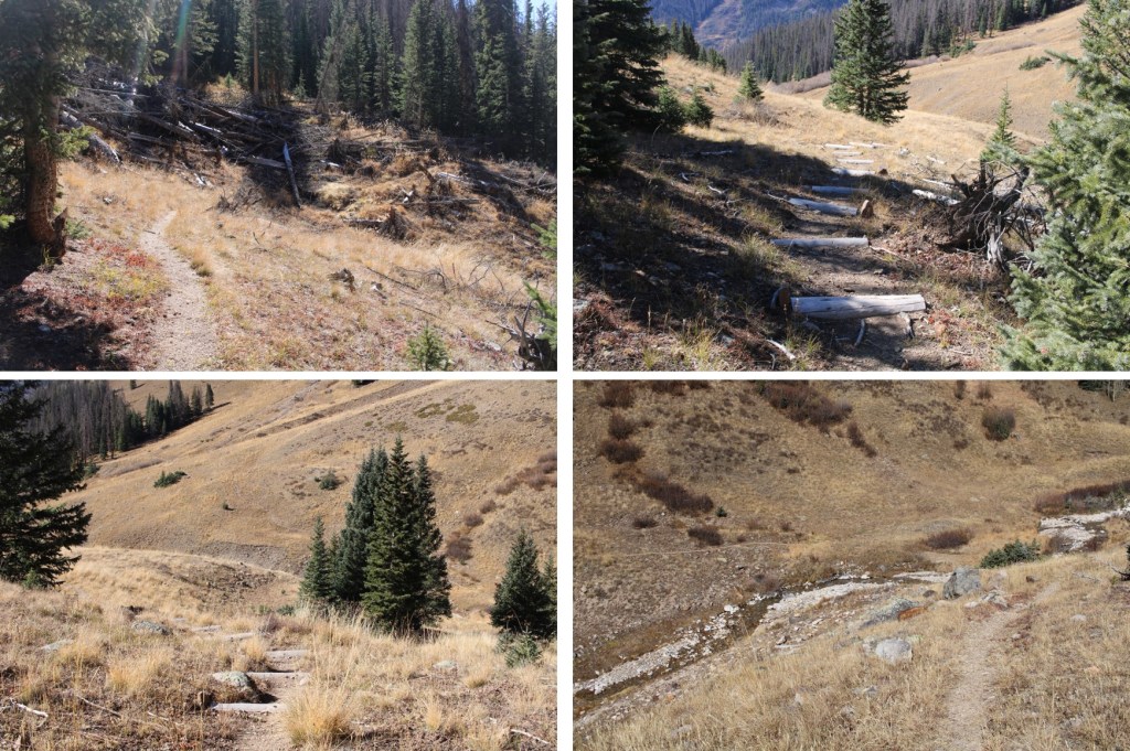
When I made it to treeline, I could see a faint trail that would be my route into the upper basin

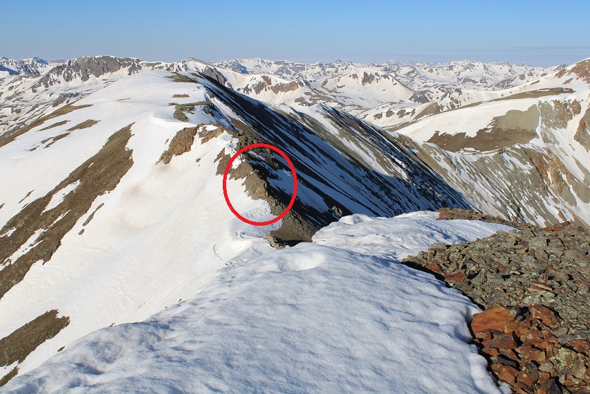
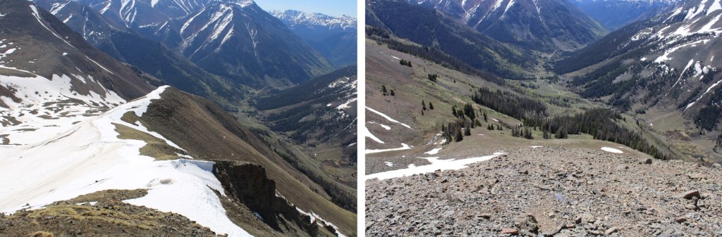
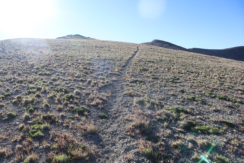
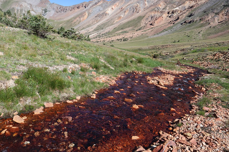
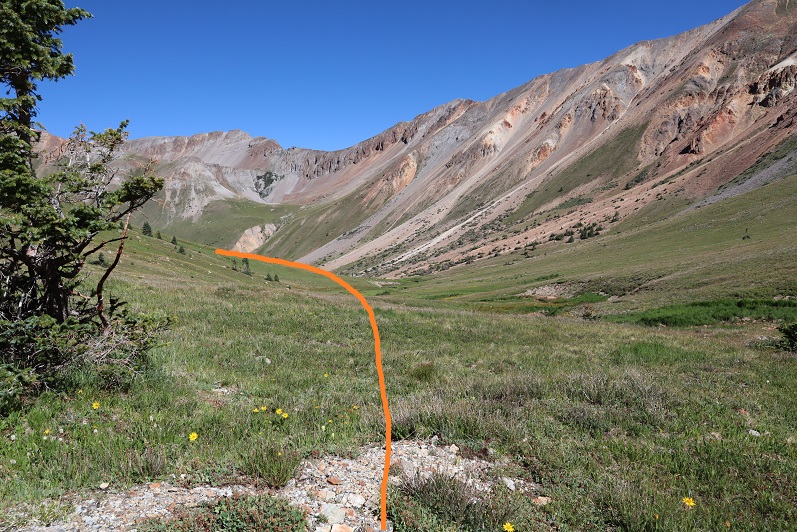
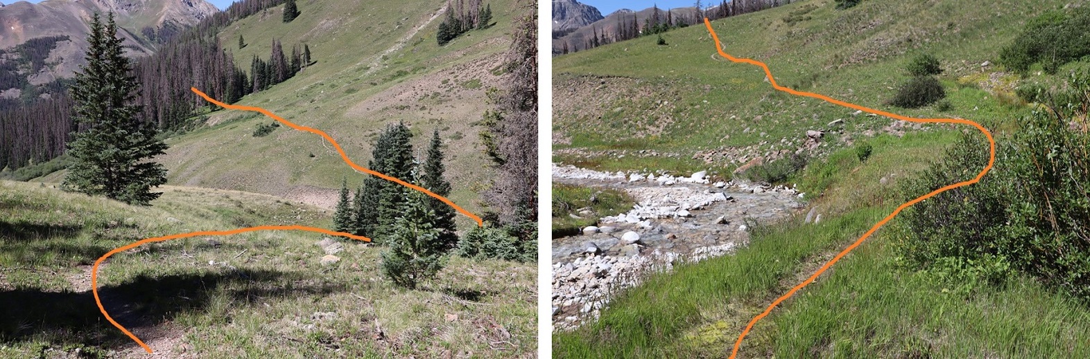
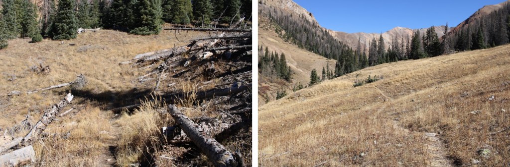
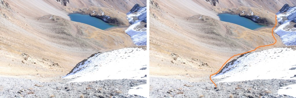
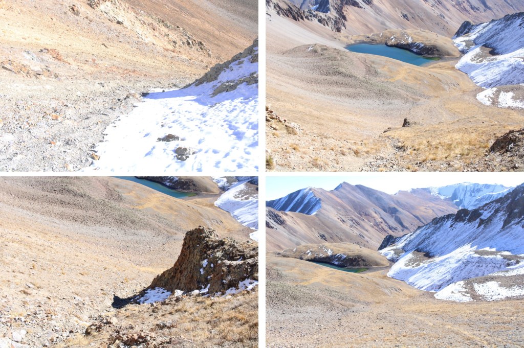
Here are some step-by-step pictures as I crossed the creek and headed towards the upper basin

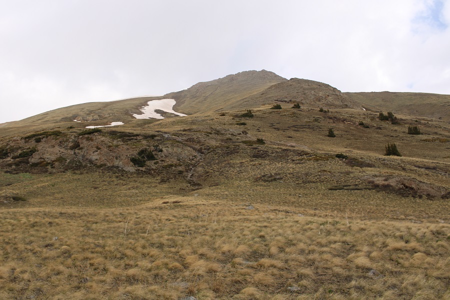
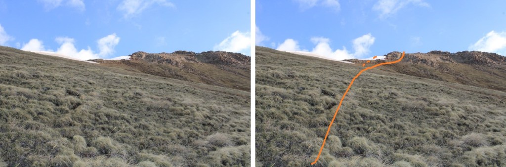
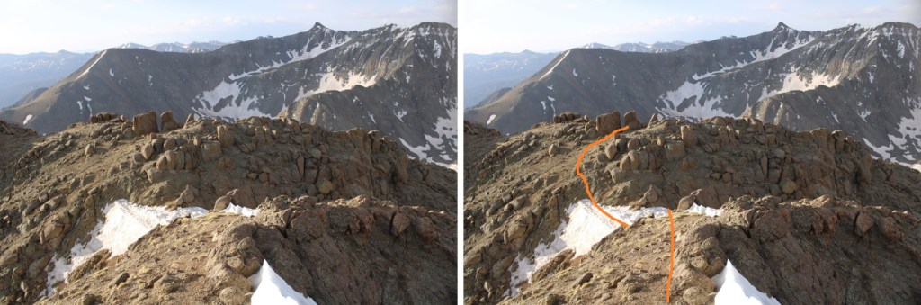
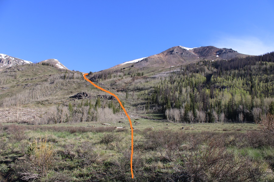
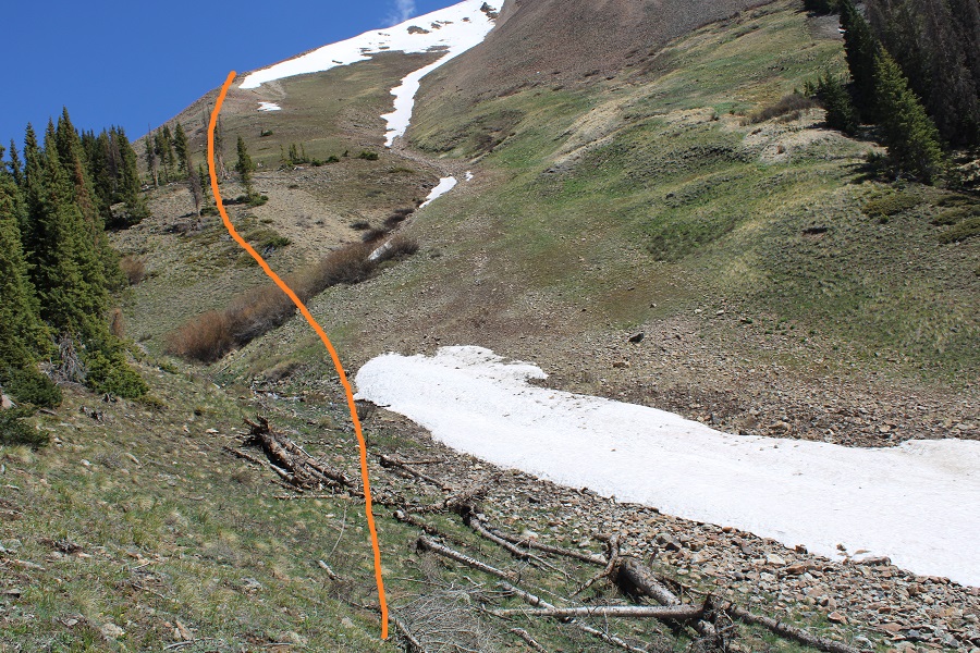
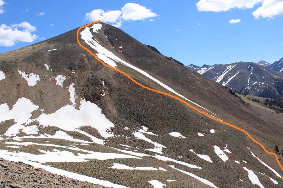
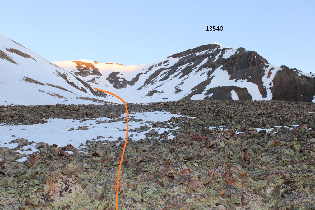
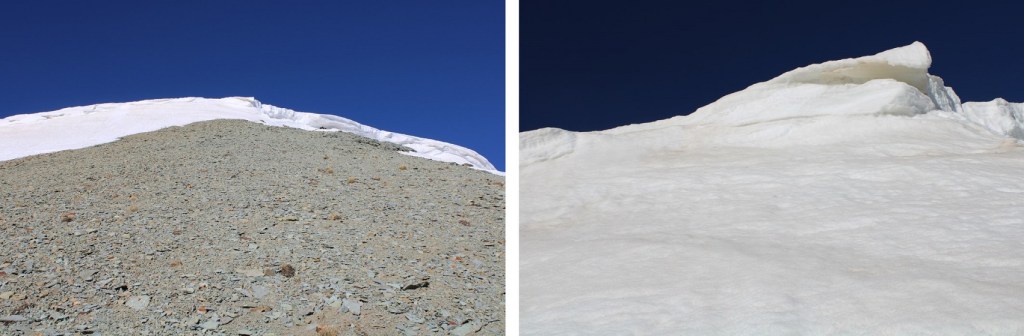
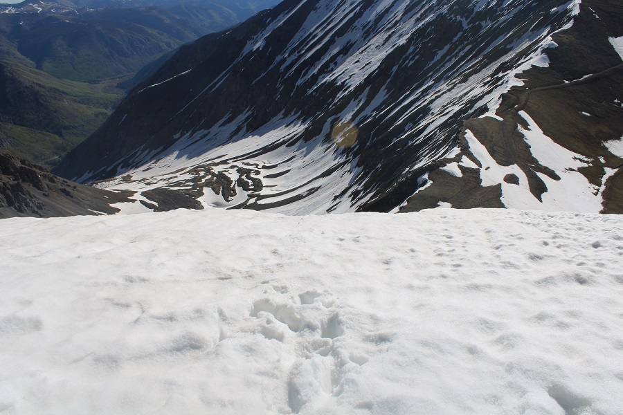
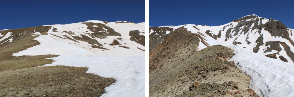
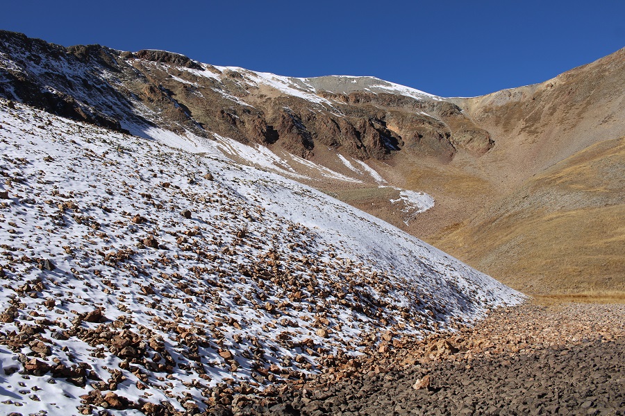
I was now headed west, and needed to ascend this gully.  When I’d been here in the past this had been a sheet of ice, and difficult to ascend, even with an ice axe and crampons.  Today I realized there’s actually a trail that will lead you up this area.

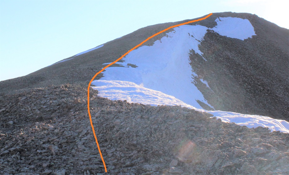
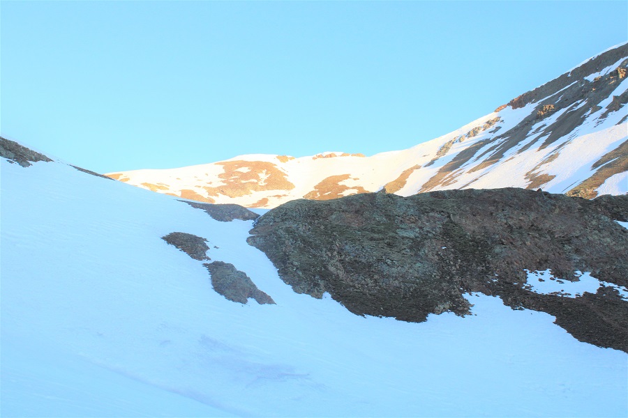
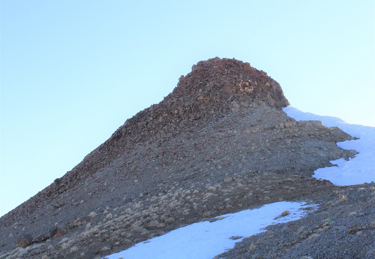
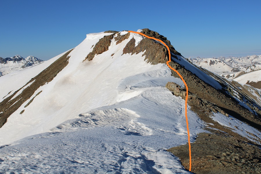
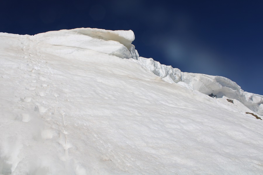
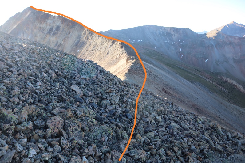
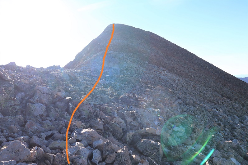
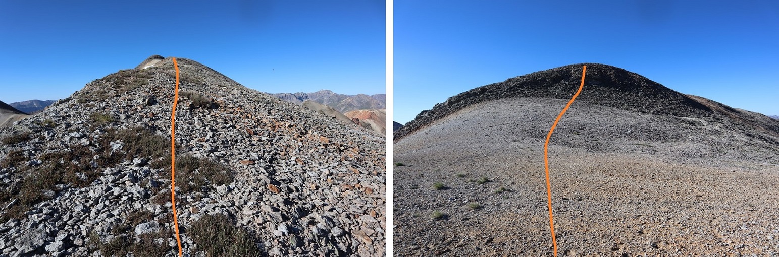
Now to gain the ridge.  I took the gully straight in front of me.  Take a good look at the top of the gully.  It’s much, much steeper than it looks.  This is the route I took:

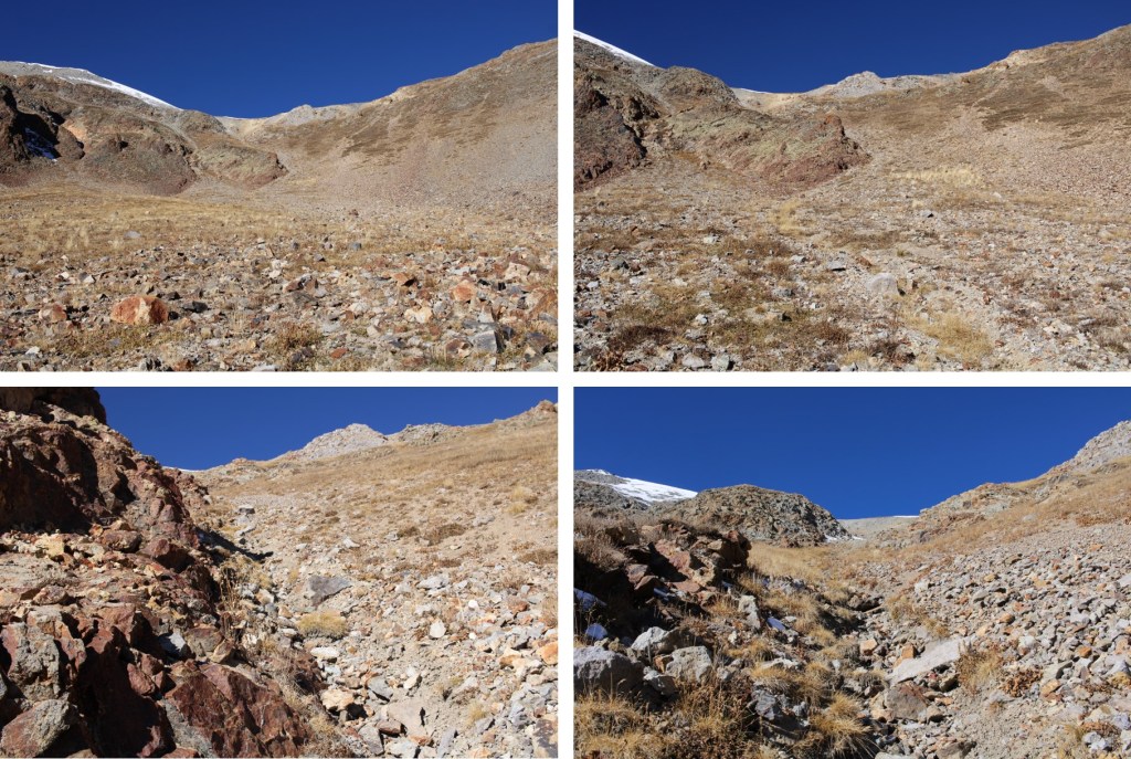
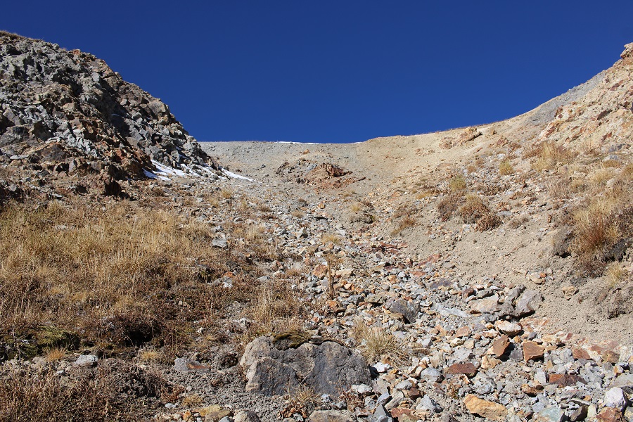
That gully is a lot steeper than it looks folks!  About 20 feet from the top I felt out of my depth, and with one hand put on my microspikes and ice axe.  I wasn’t able to reach my helmet without taking off my pack, or I would have put that on too.  I literally kicked in steps with my microspikes and used my ice axe and trekking pole to haul myself up.  My trekking pole was not enough.  Take the top of this gully seriously. 

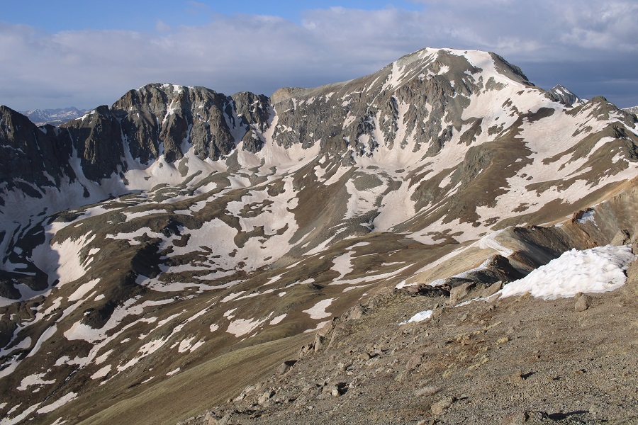
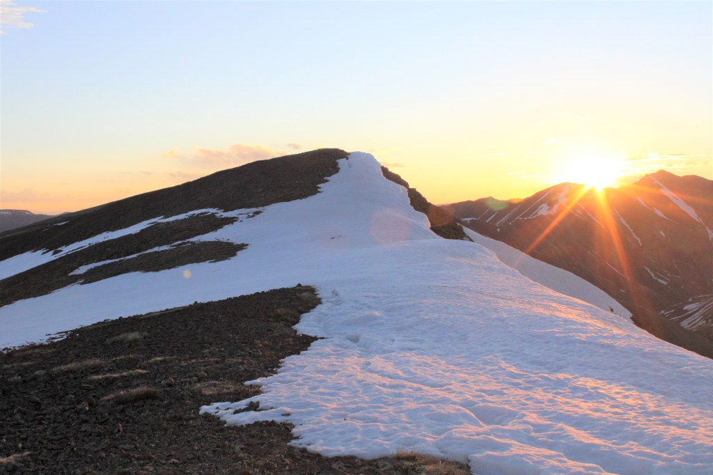
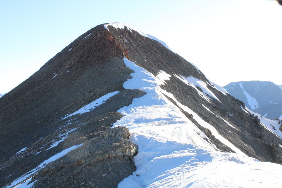
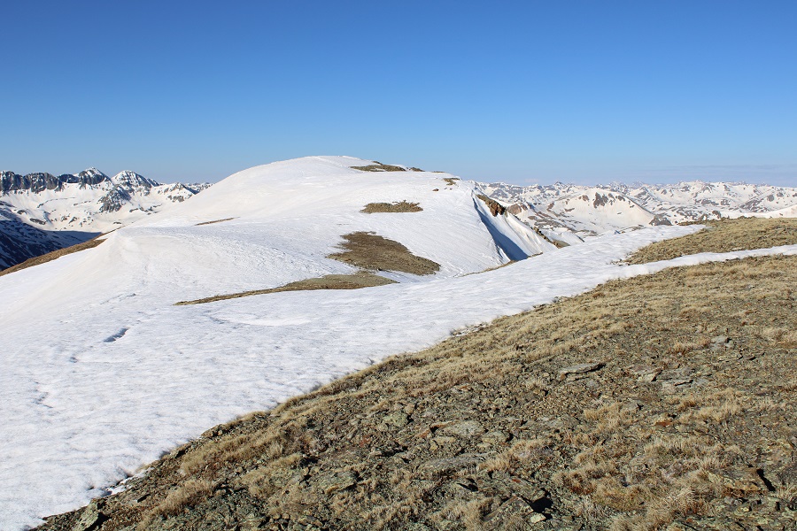
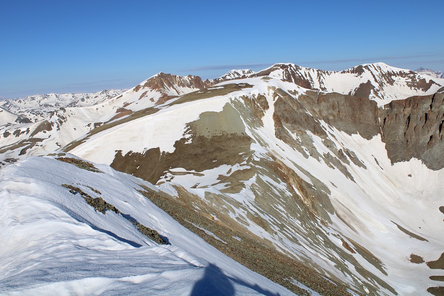
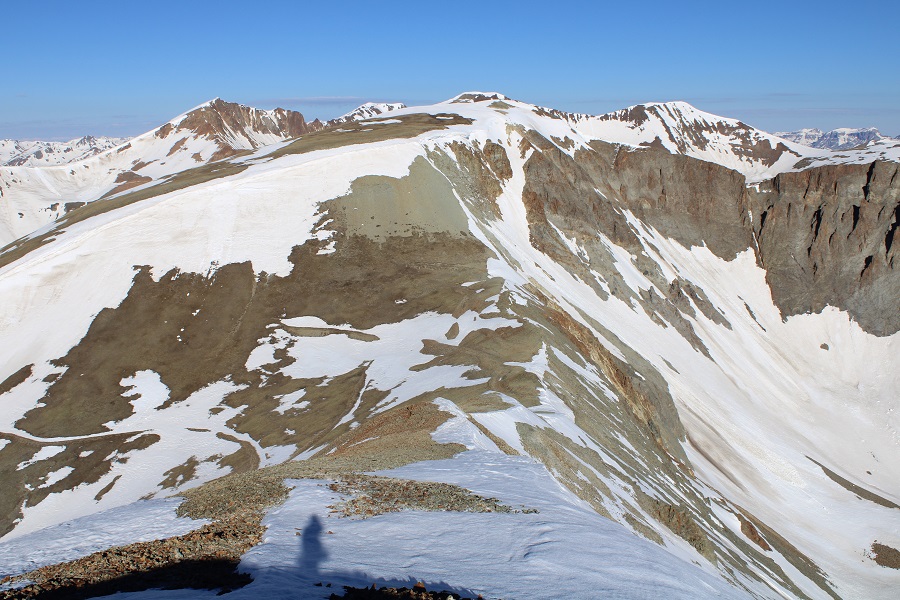
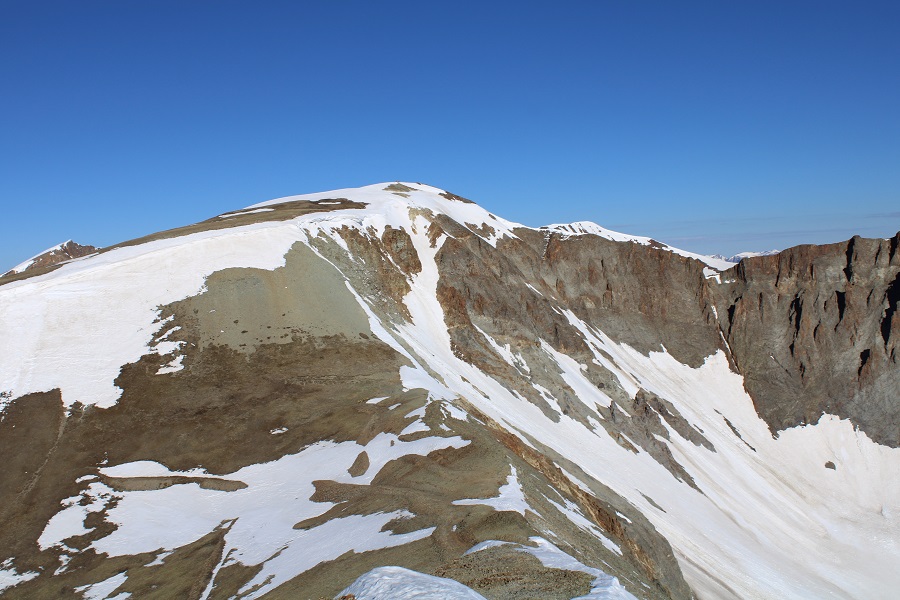
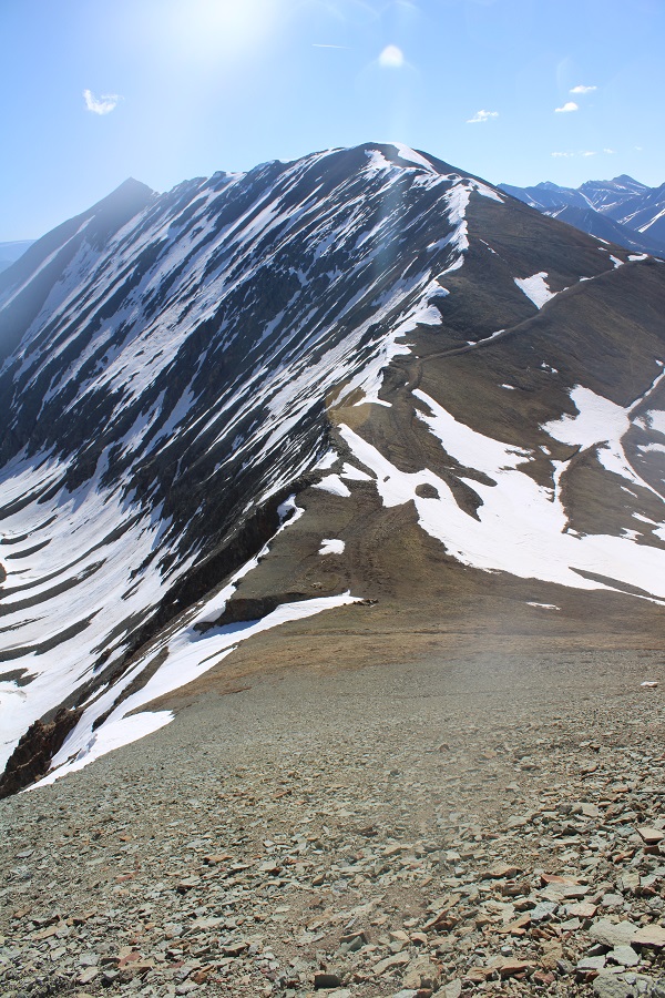
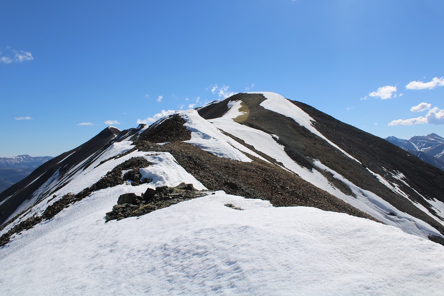
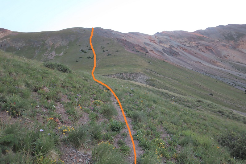
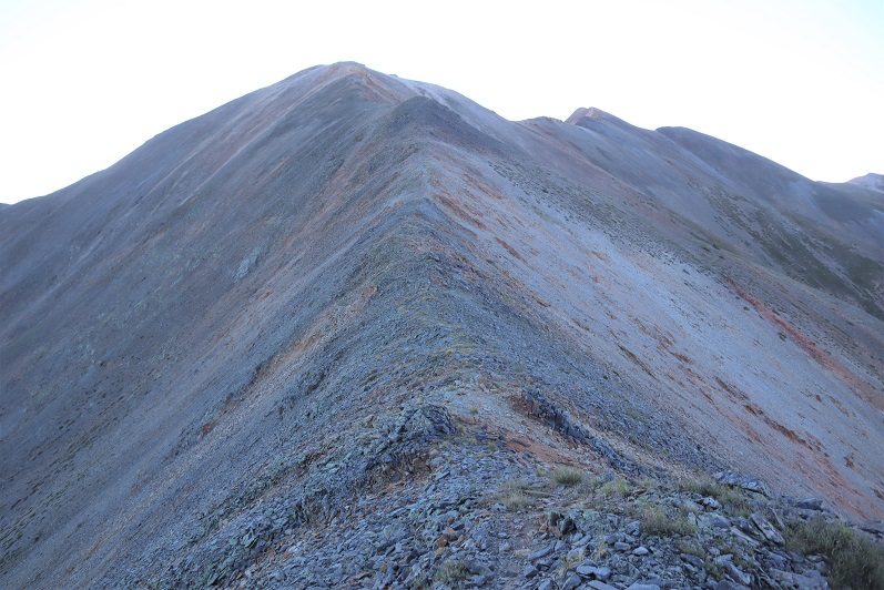
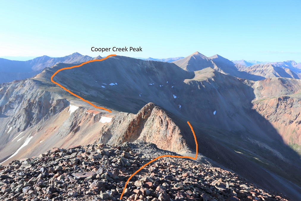
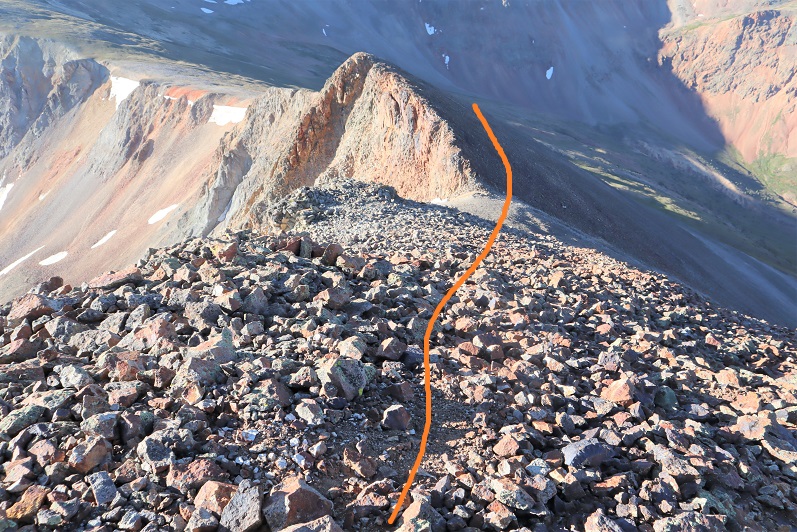
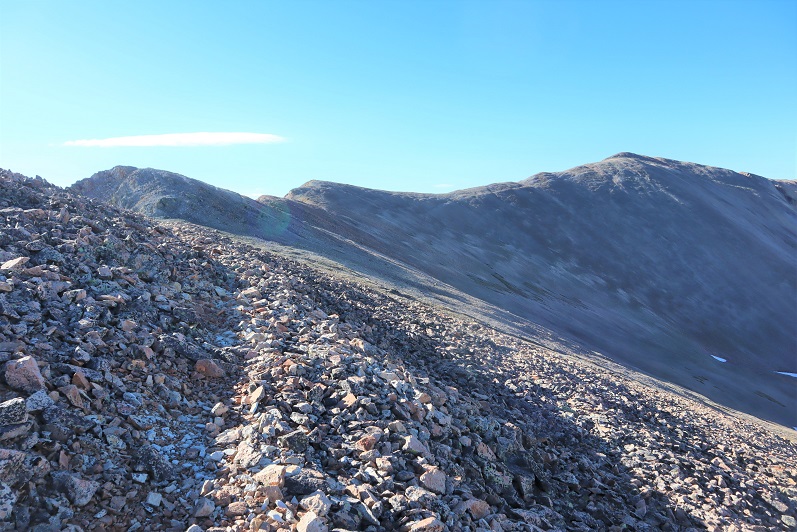
At the top of the gully I turned left, and followed the ridge southeast towards the summit

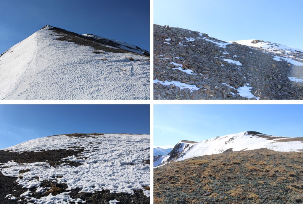
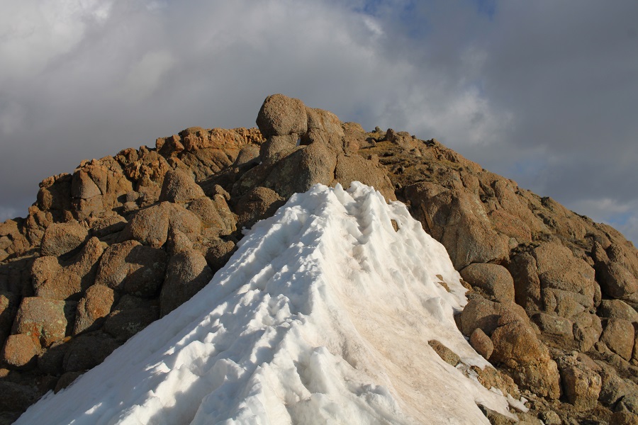
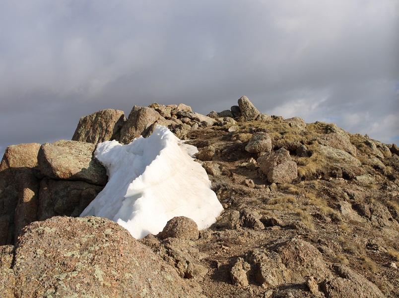
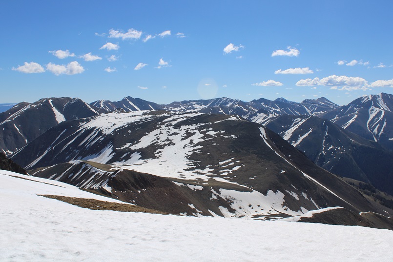
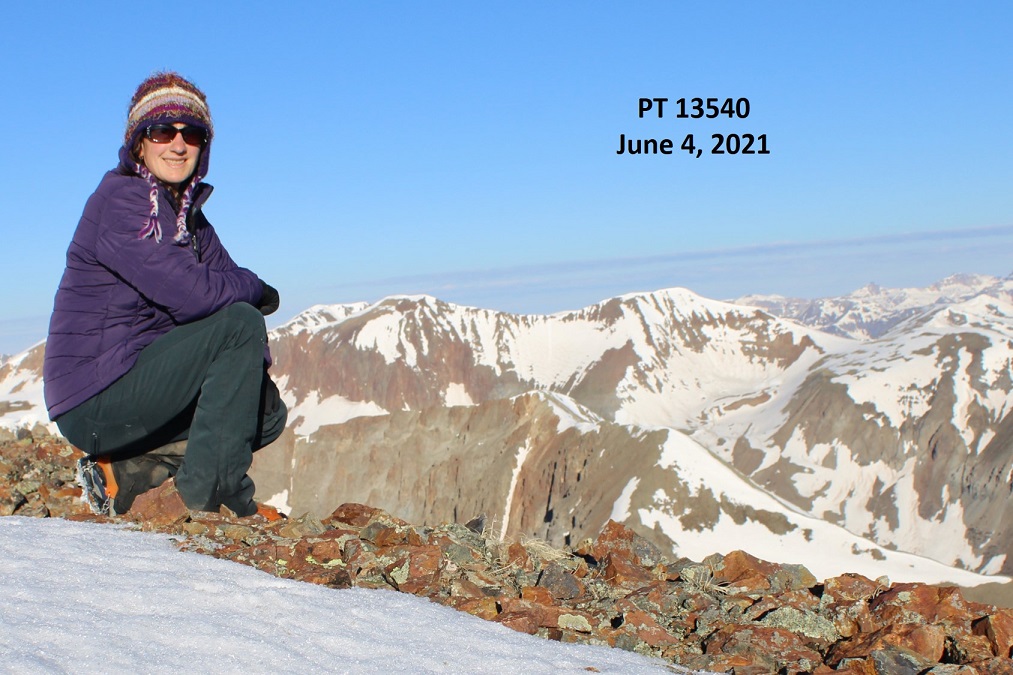
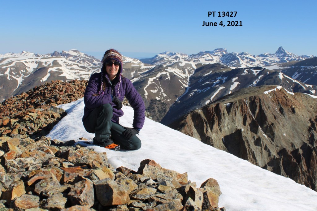
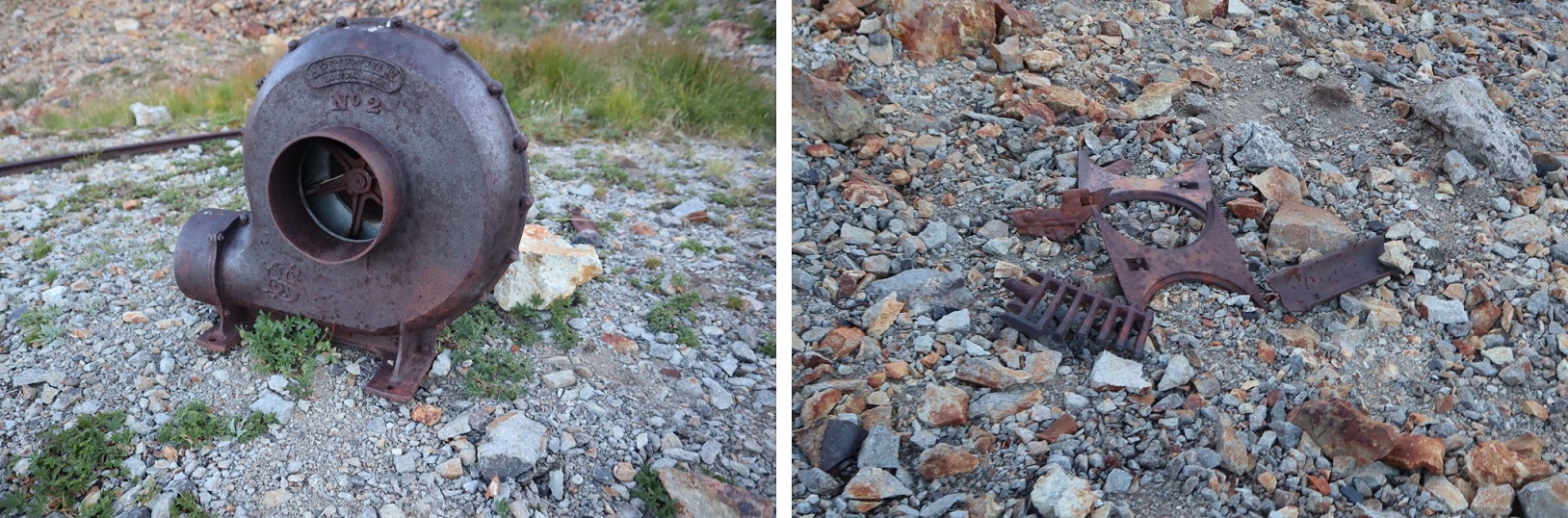
I summited Gudy Peak at 10:15am

Gudy Peak:

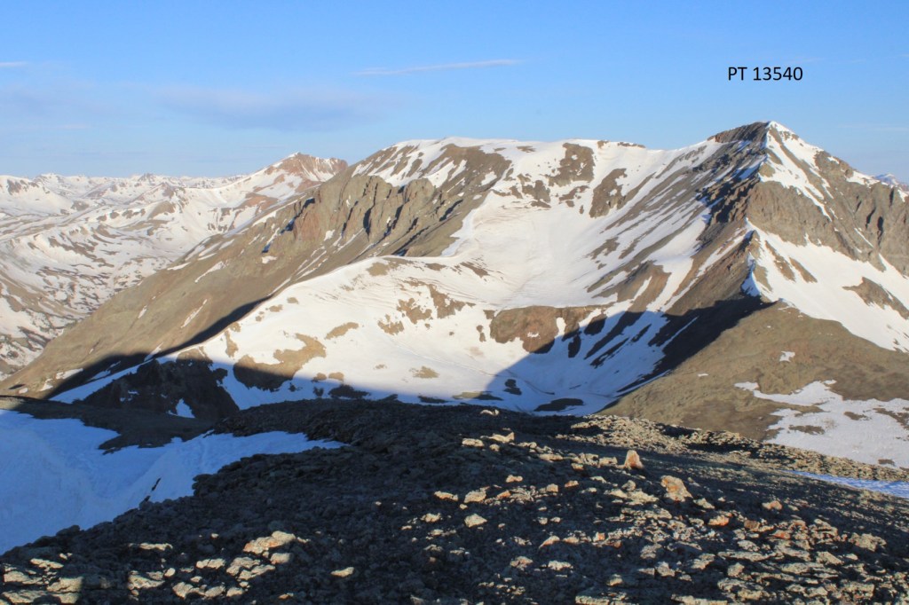
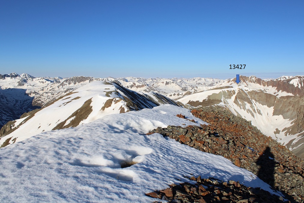
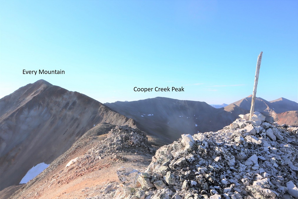
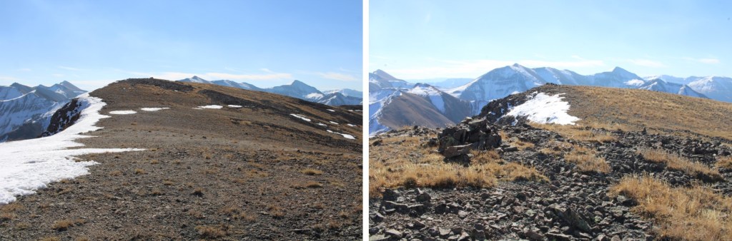
There were some great view of Uncompahgre, Wetterhorn, Matterhorn, Coxcomb, Redcliff, etc.

Now headed back, I retraced my steps back down the ridge

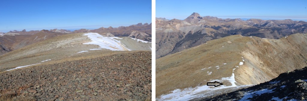
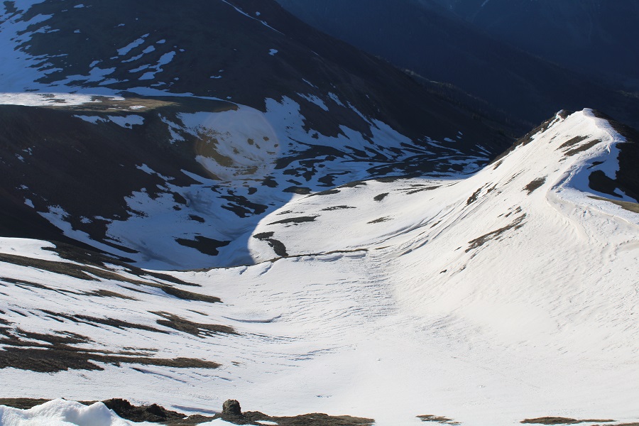
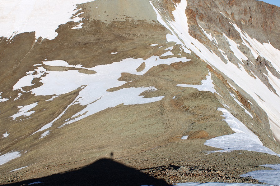
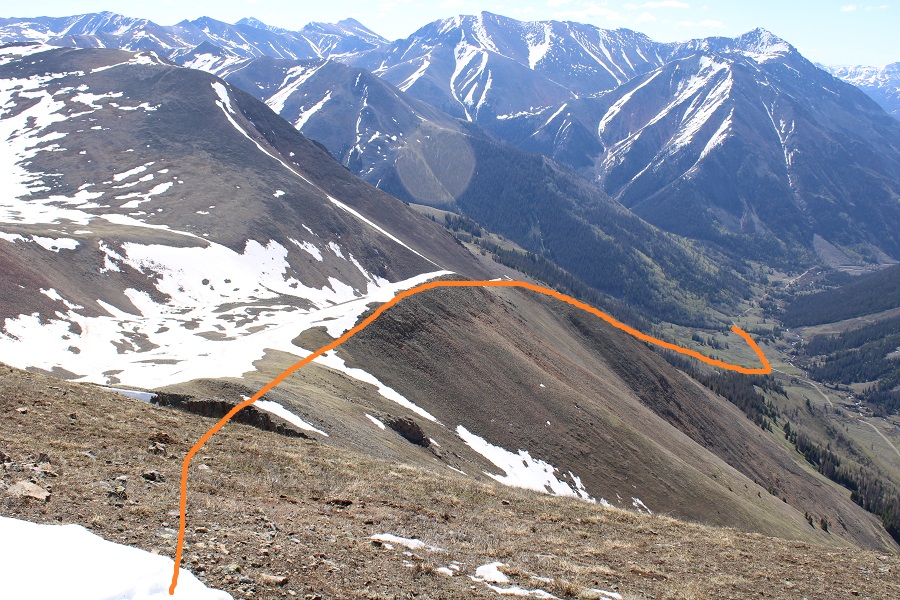
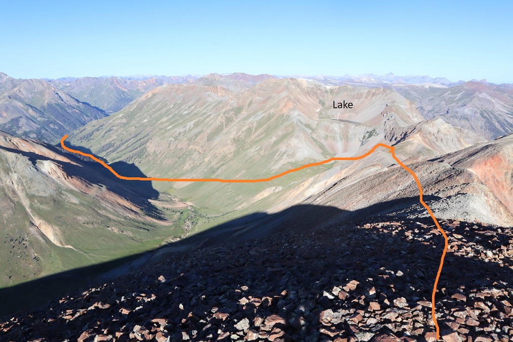
I put on my helmet and spikes for the gully, and headed east towards Cooper Lake.  Here’s an overall route out of the upper basin

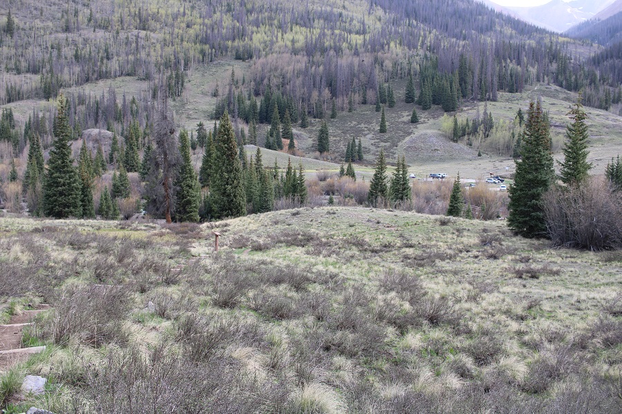
Back on trail, I followed it back to Cooper Creek

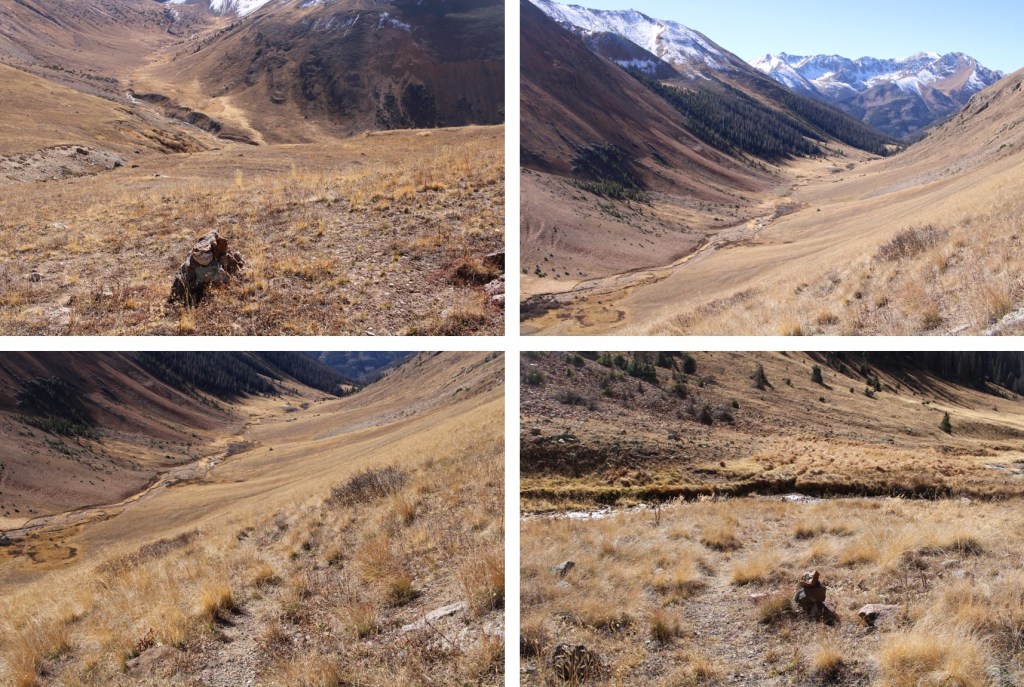
Then southeast back to the trailhead

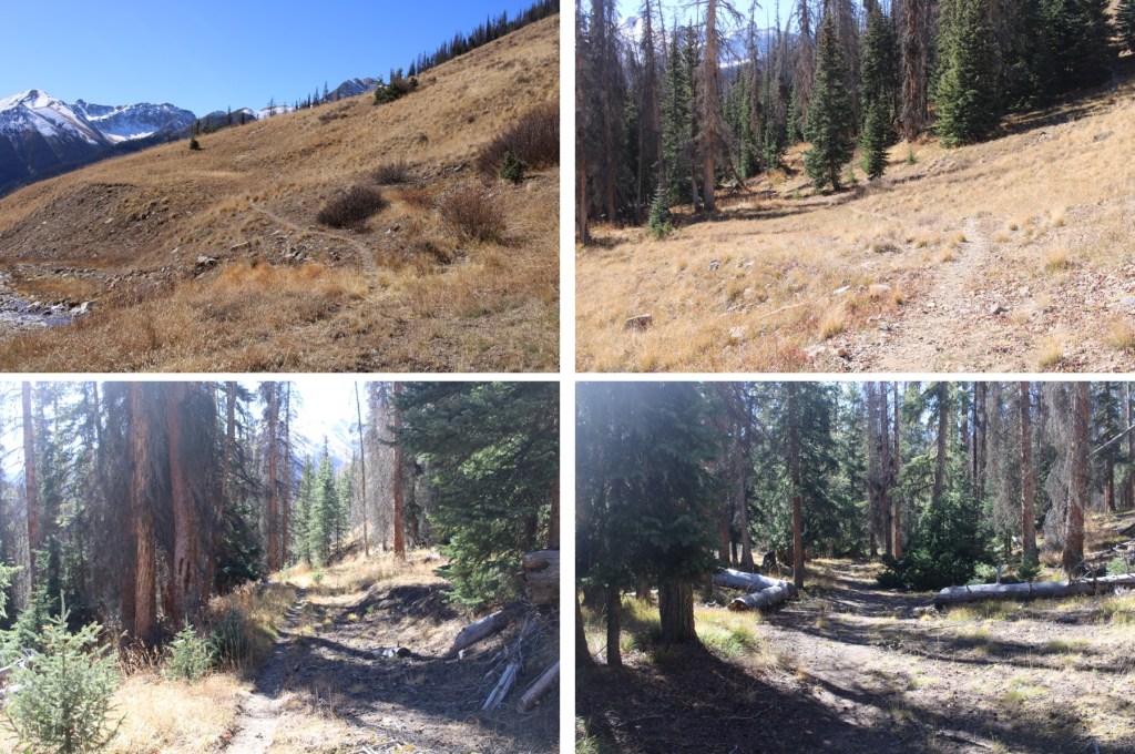
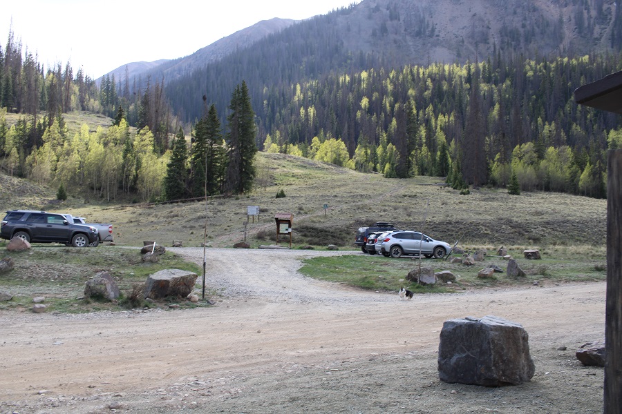
Back on the road, I turned left and followed it east back to my truck

I made it back to my truck at 12pm, making this a 10.27 mile hike with 3191’ of elevation gain in 5 hours. 

On to the next trailhead!

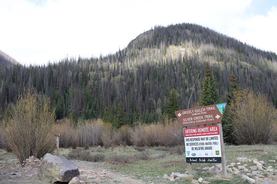
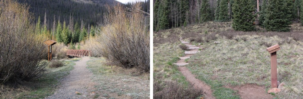
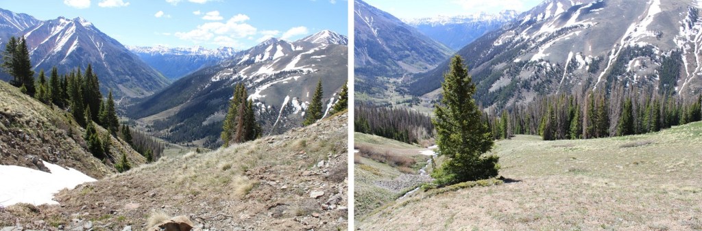
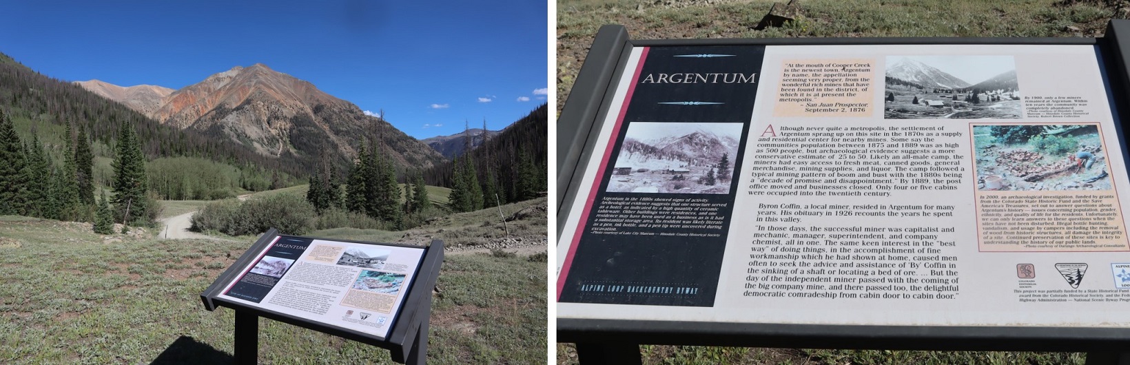
(Pictures of the area from late July of 2022)

Whitecross  Mountain – 13,542

RT Length: 7.45 miles

Elevation Gain: 3288’

Once again, just like with Sundog, I was staying near the Cooper Creek trailhead, to both give me added miles and also more peace and quiet.  I waved to my neighbors camping across the way, but they didn’t seem up for conversation.  No worries:  I put together a trip report and made it an early night.  I was on the trail at 4:30am. 

I made it to the Redcloud/Sunshine trailhead before 5am, and once again, it was bustling with hikers getting ready for their day.  Surprisingly, none of them made their way over to Handies Peak. I turned right, and took the Grizzly Gulch trail up into the basin.

There was an information board, a bridge to cross, and a register to sign.

If you’re reading this, I’m assuming you’ve already hiked Handies Peak and know the approach.  If not, it’s an easy, well maintained, class 1 trail to the basin.

At around 11860’ of elevation, I turned and left the trail.  It was just over a runnel crossing, and before a section of willows.   I headed northwest, up to the ridge of Whitecross. 

Here’s my overall route. Please note, the actual summit is hidden.

And some step-by-step photos.  Initially, I skirted the willows to the right

Then I found a large boulder, and skirted it to the left.  (It was the only boulder in a sea of tundra, and difficult to miss).

In times without snow, I’d just aim for the ridge.  However, there was a cornice lining the ridge, so I stayed under the snow.  This worked well.

The tundra was steep.  On the way down I’d use microspikes for tractions, but none was needed on the way up.  I kept aiming for the rock outcropping, careful to skirt the messy areas.

Once again, in a year without snow, it would be prudent to take the dotted line.  Today, I took the solid line up a side gully.

I was aiming for these three spires

The gully was a mix of tundra and scree

When I got to the top I turned left, and realized this had been a false summit. The true summit is just a little bit to the northwest.

I cursed myself for leaving my ice axe in the car.  I put on my microspikes, lowered my trekking pole to the size of an ice axe, and hoped the snow was solid.  It was!  I was able to easily make my way across.  Here’s my route:

I was lucky the snow was in perfect conditions:  A fall wouldn’t have been fun.

Once past this area, it was a quick walk to the summit

I summited Whitecross at 7:15am

Whitecross:

From the summit you could see Handies Peak, and the ridge. It was starting to snow lightly, and remembering the last time I was in the area, and got caught I several storms while climbing Handies Peak, I decided to head back. 

Here’s my route off the summit

The area with snow was sketchier on the way down than it had been on the way up, as there was a bit of downclimbing and a trust move involved.  Luckily, the snow was the perfect consistency.  My main concern would have been to have fallen through/postholed, but that didn’t happen this early in the morning. 

And now to head back down the gully

I kept my microspikes on for this part, and all the way until I made it back to the trail.  It was pretty straightforward.  Here’s my route:

When I made it to the trail I took off my microspikes as it started to snow a little harder.  I followed the trail back to the trailhead

I made it back to the trailhead, and followed the road back to my truck.

I made it back to my camping spot at 9am, making this a 7.45 mile hike with 3288’ of elevation gain in 4.5 hours.

On to the next trailhead!

“C.T.” Peak – 13,317

RT Length:  6.21 miles

Elevation Gain: 2925’

I’d been parked for a couple of days at Cooper Creek, dispersed camping and hiking.  I woke up to rain, so I decided to hit the snooze button on my alarm and just lie there in the bed of my truck and wait it out.  Within 15 minutes the rain stopped, and I was on my way.  This is a very straightforward hike, mostly above treeline, with little route finding (although there is some bushwhacking along Rock Creek).

I followed CR 30 for about a third of a mile, and then ascended Rock Creek, sticking to the right side of the creek

Just before making it to the basin, at after 1.5 miles and at around 11900’, I left the creek and started heading east, up the west ridge of the peak. 

While straightforward, this area was steep.  It started out with scree, then turned to rocks the size of microwaves, and then smaller rocks the size of softballs.  I just kept following the curve of the mountain as it climbed northeast.

Once I made it to the ridge, the elevation gain evened out.  I followed the ridge for .75 miles northeast, all the way to the end, to the summit.  95% of the snow was avoidable. 

I summited “C.T.” Peak at 6:15am

“C.T” Peak: 

There was a summit register.  It was still early, and it had been my intent to continue on to “Gudy Peak”, but the traverse was covered in snow, and I knew from yesterday’s hike how quickly the snow turned dangerous, so I opted to wait for it to thaw out and come back another time, knowing there’s be snow in the Cooper Lake Basin as well.  I turned and headed back the way I’d come.

Back down the ridge

Until I met up with Rock Creek and followed it back to CR 30

It was still really early in the morning, so I decided to spend some time investigating the avalanche site.  It looked recent (this winter?).  The house was scattered all over the area, with the roof several hundred feet from the closest level of the house (it looked like at least a 2-story house).  Beds were still made, but the fridge was empty, indicating the house had been closed up for the winter.  There were hiking boots in great condition, bed frames torn to pieces, propane tanks, wood burning stoves, and daily household items lying around, even a full bottle of laundry detergent.  There were camp chairs, still in good condition, folded and lying under fallen aspens next to what could have been a porch.

After abut a half hour of wandering around I made my way back to the road and followed it back to my truck.

I made it back to my truck at 8am, making this a 6.21 mile hike with 2925’ of elevation gain in 4.5 hours. 

Here’s a view of the ridge route from PT 13540

And a look up the ridge from the PT 13540 ridge

It was still early, so I decided to take a nap for a few hours.  I woke up, finished reading the book my daughter lent me, as well as a biography on Calamity Jane, and decided this finishing hikes early and just relaxing had its’ benefits.  I hiked around for a bit, started a campfire, sipped some whiskey, and thought how wonderful dispersed camping, and life in general, can be. 

PT 13540 and PT 13403

RT Length: 8.95 miles

Elevation Gain: 4206’

CR 30 has had some work:  the road was much nicer to drive than it was last year.  No more potholes!  At least the firsts 11 miles or so.  The last 5 were still a little rough.

I parked near Cooper Creek and settled in for some dispersed camping.  There was a storm rolling in I and I got to listen to the thunder roll as I ate dinner (Pho, which was awesome) and read a little.  After a while campers set up across the way.  I went over and talked with them:  It was a father and son duo from Alabama, road-tripping because the son had just finished college.  Very cool father/son time. 

I made it an early night, sleeping until my alarm went off at 3am.  I hit snooze and was on the trail by 4am.  The route starts out following CR 30 west for about a third of a mile, then I left the road and followed the drainage/Rock Creek northwest.

The area where you leave the road is also the site of a recent avalanche:  a house was destroyed, and there are pieces of the house, roof, furniture, shoes, etc. strewn about the area for about 100 yards.

I followed Rock Creek into the upper basin, staying to the left of the creek (but hugging the creek the entire way).

Once in the basin I followed it as it curved northwest.

There was a lot more snow here than I’d expected:  I put on my microspikes and climbed into the upper basin.

Once in the upper basin there was even more snow.  Microspikes were still ok at this time, but I knew I’d want to take a different route down, as the sun was going to warm up this snow quickly and there was no telling how deep I’d be postholing.  I aimed for the ridge, and once on the ridge, followed it west to a kind of saddle

At the saddle I turned right and followed the ridge northeast to the summit of 13540.

There was a class 2 rocky section to navigate.  I just went up and over this.

Here’s a look at the summit

I summited PT 13540 at 7am

PT 13540: 

Here’s a look back down at the upper and lower basins. 

My next objective was PT 13427

Here’s the route to get there

I turned and followed the ridge southeast.  Here are some step by step pictures

The area in the above picture, circled in red, is pictured below.  I skirted this to the right

Then followed the ridge, glad I’d put on my microspikes

Eventually I came to an area where I started losing elevation.  The snow was largely avoidable by sticking to the left on the ridge.  I was a little worried about that cornice in front of me however

I lost about 475’ of elevation to the saddle

Then started up the east slope.  This area was covered in scree, and quite steep. I kept eyeing the cornice, trying to find the best way to ascend.  While I had snowshoes, I didn’t have crampons, so my microspikes would have to do if it came down to it.  Here’s the path I chose to take to the summit, looking for a stable but accessible part of the cornice to climb.

When I got to the cornice, I was able to kick in steps with just my microspikes, although, lacking in forward facing spikes, they needed a little creative help from my ice axe at times. 

Towards the top I started postholing as the cornice leveled out, and had to slide on my belly the last few feet to make it to the tundra. Once over the cornice the summit was obvious, to the north

I summited PT 13427 at 8:30am

PT 13427:

Here’s a look back on PT 13540

It was still morning, but the snow was softening up quickly.  I wanted to get back over that cornice asap. I turned and headed back towards the cornice

It was easy to find my entry/exit point, as I could still see the marks from where I army crawled a few minutes ago.

I did the same thing again, facing the mountain and using the steps I’d kicked in earlier.  It was rapidly warming up:  the tip of the cornice was now steadily reedripping water.

Here’s a look at the ridge back up towards PT 13540

I slid down the scree and followed the ridge back. 

The snow was mostly avoidable until I made it to where the ridge kind of levels out for a while.  From then on it was posthole city

I knew there was no way I wanted to re-enter those basins, so I decided to take the southeast ridge down.  It parallels the basin, and while there was snow, a lot of it was avoidable.  Where it wasn’t I was postholing.  I had snowshoes, but was too stubborn to put them on.  Here’s the overall route out

And step by step, first down the ridge

Then following Rock Creek back to CR 30

Here’s a picture looking up the ridge (in case you want to take the ridge up)

I came to the avalanche area, and it was then I realized a house had recently been destroyed (more on this in my next trip report on “C.T.” Peak). 

I made it back to the road and followed it back to my truck

I made it back to my truck at 11:15am, making this an 8.95 mile hike with 4206’ of elevation gain in 7 hours, 15 minutes.

For reference, here’s a look at my route up to PT 13540 (solid line) and down (dotted line), as seen from the west ridge of “C.T” Peak.

It was still early:  I’d initially intended to add “C.T” Peak on today as well, but didn’t want to re-enter the basin with the way the snow was warming up, so I switched my plans and was going to do that peak tomorrow.  Instead, I got out a book my daughter just finished reading and was eager for me to read as well so we could discuss it together.  I walked around Argentum, found some old structures hidden way up in the hills behind my campsite, relaxed, and sipped whiskey.  Dinner was a block of white cheddar cheese and some bacon.  I had new neighbors, so I welcomed them, and then made it an early night.  It rained.

Every Mountain – 13691 & Cooper Creek Peak – 13694

1

RT Length: 12.93 miles

Elevation Gain:  3987’


The Cooper Creek Trailhead is located about a mile past the Silver Creek/Grizzly Gulch trailhead on 30 past Lake City.  There were cars parked and camping at the trailhead, so I parked at a dispersed camping spot right next to Cooper Creek.

2

It was still early so I decided to take a look around.  The Cooper Creek Trailhead is located in the historic town/settlement of Argentum, and there were still some old structures in the area.

3

4

It was an uneventful night.  I slept soundly until midnight, when campers at the spot across from me returned from their outing.  They weren’t loud, but they did wake me up.  I went back to bed and didn’t wake up again until my alarm went off.  I was on the trail at 5am.  The Cooper Creek Trailhead is just to the west of Cooper Creek, visible from the road.

5

The trail is class 1 for the first 3 miles, and seems to follow an old mining road.

6

After hiking for 1.5 miles the trail crosses Cooper Creek, just where an overturned trailer sits in the water.  It looks like it’s been there for a long time.

7

The trail continues to follow the creek up to the basin, passing a fresh avalanche area (there was still snow under the trees, but there was a clear path to follow)

8

After 3 miles of hiking along this class 1 trail it abruptly stopped.  I crossed the creek and headed northeast along the mountainside, eventually picking up another class 1 trail (I’m not sure where it had started, as I crossed the creek at a couple of cairns and must have missed the trail)

9

The trail eventually leads to a lake in the upper basin (going left), but I didn’t follow it that far.  Instead I crossed Cooper Creek one more time and headed towards an old mine to check it out.  If you don’t want to check out the mine, here’s the overall route to gain the ridge.

10

The creek crossing was simple

11

The mine was filled in, but there were some pieces of equipment lying around.

12

I turned around and noticed 2 tents set up along the trail that leads to the lake and a couple other 13ers in the area.  It was just starting to get light so I decided to be quiet as I gained the ridge.  Eventually I found a trail here that led to the ridge as well (it actually goes up and over and down into the basin on the other side of the ridge)

13

Once I gained the ridge I turned right (east) and followed the ridge towards a false summit.

14

15

16

After reaching the false summit it was a half mile hike along the ridge to the actual summit. This was class 2, with no real obstacles to overcome.

17

18

19

20

I made it to the summit of Every Mountain at 7:55am

21

“Every Mountain”

Here’s a look back at my route in

22

Here’s a look at the route over to Cooper Creek Peak

23

This was another easy class 2 ridge hike without any difficult obstacles.  At times there is even a trail.  Actually, there are quite a few game trails here.

24

25

26

27

28

I summited Cooper Creek Peak at 8:50am. It was very, very windy.

29

“Cooper Creek Peak”

Because it was windy it was also cold, so I didn’t stay long on the summit. Instead I headed back down to the Every Mountain/Cooper Creek Peak saddle and from there down into the basin

30

Here’s the overall route

31

I hiked down the grassy slope, aiming for the creek.   I then crossed the creek and stayed a little high to avoid the muddy areas

32

The creek didn’t look like it had water fit for filtering

33

Still, I followed it back to the trail

34

Here’s a look back at my way down the basin

35

And the route back on the class 1 trail

36

37

Back across the creek

38

And back to the trailhead.  On my way out I noticed a trail register I hadn’t seen on my way in

39

40

I made it back to my truck at 11:10am, making this a 12.93 mile hike with 3987’ of elevation gain in 6 hours, 10 minutes.  Here’s a topo map of my route:

41

It was still early and I wasn’t yet tired, so I decided to drive to the next trailhead and get in a few more peaks for the day…