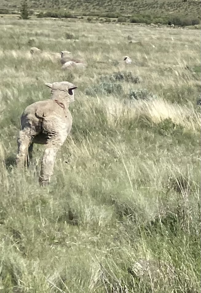
I drove to the Eddiesville trailhead the night before, hoping to get a good look at current conditions in the mountains. On the way in I saw an old, 1980s brown Tacoma parked on the side of the road, and a man sitting on a rock, watching a herd of sheep. All the sheep were facing the opposite way (I’ve become a pro at animal butt shots at this point).
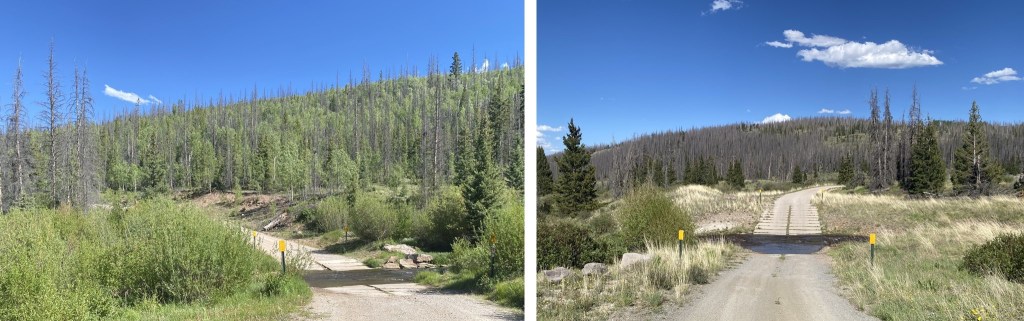
Both creek crossings were manageable, and all the downed trees had been cleared off the dirt road.
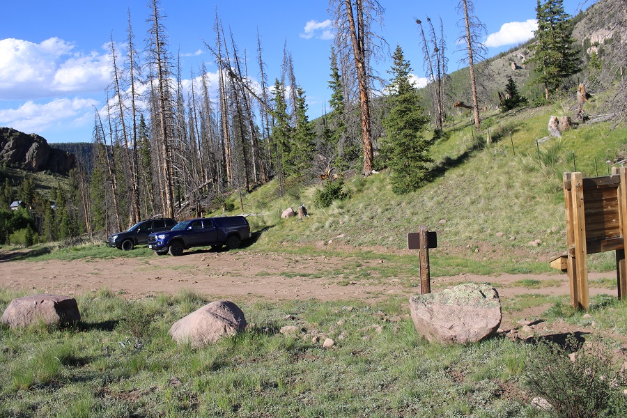
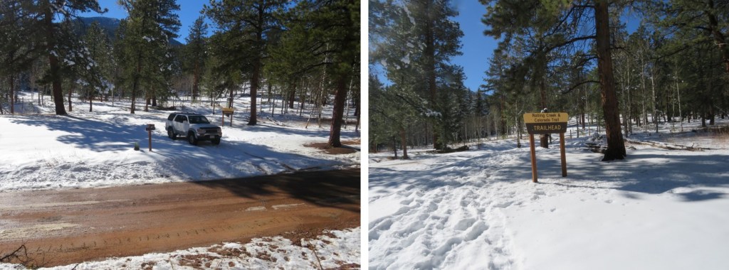
There was only one other vehicle in the parking area, which fits about 10 vehicles if everyone parks nicely. No mosquitoes, but tons of flies (they didn’t bite, they were just annoying).
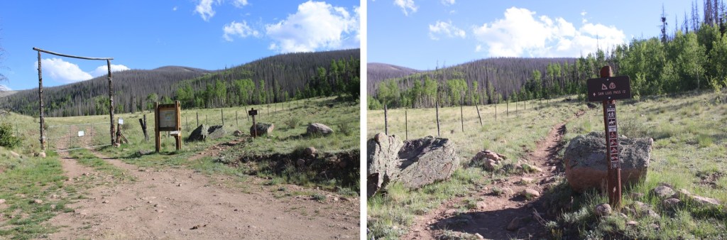
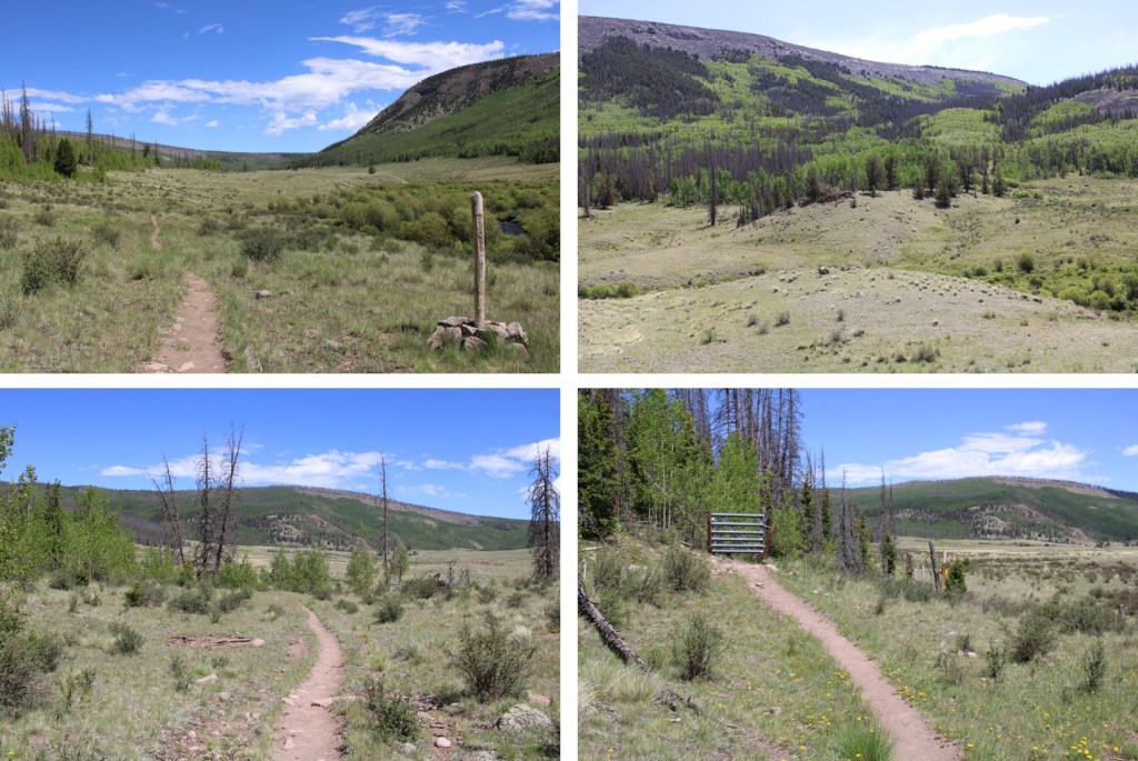
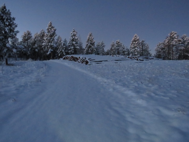
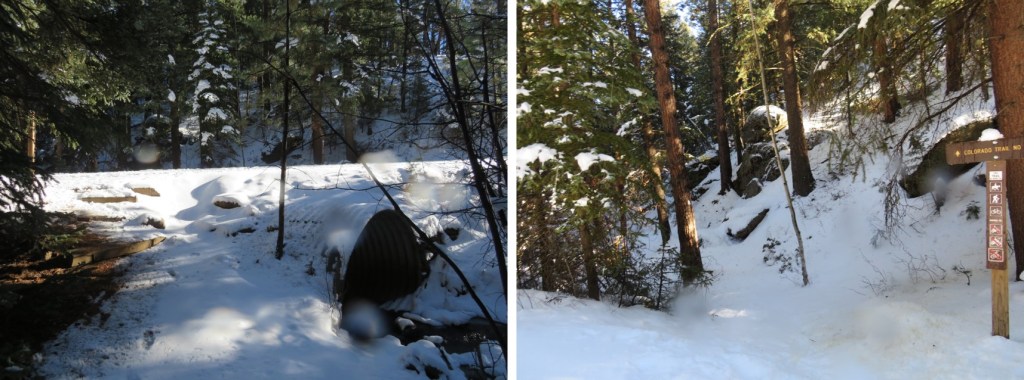
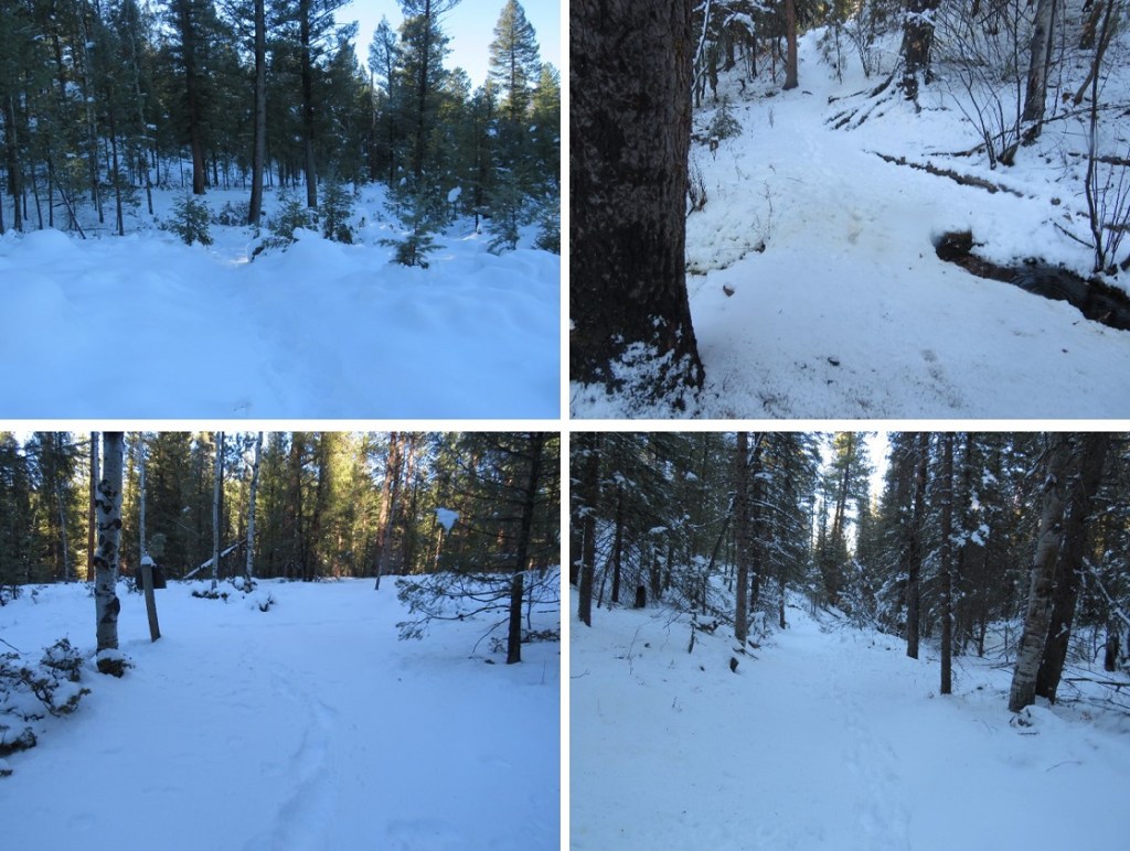
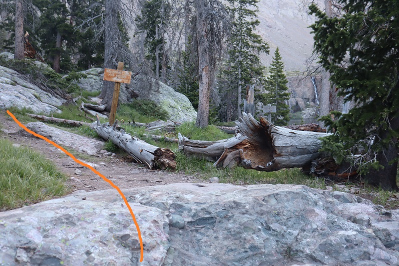
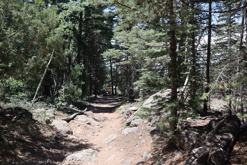
I threw 3 socks full of moth balls under my truck, wondering where the 4th one went (maybe a marmot absconded with it?) and went to bed. I was on the trail at 4am. The trail starts at the south end of the parking area, and follows the Colorado Trail.
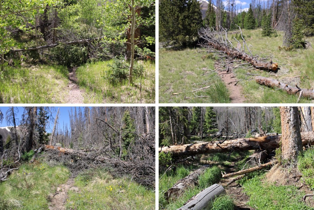
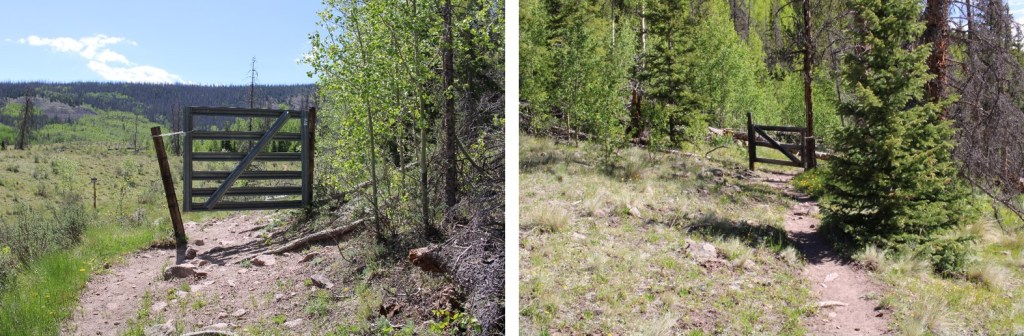
I followed the Colorado Trail for 8.25 miles, all the way to the San Luis Peak/13166 saddle. This was a very well-marked trail, which made it difficult to get lost. Also, there weren’t many trail intersections, also making it easy not to get lost. I crossed several small creeks and downed trees on my way, and passed through two gates (latched, not locked).
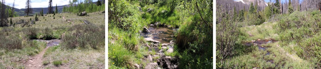
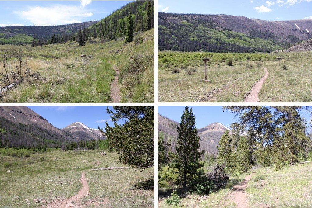
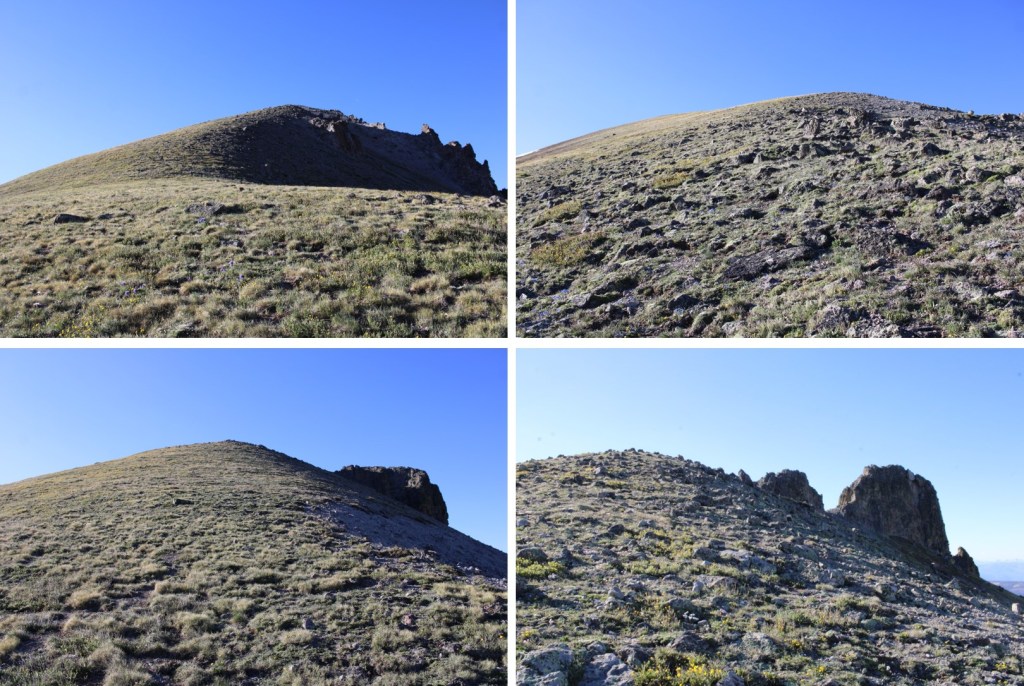
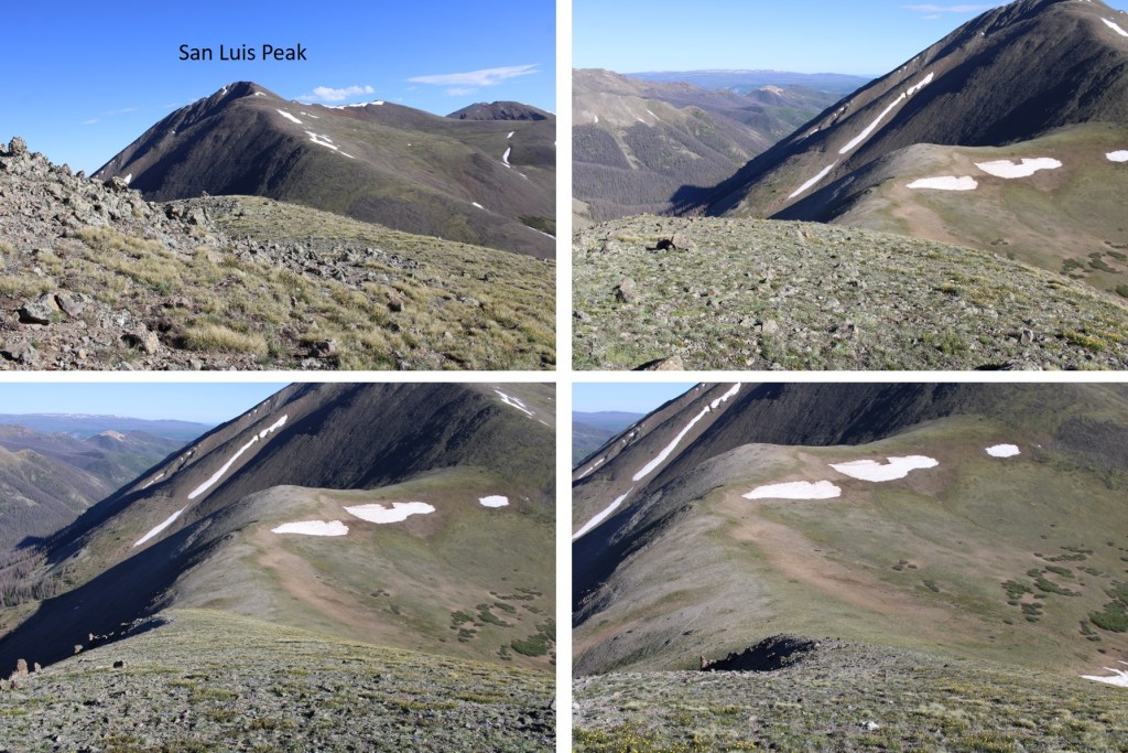
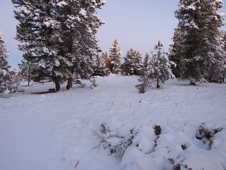
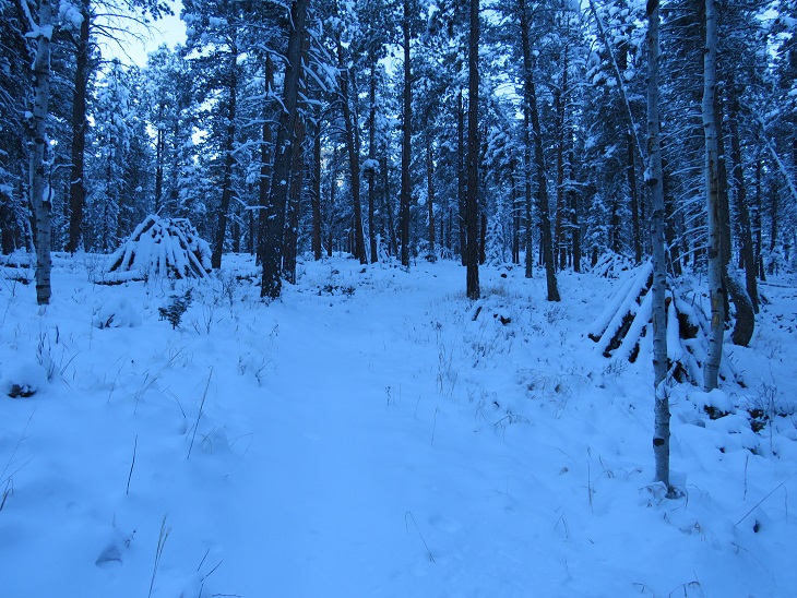
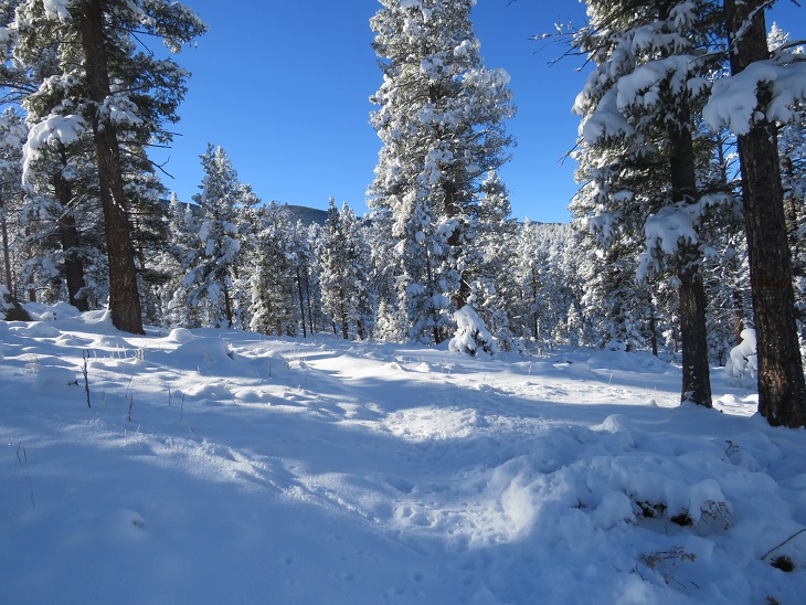
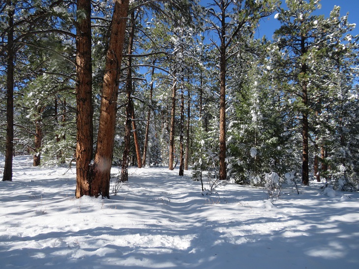
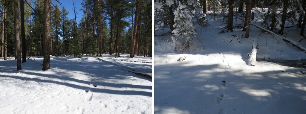
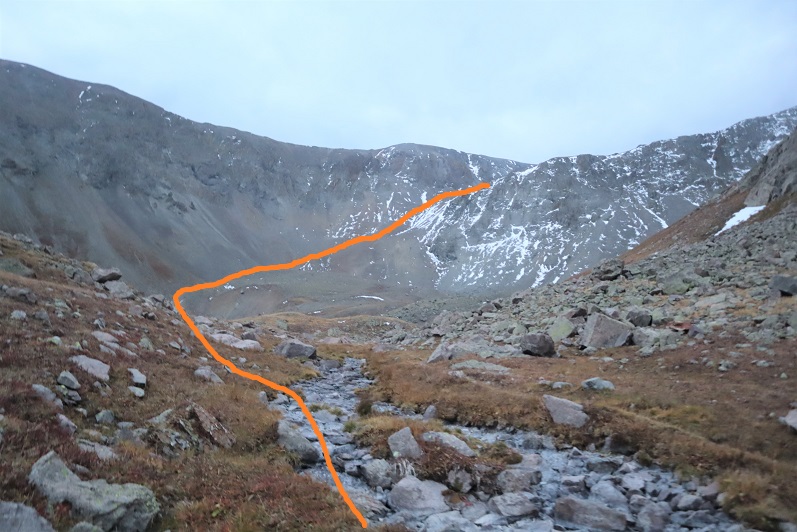
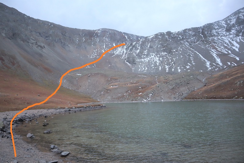
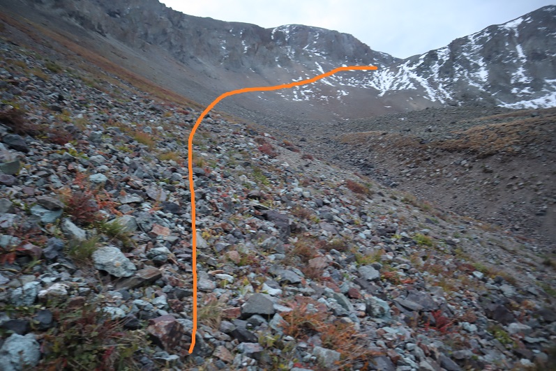
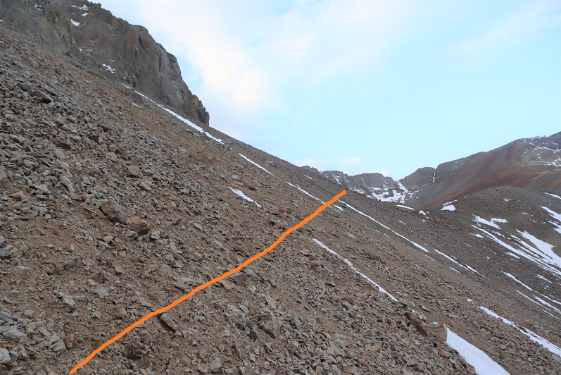
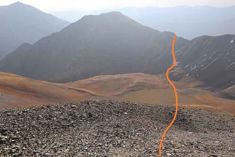
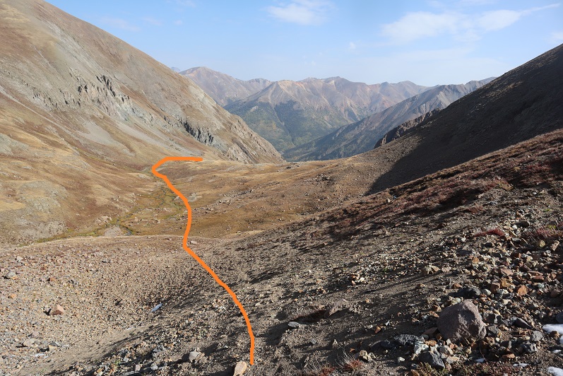
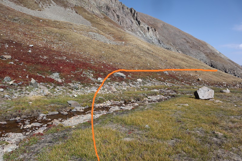
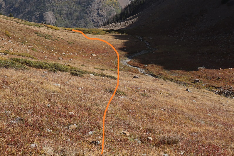
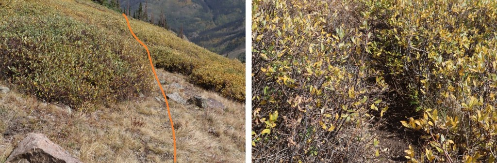
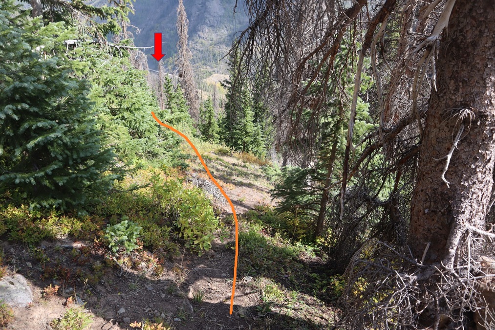
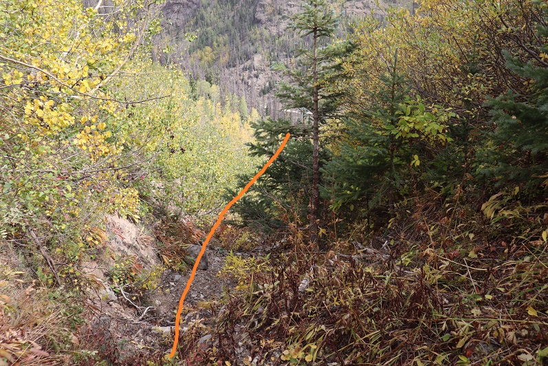
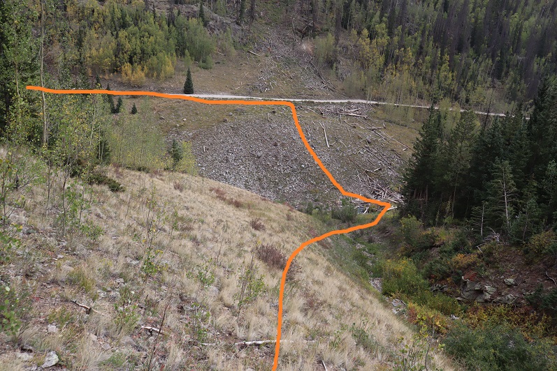
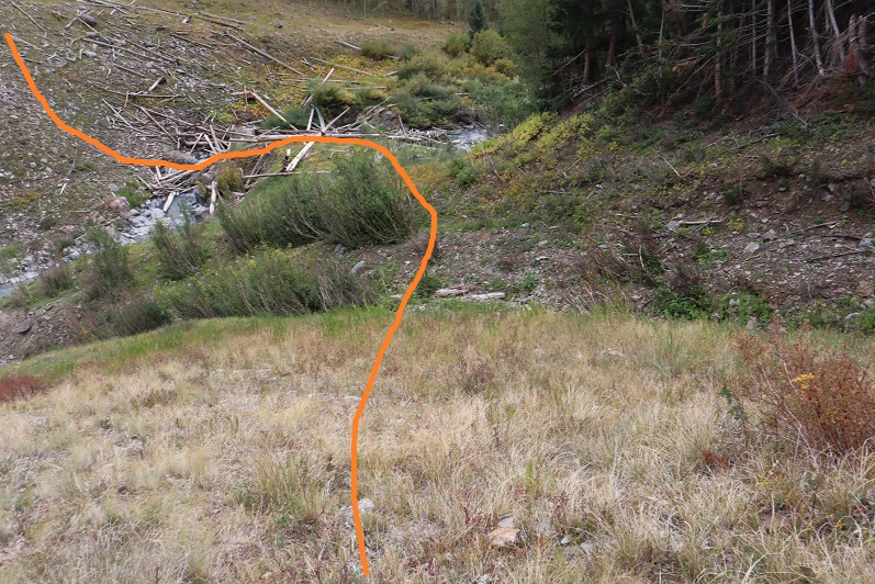
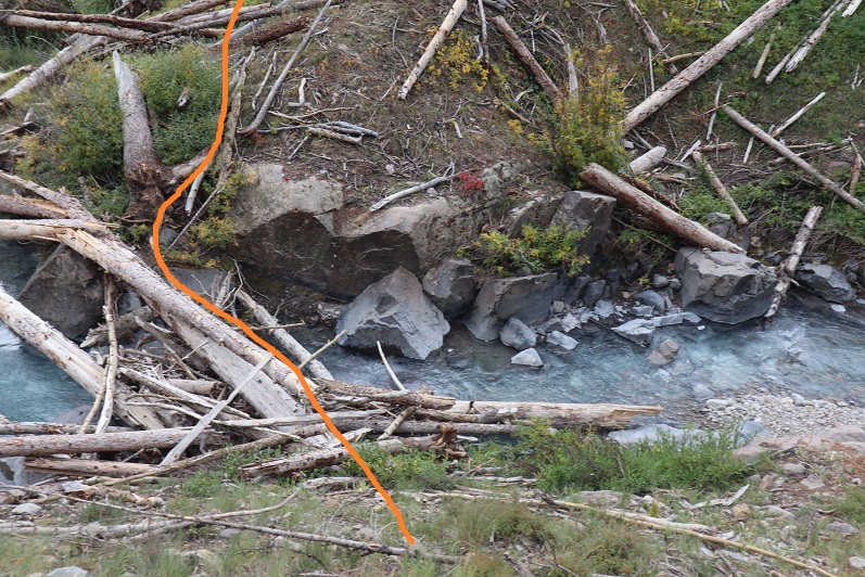
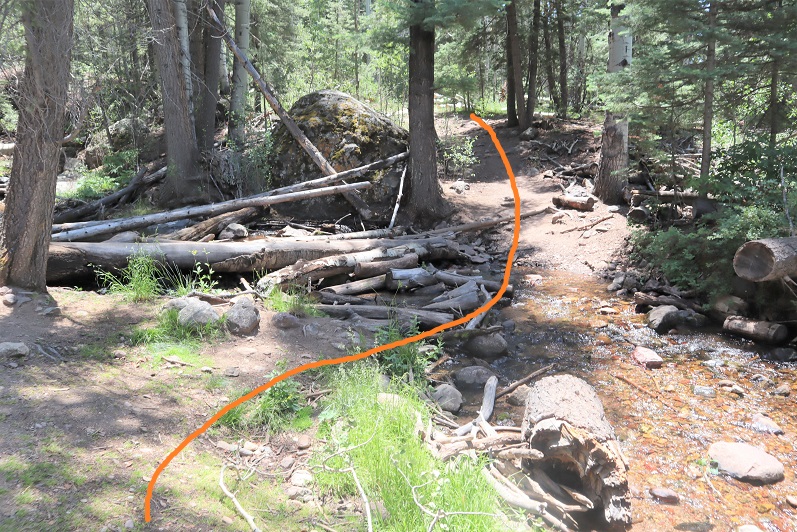
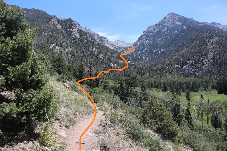
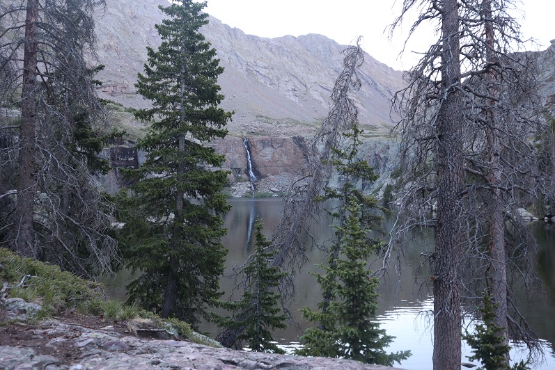
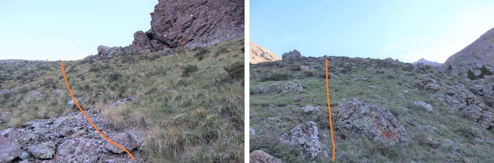
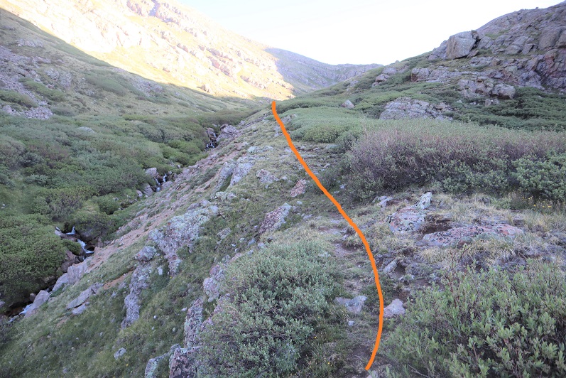
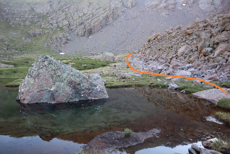
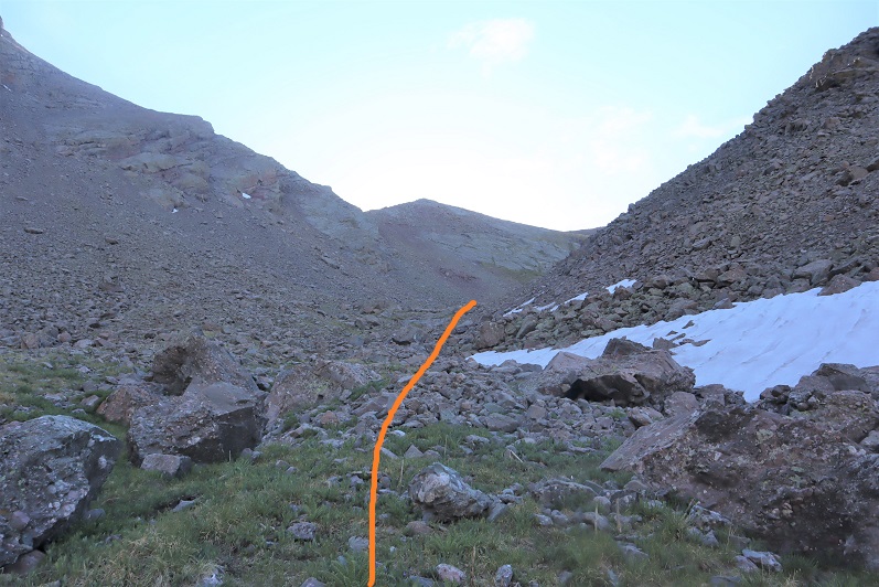
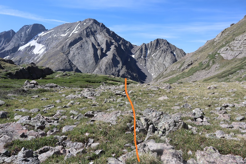
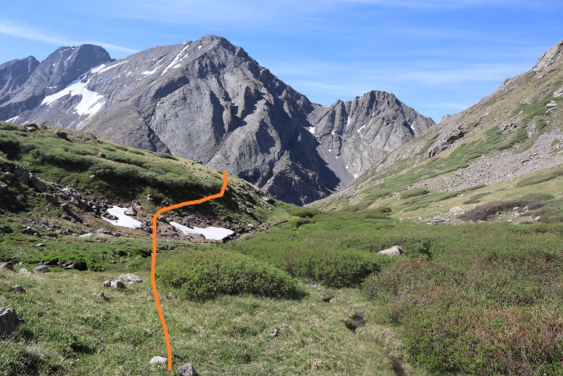
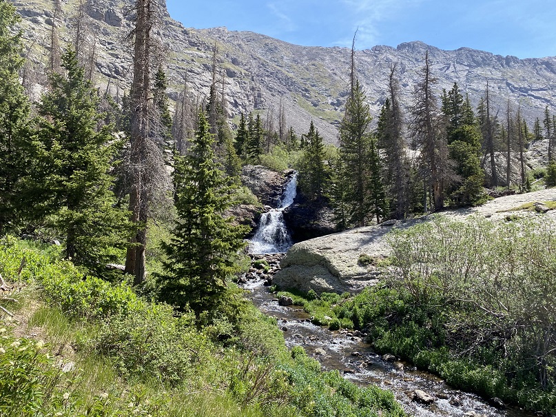
Here are some pictures of the terrain, which followed Cochetopa creek up the basin.
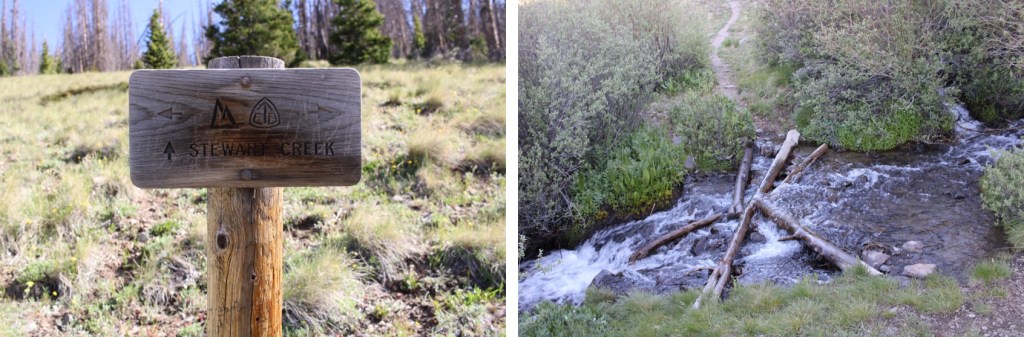
After hiking for 7 miles, I crossed Stewart Creek
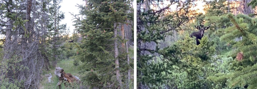
and saw a moose. I have him his space, even though he was directly on the trail.
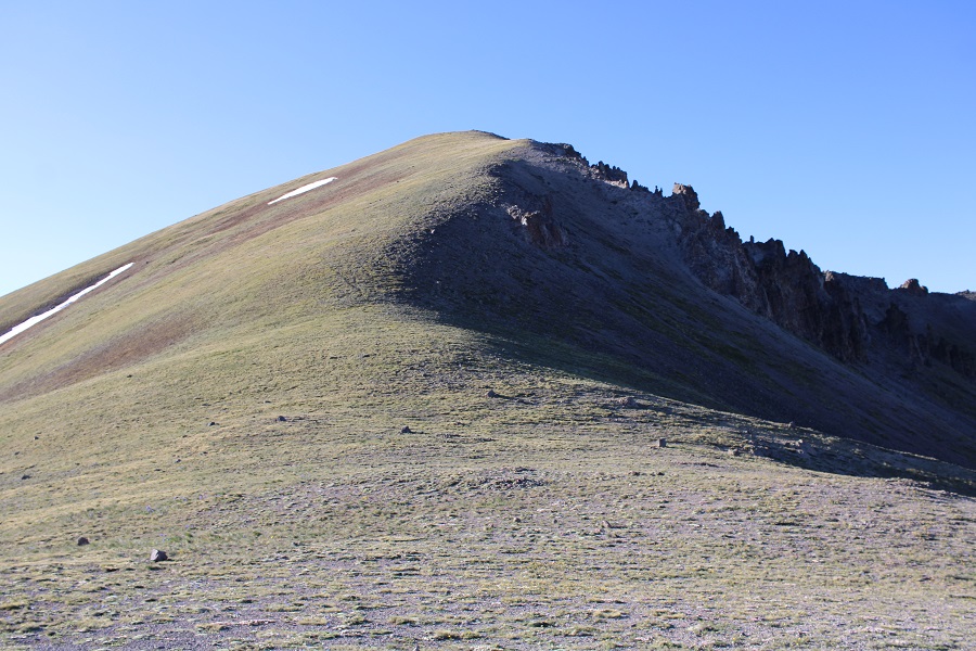
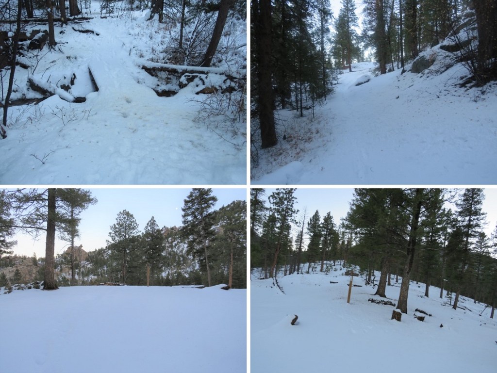
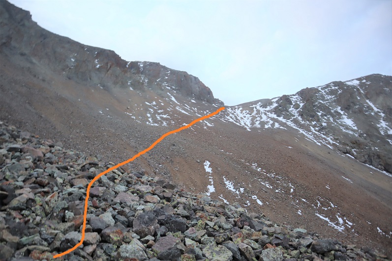
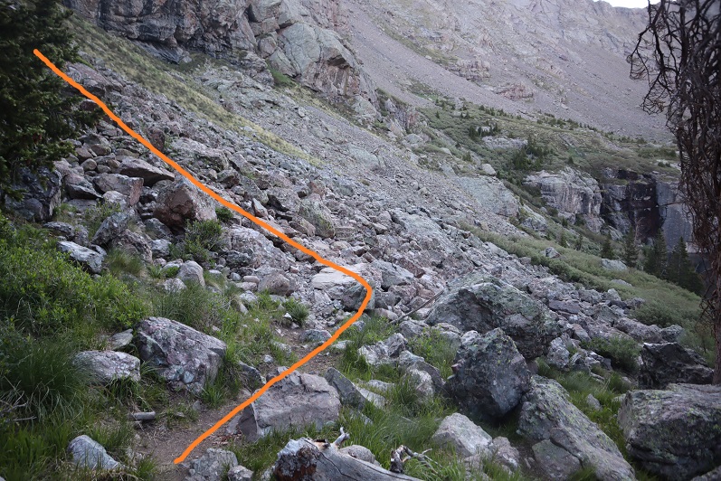
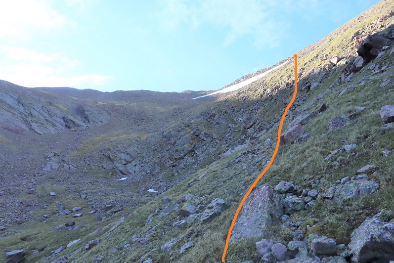
I was now above treeline, and could see the 13166/San Luis Peak saddle.
The Colorado Trail nicely brought me there.
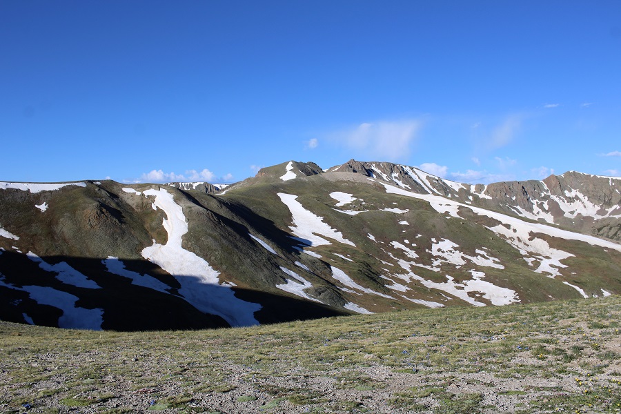
For those of you looking for the current conditions for San Luis pass, here they are. Still areas of snow on the trail, but passable.
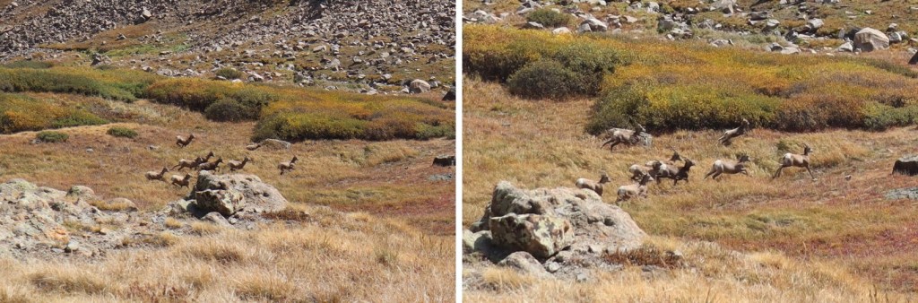
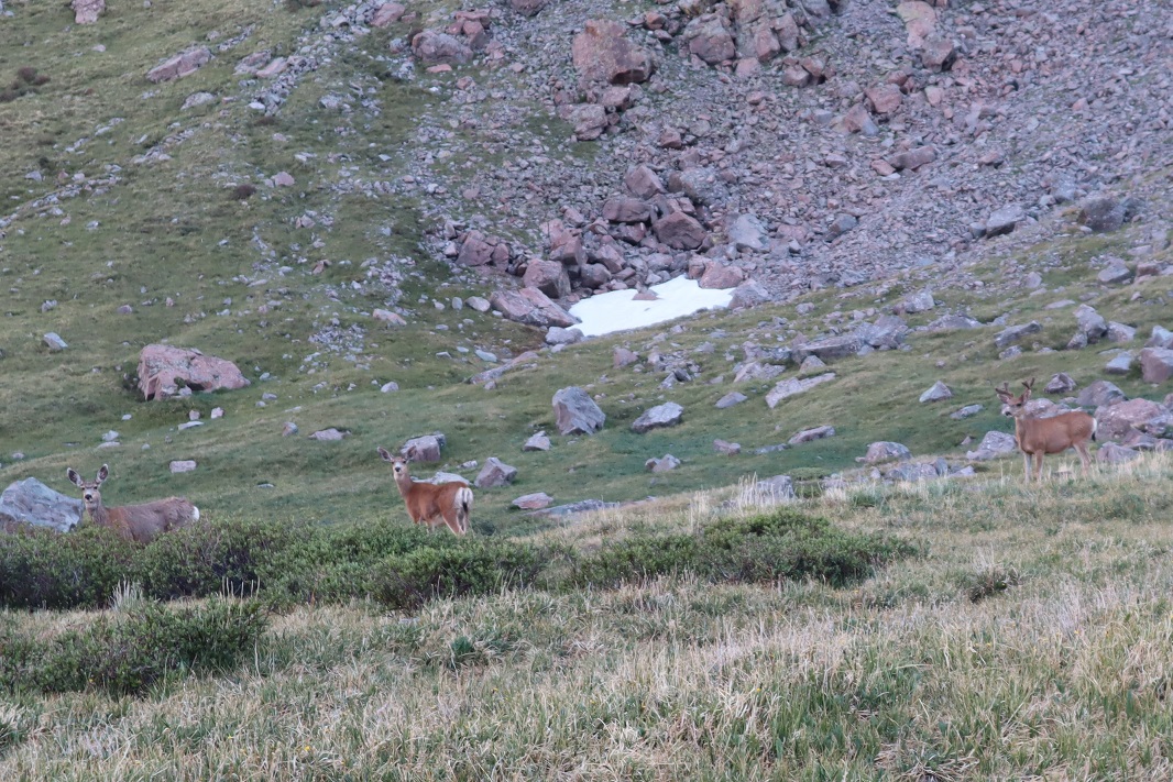
At the saddle, I disturbed a small herd of deer.
Deer:
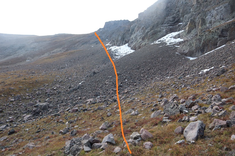
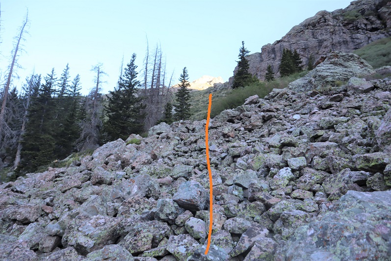
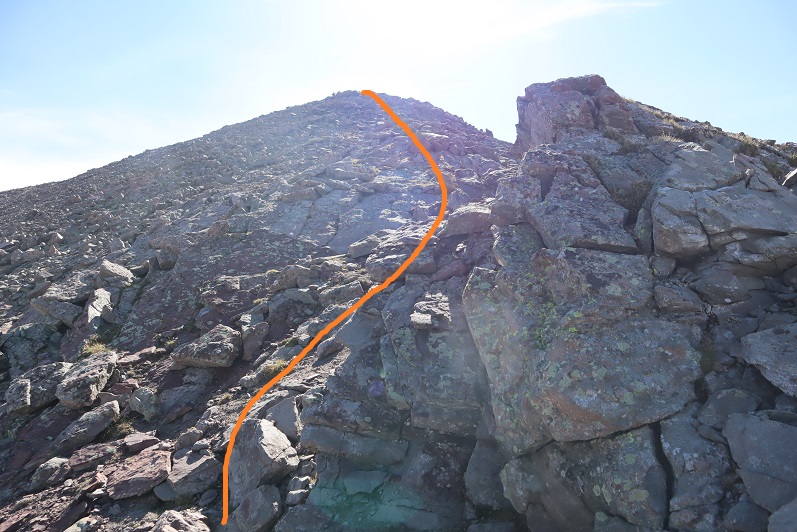
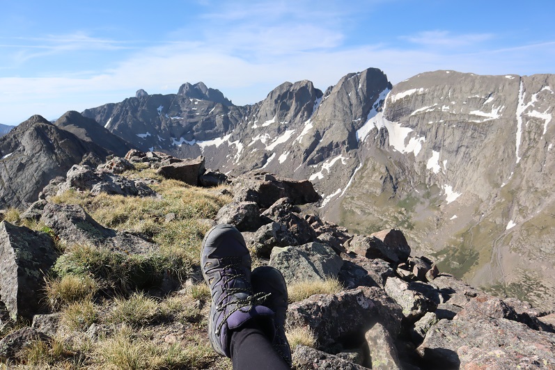
From the saddle, I turned left and headed southeast, gaining 525 feet of elevation towards the summit. This was easy tundra to navigate.
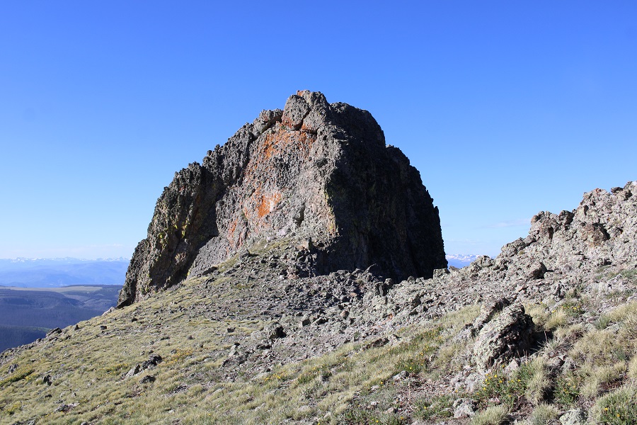
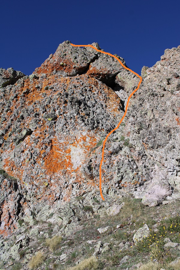
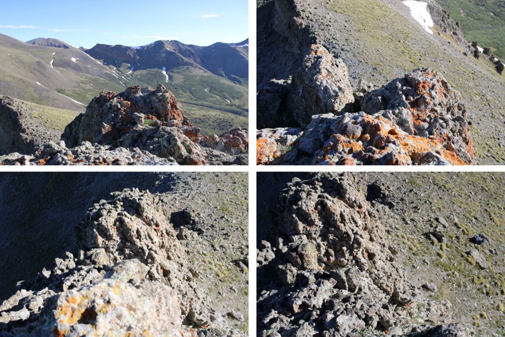
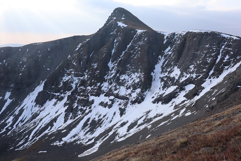
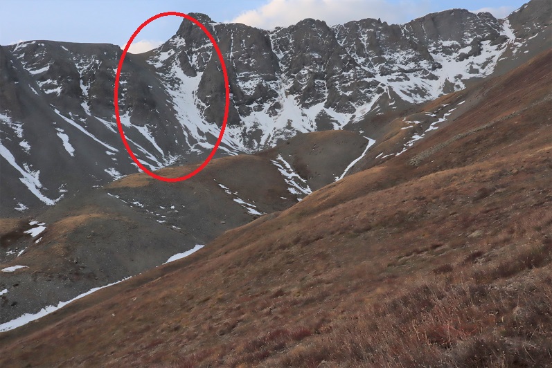
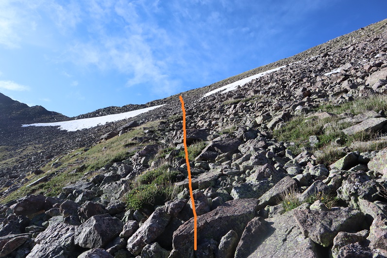
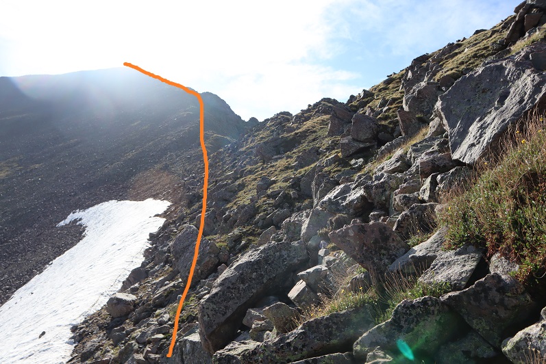
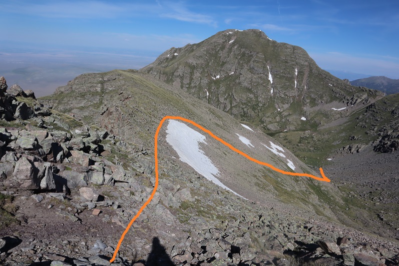
Until I saw this. Hmmm… I was going to have to go and investigate. I headed to the east side of the formation, dropped all my gear except my camera, and headed up. Sorry, no helmet, as I wasn’t aware this was more than a class 2 hike.
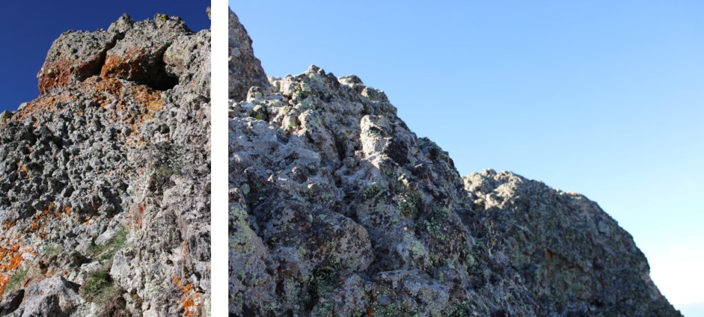
This was easier than it initially looked, nothing worse than rainbow climbing at the gym. The rock was all grippy, sturdy, and had lots of hand/footholds. The rock was solid, like in the Crestones, but with more and larger hand holds. I’d call this 30 feet of vertical climbing exposed class 3.
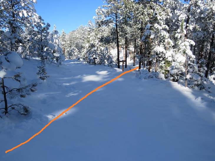
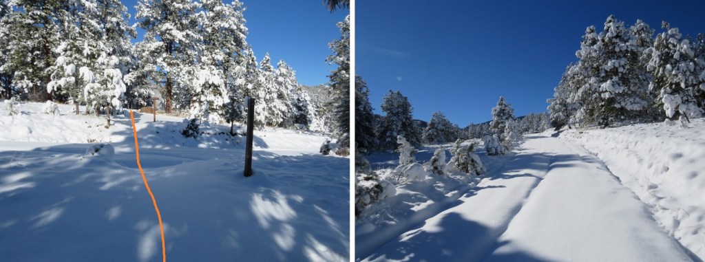
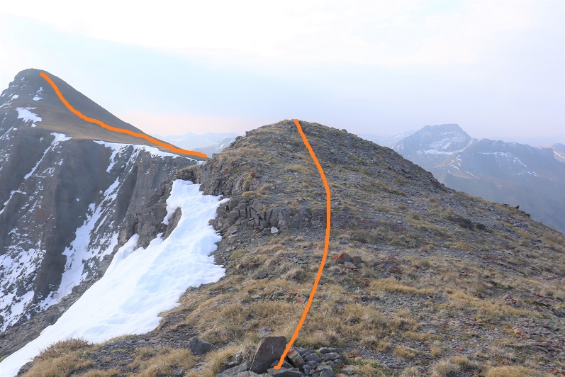
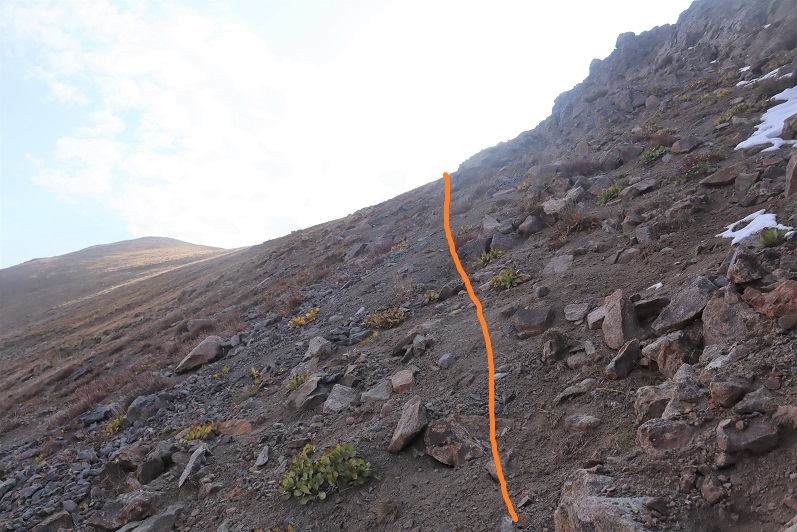
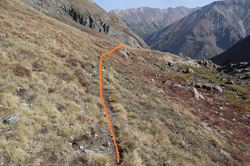
Here’s the route I took up, following the orange rock to the ridge, turning left, and crawling on hands and knees to the summit because it was windy (and exposed, and I didn’t have a helmet, etc.).
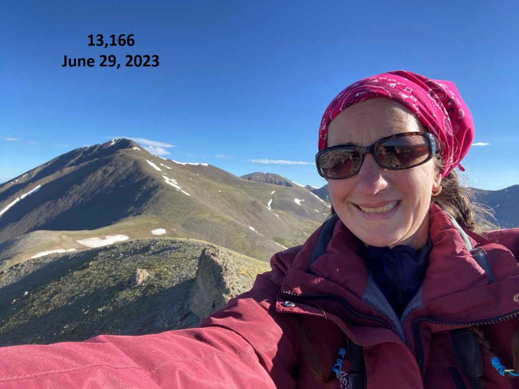
I summited 13,166 at 8am
13166:
Now to head back down. I actually just did this feet first, no need to turn and face the wall. There are plenty of hand and foot placements to use for support.
Back on firm ground, I grabbed my gear, and headed back to the saddle.
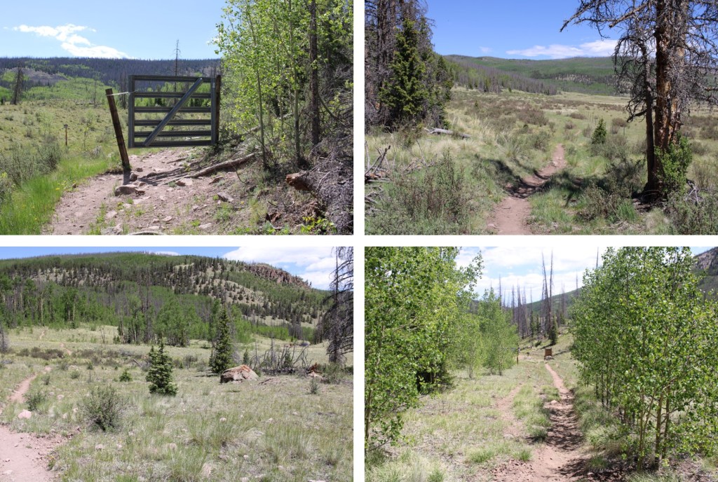
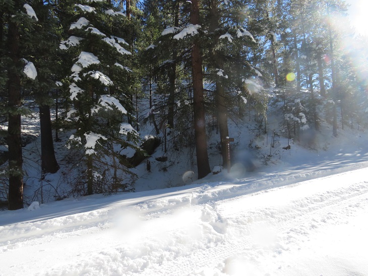
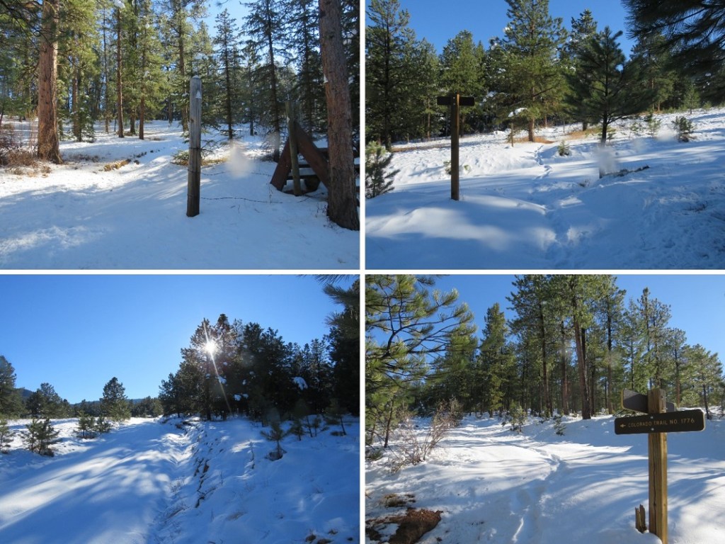
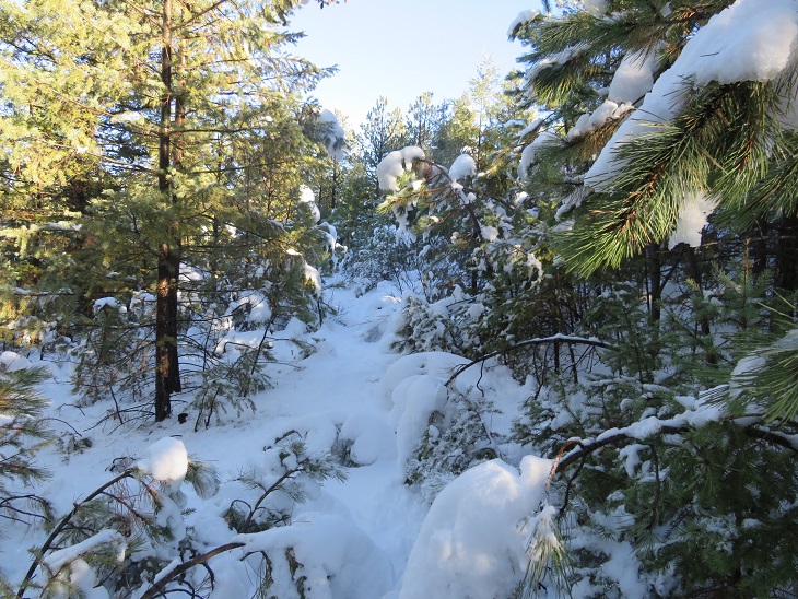
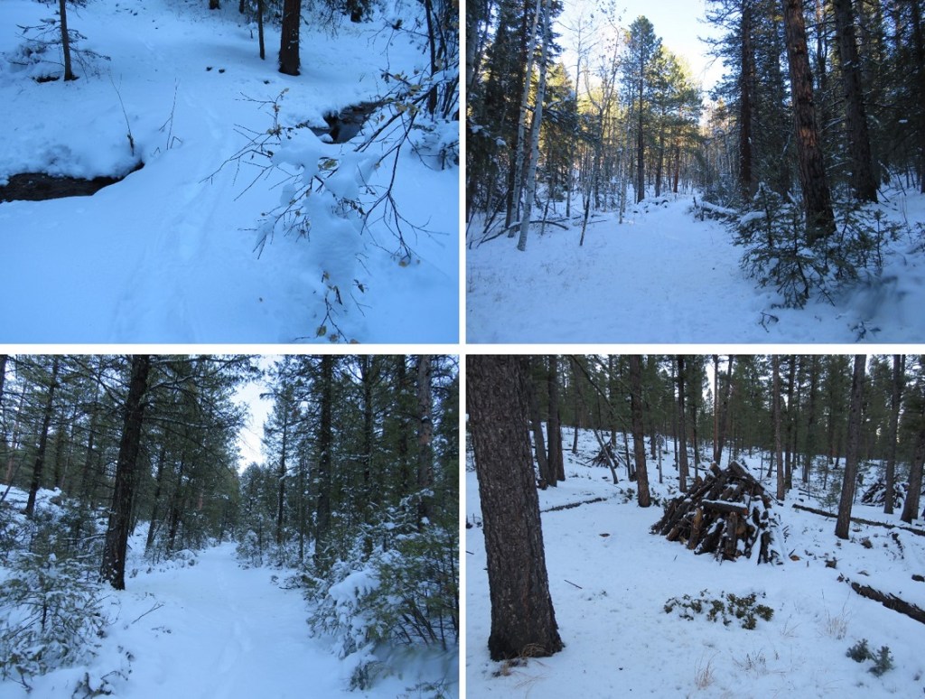
Back on the Colorado Trail, I followed it back to the trailhead
Oh, and I saw another moose. This one was curious, and kept walking towards me, so I didn’t stay long.
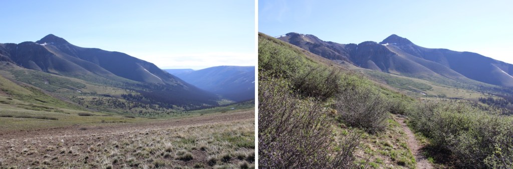
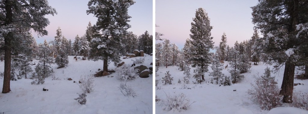
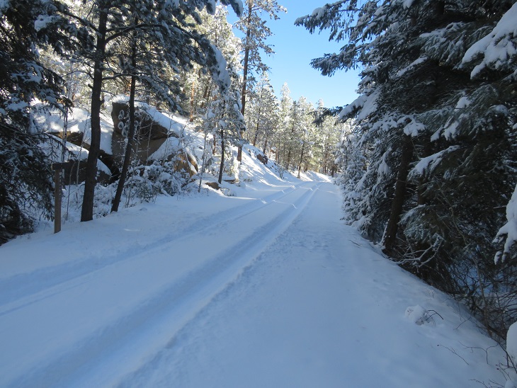
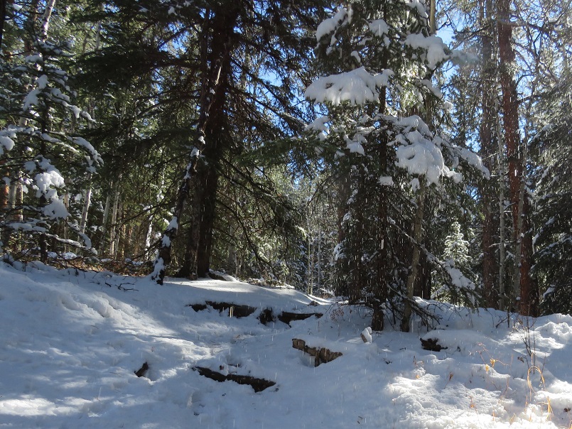
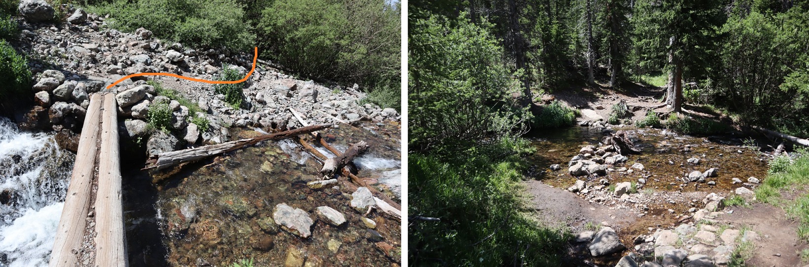
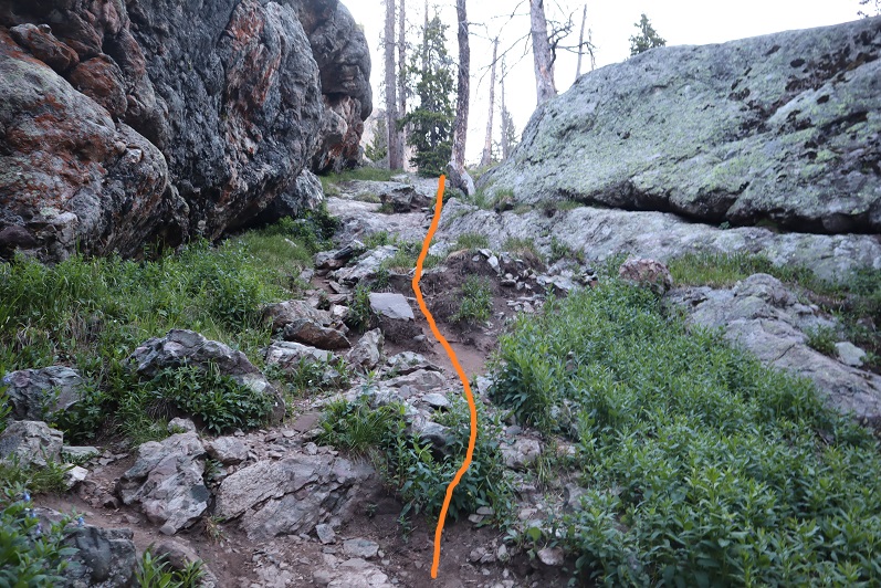
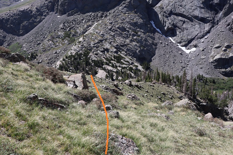
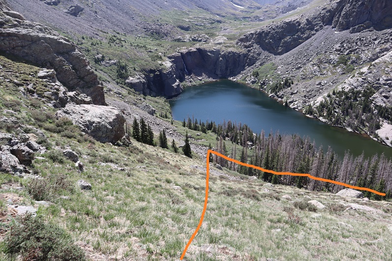
Here are some pictures the rest of the way back to the trailhead
Back at the trailhead, I noticed a chipmunk under my truck, seated atop a sock full of moth balls. So I’m guessing they don’t work with chipmunks. Oh well, at least it wasn’t a marmot. I made it back to my truck at 11am, making this a 17.29 mile hike with 3120’ in elevation gain in 7 hours.
I’d say “on to the next trailhead!” but I’m staying here.
It was an icy drive to the trailhead. I chose to do segment 3 today because all hikes I was interested in above treeline were too windy. I did realize this hike was a gamble though, as yesterday it had snowed. I wasn’t sure how much, but reports said 4-6”. Since I was here last week, I knew this would be the first accumulation in the area. If figured I could handle 4-6” of snow.
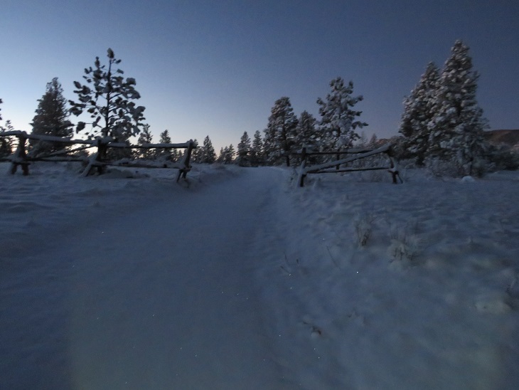
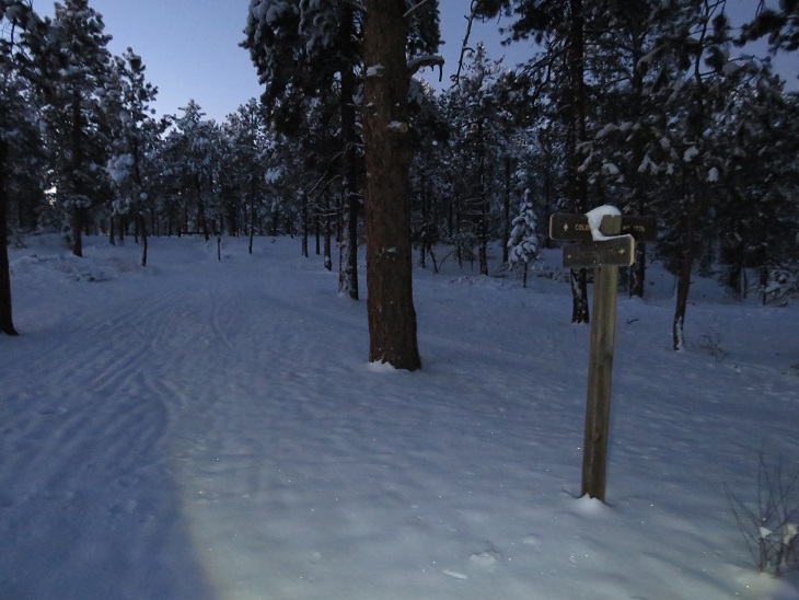
I made it to the Little Scraggy Trailhead to find the gate to the trailhead closed. I was expecting this, as when I was here last I’d noticed the gate was already closed. There are 3-4 parking spaces just outside the gate on the side of the road. There was a lot of snow on the side of the road, so I spent 10 minutes or so backing in and out of a space, packing down the snow. It was 12 degrees outside. I put on all my cold weather gear and was on the trail at 6am. The trail follows the road behind the gate. (Obviously, this picture is from last week, before the snow).
After hiking along the road for about 1 mile I came to the Little Scraggy Trailhead. Even through the snow, the road was visible.
I passed a large woodpile
This part of the trail has a lot of obvious signage.
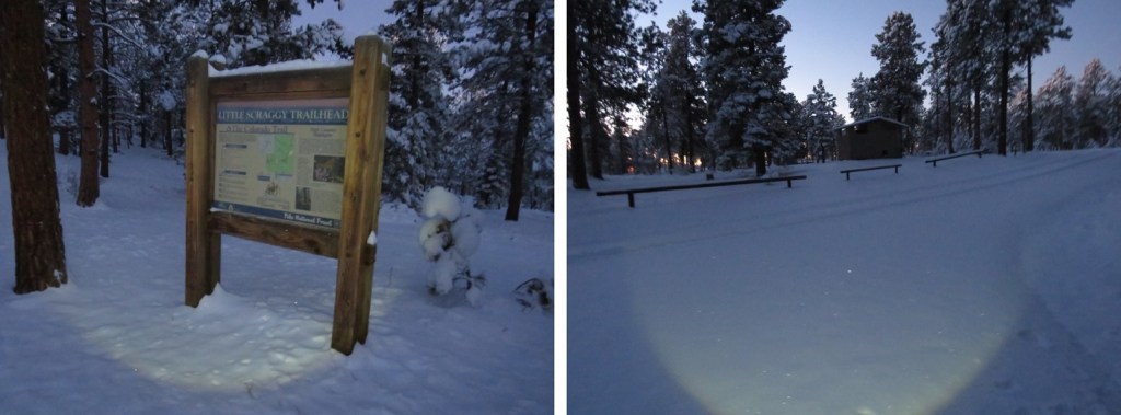
The Little Scraggy Trailhead has an information sign and bathrooms (I didn’t check to see if the bathrooms were closed for winter, but I’m assuming they are, as the road’s closed.
From here I followed a trail instead of a road. The trail was covered in snow, but I was still able to tell where it led (most of the time).
As the sun rose, I passed a really cool rock outcropping that looked like a great place to camp
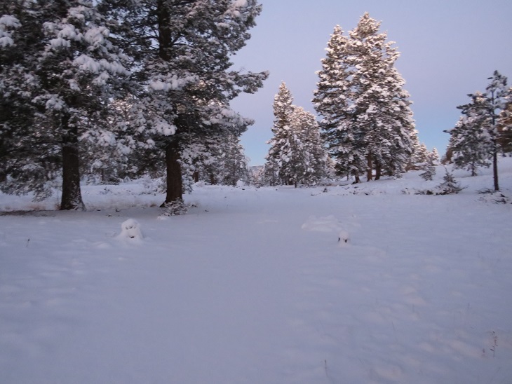
And I started seeing a lot of deer (and deer tracks)
I saw a sign that said ‘overlook’, and wanted to take a look, however, my toes were frozen. I told myself I’d take a look on the way out (which didn’t end up happening, for reasons I’ll explain later). Instead of heading straight I followed the trail to the left. Here I heard a pack of coyotes. They sounded close, yipping just over the hill. At the end of the yips I heard a bark that sounded suspiciously like a dog (but I’m sure what I’d heard initially were coyotes).
This next part of the trail was bitterly cold. I realized later in the day that due to the position of the mountains and time of year, this part of the trail never sees sunlight. The snow was sugary and soft and kept my toes frozen. I kept trying to move my toes inside of my new shoes, willing the circulation to continue flowing. Over and over again I wondered if I should turn back? How did one know when you got frostbite? At what point should I worry? What was the point of no return? Lots of these kinds of thoughts ran through my mind as I continued on. I’m not one to give up easily. The views of Little Scraggy Peak and Green Mountain were nice however.
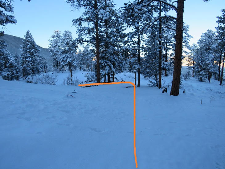
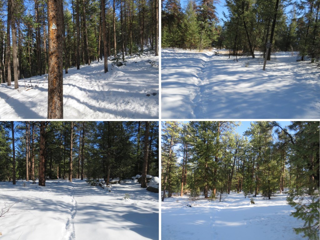
Here are more photos from this part of the hike. Sometimes the trail was easy to follow, and other times (due to snow) almost impossible. Luckily there were good signs at junctions
I passed through a wildfire mitigation area
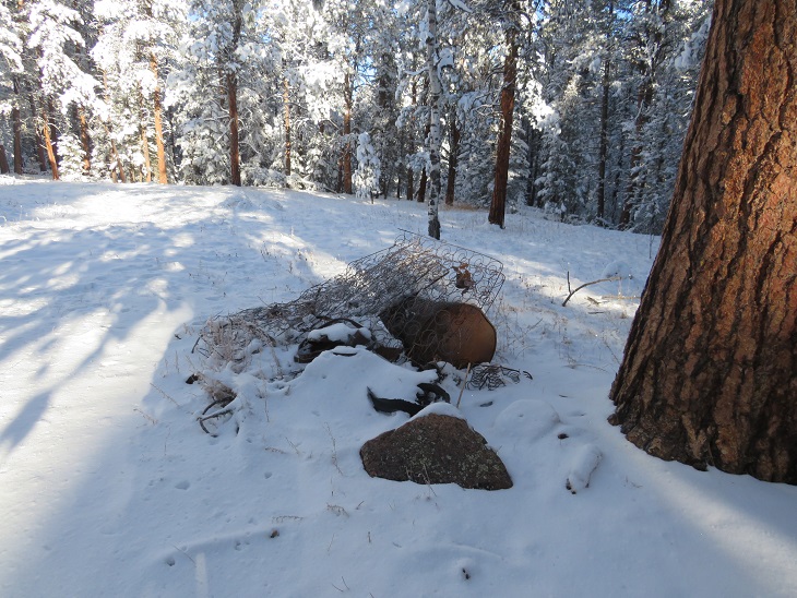
And some historical trash along the side of the trail. It was weird to find an old bedspring and cast iron and debris but no structure.
More good signage
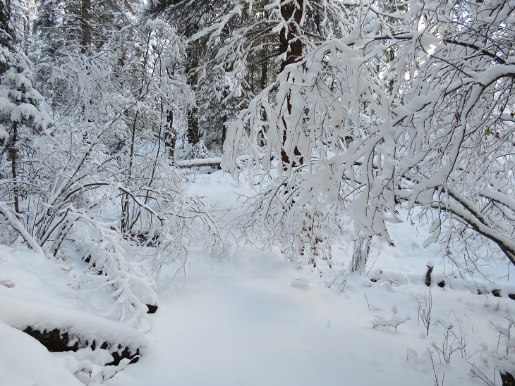
Here I came to the most beautiful part of the hike. The trees and bushes were bent over, their branches weighed down with snow. As the sun rose the forest became magical, and in places the trail became difficult to navigate. After appreciating the beauty I took my trekking pole to the branches to disperse the snow, and the branches bounced back and stood upright again.
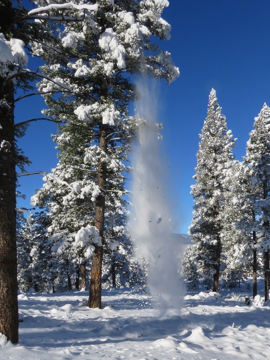
As the sun warmed up the trees, snow started falling from the branches. It was warm out, but I kept my hat on because of the falling snow.
There were several small creeks to cross on this segment, which means plenty of water. These were easy to cross and weren’t entirely frozen over, so I got to hear the water flowing underneath the ice. Most of these areas had logs to walk across. There wasn’t a log here, but the ice was solid enough for me to walk on top (I had microspikes on for this entire hike).
The snow seemed to be heaviest here. I’m guessing 8 inches or so. I contemplated putting on my snowshoes, but that sounded like too much work and brought with it the possibility of frozen fingers, so I postholed instead.
At 8.75 miles I came to the junction with Buffalo Campground
And then crossed three roads. The first went to Meadows Group Campground, but it didn’t look like anyone was headed there today
The next road was road 543. This is the low elevation point of the segment.
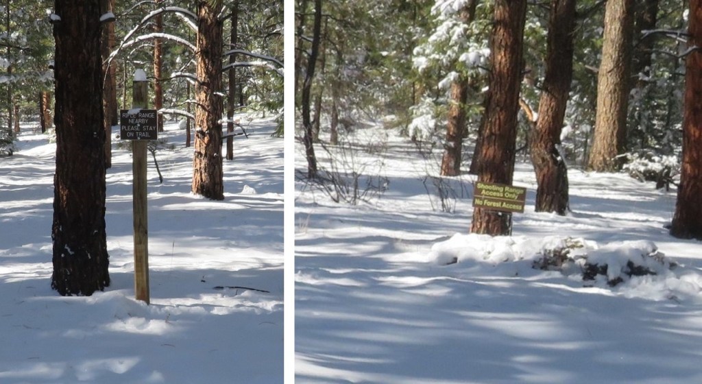
The final road went to a rifle range, and actually had tire tracks!
It was so nice to be hiking in warm weather. I use that term loosely (it was still below freezing), but the sun on my face was magical. Also, I could feel my toes again.
Now I was getting excited. My research had told me this was a 12.2 mile hike, and I knew I had to be getting close to 12 miles. I kept hiking, and came across signs asking me to stay on the trail because I was near a rifle range. No problem!
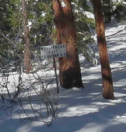
I hiked, and hiked, and hiked some more, excited I was getting near the halfway point for my hike today. I knew I had to be over 12 miles at this point, so I should be turning around soon. That’s when I saw it: a sign saying the trailhead was 2.5 miles away!
NO WAY! My spirits plummeted. I did some quick mental calculations, as I had a decision to make. It was now 2.5 more miles to my turnaround point. This would add 5 miles to my hike, and 2 hours to my day. If I continued on, I’d be hiking 30 miles today in the snow, trenching the entire way. Also, I’d most likely get back after dark, and I didn’t have cell service, so I had no way of telling anyone I’d be home late. In the end I decided I’d already gone this far and I didn’t want to waste the progress I’d already made: I was going to continue on to the Rolling Creek Trailhead. Also, this was going to be a long day! I resigned myself to not getting pictures of the start of this trail, since I’d be both starting and ending in the dark.
I hiked around what must be private property, given the fencing. This fence must have fallen inwards a few times: they steadied it with a large rock.
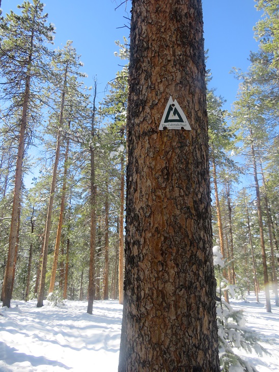
Yep, I’m still on the right trail! I was excited to see a Colorado Trail marker here. They are few and far between on this segment (although there is great signage).
The last 2.5 miles seemed to take forever!
I hit the high point of the trail, saw power lines, and then descended a short distance to the trailhead.
I made it to the Rolling Creek Trailhead at noon. I’d hiked 14.84 miles in 6 hours. Doing the math, I’d definitely be getting back after dark (dark now is 5pm, although, as I was to find later, it comes earlier on this segment). There was one vehicle parked in the small lot at the trailhead (taking up every spot available with the way they’d parked)
Even though it was noon I knew daylight was limited, so I didn’t waste much time here. I quickly turned around and headed back the way I’d come. The segment started with a little bit of elevation gain
Route finding was much easier on my way back, as I just followed my tracks in the snow
One really cool thing about this part of the day: all the snow that had been covering the trees was being warmed by the sun at a dramatic pace. Within minutes the trail became a rainforest, with snow melting and falling all around me as water as I went. It truly felt like it was raining! By the end of this part all the snow was gone from the trees, and there were water marks in the snow below them.
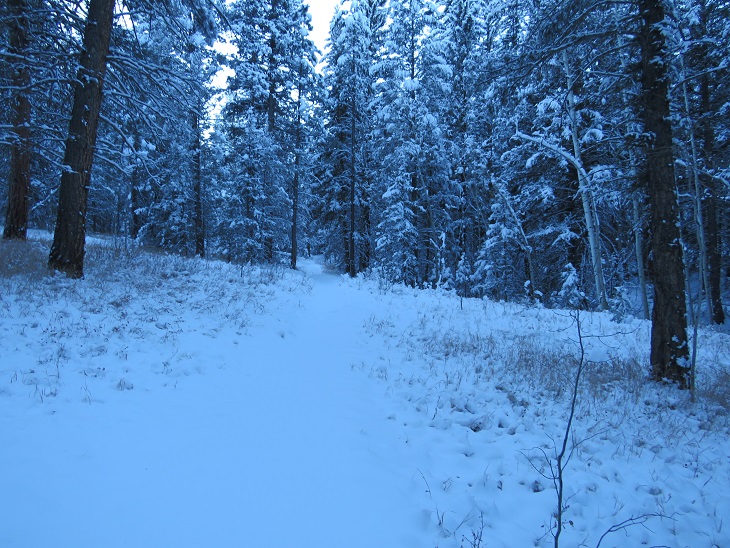
Some more trail pictures
With the snow, much of this trail looks the same. I did see more tire prints on the road on my way back out
(Sorry about the water droplets scarring the picture: the water was falling from the trees at a rapid pace)
Besides the deer, my tracks were the only ones on the trail on my way back
While the sun was quickly melting the snow off the branches at the more exposed spots, snow still lingered on the trees in the shadowy areas. In the morning I’d gingerly walked through this area. Now, I whacked every tree with my trekking pole to remove the wet snow so I could pass.
As I rounded the north side of Green Mountain I once again entered the shadows. It was now I realized this area doesn’t get sun in the winter time. The temperature dropped, and I quickly became cold again. Little did I know, but even though it was still afternoon, I wasn’t going to feel the sun again today.
The snow once again became sugary. I assume this is due to the lack of sun/melting. I passed the fire mitigation area
And followed the well marked “Colorado Trail” signs
The sun was rapidly setting. It wasn’t yet 4pm and it was already getting dark out. I quickened my pace, knowing I still had a few hours of hiking left in my day, and also cognizant of the fact I had people who’d be worried about me getting back after dark.
The sun seemed to abruptly set, just as I passed Road 550. I still had 2 miles left to hike in the dark. I don’t mind hiking in the dark (in fact, I do it on just about every hike), but the lack of a visual aid became troublesome here because it seemed someone had brought their family to go snowshoeing in this area sometime earlier in the day. There were several sets of tracks and prints that didn’t really lead anywhere, and my tracks from earlier were lost in the melee. I also wasn’t able to get any good pictures of the last 2 miles of the trail (which I’d also needed for the first 2 miles).
I passed the Little Scraggy Trailhead in deep darkness (despite the early hour) and easily followed tons of tracks in the snow on the 2wd dirt road back to my truck.
I made it back to 126 and, just for good measure, walked to the other side of the road and tapped the Colorado Trail sign on the other side, just to make sure I’d adequately linked segments. I turned around and took a picture of my truck on the other side of the road (and the closed gate)
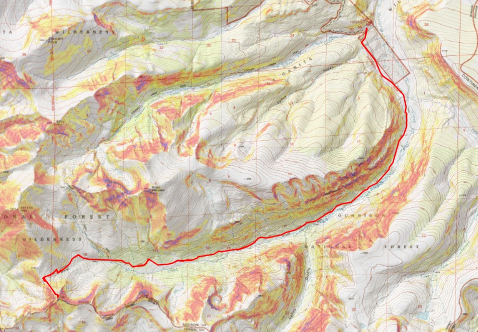
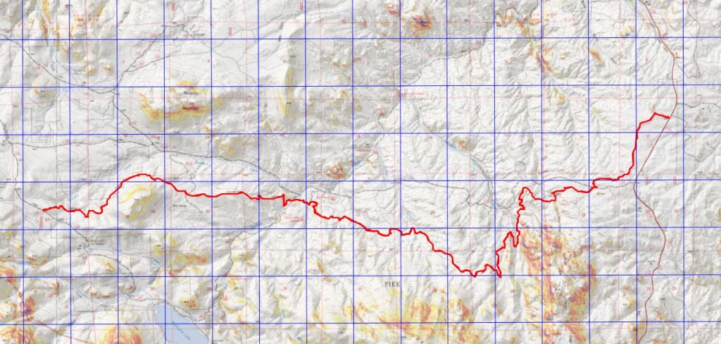
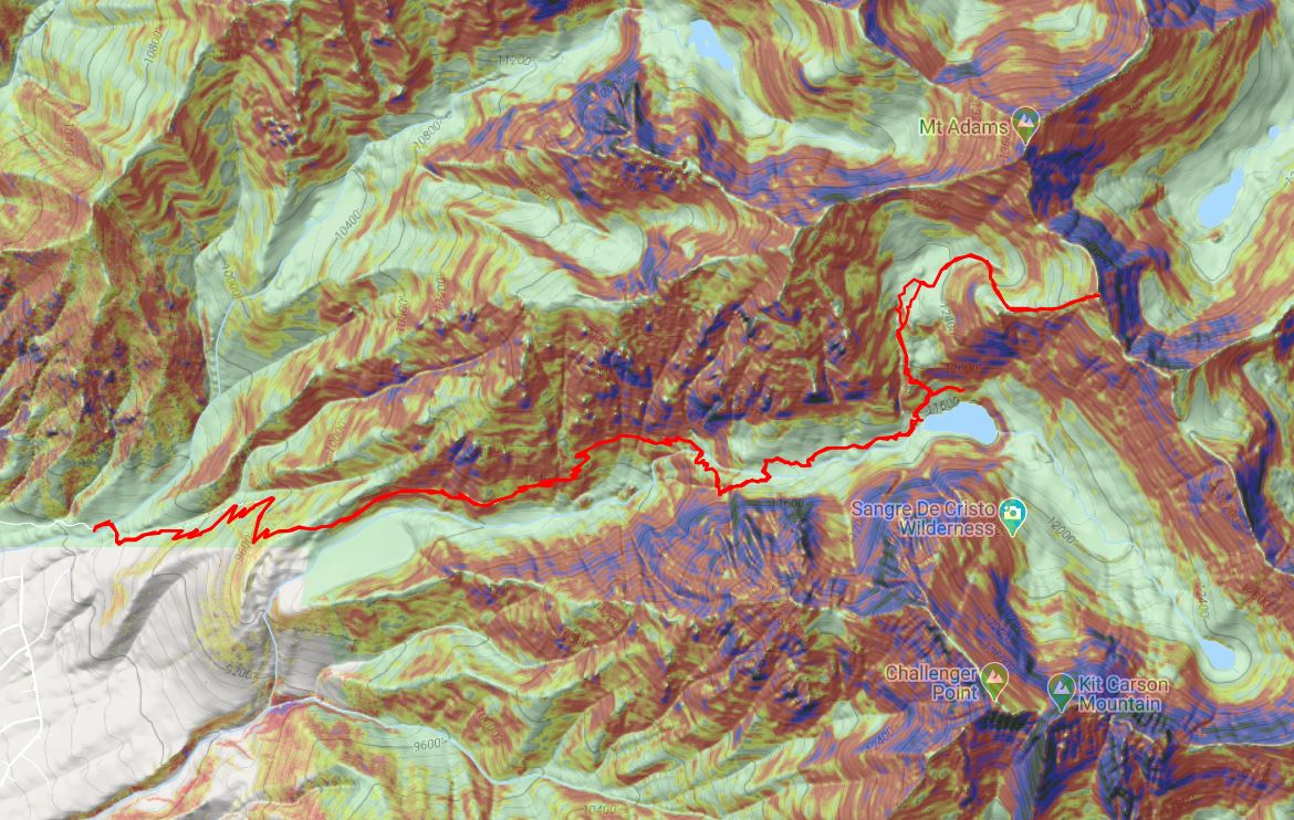
I made it back to the trailhead at 6pm, making this a 29.59 mile hike with 3362’ of elevation gain in 12 hours. I’d like to note I’d expected this segment to be around 23-24 miles, even with the added mileage from parking at the winter closure. Here’s a topo of my route. (Side note: feel free to contact me if you’d like a copy of the GPX file for this route).
My shoes were covered in ice when I got back to my truck. I shook most of the ice off, but some clumps stayed on my shoes for the 2 hour drive home, and even for a while after I set them by the fireplace. I was pleasantly surprised the hiking shoes I’d worn had kept my toes from frostbite in the conditions I’d hiked (30 miles, in consistent, sugary snow, for 12 hours, in below freezing temperatures). I have Raynaud’s, so this is phenomenal!
To finish off my birthday weekend I wanted to hike two more 13ers, which would bring my total to 200 unique Colorado 13er summits. I chose these peaks because we’ve recently had our first snow and I’ve attempted this peak before and turned back due to snow/conditions. If I wanted to get PT 13795 in this year I was going to have to do it soon.
I drove down to the Grizzly Gulch/Silver Creek Trailhead and didn’t make it there until after dark. The parking lot was packed, there were several tents set up, and tons of campers enjoying campfires. In short, it was loud and everyone seemed to be enjoying themselves. I parked, fired up my jetboil and made my birthday dinner of cup noodles and mashed potatoes. As I ate dinner, I made some notes from the days climb, then got ready for bed. There are clean bathrooms at this trailhead (no toilet paper though). As I came back from the bathroom I ran into a rather large deer licking my truck. I tried to shoo it away but she wouldn’t budge, so I carefully made my way into the back of my truck while she continued licking my bumper. On a positive note, by 9pm the entire trailhead was silent and everyone had gone to bed, so I had no problem falling asleep.
I awoke to 32 degree weather and a layer of frost on top of my sleeping bag. Looks like I’m going to have to start winterizing my topper. Since it was cold I put on my puffy as well as my windbreaker, knit hat and gloves, and was on the trail at 5:15am.
I started out by heading west, following the same trail as Handies Peak. If you’re reading this I’m going to assume at this point you’ve summited Handies Peak and I won’t go into detail about the initial approach. If you’d like to see the approach I’ve written it up from my failed attempt of PT 13795 last year.
I followed the Grizzly Gulch trail through the woods and past treeline. After hiking for 2.5 miles I turned left and headed southeast towards an upper basin. There was a faint trail here
Once in the upper basin I came to a lake. There were two tents set up, so I tried to be quiet as I passed. I skirted the lake to the left and headed towards the gully that would bring me into another basin.
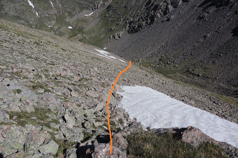
Ascending the gully beyond the lake was class 2+. The scree here was awful: I’d take one step forward and slide backwards. I actually used my ice axe and trekking pole here for stability, glad the sand was wet from the recent snow. There was no trail, so I just aimed southeast and tried to avoid the snow (it was bulletproof by the way).
Once in the upper basin I had a few options. I’ve read trip reports where hikers have used the gully to the left, but I’m not a fan of gullies. In fact, I consider ‘gully’ to be a 4 letter word. I took a look at the gully and said “nope”. Instead I took the ridge to the right. This was an easy hike on tundra, and should be the standard route.
Here’s a look at that gully I didn’t want to ascend
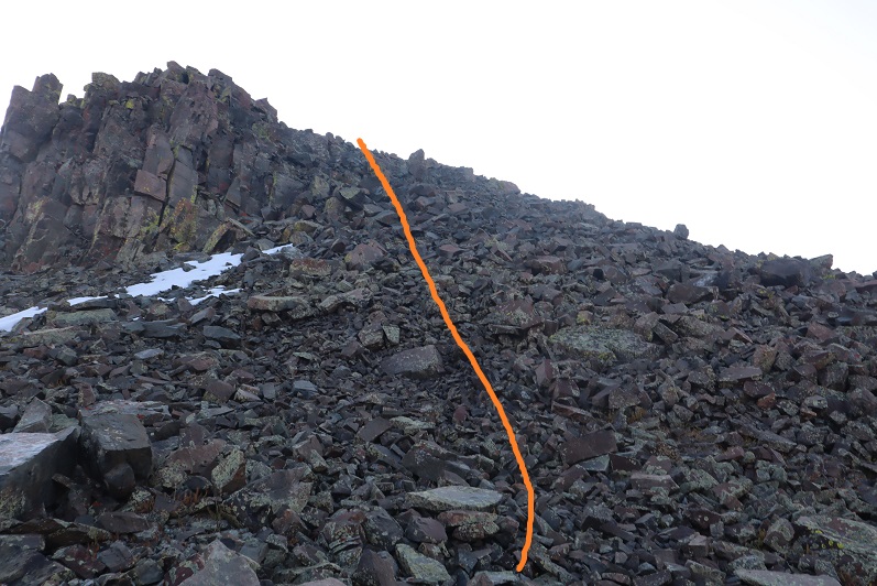
Just before gaining the ridge the tundra gave way to rock
At the top I turned left and headed southeast for an easy tundra stroll towards PT 13795
The last push to the summit was rocky, but stayed class 2
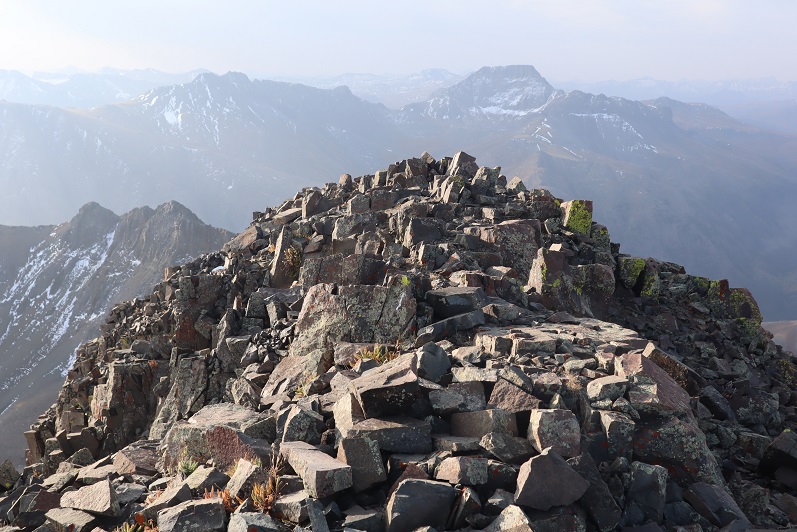
The summit was rocky as well
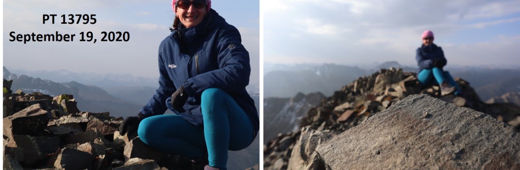
I summited PT 13795 at 8:20am. I only took 2 photos, and when I got home they were both terrible (oh well).
PT 13795:
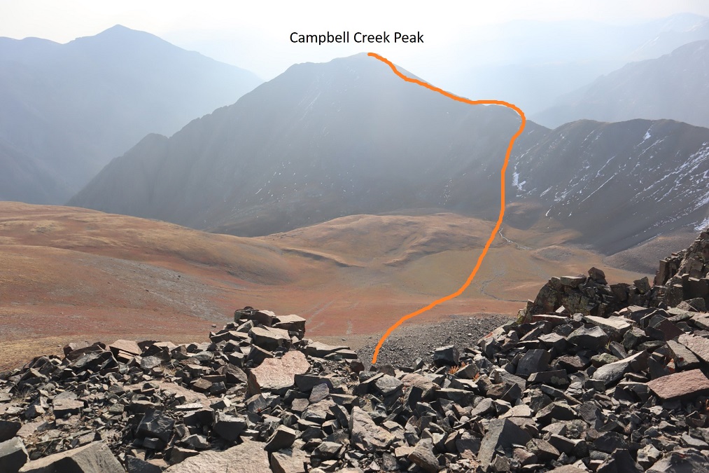
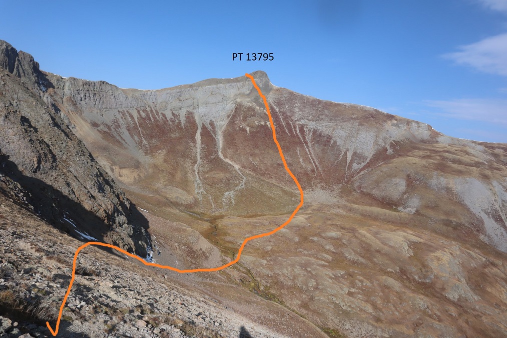
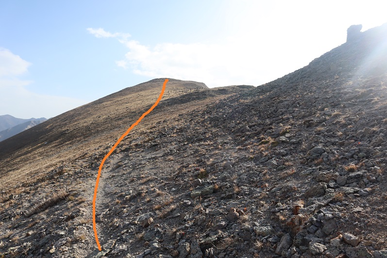
It was really hazy due to the fires, so I had a hard time getting a clear view of Campbell Creek Peak. I’d heard the ridge between PT 13795 and Campbell Creek Peak didn’t ‘go’ so I was going to need to drop down into the basin and ascend another gully. That gully didn’t look too bad. Here’s the overall route I took
First heading south to avoid the class 3-4 section directly below the peak, and then east towards the basin
I just aimed for the stream, and then stayed to the left of the rock to gain the ridge
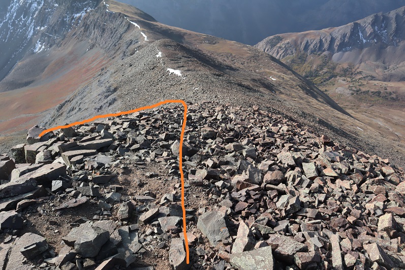
Here’s a look back at the route I took down from PT 13795 (it’s not as steep as it looks, but I was glad I’d hiked down this and not up)
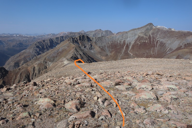
I followed the ridge northeast to the summit of Campbell Creek Peak
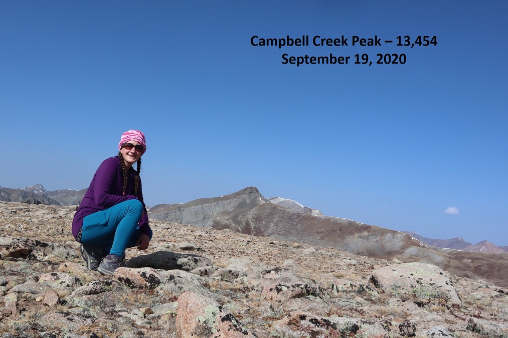
I summited Campbell Creek Peak at 9:45am
Campbell Creek Peak:
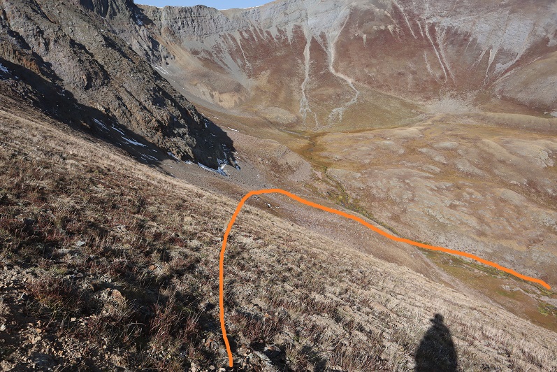
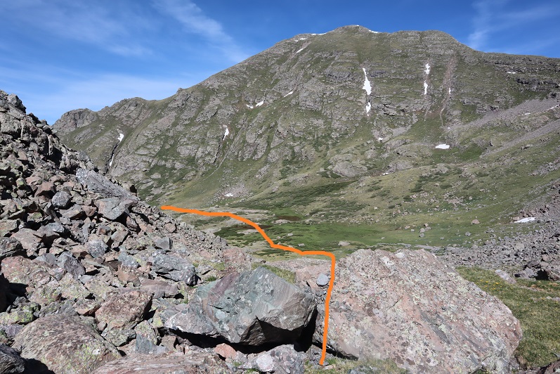
After summiting I turned around and headed back down the ridge and into the basin.
Once in the basin I turned right and followed Campbell Creek north. I crossed the creek towards the end of the basin and picked up a faint game trail
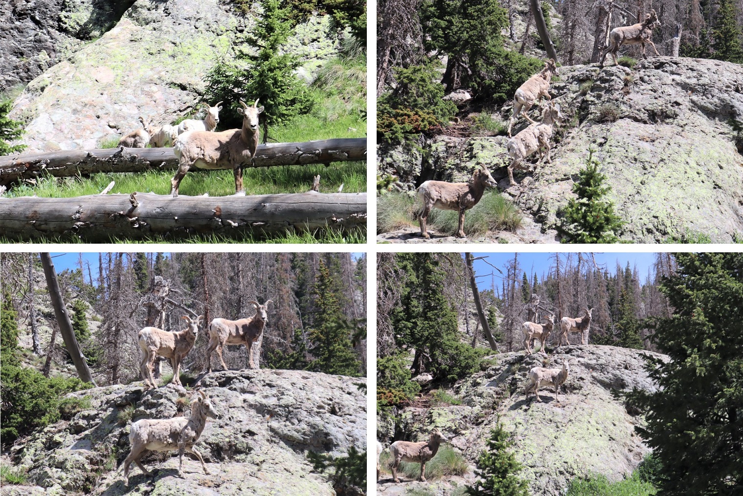
It was here I saw a herd of Bighorn Sheep. They also saw me and quickly bounded away.
The game trail I was on kept disappearing and reappearing, so I decided to just follow the creek out of the basin
This led me to a large patch of willows. I followed game trails northeast through the willows, around the side of the mountain
From here on out there was a lot of bushwhacking and route finding involved. Luckily, I could see CR 30 in the distance, so I just kept traversing the side of the mountain, heading northeast and aiming for the road, slapping willows, bushes, and branches out of my way as I went.
Eventually I came to a gully and followed it own to the Gunnison River, crossed the river on avalanche debris, and followed the road a mile back to the trailhead.
Here’s a look back at the gully I came down
I made it back to my truck at 12:30pm, making this a 11.29 mile hike with 4559’ of elevation gain in 7 hours 15 minutes.
Oh, and I didn’t get a picture of the deer licking my truck, but there were obvious signs it had when I got back and saw it in the daylight.
Campbell Creek Peak was my 200th unique 13er. Not a bad way to end a birthday weekend!
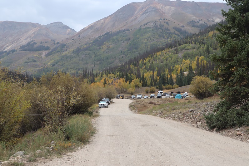
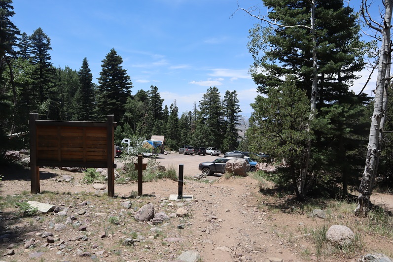
I chose this peak for today because it was the closest one on my list of unfinished bicentennials to Cielo Vista Ranch, where I’d just spent the morning hiking. I drove to the Willow Creek Trailhead and backed into the only available parking space. Vehicles were parked and double parked in each space, as well as several hundred feet down the road on the drive in. This is a popular trailhead and it was a Saturday afternoon.
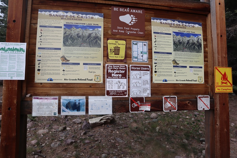
It was raining a bit as I got out and looked around. There is an open and stocked bathroom here, and lots of signage.
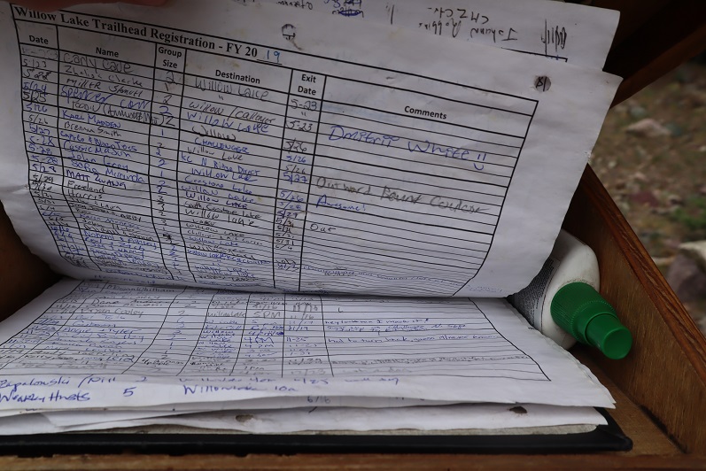
I opened the trail register container and was disappointed to find another full register. Every page was so full people were just writing in the margins of past pages. This one is from 2019. There were probably 7 pages total, which could probably get filled up here in a week. How are these useful when they aren’t kept up to date? Signing these seems useless.
I went back to my truck and got my stuff ready for the hike tomorrow. I didn’t have a flashlight so I decided to use my phone’s flashlight app. That meant conserving battery, so I put it in airplane mode. Then I people watched. There was a man hiking with a small dog in a basket, a group of about 20 high school aged backpackers returning from what looked like their first outdoor experience, and two men hiking in to Willow Lake to summit Challenger and Kit Carson tomorrow. I spent a good 30 minutes watching a man trying to turn his pulled trailer around in the parking lot. He must’ve been looking for a dispersed camping spot and wasn’t able to find one before the trailhead. Turning his rig around in the parking lot of the Willow Lake trailhead was his only option, and it took dozens of attempts. His rig was loud and he set off several car alarms in the process. It was all quite entertaining.
When the mosquitoes came out I decided to call it a night and went to bed early. I woke up at 2:30am, decided I was way too comfortable, and went back to sleep. The only bad thing about having a bed in the back of my truck is I don’t seem to want to get up in the mornings. I was on the trail by 4am.
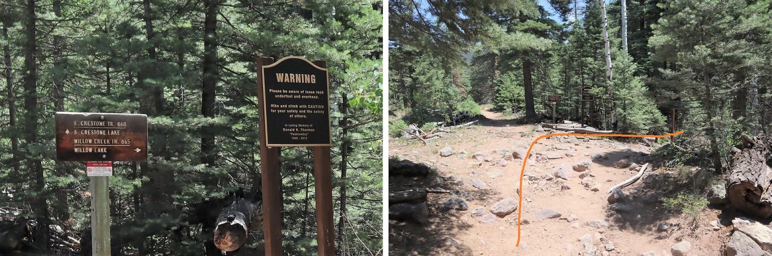
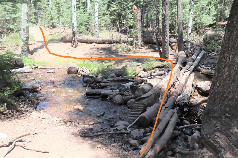
The trail starts at the east end of the parking lot and almost immediately comes to a junction. I turned right here, crossed a creek, and continued on a sandy trail.
During the first mile of this hike, as I was hiking in the dark, I kept hearing chirping. It sounded like one of those bird boxes that’s put in the middle of nowhere to monitor birds and chirps every few seconds was out there somewhere, and broken. It wasn’t chirping on my way back, so it either ran out of battery or was an actual bird going crazy at 4am. The Willow Creek Trail is a class 1 trail that switchbacks all the way up to Willow Lake. Here’s an overview
And some pictures of the trail
There are a couple of streams to cross, each with bridges/rocks
Before making it to the lake there’s a camping area. Someone has set up communal bear bag hanging areas, which I think was a brilliant idea. What’s even better is people actually seem to be using them. I saw two such areas, but there may be more.
After the camping area it’s a short distance to Willow Lake. I went up this rocky area
And was greeted by this sign and the lake. I turned left at the sign
I made it to Willow Lake after 5 miles of hiking
I continued following the trail until just before the boulder field. At this point I left the trail, turned left and continued north/north west up the hillside
There is no trail, but the route is easy to follow, as after I gained this small ridge I kept the creek to my left and willows to my right and continued north up to the basin.
It’s important to try to stay as much in the center here as possible, as to the right there are willows and shallow ponds to contend with. (I made this mistake on my way in, but was able to avoid it on my way out. I scared several deer out from willows in the process.). At the end of the basin you turn right and head east
This area was a bit mushy, so I went to the right around this rock/water to avoid getting wet, and then entered another basin
There were a lot of friendly deer here who didn’t seem to mind my hiking past them. I gave them room, but they let me get within 20 feet of them with no problem.
I headed east into the second basin, which was full of large rocks
There are a lot of ways to summit this point. I decided to gain the ridge and follow it to the summit of PT 13580
Once on the ridge it was an easy hike to the summit. The only problem was the sun was rising directly in front of me as I was hiking and I couldn’t see anything due to the glare. These pictures are from the way back down. While hiking up this ridge I heard someone from over on the Kit Carson/Challenger side yell “rock!” every couple of minutes. It’s amazing how sound carries out here.
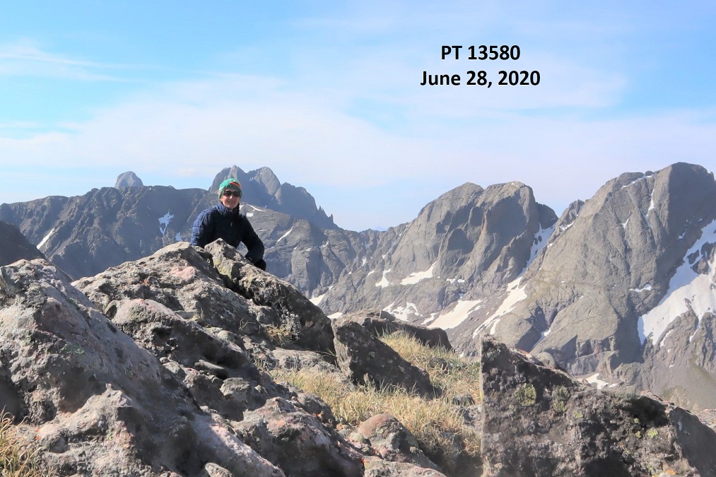
I summited PT 13580 at 8:45am, after 6.8 miles of hiking
13580:
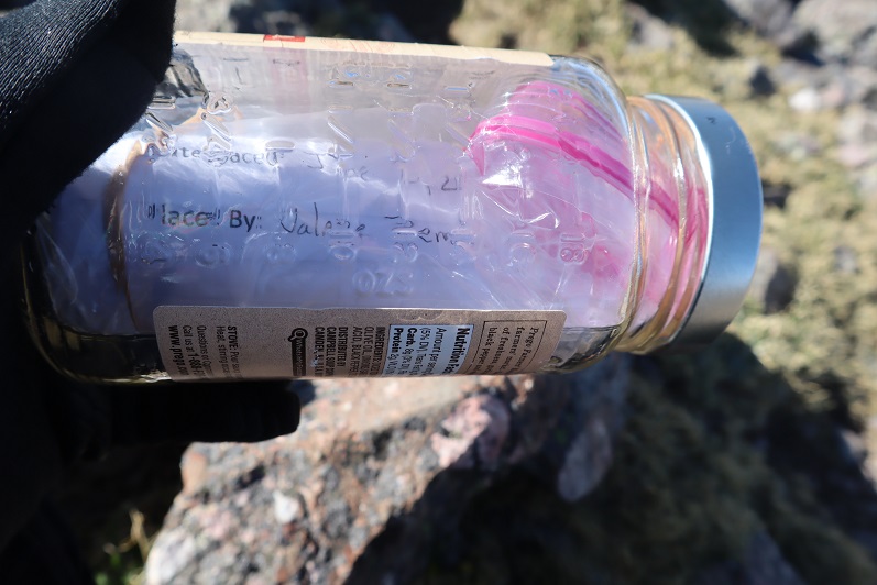
There was a summit cairn at the top, as well as a summit register. I didn’t open it, but I could read through the glass it was recently placed there (6/20/2020?)
It was a beautiful day and I stayed for a long time on the summit, enjoying the views
When it was time to go I retraced my steps back down the ridge into the basin. Here’s an overview, with Willow Lake to the south
And step by step…
Staying higher and dryer this time in the lower basin
It was easier this time to avoid both the willows and the creek
Once Willow Lake was in view it was easy to make my way back down to the trail
There are some beautiful waterfalls here
I made it to the camping area and was startled to see bighorn sheep just off the trail. The camping area was full of tents but the hikers were all out hiking. It seems while everyone is out hiking for the day the sheep came to play. They posed for me while I took a few pictures. Yes, they were a little unkempt, but friendly enough.
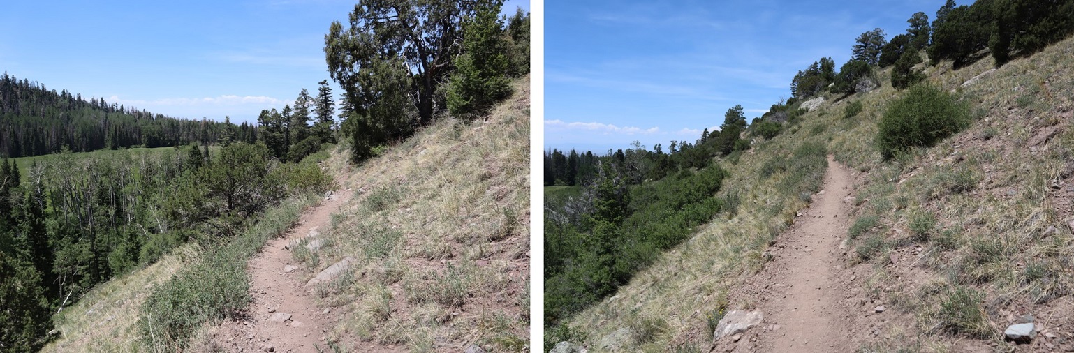
Here are some shots of the class 1 trail back down to the trailhead
I made it back to my truck at 12:30pm, making this a 13.38 mile hike with 4934’ of elevation gain in 8.5 hours. Here’s a topo map of my route. Oh, and just for reference, using my iPhone’s flashlight took up 66% of it’s battery in 2 hours (while on airplane mode).
I drove back home, cleaned up, and noticed I was full of mosquito bites. Curiously, they were only on the left side of my body.
The day had its ups and downs. I’d set my alarm and it hadn’t gone off, putting me 4 hours behind schedule for the day. I’d summited Deer Mountain A in the coldest conditions I’ve seen this season, made it back to the trailhead, and drove as fast as I could to Canon City. I hate being late, and felt awful for putting us behind schedule. No, not going wasn’t an option: we were raftpacking in the Bighorn Sheep Canyon in October, the weather wasn’t going to get any better than it was right now and I really didn’t want to wait until summer. Also, I’ve recently accomplished a few major goals and came to the realization I need to start making time for my friends.
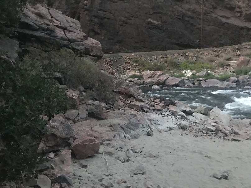
Rafting isn’t a quick process, so after combining vehicles and driving and setting up the raft and our dry bags we weren’t on the water until just after 5pm. I didn’t do much (any) of the set-up, and learned a few things about putting together gear (no water or backpacks in dry-bags). I made a mental note to start relaxing now that I’d made it and we were on river. I tried not to get too apprehensive about the weather. It was a warm day, but we were starting late. It wasn’t supposed to get too cold but I can have a Raynaud’s attack even in good weather, so I was hoping not to get cold. Or wet. As long as it wasn’t windy I should be fine. Last time we were out here I didn’t get wet at all, so I was thinking positively.
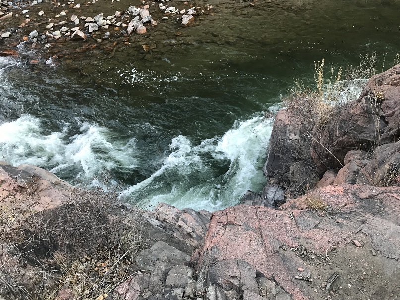
The ride down the river was nice. We were on river, so phones/cameras were in dry-bags. (Sorry, no on water pictures). We saw raptors flying overhead and river dippers skimming the water and catching bugs near the shore. All around fish jumped and caught their own dinner. The gorge was beautiful and Eric made the rapids look easy (I didn’t do much).
The sun was slowly starting to set in the gorge and the wind picked up just a little bit. I was getting splashed in the rapids and instead of drying out between runs I stayed wet. It accumulated, and before I knew it I was cold. Very, very, cold, even though it was nice out.
Trying not to be too much of a baby I asked how much longer until we made it to camp? 15 minutes. Good, that was good. I could do that. I thought. Unfortunately I don’t remember much about that last 15 minutes because I was so, so, so, so cold. I was losing feeling in my fingers, toes, and legs, but didn’t want to scare Eric and tell him that. I pumped my fingers back and forth. I had goosebumps and my toes were now white.
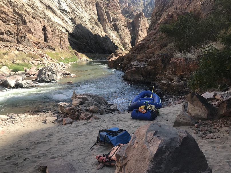
At 7pm we parked the boat at the beach (yes!!!) and I got out.
Well, I kind of tumbled out of the boat and walked about 10 steps, stumbling towards the scrub oak on the other side of the sand like a newborn giraffe.
I’m used to losing fine motor skills, but this loss of gross motor skills was a bit embarrassing. I could tell by the look in Eric’s eyes he was scared and I tried to reassure him I was ok. He wasn’t buying it and kept a close eye on me. He told me he knew I was used to either leading or doing things on my own, but he was here to teach me how to work as a team (filing that one away).
I knew I just needed to change my clothes so I could get warm, but he wasn’t leaving my side. I took off my life vest and put on a thermal and sweatshirt (something I could do to get warm without taking any clothing off). He had me dry my feet in the sand (it didn’t work). It took me a while to convince him I was ok and just needed to change out of my wet pants. I left the immediate area to go change and he stayed by the raft. Yesterday I’d bought new snow pants: shout out to Roxy for making a pair that, almost, fit me! They’re size xs and I could use one size smaller, but being a little big I was able to put them on without struggling. Bonus: They aren’t kids snow pants and snow pants they’re warm!
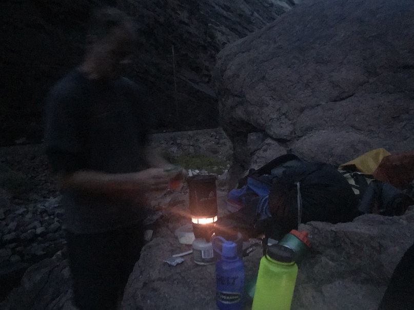
It was a slow process but with new dry clothes and a knit hat I felt much better. I still couldn’t feel my toes. I decided walking around in socks was going to have to be ok, put some on, had a shot of whiskey and started feeling much, much better. I began talking more and moving around. Eric was visibly relieved. I’m sure he was worried he was going to have to airlift me out of there or something. It was my fault all around (I got there late) so this never should have been an issue. And, now warm and dry I could focus on other, less basic survival need kinds of things.
My pants were dripping wet. I placed them on a rock, not convinced they’d dry through the night and started setting up my bivvy. We were sleeping about 20 feet above the river on a rocky ledge. There was just enough room for 2 people so we set up our sacks side by side. Unbeknownst to me, Eric put his good sleeping pad underneath my sack (which would come in handy during the night if it got cold). I think he may have been concerned I was going to have another attack during the night (I didn’t).
Knowing I don’t have fine motor skills when it gets cold I don’t usually cook when I backpack/camp in the wilderness, so I was snacking for supper. Drat! I’d forgotten my dried mangoes in the front seat of the truck! Oh well. Beef jerky and almonds it was for dinner. Eric heated up ramen.
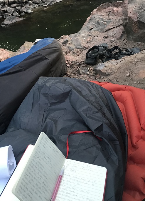
We sat and ate dinner on the rock ledge and talked, watching the stars come out. I’m not sure when I fell asleep, but I woke up twice during the night because I was thirsty. Bonus: I wasn’t cold! Here’s the view from our sleeping shelf
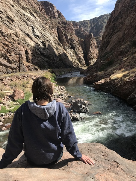
I woke up first and watched the sunrise, or as much as I could see from inside the gorge. I wrote up some trip notes from the day before
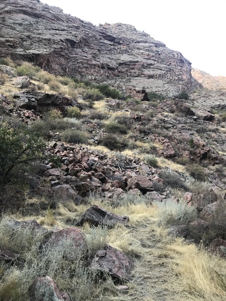
And made a friend. Actually, lots of friends: there were little caterpillars everywhere! I put every caterpiller I found on the rock behind me and eventually decided to go for a walk because my legs were falling asleep. As quietly as I could I got up, stretched, and went exploring. The area isn’t large, but looks like it could support about 10 people camping (if you don’t mind close quarters and no tents).
Check out the down view from the sleeping area
I was just getting ready to head back when I saw a mama deer and her two babies running like they were late for school
Deer
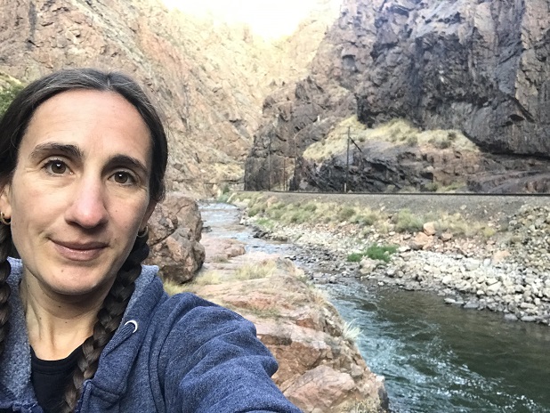
I took an early morning selfie because I was still the only one up, and decided to take a nap.
I woke up just before the first train went by. I got out my breakfast (you guessed it: beef jerky and almonds). Eric warmed up some water and I had ‘coffee’ and he put the rest in a water bottle for me to use to warm up. He’s convinced me to perpetually hike with a jetboil so my fingers get used to using it when they are numb: Last time I almost started a forest fire, so I haven’t tried to use one when cold since. Everyone on the train waved as they passed and were excited to see us ‘camping out’ in a place only accessible by watercraft. Also, I love my new socks!!! Totally worth the $6. And my pants dried over night so I didn’t have to raft out with snow pants! Another win!
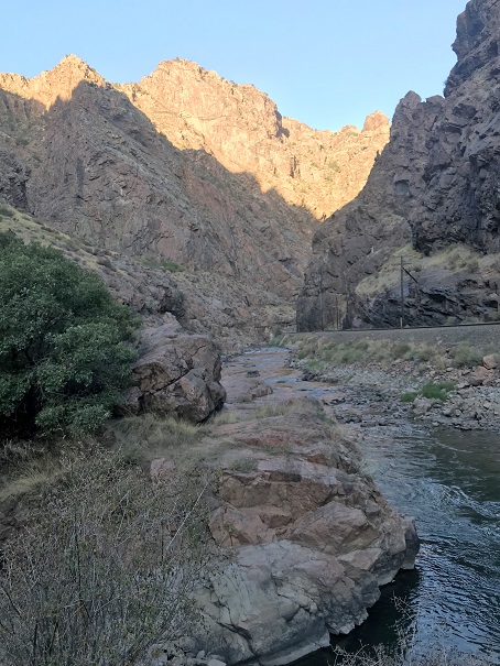
We sat so long on the ledge we saw another train go by. I enjoyed just watching the river, glad to be warm
Around 11am we gathered our gear and got ready to head out.
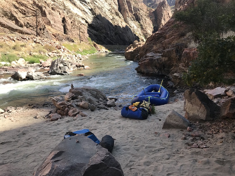
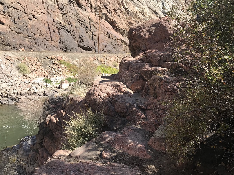
We were careful to sweep the area one more time to make sure we left no trace. This is the sleeping area (sans gear)
Back in the boat I was worried I’d get cold again, but thankfully the rest of the rafting was done in the sunlight. We stopped and waved to another train and enjoyed some wild grapes on the side of the river. We made it back around 1pm and drove to get Eric’s car. There we parted (he said he could take down the raft and put all the gear away by himself, and I selfishly agreed so I could go home and cook my daughter dinner before heading out again at midnight).
So, minus the brief Raynaud’s attack it was a great trip! We camped at the perfect spot, had some great conversations, and I learned quite a bit about raftpacking. We were the only ones on the water the entire trip. Hopefully next time I can be of a little more help on the water!
After arriving back home I looked at the pictures/videos from the trip. There was one point where I’d thought I’d taken a picture of the train passing, but ended up taking a quick video of the train along with a 4 minute video of the inside of my pocket. While listening to the video I realized something: I’m a lot!!! I talk rapidly, move from one subject to the next, over explain, and monopolize the conversation. This is something I’m going to need to work on. I may need to implement a code word or something with my kids to help me realize when I’m like this (all the time?). BTW, my nickname in preschool was “M-O”, for “Mellow Out”. So I guess what I’m saying is this isn’t something new…