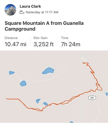
Mt Bierstadt in Winter – 14,060

1

RT Length: 11 miles

Elevation Gain: 3455’

I’m working on snowflake 14ers. Well, kind of. I set a goal to summit 5 more 14ers this year in calendar winter and I’ve been sitting on 4 since March (I only counted DeCaLiBron as 1because… well, it seemed too easy a hike to count it as more than 1) and I really wanted to get in another 14er snowflake this year. I checked the weather and Bierstadt had the best forecast on the first full day of winter so it’s the one I went with. It ended up being a fantastic choice!

I arrived at the trailhead at 5am to two other vehicles in the lot. I’d actually expected more, considering this is Guanella Pass and it’s the first day of winter. I spent quite a bit of time in my truck getting ready and wasn’t on the trail until 5:30am. I’d decided to start out wearing my spikes and snowshoes, and while they weren’t 100% necessary, I wore them the entire day but could have summited without them. I was just too lazy to take them off. Ok, not lazy, but exposing my fingers to the cold is a no-no and unfortunately a must if I’m going to take the snowshoes off. Also, I’m working on a ‘no blue toes’ season and it helps the cause if I’m not postholing. I would have postholed without the snowshoes.

Here are some pictures of the hike along the road

2

At the upper parking area the bathrooms were closed so I bypassed them and found the trail to the left

3

Here’s an overview of the route

4

The trail had a great trench and was easy to follow. There were tons of fresh signs indicating elk were in the area and using the same trails as the other hikers.

5

Here’s how to access the area above the willows

6

This is also when the sun began to rise. I turned back and my views were phenomenal!

7

There’s a lot you can say about Bierstadt. One of those things is it’s very well cairned/posted. The cairns are large and the posts even larger.

8

I just followed the snow covered trail and aimed for the next cairn/post. I came across a group of ptarmigans here. There had to be 7 or 8 of them altogether, and they blended in very well with the snow. I didn’t realize they stayed in groups of that size? I’ve only seen them singly or in pairs. It was neat to see so many at one time! One rogue ptarmigan ran ahead and about 10 yards away while the others huddled together.  Also, what do you call a group of ptarmigans? A flock? A flight? A covey? (I think it’s a covey….)

9

In any event, the route was easy to follow all the way to the upper ridge

10

11

12

And to the summit

13

14

15

I summited at 8:40am. It was cold but not nearly as windy as forecasted. I was thrilled (but still didn’t take off my gloves)

16

Summit video:

https://youtu.be/4jRE7JkdbC4 

Woot! A summit marker!

17

Here’s looking over at Evans

18

Time to head back

19

Here’s the basic route down the face

20

And a cool alternative view of Pikes Peak

21

This is about the time I started seeing other people. Mt Bierstadt can see hundreds of people a day, but today I only saw 5: Woot for hiking in winter!!! Only one other person had snowshoes, which was understandable, as the route was really well packed down.

22

Views of the way back down…

23

24

With more of those awesome trenches

25

26

27

I made it back to the upper parking lot

28

And hiked the rest of the way down to the Guanella Campground parking area. There were many more vehicles there now than when I arrived. Also, they do a good job of plowing this area.

29

I made it back to my truck at 10:45am, making this an 11 mile hike with 3455’ of elevation gain in 5 hours 15 minutes.

30

Summit Sticker can be bought here

Gray Wolf Mountain – 13,604

1

RT Length: 9.5 miles

Elevation Gain: 2300’

Surprised they hadn’t yet closed Guanella Pass for the season, and with the only above treeline forecast for peaks I want to climb that didn’t have forecasted “blowing snow and blustery winds” I decided to try to get in this bicentennial before they closed the road. The drive up was icy so I took it slow, arriving at the Guanella Pass trailhead at 6am.

2

3

It was windy and cold and windy. Did I mention it was windy?  I got ready in my truck, put on my snowshoes, and sat in the front seat, willing the wind to stop blowing my truck back and forth.  It didn’t, so I decided as soon as it was light enough where I didn’t need a flashlight I’d be on my way.  Today’s hike was short and I wasn’t too worried about time.

I started from the south end of the parking lot at 6:40am

4

Here’s an overview of my route

5

I followed the well trenched Bierstadt trail through the willows until I came to post #11

6

The wind stopped as soon as I descended into the basin, which was a welcome surprise. At post #11the trail continued to Bierstadt, but ended for me.  I turned left and angled northeast through the basin, doing my best to avoid the willows and creeks.

7

Avoiding the willows wasn’t too difficult, but avoiding the small tributaries and creeks was a challenge.   It seemed as if there were offshoots of water everywhere.  They were covered in a thin layer of ice and several inches of snow.  Since they hadn’t yet frozen over completely they were a hazard.  It would look as if I was walking along a section of grass, and then I’d hear cracking and gurgling beneath me.  I had to take care not to plunge step into a small creek but wasn’t too worried as they weren’t very deep.  As I made it to the middle of the basin I noticed a herd of elk moving ahead of me.  They’d obviously seen me first and were doing their best to put some distance between us.  Luckily for me I noticed they were traveling in the same direction I wanted to go, so I decided to just follow their tracks.

8

Following the elk had its advantages: they’re heavier than I am and I can see where they posthole and whether or not they break through ice.  I didn’t take the conventional way up this slope, but I felt more secure in my footing following animal tracks.

I followed game trails through the willows and trees

9

to a small plateau. Still following the elk tracks I gained the side of the mountain

10

And found a cairn! Woot!  It seems I was on the right track.  The elk had gone left and I wanted to go straight so I stopped following their prints and headed east through the willows and then followed the drainage up the basin, keeping the drainage to my right.

11

The beginning this part of the hike wasn’t too bad. I just kept following the drainage towards Gray Wolf Mountain

12

Just as I made it to the base of the peak the wind started picking up intensely. I made the decision not to ascend Gray Wolf Mountain via the ridge because I was worried the winds would be too much for me (dotted line).  Instead I followed the basin until I felt I was parallel with the summit and gained the ridge that way, thus being able to make it to the top without the intense wind (solid line)

13

Winds were forecasted at 20-25mph, but they far exceeded those numbers. The winds never slowed down and they never stopped.  It’s difficult to get a picture of wind…

14

15

Eventually I hit an ice patch and decided it was time to start climbing Gray Wolf Mountain

16

I turned left (north) and ascended the ridge

17

18

The higher I climbed the lower the wind speeds became. The snow here was either hard packed or soft and unconsolidated, making route finding challenging.  I had to go slower than I would have liked to avoid twisting an ankle in the snow hollows between larger rocks.

19

The further up the mountain I went the more snow I encountered

20

Until I made it to the ridge and saw it was mostly windblown. Here’s the path to the summit

21

And looking back, you can see a better view of the dropoff between Gray Wolf Mountain and Mt Spalding and the wind that went with it

22

As I got closer and closer to the summit of Gray Wolf Mountain the winds increased again. I had to keep my head down and body angled forward to avoid getting blown over

23

When I made it to the summit I took off my backpack to set it down and it was blown by the wind, tumbling 10 feet away from me. I hobbled back and forth in my snowshoes to retrieve it before it was blown off the mountain altogether.  Wow, those were some strong winds!  I set up my camera between two rocks on the summit cairn to get a picture of myself on the summit.  I got one before the camera was blown over.  This is me stoically struggling against the wind to remain upright in the wind. Also, I’m cold.

24

I didn’t even bother looking to see if the picture was good: The wind wasn’t stopping and I had to get out of there.  These were sustained winds that I’m guessing exceeded 60mph.  I bent down to retrieve my backpack to put it on.  I was able to get one arm through one of the straps, but tried over and over again unsuccessfully to get the other arm through.  The wind kept blowing the pack away.  Frustrated, I half laughed/screamed “STOP!!!!”  to the wind.  It didn’t listen and it wasn’t going to listen so I had to get creative.  I propped my backpack up against the cairn, turned around, sat down and put the pack on.  At this point the wind was blowing me against the cairn and I couldn’t stand up from a sitting position.  I rolled onto my side and used my trekking pole to hoist myself up.  I made the decision right there not to attempt Mt Spalding today:  If the wind was this bad at 13,600’ I could just imagine what it was like at 13,800’.

I trudged against the wind back the way I’d come

25

When I made it back to the ridge the wind lessened as I descended out of its path. I followed my tracks back to the plateau

26

27

28

Here you can see how each step varied: sometimes the snow was firm, and other times I’d sink

29

30

I followed the drainage back down, keeping the drainage to my left. The wind was again strong here, but nothing like it had been on the summit

31

I aimed for this bump in the ridge

32

33

Found the cairn

34

And headed back down the hillside and into the basin. Here you can see my tracks, along with a bunch of elk prints

35

The wind hadn’t been present here, so I was easily able to follow my tracks back to the trail

36

37

38

I only ran into an issue once, when an area I’d crossed earlier had warmed up and I stepped through the ice. I’d known water was here and traversed the area slowly.  In my snowshoes my foot didn’t even get wet, but this picture shows a break in the ice

39

I love following animal tracks!

40

There were tons of moose tracks near the boardwalks in the willows that hadn’t been there when I’d hiked in, but I didn’t see any moose. There was one other vehicle in the parking lot when I left.  I didn’t see anyone else all day so I’m assuming they hiked Bierstadt.

I made it back to my truck at noon, making this a 9.5 mile hike with 2300’ of elevation gain in 5 hours, 20 minutes. When I went to stop my tracker it had shut off about an hour or so into the hike (I’m assuming due to cold) so for mileage I’m going by my iPhone’s tally and for elevation gain I’m just using topo estimates.  Red is what Strava recorded, orange is the rest of my route, hand drawn. If there hadn’t been any wind this would have been a really easy day.  I was kind of bummed I hadn’t had been able to try Mt Spalding, but there are numerous ways I can hit it next time.

41

42

Also, apparently my balaclava hadn’t been entirely covering my face. It had frozen in the wind and I’d thought everything was covered but when I looked in the mirror I had a dime sized sunburn on the tip of my nose.  Very cute.

Square Top Mountain A – 13,799

1

RT Length:

Elevation Gain: 3252

I’m going to summarize, but if you’re interested in details you can read the entire story here

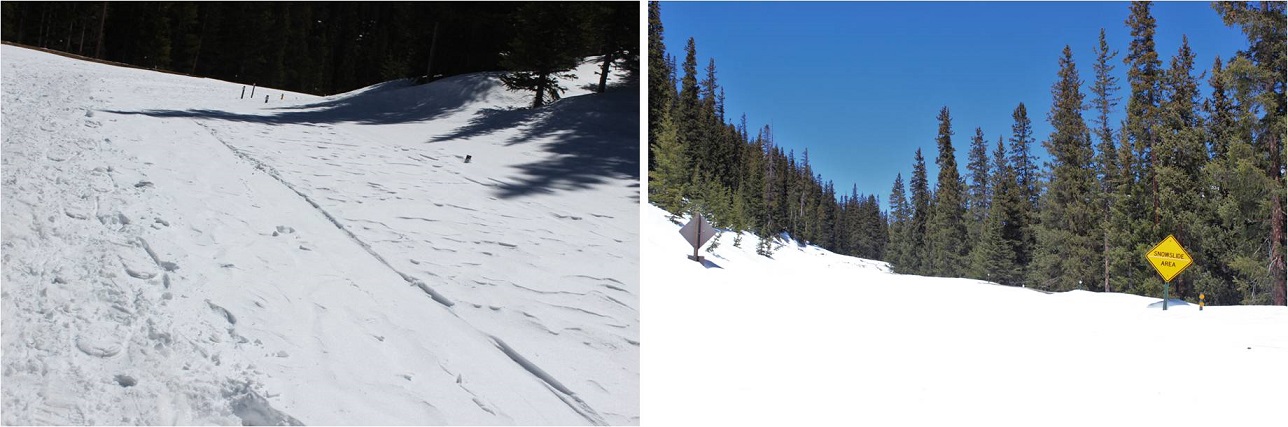
After yesterday’s summit I drove 4 hours to the next Trailhead, slept, woke up at 1:30am to 3 inches of snow, snowshoed for 3 miles, postholing up to my knees the entire way, came across an avalanche and crossed it, came to a second one that was impassable in the dark and was forced to turn back. I postholed 3 miles back, got back to my truck while it was still dark and it wouldn’t start, so I scraped 3 inches of snow off the hood, lifted it, fiddled with the battery and was on my way to the next trailhead when I saw a sign for Hanging Lake. I decided to turn my day around and check off an item on my bucket list at the same time! Now: off to my next adventure!

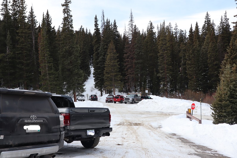
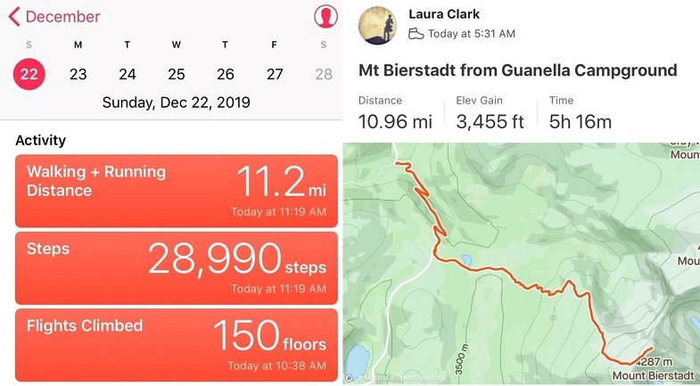
I arrived at the Guanella Pass Campground to a full parking area at 11am. I noticed a group ready to leave, so I waited around and snagged their parking spot when they left.  I was hungry from this morning, so I quickly boiled some water and prepped a Mountain House meal.  While I waited for it to cook I pulled up the weather report I’d saved from earlier in the morning (when I had reception at a truck stop down the road).  Wow.  The forecast had changed quite a bit in the two days I’d been mountaineering.  The weather for tomorrow was now very similar to the weather right now, except 20 degrees cooler.

I took a bite of the meal while I considered what to do. (Yuck! At this point I was forcing myself to eat, but this was really bad.  It tasted… old).  It was 11am, and while I’d already done 10 miles and 3000’ of elevation gain today and another 6 miles and 3600’ of elevation gain yesterday, I was feeling pretty good.

OK, so looking at the forecast I can either head out now while I’m tired but the weather’s warm, or try to get some sleep (I don’t have much luck of that at trailheads) and try tomorrow after I’ve “rested”. But it’ll be cold and windy tomorrow.  Both days had 44mph winds.  I took another bite (disgusting!) and threw the meal away.  Those things are nasty!

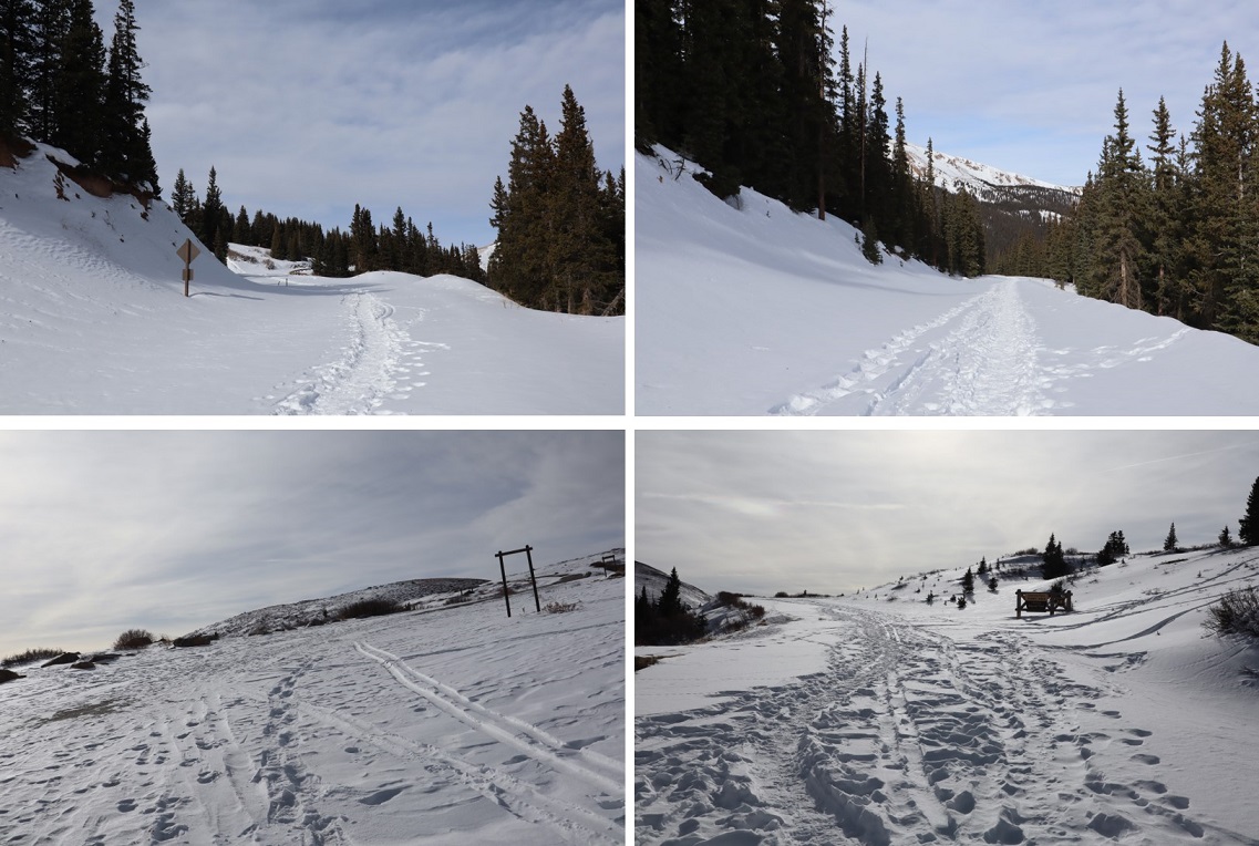
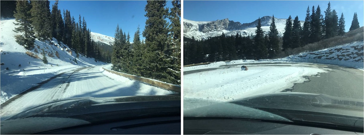
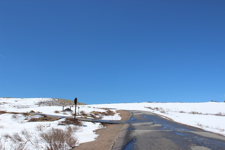
I made the obvious choice: I was the last one on the trail at 11:15am.  I figured I had a 50/50 shot at the summit, but I’d make that choice when I made it to the upper trailhead and could see the conditions/weather first hand.  The road was covered in many feet of snow and since it was late in the afternoon I needed snowshoes immediately.  I didn’t take them off the entire hike.

2

3

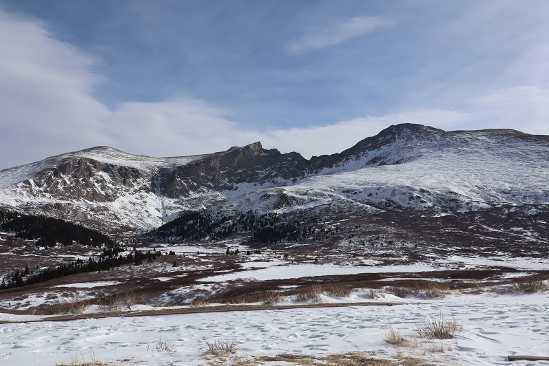
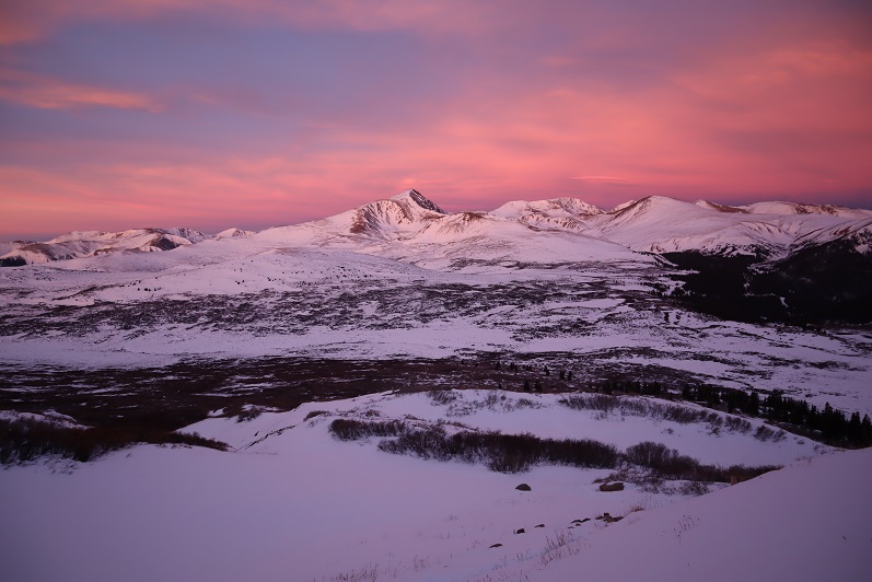
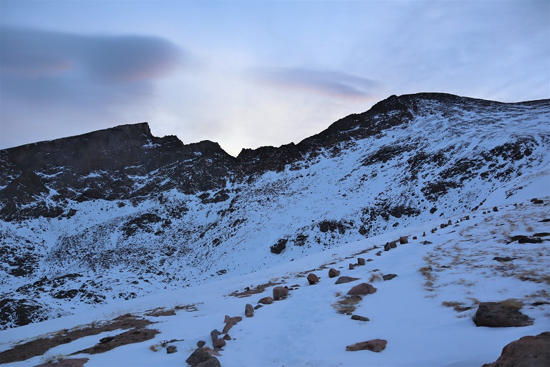
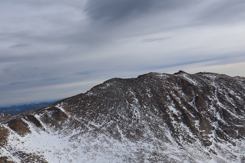
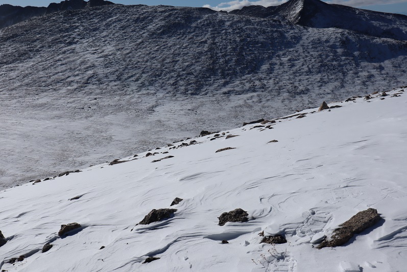
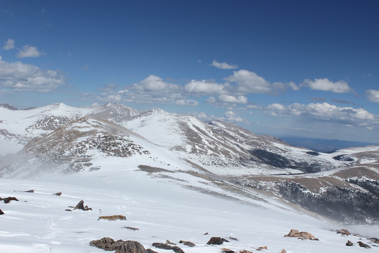
The views of Bierstadt, the Sawtooth, and Evans were beautiful, dusted with snow

4

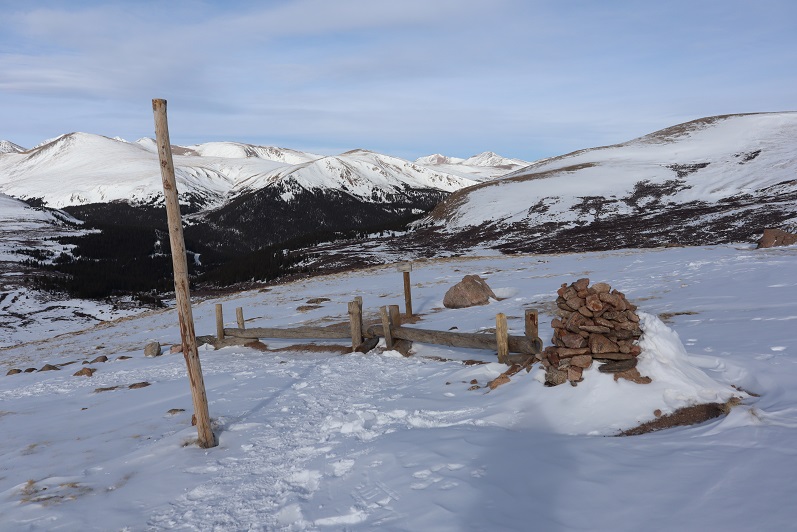
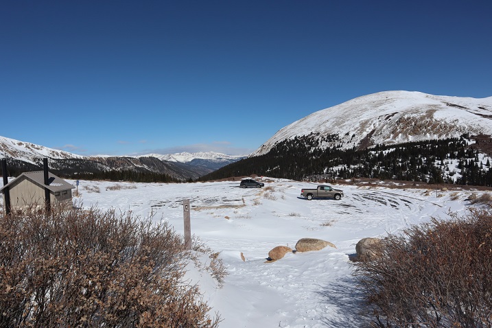
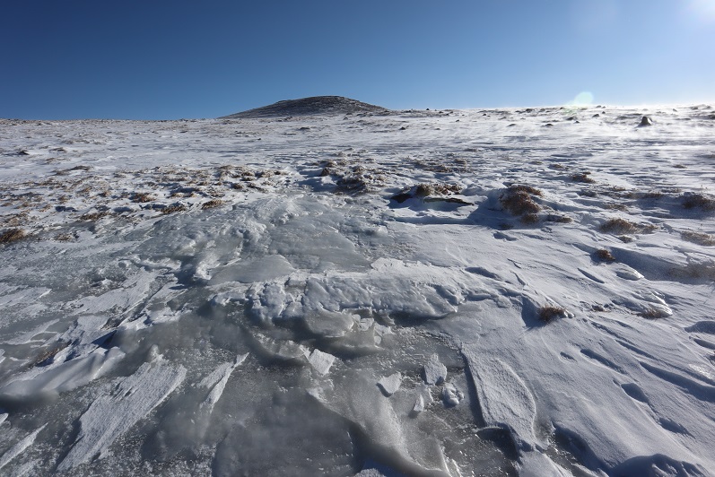
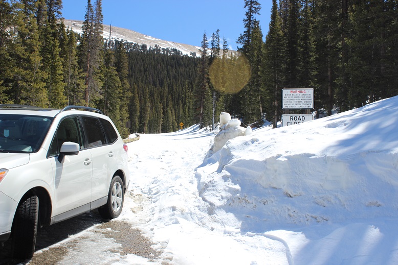
It wasn’t lost on me I was the only one hiking up the road, while I saw at least a dozen hikers on their way down, finished with their hikes (presumably of Bierstadt). Check out the snow in the parking area!

5

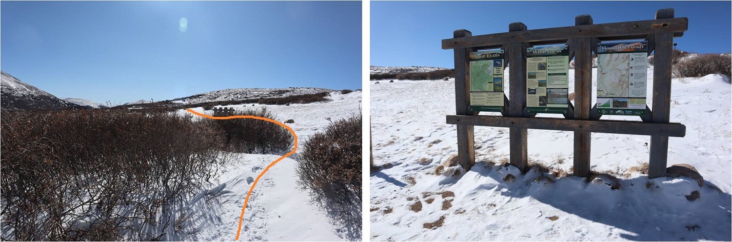
I followed a hikers trail to the Bierstadt trailhead, then crossed the road and found the trailhead at the top of Guanella Pass.

6

7

The trail starts directly behind the bathrooms. Looking at the current weather and trail conditions and measuring my present state of fitness I decided the hike was a go.  I searched my pockets for the topo map and route description I’d put together a few days ago and came up empty:  I’d left them on the dash of my truck.  Drat.  Well…. I was going for it anyway.

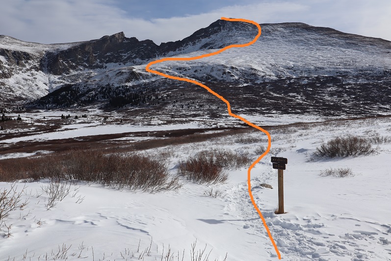
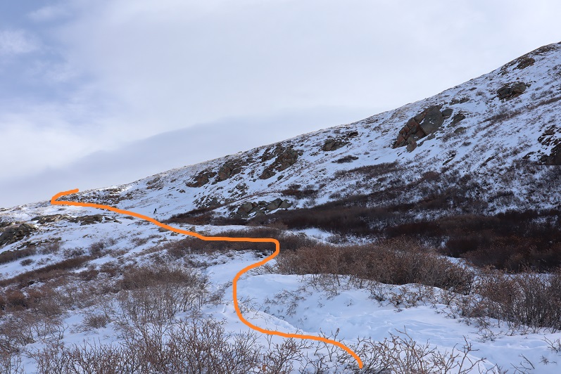
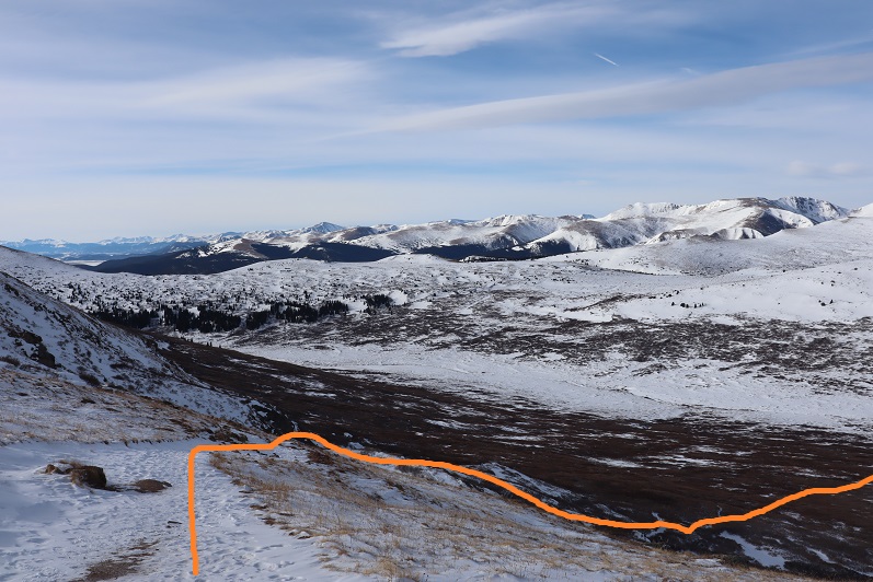
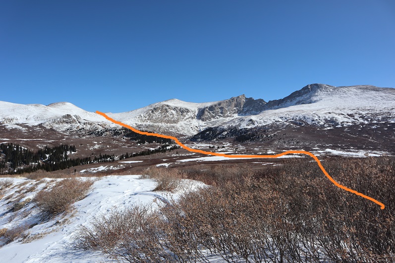
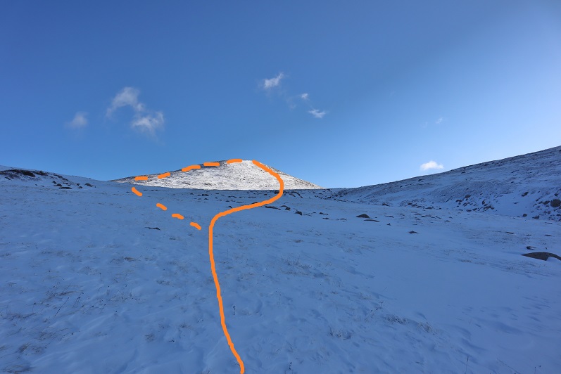
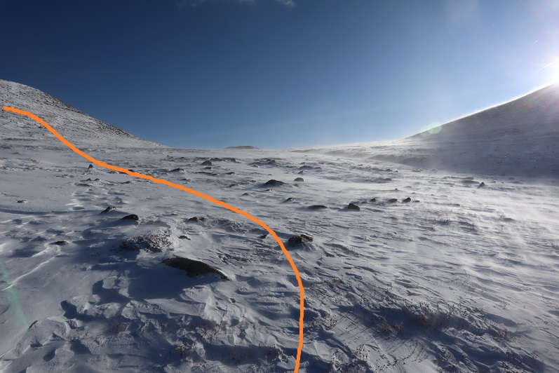
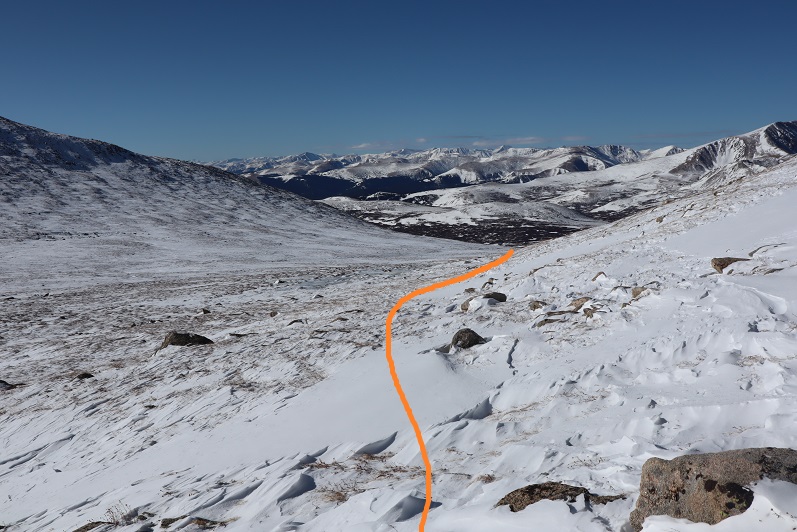
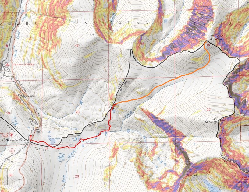
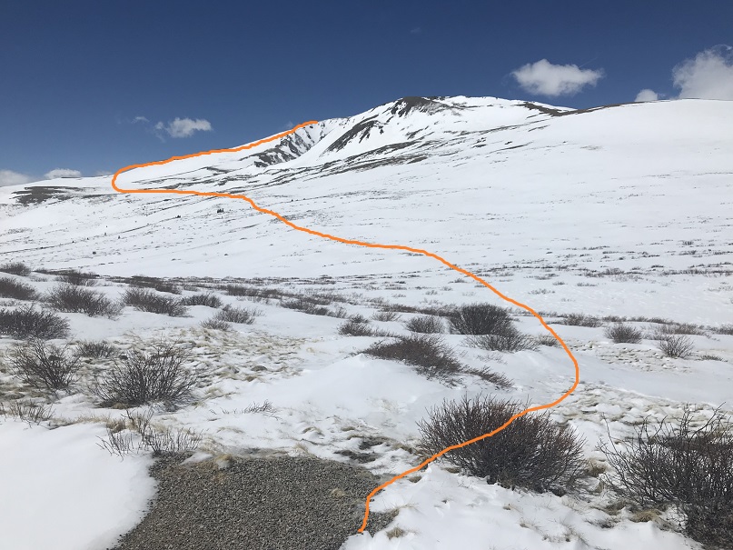
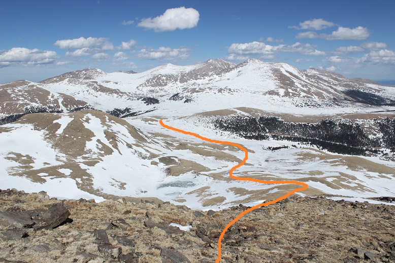
Here’s the route I took

8

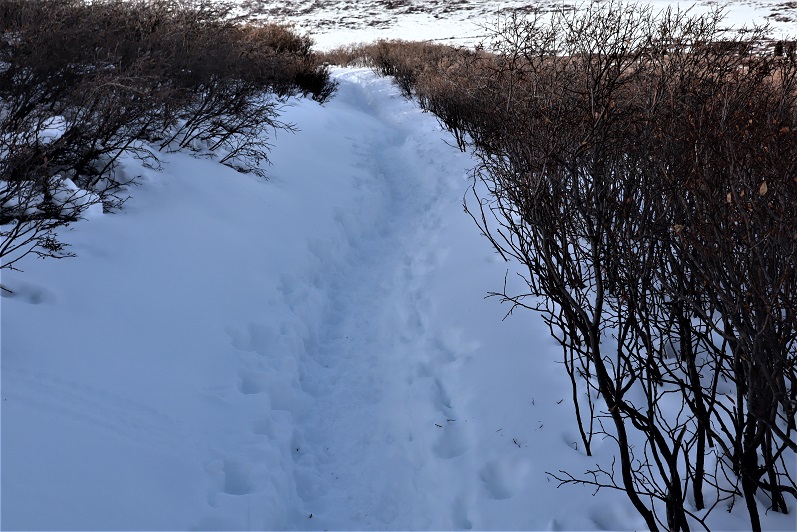
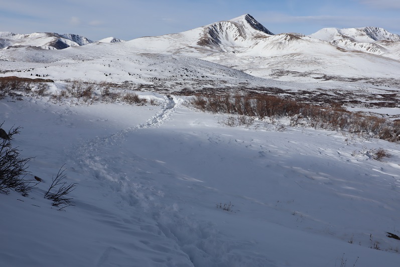
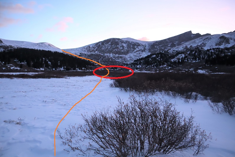
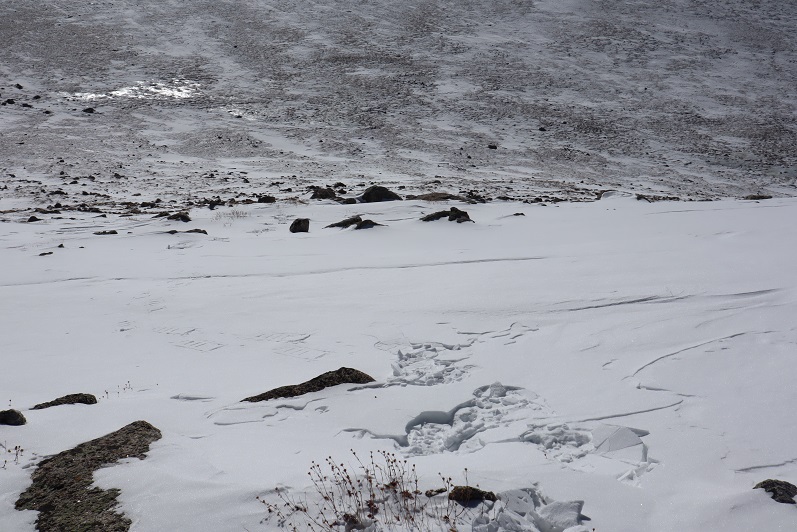
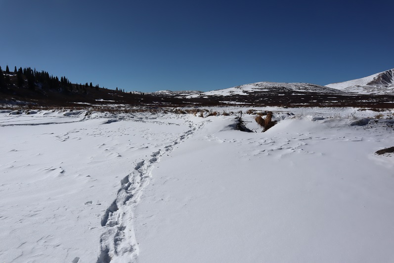
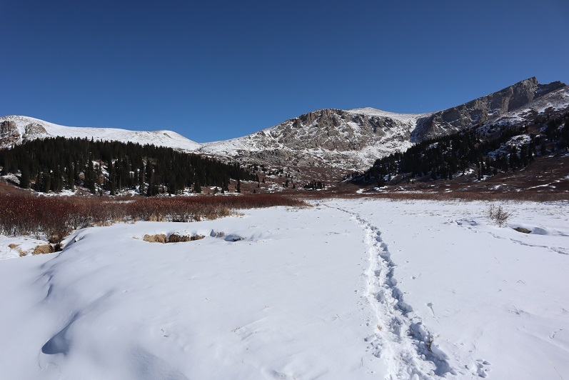
Those willows though! There are wooden bridges in the area and presumably a trail, but with all the snow I wasn’t able to find either of them.  So I trekked through the willows and headed towards Square Top, mindful not to trek too fast lest I fall into a willow hole.

Did you know there’s a trick to hiking through willows in the afternoon when the snow’s soft? It’s quite simple really:  Figure out which way the wind blows and hike behind the individual willows. If you hike on top of them you’re violating LNT, so try not to do that (even though that works too) but if you hike behind them you hike where the snow has piled up and is more compact.  In front of the willows there’s an air pocket from the snow blowing in the wind and you’ll sink.

So I trudged across the willows, only sinking up to my waist 4 or 5 times and aimed for the ridge.

9

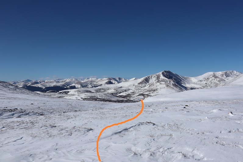
Every so often I’d look back for a frame of reference, trying to find the bathrooms and remembering my intended route back.

10

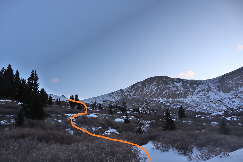
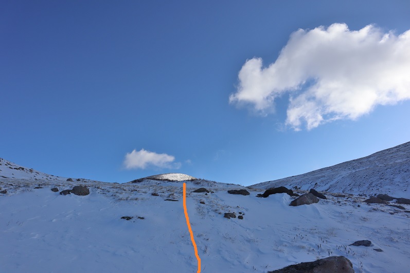
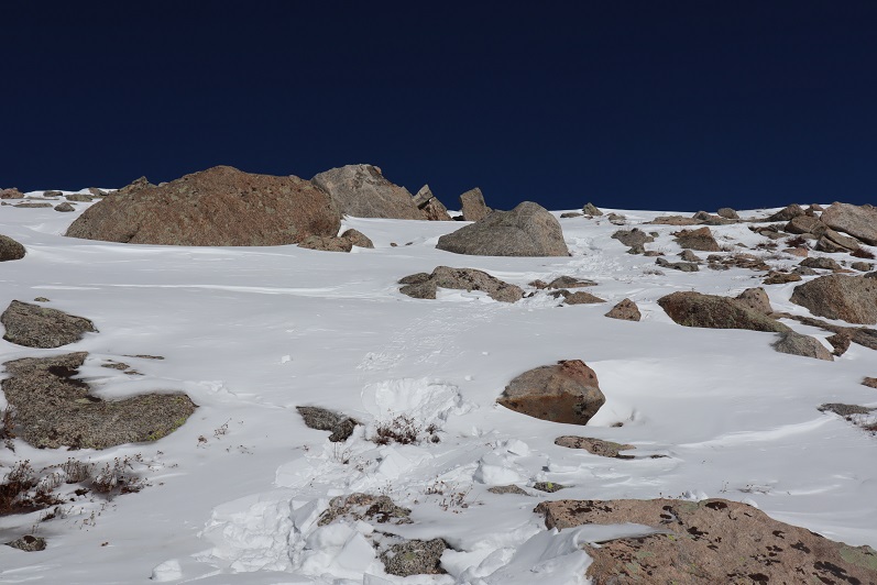
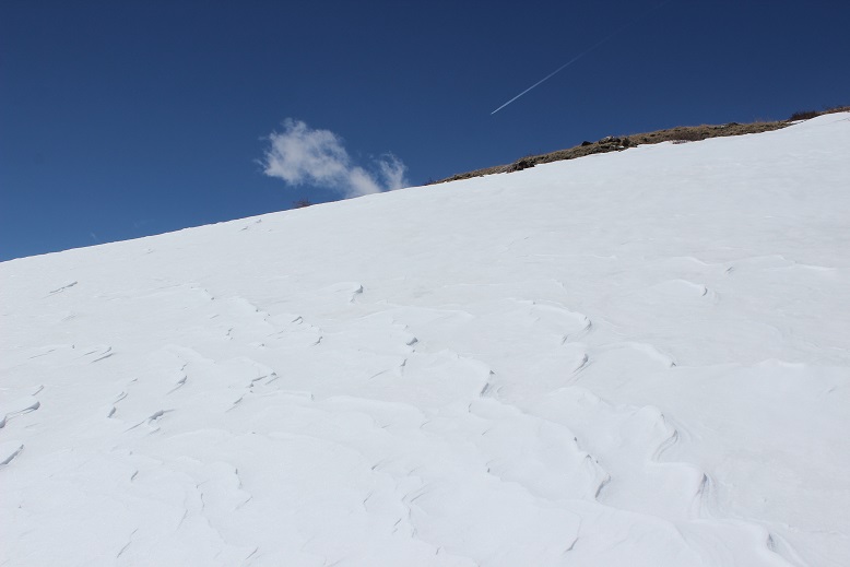
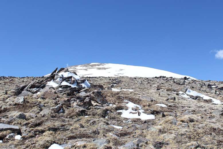
Before getting to the ridge there are several small hills to climb over, which had more snow and were steeper than anticipated

11

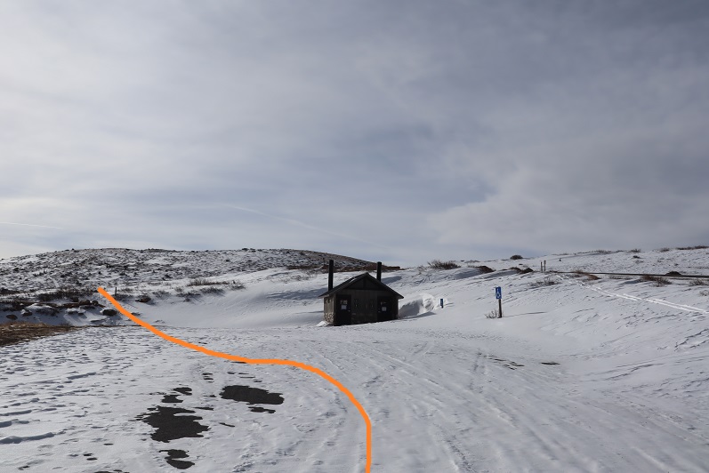
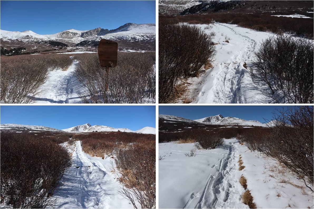
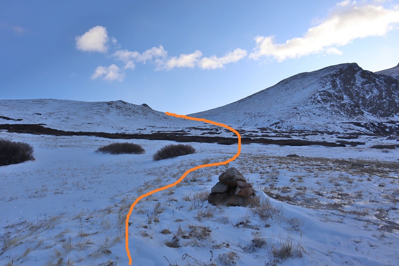
Eventually I came to this sign, and something in my head said to go left here, instead of straight (must have been the prepping I did earlier, because this was correct).

12

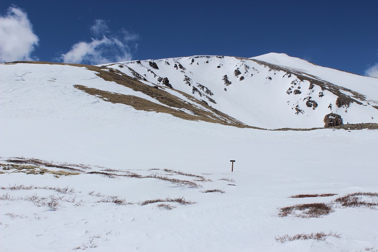
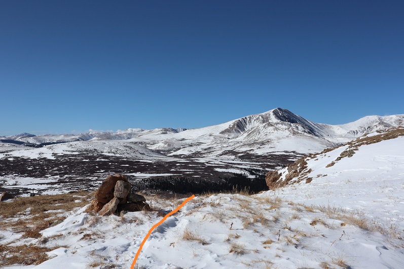
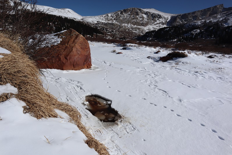
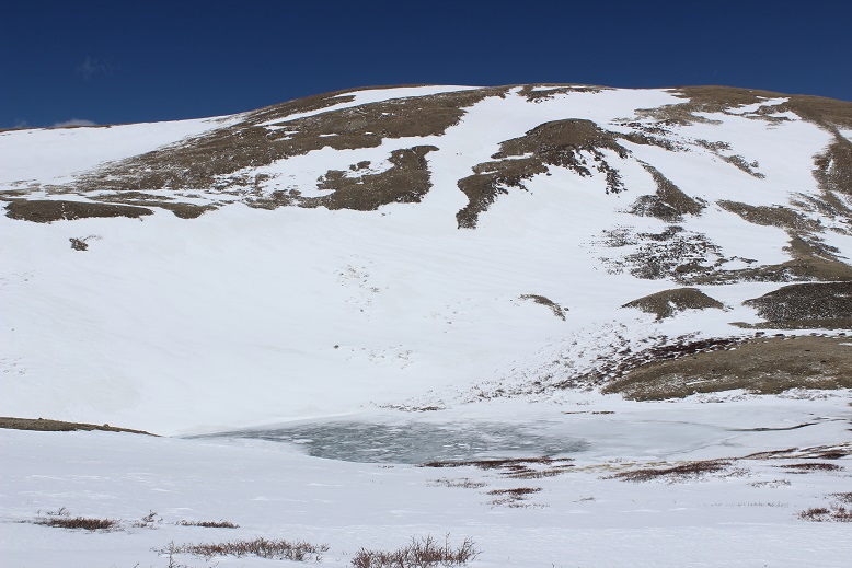
Just for reference, directly behind the sign is a small lake.

13

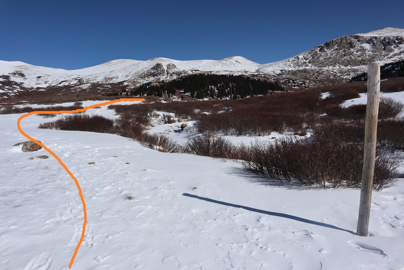
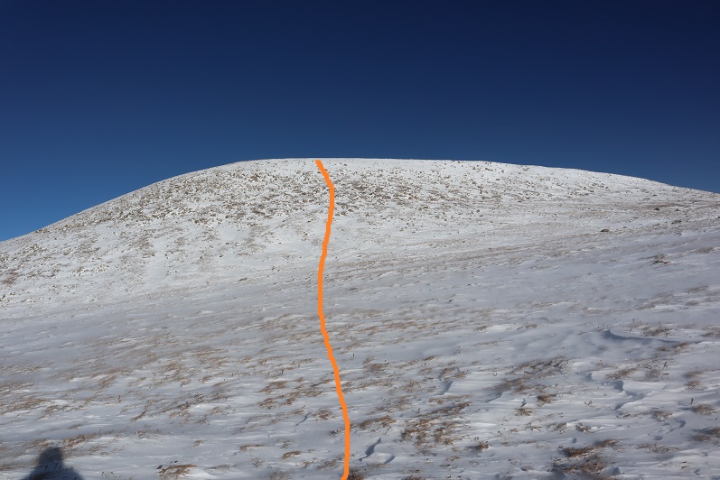
So I turned left at the sign and continued to a small saddle and turned right and began my trudge up the ridge

14

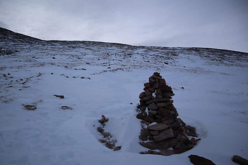
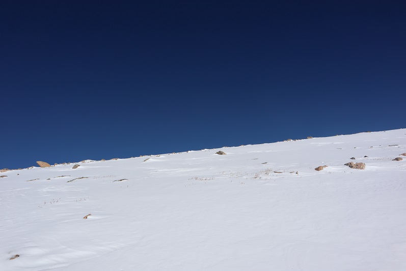
There were no signs, and no cairns (I’d been expecting them?)

I just kept heading up and up and up, and actually started drinking water. For me, this is never a good sign.  When I start drinking water it’s just the beginning of everything going downhill.  But I hadn’t eaten all that much (2 spoonfuls of that Mountain House Chili and the same this morning of an egg and bacon MH ‘meal’) and I’d hiked a lot in the past 24 hours, so I figured I should drink.

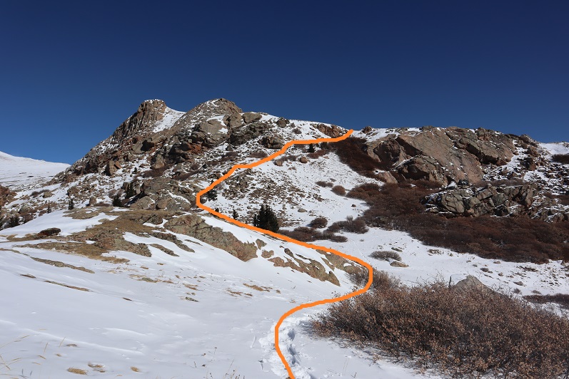
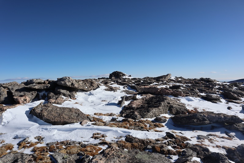
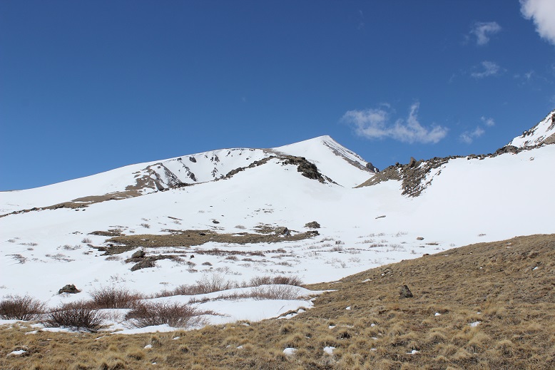
I reached another small saddle and had a pretty good view of the cornices below Square Top

15

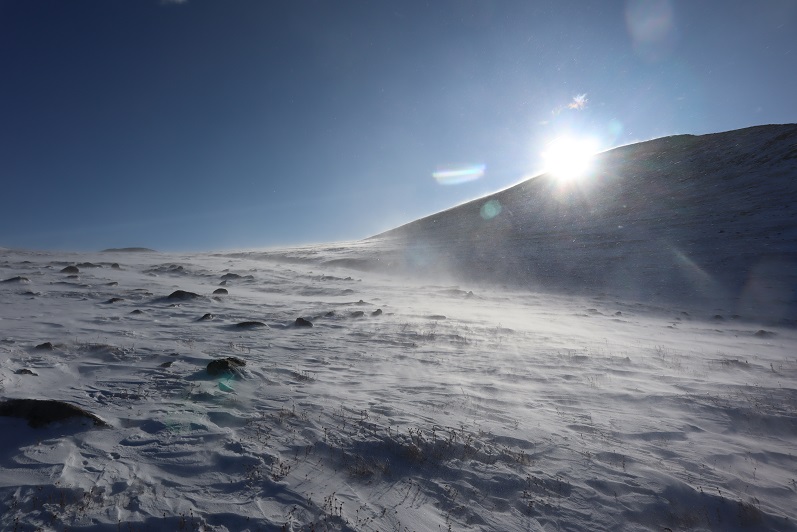
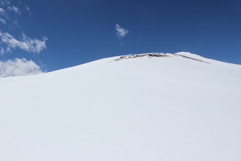
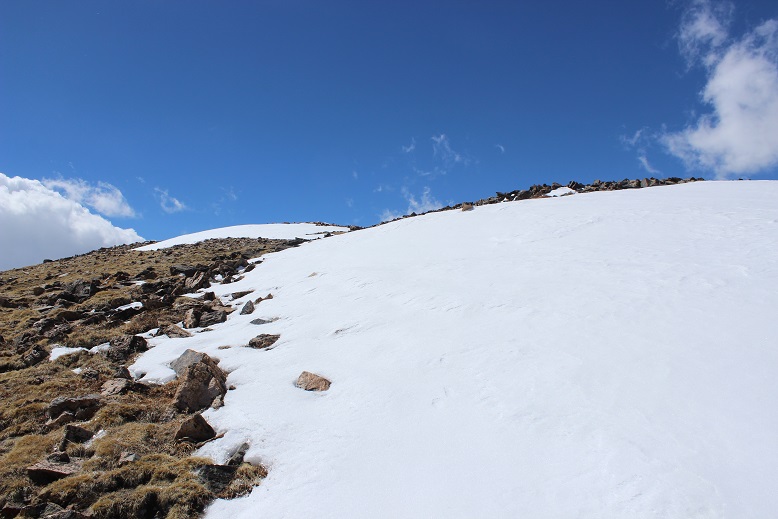
From here is where I started struggling. The wind picked up and so did the elevation gain. I kept sipping water and I even ate some dried strawberries I’d brought along (those were fantastic!).  No worries though, I could see my path to the summit and just had to keep trekking.  From my views earlier I knew this wasn’t the summit…

16

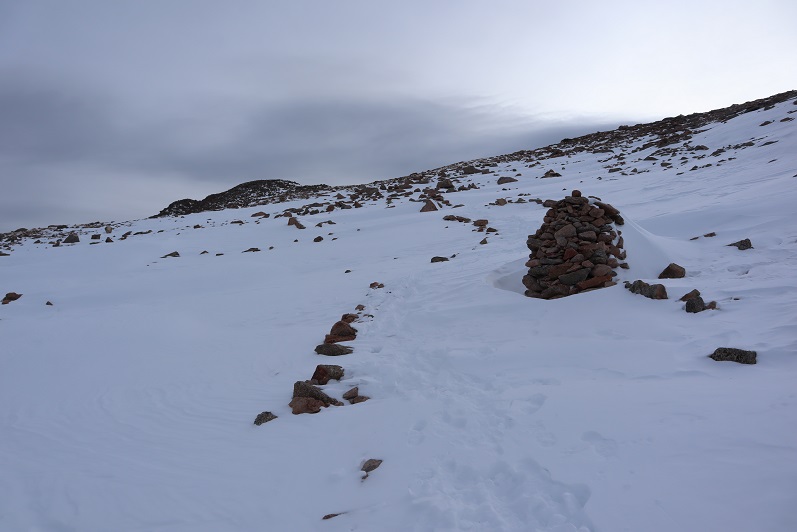
But I thought surely the summit was just behind this bump, right? Oh look, a cairn!  That must be the summit behind…

17

I was moving slowly now, and my quads were burning (as opposed to my calves yesterday). I’d take 50 steps, and then stop to rest for 10 seconds, and then continue on

18

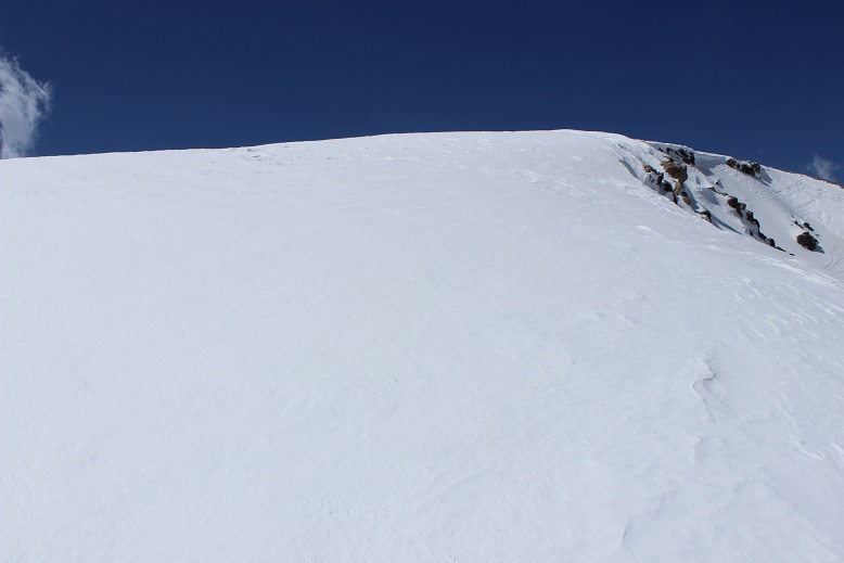
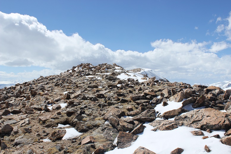
I made it to this bump, thinking surely this was it, but nope, another hill in the distance! Ouch!  Ok, now I was down to 30 steps with 10 seconds to breathe.  And lots and lots of sips of water.  I. Was. Almost. There!  I just had to keep pushing on.

19

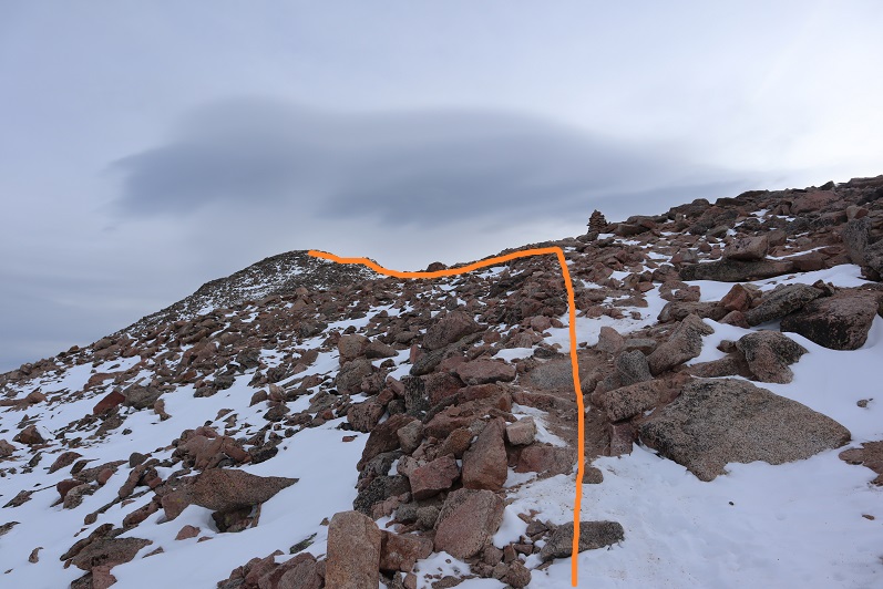
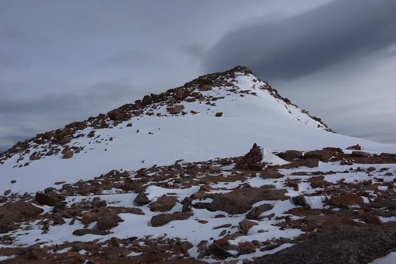
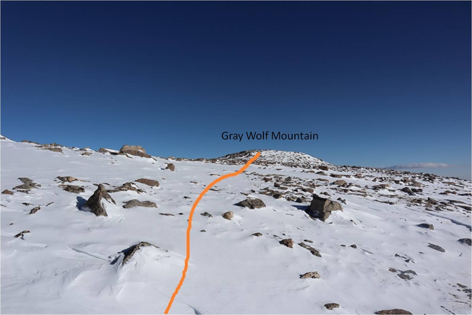
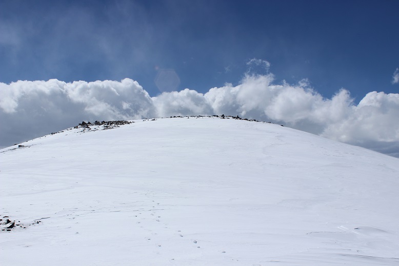
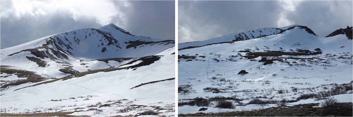
I made it to the top of this bump and wanted to curse! Why, oh why was the Lord punishing me?  There was another bump and a ridgeline and another summit in the distance.

20

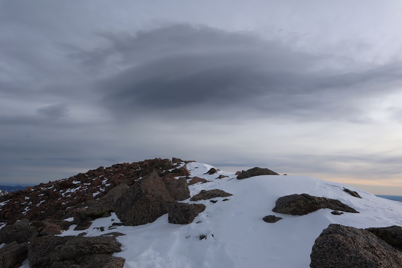
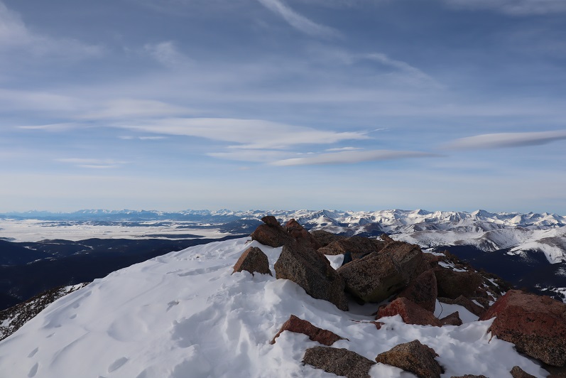
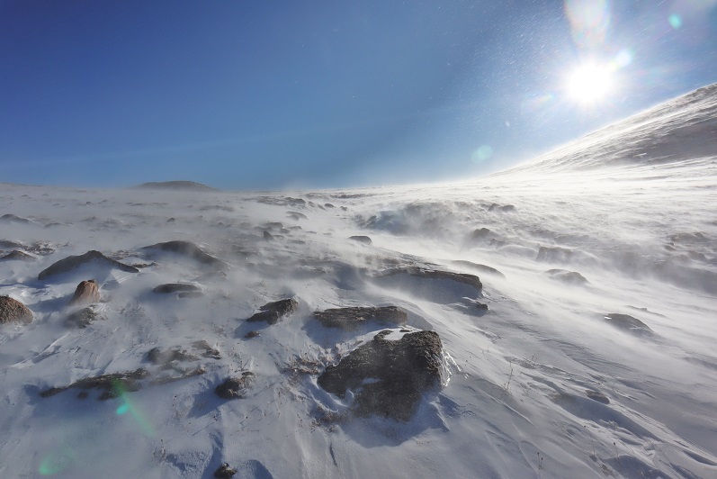
Well, there was nothing for it. I continued on, thankful at least the intense elevation gain had lessened.  Unfortunately the wind was insane here, and blowing directly at me.  Oh, and that wasn’t the summit either:  This is the summit

21

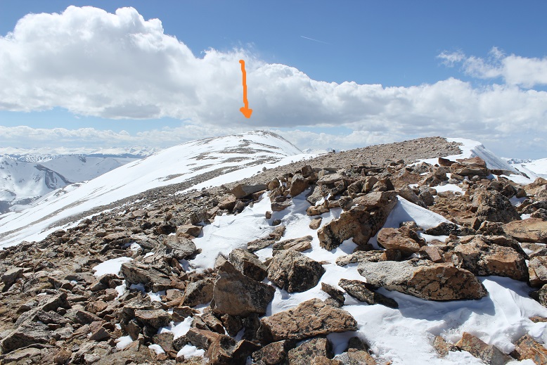
Also, it includes losing elevation a bit and then regaining it back. Joy.

22

23

Now, this wasn’t a particularly challenging hike, but I was tired to start, and I seriously worked for this ‘easy’ summit. It was cold, windy, and I was sore all over.  It was all mental and totally worth the effort!

24

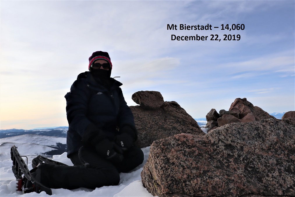
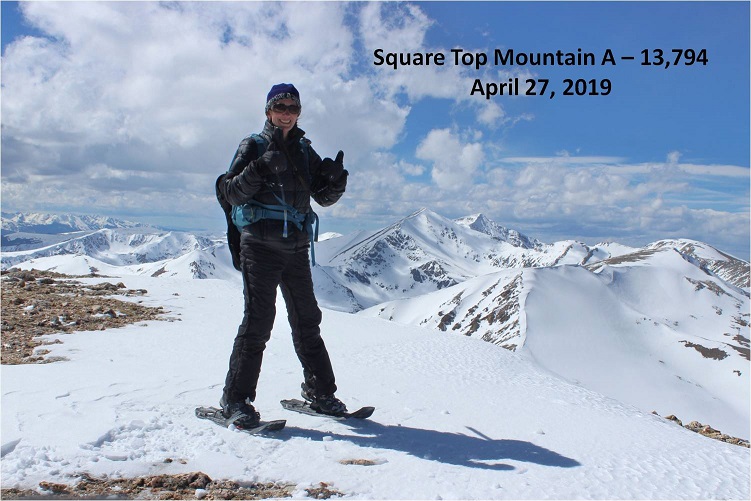
I’m not sure what time I summited because it was too windy/cold for me to take out my phone, but I did get a few summit photos with my DSLR

25

I’d originally kind of wanted to make this a loop with Argentine and Wilcox, but I’d already done Argentine Peak earlier this year, and after looking at the elevation gain/loss involved today, this was a big nope.

26

I decided to turn around and make this an out and back hike.

27

That wind never let up, and here it knocked me down a few times

28

(Looking back at the final push to the summit)

29

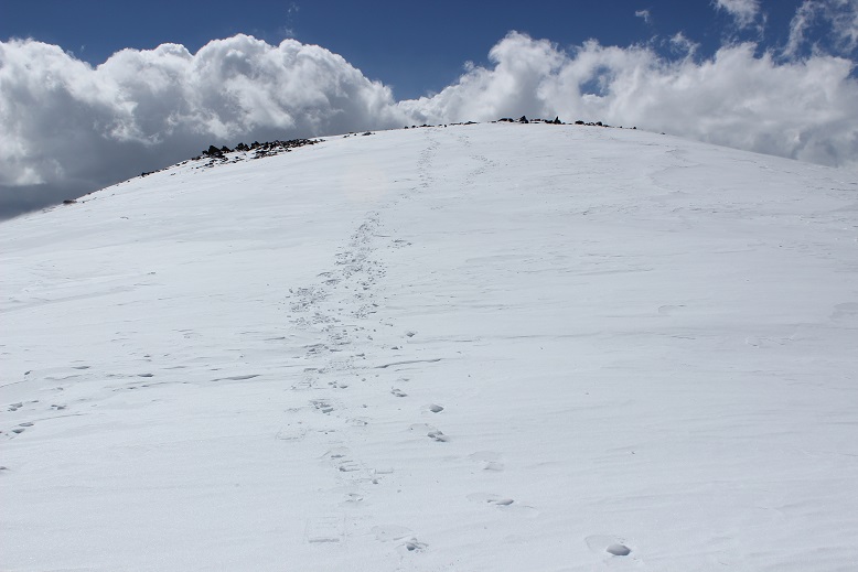
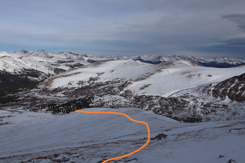
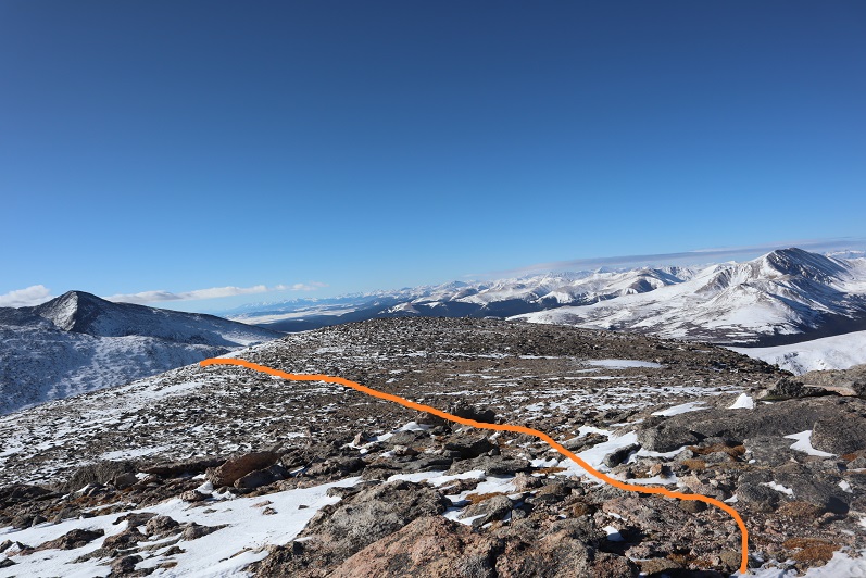
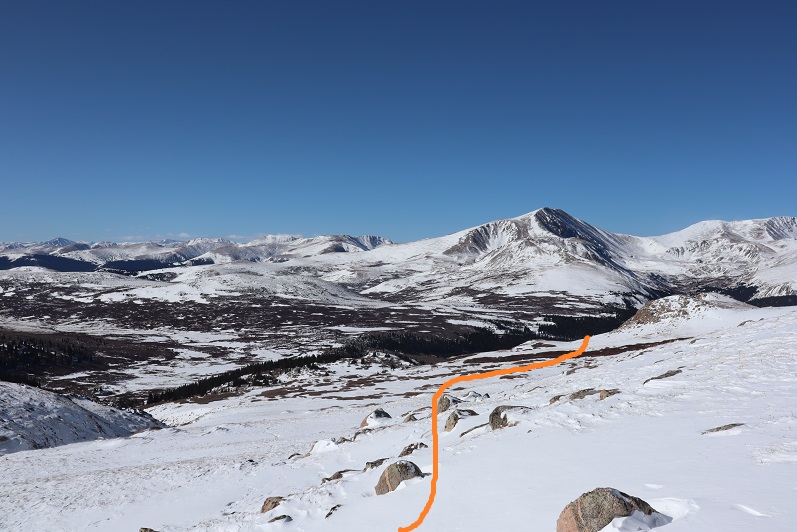
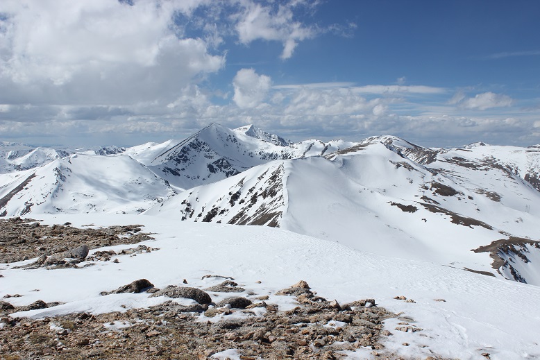
I made it back to where I’d originally thought the summit was and got a good view of the route I took up

30

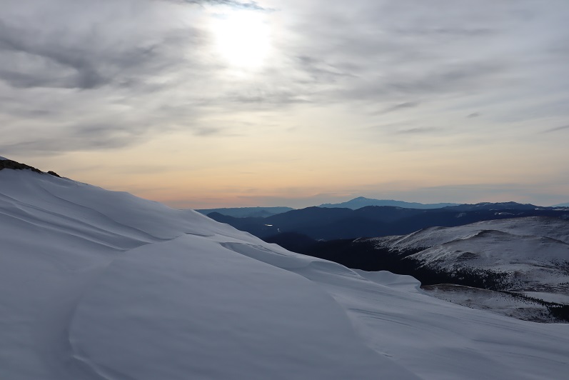
The route down was steep but felt much better on my quads

31

This hike was slow going. I wasn’t setting any records today, and I was going slower by the minute.  And that wind was causing my nose to run and run and run, making it raw, raw, raw.  Ouch!

32

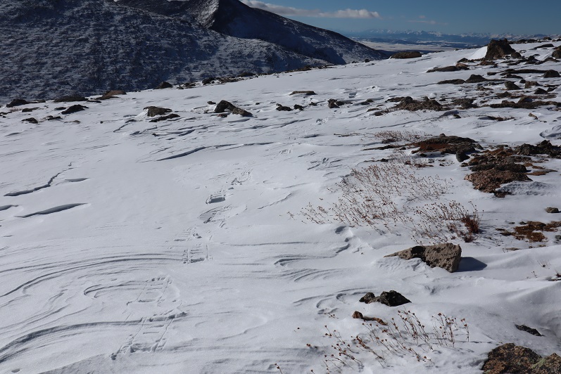
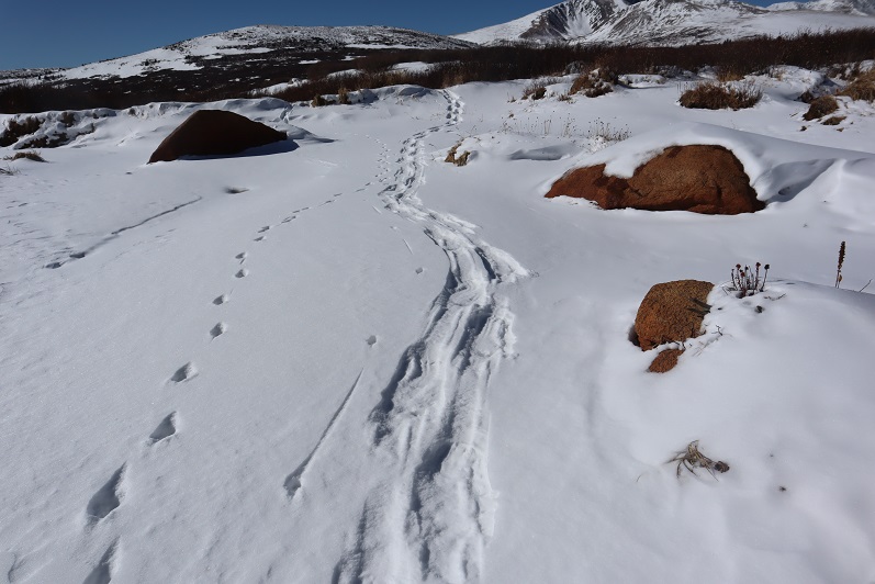
The wind was bringing in a storm. Here you can see the tracks I made on my way back down to the willows and eventually the upper trailhead area.  One of the good parts about descending so late in the day was the snow had begun to re-freeze in the willows area, actually making it firmer than it was on my trek in.

33

34

When I made it to the Guanella Pass Trailhead I knew I only had less than 2 miles left to go, but I was exhausted. I followed the road back down to my truck, trying to beat the snow.  I lost, and it snowed the last mile of the hike.

35

That last mile was brutal. My whole body was screaming for me to stop, but it was snowing and I was almost done and stopping was not an option.  I did allow myself to crouch down a few times and grunted audibly as I stood up again (I know better than to rest like this, but it felt so good!).  During this time I kept telling myself 2 things:  I could do this, and there’s a bottle of Knob Creek waiting for me in my truck.

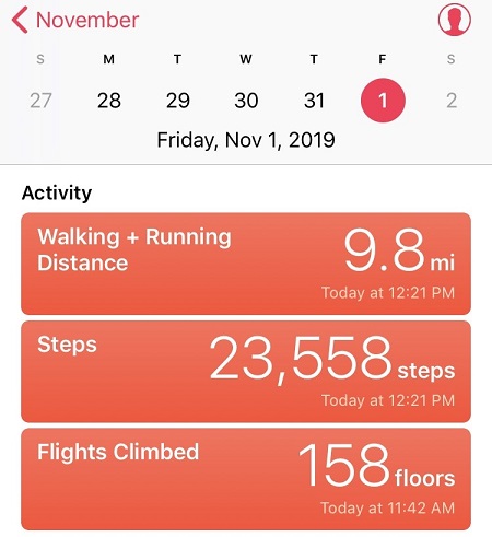
I made it back to the campground at 6:45pm, making this a 10.5 mile hike in about 7.5 hours (But I’d like to add in the past 36 hours I’d done 10,000’ of elevation gain in 26 miles, so my body had gotten quite a workout in the past day and a half).

36

Relive Video

When I got to my truck there were 2 other vehicles in the parking lot, but they looked like they were from tours intending to be out in the mountains overnight.   I took a quick wet-wipe bath and changed my clothes in the back seat of my truck.  As I was doing so it felt so good to just lie down.  Amazing. Euphoric even.   It’s been a few months since I’ve tired myself out this much on a hike and I just wanted to enjoy the feeling.  I was numb all over, my body was humming, and I hadn’t even had a shot of whiskey yet.  Or eaten.  Oh yeah, I needed to do that.  So I finished getting dressed and looked at what I had:  The uneaten Mountain House meal… 2 uncooked Mountain House meals, a sleeve of saltine crackers, and some Ritz crackers.  I was seriously missing my beef jerky!  I make an amazing beef jerky that’s my staple on these longer hikes, but my kids raided it and I didn’t have any to bring with me this weekend.  Ugh.  Ok, Whiskey and crackers it was for dinner.  I had 2 shots of whiskey, 2 Ritz crackers, and fell asleep.  Only to wake up at 12:30ambecause of the wind, needing to pee.  I sat there for 10 minutes trying to fall asleep but it was no use.

OK, I had options again. I could go outside where it was windy and snowing and jump back in my truck, and then spend the next 4 hours trying to get back to sleep. Or I could just get up and drive the 2 hours home now, and take a bath and be in bed by 3am.  This meant I’d need to work out tomorrow (a personal rule of mine) but it seemed the better option.  I was on the road and home by 2:30am, very pleased with myself.  This is why I like hiking solo:  I can make these kinds of decisions (like pushing on to the summit or leaving in the middle of the night) and no one has to agree or be put out by them.  The only downside?  Once I made it home I couldn’t sleep… so I started brainstorming better meal ideas.  I’ve got to eat better so I don’t crash, and Mountain House isn’t doing it for me.  Apparently I’d rather starve…