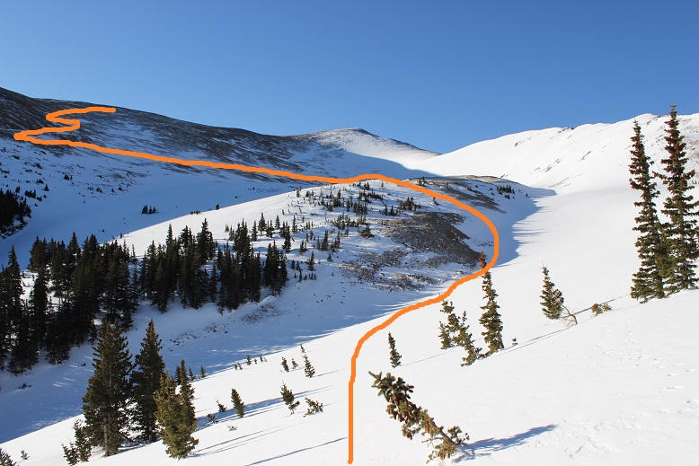
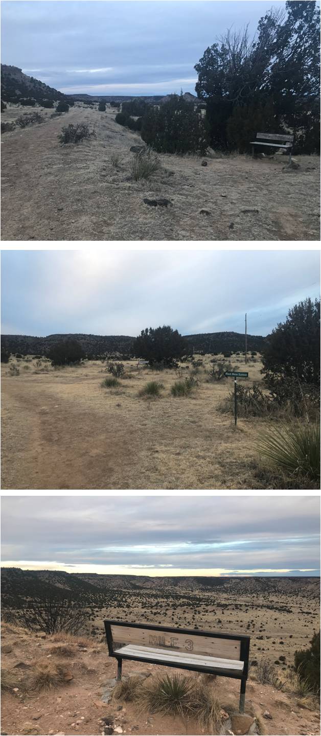
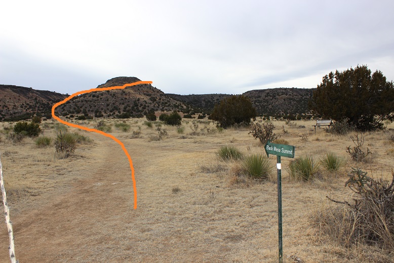
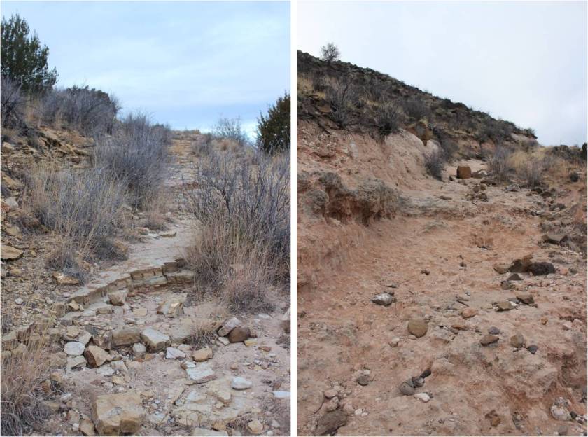
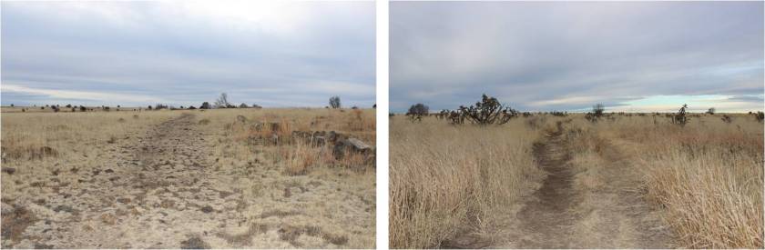
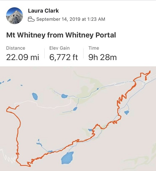
Mt Whitney – 14,508, California Highpoint

1

RT Length: 22 miles

Elevation Gain: 6772’

I won the lottery! Well, not really.  I applied for the Whitney Lottery, didn’t win any of the dates I selected (even though I put in 15 different dates) and then had to hound the site for a dropped spot.  Long story short I scored a day trip pass to hike Mt Whitney and considered it my birthday present this year, as every year around my birthday I try to check off a bucket list adventure, and it’s my birthday this week.

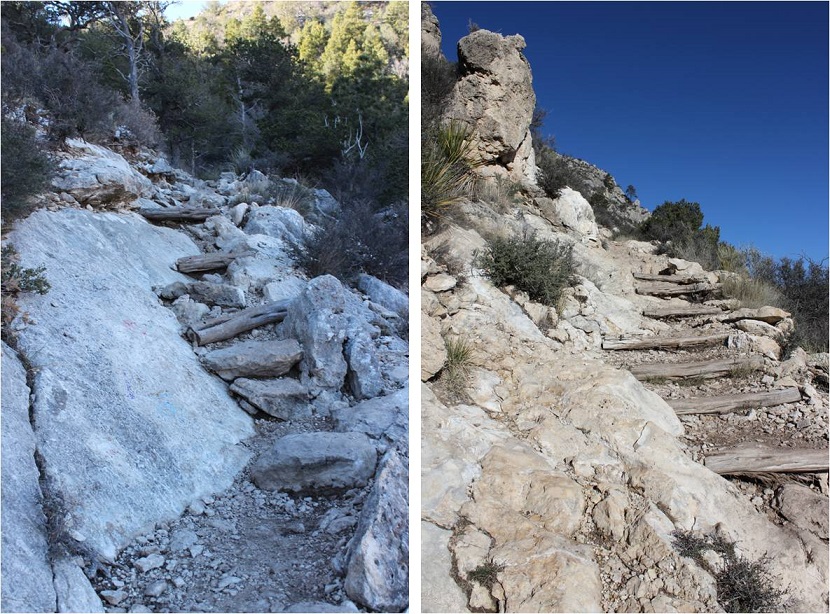
Hiking Mt Whitney has been a goal of mine ever since I attended Girl Scout camp in middle school. I didn’t know much about it other than it was the highest point in the continental United States and was supposed to be a strenuous hike.  At this point in my life as a mountaineer I can tell you the most difficult part of this hike was obtaining the permit:  basically it’s a long walk up a very well maintained trail with no route finding involved.  I didn’t get out my map once (but bring one!)There aren’t cairns because they aren’t needed. If you’re in good shape, the weather’s good and you start early you should have no difficulty hiking this mountain.

I was a little bummed my new camera hadn’t arrived yet: My old camera had been destroyed in the weather on Jagged, so I’d ordered a new one and it was supposed to arrive the day before my trip (side note:  it still hasn’t arrived, even almost a week later).  This meant I’d need to use my phone camera, which wasn’t ideal because it had been acting “iffy” lately, but worked as a decent backup.  It just meant selfies as summit shots.

I woke up at 1am, worked out on the treadmill for an hour and drove 2 hours to the airport. I was very light on gear, bringing only my small backpack and small hiking pack, both carry-ons.  The only reason I needed two packs was my sleeping bag took up too much room in my day pack, so I had to bring another.  They were both light and no I had problem carrying them through the airport.

I get stopped at security every time I pass through an airport. Every time. Usually it’s because of some sort of food item (dried mangoes, beef jerky, Girl Scout cookies, etc.) but this time it was for a valid reason:  I’d left a small pocket knife in one of my bags (an honest mistake, as I’d thought I’d cleared all such items out before packing but apparently I’d missed the knife as it fell into the spot my water bladder rested).  Funny thing, they took no issue with my crampons.  My flight was only about half full so I got a window seat and sat back and relaxed.  There must be a body building competition in Vegas this weekend because the plane was full of body builders.  My toes were already burning so I took off my shoes, sat back, and read a book.

My first stop after landing in Las Vegas was to obtain my rental car. I’d reserved one online, intending to upgrade when I got to the facility. The lady at the reception desk was nice but English was her second language and her first was outside of my skill set (Thai?).  I asked her over and over again about ground clearance and told her I’d be driving on 2WD dirt roads.  To her my only options were a Toyota or a Hyundai.  I took the Toyota Corolla and was on my way.

My second stop was the local Walmart for supplies I couldn’t take with me on the plane: food, bottled water, and a trekking pole.  I also picked up a few birthday crowns (they were out of hats, boas, etc, so I took what I could get) and snacks (peanut butter – also not allowed on planes, milk duds, and dried mangoes).

I’m not a fan of Las Vegas. I used to frequent the city as a teenager (read fake IDs and freedom 3 hours from So Cal) but once I turned 21 it lost its appeal.  Las Vegas today was simply a conduit for a larger goal:  it was the closest reasonable airport to Mt Whitney, and still a 4 hour drive to get there.

No worries though, because I love to drive! The only downside was the automatic beeping noise the rental car dashboard made when I was “drifting into the next lane”, which drove me crazy because:

  • I wasn’t drifting into the next lane
  • I was driving on curvy mountain roads and at times if I wasn’t hugging the center line I’d be falling over a cliff
  • It went off when I wasn’t using my blinker and switching lanes (who uses their blinker when they’re the only one driving for as far as you can see?)
  • It oftentimes mistook skid lines on the road for the center line and went off ‘randomly’
  • It told me it was time to pull over and take a “coffee break” because I was driving erratically (this was a bit insulting, but I understood the intended purpose)

In short, I will NEVER buy a vehicle that has this mechanism. I’m sure there was a way to turn it off but I was unable to figure it out. The constant beeping was annoying, but I got over it by turning up the volume on the radio.

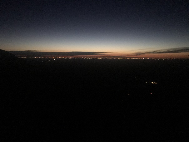
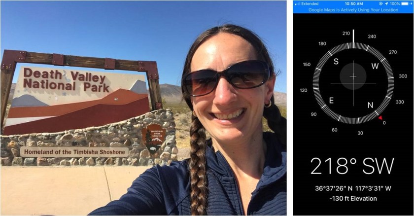
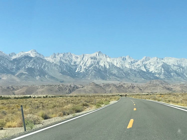
My drive took me through Death Valley which was cool because its lowest point is 282 feet below sea level (the lowest point in the US) and the next day I’d be hiking to the highest point in the continental US, so it seemed fitting to start from the bottom. The lowest elevation I was able to tag as a photo with my phone altimeter was 130 feet below sea level.  The weather was about 100 degrees outside; not bad for September.

2

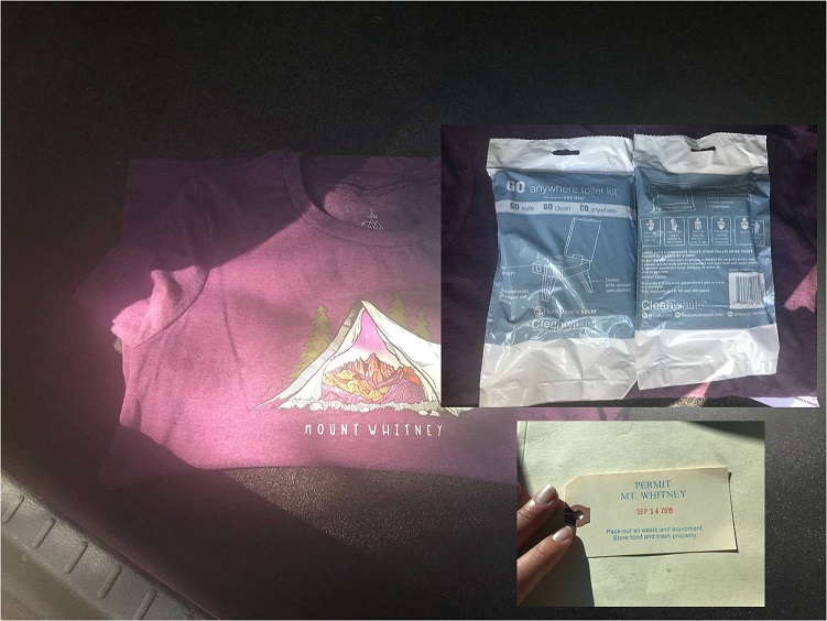
I drove from Las Vegas to the Eastern Sierra Interagency Visitor Center to pick up my permit.

3

Side note about the permit process: I completely understand the need for a permit system on this mountain, yet I seriously hope the permit system never comes to Colorado.  The permit system as it applies to hiking is one of the (many) reasons I left California: you need to get the permit several months in advance of your intended hike, they cost money, parking is an extra fee (passes were $60 a year when I left in 2007) and you’re screwed if the weather is bad on the date of your intended hike (especially if you’re coming from out of state).  Many people feel the financial NEED to summit on their given permit date due to the time/work it takes to obtain a permit and the necessary reservations for the hike.

There are also separate overnight and fire permits you need to apply for in addition to a hiking permit (god forbid you need a fire and don’t have a permit to build one…). I also don’t like the government knowing where I am at any given time (weird, I know, but it bothers me).   I’m not averse to paying to use public lands (although many people are), I just don’t appreciate the lottery system:  It took me years to obtain a permit to hike this one mountain.  Also, walk-up permits are no longer allowed.   I’d be more in favor of a hiking license (similar to a hunting/fishing license). I’m not sure how this would look exactly, but in any event, I beg you Colorado: please don’t implement the permit system:  It stinks!

Ok, off my soap box. I picked up my permit, wag bag, and bought a shirt and patch for good measure.  I was extremely lucky the weather forecast was perfect for this weekend.

4

There were several people waiting outside the permit office hoping to get a day permit. Most were internationals who didn’t understand they don’t issue day permits for Mt Whitney.  These people were seriously bummed (having travelled thousands of miles for this opportunity) and were told to keep scrolling online, looking for a dropped spot.  I felt sorry for them:  permit slots aren’t open immediately after someone drops them; they come up randomly afterwards with no rhyme or reason.

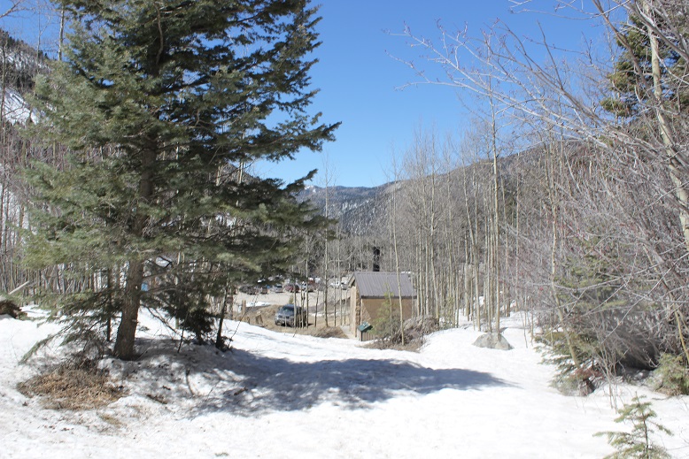
From the permit office I travelled north on US 395 to the first and only stop light in town, turned left, and drive for 13 miles to the Whitney Portal/parking/camping area for the Whitney trail.

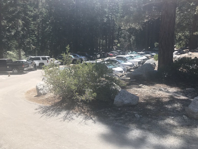
The parking area held about 200 vehicles and was completely full, so I drove around and finally found a parking spot in the overflow area. Bonus:  it was in the shade!  The campground looked like a typical California campground with sites piled on top of each other, all full, with no privacy from the campers next to you.

5

I parked the Corolla in backwards and since it was still early I decided to do a little exploring. I walked a quarter mile up the road to the portal store

6

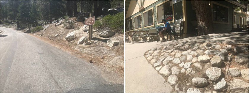
The portal store was like a mini and overpriced REI, with everything from camp stoves and winter weather gear to patches, souvenirs, t-shirts, duct tape, and emergency supplies. I wasn’t in need of any gear so I walked around a bit more.  There were bathrooms and a place to throw away wag bags and a separate area for all kinds of trash.

7

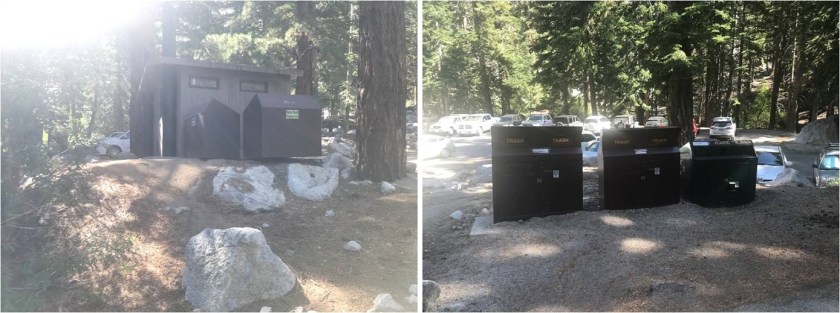
There was a water pump directly outside the bathrooms with a sign indicating you couldn’t wash there, which is totally understandable but a missed opportunity for income on the part of the portal: They should have paid showers somewhere in this place.  I’d have paid for them, and I know tons of other thru hikers would have seized the opportunity as well.

I’d heard from people there was no overnight camping in your vehicle at the portal, yet there were dozens of people doing so and no signs indicating you weren’t allowed to. I saw trucks with tents set up in their beds, and even RVs in parking spaces (you KNOW people are sleeping in those).

8

I felt it was busy, yet overheard the workers at the portal store comment on how slow it was for a Friday, and how the season must be winding down. When I asked the lady working at the portal store if I was allowed to sleep in my vehicle she said “Why not?  Everyone else does.”  So that’s what I decided to do.

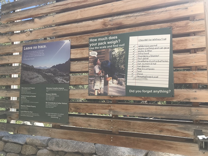
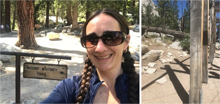
I took a selfie at the beginning of the trail and also took a picture of where people weigh their bags before beginning their hike. Today I was hiking light (my pack couldn’t have been more than 10lbs) so I didn’t weigh it.

9

I talked to a bunch of people while walking around and everyone I talked to said they intended to be “on trail” by 1am. I thought that sounded like a great idea so I decided to get to bed early for an early start.  I packed up all my gear, set out what I needed for the morning, and was asleep in the back of the Corolla by 4pm.  The last thing I saw before closing my eyes was a very small and very pink smart car racing down the road back to US 395.

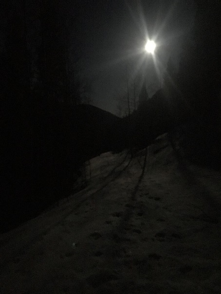
I woke up at 1am and groggily took a look around. What I thought were dozens of people with flashlights getting ready to hike ended up being the full moon reflected on the windshields of all the vehicles in the parking lot. I was on the trail by 1:30am, curious how I couldn’t see any flashlights ahead of me.

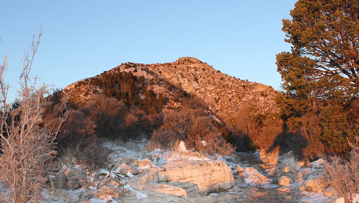
The first thing I thought to myself as I started this hike was “it smells like the California mountains”. I’m not sure how to describe it, but the mountains here just smell different than the ones we have in Colorado.  It must be the serrano, sage, mahogany, pine and scrub oak combination.

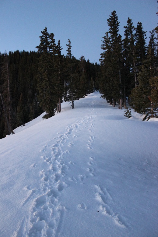
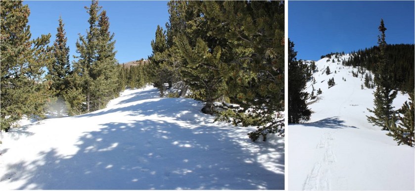
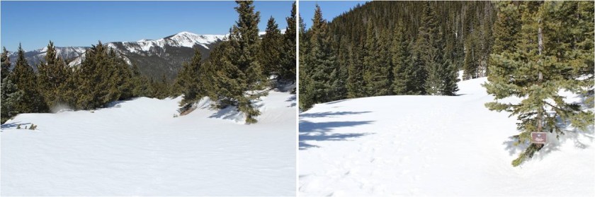
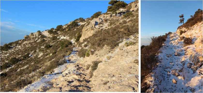
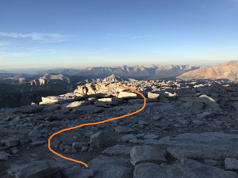
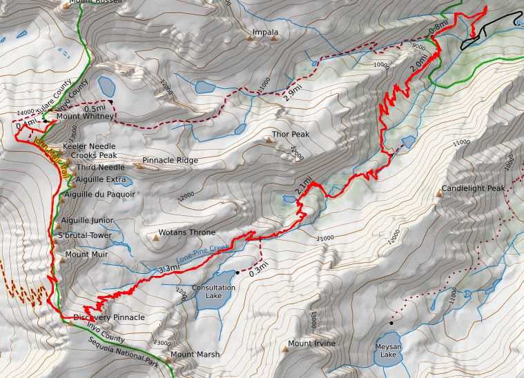
The hike starts at the Mount Whitney Trail and switchbacks and switchbacks and switchbacks. And switchbacks.  If you’re on the Mount Whitney Trail you’re on a switchback.  The first set of switchbacks head north and then west

10

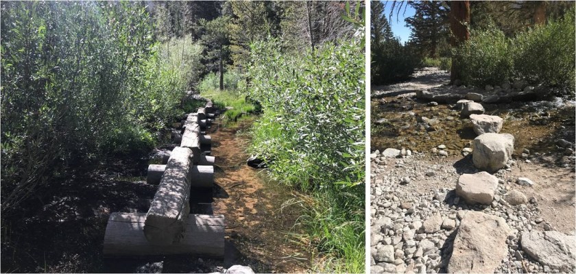
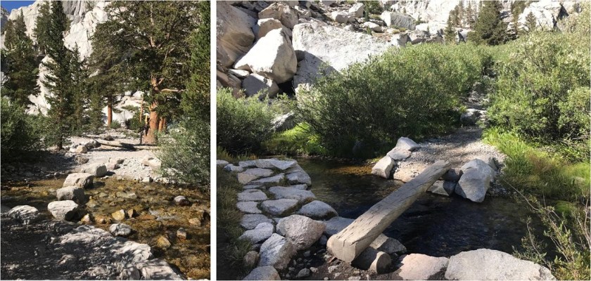
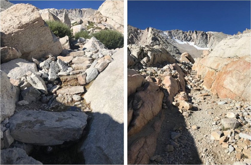
I crossed several well-maintained creek crossings in the dark (so well maintained they took the “fun” out of crossing the creek)

11

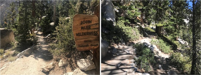
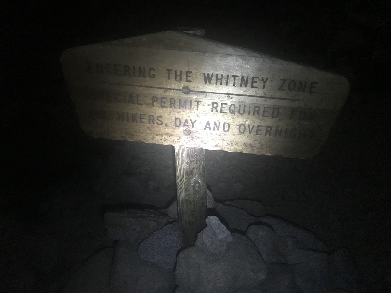
And after 3.1 miles came across this sign (apparently up until this point you don’t need a permit to hike here?)

12

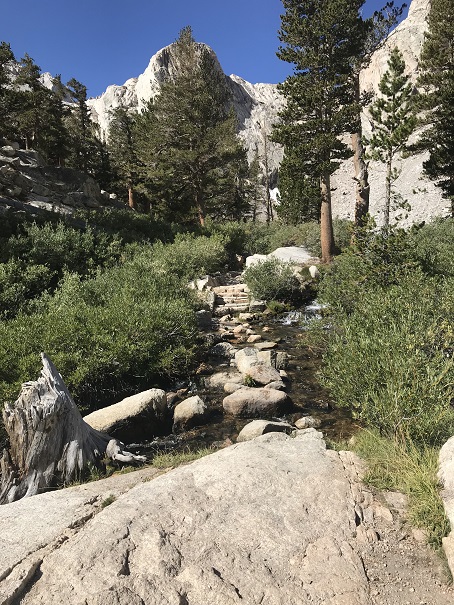
I crossed some more well maintained creek crossings

13

And in the dark saw the bear canisters set out on rocks before the tents at outpost camp. I couldn’t help thinking what a rotten place this seemed to camp:  full of rocks and dirt.

14

There were people still sleeping in their tents so I passed through quietly and continued up the trail

15

The moon was bright and I didn’t need my flashlight to see. I still couldn’t see any flashlights shining ahead of me and wondered about all those others who’d intended on a 1am start?

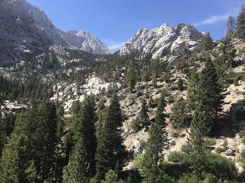
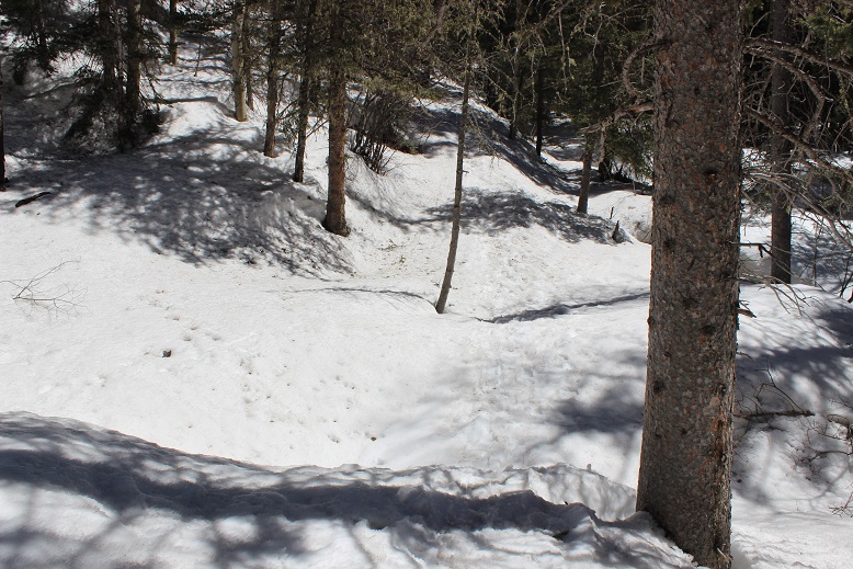
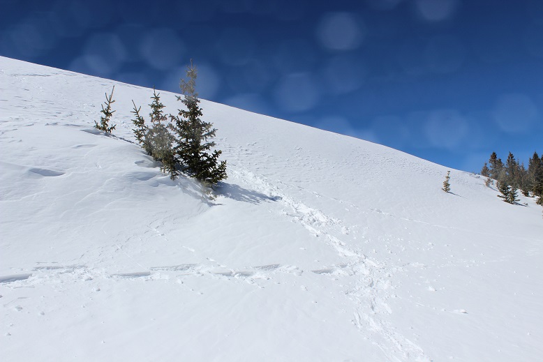
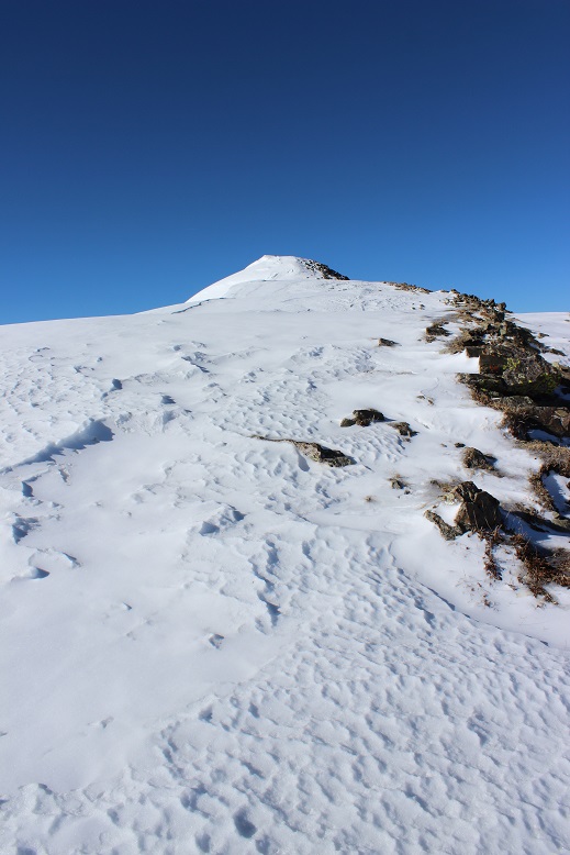
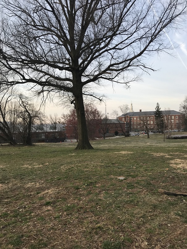
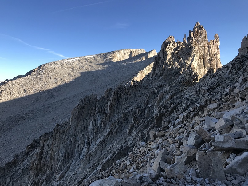
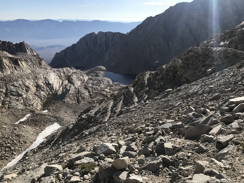
Treeline in California seems much lower than in Colorado (I encountered it here at 10,800’) so much of this hike was done surrounded by huge boulders.

16

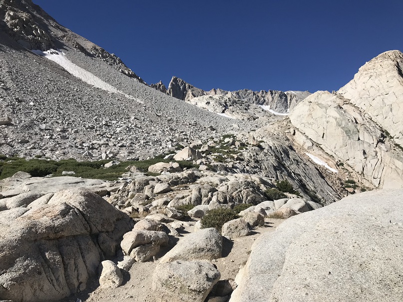
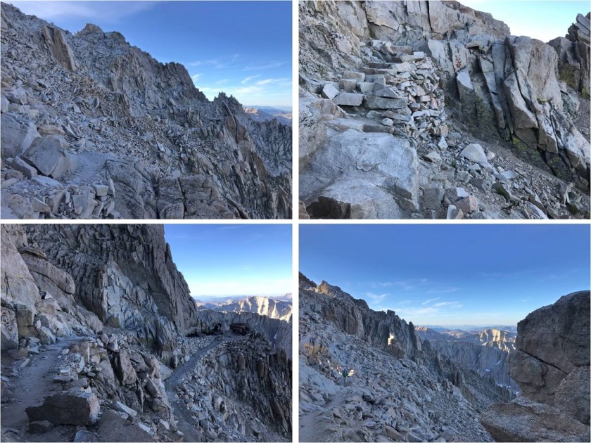
Luckily there was an easy trail to follow: I had no difficulties in the dark

17

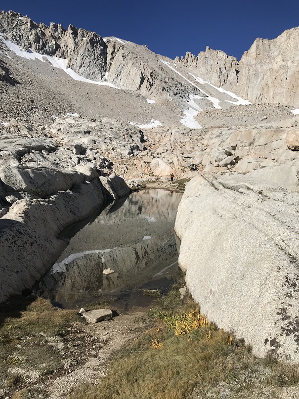
This area was kind of fun. In the dark it looked like you were supposed to just walk right through the water to get to the other side, so I just rock hopped the large boulder to the left. On the way back I could see an obvious trail to the right and took that instead

18

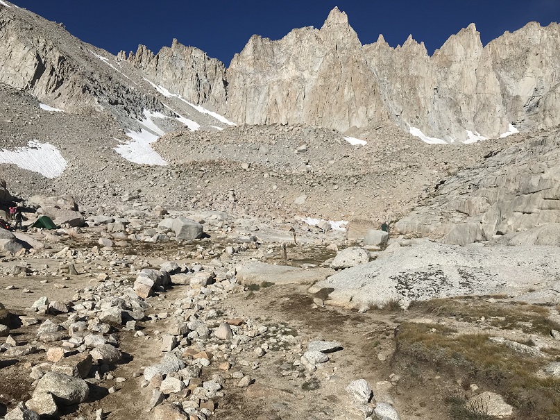
Now I was in a big basin. Here I saw dozens of flashlights and wondered how so many people got ahead of me so quickly, until I saw all the tents.  This is another camping area (Trail Camp) which also looked like a bummer place to camp (similar to the Boulder Field on Long’s Peak).

19

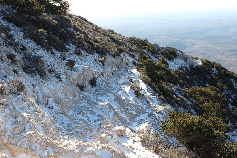
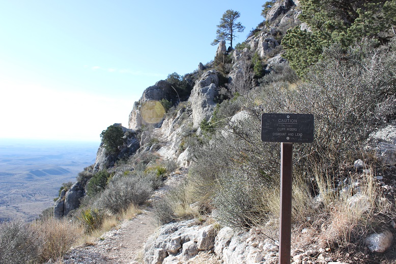
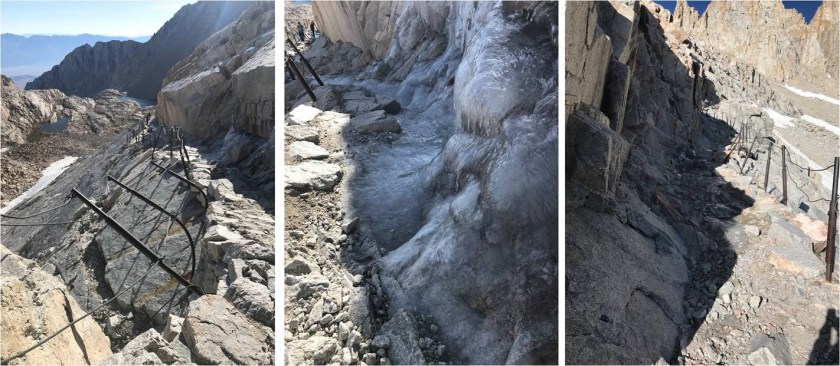
Still on a well maintained trail I continued and encountered more switchbacks. I couldn’t help but think of all the work put into this trail:  it was amazingly easy to follow. There’s a “cables section” on this route where I encountered some ice.  In an online forum I’d been told to bring microspikes for this area, but these people obviously didn’t have much mountaineering experience/know what microspikes are for:  they would have been useless here, and in any event, the ice was avoidable.

20

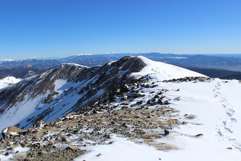
Here’s looking down on some of those switchbacks…

21

I started passing hikers in this area, saluting “good morning” as I passed. My aim was this notch, which is the “trail crest”.  This is where my mouth started hurting:  my back left molar curiously started throbbing so I took a few ibuprofen and continued on.

22

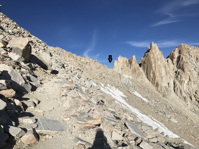
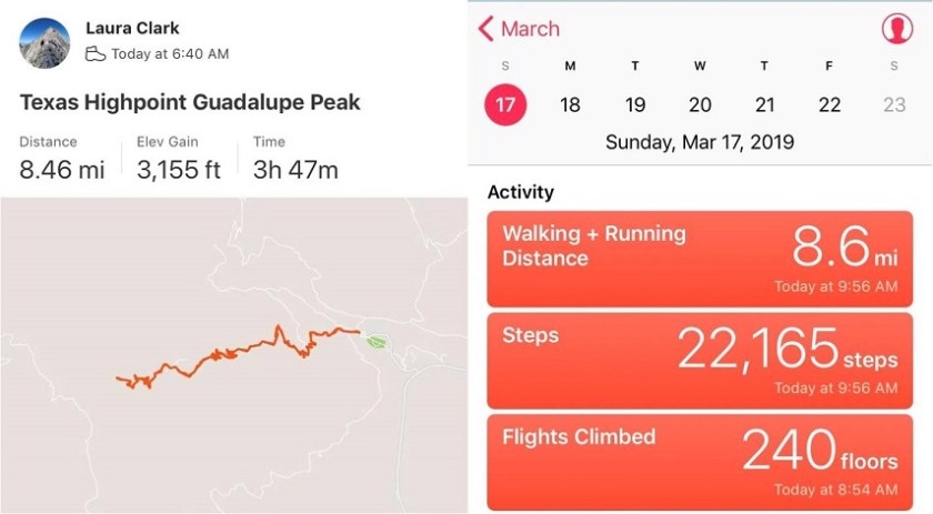
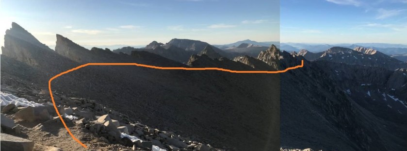
The trail crest is at 13,000’: 8.8 miles from the Whitney Portal. I reached it at 5:45am.  It took me 4 hours and 20 minutes to get there.  From here I could see dozens of headlamps shining on the trail below.

23

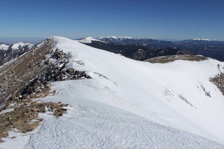
From the trail crest the trail loses a couple hundred feet in elevation as it snakes northwest towards the John Muir Trail. The junction is obvious and less than .2 miles away.

24

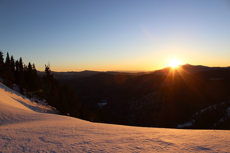
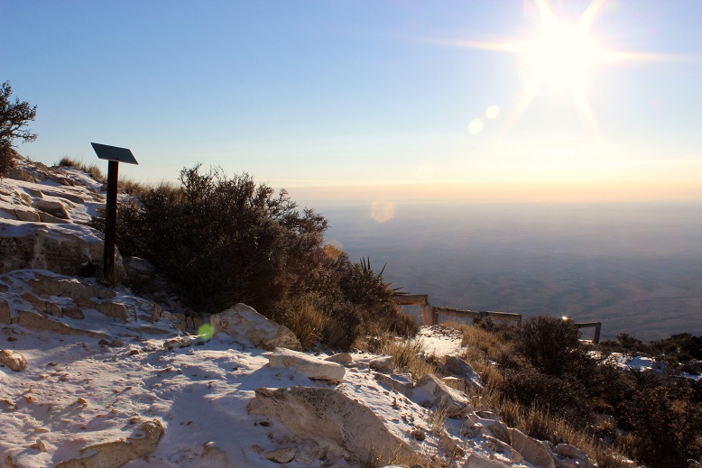
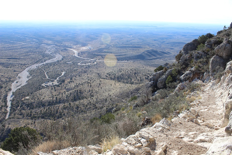
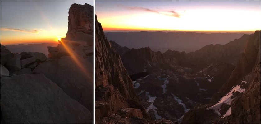
I saw a bunch of gear stashed here that looked like it was from thru hikers who didn’t want to haul all their stuff to the summit: there were bear canisters and even full overnight packs.  The views were amazing as the sun began to rise.  I kept wanting to stop and take pictures but it was getting cold and I had a summit to gain.

25

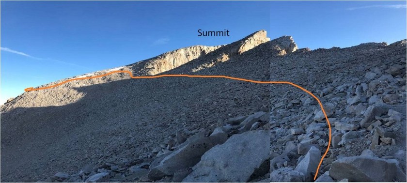
Here’s the trail as it curves around to just below the summit

26

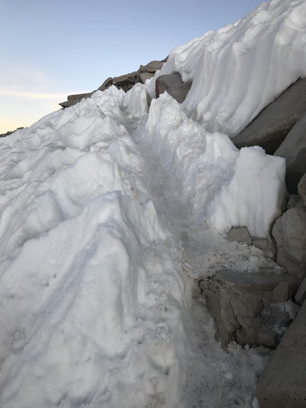
In this area I encountered a small (40 foot long?) patch of snow that was easily navigable

27

I turned the corner and followed the trail northeast to the summit of Mt Whitney

28

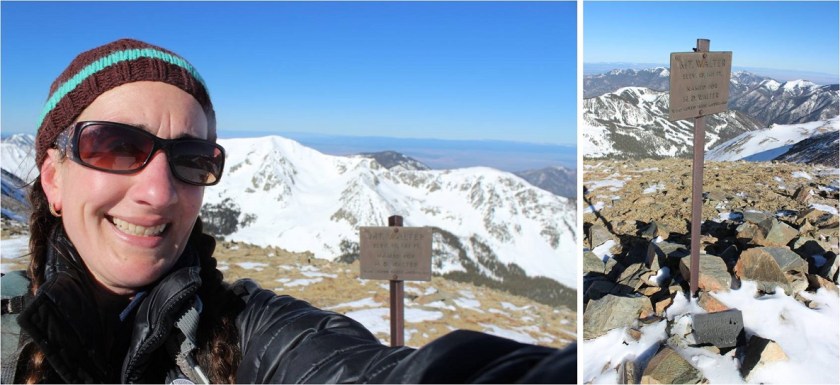
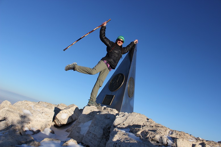
I summited at 6:50am: it had taken me 5 hours 20 minutes to hike 11 miles.  I reached the summit to cheers:  a group of 4 were perched atop a large boulder.  They’d been finishing the JMT and hiked up from their camp below.  It had been their gear I’d seen on my way in stashed at the junction.  One was snuggled in a sleeping bag, another cooking up breakfast in a jetboil.  I reached into my pack and took out the ‘Happy Birthday’ crown I’d bought at Walmart the day before and snapped a quick photo.

29

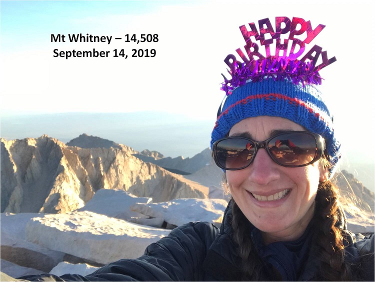
Summit of Mt Whitney:

It’s your birthday?!?!?! They exclaimed, and then we proceeded to chat for a bit.  I actually had cell service (3 bars:  Verizon) and they did not (T-mobile).  We discussed previous hikes and goals and why we each looked so familiar?

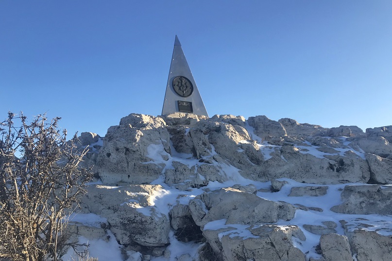
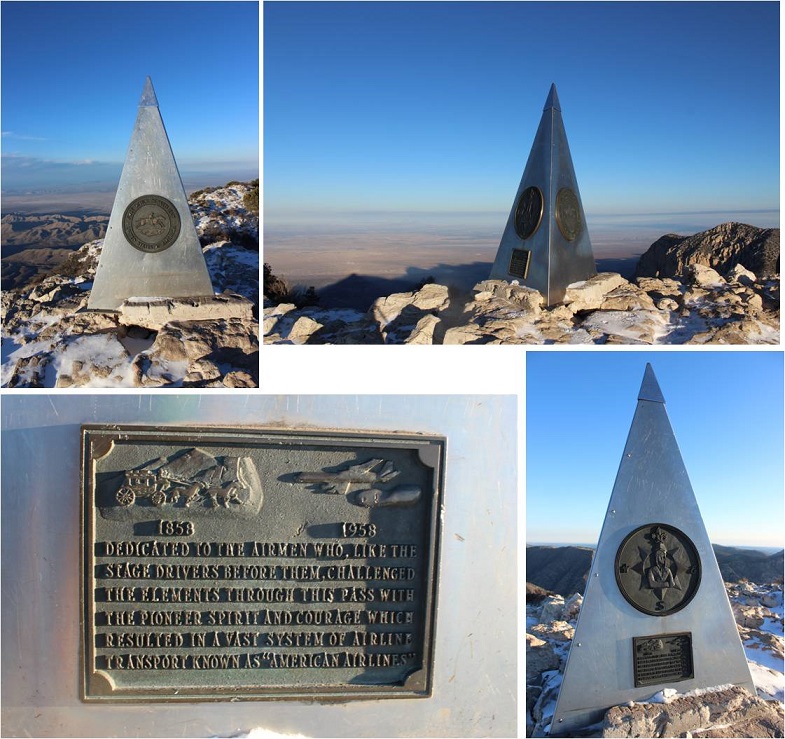
There are a lot of boulders at the top of Mt Whitney, so I started boulder hopping around. There are also a ton of summit markers!  I got pictures of a few…

30

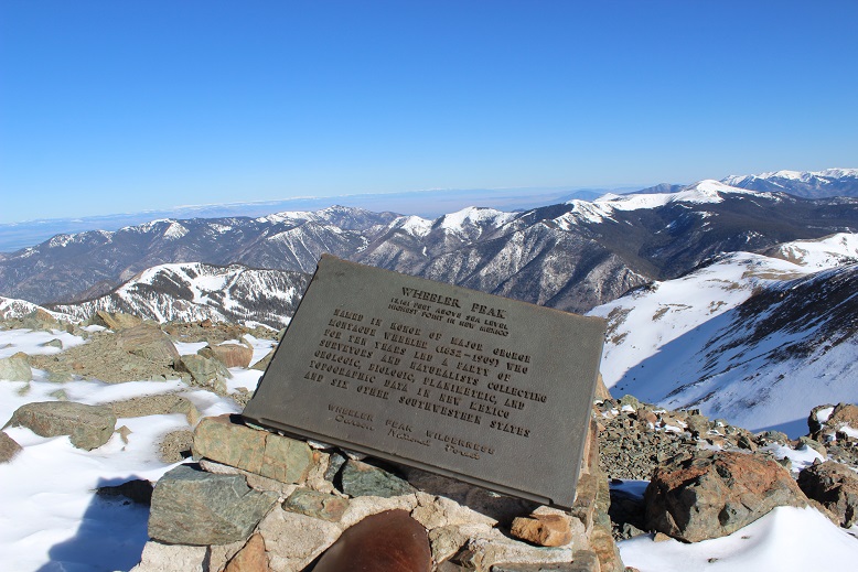
They were all pretty tough to read, and I figured they were from all the various surveys of this mountain (14,494 – 14,496 – 14,505 – 14,508). Currently Mt Whitney’s measured at 14,508’

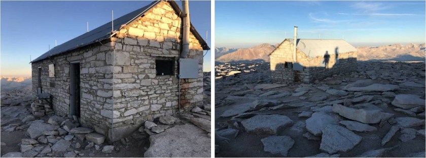
I was seriously cold (I’m guessing it was closer to the 20* right now than the forecasted 50*) and my tooth has started hurting again so I didn’t stay long. I took a quick look at the cabin

31

32

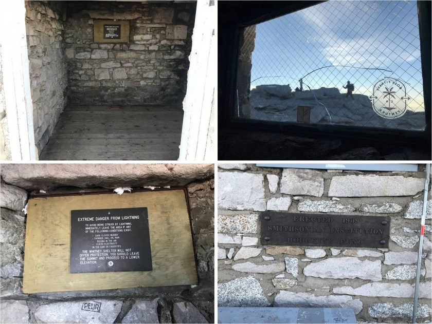
Signed the register (shocking, I know… I’m not sure why I did it?) and was on my way back down, my fingers frozen at this point (I’d need to look into buying gloves at the portal store before tomorrow’s summit)

33

Here’s a look at hike back to the trail junction

34

I loved the way this hike looks from just before the trail junction up to trail crest: It’s like something from out of a Tolkien novel.

35

There were a bunch of people stopped at the junction of the Whitney/John Muir Trails. I’d forgotten I still had on my crown, and several people wished me a happy birthday.  It was cool hearing all the different accents from the hikers, and at this point I decided to wear the crown for the rest of the hike.

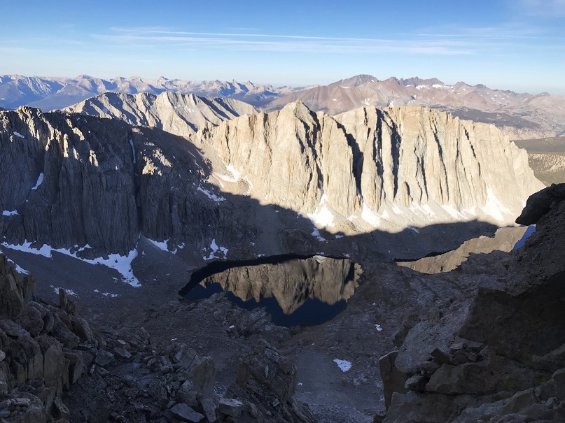
Check out the reflection of the Hitchock Lakes

36

Back through the notch I went, and took another selfie

37

At this point I really started passing people (all those flashlights I’d seen on my way up were now at the switchbacks below the notch). I’m not the kind of person who likes to draw attention to myself so keeping the birthday crown on was a conscious decision I was ready to take back at any moment, but the positive comments I got from the other hikers was a huge incentive to keep wearing it.  I got a reaction from about 90% of the people I passed on my way back down (the other 10% were too tired to even look up and notice me).

It was cool: someone would notice my crown and their eyes would light up as they said “Happy Birthday!”  No matter how exhausted they were a smile would come to their face when they read the words on the crown.  It was like my birthday was giving them some small pleasure.  I could tell if they were here visiting from another country (“You have birthday today?!?”) and a few were celebrating a birthday of their own (so I shared my crowns:  4 came in the package).  All in all it was a fun experiment and very gratifying.  So much so I’m considering wearing a birthday hat on my next popular 14er just to encourage others on the hike (not really, but if it’s your birthday you should wear one; you’d be surprised at how much you’ll brighten everyone’s day).  Also, I got really good at saying “Thank You”, something I personally need to work on.

About halfway down the switchbacks below the notch my fingers had thawed out and the sun was getting intense so I stopped to put on my sunscreen. I wasn’t able to find it and realized I must have left it in my other bag in the car.  Whoops!

Another note: I passed so many people who looked absolutely exhausted and were only 1/3 of the way (or less) done with this hike.  I have doubts as to whether they made it, and physically they should have been up for the challenge.  This isn’t a technical hike:  the only difficulty is the length and being at elevation.  If you’re in decent shape you should be able to summit this mountain.  The path is easy to follow (too easy in my opinion) and the elevation gain is spread out over a long distance.  I wasn’t even winded when I reached the top, and I’d never taken a single break (but my body’s conditioned to hiking at altitude).  The mistake these hikers were making was starting after sunrise.  I started at 1:30am and this was a great time to start, but I could have made the sunrise if I’d started half an hour earlier.  I wouldn’t start this hike after 3am.

I passed a group of hikers on my way down and we chatted for a bit. Their leader (a male in his late 20s) was taken aback when I said the hike wasn’t really that challenging. He looked like I’d just said the hardest thing he’d ever done in his life was akin to a walk in the park.  I had to quickly add “well, it’s going to be much more difficult for you because you’re doing it during the hottest part of the day”.  This mollified him a bit, and it’s totally true:  why would anyone do this hike, and especially the hardest part of the hike, in the heat of the California sun?  My advice is to start early, hike in the dark, and summit as close to sunrise as possible.  Then you get to enjoy the scenery on the way down in the daylight when you’re not too tired to enjoy it.  This also saves water weight, as you won’t be drinking because you’re hot but instead when you’re thirsty.

I’ve had people ask me which was harder, Mt. Whitney or Pikes Peak via Barr trail? Pikes Peak.  Mt Whitney was shorter, had less elevation gain, and felt like a steady climb, whereas Pikes Peak packs most of its elevation gain into the last 3 miles.

I made it back down to the trailhead at 11:20am, making this a 22 mile hike with 6772’ of elevation gain in just under 9.5 hours.

38

39

Bucket list item checked!

I headed to the portal store to look for some gloves but didn’t buy any, as their cheapest pair was $50. Don’t they understand thru hikers are poor?  Back at the car I immediately put my sunscreen in my hiking bag and got out a fresh set of clothes.  I took a wet wipe bath and was quickly on my way to my Nevada for my next summit:  Boundary Peak.

The low tire pressure light was on in my rental vehicle which bothered me a bit, but I also knew this was common at higher elevations and crossed my fingers it would go off soon (it did).

404142

New Mexico Highpoint – Wheeler Peak 13,161

1

RT Length – 14.2 miles

Elevation Gain – 4467’

The Colorado winds were high so I decided to head down to New Mexico this week to do some highpointing. Taos is actually closer to my house than many Colorado peaks, so the 4 hour drive wasn’t too demanding.  In fact, it was kind of fun.  When I made it past Ft Garland I saw a road sign indicating there were bighorn sheep in the area.  To my surprise I immediately encountered a herd of bighorn sheep standing along the side of the road.   A few minutes later I saw a sign warning of cows, and wouldn’t you know it?  Cows on the road.  The same thing happened with the deer and elk warning signs, and a few minutes later, even horses!  I hadn’t realized there were wild horses in the San Luis Valley, but yep, there sure are!  With all this good luck with animal sightings I kept hoping to see a sign indicating buffalo or elephants or zebras were in the area, but alas, wild horses were about as exotic as it got.  Kudos to the group that placed those signs so accurately.

2

I made it to the trailhead at 4:45am and was on the trail by 5am. Oh, and I did a terrible job parking (without realizing it). I actually made it to the trailhead about half an hour earlier than expected, and only recognized I was there because I saw the “Bull of the Woods trailhead” sign as I was driving by, so I backed up, parked, and was on my way.

3

It wasn’t until I was on my way down I saw there was a real parking area directly below where I’d parked. Oops!

4

The full moon was absolutely amazing! Unfortunately I wasn’t able to get a good picture, but it was so bright I didn’t need my flashlight.  I brought my snowshoes but didn’t put them on until I’d almost made it to treeline.  There was quite a bit of snow on the trail (4 feet or so) but the snow was consolidated so I was able to just walk on top of it.  There were also tracks to follow.

5

I could hear a stream to my right, but in the dark I wasn’t able to see the water. There were numerous trails criss-crossing the trail I was on, but as long as I kept hiking in the same direction (northeast) and aimed for the ridge I knew I was on the right track.  I stayed on the widest path, or what looked like the widest path.

6

I knew I was supposed to cross the stream at some point, but never saw a bridge. It turns out I crossed the stream without knowing it!  Here’s a look at the “stream crossing” from my way back.

7

Yes, that moon was full!

8

I made it to the Red River Canyon Overlook just as the sun was beginning to rise

9

10

At the overlook I turned right and followed the trail to the Bull of the Woods pasture (which didn’t resemble a pasture at all. Maybe it was the snow?)

11

12

The footprints stopped, so I was breaking trail from here on out. I got lost a few times trying to stay off private property, but there was so much snow it was impossible to know where the trail was on the mountain.  (Hint, go left)

13

I stopped and put on my snowshoes and followed the ridge, making my own trail.

14

The section after cresting this hill was much steeper than it looks. I had to swing around to the right in order to safely climb through the snow.  Here the crampons on my snowshoes came in very helpful.

16


Until the snow just kind of stopped. I knew more snow was coming, so instead of taking off my snowshoes I followed the faint trail of snow around Bull of the Woods Mountain. Here there was either very little snow, or large, steep drifts of 20+ feet.  I was glad to have my ice axe.

17

I rounded Frazier Mountain and could smell sheep. I looked all around, but not seeing any figured they must have passed the area recently (but that smell was strong!).  I was now presented with the La Cal Basin, which included a 300 foot loss in elevation.  This is also where there was quite a bit of snow, which I decided to take advantage of.  I needed to cross the basin, avoid those dicey avalanche areas, and then re-ascend the switchbacks on my left.

18

19

Crossing into the basin was a bit sketchy

20

21

22

And I was glad to make it to the switchbacks on the other side. Here there wasn’t much snow, so in keeping with my goal of not taking off my snowshoes (just to put them back on again) I stuck to the snow lined trail.

23

About halfway up the mountainside I saw a few bighorn sheep

24

And when I looked across the ridge I saw even more!

25

From here I saw what I thought was Wheeler Peak, but it was instead Mt Walter (Wheeler is beyond). I stuck to the snow to make use of my snowshoes

26

Sticking to the snow looked like this

27

And from the top of this point (13,045) I could see Mt Walter and Wheeler Peak. Sticking to the ridge (and the snow) was the way to go!

28

I passed Mt Walter and took a few quick photos of the signs and a selfie to prove I was there.

29

From here you can clearly see the summit of Wheeler Peak

30

Once again, I stuck to the ridge

31

And summited at 8:45am

32

33

Here’s the Summit Video, which I’m excited to say is the first summit video I’ve been able to take all year! I’m so glad it was warm today and sans wind.

Video: Wheeler Peak NM

OK, time to turn back. Here’s what the route looks like back from Wheeler Peak… just stick to the ridge

34

35

Yep, lots of snow! I was glad to have my ice axe.   Snowshoes were a must the entire way back down.

36

I started crossing the basin again, and unfortunately the sun had warmed up the snow. Snow kept collecting under my snowshoes and I had to keep stopping to kick it off. I made it back to Frazier Hill and saw those sheep I’d smelled earlier (I KNEW they were there somewhere!)

37

Following the trail in the light of day proved much easier than in the dark, with the added bonus of being able to follow my snowshoe tracks.

38

39

I made it back to Bull of the Woods pasture and once again found footprints. Lots and lots of prints, both human and animal.

40

The only downside to the warmth of the sun (besides clumps of snow in my snowshoes)? Rollerballs the size of dinner plates

41

As I followed the trail back to the stream I was actually able to see the stream

42

I didn’t see anyone all day until I was about half a mile from the trailhead on my way back down. I talked with a gentlemen about the conditions on the trail. He said he’s hiked these trails for years and was surprised I’d summited today. He was even more surprised when I told him I’d started at 5am.  In fact, he didn’t entirely believe me.  I made it back to the trailhead at noon, and when I stopped my Strava tracker I was told I’d sent a new app record for completing this hike.  Pretty cool!  I’d hiked the 14.2 miles of 4467’ in elevation gain in 7 hours.

43

Just for fun, here’s the relive of my hike. Note: Obviously I summited today, yet the tracker shows my high point was just shy of Mt Walter at 13,139’ (not Mt Wheeler at 13,167’), which is one of the reasons I take what these trackers record with a grain of salt.  I’ve had people tell me because my tracker doesn’t show a summit that I didn’t summit.  I call those people summit snobs and unfollow them from my account(s).  No one needs that kind of drama in their life!

Relive:  https://www.relive.cc/view/2302667578

Oh, and the good news? I was finally able to get my New Mexico Starbucks mug in Taos!  I’ve been trying for years to get a New Mexico mug to add to my collection, but they’re always out when I visit.  Funny, the mug doesn’t mention aliens at all…

44

Also, the ski season in Taos is over, which was a real shame because there was so much snow! And, Taos is beautiful!  Majestic even.  I had no idea!

Washington DC Highpoint – Point Reno 409′

1

RT Length: 43.5 miles (4.5 walking)

Elevation Gain: 1570′ (I’m suspicious of this number)

I’m currently in Reston, Virginia for work, and before flying here I did a quick search to see how far away it was from the Virginia Highpoint. About 6 hours, which was way too far, but I noticed it was about 20 miles from the Washington DC Highpoint, Point Reno. That was interesting. While Point Reno isn’t one of the “official 50” because Washington DC isn’t a state, I felt it would be a shame to miss the opportunity to check off a highpoint, so I did some more research.

The highest point in Washington DC isn’t really all that high: Point Reno only has an elevation of 409′, but since most of Washington DC is just above sea level, I might get some good views.

My challenge was I didn’t have a vehicle, but the Metro was supposed to drop off very close to the highpoint (ironic, I know). So all I had to do was get to a Metro station, make a few connections, and I should be good. The closest Metro station to where I was staying was a mile and a half away. Challenge accepted.

I woke up at 4am, ran on the treadmill for an hour, came back and was ready to go before 6am. It was very, very dark outside, with the exception of the full moon and some street lights. This 1.5 mile walk to the Metro Station was going to be interesting. My directions took me off the main streets and on a side bike route that looked a bit sketchy to me. Especially in the dark. I wished I’d brought a flashlight, but honestly hadn’t even thought darkness would be an issue. On the plus side I was waking up birds as I passed them, and I was pretty sure there was a golf course to my left. About halfway there runners started coming towards me with their headlamps shining and I felt a bit safer.

2

3

Finding the Metro Station was easier than I’d anticipated.

4

I walked up to the ticket counter to buy a pass but the attendant directed me to the automatic kiosk instead, and when I told him which stations I was using as switching points he gave me quicker directions. I thanked him and was on my way.

I took the Silver Line to Metro Central Station, got off and switched to the Red Line towards Shady Grove. This brought me to the Tenleytown-AU station. I had my phone but decided to people watch instead. Oh, and rummaged through my backpack, where I realized in fact I did have a flashlight with me. Oh well, I’d made it without one just the same.

Metros and Subways and Lightrails are interesting, but not too difficult to navigate once you know how they work. I had no problem making transfers and finding correct platforms. Also, I really felt comforted looking at the map and listening to each station being named as we stopped, reaffirming I was going in the correct direction. Until this man boarded and for some reason stood right in front of the map. He was oblivious to the fact I was appreciating its usefulness. Oh well, I had no hiccups and the whole process was much quicker than anticipated.

5

Once at Tenleytown-AU I exited the station and got my bearings.

6

It was dark when I got on the first Metro, but by the time I exited at Tenleytown the sun had some up. I headed north and when I made it to a soccer field I turned right. I was a little worried because it looked like I was on school property and school was supposed to start soon, but no one looked like they were going to stop me, so I continued hiking up over a hill.

7

I crossed a dirt path, and much sooner than I’d anticipated I came upon the ‘summit marker’. For some reason I’d thought finding it would have proven more difficult.

9

I quickly sat down on the grass and took a selfie to prove I was there, and then got up and left.

10

Nope, no views.

Video: Point Reno

Here are a few pictures I took while standing at the highpoint.

11

12

It felt weird to be celebrating checking off another one on my list with all these middle and highschoolers trudging to school. They probably thought I was weird. There were signs however indicating this was the high point, so I’m sure they must be used to highpointers taking selfies on the hill?

13

Here’s what the outside of the Tenleytown station looks like

14

And a few metro pictures. It was busy!

15

16

17

The walk back from the Reston station was much nicer in daylight.

18

Passing under bridges wasn’t quite so scary either

19

Here’s the start of the bike trail that brought me close to the Reston station (about .4 miles away)

20

I made it back to my hotel room at around 9am, making this a 43.5 mile journey in just under 3.5 hours. Looking at my stats I walked about 4.5 of those miles, and it looks like I had 1570′ in elevation gain, but that’s highly questionable. I’d put the number at closer to 100′.


So even though this was an easy highpoint, it still felt like an adventure navigating the Metro through town and people watching. Now to get to work!

Just for fun, here’s the relive: https://www.relive.cc/view/2226883108

Texas Highpoint Guadalupe Peak – 8749’

10

Elevation Gain: 3155’

RT Length: 8.5 miles

It’s about time I went hiking again!!! This past month has been rough.  It was the end of cookie sales, I was in Germany for a bit for work, came back from Germany with the flu (and I NEVER get sick, so I’m blaming it on being exposed to some German type of illness I’m not resistant to) and my fingers are still healing from my last trek up Sherman.  What concerned me most really though were my fingers:  I developed digital ulcers (yep, those things that looked like blisters under my nails were thick blisters that eventually popped).  Now they’re healed but still very raw and the skin on the tips of my fingers is thin and fragile.  I haven’t been in the high country because I didn’t want to expose my fingers to too much cold too soon.  Oh, and then there’s the historic avalanche danger we’ve had in Colorado over the past 2 weeks….

In any event, I finally had a day to hike and now just had to choose between a 14er and a highpoint. I really wanted to get in one more 14er this winter but with the avalanche danger as high as it is I opted for a road trip instead to a place with zero avy danger

2

Texas! I was dreading the 10 hour drive and missing out on my potential 5th winter 14er, but I also have highpointing goals this trip would help, and I felt it best to do this trip before the heat and summer gas prices increased.  The only downside was the drive and my tight schedule:  My oldest was coaching a guard in the St Patrick’s Day parade at noon, and since I really wanted to be there to support her and take a video I didn’t get on the road until about 1:30pm.  Almost as soon as I left I realized I’d left my trekking pole at home, so I decided to pick up a cheap one at a gas station along the way (knowing full well there’d most likely be a few free ones at the trailhead left by others).

I made it to Guadalupe Mountains National Park at 10:30pm… or 11:30pm after the 1 hour time difference at the Texas State line. There were about a dozen RVs parked in the RV lot.

3

I filled out the self reservation form, parked my car in one of the parking spaces, text my kids to let them know I’d arrived, and got settled for bed. After turning out the lights the full moon gave me a great view of the silhouetted peaks against the night sky.  I took a deep breath:  yes, taking this road trip had definitely been the correct decision.  I was so happy I was here right now, snuggled in my sleeping bag, looking up at the stars.

Now if I could only fall asleep. I usually have difficulty sleeping at trailheads and tonight was no exception.  I really just wanted to get started hiking but since it was midnight and it had been a full day it was a better idea to try to get some sleep first.  I couldn’t, and pretty soon I got cold.  Very cold.  It was in the 20s outside but I was very cold inside the cab of my truck, even with double layers of clothing, socks, jackets, a sleeping bag, and 3 fleece blankets.  The seatbelt clips were chilly and kept sticking into my back.  Note to self:  next time bring 2 sleeping bags instead of 1.

The campground was quiet for being so occupied, and as a bonus I only heard a generator go off once (those are obnoxious). I drifted in and out of sleep (mostly out) for the next 6 hours.  The moon set at about 3:30am and it suddenly got very dark outside.

I’d done my research, and the sun was supposed to rise at 7:11am. That meant the sky should begin to lighten around 6:30am.  I set my alarm for 6 so I could be on the trail no later than 6:30am but when my alarm went off it was still very dark outside.  Hmmm.  Ok, so I re-set it for 6:15am.  Still dark, and again at 6:30.  This didn’t make much sense but I felt I was wasting valuable hiking time and I was still really cold (hiking would warm me up).  So I got ready and was on the trail by 6:45am. Yep, a bunch of trekking poles had been left by other hikers near the trailhead.

The trail starts at the end of the RV parking lot, just to the left of the information sign.

4

Another bonus: this trail was very well marked. I just followed the signs that indicated “Guadalupe Peak trail”

5

The trail was very also well maintained, wide enough in most places to walk side by side with another person, and easy to follow. I quickly warmed up and waited for the sun to rise.  I hiked for over an hour before the sky began to lighten.  I could see Carlsbad in the distance.

6

Right about this time I encountered a thin layer of snow on the ground that persisted all the way to the summit. I’d known it was supposed to have snowed yesterday between 2-3pm, and here was the evidence it had.

7

I looked for tracks in the snow and was surprised to see small deer prints. I also saw a lot of squirrel tracks and some from a small creature (I’m thinking a ringtail?)

8

Suddenly I heard a low, guttural noise that sounded like ujjayi breathing coming from my left. I stopped to see what it was.  It took me a few seconds to realize it had been me (my throat is still recovering from my cold).  I cleared my throat and continued on.

Have I mentioned the switchbacks? This was supposed to be a “strenuous” hike, but there were a ton of switchbacks, making it longer than necessary but not too difficult.  Here’s a look at the first part of the route

9

The sun started to rise as I made it to the top of this area, and I could see the rest of the hike before me (there’s actually still about 2.5 miles of hiking left)

10

Once I’d rounded the first slope there was a cliff to pass, and I was surprised to see a sign that said if you were on a horse to dismount and walk it across.

11

I was surprised because I hadn’t seen any horse hoof prints or manure on the trail. Usually when they allow horses on a trail it’s littered in both.

This part of the hike took place behind the first mountain so I was able to see the sunrise a second time from a different angle.

12

I came across a false summit and some camping sites

13

I rounded the corner once again and saw more switchbacks. Here I could tell the trail went to the left, but it seemed there was another trail to the right.  I figured the trail to the right was from others cutting switchbacks and took the well established trail to the left.

14

The path was lightly lined with snow and just gave way to more and more switchbacks. Would they ever end?

15

A great view of the valley below

16

Here’s where the trail got tricky: I was almost to the summit and the path gave way to walking along exposed rock.  This in itself wouldn’t be too difficult normally, but the rock was covered in a thin layer of ice, making traction tricky

17

I couldn’t help but think this section was most likely why I hadn’t seen any hoofprints/manure along the trail: it was too difficult for a horse to maneuver.  Then I saw hitching posts and none of it made sense.

18

Oh well. There was a little bit of a scramble

19

And then I was at the summit. I thought it was cool to be at the Texas highpoint on St Patrick’s Day when it also had a dusting of snow (apparently snow here is rare, even in winter)

20

Summit Video:

I summited at about 8:40am and had fun taking photos at the top

21 Guadalupe Peak Texas 8749 3-18-2019

Since this was Texas the summit marker was huge, but interestingly enough didn’t have any mention it was a highpoint or of the elevation.

22

I’d taken off my gloves to take photos, and this ended up being a bad idea. My fingers felt raw and were beginning to tingle in a bad way, even at this relatively low elevation, so I decided to put back on my gloves and head back down.  It turns out that fork in the trail that went two ways was legit.  The trail to the right had actually been a maintained trail (the other was the horse trail) so I took that one back down.

In the daylight I could see the parking lot I’d stayed in and just how many switchbacks there had been up this trail

23

I encountered dozens of people starting their hike as I was nearing the end of mine. Dozens.  A ton of college students, families, large groups and individuals out for a day hike.  They all seemed surprised I was almost done.  I was surprised they’d chosen to hike in Texas during what would now be the heat of the day.

Here’s another look at some portions of the trail (open to horses)

24

And evidence horses were allowed

25

One of the interesting parts about this hike was all the very large Manzanita Trees I saw. I haven’t seen so many in such good shape in a long time.

26

I made it back to my truck at 10:15am, making this an 8.5 mile hike in around 3 hours 30 min

27

Just for fun, here’s the Relive link. I’m not entirely convinced all those switchbacks were necessary.  Relive:  https://www.relive.cc/view/2220225056

There are always signs telling you not to cut the switchbacks, but if you don’t want people cutting switchbacks, don’t unnecessarily make so many of them! Personally, I’d rather just take the stairs to the top.

I made it back home at 6pm. That was pretty good time!

Black Mesa – 4973’ Oklahoma Highpoint

1

RT Length: 8.6 miles

Elevation Gain: 734’

Once again the weather in Colorado was terrible, but at least I had a few days’ notice to make other hiking plans. I have backup plans for when the weather isn’t swell in the high country, and today’s plan was to drive to Oklahoma to do some highpointing.

The highest point in Oklahoma is (not surprisingly) close to the Colorado border. I left the house at 2:30am and quite enjoyed my commute until I turned off the main road and onto a dirt road with 26 miles left to the drive.  Also, I completely lost cell service.  This wasn’t a big deal as I knew my GPS would get me to the trailhead, but I was worried about finding my way back to the paved road on my return.  It was quite dark and I couldn’t see any landmarks to guide me back.  There were 6 or 7 turns, and I mentally thanked myself for printing out directions and bringing them with me.   The dirt road was littered with cow patties and I could see cow eyes glowing at me in the dark.

The last bit of road took me down a one way dirt path with 2 foot tall grass growing between the tire ruts and then through a stream crossing I was sure was over a foot deep, but I made it without a hiccup.  I arrived at the trailhead at 7:30am (after crossing a time zone, so it was 6:30am to me), gathered my gear, and was on the trail.  It was still dark out.

My vehicle was the only one in the medium sized parking lot. There was a bathroom that was open and a wheelchair accessible parking space.

2

The trailhead started behind a gate that ensured only foot traffic proceeded. I signed my name in the trail register and was on my way.

3

It was still dark when I started and I was a bit worried about forecasted wind and the potential for rain later in the day. Route finding ended up being no problem at all.  The trail follows an old 4WD road with signs every quarter mile or so marking the way.

4

So even though it was dark it would have been difficult to get lost

5

At mile 1, 2, and 3 there were benches where you could potentially sit and rest, but since this was a fairly level hike I just took pictures and kept on

6

After mile 3 the trail took a sharp turn towards the mesa and up what the instructions called switchbacks but the route never really switched back: instead it was a trail that circled up the hill.

7

The trail up to the top of the mesa was washed out but it was still easy to follow.

8

In no time at all I’d reached the top of the hill

9

From here there was another mile or so to trek, but it was across the flat mesa

10

Once again, the path was clear and easy to follow. I made it to the summit at 8am after 1.5 hours of hiking.

11

The summit was… flat. It didn’t feel like a summit at all.  I was surprised to find a summit register and elevation marker.

12

Summit 1 :

Summit 2:

https://youtu.be/QJITk1v6akI 

The obelisk at the summit was rather detailed and contained information on how far the different states were away from this point as well as a few other state facts

13

Ok, now it was time to head back down. I enjoyed the views on the mesa

14

Here’s the route back to the trailhead

15

I made it back to the trailhead at 9:15am, making this an 8.6 mile hike in 2 hours 45 min. Back at the trailhead I saw a bench I’d missed in the dark, dedicated to an avid highpointer

16

This hike was very easy. There was minimal elevation gain, and you could probably push a stroller on this hike and get it to the summit without too much difficulty. I didn’t see another person all day, but I did see dozens of cows.

Cows:

Oh, and in the light of day there weren’t any landmarks to guide me on the dirt road back home either. Once again, I was very glad I’d pre printed out directions to assist me on the way back.

17

I made it back to the paved highway without making a wrong turn, and just in the nick of time too because it started raining violently. The weather back home was much worse, as the snow anticipated for 4pm came roaring in with a vengeance around 10am and closed the freeway north of my house.  I’d made the correct choice today to head south and go highpointing instead of into the mountains near home.

Here’s the track of my route and stats for the day

Relive:  https://www.relive.cc/view/2087219413

18