Mountain Boy Peak – 13,198 & Igloo Peak – 13060

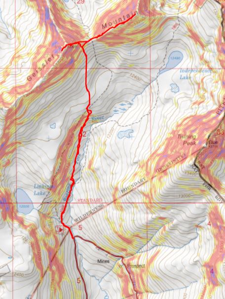
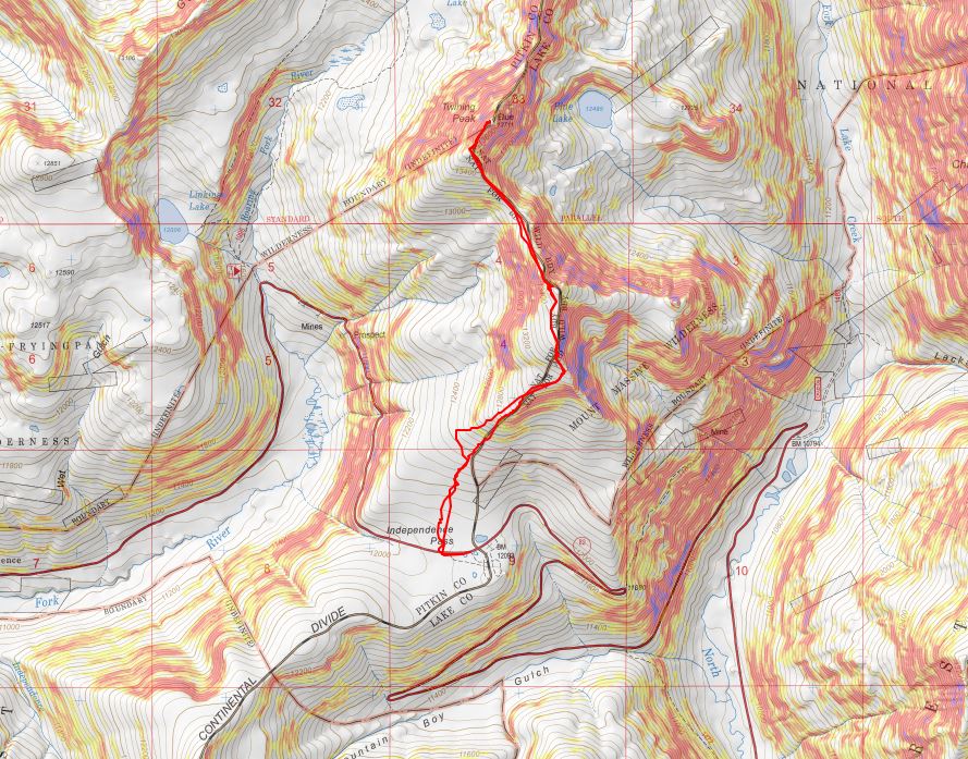
RT Length: 6.78 miles

Elevation Gain: 2151’

I wanted to get in one last peak before Interdependence Pass closes for the year.  I was supposed to hike this peak o Tuesday, but weather was coming in, so I changed my plans and hiked it Monday morning instead. 

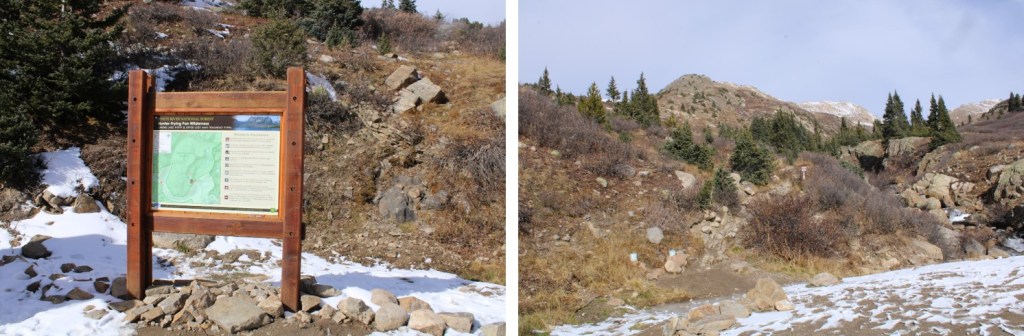
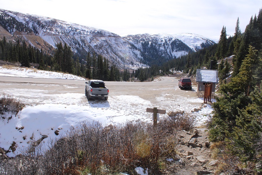
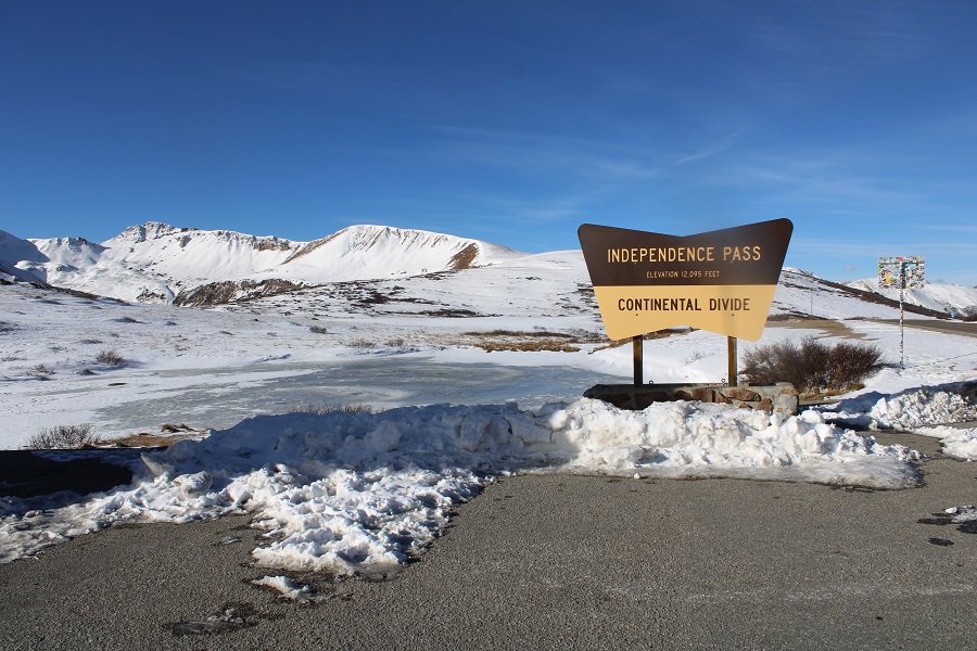
I made it to Independence Pass and was on the trail by 5:30am.  Side note:  I was here October 25th, and the bathrooms were closed for the winter.

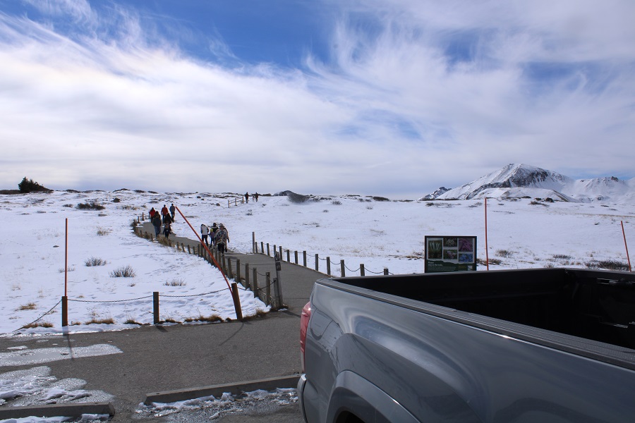
Obviously, mine was the only vehicle in the parking lot that early in the morning. The trail is obvious, and starts by heading south on a paved trail.

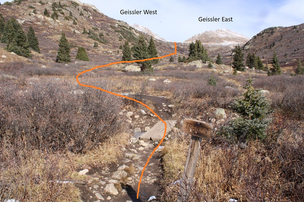
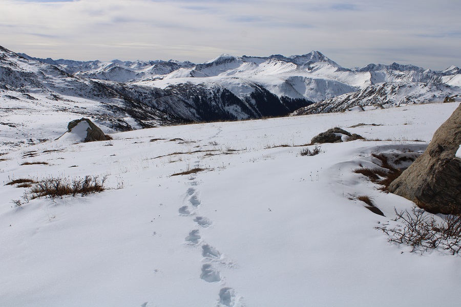
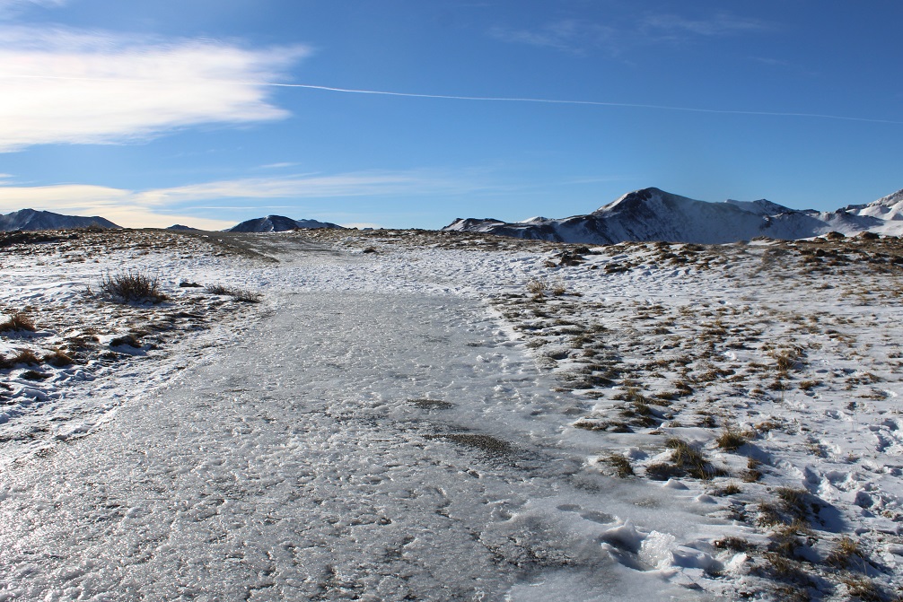
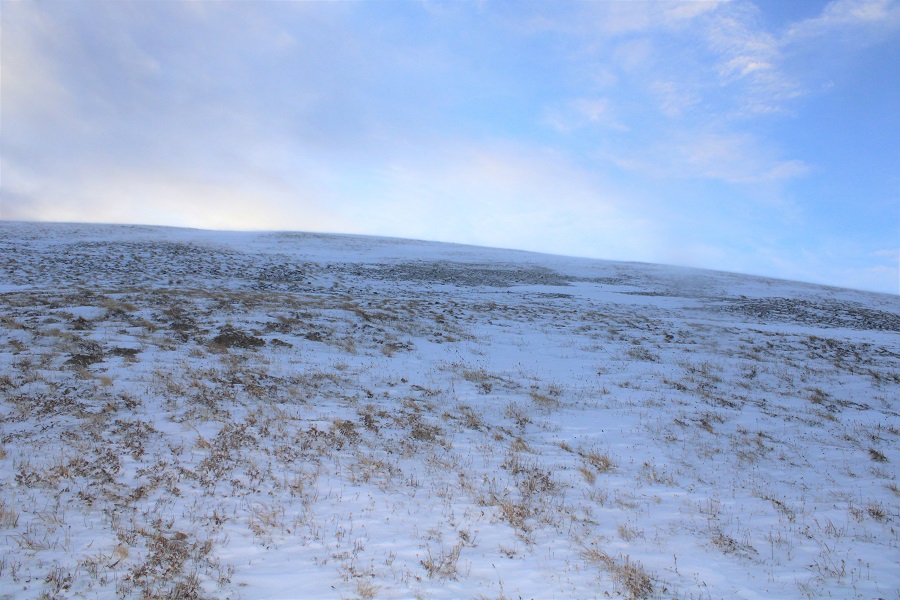
I’ve never been in this area in summer conditions, so I’m not really sure when the trail becomes a trail and no longer paved, but I know I was off pavement pretty quickly, heading west.  This morning, before making it to Igloo Peak, snowshoes were needed some of the time, overkill most of the time.

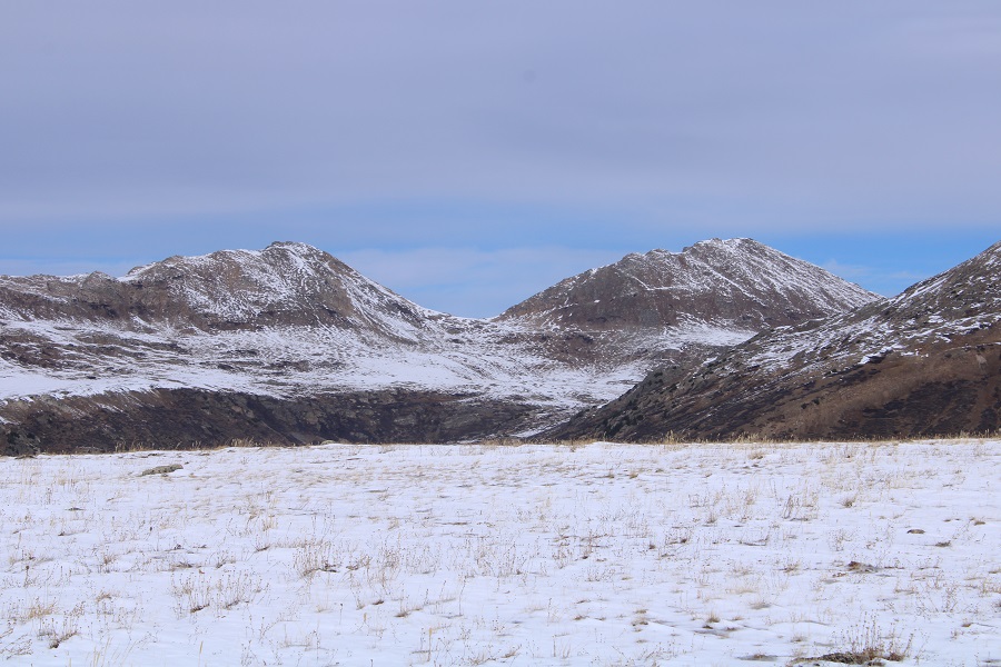
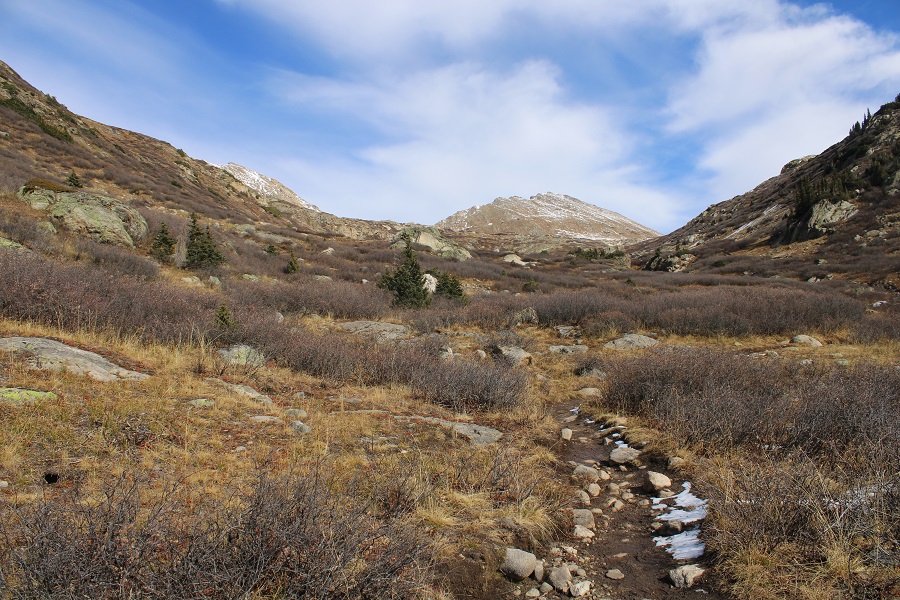
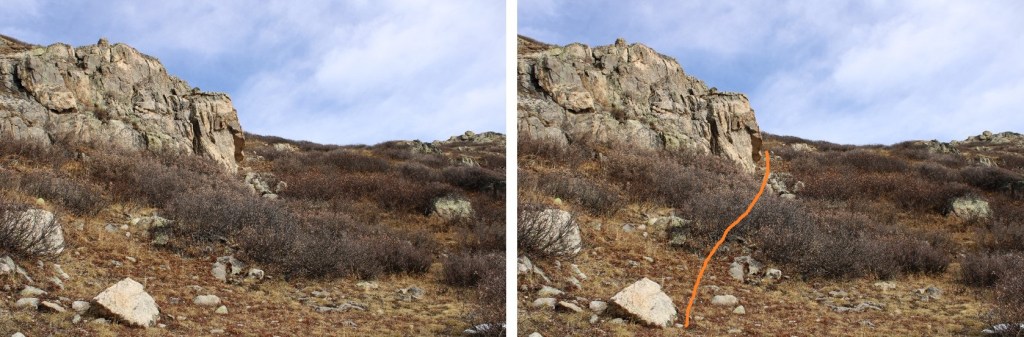
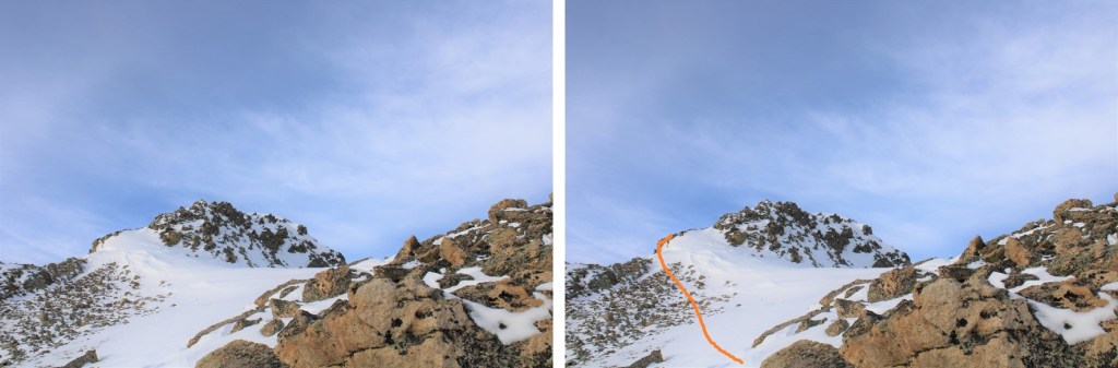
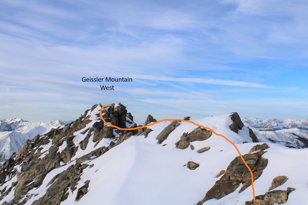
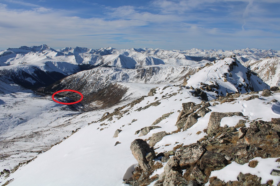
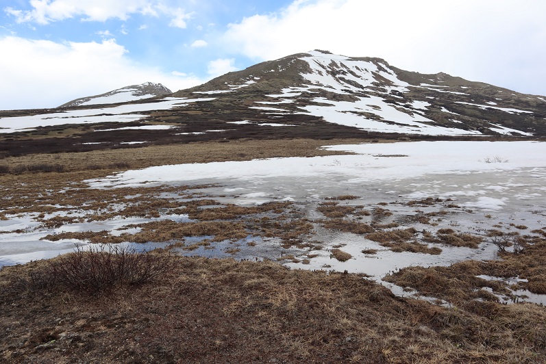
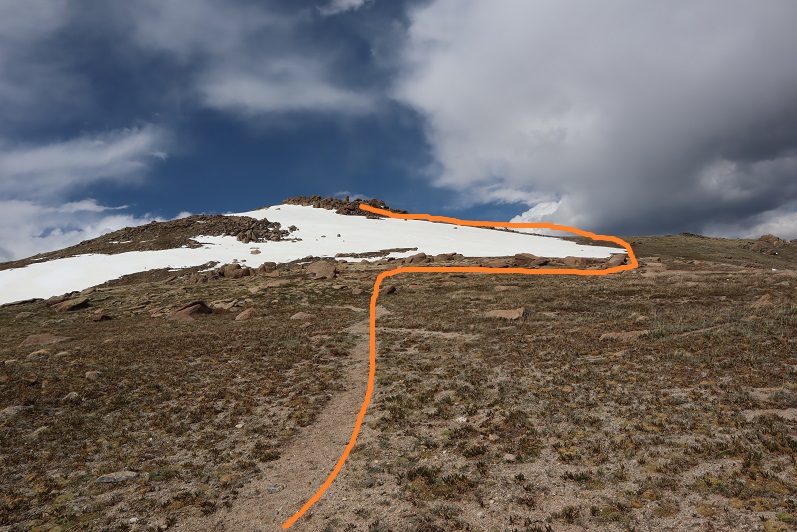
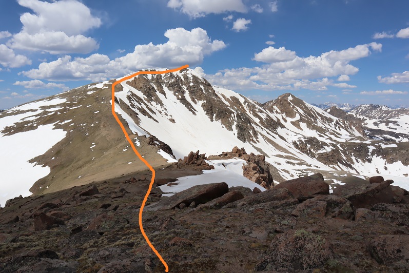
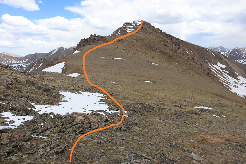
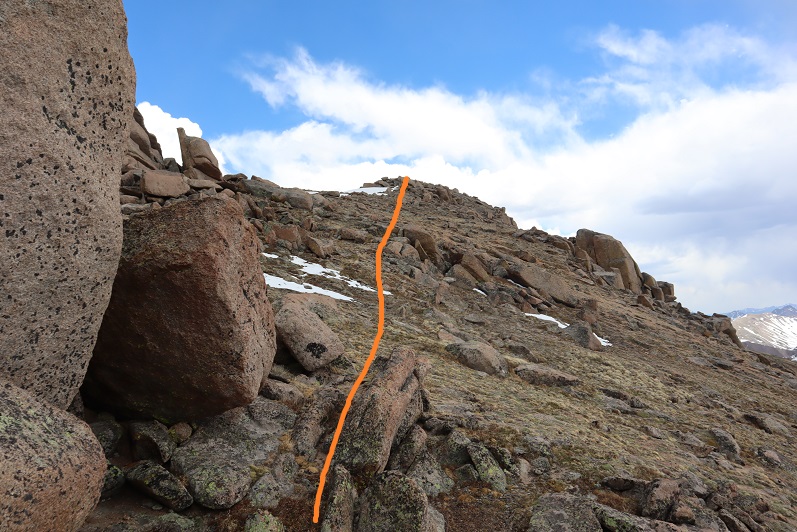
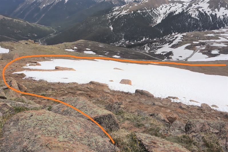
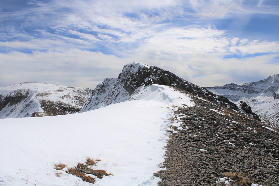
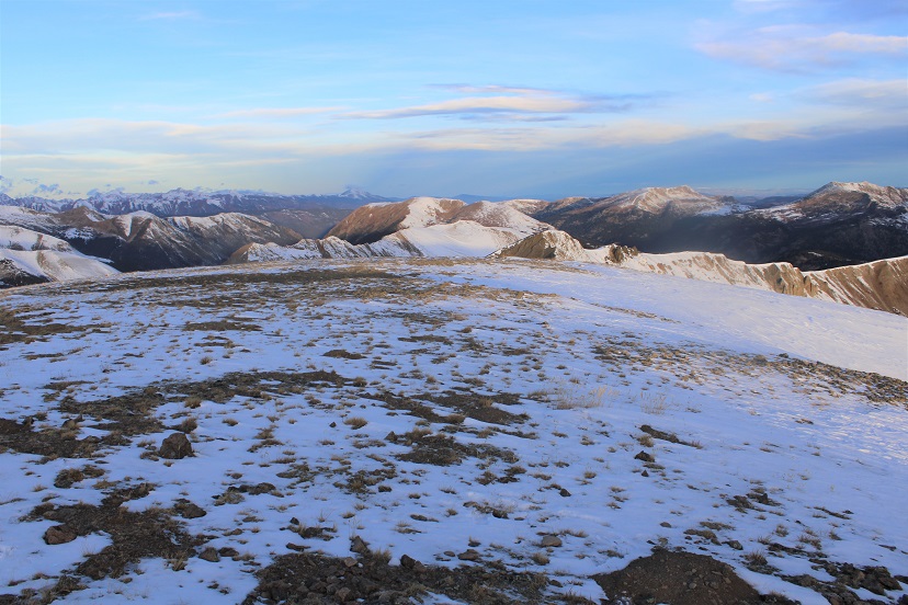
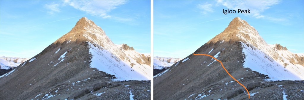
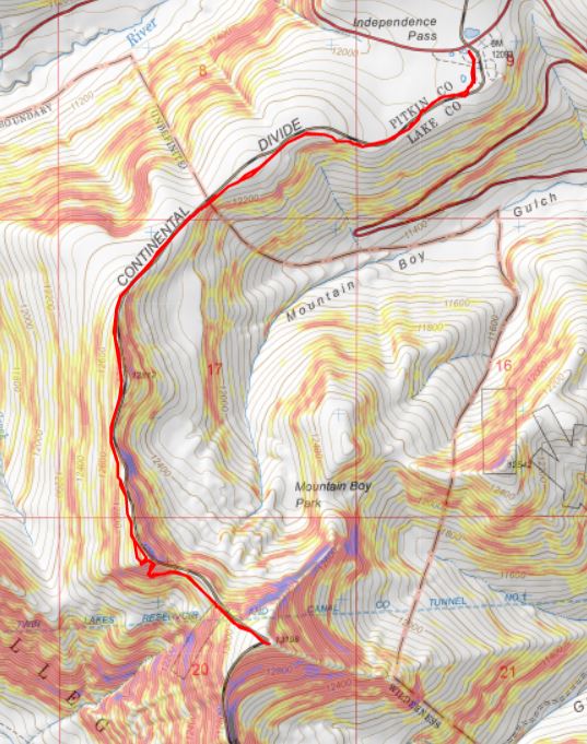
Here’s an overall view of the route to the ridge

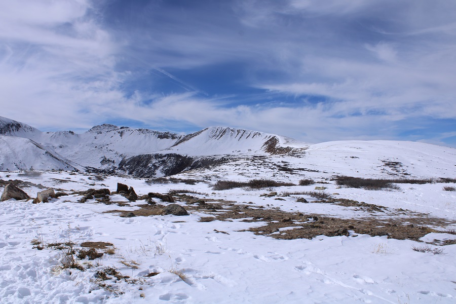
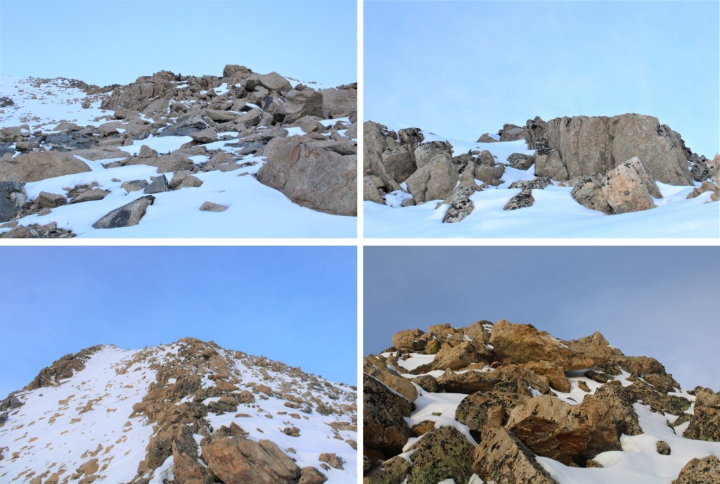
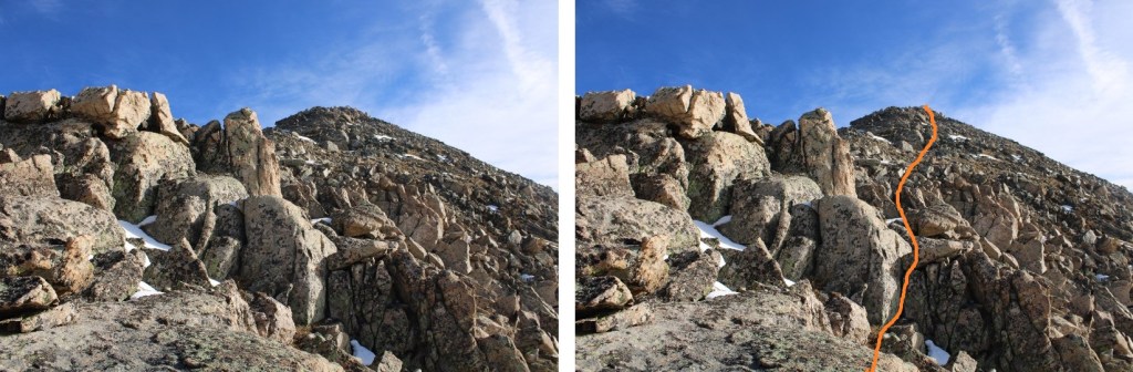
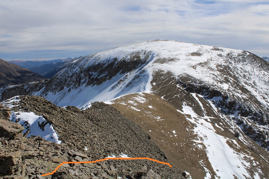
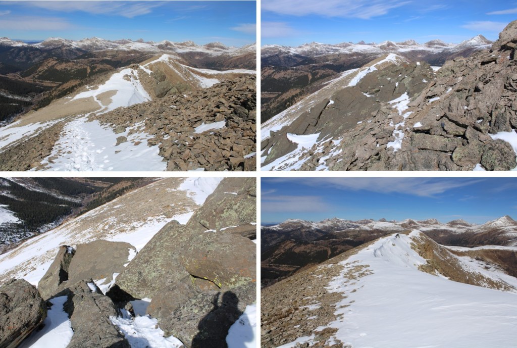
I headed towards the ridge, following an obvious route, which I am sure is class 1 in the summer.

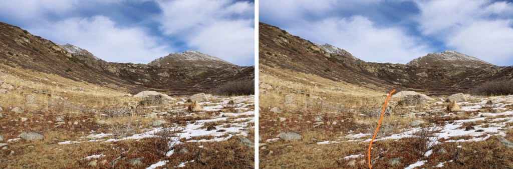
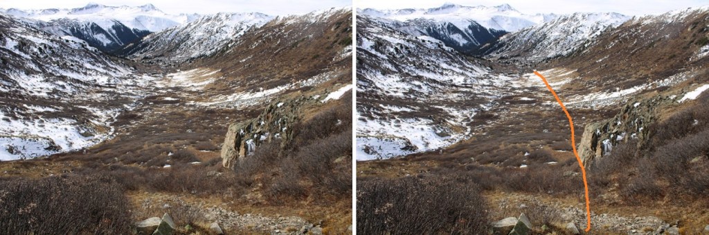
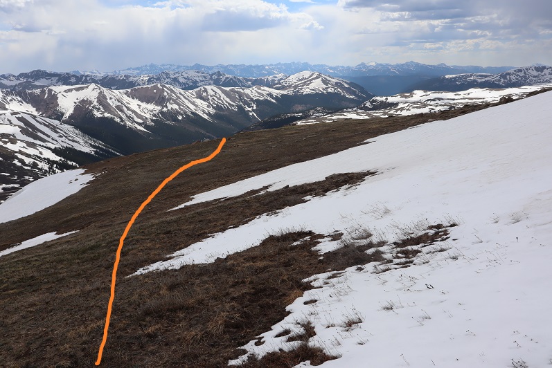
As you can see from the pictures… obvious route.  If it’s not obvious when you’re here, follow the contour of the ridge.  It’s all tundra.

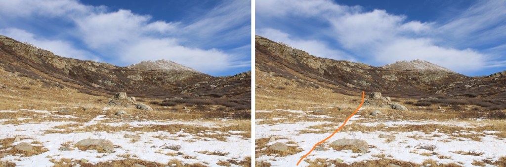
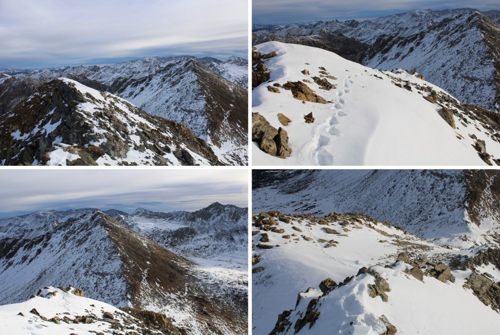
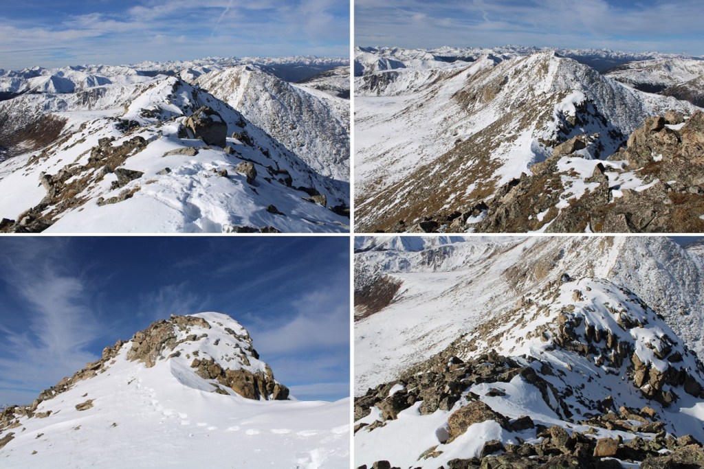
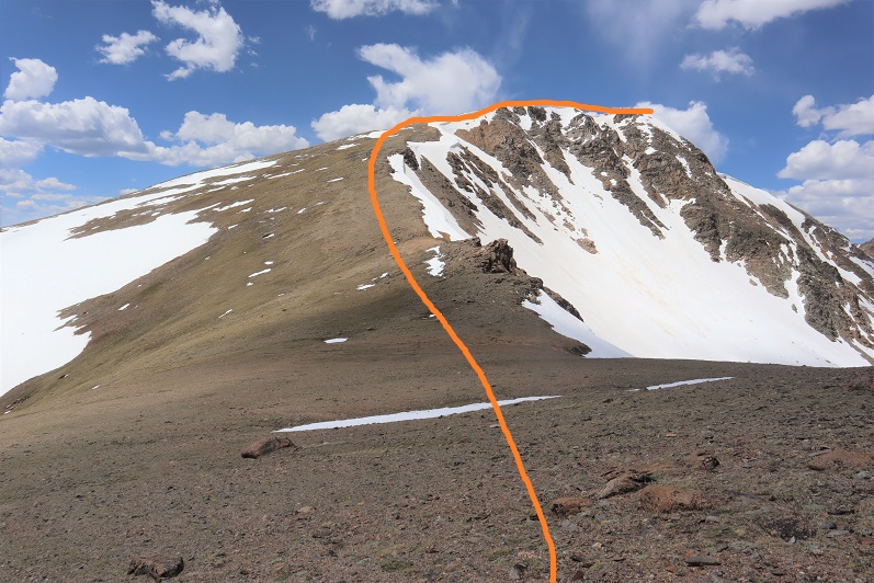
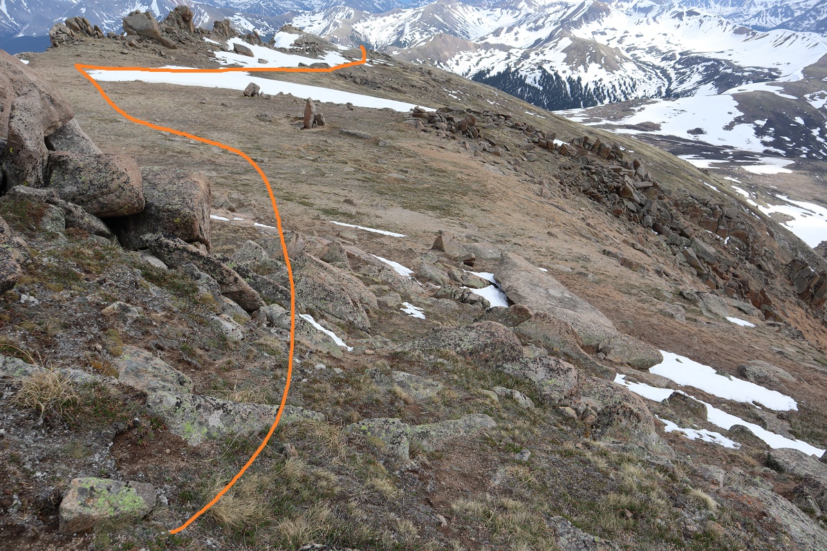
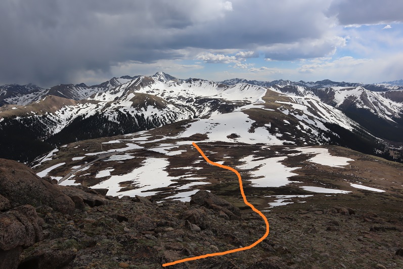
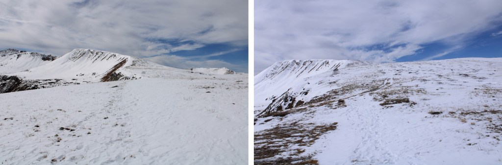
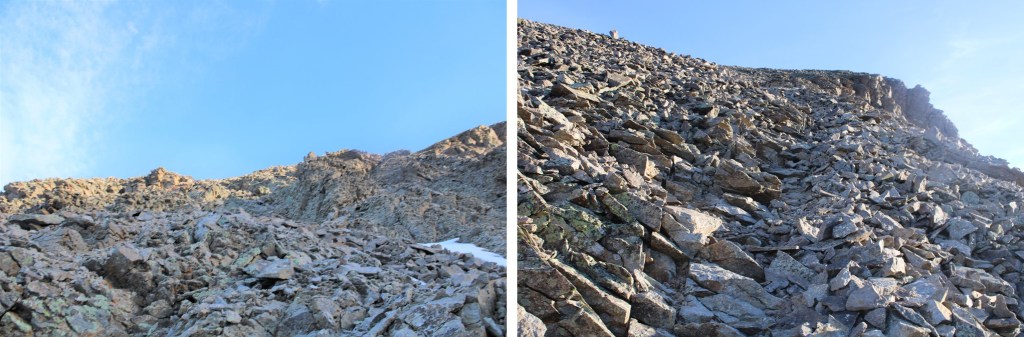
The route becomes briefly class 2 here

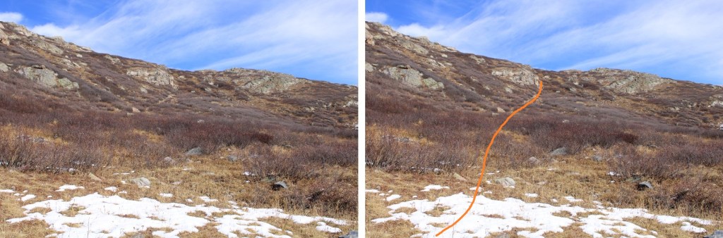
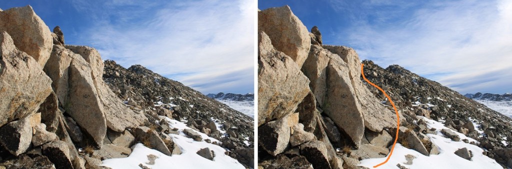
This is very easy to navigate

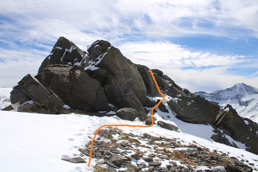
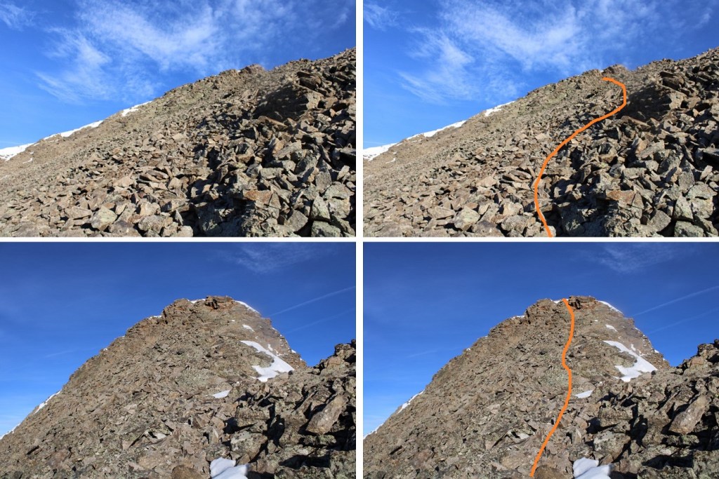
And then it’s back on a class 1 trail again

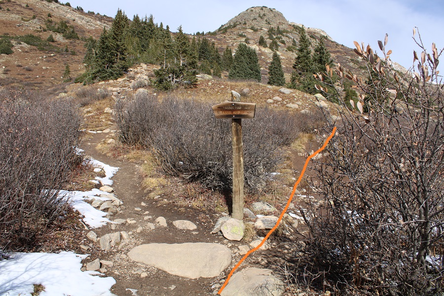
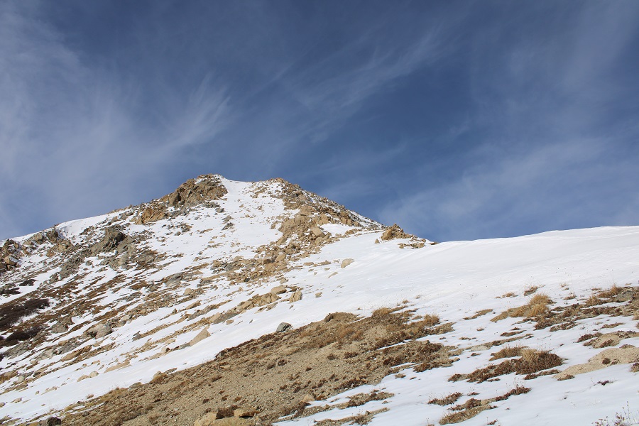
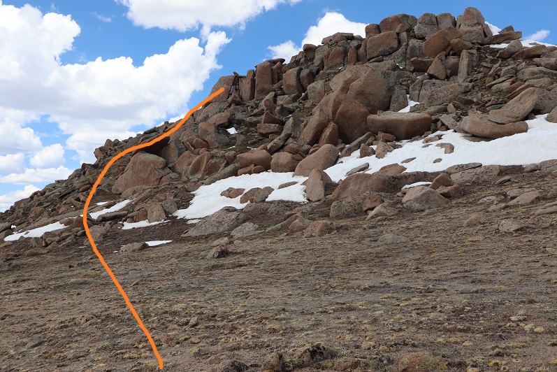
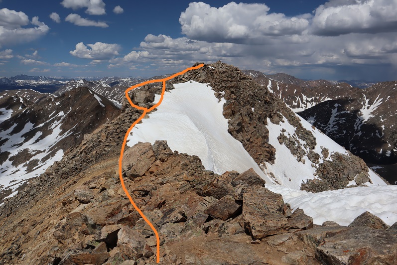
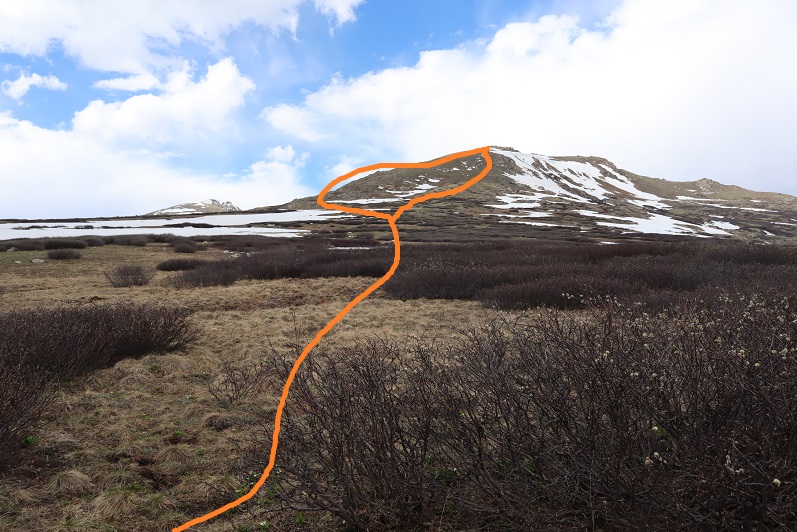
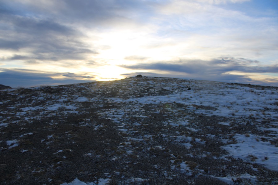
If you stay on the trail, the summit will be obvious

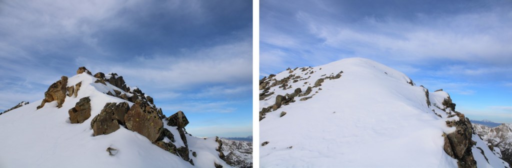
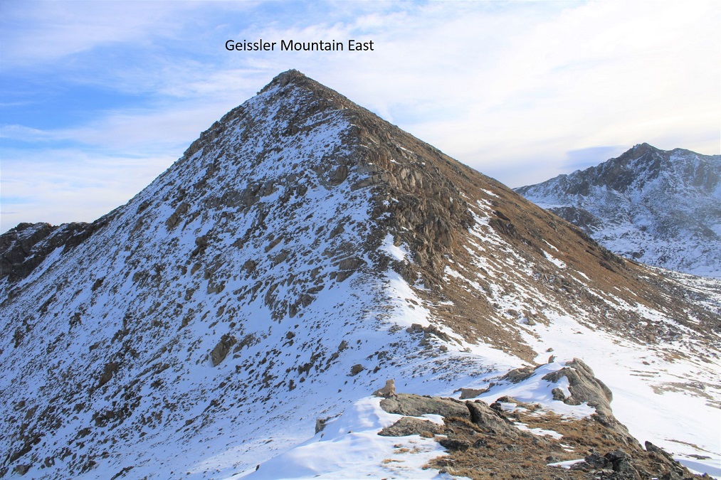
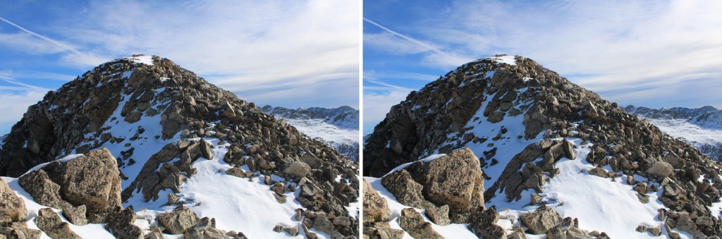
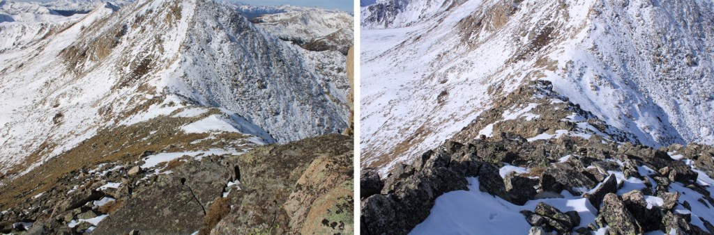
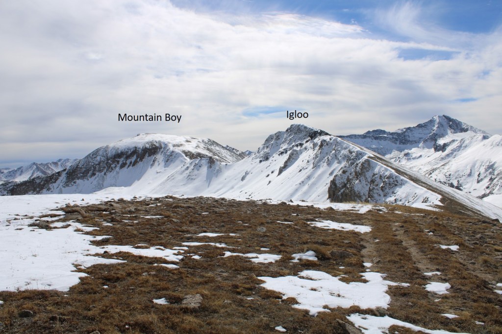
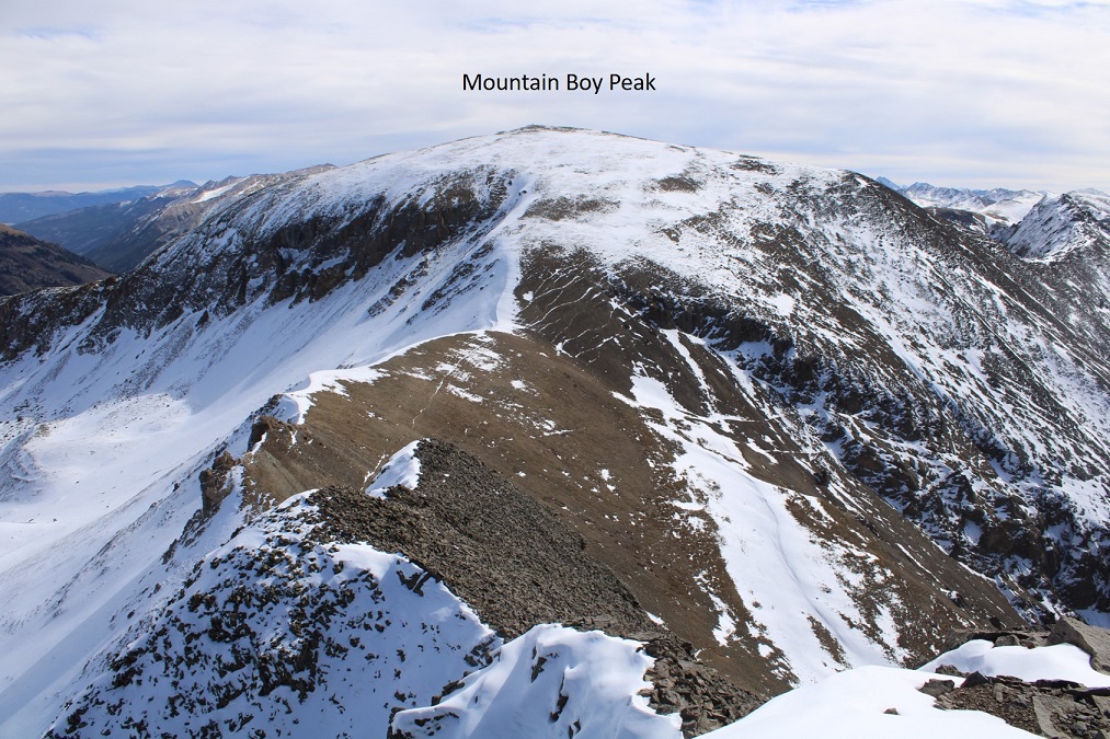
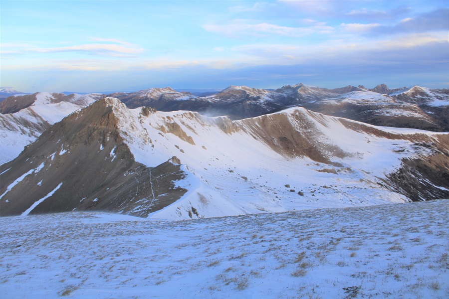
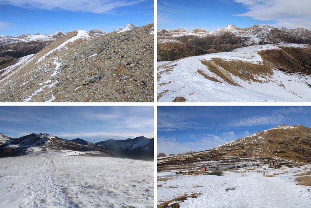
Here’s Mountain Boy from Igloo

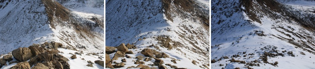
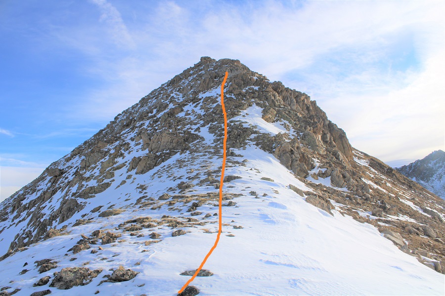
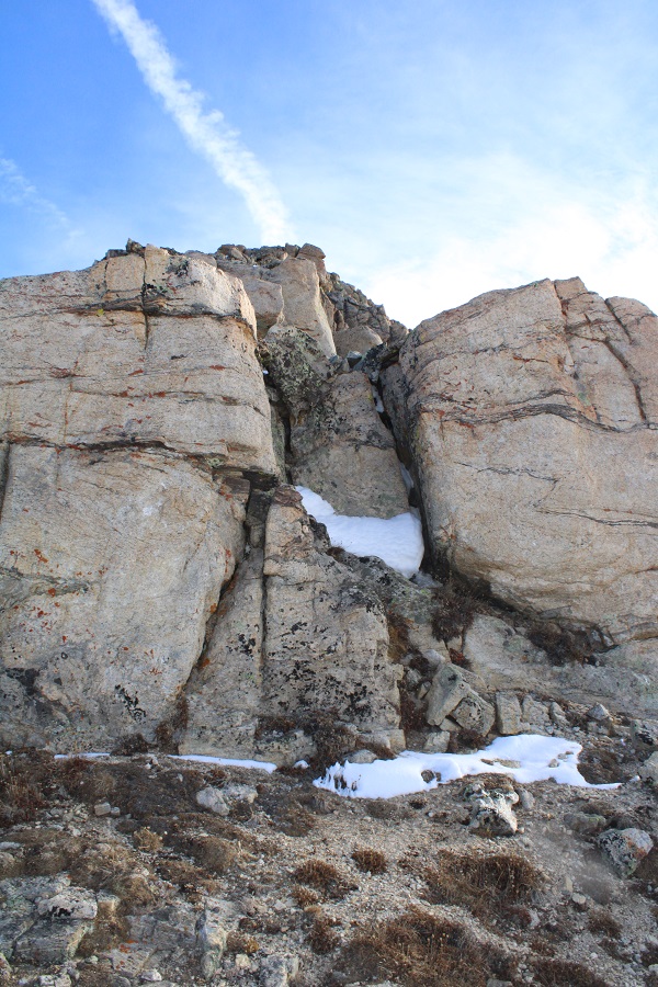
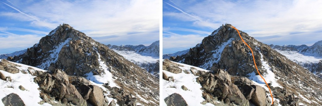
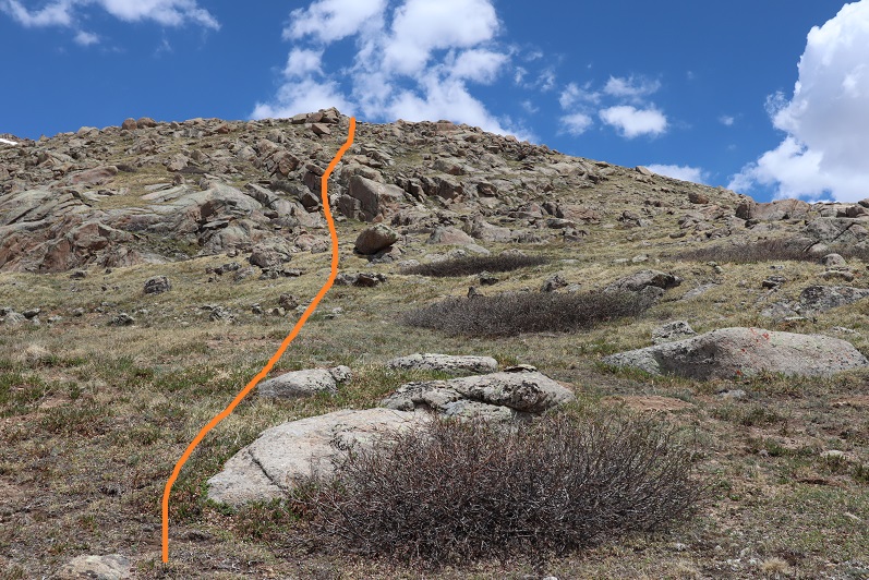
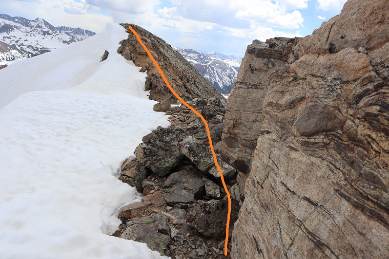
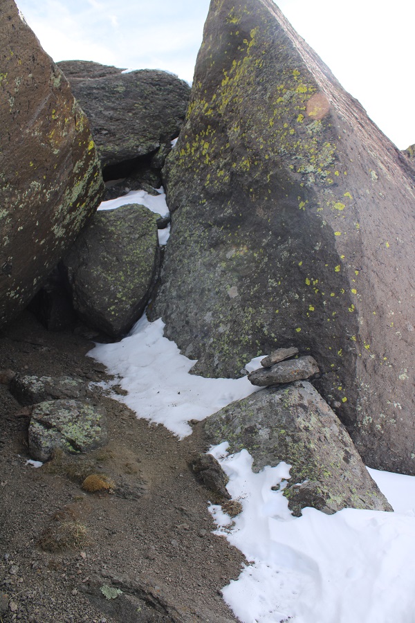
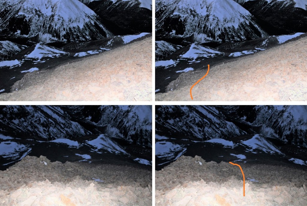
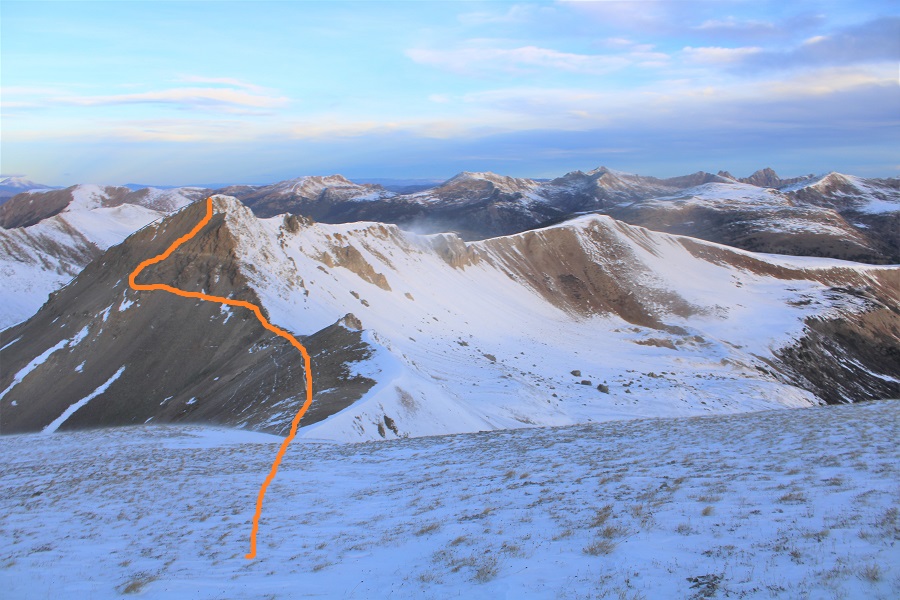
From the summit of Igloo Peak, the trail towards Mountain Boy immediately gets fun.  It’s class 2 from here on out, with one brief class 3 move (or two… it’s a chimney).  Now is a good time to put on your microspikes.  I continued southeast, heading down this briefly class 3 chimney

The rock will be loose until you make it to the saddle. 

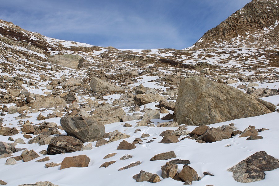
In order to get to the saddle, I headed straight south, down these scree/loose-rock filled gullies

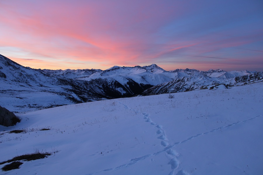
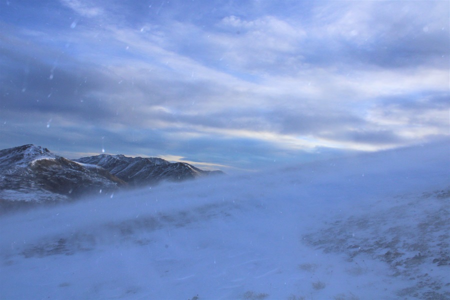
The sun was just starting to rise at this point.  Alpine sunrises are the best!

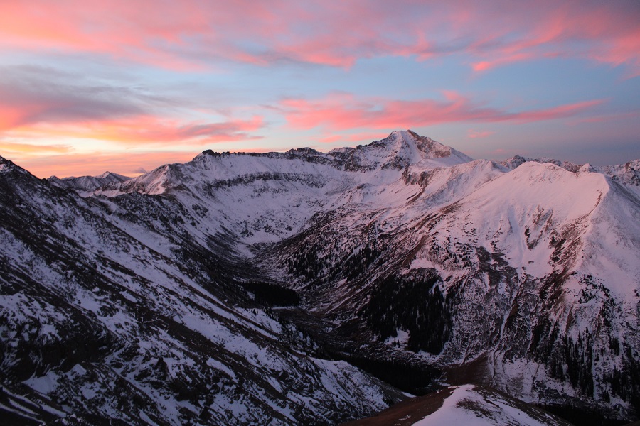
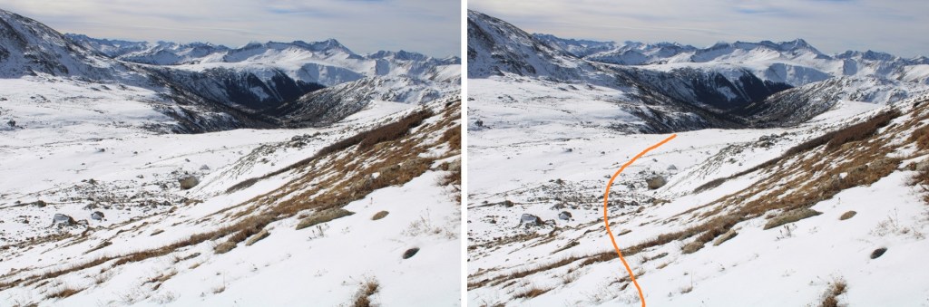
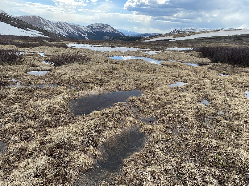
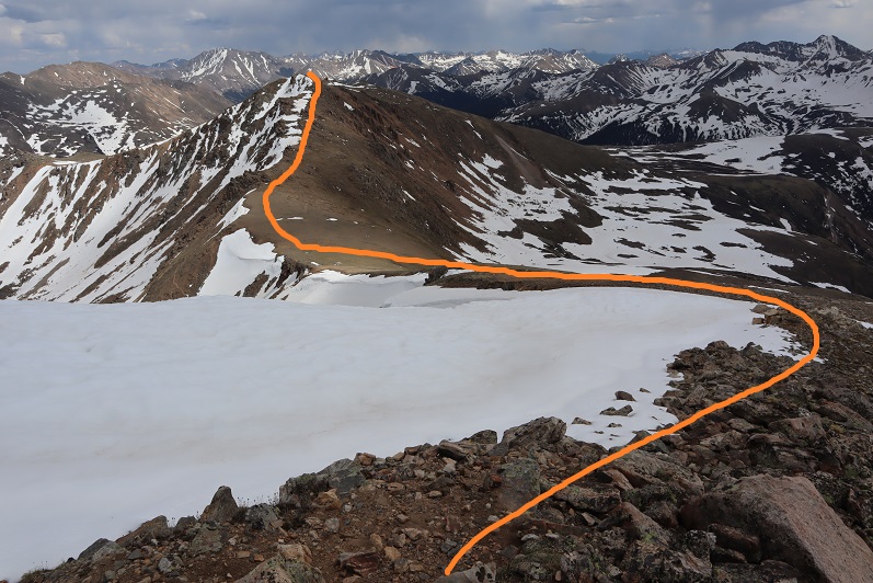
Since the sun was still rising, my view wasn’t that great.  Here’s what I saw as I was descending, following the contour of the drainages.  This is choose your own adventure, but it’ll be obvious when the drainages end.  Don’t descend too early.

It’ll also be obvious when it’s time to head towards the saddle.  There seem to be several social/game trails here.  I chose to stay high, about level with the saddle, and didn’t regret it.

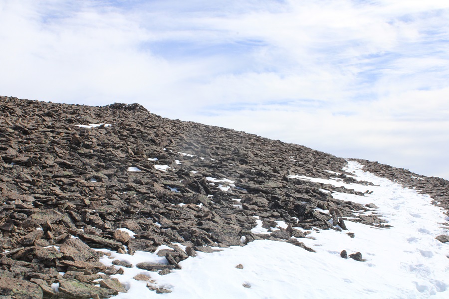
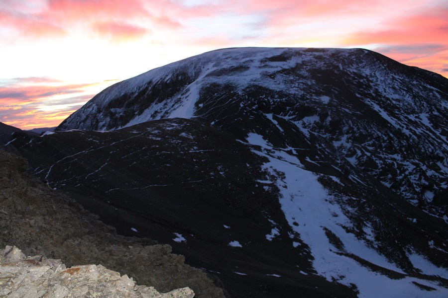
Once at the saddle, there were still a ton of social/game trails.  I chose the one closest to the ridge.  From the saddle, it was an easy hike to the summit of Mountain Boy Peak on scree/tundra

Easy, except for today’s wind!!!  It was relentless, and difficult to catch I pictures/on video at its worst.  This doesn’t begin to describe the gusts

Wind on Mountain Boy: 

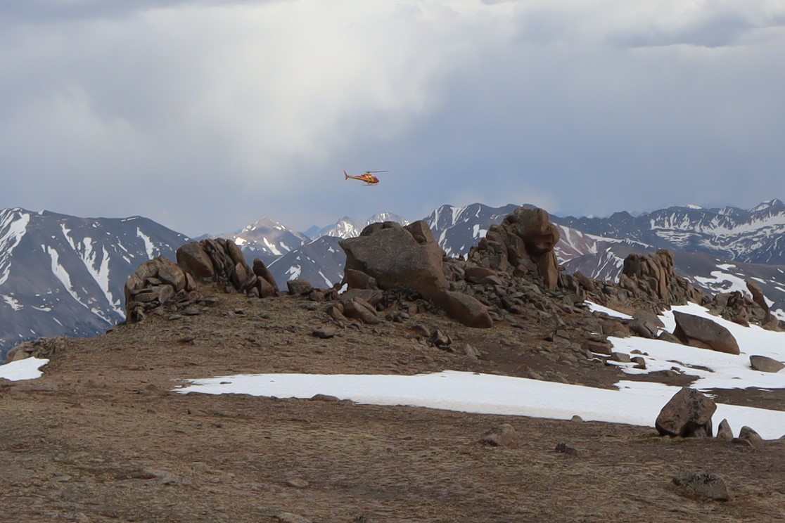
The summit is obvious, marked by a cairn

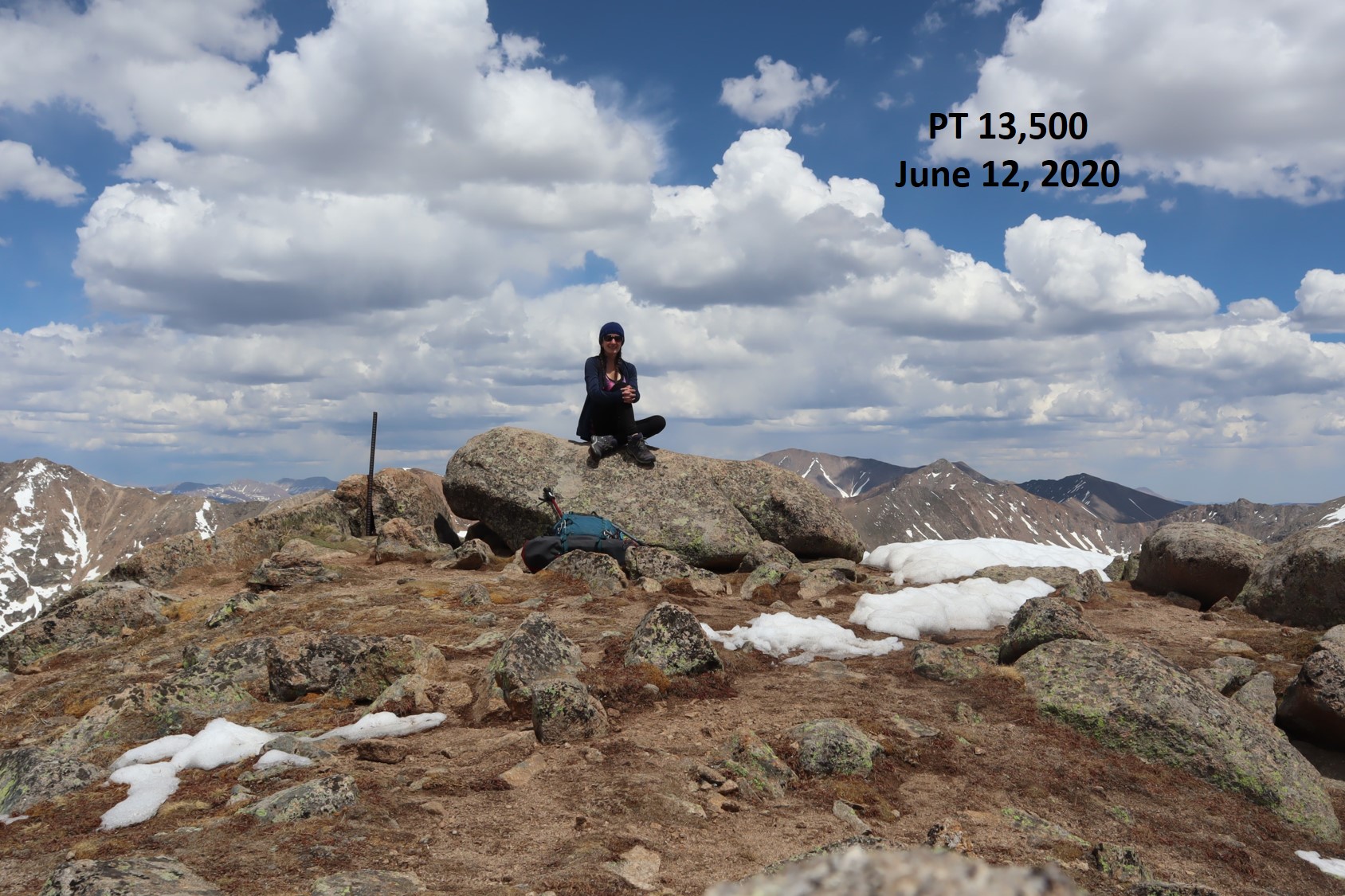
I summited Mountain Boy Peak at 7:45am.
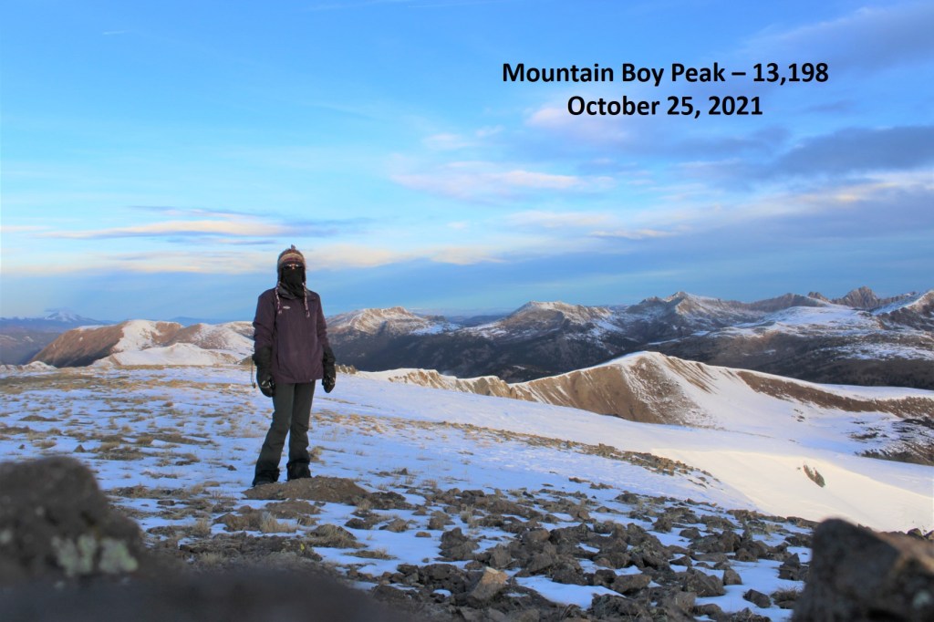
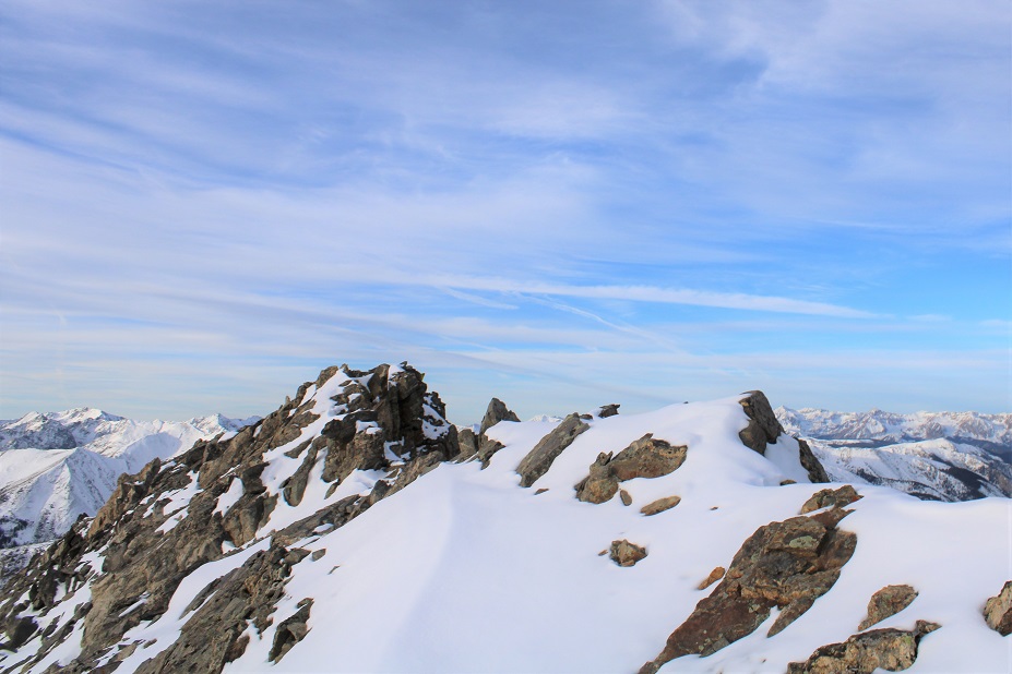
Mountain Boy Peak:

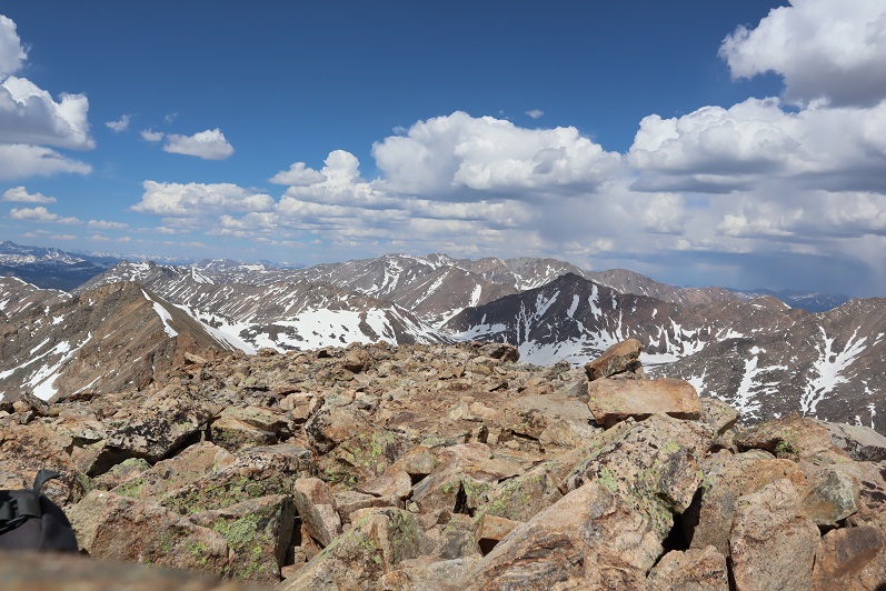
The views of Grizzly Peak were stunning!

I turned and retraced my steps back to the Mountain Boy/Igloo saddle

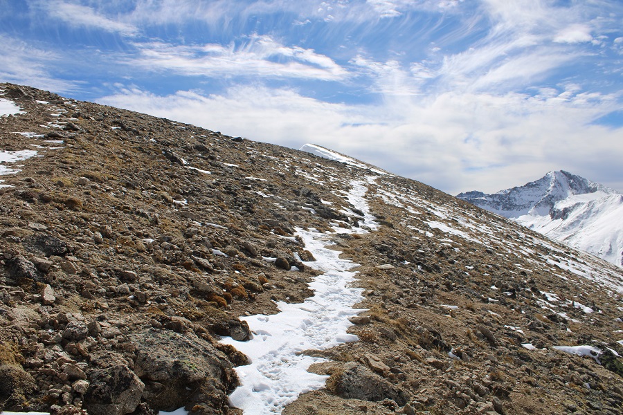
Here’s the route I took back to Igloo, which is the same route I took down.  Microspikes are helpful here, as it’s kitty litter in some areas.

Here are some close-up pictures of the route back up to Igloo

And back up those scree/rock gullies

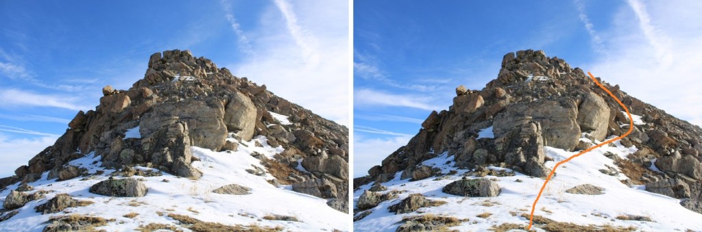
And up that quick chimney to the peak

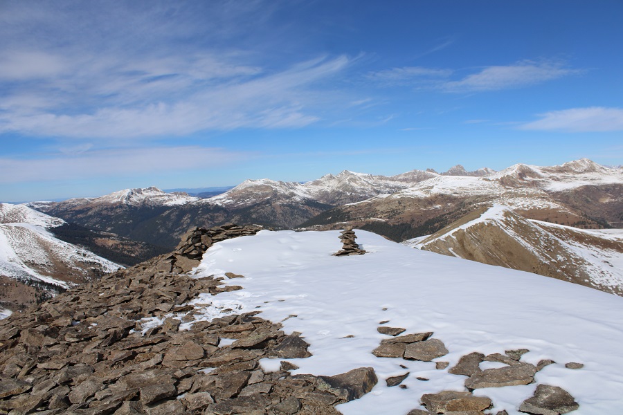
I re-summited Igloo Peak at 8:25am
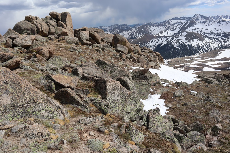
Igloo Peak:

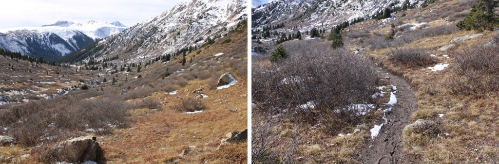
The trek was easy back to the trailhead in the daylight

I made it back to my truck at 9:15am, making this a 6.78 mile hike with 2151’ in elevation gain in 3 hours, 45 minutes

Side note:  I didn’t have my microspikes.  Well, I did, but they fell out of my pack when I took off my snowshoes, and I didn’t realize this until they were needed.  So, when I went to find my microspikes, just before the kitty litter area on the south side of Igloo Peak, they weren’t in my pack.  But I really could have used them!  Especially on the snowy ascent/decent of Mountain Boy Peak. The kitty litter areas were so much more difficult than they needed to be without spikes as well.  I cursed myself the entire time, thinking I’d lost them for good and vowing to buy new ones on my way home as soon as I got cell service.  The reason my track shows movement near Igloo Peak is because, on my way back I realized when I must have lost them and went looking for them.  I found my microspikes, along with a whiskey flask I hadn’t realized I’d lost, just before the summit of Igloo Peak.  From now on, they’re going INSIDE my pack, not in the cup holder of my backpack (I know, I know, not the best decision).

Geissler Mountain West – 13301 & Geissler Mountain East – 13380

RT Length:  5.97 miles

EG:  2381’

Independence Pass is still open, so I decided to try and get in a few peaks before it closes.  I drove to the Independence Lake Trailhead the morning of the hike, instead of the night before: every time I drive by this trailhead at night I see porcupines (plural) underneath vehicles parked there. I wonder how many times hikers have returned to their vehicles to find chewed wires at this trailhead?  This morning I was hoping it was cold enough, and late enough where they wouldn’t be out.  There weren’t any other vehicles in the parking area, and no porcupines in sight. 

I gathered my gear and was on the trail at 6am, headed north, following trail 1996.  The moon was full, so it was easy to navigate without a flashlight.

I followed this class 1 trail for just over half a mile before leaving the trail to head north. Here’s an overview of my route.

Here are some closer pictures of the route up to the Geissler West/East saddle.  I went right at the only junction

After half a mile of hiking I left the trail and continued heading north, easily avoiding the willows by staying to the west

As I neared the back of the basin, I ascended by hugging a rock outcropping and drainage

And then made my way towards the Geissler West/East saddle.  I actually stayed a little to the left to avoid snow, and because I was hiking Geissler West first

Right about now the sun was beginning to rise from behind me. I love alpine sunrises!

I continued heading towards the saddle

Once at the saddle, I then turned left, and was surprised at how much snow there was on the ridge to Geissler Mountain West.

I would have liked to have taken the gully to the summit, but the snow as sugary and unconsolidated, and above my waist in places, making my ice axe and spikes useless, so I took the ridge.  This posed its own set of challenges, as the snow on the ridge was either covering the rocks, or covering the voids.  It was “choose your own adventure” to find out which.  There was some class 3 scrambling here, but I was able to take the ridge proper.

Here are some pictures of the ridge

Once at the top of the ridge I needed to head west towards the summit.  The snow here was up to my waist.  I headed towards the next ridge

I gingerly climbed up this ridge, once again, staying directly on top of the ridge.  This was class 3 as well.

Only to find it was a false summit!  Here’s the true summit of Geissler Mountain West

I dropped my gear and just brought my camera with me, climbing over the snow and then hand-over-fisting it on the rocks to the actual summit. This was class 3 with some exposure. I didn’t take the snow because it was an unconsolidated drift, with a lot of voids to twist an ankle, sink up to my chest, or worse

I summited Geissler Mountain West at 8:25am

Geissler Mountain West:

I followed my tracks back to the Geissler West/East saddle

Now to head up towards Geissler East.  Spoiler alert: there are several false summits.  Also, once I could no longer stick to the ridge, I went right, and kept going right, hugging the south side of the mountain

This ridge is mainly class 2, with a few class 3 moves sprinkled in. The class 3 moves probably could have been avoided, if there hadn’t been snow. Here are some pictures of the route

Remember, there are a lot of false summits… and keep heading right

And finally!  The true summit!

I summited Geissler Mountain East at 9:30am

Geissler Mountain East: 

From the summit I could see the trailhead

I decided to re-trace my steps back to the saddle.  This was easy, as I just followed my footprints.

And from the saddle I made my way back down into the basin, once again, following my tracks (I love that snow allows the re-tracing of steps to be so easy!)

Back down to the willows, and eventually the trail

I made it back to my truck at 11am, making this a 5.97 mile hike with 2381’ of elevation gain in 5 hours.

On to the next trailhead!

Pt 13500 & Twining Peak – 13,711

1

RT Length: 5.39 Miles

Elevation Gain: 2443’

After summiting Sayres Benchmark I noticed the day was still nice and I had plenty of time to spare so I drove to Independence Pass to try my hand at Twining Peak. I’ve already been here once this year after another hike, but the conditions weren’t… favorable. Lots of wet marshy mush to get through to the good stuff, and I don’t like hiking with soggy socks.

When I got to the Independence Pass parking area I backed in my truck and took a look around. Yep, it was still marshy.

2

The weather looked good, and I could see a clear line to the ridge. I decided to gather all my gear (crampons, ice axe, snowshoes, new socks, etc.) and hit the trail. I walked west along HWY 82 until I reached this sign, which happened to be where the snow ended. From here I turned right (north) and headed for the ridge.

3

Yes, this was still marshy, but I could avoid the snow and getting my feet wet with careful navigation. I aimed for the ridge, intending to see what the basin looked like before determining if I would summit first via the 13500/Twining saddle or go over 13500 instead.

4

When I made it to the ridge I looked over at Twining Peak. If it were earlier in the day I would have crossed the basin and gained the saddle first (as outlined below).

5

However, it was now almost 2pm and I knew that snow was soft. Yes, I had snowshoes, but no, I didn’t want to posthole with them through the basin. So instead I turned right (northeast) and followed the ridge to 13,500. This was all class 2

6

7

There seemed to be a bit of a trail in areas that went straight up through the snow. I didn’t want to do that so when I encountered snow I just went around it. This is an easy ridge to follow.

8

9

There was a little bit of rock hopping, all class 2, and easy fun. The boulders are big and pretty stable. Just hug the ridge to the left and don’t try to go straight over the ridge and you’ll be fine.

10

11

Here’s the last bit to the summit

12

I summited at 2:15pm

13

Pt 13,500:

There wasn’t a summit register. Turning northwest I could see my path to Twining Peak

14

This was an easy ridge walk, with a little easy rock hopping and the snow was totally avoidable

15

16

The tundra changed to rocky terrain

17

There was some snow on the last section. I decided to drop to the left and find a gully to summit, but I wouldn’t recommend that route: the gully was loose and on my way back I found out the snow was actually solid near this boulder, so I should have just summited by walking across it.

18

Summit of Twining Peak

19

I summited Twining Peak at 3pm

20

Twining Peak:

The weather was starting to turn; I could see rain showers all around so I didn’t stay long on the peak. I put on my jacket and headed back down, this time going over the snow and large boulder I’d gone around on my way up.

21

And back down the ridge, sticking to the right to avoid the snow

22

23

24

I re-summited PT 13,500 as it was lightly snowing.  There was a young man at the summit who was super excited: this was his first 13er! He’s never gotten this far before on this peak, and he was excited.  He wanted to know what all the peaks were that we could see, and I obliged him for a bit. Also introduced him to 14ers.com because he’s interested in tackling more 13ers and 14ers (please be nice).

I headed back down the ridge

25

Unfortunately, at about this time I saw a flight for life helicopter whiz by. Never a good sign. Later, as I was driving back down HWY 82 I saw a police officer and a tow truck driver putting a motorcycle on the back of the tow truck, lots of lights flashing, no other vehicle/animals involved.  Ouch. I sincerely hope everyone is ok. Also, the accident happened in a straight area of the HWY, so I don’t think HWY curves were involved. In any event, please adventure carefully!

26

I took a slightly different path on my way down than I did on my way up, as I could see a clearer path that avoided marsh/snow

27

28

29

I eventually came upon a trail, but it led to snow/marsh, so I avoided it and went back down the ridge

30

The nice thing about this hike is you can see your vehicle for most of it, and at a minimum HWY 82, so it’s difficult to get lost. I just aimed for the road, avoiding the snow/mush

31

32

Here’s an overview of my hike up to the ridge and back down more to the center (after realizing the basin wasn’t something I wanted to experience today)

33

I made it back to my truck at 5:45pm, making this a 5.39 mile hike with 2443’ of elevation gain in 3.5 hours. Please don’t judge the time: I’d already hiked 12.5 miles and 4652’ of elevation this day and I was a bit tired; this hike can most likely be done faster.

Here’s a topo map of my route

34

OK, on to the next trailhead!