Marble Mountain A – 13,266

1

RT Length: 11.6 miles

Elevation Gain: 4682’

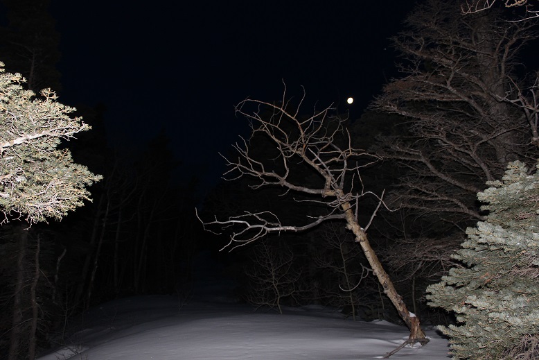
I’d attempted this peak a few weeks ago but had to turn back due to high winds above treeline.  Today I was ready to try again, armed with a beautiful weather forecast and a full night’s sleep.

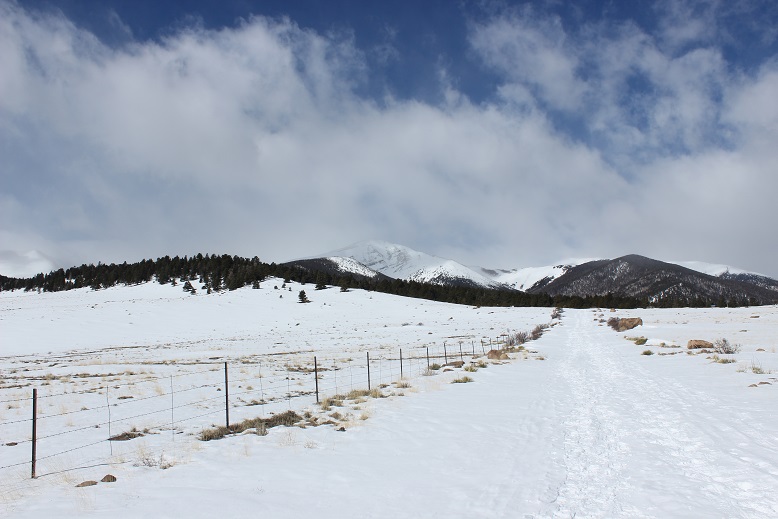
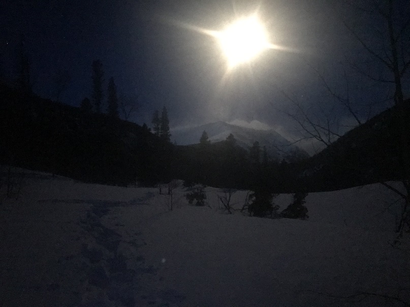
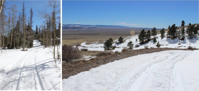
Since I’d been here 2 weeks ago and knew it had snowed here quite a big since then I didn’t even attempt to drive to the upper South Colony Lakes trailhead. I made it to the South Colony Lakes lower 2WD trailhead at 4am to one other vehicle in the lot.  It looked as if someone was sleeping in their truck.  I got together my gear and was on the trail around 4:15am.  After hiking about 100 yards I came upon snow on the 4WD road and was glad I’d parked in the lower lot.

2

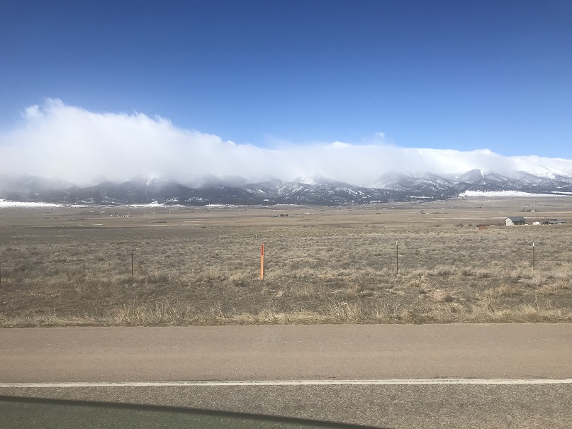
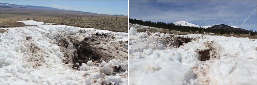
Unfortunately, it looked like someone had attempted to drive up the road in the past few days. When the road got too much snow on it they drove off the dirt road, kept driving parallel to the road, and then when they felt there was less snow went back to the main road.

3

This tears up everything people! Don’t do this!  It also looks like they learned their lesson because they got stuck in a snow drift.  I’m guessing there’s about 4 feet of snow here.  Not only did they get stuck, they tore up the road trying to get out, which will make it more difficult for drivers to make it to the upper trailhead once conditions actually improve.

4

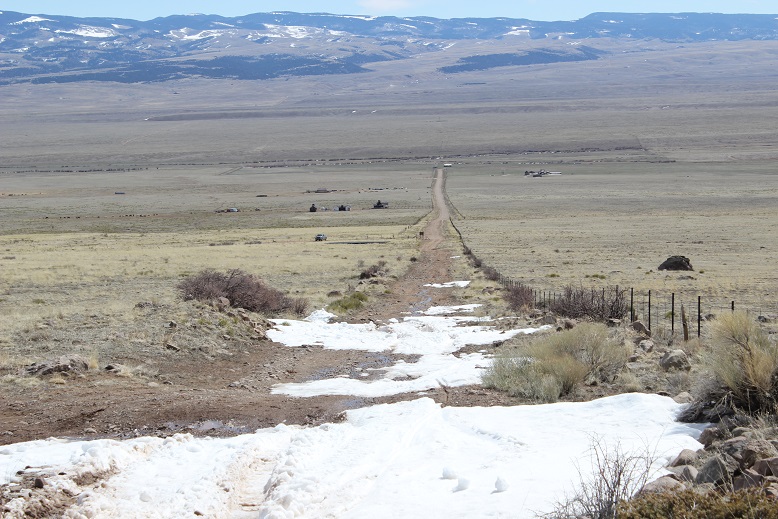
The road in was well packed in areas, soft in others, and covered in 2-6 feet of snow. It was still dark so I kept looking over my shoulder to see if anyone drove in behind me or was hiking with a flashlight but didn’t see anyone.  I put on my snowshoes at the Rainbow Trail Trailhead.

5

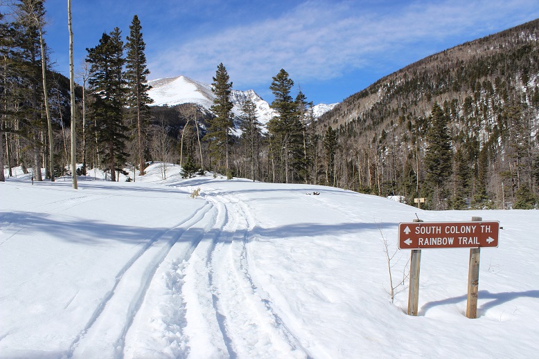
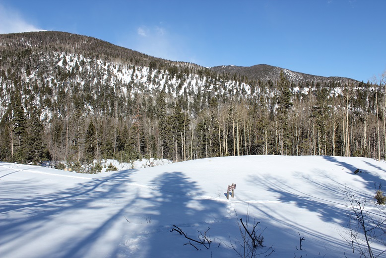
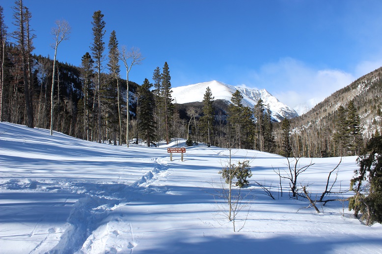
This trailhead is still inaccessible by vehicle and covered in snow.

6

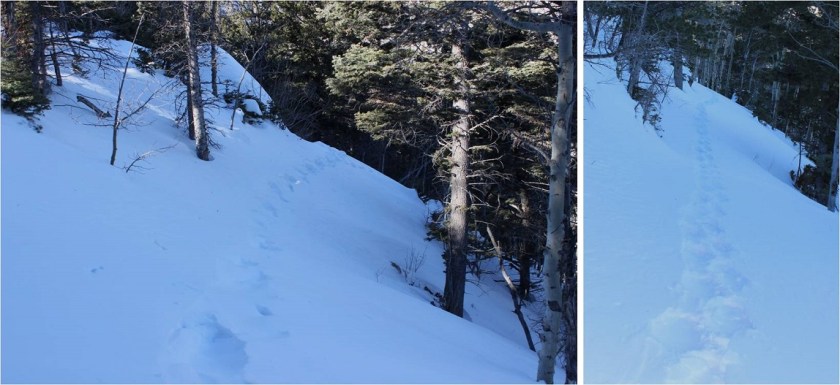
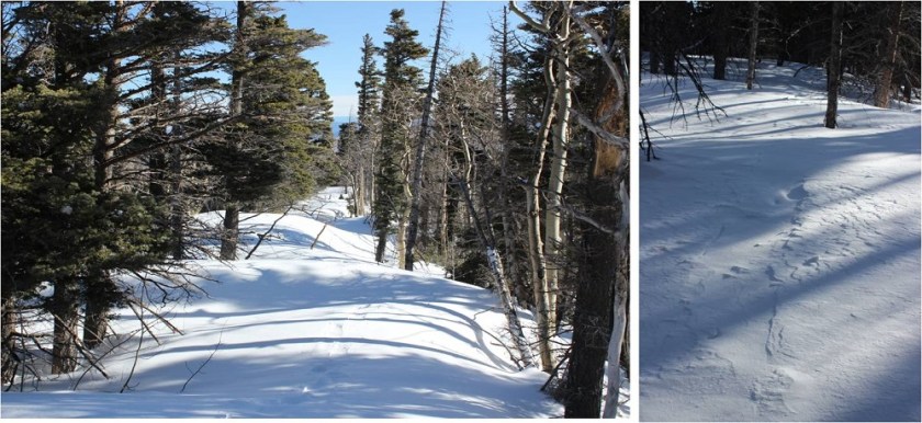
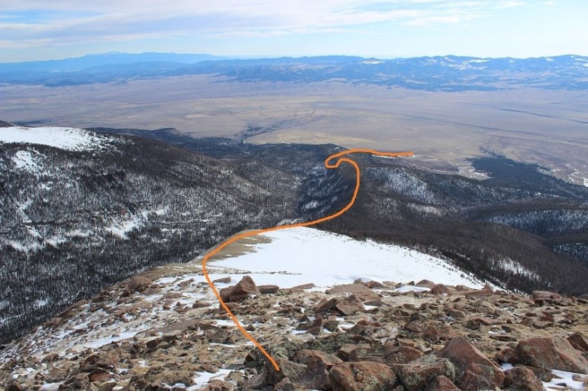
I had a map with me, but since I’d just done most of this hike 2 weeks ago I never took it out of my pack. From the Rainbow Trail I turned left (northeast) and followed the slope up to the ridgecrest.  Here the tracks I’d put in earlier were still in place, and it looked like a few others had been here since then, so there was a faint trail to follow

7

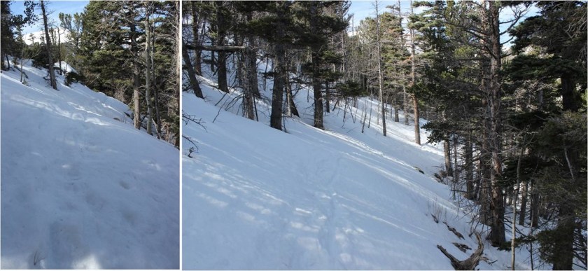
At the top of the slope I immediately turned right and followed the ridge. The ridge looks mostly flat, but does gain in elevation, all except for one area where it dips down a couple hundred feet and then inclines again.

8

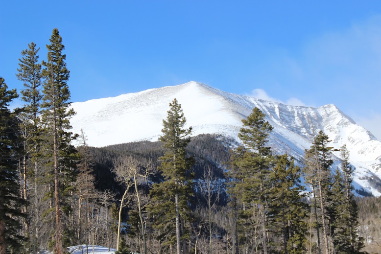
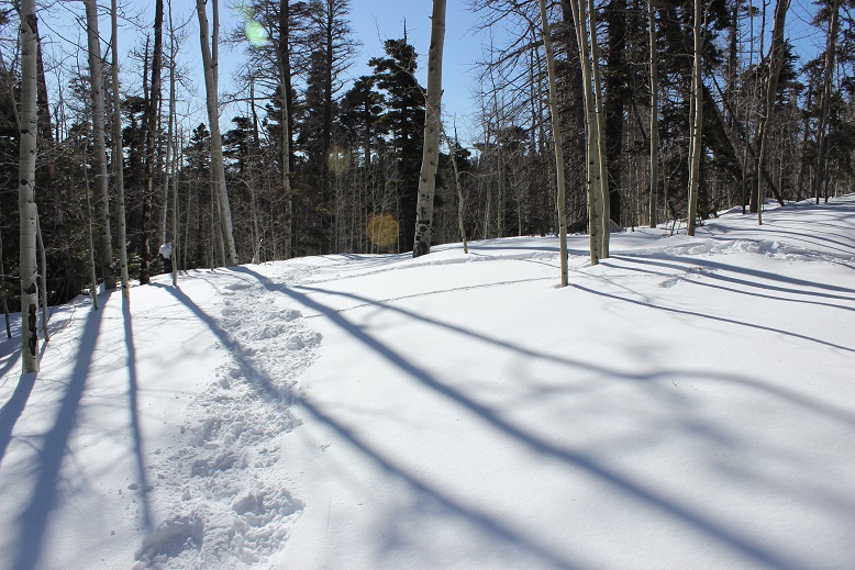
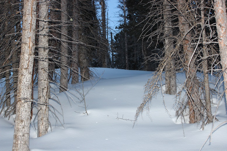
This was supposed to be a 7-10 mile hike, with about 3500’ in elevation gain, but for some reason it felt like a lot more than that. It seemed I was below treeline for much, much longer than I should have been, yet I knew I was still on track because as the sun rose I could see Humboldt peeking at me through the trees to my right.

9

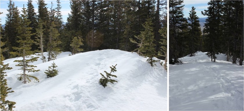
Finally (and I mean finally) I crested a vertical slope

10

And made it to treeline.

11

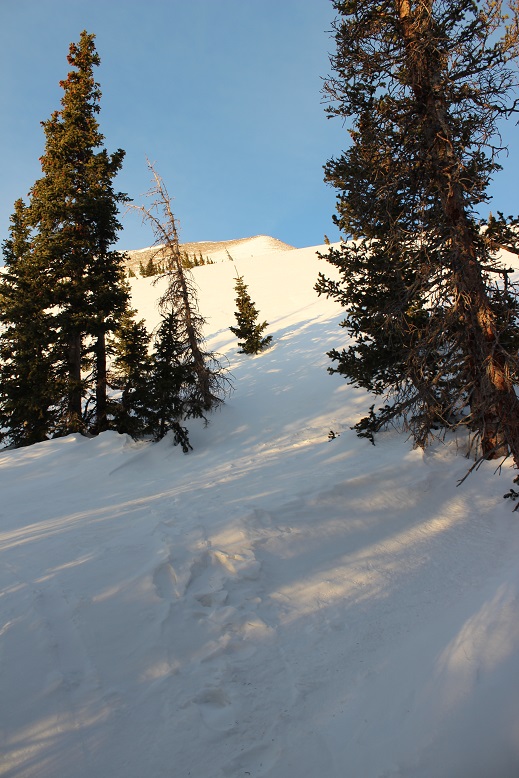
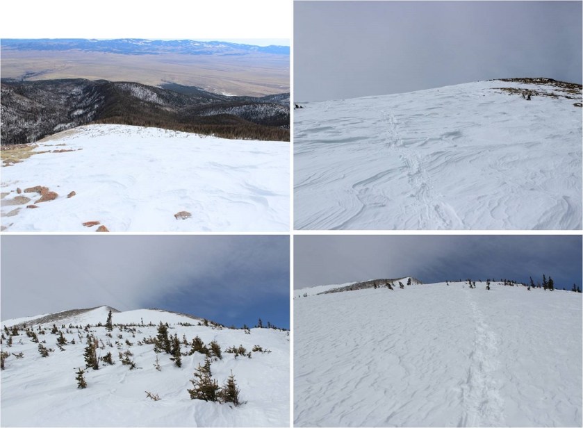
Here the snow was hard packed and I was glad I had snowshoes (crampons would have been necessary otherwise). I traded my trekking pole for my ice axe and started up the hill.

12

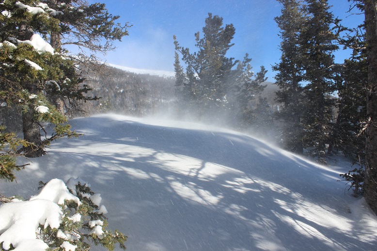
The wind picked up, and remained a steady 15mph until I made it back below treeline. In this area it was impossible to avoid the snow

13

But as soon as I was up over this hill I had the option to stick to the snow or hike on tundra instead. I was tired of the snowshoes, so I took them off and kept to the right, following the ridge.

14

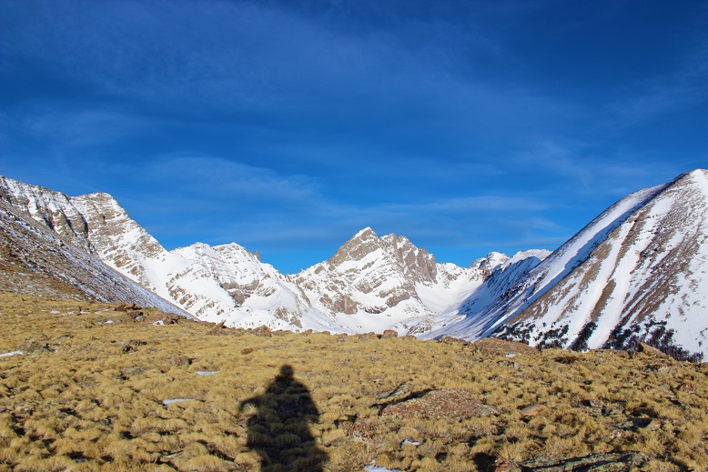
The view of the Crestones and Humboldt was beautiful!

15

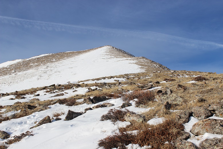
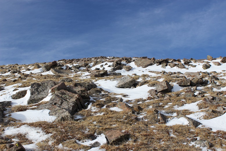
The rest of the route was pretty straightforward, but I was curiously more tired than I should have been for just 3500’ in elevation gain. I was seriously worried I was losing my touch, or that I was getting out of shape? As I neared the summit the terrain became more rocky and steep.  I found myself zig-zagging my way up, doing my best to avoid the random snow patch that had me post holing up to my thighs

16

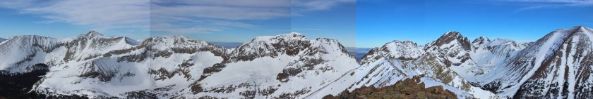
I summited to some amazing views of Humboldt, the Crestones, and a bunch of 13ers!

17 crestones

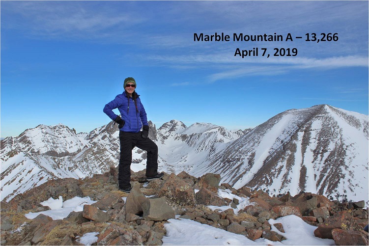
Here’s my summit photo

18 Marble Mountain A 13266

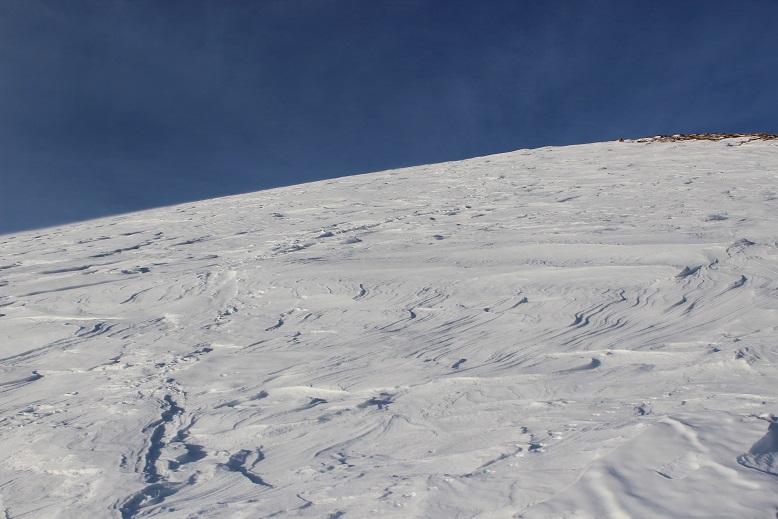
It was a beautiful day, but that wind made it cold and my fingers were starting to burn so I turned around and headed back down the slope. Here’s a look at the way I came

19

Here’s what it looks like just above treeline. Snowshoes were helpful (and here I put them back on).  I appreciated the full coverage of snow

20

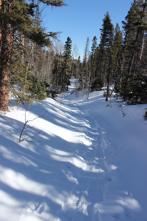
The ridge back once again seemed to take longer than necessary. It felt like I was in the trees forever!  I was still glad I had my snowshoes

21

The wind stopped below treeline and the temperature increased dramatically. I took off my hat and gloves and noticed my hands had some minor damage, but nothing that wouldn’t heal in a few days.  I saw a couple of early season mosquitoes on the ridge, which were easily distinguishable against the white backdrop of snow.  I made it back to the Rainbow Trail and followed it to the Lower South Colony Lakes trail, noticing the temperatures had warmed up the snow quite a bit and once again praising my snowshoes:  The road was becoming a slushy mess.

22

I fully expected to see people hiking up the trail or skinning, or something, but I never did. I didn’t see another person the entire day, and as I rounded the corner and could see the parking lot it became apparent why:  my truck was the only vehicle in the lot!  I’d had the entire mountain to myself today!

23

It had been a beautiful day to hike: Little wind, warm temperatures, and solitude.  When I checked my tracker it said I’d gone 11.6 miles and gained 4682’ in elevation in 6.5 hours.  No wonder I’d felt out of shape!  I’d expected a 7-10 mile, 3500’ elevation hike.  As I’d been hiking I’d begun to doubt my physical fitness, but these new numbers seemed much more accurate.

24

Here’s my Relive (which I like this time because it portrays the snow above treeline)

https://www.relive.cc/view/2272842012

I drove home feeling I’d gotten in a good workout today. This is a great ridge hike!

Marble Mountain

1

RT Length: 8.8 miles

Elevation Gain: 2540’

I knew I wasn’t going to summit from the time I made it to the trailhead. It was still dark, but through the moonlight I could see an outline of the mountains covered in clouds.  So much for those sunny skies and that 20% chance of snow today.  Yes, I knew I wasn’t going to summit from the time I made it to the trailhead, but there wasn’t really another hike with better weather anywhere in the state so I made the decision I was going to get in a good hike anyway and just turn around when I felt it was necessary.

It’s been too long since I’ve done a serious hike.   Over a month in fact.  And by serious I mean something above treeline (Guadalupe Peak had the mileage and elevation gain but topping out below 9K didn’t count).  I was beginning to feel like I was out of shape.

I arrived at the Lower South Colony Lakes trailhead at 5am to cars parked in front of the 2WD road in, blocking my drive any further. I immediately questioned their choice of parking spots but soon realized the road was impassable, so it didn’t really matter anyway.  And here’s a shock:  there was a couple sleeping UNDER their truck.  I’m afraid I woke them up on my drive in (sorry guys!  I turned off my headlights as soon as I realized you were sleeping!).  They rolled over in their sleeping bags and went back to sleep as I gathered my gear and set out, thinking “Boy, were they brave!”  It was frigid out here this morning, but you couldn’t beat the view of the stars and full moon.

I started out at about 5:20am carrying my gear, but quickly stopped to put on my snowshoes. Parking at the South Colony Lakes trailhead would add over 4 miles to the hike, but they would be an easy 4 miles along a dirt road.

2

Well, a dirt road covered in 2-3 feet of snow. Luckily there was a trench already in place.

3

I followed the trench up to the Rainbow Trail Trailhead, where the trench immediately stopped.

4

From here on out I was trenching the trail myself. This was my view as I navigated my way around the mountainside

5

This part was a bit sketchy: I’ve never trenched along a hillside before.  Up a hill sure, but never straight across.  Here’s a view looking back at some of my fancy footwork (it’s steeper than it looks)

6

I rounded the corner, hiked a bit up a hill, and found myself at an obvious juncture to turn right and follow the ridge. Well, maybe not obvious (there weren’t any signs or anything) but I could tell this was the ridge and to follow it I must turn right.

7

This is where the wind started picking up. I was in the trees, yet the wind was howling all around me. I’ve never experienced such wind while still below treeline.  There was also quite a bit more snow along the ridgeline than I’d expected.  It was at a minimum 4 feet deep, with drifts that went over 10 feet.

8

9

No maps or special navigation tools were needed: I just kept following the ridge.  The fun part was hiking up and down the drifts, checking for stability as I went.

I kept trudging along and the wind kept increasing. The blustery weather was coming from Humboldt, kicking up snow and flinging it around like little chards of glass.  I knew the wind was forecasted to be 20-25mph today, but the forecast didn’t mention sustained winds that didn’t let up. This would have been useful information. Also, I’m pretty sure the winds were higher than 25mph above treeline.

10

Video: Marble Ridge

The entire hike along the ridge I kept thinking of Sir Edmund Hillary’s quote: It’s not the mountain we conquer, but ourselves.  That was indeed true.  Pushing and overcoming our limits is what makes the experience worthwhile.  However, I’ve learned to be a little more cautions when it comes to wind and weather.  My fingers are still recovering from Sherman over a month ago, and I didn’t want to reinjure them too soon.  Yes, I knew I wasn’t summiting today, but I wanted to at least make it to treeline. On the positive side I wasn’t cold and I could still feel my fingers and toes.

When I got to treeline the views were terrible! There was only a 20% chance of snow today, but the high winds were developing their own weather above treeline, flinging snow and creating clouds as they went.  Despite predictions snow was indeed falling on the summit.  The wind here knocked me down.  I stood back up again and was knocked down again.  It was like I was living a Chumbawamba song.

I was close to the summit (I’m guessing about a mile) but from experience knew in these types of winds are too much for my body to bear for the hour or more it would take to summit and make it back down to treeline. I would have turned into a popsicle.  The winds were also supposed to increase in the afternoon, so I took a picture in my mind of the route for next time and headed back through the trees the way I’d come.

What’s this? My tracks were completely gone!  I’d just hiked through this area no more than 15 minutes ago, yet my snowshoe tracks had been filled in from blowing snow.  Wow!

11

I tried to get a picture of Humboldt, but ended up getting a shadowselfie instead and a peak covered in blowing snow.

12

Hiking back down the ridge was much easier than hiking up the ridge, even with my tracks gone. Eventually I came back to the trail junction and the wind stopped.  Here my tracks were in place, and alongside them another set of tracks.  Hmm.  That was curious?  They just seemed to stop.  It looked like an animal had walked out into the open just to use the restroom.  Then I looked closer and noticed that wasn’t the story at all:  Something had been caught by a large bird and became breakfast!

13

After crossing the hillside and following my tracks I made it back down to the Rainbow Trail trailhead. Behind the sign is the parking lot I would have used if the road were clear.  This parking area is currently covered in a few feet of snow.

14

As I reached the sign I looked back up at Marble Mountain and was a bit miffed to notice the wind had apparently stopped on the summit. The summit looked calm, clear, and was mocking me at my current position.  I started second guessing my decision to turn back.

15

Just then a big gust of wind began again from the Humboldt side and both mountains (and the Crestones) were clouded in ice again. They remained that way even after I’d made it to my truck and was driving back home.

16

The 2+ miles back to the Lower South Colony Lakes trailhead was peaceful and quiet in the early afternoon, and getting warmer by the minute. My left pinky toe was hurting something awful, but by now I’m used to this. I saw some fox tracks that I hadn’t earlier

17

I made it back to my truck at about 9:45am, surprised to notice the ground was now muddy at the trailhead.

18

I looked at my tracker(s) and saw I’d only hiked a little over 2500’ in elevation. It had seemed like so much more, but I had been breaking trail, which takes quite a bit of energy.

19

On my drive home I had the opportunity to race a horse drawn carriage.  Yes, I’m sure the horse knew we were racing.

20

I also came along a herd of bighorn sheep in the exact area that has signs indicating they were there. It’s one of the first times I’ve seen such an accurate sign.  Only one of the Bighorn Sheep seemed interested in my presence.

21

OK, so in the end this had been a worthwhile day. No, I didn’t summit, but I did get in a good hike.  I saw some wildlife and practiced my “trenching on a slope” skills, so I’m considering today a win.  Oh, and also I didn’t get frostbite.  Well, at least not on my fingers.  I did reignite the frostnip on my pinky toe that had recently healed, but it isn’t as bad as before.  I’m sure it will heal faster this time!