I didn’t want Peak Fifteen to be my Bicentennial Finisher. I really didn’t. In fact, last month I attempted Peak Fifteen, but had to turn around due to several factors: There was too much water in the couloir and if the section I was in was really class 4… my skills had gone south. It hurt to hike all the way in from Purgatory and not get a summit, but I knew the conditions weren’t safe. So, I turned around, went back home, and did more research.
This time, I brought my friend and climbing mentor, Tim. My thoughts were to climb this peak with him, get the hang of it, and attempt it solo at a later date. Spoiler alert: After successfully summiting this peak, I do not think I’ll be attempting it solo.
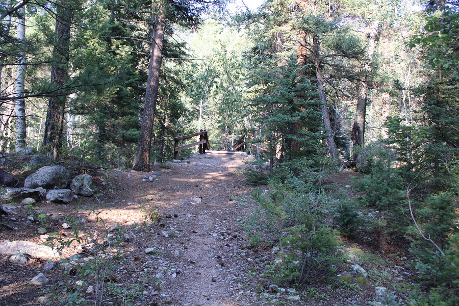
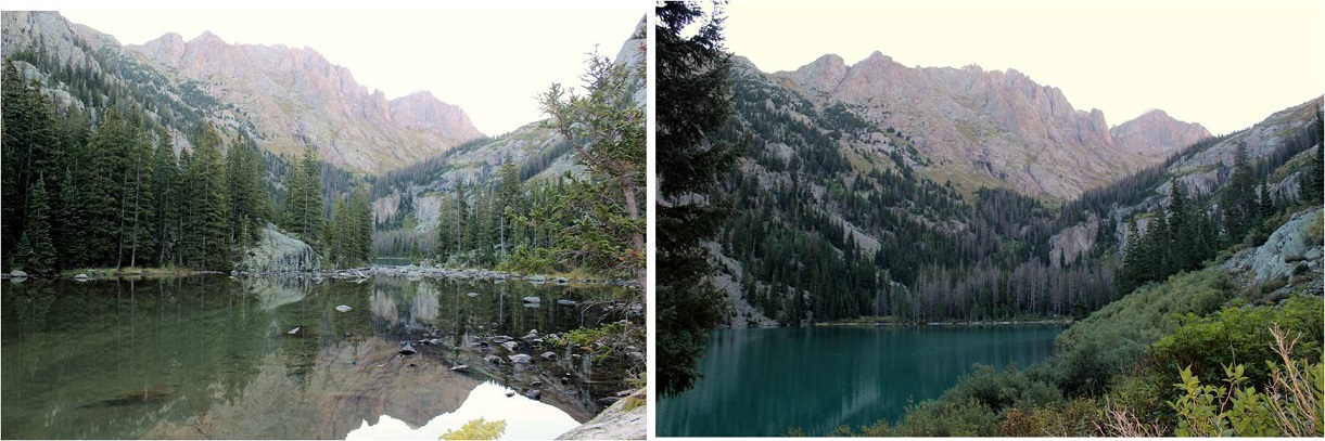
It was a long hike in from Purgatory. We ended up hiking a little slower than anticipated, so we stayed the night at the campsite at Ruby Lake; something I’ve always wanted to do. It was already dark when we arrived, and I’d only brought one set of clothing, so it was a cold night for me as my sweat turned to ice at night inside my bivy. This made for interesting (zombie filled ) nightmares.
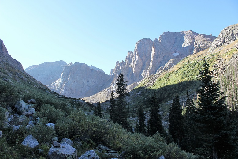
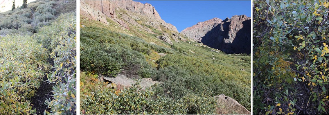
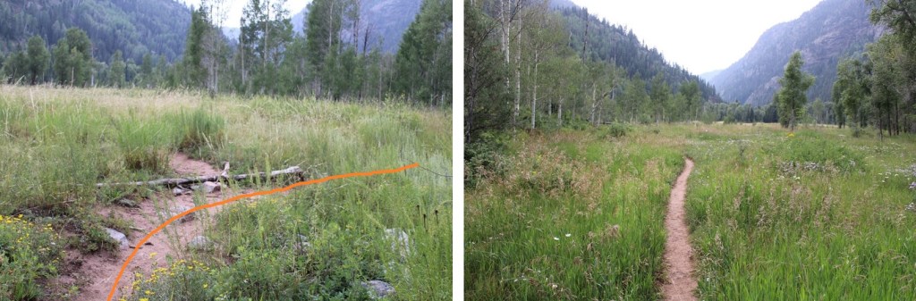
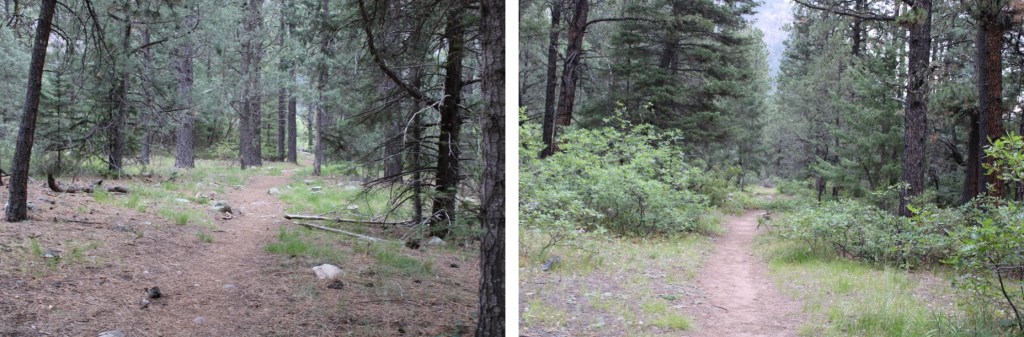
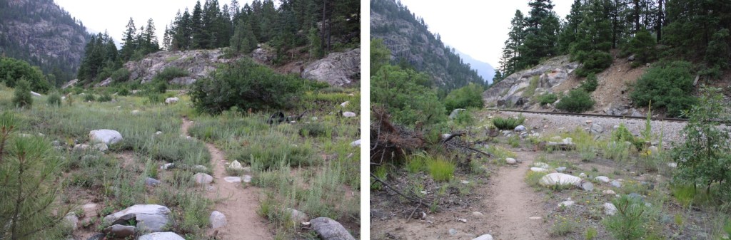
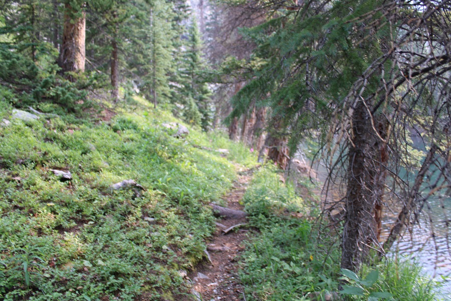
The next morning, we were up before sunrise to be willow warriors and thrash our way into Ruby Basin. We made it just as the sun rose.
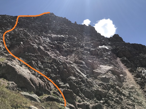
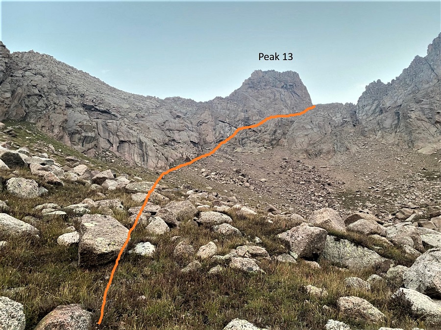
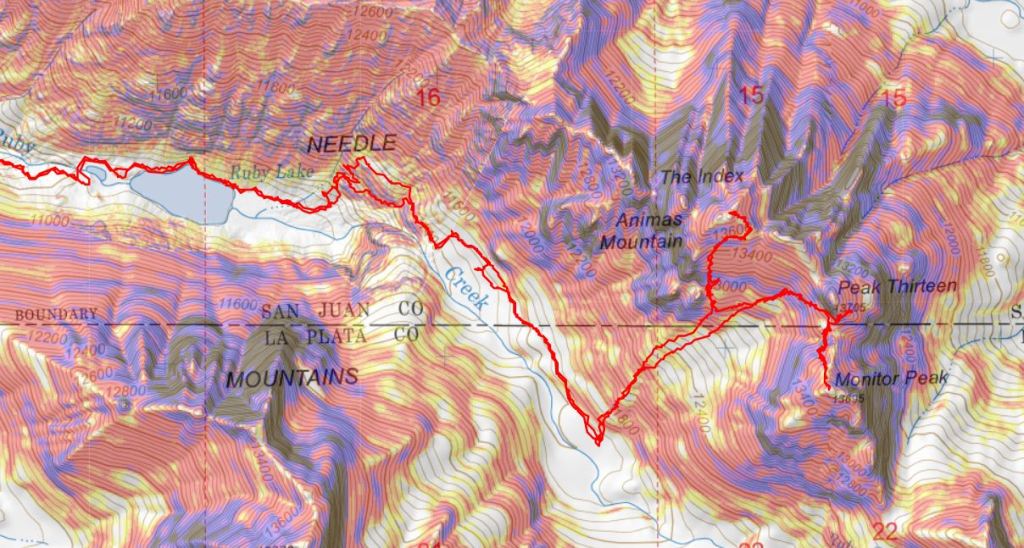
Here’s the route we took up the gully to the saddle. We stayed just above the willows, and hiked southeast across the basin until we were directly below the gully, then ascended the gully.
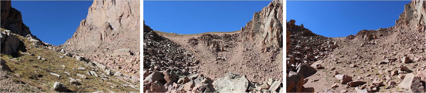
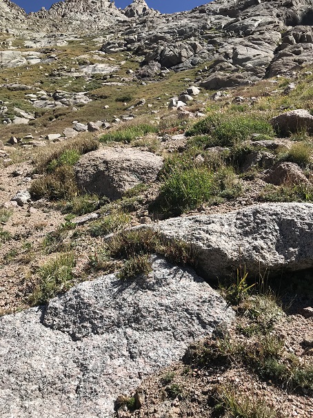
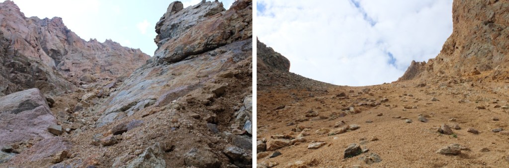
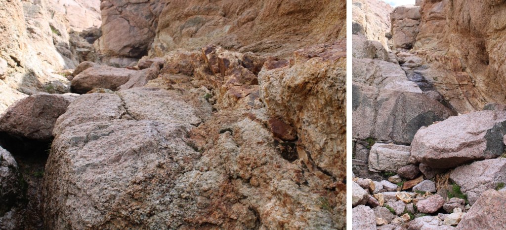
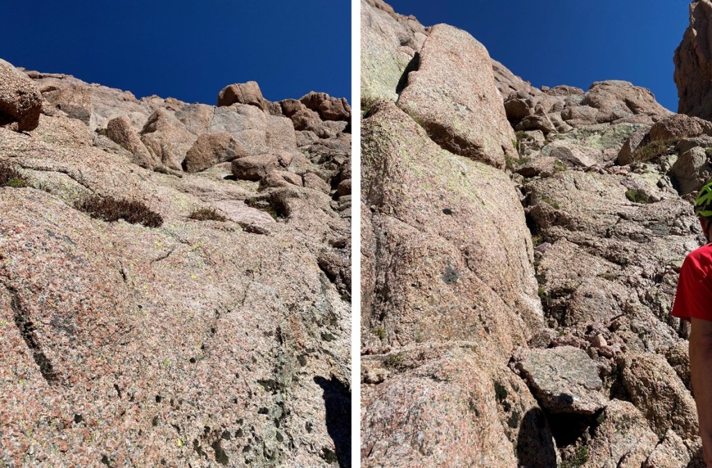
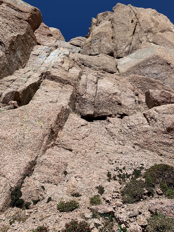
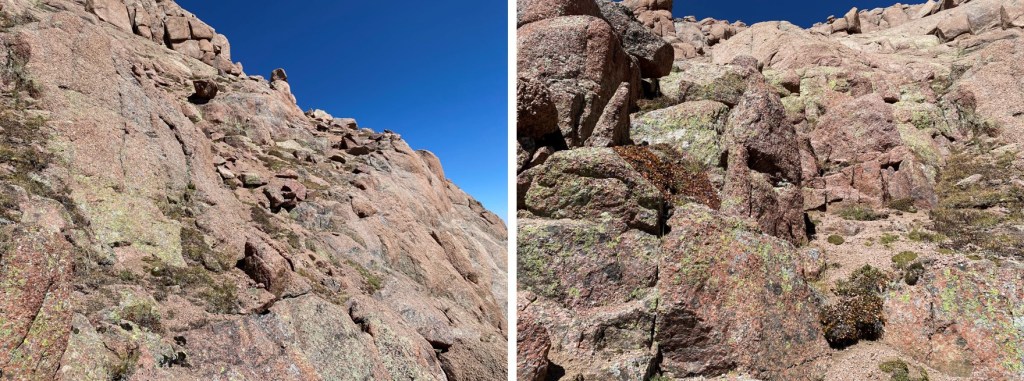
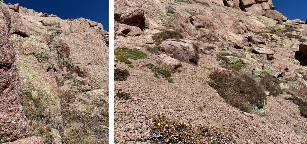
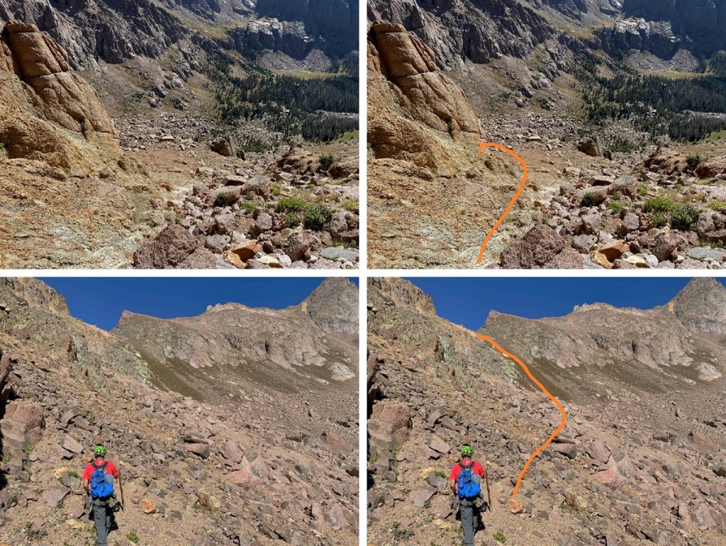
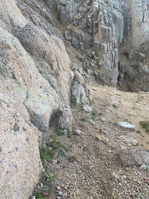
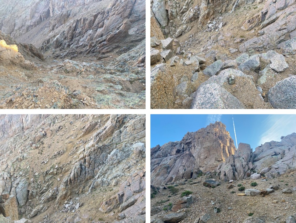
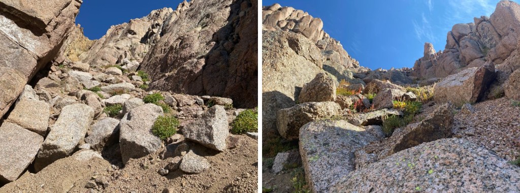
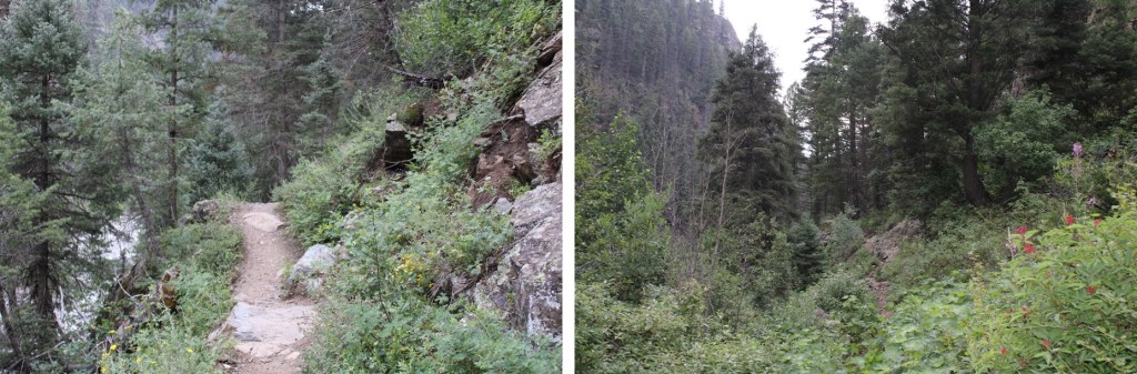
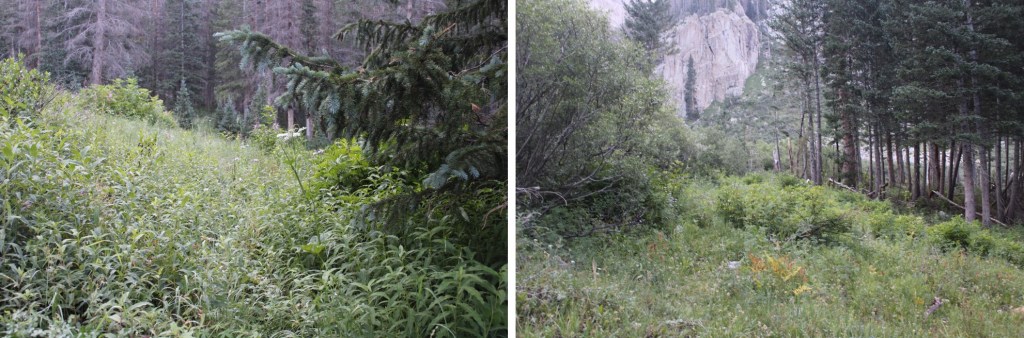
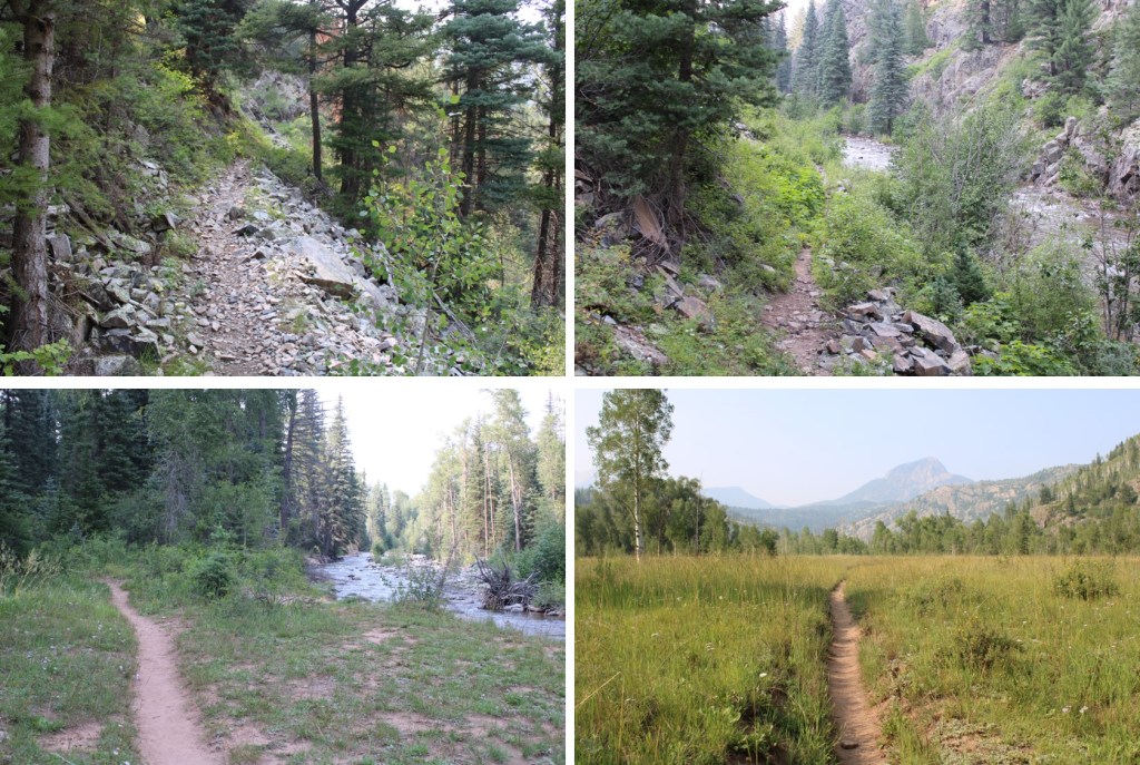
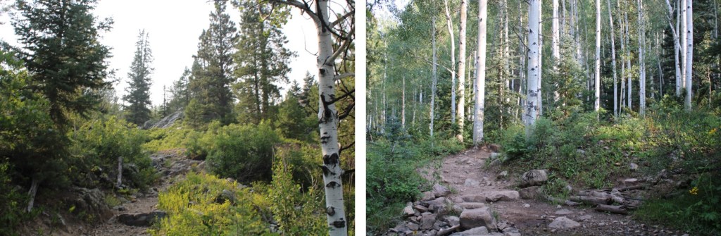
When I was here in August, there was snow under the scree in this gully. Because it was under the scree, I didn’t see it and it caught me by surprise when I unexpectedly sank up to my waist in slush. Back in August, I made it up this gully by going right, but this time we went left. It looks like the conditions change here frequently, so pick the line that goes best for you. Also, microspikes help here with the scree (if you don’t use microspikes on scree you’re making it more difficult than it needs to be: get some spikes for summer too). Here are some pictures of the gully
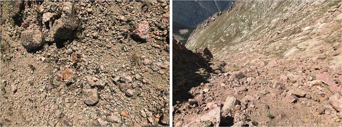
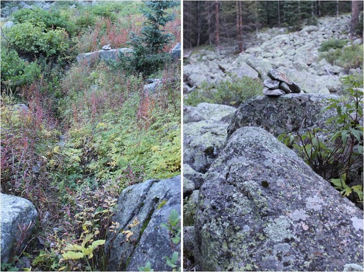
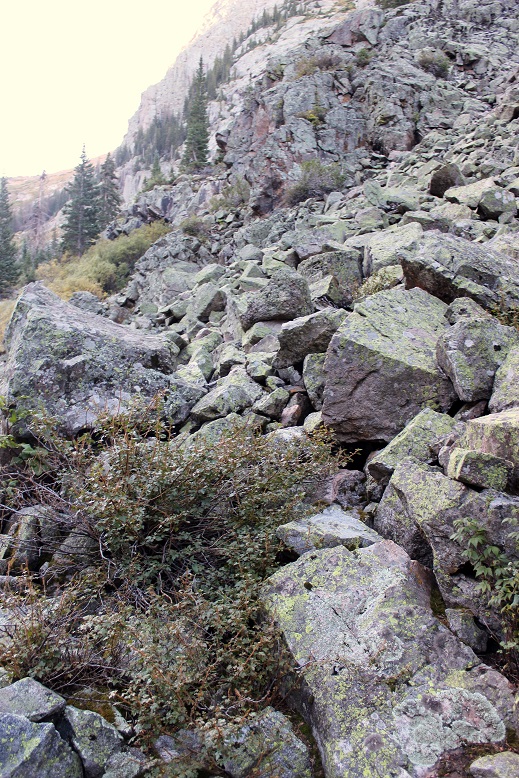
The second half of the gully is full of large rocks, which eventually give way to scree. This scree is some of the worst scree I’ve experienced. This is where your microspikes really come in handy. Back in August I followed fresh goat tracks to the saddle. Those tracks in September had been used several times and formed nice switchbacks. However, it appears these tracks are destroyed every winter, and need to be remade every summer/fall.
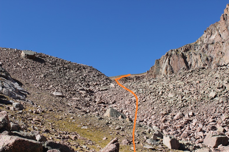
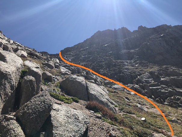
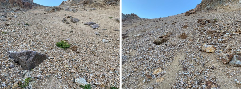
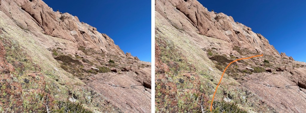
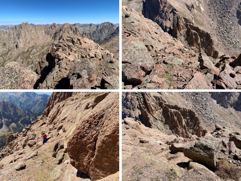
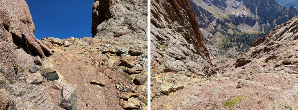
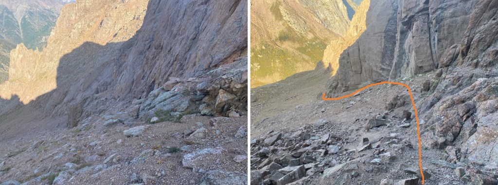
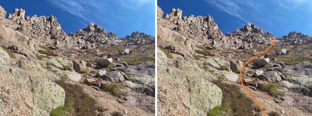
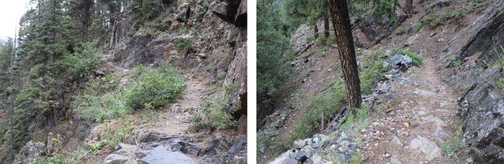
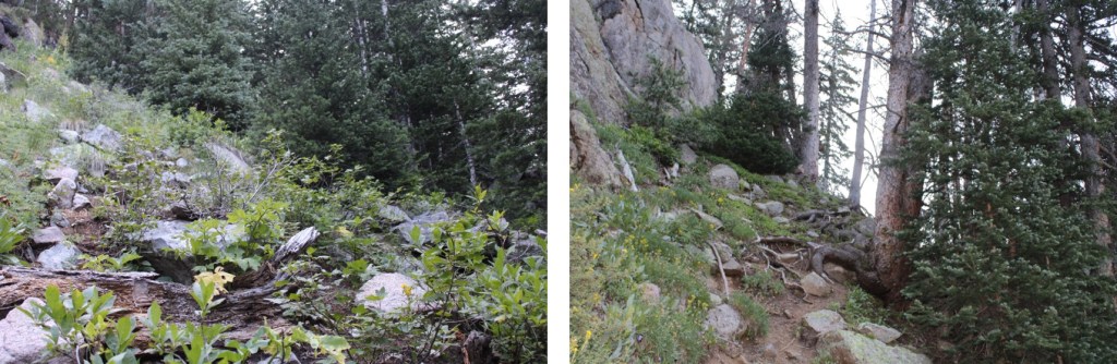
Once at the top of the gully it was time to lose about 350’ of elevation. We did this by following the scree southwest, staying high but just below the rock outcroppings (we took a different approach on the way back).
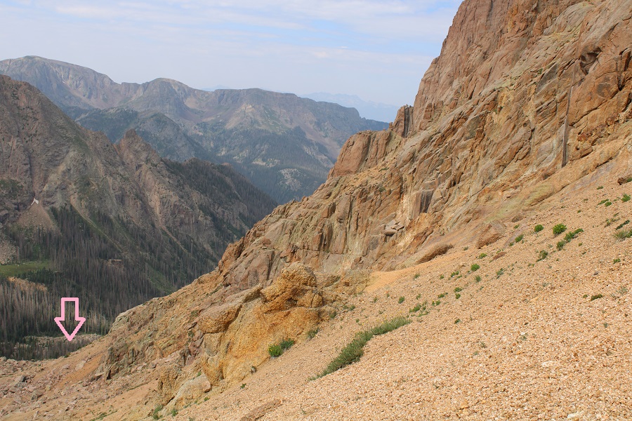
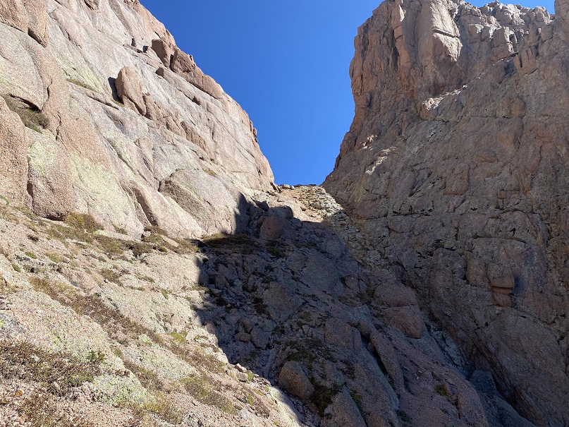
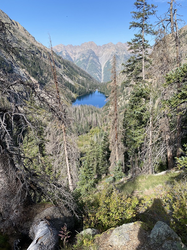
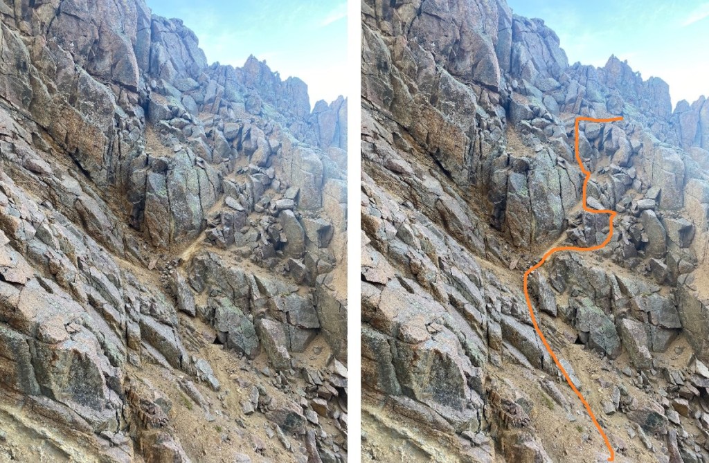
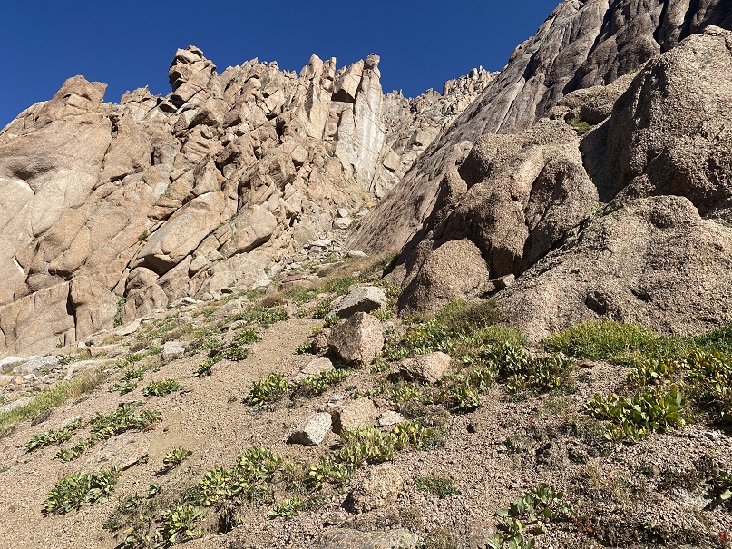
We continued down to about 12,500’, and then entered the Peak 15/Peak 16 gully
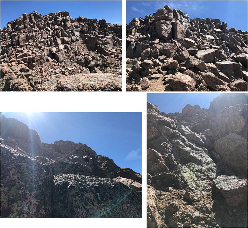
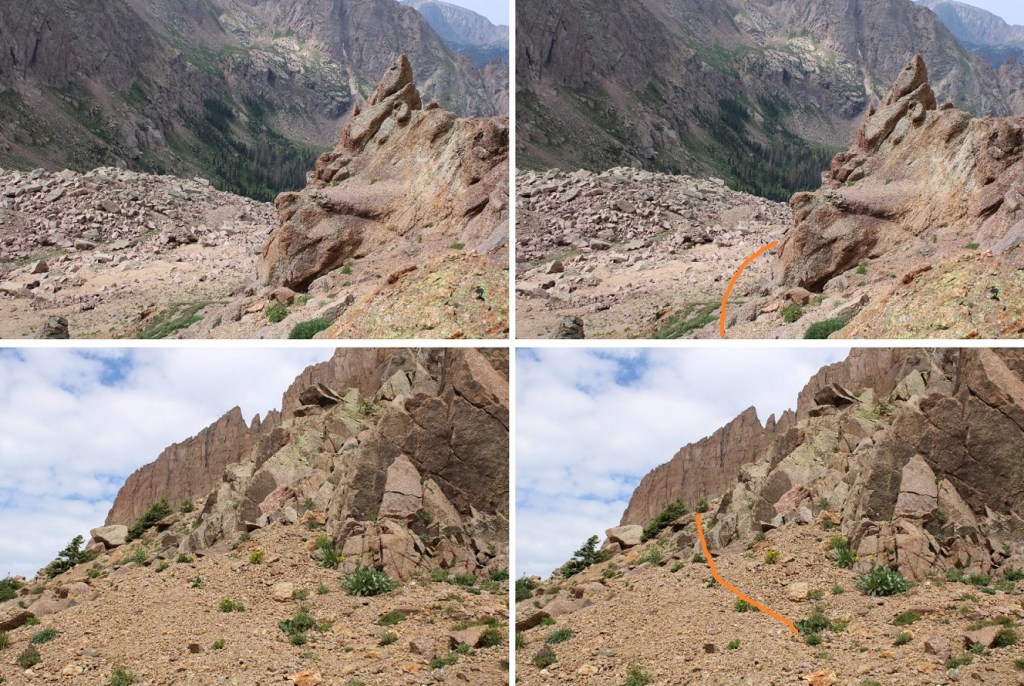
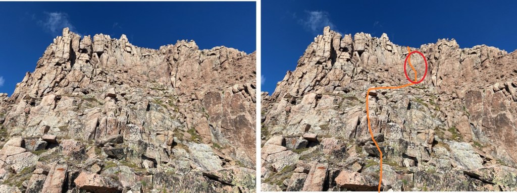
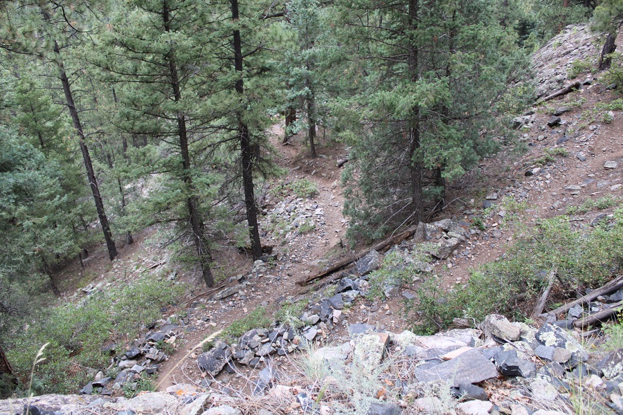
This is the gully you’re looking for. There are cairns here, and it’s the first, obvious route ‘up’
The first part of the gully is class 3, and just requires some rock hopping.
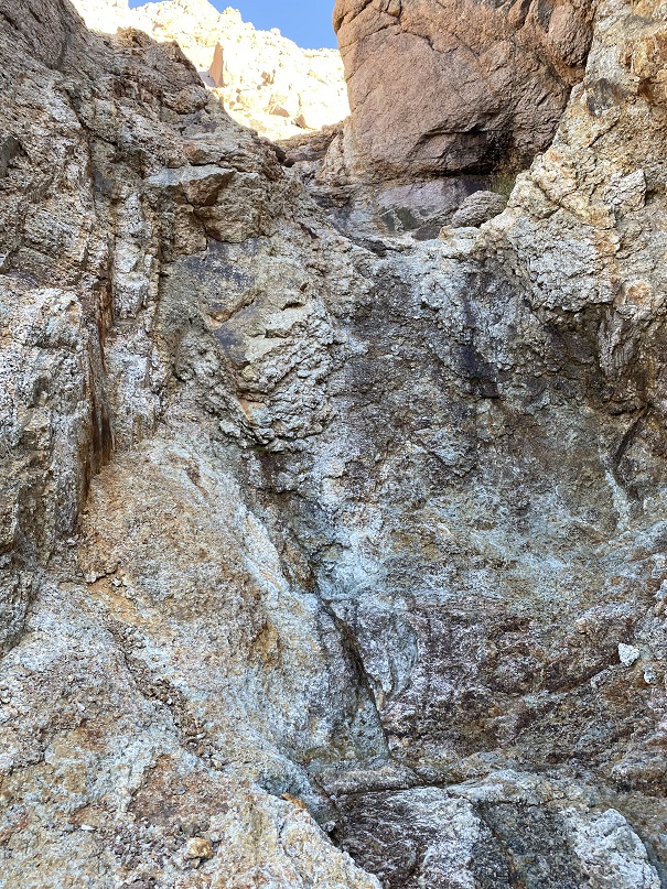
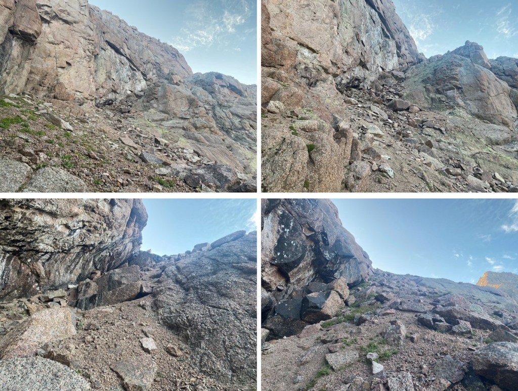
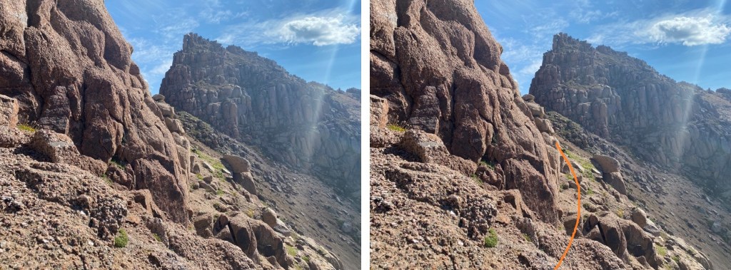
This gully turns into a couloir, and becomes easy to follow, but difficult to climb. This is the first class 4 section. There were no good hand/foot holds, as everything crumbled in my hands. In August it was running with water. Tim spent some time cleaning away the loose rock, making climbing easier. Even in mid-September, there was still water here. Wearing a pack with climbing gear/rope makes the ascent that much more difficult.
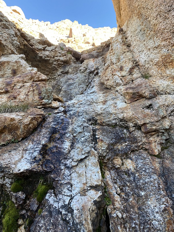
The second class 4 section of the couloir was… more than class 4. I started up, and when I got about halfway through realized I may have been in over my head. I couldn’t climb down, so I had to keep going up. Since I was ‘stuck’ it became a mental exercise, where I told myself “If I can do this while on rope, I can do it off rope as well”, but to be honest it was intense and I didn’t feel comfortable soloing this (but I did). There was a lot of deep breathing involved. I’d recommend roping up here, if you can find a way to do so. Climbing shoes would have been helpful (but they were in my pack…). We both felt this was class 5, not class 4. I belayed my partner on this section from above.
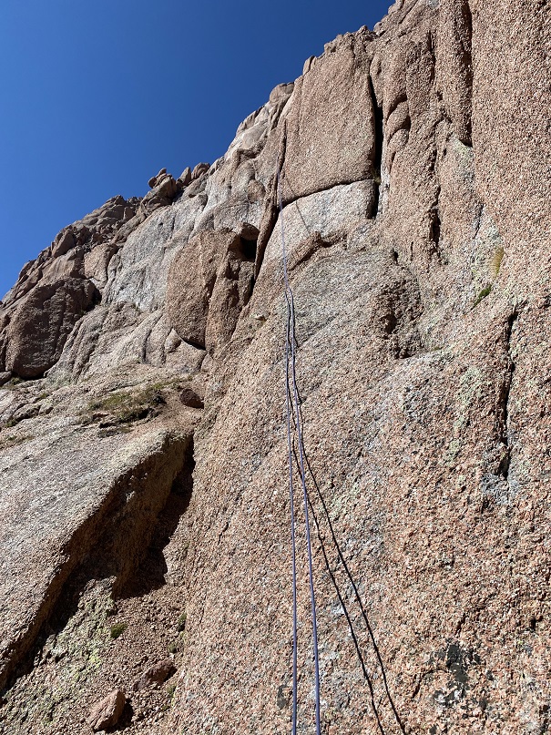
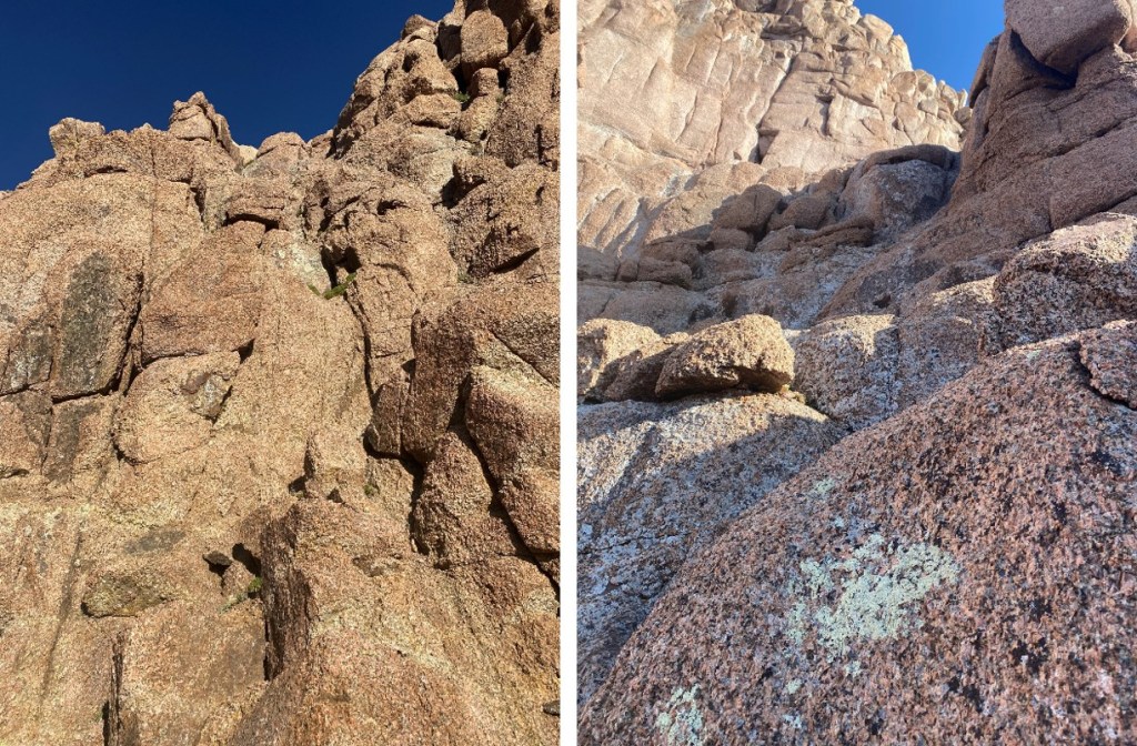
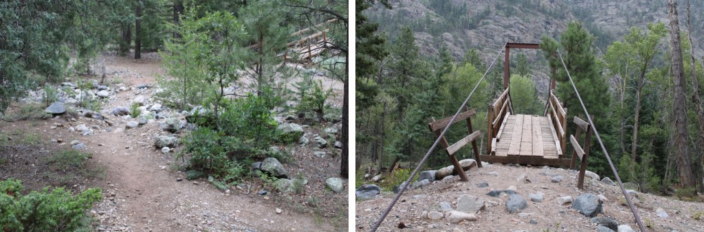
Just above this section there are anchors set up. It’s good to take note of where they’re at as you’re passing them. There will be three sets of anchors in the couloir. Here are some more pictures of the couloir. A lot of the webbing set up looks faded, but there’s plenty there. We cleaned up some of the older webbing and hiked it out (the stuff we didn’t even need to cut because it was frayed and falling apart).
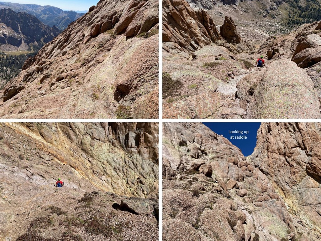
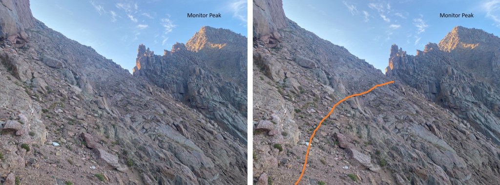
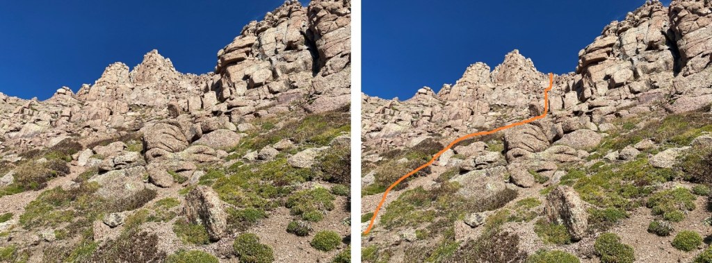
The couloir seemed to last forever. At 13,050’ we exited the couloir, below the 15/16 saddle, and went left up the ledges to 13,300’. This was class 3 scrambling with a lot of kitty litter (kitty litter is the name of the game on this climb). Where applicable, I noted Tim tossed unnecessary obstacles aside, like tumbling rocks and kitty litter, to help clear the route.
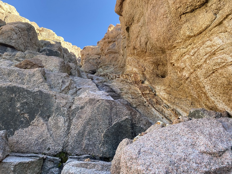
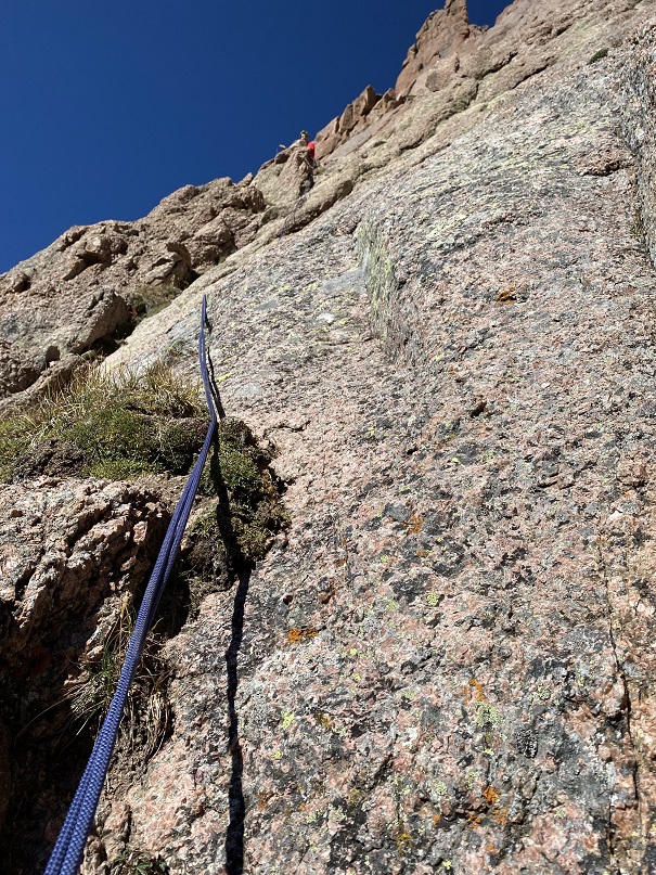
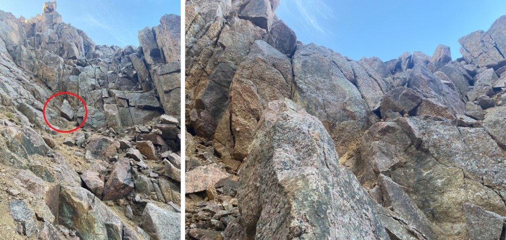
When we were about 50’ below the Peak 15/16 saddle it was time to rope up for the slabs. This picture looks at the saddle, but we were headed the opposite way, left/west (this picture is just a good visual of where you’ll be)
We were headed west, across the ledge system.
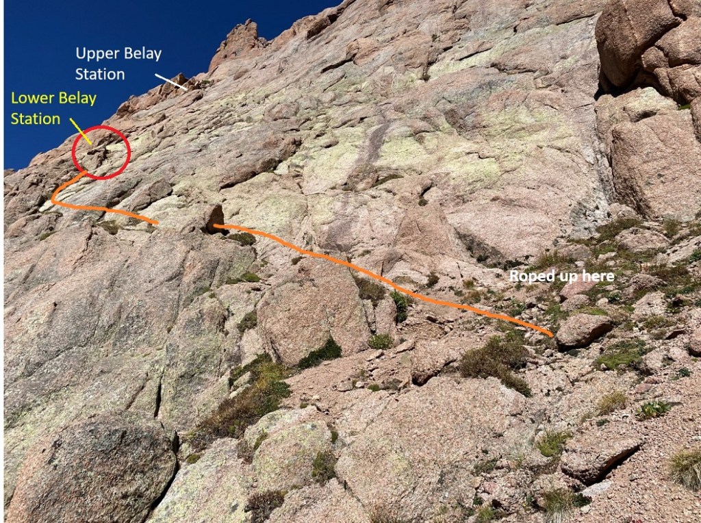
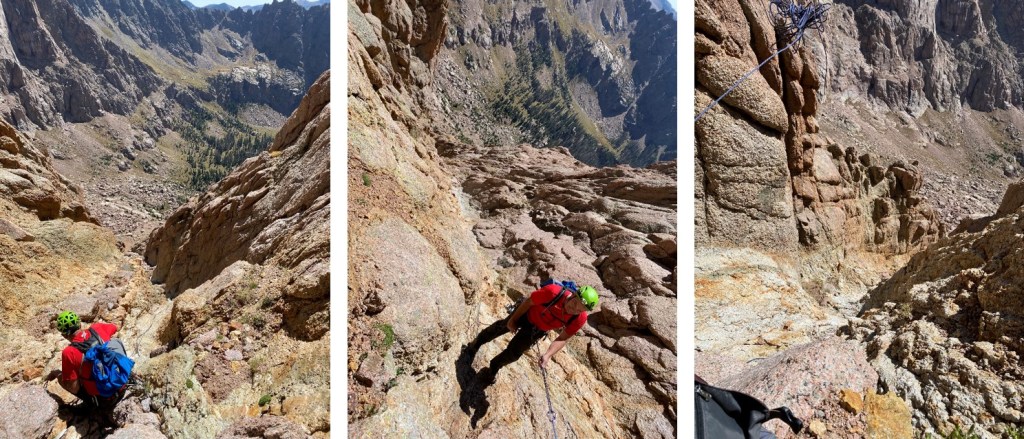
While we were still on level ground, we roped up. Then Tim led the way across the slab. It was good to get roped up first because there wasn’t a lot of room at the rappel area to do so. Here’s an overall view of our roped ascent and the belay stations. I put on my climbing shoes, but Tim didn’t feel his were necessary.
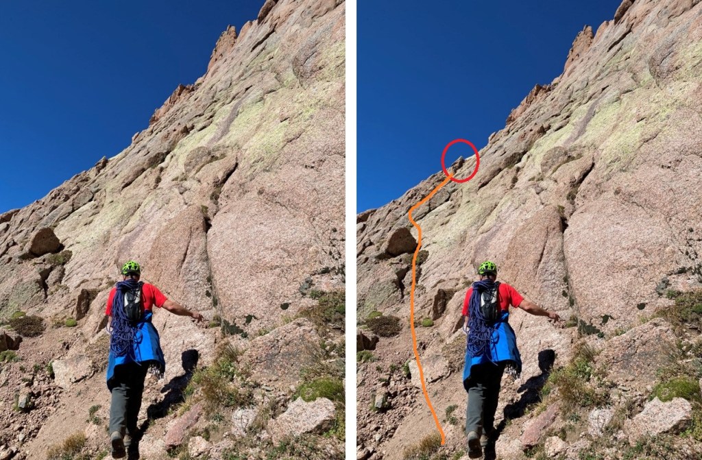
This is what it looked like getting there. We are aiming for the red circle to get to the lower belay station.
Once at the lower belay station I was set up to belay Tim from below as he set the protection and climbed first. Here’s looking back at the traverse
Oh, there’s some exposure here.
Since Tim’s the more experienced climber (WAY more experienced) I’ll let him describe this part of the route, starting with his overview:
Look for a series of shallow ledges that leads to a three foot wide ledge with a horn big enough to straddle. This is still 4th class terrain, so you can simply belay sitting next to the horn without an anchor.
If you feel you need one, wrap the rope end around the horn three times to make a tensionless hitch or use a cordalette. Bring your second up and have them belay from the three foot wide ledge below you. There will be about three horizontal seams you can place pro in ranging from #3 Camalots to .25. I managed to place five pieces total.
After your last piece you want to head for a shallow V slot next to some bulges. This is the 4th class exit and leads past a rock with a crack in it you could build an anchor in. This is exposed and one could fall from there, and you may be out of gear as I was. Continue then above this to where the steepness of the pitch eases off and there are two scrubby evergreen bushes. You can sling some of the roots for a sketchy, but adequate anchor. Once your second is up, you can both walk to the right towards a large, grassy ledge where the final 3rd class gully is.
I’m not a serious climber: I’ve been climbing for a few years, but I’m no expert. I was glad to be roped in, and wouldn’t have wanted to do this part without someone belaying me (or the other way around). A fall would have been fatal. Tim called it “poorly protected 5.4”. He placed 5 pieces of protection.
From the upper belay station, we turned right and followed the slopes east, looking for an access gully/kind of a small chimney.
The gully is about halfway to the saddle. This is what it looks like from below
From the east side it’s easier to see. This is class 3, with a cairn at the bottom.
Once up the gully, we followed the ledges northeast to the ridge. This was “choose your own adventure”, but we aimed for the northeast corner of the ridge
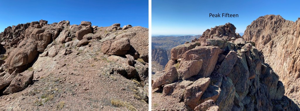
Once the furthest northeast we could go, we ascended the ridge via a short, easy class 3 ramp, and scrambled west to the summit
Final, class 2 scramble to the summit (easier than it looks)
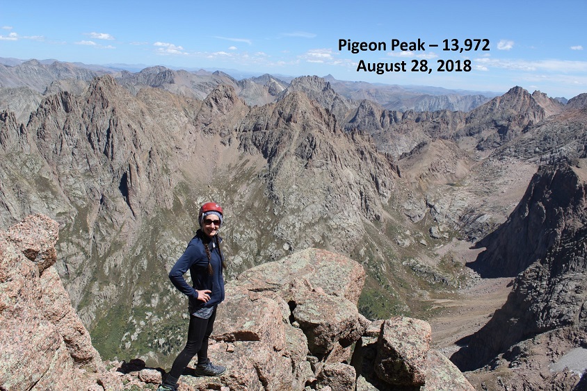
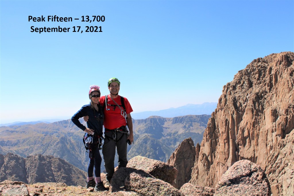
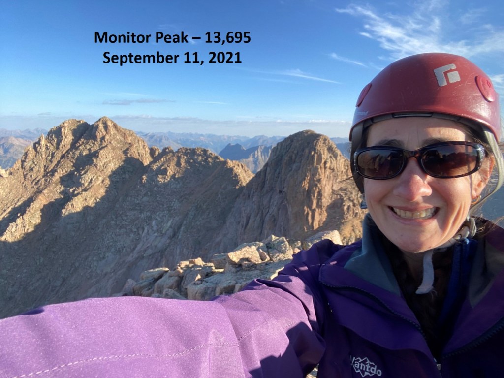
We summited Peak Fifteen at 12.30pm. Also, yes, it was my birthday, so I was celebrating not only my bicentennial finisher, bust also turning 41. Woot!
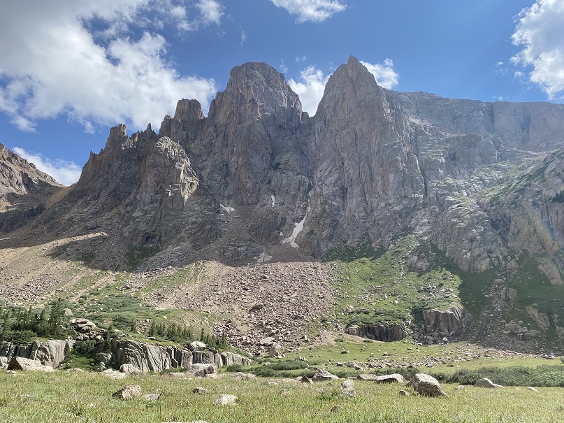
Peak Fifteen:
We stayed at the summit for quite a while, enjoying the beautiful day and awesome views. The summit register was a tube, so naturally the paper inside was wet. I added a pencil to the register, signed my WW’s, and we headed back down.
Note: we rappelled 6 times before making it to the bottom of the couloir. That’s a lot of rope work! There were adequate webbing/rings set up, which held just fine but are bleaching and might need to be replaced next season (see pictures). We cleaned up some of the ripped/damaged rope and brought it out. We brought a 60 meter, 7.9mm rope. It worked perfectly for the ascent and rappelling down, but being smaller in diameter, tended to get stuck in the cracks. Also, this is where I learned Tim curses when ropes get stuck.
We followed the ridge east back to the ledges, which we followed southwest.
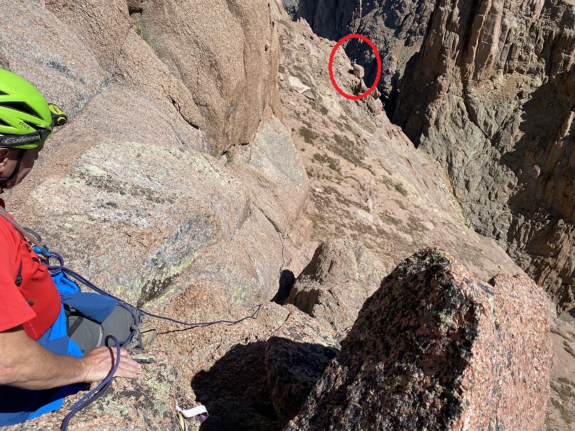
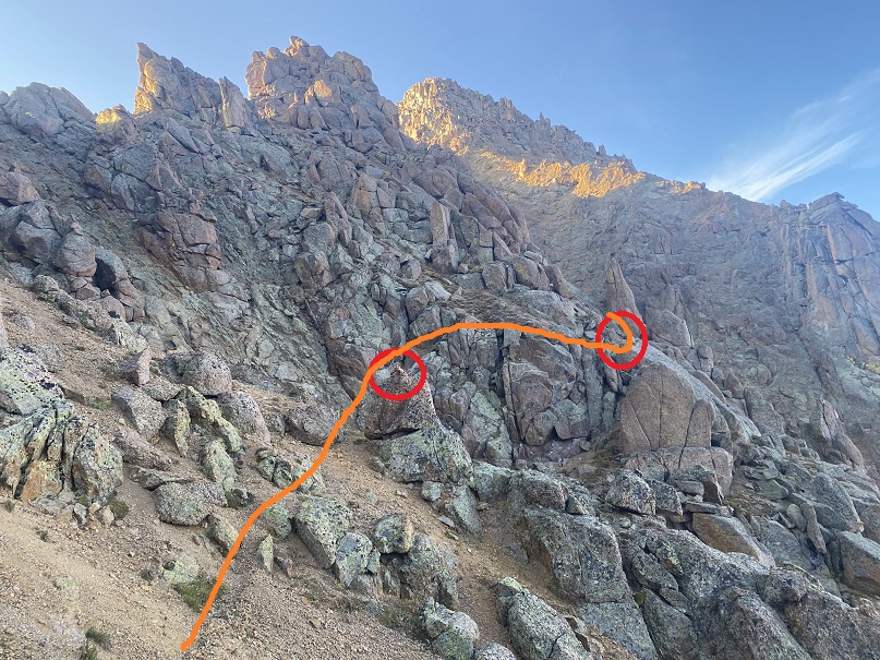
At 13570’ we headed back towards the saddle and the anchors. We rappelled down from the first anchor, and afterwards headed towards the second anchor, circled in red.
The second rappel
Here’s looking up from the bottom of the second rappel
The third rappel brought us to the Peak 15/16 saddle
Here’s looking up and down from the saddle
Once at the saddle, we went southwest on slopes, following the couloir to the right
We made our way back to the couloir, and rapped 3 more times to the bottom. We counted 6 rappels in all.
From the base of the couloir, we made our way back to the scree-saddle, this time taking the direct, grassy/tundra approach, to avoid the scree. We saw mountain goats here.
And then back down the scree filed gully, scree surfing to the basin
From the basin we hiked back through the willows to our campsite at Ruby Lake, making it back around 6pm. Round trip from Ruby Lake to the summit of Peak 15 and back to Ruby Lake made for about a 13 hour day. All that rope work sure took its time! We celebrated with some whiskey and wine; after all, this was my bicentennial finisher, and it was my birthday… no one got hurt, and, this was much harder than anticipated by both of us for different reasons and we were successful. All reasons to celebrate!
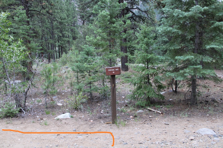
We made it an early night and were up at 6am to hike back to Purgatory. The night was much warmer, if only because I didn’t go to sleep in wet, sweat filled clothing. The hike out went fast, as we talked much of the time. We made it to the Animas River/Purgatory trail bridge, and were surprised to see people in sandals carrying small children (some of them crying). Apparently, the train stops at Cascade Wye now for passengers to get off and walk around (not sure if it’s ever done that before?).
We made it back to Purgatory Trailhead around 2:30pm. My tracker says we went 53.34 miles, with 13765’ of elevation gain.
I would like to thank Tim for being my climbing partner and accompanying me on this trek, which I’m sure ended up being more of an adventure than he bargained for! I believe this climb takes two experienced climbers to complete safely; It was nice to have someone I could trust join me. In addition, he’s been my climbing mentor, voluntarily taking me climbing and ‘teaching me the ropes’ for years. He’s the one who taught me how to set up anchors, how to climb and rappel safely, and all about proper gear. I couldn’t have done all the other class 5 bicentennial peaks without his instructions. I still keep his safety checklist with me in my climbing gear.
I also want to thank everyone who has posted trip reports in general, but specifically trip reports for Peak Fifteen, as for me it was the hardest of the bicentennials. We all experience hikes/climbs differently, and it was nice hearing the difficulty/route finding levels from other climbers. If you plan to climb this peak, please take it seriously, and read all trip reports you can find on this peak before attempting a climb, as they all offer great insights.
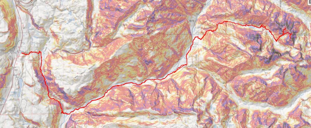
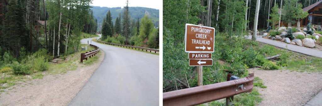
I started this hike from Purgatory Creek Trailhead. I’ve put together a route description of the trek from Purgatory to Ruby Basin, which can be found here.
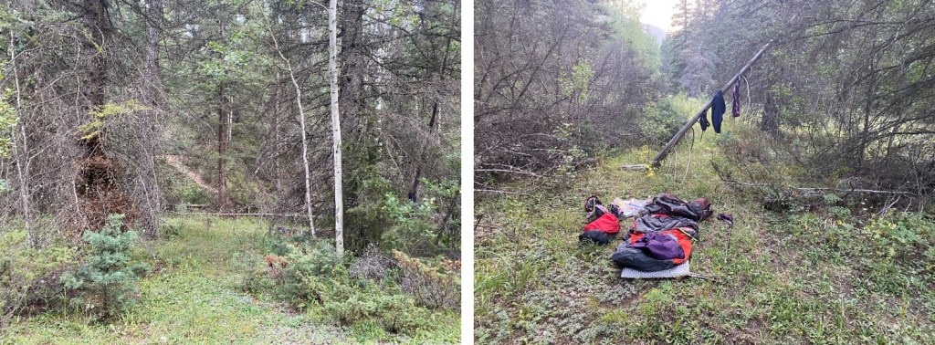
For my first day in, I decided to camp at the Ruby Basin junction. I started at 3pm and made it to my camping spot at 6:45pm. I made it to the train tracks just as a train was approaching, to which a passenger pointed at me and said “Hey look: Wildlife!” and everyone got out their cameras and waved at me. I smiled and waved back. I gathered some acorns to snack on as I hiked (just before the railroad tracks there are tons of scrub oak, and the acorns are now in season).
I was so glad it didn’t rain! I think this is the first time I’ve done this approach where it hasn’t rained. As I got closer to my camping spot, I came across two girls camping there already. I chatted with them for a minute: they were headed to Ruby Basin too, to hike Turret. I wished them well and picked a spot closer to the Ruby Basin junction to set up for the night. I dried out my clothes as best I could, ate some popcorn, and went to bed.
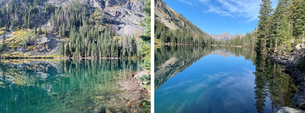
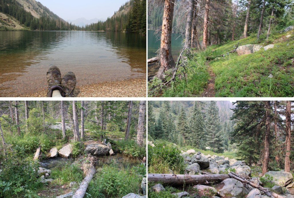
It was a warm but windy night. I was up early, and spent a good half hour just stargazing. Eventually I got up and was on the trail at 5:45am, headed to Ruby Lake. I made it to the lake just before 9am. Today I was taking my time, so I sat by the lake for a bit, filtered water, and watched the trout swim by the shore, every once in a while snagging a fly for breakfast.
My only goal today was to make it to Ruby Basin. I knew it wouldn’t take long, but I wanted to hike in the cool of the morning, instead of the heat of the day. Here’s looking back at Ruby Lake from just before making it to the basin
I made it to Ruby Basin, in all its willow filled splendor, at 10:45am. For those doing the math, it took me less than 5 hours to hike from the Ruby Basin cutoff to Ruby Basin, and I took my time.
There was a tent set up in the far side of the basin (east), but I didn’t see anyone camping there. Basically, I had the basin to myself. I strapped on my creek crossing shoes and took a walk in the creek(s). They were running at a trickle.
I relaxed for the next few hours, drying out, enjoying the sunshine, and going over my notes for my day tomorrow. This was my second attempt at these peaks. It hurt to turn around last time, but I had bad beta (and not enough beta, as I had other goals in mind and these peaks had been secondary). I’d been up in my head that entire weekend, and in the end turned around much sooner than I should have. I went home, got better beta, and was now back to attempt these peaks again. Around 2pm I saw the girls I’d met the night before enter the basin, and to my surprise, they headed directly up Turret. Rock on ladies!
Also, there were bees and crickets. Crickets everywhere! They jumped around my ankles as I walked through the basin, munched on my journal and hopped onto my gear. I ate dinner and went to bed as the sun was going down (it goes down over Turret early this time of year).
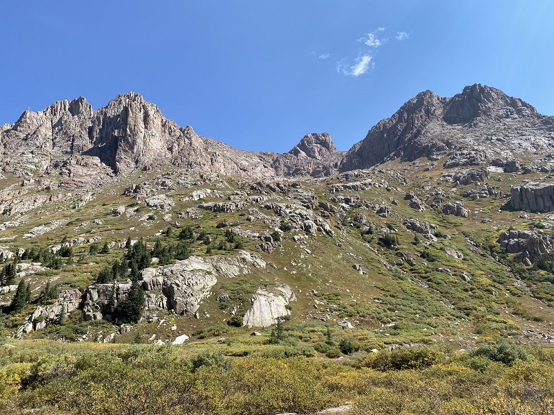
Once again, I got up before my alarm, and spent some time stargazing. I saw several shooting stars, and a few airplanes coasting across the night sky. There was no moon, but I could see the stars clearly. I made out a few constellations, and noted the frost on the outside of my bivy. I wanted to start at first light, but ended up starting a little earlier, around 6am. These are the peaks I was attempting today
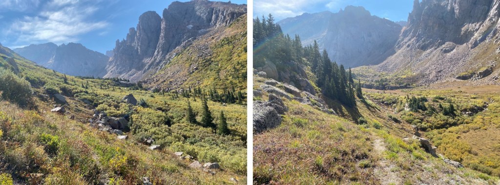
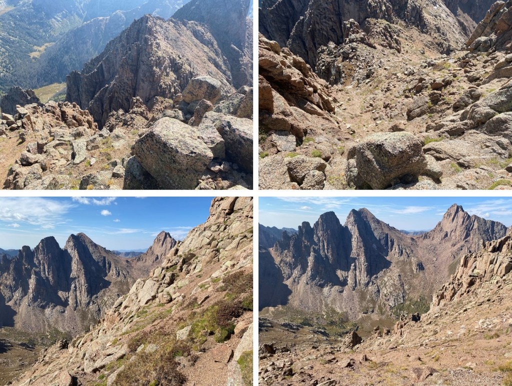
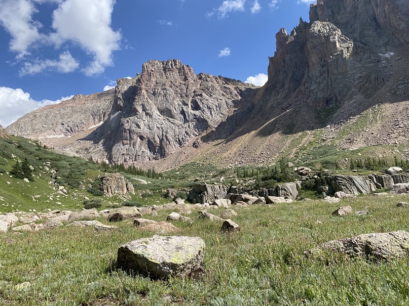
Here’s an overview of the route from Ruby Basin to the upper basin below Animas, Peak 13, and Monitor. After about 20 feet of willows, I was able to stay on tundra the entire time. This is choose your own adventure, but it’s easy to find a class 2 route into the upper basin. I just kept aiming towards Peak 13.
Here’s a look at the upper basin.
I was headed towards Monitor Peak first. There are several ways to do this. This time I took what I consider to be the ‘easy’ approach. Directly below Peak 13 there are two ramps you can ascend. I chose the further one, as it was less steep. I followed the basin northeast, towards an obvious ramp. It’s just below a section of a white and black streaked slab.
Here are some closer pictures. There are two ramps here, an upper ramp and a lower ramp. Both go, but the upper ramp is less steep, and all class 2 in my opinion.
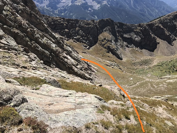
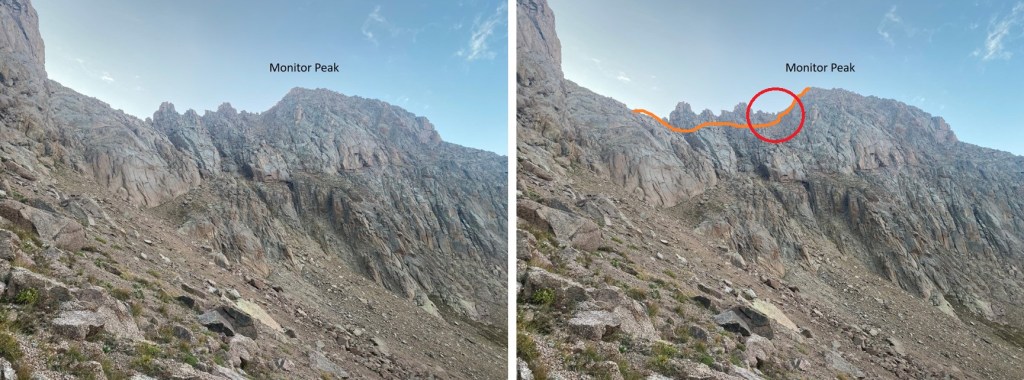
Also, while you’re here, look to your right. Find this gully (circled in red). It’s the gully you will be aiming for when ascending the ridge (ascending to the ridge before this point is fruitless). Here’s an overall view of the climb to Monitor from the Peak 13/Monitor saddle. You’ll know you’re in the right gully because there’s a white vein of rock going through it (more on this later, but from this spot you can clearly see the white vein, so it’s a good time to get a visual of where you’re aiming).
But first, let’s get to the saddle, by going up that ramp. As you can see, it’s wide, and easy to navigate.
The top of the ramp deposited me at the Peak 13/Monitor saddle. Well, actually, I didn’t need to go all the way to the saddle. I skirted the saddle and continued south across scree, following the ridge.
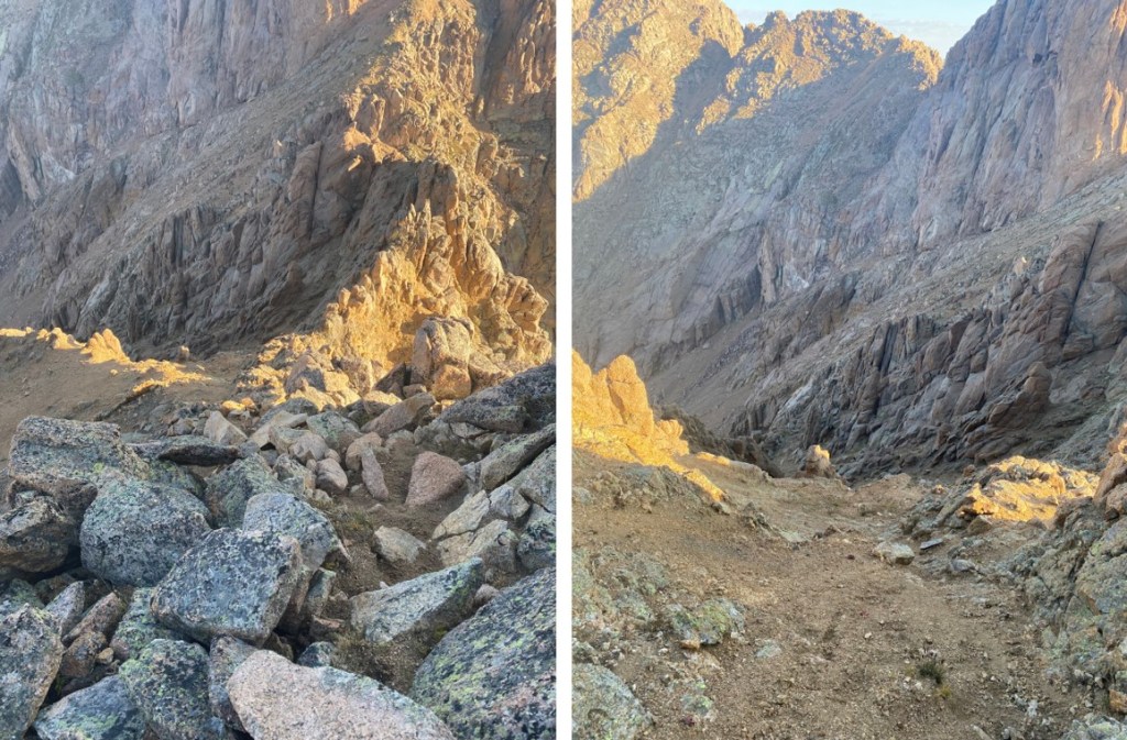
Now for the gullies. There are several of them, and in order to cross the first one I had to descend about 100 feet down, then re-ascend. Before doing that however, I got a good look at my route. This looks harder than it is. Here’s the route I took after re-ascending the gully.
But first, I had to descend on kitty-litter scree, and then re-ascend.
When re-ascending there were a couple of ways I could have gone (all felt class 3). This is the way I chose.
Get a good look at your intended route from above, as this is what it looks like from below. Hint: aim for this rock, go behind it, turn right, and follow the areas covered I dirt.
Ok, now to find that gully. Luckily, from here there were cairns, and even a bit of a game trail. I followed them south, staying well below the ridge
I rounded the corner, and could clearly see the correct gully. I followed this gully to the ridge
Once on the ridge, I turned right, and followed it to the summit, dipping to the right at the end, but always following a class 2 game trail.
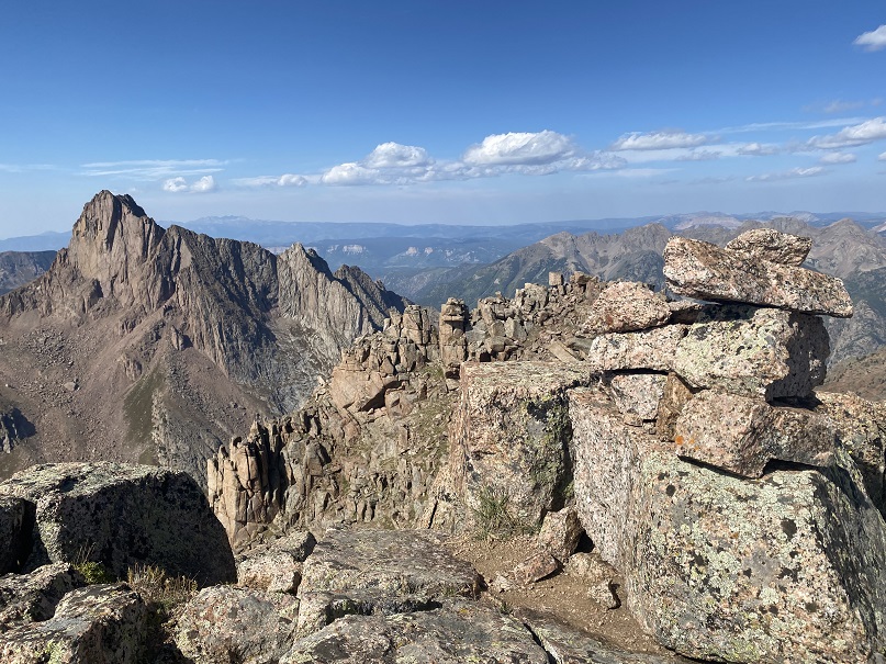
I summited Monitor Peak at 8am.
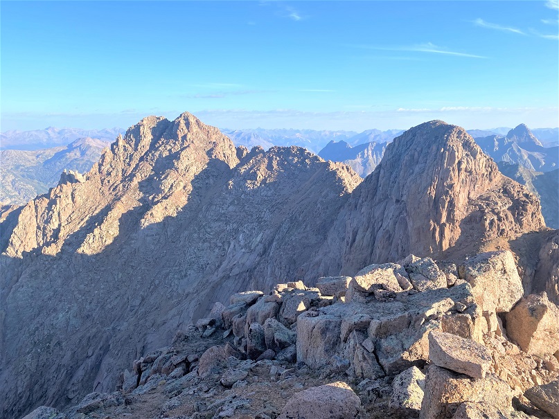
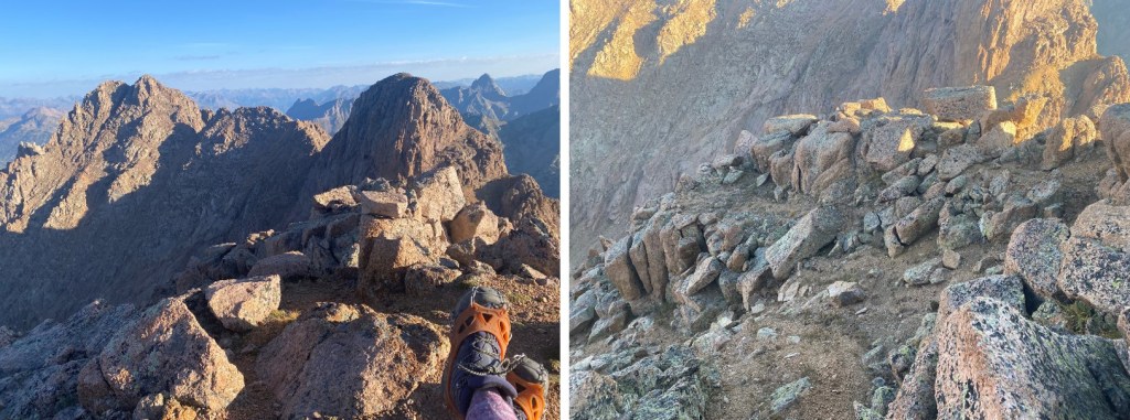
Monitor Peak:
There was a summit register in need of new paper (but with 2 pencils), and great views!
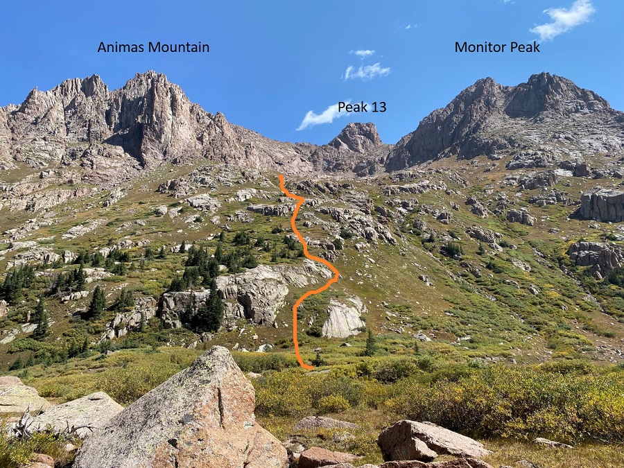
Next on the agenda was Peak 13. Spoiler alert: I didn’t summit Peak 13. When I got to the area where I was supposed to “just go straight up” I found that while it was class 4, there were no hand/foot holds, and everything I tried to grasp turned to kitty litter in my hands. Since I hike solo, I have a rule not to upclimb anything I don’t think I can downclimb (if I don’t have rope), and while I could probably have upclimbed this, I wouldn’t have been able to downclimb it, and a fall would be deadly (lots of exposure). In any event, I’ll describe the process of getting there. Now is also a good time to get a visual of how I climbed Animas Mountain as well. These were my routes:
From the summit of Monitor Peak, I headed back to the Monitor/13 saddle, retracing my steps
Once at the saddle I followed it northeast, to an obvious stopping point. Here I turned to head up, and, like I said before, I deemed it unsafe, so I turned around, tried several other ‘ledges’, and in the end decided to just head back to the upper basin and summit Animas from the gully. I was very happy with this choice. Here are pictures of the two possible routes up to Peak 13 I decided not to take
Instead, I descended back into the upper basin by way of the upper ramp.
I followed the contour of the mountain all the way down to 12860’, and the only obvious gully that ‘went’
I then followed this gully north. There are lots of divergences here, but if you keep heading north, they all seem to ‘go’. I just kept the spires to my left and followed the obvious contour of the gully. I as able to keep this all class 3. If you’re in class 4 territory, back up and look for an easier route.
When I made it to 13580’ I headed east, towards the sandy saddle between Monitor and 13500’
I didn’t go all the way to the saddle however, because I saw cairns leading me up the ridge (class 2).
Here’s the overall route to the summit, all well cairned. The circled area is a brief class 4 chimney section (less than 10 feet or so) that is the only obvious way out of the gully. When you make it above the chimney you’re about 20 vertical feet from the summit on easy to navigate ledges.
To get up the chimney I jammed my arms into either side and used my forearms to lift myself up. On the way down, I faced the rock and put both hands/arms in the left crack to lower myself down. You may be asking yourself why I was fine climbing this chimney and not the class 4 section on Peak 13? It’s because the rock here was firm, and I didn’t have to worry about it crumbling in my hands as I was climbing. When I made it to the top of the chimney I turned right and followed the cairns to the summit.
I summited Animas Mountain at 10:30am
Animas Mountain:
There was a trail register in dire need of paper. With no place to sign I put it back and turned and descended the same way I ascended, back to the saddle, and then down the gully. Note, I did not descend the scree filled gully, but instead the rocky one I ascended, this time keeping the rock spires to my right.
Once in the upper basin I headed southwest on the slope, back to my campsite. It helped to stay to the right of the waterfall area, on the tundra.
I made it back to my campsite in the Ruby Basin at 11:40am. I ate lunch, packed up my gear, thanked the marmots for not messing with it this time, and headed back through the willows towards Ruby Lake. It was a really hot day. I stopped at the lake to dip my bandana in the water and cool off my face. The water felt so good! As I was skirting the lake and looking at the clear water I couldn’t help but want to jump in. I did some mental calculations, and before I could stop myself I set all my stuff aside and went into the lake. I swam around for a few minutes, hopped back out, dried off in the sun (it only took about 30 seconds in the dry Colorado heat) dressed and was back on the trail within 10 minutes.
I made it to the Chicago Basin cutoff and decided to once again spend the night. There was a woman in a hammock waiting for her husband, who was running the Chicago Basin 14ers (woot!). I couldn’t help thinking to myself how I wish I could find a partner who would support me like that (or join me?). I set up my gear, talked with a man who’d lost his water filter and had a busted eyebrow (he got it crossing the creek?). I told him where to find the train, and campsites, and made it an early night (again). I woke up before my alarm, and was on the trail at 4am, out and back at the Purgatory trailhead at 8am. Side note: hiking in the Purgatory Flats area on the way out was by far the coldest part of my weekend. By this time I’d already taken off my coat and gloves, but had to put them back on because the temperatures were so cold. I’m thinking this isn’t the best place to camp for the night.
CalTopo tells me my stats were 45.07 miles with 12724’ of elevation gain.
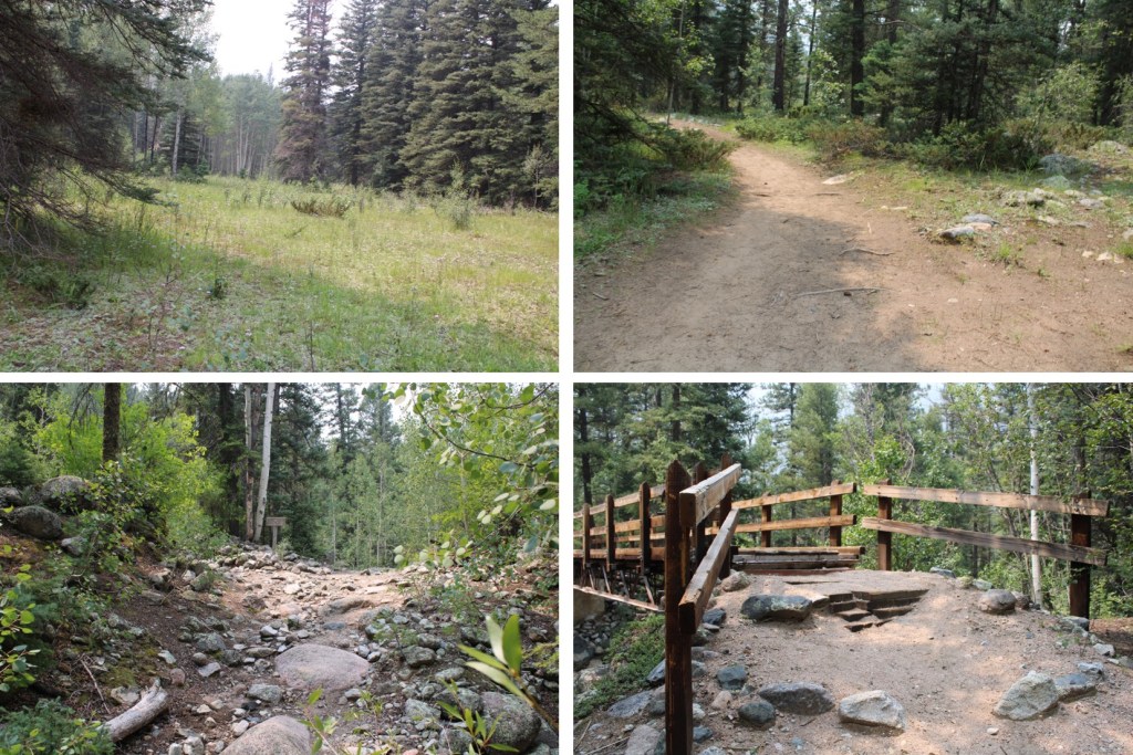
I’ve done this approach several times, but always in the dark. I decided to put together a detailed route description for those looking to head to Ruby Basin, or those interested in what it looks like hiking from Purgatory to the Chicago Basin cutoff. I feel this route has improved over the years, but unfortunately now has more downed trees blocking the trail, making route finding interesting at times.
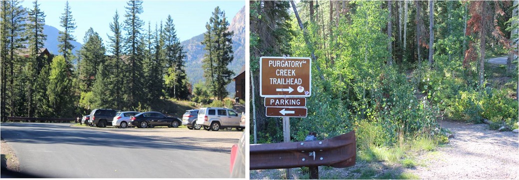
I arrived at 2pm on a Thursday afternoon and the parking area was full. They’re doing a lot of construction/new housing in the area, and there were a ton of visitors to the lake. I actually had to wait about 15 minutes for someone to leave before acquiring a spot. It might have been the time of day, but come prepared (I’ve never had trouble finding a spot before, but I usually arrive in the middle of the night).
The trailhead is clearly marked, and starts at the west end of the parking area
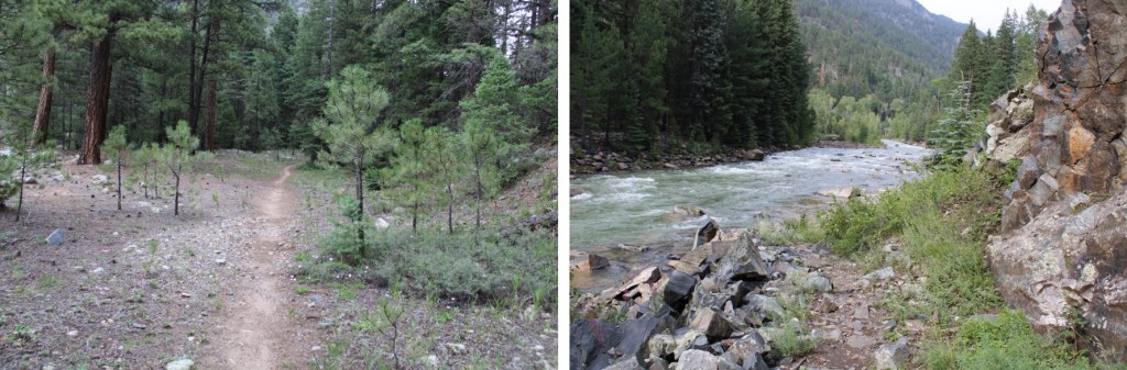
From here, the trail is class 1 as it heads east for 1.3 miles, and then turns right and follows Cascade Creek south to the Animas River. This part of the trail is nice on the way in, as you lose about 1200’ of elevation, but can be frustrating on the way out. I’d recommend hiking this part out in the cooler part of the day (or night). Here are some pictures of the trek down to Cascade Creek
And from the creek to the Animas River. Here the trail will gain and lose elevation multiple times before descending to the river. In the late summer and early fall you’ll find wild blueberries, raspberries, strawberries, and lots of foliage here.
Just before getting to the Animas River the trail descends 400’ to a flat area
Here there are picnic tables and camping spots, and finding the exact trail can be confusing. If you get lost, just head west towards the river
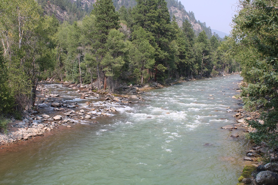
There is a very large and very obvious bridge to cross. This is also a good place to filter water (either on your way in or out). CalTopo told me I hiked 4.62 miles to this point.
As you’re crossing the bridge you can see where Cascade Creek and Animas River meet
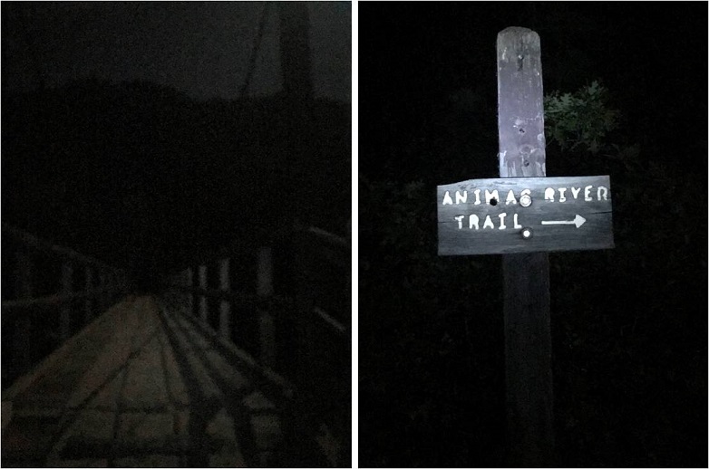
As soon as you cross the bridge, you’ll see this sign. Go LEFT here
And follow the trail to the railroad tracks
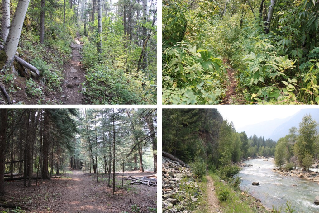
There will be an obvious place to cross the tracks. Funny story: when I was crossing the tracks this time and taking pictures the train blew its whistle from what felt like very close. I’m sure they do that to warn people to get away from the tracks at the crossing (I also heard it on my way back). If you hear the whistle, you have less than a minute to remove yourself from the tracks before the train arrives. Cross the tracks and continue on the class 1 trail as it hugs the Animas River and the Mountainside
From here the trail stays pretty level as it follows the Animas River. If it’s rained recently, you’ll want rain gear, as the foliage covers the trail in many areas and you’ll get very wet. There are many places to camp along this stretch.
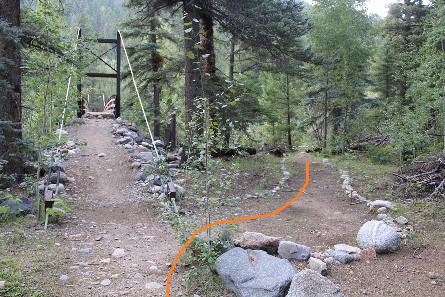
From the Animas River Crossing, it’s just under 6 miles to the cutoff for Chicago Basin (or 10.5 miles total from Purgatory). Here you’ll cross Needle Creek on another sturdy bridge. This is also another good place to filter water.
If you’re headed to Chicago Basin, there are obvious signs that will guide you there.
If you’re headed towards Needleton/Ruby Basin (etc.), continue following the trail north for another mile.
There’s new signage here. Please note, this is a public trail through private property. If you need to filter water, cross the bridge, filter, and then come back.
Here’s where the trail gets fun! Don’t cross the bridge. Instead, follow the trail to the right
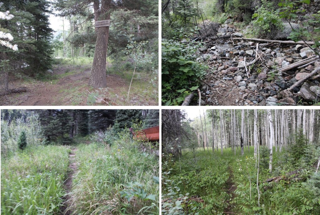
You’ll follow this trail for just under half a mile until you get to an Aspen Grove. This is a good place to spend the night before the elevation gain begins. You’ll have hiked a total of (almost) 12 miles to this point.
Here you’ll turn right, and follow an obvious trail up the hillside
This is where the elevation gain starts and doesn’t quit.
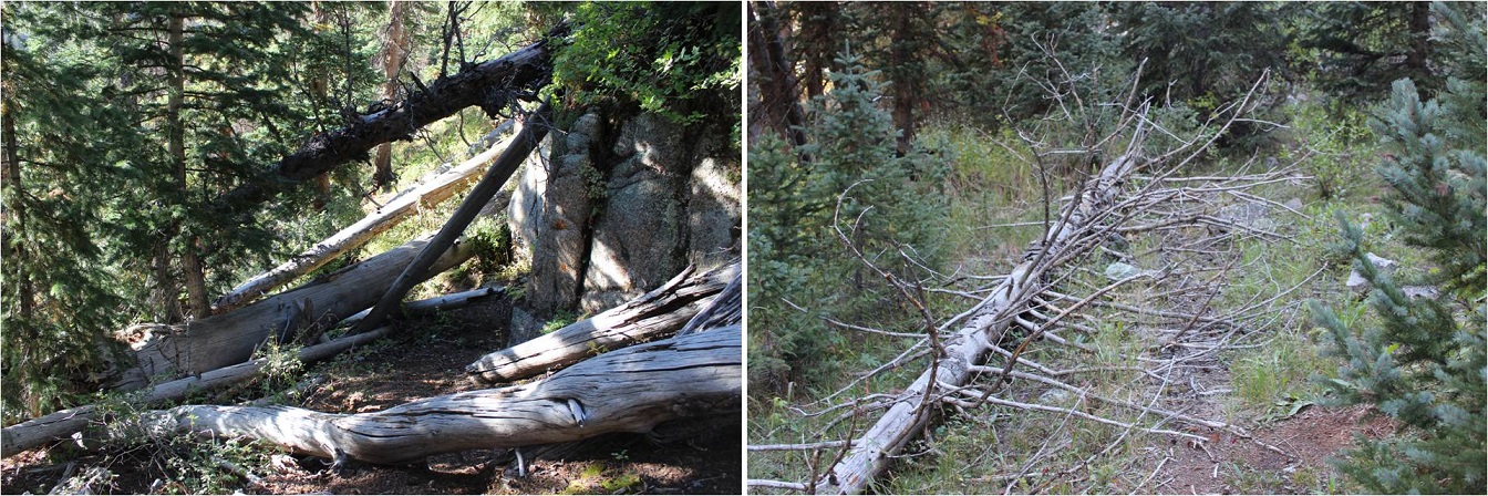
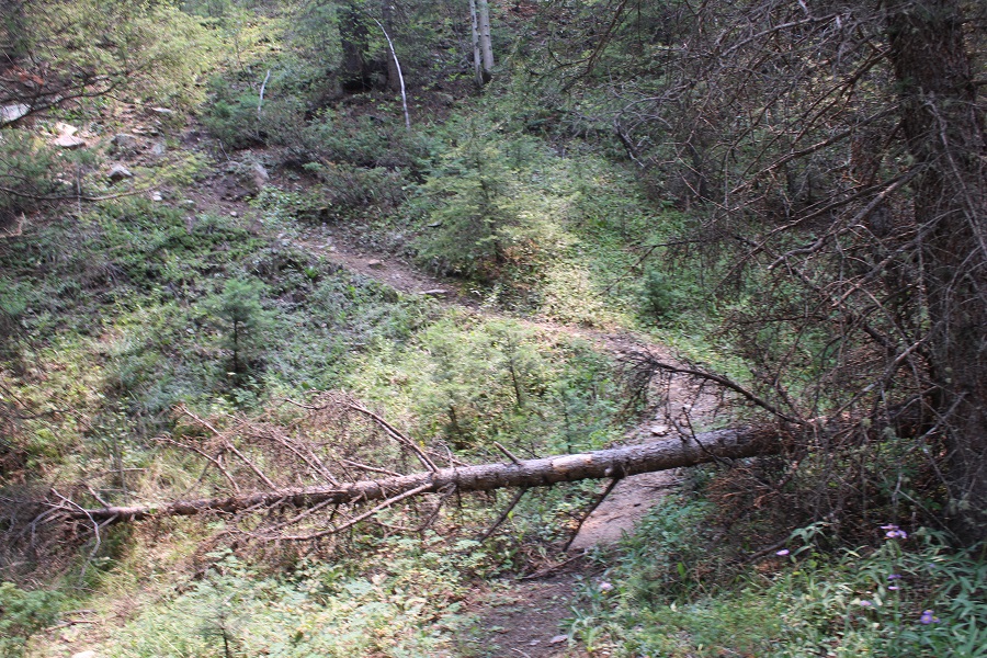
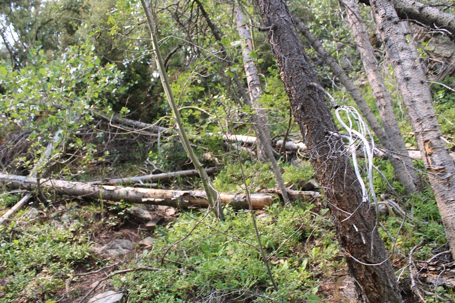
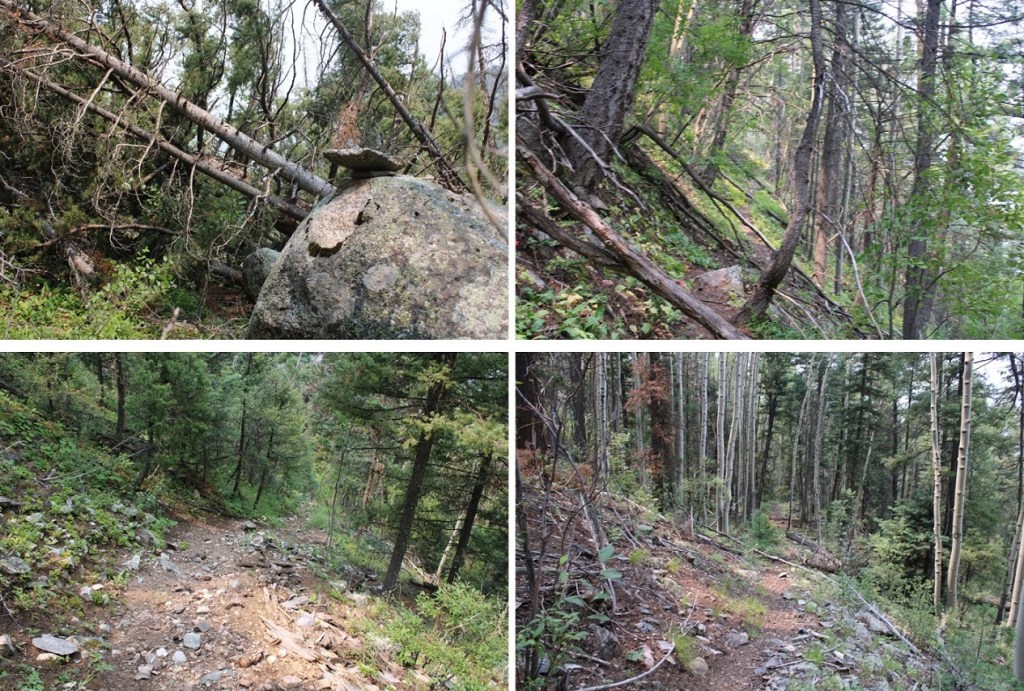
There are a lot of newly downed trees in this area, without an established workaround. Most of the trail is easy to follow, so if there’s a large downed tree in your path (and there will be), just try to be logical about where the trail should go, get around the tree, and you should be able to pick it back up again. This is tons of fun in the dark, and much easier when it’s daylight.
Another fun part: after gaining and gaining and gaining in elevation, at around 10,330’ you’ll LOSE about 200’ of elevation, quite quickly. Pictures looking down don’t do it justice, so here’s LOOKING BACK UP at the elevation you’ll lose
At this point the trail becomes a little more difficult to follow, but there is a trail and cairns. You’re hugging the mountain, following Ruby Creek east. Once again, this part of the trail is overgrown, so if it’s been raining, you’ll want to wear your rain gear to avoid getting soaked from the dew on the plants.
You’ll pass through a rocky area, with raspberry bushes and cairns to guide you
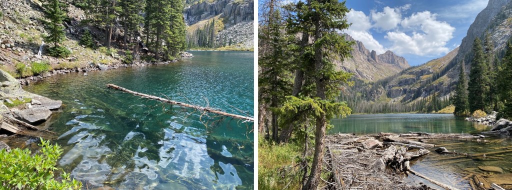
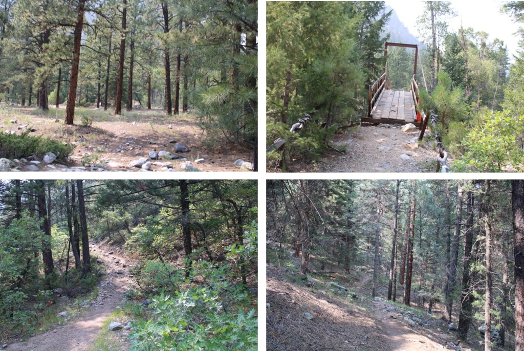
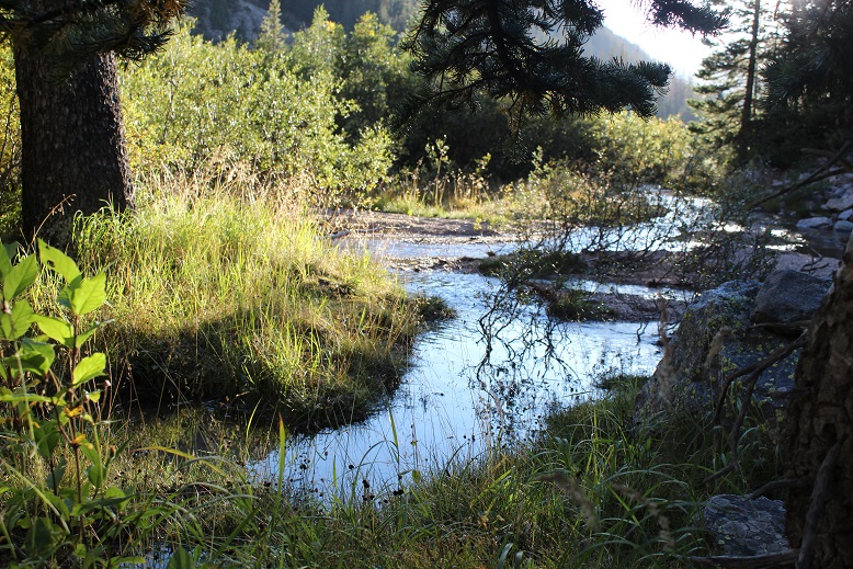
After hiking for 17 miles, and at 10800’ of elevation, you’ll arrive at Ruby Lake. Cross where the stream and lake meet, and skirt the north side of the creek.
There are also a few nice camping spots here, and the ability to filter water
Be sure to stay close to the water’s edge here, as there’s a trail and it’s much nicer on your feet than rock hopping. There are cairns here as well.
The goal now is to ascend into the upper basin. There is a trail here, but once again, a lot of downed trees and very overgrown with grass, flowers, etc. Keep heading east, staying below the rocks to your left.
At about 10900’ the trail abruptly ascends into the upper basin by aiming north.
Where you’ll be greeted with: Willows! It is now your job to navigate through these willows to Ruby Basin. I promise you, there are trails here that ‘go’. They’re goat trails and anything above your waist will be gnarly, meaning you should plan on getting whacked in the face with willow branches, but trails are here. It’s important to find the entrance to the trail, and then go with your gut. Obvious cairns are circled in red. You’re aiming for the orange arrow:
Here’s what the entrance to the trail looks like
When you make it to that orange arrow, the rest of the trail into the basin will become obvious
Pick your place to camp. There’s always plenty of water here flowing through the basin. The marmots will chew up anything not hung up, which is difficult in this treeless basin. I’ve seen Mountain Goats and Moose here a few times. This is a great starting place for several 13ers in the area. If you’d like my GPX file for the route send me an email wild.wanderer@aol.com
Here’s a view of the Ruby Basin from the east side of the basin, looking west at how you enter the basin.
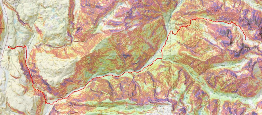
Here’s the topo route
And just for fun, a compilation of pictures of the route out.
I’ve been feeling guilty lately. I was one of the 5 people who actually got to ride the train to Needleton this summer. No one else I know caught a ride, yet many of my friends made the trek into the basin anyway, intent on crushing their adventuring goals. They have stories to tell of adding double digit mileage to an already intense adventure, hiking in from Vallecito, Purgatory, Beartown, and Elk Park.
I didn’t feel like I’d earned my hike in this summer; cheating it by taking the train in a year no one else was able. I felt like this made my 2018 summer of hikes/climbs too easy; like I didn’t get the full Chicago Basin summer of2018without the train experience. So I promised myself as soon as there was a nice day in the San Juan’s with no chance of rain I was rearranging my schedule and hiking Pigeon and Turret from the Purgatory Trailhead.
My plan was to drive to the trailhead, sleep for a bit and begin hiking at 1am. I was going to take the Purgatory Trail (etc.) to the Ruby Creek Trail, hike/climb Pigeon and Turret, and then hike back to my truck. Next (because I didn’t want to waste the mileage) I planned to drive an hour to another trailhead in the San Juan’s, sleep until 5am and hike 3 more low mileage13ers the next day. I know Pigeon & Turret via Purgatory is a challenging hike, but reports I’ve read placed it at about a 32 mile 10000’ hike (ha! More on this later). I’ve done Pikes Beak via Barr Trail (26+ miles, 7500’ in elevation gain) two days in a row before, and I’ve always been able to do that one in around 7 hours (even both days two days in a row), so I totally thought my Purgatory plan was doable in a day. Insert God laughing here.
The great weather chance came very last minute. I left work, drove home to pick up my daughter from band practice, made dinner, and drove 6.5 hours to the Purgatory Trailhead, arriving at 12:30am August 28th. I’d originally planned on sleeping for a couple of hours in my truck before starting out, but my target start time had been 1am, so I figured I’d forego the sleep and just hit the trail. I started at 12:30am
It’s a 2WD paved road all the way to the trailhead, with a parking lot that holds about 10 cars comfortably (and several more on the side of the road). There’s a lake and a nice trail that begins to the south and continues east.
The hike down to the Animas River was pleasant, but I couldn’t help but think of how I’d have to hike back up this trail on my way out. It switchbacked down for 4 miles and lost 1000’ in elevation as it wound its way to the Animas River, passing through meadows and hugging the mountainside, even following the Cascade Creek for a bit.
I wish I had pictures of this part of the trail, but I did all this hiking in the dark and figured I’d just take pictures on my way out in the sunlight. I had a flashlight but didn’t need it, as the full moon was lighting my way. I made it to the Animas River, crossed the bridge and the railroad tracks, and started my trek along the Animas River Trail.
This part of the trail hugs the Animas River. Its ups and downs are barely noticeable, unless you’re paying attention to that sort of thing (which I was). I couldn’t help but think how much those elevation losses now were going to hurt on my hike back out. I could hear the rushing of the river, and looked forward to actually seeing it while hiking back out later today.
There are signs at the junction of the Animas River Trail and the Needle Creek approach to the Chicago Basin that state it’s 7 miles from there to the Purgatory Trail. I was skeptical it was only 7 miles.
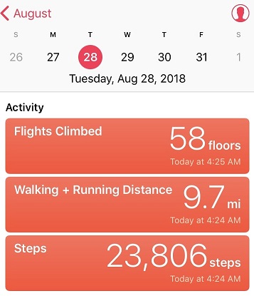
After some consideration, talking to others who’ve hiked in from Purgatory as well, and consulting the tracker I was using, I’ve come to the conclusion it’s about 7 miles along the Animas River Trail to the base of the Purgatory Trail from this point, plus another 3- 4 miles to the top of the Purgatory trail. Here’s proof from my tracker, stating it’s 9.7 miles from the Purgatory Trailhead to the Needle Creek Approach:
I’ll admit this tracker isn’t always 100% accurate, and tends to overestimate things (but only by a little). However in my estimation 9+ miles is much closer to the actual mileage than 7.
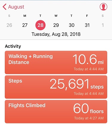
On to the Needleton train stop. I made it to the Needleton stop at 4:45am. This time my tracker said I’d gone 10.6 miles in just over 3 hours.
Not bad. And my tracker was accurate stating it was .9 miles from the Needleton Creek Approach to the Needleton Train Stop, so I think it’s accurate to state it’s 10.6 miles from the Needleton stop to the Purgatory Trailhead. This means if you take the train you’re saving 21.2 RT miles of hiking (or in my case, if you’re not taking the train you’re adding 21.2 miles to your hike).
The next part of the trail is where it gets tricky. There isn’t an established trail or any signs indicating the path you’re to take. I chose to take the Ruby Creek ‘Trail’ as opposed to the Pigeon Creek ‘Trail’ because I’d read the Ruby Creek Trail had some cairns and at times a trail to follow, whereas the (shorter) Pigeon Creek Trail did not. Since I was doing my route finding in the dark I opted for the trail with more indications I was headed in the correct direction.
There’s an area to camp here, where I saw a white horse tied up to a tree. At first I was thinking to myself “Harry Potter and a Unicorn” but after the horse whinnied hi to me I noticed a tent nearby.
I continued along the Animas River Trail for about a mile and turned right, heading up the North Pigeon Creek Trail to the Ruby Creek Trail (neither of which were actual trails). It was dark and I was upset I never saw the Columbine Tree, but figured I’d see it on my hike back out. I hugged the mountains and followed a steep and undefined trail northeast to Ruby Lake. Steep. And undefined. In the dark. Yes, route finding was a challenge, but there were just enough cairns in the right spots to assure me I was on the correct path. As the sun started to rise I got a good look at the path I’d taken thus far
And a good look at the trail ahead of me. Much of the Ruby Creek Trail looked like this. I was glad it was getting light out!
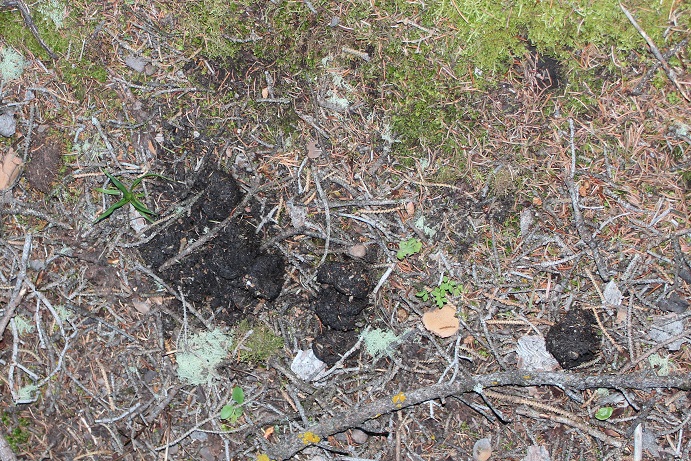
Just before making it to Ruby Lake I saw some bear scat directly on the trail (I was on a trail at this point)
Now I was on bear patrol. The scat didn’t look fresh, but it did indicate a bear had been in the area semi recently. Next I crossed a very thorny raspberry patch (probably why the bear was in the area) and came upon some boulders that led me to Ruby Lake.
The lake was beautiful in the morning light, but there was no good way to get a picture of it because of all the trees. It’s one big lake separated into two in the middle by a log jam.
It doesn’t matter which way you cross the lake, as both sides end up connecting on the upper northeast side of the lake. I chose to take the south route, full of boulders. It’s best to stay low and close to the lake.
If you take the south route you’ll need to cross a small stream after the lake to re-connect with the trail.
I use the term ‘trail’ loosely. I’m not sure if it’s because of underuse this year with the train being closed or if it’s just a poorly defined trail, but this is what it looks like after the lake.
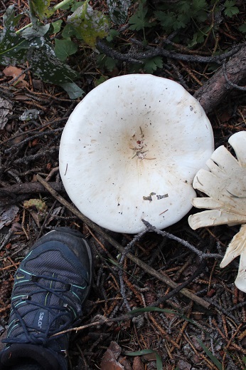
There were some pretty big mushrooms in this area
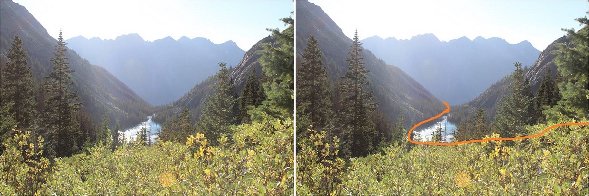
Stay to the left (northeast) of the creek/waterfall as you climb into the basin. Here’s looking back at the trail from the waterfall area (and the route I took)
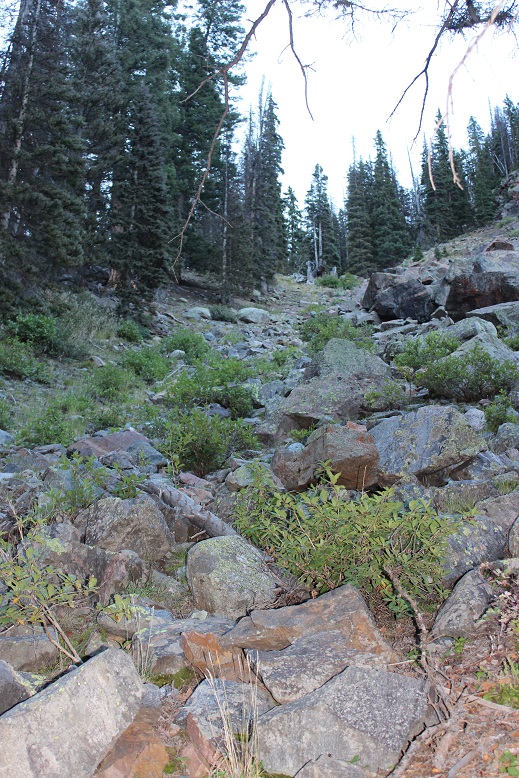
Above Ruby Lake:
From the waterfall area here’s the path in front of you
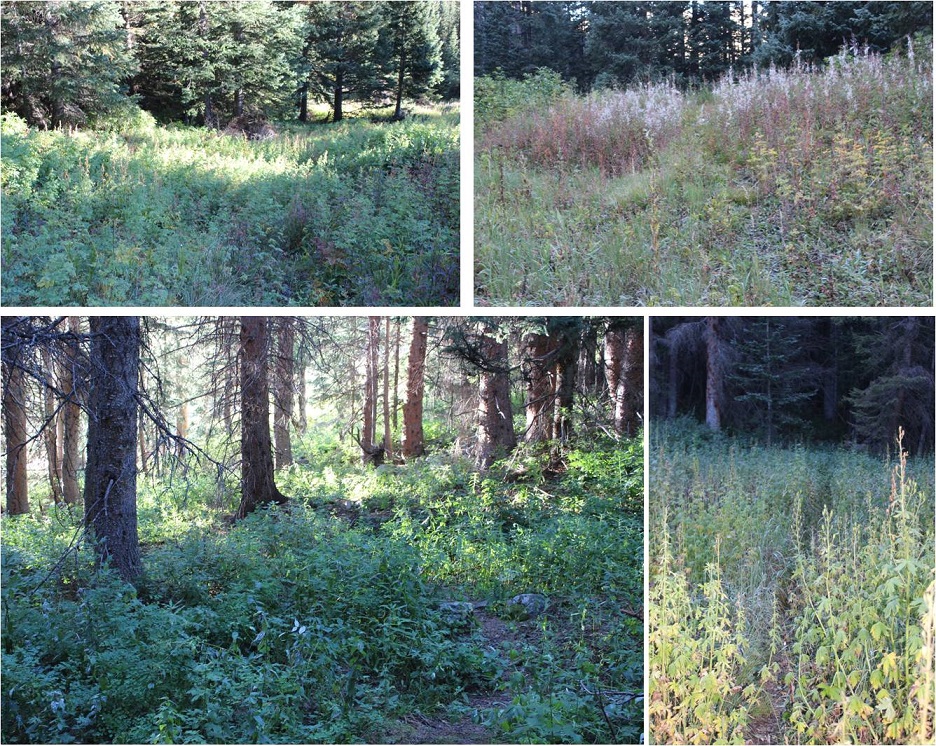
This path includes quite a bit of bushwhacking through high brush, willows, tall grass and flowers. I’m sure there are ticks involved. Once again, the trail isn’t clearly defined but you’ll see cairns every so often indicating you’re on the correct path. The path through the willows looks appropriate for anything about the size of a mountain goat (meaning you’ll get hit in the face with branches but your knees won’t) and in areas without willows the grass/flowers cover the trail. Stay high and to the left. I promise you there is a path the entire way. Also, wear pants (please wear pants hiking people!!!).
Ruby Basin Trail:
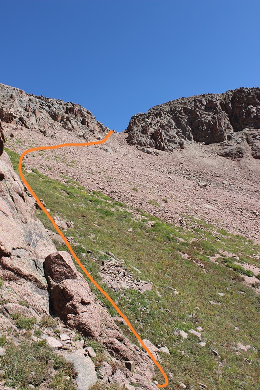
Continue on this path until you’re in the center of the basin. Stop here to get a good look and plan the route you want to take (there’s no trail from this point on). Turn to the south, look across the basin and you’ll see the route before you. Head south, cross the creek, and head up the drainage.
This is the path you want to take: aim for the large boulder (it’s freestanding and you can walk around it from either side).
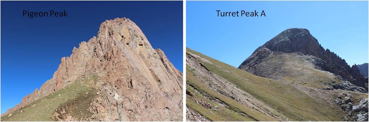
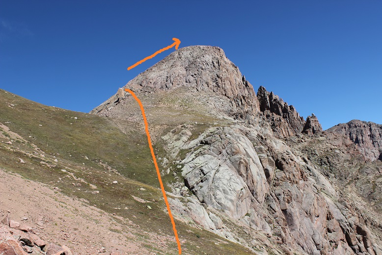
If your goal is just to hike Turret Peak A today head to the left. If Pigeon is your goal go to the right and enter a boulder. This is where your troubles begin. This section is much steeper than it looks, and filled with large boulders and loose scree.
Aim for the saddle you can see behind the boulder field.
Along the way stop and look at the rocks. They’re pretty amazing, many made up of crystals. Scores of them look like the inside of geodes. They kept me busy for quite some time, until I realized I should just take pictures and keep going.
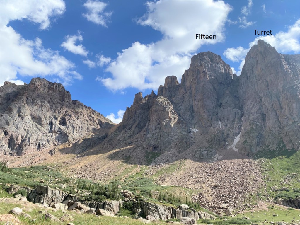
Woohoo! I made it to the 13,100’ Pigeon/Turrret Saddle. I turned around to look at the two summits.
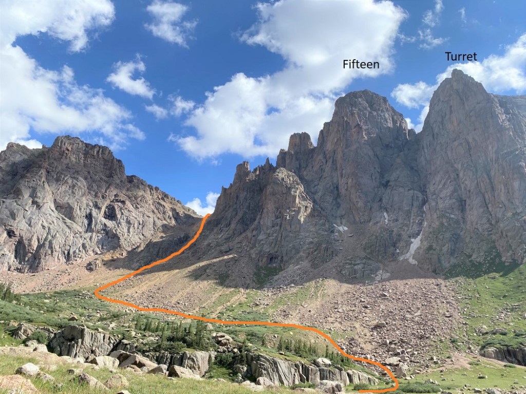
I chose to climb Pigeon first since it was supposed to be the more difficult of the two (it was). I looked southwest and shook my head from side to side: No. That’s not what I’m supposed to do. No way.
But it was. You see, you don’t climb Pigeon from the saddle, you need to be on the other side of the mountain to summit (the west side), but it’s not a direct shot. To summit from this point you have to lose elevation and re-gain it by circumnavigating the south side of Pigeon. I knew this going in, but I’d drastically underestimated the affect it would have on me when I was there. I did not want to lose all that elevation! I also didn’t want to regain it to summit Pigeon only to lose it and regain it again to summit Turret. It was now 11am and I’d been hiking since 12:30am. I was exhausted and honestly I’d expected to already have summited both peaks by this point and be headed back down. I had a serious decision to make: This was going to take a lot longer than I’d anticipated. Did I just want to turn back now?
No. No I did not. I’d come this far, it was a perfect day (not a cloud in the sky) and I was pretty sure I’d regret it if I didn’t keep going, and possibly never come back (the hike in was brutal!). I mentally calculated distance and time and knew my chances of getting back to my truck before dark were pretty much nonexistent now. I took a deep breath and began losing elevation. Several times.
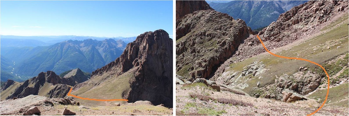
From the saddle look west-southwest and aim for a small notch/gully. You’ll be tempted to stay high, not wanting to lose elevation but trust me, you need to aim for this lower spot. The left picture shows the route looking from above
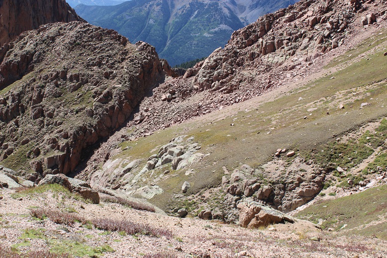
Once there you’ll continue west/southwest and drop in elevation again. Yep, all the way down to this point (12,400’). The terrain here is perilously loose, and one slip can take you sliding dangerously for a long time. Stay high, aim for the rock wall, and follow it down and around. The higher you stay early on the larger and more stable the rocks are.
Once you round the mountain you’re greeted with 1500’ of elevation to regain. It’s actually harder than it sounds/looks.
Continue west until you’re halfway across the slope. Head right (northeast) to the base of the summit pyramid. Pick your route and stay on the grassy areas as much as possible to avoid the scree. This is a very steep area.
The grass changes to the worst rubble gullies I’ve ever encountered. Scree, sand, rocks, and steep elevation don’t mix. It’s steeper than it looks. I don’t usually sweat while hiking, but today I was. I could feel drops forming and rolling down my sternum. This was a workout!
Just keep aiming here
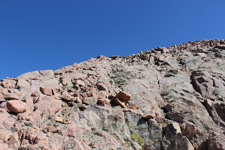
The terrain eventually changes to large boulders. If your helmet isn’t already on now’s the time to put it on. This rock itself is stable, but it crumbles when you touch it (hence the rubble gullies). It’s very slow going.
I’ve been told this is a class 4 climb, but by aiming for the base of the ramp and following it to the summit I was able to keep it at a class 3. There was still some intense scrambling going on, but nothing class 4.
I (finally) summited at 1:15pm. I’m not standing on the photogenic rock in the middle of the picture because the longest my camera will go on automatic is 10 seconds, and it wasn’t safe for me to make it there in that amount of time. #solohikingproblems
VIDEO:
Wow. That had been intense! I’d seriously misjudged today’s hike. I’m pretty sure it took me longer to summit Pigeon Peak than any other peak I’ve attempted. (12 hours, 45 minutes). It wasn’t lost on me I wasn’t even halfway through my day yet. I still needed to descend back into that basin, regain the saddle, and summit Turret Peak A. Did I still want to summit Turret? Honestly I was seriously debating this the entire time I was descending Pigeon, and told myself I’d decide when I reached the saddle. It had already been a very long day and I was very, very tired. Pigeon had kicked my butt!
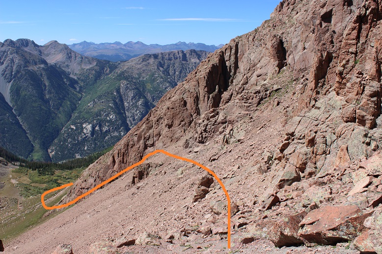
Here’s the descent route from Pigeon: First do your best to stay on the grassy areas to avoid slipping, and aim here
Locate a “thumb” in the side of the mountain. From here aim for the first gully/saddle to your left, being careful to stay as high as possible to avoid dangerous scree
From the gully/saddle you can see most of the route left. I decided to attempt Turret (not really a surprise). At this point I knew I wasn’t getting back to my truck before midnight and I wasn’t going to get to see the Animas River in the daylight. I wasn’t going to get to see the Columbine tree and I wasn’t going to get any pictures of the Aspens I knew were changing colors. (All reasons to come back I guess?)
I didn’t want to route find at night. I really didn’t, but I’d made the decision to come this far and even though I was exhausted I knew I could do this. I’d made it here route finding at night, hadn’t I? I could do the same route finding back to my truck in the dark.
Instead of re-gaining the Pigeon-Turret saddle I crossed lower, aiming for this large rock.
Once I passed the rock I turned right and followed the scree filled slope to the summit. This scree was just as bad, if not worse than the scree on Pigeon. There were also some large boulders to contend with (but it stayed at a 2+)
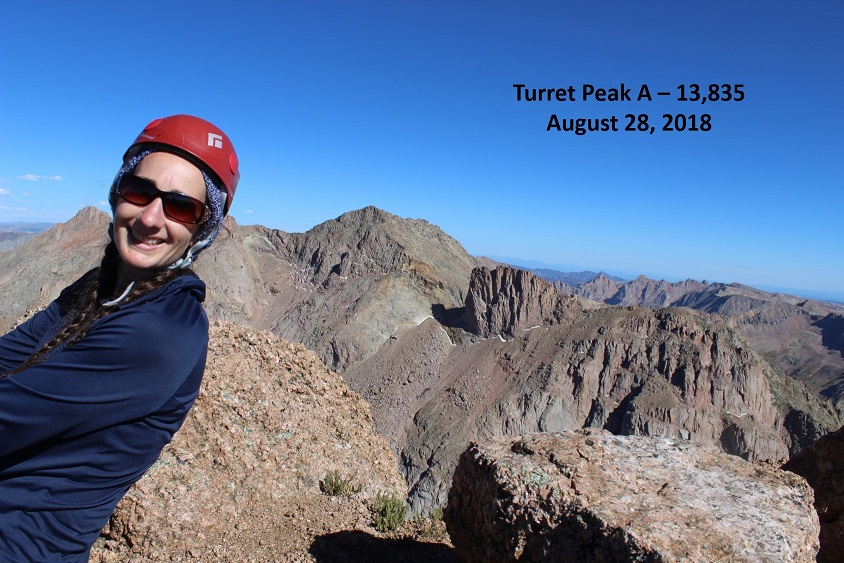
I summited at 4pm. Exhausted. I set up my camera but noticed too late I was out of the picture… that’s ok, people would rather see the views anyway. I was too tired to try a second time.
VIDEO:
The views were incredible! I turned around and looked back on the route I’d taken along the Animas River
And some other peaks in the area…
Wow. A 4pm summit. It was late, and I was now halfway through with my trip. I needed to book it down this mountain and back to my truck. But first I had to wish my friend a happy birthday. I turned on my phone, noticed I had reception, sent her a quick note and one to my kids letting them know I’d summited and turned my phone back off. I thought to myself how it would probably be faster to drive from my house to Purgatory (6.5 hours) than it would be for me to hike there from my current position.
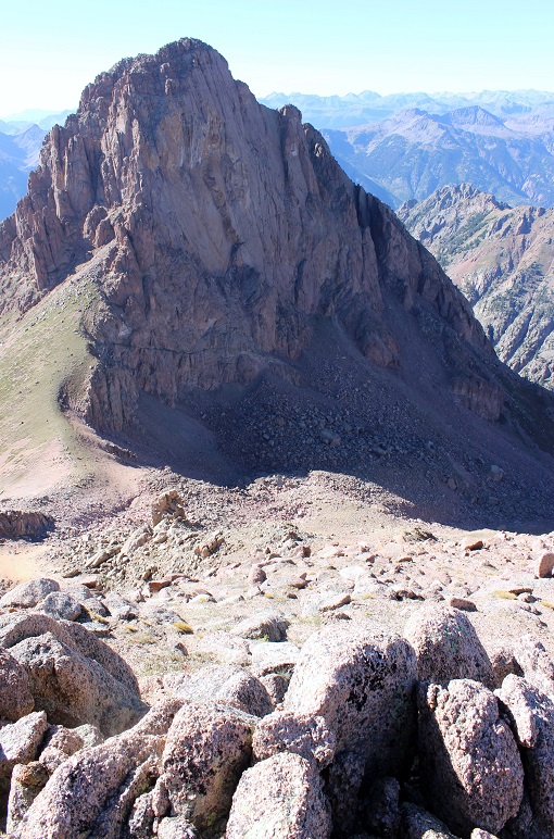
I turned back towards Pigeon Peak and headed down.
The boulders at the beginning of that large rock gully were bigger than I’d remembered. And check out that boulder! It was about 30 feet across. With how loose the rock was here I didn’t feel safe anywhere near it.
I headed back down into the Ruby Basin and had to stop for a second to enjoy the enormity of it all. I hadn’t seen one person all day. I want to come back and camp here
VIDEO:
I crossed the creek and located the “trail” that would take me back to the lake. I was surprised at just how fast the sun was setting. I mean, it just kept getting darker and darker by the minute! It became my goal to make it past the bear scat before I needed to get out my flashlight. I made it (barely), got out my flashlight, and steeled myself for some serious in the dark route-finding. It’s different route finding at night in the dark instead of early morning in the dark because you don’t have the sun coming up to look forward to (or wait something out). For reference, imagine navigating the following terrain, but at night. It really gets tricky when a 150 foot tree falls directly on the trail and you have to navigate around it without one of your senses to help
At least the route in the picture above is an actual route. Most of the trail down lacked a defined trail. It was steep and route finding wasn’t easy. But I reminded myself I’d done this once already today, I could do it again. I just kept hugging the mountainside to the left and kept listening to make sure the Animas River was to my west.
Route finding at night:
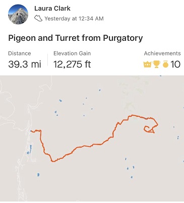
I made it back to my truck at 2am. My tracker told me this was as 39.3 mile hike with 12,275’ in elevation gain. I believe it (this is my more accurate one than the one I’d used earlier). It took me 25.5 hours to complete
This was by far the most challenging hike I’ve ever attempted endurance wise. For those of you just wanting a trip report, it stops here. For those of you interested in what happened in those 6 hours it took me to hike from Ruby Lake back to my truck, read on.
I’m not sure when the hallucinations started, but I fully noticed them around 10:30pm and tried to trace them back in time. It must have been around 9pm. I was in the middle of the Ruby Creek trail when I noticed I was running a fever.
Have you ever had a hallucination before? Well, I haven’t (besides those auditory ones near the river on Snowmass, which I experienced again on this trip btw.). Well, I noticed the river singing this time for what it was and wasn’t put off by it, but now I was hearing voices in my head and having visual hallucinations as well. I was about halfway down the Ruby Creek Approach, desperately determined to correctly route find in the dark, when I became more than flushed. I could tell I was running a fever.
I began talking to myself about myself, as if I were someone else (like a doctor talking with a nurse about a patient). What’s weird is I was having a conversation in my head with another person who wasn’t there. Interestingly enough, I was the male in the conversation, talking to a female about the patient (me).
“She’s running a fever. Anything over 102.7 and she needs to evacuate”
“Make sure she keeps drinking and gets plenty of water, but ration it so she doesn’t run out”
“Now is a good time to start trying to talk her out of those other 13ers in the morning”
“You know she’s stubborn and it won’t be easy, start reasoning with her now”
I’d hiked for two more hours before I recognized I’d had this dialogue in my head, or that it was out of the ordinary. What made me think back to this conversation I’d had in my head? It was the third time I said “Hey Bear!” and it ended up not being a bear but a shadow. I paused and took time to look at what I’d thought was a smallish bear rolling on its back and happily sucking its toes. Unlike a real animal it kept doing what it was doing and didn’t run away. I walked closer and it turned into the shadow of a rock. I’d also been seeing red eyes glowing in the dark since it became dark.
I knew the hallucinations were due to low blood sugar and lack of sleep, but I have Raynaud’s and didn’t have a sleeping bag/blanket with me, so stopping to sleep or rest was out of the question. I had food and water but food didn’t sound appetizing. I felt like I’d throw up if I ate anything, but lack of food meant low blood sugar and that combined with strenuous exercise and lack of sleep meant hallucinations (I’d been up since 4am the day before so I was going on 45 hours with no sleep and all I’d had for dinner before hiking was string cheese and two slices of roast beef).
I was saying things to placate myself like:
“Tell her we’ll get the rocks out of her shoe at the next stop. She just needs to focus and keep going to the bridge.”
“When we get to the base of the Purgatory trail she can have another piece of candy”
I made it to the Needleton stop and thought to myself I still had 10 miles to go. OMG, 10 miles! This was insane! It had been dark for hours (I’m guessing it was about 10pm at this point) and I was physically ready to drop. But I kept going. Stopping just wasn’t an option.
I felt like a machine, thinking outside of my body, running on autopilot. I was referring to myself in the third person. Ever the scientist I recognized what was going on and decided to document it in my mind to remember later. I was having both auditory and visual hallucinations (and apparently talking to myself). Not only as I talking to myself, I was talking to myself in third person, treating myself like I said before as a patient instead of as me. It was more than just a “pep talk” to keep going (but it was a pep talk, just from someone else… who was me).
Why was I seeing so many shadows tonight? I hadn’t seen any last night? Why was hiking tonight so different from last night? Then it occurred to me: the full moon wasn’t out yet. Yesterday the full moon had eliminated a lot of the shadows I was seeing tonight in the rays of my flashlight.
The visual ones were the most interesting. Once I realized the bear(s) weren’t real I decided to pay attention to what was going on. I couldn’t make the hallucinations stop, but I could accept them for what they were. They came in many forms, there was only one image at a time, I never knew what they were going to do, and they were all trying to get my attention for one reason or another.
I started using the experience as entertainment, like a tv show to keep me occupied and my mind off the fact I was physically exhausted and it hurt to continue hiking. Here are some of the hallucinations I had:
A woman in a t-shirt trying to get me to notice her t-shirt (dancing around holding up the fabric on her shoulders with her fingers while moving side to side)
A life size version of Yoda climbing a tree
Horses shaking their heads and pawing at the ground
Apes / Sasquatch walking past me (I’m guessing this was because I was seeing my shadow a lot)
Witches with cauldrons
Frogs, snakes, and bugs skittering across the path (they’d been the leaves and sticks on the ground)
Flashing black and yellow freeway signs (I didn’t read them because I was scared to see what they’d say)
Street vendors trying to get me to visit their stores
Every type of animal you can imagine pretending to be a human (a giraffe trying to use an umbrella, a zebra on two legs trying to mow a lawn)
Eventually the visions would all become a shadow/rock/tree/etc. as I passed by. As the night wore on the hallucinations started getting bolder and coming towards me. Knowing they weren’t real but still fearful, I decided to keep my head down and focus on the trail directly below my feet. From the time I crossed the Animas River until I made it back to my truck I refused to lift my head to look at anything ahead because something would lunge at me from out of the dark (not really, but it felt real at the time). The good news was I’d stopped talking to myself in the third person.
The trail up from Purgatory was terrible. It was much longer than I’d remembered, the leaves and small rocks under my feet became large bugs and frogs I tried in vain not to step on, and none of the terrain looked familiar or as I’d remembered it from yesterday. I had to keep checking my map and compass to make sure I was headed in the correct direction (I was).
I needed rest. I needed to eat. I needed to make it back to my truck so I could do both. At this point there was no way I was going to drive to another trailhead and attempt any more 13ers tomorrow (today!).
I made it back to my truck at 2am. All of the vehicles in the parking lot were the same ones that were there when I’d left. I needed to eat. I wasn’t hungry but I told myself I had to eat to replace all the calories I’d burned, so I got out a Mountain House meal and the Jetboil and got to work.
I found a ‘safe’ place to light the Jetboil, which ended up being in the middle of the parking area (small rocks and pebbles were the ground cover). I’m so glad I decided to light the stove in a fire safe area because as soon as the water started boiling and I tried to turn the stove off it wouldn’t turn off: the flame just kept intensifying. Yes, I was operating it correctly and I knew what I was doing. I decided to pour the water into the bag so I wouldn’t pour scalding water on myself as I was trying to put out the flame. You can probably guess what happened next. There’s a reason you’re not supposed to turn a Jetboil sideways/upside down. The flame quickly became 5 times its original size, dancing wildly. I momentarily panicked, blew on it, and the flame went out. Whew! That was a disaster narrowly averted. Advice: Don’t try to operate a camp stove when you’ve been hallucinating.
I put the stove away, ate my dinner, set my alarm for 9:30am and quickly fell asleep in the back of my truck. Two seconds later my alarm went off. It was already bright and quite warm outside. I did a quick head to toe physical assessment of myself: My hair was a mess, my head didn’t hurt, my feet were dry, warm, and operational. I was thinking clearly, and I wasn’t sore (at all, which was weird considering all the activity I’d done). I felt fine to drive, so I jumped into the front seat and was on my way, glad I’d had the sense to fill up the truck with gas the night before.
Normally I get on the treadmill everyday and do 5 miles with 4000’ of elevation gain, unless I’ve hiked more than that. I do this 7 days a week, and have done so for the past 8 years. I’ve been known to hop on the treadmill after easier 14ers like Bierstadt or Evans because I didn’t get enough of a workout in. Today I’ve only hiked 1000’ of elevation gain, but I’ve done 7 miles since midnight, so I’m calling it a draw and not getting on the treadmill today… I don’t even feel guilty!


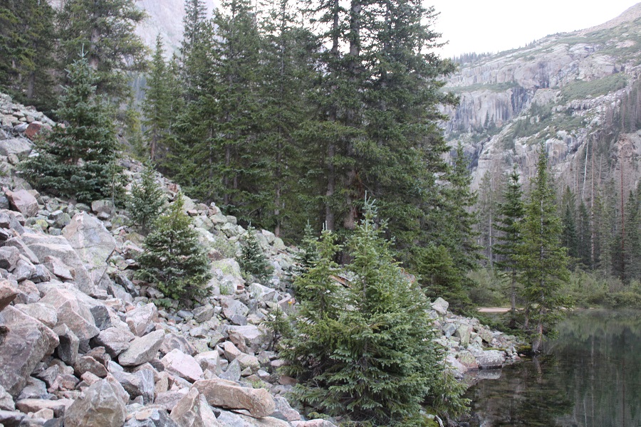


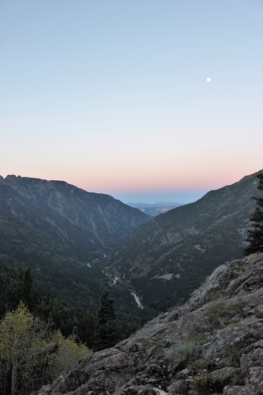
 Above Ruby Lake: