South River Peak – 13,156

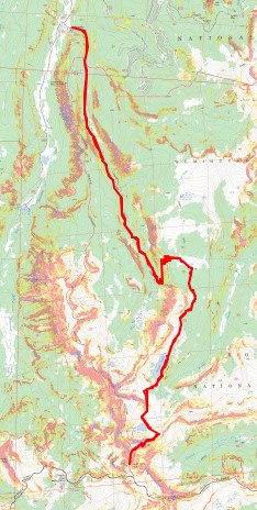
RT Length:  26.06 miles

Elevation Gain: 4677’

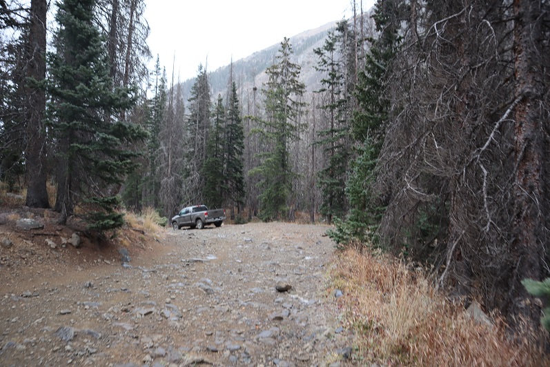
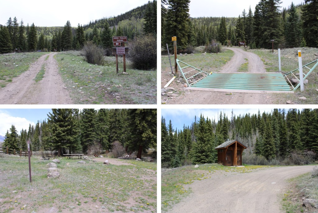
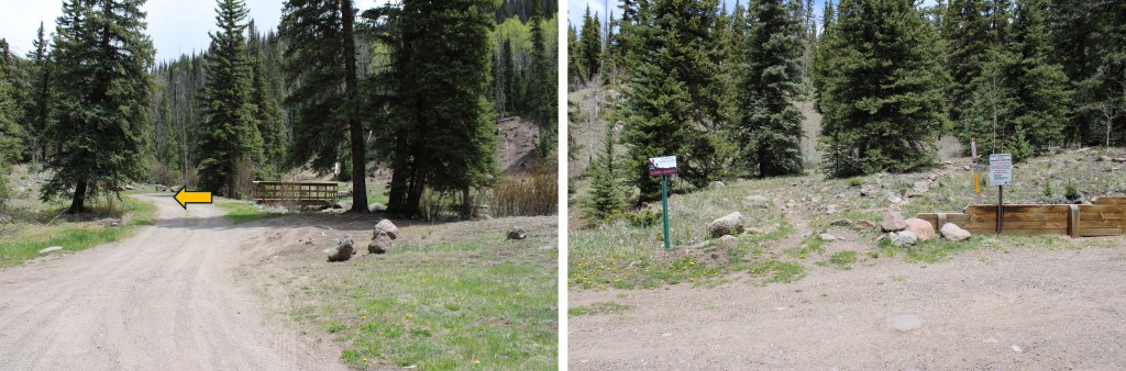
I parked at the Ivy Creek Campground and Trailhead.   This campground is for tent camping only, and has 4 spots along Ivy Creek.  The drive in is dirt 2WD, and there’s a bathroom there for use.  There was only one vehicle there when I arrived, but as I was leaving, all the parking spots were taken.

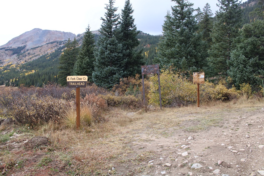
The trail starts at the Ivy Creek Trailhead, southeast of the campsites.  I left at 5:15am.

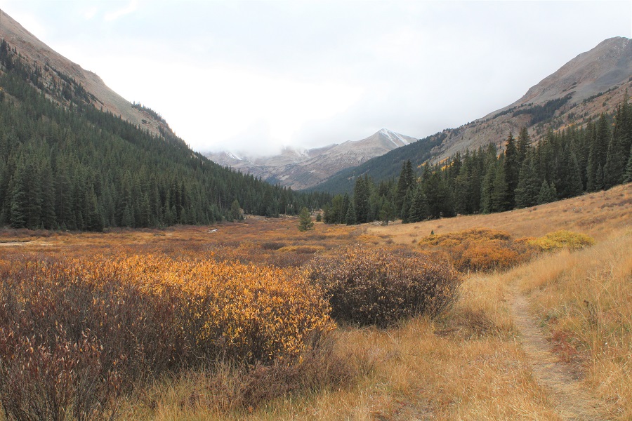
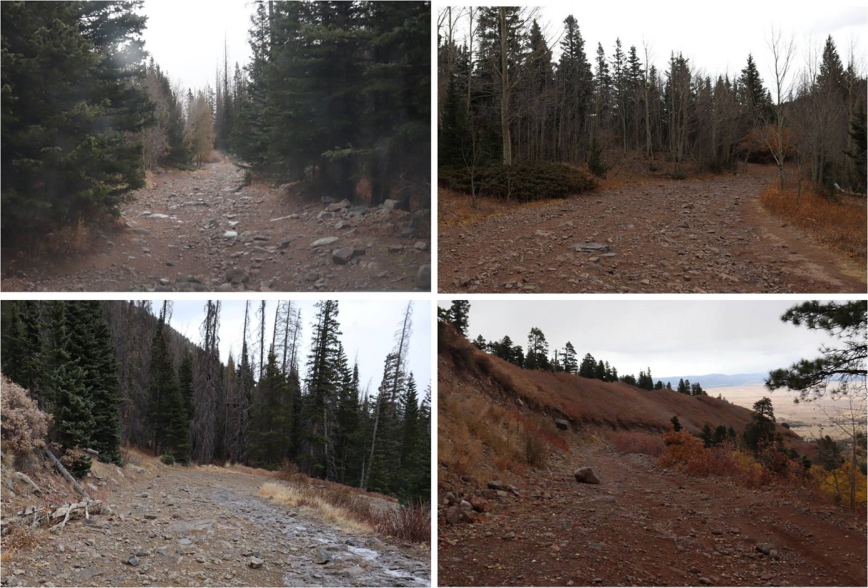
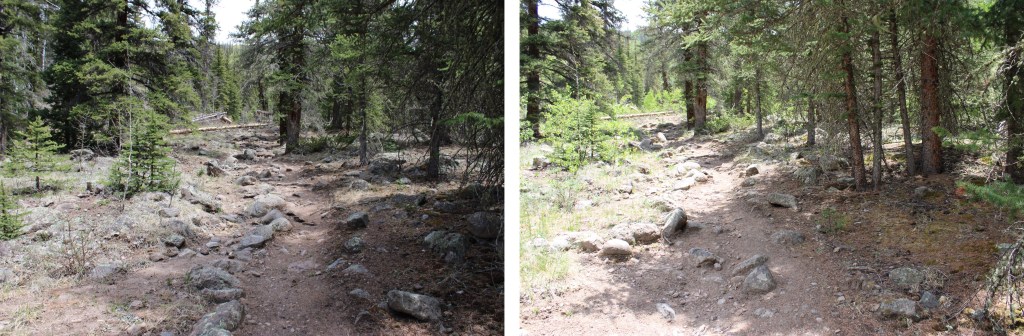
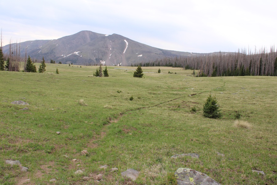
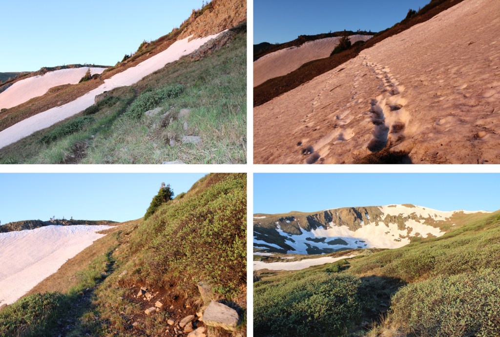
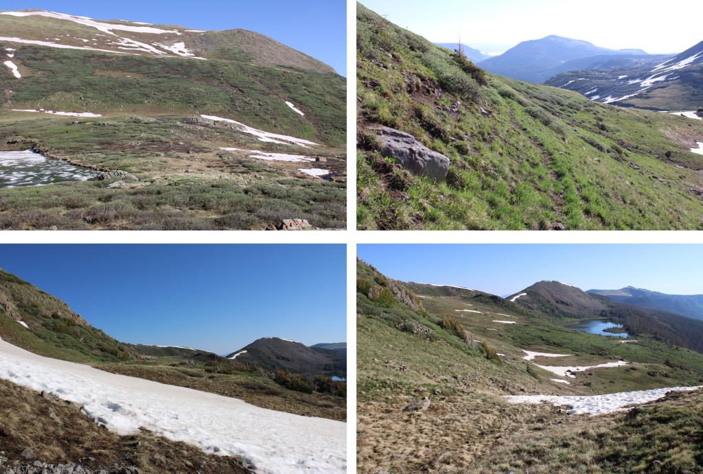
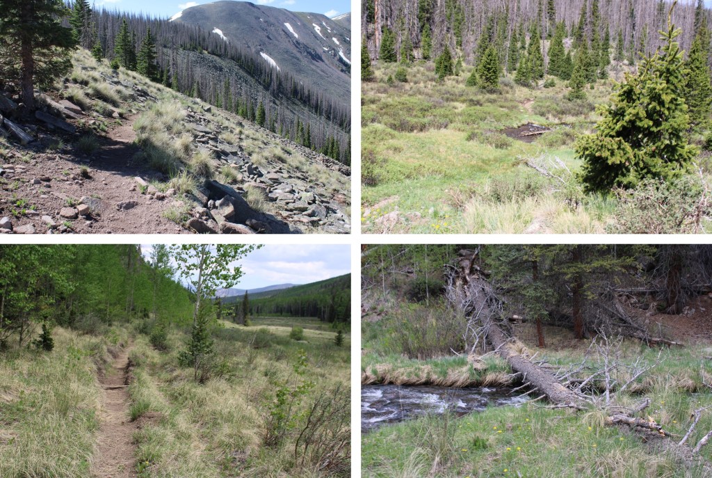
From there the Ivy Creek Trail heads east, and then curves south.  I was headed south for most of this hike, on a class 1 trail that was well defined and easy to follow.

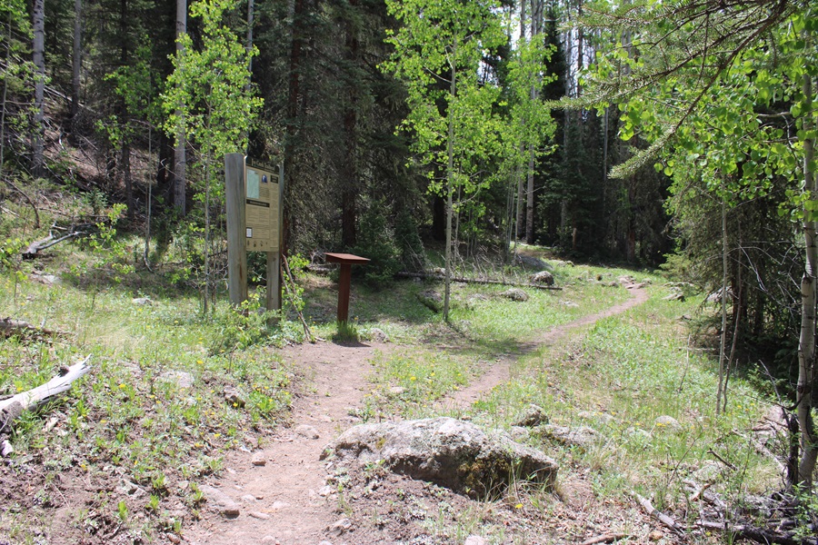
I came across a trail register and checked to see if anyone was ahead of me, and there was only one name.  This made sense since there was only one truck at the trailhead.  He indicated he was going to Goose Lake, so I expected to see him on my way.

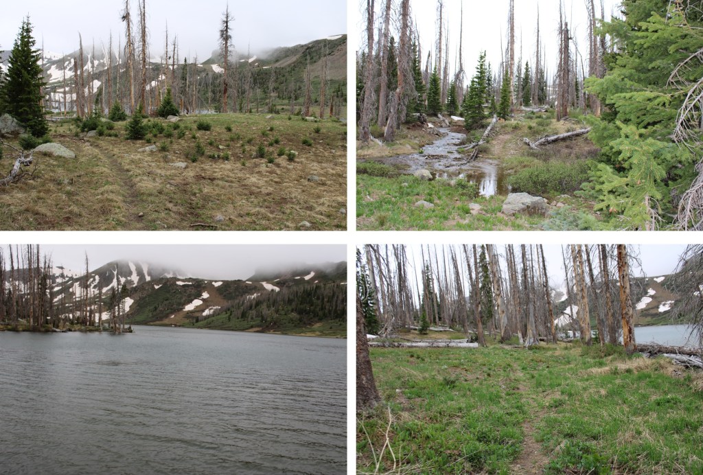
There were a few small creek crossings to navigate, but I didn’t even need to get my shoes wet.

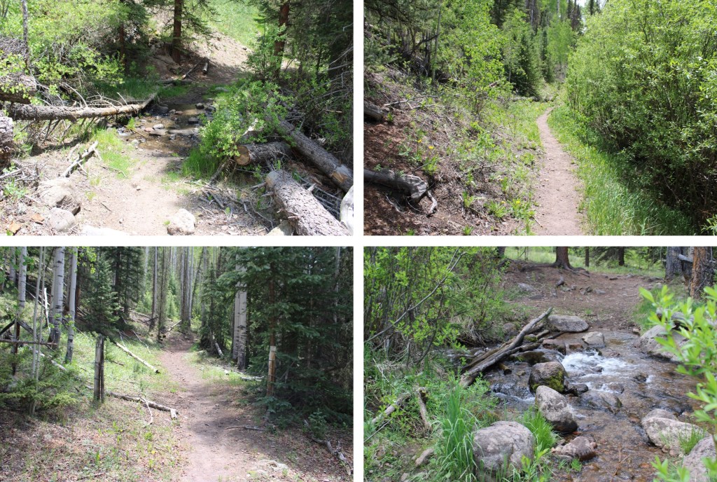
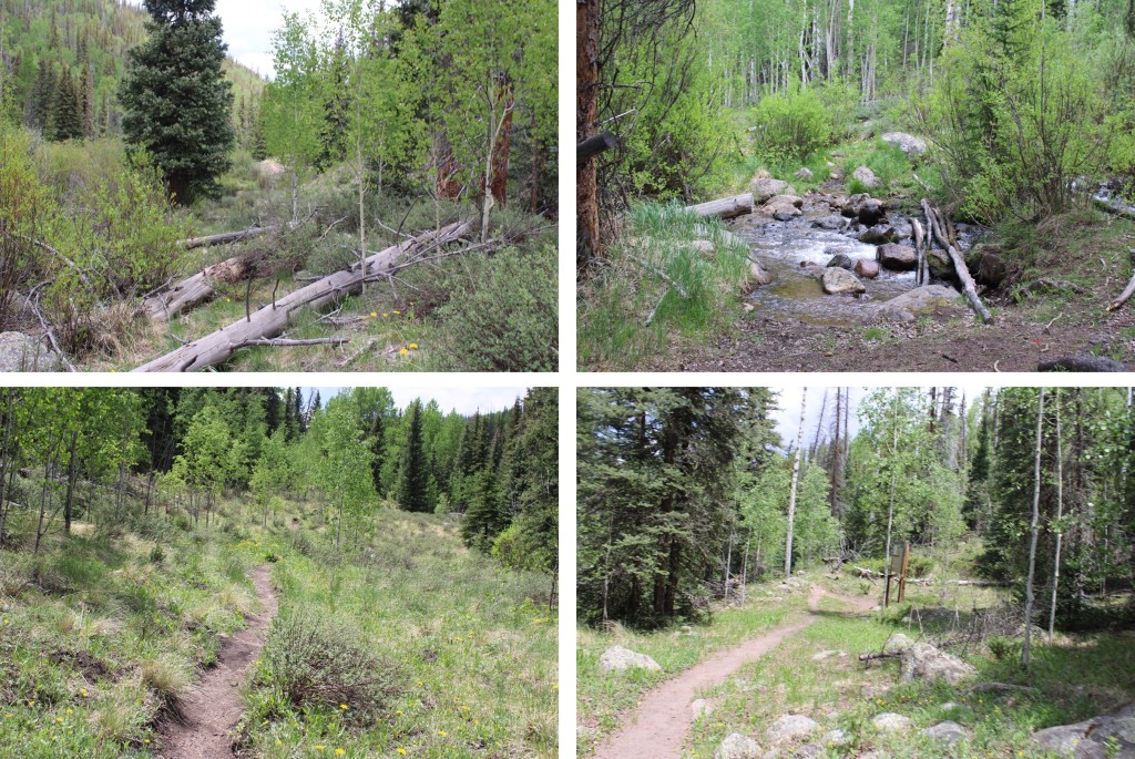
After hiking for about a mile, I came to a more demanding creek crossing.  I’d been here two weeks prior, and knew the trail was on the other side of the creek, but it was running fast and cold. 

Not wanting to get my feet wet if I could avoid it, instead of crossing the creek there, I hugged the creek to the left for about 100 yards, found a nice tree to cross the creek on, then headed west to pick back up the trail. 

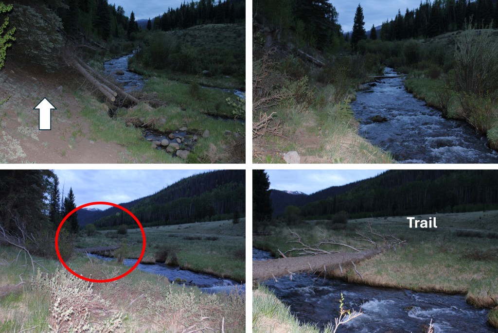
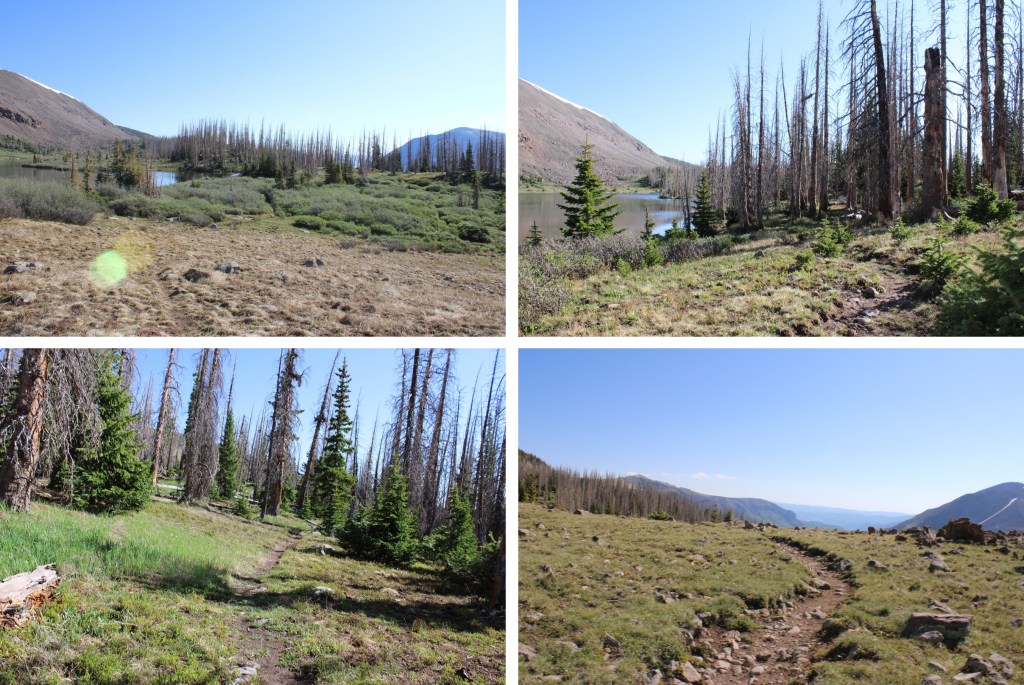
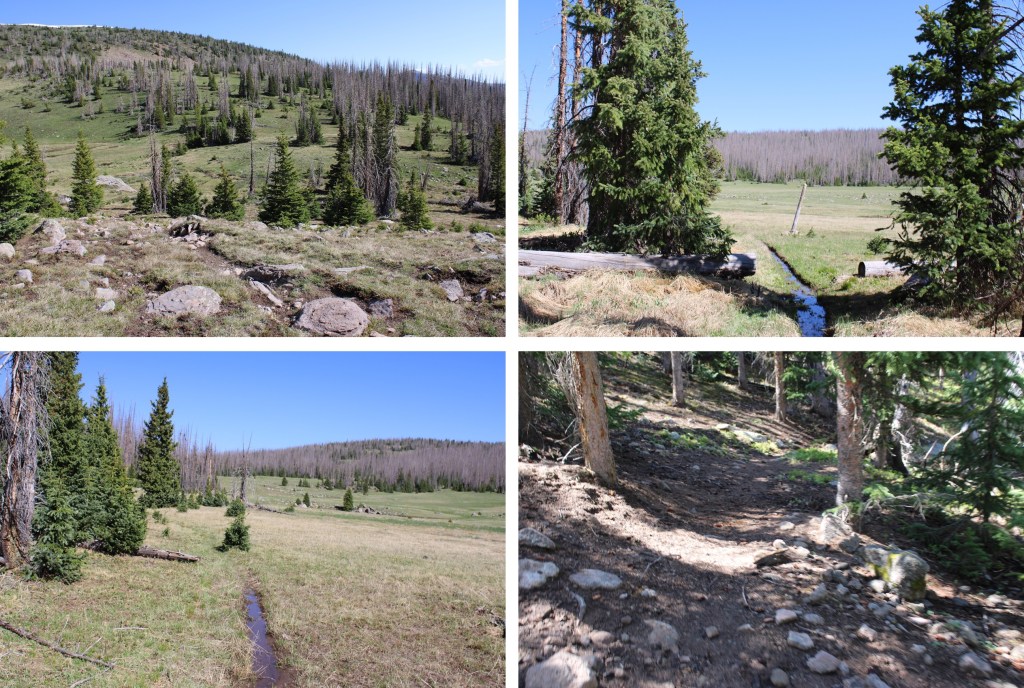
Back on the trail, I continued heading south for 3 more miles, keeping the creek to my left, passing marshes and willows, and heading in and out of the trees.  There were tons of moose tracks and scat here, which stands to reason because I saw two moose in the area 2 weeks prior.  I didn’t see them today however.

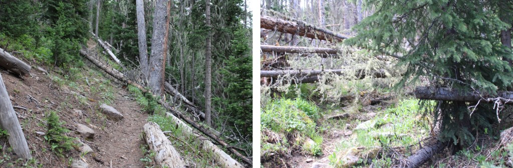
Did I mention the downed trees?  They were littering the trail most of the way.  Some were easy to hop over to craw beneath, but most required me to get creative, leave the trail to go around, then work my way back to the trail. 

After hiking for 3 miles I came to another creek crossing. Here I met the man who’d signed the register and stayed the night at Goose Lake.  He was heading back out to the trailhead.  At this point, I was fairly confident there weren’t any other people on the trail, since there hadn’t been any other vehicles at the trailhead.  I crossed the creek again, and picked up the trail on the other side.

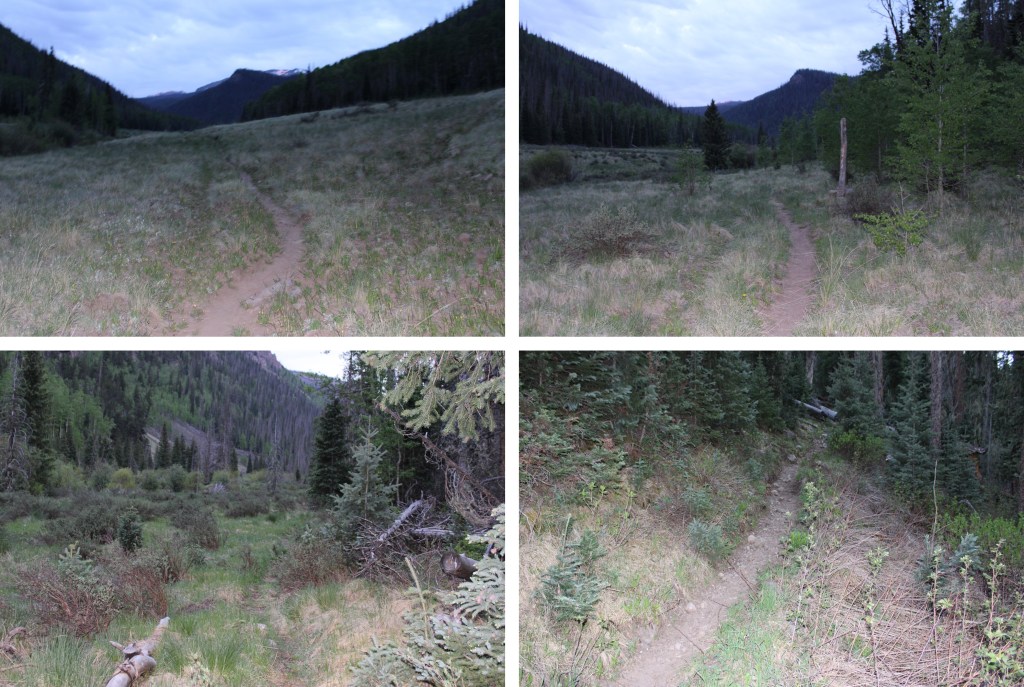
I followed the trail southeast as it hugged the mountainside.

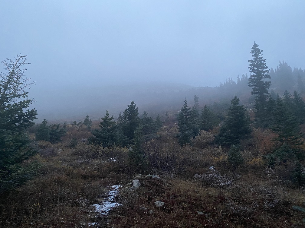
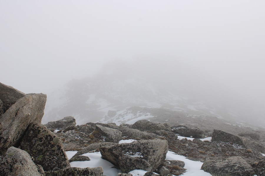
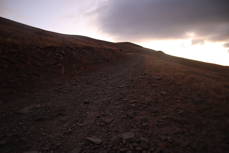
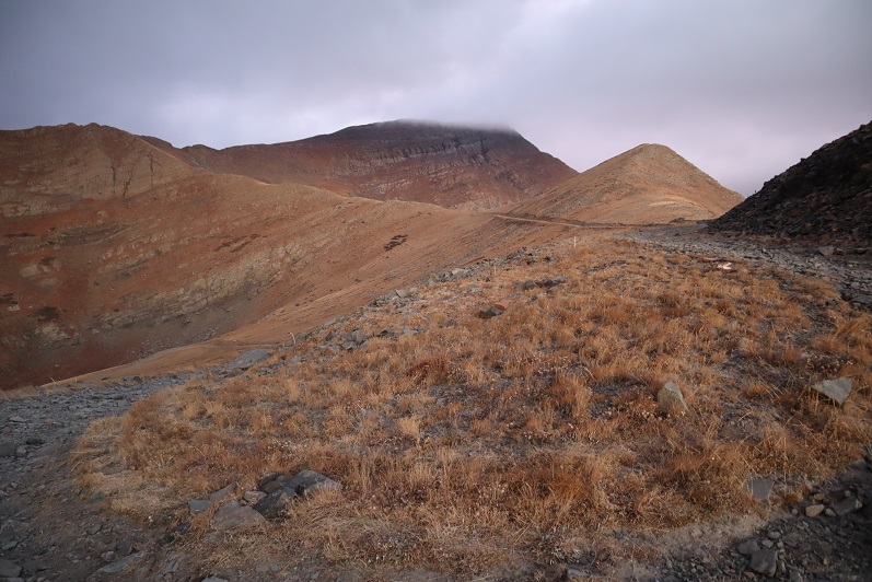
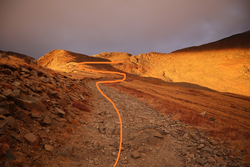
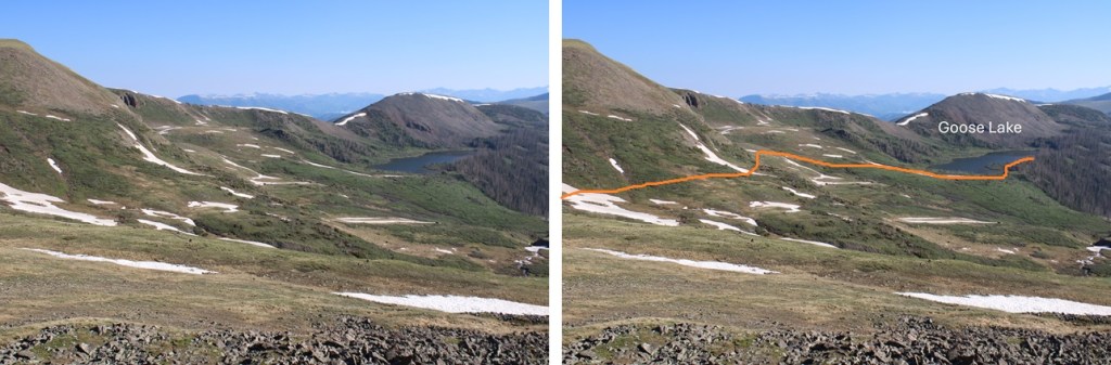
At about 5.5 miles the switchbacks began.  They brought me east, above treeline.

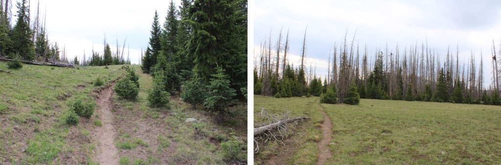
I was now in a wide, open meadow, following a trail that would slope up and down as it wound it’s way in and out of the trees south towards Goose Lake.

About half a mile before reaching Goose Lake it began to rain.  Not a big rain, just sprinkles.  It was about 9:30am, and I’d been watching the weather all morning.  The storm was coming in from behind me.  I’d done my due diligence, and knew weather was coming in.  It was supposed to start raining around noon, and it was going to last until 6pm.  Wind speeds were forecasted to be 5-7mph, with gusts 10-15mph.  I’d planned on starting early, getting to my campsite at Little Goose Lake around 10am, setting up camp, and then waiting out the storm in my tent.  

Nature had other plans. 

Yes, it was sprinkling lightly, but I was about a mile from my intended campsite.  I’d just hike a little faster to get there before the storm came in.  It wasn’t supposed to really start raining for at least another 2 hours, so I figured I had plenty of time.  I crossed over a stream that was flooding the trail and could see Goose Lake to my right.

This is when the trouble began.  The rain unexpectedly picked up and started coming down in sheets.  I was well prepared with my gear (rain pants, jacket, hat, gloves, etc.) but I was getting soaked.  I was going to have to change my plans.  No longer intent on making it to Little Goose Lake, instead I was going to set up camp at the south end of Goose Lake.  I hiked another 1/3 of a mile in the rain, willing my hands to warm up and telling myself in another few minutes I’d have my tent set up and I could get warm. 

I made it to my intended destination only to find a large group of campers already set up.  They had identical tents, backpacks, and gear, and were all huddled under a shelter to keep dry from the rain.

Well, this was unexpected.  I left the trail to go and talk to the campers sitting under the canopy.  I was shivering, mildly hypothermic at this point, and when I went to speak, found words wouldn’t come out properly.  I waved, and said something like: “Rain. Early. Cold.”  I pointed to a place away from them on the hill, and clumsily got out “Can I set up there?”

They hadn’t paid attention to me as I’d walked up to them, and now that I’d spoken they all quizzically looked back and forth at one another.  Probably thinking I was a lunatic.  Either that or they didn’t speak English.  I certainly wasn’t doing a very good job at it myself at the moment, but I have Raynaud’s, so I get very cold and lose function of my extremities and speech earlier than other people.  All I needed to do was get out of the pelting rain and into a shelter.

One man left the group to come talk to me.  He pointed back the way I’d hiked in, towards the incoming storm, and said firmly “There’s a nice campsite about half a mile back the way you came.”

It was obvious he wasn’t going to “allow” me to set up my tent anywhere near his group.  I was unable to talk any further, and I knew time was now of the essence, so I gave him one long look, willing him to change his mind, realized that was futile,  turned around, and started running back towards the other side of the lake. 

Many, many things ran through my head as I was searching for another campsite.  Most of them I won’t repeat here, but they were focused on finding a campsite as soon as possible, and wondering how that group could have turned me away, when the weather was obviously bad and quickly turning for the worse.   I tried to give them the benefit of the doubt, but I couldn’t believe they’d turned someone away from shelter in such conditions. 

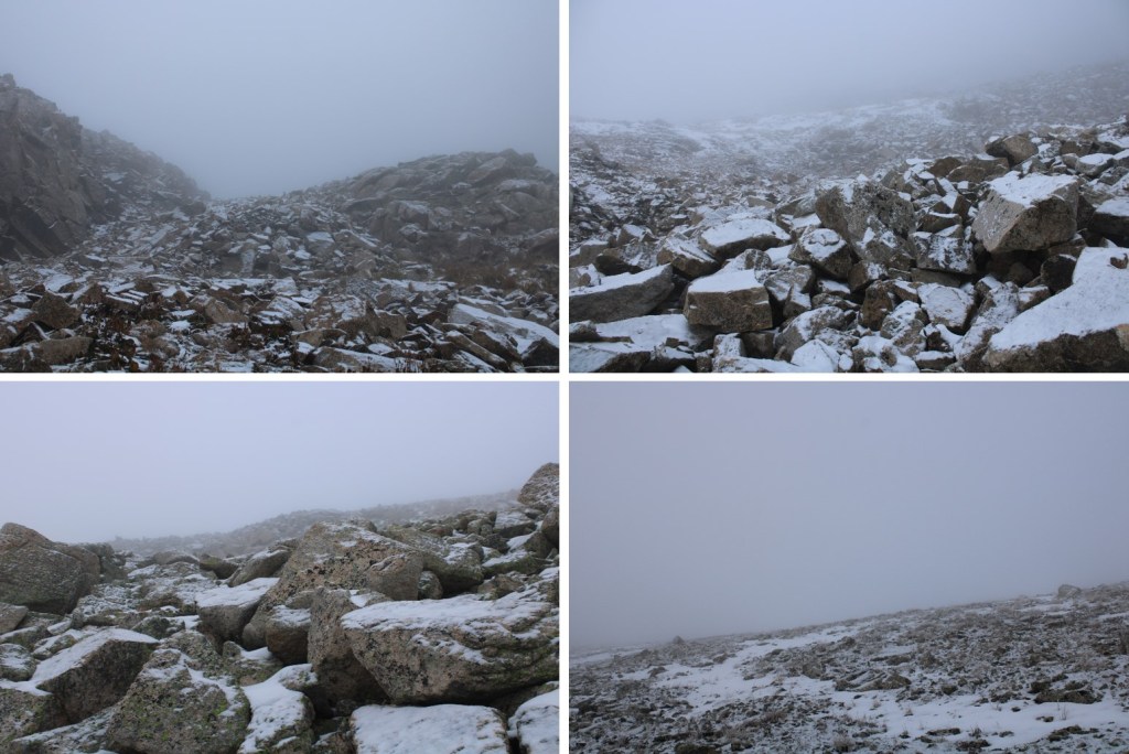
Then the wind picked up and sleet started coming down in sheets.  I was in a full-blown snow/sleet/rain squall, and needed shelter now. 

I never made it to the other side of the lake.  I could no longer see through the weather clearly, so I found the first patch of open ground I could and started setting up my tent. The wind kept blowing everything around, turning all pieces of my tent into a kite, and my numb and wet fingers weren’t helping things go any faster.  The flaps of my tent were open when I unrolled it, and before I could close them the entire inside of my shelter was soaking wet. 

I staked my tent and rain fly down, threw in all my gear, took off my shoes, hopped inside, and zipped the flaps closed.  I was prepared to wait out the storm.  I took off my outer layer and hung it up with a carabiner to the top of my tent to drip dry.  Huddling and hugging myself to stay warm, I could hear the wind before it came, and in one big WHOOSH it pulled up my tent stakes and with it my rain fly.  Rain now pelted me inside the tent.  I cursed to myself, unzipped the tent, put my shoes back on, and clumsily re-secured the rain fly. There was an inch of slush on top of my tent now, which didn’t help my frozen fingers.

I had no dexterity, so even though I tried, I couldn’t undo the Velcro that had attached to itself to secure the rain fly to the tent poles.  Instead, I just re-staked the rain fly down and hoped for the best.  The wind would blow away my rain fly and I’d repeat the process 3 more times before it finally stopped, my hands warmed up, and I was able to properly secure the rain fly with the Velcro to my tent poles. 

Now, I know what you’re thinking:  Why didn’t you change your clothes or hop into your sleeping bag to stay warm?  Well, I only had one change of clothes and one sleeping bag with me, and seeing as how everything was getting soaked every time the wind blew off my rain fly, I didn’t want the only items I had with me that were dry to become soggy as well.  So I sat there in the middle of my tent soaking wet, saving my spare clothes to change into when the weather let up.  Which it finally did, 3 hours later. 

The wind/snow/sleet/rain stopped, the sun came out, and the birds started chirping.  I took off all my wet gear and hung it out to dry on a nearby log, changed into dry clothes, and congratulated myself for not panicking, and making it through the past few hours.  Then I went over and over all the mistakes I’d made, and what I’d learned from the experience.  I know the dangers of hiking solo, and I was prepared for all kinds of weather.  Next time, I’m going to stop as soon as the weather looks like it’s going to turn so I can properly set up my gear before I lose function in my hands.  Yes, the weather came earlier than expected, but I should have known better.  The mountains make their own weather, and only I can be responsible for what steps I take to keep myself safe.  It had been quite the learning experience.

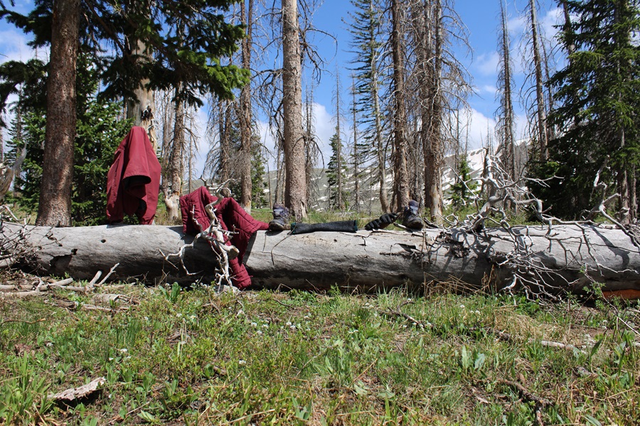
Finally starting to warm up, I set out my sleeping pad inside the wet tent to give me something dry to sleep on, rolled out my sleeping bag, and made it an early night. 

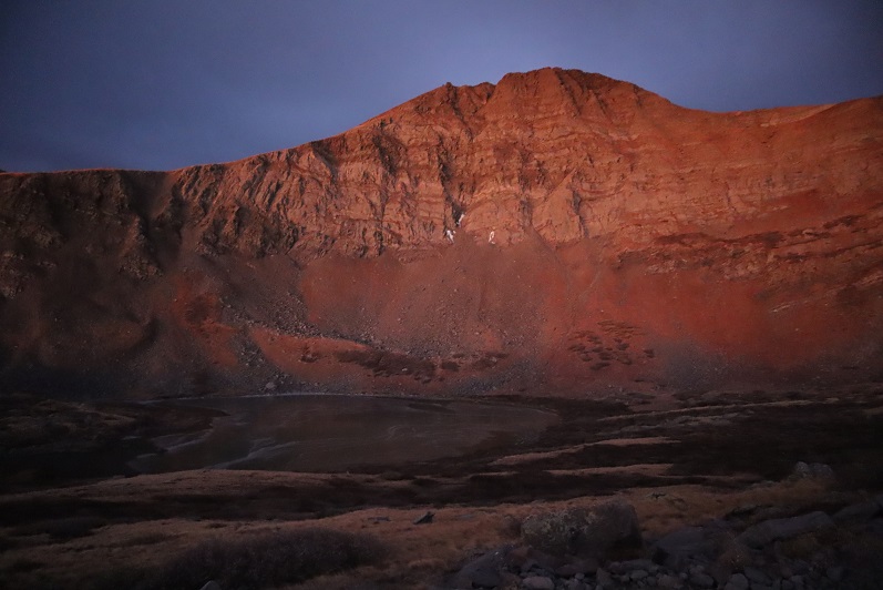
It was probably the best night’s sleep I’d had backpacking in my entire life.  I was warm and dry inside my sleeping bag, and besides the howling and yipping I heard back and forth in the middle of the night from what I’m hoping were coyotes, I slept all the way through.  The next morning was warm and clear.  Goose Lake was as still as glass.  I was on the trail again at 5:30am.  I passed by the campers I’d seen earlier as the sun started to rise.  Two of them were awake and kept their backs to me as I passed, but the others were still asleep.

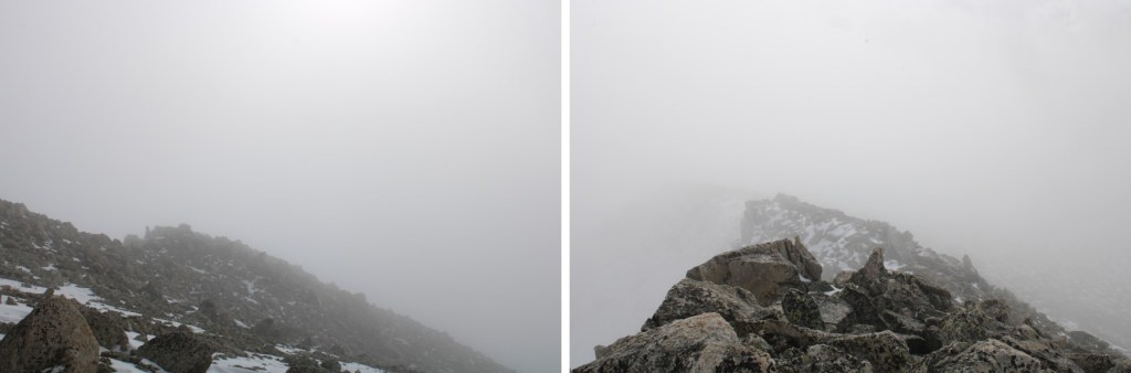
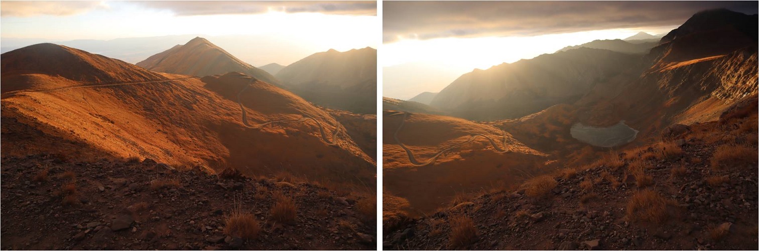
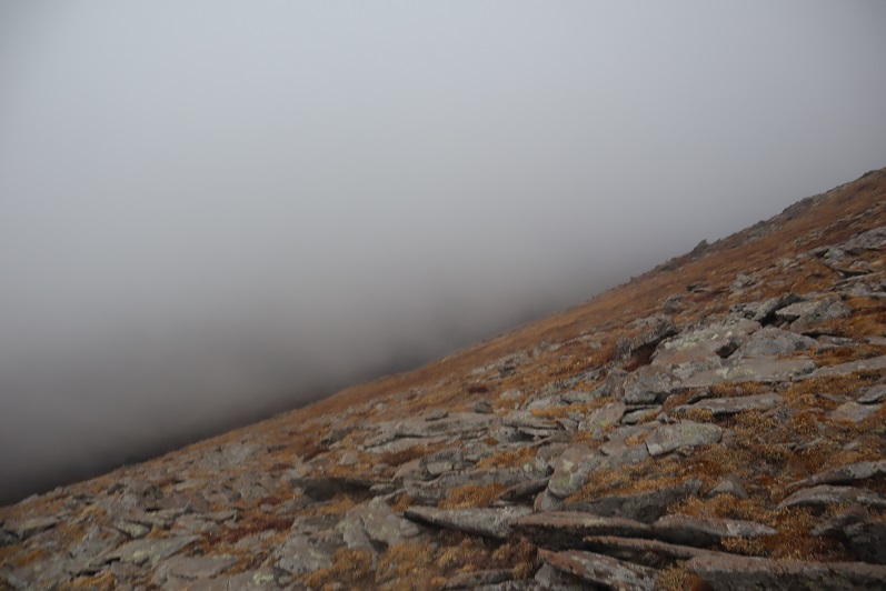
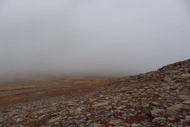
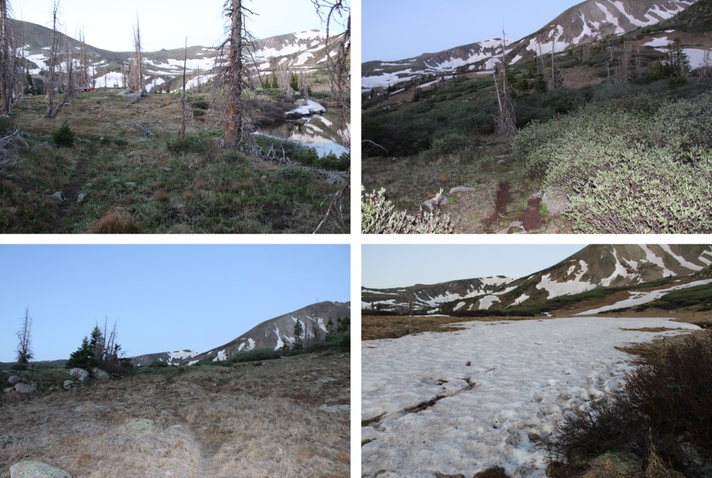
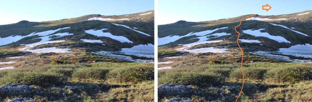
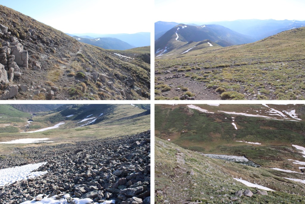
I continued following the trail south as it headed towards Little Goose Lake.  There were a few snowfields along the trail, but it was still easy to follow, as I could always see where the trail dried out up ahead.


I followed the trail to the saddle to my left.  Here’s the overall route I took:

There were snow fields to cross, but they were solid from the freeze the night before.  I put on my microspikes and followed the trail south towards Little Goose Lake.

Little Goose Lake was beautiful in the morning light.

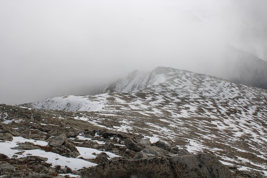
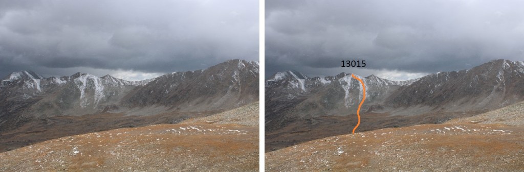
From there, I needed to make it to the saddle.  There’s a constant trail that takes you to the saddle and beyond, but with the snow I had to get a little creative. This is the route I took:

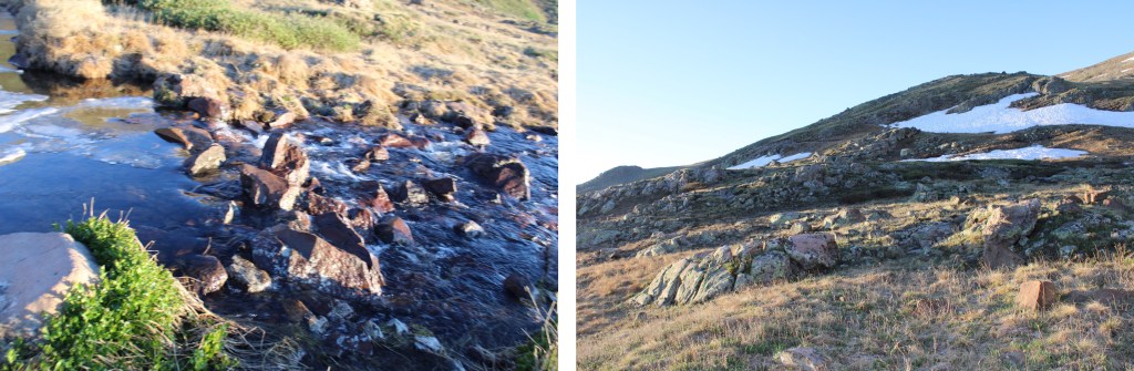
I crossed over a small stream coming out from Little Goose Lake, and headed up the slope, taking the trail where I could find it.

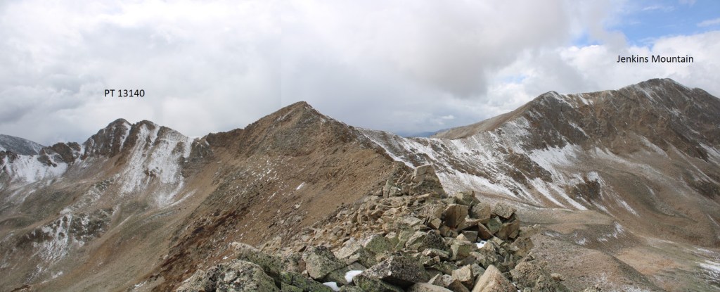
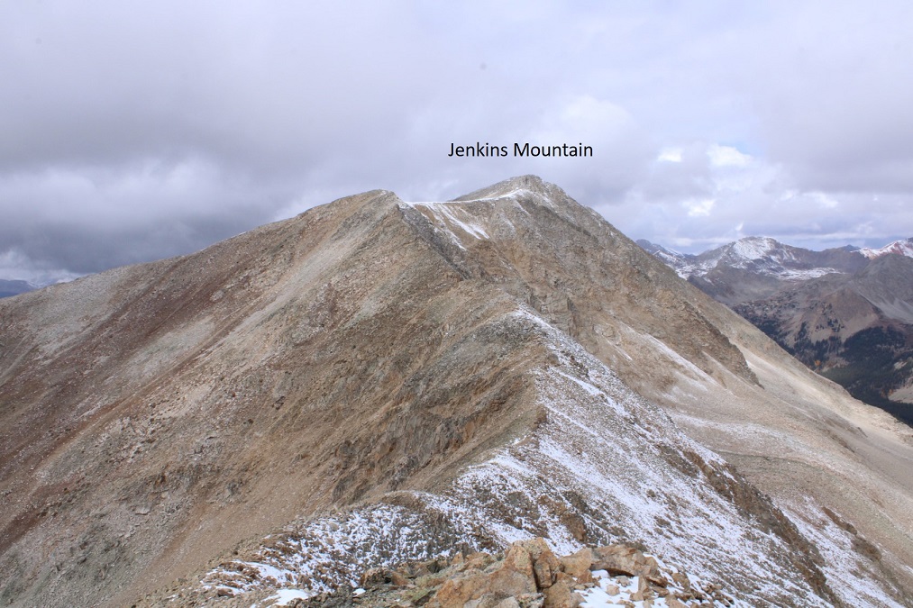
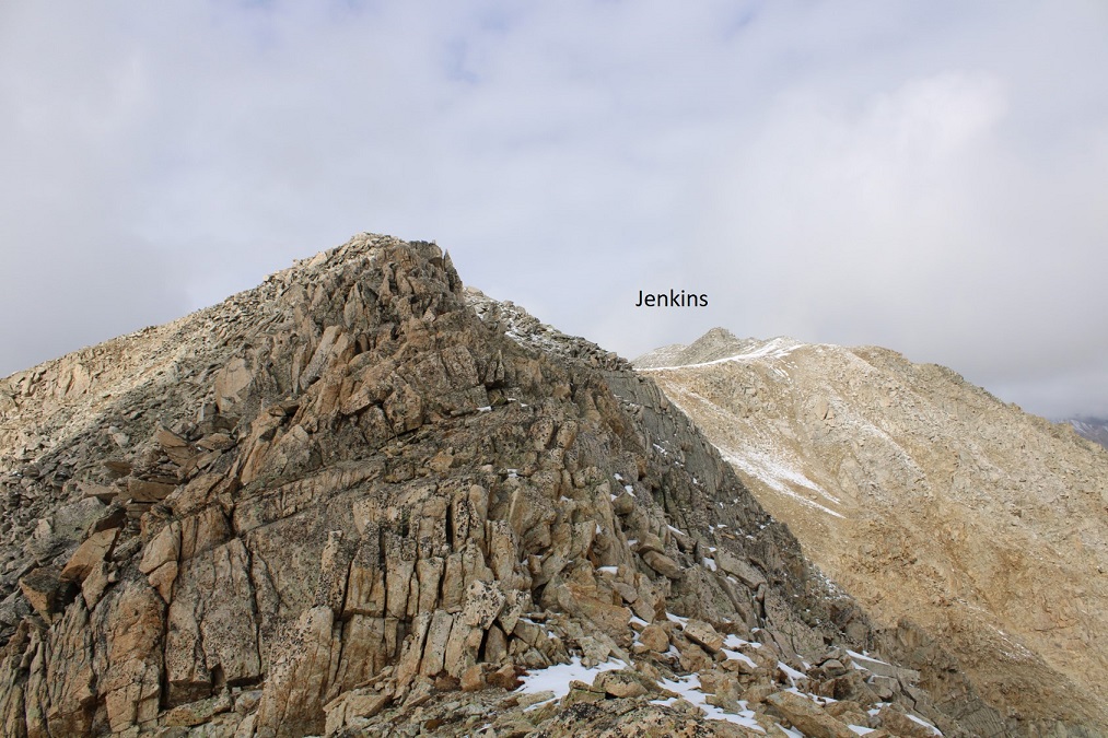
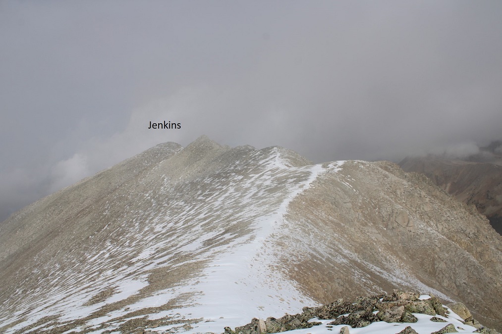
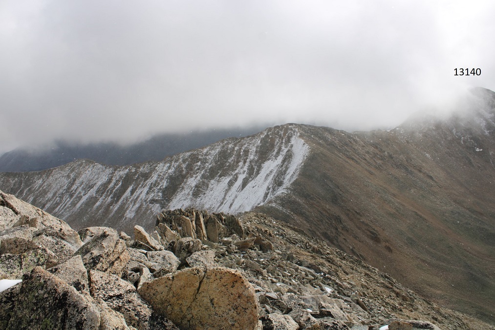
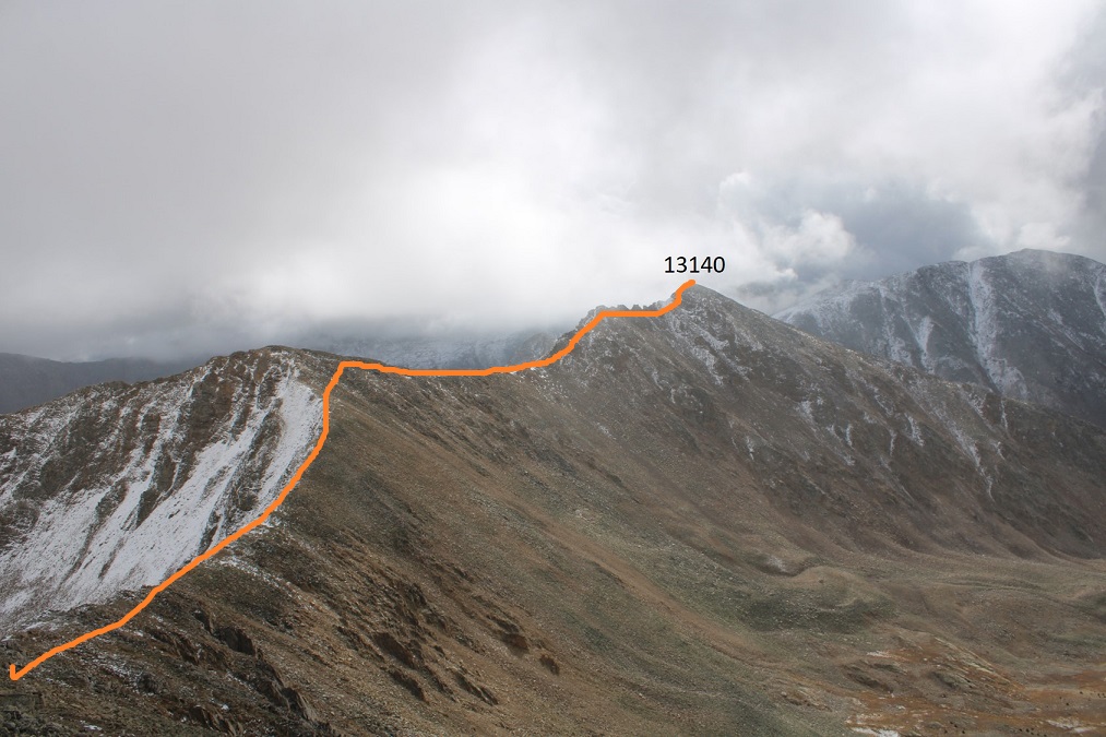
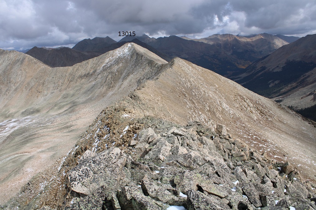
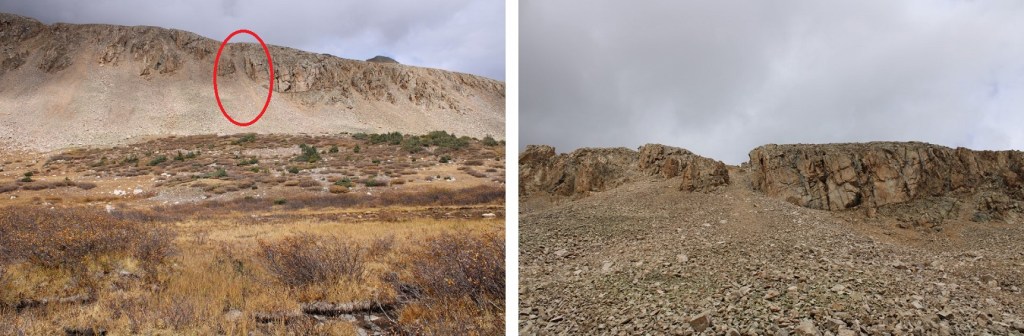
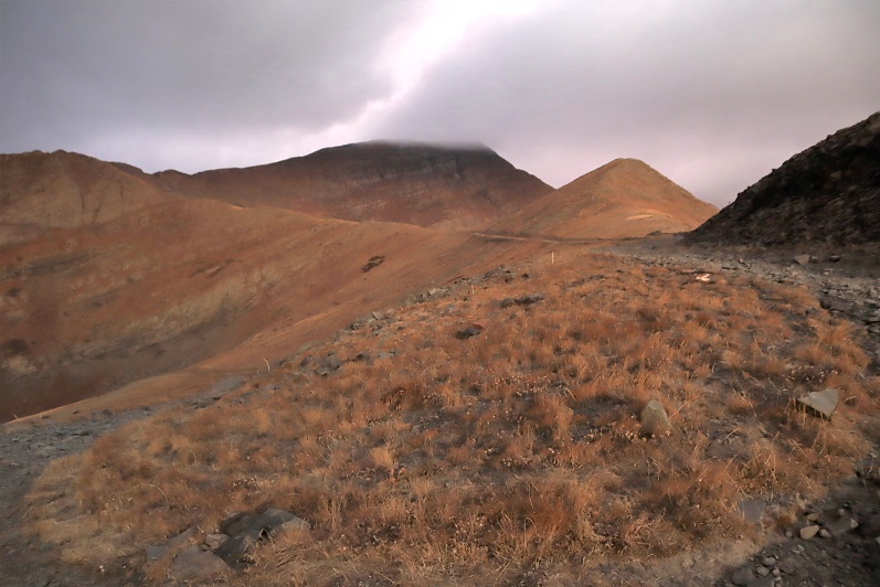
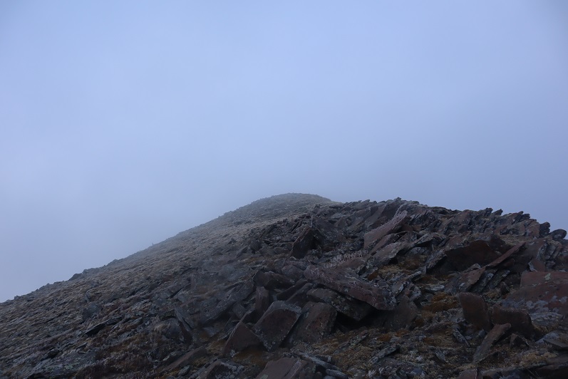
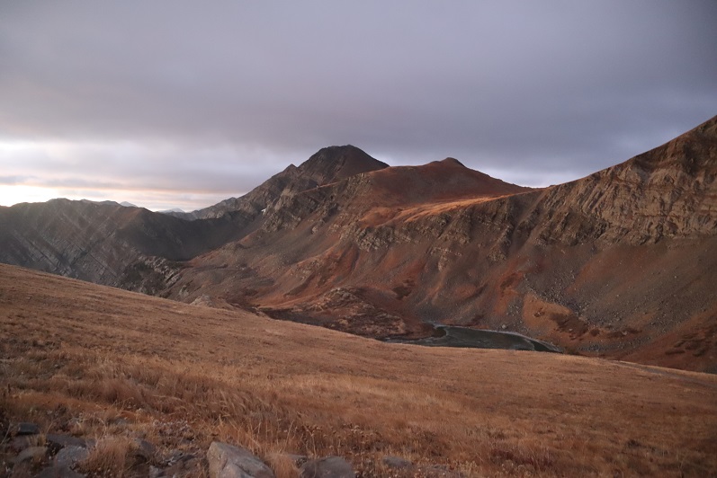
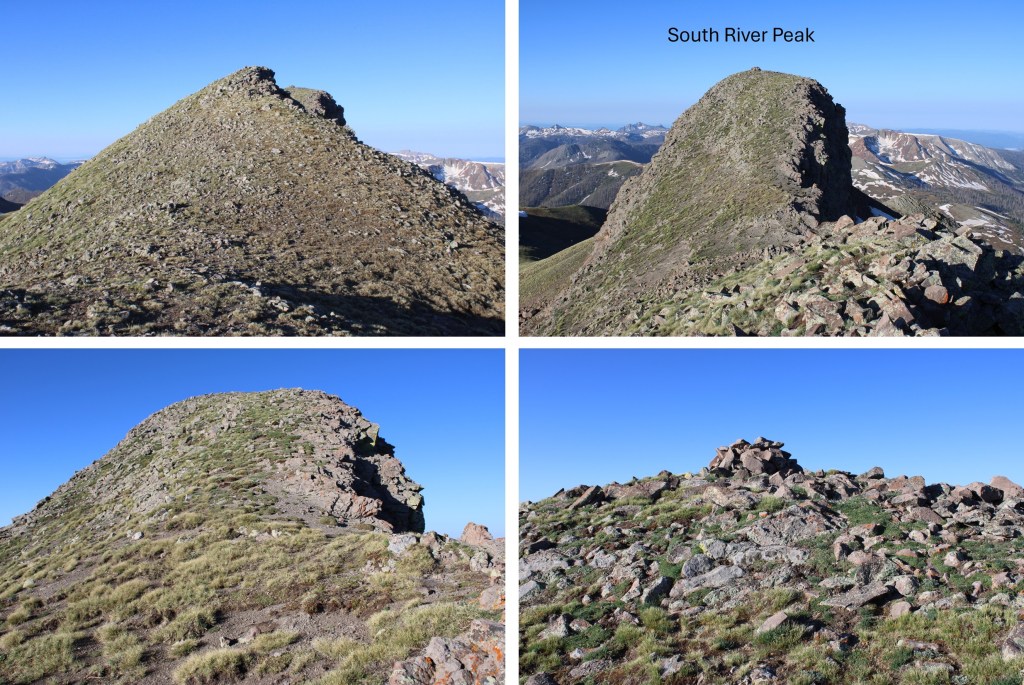
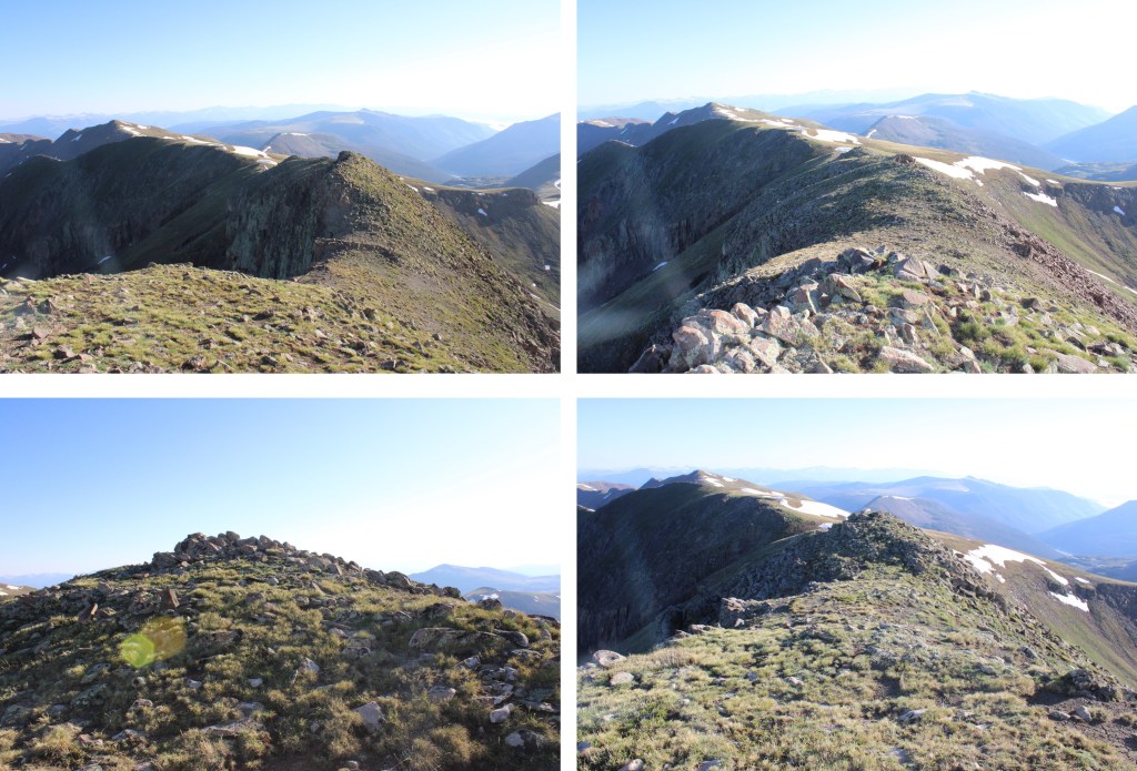
Once on the saddle, I could see the summit of South River Peak to the southwest

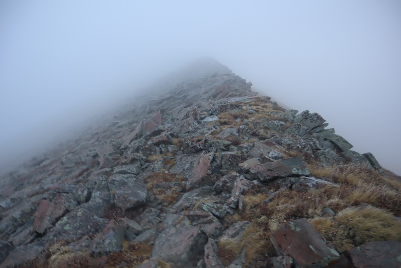
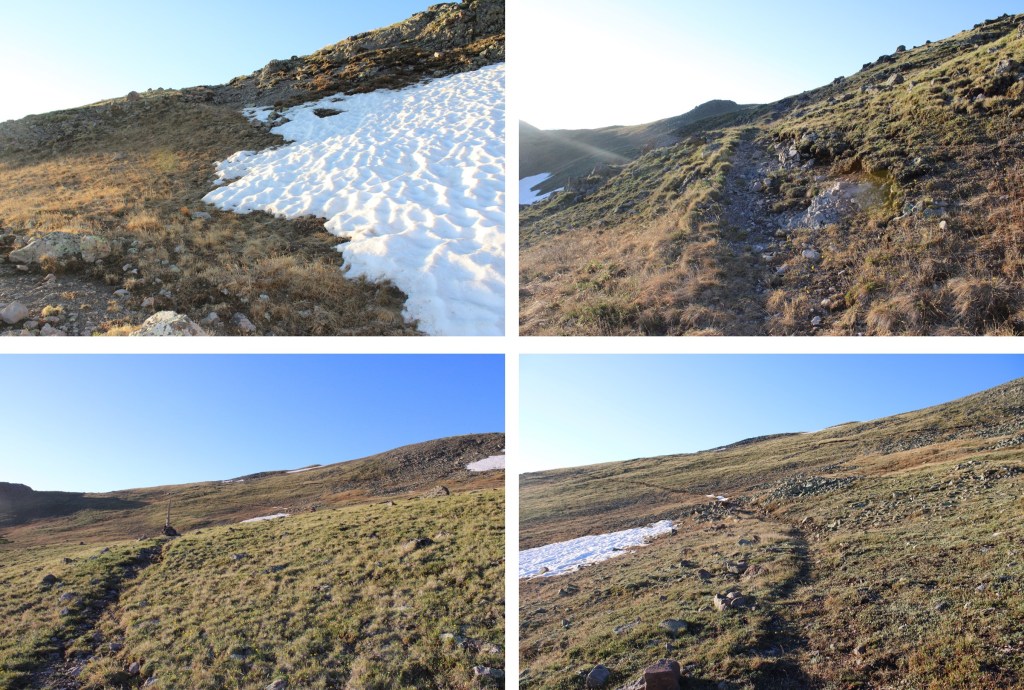
I continued following the well-defined Ivy Creek Trail.

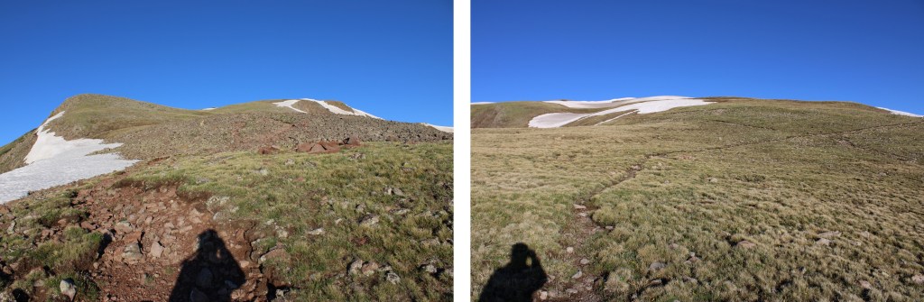
I now had a good view of South River Peak. 

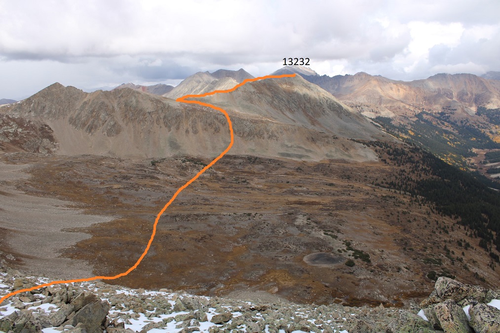
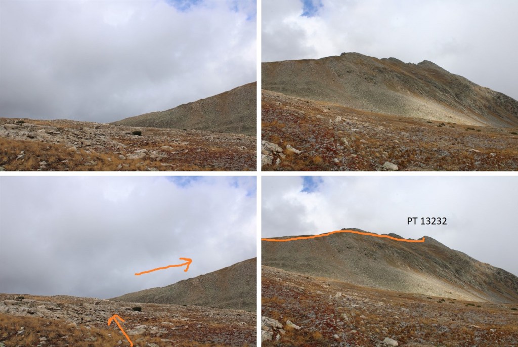
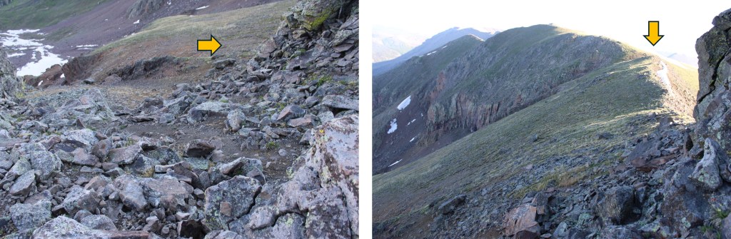
This would normally be a class 1 and easy class 2 trail to the summit, but today the trail was covered in a layer of ice I didn’t want to deal with without my ice axe.  Here is the easy way to summit South River Peak:

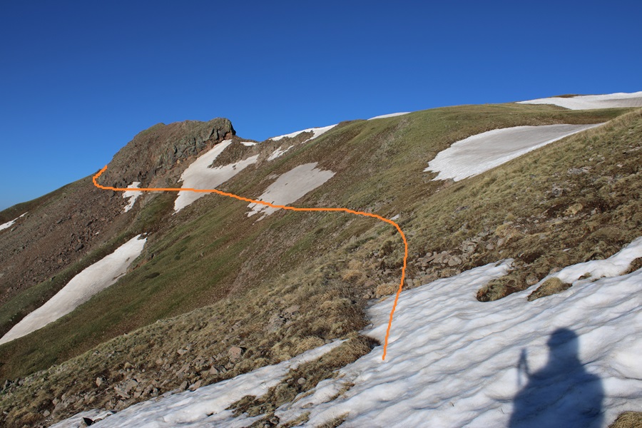
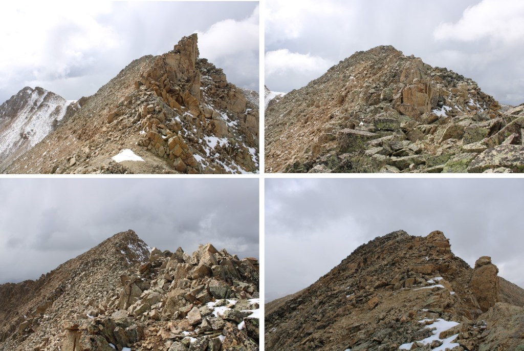
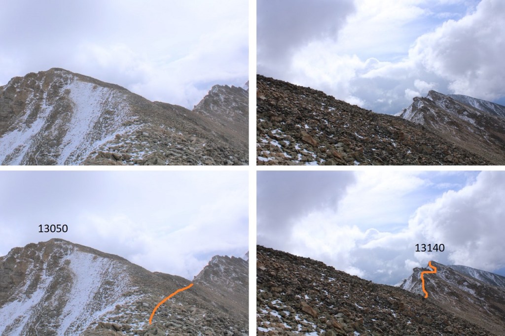
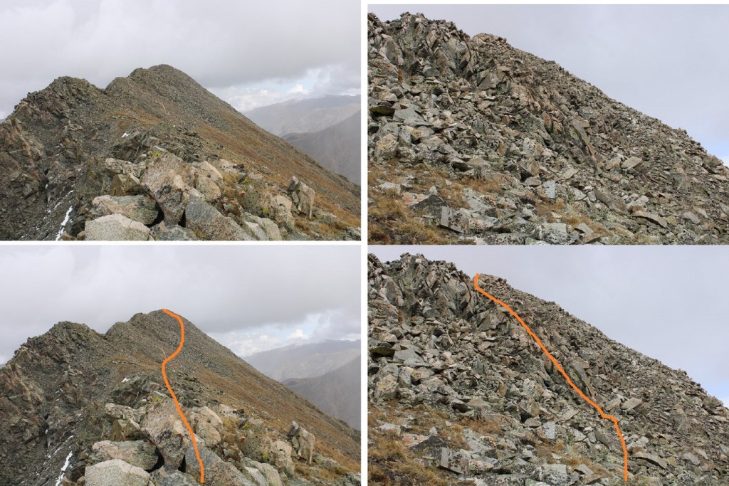
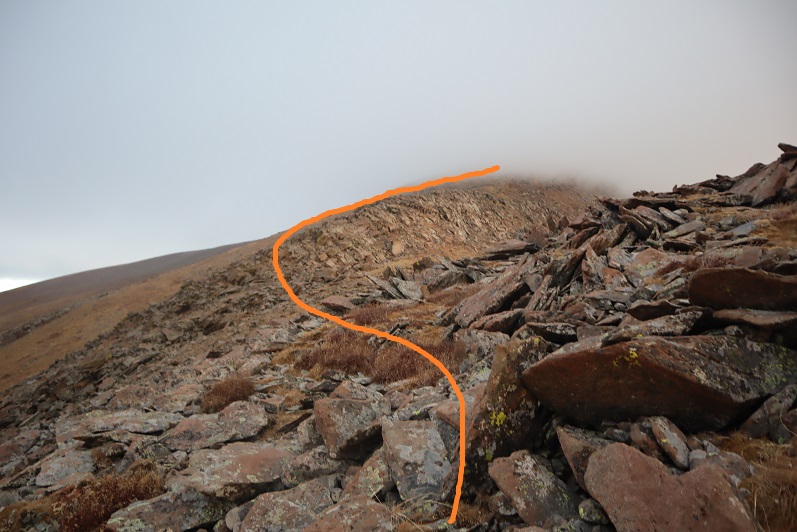
But that’s not the way I summited.  Trying to avoid the snow, I decided to continue gaining the ridge, and summit instead that way.  This is the route I took:

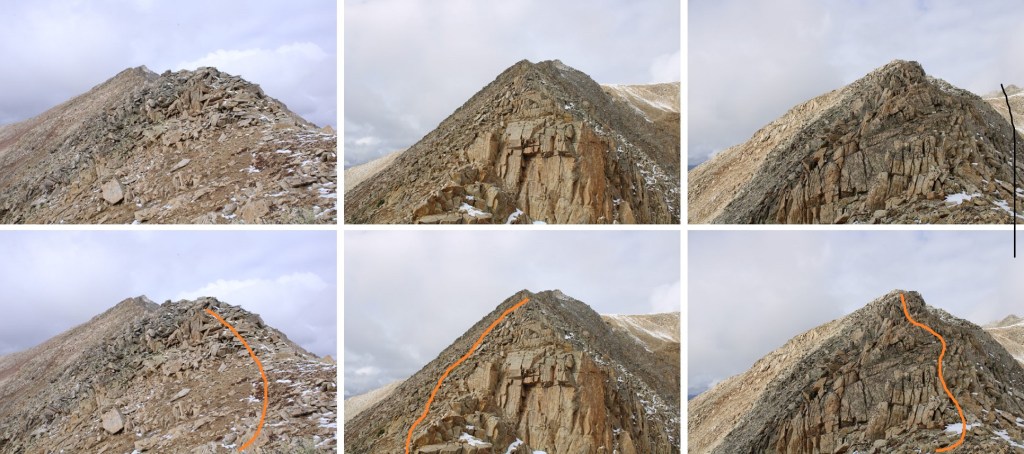
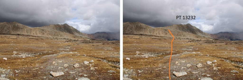
First, to gain the ridge

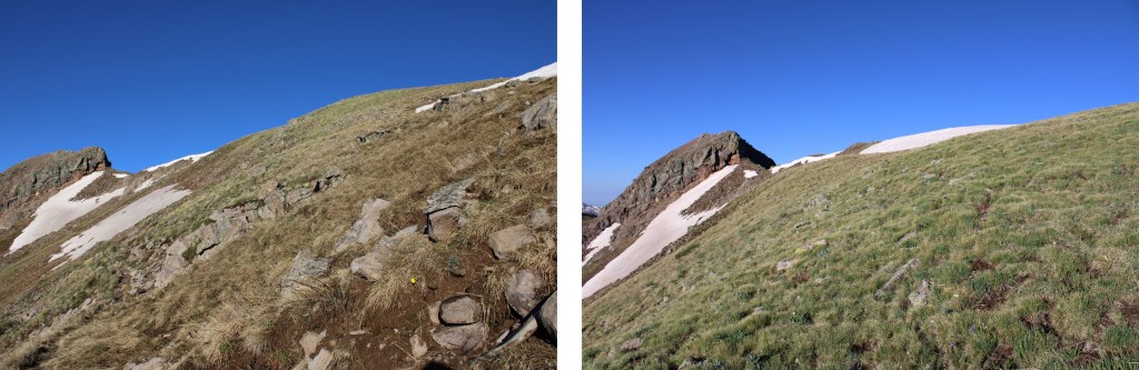
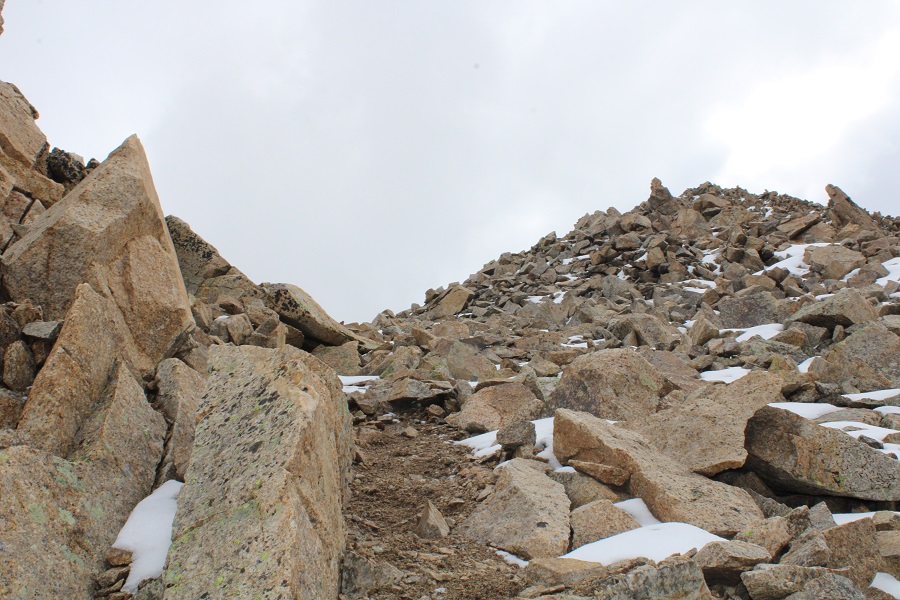
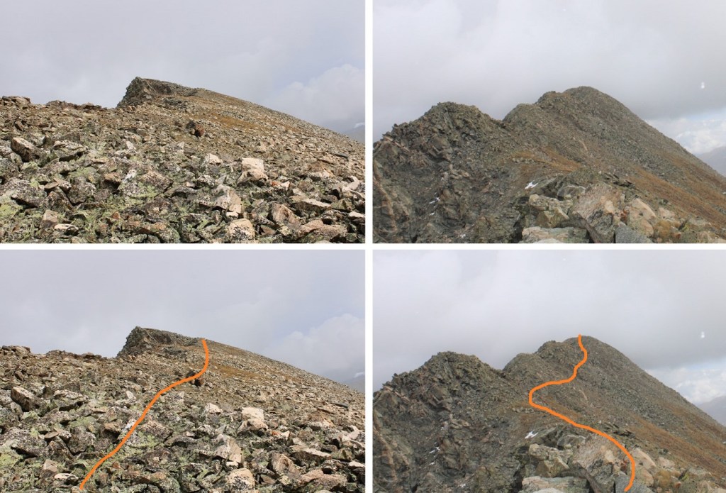
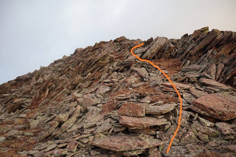
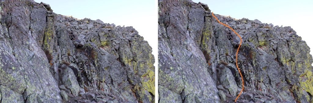
Then I followed it to the base of a rocky drainage, and climbed a short class 3 section

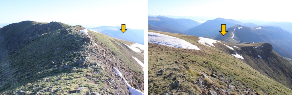
This was choose your own adventure, but there were a lot of options to the right, all easy class 3.  It’s easier than it looks.

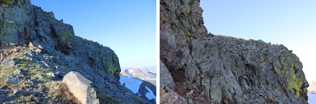
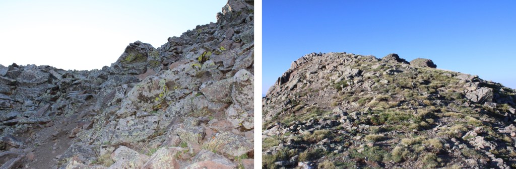
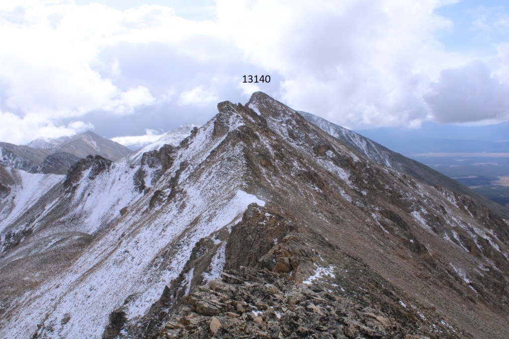
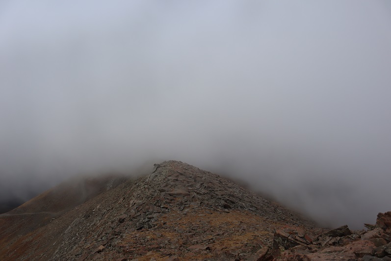
I topped out, and it was a short class 2 hike to the summit.

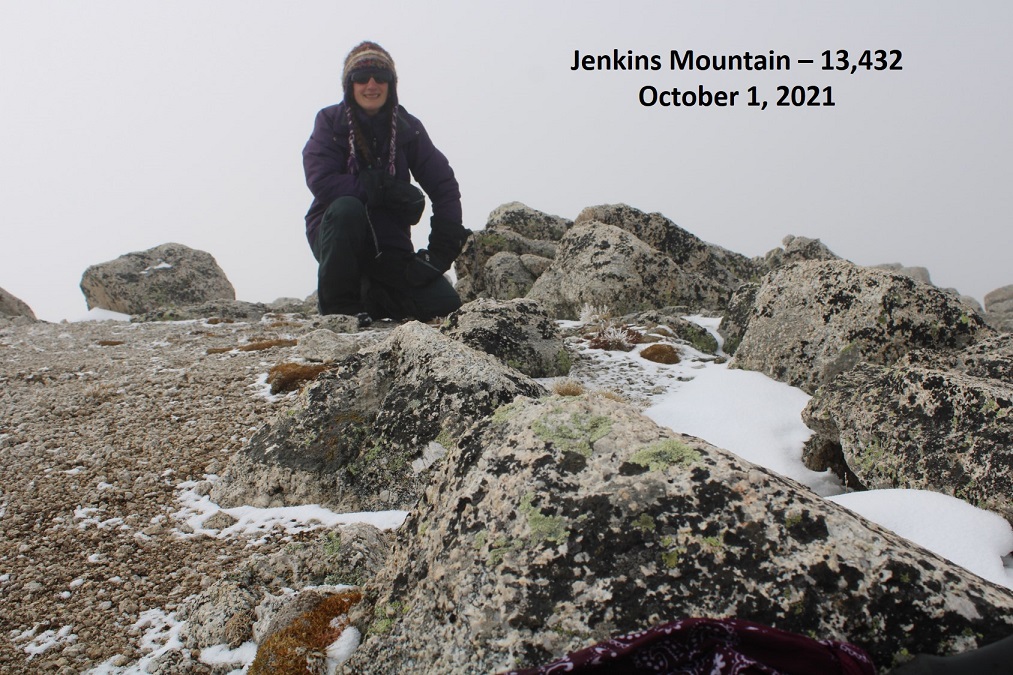
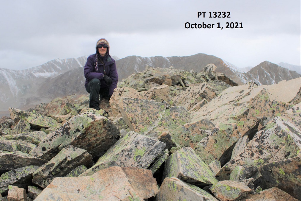
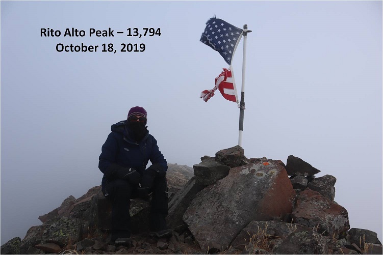
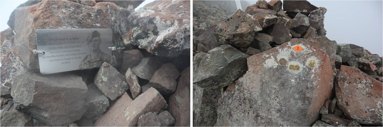
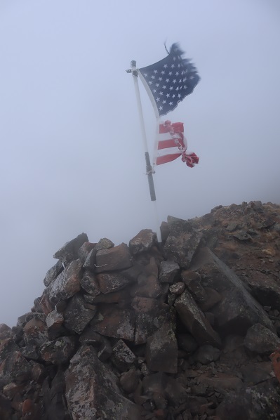
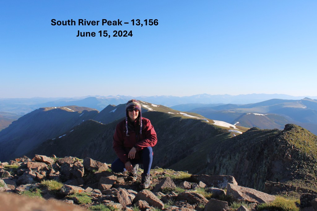
I summited South River Peak at 7:10am
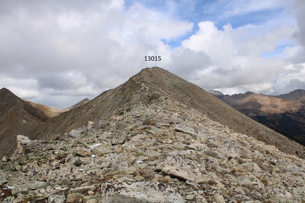
South River Peak:

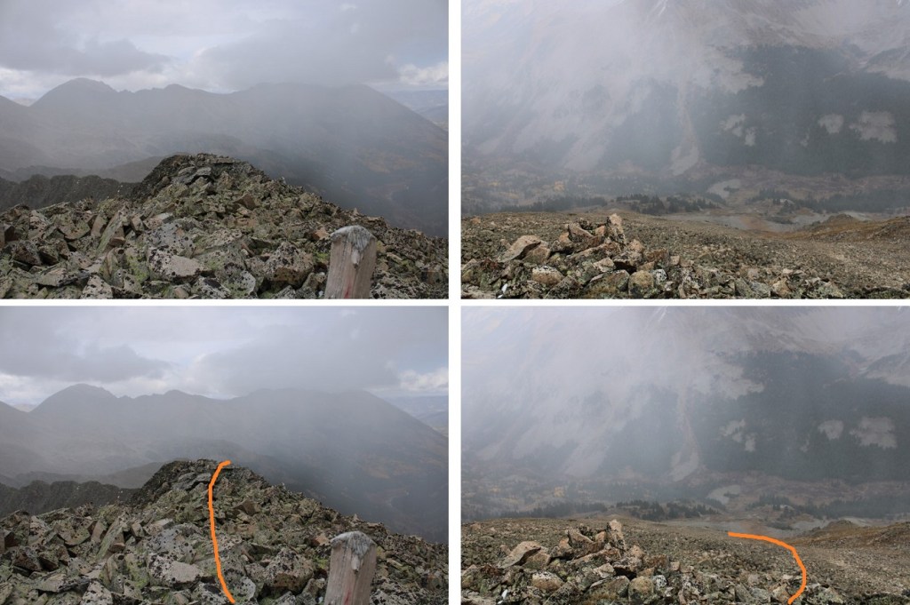
I was making this an out and back hike, so now to head back down.  I turned around and followed the ridge north to the rocky section

Back down the rock drainage

And then down the slope, back to the Ivy Creek Trail. 

Back on the trail, I followed it back to Little Goose Lake

Here’s the route I took back to Goose Lake

Once back at Goose Lake, I noticed the group I had encountered the day before had packed up and left.  I made it to my campsite, packed up all my gear, and headed back down to the trailhead.

I quickly passed the group of campers I’d encountered earlier, and learned they were part of a Backpacking Ministry from Del Norte, which explained all the identical gear and lack of vehicles at the trailhead:  they’d been dropped off and were being picked up at the end of their trip.

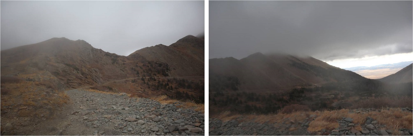
I continued on down the switchbacks, over the many creek crossings, around the downed trees littering the trail, and back to the trailhead.

I made it back to the trailhead at 12:20pm.  I did this hike as an overnight, carrying a full pack, so my time isn’t as relevant, but Strava gave me 10 hours, 20 minutes of hiking time. 

Jenkins Mountain – 13,432, PT 13,145 & PT 13,232

RT Length:  13.75 miles

Elevation Gain:  5322’

Snow had been forecasted for today, but not until later in the afternoon. I made it to the North Fork Creek Trailhead on an easy 4WD road, and it was foggy out.  I was hoping the fog would lift as the sun came up, but it ended up snowing off and on all day. Luckily there was no wind, so the snow was actually enjoyable (if annoying because I couldn’t see very far).   I was on the trail at 5:30am.

I followed North Fork Creek Trail for 2.75 miles southwest to treeline at 11,250’, without gaining or losing much elevation. I never crossed the creek.

Here the trail stopped. I’d hoped by now the sun would have lifted the fog, but unfortunately, it started snowing instead, and visibility wasn’t great.

Here’s a view of the route I took to the ridge, from back on the trail later in the day

I followed the path of least resistance and headed southwest towards a rocky gully and the ridge (better pictures later).  There was a fog, so I didn’t get great photos, but here are some pictures of what I could see:

The rocky gully area brought me to the ridge between point 13050 and 13015. I couldn’t see far, which was frustrating, but I knew to continue following the ridge southwest. Luckily, I came back to this spot later I the day, so I have clear pictures of this part of the hike.  The rocks here rolled.  In the morning they were icy, so I had to be especially careful.

I followed the ridge towards 13050. This ridge was easy to follow, even when it was snowing.  I stuck to the ridge proper, only dipping down to the left one time.  This can all be kept at class 2.

Once at PT 13050 I turned right and headed northwest towards Jenkins Mountain, first losing about 230’ of elevation.

This was another ridge hike, where I briefly dipped down to the left to avoid some rocks

Here are some pictures of the ridge, up to the first “false summit”.  If you can’t stay on the ridge, dip down to the left.

From the top of the false summit, I lost a little bit of elevation, but it was an easy ridge hike to the true summit of Jenkins Mountain.  I’m sure this would be a piece of cake on a clear day. Today however, the ridges were frustrating because I didn’t have visuals of how far they ‘went’

I summited Jenkins Mountain at 10am

Jenkins Mountain: 

I was happy to see it looked like the weather was starting to improve.  There was a summit register.  I turned and headed back towards PT 13050.

Halfway down the ridge I could see PT 13050, as well as PT 13140

I didn’t completely re-summit PT 13050.  Here’s an overview of the route I took to PT 13140

And some step-by-step pictures

I could stay on top of the ridge for most of the ridge;  it wasn’t until the end I needed to dip right.

After the false summit I needed to dip down and lose about 75’ of elevation

I regained the ridge

And this is how I summited PT 13140.  I’m sure there was some sort of a trail here, but it was currently covered in snow. The last few feet are ‘choose your own adventure’, all class 2.

I summited PT 13140 at 11:30am

PT 13140:

From the summit, here’s looking back at the trek from Jenkins, as well as the next few points for the day

For reference, this is how I gained the ridge to the saddle between PT 13050 and 13015.  It’s kind of a ridge itself.

And another view, from PT 13140, looking back at how I exited the basin and gained the ridge. I headed back to PT 13050.

Here’s looking northeast at PT 13015 from 13050.

This was a class 2 hike all the way to PT 13015

From the summit of PT 13015 I could see my next peak:  Pt 13232. 

This is the route I took to get there:

This route had me turning and following the ridge for a short distance northwest, descending a scree, rock, and snow filled gully, crossing the basin, finding another gully and ascending it to a slanting plateau/ramp, taking the plateau to the ridge, and then following the ride to the summit. Here are some step-by-step pictures:

I lost 850’ of elevation, heading int the basin

I then headed northeast and crossed the basin, heading towards an access gully (alternately, you can lose more elevation, skirt the then re-ascend the ramp, but I wanted a more direct route. 

Here’s a closer look at that gully. It was as 2+ gully, but wasn’t technical at all.

At the top of the gully I turned left and headed towards the saddle, then took the ridge to the summit (all class 2)

Here’s looking back at the way I took down and across the basin from 13015

The ridge was rocky, but easy to follow.  I tried to stay where the rocks met the tundra.

I summited PT 13232 at 2:45pm.  It was now snowing, but it was a nice, gentle snow.

PT 13232:

I could see the trailhead from the summit to the northeast: now I just needed to get there.  I descended the ridge to the northeast. Not far, just a few yards, found a scree filled gully, and took that to tundra.  I then aimed northeast towards North Fork Lake Creek, until I found the trail and followed it back to the trailhead.

Sorry for the foggy pictures here: I was in the clouds and it was snowing much of the day.  The trailhead is circled in red

I descended to the north, and round a gully to take down heading southeast, and turned left at the tundra

I then headed northeast towards North Fork Lake Creek

For reference, here’s looking up the gully I took down from PT 13232

Once on the trail I followed it back to the trailhead. 

I made it back to y truck at 4:30pm, making this a 13.75 mile hike with 5322’ of elevation gain I 11 hours. 

On to the next trailhead!

Also, it’s fall

Rito Alto Peak – 13,794

1

RT Length: 9 miles

Elevation Gain: 2849’

This was my second attempt of Rito Alto Peak, as the last time I was here I had to turn around due to downed trees and too much ice on the 4WD road in. The weather forecast for today showed heavy winds (70-80mph) overnight that would calm down to 30mph around 8am, and a 20% chance of snow between 1-3pm.  I wanted to summit 3 peaks today:  Rito Alto Peak, Hermit Peak, and Eureka Mountain, and I figured if I started around 6am I should be able to summit them all and avoid the weather in the morning and the afternoon.  Note:  most of these pictures have been lightened because it was darker than anticipated and the pictures didn’t turn out well.

Let’s talk about Hermit Pass Road: It’s definitely a high-clearance 4WD road I wanted to drive when I wouldn’t need to pass another vehicle.  October after the leaves had fallen off the trees seemed like a good time.  It took me about 45 minutes to go the final 3 miles to where I parked around 11,300’.  My Tundra handled it just fine, but it’s not something I want to drive again.

2

The wind was howling and I was seriously worried a tree would fall in the road while I was hiking and block my drive out. Note to self:  time to put the axe and shovel in the back of the truck again.  At one point I saw a two person backpacking tent (set up) on the side of the road.  I thought to myself “Wow, they’re camping seriously close to the road.  Who would do that?” (I’ve done this before near a trail, but never on a road).  Then another gust of wind blew and the tent flew about 30 feet into the air and over my truck.  Hmmm… seems like someone lost a tent.

I parked around 11,300’ but my truck could have made it all the way to the top of the pass. There were a lot of camping areas along the road, but not many areas to pass another vehicle.

3

I parked my truck and got out my gear, glad to notice it seemed the wind had stopped. My GPS stated it was 3.6 miles further on this road to the pass. I started hiking along Hermit Pass road at 6am.  The stars were out in full force and there was only one small cloud in the sky, illuminated by the moon.  The road was no more fun to hike than it was to drive.  There are so many bowling ball sized rocks that you have to be careful where you step.  At least there wasn’t any route finding involved.

4

I made it to Horseshoe Lake just as the sun was beginning to rise. I could see a thin layer of ice on the lake.

5

As I followed the road it curved around the hillside and up towards Hermit Pass. Here I got my first (and best) view of Rito Alto Peak.  The summit was in the clouds, but I figured by the time I made it there the fog would have lifted.

6

Once again, well defined road to the pass

7

Here’s looking back on the road from the top of the pass

8

Just before reaching the pass I left the road and climbed a rocky gully to reach the ridge.

9

Once on the ridge I looked to the west and assessed the weather situation. The wind picked up and it was pushing the fog towards me at an accelerated pace.  “Good” I thought.  “The wind should push the fog past me around the time I make it to the summit.”   Unfortunately, mountains make their own weather.

10

I turned northwest and headed up this rocky section

11

And onto the ridge

12

From here it was a simple class 2 ridge hike to the summit

13

Here is where the wind seriously started picking up, bringing the fog with it at an alarming pace. I could see it rushing up the mountainside towards me

14

I continued following the ridgeline as the fog turned into clouds

15

16

Now I could only see a few feet in front of me, and wondered how I’d know I’d made it to the summit?

17

That’s when I saw it: A flag and cairn in the distance!

18

I headed towards that flag and when I got there I dropped all my gear and took a photo

19

It was cold and that wind was brutal. I took some pictures of the memorial

20

And was taking a picture of the flag again when I noticed it:

21

I wasn’t at the highpoint of Rito Alto Peak. The wind slowed down for a bit and I could see the terrain angled up ahead of me. Frustrated (why would the memorial be below the summit?)  I gathered my gear and continued north for a couple dozen yards in almost no visibility.  The rocks got larger and then I felt they were heading down.  I had no idea if I’d reached the summit because I couldn’t see anything.  I took a selfie (lightened for clarity) and a picture of the rocks (not lightened) and decided to head back down, hoping the clouds at this point would have cleared enough below for me to see my way to Hermit Peak.

22

The clouds I expected to dissipate as I hiked down instead grew thicker and I had a hard time orienting myself because I couldn’t see any landmarks. I just kept aiming southeast, hoping I was following the ridge.  Every once in a while the wind would slow down and I could see a few yards ahead of me.

23

I was thrilled when I made it to a point where I could see the road again! It looked like this was where the clouds were at their lowest.

24

Foolishly I entertained the idea of waiting them out. I honestly expected the clouds to lift at any moment because weather wasn’t predicted until 1pm today (and then only a 20% chance). Instead of hiking down to the road I hiked straight to the pass, hoping to see Hermit Peak.  When I got to the pass I couldn’t see Hermit Peak, or much of anything really

25

I did see this…

26

Undeterred, I decided to hike to the road slowly. Maybe the clouds would lift in the next few minutes?

I found a sign saying “road closed” and a trail register

27

The clouds grew thicker. Argh!  I had all day to hike and I wasn’t even tired at this point.  I really wanted to summit Hermit Peak and Eureka Mountain today as well, but without visuals I didn’t want to continue on.  I also really didn’t want to come back for these peaks:  that 4WD road in had not been pleasant and I didn’t want to drive it again.  The weather was rapidly deteriorating.  I wasn’t worried about summiting the 2 other peaks, I was worried about the descent from Eureka back to the lake.  I’d had a good look at the route on the way in and in case the clouds didn’t lift (I still thought they would) it wasn’t a route I wanted to attempt with low visibility.

28

I wrestled with my decision for longer than I’d like to admit, and in the end chose to head back. This ended up being the correct choice:  The clouds continued to form and followed me down the road.

29

The clouds played tricks with my eyes: it was if I could see each tiny particle swirling around in the mist. It was beautiful to watch but caused me to blink my eyes every so often to refocus.  Visibility got a little better as I made my way back to Horseshoe Lake.

30

Here’s a look at the road back out

31

It kept getting colder and colder and then it started to snow. The snow was peaceful and nice to hike out with.

32

Yes, turning back had been the correct decision, but I felt a bit deflated because I didn’t get in as much elevation gain/mileage today as I’d hoped. Those clouds never lifted, they just got worse, and the snow had been quite unexpected this early in the day.  I made it back to my truck at 11am, well before the possible snow time of 1pm.  This was a 9 mile hike with 2849’ of elevation gain hiked in 5 hours.

33

34

I kept apologizing to my truck on the drive down: I love my truck, and this road isn’t something you do to something you love. At this sign it’s 6.7 miles up to Hermit Pass.  I know I’ll be coming back to hike Hermit/Eureka, and I want to summit Rito Alto again at the same time so I can get better summit shots. Physically the hike really wasn’t very difficult from the pass.  Next time I think I’ll just park here and make it a long day (or possibly come in another way?).

35

Here’s a look back at the weather on my way out. The snow didn’t stop for as long as I had the mountains in view.

36

For some reason I was under the impression the name of this peak was “Rio Alto Peak”. Maybe I just spelled it wrong in my notes the first time and never caught the error?  It wasn’t until I came home and looked at my log on a topo map that I realized my mistake.  Whoops!


Willow Lake

This week has been challenging 14er wise.  I’m working from home all week, so basically
I could’ve hiked any day I wished.  I’d
planned on hiking Monday, but we had a big storm roll in and blanket all of
Colorado with snow.  That meant I couldn’t
hike Tuesday either.  I made an awesome
choice and hiked Uncompaghre Wednesday.
I was quite pleased with myself, and wanted a similar success today.  Most of the peaks I still have left to hike
were too snow covered to hike this week, so I went online last night and tried
once again to get information on the Crestones.
The webcams made it look like they were pretty devoid of snow, but I
wanted to make sure before heading out there.
The forecast said it would be clear, with temperatures in the 50s with
25mph winds.  The winds were higher than
I’d have liked, but in the past the wind speeds have been overrated, so I didn’t
pay much attention to them.  

I checked my schedule for today and cleared it a bit (my son
would pick up my daughter from school) and tried to get to be early.  That didn’t work, but I did manage to get in
3 hours of sleep before waking up at 1am to head to the trail.  

This is where my bad luck began.  I’d copied and pasted the GPS coordinates
into my phone, and when they pulled up they looked like what I’d printed out
from my research:  same mileage, cities,
highways, etc.  So I just followed the
directions on my phone and arrived at what I’d thought was the trailhead.  It was kind of weird I’d gone through a
residential area, but it was on an unpaved road and we were backing up to the
forest, so I figured this was the trailhead.
But when I started on the “trail” (no sign, which is a pet peeve of
mine) I realized I was at a water treatment plant?  I pulled out my GPS and I was right where I
was supposed to be, but when I zoomed in I realized I was about 15 yards off
from the exact trailhead, and since I was in the middle of nowhere it would
take me 20 miles to go around on the roads and park in the proper spot. I
briefly considered just hiking towards the trailhead but thought better of it
and drove around.  The lady who’s house I’d
parked in front of would appreciate I’d moved my truck from her front lawn.

This meant I’d arrived at the trailhead 30 minutes later
than my intended time.  I was already
cutting it close (I know, I know, it’s a bad idea to put time limits on hikes,
but I’m a single mom and have a lot of other responsibilities too: If I’m going
to hike I have to accept these time restrictions, summit or no).  30 minutes can equal 2 miles if I book
it.  I seriously hoped I didn’t just
endanger my ability to summit because of this stupid mistake.

The drive in was 2WD all the way.

And there was ample parking at the trailhead

Woohoo!  A trail
sign!  I LOVE these things!  This meant I was on the right trail.  

I grabbed my stuff and was off at 5:30am.  Right away I had difficulty.  The trail obviously went to the right, but
there were several social trails.  

And it was dark.  GPS
is great, but it’s off a few feet in every direction, and I couldn’t really
tell which way to go.  There was a stream
to the right, and I figured that was where I was supposed to go, but there didn’t
seem to be a way to cross it?  

In the dark (even with a great flashlight) I couldn’t see
across the stream, and it didn’t look like the trees made a bridge across.  I spent another 5 minutes looking at my GPS
and going in circles before taking the plunge and just walking across the
stream, not knowing how deep it was.  My
feet and legs were wet because the water was about a foot and a half deep, but
there was an obvious trail when I made it to the other side.  

Woot!  I was on my
way!  The first 4.5 miles was
switchbacks.  Lots and lots of
switchbacks.  I didn’t mind much, because
I was working out the elevation gain in my head and this was an easy way to get
in those 4.75 miles to Willow Lake.

I crossed several smaller streams in the dark and saw
numerous waterfalls.  I’d be getting
pictures of them later!  (here they are)

Side note:  water at
this altitude/temperature means ice.  If
it looks wet, assume it’s slippery and unstable.  I know this from experience.  

Especially on those log “bridges”.

The last quarter mile before the lake was where the trail
got rough.  Well, not rough, but
messy.  Lots of ice and snow and mud on
the trail.  Yuck!

The view was great though!
The only downside from this route was I wouldn’t be seeing a sunrise (it
was on the other side of the mountain).  It
looked like I’d picked a great peak to climb today.  There was minimal snow when compared with
other 14ers and no clouds!

Just before reaching the lake I was watching my feet as I
was hiking (ice, remember?) and I saw what looked like toes in the mud.  I briefly thought it was a print from someone
wearing those shoes with the individual toes, but quickly realized it was a
(small) bear print!  Woot!  Awesome!
That meant there was a bear in the area!
It looked bigger than a cub print, but not big enough to be a full grown
bear, and the prints were heading away from me (back where I’d came from) so we’d
missed each other.  Oh well, maybe I’d
see it on the way down?

I pressed onward, over what looked like it was a waterfall
at various points during the winter

And arrived at the lake!

It was now 7:40am.  I’d
hiked 4.75 miles in 2 hours 20 minutes. Uphill.
Immediately the weather
changed.  The wind picked up
dramatically, and there was no sun?  The
temperature dropped as I looked for the correct trail.   I knew it went left behind the waterfall on
the other side of the lake.

My GPS told me to go one way, but that way was now “closed
for restoration” so I did my best to look for the proper trail.  No dice.
I ended up kind of bushwhacking my way through some willows (there had
been a trail there previously that was not too overgrown) and up some rocks to
where I saw a sign indicating the trail.
I checked my GPS:  success!

I kept trudging, admiring the view

As soon as I made my way over the waterfall area I got a good
look at the Crestones:  This view offered
a stark contrast to their backsides!  I
was amazed at how much snow there was here in the middle compared to the east!  No worries though, snow was easy enough to
navigate.  

I crossed a few very slippery half-frozen streams and made
it to a large basin.  

The wind was howling at this point.  I looked up at the intended route and sighed
inwardly:  a gully.  A BIG gully.
I hate gullies!  The first part
didn’t look too bad though, and it looked like the sun was coming out?

Nope, it went right back behind the only cloud in the
sky:  the one very similar to the one I’d
encountered on Blanca Peak last month.  UGH!  The weather was supposed to be sunny, clear,
warm, and windy?  When will I learn 14ers
create their own weather?  It WAS sunny,
clear, warm, and windy everywhere except in the basin I was in.

Here is was cloudy, cold, and very, very windy.  I rounded some large boulders and looked at
the hike in front of me.  Lots of snow
covered the trail, with no footprints.  I
was probably the first to take this route since before Monday’s storm.  No worries though, I liked hiking in the
snow.  I put on my microspikes and headed
in.  

I made my way to the gully.
It’s actually much bigger than this picture indicates.  I looked at my watch.  I had exactly 2 hours to summit both
peaks.  In normal conditions, even with a
little snow, this was doable.  Today
however was another story.  I decided to
start climbing and see how far I could make it, then adjust my goals.  

The gully sucked.
There wasn’t enough snow to make it easy to climb, but there was a lot
of ice.  And wind.  Lots and lots of wind.  Bitter, cold, snow-filled wind.  I picked a ledge and followed it, which was
much easier than hiking up the scree/snow.
I gained the first ridge and looked at the rest of the route.  It went to the right of the gully.  Right where the wind was swirling snow into
the air.  

The weather kept getting worse.

The wind picked up and knocked me into the side of the
mountain, hard.  It pressed and held me
there as ice crystals swirled up and around me and gave me an unwanted
dermabrasion on the only exposed surface of my body:  my face.
I stood back up and got my bearings, but another gust of wind did the
same thing all over again.  This was not
going well.  I got out my map, and looked
at the ‘easy’ ridge I’d get to summit after making it up the side of the
gully.  Ugh!  It was covered in snow!  (and most likely ice) And that wind!  Down here it had to be at least 65+MPH.  Up there?
Probably worse.  I did some mental
calculations, and figured it wasn’t safe for me to try to cross that snow/ice
covered ridge in this wind.  It was
knocking me around like a doll down here:  I didn’t stand a chance on the exposed
ridge.  Maybe I could wait the weather
out and see if the sun re-emerged and the wind died down?  It was early yet, but how long would that
take?  Even now I wasn’t sure I’d be able
to summit one, let alone both of the peaks I’d wanted before I had to turn back
around to make it home on time, help from the sun or not.  How far could I make it if the sun was
out?  Was it worth the wait?

Take a look at this video.
See where that snow is circling to the right of the snow filled gully?  That’s the route I needed to take, and then
across the ridge to the left.  

Then I really got to thinking.  If I wasn’t going to summit today, what was I
doing mentally calculating how much further I could go?  Here I was, cold, on top of a gully, halfway
up the side of a huge mountain, trying to gauge how much farther up I could
safely climb, when I had no intention anymore of summiting.  The wind was knocking me around, the ice was
terrible, and my fingers were numb.  The
climb up the gully had been difficult and slow, and I knew from experience the
hike down would be worse (center of gravity problems mixed with ice means slow
going and causes slips and falls).  And
here I was, mentally calculating how much further I could go before I absolutely
must turn back because of TIME.  To make
it to a class I was teaching on outdoor survival skills.  Wouldn’t it be ironic if the reason I didn’t
make it to the meeting was because I needed to be rescued?  

Good point.  I turned
around and headed back.   Summiting was optional, but making it down was
mandatory.  The gully down was indeed
worse than the way up, and took me twice as long.  By the time I’d made it to the bottom my
fingers were turning white and I couldn’t feel them anymore (they kept gripping
snow for traction, and I don’t do well in the cold).  The look back was beautiful though!

I re-crossed over the waterfall and looked at Willow Lake
from above

I probably should have noted the ice hanging from the
waterfalls earlier.  It was cold here,
and had been for a few days.  

There were tons of waterfalls on the way down, and lots of
mud/ice to trudge through.  No sign of
that bear though.

Oh, but the birds were ‘singing’

What really hurt was turning back and looking on the mountain I hadn’t climbed.  It looked warm and inviting on this side, yet I knew once I rounded the back it was a bitterly cold snow-globe of ice, wind, and snow.   What’s worse is turning back today meant I might not get to hike another 14er this year:  I don’t have many more available days so this might be it.   I took a good look at all the mountain ranges on my way in.  They’re socked with snow, and all are getting wind this weekend.  Snow I can handle, but this kind of wind? Not fun.

It ended up being an 11 mile hike, I’m not sure about the elevation gain, but 3500’+

I’ve hiked 43 14ers and this is the first time I’ve had to turn back due to weather.  And what’s worse, it was due to the wind and ice, not snow, rain, lightning, etc.  Oh well, the mountain will still be there next year.  I’ll try again!